Embed Size (px)
Citation preview
HAPTER
4:
SHORELINE
impact of lakefilling on Toronto's~
waterfront.
While understanding that lakefilling
and other forms of shoreline modification
can have beneficial effects, the Commission
reiterated its concern about these practices
in Watershed, its 1990 interim report. In that
document, the Commission confirmed that
it believed the situation was serious enough
to require a moratorium on new lakefill
projects, pending further study. The
Commission recommended that the Province
bring forward comprehensive lakefill
policies for public review as soon as possible.
The provincial response was prompt:
as a first step, in December 1990 the Minis-
ter of the Environment told the Legislature
that she had asked the Royal Commission to
address ". ..policies, practices, technology,and methods available to regenerate the
shoreline areas".
The minister's choice of the phrase
"regenerate the shoreline" was regarded as
significant. Clearly, she wanted something
much broader than a study of lakefill: the
word "regeneration" suggested a desire
to establish a shoreline that was healthier
and more beneficial to the surrounding
In the past decade, there has been
increased concern about the nature and
extent of lakefilling, measures used to con-
trol shoreline erosion, and other shoreline
modifications in the Greater Toronto biore-
gion. Reports prepared for the Ministry of
the Environment (MaE) during the 1980s
revealed the existence of extensive heavymetal and organic contamination in some
soils used for lakefill. The Royal Commis-
sion's first interim report (1989) described
other concerns as well:
The [Ministry of the Environ-
ment] analyses clearly revealed that,
while lakefilling operations have had
little or no short-term impact on surface-
water quality, they do contribute to
general sediment contamination, with
potentially damaging effects on the
biological food chain.
...extensive modifications of the
Lake Ontario shoreline have altered
natural coastal processes, causing conta-
minants to accumulate in sediments; in
the past, such pollutants would have
been transported offshore.
There has been no comprehen-
sive assessment of the cumulative
149
community. Lakefill would be a significant
consideration in the study, but would be
placed in the context of the broader issues
of a sustainable environment, economy, and
society.The Commission created the
Shoreline Regeneration WorkGroup,nine people with diverse backgrounds and
expertise, who were asked to investigate
issues and options. The Work Group first
met in February 1991, and its report,
Shoreline Regeneration for the Greater Toronto
Bioregion, was released the following
September. The report, combined with
submissions at earlier public hearings
and with other presentations, gave the
Commission broad information aboutthe problems and opportunities posed by
shoreline regeneration.
streams; this gritty material tumbled in
the shallow nearshore waters and eroded
the lake bottom and shore.
While sediment was the grindstone,
ice propelled by waves was the battering
ram: ice and wave-borne sediment attacked
the shores and peninsulas, which retreated
gradually. In sheltered areas, as waves and
currents lost their ability to carry sediment,
they deposited sand, which created andnourished beaches, bars, peninsulas, and
islands. Erosion from what we now know
as the Scarborough Bluffs, augmented by
discharge from the Don River, created a
peninsula and, later, the Toronto Islands.
Littoral sediments constantly replen-
ished the bars that proVided the essential
barrier for many river and stream mouth
marshes; these protected the marshes from
invasion by icy water from Lake Ontario's
depths. The warm waters of the marshes
proVided a rich nursery for all kinds of
aquatic plants, fish, birds, and animals.
Eighteenth-<:enturyEuropean explorersand traders found native inhabitants, and a
lush and Vibrant natural community around
the mouth of each river and stream. Pro-
tected by spitS or gravel bars, a wide variety
of fish fed and multiplied. Large quantities
of wildfowl inhabited the marshes found at
the mouths of tributaries, like Bronte and
Sixteen Mile creeks, and rivers such as the
Credit, Humber, and Don.The beaches, woods, marshes, and
islands proVided rich and varied habitat for
deer, lynx, beaver, black bear, and manyother species of flora and fauna. Morethan 50 species of fish, 270 types of birds,
and countless animals inhabited the region.
Abundant shelter and food proVided attrac-
tive incentives for European settlement.
Then, as now, humans attempted to change
HISTORY OF SHORELINEMODI FICA TION
It is important to recognize that the
shoreline of Lake Ontario has evolved since
the retreat of the glaciers about 15,000 years
ago. We can neither return the lakeshore to
"the way it used to be" nor hold it in its cur-
rent state: forces beyond human control
ensure that it constantly changes.
Until the 18th century and the arrival
of European settlers, human inhabitants of
areas around Lake Ontario adapted them-
selves rather than attempt to change the
waterfront. The forces of wind, water, frost,
and ice sculpted the shore: frost shifted the
ground, cracked the rocks, and hastenederosion of river, stream, and lake banks.
Wind gave the waves energy. The waves
pounded relentlessly against the shores, dis-lodging rocks and soil. Sand eroded from
,the shore was augmented by sediment
discharged from the mouths of rivers and
ISO
The stone hookers' last stand at Port Credit
the lake bottom and shore and, once they
were removed, erosion of the lakeshore
banks accelerated. Farmers, alarmed by
the loss of their shorefront property and
pasture, successfully urged the Legislatureto pass the so-<:alled Three-Rod Law, in
1857. The law, which prohibited stone
hookers from operating within three rods
(15 metres) of the shore, came too late,after much of the damage had been done.
Fish habitat was destroyed, shoreline facili-
ties and farming land were damaged or lost.
It was a pattern often repeated to
the present day: those involved in a worthy
enterprise (such as gathering stone, anessential foundation for development) failed
to consider the consequences for the natu-
ral environment. Nor did they fully con-
sider the damage to the shoreline economy
(farming and fishing). The activity was
unregulated at first; only when the damage
the shore, and to bend it to their needs.
The first modifications, primitive piers,
were constructed to allow deep draft sailing
vessels to load and discharge directly on
the shore.
Sailing ships required ballast, andbuildings needed stone for foundations andwalls. Loose rock from beaches and shallow
waters was easily gathered and delivered to
shipping and construction companies; soon
a thriving fleet of "stone hookers" was at
work along the shore, their crews using
devices like pitch forks with the tines bent at
right angles. These tools were employed toloosen andlift stone from the bottom. In
the 1830s, the stone hookers removed as
much as 43,000 tonnes (47,000 tons) of
stone annually.
Unfortunately, the full value of these
nearshore stones to the lake was unrecog-
nized at the time: they served as armour for
151
(hectares) (acres)
10 24
30 74
28.540
38
709994
J.C. Saddingtan Park
Lakefront Promenade Park
Colonel Samuel Smith
Waterfront Area
Humber Bay Park -East and West
Ontario Place
headlands configured to protect boat clubs
and marinas. Since the 1950s, 676 hectares
(1,668 acres) of land have been created
through lakefill, and plans exist for many
more. In Pathways and in Shoreline Regenera-tion, Royal Commission publications 11
(Barrett and Kidd 1991) and 13, lakefill
projects and the associated decline in water
quality are described in more detail.
Many projects and modifications have
taken place on the shore of the Greater
Toronto bioregion, and the nature of
change varies. Shoreline Regeneration include~
the following description of the Greater
Toronto bioregion waterfront.
4701742
1,161
42
104
(land and water)
Ashbridge's BayBluffer's Park
Source: Reid, R., R. Lockhort, ond B. Woodburn. 1990. A green strotegy for
the Greater Toronto waterfront. Publicotion no. B. Toronto: Royal Commission
on the Future of the Toronto Woterfront. A BIRD'S-EYE VIEW OFTHE SHORE TODAY
Flying over the western shoreline of
Lake Ontario, one is struck by the intensity
of development: from the sand beach of the
Burlington Bar to Oakville, much of the shore-
line is protected with hard coverings (revet-
ments) of concrete, rubble, and large quar-
ried stone (armourstone), as well as with short
groynes jutting into the lake. Occasional
narrow cobblestone or gravel beaches remain,
but the evidence of change is everywhere.
At the harbour entrance to Oakville
Creek, the lack of beach at either side of the
groynes suggests that littoral transport is not
great. To the east, the St. Lawrence Cement
Co. and Gulf Oil Co. concrete piers stretch
offshore to navigable water. Residential
development surrounds one of the few
remaining wetlands, the Rattray Marsh,
which is protected from the lake by the
barrier formed by its tree-covered bar. Even
further east, as the shale subsides below lake
level, a different shore forms -one that is
low and sandy; created from fine glacial
material near Lome Park, west of Port Credit.
became serious were limits set, a reaction
that effectively "closed the door after the
horse had escaped".
In the next 130 years, shoreline
modifications of increasing magnitude dra-
matically changed the shape of the Greater
Toronto bioregion's shore. The largest of
these initiatives, filling the Ashbridge's Bay
Marsh to create 428 hectar'es (1,057 acres)
of land for industrial and recreational
use, emerged from the 1912 Waterfront
Plan of the Board of Toronto Harbour
Commissioners (THC). Most of the fill
material was sediment dredged from the
Inner Harbour, but included construction
debris, excavated soil, sewage sludge, incin-
erator refuse, and municipal garbage.
More recently, the 1967 Waterfront
Plan for the Metropolitan Toronto Planning
Area proposed massive lakefilling, chains
of artificial islands, public open space,and marinas with a combined capacity of
5,000 boats (Metropolitan Toronto). The
1967 plan inspired a series of artificial
152
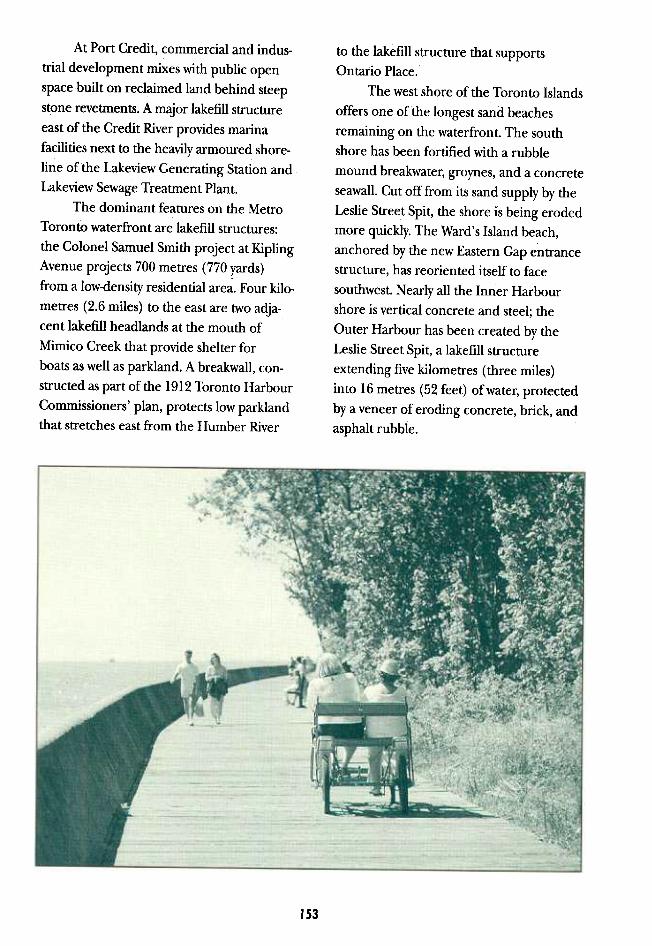
At Port Credit, commercial and indus-
trial development mixes with public open
space built on reclaimed land behind steep
stone revetments. A major lakefill structure
east of the Credit River provides marina
facilities next to the heavily armoured shore-
line of the Lakeview Generating Station and
Lakeview Sewage Treatment Plant.
The dominant features on the Metro
Toronto waterfront are lakefill structures:
the Colonel Samuel Smith project at Kipling
Avenue projects 700 metres (770 yards)
from a low-density residential area. Four kilo-
metres (2.6 miles) to the east are two adja-
cent lakefill headlands at the mouth of
Mimico Creek tharprovide shelter for
boats as well as parkland. A breakwall, con-
structed as part of the 1912 Toronto Harbour
Commissioners' plan, protects low parklandthat stretches east from the Humber River
to the lakefill structure that supports
Ontario Place.
The west shore of the Toronto Islands
offers one of the longest sand beaches
remaining on the waterfront. The south
shore has been fortified with a rubble
mound breakwater, groynes, and a concrete
seawall. Cut off from its sand supply by the
Leslie Street Spit, the shore is being eroded
more quickly. The Ward's Island beach,
anchored by the new Eastern Gap entrance
structure, has reoriented itself to face
southwest. Nearly all the Inner Harbour
shore is vertical concrete and steel; the
Outer Harbour has been created by the
Leslie Street Spit, a lakefill structure
extending five kilometres (three miles)into 16 metres (52 feet) of water, protected
by a veneer of eroding concrete, brick, and
asphalt rubble.
IS3
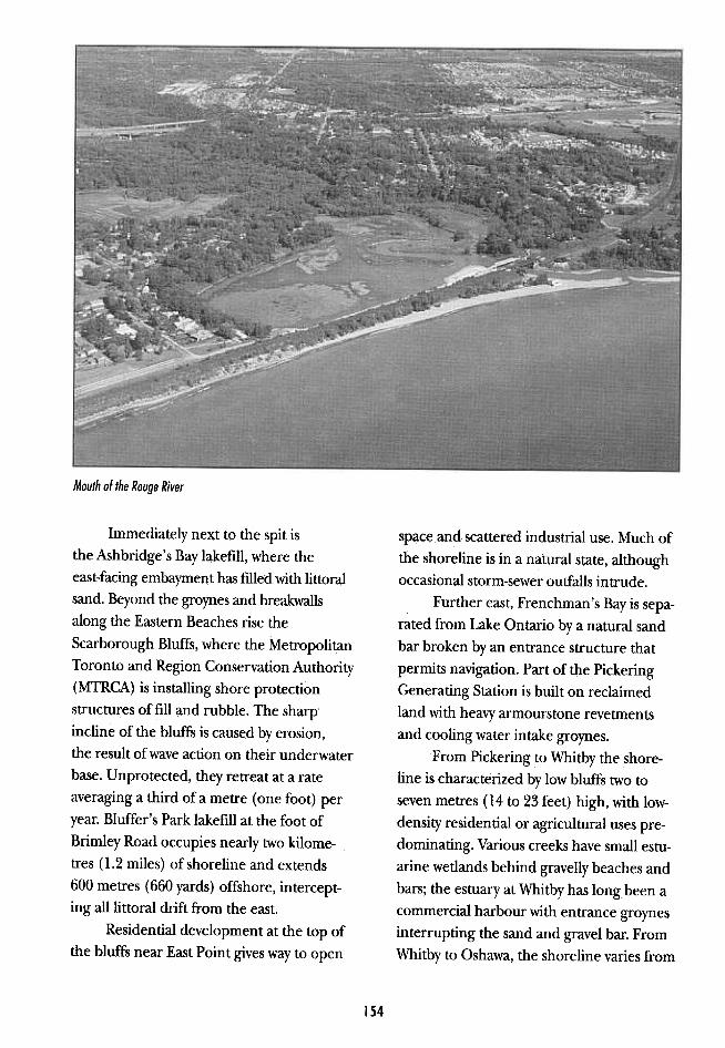
Mouth of the Rouge River
space and scattered industrial use. Much ofthe shoreline is in a natural state, although
occasional storm-sewer outfalls intrude.Further east, Frenchman's Bay is sepa-
rated from Lake Ontario by a natural sand
bar broken by an entrance structure that
permits navigation. Part of the Pickering
Generating Station is built on reclaimedland with heavy armourstone revetments
and cooling water intake groynes.
From Pickering to Whitby the shore-
line is characterized by low bluffs two to
seven metres (14 to 23 feet) high, with low-
density residential or agricultural uses pre-
dominating. Various creeks have small estu-arine wetlands behind gravelly beaches and
bars; the estuary at Whitby has long been a
commercial harbour with entrance groynes
interrupting the sand and gravel bar. From
Whitby to Oshawa, the shoreline varies from
Immediately next to the spit isthe Ashbridge's Bay lakefill, where the
east-facing embayment has filled with littoralsand. Beyond the groynes and breakwalls
along the Eastern Beaches rise the
Scarborough Bluffs, where the MetropolitanToronto and Region Conservation Authority
(MTRCA) is installing shore protection
structures offill and rubble. The sharp'
incline of the bluffs is caused by erosion,
the result of wave action on their underwater
base. Unprotected, they retreat at a rate
averaging a third of a metre (one foot) per
year. Bluffer's Park lakefill at the foot of
Brimley Road occupies nearly two kilome-
tres (1.2 miles) of shoreline and extends
600 metres (660 yards) offshore, intercept-
ing all littoral drift from the east.
Residential development at the top ofthe bluffs near East Point gives way to open
154
seven-metre (23-foot) bluffs descending to
stream estuaries, each fronted by a small
beach. Much of the land is low-density
residential or cottage-lined beaches.
On the east side of the Oshawa
Harbour entrance groynes, reclaimed
land has been created by construction of
a confined dredge spoil disposal facility.
The Oshawa Second Marsh is a large
estuarine wetland next to the more
exposed McLaughlin Bay. From Darlington
Provincial Park, the shoreline rises to bluffs
12 metres (40 feet) high, which occasionally
"slump" toward the lake. Darlington Gener-
ating Station, built partly on reclaimed land,
employs massive armourstone revetments
across its extensive shoreline.
At Raby Head, the bluffs are some
12 metres (40 feet) high, descending to a
small coastal wetland just west of a large
cement company dock, where a 32-hectare
(79-acre) lakefill structure projects 675 metres
(738 yards) into the lake.
Continuing east, the shoreline is a
series of 10-metre (33-foot) bluffs, cut by
creeks with small estuarine marshes behind
sand and gravel baymouth bars. The estuaries
at Port Darlington and Bond Head have
been partially dredged for marinas and the
baymouth bars are cut by entrance groynes.
Still farther east, the pattern is repeated,
with some bluffs reaching as high as 20 metres
(66 feet); vegetation there suggests a lower
rate of erosion. The area behind the bluffs
is almost entirely agricultural.
substantial benefits to the region: Ontario
Place, Harbourfront, and Bluffers Marina,
for example, were constructed on lakefill
and have improved the social, cultural, and
economic life of the community. These
and other projects have expanded the land
base; improved public access and amenities
such as parks, beaches, and boat-mooring
capacity; and/or increased fish and wildlife
habitat
Tommy Thompson Park, located on
the five-kilometre (three-mile) spit at the
foot of Leslie Street, demonstrates some of
the benefits of lakefill, both planned and
accidental. Planned benefits include exten-
sive boat mooring capacity, and facilities
for sailboards, dinghy sailing, rowing, and
canoeing in the sheltered waters of the
Outer Harbour, in the lee of the spit The
spontaneous emergence of grasses, herbs,
shrubs, and trees provides exceptional habi-
tat for a variety of birds and animals, an
urban wilderness of amazing variety. The
shallow, sheltered c~lls within the park pro-
vide fish with refuge from the periodic cold-
water upwellings that occur, with deadly
consequences, along much of the Lake
Ontario shore. As a result, populations
of perch, pumpkinseed, and pike have
expanded rapidly.Public access to the shoreline has been
enhanced by the artificial headlands at
Humber Bay East and Bluffer's Park, and
elsewhere thousands enjoy picnicking,
walking, and other types of recreation.
Groynes and other forms of shoreline ero-
sion control have created new beaches near
Oakville and various other places where
people can view the lake and enjoy the heat
of the summer sun. Homes and properties
along the Scarborough Bluffs, among other
areas, were saved by measures to halt or
SIGNIFICANCEOF SHORELINEMODI FICA TION
The Commission's interim reports
acknowledge that lakefilling and human
alterations of the shore have provided
155
environmental price was higher than
necessary, and sometimes outweighed
apparent benefits. In this respect, the Work
Group agreed with the position taken by
many critics of lakefill who made submis-
sions to the Royal Commission during
public hearings.
SHORELINEREGENERATION IsSUES
Concerns about the negative effects of
shoreline modification give rise to several
issues, including:
~".'J"
~, ,
delay erosion. As well, commerce has bene-
fited from lakefilling: thousands of new boat
berths have supported the boat building
and service industry. Sport fishing, mainly
salmon charters and private boats from facil-
ities at Port Credit, Bluffers, and other new
marinas, brings millions of dollars in revenue
to the region. Extensive condominium,
tourism, and commercial facilities stand
on land created bylakefilling.
There has been another benefit,
particularly to the downtown waterfront
area of Metro Toronto: the lake has been
a convenient, inexpensive repository for
large volumes of material excavated from .the environmental effects of lakefill
downtown construction sites. structures and erosion control
These benefits extract a price, however, measures, including cumulative effects
as described in Shoreline Regeneration: c of many activities, loss or damage toc
Much of the exca- (~;I'f'c, both aquatic andC\Jt:{,,;vated material used terrestrial habitat,
for lakefill was con- The lake has been a convenient, obstruction of sand
taminated with inexpensive repository for large volumes movement, elimina-
lead, other heavy of material excavated from downtown tion of traditional
metals, and organic construction sites. sources of sediment
materials that through shoreline
found their way armouring, and accel-
into the lake sediments and the food erated erosion in other places;
chain. This [fill] material, combined .the degree to which current guidelines
with the much larger sources of pollu- and control procedures for materials
tion, the sewage treatment plants, for lakefilling ensure safety;
storm sewers, and urban rivers, has .lack of standards for lakefilling
degraded the water quality of the methods and structural designs;
shore. The combined impact. of urban .disposal of the waste materials from
development -filling wetlands and construction and excavation, including
river estuaries, and armouring for that judged not suitable for lakefill;
erosion control, in addition to vast .changes in economic opportunities,
quantities of silt released from lakefill and the wisdom of spending public
sites -has damaged much of the money to protect private and public
natural habitat both above and below land through armouring -as
the water line. opposed to acquiring -hazard lands;
The Commission's Shoreline .similarly, constructing artificial head-
Regeneration Work. Group found that the lands for private boat clubs; and
156
.the impact of shoreline modification
on aesthetics, access, vistas, and
recreation.
considerable time to correct. Lakefilling,
however, is a discretionary activity and
can be stopped as a pollution source tomor-
row -if we choose to do so. There are
choices of methods and materials, as well
as of locations at which lakefilling would
be allowed.
IMPACT OF LAKEFILL
STRUCTURES AND EROSION
CONTROL MEASURES
Artificial headlands -peninsulas cre-
ated by lakefilling to shelter boat basins -
have become common on the shore of the
Greater Toronto bioregion. They have cre~
ated negative impact on the environment
in four ways:
These concerns should be consideredin the context of general apprehension
about the safety of Lake Ontario as a
source of drinking and bathing water.
The preceding chapter of this report
describes Lake Ontario's condition and
the impact of pollution, even from sources
far from the Greater Toronto bioregion's
shoreline; it also examines efforts by the
Internationaljoint Commission, the MetroToronto RAP, and other groups to address
these problems.
The contaminated sediments, over-
loaded sewage plant, or toxic pollutants from
the Niagara River and elsewhere will take
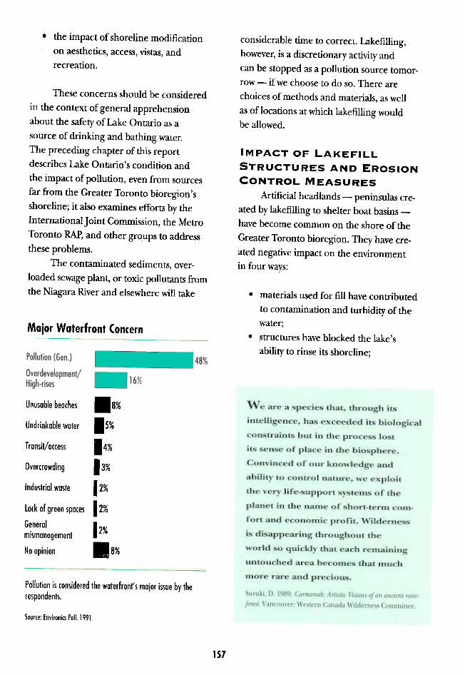
Major Waterfront Concern
.materials used for fill have contributedto contamination and turbidity of the
water;.structures have blocked the lake's
ability to rinse its shoreline;
Unusable beaches .8%
Undrinkable water 15%
Transit/ac,ess 14%
Overcrowding 13%
Industrial waste 12%
Lack af green spa'" 12%
General1 2%
mismanagement
Naapinian .8%
Pollution is considered the waterfront's major issue by the
respondents.
Source: Environics Poll. 1991.
1S7
We are a species that, through its
intelligence, has exceeded its biological
constraints but in the process lost
its sense of place in the biosphere.
Convinced of our knowledge and
ability to control nature, we exploit
the very life-support systems of the
planet in the name of short-tenn com-
fort and economic profit. Wilderness
is disappearing throughout the
world so quickly that each remaining
untouched area becomes that much
more rare and precious.
Suzuki, D, 1989, Carmanah: Artistic Visions of an anden.t rain-
forest. Vancouver: Western Canada Wilderness Committee.
measures at the foot of the Scarborough
Bluffs and erosion control efforts by individ-
uals and agencies are estimated to cover
as much as 70 per cent of the shore from
Burlington to Scarborough.
In addition to habitat loss, erosion
control impounds the sediment that would
normally drift along the shore, renew beaches,and repair storm damage done to sand and
gravel bars that are essential to protecting
estuarine marshes. Further, the structures
may change wave patterns and accelerate
erosion elsewhere on the shoreline.
.transport of sand along the waterfronthas been limited; and
.aquatic habitat has been destroyed.
Loss of shallow lake bottom for breeding
and feeding at the site reduces habitat,
while large amounts of sediment -material
that blocks the light and blankets the lake
bed -is lost during construction, thus
imposing further, indirect harm. In a deep,
dark, silt<overed environment, few aquatic
species flourish. Light is essential to the
growth of some plant organisms that fuel
the aquatic food chain. High turbidity
results in altered and reduced biotic life
and spawning capacity, in the zone that
could be most productive.
Embayments and boat basins in artifi-cial headlands, which provide shelter from
cold-water upwelling in the exposed lake,
can be a positive factor in aquatic habitat.
Above the water line, the natural growth
of plants, shrubs, and trees on lakefill and
erosion control projects have provided
new habitat for a wide variety of birds and
animals. These benefits would be much
more valuable, however, if this attractive
environment were not so contaminated.
The new headlands, which have
extended as far as five kilometres (3 miles)
into the lake, ar.e a significant barrier to
longshore movement by waves and current.As a result, suspended and floating materials
a,re trapped and deposited nearby, where
they create various pollution problems.
Erosion control embraces a variety of
materials applied to the shore to slow or
stop the loss of land by wave action. They
include vertical steel pilings, concrete
walls, large quarry stones (armourstone),construction rubble, and old tires. MTRCA
has undertaken massive erosion control
CUMULATIVE EFFECTS
As the Shoreline Regeneration Work
Group observed:It became evident that many larger
problems along the waterfront were notthe result of one horrendous event but,
rather, the cumulative effect of many
acts or interventions. Treating each pro-
ject in isolation from the rest of the
shore was a common cause of signifi-
cant degradation.
The tendency to treat lakefill and ero-
sion control projects singly is understand-
able, when each is proposed at a different
time, has a different set of characteristics
and -location, and is subject to decisions
by different municipalities and agencies.
Nonetheless, they are not independent, andtheir combined impact will, at some point,
exceed the carrying capacity of the shore.
The impact of one artificial headland
may be acceptable; but there are now eight
new headlands, with many more planned. At
some point, the shoreline circulation of
water may be so impeded that it creates a
regional cesspool.Similarly, it would be hard to prove
that 100 metres (110 yards) of armoured
158
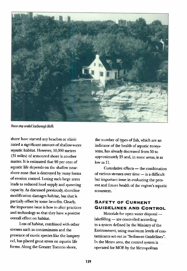
House atop eroded Scarborough Bluffs
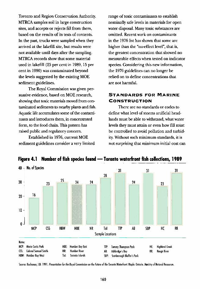
the number of types of fish, which are an
indicator of the health of aquatic ecosys-
tems, has already decreased from 50 to
approximately 25 and, in some areas, is aslow as 11.
Cumulative effects -the combinationof various stresses over time -is a difficult
but important issue in evaluating the pres-
ent and future health of the region's aquatic
ecosystem.
SAFETY OF CURRENT
GUIDELINES AND CONTROL
Materials for open water disposal-
lakefilling -are controlled accordingto a system defined by the Ministry'ofthe
Environment, using maximum levels of con-taminants set out as "Sediment Guidelines".In the Metro area, the control system is
operated for MaE by the Metropolitan
shore have starved any beaches or elimi-
nated a significant amount of shallow-water
aquatic habitat. However, 50,000 metres
(31 miles) of armoured shore is anothermatter. It is estimated that 90 per cent of
aquatic life depends on the shallow near-
shore zone that is destroyed by many forms
of erosion control. Losing such large areas
leads to reduced food supply and spawning
capacity. As discussed previously, shoreline
modification damages habitat, but that is
partially offset by some benefits. Clearly,the important issue is how to alter practices
and technology so that they have a positive
overall effect on habitat.
Loss of habitat, combined with other
stresses such as contaminants and the
presence of exotic species like the lamprey
eel, has placed great stress on aquatic life
forms. Along the Greater Toronto shore,
159
range of toxic contaminants to establish
nominally safe levels in materials for open
water disposal. Many toxic substances are
omitted. Recent work on contaminants
in the 1976 list has shown that some are
higher than the "no-effect level", that is,
the greatest concentration that showed no
measurable effects when tested on indicator
species. Considering this new information,
the 1976 guidelines can no longer be
relied on to define concentrations that
are not harmful.
STANDARDS FOR MARINE
CONSTRUCTIONThere are no standards or codes to
define what level of storms artificial head-
lands must be able to withstand, what water
levels they must attain or even how fill must
be controlled to avoid pollution and turbid-
ity. Without such minimum standards, it is
not surprising that minimum initial cost can
Toronto and Region Conservation Authority.
MTRCA samples soil in large construction
sites, and accepts or rejects fill from them,
based on the results of its tests of contents.
In the past, trucks were sampled when they
arrived at the lakefill site, but results were
not available until days after the sampling.
MTRCA records show that some material
used in lakefill (25 per cent in 1989, 15 per
cent in 1990) was contaminated beyond
the levels suggested by the existing MOE
sediment guidelines.
The Royal Commission was given per-
suasive evidence, based on MOE research,
showing that toxic materials moved from con-
taminated sediments to nearby plants and fish.
Aquatic life accumulates some of the contami-
nants and introduces them, in concentrated
form, to the food chain. This pattern has
raised public and regulatory concern.
Established in 1976, current MOE
sediment guidelines consider a very limited
Figure 4.1 Number of fish species found -T oronlo walerfronl fish collections, 1989
40 No. of Species .313131
28
2530 24 24 2423 23
1620
10
0(55 HBW Tol
Sample Locations
TTP AB RRMCP HBE HR SBP HC
HBE: Humber Bay East
HR: Humber River
Tal: Taranta Islands
Notes:
MCP: Morie Cur1is Pork
CSS: Colonel Somuel Smith
HBW: Humber Boy West
fiP: Tommy Thompson Pork
AB: Ashbridge's Boy
SBP: Scorborough Bluffer's Pork
HC: Highland Creek
RR: Rouge River
Source: Buchonon, I.D. 1991. Presentation for the Royal Commission an the Future of the Toronto Waterfront. Maple: Ontario. Ministry of Natural Resources.
160

MARCH OF THE MOTORIZED MASTODONS
Each morning, an elephantine procession emerges from the depths of downtownconstruction sites: a herd of dusty dump trucks struggles to the street level, then lumbersthrough the canyons between office towers toward the lakeshore. Brakes squealing,
engines snorting, the vehicles rumble through intersections, harassed by taxis, cyclecouriers, and pedestrians preoccupied with the day's work ahead. The trucks bear amassive burden of rubble and soil extracted from the foundations of large buildings, to
make way for parking, passageways, and the subterranean shops of downtown Toronto.Their destination is the dusty peninsula near the mouth of the Don River.
South of the flaking concrete pillars that support the aging expressway, the loadedtrucks gain speed and momentum, surging toward the open spit. There, freed of traffic,
stoplights, and human obstacles, they stampede the length of the peninsula, a swirl of dustand gulls rising in the eddies behind their bulky frames. At the water's edge, they grind toa stop, turn, and await a turn to dump their burden of rock and soil. One by one, each
struggles to the bank, arches its back, and relieves itself at the water's edge. Most of thematerial hangs on the banks or slides below the surface, while some dances away,suspended in the wavy turbulence, to be deposited far along the shore.
This pattern will be repeated more than a thousand times a week -nearly
sixty thousand times a year. The land area expands and the water surface contracts ina ritual that has continued and accelerated for the last century.
allows some material exceeding guidelines
to be deposited, and lack of codes permits
construction methods which result in
large amounts of fill mixing freely withwater along the shore.
Furthermore, lakefill projects contri-bute indirectly to shore contamination.
As a result of wave action, sediments and
nearshore waters naturally progress alongan exposed shore; unobstructed they
disperse widely, taking with them any attachedcontaminants from partially treated sew-
age, storm water or other sources. At an
artificial barrier like that at Humber Bay
East (lakefill), sediment is trapped and
deposited; the result is a contaminant sink,often accompanied by foul odours and float-
ing debris..
sources, including tributaries and sewagetreatment plants (STPs).
Not only is lakefilling a very significant
contributor to suspended solids and water
turbidity in the region, those effects are
increased dramatically when construction
practices allow a greater proportion of fillto escape.
Given that some lakefill is contami-
nated and that some of it escapes, fill
contributes copper and lead contami-nation to water in the region. However,
even at the highest percentage loss,
lakefill ranks well behind other sources
(see Figure 4.2).To summarize, in light of new infor-
mation, current guidelines for fill sedi-ments are inadequate: the control system
162

out with public funds, personal benefits at
public expense can become an issue.
Constructing artificial headlands that
protect and house private boat clubs is a
case in point: the appropriateness of using
public funds to build sheltered harbours
for private clubs surrounded by chain link
fences that deny public access is question-
able. Although everyone may enter the
public park, only a select group may enter
the grounds of a private club.
Another issue arises from publicly
funded erosion control measures under-
taken to protect private property. Those.
who benefit from erosion control are easily
identified, but the consequences of such
activity are hard to predict: whose property
DISPOSAL OF WASTE
MATERIALS FROM
CONSTRUCTION
Earlier it was mentioned that lakefill
was considered an inexpensive and conve-
nient waste disposal arrangement. The
practice has been a particularly prevalenton the Metropolitan Toronto's downtown
waterfront, where land values are extremely
high. These high values preclude disposal
on-site, and the need for large underground
parking facilities dictates that a great deal of
material must be excavated at each location.
While the average annual amount offill is immense, it varies from year to year,
depending on the amount of construction
activity. Estimates of volume from 1984 to
the year 2000 were prepared by Environ-
mental Applications Limited for the Ministry
of the Environment; they projected average
annual volume of 1,050 tonnes (1,155 tons)
-the contents of roughly 60,000 dump
trucks per year.
But how will Toronto dispose of up to
60,000 dump-truck loads of waste iflakefillis banned, or restricted by tighter standards?
While relatively low levels of contaminants
in this material mean that it should not be
mixed with water or otherwise introduced
to the food chain, most of the fill does not
require the control provided in sanitary
landfill. The most critical issues for MOE
and the construction industry are how to
classify, and where to deposit, material
unsuitable for lakefill.
ECONOMIC ISSUES
Everyone receives some form of
personal benefit from the expenditure of
public funds: motorists drive on public high-
ways; pedestrians stroll in public parks. How-
ever, when shoreline modifications are carried A downtown Toronto construction site
163
Real estate and housing on a cleaner, greener
waterfront could meet shelter needs while, at
the same time, providing amenities that bring
a higher return. Cleaner water, restored fish
habitat, and boat-launching facilities built
on lakefill may increase boat-<:hartering and
related service industries. The point is that
all these economic opportunities depend
on the basic resource -healthy water and
waterfront ecosystems. The question is how
to expand and enhance these opportunities.
AESTHETICS, ACCESS, AND
RECREA TION
Some shoreline issues are difficult toexpress in economic terms; they are gener-ally those that fall in the broad categories:aesthetic aspects, access, and recreation.
AESTHETICS
Aesthetic considerations include:
.variety in landscaping techniques for
parks and public open space;.protection of ' open-water views;
.incompatible development on or next
to fill;
.odour and appearance problems arising
from debris trapped in embayments;
.protection of natural shoreline fea-
tures such as beaches and bluffs; and
.protection of built heritage and
connections with the past.
will suffer from accelerated erosion as a
consequence of the initial measures? Whose
beach will no longer receive the sand that
is the owner's riparian right? Having used
public money to protect one property, how
does the government refuse to safeguard
another one, nearby, particularly if there is a
link between one government erosion con-
trol structure and the subsequent complaint?
Alternatives to shoreline armouring
include purchasing hazard lands, a strategy
that may prove less costly and improve pub-
lic access. In addition, expanded public
ownership'of nearshore hazard lands can
increase opportunities for natural links
between stream valleys.
There are many ways in which shore-
line regeneration can contribute to the eco-
nomic vigour of the waterfront: a waterfront
free of debris and sewage is a more attractive
place for tourism, conventions, and recre-
ation. The more attractive the setting, the
more tourist dollars available and the more
sales of nearby commercial establishments.
Traditional management and land-
scaping of public lands limit habitats. Variety
in landscaping, that is, providing areas with
native wild grasses, flowering plants, shrubs,
and trees, as well as formal park settings, will
increase diversity of habitat and species.
Unobstructed open-water vistas are
among the most valued amenities on the
164
The Great Outdoors is still great.
But we found that we are facing a
deterioration of the natural resource
base, and of the recreation infrastruc-
ture. Accelerating development of
our remaining open spaces, wetlands,
shorelines, historic sites, and country-
sides, and deferred maintenance and
care of our existing resources, are
robbing future generations of the her-
itage which is their birthright. We are
selling the backyard to buy groceries. ..
Report of the President's Commission
on Americans Outdoors.
Howe, L. 1987. Keeping our garden state green: a wcal grroern-
ment guide for greenway and open space planning. New Jersey:
New Jersey Department of Environmentll Protection.

comprehend that this fort was once centralto the defense of Upper Canada. Achieving
progress without compromising our connec-
tion to the past is another challenge for
shoreline regeneration.
AcCESSAccessibility is an important factor in
enhancing the public value of the waterfrontbut must be achieved in a way that is fair to
landowners and shows due consideration
for the many other demands on the public
purse. Some public utilities need special
security and some other land should be set
asid~ for use as sanctuary and natural areaS.
Transportation corridors parallel to theshore, such as the railways and expressways,
provide barriers to recreational access. A
lakeshore that is hidden behind a wall of
industrial, public or private fences providesfew public benefits. The issue is how to pro-
vide for a continuous waterfront trail at or
near the shore, and access to the water at
reasonable intervals, while achieving
waterfront. Proposals for lakefilling that
would block those views, or that would
support towering waterfront developments,
represent a threat to those values and a
challenge to planning waterfront areas..
Protecting shoreline views involves paying
attention to the height and location of
buildings, and the design of programs for
tree-planting on public land.
Incompatible developments -parkinglots or busy marinas next to quiet residential
areas, structures that trap debris or contami-
nated water -can degrade the value of
both public and private waterfront land.
Planning must consider adjacent land uses.
The variety of the bioregion' s shoreline
is one of its important assets. Bluffs, such as
those in Scarborough, depend on erosion
of the base to maintain their steep face;
therefore, erosion control at the base, and
normal wearing away of the cap, will eventu-
ally eliminate the sharp slope that gives
the area its character. As mentioned earlier,
armourstone at the water's edge impounds
the sediment that would normally move
downshore to renew the natural beaches
that the public values highly. We cannot stop
erosion and retain its benefits, any more
than we can "eat our cake and have it too".
Certain shoreline modification activi-ties may conflict with the public need to
retain connections with the built heritage
and the past. For example, lakefill has
reduced the Harbour Commissioners'
building from being what it Ol)ce was in
Toronto -a striking waterfront welcome
to the City -to just another inland office.
Fort York, which once commanded the har-
bour, lies hidden behind approximately
800 metres (0.5 mile) offill and structures,
its role, purpose, and location equally
obscured; the visitor may find it difficult to
Desired Waterfront DevelopmentObjectives
Natural area 60%
Recreatianal area 20%
Residential area 6%
Developed area
Combination 10%
Nearly two-thirds of the respondents would like to have more
natural areas on the waterfront.
Source: Environics Poll. 1991.
165
fairness to existing landowners, and costs
that are affordable.Regenerating the shoreline with lake-
fill can increase the types of recreational
opportunities available, by creating newland at a cost of construction that is one-
fIfth to one-tenth that of acquisition. The
environmental costs vary with the lakefill
site and construction methods but must be
added for fair comparison with acquisition
of existing land. An ecosystem approach
to land-use planning must balance and allo-
cate the benefits, while minimizing the
conflicts -a process that includes many
issues that must be considered.
How HAS SHORELINEMODIFICATION CAUSEDPROBLEMS?
The Royal Commission heard consid-
erable testimony that shoreline modifications
are part of the problem of shoreline degra-
dation. There has been significant evidence
RECREATION
Many forms of recreation, both active
and passive, can and should be enjoyed
along the shore: active pursuits include
cycling, running, fishing, power-boating,sailing, swimming, and rowing. Less vigor-ous activities include picnicking, walking,
birdwatching, sunbathing, photographing,and simply observing the passing scene.
While these pastimes are among the
most valuable to the community, they can
create conflicts, both among activities and
with other values on the shore. For example,
some residents of the shore object to the
traffic and noise created in their neighbour-
hoods by visitors to aquatic parks like
Bluffer's; birdwatchers object to motorizedinvasion of natural areas.
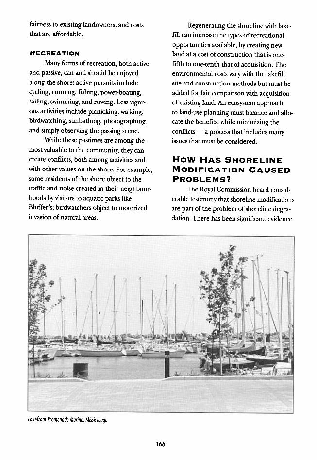
Lakefrant Promenade Marina, Mississauga
166
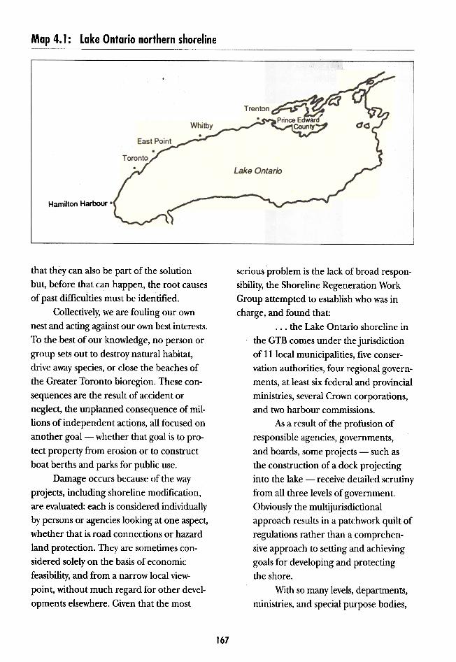
Map 4.1: lake Ontario northern shoreline
Hamilton Harbour
that they can also be part of the solution
but, before that can happen, the root causes
of past difficulties must be identified.
Collectively, we are fouling our own
nest and acting against our own best interests.
To the best of our knowledge, no person or
group sets out to destroy natural habitat,
drive away species, or close the beaches of
the Greater Toronto bioregion. These con-
sequences are the result of accident or
neglect, the unplanned consequence of mil-
lions of independent actions, all focused on
another goal- whether that goal is to pro-
tect property from erosion or to construct
boat berths and parks for public use.
Damage occurs because of the way
projects, including shoreline modification,are evaluated: each is considered individually
by persons or agencies looking at one aspect,
whether that is road connections or hazard
land protection. They are sometimes con-
sidered solely on the basis of economic
feasibility, and from a narrow local view-
point, without much regard for other devel-
opments elsewhere. Given that the most
serious problem is the lack of broad respon-
sibility, the Shoreline Regeneration Work
Group attempted to establish who was in
charge, and found that:
...the Lake Ontario shoreline in
the GTB comes under the jurisdiction
of 11 local municipalities, five conser-
vation authorities, four regional govern-
ments, at least six federal and provincial
ministries, several Crown corporations,
and two harbour commissions.
As a result of the profusion of
responsible agencies, governments,and boards, some projects -such as
the construction of a dock projecting
into the lake -receive detailed scrutiny
from all three levels of government.
Obviously the multijurisdictional
approach results in a patchwork quilt of
regulations rather than a comprehen-
sive approach to setting and achieving
goals for developing and protecting
the shore.
With so many levels, departmenTS,
ministries, and special purpose bodies,
167
Harbour. Between East Point and Whitby,
very little material is produced, and direc-
tion of movement varies. Sediment move-
ment is generally eastward from Whitby to
Prince Edward County.
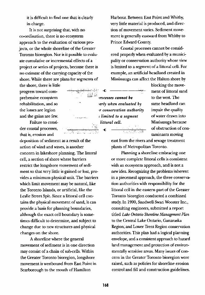
Coastal processes cannot be consid-
ered properly when evaluated by a munici-
pality or conservation authority whose view
is limited to a segment of a littoral cell. For
example, an artificial headland created in
Mississauga can affect the Halton shore by
blocking the move-
.,": ment of littoral sand
Coastal processes cannot be to the west. The
consIdered properly when evaluated by same headland can
a municiPality or conservation authority impair the quality
who.~e view is limited to a segment of water drawn into
of a littoral cell. Mississauga because'" " of obstruction of con-""ri,i' ..
tammants moVIng
east from the rivers and sewage treatment
plants of Metropolitan Toronto.
Planning a shoreline embracing one
or more complete littoral cells is consistent
with an ecosystem approach, and is not a
new idea. Recognizing the problems inherent
in a piecemeal approach, the three conserva-
tion authorities with responsibility for the
littoral cell in the eastern part of the Greater
Toronto bioregion conducted a combined
study. In 1990, Sandwell Swan Wooster Inc.,
consulting engineers, submitted a report
titled Lake Ontario Shoreline Management Plan
to the Central Lake Ontario, Ganaraska
Region, and Lower Trent Region conservation
authorities. This plan had a logical planning
envelope, and a consistent approach to hazard
land management and protection of environ-
mentally sensitive areas. Many issues of con-
cern in the Greater Toronto bioregion were
raised, such as policies for shoreline erosion
control and fill and construction guidelines.
-()
-(;
it is difficult to find one that is clearly
in charge.It is not surprising that, with no
c()-{)rdination, there is no ecosystem
approach to the evaluation of various pro-
jects, or the whole shoreline of the Greater
Toronto bioregion. Nor is it possible to evalu-
ate cumulative or incremental effects of a
project or series of projects, because there is
no estimate of the carrying capacity of the
shore. While there are plans for segments of
the shore, there is little
progress toward com-prehensive ecosystem ~" ,.
rehabilitation, and so .
the losses are legion
and the gains are few. ~~'~"'~'"
Failure to consi- ,~1,\
der coastal processes, ". , ,:: ,;:, Cc cc ,that is, erosion and CP C "'c" c c
deposition of sediment as a result of the
action of wind and waves, is another
concern in lakeshore planning. The littoral
cell, a section of shore where barriers
restrict the longshore movement of sedi-
ment so that very little is gained or lost, pro-
vides a minimum physical unit. The barriers
which limit movement may be natural, like
the Toronto Islands, or artificial, like the
Leslie Street Spit. Since a littoral cell con-
tains the physical movement of sand, it can
provide a basis for planning boundaries,
although the exact cell boundary is some-
times difficult to determine, and subject to
change due to new structures and physical
changes on the shore.
A shoreline where the general
movement of sediment is in one direction
may consist of a chain of sub-cells. Within
the Greater Toronto bioregion, longshore
movement is westbound from East Point in
Scarborough to the mouth of Hamilton
168
will collapse. This, given existing and persis-
tent environmental degradation, suggests
that positive measures must be taken soon
to preserve the benefits we enjoy today.
In summary, the damage to the shore-
line environment is not deliberate, but
happens as the unplanned consequence of
pursuing other goals. The provincial minis-tries of the Environment and Natural
Resources and the federal Department of
Fisheries and Oceans have an interest in
protecting the shore: they are trying to min-
imize the damage, but there is a lack of co-
ordination, no overall plan, and no one
agency or body with a mandate to improve
the shoreline. No one has estimated the car-
rying capacity so that cumulative effects canbe controlled or been given a mandate to
establish or enforce codes or standards for
marine construction. It is not surprising,
therefore, that most incremental changes
have degraded the natural environment and
reduced its potential benefits for the
residents and economy of the region.
WHAT IS THEPROBLEM?
While there is a great deal of planning
along the waterfront of the Greater Toronto
bioregion, there has been little progress
toward effective shoreline regeneration.
One problem is the general lack of a
co-ordinated, ecosystem approach to plan-
ning. Municipal waterfront plans are usuallybased on boundaries without an ecosystem
rationale, leaving each municipality vul-
nerable to the actions of its neighbours. A
related problem is the inability to consider
cumulative environmental effects, because
planning is done for a portion ora natural
system.Resolving intra-municipal planning
issues is a responsibility of the provincial
government. In some cases, federal agencies
are involved as well. Many of these agencies
have specialized interests such as "protect
the environment", "expand the housing
supply", and "enhance transportation" with-
out much incentive to work together. Given
the specialized viewpoints, complicated
planning issues, and lack of agreed goals,
objectives, and timetables, endless review
and delay is the common result. The water-
front is plagued by jurisdictional gridlock.
WHY SHOULD WE BECONCERNED?
A healthy shoreline is a priceless asset
for the Greater Toronto bioregion: it offers
drinkable water, recreation, rest, and solace
at the doorstep of millions, and is an excit-
ing stimulant for commerce, tourism, and
the economy. It is worth defending, and it
is not yet too late to do so.
Much of the shoreline east of
Scarborough remains in a relatively healthy
state, and adequately maintaining it will
require wisdom and fortitude, but little
money. The most significant parts of the
remaining shoreline west of Scarborough
can be protected or restored.
The Greater Toronto bioregion is
expecting a large increase in population
and density; people, industry, and other
activity will substantially increase strains on
the waterfront and its natural systems. Some
WHAT CAN BE DONE?
Effective co-ordination is the missing
element. A mechanism is needed to integrate
special interests, establish goals and time-
tables, strike balanced decisions, negotiate
compromises, and thereby break the
gridlock. Based on a review of experience in
169
other jurisdictions, and the situation within
the Greater Toronto bioregion, the Com-
mission has concluded that a co-ordinated
shoreline regeneration plan would provide
the required mechanism.
If it is to bring about shoreline
regeneration, this plan must contain
three elements:
.a co-ordinating agency with the
mandate, will, and skill to involve all
responsible parties in planning and
acting on shoreline regeneration;
.positive goals and objectives for
protecting and regenerating the shore,
as well as co-ordinated action to achieve
those goals and objectives; and
.constraints on certain development
activities in order to ensure a healthy,
resilient, productive shoreline with
increased aesthetic, social, and
economic value to the community.
A co-ordinating agency with the man-
date, will, and skills needed to improve the
situation will be able to bring the interested
municipalities and agencies together, and
to facilitate agreement on goals, principles,
and timetables for the plan area. In order to
encourage integration of the various inter-
ests, the co-ordinating agency will need a
mandate to act as the primary negotiator for
the province in arbitrating disagreements.
The Greater Toronto bioregion has
unique advantages, but is not alone in facing
a maze of waterfront jurisdictions: in the
United States, for example, the San
Francisco Bay Conservation and Develop-
ment Commission has 13 counties and
cities working co-operatively to protect
common resource. On a broader scale, the
government of the United States, through
the Coastal Zone Management Act (CZMA),
has applied constraints and incentives to
create partnerships to protect the Great
Lakes.
In Canada, the Fraser River Estuary
Management Plan (FREMP) involves
approximately 60 agencies, including
six Native bands, two harbour commissions,
the federal and provincial governments,
and all area municipalities. In each case, a
co-ordinating agency was created to bring
them all together to protect and develop the
waterfront resource.
The Greater Toronto bioregion's need
for such a co-ordinating agency was recog-
nized by the Shoreline Regeneration Work
Group which, in its report to the Royal
Commission, said that the Waterfront
Regeneration Trust recommended in
Watershed could be:
...a valuable vehicle for shoreline regen-
eration; it should pursue only those
shoreline modifications that meet
ecological criteria and ensure that newly
created lands remain in public ownership
for the benefit of future generations.
DESIRABLECHARACTERISTICSOF A SHORELINEREGENERATION PLAN
Protecting and restoring the shoreline
in keeping with the nine regeneration princi-
ples described in Chapter 1 will require
some limitations on how and where develop-
ment may proceed. Such constraints could
be established using a readily understood
control pattern -such as maps with "red"
zones for the most restrictive natural or histor-
ical areas; "orange" zones for areas in which
moderate constraints are necessary; and
"green" zones to identify the most flexible
170
.powers adequate for protecting natu-
ral areas and enforcing any restrictions
required by the plan.
Defining the boundaries for the plan
is important. An ecosystem approach suggestS
that the planning envelope should have a
natural system rationale. On land, water-
sheds normally provide the logical dimen-
sions. In the case of the waterfront, a large
iittoral cell or a combination of cells would
provide a reasonable unit. There is some
uncertainty as 10 the precise limits of these
cells along the Greater Toronto waterfront
and cell definition should be an early prior-
ity for planning. Population density and
development pressure provides another basis
for giving priority to certain areas. A plan
for the shore between Burlington Bay and
the Trent River would capture a substantial
combination of littoral cells embracing the
whole Greater Toronto bioregion, as well as
an area under significant pressure for change.
areas. Certain areas, in the "red" zones,
will be too important to the goals of public
access, habitat protection or enhancement
to allow construction, erosion control or
lakefilling.The plan should emphasize such
opportunities as initiatives that increase
access, tourism, boating, walking, swimming,
wildlife, fishing, trail hiking, and greenways.
Increasing these opportunities can be an
important tool in reducing conflicts between
uses, as well as stresses on existing facilities.
The plan should not attempt toestab-
lish all social, commercial, transportation,
and other goals and objectives for the
shoreline: other plans and mechanisms,
such as those being undertaken by regional
and area municipalities, address such
needs. However, the Shoreline Regeneration
Plan will provide enhanced opportunities
for social and commercial development,
and should be integrated with those
other plans.
There are other characteristics that
would contribute substantially to a success-
ful plan; they include:
IMPLEMENTINGTHE PLAN
The following recommendations
are designed to implement a Shoreline.an overall "red" designation for the
shoreline, until the plan identifies
discrete areas, as an incentive for
stakeholders to participate in,
negotiate, and complete the plan;
.a clearly defined, efficient approval
and control process (one-wicket
application) ;.a consultative approach to developing
and administering the plan, including
provision for regular public input
and review;
.adequate resources for agencies
responsible for developing and
implementing the plan; and
171
Whether they begin with the policies
and programs of the state, in the head
offices of large corporations, in the
workplace, or at someone's kitchen
table, the end result of sustainable
development must be the creation
of sustainable communities.
AWismer, S. \990,:8 "Assessing sustainable development inb " I Eh " ld "' .r' abled ,.. an ur ancontext. .Q' t Ira zmenslonso] SU$taz.n eve."
opment and urbanization: seminar papers, Winnipeg: Institute,
of Urban Studies..
For example, proposals that conform to
the plan could receive "credits" toward
completion of any environmental assess-
ment required.
Further, there must be rewards and
incentives to negotiate the shoreline plan,
and to support its implementation. The
most important incentive for municipalities
and conservation agencies would be break-
ing the jurisdictional "logjam", and predict-
able, steady progress of plans and projects
through provincial agencies, once those
plans comply with the agreed plan.
Regeneration Plan and to deal with existing
or future problems that could affect the
efficiency and effectiveness of that plan.
In order to implement the Shoreline
Regeneration Plan, co-operation is needed
from all levels of government. Such a part-
nership approach, which recognizes con-
straints and provides incentives but does not
remove authority and responsibility, is the
most effective approach to planning on
the waterfront.
Success will depend on the incentives
provided by a process that both safeguards
environmental and public values, and
streamlines the approvals required. The
framework for ecosystem-based planning
described in Chapter 2 should be examined
as a possible model. Having satisfied them-
selves with the rigour of the ecosystem
planning process, the federal and Ontario
agencies responsible for approvals should
be prepared to co-operate with timetables.
RECOMMENDATION
25. The Royal Commission recommends
that the Province of Ontario ensure
preparation of a Shoreline Regenera-
tion Plan to protect and regenerate
the shoreline of the Greater Toronto
bioregion, employing an ecosystem
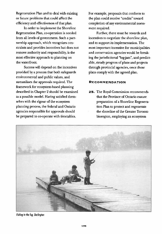
Fishing in the fog, Darlington
171)
It is important to prevent construction
of major new projects without the benefit of
the shoreline plan, because these may create
unnecessary harm and foreclose options
for future benefits.
approach. This plan should be devel-
oped with the full participation of
relevant departments of the govern-
ments of Canada and Ontario, as well.
as those of affected regions, area
municipalities, conservation authorities,
the private sector, non-governmental
groups, and the public. It should
emphasize:
RECOMMENDATION
27. The Royal Commission recommendsthat the Province place a moratoriumon approval of all major new lakefilland shoreline erosion control projects,pending approval of a ShorelineRegeneration Plan.
Notwithstanding the need for a mora-
torium, some small projects might have no
material influence on the plan, or there
might be demonstration projects that could
provide valuable insights and other benefits
without compromising the integrity of the
plan. The criteria for "small" and "demon-
stration" should be determined very early,
to avoid uncertainty.
.protection of remaining natural
areas;.rehabilitation of degraded areas;
.a mechanism for considering
cumulative environmental
effects; and
.improvement of access and
recreational opportunities.
Any shoreline plan should have the
benefit of expertise in the affected com-
munity; therefore, before a plan proceeds,
interested groups and individuals should
have the opportunity to comment on
and improve the ideas advanced by the
Royal Commission and its work groups.
Such input would allow the shoreline plan-
ning process to proceed with the support of
improved community confidence and focus.
RECOMMENDATION
28. The Royal Commission recommends
that criteria, performance standards,
and procedures be established for
small or demonstration projects thatRECOMMENDATION
26. The Royal Commission recommends
that as early as possible in the process,
the Province ensure public consultation,
including public hearings, to permit
interested parties and the public to
respond to recommendations on shore-
line regeneration, made in the
Commission's Watershed and Shoreline
REgeneration documents, as well as in
this final report.
173
The old way of doing things has proven
hollow and sometimes quite destructive,
though we have not yet learned the
rules for the new ways of doing things,
so we are in the age of in-between.
Morris, D. 1990. "The ecoloo-ical cifu~ase1f.reliant citv."O' 'I 'J
In Green cities: ecolouicall y -sound aMWQtldI!i;i tii urban Space.O' rt';
Montreal: Black Rose Books.
RECOMMENDATION
29. The Royal Commission recommends
that the Province adopt new sediment
guidelines for open-water disposal;
these should reflect the latest scientific
studies, and should establish contami-
nant limits at levels that will protect
aquatic ecosystems.
Appropriate sediment standards areone step in protecting the quality of water
on the shore; applying such standards effec-
tively, using a quality assurance system, is the
important second step. This is essential, par-
ticularly in view of the Commission's infor-
mation that, in the past, 15 to 25 per cent of
material deposited at lakefill did not meet
existing sediment standards.
could be undertaken without compro-mising the integrity of the ShorelineRegeneration Plan.
BEFORE THE SHORELINEREGENERATION PLANIS COMPLETE
An effective shoreline plan, efficiently
administered, is essential to the long-term
health of the waterfront. While develop-
ment and agreement on the plan may take
several years, some matters merit immediate
action. It is proposed that the Ministry of
the Environment prepare up-to-date sedi-
ment standards for open-water disposal and
construction standards for lakefilling, to be
applied to completing current work as well
as any small or demonstration projects. In
addition, conside:ration can proceed on
finding alternative means of dealing with
materials produced by construction, as well
as creation of greenways and the Waterfront
Trail.
RECOMMENDATION
30. The Royal Commission recommends
that the provincial Ministry of the
Environment and the Metropolitan
Toronto and Region Conservation
Authority review the quality assurance
system used to monitor and control the
quality of materials accepted for lake-
fill and that all necessary improvements
be made to improve its effectiveness.
There are several codes and standards
governing house construction, but none for
massive lakefill structures that may contain
large quantities of contaminated sediments.
Considering that some of Ontario's engineers
and engineering firms are known and
respected worldwide, it is clear that we have
the expertise needed to set appropriate stan-
dards and practices that will ensure the safety
of the public and the natural environment.
Lakefilling is discretionary activity.
Given the link established between sediment
contaminants and uptake by plants and fish
in the aquatic food chain, it seems reason-
able to avoid knowingly and voluntarily
damaging aquatic ecosystems and thequality of our drinking and bathing water.
174
The social, economic and ecological
forces that shape the city are completely
interlocked in the world that we experi-
ence. Neither our institutions nor the
structure of our systems of governance
reflect this reality, nor do they respect
the logic of the interdependent systems
that they represent.
jacobs, P.1991. Sustainable urban devel~t. Montreal:Third Summit of the World's Cities.
unsuitable for open water disposal, but
does not require the degree of control
imposed for sanitary landfill. More-
over, the MOE should actively assist in
identifying and licensing suitable sites.
RECOMMENDATION
31. The Royal Commission recommends
that the federal and provincial govern-
ments consult with marine construc-
tion engineers, academics, and experts
with relevant information, regarding
practical codes and standards applica-
ble to lakefill and erosion control
structures. Possible topics include stan-
dards related to the range of water
levels, intensity of storms, allowable
fill loss, turbidity, and any other issues
connected to public safety, public
property, and aquatic habitat.
As soon as new and tighter MOE draft
sediment guidelines are applied, a great
deal of slightly contaminated material would
be rejected as lakefill. The precise volume is
unknown, but is estimated to be at least half
of all material currently being accepted.
This means that, once construction activity
recovers from the recession, as many as
1,000 truckloads per week would require
new disposal sites. In the past, this material
was accepted at the Leslie Street Spit for less
than $100 per load. Even at current rates
(more than $1,000 per load), this material
would not be welcome at sanitary landfill
sites, because capacity is limited. Further-
more, the degree of contamination on most
loads is low enough that disposal in licensed
sanitary fill sites is not necessary. Obviously,
a practical alternative is needed.
RECOMMENDATION
32. The Royal Commission recommends
that the Ministry of the Environment
create a new "restricted fill" waste
classification for excavated soil that is
The classic "3 Rs" approach to anywaste problem -reduce, reuse, recycle -
can be applied to construction excavation
wastes.Reducing the amount of excavate pro-
duced by deep excavations for parking lots
Can be achieved by building above-ground
parking garages, reducing the number of
parking spaces required below buildings,
and increasing public transit capacity. This
excavate is the material that is most often
used in lakefill.
Other considerations such as aesthet-
ics, safety, security, and the very high value
of downtown land will dominate decisions
about parking. But, because excavation is
typically less than five per cent of a build-
ing's cost, and the cost of new transit
would dwarf even the recently inflated
price of landfill disposal, the requirement
for underground parking is unlikely to
change quickly.Recycling is a practical approach for
some bricks and broken concrete, but these
materials represent a small proportion of
overall construction waste.
Reuse offers some very interesting
options. If the material is regarded as a
resource, rather than a problem, there are
possibly some positive ways of employing it.
For example, small amounts could be
utilized to landscape nearby grounds, in
order to provide contour and texture.
Further away, they could be used in noise
berms and toboggan or ski hills. On a still
larger scale, millions of cubic metres could
175
concept can help create the natural networkthat will encourage more species at the
waterfront. Greenways and shoreline regen-eration initiatives are highly complemen-
tary. (See next chapter for an extensiveexamination of the greenway concept.)
raise the elevation of industrial lands cur-
rently under redevelopment in downtown
Toronto, such as the Railway Lands, Port
Industrial Area, Garrison Common, and
Ataratiri.
The Commission has been advised
that, assuming that contaminated soilsbelow can be sealed properly, large amountsof material could be utilized in these ways.
Benefits would include raising some lands
above the floodplain of the Don River,
achieving pleasing slopes and contours,
"hiding" expressways and rail corridors innewly created ravines, and improving soundbuffers and general drainage. It has been
estimated that, in downtown Toronto, as
much as 12 ~illion cubic metres (15 cubic
million yards) could be diverted from waste
disposal sites -an amount that wouldexceed the projected production of
excavated soils over the next decade.
RECOMMENDATION
34. The Royal Commission recommends
that the Waterfront Greenway and
Trail be integrated into the proposed
Shoreline Regeneration Plan for the
Greater Toronto bioregion, and that
work should proceed while the plan is
being prepared, providing that it doesnot compromise the plan's integrity.
RECOMMENDATION
33. The Royal Commission recommends
that the possibility of using excavated
material be evaluated in the preparationof plans and proposals for redeveloping
downtown Toronto sites, such as
Garrison Common, the Railway Lands,the Port Industrial Area, and Ataratiri.
WATERFRONT GREENWAY
AND TRAIL
Although a Waterfront Greenway
and Trail should be part of the Shoreline
Regeneration Plan, there is no need to waitfor the plan before encouraging initiatives
that will help regenerate the terrestrial edge
of the shore and make it more accessible.
Parts of the Waterfront Trail exist, and further
development is under way. The greenway
176