Embed Size (px)
Citation preview
;AUGU]U RIVI R AN I) TRIBUTARIES
11,1) DAMAGI RD-U.CTION STUDY
INN, MAII)iEN, RI'VERE ANI)
K'l SAUGUS, MASSACHUSETTS
,A! RORfQN OD ENC
APPENDIX I
.VOIME 5: U. S. Congress, .1State Legislature, Federal and J !-t;
,;,ate Agencies
Department of the ArmyNew England Division, Corps of Engineers
424 Trapelo RoadWaltham, Massachusetts 02254-9149
June 1989
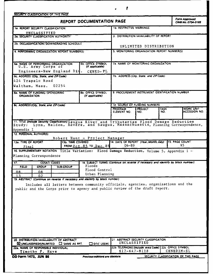
SECURITY CLASSIFICATION OF THIS PAGEForm Approved
REPORT DOCUMENTATION PAGE 0M No. O7O 7 8
la. REPORT SECURITY CLASSIFICATION lb. RESTRICTIVE MARKINGS
UNCLASSIFIED________________ _____
2a. SECURITY CLASSIFICATION AUTHORITY 3. DISTRIBUTION /AVAILABILITY OF REPORT
2b. DECLASSIFICATION /DOWNGRADING SCHEDULEUNLIMITED DISTRIBUTION
4. PERFORMING ORGANIZATION REPORT NUMBER(S) 5. MONITORING ORGANIZATION REPORT NUMBER(S)
6a. NAME OF PERFORMING ORGANIZATION 6b. OFFICE SYMBOL 7a. NAME OF MONITORING ORGANIZATIONU.S. Army Corps of / (if applica ble)
Engineers-New England Di . CENED-PL
6c. ADDRESS (City, State, and ZIP Code) 7b. ADDRESS (City, State, and ZIP Code)
424 Trapelo Road
Waltham, Mass. 02254
Ba. NAME OF FUNDING/SPONSORING |8b. OFFICE SYMBOL 9 PROCUREMENT INSTRUMENT IDENTIFICATION NUMBERORGANIZATION (If applicable)
8c. ADDRESS (City, State, and ZIP Code) 10. SOURCE OF FUNDING NUMBERS
PROGRAM IPROJECT ITASK WORK UNITELEMENT NO. NO. NO. ACCESSION NO.
11. TITLE(IncudeSecurityClasification)Saugus River and Tributaries Flood Damage ReductionStudy: Lynn, Malden, Revere, and Saugus, Massachusetts, Planning Correspondence,
Appendix I
12. PERSONAL AUTHOR(S)Robert Hunt - Project Manager
13a. TYPE OF REPORT 13b. TIME COVERED 14. DATE OF REPORT (Year, Month, Day) 15. PAGE COUNT
Final FROM . jt 85 TO De 81 06-89 95
16. SUPPLEMENTARY NOTATION Title Variation: Flood Damage Reduction, Volume 5, Appendix I -
IPlanning Correspondence
17. COSATI CODES 18. SUBJECT TERMS (Continue on reverse if necessary and identify by block number)FIELD GROUP SUB-GROUP Floods
08 08 Flood Control
_LL3 02 Urban Planning
19 ABSTRACT (Continue on reverse if necessary and identify by block number)
Includes all letters between community officials, agencies, organizations and the
public and the Corps prior to agency and public review of the draft report.
20. DISTRIBUTION/AVAILABILITY OF ABSTRACT 21. ABSTRACT SECURITY CLASSIFICATION0 UNCLASSIFIED/UNLIMITED 03 SAME AS RPT. C3 DTIC USERS UNCLASSIFIED
22a. NAME OF RESPONSIBLE INDIVIDUAL 22b. TELEPHONE (Include Area Code) 22c. OFFICE SYMBOL
Timothy P. Hays 617-647-8118 CENEDIM-SL
DD Form 1473. JUN 86 Previous editions areobsoete. SECURITY CLASSIFICATION OF THIS PAGE
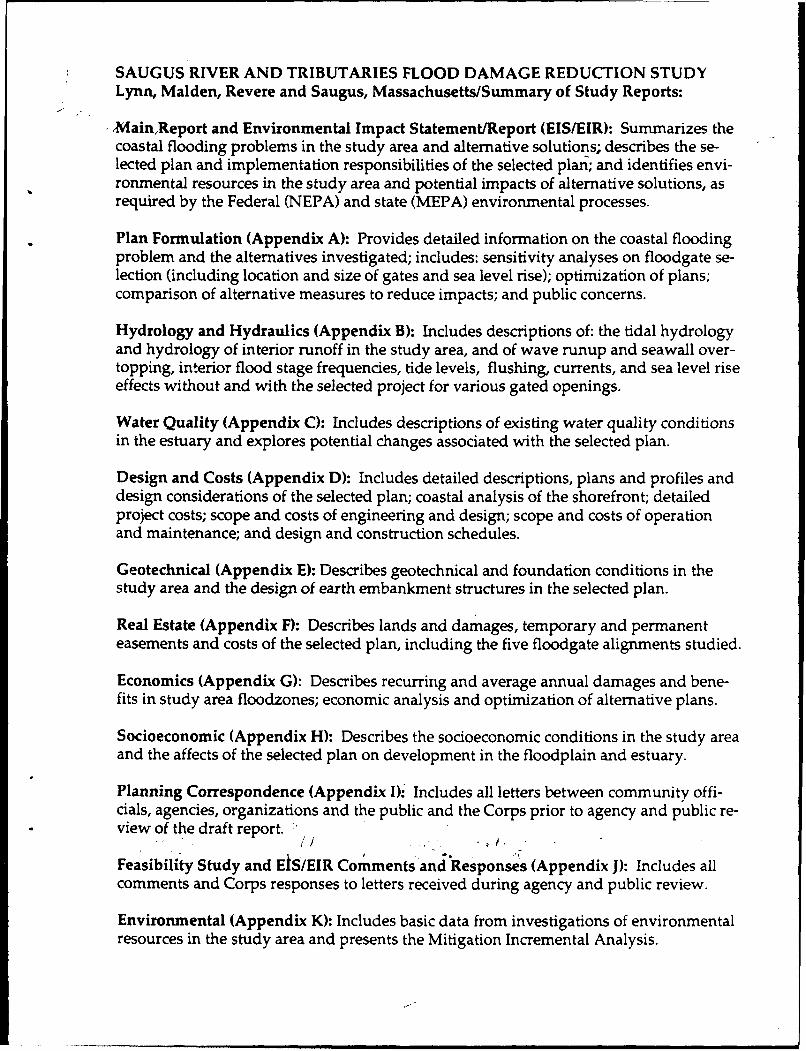
SAUGUS RIVER AND TRIBUTARIES FLOOD DAMAGE REDUCTION STUDYLynn, Malden, Revere and Saugus, Massachusetts/Summary of Study Reports:
-Main,Report and Environmental Impact Statement/Report (EIS/EIR): Summarizes thecoastal flooding problems in the study area and alternative solutions; describes the se-lected plan and implementation responsibilities of the selected plan; and identifies envi-ronmental resources in the study area and potential impacts of alternative solutions, asrequired by the Federal (NEPA) and state (MEPA) environmental processes.
Plan Formulation (Appendix A): Provides detailed information on the coastal floodingproblem and the alternatives investigated; includes: sensitivity analyses on floodgate se-lection (including location and size of gates and sea level rise); optimization of plans;comparison of alternative measures to reduce impacts; and public concerns.
Hydrology and Hydraulics (Appendix B): Includes descriptions of: the tidal hydrologyand hydrology of interior runoff in the study area, and of wave runup and seawall over-topping, interior flood stage frequencies, tide levels, flushing, currents, and sea level riseeffects without and with the selected project for various gated openings.
Water Quality (Appendix C): Includes descriptions of existing water quality conditionsin the estuary and explores potential changes associated with the selected plan.
Design and Costs (Appendix D): Includes detailed descriptions, plans and profiles anddesign considerations of the selected plan; coastal analysis of the shorefront; detailedproject costs; scope and costs of engineering and design; scope and costs of operationand maintenance; and design and construction schedules.
Geotechnical (Appendix E): Describes geotechnical and foundation conditions in thestudy area and the design of earth embankment structures in the selected plan.
Real Estate (Appendix F): Describes lands and damages, temporary and permanenteasements and costs of the selected plan, including the five floodgate alignments studied.
Economics (Appendix G): Describes recurring and average annual damages and bene-fits in study area floodzones; economic analysis and optimization of alternative plans.
Socioeconomic (Appendix H): Describes the socioeconomic conditions in the study areaand the affects of the selected plan on development in the floodplain and estuary.
Planning Correspondence (Appendix I)- Includes all letters between community offi-cials, agencies, organizations and the public and the Corps prior to agency and public re-view of the draft report.
Feasibility Study and EiS/EIR Comments and Responses (Appendix J)- Includes allcomments and Corps responses to letters received during agency and public review.
Environmental (Appendix K): Includes basic data from investigations of environmentalresources in the study area and presents the Mitigation Incremental Analysis.
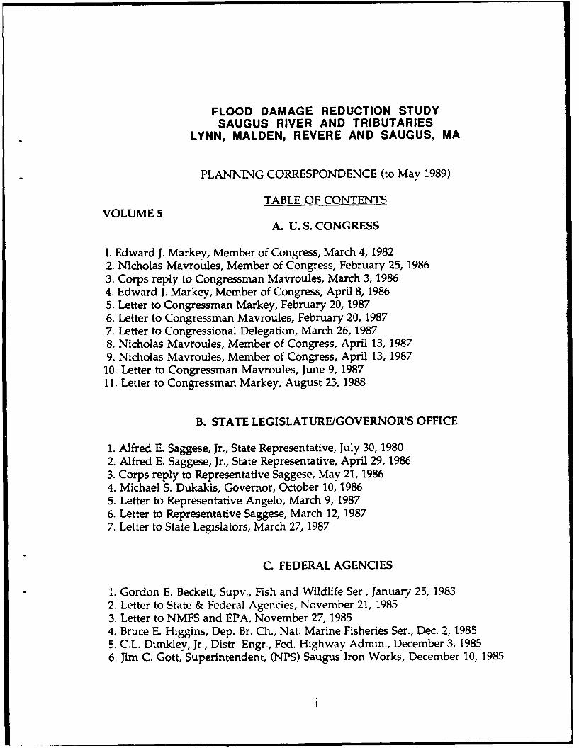
FLOOD DAMAGE REDUCTION STUDYSAUGUS RIVER AND TRIBUTARIES
LYNN, MALDEN, REVERE AND SAUGUS, MA
PLANNING CORRESPONDENCE (to May 1989)
TABLE OF CONTENTSVOLUME 5
A. U. S. CONGRESS
1. Edward J. Markey, Member of Congress, March 4, 19822. Nicholas Mavroules, Member of Congress, February 25, 19863. Corps reply to Congressman Mavroules, March 3, 19864. Edward J. Markey, Member of Congress, April 8, 19865. Letter to Congressman Markey, February 20, 19876. Letter to Congressman Mavroules, February 20, 19877. Letter to Congressional Delegation, March 26, 19878. Nicholas Mavroules, Member of Congress, April 13, 19879. Nicholas Mavroules, Member of Congress, April 13, 1987
10. Letter to Congressman Mavroules, June 9, 198711. Letter to Congressman Markey, August 23, 1988
B. STATE LEGISLATURE/GOVERNOR'S OFFICE
1. Afred E. Saggese, Jr., State Representative, July 30, 19802. Alfred E. Saggese, Jr., State Representative, April 29, 19863. Corps reply to Representative Saggese, May 21, 19864. Michael S. Dukakis, Governor, October 10, 19865. Letter to Representative Angelo, March 9, 19876. Letter to Representative Saggese, March 12, 19877. Letter to State Legislators, March 27, 1987
C. FEDERAL AGENCIES
1. Gordon E. Beckett, Supv., Fish and Wildlife Ser., January 25, 19832. Letter to State & Federal Agencies, November 21, 19853. Letter to NMFS and EPA, November 27, 19854. Bruce E. Higgins, Dep. Br. Ch., Nat. Marine Fisheries Ser., Dec. 2, 19855. C.L. Dunkley, Jr., Distr. Engr., Fed. Highway Admin., December 3, 19856. Jim C. Gott, Superintendent, (NPS) Saugus Iron Works, December 10, 1985
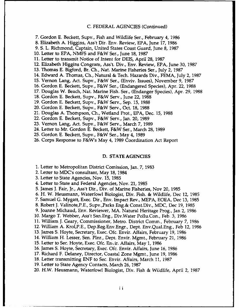
C. FEDERAL AGENCIES (Continued)
7. Gordon E. Beckett, Supv., Fish and Wildlife Ser., February 4, 19868. Elizabeth A. Higgins, Ass't Dir. Env. Review, EPA, June 17, 19869. S. L. Richmond, Captain, United States Coast Guard, June 8, 1987
10. Letter to EPA, NMFS and F&W Ser., June 18, 198711. Letter to transmit Notice of Intent for DEIS, April 28, 198712. Elizabeth Higgins Congram, Ass't. Div., Env. Review, EPA, June 30, 198713. Thomas E. Bigford, Br. Ch., Nat. Marine Fisheries Ser., July 2, 198714. Edward A. Thomas, Ch., Natural & Tech. Hazards Div., FEMA, July 2, 198715. Vernon Lang, Act. Supv., F&W Ser., (Enviv. Issues), November 9, 198716. Gordon E. Beckett, Supv., F&W Ser., (Endangered Species), Apr. 22, 198817. Douglas W. Beach, Nat. Marine Fish. Ser., (Endanger Species), Apr. 29, 198818. Gordon E. Beckett, Supv., F&W Serv., June 22, 198819. Gordon E. Beckett, Supv., F&W Serv., Sep. 15, 198820. Gordon E. Beckett, Supv., F&W Serv., Oct. 18, 198821. Douglas A. Thompson, Ch., Wetland Prot., EPA, Dec. 15, 198822. Gordon E. Beckett, Supv., F&W Serv., Jan. 20, 198923. Vernon Lang, Act. Supv., F&W Serv., March 7, 198924. Letter to Mr. Gordon E. Beckett, F&W Ser., March 28, 198925. Gordon E. Beckett, Supv., F&W Ser., May 4, 198926. Corps Response to F&W's May 4, 1989 Coordination Act Report
D. STATE AGENCIES
1. Letter to Metropolitan District Comission, Jan.. 7, 19832. Letter to MDC's consultant, May 18, 19843. Letter to State Agencies, Nov. 15, 19854. Letter to State and Federal Agencies, Nov. 21, 19855. James J. Fair, Jr., Ass't Dir., Div. of Marine Fisheries, Nov 20, 19856. H. W. Heusmann, Waterfowl Biologist, Div. Fish. & Wildlife, Dec 12, 19857. Samuel G. Mygatt, Exec. Dir., Env. Impact Rev., MEPA, EOEA, Dec 13, 19858. Robert J. Valinote,P.E., Supv.,Parks Eng.& Const.Div., MDC, Dec 19, 19859. Joanne Michaud, Env. Reviewer, MA. Natural Heritage Prog., Jan 2, 1986
10. Margo T. Webber, Ass't San.Eng., Div.Water Poilu.Con., Feb. 3, 198611. William J. Geary, Commissioner, Metro. District Comm., February 7, 198612. William A. Krol,P.E., Dep.Reg.Env.Engr., Dept. Env.Qual.Eng., Feb 12, 198613. James S. Hoyte, Secretary, Exec. Ofc. Envir. Affairs, February 19, 198614. William H. Lesser, Sen. Plnr., Dept. Envir. Mgmt., February 21, 198615. Letter to Sec. Hoyte, Exec. Ofc. En ir. Affairs, May 1, 198616. James S. Hoyte, Secretary, Exec. Ofc. Envir. Affairs, June 16, 198617. Richard F. Delaney, Director, Coastal Zone Mgmt., June 19, 198618. Letter transmitting ENF to Sec. Envir. Affairs, March 11, 198719. Letter to State Agency Contacts, March 26, 198720. H.W. Heusmann, Waterfowl Biologist, Div. Fish & Wildlife, April 2, 1987
ii
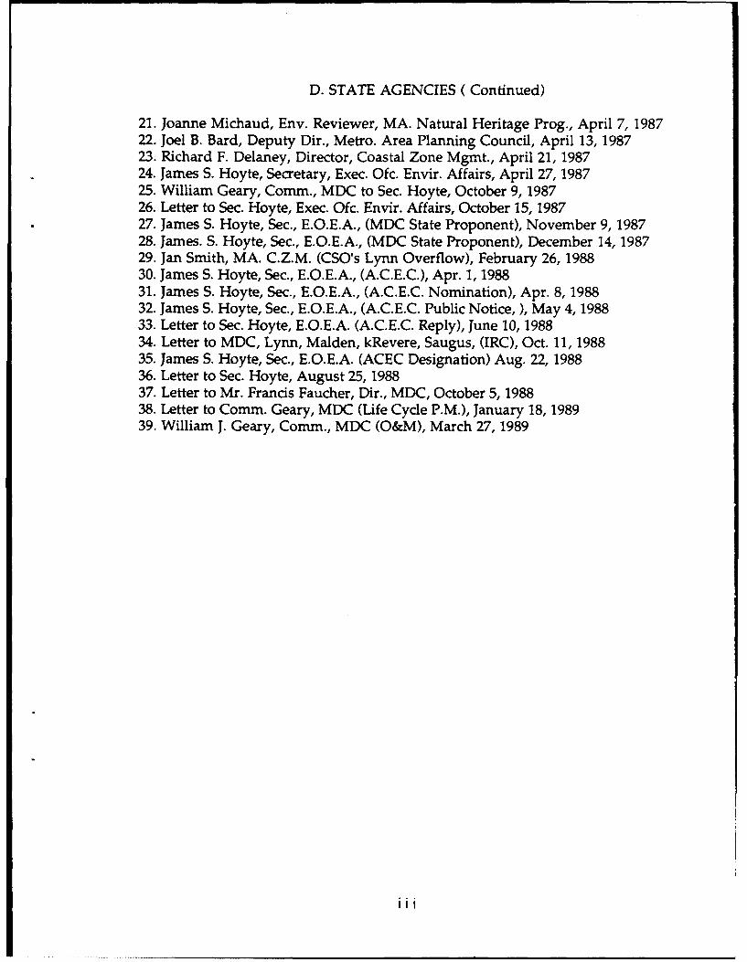
D. STATE AGENCIES (Continued)
21. Joanne Michaud, Env. Reviewer, MA. Natural Heritage Prog., April 7, 198722. Joel B. Bard, Deputy Dir., Metro. Area Planning Council, April 13, 198723. Richard F. Delaney, Director, Coastal Zone Mgmt., April 21, 198724. James S. Hoyte, Secretary, Exec. Ofc. Envir. Affairs, April 27, 198725. William Geary, Comm., MDC to Sec. Hoyte, October 9, 198726. Letter to Sec. Hoyte, Exec. Ofc. Envir. Affairs, October 15, 198727. James S. Hoyte, Sec., E.O.E.A., (MDC State Proponent), November 9, 198728. James. S. Hoyte, Sec., E.O.E.A., (MDC State Proponent), December 14, 198729. Jan Smith, MA. C.Z.M. (CSO's Lynn Overflow), February 26, 198830. James S. Hoyte, Sec., E.O.E.A., (A.C.E.C.), Apr. 1, 198831. James S. Hoyte, Sec., E.O.E.A., (A.C.E.C. Nomination), Apr. 8, 198832. James S. Hoyte, Sec., E.O.E.A., (A.C.E.C. Public Notice, ), May 4, 198833. Letter to Sec. Hoyte, E.O.E.A. (A.C.E.C. Reply), June 10, 198834. Letter to MDC, Lynn, Malden, kRevere, Saugus, (IRC), Oct. 11, 198835. James S. Hoyte, Sec., E.O.E.A. (ACEC Designation) Aug. 22, 198836. Letter to Sec. Hoyte, August 25, 198837. Letter to Mr. Francis Faucher, Dir., MDC, October 5, 198838. Letter to Comm. Geary, MDC (Life Cycle P.M.), January 18, 198939. William J. Geary, Comm., MDC (O&M), March 27, 1989
iii

VOLUME 6E. CITY OF LYNN
1. Antonio J. Marino, Mayor of Lynn, December 19, 1984.2. Letter to Mayor of Lynn, Jan 15, 19853. Paul A. Petrowski, Chm., Lynn Conservation Comm., Dec. 17, 19854. Letter to Mayor DiVirgilio, Feb. 12, 19865. Albert V. DiVirgiio, Mayor of Lynn, March 11, 19866. Letter to Mayor of Lynn, April 7, 19867. Mrs. John Skangos, Resident of Lynn, June 9, 19868. Albert V. DiVirgilio, Mayor of Lynn, June 23, 19869. Letter to Mayor DiVirgilio, February 6, 198710. Letter to Lynn Citizen Steering Comm., February 19, 198711. Letter to Mr. Michael T. Carroll, General Electric, February 19, 198712. Harry W. Coppola, Councillor, Feb. 26, 1987 and Corps reply, Mar. 6, 198713. Albert V. DiVirgilio, Mayor of Lynn, March 23, 198714. Letter to Mr. Peter M. DeVeau, Ofc. Econ. Dev., March 23, 198715. Letter to Mr. E. James Ryan, P.E., City Eng., Lynn, March 23, 198716. Letter to Mr. Maurice F. Kennedy, No. Amer. Philips Light Co., Mar. 25, 198717 Letter to Mr. Paul N. Varadian, TransContinental Dev. Corp., Mar. 25, 198718. Letter to Mr. John E. Ryder, P.E. Bay Marine Trust, March 25, 198719. Letter to Mr. Xavier Bertolino, Sr., The Gloucester Corp., Mar. 25, 198720. Letter to Mr. John E. Ryder, Rep., Lynn Area Chamb. of Comm., Jan. 12, 198821. Letter to Lynn Citizen Steer. Comm. (Meeting on Align #2) May 24, 198822. Stephen L. Smith, Ass't Planning Director, Lynn, Sep. 14, 198823. Letter to Mayor DiVirgilio (IRC), October 7, 1988
F. CITY OF MALDEN
1. Thomas H. Fallon, Mayor of Malden, August 2, 19852. Charles V. Maccario, Chm., Malden Conservation Comm., Feb 10, 19863. Letter to Mayur Conway, February 6, 19874. Letter to Malden Citizen Steering Comm., February 19, 19875. Alfred L. Thurlow, Principal Planner, April 8, 19876. Letter to Mr. John T. Kelly, City Engineer, May 19, 19877. Alfred L. Thurlow, Principal Planner, May 28, 19878. Letter to Mayor Conway (IRC), October 7, 1988
iv
G. CITY OF REVERE
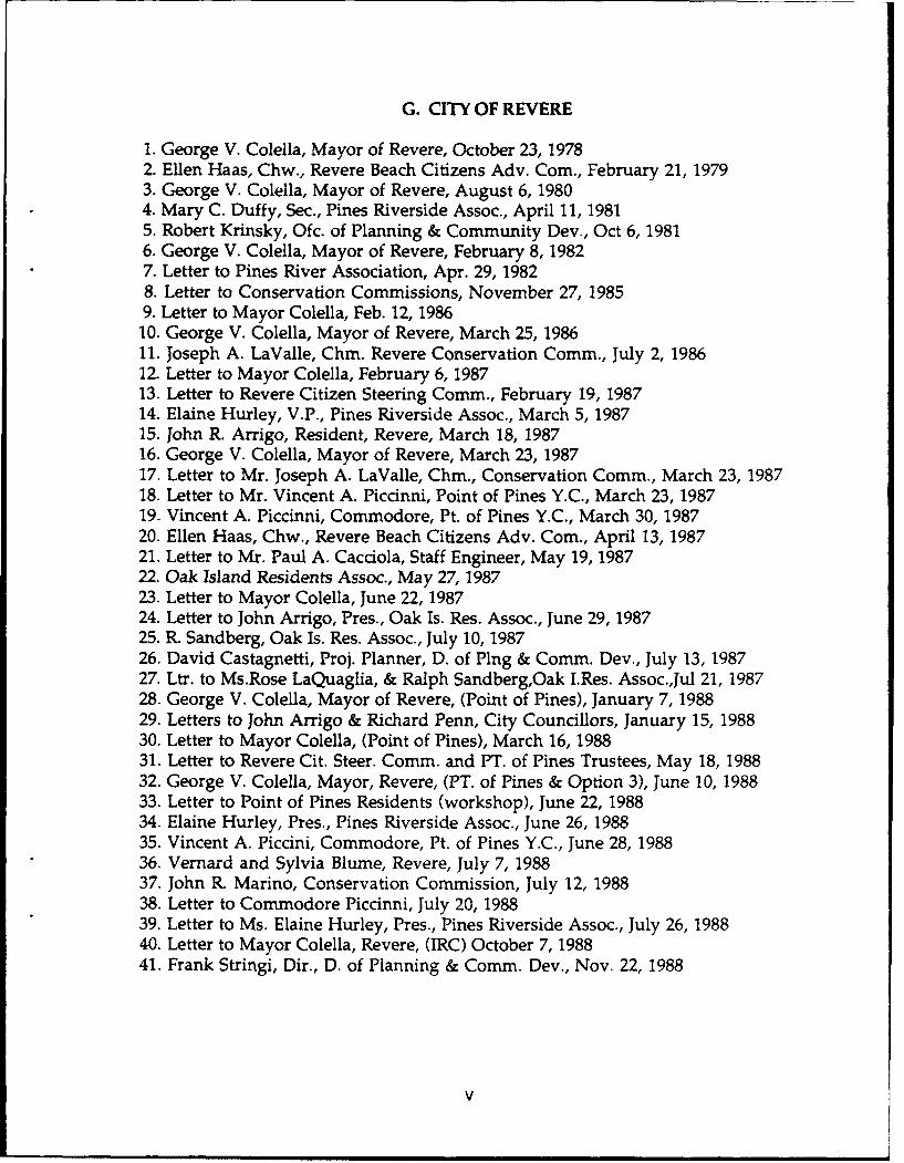
1. George V. Colella, Mayor of Revere, October 23, 19782. Ellen Haas, Chw., Revere Beach Citizens Adv. Com., February 21, 19793. George V. Colella, Mayor of Revere, August 6, 19804. Mary C. Duffy, Sec., Pines Riverside Assoc., April 11, 19815. Robert Krinsky, Ofc. of Planning & Community Dev., Oct 6, 19816. George V. Colella, Mayor of Revere, February 8, 19827. Letter to Pines River Association, Apr. 29, 19828. Letter to Conservation Commissions, November 27, 19859. Letter to Mayor Colella, Feb. 12, 198610. George V. Colella, Mayor of Revere, March 25, 198611. Joseph A. LaValle, Chm. Revere Conservation Comm., July 2, 198612. Letter to Mayor Colella, February 6, 198713. Letter to Revere Citizen Steering Comm., February 19, 198714. Elaine Hurley, V.P., Pines Riverside Assoc., March 5, 198715. John R. Arrigo, Resident, Revere, March 18, 198716. George V. Colella, Mayor of Revere, March 23, 198717. Letter to Mr. Joseph A. LaValle, Chm., Conservation Comm., March 23, 198718. Letter to Mr. Vincent A. Piccinni, Point of Pines Y.C., March 23, 198719. Vincent A. Piccinni, Commodore, Pt. of Pines Y.C., March 30, 198720. Ellen Haas, Chw., Revere Beach Citizens Adv. Com., April 13, 198721. Letter to Mr. Paul A. Cacciola, Staff Engineer, May 19, 198722. Oak Island Residents Assoc., May 27, 198723. Letter to Mayor Colella, June 22, 198724. Letter to John Arrigo, Pres., Oak Is. Res. Assoc., June 29, 198725. R. Sandberg, Oak Is. Res. Assoc., July 10, 198726. David Castagnetti, Proj. Planner, D. of Ping & Comm. Dev., July 13, 198727. Ltr. to Ms.Rose LaQuaglia, & Ralph Sandberg,Oak I.Res. Assoc.,Jul 21, 198728. George V. Colella, Mayor of Revere, (Point of Pines), January 7, 198829. Letters to John Arrigo & Richard Penn, City Councillors, January 15, 198830. Letter to Mayor Colella, (Point of Pines), March 16, 198831. Letter to Revere Cit. Steer. Comm. and PT. of Pines Trustees, May 18, 198832. George V. Colella, Mayor, Revere, (PT. of Pines & Option 3), June 10, 198833. Letter to Point of Pines Residents (workshop), June 22, 198834. Elaine Hurley, Pres., Pines Riverside Assoc., June 26, 198835. Vincent A. Piccini, Commodore, Pt. of Pines Y.C., June 28, 198836. Vernard and Sylvia Blume, Revere, July 7, 198837. John R. Marino, Conservation Commission, July 12, 198838. Letter to Commodore Piccinni, July 20, 198839. Letter to Ms. Elaine Hurley, Pres., Pines Riverside Assoc., July 26, 198840. Letter to Mayor Colella, Revere, (IRC) October 7, 198841. Frank Stringi, Dir., D. of Planning & Comm. Dev., Nov. 22, 1988
V
H. TOWN OF SAUGUS
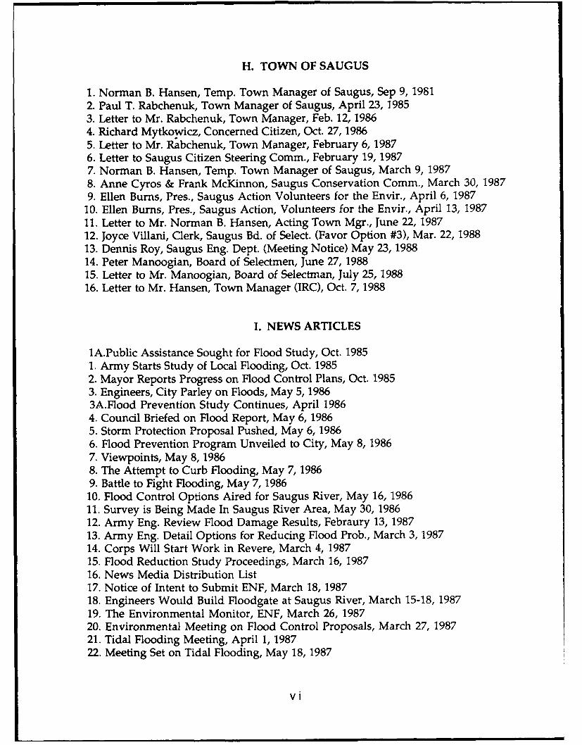
1. Norman B. Hansen, Temp. Town Manager of Saugus, Sep 9, 19812. Paul T. Rabchenuk, Town Manager of Saugus, April 23, 19853. Letter to Mr. Rabchenuk, Town Manager, Feb. 12, 19864. Richard Mytkowicz, Concerned Citizen, Oct. 27, 19865. Letter to Mr. Rabchenuk, Town Manager, February 6, 19876. Letter to Saugus Citizen Steering Comm., February 19, 19877. Norman B. Hansen, Temp. Town Manager of Saugus, March 9, 19878. Anne Cyros & Frank McKinnon, Saugus Conservation Comm., March 30, 19879. Ellen Burns, Pres., Saugus Action Volunteers for the Envir., April 6, 1987
10. Ellen Burns, Pres., Saugus Action, Volunteers for the Envir., April 13, 198711. Letter to Mr. Norman B. Hansen, Acting Town Mgr., June 22, 198712. Joyce Villani, Clerk, Saugus Bd. of Select. (Favor Option #3), Mar. 22, 198813. Dennis Roy, Saugus Eng. Dept. (Meeting Notice) May 23, 198814. Peter Manoogian, Board of Selectmen, June 27, 198815. Letter to Mr. Manoogian, Board of Selectman, July 25, 198816. Letter to Mr. Hansen, Town Manager (IRC), Oct. 7, 1988
I. NEWS ARTICLES
1A.Public Assistance Sought for Flood Study, Oct. 19851. Army Starts Study of Local Flooding, Oct. 19852. Mayor Reports Progress on Flood Control Plans, Oct. 19853. Engineers, City Parley on Floods, May 5, 19863A.Flood Prevention Study Continues, April 19864. Council Briefed on Flood Report, May 6, 19865. Storm Protection Proposal Pushed, May 6, 19866. Flood Prevention Program Unveiled to City, May 8, 19867. Viewpoints, May 8, 19868. The Attempt to Curb Flooding, May 7, 19869. Battle to Fight Flooding, May 7, 1986
10. Flood Control Options Aired for Saugus River, May 16, 198611. Survey is Being Made In Saugus River Area, May 30, 198612. Army Eng. Review Flood Damage Results, Febraury 13, 198713. Army Eng. Detail Options for Reducing Flood Prob., March 3, 198714. Corps Will Start Work in Revere, March 4, 198715. Flood Reduction Study Proceedings, March 16, 198716. News Media Distribution List17. Notice of Intent to Submit ENF, March 18, 198718. Engineers Would Build Floodgate at Saugus River, March 15-18, 198719. The Environmental Monitor, ENF, March 26, 198720. Environmental Meeting on Flood Control Proposals, March 27, 198721. Tidal Flooding Meeting, April 1, 198722. Meeting Set on Tidal Flooding, May 18, 1987
vi
23. Army Engr. Solicit Opinions on Flood Damage Study, May 20, 198724. Corps Begins Flood Control Report, June 5, 198725. Engineers Concerned about 1-95 Sandpile, July 2, 198726. Opening Up the Floodgates (New Bedford Field Trip), Nov. 18, 198827. Stink Over Sand Rises Anew, September 25, 198727. Town Gets Update on Plans for Saugus River, February 5, 198828. Saugus River Floodgate Project Proposed by Corps, Winter 198829. Broad Sound's Future Topic for Discussion, May 23, 198829. Broad Sound Designation Explained, May 31, 198830. Task Force Questions Dredging Impact, May 18, 198830. Would ACEC Slow Beaches Growth, April 28, 198831. Engineers Schedule Workshop, June 21, 198832. Thinking Aloud, June 15, 198833. Geary Maintains Stand on Shoreline Sanding, June 15, 198834. Preserving Environment, June 16, 198835. More ACEC Questions, June 16, 198836. Saugus Sounds Off, June 24, 198837. Engineers, Officials Seek F.C. Compromise, July 5, 198838. Marsh Area Gets New Status, Aug. 23, 198839. EPA Hits Revere Firms for Filling Marsh, Sep. 1, 198840. 1-95 Sandpiles to become Passive Recreation Lands, Sep. 21, 198841. "T" Must Remove Landfill at Bridge, Oct. 3, 198842. Classic Nor'easter Takes a Toll Along Coast, Oct. 24, 198843. Feds Check Out $57 M Floodgate Plan, Oct. 26, 198844. MDC to Draw Plan Cony. 1-95 ROW to Park, Oct. 31, 198845. Track Work-to Threaten Marshland, Nov. 1, 198846. MDC Preparing for Work on E. Saugus Park, Nov. 9, 198847. Wetlands Warden, Nov. 20, 198848. Rising Sea Level - claim - Saugus Coastline, Feb. 198949. State Moves to Plug Wetlands Protection Loopholes, March 19, 1989
J. INTEREST GROUPS AND OTHER LETTERS
1. Ltr. to Mr. Frank Anderson, Concerned Coastal Sportsmen, Mar. 23, 19872. Polly Bradley, Sec., S.W.I.M., Nahant, March 27, 19873. Invitation to MEPA scoping meeting, March 24, 19874. Mass. Assoc. of Conservation Comm., March 30, 19875. Richard K. Quateman, Dir. Gloucester Ofc., MA. Audubon Soc., April 10, 19876. Judith C. Skinner, Board of Dir., MA. Assoc. Cons. Comm., Apr. 12, 19877. Norma Brooks, Member, S.W.I.M., Nahant, April 14, 19878. Paul Hauge & Sally Newbury, Conservation Law Foundation, April 15, 19879. Judith C. Skinner, Board of Dir., MACC, April 16, 1987
10. Polly Bradley, Sec., S.W.I.M., Nahant, April 15, 198711. Invitation to NEPA scoping meeting, May 14, 198712. Norma Brooks, Member, S.W.I.M., Nahant, June 11, 1987
VII
J. INTEREST GROUPS AND OTHER LETTERS (Continued)
13. Polly Bradley, Pres., S.W.I.M., Nahant, June 11, 198714. Letter to Polly Bradley, Pres. S.W.I.M., July 14, 198715. Letter to Richard K. Quateman, Dir. MA. Audubon Soc., July 14, 198716. Letter to Judith C. Skinner, Member Bd. of Dir., MACC, July 14, 198717. Letter to Study Participants on Barrier Field Trip, Oct. 19, 198718. Letters to Study Participants, (Correspond. Update), Oct. 30, 198719. Attendance - Trip to Providence and New Bedford Barriers, Nov. 10, 198720. Letter to Polly Bradley, Pres., S.W.I.M. (News Article) Oct. 30, 198721. Polly Bradley, President, S.W.I.M., (Refr. News Article), Nov. 30, 198722. Letter to Technical Group (Meeting Notice), January 19, 198823. Letter to Norma Brooks, S.W.I.M. (Mem. Tech. Grp.), January 20, 198824. Alexandra D. Dawson, Pres., MA Assoc. of Conserv. Comm., Feb. 3, 198825. Notice to Techniral Group (Meeting Rescheduled), February 5, 198826. Letter to Study Participants, April 13, 198727. Letter Sent to Study Participants, Aug. 198828. Letter to Study Participants, Oct. 5, 198829. Frank E. Anderson, Pres., Coastal Sportsmen, Oct. 22, 198830. Letter to Study Participants, April 26, 1989
viii
U.S. CONGRESS
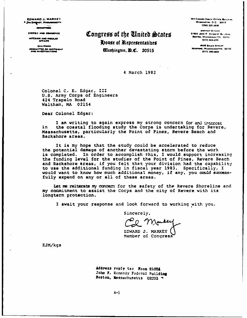
rDWAAO J. MAmKEY 403 C",eG. "H.-C Or'€cg e'o,
4j (WAGN -V OC 11 9(INS) 225-12M
066nO.Cr of f~cro
& Congre of tbe initeb £tat% h"--A'-.... --,swUlstom £56 WE4 I ?) Z)4Se.sTI Z
Ars-- X)ouSe of Ittp reSentatibeS ("U31"6
4 AIRiMAN "i48 ." Sl*$TNICr
ACMMIryU On w9*1" AOWOUISW? flAafAj,... UIS£..,-60V= .,O&T Wasbinato. M,. 20515 (17) 39&,.&W
4 March 1982
Colonel C. E. Edgar, IIIU.S. Army Corps of Engineers424 Trapelo RoadWaltham, MA 02154
Dear Colonel Edgar:
I am writing to again express my strong concern for and intercstin the coastal flooding study the Corps is undertaking for Revere,Massachusetts, particularly the Point of Pines, Revere Beach andBackshore areas.
It is my hope that the study could be accelerated to reducethe potential damage of another devastating storm before the workis completed. In order to accomplish this, I would support increasingthe funding level for the studies of the Point of Pines, Revere Beachand Backshore areas, if you felt that your division had the capabilityto use the additional funding in fiscal year 1983. Specifically, Iwould want to know how much additional money, if any, you could success-fully expend on any or all of these areas.
Let ire reiterate my concern for the safety of the Revere Shoreline andmy commitment to assist the Corps and the city of Revere with itslongterm protection.
I await your response and look forward to working with you.
Sincerely,
EDWARD J. MARKEYMember of Congress
EJM/kg s
Address reply tot Room 21001JohD F. Kcnnedy Fodcral Puldlgostoa, Massachusetts 0203
A-i
NICHOLAS MAVROULES 'o.ma
STm 014Mr. MhemAgmws 70 Wma&ATM $roleLMI. MA 01970
C0u ISl.rrm, (417) 74 $00
SMALLda *USNUSi 140 "NywAJ SIRVESCongrea od the tEnitb Matto L"°°-'MA,_.1 $0
$C"010MAM V $9 10 Slf
Suecoftumm Go fouot of 3.eprentatibeg1 ItOG3 fnojg "a~y KAvI~NIu MA 01:30
440 CANON H4a BUa Nueu TOLL Fu Wm.WAMINM. DC 2015 MABS&ACaUM
(202) 226- 020 (O 2724730
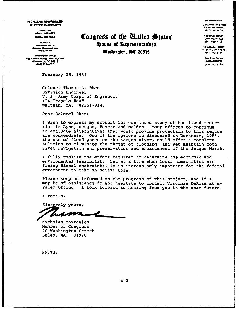
February 25, 1986
Colonel Thomas A. RhenDivision EngineerU. S. Army Corps of Engineers424 Trapelo RoadWaltham, MA. 02254-9149
Dear Colonel Rhen:
I wish to express my support for continued study of the flood reduc-tion in Lynn, Saugus, Revere and Malden. Your efforts to continueto evaluate alternatives that would provide protection to this regionare commendable. One of the options we discussed in December, 1985,the use of flood gates on the Saugus River, could offer a completesolution to eliminate the threat of flooding, and yet maintain bothriver navigation and preservation and enhancement of the Saugus Marsh.
I fully realize the effort required to determine the economic andenviromental feasibility, but at a time when local communities arefacing fiscal restraints, it is increasingly important for the federalgovernment to take an active role.
Please keep me informed on the progress of this project, and if Imay be of assistance do not hesitate to contact Virginia DeRosa at mySalem Office. I look forward to hearing from you in the near future.
I remain,
Sincerely yours,
Nicholas MavroulesMember of Congress70 Washington StreetSalem, MA. 01970
NM/vdr
A-2
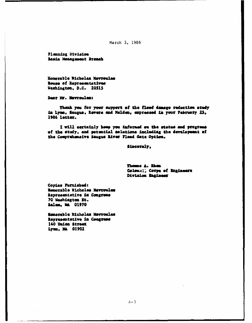
March 3, 1986
Pla nlng DivLZisolm lmamaeg t Aramk
Honorable Nichola MayrouleeSown of RapresmtativesWashington. D.C. 20515
Dear Mr. Mavroleso
Thmk y0u for your support of the flood damage roductie st"Yis Lymeo . , awagu LeVr and Malden& expressed ai your February 23@1986 letter.
I wlIl eartaInly kop you Iaformed os the status nd progresof the study, and potential slutims IncludUS the developmet ofthe Comprehenslve Saugs. Liver flood Cate Option.
Sincerely.
Thins A. ibomColonme1; CrPe of ofeDivision Sginaw
Copies FurnishedaUeorable Nicholas Mavrouleslepresaentative In Congress70 Wshington St.Sales, VA 01970
Easrable Nicholas MayroilsRepresentative In Congress140 non StreetLynn, NA 01902
A-3
EDWARD J. MARKEY 2133 RAysuom Mouu Offic Bui~o~u
7TH DISTICT. MAs SAcmus ITYs W wi krom DC 20615
1 O Nrl t T M ' (202) 225-2836
INhEIAMo AND INSULAR O £ i1n offtc
AFFAIRS 2atge2 1i ij U t wtt% OOA JOH KNI UMBDG
SUcCOMMITrEE ON ENERGYCONSERVATION AND K Uubiugton, 3C 20515
COMMISSION ON SECURITY ANDCOOPERATION IN EURoP
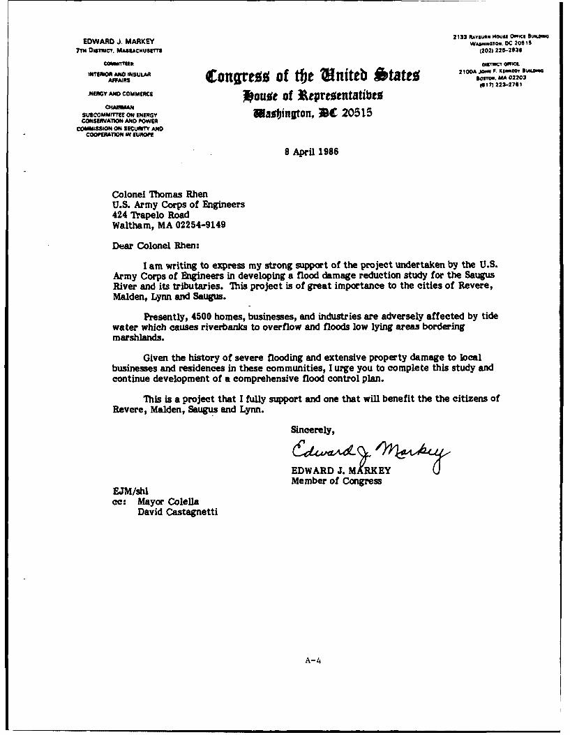
8 April 1986
Colonel Thomas RhenU.S. Army Corps of Engineers424 Trapelo RoadWaltham, MA 02254-9149
Dear Colonel Rhen:
I am writing to express my strong support of the project undertaken by the U.S.Army Corps of Engineers in developing a flood damage reduction study for the SaugusRiver and its tributaries. This project is of great importance to the cities of Revere,Malden, Lynn and Saugus.
Presently, 4500 homes, businesses, and industries are adversely affected by tidewater which causes riverbanks to overflow and floods low lying areas borderingmarshlands.
Given the history of severe flooding and extensive property damage to localbusinesses and residences in these communities, I urge you to complete this study andcontinue development of a comprehensive flood control plan.
This is a project that I fully support and one that will benefit the the citizens ofRevere, Malden, Saugus and Lynn.
Sincerely,
EDWARD J. MRKEYMember of Congress
EJM/shlcc: Mayor Colella
David Castagnetti
A-4
DEPARTMENT OF THE ARMYNEW ENGLAND DIVISION. CORPS OF ENGINEERS
424 TRAPELO ROAD
WALTHAM. MASSACHUSETTS 02254-9149
IMPLY TOAITnNTMO OF
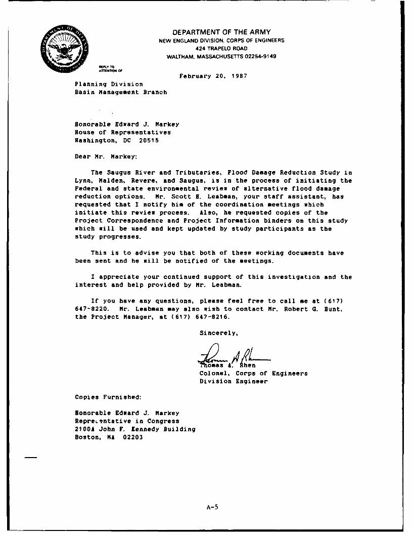
February 20, 1987Planning Division
Basin Management Branch
Honorable Edward J. Markey
House of RepresentativesWashington, DC 20515
Dear Mr. Markey:
The Saugus River and Tributaries, Flood Damage Reduction Study inLynn, Malden, Revere, and Saugus, is in the process of initiating the
Federal and state environmental review of alternative flood damagereduction options. Hr. Scott I. Leabman, your staff assistant, has
requested that I notify him of the coordination meetings whichinitiate this review process. Also, he requested copies of the
Project Correspondence and Project Information binders on this studywhich will be used and kept updated by study participants as the
study progresses.
This is to advise you that both of these working documents have
been sent and he will be notified of the meetings.
I appreciate your continued support of this investigation and the
interest and help provided by Mr. Leabman.
If you have any questions, please feel free to call me at (617)647-8220. Mr. Leabman may also wish to contact Mr. Robert G. Hunt,the Project Manager, at (617) 647-8216.
Sincerely,
Colonel, Corps of Engineers
Division Engineer
Copies Furnished:
Honorable Edward J. MarkeyRepreLentative in Congress
2100A John F. Kennedy Building
Boston, MA 02203
A-5
DEPARTMENT OF THE ARMYNEW ENGLAND DIVISION. CORPS OF ENGINEERS
424 TRAPELO ROAD
WALTHAM. MASSACHUSETTS 02254-9149
"PLY TOArrENTION OF February 20, 1987
Planning Division
Basin Management Branch
Honorable Nicholas Mavroules
House of Representatives
Washington, DC 20515
Dear Mr. Mavroules:
The Saugus River and Tributaries, Flood Damage Reduction Study in
Lynn, Malden, Revere, and Saugus, is in the process of initiating the
Federal and state environmental review of alternative flood damagereduction options. Ms. Virginia A. DeRosa, your staff assistant, has
requested that I notify her of the coordination meetings whichinitiate this review process. Also, she requested copies of the
Project Correspondence and Project Information binders on this studywhich will be used and kept updated by study participants as the
study progresses.
This is to advise you that both of these working documents have
been sent and she will be notified of the meetings.
I appreciate your continued support of this investigation and theinterest and help provided by Ms. DeRosa.
If you have any questions, please feel free to call me at (617)647-8220. Ms. DeRosa may also wish to contact Mr. Robert G. Hunt,
the Project Manager, at (617) 647-8216.
Sincerely,
4T&maA RhenColonel, Corps of Engineers
Division Engineer
Copies Furnished:
Honorable Nicholas Mavroules
Representative in Congress70 Washington St.
Salem, MA 01970
Honorable Nicholas Mavroules
Representative in Congress
140 Union Street
Lynn, MA 01902
A-6
-DEPARTMENT OF THE ARMYNEW ENGLAND DIVISION. CORPS OF ENGINEERS
424 TRAPELO ROADWALTHAM, MASSACHUSETTS 02254-9149
:1"'L","0C, NoOf March 26, 1987
Planning Division
Basin Management
Honorable Edward M. KennedyUnited States SenateWashington, D.C. 20510
Dear Senator Kennedy:
The New England Division, Corps of Engineers has submittedthe enclosed Environmental Notification Form (ENF) for the SaugusRiver and Tributaries Flood Damage Reduction Study on behalf ofthe communities of Lynn, Malden, Revere, and Saugus,Massachusetts.
The preferred preliminary plan includes floodgates on theSaugus River tied into shorefront protection along Revere Beach,Lynn Harbor and Lynn Beach. This estimated $40 million planwould protect 5000 residential, public, commercial and industrialbuildings and several major arteries used by north shorecommuters.
The State is presently initiating an environmental reviewwhich is required before the final recommendations can be made.This process includes a thorough review of alternative plans andtheir impacts. It also provides the public one of manyopportunities to voice concerns during the planning period.
Comments on the ENF, concerning potential environmentalimpacts that are likely to be significant, are due by April 15,1987. They should be sent directly to the Secretary ofEnvironmental Affairs, 100 Cambridge Street, Boston,Massachusetts, 02202, Attention: MEPA Unit, referencing theproject by name and its EOEA #6497. A Scoping meeting will beheld at Revere High School, School Street, Revere, Massachusettson Tuesday, April 7, 1987 from 3:00 - 5:00 p.m.
A-7

-2-
I appreciate your interest in this study. If you have anyquestions, please feel free to call me at (617) 647-8220. Mr.Robert G. Hunt, the Project Manager (647-8216) can be contactedfor additional information. The MEPA contact person for thisproject is Mr. David Shepardson. He can be reached at 727-5830.
Sincerely,
Thomas A. RhenColonel, Corps of EngineersDivision Engineer
Enclosure
Copy Furnished:Honorable Edward M. KennedyUnited States Senator2400A JFK Federal BuildingBoston, Massachusetts 02203
A-7a
SIMILAR LETTER SENT TO:
Honorable Edward M. KennedyUnited States SenateWashington, D.C. 20510
Honorable Edward M. KennedyUnited States Senator2400A JFK Federal BuildingBoston, Massachusetts 02203
Honorable John F. KerryUnited States SenateWashington, D.C. 20510
Honorable John F. KerryUnited States Senator3220 Tranportation Building10 Park PlazaBoston, Massachusetts 02116
Honorable Nicholas MavroulesHouse of RepresentativesWashington, D.C. 20515
Honorable Nicholas MavroulesRepresentative in CongressATTN: Ms. Virginia DeRosa70 Wasington StreetSalem, Massachusetts 01970
Honorable Nicholas MavroulesRepresentative in Congress140 Union StreetLynn, Massachusetts 01902
Honorable Edward J. MarkeyHouse of RepresentativesWashington, D.C. 20515
Honorable Edward J. MarkeyRepresentative in CongressATTN: Mr. Scott H. Leabman2100A JFK Federal BuildingBoston, Massachusetts 02203
A-7b
NICHOLAS MAVROULES asacT oafts
VI BmST1C7. MA8SNIJSE4 70 WAShO ONe SfllITUAWm. MA 01970
00MW flS 16171 745-1500AMDl SiMAlCiS
AMD IVIESConqrttg of tbt Itniteb *tatt. L,. MA 01902
1174105
*ou~gt of Atpratntatib%; 10 WeLOG eMI"plow"In~laot" Donft"10 MA 01630
.asbington. C 20515 1.7 272-34,WAIUIGOUO 0M4Ct
2432 PAvoum ft"UrD l ut Iutaw TLL Fit" Wr*rwWAa "meO4I . DC 20515 MAttaC"91"a '
a021 2 020 (o 272-4730
April 13, 1987
Colonel Thomas A. RhenDivision EngineerU. S. Army Corps of Engineers424 Trapelo RoadWaltham, MA. 02254-9149
Dear Colonel Rhen:
I write at this time to reiterate my support for the proposedflood damage reduction plan for the Saugus River and Tributarieson behalf of the communities of Lynn, Saugus, Revere and Malden,Massachusetts.
I must concur that the preliminary plan that incorporates the useof floodgates on the Saugus River tied into shorefront protectionalong Revere Beach, Lynn Harbor and Lynn Beach would offer themaximum protection to the 5,000 residential, public, commercialand industrial buildings and several major arteries in this area.
I would also like at this time to commend Mr. Robert Hunt theProject Engineer and his staff for the fine job that has beesdone on this project. Mr. Hunt has exhibited his knowledge andcomplete understanding of the problems in the area and his thoroughexploration of the alternatives and their impact on the environ-ment has been well taken.
Once again, please keep me informed on the progress of this project,and I look forward to meeting with you in the near future to furtherdiscuss mutual concerns. In the interim if I may be of assistancecontact Virginia DeRosa at my Salem Office. I remain,
Sincerely yours,
ONicholas avroulesMember of Congress70 Wash ngton StreetSalem, MA. 01970
NM/vdr
A-8
NICHOLAS MAVROULES Dsc' FS? )e~t; .T U&SSC~u~i~r|70 W.S.~t' - '*!
S.1. 0.11 :9,:COMUU?!(s 1(6171 745-!e .C
LAME SERVICES 4L.C -lSMALL SUSINISS Congrez of t 'niteb *tatez L- WAI: ....
C.A.-M.M 6 f 7, 599- 7 '_5S.0.1... 9~ouit of A tprezentatibe5 10 17J0. S 'J - [ 'SuecoiMll O ? U~ J 10 Wi.Ovt S*li["
,asbington, 3C 20515 ,617)372-3461w2fa5".u..GOlI 011111€ II.0N OLl. Plli WI?.,N
2432 "OtUI oult Of$ 'ct tI G TOLLFma wMO
W.S" . TOk. DC 206 15 M u yin r
(2021 224020 (8001 272-6730
April 13, 1987
Mr. James S. HoyteSecretary of Environmental Affairs100 Cambridge StreetBoston, Massachusetts 02202
RE: EOEA #6497- MEPA Unit
Dear Mr. Hoyte:
I am writing to concur with the New England Division, Army Corpsof Engineers Environmental Notification Form (ENF) for the SaugusRiver and Tributaties Flood Damage Reduction Study.
After having reviewed the alternatives presented by the Corps, thepreferred preliminary plan that includes floodgates on the SaugusRiver, tied into shorefront protection along Revere Beach, LynnHarbor and Lynn Beach would offer the maximum protection to the5,000 residential, public, commercial and industrial buildingsand several major arteries in the area. Additionally, the ArmyCorps of Engineers has shown great concern in its iritial effortsto deal with the environmental impact issues in thib region andcontinues to seek further imput. At the recent scoping meetingit appeared that a representative and diverse group of interestswere present to offer their views and comments.
Please keep me informed as to the progress of this project, andif I may be of sevrice please do not hesitate to contact VirginiaDeRosa at my Salem Office. I remain,
Sincerely yours,
icholas Mavroules RECEIVEDMember of Congress70 Washington StreetSalem, MA. 01970 - VU7
OFFICE oW Thl SECRETARY Of
MN/vdr INVIROWMLNTAL AFFAIAS
A-9
DEPARTMENT OF THE ARMYNEW ENGLAND DIVISION. CORPS OF ENGINEERS
424 TRAPELO ROAD
WALTHAM. MASSACHUSETTS 02254-9149
ani1 A"' sion June 9, 1987
Basin Management Branch
Honorable Nicholas MavroulesHouse of RepresentativesWashington, DC 20515
Dear Mr. Mavroules:
Ms. Virginia DeRosa , your staff aid, requested we notify you ofthe potential impact on Saugus residents if the abandoned 1-95embankment in the Saugus Marsh is removed. We are also concernedabout the removal and disposition of this fill for two of ourprojects: the Revere Beach Erosion Control Project which wouldre-nourish Revere Beach, and the Saugus River and Tributaries, FloodDamace Reduction Study in Lynn, Malden, Revere and Saugus.
Analysis of existing physical and hydraulic conditions of theRevere/Saugus Marsh indicated that complete removal of the 1-95embankment fill would raise tidal flood elevations in the SeaplaneBasin and East Saugus areas from about one-half to one foot. Tomaintain the existing tidal flood protection provided by the 1-95embankment, the fill could be removed to a berm with a top elevationat +11 feet N.G.V.D. (i.e., within 4 to 6 feet of the irregular marshsurface) and a top width of 75 feet.
If you have any questions, please feel free to call me at (617)647-8220. Ms. DeRosa may also wish to contact Mr. Robert G. Hunt,the Project Manager of the Saugus River Flood Study, at (617)647-8216.
Sincerely,
Colonel Corps of EngineersDivision Engineer
Copies Furnished:Honorable Nicholas MavroulesRepresentative in CongressATTN: Ms. Virginia DeRosa70 Washington St.Salem, Ma 01970
Honorable Nicholas MavroulesRepresentative in Congress140 Union StreetLynn, MA 01902
A-10
DEPARTMENT OF THE ARMYNEW ENGLAND DIVISION. CORPS OF ENGINEERS
424 TRAPELO ROAD
WALTHAM. MASSACHUSETTS 02254-9149
AMo. August 23, 1988Planning DivisionBasin Management Branch
lonorable Edward J. NarkayRepresentative in Congress21001 JFK Federal BuildingBeaton, Massachusetts 02203
Dear Nr. Markey:
No. Carol Lederman contacted Hr. Robert 0. Bunt of my staff on August17, 1988 requesting information on the Rose Quarry and Pines River marshin Revere. Enclosed is an environmental report on the marsh titled "FinalReport, letland-Eutuary &*e**sent for the Saugus River and Tributaries,Flood Damage Reduction Study" prepared for our flood study-in Lynn,Malden, Revere and Saugus. The report identifies environmental resourcesin the Saugus and Pines River Estuary. This report is being eod as baseline information in describing and assessing these resources foralternative plans of flood protection.
Our detailed study area maps which show the floodplain in thecommunities also shows that the entrance to the Rowe Quarry Is about sixto seven feet above the flood plain and at a contour Elevation of 20 ft.501D. Our maps do not shon elevations for the interior of Rose Quarry.
I hope this Information proves helpful and I appreciate your continuedsupport for the flood damage reduction study and the interest and helpprovided by your staff.
If you have any questions, please feetl free to call me at (617)647-8220. No. Lederman may also wish to contact Hr. Bunt, the ProjectManager, at (617) 647-8216.
Sice sly,
Enclosure maog.Colonel, Corps of EngineersDivision Engineer
Copy Furnished:
lonorable Edward J. arkeylouse of RepresentativesWashington, DC 2051S
A-I

STATE LEGISLATURE
1KOL4005 ow R1P0NrAT1VIS
STATZ NOUS. BOSTON 02133
AIrED 9. SAGGESIE R omle*e
ALYRKKAGS JR. omlesaOT SUFFOLK DISTItCT
es LORING ROAD 9;i16 i Third Reding. ViceWINTNOP. MA 02182 J*12ay
Tm.. Ie. 23 IthlaJuly 30, 1980 *00o 12. WTATE NO
TEl. 727.21
Honorable George V. ColellaMayor of RevereCity HallRevere, MA 02151
Dear Mayor Colella:
Recently, a group of our constituents from Beachmontcontacted my office in regard to improvements to the Marsh-land and waterways of the Belle Isle area.
The residents of the area adjoining the marsh havecronic and serious problems with flooding, insects, and rats.These pose a health hazard and should, by themselves, initiatesome action. Furthermore, Belle Isle Inlet and its adjoiningwaterways are in need of dredging as the water levels haveadded to the flooding problems and made the Beachmont YachtClub virtually innaccesible by boat.
I have been in contact with the Department of EnvironmentalQuality Engineering to investigate the possibility of havingBelle Isle dredged in the near future. May I suggest thatyou, as Mayor of Revere, contact Colonel Max Scheider of theArmy Corps of Engineers to initiate a possible program offlood control and waterway clearance for the area.
I am looking forward to hearing from you regarding the
problems of this area.
With every good wish, I remain
Sincerely,
ALFRED E. SAGGESE, JR.
State Representative
AES: J
cc Miss Mabel Woodcock Mr. Robert Foy Fred Milton126 Crystil Avenue 135 Crystal Avenue CommodoreRevere, MA 02151 Revere, MA 02151 Beachmont Yacht Cl'
B-1 Revere, MA 02151
HOUSE OF REPRESENTATIVES
STATI HOUSE. BOSTON 02133
VICE CHAIRMAN. STATE ADMINISTRATION
Other Committees
ALFRED E. SAGGESE. JR. Post Audit and Ovorsigfrl20Tm SUFFOLK DISTRICT PesonAel and Admini
95 LORING ROAD Personnel and AdnslrahonWINTHROP. MA 02152 ROOM 489S. STATE HOUSE
TzL. 846-9123 TXL. 722.-2017
April 29, 1986
Colonel Thcnas RhenDivision EngineerCorps of Engineers424 Trapelo RoadWaltham, MA 02254
Dear Colonel Rhen:
I am writing to voice my strong support for the Flood Damage ReductionStudy undertaken by your office in the czmunities of Revere, Lynn, Saugusand Malden. You and your staff have conducted a detailed investigation ofthe flood problem and presented several remedial alternatives.
As you proceed into the final selection phase, please be assured thatI am prepared to assist you at the legislative level. I will work to insurethat you receive ample funding.
If I can be of assistance to you in this or any other matter, pleasefeel free to call upon me.
With kind regards, I am
Sipcqrel I<
AtS:as
B- 2
Planning DivisionBasin Management Branch
Mr. Alfred Z. Saggese, Jr.State RepresentativeHouse of RepresentativesState HouseBoston, HA 02133
Thank you for your strong letter of support dated April 29, 1986 forthe Flood Damage Reduction Study, Saugus River and Tributaries in Lynn,Malden, Revere and Saugus, Massachusetts.
Your letter advising us of your assistance at the State legislativelevel is appreciated. However, before we complete extensive planning,including costly environmental studies, we need to know that the non-Federal share of potential project costs, e.g. 35% of a $20 to 40 millionproject, would be available before construction of such a project.
I also appreciate your staff's interest demonstrated by Ms. AnnSullivan at the briefing with Revere officials on April 8, 1986. Asexplained, three options are being considered to protect up to 4,500residents and businesses in the region. There appears to be considerablesupport for the regional or comprehensive plan including flood gates onthe Saugus River tied into shorefront protection along Revere Beach andLynn Harbor. However, before a decision is made to recommend anyparticular option for detailed study, we need to determine the preliminaryeconomic and environmental feasibility of these options. This work isscheduled to be completed this fall, followed by extensive public inputand ultimately reaching a decision in December.
If the comprehensive plan is selected for detailed study thenextensive modeling and environmental sampling of the Saugus River estuaryand other tasks would follow to determine impacts, mitigation and projectfeatures. The final feasibility report should be under review in aboutthree years. Project review, Congressional authorization, and finaldesign may require an additional three years before construction funds arerequired. Your assistance throughout this process will assure that yourconstituent's are fully aware of plans being considered. I will certainlykeep you informed on the status of the study.
B-3
-2-
If you have any questions, please feel fre, to call me at617/647-8220. Mr. Robert G. Bunt is the Project Manager and can bereached at 617/647-8216.
Sincerely,
Thomas A. honColonel, Corps of 3ngiaeersDivision ingineer
CF:Mr. Alfred 3. Saggese, Jr.State Representative95 Loring loadWinthrop, n 02254
B-3a
THE COMMONWEALTH OF MASSACHUSETTS
EXECUTIVE DEPARTMENT
STATE HOUSE B SOSTON 02133
MICHAEL S. DUKAKIS@oveftmo October 10, 1986
Colonel Thomas A. RhenDivision EngineerCorps of Engineers424 Trapelo Road
Waltham, MA 02254
Dear Colonel Rhen:
Thank you for your recent letter to me concerning an Update
Report on cooperative projects currently underway with the NewEngland Division, U.S. Army Corps of Engineers.
Your involvement in Massachusetts is extensive, far-reachingand contributes greatly toward resolving a variety of problems.
Upon reviewing the Report, I noted the diversity ofrecipients at both the state and local levels that benefit fromthe Corps work. Also, I am aware of the coordination agreementsbetween the Federal Government and recipient that must precedeproject development.
To assist in the coordination and communication elements of
our mutual relationship and expedite state involvement in Corpsinitiatives, I am designating Richard F. Delaney, Director of theCoastal Zone Management Office as the contact point for mattersinvolving planning, permitting and policy.
Further, I am designating John J. Hannon, P.E. Chief Engineerin the Division of Waterways, epartment of EnvironmentalManagement as the contact poin for construct* ,contractual and
operational matters.
Thank you for your cant uiog ontributio to-Massachusetts.
A I'a he1 S. ka-ks •MSD/JJH/RFD:dc Governor
/
* B-4
DEPARTMENT OF THE ARMYNEW ENGLAND DIVISION, CORPS OF ENGINEERS
424 TRAPELO ROAD
WALTHAM. MASSACHUSETTS 02254-9149
LnnY, vision'' March 9, 1987
-Basin Management Branch
Mr. Steven V. AngeloState RepresentativeState HouseBoston, MA 02133
Dear Mr. Angelo:
We are in the process of initiating the Federal and stateenvironmental review of alternative flood damage reduction optionsfor the Saugus River and Tributaries, Flood Damage Reduction Study inLynn, Malden, Revere, and Saugus. Ms. Michelle C. Nadeau, yourlegislative assistant, has requested that I notify her of futurecoordination meetings on this study including meetings for thisreview process. Also, she requested copies of the ProjectCorrespondence and Project Information binders on this study whichwill be used and kept updated by study participants as the studyprogresses.
This is to advise you that both of these working documents havebeen sent and she will be notified of the meetings. Enclosed is abrochure on the study for your information.
I appreciate your support of this investigation and the interestof Ms. Nadeau.
If you have any questions, please feel free to call me at (617)647-8220. Ms. Nadeau may also wish to contact Mr. Robert G. Hunt,the Project Manager, at (617) 647-8216.
S' re y,
e . yMA R ngineerst g visi Engineer
Enclosure as stated
B- 5
DEPARTMENT OF THE ARMYNEW ENGLAND DIVISION. CORPS OF ENGINEERS
424 TRAPELO ROAD
WALTHAM. MASSACHUSES 02254-9149
MnPV To
March 12, 1987
Planning DivisionBasin Management Branch
Mr. Alfred E. Saggese, Jr.State RepresentativeHouse of RepresentativesState HouseBoston, Massachusetts 02133
Dear Mr. Saggese:
In the temporary absence of Colonel Thomas A. Rhen, I amwriting to inform you that we are in the process ofinitiating the Federal and State environmental review ofalternative flood damage reduction options for the SaugusRiver and Tributaries, flood Damage Reduction Study in Lynn,Malden, Revere, and Saugus. Ms. Ann Sullivan, yourlegislative assistant, has requested that I notify her offuture coordination meetings on this study including meetingsfor this review process. Also, she requested copies of theProject Correspondence and Project Information binders onthis study which will be used and kept updated by studyparticipants as the study progresses.
This is to advise you that both of these workingdocuments have been sent and she will be notified of themeetings. Enclosed is a brochure on the study for yourinformation.
I appreciate your support of this investigation and theinterest of Ms. Sullivan.
If you have any questions, please feel free to call meat (617) 647-8222. Ms. Sullivan may also wish to contact Mr.Robert G. Hunt, the Project Manager, at (617) 647-8216.
Sin ely,si /
St 'IMaj r s o ngineersAc g i isl Engineer
Enclosure
B-6
DEPARTMENT OF THE ARMYNEW ENGLAND DIVISION. CORPS OF ENGINEERS
424 TRAPELO ROAD
WALTHAM. MASSACHUSETTS 02254-9149
*, .. o March 27, 1987
Planning DivisionBasin Management
Honorable John C. McNeilMassachusetts House of RepresentativesState HouseBoston, Massachusetts 02113
Dear Mr McNeil:
The New England Division, Corps of Engineers has submitted theenclosed Environmental Notification Form (ENF) for the Saugus Riverand Tributaries Flood Damage Reduction Study on behalf of thecommunities of Lynn, Malden, Revere, and Saugus, Massachusetts.
The preferred preliminary plan includes floodgates on theSaugus River tied into shorefront protection along Revere Beach,Lynn Harbor and Lynn Beach. This estimated $40 million plan wouldprotect 5000 residential, public, commercial and industrial build-ings and several major arteries used by north shore commuters.
The State is presently initiating an environmental review whichis required before the final recommendations can be made. Thisprocess includes a thorough review of alternative plans and theirimpacts. It also provides the public one of many opportunities tovoice concerns during the planning period.
Comments on the ENF, concerning potential environmental impactsthat are likely to be significant, are due by April 15, 1987. Theyshould be sent directly to the Secretary of Environmental Affairs,100 Cambridge Street, Boston, Massachusetts, 02202, Attention: MEPAUnit, referencing the project by name and its EOEA #6497. A Scopingmeeting will be held at Revere High School, School Street, Revere,Massachusetts on Tuesday, April 7, 1987 from 3:00 - 5:00 p.m.
I appreciate your interest in this study. If you have anyquestions, please feel free to call me at (617) 647-8220. Mr.Robert G. Hunt, the Project Manager (647-8216) can be contacted foradditional information. The MEPA contact person for this project isMr. David Shepardson. He can be reached at 727-5830.
Sincerely,_ Z,.VL_Thomas A. RhenColonel, Corps of EngineersDivision Engineer
Enclosure
B-7
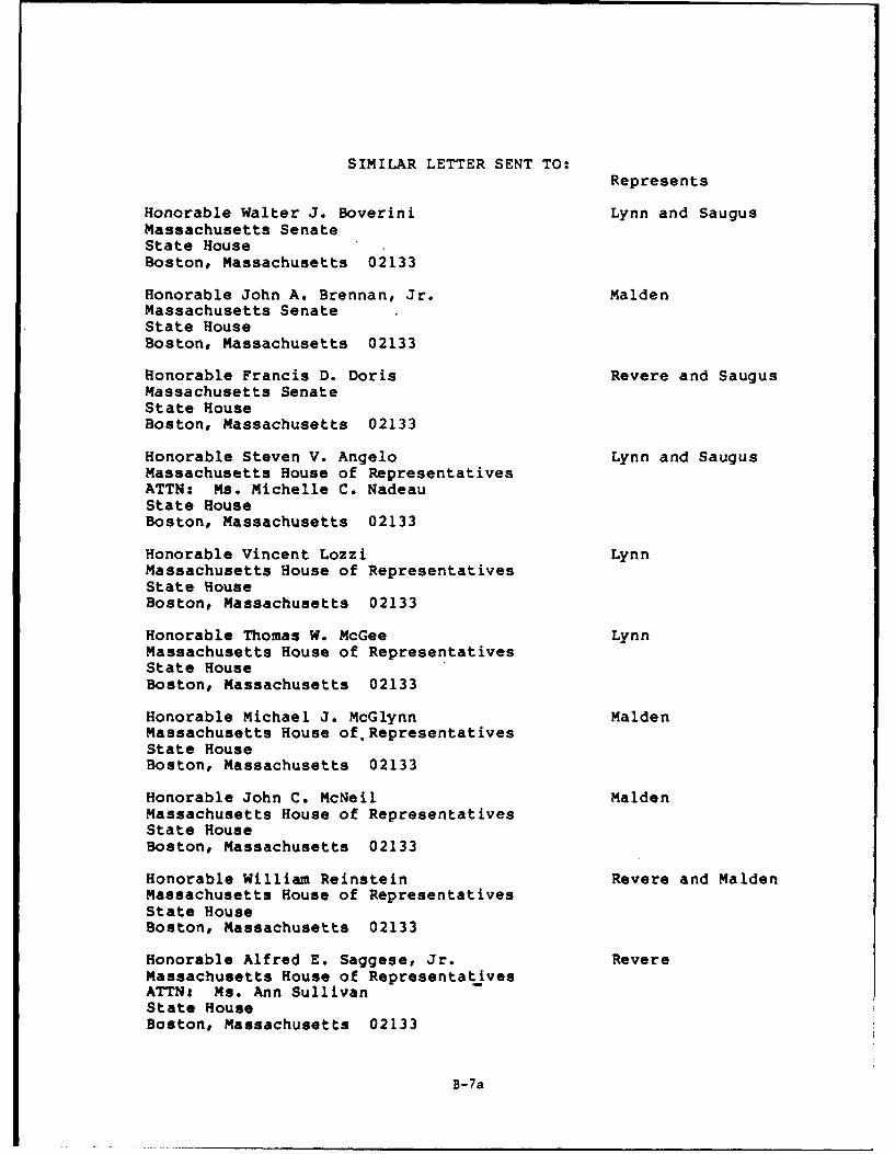
SIMILAR LETTER SENT TO:Represents
Honorable Walter J. Boverini Lynn and SaugusMassachusetts SenateState HouseBoston, Massachusetts 02133
Honorable John A. Brennan, Jr. MaldenMassachusetts SenateState HouseBoston, Massachusetts 02133
Honorable Francis D. Doris Revere and SaugusMassachusetts SenateState HouseBoston, Massachusetts 02133
Honorable Steven V. Angelo Lynn and SaugusMassachusetts House of RepresentativesATTN: Ms. Michelle C. NadeauState HouseBoston, Massachusetts 02133
Honorable Vincent Lozzi LynnMassachusetts House of RepresentativesState HouseBoston, Massachusetts 02133
Honorable Thomas W. McGee LynnMassachusetts House of RepresentativesState HouseBoston, Massachusetts 02133
Honorable Michael J. McGlynn MaldenMassachusetts House of. RepresentativesState HouseBoston, Massachusetts 02133
Honorable John C. McNeil MaldenMassachusetts House of RepresentativesState HouseBoston, Massachusetts 02133
Honorable William Reinstein Revere and MaldenMassachusetts House of RepresentativesState HouseBoston, Massachusetts 02133
Honorable Alfred E. Saggese, Jr. RevereMassachusetts House of RepresentativesATTNt Ms. Ann SullivanState HouseBoston, Massachusetts 02133
B-7a
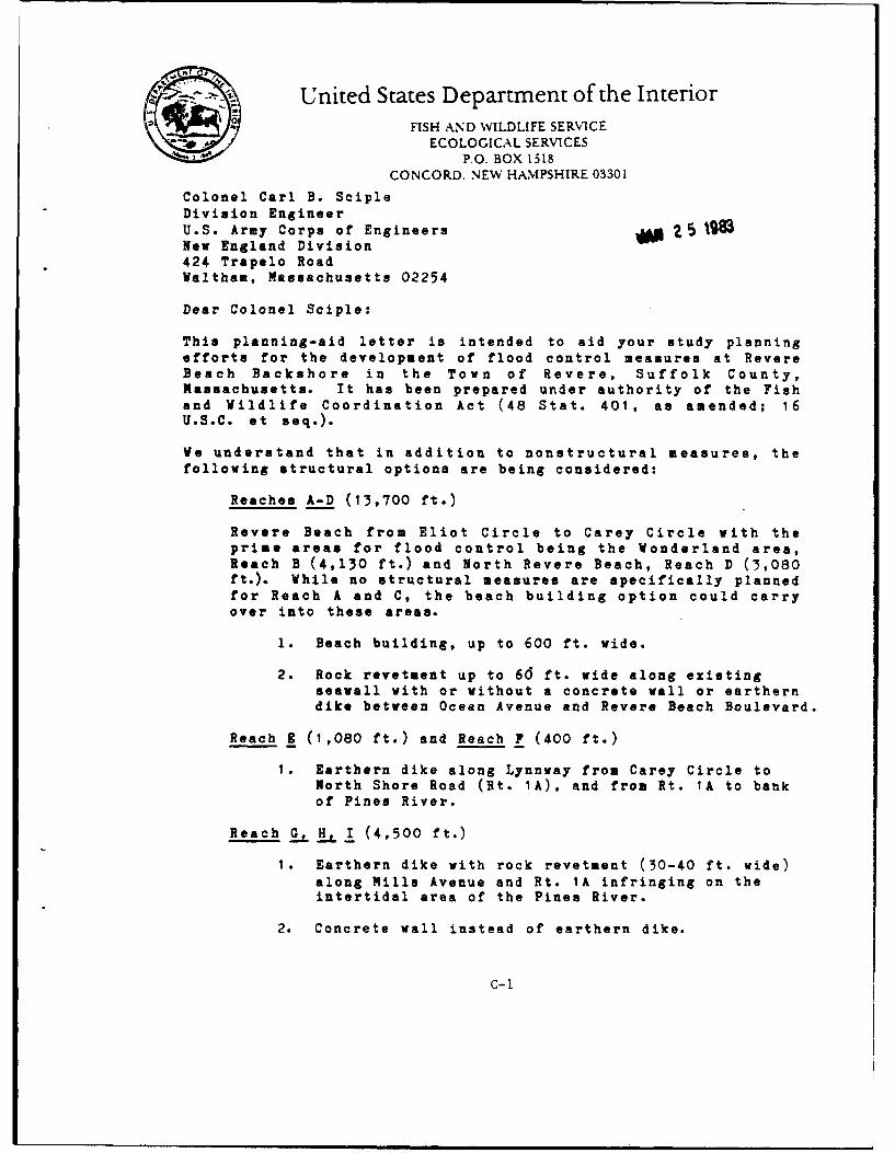
FEDERAL AGENCIES
*United States Department of the InteriorFISH AND WILDLIFE SERVICE
ECOLOGICAL SERVICESP.O. BOX 1518
CONCORD. NEW HAMPSHIRE 03301
Colonel Carl B. ScipleDivision EngineerU.S. Army Corps of Engineers 5 2 INew England Division424 Trapelo RoadWaltham, Massachusetts 02254
Dear Colonel Sciple:
This planning-aid letter is intended to aid your study planningefforts for the development of flood control measures at RevereBeach Backshore in the Town of Revere, Suffolk County,Massachusetts. It has been prepared under authority of the Fishand Wildlife Coordination Act (48 Stat. 401, as amended; 16U.S.C. et seq.).
We understand that in addition to nonstructural measures, the
following structural options are being considered:
Reaches A-D (13,700 ft.)
Revere Beach from Eliot Circle to Carey Circle with theprime areas for flood control being the Wonderland area,Reach B (4,130 ft.) and North Revere Beach, Reach D (3,080ft.). While no structural measures are specifically plannedfor Reach A and C, the beach building option could carryover into these areas.
1. Beach building, up to 600 ft. wide.
2. Rock revetment up to 66 ft. wide along existingseawall with or without a concrete wall or eartherndike between Ocean Avenue and Revere Beach Boulevard.
Reach 1 (1,080 ft.) and Reach F (400 ft.)
1. Earthern dike along Lynnway from Carey Circle toNorth Shore Road (Rt. 1A), and from Rt. 1A to bankof Pines River.
Reach G, H, 1 (4,500 ft.)
1. Earthern dike with rock revetment (30-40 ft. wide)along Mills Avenue and Rt. 1A infringing on theintertidal area of the Pines River.
2. Concrete wall instead of earthern dike.
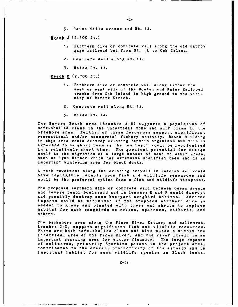
C-1
-2-
3. Raise Mills Avenue and Rt. IA.
Reach J (2,300 ft.)
1. Earthern dike or concrete wall along the old narrowgage railroad bed from Rt. IA to Oak Island.
2. Concrete wall along Rt. IA.
3. Raise Rt. 1A.
Reach K (2,700 ft.)
I. Earthern dike or concrete wall along either thewest or east side of the Boston and Maine Railroadtracks from Oak Island to high ground in the vici-nity of Revere Street.
2. Concrete wall along Rt. IA.
3. Raise Rt. IA.
The Revere Beach area (Reaches A-D) supports a population ofsoft-shelled class in the intertidal zone and surf clams in theoffshore area. Neither of these resources support significantrecreational and/or commercial fishery activity. Beach buildingin this area would destroy existing benthic organisms but this isexpected to be short term as the new beach would be recolonizedin a relatively short time. The greatest potential for damagewould be the migration of a large amount of sand to other areas,such as 'rnn Harbor which has extensive shellfish beds and is animportant wintering area for black ducks.
A rock revetment along the existing seawall in Reaches A-D wouldhave negligible impacts upon fish and wildlife resources andwould be the preferred option trom a fish and wildlife viewpoint.
The proposed earthern dike or concrete wall between Ocean Avenueand Revere Beach Boulevard and in Reaches E and F would disruptand possibly destroy some backyard songbird habitat. Adverseimpacts could be minimized if the proposed earthern dike isseeded to grass and planted with trees and shrubs to replacehabitat for such songbirds as robins, sparrows, catbirds, andothers.
The backshore area along the Pines River Estuary and saltmarsh,Reaches G-K, support significant fish and wildlife resources.There are both soft-shelled clams and blue mussels within theintertidal area of the Pines River, and the river itself is animportant asawning area for winter flounder. The large expanseof saltmarsn, primarily Spartina patens in the project area,contributes to the overall productivity of the estuary and isimportant habitat for such wildlife species as Black ducks,
C-la
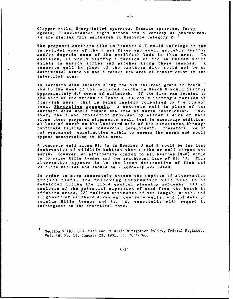
-3-
Clapper rails, Sharp-tailed sparrows, Seaside sparrows, Snowyegrets, Black-crowned night herons and a variety of shorebirds.We are placing this saltmarsh in Resource Category 2.
The proposed earthern dike in Reaches G-I would infringe on theintertidal area of the Pines River and would probably destroyand/or degrade some of the shellfish beds in this area. Inaddition, it would destroy a portion of the saltmarsh whichexists in narrow strips and patches along these reaches. Aconcrete wall in place of the earthern dike would not be asdetrimental since it would reduce the area of construction in theintertidal zone.
An earthern dike located along the old railroad grade in Reach Javd to the west of the railroad tracks in Reach K would destroyapproximately 4.5 acres of saltmarsh. If the dike was located tothe east of the tracks in Reach K, it would destroy a portion ofbrackish marsh that is being rapidly colonized by the commonreed, Phragmites communis. A concrete wall in place of theearthern dike would reduce the area of marsh destruction. How-ever, the flood protection provided by either a dike or wallalong these proposed alignments would tend to encourage addition-al loss of marsh on the landward side of the structures throughcontinued filling and commercial development. Therefore, we donot recommend construction within or across the marsh and wouldoppose construction in this area.
A concrete wall along Rt. IA in Reaches J and K would be far lessdestructive of wildlife habitat than a dike or wall across themarsh. However, an alternative common to all Reaches (G-K) wouldbe to raise Mills Avenue and the southbound lane of Rt. IA. Thisalternative appears to be the least destructive of fish andwildlife habitat and should be rigorously evaluated.
In order to more accurately assess the impacts of alternativeproject plans, the following information will need to bedeveloped during the flood control planning process: (1) ananalysis of the potential migration of sand from the beach tooffshore areas, (2) refined estimates of the length, width, andalignment of earthern dikes and concrete walls, and (3) data onraising Mills Avenue and Rt. 1A, especially with regard toinfringment on the intertidal zone.
Section V (B), U.S. Fish and Wildlife Mitigation Policy, Federal Register,
Vol. 46, No. 15, January 23, 1981, pp. 7644-7663.
C-lb
-4-
We would be pleased to assist you in the various stages ofproject planning, and we will report on the potential impacts ofyour selected plan.
Sincerely yours,
Gordon E. BeckettSupervisor
C-Ic
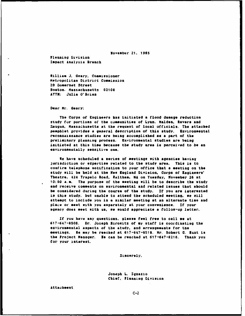
November 21, 1905Planning DivisionImpact analysis Branch
Killiam 1. Geary, CommissionerMer-opolitan District Commission
20 3omerset StreetBoston. Hassachusetts 02108ATTh: Julia O'Brian
Dear Mr. Oeary:
The Corps of Engineers has initiated a flood damage reductionstudy for portions of the communities of Lynn. Malden, Revere andSaugus, Massachusetta at the request of local officials. The attachedpamphlet provides a general description of this study. Environmentalrconnaissance studies are being accomplished as a part of thepreliminary planning process. Environmental studies are beinginitiated at this time because the study area is perceived to be anenvironmentally sensitive one.
Ne have scheduled a eeries of meetings with agencies having3urisdiction or ezpertise related to the study area. This is toconfirm telephone notification to your office that a meeting on thestudy mill be held at the Now England Division, Corps of Engineers'Theatre, 424 Trapelo Road, Waltham, WA on Tuesday, November 26 at10:00 am. The purpose of the meeting will be to describe the studyand receive comments on environmental and related issues that shouldbe considered during the course of the study. If you are iatervstedin this study. but unable to attend the scheduled meeting, we 1llattempt to include you in a similar meeting at an alternate time andplace or meet with you separately at your convenience. If youragency does meet with us, Ke mould appreciate a follow-up letter.
It you have any questions, please feel free to call me at617-647-8508. Dr. Joseph Borowitz of my staff In coordinating theenvironmental aspects of the study, and arrangements for themeetings. Be may be reached at 6W7-647-S51. Mr. Robert 0. Bunt isthe Project Manager. Ne can be reached at 617-647-8216. Thank youfor your interest.
Sincerely,
Joseph L. IgnazioChief, Planning Division
Attachment
C-2
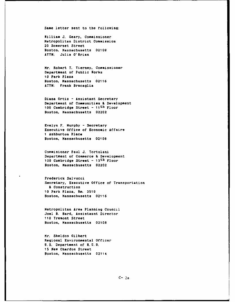
Same letter sent to the following:
William J. Geary, CommissionerMetropolitan District Commission20 Somerset StreetBoston, Massachusetts 02108ATTN: Julia O'Brian
Mr. Robert T. Tierney, CommissionerDepartment of Public Works10 Park PlazaBoston, Massachusetts 02116ATTN: Frank Bracaglia
Diana Ortiz - Assistant SecretaryDepartment of Communities & Development100 Cambridge Street - 1 1 th FloorBoston, Massachusetts 02202
Evelyn F. Murphy - SecretaryExecutive Office of Economic Affairs1 Ashburton PlaceBoston, Massachusetts 02108
Commisioner Paul J. TortolaniDepartment of Commerce & Development100 Cambridge Street - 1 3 th FloorBoston, Massachusetts 02202
Frederick SalvucciSecretary, Executive Office of Transportation& Construction
10 Park Plaza, Rm. 3510Boston, Massachusetts 02116
Metropolitan Area Planning CouncilJoel B. Bard, Assistaznt Director110 Tremont StreetBoston, Massachusetts 02108
Mr. Sheldon GilbertRegional Environmental OfficerU.S. Department of H.U.D.15 New Chardon StreetBoston, Massachusetts 02114
C- 2a
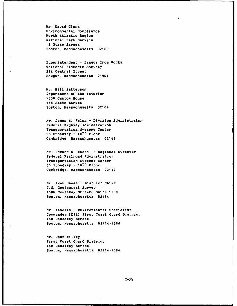
Mr. David ClarkEnvironmental ComplianceNorth Atlantic RegionNational Park Service15 State StreetBoston, Massachusetts 02109
Superintendent - Saugus Iron WorksNational Historic Society
244 Central StreetSaugus, Massachusetts 01906
Mr. Bill PattersonDepartment of the Interior1500 Custom House165 State StreetBoston, Massachusetts 02109
Mr. James A. Walsh - Division Administrator
Federal Highway IdminstrationTransportation Systems Center55 Broadway - l0 th FloorCambridge, Massachusetts 02142
Mr. Edward B. Bassel - Regional DirectorFederal Railroad AdminstrationTransportation Systems Center55 Broadway - loth FloorCambridge, Massachusetts 02142
Hr. Ivan James - District ChiefU.S. Geological Survey1500 Causeway Street, Suite 1309
Boston, Massachusetts 02114
Mr. Kaselis - Environmental SpecialistCommander (DPL) First Coast Guard District150 Causeway StreetBoston, Massachusetts 02114-1396
Mr. John WilleyFirst Coast Guard District150 Causeway StreetBoston, Massachusetts 02114-1396
C-2b
November 27, 1985
Planning DivisionImpact Analysis Branch
Mr. Tom BigfordChief, Habitat Conservation Branch, NUPSState Fish PierGloucester, Massachusetts 01930
Dear Mr. Bigford:
Tbank you for sending 3ue Hello of your staff to meetwitb members of mine on November 15 concerning the flooddamage reduction study for portions of the communities ofLynn, Malden, Revere and Saugus, Massachusetts. Thismeeting, to describe the study, now in preliminaryplanning, and to initiate agency coordination, byrequesting comments on environmental and related issuesthat should be considered during the course of the study,yielded valuable information to us.
We would appreciate receiving a letter from youroffice. as a follow-up to the meeting, with particularemphasis on any concerns your agency has at this time. ifyou have any questions, please real free to call me at FTS834-7508. Dr. Joseph Horowitz of my staff is coordinatingthe environmental aspects of the study. He may be reachedat FT3 839-7516. Mr. Robert Hunt is the Project Manager.He may be reached at 1PU 839-7216. Thank you for yourinterest.
Sincerely,
Joseph L. IgnagioChief, Planning Division
C- 3
Same letter sent to the following:
Mr. Tom BigfordChief, Habitat Conservation Branch, NMFSState Fish PierGloucester, Massachusetts 01930
Ms. Betsy Higgins, Mail Code GRERU.S. Environmental Protection AgencyRegion 1, JFK BuildingBoston, Massachusetts 02203
Mr. Larry Brill, Mail Code WR/WQ/PSChief, Planning and Standards SectionU.S. Environmental Protection AgencyRegion 1, JFK BuildingBoston, Massachusetts 02203
C- 3a
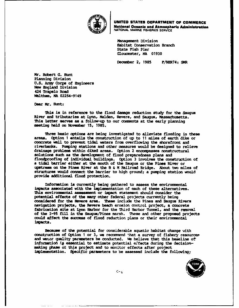
UNITED STATES DEPARTMENT OF COMMERCENational Oceanic and Atmospherio AdministrationNATIONAL MARINE FISHERIES SERVICE
Management DivisionHabitat Conservation BranchState Fish PierGloucester, MA 01930
December 2, 1985 F/NER74: S3R
Mr. Robert G. HuntPlanning DivisionU.S. Army Corps of EngineersNew zngland Division424 Trapelo RoadWaltham, MA 02254-9149
Dear Mr. Hunt:
Tis is in reference to the flood damage reduction study for the SaugusRiver and tributaries at Lynn, Malden, Revere, and Saugus, Massachusetts.This letter serves as a follow-up to our comments at the early planning
eting held on November 15, 1985.
Three basic options are being investigated to alleviate flooding in theseareas. Option 1 entails the construction of up to 11 miles of earth dike orconcrete wall to prevent tidal waters from overflowing the shorefront andriverbanks. Paiping stations and other measures would be designed to relievedrainage problems within diked areas. Option 2 encompasses nonstructuralsolutions such as the development of flood preparedness plans andfloodproofing of individual buildings. Option 3 involves the construction ofa tidal barrier either at the mouth of the Saugus or the Pines River orutr on the Pines River at the B & M Railroad Bridge. About two miles ofstructures would connect the barrier to high ground; a pumping station wouldprovide additional flood protection.
Informtion is currently being gathered to assess the environmentalimpacts associated with the implementation of each of these alternatives.'Tis enviromtntal assessment or impact statement should consider thepotential effects of the many other federal projects currently beingconsidered for the Revere area. These include the Pines and Saugus Riversnavigation projects, the Revere beach erosion control project, a concretefabrication site at Lynn Harbor for the Third Harbor Tunnel, and the removalof the 1-95 fill in the Saugus/Pines marsh. These and other proposed projectscould affect the success of flood reduction plans or their environmentalJMpacts.
Because of the potential for considerable aquatic habitat change withoongtruction of Option 1 or 3, we recomend that a survey of fishery resourcepand wator quality parameters be conducted. We believe that this baweline of,
informatioa 4 essential to estimate potential effects during the decision-making phase ot this project and to monitor effects after projectimplementation. Specific parameters to be assessed include the following;
C-4
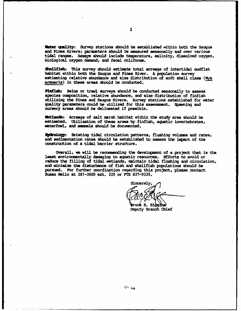
2
Water qmality: Survey stations should be established within both the Saugusand Pines Rivers; parameters should be measured seasonally and over varioustidal ranges. Assays should include temperature, salinity, dissolved oxygen,biological oxygen demand, and fecal coliform.
Shelifih: This survey should estlmate total acreage of intertidal mudflathabitat within both the Saugus and Pines River. A population surveyestimating relative abundance and size distribution of soft shell clam (Marenaria) in these areas should be conducted.
PifJtsb: Seine or trawl surveys should be conducted seasonally to assessspecies composition, relative abundance, and size distribution of finfishutilizing the Pines and Saugus Rivers. Survey stations established for waterquality parameters could be utilized for this assesmnt. Spawning andnursery areas should be delineated if possible.
brtauds: Acreage of salt marsh habitat within the study area should beestimated. Utilization of these areas by finfish, aquatic invertebrates,waterfowl, and mmmls should be documented.
Nldrologj. Existing tidal circulation patterns, flushing volumes and rates,and sedimentation rates should be established to assess the lipact of theconstruction of a tidal barrier structure.
Overall, we will be recoemending the development of a project that is theleast environmentally damaging to aquatic resources. Efforts to avoid orreduce the filling of tidal wetlands, maintain tidal flushing and circulation,and minimize the disturbance of fish and shellfish populations should bepursued. For further coordination regarding this project, please contactSusan Mello at 281-3600 ext. 335 or FTS 837-9335.
Deputy Branch Chief
C- 4a

U. S. DEPARTMENT OF TRANSPORTATION
FEOERAL HIGHWAY ADMINISTRATION
REGION ONE
55 Broadway - 10th FloorCambridge, Massachusetts 02142
1N IMPLY RI[FIN TO:
HA-MA
December 3, 1985
Mr. Joseph IgnazioChief, Planning DivisionDepartment of the ArmyNew England Division, Corps of Engineers424 Trapelo RoadWaltham, Massachusetts 02254-9149
Dear Mr. Ignazio:
Thank you for your letter of November 21, 1985 concerning a flood damagestudy in Lynn-Saugus-Revere. We are sorry we were unable to attend theNovember 26, 1985 meeting in Waltham, however, we do have some informationthat you should consider during the course of your study.
The Massachusetts Department of Public Works prepared and distributed adraft EIS for a proposed Revere Beach Connector a few years ago. I believeyour office may have reviewed and commented on that document. Inasmuch aswe are not certain as to the DPW's current plans for that Connector, wesuggest that they be contacted in that regard.
Also, the DPW has plans for disposing of the "1-95 FILL" and you may alsowish to inquire about those plans. You can contact the DPW by writing toChief Engineer Robert .J. McDonagh, Massachusetts Department of Public Works,10 Park Plaza, Boston, MA 02116.
Sincerely yours,
James A. WalshDivi ion Administrator
By: C. L. Dunkley, Jr.District Engineer
C-5
United S .tes Department of the In riorNATIONAL PARK SERVICE
SAUGUS IRON WORKSIN 2SPLV =mu TO: NATIONAL HISTORIC SITE
244 Centml StreetSauus, Massachusue 01906
December 10, 1985
Mr. Joseph L. Ignazio, Chief, Planning DivisionDepartment of the ArmyNew England Division, Corps. of Engineers424 Trapelo RoadWaltham, Mass. 02254-9149
Dear Mr. Ignazio:
I regret not being able to attend your November 26 meeting regardingflood control of the Saugus River. Since the Saugus River bisectsthe Saugus Iron Works National Historic Site within its tidal zone,any substantial actions affecting the River also have a potentialdirect bearing on the park.
In addition to your proposal, there is a project to dredge the mouthof the river for the benefit of commercial fishing interests.Several studies also are being condUeted by various groups, suchas a salinity study for RESCO and the potential for reintroducingtrout for sportfishing.
Not only are these activities being waged independently, somemight be in direct conflict with others.
In any event, I would welcome the opportunity to meet with you and/or your staff during these early planning stages. If convenient,I would like to invite you to Saugus so we can also incorporate avisit to river sites if needed.
Please let me know if this is feasible. My phone number is 233-0050and address is on the letterhead.
Si rely,
Jim C. Gott
Superintendent
CC: Dave'iark, NAR
c -f
United States Department of the InteriorFISH AND WILDLIFE SERVICE
ECOLOGICAL SERVICES9 P.O. BOX 1518
CONCORD, NEW HAMPSHIRE 03301
Mr. Joseph Ignazio, ChiefPlanning DivisionU.S. Army Corps of Engineers424 Trapelo RoadWaltham, Massachusetts 02254
Dear Mr. Ignazio:
This is in response to Mr. Hunt's request that we identify questions, concernsand study needs associated with your flood control study In Revere, Lynn,Malden and Saugus, Massachusetts.
We have identified a partial listing of questions, concerns and study needswith respect to a tidal barrier dam being located on the Saugus River near theGeneral Edwards Bridge. As your study progresses and we learn more about thevarious plans, we will probably identify additional concerns and drop orrefine existing ones.
If you have not already done so, we suggest that you obtain maps, charts,drawings and other historical documents to identify the extent (acreage) ofthe original and existing wetlands and floodplains by cover type, if possible,in the study area. This data would be useful for contrasting the originalundeveloped wetland-floodplain with the existing condition and to determinewhich cover types have been most extensively impacted. It would be useful ifthis cover type information could be displayed for the 10, 50, 100,500 yearand standard project flood boundaries. If possible, specific ownership andboundaries should be determined for lands within the study area.
Since the tidal barrier would effectively establish the Revere-Saugus marsh asa freshwater interior storage area during storm events, detailed informationwill be necessary to establish baseline (existing) water quality conditionsduring the various tidal phases on a seasonal or monthly basis for allsegments of the study area. Study parameters should include salinity,dissolved oxygen, temperature, pH, currents, mixing patterns and coliformbacteria. Data on the biological resources of the estuary should include thetemporal and spatial distribution of the major life stages of finfish, birds,mammals, reptiles and amphibians. Similar data would be necessary for theecologically or commercially important invertebrate resources includingshellfish and perhaps the dominant phyto- and zooplankton communities sincethey may be susceptible to salinity and other water quality parameters. Itmay be necessary to develop salinity tolerance (acute and chronic) data forvarious life stages of aquatic and wetland species utilizing the estuary, ifit is not currently available. We have not attempted to identify samplingfrequency, study duration, sampling points, species or other detailed aspectsof any study progam. These details would need to be refined as the studyprogresses.
C-7
-2-
If a precondition for the project is that absolutely no change in the existinghydrologic regime within the estuary would be allowed during non-flood events,could a barrier dam be designed and operated within this constraint? Whatphysical changes would be required in the river/estuary to guarantee theseoperating constraints? If these constraints cannot be met, what hydrologicchanges would likely occur during normal tide stages? What agency would beresponsible for operating and maintaining the barrier? How much and what typeof land acquisition would be contemplated for the 10, 50, 100, 500 andstandard project flood boundaries? What are the potential scenarios forproject operation? Could the project ever be operated in such a manner thatthe storage area could be converted into a non-tidal or in the worst case, afreshwater system?
If the project was constructed, how many acres of flood prone land would beavailable for development or for conversion to more intense development.Would the existing 10, 50, 100, or 500 year floodplain boundaries be changedas a result of the project?
If you should have any ques - -! concerning the issues identified in thisletter, please feel free to Lontact Mr. Vern Lang of this office at FTS 834-4797.
Sincerely yours,
Gordon E. BeckettSupervisorNew England Area
C- 7a
UNITED STATES ENVIRONMENTAL PROTECTION AGENCYAEG"O I
J. F. KENNEDY FEDERAL 4UADING. BOSTON MASUC T MW
June 17, 1986
Joseph Ignazio, ChiefPlanning DivisionNew England DivisionU.S. Army Corps of Engineers424 Trapelo RoadWaltham, MA 02254-9149
Dear Mr. Ignazio:
Thank you for the opportunity to comment on the Corps' proposed*Flood Damage Reduction Study - Saugus River and Tributaries,"located in the communities of Lynn, Malden, Revere, and Saugus inEssex, Middlesex, and Suffolk Counties, Massachusetts.
As you are aware, EPA has participated in several interagency meet-ings for the proposed project including the November 15, 1985, andJanuary 8, 1986, meetings at the Corps. Based on these meetings weunderstand that three basic options or combination of options forflood damage reduction are being studied. Option one, StructuralLocal Protection Plans, would seperately protect the Revere BeachBackshore, Northgate, Town Line Brook, East Saugus, and Lynn withapproximately 12.5 miles of earthen dikes or concrete walls toprevent coastal waters from flowing over the shorefront and river-banks. Pumping stations and other measures would be required withoption one to relieve drainage problems within areas protected bythe structures. Option two, Nonstructural Plans, would reduceflood damage through flood preparedness plans and floodproofing ofbuildings. It is initially believed that 10% of the structures inthe floodplain could be protected by raising buildings, providingwater tight enclosures for utilities, sealing windows and doorswith waterproof closures and other measures. Option three, Compre-hensive Plan, would include a floodgate structure at the mouth ofeither the Saugus or Pines River (or alternate alignment) and twomiles of structure to link the floodgate structure to high ground.A pump station would also be included in option three for additionalprotection. The Saugus and Pines Rivers estuaries would be preservedas natural storage areas for interior runoff. It is believed thatoption three would protect up to 4,500 homes and businesses in allsix flood-prone areas.
We believe from a Section 404 and overall environmental perspective,option three with a floodgate structure near the General EdwardsBridge is the most promising action. Minimal wetland loss and maximumflood protection appear to be achievable while maintaining existinghydrological conditions, vegetation, fisheries, wildlife, and current
C-8
-2-
uses. Identifying the 100 year and 500 year floodplain elevationsand requiring the purchase or easement acquisition oi the Lioodwayfor flood retention could in the long term be an important measurein educating the public and local governments to the resource valupsof the Saugus and Pines River estuaries, and the need to protectthe estuaries from development, unregulated fill, and dumpingactivities. We support the continued study of no :ition, optionone and option two for comparative alternative and environmentalanalyses under Section 404 and NEPA, but believe these alternativescould result in lower flood protection and higher environmentalcosts.
EPA's main concern with the proposed project is the protection ofthe existing saltmarsh estuary. As you know, the Pines RiverWatershed and the Saugus River Watershed, including adjacent wetlandsand direct tributary systems, are included as a priority waterbody/wetland in "EPA's Priority Wetland Listing for New England.3 Thisdesignation as a priority waterbody/wetland is due to the highresource values (extensive mudflats and saltmarsh; anadromous fish;large population of softshell clams, and other shellfish; and,winter flounder and smelt spawning grounds) threatened by furtherindustrial development in an already stressed ecosystem, creationof federal navigation channels, and expansion of marine facilities.Such identification makes the Saugus River and Pines River wetlandseligible for advanced identification under Part 230.80 of "EPA'sGuidelines for specification of Disposal for Dredged or Fill Material"(40 CFR Part 230, also known as 404 (b)(1) Guidelines] and/oreligible for predesignation under Section 404(c).
The Massachusetts Coastal Zone Management Plan recommends, "thatthe Saugus/Pines River Marsh be the highest priority for restrictionunder the state's Wetlands Restriction Programs." Unfortunately,the Massachusetts Coastal Zone Management Plan and the MassachusettsWetland Protection Act, even in combination with federal wetland andflood protection regulations, have not been highly effective inprotecting the resources of the Saugus and Pines River estuaries.In addition to unregulated fill activities and encroaching develop-ment adversely affecting the marsh area, a number of federal andfederally assisted projects have been proposed that would affectthe marsh. These projects include: the Revere Beach ConnectorProject; the North Shore Transit Improvements Project, (MBTA BlueLine Extension, Pine Station Commuter Parking, MBTA WonderlandStation and Parking Garage); Interstate Highway 95; the RevereBeach Erosion Project; the Pines River and Saugus River NavigationChannel Projects; and the possible location of the fabrication sitefor the Third Harbor Project.
We believe the final flood damage reduction plan should have theleast environmental damage and protect the saltmarsh estuaries.Therefore, we recommend that the Corps development plan and envi-ronmental evaluation concentrate on measures to avoid or reducefilling of wetlands; maintain current drainage patterns, includingtidal flushing and circulation; minimize changes in environmentalparameters (i.e., turbidity, salinity, water temperature, dissolved
C-8a
-3-
oxygen, pH, detritis distribution, organic/nutrient cycling, andtidal inundation); and prohibit additional development of thefloodplain.
We look forward to working with you in development of the flooddamage reduction plan for the Saugus River and tributaries. Forfurther coordination regarding this project please contact DonaldCooke of my staff at 617/223-1739.
Sincerely,
Elizabeth A. HiggY, Assistant Directorfor Environmental Review
Office of Governmental Relations andEnvironmental Review (RGR-2203)
cc: Robert Hunt, COEJoseph Horowitz, COEVern Lang, US FWSSusan Mello, NMFSRobert Sonnichsen, FEMARichard Delaney, Director, MA CZMSam Mygatt, MEPAEdward Reiner, EPA (WQP-2103)
C-8b
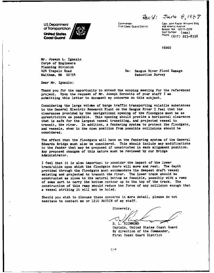
us.Depar Commander Caot John Foster Williams Bldg
First Coast Guard District 408 Atlantic Avenuef Trursporu Boston. MA 02210-2209T h uStall Symbol (Coan)Phone (617) 223-8338
16000
Mr. Joseph L. IgnazioCorps of EngineersPlanning Division424 Trapelo Road Re: Saugus River Flood DamageWaltham, MA 02154 Reduction Survey
Dear Mr. Ignazio:
Thank you for the opportunity to attend the scoping meeting for the referencedproject. Upon the request of Mr. Joseph Horowitz of your staff I amsubmitting this letter to document my concerns on this subject.
Considering the large volume of barge traffic transporting volatile substancesto the General Electric Research Plant on the Saugus River I feel that theclearances provided by the navigational opening of the floodgate must be asunrestrictive as possible. This opening should provide a horizontal clearancethat is safe for the largest vessel transiting, and projected vessel totransit, the river. In addition, a tendering system to protect the floodgate,
and vessels, when in the open position from possible collisions should beconsidered.
The effect that the floodgate will have on the fendering system of the General
Edwards Bridge must also be considered. This should include any modificationsto the fender that may be proposed if constructed in each alignment position.Any proposed changes of this nature must be reviewed by our BridgeAdministrator.
I feel that it is also importani, to consider the impact of the lower
track/slide upon which the floodgate doors will move and rest. The depth
provided through the floodgate must accommodate the deepest draft vessel
existing and projected to transit the river. The lower track should be
constructed as close to the natural bottom as feasible, possibly with a ramp
of some sort to carry the bottom contour up to the top of the track. The
construction of this ramp should reduce the force of any collision enough that
a vessel striking it will not be holed.
Should you wish to discuss these concerns in more detail, please do not
hesitate to contact me or LTJG HAYDIN of my staff.
Sincerely,
S. IL. RICHMONDCaptain, United States Coast GuardBy direction of the Commander,First Coast Guard District
C-9
June 18, 1987
Planning DivisionImpact Analysis Branch
Ms. Elizabeth HigginsAssistant Director for Environmental ReviewEPA - Region 1, RGR-2203JFK BuildingBoston, Massachusetts 02203
Dear Ms. Higgins:
The New England Division (NED), Corps of Engineerswishes to formally request your participation as aCooperating Agency under NEPA in the development of theEnvironmental Impact Statement for the Flood DamageReduction Study, Saugus River and Tributaries, MA. Iappreciate the involvement of your staff in this study todate.
Please notify me, in writing, of your response to thisrequest at your earliest convenience.
If you have any questions, please call me at FTS839-7508, or Joe Horowitz. my Environmental Manager for thestudy, at FTS 839-7518.
Sincerely,
Joseph L. IgnazioChief, Planning Division
SAME LETTER SENT TO:
Mr. Tom Bigford, Chief
Habitat Conservation BranchNational Marine Fisheries Service
2 State Fish Pier
Gloucester, MA 01930
Mr. Gordon Beckett, SupervisorFish & Wildlife Service - Ecological Services22 Bridge St., Ralph Pill Building, 4 th FloorConcord, NH 03301
C-1O
DEPARTMENT OF THE ARMYNEW ENGLAND DIVISION. CORPS OF ENGINEERS
424 TRAPELO ROAD
WALTHAM MASSACHUSETTS 02254.9149
..... April 28, 1987
Planning DivisionNEDPL-I
DirectorOffice of Federal RegisterNational Archives Records AdministrationWashington, D.C. 20408
Dear Sir:
Enclosed please find three signed copies of the Notice ofIntent for the preparation of a Draft Environmental ImpactStatement for the Flood Damage Reduction Study, Saugus River andTributaries - Lynn, Malden, Revere and Saugus, Massachusetts.
If you have any questions, please call me at FTS 839-7508 or617-647-8508, or Mr. Robert G. Hunt, the Project Manager, at FTS839-7216 or 617-647-8216.
Sincerely,
Chi, Plannir.i's
Copy Furnished:Ms. Elizabeth HigginsAsst. Dir. for Environ. ReviewEPA, Region I, RGR-2203JFK BuildingBoston, Massachusetts 02203
C-I
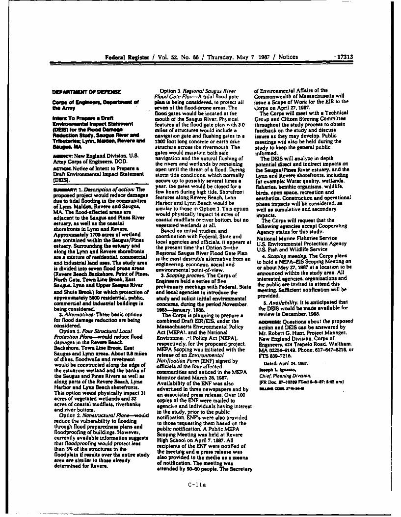
Federal Reister / Vol. 52. No. 88 / Thursday. May 7. 1987 / Notices •17313
DEPARTMENT OF DEES Option 3. Regional Saugus River of Environmental Affairs of theFlood Gate Plan-A tidal flood sate Commonwealth of Massachusetts will
O f Ary plan is being cosidered. to protect all issue a Scope of Work for the MR to theUhe Arny seven of the flood-prone areas. The Corps on April 27.1987.
flood Sates would be located at the The Corps will meet with a TechnicalIntent To Ppa a Draft mouth of the Saugus River. Physical Group and Citizen Steering CommitteeEnvlrenwental a pect Statememnt features of the flood gate plan with 3.0 throughout the study process to obtain(DIS) foe Uhe Flood Denuisa miles of structures would include a feedback on the study and discussReduction Study, SKA Rim and navigation gate and flushing gates in a issues as they may develop. PublicTMrta Lynn, Maieon, Revere 01d 2300 foot long concrete or earth dike meetings will also be held during theSagUS, MA structure across the rivermouth. The study to keep the general publicAUI=. Now England Division. U.S gates would maintain both safe informed.Army Corps of Enginde D D. navigation and the natural flushing of The DEIS will analyze in depthAMy Cops of nintrer e D . the rivers and wetlands by remaining potential direct and indirect impacts on
Notice of Intent to Prepare a open until the threat of a flood. During the Saugus/Pines River estuary, and theDraft Envirounental Impact Statement storm tide conditions, which normally Lynn and Revere shorefronts, including(DEIS). occurs up to possibly several times a for example: Water quality, wetlands,
year. the gates would be closed for a fisheries. benthic organisms, wildlife.eropose1. Description of action" The few hours during high tide. Shorefront birds, open space. recreation andproposed project would reduce daaes features along Revere Beach. Lynn aesthetics. Construction and operationaldue to tidal floodin. in the communities Harbor and Lynn Beach would be phase impacts will be considered, asof Lynn. M an. Revere and Samugu similar to those in Option I. This option well as cumulative and secondaryMA. The flooS-afgected ares are would physically impact 14 acres of impacts.adjacent to the Saugu5 and Pines Rive coastal mudflats or river bottom, but no The Corps will request that thestury, as well as the coatal vegetated wetlands at all. following agencies accept Cooperatingshoreoonts in Lynn and Revere. Based on initial studies, and Agency status for this study:Approxtitely 1700 ait es of 'wetland coordination with Federal. State and National Marine Fisheries Serviceare contained within the SuguS/Pns local agencies and officials, it appears at U.S. Environmental Protection Agencyestuary. Surrounding the estuary 8nd the present time that Option 3-the U.S. Fish and Wildlife Servicealong the Lynn and Revere shorerotis Regional Sugus River Flood Gate Planare a mixture of residentiaL om eicial is the most desirable alternative from an 4. Scoping meeting. The Corps plansand industrial land uses. The study are engineering, economic, social and to hold a NEPA-EIS Scoping Meeting onis divided into seven flood prone areas environmental point-of-view, or about May 27. 1987 at a location to be(Revere Beach Backshor. Point of Pines. 3. Scoping process: The Corps of announced within the study area. AllNorth Gate. Town Line Brook. East Engineers held a series of five interested agencies. organizations andSaups. Lynn md Upper Soups River preliminary meetings with Federal. State the public are invited to attend thisand Shute Brook) for which prmection of and local agencies to introduce the meeting. Sufficient notification wil! beapproximately S00 residential, public, - study and solicit initial environmental provided.commercial and Industrial buildings is concerns, during the period November. 5. Availability. it is anticipated thatbeing considered. 1985-January. 196e. the DEIS would be made available for
2. Alternatives: Three basic options The Corps is planning to prepare a review in December. 1988.for flood damage reduction are being combined Draft EIR/ES. under the Aomta: Questions about the proposedconsidered. Massachusetts Environmental Policy action and DEIS can be answered by
Option 1. Four Structurl Local Act (MEPAI, and the National Mr. Robert G. Hunt. Project Manager.Protection Plans-would reduce flood Environmei .-I Policy Act (NEPA). New England Division. Corps ofdamages in the Revne Beach respectively, for the proposed project. Engineers. 424 Trapelo Road. Waltham.Backshore. Town Line Brook. East MEPA Scoping was initiated with the MA 02254-9149. Phone: 617-647-216 orSaugus and Lynn areas. About 9.8 miles release of an Environmental FTS 839-7216.of dikes. floodwalls and revetmnt Notification Form (ENF) signed by Dated: April 24. 1967.would be constructed along the edge of officials of the four affectedthe estuarine wetland and the banks of comminunities and noticed in the MEPA oleph L Ipgazio,the Saugus and Pines Rivers as well as Monitor dated March 26, 1987. Chief. Planning Division.along parts of the Revere Beach. Lynn Availability of the ENF was also IFR DoC. 87-I3 Filed ,-6-4: 8:45 arn]Harbor and Lynn Beach shorefronts. advertised in three newspapers and by in.Ls Coca ifN.UThis option would physically impact 31 an associated press release. Over 100acres of vegetated wetlands and 32 copies of the ENF were mailed toacres of coastal mudflats. riverbanks agencies and individuals having interestand river bottom, in the study, prior to the public
Option 2. Nonstructurol Plan#-woud notification. ENFs were also providedreduce the vulnerability to flooding to those requesting them based on thethrough flood preparedness plans and public notification. A Public MEPAfloodproofing of buildings. However. Scoping Meeting was held at Reverecurrently available information suggests High School on April 7. 1987. Allthat floodproof would protect less recipients of the ENF were notified ofthan f testutues i the ntir the meeting and a press release wasfloodplain if results over the entire study also provided to the media as a meansarea ar similar to those already of notification. The meeting was
attended by 50-W0 people. The Secretary
C-lla
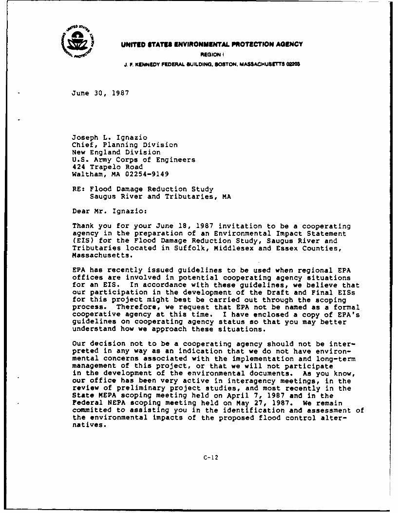
(b ~UNITED STATES ENVIRONMENTAL PROTECTION AGENCY(4i REGION I
J. F. KENNEDY FEDERAL BUILDING. BOSTON. MASSACHUSETTS 00r
June 30, 1987
Joseph L. IgnazioChief, Planning DivisionNew England DivisionU.S. Army Corps of Engineers424 Trapelo RoadWaltham, MA 02254-9149
RE: Flood Damage Reduction Study
Saugus River and Tributaries, MA
Dear Mr. Ignazio:
Thank you for your June 18, 1987 invitation to be a cooperatingagency in the preparation of an Environmental Impact Statement(EIS) for the Flood Damage Reduction Study, Saugus River andTributaries located in Suffolk, Middlesex and Essex Counties,Massachusetts.
EPA has recently issued guidelines to be used when regional EPAoffices are involved in potential cooperating agency situationsfor an EIS. In accordance with these guidelines, we believe thatour participation in the development of the Draft and Final EISsfor this project might best be carried out through the scopingprocess. Therefore, we request that EPA not be named as a formalcooperative agency at this time. I have enclosed a copy of EPA'sguidelines on cooperating agency status so that you may betterunderstand how we approach these situations.
Our decision not to be a cooperating agency should not be inter-preted in any way as an indication that we do not have environ-mental concerns associated with the implementation and long-termmanagement of this project, or that we will not participatein the development of the environmental documents. As you know,our office has been very active in interagency meetings, in thereview of preliminary project studies, and most recently in theState MEPA scoping meeting held on April 7, 1987 and in theFederal NEPA scoping meeting held on May 27, 1987. We remaincommitted to assisting you in the identification and assessment ofthe environmental impacts of the proposed flood control alter-natives.
C-12
-2-
We look forward to continue working with you in development ofthe flood damage reduction plan for the Saugus River and tribu-taries. For further coordination regarding this project pleasecontact Donald Cooke of my staff at 617/565-3426 (FTS 839-3426).
Sincerely yours,
Elizabeth Higgtrs Congram7 Assistant Directorfor Environmental Review
Office of Government Relations andEnvironmental Review
Enclosure
cc: Joseph Horowitz, COERobert Hunt, COEVernon Lang, USFWSSusan Mello, NMFSRobert Sonnichsen, FEMA
C-12a
* UNITED STATES DEPARTMENT OF COMMENCENational Oonio and Atmophoe AdministmuelonNATIONAL MARINE FISHERIES SERVICE
Habitat Conservation BranchWater StreetWoods Hole, MA 02543
July 2, 1987 F/NER741:SM
Mr. Joseph L. IgnazioChief, Planning DivisionNew England DivisionU.S. Army Corps of Engineers424 Trapelo RoadWaltham, MA 02254-9149
Dear Mr. Ignazio:
This is in reference to the scoping process for the Flood DamageReduction Study for Lynn, Malden, Revere, and Saugus,Massachusetts. This letter serves as a follow-up to our letterof December 2, 1985 that outlined specific areas for studyrelative to this project.
The Saugus/Pines River Estuary supports populations of valuablefishery resources such as winter flounder (Pseudooleuronectesa1l), alewife (Alosa Dseudoharenaus), smelt (Osmerusmordax), American eel (n rostrata) and soft shell clam(M = arnara). The estuary provides spawning, nursery, andfeeding habitat for these and other aquatic species, and isbordered by extensive salt marsh wetlands and intertidalmudflats. Any structural method of reducing flood damage mustprovide for the maintenance of these aquatic populations andhabitats.
The Corps has begun extensive hydrological, geological, andbiological surveys to assess existing conditions within theSaugus River Estuary and to predict the likely environmentaleffects from project implementation. Preliminary investigationsby the Corps have indicated that the Saugus River floodgateoption is preferable when considering the flood reductioneffectiveness, public preference, economic feasibility, andenvironmental impacts of the three alternative plans. However,this option still proposes substantial aquatic habitatmodifications, and could adversely affect resident aquaticpopulations by altering water quality parameters, circulationpatterns, and currents, by creating a physical barrier to fishspawning grounds, or through direct habitat loss.
Based on the preliminary plans, the floodgate structure wouldreduce the channel opening from about 1000 feet to about 100feet, and create a complete barrier up to about 5 feet above theriver bottom. It is important that the effects of this structurebe accurately predicted early in the development of project plansso that the structure can be designed to avoid and/or mitigateadverse effects to aquatic resources.
C-13
Increased current velocity at the gate structure could impedemigrating fish. Predicted increases in velocity over theexisting conditions should be related to the swimming abilitiesof migratory fish species, such as winter flounder, alewife, andblueback herring, to determine if the post-project currentvelocity would be within an acceptable range for all life stagesof these species. Similarly, changes in salinity or temperatureregime could affect spawning time, hatching success, and larvalmortality. Changes in circulation patterns within the estuarycould cause fish and shellfish larvae to be swept away fromnursery areas or settling sites and cause increased mortality.We should assume that resident populations have developedeffective spawning strategies that are attuned to ambientconditions, and that significant deviations could adverselyaffect reproductive success.
An assessment of the ability of migrating fish to pass over theproposed vertical barrier at the gate structure should also beconducted. Although it is likely that this structure will notimpede pelagic species, such as alewife and blueback herring,demersal species, such as the winter flounder, may be obstructed.To address this issue it may be necessary to conduct anexperiment to assess winter flounder's ability to maneuver oververtical barriers. It may be more practical to redesign the tidegate structure with a complete opening, or to create some type ofgradual incline leading up to the barrier.
We appreciate the opportunity to comment on this project in thisearly development phase. For further coordination, pleasecontact Susan Mello at FTS 840-1323.
Sincerely,
Thomas E. BigfordBranch Chief
cc: Vern Lang, FWS - Concord, NHEd Reiner, EPA - WQP, BostonDon Cooke, EPA - RGR, BostonJim O'Connell, MACZMLeigh Bridges, MADMFJoe Horowitz, COEMike Ludwig
C-13a
Federal Emergency Management AgencyRegion I J.W. McCormack Post Office and Coit House
Boston, Massachusetts 02109
| a 2 w67Mr. Joseph L. IgnazioChief, Planning OfficerArmy Corps of Engineers424 Trapelo RoadWaltham, M 02254-9149
Dear Mr. Ignazio:
We appreciate the irwitation extended to this office to attend the EnvironmentalImpact Statement (EIS) Scoping Meeting on May 27, 1987 in Saugus, Massachusettsfor the Corps of Engineers Saugus River and Tri itaries, Flood Damage ReductionStudy.
We have examined both the Project Information Report 3nd the Draft (EIS) Outlineand agree that Option #3 the Regional Saugus River Floodgate Plan would representthe most beneficial solution for tidal flooding protection in this area.
The Draft (EIS) Outline does indicate that hydrologi-al im-pacts of this proposalwill be examined. This office would be particularly concerned about thepotential impacts this proposed floodgate barrier wald have on both coastaland riverine flood levels as presently established in the completed FEMA FloodInsurance Studies for the four communities effected of Lynn, Malden, Revere andSaugus. The revised levels and flood mapping should be made available to FEMA.
Finally, we recommend that warning and evacuaticn plans be developed to theextent necessary with Option #3 if some struct s remain unprotected by theconstruction of the flood gate.
If this agency can provide any further assistance in the development of theEIS for this important flood control project, please contact Paul white orKevin Merli of this office at (617) 223-9561.
Sincerely,
Edward A. Thomas, ChiefNatural & Technological Hazards Division
C-14
SUnited States Department of the Interior
FISH AND WILDLIFE SERVICE400 RALPH PILL MARKETPLACE
22 BRIDGE STREETCONCORD, NEW HAMPSHIRE 03301-4901
Mr. Joseph Ignazio, chief N" 9 198Planning DivisionU.S. A=y Corps of Engineers424 Trapelo RoadWaltham, Massac 02254
Dear Mr. Ignazio:
This Planning Aid Letter is written to assist the Planning Division of theCorps in identifying the environmental issues regarding the proposed floodcontrol project for the Saugus River and tributaries. It has been preparedunder the authority of the Fish and Wildlife Coordination Act (48 Stat. 401,as amended; 16 U.S.C. 661, et seq.)
In October 1985, the Southeastern New EIgland (SD ) study formally identifiedcoastal flooding in the Saugus River as one matter requiring additionalinvestigation. Approximately 5,000 residential and commercial buildingswithin the -munities of Lynn, Saugus, Revere and Malden have historicallyexperienced tidal flooding during major storms. Largely as a result of the"Blizzard of February 19780, the Corps of Engineers began a study to determinehow to reduce flood damages in the four cmmunities.
Three potential solutions or options have emerged for reducing flood damages.Opticn 1 involves four structural local protection plans (LPP). This ccsistsof con ructing earthen dikes and concrete walls at Revere Beach Badcskoe,Lynn, East Saugus and Town Line Brook. All LPP's would protect each area froma severe coastal storm. Option II is a nonstructural plan which involves suchmeasures as flood insurance, floodproofing buildings, flood warning, andevacuation. Option III, the Corps' preferred alternative, consists ofconstructing a floodgate at the mouth of the Saugus River near the GeneralEdwards Bridge. This would reduce flooding of the 1,800 acres (elevation 8feet N.G.V.D.) of the Saugus and Pines River Estuary during severe storms.Both Options I and III pose many questions regarding potential environmentalimpacts to the estuary. One of the purposes of this letter is to advise youroffice of some of these issues that will need to be addressed during theFeasibility Study and in the Environmental Impact Statement (EIS) preparationprocess.
7he impc-tance of the Saugus and Pines River estuary cannot be overe m asizedsince it contains a wide variety of public trust resources. Nearly 70 percentof all cmnmercial fish and shellfish resources are dependent upon estuariesfor spawning and nursery grounds. This estuary with its saltmarshes,mudflats, and shallow subtidal channels is one of the most biologicallysignificant estuaries in Massachusetts north of Boston. Many species of birdsare dependent on the estuary. A few of the more noteworthy ones include theglossy ibis, clapper rail, seaside sparrow, sharp-tailed sparrow, snowy egret,
C-15
-2-
great egret, great blue heron, green heron, black-crowned night heron,harrier, black ducks, mallards and gadwalls. I~cal birders report observingperegrine falcons and ospreys over the marsh during fall migration. Blackducks, a species of special cocern because of declining polations, winterwithin the estuary. Snowy owls also use the area periodically during thewinter months. The Feasibility Study needs to identify the species andnumbers of birds that use the marsh for nesting and other reproductivefunctions as well as winter residents and the importance of this estuaryduring spring and fall migration seasons. The spatial and temporal uses ofthis estuary by avian resources need to be identified.
The mud flats of the estuary perform another important ecological role.Marine worms, snails and other shellfish in the marsh form the basis of themacro-marine food chain. Shorebirds and finfish which feed on theseinvertebrates may in turn become prey for the peregrine falcon and osprey.Snails which feed on the organic material of the mud flat are an importantdietary staple for black ducks. Soft shelled clams and mussels, although toocotamted for human consumption unless depurated, are an important foodsource to many species of diving ducks which frequent the marsh during thewinter months. Winter flounder, alewife, smelt, blueback herring, and eelsare a few of the more common recreally valuable finfish that occur in theSaugus and Pines River Estuary. Spawning and nursery habitat is available inthe estuary for many of these species. Additicnlly, Atlantic silversides,mummichs, and sticklebacks occur in the pannes of water in the marsh. Thesein turn are preyed upon by green herons and other wading birds. Collectively,the biotic and abioLic factors of the marsh are fragile and interdependentlyconnected. These species have adapted to tolerate normal changes in waterlevels, salinity, temperature, and dissolved oxygen brought on by tidalaction. However, any action which would disrupt the tidal flow in and out ofthe estuary for a prolonged period may directly or indirectly impactindividual species, groups of species or perhaps, food webs.
One of the primary issues regarding your preferred alternative is how thetidal barrier would impact the estuary and the organisms dependent upon it.The present channel opening near the General Edwards Bridge is approximately1,000 feet. Installatin of a floodgate would reduce the channel width to 100feet for navigation. This would increase current velocity at the gatestructure which may impact fish and other biota movement in and out of theestuary. Gate structures must be designed to allow safe fish passage. Due tothe funel effect of tidal water moving through a constricted opening in thegate structure, a delayed low and high tide is likely to occur. Yourinvestigations should identify how this would affect water levels and volumeswithin the estuary, spatially and temporally. We also expect the floodgate toalter water circulation and sedimentation patterns, particularly near theGeneral Edwards Bridge. This could potentially be damaging to marineresources, particularly shellfish beds. Members of my staff hav identified
C-15a
-3-
productive shellfish beds in the mud flats from the General Edwards Bridgearea upstream in the Pines River to Seaplane Basin as well as in the SaugusRiver. Productive spawning and nursery habitat also exists for finfish in theestuary.
We are also concerned that a closed floodgate could alter the pH, salinity,temperature, dissolved oxygen and contaminant accumulation as freshwaterrunoff from interior storage areas becomes locked into the marsh during stormevents. We have reservations about bow this will impact shellfish, submergedaquatic plants, finfish, benthic invertbrates as well as other organisms inthe estuary. We recommend you initiate water quality investigationsthroughout the year, to determine p, salinity, temgerature, dissolved oxygen,as well as conventional, non-conventional and priority pollutants in thissystem. This information would help enable agencies to predict what waterquality changes may occur and bow this in turn may impact the ecology of theestuary. We also request that the Corps identify all mumicipal and commercialoutfall pipes in the immediate study area, the contents of the didscarges andtheir spatial and temporal distribiton It is our understanding that GeneralElectric has at least 30 outfall pipes disdharging cooling and process waterinto the marsh. RESCD draws water from the Saugus River, uses it for cooling,and discharges it back into the river. Between 50 and 100 municipal stormdrainage pipes discharge storm water into the marsh. Storm water runoffcontains petroleum hydrocarbon from streets, parking lots, as well as otherountaminants from landfills and septic systems. The Corp needs to determineas precisely as possible the actual number of storm drainage pipes and theprojected volume of water flowing into the marsh during storms. It is alsonecessary to identify the priority pollutants, conventional and non-conventional pollutants present in the stormdrain flows and at whatonemtration so that loadings to the estuary can be determined-
Another issue which needs to be addressed is how the floodgate will influencethe high water elevation at high tide, spatially and temporally. We suspectthat the 100 foot wide opening in the floodgate will restrict flow on incomingtides to the point that portions of the marsh may not receive the same spatialand temporal inundation that currently exists. We encourage you to calculatebow many aores of marsh would be impacted with a reduction in the high watermark. The 1-95 embankment acts as a barrier to incoming tides, reducing thehistoric high water mark by at least six inches. Restricted flows through thefloodgate in combination with the 1-95 embankment will further reduce theamount of water reaching the back of the marsh. It is our understanding thatone of the arguments for not removing the 1-95 embaniment is that it acts as abarrier in reducing flood waters from adversely impacting the Towns of EastSaugus and Saugus, except during unusual severe storms. Since the material inthe embankment is earmarked for various state and federal projects, weencourage the Corps to work with those agencies to remove the 1-95 embankment.
C-15b
-4-
Removal of this impediment will enhance the quality and characteristics of theestuary by allowing an additional minimum of six inches of tidal water tocirculate through the back portions of the marsh. The 1-95 embankment is butone impediment restriction impacting the tidal prism of the marsh; there areothers including the General Edwards Bridge and Route 107. The cumulativeimpacts of all these restrictions on the estuary needs to be addressed in theFeasibility Study and ElM
The Service recotamends the Corps identify the landowners of the estuary andexplore the possibilities of purchasing the marsh to preserve its functions asfloodwater storage, fisheries and wildlife habitat and recreational values.The estuary is an outstanding resource in an otherwise urban environment. Assuch, it is worthy of special management consideration.
The Service is also cxncerned that implementation of the floodgate option maystimulate secondary development in and along the fringes of the marsh. Thisissue needs to be addressed in your planning process. In other words, we areconcerned that flood-prone land would become available for business orresidential development that would not be available or as attractive fordevelopment without the project. For example, would the 100, 500 year, orstandard project floodplain boundaries be changed as a result of the project?Additionally, your planning process needs to examine who will control thegates, what scenario must exist for gate closure, and for what duration?Also, what mechanisms exist for the Corm, state or local interests to changethe operation of the project once it has been constructed? Could the projectoperation be changed to eliminate "spring tides" for instance in the estuary?
The four local protection plans being considered under Option I also have thepotential to adversely impact the estuary. Approximately 10 miles of earthendikes and concrete walls would be built, negatively impacting a minimum of 31acres of saltmarsh and 32 acres of mud flats, river bank and river bottomhabitat. These structures would tie into high ground to prevent floodwatersfrom impacting residential and commercial properties in the communities nearthe marsh. Your planning process also needs to address the indirect impactsassociated with construction and maintenance of nearly 10 miles of dikes andwalls and the source of the material to construct these structures.Construction activities should be curtailed during the spring and early summermonths to avoid disrupting nesting of a variety of birds, most notablydabbling ducks and songbirds. Additionally, strict erosion control measureswould need to be implemented to reduce the amount of silt from entering themarsh during construction of dikes and walls. Your planning process shouldalso identify the impacts associated with access points, construction vehicleroads and equipment staging areas. Would vegetation be allowed to return todisturbed areas adjacent to dikes or would these areas be kept void of plant
C-15c
growth by herbicides as part of the maintenance schedule? What human useswould be allowed on the dikes, i.e., bicycle or pedestrian paths or ORVtrails?
One other alternative to either the local protection plans or floodgatestructure is nnatructural plans. We recognize that this alternative is notregarded by the Corps as a viable option but the Feasibility Study and EISshould address nontructural plans such as flood warning and evacuation plans,flood insurance, floodproofing buildings, and raising and/or relocatingbuildings in the floodplain area.
We look forward to working with you throughout the next phse of the planningpzocess. Please ccntact Ron Joseph or myself if you should have any questionscrning this letter.
Sin ly yours,
C-15d
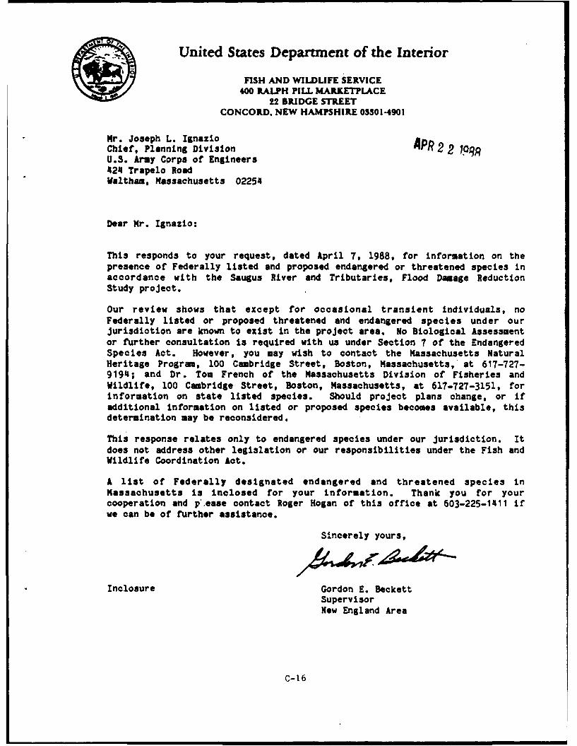
-United States Department of the Interior
FISH AND WILLIFE SERVICE400 RALPH PILL MARKETPLACE
22 BRIDGE STREETCONCORD, NEW HAMPSHIRE 033014901
Mr. Joseph L. IgnazioChief, Planning Division APR 2 2 7QqRU.S. Army Corps of Engineers424 Trapelo RoadWaltham, Massachusetts 02254
Dear Mr. Ignazio:
This responds to your request, dated April 7, 1988, for information on thepresence of Federally listed and proposed endangered or threatened species inaccordance with the Saugus River and Tributaries, Flood Damage ReductionStudy project.
Our review shows that except for occasional transient individuals, noFederally listed or proposed threatened and endangered species under ourjurisdiction are known to exist in the project area. No Biological Assessmentor further consultation is required with us under Section 7 of the EndangeredSpecies Act. However, you may wish to contact the Massachusetts NaturalHeritage Program, 100 Cambridge Street, Boston, Massachusetts, at 617-727-9194; and Dr. Tom French of the Massachusetts Division of Fisheries andWildlife, 100 Cambridge Street, Boston, Massachusetts, at 617-727-3151, forinformation on state listed species. Should project plans change, or ifadditional information on listed or proposed species becomes available, thisdetermination may be reconsidered.
This response relates only to endangered species under our jurisdiction. Itdoes not address other legislation or our responsibilities under the Fish andWildlife Coordination Act.
A list of Federally designated endangered and threatened species inMassachusetts is inclosed for your information. Thank you for yourcooperation and p ease contact Roger Hogan of this office at 603-225-1411 ifwe can be of further assistance.
Sincerely yours,
Inclosure Gordon E. BeckettSupervisorNew England Area
C-16
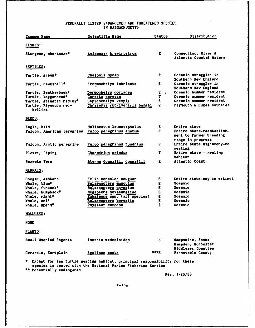
FEDERALLY LISTED ENDANGERED AND THREATENED SPECIES
IN MASSACHUSETTS
Common Name Scientific Name Status Distribution
FISHES:
Sturgeon, shortnose m Acieenser brevirostrum E Connecticut River &Atlantic Coastal Waters
REPTILES:
Turtle, green* Chelonia mydas T Oceanic straggler inSouthern New England
Turtle, hawksbill* Eretmochelys imbricata E Oceanic straggler inSouthern New England
Turtle, leatherback* Dermochelys ooriacea E Oceanic summer residentTurtle, loggerhead* Caretta caretta T Oceanic summer residentTurtle, Atlantic ridley4 Lepidochelys kempi E Oceanic summer residentTurtle, Plymouth red- Chrysemys rubriventris bangsi E Plymouth & Dukes Counties
bellied
BIRDS:
Eagle, bald Haliaeetus leucocephalus E Entire stateFalcon, American peregrine Falco peregrinus anatum E Entire state-reestablish-
ment to former breedingrange in progress
Falcon, Arctic peregrine Falco peregrinus tundrius E Entire state migratory-nonesting
Plover, Piping Charadrius melodus T Entire state - nestinghabitat
Roseate Tern Sterna douaallii dougallii E Atlantic Coast
MAMMALS:
Cougar, eastern Fells concolor couguar E Entire state-may be extinctWhale, blue* Balaenoptera musculus E OceanicWhale, finback* Balaenoptera physalus E OceanicWhale, humpback* Megaptera novaeangliae E OceanicWhale, rights Eubalaena spp. (all species) E OceanicWhale, sei* Balaenoptera borealis E OceanicWhale, sperm* Physeter catodon E Oceanic
MOLLUSKS:
NONE
PLANTS:
Small Whorled Pogonia Isotria medeoloides K Hampshire, EssexHampden, WorcesterMiddlesex Counties
Gerardia, Sandplain Agalinus acuta aepE Barnstable County
0 Except for sea turtle nesting habitat, principal responsibility for thesespecies is vested with the National Marine Fisheries Service
a' Potentially endangeredRev. 1/25/88
C-16a
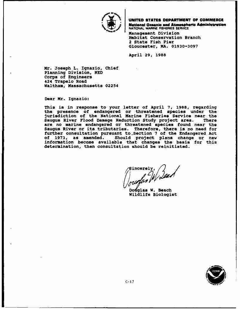
UNITED STATES DEPARTMENT OF COMMERCENational Oceanic and Atw~mphu'Ic AdmnistationI.NATIONAL MARINE FISHERIES SERVICEManagement Division
Habitat Conservation Branch2 State Fish PierGloucester, MA. 01930-3097
April 29, 1988
Mr. Joseph L. Ignazio, ChiefPlanning Division, NEDCorps of Engineers424 Trapelo RoadWaltham, Massachusetts 02254
Dear Mr. Ignazio:
This is in response to your letter of April 7, 1988, regardingthe presence of endangered or threatened species under thejurisdiction of the National Marine Fisheries Service near theSaugus River Flood Damage Reduction Study project area. Thereare no marine endangered or threatened species found near theSaugus River or its tributaries. Therefore, there is no need forfurther consultation pursuant to.Section 7 of the Endangered Actof 1973, as amended. Should project plans change or newinformation become available that changes the basis for thisdetermination, then consultation should be reinitiated.
incerely
Dglas W. BeachWildlife Biologist
C-17 I W
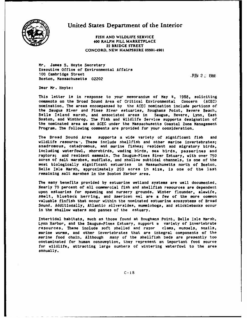
AUnited States Department of the InteriorFISH AND WILDLIFE SERVICE
400 RALPH PILL MARKETPLACE22 BRIDGE STREET
CONCORD, NEW HAMPSHIRE 03301-4901
Mr. James S. Hoyte SecretaryExecutive Office of Environmental Affairs100 Cambridge Street -JM 2 1986Boston, Massachusetts 02202
Dear Mr. Hoyte:
This letter is in response to your memorandum of May 4, 1988, solicitingcomments on the Broad Sound Area of Critical Environmental Concern (ACEC)nomination. The areas encompassed by the ACEC nomination include portions ofthe Saugus River and Pines River estuaries, Roughans Point, Revere Beach,Belle Island marsh, and associated areas in Saugus, Revere, Lynn, EastBoston, and Winthrop. The Fish and Wildlife Service supports designation ofthe nominated area as an ACEC under the Massachusetts Coastal Zone ManagementProgram. The following comments are provided for your consideration.
The Broad Sound Area supports a wide variety of significant fish andwildlife resource-. These include shellfish and other marine invertebrates;anadromous, catadromous, and marine fishes; resident and migratory birds,including waterfowl, shorebirds, wading birds, sea birds, passerines andraptors; and resident mammals. The Saugus-Pines River Estuary, with over 750acres of salt marshes, mudflats, and shallow subtidal channels, is one of themost biologically significant estuaries in Massachusetts north of Boston.Belle Isle Marsh, approximately 250 acres in size, is one of the lastremaining salt marshes in the Boston Harbor area.
The many benefits provided by estuarine wetland systems are well documented.Nearly 70 percent of all commercial fish and shellfish resources are dependentupon estuaries for spawning and nursery grounds. Winter flounder, alewife,smelt, blueback herring, and American eel are a few of the more commonvaluable finfish that occur within the nominated estuarine ecosystems of BroadSound. Additionally, Atlantic silversides, mummichogs, and sticklebacks occurin the shallow waters and pannes of the estuary.
Intertidal habitats, such as those found at Roughans Point, Belle Isle Marsh,Lynn Harbor, and the Saugus-Pines Estuary, support a variety of invertebrateresources. These include soft shelled and razor clams, mussels, snails,marine worms, and other invertebrates that are integral components of themarine food chain. Although many of the shellfish beds are presently toocontaminated for human consumption, they represent an important food sourcefor wildlife, attracting large numbers of wintering waterfowl to the areaannually.
C-18
-2-
Many species of birds are dependent on estuarine habitats within the areaencompassed by the Broad Sound ACEC nomination. A few noteworthy onesinclude the glossy ibis, clapper rail, seaside sparrow, sharp-tailed sparrow,snowy egret, great egret, great blue heron, green heron, black-crowned nightheron, harrier, black duck, mallard, and gadwall. Peregrine falcons andospreys have been observed over the Saugus-Pines River marsh by local birders
during the migration seasons. Black ducks, a species of concern because ofdeclining populations, winter in the protected waters of Broad Sound,particularly within Lynn Harbor. Because of the high level of use of the LynnHarbor intertidal flats by black ducks, we recommend that the proposed ACECboundary be expanded to include this area.
Wetlands and other special aquatic habitats in the Broad Sound vicinity havebeen seriously impacted by a number of development-related activities in thepast. Despite the wide-spread recognition of important functional valuesprovided by wetlands and the implementation of federal and state regulatoryprograms, wetlands in the Broad Sound vicinity continue to be lost to
piecemeal filling. The loss of additional wetlands from residential andcommercial development will likely continue, particularly if additional floodprotection measures are provided in the future.
The Fish and Wildlife Service supports the designation of the nominated areas
in the Broad Sound vicinity as an ACEC. We believe that the fish and wildliferesources which occur here are of state and national significance and as such
merit the ACEC designation. Designation of an ACEC would result in formal
recognition of the ecological and societal importance of the estuarine and
coastal resources within Broad Sound. This, in turn, will focus public andresource agency attention on the need to meet the strict environmental
standards for project review that currently exist, but are sometimes not
enforced.
We hope that these comments will prove useful to your ACEC adoption
proceedings. Please feel free to contact Michael Tehan of my staff at (603)
225-1411 or FTS 83 4-4411 if you have any questions regarding these comments.
Sincerely yours,
Gordon E. BeckettSupervisorNew England Area
C-13a
CC: RO/FWE Reading FileEPA, Don Cooke/NED, Bob Hunt,NMFS, Sue MelloDFW&ELE, H.W. HeusmannDEQE, Wetlands, Charlie NataleDFW&ELE, Brad ChaseMass. CZM, Brad Barr
FWE: MTehan:jd:6-21-88:834-4411
C-18b
- .:,. ~United States Department of the Interior
FISH AND) WILDLIFE SERVICE400 RALPH PILL MARKETPLACE
22 BRIDGE STREETCONCORD, NEW HAMPSHIRE 033014901
Mr.Joseph Vqnazio, ChiefPlanning Di' isionNew England DivisionU.S. Army Corps of Engineers SE' 1 5424 Trapelo
Road
Waltham, Massachusetts 02254
Dear Mr. Ignazio:
This planning aid letter provides cements on the Final Wetland-EstuaryAssessment Report for the Saugus River and Tributaries Flood Damage andReduction Study. This final report was prepared for the New England Division(NED), Corps of Engineers by the IP, Inc. consulting firm in April, 1988. Ourccmnts have been prepared under the authority of the Fish and WildlifeCoordination Act (48 Stat. 401, as amended; 16 U.S.C. 661 et seq.).
GENERAL COMMENTS
The stated purpose of the final report is to provide the results of baselinenatural resource inventories of the Saugus and Pines Rivers Estuary, includingwetland plant communities, wildlife and fishery resources, and benthicinvertebrate comuunities. With the exception of the concerns noted below, wefound that the report generally provides a thorough review of these resourceswithin the Saugus and Pines Rivers Estuary. The report should be a valuablesource of baseline information for preparation of the environmental impactstatement.
The primary deficiency of the baseline information is that it does notadequately describe the spatial and temporal distribution of resources withinall areas potentially affected by the regional flood control project.Specifically, it does not adequately characterize: 1) winter or seasonalmigration use of the estuary or other project-affected areas by wildliferesources such as migratory birds; or 2) wetlands, benthic cammunities, andwildlife resources of the entire area affected by the flood control project,particularly those areas east of the General Edwards Bridge and in Lynn Harborthat would be impacted by the flood barrier, dikes and floodwalls. Impactanalyses and mitigation planning may be affected by the lack of completeresource data for these areas.
Other concerns with the report relate to the discussion of project impacts.We are unable to concur with all of the "no impct" conclusions reached forthose project alternatives analyzed in the report. Some of our concerns stemfrom a continuing lack of baseline data on the physical and chemicalenvironment necessary to evaluate impacts of the floodgate during closureperiods; e.g. detailed information on the contents, volume, and location ofall ninicipal and industrial discharges in the study area. In other cases, we
'C-19
-2-
felt that assmp~tions regarding the affect of flood barrier alternatives wereinadequately supported with biological justification; e.g fish passage-tee
Sce of cur caons regarding impect analyses in the report my no longe berelevant since the NED ha. s wiil adopted a revised flood barrierconfiguration (N4) that ruchtes impacts to the natural en io.For thisreason, we have abbreviated our cin-n-to on thos aspects of the impactanalysis that are less relevant doe to the revised project design.
Planning aid cmntts on the U14 design are not incl uied in this letter. wehave not yet recteived a final description of the 14 alternative nor has theNED formally requested our cimnts on the revised project configuration.
SPB=PC C~q4DiS
page 4. The wetLan study area was limited to the area went of the Generaladwords Bridge. Th proposed- flood control project inclds h Saugus Rivereast of tebridge, aswlla portions of Lym Habr Th study areashould have included all wetlnd and merine habitats p*ontially affected bythe project.
page 9 The rnrative dascibing peret cover for cainity tye on page 9dow not qcorree1pourd with the percent coe figures in ?able 2.2 on page 15. wecould not find an ezpmaition for this discrepancy.
page 17 We do not fully agree with the statet here that the study areadoes not provide 0...eoven suitablq habitat..." for any threatened or
-nposced species. We were unable to thek sounae of this statement asthis admay othe literature citations are not liste in ti ' afere 1 4ssection at th ad of the report. It is true tht th estuary has not beendesignated as critical habitat for threa 1or1c endanagered species. Hwr,,the area does provide suitable foraging habitat for rag I mrs such as theperegrine, falco and bald eagle. Thse animls my but for waterf owl ortwohirda in the estuary and adjacent mrcio areas, pticularly during the
fall migration or wintering period whn prey are -r "ma.we reportedpreviously that local birders have sighted peregrina. over th estuaryduring the fall migration period. The estuary my also provide seasonalforaging habitat for the threatened piping plover.
page 21 ftglish and -etric --- urman- units are mzd throughout thisauction and such of the report. We found this inconvuzient and rscmnstandardizing to a single Imsr systen, at least, within the descriptionof a given study.
C-19&
-3-
page 27 The meaning of the term 0dominant plant" should be clarified as itused in more than one context throughout the wetland plant section. In somecases, the term refers to the species with the highest frequency ofoccurrence. In other cases, it applies to the species with the highestpercent cover. In at least one instance, two different species were describedas dominant along the sm transect (A3) and it is unclear what the criteriafor dominance were there.
page 61 The reference to "marsh hawk" at the bottom of the page should bechanged to "northern harrier" to reflect nomenclature changes from the sixthedition of the American Ornithologists' Union Checklist of North AmericanBirds, published in 1983.
page 62 Wildlife use of the wetland c r ts was characterized based onone or more site visits during the sr of 1987. Although good informationof sumer wildlife use was generated by this effort, it is difficult toadequately characterize the spatial and temporal uses by all wildlife based onlimited observations during only one breading season. It would be useful tohave similar observations from more than one field season to account foryear-to-year variability in aninml populations.
page 73 The bird census surveys provide good inforation of the breedingbird populations of the estuary, but they do not adequately characterizetmporal bird use of the estuary during the spring and fall migration orwinter periods. One of the issues identified in our November 9, 1987,planning aid letter was the need to identify winter bird residents and theinportance ot the estuary to birds during the spring and fall migrationseasons. We believe this information is important and should be included inthe environmetal impact statemnt.
page 87 Wildlife observation stations documented bird use only within theestuary, west of the General Edmards Bridge. We believe there is substantialseasonal use of habitats east of the bridge in areas potentially affected bythe regional flood control project. If additional information on the use ofthese areas by wildlife cannot be obtained, the environmental impactstatement should disclose the fact that there is insufficient information onthis subject and proceed with a worst-case assumption; i.e. that areasaffected by the project east of the bridge are important bird use areas.
page 126 We found the discussion of current velocities at the mouth of theriver difficult to interpret. For example, the maximum current velocitiesdcribed in the narrative on this page do not correspond with the maimmmeasured velocities shown in figures 4.6 or 4.7. Also, the report uses
C.- 19 b
-4-
current velocity information from navigation studies and applies it to fishpassage analyses. Since the discussion relates to velocity impacts on fishpassage, there should be a description of where in the water colum velocity
-asursuents/predictions were made and how this relates to the expectedposition of various fish species and life stages within the water column.
We also question some of the assumptions m&e with respect to swimming speedsof marine fishes and passage through the flood gates. Specifically, wequestion whether it is appropriate to apply the ratio of cruising speed todarting speed developed by Bell for salmonids to winter and windowpaneflounder. The relationship did not hold true for cod, and there is no evidencethat it would hold true for flatfishes. Since flounder are one of the mostimportant species in the project area that exhibit annual estuarine migration,we believe a conservative analysis of their ability to pass through thefloodgates is warranted.
page 136 The discussion of least damaging alternatives appears to be biasedtowards gate design N3. Based on information in the report, we believe thatdesign EN would have the least impact on flow velocity and flushing rates, notN3 as concluded here.
page 139 The Ltion to orient flushing gate openings near the surfaceto pass fish is based primarily on salmonid behavior. Becuse of the presenceof economically valuable dmersal fish and invertebrate species known tomigrate through the estuary, we recommnd that the flushing gates be designedwith openings that extend the full length of the water column. We alsorecmmnd that the gate sill elevation not extend above the river bottom.Constructing the sill flush with the bottom should provide a smooth transitionthrough the gates and would preclude the need for costly monitoring studies ofexperimental "wr w to pass lobsters and bottomfish. Also, rock blanketsplaced to prevent scouring of pier footings should be placed as close to theriver bottom as possible and should have a gradual slope.
page 14 As stated before, we cannot concur. that gate configuration N3 wouldhave no impact on fishery resources. It is our understanding that the NM) hasdeveloped a new flood barrier design, N4, that would improve flushing and fishpassage conditions. As soon as the specifics of this design are provided tous, we will review it in detail and provide planning aid commets for yourconsideration.
page 141-162 The evaluation of closed gate water quality impacts to fishprovided on thes pages is of limited usefulness due to the paucity of data onwater quality and effluent discharges within the project-affected area.Accordingly, it is premature to conclude that impacts to fishery resourcesfrom water quality changes during closed gate csoitions would-be minimal. The
Q0-19c
-5-
significant water quality data gaps identified here and in the report shouldbe filled and hydraulic modeling studies completed before analyzing impacts tofishery resources during closed gate conditions.
page 170 It would be helpful if the report included a more thoroughdiscussion of the rationale behind the study design for the benthic samplingprogram. For example, there is no explanation of why the benthic samplingdesign was intentionally "unbalanced", making it difficult to make statisticalcomparisons within and between sample areas. Why were random samples selectedin sane intertidal areas and transects in others? It also appears that thesampling program did not adequately target those areas where physical impactsfrom structures are expected, e.g. flood barrier locations east of the GeneralEdwards Bridge and dike locations along Lynn Harbor. The benthic data is alsolimited by the fact that sampling was performed once during a single fieldseason, and as such cannot account for year-to-year variability in speciesabundance or distribution. As a result of these shortcomings in the benthicsampling program, impact analyses and mitigation planning for certain projectfeatures may need to rely in part on past observations of shellfish and otherinvertebrate resources or on a worst-case type analysis.
Please contact Michael Tehan of my staff at 603 225-1411 or FTS 834-4411should you have any questions regarding these planning aid coments. We lookfoward to the opportunity to review the modified project design for the SaugusRiver and Tributaries Flood Reduction study.
Sincerely yours,
Gordon E. BeckettSupervisorNew England Area
C.- 19d
.United States Department of the Interior
FISH AND WILDLIFE SERVICE400 RALPH PILL MARKETPLACE
22 BRIDGE STREETCONCORD, NEW HAMPSHIRE 033014901
Joseph L. IgnazioChief, Planning DivisionNew Egland Division, Corps of Engineers OCT424 Trapelo RoadWaltham, Massachusetts 92254
Dear Mr. Ignazio:
We have completed our review of the Final Socioeconomic Assessment for theSaugus River and Tributaries Flood Damage and Reduction Study. The followingplanning aid caments are provided for your consideration. They have beenprepared under the authority of the Fish and Wildlife Coordination Act (48Stat. 401, as amended; 16 U.S.C. 661 et seq.).
The final report contains a substantial amount of useful infounation forincorporation into the environmental impact statement (EIS) currently underpreparation. The report describes a number of factors that indicate there ispotential for increased development in what is now considered the floodplainwith implementation of the regional flood control project. Evidence thatexisting regulations have been ineffective in protecting wetlands is alsoprovided. Based on our interpretation of the findings presented, we reacheddifferent conclusions than the authors. We believe that specific measureswill be necessary to prevent the continued and possibly accelerated loss ofwetlands frum increased development pressure that can be expected withconstruction of the Saugus River and tributaries flood control project.
We recognize that attempting to predict the effect of flood protection onfuture development requires a certain degree of speculation. However, we havereiterated some of the statements/findings from the report that we believesupport the contention that floodplain development may be stimulated with theprovision of widespread flood control.
Page 28. "...there were opinions expressed amongst local developers andresidents that there is pressure to develop within the marsh environment.Residents of Oak Island said that incremental, illegal filling of the marshnear them has occurred for years."
"A realtor in Saugus said that people are holding onto their property in theflood plain waiting for "something" to happen. She said that the requirementto build above the flood level has discouraged same building in the area."
"Violations of wetland filling is another indicator f the pre,7sure fordevelopment." While reference is made to nine state enforcement cases here,the NED Enforcement Division recently photographed over 30 sites within theestuary for investigation of possible unauthorized filling.
C-20
-2-
Page 56. "Because of beach access, these neighborhoods (Point of Pines andOak IT and] are beconing more popular."
"...the possibility of a cammuter rail station in East Saugus is increasinginterest in the area."
Page 57. "Since the majority of the estuary is zoned for industrial use,
there is suime pressure for it to be used for industrial purposes."
Page 59. Regional industries will continue to grow in the future.
Page 71. Historically, salt marsh in the estuary has been filled to supportindustrial, residential, and comercial growth.
"Without a federal flood control project, the regulated flood plain isproposed to increase throughout the study area."
Page 90. With the project, it is assumed that the FDE4A base flood elevationwould be lowered. Development incentives associated with a lowered base floodelevation would include: reduced construction costs, elimination of floodinsurance premiums, elimination of redevelopment restrictions associated withFEMA building regulations, and increased property values from eliminating thethreat of large floods.
Contrary to the conclusion that wetland filling for development is negligibledue to strict regulations, a number of findings presented in the report implythat current wetland protection regulations have been ineffective. Some ofthese findings are presented below:
Pages 6-12. Wetland losses detected by the IEP's analysis of aerialphotography for Revere, Saugus, and Lynn totaled 59 acres since passage of theClean Water Act and the Massachusetts Wetlands Protection Act (i.e., 1978-1987). A number of additional potential illegal fill sites have recently beenphotographed from the air by the Corps and are currently under investigation.
Page 31. The Massachusetts Wetlands Protection Act is not a panacea assuggested, since those portions of the marsh where Phragmites has becameestablished may be filled without mitigation for wetland functional values.Also, the document notes that the DEQE staff gave the impression that wetlandviolations will continue to occur even with regulations in place.
Page 38. Zoning is not a deterrent since Saugus and Revere have zoned the.. arsh for industrial development.
Page 40. IEP identified 23 areas as recent fill within the estuary. Asmention-d above, the NED Regulatory Enforcement Section identifiedapproximately 10 more sites (a total of 33) during a recent aerial survey forinvestigation of possible unauthorized filling activity.
C-20a
-3-
Page 27. The townhouse development on Marshall Street described here iscurrently under construction and was the subject of a recent Corpsenforcement action. During the initial site preparation, the project was"expanded" into adjacent wetlands with the illegal placement of fill in saltmarsh. Upon being notified by a local 'watchdog group', the EnforcementSection delineated the original wetland boundary and ordered that portion ofthe fill in Corps-jurisdiction wetlands removed. Although the illegally placedfill has been removed and technically there is no longer encroachment in themarsh, the habitat value of the site has been lost. The development extendsright up to the edge of the marsh and has eliminated the vegetated bufferzone. The loss of buffering capacity associated with these fringe areas willin turn affect other functional values throughout the estuary. There willundoubtedly be further habitat degradation fram increased human disturbance,parking lot runoff, etc.
We believe this project characterizes the type of wetland impacts that can beexpected fram development around the fringe of the estuary. Although theproject was no- intended to be developed in the marsh per se, fill wasillegally placed and functional wetland values lost. We believe this type offringe wetland encroachment will became more conuonplace with the above-mentioned incentives for floodplain development associated with the regionalflood control project.
IEP states on page 14 of the report that "It is the edge of the upland/saltmarsh that would be potentially lost to any future incremental growth anddevelopment rather than any additional, centrally located, large-scaleprojects." We agree that fringe development is a major part of the problem,however, we believe that the possibility of future large-scale, centrallylocated projects cannot be ruled out. There is a great deal of vacant uplandwithin the estuary that is available for development. The developable lotstudy showed that of the 237 acres of developable land within the study area,approximately two-thirds (160 acres) is within the 100-year floodplain.Although not specitically identified in the study, much o' this land consistsof previously filled tidelands. Since these areas are no longer classified aswetlands, the primary regulatory barriers to development are floodplainregulations. These former tidelands would be more attractive for developmentonce the floodplain designation is eliminated with implementation of theregional flood control project.
The primary significance of developing previously filled tidelands is thatthey would no longer be available tor restoration and enhancement of theirformer floodplain and wetland values. Restoration and preservation of thenatural and beneficial values served by floodplains and wetlands is aresi'onsibility of the Corps and other Federal agencies under Executive Orders1198d, Floodplain Management, and 11990, Protection of Wetlands.
C-20b
-4-
The Executive Order on Floodplain Manegem 1, was issued in order to avoid thelong-term and short-term impacts associited with the occupancy andmodification of floodplains and to avoid direct or indirect support offloodplain development. Likewise, the Executive Order on Protection ofWetlands was issued in order to avoid long-term and short-term adverseimpacts associated with the destruction or modification of wetlands and toavoid direct or indirect support of new construction in wetlands. The mandatesof both of these Orders are directly applicable to the Corp's intent todevelop tk*- Saugus River and tributaries regional flood control project. Theenvironmental impact statmuent should include a discussion of alternatives toavoid adverse effects and new development in floodplains and wetlands.
In summary, we found the Final Socioeconomic Assessnent to contain a greatdeal of useful information regarding development and wetland trends within thestudy area. However, we interpreted the information differently than theauthors. We found support for the contention that wetland losses fromdevelopmental encroachment around the marsh will not only continue, but willpossibly increase with implementation of the proposed regional flood controlproject. Wetland impact associated with floodplain developent incentiveswould likely result from increased develoamnt around the fringes of themarsh. Because a majority of the developable lad in t study rea lieswithin the floodplain, there is also potemtial for now lager-scal Proectsto be developed on previously filled tidelands within the estua ofloodplain construction restrictions are eliminated.
we would expect the environetal impect statm nt to include a discusion ofalternative solutions to curb incemetal wetland los&. frus inducedfloodplain develo;mnt. There are obviously a mber of possible solutions,ranging from increased support for enforcement and education to landprotection options such as conservation eamnts and/or acquisition.
Please feel free to contact Mike Tehan at 663-225-1411 if we can be of furtherassistance on this subject.
Sincerely yours,
Gordon Z. BeckettsupervisorNe ugLand Area
C_ zo|
SUNITED STATES ENVIRONMENTAL PROTECTION AGENCYREGION I
J.P. KENNEDY FEDERAL BUILDING. BOSTON, MASSACHUSETTS 02203-2211
December 15, 1988
Mr. Steven C. DavisAssistant Secretary of Environmental Impact ReviewExecutive Office of Environmental Affairs100 Cambridge Street, 20th FloorBoston, Massachusetts 02202
ATTN: MEPA Unit--EOEA NO. 6716
Dear Mr. Davis:
The Environmental Protection Agency has reviewed the PlanningPerspective Preliminary To Draft Environmental Impact Report forthe proposed South Harbor project located in Lynn, Massachusettsproposed by the South Harbor Realty Trust. Ou: review, however,is limited to concerns which arise from the alternative shorelineprotection proposals as it relates to the federal permitrequirements, rather than the entire proposal for development ofthe upland at the site.
On December 9, 1987 Edward Reiner of my Wetland Protection staffmet with Mr. Peter Walworth representing the developer and touredthe subject property. This meeting was held in order to get somepreliminary comments from the EPA in regard to ultimate permitapplications to the Corps of Engineers under Section 10 of theRivers and Harbors Act and Section 404 of the Clean Water Act forwork at the site.
The main issue of concern to EPA relates to the reconstructionof the deteriorated wooden vertical bulkhead at the site orother means of stabilizing the man-made shoreline. Adjacent tothe wooden bulkhead is an extensive intertidal mud flat areawhich is considered to be a special aquatic site under the EPAsection 404(b)(1) guidelines. In accord with the EPA guidelineswe informed Mr. Walworth the best means stabilizing the shorelinewould be to do it in a manner that avoids any additionalencroachment on the mud flat by keeping the toe of slope of anynew fill where the existing toe of slope or vertical bulkheadalignment exists. This would avoid all impacts to existingshellfish beds (soft shell clams, razor clams and blue mussels)arv the other resources and values of the mud flat (sea worms,otner invertebrates, shorebird feeding areas, etc).
A side issue relates to the presence and desired removal of anexisting wooden barge located within the Saugus River adjacent tothe site and the debris such as the cars which are located withinthe mud flat.
C-21
2
We further suggest that the required elevation of the land(above the floodplain) could be possibly achieved by having oneheight of fill nearest the waters edge and another level of fillfurther away from the shoreline where any development isproposed. This design may enhance the human access of the siteto the water and mud flat as opposed to an extremely high seawallor riprap slope at the immediate shoreline.
We are pleased that the developer has proposed to maintain thetoe of slope of the existing shoreline as is (Page 23) in accordwith our recommendation. The developer, however, also proposesan alternate design which would require the filling ofapproximately 1.7 acres of the mud flat by maintaining thebulkhead line as the top of slope. The EPA would object topermit issuance for this alternative as lees damaging practicablealternatives exist to avoid the mud flat fill (§230.10(a) of theEPA 404(b)(1) guidelines).
It is important to note that the Corps of Engineers haspreliminary plans to place approximately 6.5 acres of fill inthis same mud flat for the construction of their proposed flooddike as part of the flood protection project they are consideringfor the entire Saugus/Pines River estuary. The EPA would objectto this fill based on the availability of a less damagingalternative means of achieving the required flood protection asenvisioned by the first plan proposed by the South Harbor RealtyTrust (i.e. keeping the toe of slope of any new fill at theexisting toe of slope).
One additional item to note is that any proposal to dredge themud flat area for marina development would likely raisesubstantial objections to permit issuance due to the loss of mudflat associated with dredging activities. The limited dredging,however, for installing the new toe of riprap would not raiseobjections from our office.
We are pleased to be able to provide these comments at this earlystage of planing and hope that this will allow the developer toplan accordingly and therefore obtain any required permits in aquicker manner by avoiding permit objections.
Please call Edward Reiner of my staff at 617-565-4434 ifadditional coordination is needed in this matter.
Si rely,
DouglasV ThomF' eWetland rotection Section
C-21a
3
Copies furnished:Laura Eaton, USFWS, Concord, NHSue Hello, NMFS, Woods Hole, MAJay Copeland, MA NHP, Boston, MAWilliam Lawless, NEDACE, Regulatory Div., Waltham, MA-Robert Hunt, NEDACE, Planning Div., Waltham, MARobert Gauvarau, NEDACE, Executive Office, Waltham, MAJudy Perry, MA DWPC, Boston, MACaroline Simmons, MACC, Medford, MARon Manfredonia, Chief WQB, EPAJim O'Connell, MCZM, Boston, MA
C-21b
United States Department of the Interior
~FISH AND WILDLIFE SERVICE400 RALPH PILL MARKETPLACE
22 BRIDGE STREETCONCORD, NEW HAMPSHIRE 03301-4901
Mr. Joseph Ignazio, Chief January 20, 1989Plannin DivisionNew England DivisionU.S. Army Corps of Eineers424 Trapelo RoadWaltham, 4a ss-Usetts 02254
Dear Mr. Ignazio:
This letter provides review conments as requested for two technical reportspreparea for the Saugus River and Tributaries Flood Damage Reduction Study.Tte reports are: the Draft Hydrologic and Hydraulic Analysis and the DraftWater Quality Assessment for the Tidal Flood trvol Project. On Deoember 8,1988, we met with youw staff to discuss issues from the technical reports aswell as mitigation measures for the regional flood control project. Thefolling coments sumarize the primary issues from the reports discussedduring the coordination meeting. Fish and wildlife mitigation (e.g. wetlandcxmpensation) will be discussed in a separate planning aid letter. Thesecxients are provided under the authority of the Fish and WildlifeCoordination Act (48 Stat. 401, as amended; 16 U.S.C. 661 et seq.).
Hvdrolov and Hydraulics Analysis
Of the topics discussed during our coordination meeting, we have identifiedthree issues that require further discu ssi/clarification as the planningprocess continues. These are: 1) the design of the flushing gates withrespect to impacts on estuary flushing and fish passage; 2) delineation andpreservation of the interior storage area for pcnding runoff during a closedgate condition; and 3) the effect of sea level rise on project design andoperation.
Gate Design
Cur primary coZTrns with the floodgate design center around the need to avoida constriction or barrier at the mouth of the Saugus-Pines River estuary thatmay impede tidal exchange (estuary flushing) or the passage of fish or otheraquatic organisms (active or passive). Of the alternate floodgate designspresnted to date, the EN and N4 cmneptual designs would have the leastrelative impact to estuary flushing and fish passage. We therefore reonendthat eithr of these gate schemes be adopted if the tidal floodgate option isimpleented.
The additional flushing gates of the N4 configuration alleviate most of the-idal exchange impacts associated with the other alternatives (FC, Nl, N2,
N3). The N4 gate configuration, with the lower flushing gate openings flushwith the river bottom, should eliminate the potential for demersal fish andlcbster passage impacts that existed with the elevated gate sills of previous
C-2 2
-2-
designs. Bemuse of the benefits associated with the N4 gate configuration,we rec d that neither the flow area nor the distribution of gate openingsbe reduced frm that which is currently proposed. We also recmmend that gatesills remain flush with the river bottom.
Our reuining c rns with the N4 gate schm relate to the fact that thegate will onstrict daily tidal flows at water surface elevations above meansea level (0.0 feet NGD). Because the top of the flushirg gate is atelevaticn 0. 0 feet, pressure flow coditions will exist when tide levelse this eleation. The structure may .hinder the passage of certain fishspecies since the uper portion of the water column would be ostructed attide levels above 0. 0 NGVD, and surface swimiri fish would have to sound topass thrclgh the flushing gates. Also of coern is the affect of pressureflow through the gate openings on ichthycplanktor. Organism my experienceniortality or predation following injury from inpingment or contact with shearzones associated with turtulent eddies. Even if the gates do not excecvelocities or shear forces at existing structures, cumulative impacts mayprove significant.
We recognize that these types of biological impacts are difficult to quantify.Rather than assum they are insignificant, we rec-end that the potential forfishery impacts be minimized by increasiM the top elevation of the flushinggate openings to reduce flow constriction at higher tide elevations. Ideally,the gates would be fully open to allow unrestricted tidal exchange as with thenavigation gate. Also, the edges of the flushing gates should be rounded anddesigned to promote smooth laminar flow through the cpening to reduce thepotential for impingement, shear forces, and turbulent eddies. We understandthat the Corps intends to take a more detailed look at these project designxs . We look forward to continued coordination with the Corps to helpresolve our fish passage oncen.
Interior Storage
We believe that the i ss of interior storage capacity could benefit fromfurther clarification as per discussion at the coordination meeting. ourinterest in clarifying this ise is due to the fact that the interior storagearea is cumprised of estuarine wetlands of major eological significance.Despite protection under federal and state regulations, illegal wetlandfilling has been a problem in the Saugus-Pin River estuary.
It is a= understanding that by preserving all estuarine lands below +7.0 feetNGVD, enogh storage for wrst-case interior runoff and wave overtqpingwauld be provided without sea level rise. Ihe Corps has indicated that alltidally influenced wetlands in the study area are contained below this level.It is also o= understanding that protection of the area below +7.0 NGVD willbe accamplished not only under pertinent federal, state and local regulations,but through local assuran to be developed for this proje'. To assist inthe protection of the designated storage area, it is our urderstanding thatthe Corps will delinsate both the wtland-upland boundary and the +7.0-foot
ntour on project maps.
C-22a
-3-
We fully support the Corps proposal to closely monitor the designated storagearea for ompliance with local assurance provisions and wetland protectionregulations. Depending on the estimates for increased wave overtopping withprojected sea level rise, it may be prudent to increase the interior pondingarea even further, e.g. include all undeveloped land in the estuary up toelevation +8.0, the elevation where flood damage starts.
Sea Level Rise
7he Hydrology and Hydraulics Analysis discusses the affect of sea level riseon project operation. According to corps policy, the analysis was based onboth the actual historical rate of local sea level rise (approximately onefoot over the project life) and the National Research Council's maximmprojected sea level rise (approximately four feet). It is our understandingthat under both the one foot and the four foot projections for sea levelrise, the project could begin to negatively affect estuary flushing duringmaximum astronomic tides. It is also our understanding that the project wouldbegin to impact estuary flushing during more frequently occurring tide levelsif sea level rise exceeds two feet. Maximum current velocities through thefloodgate and gate closure frequency would also increase with sea level rise.The implication of these impacts should be thoroughly evaluated.
We acknowledge that sea level rise is a relatively new issue for thescientific comunity and that predictions of sea level rise vary dramatically.However, we believe that the local historic rate of sea level rise representsa realistic minimum projection and should play an important role in projectplanning and design. Consideration of even the minimnum rate of sea level riselends additional support for our recamnerdations to maximize the open area ofthe flushing gates and to take a onswervative approach in the delineation andpreservation of interior storage capacity. It is our understanding that if sealevel rise exceeds one or two feet, then project modifications would bewarranted and additional coordination on fish and wildlife issues would berequired.
Water Oualitv
Mve draft Water Quality Assesnt generally provides a thorough review ofwater quality issues pertinent to development of the tidal flood gate. Asindicated in the Water Quality Assessment, tidal exchange in the Saugus/PinesRiver estuary far exceeds the influence of fresh water inflow. Tidal flushingplays a significant role in maintaining water quality in the estuary,particularly in diluting bacterial, chemical, and thermal inputs. Tidalexchange in the estuary is already impeded by manmade constrictions, includingbridges and the 1-95 fill embankment. Any further restriction of tidalflushing would contribute cumulatively to water quality degradation in theestuary.
As mentioned above, even the N4 gate scheme would restrict tidal flow athigher tide elevations. As was explained during the coordination meeting, theopen area of "14 exceeds that of the narrowest existing constriction at theestuary mouth o. -ing the time of maximum tidal exchange, i.e. when the tidelevel is at 0.0 feet elevation. Thus, while there will be a constriction offlow once the tide level exceeds elevation 0.0 feet, the overall reduction in
C-22b
-4-
tidal exchange is predicted to be only 0.1 percent, whid the Corps considersnegligible. To insure that the floodgate does not impact water quality byimding tidal exchange, we reamuend that the open area of the structure notbe decreased fram the currently propoed 8700 square feet. Preferably, thetotal open area would be increased by raising the top of the flushing gateopenings as suggested above. This would provide an additional margin of safetyin the event that future sea level rise exceeds the minimum predictions.
In the Water Quality Asswent, it is assumed that the 1-95 fill wouldprobably be breached by others once the regional protection project is builtand that breacin of the fill would partially czmpensate for any lost tidalflushing volume associated with the project (page 76). These assmwptions arectrary to our Decenber 8, 1988, discussions that breaching of the 1-95 fillis highly unlikely due to state and local ocerns, e.g. nuisance flooding inEast Saugus. It is ou urnderstanding that all references to breaching the I-95 fill will be removed fra the final report.
We appreciate your efforts to develop an envircmentally sound project andlook forward to further coordination in the next stage of project planning.Please cotact Michael Tehan at (603) 225-1411 if there are any questions.
Sincerely yors,
Gordon E. BeckettSupervisorNew Erx1and Area
C-22c
'United States Department of the Interior
I. FISH AND WILDLIFE SERVICE400 RALPH PILL MARKETPLACE
22 BRIDGE STREETCONCORD, NEW HAMPSHIRE 03301-4901
Mr. Joseph Ignazio, Chief March 7, 1989Planning DivisionNew Enland DivisionU.S. Army Corps of Engineers424 Trapelo RoadWaltham, Massacsetts 02254
Dear Mr. Ignazio:
This letter is in regard to mitigation planning for the Saugus River andTributaries Flood Damage Reduction Study. It focuses primarily on mitigationfor wetland and intertidal habitat losses associated with the two structuraloptins for the regional flood control project-i.e. local protection plans(option 1) and the Saugus River tidegate (option 3). We have not received aformal mitigation plan to review and c nt on at this time. However, at therequest of Mr. Rdert Hunt, Project Manier, and others, we are providingthese cumments to documaent disossions beteen this office and the PlanningDivision on the subject of mitigatin. These camnents are provided under theauthority of the Fish and Wildlife Coordination Act (48 Stat. 401, asamended; 16 U.S.C. 661 et seq.).
Under option 1, structural local protection plans, flood protection would beprovided for four areas: Lynn, Mast Saugus, Town Line Brook, and Revere BeachBackshore. Four separate local protection projects would be constructed,totaling same 8.8 miles of earthen dikes and c ete walls. It is ourunderstarding that this option, as presently proposed, would reire fill ingaproximately 17.7 acres of wetlands and 20.2 acres of intertidal flats. Up to10 addititinal acres of wetlands and 2.9 additional acres of intertidal flatswould be impacted during the construction period.
Option 3, the regional floodgate plan, wzuld include a floodgate structureacross the mouth of the Saugus River, and shoreftrot protection along RevereBeach, Point of Pines, and Lynn Harbor. We u-derstand that option 3 would notrequire the filling of wetlands, however, 10 acres of productive intertidaland subtidal habitats would be filled or dredged-3.0 acres at the floodgatesite, 5.6 acres at Lynn Harbor, and 1.4 acres at Point of Pines. An additional3.8 acres of intertidal and subtidal habitat would be impacted by scouring inthe vicinity of the floodgate. We understand that the proposed dredging limitsfor the floodgate have been mdif.ied to avoid mussel beds in Lynn Harbor.
Mitigation planning efforts by the Corps have focused on formulati. g the mosteconoically efficient plans to create replacement wetland and intertidalhabitats as compensation for project-related habitat losses. We understandthat wetland losses from option 1 would be mitigated by creating 19.5 acres ofestuarine wetlands through remval of a portion of the of the 1-95 fillembankmnt. A linear strip of the fill would be graded down to the elevationof the surzrunding marsh and wetland vegetation planted. We undIurstand the new
C-23
-2-
wetland would be mnitored to insure sucessful wetland plant establishment,with corrective measures taken if initial attempts are less than completelysuccessful. The mitigation site wuld be maintained for the life of the floodcontrol project.
We wxietr that intertidal habitat losses would be mitigated by creatingclam flats adjacent to the Seaplane Basin-20 acres for option 1 or 10 acresfor cqtin 3. A portion of the 1-95 fill would be rmoved, the site graded tomatc the elevation and slope of adjacent clam flats, and soft-shelled clamstransplanted from nearby areas to seed the newly created habitat. Themitigation plan calls for establismnt of a fringe of and dunegrasses to act as a buffer zone fran human activity, e.g. CRV traffic.
It is uur uxerstandin that by using floodwalls instead of earthen levees,wetland losses from option 1 cauld be reduced from 17.7 acres to 3.7 acres. Byusirg floodwalls along Lynn Harbor instead of levees for cpticn 3, 5.6 acresof fill in intrtidal clam flats could be avoided. A similar reduction inimpacts could be expected for option 1. It is also our understanding thatwhile floodwalls would cost more than levees, the overall benefit/cost ratiofor the regional flood control project would rmaiin positive even if the lessdamaging floodwall alternatives were iplewted.
We are cocerned that the Corps has focused their mitigation efforts onhabitat cmeensation masures for losses that could be avoided by implementingless damaging alternatives. This problem is brought on by the inherentinconsistency bete the Corps' planning policy of developing the NationalEx=ic Development (NED) Plan, consistent with the Water Resources Council'sPrinciples and Guidelines, and the purpose and policies of the Clean Water Act(CA) and its implementing regulaticns such as the Section 404 (b) (1)Guidelines. The 404(b) (1) Guidelines are enforceable regulations that applyto both the Corps' Section 404 regulatory program and the civil works program[40 CFR 230.2]. In contrast, the Principles and Guidelines, as adopted on
March 10, 1983, are not rules; they are advisory only. In developing the NEDplan, it appears as though project -ost is the cverridir factor considered bythe Corps. Another important elemnt of project aeptability is ccapliancewith state and federal regulatory reauieMnts. The planning process must bethorough in terms of cauPliance with applicable laws, e.g. Section 401 waterquality certification, CZM comistency, and Section 404(b) (1) Guidelie, sothat cstrucion will not be delayed or prodibited by an unresolvedregulatory process.
It is aur understanding that the Planning Division's primary consideration indevelopir mitigation is also cost. We believe that the use of econvuics asthe primary mitigation decision criteria is inconsistent with a number offederal laws, reculaticas and guidelines that call for fish and wildlife toreceive equal comideration with other project purposes (Fish and WildlifeCoordination Act) and which pramote a step by sto°p mitigation processemphasizix impact avoidance and minimization before ccspensation (Section404(b) (1) Guidelines, thty National Eivircaiatal Policy Act, Emcutive Order11990, Protection of Wetlands, and the Fish and Wildlife Service MitigationPolicy).
C-23a
-3-
The President's Council on &ivirarnental Quality defined the term mitigationin the National Envirmntal Policy Act regulatis to include "(a) avoidingthe impact altogether by not taking a certain action or parts of an action;(b) minimizing impacts by limiting the degree of magnitude of the action andits inplementation; (c) rectifying the impact by repairing, rehabilitating, orrestoring the affected envr ; (d) reducing or eliminating the impactover time by preservatin and maintenance operations during the life of theaction; and (e) c=ensating for the impact by replacing or providingsubstitute resources or envYirmnts" (40 CER Part 1508.20 (a-e)]. Wesupport this definition of mitigation and have made it an integral part of curMitigation Policy [FR 46:15, January 23, 1981). We consider the specificelements of this definition to represent the desirable sequence of steps inthe mitigation planning process. Ccmpensating for impacts by providingreplnt resources should occur only after all of the other mitigationsteps have been exhaustively pursued-
The Planning Division's aproach to mitigation should be consistent with thatused in the evaluation of wetland fill projects urxer the Corps' Section 404regulatory program whe the above referenced laws and guidelines areroutinely applied. It is likely that a 404 permit application for a projectwith wetland or aquatic impacts of the same magnitude as this civil workspropoal would receive strong cbjections from reviewing resource agencies. Asan example, it is our understanding that a private development caqpanyrecently proposed a shoreline protection project for Lynn Harbor similar tothe Corps' levee proposal. We understand that during pre-developmntconsultation in the MEPA process, the EPA indicated they would consider anyshrefront protection project that encroached upon the intertidal zone in LynnHarbor to be inoistent with the 404 (b) (1) Guideline provisions regardingwater deperdency, practicable alternatives, and significant degradation. Wefurther wkerstand the developer was advised to seek less damagingalternatives for the project prior to applying for a Section 404 permit. Thedisd~arg restrictions that apply to Section 404 regulatory activities applyequally to Corps' civil works projects.
We are also concer-ed with the Corps reliance on replacement habitat creationfor mitigation because we do not believe that wetlard creation is a provenscience or that all functional values of natural wetlands can successfully beduplicated with any predictable degree of success. Wetland creation in theregulatory arena has a poor success record. For example, a recent EPAassesa 1n of wetland mitigation practices associated with the 404 regulatoryprogra- found that planned wetland mitigation resulted in a substantial netloss of wetland acreage, a net loss of wetland diversity, and temporal wetlandlosses at the mitigation sites. Likewise, in a 1985 review of wetlandmitigation (Mitigating Freshwater Wetlard Alterations in the GlaciatedNortheastern United States: An Assess. t. of the Science Base), J.S. Larsonconcluded that there is a high degree of uncertainty associated withartificially duplicating certain wetland functional values, partizularly waterquality and nutrient cycling functions. Risk and unertainty in the ability toduplicate fu r-a--tal detrital and grazing nides in the food dain were alsonoted. larson cites several references that suggest there is still a greatdeal of upertainty and risk in artificially creating coastal wetlands formitigation.
C-23b
-4-
It is likely that sme level of wetland copensation will be required forqpticn 1, even if the less danaging floodwall alternative is adopted. To
mte unavoidable wetland losses, we reme a minimum wetlandrl t/loss ratio of greater than one, preferably at least 2 to 1. nhiswould not only cupensate for the productivity lag following costruction, butwould allow for a margin of safety in the event that functional wetland valuesof the now habitat are less than expected. We note that 2 to 1 c-u'ensatorymitigation was required as a permit condition for wetland losses associatedwith the MOD project in the Sagus River estuary.
Mile we fully erdrse reuval of the 1-95 fill, preferably in its entirety,we reommend that other potential wetland restoration sites within the estuaryalso be evaluated. We believe there my be other degraded sites that offergreater potential for successful restoration (fill removal, restoring tidalflushing) than the 1-95 site. It is our urWestandinr that during the originalplacement of the 1-95 fill, the underlying wetland substrate was removed to asubstantial depth and replaced with cxmacted fill material. The physicalcharacteristics of this material may affect restoration of wetland vegetation,soils, and hydrology. Wetland reestablishment may take longer than at a sitewhere the underlying wetland soils are intact. To facilitate wetlandrecovery, it may be necessary to replace peat that was previously ramved.Um Corps may wish to consider other candidate restoration sites, e.g. the oldSaugus racetrack, where wetland recovery may be more rapid. We look forwardto additional coomination on this issue.
Another rextordation to imiprove the wetland cxupensation Proposal is toinclude a vegetated buffer zone along the upland boundary of the mitigationsite to provide habitat diversity and to isolate and protect the site frmencroaching develiopnent around the estuary perimeter. Th proposal forintertidal habitat mitigatin already includes a vegetated buffer zone of
a and bebI grasses to protect the site. We also reomend that humanaccess to the compensation site be controlled, for example, by fencing thesite to exclude off road vehicles.
Provided that wetland and aquatic fills can be reduced to comply with NEPA,CZM, and O@A regulations, we suport the inclusion of a monitoring program andremial contingencies as c'ensation plan features. Inadequate monitoringand failure to take corrective action have been a significant source of pastmitigatico failures. We look forward to working closely with the Corps todevelo specific evaluation criteria and other details of mitigation follow-upstudies.
In sunmary, we conur with the Corps' recognition of the high ecologialinportane of wetlands and intertidal flats affected by the project. Mhile wesupport the Corps intent to fully mitigate impacts to wetlands and aquatichabitats, we cannot endorse tl.-q current proposal for experimental habitatcxqpensation when less damaging practicable alternatives are available. We donot believe that the science of wetland creation is sufficiently developed toallow natural wetlands to be duplicated with any degree of certainty.
C-23c
-5-
Wetland and intertidal habitat creation should be used for Cx.mensation onlywhere impacts are clearly unavoidable and the Corps can d-swstrate that lessdamaging alternatives are rot available. It is our understanding that thePlannir Division has determined that less damagir, practicable alternativesare available for this project. Further, we understand that the Corps hasdetermined that the use of flood walls instead of earth levees for localprotection structures would subtantially reduce the amount of wetland andintertidal habitat lost to filling; would fully accomplish project floodcontrol cbjectives; and would still result in a positive overall benefit/costratio for the project. It is important that these less damaging alternativesbe fully developed in the NEPA envirmimntal impact statement.
In the event that certain wetland and aquatic inpacts cannot be avoided, asdetermined by application of 40 CER 230.10(a), the EPA 404(b) (1) Guidelines,we recuend that cr ensatory wvtland mitigation be provided on at least a 2to 1 basis. We also recaxzund that additional wetland compensation siteswithin the Saugus-Pines River Estuary be evaluated. While we fully endorsereval of the 1-95 fill and subsequent wetland restoration, we believe theremay be other degraded wetlands within the estuary with greater potential forrapid recovery that wvuld suit the Corps' campensation needs.
Finally, as we have stated in previous cor on this project, webelieve that non-structural alternatives, such as flood insurance, would bethe least damaging to wetland and aquatic resources. Non-structural solutionsrepresent practicable alternatives within the meaning of the NEPA and CQAregulatimns and as such, should be given full consideration under thealternatives analysis in the NEPA enviroimental impact statement.
We apreciate the cportunity to provide these early fish and wildlifecoordination omments. We look forward to ontinued consultation with thePlanning Division to resolve these and other fish and wildlife issues duringthe project planning process. Please contact Michael Tehan at (603) 225-1411if there are any further questions.
Sincerely yours,
Acting S(*ervi rNew England Area
C-23d
DEPARTMENT OF THE ARMYNEW ENGLAND DIVISION. CORPS OF ENGINEERS
424 TRAPELO ROADWALTHAM. MASSACHUSETTS 02254
REPLY TOATTENTION oF
March 28, 1989
Planning DivisionImpact Analysis Branch
Mr. Gordon Z. BeckettU.S. Department of the InteriorFish and Wildlife Service22 Bridge StreetRalph Pill Building, 4th FloorConcord, New Hampshire 03301
Dear Mr. Beckett:
In accordance with the Fish and Wildlife CoordinationAct transfer funding scope of work, enclosed please find apre-release copy of the Saugus River and Tributaries FloodDamage Reduction Study Main Report and EIS/EIR, for yourreview.
I would appreciate receiving a Final Coordination ActReport within 30 days, as previously agreed.
Sincerely,
oseph L. Igna iChief, Planning Division
C-24
.United States Department of the Interior
FISH AND WILDLIFE SERVICE400 RALPH PILL MARKETPLACE
22 BRIDGE STREETCONCORD, NEW HAMPSHIRE 03301-4901
LC Stanley J. Murphy May 4, 1989Deputy Division EngineerNew England DivisionU.S. Army Corps of Engineers424 Trapelo RoadWaltham, Massachusetts 02254
Dear Colonel Murphy:
We hereby submit our Fish and Wildlife Coordination Act Report on the SaugusRiver and Tributaries Flood Reduction Study, in accordance with the Fish andWildlife Coordination Act (48 Stat. 401, as amended; 16 U.S.C. 661 et seq.).This report also includes our coments and recomendations for the protectionof estuaries pursuant to 16 U.S.C. 1221-1226, Estuarine Areas (EstuaryProtection Act). We have considered information from the pre-release copy ofthe Draft Feasibility Report and Draft Environmental ImpactStatement/Envirornental Impact Report (DEIS) in preparing our report. It isour understanding these documents will soon be available for public review andcment.
The Corps' preferred alternative for reducing flood damages in the study areais Option 3, the regional floodgate plan. This option would include afloodgate structure across the mouth of the Saugus River, and shorefrontprotection along Revere Beach, Point of Pines, and Lynn Harbor. Overall, 11acres of intertidal and 3.8 acres of subtidal habitat would be permanentlyimpacted by this option. Another 5.9 acres of intertidal habitat would beimpacted during construction and 4.5 subtidal acres would be dredged.
In addition to the preferred plan, two other options have been considered forflood protection within the study area. Option 1, structural localprotection plans, would provide flood protection for four areas: Lynn, EastSaugus, Town Line Brook, and Revere Beach Backshore. Four separate localprotection projects (LPP's) would be constructed, totaling some 8.8 miles ofearthen dikes and concrete walls. This option would require fillingapproximately 17.7 acres of wetlands and 20.2 acres of intertidal flats. Upto 10 additional acres of wetlands and 2.9 additional acres of intertidalflats would be impacted during the construction period.
Option 2 is a non-structural plan which involves floodproofing buildings,flood warning, and evacuation procedures.. This is the option we recommendbecause it would not adversely impact fish Lnd wildlife resources. It alsohas the highest benefit:cost ratio of the alternatives considered. Weunderstand the Corps does not consider option 2 to be feasible because of thelesser level of flood protection it offers.
C-25
-2-
The study area encompasses about 4000 acres that are considered the floodplainof the estimated worst possible coastal storm, the standard projectnortheaster (SPN). Approximately 40 percent of the SIN floodplain consists ofthe Saugus-Pines River estuary, which at 1,660 acres, is the largest estuarynear Boston. The estuary and its environs support a variety of fish andwildlife resources including marine and anadrcmous fish, shellfish and otherinvertebrates, and migratory birds. The Saugus-Pines River estuary and LynnHarbor have been designated a special management area under the North AmericanWaterfowl Management Plan because of the high habitat value for waterfowl andthe eminent threat of habitat destruction, including impacts from thisproject. We consider the estuarine habitat potentially affected by theproject to be of high value for migratory birds and both marine and anadrmousfish. This habitat type is becoming scarce along the New England coast. Ourmitigation goal is to allow no net loss of existing habitat value.
We have previously reported on the project in planning aid letters datedFebruary 4, 1986, November 9, 1987, April 22, 1988, September 15, 1988,October 18, 1988, January 20, 1989, and March 7, 1989. The fish and wildliferesources of the project area, preliminary concerns with project features, andmitigation recommendations were discussed in those letters.
Despite our extensive coordination with the Corps, we continue to havesignificant concerns regarding the proposed project. These include:inadequate consideration of alternatives, particularly non-structural ones;the effect of the project on floodplain development and wetland protection;intertidal habitat losses from levee construction within Lynn Harbor; fishpassage impacts from flow constriction at the mouth of the Saugus River; andthe potential for wide-scale ecological impacts within the estuary fromincreased floodgate operation in the future.
Because of these unresolved issues, we cannot support the project as proposed.At this time, we can support only option 2, the non-structural plan. Thisoption is the least environmentally damaging and would not adversely impactwetlands or fish and wildlife resources.
Nonr-stutural Alternatives
Elements of the non-structural option should be more fully developed and thealternative expanded to include all potential non-structural flood controlmeasures. Option 2 considered only two elements: the suitability ofstructures for floodproofing and an early warning and evacuation plan. Itappears that these elements were not evaluated with the same level of detailas the structural alternatives. For example, the study concluded thatfloodproofing was impractical since only 240 buildings were found to besuitable for floodproofing measures. However, it appears that floodproofingopportunities in the study area were not fully considered, sLce only 2685 ofthe 5000 flood-prone buildings in the study area were investigated forfloodproofing potential. The rationale behind this apparent difference inbaseline assumptions between alternatives (e.g. how many buildings are subjectto flooding) should be spelled out in the final report.
C-25a
-3-
The National Flood Insurance Program (NFIP) was not considered as a non-structural alternative despite the fact that all four of the communitieswithin the study area--Saugus, Lynn, Revere, and Malden--participate in theprogram. According to the Federal Emergency Management Agency (FEMA) about1100 NFIP policies are in affect in these communities. Average annual flooddamage claims under all of these policies were just under $400,000 over thelast 12 years, including 1978, the year of a 100-year storm event. Thisfigure contrasts sharply with the Corps' estimate of over $8,000,000 inaverage annual flood damages. The low flood insurance participation anddamage payment rate suggest that: the occupants of the study area do notconsider flooding to be a serious or chronic problem (i.e. low risk); most ofthe annual flood damages are not severe (i.e. nuisance flooding); or perhapssome structures are not considered worth insuring by their owners. It is alsopossible that the NFIP is an under-utilized resource and that opportunitiesexist for expanded participation/coverage as part of a non-structural floodcontrol plan. We recommend that the various non-structural options beevaluated with the same level of detail as the structural options.Alternatives to the proposed action should be given full consideration in thefinal EIS to fulfill the intent of the National Environmental Policy Act.
Floodplain Management and Induced Develcpivnt
We believe the project is inconsistent with the current Federal philosophy toavoid development in estuaries, coastal areas susceptible to flooding,floodplains, and wetlands. This philosophy is laid out in a number of Federallaws, executive orders, and policies. The previously referenced "EstuaryProtection Act" (P.L. 90-454) was enacted by Congress in 1968 to recognizethe value of estuarine areas and to establish a national policy to protect,conserve, and restore estuaries in the United States. The Coastal ZoneManagement Act (CZMA), was passed by Congress in 1972 (P.L. 92-583) andamended in 1976 (P.L. 94-370), following completion of three national studieswhich documented increasing threats to coastal resources from populationgrowth, pollution, and large-scale coastal development. The CZMA establisheda national policy to preserve, protect, and where possible to restore orenhance the resources of the Nation's coastal zone, and provided assistance tostates in developing comprehensive coastal management programs to carry outnational policy directives. The Coastal Barriers Resources Act (CERA) of1982 (P.L. 97-348) was enacted by Congress in response to growing Federalexpenditures to protect against hurricane storm surges and coastal floodingassociated with rapidly expanding coastal development. The CBRA recognizesthe importance of coastal barrier resources, including fish and wildlife, andseeks to eliminate Federally subsidized developme Ln flood-prone coastalbarrier areas. Although the study area is not f; ..fically designated acoastal barrier under the CBRA, Congressional intenL .egarding the need tocontrol Federal expenditures for coastal development is clear. The need toavoid Federally funded or subsidized projects within floodplains and wetlandsis addressed in Executive Orders 11988, Floodplain Management, and 11990,Protection of Wetiands. Both executive orders require the consideration ofalternatives to avoid impacts to floodplain and wetland resources.
C-25b
-4-
We believe the proposed project is inconsistent with the mandate of ExecutiveOrder 11988 to discourage floodplain development and to restore and preservethe beneficial values served by floodplains. Rather than preserving orrestoring floodplain values, the project would result in a reduction of thearea designated as floodplain and/or redesignaticn to a less restrictivefloodplain classification. This in turn will likely result in increaseddevelopment around the perimeter of the estuary and the loss of beneficialfloodplain values, including fish and wildlife habitat.
Factors that would contribute to increased floodplain development aredescribed in both the Feasibility Report and the DEIS. These include:reduction of the FEMA base flood elevation, reduced flood insurance premiums,reduced construction and floodproofing costs, curtailment of FEA buildingregulations, increased property values, and elimination of the perceivedthreat of major flood events.
We disagree with the claim that the floodgate plan will greatly enhancewetland and floodplain protection within the study area. The project wouldnot change regulatory protection of the marsh. It is suggested that addedprotection would occur through the proposed "estuary storage protectionprogram," which would encourage enforcement of existing wetland and floodplainregulations to protect the area needed for interior runoff storage during gateclosure. Existing wetland regulations have been less than ompletelyeffective in preventing incremental wetland losses in the past and it isunlikely that they will do so in the future. Although the proposed localassurance provisions would help detect unauthorized activities, wetlandfilling is not prohibited by the Clean Water Act, only regulated under theSection 404 permit program. Over half of the wetland losses investigated bythe Corps over the last 10 years were from permitted activities, i.eactivities authorized by the Corps. Following project construction, annualwetland losses may increase as a result of growing pressures to fill anddevelop wetlands. Even with the Corps' projection that the current annualwetland loss rate of 0.5 acre/year will continue, 50 additional wetland acresin the estuary storage area will be lost during the project life.
In those portions of the estuary storage area that are not wetlands,protection of runoff storage capacity would be through existing floodplainregulations. Floodplain regulations will not necessarily protect the non-wetland storage area, since they do not prohibit filling or development. Asnoted above, flood protection offered by the project would likely encouragedevelopment rather than discourage it. If long term protection of the estuarystorage area is essential for successful project operation, we recomend thatthe Corps formulate a more definitive plan for protecting floodrlain andwetlands within the project area, e.g. acquisition of land or floodeasements.
Intertidal Habitat Losses
We continue to be concerned with the unnecessary loss of productive intertidalhabitat from structural protection measures along the LTLn Harbor shorefront.This area is important not only for shellfish, such as blue mussels and softshelled clams, but for waterfowl that feed on the rich invertebrate resources.It is our understanding that 5.6 acres of fill in intertidal habitat could beavoided through the use of either setback levees or vertical walls. A similar
C-25c
-5-
reduction in impacts could be expected for option 1 if alternate structuralmeasures were used. Less damaging alternatives have been eliminated frcmfurther consideration as they are considered cost prohibitive. However, inthe cost breakdown for shorefront protection along Lynn Harbor (p.70,Feasibility Report), the average cost per foot for dikes is $628, while theaverage cost per foot for walls is $478. It appears that, on average, wallswould cost less than dikes. Even if less damaging alternatives such as wallsor setback levees wouild cost more, it is our understanding that the overallbenefit:cost ratio for the regional flood control project would still remainpositive if they were implemented.
In our March 7, 1989, planning aid letter, we indicated our concern over theapparent inconsistency between the Corps' planning policy of developing theNational Economic Development (NED) Plan, and the purpose and policies of theClean Water Act (CWA) and its implementing regulations such as the Section404(b)(1) Guidelines (Guidelines). The development of less damagingpracticable alternatives mandated by the Guidelines has apparently beenoverridden by the Corps policy of developing the least cost alternative.Development of the NED plan does not preclude the need to protect theenvironment. As noted in the Water Resource Council's "Principles andGuidelines", the Federal objective of water and related land resources projectplanning is to contribute to national econcmic development consistent withprotecting the Nation's envirorment, pursuant to national environmentalstatutes, applicable executive orders, and other Federal planningrequirements. It appears that the Corps has assumed that the NED level ofbenefits cannot be achieved without omitting the full cost of environmentalprotection. This position is contrary to the Federal objective, as nationaleconomic development must be accompanied by protection of the environment.
The use of economics as the primary planning criteria is also inconsistentwith Federal laws and guidelines that call for fish and wildlife to receiveequal consideration with other project purposes (Fish and WildlifeCoordination Act) and which promote a step by step mitigation processemphasizing impact avoidance and minimization before compensation (Section404 (b) (1) Guidelines, the National Environmental Policy Act, Executive Order11990, and the Fish and Wildlife Service Mitigation Policy).
We support the concept of fully mitigating all project impacts to fish andwildlife resources. However, we cannot support the proposed compensatorywetland and intertidal mitigation plan for several reasons. First, there arepracticable alternatives for avoiding impacts that would better meet thestated project objective to reduce flooding with the least possibledisruption to natural resources of the study area (p.31, Feasibility Report).The proposed project does not accoplish this objective, since less damagingalternatives were identified, yet were not included in the preferred plan.
Second, there would still be a net loss in habitat for some of the importantwaterfowl species that utilize intertidal flats in Lynn Harbor. Lynn Harborand the Saugus-Pines River estuary comprise the Greater Boston focus area, aspecial management unit designated by the Atlantic Coast Joint Venture underthe North American Waterfowl Management Plan (NAWMP). The Lynn Harborintertidal flats, important as a low tide feeding area for black duck andwintering habitat for a variety of diving duck species, are among the priority
C-25d
-6-
waterfowl habitats the Atlantic Coast Joint Venture seeks to protect. Wedisagree with the Corps' assumption that impacts to wintering black duckwould be mitigated by blue mussel colonization of the proposed rock-covereddikes. Black duck have been observed utilizing intertidal flats directlyadjacent to the existing Lynn Harbor walls. Presumably the site offers aunique combination of habitat features that waterfowl find attractive. Inaddition to the food value of the tide flats (they are among the first exposedas the tide recedes), it is likely the adjacent walls have value as cover andoffer protection from wind and weather under certain conditions. The slopingdike face would be more exposed and would not offer similar cover benefits.It would also not support the same invertebrate communities as the existingtide flats. We have no reason to expect ducks that presently feed onintertidal flats would forage equally well among the rock riprap. We alsowould not expect waterfowl and other migratory birds to just simply move overto the mitigation site in the Seaplane Basin after their habitat is eliminatedin Lynn Harbor.
Protection of Atlantic Coast habitat for black duck is identified in the NAWMPas an international priority. The Cooperative Agreement between theDepartment of the Interior and the Department of the Army regarding WaterfowlHabitat Conservation at Civil Works Projects calls for the Army to work withthe Service in the planning of new civil works projects to avoid or minimizeimpacts to waterfowl habitat, consistent with the Fish and WildlifeCoordination Act and the goals of the NAV*P. Our recomerdation formitigating impacts to black duck habitat in Lynn Harbor is to completely avoidhabitat loss by selecting a less damaging alternative.
Finally, we are not convinced that all functional values of project-impactedwetlands can successfully be duplicated with any predictable degree ofsuccess. Wetland creation in the regulatory arena has a less than perfectsuccess record. Strict reliance on a 1:1 habitat replacement ratio supposesthat the replacement habitat will be equal in all respects to habitatdestroyed by the project. We have already shown that waterfowl habitatvalues will not be equal. Since we believe it is not possible to guaranteethat all habitat values will successfully be recreated, we will continue torecommend a minimum 2:1 compensatory mitigation ratio to allow for areasonable margin of safety.
Fish Passage
The proposed floodgate has been modified during the planning process toalleviate many of the environmental problems of earlier designs. As noted inour previous comments, our remaining concern is with the potential for fishpassage impacts from the constriction of tidal flow at the mouth of the SaugusRiver. The proposed design would constrict daily tidal flows through theflushing gates when water levels are above the 0.0 foot elevation of the uppergate openings, causing pressure flow conditions. As a result, planktonic fisheggs, larvae, and weak swimmuing juveniles may be impinged or otherwise damagedas they are forced through the gate openings under pressure. Organisms mayalso be injured or experience increased predation following contact with shearzones associated with turbulent eddies formed by flow constriction. Earlylife stages of winter flounder and rainbow smelt may be affected during ebbtides; Atlantic herring during flood tides.
C-25e
-7-
A related concern is that the structure may hinder the passage of surfaceoriented fish, since the upper portion of the water column would be obstructedat tide levels above 0.0 feet. Vertical distribution in the water column canbe important for fish migration. Some species are known to use tidal currentsin the upper water column for transport between estuarine and marine waters.
The Feasibility Report indicates that rounded gate openings would beconsidered during the design of the floodgate to aid in smooth flow transitionthrough the gates. In addition to using rounded gate openings, we recmvendthat the floodgate structure be designed to allow unrestricted tidal exchangethroughout the water column at all of the flushing gates. This shouldsubstantially reduce the potential for fish passage/impingement impacts.
Finally, the issue of the elevated sill on the navigation gate is unresolved.We recommend that the sill for the navigation gate be flush with the riverbottom, similar to the flushing gates, to facilitate demersal fish and lobsterpassage. If the bottom of the gates cannot be made flush with the river bed,we recommend that an inclined apron be used to aid fish passage over thevertical gate sill.
Future Conditicn
One of our initial concerns with the proposed floodgate design was thepotential for wide-scale estuarine impacts from changes in tidal flushing andwater quality parameters under both open and closed gate conditions. Flushingimpacts during open gate conditions have been substantially reduced byincreasing the open area of the flushing gates. The potential for significantwater quality impacts during closed gate conditions still exists. Impactswould be primarily associated with the retention of thermal, biological andchemical pollutants from a variety of sources within the estuary.
The Corps' conclusion that the project will cause only minor water qualityimpacts is based on the assumption that the floodgate would operate veryinfrequently (approximately 2 to 3 times per year) and that closures would beof short duration (typically 1 to 2 hours). The impact of the preferredfloodgate option on the overall ecology of the Saugus-Pines River estuary willgradually increase in the future as sea level continues to rise and thefloodgates are operated more frequently. It is estimated that the floodgatewould close 35 to 40 times per year for 2-3 hours per closure if the historicrate of sea level rise continues over the 100-year project life (a 0.8-footrise). The 4.2-foot sea level rise projection would result in 575-600floodgate closures per year and a 5-6 hour duration per closure. Floodgateclosure could be even more frequent under higher projections of sea level rise(EPA's "mid-high" and "high" projections are approximately 5.8 and 9.2 feetfor the next 100 years, respectively).
Increasing floodgate closure frequency will result in significant impacts tothe estuarine environment. As described in the DEIS, adverse impacts include:reductions in marsh sedimentation rates resulting in a decreased ability ofthe marsh to keep up with sea level rise; changes in the vegetativecoposition of the marsh from reduced frequency of tidal inundation; andimpacts to water quality from increased storage of pollutants and thermaldischarges and reduced dissolved oxygen and salinity levels.
C-25f
-8-
As a result of rising sea levels, the number of gate closures to preventflooding from astronomic high tides, as opposed to storm-related flooding,would gradually increase. Under present conditions, the Corps assumes thatmixing from storm-related wind and wave action will help prevent water qualitydegradation from pollutant concentration during closed gate conditions. Asroutine closures to protect against astronomic high tides become more commn,storm-related wind and wave mixing would not necessarily be present tomitigate the impact of confined pollutant discharges during closed gateconditions.
We are concerned that these widespread inpacts to the estuarine environmentcould also be realized in the absence of sea level rise, depending on how theproject is operated in the future. The issue of who would operate andmaintain the project is presently unresolved. Avoidance of environmentalimpacts is dependent on adherence to strict operational constraints.Regardless of the constraints established during the planning process,changing social/political pressures over the project life may dictatedifferent operational regimes in the future. These in turn could cause moresevere impacts than those presented in the Feasibility Report for existingconditions. As long as the floodgate structure is in place, the potential foroperational impacts will exist.
Non-structural solutions for reducing flood damage in the study area wouldbest accomodate natural wetland expansion processes related to sea levelrise. For this study, it is assumed that owners of developed propertiessurrounding the estuary would erect vertical barriers to prevent marshexpansion associated with rising sea levels. However, the point willeventually be reached when continuing to increase the height of shorelineprotection will no longer be feasible. Development will be forced to pullback from the waters edge and allow salt marshes to recede. Non-structuralmeasures would allow this landward shift in wetlands to proceed naturally, asdevelopment could be pulled back at a gradual pace to keep up with rising sealevel. Implementing structural protection measures, however, would not onlypostpone the inevitable evacuation of coastal areas subject to sea level rise,they could make matters worse by supporting continued development within thecoastal floodplain.
Given the potential for widespread impacts to the Saugus-Pines River estuaryfrom project-induced changes in tidal flushing, we believe that large scalemitigation/enhancement measures are justified. The Corps should seriouslyconsider breaching and or complete removal of the 1-95 fill enbankament torestore tidal flushing to degraded portions of the estuary. Breaching thefill embankment is mentioned throughout the Hydrology and Hydraulics Appendixas a way to mitigate estuary flushing impacts associated with the project.Providing measures to restore and enhance estuarine habitat is consistent withthe stated plan formulation considerations, as well as the provisions of theFish and Wildlife Coordination Act, the Cooperativa Agreement on WaterfowlConservation at Civil Works Projects, the "Estuary Protection Act", ExecutiveOrders 11990 and 11988, and the Coastal Zone Management Act.
C-25g
-9-
In summary, we are unable to support the preferred alternative of a floodgateand associated shoreline protection because of unacceptable local impacts fromcertain structural features of the project, as well as the potential for long-term impacts to the ecology of the Saugus-Pines River estuary. Although wehave recommended measures to avoid or otherwise mitigate impacts from the LynnHarbor dikes and the floodgate itself, we do not see any way to avoid long-term estuary impacts from tidal changes associated with project operation.While project-induced tidal changes may not be significant at the presenttime, future changes in environmental or social/political conditions couldresult in significant fish and wildlife impacts from increased frequency andduration of floodgate closures.
A scaled-down version of the local protection option may prove to be lessenvironmentally damaging in the long run than the floodgate option. However,this would be contingent on the Corps' ability to either relocate proposedlevees or replace them with vertical walls to avoid the wetland and intertidalencroachment of the current proposal. Implementation of either of theproposed structural alternatives would have adverse implications regarding theneed to gradually pull back development from coastal areas subject toreclamation by accelerated sea level rise.
We consider the project to be inconsistent with the current Federalphilosophy and public policy to avoid development in estuaries, coastal areassusceptible to flooding, floodplains, and wetlands. This philosophy andpolicy is laid out in a number of Federal laws, executive orders, andregulations. The "Estuary Protection Act" established a National policy toprotect, conserve, and restore estuaries in the United States. The CoastalZone Management Act established a national policy to preserve, protect, andwhere possible to restore or enhance the resources of the Nation's coastalzone. The Coastal Barriers Resources Act recognizes the importance of coastalbarrier resources and seeks to eliminate Federally subsidized development inflood-prone coastal barrier areas. Executive Orders 11988, FloodplainManagement, and 11990, Protection of Wetlands, recognize the many beneficialvalues of floodplains and wetlands and require that Federal agencies avoiddirect or indirect support of floodplain or wetland development wherever thereis a practicable alternative.
We support the use of non-structural solutions to reduce flood damages in thestudy area since they would not adversely impact fish and wildlife resourcesnor would they have the wide-ranging ecological implications of the regionalfloodgate alternative. We encourage the Corps to further investigate thepotential for all possible non-structural flood control solutions, perhaps incombination with scaled-down or otherwise modified structural features thatwould not impact the important fish and wildlife resources of the projectarea.
Sincerely yours,
Gordon E. BeckettSupervisorNew England Area
C --2 5 h
The Corps' Response to the U. S. Fish and Wildlife Service Final CoordinationReport of May 4, 1989 appears as a separate attachment during the Agency andPublic Review of the Draft Feasibility Report and EIS/EIR. The Corps Responsewill appear in Appendix J following the public review and completion of the FinalFeasibility Report and EIS/EIR.
C-26
STATE AGENCIES
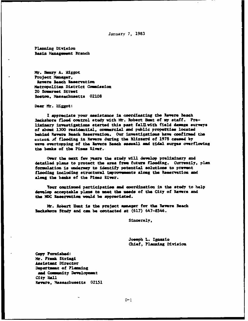
January 7, 1983
Planning DivisionBasin Manageient Branch
Mr. Beary A. IHiggotProject Manager,lavers Beach Roeservation
Metropolitan District Cmission20 Somerset StreetBoston, Massachsetts 02108
Deer Mr. Higgot:
I appreciate your asIstanice In coordinating the Revers Beach3eckshore flood coutrol study with Mr.* Robert Hut of my staff. Pre-liiary investigations started this past falU ith field dmge surveysof about 1300 residential, commercial md public propefttes locatedbehind Revere Beach Reservation. Our investigations have confirind theexteut -if flooding in Revere during the Blizzard of 1978 caused byways overtopping of the Revere Beach seavall and tidal surges overf lowingthe banks of the Pines River.-
Over the next few years the study wili develop preliminary anddetailed plans to protect the area f rem future flooding. Currently, planformalation. is underway to identify potential solutions to preventflooding -including structural Improvmnts aloeg the Reservation andaloeg the banks of the Piusts River.
Your caintimud. participaties and coordination in the study to helpdevelop acceptable plane to mmt the neds of the City of Revere andthe NDC Raservation would be appreciated.
Mt.* Robert RUnt is the Project inmger for the Revere BeachBmcksbore Study and ca be contacted at (617) 647-8546.
Sincerely,
Joseph L. IgaaioChief, P1awlg Division
Copy Furnished:Mr~. Frank StriagiAssistant DirectorDeprtmet of Planing
au Caminity Develpmtcity HallRevere, Mlassachusetts 02151
D- 1
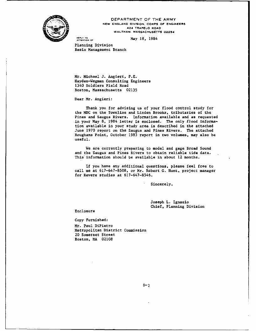
" " DEPARTMENT OF THE ARMYNEW ENGLAND DIVISION. CORPS OF ENGINEERS
424 TRAPELO ROAD
WALTHAM. MASSACHUSETTS 02214
, ..... OfMay 18, 1984
Planning DivisionBasin Management Branch
Mr. Michael J. Angieri, P.E.Hayden-Wegman Consulting Engineers1340 Soldiers Field RoadBoston, Massachusetts 02135
Dear Mr. Angieri:
Thank you for advising us of your flood control study forthe MDC on the Townline and Linden Brooks, tributaries of thePines and Saugus Rivers. Information available and as requestedin your May 8, 1984 letter is enclosed. The only flood informa-tion available in your study area is described in the attachedJune 1970 report on the Saugus and Pines Rivers. The attachedRoughans Point, October 1983 report in two volumes, may also beuseful.
We are currently preparing to model and gage Broad Soundand the Saugus and Pines Rivers to obtain reliable tide data.This information should be available in about 12 months.
If you have any additional questions, please feel free tocall me at 617-647-8508, or Mr. Robert G. Hunt, project managerfor Revere studies at 617-647-8546.
Sincerely,
Joseph L. IgnazioChief, Planning Division
Enclosure
Copy Furnished:
Mr. Paul DiPietroMetropolitan District Commission20 Somerset StreetBoston, MA 02108
D-2
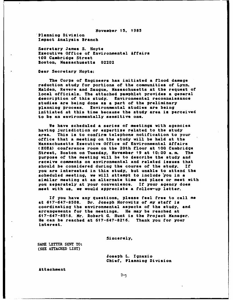
November 15, 1985Planning DivisionImpact Analysis Branch
Secretary James S. HoyteExecutive Office of Environmental Affairs100 Cambridge StreetBoston, Massachusetts 02202
Dear Secretary Hoyte:
The Corps of Engineers has initiated a flood damagereduction study for portions of the communities of Lynn,Malden, Revere and Saugus, Massachusetts at the request oflocal officials. The attached pamphlet provides a generaldescription of this study. Environmental reconnaissancestudies are being done as a part of the preliminaryplanning process. Environmental studies are beinginitiated at this time because the study area is perceivedto be an environmentally sensitive one.
We have scheduled a series of meetings with agencieshaving jurisdiction or expertise related to the studyarea. This is to confirm telephone notification to youroffice that a meeting on the study will be held at theMassachusetts Executive Office of Environmental Affairs(EOEA) conference room on the 20th floor at 100 CambridgeStreet, Boston on Tuesday, November 19 at 10:00 a.m. Thepurpose of the meeting will be to describe the study andreceive comments on environmental and related issues thatshould be considered during the course of the study. Ifyou are interested in this study, but unable to attend thescheduled meeting, we will attempt to include oyou in asimilar meeting at an alternate time and place or meet withyou separately at your convenience. If your agency doesmeet with us, we would appreciate a follow-up letter.
If you have any questions, please feel free to call meat 617-647-8508. Dr. Joseph Horowitz of my staff iscoordinating the environmental aspects of the study, andarrangements for the meetings. He may be reached at617-647-8518. Mr. Robert G. Hunt is the Project Manager.He can be reached at 617-647-8216. Thank you for yourinterest.
Sincerely,
SAME LETTER SENT TO:(SEE ATTACHED LIST)
Joseph L. IgnazioChief, Planning Division
AttachmentD-3
A copy of this letter has also been sent to the followingpeople:
Mr. Dick ChalpinChief, Environmental EngineerDEQE/Northeast Regional Office5 Commonwealth AvenueWoburn, Massachusetts 01801
Mr. Thomas McMahon, DirectorDivision of Water Pollution ControlDepartment of Environmental Quality EngineeringI Winter StreetBoston, Massachusetts 02108
DirectorDivision of WetlandsDepartment of Environmental Quality EngineeringI Winter StreetBoston, Massachusetts 02108ATTN: Mr. Gary Clayton
Mr. Walter E. Bickford, DirectorDepartment of Fisheries, Wildlife andRecreational Vehicles
100 Cambridge StreetBoston, Massachusetts 02202
Mr. Philip G. Coates, DirectorDivision of Marine FisheriesDepartment of Fisheries, Wildlife andRecreational Vehicles
100 Cambridge StreetBoston, Massachusetts 02202ATTN: Mr. Leigh Bridges
Mr. Randall FairbanksAsst. Director of Sport FisheriesDivision of Marine Fisheries100 Cambridge Street, 19th FloorBoston, Massachusetts 02202
Mr. James FairAsst. Director of Commercial FisheriesDivision of Marine Fisheries100 Cambridge StreetBoston, Massachusetts 02202
D- 3a
Mr. Richard Cronin, DirectorDivision of Fisheries & Wildlife100 Cambridge StreetBoston, Massachusetts 02202
Mr. Tom FrenchDirector of Nongame & Endangered SpeciesDept. of Fisheries, Wildlife & Recreational Vehicles100 Cambridge Street, 19th FloorBoston, Massachusetts 02202
Mr. Henry WooslevCoordinator of Natural Heritage ProgramDept. of Fisheries, Wildlife & Recreational Vehicles100 Cambridge Street, 19th FloorBoston, Massachusetts 02202
Secretary James S. HoyteExecutive Office of Environmental Affairs100 Cambridge StreetBoston, Massachusetts 02202
Mr. Samual Mygatt, DirectorEnvironmental Impact ReviewExecutive Office of Environmental Affairs100 Cambridge StreetBoston, Massachusetts 02202
Mr. Steven DavisExecutive Office of Environmental Affairs100 Cambridge StreetBoston, Massachusetts 02202
Mr. Richard F. DelaneyDirectorCoastal Zone Management100 Cambridge Street, Room 2006Boston, Massachusetts 02202
D-3b
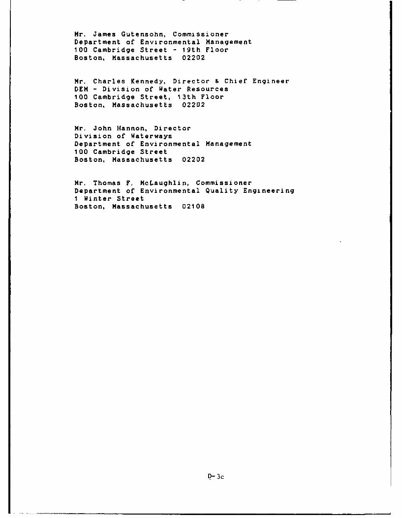
Mr. James Gutensohn, CommissionerDepartment of Environmental Management100 Cambridge Street - 19th FloorBoston, Massachusetts 02202
Mr. Charles Kennedy, Director & Chief EngineerDEM - Division of Water Resources100 Cambridge Street, 13th FloorBoston, Massachusetts 02202
Mr. John Hannon, DirectorDivision of WaterwaysDepartment of Environmental Management100 Cambridge StreetBoston, Massachusetts 02202
Mr. Thomas F. McLaughlin, CommissionerDepartment of Environmental Quality EngineeringI Winter StreetBoston, Massachusetts 02108
D- 3c
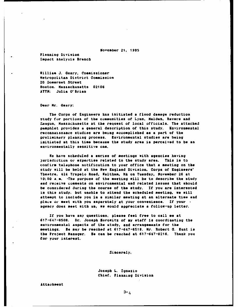
November 21, 1905Planninq DivisionImpact Analysis Branch
Nilliam J. Geary, Commissionermetropolitan District Commission20 omerset StreetBoston. Massachusetts 02108ATTN: Julia O'Brian
Dear Mr. Geary:
The Corps of Engineers has initiated a flood damage reductionstudy for portions of the communities of Lynn, Malden, Revere andSaugus, Massachusetts at the request of local officials. The attachedpamphlet provides a general description of this study. Environmentalreconnaissance studies are being accomplished as a part of thepreliminary planning process. Environmental studies are being
initiated at this time because the study area is perceived to be an
environmentally sensitive one.
ge have scheduled a series of meetings with agencies having3urisdiction or expertise related to the study area. This is toconfirm telephone notification to your office that a meeting on the
study will be held at the Nen England Division, Corps of Engineers'Theatre, 424 Trapelo Road, Waltham, MA on Tuesday, November 26 at10:00 a.m. -The purpose of the meeting will be to describe the study
and receive comments on environmental and related issues that shouldbe considered during the course of the study. If you are interested
in this study, but unable to attend the scheduled meeting, we willattempt to include you in a similar meeting at an alternate time andplace or meet with you separately at your convenience. If youragency does meet with us, we would appreciate a follow-up letter.
If you have any questions, please feel free to call me at617-647-8508. Dr. Joseph lorowitx of my staff is coordinating theenvironmental aspects of the study, and arrangements for themeetings. ie may be reached at 617-647-510. Mr. Robert G. Hunt isthe Project Manager. Ne can be reached at 617-647-6216. Thank youfor your interest.
Sincerely,
Joseph L. Ignazio
Chief, Planning Division
Attaohment
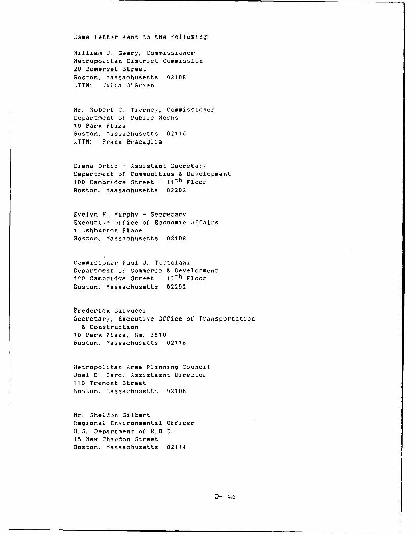
Same letter sent to the following:
Hilliam J. Geary, CommissionerMetropolitan District Commission
20 Somerset StreetBoston, Massachusetts 02108ATTN: Julia 0' Brian
Mr. Robert T. Tierney, Commissioner
Department of Public gorks10 Park Plaza
Boston, Massachusetts 02116ATTN: Frank Bracaglia
Diana Ortiz - Assistant SecretaryDepartment of Communities & Development
100 Cambridge Street - 11th Floor
Boston. Massachusetts 02202
Evelyn F. Murphy - SecretaryExecutive Office of Economic Affairs1 Ashburton Place
Boston, Massachusetts 02108
Commisioner Paul J. Tortolani
Department of Commerce & Development100 Cambridge Street - 13 th Floor
Boston. Massachusetts 02202
1'rederick Salvucci
Secretary, Executive Office ot" Transportation& Construction
10 Park Plaza, Rm. 3510
Boston. Massachusetts 02116
Metropolitan Area Planning CouncilJoel E. Card, Assistaznt Director110 Tremont Street
Boston. Massachusetts 02108
Mr. Sheldon GilbertRegional Environmental Otficer
U. S. Department of H. U. D.15 flew Chardon StreetBoston. Massachusetts 02114
D- 4a
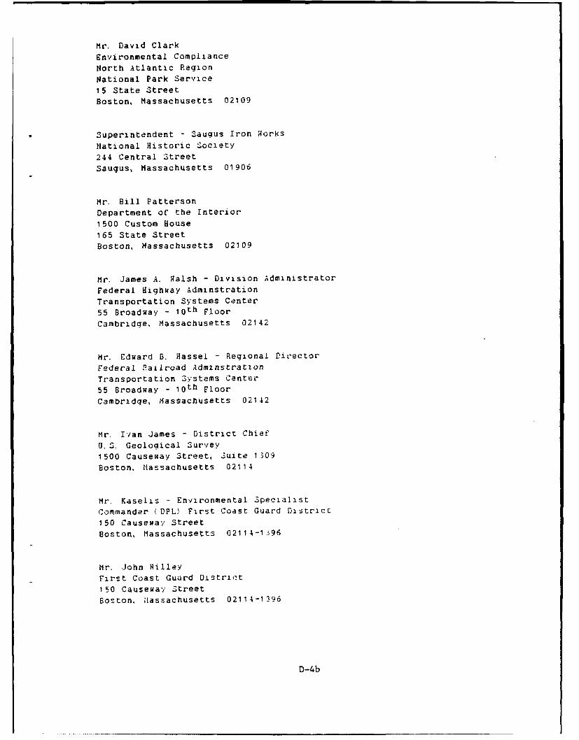
Mr. David Clark
Environmental Compliance
North Atlantic Region
National Park Service
15 State Street
Boston, Massachusetts 02109
Superintendent - Saugus Iron Norks
National Historic Society
244 Central Street
Saugus, Massachusetts 01906
Mr. Bill Patterson
Department of the Interior
1500 Custom House165 State Street
Boston, Massachusetts 02109
Mr. James A. Ralsh - Division Administrator
Federal Highway Adminstration
Transportation Systems Center
55 Broadway - l0 th Floor
Cambridge, Massachusetts 02142
Mr. Edward B. Hassel - Regional Director
Federal Railroad Adminstration
Transportation Systems Center
55 Broadway - loth Floor
Cambridge, Massachusetts 02142
Mr. Ivan James - District Chief
U. S. Geological Survey
1500 Causeway Street, Suite 1309
Boston, Massachusetts 02114
Mr. Kaselis - Environmental Specialist
Commander (DPL) First Coast Guard Distric-
150 Causeway Street
Boston, Massachusetts 02114-1596
Mr. John Hilley
First Coast Guard Distric t
150 Causeway Street
Boston, Nassachusetts 02114-1396
D-4b
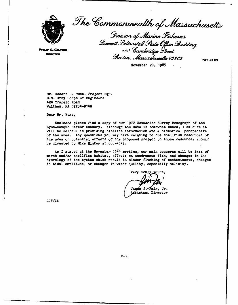
PRuP C COATUowY on 02 2 727-3193
November 20, 1985
Mr. Robert G. Hunt, Project Mgr.U.S. Army Corps of Engineers424 Trapelo RoadWaltham, MA 02254-9149
Dear Mr. Hunt,
Enclosed please find a copy of our 1972 Estuarine Survey Monograph of theLynn-Saugus Harbor Estuary. Although the data is somewhat dated, I am sure itwill be helpful in providing baseline information and a historical perspectiveof the area. Any questions you may have relating to the shellfish resources ofthe area or potential effects of the proposed project on those resources shouldbe directed to Mike Hickey at 888-4043.
As I stated at the November 19th meeting, our main concerns will be loss ofmarsh and/or shellfish habitat, effects on anadromous fish, and changes in thehydrology of the system which result in slower flushing of contaminants, changesin tidal amplitude, or changes in water quality, especially salinity.
Very truly ours,
ur°
ia ant Director
JJF/lt
D-5
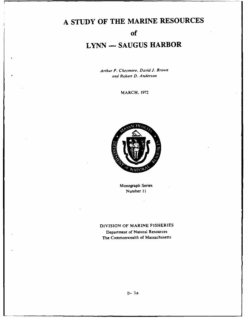
A STUDY OF THE MARINE RESOURCES
of
LYNN - SAUGUS HARBOR
Arthur P. Chesmore, David J. Brownand Robert D. Anderson
MARCH, 1972
Monograph SeriesNumber 11
DIVISION OF MARINE FISHERIES
Department of Natural Resources
The Commonwealth of Massachusetts
D- 5a
ECONOMIC VALUES
The minimum value derived from the utilization Based on the expanded refource valueof the marine resources of Lynn - Saugus Harbor ($491,257.12) the minimum marine fisheries revenueduring 1968 was $279,493 (Table 21). Commercial yield/surface acre (MHW) for the study area wasfishing for lobsters, sea worms and soft shell clams estimated at $69.79.accounted for 63.2% ($176,689) of the total incomewhile sport fishing activities accounted for 36.8%($102,804). An estimated $96,084 was lost during Table 21. Minimum Economic Values of Marine Fisheries1968 resulting from harvest restrictions on approx- Resources in Lynn - Saugus Harbor. 1968 - 1969.
imately 8,007 bu of contaminated soft shell clams.Minimum value of the 1968 Lynn - Saugus Har- Sport Fishery
bor sport fishery was $102,804. However, the 1965 Party and charter boat fees ............... $69.564fishing survey indicated an average expendi- Skiff rental fees ........................... 27,720
sport Launching ramp fees ...................... 5.520ture of $8.34 per salt water fishing trip. Using this Sub-total ................................ $102.804
cost, the 37,718 sport fishing trips from Lynn -Saugus Harbor amounted to an expenditure of Commercial Fisheries
$314,568.12. Combining this expanded value for the Lobsters ................................ S147.394Soft shell clams .......................... 7.795
sport fishery with the minimum value of the com- Sea worms ............................... 21.500mercial fisheries ($176,689)' an estimated Sub-total ............................... .. 176.689$491,257.12 was realized from the utilization of themarine resources of Lynn - Saugus Harbor during GRAND TOTAL ........................... $279.4931968.
SUMMARY
A minimum of$147,394 was derived from the com- by approximately 37,718 sport fishermen utilizingmercial harvest of lobsters in the Lynn - Saugus party and charter boats, rented skiffs and boatHarbor area during 1968. An estimated $21,500 was launching facilities.realized from sea worm harvest and $7,795 was Twenty species of algae and 14 species of vascularderived from soft shell clams harvested from the plants were collected from the waters and saltintertidal flats of the study area. marshes of the study area. The Lynn - Saugus
Thirty-one species of finfish, totalling 4,210 area contains 1,269 acres of salt marsh.individuals, were collected during sampling opera- The total estimated minimum economic valuetions at five shore and four offshore stations. Finfish derived from the utilization of the marine fisheriesspecies sought by sport fishermen include winter resources of Lynn - Saugus Harbor amounted toflounder, Atlantic cod, haddock, mackerel, striped $279,493. The estimated expanded value wasbass and pollock. An estimated $102,804 was spent $491,257.12.
RECOMMENDATIONS
The following recommendations are made to aid 2. .. all salt marsh within the study area be placedin the management and wise utilization of the marine under the protection of the Coastal Wetlands Actresources of Lynn - Saugus Harbor. It is recom- (Chapter 130, Section 105).mended that:1. . . the salt marshes and tidal flats of the study 3. regulations and abatement schedules bearea be protected from alteration and destruction enforced curtailing discharge of untreated domesticbecause of their habitat, and for their food chain sewage and industrial waste into the waters of Lynncontributions which are vital to finfish and shellfish - Saugus Harbor and that water quality standardspopulations. of SA and SB be met as soon as possible.
36
D- 5b
4. .. .the Division of Environmental Health, Mass- facility be constructed within Lynn - Saugus Har-achusetts Department of Public Health, continue bor in the vicinity of Beachmont.to monitor water and shellfish for the presence of 6. ... fishing piers and public access be constructedcoliform bacteria; and finfish, shellfish and water in Lynn - Saugus Harbor in the areas of Bass Point,for pesticide and heavy metal residues. This should Nahant and Grovers Cliff, Winthrop.be part of a continuing study along the entire coast- 7. . . by 1978, Lynn - Saugus Harbor be restudiedline of Massachusetts. and the findings be compared to this report.5... .an all-tide boat launching ramp and parking
LITERATURE CITED
American Fisheries Society. 1970. A list of common -. 1969. A study of the marine resources of theand scientific names of fishes from the United Annisquam River - Gloucester Harbor CoastalStates and Canada. Third Edition. Special Publi- System. Mono. Ser. No. 8. Mass. Div. Marinecation No. 6. American Fisheries Society. 150 Fisheries. 62 p.p. Lewis, A. 1844. The history of Lynn including Nah-
Chesmore, A.P., S.A. Testaverde, and F.P. ant. Samuel W. Dickinson. Boston. pp. 87, 109,Richards. 1971. A study of the marine resources 263.of Dorchester Bay. Mono. Ser. No. 10. Mass. -. 1848. The picture of Nahant. J.B. Tolman,Div. Marine Fisheries. 44 p. Lynn. 16 p.
Fernald, M.L. 1959. Gray's manual of botany. - , and J.R. Newhall. 1865. History of Lynn,Eighth Edition. American Book Co., New York. Essex County Massachusetts including Lynn-1,632 p. field, Saugus, Swampscott, and Nahant. John
Fiske, J.D., C.E. Watson and P.G. Coates. 1966. L. Shorey. Boston. 494 p.A study of the marine resources of the North Lynn School Committee. 1931. History stories ofRiver. Mono. Ser. No. 3. Mass. Div. Marine Lynn. Lynn. 243 p.Fisheries. 53 p. Marx, W. 1967. The frail ocean. Ballantine Books,
Goode, G.B. 1887. The fisheries and fishing Inc. New York. 274 p.industries of the United States. U.S. Government Massachusetts, Commonwealth of. 1920. AnnualPrinting Office. Washington, D.C. 900 p. Report of the Division of Fisheries and Game
G uberlet, M.L. 1956. Seaweeds at ebb tide. U niver- for the year ending November 30, 1919.sity of Washington Press. Seattle. 182 p. -. 1921. Annual Report of the Division of
Hurd, D.H. 1888. History of Essex County, Mass- Fisheries and Game for the year endingachusetts. Vol. 2. J. W. Lewis & Co., Phila- November 30, 1920. 173 p.delphia. 1428 p. -. 1922. Annual Report of the Division of
Hutton, R.F. 1968. Estuaries and the environment. Fisheries and Game for the year ending15th Annual Conservation Conference. National November 30, 1921. 195 p.Wildlife Association. Washington, D.C. - . 1963. Report of the Department of Natural
Jerome, W.C. Jr., A.P. Chesmore, C.O. Anderson, Resources relative to the coastal wetlands in theJr. and F. Grice. 1965. A study of the marine Commonwealth and certain shellfish grants.resources of the Merrimack River Estuary. Mono. (under Chapter 75 of the Resolves of 1962).Ser. No. 1. Mass. Div. Marine Fisheries. 90 p. Matthiessen, G.C. 1962. Tidemarshes: a vanishing
Jerome, W.C. Jr., A.P. Chesmore and C.O. Ander- resource. Mass. Audubon Society, Summerson, Jr. 1967. A study of the marine resources Issue. South Lincoln, Mass. pp 216-221.of Beverly - Salem Harbor. Mono. Ser. No. National Technical Advisory Committee Report.4. Mass. Div. Marine Fisheries. 74 p. 1968. Water quality criteria. U.S. Government
-. 1968. A study of the marine resources of the Printing Office, Washington, D.C. pp. 82 - 83.Parker River - Plum Island Sound Estuary. Newhall, J.R. 1879. Lin: The third plantation ofMono. Ser. No. 6. Mass. Div. Marine Fisheries. Massachusetts Colony. George C. Herbert.81 p. Lynn. 500 p.
37
D-5c
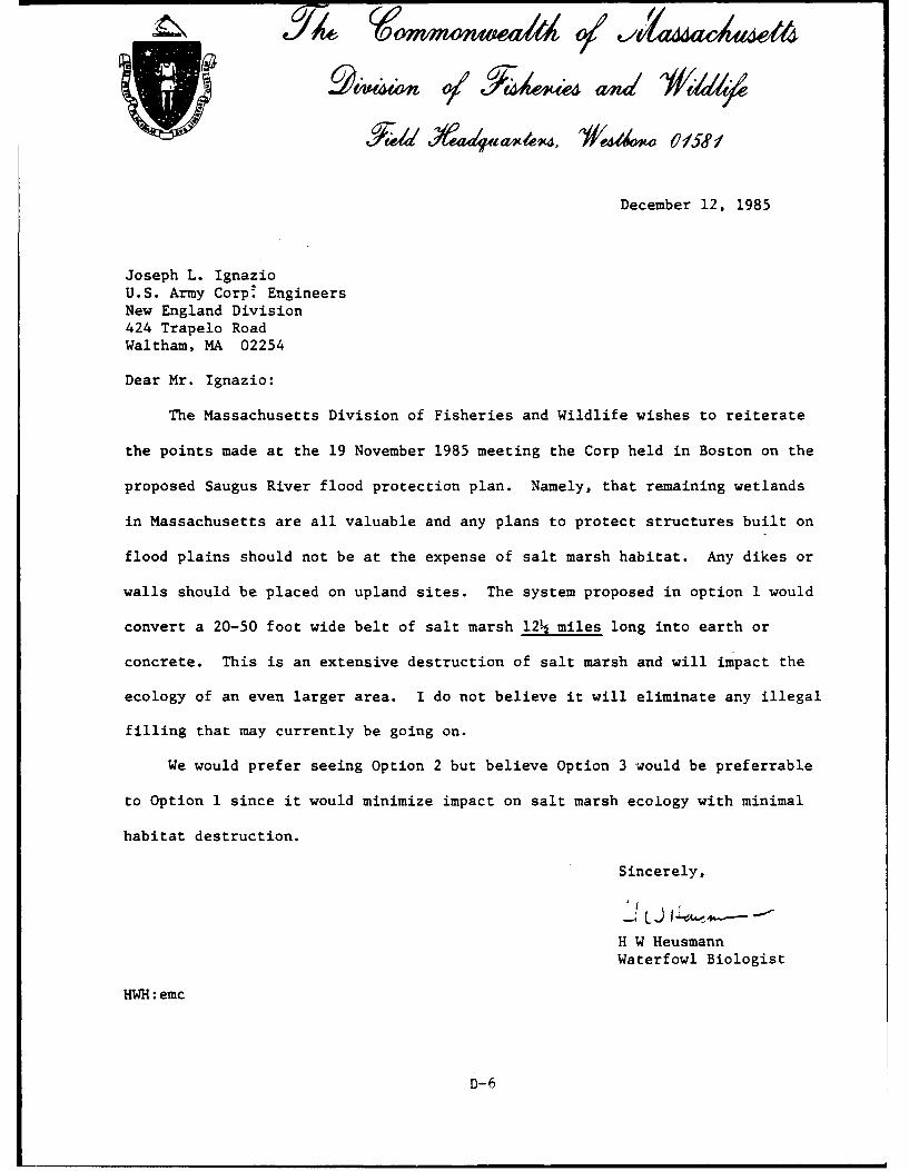
December 12, 1985
Joseph L. IgnazioU.S. Army Corp' EngineersNew England Division424 Trapelo RoadWaltham, MA 02254
Dear Mr. Ignazio:
The Massachusetts Division of Fisheries and Wildlife wishes to reiterate
the points made at the 19 November 1985 meeting the Corp held in Boston on the
proposed Saugus River flood protection plan. Namely, that remaining wetlands
in Massachusetts are all valuable and any plans to protect structures built on
flood plains should not be at the expense of salt marsh habitat. Any dikes or
walls should be placed on upland sites. The system proposed in option I would
convert a 20-50 foot wide belt of salt marsh 12 miles long into earth or
concrete. This is an extensive destruction of salt marsh and will impact the
ecology of an even larger area. I do not believe it will eliminate any illegal
filling that may currently be going on.
We would prefer seeing Option 2 but believe Option 3 would be preferrable
to Option 1 since it would minimize impact on salt marsh ecology with minimal
habitat destruction.
Sincerely,
H W HeusmannWaterfowl Biologist
HWH:emc
D-6
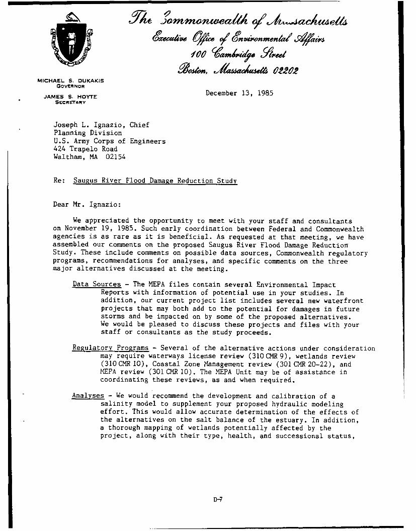
Aica~ Op. V/ SnWnMenia/ s~lw
MICHAEL S. DUKAKISG O V E R N O RD
e e b r 1 , 9 8JAMES S. HOYTE
SECRETARY
Joseph L. Ignazio, ChiefPlanning DivisionU.S. Army Corps of Engineers424 Trapelo RoadWaltham, MA 02154
Re: Saugus River Flood Damage Reduction Study
Dear Mr. Ignazio:
We appreciated the opportunity to meet with your staff and consultantson November 19, 1985. Such early coordination between Federal and Commonwealthagencies is as rare as it is beneficial. As requested at that meeting, we haveassembled our comments on the proposed Saugus River Flood Damage ReductionStudy. These include comments on possible data sources, Commonwealth regulatoryprograms, recommendations for analyses, and specific comments on the threemajor alternatives discussed at the meeting.
Data Sources - The MEPA files contain several Environmental ImpactReports with information of potential use in your studies. Inaddition, our current project list includes several new waterfrontprojects that may both add to the potential for damages in futurestorms and be impacted on by some of the proposed alternatives.We would be pleased to discuss these projects and files with yourstaff or consultants as the study proceeds.
Regulatory Programs - Several of the alternative actions under considerationmay require waterways license review (310 CMR 9), wetlands review(310CMR 10), Coastal Zone Management review (301 CuR 20-22), andMPA review (301 CMR 10). The MEPA Unit may be of assistance incoordinating these reviews, as and when required.
Analyses - We would recommend the development and calibration of asalinity model to supplement your proposed hydraulic modelingeffort. This would allow accurate determination of the effects ofthe alternatives on the salt balance of the estuary. In addition,a thorough mapping of wetlands potentially affected by theproject, along with their type, health, and successional status,
D-7
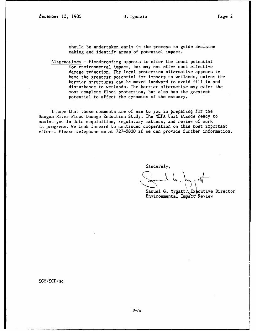
becember 13, 1985 J. Ignazio Page 2
should be undertaken early in the process to guide decisionmaking and identify areas of potential impact.
Alternatives - Floodproofing appears to offer the least potentialfor environmental impact, but may not offer cost effectivedamage reduction. The local protection alternative appears tohave the greatest potential for impacts to wetlands, unless thebarrier structures can be moved landward to avoid fill in anddisturbance to wetlands. The barrier alternative may offer themost complete flood protection, but also has the greatestpotential to affect the dynamics of the estuary.
I hope that these comments are of use to you in preparing for theSaugus River Flood Damage Reduction Study. The MEPA Unit stands ready toassist you in data acquisition, regulatory matters, and review of workin progress. We look forward to continued cooperation on this most importanteffort. Please telephone me at 727-5830 if we can provide further information.
Sincerely,
Samuel G. Mygatt,\Excutive Director
Environmental Impa~t Review
SGM/SCD/sd
D-7a
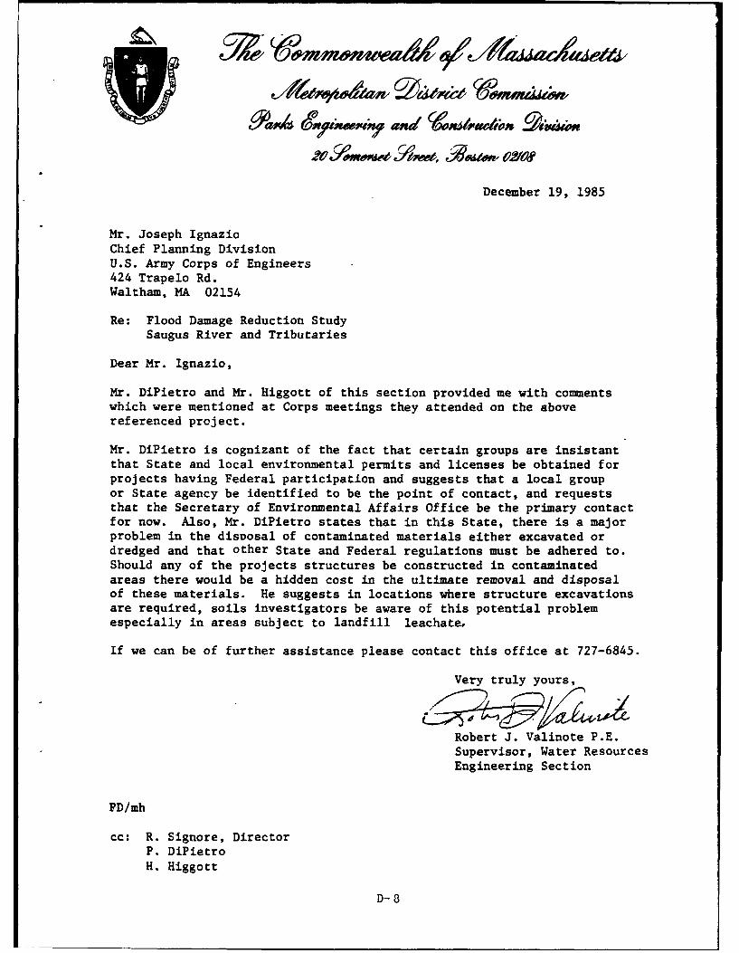
December 19, 1985
Mr. Joseph IgnazioChief Planning DivisionU.S. Army Corps of Engineers424 Trapelo Rd.Waltham, MA 02154
Re: Flood Damage Reduction Study
Saugus River and Tributaries
Dear Mr. Ignazio,
Mr. DiPietro and Mr. Higgott of this section provided me with commentswhich were mentioned at Corps meetings they attended on the abovereferenced project.
Mr. DiPietro is cognizant of the fact that certain groups are insistantthat State and local environmental permits and licenses be obtained forprojects having Federal participation and suggests that a local groupor State agency be identified to be the point of contact, and requeststhat the Secretary of Environmental Affairs Office be the primary contactfor now. Also, Mr. DiPietro states that in this State, there is a majorproblem in the disoosal of contaminated materials either excavated ordredged and that other State and Federal regulations must be adhered to.Should any of the projects structures be constructed in contaminatedareas there would be a hidden cost in the ultimate removal and disposalof these materials. He suggests in locations where structure excavationsare required, soils investigators be aware of this potential problemespecially in areas subject to landfill leachate,
If we can be of further assistance please contact this office at 727-6845.
Very truly yours,
Robert J. Valinote P.E.Supervisor, Water ResourcesEngineering Section
PD/mh
cc: R. Signore, DirectorP. DiPietroH. Higgott
D-8
MassachusettsNatural Heritage
4Program
January 2, 1986
Mr. Joseph HorwitzPlanning DivisionNew England Division, Corps of Engineers424 Trapelo Rd.Waltham, MA 02254 RE: Flood Damage Reduction Study
Lynn, Malden, Revere, and Saugus,MA
Dear Mr. Horwitz,
Thank you for contacting the Massachusetts Natural Heritage Program regardingrare plants and animals and exemplary natural communities within the study areafor the Saugus River and Tributaries Flood Damage Reduction Project. At thistime, we are not aware of any rare species in this area.
As you requested, I have examined our records for the Piping Plover (Charadriusmelodus). The nearest breeding colonies are in Ipswich to the north and Scituateto the south. Terns (Sterna sp.) have nested on Snake Island in Winthrop, butthis locality is miles from the study area.
Please note that locations of rare species should not be made public inorder toprotect populations and habitats from inadvertent damage. Also, as our inventoryexpands with ongoing fieldwork and research, more data on this area may becomeavailable in the future.
For your reference, I am enclosing a Program Description, and Lists of Rare andEndangered Plants and Animals. Please feel free to contact me if I can be offurther assistance.
Sincerely,
Joanne HichaudEnvironmental Reviewer
JM/jmEncl.
D-9Division of Fisheries and Wildlife 100 Cambridge Street, Boston, Mass. 02202 (617) 727-9194,-3151
S. RUSSELL SYLVA y'e,0j *w .n
CommissoneF
February 3, 1986
Dr. Joseph HorowitzArmy Corps of Engineers424 Trapelo RoadWaltham, MA 02254-9149
Dear Dr. Horowitz:
The Department's Division of Water Pollution Control has reviewed thedescription of the flood damage reduction study for portions of thecommunities of Lynn, Malden, Revere, and Saugus, Massachusetts along theSaugus and Pines Rivers. The Department is concerned with water qualityof the rivers and estuaries to make sure they meet the water qualitystandards and classification assigned to the rivers.
Both the Saugus and Pines Rivers are classified as SB waters withdesignated uses as a marine fishery, shellfishing and primary and secondaryrecreation. Water quality criteria for class SB waters are listed below.
For Class SB waters:
Parameter Criteria
1. Dissolved Oxygen Shall be a minimum of 85 percent ofsaturation at water temperatures above77°F (25°C) and shall be a minimum of6.0 mg/l at water temperatures of77°F (25'C) and below.
2. Temperature Increase None except where the increase will notexceed the recommended limits on themost sensitive water use.
3. pH Shall be in the range of 6.5-8.5 and notmore than 0.2 units outside of thenaturally occurring range.
D- 10
Dr. Joseph Horowitz - 2 - February 3, 1986
Parameter Criteria
4. Total Coliform Bacteria Shall not exceed a median value of 700 MPNper i00 ml and not more than 20% of thesamples shall exceed 1000 MPN per 100 mlduring any monthly sampling period, exceptas provided in 314 CMR 4.02(1).
To date the Division has conducted two water quality surveys within the Saugusand Pines River (1976 and 1982). Copies of these reports have been sent tothe Army Corps of Engineers. If additional copies are needed, please feel freeto contact me in Westborough (366-9181).
The Department feels the main problem .,ith options one and three in the proposalis the impact on the wetlands. These concerns should be addressed by theDepartment's Division of Wetlands Northeast Region. Direct all questions toJohn Felix (617/935-2160).
Any alteration of the natural course of flow for the rivers will change thecurrents and stream flow. This could cause settling of solids in backwaters,thus filling in the wetlands and stream channels or cause scouring and sedimentresuspension where new currents and backwaters are created. Furthermore, achange in saltwater - freshwater mixtures could cause a change in biologicalhabitats and communities. If death or decay of living organisms occurred,water quality degradation could occur.
If option one is implemented, National Pollutant Discharge Elimination System(NPDES) permits will be required at all pumping stations. Glenn Gilmore orSharon Jones in the DEQE Boston office of the Division of Water PollutionControl, Permits Section can provide the necessary information concerning thepermit process.
Therefore, the Division of Water Pollution Control is mainly interested inwater quality conditions and the change in water quality and biological impactsthat would result with an alteration of the natural and current environment.
If you have any further questions regarding this study please feel free tocontact me. John Felix in the Division of Wetlands should also be contactedduring the scoping process.
Sincerely,
Margo T. Webber
Assistant Sanitary Engineer
MTw/kt
cc: John Felix, DEQE Northeast RegionGlenn Gilmore
D-lia
4Q1,1im 9j-1 TEA4
WILLIAM J. GEARY t • ... IV •COMMISSIONER
FEB 1 d ' February 7, 1986
CFFICE OF THE 'r.C.y OF R CE IV DE.!:,:, -1t.,1 IMVTAL AFFAIRS
Mr. James S. Hoyte, Secretary A
Executive Office of Environmental Affairs • 1100 Cambridge StreetBoston, Massachusetts 02202 OFFiCE OF THE SECRETARY
X ENVIRONMENTAL AFFAIRSRe: U.S Army Corps of Engineers Flood Damage Reduction Study, Saugus
River and Tributaries
Dear Jamie:
Our Engineering and Construction Division was briefed by the Azn
Corps regarding this proposed project study at several meetings. As
you are aware we have completed and have ongoing flood control pro-
jects in the Revere area. This study may show significant cost savings
to the Coimronwealth by providing tidal flood protection over a more
wide spread area than the construction of smaller local protection
projects.
We encourage the endeavors of this study and support the long
range flood reduction benefits to residents and P.D.C. properties in the
affected area.
ye ruly yours,
Geary'ssioner
PJD/nem
cc: Richard R. Signore, Dir. arks Eng. & Constr.R. Valinote, P.E. Supervisor Water Resources Section
D-11
S. RUSSELL SYLVA 5ConwmWner
935-2160 February 12, 1986
Dr. Joseph Horowitz RE: Flood Reduction StudyU.S. Army Corps of Engineers Saugus River/Tributaries424 Trapelo Road Wetland ConcernsWaltham, MA 02154
Dear Dr. Horowitz:
As per your request, the Wetlands Division of the Department of EnvironmentalQuality Engineering is submitting coments regarding the Army Corps of Engineer'sflood damage reduction study currently underway for the Saugus River and itstributaries. An overview of the flooding problem and various options beingconsidered by the ACE to address local flooding issues were presented at a meetingsponsored by your agency on January 8, 1986.
The ACE is presently considering three main options to deal with floodingproblems in four communties that border the Saugus River or its tributaries. Theoptions were outlined in an October, 1985 publication entitled "ProjectInformation: Flood Damage Reduction Study, Saugus River and Tributaries". Option#1 would involve the construction of earth dikes or concrete walls to preventcoastal waters from flooding five specific areas along the Saugus River. Option #2would reduce vulnerability to flooding by raising or floodproofing buildings,implementing a flood preparedness plan and using other "non-structural" means toprevent or reduce flood damage. Option #3 is a "Comprehensive Plan" that wouldinvolve the constructin of a tidal barrier across the Saugus and/or Pines River.This option would also require the construction of navigation gates, flushing gatesand a pump station.
Following review of the three options, it is the Departments's opinion thatOption #2 would result in least impact on the interests identified in the WetlandsProtection Act. Options #1 and #3 would probably result in significant alterationof a number of coastal resource areas; including Salt Marsh, Coastal Bank, BarrierBeach, Coastal Dune, Coastal Beach, Land Under the Ocean and possibly LandContaining Shellfish. The Department, in recognizing the local flooding problem,would favor Option #2 or any other option that would result in the least amount ofdestruction/alteration of the resource areas identified in the Wetlands ProtectionAct. The Department would also favor any option that would restrict furtherdevelopment in areas proned to coastal flooding.
D-12
Page -2-Flood Reduction StudySaugus River/Tributaries
Please be advised that some of the activities that would probably be involvedin Options #1 and #3 would probably require a waiver of the Wetlands Regulations bythe Commissioner of the Department. Activities such as the alteration of more than5000 square feet of bordering vegetated wetlands or any alteration of salt marshare prohibited unless a Variance is granted by.the Commissioner.
The Department hopes these comments are helpful in your assessment of thevarious options being considered. If you have any further questions, please do nothesitate to contact Mr. John Felix at 935-2160.
Sincerely,
William A. Krol, P.E.Deputy Regional Environmental Engineer
WAX/jf/cd
D- 12a
3~qe &mwtaaea14lfd ~ c~~1
MICHAEL S. DUKAKISGOVERNOR February 19, 1986
JAMES S. HOYTE
SECRetrrARY
Colonel Thomas A. RhenU.S. Army Corps of Engineers424 Trapelo RoadWaltham, MA 02254-9149
RE: Flood Damage Reduction Study: Saugus River and Tributaries
Dear Colonel Rhen:
As a result of my recent meeting with you and members of yourstaff at which we discussed your activities regarding the Flood DamageReduction Study, for the Saugus River and Tributaries, I have brieflydiscussed the proposal with members of my departments.
This Office supports the Corps' continued efforts to generateextensive environmental baseline data to assess the extent of flooddamage in the affected communities and to determine if flood damagereduction options can be implemented while minimizing impacts to thevaluable Saugus marsh resource area. I have directed my departmentsto cooperate with your staff In supplying information regarding yourendeavor.
In general, the Commonwealth prefers nonstructural flood damagereduction solutions, such as floodprooflng, which clearly pose lesserenvironmental impacts. As your proposal develops, more substantativedata will become available that will allow for a comprehensive assessmentof the proper remedial option.
Sincerely,
Secretary
JSH/JO/gb
D- 13
Commonwealth of MassachusettsExecutive Office of Environmental AffairsDepartment of Environmental Management
100 Cambrkdge StreetBostonMassacuset0]2202
Divson ofWater Resources February 21, 1986
Mr. Joseph L. Ignazio, Chief, Planning DivisionNew England DivisionCorps of Engineers424 Trapelo RoadWaltham, MA 02254
Re: Flood Damage ReductionStudy Saugus River andTributaries
Dear Mr. Ignazio:
Mr. Joe Horowitz asked me by phone to comment in writing onthe above referenced project for which we had a meeting with otherstate agencies on Wednesday, January 8, 1986. My position withthe Division of Water Resources is that of Senior Planner for theFlood Hazard Management Project a federally funded program affiliatedwith the National Flood Insurance Program. My comments thereforereflect those issues relating to the National Flood Insurance Program.
Clearly there is a need to address flooding issues in the targetarea. According to literature I received from the Federal EmergencyManagement Agency the following numbers of flood insurance policiesare in effect charging the indicated premiums, as of December 21, 1986.
Chares F. Kennedy
Director & Chie Engineer
D-14
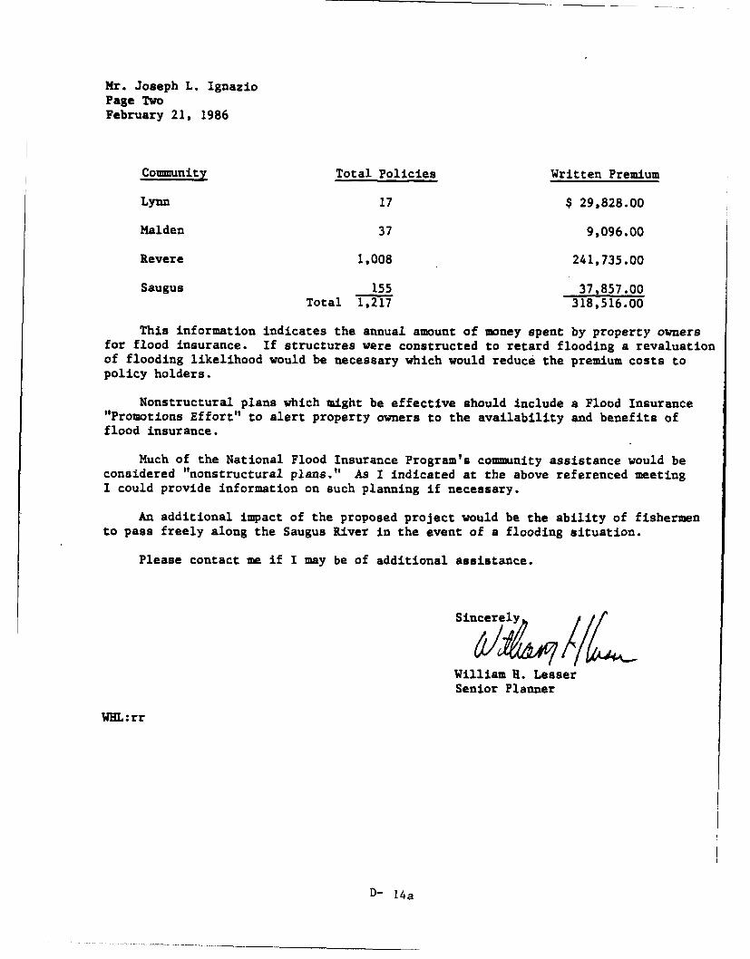
Mr. Joseph L. IgnazioPage TwoFebruary 21, 1986
Community Total Policies Written Premium
Lynn 17 $ 29,828.00
Malden 37 9,096.00
Revere 1,008 241,735.00
Saugus 155 37,857.00Total 1,217 318,516.00
This information indicates the annual amount of money spent by property ownersfor flood insurance. If structures were constructed to retard flooding a revaluationof flooding likelihood would be necessary which would reduce the premium costs topolicy holders.
Nonstructural plans which might be effective should include a Flood Insurance"Promotions Effort" to alert property owners to the availability and benefits offlood insurance.
Much of the National Flood Insurance Program's community assistance would beconsidered "nonstructural plans." As I indicated at the above referenced meetingI could provide information on such planning if necessary.
An additional impact of the proposed project would be the ability of fishermento pass freely along the Saugus River in the event of a flooding situation.
Please contact me if I may be of additional assistance.
Sincerely
1L
William H. LesserSenior Planner
WHL:rr
D- 14a
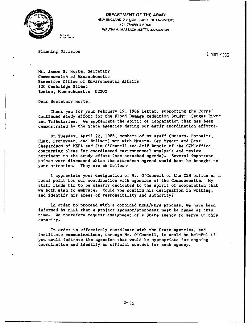
DEPARTMENT OF THE ARMYNEW ENGLAND DIVIION. CORPS OF ENGINEERS
424 TRAPELO ROAD
WALTHAM. MASSACHUSETTS 02254-9149Mf tV TO
Planning Division 1 MAY-;986
Mr. James S. Hoyte, SecretaryCommonwealth of MassachusettsExecutive Office of Environmental Affairs100 Cambridge StreetBoston, Massachusetts 02202
Dear Secretary Hoyte:
Thank you for your February 19, 1986 letter, supporting the Corps'continued study effort for the Flood Damage Reduction Study: Saugus Riverand Tributaries. We appreciate the spirit of cooperation that has beendemonstrated by the State agencies during our early aoordination efforts.
On Tuesday, April 22, 1986, members of my staff (Messrs. Horowitz,Hunt, Pronovost, and Bellmer) met with Messrs. Sam Mygatt and DaveShepardson of MEPA and Jim O'Connell and Jeff Benoit of the CZM officeconcerning plans for coordinated environmental analysis and reviewpertinent to the study effort (see attached agenda). Several importantpoints were discussed which the attendees agreed would best be brought toyour attention. They are as follows:
I appreciate your designation of Mr. O'Connell of the CZM office as afocal point for our coordination with agencies of the Commonwealth. Mystaff finds him to be clearly dedicated to the spirit of cooperation thatwe both wish to embrace. Could you confirm his designation in writing,and identify his areas of responsibility and authority?
In order to proceed with a combined MEPA/NEPA process, we have beeninformed by MEPA that a project sponsor/proponent must be named at thistime. We therefore request assignment of a State agency to serve in thiscapacity.
In order to effectively coordinate with the State agencies, andfacilitate communications, through Mr. O'Connell, it would be helpful ifyou could indicate the agencies that would be appropriate for ongoingcoordination and identify an official contact for each agency.
D- 15
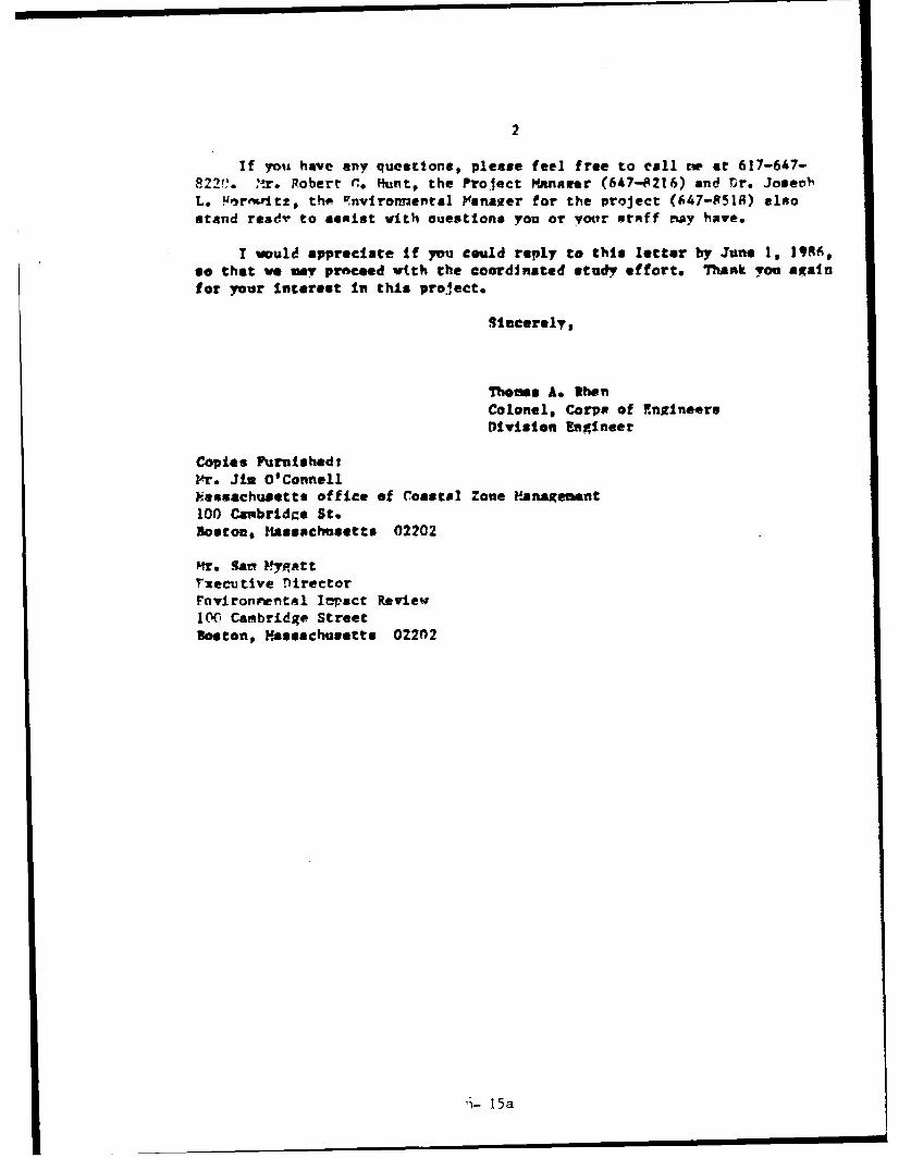
2
If you have any questions, please feel free to call tm at 617-647-
822". r. Robert C Hunt, the Project Manarer (647-8216) and Dr. JosevhmL. :,rnv~t2, the Fnviroirental Fsana2er for the project (647-8518) alsostand ready to assist with nuestione you or your stAff may have.
I would appreciate if you could reply to this letter by June 1, 1996,so that we my proceed with the coordinated study effort. Thank you againfor your interest in this protect.
Sincerely,
Thomas A. WhenColonel, Corps of EngineersDivision Engineer
Copies Furnished:Mr. Jin O'Connell?iassachuaetts office of ,oasta Zone panagement100 Canbridke St.Boston, Massachusetts 02202
Mrs Sart M:ygtt
rxecutive nirectorrnyfron1e, tal Iepact ReviewI00 Cambridge StreetBoston, Massachusetts 02202
ni- 15a
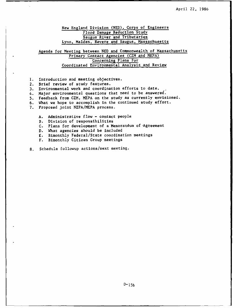
April 22, 1986
New England Division (NED), Corps of EngineersFlood Damage Reduction StudySaugus River and Tributaries
Lynn, Malden, Revere and Saugus, Massachusetts
Agenda for Meeting between NED and Commonwealth of MassachusettsPrimary Contact Agencies (CZM and MEPA)
Concerning Plans ForCoordinated Environmental Analysis and Review
1. Introduction and meeting objectives.2. Brief review of study features.3. Environmental work and coordination efforts to date.4. Major environmental questions that need to be answered.5. Feedback from CZM, MEPA on the study as currently envisioned.6. What we hope to accomplish in the continued study effort.7. Proposed joint NEPA/MEPA process.
A. Administrative flow - contact peopleB. Division of responsibilitiesC. Plans for development of a Memorandum of AgreementD. What agencies should be includedE. Bimonthly Federal/State coordination meetingsF. Bimonthly Citizen Group meetings
8. Schedule followup actions/next meeting.
D-15b
8 ~e 40mm~olitea1x 0/eriaIa a
100 1(amhicap A wlet
MICHAEL S. DUKAKISG VERNOR
JAMES S. HOYTE
SECRETARY
Colonel Thomas A. RhenU.S. Army Corps of Engineers424 Trapelo RoadWaltham, Massachusetts 02254-9149
Re: Flood Damage Reduction Study: Saugus River and Tributaries
Dear Colonel Rhen:
Thank you for your May 1, 1986 letter which was written in responseto the April 22, 1986 meeting between members of your staff, the MEPAUnit, and MCZM regarding the Corps' proposed Flood Damage ReductionStudy for the Saugus River and Tributaries. Several points were discussedat that meeting and were brought to my attention.
First, I would like to reiterate, as I have stated in my February 19,1986 letter to you, that this Office continues to support the Corps' effortsto generate environmental baseline data for this study. My Office standsready to cooperate with your staff in supplying information that we haveon hand regarding your endeavor.
• In response to your request for the assignment of a State agencyas a project sponsor/proponent, it is our opinion that state agencysponsorship is not appropriate at this time. It is more appropriate thatthe communities which are affected by the extensive flooding, and whomay benefit from a selected option, become vested in the project asproponents at this early point in the study. State sponsorship may beappropriate at a future date when more substantive data becomes availableto assess the implementation of the proper remedial option. We advocatethat you continue to work with MEPA to establish a combined MEPA/NEPAprocess"as was discussed with Mr. Mygatt and Mr. Shepardson.
Mr. Jim O'Connell will continue to be the focal point of coordinationwhich is his usual role within MCZM as Project Review Coordinator. Hisresponsibility is to assure that projects undergoing review by MCZM havecomplied with all statutory state agency requirements. Due to the magnitudeof this proposal and the potential impacts, MCZM will be a major participantin the process of accumulating the on-going comments and all of the requiredstate permits. He will be able to assist you in facilitating coordinationamong the various agencies in generating the necessary information. Itmay be more prudent, however, when seeking specific information to contactthe appropriate state agency directly. To facilitate effective coordination,
D-16
Colonel Thbmas A. RhenJune 16, 1986Page 2
Mr. O'Connell should receive copies of all correspondence between the Corps'and the State regarding this project. The attached sheet lists the appropriatepersonnel for agencies within the Executive Office of Environmental Affairswho will be the contact for the review of this project.
We look forward to working closely with the Corps' in generating thebaseline data necessary to adequately assess the options proposed for thisproject.
Sincerely,
Secretary
JSH JO /slaAttachmentcc: Bob Hunt, COE
Joe Horowitz, COERichard Delaney, Director, MCZMSam Mygatt, Director, MEPAPhilip Coates, Director, Div. of Marine FisheriesJack Hannon, Director, DEM-Div. of WaterwaysThomas McMahon, Director, DEQE-Div. of Water Pollution ControlGary Clayton, Director, DEQE-Div. Wetlands & Waterways RegulationRichard Cronin, Director, Div. Fisheries & WildlifeCharles Kennedy, Director, DEM-Div. Water Resources
D-16a
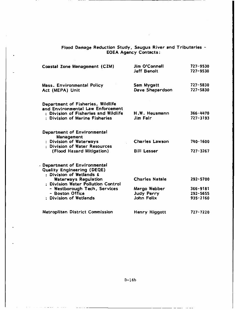
Flood Damage Reduction Study, Saugus River and Tributaries -
EOEA Agency Contacts:
Coastal Zone Management (CZM) Jim O'Connell 727-9530Jeff Benoit 727-9530
Mass. Environmental Policy Sam Mygatt 727-5830Act (MEPA) Unit Dave Shepardson 727-5830
Department of Fisheries, Wildlifeand Environmental Law Enforcement
: Division of Fisheries and Wildlife H.W. Heusmann 366-4470: Division of Marine Fisheries Jim Fair 727-3193
Department of EnvironmentalManagement
: Division of Waterways Charles Lawson 740-1600: Division of Water Resources
(Flood Hazard Mitigation) Bill Lesser 727-3267
Department of EnvironmentalQuality Engineering (DEQE)
: Division of Wetlands &Waterways Regulation Charles Natale 292-5700
: Division Water Pollution Control- Westborough Tech, Services Margo Webber 366-9181- Boston Office Judy Perry 292-5655
: Division of Wetlands John Felix 935-2160
Metroplitan District Commission Henry Higgott 727-7220
D-16b
91-e 4 mtmonwea1Ae.A "t4 adwae1
COASTAL ZONEMANAGEMENT
June 19, 1986
Robert Hunt, Project ManagerU.S. Army Corps of EngineersN.E. Division424 Trapelo RoadWaltham, Massachusetts 02254-9149
Re: Flood Damage Reduction Study: Saugus River and Tributaries
Dear Mr. Hunt:
The Massachusetts Coastal Zone Management Office has reviewed theProject Information brochure for the above-referenced project. In additionto a review of this document, members of my staff have attended severalinformational meetings conducted by Corps personnel. Your efforts toinvolve state agencies early in the review process are to be commended.We look forward to this kind of close coordination between the Corps andour office on future endeavors.
As Secretary Hoyte stated in his letter dated February 19, 1986, theCommonwealth supports the collection of environmental baseline data andthe assessment of potential flood damage within the Saugus River estuary.Evaluation of this information will provide the Commonwealth with the properbasis upon which a preferred flood reduction option can be chosen. In severalof the information meetings, MCZM has raised general concerns regardingthe three preliminary flood damage reduction options. I would like to brieflyreiterate those concerns.
Option 1. Structural Local Protection Plan - The proposed constructionof about 12.5 miles of dikes, walls and revetments could impact as muchas 38.5 acres of wetland. This would raise serious conflicts with the CoastalRegulations of the Wetlands Protection Act (M.G.L. c.131, s.40) and theMCZM Program Policies.
Option 2. Nonstructural Plans - Where possible, the Commonwealth supportsthe use of nonstructural means to alleviate flood damage. Floodproofingof homes and businesses, in concert with the installation of a flood warningsystem should be closely examined.
D-17
Robert Hunt, Project ManagerJune 19, 1986Page 2
Option 3. Comprehensive Plan - The construction of tide gates across theSaugus or Pines River will require very detailed investigations into theImpacts which may occur to the estuary. Included in the analysis will besuch concerns as flushing characteristics, sediment resuspension anddispersal patterns, salinity and D.O. changes, and navigation impacts.
This Office is committed to working closely with the Corps on this andfuture projects. Please do not hesitate to contact either myself or Mr. JimO'Connell at 727-9530 if you have any questions.
Sic
Al
,chard F. DelaneyDirector
RFD/JB/sla
D-17a
DEPARTMENT OF THE ARMYNEW ENGLAND DIVISION. CORPS OF ENGINEERS
424 TRAPELO ROAD
WALTHAM. MASSACHUSETTS 02254-9149
'%"g|loom of
March 11, 1987
Planning DivisionImpact Analysis Branch
Secretary or Environmental Affairs100 Cambridge Street-2Oth floorBoston, Massachusetts 02202Attn: Mr. David Shepardson, MEPA Unit
Dear Mr. Shepardson:
The New England Division, Corps of Engineers, ispleased to submit the enclosed Environmental NotificationForm for the Saugus River and Tributaries, Flood DamageReduction Study on behalf of the communities or Lyrn,Malden, Revere, and Saugus, Massachusetts.
Under separate cover, I am providing a ProjectInformation btinder and a binder of all ProjectCorrespondenc'e. These are working documents which will beused and kept updated by study participants as the studyprogresses.
The Corps looks forward to working with MEPA on thisstudy and preparing the combined EIR/EIS. If you have anyquestions, please feel free to call me at (617) 647-8508.Mr. Joseph Horowitz, the Environmental Manager (647-8518)and Mr. Robert Hunt, the Project Manager (647-8216) canboth be contacted for additional information.
ncerely,
o s e .o ,
Enclosure h , Planni i i on
D-18
COPIES FURNISHED TO:
Mr. James O'Connell W//'I ThA ,'/E"-.Massachusetts Coastal Zone Management100 Cambridge Street, 20th FloorBoston, MA 02202
Mr. Stephen L. SmithAssistant City PlannerPlanning Dept. , Rm. 106City Hall, Lynn, MA 01901
Mr. Henry J. MulhernExecutive DirectorMalden Redevelopment AuthorityGovernment Center200 Pleasant StreetMalden, MA 02148
Mr. Frank L. Stringi W/ZJ/F
DirectorDept. or Planning & Community Dev.City HallRevere, MA 02151
Mr. Dennis R. Roy WI/ /r
Town EngineerTown HallSaugus, MA 01906
D-18a
O ~ DEPARTMENT OF THE ARMYNEW ENGLAND 0IVISION. CORPS OF ENGINEERS
424 TRAPELO ROAD
WALTHAM. MASSACHUSETTS 02254-9149
AMY o March 26, 1987*TTEWO OF
Planning DivisionBasin Management Branch
Mr. David ShepardsonEOEA/MEPA Unit100 Cambridge Street, 20th FloorBoston, Massachusetts 02202
Dear Mr. Shepardson:
I previously forwarded to you the Environmental Notification Formfor the Saugus River and Tributaries, Flood Damage Reduction Study onbehalf of the communities of Lynn, Malden, Revere and Saugus, MA, foryour review and comments. I appreciate your interest in this study.
Mr. James S. Hoyte, Secretary of Environmental Affairs, in aletter dated June 16, 1986 to the Corps provided a list of agenciesfor coordination of the study. I appreciate your willingness torepresent your agency. In order to obtain your views during thestudy process, group meetings will be held periodically with pointsof contact from Federal, state and local agencies. In preparationfor your participation, a Project Information binder and a binder ofall Project Correspondence will be provided under separate cover.These are working documents which will be used and kept updated bystudy participants as the study progresses.
The Corps looks forward to working with you on thisFederal/State/Local Agency Technical Group to help identify andresolve concerns during this important study. If you have anyuestions, please feel free to call me at (617) 647-8508. Mr. RobertG. Hunt, the Project Manager (647-8216) and Mr. Joseph L. Horowitz,the Environmental Manager (647-8518) can both be contacted foradditional information.
Sincerely,
os ph. gnaio
Copy Furnished:
Mr. Steve Davis, DirectorEOEA/MEPA Unit100 Cambridge Street, 20th FloorBoston, Massachusetts 02202
D-19
Similar Letters Sent to: Carbon Files Sent to Dept. Heads:
Mr. James Fair, Jr. Mr. Philip Coates, DirectorAsst. Director of Coma. Fisher. DFW&ELE/Div. of Marine FisheriesDF&ELE/Div. of Marine Fisher. 100 Cambridge St., 19th Floor100 Cambridge St., 19th Floor Boston, MA 02202Boston, MA 02202
Mr. H. W. Heusmann Mr. Richard CroninWaterfowl Biologist DirectorDFW&ELE/Div. of Fisheries and DFW&ELE/Div of Fisheries andWildlife Wildlife
Field Headquarters 100 Cambridge StreetWestborough, NA 01581 Boston, NA 02202
Mr. William Lesser Mr. Charles KennedySenior Planner, Flood Hazard Director and Chief EngineerMitigation DEM/Div of Water Resources
DEN/Division of Water Resources 100 Cambridge St., 13th Floor100 Cambridge St., 13th Floor Boston, MA 02202Boston, MA 02202
Mr. Charles Lawson Mr. John HannonSenior Civil Engineer Director and Chief EngineerDEN/Division of Waterways DEN/Div. of WaterwaysBldg. 45, 349 Lincoln St. 100 Cambridge St., 19th FloorHingham, Massachusetts 02043 Boston, NA 02202
Mr. John Felix Mr. Gary ClaytonChief, Wetlands Section DirectorDEQE/NE Regional Ofc - Div of DEQE/Div. of Wetlands & Water-
Wetlands ways Reg.Five Commonwealth Ave. One Winter St., 8th FloorWoburn, NA 01801 Boston, MA 02108
Ms. Margo Webber Mr. Thomas McMahonSenior Sanitary Engineer DirectorDEQE/DWPC-TSB DEQE/Div. of Water Pollution Cont.Westview Building, Lyman Sch. One Winter St.Westborough, MA 01581 Boston, MA 02108
Ms. Judy Perry Mr. Thomas McMahonDEQE/DWPC - Permits DirectorOne Winter Street DEQE/Div. of Water Pollution Cont.Boston, NA 02108 One Winter St.
Boston, MA 02108
Mr. Charles Natale Mr. Gary ClaytonChief, Waterways Reg. Sec. DirectorDEQI/Div. of Wetlands & Water- DEQE/Div. of Wetlands & Water-
ways Reg. ways Reg.One Winter St., 8th Floor One Winter St., 8th FloorBoston, NA 02108 Boston, NA 02108
D-19a
-2-
Mr. David Shepardson Mr. Steve Davis, DirectorzOZA/xEPA Unit EOEA/MEPA Unit100 Cambridge Street, 20th Floor 100 Cambridge Street, 20th FloorBoston, XA 02202 Boston, MA 02202
Mr. Henry A. Higgott Mr. William J. Geary, CommissionerProject ManagerMDC/Parks Engr. & Constr. Div.20 Soerset StreetBoston, MA 02108
Mr. Jeff Benoit Mr. Richard F. DelaneyCoastal Geologist DirectorCosatal Zone Management Coastal Zone Management100 Cambridge Street, 20th Floor 100 Cambridge Street, 20th FloorBoston, MA 02202 Boston, MA 02202
Mr. Jim O'Connell Mr. Richard F. DelaneyProject Review Coordinator DirectorCoastal Zone Management Coastal Zone Management100 Cambridge Street, 20th Floor 100 Cambridge Street, 20th FloorBoston, Massachusetts 02202 Boston, Massachusetts 02202
Mr. Paul J. DiPietro Mr. William J. Geary, CommissionerProject ManagerXfDC/Parks Engr. & Const. Div.20 Somerset St.Boston, MA 02108
Mr. Carney Terzian Mr. William J. GearySupv., Water Resources and CommissionFlood Control Section Metropolitan District Comm.
MDC/Parks Engr. and Const. Div. 20 Somerset Street20 Somerset Street Boston, MA 02108Boston, MA 02108
BMB File, 112N (87-23)
D-19b
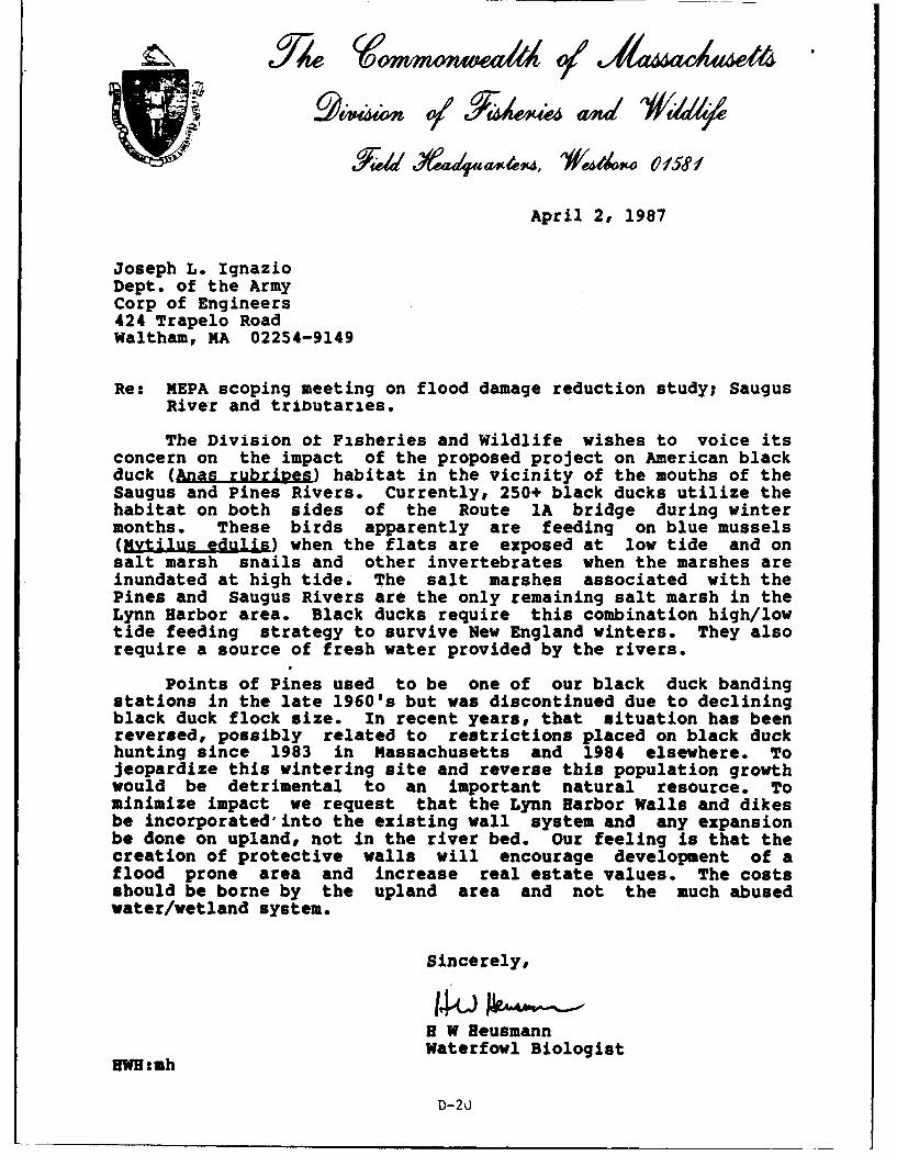
3;0/ 1YaOX an ww
April 2, 1987
Joseph L. IgnazioDept. of the ArmyCorp of Engineers424 Trapelo RoadWaltham, MA 02254-9149
Re: MEPA scoping meeting on flood damage reduction study; SaugusRiver and tributaries.
The Division ot Fisheries and Wildlife wishes to voice itsconcern on the impact of the proposed project on American blackduck (Anas rubripes) habitat in the vicinity of the mouths of theSaugus and Pines Rivers. Currently, 250+ black ducks utilize thehabitat on both sides of the Route IA bridge during wintermonths. These birds apparently are feeding on blue mussels(Mytilus edulis) when the flats are exposed at low tide and onsalt marsh snails and other invertebrates when the marshes areinundated at high tide. The salt marshes associated with thePines and Saugus Rivers are the only remaining salt marsh in theLynn Harbor area. Black ducks require this combination high/lowtide feeding strategy to survive New England winters. They alsorequire a source of fresh water provided by the rivers.
Points of Pines used to be one of our black duck bandingstations in the late 1960's but was discontinued due to decliningblack duck flock size. In recent years, that situation has beenreversed, possibly related to restrictions placed on black duckhunting since 1983 in Massachusetts and 1984 elsewhere. Tojeopardize this wintering site and reverse this population growthwould be detrimental to an important natural resource. Tominimize impact we request that the Lynn Harbor Walls and dikesbe incorporated into the existing wall system and any expansionbe done on upland, not in the river bed. Our feeling is that thecreation of protective walls will encourage development of aflood prone area and increase real estate values. The costsshould be borne by the upland area and not the much abusedwater/wetland system.
Sincerely,
H W HeusmannWaterfowl Biologist
'WH:mh
D-20
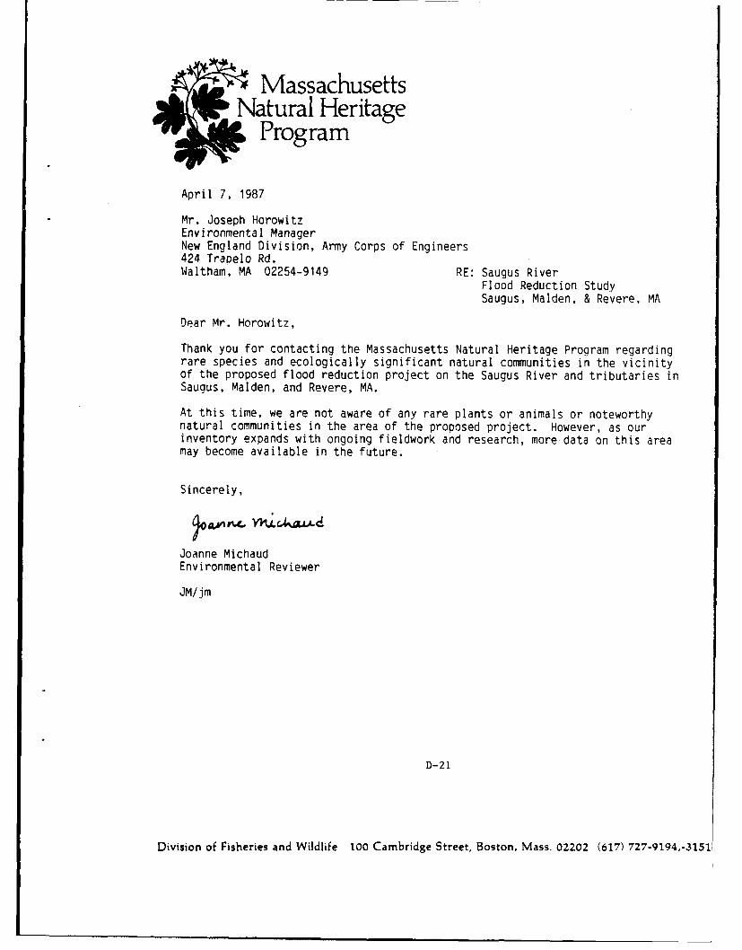
MassachusettsNatural Heritage
Program
April 7, 1987
Mr. Joseph HorowitzEnvironmental ManagerNew England Division, Army Corps of Engineers424 Trapelo Rd.Waltham, MA 02254-9149 RE: Saugus River
Flood Reduction StudySaugus, Malden, & Revere, MA
Dear Mr. Horowitz,
Thank you for contacting the Massachusetts Natural Heritage Program regardingrare species and ecologically significant natural communities in the vicinityof the proposed flood reduction project on the Saugus River and tributaries inSaugus, Maiden, and Revere, MA.
At this time, we are not aware of any rare plants or animals or noteworthynatural communities in the area of the proposed project. However, as ourinventory expands with ongoing fieldwork and research, more data on this areamay become available in the future.
Sincerely,
Joanne MichaudEnvironmental Reviewer
JM/jm
D-21
Division of Fisheries and Wildlife 100 Cambridge Street, Boston, Mass. 02202 (617) 727-9194,-3151
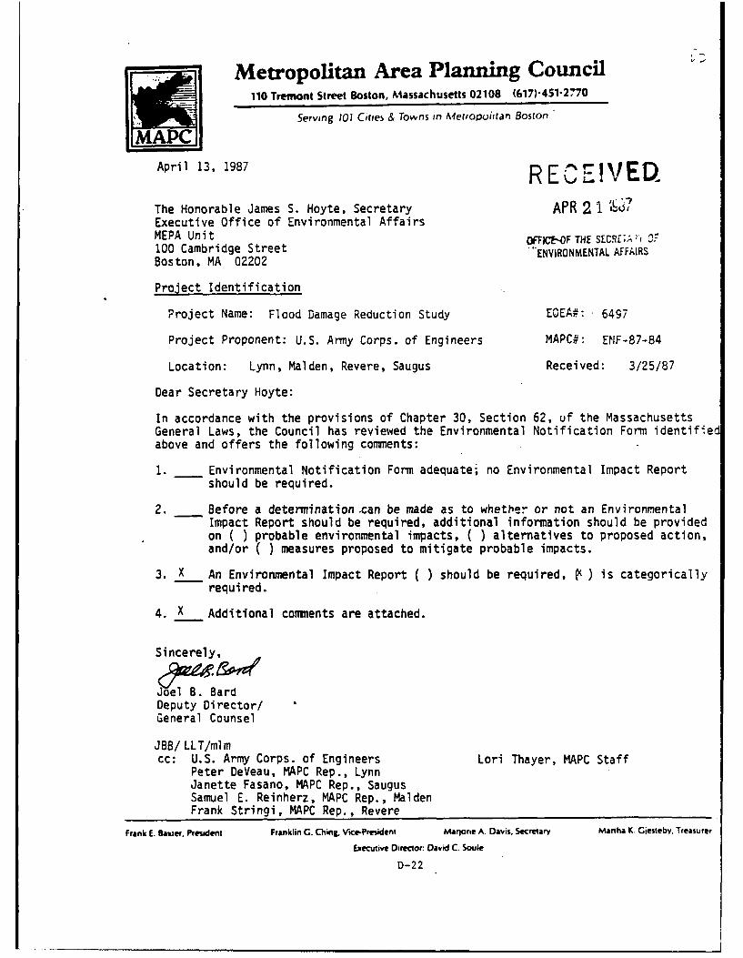
Metropolitan Area Planning Council110 Tremont Street Boston, Massachusetts 02108 (617)-451-2'70
Serving 101 Cities & Towns in Metropoiitan Boston
April 13, 1987 RE EVE%
The Honorable James S. Hoyte, Secretary APR 2 1 7
Executive Office of Environmental AffairsMEPA Unit OFTIC -OF THE SECRf;A?100 Cambridge Street "ENVIRONMENTAL AFFAIRSBoston, MA 02202
Project Identification
Project Name: Flood Damage Reduction Study E0EA#: 6497
Project Proponent: U.S. Army Corps. of Engineers MAPC#: ENF-87-84
Location: Lynn, Malden, Revere, Saugus Received: 3/25/87
Dear Secretary Hoyte:
In accordance with the provisions of Chapter 30, Section 62, uf the MassachusettsGeneral Laws, the Council has reviewed the Environmental Notification Form identifiedabove and offers the following conments:
1. Environmental Notification Form adequate; no Environmental Impact Reportshould be required.
2. Before a determination .can be made as to whether or not an EnvironmentalImpact Report should be required, additional information should be providedon ( ) probable environmental impacts, ( ) alternatives to proposed action,and/or ( ) measures proposed to mitigate probable impacts.
3. X An Environmental Impact Report ( ) should be required, ( ) is categoricallyrequired.
4. X Additional comments are attached.
Sincerely,
Deputy Director/General Counsel
JBB/ LLT/mlmcc: U.S. Army Corps. of Engineers Lori Thayer, MAPC Staff
Peter DeVeau, MAPC Rep., LynnJanette Fasano, MAPC Rep., SaugusSamuel E. Reinherz, MAPC Rep., MaidenFrank Stringi, MAPC Rep., Revere
Frank E. Baxter. President Franklin C. Ching, VicePresident Marjorie A. Davis, Secretary Martha K. Giesteby. Treasurer
Executive Director: David C. Soule
D-22
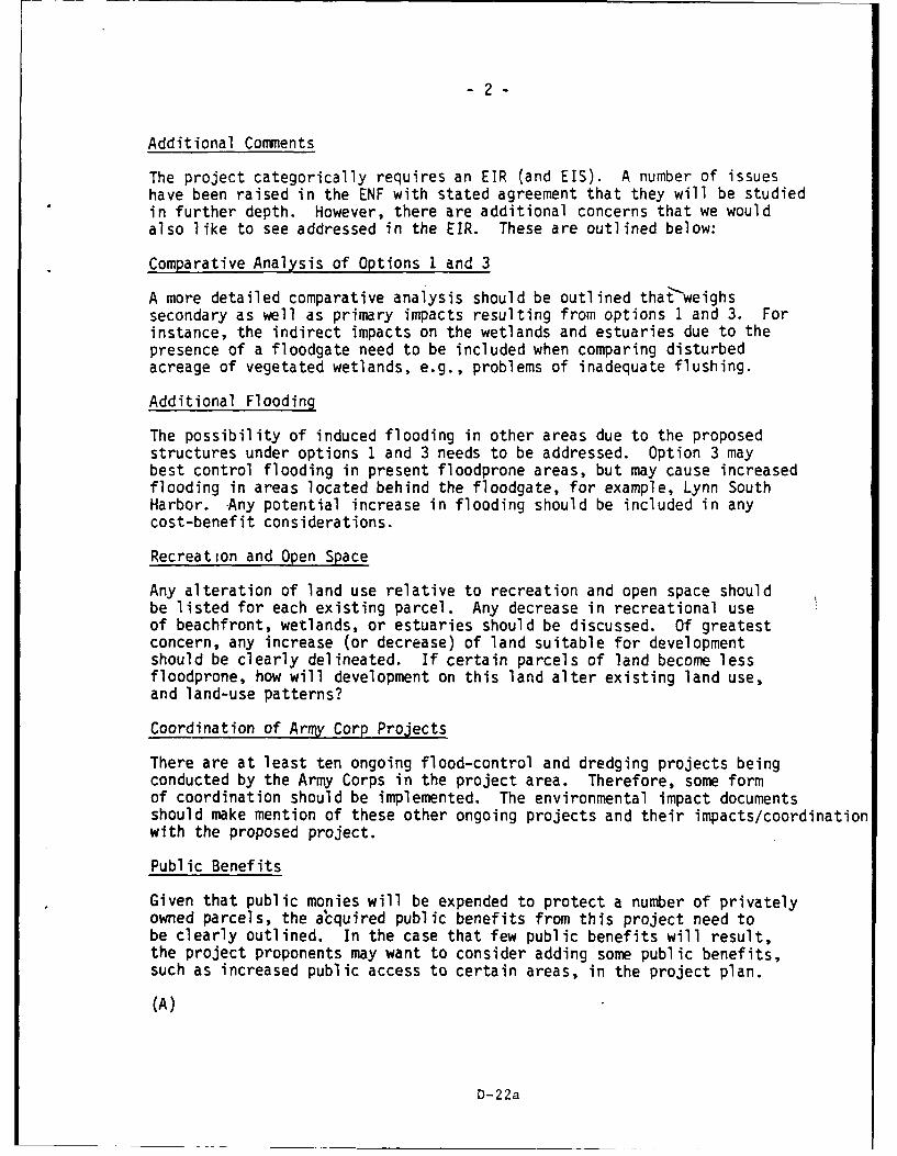
-2-
Additional Comments
The project categorically requires an EIR (and EIS). A number of issueshave been raised in the ENF with stated agreement that they will be studiedin further depth. However, there are additional concerns that we wouldalso like to see addressed in the EIR. These are outlined below:
Comparative Analysis of Options 1 and 3
A more detailed comparative analysis should be outlined thatweighssecondary as well as primary impacts resulting from options 1 and 3. Forinstance, the indirect impacts on the wetlands and estuaries due to thepresence of a floodgate need to be included when comparing disturbedacreage of vegetated wetlands, e.g., problems of inadequate flushing.
Additional Flooding
The possibility of induced flooding in other areas due to the proposedstructures under options 1 and 3 needs to be addressed. Option 3 maybest control flooding in present floodprone areas, but may cause increasedflooding in areas located behind the floodgate, for example, Lynn SouthHarbor. Any potential increase in flooding should be included in anycost-benefit considerations.
Recreation and Open Space
Any alteration of land use relative to recreation and open space shouldbe listed for each existing parcel. Any decrease in recreational useof beachfront, wetlands, or estuaries should be discussed. Of greatestconcern, any increase (or decrease) of land suitable for developmentshould be clearly delineated. If certain parcels of land become lessfloodprone, how will development on this land alter existing land use,and land-use patterns?
Coordination of Army Corp Projects
There are at least ten ongoing flood-control and dredging projects beingconducted by the Army Corps in the project area. Therefore, some formof coordination should be implemented. The environmental impact documentsshould make mention of these other ongoing projects and their impacts/coordinationwith the proposed project.
Public Benefits
Given that public monies will be expended to protect a number of privatelyowned parcels, the alcquired public benefits from this project need tobe clearly outlined. In the case that few public benefits will result,the project proponents may want to consider adding some public benefits,such as increased public access to certain areas, in the project plan.
(A)
D-22a
Metropolitan Area Planning Council110 Tremont Street Boston, Massachusetts 02108 (617)-451-2770
Serving 101 Cities & Towns in Metropolitan Boston
DATE. March 25, 1987
.D. #: ENF-87-84
TO: Samuel F- Rainharz
COMINITY: Malden
Enclosed is a description of the project referenced below.
The Council requests that you consider whether this report adequatelydescribes the project's impact upon your "coamunity and addressessignificant environmental benefits and potential damages.
PROJECT TITLE: Flood Damage Protection Study
THE COUNCIL HAS ONLY 20 CALENDAR DAYS TO FILE COMMENT WITHE.O.E.A. TO MEET THIS DEADLINE9 TOUR COMMENTS MUST BERECEIVED AT THE MAPC BY April 11, 1987
~ ADEQUATELY DESCRIBES ENVIRONMENTAL IMPACTS
MERITS FURTHER ENVIRONMENTAL STUDY
[NEED MORE INFORMATION
EXPLANATORY CO MENTS:
SDIGNATURE:1
DATE: ai.-X )4c
D-22b
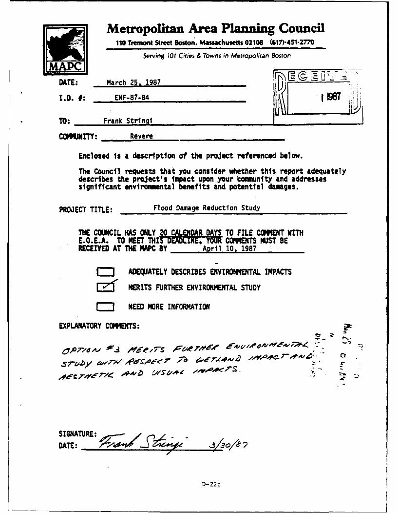
Metropolitan Area Planning Council110 Tremont Street Boston, Massachusetts 02106 (617)-451-2770
Serving 101 Cities & Towns in Metropolitan Boston
DATE: March 25, 1987
1.0. 0: ENF-87-84
TO: Frank Strin i
COMIJNITY: Revere
Enclosed is a description of the project referenced below.
The Council requests that you consider whether this report adequatelydescribes the project's impact upon your "cmmunlty and addressessignificant environmental benefits and potential damages.
PROJECT TITLE: Flood Damage Reduction Study
THE COUNCIL HAS ONLY 20 CALENDAR DAYS TO FILE COMMENT WITHE.O.E.A. TO MEET THIS DEADLINE, TOUR COENS 14UST BERECEIVED AT THE MAPC BY April 10, 1987
j~J ADEQJATELY DESCRIBES ENVIRONMENTAL IMPACTS
Ef MERITS FURTHER ENVIRONMENTAL STUDY
C= NEED MORE INFORMATION
EXPLANATORY COMENTS: Pt
0A07-l* Ae / 77s A.e # 64/
SIGNATURE:DATE:D
D- 22 c
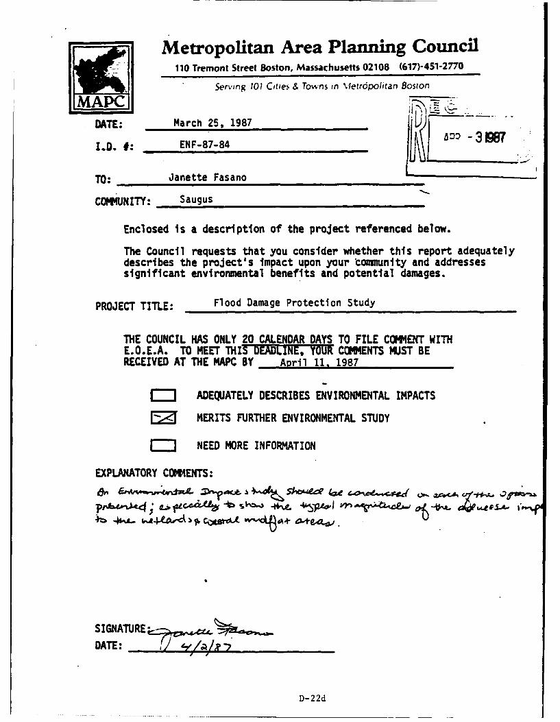
Metropolitan Area Planning Council110 Tremont Street Boston, Massachusetts 02108 (617)-451-2770
Serving 101 Cities & Towns in \Ietrdpolitan BostonN'_ ____1
DATE: March 25, 1987
I.D. #: ENF-87-84
TO: Janette Fasano
COMMUNITY: Saugus
Enclosed is a description of the project referenced below.
The Council requests that you consider whether this report adequatelydescribes the project's impact upon your "ommunity and addressessignificant environmental benefits and potential damages.
PROJECT TITLE: Flood Damage Protection Study
THE COUNCIL HAS ONLY 20 CALENDAR DAYS TO FILE COMMlENT WITHE.O.E.A. TO MEET THIS DEADINE, YOUR COMMENTS MUST BERECEIVED AT THE MAPC BY April 11, 1987
~I ADEQUATELY DESCRIBES ENVIRONMENTAL IMPACTS
FZ MERITS FURTHER ENVIRONMENTAL STUDY
j NEED MORE INFORMATION
EXPLANATORY COM44ENTS:
S IGNATURE-
DATE: ii ,I /
D- 22d
COASTAL ZONE CCEI022MANAGEMENT
RE CEIV EDMEMORANDUM AR231
TO: STEVE DAVIS, DIREI MEPA UNIT OFFICE OF THE SECRETARY OFENVt ,NMENTAL %F FAIRS
FROM: RICHARD F. DELAN ECTOR, MCZM
DATE: APRIL 21, 1987
RE: EOEA #6494 - FLOOD DAMAGE REDUCTION STUDY, SAUGUSRIVER AND TRIBUTARIES
The Massachusetts Coastal Zone Management (MCZM) Office hasreviewed the Environmental Notification Form (ENF) for the projectreferenced above which was noticed for public comment in the EnvironmentalMonitor dated March 26, 1987.
The proposed project would provide protection against tidal floodingin the communities of Lynn, Maiden, Revere and Saugus. The protectionis being considered for approximately 5,000 residential, commercial orindustrial buildings. Three basic options for flo( d damage reduction arebeing considered. Under the MEPA regulations this project is categoricallyincluded and automatically requires the preparation of an EnvironmentalImpact Report (EIR). Comments regarding each option will be presentedseperately.
Option 1. Four Structural Local Protection Plans - This option includesthe construction of 9.8 miles of flood protection structures. Approximatelythirty-one (31) acres of vegetated wetlands and thirty-two (32) acres oftidal flats, banks and river bottom would be adversely affected by thisoption.
Comments: A detailed delineation of all wetlands should be presented.This would include saltmarsh, freshwater marsh, coastal beaches andbanks, tidal flats shellfish beds, etc. A complete evaluation of how theconstruction of the structures complies with the Coastal Regulations underthe Wetlands Protection Act must be performed. Special attention shouldbe given to the requirements for a variance if any saltmarsh is going tobe filled or altered.
D-23
-2-
Option 2. Nonstructural Plans - The nonstructural option would reduceflooding damage through flood prepardness plans and floodproofing ofbuildings.
Comments: MCZM favors this alternative because it provicL!s reductionin flood damages yet does not encourage continued encroachment in flood-prone or environmentally sensitive areas. A detailed economic analysismust be provided that documents why this option is not a feasible alternative.Emphasis should focus on how many buildings have been built since 1978in the floodplain without proper floodproofing. Justification should bepresented for the support of a public expenditure to protect buildingsthat were not constructed according to the requirements of Section 744of the State Building Code.
Option 3. Regional Saugus River Flood Gate Plan - This is the COE preferredoption and consists of a tidal flood gate across the mouth of the SaugusRiver and approximately three (3) miles of flood protection structuresalong the Lynn shorefront areas. It is expected that this option wouldadversely affect about fourteen (14) acres of tidal flats or river bottom.
Comments: A delineation and discussion of the wetland areas within thestudy areas, similar to the one requested for option 1, would be necessaryfor this option. In addition, a complete analysis of the present flushingcharacteristics of the estuary must be completed. This analysis mustaddress tidal circulation patterns, flushing rates, tidal amplitude andphase, sediment transport rates and disposal patterns. A completeecological survey of the estuary tust also be included in this analysis.Once the existing conditions one fully understood, the affect of the tidalgate on these same parameters must be analyzed.
The final placement site of the tidal gate could also potentially affectstorm surge level to areas immediately adjacent to the tidal gate. Thereforea detailed surge model should be generated for Broad Sound.
General Comments
It would seem appropriate that the expenditure of such a large sumof taxpayer money should produce some type of public benefit that canbe utilized by everyone, especially since the private sector will benefitso much from this project. Public walkways or fishing areas shouldaccompany all of the options.
The selection of either Option 1 or Option 3 would directly increasethe encroachment of development on the Saugus River estuary. Providingflood protection to the upland floodplain will encourage more residentialand industrial development of the area. Whatever option is finally selected,it must incorporate the long-term protection of the Saugus Estuary. itwill be required that some type of long-term Orotection is a component ofthe final plan.
D-23a
-3-
It is well documented that relative sea level rise has been ongoingat an approximate rate of one foot per century for at least the past severalhundred years (based on tidal records). The Environmental ProtectionAgency has generated estimates that this rate could increase substantiallyin the next one hundred years. Because this project is expected to havea life expetency of one hundred years, the planning of this project shouldincorporate an analysis of the future effectiveness of the pCoject basedon the present day rate of relative sea level rise. Consideration shouldalso be given to the EPA estimates of future sea level rise rates.
Please be advised that this projeuct will be subject to federal consistencyreview by this Office before any federal action can be taken. Additionalinformation regarding federal consistency review can be obtained by contactingMr. Jim O'Connell at 727-9530.
RFD/JB/sla
D-23b
Re rmmoenwea1A q1'Ja 4 acAuae14 VIA
MICHAEL S. DUKAKISGOVERNOR
JAMES S. HOYTESECRETARY
CERTIFICATE OF THE SECRETARY OF ENVIRONMENTAL AFFAIRS
ON THE
ENVIRONMENTAL NOTIFICATION FORM
PROJECT NAME : Flood Damage Reduction Study
PROJECT LOCATION : Lynn, Malden, Revere and Saugus
EOEA NUMBER : 6497
PROJECT PROPONENT : U.S. Army, Corps of Engineers
DATE NOTICED IN MONITOR : March 26, 1987
Pursuant to the Massachusetts Environmental Policy Act(G.L.,c.30,s.61-62H) and Sections 11.04 and 11.06 of the MEPAregulations (301 CMR 11.00), I hereby determine that the aboveproject requires the preparation of an Environmental ImpactReport.
The proposed project in some of its alternatives iscategorically included among those projects for which anEnvironmental impact Report is required. The Corps of Engineershave also concluded that a Federal Environmental Impact Statementis required. My goal is that a single document be adequate tosatisfy both the State and Federal environmental review. Forthat reason it is provided that the enclosed Scope may beexpanded to include the Federal needs such as economic and socialimpacts. The state review will consider the entire document.
The project is complicated by several other state/federalactions in the area. Most important to this project are theremoval of the 1/95 embankment for Revere Beach Renourishment andMass. DPW highway projects and the local/state/federal enlargednavigational channel in the Saugus River. Both projects are now
1
D-24
EOEA #6497 ENP Certificate April 27, 1987
plannea, but not existing, so that background data with theprojects are not available. However, both are projected to be inplace prior to construction of the Flood Damage Reduction?roject. Thus, the analysis and modeling efforts are complicatedby the need to separate impacts from these earlier projects fromthe impacts of the current proposal.
In basic form the EIR neeas to evaluate potential changes intida: flushing, storm surges, sediment transport, and waterquality in order to assess the impacts of any potential changeson operations, processes, and resources in the area. Inaddition, the revised FEMA flood elevations are necessary toallow local, state, federal landuse regulatory changes and toevaluate potential land use changes following the project.
On the state level, a strong mitigation plan is necessaryfor identified potential significant impacts and since a M.G.L.ch.30,s.40 waiver would be required for some options, ananalysis of the ability to meet the waiver criteria is needed.Also, since some state agency will become a proponent for apercentage of the project, the final EIR should contain a draftM.G.L. ch.3o,s.61 finding.
SCOPE
A. Evaluation of changes in the physical environment fromtoday, through other proposed changes to implementation of thecurrent proposals. Such analysis must included;
A. Tidal Flushing
!) Mean2) Spring3) Storm
B. Sediment Transport
i) within the estuary2) from the estuary
C. Water Quality consider for both normal and stormconditions
1) salinitya. boundariesb. quality changes
2) contaminants such as mercury and hydrocarbons
2
D- 24a
EOEA #6497 ENF Certificate April 27, 1987
D. Storm Surge - changes both within and outside theflood control structures must be evaluated.
E. Flood Stage/Frequency - changes in flood levels asused by FEMA should be presented. Identify ifstructures are in the new flood zones.
II. Environmental impacts of both construction and operation ofthe alternative strategies on the following issues must beevaluated.
A. Water Quality - construction impacts of dredging, etc.need analysis.
B. Wetland Resources - Each of the wetland resource areasunder M.G.L. ch.!31,s.40, including wildlife habitat must beseparately quantified and evaluated.
C. Fisheries - Catadromous, Anadromous, Flounder nursery,and Sea Run Brown Trout must be considered.
D. Water fowl - include nesting, feeding over-wintering andmigratory use.
E. Benthic Community - include shellfish, sea worms, etc.
F. Aesthetics/Recreation - both physical and visual accessto the estuary and recreation areas should be evaluated.
G. Navigational Impacts - include current changing andchannel closing impacts.
H. Community Growth - suggested future growth shouldconsider the changed flood status, but also that theenclosed basin of the hurricane dike would act as an inlandwetland for mainland runoff when closed, which may precludefilling without compensation.
III. Mitigation - Specific mitigation should be proposed,evaluated and adopted if feasible for each significant impactidentified above.
AV. Waiver - For each alternative requiring a waiver underM.G.L. ch.131,s.40, the ability to meet the waiver criteria mustbe fully evaluated.
V. Section 61 Finding - A state agency will become a partner of'the adopted flood reduction program. This agency anL every otherstate agency acting on the proposal must include a section 61
3
D-24b
EOEA #6497 ENF Certificate April 27, 1987
finding in their action. The Final Impact Report must contain adraft section 6 L finding for the entire project.
April 27, 1987DAT E S SECRE TARY
JSH/DES/bk
4
D-24c
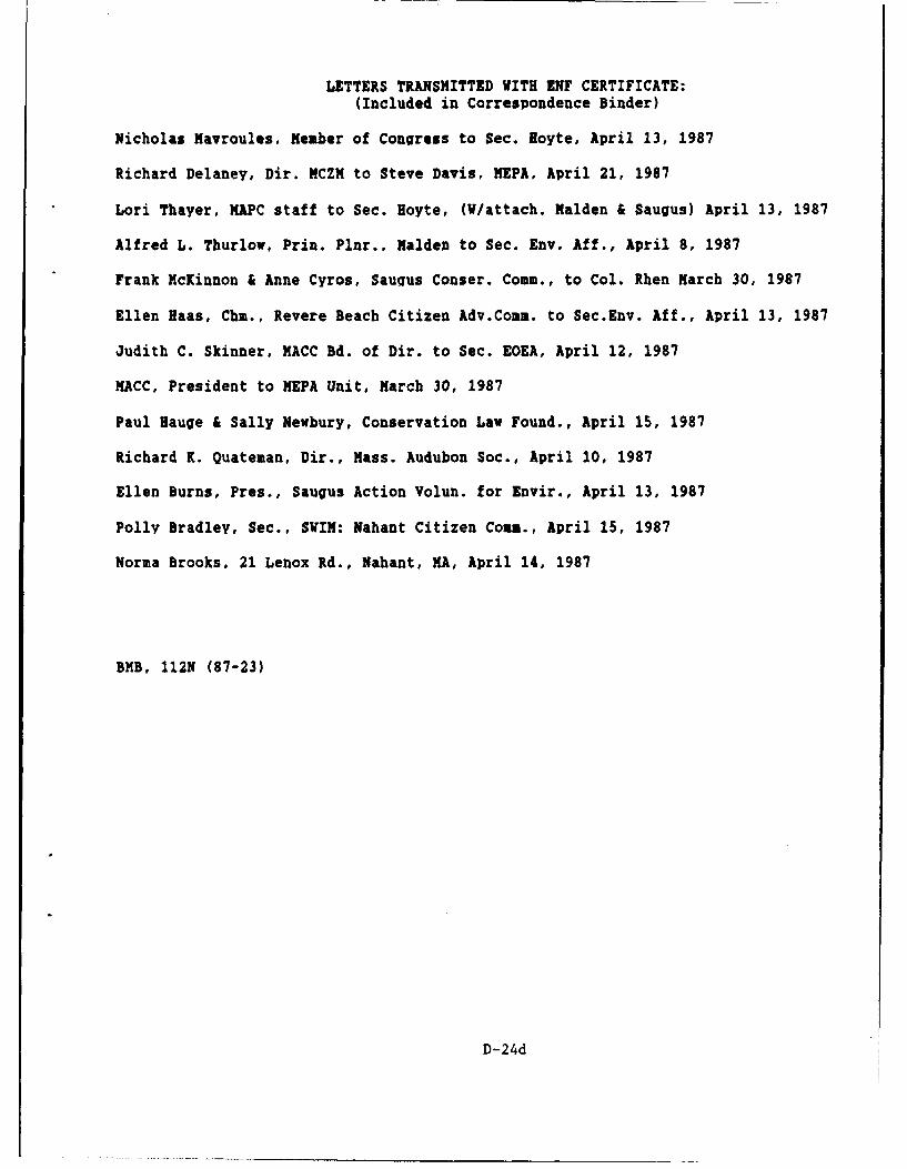
LETTERS TRANSMITTED WITH ENF CERTIFICATE:
(Included in Correspondence Binder)
Nicholas Mavroules, Member of Congress to Sec. Hoyte, April 13, 1987
Richard Delaney, Dir. MCZM to Steve Davis, MEPA, April 21, 1987
Lori Thayer, MAPC staff to Sec. Hoyte, (W/attach. Malden & Saugus) April 13, 1987
Alfred L. Thurlow, Prin. Plnr., Malden to Sec. Env. Aff., April 8, 1987
Frank McKinnon & Anne Cyros, Saugus Conser. Comm., to Col. Rhen March 30, 1987
Ellen Haas, Chi., Revere Beach Citizen Adv.Comm. to Sec.Env. Aff., April 13, 1987
Judith C. Skinner, MACC Bd. of Dir. to Sec. EOEA, April 12, 1987
MACC, President to MEPA Unit, March 30, 1987
Paul Hauge & Sally Newbury, Conservation Law Found., April 15, 1987
Richard K. Quateman, Dir., Mass. Audubon Soc., April 10, 1987
Ellen Burns, Pres., Saugus Action Volun. for Envir., April 13, 1987
Polly Bradley, Sec., SWIM: Nahant Citizen Comm., April 15, 1987
Norma Brooks, 21 Lenox Rd., Nahant, MA, April 14, 1987
BMB, 112N (87-23)
D-24d
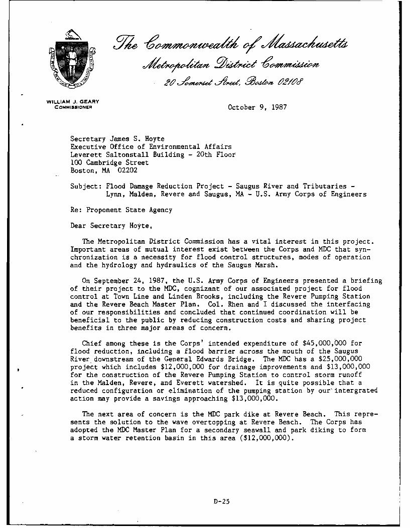
WILLIAM J. GEARYCOMMISSIONER October 9, 1987
Secretary James S. HoyteExecutive Office of Environmental AffairsLeverett Saltonstall Building - 20th Floor100 Cambridge StreetBoston, MA 02202
Subject: Flood Damage Reduction Project - Saugus River and Tributaries -
Lynn, Malden, Revere and Saugus, MA - U.S. Army Corps of Engineers
Re: Proponent State Agency
Dear Secretary Hoyte,
The Metropolitan District Commission has a vital interest in this project.Important areas of mutual interest exist between the Corps and MDC that syn-chronization is a necessity for flood control structures, modes of operationand the hydrology and hydraulics of the Saugus Marsh.
On September 24, 1987, the U.S. Army Corps of Engineers presented a briefingof their project to the MDC, cognizant of our associated project for floodcontrol at Town Line and Linden Brooks, including the Revere Pumping Stationand the Revere Beach Master Plan. Col. Rhen and I discussed the interfacingof our responsibilities and concluded that continued coordination will bebeneficial to the public by reducing construction costs and sharing projectbenefits in three major areas of concern.
Chief among these is the Corps' intended expenditure of $45,000,000 forflood reduction, including a flood barrier across the mouth of the SaugusRiver downstream of the General Edwards Bridge. The MDC has a $25,000,000project which includes $12,000,000 for drainage improvements and $13,000,000for the construction of the Revere Pumping Station to control storm runoffin the Malden, Revere, and Everett watershed. It is quite possible that areduced configuration or elimination of the pumping station by our intergratedaction may provide a savings approaching $13,000,000.
The next area of concern is the MDC park dike at Revere Beach. This repre-sents the solution to the wave overtopping at Revere Beach. The Corps hasadopted the MDC Master Plan for a secondary seawall and park diking to forma storm water retention basin in this area ($12,000,000).
D-25
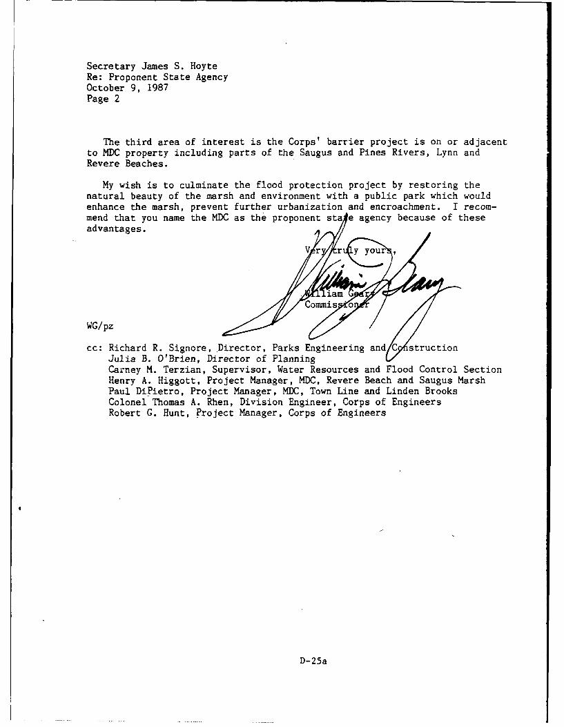
Secretary James S. HoyteRe: Proponent State AgencyOctober 9, 1987Page 2
The third area of interest is the Corps' barrier project is on or adjacentto MDC property including parts of the Saugus and Pines Rivers, Lynn andRevere Beaches.
My wish is to culminate the flood protection project by restoring thenatural beauty of the marsh and environment with a public park which wouldenhance the marsh, prevent further urbanization and encroachment. I recom-mend that you name the MDC as the proponent sta e agency because of theseadvantages.
Commisd
WG/pz
cc: Richard R. Signore, Director, Parks Engineering and structionJulia B. O'Brien, Director of PlanningCarney M. Terzian, Supervisor, Water Resources and Flood Control SectionHenry A. Higgott, Project Manager, MDC, Revere Beach and Saugus MarshPaul DiPietro, Project Manager, MDC, Town Line and Linden BrooksColonel Thomas A. Rhen, Division Engineer, Corps of EngineersRobert G. Hunt, Project Manager, Corps of Engineers
D-25a
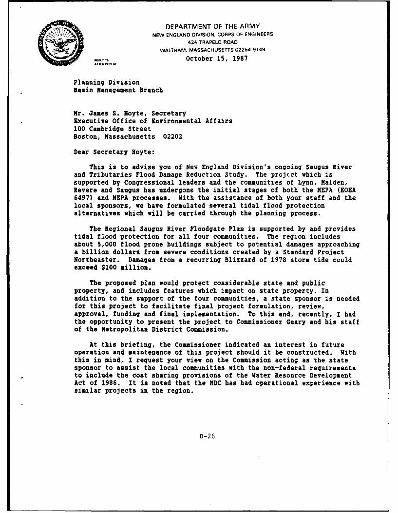
DEPARTMENT OF THE ARMYNEW ENGLAND DIVISION. CORPS OF ENGINEERS
424 TRAPELO ROAD
WALTHAM. MASSACHUSETTS 02254-9149
IPLY TO October 15, 1987ATTENTION O
Planning DivisionBasin Management Branch
Mr. James S. Hoyte, SecretaryExecutive Office of Environmental Affairs100 Cambridge StreetBoston, Massachusetts 02202
Dear Secretary Hoyte:
This is to advise you of New England Division's ongoing Saugus Riverand Tributaries Flood Damage Reduction Study. The project which issupported by Congressional leaders and the communities of Lynn, Malden,Revere and Saugus has undergone the initial stages of both the MEPA (EOEA6497) and NEPA processes. With the assistance of both your staff and thelocal sponsors, we have formulated several tidal flood protectionalternatives which will be carried through the planning process.
The Regional Saugus River Floodgate Plan is supported by and providestidal flood protection for all four communities. The region includesabout 5,000 flood prone buildings subject to potential damages approachinga billion dollars from severe conditions created by a Standard ProjectNortheaster. Damages from a recurring Blizzard of 1978 storm tide couldexceed $100 million.
The proposed plan would protect considerable state and publicproperty, and includes features which impact on state property. Inaddition to the support of the four communities, a state sponsor is neededfor this project to facilitate final project formulation, review,approval, funding and final implementation. To this end, recently, I hadthe opportunity to present the project to Commissioner Geary and his staffof the Metropolitan District Commission.
At this briefing, the Commissioner indicated an interest in futureoperation and maintenance of this project should it be constructed. Withthis in mind, I request your view on the Commission acting as the statesponsor to assist the local communities with the non-federal requirementsto include the cost sharing provisions of the Water Resource DevelopmentAct of 1986. It is noted that the MDC has had operational experience withsimilar projects in the region.
D-26
-2-
Should you desire, I would be pleased to brief you and your staffon this important project. If you have any questions, please feelfree to call me at (617) 647-8220. Mr. Robert G. Hunt, the projectmanaaer (647-8216), can also be contacted to answer questions fromyou or your staff.
Thank you again for your interest and cooperation on thisproject.
Sincerely,
Thomas A. RenColonel, Corps of EnaineersDivision Engineer
Copies Furnished:
Honorable Albert V. DiVirailio, Mayor of LynnCity Hall, Lynn, MA 01901
Honorable James S. Conway, Mayor of MaldenGovernment Center, 200 Pleasant St., Malden, MA 02148
Honorable George V. Colella, Mayor of RevereCity Hall, Revere, MA 02151
Mr. Norman B. Hansen, Town ManagerTown Hall, Saugus, KA 01906
Mr. Jim O'Connell, Project Review CoordinatorMass. Coastal Zone Management, 100 Cambridge St., Boston, MA 02202
Mr. William J. Geary, CommissionerMetropolitan District Commission20 Somerset Street, Boston, MA 02108
D-26a
MICHAEL S. DUKAKISGOVERNOR
JAMES S. HOYTE November 9, 1987SECRETARY
Commissioner William Geary
Metropolitan District Commission20 Somerset StreetBoston, MA 02108
Re: Saugus River and Tributaries Flood Damage Reduction Project - EOEA #6497
Dear Commissioner Geary:
It is with great pleasure that I accept your offer to serve as theCommonwealth's joint proponent with the U.S. Army Corps of Engineers in theFlood Damage Reduction Project. This project is of great importance atall levels of government and, as you point out, relates closely to severalongoing efforts by the Metropolitan District Commission. Thus, I do herebyconfirm the MDC as a joint proponent on EOEA #6497 and shall publish a noticeof this determination in the next issue of the Environmental Monitor.
So that you may begin your joint efforts most expeditiously, I amattaching a copy of my Certificate on the Environmental Notification Formfor the project. This lays out the scope of the Environmental Impact Reportfor the project and will guide my review of the project. I also suggest thatyour designee for the project contact Steve Davis or David Shepardson at theMEPA office and Col. Rhen's designee at the Corps to develop a more completefile on the project.
Again, it is with pleasure that I accept your offer; it marks a milestonein cooperation for this project and will help to assure a successful conclusion.
Sincerely,
Secretary
cc: Col.Rhen, USACOER. Hunt, USACOER. Signore, MDCS. Davis, MEPA
SCD/sd
D-27
JY/e 6 *00 mwnea1A ot(A4acluaedtJo dm . i uca ?20
MICHAEL S. DUKAKISGOVERNOR
JAMES S. HOYrESECRETARY
December 14, 1987
Colonel Thomas A. RhenDivision EngineerNew England DivisionU.S. Army Corps of Engineers424 Trapelo RoadWaltham, MA 02254
RE: Saugus River Flood Damage Reduction Project - EOEA #6497
Dear Colonel Rhen:
Recently, I sent you a copy of my November 9, 1987 letter toCommissioner Geary of the Metropolitan District Commissionaccepting with great pleasure the MDC's offer to serve as theCommonwealth's joint proponent with the communities of Lynn,Malden, Revere, and Saugus and the U.S. Army Corps of Engineerson the Saugus River Flood Damage'Reduction Project. This marks amilestone in the continued inter governmental cooperation on thisproject.
I want to reiterate my strong support for this process. Iwould also like to thank you for the active role of the Corps infostering both the process and the spirit of cooperation. Inthis regard, I assure you that the Commonwealth will continue towork with the Corps in assessing the appropriate course of actionfor this project.
Sincerely,
Jamesa eSecretary
JSH/sd
cc: W. Geary, MDCS. Davis, MEPA
D-28
10 h . W d--
01;,-ev i
COASTAL ZONE 20c/:vxtMANAGEMENT
MEMORANDUM
TO: STEVE DAVIS, DIRECTOR MEP
FROM: JAN SMITH, MCZ
DATE: FEBRUARY 26, "8,
RE: SAUGUS RIVER AND TRIBUTARIES FLOOD DAMAGE REDUCTIONSTUDY
I attended the recent Technical Advisory Group meeting on February2S, 1988 where the Army Corps of Engineers presented an overview andupdate on their basel -ie information gathering efforts on the Saugus RiverFlood Control Project.
I expressed my concern at that meeting over the problems that wouldbe caused by the existing combined sewer overflow to the Saugus River fromthe City of Lynn. Lynn and their consultants are currently developing afacilities plan under a consent decree with EPA and DEQE. The Lynn effortsto mitigate the CSO on the Saugus River is being based on the calculateddilution available from an unobstructed, regular tidal flow and DEQE's CSOpolicy which allows four violations of water quality criteria per year. Myconcerns are that: 1) the closure of the hurricane barrier at any time willaffect the dilution available and consequently the ability to meet water qualitycriteria; and 2) It is very reasonable to anticipate that the expected fourviolations will occur during a period of heavy rainfall that will coincide witha storm surge requiring a closure of the barrier. This will compound waterquality problems. The issues which require examination include sedimentation'and associated toxics deposition, especially during a closure of the barrier,as well as bacterial contamination of shellfish beds resulting from the overflow,and the ability to meet the required water quality criteria. The CSO policyof DEQE identifies mitigation based on economic feasibility, and, since theSaugus River flood control project will clearly influence the mitigation plan,I suggested to the Corps of Engineers at the TAG meeting that they considerfunding a facility to completely eliminate the CSO on the Saugus River.
Subsequent to the TAG meeting, it came to my attention that this issuewas not included in the scope of studies required by MEPA, and I feel thatan amendment should be made to include this item since the potential impactson water q uality are severe.
JS/sla
cc: Judy Perry - DWPC-DEQE, Boston ,-Bob Hunt, Project Manager, COE &I kYf
D-29
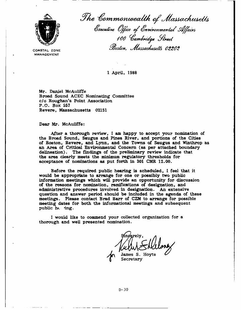
COASTAL ZONE icae t2&MANAGEMENT
1 April, 1988
Mr. Daniel McAuliffeBroad Sound ACEC Nominating Committeec/o Roughan's Point AssociationP.O. Box 557Revere, Massachusetts 02151
Dear Mr. McAuliffe:
After a thorough review, I am happy to accept your nomination ofthe Broad Sound, Saugus and Pines River, and portions of the Citiesof Boston, Revere, and Lynn, and the Towns of Saugus and Winthrop asan Area of Critical Environmental Concern (as per attached boundarydelineation). The findings of the preliminary review indicate thatthe area clearly meets the minimum regulatory thresholds foracceptance of nominations as put forth in 301 CMR 12.00.
Before the required public hearing is scheduled, I feel that itwould be appropriate to arrange for one or possibly two publicinformation meetings which will provide an opportunity for discussionof the reasons for nomination, ramifications of designation, andadministrative procedures involved in designation. An extensivequestion and answer period should be included in the agenda of thesemeetings. Please contact Brad Barr of CZM to arrange for possiblemeeting dates for both the informational meetings and subsequentpublic hc. ing.
I would like to commend your collected organization for athorough and well presented nomination.
n ly,
,James S. HoyteSecretary
D-30
Daniel McAuliffe1 April, 1988Page 2
JSH/BWBAttachment
cc: City of Boston City CouncilBoston Redevelopment AuthorityEnvironment Department
City of Lynn City CouncilPlanning DepartmentConservation Commission
City of Revere City CouncilPlanning DepartmentConservation Commission
Town of Winthrop Board of SelectmenPlannin BoardConservation Commission
Town of Saugus Board of SelectmenPlanning BoardConservation Commission
Gary Clayton, Charles Natale, DEQE/DWWRThomas McMahon, Judy Perry, DEQE/DWPCWilliam Geary, MDCJoe Horowitz, Terry Flemming IAB/NED/ACOENathaniel S. Lawrence, Esq., AG OfficeSteven I. Burr, Esq., Gaston and SnowFara Courtney, MCZM North Shore Regional CoordinatorHenry Woolsey, DFWELE/NHESPPhilip Coates, DFWELE/DMFEast Saugus Waterfront Task Force
D-30a
_ ~ ~ ~ ~ ~ ~ ~ ~ , Ylexmmn elll 'a1a~a 1
COASTAL ZONE eve37,~c22'?MANAGEMENT
2 April, 1988
Dc'nic! McAuliffeBroad Sound ACEC Nominating Committeec/o Roughan's Point AsscoiationP.O. Box 557Revere, Massachusetts
Dear Mr. McAuliffe:
I overlooked the attachment referenced in the letter from the Secretarydated 1 April, 1988. Sorry for any inconvenience.
Bradley W. BarrCritical Areas Coordinator
Attachmentcc: City of Boston: City Council, BRA, Environment Dept.
City of Lynn: City Council, Planning Dept., Cons. Comm.City of Revere: City Council, Planning Dept., Cons. Comm.Town of Winthrop: Selectmen, Planning Board, Cons. Comm.Town of Saugus: Selectmen, Planning Board, Cons. Comm.Gary Clayton, Charles Natale, DEQE/DWWRThomas McMahon, Judy Perry, DEQE/DWPCWilliam Geary, MDCJoe Horowitz, Terry Flemming IAB/NED/ACOENathaniel Lawrence, Esq., AG OfficeSteven I. Burr, Gaston and SnowFara Courtney, MCZM North Shore Regional CoordinatorHenry Woolsey, DFWELE/NHESPPhilip Coates, DFWELE/DMFEast Saugus Waterfront Task Force
D-30b
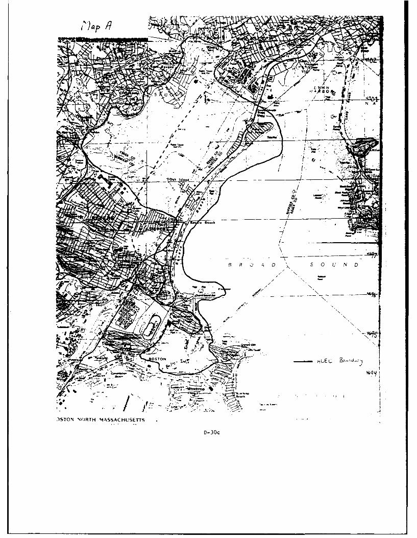
7Z- =~XN__
-a - L
-- J
)STON\ORT 'IASACHLSETT
D-30c
Wo ambmwy
MICHAEL S. DUKAKISGOVERNOR April 8, 1988
JAMES S. HOYTESECRETARY
Col. Thomas A. RhenDivision EngineerNew England DivisionU.S. Army Corps of Engineers424 Trapelo RoadWaltham, Massachusetts 02254
Dear Col. Rhen:
This letter is to inform you that I have recently accepted anomination under our Areas of Critical Environmental Concern (ACEC)Program which may affect a number of Corps projects that are either in theplanning stages or currently authorized. This nomination includesportions of the Cities of Revere, Lynn, and Boston, and the Towns ofWinthrop and Saugus. Specifically included are the Saugus marshes, RevereBeach, Roughan's Point, and the Belle Isle Marshes. We have preliminarilyidentified the Saugus River Flood Reduction Study, the proposed SaugusRiver Federal Navigation Project, the proposed Pines River FederalNavigation Project, and the Revere Beach Erosion Control Project aspotentially affected by the designation of the proposed area. Enclosedplease find a copy of the nomination, which includes maps and proposedboundary descriptions, as well as a copy of the most recent version of theACEC Book, which details where the existing ACEC are located and how theprogram is administered and implemented.
We would like to offer you the opportunity to meet with Brad Barr,who administers the coastal aspects of this program for me, to furtherdiscuss the implications of this nomination with regard to the current andfuture activities of the New England Division. I hope that you willcontact him at 727-9530 as soon as possible to allow for this coordinationin the early phases of the review of the nomination.
Sincere
James S. Ho 4
Secretary
JSHIBWBAttachmentscc: Vito Andreliunas, Joeseph Ignazio, Carl Boutilier, William Lawless
D-31
P.O. box 557Revere, MA 02151
March o, 19b
nonoraole Secretary ot Environmental Affairs
Lxecutive uttice of Environmental AffairsIOU Oambriage Street ,A. 1 " '9boston, ftk UZZUL COASTAL 70NE (L'NAGEMENT
Dear Sir,
We, tue undersigned citizens of the Commonwealth of Massachusetts dohereby nominate broad Sound tor designation as an Area of Criticaltnvironmental Concern (ACLC) under the regulations of themassacnusetts Coastal 4one Management program and the regulations oftne Massachusetts Environmental Policy Act. This area includes:belle Isle Marsh, Short Beach, Roughan's Point, Crescent Beach, Reverebeacn, Point of Pines and the Revere/Lynn/Saugus Salt Marsh System andcertain adjacent watershed areas and buffer zones
we provide with this request a summary of information regarding theproposed areas resources which we feel not only satisfy the minimumeligibility requirements, but also greatly exceed these requirements.Also included is a description, including maps, of the boundaries ofthe proposed area for designation, and the advantages of ACECdesignation.
The Broad Sound area described above has long been recognized by thewintnrop/Kevere/Lynn community for its natural beauty and recreationaluse. We hope you will review this nomination favorably.
TnanK you tor your consideration.
Sincerely,
-, /17 A /1
D-31a
Honorable Secretary of Environmental AffairsRe: Nomination of Broad Sound as an ACECMarch 6, 1988
Proposed ACEC Boundaries
The proposed area generally includes: 1) Belle Isle Marsh in Winthrop,East Boston and Revere, 2) Short Beach in Winthrop and Revere,3) Roughan's Point, Crescent Beach, Revere Beach, Oak Island and Point ofPines in Revere, 4) the Pines and Saugus River Estuary and Salt Marsh,Bear Creek, Diamond Creek, Seaplane Basin and associated floodplain andbuffer zone areas in Saugus, Lynn and Revere. The seaward boundary isthe mean low water line while the landward boundary is generally based onthe 10' contour, the 100 year floodplain and certain man-made structures.All elevations referred to are NGVD datum as indicated on the USGS 74minute topographic sheet of the Boston North (42071-Dl-TM-025) and Lynn(42070-D7-TM-025) Quadrangles dated 1971, photorevised in 1978.
Specifically:The proposed area is defined as follows:
The proposed area begins at the northwest corner of the Belle IsleMarsh abutting Bennington Street in Revere (see map A). The boundaryfollows Bennington Street south to Orient Heights in East Boston. Theboundary then moves east along the 10' contour around the marsh toinclude the Belle Isle Inlet and Short Beach Creek. At Short Beach inWinthrop the boundary turns north along the mean low water line intoRoughan's Point in Revere to include the Breakwater and Cherry IslandBar. The boundary then moves north to include the tidal flats ofCrescent and Revere Beach. At the Point of Pines in Revere the boundaryfollows the tidal flats and turns west as defined by the 100 yearfloodplain including: the Lynn/Saugus Marsh, the Saugus Iron Works, BearCreek, Diamond Creek, Seaplane Basin, Oak Island, and the Pines andSaugus Rivers (see map B). The boundary then moves south along the 100year floodplain to include Sales Creek where it turns east along thefloodplain boundary (see map C) to Roughan's Point and then turns southalong the 10' contour to the northeast corner of Belle Isle Marsh. Theboundary is completed when it turns west following the 10' contour to thenorthwest corner of Belle Isle Marsh in Revere.
Resources reouired for elizibiltv:
Listed below is a summary of the area's resources which we feel meet andexceed the requirements for designation as an ACEC as set forth inregulation 310-CMR-20.00 of the CZM program.
1. Historic Sites
a. The Belle Isle Marsh is comprised of 275 acres of salt marsh, saltmeadow and tidal flats (150 acres are owned by the MDC, the remaining 125acres are owned by the towns of East Boston, Winthrop and Revere). Thisarea is unique in its proximity to the developed areas that surround it(East Boston, Winthrop and Revere).
1
D-31b
Honorable Secretary of Environmental AffairsRe: Nomination of Broad Sound as an ACECMarch 6, 1988"
l.a. Historical Sites. continued:
Belle Isle Marsh was the scene of the second battle of the RevolutionaryWar in 1776. This battle was known at the time as "The Battle of ChelseaCreek".
b. Revere Beach is the oldest public beach in the United States. Revereand Crescent beach have been enjoyed by the public since the late 19thcentury. Over the past few decades the beach area had deteriorated.Presently, prolific reconstruction and development is taking place alongthe beach. Future development must be approached in an intelligent andthoughtful manner in order to avoid irreversible negative impact upon ournation's oldest public beach.
c. Early in the 17th century, the first successful Iron Works in thiscountry was established by colonial settlers on the banks of the SaugueRiver. The Saugus Iron Works is now a national historic site owned andoperated by the National Park Service.
2. Shellfish Beds
Throughout the area nominated there is an abundance of shellfish bedscontaining softshell clams, quahogs, razor clams and blue mussels. Inparticular there are rich beds in the Belle Isle Marsh, Roughan's Point,Revere Beach and the Lynn/Saugus Salt Marsh areas. Although theharvesting of shellfish has been banned in some of these areas due to theeffects of pollution and contamination, efforts to improve the overallquality of the environment through the construction of sewage treatmentfacilities (Massachusetts Water Resources Authority) and stricterenviroTmental controls (MEPA, DEQE and CZM) may result in the improvementand resurgence of tainted shellfish beds.
-3. Significant Wildlife Habitat
The area proposed is unique as a significant habitat for a wide varietyof wildlife in so natural a setting within 5 miles of Boston, a majormetropolitan center. Among the mammal species indigenous to the areaare: Racoon, Muskrat, Meadow Voles, Skunks, Red Fox and Harbor Seals.Additionally, the Friends of Belle Isle Marsh and the Concerned CoastalSportsmen's Association list scores of species of birds that either breedin the area or feed and rest during their annual migrations. A partiallisting includes: Short-eared Owls, Snowy Owls, Glossy Ibis, GreatEgret, Blue-wing Teal, Hudsonian Godwit, Osprey, Buffleheads, Willets,Marsh Hawks, Peregifne Falcons, Kestrels, Loons, Greater and LesserYellowlegs, Black Bellied and Semi-palmated Plovers, Eiders, Scaup, andRed Breasted and Hooded Mergansers. Among the species known to breed inthe area are: Black Ducks, Mallards, Meadowlark, Spotted Sandpiper,Sharp-tailed Sparrow, American Kestrel, Common Terns, Killdeer and Red-tailed Hawks. Suspected breeders include: Blue-winged Teal, Marsh Wrenand Savannah Sparrow.
D-31c
Honorable Secretary of Environmental AffairsRe: Nomination of Broad Sound as an ACECMarch 6, 1988
3. Significant Wildlife Habitat, continued:
Crustacean species found in the nominated area include: Lobster, Quahogs,Softshell Clams, Razor Clams, Periwinkles, Blue Mussels, Green Crabs andRock Crabs.
4. Floodylain
Most of the area proposed for ACEC designation lies within thefloodplains for the Winthrop/Revere/Lynn community and is subject to theflood waters of coastal storms and rainwater innundation. The Blizzardof 1978 demonstrated that these floodplains serve to protect landwardcommunities from the destruction caused by ocean flooding. The 1978flood ravaged many homes in floodplain areas proximal to and included inthe proposed ACEC designation area. Any new development in floodplainareas must come under close scrutiny in order to avoid exacerbation ofthis coastal flooding situation.
5. Coastal Estuary and Embayments
The Pine and Saugus rivers are coastal rivers, comprised of shallowcoves, salt marshes and salt meadows, lagoons, shellfish beds and theinteraction of salt and fresh water. Both intertidal areas are prolificand abundant in marine resources.
6. Salt Meadow
Included in the nominated area are several hundred acres of salt meadowin Belle Isle Marsh and the Lynn/Saugus Salt Marsh. -This soil iswaterlogged through most of the growing season. Vegetation ispredominately grasses, rushes and sledges.
7. Salt Marsh
There are several hundred acres of salt marsh included in the areaproposed for designation. The salt marsh areas serve to controlpollution by :apping, organically binding and breaking down solids.These marg , provide the autotrophic energy source, i.e., plants, uponwhich th .itire marine food web depends. Marsh vegetation includes:Spartina grasses, Salicornias, Atriplex, duckweed, watershields, marshmallow, water lillies, bullrushes and cattails.
8. Coastal. Barrier and Recreational Beaches
There are several public beaches used for recreational purposes withinthe area proposed for ACEC designation. Many of these (especially RevereBeach) are barrier beaches. They are maintained by the town of Winthrop,the city of Revere and the Metropolitan District Commission.
D-31d
Honorable Secretary of Environmental AffairsRe: Nomination of Broad Sound as an ACECMarch 6, 1988
ACEC Nomination, continued:
9. Habitat for Threatened, Rare or Endangered Species
Common Terns and Meadowlarks are known to breed in the Belle Isle andLynn/Saugus Salt Marsh.
10. Anadromous/Catadromous Fish Run
a. In the fall, usually between September and December, smelt run up theBelle Isle Inlet and Short Beach Creek into the Belle Isle Marsh.
f
b. In season, large numbers of blue fish, striped bass and flounder arefound in Broad Sound. These fish populations constitute a significantportion of the food chain and also represent a substantial recreationaland commercial fishery.
Advantages of ACEC Desig ation for the Broad Sound Area
When we examined the intense development pressures that currently existin the proposed area, the advantages of ACEC designation became apparent.The advantages of ACEC designation are enormous, especially when EastBoston, Winthrop, Revere, Lynn and Saugus are experiencing majordevelopment; for example: 1) Belle Isle Marsh is being encroached uponby development along Bennington Street, 2) Roughan's Point has beentargeted for high-density development, 3) Revere Beach has experiencedthe greatest impact of high-density development thus far, and4) currently there are plans for the construction of an MBTA Purple Linestation, and parking for approximately 3,000 vehicles on land adjacent toand including the Lynn/Saugus Marsh.
In order to minimize the potentially irreversible negative impact rndpublic health threat of development on the Broad Sound area, we seek ACECdesignation. We hope this designation will help to prevent adverseeffects on wildlife habitat, water quality, flood control and areas ofhistorical significance.
In summary, it is our responsibility to protect this area for present andfuture generations, not just for the people in the Broad Sound area, butfor each and every citizen of the Commonwealh. Also, we believe thisdesignation will instill a greater public appreciation of the Broad Soundarea, its recreational aspects and its natural beauty.
D-31e
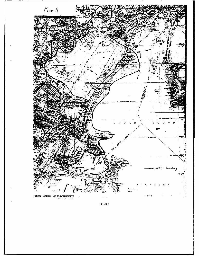
AA
- ~ ~Al
STON ~I~TH ASSACUSETT
D- 31.
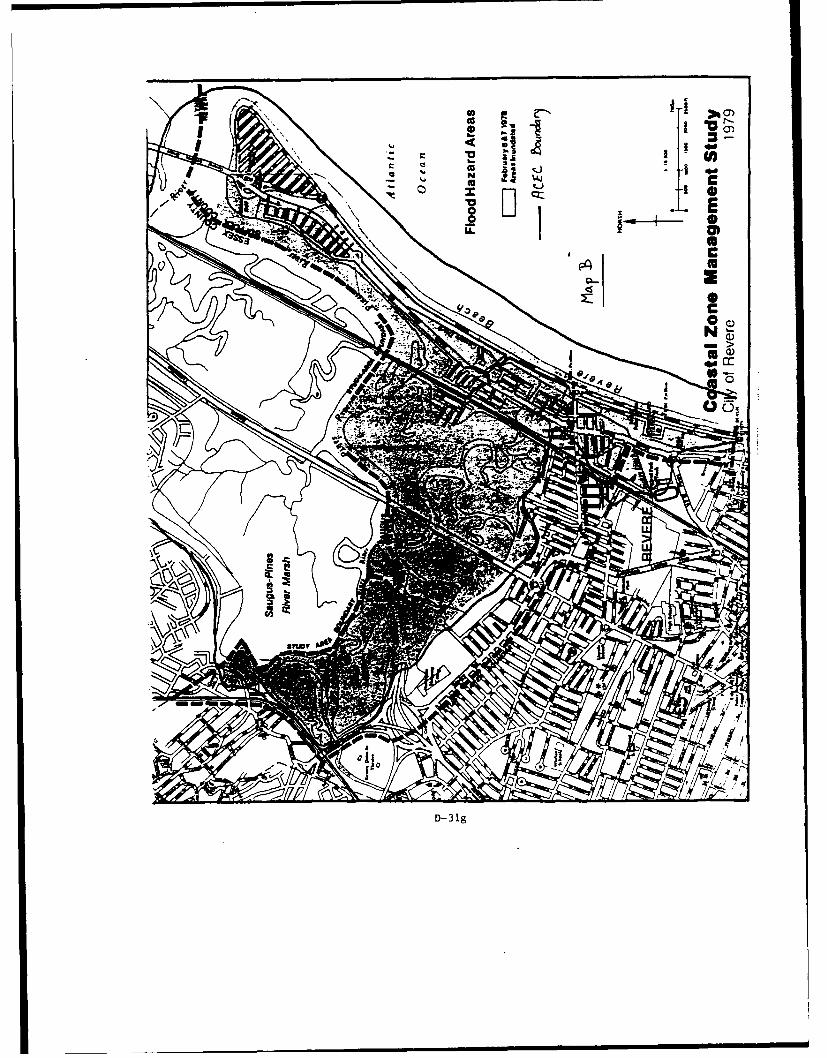
CL
D- 3 g
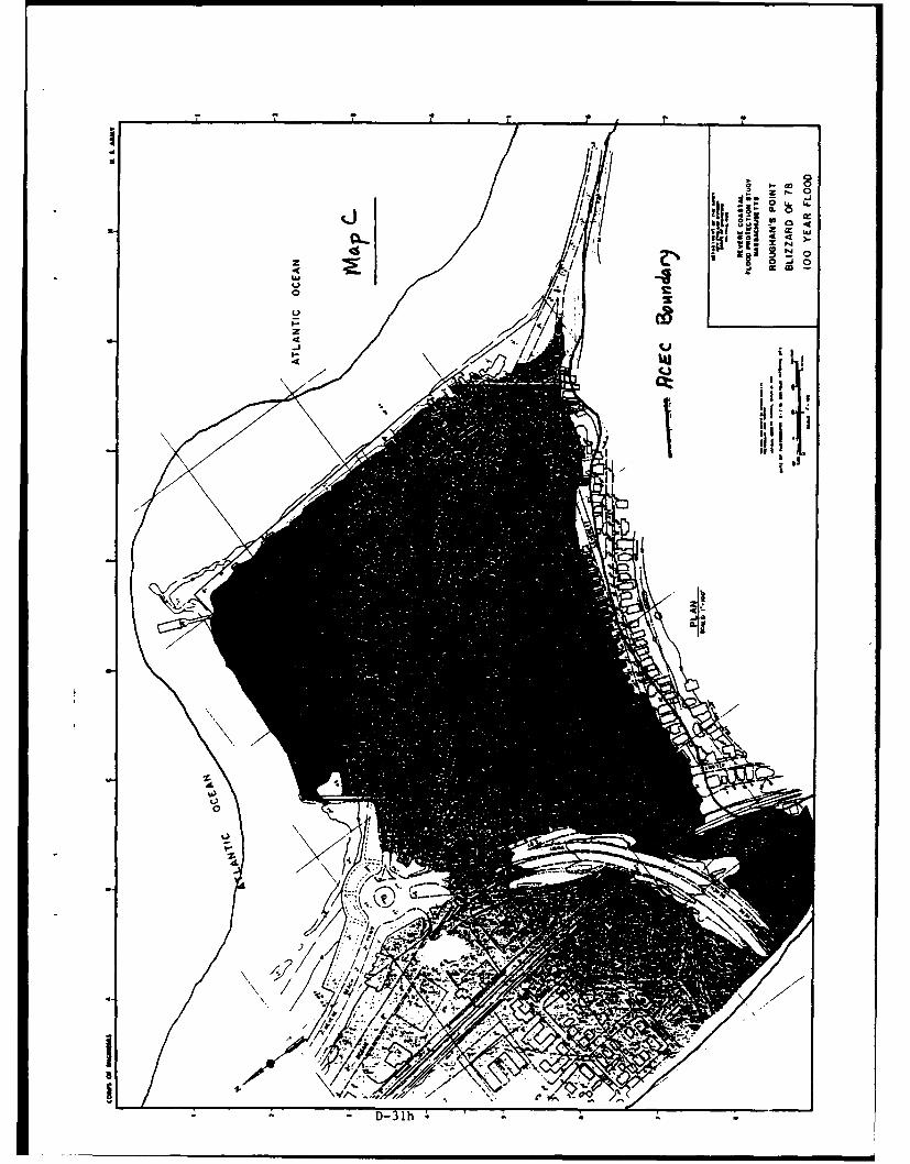
a- CL 0
I0
II-j:Er ~OLa~
/1*1(184
IPbj-
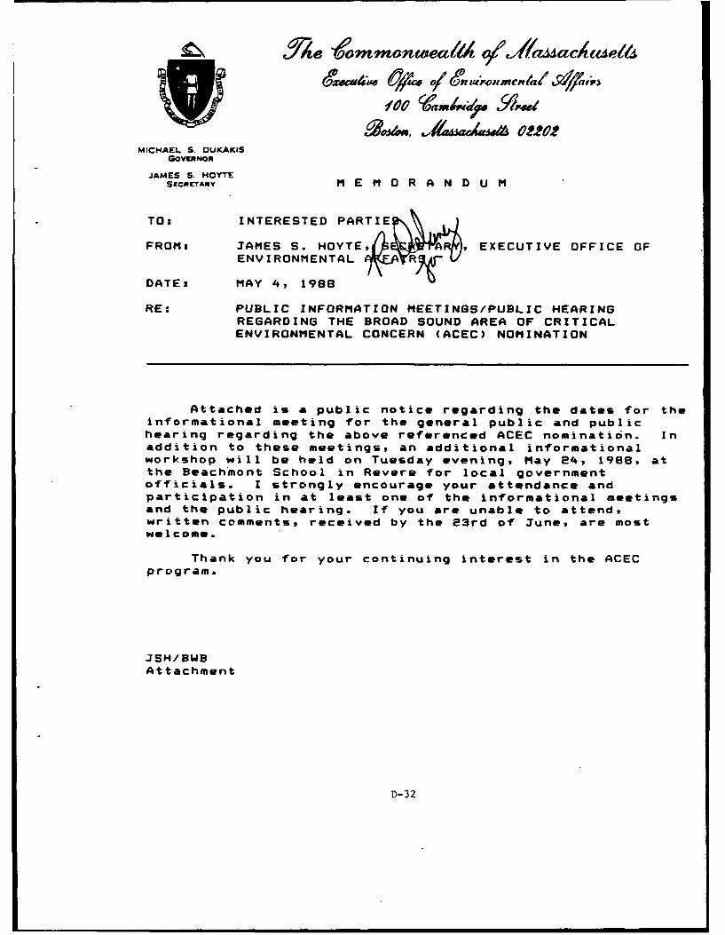
3 eo~mmonwieai14 o/Yamaeactuel6
100 shvmiow 'Amsd
.qM~jss, A&Wa-U&022MICHAEL S. DUKAKIS
GOVERNOR
JAMES S. HOYTEsECOmrARY M E M 0 R A N D U M
TO: INTERESTED PARTIE
FROM: JAMES S. HOYTE , EXECUTIVE OFFICE OFENVIRONMENTAL ;R V
DATE: MAY 4, 1988
RE: PUBLIC INFORMATION MEETINGS/PUBLIC HEARINGREGARDING THE BROAD SOUND AREA OF CRITICALENVIRONMENTAL CONCERN (ACEC) NOMINATION
Attached is a public notice regarding the dates for theinformational meeting for the general public and publichearing regarding the above referenced ACEC nomination. Inaddition to these meetings, an additional informationalworkshop will be held on Tuesday evening, May 24, 1988, atthe Beachmont School in Revere for local governmentofficials. I strongly encourage your attendance andparticipation in at least one of the informational meetingsand the public hearing. If you are unable to attend,written comments, received by the 23rd of June, are mostwelcome.
Thank you for your continuing interest in the ACECprogramb
JSH/BWBAttachment
D-32
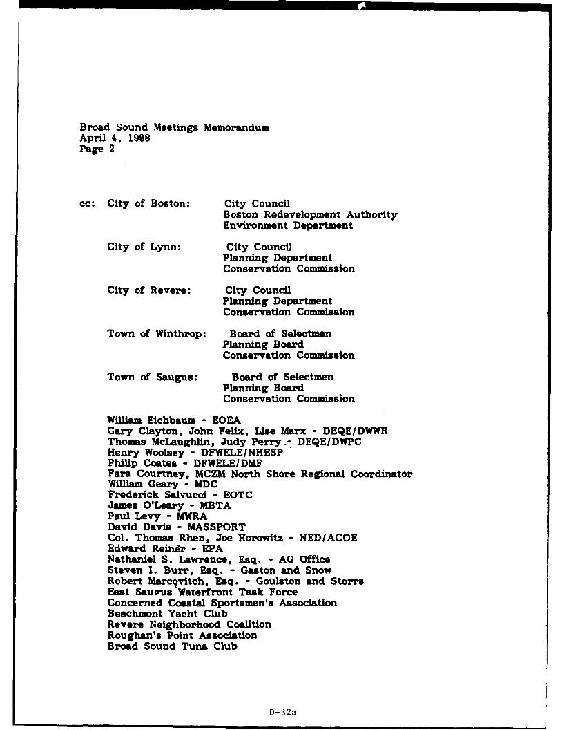
I~-- I -- I - I I I I I
Broad Sound Meetings MemorandumApril 4, 1988Page 2
cc: City of Boston: City CouncilBoston Redevelopment AuthorityEnvironment Department
City of Lynn: City CouncilPlanning DepartmentConservation Commission
City of Revere: City CouncilPlanning DepartmentConservation Commission
Town of Winthrop: Board of SelectmenPlanning BoardConservation Commission
Town of Saugus: Board of SelectmenPlanning BoardConservation Commission
WilliAm Eichbaum - EOEAGary Clayton, John Felix, Use Marx - DEQE/DWWRThomas McLaughlin, Judy Perry.- DEQE/DWPCHenry Woolsey - DFWELE/NHESPPhilip Coates - DFWELEIDMFFare Courtney, MCZM North Shore Regional CoordinatorWilliam Geary - MDCFrederick Salvucci - EOTCJames O'Leary - MBTAPaul Levy - MWRADavid Davis - MASSPORTCol. Thomas Rhen, Joe Horowitz - NED/ACOEEdward Reiner - EPANathaniel S. Lawrence, Esq. - AG OfficeSteven I. Burr, Esq. - Gaston and SnowRobert Marcqvitch, Esq. - Goulston and StorrsEast Saupus Waterfront Task ForceConcerned Coastal Sportsmen's AssociationBeachmont Yacht ClubRevere Neighborhood CoalitionRoughan's Point AssociationBroad Sound Tuna Club
D-32a
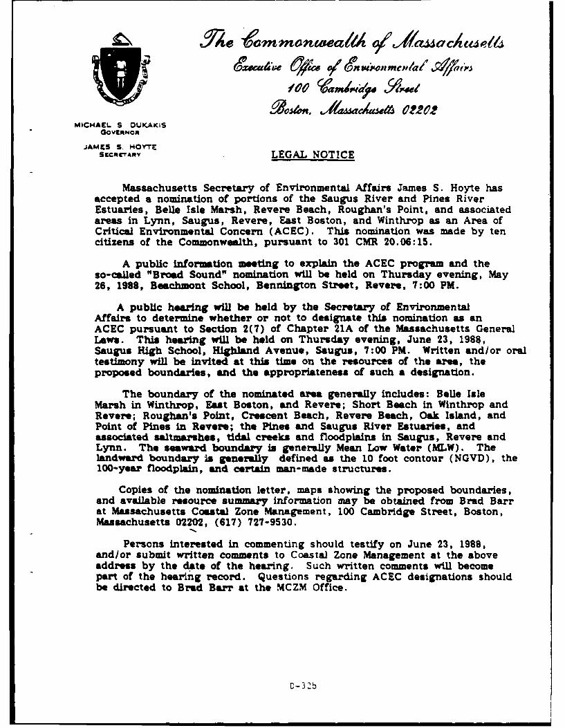
t./" e mmonwea1A #Jf'A4 ~acae1
MICHAEL S OUKAKISGOVERNOR
JAME S S. HOY'TEScmrA Y LEGAL NOTICE
Massachusetts Secretary of Environmental Affairs James S. Hoyte hasaccepted a nomination of portions of the Saugus River and Pines RiverEstuaries, Belle Isle Marsh, Revere Beach, Roughan's Point, and associatedareas in Lynn, Saugus, Revere, East Boston, and Winthrop as an Area ofCritical Environmental Concern (ACEC). This nomination was made by tencitizens of the Commonwealth, pursuant to 301 CMR 20.06:15.
A public information meting to explain the ACEC program and theso-called "Broad Sound" nomination will be held on Thursday evening, May26, 1988, Beachmont School, Bennington Street, Revere, 7:00 PM.
A public hearing will be held by the Secretary of EnvironmentalAffairs to determine whether or not to designate this nomination as anACEC pursuant to Section 2(7) of Chapter 21A of the Massachusetts GeneralLaws. This hearing will be held on Thursday evening, June 23, 1988,Saugus High School, Highland Avenue, Saugus, 7:00 PM. Written and/or oraltestimony will be invited at this time on the resources of the area, theproposed boundaries, and the appropriateness of such a designation.
The boundary of the nominated area generally includes: Bele IsleMarsh in Winthrop, East Boston, and Revere; Short Beach in Winthrop andRevere; Roughan's Point, Crescent Beach, Revere Beach, Oak Island, andPoint of Pines in Revere; the Pines and Saugus River Estuaries, andassociated saltmarshes, tidal creeks and floodplains in Saugus, Revere andLynn. The seaward boundary is generally Mean Low Water (MLW). TheIandwa.rd boundary Is generally defined as the 10 foot contour (NGVD), the100-year floodplain, and certain man-made structures.
Copies of the nomination letter, maps showing the proposed boundaries,and available resource summary information may be obtained from Brad Barrat Massachusetts Coastal Zone Management, 100 Cambridge Street, Boston,Massachusetts 02202, (617) 727-9530.
Persons interested in commenting should testify on June 23, 1988,and/or submit written comments to Coastal Zone Management at the aboveaddress by the date of the hearing. Such written comments will becomepart of the hearing record. Questions regarding ACEC designations shouldbe directed to Brad Barr at the MCZM Office.
D-3'b
DEPARTMENT OF THE ARMYNEW ENGLAND DIVISION. CORPS OF ENGINEERS
424 TRAPELO ROAD
WALTHAM. MASSACHUSETTS 02254-9149
Wtqv ToaTT|ewOm a.
Planning Division 10 JUNImpact Analysis Branch
James S. Hoyte, SecretaryCcIamweaath of MassachusettsExecutive Office of Environmental Affairs100 Cambridge StreetBoston, Massachusetts 02202
Dear Secretary Hcyte:
Thank you for your letter of April 8, 1988 concerning the BroadSound Area of Critical Envirormntal Concern (AC ) nomination, andfor providing the opportunity for my staff to meet with Brad Barr onthe ACMC Program. Our meeting of May 6 with Mr. Barr was veryproductive in outlining the potential implications of an ACECdesignation on the New England Division's (NED's) projects undertakenon behalf of local and Commrrnalth sponsors.
It is our understanding that the nominated AC will be:
1) designated with the boundaries as nominated, or2) designated with revised boundaries, or3) not designated
It is further understood that, should an ACEC be designated, allwork within the designated area would be subject to higherenvirorental performance standards. These would include:
1) Under the Massachusetts Coastal Zone Management Program,focus on the'area would be intensified by the application of Policy 2that calls for all EOEA agencies, including CZM, to take actionthrough their programs and regulatory responsibilities, to protect anACEC.
2) Under the Wetlands Protection Act, performance standardsfor land under the ocean, tidal flats, coastal dunes and rockyintertidal shores would change from "minimize adverse effects" to "noadverse effect."
3) Under the Waterwys Licensing Program (Chapter 91), thestandard would change from "minimiz- adverse effects to theenvironment" to "no adverse impact." Further, no license would beissued for "imqprovement dredging in any part of an ACBc, except forthe purposes of shellfish enhancement or other marine productivity."
D-33
-2-
4) Under the Water Quality Standards of the Division ofWater Pollution Control, the Division would be required to classifywaters within this ACEC as SA and to incorporate strictantidegredation standards.
A brief description and status update of NED projects in thenominated area, and our understanding of how they might be imrpactedby an ACEC designation, follows:
1. Pines River Navigation
Type of Project: Improvement dredging for recreationalnavigation. Section 107-Continuing Authority.
Project Description: Proposed construction of a 6500 footlong Federal navigation channel from the confluence of the Saugus andPines River upstream to the head of navigation, with a 5 acreanchorage along the western limit of the downstream channel reach.
Estimated Cost: $1,200,000
Status: Deferred at this time due to its primarilyrecreational nature.
Sponsor: City of Revere/Massachusetts DE4
Impact of ACEC: Prohibited under Chapter 91.
2. S~ugus River Navigation
Type of Project: Improvement dredging for commercialnavigation. Section 107-Continuing Authority.
Project Description: Proposed construction of an 18,400foot long Federal navigation channel from deep water in the westernchannel of Lynn Harbor upstream to the vicinity of the Marshall BoatYard, plus two anchorage areas totalling 4.3 acres upstream fromWestern Ave.
Estimated Cost: $1,400,000
Status: Preparing a Detailed Project Report for Washingtonapproval.
Sponsor: Town of Saugus/Massachusetts DEM
Impact of ACEC: Prohibited under Chapter 91.
D-33 4L.
-3-
3. Point of Pines
Type of Project: Coastal flood protection for about 360structures, mostly residences. Section 205-Continuing Authority.
Project Description: The proposed project includes a) 1600linear feet of stone revetment with beach sand replenishment alongthe southerly shore of Point of Pines, b) 1700 linear feet of sanddune replenishment and beach grass planting extending northward fromthe revetment and, from there, c) 1750 linear feet of concrete wallalong the Saugus River to the General Edwards Bridge.
Estimated Cost: $5,000,000
Status: Authorized by Washington to prepare plans andspecifications. Subject to receipt of agreed-to local cooperationagreement by the sponsor, authorization for construction could occur.
Sponsor: City of Revere
Impact of ACES: Upgraded performance standards underWetlands Protection Act, Chapter 91 and CZM consistency review couldpreclude the project.
4. Roughans Point
Type of Project: Coastal flood protection for 300residences. Congressionally Authorized Project.
Project Description: Approximately 4000 feet of stonerevetment would be placed along the shore. Interior drainageimprovements would be made. A sluice gate would be constructed onSales Creek by the Revere Beach Parkway.
Estimated Cost: $10,000,000
Status: Authorized for construction. In PreconstructionEngineering & Design Phase.
Sponsor: City of Revere/Massachusetts rV4
Impact of ACEC: Upgraded performance standards underWetlands Protection Act, Chapter 91 and CZM consistency review couldpreclude the project.
5. Revere Beach Erosion Control
Type of Project: Coastal flood protection for reduction ofdamage to seawalls. Congressionally Authorized Project.
D-33 6
-4-
Project Description: Project wuld consist of placing about800,000 cubic yards of sandfill along approximately 1300 feet ofRevere Beach to form a 50 foot wide berm at elevation +18 feet abovemlw seaward of the existing seawall, with the fill then sloping down1 on 15 to the existing beach. The sand would be obtained from theabandoned 1-95 embankment in the Saugus/Pines estuary.
Estimated Cost: $8,700,000
Status: Authorized for construction. Funds to initiateconstruction appropriated in FY 87.
Sponsor: Metropolitan District Commission
Impact of ACEC: Upgraded performance standards underWetlands Protection Act, Chapter 91 and CZM consistency review couldpreclude the project.
6. Saugus River and Tributaries
Type of Project: Flood damage reduction for 5000residential, commercial, industrial and public buildings.Congressionally Authorized Study.
Project Description: The preferred Regional Saugus RiverFloodgate Plan would include floodgates at the mouth of the SaugusRiver in a 1300 foot long structure, including a navigation gate andflushing gates; dikes and/or walls along 1.5 miles of Lynn Harbor;0.6 miles of earth dike on high ground near the MDC Police Stationbehind Revere Beach; and preservation of a ponding area with a 0.1mile containing wall behind Revere Beach Boulevard. Potentialindirect impacts of the floodgate on the estuary may cause theproject footprint to include the entire estuary.
Estimated Cost: $55,000,000
Status: Feasibility Study Phase.
Sponsor: Lynn, Malden, Revere, Saugus/Metropolitan DistrictCommission.
Impact of ACEC: Upgraded performance standards underWetlands Protection Act, Chapter 91, CZM consistency review and WaterQuality Certification process could preclude the project.
D-33c
-5-
In summary, six projects sponsored by local interests andCommonwealth agencies could be either clearly prohibited (Pines andSaugus River Navigation) or placed at high risk of being precluded bythe upgraded performance standards associated with an ACECdesignation in the nominated area (Point of Pines, Roughans Point,Revere Beach Erosion Control, Saugus River and Tributaries).Collectively, these projects represent a majority of the spatialextent of the nominated ACEC.
If you hae any questions or require further information, pleasecall me at 647-8220. Dr. Joseph Horowitz of my staff will behandling the details. He can be reached at 647-8518.
I appreciate your early inclusion of NED in the coordination ofthis important ACEC nomination.
Sincerely,
omsA. RhenColonel, Corps of EngineersDivision Engineer
Copies Furnished:(See Attached List)
D-33d
Copies Furnished: Honorable Albert V. DiVirgilioMayor of Lynn
Mr. Brad Barr City HallOffice of Coastal Zone Management Lynn, Massachusetts 01901100 Cambridge Street Attn: Mr. Stephen SmithBoston, Massachusetts 02202
Honorable James S. ConwayMs. Fara Courtney Mayor of MaldenOffice of Coastal Zone Management Government Center159 Main Street 200 Pleasant StreetGloucester, Massachusetts 01930 Malden, Massachusetts 02148
Attn: Mr. Henry MulhernMr. Henry Higgott
DC Parks, Engrg. & Construction Mr. Steve Davis, Director20 Scmerset Street FOEA/MEPA UnitBoston, Massachusetts 02108 100 Cambridge Street, 20th Floor
Boston, Massachusetts 02202Mr. Carney TerzianMDC Parks, Engrg. & Construction Mr. Daniel McAuliffe20 Somerset Street Broad Sound ACEC Nninating CamitteeBoston, Massachusetts 02108 c/o Roughans Point Association
P.O. Box 557Mr. William Geary, Cczmissioner Revere, Massachusetts 02151MDC20 Somerset StreetBoston, Massachusetts 02108
Mr. Eugene CavanaughActing Director & Chief EngineerDE4/Division of WaterwaysBuilding 45, 349 Lincoln StreetHingham, Massachusetts 02043
Mr. Norman B. HansenTown ManagerTown HallSaugus, Massachusetts 01909Attn: Mr. Dennis Roy
Honorable George V. ColellaMayor of RevereCity HallRevere, Massachusetts 02151Attn: Mr. Frank Stringi
D-33e
* DEPARTMENT OF THE ARMYNEW ENGLAND DIVISION. CORPS OF ENGINEERS
424 TRAPELO ROAD
Z7 WALTHAM. MASSACHUSETTS 02254-9149
0 V~ TO
A1Y'I|NTO O
Planning DivisionImpact Analysis Branch 10 JUN 1988
Honorable George V. ColellaMayor of RevereCity HallRevere, Massachusetts 02151Attn: Mr. Frank Stringi
Dear Mayor Colel la:
Attached, for your information, is a letter that I have sent toMassachusetts Secretary of Enviroruental Affairs, James Hoyte, concerningthe nominated Broad Sound Area of Critical Environmental Concern (ACEC).
If you have any comments regarding this matter, please furnish themdirectly to Secretary Hoyte by June 23, 1988. His full address is:
James S. Hoyte, SecretaryCcmmonwealth of MassachusettsExecutive Office of Envirormental Affairs100 Cambridge StreetBoston, Massachusetts 02202
Sincerely,
Thomas A. RhenColonel, Corps of EngineersDivision Engineer
Attachment
D-33f
Sme letter sent to: Copy Furnished
Mr. William Geary, Commissioner James S. Hoyte, SecretaryNC Cammraiealth of Massachusetts20 Somerset Street Executive Office of Environental AffairsBoston, Massachusetts 02108 100 Cambridge Street
Boston, Massachusetts 02202Mr. Eugene CavanaughActing Director and Chief Engineer Mr. Brad BarrD4/Division of Waterways Office of Coastal Zone ManagementBuilding 45, 349 Lincoln Street 100 Cambridge StreetHingham, Massachusetts 02043 Boston, Massachusetts 02202
Mr. Norman B. Hansen Ms. Fara CourtneyTcwn Manager Office of Coastal Zone ManagementTown Hall 159 Main StreetSaugus, Massachusetts 01909 Gloucester, Massachusetts 01930Attn: Mr. Dennis Roy
Mr. Steve Davis, DirectorHonorable George V. Colella EDEA/MEPA UnitMayor of Revere 100 Cambridge Street, 20th FloorCity Hall Boston, Massachusetts 02202Revere, Massachusetts 02151Attn: Mr. Frank Stringi Mr. Daniel McAuliffe
Broad Sound ACE)C Nominating CommitteeHonorable Albert V. DiVirgilio C/o Roughans Point AssociationMayor of Lynn P.O. Box 557City Hall Revere, Massachusetts 02151Lynn, Massachusetts 01901Attn: Mr. Stephen Smith Mr. Henry Higgott
MDC Parks, Engineering and ConstructionHonorable James S. Conway 20 Somerset StreetMayor of Malden Boston, Massachusetts 02108Government Center200 Pleasant Street Mr. Carney TerzianMalden, Massachusetts 02148 MDC Parks, Engineering and ConstructionAttn: Mr. Henry Mulhern 20 Somerset Street
Boston, Massachusetts 02108
D-33g
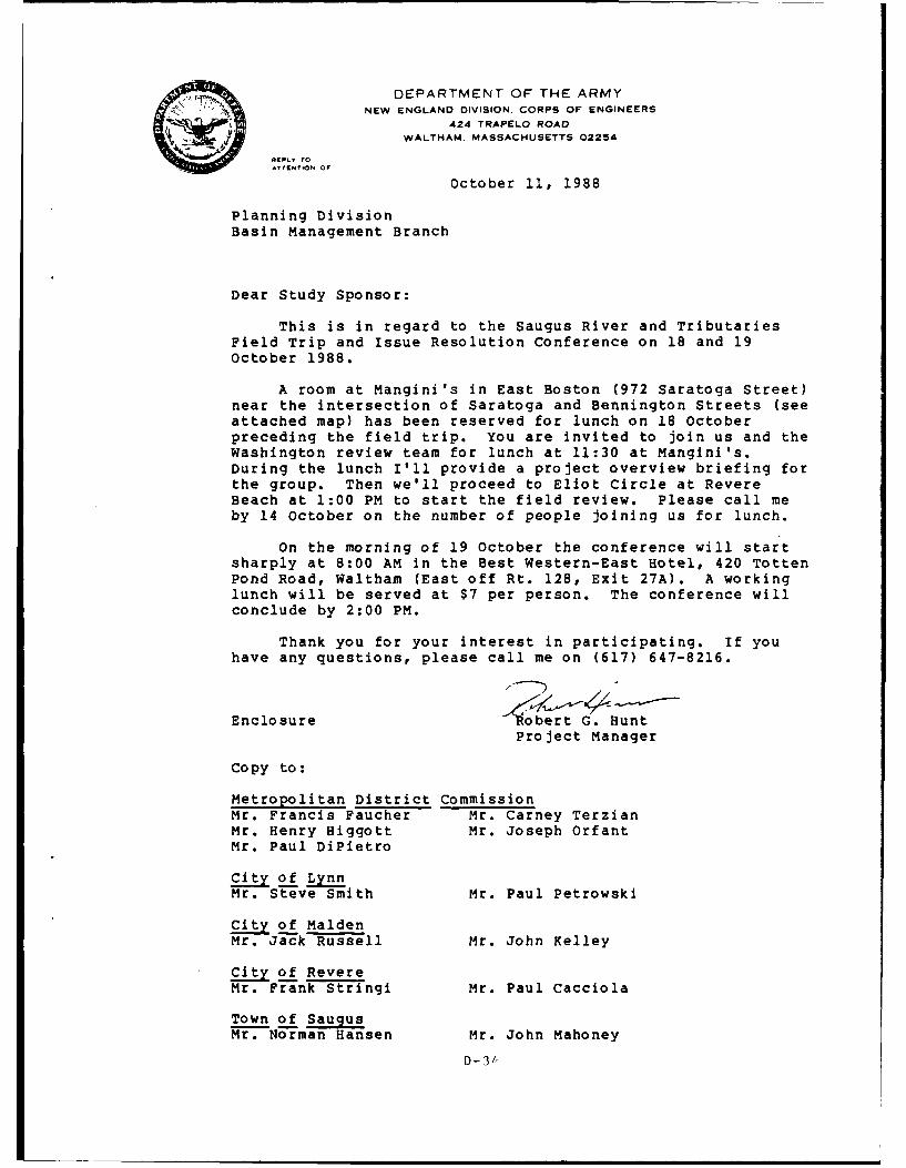
DEPARTMENT OF THE ARMYNEW ENGLAND DIVISION. CORPS OF ENGINEERS
424 TRAPELO ROAD
WALTHAM. MASSACHUSETTS 02254
RIEFIY TO
October 11, 1988
Planning DivisionBasin Management Branch
Dear Study Sponsor:
This is in regard to the Saugus River and TributariesField Trip and Issue Resolution Conference on 18 and 19October 1988.
A room at Mangini's in East Boston (972 Saratoga Street)near the intersection of Saratoga and Bennington Streets (seeattached map) has been reserved for lunch on 18 Octoberpreceding the field trip. You are invited to join us and theWashington review team for lunch at 11:30 at Mangini's.During the lunch I'll provide a project overview briefing forthe group. Then we'll proceed to Eliot Circle at RevereBeach at 1:00 PM to start the field review. Please call meby 14 October on the number of people joining us for lunch.
On the morning of 19 October the conference will startsharply at 8:00 AM in the Best Western-East Hotel, 420 TottenPond Road, Waltham (East off Rt. 128, Exit 27A). A workinglunch will be served at $7 per person. The conference willconclude by 2:00 PM.
Thank you for your interest in participating. If youhave any questions, please call me on (617) 647-8216.
Enclosure 'ert 0. Hunt
Project Manager
Copy to:
Metropolitan District CommissionMr. Francis Faucher Mr. Carney TerzianMr. Henry Higgott Mr. Joseph OrfantMr. Paul DiPietro
City of LynnMr. Steve Smith Mr. Paul Petrowski
City of MaldenMr. Jack Russell Mr. John Kelley
City of RevereMr. Frank Stringi Mr. Paul Cacciola
Town of Saugus
Mr. Norman Hansen Mr. John Mahoney
D -3/,
DESIGNATION OF PORTIONS OF THE CITIES OFBOSTON, LYNN, AND REVERE, AND THE TOWNS OF
SAUGUS AND WINTHROP
AS THE
RUMNEY MARSHESAREA OF CRITICAL ENVIRONMENTAL CONCERN
WITH SUPPORTING FINDINGS
Following an extensive formal review required by the regulations ofthe Executive Office of Environmental Affairs (301 CMR 12.00) includingnomination review, research, meetings, and evaluation of all publiccomments, I, the Secretary of Environmental Affairs, hereby designateportions of the Cities of Boston, Lynn, and Revere, and the Towns ofSaugus and Winthrop, as described below, as an Area of CriticalEnvironmental Concern (ACEC). I take this action pursuant to theauthority granted me under Massachusetts General Law c. 21A, s. 2(7).
I also hereby find that the coastal wetland resource areas includedin the Rumney Marshes ACEC, the title taken from the name used during thecolonial era to identify the marshes and lowlands of this region, aresignificant to flood control, the prevention of storm damage, theprotection of land containing shellfish, and fisheries; the prevention ofpollution, the protection of wildlife habitat, the protection of publicand private water supplies; public interests defined in the WetlandsProtection Act (MGL c. 131, s. 40; 310 CMR 10.00).
I. Boundary of the Rumney Marshes ACEC
Upon review of the boundaries as recommended in the nomination letterand subsequent recommendations made in testimony received, the designatedboundary encloses two principal wetland systems, the Saugus and PinesRiver Estuary, and Belle Isle Marsh. The landward boundary, in largepart, is the 100 year flood elevation as delineated by the FederalEmergency Management Agency (FE1A) Flood Insurance Rate Maps and FloodwayMaps. However, in certain specific locations described herein, thelandward boundary may change to the edge of wetland, as defined in theWetlands Protection Act (MGL c. 131 s.40), or artificial boundaries.
Specifically, the boundary of the Saugus and Pines Estuary is definedas follows: The area includes the Saugus and Pines Rivers and wetlandresource areas falling within and adjacent to this estuarine system.Beginning at the northerly shore of the Saugus River, at a point where thewesterly edge of the railroad right-of-way intersects the 100 year floodelevation, the boundary follows the thread of the shoreline at the 100year flood elevation. The boundary continues at this elevation throughthe Lynn and East Saugus waterfronts, southwesterly to Franklin Park inRevere, then southeasterly to a point in Revere where North Shore Roadintersects this elevation. The boundary then follows the westerly(marshward) side of North Shore Road until it reaches Mills Avenue, whichthe boundary follows until it reaches the
D-35
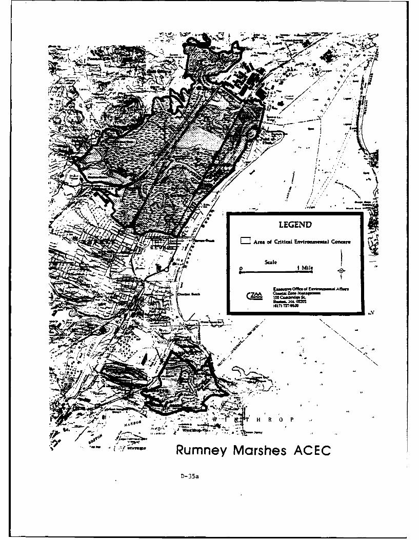
-- 3v
J-~

Rumney Marshes ACEC Designation22 August, 1988Page 2
railroad right-of-way. The boundary follows the westerly side of thisright-of-way, across the Saugus River, to the point from whence itstarted.
The boundary of the Belle Isle Marsh portion of the ACEC is definedas follows: The area includes the Belle Isle Creek, the marshes of thissystem, and the tributary streams. Beginning at the northerly end ofBennington Street in Revere at a point of intersection between theeasterly (marshward) edge of the street and the 100 year flood elevation,the boundary follows Bennington Street in a southerly direction to whereit crosses Belle Isle Creek. The boundary then becomes coincident withthe jurisdictional boundary of the Wetlands Protection Act (i.e. typically100 feet beyond the edge of the wetland resource area). The ACEC boundaryfollows along the creek in a northwesterly direction to Sales Creek, whichis also subject to this designation. In general, all lands and watersfalling under the jurisdiction of MGL C. 131, s. 40 in the Belle IsleCreek and Sales Creek areas falls within this designation. On thesoutherly side of Belle Isle Creek at Bennington Street, the boundarycontinues along the easterly edge of the street until a point at theintersection with Leverett Street. From this point, the boundary becomesthe "edge of wetland", as defined in the Wetlands Protection Act andregulations promulgated thereunder, and follows the thread o.f the wetlandedge to East Boston and around the MBTA Rail Yard to a point, at thesoutherly side of the yard, where the edge of wetland roughly intersectswith the 100 year flood elevation. From this area, the boundary followsthis elevation to a point of intersection with Winthrop Parkway. Theboundary follows the westerly edge of the Winthop Parkway to CrystalStreet in Revere, which it follows until a point of intersection with 100year flood elevation. From this point, the boundary continues at thiselevation to the point from whence it started.
II. Boundary Exclusions and Exemptions from Designation:
There are three separate areas that fall within the describedboundaries which are to be excluded. The first is the "footprint" of theproposed Belle Isle Creek dredging project. Given that this project iscurrently only in the preliminary planning stages and there is noindication, at this time, precisely which areas will be dredged, theultimate exclusion will be based on the plans for the project as approvedby the Office of Coastal Zone Management through their Federal Consistencyreview. This exclusion is granted with the provision that the Departmentof Environmental Management, through its Division of Waterways, willdirect the planning of this project in a manner consistent with the ACECdesignation.
The second and third exclusions are for the dredging of the Saugus
D-35 b
Rumney Marshes ACEC Designation22 August, 1988Page 3
and Pines Rivers. Like the Belle Isle dredging exclusion, the finalconfiguration of the exclusion will be based on the project plans asapproved by the Office of Coastal Zone Management through their FederalConsistency review.
The rationale for the exclusion of the Saugus River dredging projectis based on the intent of the Executive Office of Environmental Affairs tocontinue in its active support of commercial fishing and relatedactivities in the Saugus River. The dredging of this channel, andassociated limited anchorage areas, will enhance navigational access tothe river. With this enhanced access comes the potential for greatercompetition between the commercial and recreational boating interests. Theprincipal resource being competed for is space; space for dockage, formoorings, and for appropriate shoreside services. Nearly all of thisspace is created or enhanced through new dredging, which is prohibitedunder the ACEC designation. In recognition of this improvement dredgingprohibition and the potential adverse effect it may have on the commercialfishing industry in the Saugus River, a secretarial waiver, pursuant to301 CMR 12.15, of this prohibition will be considered in instances wherethe proposed project: 1) provides the broadest possible public benefit;2) is consistent with the goals of the EOEA in supporting the commercialfishing industry in the Saugus River; 3) is otherwise consistent with therigorous standards of the ACEC designation; and 4) is fully consistentwith the MCZM Program Policies. It should be understood that this waiverwill not be granted lightly, an. that projects receiving a waiver willvery closely scrutinized as they pass through the regulatory process.
The reason for the Pines River dredging being excluded from thedesignation is directly tied to the exclusion of the dredging of theSaugus. The Pines River is predominantly a recreational boating area,and taken within the context of the Saugus/Pines system, it is the moreappropriate location to allow the development of new or expandedrecreational boating facilities. To this end, a secretarial waiver willbe considered for projects related to recreational boating and relatedshoreside services. The same conditions listed above, particularly Nos.1,3, and 4, will be the framework used to determine whether the grantingof a waiver is appropriate. However, significantly more emphasis will beplaced on the "public benefits" aspects of the project requesting awaiver.
The intent of these exclusions and discretionary waivers is providesome additional level of protection to the resource areas within theACEC. If, at some time in the future, the local municipalities were todevelop an appropriate regional harbor management plan for the Saugus andPines Rivers, this management plan would then provide the basis for waiver
D-35c
Rumney Marshes ACEC Designation22 August, 1988Page 4
decisions. The communities responsible for these two harbor areas shouldcontact the MCZM Harbor Planning Coordinator to find out more aboutongoing technical support and funding programs for this type of planning.
Two specific projects, and a few small activities accessory to otherlarge public works projects falling outside the boundary, are to beexempted from the designation. These projects are being "exempted" fromthe designation rather than "excluded" from the boundary because the havea scope of activities which cannot be properly defined by a standardgeographic exclusion, are projects with potentially broad public benefits,and are or have already been closely scrutinized by the environmentalregulatory agencies.
The Saugus River Flood Damage Reduction Project is the first projectto be exempted from the designation. Like the excluded projects discussedabove, this project will be exempted as it is approved by the Office ofCoastal Zone Management through its Federal Consistency review. I feelthat the ongoing interagency review process, directed by the Corps ofEngineers, will allow the project to be closely scrutinized as to itsenvironmental impacts and provide for appropriate mitigation. Thisprocess will meet or exceed the intent of the designation with regard tothe proposed project.
The second project to be exempted from the designation is the Salesand Green Creeks Flood Control Projects. This project is being directedby the DEM, Division of Waterways and has recently received a SecretarialCertificate for the Final Environmental Impact Report (FEIR). Given theclose scrutiny the the project has already received through the MEPAprocess, and the broad public benefit resulting from the project, I feelthat the project has met the intent of the designation and should beallowed to proceed under the preexisting environmental standards. Likethe Corps of Engineers, the DEM should realize that these exemptions carrywith them the responsibility of assuring that the projects are planned andcarried out in the most environmentally sensitive manner possible. Wewill be closely watching the progress of both of these projects to assure
these responsibilities are met.
Two smaller exemptions are activities related to projects which falloutside the boundary of the ACEC. There is a tide gate to be improved andmaintained in Sales Creek as a part of the Roughan's Point Flood ReductionProject. To facilitate the overall project, this activity is exempt fromthe designation. The second exemption is the removal of sand from theso-called "1-95 Embankment". While the removal of this material may notpresent a problem even under the designation, in the interest of clarityand facilitation of an important beach nourishment project, this activity
D-35 d
Rumney Marshes ACEC Designation22 August, 1988Page 5
is also exempt. It is presumed that this excavation will be consistentwith the existing Secretarial Certificate for the project. In general, Iam, and have been, very concerned with the ultimate fate of this fill. Torestate my position, our ultimate goal is to remove the fill and restorethe marsh. Any activity which does not further this goal will be deemedinconsistent with the designation.
The area included in the designation has been significantly reducedfrom that which was proposed by the nominating committee. This reductionin geographic scope was not made lightly, nor without due considerationfor the potential importance of these areas with regard to resourceprotection. While we have concluded that these areas are inappropriatefor designation, it should be recognized that all activities in thevicinity of an urban marshland such as this have the potential for adverseenvironmental impacts, especially the degradation of water quality orwildlife habitat values. It is incumbent on those who propose to build inthese adjacent areas to consider carefully the potential adverse impactsthat may be associated with their projects. It is equally important thatthe surrounding communities closely scrutinize their zoning and land usecontrols adjacent to these valuable resources to assure that these localcontrols enhance the protections afforded by the designation. Finally,all EOEA agencies should be reminded, as a result of this designation, oftheir responsibility to reflect the environmental sensitivity of this areain their decisions.
III. Designation of the Resources of the Rumney Marshes ACEC
In my letter of acceptance of the nomination of the Saugus and PinesRivers and Belle Isle Marsh as an ACEC, I indicated that our evaluationindicated that it easily met the minimum threshold for consideration. Thenomination letter clearly lists the quantity and quality of the resourcespresent.
The presence of these resources, and their relatively undisturbednature within such a developed area, clearly indicate their value to theregion and the state.
IV. Procedures Leading to ACEC Designation
On 15 March, 1988, a letter of nomination, signed by ten citizens ofthe Commonwealth and pursuant to 301 CMR 12.00, was received by myoffice. The nomination was formally accepted by letter on 1 April, 1988,and the review process was begun.
D-35e
Rumney Marshes ACEC Designation22 August, 1988Page 6
Notice of the acceptance of the nomination and of an informationalmeeting and a public hearing was published in the Boston Globe and in theMassachusetts Environmental Monitor on 12 May, 1988. :'umerousinformational articles appeared in the local and regional newspapers.
A meeting for town officials was held on 24 May, 1988, and aninformational meeting for the general public followed on 26 May, 1988.The public hearing was held on 23 June, 1988, and the public commentperiod was held open until 8 August, 1988. Written and oral testimony wasreceived from 39 individuals and organizations at the public hearing and64 comment letters were received before the close of the comment period.The comment letters and public hearing testimony is on file at the MCZMoffice.
V. Discussion of Criteria for Designation Specified 301 CMR 12.06
In the review process leading to the decision on a nominated area,the Secretary must consider the factors specified in Section 12.06 of theEOEA regulations. As stated in these regulations, the factors need not beweighed equally, nor must all of these factors be present for an area tobe designated. While the more factors an area contains, the more likelyits designation, the strong presence of even a single factor may besufficient for designation.
Based on the information in the nomination letter, presented at thepublic hearing, and through written comments, and on the research of mystaff, I find the following factors relevant to the designated ACEC:
Threats to Public Health through Inappropriate Use
Saltmarshes play an important role in the prevention of flood damageby providing vital flood storage capacity. This capacity is lost whenmarshlands are filled. It has been documented, through research of theCorps of Engineers, that the saltmarshes of the Saugus and Pines RiverEstuary have experienced filling of saltmarshes at a rate of approximately6 acres per year. Just considering the loss of flood storage capacity ofthe system, ignoring for the moment the other vital roles saltmarshes playin coastal ecosystems, this magnitude of presumably illegal fill hassignificant implications with regard public health, safety, and welfare.
Productivity
The Saugus and Pines Estuary, situated landward of the barrier beachof Revere, contains one of the most extensive salt marsh systems in thegreater Boston metropolitan area. Including Belle Isle Marsh, the areascontain approximately 1000 acres of saltmarsh, tidal flats, and shallow
D-35 f
Rumney Marshes ACEC Designation22 August, 1988Page 7
subtidal channels. The U.S. Fish and Wildlife Service characterizes thedesignated area as "one of the most biologically significant estuaries inMassachusetts north of Boston". Further quoting from the USFWS commentletter:
"Nearly 70 percent of all commercial fish and shellfish resources aredependent on estuaries for spawning and nursery grounds. Winterflounder, alewife, smelt, blueback herring, and American eel are a fewof the more common finfish that occur within the nominated estuarineecosystems... Intertidal habitats ...support a wide variety ofinvertebrate resources. These include soft shelled and razor clams,mussels, snails, marine worms, and other invertebrates that areintegral components of the marine food chain. Although many of theshellfish beds are too contaminated for human consumption, theyrepresent an important food source for wildlife, attracting largenumbers of wintering waterfowl to the area annually".
The list of bird species, migratory or indigenous, is extraordinary.The Massachusetts Natural Heritage and Endangered Species Program hascommented that the area contains at least 5 species listed by theDivision of Fisheries and Wildlife as Endangered, Threatened, or a Speciesof Special Concern. Despite its proximity to the intense development ofthe area, there is little doubt of the productivity of the designatedarea.
Uniqueness of the Area
Given its close proximity to a major metropolitan center with apopulation in excess of one million, this relatively undisturbed estuaryand marsh complex is indeed unique. Much like the Back River ACEC and theWeir River ACEC to the south, this relatively large tract of marshlandhabitat, situated in an area subject to intense development pressure,provides the resource base necessary to maintain the diversity andproductivity of an ecosystem which must, despite stringent regulation,accommodate the cumulative impacts arising from this development. Whilethere may be smaller parcels of marshland which dot the urban landscape,the inventory of larger marshes capable of supporting these vitalresources is dwindling and must be preserved.
Imminence of Threat to Resources
Despite laws and regulations to the contrary, construction on thefringes of marshes and waterways can result in incremental filling overtime. As mentioned above, this is especially true in the Saugus and PinesRiver Estuary. The intensity of development, especially adjacent to the
D-35*_
Rumney Marshes ACEC Designation22 August, 1988Page 8
designated areas, is ever increasing. Given the existing intensity ofdevelopment in the area, the chronic and cumulative impacts associatedwith this proposed development activity may exceed the system's capacityto accommodate its effects.
It is hoped that this designation will serve to focus attention onthe value and sensitivity of the area and will provide a guide for futuredevelopment proposals.
James S. Hoyte /teSecretary of Environmen-al Affairs
D-35h
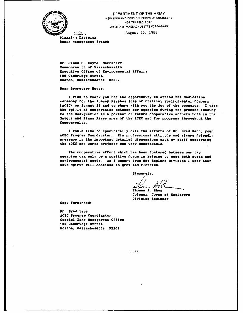
DEPARTMENT OF THE ARMYNEW ENGLAND DIVISION. CORPS OF ENGINEERS
424 TRAPELO ROAD
WALTHAM. MASSACHUSETTS 02254-9149
Rift, O August 25, 1988
Plannl'7 DivisionBasin Management Branch
Mr. James S. Boyte, Secretary
Commonwealth of Massachusetts
Executive Office of Environmental Affairs100 Cambridge StreetBoston, Massachusetts 02202
Dear Secretary loyte:
I wish to thank you for the opportunity to attend the dedicationceremony for the Rumney Marshes Area of Critical Environmental Concern(ACEC) on August 23 and to share with you the joy of the occasion. I viewthe spivit of cooperation between our agencies during the process leading
to the designation as a portent of future cooperative efforts both in theSaugus and Pines River area of the ACEC and for programs throughout theCommonwealth.
I would like to specifically cite the efforts of Mr. Brad Barr, your
ACEC Program Coordinator. Nis professional attitude and always friendlypresence in the important detailed discussions with my staff concerningthe ACEC and Corps projects was very commendable.
The cooperative effort which has been fostered between our two
agencies can only be a positive force in helping to meet both human and
environmental needs. As I depart from New England Division I know that
this spirit will continue to grow and flourish.
Sincerely,
Thomas A. RhenColonel, Corps of EngineersDivision Engineer
Copy Furnished:
Mr. Brad Barr
ACEC Program CoordinatorCoastal Zone Management Office100 Cambridge Street
Boston, Massachusetts 02202
D-36
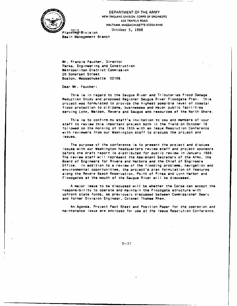
S,., DEPARTMENT OF THE ARMYNEW ENGLAND DIVISION. CORPS OF ENGINEERS
424 TRAPELO ROADWALTHAM. MASSACHUSETTS 02254-9149
' ,"o October 5, 1988PIanAq'"kP'0ivisionBasin Management Branch
Mr. Francis Faucher, Director
Parks, Engineering and Construction
Metropolitan District Commission
20 Somerset Street
Boston, Massachusetts 02108
Dear Mr. Faucher:
This is in regard to the Saugus River and Tributaries Flood DamageReduction Study and proposed Regional Saugus River Floodgate Plan. This
project was formulated to provide the highest possible level of coastalflood protection to citizens, businesses and major public facilities
serving Lynn, Malden, Revere and Saugus and resources of the North Shore.
This is to confirm my staff's invitation to you and members of your
staff to review this important project both in the field on October 18followed on the morning of the 19th with an Issue Resolution Conferencewith reviewers from our Washington staff to discuss the project and
issues.
The purpose of the conference is to present the project and discuss
issues with our Washington headquarters review staff and project sponsors
before the draft report Is distributed for public review in January 1989.The review staff will represent the Assistant Secretary of the Army, the
Board of Engineers for Rivers and Harbors and the Chief of EngineersOffice. In addition to a review of the flooding problems, navigation andenvironmental opportunities, the project's plan formulation of features
along the Revere Beach Reservation, Point of Pines and Lynn Harbor and
F!oodgates at the mouth of the Saugus River will be discussed.
A major issue to be discussed will be whether the Corps can accept the
responsibility to operate and maintain the Floodgate structure with
upfront state funds, as previously discussed between Commissioner Geary
and former Division Engineer, Colonel Thomas Rhen.
An Agenda, Project Fact Sheet and Position Paper for the operation andmaintenance issue are enclosed for use at the Issue Resolution Conference.
D-37
-2-
If you have any questions, please feet free to call me at 617-647-8599or Mr. Robert G. Hunt, the Project Manager, at 617-647-8216.
Sincerely,
SChiq T Plannin 4vi!Ll
Enclosures
Copy Furnished:
Mr. William J. Geary, CommissionerMetropolitan District Commission20 Somerset StreetBoston, Massachusetts 02108
Mr. Carney TersianMDC Parks Engineering and Construction20 Somerset StreetBoston, MA 02108
Mr. Joseph Orfant
MDC Planning Office20 Somerset StreetBoston, MA 02108
D-37a
DEPARTMENT OF THE ARMYNEW ENGLAND DIVISION. CORPS OF ENGINEERS0 424 TRAPELO ROADWALTHAM. MASSACHUSETTS 02254-9149
January 18, 1989
Executive Office
Commissioner William J. GearyMetropolitan District Commission20 Somerset StreetBoston. Massachusetts 02108
Dear Commissioner Geary:
I am writing to inform you of the Corps recent reorganization of ourProject Management system and how this may affect our ongoing work at theSENE, Town Brook and Revere Beach projects.
The basis for our reorganization is the Water Resources Development Actof 1986 (WRDA86) which introduced new challenges to the Corps in its missionof planning, designing, constructing and operating water resource projects.The Act enables our non-Federal sponsor, as a direct partner, to participatemore actively in the decision-making process of a project. The cost sharingaspect creates a dual accountability to provide for more efficient and fullydeveloped projects.
Imposed cost restraints greatly influenced our instituting a mechanismfor streamlining the system while providing comprehensive planning, designand construction management enhancement procedures. As a result the Corpsdeveloped a stronger project management orientation to improveaccountability for time, cost, and quality throughout the projectdevelopment cycle.
Previously, the Corps project management system relied heavily on
decentralized program execution. This process required a passing of project
accountability from the Chief of Planning Division and his Study Managerduring Feasibility Stage to the Chief, Engineering Division and his Design
Manager through pre-engineering and plans and specifications. Once
construction award is made the Chief of Construction Division and hisProject Engineer administers the work of the construction contractor.
A Life Cycle Project Management (LCPM) system has now been established
to orchestrate the entire project development. While the functions of the
divisional elements remain to technically specialize in their project phase,the Life Cycle Project Manager, who reports directly to the Executive Office
and myself, will provide complete project overview, coordination and
accountability throughout the life of the project.
D-38
-2-
The Life Cycle Project Management system at New England Division currentlyconsists of a Deputy Division Engineer for Project Management. Mr. WilliamF. McCarthy, and the Life Cycle Project Manager, Mr. Robert J. Gauvreau.Mr. Gauvreau's involvement includes management of the Southeastern NewEngland Study in Revere, Lynn and Saugus, the Town Brook Project and RevereBeach.
It should be noted that the establishment of Life Cycle ProjectManagement Is just one result of WRDA 86. Also as a direct consequence ofWRDA 86, greater responsibility is shared with our local sponsor for projectdevelopment. Our partnership comitment includes the Local Sponsor as anactive participant. This means the Local Sponsor (MDC) has to assume notonly some of the cost burdens but a high degree of direct positiveinteraction with the communities in determining local concerns, resolvingissues and obtaining in a timely manner necessary lands, permits andcertifications essential to the project success.
I believe the system is a good one and will produce quality projects ina time-saving and more cost effective manner. I am looking forward tocontinuing our productive partnership with your agency.
Sincerely,
Daniel M. WilsonColonel, Corps of EngineersDivision Engineer
D-38a
The Commonwealth of Massachusetts 20 Somerset StreetMetropolitan District Commission Boston, MA 02108
William J. Geary, Commissioner 617-727-5114
March 27, 1989The
of seft
Colonel Daniel M. Wilson, Division CommanderU.S. Army Corps of Engineers,New England Division424 Trapelo RoadWaltham, MA 02254-9149
RE: Flood Damage Reduction Project; Saugus, Lynn, Revere and Malden:AISA Request to U.S.A.C.E. NED for Support of Operation and Maintenance
of Saugus River Tidal Floodgates
RecdsoftelDear Colonel Wilson:
Pt~c-cotsv The Flood Damage Reduction Project is unique in scope and design
in terms of region protected and environmental and navigationIu8 ,f sensitivity. It will be among the largest urban flood control projects
in New England encompassing four major metropolitan Boston municipalities.Bostn Nwb Isands The projec- directly affects and will benefit a combined residential,
commercial, industrial and commuter population of 400,000; this.motoopmwe includes a major defense establishment, the General Electric Co., (Jet
Engine Manufacturing Plant); North Shore Gas and Electric Co., andwastewater treatment facilities in Lynn, as well as five major northshore transportation arteries.
SMneThe Executive Office of Environmental Affairs, Commonwealth of
Massachusetts, has proclaimed the Rumney Marsh as an Area of CriticalPure weteuppy Environmental Concern (ACEC) to protect the salt marsh and wetlands
from further encroachment and degraiation from urban or industrialoue wm development. No changes in physical features, estuary dynamics or
sua"yrOvr, water quality are allowed in this marsh, with the exception of this andseveral other federally sponsored projects. Note that this exception
FWAAk1srPW*, was mandated by strong community and statewide support for the FloodSit" nfi Reduction Project indicating universal public acceptance.
Zoo o -
The proposed tidal floodgates and other project features must bePf ,soid aesthetically pleasing as well as functional to protect the adjacent
Bnad Sstem communities against a (SPN) storm far worse than the 1978 event. This
is a major concern to the MDC and I am sure all appropriate steps willNn ~ be taken to eliminate community concerns. The proposed flood gates
structures include a 100 ft. navigation gate in addition to ten 50 ft.
Bsw Baes flushing gates at the mouth of the Saugus River. This gate configurationEB * . will allow safe passage for navigators and will maintain the naturalMWAlsdIFeed tide levels and flushing in the salt marsh during storm events. It ispv &VNevo essential that appropriate flushing takes place in order to protect
this fragile estuary environment.
Me P roParkws MetroPolce PreWtr
D-39
Colonel Daniel WilsonMarch 27, 1989Page 2
This is one of the first projects in New England that will specificallyrequire monitoring and protection of the wetlands to preserve the natural floodwater storage requirement of the project to reduce damages.
The operational control of this amount of machinery requires a specializedstaff with sophisticated facilities to predict closure for coastal storms. Thisis complicated by interior runoff storage during gate operation, and the need tominimize navigation and environmental impacts, and yet substantially reduce stormdamage. Operating and maintaining the project to meet the intended goals wouldbe a challenge to the Commonwealth. The Corps alone is better equipped and hasmore extensive experience in operating coastal floodgates.
The magnitude of the project and sophisticated equipment required foroperation and maintenance will be considerable. It will be necessary toestablish a control center, a predictive level of maintenance (daily, weekly andmonthly) and a projected long-term maintenance plan to produce optimum results interms of minimal impacts and life cycle maintenance costs. MDC knows fromexperience that an imbalanced operation between predictive and projectedmaintenance, including neglect, leads to malfunction and staggering remedialcosts. Staffing requires highly skilled engineers of several disciplines which.the Corps already supports for similar projects. Operations and maintenance ofsimilar projects has been successfully demonstrated by the Corps.
The Corps of Engineers experience and technical expertise to operate andmaintain similar projects is needed and this expertise cannot be obtainedelsewhere, I request that the U.S. Army Corps of Engineers, New England Divisiontake the reponsibility of operating and maintaining the proposed floodgatecomponent of the Flood Reduction Project. It is anticipated that all costs foroperation, maintenance and replacement will be provided by the MDC which willrequire state legislative approval.
As you probably know, I will be leaving my post as Commissioner on March 31.I have a great deal of confidence in my successor, Ilyas Bhatti. I know that hewill build on the accomplishments of the past 6 years.
Please address all future corresponden to him, and thank you for yourinterest in the Metropolitan District Co on.
NDB/HAH/cmf
D-39a


![[DERP FUDS] · Commander [DERP FUDS] US Army Corps of Engineers . 424 Trapelo Road . Waltham, Massachusetts . 02254 . Re: Holton Circle Superfund Site in Londonderry, New Hampshire](https://img.pdfslide.net/doc/110x75/5fa5bc6bab280f70f95e9c2d/derp-fuds-commander-derp-fuds-us-army-corps-of-engineers-424-trapelo-road.jpg)


![g]kfnL sf+u|];sf] ljwfg, @)!& - Nepali Congress](https://img.pdfslide.net/doc/110x75/6189895f824905645f3ea476/gkfnl-sfusf-ljwfg-amp-nepali-congress.jpg)