Embed Size (px)
Citation preview

ORIGINAL PAPER
A climate-based model to predict potential treeline positionaround the globe
Jens Paulsen • Christian Korner
Received: 23 December 2013 / Accepted: 26 January 2014 / Published online: 25 February 2014
� Swiss Botanical Society 2014
Abstract In situ temperature measurements revealed that
the position of the high-elevation treeline is associated with a
minimum seasonal mean air temperature within a tempera-
ture-defined minimum season length across latitudes. Here,
we build upon this experience and present the results of a
global statistical analysis and a predictive model for low
temperature treeline positions. We identified 376 natural
treelines from satellite images across the globe, and searched
for their closest climatic proxies using a climate database.
The analysis included a snow and a water balance submodel
to account for season length constraints by snow pack and
drought. We arrive at thermal treeline criteria almost iden-
tical to those that emerged from the earlier in situ
measurements: tree growth requires a minimum length of the
growing season of 94 days. The model yields best fit when
the season is defined as all days with a daily mean temper-
ature [0.9 �C, and a mean of 6.4 �C across all these days.
The resultant treeline model ‘TREELIM’ offers a robust
estimation of potential treeline elevation based on climate
data only. Error terms include imprecise treeline position in
satellite images and climate approximations in mountainous
terrain. The algorithm permits constraining low temperature
limits of forest growth worldwide (including polar treelines)
and also permits a bioclimatic stratification of mountain
biota, for instance, for biodiversity assessments. As a side
product, the model yields the global potentially forested
area. The results support the isotherm theory for natural
treeline formation. This completely independent statistical
assessment of the climatic drivers of the global treeline
phenomenon confirmed the results of a multi-year mea-
surement campaign.
Keywords Alpine � Altitude � Arctic � Bioclimatology �Elevation � Forest � Mountains � Season � Temperature
Introduction
The temperature limit of tree growth represents a life form
boundary that separates the treeless alpine and polar tundra
belt from the warmer montane and boreal belt around the
globe. Except for arid and semi-arid regions, the montane
belt, just as the boreal belt, is naturally forested. Situations,
where appropriate substrate is lacking (e.g. eroded terrain,
swamps), or where rock fall or avalanches prevent tree
growth, or where forests had been devastated by fire,
storms or pests or removed by human land use, are region
specific or not related to biological principles that apply
across the globe, and thus, cannot be predicted. Our ana-
lysis included both alpine and polar treelines.
The climatic treeline represents a most obvious land
cover demarcation and its relation to temperature makes it
an ideal reference line for other bioclimatic zones. Treeline
is defined here as a line connecting the uppermost or most
northern patches of trees of at least 3 m height in undis-
turbed areas (Korner 2012). This line holds a middle
position between the limit of closed forests and the limit of
seedling or krummholz growth beyond the treeline. Where
soil moisture and the duration of the snow-free period
permit, the position of the treeline is clearly related to
Electronic supplementary material The online version of thisarticle (doi:10.1007/s00035-014-0124-0) contains supplementarymaterial, which is available to authorized users.
J. Paulsen � C. Korner (&)
Institute of Botany, University of Basel, Schonbeinstrasse 6,
4056 Basel, Switzerland
e-mail: [email protected]
J. Paulsen
e-mail: [email protected]
Alp Botany (2014) 124:1–12
DOI 10.1007/s00035-014-0124-0
123

temperature, with a common isotherm for seasonal mean
temperature of around 6 �C around the globe as will be
discussed below (Korner and Paulsen 2004; Korner 2012).
The reason why trees reach a low temperature limit,
beyond which other plant life forms (shrubs, grasses, forbs)
still thrive, has to do with the stature and height of trees,
causing their canopy to experience temperatures very close
to ambient air temperatures, whereas small stature vege-
tation can decouple aerodynamically from the free
atmosphere and, thus, profit from solar heating of their
canopies (Grace 1988; Scherrer and Korner 2010). The
thermal disadvantage of tree stature in cold climates can be
demonstrated by microclimatic data and by infrared ther-
mography (Wilson et al. 1987; Korner 2007, 2012).
The results of 15 years of data collecting (Korner and
Paulsen 2004; Korner 2012) around the globe suggest that
the undisturbed high elevation and polar treelines of the
world follow a common climatic envelope that makes it
tempting to predict the potential treeline position by
meteorological data only. Earlier attempts at delineating
treeline position by temperature used proxies that work at
regional or specific latitude scale only, such as the warmest
month mean (e.g. Glock 1955; Holtmeier 1974; Wardle
1998) or mean annual temperature (Jobbagy and Jackson
2000) for the temperate zone. Following from our earlier
works (Korner and Paulsen 2004), the position of the cli-
matic treeline can be constrained globally by three
meteorological parameters: A threshold value determines
the minimum air temperature for physiological tree activity
(definition of the growing season), a minimum duration and
a minimum mean temperature during that season. Based on
these findings, we aimed at developing a model that rests
on these three parameters and predicts the potential posi-
tion of the low temperature treeline from meteorological
data.
Since the model described here adopts standard meteoro-
logical information at a monthly scale as provided by a global
climate data base (WORLDCLIM, Hijmans et al. 2005, http://
www.worldclim.org), the first assumption is that weather
station data related to a certain location can be scaled to the
climate trees actually experience. Over large areas and long
periods, and for trees [3 m, this assumption is reasonably
well supported (Korner 2007, 2012; Kollas et al. 2014). We
describe the criteria by which a large data set of natural cli-
matic treeline positions was obtained and how these positions
were linked to climate data obtained from a database to
‘calibrate’ the model. We also describe the algorithms used to
calculate the parameters needed to predict the possibility of
tree growth and how we obtained the best-fit numeric values
for these treeline proxies (parameterization).
The main task was to predict whether the climate at any
geographical location allows tree growth or not. This offers
a wide application in biogeography. One of these is a
stratification of the world into vertical (elevational) bio-
climatic belts, anchored at the treeline isotherm (Korner
et al. 2011). The great advantage of such an approach is the
abandonment of metres of elevation or degrees of latitude
as a site characterization, and rather use the actual climatic
envelope. This should permit comparing mountain biota
across latitudes based on bioclimatology.
Methods and model design
Basic model assumptions and definition of climatic
treeline proxies
From our earlier works with data loggers (Korner and
Paulsen 2004), it emerged that only three independent
parameters are necessary to model treeline elevation by
standardized meteorological data: (a) a threshold temper-
ature DTMIN that constrains the growing season; (b) a
minimum mean temperature for all days of the growing
season SMT as defined in (a); (c) a minimum length of the
growing season LGS. The definition of the growing season
is a central issue, because temperatures outside the growing
season have no predictive value (Korner 2012). The model,
thus, needs to select periods suitable for tree growth, which
means, warm enough conditions with sufficient soil mois-
ture and no snow cover.
Defining the beginning and end of the growing season
by a critical air temperature only (as in Korner and Paulsen
2004) turned out to be problematic at a global scale
because this procedure does not account for irregular sea-
sonal temperatures at equatorial latitudes, and it does not
account for snow pack and drought. Therefore, the TRE-
ELIM model presented here uses a LGS representing the
sum of days with a daily mean temperature above a defined
threshold temperature (DTMIN). The mean temperature of
the growing season (SMT) for any site is then calculated by
averaging the daily means for all these days. Days during
which snow is present or during which soil water is not
available do not count for season length (see below).
Hence, to predict the position of the low temperature limit
for tree growth for a given region, the effective duration of
the growing season must be known. Once this period is
defined, the model takes the length of this period and its
mean temperature to decide, whether tree growth is pos-
sible or not (Fig. 1).
To determine the number of days matching the criteria
for the growing season (daily mean air tempera-
ture C DTMEAN, absence of snow and sufficient plant
available soil water) for any site, soil water content, snow
melt and snow accumulation, and temperature have to be
modelled on a daily basis for each day of the year. These
daily data were obtained by converting the 30-year
2 Alp Botany (2014) 124:1–12
123

monthly mean temperatures from the climate data base into
a seasonal course of mean daily temperatures using cubic
splines. In essence, this procedure is smoothening the
seasonal course of temperatures (no monthly steps) and no
other assumption is made than that the shape at daily res-
olution matches that at monthly resolution once averaged
over 30 years.
Snowpack The snow module of TREELIM accounts for
the assumption that trees do not exert significant growth as
long as there is late-laying snow on the ground. Snow pack
may thus constrain the length of the growing period,
despite warm air temperatures. It was assumed that all
precipitation that falls at daily mean temperatures B0 �C
fall as snow, and snow was assumed to stay and accumulate
on the ground as long as daily mean temperatures remained
\0 �C. If a snow layer is present, snow is assumed to melt
whenever daily mean temperatures are [0 �C at a rate of
0.84 kg m-2 day-1 for each degree [0 �C (the WAT-
FLOOD model; http://www.civil.uwaterloo.ca/watflood/).
Sublimation was ignored.
Whenever rain falls on an existing snow layer, this water
cools to 0 �C and the thermal energy (4.186 kJ kg-1 K-1)
is used to melt snow (333.5 kJ kg-1 snow). Thus, 1 mm of
rain melts 1/80 kg m-2 snow per degree air temperature
above 0 �C. The quantity of snow pack (in kg m-2) was
calculated by a simple input–output model with a
daily resolution: snow layer at day (i) = snow layer at day
(i - 1) ? snowfall at day (i) - snow melt at day (i).
Because this equation is recursive, a starting point of the
calculation is required. We assume that the snow layer is
0 mm at the last day of the longest consecutive period of air
temperatures[0 �C. From this starting date, the snow layer
submodel is run repetitively through the full year for as long
as the number of snow-free days in the year changes. If the
number of days without snow is 0, there is perpetual ice or
snow; if not, there is at least 1 day with no snow and the
quantity of snow pack is known for each day of the year.
Site water balance Since the potential treeline, by defi-
nition, is related to temperature conditions, and precipitation
clearly does not exert elevational patterns that match with
treeline positions across the globe, ‘potential treeline’ cannot
b Fig. 1 A schematic illustration of the main steps and modules of the
TREELIM model. Subroutines that are discussed in greater detail in
the text are annotated by a double line. Note, the calculation of the
length and mean temperature of the growing season (LGS and SMT,
lower panel) is a key module of the main routine (upper panel). GR
georeference, DTMIN minimum daily mean temperature for a day to
belong to the growing season, TMIN, TMEAN and TMAX monthly
temperature data obtained from Worldclim, TGR temperature at the
elevation of the georeference, HTL predicted elevation of treeline
location, HGR elevation at georeference, Dh elevational distance
between treeline and GR. The script of the model is provided in
electronic supplementary materials, S1
Alp Botany (2014) 124:1–12 3
123

be suppresses by drought effects, but such effects can pre-
vent trees from occurring at the potential treeline. So, while
there is still a potential thermal tree limit, trees may be absent
for drought reasons (arid and semi-arid regions). Hence, in
the TREELIM model, water comes into play as a potential
constraint to the LGS during which thermal conditions
would permit tree growth.
The water balance equation was solved by a submodel of
TREELIM that accounts for precipitation (liquid and solid),
evapotranspiration, and the resulting soil water content.
Since climate databases offer only monthly precipitation,
we had to approximate actual rainfall regimes, assuming
that air temperature determines saturated vapour content of
the air. We then adopted a temperature-related stepwise
interpolation of mean daily rainfall from annual data with a
monthly resolution. This given amount of precipitation
water was allocated by plausibility to precipitation events in
the following way: The mean per day event was assumed to
be 5 mm if the monthly mean T was \5 �C, 10 mm for
5–10 �C, 15 mm for 10–15 �C, 20 mm for [15 �C. For
instance, if the monthly mean temperature is 7.3 �C and the
monthly precipitation is 27.4 mm, precipitation events are
assumed to be 10 mm each, one on day 7, one on day 14,
and the remaining 7.4 mm are assumed to fall on day 21.
This procedure is more realistic than for instance split-
ting monthly precipitation into 30 events. Since soil
moisture is buffering moisture availability, the actual
fragmentation of monthly precipitation is not very critical,
except for conditions where drought is critical, which is
rare at alpine treeline elevations. Errors introduced by this
procedure are certainly small compared to the uncertainty
of actual precipitation at treeline, based on climatic layers
derived from low elevation climate stations.
Daily Potential evapotranspiration (DPET) was estimated
using the Hargreaves equation (Hargreaves and Samani 1985)
in the FAO-56 form as adopted by Allen et al. (1998), again
with a daily resolution. Input variables are the elevation of the
site, daily maximum and minimum temperature derived from
WORLDCLIM data, solar radiation (depending on season
and latitude) and cloudiness data obtained from the University
of East Anglia Climatic Research Unit (CRU; http://www.cru.
uea.ac.uk; New et al. 2002). We calculated solar radiation
with the equations provided by the University of Oregon Solar
Radiation Monitoring Laboratory (http://solardat.uoregon.
edu/SolarRadiationBasics.html).
The water balance for a given day was then calculated
with a two-layer bucket model for a given soil water holding
capacity as defined by the International Geosphere-Bio-
sphere Programme (IGBP 2000). We assumed an upper soil
layer that holds a maximum of 30 mm of water (or less if the
IGBP value was less than these 30 mm), and a lower layer
with a water holding capacity for the remaining profile as
indicated in the IGBP data minus the 30 mm for the upper
layer. As long as water was available in the upper layer, daily
evapotranspiration was assumed to equal potential evapo-
transpiration. If the upper layer was water saturated (more
than 30 mm H2O), any additional rain or snow melt water
flows into the lower soil layer until it is also saturated, and
any extra water creates runoff. Once the upper layer becomes
dry, we used a simple square root correction for the esti-
mation of the real daily evapotranspiration (DRET) from
deeper layers, accounting for the diminishing uptake by
roots from drying soils and the growing resistance to water
diffusion through the dry upper soil layers, as proposed in
the WATFLOOD model (http://www.civil.uwaterloo.ca/
watflood/): DRET = DPET 9 (actual soil water content/
soil water capacity)1/2 in kg m-2 day-1, with soil water
values in kg m-2 (Donald et al. 1995; Kouwen et al. 2005).
The equation is recursive, and the model starts its first run at
the last day of the driest period (the longest period without
precipitation and the highest accumulated potential evapo-
transpiration) with an actual soil water content that is half its
field capacity. The model is then run until the actual soil
water values for each day of the year are stabilizing, i.e. do
not change from one year to the next. Because DRET is
always less than the actual soil water content, the actual soil
water content is always [0 and the drought limit for tree
growth was assumed to be at 20 % of field capacity.
Combining the sub-routines These routines will become
particularly effective in areas where there is a likelihood
that snow pack or drought constrain the season length below
a critical number of days, and they are constraining the
actual number of days that belong to the growing season as
determined by temperature only, and with this, these rou-
tines are influencing the resulting mean temperature for that
period (the number of days from which the critical seasonal
mean temperature is calculated). After processing these
routines, for every day of the year the presence or absence
of snow, the actual soil water content and the mean air
temperature are known and the length and the mean tem-
perature of the growing period can be calculated.
Because we use an annual course of daily temperature
that resulted from smoothing a 30-year mean monthly
course of annual temperature, the temperature thresholds
are generally passed only once in spring and once in
autumn (except for equatorial latitudes). Cold events dur-
ing the growing period are averaged out in the long-term
means, despite the fact that summer snowfall is common in
climates near higher latitude treelines. This also applies to
dry episodes in regions with a humid climate. SMT is the
mean air temperature of all days that are contributing to
LGS. If LGS is zero (because no day is warm enough, or
because of arid climate, or because of the presence of
perpetual snow) SMT is not defined. Applying such long-
term means is very realistic in the light of the long inte-
gration periods encountered in treeline formation.
4 Alp Botany (2014) 124:1–12
123

As an example, Fig. 2 shows the modelled key param-
eters for a moist high montane climate (LGS = 168 days,
SMT = 9.3 �C for DTMIN = 0.9 �C). It also shows that
the start of the growing season could be delayed by more
than 2 months by late snow pack, while the end is deter-
mined by low air temperature.
In regions with one or more dry seasons, the growing
period may additionally be fragmented by soil drought. The
example shown in Fig. 3 shows that the short growing
period in spring is only made possible because the winter
snow layer accumulates the scarce precipitation: it starts
after snow melt and ends by the time the soil moisture is
exhausted. A second growing period in autumn may be too
short for significant growth, but could contribute to the
formation of storage reserves in trees.
Climatic proxy data for actual treeline position
The modelling hypothesis assumes that trees are able to
persist if the snow-free and sufficiently moist part of the
season reaches a minimum warmth and length. In other
words, the value for seasonal mean temperature (SMT)
must not fall below a certain seasonal mean temperature
SMTMIN, and the LGS must not be shorter than a mini-
mum season length (LGSMIN). In the following, it is
explained how numeric values for DTMIN, LGSMIN and
SMTMIN were obtained.
Trees can grow if the season is long and warm enough.
The threshold values (LGSMIN and SMTMIN) are identical
for all sites (no regional bias). This translates to the Boolean
expression SMT C SMTMIN AND LGS C LGSMIN to be
true for all sites where trees can grow. At the climatic limit of
tree growth, i.e. at the treeline, the expression changes to
(SMT = SMTMIN AND LGS C LGSMIN) OR (SMT C
SMTMIN AND LGS = LGSMIN) depending on the cli-
mate character, causing either season length or SMT to first
constrain tree growth.
Changing the temperature data for a site will shorten or
lengthen the duration and mean temperature of the growing
season. Air temperature is correlated to elevation by the
lapse rate. Altering the temperature data by a constant
value is equivalent to a shift of the elevation of the site. An
elevation can be calculated where the above logical
expression for season length and SMT match. This is the
predicted treeline elevation for a given site. If this calcu-
lation is done for a site known to be at the treeline, and if
the values for DTMIN, SMTMIN and LGSMIN are cor-
rect, the calculated treeline elevation should match the real
one. If done for many treeline sites, the remaining mean
error in elevation is a measure of the appropriateness of the
numerical values of DTMIN, SMTMIN and LGSMIN.
We used a set of 376 treelines sites. These sites have
been located using Google Earth satellite images
(Fig. 4). We scanned Google Earth for clearly recog-
nizable treeline positions in regions where the quality of
the images was good enough, and with large enough
montane forest areas that permitted to identify the most
likely upper or most northerly limit of groups of trees
(Fig. 4). Since Google Earth offers continuous readings
of site elevation (as one moves the cursor), it is easy to
search for maximum elevation of trees in a given region.
The accuracy of Google Earth elevations compared to
the elevation values given in Worldclim tested for 144
random points across the globe was: Dh = 3.7 m ± 52
(SD). Determining treeline elevation using satellite
images incurs some uncertainties. These images do not
always permit to distinguish between tall shrub and
trees, and there always remains some uncertainty with
regard to regional land use and thus anthropogenic
effects. We carefully scanned the whole region of a site
before accepting a site as a ‘natural’ climatic treeline to
avoid sites with local treeline depression by any sort of
Fig. 2 An example of modelled annual snow layer (mm water) and
soil water content for a high montane site (47�150N, 9�450E, 1,417 m
a.s.l) with perhumid climate. The dotted vertical lines indicate the
limits of the growing season as set by air temperature only
Fig. 3 An example for the modelled annual of snow layer and soil
water content for a continental site (47�150N, 620E, 62 m a.s.l.) with
steppe climate. The dotted vertical lines indicate the limits of the
season as set by air temperature only
Alp Botany (2014) 124:1–12 5
123

disturbance, a procedure similar to the one adopted by
Paulsen and Korner (2001).
We used WORLDCLIM 1.4 at 203000 resolution and
Mercator-projection (WGS84) for topography, air temper-
ature and precipitation (data at monthly resolution). The
203000 of the used WORLDCLIM database grid corresponds
to 4.6 km in latitudinal direction and to 4.6 km times the
cosine of latitude in the longitudinal direction (i.e. 4.6 km
at the equator and 3.3 km at 45� N or S).
We calculated the climate assumed to prevail at the
selected treeline location from that grid point of the
WORLDCLIM pixel containing this location that came
closest to the elevation of the test site. The remaining
elevational distance was accounted for by assuming a
common altitudinal lapse rate of air temperature of
-0.0055 K m-1 during the growing season (Korner 2012).
For each of the 376 treeline sites, we tested any possible
combination of DTMIN, SMTMIN and LGSMIN to find the
smallest deviation between modelled potential versus actual
treeline elevation. Specifically, we assume values for DTMIN
and SMTMIN in 0.1 K steps (note the use of K for temperature
differences and �C for temperatures), and LGSMIN in 1-day
steps. There are (8 - 0 �C)/0.1 K 9 (8 - 0 �C)/0.1
K/2 9 (150 – 60 days)/1 day = 288,000 combinations:
there are forests where the daily mean air temperature
never reaches 8 �C, and where the season is shorter than
150 days. For each of these combinations of values for
DTMIN, SMTMIN and LGSMIN, we calculated the tree-
line elevation of the 376 calibration points, and the residual
error in terms of (elevation predicted - elevation mea-
sured) was used to rate the appropriateness (fitting) of the
three core parameters. The value triplet with the lowest
error was then chosen to predict treeline elevation from
meteorological data. The remaining error indicates the
limitations of the model and the available data.
Results
The resultant parameters that yielded the best approxi-
mation of treeline elevation globally, are 0.9 �C for
DTMIN, 94 days for LGSMIN, and 6.4 �C for SMTMIN.
The TREELIM model reproduces some well-known
phenomena related to treeline position such as the lack of
forest in regions with \200 mm annual precipitation
irrespective of the climate zone, the depression of treeline
elevation with increasing precipitation (typically near the
equator and in coastal areas and moist mountain ranges),
and the maximum elevation of potential treeline in rela-
tively dry mountains of the subtropics of both
hemispheres (Fig. 5). The regression inserted in Fig. 5
illustrates the performance of TREELIM with a root mean
square error (RMSE) of 78 m for the predicted versus the
actual treeline. As an example, we offer an analysis at a
regional scale for New Zealand, where treeline elevation
is predicted by TREELIM with a mean error of 11 m
(Table 1).
Extended beyond mountainous terrain, for which TRE-
ELIM was designed, the model also yields the potential
global forest area based on climate only (Fig. 6). Surfaces
labelled as ‘arid’ are treeless (too dry for tree growth). Note,
the vegetation categories emerging from TREELIM cannot
be expected to match classical biome categories, because
we use strict climatological criteria rather than statistical
proxies for certain vegetation types. The total potential
forest area globally arrives at 88 Mio km2 of which 12 Mio
km2 is montane (Korner et al. 2011), 58 Mio km2 is
potentially covered by boreal, temperate, subtropical and
seasonal tropical forests, and 18 Mio km2 fall in the per-
humid tropical regions. 33 Mio km2 are too dry for tree
growth at any elevation, although temperature alone would
not prevent tree presence (Table 2).
Fig. 4 Location of the 376
treeline sites across the globe
used for model parameterization
(inset showing an example of a
boreal treeline site)
6 Alp Botany (2014) 124:1–12
123

Sensitivity of the model
To test the sensitivity of the model, we calculated the net
effect of an error in treeline elevation on the potential
forest covered area (Fig. 7). Figure 7 shows that, at the
elevation of the climatic treeline, the land surface area is
ca. 17’000 km2 per m of elevation. Hence, an elevation
error of 100 m would produce ca. 100 9 17,000 km2 = 1.7
Mio km2 of change in uppermost montane forest area. If the
model placed the treeline systematically at a 0.55 K
Fig. 5 Modelled (potential) and
actual treeline position for 376
treeline sites across the globe
(see Fig. 4). The variation at a
given latitude largely reflects
the regional climate variation at
same latitudes (e.g. oceanic vs.
continental climate). The
difference between actual and
predicted treeline, any errors in
the climate proxies obtained for
that location, and its elevation
and the intrinsic limitations of
the model. The inset shows the
accuracy of the model at
different elevations of the
treeline (elevation
predicted = 1.005 9 elevation
measured - 1 m, r2 = 0.997,
RMSE = 78 m)
Table 1 The potential climatic treeline in New Zealand as predicted by the TREELIM model
Latitude Longitude Exposure Treeline elevation
measured (m)
Treeline elevation
predicted (m)
Treeline elevation predicted
minus measured (m)
-45.452297 166.964312 E 854 893 39
-45.821247 167.064713 NE 914 932 18
-45.746002 167.435498 N 1,077 1,086 9
-44.419006 168.100470 N 1,210 1,256 46
-44.397979 168.820244 S 1,053 1,073 20
-44.048663 168.848888 SE 1,011 995 -16
-44.066847 168.893085 NW 1,139 1251 112
-43.626258 170.271241 SE 1,261 1,231 -30
-43.349191 170.555730 W 1,121 1,065 -56
-42.863887 171.529996 S 1,100 1,157 57
-42.331892 172.079341 NE 1,240 1,210 -30
-42.333333 172.083333 NE 1,220 1,251 31
-41.952443 173.047347 SE 1,478 1,472 -6
-41.967142 173.047670 N 1,535 1,586 51
-40.830681 175.415764 NW 1,205 1,147 -58
-39.272947 175.501629 W 1,379 1,383 4
-39.166667 175.850000 NW 1,350 1,344 -6
-39.207596 175.874502 NW 1,424 1,429 5
Mean deviation 11
We applied the global algorithm to 18 regional, undisturbed treeline positions. We attribute the local deviations in elevation to the deviation of
the WORLDCLIM climatic layer from actual site conditions
Latitude and longitude in decimal �
Alp Botany (2014) 124:1–12 7
123

(?100 m) too cool position, or if climate warming would
shift treeline corresponding to an increase of temperature by
?0.55 K, the potentially forested land area would be ?1.7
Mio km2 (1.9 %) larger, not accounting for fire or any other
forest disturbance. This number reflects the net effect of a
thermal stimulation of tree growth and (to a small extent)
enhanced water stress (in very dry regions).
The model clearly shows that high precipitation is
negative for treeline elevation, with highest treelines in
relatively dry regions. Hence, above a certain threshold,
treeline is depressed by increasing precipitation, as exem-
plified for the temperate zone in Fig. 8. That trend is well
reflected in the central versus front range elevations of
treeline and has to do with either greater snowpack or
cloudiness (part of which is known as the mass elevation
effect, Brockmann-Jerosch 1919; Korner 2012).
Discussion
The position of the low temperature limit of tree growth
can be predicted globally by a common set of climate
parameters. The treeline phenomenon appears to have a
common biological cause that applies across climatic zones
(latitudes). Based on a broad set of reference points at the
treeline and climatic information obtained from a public
database, we arrived at very similar climate proxies like
those obtained from in situ data using data loggers (Korner
and Paulsen 2004 and additional data collected since then,
see Korner 2012). The best fit for minimum season length
in our model is 94 days (compared to the 90 days obtained
from field measurements), and the best fit for the minimum
mean temperature is 6.4 �C (compared to 6.5 �C in the
earlier assessments). These new parameters reflect both,
the wider sample of locations as well as the deviations of
spatially interpolated WORLDCLIM data from actual tre-
eline temperatures as recorded by data loggers. Based on
both independent assessments, the potential treeline can be
reasonably well predicted with these climatic descriptors.
We believe the remaining error in elevation is also a result
of WORLDCLIM climatic layers missing exact local
temperatures, an error intrinsic to any model using a cli-
mate data base (see below).
Because of 20th century global warming, the tempera-
tures used by WORLDCLIM (commonly calculated from
data measured in the years 1950–2000) do already reflect
the early part of the global rise in temperature (perhaps
0.3–0.5 K). Hence, had the actual treeline been tracking
Fig. 6 World map of potential land cover relative to climatic treeline
position (see also Table 2). Surfaces labelled as ‘arid’ are too dry for
tree existence, but trees would grow if irrigated or in depressions
where water accumulates. Surfaces labelled as ‘cold and arid’ are
both too dry and too cold for tree growth (e.g. parts of Tibet and of the
South American Altiplano)
Table 2 Potentially forested area relative to treeline position (land
area without Antarctica)
Climate
code
Land area
(Mio km2)
Type of potential vegetation
1 8.41 Cold desert or cold semi-desert
2 5.42 Alpine grassland and tundra
3 12.16 Montane or boreal forest
4 58.07 Temperate and subtropical forests
5 17.78 Perhumid, no frost
6 31.88 Hot desert or semi-desert
7 0.92 Dry and cold desert or semi-desert
Climate codes: 1 (far above treeline): season length (LGS) B30 days
or season mean temperature (SMT) B3 �C; 2 (adjacent above tree-
line): 60 days \ LGS \ 94 days and 3 �C \ SMT \ 6.4 �C; 3
(adjacent below treeline): 6.4� B SMT B 10� and LGS C 94 days or
94 days B LGS B 130 days and SMT C 6.4 �C; 4 (below treeline):
growing season warmer and longer than (3), but drought or frost or
both occur; 5 (far below treeline): perpetual growing season; 6 (hot
and arid): too dry for tree growth; 7 (cold and arid): too cold, but also
too dry for tree growth (for instance parts of western Tibet)
8 Alp Botany (2014) 124:1–12
123

these changes, the treeline would be at a 60–90 m higher
position. Given the ongoing warming, more recently col-
lected temperatures would be differing from those at the
potential tree limit even more, simply because tree
responses lag behind climatic changes, and the current
treeline position is a legacy of past climates (Korner 2012).
We may, thus, assume that the isotherm for seasonal
temperature is closer to 6.0 �C (or even slightly below) in a
steady-state treeline–temperature equilibrium. This may be
one of the reasons, why some tropical treelines showed
slightly lower SMT values than some mid latitude treelines
(the humid tropical ones likely to be closer to thermal
equilibrium because of less pronounced warming in low
compared to high latitudes).
There are some intrinsic limitations to a climate-based
modelling of potential treeline position as attempted here.
We need to assume that the available data are of the same
quality across the terrestrial surface. Had we used better
data available for some countries only, predicted treeline
elevation would be better constrained in these regions (as
in the example for New Zealand shown in Table 1). Hence,
a major source of error is that the density of climate sta-
tions commonly gets scarce in mountain regions. The
climate approximations get weaker and the sometimes
rapid change of precipitation over short horizontal dis-
tances is not reflected in the climate database. Other local
climatic peculiarities such as shelter effects of mountains
(lee versus luv climates), local wind systems such as Fohn
wind or cold air drainage, summit syndromes (isolated
mountain tops, cloudiness), etc. may also contribute to this
type of error. Soil moisture approximations are always a
problematic part in modelling plant water relations because
the available soil data are close to guessing in mountain
terrain, and rooting depth is unknown.
Because modelling precipitation in mountain regions
from scarce weather stations is an error-prone task (Hij-
mans et al. 2005), we believe that the inaccuracy of
precipitation data and their effect on snow pack is a major
source of the remaining error of the model at a local scale
in very humid regions. With these limitations, the model
predicts potential treeline compared to actual treeline by a
root mean square error (RMSE) of 78 m (Fig. 5). Hence
the model has high predictive power at large geographical
scales and for regions with highly constrained climatic
information, and it should not be expected to predict the
position at a local scale, particularly not for regions with
very few climatic stations. Yet, as the example for New
Zealand (Table 1) shows, the predictive power can even be
higher at a regional scale (11 m mean error) despite
parameterization was obtained from global data.
Other limitations are relatively simple routines for pro-
cesses like snow melt and evapotranspiration. While
WORLDCLIM uses regionally and seasonally variable
temperature lapse rates, we used a uniform temperature
lapse rate of -0.0055 K m-1 across the globe for scaling
over the remaining distance from a WORLDCLIM grid
point to treeline elevation. Since this commonly incurs
only a few hundred metres, a regional deviation of the
lapse rate should hardly affect the resultant treeline posi-
tion. Some of the variations seen in Fig. 5 may relate to
such effects. This kind of noise cannot simply be reduced
by sampling more treeline sites, because the error is
intrinsic to the available climate data. Simplifications in the
Fig. 7 Land area by elevation
relative to the position of the
regional potential climatic
treeline (without Antarctica).
The area right of the dotted line
includes the alpine and nival
biogeographic belt and the
arctic tundra. The area
immediately left of the dotted
line is the montane or boreal
forest belt, with the land furthest
below the treeline to the left end
Fig. 8 Predicted treeline elevation for a temperate zone treeline site
(47�150N, 9�450E), if the climate is modified by varying annual
precipitation only (under otherwise constant temperature conditions).
The higher the precipitation, the lower the treeline
Alp Botany (2014) 124:1–12 9
123

modelling algorithms would affect all sites similarly (sys-
tematic deviation from reality). However, the surprisingly
close matching of the results with an independent earlier
assessment by in situ data loggers (Korner and Paulsen
2004, plus data collected since then, Korner 2012) suggests
that such systematic errors are very small at a global scale
(but may be substantial locally).
A common isotherm of low temperature for forest limits
worldwide, as this assessment revealed it, calls for a
common mechanism. This is not the place to re-review this
field (see Korner 2012). However, it is worth re-calling the
range of environmental contrasts such an isotherm-related
treeline passes through at a global scale. Forest limits are
found between sea level and 5,000 m a.s.l., corresponding
to an almost halving of atmospheric pressure and, thus,
CO2 partial pressure, with only a minor fraction of the
photosynthetic disadvantage of increasing elevations (at
similar temperature) balanced by enhanced gas diffusivity
(Korner, 2012). Further, the isotherm includes locations
from 94 up to 365 days of growing season length, i.e. a
two- to threefold contrast in annual potential photosyn-
thetic assimilation, if one accounts for the fact that high
latitudes offer longer days.
There is also a lot of physiological evidence, that carbon
acquisition (photosynthesis) is far less sensitive to low
temperature than structural carbon investment (biomass
production), hence, carbon limitation is an unlikely global
driver of low temperature forest limits (see Korner 2012;
Hoch and Korner 2012). Modelling forest growth in cold
climates based on photosynthesis responses lacks a bio-
logical justification, although such models may arrive at
approximations for reasons related to parameter selection
and tuning (rather than reflecting actual mechanisms; e.g.
Schwalm and Ek 2004). Similar to drought (for a review
see Muller et al. 2011), low temperature affects tissue
formation directly, and does not permit significant biomass
accretion at temperatures below 5 �C (Rossi et al. 2007;
Alvarez-Uria and Korner 2007), a well-known threshold in
agriculture (e.g. for winter crops; Korner 2008). Such
thermal thresholds act instantaneously on life processes.
Thus, daily, monthly or even seasonal means cannot cap-
ture such biological limits.
Hence, the obtained isotherm must not be interpreted as a
physiological threshold for certain vital processes, but
rather reflects an arithmetic mean that is subsuming the
combined action of low temperature, integrated over time,
on a suite of processes associated with tissue formation,
from root tips to apical meristems. The fact that the mean
6.4 �C growing season temperature limit comes close to
known physiological growth limits should not distract from
the actual situation in the field, where temperatures may
vary greatly (e.g. from -5 to ?25 �C during the growing
season), thus including many warm hours. There is great
seasonal variation of temperature in some (temperate and
subtropical) but not in other regions (humid tropical). When
temperatures were allowed to vary experimentally in a day–
night regime between 0 and 12 �C versus a constant 6 �C
temperature, the growth rate of seedlings of treeline coni-
fers was not different (Hoch and Korner 2009) and the
effect of low temperature could not be compensated by
fertilizer addition (Hoch 2013). These results hint at some
trade-off between rate and duration of growth at a diurnal
scale, but not at an annual scale, given the similar isotherms
across latitudes (and season lengths). Research is needed to
decipher the causalities behind a seasonal mean temperature
threshold for treeline, given that most biological processes
show a non-linear response to temperature.
The global potential forest cover presented in Fig. 6 is a
side product of predicting the high elevation tree limits
across latitudes. Despite its simplicity, this model offers a
very realistic picture of potential global land cover by
forests. As temperature becomes uncritically warm, the
routines employed for water will gain more weight as they
have at treeline, and we expect that drought limits of tree
growth will be mirrored less precisely by our routines at
low elevation. The global potential forest area of 88 Mio
km2 (83 % of vegetation covered land, 65 % of all land
outside Antarctica) obtained here, covers a larger area than
the actual forest covered area.
The problem with any actual forest area estimates is the
completeness of cover. Some statistics count 1� 9 1�pixels as bearing forest as long as at least 5 % of the grid
area carries trees (DiMiceli et al. 2011). Others use
thresholds between 10 and 30 % per grid cell to be con-
sidered forested (Zomer et al. 2008). Saugier et al. (2001)
accumulated data for tropical (17.5 Mio km2), temperate
(10.4 Mio km2) and boreal forests (13.7 Mio km2; total
41.6 Mio km2) that can be considered more or less ‘closed’.
However, their ‘savanna’ category (27.6 Mio km2) is lar-
gely grassland as result of fires (Bond et al. 2005). To
estimate the savanna forest fraction, we assumed that
undisturbed savannas could bear a biomass stock corre-
sponding to the global average for forests (between very
low, boreal and very high, tropical), and compared this
estimate to the actual savanna biomass pool listed by
Saugier et al. (2001), which yields a ca. 24 % forest frac-
tion of savannas, or 6.5 Mio km2, bringing the global forest
area on a close-to-full cover basis to 48 Mio km2 or 45 %
of the 106 Mio km2 that are not deserts or covered by ice
(hence bear some vegetation). The fraction would fall to
36 % if all land area outside Antarctica (ca. 135 Mio km2)
would be used as a reference. An actual forest area of 48
Mio km2 corresponds to 55 % of the potential forest area
predicted by our model (45 % loss of forest). Bond et al.
(2005) assumed a potential 56 % cover of land area by
forests (but they do not mention what their 100 %
10 Alp Botany (2014) 124:1–12
123
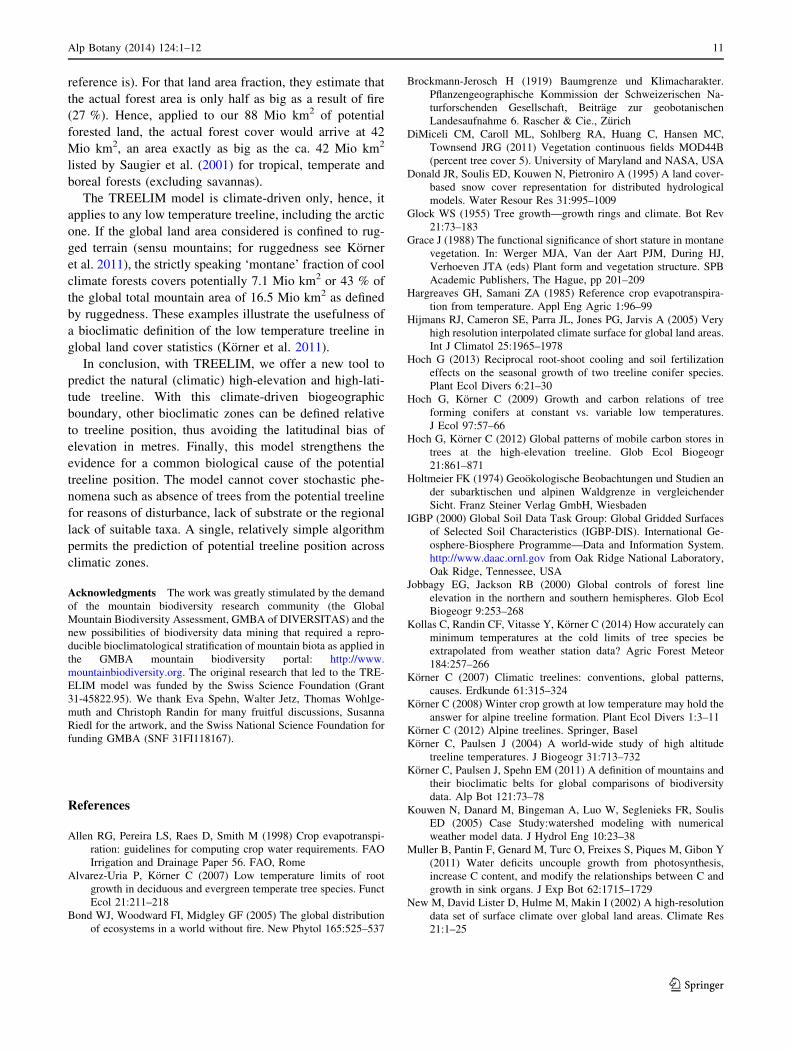
reference is). For that land area fraction, they estimate that
the actual forest area is only half as big as a result of fire
(27 %). Hence, applied to our 88 Mio km2 of potential
forested land, the actual forest cover would arrive at 42
Mio km2, an area exactly as big as the ca. 42 Mio km2
listed by Saugier et al. (2001) for tropical, temperate and
boreal forests (excluding savannas).
The TREELIM model is climate-driven only, hence, it
applies to any low temperature treeline, including the arctic
one. If the global land area considered is confined to rug-
ged terrain (sensu mountains; for ruggedness see Korner
et al. 2011), the strictly speaking ‘montane’ fraction of cool
climate forests covers potentially 7.1 Mio km2 or 43 % of
the global total mountain area of 16.5 Mio km2 as defined
by ruggedness. These examples illustrate the usefulness of
a bioclimatic definition of the low temperature treeline in
global land cover statistics (Korner et al. 2011).
In conclusion, with TREELIM, we offer a new tool to
predict the natural (climatic) high-elevation and high-lati-
tude treeline. With this climate-driven biogeographic
boundary, other bioclimatic zones can be defined relative
to treeline position, thus avoiding the latitudinal bias of
elevation in metres. Finally, this model strengthens the
evidence for a common biological cause of the potential
treeline position. The model cannot cover stochastic phe-
nomena such as absence of trees from the potential treeline
for reasons of disturbance, lack of substrate or the regional
lack of suitable taxa. A single, relatively simple algorithm
permits the prediction of potential treeline position across
climatic zones.
Acknowledgments The work was greatly stimulated by the demand
of the mountain biodiversity research community (the Global
Mountain Biodiversity Assessment, GMBA of DIVERSITAS) and the
new possibilities of biodiversity data mining that required a repro-
ducible bioclimatological stratification of mountain biota as applied in
the GMBA mountain biodiversity portal: http://www.
mountainbiodiversity.org. The original research that led to the TRE-
ELIM model was funded by the Swiss Science Foundation (Grant
31-45822.95). We thank Eva Spehn, Walter Jetz, Thomas Wohlge-
muth and Christoph Randin for many fruitful discussions, Susanna
Riedl for the artwork, and the Swiss National Science Foundation for
funding GMBA (SNF 31FI118167).
References
Allen RG, Pereira LS, Raes D, Smith M (1998) Crop evapotranspi-
ration: guidelines for computing crop water requirements. FAO
Irrigation and Drainage Paper 56. FAO, Rome
Alvarez-Uria P, Korner C (2007) Low temperature limits of root
growth in deciduous and evergreen temperate tree species. Funct
Ecol 21:211–218
Bond WJ, Woodward FI, Midgley GF (2005) The global distribution
of ecosystems in a world without fire. New Phytol 165:525–537
Brockmann-Jerosch H (1919) Baumgrenze und Klimacharakter.
Pflanzengeographische Kommission der Schweizerischen Na-
turforschenden Gesellschaft, Beitrage zur geobotanischen
Landesaufnahme 6. Rascher & Cie., Zurich
DiMiceli CM, Caroll ML, Sohlberg RA, Huang C, Hansen MC,
Townsend JRG (2011) Vegetation continuous fields MOD44B
(percent tree cover 5). University of Maryland and NASA, USA
Donald JR, Soulis ED, Kouwen N, Pietroniro A (1995) A land cover-
based snow cover representation for distributed hydrological
models. Water Resour Res 31:995–1009
Glock WS (1955) Tree growth—growth rings and climate. Bot Rev
21:73–183
Grace J (1988) The functional significance of short stature in montane
vegetation. In: Werger MJA, Van der Aart PJM, During HJ,
Verhoeven JTA (eds) Plant form and vegetation structure. SPB
Academic Publishers, The Hague, pp 201–209
Hargreaves GH, Samani ZA (1985) Reference crop evapotranspira-
tion from temperature. Appl Eng Agric 1:96–99
Hijmans RJ, Cameron SE, Parra JL, Jones PG, Jarvis A (2005) Very
high resolution interpolated climate surface for global land areas.
Int J Climatol 25:1965–1978
Hoch G (2013) Reciprocal root-shoot cooling and soil fertilization
effects on the seasonal growth of two treeline conifer species.
Plant Ecol Divers 6:21–30
Hoch G, Korner C (2009) Growth and carbon relations of tree
forming conifers at constant vs. variable low temperatures.
J Ecol 97:57–66
Hoch G, Korner C (2012) Global patterns of mobile carbon stores in
trees at the high-elevation treeline. Glob Ecol Biogeogr
21:861–871
Holtmeier FK (1974) Geookologische Beobachtungen und Studien an
der subarktischen und alpinen Waldgrenze in vergleichender
Sicht. Franz Steiner Verlag GmbH, Wiesbaden
IGBP (2000) Global Soil Data Task Group: Global Gridded Surfaces
of Selected Soil Characteristics (IGBP-DIS). International Ge-
osphere-Biosphere Programme—Data and Information System.
http://www.daac.ornl.gov from Oak Ridge National Laboratory,
Oak Ridge, Tennessee, USA
Jobbagy EG, Jackson RB (2000) Global controls of forest line
elevation in the northern and southern hemispheres. Glob Ecol
Biogeogr 9:253–268
Kollas C, Randin CF, Vitasse Y, Korner C (2014) How accurately can
minimum temperatures at the cold limits of tree species be
extrapolated from weather station data? Agric Forest Meteor
184:257–266
Korner C (2007) Climatic treelines: conventions, global patterns,
causes. Erdkunde 61:315–324
Korner C (2008) Winter crop growth at low temperature may hold the
answer for alpine treeline formation. Plant Ecol Divers 1:3–11
Korner C (2012) Alpine treelines. Springer, Basel
Korner C, Paulsen J (2004) A world-wide study of high altitude
treeline temperatures. J Biogeogr 31:713–732
Korner C, Paulsen J, Spehn EM (2011) A definition of mountains and
their bioclimatic belts for global comparisons of biodiversity
data. Alp Bot 121:73–78
Kouwen N, Danard M, Bingeman A, Luo W, Seglenieks FR, Soulis
ED (2005) Case Study:watershed modeling with numerical
weather model data. J Hydrol Eng 10:23–38
Muller B, Pantin F, Genard M, Turc O, Freixes S, Piques M, Gibon Y
(2011) Water deficits uncouple growth from photosynthesis,
increase C content, and modify the relationships between C and
growth in sink organs. J Exp Bot 62:1715–1729
New M, David Lister D, Hulme M, Makin I (2002) A high-resolution
data set of surface climate over global land areas. Climate Res
21:1–25
Alp Botany (2014) 124:1–12 11
123

Paulsen J, Korner C (2001) GIS-analysis of treeline elevation in the
Swiss Alps suggest no exposure effect. J Veg Sci 12:817–824
Rossi S, Deslauriers A, Anfodillo T, Carraro V (2007) Evidence of
threshold temperatures for xylogenesis in conifers at high
altitudes. Oecologia 152:1–12
Saugier B, Roy J, Mooney HA (2001) Estimations of global terrestrial
productivity: converging toward a single number? In: Roy J,
Saugier B, Mooney HA (eds) Terrestrial global productivity.
Academic Press, San Diego, pp 543–557
Scherrer D, Korner C (2010) Infra-red thermometry of alpine
landscapes challenges climatic warming projections. Glob
Chang Biol 16:2602–2613
Schwalm CR, Ek AR (2004) A process-based model of forest
ecosystems driven by meteorology. Ecol Modell 179:317–348
Wardle P (1998) Comparison of alpine timberlines in New Zealands
and the Southern Andes. R Soc N Z Miscell Publ 48:69–90
Wilson C, Grace J, Allen S, Slack F (1987) Temperature and stature: a
study of temperatures in montane vegetation. Funct Ecol
1:405–413
Zomer RJ, Trabucco A, Verchot LV, Muys B (2008) Land area
eligible for afforestation and reforestation within the clean
development mechanism: a global analysis of the impact of
forest definition. Mitig Adapt Strateg Glob Chang 13:219–239
12 Alp Botany (2014) 124:1–12
123