Embed Size (px)
Citation preview
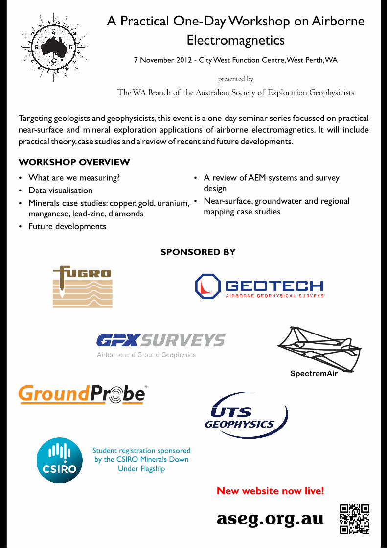
presented by
The WA Branch of the Australian Society of Exploration Geophysicists
A Practical One-Day Workshop on Airborne
Electromagneticshttp://aseg.org.au/
7 November 2012 - City West Function Centre, West Perth, WA
Ÿ What are we measuring?
Ÿ Data visualisation
Ÿ Minerals case studies: copper, gold, uranium, manganese, lead-zinc, diamonds
Ÿ Future developments
WORKSHOP OVERVIEW
Targeting geologists and geophysicists, this event is a one-day seminar series focussed on practical
near-surface and mineral exploration applications of airborne electromagnetics. It will include
practical theory, case studies and a review of recent and future developments.
Ÿ A review of AEM systems and survey design
Ÿ Near-surface, groundwater and regional mapping case studies
Student registration sponsored by the CSIRO Minerals Down
Under Flagship
http://www.csiro.au/en/Organisation-Structure/Flagships/Minerals-Down-Under-Flagship.aspx
http://www.groundprobe.com/geophysics.html
http://geotechairborne.com
http://gpxsurveys.com.au/http://www.spectrem.co.za/
SpectremAir
http://www.uts.com.au/
http://www.fugroairborne.com/
SPONSORED BY
aseg.org.au
New website now live!
http://aseg.org.au/
PROGRAM
SESSION 1
8:00 8:30- Registration
OVERVIEW CHAIR: Anne Tomlinson
8:30 8:40- Opening address Anne Tomlinson ASEG WA
8:40 9:10- What are we measuring? Paul Mutton Southern Geoscience Consultants
9:10 9:45- An overview of AEM systems: descriptions, survey objectives and design considerations
Bill Peters Southern Geoscience Consultants
9:45 10:15- Visualisation of AEM data Kim Frankcombe ExploreGeo
10:15 10:40- Morning tea
SESSION 2 CASE STUDIES 1 CHAIR: Chris Wijns
10:40 11:05- VTEM airborne EM system clearly detects Abra polymetallic base metal deposit; an ongoing comparison to other airborne and ground EM systems
Jayson Meyers, Jimmy Wood, David Stannard, Nigel CantwellKeith FiskMingyan Wang, Lyndon Hardy
11:05 11:30- Direct targeting / modelling airborne EM data using Leroi-Air
Jeremy Cook
11:30 11:55- Airborne electromagnetics for definition of manganese mineralisation: a case study in the Eastern Pilbara region, Western Australia
Gemma King
11:55 12:20- Tottenham Copper Project, NSW Peter Muccilli
12:20 13:20- Lunch
Resource Potentials
Geotech AirborneAbra Mining
Newmont Mining Corporation
Consolidated Minerals
Mincor Resources
SESSION 3 CASE STUDIES 2 CHAIR: Paul Mutton
13:20 13:45- Airborne electromagnetics for uranium exploration in Australia and Canada
Dr Andrew Fitzpatrick
13:45 14:05- Diamond exploration using AEM Keith Jones
14:05 14:30- Wanted: earlier times and shallower information from airborne EM for geotechnical and regolith studies
Chris Wijns
14:30 14:55- Hydrogeological applications of AEM data Camilla Sørensen
14:55 15:20- Afternoon tea
Cameco Australia
Consultant
First Quantum Minerals
University of Adelaide / Aarhus Geophysics
SESSION 4 FUTURE DEVELOPMENTS CHAIR: Kim Frankcombe
15:20 15:45- Oblique mineral targets, or horizontal layered noise?
Yusen Ley-Cooper
15:45 16:10- Distal footprints of large ore systems – the challenge of exploring through cover and the role of AEM
Tim Munday, Ravi Anand, Rob Hough
16:10 16:45- The future of AEM Peter Fullagar
16:45 16:50- Closing address
CSIRO
CSIRO / Minerals Down Under Flagship
Fullagar Geophysics / Mira Geoscience
Anne Tomlinson ASEG WA
16:50 18:30- Sundowner
http://aseg.org.au
ABSTRACTS
SESSION 1 OVERVIEW
What are we measuring?
Paul Mutton, Southern Geoscience Consultants
Airborne electromagnetic (AEM) application and interpretation requires an understanding of the principles of the survey technique and an awareness of how the earth responds to external fields. As the AEM systems improve and our ability to detect very small fields has increased by orders of magnitude, we can not only detect deeper, smaller targets, but we also find ourselves measuring phenomena and effects that were previously below noise levels and undetectable. Many of these are from a shallow depth and are not able to be modelled with commercial software. This presentation is an overview of the different types of earth responses, and also describes concepts and terms that geologists will hear when discussing AEM survey results.
An overview of AEM systems: descriptions, survey objectives and design considerations
Bill Peters, Southern Geoscience Consultants
Airborne EM has been responsible for many significant discoveries over the last fifty years and is a cost effective and rapid exploration method when used correctly. The improvement in technology and processing has accelerated greatly in recent years with new systems appearing almost monthly.
There are an extremely wide range of uses for AEM including massive sulphide detection, geological mapping, palaeochannel delineation, ground water exploration, bathymetry, etc. AEM systems are at present either on fixed wing or helicopter platforms. Fixed wing systems provide a large footprint and lower cost but at the expense of lower resolution and an asymmetrical response. Helicopter systems are higher cost but have higher resolution, symmetrical response and permit shorter line lengths. The systems are further divided into frequency domain (FDEM) and time domain (TEM). FDEM systems are lower power and have less penetration but offer higher sensitivity to weaker conductors. TEM systems have higher power and penetration and are better at deep bedrock conductor search. There are currently three fixed wing and seven helicopter systems locally available in various configurations. In order to optimise your exploration it is important to match the AEM system used to the survey objectives such as vertical and horizontal resolution, target conductance, depth of penetration, etc. Other factors include line spacing, the need for tie lines, flight direction, line length, ferry times, etc.
Visualisation of AEM data
Kim Frankcombe, ExploreGeo
There are many types of EM systems, however, there are even more ways of presenting the data that these systems generate. The style of presentation will depend on the target sought from the survey. A geophysicist looking for nickel sulphide would use a different suite of products from a geophysicist or geologist looking for uranium or groundwater. Likewise, the tools used in interpretation will vary, depending on the use the data are being put to.
EM data may be transformed or inverted into conductivity depth space. Simple transforms are linear and operator independent. The results from more complex transforms and all inversions are dependent on the parameters input by the operator. Not only can there be large differences between the results from different inversion algorithms, there can be just as great a difference between the results from two operators using the same software. This is particularly evident for 3D inversion which is still a relatively immature technology. The holy grail of every geophysicist or contractor being able to press a few buttons on the computer and obtain an accurate 3D picture of the earth from EM data is still a long way off, although we can now see that it will probably be reached at some point.
SESSION 2 CASE STUDIES 1
Direct targeting / modelling airborne EM data using Leroi-Air
Jeremy Cook, Newmont Mining Corporation
The typical approach to following up airborne EM anomalies involves selecting, analysing, rating and ranking of anomalies, followed by an appropriate ground EM program to tighten up anomaly locations ahead of defining drill targets. In some environments ground follow up is extremely difficult for either logistical, cultural or safety reasons.
Advances in software, in particular a full solution to a plate response in a conductive half space, have facilitated direct targeting of modelled airborne EM anomalies. This is somewhat dependant on the terrane and target type.
This presentation briefly covers the modelling approach and modelling results of a Spectrem survey in Brazil and a HoisTEM Survey in Ghana.
SESSION 2 CASE STUDIES 1 con.
VTEM airborne EM system clearly detects Abra polymetallic base metal deposit; an ongoing comparison to other airborne and ground EM systems
J. Meyers, J. Wood, D. Stannard and N. Cantwell: Resource Potentials Pty Ltd
Keith Fisk: Geotech Airborne Pty Ltd
M. Wang and L. Hardy: Abra Mining Pty Ltd
Abra is a sedimentary hosted, polymetallic base metal deposit that occurs in the Jillawarra sub-basin of the Edmund Basin, which formed as part of the long-lived Capricorn Orogen between the Pilbara and Yilgarn cratons. Abra was discovered in 1981 by drill testing a coincident, 'bull's eye' magnetic and gravity anomaly with no geochemical or outcrop evidence for mineralisation. Drilling confirmed that the top of the deposit sits below 250 m depth and extends well beyond 500 m. The host rocks for the deposit are siliciclastic (mainly siltstone) and carbonate deposits of the middle Proterozoic Edmund Group. The Abra deposit is predominantly Pb-Zn mineralised, with accessory Cu, Ag, and Au. Alteration minerals are stratiform magnetite replacing carbonate, and this is overlain by hematite alteration. Barite is common throughout the deposit and contributes to the gravity anomaly.
Soon after the discovery of Abra in the early 1980s, the deposit was shown to have a well-defined EM anomaly in fixed and moving loop time domain EM surveys using the SIROTEM system. Since then, almost all drillholes into Abra have been surveyed using downhole EM, and some core samples have been analysed for physical properties. Most of the EM response comes from galena and some chalcopyrite with trace pyrite. In the 1990s, a GEOTEM time domain fixed wing AEM survey was carried out over the deposit. GEOTEM detected a coincident conductor to Abra in the last 3 channel windows with amplitudes just above the noise level. The EM anomaly in the GEOTEM data set is not distinct, and does not greatly stand out from other late time anomalies in the region. In early 2012, an XTEM time domain helicopter EM survey was carried out over the deposit. This system did not have the penetration to detect the deposit, but the results of this survey were used for near surface geological mapping and as a Mn mineralisation detection tool. In October 2012, a VTEM time domain helicopter EM survey was carried out over the deposit. VTEM clearly detected the deposit to the level of detail obtained by the SIROTEM survey, or better, and identified other EM targets that are coincident to magnetic anomalies that will be drill tested in the near future. The VTEM survey over Abra shows that this system has significant depth penetration in Australian conditions having weak to moderately conductive overburden, and can be used as an effective exploration tool for other deep, blind base metal deposits.
It is possible that LandTEM moving loop EM data using a high temperature SQUID sensor will be shown covering the Abra deposit for comparison by the time of the workshop.
Tottenham Copper Project, NSW
Peter Muccilli, Mincor Resources
The Tottenham Copper Project is located in the Lachlan Fold Belt of New South Wales 160Km South East of Cobar. The project has had small-scale production dating back to the 1880s producing 5,000t of copper metal from oxide ores.
The Ordovician Girilambone Group is dominated by sequences of thick turbidites comprised of cyclic greywacke, pelite and psammopelite lithologies, and associated mafic volcanic/intrusive units. The district has undergone low-grade metamorphism to greenschist facies.
The geological setting of the Tottenham copper mineralisation is similar to that of the Girilambone group of mines, including Tritton Copper Mine (13 million tonnes @ 2.4% copper) and Murrawombie (formerly Girilambone).
Copper mineralisation at Tritton and Tottenham is consistent with Besshi-style volcanic-hosted massive sulphide (VHMS) deposits (mafic/politic-associated). These deposits are generally pyrite-rich systems that contain chalcopyrite with gold and silver credits. Due to both deformation and metamorphism, the pyritic dominated banded ores can be remobilised to form massive sulphides bodies dominated by chalcopyrite. These bodies are conceptually detectable by electromagnetic (EM) surveys.
The prospective stratigraphic contact at Tottenham is folded into a broad antiform. The quartz-magnetite unit, believed to be an exhalative unit, formed on the sea floor by volcanic activity. The quartz-magnetite is an excellent marker horizon and is easily identifiable in magnetic surveys.
Mincor's initial work in the area focused on the near-surface oxide potential during 2006/2007. The company carried out exploration and drilling programs that led to the delineation of a maiden JORC-compliant Inferred Resource of 3.7 million tonnes @ 1.1% copper containing 41,850 tonnes of copper metal in February 2008.
Mincor's exploration then turned its attention to the copper sulphide potential beneath the oxide resources and the region. Mincor's target is a cluster of VHMS deposits located along the base of 30 kilometres strike of the quartz-magnetite unit.
Mincor has now carried out detailed aeromagnetic and VTEM surveys. The VTEM survey was aimed at directly detecting remobilised massive sulphides. The results are highly encouraging with a strong VTEM anomaly identified at Carolina. Drill testing (TMD2) of this EM target returned 2.18 metres @ 11.17% copper, 2.77g/t gold, 9.47g/t silver from 184.6 metres down-hole (estimated true width 2 metres) within massive sulphides and is clear evidence of the effectiveness of the airborne EM survey.
The results and subsequent drillholes has led to a new inferred resource calculation for the district released in July 2012 for 6.99 million tonnes @ 1.2% copper containing 85,700 tonnes of copper metal.
SESSION 2 CASE STUDIES 1 con.
Airborne electromagnetics for definition of manganese mineralisation: a case study in the Eastern Pilbara region, Western Australia
Gemma King, Consolidated Minerals
Airborne electromagnetics (AEM) is used as an exploration technique for targeting manganese. Previous AEM surveying in 2002 over the Woodie Woodie mine tenements provided targets that were drilled, and delineated significant manganese mineralisation. Based on this success, the technique was applied over regional projects of interest between 2004 and 2009. The introduction of systems with increased power and the option of B-field measurements highlighted the question of their applicability to manganese exploration. A case study area was chosen to enable testing of new systems over a prospect with known manganese mineralisation. Results from the case study are presented using profile, channel grid and conductivity depth imaging data. High signal to noise and B-field measurements provide an advantage over traditional dB/dt systems in discriminating manganese targets in areas of conductive cover.
SESSION 3 CASE STUDIES 2
Airborne electromagnetics for uranium exploration in Australia and Canada
Dr Andrew Fitzpatrick, Cameco Australia
Airborne electromagnetic (EM) methods are commonly used in uranium exploration for a wide range of deposits styles. In the Athabasca Basin of Canada, the majority of the uranium deposits are associated with large graphitic units, which provide ideal targets for airborne EM. In Australia airborne EM is used to map unconformities which are typically conductive compared to the resistive sandstone and basement units. These are two clear examples of using Airborne EM for uranium targeting, but the method is also deployed to map more subtle features such as lithological variations, alteration and structures that may have an influence on uranium mineralisation. This presentation provides some examples of the use of airborne EM for Uranium exploration in Australia and Canada using the TEMPEST and VTEM systems along with a range of modelling approaches from 1D to 3D.
Diamond exploration using AEM
Keith Jones, Consultant
During the last major diamond rush in Northern Canada in the early 90s, in excess of 100,000 line km of heliborne electromagnetic (HEM) data were flown each year at the peak of the exploration phase. The major contribution which airborne electromagnetics (AEM) made to the discovery of new diamondiferous provinces has established the method as an essential component of exploring for kimberlites. Examples are given of the variations in geological settings, physical properties and size of kimberlites which are the common host to diamond deposits as these dictate the most appropriate choice of AEM system. A number of case histories are included which describe the successful application of AEM in exploring for diamondiferous kimberlites. Despite current economic conditions demand for diamonds is likely to exceed supply and new challenges face the industry in locating new deposits.
Wanted: earlier times and shallower information from airborne EM for geotechnical and regolith studies
Chris Wijns, First Quantum Minerals Ltd
The regolith or overburden can often be an obstruction to exploration or mining activities, and mapping of the depth and character of this overburden is an important activity for both exploration and geotechnical purposes. Airborne EM can often be used to good effect, if the bottom of overburden or weathering provides an electrically conductive boundary with the rock below. In the case of such shallow studies, very early measurement times are needed after current turnoff in the transmitting loop, and this becomes the limiting factor in how well the near-surface can be resolved. Two examples from northern Finland use the low-moment data from the SkyTEM dual moment system to map the depth of glacial till. In one case, combined with limited geotechnical drilling and pits, this was used to help plan mine infrastructure, in particular the crusher, in an area of shallow bedrock, thus necessitating less excavation. A second example uses the estimated depth of glacial till to plan base-of-till (BoT) geochemical drilling, since the BoT drill rig cannot penetrate much past 10 m. In areas of deeper estimated till, a scout drill rig is used instead, which, while more expensive, avoids the much higher cost of total failure with the standard BoT rig.

SESSION 3 CASE STUDIES 2 con.
Hydrogeological applications of AEM data
Camilla Sørensen, The University of Adelaide / Aarhus Geophysics
Airborne EM can provide effective support for groundwater assessment and aquifer characterization. When used with other conventional hydrogeological data it has the potential to assist more effective groundwater management. Arguably however, AEM data are most useful when a quantitative approach is taken to their acquisition and interpretation. This may involve the use of a range of calibration procedures which are not always employed in other applications, e.g. mineral exploration. Some critical aspects are accuracy (calibration) and precision of raw data, careful editing of artefacts arising from different sources of anthropogenic and background noise, accurate inversion, post processing, integration with ancillary data from different sources. Case studies from Australia (SkyTEM) and, time allowing, other parts of the world (VTEM, AeroTEM) illustrate some of the topics above. Other applications such as geotechnical, engineering, geothermal, overburden mapping, can also benefit from this approach.
SESSION 4 FUTURE DEVELOPMENTS
Oblique mineral targets, or horizontal layered noise?
Yusen Ley-Cooper, CSIRO
Processing and interpretation work flows for AEM data may differ depending on the purpose of the survey. Surveys acquired for mapping and groundwater studies tend to focus on layered structures while surveys designed for the detection of ore bodies tend to focus on discrete targets. As part of an on-going multi-system study, we flew a Spectrem 2000 system over two small trial areas in the Musgrave province, South Australia. One of these areas includes a discrete mineral target whilst the other area is being used to define groundwater aquifers and regolith architecture.
The Spectrem 2000 AEM system employs a bipolar, 100% duty cycle, approximately square-wave current pulse at variable base frequencies of 25 Hz and higher. The system measures two-components throughout the transmitter pulse to facilitate interpretation of both near-surface features and signals from extremely conductive targets. Streaming data are recorded for processing to step responses. Inline 'X component' data are used to discriminate lateral variations and vertical 'Z component' data are used to identify horizontal layering.
We used different conductivity depth transform algorithms and forward-modelling codes to compare system responses from our trial area. Our results highlight many similarities between Spectrem 2000 data and other systems previously flown over the same areas. This study illustrates the value of alternative interpretations and exploration philosophies to the application of AEM in the search for minerals targets and in groundwater studies. We show that a system's optimality is very much dependent on the geological exploration problem to be solved.
Distal footprints of large ore systems – the challenge of exploring through cover and the role of AEM
Tim Munday, Ravi Anand and Rob Hough, CSIRO Earth Science and Resource Engineering / Minerals Down Under Flagship
Among the emerging geoscience research topics is one that relates to distal footprints of large ore systems. Of particular interest is whether these systems have far field signatures, whether they are detectable, and whether they have a petrophysical expression and can be identified through cover. Linked to this, and the need to target what are likely to be the more subtle expressions of mineralisation, requires that we give increased attention to the development of systems that have improved sensitivity, lower noise and a greater bandwidth. There is also a need to develop more effective interpretation procedures that can tease the subtleties from any geophysical data that is acquired. AEM systems clearly have a role to play in the exploration through cover, and presently we see noticeable effort directed to the design of systems with a higher moment that have a capability to see deeper through a conductive transported cover, or an in situ regolith. Whilst that emphasis is understandable and is bearing fruit, we suggest that in sometimes it may come at the expense of targeting the more subtle and potentially “near-surface” mineral systems that may be both cheaper and easier to exploit. We believe that broadband EM technologies which address the finer characterisation of regolith and sedimentary cover on the Basin margins, and which can be applied quickly and effectively, with information generated in near real time, have significant potential to shorten the exploration cycle and to add value to information generated in other exploration techniques such as geochemical/hydrogeochemical sampling and analysis. Linking a variable and complex regolith expression which could be derived from AEM systems with an understanding of how mineral systems evolve in weathering may help define discontinuities or boundaries to sample and analyse. The other trend, which we also believe is critical, is the acquisition of AEM data over larger areas of terrain. Common practice (at least to date), has been to acquire data over small areas targeting tenements or prospects. Consequently the detection of anomalism, if present, is harder to see/understand in the broader geological context. For that reason, we believe regional data acquisition, supported by State and/or Federal agencies will assist to determining the geophysical expression of both proximal and distal characteristics of ore systems.
SESSION 4 FUTURE DEVELOPMENTS con.
The future of AEM
Peter Fullagar, Fullagar Geophysics Pty Ltd & Mira Geoscience Advanced Geophysical Interpretation Centre
Airborne electromagnetic (AEM) methods have proved very successful in the past in mineral exploration, for direct targeting of ore bodies and kimberlite pipes, and more recently in hydrological and environmental applications, for mapping. There have been impressive technical developments in the last decade, including the advent of helicopter TEM systems, passive AEM systems, and 3D inversion algorithms, though these have not delivered many major new metalliferous discoveries. Various avenues for further technical advances have been proposed in both acquisition (e.g. lower base frequency, B-field sensors, inductive IP, deployment of drones) and interpretation (e.g. fast 3D inversion, geologically constrained inversion, data fusion, integrated interpretation). While these all have merit, the more mundane issues of system calibration and system parameter specification are equally, if not more, important if AEM is to achieve its full potential in the future.
References
Christiansen, A.V., Auken, E., and Viezzoli, A., 2011, Quantification of modeling errors in airborne TEM caused by inaccurate system description: Geophysics, 76, F43-F52.
Fullagar, P.K., and Pears, G.A., 2007, Towards geologically realistic inversion: in "Proceedings of Exploration 07: Fifth Decennial International Conference on Mineral Exploration", B. Milkereit (ed.), pp. 444-460.
Hodgkinson, J.H., Fraser, S.J., and Donchak, P., 2012, Using self-organising maps to derive lithological boundaries from geophysically-derived data in the Mt. Isa region, Queensland: paper presented at ASEG Conference, Brisbane.
Macnae, J.C., 2007, Developments in Broadband Airborne Electromagnetics in the Past Decade: in "Proceedings of Exploration 07: Fifth Decennial International Conference on Mineral Exploration", B. Milkereit (ed.), pp. 387-398.
Smith, R.S., 2012, Electromagnetic induction methods in mining geophysics from 2008 to 2012: Paper presented at the 21st Workshop on Electromagnetic Induction in the Earth, Darwin Australia, July 25-31, 2012.
Witherly, K., 2000, Airborne Electromagnetics Surveying - 50 Years of Discovery and Still Going Strong: paper presented at PDAC Convention, Toronto.
Witherly, K., and Allard, M., 2010, The evolution of the use of geophysics in the search for blind VHMS deposits in the Abitibi greenstone belt, Québec Canada: paper presented at SEG Conference, Denver.

aseg.org.au
New website now live!
Keep up to date with all the latest events and society news
You can also find us on
http://aseg.org.au
http://aseg.org.au
http://www.twitter.com/ASEG_news http://www.linkedin.com/groups?gid=4337055&trk=myg_ugrp_ovr http://www.facebook.com/groups/387350007980109/