Embed Size (px)
Citation preview
A Quick Tour of the NOAA Environmental Software Infrastructure and Interoperability Group
Cecelia DeLuca and the ESMF teamESRL Directorate SeminarJune 2, 2011
Outline
• NESII Overview• NESII Projects
◦ Earth System Modeling Framework (ESMF)◦ National Unified Operational Prediction Capability (NUOPC)◦ Earth System Curator◦ Earth System Commodity Governance (CoG)◦ Curator Hydrology◦ NOAA Climate Projection Pilot (NCPP)◦ TeraGrid Environmental Science Gateway◦ Global Interoperability Program

The Basics
• NESII focuses on development of software infrastructure for Earth system modeling
• Arrived at ESRL / CIRES on Nov 1, 2009
• Formerly the Earth System Modeling Infrastructure section at the National Center for Atmospheric Research
• Started with the Earth System Modeling Framework (ESMF) project – has grown to include numerous others
• Partners and customers are from research and operational centers, weather and climate, across U.S. agencies and international organizations

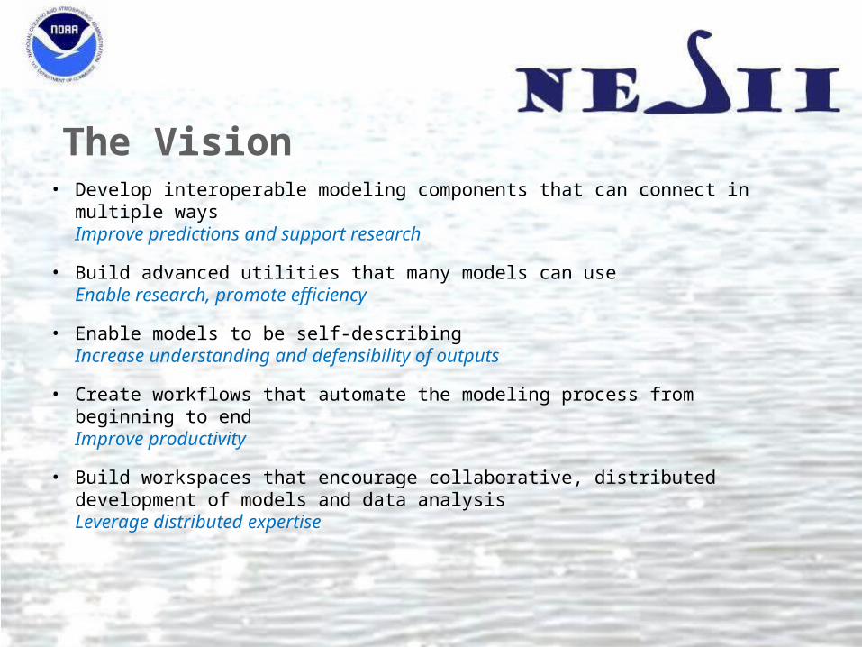
The Vision• Develop interoperable modeling components that can connect in multiple ways
Improve predictions and support research
• Build advanced utilities that many models can useEnable research, promote efficiency
• Enable models to be self-describingIncrease understanding and defensibility of outputs
• Create workflows that automate the modeling process from beginning to endImprove productivity
• Build workspaces that encourage collaborative, distributed development of models and data analysisLeverage distributed expertise

The TeamPerson Role Location
Cecelia DeLuca Technical Manager ESRL
Sylvia Murphy Operations & Project Manager ESRL
Silverio Vasquez Test and Integration Lead ESRL
Gerhard Theurich Senior Developer – architecture CA
Bob Oehmke Senior Developer - grids ESRL
Luca Cinquini Senior Developer - database ESRL/CA
Peggy Li Developer - performance CA
Allyn Treshansky Developer - metadata CA
Walter Spector Developer – porting CA
Ryan O’Kuinghttons Developer - everything ESRL
Fei Liu Developer - applications New Jersey
Kathy Saint Developer - web Florida
Earl Schwab Developer - utilities CO
NESII visitors:Tony Wong, intern andJay Hnilo, NCDC
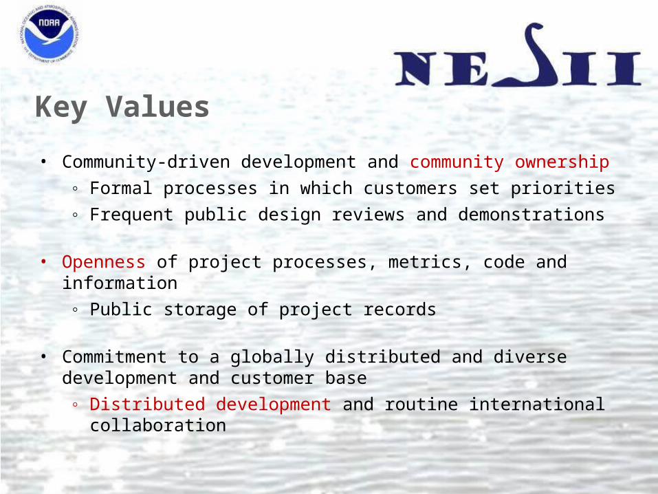
Key Values
• Community-driven development and community ownership◦ Formal processes in which customers set priorities◦ Frequent public design reviews and demonstrations
• Openness of project processes, metrics, code and information◦ Public storage of project records
• Commitment to a globally distributed and diverse development and customer base◦ Distributed development and routine international collaboration
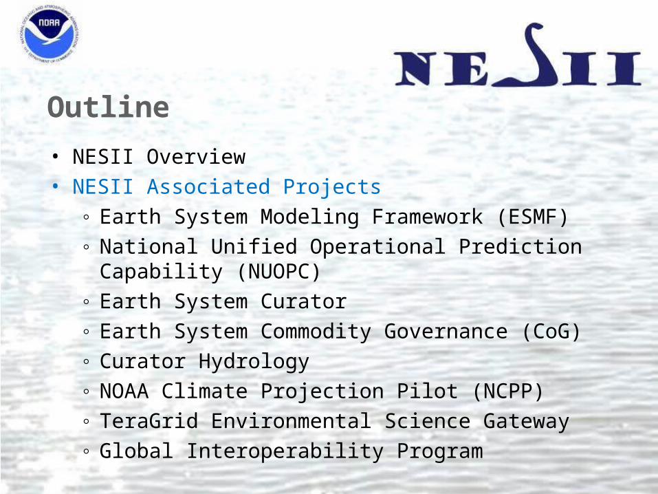
Outline
• NESII Overview• NESII Associated Projects
◦ Earth System Modeling Framework (ESMF)◦ National Unified Operational Prediction Capability (NUOPC)◦ Earth System Curator◦ Earth System Commodity Governance (CoG)◦ Curator Hydrology◦ NOAA Climate Projection Pilot (NCPP)◦ TeraGrid Environmental Science Gateway◦ Global Interoperability Program
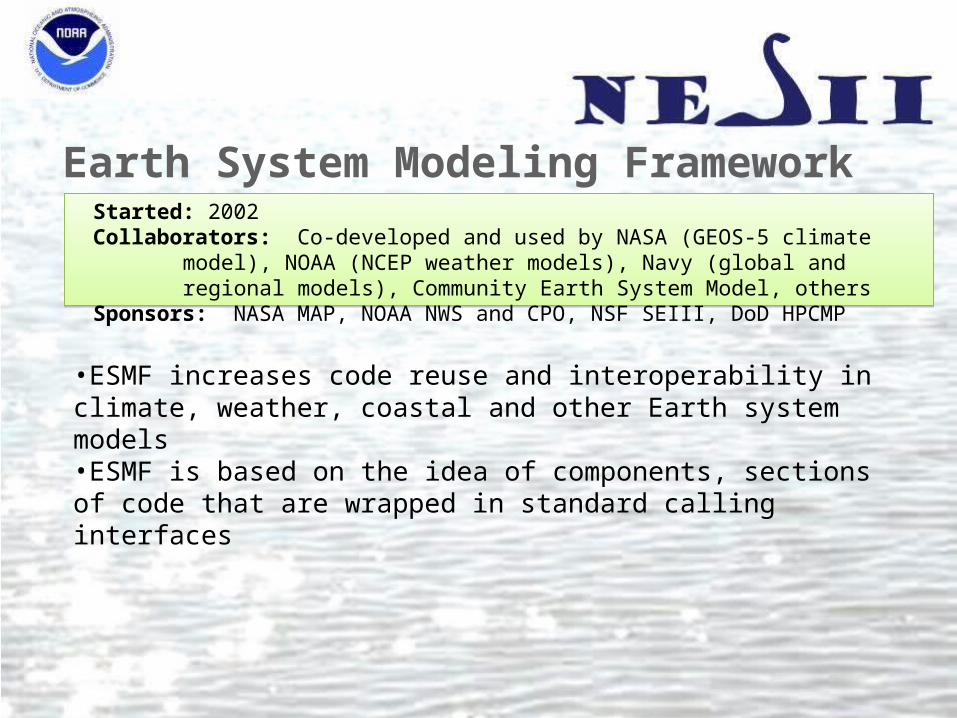
Earth System Modeling Framework
Started: 2002Collaborators: Co-developed and used by NASA (GEOS-5 climate model), NOAA (NCEP weather models),
Navy (global and regional models), Community Earth System Model, othersSponsors: NASA MAP, NOAA NWS and CPO, NSF SEIII, DoD HPCMP
•ESMF increases code reuse and interoperability in climate, weather, coastal and other Earth system models •ESMF is based on the idea of components, sections of code that are wrapped in standard calling interfaces

ESMF Architecture
• Each box in the diagram is a component• Components can be arranged hierarchically, helping to organize the structure of complex
models• Different modeling groups may create different kinds or levels of components
Architecture of the GEOS-5 atmosphericgeneral circulation model
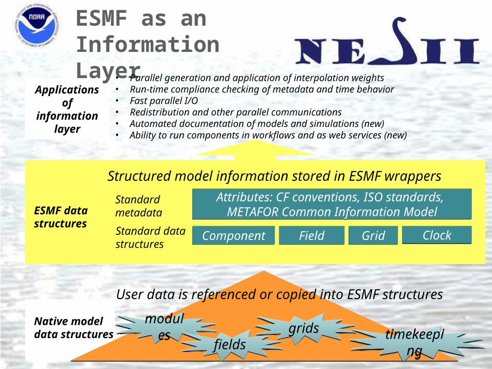
Applications of information
layer
ESMF as anInformation Layer
Native model data structures
Standard data structures
Standard metadata
• Parallel generation and application of interpolation weights• Run-time compliance checking of metadata and time behavior• Fast parallel I/O• Redistribution and other parallel communications• Automated documentation of models and simulations (new)• Ability to run components in workflows and as web services (new)
FieldField GridGrid ClockClockComponentComponent
Attributes: CF conventions, ISO standards, METAFOR Common Information Model
Attributes: CF conventions, ISO standards, METAFOR Common Information Model
Structured model information stored in ESMF wrappers
User data is referenced or copied into ESMF structures
modulesmodulesfieldsfields
gridsgridstimekeepingtimekeeping
ESMF data structures

• ESMF Offline:◦ Application which can be automatically built as part of ESMF◦ Application generates a netCDF weight file from two netCDF grid files◦ Supports SCRIP format grid files, and a custom ESMF unstructured format
mpirun –np 32 ESMF_RegridWeightGen –s src_grid.nc –d dst_grid.nc –m bilinear –w weights.nc
• Integrated: ◦ ESMF library subroutine calls which do interpolation during model run◦ Can get weights or feed directly into ESMF parallel sparse matrix multiply◦ Can be used without ESMF components
call ESMF_FieldRegridStore(srcField=src, dstField=dst, regridMethod=ESMF_REGRID_METHOD_BILINEAR, routehandle=rh)
call ESMF_FieldRegrid(srcField=src, dstField=dst, routehandle=rh)
ESMF Regridding

ESMF Offline Supported Grids• Grids with spherical (lon, lat) coordinates – any pair of:
◦ Global 2D logically rectangular grids◦ Regional 2D logically rectangular grids◦ 2D unstructured meshes composed of polygons with any number of
sides: triangles, quadrilaterals, pentagons, hexagons,…◦ Multi-patch grids (e.g. cubed spheres) currently supported via
unstructured format
HOMME Cubed Sphere Grid with PentagonsCourtesy Mark Taylor of Sandia
FIM Unstructured GridCourtesy ESRL GSD
Regional Grid
RESULT:“use of the parallel ESMF offline regridding capability has reduced the time it takes to create CLM surface datasets from hours to minutes” - Mariana Vertenstein, NCAR

Integrated Supported GridsIn addition, integrated regridding supports Cartesian (x,y) coordinates:• Regridding between any pair of:
◦ 2D meshes composed of triangles and quadrilaterals◦ 2D logically rectangular Grids composed of a single patch
• Bilinear regridding between any pair of:◦ 3D meshes composed of hexahedrons◦ 3D logically rectangular Grids composed of a single patch
2D Unstructured MeshFrom www.ngdc.noaa.gov
3D Grid 3D Unstructured Mesh

National Unified Operational Prediction Capability (NUOPC)
• ESMF allows for many levels of components, types of components, and types of connections
• In order to achieve greater interoperability, usage and content conventions and component templates are needed
• This collaboration is building a “NUOPC Layer” that constrains how ESMF is used, and introduces metadata and other content standards
• The initial pilot project (to be delivered June 2011) focuses on atmosphere-ocean coupling in NCEP NEMS and Navy NOGAPS and COAMPS codes
Started: 2010Collaborators: Tri-agency (NOAA, Navy, Air Force) consortium of operational weather prediction centers,
with participation from NOAA GFDL and NASA modelersSponsors: NOAA NWS and Navy

A Common Model Architecture
NUOPC partners have agreed on a subset of components whose interactions will be standardized

Earth System Curator
• Intergovernmental Panel on Climate Change (IPCC) assessments rely on data generated by Coupled Model Intercomparison Projects (CMIPS), where different scenarios are tested across many models
• For the last IPCC assessment, there was little metadata available about the runs performed
• The Curator project collaborated on a comprehensive metadata schema for climate models, and implemented a metadata display in the Earth System Grid data distribution portal
Started: 2005Collaborators: METAFOR , NCAR, DOE PCMDI, Earth System Grid Federation, NOAA GFDL, Georgia
Institute of TechnologySponsors: NSF SEIII, NASA MAP, NOAA GIP
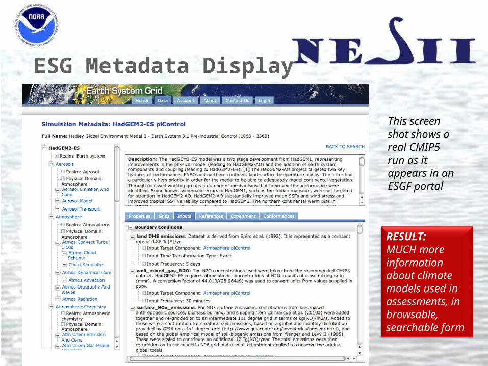
ESG Metadata Display
RESULT:MUCH more information about climate models used in assessments, in browsable, searchable form
This screen shot shows a real CMIP5 run as it appears in an ESGF portal
Earth System CoG
• Will facilitate collaborative model building, evaluation and analysis• Project hosting and indexing with connections to data and analysis services through the Earth System
Grid Federation• Emphasis on encouraging best practices in project management, “commoditized governance”
◦ Templates for project layout so information is easy to find◦ Peer or parent/child connections between projects◦ Communications between projects
• Pilot project is 2012 workshop on comparison of atmospheric dynamical cores (previously supported 2008 workshop)
Started: 2009Collaborators: NCAR, Eart System Grid Federation, University of Michigan, CU Community Surface
Dynamics Modeling SystemSponsors: NSF CDI
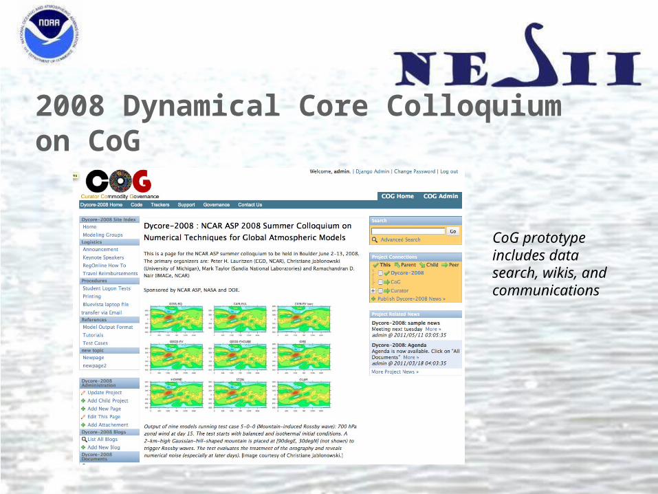
2008 Dynamical Core Colloquium on CoG
CoG prototype includes data search, wikis, and communications
Curator Hydrology
• A new perspective on climate impacts modeling• Instead of what do we “put in” the climate model …• How do we create a linked network of models that multiple communities can use?
Started: 2009Collaborators: University of South Carolina, University of MichiganSponsors: NOAA GIP

Design GoalsGoals Strategies
Modeling systems can be reconfigured easily for including different models or solving different problems
Leverage model interface and data standards
Modeling systems are highly accessible and can be integrated into workflows that include analysis, visualization, and other processing of outputs
Service oriented architecture
Communities formed around local/regional modeling and climate are able to utilize the social and technical structures that have evolved in their domains
Models retain their native codes, computing platforms, and data formats as much as possible

Climate-Hydro Coupling
• Hydrological impact studies can be improved when forced with data from climate models [Zeng et al., 2003; Yong et al., 2009]
• Ideally the coupling would be two-way• A technology gap exists:
◦ Many hydrological models run on personal computers◦ Most climate models run on high performance supercomputers
• Existing frameworks: ESMF (climate/weather) and OpenMI (hydrology) can connect these types of models◦ ESMF and OpenMI components can be operated as web services that can be
used to communicate across a distributed network◦ Both ESMF and OpenMI are widely used
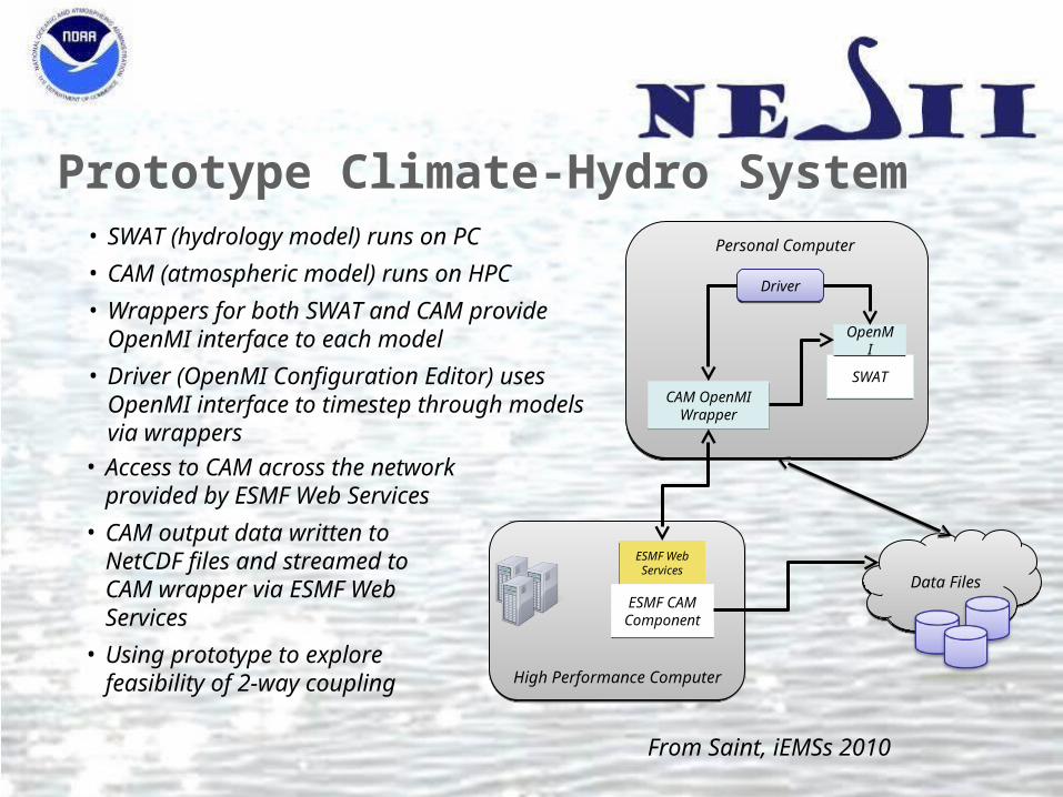
Prototype Climate-Hydro System
Data FilesData Files
SWATSWAT
OpenMIOpenMI
CAM OpenMI Wrapper
CAM OpenMI Wrapper
DriverDriver
High Performance ComputerHigh Performance Computer
ESMF Web Services
ESMF Web Services
ESMF CAMComponentESMF CAMComponent
Personal Computer• SWAT (hydrology model) runs on PC
• CAM (atmospheric model) runs on HPC
• Wrappers for both SWAT and CAM provide OpenMI interface to each model
• Driver (OpenMI Configuration Editor) uses OpenMI interface to timestep through models via wrappers
• Access to CAM across the network provided by ESMF Web Services
• CAM output data written to NetCDF files and streamed to CAM wrapper via ESMF Web Services
• Using prototype to explore feasibility of 2-way coupling
From Saint, iEMSs 2010
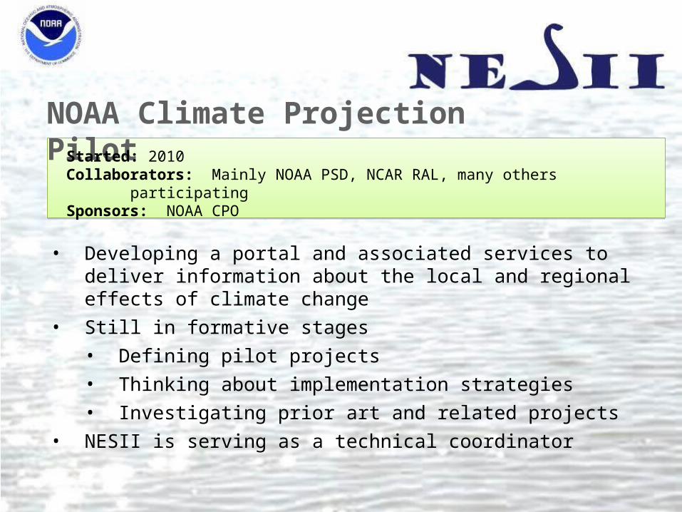
NOAA Climate Projection PilotStarted: 2010Collaborators: Mainly NOAA PSD, NCAR RAL, many others participatingSponsors: NOAA CPO
• Developing a portal and associated services to deliver information about the local and regional effects of climate change
• Still in formative stages• Defining pilot projects• Thinking about implementation strategies• Investigating prior art and related projects
• NESII is serving as a technical coordinator
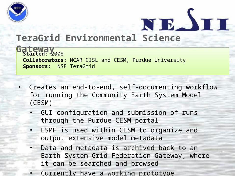
TeraGrid Environmental Science Gateway
Started: 2008Collaborators: NCAR CISL and CESM, Purdue UniversitySponsors: NSF TeraGrid
• Creates an end-to-end, self-documenting workflow for running the Community Earth System Model (CESM)• GUI configuration and submission of runs through the Purdue CESM
portal• ESMF is used within CESM to organize and output extensive model
metadata• Data and metadata is archived back to an Earth System Grid Federation
Gateway, where it can be searched and browsed• Currently have a working prototype
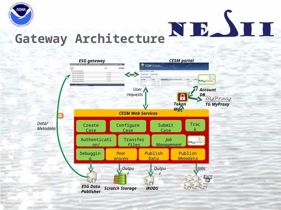
Gateway Architecture
Create Case Configure Case Submit Case
Authentication/ Authorization
Track Status
Post-processDebugging
Transfer Files
Publish Metadata
ESG Data Publisher
iRODSScratch Storage
Token Mgr
Data/Metadata
JobsOutput
CESM Web Services
User requests
Job Management
CESM portalESG gateway
Output
TG MyProxy
Account DB
Publish Data

NOAA Global Interoperability Program
• GIP builds software infrastructure that• can be used in the weather, water, and climate disciplines, and for training
modelers• integrates and automates workflows
• NESII lead DeLuca coordinates the project
Started: 2009Collaborators: NOAA GFDL, PMEL, GSD, and NCDC, Unidata, NCAR, CSU, University of Michigan Sponsors: NOAA CPO
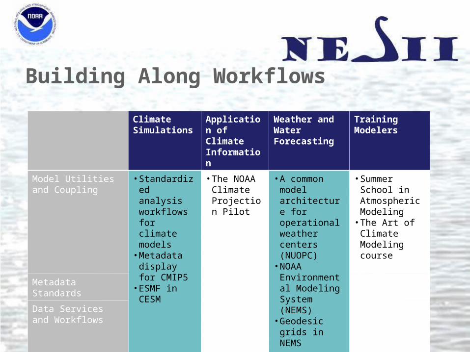
Building Along Workflows
Climate Simulations
Application of Climate Information
Weather and Water Forecasting
Training Modelers
Model Utilities and Coupling
• Standardized analysis workflows for climate models
• Metadata display for CMIP5
• ESMF in CESM
• The NOAA Climate Projection Pilot
• A common model architecture for operational weather centers (NUOPC)
• NOAA Environmental Modeling System (NEMS)
• Geodesic grids in NEMS
• Summer School in Atmospheric Modeling
• The Art of Climate Modeling course
Metadata Standards
Data Services and Workflows
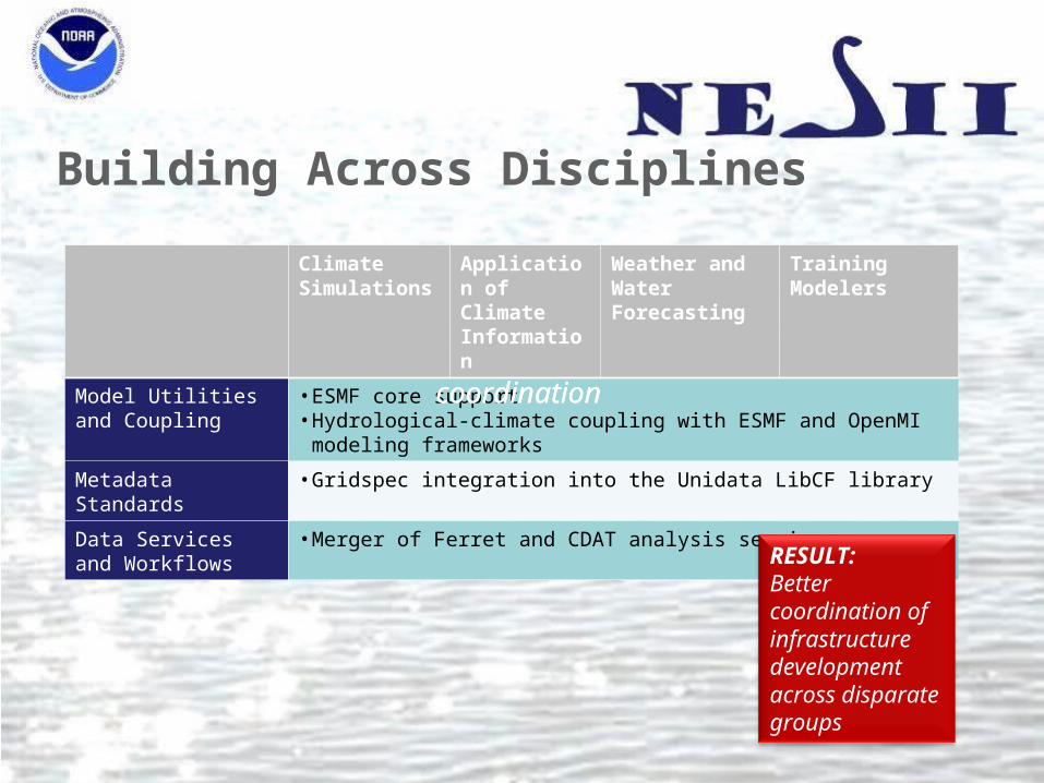
Building Across Disciplines
Climate Simulations
Application of Climate Information
Weather and Water Forecasting
Training Modelers
Model Utilities and Coupling
• ESMF core support• Hydrological-climate coupling with ESMF and OpenMI modeling frameworks
Metadata Standards • Gridspec integration into the Unidata LibCF library
Data Services and Workflows
• Merger of Ferret and CDAT analysis services
coordination coordination
RESULT:Better coordination of infrastructure development across disparate groups
The Vision• Develop interoperable modeling components that can connect in multiple ways
Improve predictions and support research
• Build advanced utilities that many models can useEnable research, promote efficiency
• Enable models to be self-describingIncrease understanding and defensibility of outputs
• Create workflows that automate the modeling process from beginning to endImprove productivity
• Build workspaces that encourage collaborative, distributed development of models and data analysisLeverage distributed expertise

Questions?
• For more information, links and references, see our newish group page: http://esrl.noaa.gov/nesii/
• Please join us for an open house following this talk in GB132!