Embed Size (px)
Citation preview
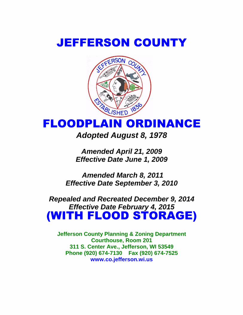
JEFFERSON COUNTY
FLOODPLAIN ORDINANCE
Adopted August 8, 1978
Amended April 21, 2009 Effective Date June 1, 2009
Amended March 8, 2011
Effective Date September 3, 2010
Repealed and Recreated December 9, 2014 Effective Date February 4, 2015
(WITH FLOOD STORAGE)
Jefferson County Planning & Zoning Department
Courthouse, Room 201 311 S. Center Ave., Jefferson, WI 53549
Phone (920) 674-7130 Fax (920) 674-7525 www.co.jefferson.wi.us
1
TABLE OF CONTENTS
14.1.0 STATUTORY AUTHORIZATION, FINDING OF FACT, STATEMENT OF
PURPOSE, TITLE AND GENERAL PROVISIONS 2
14.1.1 Statutory Authorization 2
14.1.2 Finding of Fact 2
14.1.3 Statement of Purpose 2
14.1.4 Title 2
14.1.5 General Provisions 2
(1) Areas to be Regulated 2
(2) Official Maps and Revisions 2
(3) Establishment of Districts 5
(4) Locating Floodplain Boundaries 5
(5) Removal of Lands from Floodplain 5
(6) Compliance 5
(7) Municipalities and State Agencies Regulated 6
(8) Abrogation and Greater Restrictions 6
(9) Interpretation 6
(10) Warning and Disclaimer of Liability 6
(11) Severability 6
(12) Annexed Areas for Cities/Villages 6
14.2.0 GENERAL STANDARDS APPLICABLE TO ALL FLOODPLAIN 7
14.2.1 Hydraulic and Hydrologic Analyses 7
14.2.2 Watercourse Alterations 7
14.2.3 Chapter 30, 31, Wis. Stats., Development 7
14.2.4 Public or Private Campgrounds 7
14.3.0 FLOODWAY DISTRICT (FW) 8
14.3.1 Applicability 9
14.3.2 Permitted Uses 9
14.3.3 Standards for Development 9
14.3.4 Prohibited Uses 10
14.4.0 FLOODFRINGE DISTRICT (FF) 11
14.4.1 Applicability 11
14.4.2 Permitted Uses 11
14.4.3 Standards for Development 11
14.5.0 OTHER FLOODPLAIN DISTRICTS 13
14.5.1 General Floodplain District (GFP) 13
14.5.2 Flood Storage District 15
14.6.0 NONCONFORMING USES 15
14.6.1 General 15
14.6.2 Floodway Districts 18
14.6.3 Floodfringe Districts 18
14.6.4 Flood Storage Districts 19
14.7.0 ADMINISTRATION 19
14.7.1 Zoning Administrator 19
14.7.2 Zoning Agency 25
14.7.3 Board of Adjustment/Appeals 25
14.7.4 To Review Appeals of Permit Denials 28
14.7.5 Floodproofing 28
14.7.6 Public Information 29
14.8.0 AMENDMENTS 29
14.8.1 General 30
14.8.2 Procedures 30
14.9.0 ENFORCEMENT AND PENALTIES 30
14.10.0 DEFINITIONS 31
2
14.1.0 STATUTORY AUTHORIZATION, FINDING OF FACT, STATEMENT OF PURPOSE,
TITLE AND GENERAL PROVISIONS
14.1.1 STATUTORY AUTHORIZATION
This ordinance is adopted pursuant to the authorization in ss. 61.35 and 62.23, for villages and
cities; 59.69, 59.692, and 59.694 for counties; and the requirements in s. 87.30, Stats.
14.1.2 FINDING OF FACT
Uncontrolled development and use of the floodplains and rivers of this municipality would
impair the public health, safety, convenience, general welfare and tax base.
14.1.3 STATEMENT OF PURPOSE
This ordinance is intended to regulate floodplain development to:
(1) Protect life, health and property;
(2) Minimize expenditures of public funds for flood control projects;
(3) Minimize rescue and relief efforts undertaken at the expense of the taxpayers;
(4) Minimize business interruptions and other economic disruptions;
(5) Minimize damage to public facilities in the floodplain;
(6) Minimize the occurrence of future flood blight areas in the floodplain;
(7) Discourage the victimization of unwary land and homebuyers;
(8) Prevent increases in flood heights that could increase flood damage and result in conflicts
between property owners; and
(9) Discourage development in a floodplain if there is any practicable alternative to locate the
activity, use or structure outside of the floodplain.
14.1.4 TITLE
This ordinance shall be known as the Floodplain Zoning Ordinance for Jefferson County
Wisconsin.
14.1.5 GENERAL PROVISIONS
(1) AREAS TO BE REGULATED
This ordinance regulates all areas that would be covered by the regional flood or base flood
as shown on the Flood Insurance Rate Map (FIRM) or other maps approved by DNR. Base
flood elevations are derived from the flood profiles in the Flood Insurance Study (FIS) and
are shown as AE, A1-30, and AH Zones on the FIRM. Other regulatory zones are displayed
as A and AO zones. Regional Flood Elevations (RFE) may be derived from other studies. If
more than one map or revision is referenced, the most restrictive information shall apply.
(2) OFFICIAL MAPS & REVISIONS
3
The boundaries of all floodplain districts are designated as A, AE, AH, AO or A1-30 on the
maps based on the Flood Insurance Study (FIS) listed below. Any change to the base flood
elevations (BFE) or any changes to the boundaries of the floodplain or floodway in the FIS
or on the Flood Insurance Rate Map (FIRM) must be reviewed and approved by the DNR
and FEMA through the Letter of Map Change process (see s. 14.8.0 Amendments) before it is
effective. No changes to RFE's on non-FEMA maps shall be effective until approved by the
DNR. These maps and revisions are on file in the office of the Jefferson County Planning
and Zoning Department, Jefferson County. If more than one map or revision is referenced,
the most restrictive information shall apply.
(a) OFFICIAL MAPS : Based on the FIS: (http://store.msc.fema.gov to access the FEMA
Map Store)
1. Flood Insurance Rate Map (FIRM), panel numbers, 55055C0019E, 55055C0066E,
55055C0092E, 55055C0195E, 55055C0210E, 55055C0305E, 55055C0310E,
55055C0407E, 55055C0430E, 55055C0435E, 55055C0460E, dated 06/02/2009.
2. Panel numbers 55055C0017F, 55055C0028F, 55055C0029F, 55055C0033F,
55055C0034F, 55055C0036F, 55055C0037F, 55055C0040F, 55055C0041F,
55055C0042F, 55055C0043F, 55055C0044F, 55055C0053F, 55055C0055F,
55055C0061F, 55055C0063F, 55055C0065F, 55055C0067F, 55055C0068F,
55055C0069F, 55055C0079F, 55055C0083F, 55055C0086F, 55055C0087F,
55055C0088F, 55055C0089F, 55055C0091F, 55055C0093F, 55055C0094F,
55055C0104F, 55055C0108F, 55055C0111F, 55055C0112F, 55055C0113F,
55055C0114F, 55055C0116F, 55055C0118F, 55055C0134F, 55055C0135F,
55055C0142F, 55055C0144F, 55055C0153F, 55055C0154F, 55055C0155F,
55055C0156F, 55055C0157F, 55055C0158F, 55055C0159F, 55055C0161F,
55055C0162F, 55055C0163F, 55055C0167F, 55055C0170F, 55055C0176F,
55055C0177F, 55055C0178F, 55055C0179F, 55055C0181F, 55055C0182F,
55055C0183F, 55055C0184F, 55055C0186F, 55055C0187F, 55055C0188F,
55055C0189F, 55055C0191F, 55055C0193F, 55055C0205F, 55055C0207F,
55055C0215F, 55055C0220F, 55055C0226F, 55055C0227F, 55055C0228F,
55055C0229F, 55055C0231F, 55055C0233F, 55055C0239F, 55055C0240F,
55055C0243F, 55055C0245F, 55055C0257F, 55055C0260F, 55055C0267F,
55055C0269F, 55055C0276F, 55055C0280F, 55055C0285F, 55055C0286F,
55055C0287F, 55055C0288F, 55055C0289F, 55055C0291F, 55055C0292F,
55055C0293F, 55055C0294F, 55055C0302F, 55055C0304F, 55055C0306F
55055C0308F, 55055C0311F, 55055C0312F, 55055C0313F, 55055C0314F,
55055C0316F, 55055C0317F, 55055C0318F, 55055C0319F, 55055C0329F,
55055C0330F, 55055C0331F, 55055C0332F, 55055C0333F, 55055C0334F,
55055C0336F, 55055C0337F, 55055C0338F, 55055C0339F, 55055C0341F,
55055C0343F, 55055C0345F, 55055C0351F, 55055C0352F, 55055C0353F,
55055C0354F, 55055C0356F, 55055C0363F, 55055C0364F, 55055C0365F,
55055C0368F, 55055C0370F, 55055C0382F, 55055C0401F, 55055C0402F,
55055C0406F, 55055C0432F, 55055C0434F, 55055C0451F, 55055C0452F,
4
55055C0453F, 55055C0454F, 55055C0476F, 55055C0477F, dated 02/04/2015, with
corresponding profiles that are based on the Flood Insurance Study (FIS)
55055CV001B and 55025CV002B, dated 02/04/2015.
Approved by: The DNR and FEMA
(b) OFFICIAL MAPS: Based on other studies. Any maps referenced in this section must be
approved by the DNR and be more restrictive than those based on the FIS at the site of
the proposed development.
1. Lake Ripley floodplain delineation prepared for the Lake Ripley Management
District, dated October 3, 2008, prepared by Montgomery Associates.
2. Deer Creek floodplain analysis for Jason Dey property, dated September 4, 2008,
prepared by Montgomery Associates.
3. Rock Creek floodplain analysis for the Hooper’s Dam Mill Building, dated October
15, 2007, prepared by RSV Engineering, Inc.
4. Carlin Dam Analysis for reconstruction of Carlin Dam, dated November 26, 2008,
prepared by STS.
5. STH 26 Watertown Bypass and Frontage Road for the Wisconsin Department of
Transportation Project 1390-04-02, dated October 29, 2008, prepared by the
Wisconsin Department of Transportation. [am. 04/21/09, Ord. 2009-1]
6. Carlin Dam (Upper Spring Lake) a) Floodway map dated 11/19/09 and titled “Carlin
Dam – Condition 1. Dam In-Place, Dam Failure Inundation Map”; b) Flood profile
dated 09/17/09 and titled “Scuppernong Plan: 1) Condition 1. Scuppernong Carlin
Dam”, and c) Floodway data table dated 11/19/09 and titled “Carlin Dam –
Condition 1. Dam In-Place, Dam Failure Inundation Map. HEC-RAS Standard
Output Table”
7. Dam Failure Analysis and Assessment – Blue Spring Lake, dated June 5, 2012,
prepared by General Engineering Co. (GEC)
8. Town of Palmyra on Spring Creek for S&R Egg Farms, dated 09/02/2011, prepared
by Hayes Engineering Co. S.C.
9. Golden Lake LOMR with modified BFE dated 4-12-10, effective 9/3/10 (Case #10-
05-0806P)
10. Jefferson County Flood Storage Map, Panel number 1-13, dated February 4, 2015
11. Whitewater Dam Failure Analysis-Old Stone Mill Hydraulic Shadow, dated
November 11, 2013
Approved by: The DNR
5
(3) ESTABLISHMENT OF FLOODPLAIN ZONING DISTRICTS
The regional floodplain areas are divided into four districts as follows:
(a) The Floodway District (FW), is the channel of a river or stream and those portions of the
floodplain adjoining the channel required to carry the regional floodwaters and are
contained within AE Zones as shown on the FIRM.
(b) The Floodfringe District (FF) is that portion between the regional flood limits and the
floodway and displayed as AE Zones on the FIRM.
(c) The General Floodplain District (GFP) is those areas that may be covered by floodwater
during the regional flood and does not have a BFE or floodway boundary determined,
including A, AH and AO zones on the FIRM.
(d) The Flood Storage District (FSD) is that area of the floodplain where storage of
floodwaters is calculated to reduce the regional flood discharge.
(4) LOCATING FLOODPLAIN BOUNDARIES
Discrepancies between boundaries on the official floodplain zoning map and actual field
conditions shall be resolved using the criteria in subd (a) or (b) below. If a significant
difference exists, the map shall be amended according to s. 14.8.0 Amendments. The zoning
administrator can rely on a boundary derived from a profile elevation to grant or deny a land
use permit, whether or not a map amendment is required. The zoning administrator shall be
responsible for documenting actual pre-development field conditions and the basis upon
which the district boundary was determined and for initiating any map amendments required
under this section. Disputes between the zoning administrator and an applicant over the
district boundary line shall be settled according to s. 14.7.3(3) and the criteria in (a) and (b)
below. Where the flood profiles are based on established base flood elevations from a
FIRM, FEMA must approve any map amendment or revision pursuant to s. 14.8.0
Amendments.
(a) If flood profiles exist, the map scale and the profile elevations shall determine the district
boundary. The regional or base flood elevations shall govern if there are any
discrepancies.
(b) Where flood profiles do not exist for projects, the location of the boundary shall be
determined by the map scale.
(5) REMOVAL OF LANDS FROM FLOODPLAIN
Compliance with the provisions of this ordinance shall not be grounds for removing land
from the floodplain unless it is filled at least two feet above the regional or base flood
elevation, the fill is contiguous to land outside the floodplain, and the map is amended
pursuant to s. 14.8.0 Amendments.
(6) COMPLIANCE
Any development or use within the areas regulated by this ordinance shall be in compliance
with the terms of this ordinance, and other applicable local, state, and federal regulations.
6
(7) MUNICIPALITIES AND STATE AGENCIES REGULATED
Unless specifically exempted by law, all cities, villages, towns, and counties are required to
comply with this ordinance and obtain all necessary permits. State agencies are required to
comply if s. 13.48(13), Stats., applies. The construction, reconstruction, maintenance and
repair of state highways and bridges by the Wisconsin Department of Transportation are
exempt when s. 30.2022, Stats., applies.
(8) ABROGATION AND GREATER RESTRICTIONS
(a) This ordinance supersedes all the provisions of any municipal zoning ordinance enacted
under ss. 59.69, 59.692 or 59.694 for counties; s. 62.23 for cities; s. 61.35 for villages; or
s. 87.30, Stats., which relate to floodplains. A more restrictive ordinance shall continue
in full force and effect to the extent of the greater restrictions, but not otherwise.
(b) This ordinance is not intended to repeal, abrogate or impair any existing deed restrictions,
covenants or easements. If this ordinance imposes greater restrictions, the provisions of
this ordinance shall prevail.
(9) INTERPRETATION
In their interpretation and application, the provisions of this ordinance are the minimum
requirements liberally construed in favor of the governing body and are not a limitation on or
repeal of any other powers granted by the Wisconsin Statutes. If a provision of this
ordinance, required by ch. NR 116, Wis. Adm. Code, is unclear, the provision shall be
interpreted in light of the standards in effect on the date of the adoption of this ordinance or
in effect on the date of the most recent text amendment to this ordinance.
(10) WARNING AND DISCLAIMER OF LIABILITY
The flood protection standards in this ordinance are based on engineering experience and
research. Larger floods may occur or the flood height may be increased by man-made or
natural causes. This ordinance does not imply or guarantee that non-floodplain areas or
permitted floodplain uses will be free from flooding and flood damages. This ordinance does
not create liability on the part of, or a cause of action against, the municipality or any officer
or employee thereof for any flood damage that may result from reliance on this ordinance.
(11) SEVERABILITY
Should any portion of this ordinance be declared unconstitutional or invalid by a court of
competent jurisdiction, the remainder of this ordinance shall not be affected.
(12) ANNEXED AREAS FOR CITIES AND VILLAGES
The Jefferson County floodplain zoning provisions in effect on the date of annexation shall
remain in effect and shall be enforced by the municipality for all annexed areas until the
municipality adopts and enforces an ordinance which meets the requirements of ch. NR 116,
Wis. Adm. Code and 44 CFR 59-72, National Flood Insurance Program (NFIP). These
annexed lands are described on the municipality's official zoning map. County floodplain
zoning provisions are incorporated by reference for the purpose of administering this section
and are on file in the office of the municipal zoning administrator. All plats or maps of
annexation shall show the regional flood elevation and the floodway location.
7
14.2.0 GENERAL STANDARDS APPLICABLE TO ALL FLOODPLAIN DISTRICTS
The community shall review all permit applications to determine whether proposed building sites
will be reasonably safe from flooding. If a proposed building site is in a flood-prone area, all
new construction and substantial improvements shall be designed and anchored to prevent
flotation, collapse, or lateral movement of the structure resulting from hydrodynamic and
hydrostatic loads; be constructed with flood-resistant materials; be constructed to minimize flood
damages and to ensure that utility and mechanical equipment is designed and/or located so as to
prevent water from entering or accumulating within the equipment during conditions of flooding.
Subdivisions shall be reviewed for compliance with the above standards. All subdivision
proposals (including manufactured home parks) shall include regional flood elevation and
floodway data for any development that meets the subdivision definition of this ordinance and all
other requirements in s. 14.7.1(2). Adequate drainage shall be provided to reduce exposure to
flood hazards and all public utilities and facilities, such as sewer, gas, electrical, and water
systems are located and constructed to minimize or eliminate flood damages.
14.2.1 HYDRAULIC AND HYDROLOGIC ANALYSES
(1) No floodplain development shall:
(a) Obstruct flow, defined as development which blocks the conveyance of floodwaters by
itself or with other development, causing any increase in the regional flood height; or
(b) Cause any increase in the regional flood height due to floodplain storage area lost.
(2) The zoning administrator shall deny permits if it is determined the proposed development will
obstruct flow or cause any increase in the regional flood height, based on the officially
adopted FIRM or other adopted map, unless the provisions of s. 14.8.0 Amendments are met.
14.2.2 WATERCOURSE ALTERATIONS
No land use permit to alter or relocate a watercourse in a mapped floodplain shall be issued until
the local official has notified in writing all adjacent municipalities, the Department and FEMA
regional offices, and required the applicant to secure all necessary state and federal permits. The
standards of s. 14.2.1 must be met and the flood carrying capacity of any altered or relocated
watercourse shall be maintained.
As soon as is practicable, but not later than six months after the date of the watercourse alteration
or relocation and pursuant to s. 14.8.0 Amendments, the community shall apply for a Letter of
Map Revision (LOMR) from FEMA. Any such alterations must be reviewed and approved by
FEMA and the DNR through the LOMC process.
14.2.3 CHAPTER 30, 31, WIS. STATS., DEVELOPMENT
Development which requires a permit from the Department, under chs. 30 and 31, Stats., such as
docks, piers, wharves, bridges, culverts, dams and navigational aids, may be allowed if the
necessary permits are obtained and amendments to the floodplain zoning ordinance are made
according to s. 14.8.0 Amendments.
14.2.4 PUBLIC OR PRIVATE CAMPGROUNDS
Public or private campgrounds shall have a low flood damage potential and shall meet the
following provisions:
8
(1) The campground is approved by the Department of Health Services;
(2) A land use permit for the campground is issued by the zoning administrator;
(3) The character of the river system and the campground elevation are such that a 72-hour
warning of an impending flood can be given to all campground occupants;
(4) There is an adequate flood warning procedure for the campground that offers the minimum
notice required under this section to all persons in the campground. This procedure shall
include a written agreement between the campground owner, the municipal emergency
government coordinator and the chief law enforcement official which specifies the flood
elevation at which evacuation shall occur, personnel responsible for monitoring flood
elevations, types of warning systems to be used and the procedures for notifying at-risk
parties, and the methods and personnel responsible for conducting the evacuation;
(5) This agreement shall be for no more than one calendar year, at which time the agreement
shall be reviewed and updated - by the officials identified in sub. (4) - to remain in
compliance with all applicable regulations, including those of the state Department of
Health Services and all other applicable regulations;
(6) Only camping units that are fully licensed, if required, and ready for highway use are
allowed;
(7) The camping units shall not occupy any site in the campground for more than 180
consecutive days, at which time the camping unit must be removed from the floodplain for a
minimum of 24 hours;
(8) All camping units that remain on site for more than 30 days shall be issued a limited
authorization by the campground operator, a written copy of which is kept on file at the
campground. Such authorization shall allow placement of a camping unit for a period not to
exceed 180 days and shall ensure compliance with all the provisions of this section;
(9) The municipality shall monitor the limited authorizations issued by the campground
operator to assure compliance with the terms of this section;
(10) All camping units that remain in place for more than 180 consecutive days must meet the
applicable requirements in either s. 14.3.0, 14.4.0 or 14.5.0 for the floodplain district in
which the structure is located;
(11) The campground shall have signs clearly posted at all entrances warning of the flood hazard
and the procedures for evacuation when a flood warning is issued; and
(12) All service facilities, including but not limited to refuse collection, electrical service, gas
lines, propane tanks, sewage systems and wells shall be properly anchored and placed at or
floodproofed to the flood protection elevation.
14.3.0 FLOODWAY DISTRICT (FW)
9
14.3.1 APPLICABILITY
This section applies to all floodway areas on the floodplain zoning maps and those identified
pursuant to s. 14.5.1(4).
14.3.2 PERMITTED USES
The following open space uses are allowed in the Floodway District and the floodway areas of
the General Floodplain District, if:
they are not prohibited by any other ordinance;
they meet the standards in s. 14.3.3 and 14.3.4; and
all permits or certificates have been issued according to s. 14.7.1.
(1) Agricultural uses, such as: farming, outdoor plant nurseries, horticulture, viticulture and wild
crop harvesting.
(2) Nonstructural industrial and commercial uses, such as loading areas, parking areas and
airport landing strips.
(3) Nonstructural recreational uses, such as golf courses, tennis courts, archery ranges, picnic
grounds, boat ramps, swimming areas, parks, wildlife and nature preserves, game farms, fish
hatcheries, shooting, trap and skeet activities, hunting and fishing areas and hiking and
horseback riding trails, subject to the fill limitations of s. 14.3.3(4).
(4) Uses or structures accessory to open space uses, or classified as historic structures that
comply with ss. 14.3.3 and 14.3.4.
(5) Extraction of sand, gravel or other materials that comply with s. 14.3.3(4).
(6) Functionally water-dependent uses, such as docks, piers or wharves, dams, flowage areas,
culverts, navigational aids and river crossings of transmission lines, and pipelines that
comply with chs. 30 and 31, Stats.
(7) Public utilities, streets and bridges that comply with s. 14.3.3(3).
14.3.3 STANDARDS FOR DEVELOPMENTS IN THE FLOODWAY
(1) GENERAL
(a) Any development in the floodway shall comply with s. 14.2.0 and have a low flood
damage potential.
(b) Applicants shall provide the following data to determine the effects of the proposal
according to s. 14.2.1 and 14.7.1 (2)(c):
1. A cross-section elevation view of the proposal, perpendicular to the watercourse,
showing if the proposed development will obstruct flow; or
2. An analysis calculating the effects of this proposal on regional flood height.
(c) The zoning administrator shall deny the permit application if the project will cause any
increase in the flood elevations upstream or downstream, based on the data submitted
for subd. (b) above.
10
(2) STRUCTURES
Structures accessory to permanent open space uses or functionally dependent on a
waterfront location may be allowed by permit if the structures comply with the following
criteria:
(a) Not designed for human habitation, does not have a high flood damage potential and is
constructed to minimize flood damage;
(b) Shall have a minimum of two openings on different walls having a total net area not less
than one square inch for every square foot of enclosed area, and the bottom of all such
openings being no higher than one foot above grade. The openings shall be equipped
with screens, louvers, or other coverings or devices provided that they permit the
automatic entry and exit of floodwaters.
(c) Must be anchored to resist flotation, collapse, and lateral movement;
(d) Mechanical and utility equipment must be elevated or flood proofed to or above the
flood protection elevation; and
(e) It must not obstruct flow of flood waters or cause any increase in flood levels during the
occurrence of the regional flood.
(3) PUBLIC UTILITIES, STREETS AND BRIDGES
Public utilities, streets and bridges may be allowed by permit, if:
(a) Adequate floodproofing measures are provided to the flood protection elevation; and
(b) Construction meets the development standards of s. 14.2.1.
(4) FILLS OR DEPOSITION OF MATERIALS
Fills or deposition of materials may be allowed by permit, if:
(a) The requirements of s. 14.2.1 are met;
(b) No material is deposited in navigable waters unless a permit is issued by the
Department pursuant to ch. 30, Stats., and a permit pursuant to s. 404 of the Federal
Water Pollution Control Act, Amendments of 1972, 33 U.S.C. 1344 has been issued,
if applicable, and all other requirements have been met;
(c) The fill or other materials will be protected against erosion by riprap, vegetative
cover, sheet piling or bulkheading; and
(d) The fill is not classified as a solid or hazardous material.
14.3.4 PROHIBITED USES
All uses not listed as permitted uses in s. 14.3.2 are prohibited, including the following uses:
(1) Habitable structures, structures with high flood damage potential, or those not associated
with permanent open-space uses;
11
(2) Storing materials that are buoyant, flammable, explosive, injurious to property, water quality,
or human, animal, plant, fish or other aquatic life;
(3) Uses not in harmony with or detrimental to uses permitted in the adjoining districts;
(4) Any private or public sewage systems, except portable latrines that are removed prior to
flooding and systems associated with recreational areas and Department-approved
campgrounds that meet the applicable provisions of local ordinances and ch. SPS 383, Wis.
Adm. Code;
(5) Any public or private wells which are used to obtain potable water, except those for
recreational areas that meet the requirements of local ordinances and chs. NR 811 and NR
812, Wis. Adm. Code;
(6) Any solid or hazardous waste disposal sites;
(7) Any wastewater treatment ponds or facilities, except those permitted under s. NR
110.15(3)(b), Wis. Adm. Code; and
(8) Any sanitary sewer or water supply lines, except those to service existing or proposed
development located outside the floodway which complies with the regulations for the
floodplain area occupied;
(9) Any accessory residential structures.
14.4.0 FLOODFRINGE DISTRICT (FF)
14.4.1 APPLICABILITY
This section applies to all floodfringe areas shown on the floodplain zoning maps and those
identified pursuant to s.14.5.4.
14.4.2 PERMITTED USES
Any structure, land use, or development is allowed in the Floodfringe District if the standards in
s. 14.4.3 are met, the use is not prohibited by this or any other ordinance or regulation and all
permits or certificates specified in s. 14.7.1 have been issued.
14.4.3 STANDARDS FOR DEVELOPMENT IN THE FLOODFRINGE
S. 2.1 shall apply in addition to the following requirements according to the use requested. Any
existing structure in the floodfringe must meet the requirements of s. 14.6.0 Nonconforming
Uses;
(1) RESIDENTIAL USES
Any structure, including a manufactured home, which is to be newly constructed or moved
into the floodfringe, shall meet or exceed the following standards. Any existing structure in
the floodfringe must meet the requirements of s. 14.6.0 Nonconforming Uses;
(a) The elevation of the lowest floor shall be at or above the flood protection elevation on fill
unless the requirements of s. 14.4.3 (1)(b) can be met. The fill shall be one foot or more
above the regional flood elevation extending at least 15 feet beyond the limits of the
structure.
12
(b) The basement or crawlway floor may be placed at the regional flood elevation if it is dry
floodproofed to the flood protection elevation. No basement or crawlway floor is
allowed below the regional flood elevation;
(c) Contiguous dryland access shall be provided from a structure to land outside of the
floodplain, except as provided in subd. (d).
(d) In developments where existing street or sewer line elevations make compliance with
subd. (c) impractical, the municipality may permit new development and substantial
improvements where roads are below the regional flood elevation, if:
1. The municipality has written assurance from police, fire and emergency services that
rescue and relief will be provided to the structure(s) by wheeled vehicles during a
regional flood event; or
2. The municipality has a DNR-approved emergency evacuation plan.
(2) ACCESSORY STRUCTURES OR USES
Accessory structures shall be constructed on fill with the lowest floor at or above the
regional flood elevation.
(3) COMMERCIAL USES
Any commercial structure which is erected, altered or moved into the floodfringe shall meet
the requirements of s. 14.4.3(1). Subject to the requirements of s. 14.4.3(5), storage yards,
surface parking lots and other such uses may be placed at lower elevations if an adequate
warning system exists to protect life and property.
(4) MANUFACTURING AND INDUSTRIAL USES
Any manufacturing or industrial structure which is erected, altered or moved into the
floodfringe shall have the lowest floor elevated to or above the flood protection elevation or
meet the floodproofing standards in s. 14.7.5. Subject to the requirements of s. 14.4.3(5),
storage yards, surface parking lots and other such uses may be placed at lower elevations if
an adequate warning system exists to protect life and property.
(5) STORAGE OF MATERIALS
Materials that are buoyant, flammable, explosive, or injurious to property, water quality or
human, animal, plant, fish or aquatic life shall be stored at or above the flood protection
elevation or floodproofed in compliance with s. 14.7.5. Adequate measures shall be taken to
ensure that such materials will not enter the water body during flooding.
(6) PUBLIC UTILITIES, STREETS AND BRIDGES
All utilities, streets and bridges shall be designed to be compatible with comprehensive
floodplain development plans; and
(a) When failure of public utilities, streets and bridges would endanger public health or
safety, or where such facilities are deemed essential, construction or repair of such
facilities shall only be permitted if they are designed to comply with s. 14.7.5.
(b) Minor roads or non-essential utilities may be constructed at lower elevations if they are
designed to withstand flood forces to the regional flood elevation.
13
(7) SEWAGE SYSTEMS
All sewage disposal systems shall be designed to minimize or eliminate infiltration of flood
water into the system, pursuant to s. 14.7.5(3), to the flood protection elevation and meet the
provisions of all local ordinances and ch. SPS 383, Wis. Adm. Code.
(8) WELLS
All wells shall be designed to minimize or eliminate infiltration of flood waters into the
system, pursuant to s. 14.7.5(3), to the flood protection elevation and shall meet the
provisions of chs. NR 811 and NR 812, Wis. Adm. Code.
(9) SOLID WASTE DISPOSAL SITES
Disposal of solid or hazardous waste is prohibited in floodfringe areas.
(10) DEPOSITION OF MATERIALS
Any deposited material must meet all the provisions of this ordinance.
(11) MANUFACTURED HOMES
(a) Owners or operators of all manufactured home parks and subdivisions shall provide
adequate surface drainage to minimize flood damage, and prepare, secure approval and file
an evacuation plan, indicating vehicular access and escape routes, with local emergency
management authorities.
(b) In existing manufactured home parks, all new homes, replacement homes on existing
pads, and substantially improved homes shall:
1. have the lowest floor elevated to the flood protection elevation; and
2. be anchored so they do not float, collapse or move laterally during a flood
(c) Outside of existing manufactured home parks, including new manufactured home parks
and all single units outside of existing parks, all new, replacement and substantially
improved manufactured homes shall meet the residential development standards for the
floodfringe in s. 14.4.3(1).
(12) MOBILE RECREATIONAL VEHICLES
All mobile recreational vehicles that are on site for 180 consecutive days or more or are not
fully licensed and ready for highway use shall meet the elevation and anchoring requirements
in s. 14.4.3 (11)(b) and (c). A mobile recreational vehicle is ready for highway use if it is on
its wheels or jacking system, is attached to the site only by quick-disconnect utilities and
security devices and has no permanently attached additions.
14.5.0 OTHER FLOODPLAIN DISTRICTS
Other floodplain districts may be established under the ordinance and reflected on the floodplain
zoning map. These districts may include general floodplain districts and flood storage districts.
14.5.1 GENERAL FLOODPLAIN DISTRICT (GFP)
(1) APPLICABILITY
The provisions for this district shall apply to all floodplains mapped as A, AO or AH zones.
14
(2) PERMITTED USES
Pursuant to s. 14.5.4, it shall be determined whether the proposed use is located within the
floodway or floodfringe.
Those uses permitted in the Floodway (s. 14.3.2) and Floodfringe (s. 14.4.2) Districts are
allowed within the General Floodplain District, according to the standards of s. 14.5.1(3),
provided that all permits or certificates required under s. 14.7.1 have been issued.
(3) STANDARDS FOR DEVELOPMENT
S. 14.3.0 applies to floodway areas, s. 14.4.0 applies to floodfringe areas. The rest of this
ordinance applies to either district.
(a) In AO/AH Zones the structure’s lowest floor must meet one of the conditions listed
below whichever is higher:
1. at or above the flood protection elevation; or
2. two (2) feet above the highest adjacent grade around the structure; or
3. the depth as shown on the FIRM.
(b) In AO/AH zones, provide plans showing adequate drainage paths to guide floodwaters
around structures.
(4) DETERMINING FLOODWAY AND FLOODFRINGE LIMITS
Upon receiving an application for development within the general floodplain district, the
zoning administrator shall:
(a) Require the applicant to submit two copies of an aerial photograph or a plan which
shows the proposed development with respect to the general floodplain district limits,
stream channel, and existing floodplain developments, along with a legal description of
the property, fill limits and elevations, building floor elevations and flood proofing
measures; and the flood zone as shown on the FIRM.
(b) Require the applicant to furnish any of the following information deemed necessary by
the Department to evaluate the effects of the proposal upon flood height and flood flows,
regional flood elevation and to determine floodway boundaries.
1. A Hydrologic and Hydraulic Study as specified in s. 14.7.1(2)(c).
2. Plan (surface view) showing elevations or contours of the ground; pertinent structure,
fill or storage elevations; size, location and layout of all proposed and existing
structures on the site; location and elevations of streets, water supply, and sanitary
facilities; soil types and other pertinent information;
3. Specifications for building construction and materials, floodproofing, filling,
dredging, channel improvement, storage, water supply and sanitary facilities.
15
14.5.2 FLOOD STORAGE DISTRICT
The flood storage district delineates that portion of the floodplain where storage of floodwaters
has been taken into account and is relied upon to reduce the regional flood discharge. The
district protects the flood storage areas and assures that any development in the storage areas will
not decrease the effective flood storage capacity which would cause higher flood elevations.
(1) APPLICABILITY
The provisions of this section apply to all areas within the Flood Storage District (FSD), as
shown on the official floodplain zoning maps.
(2) PERMITTED USES
Any use or development which occurs in a flood storage district must meet the applicable
requirements in s. 14.4.3.
(3) STANDARDS FOR DEVELOPMENT IN FLOOD STORAGE DISTRICTS
(a) Development in a flood storage district shall not cause an increase equal or greater than
0.00 of a foot in the height of the regional flood.
(b) No development shall be allowed which removes flood storage volume unless an equal
volume of storage as defined by the pre-development ground surface and the regional
flood elevation shall be provided in the immediate area of the proposed development to
compensate for the volume of storage which is lost, (compensatory storage). Excavation
below the groundwater table is not considered to provide an equal volume of storage.
(c) If compensatory storage cannot be provided, the area may not be developed unless the
entire area zoned as flood storage district – on this waterway – is rezoned to the
floodfringe district. This must include a revision to the floodplain study and map done
for the waterway to revert to the higher regional flood discharge calculated without
floodplain storage, as per s.14.8.0 Amendments of this ordinance.
(d) No area may be removed from the flood storage district unless it can be shown that the
area has been filled to the flood protection elevation and is contiguous to other lands
lying outside of the floodplain.
14.6.0 NONCONFORMING USES
14.6.1 GENERAL
(1) APPLICABILITY
If these standards conform with s. 59.69(10), Stats., for counties or s. 62.23(7)(h), Stats., for
cities and villages, they shall apply to all modifications or additions to any nonconforming
use or structure and to the use of any structure or premises which was lawful before the
passage of this ordinance or any amendment thereto.
(2) The existing lawful use of a structure or its accessory use which is not in conformity with the
provisions of this ordinance may continue subject to the following conditions:
(a) No modifications or additions to a nonconforming use or structure shall be permitted
unless they comply with this ordinance. The words "modification" and "addition"
include, but are not limited to, any alteration, addition, modification, structural repair,
rebuilding or replacement of any such existing use, structure or accessory structure or
16
use. Maintenance is not considered a modification; this includes painting, decorating,
paneling and other nonstructural components and the maintenance, repair or replacement
of existing private sewage or water supply systems or connections to public utilities.
Any costs associated with the repair of a damaged structure are not considered
maintenance.
The construction of a deck that does not exceed 200 square feet and that is adjacent to
the exterior wall of a principal structure is not an extension, modification or addition.
The roof of the structure may extend over a portion of the deck in order to provide safe
ingress and egress to the principal structure.
(b) If a nonconforming use or the use of a nonconforming structure is discontinued for 12
consecutive months, it is no longer permitted and any future use of the property, and any
structure or building thereon, shall conform to the applicable requirements of this
ordinance;
(c) The municipality shall keep a record which lists all nonconforming uses and
nonconforming structures, their present equalized assessed value, the cost of all
modifications or additions which have been permitted, and the percentage of the
structure's total current value those modifications represent;
(d) No modification or addition to any nonconforming structure or any structure with a
nonconforming use, which over the life of the structure would equal or exceed 50% of its
present equalized assessed value, shall be allowed unless the entire structure is
permanently changed to a conforming structure with a conforming use in compliance
with the applicable requirements of this ordinance. Contiguous dry land access must be
provided for residential and commercial uses in compliance with s. 14.4.3(1). The costs
of elevating the lowest floor of a nonconforming building or a building with a
nonconforming use to the flood protection elevation are excluded from the 50%
provisions of this paragraph;
(e) No maintenance to any nonconforming structure or any structure with a nonconforming
use, the cost of which would equal or exceed 50% of its present equalized assessed
value, shall be allowed unless the entire structure is permanently changed to a
conforming structure with a conforming use in compliance with the applicable
requirements of this ordinance. Contiguous dry land access must be provided for
residential and commercial uses in compliance with s. 14.4.3(1).
(f) If on a per event basis the total value of the work being done under (d) and (e) equals or
exceeds 50% of the present equalized assessed value the work shall not be permitted
unless the entire structure is permanently changed to a conforming structure with a
conforming use in compliance with the applicable requirements of this ordinance.
Contiguous dry land access must be provided for residential and commercial uses in
compliance with s. 14.4.3(1).
(g) Except as provided in subd. (h), if any nonconforming structure or any structure with a
nonconforming use is destroyed or is substantially damaged, it cannot be replaced,
reconstructed or rebuilt unless the use and the structure meet the current ordinance
requirements. A structure is considered substantially damaged if the total cost to restore
17
the structure to its pre-damaged condition equals or exceeds 50% of the structure’s
present equalized assessed value.
(h) For nonconforming buildings that are substantially damaged or destroyed by a nonflood
disaster, the repair or reconstruction of any such nonconforming building shall be
permitted in order to restore it to the size and use in effect prior to the damage event,
provided that the minimum federal code requirements below are met and all required
permits have been granted prior to the start of construction.
1. Residential Structures
a. Shall have the lowest floor, including basement, elevated to or above the base
flood elevation using fill, pilings, columns, posts or perimeter walls. Perimeter
walls must meet the requirements of s. 14.7.5(2).
b. Shall be anchored to prevent flotation, collapse, or lateral movement of the
structure resulting from hydrodynamic and hydrostatic loads, including the
effects of buoyancy and shall be constructed with methods and materials
resistant to flood damage.
c. Shall be constructed with electrical, heating, ventilation, plumbing and air
conditioning equipment and other service facilities that are designed and/or
elevated so as to prevent water from entering or accumulating within the
components during conditions of flooding.
d. In A Zones, obtain, review and utilize any flood data available from a federal,
state or other source.
e. In AO Zones with no elevations specified, shall have the lowest floor, including
basement, meet the standards in s. 14.5.3(1).
f. In AO Zones, shall have adequate drainage paths around structures on slopes to
guide floodwaters around and away from the structure.
2. Nonresidential Structures
a. Shall meet the requirements of s. 14.6.1(2)(h)1a-f.
b. Shall either have the lowest floor, including basement, elevated to or above the
regional flood elevation; or, together with attendant utility and sanitary facilities,
shall meet the standards in s. 14.7.5(1) or (2).
c. In AO Zones with no elevations specified, shall have the lowest floor, including
basement, meet the standards in s. 14.5.3(1).
(3) A nonconforming historic structure may be altered if the alteration will not preclude the
structure’s continued designation as a historic structure, the alteration will comply with s.
14.3.3(1), flood resistant materials are used, and construction practices and floodproofing
methods that comply with s. 14.7.5 are used. Repair or rehabilitation of historic structures
shall be exempt from the development standards of s. 14.6.1(2)(h)1 if it is determined that
the proposed repair or rehabilitation will not preclude the structure's continued designation as
18
a historic structure and is the minimum necessary to preserve the historic character and
design of the structure.
14.6.2 FLOODWAY DISTRICT
(1) No modification or addition shall be allowed to any nonconforming structure or any structure
with a nonconforming use in the Floodway District, unless such modification or addition:
(a) Has been granted a permit or variance which meets all ordinance requirements;
(b) Meets the requirements of s. 14.6.1;
(c) Shall not increase the obstruction to flood flows or regional flood height;
(d) Any addition to the existing structure shall be floodproofed, pursuant to s. 14.7.5, by
means other than the use of fill, to the flood protection elevation; and
(e) If any part of the foundation below the flood protection elevation is enclosed, the
following standards shall apply:
1. The enclosed area shall be designed by a registered architect or engineer to allow for
the efficient entry and exit of flood waters without human intervention. A minimum
of two openings must be provided with a minimum net area of at least one square
inch for every one square foot of the enclosed area. The lowest part of the opening
can be no more than 12 inches above the adjacent grade;
2. The parts of the foundation located below the flood protection elevation must be
constructed of flood-resistant materials;
3. Mechanical and utility equipment must be elevated or floodproofed to or above the
flood protection elevation; and
4. The use must be limited to parking, building access or limited storage.
(2) No new on-site sewage disposal system, or addition to an existing on-site sewage disposal
system, except where an addition has been ordered by a government agency to correct a
hazard to public health, shall be allowed in the Floodway District. Any replacement, repair
or maintenance of an existing on-site sewage disposal system in a floodway area shall meet
the applicable requirements of all municipal ordinances, s. 14.7.5(3) and ch. SPS 383, Wis.
Adm. Code.
(3) No new well or modification to an existing well used to obtain potable water shall be
allowed in the Floodway District. Any replacement, repair or maintenance of an existing
well in the Floodway District shall meet the applicable requirements of all municipal
ordinances, s. 14.7.5(3) and chs. NR 811 and NR 812, Wis. Adm. Code.
14.6.3 FLOODFRINGE DISTRICT
(1) No modification or addition shall be allowed to any nonconforming structure or any structure
with a nonconforming use unless such modification or addition has been granted a permit or
variance by the municipality, and meets the requirements of s. 14.4.3 except where s.
14.6.3(2) is applicable.
19
(2) Where compliance with the provisions of subd. (1) would result in unnecessary hardship and
only where the structure will not be used for human habitation or be associated with a high
flood damage potential, the Board of Adjustment/Appeals, using the procedures established
in s. 14.7.3, may grant a variance from those provisions of subd. (1) for modifications or
additions using the criteria listed below. Modifications or additions which are protected to
elevations lower than the flood protection elevation may be permitted if:
(a) No floor is allowed below the regional flood elevation for residential or commercial
structures;
(b) Human lives are not endangered;
(c) Public facilities, such as water or sewer, shall not be installed;
(d) Flood depths shall not exceed two feet;
(e) Flood velocities shall not exceed two feet per second; and
(f) The structure shall not be used for storage of materials as described in s. 14.4.3(5).
(3) All new private sewage disposal systems, or addition to, replacement, repair or maintenance
of a private sewage disposal system shall meet all the applicable provisions of all local
ordinances, 14.7.5(3) and ch. SPS 383, Wis. Adm. Code.
(4) All new wells, or addition to, replacement, repair or maintenance of a well shall meet the
applicable provisions of this ordinance, s. 14.7.5(3) and ch. NR 811 and NR 812, Wis. Adm.
Code.
14.6.4 FLOOD STORAGE DISTRICT
No modifications or additions shall be allowed to any nonconforming structure in a flood storage
area unless the standards outlined in 14.5.2(3) are met.
14.7.0 ADMINISTRATION
Where a zoning administrator, planning agency or a board of adjustment/appeals has already
been appointed to administer a zoning ordinance adopted under ss. 59.69, 59.692 or 62.23(7),
Stats., these officials shall also administer this ordinance.
14.7.1 ZONING ADMINISTRATOR
(1) DUTIES AND POWERS
The zoning administrator is authorized to administer this ordinance and shall have the
following duties and powers:
(a) Advise applicants of the ordinance provisions, assist in preparing permit applications and
appeals, and assure that the regional flood elevation for the proposed development is
shown on all permit applications.
20
(b) Issue permits and inspect properties for compliance with provisions of this ordinance and
issue certificates of compliance where appropriate.
(c) Inspect and assess all damaged floodplain structures to determine if substantial damage
to the structures has occurred.
(d) Keep records of all official actions such as:
1. All permits issued, inspections made, and work approved;
2. Documentation of certified lowest floor and regional flood elevations;
3. Floodproofing certificates.
4. Water surface profiles, floodplain zoning maps and ordinances, nonconforming uses
and structures including changes, appeals, variances and amendments.
5. All substantial damage assessment reports for floodplain structures.
6. List of nonconforming structures and uses. .
(e) Submit copies of the following items to the Department Regional office:
1. Within 10 days of the decision, a copy of any decisions on variances, appeals for
map or text interpretations, and map or text amendments;
2. Copies of case-by-case analyses and other required information including an annual
summary of floodplain zoning actions taken.
3. Copies of substantial damage assessments performed and all related correspondence
concerning the assessments.
(f) Investigate, prepare reports, and report violations of this ordinance to the municipal
zoning agency and attorney for prosecution. Copies of the reports shall also be sent to
the Department Regional office.
(g) Submit copies of amendments to the FEMA Regional office.
(2) LAND USE PERMIT
A land use permit shall be obtained before any new development; repair, modification or
addition to an existing structure; or change in the use of a building or structure, including
sewer and water facilities, may be initiated. Application to the zoning administrator shall
include:
(a) GENERAL INFORMATION
1. Name and address of the applicant, property owner and contractor;
2. Legal description, proposed use, and whether it is new construction or a modification;
(b) SITE DEVELOPMENT PLAN
A site plan drawn to scale shall be submitted with the permit application form and shall
contain:
21
1. Location, dimensions, area and elevation of the lot;
2. Location of the ordinary highwater mark of any abutting navigable waterways;
3. Location of any structures with distances measured from the lot lines and street
center lines;
4. Location of any existing or proposed on-site sewage systems or private water supply
systems;
5. Location and elevation of existing or future access roads;
6. Location of floodplain and floodway limits as determined from the official
floodplain zoning maps;
7. The elevation of the lowest floor of proposed buildings and any fill using the vertical
datum from the adopted study – either National Geodetic Vertical Datum (NGVD) or
North American Vertical Datum (NAVD);
8. Data sufficient to determine the regional flood elevation in NGVD or NAVD at the
location of the development and to determine whether or not the requirements of s.
14.3.0 or 14.4.0 are met; and
9. Data to determine if the proposed development will cause an obstruction to flow or
an increase in regional flood height or discharge according to s. 14.2.1. This may
include any of the information noted in s. 14.3.3(1).
(c) HYDRAULIC AND HYDROLOGIC STUDIES TO ANALYZE DEVELOPMENT
All hydraulic and hydrologic studies shall be completed under the direct supervision of a
professional engineer registered in the State. The study contractor shall be responsible
for the technical adequacy of the study. All studies shall be reviewed and approved by
the Department.
1. Zone A floodplains:
a. Hydrology
i. The appropriate method shall be based on the standards in ch. NR 116.07(3),
Wis. Admin. Code, Hydrologic Analysis: Determination of Regional Flood
Discharge.
b. Hydraulic modeling
The regional flood elevation shall be based on the standards in ch. NR 116.07(4),
Wis. Admin. Code, Hydraulic Analysis: Determination of Regional Flood
Elevation and the following:
i. determination of the required limits of the hydraulic model shall be based
on detailed study information for downstream structures (dam, bridge,
culvert) to determine adequate starting WSEL for the study.
22
ii. channel sections must be surveyed.
iii. minimum four foot contour data in the overbanks shall be used for the
development of cross section overbank and floodplain mapping.
iv. a maximum distance of 500 feet between cross sections is allowed in
developed areas with additional intermediate cross sections required at
transitions in channel bottom slope including a survey of the channel at
each location.
v. the most current version of HEC-RAS shall be used.
vi. a survey of bridge and culvert openings and the top of road is required at
each structure.
vii. additional cross sections are required at the downstream and upstream
limits of the proposed development and any necessary intermediate
locations based on the length of the reach if greater than 500 feet.
viii. standard accepted engineering practices shall be used when assigning
parameters for the base model such as flow, Manning’s N values, expansion
and contraction coefficients or effective flow limits. The base model shall
be calibrated to past flooding data such as high water marks to determine
the reasonableness of the model results. If no historical data is available,
adequate justification shall be provided for any parameters outside standard
accepted engineering practices.
ix. the model must extend past the upstream limit of the difference in the
existing and proposed flood profiles in order to provide a tie-in to existing
studies. The height difference between the proposed flood profile and the
existing study profiles shall be no more than 0.00 feet.
c. Mapping
A work map of the reach studied shall be provided, showing all cross section
locations, floodway/floodplain limits based on best available topographic data,
geographic limits of the proposed development and whether the proposed
development is located in the floodway.
i. If the proposed development is located outside of the floodway, then it is
determined to have no impact on the regional flood elevation.
ii. If any part of the proposed development is in the floodway, it must be added
to the base model to show the difference between existing and proposed
conditions. The study must ensure that all coefficients remain the same as in
the existing model, unless adequate justification based on standard accepted
engineering practices is provided.
2. Zone AE Floodplains
a. Hydrology
23
If the proposed hydrology will change the existing study, the appropriate method
to be used shall be based on ch. NR 116.07(3), Wis. Admin. Code, Hydrologic
Analysis: Determination of Regional Flood Discharge.
b. Hydraulic model
The regional flood elevation shall be based on the standards in ch. NR 116.07(4),
Wis. Admin. Code, Hydraulic Analysis: Determination of Regional Flood
Elevation and the following:
i. Duplicate Effective Model
The effective model shall be reproduced to ensure correct transference of the
model data and to allow integration of the revised data to provide a
continuous FIS model upstream and downstream of the revised reach. If
data from the effective model is available, models shall be generated that
duplicate the FIS profiles and the elevations shown in the Floodway Data
Table in the FIS report to within 0.1 foot.
ii. Corrected Effective Model.
The Corrected Effective Model shall not include any man-made physical
changes since the effective model date, but shall import the model into the
most current version of HEC-RAS for Department review.
iii. Existing (Pre-Project Conditions) Model.
The Existing Model shall be required to support conclusions about the actual
impacts of the project associated with the Revised (Post-Project) Model or to
establish more up-to-date models on which to base the Revised (Post-
Project) Model.
iv. Revised (Post-Project Conditions) Model.
The Revised (Post-Project Conditions) Model shall incorporate the Existing
Model and any proposed changes to the topography caused by the proposed
development. This model shall reflect proposed conditions.
v. All changes to the Duplicate Effective Model and subsequent models must
be supported by certified topographic information, bridge plans, construction
plans and survey notes.
vi. Changes to the hydraulic models shall be limited to the stream reach for
which the revision is being requested. Cross sections upstream and
downstream of the revised reach shall be identical to those in the effective
model and result in water surface elevations and topwidths computed by the
revised models matching those in the effective models upstream and
downstream of the revised reach as required. The Effective Model shall not
be truncated.
c. Mapping
Maps and associated engineering data shall be submitted to the Department for
review which meet the following conditions:
24
i. Consistency between the revised hydraulic models, the revised floodplain
and floodway delineations, the revised flood profiles, topographic work
map, annotated FIRMs and/or Flood Boundary Floodway Maps (FBFMs),
construction plans, bridge plans.
ii. Certified topographic map of suitable scale, contour interval, and a
planimetric map showing the applicable items. If a digital version of the
map is available, it may be submitted in order that the FIRM may be more
easily revised.
iii. Annotated FIRM panel showing the revised 1% and 0.2% annual chance
floodplains and floodway boundaries.
iv. If an annotated FIRM and/or FBFM and digital mapping data (GIS or
CADD) are used then all supporting documentation or metadata must be
included with the data submission along with the Universal Transverse
Mercator (UTM) projection and State Plane Coordinate System in
accordance with FEMA mapping specifications.
v. The revised floodplain boundaries shall tie into the effective floodplain
boundaries.
vi. All cross sections from the effective model shall be labeled in accordance
with the effective map and a cross section lookup table shall be included to
relate to the model input numbering scheme.
vii. Both the current and proposed floodways shall be shown on the map.
viii. The stream centerline, or profile baseline used to measure stream distances
in the model shall be visible on the map.
(d) EXPIRATION
All permits issued under the authority of this ordinance shall expire no more than 180
days after issuance. The permit may be extended for a maximum of 180 days for good
and sufficient cause.
(3) CERTIFICATE OF COMPLIANCE
No land shall be occupied or used, and no building which is hereafter constructed, altered,
added to, modified, repaired, rebuilt or replaced shall be occupied until a certificate of
compliance is issued by the zoning administrator, except where no permit is required, subject
to the following provisions:
(a) The certificate of compliance shall show that the building or premises or part thereof,
and the proposed use, conform to the provisions of this ordinance;
(b) Application for such certificate shall be concurrent with the application for a permit;
(c) If all ordinance provisions are met, the certificate of compliance shall be issued within
10 days after written notification that the permitted work is completed;
25
(d) The applicant shall submit a certification signed by a registered professional engineer,
architect or land surveyor that the fill, lowest floor and floodproofing elevations are in
compliance with the permit issued. Floodproofing measures also require certification by
a registered professional engineer or architect that the requirements of s. 14.7.5 are met.
(4) OTHER PERMITS
Prior to obtaining a floodplain development permit the applicant must secure all necessary
permits from federal, state, and local agencies, including but not limited to those required by
the U.S. Army Corps of Engineers under s. 404 of the Federal Water Pollution Control Act,
Amendments of 1972, 33 U.S.C. 1344.
14.7.2 ZONING AGENCY
(1) The Jefferson County Planning and Zoning Committee shall:
(a) oversee the functions of the office of the zoning administrator; and
(b) review and advise the governing body on all proposed amendments to this ordinance,
maps and text.
(2) The Jefferson County Planning and Zoning Committee shall not:
(a) grant variances to the terms of the ordinance in place of action by the Board of
Adjustment/Appeals; or
(b) amend the text or zoning maps in place of official action by the governing body.
14.7.3 BOARD OF ADJUSTMENT/APPEALS
The Board of Adjustment/Appeals, created under s. 59.694, Stats., for counties or s. 62.23(7)(e),
Stats., for cities or villages, is hereby authorized or shall be appointed to act for the purposes of
this ordinance. The Board shall exercise the powers conferred by Wisconsin Statutes and adopt
rules for the conduct of business. The zoning administrator shall not be the secretary of the
Board.
(1) POWERS AND DUTIES
The Board of Adjustment/Appeals shall:
(a) Appeals - Hear and decide appeals where it is alleged there is an error in any order,
requirement, decision or determination made by an administrative official in the enforcement
or administration of this ordinance;
(b) Boundary Disputes - Hear and decide disputes concerning the district boundaries shown
on the official floodplain zoning map; and
(c) Variances - Hear and decide, upon appeal, variances from the ordinance standards.
(2) APPEALS TO THE BOARD
(a) Appeals to the board may be taken by any person aggrieved, or by any officer or
department of the municipality affected by any decision of the zoning administrator or
other administrative officer. Such appeal shall be taken within 30 days unless otherwise
26
provided by the rules of the board, by filing with the official whose decision is in
question, and with the board, a notice of appeal specifying the reasons for the appeal.
The official whose decision is in question shall transmit to the board all records
regarding the matter appealed.
(b) NOTICE AND HEARING FOR APPEALS INCLUDING VARIANCES
1. Notice - The board shall:
a. Fix a reasonable time for the hearing;
b. Publish adequate notice pursuant to Wisconsin Statutes, specifying the date,
time, place and subject of the hearing; and
c. Assure that notice shall be mailed to the parties in interest and the Department
Regional office at least 10 days in advance of the hearing.
2. Hearing - Any party may appear in person or by agent. The board shall:
a. Resolve boundary disputes according to s. 14.7.3(3);
b. Decide variance applications according to s. 14.7.3(4); and
c. Decide appeals of permit denials according to s. 14.7.4.
(c) DECISION: The final decision regarding the appeal or variance application shall:
1. Be made within a reasonable time;
2. Be sent to the Department Regional office within 10 days of the decision;
3. Be a written determination signed by the chairman or secretary of the Board;
4. State the specific facts which are the basis for the Board's decision;
5. Either affirm, reverse, vary or modify the order, requirement, decision or
determination appealed, in whole or in part, dismiss the appeal for lack of
jurisdiction or grant or deny the variance application; and
6. Include the reasons for granting an appeal, describing the hardship demonstrated by
the applicant in the case of a variance, clearly stated in the recorded minutes of the
Board proceedings.
(3) BOUNDARY DISPUTES
The following procedure shall be used by the Board in hearing disputes concerning
floodplain district boundaries:
(a) If a floodplain district boundary is established by approximate or detailed floodplain
studies, the flood elevations or profiles shall prevail in locating the boundary. If none
exist, other evidence may be examined;
(b) The person contesting the boundary location shall be given a reasonable opportunity to
present arguments and technical evidence to the Board; and
27
(c) If the boundary is incorrectly mapped, the Board should inform the zoning committee or
the person contesting the boundary location to petition the governing body for a map
amendment according to s. 14.8.0 Amendments.
(4) VARIANCE
(a) The Board may, upon appeal, grant a variance from the standards of this ordinance if an
applicant convincingly demonstrates that:
1. Literal enforcement of the ordinance will cause unnecessary hardship;
2. The hardship is due to adoption of the floodplain ordinance and unique property
conditions, not common to adjacent lots or premises. In such case the ordinance or
map must be amended;
3. The variance is not contrary to the public interest; and
4. The variance is consistent with the purpose of this ordinance in s. 14.1.3.
(b) In addition to the criteria in subd. (a), to qualify for a variance under FEMA regulations,
the following criteria must be met:
1. The variance shall not cause any increase in the regional flood elevation;
2. Variances can only be granted for lots that are less than one-half acre and are
contiguous to existing structures constructed below the RFE; and
3. Variances shall only be granted upon a showing of good and sufficient cause, shall
be the minimum relief necessary, shall not cause increased risks to public safety or
nuisances, shall not increase costs for rescue and relief efforts and shall not be
contrary to the purpose of the ordinance.
(c) A variance shall not:
1. Grant, extend or increase any use prohibited in the zoning district;
2. Be granted for a hardship based solely on an economic gain or loss;
3. Be granted for a hardship which is self-created.
4. Damage the rights or property values of other persons in the area;
5. Allow actions without the amendments to this ordinance or map(s) required in s.
14.8.0 Amendments; and
6. Allow any alteration of an historic structure, including its use, which would preclude
its continued designation as an historic structure.
28
(d) When a floodplain variance is granted the Board shall notify the applicant in writing that
it may increase risks to life and property and flood insurance premiums could increase up
to $25.00 per $100.00 of coverage. A copy shall be maintained with the variance record.
14.7.4 TO REVIEW APPEALS OF PERMIT DENIALS
(1) The Zoning Agency (s. 14.7.2) or Board shall review all data related to the appeal. This may
include:
(a) Permit application data listed in s. 14.7.1(2);
(b) Floodway/floodfringe determination data in s. 14.5.1(4);
(c) Data listed in s. 14.3.3(1)(b) where the applicant has not submitted this information to
the zoning administrator; and
(d) Other data submitted with the application, or submitted to the Board with the appeal.
(2) For appeals of all denied permits the Board shall:
(a) Follow the procedures of s. 14.7.3;
(b) Consider zoning agency recommendations; and
(c) Either uphold the denial or grant the appeal.
(3) For appeals concerning increases in regional flood elevation the Board shall:
(a) Uphold the denial where the Board agrees with the data showing an increase in flood
elevation. Increases may only be allowed after amending the flood profile and map and
all appropriate legal arrangements are made with all adversely affected property owners
as per the requirements of s. 14.8.0 Amendments; and
(b) Grant the appeal where the Board agrees that the data properly demonstrates that the
project does not cause an increase provided no other reasons for denial exist.
14.7.5 FLOODPROOFING STANDARDS FOR NONCONFORMING STRUCTURES OR USES
(1) No permit or variance shall be issued for a non-residential structure designed to be watertight
below the regional flood elevation until the applicant submits a plan certified by a registered
professional engineer or architect that the floodproofing measures will protect the structure
or development to the flood protection elevation and submits a FEMA Floodproofing
Certificate.
(2) For a structure designed to allow the entry of floodwaters, no permit or variance shall be
issued until the applicant submits a plan either:
(a) certified by a registered professional engineer or architect; or
29
(b) meets or exceeds the following standards:
1. a minimum of two openings having a total net area of not less than one square inch
for every square foot of enclosed area subject to flooding;
2. the bottom of all openings shall be no higher than one foot above grade; and
3. openings may be equipped with screens, louvers, valves, or other coverings or
devices provided that they permit the automatic entry and exit of floodwaters.
(3) Floodproofing measures shall be designed, as appropriate, to:
(a) Withstand flood pressures, depths, velocities, uplift and impact forces and other regional
flood factors;
(b) Protect structures to the flood protection elevation;
(c) Anchor structures to foundations to resist flotation and lateral movement;
(d) Minimize or eliminate infiltration of flood waters; and
(e) Minimize or eliminate discharges into flood waters.
14.7.6 PUBLIC INFORMATION
(1) Place marks on structures to show the depth of inundation during the regional flood.
(2) All maps, engineering data and regulations shall be available and widely distributed.
(3) Real estate transfers should show what floodplain district any real property is in.
14.8.0 AMENDMENTS
Obstructions or increases may only be permitted if amendments are made to this ordinance, the
official floodplain zoning maps, floodway lines and water surface profiles, in accordance with s.
14.8.1.
(1) In AE Zones with a mapped floodway, no obstructions or increases shall be permitted unless
the applicant receives a Conditional Letter of Map Revision from FEMA and amendments
are made to this ordinance, the official floodplain zoning maps, floodway lines and water
surface profiles, in accordance with s. 14.8.1. Any such alterations must be reviewed and
approved by FEMA and the DNR.
(2) In A Zones increases equal to or greater than 1.0 foot may only be permitted if the applicant
receives a Conditional Letter of Map Revision from FEMA and amendments are made to this
ordinance, the official floodplain maps, floodway lines, and water surface profiles, in
accordance with s. 14.8.1.

30
14.8.1 GENERAL
The governing body shall change or supplement the floodplain zoning district boundaries and
this ordinance in the manner outlined in s. 14.8.2 below. Actions which require an amendment to
the ordinance and/ or submittal of a Letter of Map Change (LOMC) include, but are not limited
to, the following:
(1) Any fill or floodway encroachment that obstructs flow causing any increase in the regional
flood height;
(2) Any change to the floodplain boundaries and/or watercourse alterations on the FIRM;
(3) Any changes to any other officially adopted floodplain maps listed in 14.1.5 (2)(b);
(4) Any floodplain fill which raises the elevation of the filled area to a height at or above the
flood protection elevation and is contiguous to land lying outside the floodplain;
(5) Correction of discrepancies between the water surface profiles and floodplain maps;
(6) Any upgrade to a floodplain zoning ordinance text required by s. NR 116.05, Wis. Adm.
Code, or otherwise required by law, or for changes by the municipality; and
(7) All channel relocations and changes to the maps to alter floodway lines or to remove an area
from the floodway or the floodfringe that is based on a base flood elevation from a FIRM
requires prior approval by FEMA.
14.8.2 PROCEDURES
Ordinance amendments may be made upon petition of any party according to the provisions of s.
62.23, Stats., for cities and villages, or 59.69, Stats., for counties. The petitions shall include all
data required by ss. 14.5.1(4) and 14.7.1(2). The Land Use Permit shall not be issued until a
Letter of Map Revision is issued by FEMA for the proposed changes.
(1) The proposed amendment shall be referred to the zoning agency for a public hearing and
recommendation to the governing body. The amendment and notice of public hearing shall
be submitted to the Department Regional office for review prior to the hearing. The
amendment procedure shall comply with the provisions of s. 62.23, Stats., for cities and
villages or s. 59.69, Stats., for counties.
(2) No amendments shall become effective until reviewed and approved by the Department.
(3) All persons petitioning for a map amendment that obstructs flow causing any increase in the
regional flood height, shall obtain flooding easements or other appropriate legal
arrangements from all adversely affected property owners and notify local units of
government before the amendment can be approved by the governing body.
14.9.0 ENFORCEMENT AND PENALTIES
Any violation of the provisions of this ordinance by any person shall be unlawful and shall be
referred to the municipal attorney who shall expeditiously prosecute all such violators. A
violator shall, upon conviction, forfeit to the municipality a penalty of not less than $25.00 and
not more than $50.00 (50 dollars), together with a taxable cost of such action. Each day of
continued violation shall constitute a separate offense. Every violation of this ordinance is a
31
public nuisance and the creation may be enjoined and the maintenance may be abated by action
at suit of the municipality, the state, or any citizen thereof pursuant to s. 87.30, Stats.
14.10.0 DEFINITIONS
Unless specifically defined, words and phrases in this ordinance shall have their common law
meaning and shall be applied in accordance with their common usage. Words used in the present
tense include the future, the singular number includes the plural and the plural number includes
the singular. The word "may" is permissive, "shall" is mandatory and is not discretionary.
1. A ZONES – Those areas shown on the Official Floodplain Zoning Map which would be
inundated by the regional flood. These areas may be numbered or unnumbered A Zones.
The A Zones may or may not be reflective of flood profiles, depending on the availability of
data for a given area.
2. AH ZONE – See “AREA OF SHALLOW FLOODING”.
3. AO ZONE – See “AREA OF SHALLOW FLOODING”.
4. ACCESSORY STRUCTURE OR USE – A facility, structure, building or use which is
accessory or incidental to the principal use of a property, structure or building.
5. ALTERATION – An enhancement, upgrading or substantial change or modifications other
than an addition or repair to a dwelling or to electrical, plumbing, heating, ventilating, air
conditioning and other systems within a structure.
6. AREA OF SHALLOW FLOODING – A designated AO, AH, AR/AO, AR/AH, or VO zone
on a community’s Flood Insurance Rate Map (FIRM) with a 1 percent or greater annual
chance of flooding to an average depth of 1 to 3 feet where a clearly defined channel does
not exist, where the path of flooding is unpredictable, and where velocity flood may be
evident. Such flooding is characterized by ponding or sheet flow.
7. BASE FLOOD – Means the flood having a one percent chance of being equaled or exceeded
in any given year, as published by FEMA as part of a FIS and depicted on a FIRM.
8. BASEMENT – Any enclosed area of a building having its floor sub-grade, i.e., below ground
level, on all sides.
9. BUILDING – See STRUCTURE.
10. BULKHEAD LINE – A geographic line along a reach of navigable water that has been
adopted by a municipal ordinance and approved by the Department pursuant to s. 30.11,
Stats., and which allows limited filling between this bulkhead line and the original ordinary
highwater mark, except where such filling is prohibited by the floodway provisions of this
ordinance.
11. CAMPGROUND – Any parcel of land which is designed, maintained, intended or used for
the purpose of providing sites for nonpermanent overnight use by 4 or more camping units,
or which is advertised or represented as a camping area.
12. CAMPING UNIT – Any portable device, no more than 400 square feet in area, used as a
32
temporary shelter, including but not limited to a camping trailer, motor home, bus, van, pick-
up truck, or tent that is fully licensed, if required, and ready for highway use.
13. CERTIFICATE OF COMPLIANCE – A certification that the construction and the use of
land or a building, the elevation of fill or the lowest floor of a structure is in compliance with
all of the provisions of this ordinance.
14. CHANNEL – A natural or artificial watercourse with definite bed and banks to confine and
conduct normal flow of water.
15. CRAWLWAYS or CRAWL SPACE – An enclosed area below the first usable floor of a
building, generally less than five feet in height, used for access to plumbing and electrical
utilities.
16. DECK – An unenclosed exterior structure that has no roof or sides, but has a permeable floor
which allows the infiltration of precipitation.
17. DEPARTMENT – The Wisconsin Department of Natural Resources.
18. DEVELOPMENT – Any artificial change to improved or unimproved real estate, including,
but not limited to, the construction of buildings, structures or accessory structures; the
construction of additions or alterations to buildings, structures or accessory structures; the
repair of any damaged structure or the improvement or renovation of any structure,
regardless of percentage of damage or improvement; the placement of buildings or
structures; subdivision layout and site preparation; mining, dredging, filling, grading, paving,
excavation or drilling operations; the storage, deposition or extraction of materials or
equipment; and the installation, repair or removal of public or private sewage disposal
systems or water supply facilities.
19. DRYLAND ACCESS – A vehicular access route which is above the regional flood elevation
and which connects land located in the floodplain to land outside the floodplain, such as a
road with its surface above regional flood elevation and wide enough for wheeled rescue and
relief vehicles.
20. ENCROACHMENT – Any fill, structure, equipment, use or development in the floodway.
21. FEDERAL EMERGENCY MANAGEMENT AGENCY (FEMA) – The federal agency that
administers the National Flood Insurance Program.
22. FLOOD INSURANCE RATE MAP (FIRM) – A map of a community on which the Federal
Insurance Administration has delineated both the floodplain and the risk premium zones
applicable to the community. This map can only be amended by the Federal Emergency
Management Agency.
23. FLOOD or FLOODING – A general and temporary condition of partial or complete
inundation of normally dry land areas caused by one of the following conditions:
The overflow or rise of inland waters;
The rapid accumulation or runoff of surface waters from any source;
The inundation caused by waves or currents of water exceeding anticipated cyclical
levels along the shore of Lake Michigan or Lake Superior; or
33
The sudden increase caused by an unusually high water level in a natural body of water,
accompanied by a severe storm, or by an unanticipated force of nature, such as a seiche,
or by some similarly unusual event.
24. FLOOD FREQUENCY – The probability of a flood occurrence which is determined from
statistical analyses. The frequency of a particular flood event is usually expressed as
occurring, on the average once in a specified number of years or as a percent (%) chance of
occurring in any given year.
25. FLOODFRINGE – That portion of the floodplain outside of the floodway which is covered
by flood waters during the regional flood and associated with standing water rather than
flowing water.
26. FLOOD HAZARD BOUNDARY MAP – A map designating approximate flood hazard
areas. Flood hazard areas are designated as unnumbered A-Zones and do not contain
floodway lines or regional flood elevations. This map forms the basis for both the regulatory
and insurance aspects of the National Flood Insurance Program (NFIP) until superseded by a
Flood Insurance Study and a Flood Insurance Rate Map.
27. FLOOD INSURANCE STUDY – A technical engineering examination, evaluation, and
determination of the local flood hazard areas. It provides maps designating those areas
affected by the regional flood and provides both flood insurance rate zones and base flood
elevations and may provide floodway lines. The flood hazard areas are designated as
numbered and unnumbered A-Zones. Flood Insurance Rate Maps, that accompany the Flood
Insurance Study, form the basis for both the regulatory and the insurance aspects of the
National Flood Insurance Program.
28. FLOODPLAIN – Land which has been or may be covered by flood water during the regional
flood. It includes the floodway and the floodfringe, and may include other designated
floodplain areas for regulatory purposes.
29. FLOODPLAIN ISLAND – A natural geologic land formation within the floodplain that is
surrounded, but not covered, by floodwater during the regional flood.
30. FLOODPLAIN MANAGEMENT – Policy and procedures to insure wise use of floodplains,
including mapping and engineering, mitigation, education, and administration and
enforcement of floodplain regulations.
31. FLOOD PROFILE – A graph or a longitudinal profile line showing the relationship of the
water surface elevation of a flood event to locations of land surface elevations along a stream
or river.
32. FLOODPROOFING – Any combination of structural provisions, changes or adjustments to
properties and structures, water and sanitary facilities and contents of buildings subject to
flooding, for the purpose of reducing or eliminating flood damage.
33. FLOOD PROTECTION ELEVATION – An elevation of two feet of freeboard above the
water surface profile elevation designated for the regional flood. (Also see: FREEBOARD.)
34
34. FLOOD STORAGE – Those floodplain areas where storage of floodwaters has been taken
into account during analysis in reducing the regional flood discharge.
35. FLOODWAY – The channel of a river or stream and those portions of the floodplain
adjoining the channel required to carry the regional flood discharge.
36. FREEBOARD – A safety factor expressed in terms of a specified number of feet above a
calculated flood level. Freeboard compensates for any factors that cause flood heights
greater than those calculated, including ice jams, debris accumulation, wave action,
obstruction of bridge openings and floodways, the effects of watershed urbanization, loss of
flood storage areas due to development and aggregation of the river or stream bed.
37. HABITABLE STRUCTURE – Any structure or portion thereof used or designed for human
habitation.
38. HEARING NOTICE – Publication or posting meeting the requirements of Ch. 985, Stats.
For appeals, a Class 1 notice, published once at least one week (7 days) before the hearing, is
required. For all zoning ordinances and amendments, a Class 2 notice, published twice, once
each week consecutively, the last at least a week (7 days) before the hearing. Local
ordinances or bylaws may require additional notice, exceeding these minimums.
39. HIGH FLOOD DAMAGE POTENTIAL – Damage that could result from flooding that
includes any danger to life or health or any significant economic loss to a structure or
building and its contents.
40. HIGHEST ADJACENT GRADE – The highest natural elevation of the ground surface prior
to construction next to the proposed walls of a structure.
41. HISTORIC STRUCTURE – Any structure that is either:
Listed individually in the National Register of Historic Places or preliminarily
determined by the Secretary of the Interior as meeting the requirements for individual
listing on the National Register;
Certified or preliminarily determined by the Secretary of the Interior as contributing to
the historical significance of a registered historic district or a district preliminarily
determined by the Secretary to qualify as a registered historic district;
Individually listed on a state inventory of historic places in states with historic
preservation programs which have been approved by the Secretary of the Interior; or
Individually listed on a local inventory of historic places in communities with historic
preservation programs that have been certified either by an approved state program, as
determined by the Secretary of the Interior; or by the Secretary of the Interior in states
without approved programs.
42. INCREASE IN REGIONAL FLOOD HEIGHT – A calculated upward rise in the regional
flood elevation greater than 0.00 foot, based on a comparison of existing conditions and
proposed conditions which is directly attributable to development in the floodplain but not
attributable to manipulation of mathematical variables such as roughness factors, expansion
and contraction coefficients and discharge.
35
43. LAND USE – Any nonstructural use made of unimproved or improved real estate. (Also see
DEVELOPMENT.)
44. LOWEST ADJACENT GRADE – Elevation of the lowest ground surface that touches any of
the exterior walls of a building.
45. LOWEST FLOOR – The lowest floor of the lowest enclosed area (including basement). An
unfinished or flood resistant enclosure, usable solely for parking of vehicles, building access
or storage in an area other than a basement area is not considered a building’s lowest floor;
provided that such enclosure is not built so as to render the structure in violation of the
applicable non-elevation design requirements of 44 CFR 60.3.
46. MAINTENANCE – The act or process of restoring to original soundness, including
redecorating, refinishing, non structural repairs, or the replacement of existing fixtures,
systems or equipment with equivalent fixtures, systems or structures.
47. MANUFACTURED HOME – A structure transportable in one or more sections, which is
built on a permanent chassis and is designed to be used with or without a permanent
foundation when connected to required utilities. The term "manufactured home" includes a
mobile home but does not include a "mobile recreational vehicle."
48. MOBILE/MANUFACTURED HOME PARK OR SUBDIVISION – A parcel (or contiguous
parcels) of land, divided into two or more manufactured home lots for rent or sale.
49. MOBILE/MANUFACTURED HOME PARK OR SUBDIVISION, EXISTING – A parcel of
land, divided into two or more manufactured home lots for rent or sale, on which the
construction of facilities for servicing the lots is completed before the effective date of this
ordinance. At a minimum, this would include the installation of utilities, the construction of
streets and either final site grading or the pouring of concrete pads.
50. MOBILE/MANUFACTURED HOME PARK, EXPANSION TO EXISTING – The
preparation of additional sites by the construction of facilities for servicing the lots on which
the manufactured homes are to be affixed. This includes installation of utilities, construction
of streets and either final site grading, or the pouring if concrete pads.
51. MOBILE RECREATIONAL VEHICLE – A vehicle which is built on a single chassis, 400
square feet or less when measured at the largest horizontal projection, designed to be self-
propelled, carried or permanently towable by a licensed, light-duty vehicle, is licensed for
highway use if registration is required and is designed primarily not for use as a permanent
dwelling, but as temporary living quarters for recreational, camping, travel or seasonal use.
Manufactured homes that are towed or carried onto a parcel of land, but do not remain
capable of being towed or carried, including park model homes, do not fall within the
definition of "mobile recreational vehicles."
52. MODEL, CORRECTED EFFECTIVE – A hydraulic engineering model that corrects any
errors that occur in the Duplicate Effective Model, adds any additional cross sections to the
Duplicate Effective Model, or incorporates more detailed topographic information than that
used in the current effective model.
36
53. MODEL, DUPLICATE EFFECTIVE – A copy of the hydraulic analysis used in the effective
FIS and referred to as the effective model.
54. MODEL, EFFECTIVE – The hydraulic engineering model that was used to produce the
current effective Flood Insurance Study.
55. MODEL, EXISTING (PRE-PROJECT) – A modification of the Duplicate Effective Model
or Corrected Effective Model to reflect any man made modifications that have occurred
within the floodplain since the date of the effective model but prior to the construction of the
project for which the revision is being requested. If no modification has occurred since the
date of the effective model, then this model would be identical to the Corrected Effective
Model or Duplicate Effective Model.
56. MODEL, REVISED (POST-PROJECT) – A modification of the Existing or Pre-Project
Conditions Model, Duplicate Effective Model or Corrected Effective Model to reflect
revised or post-project conditions.
57. MUNICIPALITY or MUNICIPAL – The county, city or village governmental units enacting,
administering and enforcing this zoning ordinance.
58. NAVD or NORTH AMERICAN VERTICAL DATUM – Elevations referenced to mean sea
level datum, 1988 adjustment.
59. NGVD or NATIONAL GEODETIC VERTICAL DATUM – Elevations referenced to mean
sea level datum, 1929 adjustment.
60. NEW CONSTRUCTION – For floodplain management purposes, "new construction" means
structures for which the start of construction commenced on or after the effective date of
floodplain zoning regulations adopted by this community and includes any subsequent
improvements to such structures. For the purpose of determining flood insurance rates, it
includes any structures for which the "start of construction" commenced on or after the
effective date of an initial FIRM or after December 31, 1974, whichever is later, and includes
any subsequent improvements to such structures.
61. NONCONFORMING STRUCTURE – An existing lawful structure or building which is not
in conformity with the dimensional or structural requirements of this ordinance for the area
of the floodplain which it occupies. (For example, an existing residential structure in the
floodfringe district is a conforming use. However, if the lowest floor is lower than the flood
protection elevation, the structure is nonconforming.)
62. NONCONFORMING USE – An existing lawful use or accessory use of a structure or
building which is not in conformity with the provisions of this ordinance for the area of the
floodplain which it occupies. (Such as a residence in the floodway.)
63. OBSTRUCTION TO FLOW – Any development which blocks the conveyance of
floodwaters such that this development alone or together with any future development will
cause an increase in regional flood height.
37
64. OFFICIAL FLOODPLAIN ZONING MAP – That map, adopted and made part of this
ordinance, as described in s. 14.1.5(2), which has been approved by the Department and
FEMA.
65. OPEN SPACE USE – Those uses having a relatively low flood damage potential and not
involving structures.
66. ORDINARY HIGHWATER MARK – The point on the bank or shore up to which the
presence and action of surface water is so continuous as to leave a distinctive mark such as
by erosion, destruction or prevention of terrestrial vegetation, predominance of aquatic
vegetation, or other easily recognized characteristic.
67. PERSON – An individual, or group of individuals, corporation, partnership, association,
municipality or state agency.
68. PRIVATE SEWAGE SYSTEM – A sewage treatment and disposal system serving one
structure with a septic tank and soil absorption field located on the same parcel as the
structure. It also means an alternative sewage system approved by the Department of Safety
and Professional Services, including a substitute for the septic tank or soil absorption field, a
holding tank, a system serving more than one structure or a system located on a different
parcel than the structure.
69. PUBLIC UTILITIES – Those utilities using underground or overhead transmission lines
such as electric, telephone and telegraph, and distribution and collection systems such as
water, sanitary sewer and storm sewer.
70. REASONABLY SAFE FROM FLOODING – Means base flood waters will not inundate the
land or damage structures to be removed from the floodplain and that any subsurface waters
related to the base flood will not damage existing or proposed buildings.
71. REGIONAL FLOOD – A flood determined to be representative of large floods known to
have occurred in Wisconsin. A regional flood is a flood with a one percent chance of being
equaled or exceeded in any given year, and if depicted on the FIRM, the RFE is equivalent to
the BFE.
72. START OF CONSTRUCTION – The date the building permit was issued, provided the
actual start of construction, repair, reconstruction, rehabilitation, addition, placement, or
other improvement was within 180 days of the permit date. The actual start means either the
first placement of permanent construction on a site, such as the pouring of slab or footings,
the installation of piles, the construction of columns, or any work beyond initial excavation,
or the placement of a manufactured home on a foundation. Permanent construction does not
include land preparation, such as clearing, grading and filling, nor does it include the
installation of streets and/or walkways, nor does it include excavation for a basement,
footings, piers or foundations or the erection of temporary forms, nor does it include the
installation on the property of accessory buildings, such as garages or sheds not occupied as
dwelling units or not part of the main structure. For an alteration, the actual start of
construction means the first alteration of any wall, ceiling, floor or other structural part of a
building, whether or not that alteration affects the external dimensions of the building.
38
73. STRUCTURE – Any manmade object with form, shape and utility, either permanently or
temporarily attached to, placed upon or set into the ground, stream bed or lake bed,
including, but not limited to, roofed and walled buildings, gas or liquid storage tanks,
bridges, dams and culverts.
74. SUBDIVISION – Has the meaning given in s. 236.02(12), Wis. Stats.
75. SUBSTANTIAL DAMAGE – Damage of any origin sustained by a structure, whereby the
cost of restoring the structure to its pre-damaged condition would equal or exceed 50 percent
of the equalized assessed value of the structure before the damage occurred.
76. SUBSTANTIAL IMPROVEMENT – Any repair, reconstruction, rehabilitation, addition or
improvement of a building or structure, the cost of which equals or exceeds 50 percent of the
equalized assessed value of the structure before the improvement or repair is started. If the
structure has sustained substantial damage, any repairs are considered substantial
improvement regardless of the work performed. The term does not, however, include either
any project for the improvement of a building required to correct existing health, sanitary or
safety code violations identified by the building official and that are the minimum necessary
to assure safe living conditions; or any alteration of a historic structure provided that the
alteration will not preclude the structure’s continued designation as a historic structure.
77. UNNECESSARY HARDSHIP – Where special conditions affecting a particular property,
which were not self-created, have made strict conformity with restrictions governing areas,
setbacks, frontage, height or density unnecessarily burdensome or unreasonable in light of
the purposes of the ordinance.
78. VARIANCE – An authorization by the board of adjustment or appeals for the construction or
maintenance of a building or structure in a manner which is inconsistent with dimensional
standards (not uses) contained in the floodplain zoning ordinance.
79. VIOLATION – The failure of a structure or other development to be fully compliant with the
floodplain zoning ordinance. A structure or other development without required permits,
lowest floor elevation documentation, floodproofing certificates or required floodway
encroachment calculations is presumed to be in violation until such time as that
documentation is provided.
80. WATERSHED – The entire region contributing runoff or surface water to a watercourse or
body of water.
81. WATER SURFACE PROFILE – A graphical representation showing the elevation of the
water surface of a watercourse for each position along a reach of river or stream at a certain
flood flow. A water surface profile of the regional flood is used in regulating floodplain
areas.
82. WELL – means an excavation opening in the ground made by digging, boring, drilling,
driving or other methods, to obtain groundwater regardless of its intended use.
83. ZONING ADMINISTRATOR – For the purposes of this ordinance, the Director of Planning
and Zoning, or designee, is the Zoning Administrator.

39
Adopted: 12-09-2014
Effective: 02-04-2015