Embed Size (px)
Citation preview
ADVANCED CLASSIFICATION LIBRARY FOR ARCGISAlpha Version
Adam Wehmann
Autumn 2012
12/4/2012
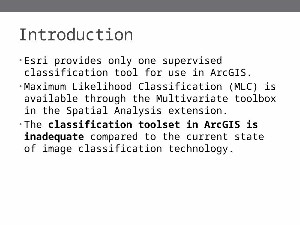
Introduction• Esri provides only one supervised classification tool for
use in ArcGIS.• Maximum Likelihood Classification (MLC) is available
through the Multivariate toolbox in the Spatial Analysis extension.
• The classification toolset in ArcGIS is inadequate compared to the current state of image classification technology.
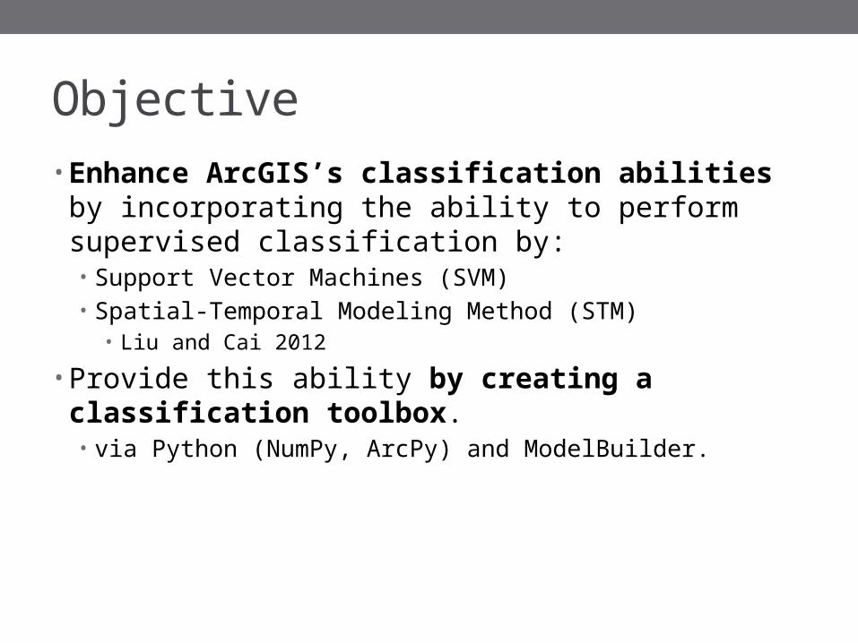
Objective• Enhance ArcGIS’s classification abilities by
incorporating the ability to perform supervised classification by:• Support Vector Machines (SVM) • Spatial-Temporal Modeling Method (STM)
• Liu and Cai 2012
• Provide this ability by creating a classification toolbox.• via Python (NumPy, ArcPy) and ModelBuilder.
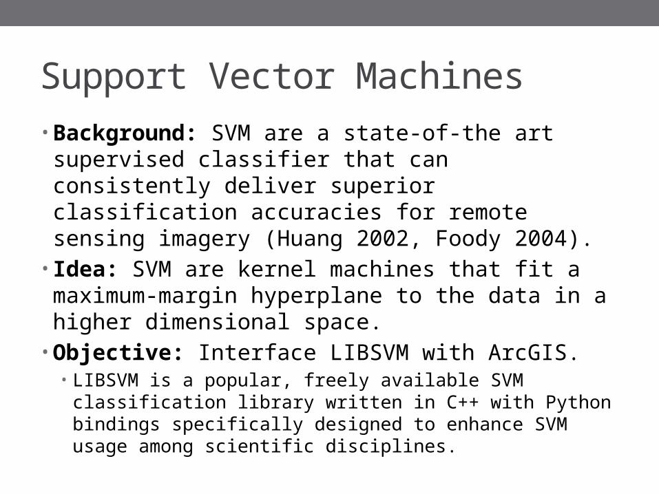
Support Vector Machines• Background: SVM are a state-of-the art supervised
classifier that can consistently deliver superior classification accuracies for remote sensing imagery (Huang 2002, Foody 2004).
• Idea: SVM are kernel machines that fit a maximum-margin hyperplane to the data in a higher dimensional space.
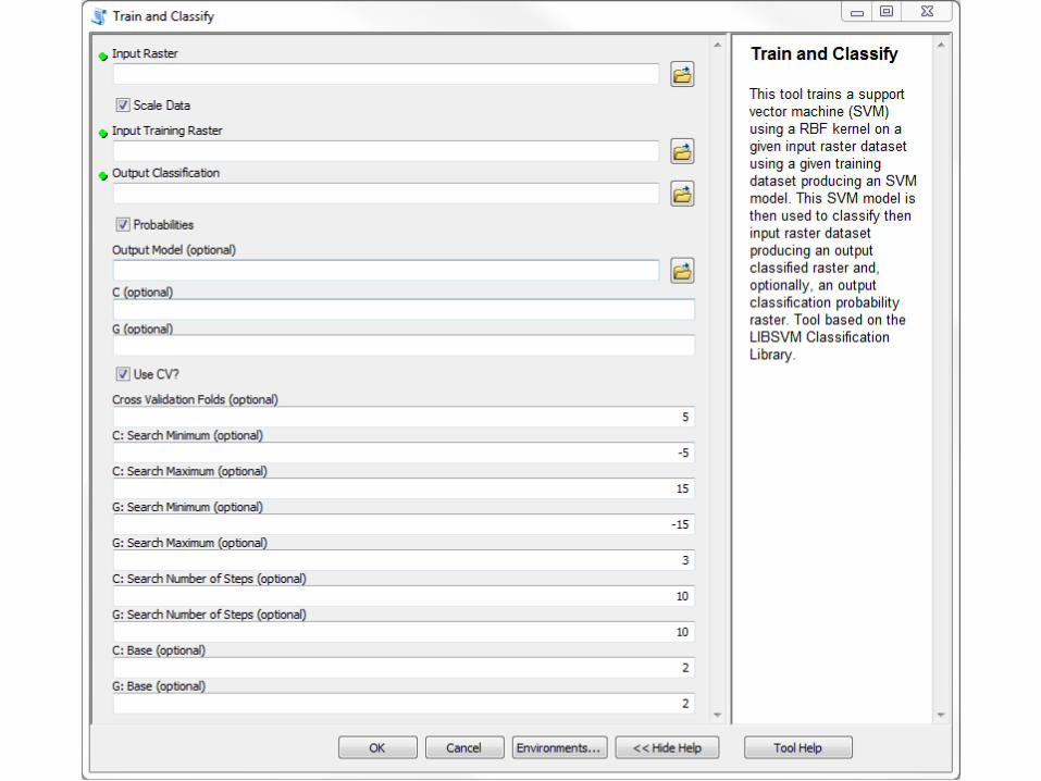
• Objective: Interface LIBSVM with ArcGIS.• LIBSVM is a popular, freely available SVM classification library
written in C++ with Python bindings specifically designed to enhance SVM usage among scientific disciplines.
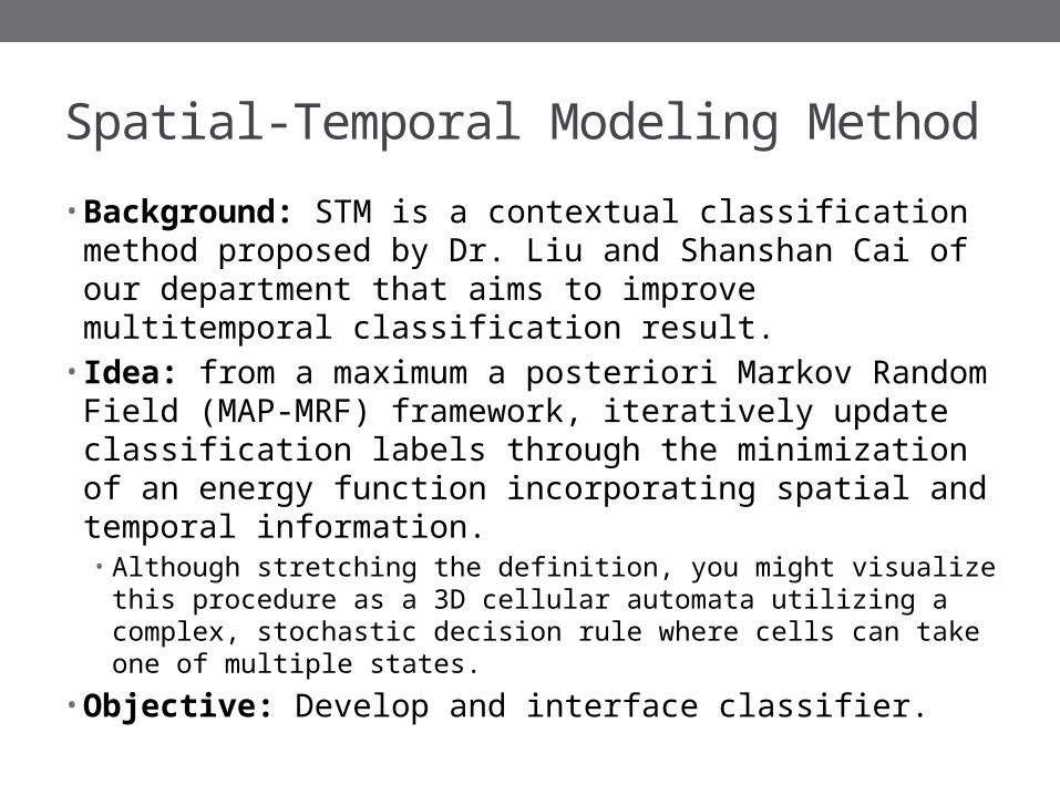
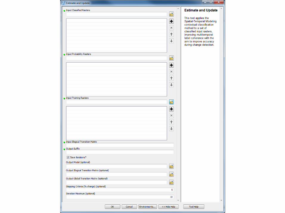
Spatial-Temporal Modeling Method• Background: STM is a contextual classification method
proposed by Dr. Liu and Shanshan Cai of our department that aims to improve multitemporal classification result.
• Idea: from a maximum a posteriori Markov Random Field (MAP-MRF) framework, iteratively update classification labels through the minimization of an energy function incorporating spatial and temporal information.• Although stretching the definition, you might visualize this
procedure as a 3D cellular automata utilizing a complex, stochastic decision rule where cells can take one of multiple states.
• Objective: Develop and interface classifier.

STM Energy Function
− 𝛽0 ln ( �̂� (𝑥𝑝∨𝐿𝑝 ))− 𝛽1 ∑
𝑁 𝑆 (𝑝 )
𝐼 (𝐿𝑝=𝐿𝑛 (𝑝 ) )
− 𝛽2 ∑𝑁𝑇
1(𝑝 )
𝑃 (𝐿𝑝∨𝐿𝑛 (𝑝 ) )+𝛽3 ∑𝑁 𝑇
1(𝑝 )
𝐼 (𝐿𝑛 (𝑝 )⇏𝐿𝑝 )
¿
spectral energy weight prior probability
spatial energy class label probability
past temporal energy pixelequality indicator function
future temporal energy neighborhood of a pixelexclusion indicator function
Assign a pixel p the label L that minimizes the energy U:
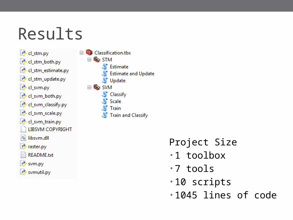
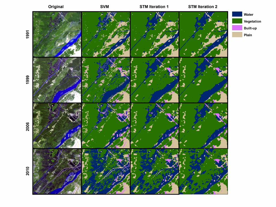
Results
Project Size• 1 toolbox• 7 tools• 10 scripts• 1045 lines of code
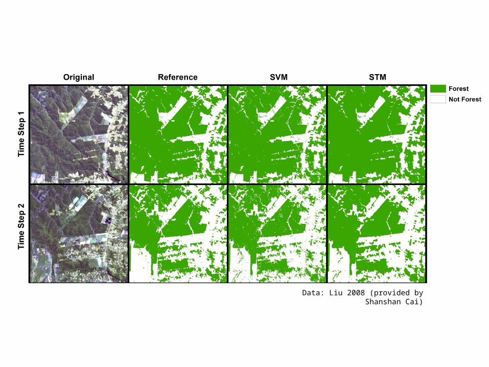
Data: Liu 2008 (provided by Shanshan Cai)
Future• More testing is needed prior to public release.
• Obtaining and producing better testing data will be part of this.
• Production of stand-alone scripts using GDAL to load data instead of ArcPy functions.
• Further documentation.
References Allen, D.W. 2011. Getting to Know ArcGIS ModelBuilder. ESRI Press. Chang, C-C. and C-J. Lin. 2011. LIBSVM: a library for support vector machines, ACM Transactions
on Intelligent Systems and Technology, 2(27), pp. 1-27. Software available at: http://www.csie.ntu.edu.tw/~cjlin/libsvm
Foody, G.M and A. Mathur. 2004. A relative evaluation of multiclass image classification by support vector machines. IEEE Transactions on Geoscience and Remote Sensing, 42(6), pp. 1335-1343.
Huang, C., L.S. Davis, and J.R.G. Townshend. 2002. An assessment of support vector machines for land cover classification. International Journal of Remote Sensing, 23(4), pp. 725-749.
Liu, D., M. Kelly, and P. Gong. 2006. A spatial-temporal approach to monitoring forest disease spread using multi-temporal high spatial resolution imagery. Remote Sensing of the Environment, 101, pp. 167-180.
Liu, D., K. Song, J.R.G. Townshend, and P. Gong. 2008. Using local transition probability models in Markov random fields for forest change detection. Remote Sensing of the Environment, 112, pp. 2222-2231.
Liu, D. and S. Cai. 2012. A spatial-temporal modeling approach to reconstructing land-cover change trajectories from multi-temporal satellite imagery, Annals of the Association of American Geographers, 102(6), pp. 1329-1347.
Melgani, F. and S.B. Serpico. 2003. A Markov random field approach to spatio-temporal contextual image classification. IEEE Transactions on Geoscience and Remote Sensing, 41(11), pp. 2478-2487.
Tso, B. and P.M. Mather. 2009. Classification Methods for Remotely Sensed Data. Boca Raton: CRC Press.


![[Arcgis] Riset ArcGIS JS & Flex](https://img.pdfslide.net/doc/110x75/55cf96d7550346d0338e2017/arcgis-riset-arcgis-js-flex.jpg)
