Embed Size (px)
Citation preview

An Introduction to Geospatial Analysis for Health Disparities Research
Justin Stoler, PhD, MPH, CPHDepartment of Geography
Department of Public Health SciencesAbess Center for Ecosystem Science & Policy
The Health Geographics Lab: miami.edu/healthgeo

Agenda
Introduction to Geospatial Analysis (me)
Audience Group Activity (you)
Group Discussion (we)
Geospatial Analysis for Public Health Research - 2

Motivation
The number of tools and data sources forgeographic analysis has been exploding.
Most disciplines have re-discovered spatialthinking and spatial analysis (the naturalsciences are furthest along).
Spatial analysis in public health has beenmainstream for a while.
Geospatial Analysis for Public Health Research - 3

Geospatial Analysis for Public Health Research - 4
(300+ pp Special Issue: Geographies of Health )
2012 Vol 102 No 5
UM Communities Using GIS
Civil Engineering
Ecosystem Science & Policy
RSMAS
Master of Public Administration
Sociology and Criminology
Biology’s Coastal Ecology Lab
Office of Civic and Community Engagement
Center for Computational Sciences…
Geospatial Analysis for Public Health Research - 5
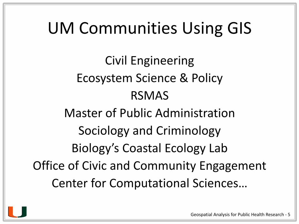
On Airs, Waters, and Places
Whoever wishes to investigate medicine properly, should proceed
thus: …consider the seasons of the year, and what effects each of
them produces… Then the winds, …such as are peculiar to each
locality. We must also consider the qualities of the waters, for as they
differ from one another in taste and weight… In the same manner,
when one comes into a city, he ought to consider its situation, how it
lies as to the winds and the rising of the sun… the waters which the
inhabitants use, whether they be marshy and soft, or hard and running
from elevated and rocky situations, and deficient in water, or wooded
and well watered, and whether it lies in a hollow, confined situation,
or is elevated and cold; and the mode in which the inhabitants live,
and what are their pursuits…
From these things he must proceed to investigate everything else.
-Hippocrates (c. 400 BC)
Geospatial Analysis for Public Health Research - 6

Geospatial Analysis for Public Health Research - 7
Geospatial Analysis for Public Health Research - 8
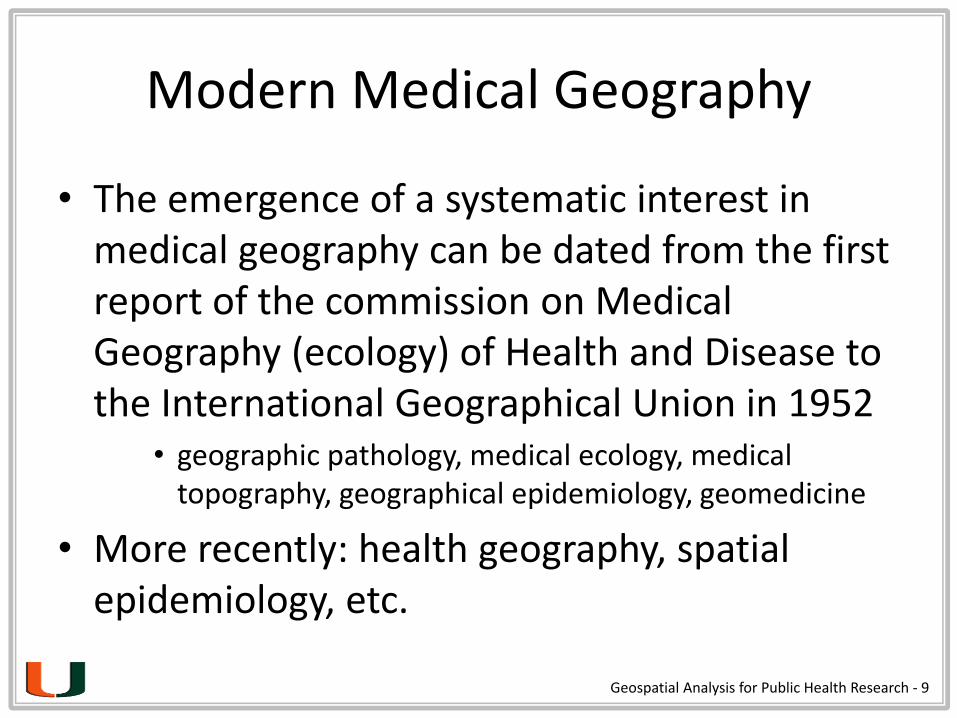
Modern Medical Geography
• The emergence of a systematic interest in medical geography can be dated from the first report of the commission on Medical Geography (ecology) of Health and Disease to the International Geographical Union in 1952
• geographic pathology, medical ecology, medical topography, geographical epidemiology, geomedicine
• More recently: health geography, spatial epidemiology, etc.
Geospatial Analysis for Public Health Research - 9
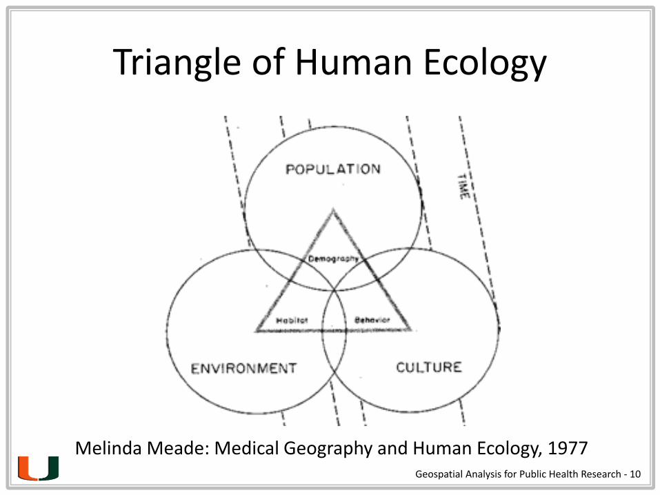
Triangle of Human Ecology
Melinda Meade: Medical Geography and Human Ecology, 1977 Geospatial Analysis for Public Health Research - 10
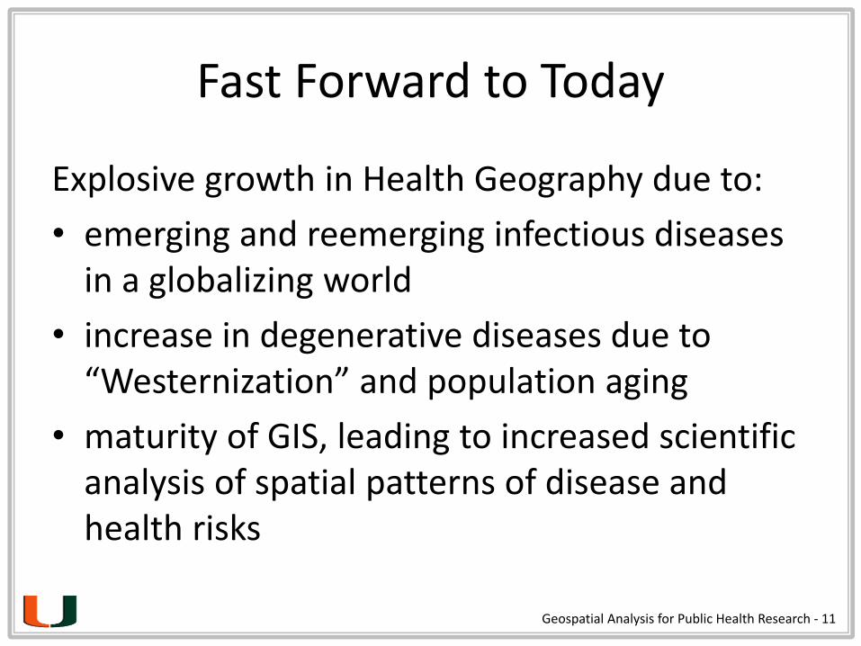
Fast Forward to Today
Explosive growth in Health Geography due to:
• emerging and reemerging infectious diseases in a globalizing world
• increase in degenerative diseases due to “Westernization” and population aging
• maturity of GIS, leading to increased scientific analysis of spatial patterns of disease and health risks
Geospatial Analysis for Public Health Research - 11

Epidemiology Defined
“The study of the determinants, distribution, and control of disease and other health factors.”
Geospatial Analysis for Public Health Research - 12

The Holy Grail: The Space-Time Cube
Geospatial Analysis for Public Health Research - 13
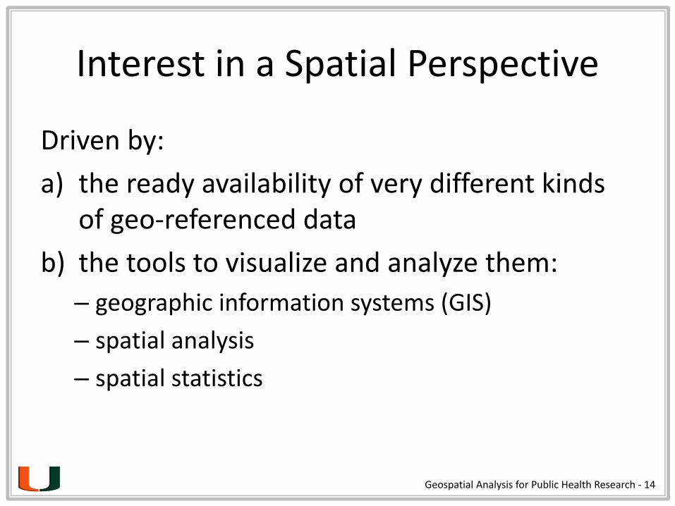
Interest in a Spatial Perspective
Driven by:
a) the ready availability of very different kinds of geo-referenced data
b) the tools to visualize and analyze them:
– geographic information systems (GIS)
– spatial analysis
– spatial statistics
Geospatial Analysis for Public Health Research - 14

Geographic Information Science
Geospatial Analysis for Public Health Research - 15
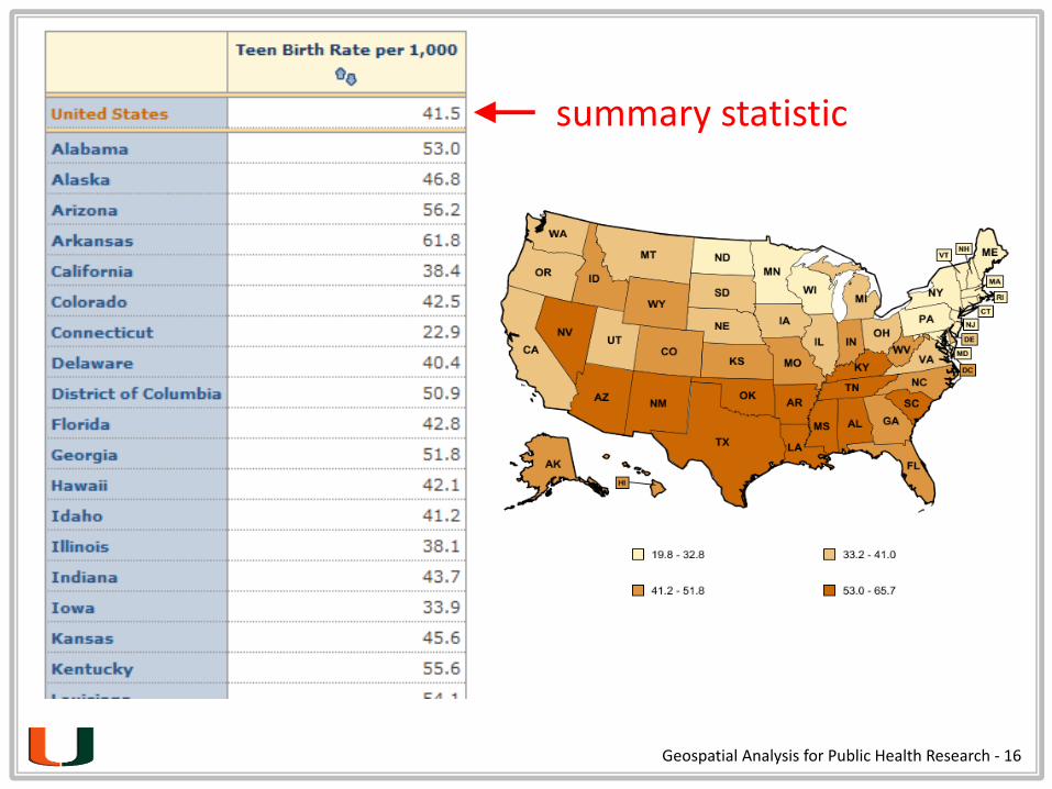
Geospatial Analysis for Public Health Research - 16
summary statistic
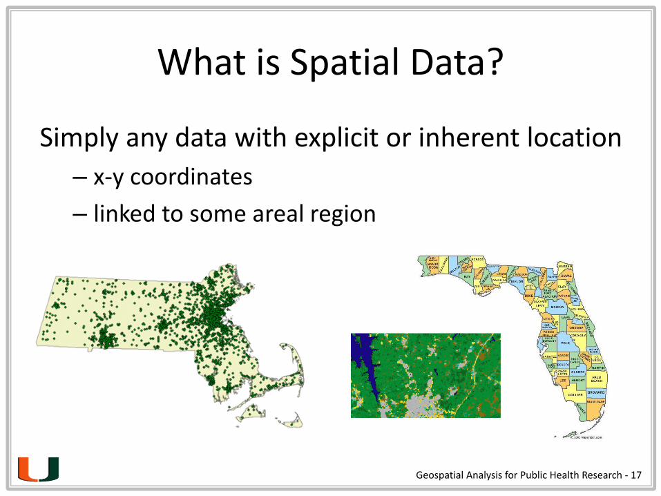
What is Spatial Data?
Simply any data with explicit or inherent location
– x-y coordinates
– linked to some areal region
Geospatial Analysis for Public Health Research - 17

What is Spatial Data?
Geographic (spatial) data have unique features
– location = ID variable
– absolute and relative location
– scale/aggregation
– spatial embeddedness (networks, hierarchies)
– spatial autocorrelation
Ignoring these unique features limits analytical potential and can also introduce problems.
Geospatial Analysis for Public Health Research - 18

Why Spatial Data?
The ability to analyze, over space and time:
locations
quantities
densities
changes
connections
what’s inside
what’s nearbyGeospatial Analysis for Public Health Research - 19

Two methods of representing geographic data in digital format:
Vector (features): • point: to record location in a 2-dimensional space • lines: between two points (directions and length)• polygons: closed vectors (area, centroids, and perimeter)
Raster (surfaces): • use a fixed grid and record information about each
element on the grid (satellite images, aerial photos, etc.)
Representations of Geographic Data
Geospatial Analysis for Public Health Research - 20

Geospatial Analysis for Public Health Research - 21

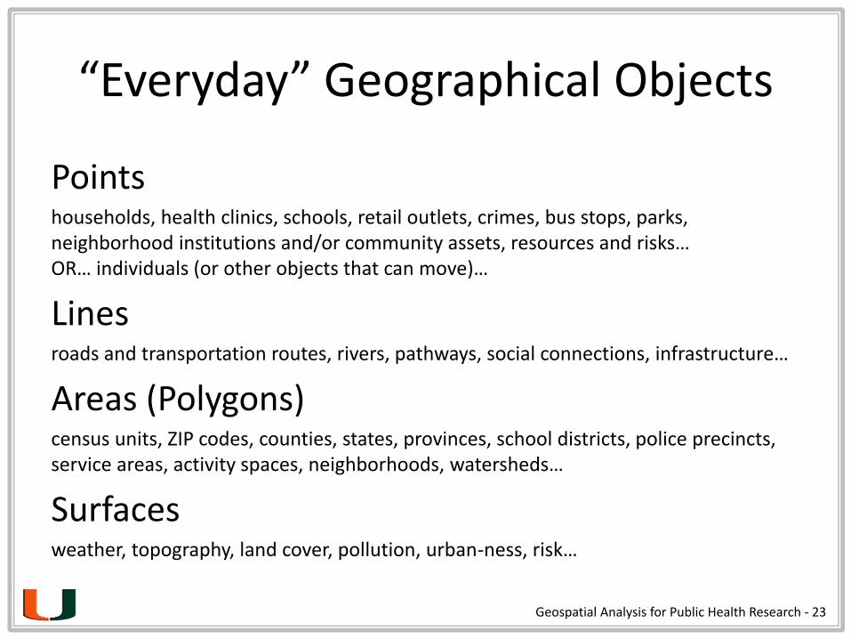
“Everyday” Geographical Objects
Pointshouseholds, health clinics, schools, retail outlets, crimes, bus stops, parks, neighborhood institutions and/or community assets, resources and risks…OR… individuals (or other objects that can move)…
Linesroads and transportation routes, rivers, pathways, social connections, infrastructure…
Areas (Polygons)census units, ZIP codes, counties, states, provinces, school districts, police precincts, service areas, activity spaces, neighborhoods, watersheds…
Surfacesweather, topography, land cover, pollution, urban-ness, risk…
Geospatial Analysis for Public Health Research - 23

“Everyday” Spatial Data Producers
Users have become producers, not just consumers, of spatial data
– Volunteered Geographic Information (VGI)
• “Old”: Flickr, Foursquare, Google Maps, Historypin, etc.
• “New”: mobile apps, wearable technologies
– Crowdsourcing (online posts, SMS, tweets…)
– Participatory GIS (PGIS)
• “empowering the public and communities with GIS”
Geospatial Analysis for Public Health Research - 24

Classic GIS Applications
Businesses — site location for a new store
Urban planners — map traffic capacity and congestion
Demographers — population growth and decline
Police/firefighters — shortest route to incident
Epidemiologists — spread of disease
Biologists — invasive species or wildlife corridors
Geospatial Analysis for Public Health Research - 25
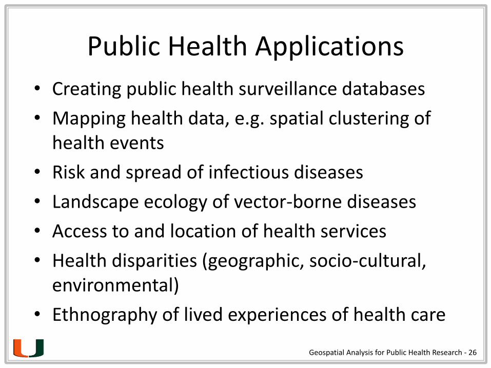
Public Health Applications
• Creating public health surveillance databases
• Mapping health data, e.g. spatial clustering of health events
• Risk and spread of infectious diseases
• Landscape ecology of vector-borne diseases
• Access to and location of health services
• Health disparities (geographic, socio-cultural, environmental)
• Ethnography of lived experiences of health care
Geospatial Analysis for Public Health Research - 26

Disease rates

Emergency services

Service Accessibility
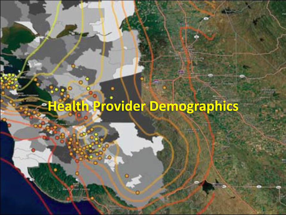
Health Provider Demographics
3
1


Beyond the Map… Spatial Statistics
Why spatial statistics?
• Assumption of normality in the central limit theorum: “independent and identically distributed”
Geospatial Analysis for Public Health Research - 33

Spatial Autocorrelation
The extent to which similar values are near each other; a core principle of spatial analysis.
Geospatial Analysis for Public Health Research - 34
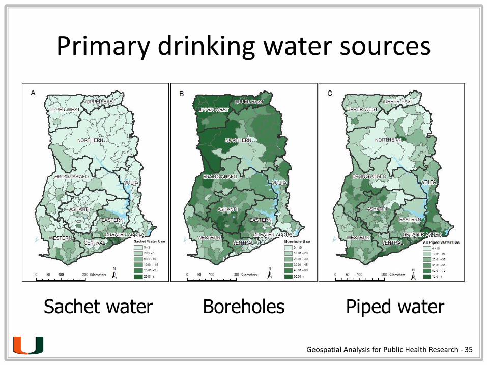
Primary drinking water sources
• x
Sachet water Boreholes Piped water
Geospatial Analysis for Public Health Research - 35

Local cluster analysis (LISA)
• x
Sachet water Boreholes Piped water
Geospatial Analysis for Public Health Research - 36

OLS Model
Characteristic β (se) t-score R2
Sachet water 0.601
Constant 0.093 (0.03) 2.994**
Trash collection service access (%) 0.350 (0.05) 6.704***
Reside where born (%) -0.100 (0.05) -2.200*
Internet access (%) 0.357 (0.11) 3.245**
Distance from Accra (km) -0.0001 (0.00) -2.636**
Predictors of sachet use
* P < .05; ** P < .01; *** P < .001
Geospatial Analysis for Public Health Research - 37
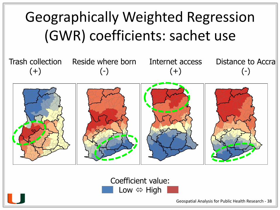
Geographically Weighted Regression (GWR) coefficients: sachet use
Trash collection(+)
Reside where born(-)
Internet access(+)
Distance to Accra(-)
Coefficient value: Low High
Geospatial Analysis for Public Health Research - 38

Geospatial Analysis for Public Health Research - 39
It’s All About Health Disparities

Geospatial Analysis for Public Health Research - 40
Example: IPV services & race in MDC
Geospatial Analysis for Public Health Research - 41
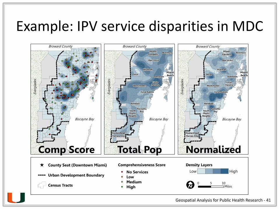
Example: IPV service disparities in MDC
Geospatial Analysis for Public Health Research - 42
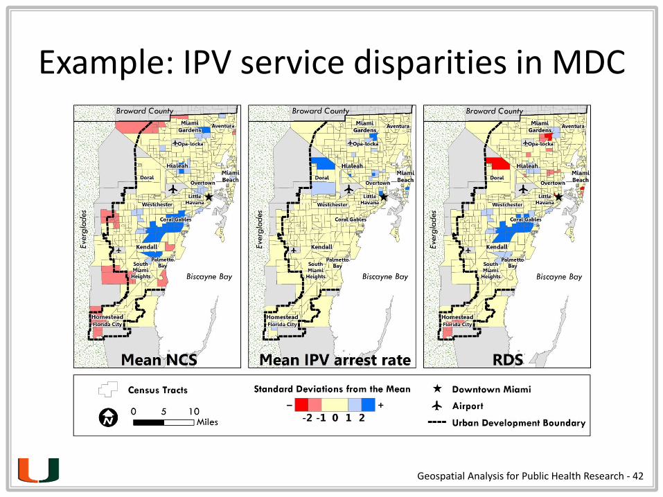
Example: IPV service disparities in MDC
Geospatial Analysis for Public Health Research - 43
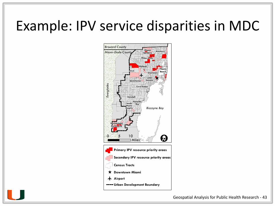
Example: IPV service disparities in MDC
Geospatial Analysis for Public Health Research - 44
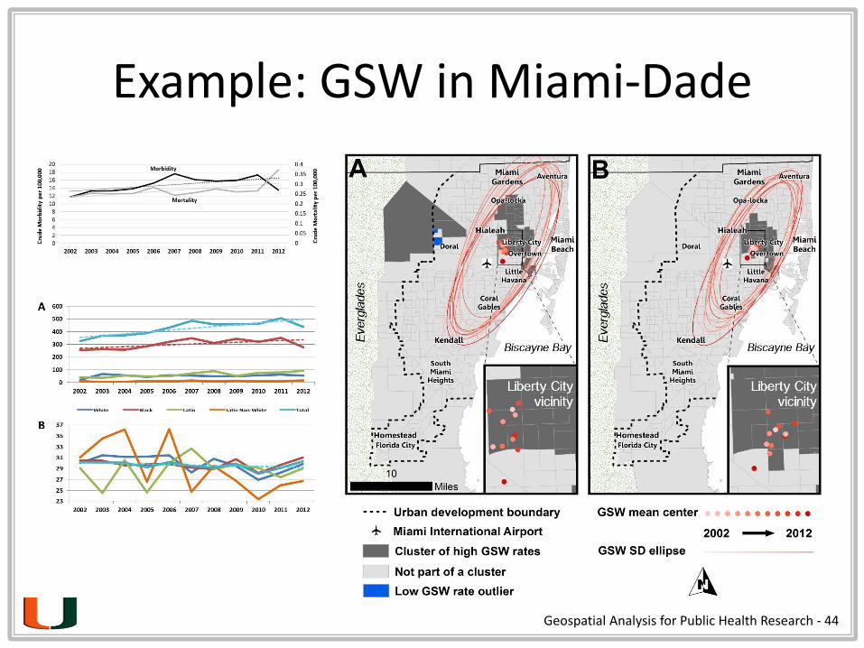
Example: GSW in Miami-Dade
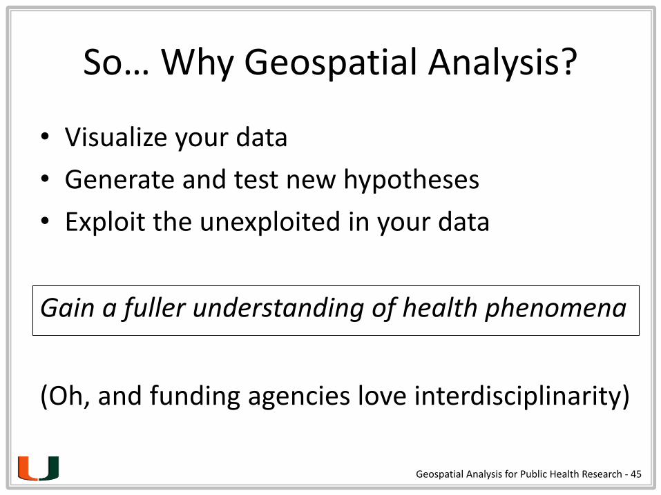
So… Why Geospatial Analysis?
• Visualize your data
• Generate and test new hypotheses
• Exploit the unexploited in your data
Geospatial Analysis for Public Health Research - 45
Gain a fuller understanding of health phenomena
(Oh, and funding agencies love interdisciplinarity)
Audience Group Activity
Geospatial Analysis for Public Health Research - 46

Why Spatial Data?
The ability to analyze, over space and time:
locations
quantities
densities
changes
connections
what’s inside
what’s nearbyGeospatial Analysis for Public Health Research - 47
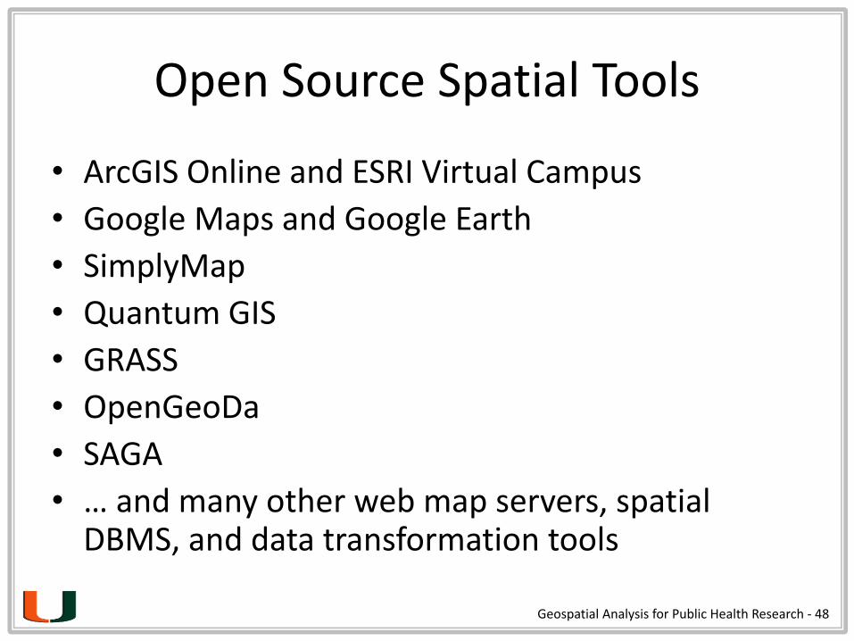
Open Source Spatial Tools
• ArcGIS Online and ESRI Virtual Campus
• Google Maps and Google Earth
• SimplyMap
• Quantum GIS
• GRASS
• OpenGeoDa
• SAGA
• … and many other web map servers, spatial DBMS, and data transformation tools
Geospatial Analysis for Public Health Research - 48
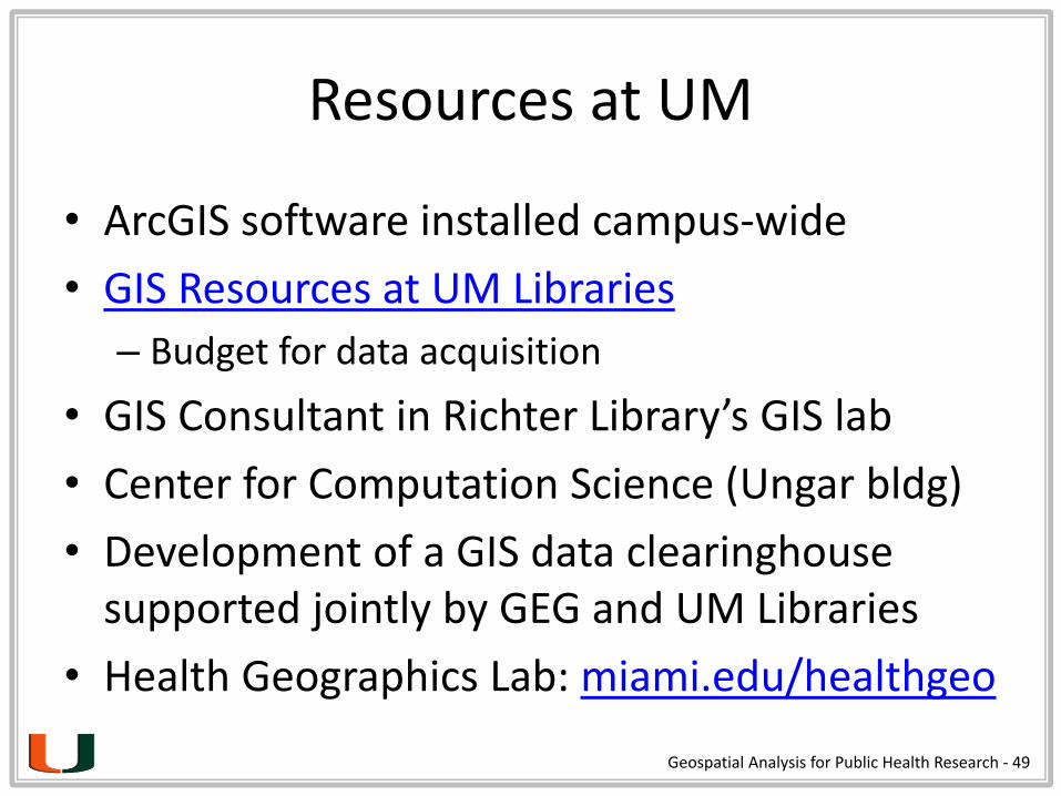
Resources at UM
• ArcGIS software installed campus-wide
• GIS Resources at UM Libraries
– Budget for data acquisition
• GIS Consultant in Richter Library’s GIS lab
• Center for Computation Science (Ungar bldg)
• Development of a GIS data clearinghouse supported jointly by GEG and UM Libraries
• Health Geographics Lab: miami.edu/healthgeo
Geospatial Analysis for Public Health Research - 49
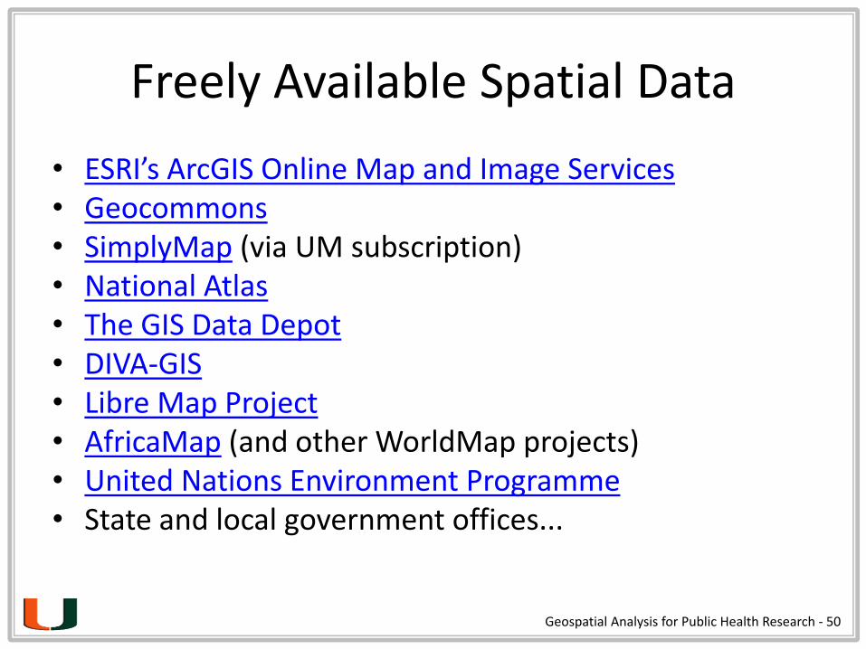
Freely Available Spatial Data
• ESRI’s ArcGIS Online Map and Image Services• Geocommons• SimplyMap (via UM subscription)• National Atlas• The GIS Data Depot• DIVA-GIS• Libre Map Project• AfricaMap (and other WorldMap projects)• United Nations Environment Programme• State and local government offices...
Geospatial Analysis for Public Health Research - 50
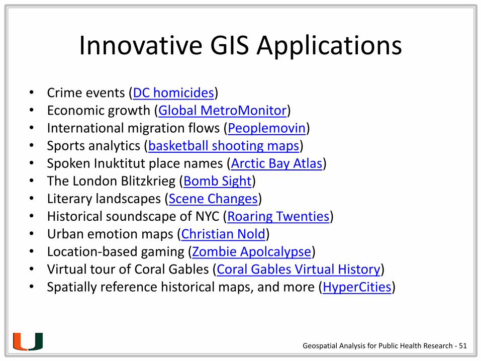
Innovative GIS Applications
• Crime events (DC homicides)• Economic growth (Global MetroMonitor)• International migration flows (Peoplemovin)• Sports analytics (basketball shooting maps)• Spoken Inuktitut place names (Arctic Bay Atlas)• The London Blitzkrieg (Bomb Sight)• Literary landscapes (Scene Changes)• Historical soundscape of NYC (Roaring Twenties)• Urban emotion maps (Christian Nold)• Location-based gaming (Zombie Apolcalypse)• Virtual tour of Coral Gables (Coral Gables Virtual History)• Spatially reference historical maps, and more (HyperCities)
Geospatial Analysis for Public Health Research - 51

The Health Geographics Lab:miami.edu/healthgeo
Minor in Social Science & MedicineMinor in Medical Humanities