Embed Size (px)
Citation preview
Second Edition, May 2004 1
Road Project Environmental Processes Manual
App
endi
x A
APPENDIX AEnvironmental
Websites

2 Second Edition, May 2004
Road Project Environmental Processes Manual
App
endi
x A
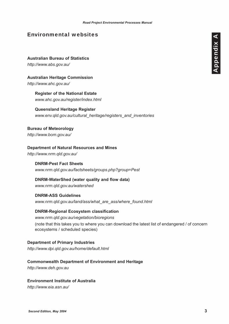
Environmental websites
Australian Bureau of Statisticshttp://www.abs.gov.au/
Australian Heritage Commissionhttp://www.ahc.gov.au/
Register of the National Estatewww.ahc.gov.au/register/index.html
Queensland Heritage Registerwww.env.qld.gov.au/cultural_heritage/registers_and_inventories
Bureau of Meteorologyhttp://www.bom.gov.au/
Department of Natural Resources and Mineshttp://www.nrm.qld.gov.au/
DNRM-Pest Fact Sheetswww.nrm.qld.gov.au/factsheets/groups.php?group=Pest
DNRM-WaterShed (water quality and flow data)www.nrm.qld.gov.au/watershed
DNRM-ASS Guidelineswww.nrm.qld.gov.au/land/ass/what_are_ass/where_found.html
DNRM-Regional Ecosystem classificationwww.nrm.qld.gov.au/vegetation/bioregions(note that this takes you to where you can download the latest list of endangered / of concernecosystems / scheduled species)
Department of Primary Industrieshttp://www.dpi.qld.gov.au/home/default.html
Commonwealth Department of Environment and Heritagehttp://www.deh.gov.au
Environment Institute of Australiahttp://www.eia.asn.au/
Second Edition, May 2004 3
Road Project Environmental Processes Manual
App
endi
x A

4 Second Edition, May 2004
Environmental Protection Agencyhttp://www.epa.qld.gov.au/
Greening Australiahttp://www.greeningaustralia.org.au/
Murray Darling Basin Commissionhttp://www.mdbc.gov.au/
Wet Tropics Management Authorityhttp://www.wettropics.gov.au/
Road Project Environmental Processes Manual
App
endi
x A
Second Edition, May 2004 1
Road Project Environmental Processes Manual
App
endi
x B
APPENDIX BRoad Project
EnvironmentalRisk Proforma

2 Second Edition, May 2004
Road Project Environmental Processes Manual
App
endi
x B
Second Edition, May 2004 3
Road Project Environmental Processes Manual
App
endi
x B
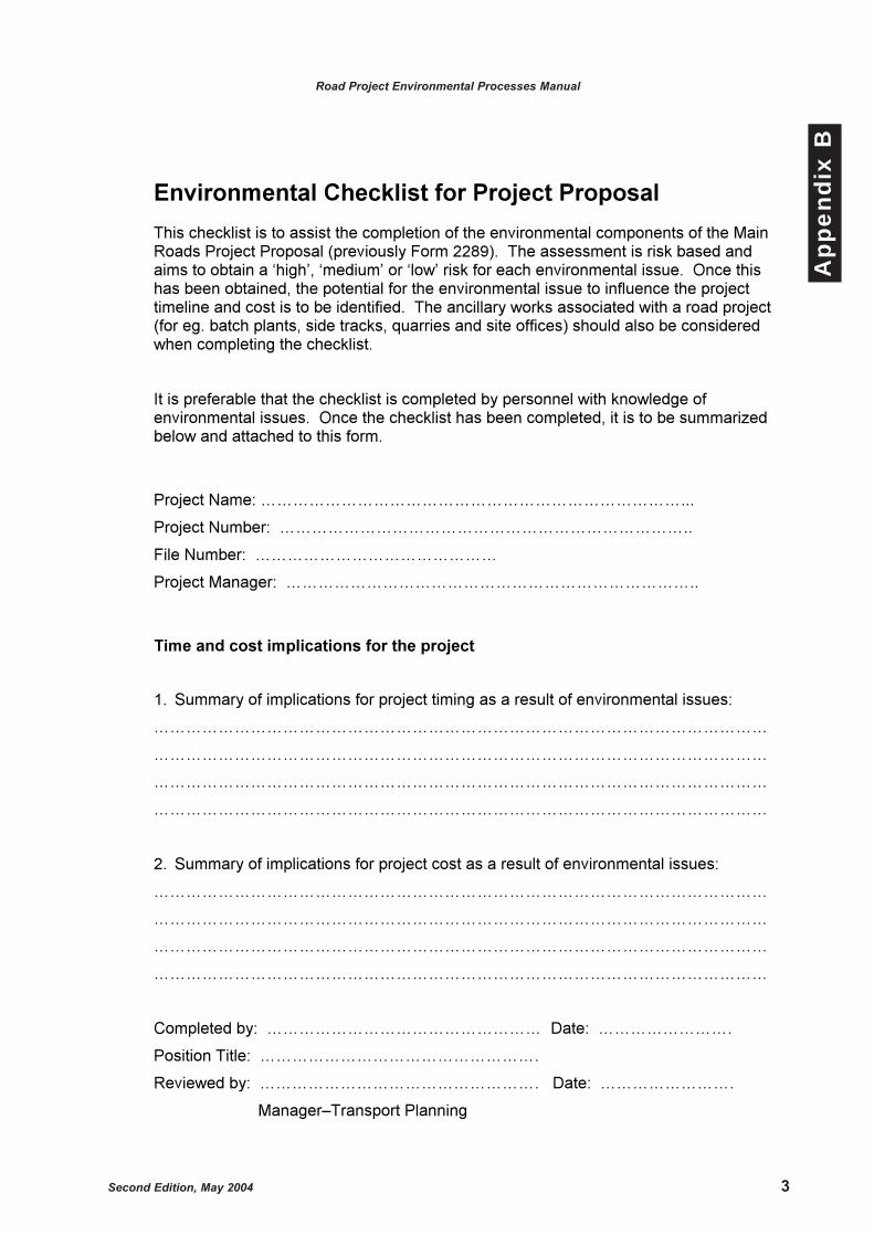
Environmental Checklist for Project Proposal
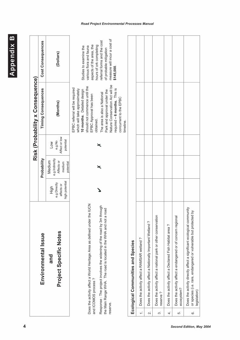
This checklist is to assist the completion of the environmental components of the Main Roads Project Proposal (previously Form 2289). The assessment is risk based and aims to obtain a ‘high’, ‘medium’ or ‘low’ risk for each environmental issue. Once this has been obtained, the potential for the environmental issue to influence the project timeline and cost is to be identified. The ancillary works associated with a road project (for eg. batch plants, side tracks, quarries and site offices) should also be consideredwhen completing the checklist.
It is preferable that the checklist is completed by personnel with knowledge of environmental issues. Once the checklist has been completed, it is to be summarized below and attached to this form.
Project Name: ……………………………………………………………………...
Project Number: …………………………………………………………………..
File Number: ………………………………………
Project Manager: …………………………………………………………………..
Time and cost implications for the project
1. Summary of implications for project timing as a result of environmental issues:
……………………………………………………………………………………………………
……………………………………………………………………………………………………
……………………………………………………………………………………………………
……………………………………………………………………………………………………
2. Summary of implications for project cost as a result of environmental issues:
……………………………………………………………………………………………………
……………………………………………………………………………………………………
……………………………………………………………………………………………………
……………………………………………………………………………………………………
Completed by: …………………………………………… Date: …………………….
Position Title: …………………………………………….
Reviewed by: ……………………………………………. Date: …………………….
Manager–Transport Planning
4 Second Edition, May 2004
Road Project Environmental Processes Manual
App
endi
x B
Ris
k (P
roba
bilit
y x
Con
sequ
ence
) Pr
obab
ility
Ti
min
g C
onse
quen
ces
Cos
t Con
sequ
ence
s En
viro
nmen
tal I
ssue
an
d Pr
ojec
t Spe
cific
Not
es
Hig
h e.
g D
irect
ly
affe
cts
or
high
pot
entia
l
Med
ium
e.
g.In
dire
ctly
A
ffect
s or
m
ediu
m
pote
ntia
l
Low
e.
g.N
o A
ffect
or l
ow
pote
ntia
l
(Mon
ths)
(D
olla
rs)
Doe
s th
e ac
tivity
affe
ct a
Wor
ld H
erita
ge A
rea
as d
efin
ed u
nder
the
IUC
N
and
ICO
MO
S p
roce
ss ?
Res
pons
e : T
he p
roje
ct in
volv
es th
e w
iden
ing
of th
e ro
ad b
y 3m
thro
ugh
the
Mai
n R
ange
WH
A.
The
road
is lo
cate
d in
the
WH
A a
nd n
ot a
road
re
serv
e.
EP
BC
refe
rral
will
be
requ
ired
whi
ch w
ill ta
ke a
ppro
xim
atel
y 10
mon
ths.
Det
aile
d de
sign
sh
ould
not
com
men
ce u
ntil
the
EP
BC
App
rova
l has
bee
n ob
tain
ed.
The
area
is a
lso
a N
atio
nal
Par
k an
d ap
prov
al u
nder
the
Nat
ure
Con
serv
atio
n Ac
t will
be
requ
ired
– 6
mon
ths.
Thi
s is
co
ncur
rent
to th
e E
PB
C
timel
ine.
Stu
dies
to e
xam
ine
the
vario
us fl
ora
and
faun
a as
pect
s of
the
area
, the
ho
urs
of o
rk c
ompl
etin
g re
ferr
al fo
rms
and
the
cost
of
pro
babl
e m
itiga
tion
mea
sure
will
incu
r a c
ost o
f $1
45,0
00.
Ecol
ogic
al C
omm
uniti
es a
nd S
peci
es
1.
Doe
s th
e ac
tivity
affe
ct a
RA
MS
AR
wet
land
?
2.
Doe
s th
e ac
tivity
affe
ct a
Nat
iona
lly Im
porta
nt W
etla
nd ?
3.
Doe
s th
e ac
tivity
affe
ct a
nat
iona
l par
k or
oth
er c
onse
rvat
ion
rese
rve
?
4.
Doe
s th
e ac
tivity
affe
ct a
Dec
lare
d Fi
sh H
abita
t are
a ?
5.
Doe
s th
e ac
tivity
affe
ct a
end
ange
red
or o
f con
cern
regi
onal
ec
osys
tem
?
6.
Doe
s th
e ac
tivity
dire
ctly
affe
ct a
sig
nific
ant e
colo
gica
l com
mun
ity
or s
peci
es (i
.e. r
are,
end
ange
red
or v
ulne
rabl
e bu
t pro
tect
ed b
y le
gisl
atio
n)

Second Edition, May 2004 5
Road Project Environmental Processes Manual
App
endi
x B
7.
Does t
he a
ctivity a
ffect
sig
nific
ant
habitat
ele
ments
( e
.g.
corr
idor,
tree h
ollo
ws)?
Cu
ltu
ral
He
rita
ge
(S
ha
red
or
Na
tura
l)
8.
Does t
he a
ctivity a
ffect
a W
orld H
erita
ge A
rea a
s d
efined u
nder
the
IUC
N a
nd I
CO
MO
S p
rocess?
9.
Does t
he a
ctivity a
ffect
a s
ite o
n t
he N
ational H
erita
ge L
ist?
10.
Does t
he a
ctivity a
ffect
a s
ite o
n t
he C
om
mon
we
alth H
eri
tage L
ist
(EP
BC
)?
11.
Does t
he a
ctivity a
ffect
a s
ite o
n t
he R
egis
ter
of
the N
ational
Esta
te?
12.
Does t
he a
ctivity a
ffect
a s
ite o
f th
e N
ational T
rust
Regis
ter
?
13.
Does t
he a
ctivity a
ffect
a s
ite o
f th
e Q
ueensla
nd H
erita
ge ?
14.
Does t
he a
ctivity a
ffect
a h
erita
ge s
ite lis
ted u
nder
a local
govern
ment
pla
nn
ing s
chem
e ?
15.
Does t
he a
ctivity a
ffect
a s
ignific
ant
herita
ge s
ite n
ot
pro
tecte
d b
y
legis
lation b
ut
of
import
ance t
o t
he c
om
munity (
inclu
din
g s
ites
within
the r
oad r
eserv
e (
e.g
. bridges,
sto
ne p
itchin
g a
nd s
o o
n)
La
nd
Ma
na
ge
me
nt
16.
Does t
he a
ctivity d
istu
rb s
odic
soils
?
17.
Does t
he a
ctivity d
istu
rb a
cid
sulp
hate
so
ils ?
18.
Does t
he a
ctivity d
istu
rb a
cid
soils
?
19.
Does t
he a
ctivity d
istu
rb s
alin
e s
oils
( p
rim
ary
or
second
ary
) ?
20.
Does t
he a
ctivity h
ave t
he p
ote
ntia
l to
spre
ad e
xis
tin
g d
ecla
red
pla
nt
pop
ula
tio
ns o
r in
trod
uce
ne
w d
ecla
red p
lant
pop
ula
tio
ns ?
21.
Does t
he a
ctivity h
ave t
he p
ote
ntia
l to
spre
ad e
xis
tin
g d
ecla
red
insect
or
dis
ease p
op
ula
tions o
r in
troduce n
ew
decla
red insect
or

6 Second Edition, May 2004
Road Project Environmental Processes Manual
App
endi
x B
dis
ease p
opula
tions? (
e.g
. fire
ants
, S
MU
T,
and s
o o
n)
22.
Does t
he a
ctivity h
ave t
he p
ote
ntia
l to
spre
ad e
xis
tin
g
envir
onm
enta
l w
ee
d
pop
ula
tions o
r in
tro
duce n
ew
enviro
nm
enta
l
we
ed p
opula
tio
ns ?
23.
Does t
he a
ctivity c
ha
nge d
rain
ag
e c
onfigura
tions o
n s
oil
conserv
ation p
lans u
nder
the S
oil
Conserv
ation A
ct
?
24.
Does t
he a
ctivity a
ffect
floodin
g ?
25.
Does t
he a
ctivity a
ffect
land w
hic
h h
as n
ot
had n
ative t
itle
exting
uis
hed
?
26.
Does t
he a
ctivity r
equire a
quarr
y o
r oth
er
ancill
ary
activitie
s t
hat
may t
rigger
IDA
S r
equir
em
ents
or
oth
er
perm
itting ?
Wa
ter
Ma
na
ge
me
nt
27.
Does t
he a
ctivity a
ffect
natu
ralw
ate
rwa
yor
wate
r body
28.
Does t
he a
ctivity a
ffect
(inclu
din
g d
eposit s
edim
ent
or
use a
ll
availa
ble
wate
r) a
art
ific
ial w
ate
r bod
y (
e.g
.da
m,
irrigatio
n c
hann
el)
29.
Does t
he a
ctivity a
ffect
gro
und
wate
r flo
ws ?
30.
Does t
he a
ctivity r
eq
uire r
ecycle
d w
ate
r ?
Am
en
ity
31.
Does t
he a
ctivity d
istu
rb e
xis
ting c
onta
min
ate
d s
ites (
regis
tere
d a
nd
unre
gis
tere
d)
?
32.
Does t
he a
ctivity involv
e p
rocesses t
hat
may c
reate
conta
min
ate
d
sites ?
33.
Does t
he a
ctivity t
rigg
er
the R
oad T
raffic
Nois
e M
ana
gem
ent
Code
of
Pra
ctice ?
34.
Does t
he a
ctivity s
ignific
antly
change (
perm
anently o
r te
mpora
rily
)
the v
ibra
tion a
nd a
ir q
ualit
ye
nviro
nm
ent, e
specia
lly in r
ela
tion t
o
sensitiv
e r
ecep
tors
?
Second Edition, May 2004 1
Road Project Environmental Processes Manual
App
endi
x C
APPENDIX CTerms of Reference
Determination and ExampleTerms of Reference

2 Second Edition, May 2004
Road Project Environmental Processes Manual
App
endi
x C
Second Edition, May 2004 3
Road Project Environmental Processes Manual
App
endi
x C
Terms of Reference Determination and Example Terms of Reference
This appendix is designed to help identify the appropriate level of assessment for each
environmental issue for the Environmental Approval Report. A terms of reference (TOR) for
‘low level assessment’ (L), ‘moderate level assessment’ (M) and ‘high level assessment’ (H) has
been developed for each environmental issue and are provided in Appendix C2. By considering
each issue individually, the Environmental Approval Report terms of reference can be
specifically tailored to the project.
When answering the questions, the existing environmental values and the extent of works
should be considered. For example, if substantial excavations below the 5 m topographic
contour are proposed, the potential for issues associated with acid sulfate soils would be high.
Therefore, for such a project, a selection of ‘High level assessment’ for the terms of reference
module for Soils/Topography would be appropriate.
Where you are unsure as to the potential impacts for a particular issue and are unable to decide
between two levels of assessment, the higher level of assessment should be chosen.
Example
The following example illustrates the method to be used in determining the appropriate TOR
module. Only one question is to be answered; however, a number of issues should be
considered. This example focuses on determining the TOR module for water quality.
Project description: A proposed realignment and replacement of a bridge over Currumbin Creek,
including upgrade of the approaches to the bridge. The proposed works will require significant
earthworks upstream and downstream of the existing bridge. Earthworks are expected to be of
4–5 months duration. Limited earthworks will be required on the banks of the creek.
Existing environment: The creek is a substantial waterway with incised banks and is likely to
have flow or standing water under most conditions. Within the area of the existing bridge most
trees have been removed, but there is a thick cover of grasses. Upstream and downstream of
the existing bridge alignment, riparian vegetation including mature trees appears to be intact.
For a considerable distance downstream, the creek is similar, running through rural areas where
there have been periodic disturbances to riparian zones.
To determine the appropriate TOR module for water quality, answer the following question.
To what extent is water quality an issue for the project?
In order to answer this question, you should think about the following issues:
�� The current condition of the watercourse including riparian vegetation, water quality, bed and banks: Riparian vegetation is intact, water quality is likely to be okay but probably high
nutrient levels, and the bed and banks are relatively undisturbed. The creek is not
considered to be highly sensitive.
�� The possible impact on downstream environments: Impacts could include increased turbidity
and sedimentation due to earthworks. Possible impacts from any spillages during
construction.
�� The possible impact on groundwater resources: Unlikely to be any major impact on
groundwater resources.
�� The magnitude, extent and duration of works within or adjacent to the waterway: Significant
earthworks will be required and will be of approximately 4–5 months duration. Some works
will be required on the creek banks.
4 Second Edition, May 2004
Road Project Environmental Processes Manual
App
endi
x C
�� Sensitivity of surrounding waterbodies and receiving environments: While the creek is in a
relatively good condition, it is not considered to be in a pristine state, and rural and urban
activities within the catchment influence the water quality. There are no highly sensitive
environments downstream of the proposed bridge.
To determine the TOR module required, all of the above issues need to be considered. The
creek is in good condition, but is not considered highly sensitive. However, earthworks will be
required on the creek banks, and so some disturbance of riparian vegetation will occur. There
is also the potential for water quality impacts from any spillages that may occur during
construction. Receiving environments are not considered to be sensitive.
Considering all of the above issues, a moderate (M) level assessment TOR would seem
appropriate for water quality issues for this project.
Second Edition, May 2004 5
Road Project Environmental Processes Manual
App
endi
x C
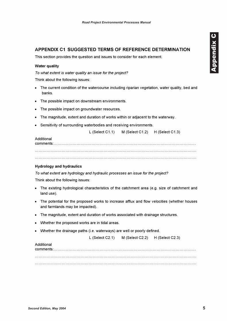
APPENDIX C1 SUGGESTED TERMS OF REFERENCE DETERMINATION
This section provides the question and issues to consider for each element.
Water quality
To what extent is water quality an issue for the project?
Think about the following issues:
�� The current condition of the watercourse including riparian vegetation, water quality, bed and
banks.
�� The possible impact on downstream environments.
�� The possible impact on groundwater resources.
�� The magnitude, extent and duration of works within or adjacent to the waterway.
�� Sensitivity of surrounding waterbodies and receiving environments.
L (Select C1.1) M (Select C1.2) H (Select C1.3)
Additional
comments:………………………………………………………………………………………………….
……………………………………………………………………………………………………………….
……………………………………………………………………………………………………………….
Hydrology and hydraulics
To what extent are hydrology and hydraulic processes an issue for the project?
Think about the following issues:
�� The existing hydrological characteristics of the catchment area (e.g. size of catchment and
land use).
�� The potential for the proposed works to increase afflux and flow velocities (whether houses
and farmlands may be impacted).
�� The magnitude, extent and duration of works associated with drainage structures.
�� Whether the proposed works are in tidal areas.
�� Whether the drainage paths (i.e. waterways) are well or poorly defined.
L (Select C2.1) M (Select C2.2) H (Select C2.3)
Additional
comments:………………………………………………………………………………………………….
……………………………………………………………………………………………………………….
……………………………………………………………………………………………………………….
6 Second Edition, May 2004
Road Project Environmental Processes Manual
App
endi
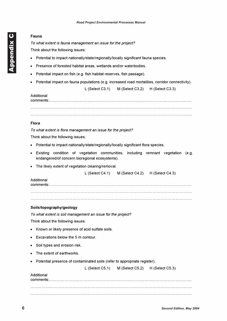
x C Fauna
To what extent is fauna management an issue for the project?
Think about the following issues:
�� Potential to impact nationally/state/regionally/locally significant fauna species.
�� Presence of forested habitat areas, wetlands and/or waterbodies.
�� Potential impact on fish (e.g. fish habitat reserves, fish passage).
�� Potential impact on fauna populations (e.g. increased road mortalities, corridor connectivity).
L (Select C3.1) M (Select C3.2) H (Select C3.3)
Additional
comments:………………………………………………………………………………………………….
……………………………………………………………………………………………………………….
……………………………………………………………………………………………………………….
Flora
To what extent is flora management an issue for the project?
Think about the following issues:
�� Potential to impact nationally/state/regionally/locally significant flora species.
�� Existing condition of vegetation communities, including remnant vegetation (e.g.
endangered/of concern bioregional ecosystems).
�� The likely extent of vegetation clearing/removal.
L (Select C4.1) M (Select C4.2) H (Select C4.3)
Additional
comments:………………………………………………………………………………………………….
……………………………………………………………………………………………………………….
……………………………………………………………………………………………………………….
Soils/topography/geology
To what extent is soil management an issue for the project?
Think about the following issues:
�� Known or likely presence of acid sulfate soils.
�� Excavations below the 5 m contour.
�� Soil types and erosion risk.
�� The extent of earthworks.
�� Potential presence of contaminated soils (refer to appropriate register).
L (Select C5.1) M (Select C5.2) H (Select C5.3)
Additional
comments:………………………………………………………………………………………………….
……………………………………………………………………………………………………………….
……………………………………………………………………………………………………………….
Second Edition, May 2004 7
Road Project Environmental Processes Manual
App
endi
x C
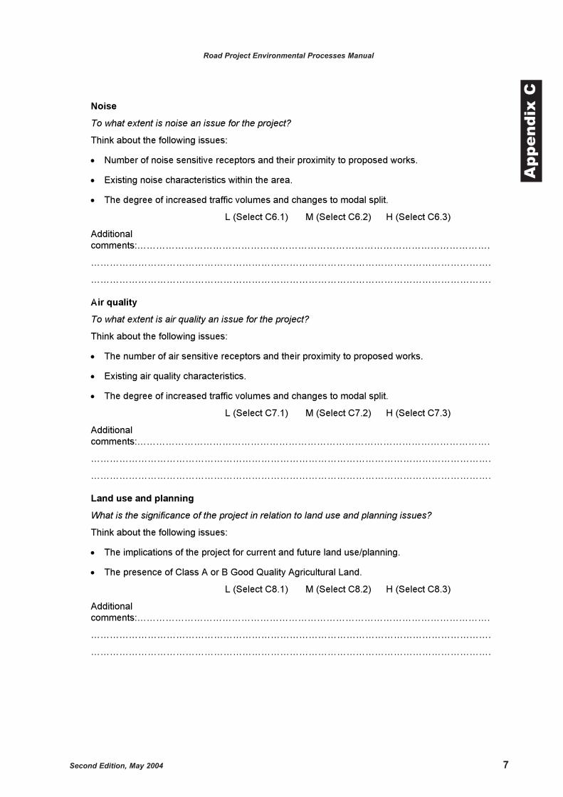
Noise
To what extent is noise an issue for the project?
Think about the following issues:
�� Number of noise sensitive receptors and their proximity to proposed works.
�� Existing noise characteristics within the area.
�� The degree of increased traffic volumes and changes to modal split.
L (Select C6.1) M (Select C6.2) H (Select C6.3)
Additional
comments:………………………………………………………………………………………………….
……………………………………………………………………………………………………………….
……………………………………………………………………………………………………………….
Air quality
To what extent is air quality an issue for the project?
Think about the following issues:
�� The number of air sensitive receptors and their proximity to proposed works.
�� Existing air quality characteristics.
�� The degree of increased traffic volumes and changes to modal split.
L (Select C7.1) M (Select C7.2) H (Select C7.3)
Additional
comments:………………………………………………………………………………………………….
……………………………………………………………………………………………………………….
……………………………………………………………………………………………………………….
Land use and planning
What is the significance of the project in relation to land use and planning issues?
Think about the following issues:
�� The implications of the project for current and future land use/planning.
�� The presence of Class A or B Good Quality Agricultural Land.
L (Select C8.1) M (Select C8.2) H (Select C8.3)
Additional
comments:………………………………………………………………………………………………….
……………………………………………………………………………………………………………….
……………………………………………………………………………………………………………….
8 Second Edition, May 2004
Road Project Environmental Processes Manual
App
endi
x C
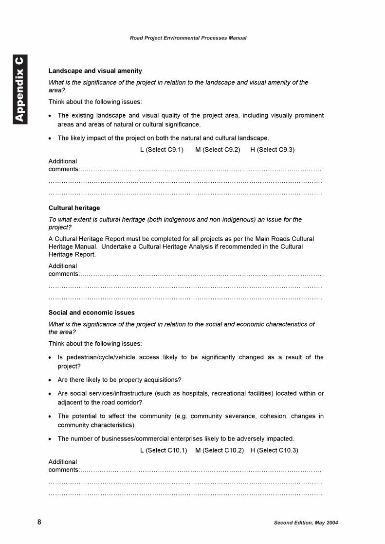
Landscape and visual amenity
What is the significance of the project in relation to the landscape and visual amenity of the area?
Think about the following issues:
�� The existing landscape and visual quality of the project area, including visually prominent
areas and areas of natural or cultural significance.
�� The likely impact of the project on both the natural and cultural landscape.
L (Select C9.1) M (Select C9.2) H (Select C9.3)
Additional
comments:………………………………………………………………………………………………….
……………………………………………………………………………………………………………….
……………………………………………………………………………………………………………….
Cultural heritage
To what extent is cultural heritage (both indigenous and non-indigenous) an issue for the project?
A Cultural Heritage Report must be completed for all projects as per the Main Roads Cultural
Heritage Manual. Undertake a Cultural Heritage Analysis if recommended in the Cultural
Heritage Report.
Additional
comments:………………………………………………………………………………………………….
……………………………………………………………………………………………………………….
……………………………………………………………………………………………………………….
Social and economic issues
What is the significance of the project in relation to the social and economic characteristics of the area?
Think about the following issues:
�� Is pedestrian/cycle/vehicle access likely to be significantly changed as a result of the
project?
�� Are there likely to be property acquisitions?
�� Are social services/infrastructure (such as hospitals, recreational facilities) located within or
adjacent to the road corridor?
�� The potential to affect the community (e.g. community severance, cohesion, changes in
community characteristics).
�� The number of businesses/commercial enterprises likely to be adversely impacted.
L (Select C10.1) M (Select C10.2) H (Select C10.3)
Additional
comments:………………………………………………………………………………………………….
……………………………………………………………………………………………………………….
……………………………………………………………………………………………………………….
Second Edition, May 2004 9
Road Project Environmental Processes Manual
App
endi
x C
Climate
To what extent are local climatic conditions likely to be an issue for the project?
Select C12.1
Additional
comments:………………………………………………………………………………………………….
……………………………………………………………………………………………………………….
……………………………………………………………………………………………………………….
Waste Management
What is the significance of the project in relation to waste management?
Select C13.1
Additional
comments:………………………………………………………………………………………..
……………………………………………………………………………………………………………….
.
……………………………………………………………………………………………………………….
.
Legislative requirements
What permits/licences/approvals are required for the project?
Select C14.1
Additional
comments:………………………………………………………………………………………………….
……………………………………………………………………………………………………………….
……………………………………………………………………………………………………………….
________________________________ ________________________ _______________
Name Signature Date
10 Second Edition, May 2004
Road Project Environmental Processes Manual
App
endi
x C APPENDIX C2 EXAMPLE TERMS OF REFERENCE
WATER QUALITY
Objective
To identify existing water quality within the catchment and to determine any significant impact of
the proposed project on water quality of the study area.
C1.1 Low level assessment
The following issues and activities should be addressed.
Key issues/activities
��Research and review existing data sources to collate and document any water quality data
if available.
��Identify and describe any waterways (natural or artificial) or groundwater within the
proposed project area.
��Identify any catchment management plans and/or catchment management groups within
the proposed project area.
��Identify and assess the impact of the proposed project on water quality, including the
potential for pollution of surface and groundwater.
��Consider the requirements of the Environmental Protection (Water) Policy 1997.
��Examine and discuss measures to mitigate the potential impacts of the proposed works.
Minimum outputs
��Maps/aerial photographs showing location of rivers, creeks or other waterways within and
adjacent to area of proposed works.
��Discussion of the current condition of waterways and groundwater and potential impacts of
the proposed works.
��Summary for inclusion in the Environmental Approval Report.
C1.2 Moderate level assessment
The following issues/activities and minimum outputs should be addressed in addition to the low
level assessment.
Key issues/activities
��Identify users of water resources (including recreational and industry purposes) within the
proposed project area.
��Conduct a surface water quality assessment according to ANZECC (1992) guidelines and
the EPA (1999) Water Quality Sampling Manual including:
– existing surface water quality
– types of pollution affecting surface waters
– their effects and probable sources.
��Conduct a groundwater quality assessment including:
– existing groundwater quality
– types of pollution affecting ground waters
Second Edition, May 2004 11
Road Project Environmental Processes Manual
App
endi
x C
– their effects and probable sources.
��Identify any sensitive environments, especially wetlands of national significance.
��Identify any developments or land degradation in the study area or the immediate
catchment that may affect water quality.
��Assess the requirements of the pre-construction, construction and post-construction water
quality monitoring programs (if deemed necessary).
��Liaise with other statutory authorities (eg DNR and EPA)
Minimum outputs
��As per low level assessment outputs
��Discussion of potential impacts on water quality during construction and operation of
proposed works.
��Pre-construction, construction and post-construction water quality monitoring programs.
��Recommended management measures to mitigate potential impacts.
C1.3 High level assessment
The following issues/activities and minimum outputs should be addressed in addition to the low
and moderate level assessment.
Key issues/activities
��Identify catchment boundaries within and adjacent to the proposed project area.
��Identify any catchment management issues including catchment management plans and
any potential impacts of the proposed project on water quality within the catchments.
��Examine and discuss environmental issues related to the source of/amount of water taken
for construction purposes.
Minimum outputs
��As per moderate level assessment outputs.
��Identify catchment boundaries on maps/aerial photographs.
��Nominate proposed water quality criteria to be achieved during construction and operational
phases.
12 Second Edition, May 2004
Road Project Environmental Processes Manual
App
endi
x C
HYDROLOGY/HYDRAULICS
Objective
To identify existing hydrology and to determine any significant impact of the proposed project on
the hydrology/hydraulics of the study area.
C2.1 Low level assessment
The following issues and activities should be addressed.
Key issues/activities
��Review/research all existing data on the hydrological characteristics of the catchment.
��Describe the existing hydrological characteristics within the proposed project area including
catchment area, waterways and peak flood flows.
��Identify natural and artificial hydrological features of the catchment.
��Identify potential impacts of the proposed project on peak flood flows and velocities,
particularly in the vicinity of any waterway crossings.
��Recommend management measures to mitigate potential impacts.
��Identify the requirement for any further detailed hydrological investigations.
Minimum outputs
��Describe hydrological characteristics within and adjacent to the area of works.
��Discuss any potential impacts on hydrology/hydraulics within and adjacent to the area of
proposed works.
��Map of the hydrological features of the catchment.
��Summary for inclusion in Environmental Approval Report.
C2.2 Moderate level assessment
The following issues/activities and minimum outputs should be addressed in addition to the low
level assessment.
Key issues/activities
��Identify if the catchment has (or is in the process of developing) a catchment management
plan, water area management plan or other similar management plan. Describe the
requirements of these plans in relation to the proposed project.
��Identify if the catchment is subject to a declared catchment plan, declared irrigation area or
declared groundwater area and the effect of the proposed project on these declarations or
vice versa.
��Identify if any Floodplain Management Guidelines or Management Plans apply to the study
area and if so document the requirements in relation to the proposed project.
��Identify if the catchment flows into a significant environmental area and any flow
requirements in relation to this area.
Minimum outputs
��As per low level assessment outputs.
��Recommended mitigation measures.
Second Edition, May 2004 13
Road Project Environmental Processes Manual
App
endi
x C
C2.3 High Level assessment
The following issues/activities and minimum outputs should be addressed in addition to the low
and moderate level assessment.
Key issues/activities
��Identify if the study area has an Approved Property Plan under the Soil Conservation Act 1986 and describe the implications.
��Identify if the study area has Land and Water Management Plan under the Water Act 2000and describe the implications.
��Review the hydrological modelling reports and identify and map flooding data and issues.
Minimum outputs
��As per moderate assessment level outputs.
��Define catchment and sub-catchment boundaries and show on an appropriate drawing or
map.
��Provide a list of any buildings or other structures that are likely to be impacted as a result of
the proposed works.
��Provide recommended measures to be incorporated into road design.
��Summary of Hydrology report in Environmental Approval Report, to include:
– description of current conditions and flooding characteristics
– methodology employed and information sources e.g.. model used
– predicted flooding impacts including peak heights and velocities for 50 and 100 year
ARI
– recommended mitigation measures to be incorporated into design.
14 Second Edition, May 2004
Road Project Environmental Processes Manual
App
endi
x C FAUNA
Objective
To identify the existing faunal environment and to determine any significant impact of the
proposed project on the fauna of the study area.
C3.1 Low level assessment
The following issues and activities should be addressed.
Key issues/activities
��Research and review relevant reports and databases on terrestrial and aquatic fauna
species and populations in the study area, including but not limited to:
– databases that identify scheduled (those listed on Schedules 1 to 4 of the Nature
Conservation (Wildlife) Regulation 1994) and common species e.g. Queensland
Museum, Wildnet, Commonwealth Department of Environment and Heritage, Birds
Australia;
��Identify and map on an aerial photograph the location of scheduled species including those
listed under the following acts:
– Schedules 1, 2, 3 & 4 of the Nature Conservation (Wildlife) Regulation 1994
– International treaties such as JAMBA and CAMBA
– Environment Protection and Biodiversity Conservation Act 1999
��Review aerial photographs and vegetation maps to identify fauna corridors or other habitat
features such as roosting sites, tree hollows etc.
��Identify and assess potential impacts of the proposed activity on fauna.
��Recommend management measures to mitigate potential impacts.
��Review the RCEA database and if it reveals the area of proposed works as having a
General Environmental value of ‘low’ no inspection of the proposed site by a qualified
ecologist is required.
Minimum outputs
��List of scheduled and common species identified within and directly adjacent to the area of
proposed works.
��Map the location of scheduled species.
��Recommended mitigation measures.
��Summary for inclusion in Environmental Approval Report.
C3.2 Moderate level assessment
The following issues/activities and minimum outputs should be addressed in addition to the low
level assessment.
Key issues/activities
��Undertake a site inspection by a qualified ecologist to identify ecological communities and
their potential to support significant fauna species.
��Identify whether any vegetated corridors occur within the area of proposed works and
establish which fauna species are most likely to utilise the corridor.
Second Edition, May 2004 15
Road Project Environmental Processes Manual
App
endi
x C��Assess any impact of the proposed activity on fauna species, populations and communities,
with particular emphasis on scheduled species and those protected under International
treaties and the Environment Protection & Biodiversity Conservation Act 1999.
Minimum outputs
��As per low level assessment outputs.
��Description of current fauna characteristics and fauna habitat value.
��Describe the habitat requirements of significant fauna species (includes International,
National, State protected and locally significant species) and impacts on these habitats.
��Discussion of potential impacts on fauna and fauna movement.
C3.3 High level assessment
The following issues/activities and minimum outputs should be addressed in addition to the low
and moderate level assessment.
Key issues/activities
��Undertake field surveys by a qualified ecologist to identify the presence and extent of
species, populations and communities within and in the vicinity of the proposed corridor
including:
– Interpretation of remote sensing data and/or aerial photography.
– Collection of anecdotal information (including local sightings, specialist interest groups,
indirect evidence of species existence).
– Collection of field survey data on fauna by identification of scratch marks, scats,
footprints, nests, pitfall traps, Elliott traps, spotlighting, anabat detection and other
specialised techniques. Four night/five day assessments may be required but this
needs to be confirmed with the District Environmental Officer.
– Identification of any scheduled species, populations or communities or their habitats in
accordance with the Nature Conservation (Wildlife) Regulation 1994 and Environment Protection & Biodiversity Conservation Act 1999.
– Presence of any declared Fish Habitat Reserves.
– Compare to identified and relevant earlier studies.
��Prepare maps, photographs and a description of the distribution of significant species,
populations and communities and their habitats (with separate and specific reference to
those as listed under Schedules of the Nature Conservation (Wildlife) Regulation 1994,
JAMBA/CAMBA and Environment Protection & Biodiversity Conservation Act 1999):
��Assess the impacts of the proposed project on all fauna species (including aquatic species,
insects, soils etc), populations and communities in particular where:
– habitat is critical to life cycle events of species;
– locally or regionally significant species and populations occur or are likely to occur in the
study area, especially those at the limit of their known distribution;
– dispersal routes/wildlife corridors significant locally or regionally are affected or potentially
affected by the proposed project;
– barriers to interbreeding opportunities between populations will result from the proposed
project.
��Propose ameliorative measures to reduce the extent of the proposed project on all species
and/or communities in accordance with a hierarchy of ‘avoid, minimise, ameliorate’:
16 Second Edition, May 2004
Road Project Environmental Processes Manual
App
endi
x C
– Identify any measures which would avoid impacts (e.g. route options, alignment options,
design details).
– Identify measures to minimise impacts that cannot be avoided and assess the likely
effectiveness of those measures. Include waterway measures to facilitate the passage
of fish, in accordance with relevant guidelines.
– Provide recommendations for design and location of proposed measures to minimise
impacts.
– Provide details of any monitoring required to assess the success of measures to minimise
impacts.
– Describe opportunities for improvement of habitat adjacent to existing roads in the study
area.
– If necessary, consider the possibility and cost effectiveness of providing compensatory
habitat, particularly when avoidance or minimisation of impacts is not practical.
Minimum outputs
��As per moderate level assessment outputs.
��Description of methodology used for field investigations including timing, rainfall &
temperature prior to and during surveys.
��A comprehensive report detailing the findings of field investigations, including appropriately
scaled figures that show the location of sightings of significant species and the location and
extent of preferred habitat for significant species.
��Description of existing fauna habitat value.
��Recommended management measures to mitigate potential impacts. Include
maps/diagrams to show location, extent and configuration of proposed management
measures.
Second Edition, May 2004 17
Road Project Environmental Processes Manual
App
endi
x CFLORA
Objective
To identify the existing floral environment and to determine any significant impact of the
proposed project on the flora of the study area.
C4.1 Low level assessment
The following issues and activities should be addressed for all levels of assessment.
Key issues/activities
��Research and review relevant reports and databases on terrestrial and aquatic flora
species, populations and ecological communities in the study area, including but not limited
to:
– maps of ecological communities e.g. Regional Ecosystems, Catchment Management
Plans, Fish Habitat Areas etc;
– databases that identify scheduled and common species, populations and ecological
communities e.g. Herbrecs, Commonwealth Department of Environment and Heritage,
PestInfo.
��Review aerial photographs to identify the presence of any vegetation communities within
and directly adjacent to the road corridor and particularly those communities that could
support any of the significant flora species identified from the database search.
��Review regional ecosystem mapping to identify whether any ‘endangered’ or ‘of concern’
communities occur within the area of proposed works.
��Assess any impact of the proposed activity on vegetation communities.
��Recommend management measures to mitigate potential impacts on ‘endangered’ and ‘of
concern’ vegetation communities as described in the Vegetation Management Act 1999.
Minimum outputs
��Map the location of vegetation communities on an aerial photograph and discuss these
communities in relation to Regional Ecosystems.
��List of scheduled species likely to occur within and directly adjacent to the area of proposed
works as per the database search and discussion as to the likely presence of these species
based on the vegetation communities present.
��Recommended mitigation measures.
��Summary for inclusion in Environmental Approval Report.
C4.2 Moderate level assessment
The following issues/activities and minimum outputs should be addressed in addition to the low
level assessment.
Key issues/activities
��Undertake a site inspection by a qualified botanist to identify vegetation communities within
and directly adjacent to the road corridor and assess their current condition and
significance.
��Research existing information on identified scheduled species and ensure that the study
addresses all relevant legislative requirements.
��Assess any impact of the proposed activity on flora species, populations and vegetation
communities, with particular emphasis on any scheduled species.
18 Second Edition, May 2004
Road Project Environmental Processes Manual
App
endi
x C ��Assess any impact of the proposed activity on flora species, populations and vegetation
communities, with particular emphasis on any scheduled species.
��Identify the levels of disturbance and list declared plant species found within and adjacent to
the proposed site.
Minimum outputs
��As per low level assessment outputs.
��Identification of any remnant vegetation within and directly adjacent to the area of proposed
works.
��List of the dominant species for each vegetation community including weed/introduced
species.
��Provide a description of vegetation communities present including:
– extent
– condition
– significance within the local area
– regional ecosystem classification.
��Summary of the potential impact on vegetation communities within and adjacent to the area
of proposed works.
��Provide a list of plant species recommended for revegetation and landscaping.
C4.3 High level assessment
The following issues/activities and minimum outputs should be addressed in addition to the low
and moderate level assessment.
Key issues/activities
��Undertake field surveys by a qualified botanist to identify the presence and extent of
species, populations and vegetation communities within and adjacent to the proposed
corridor including:
– Interpretation of remote sensing data and/or aerial photography;
– Collection of anecdotal information;
– Plant species list for each vegetation associations by representative sampling;
– Identification of any significant species, populations or vegetation communities in
accordance with the Nature Conservation (Wildlife) Regulations 1994 and Environment Protection & Biodiversity Conservation Act 1999;
��Prepare maps, photographs and a description of the distribution of significant species,
populations and vegetation communities (with separate and specific reference to those as
listed under Schedules of the Nature Conservation (Wildlife) Regulations 1994 and
Environment Protection & Biodiversity Conservation Act 1999):
– Identify and classify vegetation types as per regional ecosystem classifications
– Describe the existing condition of each of vegetation communities, especially in relation
to the degree of disturbance (weed invasion, clearing, grazing etc.).
��Assess the impacts of the proposed project on all flora species (including aquatic
vegetation), populations and vegetation communities:
– Identify if any critical habitat in terms of the Nature Conservation (Wildlife) Regulations
1994 and Environment Protection & Biodiversity Conservation Act 1999 will be affected.
Second Edition, May 2004 19
Road Project Environmental Processes Manual
App
endi
x C
��Propose ameliorative measures to reduce the extent of the proposed project on all species
and/or communities in accordance with a hierarchy of ‘avoid, minimise, ameliorate’:
– Identify any measures which would avoid impacts (e.g. route options, alignment options,
design details).
– Identify measures to minimise impacts that cannot be avoided and assess the likely
effectiveness of those measures.
– Provide recommendations for design and location of proposed measures to minimise
impacts.
– Provide details of any monitoring required to assess the success of measures to minimise
impacts.
– Describe opportunities for improvement of habitat adjacent to existing roads in the study
area.
– If necessary, consider the possibility and cost effectiveness of providing compensatory
areas of habitat, particularly when avoidance or minimisation of impacts is not a
practicable or cost effective option.
Minimum outputs
��As per moderate level assessment outputs.
��Comprehensive species list for each vegetation community identified, including
weed/introduced species.
��Maps/aerial photographs showing the following:
– Location of vegetation communities
– Location of any significant species identified
– Boundary of survey area.
��Description of methodology used to undertake flora assessment, including number of days
in field, survey techniques and identification techniques.
��Recommended management measures for each ‘endangered’ and ‘of concern’ vegetation
community as described in the Vegetation Management Act 1999, to mitigate potential
impacts. Include maps/aerial photographs to show location and extent of proposed
management measures.
20 Second Edition, May 2004
Road Project Environmental Processes Manual
App
endi
x C SOILS/TOPOGRAPHY/GEOMORPHOLOGY
Objective
To identify existing soil/topography/geomorphology characteristics of the study area and to
determine any significant impact of the proposed project on these characteristics.
C5.1 Low level assessment
The following issues and activities should be addressed.
Key issues/activities
Soils:
��Undertake a desktop review to identify, describe and map the soils within the study area.
��Assess erosion potential and recommend soil erosion mitigation measures where required.
��Identify any land within the study area that is listed on the Contaminated Sites Register.
��Identify any land within the study area that is likely to contain potential acid sulfate soils.
Topography:
��Undertake a desktop review to identify and describe the topography within the study area,
including any significant topographical features.
��Identify any potential impacts of the proposed project on the topography of the study area
and recommend mitigation measures (where necessary).
Geomorphology:
��Undertake a desktop review to identify, describe and map the geological units of the study
area.
��Identify any existing or proposed quarries/borrow pits within the road reserve.
��Identify any geomorphological constraints to the project and recommend mitigation
measures (where necessary).
Minimum outputs
��Map the location of soil types, geological units and topographical features within the study
area.
��Description of soil types, geology and topography within the study area, including the soil
classification system used (eg Northcote, Australian Soil Classification System or Great Soil
Groups).
��Discuss erosion risk of each identified soil type.
��Recommend mitigation measures for construction and operational phases.
C5.2 Moderate level assessment
The following issues/activities and minimum outputs should be addressed in addition to the low
level assessment.
Key issues/activities
Soils:
��Identify and map any problem soil types, and existing locations, types and causes of
erosion within the study area.
��Identify and discuss the depth and type of land disturbance associated with the proposed
project.
Second Edition, May 2004 21
Road Project Environmental Processes Manual
App
endi
x C��Assess erosion potential including potential for erodibility and dispersibility of all identified
soil types, and detail soil erosion mitigation measures.
��In areas of acid sulfate soils, undertake a preliminary investigation in accordance with
QASSIT guidelines. Discuss the results of the investigation and recommend management
measures where necessary.
��Undertake an investigation of any contaminated land to determine the level and type of
contamination. Recommend management measures to remediate the land.
Topography:
��Undertake a full physical environment assessment, including discussion on landforms,
topography and terrain components.
��Describe in detail the effect that the proposed project may have on the topography of the
study area, especially near waterways and ridge lines.
��Recommend mitigation measures.
Geomorphology:
��Description of the regional geology.
��Identification of the geology/geotechnical aspects within the study area that may impact on
the construction and operation of the proposed project.
Minimum outputs
��As per low level of assessment outputs.
��Maps/aerial photographs showing contours and significant topographical features.
��Description of potential impacts of soils, topography and geomorphology on the proposed
project.
��Description of ASS and contaminated land investigations.
C5.3 High level assessment
The following issues/activities and minimum outputs should be addressed in addition to the low
and moderate level assessment.
Key issues/activities
Soils:
��Develop and undertake a soil sampling methodology for approval by Main Roads that will
identify the soil types and characteristics in the study area.
��Review and analyse the test results, map the soil types, document the soil characteristics
and identify any potential environmental problems.
��Carry out an acid sulfate soils survey of all low lying ground areas (areas less than 10m
AHD):
– The survey is to be carried out in accordance with the QASSIT guidelines.
– An Acid Sulfate Soils Management Plan is to be prepared if survey identifies potential
ASS within areas to be disturbed by earthworks.
��Conduct a Detailed Site Investigation as per the Draft Guidelines for the Assessment and
Management of Contaminated Land in Queensland (1998). This work is to be carried out
by a suitably qualified and experienced person as per the requirements of the
Environmental Protection Act 1994.
��Propose effective management of topsoil to avoid weed infestation, incorporating:
22 Second Edition, May 2004
Road Project Environmental Processes Manual
App
endi
x C
Topography:
��Identify and map the study area contours, morphology (especially significant topographical
features), slopes, drainage lines, location of the high bank, aspect and catchment
boundaries.
��Describe in detail the topographical transect of the proposed project especially near
waterways or ridge lines eg. if sidetracks are proposed across waterways a cross section of
the waterway and the proposed topography would be appropriate.
Geomorphology:
��Review the geotechnical assessment (if available) and incorporate information into
Environmental Approval Report including:
– Description of the regional geology including identification of rock types and structural
aspects.
– Assessment of any commercial deposits and past and proposed mining extractive
industries.
– Description of the impact of the geology/geotechnical aspects on the overall proposed
project including the construction phase.
– Assessment of material types and foundation conditions at cuttings and low lying areas.
– Preliminary analysis of low lying ground for settlement potential under fill embankments.
– Detail on soil/rock profile and embankment support.
– Assessment of the need for blasting in the cuttings.
– Assessment of likely cut and fill stability with preliminary batter slope design
recommendations.
– A coordinate survey of all boreholes, test pits, cone penetrometer sites, seismic survey
lines and other significant investigation features with all such sites shown on
accompanying plans, maps etc.
Minimum outputs
��As per moderate level assessment outputs.
��Description of soil sampling methodology, test results, soil characteristics and potential
problems.
��Summary of Geotechnical report for inclusion in Environmental Approval Report.
��Recommended management measures to prevent soil erosion and topsoil contamination.
Second Edition, May 2004 23
Road Project Environmental Processes Manual
App
endi
x C
NOISE
Objective
To identify the existing acoustic environment and to determine any significant impact of the
proposed project on the acoustic environment.
C6.1 Low level assessment
The following issues and activities should be addressed.
Key issues/activities
��Undertake desktop review of aerial photographs to identify the nearest noise sensitive
receptors.
��Identify the source and types of noise during the construction and operation phases of the
project and their potential impacts on noise sensitive receptors.
��Describe existing noise sources in the study area.
��Consider the requirements of the Environmental Protection (Noise) Policy 1997.
��Recommend management measures to mitigate potential impacts.
Minimum outputs
��Aerial photographs showing locations of nearest noise sensitive receptors.
��Discussion of the following:
– Principal noise sources during construction and operation
– Potential impacts on noise sensitive receptors
– Preferred mitigation measures.
C6.2 Moderate level assessment
The following issues/activities and minimum outputs should be addressed in addition to the low
level assessment.
Key issues/activities
��Undertake desktop review of aerial photographs and a site inspection to identify the nearest
noise sensitive receptors.
��Identify locations where background pre-construction noise levels may be measured and
describe adjacent land use in the area.
��Carry out representative background noise measurements at noise sensitive locations.
��Obtain traffic volumes prediction data from DMR for ten years following completion of the
road, and identify potential impacts.
��Assess potential construction noise in relation to identified noise sensitive sites and assess
levels against DMR guidelines.
Minimum outputs
��As per low level assessment outputs.
��Description of methodology used for noise monitoring.
��Discussion of the findings of the noise assessment.
24 Second Edition, May 2004
Road Project Environmental Processes Manual
App
endi
x C C6.3 High level assessment
The following issues/activities and minimum outputs should be addressed in addition to the low
and moderate level assessment.
Key issues/activities
��Submit for concurrence prior to commencement of the work a baseline survey methodology
for approval by Main Roads which details:
– scope of the work
– sampling locations
– equipment to be used
– proposed documentation.
��Review existing information and plans for construction to assess potentially high noise
impact locations that may arise as a result of both construction and anticipated traffic noise.
��Carry out field assessments of selected locations and take suitable noise measurements of
both day time and night time noise levels for representative background locations and noise
sensitive locations, taking due consideration of wind and other meteorological conditions
during the survey and land use in the area.
��Model predicted noise levels along the route, especially in the identified high noise
locations, taking into consideration:
– pre-construction noise levels, based on hourly traffic flows;
– predicted traffic volumes, composition and speed 10 years from project completion;
– effects of topographical and other physical features along the route;
– existing land use.
��Assess the results against Figure B1.1 of the Main Roads Road Traffic Noise Management:
Code of Practice.
��Investigate various alternative options to mitigate against excessive traffic noise levels
anticipated as a result of the proposal, in relation to noise level objectives established by
relevant guidelines.
��Assess potential construction noise and vibrations in relation to identified noise sensitive
sites and assess levels against relevant standards and guidelines.
��Make recommendations for implementation of any noise mitigation measures that may be
required to reduce excessively high construction or operational noise, including:
– specific community liaisons
– hours of operations
– erection of temporary barriers
– timing of construction of permanent barriers, house treatments or other attenuation
measures.
��Notify the Contact Officer if noise barriers are required.
Minimum outputs
��Maps/aerial photographs showing noise contour, locations for background monitoring and
noise sensitive receptors.
��Summary of noise assessment report in Environmental Approval Report.
Second Edition, May 2004 25
Road Project Environmental Processes Manual
App
endi
x CAIR QUALITY
Objective
To identify existing air quality and to determine any significant impact of the proposed project on
air quality within the study area.
C7.1 Low level assessment
The following issues and activities should be addressed.
Key issues/activities
��Undertake desktop review of aerial photographs to identify the nearest air sensitive
receptors.
��Describe existing air quality within the study area.
��Identify potential impacts on air sensitive receptors during the construction and operational
phases of the proposed project, and assess their significance.
��Consider the requirements of the Environmental Protection (Air) Policy 1997.
��Recommend management measures to mitigate potential impacts.
Minimum outputs
��Aerial photographs showing locations of nearest air sensitive receptors.
��Discussion of the following:
– principal sources of air pollution during construction and operation
– potential impacts on air sensitive receptors and the surrounding environment
– preferred mitigation measures.
C7.2 Moderate level assessment
The following issues/activities and minimum outputs should be addressed in addition to the low
level assessment.
Key issues/activities
��Undertake a desktop review and site inspection to identify the nearest air sensitive
receptors.
��Undertake baseline monitoring at selected locations.
��Predict traffic emissions during operation and compare with relevant guidelines.
Minimum outputs
��As per low level assessment outputs.
��Report and discuss any baseline monitoring.
��Predict traffic emission for 5 and 10 years following opening of road.
C7.3 High level assessment
The following issues/activities and minimum outputs should be addressed in addition to the low
and moderate level assessment.
26 Second Edition, May 2004
Road Project Environmental Processes Manual
App
endi
x C
Key issues/activities
��Develop a baseline survey methodology for approval by Main Roads. The survey should
use recognised survey techniques and include at least 48 hours of calm monitoring.
��Air quality parameters to be investigated will be approved by Main Roads as per the
aforementioned point. However, at a minimum the following will be required to be tested by
NATA accredited equipment:
– total suspended particulate;
– particulate matter (< 10ug);
– particulate matter (PM10
);
– oxides of nitrogen (nitrogen dioxide);
– reactive organic compounds (ROCS);
– toluene and benzene;
– carbon monoxide;
– lead.
��Review and analyse the test results for 1, 2, 5 and 10 years following opening of the road
considering the requirements of the Environmental Protection (Air) Policy 1997.
��Undertake dispersion modelling of existing and expected concentrations. The modelling
should be based on 1, 8 and 24 hour concentrations.
��Relate the above estimates and predictions to the air quality goals noted by Main Roads
and EPA.
��Recommend management measures to mitigate potential impacts of the proposed project
on air sensitive receptors.
Minimum outputs
��Description of existing air quality characteristics and potential impacts.
��Present and discuss results of modelling.
��Comparison of existing air quality characteristics and predicted characteristics with air
quality guidelines.
Second Edition, May 2004 27
Road Project Environmental Processes Manual
App
endi
x C
PLANNING AND LAND USE
Objective
To identify existing land use and to determine any significant impact of the proposed project on
the current and future land use of the study area.
C8.1 Low level assessment
The following issues and activities should be addressed.
Key issues/activities
��Review of maps/aerial photographs (site visit as required) to identify current land use within
and adjacent to the area of proposed project.
��Review of planning scheme maps to identify current planning designations within and
adjacent to the area of proposed works.
��Review of relevant planning scheme provisions to determine compatibility of the proposed
project with desired intent of the planning scheme.
��Identify and assess potential changes in land use during construction and operation phases
of the proposed project.
Minimum outputs
��List and description of land uses within and adjacent to the area of proposed project (map
as required).
��List of planning scheme designations within and adjacent to area of proposed project.
��Summary of compatibility of the proposed project with the relevant planning scheme.
��Summary of potential impact on existing and future land use as a result of the proposed
project.
C8.2 Moderate level assessment
The following issues/activities and minimum outputs should be addressed in addition to the low
level assessment.
Key issues/activities
��Identify areas of Good Quality Agricultural Land (GQAL) and assess potential loss of
productive lands.
��Review of land tenure to identify various tenures in particular areas potentially subject to
Native Title.
Minimum outputs
��As per low level assessment outputs.
��Map indicating various tenure and summary of implications.
��Summary of potential impacts on GQAL and justification for proposed project in accordance
with State Planning Policy 2/92.
��Recommended mitigation measures.
��Summary for inclusion in Environmental Approval Report.
28 Second Edition, May 2004
Road Project Environmental Processes Manual
App
endi
x C
C8.3 High level assessment
The following issues/activities and minimum outputs should be addressed in addition to the low
and moderate level assessment.
Key issues/activities
��Identification of GQAL areas and likely impact of the proposed project including:
– The nature and extent of agricultural lands in the study area.
– Current agricultural uses in the study area, the nature and extent of properties and
enterprises including major agricultural products.
– Impacts on agricultural production and value.
– Potential impacts of proposed project on future agricultural land use and potential for
alienation from agricultural use arising from road construction.
– Direct and indirect losses due to road construction, eg. roads, sheds, other specialist
facilities, water supply, drainage and farm roads and access.
– Impacts at the individual property level including impacts on farm management and
viability and potential re-sale of severed land to adjoining landholders to maintain the
prime land.
– Detailed consultation with affected landholders.
��Advise on any strategies being developed by the local authority which may affect the
proposed project, yet may not be reflected in formal planning documents.
Minimum outputs
��As per moderate level assessment outputs.
��Map indicating the classes of GQAL within and adjacent to the proposed project area.
��Summary of potential impacts on GQAL and justification for proposed project in accordance
with State Planning Policy 2/92
��Provide a summary of Planning and Land Use Report for inclusion in Environmental
Approval Report.
Second Edition, May 2004 29
Road Project Environmental Processes Manual
App
endi
x CLANDSCAPE AND VISUAL AMENITY
Objective
To identify existing landscape features and to determine any significant impact of the proposed
project on the landscape and visual amenity of the study area.
C9.1 Low level assessment
The following issues and activities should be addressed.
Key issues/activities
��Identify and describe existing landscape and visual values within and adjacent to the
proposed project area in terms of landscape elements, character, value and sensitivity.
��Identify and assess potential changes to landscape and visual values (both natural and
man-made) as a result of the proposed project.
��Recommend mitigation measures (if required).
Minimum outputs
��Photographs of existing landscape and visual values within and adjacent to the proposed
project that may be affected.
��Description of existing landscape and visual values within and adjacent to the proposed
project.
��List of recommended mitigation measures (if required).
C9.2 Moderate level assessment
The following issues and activities should be addressed in addition to those of the low level
assessment.
Key issues/activities
��Identify significant view sheds and assess the potential impacts of change.
��Provide management measures to ameliorate visual impacts on nearby residents, maintain
sight lines and provide a pleasant driving experience for motorists.
��Recommend a landscape strategy.
Minimum outputs
��As per low level assessment outputs.
��Representative sections of proposed landscape treatments and preferred treatment for the
route.
��List of recommended mitigation measures for affected areas.
C9.3 High level assessment
The following issues and activities should be addressed in addition to those of the low and
moderate level assessment.
Key issues/activities
��Evaluate and discuss the likely visual impacts of the route on both the natural and cultural
landscapes. This shall include extension of the viewshed analysis to locations outside the
corridors.
��Advise on landscape improvement, protection and mitigation guidelines relating to:
30 Second Edition, May 2004
Road Project Environmental Processes Manual
App
endi
x C
– noise attenuation measures
– cut and fill embankments
– interchanges and grade separations
– town entry, bridge design and road furniture
– erosion control
– visual and headlight screening to preserve visually and ecologically significant areas.
��Evaluate and discuss simulated views likely to be experienced by drivers along the
proposed route ie. sequential experience, landmarks etc.
Minimum outputs
��As per moderate level assessment outputs.
��Landscape strategic plan for the proposed route (1:10,000) for use in community
consultation.
��Landscape concept plan (1:10,000) showing various landscape treatments for the road.
��Colour photomontages (A3) from selected viewpoints.
��Provide selected artist perspective’s (A3) of afterview only showing the existing environment
and visual impacts of the proposal on landscape sensitive areas, road users, pedestrians,
adjoining residential and commercial areas.
��Indicate viewshed for the surrounding area as viewed to and from the proposed route.
��Provide a summary of the Landscape and Visual Amenity Report for inclusion in
Environmental Approval Report.
Second Edition, May 2004 31
Road Project Environmental Processes Manual
App
endi
x CSOCIAL AND ECONOMIC ISSUES
Objective
To identify the existing socio-economic environment and to determine any significant impact of
the proposed project on the socio-economic characteristics of the study area.
C10.1 Low level assessment
The following issues and activities should be addressed.
Key issues/activities
��Undertake a review of ABS Census of Population and Housing, and other related data to
describe the basic local community structure and patterns.
��Identify and assess changes in access or movement (vehicular, pedestrian and bicycle).
��Identify and assess any impacts of the proposed project on the community.
��Identify and assess changes in local business operations as a result of the proposed project
(such as changes to operating hours or access to businesses, particularly during
construction).
Minimum outputs
��Basic community profile (including population characteristics).
��Discussion of potential impacts on the socio-economic environment within and adjacent to
area of proposed works.
��Recommend management measures to mitigate potential impacts.
C10.2 Moderate level assessment
The following issues and activities should be addressed in addition to those of the low level
assessment.
Key issues/activities
��Develop a community profile including:
– population structure
– household income
– dwelling structure and tenure
– labour force status
– mobility.
��Assess the impact of the proposed project on the local and regional economy.
��Develop management measures where required to mitigate potential impacts.
��Integrate findings of the community involvement to establish potential social issues and
concerns.
Minimum outputs
��Community profile based on ABS demographic data
��Description and discussion of potential impacts on local and regional community structures
and patterns.
��Description and discussion of potential on the local and regional economic characteristics.
32 Second Edition, May 2004
Road Project Environmental Processes Manual
App
endi
x C
��Recommended management measures.
C10.3 High level assessment
The following issues and activities should be addressed in addition to those of the low and
moderate level assessment.
Key issues/activities
��Identify and assess potential significance of the impacts of the proposed project on the
community. Impacts may include changes in the local demographics, health problems,
physiological stress, intrusion, community severance, changes to industry and commerce,
disruption to recreation and tourism, changes to access patterns (vehicular, pedestrian and
cyclists), changes to residential amenity and character, displacement and provision of safe
pedestrian crossings, paths and cycleways.
��Obtain and consider information regarding local access, including effects on local road
access and access limitations by any proposed development, use of the road by cyclists
and provision of safe pedestrian crossings and paths where necessary.
��Assess the impact of the proposed project on individual properties directly affected by the
proposal.
��Consideration of comments received from government and other organisations as part of
the community consultation.
��A discussion on the feasibility of proposals for mitigating potential impacts.
Minimum outputs
��As per moderate level assessment outputs.
��List of properties that will be affected by the proposed project and any land acquisition
required, along with measures to manage impacts.
��Summary for inclusion in Environmental Approval Report.
Second Edition, May 2004 33
Road Project Environmental Processes Manual
App
endi
x CCLIMATE
Objective
To identify the potential for local climatic conditions to impact upon the proposed project.
C12.1 All levels of assessment
Key issues/activities
The following issues and activities should be addressed.
��Collect and graphically illustrate the following data:
- Rainfall averages (monthly for the past five years at minimum), rainy days per season. If
using Australian Rainman it would be preferable for the daily rain data to be included.
- Average wind speed (seasonal for past five years) and predominant direction.
- Number of frosts (monthly for past five years).
- Temperatures (monthly minimum, maximum and average for the past five years).
- Number of fogs (monthly for past five years).
- Relative humidity, temperature and evaporation.
Data can be obtained from Australian Rainman or the Bureau of Meteorology.
��Analyse this data and discuss how this data may affect dust nuisance, successful
revegetation, erosion risk, watering rates etc.
��Identify potential adverse climatic conditions which would need to be accommodated during
the design, construction and operation of the proposed project.
��Recommend measures to reduce the likelihood of climatic conditions impacting on other
environmental issues related to the proposal.
Minimum outputs
��Summary and illustrations for inclusion in the Environmental Approval Report.
��Recommended mitigation measures documented in the Environmental Approval Report.
34 Second Edition, May 2004
Road Project Environmental Processes Manual
App
endi
x C WASTE MANAGEMENT
Objective
To assess the potential generation of waste and formulate principles to manage this waste.
C13.1 All levels of assessment
Key issues/activities
The following issues and activities should be addressed.
��Identify and assess the potential waste created during all phases of the proposed project
including construction and operation.
��Identify any regulated waste that will be produced during the proposed project.
��Propose measures to minimise waste creation and identify disposal methods, sites and
treatments for remaining waste.
��Develop management procedures for each waste stream in accordance with the
requirements of the Environmental Protection (Waste Management) Policy 2000 and the
Environmental Protection (Waste Management) Regulation 2000.
Minimum outputs
��Summary for inclusion in Environmental Approval Report
��Recommended mitigation measures.
Second Edition, May 2004 35
Road Project Environmental Processes Manual
App
endi
x C
LEGISLATIVE AND PERMITTING REQUIREMENTS
Objective
To identify all legislative approval and permitting requirements relevant to the proposed project.
C14.1 All levels of assessment
Key issues/activities
The following requirements are relevant to all levels of assessment.
��Identify all relevant legislative and permitting requirements. This should include all Federal,
State and local permitting requirements.
��Relevant legislation may include:
– Environmental Protection Act 1994
– Integrated Planning Act 1997
– Transport Infrastructure Act 1994
– Water Act 2000
– Fisheries Act 1994
– Nature Conservation Act 1992
– Environment Protection and Biodiversity Conservation Act 1999
– State Development and Public Works Organisation Act 1971
– Other relevant acts as listed in the Main Roads Environmental Legislation Register 2001.
Minimum outputs
��Summary of relevant legislative acts.
��List of permits and approvals that may be required.

36 Second Edition, May 2004
Road Project Environmental Processes Manual
App
endi
x C
Second Edition, May 2004 1
Road Project Environmental Processes Manual
App
endi
x D
APPENDIX DEnvironment Protection &Biodiversity Conservation
Act 1999Triggers and Guidelines

2 Second Edition, May 2004
Road Project Environmental Processes Manual
App
endi
x D
Second Edition, May 2004 3
Road Project Environmental Processes Manual
App
endi
x D
Introduction
This appendix provides a guide to assist with determining whether referral under the
Environment Protection and Biodiversity Conservation Act 1999 is required.
Each of the issues relevant to the determination of Commonwealth involvement are discussed.
Consider the information provided below and utilise the referenced tools to determine whether
the Act is triggered.
Will the project require works on Commonwealth land that have the potential to
significantly impact the environment of Commonwealth land?
� Yes � No
Issues to consider
This question requires the determination as to whether the project has significant
impact, as per all other questions. The key difference for this question is that the
determination needs to consider the whole environment of Commonwealth land, not
just matters of national environmental significance. Therefore, this question, unlike
all others, includes all environmental issues such as noise, water and air pollution in
addition to flora and fauna issues.
Advice from Department of Environment and Heritage has identified that road
reserves associated with Federal Highways are not deemed to be Commonwealth
land. Commonwealth land does include federally owned airports (not all airports
are federally owned) and defence lands.
Relevant tools to aid decision
The most relevant tool would be land use mapping such as the Digital Cadastre
Database (DCDB) (available on RCEA) and/or Local Government Planning
Schemes. These data sources should identify the tenure of the land but you may
need to contact the airport directly to determine whether it is federally owned.
Comments:
………………………………………………………………………………………………...
…………………………………………………………………………………………………
…………………………………………………………………………………………………
Does the project have, will have, or is likely to have, a significant impact on the
world heritage values of a declared World Heritage property?
� Yes � No
Issues to consider
There are presently four listed World Heritage properties within Queensland.
These properties, together with the Main Roads District associated with the
properties, are:
�� Australian Fossil Mammal Site at Riversleigh—North West District;
�� Central Eastern Rainforest Reserves of Australia—South Coast Hinterland,
Border and Southern Districts;
�� Wet Tropics of Queensland—Peninsula and Northern District;
�� Great Barrier Reef—Peninsula, Northern, Mackay and Central Districts.
4 Second Edition, May 2004
Road Project Environmental Processes Manual
App
endi
x D
The Act requires Commonwealth referral if the proposed works have the potential
to significantly impact the values of these properties. Tables that list the values of
each property can be accessed via the Department of Environment and Heritage
Interactive Map on their web site. Review the values within the table and determine
whether the proposed works could result in the loss, damage or degradation to one
of the listed values. Note that activities having a significant impact on world
heritage values may occur outside the declared boundary of the World Heritage
property.
Relevant tools to aid decision
A list of the identified values for each of the listed World Heritage properties in
Queensland and maps showing the location of each World Heritage property can
be found on the Department of Environment and Heritage webpage. The RCEA
database also has a mapping layer for World Heritage properties (the boundaries
provided in the RCEA database are more accurate than those in the Department of
Environment and Heritage webpage).
Comments:
……………………………………………………………………………………………….
…………………………………………………………………………………………………………
…………………………………………………………………………………………………………
Does the project have, will have, or is likely to have, a significant impact on the
ecological character of a declared Ramsar wetland?
� Yes � No
Issues to consider
There are presently five listed declared Ramsar wetlands within Queensland.
These wetlands, together with the Main Roads District associated with the
wetlands, are:
�� Moreton Bay—Metropolitan District, South Coast Hinterland District
�� Bowling Green Bay—Northern District
�� Shoalwater and Corio Bays—Central District
�� Great Sandy Strait—North Coast Hinterland District, Wide Bay District
�� Currawinya Lakes—South West District.
The Act requires Commonwealth referral if the proposed works have the potential
to significantly impact the ecological character of these wetlands. Descriptions of
the ecological character of each wetland can be accessed via the Department of
Environment and Heritage Interactive Map (also see Appendix D3). In general, you
will need to consider if the project has, will or is likely to result in:
�� areas of wetland being destroyed or substantially modified; or
�� a substantial and measurable change in the hydrological regime of the wetland;
or
�� the habitat or lifecycle of native species dependent upon the wetland being
seriously affected; or
�� a substantial and measurable change in the physico-chemical status of the
wetland (eg: a change on salinity pollution or nutrients); or
�� an invasive species that is harmful to the ecological character of the wetland
being established in the wetland.
Second Edition, May 2004 5
Road Project Environmental Processes Manual
App
endi
x D
Note that activities having a significant impact on Ramsar wetlands may occur
outside the declared boundary of the wetland.
Relevant tools to aid decision
Relevant information for each of the listed Ramsar wetlands and maps showing the
location of each Ramsar wetland can be found on the Department of Environment
and Heritage webpage. The RCEA database also has a mapping layer for Ramsar
wetlands (the boundaries provided in the RCEA database are more accurate than
those in the Department of Environment and Heritage webpage).
Comments:
…………………………………………………………………………………………………
…………………………………………………………………………………………………
…………………………………………………………………………………………………
Does the project have, will have, or is likely to have, a significant impact on a listed
threatened species included in any of the following categories:
�� extinct in the wild
�� critically endangered
�� endangered
�� vulnerable
� Yes � No
Issues to consider
�� There are several categories of threatened species and the issues to consider
in determining whether the project has the potential to significantly impact the
species differs among categories. As such, it is important to identify the
appropriate category for the species in question, and then read the relevant
guidelines. The Department of Environment and Heritage guidelines to
determine impacts of significance for each protection category are provided in
Appendix D3.
Relevant tools to aid decision
There are several tools that can be used to determine which Commonwealth
protected species may occur within the vicinity of the proposed works and their
conservation category. These are the RCEA database and the Department of
Environment and Heritage webpage. The key difference between these databases
is that the records within the RCEA database are known localities of protected
species. Therefore, although fewer species may be detected, those detected
species have been known to occur within the area (either presently or historically).
In contrast, the Department of Environment and Heritage records are based on the
broad geographic ranges of the species, not known records. Therefore, more
species will be identified, but some of these species may not occur within the area
of the proposed works.
Therefore, utilise the two databases to obtain a list of species that could potentially
occur within the area (use a 10 km buffer for the RCEA database and a 1-2 km
buffer for the Department of Environment and Heritage webpage). Establish the
preferred habitat for each species based on experience or the Department of
Natural Resources species inventories (3 volume set titled Flora and Fauna Information System, Species Management Manual) and the Main Roads
supplement. Then determine the following:
�� the extent of roadworks and thus vegetation clearing associated with the
project;
6 Second Edition, May 2004
Road Project Environmental Processes Manual
App
endi
x D
�� where possible, the vegetation communities to be affected (use the RCEA
database on regional ecosystems or data from previous assessments);
�� whether the communities to be affected are preferred habitats for the identified
species (this should be identified by the field assessment component of the
RCEA project);
�� whether the above information establishes that a Commonwealth species may
be significantly impacted and thus referral under the Act is required.
Comments:
…………………………………………………………………………………………………
…………………………………………………………………………………………………
…………………………………………………………………………………………………
…………………………………………………………………………………………………
Does the project have, will have, or is likely to have, a significant impact on a listed
threatened ecological community included in any of the following categories:
�� critically endangered
�� endangered
� Yes � No
Issues to consider
There are numerous communities listed Nationally. Several of these communities
occur within Queensland. The communities listed for Queensland are generally
based on the regional ecosystem classifications of Sattler and Williams (1999). At
the time of printing this manual, these communities related to the four broad
communities listed below (please note however that additional communities are
being considered all the time and therefore a review of the listed communities
should be undertaken at the time of assessment):
��Bluegrass (Dichanthium spp.) dominant grasslands of the Brigalow Belt
Bioregions (North and South)
��Brigalow (Acacia harpophylla dominant and co-dominant)
��Semi-evergreen vine thickets of the Brigalow Belt (North and South)
��The community of native species dependent on natural discharge of
groundwater from the Great Artesian Basin.
Relevant tools to aid decision
The Department of Environment and Heritage webpage provides lists of the
critically endangered and endangered ecological communities. This list should be
reviewed on a regular basis so that new listings can be reviewed for their
implications to Main Roads. In the event that a Main Roads project has the
potential to impact a critically endangered or endangered ecological community, the
following should be considered (see Appendix D3 for full details):
If the project has, will have or is likely to:
�� lead to a long-term adverse affect on an ecological community; or
�� reduce the extent of the community; or
�� fragment the occurrence of the community; or
�� adversely affect habitat critical to the survival of the ecological community; or

Second Edition, May 2004 7
Road Project Environmental Processes Manual
App
endi
x D
�� modify or destroy abiotic (non-living) factors (such as water, nutrients, or soil)
necessary for the community’s survival; or
�� result in invasive species that are harmful to the community becoming
established; or
�� interfere the recovery of an ecological community.
Comments:
…………………………………………………………………………………………………
…………………………………………………………………………………………………
…………………………………………………………………………………………………
…………………………………………………………………………………………………
…………………………………………………………………………………………………
Does the project have, will have, or is likely to have, a significant impact on a listed
migratory species?
� Yes � No
Issues to consider
Listed migratory species refer to the International treaties signed between the
Japanese and Australian governments (termed JAMBA) and the Chinese and
Australian governments (termed CAMBA) and the Convention on the Conservation
of Migratory Species of Wild Animals (termed the Bonn Convention). There are
approximately 80 species listed under the JAMBA and CAMBA treaties, with
approximately 50 species being common to both lists. The species are
predominantly wader or shorebirds and are thus commonly associated with coastal
wetlands and inland lakes. However, the listed species may also occur throughout
Queensland. The species listed under the Bonn Convention contain a few
mammal, reptile, fish and insect species in addition to birds.
Relevant tools to aid decision
The most appropriate tool to identify the listed species within the wider area of the
proposed works is the Department of Environment and Heritage webpage. Then
consider the extent of works proposed and the potential to significantly impact the
listed migratory species. In determining significance, consider if the project has, will
have, or is likely to:
�� substantially modify (including fragmenting, altering fire regimes, altering
nutrient cycles or altering hydrological cycles), destroy or isolate an area of
important habitat* of the migratory species; or
�� result in invasive species that is harmful to the migratory species becoming
established in an area of important habitat of the migratory species; or
�� seriously disrupt the lifecycle (breeding, feeding, migration or resting behaviour)
of an ecologically significant proportion of the population of the species.
* An important habitat is defined in the Department of Environment and Heritage
administrative guidelines as:
1. habitat utilised by a migratory species occasionally or periodically within a
region that supports an ecologically significant proportion* of the population of
the species; or
2. habitat utilised by a migratory species which is at the limit of the species range;
or
3. habitat within an area where the species is declining.

8 Second Edition, May 2004
Road Project Environmental Processes Manual
App
endi
x D
* Unfortunately no guidance has been provided by Department of Environment and
Heritage to determine what is an ecologically significant proportion.
Comments:
…………………………………………………………………………………………………
…………………………………………………………………………………………………
…………………………………………………………………………………………………
…………………………………………………………………………………………………
…………………………………………………………………………………………………
If you answered yes to any of the above questions, referral to the Commonwealth is required.
As such, the twelve page referral proforma is to be completed and forwarded to Department of
Environment and Heritage (the Commonwealth referral, assessment and approval process is
described in Part A of the Road Project Environmental Manual, 2003). The referral form and a
referral guide are located on the Department of Environment and Heritage website at
http://www.ea.gov.au/.
If you answered no to all of the above questions, sign and date this checklist, place a copy on
the relevant project file and proceed to the Assessment of Triggers under the SDPWO Act.
______________________________ _________________________ _______________
Name Signature Date
Second Edition, May 2004 9
Road Project Environmental Processes Manual
App
endi
x DOTHER MATTERS OF NATIONAL ENVIRONMENTAL SIGNIFICANCE
The Act identifies four additional matters that require consideration.
1. National Heritage Areas
2. Commonwealth Marine Areas
3. Nuclear Actions
4. Other
Discussion on each of these issues follows.
1. National Heritage Areas
The National Heritage List records the natural, Indigenous and historic places with outstanding
heritage values recognised at a national level. These places have values or characteristics that
have special meaning for all Australians. They show important historical aspects of the continent
on which we live, and reflect the diverse experience of human occupation.
Main Roads must consider if any proposed works are likely to cause a significant impact on
areas that are included in the National Heritage List. These areas were previously considered
under the Australian Heritage Commission Act 1975.
2. Commonwealth Marine Areas
Under the United Nations Convention on the Law of the Sea, Australia has rights and
responsibilities over some 16 million square kilometres of ocean. The great majority of
Australia's marine area is under sole Commonwealth Government jurisdiction. Around
continental Australia, the Commonwealth Marine Area stretches from the external boundaries of
the Exclusive Economic Zone (EEZ) which constitutes the waters 200 nautical miles seaward of
the coastal baseline to 3 nautical miles from the coastal baseline.
While Main Roads must consider whether any proposed works are likely to cause a significant
impact on marine areas, it is considered unlikely that any project would trigger referral of the Act
under this NES matter.
3. Nuclear Actions
This NES matter is not applicable to the standard works conducted by Main Roads. Then only
possible trigger that would implicate Main Roads is ‘transporting spent nuclear fuel or
radioactive waste products arising from reprocessing’.
4. Other
The provision for ‘Other matters’ within the Act enables the Commonwealth to add further NES
matters to those already in force. Matters that are presently being considered are a greenhouse
trigger and a trigger for areas listed on the Register of the National Estate. While these matters
are presently not listed, Main Roads should continue to review the legislation and determine the
impacts associated with the future listing of these and other matters.
______________________________ ______________________ ___________
Name Signature Date

10 Second Edition, May 2004
Road Project Environmental Processes Manual
App
endi
x D
Second Edition, May 2004 1
Road Project Environmental Processes Manual
App
endi
x E
APPENDIX EState Development
and Public WorksOrganisation Act 1971
Triggers

2 Second Edition, May 2004
Road Project Environmental Processes Manual
App
endi
x E
Second Edition, May 2004 3
Road Project Environmental Processes Manual
App
endi
x E
The State Development and Public Works Organisation Act 1971 (SDPWO Act) aims to provide
for State and regional planning and development through a coordinated system of public works
organisation and environmental controls for major projects. All Main Roads project will trigger
Section 25 of the SDPWO Act as this section states that ‘in any development proper, account is
taken of the environmental effects.” This however, does not trigger an external assessment
process. Rather, the internal assessment process may be followed. An external assessment
process is only required if Section 26 of the SDPWO Act is triggered.
To determine whether Section 26 of the SDPWO Act is triggered, answer the question in the
table below.
Project Name: ……………………………………………………………….
Project Number: ……………………………………………………………….
Date of Assessment: …………………
File Number: …………………………
Project Manager: ……………………………………………………………….
Assessor: ……………………………………………………………………….
Table 1 SDPWO Act assessment trigger
Has the Coordinator-General by his/her own motion or at the direction of the Minister,
declared the project a ‘significant project’ under Section 26 of the Act?
Comments:
…………………………………………………………………………………………………
…………………………………………………………………………………………………
� Yes � No
If you answered yes to the above question, an Environmental Impact Statement (EIS) under the
SDPWO Act is to be prepared. Follow the assessment process as per the SDPWO Act and
accompanying ‘Impact Assessment in Queensland Policies and Administrative Arrangements’
(the Green Book).
If you answered no to the above question, please sign and date this checklist, place a copy on
the relevant project file.
______________________________ _________________________ _______________
Name Signature Date

4 Second Edition, May 2004
Road Project Environmental Processes Manual
App
endi
x E
Second Edition, May 2004 1
Road Project Environmental Processes Manual
App
endi
x F
APPENDIX FIntegrated Planning
Act 1997Triggers

2 Second Edition, May 2004
Road Project Environmental Processes Manual
App
endi
x F
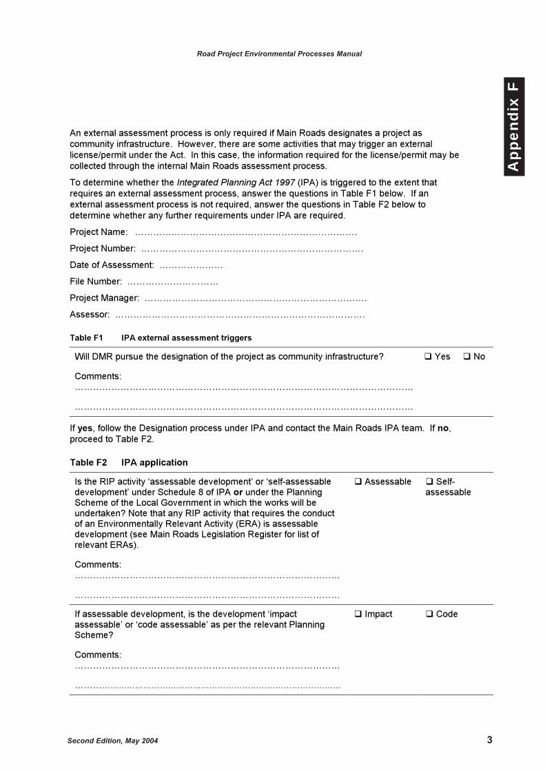
Second Edition, May 2004 3
Road Project Environmental Processes Manual
App
endi
x F
An external assessment process is only required if Main Roads designates a project as
community infrastructure. However, there are some activities that may trigger an external
license/permit under the Act. In this case, the information required for the license/permit may be
collected through the internal Main Roads assessment process.
To determine whether the Integrated Planning Act 1997 (IPA) is triggered to the extent that
requires an external assessment process, answer the questions in Table F1 below. If an
external assessment process is not required, answer the questions in Table F2 below to
determine whether any further requirements under IPA are required.
Project Name: ……………………………………………………………….
Project Number: ……………………………………………………………….
Date of Assessment: …………………
File Number: …………………………
Project Manager: ……………………………………………………………….
Assessor: ……………………………………………………………………….
Table F1 IPA external assessment triggers
Will DMR pursue the designation of the project as community infrastructure?
Comments:
…………………………………………………………………………………………………
…………………………………………………………………………………………………
� Yes � No
If yes, follow the Designation process under IPA and contact the Main Roads IPA team. If no,
proceed to Table F2.
Table F2 IPA application
Is the RIP activity ‘assessable development’ or ‘self-assessable
development’ under Schedule 8 of IPA or under the Planning
Scheme of the Local Government in which the works will be
undertaken? Note that any RIP activity that requires the conduct
of an Environmentally Relevant Activity (ERA) is assessable
development (see Main Roads Legislation Register for list of
relevant ERAs).
Comments:
……………………………………………………………………………
……………………………………………………………………………
� Assessable � Self-
assessable
If assessable development, is the development ‘impact
assessable’ or ‘code assessable’ as per the relevant Planning
Scheme?
Comments:
……………………………………………………………………………
……………………………………………………………………………………
� Impact � Code

4 Second Edition, May 2004
Road Project Environmental Processes Manual
App
endi
x F
Implications of findings for Table F2
�� If ‘self-assessable’ - Main Roads can follow their internal assessment process and no
application or approval to Local Government is required. However, the relevant external
standards (eg standard building regulations) are to be addressed.
�� If ‘code assessable’ - Main Roads is required to lodge an application and gain
development approval. However, the information required may be obtained through the
internal Main Roads assessment process. In this instance, the information provided within
the application would be assessed against the applicable codes.
�� If ‘impact assessable’ – Main Roads will be required to lodge an application under the IPA
and requirements additional to those of the internal Main Roads process will be required
(refer Chapter 3 Part 4 of IPA for these requirements).
Please sign and date this checklist, place a copy on the relevant project file and proceed to the
relevant assessment process.
______________________________ _________________________ _______________
Name Signature Date
Second Edition, May 2004 1
Road Project Environmental Processes Manual
App
endi
x G
APPENDIX GSuggested Content
of an EnvironmentalApproval Report

2 Second Edition, May 2004
Road Project Environmental Processes Manual
App
endi
x G
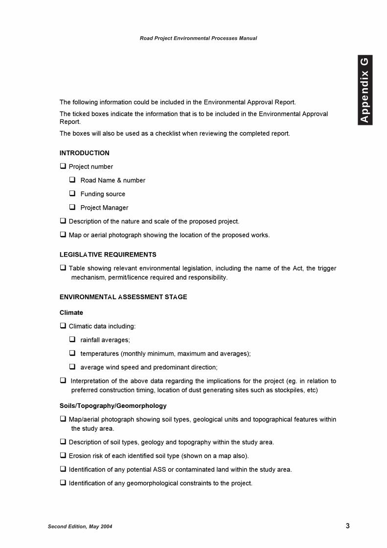
Second Edition, May 2004 3
Road Project Environmental Processes Manual
App
endi
x G
The following information could be included in the Environmental Approval Report.
The ticked boxes indicate the information that is to be included in the Environmental Approval
Report.
The boxes will also be used as a checklist when reviewing the completed report.
INTRODUCTION
��Project number
��Road Name & number
��Funding source
��Project Manager
��Description of the nature and scale of the proposed project.
��Map or aerial photograph showing the location of the proposed works.
LEGISLATIVE REQUIREMENTS
��Table showing relevant environmental legislation, including the name of the Act, the trigger
mechanism, permit/licence required and responsibility.
ENVIRONMENTAL ASSESSMENT STAGE
Climate
��Climatic data including:
��rainfall averages;
��temperatures (monthly minimum, maximum and averages);
��average wind speed and predominant direction;
��Interpretation of the above data regarding the implications for the project (eg. in relation to
preferred construction timing, location of dust generating sites such as stockpiles, etc)
Soils/Topography/Geomorphology
��Map/aerial photograph showing soil types, geological units and topographical features within
the study area.
��Description of soil types, geology and topography within the study area.
��Erosion risk of each identified soil type (shown on a map also).
��Identification of any potential ASS or contaminated land within the study area.
��Identification of any geomorphological constraints to the project.
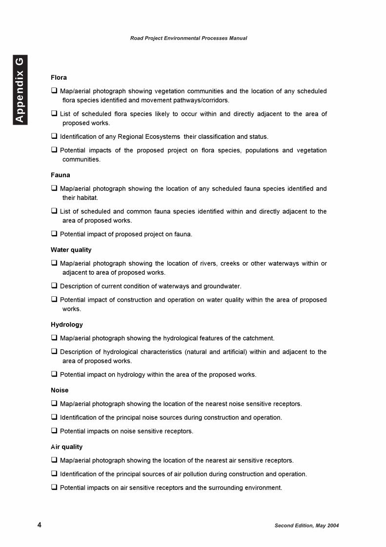
4 Second Edition, May 2004
Road Project Environmental Processes Manual
App
endi
x G
Flora
��Map/aerial photograph showing vegetation communities and the location of any scheduled
flora species identified and movement pathways/corridors.
��List of scheduled flora species likely to occur within and directly adjacent to the area of
proposed works.
��Identification of any Regional Ecosystems their classification and status.
��Potential impacts of the proposed project on flora species, populations and vegetation
communities.
Fauna
��Map/aerial photograph showing the location of any scheduled fauna species identified and
their habitat.
��List of scheduled and common fauna species identified within and directly adjacent to the
area of proposed works.
��Potential impact of proposed project on fauna.
Water quality
��Map/aerial photograph showing the location of rivers, creeks or other waterways within or
adjacent to area of proposed works.
��Description of current condition of waterways and groundwater.
��Potential impact of construction and operation on water quality within the area of proposed
works.
Hydrology
��Map/aerial photograph showing the hydrological features of the catchment.
��Description of hydrological characteristics (natural and artificial) within and adjacent to the
area of proposed works.
��Potential impact on hydrology within the area of the proposed works.
Noise
��Map/aerial photograph showing the location of the nearest noise sensitive receptors.
��Identification of the principal noise sources during construction and operation.
��Potential impacts on noise sensitive receptors.
Air quality
��Map/aerial photograph showing the location of the nearest air sensitive receptors.
��Identification of the principal sources of air pollution during construction and operation.
��Potential impacts on air sensitive receptors and the surrounding environment.
Second Edition, May 2004 5
Road Project Environmental Processes Manual
App
endi
x G
Planning and land use
��List and description of land uses within and adjacent to the area of proposed project.
��List of planning scheme designations within and adjacent to area of proposed project.
��Compatibility of the proposed project with the relevant planning scheme.
��Potential impact on existing and future land use as a result of the proposed project.
Landscape and visual amenity
��Photographs of existing landscape and visual values within and adjacent to the proposed
project that may be affected.
��Description of existing landscape and visual values within and adjacent to the proposed
project.
��Potential changes to landscape and visual values as a result of the proposed project.
Socio-economic issues
��Description of the basic community profile.
��Discussion of potential impacts on the socio-economic environment within and adjacent to
area of proposed works.
Consultation
��Summary of consultation undertaken (with stakeholders and the community).
��Summary of comments received from landowners, stakeholders and the community and how
these comments were addressed.
Cultural Heritage
��Summary of work undertaken during CHR and CHA and recommended management
measures.
Waste management
��Identification of potential sources of waste during construction and maintenance.
��Management procedures for each waste stream.
ENVIRONMENTAL MANAGEMENT STAGE
��For each of the elements discussed above provide the following information in tabular
format:
��environmental element;
��brief description of the potential environmental impact;
��management measures required to be implemented during the design, construction and
maintenance of the proposed project (including reporting, monitoring and auditing
requirements and legislative requirements eg. permits/licences/approvals);
��responsibility for implementation.
��location within the contract documentation that the management measure should be
included (ie. design drawings and/or specifications).

6 Second Edition, May 2004
Road Project Environmental Processes Manual
App
endi
x G
CERTIFIED STATEMENT
��The report should contain certification from the Chief Executive Officer or District Director as
follows:
'Following consultation with the Environment Protection Agency’ or ‘In accordance with
procedures agreed between the Department of Main Roads and the Environment Protection
Agency’, the environmental implications of the proposal have been assessed and are set out
in the ‘Project Proposal Report’ or ‘attached documentation’. In my opinion, the proposal ‘is’
or ‘is not’ a matter which raises ‘any environmental issues under Commonwealth or State
legislation’ or ‘any environmental issues have been addressed to the satisfaction of the
relevant environmental authorities, whether Commonwealth or State’.
APPENDICES
��Where detailed technical or supporting documents are required, they should be placed in
appendices. (Supporting information may include: specialist reports e.g. noise report,
fauna/flora species list, field/laboratory results, etc).
��Completed proformas for legislative trigger evaluations.

Second Edition, May 2004 1
Road Project Environmental Processes Manual
App
endi
x H
APPENDIX HRecent Publications

2 Second Edition, May 2004
Road Project Environmental Processes Manual
App
endi
x H

Second Edition, May 2004 3
Road Project Environmental Processes Manual
App
endi
x HRecent Publications:
1. Main Roads Strategic Framework for Road System Asset Management.
2. Pre-construction Processes Manual.
3. Main Roads Cultural Heritage Manual 1998.
4. Main Roads Public Consultation Policy and Guidelines.
5. IPA Planning Scheme Manual.
6. IDAS Manual for Main Roads as an Applicant.
7. Main Roads Environmental Legislation Register.