Embed Size (px)
Citation preview

APPENDIX F.
MEETING MINUTES
1. January 25, 2001 Preliminary District Team Meeting
2. July 17, 2001 Project Team Meeting #1
3. August 13, 2001 Jackson Co. Local Officials Meeting
4. August 13, 2001 Jackson Co. Local Agencies Meeting
5. August 14, 2001 Owsley Co. Local Officials Meeting
6. August 14, 2001 Owsley Co. Local Agencies Meeting
7. October 4, 2001 Jackson Co. Public Meeting #1
8. October 9, 2001 Owsley Co. Public Meeting #1
9. October 19, 2001 Kiwanis Club Meeting
10. March 27, 2002 Jackson Co. Local Officials Meeting #2
11. March 27, 2002 Jackson Co. Local Agencies Meeting #2
12. April 9, 2002 Owsley Co. Local Officials/Agencies Meeting #2
13. June 4, 2002 Jackson Co. Public Meeting #2
14. June 13, 2002 Owsley Co. Public Meeting #2
15. August 5, 2002 Project Team Meeting #2

MINUTES
KY 30 Scoping Study Preliminary District Team Meeting
January 25, 2001 at 10:00 a.m.
On Thursday, January 25, 2001 at 10:00 a.m. a team meeting for the KY 30 Scoping Study was held in the conference room of the KYTC District 10 office. In attendance were the following persons: • Jim Wilson, P.E. Engineering Manager KYTC Division of Planning • Ted Noe, P.E., Project Engineer KYTC Division of Planning • Danny Jewell. P.E., TEBM for Pre-Construction KYTC District 11 • Bill Madden, P.E., TEBM for Pre-Construction KYTC District 10 • Eddie Terry, P.E., TEBM for Planning KYTC District 10 • Rokshad Khan, Environmental Coordinator KYTC District 10 • Mike Merriman, P.E., Project Engineer Wilbur Smith Associates • Bill Leake, P.E.,P.L.S. Sr. Technical Engineer Wilbur Smith Associates Jim Wilson opened the meeting by stating that the reason for the meeting was to gather input from both Districts regarding the KY 30 Corridor improvements. The consultant presented quad sheets that the District 10 staff had prepared for an earlier study showing ten (10) possible alternates for the KY 30 Corridor. Danny Jewell brought up the fact that the project lies within an Empowerment Zone and Jackson County has a board that is looking for a site for a reservoir/lake in the Sturgeon Creek area. The consultant should check with the board to find out the status of this project. Jerry Rickett is the manager of the Kentucky Highlands Empowerment Zone whose phone number is 1-606-864-5175. In the Economic Development Cabinet the contact person is Ms. Phyllis Bruning at phone number 1-502-564-7670. Danny Jewell stated that the consultant also needs to check with the Daniel Boone National Forest office to see if any land within the project area has been purchased by them. Bill Madden stated that District 10 preferred a corridor along existing KY 30 while Danny Jewell with District 11 stated not to use any part of existing KY 30. The consultant and central planning staff have driven the route and are very aware of the deficiencies of existing KY 30. The consultant will need to document the deficiencies with existing KY 30 and previous study efforts that justify the need for consideration of alternative highway corridor options for this route. The KY 30 Scoping project falls within two (2) ADD Districts, Cumberland Valley for Jackson County and Kentucky River for Owsley County. The consultant should make sure that both ADDs are kept well informed on this project.
A section of KY 30 south of Tyner has been designed. Danny Jewell will provide WSA with plans of the section. At the present time this section ends at an at-grade intersection with US 421. When WSA looks at the Scoping Study section of the KY 30 project they should evaluate the intersection with US 421 as an at-grade and grade-separated crossing with off ramps to US 421. A concern of all parties in attendance is the location of corridor alternates. If corridors impact side roads, there are possible disruptions of family clusters, which are common in Eastern Kentucky. Relocations issues associated with corridor alternatives should be considered. Public involvement is a major concern of both Districts because of the uncertainty of future funding. If we go to the public with proposed corridors and gain input and approval of a corridor and then find that funding of the project is not available, the Cabinet could lose credibility with the public and other interested parties. KYTC staff have encountered similar situations in which they receive a number of inquiries and telephone calls from property owners and other stakeholders who do not understand the timeframe of the project and the KYTC’s project development process. Clear public information on the project and its potential schedule will be a major concern on the project if we are looking at total relocation. It was determined that the study should include two rounds of meetings of the following in each county: meetings with local officials and interest groups, special agency groups, and public meetings. Additionally, four team meetings with KYTC and ADD staff will be held during the course of study. The consultant will be responsible for identifying and addressing potential Environmental Justice issues for the project. The meeting closed at 11:30 a.m. After the meeting Jim Wilson and Ted Noe were scheduled to drive existing KY 30 prior to returning to Frankfort.

KY 30 Team Meeting Reconstruction of KY 30-Tyner to Booneville Jackson-Owsley Counties, Item No. 10-279.50
10:00 a.m. July 17, 2001 District 10 Conference Room
A project team meeting for the KY 30 Scoping Study in Jackson-Owsley Counties (Item No. 10-279.50) was conducted on Tuesday, July 17, 2001 at the District 10 Conference Room in Jackson, Kentucky. The purpose of the meeting was to discuss the purpose, goals and objectives of the proposed project, to review preliminary existing conditions data for the study corridor, and to identify future study needs. Participants at the meeting included representatives from KYTC District 10, KYTC District 11, KYTC Division of Planning, the Cumberland Valley Area Development District, and consultant staff from Wilbur Smith Associates (WSA). Individual attendees at the meeting included the following: Eddie Terry KYTC District 10, Planning Craig Lindon KYTC District 10, Planning
Sue Allen KYTC District 10, Planning Bruce Napier KYTC District 10, Right of Way Corbett Caudill KYTC District 10, Design Charles Allen KYTC District 10, Construction Mark Wireman KYTC District 10, Traffic/Permits William Madden KYTC District 10, Preconstruction Jeff Allen KYTC District 10, Environmental Coordinator
Daniel Jewell KYTC District 11, Preconstruction John Cornett KYTC District 11, Construction
Ted Noe KYTC, Planning Jim Wilson KYTC, Planning
Gene Lynch KYTC District 10, Permits Clay McKnight Cumberland Valley Area Development District (CVADD) Craig Lee Qore Inc.
Liz Bullock Palmer Engineering Marc Williams Wilbur Smith Associates
Mike Merriman Wilbur Smith Associates Hollis Loveday Wilbur Smith Associates (Knoxville, TN office) Brady Johnson Wilbur Smith Associates Terry Grubb Wilbur Smith Associates (Knoxville, TN office) A summary of the key comments and discussion items for this meeting is included below, organized according to the meeting agenda. Attached to these minutes is a copy of the agenda from this meeting.
1) Introduction and Purpose
Ted Noe opened the meeting with introductions of project attendees and a brief introduction of the KY 30 project.
2a) General Project Area
Attendees were provided with copies of a preliminary existing conditions summary that consisted of mapping and table data summaries for KY 30 and surrounding highways.
• Topographic and Digital Ortho photographic Environmental Footprint Map
This map showed current conditions and known environmental issues for KY 30 and the surrounding areas.
• Topographic Environmental Footprint with preferred KY 30 alignment from Tyner to Booneville based on 1994 KYTC Scoping Study.
2b) Available data and reports
Other information available that may relate to this project includes:
• Scoping Studies, Project Scoping Summary
2c) Problems with existing roadway or network
Concerns for KY 30 route that were expressed included:
• Poor geometrics (narrow lanes, no shoulders, substandard horizontal/vertical curvature, no passing zones)
• Lack of access to Interstate or Parkway Systems (I-75, Mountain Parkway, I-64)
• Minimal truck operations (KY 30 is not on NHS or NN & only Class A/AA rated)
• Needed bridge replacements (Two have low sufficiency ratings (< 50) in Owsley County)
It was noted that traffic congestion did not appear to be a major issue along the route. Also, accident data did not suggest any high-accident location(s).
2d) Benefits of proposed project
A number of benefits were identified related to the subject project:
• Improve geometrics/safety
• Improved connectivity to I-75 and other highway systems
• Potential for better economic development opportunities
• Improved truck access
• Better travel time/time savings
• Potential segment on a proposed London-Ashland corridor (I-75 to I-64)
Consideration should be given to the estimation of potential diversion of new traffic that would be attracted to an improved KY 30 corridor. WSA will reference the statewide traffic model to aid in this estimate.
2e) Additional information needed to document problems
• Truck classification counts through KYTC Planning
• KY 11 proposed improvements near Booneville
• The Empowerment Zone of Jackson County has moved the possible location of a lake/recreation area from Sturgeon Creek to the War Fork/Steer Fork area near McKee
District 10 is working with GRW to do Phase I design of this route. Currently a proposed alignment has not been set.
2f) Logical Termini
• South end to tie with project under design at Tyner, where a grade-separated interchange is preferred (ramps to US 421)
• North end to tie with KY 11 improvement, approximately 2 miles west of Booneville, near the existing KY 30 junction
2g) Project goals and objectives
For the KY 30 project, several goals and objectives were identified, which included:
• Provide improved Interstate or Parkway System access
• Improve systems connectivity
• Improve geometrics
• Improve travel time for diverted traffic
• Provide truck access for eligibility on designated truck network
• Enhance economic development opportunities
3) Environmental Footprint Area
• An area centered along KY 30, approximately 2 miles on each side of KY 30
4) Probable Design Criteria
Probable design criteria to assume (for planning/cost considerations only) for the proposed improvement include the following:
• Rolling terrain limits maximum grade to 4%. District officials indicated that 5% grades would be acceptable for short segments with truck passing lanes.
• Two 12’ lanes
• 60 mph
• 10-12’ shoulders
• 18’ ditch @ 6:1 slope for safety
• Truck/Passing lanes, where required
Bill Madden emphasized the need to insure that the improved design standards did not lead to an unintended consequence of creating safety hazards along the route because of motorists driving
too fast. These problems have occurred along sections of the AA Highway and US 23, particularly where motorists on crossroads have pulled out in front of fast moving vehicles.
5) Possible alternatives and corridors
Meeting participants discussed several possible corridor alternatives and improvement needs to consider for the purpose of this scoping study. These alternatives will include the following:
• WSA will study a minimum of 3 alternate corridors in detail, but all viable corridors will be considered for study
• Corridor width will be 2000’ for each alternate under study
• In Jackson County, Daniel Jewell suggested staying south of KY 30 more than is illustrated by the previous scoping study alignment.
• Grade-separated structures should be considered at the Tyner and Booneville termini, if justified by traffic and safety.
• In Owsley County Bill Madden suggested pulling the alignment south of KY 30 near KY 846 and following the southern alternative identified by the scoping study, to stay on ridge lines, thereby minimizing the crossing of blueline streams.
• Route should be considered for through-traffic needs since residual traffic can continue to use existing KY 30 (i.e., some connectivity to be provided to existing KY 30)
6) Agency Coordination Needs
Through the course of discussion, several agency coordination needs were cited and these included the following contacts:
• State Representatives of Jackson/Owsley Counties (Senator Albert Robinson, Senator Robert Stivers, Representative Marie Rader)
• Mayors
• County Judges
• Congressman Hal Rogers (5th District)
• Daniel Boone National Forest
• Empowerment Zone of Jackson County
• Environmental Protection Agency (EPA)
• Historical groups
• Department of Agriculture
• Opposition groups
7) Public Involvement Needs
Hollis Loveday gave a summary and handout of the public involvement plan. The plan will be finalized after the initial meeting with local officials. This plan would be used to gather input from local agencies and help develop a preliminary schedule for team and public meetings. Typical public officials to include in this plan are:
• County Judges
• Magistrates
• County Engineer (if available)
• School Board members
• Emergency Medical Services (EMS) and Fire Department
• Chamber of Commerce
• State Police (London Post) and local police
Hollis also mentioned key points for citizens involvement. It was decided to have a separate meeting for each county initially and then possibly at one central location. Meeting notices should be posted within the corridor and at traditional outlets including: • Local Newspapers
♦ Booneville Sentinel (weekly); circulation 2,100
♦ Jackson County Sun (weekly); circulation 3,650
• Radio Stations
♦ WWAG 107.9 FM (McKee)
♦ WLJC 102.1 FM (Beattyville)
♦ WEKG 810 AM (Jackson)
♦ WJSN 106.5 FM (Jackson)
• Post Offices
• Churches
• Stores
• Banks
A Citizens Advisory Committee (CAC) was proposed but local district staff and central office suggested this may not be the best approach. However, local officials may want a CAC since there is a need for more public involvement to engage citizens within the study corridor. It was proposed that these efforts might include posting flyers and/or staffing information booths at stores, churches, post offices and other key locations along the corridors. Banks and social service offices in Tyner and Booneville might also be considered. Some agencies to include in the citizen’s involvement are:
• Freight/Trucking Officials and UPS • Transportation officials (KYTC Maintenance/Operations, School System, etc.) • Mail carriers
The first public meeting will likely be held in mid-September. Three or four exhibit areas will be located around the room for written comments. Also, we can use a court reporter or secretary with a tape recorder for any oral comments. Refreshments can be provided. Possible locations for the Public Meetings include:
• Tyner Elementary School (Jackson County)
• Booneville High School (Owsley County)
After the first public meetings, there will be a meeting with District 10 and 11 staff to go over the results and to keep everyone informed. This may consist of a ½ day workshop with citizens and local stakeholders. Following this meeting there will be a public officials meeting to discuss recommendations.
The second public meetings will likely be held by mid-December. There will be a presentation with recommendations and then we will solicit comments. There will be a questionnaire/survey form for attendees to complete.
After the second public meeting, there will be a Project Team Meeting with WSA and Districts 10 and 11 to discuss any additional comments or concerns for the project. WSA will draft a newspaper release for the final alignment/corridor alternate.
District staff indicated a preference to have some alternative corridor options shown at the first public meeting. KYTC Planning indicated that this approach was not generally preferred. Presenting a blank map at the first meeting is typically done and the KYTC has generally followed this approach. Following the meeting it was proposed that the corridor identified in the scoping study be displayed on a single board, but this illustration would not be on any handouts.
8) Documentation/Reports
No comments were made regarding the documentation of this project. With no further comments or discussion, the meeting concluded at noon.

KY 30 Local Officials Meeting Reconstruction of KY 30-Tyner to Booneville Jackson-Owsley Counties, Item No. 10-279.50
11:00 a.m. August 13, 2001 Jackson County Empowerment Zone Office
McKee, Kentucky
A local officials meeting for the KY 30 Scoping Study in Jackson-Owsley Counties (Item No. 10-279.50) was conducted on Monday, August 13, 2001 in McKee, Kentucky. The purpose of the meeting was to discuss the purpose, goals and objectives of the proposed project, to review preliminary existing conditions data for the study corridor, and to solicit input for the local area officials. Individual attendees at the meeting included the following: Mary Purkey Empowerment Zone Fletcher Gabbard Empowerment Zone Tommy Slone Judge Executive Jackson County Marie Rader Representative-89th District Clay McKnight Cumberland Valley Area Development District William Madden KYTC District 10 Corbett Caudill KYTC District 10 Daryl Greer KYTC-Division of Planning Daniel Jewell KYTC District 11, Preconstruction
Jim Wilson KYTC Division of Planning Liz Bullock Palmer Engineering Marc Williams Wilbur Smith Associates
Mike Merriman Wilbur Smith Associates Brady Johnson Wilbur Smith Associates Dawn Foster Wilbur Smith Associates – Knoxville, TN Office A summary of the key comments and discussion items for this meeting is included below, organized according to the meeting agenda. Attached to these minutes is a copy of the agenda from this meeting.
Introduction and Purpose Jim Wilson opened the meeting with introductions of project attendees. He discussed the limits of the study and the purpose of the meeting which is to inform the local official and solicit their input. Daniel Jewel advised that sections of KY 30 were under construction south of Tyner. Mike Merriman reviewed the handouts that included the study purpose, issues, and goals summary.
General Project Area Attendees were provided with copies of a preliminary existing conditions summary that consisted of mapping, traffic data tables for KY 30 and the Public Involvement Plan.
• Project Location Map
• Accident Information By Type
• Traffic Information for Jackson and Owsley Counties
• Topographic Environmental Footprint for Jackson and Owsley Counties
This map showed the London to Tyner Proposed Alignment at Tyner
• Public Involvement Plan
Existing Concerns A number of existing concerns and issues were discussed during the meeting. These included:
• Judge Slone noted that a lot of people avoid the highway due to poor conditions
• Representative Rader mentioned that meeting trucks along the road is hazardous, especially when motorists meet trucks on bridges. Citizen’s in Lee County have expressed a desire for this road improvement. With access improvements quality of life would be improved.
• Mary Purkey mentioned that industry has been lost in the area due to poor highway access.
Termini
• South end to tie with project under design at Tyner, where a grade-separated interchange is preferred (ramps to US 421)
• North end to tie with KY 11 improvement, approximately 2 miles west of Booneville, near the existing KY 30 junction
Design Criteria The typical design section, for planning purposes, would likely involve:
• 2 lane road with 12’ lanes and 10’ shoulders
• 60 MPH design speed
• Possibly truck passing lanes
• ± 4% grade (rolling terrain)
Other Issues An additional need identified by Representative Rader was emergency service access for Medical, Fire, and Police Departments. Jim Wilson suggested that this issue be added to the need of the project. Mr. Gabbard noted that the industrial park in Jackson County should be considered in the travel needs for the project. Mike reviewed the environmental footprint maps. Marc noted the importance of gaining input to help verify environmental issues along the corridor. The superfund site east of KY 30 in Jackson County was noted. It was suggested that this might be related to a property owner.
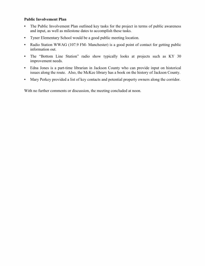
Public Involvement Plan
• The Public Involvement Plan outlined key tasks for the project in terms of public awareness and input, as well as milestone dates to accomplish these tasks.
• Tyner Elementary School would be a good public meeting location.
• Radio Station WWAG (107.9 FM- Manchester) is a good point of contact for getting public information out.
• The “Bottom Line Station” radio show typically looks at projects such as KY 30 improvement needs.
• Edna Jones is a part-time librarian in Jackson County who can provide input on historical issues along the route. Also, the McKee library has a book on the history of Jackson County.
• Mary Perkey provided a list of key contacts and potential property owners along the corridor. With no further comments or discussion, the meeting concluded at noon.

KY 30 Local Agencies Meeting Reconstruction of KY 30-Tyner to Booneville Jackson-Owsley Counties, Item No. 10-279.50
1:00 p.m. August 13, 2001 Jackson County Empowerment Zone Office
McKee, Kentucky
A local agencies meeting for the KY 30 Scoping Study in Jackson-Owsley Counties (Item No. 10-279.50) was conducted on Monday, August 13, 2001 McKee, Kentucky in the Jackson County Empowerment Zone Office. The purpose of the meeting was to discuss the purpose, goals and objectives of the proposed project, to review preliminary existing conditions data for the study corridor, and to solicit input from the local agencies. Individual attendees at the meeting included the following: Linda Truett Daniel Boone Transit & Jackson County Public Schools Devonna Hisel Jackson County Transportation Committee J. C. Dunsil Jackson County E Z Projects Manager Mike Smith Jackson County Board of Education Dinah Ward Community Based Services Rodney Chrisman Jackson Energy Cooperative Clay McKnight Cumberland Valley Area Development District Marie Rader State Representative-89th District Daniel Jewell KYTC-District 11 Daryl Greer KYTC-Planning Jim Wilson KYTC-Planning Corbett Caudill KYTC-District 10 William Madden KYTC-District 10 Liz Bullock Palmer Engineering Mike Merriman Wilbur Smith Associates Brady Johnson Wilbur Smith Associates Dawn Foster Wilbur Smith Associates (Knoxville, TN Office)
Marc Williams Wilbur Smith Associates A summary of the key comments and discussion items for this meeting is included below, organized according to the meeting agenda. Attached to these minutes is a copy of the agenda from this meeting.
Introduction and Purpose Jim Wilson opened the meeting with introductions of project attendees. He reviewed the scope and limits of this current project along KY 30 from Booneville to Tyner. Mike Merriman reviewed the study purpose, issues, project goals, project schedule, and KYTC contacts.
General Project Area Mike provided attendees with copies of a preliminary existing conditions summary that consisted of mapping, accident data tables for KY 30 and the Public Involvement Plan.

• Project Location Map
• Accident Information By Type • Topographic Environmental Footprint for Jackson and Owsley Counties.
This map showed the London to Tyner Proposed Alignment at Tyner
• Public Involvement Plan
Existing Concerns A number of existing concerns and issues were discussed during the meeting. These included:
• Improved access for Emergency Services (ambulance, fire, police).
• Representative Rader mentioned a possible historic structure near Herd. Also, a report conducted by the Jackson County Development Coop has documented the historic characteristics of Jackson County.
• Stores, businesses along the route might be adversely affected if the road was located too far away from the existing road. It was suggested by meeting participants that keeping the roadway near or adjacent to the existing road would be desirable.
• In cliff lines, endangered species may exist (Virginia Big Eared Bat & Indiana Bat)
• Some Karst topography might exist along the western edge of the corridor in Jackson County
• The narrow roadway creates problems for public transportation along KY 30. A school official noted that last year Jackson and Owsley County school buses sideswiped each other (hit mirrors) due to the narrow roadway.
• A 2-lane section is recommended at this time. Future traffic studies may warrant an increase in lane requirements.
Termini
• South end to tie with project under design at Tyner, where a grade-separated interchange is preferred (ramps to US 421)
• North end to tie with KY 11 improvement, approximately 2 miles west of Booneville, near the existing KY 30 junction
Design Criteria The typical design section, for planning purposes, would likely involve:
• 2 lane road with 12’ lanes and 10’ shoulders
• 60 MPH design speed
• Possibly truck passing lanes
• ± 4% grade (rolling terrain)

Public Involvement Representative Rader mentioned that she has previously had good success getting written surveys from constituents. Often, the public doesn’t like to put their names on forms. The KYTC typically asks for names and addresses. However, this might be optional if it would encourage more responses. With no further comments or discussion, the meeting concluded at 2:00 pm.

KY 30 Local Officials Meeting Reconstruction of KY 30-Tyner to Booneville Jackson-Owsley Counties, Item No. 10-279.50
10:00 a.m. August 14, 2001 Owsley County Courthouse
Booneville, Kentucky
A local officials meeting for the KY 30 Scoping Study in Jackson-Owsley Counties (Item No. 10-279.50) was conducted on Tuesday, August 14, 2001 in Booneville, Kentucky at the Owsley County Courthouse. The purpose of the meeting was to discuss the purpose, goals and objectives of the proposed project, to review preliminary existing conditions data for the study corridor, and to solicit input from the local area officials. Individual attendees at the meeting included the following: Jimmie Herald Judge Executive Owsley County Jeff Coots Kentucky River Area Development District Marie Rader State Representative-89th District Ted Noe KYTC-Planning Jim Wilson KYTC-Planning Corbett Caudill KYTC-District 10 William Madden KYTC-District 10 Craig Lindon KYTC-District 10, Planning Liz Bullock Palmer Engineering Ron Estes KYTC-District 10 Mike Merriman Wilbur Smith Associates Brad Johnson Wilbur Smith Associates Dawn Foster Wilbur Smith Associates A summary of the key comments and discussion items for this meeting is included below, organized according to the meeting agenda. Attached to these minutes is a copy of the agenda from this meeting.
Introduction and Purpose Ted Noe opened the meeting with introductions of project attendees. He discussed the limits of the study and the purpose of the meeting which is to inform the local official and solicit their input. Mike Merriman presented the handouts that included the study purpose, issues, and goals summary.
General Project Area Attendees were provided with copies of a preliminary existing conditions summary that consisted of mapping, table data summaries for KY 30 and the Public Involvement Plan.
• Project Location Map
• Accident Information By Type
• Traffic Information for Jackson and Owsley Counties

• Topographic Environmental Footprint for Jackson and Owsley Counties
This map showed the London to Tyner Proposed Alignment at Tyner
• Public Involvement Plan
Existing Concerns A number of existing concerns and issues were discussed during the meeting. These included:
• There is a need for improved roads to lure industry.
• There are a lot of unmarked cemeteries. The Booneville library has documents that could help locate those.
• Increased truck traffic
• Higher speeds
• Deer crossings
• No zoning within the county
Termini
• South end to tie with project under design at Tyner, where a grade-separated interchange is preferred (ramps to US 421)
• North end to tie with KY 11 improvement, approximately 2 miles west of Booneville, near the existing KY 30 junction
Design Criteria The proposed typical design section, for planning purposes, would likely involve:
• 2 lane road with 12’ lanes and 10’ shoulders
• 60 MPH design speed
• Possibly truck passing lanes
• ± 4% grade (rolling terrain)
Other Issues Judge-Executive Herald mentioned several concerns/issues for this study that include: • This is the most important need for Owsley County- an improvement of KY 30
• To keep KY 30 as straight as possible to I-75
• Lee County is supporting the project, don’t want to move away from them
• Interested in London to Ashland corridor for the area
• Prefer large passing lanes for trucks
• The end of welfare is forcing people to get out and use the road system more

• Loss of tobacco crops for any new construction should be minimized
Public Involvement
• Cafeteria at Booneville High School for public meeting
• Local Newspaper
• Two or three radio stations in the area
• Need to include people from Lee and Breathitt Counties. All three counties will use the road.
• Meter readers can put flyers on the door. Door to door will be more effective. With no further comments or discussion, the meeting concluded at 11:00 am.
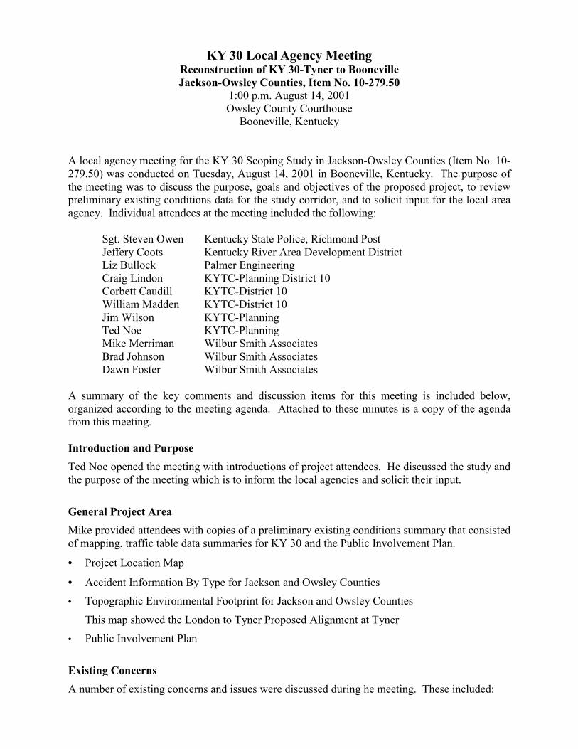
KY 30 Local Agency Meeting Reconstruction of KY 30-Tyner to Booneville Jackson-Owsley Counties, Item No. 10-279.50
1:00 p.m. August 14, 2001 Owsley County Courthouse
Booneville, Kentucky
A local agency meeting for the KY 30 Scoping Study in Jackson-Owsley Counties (Item No. 10-279.50) was conducted on Tuesday, August 14, 2001 in Booneville, Kentucky. The purpose of the meeting was to discuss the purpose, goals and objectives of the proposed project, to review preliminary existing conditions data for the study corridor, and to solicit input for the local area agency. Individual attendees at the meeting included the following: Sgt. Steven Owen Kentucky State Police, Richmond Post Jeffery Coots Kentucky River Area Development District Liz Bullock Palmer Engineering Craig Lindon KYTC-Planning District 10 Corbett Caudill KYTC-District 10 William Madden KYTC-District 10 Jim Wilson KYTC-Planning
Ted Noe KYTC-Planning Mike Merriman Wilbur Smith Associates Brad Johnson Wilbur Smith Associates Dawn Foster Wilbur Smith Associates A summary of the key comments and discussion items for this meeting is included below, organized according to the meeting agenda. Attached to these minutes is a copy of the agenda from this meeting.
Introduction and Purpose Ted Noe opened the meeting with introductions of project attendees. He discussed the study and the purpose of the meeting which is to inform the local agencies and solicit their input.
General Project Area Mike provided attendees with copies of a preliminary existing conditions summary that consisted of mapping, traffic table data summaries for KY 30 and the Public Involvement Plan.
• Project Location Map
• Accident Information By Type for Jackson and Owsley Counties
• Topographic Environmental Footprint for Jackson and Owsley Counties
This map showed the London to Tyner Proposed Alignment at Tyner
• Public Involvement Plan
Existing Concerns A number of existing concerns and issues were discussed during he meeting. These included:
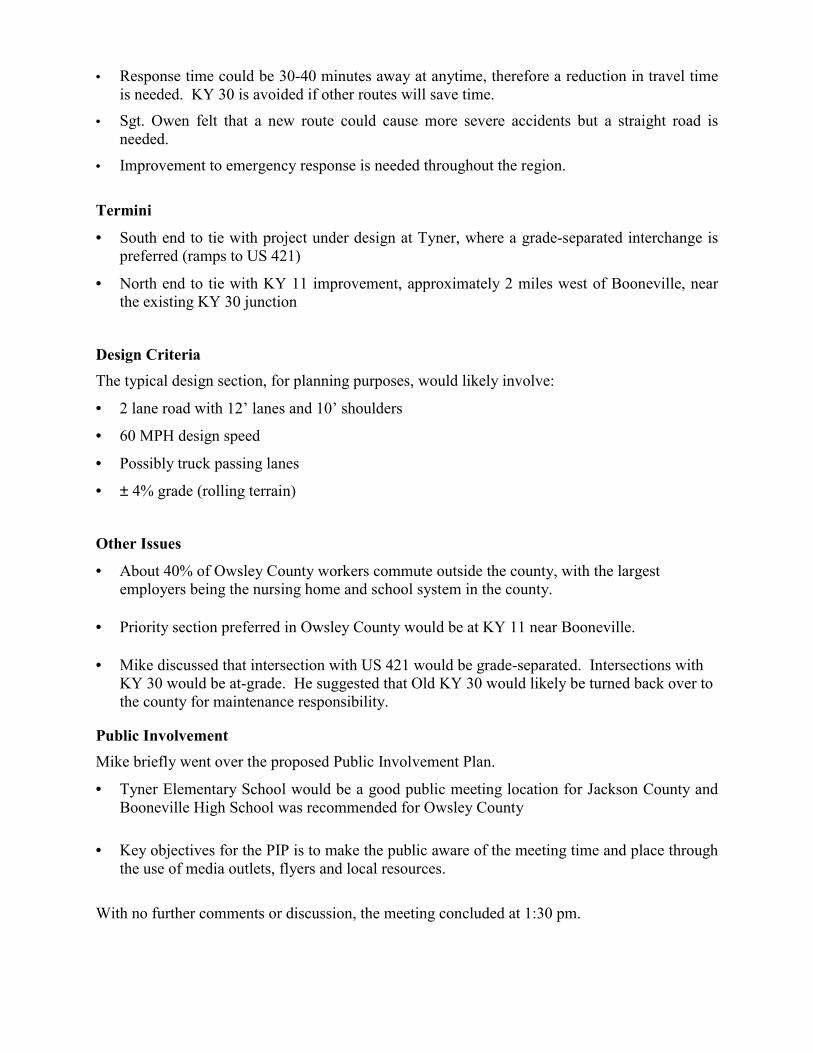
• Response time could be 30-40 minutes away at anytime, therefore a reduction in travel time is needed. KY 30 is avoided if other routes will save time.
• Sgt. Owen felt that a new route could cause more severe accidents but a straight road is needed.
• Improvement to emergency response is needed throughout the region.
Termini
• South end to tie with project under design at Tyner, where a grade-separated interchange is preferred (ramps to US 421)
• North end to tie with KY 11 improvement, approximately 2 miles west of Booneville, near the existing KY 30 junction
Design Criteria The typical design section, for planning purposes, would likely involve:
• 2 lane road with 12’ lanes and 10’ shoulders
• 60 MPH design speed
• Possibly truck passing lanes
• ± 4% grade (rolling terrain)
Other Issues
• About 40% of Owsley County workers commute outside the county, with the largest employers being the nursing home and school system in the county.
• Priority section preferred in Owsley County would be at KY 11 near Booneville. • Mike discussed that intersection with US 421 would be grade-separated. Intersections with
KY 30 would be at-grade. He suggested that Old KY 30 would likely be turned back over to the county for maintenance responsibility.
Public Involvement Mike briefly went over the proposed Public Involvement Plan.
• Tyner Elementary School would be a good public meeting location for Jackson County and Booneville High School was recommended for Owsley County
• Key objectives for the PIP is to make the public aware of the meeting time and place through
the use of media outlets, flyers and local resources.
With no further comments or discussion, the meeting concluded at 1:30 pm.
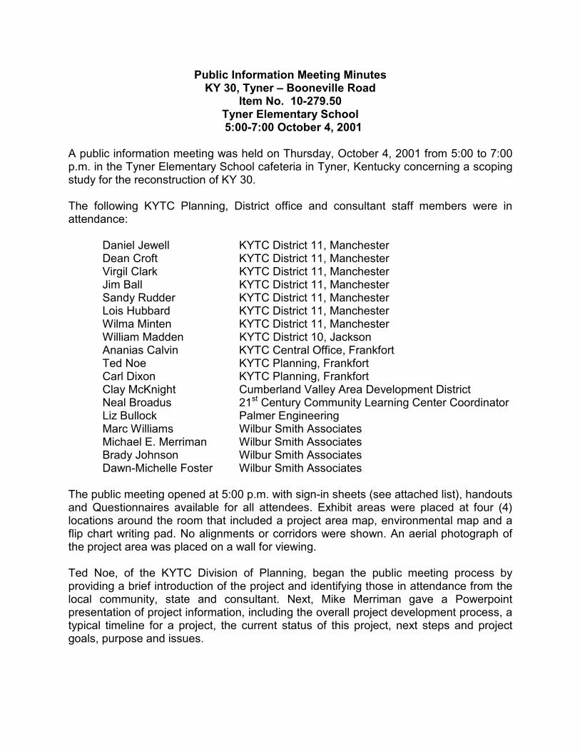
Public Information Meeting Minutes KY 30, Tyner – Booneville Road
Item No. 10-279.50 Tyner Elementary School
5:00-7:00 October 4, 2001 A public information meeting was held on Thursday, October 4, 2001 from 5:00 to 7:00 p.m. in the Tyner Elementary School cafeteria in Tyner, Kentucky concerning a scoping study for the reconstruction of KY 30. The following KYTC Planning, District office and consultant staff members were in attendance:
Daniel Jewell KYTC District 11, Manchester Dean Croft KYTC District 11, Manchester
Virgil Clark KYTC District 11, Manchester Jim Ball KYTC District 11, Manchester Sandy Rudder KYTC District 11, Manchester Lois Hubbard KYTC District 11, Manchester Wilma Minten KYTC District 11, Manchester William Madden KYTC District 10, Jackson Ananias Calvin KYTC Central Office, Frankfort Ted Noe KYTC Planning, Frankfort Carl Dixon KYTC Planning, Frankfort Clay McKnight Cumberland Valley Area Development District Neal Broadus 21st Century Community Learning Center Coordinator Liz Bullock Palmer Engineering Marc Williams Wilbur Smith Associates Michael E. Merriman Wilbur Smith Associates Brady Johnson Wilbur Smith Associates Dawn-Michelle Foster Wilbur Smith Associates The public meeting opened at 5:00 p.m. with sign-in sheets (see attached list), handouts and Questionnaires available for all attendees. Exhibit areas were placed at four (4) locations around the room that included a project area map, environmental map and a flip chart writing pad. No alignments or corridors were shown. An aerial photograph of the project area was placed on a wall for viewing. Ted Noe, of the KYTC Division of Planning, began the public meeting process by providing a brief introduction of the project and identifying those in attendance from the local community, state and consultant. Next, Mike Merriman gave a Powerpoint presentation of project information, including the overall project development process, a typical timeline for a project, the current status of this project, next steps and project goals, purpose and issues.
Following the presentation, attendees were encouraged to ask questions and give comments about the project at any of the exhibit areas, which were staffed by both state and consultant personnel. This was the “open house” portion of the meeting. A tape recorder was provided to record oral comments. All of this information will be made a part of the final report document. The Division of Planning also provided refreshments for those in attendance, which went over well with those in attendance and provided for a friendlier atmosphere. A total of 56 persons attended the two-hour public session (this number does not include the above 18 persons) and provided constructive comments regarding the KY 30 reconstruction project. Concerns, comments and questions included the following:
• An eastern route is preferred, specifically a line from Tyner-Herd-Elias to KY 11;
• The Moore farm near the US 421/KY 30 intersection may have an historic smokehouse and splitting the farm is not desirable;
• Concern that the existing route would not be maintained if the new road is built too far away from existing KY 30;
• Another possible corridor is from Tyner to KY 1709 to Maulden to Island City – this would help open up the Island City area;
• There are many (up to 200) unmarked grave sites within the Herd to Elias area and possibly other unmarked grave sites within the project area; and,
• Taking or splitting prime farmland is a concern. Some of the best farmland in Jackson County lies between the Herd to Elias area, south of existing KY 30.
The general consensus among those who attended seems to indicate that the community needs the project and is willing to consider any corridor that is recommended. The meeting closed at 7:00 p.m.

Public Information Meeting Minutes KY 30, Tyner – Booneville Road
Item No. 10-279.50 Owsley County High School
5:00-7:00 October 9, 2001
A public information meeting was held on Tuesday, October 9, 2001 from 5:00 to 7:00 p.m. in the Owsley County High School cafeteria in Booneville, Kentucky concerning a scoping study for the reconstruction of KY 30. The following KYTC Planning, District office and consultant staff members were in attendance:
William Madden KYTC District 10, Jackson Craig Lindon KYTC District 10, Jackson
Charles Allen KYTC District 10, Jackson Jeff Allen KYTC District 10, Jackson Sherry Pitts KYTC District 10, Jackson Sue Allen KYTC District 10, Jackson Sandra Friend KYTC District 10, Jackson Laura Hayes KYTC District 10, Jackson Ron Easter KYTC District 10, Jackson Ted Noe KYTC Planning, Frankfort Jim Wilson KYTC Planning, Frankfort Michael E. Merriman Wilbur Smith Associates Brady Johnson Wilbur Smith Associates Dawn-Michelle Foster Wilbur Smith Associates Brad Black Wilbur Smith Associates The public meeting opened at 5:00 p.m. with sign-in sheets, handouts and Questionnaires available for all attendees. Exhibit areas were placed at four (4) locations around the room that included a project area map, environmental map and a flip chart writing pad. No alignments or corridors were shown. An aerial photograph of the project area was placed on a table for viewing. Ted Noe, of the KYTC Division of Planning, began the public meeting process by providing a brief introduction of the project and identifying those in attendance from the local community, state and consultant. Next, Mike Merriman gave a Powerpoint presentation of project information, including the overall project development process, a typical timeline for a project, the current status of this project, next steps and project goals, purpose and issues. Following the presentation, attendees were encouraged to ask questions and give comments about the project at any of the exhibit areas, which were staffed by both state and consultant personnel. This was the “open house” portion of the meeting. A tape
recorder was provided to record oral comments. All of this information will be made a part of the final report document. The Division of Planning also provided refreshments for those in attendance, which went over well with those in attendance and provided for a friendlier atmosphere. A total of 46 persons attended the two-hour public session (this number does not include the above 15 persons) and provided constructive comments regarding the KY 30 reconstruction project. Concerns, comments and questions included the following:
• Some residents expressed concern about the right-of-way acquisition process;
• Update accident data, if possible, to reflect fatalities on KY 30 this year;
• The underground storage tanks at Bo’s Grocery have been removed;
• A good connection to KY 399 needs to be established; and,
• How far south will the new road be tied in to US 421 and KY 11? The general consensus among those who attended seems to indicate that the community needs the project and is willing to consider any corridor that is recommended. The meeting closed at 6:30 p.m.

Kiwanis Club Meeting Minutes KY 30, Tyner – Booneville Road
Item No. 10-279.50 Opal’s Restaurant
11:30 AM - 12:30 PM October 19, 2001
A Kiwanis Club meeting was held on Thursday, October 19, 2001 from 11:30 a.m. to 12:30 p.m. at Opal’s Restaurant in McKee, Kentucky. The consultant and Division of Planning was invited to give a presentation on a scoping study for the reconstruction of KY 30. The following KYTC Planning, District office and consultant staff members were in attendance:
Joel Holcomb KYTC District 11, Manchester Clay McKnight Cumberland Valley Area Development District Ted Noe KYTC Planning, Frankfort Michael E. Merriman Wilbur Smith Associates The meeting begin around 11:30 a.m. with sign-in sheets (see attached list), handouts and Questionnaires available for all attendees. One exhibit each of the project area and environmental footprint were placed on easels in the back of the room. No alignments or corridors were shown. Ted Noe, of the KYTC Division of Planning, began the meeting by providing a brief introduction of the project. Next, Mike Merriman gave a Powerpoint presentation of project information, including the overall project development process, a typical timeline for a project, the current status of this project, next steps and project goals, purpose and issues. This was the same presentation given at the public meetings. A total of 33 persons attended the meeting (this number does not include the above 4 persons). Concerns, comments and questions included the following:
• Travel time between London and Natural Bridge (Powell County) is difficult using the current route.
• Why are we doing this section? Jackson County residents would not travel this route to Booneville very much.
• Is the London to Tyner section going to be done?
• Will the report include traffic projections based on the proposed route being completed?
• A new KY 30 route between Tyner and Booneville is needed for the growth of the area.

The meeting closed at 12:30 p.m.

KY 30 Local Officials Meeting #2 page 1
MEETING MINUTES
KY 30 Scoping Study Reconstruction of KY 30 from Tyner to Booneville
Owsley & Jackson Counties
Local Officials Meeting #2 3/27/02 – 10:00 a.m.
Jackson County Empowerment Zone McKee, Kentucky
A second Local Officials Meeting regarding potential improvements to KY 30 was held on Wednesday, March 27, 2002 at 10:00 a.m. in the Jackson County Empowerment Zone office in McKee, Kentucky. Attendees at the meeting included the following:
Tommy Slone Jackson County Judge Executive Fletcher Gabbard Jackson County Empowerment Zone & JCDA Mary Purkey Jackson County Empowerment Zone
Clay McKnight Cumberland Valley Area Development District (CVADD) William Madden KYTC District 10 Dean Croft KYTC District 11, Environmental Lonnie Morgan KYTC District 11, Design Jim Wilson KYTC Central Office, Planning
Ted Noe KYTC Central Office, Planning Mike Merriman Wilbur Smith Associates Samantha Wright Wilbur Smith Associates The Local Officials Meeting was conducted as shown in the following agenda:
1) Welcome Ted Noe welcomed the meeting attendees and thanked them for their interest in the KY 30 Scoping Study.
2) Introductions The meeting attendees, KYTC staff, ADD representative, and consultant staff introduced themselves to the meeting group.
3) Project History Mr. Noe provided a summary of the project activities to-date, including the date and content of all project meetings. He indicated that the purpose of the second Local Officials Meeting was to
KY 30 Local Officials Meeting #2 page 2
discuss the alternatives developed through the study process and gain input from the meeting attendees.
Mike Merriman then began a review of the handout information:
• The Study Purpose, Goals and Project Issues statement for the project was summarized. Additional funding has not been added to the Six Year Highway Plan for this project. Public meeting items and information have been added to the project website for public review: http://www.kytc.state.ky.us/planning/index.htm.
• The public comment survey results were presented, including responses to the eight survey questions. Items of note included: 80% indicated the project would be beneficial; 33% indicated they would use the new highway daily; and 64% indicated the new route should intersect with KY 11 near the existing KY 30 intersection. Identified environmental issues included family cemeteries, farms, businesses, and natural areas.
Meeting comments included:
− A few surveys indicated that the new route would not be used at all and this seems unlikely.
4) Presentation of the Alternatives • Mr. Merriman then summarized the next items in the meeting handout – the alternatives and
related materials developed from public input, local input, and discussions with district folks. Four options (A1, B1, C1 and D1) for section one of the proposed route were developed between Tyner to Sturgeon. Alternates avoid the brown-shaded agricultural zone and farmland areas as much as possible. Meeting comments included:
− D1 is shortest and straightest;
− C1 is not desirable;
− How will you contact property owners? (Response: That would be another phase of this project, plus these bands are 2000’-wide and we don’t really know how much impact there would be to private property); and,
− Is there any reason that all of the alternatives converge at Sturgeon? It may be beneficial to reduce the curve into Sturgeon, providing more of a direct connection between A1 and A2 north of Sturgeon. (Response: We are not tied to Sturgeon and can consider this as an option for the study).
• Three options (A2, B2 and C2) for section two of the proposed route were developed from Sturgeon to Levi. Alternate A2 ties in with some of the District’s work on KY 11 north of Levi. Meeting comments included:
− There are a number of cemeteries within the B2 corridor. Should we shift the B2 corridor to the north to avoid the cemeteries? (Response: Because the corridors are 2000’ in width, it will be possible to avoid most of the cemetery locations within B2);
− A2 may attract more traffic than C2;
KY 30 Local Officials Meeting #2 page 3
− From a construction standpoint, it would be easier to reduce the number of KY 30 crossings; and,
− How important is it to stay near the existing road? (Response: More people typically use a new route when it’s closer to the old one, and public involvement for this study indicated that local citizens would like it near the old road).
• Environmental issues within each of the corridors were presented on topographic and aerial photographic maps, as well as listed within a comparative matrix. The matrix included many identified issues within the 2000’ boundary of each alternate, but was not an all-inclusive list. Mr. Merriman reviewed the ranking of the alternates related to cemeteries, prime farmland, intersections with KY 30, intersections with other roads, and other issues. KYTC officials indicated that the object of this project would be to minimize impacts to these items as much as possible.
The meeting attendees did not identify any other issues that would be important to include in the table.
• Mr. Merriman then reviewed a cost estimate table for the alternate corridors. The average cost to construct this corridor would be about $60 million. It is important to note that there are no funds in the current Six Year Highway Plan for additional phases of this project. It may be more feasible to choose corridor alternates that can be constructed in independent segments.
• Samantha Wright presented existing and future traffic volumes for three potential build scenarios, based on the Kentucky Statewide Traffic Model. Improvements to the study section of KY 30, as well as improvements under design to the south and in the Long-Range Plan to the north, are expected to attract traffic to the corridor. Additional future traffic volumes may help improve the chances for funding for this project. The identified future volumes support the recommendation of 2-lanes, with truck-lanes where necessary.
• Mr. Merriman reviewed the public comment survey planned for distribution at the next public meeting. The public meetings will be held within the next couple of months, probably in the same locations as the first meetings.
• Finally, Mr. Merriman discussed the Long Range Plan Map developed by the KYTC, showing the vision for improvements along the KY 30/KY 11/KY 7 corridor. KYTC officials indicated that a number of projects along this corridor are represented in the current Six Year Highway Plan.
5) Questions and Answers • Is there other information we should show the public?
− Add an Other Comments section to the public comment survey;
− Add a question to the public comment survey about where the improved route should cross KY 30;
− Revise the public comment survey map to show the realignment of A1 and A2 north of Sturgeon, but wait until after the meetings in Booneville on April 9th, 2002;
− Develop an exhibit of a contiguous map showing the alternatives; and,
KY 30 Local Officials Meeting #2 page 4
− Develop an exhibit of the three traffic scenarios, adding a footnote about the pink shading and the improvements to KY 7 in the third scenario.
• Which alternates do the meeting attendees prefer?
− D1 and C2 were recommended by two of the three attendees. They consider access from KY 30, minimization of costs, and a straight alignment to be important;
− Meeting attendees also indicated that any route too close to existing KY 30 would not permit development of industry and business, as it may be too close to residential areas. Building the road away from the existing route would also permit future expansion of road, if necessary.
− The District indicated that D1 and C2 are the shortest and least expensive. B2 follows KY 30 more closely, and does not disturb areas further from the existing road like the other alternates. Any option should include turn lanes at intersection approaches along the new route;
− According to the CVADD, improved travel time is important for opening up business development, and could be accomplished with D1 and C2. Use of the existing KY 30 corridor for agricultural vehicles indicates that a route away from the existing road would be beneficial.
6) Adjourn The meeting was adjourned at 11:15 a.m.
KY 30 Local Agencies Meeting #2 page 1
MEETING MINUTES
KY 30 Scoping Study Reconstruction of KY 30 from Tyner to Booneville
Owsley & Jackson Counties
Local Agencies Meeting #2 3/27/02 – 1:00 p.m.
Jackson County Empowerment Zone McKee, Kentucky
As part of the KY 30 Scoping Study public involvement process, a second Local Agencies Meeting was held at the Jackson County Empowerment Zone office on Wednesday, March 27th, 2002, at 1:00 p.m. Attendees at the meeting included the following: J.C. Dunsil Jackson County Empowerment Zone Clay McKnight Cumberland Valley ADD
William Madden KYTC District 10 Dean Croft KYTC District 11, Environmental
Lonnie Morgan KYTC District 11, Design Jim Wilson KYTC Central Office, Planning
Ted Noe KYTC Central Office, Planning Mike Merriman Wilbur Smith Associates Samantha Wright Wilbur Smith Associates
The Local Agencies Meeting was conducted as shown in the following agenda:
1) Welcome Ted Noe welcomed the meeting attendees and thanked them for their interest in the KY 30 Scoping Study.
2) Introductions The meeting attendee, KYTC staff, ADD representative, and consultant staff introduced themselves to the meeting group.
3) Project History Mr. Noe provided a summary of the project activities to-date, including the date and content of all project meetings. The meeting attendee asked about the public meeting in Jackson County. Mr. Noe indicates that the meeting was a success, as it was well-attended and the facility was nice.
KY 30 Local Agencies Meeting #2 page 2
Mike Merriman then began a review of the handout information:
• The Study Purpose, Goals and Project Issues statement for the project was summarized. Additional funding has not been added to the Six Year Highway Plan for this project. Public meeting items and information have been added to the project website for public review: http://www.kytc.state.ky.us/planning/index.htm.
• The public comment survey results were presented, including responses to the eight survey questions. Items of note included: 80% indicated the project would be beneficial and 33% indicated they would use the new highway daily. Identified environmental issues included family cemeteries, farms, businesses, and natural areas.
4) Presentation of the Alternatives • Mr. Merriman then summarized the next items in the meeting handout – the alternatives and
related materials developed from public input, local input, and discussions with district folks. Four options (A1, B1, C1 and D1) for section one of the proposed route were developed between Tyner to Sturgeon. Meeting comments included:
− Which corridor has been chosen? (Response: That decision has not yet been made and will depend on the input from many sources).
• Three options (A2, B2 and C2) for section two of the proposed route were developed from Sturgeon to Levi. Alternate A2 ties in with some of the District’s work on KY 11 north of Levi.
• Environmental issues within each of the corridors were presented on topographic and aerial photographic maps, as well as listed within a comparative matrix. The matrix included many identified issues within the 2000’ boundary of each alternate, but was not an all-inclusive list. Mr. Merriman reviewed the ranking of the alternates related to cemeteries, prime farmland, intersections with KY 30, intersections with other roads, and other issues.
Meeting comments included:
− What does the geotechnical ranking mean? (Response: The preferred alternate from a geotechnical standpoint is ranked as 1);
− What is the superfund site shown on the environmental map? (Response: Information related to that site will be identified prior to the public meeting); and,
− The illegal dumpsite at the corner of KY 30 and Creech Road is being cleaned up. • Mr. Merriman then reviewed a cost estimate table for the alternate corridors. The average
cost to construct this corridor would be about $60 million.
• Samantha Wright presented existing and future traffic volumes for three potential build scenarios, based on the Kentucky Statewide Traffic Model. Improvements to the study section of KY 30, as well as improvements under design to the south and in the Long-Range Plan to the north, are expected to attract traffic to the corridor. Additional future traffic volumes may help improve the chances for funding for this project. The identified future volumes support the recommendation of 2-lanes, with truck-lanes where necessary.
KY 30 Local Agencies Meeting #2 page 3
Meeting comments included:
− What improvements are planned for KY 11? (Response: The Long Range Plan for this entire corridor involves two-lane widening with truck lanes where necessary).
• Mr. Merriman reviewed the public comment survey planned for distribution at the next public meeting. The public meetings will be held within the next couple of months, probably in the same locations as the first meetings.
• Finally, Mr. Merriman discussed the Long Range Plan Map developed by the KYTC, showing the vision for improvements along the KY 30/KY 11/KY 7 corridor.
5) Questions and Answers • Are there any comments on the alternatives or materials presented?
− It looks like a thorough job has been done on this project. 6) Adjourn The meeting was adjourned at 1:45 p.m.

KY 30 Local Officials/Agencies Meeting #2_Booneville page 1
MEETING MINUTES
KY 30 Scoping Study Reconstruction of KY 30 from Tyner to Booneville
Owsley & Jackson Counties (Item No. 10-279.50)
Local Officials/Agencies Meeting #2
4/09/02 – 10:00 a.m. Owsley County Court House
Booneville, Kentucky
A second local officials and agencies meeting regarding potential improvements to KY 30 was held on Tuesday, April, 9, 2002 at 10:00 a.m. in the Owsley County Court House in Booneville, Kentucky. Attendees at the meeting included the following:
Jimmie Herald Owsley County Judge Executive Susan Ramos Booneville/Owsley County Industrial Authority Ronnie Callahan City of Booneville
Charles Long Mayor, City of Booneville Clayton Combs Owsley County Roadway Foreman Jeff Coots Kentucky River Area Development District (KRADD) William Madden KYTC District 10, Planning Jim Wilson KYTC Central Office, Planning
Ted Noe KYTC Central Office, Planning Michael E. Merriman Wilbur Smith Associates Bradley S. Black Wilbur Smith Associates The Local Officials/Agencies Meeting was conducted as shown in the following agenda:
1) Welcome Ted Noe welcomed the meeting attendees and thanked them for their interest in the KY 30 Scoping Study.
2) Introductions The meeting attendees, KYTC staff, ADD representative, and consultant staff introduced themselves to the meeting group.
3) Project History Mr. Noe provided a summary of the project activities to-date, including the date and content of all project meetings. He indicated that the purpose of the second local officials meeting was to discuss the alternatives developed through the public involvement process and gain input from the meeting attendees.
Mike Merriman then began a review of the handout information:

KY 30 Local Officials/Agencies Meeting #2_Booneville page 2
• The Study Purpose, Goals and Project Issues statement for the project was summarized. Additional funding has not been added to the Draft Six Year Highway Plan for this project. Public meeting items and information have been added to the project website for public review: http://www.kytc.state.ky.us/planning/index.htm.
• The public comment survey results were presented, including responses to the eight survey questions. Items of note included: 80% indicated the project would be beneficial; 33% indicated they would use the new highway daily; and 64% indicated the new route should intersect with KY 11 near the existing KY 30 intersection. Identified environmental issues included family cemeteries, farms, businesses, and natural areas.
Meeting comments included:
− Most of the community members would utilize any potential new roadway.
− Access to I-75 would help create more growth for the community.
− Renewal Community Status should be utilized to help the project move forward.
− If a new roadway is constructed then there may be more vehicles passing through the area.
4) Presentation of the Alternatives • Mr. Merriman then summarized the next items in the meeting handout – the alternatives and
related materials developed from public input, local input and discussions with district personnel. Four options (A1, B1, C1 and D1) for section one of the proposed route were developed between Tyner to Sturgeon. Alternates avoid the agricultural zone and farmland areas as much as possible. Meeting comments included:
− D1 is shortest and straightest; and,
− C1 is not desirable. • Three options (A2, B2 and C2) for section two of the proposed route were developed from
Sturgeon to Levi. Alternate A2 ties in with some of the District’s work on KY 11 north of Levi. Meeting comments included:
− From a construction standpoint, it would be easier to reduce the number of KY 30 crossings for less maintenance of traffic; and,
- C2 seems to be the straightest and most direct route.
• Environmental issues within each of the corridors were presented on topographic and aerial photographic maps, as well as listed within a comparative matrix. The matrix included many identified issues within the 2000’ boundary of each alternate, but was not an all-inclusive list. Mr. Merriman reviewed the summary of the alternates related to cemeteries, prime farmland, intersections with KY 30, intersections with other roads, and many other issues. KYTC officials noted that a major objective of this project would be to minimize impacts to these
KY 30 Local Officials/Agencies Meeting #2_Booneville page 3
items as much as possible. It was noted that only about 10-15 percent of the corridor would likely be used for actual construction of the project, thus many features within each corridor may be avoided. Comments on this issue included:
- The wetlands around Endee may be a problem.
- It was noted there were a lot of cemeteries around the Sturgeon area.
• Mr. Merriman then reviewed a cost estimate table for the alternate corridors. The average cost to construct this corridor would be about $60 million. It is important to note that there are no funds in the current Draft Six Year Highway Plan for additional phases of this project. If funding becomes available, it is likely that the preferred corridor alternate will be built in 2 or 3 mile segments until the entire project is completed.
• Mr. Merriman then presented existing and future traffic volumes for three potential build scenarios, based on the Kentucky Statewide Traffic Model. Improvements to the study section of KY 30, as well as improvements under design to the south and in the Long-Range Plan to the north, are expected to attract traffic to the corridor. Additional future traffic volumes, possibly through system connectivity or economic development, may help improve the chances of funding for this project or advancing the schedule. The identified future volumes support the recommendation of 2-lanes, with truck-lanes or passing lanes, where necessary.
• Mr. Merriman reviewed the public comment survey (questionnaire) planned for distribution at the next public meeting. The public meetings should be held within the next couple of months, probably in the same locations as the first meetings.
• Finally, Mr. Merriman discussed the Long Range Plan Map developed by the KYTC, showing the vision for improvements along the KY 30/KY 11/KY 7 corridor, a transportation link between I-75 at London and I-64 at Grayson.
5) Questions and Answers, Comments • Which alternates do the meeting attendees prefer?
− D1 and C2 were supported by the majority of the attendees. These segments do not cross KY 30 and provide a direct access between Tyner and Booneville. Attendees consider access from KY 30, minimization of costs, and a straight alignment to be important;
− Meeting attendees also indicated that any route adjacent to existing KY 30 would not allow development, or potential for development, of industry and business, as it may be too close to residential areas or small communities. Building the road away from the existing route would also permit future expansion of the road.
6) Adjourn The meeting was adjourned at 11:00 a.m.
KY 30 Public Meeting No. 2—Tyner 1
Public Involvement Meeting
KY 30 Reconstruction Owsley and Jackson Counties
Item No. 10-279.50 Tyner Elementary School
5:00 p.m. to 7:00 p.m. (EST), June 4, 2002 A public involvement open house was held on Tuesday, June 4th from 5:00 p.m. to 7:00 p.m. at the Tyner Elementary School gymnasium in Tyner, Kentucky. The following Kentucky Transportation Cabinet (KYTC) District 11, KYTC Central Office, and consultant staff from Wilbur Smith Associates (WSA) were in attendance:
Wilma Minton KYTC District 11 Lois Hubbard KYTC District 11 Daniel Jewell KYTC District 11 James E. Ball KYTC District 11 Quentin Smith KYTC District 11 Andy Buell KYTC District 11 Debbie Dixon KYTC District 11 Virgil Clark KYTC District 11 Sandy Rudder KYTC District 11 Dean Craft KYTC District 11 Lonnie Morgan KYTC District 11 Ted Noe KYTC Central Office, Division of Planning Jimmy C. Wilson KYTC Central Office, Division of Planning Michael E. Merriman WSA - Lexington Bradley S. Black WSA - Lexington
The public involvement open house was organized as a presentation/walk-through tour of project information. The room was set up with an arrangement of project exhibits, comment boards and refreshments. As attendees entered the room, they were asked to sign-in and pick-up a packet containing the following items:
• Study purpose, issues, and project goals;
• Project location map;
• Traffic and geometric data for the project location;
• Environmental footprint map with alternate corridors (Jackson County);
• Environmental footprint map with alternate corridors (Owsley County);
• Corridor evaluation matrix; and,
• Project Questionnaire results.

KY 30 Public Meeting No. 2—Tyner 2
Shortly after 5:00 p.m. (EST) Ted Noe welcomed all attendees and thanked everyone for coming. Mr. Noe gave a brief overview of the status of the project and then turned the meeting over to Mike Merriman. Mr. Merriman continued reviewing the current status of the project and then began a presentation that covered the following items:
• Meeting format;
• Road building process;
• Study purpose;
• Project schedule;
• Project area;
• Project goals;
• Existing roadway conditions;
• Desired roadway conditions;
• Year 2001 traffic data;
• Year 2025 traffic data;
• Accident data;
• National Environmental Policy Act (NEPA);
• Environmental issues/concerns;
• Corridor alternates;
• Evaluation of corridor alternates; and,
• Next steps for the project. After the completion of the presentation, Mr. Noe and Mr. Merriman strongly encouraged all attendees to stop by the display stations to state any issues and/or concerns. A total of eleven (11) persons registered their attendance at the two-hour public session (this number does not include the above staff members). A copy of the sign-in sheet is attached to this document. A few people completed the public comment survey at the meeting while most took a pre-addressed, postage-paid envelope to mail the questionnaire in at a later date. Oral comments made to staff members are listed below:
• Tyner businesses will likely be damaged with any proposed interchange at US 421.
• Prime farmland within the area seems incorrectly displayed on the maps. WSA will investigate this further to determine if there is an error in the amount of prime farmland acreage.
• Can corridor be moved to follow US 421 from proposed London tie and then run along KY 30?
• Why was a 2000-foot corridor width used?
• Why was East Bernstadt (London segment) terminated at proposed location on US 421?
• Project will only benefit Laurel and Owsley Counties, will not benefit Jackson County.

KY 30 Public Meeting No. 2—Tyner 3
Other comments and identified issues are anticipated though the public comment surveys, which were distributed at the meeting and can be returned by mail to the KYTC until June 21, 2002. Once the questionnaires are received by the KYTC, these comments will also be included in the official meeting record. The meeting closed at 7:00 p.m.

KY 30 Public Meeting No. 2—Tyner 1
Public Involvement Meeting Minutes
KY 30 Reconstruction Owsley and Jackson Counties
Item No. 10-279.50 Owsley County High School Cafeteria
5:00 p.m. to 7:00 p.m. (EST), June 13, 2002 A public involvement open house was held on Thursday, June 13th from 5:00 p.m. to 7:00 p.m. at the Owsley County High School Cafeteria in Booneville, Kentucky. The following Kentucky Transportation Cabinet (KYTC) District 10, KYTC Central Office, Federal Highway Administration (FHWA) and consultant staff from Wilbur Smith Associates (WSA) were in attendance:
Sandra Friend KYTC District 10 Ron Easter KYTC District 10 Sherry Pitts KYTC District 10 Melaina Branham KYTC District 10 Jeff Allen KYTC District 10 William Madden KYTC District 10 Debbie Dixon KYTC District 10 Ted Noe KYTC Central Office, Division of Planning Jimmy C. Wilson KYTC Central Office, Division of Planning Anthony Goodman FHWA Michael E. Merriman WSA - Lexington Bradley S. Black WSA - Lexington
The public involvement open house was organized as a presentation/walk-through tour of project information. The room was set up with an arrangement of project exhibits, comment boards and refreshments. As attendees entered the room, they were asked to sign-in and pick-up a packet containing the following items:
• Study purpose, issues, and project goals;
• Project location map;
• Traffic and geometric data for the project location;
• Environmental footprint map with alternate corridors (Jackson County);
• Environmental footprint map with alternate corridors (Owsley County);
• Corridor evaluation matrix; and,
• Project Questionnaire results. Shortly after 5:00 p.m. (EST) Ted Noe welcomed all attendees and thanked everyone for attending. Mr. Noe gave a brief overview of the status of the project and then turned the meeting over to Mike Merriman. Mr. Merriman continued reviewing the current status of the project and then began a presentation that covered the following items:
• Meeting format;
• Road building process;

KY 30 Public Meeting No. 2—Tyner 2
• Study purpose;
• Project schedule;
• Project area;
• Project goals;
• Existing roadway conditions;
• Desired roadway conditions;
• Year 2001 traffic data;
• Year 2025 traffic data;
• Accident data;
• National Environmental Policy Act (NEPA);
• Environmental issues/concerns;
• Corridor alternates;
• Evaluation of corridor alternates; and,
• Next steps for the project. After the completion of the presentation, Mr. Noe and Mr. Merriman strongly encouraged all attendees to stop by the display stations to state any issues and/or concerns. A total of thirty-three persons registered their attendance at the two-hour public session (this number does not include the above staff members). A copy of the sign-in sheet is attached to this document. A few people completed the public comment survey at the meeting while most took a pre-addressed, postage-paid envelope to mail the questionnaire in by June 28, 2002. Oral comments made to staff members are listed below:
• Why has the Cabinet waited so long to build this roadway?
• The road is needed as soon as possible.
• Travel time from Levi to London is fifty-one minutes; this time is accomplished by exceeding some safe speed limits.
• The straightest and cheapest route is preferred.
• Explain difference between historic structures and eligible historic structures.
• Would be willing to give up my property or move in order to allow the new roadway to be built.
Other comments and identified issues are anticipated though the public comment surveys, which were distributed at the meeting and can be returned by mail to the KYTC until June 21, 2002. Once the questionnaires are received by the KYTC, these comments will also be included in the official meeting record. The meeting closed at 7:00 p.m. (Attachment: (2) Public Meeting Sign-In Sheets)
KY 30 Team Meeting Reconstruction of KY 30, Tyner to Booneville
Owsley – Jackson Counties, Item No. 10-279.50 10:00 a.m. (EDT) August 5, 2002
District 10 Conference Room
A project team meeting for the KY 30 Scoping Study in Owsley – Jackson Counties (Item No. 10-279.50) was conducted on Monday, August 5, 2002 at the District 10 Conference Room in Jackson, Kentucky. The purpose of the meeting was to discuss the purpose, goals and objectives of the proposed project, to review preliminary existing conditions for the study corridor and identify a preferred corridor. Participants at the meeting included representatives from the Kentucky Transportation Cabinet (KYTC) District 10, KYTC District 11, KYTC Central Office (Division of Planning) and consultant staff from Wilbur Smith Associates (WSA). Individual attendees at the meeting included the following:
Charles Allen KYTC District 10, Jackson William Madden KYTC District 10, Jackson Dean Croft KYTC District 11, Manchester Jim Ball KYTC District 11, Manchester Quentin Smith KYTC District 11, Manchester
Ted Noe KYTC Central Office (Division of Planning) Jimmy C. Wilson KYTC Central Office (Division of Planning)
Michael E. Merriman Wilbur Smith Associates Bradley S. Black Wilbur Smith Associates A summary of the key comments and discussion items for this meeting is included below, organized according to the meeting agenda. It should be noted that an agenda for this meeting is attached to this document. Welcome Ted Noe opened the meeting by welcoming all of those in attendance and thanking attendees for their concern and interest regarding the project. Introductions Given that all attendees had previously worked together, introductions were not necessary. Project History Wilbur Smith Associates provided packets to all attendees that included the following items:
• Meeting Agenda;
• Study Purpose, Issues and Project Goals;
• Project Location (Map);
• KY 30 Estimated 1999 ADT & 2025 ADT Using Statewide Traffic Model (Map);

2
• Traffic and Geometric Data (Table);
• Accident Information by Accident Type (Map);
• Accident Analysis (Table);
• KY 30 Environmental Footprint – Jackson County Alternates (Map);
• KY 30 Environmental Footprint – Owsley County Alternates (Map);
• Alternate Corridor Comparisons for KY 30 (Table);
• Project Questionnaire Results (From Public Meetings at Tyner and Booneville, October 2001);
• Project Questionnaire Results (From Public Meetings at Tyner and Booneville, June 2002); and
• Agency Coordination Letter Comments. Mike Merriman briefly gave an overview of each of the aforementioned items contained in attendees’ packets. Mr. Merriman noted that no additional funding is available in the current Six Year Highway Plan for this project. In addition, it was noted that existing traffic and accident data does not warrant improvements to the existing roadway. Furthermore, Mr. Merriman noted that future traffic estimates based on the KYTC Statewide Traffic Model did not warrant improvements to the existing route. However, Mr. Merriman continued by informing attendees that 72 percent of questionnaire respondents supported improving the KY 30 route. Also, as part of the state’s Long-Range Transportation Plan, the Tyner to Booneville segment of KY 30 reconstruction is to be completed. Currently, the KYTC has plans to design or construct KY 30 from East Bernstadt to Tyner and KY 11 from Booneville to Beattyville. For route continuity, and access between I-75 and the Mountain Parkway, the Tyner-Booneville segment of KY 30 would have to be done. It is anticipated that traffic volumes and economic development opportunities would be improved by this new route. Attendees were given a brief overview discussion regarding each of the twelve (12) corridors identified to date. Mr. Merriman noted that 82 percent of Questionnaire respondents chose Alternate D-J, a more direct routing that did not cross existing KY 30; however, based on his conversations with the public, Mr. Merriman stated it was his opinion that the public would support any improvement and perhaps selected Alternate D-J because it was the “straightest” route. Attendees noted that Alternate Segment J does not tie into KY 399 at Vincent and an alternate with better access to KY 399 is preferred. Mr. Merriman stated that a geotechnical overview was performed and recommended Alternate D-J. However, it was noted that there was no “fatal flaws” found with any of the corridors, either environmentally or geotechnically. Questions and Answers Jimmy Wilson noted that all alternates seemed to meet the original specified project goals. In addition, Mr. Wilson noted that other corridor(s) may be selected to carry forward. Although the “Do-Nothing” alternate is viable for this project, this alternate would not meet any of the project goals set forth from the KYTC, agencies, local officials and the general public and was not recommended.

3
The consensus for the corridor alternate was D-H. Attendees favored Alternate Segment H as opposed to Alternate Segment J. Specifically, attendees identified the following as to their choice:
• The anticipated intersection with KY 11, near Levi, would provide better access with current KY 11 improvements in this area;
• There are feasible intersections with the existing route so that sections of independent utility can be utilized, thus making priority sections and funding options available along the entire corridor;
• In Owsley County, this corridor would be close to the existing route and the communities of Vincent and Travellers Rest, thus providing a route closer to existing KY 30;
• The corridor may traverse some areas which have previously incurred mining activities and this may minimize the amount of undisturbed land that will be required for construction; and
• Utilization of this corridor should minimize the amount of prime farmland affected.
In addition to the above advantages of Alternate Segment H, attendees noted that Alternate Segment J had the following disadvantages:
• Numerous cemeteries; and
• Multiple river crossings. Given all of the aforementioned issues regarding Alternate Segment H and Alternate Segment J, it was determined that the Scoping Study Draft Report currently under preparation by WSA would recommend Alternate D-H. Attendees expressed a desire for WSA to break this corridor into segments and prioritize the segments accordingly. Mr. Merriman agreed that this was possible and would be incorporated into the draft and final reports. Attendees identified the following as potential segments (ranked according to decreasing prioritization) beginning in Owsley County:
1. KY 30/KY 11 intersection, near Levi, to KY 30, near Vincent (Owsley County) 2. KY 30, near Vincent to KY 30, near Travellers Rest (Owsley County) 3. KY 30, near Travellers Rest, to KY 30, near Sturgeon (Owsley County) 4. KY 30, near Sturgeon, to KY 30, near Elias (Jackson County) 5. KY 30, near Elias to KY 30, near Herd (Jackson County) 6. KY 30, near Herd to KY 30/US 421 intersection, at Tyner (Jackson County)
Costs will be estimated for the following phases of design: Design/Environmental, Right-of-Way, Utilities and Construction. Estimates will be derived from similar projects in Districts 10 and 11. Adjourn With no further comments, the meeting ended at 11:20 a.m. (EDT).
4
AGENDA Interdisciplinary Team Meeting
Scoping Study Owsley – Jackson Counties, Item No. 10-279.50
Reconstruction of KY 30 from Tyner to Booneville August 5, 2002
10:00 am District 10 Conference Room
1) Welcome 2) Introductions 3) Project History 4) Presentation of Alternatives 5) Questions and Answers 6) Adjourn