Embed Size (px)
Citation preview

SUMMARY Seward Hwy/Alyeska Hwy Intersection Improvements
Z546190000 Public Open House #1
Date | Time: December 10, 2020 (6:00pm - 8:00pm) |
Location: Virtual Meeting Via Zoom |
Project Team Christina Huber, PE, Project Manager, DOT&PF Tim Grier, PE, Project Manager, R&M Consultants, Inc. (R&M) Van Le, AICP, Stakeholder Coordination/CSS Process Lead, R&M Marc Frutiger, PE, PTOE, Lead Civil Engineer, R&M Taryn Oleson-Yelle, AICP, Stakeholder Coordination, R&M Jeanne Bowie, PE, PhD, PTOE, Traffic Engineering Analyst, Kinney Engineering
For a full list of project team members, see slide two of the attached presentation.
Attendees
The meeting was attended virtually via Zoom or conference call. Attendees came and went throughout the meeting, with 43 attendees at 6:30 PM during the first presentation, and 21 attendees after the second presentation at 7:40 PM, including project team members. An estimated 46 members of the public were in attendance.
Emails were collected from attendees who provided them to the project team via chat or email.
Attendees present in the Zoom meeting with name identification included (excluding project team members):
Anna Ferntheil Betsy Connell BSullivan Catherine McDermott Damacdonald Danika Simpson, DOT&PF ROW Daniel McIntosh David Post, DOT&PF Debessex1 Eric Steinfort Erin O’Leary James Sowerwine, DOT&PF Jerry Fox Kyle Kelley Larry
Lckruse (Fritz Krusen) Marc’s Iphone2 Martin Cassens Michelle Weston Mike Edgington Nolson Orion LeCroy DOT&PF Sandra Griffin Scott Sean Holland, DOT&PF Shannon Cothren Shawn Gardner, DOT&PF Shelley Rowton Zelma Denise (John Gallup)
Page 2
Meeting Materials
The following materials were presented during the Public Meeting and were also posted to the project website (www.sewardalyeskahwyintersection.com) prior to Open House (see attachments):
PDF Presentation which included o Study Area Aerial Graphic o Traffic Data and Graphic o Identified Issues Graphic o Photos of existing conditions at the intersections o Project Schedule o Contact information
Meeting Summary
The Zoom meeting opened fifteen minutes prior to the scheduled start time of 6:00 PM. Taryn Oleson-Yelle, AICP (operating under the username R&M Consultants, Inc.) monitored the Zoom platform and facilitated the conversation and chat. The meeting was recorded for accuracy and is available to DOT&PF upon request. Participants mainly joined the meeting via computer but were also able to join by phone.
The meeting began at the scheduled time of 6:00 PM and the presentation began with introductions prior to 6:15 PM.
Van Le, AICP and Marc Frutiger, PE, PTOE of R&M Consultants. Inc presented twice during the event. Van first introduced the Seward Hwy & Alyeska Hwy Intersection Improvements project and the project team. Marc then gave an overview of the project’s scope and objectives and described the study area. He informed participants that the project is funded for engineering, environmental and public involvement activities through the selection of a preferred alternative and development of the design to the 30% level, including compliance with the Municipality of Anchorage’s Context Sensitive Solutions (CSS) Policy and the National Environmental Policy Act (NEPA).
Van reviewed the events that have occurred to date, including meetings with the Girdwood Board of Supervisors and the Girdwood Alliance Board, the Anchorage Transportation Fair and stakeholder meetings. She summarized the issues and opportunities the project team has heard so far from those events. The project schedule was presented and Van explained that the project is in the issue identification phase and that we are looking for community members to share their experiences, inputs, concerns and priorities for the Seward Hwy & Alyeska Hwy intersection. Following the presentation, the meeting opened into a discussion on issues and opportunities and a question and answer session.
At 7:20 PM, Van and Marc gave the presentation again to inform community members who had joined the meeting after the first presentation and round of discussion. The meeting concluded at 8:05 PM, consistent with the schedule end time. Stakeholder’s input gathered during and after the meeting will help inform the concepts that will be explored during the alternative identification phase of the project.

Page 3
The following is a summary of the comments (grouped roughly by topic), questions and answers that were provided through both the audio and chat during the meeting:
Resources
• Michelle Weston, Girdwood Fire & Rescue o I permitted the Girdwood sign when I was with the MOA-HLB and can help you with the history of
that. o Emergency response to Old Girdwood is also through gas station parking lot and old Girdwood
does not have a water supply for structure fires (lots are served by individual wells). Project Team Response: Thank you, Michelle, it’s great to know we have you as a resource!
• Shelley Rowton, HLB Land Management Officer
o HLB owns multiple properties in and around the study area. Happy to talk. I'm engaging with Jusdi Doucet tomorrow (12/11/20) about Mental Health Trust's land in the study area. I am very interested in collaborating on a wetlands/tidelands pullout, boardwalk, interpretive walk.
o Original townsite, albeit under water, should be featured, as well as the unique tideland area. o Last thing - we are exploring alternatives for a wetland mitigation bank site in Girdwood and hope
that we can be a valuable resource for those needs. Understanding what they might be up front will help us plan for adequate credits availability. Project Team Response: I'm very glad you're at the meeting and want to collaborate, it will certainly
lead to better alternatives and more opportunities to explore. Looking forward to talking with you in the near future!
Scope, Boundaries & Size of the Project • Have measurements been taken to consider the size constraints on the interchange, considering the
wetlands and private property? I imagine size constraints will be a big factor in what solutions can be considered.
o Project Team Response: at this point we aren’t boxing ourselves in given available ROW or environmental constraints. We are starting with the full slew of alternative options and then ROW and environmental impacts would be taken into consideration. Large list of Alts to then be paired down given those potential impacts
• Is the bridge going over the railroad tracks included in the scope of the study? It is a main access for Girdwood. Iditarod historic trail would like to connect the trail under that bridge and would therefore be a main stakeholder.
o Project Team Response: Glacier Creek bridge and ARRC bridge are included in the ‘study area’ but we always draw it larger than the ‘worst case’ project area. Typically, we don’t replace bridges if we can prevent it. We don’t know yet because we don’t know what our alternatives will be or what they will require.
o I strongly support the continuation of the bike path from the Lower Iditarod Trail, to under the railroad bridge, as a way to hook back into the Bird to Gird Bike path. The official end of the Lower Iditarod Trail exits directly onto the Alyeska Highway forcing people to cross the highway at a point that many drivers are speeding and unaware of this crossing. This could be fixed by connecting the Lower Iditarod Trail directly to the Bird to Gird under the railroad bridge, providing a safe loop through the Girdwood Valley that does not cross the highway at-grade.

Page 4
• Please consider some sort of scenic view pullouts on the southbound side of the Seward Highway opposite from Toadstool Drive. The beachheads there offer space for parking and boardwalks. People park at the “Welcome to Girdwood” sign on Toadstool and run across the highway to take pictures. If there was a pumpable bathroom there it might also relive some of the pressure from the Tesoro Mall as well. This area also provides access to ice-skating.
• If you were to install rotary (or similar solution type), it looks like you’re going to have to acquire some high value wetlands which is a substantial step but it would be well worth that effort.
• Michelle, Girdwood Fire & Rescue: Way back in the 90s, the HLB had some plans for properties by the railroad between Toadstool Dr. and Alyeska Hwy to do some development projects even though they are wetlands, but I’m not sure if those are still active
o Shelly, HLB Land Management Response: northwest corner and southwest of this intersection is now owned by the Alaska Mental Health Trust. HLB does own on either side of Glacier Creek within the project boundary – Glacier Creek has flooded in the past and has had to undergo emergency gravel removal during those flooding events. I have concerns about the road that has been pounded into the side of the creek there supporting parking/fishing in the creek.
Traffic
• I'd love to hear a results analysis of the crashes/property data. Any conclusions that stood out? o Jeanne, Kinney Engineering Response: crash type we see in the data (1980-2017) happening most often are
crashes turning left from Alyeska Hwy or the Tesoro Mall and it appears to be related to a vehicle either parked along the highway or making a right-hand turn blocking the view of the left-turning driver – thinking they have a gap but actually do not. Severity of crashes: we have not found any fatal crashes that are related to the intersection – we know the Seward Highway has high crash rates when compared to other, similar facilities, but we didn’t see any fatal crashes that were directly related to the intersection. Most crashes result in property damage.
• Looking at the rates of crashes in your traffic data, how does that compare – is it low, high? I guess that would contribute as to when this project could get funded.
o Jeanne, Kinney Engineering Response: DOT&PF publishes average crash rates for different kinds of facilities; for the last 5 years comparing this intersection to other 3-legged intersections throughout the state, this intersection is considered average.
• There was a fatality there last week o Project Team Response: Thank you, and we are aware there was a crash near the study area recently. Jeanne,
our traffic analyst, is speaking to the data available to her which is through 2017, but we will be looking at updated data as it becomes available. I believe Michelle Weston, Girdwood Fire & Rescue Chief, just spoke a bit towards last week's fatality as well which was not at the intersection.
• Michelle’s, Girdwood Fire & Rescue perspective anecdotally over the last 24 years: most calls have been primarily left hard turn related, I haven’t responded to a fatality call at the intersection. As far as major vs. minor injury classification is concerned, I’m not sure what the exact definition is, but for the police, minor injuries are still being transferred to the hospital. Most crashes at the intersection result in people being taken to the hospital to be checked out. APD takes up to 30 minutes to respond if traffic control is needed at a crash site.
o Orion LeCroy (DOT&PF Traffic & Safely): Michelle - The definition for a serious injury crash is located in the Motor Vehicle Collision Report Manual - Page 143. http://www.dot.state.ak.us/stwdplng/hwysafety/assets/pdf/Alaska_Motor_Vehicle_Collision_Report

Page 5
_Manual_Jan_2016.pdf
• The traffic control for this intersection with regards to an emergency scene is BANANAS!
Left Turns:
• Left turning traffic, especially on weekends, is a concern – my [Orion, DOT&PF and Girdwood Resident] personal record turning left off Alyeska to head southbound was 13 minutes to find a gap.
• Leaving the Girdwood valley in the summer to head south during the summer months is very challenging, mostly because of the steady stream of southbound traffic combined with southbound traffic turning onto the Alyeska Highway. This causes two problems: it backs up traffic on the Alyeska Highway, often resulting in risk taking driver behavior, and as it was pointed out many locals cut through the Tesoro Mall area to bypass that intersection as to not have to deal with the southbound traffic turning onto the Alyeska Highway.
• Happy to see that the two left turns at the intersection are recognized as a primary concern and that people are cutting over through the Tesoro Mall parking lot to access the highways.
Speed Control:
• Any traffic solution needs to take into consideration some traffic calming measures to slow speeds of vehicles as they enter the Alyeska Highway into Girdwood. Flashing speed signs and other signage would be appropriate.
• I have concerns regarding left turning movements and high speeds into and out from Alyeska Hwy; what type of considerations are being taken? If you are looking for smoother traffic flow, what would prevent the problem of high speed turning movements? If you have very smooth traffic flow with easy turning movements, how do we control traffic speeds/slow down traffic on the Alyeska Hwy? (its 45 MPH but coming from the 65 MPH on the Seward)
o Jeanne, Kinney Engineering Response: there are multiple ways to control speed, including incorporation of vertical elements, what is happening adjacent to the road tends to aid in controlling speed as well as horizontal design features such as curves. You’re right, if you don’t have something telling you ‘you’re in a different place now’ with a smooth transition from a higher speed area to a slower one, driver behavior tends to be to continue at the higher speed.
o Marc, R&M Question to Jeanne: did your traffic data show anything about typical speeds on Alyeska? Jeanne Response: A cursory review of the speed data collected this fall indicates that the 85th
percentile is appropriate for the posted speed of 45 mph.

Page 6
Access & Circulation • Toadstool is the only alternate emergency access out of the Girdwood Valley if there is an accident or
emergency at this intersection
• Boat ramp emergency access is important to respond to situations in Turnagain Arm o The boat ramp that was taken out because of the most recent work on the bridge (Seward Hwy MP
75-90 project) should be replaced in order for First Responders to continue to service the Turnagain Arm.
• There often isn’t law enforcement here for 30 minutes, myself and other first responders have nearly been hit on the highway while responding to situations on the highway – semis and other traffic needs to slow down, it’s only a matter of time before a responder is injured or killed by fast moving traffic.
Tesoro Mall:
• How much ability / consideration is being given to helping the Girdwood Station / Tesoro Mall with the ambiguous nature of their traffic flow as it interacts with both the Alyeska Highway and the Seward Highway?
o Danica, DOT&PF ROW Response: one thing we look at is existing access and any way we can consolidate/minimize access points without limiting movements. ROW has been overtaken by the mall and as part of this project we may need to repurpose that ROW and one way we do that may be through access mitigation. At this concept stage we don’t know much, but as we move forward we will review all of that and look for ways to improve.
o Van, R&M Response: parking is required for the Station Mall per MOA regulations and number of driveways/turning movements for the Tesoro will be taken into consideration and have requirements, but we are looking at all the options.
• Consolidation and clearer intentions of the traffic flow in and out of the mall would be great. When people come in it's like moths to a light, scattered and erratic. I'd love to see Tesoro make some more investments into improving their internal traffic flow design as well. I understand it's the busiest Tesoro out of all of their locations. I doubt DOT has much influence on their decisions, but it sure would be great. This place is basically a rest stop along the highway.
o Project Team Response: Thanks for your comment and feedback. The Tesoro mall access is interdependent with its internal traffic flow of their site, so it will be taken into consideration and be part of the conversation. Thanks again!
• I know that the Tesoro Mall is a private entity. But, it would be important, I think, to include them in the traffic discussion. Movement in the Tesoro parking lot is random chaos.
o Project Team Response: Thank you for your comment, and yes, we completely agree. We already started having meetings and conversations with the tenants of the Tesoro Mall and will be part of the project development process us. No worries, the comment is received and tracked on our end :) Thanks again.
• Traffic flow into and out and within the Tesoro Mall can be a big problem as there is no marked traffic flow pattern. It is very random from the way people drive through the mall to the direction that people park. Because of this semis and larger vehicles will often park in the right-of-way’s both north and southbound by the Tesoro. I’ve heard that the Girdwood Tesoro is the busiest Tesoro in the state, which really puts the traffic pressure of this location into greater perspective.

Page 7
Old Girdwood:
• As a homeowner on Old West Street, I drive this intersection multiple times on a daily basis. All of us in Old Girdwood would like an alternative access other than through the Tesoro Mall access – going through the parking lot is really a pain for us in Old Girdwood, we would like to avoid it.
o Please speak with Girdwood Fire about accessing Old Town Girdwood via Tesoro Mall o Marc, R&M: accessing Old Town via the Mall is a recognized problem, thanks for bringing it up and we are
in the process of engaging with the Fire Department as well.
• The major CEA substation for the Girdwood Valley is also immediately north of Tesoro Mall. So, access to Gold Ave is necessary for there also as they will bring in big equipment when the feeder lines are getting worked on. The mine roads recently organized as a neighborhood due to a recent action in our neighborhood by Planning and Zoning Commission. I [Michelle Weston] will make sure our neighborhood knows about this project.
o Project Team Response: Thanks, Michelle for the insight and reminder of the CEA substation. Accessibility is a primary consideration for any potential alternatives. And thank you for sharing with the newly organized neighborhood!
• Marc, R&M Question to Michelle Weston: Is it AWWU that maintains the lift station in the area [Old Girdwood]? Are all lots in the area on wells still?
o Michelle Response: Yes, and yes.
• Marc, R&M Question: based on our recent work on the Seward Hwy MP 100-105 Improvements project, some neighborhoods in Indian have buried water tank for emergency situations. Does Old Girdwood have something like that?
o Michelle Response: no there is not that kind of facility. In the event of a large fire (e.g, Tesoro mall), we would have to run a water shuttle operation up and down the Alyeska Hwy from a neighborhood in the Valley.
o No water supply in Old Girdwood and we need to find a dedicated water source – if there is a fire there it will require significant water supply to put out.
• Having some parking on Gold Avenue at the end near glacier creek might be helpful, as lots of folks fish and park on the road, blocking firetruck access in the summer during salmon season.
Alternative Design & Considerations Maintenance:
• The design needs to consider easy snow removal as state cuts is making it difficult for DOT&PF crews to keep it up with their territory
o Project Team Response: Thank you for your comment. Yes, maintenance of facilities will be taken into consideration for all design alternatives.
• The plows are certainly not going to like more curves. • Any solution built should consider ease of snow removal during the winter months. • Shawn Gardner (DOT&PF): One of the questions that was asked was whether the project scope includes the
bridge across the railroad, as there is a project that hopes to extend a trail through that area.
Examples & Designs:
• Cameron, Arizona has built an intersection that addressed similar concerns there that we are experiencing here. Speed limit may be 30 or 35 mph with commercial businesses scattered around the intersection.

Page 8
o https://azdot.gov/adot-news/adot-completes-us-89-improvements-cameron
• After traveling to New Zealand for the past six years, the multi-land roundabouts work great at lowering speeds and keeping traffic moving. Work really well at T-intersections like the Seward/Alyeska Highway.
• As I mentioned in a set of e-mails to members of the project team on 15 Nov 2020; I’ve seen two “grade separated” solutions. One was the “Newtonhill Flyover” in Abderdeenshire, Scotland; very analogous regarding to solving the “two left-hand turns” problem. But maybe not so good re in & out of Tesoro mall. In Houston, TX; segments of busy state highways were elevated in their entirety to overpass busy intersections, with on/off ramps to enable local access at grade. Although I knew about the wetlands concerns, the view shed concern is new to me and obviously requires consideration. But thanks to AK DOT & PF for considering this improvement! L.C. “Fritz” Krusen, Anchorage/Girdwood.
o Project Team Response: Thank you Fritz, yes, we received your emails in November with the examples you mentioned. Something we will be keeping in mind as we develop alternatives will include potential construction costs, especially as the grade separated solutions do tend to be more expensive.
• I have a suggestion of an intersection for you to look at as a possible solution. The reasons I think this may be a good solution are:
o 1. It solves the left turn issues. o 2. It would stop people before entering the Alyeska Highway, addressing the concerns about people
traveling too fast on that route. o 3. It would not stop traffic on the Seward Highway. o 4. It would have minimal impact on the wetlands. o 5. It would stop people from stopping on the side of the Seward Highway for sightseeing and
fishing etc because the better place to stop would be on a turn out off of the frontage road. o 6. It has pedestrian accommodations
This intersection is not complete as there is no onramp to the South, but that's a minor change and easily accommodated. The interchange that I am suggesting you look at is near Jacksonville, FL at gps coordinates 30.159466 -81.831601.
• Larry: there was a design 3 years ago that looked like a bow and arrow that was all at existing grade which would be less expensive and maintains the view shed. is that still a possibility and if not, why?
o Marc, R&M Response: that is one of many alternatives we will be looking at, we have seen renderings and it certainly hasn’t been excluded. Once we understand the issues we are trying to solve, we will put together a pallet of alternatives through the criteria we are trying to solve and move forward with recommendations from there.
• I like the idea of a large rotary as a solution for the interchange, as it acts as traffic calming as well as eliminates vehicles having to cross traffic. Perhaps a Girdwood by-pass route on the southside of the highway that hooks into the current road in addition to a rotary for people entering/leaving Girdwood and Tesoro Mall.
Schedule, Funding & Construction • When is our [the community’s] next chance to provide input? Do we get another chance to see the
recommended alternative before you go to PZC? o Van, R&M Response: We are going through the CSS process required by the MOA, we are in the first data
gathering stage. The first PZC appearance is bringing everything we’re hearing tonight and so far, and we will come back to GBOS and Open House #2 will show you all the different alternatives we’ve come up with so

Page 9
far and have your input help the engineers refine those alternatives and recommend a preferred/recommended alternative. We wouldn’t be prepared to go to the PZC hearing without coming back and engaging with the community (you guys) again and getting your input on the developed and preferred alternative. There will be multiple other opportunities for you to participate, we are collecting input at any time throughout the project, not just during the formal public open houses.
• When can we expect this to go to construction? o Christine, DOT&PF Response: Would not be before 2023 but depends a great deal on funding availability.
Right now, we only have state funding and we feel it is enough to get through design and purchase required ROW but not for construction. Costs will depend on the chosen alternative, but we suspect we will need to get this into the STIP to get federal funding. It’s hard to get additional projects into the STIP right now, based on our understanding.
• It is very important that the residents of Old Town do not have the quality of their water (all are on wells) negatively affected because any construction in the proposed area.
• David Post (DOT&PF): I believe there was a question previously about when federal funding might be available for future phases of this project. This is difficult to predict at this time. In the near term (approximately next four to six years) we have more projects than we have available funding for construction. However, funding to start the environmental phase is a much smaller cost than construction, and has the potential to start prior to completing construction of all existing projects. We are also in the process of revising the manner in which we select which projects on the National Highway System (which includes the Seward Highway) would receive funding.
• Regarding funding: I wonder what the state voters could do to get the state more money for public services?
o David Post (DOT&PF) Response: The best way for the community to help advance this project, is to continue to provide written support to Alaska DOT&PF Programming Division for this project and to specifically request it be incorporated into the STIP and state the specific community concerns. In addition, the community could review the details of the STIP project selection criteria as they evolve. When there is a public review draft of the selection criteria (probably available sometime during 2021), I can provide them to GBOS if they request.
o Shawn Gardner (DOT&PF) Response: Website for the STIP: http://dot.alaska.gov/stwdplng/cip/stip/index.shtml and any community letters of support for the project can be send to me at [email protected] and cc’d to David Post [email protected]
Light Pollution • Not sure if anyone mentioned it, but as a resident of Old Girdwood, I have a concern regarding any light
pollution future developments may have on Girdwood, especially Old Girdwood. We like it dark down here. Hopefully we can keep the lights low.
o Project Team Response: No one has mentioned light pollution specifically for Old Girdwood - thank you for doing so and your comment will make it into the record and be taken into consideration.
• Hi, live in Old Girdwood (right against Glacier Creek on Gold Avenue… built our home here 2 years ago and noticed it’s not on any of the maps. Perhaps our largest concern are street lights out in front of the house on the highway, would hate to forever lose the natural night sky by having street lighting put in along the highway (we built a home here to be away from the city and lights).
Page 10
Miscellaneous • Regarding the project logo; as a marketing note. I feel it would be better for getting folks'
attention/interest/buy-in on the project if Alyeska highway was listed first as the Seward highway obviously intersects with many other roads
o R&M/DOT Response: thank you for your comment, we will take that into consideration!
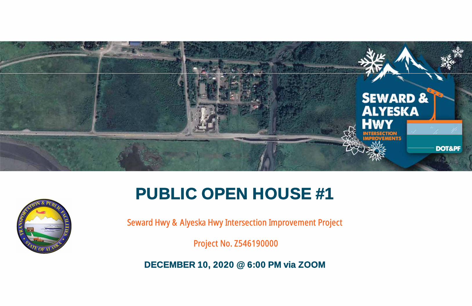
PUBLIC OPEN HOUSE #1
Seward Hwy & Alyeska Hwy Intersection Improvement Project
Project No. Z546190000
DECEMBER 10, 2020 @ 6:00 PM via ZOOM
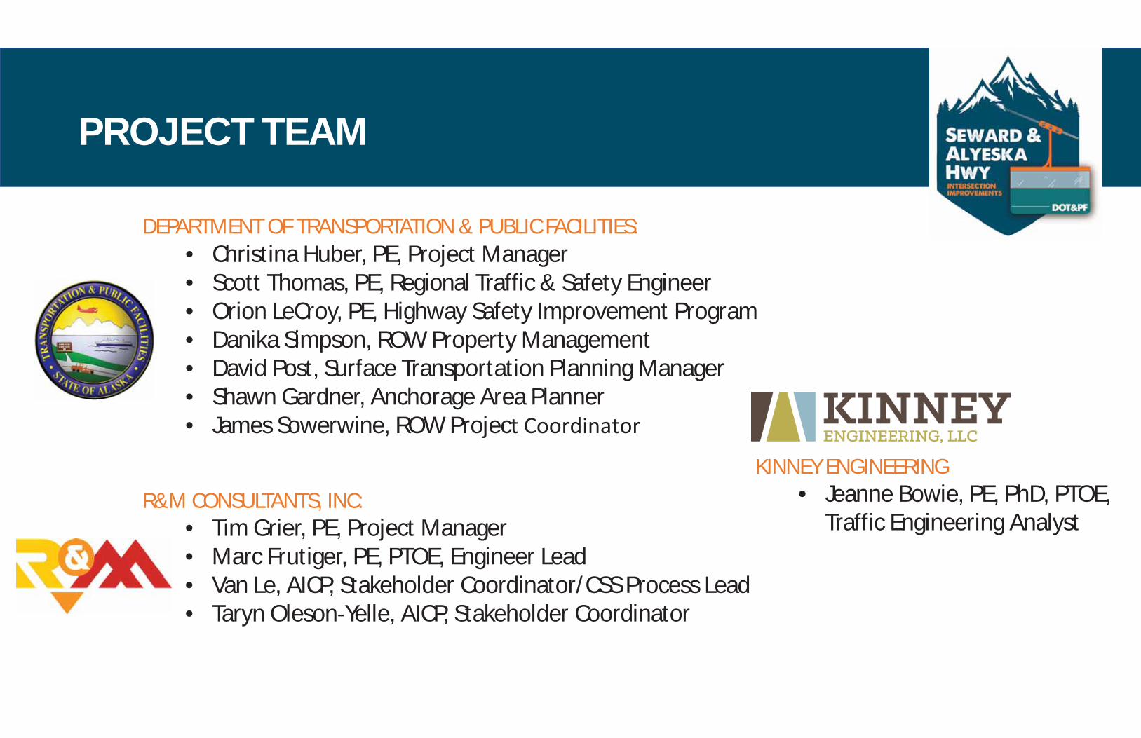
PROJECT TEAM
DEPARTMENT OF TRANSPORTATION & PUBLIC FACILITIES:• Christina Huber, PE, Project Manager• Scott Thomas, PE, Regional Traffic & Safety Engineer• Orion LeCroy, PE, Highway Safety Improvement Program• Danika Simpson, ROW Property Management• David Post, Surface Transportation Planning Manager• Shawn Gardner, Anchorage Area Planner• James Sowerwine, ROW Project Coordinator
R&M CONSULTANTS, INC:• Tim Grier, PE, Project Manager• Marc Frutiger, PE, PTOE, Engineer Lead• Van Le, AICP, Stakeholder Coordinator/CSS Process Lead• Taryn Oleson Yelle, AICP, Stakeholder Coordinator
KINNEY ENGINEERING• Jeanne Bowie, PE, PhD, PTOE,
Traffic Engineering Analyst

PROJECT OVERVIEWSCOPE
The Alaska Department of Transportation and Public Facilities (DOT&PF) isstarting the Seward Hwy & Alyeska Hwy Intersection Improvement project whichseeks to improve the capacity, operation and safety of the intersection.
Scope: DOT&PF has funded the project for engineering, environmental andpublic involvement activities through the selection of an alternative anddevelopment of the design to the 30% level, including compliance with theMunicipality of Anchorage’s Context Sensitive Solutions (CSS) Policy and theNational Environmental Policy Act (NEPA).

SEWARD HIGHWAY
TESOROSTATION
MALL
TURNAGAIN ARM
GLA
CIE
R C
REE
K
ALASKA RAILROAD
TOA
DST
OO
L D
R
ALY
ESKA
HIG
HW
AY
MA
IN S
T
GOLD AVE
CHUGACHNATIONAL
FORESTRANGERSTATION
TO ANCHORAGE TO SEWARD
TO G
IRD
WO
OD
B IRD TO GIRD PATHWAY
TID
EWA
TER
SLO
UG
H
PROJECT LIMITSSEWARD HWY MP 75-90PROJECT LIMITS
STUDY AREA
Seward Hwy & Alyeska HwyIntersection Improvements November 18, 2020
Project OverviewAERIAL IMAGE DATES: 2015 & 2020

WHAT WE KNOWEXISTING CONDITIONS & DATA COLLECTED
• Traffic data• Crashes• Speeds• Volume• Turning movements• Non motorized
• Environmental Constraints• Wetlands
• Topography• Field survey• Aerial data acquisition
6%
28%
64%
2%
0
2
4
6
8
10
12
1980
1981
1982
1983
1984
1985
1986
1987
1988
1989
1990
1991
1992
1993
1994
1995
1996
1997
1998
1999
2000
2001
2002
2003
2004
2005
2006
2007
2008
2009
2010
2011
2012
2013
2014
2015
2016
2017
Cras
hFr
eque
ncy
Year
Seward Highway and Alyeska Highway Crash Severity by Year(1980 to 2017)
Unknown
Property Damage Only (PDO)
Minor Injury
Major Injury

SEWARD HIGHWAY
TESOROSTATION
MALL
GLA
CIE
R C
REE
K
ALASKA RAILROAD
TOA
DST
OO
L D
R
ALY
ESKA
HIG
HW
AY
MA
IN S
T
GOLD AVE
TO SEWARD
TO G
IRD
WO
OD
PROJECT LIMITS
STUDY AREA
BIRD TO GIRD PATHWAY
ROWROW
ROW
RO
WRO
W
ROW
SEWARD HWY MP 75-90PROJECT LIMITS
I
I
SPEED AND TRAFFIC VOLUMESTUDY (TYPICAL)
TURNING MOVEMENT COUNT(AM, PM, WEEKEND) AND
SIGHT DISTANCE MEASUREMENT(TYPICAL)
TID
EWA
TER
SLO
UG
H
TURNAGAIN ARM
TO ANCHORAGE
WELCOME TO GIRDWOOD SIGN
Seward Hwy & Alyeska HwyIntersection Improvements December 10, 2020
Traffic StudyAERIAL IMAGE DATES: 2015 & 2020

WHAT WE KNOWWETLANDS
Based on delineation performed in2020, subject to US Army Corps ofEngineers review and approval.
High Value
Low Value

ISSUESToadstool Drive
• Girdwood Sign at Toadstool is an attraction,increases stopping/turning movements
• Traffic stopping at Toadstool, pedestrians runningacross highway to photograph Turnagain Arm
• Used as a bypass for intersection, creating moretraffic for local residents
Main Street• Used as a bypass for intersection by locals• Local street, not improved
Gold Avenue• Issue with accessing Alyeska Highway from Gold
Ave.• Old Girdwood townsite has to use the gas station
parking lot for through access
WHAT WE HEARDSTAKEHOLDER ENGAGEMENT SO FAR
Girdwood Station & Commercial Mall• Pedestrian/Bicycle traffic – kids, dogs, people,
especially at Alyeska/Gold Avenue pathway connection• 3 Driveways at Tesoro can cause conflicts• Mall access can be difficult• ROW is being used by vendors to sell seafood, other
itemsSafe ingress/egress for Trucks at Tesoro
• Creates situation where they park along the shouldersof the Seward Highway
• No dedicated parking for big rigsViewsheds to Turnagain Arm
• Do not block or change viewsheds for any alternative• Concerns about the area south of the highway• Desire for scenic view pullouts on Arm side of Seward
Hwy to address parking along shoulders

ISSUES (continued)Speeding along Alyeska Highway after turningoff of Seward HighwayJuly and December are the most congestedmonthsStrong opposition to gravel sourcing fromGirdwood Valley
OPPORTUNITIESRecreation use and need for safe parking orpullouts
• Tide lands for skating in winter• Fishing under Glacier Creek Bridge• Would like a boardwalk in the tidal flats
Non Motorized facilities• Consider a bike path connection (continue Bird to
Gird trail)• Coordination with National Historic Iditarod Trail
WHAT WE HEARDSTAKEHOLDER ENGAGEMENT

SEWARD HIGHWAY
TESOROSTATION
MALL
GLA
CIE
R C
REE
K
ALASKA RAILROAD
TOA
DST
OO
L D
R
ALY
ESKA
HIG
HW
AY
MA
IN S
T
GOLD AVE
TO ANCHORAGE TO SEWARD
TO G
IRD
WO
OD
PROJECT LIMITS
STUDY AREA
BIRD TO GIRD PATHWAY
ROWROW
ROW
RO
WRO
W
ROW
SEWARD HWY MP 75-90PROJECT LIMITS
LEGEND
SPEEDING
PEDESTRIAN/VEHICLE CONFLICT
USE OF ROW BY VENDORS
LOCAL ROAD USED AS DETOURFOR CUT-THROUGH TRAFFIC
MULTIPLE DRIVEWAYSCONFUSION/CONFLICTS
LACK OF OFF-STREET PARKING
PRESERVE VIEWSHED
FISHING ACCESS
RECREATION/TRESPASSING ACCESSTHROUGHPRIVATEPROPERTY
ACCESSTHROUGHPRIVATEPROPERTY
WELCOME TO GIRDWOOD SIGN
Seward Hwy & Alyeska HwyIntersection Improvements December 10, 2020
Identified IssuesAERIAL IMAGE DATES: 2015 & 2020

WHAT WE HAVE SEENCONDITIONS AT THE INTERSECTION

WHAT WE HAVE SEENCONDITIONS AT THE INTERSECTION

WHERE WE ARE GOINGPROJECT SCHEDULE
WE AREHERE

WE WANT TO HEAR FROM YOUQUESTIONS AND COMMENTS WELCOME
PROJECT WEBSITE:www.sewardalyeskahwyintersection.com
CONTACT:Van Le, AICP, Stakeholder [email protected]
Christina Huber, PE, Project [email protected]