Embed Size (px)
Citation preview

Basin Plan Amendment Final Staff Report Tulare Lake Bed MUN and AGR Evaluation
APPENDIX K: ENVIRONMENTAL CHECKLIST/SUBSTITUTE ENVIRONMENTAL DOCUMENT

Basin Plan Amendment Final Staff ReportTulare Lake Bed MUN and AGR Evaluation 1-1
ENVIRONMENTAL CHECKLIST
The Central Valley Regional Water Quality Control Board (Central Valley Water Board or Board), as a Lead Agency under the California Environmental Quality Act (CEQA), is responsible for evaluating all the potential environmental impacts that may occur because of changes made to the Water Quality Control Plan for the Tulare Lake Basin (Basin Plan). (Public Resources Code, Section 21000 et seq.) The Secretary of Resources has determined that the Central Valley Water Board’s Basin Planning Process qualifies as a certified regulatory program pursuant to Public Resources Code Section 21080.5 and California Code of Regulations, Title 14, Section 15251(g). This determination means that the Central Valley Water Board’s Basin Planning process needs only to comply with abbreviated CEQA requirements. The Staff Report and this Checklist satisfy the requirements of State Water Board’s Regulations for Implementation of CEQA, Exempt Regulatory Programs, which are found at California Code of Regulations, Title 23, Section 3775 et seq.
PROJECT INFORMATION
1. Project Title: Evaluation of the Municipal and Domestic Supply (MUN) and Agricultural Supply (AGR) Beneficial Uses in Groundwater Contained in a Portion of the Historical Tulare Lake Bed
2. Lead Agency Name and Address: Central Valley Regional Water Quality Control Board 11020 Sun Center Drive, #200, Rancho Cordova, CA 95670
3. Contact Person and PhoneNumber:
Pam Buford, Senior Environmental Scientist, (559) 445-5576Jeanne Chilcott, Environmental Program Manager,(916) 464-4788
4. Project Location: The Tulare Lake Basin comprises much of the southern San Joaquin Valley. The proposed de-designation area is bounded to the north by Laurel Avenue (Kings County) and the community of Stratford, and on the west by Highway 41 and Interstate 5 near Kettleman City. The eastern boundary is near Highway 43 with the City of Corcoran to the northeast and the community of Alpaugh to the southeast.
5. Project Sponsor’s Name andAddress:
Tulare Lake Bed interests through coordination with CV-SALTS
6. General Plan Designation: N/A (multiple jurisdictions)
7. Zoning: N/A (multiple jurisdictions)
8. Description of Project: (Describe the whole action involved, including but not limited to later phases ofthe project, and any secondary, support, or off-site features necessary for its implementation. Attachadditional sheets if necessary.)

Substitute Environmental Documentation Ascent Environmental
1-2Basin Plan Amendment Final Staff Report Tulare Lake Bed MUN and AGR Evaluation
This Environmental Checklist is intended to provide supporting environmental review documentation for a proposed amendment to the Water Quality Control Plan for the Tulare Lake Basin (Basin Plan) to de-designate the Municipal and Domestic Supply (MUN) and the Agricultural Supply (AGR) beneficial uses from groundwater within horizontally and vertically delineated areas underlying a portion of the historical Tulare Lake Bed.
BACKGROUND:
The proposed amendment is part of a larger effort by the Central Valley Salinity Alternatives for Long-Term Sustainability (CV-SALTS) stakeholder initiative to develop a comprehensive Salt and Nitrate Management Plan (SNMP) for the Central Valley. As part of its work on the SNMP, CV-SALTS is reviewing the Basin Plan’s beneficial use designations to determine whether these beneficial use designations were appropriately made and, if so, whether the Basin Plan’s implementation programs provide an appropriate level of protection for the waterbodies that support these beneficial uses. Where appropriate, CV-SALTS is proposing that the California Regional Water Quality Control Board, Central Valley Region (Central Valley Water Board or Board) modify the Basin Plan’s MUN and/or AGR beneficial use designations and programs of implementation to encourage reuse and recycling, to give regulated entities more flexibility in managing limited water supplies, and to identify potential salt management areas that would help salt to be moved out of sensitive areas.
The Central Valley Water Board has incorporated the Sources of Drinking Water Policy, State Water Board Resolution No. 88-63 (Sources of Drinking Water Policy) into the Basin Plans, and has designated all surface and ground water bodies in the Central Valley region as supporting the MUN beneficial use unless a particular water body is specifically designated as not supporting the MUN beneficial use in the Basin Plans. The Sources of Drinking Water Policy identifies exceptions to the MUN beneficial use that can apply to certain water bodies, including an exception that applies to water bodies where the total dissolved solids (TDS) exceeds 3,000 milligrams per liter (mg/L) (5,000 microsiemens per centimeter (μS/cm) as electrical conductivity (EC)), provided that the waterbody is not expected to supply a public water system. [Hereinafter in this document, EC values will be cited instead of TDS values to avoid confusion.] The Sources of Drinking Water Policy also provides an exception for water bodies that do not provide sufficient water to supply a single well capable of producing an average, sustained yield of 200 gallons per day. However, these exceptions are not self-implementing – the Central Valley Water Board is required to protect the MUN beneficial use even in water bodies that meet the exception criteria in the Sources of Drinking Water Policy unless and until a Basin Plan amendment is adopted that specifically de-designates the MUN use in such water bodies.
With regard to the AGR beneficial use, the Basin Plan states that unless otherwise designated by the Central Valley Water Board, “all ground waters in the region are considered suitable or potentially suitable, at a minimum, for agricultural supply (AGR)….” Agricultural supply includes the use of groundwater for irrigation, livestock watering, and support of vegetation for range grazing. The water quality objective to protect AGR is the narrative water quality objective that requires waters not contain chemical constituents in concentrations that adversely affect beneficial uses. Narrative water quality objectives are interpreted by the Central Valley Water Board using the best available scientific criteria in combination with the following six factors:
1. Past, present, and probable future beneficial uses;
2. Environmental characteristics of the hydrographic unit under consideration, including the quality ofwater available thereto;
3. Water quality conditions that could reasonably be achieved through the coordinated control of allfactors which affect water quality in the area;
4. Economic considerations;
5. The need for developing housing within the region; and
6. The need to develop and use recycled water. (Wat. Code, § 13241.)

Ascent Environmental Substitute Environmental Documentation
Basin Plan Amendment Final Staff Report Tulare Lake Bed MUN and AGR Evaluation 1-3
The Central Valley Water Board has utilized salinity guidelines identified in Ayers and Westcot (Ayers and Westcot, 1985) to interpret the Basin Plan’s narrative objective, and has previously considered irrigation water supply at 700 μS/cm to be protective of all crops at all times. The CV-SALTS conducted a review of literature related to salinity impacts on both irrigation and stock watering, and found that the literature concurred with the Ayers and Westcot finding that only the most salt tolerant crops may be sustainably irrigated with water exceeding 3,000 μS/cm (CV-SALTS, 2013). As part of the literature review, CV-SALTS also identified a range of acceptable salt levels for livestock watering (Id.).
The Board identified the need to evaluate the appropriateness of designated beneficial uses as a priority in the Board’s 2014 Triennial Review (Central Valley Water Board, 2014). Concurrently, the CV-SALTS initiative identified that there was a need to define the salinity-related requirements for the protection of both the MUN and AGR beneficial uses. To support both needs, the Central Valley Salinity Coalition, a discharger group financially supporting and managing the CV-SALTS initiative, and the Tulare Lake Drainage District jointly provided resources for the development of technical information and environmental and economic analyses in support of this MUN and AGR beneficial use evaluation project for a portion of the historical Tulare Lake Bed. The technical and regulatory information developed in support of this beneficial use evaluation is compiled in the Technical and Regulatory Evaluation of MUN and AGR Beneficial Uses in the Tulare Lake Bed Area (Beneficial Use Evaluation Report) prepared by Kenneth D. Schmidt and Associates , CDM Smith, and Summers Engineering (CV-SALTS, 2015). Stakeholders participating in the effort provided updates on the project to the CV-SALTS Executive Committee during public meetings. The Executive Committee is comprised of representatives from state, federal, and local agencies, the discharger community, environmental organizations, disadvantaged communities and Environmental Justice groups.
As part of the investigation for the Beneficial Use Evaluation, representatives of Tulare Lake Drainage District (TLDD) and Tulare Lake Basin Water Storage District (TLBWSD) initiated meetings with stakeholders within and surrounding the project area. Stakeholder meetings generally were focused on the solicitation of input from the surrounding disadvantaged communities and municipalities, farmers/ranchers, and landowners in the project area with regard to the proposal to de-designate MUN and AGR beneficial uses in a portion of the historical Tulare Lake Bed. This stakeholder effort has resulted in local support for the proposed project. In April 2015, Board staff held an initial California Environmental Quality Act scoping meeting in Corcoran to provide information on the proposed project and solicit additional information from the public to inform development of the Staff Report and associated environmental review.
The Project Study Area is located in the southern part of the Central Valley of California in the Tulare Lake Basin. The Tulare Lake Basin essentially functions as a closed basin except during extreme flood years, when some Kings River water moves north through Fresno Slough into the San Joaquin River (Basin Plan). Because the Tulare Lake Basin is a closed basin, salts have been naturally deposited and accumulated since its formation and before any influence from man. The diversion of water into the basin from other watersheds to support 3 million acres of agriculture (Sholes, 2006), including three of the five most agriculturally productive counties in the United States (20121), has exacerbated the accumulation of salts. The majority of the western and southern Tulare Lake Basin and most of the historical Tulare Lake Bed is underlain by clay layers ranging from the A-Clay near the surface to the F-Clay below the Corcoran Clay (also known as the E-Clay). The Corcoran Clay varies in depth from the surface, up to 200 feet thick and serves as a confining layer, splitting the aquifer into a distinct shallow, perched groundwater zone and a lower, confined zone. The shallow perched groundwater in the proposed de-designation area and in the surrounding area contains highly elevated salinity concentrations. Communities and agricultural operations in the project area utilize either imported water or groundwater from the lower, confined aquifer for their water supplies.
1 http://agcomm.co.tulare.ca.us/default/assets/File/2012CensusCA_1.pdf

Substitute Environmental Documentation Ascent Environmental
1-4Basin Plan Amendment Final Staff Report Tulare Lake Bed MUN and AGR Evaluation
The Beneficial Use Evaluation Report (CV-SALTS, 2015) used historical information for the Project Study Area related to groundwater conditions, subsurface geologic conditions, groundwater quality, and well construction data to establish a preliminary horizontal de-designation boundary for MUN and AGR beneficial uses as an initial step in the process. This information indicates that natural groundwater gradients in the project area are from the surrounding area toward the central area of the historical Tulare Lake Bed. As a second step in the evaluation process, the Project Study Area was divided into five subareas for more detailed examination: Central Subarea, North Subarea, West Subarea, South Subarea, and East Subarea (see Figure 9). All subareas except the Central Subarea, which is located in the middle of the historical Tulare Lake Bed, extended outside of the preliminary horizontal de-designation boundary. Each subarea was evaluated in greater detail with respect to soil conditions, groundwater conditions, water quality, regional subsurface geology, surface features, active water supply wells and their uses, and nearby cities and communities. This information for each of the four outer subareas – referred to as fringe areas – was used to adjust the preliminary horizontal de-designation boundary to define the proposed horizontalde-designation boundary for MUN and AGR beneficial uses. Additionally, the focused analyses conductedwithin each of the subareas allowed for delineation of vertical de-designation depths. Vertical de-designation depths within in the de-designation area vary according to the depth of the confining claylayers that separate the shallow, perched groundwater zone from the lower confined zone.
The proposed horizontal de-designation boundary was adjusted to exclude nearby towns. These communities pump their groundwater from locations upgradient from the proposed de-designation area. The technical authors of the Beneficial Use Evaluation Report conducted a zone of capture analysis to confirm that the pumping of municipal wells outside of the proposed de-designation boundary would not influence the flow of shallow groundwater toward municipal wells and would not result in the extraction of groundwater from within or beneath the de-designation area. The analysis found that pumping groundwater from municipal wells in Stratford, Alpaugh, Kettleman City, and Corcoran would not influence the flow of shallow groundwater, and, in the cases of Kettleman City and Corcoran, where wells tap strata above the Corcoran Clay, these wells would not extract water from within the area proposed for de-designation (KDSA, 2016a). A second zone of capture analysis performed for a representative, shallow, private domestic well located just outside of the proposed de-designation boundary found that a well located greater than 87.5 feet from the de-designation boundary would not draw groundwater from within the de-designation boundary, nor influence the flow of shallow groundwater toward the domestic well (KDSA, 2016b). To be conservative, a domestic well greater than 100 feet away from the de-designation boundary would not draw groundwater from the area proposed for MUN de-designation, nor effect the gradient-driven flow of groundwater toward the center of the lake bed.
Three active domestic wells are located within the horizontal extent of the proposed de-designation area but outside the proposed vertical de-designation boundary. Two of these three active domestic wells (located southwest of Stratford as shown in Figure 9) are completed below the Corcoran Clay, while one draws water from a depth of 500-520 feet, below the proposed vertical de-designation boundary (below the A-Clay). A number of active irrigation supply wells have been identified within the proposed horizontal de-designation boundary (see Figure 9); however, all of these wells are completed below the Corcoran Clay and thus, below the proposed vertical de-designation boundary in which they are located.
Based on the groundwater well reconnaissance work performed as part of the Beneficial Use Evaluation Report, it was determined that the three-dimensional space described by the horizontal and vertical de-designation boundaries shown in Figure 9 contains groundwater that exceeds an EC of 5,000 µS/cm, and in many portions falls within the range 10,000 to 40,000 μS/cm. Where wells exhibited EC levels less than 5,000 μS/cm, proposed de-designation boundaries were adjusted to not include these wells or the zones from which they extract groundwater. EC levels in the proposed de-designation area meet the water quality conditions of Exception 1a of the Sources of Drinking Water Policy, and the groundwater is not reasonably expected to supply a public water system. EC levels of 5,000 µS/cm or greater also exceed guidelines from the Canadian Council of Ministers for the Environment (CCME) that recommend a maximum EC limit of 5,000 µS/cm for all classes of livestock (Canada, 2012). These Canadian guidelines were included in the CV-SALTS literature review that evaluated salinity impacts on irrigation and stock watering (CV-SALTS, 2013).

Ascent Environmental Substitute Environmental Documentation
Basin Plan Amendment Final Staff Report Tulare Lake Bed MUN and AGR Evaluation 1-5
Alternatives to the proposed horizontal and vertical de-designation boundaries shown in Figure 9 were identified by stakeholders for both the MUN and AGR beneficial uses in the project area.
Stakeholders identified the following four project alternatives pertaining to the MUN beneficial use designation for a portion of the historical Tulare Lake Bed:
1. No Action.
2. De-designate MUN Beneficial Use within the Historical Footprint of the Tulare Lake Bed at anElevation of 200 Feet above Mean Sea Level with No Vertical De-designation Boundary.
3. De-designate MUN Beneficial Use in a Portion of the Historical Tulare Lake Bed Based onApplication of the Sources of Drinking Water Policy (SWRCB Resolution No. 88-63) Exception 1a.
4. Development of MUN Site-Specific Salinity Objectives within the Proposed MUN De-designationBoundary.
Stakeholders also identified the following six project alternatives pertaining to the AGR beneficial use designation for a portion of the historical Tulare Lake Bed:
1. No Action
2. Development of AGR Site-Specific Salinity Objectives within the Proposed AGR De-designationBoundaries for Irrigation Supply and Livestock Watering.
3. De-designate AGR Beneficial Use within Separate Horizontal and Vertical Boundaries for IrrigationSupply and Livestock Watering.
4. Development of Classes of AGR Uses and Water Quality Objectives that Better Represent Irrigationand Livestock Watering Limitations at Different Groundwater Salinity Concentrations within theProposed AGR De-designation Boundaries for Irrigation Supply and Livestock Watering.
5. De-designate AGR Irrigation Supply and Livestock Watering Beneficial Uses within CombinedHorizontal and Vertical Boundaries Based on an EC Groundwater Quality Threshold of5,000 μS/cm.
6. De-designate AGR Irrigation Supply and Livestock Watering Beneficial Uses within CombinedHorizontal and Vertical Boundaries Based on an EC Groundwater Quality Threshold of7,500 μS/cm.
PROPOSED ACTION:
The proposed action (implementation of MUN Alternative 3 and AGR Alternative 5, as described in the Basin Plan Amendment Staff Report) includes the following:
De-designate MUN as a beneficial use (based on Exception Criterion 1a of the Sources of DrinkingWater Policy, TDS exceeding 3,000 mg/L [EC exceeding 5,000 µS/cm]) within the horizontal boundaryto the variable vertical depths represented in Figure 8 of the Basin Plan Amendment Staff Report.
De-designate AGR irrigation supply and livestock watering beneficial uses within the horizontalboundary to the variable vertical depths identified in Figure 11 of the Basin Plan Amendment StaffReport based on an EC groundwater quality threshold of 5,000 µS/cm.
Figure 8, Figure 9, and Figure 11 are included in Appendix A.
Proposed Program of Implementation In addition to the proposed actions identified above, the following are key actions that would assist in determining whether discharges to the de-designation area are causing or contributing to the non-compliance of relevant water quality objectives (WQOs) outside of the de-designation boundary.

Substitute Environmental Documentation Ascent Environmental
1-6Basin Plan Amendment Final Staff Report Tulare Lake Bed MUN and AGR Evaluation
Groundwater Quality Monitoring – Project-specific groundwater monitoring directly adjacent and upgradient to and beneath the location of a new discharge. Groundwater monitoring in the shallowest groundwater adjacent to a new discharge can inform the Central Valley Water Board whether the discharge is affecting groundwater quality upgradient of the proposed de-designation boundary. This type of monitoring will show if there is lateral movement of groundwater from within the de-designation boundary to outside the de-designation area. Groundwater monitoring in the deeper shallow groundwater beneath a new discharge can inform the Central Valley Water Board whether the discharge is affecting groundwater quality beneath the proposed de-designation boundary. This type of monitoring will show if there is vertical movement of groundwater from within the de-designation boundary to outside of the de-designation area.
WQO Compliance Point for Proposed Actions – The de-designation boundary associated with the two preferred alternatives is a three dimensional (3D) space formed by impermeable clay layers that produce a hydrologic barrier to the downward flow of groundwater. The Beneficial Use Evaluation determined average minimum depths to the tops of clay layers (see Figure 8 and Figure 11). The thickness of these layers is variable. The point of compliance at which groundwater is required to meet relevant WQOs is at the bottom of the clay layer along the outside surface of the de-designation boundary. An entity wishing to determine exactly where beneficial uses are protected at any given horizontal location would need to drill a borehole to determine at which depth a particular clay layer ends.
Direct and Indirect Physical Environmental Effects Implementation of the proposed action would result in de-designation of MUN and AGR (agricultural irrigation and livestock watering) beneficial uses at specific variable vertical depths within the defined horizontal boundaries indicated in Figures 8 and 11, respectively. Because the preferred MUN and AGR alternatives use the same beneficial use de-designation boundary (i.e., the boundaries shown in Figure 8 and Figure 11 are identical), there exists only a single three dimensional (3D) space in which both beneficial uses would be de-designated. The salinity thresholds used as a basis for de-designation are very high for municipal and agricultural uses. EC levels of the ambient groundwater within the proposed de-designation boundary exceed 5,000 µS/cm. The Technical and Regulatory Evaluation of MUN and AGR Beneficial uses in the Tulare Lake Bed Area (Beneficial Use Evaluation) prepared in December 2015 by Kenneth D. Schmidt & Associates, along with a subsequent well reconnaissance effort conducted by Tulare Lake Basin Water Storage District (TLBWSD) staff, provide a thorough evaluation of water supply wells in the project area (CV-SALTS 2015; TLBWSD, 2016). The Beneficial Use Evaluation indicates that nearly all of the domestic and agricultural supply wells within the proposed horizontal boundary have been abandoned or destroyed. Only three active domestic wells are within the proposed horizontal de-designation boundary (southwest of Stratford). Two of these wells are completed below the Corcoran Clay and one well draws water from a depth of 500-520 feet (below confining A-Clay layer). All three wells are completed below the proposed vertical de-designation boundary (CV-SALTS 2015). All active irrigation wells within the proposed de-designation boundary are completed below the Corcoran Clay. Therefore, no known groundwater use (within the horizontal boundary and affected vertical depth) for municipal or agricultural uses is occurring. None of the disadvantaged communities and municipalities surrounding the proposed horizontal boundary currently use the groundwater within the defined horizontal and variable vertical boundaries for municipal and domestic purposes and none have plans to use or treat this groundwater in the future. Because the groundwater is not currently used or proposed for use for these beneficial uses at the variable vertical depths that would be affected, de-designation of the MUN and AGR beneficial uses at the variable vertical depths identified within the horizontal boundary would not result in a known or substantive change in the water use. Therefore, no direct or indirect physical substantial environmental effect would be expected as a result of the proposed action.
Public Comments Received The Central Valley Regional Water Quality Control Board held a public scoping meeting on 14 April 2015. Stakeholders and interested parties were notified of the 14 April 2015 scoping meeting through announcements sent on 18 March 2015 by the Basin Planning and CV-SALTS electronic email lists. Tribal notifications of the scoping meeting were sent by regular U.S. mail on 20 March 2015. The public comment period for the scoping meeting ended on 30 April 2015. Four comment letters were received: Dennis Fox;

Ascent Environmental Substitute Environmental Documentation
Basin Plan Amendment Final Staff Report Tulare Lake Bed MUN and AGR Evaluation 1-7
the Floodplain Management Section of Engineering, Surveying and Permit Services for Kern County; Stanislaus County; and representatives from the Leadership Counsel for Justice and Accountability, Clean Water Action, and Community Water Center. Only two of the comment letters received raised any issues or concerns. Most of the concerns raised did not relate specifically to the proposed action. Environmental justice was the most prominent issue raised. The Central Valley Water Board took into consideration all comments received when selecting the proposed action. Copies of the comment letters are attached in Appendix B.
California law defines “environmental justice” as the fair treatment of people of all races, incomes, and cultures with respect to the development, adoption, implementation, and enforcement of environmental laws, regulations, and policies. Gov. Code Section 65040.12, subd. (e). The principles established by environmental justice ensure protection against the inequitable distribution of adverse environmental impacts on sensitive, disadvantaged communities. The State and the agencies that fall under its jurisdiction must actively seek to achieve equal protection against harmful environmental impacts for all persons and their corresponding communities.
With respect to the proposed action, the tenets of environmental justice would be upheld. The de-designation of MUN and AGR beneficial uses for groundwater at varying vertical depths would not cause any physical change to occur that would result in an unequal, adverse environmental effect on a low-income community. The current MUN and AGR uses in the project area would not change as a result of the removal of the aforementioned beneficial use designations. Groundwater quality would not substantially change from current conditions with implementation of the proposed action. Increased levels of pollution within vulnerable communities would not occur, nor would flow rates into the project site be reduced.
9. Surrounding Land Uses andSetting: (Briefly describe theproject’s surroundings)
The historical Tulare Lake Bed is a natural depression on the valley floor that historically formed a large inland lake but is now dry. Because development of the upstream diversions on the eastside of the San Joaquin Valley from the four major river tributaries (Kings, Kaweah, Tule, and Kern) and the U. S. Army Corps of Engineers’ flood control projects on the tributaries, the Tulare Lake Basin is a “closed basin” with no natural outflow. The proposed action will affect a surface area of approximately 324,000 acres and covers a portion of the historical Tulare Lake Bed. The area has alkaline heavy clay soils, extremes of climate, and threat of flood hazard because of topography. The primary land use is commercial agricultural production of cotton, wheat, safflower, alfalfa hay, processing tomatoes, and other field crops. The lowest lying area of the historical Tulare Lake Bed is utilized for evaporation ponds to manage and dispose of subsurface tile drainage waters that are received from TLDD landowners. The proposed project area does not include any towns or communities; it is bounded to the north by Laurel Avenue (Kings County) and the community of Stratford, on the west by Highway 41 and Interstate 5 near Kettleman City. The eastern boundary is near Highway 43 with the City of Corcoran to the northeast and the community of Alpaugh to the southeast. These cities and communities use groundwater from the confined aquifer (below the Corcoran Clay) as a drinking water source, but the municipal supply wells are outside of the project area. Because the closed basin is prone to periodic flooding, there are few residences and permanent plantings and no public supply wells located in the interior portion of the Tulare Lake Bed.
Substitute Environmental Documentation Ascent Environmental
1-8Basin Plan Amendment Final Staff Report Tulare Lake Bed MUN and AGR Evaluation
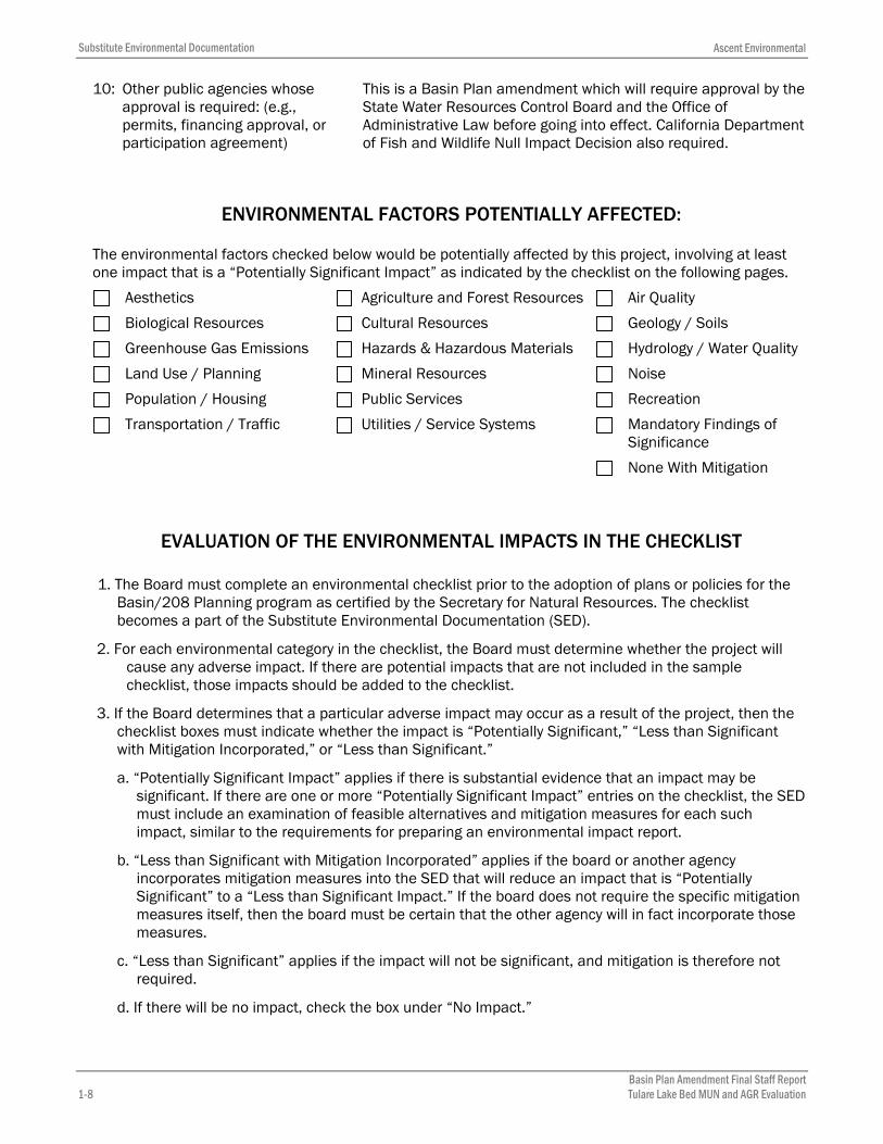
10: Other public agencies whose approval is required: (e.g., permits, financing approval, or participation agreement)
This is a Basin Plan amendment which will require approval by the State Water Resources Control Board and the Office of Administrative Law before going into effect. California Department of Fish and Wildlife Null Impact Decision also required.
ENVIRONMENTAL FACTORS POTENTIALLY AFFECTED:
The environmental factors checked below would be potentially affected by this project, involving at least one impact that is a “Potentially Significant Impact” as indicated by the checklist on the following pages.
Aesthetics Agriculture and Forest Resources Air Quality
Biological Resources Cultural Resources Geology / Soils
Greenhouse Gas Emissions Hazards & Hazardous Materials Hydrology / Water Quality
Land Use / Planning Mineral Resources Noise
Population / Housing Public Services Recreation
Transportation / Traffic Utilities / Service Systems Mandatory Findings of Significance
None With Mitigation
EVALUATION OF THE ENVIRONMENTAL IMPACTS IN THE CHECKLIST
1. The Board must complete an environmental checklist prior to the adoption of plans or policies for theBasin/208 Planning program as certified by the Secretary for Natural Resources. The checklistbecomes a part of the Substitute Environmental Documentation (SED).
2. For each environmental category in the checklist, the Board must determine whether the project willcause any adverse impact. If there are potential impacts that are not included in the samplechecklist, those impacts should be added to the checklist.
3. If the Board determines that a particular adverse impact may occur as a result of the project, then thechecklist boxes must indicate whether the impact is “Potentially Significant,” “Less than Significantwith Mitigation Incorporated,” or “Less than Significant.”
a. “Potentially Significant Impact” applies if there is substantial evidence that an impact may besignificant. If there are one or more “Potentially Significant Impact” entries on the checklist, the SEDmust include an examination of feasible alternatives and mitigation measures for each suchimpact, similar to the requirements for preparing an environmental impact report.
b. “Less than Significant with Mitigation Incorporated” applies if the board or another agencyincorporates mitigation measures into the SED that will reduce an impact that is “PotentiallySignificant” to a “Less than Significant Impact.” If the board does not require the specific mitigationmeasures itself, then the board must be certain that the other agency will in fact incorporate thosemeasures.
c. “Less than Significant” applies if the impact will not be significant, and mitigation is therefore notrequired.
d. If there will be no impact, check the box under “No Impact.”

Ascent Environmental Substitute Environmental Documentation
Basin Plan Amendment Final Staff ReportTulare Lake Bed MUN and AGR Evaluation 1-9
4. The Board must provide a brief explanation for each “Potentially Significant,” “Less than Significantwith Mitigation Incorporated,” “Less than Significant,” or “No Impact” determination in the checklist.The explanation may be included in the written report described in section 3777(a)(1) or in thechecklist itself. The explanation of each issue should identify: (a) the significance criteria or threshold,if any, used to evaluate each question; and (b) the specific mitigation measure(s) identified, if any, toreduce the impact to less than significant. The Board may determine the significance of the impact byconsidering factual evidence, agency standards, or thresholds. If the “No Impact” box is checked, theBoard should briefly provide the basis for that answer. If there are types of impacts that are not listedin the checklist, those impacts should be added to the checklist.
5. The Board must include mandatory findings of significance if required by CEQA Guidelines section15065.
6. The Board should provide references used to identify potential impacts, including a list of informationsources and individuals contacted.

Substitute Environmental Documentation Ascent Environmental
1-10 Basin Plan Amendment Final Staff Report Tulare Lake Bed MUN and AGR Evaluation
1 AESTHETICS
ENVIRONMENTAL ISSUES Potentially Significant
Impact
Less Than Significant with
Mitigation Incorporated
Less Than Significant
Impact
No Impact
I. AESTHETICS. Would the project:
a) Have a substantial adverse effect on a scenicvista?
b) Substantially damage scenic resources, including,but not limited to, trees, rock outcroppings, andhistoric buildings within a state scenic highway?
c) Substantially degrade the existing visual characteror quality of the site and its surroundings?
d) Create a new source of substantial light or glarewhich would adversely affect day or nighttimeviews in the area?
1.1.1 Discussion
The proposed action includes de-designation of MUN and AGR (agricultural irrigation and livestock watering) beneficial uses at specific variable vertical depths within defined horizontal boundaries. Very few residences exist within the project area and the groundwater at the affected variable vertical depths for MUN and AGR is not currently used for municipal or agricultural uses. Implementation of the proposed action would not require any ground disturbance, vegetation removal, development of structures/facilities, or any other physical effect that would be visible, much less damage or obstruct aesthetic resources. Project operation would not include any new sources of light or nighttime glare nor would implementation affect the integrity of any State Scenic Highway. The project would result in no impact.

Ascent Environmental Substitute Environmental Documentation
Basin Plan Amendment Final Staff ReportTulare Lake Bed MUN and AGR Evaluation 2-11
2 AGRICULTURE AND FOREST RESOURCES
ENVIRONMENTAL ISSUES Potentially Significant
Impact
Less Than Significant with
Mitigation Incorporated
Less Than Significant
Impact
No Impact
II. AGRICULTURE AND FOREST RESOURCES.
In determining whether impacts to agricultural resources are significant environmental effects, lead agencies may refer to the California Agricultural Land Evaluation and Site Assessment Model (1997, as updated) prepared by the California Department of Conservation as an optional model to use in assessing impacts on agriculture and farmland. In determining whether impacts to forest resources, including timberland, are significant environmental effects, lead agencies may refer to information compiled by the California Department of Forestry and Fire Protection regarding the state’s inventory of forest land, including the Forest and Range Assessment Project and the Forest Legacy Assessment project; and forest carbon measurement methodology provided in Forest Protocols adopted by the California Air Resources Board.
Would the project:
a) Convert Prime Farmland, Unique Farmland, orFarmland of Statewide Importance (Farmland), asshown on the maps prepared pursuant to theFarmland Mapping and Monitoring Program of theCalifornia Resources Agency, to non-agriculturaluse?
b) Conflict with existing zoning for agricultural use ora Williamson Act contract?
c) Conflict with existing zoning for, or cause rezoningof, forest land (as defined in Public ResourcesCode section 12220(g)), timberland (as definedby Public Resources Code section 4526), ortimberland zoned Timberland Production (asdefined by Government Code section 51104(g))?
d) Result in the loss of forest land or conversion offorest land to non-forest use?
e) Involve other changes in the existing environment,which, due to their location or nature, could resultin conversion of Farmland to non-agricultural useor conversion of forest land to non-forest use?
2.1.1 Discussion
No forest land exists within the project area. Because the project area does not contain forest lands, the proposed action would have no impact on forest land
The project area does not contain any towns or communities, but lies adjacent to Kettleman City, Corcoran, Alpaugh, and Stratford. These urban areas are surrounded by agricultural lands, including lands designated

Substitute Environmental Documentation Ascent Environmental
2-12 Basin Plan Amendment Final Staff Report Tulare Lake Bed MUN and AGR Evaluation
as Prime Farmland, Unique Farmland, or Farmland of Statewide Importance (Department of Conservation [DOC] 2015). The groundwater at the affected variable vertical depths for AGR currently contains very high levels of salinity such that groundwater at these depths is not used for irrigation or livestock watering. Implementation of the proposed action would de-designate the AGR beneficial use (irrigation and livestock watering) at specified variable vertical depths within a defined horizontal boundary. Because groundwater from these depths is not known to be currently used for irrigation purposes, and because groundwater could continue to be used for irrigation if pumped from the appropriate vertical depths, or conveyed from outside the de-designation boundary as is currently practiced, the proposed project would not adversely affect current agricultural operations and would not convert important farmland to a non-agricultural use. The proposed action would also not conflict with a Williamson Act contract. The proposed action would result in no impact to agricultural resources.

Ascent Environmental Substitute Environmental Documentation
Basin Plan Amendment Final Staff Report Tulare Lake Bed MUN and AGR Evaluation 3-13
3 AIR QUALITY
ENVIRONMENTAL ISSUES Potentially Significant
Impact
Less Than Significant with
Mitigation Incorporated
Less Than Significant
Impact
No Impact
III. AIR QUALITY.
Where available, the significance criteria established by the applicable air quality management or air pollution control district may be relied on to make the following determinations.
Would the project:
a) Conflict with or obstruct implementation of theapplicable air quality plan?
b) Violate any air quality standard or contributesubstantially to an existing or projected air qualityviolation?
c) Result in a cumulatively considerable net increaseof any criteria pollutant for which the projectregion is non-attainment under an applicablefederal or state ambient air quality standard(including releasing emissions which exceedquantitative thresholds for ozone precursors)?
d) Expose sensitive receptors to substantialpollutant concentrations?
e) Create objectionable odors affecting a substantialnumber of people?
3.1.1 Discussion
The project area is predominantly located in Kings County, with a small portion in Tulare County (far east section of project area) and a very small portion in Kern County (southeast section of project area). The project area is located within the area regulated for air quality standards attainment by the San Joaquin Valley Air Pollution Control District (SJVAPCD). SJVAPCD is considered an attainment area for the federal 8-hour Carbon Monoxide (CO) standard and an extreme ozone nonattainment area for the federal 8-hour ozone standard.
As previously discussed, the proposed action includes de-designation of MUN and AGR (agricultural irrigation and livestock watering) beneficial uses at specific variable vertical depths within defined horizontal boundaries. Very few residences exist within the project area and the groundwater at the affected variable vertical depths for MUN and AGR is not currently used for municipal or agricultural uses. Current irrigation practices, relying on other water sources, would continue. Implementation of the proposed action may require vehicle trips and machinery operation for drilling and sampling of monitoring wells. This would require minimal ground disturbance, and would not result in any other physical effect that could diminish air quality that differs from the existing vehicle trips from agricultural operations. Implementation and operation of the proposed action would not involve activities that would produce air pollutants. Local air quality plans established by SJVAPCD would not be affected nor would any sensitive receptors in the project area experience an increase in concentrations of air pollutants. There would be no impact.

Substitute Environmental Documentation Ascent Environmental
4-14 Basin Plan Amendment Final Staff Report Tulare Lake Bed MUN and AGR Evaluation
4 BIOLOGICAL RESOURCES
ENVIRONMENTAL ISSUES Potentially Significant
Impact
Less Than Significant with
Mitigation Incorporated
Less Than Significant
Impact
No Impact
IV. BIOLOGICAL RESOURCES. Would the project:
a) Have a substantial adverse effect, either directlyor through habitat modifications, on any speciesidentified as a candidate, sensitive, or special-status species in local or regional plans, policies,or regulations, or by the California Department ofFish and Wildlife or the U.S. Fish and WildlifeService?
b) Have a substantial adverse effect on any riparianhabitat or other sensitive natural communityidentified in local or regional plans, policies, orregulations or by the California Department of Fishand Wildlife or the U.S. Fish and Wildlife Service?
c) Have a substantial adverse effect on federallyprotected wetlands as defined by Section 404 ofthe Clean Water Act (including, but not limited to,marsh, vernal pool, coastal, etc.) through directremoval, filling, hydrological interruption, or othermeans?
d) Interfere substantially with the movement of anynative resident or migratory fish or wildlife speciesor with established native resident or migratorywildlife corridors, or impede the use of nativewildlife nursery sites?
e) Conflict with any local policies or ordinancesprotecting biological resources, such as a treepreservation policy or ordinance?
f) Conflict with the provisions of an adopted HabitatConservation Plan, Natural CommunityConservation Plan, or other approved local,regional, or state habitat conservation plan?
4.1.1 Discussion
The proposed action includes de-designation of MUN and AGR (agricultural irrigation and livestock watering) beneficial uses at specific variable vertical depths within defined horizontal boundaries. Implementation of the proposed action would not require any ground disturbance, vegetation removal, or development/operation of structures or facilities, or any other physical effect that could negatively impact biological resources. The removal of MUN and AGR as beneficial groundwater uses would not produce a physical change that would conflict with any Habitat Conservation Plans, Natural Community Conservation Plans, or local policies designed to protect biological resources. No adverse impacts would occur to federally- or State-listed species as a result of project implementation, nor would the proposed action deplete biodiversity in aquatic and riparian habitats near the project area. There would be no impact.

Ascent Environmental Substitute Environmental Documentation
Basin Plan Amendment Final Staff ReportTulare Lake Bed MUN and AGR Evaluation 5-15
5 CULTURAL RESOURCES
ENVIRONMENTAL ISSUES Potentially Significant
Impact
Less Than Significant with
Mitigation Incorporated
Less Than Significant
Impact
No Impact
V. CULTURAL RESOURCES. Would the project:
a) Cause a substantial adverse change in thesignificance of a historical resource as defined inSection 15064.5?
b) Cause a substantial adverse change in thesignificance of an archaeological resourcepursuant to Section 15064.5?
c) Directly or indirectly destroy a uniquepaleontological resource or site or unique geologicfeature?
d) Disturb any human remains, including thoseinterred outside of formal cemeteries?
5.1.1 Discussion
The proposed action includes de-designation of MUN and AGR (agricultural irrigation and livestock watering) beneficial uses at specific variable vertical depths within defined horizontal boundaries. While there are few residences in the lakebed, there is always the possibility of archaeological, paleontological and cultural artifacts that might be found in the project area. Very few residences exist within the project area and the groundwater at the affected variable vertical depths for MUN and AGR is not currently used for municipal or agricultural uses. Implementation of the proposed action may require minimal ground disturbance for monitoring well installation. However, this type of activity is associated with the existing agriculture land use designation in the project area. If previously undiscovered cultural resources are found, these resources would be evaluated and mitigation would be required that would result in the recording, protecting, and/or preservation of these resources. There would be no impact.

Substitute Environmental Documentation Ascent Environmental
6-16 Basin Plan Amendment Final Staff Report Tulare Lake Bed MUN and AGR Evaluation
6 GEOLOGY AND SOILS
ENVIRONMENTAL ISSUES Potentially Significant
Impact
Less Than Significant with
Mitigation Incorporated
Less Than Significant
Impact
No Impact
VI. GEOLOGY AND SOILS. Would the project:a) Expose people or structures to potential
substantial adverse effects, including the risk ofloss, injury, or death involving:
i) Rupture of a known earthquake fault, as delineatedon the most recent Alquist-Priolo Earthquake FaultZoning Map issued by the State Geologist for thearea or based on other substantial evidence of aknown fault? (Refer to California Geological SurveySpecial Publication 42.)
ii) Strong seismic ground shaking?
iii) Seismic-related ground failure, includingliquefaction?
iv) Landslides?
b) Result in substantial soil erosion or the loss oftopsoil?
c) Be located on a geologic unit or soil that isunstable, or that would become unstable as aresult of the project, and potentially result in on- oroff-site landslide, lateral spreading, subsidence,liquefaction, or collapse?
d) Be located on expansive soil, as defined in Table18-1-B of the Uniform Building Code (1994, asupdated), creating substantial risks to life orproperty?
e) Have soils incapable of adequately supporting theuse of septic tanks or alternative waste waterdisposal systems where sewers are not availablefor the disposal of waste water?
6.1.1 Discussion
The 2002 Alquist-Priolo Earthquake Fault Zoning Map shows that the project area is not located within any Earthquake Fault Zones; Landslide and Liquefaction Zones; or Fault Zones, Landslide and Liquefaction Zones (DOC 2002). The project site is located within Kings County, inland of the San Andreas Fault. As discussed previously, the proposed action includes de-designation of MUN and AGR (agricultural irrigation and livestock watering) beneficial uses at specific variable vertical depths within defined horizontal boundaries. Very few residences exist within the project area and the groundwater at the affected variable vertical depths for MUN and AGR is not currently used for municipal or agricultural purposes. The proposed project would not result in changes to rates of groundwater extraction; therefore, no impacts related to ground subsidence would result. Implementation of the proposed action would not require any ground disturbance, vegetation removal, or development/operation of structures or facilities, or any other physical change that would expose people or structures to seismic activity or unstable soils. The use of septic tanks or additional wastewater disposal systems is not a component of the proposed action. The project area does not contain any locations subject to potential strong seismic shaking, landslides, or liquefaction; therefore, there is no impact.

Ascent Environmental Substitute Environmental Documentation
Basin Plan Amendment Final Staff Report Tulare Lake Bed MUN and AGR Evaluation 7-17
7 GREENHOUSE GAS EMISSIONS
ENVIRONMENTAL ISSUES Potentially Significant
Impact
Less Than Significant with
Mitigation Incorporated
Less Than Significant
Impact
No Impact
VII. GREENHOUSE GAS EMISSIONS. Would the project:
a) Generate greenhouse gas emissions, eitherdirectly or indirectly, that may have a significantimpact on the environment?
b) Conflict with an applicable plan, policy orregulation adopted for the purpose of reducing theemissions of greenhouse gases?
7.1.1 Discussion
The proposed action includes de-designation of MUN and AGR (agricultural irrigation and livestock watering) beneficial uses at specific variable vertical depths within defined horizontal boundaries. Very few residences exist within the project area and the groundwater at the affected variable vertical depths for MUN and AGR is not currently used for municipal or agricultural uses. Implementation of the proposed action may require installation of monitoring wells that would result in minimal ground disturbance, vegetation removal, or development/operation of structures or facilities, which may produce minimal GHG emissions. The proposed project may include the use of GHG-generating equipment or machinery. However, equipment used in monitoring well installation is comparable to equipment used in existing agricultural operations that are authorized pursuant to the agriculture land use designation in the project area. Any release of GHG-related pollutants as a result of project implementation would be consistent with the existing agriculture land use designation in the project area. There would be no impact.

Substitute Environmental Documentation Ascent Environmental
8-18 Basin Plan Amendment Final Staff Report Tulare Lake Bed MUN and AGR Evaluation
8 HAZARDS AND HAZARDOUS MATERIALS
ENVIRONMENTAL ISSUES Potentially Significant
Impact
Less Than Significant with
Mitigation Incorporated
Less Than Significant
Impact
No Impact
VIII. HAZARDS AND HAZARDOUS MATERIALS. Would the project:
a) Create a significant hazard to the public or theenvironment through the routine transport, use,or disposal of hazardous materials?
b) Create a significant hazard to the public or theenvironment through reasonably foreseeableupset and/or accident conditions involving therelease of hazardous materials into theenvironment?
c) Emit hazardous emissions or handle hazardousor acutely hazardous materials, substances, orwaste within one-quarter mile of an existing orproposed school?
d) Be located on a site which is included on a list ofhazardous materials sites compiled pursuant toGovernment Code Section 65962.5 and, as aresult, would it create a significant hazard to thepublic or the environment?
e) For a project located within an airport land useplan or, where such a plan has not been adopted,within two miles of a public airport or public useairport, would the project result in a safety hazardfor people residing or working in the project area?
f) For a project within the vicinity of a privateairstrip, would the project result in a safetyhazard for people residing or working in theproject area?
g) Impair implementation of or physically interferewith an adopted emergency response plan oremergency evacuation plan?
h) Expose people or structures to a significant riskof loss, injury, or death involving wildland fires,including where wildlands are adjacent tourbanized areas or where residences areintermixed with wildlands?
8.1.1 Discussion
The proposed action includes de-designation of MUN and AGR (agricultural irrigation and livestock watering) beneficial uses at specific variable vertical depths within defined horizontal boundaries. Very few residences exist within the project area and the groundwater at the affected variable vertical depths for MUN and AGR is not currently used for municipal or agricultural uses. Implementation of the proposed action would not require any ground disturbance, vegetation removal, or development/operation of structures or facilities, or any other physical effects that would generate or require the handling of hazardous materials. There would be no impact.
Ascent Environmental Substitute Environmental Documentation
Basin Plan Amendment Final Staff ReportTulare Lake Bed MUN and AGR Evaluation 9-19
9 HYDROLOGY AND WATER QUALITY
ENVIRONMENTAL ISSUES Potentially Significant
Impact
Less Than Significant with
Mitigation Incorporated
Less Than Significant
Impact
No Impact
IX. HYDROLOGY AND WATER QUALITY. Would the project:
a) Violate any water quality standards or wastedischarge requirements?
b) Substantially deplete groundwater supplies orinterfere substantially with groundwater rechargesuch that there would be a net deficit in aquifervolume or a lowering of the local groundwatertable level (e.g., the production rate of pre-existingnearby wells would drop to a level that would notsupport existing land uses or planned uses forwhich permits have been granted)?
c) Substantially alter the existing drainage pattern ofthe site or area, including through the alteration ofthe course of a stream or river, in a manner whichwould result in substantial on- or offsite erosion orsiltation?
d) Substantially alter the existing drainage pattern ofthe site or area, including through the alteration ofthe course of a stream or river, or substantiallyincrease the rate or amount of surface runoff in amanner which would result in on- or offsiteflooding?
e) Create or contribute runoff water which wouldexceed the capacity of existing or plannedstormwater drainage systems or providesubstantial additional sources of polluted runoff?
f) Otherwise substantially degrade water quality?
g) Place housing within a 100-year flood hazard areaas mapped on a federal Flood Hazard Boundary orFlood Insurance Rate Map or other flood hazarddelineation map?
h) Place within a 100-year flood hazard areastructures that would impede or redirect floodflows?
i) Expose people or structures to a significant risk ofloss, injury, or death involving flooding, includingflooding as a result of the failure of a levee ordam?
j) Result in inundation by seiche, tsunami, ormudflow?
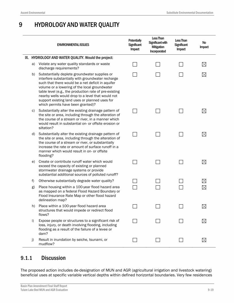
9.1.1 Discussion
The proposed action includes de-designation of MUN and AGR (agricultural irrigation and livestock watering) beneficial uses at specific variable vertical depths within defined horizontal boundaries. Very few residences

Substitute Environmental Documentation Ascent Environmental
9-20 Basin Plan Amendment Final Staff Report Tulare Lake Bed MUN and AGR Evaluation
exist within the project area and the groundwater at the affected variable vertical depths for MUN and AGR is not currently used for municipal or agricultural uses. Implementation of the proposed action would not require any ground disturbance, vegetation removal, or development/operation of structures or facilities, or any other physical effects on water quality or hydrology. The proposed action does not include the alteration or adjustment of salinity levels in the project area. The de-designation of MUN and AGR uses would not create a physical impact on water quality and supply, as such uses are already limited or not existent in the project area. Water supply is currently provided by the Tulare Lake Basin Water Storage District (TLBWSD), which is sourced by groundwater resources upslope of the basin, local water runoff, and surface water provided by the State Water Project (SWP). De-designation would not alter this use. There would be no impact.

Ascent Environmental Substitute Environmental Documentation
Basin Plan Amendment Final Staff ReportTulare Lake Bed MUN and AGR Evaluation 10-21
10 LAND USE AND PLANNING
ENVIRONMENTAL ISSUES Potentially Significant
Impact
Less Than Significant with
Mitigation Incorporated
Less Than Significant
Impact
No Impact
X. LAND USE AND PLANNING. Would the project:
a) Physically divide an established community?
b) Conflict with any applicable land use plan, policy,or regulation of an agency with jurisdiction overthe project (including, but not limited to, ageneral plan, specific plan, local coastal program,or zoning ordinance) adopted for the purpose ofavoiding or mitigating an environmental effect?
c) Conflict with any applicable habitat conservationplan or natural community conservation plan?
10.1.1 Discussion
As discussed previously, the proposed action includes de-designation of MUN and AGR (agricultural irrigation and livestock watering) beneficial uses at specific variable vertical depths within defined horizontal boundaries. Very few residences exist within the project area and the groundwater at the affected variable vertical depths for MUN and AGR is not currently used for municipal or agricultural uses. Implementation of the proposed action would not require any ground disturbance, vegetation removal, or development/operation of structures or facilities, or any other physical change that would divide an established community, or conflict with a Habitat Conservation Plan, Natural Community Conservation Plan, or policy adopted to mitigate an environmental effect. The proposed action will not require current land use(s) in the proposed de-designation area to be modified. However, the counties of Kings, Tulare, and Kern will need to determine if any existing zoning ordinances relevant to the proposed de-designation area require amendment to be consistent with General Plan land use development and land use decisions. The proposed action would not result in any land use changes; therefore, there is no impact.

Substitute Environmental Documentation Ascent Environmental
11-22 Basin Plan Amendment Final Staff Report Tulare Lake Bed MUN and AGR Evaluation
11 MINERAL RESOURCES
ENVIRONMENTAL ISSUES Potentially Significant
Impact
Less Than Significant with
Mitigation Incorporated
Less Than Significant
Impact
No Impact
XI. MINERAL RESOURCES. Would the project:
a) Result in the loss of availability of a knownmineral resource that would be of value to theregion and the residents of the state?
b) Result in the loss of availability of a locallyimportant mineral resource recovery sitedelineated on a local general plan, specific plan,or other land use plan?
11.1.1 Discussion
The proposed action includes de-designation of MUN and AGR (agricultural irrigation and livestock watering) beneficial uses at specific variable vertical depths within defined horizontal boundaries. While there exist oil and gas resources in the Tulare Lake Bed, the de-designation of MUN and AGR beneficial uses would not affect the availability or accessibility of these mineral resources. Therefore, implementation of the proposed action would not require any ground disturbance, vegetation removal, or development/operation of structures or facilities, or any other physical change that would affect mineral resources. Project completion would not alter the availability of any known mineral resources or conflict with a mineral resource recovery site. There would be no impact.

Ascent Environmental Substitute Environmental Documentation
Basin Plan Amendment Final Staff ReportTulare Lake Bed MUN and AGR Evaluation 12-23
12 NOISE
ENVIRONMENTAL ISSUES Potentially Significant
Impact
Less Than Significant with
Mitigation Incorporated
Less Than Significant
Impact
No Impact
XII. NOISE. Would the project result in:
a) Exposure of persons to or generation of noiselevels in excess of standards established in thelocal general plan or noise ordinance, or in otherapplicable local, state, or federal standards?
b) Exposure of persons to or generation of excessivegroundborne vibration or groundborne noiselevels?
c) A substantial permanent increase in ambientnoise levels in the project vicinity above levelsexisting without the project?
d) A substantial temporary or periodic increase inambient noise levels in the project vicinity abovelevels existing without the project?
e) For a project located within an airport land useplan or, where such a plan has not been adopted,within two miles of a public airport or public useairport, would the project expose people residingor working in the project area to excessive noiselevels?
f) For a project within the vicinity of a privateairstrip, would the project expose people residingor working in the project area to excessive noiselevels?
12.1.1 Discussion
The proposed action includes de-designation of MUN and AGR (agricultural irrigation and livestock watering) beneficial uses at specific variable vertical depths within defined horizontal boundaries. Very few residences exist within the project area and the groundwater at the affected variable vertical depths for MUN and AGR is not currently used for municipal or agricultural uses. Implementation of the proposed action may require minimal ground disturbance, vegetation removal, or development/operation of structures or facilities from the installation of monitoring wells. Equipment used in monitoring well installation is comparable to equipment used in existing agricultural operations that are authorized pursuant to the agriculture land use designation in the project area. The proposed project would not generate increased noise. There would be no impact.

Substitute Environmental Documentation Ascent Environmental
13-24 Basin Plan Amendment Final Staff Report Tulare Lake Bed MUN and AGR Evaluation
13 POPULATION AND HOUSING
ENVIRONMENTAL ISSUES Potentially Significant
Impact
Less Than Significant with
Mitigation Incorporated
Less Than Significant
Impact
No Impact
XIII. POPULATION AND HOUSING. Would the project:a) Induce substantial population growth in an area,
either directly (for example, by proposing newhomes and businesses) or indirectly (for example,through extension of roads or otherinfrastructure)?
b) Displace substantial numbers of existing homes,necessitating the construction of replacementhousing elsewhere?
c) Displace substantial numbers of people,necessitating the construction of replacementhousing elsewhere?
13.1.1 Discussion
The proposed action includes de-designation of MUN and AGR (agricultural irrigation and livestock watering) beneficial uses at specific variable vertical depths within defined horizontal boundaries. Very few residences exist within the project area and the groundwater at the affected variable vertical depths for MUN and AGR is not currently used for municipal or agricultural uses. Implementation of the proposed action would not require any ground disturbance, vegetation removal, or development/operation of structures or facilities. The proposed action would not result in addition or removal of any homes and therefore would not result in an increase in population or in the displacement of people or homes. There would be no impact on population and housing.

Ascent Environmental Substitute Environmental Documentation
Basin Plan Amendment Final Staff ReportTulare Lake Bed MUN and AGR Evaluation 14-25
14 PUBLIC SERVICES
ENVIRONMENTAL ISSUES Potentially Significant
Impact
Less Than Significant with
Mitigation Incorporated
Less Than Significant
Impact
No Impact
XIV. PUBLIC SERVICES. Would the project:
a) Result in substantial adverse physical impactsassociated with the provision of new or physicallyaltered governmental facilities, or the need fornew or physically altered governmental facilities,the construction of which could cause significantenvironmental impacts, in order to maintainacceptable service ratios, response times, orother performance objectives for any of the publicservices:
Fire protection?
Police protection?
Schools?
Parks?
Other public facilities?
14.1.1 Discussion
As previously discussed, the proposed action includes de-designation of MUN and AGR (agricultural irrigation and livestock watering) beneficial uses at specific variable vertical depths within defined horizontal boundaries. The area is non-residential and there are no parks or schools. There are no plans to put any parks or schools in the project area. Police and fire protection are provided by the county and changing the designated beneficial uses of groundwater will not change or increase the need for fire or police protection. The de-designation of MUN and AGR as beneficial water uses would not create a physical effect that would cause an environmental impact or result in the obstruction of service-designated routes or roadways. Therefore, implementation of the proposed action would not require any ground disturbance, or development/operation of additional structures or facilities for the purpose of maintaining public services. There would be no impact.

Substitute Environmental Documentation Ascent Environmental
15-26 Basin Plan Amendment Final Staff Report Tulare Lake Bed MUN and AGR Evaluation
15 RECREATION
ENVIRONMENTAL ISSUES Potentially Significant
Impact
Less Than Significant with
Mitigation Incorporated
Less Than Significant
Impact
No Impact
XV. RECREATION. Would the project:
a) Increase the use of existing neighborhood andregional parks or other recreational facilities suchthat substantial physical deterioration of thefacility would occur or be accelerated?
b) Include recreational facilities or require theconstruction or expansion of recreational facilitiesthat might have an adverse physical effect on theenvironment?
15.1.1 Discussion
The proposed action includes de-designation of MUN and AGR (agricultural irrigation and livestock watering) beneficial uses at specific variable vertical depths within defined horizontal boundaries. Very few residences exist within the project area and the groundwater at the affected variable vertical depths for MUN and AGR is not currently used for municipal or agricultural uses. Therefore, implementation of the proposed action would not require any ground disturbance, or development/operation of recreational structures or facilities. Project implementation would not result in an increase in recreational activities or increase demand for new recreational facilities. There would be no impact.

Ascent Environmental Substitute Environmental Documentation
Basin Plan Amendment Final Staff Report Tulare Lake Bed MUN and AGR Evaluation 16-27
16 TRANSPORTATION/TRAFFIC
ENVIRONMENTAL ISSUES Potentially Significant
Impact
Less Than Significant with
Mitigation Incorporated
Less Than Significant
Impact
No Impact
XVI. TRANSPORTATION/TRAFFIC. Would the project:
a) Conflict with an applicable plan, ordinance orpolicy establishing measures of effectiveness forthe performance of the circulation system, takinginto account all modes of transportation includingmass transit and non-motorized travel andrelevant components of the circulation system,including but not limited to intersections, streets,highways and freeways, pedestrian and bicyclepaths, and mass transit?
b) Conflict with an applicable congestionmanagement program, including, but not limitedto level of service standards and travel demandmeasures, or other standards established by thecounty congestion management agency fordesignated roads or highways?
c) Result in a change in air traffic patterns, includingeither an increase in traffic levels or a change inlocation that results in substantial safety risks?
d) Substantially increase hazards due to a designfeature (e.g., sharp curves or dangerousintersections) or incompatible uses (e.g., farmequipment)?
e) Result in inadequate emergency access?
f) Conflict with adopted policies, plans, or programsregarding public transit, bicycle, or pedestrianfacilities, or otherwise decrease the performanceor safety of such facilities?
16.1.1 Discussion
As previously discussed, the proposed action includes de-designation of MUN and AGR (agricultural irrigation and livestock watering) beneficial uses at specific variable vertical depths within defined horizontal boundaries. Very few residences exist within the project area and the groundwater at the affected variable vertical depths for MUN and AGR is not currently used for municipal or agricultural uses. Therefore, implementation of the proposed action would not require any ground disturbance, or development/operation of structures or facilities, or any other physical effect that could adversely impact transportation. The de-designation of MUN and AGR beneficial uses would not create an increase in traffic flow, or conflict with any traffic-related plans or policies. Project completion would have no effect on air traffic. There would be no impact.

Substitute Environmental Documentation Ascent Environmental
17-28 Basin Plan Amendment Final Staff Report Tulare Lake Bed MUN and AGR Evaluation
17 UTILITIES AND SERVICE SYSTEMS
ENVIRONMENTAL ISSUES Potentially Significant
Impact
Less Than Significant with
Mitigation Incorporated
Less Than Significant
Impact
No Impact
XVII. UTILITIES AND SERVICE SYSTEMS. Would the project:
a) Exceed wastewater treatment requirements ofthe applicable Regional Water Quality ControlBoard?
b) Require or result in the construction of new wateror wastewater treatment facilities or expansion ofexisting facilities, the construction of which couldcause significant environmental effects?
c) Require or result in the construction of new stormwater drainage facilities or expansion of existingfacilities, the construction of which could causesignificant environmental effects?
d) Have sufficient water supplies available to servethe project from existing entitlements andresources, or are new or expanded entitlementsneeded?
e) Result in a determination by the wastewatertreatment provider that serves or may serve theproject that it has adequate capacity to serve theproject’s projected demand, in addition to theprovider’s existing commitments?
f) Be served by a landfill with sufficient permittedcapacity to accommodate the project’s solidwaste disposal needs?
g) Comply with federal, state, and local statutes andregulations related to solid waste?
17.1.1 Discussion
The proposed action includes de-designation of MUN and AGR (agricultural irrigation and livestock watering) beneficial uses at specific variable vertical depths within defined horizontal boundaries. Very few residences exist within the project area and the groundwater at the affected variable vertical depths for MUN and AGR is not currently used for municipal or agricultural uses. Therefore, implementation of the proposed action would not require any ground disturbance, or development/operation of structures or facilities for the purpose of increased utility usage. Project activities would not include the construction of supplementary facilities or additions to existing facilities. Water supply is already provided by alternative sources, including groundwater resources upslope of the basin and surface water provided by the SWP, and de-designation would not alter this use. Project implementation would not generate solid waste; therefore, there would be no conflict with federal, state, and local policies regarding solid waste. Any future request by a publically owned treatment works to relocate its facilities to the proposed de-designation area as a means to benefit from relaxed salinity discharge requirements would be required to apply for a change in point of discharge with the Central Valley Water Board, at which point the Board would evaluate potential impacts to water quality and beneficial uses at and downgradient from the proposed point of discharge. Additionally, a proposal for the construction of a wastewater treatment facility in the proposed de-designation area would be required to undergo its own environmental review. There would be no impact.

Ascent Environmental Substitute Environmental Documentation
Basin Plan Amendment Final Staff ReportTulare Lake Bed MUN and AGR Evaluation 18-29
18 MANDATORY FINDINGS OF SIGNIFICANCE
ENVIRONMENTAL ISSUES Potentially Significant
Impact
Less Than Significant with
Mitigation Incorporated
Less Than Significant
Impact
No Impact
XVIII. MANDATORY FINDINGS OF SIGNIFICANCE.
a) Does the project have the potential tosubstantially degrade the quality of theenvironment, substantially reduce the habitat ofa fish or wildlife species, cause a fish or wildlifepopulation to drop below self-sustaining levels,threaten to eliminate a plant or animalcommunity, reduce the number or restrict therange of an endangered, rare, or threatenedspecies, or eliminate important examples of themajor periods of California history or prehistory?
b) Does the project have impacts that areindividually limited, but cumulativelyconsiderable? (“Cumulatively considerable”means that the incremental effects of a projectare considerable when viewed in connection withthe effects of past projects, the effects of othercurrent projects, and the effects of probablefuture projects.)
c) Does the project have environmental effects thatwill cause substantial adverse effects on humanbeings, either directly or indirectly?
Authority: Public Resources Code Sections 21083, 21083.5.
Reference: Government Code Sections 65088.4. Public Resources Code Sections 21080, 21083.5, 21095; Eureka Citizens for Responsible Govt. v. City of Eureka (2007) 147 Cal.App.4th 357; Protect the Historic Amador Waterways v. Amador Water Agency (2004) 116 Cal.App.4th at 1109; San Franciscans Upholding the Downtown Plan v. City and County of San Francisco (2002) 102 Cal.App.4th 656.
18.1.1 Discussion
As previously discussed, the proposed action includes de-designation of MUN and AGR (agricultural irrigation and livestock watering) beneficial uses at specific variable vertical depths within a defined horizontal boundary. Very few residences exist within the project area and the groundwater at the affected variable vertical depths for MUN and AGR is not currently used for municipal or agricultural uses. Implementation of the proposed action would not require any ground disturbance, or development/operation of structures or facilities. The abovementioned activities do not require the physical alteration of existing structures or habitats and would not result in the loss of an endangered, threatened, or listed species, or any historically significant resources. There would be no cumulatively considerable adverse effects on the environment or human beings. Implementation of the proposed action would not affect water quality of the project site. There would be no impact on fish or wildlife species, cultural resources, or humans.

Substitute Environmental Documentation Ascent Environmental
19-30 Basin Plan Amendment Final Staff Report Tulare Lake Bed MUN and AGR Evaluation
19 REFERENCES
Ayers, R.S. and D.W. Westcot. 1985. Water Quality for Agriculture. Food and Agriculture Organization of the United Nations, Irrigation and Drainage Paper 29, Rev. 1, Rome.
California Department of Conservation. 2002. Regulatory Maps. Available: http://www.quake.ca.gov/gmaps/WH/regulatorymaps.htm. Accessed June 2015.
California Department of Conservation. 2015. California Important Farmland Finder. Available: http://maps.conservation.ca.gov/ciff/ciff.html. Accessed June 2015.
Canada. 2012. Canadian Environmental Quality Guidelines: Water Quality Guidelines for the Protection of Agriculture. http://www.ccme.ca/en/resources/canadian_environmental_quality_guidelines/index.html Last accessed February 3, 2016.
Central Valley Water Board. 2014. Issue List and Work Plan for the 2014 Triennial Review of the Water Quality Control Plan for the Tulare Lake Basin. Resolution No. R5-2015-0020. April 16.
Central Valley Salinity Alternatives for Long-Term Sustainability (CV-SALTS). 2012. Salinity Effects on Agriculture Irrigation-Related Uses of Water. Prepared by CDM Smith. Prepared for CV-SALTS. August 10.
CV-SALTS. 2013. Salts and Nutrients: Literature Review for Stock Drinking Water Final Report. Prepared byKennedy/Jenks Consultants and Texas A&M Agrilife Research. Prepared for CV-SALTS. May 20.
CV-SALTS. 2015. Technical and Regulatory Evaluation of MUN and AGR Beneficial Uses in the Tulare Lake
Bed Area. Prepared by Kenneth D. Schmidt & Associates (hydrology) and CDM Smith and Summers Engineering (regulatory and technical analysis). Submitted by Tulare Lake Drainage District and Tulare Lake Basin Water Storage District. December 4.
DOC. See California Department of Conservation.
Kenneth D. Schmidt and Associates (KDSA). 2016a. Tulare Lake Bed De-Designation: Directions of Groundwater Flow near Urban Areas (Municipal Well Zone of Capture Analysis). Prepared for Tulare Lake Basin Water Storage District. July 8.
KDSA. 2016b. Domestic Well Zone of Capture Analysis. Prepared for Tulare Lake Basin Water Storage District. September 8.
National Academy of Science (NAS) and National Academy of Engineering (NAE). 1973. Water Quality Criteria 1972, a Report to the Committee on Water Quality Criteria. National Academy of Science and National Academy of Engineering, Washington, DC. EPA-R3-73-March 1973 (Blue Book).
Sholes, D.A. 2006. History, Lithology, and Groundwater Conditions in the Tulare Lake Basin. Presentation given to Central Valley Regional Water Board Meeting. 21 September 2006.
Tulare Lake Basin Water Storage District (TLBWSD). 2016. Evaluation of 14 Potential Additional Well Locations. Technical Memorandum #2 to Mike Trouchon (Larry Walker Associates) from Jacob Westra (TLBWSD). September 14.

Basin Plan Amendment Final Staff ReportTulare Lake Bed MUN and AGR Evaluation
APPENDIX A – FIGURES

Corcoran
Alpaugh
Stratford
Kettleman City
7
6
7
6
6
5
77
6 3 2 6
8
7
4
6
7
5
6
2 4
9
9
6
9
7
7
8
4 3
77
7
4
5
5
6
8
9
4
34
4
7
1
621
3
6
9
2
4
9
55
6
1
9
3
7
8
2
88
5
8
8
1
5
9
8
3
4
3
3
7
8
8
8
4
6
8
1
4
4
9
9
3
4
3
3
1
5
6
6 1
2
5
3
9
2
5
8
7
7
6
8
7 9
9
9
8
4
9
9
8
8
2
9
23
9
2
4
2
4
8
1
5
4
1
2
3
9
1
2
9
4
9
3
2
9
98
8
7
5
6
3
5
4
4
7
1
7
5
8
9
6
7
6
6
8
2
5
7
3
1
4
3
4
2
4
9
8
8
9
8
8
7
8
3
5
3
9
5
1
5
2
45
5
2
1
1
5
1
5
2
1
3 3
1
5
5
6
5 3
9
3
2
3
8
1
4
7
6
6
4 5
4
6
1
9
6
35
3
6
5
8
1
7
6
7
7
2
3
2
9
4
2
52
4
7
33 11
1 624
6
7
1
31
30
31
18
19
25
30
31
19
30
30
31
11
18
30
29
11
18
11
31
30
11
18
19
11
25
31
18
19
11
11
30
26
12
18
28
11
11
19
18
11
19
30
17
11
11
11
11
11
11
11
11
18
29
11
19
31
11
30
11
11
30
15
1613
19
33
29
28
33
19
20
2
11
21
21
24
25
26
12
34
25
29
10
2219
29
33
23
29
27
11
13
20
31
11
3632
20
20
16
31
31
26
30
34
30
28
24
29
15
36
21
23
30
22
28
22
26
19
29
28
13
32
32
10
19
32
32
30 26
26
34
35
27
22
18
24
27
33
24
18
34
16
30
19
17
28
31
35
16
19
35
29
36
20
19
26
27
26
17
16
10
17
35
10
33
10
28
30
33
10
16
30
3432
16
22
22
25
21
24
26
26
32 31
17
32
28
23
27
13
17
21
21
33
12
14
36
32
34
29
14
29
30
28
13
31
23
16
30
28
31
17
12
19
14
14
31
23
27
27
23
21
34
34
27 27
3431
15
30
35
22
33
27
27
10
18
13
36
17 18
14
27
16
10
26
16
18
25
13
16
16
17
17
27
35
10
23
29
29
27
10
10
29
32
13
13
26
31
15
29
30
19
30
33
2019
28
35
25
25
16
16
21
35
12
20
20
28
15
27
27
33
24
17
14
14
21
21
26
29
19
16
25
15
15
22
31
15
15
20
2221
22
10
27
33
10
20
17
17
33
12
22
12
13
28
32
35
34
28
16
30
12
29
21
13
25
17
28
33
12
22
28
28
10
13
19
26
23
36
24
20
32
15
15
15
34
23
26
25
14
14
36
21
31
25
25
17
32
35
17
20
20
22
18
26
25
33
32
33
33
29
31
29
15
15
15
25
29
34
12
27
33
18
24
17
17
14
17
28
34
33
27
21
30 28
29
20
12
27
29
29
25
17
15
12
17
28
32
19
16
36
36
12
16
23
30
20
20
10
10
17
32
32
23
13
24
36
20
13
23
18
14
14
25
23 21
32
16
16
21
22
22
22
21
1314
18
26
12
28
32
28
22
24
24
33
21
32
36
27
17
13
14
30
24
12
35
6
15
20
20
25
15
15
19
10
26
22
18
12
34
12
20
24
34
34
35
28
28
24
28
21
17
10
18
28
32
34
21
22
31
24
23
12
29
29
19
20
14
33
27
35
22
13
21
28
28
13
33
19
18
16
22
19
33
27
1614
28 26
28
25
26
36
29
23
18
23
21
21
30
35
26
34
20
20
31
30
21
21
24
14
16
16
2224
23
14
15
34
26 30
12
20
32
21
18
18
20
17
25
20
32
35
36
33
14
34
27
29
34
2725
32
26
27
18
23
23
10
22
22
36
20
29
1212
14
20
29
25
21
25
21
2021
28
27
16
24
35
15
16
12
33
24
24
15
15
36
10
23
23
27
13
15
21
36
22
10
30
33
22
10
10
20
33
28
36
16
10
19
29
22
22
20
26
26
17
10
27
31
15
27
32
24
32
15
15
15
10
25
36
10
34
27
14
25
34
24
26
35
32
35
21
23
23
33
18
13
31
10
10
34
34
12
30
20 24
22
34
32
15
35
15
27
34
17
28
10
14
31
27
35
35
36
13
24
19
18
35
17
28
29
17
17
36
13
20
24
24
33
25
21
28
7
36
33
21
31
23
23
16
25
36
14
18
35
22
29
26
12
2021
34
29
35
14
16
33
13
34
31
27
26
14
19
19
29
13
22
22
24
24
3632
29
23 22 23
26
20
32
1922
23
36
16
19
31
23
30
25
21
18
19
34
2
27
30
1922
31
2
18
19
31
30
2
24
25
36
12
13
25
17
36
18 16
32 33
151417 151618 13
11
31
1314
34 3336
15
3332
17
3235
11
34 36
35
16
14
35
35
35 3231
13 18
34
23
23
26
3331
26
36
1415
11
14
18
19
26
16
35
34 35
30
36
23
11
14
17
31
24
32
35
3433
26
14
23
13
35
14 1815161718
31
1
13
24
1
12
13
24
25
36
12
13
24
25
24
2421S 21E
22S 21E
24S 22E
21S 20E
20S 21E20S 20E
23S 21E
24S 21E
23S 22E
21S 22E
22S 22E
21S 19E
23S 20E
24S 20E
22S 19E
22S 20E
23S 19E
24S 19E
25S 21E 25S 22E25S 20E25S 19E
24S 23E
23S 23E
25S 23E
22S 23E
21S 23E
20S 23E
19S 21E 19S 22E19S 20E19S 19E
19S 23E
20S 18E
19S 18E
22S 18E
§̈¦5
·|}41
·|}43
·|}198
·|}137
6T
H A
VE
6T
H A
VE
U T I C A A V EU T I C A A V E
K E N T A V EK E N T A V E
I D A H O A V EI D A H O A V E
10
TH
AV
E1
0T
H A
VE
19
TH
AV
E1
9T
H A
VE
K A N S A S A V EK A N S A S A V E
J A C K S O N A V EJ A C K S O N A V E
25
TH
AV
E2
5T
H A
VE
16
TH
AV
E1
6T
H A
VE
18
TH
AV
E1
8T
H A
VE
17
TH
AV
E1
7T
H A
VE
8T
H A
VE
8T
H A
VE
P U E B L O A V EP U E B L O A V E
R E D D I N G A V ER E D D I N G A V E
J E R S E Y A V EJ E R S E Y A V E
14
TH
AV
E1
4T
H A
VE
A V E NA L C
U T OF F
AV E NA L C
U T OF F
7T
H A
VE
7T
H A
VE
22
ND
AV
E2
2N
D A
VE
11
TH
AV
E1
1T
H A
VE
21
ST
AV
E2
1S
T A
VE
5T
H A
VE
5T
H A
VE
12
TH
AV
E1
2T
H A
VE
9T
H A
VE
9T
H A
VE
N E V A D A A V EN E V A D A A V E
W H I T L E Y A V EW H I T L E Y A V E
M A D I S O N A V EM A D I S O N A V E
P A R I S A V EP A R I S A V E
T U C S O N A V ET U C S O N A V E
Q U E B E C A V EQ U E B E C A V E
KIN
G A
VE
KI N
G A
VE
L I N C O L N A V EL I N C O L N A V E
O M A H A A V EO M A H A A V E
O R A N G E A V EO R A N G E A V E
R A C I N E A V ER A C I N E A V E
4T
H A
VE
4T
H A
VE
N E W T O N A V EN E W T O N A V E
D E V I L S D E N R D
D E V I L S D E N R D
20
TH
AV
E2
0T
H A
VE
13
TH
AV
E1
3T
H A
VE
L A N S I N G A V EL A N S I N G A V E
DA
IRY
AV
ED
AI R
Y A
VE
S A L E M A V ES A L E M A V E
M A N T E C A A V EM A N T E C A A V E
S E A T T L E A V ES E A T T L E A V E
V I R G I N I A A V EV I R G I N I A A V E
27
TH
AV
E2
7T
H A
VE
N O R T H A V EN O R T H A V E
A V E N G E R A V EA V E N G E R A V E
15
TH
AV
E1
5T
H A
VE
25
TH
ST
25
TH
ST
OT
I S A
VE
OT
I S A
VE
2 1 1 / 2 AV E
2 1 1 / 2 AV E
PIC
KE
RE
LL
AV
EP
I CK
ER
EL
L A
VE
20
TH
AV
E2
0T
H A
VE
N E W T O N A V EN E W T O N A V E
L A N S I N G A V EL A N S I N G A V E
N E V A D A A V EN E V A D A A V E
4T
H A
VE
4T
H A
VE
6T
H A
VE
6T
H A
VE
4T
H A
VE
4T
H A
VE
N E V A D A A V EN E V A D A A V E
9T
H A
VE
9T
H A
VE
15
TH
AV
E1
5T
H A
VE
25
TH
AV
E2
5T
H A
VE
10
TH
AV
E1
0T
H A
VE
21
ST
AV
E2
1S
T A
VE
I D A H O A V EI D A H O A V E
7T
H A
VE
7T
H A
VE
4T
H A
VE
4T
H A
VE
J E R S E Y A V EJ E R S E Y A V E
M A N T E C A A V EM A N T E C A A V E
5T
H A
VE
5T
H A
VE
N E V A D A A V EN E V A D A A V E
25
TH
AV
E2
5T
H A
VE
L A N S I N G A V EL A N S I N G A V E
12
TH
AV
E1
2T
H A
VE
9T
H A
VE
9T
H A
VE
4T
H A
VE
4T
H A
VE
N E V A D A A V EN E V A D A A V E
Figure 8Proposed Boundary for De-Designation of MUN Electrical Conductivity (EC) of Groundwater ≥ 5,000 microsiemens/cm
Path: V:\CV Salts\CV salt map Vertical Delisting Depth - MUN.mxd
LegendProposed MUN De-Designation Boundary
Originally Proposed De-Designation Boundary
De-designate to Top of A-Clay (Minimum of 75 feet in depth)
De-designate to Top of A-Clay (Minimum of 110 feet in depth)
De-designate to Top of C-Clay (Minimum of 200 feet in depth)
De-designate to Top of Corcoran Clay
0 2 4Miles
±

!(
!(
!(
!(
!(!(
!(
!( !(
!(
!(
!(!(
!(
!(
!(
!(
!(
!(
!(!(!(
!(
!(!(
!(
!(
!(
!(
!(
!(
!(
!(
!(
!(
!(
!(
!(
!(
!(
!(
!(
!(!(
!(!(
!(
!(
!(
!(
!(
!(
!(
!(
!(
!(
!(
!(—
!(
!(!(
!(!(
!(!(
!(!(!(
!(
!(!(
!(
!(!(
!(
!(
!(!(!(!(!(
!(
!(
!( !(
!(
!(
!(
!(!(
!(!(
!(!(
!(!(
!(!(!(!(!(
!(
!(!(!(!(
!(
!(!(!(
!(!(!(
!(!(
!(
!(
!(
!(
!(
!(!(!(!(
!(!(!(
!(!(
!(!(
!(!(
!(!(
!(!(
!(
!(!(
!(
!(!(
!(
!(
!(
!(!(
!(
!(
!(
!(!(
!(!(
!(!(
!(
!(
!(!(
!(!(
!(
!(
!(
!(
!(
!(
!(!( !(
!(
!(
!(
!(
!(
!(
!(
!(
!(
!(!(
!(
!(!(
!(——!(——
!(——
!(——
!(——
!(—!(—
!(|!(|!(|!(|
!(\!(\!(\!(\
!(\!(\!(\!(\!(\
!(——
!(——
!(——
!( !(\ !( !(\
!(\
!(\
!(!(
!(—!(!(!( !(!(!(
!(!(!(
!(!(!(—!(
!( !(—!(
!( !(
!(
!(—
!(!(!(!(
!(
!(!(
!(—!(—
!(—!(—
!(—!(—
!(—
!(—!(—!(—
!(—
!(— !(—
!(—!(—
!(—!(—!(—
!(—
!(—!(—!(—
!(—
!(—
!
<
!(——
!(—
!(!(!(
!(!(!(
!( !(!(
!(!( !(!(!(!(!(!(!(
!(!(!(
!(!(!(!(
!(!(!(
!(!(!(!( !(
!(!(
!(!(!(
!(
!(
!(
!(|
!(—!(—!(—
!(—!(
!(!(—!(—!(
!(—
!(——
!
<
!(
!(!(!(!(
!(—!(—
!(——!(——
!<!<
!(——
!(——
!(—!(—
!(—!(
!(—!(— !<!(—!(
—!(—!(—!(!(—
!(—
!(—!(—!(—!(—!(—
!(|!(|!(|
!(|!(!(—!(—
!(—!(—!(
!(—!(!( !(—!(—!(—!(—!(—
!(—!(—!(—!(—
!(—
!(—
!( !(—
!(—
!(—!(—
!(—!(—
!(
!(
!(
!(
!(
!(!(
!(
!( !(
!(
!(
!(!(
!(
!(
!(
!(
!(
!(
!(!(!(
!(
!(!(
!(
!(
!(
!(
!(
!(
!(
!(
!(
!(
!(
!(
!(
!(
!(
!(
!(
!(!(
!(!(
!(
!(
!(
!(
!(
!(
!(
!(
!(
!(
!(
!(—
!(
!(!(
!(!(
!(!(
!(!(!(
!(
!(!(
!(
!(!(
!(
!(
!(!(
!(
!(
!(
!( !(
!(
!(
!(!(
!(!(
!(!(
!(!(
!(
!(
!(!(!(!(
!(
!(!(!(
!(!(!(
!(!(
!(
!(
!(
!(
!(
!(!(!(!(
!(!(!(
!(!(
!(!(
!(!(
!(!(
!(!(
!(
!(!(
!(
!(!(
!(
!(
!(
!(!(
!(
!(
!(
!(!(
!(!(
!(!(
!(
!(
!(!(
!(!(
!(
!(
!(
!(
!(
!(
!(!( !(
!(
!(
!(
!(
!(
!(
!(
!(!(
!(
!(——!(——
!(——
!(——
!(——
!(
!(—!(—
!(—!(—!(—!(—!(—
!(—
!(—
!(——
!(—
!(—!(—!(—
!(—
!(——
!
<
!(——
!(——
!(—!(—!(—!(—
!(—
!(—
!!
!
!
!
!
!
!
!!
!
!
!
!
!!
!
!
!
!
! !!
! !
!
!
!!!
!! !
!!
!
!
!
! !
!
!
!(
!(
!
!(—
!(—
!(—
!( !(
!(
!(
!(!(
!(
!(!(!(
!( !(
!(
!(
!(
!(
!.
!.
!. Corcoran
Alpaugh
Stratford
Kettleman City
CENTRAL SUBAREA
EAST SUBAREA
NORTH SUBAREA
SOUTH SUBAREA
WEST SUBAREA
7
6
7
6
6
5
77
61 3 26
8
7
4
6
3
7
5
2
2
6
2 4
9
9
6
9
7
7
8
4
3
77
7
4
5
5
6
8
9
4
34
4
7
1
621
3
6
9
2
4
9
5
5
6
1
9
3
7
8
2
88
5
8
8
1
5
9
8
3
4
3
3
7
8
8
8
4
6
8
1
4
4
9
9
3
4
31
5
6
6 1
2
5
3
9
2
5
8
7
7
6
8
79
9
9
8
4
2
9
9
8
8
2
9
23
9
4
2
4
8
1
5
4
1
2
9
1
2
9
4
6
79
32
2
9
9
8
8
7
5
6
3
5
4
4
7
1
7
5
8
9
6
7
6 6
6
8
2
5
3
1
4
3
4
2
4
7
9
8
8
9
8
8
7
8
3
5
3
9
5
1
5
2
45
5
2
1
1
5
1
5
2
1
3 3
1
5
5
6
5 3
9
7
3
2
3
8
1
4
7
6
6
4 5
4
6
1
9
6
35
3
6
5
8
1
7
7
7
2
3
26
9
4
2
5
2
2
4
33 11
1 624
1
31
1
30
31
18
19
25
30
31
19
30
30
31
11
18
30
29
11
11
18
11
31
30
11
18
19
11
31
11
11
2
11
18
19
11
11
30
26
12
18
28
11
11
19
18
11
19
30
17
11
11
36
11
11
11
1111
11
1
18
29
11
19
31
1
11
30
11
11
3333
15
11
32
1613
33
29
28
33
19
20
11
21
21
24
25
26
12
34
31
31
29
10
22 19
29
33
23
29
27
11
13
20
31
34
3632
31
20
35
20
16
31
26
30
34
30
28
29
15
36
36
23
30
22
28
22
26
10
19
29
28
13
32
32
10
19
32
32
3026
26
35
23
31
22
18
24
27
33
24
18
34
16
17
28
31
35
16
19
35
29
31
19
27
26
17
16
10
17
35
10
33
33 33
10
28
30
10
16
15
30
34
14
14
32
16
22
22
25
21
26
32 31
17
32
28
23
27
13
17
25
21
21
33
12
14
36
32
34
29
14
30
28
13
23
16
30
28
17
12
19
14
14
31
35
27
27
26
23
21
34
34
27 27
3431
15
30
35
2222
33
27
27
10
18
13
36
17
18
14
27
16
32
10
26
16
18
25
13
16
16
17
17
27
35
10
29
29
27
10
10
29
32
13
13
26
31
15
30
19
30
33
2019
28
32
35
25
25
16
16
21
35
12
20
20
28
15
35
27
27
33
24
17
14
14
21
21
29
19
16
25
15
15
15
15
2221
10
33
10
20
17
17
33
12
22
12
13
28
32
14
34
28
16
30
30
12
21
13
25
17
28
33
12
28
28
10
13
19
26
23
24
20
32
15
15
15
34
34
23
26
25
14
14
36
21
31
25
25
17
32
35
17
20
20
23
23
18
26
25
33
34
19
19
32
33
33
29
31
29
15
15
15
29
34
12
27
33
33
18
24
17
17
14
17
34
33
27
21
35
30 28
29
20
12
2729
29
25
15
17
28
32
35
19
16
36
12
16
34
23
30
20
20
10
10
17
32
32
23
13
35
23
36
36
20
13
23
18
14
14
25
32
16
16
21
22
22
22
21
1314
18
26
12
28
28
22
24
24
33
21
32
36
27
17 14
13
14
24
12
35
15
20
20
25
15
15
19
10
26
30
22
18
12
34
12
20
24
34
34
35
28
28
24
36
17
10
26
26
18
32
34
21
22
31
24
27
23
12
29
29
20
14
27
35
35
22
13
21
28
28
13
3331
19
18
16
22
19
33
27
26
1614
28 26
28
26
36
29
23
18
21
21
30
35
26
34
20
20
31
21
21
24
14
16
16
2224
23
14
15
34
26
12
26 30
12
20
32
21
14
18
18
20
17
25
32
35
36
14
34
34
29
27
25
32
27
18
23
23
10
22
22
36
20
29
1212
14
20
29
25
25
21
2021
28
27
16
35
15
16
12
33
24
24
15
15
36
10
13
23
23
27
13
15
21
36
22
10
30
33
22
10
10
20
33
36
16
10
19
29
22
22
20
26
26
17
10
27
15
32
24
35
35
15
15
15
10
25
36
10
27
14
25
24
26
32
35
21
23
23
18
13
18
18
31
10
34
12
30
20 24
34
35
15
27
34
17
28
14
31
31
27
35
36
34
13
24
18
19
17
18
29
17
17
13
23
24
24
33
25
21
28
36
21
31
23
23
16
25
36
14
18
35
22
29
26
12
34
30
35
16
36
33
13
34
31
26
14
31
19
19
13
22
22
24
24
3632
29
23 22 2320
32
1922
36
16
19 23
25
21
1
34
12
13
31 33
24
3231
25
3433
353633
3634
36
323235
12
13
31363534
25
24
11
33
35
36
36
32
23
26
36
25
14
12
24
24
13
12
31
13
24
25
3534
2
36
333231
12
36
13
24
24
25
36
35
7
17
12
10
11
14
23
26
35
1
35
36
25
36
1
24
12
13
25
24
13
12
26
2421S 21E
22S 21E
25S 22E
24S 22E
25S 21E25S 19E
21S 20E
20S 21E
20S 20E
23S 21E
24S 21E
23S 22E
21S 22E
22S 22E
24S 19E
25S 20E
21S 19E
23S 19E 23S 20E
24S 20E
22S 19E
22S 20E
25S 23E
24S 23E
23S 23E
22S 23E
21S 23E
20S 23E20S 18E
19S 22E
21S 18E
19S 21E
22S 18E
19S 20E
23S 18E
19S 23E19S 19E
24S 18E
19S 18E
§̈¦5
·|}41
·|}43
·|}137
6T
H A
VE
6T
H A
VE
U T I C A A V EU T I C A A V E
K E N T A V EK E N T A V E
10
TH
AV
E1
0T
H A
VE
K A N S A S A V EK A N S A S A V E
19
TH
AV
E1
9T
H A
VE
25
TH
AV
E2
5T
H A
VE
P U E B L O A V EP U E B L O A V E
16
TH
AV
E1
6T
H A
VE
18
TH
AV
E1
8T
H A
VE
R E D D I N G A V ER E D D I N G A V E
L A U R E L A V EL A U R E L A V E
17
TH
AV
E1
7T
H A
VE
22
ND
AV
E2
2N
D A
VE
8T
H A
VE
8T
H A
VE
10
1/ 2
AV
E1
0 1
/ 2 A
VE
N E V A D A A V EN E V A D A A V E
AV E NA L C
U T OF F
AV E NA L C
U T OF F
12
TH
AV
E1
2T
H A
VE
W H I T L E Y A V EW H I T L E Y A V E
M A D I S O N A V EM A D I S O N A V E
P A R I S A V EP A R I S A V E
D E V I L S D E N R D
D E V I L S D E N R D
O M A H A A V EO M A H A A V E
14
1/2
AV
E1
4 1
/ 2 A
VE
14
TH
AV
E1
4T
H A
VE
T U C S O N A V ET U C S O N A V E
Q U E B E C A V EQ U E B E C A V E
K I N G A V EK I N G A V E
L I N C O L N A V EL I N C O L N A V E
N I L E S A V EN I L E S A V E
O R A N G E A V EO R A N G E A V E
R A C I N E A V ER A C I N E A V E
4T
H A
VE
4T
H A
VE
N E W T O N A V EN E W T O N A V E
7T
H A
VE
7T
H A
VE
20
1/ 2
AV
E2
0 1
/ 2 A
VE
20
TH
AV
E2
0T
H A
VE
21
ST
AV
E2
1S
T A
VE
13
TH
AV
E1
3T
H A
VE
L A K E V I E W A V EL A K E V I E W A V E
5 1
/2 A
VE
5 1
/ 2 A
VE
5T
H A
VE
5T
H A
VE
L A N S I N G A V EL A N S I N G A V E
DA
IRY
AV
ED
AI R
Y A
VE
S A L E M A V ES A L E M A V E
11
TH
AV
E1
1T
H A
VE
M A N T E C A A V EM A N T E C A A V E
S E A T T L E A V ES E A T T L E A V E
M E D F O R D R DM E D F O R D R D
V I R G I N I A A V EV I R G I N I A A V E
SA
NT
A F
E A
VE
SA
NT
A F
E A
VE
N O R T H A V EN O R T H A V E
9T
H A
VE
9T
H A
VE
9 1
/ 2 A
VE
9 1
/ 2 A
VE
15
TH
AV
E1
5T
H A
VE
Q U A I L A V EQ U A I L A V E
OT
I S A
VE
OT
I S A
VE
CE
NT
RA
L VA
LL
EY
HW
Y
CE
NT
RA
L VA
LL
EY
HW
Y
F R O N T A G E R D
F R O N T A G E R D
VA
N D
OR
ST
EN
AV
EV
AN
DO
RS
TE
N A
VE
4T
H A
VE
4T
H A
VE
25
TH
AV
E
25
TH
AV
E
4T
H A
VE
4T
H A
VE
21
ST
AV
E2
1S
T A
VE
6T
H A
VE
6T
H A
VE
10
TH
AV
E1
0T
H A
VE
8T
H A
VE
8T
H A
VE
5T
H A
VE
5T
H A
VE
12
TH
AV
E1
2T
H A
VE
N E W T O N A V EN E W T O N A V E
N E V A D A A V EN E V A D A A V E
7T
H A
VE
7T
H A
VE
N E W T O N A V EN E W T O N A V E
N E V A D A A V EN E V A D A A V E
9T
H A
VE
9T
H A
VE
L A U R E L A V EL A U R E L A V E
7T
H A
VE
7T
H A
VE
KI N
G A
VE
KI N
G A
VE
4T
H A
VE
4T
H A
VE
5T
H A
VE
5T
H A
VE
N E V A D A A V EN E V A D A A V E
L A N S I N G A V EL A N S I N G A V E
3
23
Figure Proposed Boundary for De-designation of MUN and AGR Beneficial Uses Showing Water Supply Wells within Subareas
Path: V:\CV Salts\CV salt map - Location of Water Supply Wells for ES 1.mxd
DRAFT - SUBJECT TO REVISION
0 2 4Miles
±
Date Saved: 9/26/2016
Legend
!. Active Irrigation Wells with Plotted EC Data
Wells Inside Proposed De-designation Boundary
Wells Outside Proposed De-designation Boundary**!(—— Stock Well
!(\ Industrial Well
!< Small Water System Well
!
<
Dairy Well
!( Irrigation Well
!(| Public Supply Well
!(— Domestic Well
!( Municipal Water Wells
** Some wells may be Active, Abandoned or Destroyed
!(—— Stock Well*
!
<
Dairy Well*
!( Irrigation Well*
!(— Domestic Well** Well is either Abandoned or Destroyed
!. Inactive Irrigation Well with Plotted EC Data
!(—Active Domestic Water Supply Wells Completed below Vertical Delisting(There are no Active Domestic Wells that are above Vertical Delisting)
!Active Irrigation Wells Completed Below Corcoran Clay(There are no Active Irrigation Wells that are above Corcoran Clay)
Subarea Evaluated
Proposed MUN and AGR De-Designation Boundary
Originally Proposed De-Designation Boundary
De-Designate to Top of A-Clay (Minimum of 75 feet in depth)
De-Designate to Top of A-Clay (Minimum of 110 feet in depth)
De-Designate to Top of C-Clay (Minimum of 200 feet in depth)
De-Designate to Top of Corcoran Clay

Corcoran
Alpaugh
Stratford
Kettleman City
7
6
7
6
6
5
77
6 3 2 6
8
7
4
6
3
7
5
2
6
2 4
9
9
6
9
7
7
8
4 3
77
7
4
5
5
6
8
9
4
34
4
7
1
621
3
6
9
2
4
9
55
6
1
9
3
7
8
2
88
5
8
8
1
5
9
8
3
4
3
3
7
8
8
8
4
6
8
1
4
4
9
9
3
4
3
3
1
5
6
6 1
2
5
3
9
2
5
8
7
7
6
8
7 9
9
9
8
4
9
9
8
8
2
9
23
9
4
2
4
8
1
5
4
1
2
9
1
2
9
4
6
9
3
2
9
98
8
7
5
6
3
5
4
4
7
7
1
7
5
8
9
6
7
6
6
8
2
5
7
3
1
4
3
4
2
4
9
8
8
9
8
8
7
8
3
5
3
9
5
1
5
2
45
5
2
1
1
5
1
5
2
1
3 3
1
5
5
6
5 3
9
3
2
3
8
1
4
7
6
6
4 5
4
6
1
9
6
35
3
6
5
8
1
7
7
7
2
3
2
9
4
2
52
4
33 11
1 624
6
7
1
31
2
30
31
18
19
25
30
31
19
30
30
31
11
18
30
29
11
18
11
31
30
11
18
19
11
25
31
11
18
19
11
11
30
26
12
18
28
11
11
19
18
11
19
30
2
17
11
11
36
11
11
11
11
11
11
18
6
29
11
19
31
11
30
11
11
3333
30
15
32
1613
19
33
29
28
33
19
20
11
21
21
24
25
26
12
34
7
25
29
10
2219
29
33
23
29
27
11
13
20
31
2
34
3632
31
20
20
16
31
31
26
30
34
30
28
24
29
15
36
36
21
23
30
22
28
22
26
10
19
29
28
13
32
32
32
10
19
32
32
30 26
26
34
35
27
31
22
18
24
27
33
24
18
34
16
30
19
17
28
31
35
16
19
35
29
36
31
20
19
26
27
26
17
16
10
17
35
10
33
33 33
10
28
30
33
10
16
15
30
34
14
32
16
22
22
25
21
24
26
26
32 31
17
32
28
23
27
13
17
21
21
33
12
14
36
32
34
29
14
29
30
28
13
31
23
16
30
28
31
17
12
19
14
14
31
23
35
27
27
23
21
34
34
27 27
3431
15
30
35
2222
33
27
27
10
18
13
36
17 18
14
27
16
32
10
26
16
18
25
13
16
16
17
17
27
35
10
23
29
29
27
10
10
29
32
13
13
26
31
15
29
30
19
30
33
2019
28
32
35
25
25
16
16
21
35
12
20
20
28
15
35
27
27
33
24
17
14
14
21
21
26
29
19
16
25
15
15
22
31
15
15
20
2221
22
10
27
33
10
20
17
17
33
12
22
12
13
28
32
35
34
28
16
30
12
29
21
13
25
17
28
33
12
22
28
28
10
13
19
26
23
36
24
20
32
15
15
15
34
34
23
26
25
14
14
36
21
31
25
25
17
32
35
17
20
20
23
22
18
26
25
33
34
32
33
33
29
31
29
15
15
15
25
29
34
12
27
33
33
18
24
17
17
14
17
28
34
33
27
21
30 28
29
20
12
2729
29
25
17
15
12
17
28
32
19
16
36
36
12
16
34
23
30
20
20
10
10
17
32
32
32
23
13
35
24
36
36
20
13
23
18
14
14
25
23 21
32
16
16
21
22
22
22
21
1314
18
26
12
28
32
28
22
24
24
33
21
32
36
27
17
13
14
30
24
12
35
15
20
20
25
15
15
19
10
26
22
18
12
34
12
20
24
34
34
35
28
28
24
28
21
17
10
26
18
28
32
34
21
22
31
24
27
23
12
29
29
19
20
14
33
27
35
35
22
13
21
28
28
13
3331
19
18
16
22
19
33
27
1614
28 26
28
25
26
36
29
23
18
23
21
21
30
35
26
34
20
20
31
30
21
21
24
14
16
16
2224
23
14
15
34
26 30
12
20
32
21
18
18
20
17
25
20
32
35
36
33
14
34
34
27
29
34
2725
32
26
27
18
23
23
27
10
22
22
36
20
29
1212
14
20
29
25
21
25
21
2021
28
27
16
24
35
15
16
12
33
24
24
15
15
36
10
23
23
27
13
15
21
36
22
10
30
33
22
10
10
20
33
34
28
36
16
10
19
29
22
22
20
26
26
17
10
27
15
27
32
24
35
32
15
15
15
10
25
36
10
34
27
14
25
34
24
26
35
32
35
21
23
23
33
18
13
31
10
10
34
12
30
20 24
34
32
35
15
27
34
17
28
22
14
31
31
27
35
35
36
34
13
24
19
18
35
17
28
29
17
17
36
13
20
24
24
33
25
21
28
36
33
21
31
23
23
16
25
36
14
18
35
22
29
26
12
2021
34
29
35
16
36
33
13
34
31
26
14
19
19
29
13
18
2
22
22
24
24
3632
29
23 22 2320
32
1922
19
36
16
19
31
23
30
25
30
21
31
19
18
19
31
30
17
24
1518
25
16
36
141517 1618
12
1314 13
13
25
1517
36
1613
11
181415
11
35
16
14
35
17
23
26
23
11
26
13
14
26
35
14
11
23
14
1815
35
26
14
16
18
31
23
19
30
1718
24
13
1
24
1
12
13
24
25
36
12
13
24
1
36
35
26
2
23
25
25
14
11
24
12
13
36
1
24
2421S 21E
22S 21E
25S 22E
24S 22E
25S 21E
21S 20E
20S 21E20S 20E
23S 21E
24S 21E
23S 22E
21S 22E
22S 22E
25S 20E
21S 19E
23S 19E 23S 20E
24S 20E
22S 19E
22S 20E
24S 19E
25S 19E 25S 23E
24S 23E
23S 23E
22S 23E
21S 23E
20S 23E
19S 21E19S 22E
19S 20E19S 19E19S 23E
20S 18E
19S 18E
§̈¦5
·|}41
·|}43
·|}198
·|}137
6T
H A
VE
6T
H A
VE
U T I C A A V EU T I C A A V E
K E N T A V EK E N T A V E
I D A H O A V EI D A H O A V E
10
TH
AV
E1
0T
H A
VE
19
TH
AV
E1
9T
H A
VE
K A N S A S A V EK A N S A S A V E
J A C K S O N A V EJ A C K S O N A V E
25
TH
AV
E2
5T
H A
VE
16
TH
AV
E1
6T
H A
VE
18
TH
AV
E1
8T
H A
VE
17
TH
AV
E1
7T
H A
VE
8T
H A
VE
8T
H A
VE
P U E B L O A V EP U E B L O A V E
R E D D I N G A V ER E D D I N G A V E
J E R S E Y A V EJ E R S E Y A V E
14
TH
AV
E1
4T
H A
VE
7T
H A
VE
7T
H A
VE
A V E NA L C
U T OF F
AV E NA L C
U T OF F
11
TH
AV
E1
1T
H A
VE
22
ND
AV
E2
2N
D A
VE
21
ST
AV
E2
1S
T A
VE
5T
H A
VE
5T
H A
VE
9T
H A
VE
9T
H A
VE
12
TH
AV
E1
2T
H A
VE
N E V A D A A V EN E V A D A A V E
W H I T L E Y A V EW H I T L E Y A V E
M A D I S O N A V EM A D I S O N A V E
P A R I S A V EP A R I S A V E
T U C S O N A V ET U C S O N A V E
Q U E B E C A V EQ U E B E C A V E
KIN
G A
VE
KI N
G A
VE
L I N C O L N A V EL I N C O L N A V E
O M A H A A V EO M A H A A V E
O R A N G E A V EO R A N G E A V E
R A C I N E A V ER A C I N E A V E
4T
H A
VE
4T
H A
VE
N E W T O N A V EN E W T O N A V E
D E V I L S D E N R D
D E V I L S D E N R D
20
TH
AV
E2
0T
H A
VE
13
TH
AV
E1
3T
H A
VE
L A N S I N G A V EL A N S I N G A V E
DA
IRY
AV
ED
AI R
Y A
VE
S A L E M A V ES A L E M A V E
27
TH
AV
E2
7T
H A
VE
M A N T E C A A V EM A N T E C A A V E
S E A T T L E A V ES E A T T L E A V E
V I R G I N I A A V EV I R G I N I A A V E
N O R T H A V EN O R T H A V E
25
TH
ST
25
TH
ST
A V E N G E R A V EA V E N G E R A V E
15
TH
AV
E1
5T
H A
VE
OT
I S A
VE
OT
I S A
VE
1S
T A
VE
1S
T A
VE
2 1 1 / 2 AV E
2 1 1 / 2 AV E
PIC
KE
RE
LL
AV
EP
I CK
ER
EL
L A
VE
N E V A D A A V EN E V A D A A V E
10
TH
AV
E1
0T
H A
VE
25
TH
AV
E2
5T
H A
VE
L A N S I N G A V EL A N S I N G A V E
15
TH
AV
E1
5T
H A
VE
6T
H A
VE
6T
H A
VE
4T
H A
VE
4T
H A
VE
20
TH
AV
E2
0T
H A
VE
M A N T E C A A V EM A N T E C A A V E
N E V A D A A V EN E V A D A A V E
I D A H O A V EI D A H O A V E
4T
H A
VE
4T
H A
VE
J E R S E Y A V EJ E R S E Y A V E
12
TH
AV
E1
2T
H A
VE
9T
H A
VE
9T
H A
VE
4T
H A
VE
4T
H A
VE
21
ST
AV
E2
1S
T A
VE
7T
H A
VE
7T
H A
VE
4T
H A
VE
4T
H A
VE
L A N S I N G A V EL A N S I N G A V E
N E V A D A A V EN E V A D A A V E
I D A H O A V EI D A H O A V E
25
TH
AV
E2
5T
H A
VE
5T
H A
VE
5T
H A
VE
9T
H A
VE
9T
H A
VE
N E V A D A A V EN E V A D A A V E
20
TH
AV
E2
0T
H A
VE
Figure 11Proposed Boundary for De-Designation of AGR - Crop Irrigation Electrical Conductivity (EC) of Groundwater ≥ 3,000 microsiemens/cm
Path: V:\CV Salts\CV salt map Vertical Delisting Depth - AGR Crop.mxd
LegendProposed AGR-Crop De-Designation Boundary
Originally Proposed De-Designation Boundary
De-designate to Top of A-Clay (Minimum of 75 feet in depth)
De-designate to Top of A-Clay (Minimum of 110 feet in depth)
De-designate to Top of C-Clay (Minimum of 200 feet in depth)
De-designate to Top of Corcoran Clay
0 2 4Miles
±Date Saved: 9/28/2016

Basin Plan Amendment Final Staff Report Tulare Lake Bed MUN and AGR Evaluation
APPENDIX B
COMMENTS RECEIVED BY CENTRAL VALLEY WATER BOARD ON PUBLIC SCOPING MEETING HELD ON APRIL 14, 2015, FOR DISCUSSION OF EVALUATION OF THE MUNICIPAL AND DOMESTIC AND AGRICULTURAL BENEFICAL USES IN TULARE LAKE BED GROUNDWATER.

Office Memorandum KERN COUNTY
To: California Regional Water QualityControl BoardPam Buford
Date: March 26, 2015
From: Engineering, Surveying and Permit ServicesFloodplain Management SectionAaron Leicht, by Jason Scheer
Phone: (661) 862 5083Email: [email protected]
Subject: Tulare Lakebed MUN AGR Evaluation
From the information supplied, we have no comments or recommendations regarding theabove project.


April 30, 2015 Pam Buford California Regional Water Quality Control Board Central Valley Region 1685 E Street Fresno, CA 93706
Re: Notice of Public Workshop and CEQA Public Scoping Meeting for the Evaluation of the Municipal and Domestic Supply (MUN) and Agricultural Supply (AGR) Beneficial Uses in a Portion of the Historical Tulare Lakebed
Dear Ms. Buford,
We submit these comments in response to the “Notice of Public Workshop and California Environmental Quality Act Public Scoping Meeting” for the “Evaluation of the Municipal and Domestic Supply (MUN) and Agricultural Supply (AGR) Beneficial Uses in a Portion of the Historical Tulare Lakebed”. The Public Notice states that the Scoping Meetings will include discussions of potential amendments to the Tulare Lake Basin Plan to incorporate a framework for evaluating the applicability of the MUN and AGR beneficial uses and associated water quality objectives throughout the Tulare Lake Basin. Accordingly, these comments address those potential amendments as well.
Basin Planning is a “certified regulatory program,” and therefore requires development of a Substitute Environmental Document (SED) pursuant to the California Environmental Quality Act (CEQA). Through said document the Central Valley Regional Quality Control Board (CVWQCB or Board) must comply with CEQA’s mandate to disclose the environmental effects of a proposed change to a basin plan and must “identify the environmental effects of projects, and then to mitigate those adverse effects through the imposition of feasible mitigation measures and / or through the selection of feasible alternatives.” Public Resources Code § 21159, et seq.; see also, Sierra Club v. State Bd. of Forestry, 7 Cal. 4th 1215, 1233 (1994).

2
Our comments focus on the responsibility of the Board to consider the impact of any proposed change on the quality and reliability of drinking water sources for low income communities and communities of color that rely for their drinking water supply on groundwater that is currently or may in the future become contaminated (vulnerable communities). The Board must consider, as part of this analysis, the impact that any proposed change will have for communities reliant for MUN uses on both public water systems and state small systems, as well as for individuals relying on private wells. The Board must consider the impact on both current and future MUN beneficial uses.
Under California law, “environmental justice” means the fair treatment of people of all races, cultures, and incomes with respect to the development, adoption, implementation, and enforcement of environmental laws, regulations, and policies. Gov. Code, § 65040.12, subd. (e). Fairness in this context means that the benefits of a healthy environment should be available to everyone, and the burdens of pollution or inequitable investments should not be focused on sensitive populations or on communities that already are experiencing its adverse effects. Agencies subject to CEQA, including state and regional water boards, must promote these principles. Pub. Res. § 71110, et. seq. Accordingly, the CVWQCB must analyze and address the distribution of environmental impacts and any disparities affecting low-income people and people of color, to ensure that the benefits and burdens of the any de-designation or Basin Plan Amendment are fairly distributed. CEQA requires consideration of “economic, environmental, and social factors,” particularly, “the goal of providing a decent home and satisfying living environment for every Californian.” CEQA Guidelines, §15021. CEQA Guidelines, and the guidelines governing water boards, specifically require responsible agencies to determine if a proposed project will expose “sensitive receptors” to pollution. See e.g., 14 C.C.R., Appendix G; 23 C.C.R., Appendix A. Moreover, “CEQA requires a lead agency to consider whether a project’s effects, while they might appear limited on their own, are ‘cumulatively considerable’ and therefore significant.” Pub. Res. Code, § 21083, subd. (b)(3). Consideration of cumulative effects is especially crucial for vulnerable communities, who may already be burdened by pollution from existing sources. Kings County Farm Bureau v. City of Hanford, 221 Cal. App. 3d 692, 723-24 (Cal. Ct. App. 1990) (EIR inadequate since it failed to study effects of all proposed power projects in San Joaquin Air basin); Los Angeles Unified School District v. Los Angeles, 58 Cal. App. 4th 1019, 1025-26 (Cal. Ct. App. 1997) (EIR inadequate since it failed to study increased noise pollution in relation to existing levels of noise pollution). Under CEQA, an agency is required to find that a “project may have a ‘significant effect on the environment’” if, among other things, “[t]he environmental effects of a project will cause substantial adverse effects on human beings, either directly or indirectly[.]” Pub. Res. Code, § 21083, subd. (b)(3); see also, CEQA Guidelines, § 15126.2. The SED must explicitly and robustly identify and assess mitigations for impacts that potentially impact vulnerable communities. This includes the impacts, disaggregated by race and income, related to: access to water that meets water quality objectives in the short and long term, costs

3
related to accessing potable water, and other public health factors (including those related to chronic diseases). The Board must assess each proposed change and each alternative as a whole and its constituent parts for its impact on vulnerable communities. The SED must assess each proposed change and each alternative’s impact on vulnerable and environmental justice communities in the short and long term, on current drinking water sources and on potential drinking water sources, on vulnerable communities in the aggregate, vulnerable communities in identifiable hydrologically relevant regions, and in each potentially impacted community. In each analysis, the SED must assess the maximum impact that each alternative may have on communities and individuals that will potentially be impacted by de-designation, by the proposed basin plan amendments, and programs and policies that derive their authority from the modified basin plan, including programs and policies developed in basins beyond the Tulare Lake Basin. Not only must each proposed change and each alternative be assessed holistically for its impact on vulnerable communities but each critical component and each mitigation measure, as discussed below, must be assessed for such impact. The assessment should evaluate the impact on vulnerable communities as a whole and include specific information with respect to numbers of communities and residents impacted by each alternative and the impact of each alternative on specific geographies, communities and individuals as discussed above. Specifically,
The SED must assess each proposed change to the Beneficial Use Classification system, including but not limited to the creation of new beneficial uses, the creation of beneficial use subcategories such as “limited” or “restricted” MUN beneficial uses, the use of interim designations in water bodies that are not specifically named in the Basin Plan, and de-designation of existing beneficial uses in specific water bodies or categories of water bodies.
The SED must include an analysis of how any proposed change will impact drinking water quality for any person, including those individuals and communities relying on private wells and wells serving fewer than fifteen people. The SED must conduct this analysis over the short and long term.
Similarly, the SED must assess the impact of each modified Water Quality Objective
(WQO) for the above-mentioned modified MUN uses.
The SED must assess the health and fiscal impacts of any proposed change to WQOs including the elimination or modification of any relevant secondary MCL.
The analysis must include the health and fiscal impact of any proposed change on current and potential beneficial uses of the subject groundwater and the health and fiscal impact

4
of any proposed mitigations measures on current and potential beneficial uses of subject groundwater.
The SED must analyze any potential modification or modifications to the basin plan for its maximum potential short and long term impact on all drinking water sources, including both current and potential drinking water sources.
To the extent that any proposed amendment or mitigation measure relies on treatment or monetary compensation, rather than groundwater protection, the SED must assess its potential impact on groundwater quality and compliance with relevant state law, including the state’s Anti-degradation policy.
The SED must assess the maximum potential impact of the proposed de-designation of the Historical Tulare Lakebed as well as the maximum potential impact of any basin plan amendment that includes a framework for de-designating MUN uses throughout the planning area. The SED must include in its evaluation of the latter an analysis of how findings in the Tulare Lakebed de-designation study are sufficiently replicable to serve as the foundation for a basin-wide framework.
Similarly, the SED must assess the potential use of any modified framework for evaluating de-designation or modified MUN designations beyond the Tulare Lake Basin, and the impacts thereof.
The SED must assess any change to the manner in which WQOs are applied or assessed including any expanded discretion granted to the Board to alter compliance standards. The SED must assess both the health and economic impacts of any such change.
We welcome any questions regarding these comments and look forward to reviewing the substitute environmental documentation for the proposed changes to ensure that it effectively and fairly promotes the Board’s responsibility to protect the water for all residents within its jurisdiction. Should you have any questions, please do not hesitate to contact Phoebe Seaton at [email protected] or by phone at 559-369-2790.
Sincerely,
Phoebe Sarah Seaton Co-Director and Attorney Leadership Counsel for Justice and Accountability
Jennifer Clary Water Policy Analyst Clean Water Action
Laurel Firestone Co-Executive Director and Attorney at Law Community Water Center