Embed Size (px)
Citation preview
ArcGIS 3D Analyst - Lidar ApplicationMichael Lau
Vincent Yeung
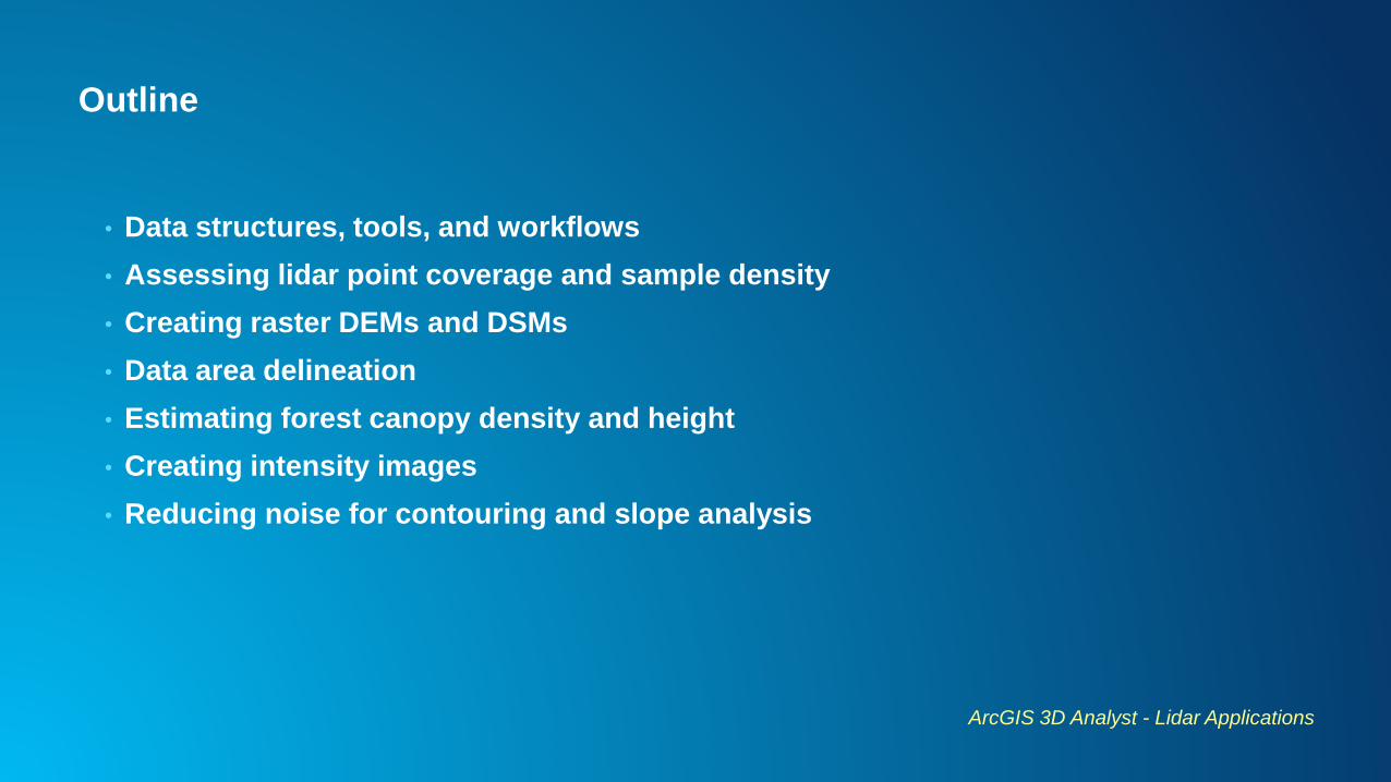
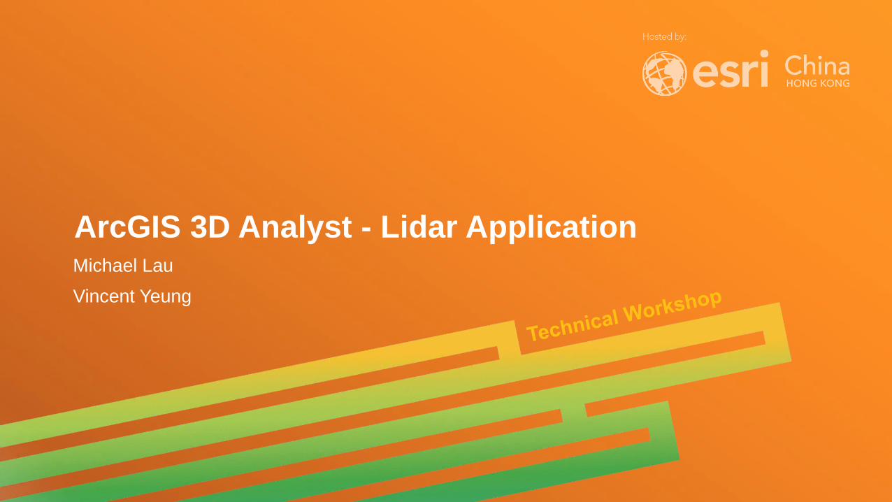
Outline
• Data structures, tools, and workflows
• Assessing lidar point coverage and sample density
• Creating raster DEMs and DSMs
• Data area delineation
• Estimating forest canopy density and height
• Creating intensity images
• Reducing noise for contouring and slope analysis
ArcGIS 3D Analyst - Lidar Applications
Big Picture
• Solutions for GIS end users
- Not about lidar data production
• Operate on clean/classified lidar points
• Produce useful derivatives
• Perform analysis
• Handle large datasets
• Both file and database oriented solutions
ArcGIS 3D Analyst - Lidar Applications
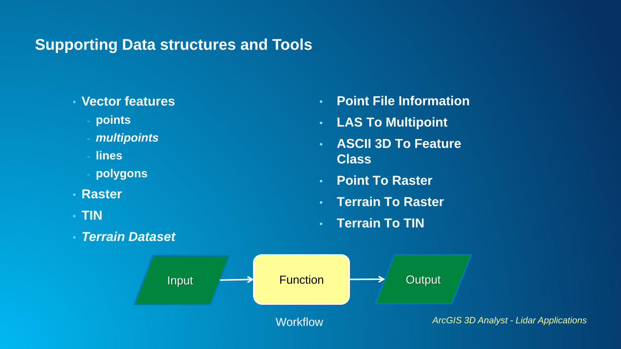
Supporting Data structures and Tools
• Vector features
- points
- multipoints
- lines
- polygons
• Raster
• TIN
• Terrain Dataset
ArcGIS 3D Analyst - Lidar Applications
• Point File Information
• LAS To Multipoint
• ASCII 3D To Feature
Class
• Point To Raster
• Terrain To Raster
• Terrain To TIN
FunctionInput Output
Workflow
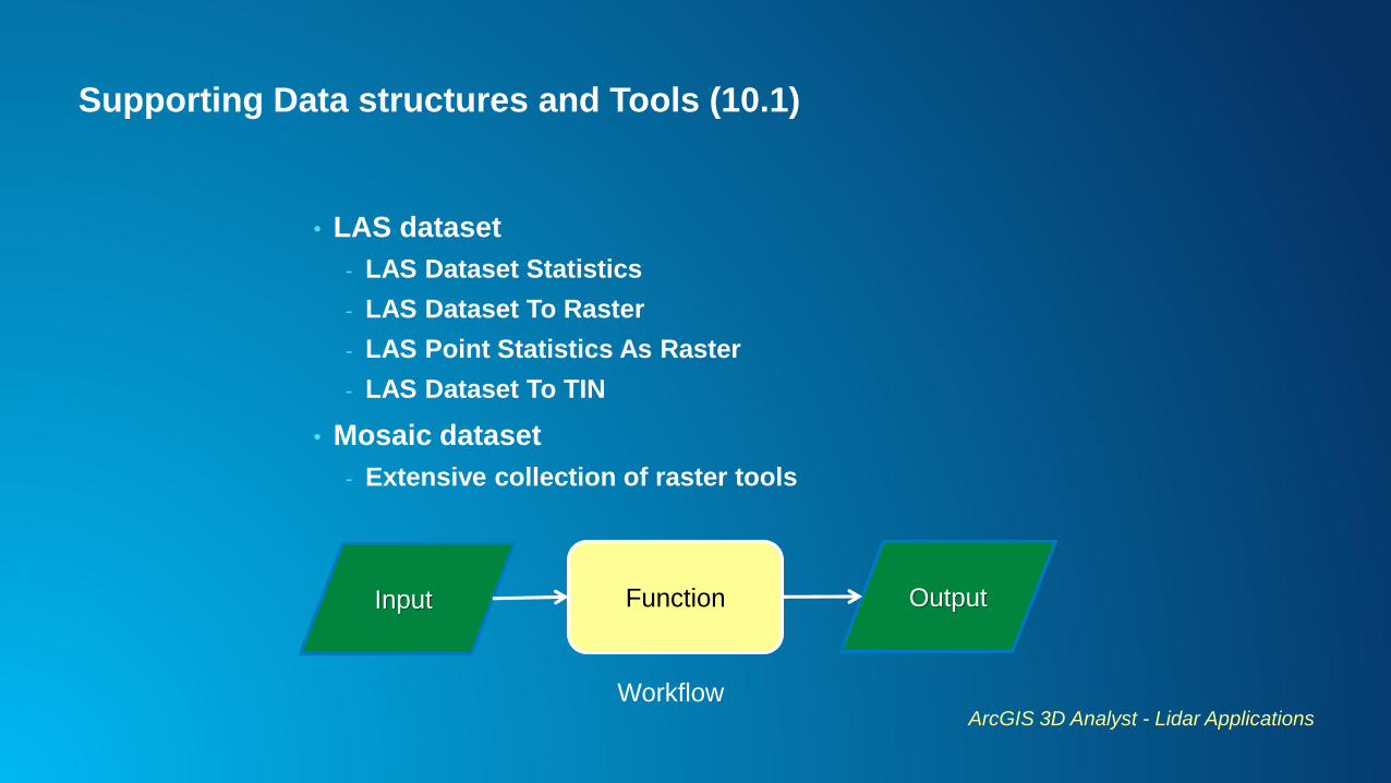
Supporting Data structures and Tools (10.1)
• LAS dataset
- LAS Dataset Statistics
- LAS Dataset To Raster
- LAS Point Statistics As Raster
- LAS Dataset To TIN
• Mosaic dataset
- Extensive collection of raster tools
ArcGIS 3D Analyst - Lidar Applications
FunctionInput Output
Workflow
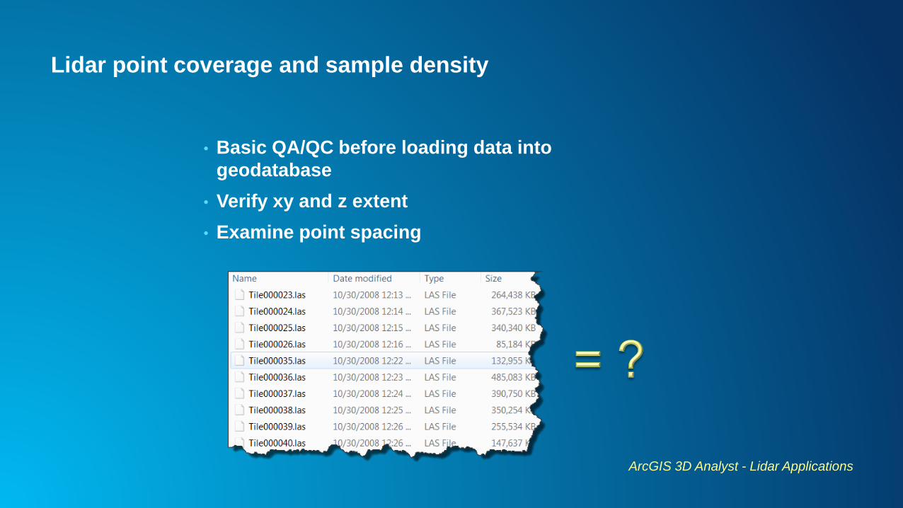
Lidar point coverage and sample density
• Basic QA/QC before loading data into
geodatabase
• Verify xy and z extent
• Examine point spacing
ArcGIS 3D Analyst - Lidar Applications
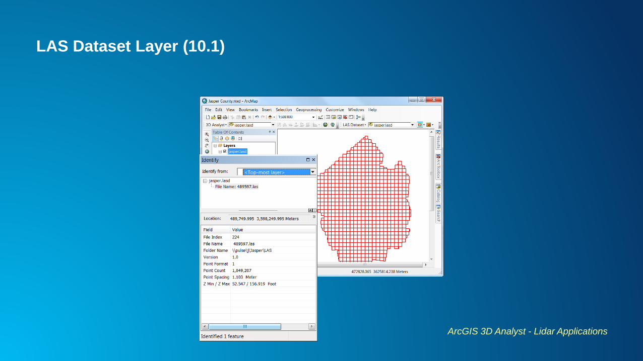
LAS Dataset Layer (10.1)
ArcGIS 3D Analyst - Lidar Applications
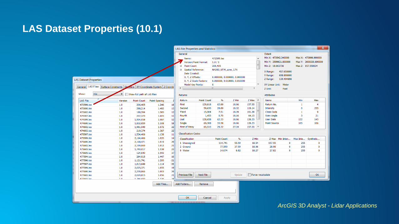
LAS Dataset Properties (10.1)
ArcGIS 3D Analyst - Lidar Applications
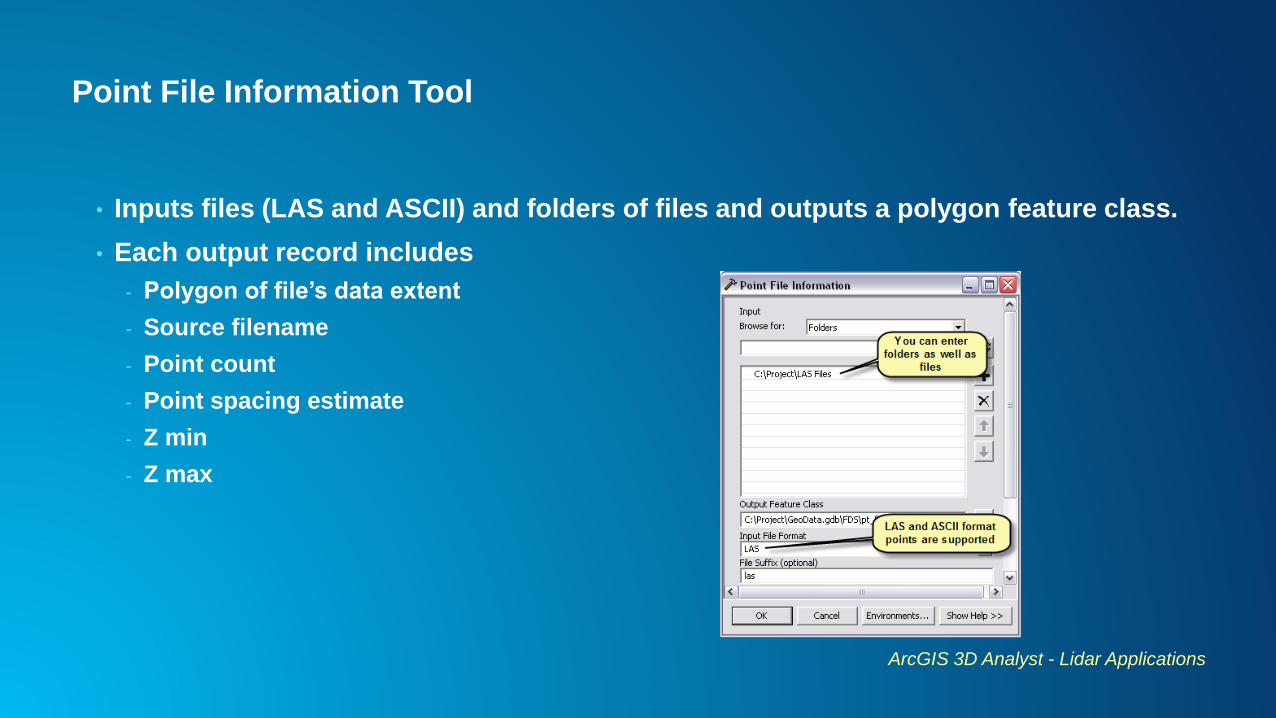
Point File Information Tool
• Inputs files (LAS and ASCII) and folders of files and outputs a polygon feature class.
• Each output record includes
- Polygon of file’s data extent
- Source filename
- Point count
- Point spacing estimate
- Z min
- Z max
ArcGIS 3D Analyst - Lidar Applications
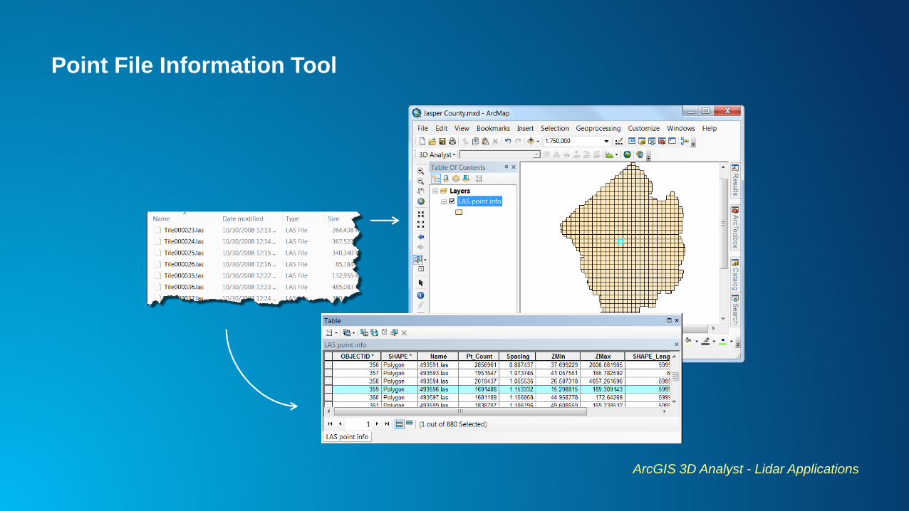
Point File Information Tool
ArcGIS 3D Analyst - Lidar Applications
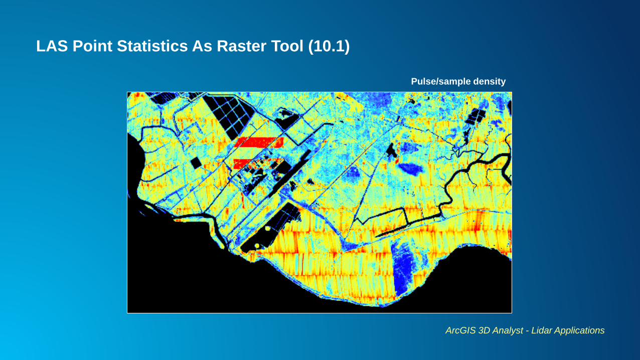
LAS Point Statistics As Raster Tool (10.1)
ArcGIS 3D Analyst - Lidar Applications
Pulse/sample density
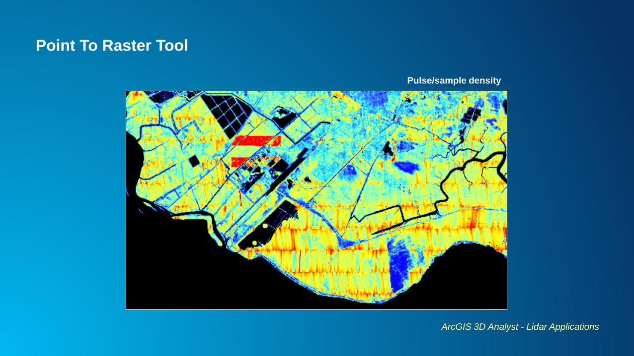
Point To Raster Tool
ArcGIS 3D Analyst - Lidar Applications
Pulse/sample density
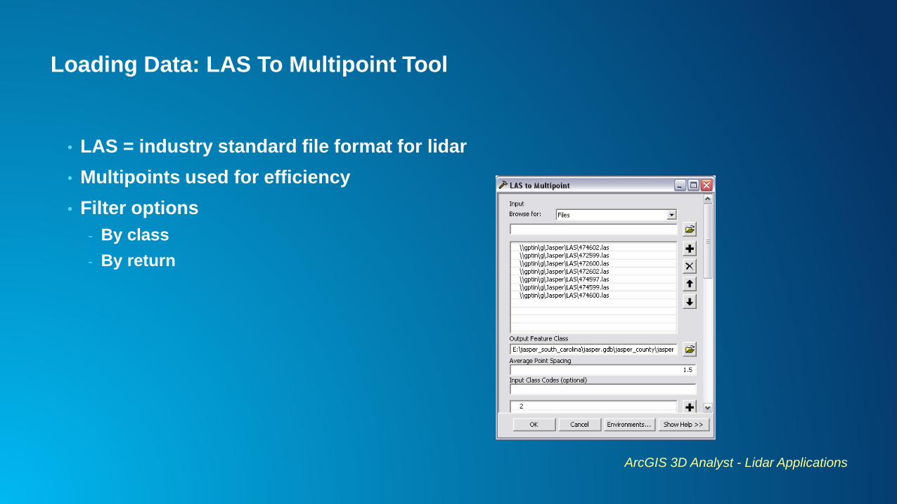
Loading Data: LAS To Multipoint Tool
• LAS = industry standard file format for lidar
• Multipoints used for efficiency
• Filter options
- By class
- By return
ArcGIS 3D Analyst - Lidar Applications
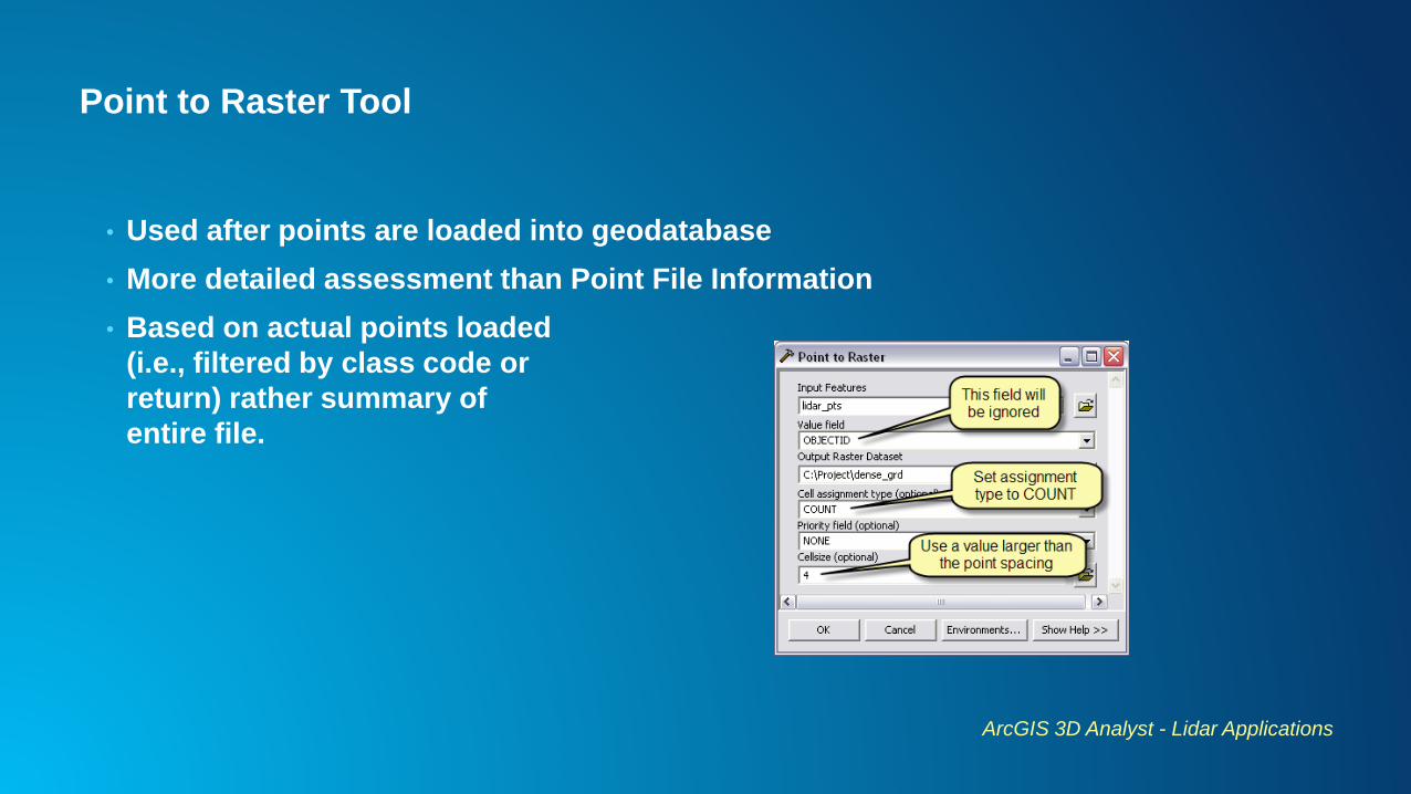
Point to Raster Tool
• Used after points are loaded into geodatabase
• More detailed assessment than Point File Information
• Based on actual points loaded
(i.e., filtered by class code or
return) rather summary of
entire file.
ArcGIS 3D Analyst - Lidar Applications
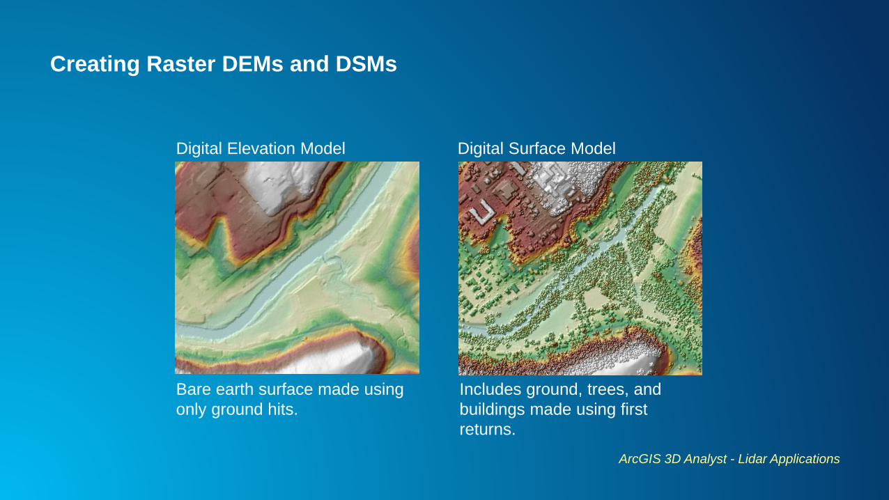
Creating Raster DEMs and DSMs
ArcGIS 3D Analyst - Lidar Applications
Bare earth surface made using
only ground hits.
Includes ground, trees, and
buildings made using first
returns.
Digital Elevation Model Digital Surface Model
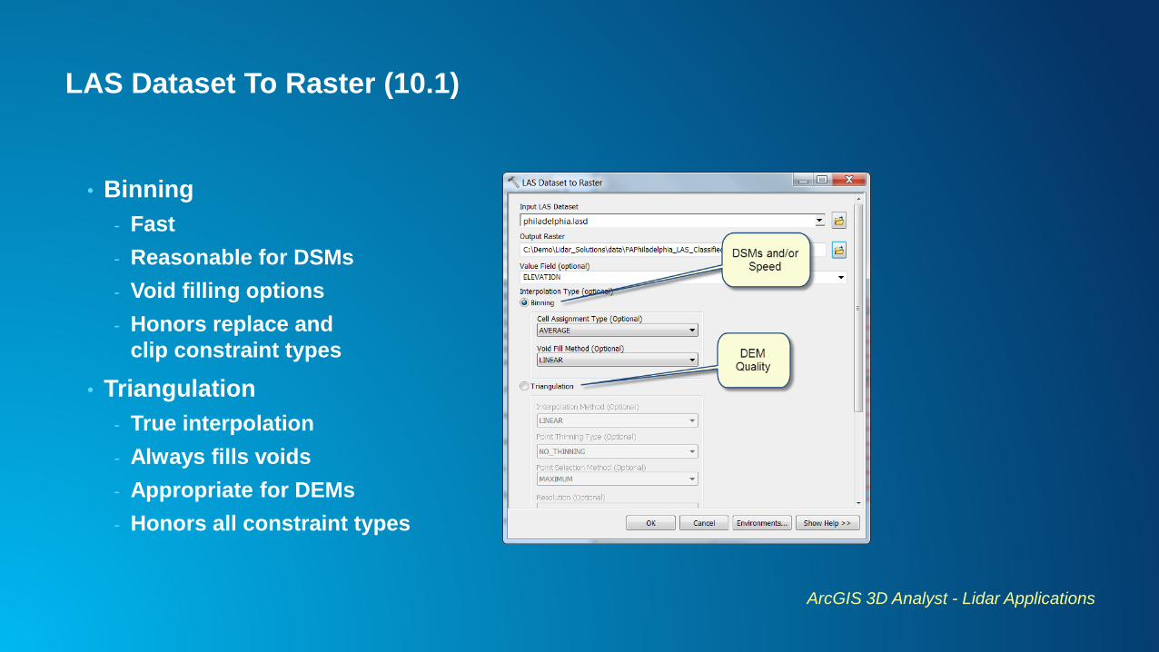
LAS Dataset To Raster (10.1)
• Binning
- Fast
- Reasonable for DSMs
- Void filling options
- Honors replace and
clip constraint types
• Triangulation
- True interpolation
- Always fills voids
- Appropriate for DEMs
- Honors all constraint types
ArcGIS 3D Analyst - Lidar Applications
Point to Raster Tool
• Fast
• Rasterize based on multipoint vertex z
• Not true interpolation
• Doesn’t support breaklines
• Data gaps
• Arguably works best with 1st return data because there are fewer and smaller data
voids to deal with.
ArcGIS 3D Analyst - Lidar Applications

Point to Raster Post-process: Void Filling
ArcGIS 3D Analyst - Lidar Applications
Point To RasterRaster
Calculator
Con(IsNull("pt2ras"), FocalStatistics(“pt2ras", NbrRectangle(3, 3, "CELL"), "MEAN", "DATA"), "pt2ras")
Con(IsNull([pt2ras]), FocalMean([pt2ras], Rectangle, 3, 3, DATA), [pt2ras]) 9.3
10.0
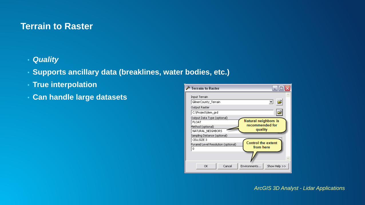
Terrain to Raster
• Quality
• Supports ancillary data (breaklines, water bodies, etc.)
• True interpolation
• Can handle large datasets
ArcGIS 3D Analyst - Lidar Applications
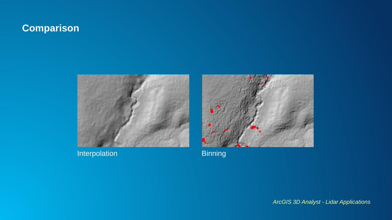
Comparison
ArcGIS 3D Analyst - Lidar Applications
Interpolation Binning
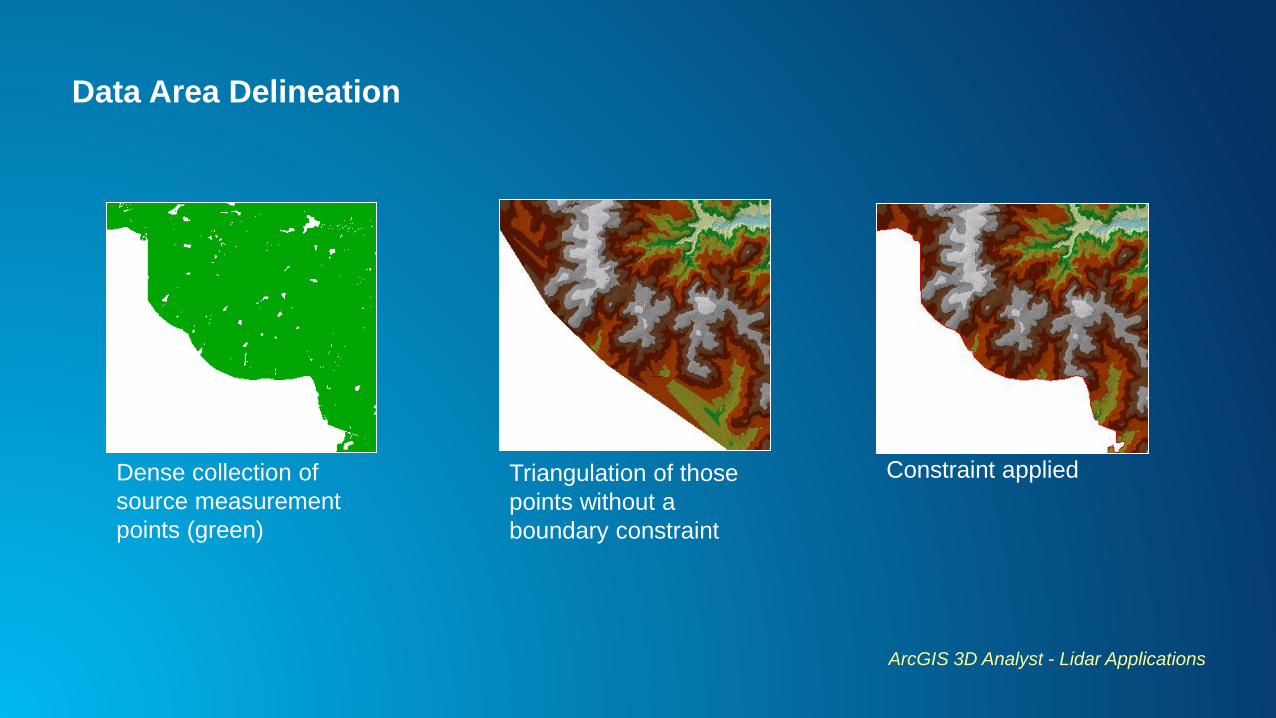
Data Area Delineation
ArcGIS 3D Analyst - Lidar Applications
Dense collection of
source measurement
points (green)
Triangulation of those
points without a
boundary constraint
Constraint applied
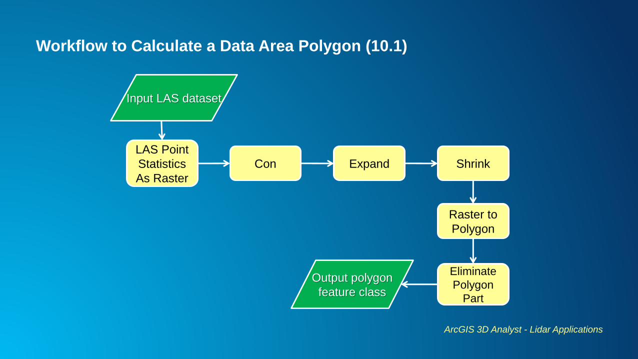
Workflow to Calculate a Data Area Polygon (10.1)
ArcGIS 3D Analyst - Lidar Applications
LAS Point
Statistics
As Raster
Input LAS dataset
Con Expand Shrink
Raster to
Polygon
Eliminate
Polygon
Part
Output polygon
feature class
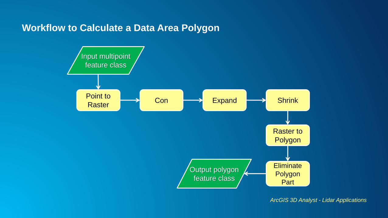
Workflow to Calculate a Data Area Polygon
ArcGIS 3D Analyst - Lidar Applications
Point to
Raster
Input multipoint
feature class
Con Expand Shrink
Raster to
Polygon
Eliminate
Polygon
Part
Output polygon
feature class
Demo
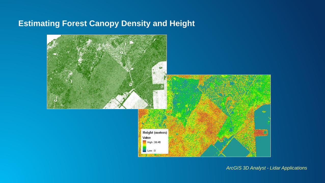
Estimating Forest Canopy Density and Height
ArcGIS 3D Analyst - Lidar Applications
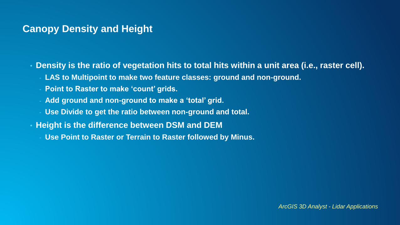
Canopy Density and Height
• Density is the ratio of vegetation hits to total hits within a unit area (i.e., raster cell).
- LAS to Multipoint to make two feature classes: ground and non-ground.
- Point to Raster to make ‘count’ grids.
- Add ground and non-ground to make a ‘total’ grid.
- Use Divide to get the ratio between non-ground and total.
• Height is the difference between DSM and DEM
- Use Point to Raster or Terrain to Raster followed by Minus.
ArcGIS 3D Analyst - Lidar Applications
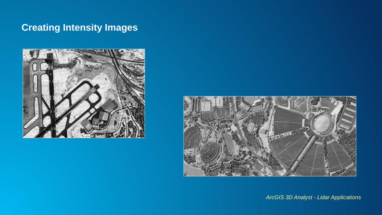
Creating Intensity Images
ArcGIS 3D Analyst - Lidar Applications
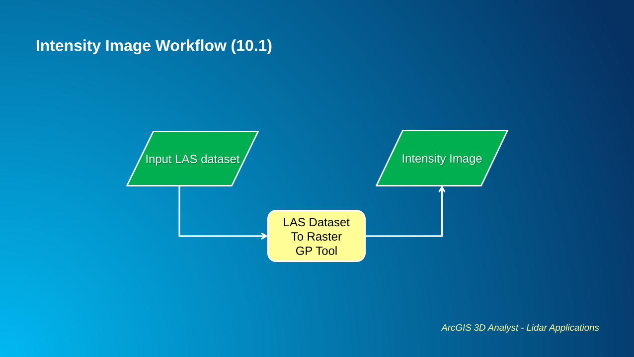
Intensity Image Workflow (10.1)
ArcGIS 3D Analyst - Lidar Applications
Input LAS dataset
LAS Dataset
To Raster
GP Tool
Intensity Image
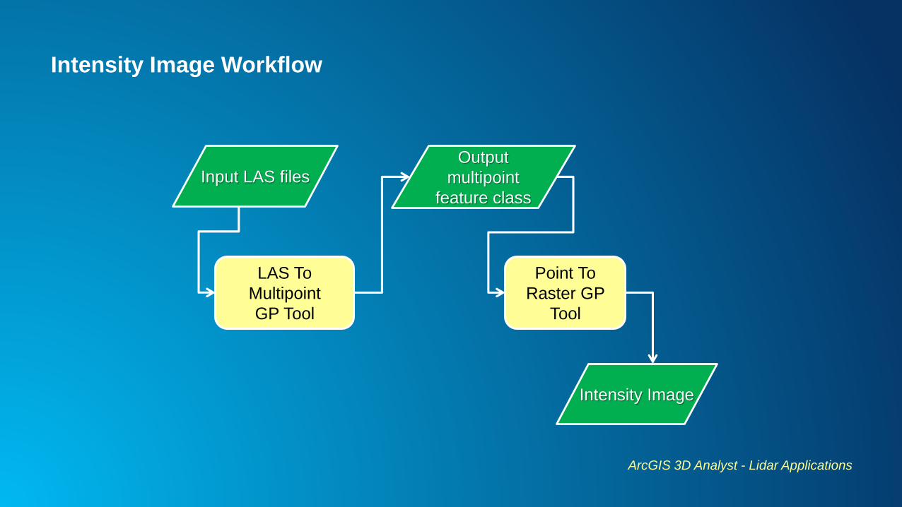
Intensity Image Workflow
ArcGIS 3D Analyst - Lidar Applications
LAS To
Multipoint
GP Tool
Output
multipoint
feature class
Intensity Image
Input LAS files
Point To
Raster GP
Tool
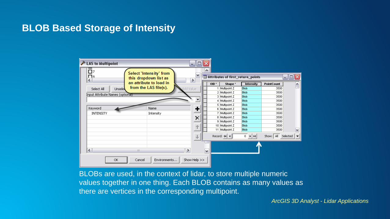
BLOB Based Storage of Intensity
ArcGIS 3D Analyst - Lidar Applications
BLOBs are used, in the context of lidar, to store multiple numeric
values together in one thing. Each BLOB contains as many values as
there are vertices in the corresponding multipoint.
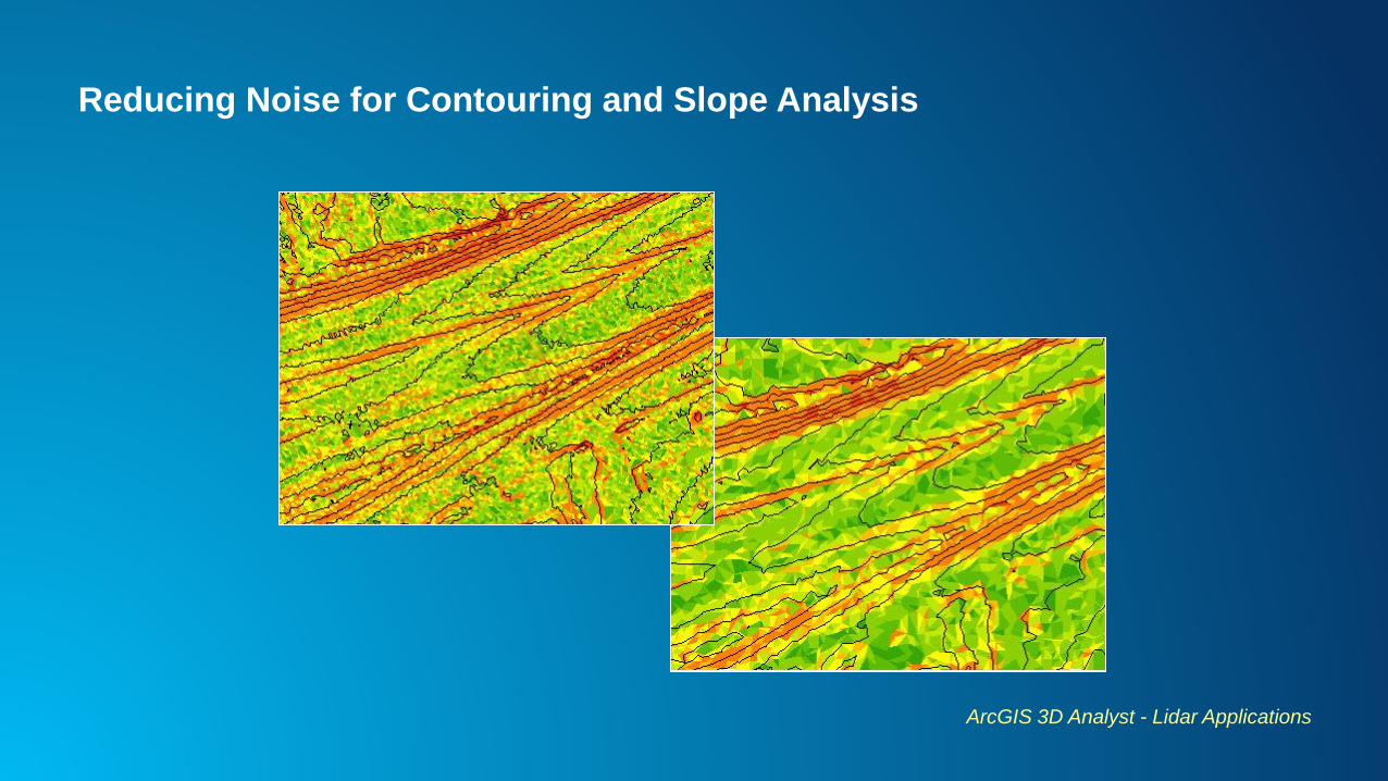
Reducing Noise for Contouring and Slope Analysis
ArcGIS 3D Analyst - Lidar Applications
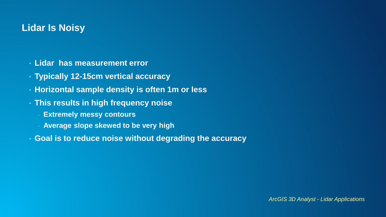
Lidar Is Noisy
• Lidar has measurement error
• Typically 12-15cm vertical accuracy
• Horizontal sample density is often 1m or less
• This results in high frequency noise
- Extremely messy contours
- Average slope skewed to be very high
• Goal is to reduce noise without degrading the accuracy
ArcGIS 3D Analyst - Lidar Applications
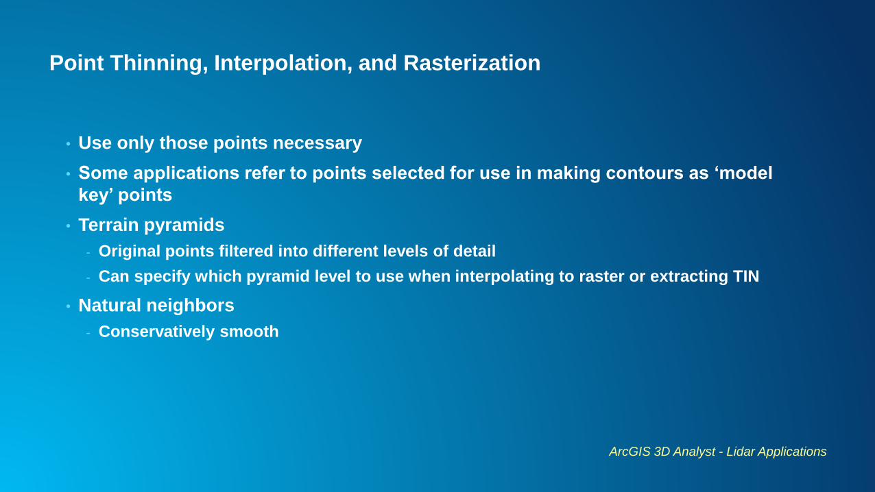
Point Thinning, Interpolation, and Rasterization
• Use only those points necessary
• Some applications refer to points selected for use in making contours as ‘model
key’ points
• Terrain pyramids
- Original points filtered into different levels of detail
- Can specify which pyramid level to use when interpolating to raster or extracting TIN
• Natural neighbors
- Conservatively smooth
ArcGIS 3D Analyst - Lidar Applications
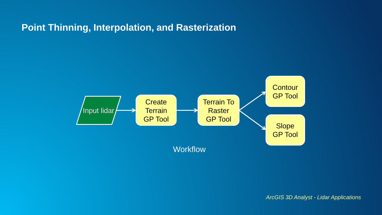
Point Thinning, Interpolation, and Rasterization
ArcGIS 3D Analyst - Lidar Applications
Input lidar
Create
Terrain
GP Tool
Terrain To
Raster
GP Tool
Contour
GP Tool
Slope
GP Tool
Workflow
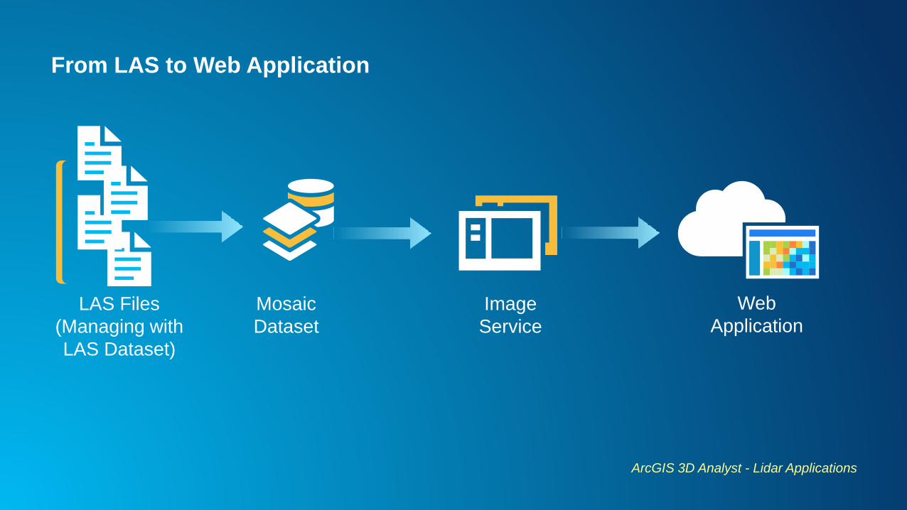
From LAS to Web Application
ArcGIS 3D Analyst - Lidar Applications
LAS Files
(Managing with
LAS Dataset)
Mosaic
Dataset
Image
Service
Web
Application
Demo

Share your moment #EsriAPUC