Embed Size (px)
Citation preview
Southeast MN GIS User Group Meeting – October 17, 2018
ArcGIS Enterprise & Portal
Presented By: Justin Hansen

Southeast MN GIS User Group Meeting – October 17, 2018
ArcGIS Online & ArcGIS Enterprise• ArcGIS Online– Your mapping platform– Share public content and applications– Open data– Runs in the cloud
• ArcGIS Enterprise– Your GIS platform– Integrate Desktop GIS: ArcGIS Pro– Share private content and apps within your organization– Runs on your infrastructure
Southeast MN GIS User Group Meeting – October 17, 2018
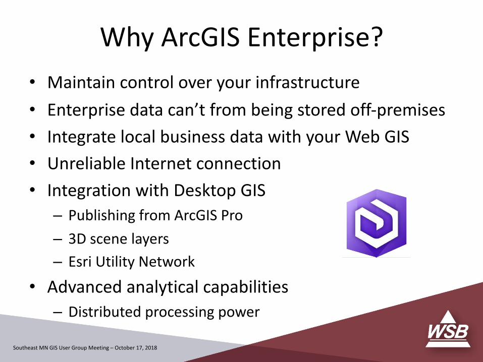
Why ArcGIS Enterprise?
• Maintain control over your infrastructure
• Enterprise data can’t from being stored off-premises
• Integrate local business data with your Web GIS
• Unreliable Internet connection
• Integration with Desktop GIS– Publishing from ArcGIS Pro
– 3D scene layers
– Esri Utility Network
• Advanced analytical capabilities– Distributed processing power

Southeast MN GIS User Group Meeting – October 17, 2018
ArcGIS Platform – Evolution
Image courtesy of Esri

Southeast MN GIS User Group Meeting – October 17, 2018
Esri Web GIS Model
Image courtesy of Esri
Southeast MN GIS User Group Meeting – October 17, 2018
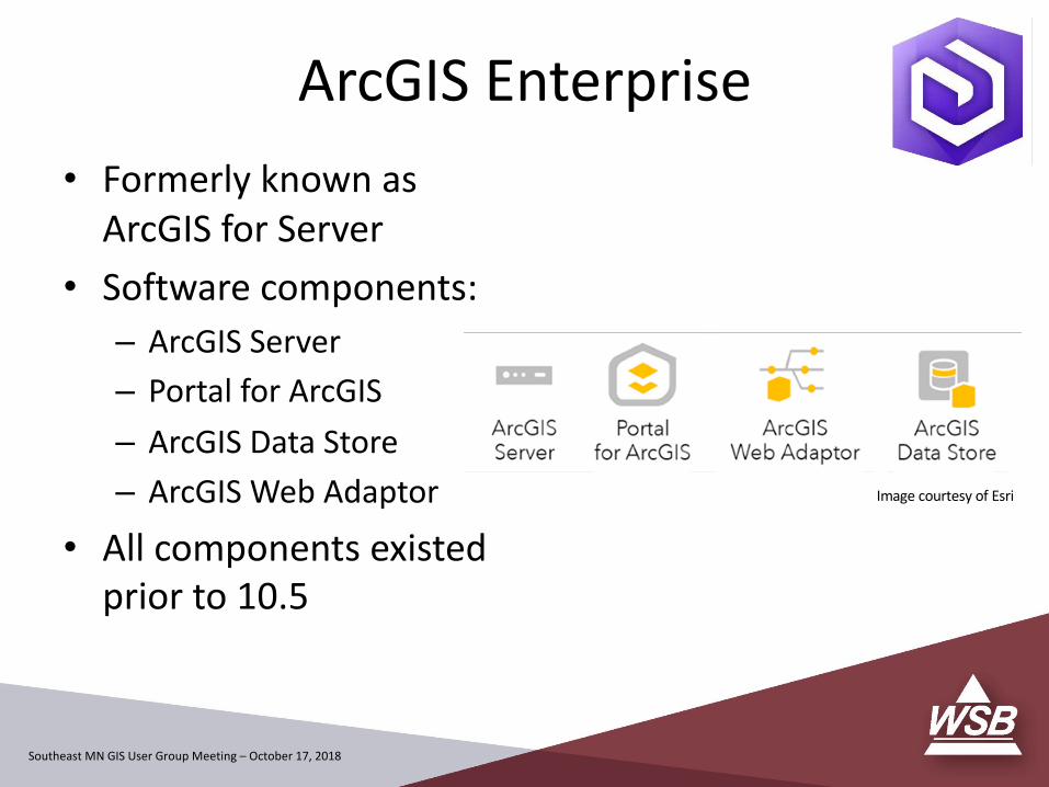
ArcGIS Enterprise
• Formerly known as ArcGIS for Server
• Software components:– ArcGIS Server
– Portal for ArcGIS
– ArcGIS Data Store
– ArcGIS Web Adaptor
• All components existed prior to 10.5
Image courtesy of Esri
Southeast MN GIS User Group Meeting – October 17, 2018
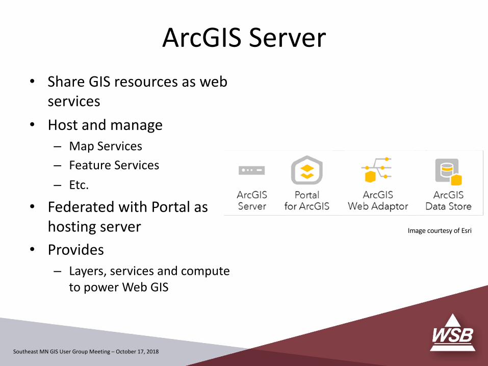
• Share GIS resources as web services
• Host and manage– Map Services– Feature Services– Etc.
• Federated with Portal as hosting server
• Provides– Layers, services and compute
to power Web GIS
ArcGIS Server
Image courtesy of Esri
Southeast MN GIS User Group Meeting – October 17, 2018
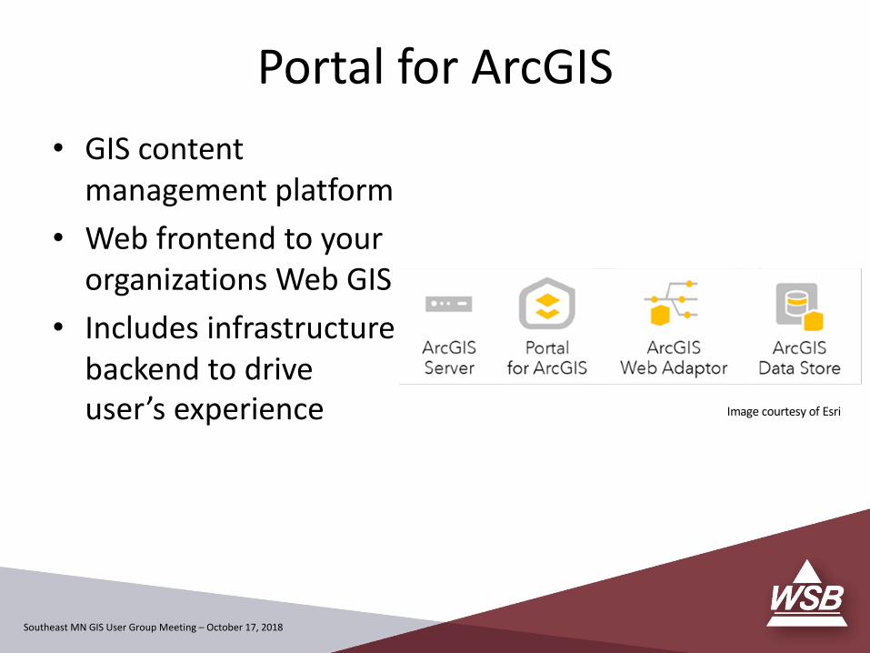
Portal for ArcGIS
• GIS content management platform
• Web frontend to your organizations Web GIS
• Includes infrastructure backend to drive user’s experience Image courtesy of Esri

Southeast MN GIS User Group Meeting – October 17, 2018
Portal for ArcGIS – Capabilities• Browse, search, and
discover GIS assets• Self-service mapping• Content creation and
management• Sharing and collaboration• Data hosting and mapping• Visualization, collection,
and analysis• Ready to use maps and
layers
Image courtesy of Esri

Southeast MN GIS User Group Meeting – October 17, 2018
ArcGIS Web Adaptor• Software load balancer• Directs network traffic
from web server to:– Portal– ArcGIS Server
• Acts as a reverse proxy for Web GIS access
• Exposes endpoints through standard http/https (80, 443)
• Required for ArcGIS Enterprise
Image courtesy of Esri

Southeast MN GIS User Group Meeting – October 17, 2018
ArcGIS Data Store• Introduced at 10.3• Managed data repository /
appliance• Stores spatial content
copied to Portal as hosted content
• Three versions– Relational data store
• Hosted feature layers
– Tile Cache data store• Scene layer caches
– Spatiotemporal big data store• Real-time data• GeoAnalytics output
Image courtesy of Esri

Southeast MN GIS User Group Meeting – October 17, 2018
• Licensing Roles:– GIS Server– Image Server– GeoEvent Server– GeoAnalytics Server– Business Analyst Server
• Functionality Matrix• ArcGIS Server licensed based on:– Edition– Capabilities
Server Licensing Roles
Image courtesy of Esri

Southeast MN GIS User Group Meeting – October 17, 2018
ArcGIS Server to ArcGIS Enterprise
Southeast MN GIS User Group Meeting – October 17, 2018
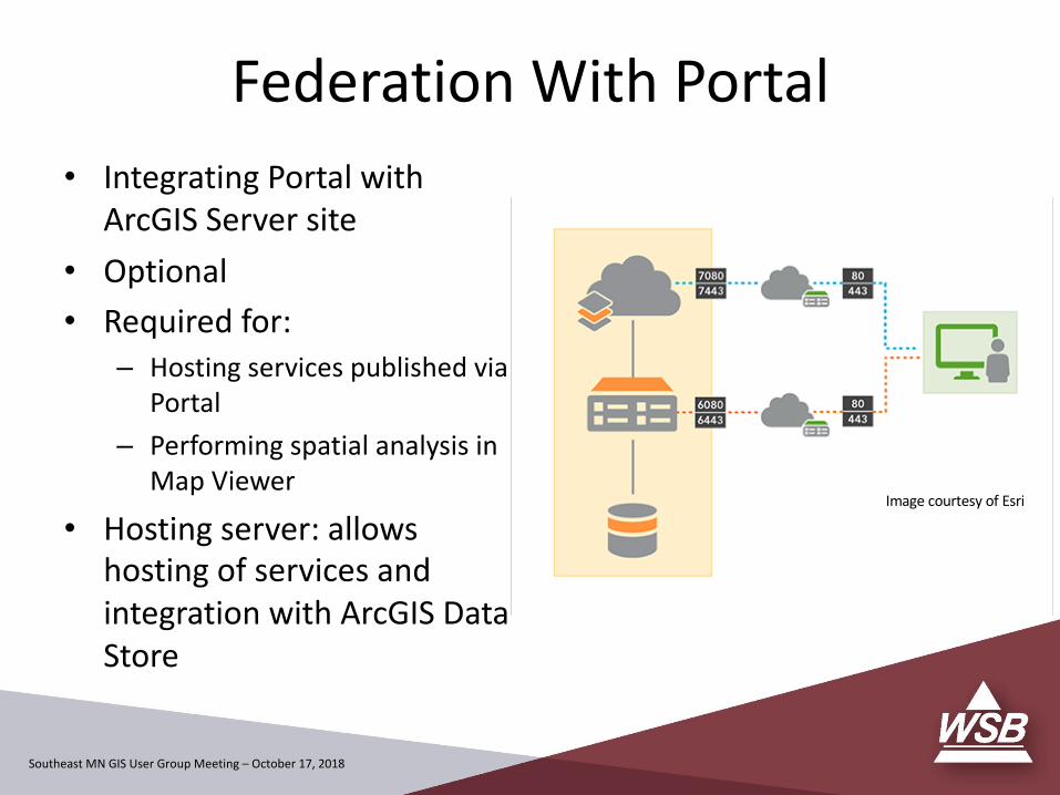
• Integrating Portal with ArcGIS Server site
• Optional• Required for:
– Hosting services published via Portal
– Performing spatial analysis in Map Viewer
• Hosting server: allows hosting of services and integration with ArcGIS Data Store
Federation With Portal
Image courtesy of Esri
Southeast MN GIS User Group Meeting – October 17, 2018
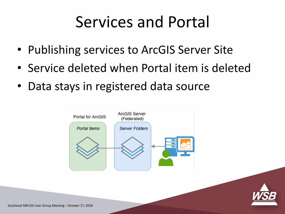
Services and Portal• Publishing services to ArcGIS Server Site• Service deleted when Portal item is deleted• Data stays in registered data source

Southeast MN GIS User Group Meeting – October 17, 2018
Services and Portal• Publishing Hosted service to Portal• Service deleted when Portal item is deleted• Hosted data is deleted from Data Store
Southeast MN GIS User Group Meeting – October 17, 2018
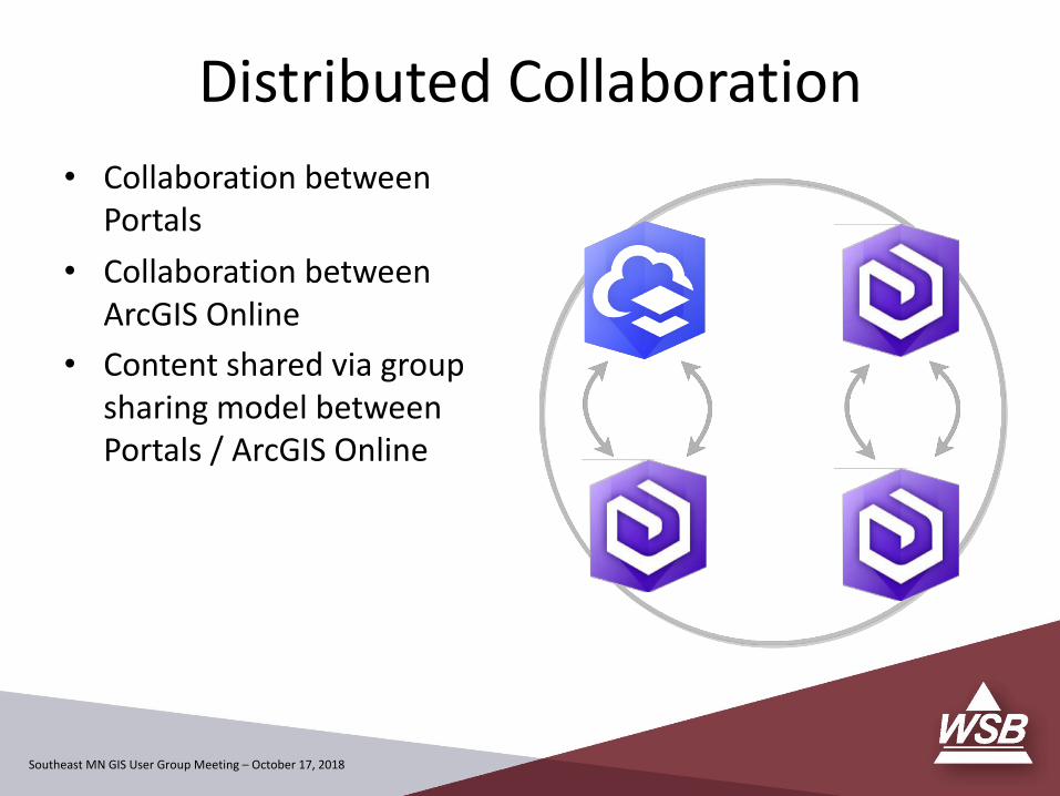
• Collaboration between Portals
• Collaboration between ArcGIS Online
• Content shared via group sharing model between Portals / ArcGIS Online
Distributed Collaboration
Southeast MN GIS User Group Meeting – October 17, 2018
A Bit About WSB
Southeast MN GIS User Group Meeting – October 17, 2018
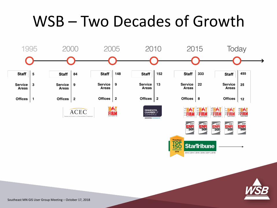
WSB – Two Decades of Growth
Southeast MN GIS User Group Meeting – October 17, 2018
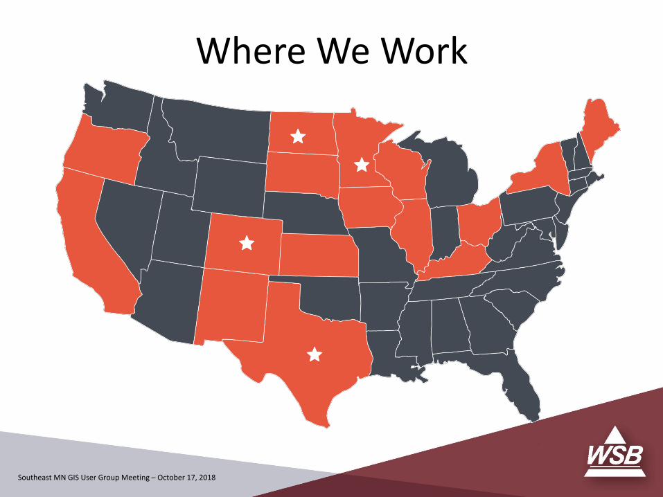
Where We Work
Southeast MN GIS User Group Meeting – October 17, 2018
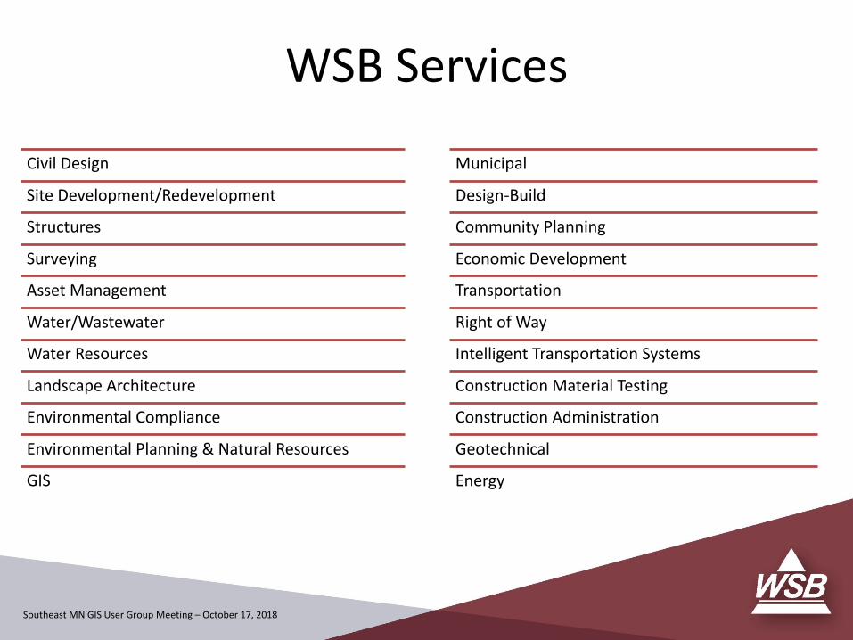
WSB Services
Civil Design
Site Development/Redevelopment
Structures
Surveying
Asset Management
Water/Wastewater
Water Resources
Landscape Architecture
Environmental Compliance
Environmental Planning & Natural Resources
GIS
Municipal
Design-Build
Community Planning
Economic Development
Transportation
Right of Way
Intelligent Transportation Systems
Construction Material Testing
Construction Administration
Geotechnical
Energy

Southeast MN GIS User Group Meeting – October 17, 2018
Justin HansenSr. Associate / Solutions [email protected] Xenia Ave South, Suite 300Minneapolis, MN 55416
Contact