Embed Size (px)
Citation preview
Brockman Park Cemetery Archaeological Investigation Amherst, Virginia
Project Commission # 20120631 Page i
Archaeological Investigation of a “cemetery of unknown
origin” in the L. Barnes Brockman, Sr. Business and
Industrial Park, Amherst, Virginia.
Project Number 20120631
December 19, 2012
Submitted to:
Town of Amherst Industrial Development
Authority; Jack Hobbs, Secretary
Submitted by:
Randy Lichtenberger, Director of Cultural
Resources, Robert Clarke and Keith
Adams
Brockman Park Cemetery Archaeological Investigation Amherst, Virginia
Project Commission # 20120631 Page ii
Table of Contents
Executive Summary 1
1. Introduction 2
2. Field and Laboratory Methods 3
3. Results 5
4. Conclusions and Recommendations 13
References Cited 15
Appendix A: Oversize site maps pre- and post-excavation
Figures
1. Project location 3
2. H&P crewmembers laying out shovel test pit locations 4
3. Overview of site facing north-northwest 6
4. View of what was believed to be potential grave markers (Feature 1)
after raking 6
5. Feature 1 after excavation 7
6. Feature 2 after partial excavation 7
7. View along Feature 3, a loose stone footer 8
8. South-southwest view of the site following topsoil stripping 9
9. Northeast view of the site following topsoil stripping 10
10. Feature 1 following its removal 10
11. Exposed subsoil beneath Feature 2 following its removal 11
12. Typical shovel test profile 11
Tables
1. Artifact Inventory 12
2. Mortar Sample Inventory 13
Brockman Park Cemetery Archaeological Investigation Amherst, Virginia
Project Commission # 20120631 Page 1
EXECUTIVE SUMMARY
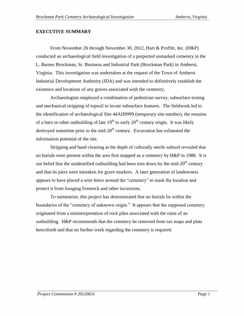
From November 26 through November 30, 2012, Hurt & Proffitt, Inc. (H&P)
conducted an archaeological field investigation of a purported unmarked cemetery in the
L. Barnes Brockman, Sr. Business and Industrial Park (Brockman Park) in Amherst,
Virginia. This investigation was undertaken at the request of the Town of Amherst
Industrial Development Authority (IDA) and was intended to definitively establish the
existence and locations of any graves associated with the cemetery.
Archaeologists employed a combination of pedestrian survey, subsurface testing
and mechanical stripping of topsoil to locate subsurface features. The fieldwork led to
the identification of archaeological Site 44AH9999 (temporary site number), the remains
of a barn or other outbuilding of late 19th
to early 20th
century origin. It was likely
destroyed sometime prior to the mid-20th
century. Excavation has exhausted the
information potential of the site.
Stripping and hand cleaning at the depth of culturally sterile subsoil revealed that
no burials were present within the area first mapped as a cemetery by H&P in 1988. It is
our belief that the unidentified outbuilding had been torn down by the mid-20th
century
and that its piers were mistaken for grave markers. A later generation of landowners
appears to have placed a wire fence around the “cemetery” to mark the location and
protect it from foraging livestock and other incursions.
To summarize, this project has demonstrated that no burials lie within the
boundaries of the “cemetery of unknown origin.” It appears that the supposed cemetery
originated from a misinterpretation of rock piles associated with the ruins of an
outbuilding. H&P recommends that the cemetery be removed from tax maps and plats
henceforth and that no further work regarding the cemetery is required.
Brockman Park Cemetery Archaeological Investigation Amherst, Virginia
Project Commission # 20120631 Page 2
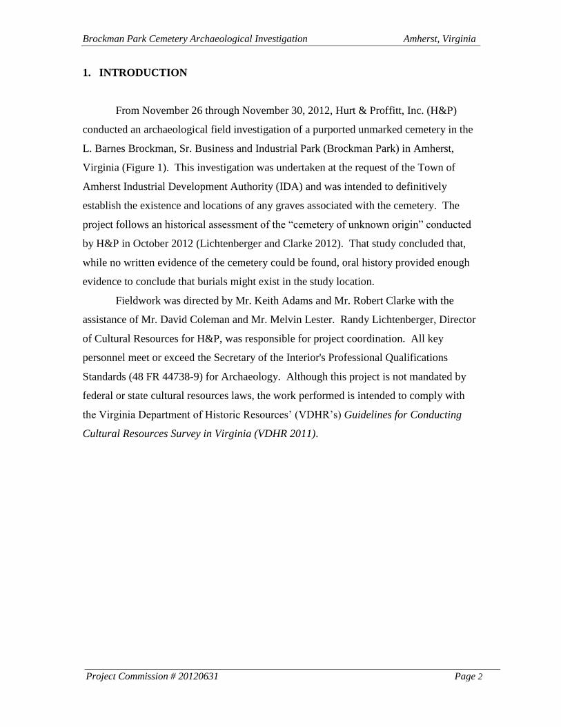
1. INTRODUCTION
From November 26 through November 30, 2012, Hurt & Proffitt, Inc. (H&P)
conducted an archaeological field investigation of a purported unmarked cemetery in the
L. Barnes Brockman, Sr. Business and Industrial Park (Brockman Park) in Amherst,
Virginia (Figure 1). This investigation was undertaken at the request of the Town of
Amherst Industrial Development Authority (IDA) and was intended to definitively
establish the existence and locations of any graves associated with the cemetery. The
project follows an historical assessment of the “cemetery of unknown origin” conducted
by H&P in October 2012 (Lichtenberger and Clarke 2012). That study concluded that,
while no written evidence of the cemetery could be found, oral history provided enough
evidence to conclude that burials might exist in the study location.
Fieldwork was directed by Mr. Keith Adams and Mr. Robert Clarke with the
assistance of Mr. David Coleman and Mr. Melvin Lester. Randy Lichtenberger, Director
of Cultural Resources for H&P, was responsible for project coordination. All key
personnel meet or exceed the Secretary of the Interior's Professional Qualifications
Standards (48 FR 44738-9) for Archaeology. Although this project is not mandated by
federal or state cultural resources laws, the work performed is intended to comply with
the Virginia Department of Historic Resources’ (VDHR’s) Guidelines for Conducting
Cultural Resources Survey in Virginia (VDHR 2011).
Brockman Park Cemetery Archaeological Investigation Amherst, Virginia
Project Commission # 20120631 Page 3
Figure 1. Project location.
2. FIELD AND LABORATORY METHODS
The goal of the present archaeological survey was to confirm the identification of
a possible cemetery located in Brockman Park. If graves were indeed present the field
studies were intended to result in detailed mapping of these features to aid in the
preparation of a removal and reburial plan. The survey methodology employed to meet
these goals was chosen with regard to the project’s scope (i.e., the project’s potential to
affect significant resources, should they be present), the potential of the study area to
contain significant archaeological resources, and local field conditions.
The study area for archaeological resources for the Brockman Park project was
defined as the footprint of a cemetery noted on a 1988 plat prepared by H&P. The
purported cemetery was roughly diamond-shaped and measured 59 ft. x 38.7 ft. x 42.85
ft. x 57.23 ft. on its sides. It encompassed approximately 1/16th
acre of land located 450
ft. (135m) north of the end of Brockman Park Drive (Appendix A-1; also see
Lichtenberger and Clarke 2012:Figures 2 and 3).
Amherst
Brockman Park Cemetery Archaeological Investigation Amherst, Virginia
Project Commission # 20120631 Page 4
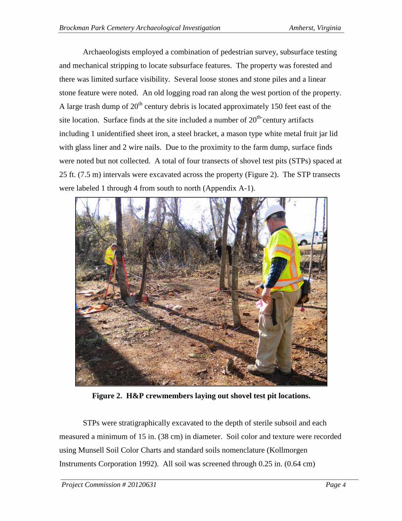
Archaeologists employed a combination of pedestrian survey, subsurface testing
and mechanical stripping to locate subsurface features. The property was forested and
there was limited surface visibility. Several loose stones and stone piles and a linear
stone feature were noted. An old logging road ran along the west portion of the property.
A large trash dump of 20th
century debris is located approximately 150 feet east of the
site location. Surface finds at the site included a number of 20th-
century artifacts
including 1 unidentified sheet iron, a steel bracket, a mason type white metal fruit jar lid
with glass liner and 2 wire nails. Due to the proximity to the farm dump, surface finds
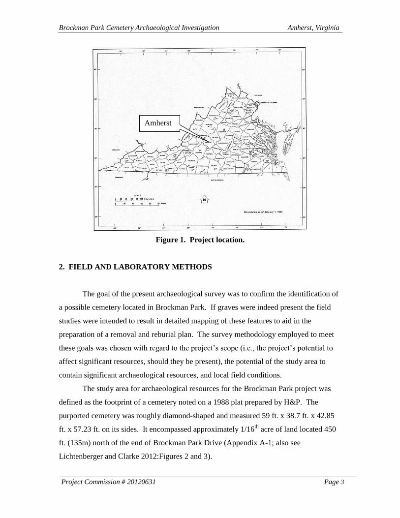
were noted but not collected. A total of four transects of shovel test pits (STPs) spaced at
25 ft. (7.5 m) intervals were excavated across the property (Figure 2). The STP transects
were labeled 1 through 4 from south to north (Appendix A-1).
Figure 2. H&P crewmembers laying out shovel test pit locations.
STPs were stratigraphically excavated to the depth of sterile subsoil and each
measured a minimum of 15 in. (38 cm) in diameter. Soil color and texture were recorded
using Munsell Soil Color Charts and standard soils nomenclature (Kollmorgen
Instruments Corporation 1992). All soil was screened through 0.25 in. (0.64 cm)
Brockman Park Cemetery Archaeological Investigation Amherst, Virginia
Project Commission # 20120631 Page 5
hardware mesh. Artifacts were recovered and bagged by level within each pit. All
provenience data and a preliminary artifact inventory were recorded in the field.
Following the completion of shovel testing, a backhoe and operator were
employed to remove the soil across the site to the depth of culturally sterile subsoil. The
backhoe used for this work possessed a 4 ft. wide smooth bucket in order to minimize
disturbance to potential features. Archaeologists followed behind the backhoe and hand
scraped the exposed subsoil with flat-bladed shovels and trowels in order to expose
potential cultural features. All soil was replaced upon completion of the project.
Laboratory processing and the curation of artifacts were carried out at the Sweet
Briar College Archaeological Materials Laboratory in accordance with the Virginia
Department of Historic Resources State Collections Management Standards (VDHR
2011). All recovered artifacts were cataloged using Microsoft Word 2003. Artifacts and
original field notes are curated with the Town of Amherst.
3. RESULTS
A total of nine STPs was excavated during the course of the Brockman Park
cemetery location project, three of which (STP’s B-1, C-2 and C-3) were positive for
artifacts that consisted of one wire nail, one melted clear glass fragment and one piece of
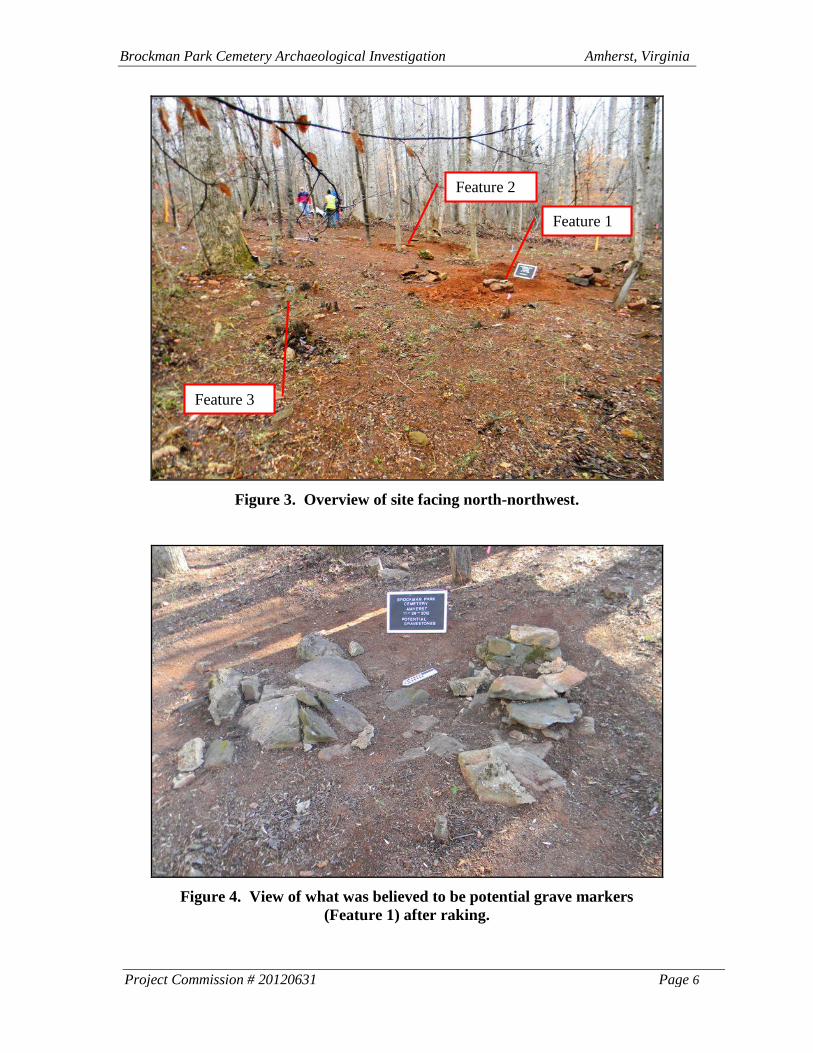
mortar. In addition, three surface features were noted consisting of two brick and stone
structural piers and one linear feature of stone along the south edge of the site (Figure 3).
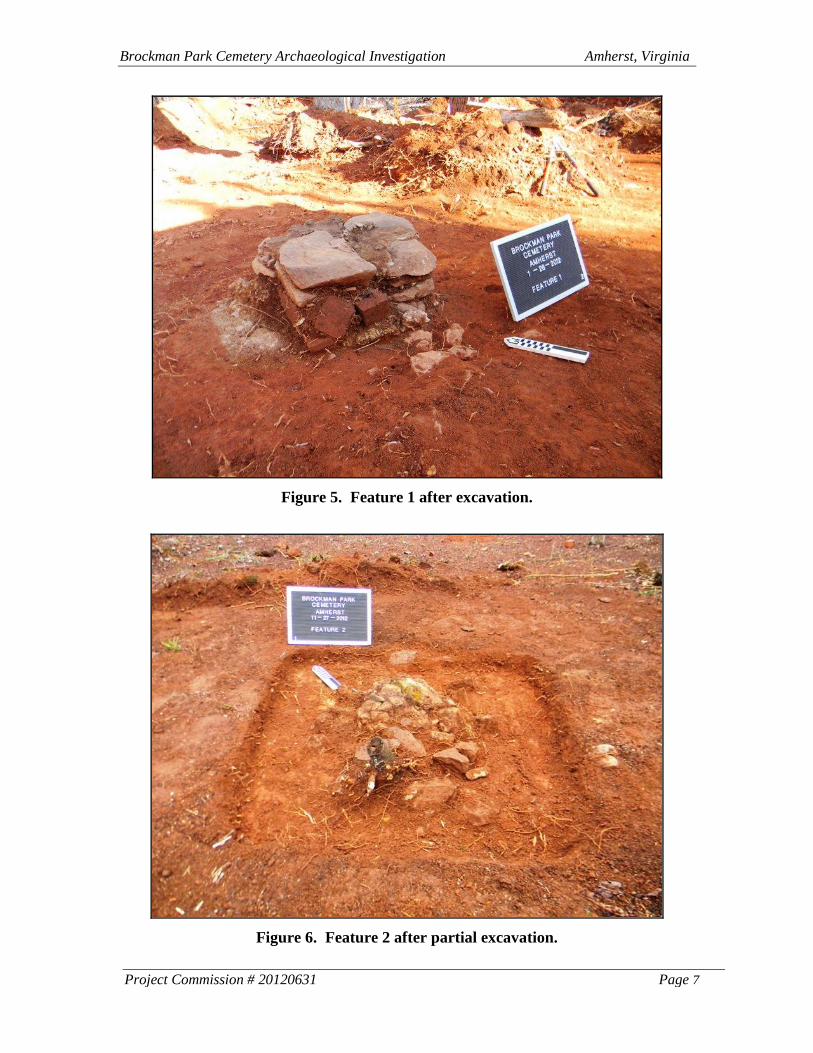
Feature 1 consisted of a large collection of disarticulated stones adjacent to a mortared
stone pier measuring approximately 2 feet square. The stone piles associated with this
feature, the easternmost pier, were particularly reminiscent of grave markers (Figure 4).
Only after the loose stones were removed did Feature 1 become clear (Figure 5). Feature
2 was a slightly smaller stone and brick pier measuring approximately 15 inches square
(Figure 6). This feature appears to have been constructed by placing the stones and
bricks in a mortar matrix within a wooden form, the traces of which remained in the
mortar. The hole excavated for the pier was then backfilled with soil. This feature
appears to have been impacted by the old logging road along the west side of the site
(Appendix A-1).
Brockman Park Cemetery Archaeological Investigation Amherst, Virginia
Project Commission # 20120631 Page 6
Figure 3. Overview of site facing north-northwest.
Figure 4. View of what was believed to be potential grave markers
(Feature 1) after raking.
Feature 1
Feature 3
Feature 2
Brockman Park Cemetery Archaeological Investigation Amherst, Virginia
Project Commission # 20120631 Page 7
Figure 5. Feature 1 after excavation.
Figure 6. Feature 2 after partial excavation.
Brockman Park Cemetery Archaeological Investigation Amherst, Virginia
Project Commission # 20120631 Page 8
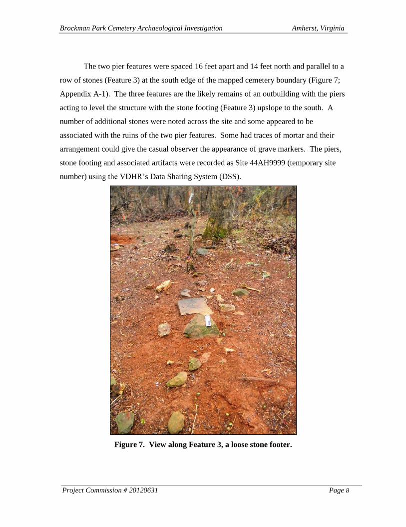
The two pier features were spaced 16 feet apart and 14 feet north and parallel to a
row of stones (Feature 3) at the south edge of the mapped cemetery boundary (Figure 7;
Appendix A-1). The three features are the likely remains of an outbuilding with the piers
acting to level the structure with the stone footing (Feature 3) upslope to the south. A
number of additional stones were noted across the site and some appeared to be
associated with the ruins of the two pier features. Some had traces of mortar and their
arrangement could give the casual observer the appearance of grave markers. The piers,
stone footing and associated artifacts were recorded as Site 44AH9999 (temporary site
number) using the VDHR’s Data Sharing System (DSS).
Figure 7. View along Feature 3, a loose stone footer.
Brockman Park Cemetery Archaeological Investigation Amherst, Virginia
Project Commission # 20120631 Page 9
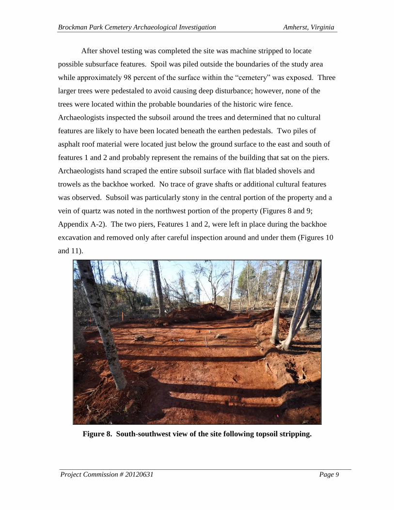
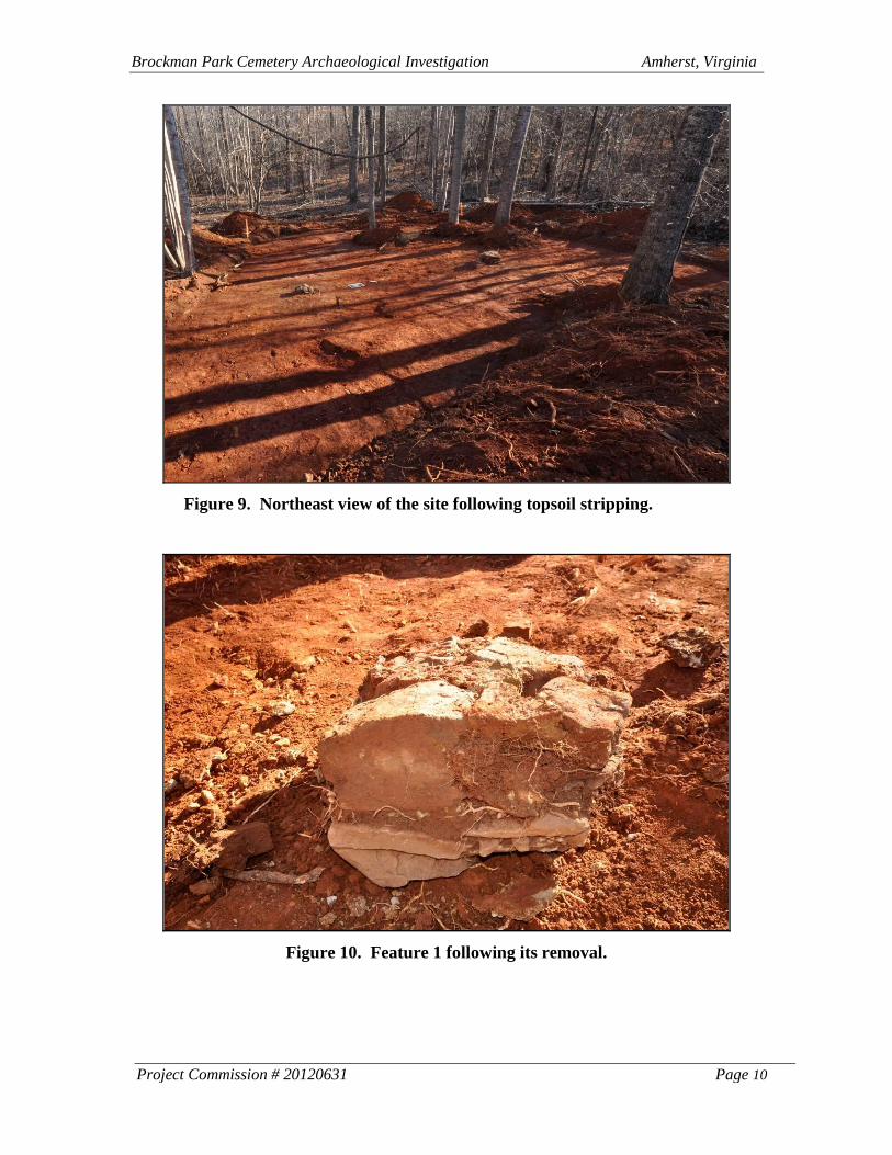
After shovel testing was completed the site was machine stripped to locate
possible subsurface features. Spoil was piled outside the boundaries of the study area
while approximately 98 percent of the surface within the “cemetery” was exposed. Three
larger trees were pedestaled to avoid causing deep disturbance; however, none of the
trees were located within the probable boundaries of the historic wire fence.
Archaeologists inspected the subsoil around the trees and determined that no cultural
features are likely to have been located beneath the earthen pedestals. Two piles of
asphalt roof material were located just below the ground surface to the east and south of
features 1 and 2 and probably represent the remains of the building that sat on the piers.
Archaeologists hand scraped the entire subsoil surface with flat bladed shovels and
trowels as the backhoe worked. No trace of grave shafts or additional cultural features
was observed. Subsoil was particularly stony in the central portion of the property and a
vein of quartz was noted in the northwest portion of the property (Figures 8 and 9;
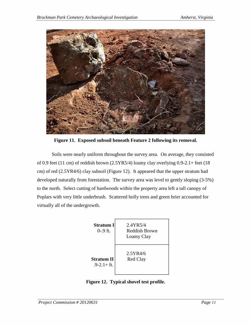
Appendix A-2). The two piers, Features 1 and 2, were left in place during the backhoe
excavation and removed only after careful inspection around and under them (Figures 10
and 11).
Figure 8. South-southwest view of the site following topsoil stripping.
Brockman Park Cemetery Archaeological Investigation Amherst, Virginia
Project Commission # 20120631 Page 10
Figure 9. Northeast view of the site following topsoil stripping.
Figure 10. Feature 1 following its removal.
Brockman Park Cemetery Archaeological Investigation Amherst, Virginia
Project Commission # 20120631 Page 11
Figure 11. Exposed subsoil beneath Feature 2 following its removal.
Soils were nearly uniform throughout the survey area. On average, they consisted
of 0.9 feet (11 cm) of reddish brown (2.5YR5/4) loamy clay overlying 0.9-2.1+ feet (18
cm) of red (2.5YR4/6) clay subsoil (Figure 12). It appeared that the upper stratum had
developed naturally from forestation. The survey area was level to gently sloping (3-5%)
to the north. Select cutting of hardwoods within the property area left a tall canopy of
Poplars with very little underbrush. Scattered holly trees and green brier accounted for
virtually all of the undergrowth.
Stratum I 2.4YR5/4
0-.9 ft. Reddish Brown
Loamy Clay
2.5YR4/6
Stratum II Red Clay
.9-2.1+ ft.
Figure 12. Typical shovel test profile.
Brockman Park Cemetery Archaeological Investigation Amherst, Virginia
Project Commission # 20120631 Page 12
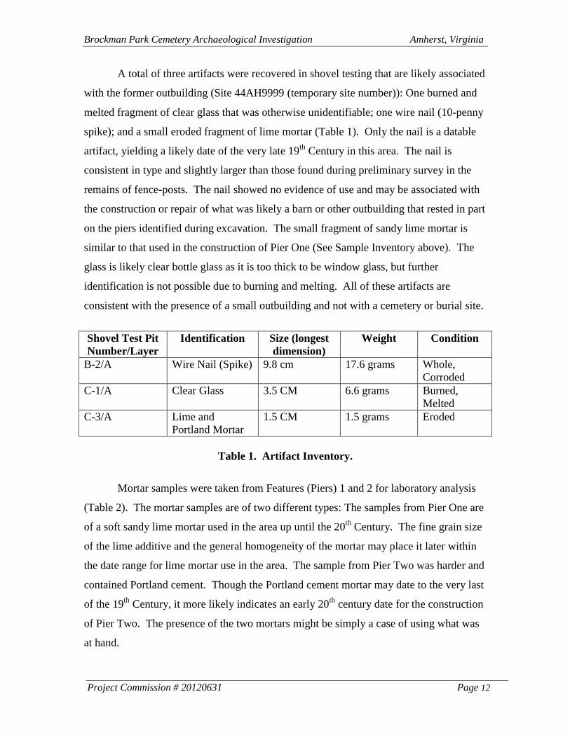
A total of three artifacts were recovered in shovel testing that are likely associated
with the former outbuilding (Site 44AH9999 (temporary site number)): One burned and
melted fragment of clear glass that was otherwise unidentifiable; one wire nail (10-penny
spike); and a small eroded fragment of lime mortar (Table 1). Only the nail is a datable
artifact, yielding a likely date of the very late 19th
Century in this area. The nail is
consistent in type and slightly larger than those found during preliminary survey in the
remains of fence-posts. The nail showed no evidence of use and may be associated with
the construction or repair of what was likely a barn or other outbuilding that rested in part
on the piers identified during excavation. The small fragment of sandy lime mortar is
similar to that used in the construction of Pier One (See Sample Inventory above). The
glass is likely clear bottle glass as it is too thick to be window glass, but further
identification is not possible due to burning and melting. All of these artifacts are
consistent with the presence of a small outbuilding and not with a cemetery or burial site.
Shovel Test Pit
Number/Layer
Identification Size (longest
dimension)
Weight Condition
B-2/A Wire Nail (Spike) 9.8 cm 17.6 grams Whole,
Corroded
C-1/A Clear Glass 3.5 CM 6.6 grams Burned,
Melted
C-3/A Lime and
Portland Mortar
1.5 CM 1.5 grams Eroded
Table 1. Artifact Inventory.
Mortar samples were taken from Features (Piers) 1 and 2 for laboratory analysis
(Table 2). The mortar samples are of two different types: The samples from Pier One are
of a soft sandy lime mortar used in the area up until the 20th
Century. The fine grain size
of the lime additive and the general homogeneity of the mortar may place it later within
the date range for lime mortar use in the area. The sample from Pier Two was harder and
contained Portland cement. Though the Portland cement mortar may date to the very last
of the 19th
Century, it more likely indicates an early 20th
century date for the construction
of Pier Two. The presence of the two mortars might be simply a case of using what was
at hand.
Brockman Park Cemetery Archaeological Investigation Amherst, Virginia
Project Commission # 20120631 Page 13
Sample Context Identification Size Weight
Pier 1 - Sample 1 Soft Sandy Lime
Mortar
4.6 CM 4.0 grams
Pier 1 - Sample 2 Soft Sandy Lime
Mortar
10.5 CM 143.3 grams
Pier 2 - Sample 1 Hard Sandy Portland
Mortar
7.5 CM 7.5 grams
Table 2. Mortar Sample Inventory.
4. CONCLUSIONS AND RECOMMENDATIONS
Archaeological testing and topsoil stripping at the so-called “cemetery of
unknown origin” led to the identification of archaeological Site 44AH9999 (temporary
site number), the remains of a barn or other outbuilding of late 19th
to early 20th
century
origin. The site produced a very light scatter of historic period artifacts and just three
features; two mortared stone piers and a dry-laid row of stones. The piers would have
raised the back or downslope side of the building to the elevation of the entrance situated
facing current Route 60. As noted above, the artifact assemblage and construction
materials suggest this building was constructed between the late 19th
and early 20th
centuries. It was likely destroyed sometime prior to the mid-20th
century. Excavation
has exhausted the information potential of the site. The site’s limited data has no
potential to contribute significant new information to an understanding of the
Subsistence/Agriculture theme in the Upper Piedmont during the Reconstruction and
Growth (1865-1917) to World War I to World War II (1917-1945) periods (VDHR
2011).
Stripping and hand cleaning at the depth of culturally sterile subsoil revealed that
no burials were present within the area first mapped as a cemetery by H&P in 1988.
During H&P’s 2012 historical investigation, an informant, Mr. Granville B. Shrader,
confirmed what he believed to be the cemetery location. He recalled that a wire fence
had enclosed the cemetery as late as the 1980s and noted that the single remaining post at
the site had been part of that fence. H&P subsequently identified several other posts in
the vicinity. It is clear when comparing the post locations to the 1988 cemetery
boundaries that the H&P surveyor at the time simply mapped around the fence leaving a
Brockman Park Cemetery Archaeological Investigation Amherst, Virginia
Project Commission # 20120631 Page 14
buffer of 5 to 10 feet on all sides to insure that any graves would be contained within the
boundaries (Appendix A-1).
Coincidentally, the wire fence which enclosed the supposed cemetery also
enclosed the ruins of the two stone piers associated with Site 44AH9999 (temporary site
number). As these piers were exposed during the current investigation, they appeared at
first glance to represent two or three potential grave sites. The southeastern pier had
collapsed into two distinct elongated piles of stone (see Figure 4). It is our belief that the
unidentified outbuilding had been torn down by the mid-20th
century and that its piers
were mistaken for grave markers. A later generation of landowners appears to have
placed a wire fence around the “cemetery” to mark the location and protect it from
foraging livestock and other incursions.
To summarize, this project has demonstrated that no burials lie within the
boundaries of the “cemetery of unknown origin.” It appears that the supposed cemetery
originated from a misinterpretation of rock piles associated with the ruins of an
outbuilding. H&P recommends that the cemetery be removed from tax maps and plats
henceforth and that no further work regarding the cemetery is required.
Brockman Park Cemetery Archaeological Investigation Amherst, Virginia
Project Commission # 20120631 Page 15
REFERENCES CITED
Kollmorgen Instruments Corporation
1992 Munsell Soil Charts. Kollmorgen Instruments Corporation, Baltimore.
Lichtenberger, Randy and Sarah Clarke
2012 Historical Assessment of a “cemetery of unknown origin” in the L. Barnes
Brockman, Sr. Business and Industrial Park, Amherst, Virginia. Prepared by Hurt
& Proffitt, Inc. for the Town of Amherst. Manuscript on file at the Town of
Amherst.
Virginia Department of Historic Resources (VDHR).
2011 Guidelines for Conducting Cultural Resources Survey in Virginia. VDHR,
Richmond.
2011 State Collections Management Standards. VDHR, Richmond.