Embed Size (px)
Citation preview
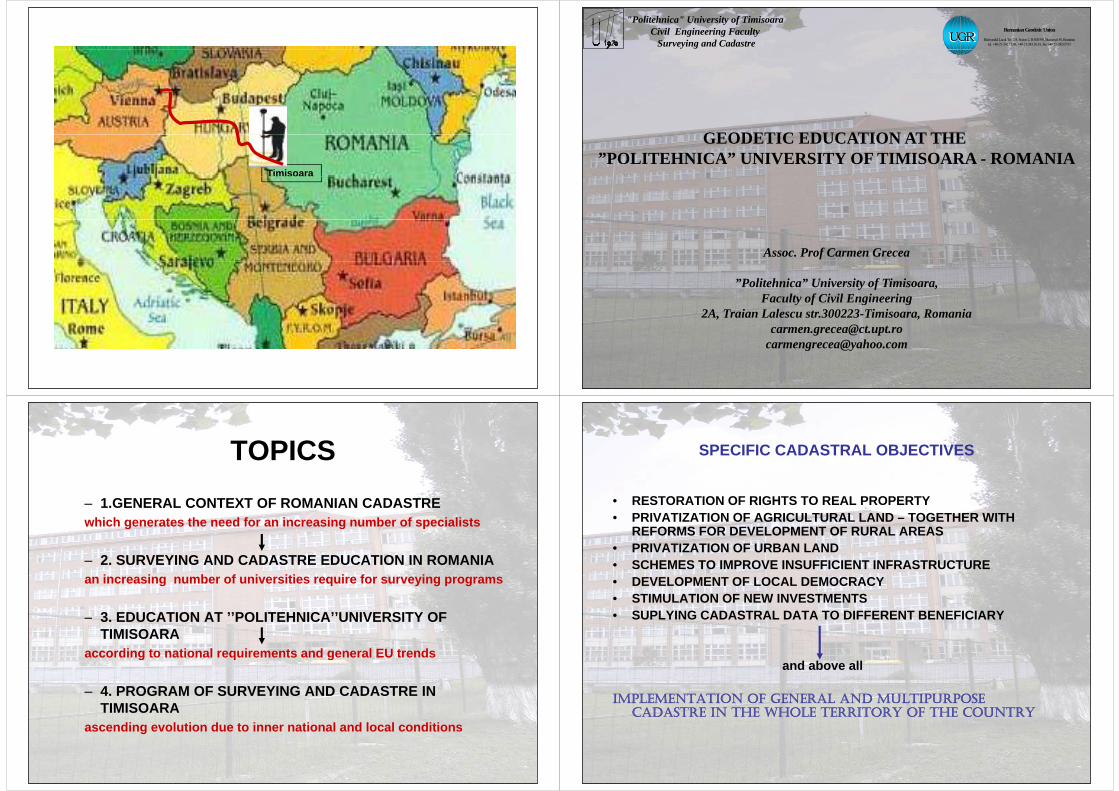
Timisoara
"Politehnica" University of TimisoaraCivil Engineering Faculty
Surveying and Cadastre
Romanian Geodetic Union
Bulevardul Lacul Tei 124, Sector 2, R-020396, Bucureşti 38, România tel. +40-21-242.12.08, +40-21-243.36.81, fax +40-21-242.07.93
UGR UGR
GEODETIC EDUCATION AT THEGEODETIC EDUCATION AT THE ”POLITEHNICA” UNIVERSITY OF TIMISOARA - ROMANIA
Assoc. Prof Carmen Grecea
”Politehnica” University of Timisoara,Faculty of Civil Engineeringy f g g
2A, Traian Lalescu str.300223-Timisoara, [email protected]
[email protected]@yahoo.com
TOPICSTOPICS– 1.GENERAL CONTEXT OF ROMANIAN CADASTREwhich generates the need for an increasing number of specialists
– 2. SURVEYING AND CADASTRE EDUCATION IN ROMANIAan increasing number of universities require for surveying programs
3 EDUCATION AT ’’POLITEHNICA’’UNIVERSITY OF– 3. EDUCATION AT ’’POLITEHNICA’’UNIVERSITY OF TIMISOARA
according to national requirements and general EU trendsaccording to national requirements and general EU trends
– 4. PROGRAM OF SURVEYING AND CADASTRE IN TIMISOARA
ascending evolution due to inner national and local conditions
SPECIFIC CADASTRAL OBJECTIVESSPECIFIC CADASTRAL OBJECTIVES
• RESTORATION OF RIGHTS TO REAL PROPERTY• PRIVATIZATION OF AGRICULTURAL LAND – TOGETHER WITH
REFORMS FOR DEVELOPMENT OF RURAL AREASREFORMS FOR DEVELOPMENT OF RURAL AREAS• PRIVATIZATION OF URBAN LAND• SCHEMES TO IMPROVE INSUFFICIENT INFRASTRUCTURE• DEVELOPMENT OF LOCAL DEMOCRACY• STIMULATION OF NEW INVESTMENTS• SUPLYING CADASTRAL DATA TO DIFFERENT BENEFICIARY• SUPLYING CADASTRAL DATA TO DIFFERENT BENEFICIARY
and above all
IMPLEMENTATION OF GENERAL AND MULTIPURPOSE IMPLEMENTATION OF GENERAL AND MULTIPURPOSE CADASTRE IN THE WHOLE TERRITORY OF THE COUNTRY
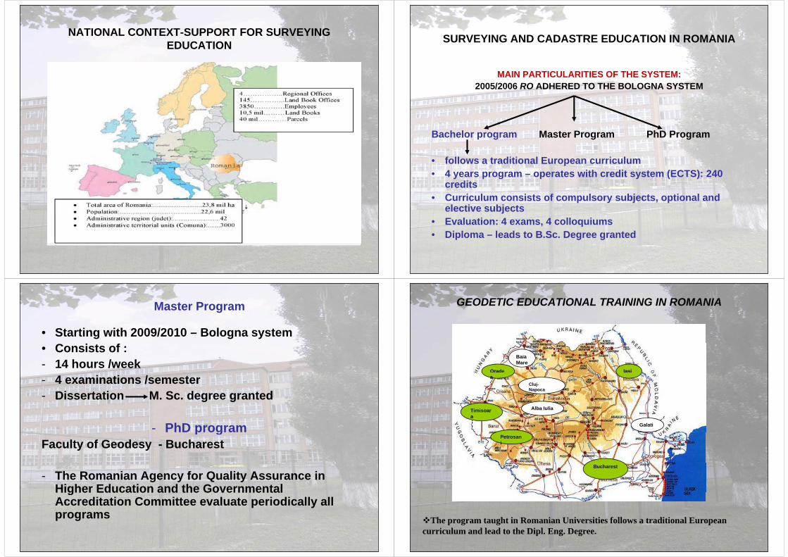
NATIONAL CONTEXT-SUPPORT FOR SURVEYINGNATIONAL CONTEXT SUPPORT FOR SURVEYING EDUCATION SURVEYING AND CADASTRE EDUCATION IN ROMANIASURVEYING AND CADASTRE EDUCATION IN ROMANIA
MAIN PARTICULARITIES OF THE SYSTEM:2005/2006 RO ADHERED TO THE BOLOGNA SYSTEM
Bachelor program Master Program PhD Program
• follows a traditional European curriculum• 4 years program – operates with credit system (ECTS): 240
creditscredits• Curriculum consists of compulsory subjects, optional and
elective subjects• Evaluation: 4 exams, 4 colloquiums • Diploma – leads to B.Sc. Degree granted
Master Program
• Starting with 2009/2010 – Bologna system• Consists of :- 14 hours /week- 4 examinations /semester- Dissertation M. Sc. degree granted
- PhD programp gFaculty of Geodesy - Bucharest
- The Romanian Agency for Quality Assurance in Higher Education and the GovernmentalHigher Education and the Governmental Accreditation Committee evaluate periodically all programs
GEODETIC EDUCATIONAL TRAINING IN ROMANIA
Orade
Baia Mare
Iasia
Cluj-Napoca
Timisoara
Galati
Alba Iulia
Petrosani
Bucharest
The program taught in Romanian Universities follows a traditional EuropeanThe program taught in Romanian Universities follows a traditional European curriculum and lead to the Dipl. Eng. Degree.
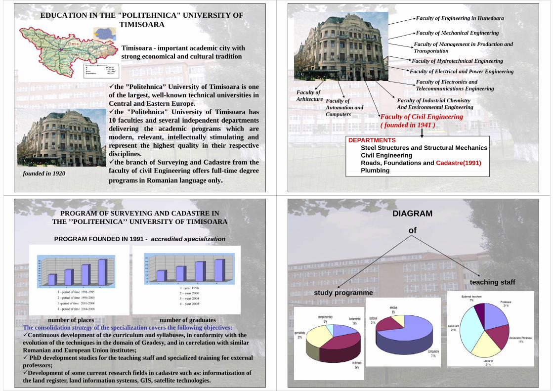
EDUCATION IN THE "POLITEHNICA" UNIVERSITY OF TIMISOARATIMISOARA
i i i i i iTimisoara - important academic city withstrong economical and cultural tradition
the ”Politehnica” University of Timisoara is onethe Politehnica University of Timisoara is oneof the largest, well-known technical universities inCentral and Eastern Europe.the "Politehnica" University of Timisoara has10 faculties and several independent departmentsdelivering the academic programs which aredelivering the academic programs which aremodern, relevant, intellectually stimulating andrepresent the highest quality in their respectivedisciplines.the branch of Surveying and Cadastre from thefaculty of civil Engineering offers full-time degreef d d i 1920 faculty of civil Engineering offers full-time degreeprograms in Romanian language only.
founded in 1920
Faculty of Engineering in Hunedoara
Faculty of Management in Production and
Faculty of Mechanical Engineering
Faculty of Hydrotechnical Engineering
Faculty of Management in Production and Transportation
Faculty of Electronics andT l i ti E i i
Faculty of Electrical and Power Engineering
Faculty ofArhitecture Faculty of
Automation andFaculty of Industrial ChemistryAnd Environmental Engineering
Telecommunications Engineering
Automation andComputers
And Environmental Engineering
Faculty of Civil Engineering ( founded in 1941 )
DEPARTMENTSSteel Structures and Structural MechanicsCivil EngineeringRoads, Foundations and Cadastre(1991)PlumbingPlumbing
PROGRAM OF SURVEYING AND CADASTRE IN THE ’’POLITEHNICA’’ UNIVERSITY OF TIMISOARATHE ’’POLITEHNICA’’ UNIVERSITY OF TIMISOARA
PROGRAM FOUNDED IN 1991 - accredited specializationPROGRAM FOUNDED IN 1991 accredited specialization
number of places number of graduatesThe consolidation strategy of the specialization covers the following objectives:Continuous development of the curriculum and syllabuses, in conformity with the evolution of the techniques in the domain of Geodesy, and in correlation with similar q y,Romanian and European Union institutes; PhD development studies for the teaching staff and specialized training for external professors;professors;Development of some current research fields in cadastre such as: informatization of the land register, land information systems, GIS, satellite technologies.
DIAGRAM
of
teaching staffstudy programme
teaching staff
Legend:CR-credits
E-examD-distributive evaluation
C-colloquium/oral examination
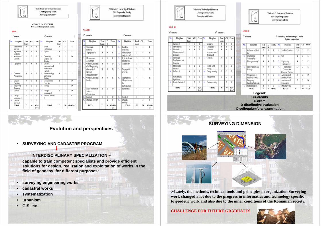
E l ti d tiEvolution and perspectives
• SURVEYING AND CADASTRE PROGRAM
INTERDISCIPLINARY SPECIALIZATION –capable to train competent specialists and provide efficient solutions for design, realization and exploitation of works in the field of geodesy for different purposes:
• surveying engineering workscadastral works• cadastral works
• systematization• urbanism• urbanism• GIS, etc.
SURVEYING DIMENSION
Lately, the methods, technical tools and principles in organization Surveying work changed a lot due to the progress in informatics and technology specific to geodetic work and also due to the inner conditions of the Romanian society.
CHALLENGE FOR FUTURE GRADUATESCHALLENGE FOR FUTURE GRADUATES
GENERAL CONCLUSIONSGENERAL CONCLUSIONS
• In the last period there have been significant changes in Geodesy
which brought createdwhich brought created-major technological developments growing demand from -demand for new products and services government, local
authoritiesauthorities and enterprises for specialists
with new knowledge and skillswith new knowledge and skills
• The information age has changed the surveying and mapping professionsprofessions
• Future surveying and mapping graduates should be able to move from technical specialists roles to participants in solution of societaltechnical specialists roles to participants in solution of societal problems – in many cases, professional surveyors no longer provide services directly to society BUT their results are passed on to other professions for final interpretation, analysis and presentation to the p p , y ppublic (architects, engineers)
GENERAL CONCLUSIONSGENERAL CONCLUSIONS
• The educational emphasis must shift from dependence on state-of the art instrumentation and equipment specific training to the appropriate application and analysis of the use of theseto the appropriate application and analysis of the use of these changing technologies;
Students and graduates should be encouraged to develop a• Students and graduates should be encouraged to develop a practical background and to mix educational experience with the practical experience;
• Another truth is, that knowledge and professional competence is no longer given once and for all – it must be maintained and extended through a lifelong process of learning;
• So the continuing education after graduation is as importantSo, the continuing education after graduation is as important as proper curriculum on the school and university levels