Embed Size (px)
DESCRIPTION
Why Assorted? What we did What we’re doing Real-time inversion for finite fault slip models and rupture geometry based on high-rate GPS data Jessica Murray, John Langbein, Joan Gomberg Go see the poster! What we’re doing Crowd-sourced geodesy for earthquake hazard and process studies USGS Innovation Center for Earth Sciences (ICES) Benjamin Brooks, Jessica Murray, Carol Prentice (USGS), Bob Iannucci (CMU-SV) GPU implementation of real-time finite fault inversion ICES Jessica Murray (USGS), Ole Mengshoel (CMU-SV) Performance testing real-time finite fault inversions in Cascadia David Schmidt (UW)
Citation preview
Assorted innovations in earthquake early warning and rapid response
Sarah Minson
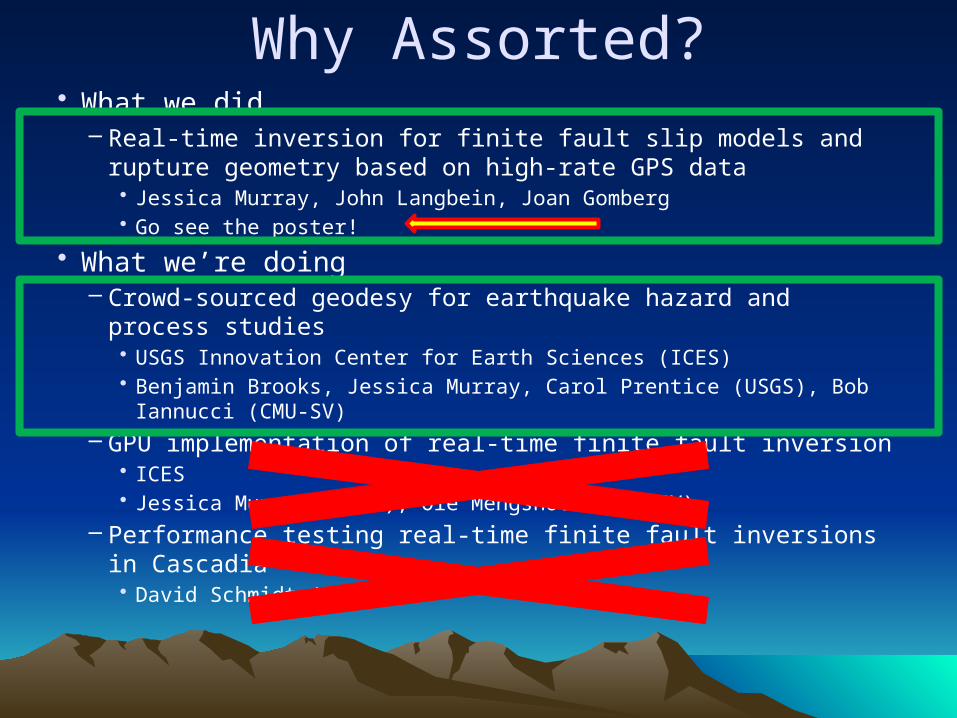
Why Assorted?• What we did
– Real-time inversion for finite fault slip models and rupture geometry based on high-rate GPS data• Jessica Murray, John Langbein, Joan Gomberg• Go see the poster!
• What we’re doing– Crowd-sourced geodesy for earthquake hazard and process
studies• USGS Innovation Center for Earth Sciences (ICES)• Benjamin Brooks, Jessica Murray, Carol Prentice (USGS), Bob Iannucci
(CMU-SV)– GPU implementation of real-time finite fault inversion
• ICES• Jessica Murray (USGS), Ole Mengshoel (CMU-SV)
– Performance testing real-time finite fault inversions in Cascadia• David Schmidt (UW)
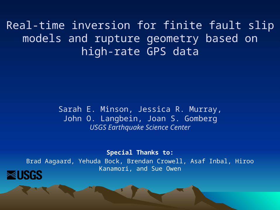
Real-time inversion for finite fault slip models and rupture geometry based on high-rate GPS data
Sarah E. Minson, Jessica R. Murray,John O. Langbein, Joan S. Gomberg
USGS Earthquake Science Center
Special Thanks to:Brad Aagaard, Yehuda Bock, Brendan Crowell, Asaf Inbal, Hiroo Kanamori, and Sue Owen
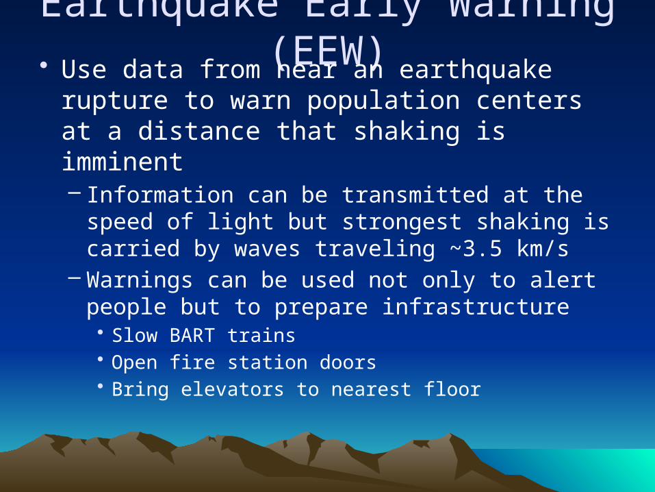
Earthquake Early Warning (EEW)• Use data from near an earthquake rupture
to warn population centers at a distance that shaking is imminent– Information can be transmitted at the speed of
light but strongest shaking is carried by waves traveling ~3.5 km/s
– Warnings can be used not only to alert people but to prepare infrastructure• Slow BART trains• Open fire station doors• Bring elevators to nearest floor
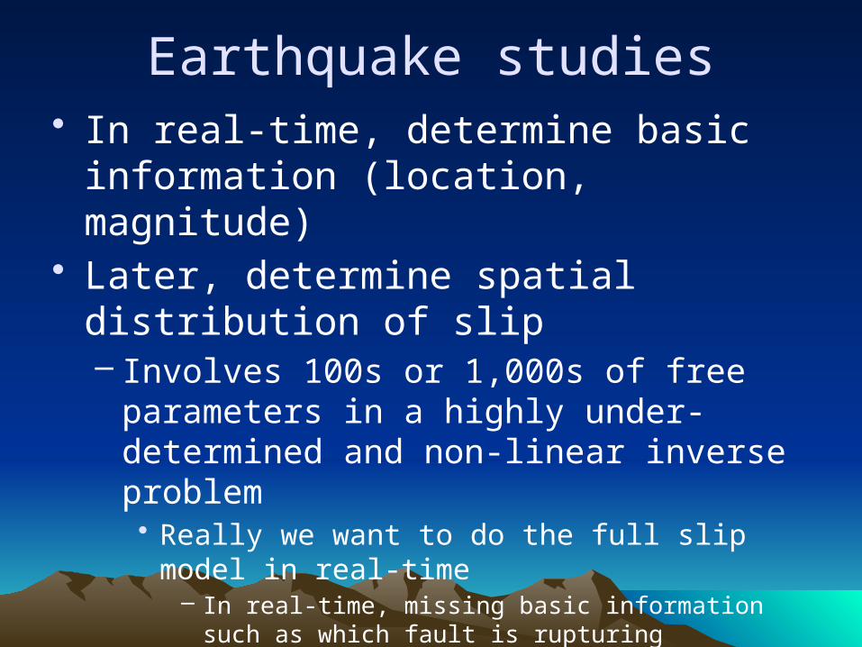
Earthquake studies• In real-time, determine basic information
(location, magnitude)• Later, determine spatial distribution of slip
– Involves 100s or 1,000s of free parameters in a highly under-determined and non-linear inverse problem• Really we want to do the full slip model in real-time
– In real-time, missing basic information such as which fault is rupturing
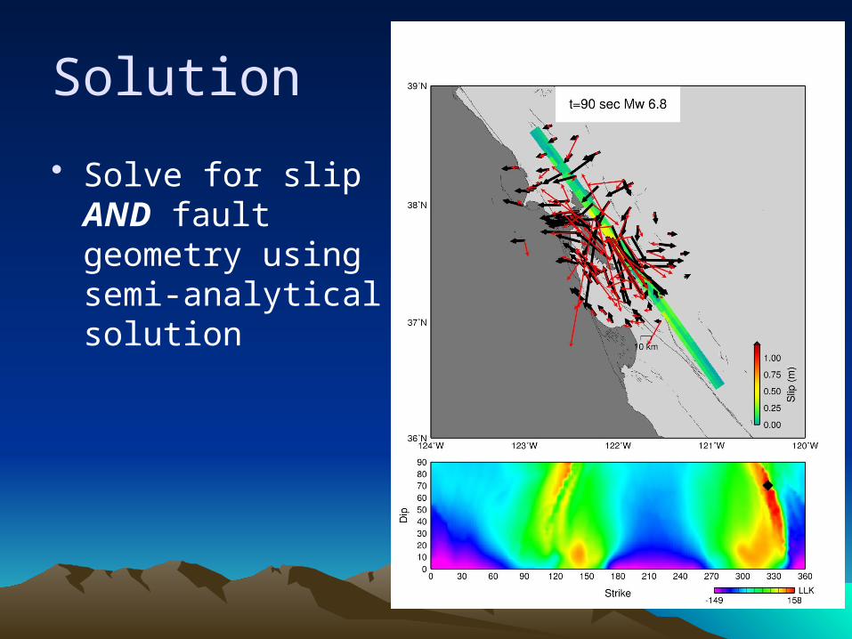
Solution
• Solve for slip AND fault geometry using semi-analytical solution
Crowd-sourced geodesy for earthquake hazard and process studies
Benjamin Brooks1, Jessica Murray1, Sarah Minson1
Carol Prentice1, Bob Iannucci21USGS Earthquake Science Center
2Carnegie Mellon University - Silicon Valley
ICES
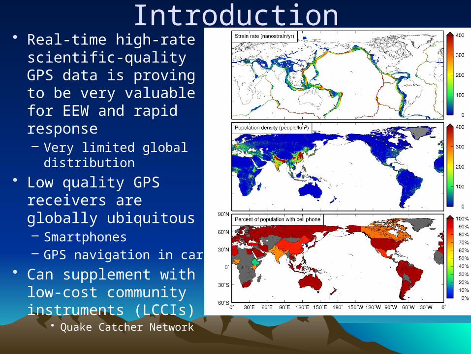
Introduction• Real-time high-rate
scientific-quality GPS data is proving to be very valuable for EEW and rapid response– Very limited global
distribution• Low quality GPS
receivers are globally ubiquitous– Smartphones– GPS navigation in cars
• Can supplement with low-cost community instruments (LCCIs)
• Quake Catcher Network
Challenges
• Huge errors associated with pseudorange-based GPS locations
• Even huger errors associated with attaching GPS to humans
• Communications issues• Data volume could be enormous
Caveat
• This is an altruistic EEW system– Normally we use instruments near the source
to warn humans at a distance– Here we use instruments attached to humans
near the source to warn humans at a distance

To-Do• Earthquake location and Mw
• Data resampling
• Focal mechanism
• Slip modeling
• Detection?• Quality control?
Reuse real-time finite fault inversion
e.g., Scripps group
Fit displacement amplitudes
Easting
Nor
thin
g
Thank you for listening!