Embed Size (px)
Citation preview
ADAPTATION INSPIRATION
BOOK23 EuropEan casEs
of climatE changE adaptation to inspirE EuropEan
dEcision-makErs, practitionErs and citizEns
BasE

BASEADAPTATION INSPIRATION
BOOK23 EuropEAn cASES
of climAtE chAngE AdAptAtion to inSpirE EuropEAn
dEciSion-mAkErS, prActitionErS And citizEnS
This project has received funding from the European Union’s Seventh Framework Programme for research, technological development and demonstration under Grant Agreement No. 308337 (Project BASE). The contents of this book are the sole responsi-bility of BASE and can in no way be taken to reflect the views of the European Union.
BASEADAPTATION INSPIRATION
BOOK23 EuropEAn cASES
of climAtE chAngE AdAptAtion to inSpirE EuropEAn
dEciSion-mAkErS, prActitionErS And citizEnS
page 14
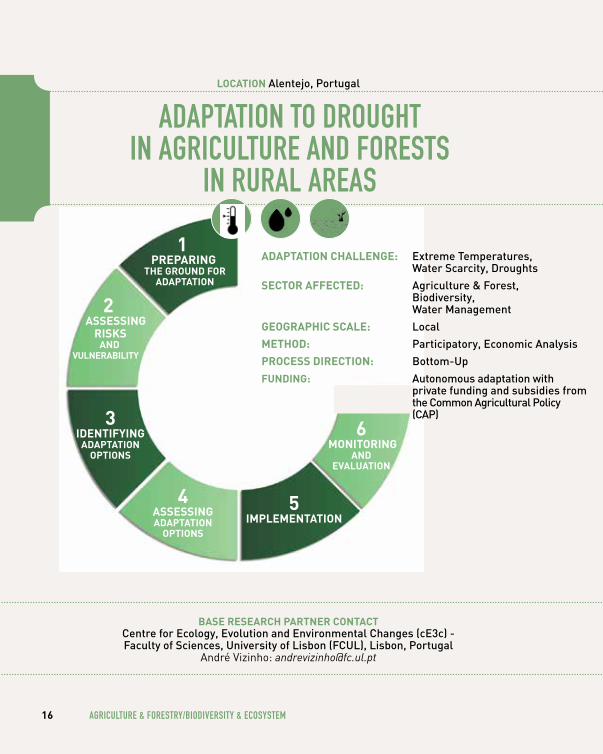
AgRIculTuRe & FOReSTRy/ BIODIveRSITy & ecOSySTem160 ADAPTATION TO DROughT IN AgRIculTuRe
AND FOReSTS IN RuRAl AReAS Alentejo, Portugal
220 PuBlIc AND PRIvATe clImATe chANge ADAPTATION INITIATIveS FOR A NATIONAl PARK Dartmoor, United Kingdom
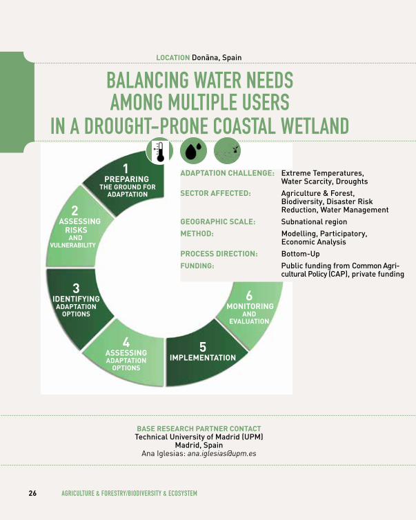
260 BAlANcINg wATeR NeeDS AmONg mulTIPle uSeRS IN A DROughT-PRONe cOASTAl weTlAND Donãna, Spain
300 uRBAN-RuRAl cO-OPeRATION: FARmeRS AS POTeNTIAl wATeR mANAgeRS? Holstebro, Denmark
360 SuSTAINABle gRAPevINe PRODucTION uNDeR A chANgINg clImATe South Moravia, Czech Republic
400 exPlORINg SceNARIOS FOR A uNeScO BIOSPheRe ReSeRve Šumava, Czech Republic
440 ReDucINg DROughT AND exTReme weATheR ImPAcTS FOR hOP culTIvATION Ústí, Czech Republic
page 48
wATeR ReSOuRceS & heAlTh500 RAISINg AwAReNeSS OF The RISKS
OF SKIN cANceR AND SuN exPOSuRe Cornwall, United Kingdom
540 ImPAcT OF chANgeS IN TemPeRATuRe, PRecIPITATION AND ulTRA vIOleT ON meNTAl heAlTh England, United Kingdom
580 mOvINg wITh clImATe chANge: FlexIBle wATeR levelS IN A lARge mulTI-uSe ARTIFIcIAl lAKe IJsselmeer, the Netherlands
620 TOwARDS clImATe-PROOFINg mANAgemeNT PlANS IN A hIgh FlOOD RISK RuRAl RIveR BASIN Kalajoki, Finland
680 cOmBATINg heAT STReSS ImPAcT IN A meTROPOlITAN INlAND cITy Madrid, Spain
page 6FORewORDAndré Jol
European Environment Agency
page7ABOuT ThIS BOOK
page 8OveRvIew mAP
OF The 23 euROPeAN cASe STuDIeS
page 10INTRODucTION
page 132leSSONS leARNT
What lessons can we draw from the 23 inspiring
European adaptation case studies?
page 136cOlOPhON
ADAPTATION INSPIRATION
BOOKcontEnt
4
page 74
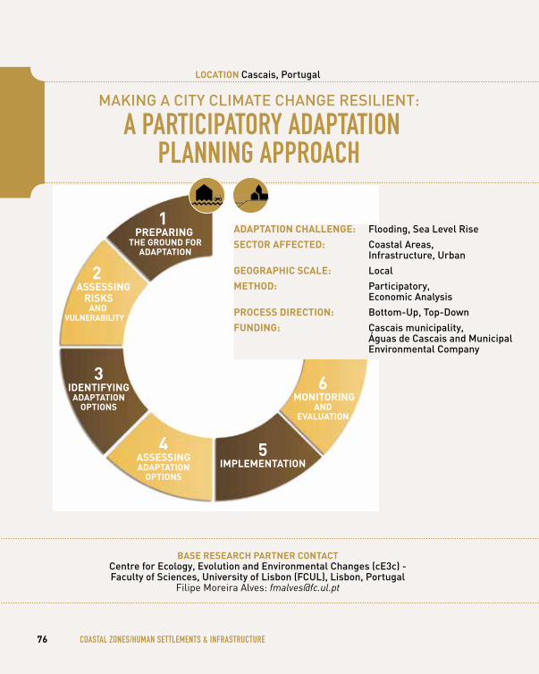
cOASTAl ZONeS/ humAN SeTTlemeNTS & INFRASTRucTuRe760 mAKINg A cITy clImATe chANge ReSIlIeNT:
A PARTIcIPATORy ADAPTATION PlANNINg APPROAch Cascais, Portugal
820 uRBAN ReSIlIeNce AND SuSTAINABle TRANSITIONS: A lARge-ScAle cOmPReheNSIve ADAPTATION STRATegy FOR A cOASTAl cITy Copenhagen, Denmark
880 cONSIDeRINg cOASTAl ADAPTATION OPTIONS AND A vulNeRABle RAIlwAy INFRASTRucTuRe Dawlish, United Kingdom
920 cOllecTIve DIAlOgue AND guIDeD STAKehOlDeR eNgAgemeNT: A PARTIcIPATORy AcTION ReSeARch APPROAch Ílhavo and Vagos, Portugal
980 mAINSTReAmINg clImATe chANge ADAPTATION INTO uRBAN PlANNINg Jena, Germany
104 PARTIcIPATORy meThODS AND lOcAl INcluSION: APPlIcATION AND eFFecT IN ADAPTATION POlIcy PlANNINg Kalundborg, Denmark
110 PROTecTINg hOmeS AND BuSINeSSeS: FlOOD AllevIATION Scheme FOR A cITy Leeds, United Kingdom
114 ADAPTINg TO A chANgINg clImATe: FlOOD PROTecTION SySTem IN The cITy Prague, Czech Republic
118 TOwARDS OPTImAl BAlANce IN FlOOD RISK mANAgemeNT IN The DelTA Rotterdam, the Netherlands
122 uSINg AcTIve PuBlIc PARTIcIPATION IN The cO-DevelOPmeNT OF cOASTAl PROTecTION STRATegIeS FOR A TOuRISTIc BeAch cITy Timmendorfer Strand, Germany
126 SPONTANeOuS ADAPTATION By PRIvATe AND PuBlIc AcTORS IN The cITy ceNTRe Venice, Italy
5
forEwordClimate change is a reality and the extent and speed of change are becoming ever more evident: temperatures are rising, rainfall patterns are shifting, sea ice, glaciers and snow are melting, and sea level is rising. Climate-related extremes such as heat waves, heavy precipitation and droughts are increasing in frequency and intensity in many regions. These changes, in interaction with economic and demographic develop-ments and land use changes, have already had many impacts on ecosystems, economic sectors, infra-structure and human health and well-being across Europe. The global Paris climate agreement is a major step forward, aiming to keep the increase in average global temperature to well below 2°C and requiring substantial reductions in global green-
house gas emissions. The agreement is due to enter into force in November 2016.
However, complementary actions to adapt are also required, to prevent or minimise the impacts. The EU climate change adaptation strategy of 2013 encourages countries to adopt adaptation strategies, promotes action in cities, mainstreams adaptation in EU policies, enhances research and information- sharing, and provides funding. In 2017-2018 the European Commission will assess whether action being taken so far is sufficient.
An increasing number of European Environment Agency (EEA) member countries have adopted national adaptation strate-gies and are implementing action plans. Strategies and actions also emerge in many cities and transnational
regions across Europe. Technological and eco- system-based measures, and measures addressing behavioural changes, are being taken. Especially ecosystem-based measures, with multiple benefits, receive attention.
The EEA provides information to support these develop-ments. For example in 2016 EEA published a report on urban adaptation including an overview of actions cities have taken. It recommends taking a wider systemic approach, including for example better urban planning with more green areas that can retain excess rainwater or cool built-up city centres in the summer, or by preventing the construction of houses in flood-prone areas. This can transform cities into much more attractive, climate-resilient and sustainable places.
ADAPTATION INSPIRATION
BOOKforEword & ABout thiS Book
6 FORewORD & ABOuT ThIS BOOK
ABout thiS BookThis book is inspired by the positive feedback receivedby the Adaptation Inspiration Book developed in CIRCLE-2,coordinated by the Faculty of Sciences, University of Lisbon.This inspiration book is a culmination of four years exten-sive case study research carried out within the EU FP7 Project BASE: Bottom-up climate adaptation strategies towards a sustainable Europe (2012-2016).
Pivoted largely on findings from a meta-analysis of BASE case study research, this book presents a brief overview of 23 diverse in-depth case studies that span across Europe, administrative levels, geographic scales, multiple sectors and trans-disciplines. Case studies range from traditional analytical studies to participatory action research.Depending on the climate change adaptation phase, needs and challenges, each case study focuses on one or a combination of methods applied in the climate change adaptation planning process, namely: economic evaluations of adaptation options; participatory applications; and implementation barriers and opportunities.
A comprehensive description of methods and case studies can be found in BASE publicationswww.base-adaptation.eu/publications.
we hope these case studies provide inspiration, motivation and guidance to European decision-makers, climate change adaptation practitioners and citizens to pondEr, Act, trAnSform & AdApt towards a sustainable Europe.
7
The European Commission and EEA have also developed the European Climate Adaptation Platform (Climate-ADAPT) providing for example planning support tools, adaptation case studies and measures.
The BASE adaptation inspiration book gives a very good overview of a variety of in-depth case studies that span across Europe, administrative levels, geographic scales, multiple sectors and trans-disciplines. These can inspire European decision-makers, practi-tioners and citizens to take action. I do hope this book can indeed inspire people to adapt.
André Jol Head of group climate change impacts, vulnerability and adaptation
LIBYA
Tripoli
LEBANONBeirut
Amman
JORDANISRAEL
Jerusalem
Selfoss Egilsstadir
Akureyri
Saudharkrokur
Keflavik Reykjavik
Borgarnes
ísafördur
ICELAND
Cairo
EGYPT
CYPRUS
Lefkosia (Nicosia)
ADAPTATION INSPIRATION
BOOKovErviEw mAp of thE 23 EuropEAn cASE StudiES
8 OveRvIew mAP OF The 23 euROPeAN cASe STuDIeS
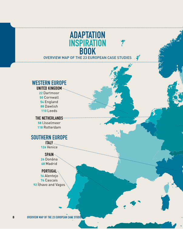
weSTeRN euROPe uNITeD KINgDOm
22 Dartmoor50 Cornwall 54 England 88 Dawlish 110 Leeds
The NeTheRlANDS58 IJsselmeer 118 Rotterdam
SOuTheRN euROPe ITAly
126 Venice
SPAIN 26 Donãna 68 Madrid
PORTugAl 16 Alentejo 76 Cascais
92 Ílhavo and Vagos
LIBYA
Tripoli
LEBANONBeirut
Amman
JORDANISRAEL
Jerusalem
Selfoss Egilsstadir
Akureyri
Saudharkrokur
Keflavik Reykjavik
Borgarnes
ísafördur
ICELAND
Cairo
EGYPT
CYPRUS
Lefkosia (Nicosia)
9
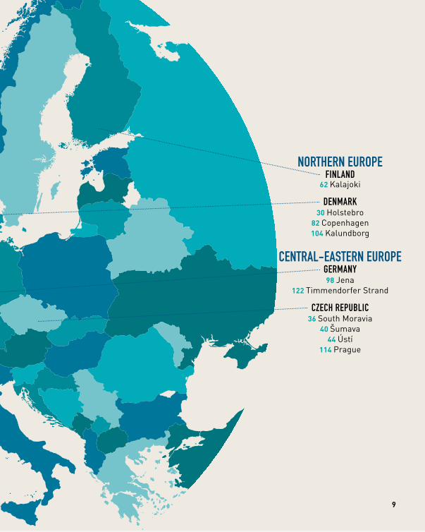
NORTheRN euROPeFINlAND
62 Kalajoki
DeNmARK30 Holstebro
82 Copenhagen104 Kalundborg
ceNTRAl-eASTeRN euROPe geRmANy98 Jena
122 Timmendorfer Strand
cZech RePuBlIc36 South Moravia
40 Šumava 44 Ústí
114 Prague
introductionClimate change poses a tricky challenge for collective action across the world. The 2015 Paris Agreement was a historical step, and tipped the balance towards the possibility of containing global climate change at acceptable levels. Even if the world’s governments jointly succeed in combining their mitigation efforts for holding temperature increases below 2ºC by 2100, adaptation is inevitable, as some level of climatic change is to be expected due to lags in the climate system.
Impacts and consequences of climate change span from global to local scales, from regional to context-specific effects, and will take a toll on a variety of communities. To ensure equitable, efficient and effective solutions for climate change, adaptation processes need to be harmonised across levels of governance from central governments to local polities, and scales, involving as far as possible a wide diversity of stakeholder groups and individuals. The losers and winners of these processes need to be thoroughly accounted for and engaged in the design of policies and solutions.
Societies should be equally inspired to turn the climate change problem into a thriving opportunity for change, by promoting innovative solutions towards sustainable, equitable and resilient communities. At the base of collective action stand a number of policies and strategies designed at global, regional and national scales, which need to correspond to local needs in order to ensure effective implementation and willingness to adapt. With the goal of supporting more sustainable climate change adaptation pathways throughout Europe, BASE research takes on a unique focus by addressing the integration of top-down policies and processes, and bottom-up responses and initiatives.
Through its case study research, project BASE provides the empirical content and data from a diverse selection of top-down strategies and bottom-up experiences throughout Europe. A set of 23 case studies, each led by one or more BASE partners (henceforth, referred to as case study owners), were selected. In some instances, sub-cases were developed within a case study to
ADAPTATION INSPIRATION
BOOKintroduction
10 INTRODucTION
account for the varying climatic, environment and socio-economic settings, as well as varied dimensions regarding geographical areas covered, and scales and levels of governance. As a result of BASE, four years of case study research
are condensed in this book to offer a number of experiences and lessons learnt, which hopefully will inspire policy-makers, practitioners and citizens in Europe and across the globe to continue working towards a sustainable world.
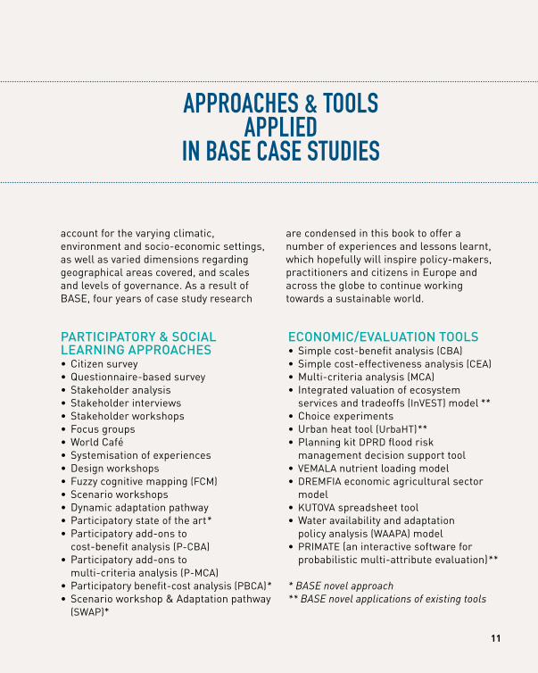
APPROAcheS & TOOlS APPlIeD
IN BASe cASe STuDIeS
pArticipAtory & SociAl lEArning ApproAchES• Citizen survey• Questionnaire-based survey• Stakeholder analysis• Stakeholder interviews• Stakeholder workshops• Focus groups• World Café• Systemisation of experiences• Design workshops• Fuzzy cognitive mapping (FCM)• Scenario workshops• Dynamic adaptation pathway• Participatory state of the art*• Participatory add-ons to
cost-benefit analysis (P-CBA)• Participatory add-ons to
multi-criteria analysis (P-MCA)• Participatory benefit-cost analysis (PBCA)*• Scenario workshop & Adaptation pathway
(SWAP)*
Economic/EvAluAtion toolS• Simple cost-benefit analysis (CBA)• Simple cost-effectiveness analysis (CEA)• Multi-criteria analysis (MCA)• Integrated valuation of ecosystem
services and tradeoffs (InVEST) model **• Choice experiments• Urban heat tool (UrbaHT)**• Planning kit DPRD flood risk
management decision support tool• VEMALA nutrient loading model• DREMFIA economic agricultural sector
model • KUTOVA spreadsheet tool• Water availability and adaptation
policy analysis (WAAPA) model• PRIMATE (an interactive software for
probabilistic multi-attribute evaluation)**
* BASE novel approach** BASE novel applications of existing tools
11
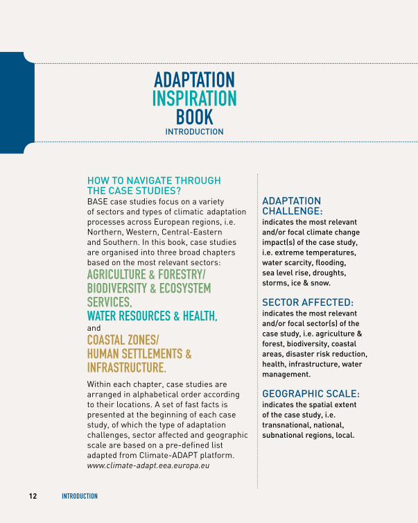
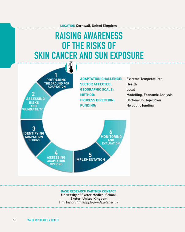
AdAptAtion chAllEngE: indicates the most relevant and/or focal climate change impact(s) of the case study, i.e. extreme temperatures, water scarcity, flooding, sea level rise, droughts, storms, ice & snow.
SEctor AffEctEd: indicates the most relevant and/or focal sector(s) of the case study, i.e. agriculture & forest, biodiversity, coastal areas, disaster risk reduction, health, infrastructure, water management.
gEogrAphic ScAlE: indicates the spatial extent of the case study, i.e. transnational, national, subnational regions, local.
ADAPTATION INSPIRATION
BOOKintroduction
how to nAvigAtE through thE cASE StudiES?BASE case studies focus on a variety of sectors and types of climatic adaptation processes across European regions, i.e. Northern, Western, Central-Eastern and Southern. In this book, case studies are organised into three broad chapters based on the most relevant sectors:
AgRIculTuRe & FOReSTRy/ BIODIveRSITy & ecOSySTem SeRvIceS, wATeR ReSOuRceS & heAlTh, and
cOASTAl ZONeS/ humAN SeTTlemeNTS & INFRASTRucTuRe. Within each chapter, case studies are arranged in alphabetical order according to their locations. A set of fast facts is presented at the beginning of each case study, of which the type of adaptation challenges, sector affected and geographic scale are based on a pre-defined list adapted from Climate-ADAPT platform. www.climate-adapt.eea.europa.eu
12 INTRODucTION
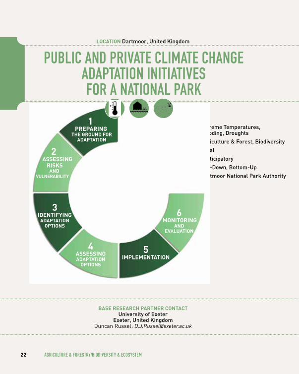
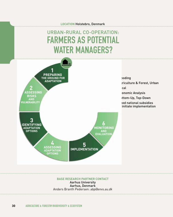
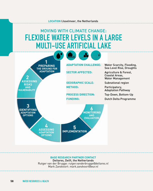
AdAptAtion ChAllenge:
SeCtor AffeCted:
geogrAphiC SCAle:
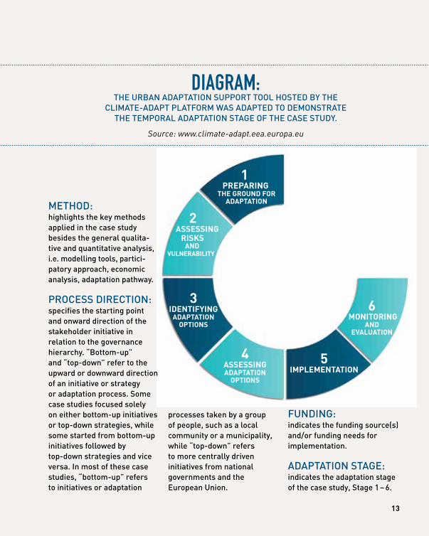
Method:
proCeSS direCtion:
funding: 2AdAptAtion StAge
1 prepAring
the ground for AdAptAtion
2 ASSeSSing
riSkS And
vulnerAbility
3 identifying
AdAptAtion optionS
4 ASSeSSing AdAptAtion
optionS
5 iMpleMentAtion
6 Monitoring
And evAluAtion
DIAgRAm: thE urBAn AdAptAtion Support tool hoStEd By thE
climAtE-AdApt plAtform wAS AdAptEd to dEmonStrAtE thE tEmporAl AdAptAtion StAgE of thE cASE Study.
Source: www.climate-adapt.eea.europa.eu
processes taken by a group of people, such as a local community or a municipality, while “top-down” refers to more centrally driven initiatives from national governments and the European union.
mEthod: highlights the key methods applied in the case study besides the general qualita-tive and quantitative analysis, i.e. modelling tools, partici-patory approach, economic analysis, adaptation pathway.
procESS dirEction: specifies the starting point and onward direction of the stakeholder initiative in relation to the governance hierarchy. “Bottom-up” and “top-down” refer to the upward or downward direction of an initiative or strategy or adaptation process. Some case studies focused solely on either bottom-up initiatives or top-down strategies, while some started from bottom-up initiatives followed by top-down strategies and vice versa. in most of these case studies, “bottom-up” refers to initiatives or adaptation
funding: indicates the funding source(s) and/or funding needs for implementation.
AdAptAtion StAgE: indicates the adaptation stage of the case study, Stage 1 – 6.
13

14 AgRIculTuRe & FOReSTRy/BIODIveRSITy & ecOSySTem
AgRIculTuRe & FOReSTRy/
BIODIveRSITy & ecOSySTem
15
ADAPTATION TO DROughT IN AgRIculTuRe AND FOReSTS
IN RuRAl AReAS
bASe reSeArCh pArtner ContACtcentre for Ecology, Evolution and Environmental changes (cE3c) - faculty of Sciences, university of lisbon (fcul), lisbon, portugal
André Vizinho: [email protected]
16 AgRIculTuRe & FOReSTRy/BIODIveRSITy & ecOSySTem
loCAtion Alentejo, portugal
4AdAptAtion StAge
1 prepAring
the ground for AdAptAtion
3 identifying
AdAptAtion optionS
4 ASSeSSing AdAptAtion
optionS
5 iMpleMentAtion
6 Monitoring
And evAluAtion
2 ASSeSSing
riSkS And
vulnerAbility
AdAptAtion ChAllenge: Extreme temperatures, water Scarcity, droughts
SeCtor AffeCted: Agriculture & forest, Biodiversity, water management
geogrAphiC SCAle: local
Method: participatory, Economic Analysis
proCeSS direCtion: Bottom-up
funding: Autonomous adaptation with private funding and subsidies from the common Agricultural policy (cAp)
17
Pho
to: A
ndré
Viz
inho
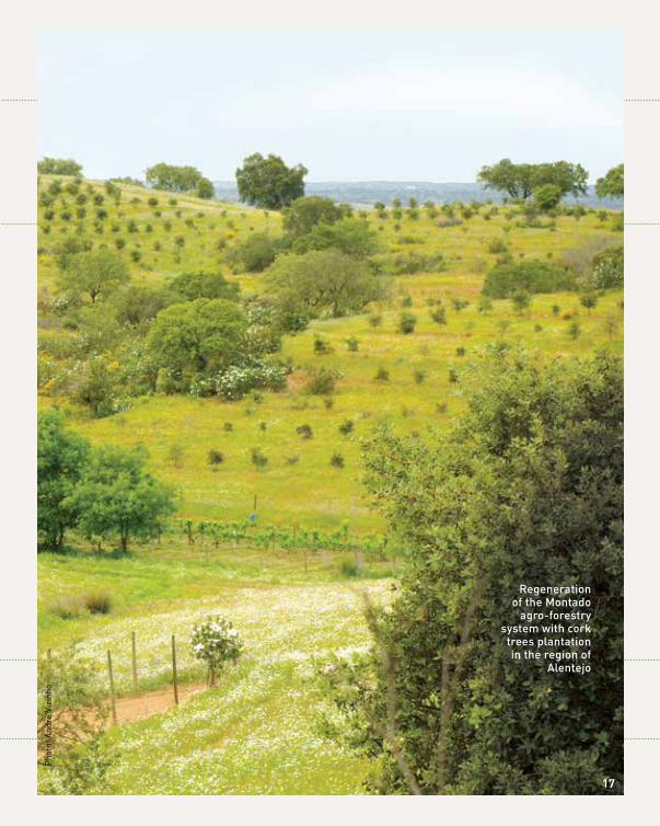
regeneration of the montado
agro-forestry system with cork
trees plantation in the region of
Alentejo
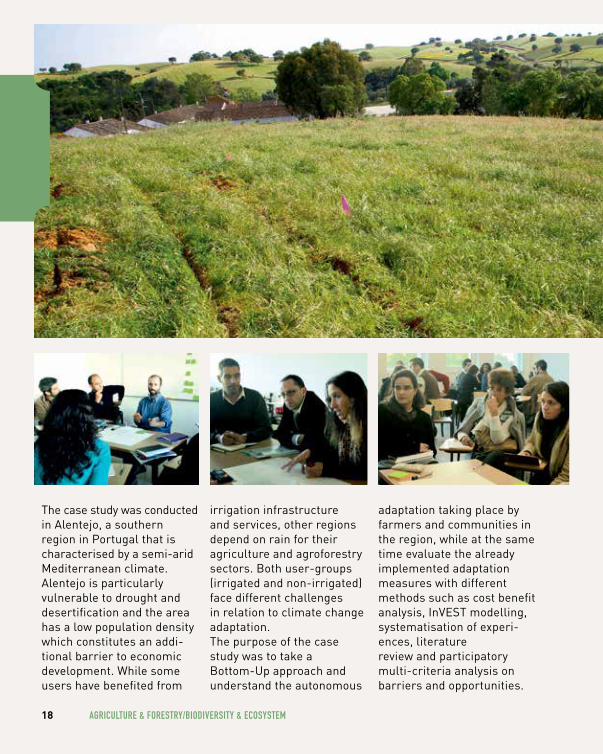
The case study was conducted in Alentejo, a southern region in Portugal that is characterised by a semi-arid Mediterranean climate. Alentejo is particularly vulnerable to drought and desertification and the area has a low population density which constitutes an addi-tional barrier to economic development. While some users have benefited from
irrigation infrastructure and services, other regions depend on rain for their agriculture and agroforestry sectors. Both user-groups (irrigated and non-irrigated) face different challenges in relation to climate change adaptation. The purpose of the case study was to take a Bottom-Up approach and understand the autonomous
adaptation taking place by farmers and communities in the region, while at the same time evaluate the already implemented adaptation measures with different methods such as cost benefit analysis, InVEST modelling, systematisation of experi-ences, literature review and participatory multi-criteria analysis on barriers and opportunities.
18 AgRIculTuRe & FOReSTRy/BIODIveRSITy & ecOSySTem
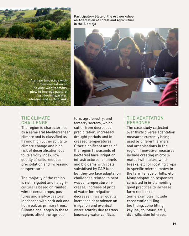
thE climAtE chAllEngEThe region is characterised by a semi-arid Mediterranean climate and is classified as having high vulnerability to climate change and high risk of desertification due to its aridity index, low quality of soils, reduced precipitation and increasing temperatures.
The majority of the region is not irrigated and its agri-culture is based on rainfed winter cereal crops, pas-tures and a silvo-pastoral landscape with cork oak and holm oak as primary trees. Climate challenges in these regions affect the agricul-
ture, agroforestry, and forestry sectors, which suffer from decreased precipitation, increased drought periods and in-creased temperatures. Other significant areas of the region (thousands of hectares) have irrigation infrastructures, channels and big dams with costs subsidised by CAP funds but they too face adaptation challenges related to heat waves, temperature in-crease, increase of price of water for irrigation, decrease in water quality, increased dependence on irrigation and eventual water scarcity due to trans-boundary water conflicts.
thE AdAptAtion rESponSEThe case study collected over thirty diverse adaptation measures currently being used by different farmers and organisations in the region. Innovative measures include creating microcli-mates (with lakes, wind-breaks, etc) or locating crops in specific microclimates in the farm (shade of hills, etc). Many adaptation responses consisted in implementing good practices to increase farm resilience. Some examples include conservation tilling (no tilling, zone tilling, keyline, countour, etc.), diversification (of crops,
19
Pho
tos:
And
ré V
izin
ho
Alentejo landscape with demonstration of
keyline with yeomans plow to improve pasture
productivity, water retention and carbon sink
participatory State of the Art workshop on Adaptation of forest and Agriculture in the Alentejo
species, varieties, genes, creating agro-silvo- pastoral landscapes, etc), improving soil quality (increasing organic matter, mulching, rotating livestock, introducing sewage sludge on soil, etc.).
Other measures focus on harvesting rainwater and using water more efficiently such as off-stream dams, water retention landscapes, precision drip irrigation with
organic fertilizer, reusing grey water, using renewable energy for water pumping to reduce the costs of irrigation. Finally, several measures focused on raising the adaptive capacity namely with awareness raising about sustainability and climate change, training courses in permaculture, and the development of community plans for an eco village.
thE AdAptAtion rESponSE
20 AgRIculTuRe & FOReSTRy/BIODIveRSITy & ecOSySTem
thE pEoplE And inStitutionS involvEdTwenty-one farms and projects were interviewed in this case study and contributed information to its findings. For the farmers, the motivation for participa-tion was mainly due to their interest in improving yields from their farm and thus their income. Participation also came from local NGOs and community
organisations interested in implementing sustainable practices. In order to gather these perspectives from different stakeholders, the case study organised several partici-patory events starting with a “Participatory State of the Art workshop on Adaptation of Forest and Agriculture in the Alentejo” with the re-search community, national and regional stakeholders working on related fields.
thE outcomE of ActionThe range of adaptation responses varied greatly with the selection of thirty recognised measures and projects each with certain level of success and/or limiting factors. A participatory multi-criteria analysis was conducted to understand these factors on fifteen adaptation measures considered most important for stakeholders.
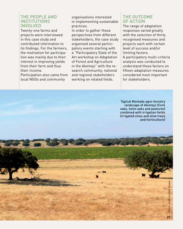
typical montado agro-forestry landscape of Alentejo (cork
oaks, holm oaks and pastures) combined with irrigation fields (irrigated vines and olive trees
and horticulture)
21
Pho
to: J
oaqu
im A
lves
Gas
par
PuBlIc AND PRIvATe clImATe chANge ADAPTATION INITIATIveS FOR A NATIONAl PARK
bASe reSeArCh pArtner ContACtuniversity of Exeter
Exeter, united kingdomDuncan Russel: [email protected]
22 AgRIculTuRe & FOReSTRy/BIODIveRSITy & ecOSySTem
loCAtion dartmoor, united kingdom
AdAptAtion ChAllenge: Extreme temperatures, flooding, droughts
SeCtor AffeCted: Agriculture & forest, Biodiversity
geogrAphiC SCAle: local
Method: participatory
proCeSS direCtion: top-down, Bottom-up
funding: dartmoor national park Authority2AdAptAtion StAge
1 prepAring
the ground for AdAptAtion
3 identifying
AdAptAtion optionS
4 ASSeSSing AdAptAtion
optionS
5 iMpleMentAtion
6 Monitoring
And evAluAtion
2 ASSeSSing
riSkS And
vulnerAbility
Pho
to: D
unca
n R
usse
l
23
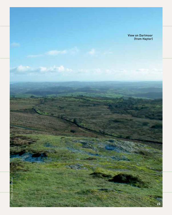
view on dartmoor (from haytor)
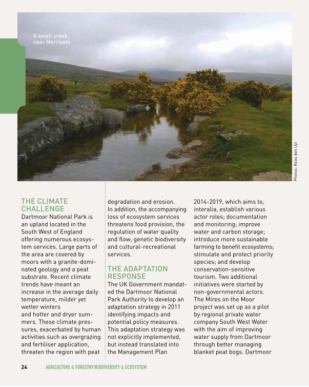
thE climAtE chAllEngEDartmoor National Park is an upland located in the South West of England offering numerous ecosys-tem services. Large parts of the area are covered by moors with a granite-domi-nated geology and a peat substrate. Recent climate trends have meant an increase in the average daily temperature, milder yet wetter winters and hotter and dryer sum-mers. These climate pres-sures, exacerbated by human activities such as overgrazing and fertiliser application, threaten the region with peat
degradation and erosion. In addition, the accompanying loss of ecosystem services threatens food provision, the regulation of water quality and flow, genetic biodiversity and cultural-recreational services.
thE AdAptAtion rESponSEThe UK Government mandat-ed the Dartmoor National Park Authority to develop an adaptation strategy in 2011 identifying impacts and potential policy measures. This adaptation strategy was not explicitly implemented, but instead translated into the Management Plan
2014-2019, which aims to, interalia, establish various actor roles; documentation and monitoring; improve water and carbon storage; introduce more sustainable farming to benefit ecosystems; stimulate and protect priority species; and develop conservation-sensitive tourism. Two additional initiatives were started by non-governmental actors. The Mires on the Moor project was set up as a pilot by regional private water company South West Water with the aim of improving water supply from Dartmoor through better managing blanket peat bogs. Dartmoor
24 AgRIculTuRe & FOReSTRy/BIODIveRSITy & ecOSySTem
Pho
tos:
Roo
s de
n U
yl
A small creek, near merrivale
Farming Futures is a bottom-up project set up to better manage Dartmoor’s distinctive ecosystem through the implementation localised agro-environmental schemes, such as better management of vegetation to prevent wildfires and maintaining beneficial livestock farming.
thE pEoplE And inStitutionS involvEdThe Dartmoor National Park Authority was suggested as the primary authority responsible for adaptation in Dartmoor National Park. The current responsibility around adaptation is however
not that clear. The Mires on the Moor project is not a public policy initiative, but rather initiated by drinking water company South West Water and the University of Exeter, taking place on land owned by the Duchy of Cornwall and (partly) used by local residents and farmers. Dartmoor Farming Futures was initiated by local farmers together with the Dartmoor Commoners Council, the Forest Commoners Council, the Haytor and Bagtor Commoners Council, and the DNPA, together with the Duchy of Cornwall, Natural England, RSPB, South West Water, and the Ministry of Defence.
25
thE outcomE of ActionThe Management Plan 2014-2019 includes some adaptation measures though not explicitly under a climate change heading. The Management Plan will be implemented and monitored, though it is not yet known exactly how and when, and whether evaluation outcomes will be used. The National Park Authority informed researchers that climate change adaptation is currently not one of their priorities, which may be a reflection of recently reduced funding and changing higher-level political priorities.A first preliminary evaluation has been conducted in 2013, the Dartmoor Farming Futures programme was deemed to have successfully translated national and EU policies into a localised setting. The Mires on the Moor project entailed rewetting bog areas. The project received criticism for not indicating compensa-tion sums and (partly) failing to engage local expertise and feedback.
The project ends in 2015, and South West Water has decided not to fund any continuation of the project on Dartmoor.
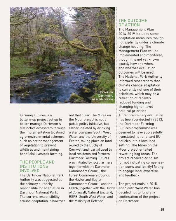
creek on dartmoor,
near merrivale
BAlANcINg wATeR NeeDS AmONg mulTIPle uSeRS
IN A DROughT-PRONe cOASTAl weTlAND
bASe reSeArCh pArtner ContACttechnical university of madrid (upm)
madrid, SpainAna Iglesias: [email protected]
26 AgRIculTuRe & FOReSTRy/BIODIveRSITy & ecOSySTem
loCAtion donãna, Spain
1AdAptAtion StAge
1 prepAring
the ground for AdAptAtion
3 identifying
AdAptAtion optionS
4 ASSeSSing AdAptAtion
optionS
5 iMpleMentAtion
6 Monitoring
And evAluAtion
2 ASSeSSing
riSkS And
vulnerAbility
AdAptAtion ChAllenge: Extreme temperatures, water Scarcity, droughts
SeCtor AffeCted: Agriculture & forest, Biodiversity, disaster risk reduction, water management
geogrAphiC SCAle: Subnational region
Method: modelling, participatory, Economic Analysis
proCeSS direCtion: Bottom-up
funding: public funding from common Agri-cultural policy (cAp), private funding
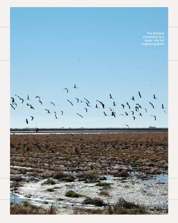
the doñana ecosystem is a major site for
migrating birds
Pho
to: A
na Ig
lesi
as
27
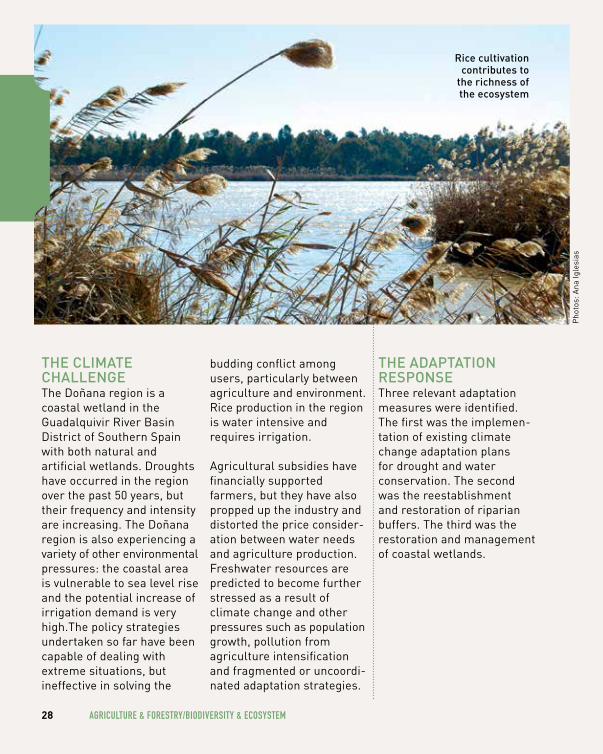
thE climAtE chAllEngEThe Doñana region is a coastal wetland in the Guadalquivir River Basin District of Southern Spain with both natural and artificial wetlands. Droughts have occurred in the region over the past 50 years, but their frequency and intensity are increasing. The Doñana region is also experiencing a variety of other environmental pressures: the coastal area is vulnerable to sea level rise and the potential increase of irrigation demand is very high.The policy strategies undertaken so far have been capable of dealing with extreme situations, but ineffective in solving the
budding conflict among users, particularly between agriculture and environment. Rice production in the region is water intensive and requires irrigation. Agricultural subsidies have financially supported farmers, but they have also propped up the industry and distorted the price consider-ation between water needs and agriculture production.Freshwater resources are predicted to become further stressed as a result of climate change and other pressures such as population growth, pollution from agriculture intensification and fragmented or uncoordi-nated adaptation strategies.
thE AdAptAtion rESponSEThree relevant adaptation measures were identified. The first was the implemen-tation of existing climate change adaptation plans for drought and water conservation. The second was the reestablishment and restoration of riparian buffers. The third was the restoration and management of coastal wetlands.
28 AgRIculTuRe & FOReSTRy/BIODIveRSITy & ecOSySTem
Pho
tos:
Ana
Igle
sias
rice cultivation contributes to
the richness of the ecosystem
thE pEoplE And inStitutionS involvEdFour stakeholder groups were identified based on criteria of those most likely to be affected by adaptation policies as well as those with the most influence in the adaptation decision making process. The four identified groups were farmers who had the most to gain or lose, the local institutions responsible for decision-making, and the citizens and environmen-talists. Some 90% of farmers in Doñana belong to a farmers organisation and these were the main representative bodies involved (i.e. Farmer Advisory Services, Irrigation Communities, Cooperatives, or Rice Farming Federations and Unions).
At the local government level, the River Basin Authorities represented the public officials with control over water resources policy, water management and irrigation planning. Finally, a longstanding environmentalist organisation represented nature welfare claiming more water for the natural wetland. In this particular case, the four stakeholder groups had strong disagreements about water management.
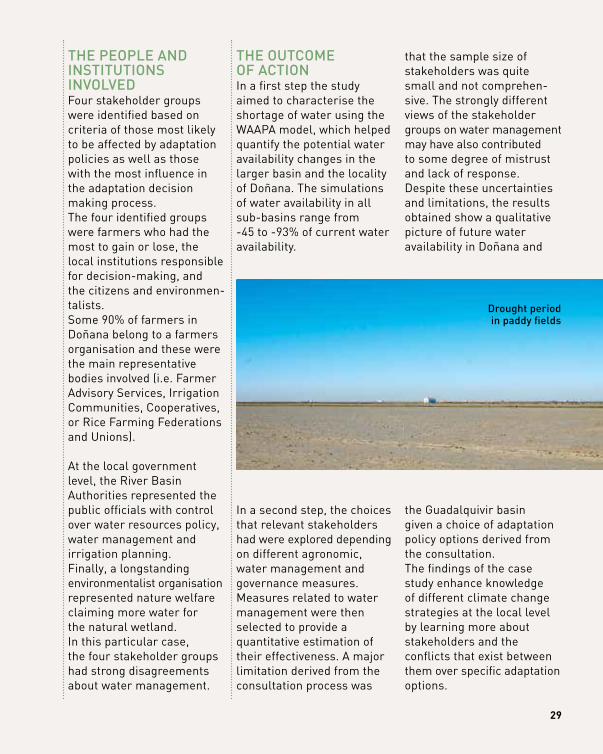
thE outcomE of ActionIn a first step the study aimed to characterise the shortage of water using the WAAPA model, which helped quantify the potential water availability changes in the larger basin and the locality of Doñana. The simulations of water availability in all sub-basins range from -45 to -93% of current water availability.
In a second step, the choices that relevant stakeholders had were explored depending on different agronomic, water management and governance measures. Measures related to water management were then selected to provide a quantitative estimation of their effectiveness. A major limitation derived from the consultation process was
that the sample size of stakeholders was quite small and not comprehen-sive. The strongly different views of the stakeholder groups on water management may have also contributed to some degree of mistrust and lack of response.Despite these uncertainties and limitations, the results obtained show a qualitative picture of future water availability in Doñana and
the Guadalquivir basin given a choice of adaptation policy options derived from the consultation. The findings of the case study enhance knowledge of different climate change strategies at the local level by learning more about stakeholders and the conflicts that exist between them over specific adaptation options.
29
drought period in paddy fields
urBAn-rurAl co-opErAtion:
FARmeRS AS POTeNTIAl wATeR mANAgeRS?
bASe reSeArCh pArtner ContACtAarhus university Aarhus, denmark
Anders Branth Pedersen: [email protected]
30 AgRIculTuRe & FOReSTRy/BIODIveRSITy & ecOSySTem
loCAtion holstebro, denmark
AdAptAtion ChAllenge: flooding
SeCtor AffeCted: Agriculture & forest, urban
geogrAphiC SCAle: local
Method: Economic Analysis
proCeSS direCtion: Bottom-up, top-down
funding: need national subsidies to initiate implementation3
AdAptAtion StAge
1 prepAring
the ground for AdAptAtion
3 identifying
AdAptAtion optionS
4 ASSeSSing AdAptAtion
optionS
5 iMpleMentAtion
6 Monitoring
And evAluAtion
2 ASSeSSing
riSkS And
vulnerAbility
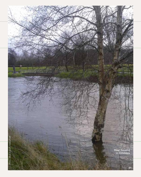
river flooding in holstebro
Pho
to: J
akob
Sto
ktof
t Odd
ersh
ede
31
thE climAtE chAllEngEHolstebro is a Danish municipality (population app. 57,000) located on the Jutland peninsula. The second longest water-course in Denmark, the Storåen, runs through the town (population app. 35,000), which is surrounded mainly by agricultural farmland. The municipality has experienced significant floods on a minimum of nine occasions since 1918. The flooding events have occurred irregularly, but
recurrently over the past century and it is predicted that floods will continue to increase in frequency and intensity due to climate change. The town of Holstebro is one of ten nationally appointed flood risk areas in Denmark under the EU Floods Directive (2007/60/EC), where the risk of a 100-year flood event is high and substantial damages to buildings, housing and infrastructure may result from such events. Holstebro suffered serious floods in
2011 when several months of heavy snowfall were followed by intense rain and snowmelt. The town flooded again most recently in December 2015.
thE AdAptAtion rESponSEHolstebro municipality adopted a local risk man-agement plan in 2015 and a climate adaptation plan in 2014. The municipality’s Climate Adaptation Plan is a strategic plan that aims to address several policy areas. This first plan for Holstebro
32 AgRIculTuRe & FOReSTRy/BIODIveRSITy & ecOSySTem
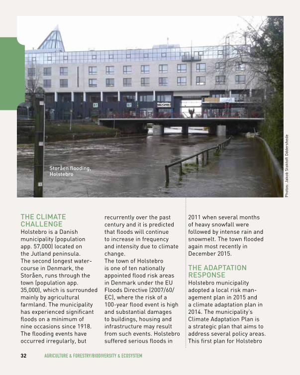
Storåen flooding, holstebro
Pho
tos:
Jak
ob S
tokt
oft O
dder
shed
e
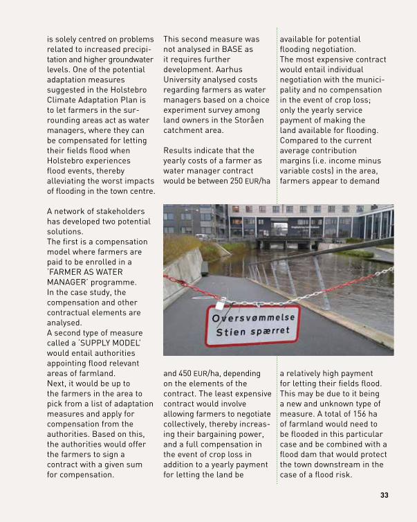
is solely centred on problems related to increased precipi-tation and higher groundwater levels. One of the potential adaptation measures suggested in the Holstebro Climate Adaptation Plan is to let farmers in the sur-rounding areas act as water managers, where they can be compensated for letting their fields flood when Holstebro experiences flood events, thereby alleviating the worst impacts of flooding in the town centre.
A network of stakeholders has developed two potential solutions. The first is a compensation model where farmers are paid to be enrolled in a ‘FARMER AS WATER MANAGER’ programme. In the case study, the compensation and other contractual elements are analysed. A second type of measure called a ‘SUPPLy MODEL’ would entail authorities appointing flood relevant areas of farmland. Next, it would be up to the farmers in the area to pick from a list of adaptation measures and apply for compensation from the authorities. Based on this, the authorities would offer the farmers to sign a contract with a given sum for compensation.
This second measure was not analysed in BASE as it requires further development. Aarhus University analysed costs regarding farmers as water managers based on a choice experiment survey among land owners in the Storåen catchment area.
Results indicate that the yearly costs of a farmer as water manager contract would be between 250 EUR/ha
and 450 EUR/ha, depending on the elements of the contract. The least expensive contract would involve allowing farmers to negotiate collectively, thereby increas-ing their bargaining power, and a full compensation in the event of crop loss in addition to a yearly payment for letting the land be
available for potential flooding negotiation. The most expensive contract would entail individual negotiation with the munici-pality and no compensation in the event of crop loss; only the yearly service payment of making the land available for flooding. Compared to the current average contribution margins (i.e. income minus variable costs) in the area, farmers appear to demand
a relatively high payment for letting their fields flood. This may be due to it being a new and unknown type of measure. A total of 156 ha of farmland would need to be flooded in this particular case and be combined with a flood dam that would protect the town downstream in the case of a flood risk.
33
34 AgRIculTuRe & FOReSTRy/BIODIveRSITy & ecOSySTem
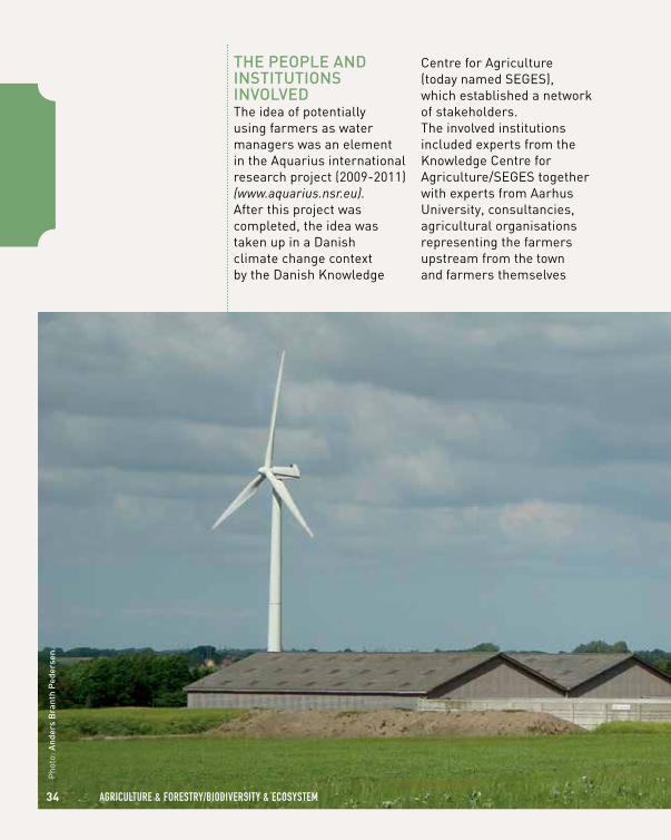
thE pEoplE And inStitutionS involvEdThe idea of potentially using farmers as water managers was an element in the Aquarius international research project (2009-2011) (www.aquarius.nsr.eu). After this project was completed, the idea was taken up in a Danish climate change context by the Danish Knowledge
Centre for Agriculture (today named SEGES), which established a network of stakeholders. The involved institutions included experts from the Knowledge Centre for Agriculture/SEGES together with experts from Aarhus University, consultancies, agricultural organisations representing the farmers upstream from the town and farmers themselves
Pho
to: A
nder
s B
rant
h p
eder
sen
35
A danish farm in Jutland
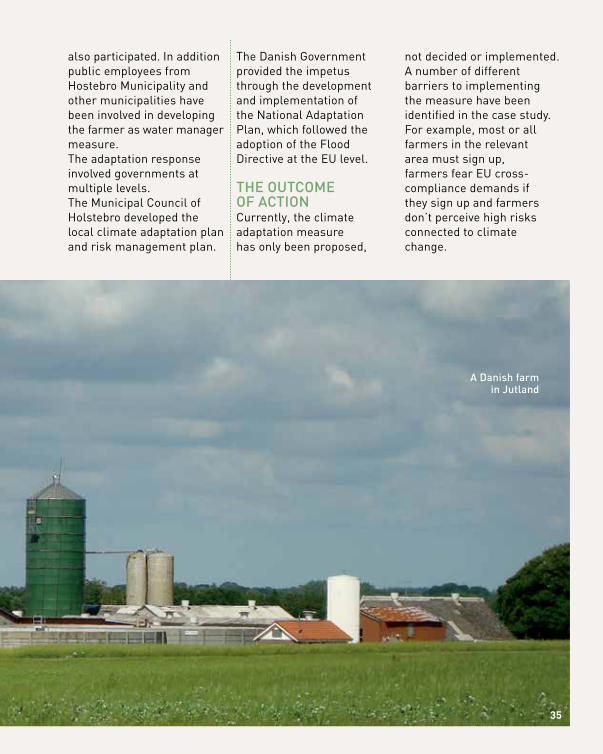
also participated. In addition public employees from Hostebro Municipality and other municipalities have been involved in developing the farmer as water manager measure.The adaptation response involved governments at multiple levels. The Municipal Council of Holstebro developed the local climate adaptation plan and risk management plan.
The Danish Government provided the impetus through the development and implementation of the National Adaptation Plan, which followed the adoption of the Flood Directive at the EU level.
thE outcomE of ActionCurrently, the climate adaptation measure has only been proposed,
not decided or implemented. A number of different barriers to implementing the measure have been identified in the case study. For example, most or all farmers in the relevant area must sign up, farmers fear EU cross- compliance demands if they sign up and farmers don’t perceive high risks connected to climate change.
SuSTAINABle gRAPevINe PRODucTION uNDeR A chANgINg
clImATe
bASe reSeArCh pArtner ContACtglobal change research institute of the czech Academy of Sciences (czechglobe)
Brno, czech republicEliška Lorencová: [email protected]
36 AgRIculTuRe & FOReSTRy/BIODIveRSITy & ecOSySTem
loCAtion South moravia, czech republic
1AdAptAtion StAge
1 prepAring
the ground for AdAptAtion
3 identifying
AdAptAtion optionS
6 Monitoring
And evAluAtion
AdAptAtion ChAllenge: water Scarcity, droughts
SeCtor AffeCted: Agriculture & forest, water management
geogrAphiC SCAle: local
Method: participatory
proCeSS direCtion: Bottom-up
funding: no extra public funding available for adaptation
2 ASSeSSing
riSkS And
vulnerAbility
4 ASSeSSing AdAptAtion
optionS
5 iMpleMentAtion
vineyards of South moravia
Pho
to: E
liška
Krk
oška
Lor
enco
vá
37
thE climAtE chAllEngEThe South Moravian Region lies in the southeast of the Czech Republic, and it is home to the country’s second largest city of Brno. Agricultural land covers 60% of the area of the region. Vine growing is a specialty in the region, which has more than 90% of the total area of vineyards in the country. Climate change projections indicate the
growing probability of drought in the region. In 2011-2012, the region witnessed an extreme drought episode that was classified as one of the worst in the past 130 years. In the autumn of 2011, for exam-ple, the total precipitation represented only 10-30% of the long-term average for Moravia. Projections for 2050 indicate the occurrence of this type of drought event every 20 years.
thE AdAptAtion rESponSEIn order to determine stakeholder perceptions and evaluation of adaptation options, a quantitative questionnaire was distributed among wine growers situated in South Moravian region in November 2014. The potential adaptation measures discussed can be categorised as changes in insurance policies such as risk transfer tools, land use practices like introducing no-tillage technologies and shifting agricultural activities, and water saving practices in the form of increasing water retention and improving the efficiency of irrigation systems.
thE pEoplE And inStitutionS involvEdSince the adaptation process in the Czech Republic is mostly top-down, the actual implementation of specific adaptation measures depends on the implemen-tation of National Adaptation Strategy approved recently, in October 2015, which will be supported by the Adaptation Action Plan (to be formulated in 2016). Therefore, the adaptation activity on the regional and local level and specific sectors is currently limited. In the case of agriculture, specifically vine
38 AgRIculTuRe & FOReSTRy/BIODIveRSITy & ecOSySTem
grapevine growing
growing, the non-existence of a cross-sectoral adap-tation strategy has left adaptation actions rather fragmented, related mostly to the farm management regime and largely auton-omous.However, problems related to climate change impacts, such as drought and water availability are gaining increasing political attention and support. In July 2015, the Czech Government approved a document titled “Prepara-tion for the implementation of measures to mitigate the negative effects of drought and water scarcity.” This policy document takes into account climate change projections and deals with the risk of drought, water availability and flood risk in the long-term perspective. The drought management
plans should in the future become part of the legislation. In this phase, measures and procedures that need to be implemented are proposed, including: • DROUGHT MONITORING
and information (e.g. drought risk classification of CZ, drought and water availability monitoring)
• LEGISLATIVE CHANGES (e.g. drought management plan)
• ORGANISATIONAL measures (e.g. manage-ment of current reservoirs, irrigation efficiency)
• ECONOMIC measures (e.g. set up of water pricing tools)
• TECHNICAL measures (e.g. support to construction of new reservoirs)
• ENVIRONMENTAL measures (e.g. ecosys-tem-based measures)
39Pho
tos:
Eliš
ka K
rkoš
ka L
oren
cová
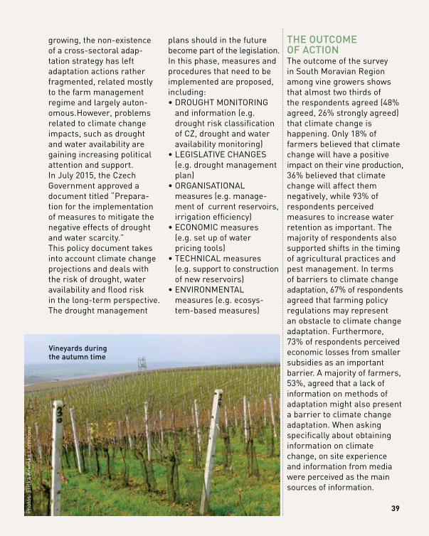
vineyards during the autumn time
thE outcomE of ActionThe outcome of the survey in South Moravian Region among vine growers shows that almost two thirds of the respondents agreed (48% agreed, 26% strongly agreed) that climate change is happening. Only 18% of farmers believed that climate change will have a positive impact on their vine production, 36% believed that climate change will affect them negatively, while 93% of respondents perceived measures to increase water retention as important. The majority of respondents also supported shifts in the timing of agricultural practices and pest management. In terms of barriers to climate change adaptation, 67% of respondents agreed that farming policy regulations may represent an obstacle to climate change adaptation. Furthermore, 73% of respondents perceived economic losses from smaller subsidies as an important barrier. A majority of farmers, 53%, agreed that a lack of information on methods of adaptation might also present a barrier to climate change adaptation. When asking specifically about obtaining information on climate change, on site experience and information from media were perceived as the main sources of information.
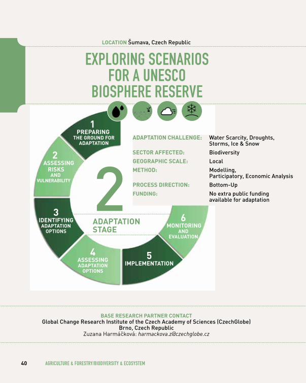
exPlORINg SceNARIOS FOR A uNeScO
BIOSPheRe ReSeRve
bASe reSeArCh pArtner ContACtglobal change research institute of the czech Academy of Sciences (czechglobe)
Brno, czech republicZuzana Harmácková: [email protected]
40 AgRIculTuRe & FOReSTRy/BIODIveRSITy & ecOSySTem
loCAtion Šumava, czech republic
1 prepAring
the ground for AdAptAtion
3 identifying
AdAptAtion optionS
6 Monitoring
And evAluAtion
AdAptAtion ChAllenge: water Scarcity, droughts, Storms, ice & Snow
SeCtor AffeCted: Biodiversity
geogrAphiC SCAle: local
Method: modelling, participatory, Economic Analysis
proCeSS direCtion: Bottom-up
funding: no extra public funding available for adaptation2
AdAptAtion StAge
2 ASSeSSing
riSkS And
vulnerAbility
4 ASSeSSing AdAptAtion
optionS
5 iMpleMentAtion
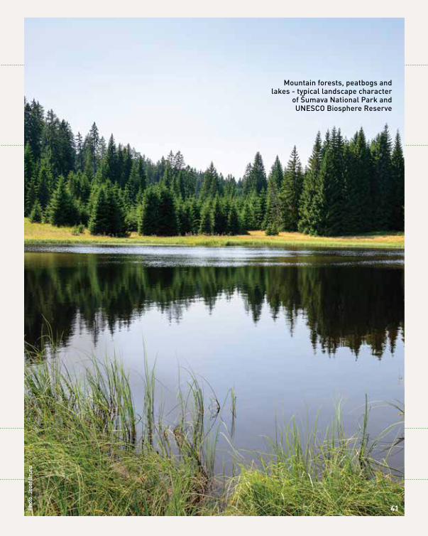
mountain forests, peatbogs and lakes - typical landscape character
of Šumava national park and unESco Biosphere reserve
Phot
o: J
osef
Brů
na
41
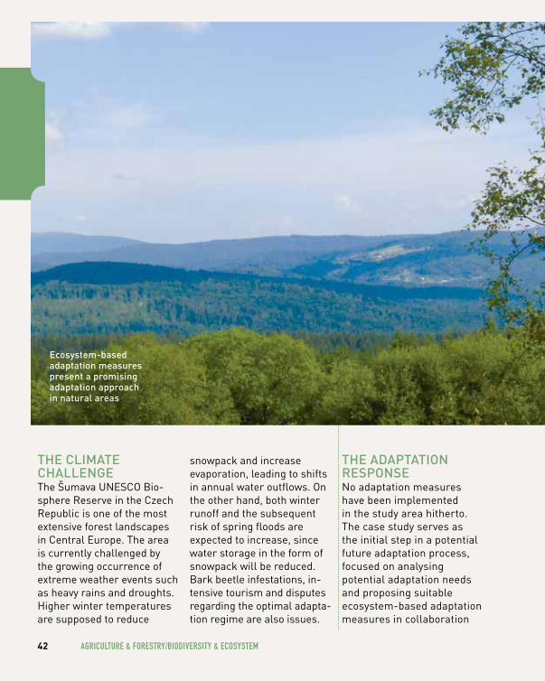
thE climAtE chAllEngEThe Šumava UNESCO Bio-sphere Reserve in the Czech Republic is one of the most extensive forest landscapes in Central Europe. The area is currently challenged by the growing occurrence of extreme weather events such as heavy rains and droughts. Higher winter temperatures are supposed to reduce
snowpack and increase evaporation, leading to shifts in annual water outflows. On the other hand, both winter runoff and the subsequent risk of spring floods are expected to increase, since water storage in the form of snowpack will be reduced. Bark beetle infestations, in-tensive tourism and disputes regarding the optimal adapta-tion regime are also issues.
thE AdAptAtion rESponSENo adaptation measures have been implemented in the study area hitherto. The case study serves as the initial step in a potential future adaptation process, focused on analysing potential adaptation needs and proposing suitable ecosystem-based adaptation measures in collaboration
42 AgRIculTuRe & FOReSTRy/BIODIveRSITy & ecOSySTem
Ecosystem-based adaptation measures present a promising adaptation approach in natural areas
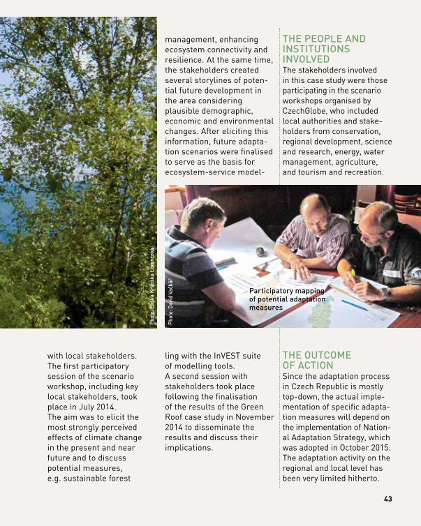
with local stakeholders. The first participatory session of the scenario workshop, including key local stakeholders, took place in July 2014. The aim was to elicit the most strongly perceived effects of climate change in the present and near future and to discuss potential measures, e.g. sustainable forest
management, enhancing ecosystem connectivity and resilience. At the same time, the stakeholders created several storylines of poten-tial future development in the area considering plausible demographic, economic and environmental changes. After eliciting this information, future adapta-tion scenarios were finalised to serve as the basis for ecosystem-service model-
ling with the InVEST suite of modelling tools. A second session with stakeholders took place following the finalisation of the results of the Green Roof case study in November 2014 to disseminate the results and discuss their implications.
thE pEoplE And inStitutionS involvEdThe stakeholders involved in this case study were those participating in the scenario workshops organised by CzechGlobe, who included local authorities and stake-holders from conservation, regional development, science and research, energy, water management, agriculture, and tourism and recreation.
thE outcomE of ActionSince the adaptation process in Czech Republic is mostly top-down, the actual imple-mentation of specific adapta-tion measures will depend on the implementation of Nation-al Adaptation Strategy, which was adopted in October 2015. The adaptation activity on the regional and local level has been very limited hitherto.
43
Phot
o: D
avid
Vač
kář
Phot
o: E
liška
Krk
oška
Lor
enco
vá
participatory mapping of potential adaptation measures
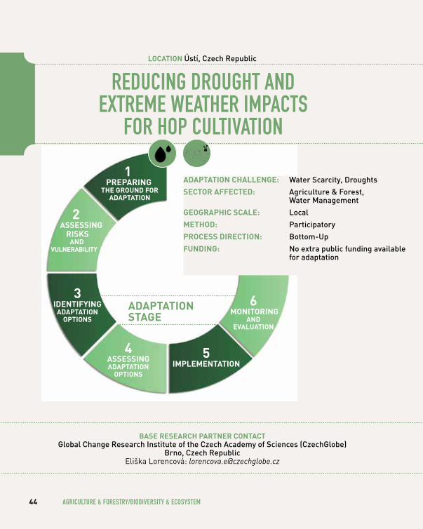
ReDucINg DROughT AND exTReme weATheR ImPAcTS
FOR hOP culTIvATION
bASe reSeArCh pArtner ContACtglobal change research institute of the czech Academy of Sciences (czechglobe)
Brno, czech republicEliška Lorencová: [email protected]
44 AgRIculTuRe & FOReSTRy/BIODIveRSITy & ecOSySTem
loCAtion Ústí, czech republic
11
prepAring the ground for
AdAptAtion
3 identifying
AdAptAtion optionS
4 ASSeSSing AdAptAtion
optionS
5 iMpleMentAtion
6 Monitoring
And evAluAtion
AdAptAtion ChAllenge: water Scarcity, droughts
SeCtor AffeCted: Agriculture & forest, water management
geogrAphiC SCAle: local
Method: participatory
proCeSS direCtion: Bottom-up
funding: no extra public funding available for adaptation
AdAptAtion StAge
2 ASSeSSing
riSkS And
vulnerAbility
the impact of extreme weath-
er event
Pho
to: J
osef
Jež
ek
45
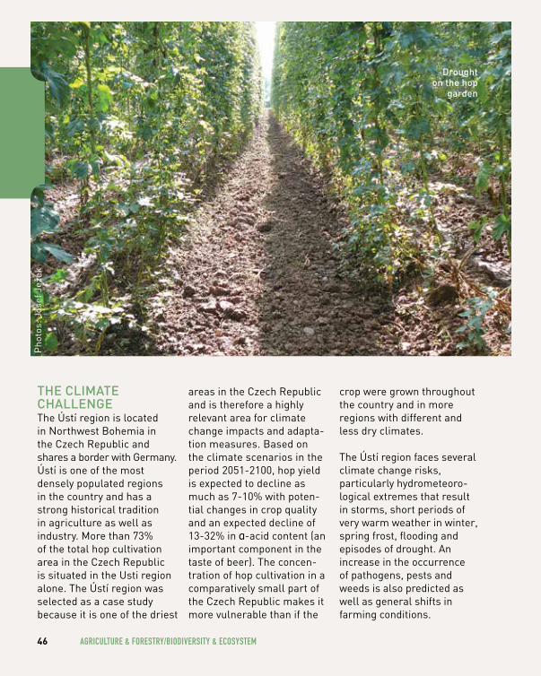
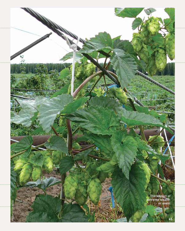
thE climAtE chAllEngEThe Ústí region is located in Northwest Bohemia in the Czech Republic and shares a border with Germany. Ústí is one of the most densely populated regions in the country and has a strong historical tradition in agriculture as well as industry. More than 73% of the total hop cultivation area in the Czech Republic is situated in the Usti region alone. The Ústí region was selected as a case study because it is one of the driest
areas in the Czech Republic and is therefore a highly relevant area for climate change impacts and adapta-tion measures. Based on the climate scenarios in the period 2051-2100, hop yield is expected to decline as much as 7-10% with poten-tial changes in crop quality and an expected decline of 13-32% in ɑ-acid content (an important component in the taste of beer). The concen-tration of hop cultivation in a comparatively small part of the Czech Republic makes it more vulnerable than if the
crop were grown throughout the country and in more regions with different and less dry climates.
The Ústí region faces several climate change risks, particularly hydrometeoro-logical extremes that result in storms, short periods of very warm weather in winter, spring frost, flooding and episodes of drought. An increase in the occurrence of pathogens, pests and weeds is also predicted as well as general shifts in farming conditions.
46 AgRIculTuRe & FOReSTRy/BIODIveRSITy & ecOSySTem
Pho
tos:
Jos
ef J
ežek
drought on the hop
garden
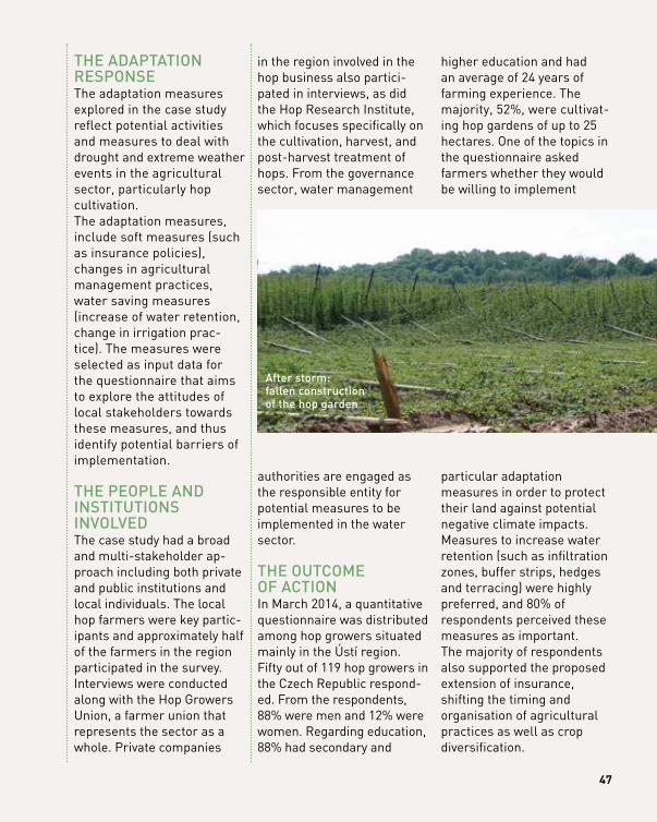
thE AdAptAtion rESponSEThe adaptation measures explored in the case study reflect potential activities and measures to deal with drought and extreme weather events in the agricultural sector, particularly hop cultivation. The adaptation measures, include soft measures (such as insurance policies), changes in agricultural management practices, water saving measures (increase of water retention, change in irrigation prac-tice). The measures were selected as input data for the questionnaire that aims to explore the attitudes of local stakeholders towards these measures, and thus identify potential barriers of implementation.
thE pEoplE And inStitutionS involvEdThe case study had a broad and multi-stakeholder ap-proach including both private and public institutions and local individuals. The local hop farmers were key partic-ipants and approximately half of the farmers in the region participated in the survey. Interviews were conducted along with the Hop Growers Union, a farmer union that represents the sector as a whole. Private companies
in the region involved in the hop business also partici-pated in interviews, as did the Hop Research Institute, which focuses specifically on the cultivation, harvest, and post-harvest treatment of hops. From the governance sector, water management
authorities are engaged as the responsible entity for potential measures to be implemented in the water sector.
thE outcomE of ActionIn March 2014, a quantitative questionnaire was distributed among hop growers situated mainly in the Ústí region. Fifty out of 119 hop growers in the Czech Republic respond-ed. From the respondents, 88% were men and 12% were women. Regarding education, 88% had secondary and
higher education and had an average of 24 years of farming experience. The majority, 52%, were cultivat-ing hop gardens of up to 25 hectares. One of the topics in the questionnaire asked farmers whether they would be willing to implement
particular adaptation measures in order to protect their land against potential negative climate impacts. Measures to increase water retention (such as infiltration zones, buffer strips, hedges and terracing) were highly preferred, and 80% of respondents perceived these measures as important.The majority of respondents also supported the proposed extension of insurance, shifting the timing and organisation of agricultural practices as well as crop diversification.
47
After storm: fallen construction of the hop garden
48 wATeR ReSOuRceS & heAlTh
wATeR ReSOuRceS
& heAlTh
49
RAISINg AwAReNeSS OF The RISKS OF
SKIN cANceR AND SuN exPOSuRe
bASe reSeArCh pArtner ContACtuniversity of Exeter medical School
Exeter, united kingdom Tim Taylor: [email protected]
50 wATeR ReSOuRceS & heAlTh
loCAtion cornwall, united kingdom
1AdAptAtion StAge
1 prepAring
the ground for AdAptAtion
3 identifying
AdAptAtion optionS
4 ASSeSSing AdAptAtion
optionS
5 iMpleMentAtion
6 Monitoring
And evAluAtion
AdAptAtion ChAllenge: Extreme temperatures
SeCtor AffeCted: health
geogrAphiC SCAle: local
Method: modelling, Economic Analysis
proCeSS direCtion: Bottom-up, top-down
funding: no public funding
2 ASSeSSing
riSkS And
vulnerAbility
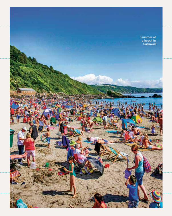
Summer at a beach in cornwall
51Pho
to: i
stoc
k.co
m/c
sfot
oim
ages
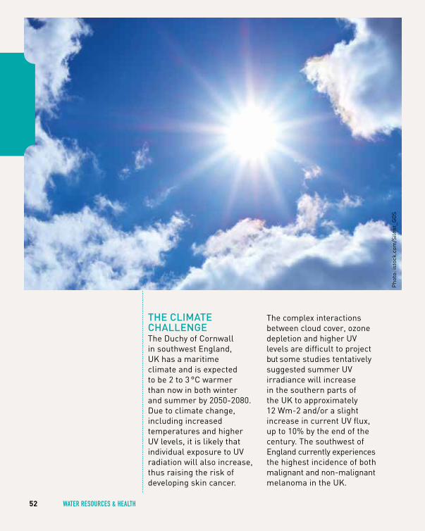
thE climAtE chAllEngEThe Duchy of Cornwall in southwest England, UK has a maritime climate and is expected to be 2 to 3 °C warmer than now in both winter and summer by 2050-2080. Due to climate change, including increased temperatures and higher UV levels, it is likely that individual exposure to UV radiation will also increase, thus raising the risk of developing skin cancer.
The complex interactions between cloud cover, ozone depletion and higher UV levels are difficult to project but some studies tentatively suggested summer UV irradiance will increase in the southern parts of the UK to approximately 12 Wm-2 and/or a slight increase in current UV flux, up to 10% by the end of the century. The southwest of England currently experiences the highest incidence of both malignant and non-malignant melanoma in the UK.
52 wATeR ReSOuRceS & heAlTh
Pho
to: i
stoc
k.co
m/S
ilent
_GO
S
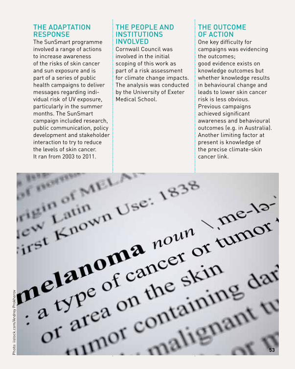
thE AdAptAtion rESponSEThe SunSmart programme involved a range of actions to increase awareness of the risks of skin cancer and sun exposure and is part of a series of public health campaigns to deliver messages regarding indi-vidual risk of UV exposure, particularly in the summer months. The SunSmart campaign included research, public communication, policy development and stakeholder interaction to try to reduce the levels of skin cancer. It ran from 2003 to 2011.
thE pEoplE And inStitutionS involvEdCornwall Council was involved in the initial scoping of this work as part of a risk assessment for climate change impacts. The analysis was conducted by the University of Exeter Medical School.
thE outcomE of ActionOne key difficulty for campaigns was evidencing the outcomes; good evidence exists on knowledge outcomes but whether knowledge results in behavioural change and leads to lower skin cancer risk is less obvious. Previous campaigns achieved significant awareness and behavioural outcomes (e.g. in Australia). Another limiting factor at present is knowledge of the precise climate-skin cancer link.
53
Pho
to: i
isto
ck.c
om/A
ndre
y P
rokh
orov
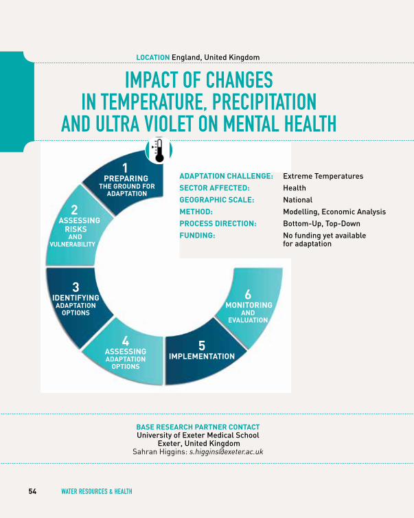
ImPAcT OF chANgeS IN TemPeRATuRe, PRecIPITATION
AND ulTRA vIOleT ON meNTAl heAlTh
bASe reSeArCh pArtner ContACtuniversity of Exeter medical School
Exeter, united kingdom Sahran Higgins: [email protected]
54 wATeR ReSOuRceS & heAlTh
loCAtion England, united kingdom
2AdAptAtion StAge
1 prepAring
the ground for AdAptAtion
3 identifying
AdAptAtion optionS
4 ASSeSSing AdAptAtion
optionS
5 iMpleMentAtion
6 Monitoring
And evAluAtion
AdAptAtion ChAllenge: Extreme temperatures
SeCtor AffeCted: health
geogrAphiC SCAle: national
Method: modelling, Economic Analysis
proCeSS direCtion: Bottom-up, top-down
funding: no funding yet available for adaptation
2 ASSeSSing
riSkS And
vulnerAbility

55Pho
to: i
stoc
k.co
m/K
atar
zyna
Bia
lasi
ewic
z
mental health may be affected
by climate change
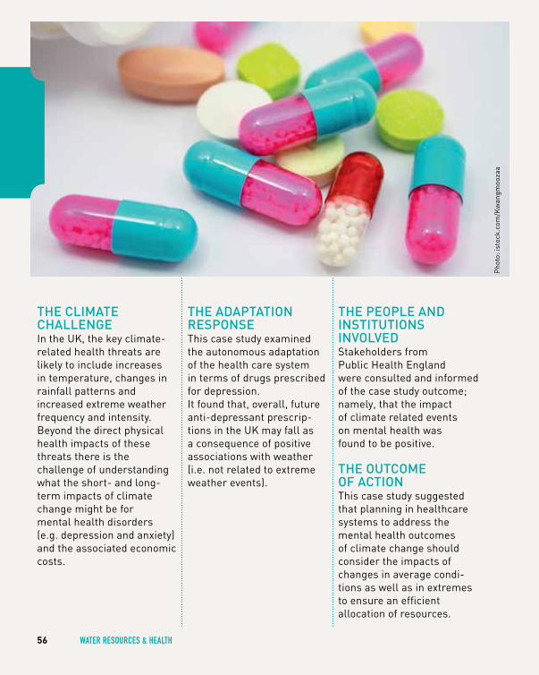
thE climAtE chAllEngEIn the UK, the key climate- related health threats are likely to include increases in temperature, changes in rainfall patterns and increased extreme weather frequency and intensity. Beyond the direct physical health impacts of these threats there is the challenge of understanding what the short- and long- term impacts of climate change might be for mental health disorders (e.g. depression and anxiety) and the associated economic costs.
thE AdAptAtion rESponSEThis case study examined the autonomous adaptation of the health care system in terms of drugs prescribed for depression. It found that, overall, future anti-depressant prescrip-tions in the UK may fall as a consequence of positive associations with weather (i.e. not related to extreme weather events).
thE pEoplE And inStitutionS involvEdStakeholders from Public Health England were consulted and informed of the case study outcome; namely, that the impact of climate related events on mental health was found to be positive.
thE outcomE of ActionThis case study suggested that planning in healthcare systems to address the mental health outcomes of climate change should consider the impacts of changes in average condi-tions as well as in extremes to ensure an efficient allocation of resources.
56 wATeR ReSOuRceS & heAlTh
Pho
to: i
stoc
k.co
m/K
wan
gmoo
zaa

climate change may present
challenges and opportunities to
the national health Service and the rest of the health sector
Pho
to: i
stoc
k.co
m/m
arbu
ry
57
moving with climAtE chAngE:
FlexIBle wATeR levelS IN A lARge mulTI-uSe ARTIFIcIAl lAKe
bASe reSeArCh pArtner ContACtdeltares, delft, the netherlands
Rutger van der Brugge: [email protected] Mark Zandvoort: [email protected]
58 wATeR ReSOuRceS & heAlTh
loCAtion iJsselmeer, the netherlands
5AdAptAtion StAge
1 prepAring
the ground for AdAptAtion
3 identifying
AdAptAtion optionS
4 ASSeSSing AdAptAtion
optionS
5 iMpleMentAtion
6 Monitoring
And evAluAtion
AdAptAtion ChAllenge: water Scarcity, flooding, Sea level rise, droughts
SeCtor AffeCted: Agriculture & forest, coastal Areas, water management
geogrAphiC SCAle: Subnational region
Method: participatory, Adaptation pathway
proCeSS direCtion: top-down, Bottom-up
funding: dutch delta programme
2 ASSeSSing
riSkS And
vulnerAbility
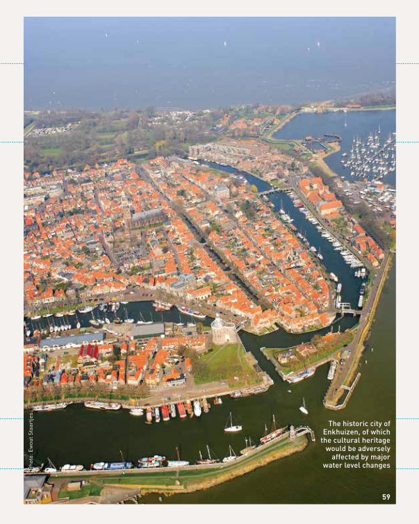
the historic city of Enkhuizen, of which
the cultural heritage would be adversely
affected by major water level changesP
hoto
: Ew
out S
taar
tjes
59
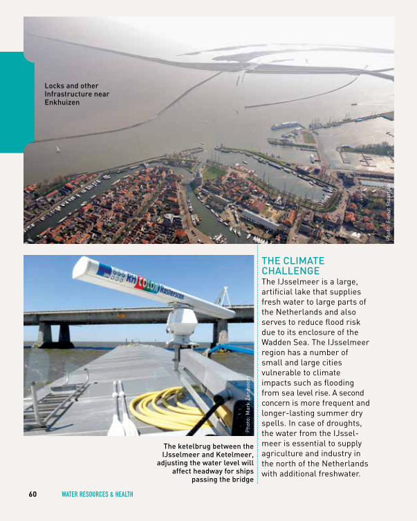
thE climAtE chAllEngEThe IJsselmeer is a large, artificial lake that supplies fresh water to large parts of the Netherlands and also serves to reduce flood risk due to its enclosure of the Wadden Sea. The IJsselmeer region has a number of small and large cities vulnerable to climate impacts such as flooding from sea level rise. A second concern is more frequent and longer-lasting summer dry spells. In case of droughts, the water from the IJssel-meer is essential to supply agriculture and industry in the north of the Netherlands with additional freshwater.
60 wATeR ReSOuRceS & heAlTh
locks and other infrastructure near Enkhuizen
the ketelbrug between the iJsselmeer and ketelmeer,
adjusting the water level will affect headway for ships
passing the bridge
Pho
to: E
wou
t Sta
artje
s
Pho
to: M
ark
Zand
voor
t
thE AdAptAtion rESponSETo maintain the current functions of the lake while simultaneously adapting to sea level rise and drought, the Deltaprogramme IJsselmeer proposed measures aimed at raising the lake’s water level in sync with sea level rise to avoid flooding and ensuring the flexibility of the water level during summer droughts and secure freshwater for agriculture, nature and other purposes.
The program carried out a problem analysis based on the delta-scenarios in 2011. In 2012, they developed possible strategies and in 2013 they made more detailed studies of the preferred strategies, leading to a policy decision consisting of five solutions in 2014.
thE pEoplE And inStitutionS involvEdThe Delta Programme was set up as a national pro-gramme, so by definition, all relevant local and regional governments were actively involved: the Ministry of Infrastructure and Environment, the water boards, the provinces and relevant municipalities. Knowledge institutes such as Deltares, PBL (the Dutch Planning Institute) and KNMI (the Dutch Meteorological Institute) assisted in developing delta scenarios and impact assessments.In the IJsselmeer sub-pro-gramme, local politicians and officials were involved in a regional collaboration body and in a smaller steering group, both of which formed the most important arena to discuss the progress of the programme. Ten important
NGOs in the region were clustered into one represen-tative stakeholder action group representing their individual stakes, including a sustainable fresh water supply, fishery, nature, harbours, tourism and agriculture.
thE outcomE of ActionThere is a combined package of five solutions implemented, based on a more flexible management regime of the water level. The first two are first and foremost related to flood risk; namely establishing draining and pumping capabilities to manage more flexible water levels as well as dikes. The latter three are focused on fresh water supply, such as facilitating adjustments of assets and spatial design along the lake’s shores and reducing freshwater usage.
61
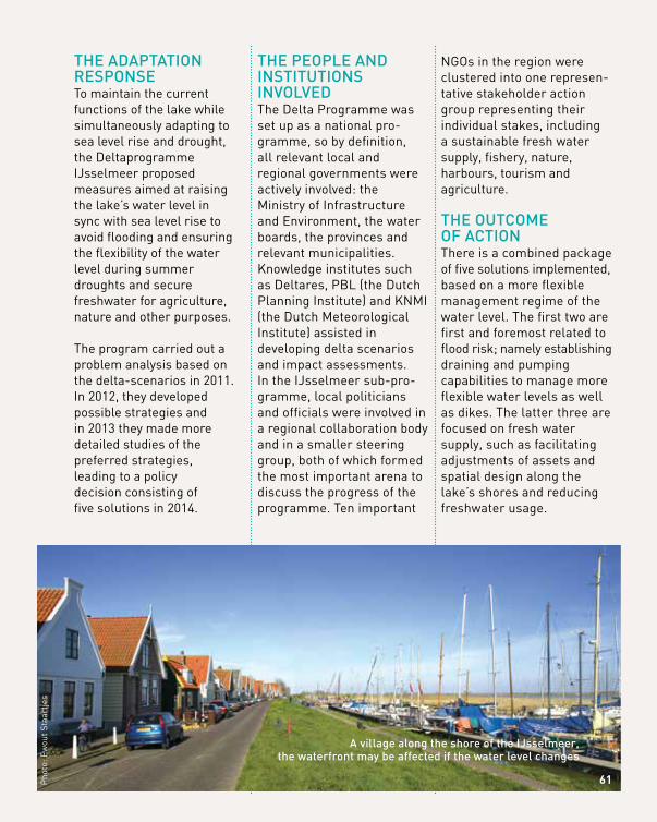
A village along the shore of the iJsselmeer, the waterfront may be affected if the water level changes
Pho
to: E
wou
t Sta
artje
s
TOwARDS clImATe-PROOFINg mANAgemeNT PlANS IN A hIgh FlOOD
RISK RuRAl RIveR BASIN
bASe reSeArCh pArtner ContACtfinnish Environment institute (SykE)
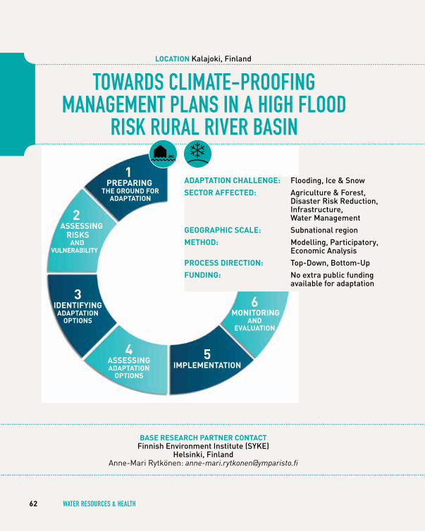
helsinki, finlandAnne-Mari Rytkönen: [email protected]
62 wATeR ReSOuRceS & heAlTh
loCAtion kalajoki, finland
3AdAptAtion StAge
1 prepAring
the ground for AdAptAtion
3 identifying
AdAptAtion optionS
4 ASSeSSing AdAptAtion
optionS
5 iMpleMentAtion
6 Monitoring
And evAluAtion
AdAptAtion ChAllenge: flooding, ice & Snow
SeCtor AffeCted: Agriculture & forest, disaster risk reduction, infrastructure, water management
geogrAphiC SCAle: Subnational region
Method: modelling, participatory, Economic Analysis
proCeSS direCtion: top-down, Bottom-up
funding: no extra public funding available for adaptation
2 ASSeSSing
riSkS And
vulnerAbility
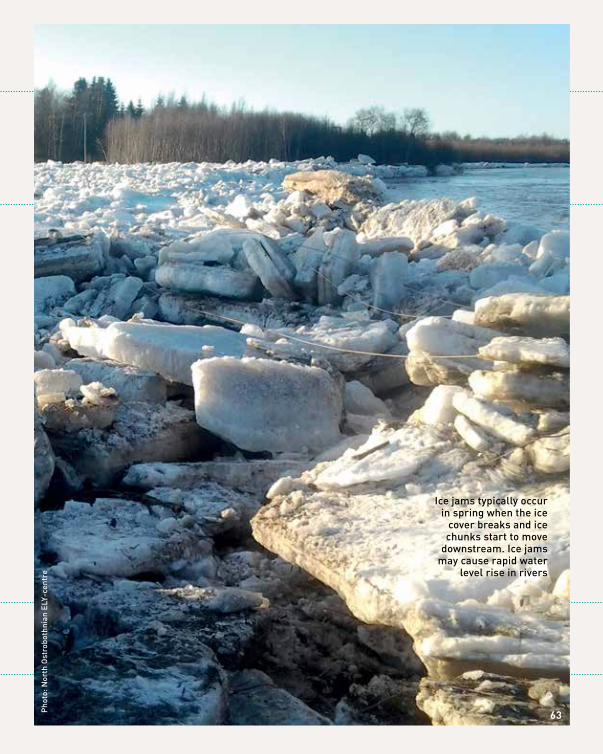
11
ice jams typically occur in spring when the ice
cover breaks and ice chunks start to move
downstream. ice jams may cause rapid water
level rise in rivers
63pho
to: n
orth
ost
robo
thni
an E
ly-c
entr
e

pho
tos:
nor
th o
stro
both
nian
Ely
-cen
tre
thE climAtE chAllEngEThe Kalajoki river basin is a typical Finnish flood risk area that faces the interdependent challenges of managing flooding, caused by snowmelt, heavy rains and ice dams, as well as poor water status, originated mainly from agricultural activities in the river basin. Seasonal changes in discharges in Finland are the most distinct anticipated impacts of climate change. Changes in precipitation and temperature may also increase the nutrient load
from catchments to water bodies in future climate. The Kalajoki is a mid- size lowland river that is surrounded mainly by rural land. Currently, 80% of the land in the basin is woodland and peatland and approximately 15% is used for agriculture. Some 48,000 people live in the basin.
The case study focused on the ylivieska-Alavieska region within the Kalajoki basin. This area has been nominated nationally as a significant flood risk area. Presently, there are in total
620 inhabitants, 530 buildings and 3 vulnerable sites (e.g. hospital) in the area that are at risk in the case of an extreme flood. Most risk sites in the study area are protected by embankments, however, an extreme weather event that exceeds the capacity of the embank-ments multiplies the estimated damage costs to EUR 15-25 million. Flooding also increases nutrient loading and sus-pended solids to watersheds, especially during summer and autumn floods when the land is unfrozen.
64 wATeR ReSOuRceS & heAlTh
flood in kalajoki river basin in August 2012 caused significant crop damages
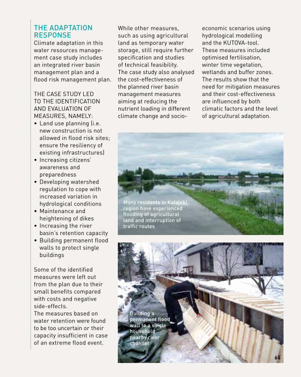
thE AdAptAtion rESponSEClimate adaptation in this water resources manage-ment case study includes an integrated river basin management plan and a flood risk management plan.
THE CASE STUDy LED TO THE IDENTIFICATION AND EVALUATION OF MEASURES, NAMELy: • Land use planning (i.e.
new construction is not allowed in flood risk sites; ensure the resiliency of existing infrastructures)
• Increasing citizens’ awareness and preparedness
• Developing watershed regulation to cope with increased variation in hydrological conditions
• Maintenance and heightening of dikes
• Increasing the river basin’s retention capacity
• Building permanent flood walls to protect single buildings
Some of the identified measures were left out from the plan due to their small benefits compared with costs and negative side-effects. The measures based on water retention were found to be too uncertain or their capacity insufficient in case of an extreme flood event.
While other measures, such as using agricultural land as temporary water storage, still require further specification and studies of technical feasibility. The case study also analysed the cost-effectiveness of the planned river basin management measures aiming at reducing the nutrient loading in different climate change and socio-
economic scenarios using hydrological modelling and the KUTOVA-tool. These measures included optimised fertilisation, winter time vegetation, wetlands and buffer zones. The results show that the need for mitigation measures and their cost-effectiveness are influenced by both climatic factors and the level of agricultural adaptation.
Building a permanent flood wall to a single household nearby river channel
many residents in kalajoki region have experienced flooding of agricultural land and interruption of traffic routes
65
66 wATeR ReSOuRceS & heAlTh
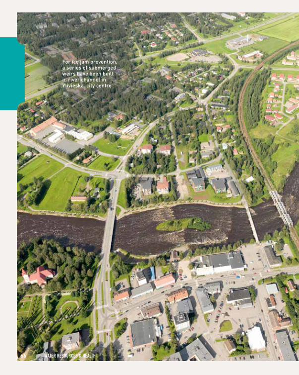
for ice jam prevention, a series of submerged weirs have been built in river channel in ylivieska city centre
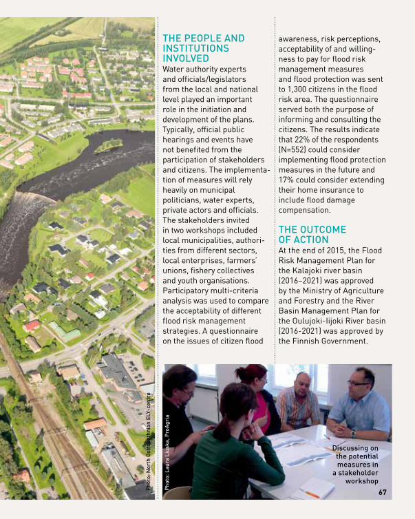
thE pEoplE And inStitutionS involvEdWater authority experts and officials/legislators from the local and national level played an important role in the initiation and development of the plans. Typically, official public hearings and events have not benefited from the participation of stakeholders and citizens. The implementa-tion of measures will rely heavily on municipal politicians, water experts, private actors and officials. The stakeholders invited in two workshops included local municipalities, authori-ties from different sectors, local enterprises, farmers’ unions, fishery collectives and youth organisations. Participatory multi-criteria analysis was used to compare the acceptability of different flood risk management strategies. A questionnaire on the issues of citizen flood
awareness, risk perceptions, acceptability of and willing-ness to pay for flood risk management measures and flood protection was sent to 1,300 citizens in the flood risk area. The questionnaire served both the purpose of informing and consulting the citizens. The results indicate that 22% of the respondents (N=552) could consider implementing flood protection measures in the future and 17% could consider extending their home insurance to include flood damage compensation.
thE outcomE of ActionAt the end of 2015, the Flood Risk Management Plan for the Kalajoki river basin (2016–2021) was approved by the Ministry of Agriculture and Forestry and the River Basin Management Plan for the Oulujoki-Iijoki River basin (2016-2021) was approved by the Finnish Government.
pho
to: n
orth
ost
robo
thni
an E
ly-c
entr
e
pho
to: l
aura
liu
ska,
pro
Agr
ia
discussing on the potential measures in
a stakeholder workshop
67

cOmBATINg heAT STReSS ImPAcT IN A
meTROPOlITAN INlAND cITy
bASe reSeArCh pArtner ContACttechnical university of madrid (upm), madrid, Spain
Ana Iglesias: [email protected] Basque centre for climate change (Bc3), Bizkaia, Spain
Aline Chiabai: [email protected]
68 wATeR ReSOuRceS & heAlTh
loCAtion madrid, Spain
1 prepAring
the ground for AdAptAtion
3 identifying
AdAptAtion optionS
4 ASSeSSing AdAptAtion
optionS
5 iMpleMentAtion
6 Monitoring
And evAluAtion
2AdAptAtion StAge
AdAptAtion ChAllenge: Extreme temperatures, water scarcity, droughts
SeCtor AffeCted: disaster risk reduction, health, urban
geogrAphiC SCAle: local
Method: modelling, participatory, Economic Analysis
proCeSS direCtion: Bottom-up
funding: no public funding
2 ASSeSSing
riSkS And
vulnerAbility
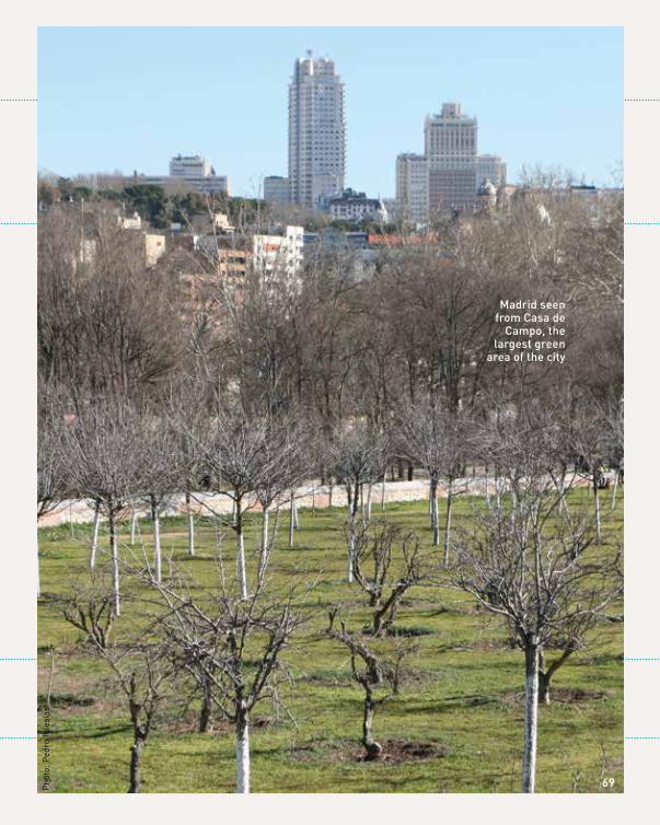
madrid seen from casa de
campo, the largest green
area of the city
Pho
to: P
edro
Igle
sias
69
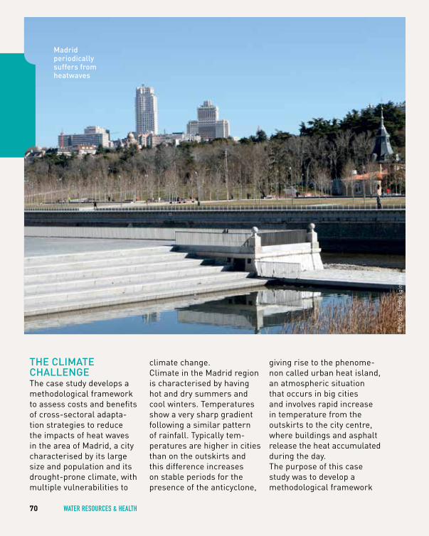
thE climAtE chAllEngEThe case study develops a methodological framework to assess costs and benefits of cross-sectoral adapta-tion strategies to reduce the impacts of heat waves in the area of Madrid, a city characterised by its large size and population and its drought-prone climate, with multiple vulnerabilities to
climate change.Climate in the Madrid region is characterised by having hot and dry summers and cool winters. Temperatures show a very sharp gradient following a similar pattern of rainfall. Typically tem-peratures are higher in cities than on the outskirts and this difference increases on stable periods for the presence of the anticyclone,
giving rise to the phenome-non called urban heat island, an atmospheric situation that occurs in big cities and involves rapid increase in temperature from the outskirts to the city centre, where buildings and asphalt release the heat accumulated during the day.The purpose of this case study was to develop a methodological framework
70 wATeR ReSOuRceS & heAlTh
Pho
tos:
Ped
ro Ig
lesi
as
madrid periodically suffers fromheatwaves
to assess the costs and benefits of selected adap-tation strategies to reduce the impacts of heat waves in Madrid and study the cross-sectoral effects of those measures.
TO DO THIS THE CASE STUDy SETS FOUR OBJECTIVES: • study direct and indirect
impacts of heat waves in the city of Madrid;
• establish synergies and tradeoffs between sectors;
• robust understanding of system complexity;
• assess costs and benefits of some selected measures
thE AdAptAtion rESponSEA participatory process was used to obtain as much information as possible about the complexity of the urban system, responding to the stakeholder’s feedbacks and main drivers.The method, FUZZy COGNITIVE MAPPING, allows modelling the system in a semi-quantitative way and simulating policy options (running different policy scenarios). This information that was used to feed the cost-benefit analysis (CBA) of a selection of adaptation measures was also obtained from the process of interviews to the stakeholders.
thE pEoplE And inStitutionS involvEdThe stakeholder consultation focused on individuals either involved in decision-making or able to influence the decision-making process. Citizen participation was limited to NGOs and Farmer’s Unions.
A first stakeholder meeting was organised to understand the socio-economic and political context of impacts and adaptation in the region of Madrid, including repre-sentatives of the Spanish Ministry of Health, Social Services and Equity, Madrid municipality, Madrid community (regional level), the Spanish Climate Change Office, the Health department
of the government of Navarra, the water utility foundation Canal Isabel II, a union of farmers, the electricity company Iberdrola, experts from the Autono-mous University of Barcelona and Technical University of Madrid. A second round held personal interviews with stakeholders
to get information to be used in the Fuzzy Cognitive Mapping to elicit information about the perceived impacts and adaptation options from different expertise angles in the city of Madrid. It involved the participation of 24 stakeholders including researchers and public authorities (only a few of them participated in the first round).
11
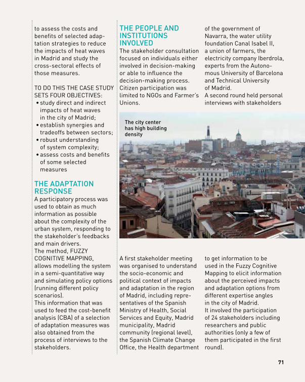
the city center has high building density
71
72 wATeR ReSOuRceS & heAlTh
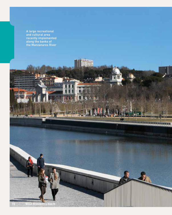
A large recreational and cultural area recently implemented along the banks of the manzanares river
73Pho
to: P
edro
Igle
sias
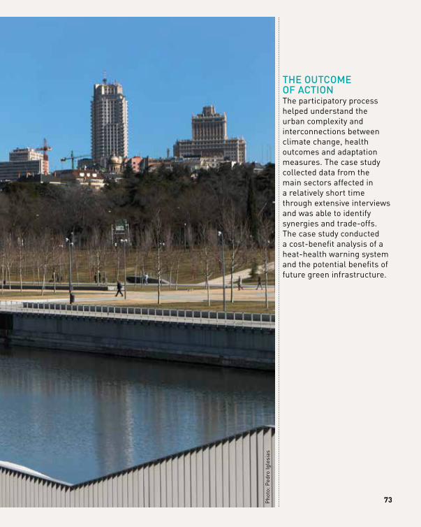
thE outcomE of ActionThe participatory process helped understand the urban complexity and interconnections between climate change, health outcomes and adaptation measures. The case study collected data from the main sectors affected in a relatively short time through extensive interviews and was able to identify synergies and trade-offs. The case study conducted a cost-benefit analysis of a heat-health warning system and the potential benefits of future green infrastructure.
74 cOASTAl ZONeS/humAN SeTTlemeNTS & INFRASTRucTuRe
cOASTAl ZONeS/humAN SeTTlemeNTS
& INFRASTRucTuRe
75
mAking A city climAtE chAngE rESiliEnt:
A PARTIcIPATORy ADAPTATION PlANNINg APPROAch
bASe reSeArCh pArtner ContACtcentre for Ecology, Evolution and Environmental changes (cE3c) - faculty of Sciences, university of lisbon (fcul), lisbon, portugal
Filipe Moreira Alves: [email protected]
76 cOASTAl ZONeS/humAN SeTTlemeNTS & INFRASTRucTuRe
loCAtion cascais, portugal
5AdAptAtion StAge
1 prepAring
the ground for AdAptAtion
3 identifying
AdAptAtion optionS
4 ASSeSSing AdAptAtion
optionS
5 iMpleMentAtion
6 Monitoring
And evAluAtion
AdAptAtion ChAllenge: flooding, Sea level rise
SeCtor AffeCted: coastal Areas, infrastructure, urban
geogrAphiC SCAle: local
Method: participatory, Economic Analysis
proCeSS direCtion: Bottom-up, top-down
funding: cascais municipality, Águas de cascais and municipal Environmental company
2 ASSeSSing
riSkS And
vulnerAbility
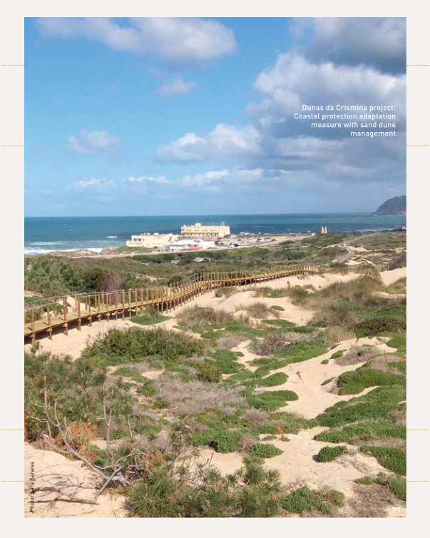
dunas da crismina project: coastal protection adaptation
measure with sand dune management
77Pho
to: S
ara
Sara
iva
thE climAtE chAllEngECascais is a Portuguese city on the Atlantic coast and 30 km west of Lisbon. It is characterised by a mountainous terrain, and 33% of its total area belongs to Sintra-Cascais Natural Park. It has historically faced both fires and floods as key climate vulnerabilities, however and due to clear signal from the Municipality and the local stakeholders, we have focused on the crucial risk of flash river flooding extreme events which are expected to increase both in frequency
and intensity with climate change. Flash flooding is of especially high concern due to extensive urbanisa-tion in areas with strong economic and touristic activity and concentrated physical capital, namely historical buildings.
In the period between 2000 and 2011, there was just over EUR 1 million in private claims to insurance compa-nies, with 40% of that value occurring in a single event in 2008 in two parishes. In the same year, annual private costs due to flooding in Cascais exceeded EUR 400,000.
78 cOASTAl ZONeS/humAN SeTTlemeNTS & INFRASTRucTuRe
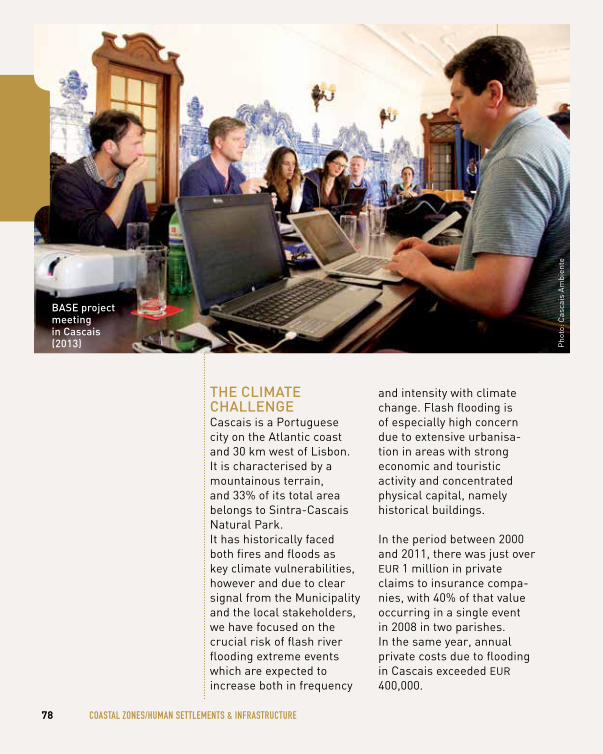
Pho
to: C
asca
is A
mbi
ente
BASE project meeting in cascais (2013)
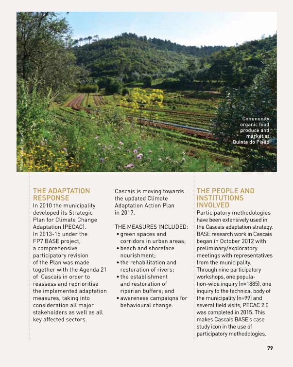
thE AdAptAtion rESponSEIn 2010 the municipality developed its Strategic Plan for Climate Change Adaptation (PECAC). In 2013-15 under the FP7 BASE project, a comprehensive participatory revision of the Plan was made together with the Agenda 21 of Cascais in order to reassess and reprioritise the implemented adaptation measures, taking into consideration all major stakeholders as well as all key affected sectors.
Cascais is moving towards the updated Climate Adaptation Action Plan in 2017.
THE MEASURES INCLUDED: • green spaces and
corridors in urban areas; • beach and shoreface
nourishment; • the rehabilitation and
restoration of rivers; • the establishment
and restoration of riparian buffers; and
• awareness campaigns for behavioural change.
thE pEoplE And inStitutionS involvEdParticipatory methodologies have been extensively used in the Cascais adaptation strategy. BASE research work in Cascais began in October 2012 with preliminary/exploratory meetings with representatives from the municipality. Through nine participatory workshops, one popula-tion-wide inquiry (n=1885), one inquiry to the technical body of the municipality (n=99) and several field visits, PECAC 2.0 was completed in 2015. This makes Cascais BASE’s case study icon in the use of participatory methodologies.
79
Pho
to: R
aque
l San
tos
community organic food produce and
market at Quinta do pisão
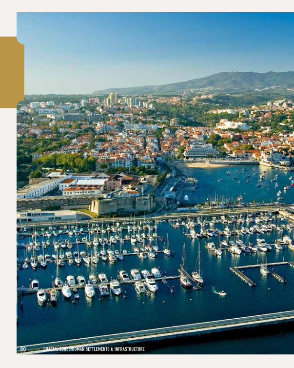
80 cOASTAl ZONeS/humAN SeTTlemeNTS & INFRASTRucTuRe
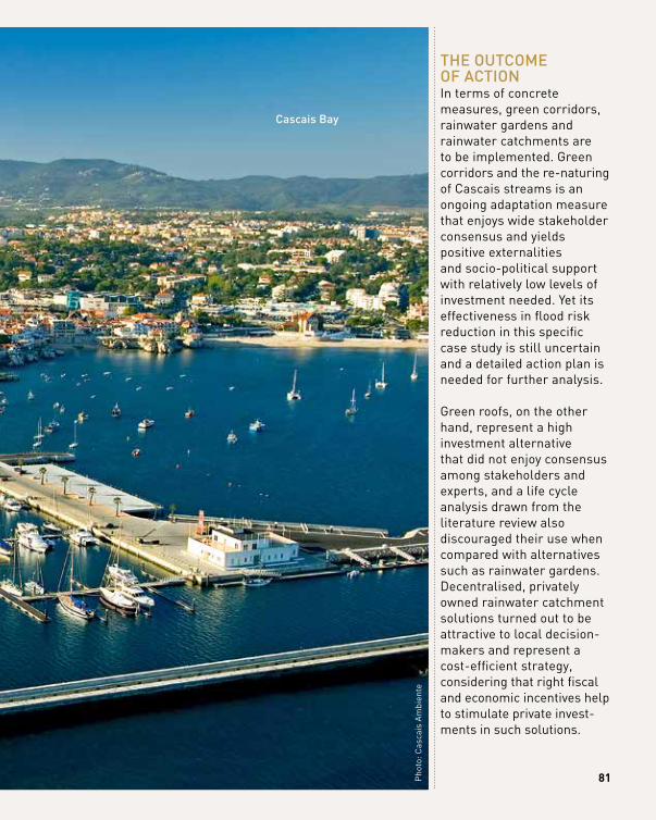
81
thE outcomE of ActionIn terms of concrete measures, green corridors, rainwater gardens and rainwater catchments are to be implemented. Green corridors and the re-naturing of Cascais streams is an ongoing adaptation measure that enjoys wide stakeholder consensus and yields positive externalities and socio-political support with relatively low levels of investment needed. yet its effectiveness in flood risk reduction in this specific case study is still uncertain and a detailed action plan is needed for further analysis. Green roofs, on the other hand, represent a high investment alternative that did not enjoy consensus among stakeholders and experts, and a life cycle analysis drawn from the literature review also discouraged their use when compared with alternatives such as rainwater gardens. Decentralised, privately owned rainwater catchment solutions turned out to be attractive to local decision- makers and represent a cost-efficient strategy, considering that right fiscal and economic incentives help to stimulate private invest-ments in such solutions.
Pho
to: C
asca
is A
mbi
ente
cascais Bay
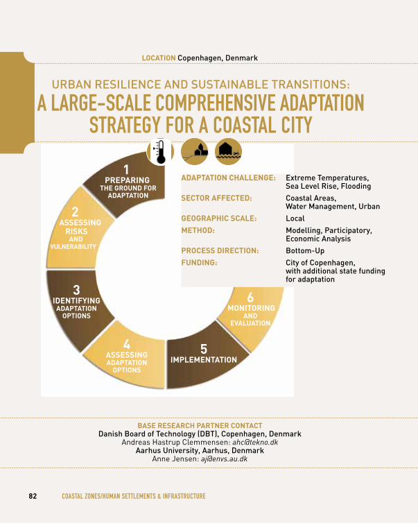
urBAn rESiliEncE And SuStAinABlE trAnSitionS: A lARge-ScAle cOmPReheNSIve ADAPTATION
STRATegy FOR A cOASTAl cITy
bASe reSeArCh pArtner ContACtdanish Board of technology (dBt), copenhagen, denmark
Andreas Hastrup Clemmensen: [email protected] university, Aarhus, denmark
Anne Jensen: [email protected]
82 cOASTAl ZONeS/humAN SeTTlemeNTS & INFRASTRucTuRe
loCAtion copenhagen, denmark
5AdAptAtion StAge
1 prepAring
the ground for AdAptAtion
3 identifying
AdAptAtion optionS
4 ASSeSSing AdAptAtion
optionS
5 iMpleMentAtion
6 Monitoring
And evAluAtion
AdAptAtion ChAllenge: Extreme temperatures, Sea level rise, flooding
SeCtor AffeCted: coastal Areas, water management, urban
geogrAphiC SCAle: local
Method: modelling, participatory, Economic Analysis
proCeSS direCtion: Bottom-up
funding: city of copenhagen, with additional state funding for adaptation
2 ASSeSSing
riSkS And
vulnerAbility
1111
Pho
to: M
unic
ipal
ity o
f Cop
enha
gen
83
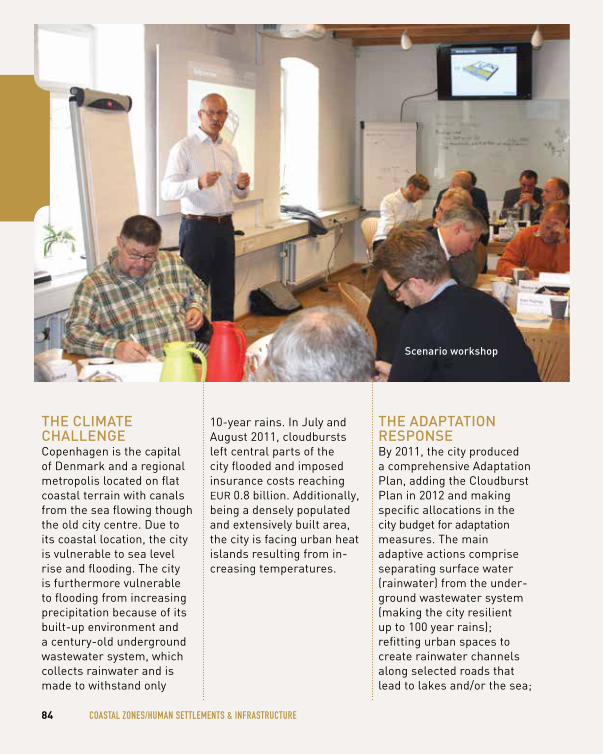
84 cOASTAl ZONeS/humAN SeTTlemeNTS & INFRASTRucTuRe
thE climAtE chAllEngECopenhagen is the capital of Denmark and a regional metropolis located on flat coastal terrain with canals from the sea flowing though the old city centre. Due to its coastal location, the city is vulnerable to sea level rise and flooding. The city is furthermore vulnerable to flooding from increasing precipitation because of its built-up environment and a century-old underground wastewater system, which collects rainwater and is made to withstand only
10-year rains. In July and August 2011, cloudbursts left central parts of the city flooded and imposed insurance costs reaching EUR 0.8 billion. Additionally, being a densely populated and extensively built area, the city is facing urban heat islands resulting from in-creasing temperatures.
thE AdAptAtion rESponSEBy 2011, the city produced a comprehensive Adaptation Plan, adding the Cloudburst Plan in 2012 and making specific allocations in the city budget for adaptation measures. The main adaptive actions comprise separating surface water (rainwater) from the under-ground wastewater system (making the city resilient up to 100 year rains); refitting urban spaces to create rainwater channels along selected roads that lead to lakes and/or the sea;
Scenario workshop
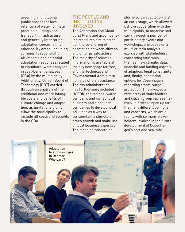
greening and ‘blueing’ public spaces for local retention of water; climate proofing buildings and transport infrastructure; and generally integrating adaptation concerns into other policy areas, including community regeneration. All impacts and potential adaptation responses related to cloudburst were analysed in cost-benefit analyses (CBA) by the municipality. Additionally, Danish Board of Technology (DBT) carried through an analysis of the additional and more intangi-ble costs and benefits of climate change and adapta-tion, as limitations didn’t allow the municipality to include all costs and benefits in the CBA.
thE pEoplE And inStitutionS involvEdThe Adaptation and Cloud-burst Plans and accompany-ing measures aim to estab-lish the co-sharing of adaptation between citizens and other private actors. The majority of relevant information is available at the city homepage for free, and the Technical and Environmental Administra-tion also offers assistance. The city administration has furthermore included HOFOR, the regional water company, and invited local business and clean tech companies to develop local solutions as a way to concomitantly stimulate green growth and make use of local business expertise. The planning concerning
storm-surge adaptation is at an early stage, which allowed DBT, in cooperation with the municipality, to organise and carry through a number of participatory events and workshops, one based on a multi-criteria analysis exercise with stakeholders, concerning four main themes: new climatic data, financial and funding aspects of adaption, legal constraints and, finally, adaptation options for Copenhagen regarding storm-surge protection. This involved a wide array of stakeholders and citizen group representa-tives, in order to open up for the many different opinions and concerns, which are a reality with so many stake-holders involved in the future development of Copenha-gen’s port and sea-side.
85pho
tos:
Jør
gen
mad
sen
Adaptation to storm-surges in denmark: who pays?
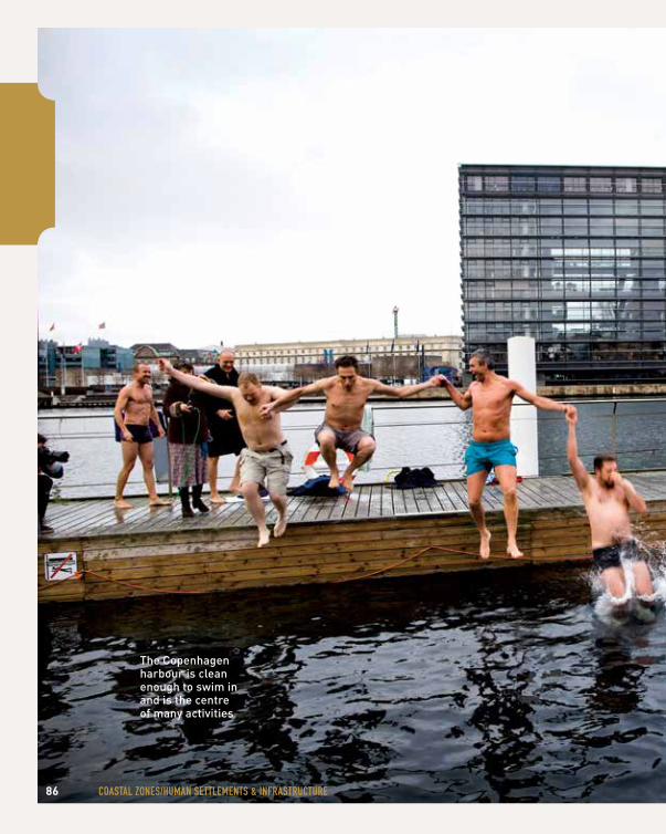
86 cOASTAl ZONeS/humAN SeTTlemeNTS & INFRASTRucTuRe
the copenhagen harbour is clean enough to swim in and is the centre of many activities
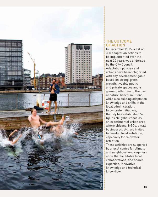
87
thE outcomE of ActionIn December 2015, a list of 300 adaptation actions to be implemented over the next 20 years was endorsed by the City Council. Adaptation policies and actions have been integrated with city development goals based on strong green growth, liveable public and private spaces and a growing attention to the use of nature-based solutions, while also building adaptation knowledge and skills in the local administration. In concrete initiatives, the city has established Sct Kjelds Neighbourhood as an experimental urban area where citizens, NGOs, small businesses, etc. are invited to develop local solutions, especially for rainwater retention. These activities are supported by a local centre for climate and neighbourhood regener-ation that facilitates local collaborations, and shares expertise, innovative knowledge and technical know-how.
pho
to: p
olfo
to
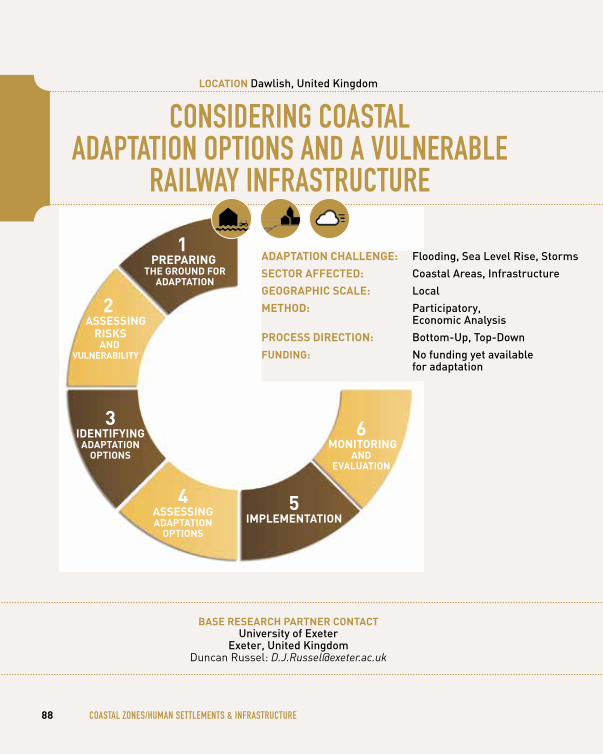
cONSIDeRINg cOASTAl ADAPTATION OPTIONS AND A vulNeRABle
RAIlwAy INFRASTRucTuRe
bASe reSeArCh pArtner ContACtuniversity of Exeter
Exeter, united kingdom Duncan Russel: [email protected]
88 cOASTAl ZONeS/humAN SeTTlemeNTS & INFRASTRucTuRe
loCAtion dawlish, united kingdom
1AdAptAtion StAge
1 prepAring
the ground for AdAptAtion
3 identifying
AdAptAtion optionS
4 ASSeSSing AdAptAtion
optionS
5 iMpleMentAtion
6 Monitoring
And evAluAtion
AdAptAtion ChAllenge: flooding, Sea level rise, Storms
SeCtor AffeCted: coastal Areas, infrastructure
geogrAphiC SCAle: local
Method: participatory, Economic Analysis
proCeSS direCtion: Bottom-up, top-down
funding: no funding yet available for adaptation
2 ASSeSSing
riSkS And
vulnerAbility
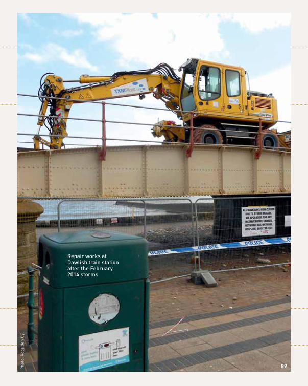
repair works at dawlish train station after the february 2014 storms
Pho
to: R
oos
den
Uyl
89
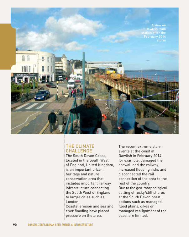
90 cOASTAl ZONeS/humAN SeTTlemeNTS & INFRASTRucTuRe
thE climAtE chAllEngEThe South Devon Coast, located in the South West of England, United Kingdom, is an important urban, heritage and nature conservation area that includes important railway infrastructure connecting the South West of England to larger cities such as London. Coastal erosion and sea and river flooding have placed pressure on the area.
The recent extreme storm events at the coast at Dawlish in February 2014, for example, damaged the seawall and the railway, increased flooding risks and disconnected the rail connection of the area to the rest of the country. Due to the geo-morphological setting of rocky/cliff shores at the South Devon coast, options such as managed flood plains, dikes or managed realignment of the coast are limited.
Pho
tos:
Roo
s de
n U
yl
A view on dawlish train
station after the february 2014
storm
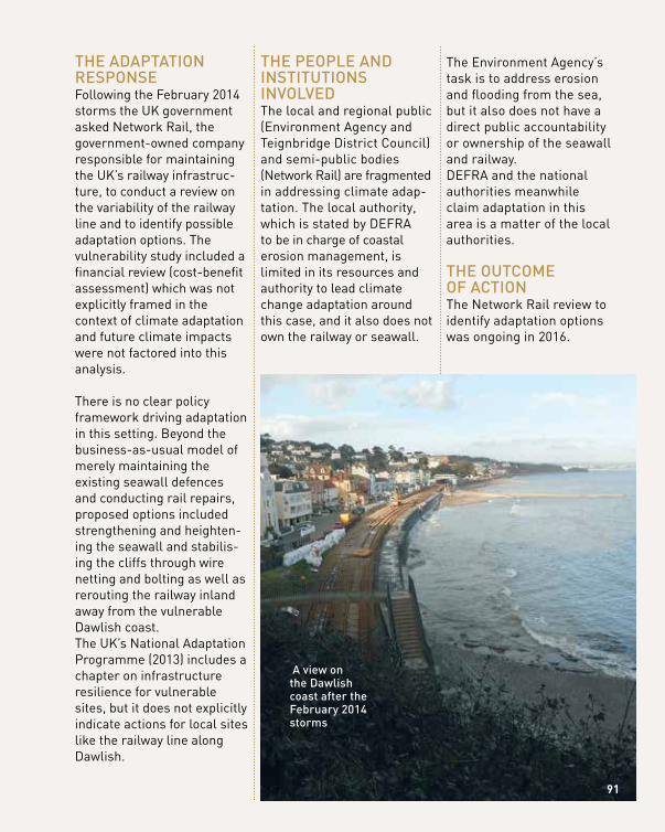
thE AdAptAtion rESponSEFollowing the February 2014 storms the UK government asked Network Rail, the government-owned company responsible for maintaining the UK’s railway infrastruc-ture, to conduct a review on the variability of the railway line and to identify possible adaptation options. The vulnerability study included a financial review (cost-benefit assessment) which was not explicitly framed in the context of climate adaptation and future climate impacts were not factored into this analysis.
There is no clear policy framework driving adaptation in this setting. Beyond the business-as-usual model of merely maintaining the existing seawall defences and conducting rail repairs, proposed options included strengthening and heighten-ing the seawall and stabilis-ing the cliffs through wire netting and bolting as well as rerouting the railway inland away from the vulnerable Dawlish coast. The UK’s National Adaptation Programme (2013) includes a chapter on infrastructure resilience for vulnerable sites, but it does not explicitly indicate actions for local sites like the railway line along Dawlish.
thE pEoplE And inStitutionS involvEdThe local and regional public (Environment Agency and Teignbridge District Council) and semi-public bodies (Network Rail) are fragmented in addressing climate adap-tation. The local authority, which is stated by DEFRA to be in charge of coastal erosion management, is limited in its resources and authority to lead climate change adaptation around this case, and it also does not own the railway or seawall.
The Environment Agency’s task is to address erosion and flooding from the sea, but it also does not have a direct public accountability or ownership of the seawall and railway. DEFRA and the national authorities meanwhile claim adaptation in this area is a matter of the local authorities.
thE outcomE of ActionThe Network Rail review to identify adaptation options was ongoing in 2016.
91
A view on the dawlish coast after the february 2014 storms
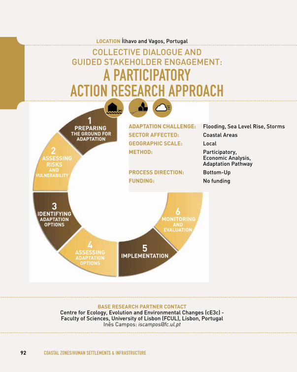
collEctivE diAloguE And guidEd StAkEholdEr EngAgEmEnt:
A PARTIcIPATORy AcTION ReSeARch APPROAch
bASe reSeArCh pArtner ContACtcentre for Ecology, Evolution and Environmental changes (cE3c) - faculty of Sciences, university of lisbon (fcul), lisbon, portugal
Inês Campos: [email protected]
92 cOASTAl ZONeS/humAN SeTTlemeNTS & INFRASTRucTuRe
loCAtion Ílhavo and vagos, portugal
4AdAptAtion StAge
1 prepAring
the ground for AdAptAtion
3 identifying
AdAptAtion optionS
4 ASSeSSing AdAptAtion
optionS
5 iMpleMentAtion
6 Monitoring
And evAluAtion
AdAptAtion ChAllenge: flooding, Sea level rise, Storms
SeCtor AffeCted: coastal Areas
geogrAphiC SCAle: local
Method: participatory, Economic Analysis, Adaptation pathway
proCeSS direCtion: Bottom-up
funding: no funding
2 ASSeSSing
riSkS And
vulnerAbility
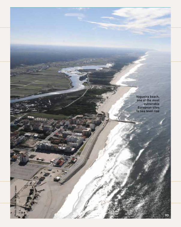
pho
to: S
iAr
l/A
. mot
a lo
pes
vagueira beach, one of the most
vulnerable European sites
to sea level rise
93
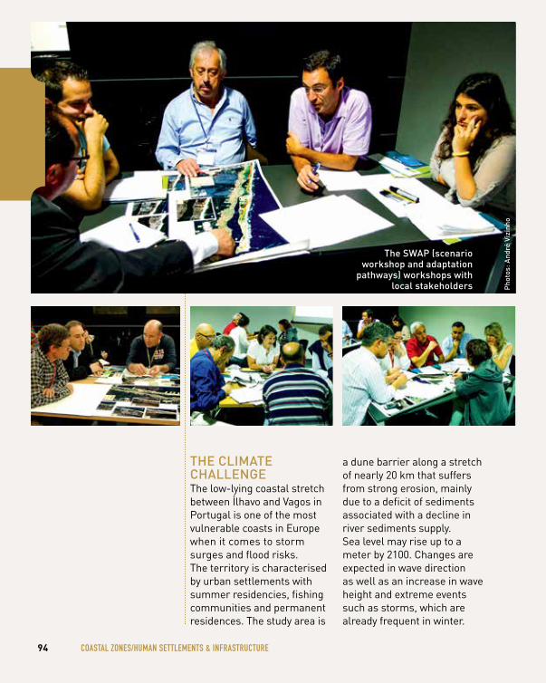
thE climAtE chAllEngEThe low-lying coastal stretch between Ílhavo and Vagos in Portugal is one of the most vulnerable coasts in Europe when it comes to storm surges and flood risks. The territory is characterised by urban settlements with summer residencies, fishing communities and permanent residences. The study area is
a dune barrier along a stretch of nearly 20 km that suffers from strong erosion, mainly due to a deficit of sediments associated with a decline in river sediments supply. Sea level may rise up to a meter by 2100. Changes are expected in wave direction as well as an increase in wave height and extreme events such as storms, which are already frequent in winter.
94 cOASTAl ZONeS/humAN SeTTlemeNTS & INFRASTRucTuRe
pho
tos:
And
ré v
izin
ho
the SwAp (scenario workshop and adaptation
pathways) workshops with local stakeholders
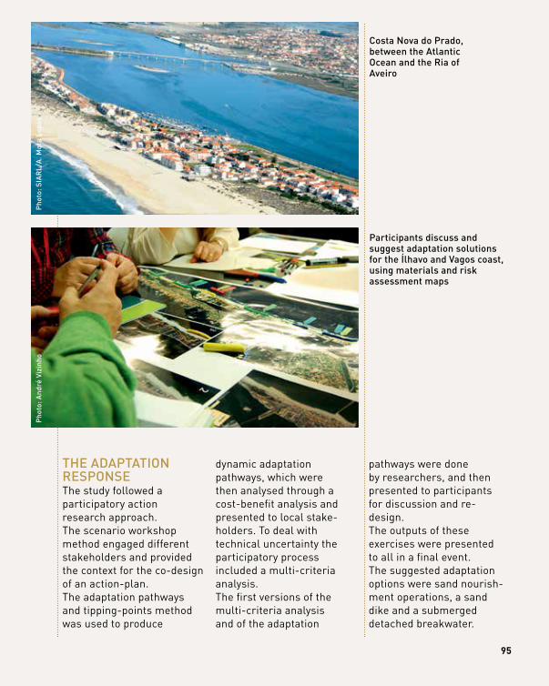
95
thE AdAptAtion rESponSEThe study followed a participatory action research approach. The scenario workshop method engaged different stakeholders and provided the context for the co-design of an action-plan. The adaptation pathways and tipping-points method was used to produce
dynamic adaptation pathways, which were then analysed through a cost-benefit analysis and presented to local stake-holders. To deal with technical uncertainty the participatory process included a multi-criteria analysis.The first versions of the multi-criteria analysis and of the adaptation
pathways were done by researchers, and then presented to participants for discussion and re- design.The outputs of these exercises were presented to all in a final event. The suggested adaptation options were sand nourish-ment operations, a sand dike and a submerged detached breakwater.
pho
to: A
ndré
viz
inho
costa nova do prado, between the Atlantic ocean and the ria of Aveiro
participants discuss and suggest adaptation solutions for the Ílhavo and vagos coast, using materials and risk assessment maps
pho
to: S
iAr
l/A
. mot
a lo
pes
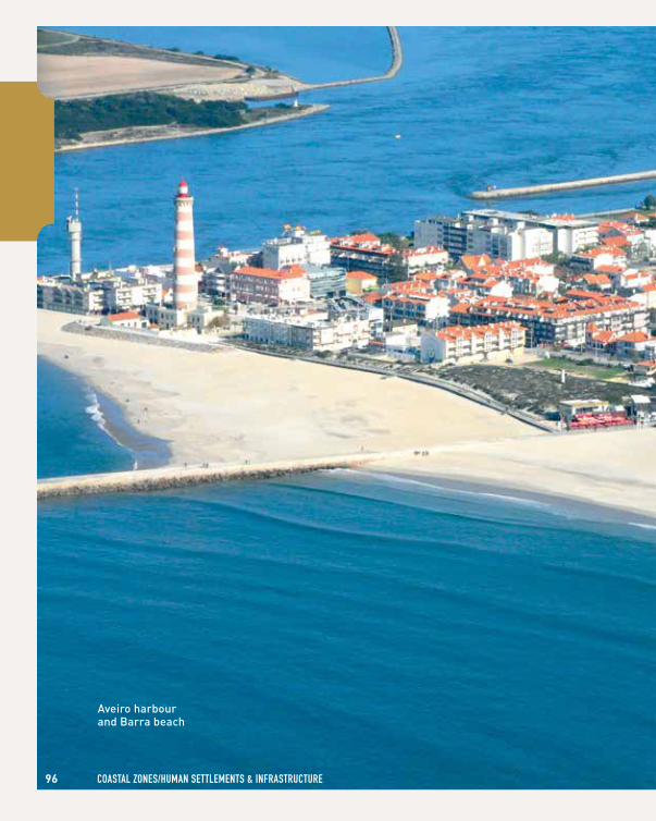
96 cOASTAl ZONeS/humAN SeTTlemeNTS & INFRASTRucTuRe
Aveiro harbour and Barra beach
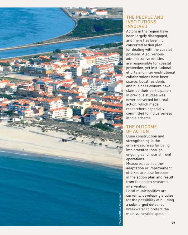
97pho
to: S
iAr
l/A
. mot
a lo
pes
thE pEoplE And inStitutionS involvEdActors in the region have been largely disengaged, and there has been no concerted action plan for dealing with the coastal problem. Also, various administrative entities are responsible for coastal protection, yet institutional efforts and inter-institutional collaborations have been scarce. Local residents and business owners have claimed their participation in previous studies was never converted into real action, which made researchers especially committed to inclusiveness in this scheme.
thE outcomE of ActionDune construction and strengthening is the only measure so far being implemented through ongoing sand nourishment operations. Measures such as the adaptation or improvement of dikes are also foreseen in the action plan and result from the action research intervention. Local municipalities are currently developing studies for the possibility of building a submerged detached breakwater to protect the most vulnerable spots.
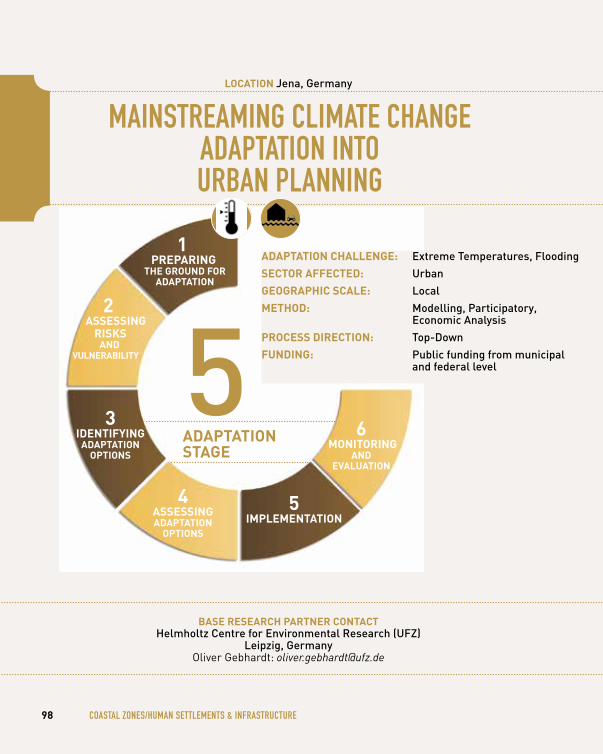
mAINSTReAmINg clImATe chANge ADAPTATION INTO uRBAN PlANNINg
bASe reSeArCh pArtner ContACthelmholtz centre for Environmental research (ufz)
leipzig, germanyOliver Gebhardt: [email protected]
98 cOASTAl ZONeS/humAN SeTTlemeNTS & INFRASTRucTuRe
loCAtion Jena, germany
1 prepAring
the ground for AdAptAtion
3 identifying
AdAptAtion optionS
4 ASSeSSing AdAptAtion
optionS
5 iMpleMentAtion
6 Monitoring
And evAluAtion
5AdAptAtion StAge
AdAptAtion ChAllenge: Extreme temperatures, flooding
SeCtor AffeCted: urban
geogrAphiC SCAle: local
Method: modelling, participatory, Economic Analysis
proCeSS direCtion: top-down
funding: public funding from municipal and federal level
2 ASSeSSing
riSkS And
vulnerAbility
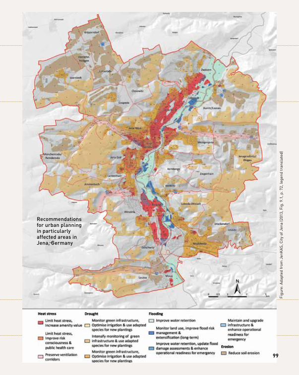
recommendations for urban planning in particularly affected areas in Jena, germany
Figu
re: A
dapt
ed fr
om J
enK
AS,
City
of J
ena
(201
3, F
ig. 9
.1, p
. 72,
lege
nd tr
ansl
ated
)
99
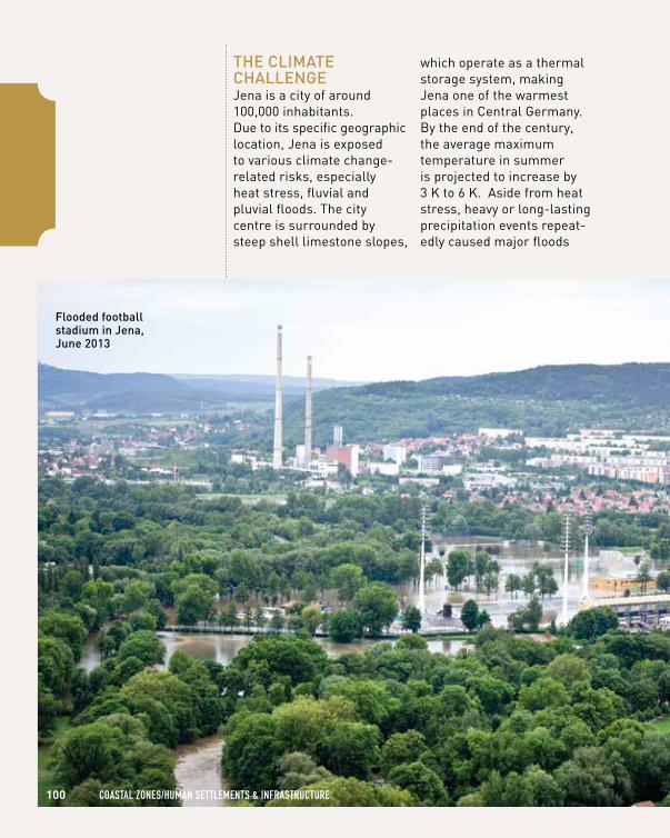
thE climAtE chAllEngEJena is a city of around 100,000 inhabitants. Due to its specific geographic location, Jena is exposed to various climate change- related risks, especially heat stress, fluvial and pluvial floods. The city centre is surrounded by steep shell limestone slopes,
which operate as a thermal storage system, making Jena one of the warmest places in Central Germany. By the end of the century, the average maximum temperature in summer is projected to increase by 3 K to 6 K. Aside from heat stress, heavy or long-lasting precipitation events repeat-edly caused major floods
100 cOASTAl ZONeS/humAN SeTTlemeNTS & INFRASTRucTuRe
flooded football stadium in Jena, June 2013
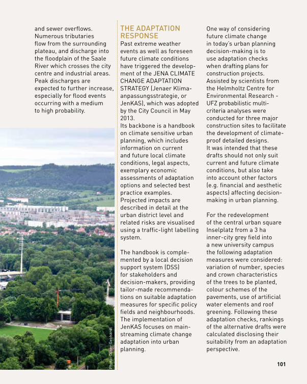
101
thE AdAptAtion rESponSEPast extreme weather events as well as foreseen future climate conditions have triggered the develop-ment of the JENA CLIMATE CHANGE ADAPTATION STRATEGy (Jenaer Klima- anpassungsstrategie, or JenKAS), which was adopted by the City Council in May 2013. Its backbone is a handbook on climate sensitive urban planning, which includes information on current and future local climate conditions, legal aspects, exemplary economic assessments of adaptation options and selected best practice examples.Projected impacts are described in detail at the urban district level and related risks are visualised using a traffic-light labelling system.
The handbook is comple-mented by a local decision support system (DSS) for stakeholders and decision-makers, providing tailor-made recommenda-tions on suitable adaptation measures for specific policy fields and neighbourhoods.The implementation of JenKAS focuses on main-streaming climate change adaptation into urban planning.
One way of considering future climate change in today’s urban planning decision-making is to use adaptation checks when drafting plans for construction projects. Assisted by scientists from the Helmholtz Centre for Environmental Research - UFZ probabilistic multi- criteria analyses were conducted for three major construction sites to facilitate the development of climate- proof detailed designs. It was intended that these drafts should not only suit current and future climate conditions, but also take into account other factors (e.g. financial and aesthetic aspects) affecting decision- making in urban planning.
For the redevelopment of the central urban square Inselplatz from a 3 ha inner-city grey field into a new university campus the following adaptation measures were considered: variation of number, species and crown characteristics of the trees to be planted, colour schemes of the pavements, use of artificial water elements and roof greening. Following these adaptation checks, rankings of the alternative drafts were calculated disclosing their suitability from an adaptation perspective.
and sewer overflows. Numerous tributaries flow from the surrounding plateau, and discharge into the floodplain of the Saale River which crosses the city centre and industrial areas. Peak discharges are expected to further increase, especially for flood events occurring with a medium to high probability.
Pho
to: O
liver
Geb
hard
t
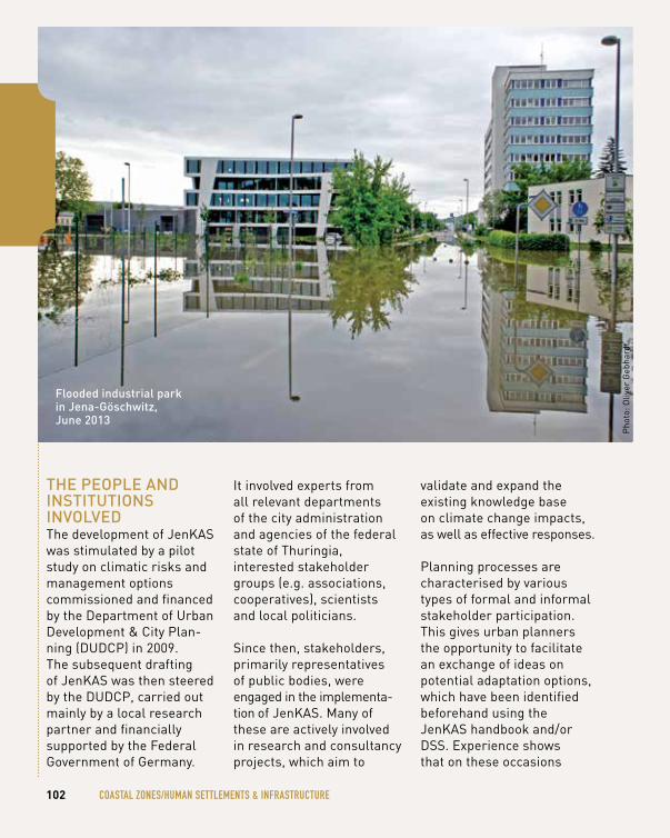
102 cOASTAl ZONeS/humAN SeTTlemeNTS & INFRASTRucTuRe
thE pEoplE And inStitutionS involvEdThe development of JenKAS was stimulated by a pilot study on climatic risks and management options commissioned and financed by the Department of Urban Development & City Plan-ning (DUDCP) in 2009. The subsequent drafting of JenKAS was then steered by the DUDCP, carried out mainly by a local research partner and financially supported by the Federal Government of Germany.
It involved experts from all relevant departments of the city administration and agencies of the federal state of Thuringia, interested stakeholder groups (e.g. associations, cooperatives), scientists and local politicians.
Since then, stakeholders, primarily representatives of public bodies, were engaged in the implementa-tion of JenKAS. Many of these are actively involved in research and consultancy projects, which aim to
validate and expand the existing knowledge base on climate change impacts, as well as effective responses.
Planning processes are characterised by various types of formal and informal stakeholder participation. This gives urban planners the opportunity to facilitate an exchange of ideas on potential adaptation options, which have been identified beforehand using the JenKAS handbook and/or DSS. Experience shows that on these occasions
flooded industrial park in Jena-göschwitz, June 2013
Pho
to: O
liver
Geb
hard
t
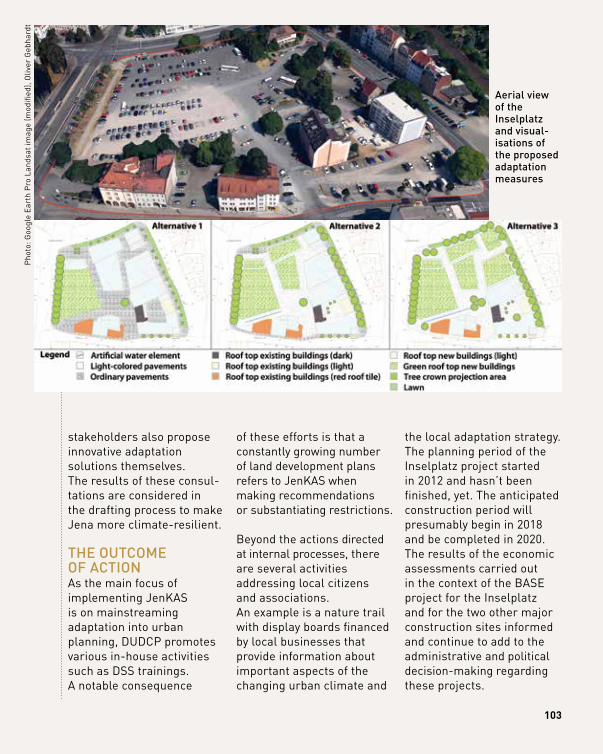
103
stakeholders also propose innovative adaptation solutions themselves. The results of these consul-tations are considered in the drafting process to make Jena more climate-resilient.
thE outcomE of ActionAs the main focus of implementing JenKAS is on mainstreaming adaptation into urban planning, DUDCP promotes various in-house activities such as DSS trainings. A notable consequence
of these efforts is that a constantly growing number of land development plans refers to JenKAS when making recommendations or substantiating restrictions.
Beyond the actions directed at internal processes, there are several activities addressing local citizens and associations. An example is a nature trail with display boards financed by local businesses that provide information about important aspects of the changing urban climate and
the local adaptation strategy.The planning period of the Inselplatz project started in 2012 and hasn’t been finished, yet. The anticipated construction period will presumably begin in 2018 and be completed in 2020. The results of the economic assessments carried out in the context of the BASE project for the Inselplatz and for the two other major construction sites informed and continue to add to the administrative and political decision-making regarding these projects.
Aerial view of the inselplatz and visual-isations of the proposed adaptation measures
Pho
to: G
oogl
e E
arth
Pro
Lan
dsat
imag
e (m
odifi
ed),
Oliv
er G
ebha
rdt
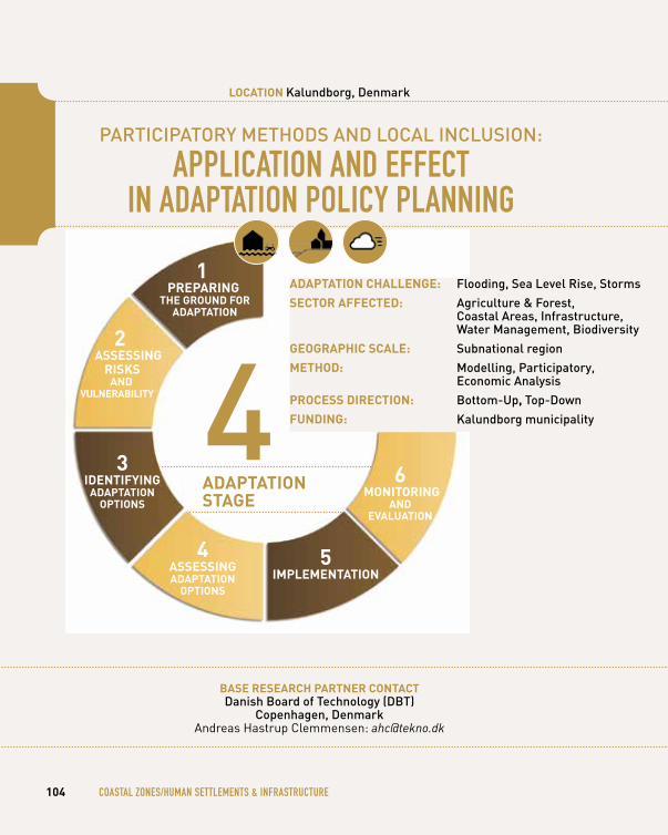
pArticipAtory mEthodS And locAl incluSion: APPlIcATION AND eFFecT
IN ADAPTATION POlIcy PlANNINg
bASe reSeArCh pArtner ContACtdanish Board of technology (dBt)
copenhagen, denmarkAndreas Hastrup Clemmensen: [email protected]
104 cOASTAl ZONeS/humAN SeTTlemeNTS & INFRASTRucTuRe
loCAtion kalundborg, denmark
1 prepAring
the ground for AdAptAtion
3 identifying
AdAptAtion optionS
4 ASSeSSing AdAptAtion
optionS
5 iMpleMentAtion
6 Monitoring
And evAluAtion
4AdAptAtion StAge
AdAptAtion ChAllenge: flooding, Sea level rise, Storms
SeCtor AffeCted: Agriculture & forest, coastal Areas, infrastructure, water management, Biodiversity
geogrAphiC SCAle: Subnational region
Method: modelling, participatory, Economic Analysis
proCeSS direCtion: Bottom-up, top-down
funding: kalundborg municipality
2 ASSeSSing
riSkS And
vulnerAbility
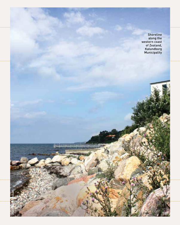
Shoreline along the
western coast of zealand,
kalundborg municipality
pho
to: J
ørge
n m
adse
n
105
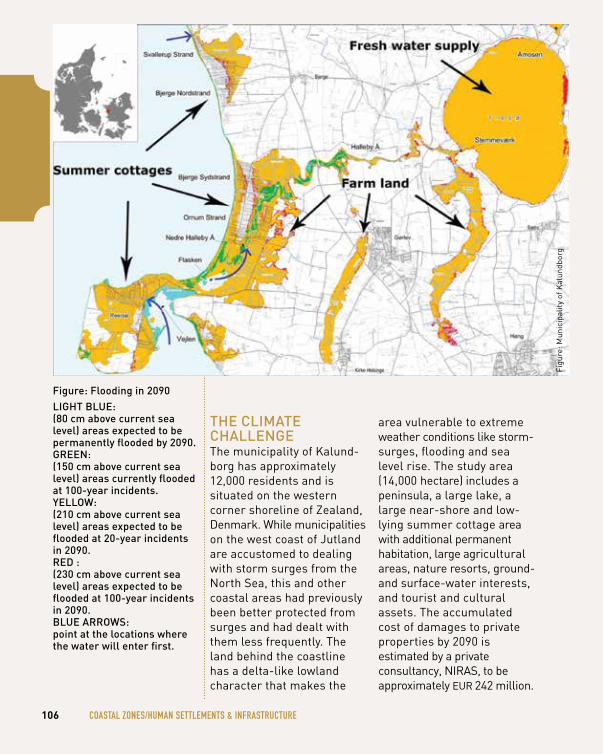
thE climAtE chAllEngEThe municipality of Kalund-borg has approximately 12,000 residents and is situated on the western corner shoreline of Zealand, Denmark. While municipalities on the west coast of Jutland are accustomed to dealing with storm surges from the North Sea, this and other coastal areas had previously been better protected from surges and had dealt with them less frequently. The land behind the coastline has a delta-like lowland character that makes the
area vulnerable to extreme weather conditions like storm- surges, flooding and sea level rise. The study area (14,000 hectare) includes a peninsula, a large lake, a large near-shore and low- lying summer cottage area with additional permanent habitation, large agricultural areas, nature resorts, ground- and surface-water interests, and tourist and cultural assets. The accumulated cost of damages to private properties by 2090 is estimated by a private consultancy, NIRAS, to be approximately EUR 242 million.
Figu
re: M
unic
ipal
ity o
f Kal
undb
org
106 cOASTAl ZONeS/humAN SeTTlemeNTS & INFRASTRucTuRe
figure: flooding in 2090light BluE: (80 cm above current sea level) areas expected to be permanently flooded by 2090.grEEn: (150 cm above current sea level) areas currently flooded at 100-year incidents.yEllow: (210 cm above current sea level) areas expected to be flooded at 20-year incidents in 2090.rEd :(230 cm above current sea level) areas expected to be flooded at 100-year incidents in 2090.BluE ArrowS: point at the locations where the water will enter first.
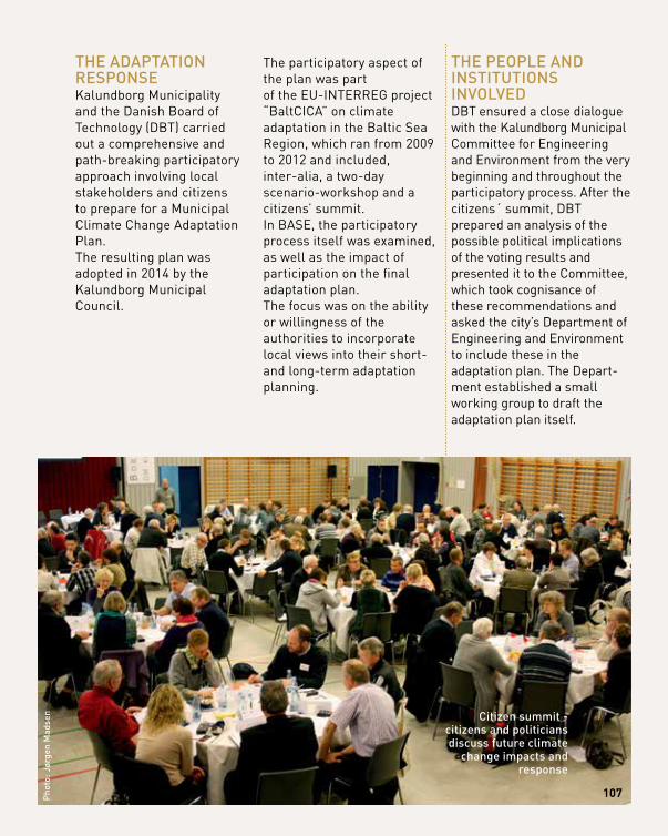
thE AdAptAtion rESponSEKalundborg Municipality and the Danish Board of Technology (DBT) carried out a comprehensive and path-breaking participatory approach involving local stakeholders and citizens to prepare for a Municipal Climate Change Adaptation Plan. The resulting plan was adopted in 2014 by the Kalundborg Municipal Council.
The participatory aspect of the plan was part of the EU-INTERREG project “BaltCICA” on climate adaptation in the Baltic Sea Region, which ran from 2009 to 2012 and included, inter-alia, a two-day scenario-workshop and a citizens’ summit. In BASE, the participatory process itself was examined, as well as the impact of participation on the final adaptation plan.The focus was on the ability or willingness of the authorities to incorporate local views into their short- and long-term adaptation planning.
thE pEoplE And inStitutionS involvEdDBT ensured a close dialogue with the Kalundborg Municipal Committee for Engineering and Environment from the very beginning and throughout the participatory process. After the citizens´ summit, DBT prepared an analysis of the possible political implications of the voting results and presented it to the Committee, which took cognisance of these recommendations and asked the city’s Department of Engineering and Environment to include these in the adaptation plan. The Depart-ment established a small working group to draft the adaptation plan itself.
pho
to: J
ørge
n m
adse
n
107
citizen summit - citizens and politicians discuss future climate
change impacts and response
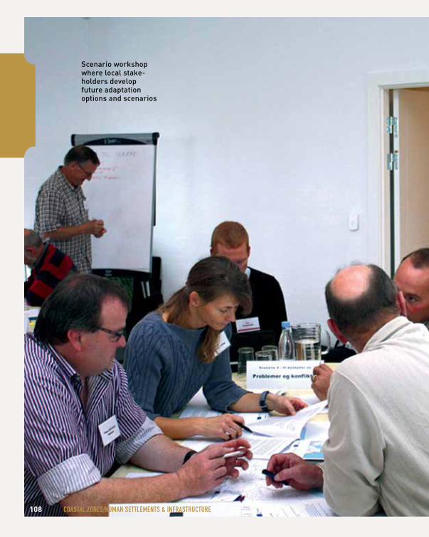
108 cOASTAl ZONeS/humAN SeTTlemeNTS & INFRASTRucTuRe
Scenario workshop where local stake-holders develop future adaptation options and scenarios
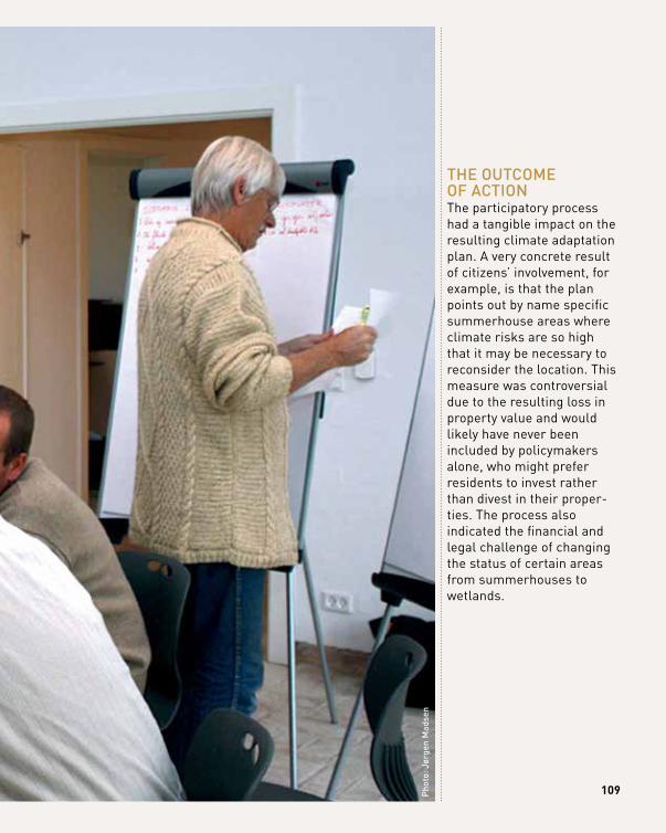
109pho
to: J
ørge
n m
adse
n
thE outcomE of ActionThe participatory process had a tangible impact on the resulting climate adaptation plan. A very concrete result of citizens’ involvement, for example, is that the plan points out by name specific summerhouse areas where climate risks are so high that it may be necessary to reconsider the location. This measure was controversial due to the resulting loss in property value and would likely have never been included by policymakers alone, who might prefer residents to invest rather than divest in their proper-ties. The process also indicated the financial and legal challenge of changing the status of certain areas from summerhouses to wetlands.
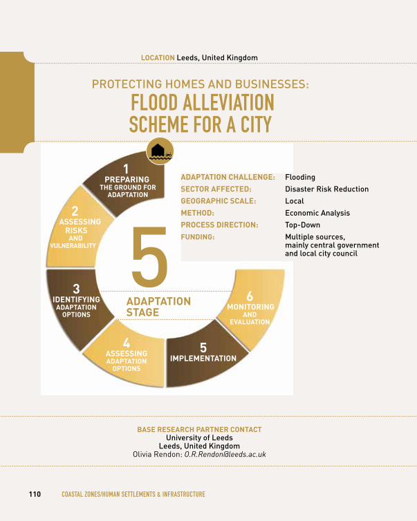
protEcting homES And BuSinESSES: FlOOD AllevIATION Scheme FOR A cITy
bASe reSeArCh pArtner ContACtuniversity of leeds
leeds, united kingdomOlivia Rendon: [email protected]
110 cOASTAl ZONeS/humAN SeTTlemeNTS & INFRASTRucTuRe
loCAtion leeds, united kingdom
1 prepAring
the ground for AdAptAtion
3 identifying
AdAptAtion optionS
4 ASSeSSing AdAptAtion
optionS
5 iMpleMentAtion
6 Monitoring
And evAluAtion
5AdAptAtion StAge
AdAptAtion ChAllenge: flooding
SeCtor AffeCted: disaster risk reduction
geogrAphiC SCAle: local
Method: Economic Analysis
proCeSS direCtion: top-down
funding: multiple sources, mainly central government and local city council
2 ASSeSSing
riSkS And
vulnerAbility
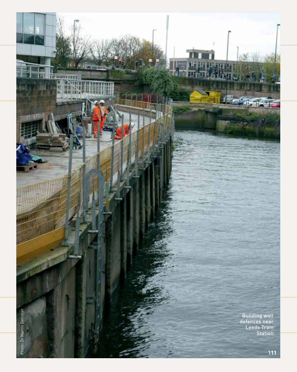
Building wall defences near
leeds train Station
11111Pho
to: D
r M
artin
Dal
limer
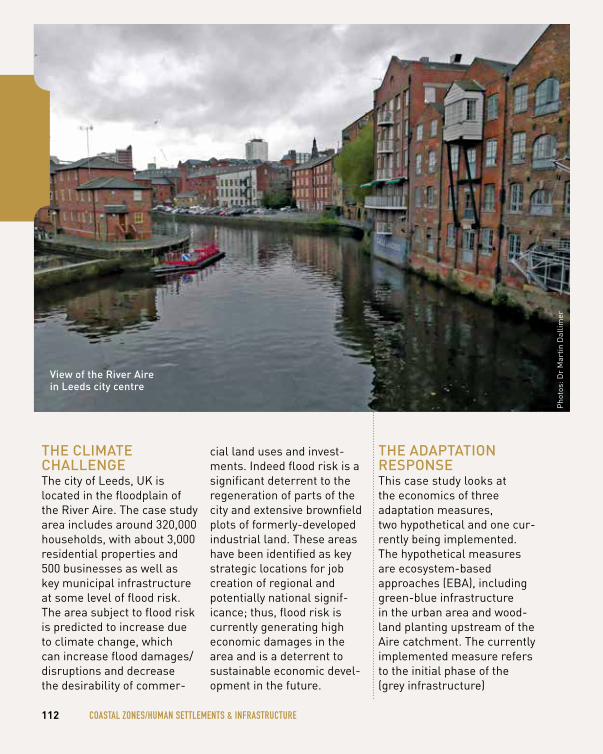
thE climAtE chAllEngEThe city of Leeds, UK is located in the floodplain of the River Aire. The case study area includes around 320,000 households, with about 3,000 residential properties and 500 businesses as well as key municipal infrastructure at some level of flood risk. The area subject to flood risk is predicted to increase due to climate change, which can increase flood damages/disruptions and decrease the desirability of commer-
cial land uses and invest-ments. Indeed flood risk is a significant deterrent to the regeneration of parts of the city and extensive brownfield plots of formerly-developed industrial land. These areas have been identified as key strategic locations for job creation of regional and potentially national signif-icance; thus, flood risk is currently generating high economic damages in the area and is a deterrent to sustainable economic devel-opment in the future.
thE AdAptAtion rESponSEThis case study looks at the economics of three adaptation measures, two hypothetical and one cur-rently being implemented. The hypothetical measures are ecosystem-based approaches (EBA), including green-blue infrastructure in the urban area and wood- land planting upstream of the Aire catchment. The currently implemented measure refers to the initial phase of the (grey infrastructure)
Pho
tos:
Dr
Mar
tin D
allim
er
112 cOASTAl ZONeS/humAN SeTTlemeNTS & INFRASTRucTuRe
view of the river Aire in leeds city centre
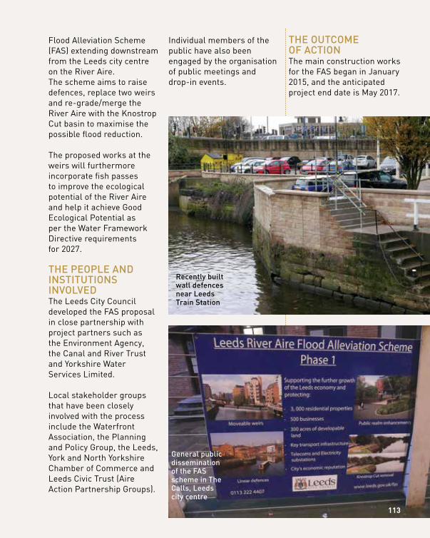
Flood Alleviation Scheme (FAS) extending downstream from the Leeds city centre on the River Aire. The scheme aims to raise defences, replace two weirs and re-grade/merge the River Aire with the Knostrop Cut basin to maximise the possible flood reduction.
The proposed works at the weirs will furthermore incorporate fish passes to improve the ecological potential of the River Aire and help it achieve Good Ecological Potential as per the Water Framework Directive requirements for 2027.
thE pEoplE And inStitutionS involvEdThe Leeds City Council developed the FAS proposal in close partnership with project partners such as the Environment Agency, the Canal and River Trust and yorkshire Water Services Limited.
Local stakeholder groups that have been closely involved with the process include the Waterfront Association, the Planning and Policy Group, the Leeds, york and North yorkshire Chamber of Commerce and Leeds Civic Trust (Aire Action Partnership Groups).
Individual members of the public have also been engaged by the organisation of public meetings and drop-in events.
thE outcomE of ActionThe main construction works for the FAS began in January 2015, and the anticipated project end date is May 2017.
recently built wall defences near leeds train Station
general public dissemination of the fAS scheme in the calls, leeds city centre
113
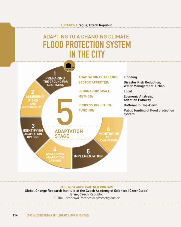
AdApting to A chAnging climAtE:
FlOOD PROTecTION SySTem IN The cITy
bASe reSeArCh pArtner ContACtglobal change research institute of the czech Academy of Sciences (czechglobe)
Brno, czech republicEliška Lorencová: [email protected]
114 cOASTAl ZONeS/humAN SeTTlemeNTS & INFRASTRucTuRe
loCAtion prague, czech republic
1 prepAring
the ground for AdAptAtion
3 identifying
AdAptAtion optionS
4 ASSeSSing AdAptAtion
optionS
5 iMpleMentAtion
6 Monitoring
And evAluAtion
5AdAptAtion StAge
AdAptAtion ChAllenge: flooding
SeCtor AffeCted: disaster risk reduction, water management, urban
geogrAphiC SCAle: local
Method: Economic Analysis, Adaption pathway
proCeSS direCtion: Bottom-up, top-down
funding: public funding of flood protection system
2 ASSeSSing
riSkS And
vulnerAbility
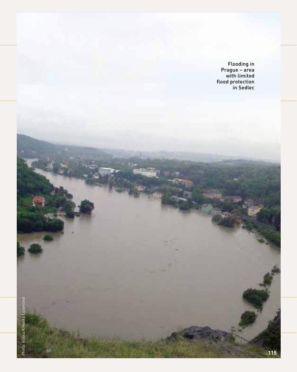
flooding in prague – area
with limited flood protection
in Sedlec
Pho
to: E
liška
Krk
oška
Lor
enco
vá
115
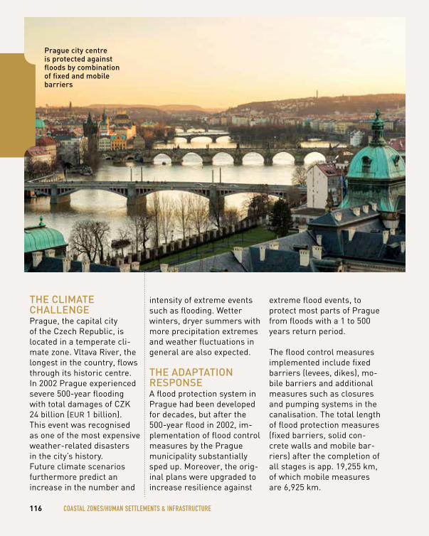
thE climAtE chAllEngEPrague, the capital city of the Czech Republic, is located in a temperate cli-mate zone. Vltava River, the longest in the country, flows through its historic centre. In 2002 Prague experienced severe 500-year flooding with total damages of CZK 24 billion (EUR 1 billion). This event was recognised as one of the most expensive weather-related disasters in the city’s history. Future climate scenarios furthermore predict an increase in the number and
intensity of extreme events such as flooding. Wetter winters, dryer summers with more precipitation extremes and weather fluctuations in general are also expected.
thE AdAptAtion rESponSEA flood protection system in Prague had been developed for decades, but after the 500-year flood in 2002, im-plementation of flood control measures by the Prague municipality substantially sped up. Moreover, the orig-inal plans were upgraded to increase resilience against
extreme flood events, to protect most parts of Prague from floods with a 1 to 500 years return period.
The flood control measures implemented include fixed barriers (levees, dikes), mo-bile barriers and additional measures such as closures and pumping systems in the canalisation. The total length of flood protection measures (fixed barriers, solid con-crete walls and mobile bar-riers) after the completion of all stages is app. 19,255 km, of which mobile measures are 6,925 km.
116 cOASTAl ZONeS/humAN SeTTlemeNTS & INFRASTRucTuRe
prague city centre is protected against floods by combination of fixed and mobile barriers
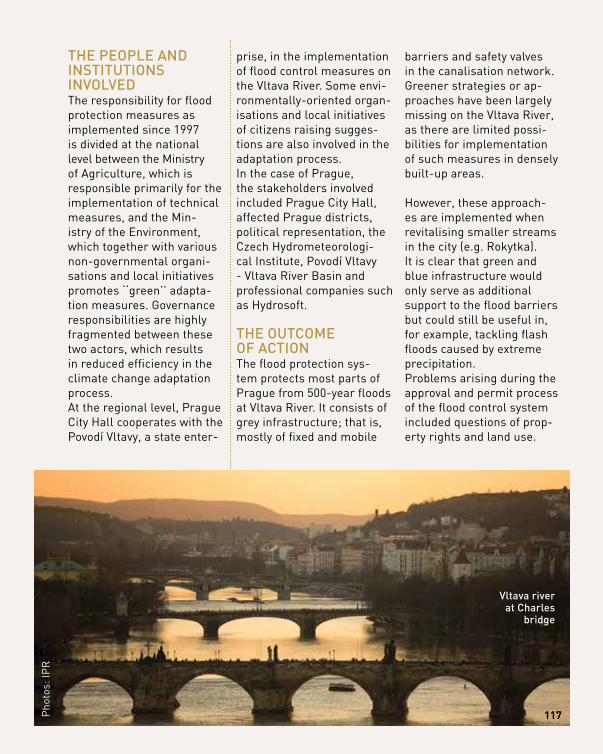
thE pEoplE And inStitutionS involvEdThe responsibility for flood protection measures as implemented since 1997 is divided at the national level between the Ministry of Agriculture, which is responsible primarily for the implementation of technical measures, and the Min-istry of the Environment, which together with various non-governmental organi-sations and local initiatives promotes ‘‘green’’ adapta-tion measures. Governance responsibilities are highly fragmented between these two actors, which results in reduced efficiency in the climate change adaptation process.At the regional level, Prague City Hall cooperates with the Povodí Vltavy, a state enter-
prise, in the implementation of flood control measures on the Vltava River. Some envi-ronmentally-oriented organ-isations and local initiatives of citizens raising sugges-tions are also involved in the adaptation process. In the case of Prague, the stakeholders involved included Prague City Hall, affected Prague districts, political representation, the Czech Hydrometeorologi-cal Institute, Povodí Vltavy - Vltava River Basin and professional companies such as Hydrosoft.
thE outcomE of ActionThe flood protection sys-tem protects most parts of Prague from 500-year floods at Vltava River. It consists of grey infrastructure; that is, mostly of fixed and mobile
barriers and safety valves in the canalisation network. Greener strategies or ap-proaches have been largely missing on the Vltava River, as there are limited possi-bilities for implementation of such measures in densely built-up areas.
However, these approach-es are implemented when revitalising smaller streams in the city (e.g. Rokytka). It is clear that green and blue infrastructure would only serve as additional support to the flood barriers but could still be useful in, for example, tackling flash floods caused by extreme precipitation. Problems arising during the approval and permit process of the flood control system included questions of prop-erty rights and land use.
117Pho
tos:
IPR
vltava river at charles
bridge
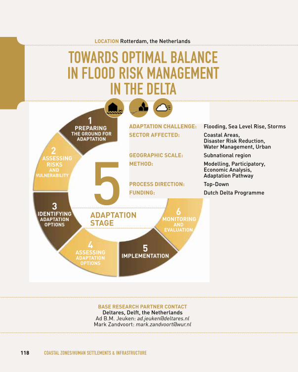
TOwARDS OPTImAl BAlANce IN FlOOD RISK mANAgemeNT
IN The DelTA
bASe reSeArCh pArtner ContACtdeltares, delft, the netherlands
Ad B.M. Jeuken: [email protected] Zandvoort: [email protected]
118 cOASTAl ZONeS/humAN SeTTlemeNTS & INFRASTRucTuRe
loCAtion rotterdam, the netherlands
1 prepAring
the ground for AdAptAtion
3 identifying
AdAptAtion optionS
4 ASSeSSing AdAptAtion
optionS
5 iMpleMentAtion
6 Monitoring
And evAluAtion
5AdAptAtion StAge
AdAptAtion ChAllenge: flooding, Sea level rise, Storms
SeCtor AffeCted: coastal Areas, disaster risk reduction, water management, urban
geogrAphiC SCAle: Subnational region
Method: modelling, participatory, Economic Analysis, Adaptation pathway
proCeSS direCtion: top-down
funding: dutch delta programme
2 ASSeSSing
riSkS And
vulnerAbility
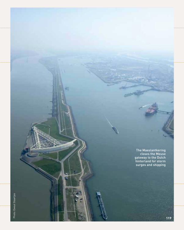
the maeslantkering closes the meuse
gateway to the dutch hinterland for storm surges and shipping
Pho
to: E
wou
t Sta
artje
s
119
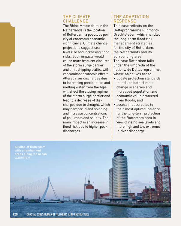
120 cOASTAl ZONeS/humAN SeTTlemeNTS & INFRASTRucTuRe
thE climAtE chAllEngEThe Rhine Meuse delta in the Netherlands is the location of Rotterdam, a populous port city of enormous economic significance. Climate change projections suggest sea level rise and increasing flood risks. Such impacts would cause more frequent closures of the storm surge barrier and limit shipping traffic, with concomitant economic effects. Altered river discharges due to increasing precipitation and melting water from the Alps will affect the closing regime of the storm surge barrier and lead to a decrease of dis-charges due to drought, which may hamper inland shipping and increase concentrations of pollutants and salinity. The main impact is an increase in flood risk due to higher peak discharges.
thE AdAptAtion rESponSEThis case reflects on the Deltaprogramme Rijnmond- Drechtsteden, which handled the long-term flood risk management strategies for the city of Rotterdam, the Netherlands and its surrounding area. The case Rotterdam falls under the umbrella of the nationwide Deltaprogramme, whose objectives are to: • update protection standards
to include both climate change scenarios and increased population and economic value protected from floods, and
• assess measures as to their most optimal balance for the long-term protection of the Rotterdam area in view of rising sea levels and more high and low extremes in river discharge.
Skyline of rotterdam with unembanked areas along the urban waterfront
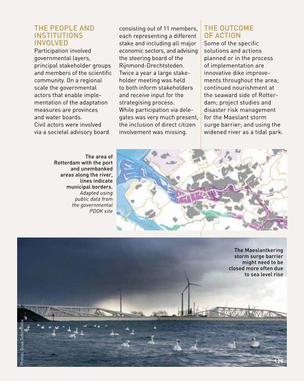
thE pEoplE And inStitutionS involvEdParticipation involved governmental layers, principal stakeholder groups and members of the scientific community. On a regional scale the governmental actors that enable imple-mentation of the adaptation measures are provinces and water boards.Civil actors were involved via a societal advisory board
consisting out of 11 members, each representing a different stake and including all major economic sectors, and advising the steering board of the Rijnmond-Drechtsteden. Twice a year a large stake-holder meeting was held to both inform stakeholders and receive input for the strategising process. While participation via dele-gates was very much present, the inclusion of direct citizen involvement was missing.
thE outcomE of ActionSome of the specific solutions and actions planned or in the process of implementation are innovative dike improve-ments throughout the area; continued nourishment at the seaward side of Rotter-dam; project studies and disaster risk management for the Maeslant storm surge barrier; and using the widened river as a tidal park.
Pho
tos:
Guu
s Sc
hone
ville
121
the maeslantkering storm surge barrier
might need to be closed more often due
to sea level rise
the area of rotterdam with the port
and unembanked areas along the river,
lines indicate municipal borders.
Adapted using public data from
the governmental PDOK site
uSINg AcTIve PuBlIc PARTIcIPATION IN The cO-DevelOPmeNT OF cOASTAl PROTecTION
STRATegIeS FOR A TOuRISTIc BeAch cITy
bASe reSeArCh pArtner ContACtEcologic instituteBerlin, germany
Nico Stelljes: [email protected]
122 cOASTAl ZONeS/humAN SeTTlemeNTS & INFRASTRucTuRe
loCAtion timmendorfer Strand, germany
1 prepAring
the ground for AdAptAtion
3 identifying
AdAptAtion optionS
4 ASSeSSing AdAptAtion
optionS
5 iMpleMentAtion
6 Monitoring
And evAluAtion
4AdAptAtion StAge
AdAptAtion ChAllenge: flooding, Sea level rise, Storms
SeCtor AffeCted: coastal Areas, disaster risk reduction, urban
geogrAphiC SCAle: local
Method: modelling, participatory, Economic Analysis
proCeSS direCtion: Bottom-up
funding: regional government and city, Eu funding via cohesion policy
2 ASSeSSing
riSkS And
vulnerAbility
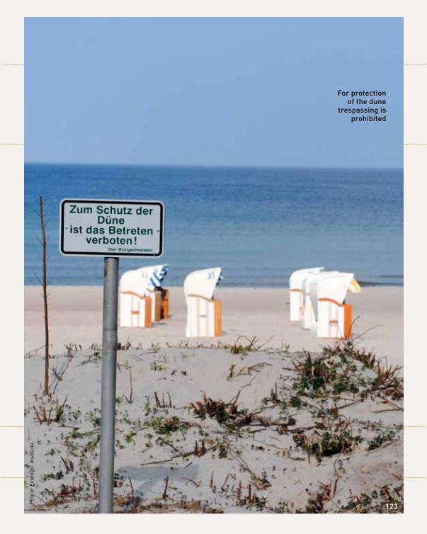
for protection of the dune
trespassing is prohibited
Pho
to: E
colo
gic
Inst
itute
123
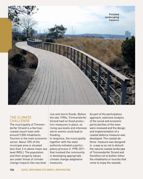
thE climAtE chAllEngEThe municipality of Timmen-dorfer Strand is a German coastal resort town with around 9,000 inhabitants. Tourism is the main economic sector. About 18% of the municipal area is situated less than 3 m above mean sea level (MSL). The population and their property values are under threat of climate change impacts like sea level
rise and storm floods. Before the late 1990s, Timmendorfer Strand had no flood protec-tion measures in place, so rising sea levels and intensive storm events could lead to flooding. In response, the municipality together with the state authority initiated a partici-patory process in 1998-2011 that involved the community in developing appropriate climate change adaptation measures.
As part of the participatory approach, extensive analysis of the social and economic particularities of the town were reviewed and the design and implementation of a coastal defence measure was developed. The coastal de-fence measure was designed in a way so as not to disturb the natural coastal landscape of Timmendorfer Strand and therefore not to bother either the inhabitants or tourists that come to enjoy the seaside.
124 cOASTAl ZONeS/humAN SeTTlemeNTS & INFRASTRucTuRe
finished landscaping
measure
Pho
tos:
Eco
logi
c In
stitu
te
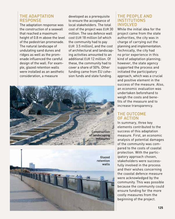
thE AdAptAtion rESponSEThe adaptation response was the construction of a seawall that reached a maximum height of 0.8 m above the level of the pedestrian promenade. The natural landscape of undulating sand dunes and ridges as well as the prom-enade influenced the careful design of the wall. For exam-ple, glazed retention walls were installed as an aesthetic consideration, a measure
developed as a prerequisite to ensure the acceptance of local stakeholders. The total cost of the project was EUR 30 million. The sea defence wall cost EUR 18 million (of which the community had to pay EUR 3.5 million), and the cost of architectural and landscap-ing activities amounted to an additional EUR 12 million. Of these, the community had to cover a share of 50%. Other funding came from EU cohe-sion funds and state funding.
thE pEoplE And inStitutionS involvEdWhile the initial idea for the project came from the state authorities, the city was in charge of carrying out the planning and implementation. Technically, the city had no prior experience in this kind of adaptation planning; however, the state agency supported the process and initiated the participatory approach, which was a crucial
11
and positive element in the success of the measure. Also, an economic evaluation was undertaken beforehand to weigh the costs and bene-fits of the measure and to increase transparency.
thE outcomE of ActionIn summary, three key elements contributed to the success of this adaptation measure. First, an economic analysis of potential damages of the community was com-pared to the costs of coastal protection. With the partic-ipatory approach chosen, stakeholders were success-fully involved in the process and their wishes concerning the coastal defence measure were acknowledged by the community. This was possible because the community could ensure funding for the more costly measures from the beginning of the project.
glazed retention
walls
construction of landscaping
measures
125

SPONTANeOuS ADAPTATION By PRIvATe AND PuBlIc AcTORS
IN The cITy ceNTRe
bASe reSeArCh pArtner ContACtEuro-mediterranean center on climate change (cmcc)
venice, italyMargaretha Breil: [email protected]
126 cOASTAl ZONeS/humAN SeTTlemeNTS & INFRASTRucTuRe
loCAtion venice, italy
1 prepAring
the ground for AdAptAtion
3 identifying
AdAptAtion optionS
4 ASSeSSing AdAptAtion
optionS
5 iMpleMentAtion
6 Monitoring
And evAluAtion
1AdAptAtion StAge
AdAptAtion ChAllenge: flooding, Sea level rise
SeCtor AffeCted: urban
geogrAphiC SCAle: local
Method: participatory, Economic Analysis
proCeSS direCtion: Bottom-up
funding: no public funding
2 ASSeSSing
riSkS And
vulnerAbility
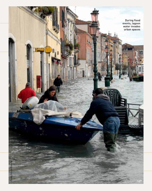
11127Pho
to: C
atul
lo R
ober
to
during flood events, lagoon water invades urban spaces
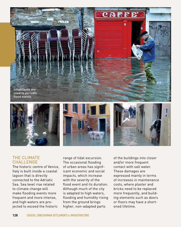
thE climAtE chAllEngEThe historic centre of Venice, Italy is built inside a coastal lagoon that is directly connected to the Adriatic Sea. Sea level rise related to climate change will make flooding events more frequent and more intense, and high waters are pro-jected to exceed the historic
range of tidal excursion. The occasional flooding of urban areas has signif-icant economic and social impacts, which increase with the severity of the flood event and its duration. Although much of the city is adapted to high waters, flooding and humidity rising from the ground brings higher, non-adapted parts
of the buildings into closer and/or more frequent contact with salt water. These damages are expressed mainly in terms of increases in maintenance costs, where plaster and bricks need to be replaced more frequently, and build-ing elements such as doors or floors may have a short-ened lifetime.
128 cOASTAl ZONeS/humAN SeTTlemeNTS & INFRASTRucTuRe
Pho
tos:
Mar
gare
tha
Bre
ilP
hoto
: Rob
erto
Tro
mbe
tta
inhabitants are used to periodic flood events
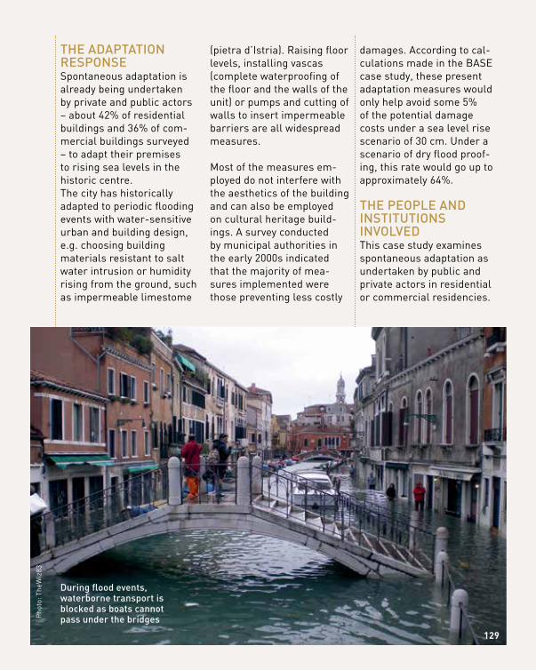
thE AdAptAtion rESponSESpontaneous adaptation is already being undertaken by private and public actors – about 42% of residential buildings and 36% of com-mercial buildings surveyed – to adapt their premises to rising sea levels in the historic centre. The city has historically adapted to periodic flooding events with water-sensitive urban and building design, e.g. choosing building materials resistant to salt water intrusion or humidity rising from the ground, such as impermeable limestome
(pietra d’Istria). Raising floor levels, installing vascas (complete waterproofing of the floor and the walls of the unit) or pumps and cutting of walls to insert impermeable barriers are all widespread measures.
Most of the measures em-ployed do not interfere with the aesthetics of the building and can also be employed on cultural heritage build-ings. A survey conducted by municipal authorities in the early 2000s indicated that the majority of mea-sures implemented were those preventing less costly
damages. According to cal-culations made in the BASE case study, these present adaptation measures would only help avoid some 5% of the potential damage costs under a sea level rise scenario of 30 cm. Under a scenario of dry flood proof-ing, this rate would go up to approximately 64%.
thE pEoplE And inStitutionS involvEdThis case study examines spontaneous adaptation as undertaken by public and private actors in residential or commercial residencies.
Pho
to: T
heW
iz83
during flood events, waterborne transport is blocked as boats cannot pass under the bridges
129
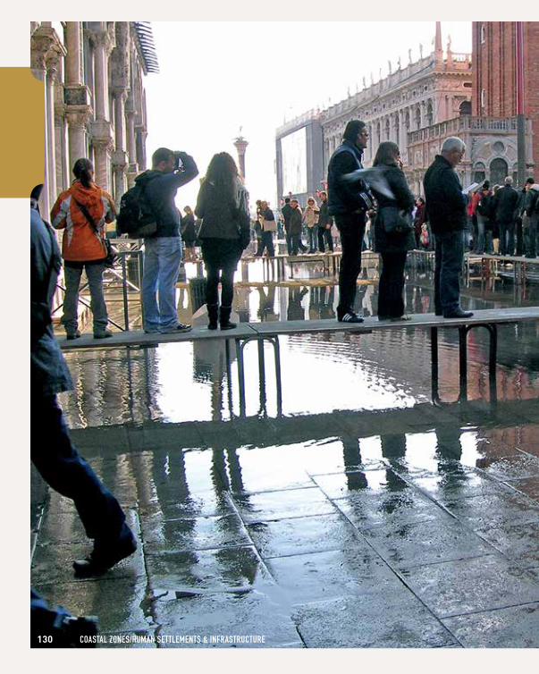
130 cOASTAl ZONeS/humAN SeTTlemeNTS & INFRASTRucTuRe
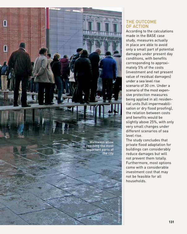
Pho
to: G
iova
nni M
ello
walkways allow reaching the most important parts of
the city
131
thE outcomE of ActionAccording to the calculations made in the BASE case study, measures actually in place are able to avoid only a small part of potential damages under present day conditions, with benefits corresponding to approxi-mately 5% of the costs (investment and net present value of residual damages) under a sea level rise scenario of 30 cm. Under a scenario of the most expen-sive protection measures being applied in all residen-tial units (full impermeabili-sation or dry flood proofing), the relation between costs and benefits would be slightly above 25%, with only very small changes under different scenarios of sea level rise. The study concludes that private flood adaptation for buildings can considerably reduce damages but will not prevent them totally. Furthermore, most options come with a considerable investment cost that may not be feasible for all households.
A viBrAnt co-Evolving ´EcoSyStEm’ BASE provides clear evidence that bottom-up and top-down processes emerge as a regenerative cycle. research shows there is no conflict between local action and top policies. relations between bottom-up initiatives and top-down strategies are potentially symbiotic and can form a vibrant and co-evolving ecosystem for collective action towards a sustainable and resilient Europe. Regardless of the starting point, case study experiences show it is critical to keep the process going. Almost half of BASE European case studies have some form of on-going bottom-up ‘autonomous’ adaptation. Measures were implemented by individuals or communities in rural and urban areas.Mainstreaming climate change adaptation will benefit greatly from socially innovative strategies, measures or networks that arise from bottom-up processes. Social innovation and multi-stakeholder involvement are fundamental pillars for collective action towards climate resilience. It is up to local, national and supranational policy, and regulatory frameworks to encourage these initiatives and recognise the need to both capacitate and learn from them.
holiStic SitESAdaptation may demand deep changes at various domains of social life, from landscape ecology to economic, political, technological and cultural dimensions. A holistic perspective is key to ensure thriving and resilient societies, today and in the future.Any action taken to adapt needs to be capable of intertwining equity consider-ations, and distribution of capacity building and vulnerability awareness. Case study research shows that adaptation solutions should not be limited to hard engineering interventions, e.g. dikes and seawalls. Well-adapted societies may need to question dominant social practices and redefine political power relationships, through increased dialogue and public participation in decision-making. A sustainable way of living in altered landscapes may even mean accepting there are limits to adaptation. For instance, some coastal settlements may face the possibility of re-locating. It is therefore vital that adaptation measures take stock of mixed ‘recipes’, integrating grey, green and soft solutions, which has been a common trait in most BASE case studies.
whAT leSSONS cAN we DRAw FROm The 23 INSPIRINg euROPeAN ADAPTATION
cASe STuDIeS?
132 leSSONS leARNT
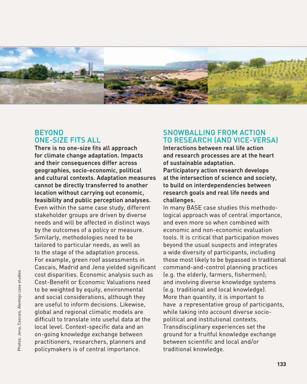
BEyond onE-SizE fitS All there is no one-size fits all approach for climate change adaptation. impacts and their consequences differ across geographies, socio-economic, political and cultural contexts. Adaptation measures cannot be directly transferred to another location without carrying out economic, feasibility and public perception analyses.Even within the same case study, different stakeholder groups are driven by diverse needs and will be affected in distinct ways by the outcomes of a policy or measure. Similarly, methodologies need to be tailored to particular needs, as well as to the stage of the adaptation process. For example, green roof assessments in Cascais, Madrid and Jena yielded significant cost disparities. Economic analysis such as Cost-Benefit or Economic Valuations need to be weighted by equity, environmental and social considerations, although they are useful to inform decisions. Likewise, global and regional climatic models are difficult to translate into useful data at the local level. Context-specific data and an on-going knowledge exchange between practitioners, researchers, planners and policymakers is of central importance.
SnowBAlling from Action to rESEArch (And vicE-vErSA)interactions between real life action and research processes are at the heart of sustainable adaptation. participatory action research develops at the intersection of science and society, to build on interdependencies between research goals and real life needs and challenges.In many BASE case studies this methodo- logical approach was of central importance, and even more so when combined with economic and non-economic evaluation tools. It is critical that participation moves beyond the usual suspects and integrates a wide diversity of participants, including those most likely to be bypassed in traditional command-and-control planning practices (e.g. the elderly, farmers, fishermen); and involving diverse knowledge systems (e.g. traditional and local knowledge). More than quantity, it is important to have a representative group of participants, while taking into account diverse socio- political and institutional contexts. Transdisciplinary experiences set the ground for a fruitful knowledge exchange between scientific and local and/or traditional knowledge.
133
Pho
tos:
Jen
a, C
asca
is, A
lent
ejo
case
stu
dies
kEEp trAck of chAngEmonitoring is a key need for developing adequate funding mechanisms and promote political commitment, but also to ensure sustainability of the measures implemented.European case study stakeholders recognised that keeping track of adaptation processes, although challenging, is a priority in order to inform decision-making and subsidy mechanisms. Evaluating is tricky and largely dependent on data availability and quality, but also on time, resources (human, material, and financial) and budget constraints. BASE case studies experimented with methodological approaches that integrate the possibility of future change (e.g. The Dynamic Adaptation Pathways; Multi-criteria Analysis) and are useful for evaluation and monitoring. yet, more methods and approaches should be developed and improved to address the challenge of monitoring highly complex and uncertain processes.
cAn’t ignorE policyclimate change adaptation has to do with political choices and is not only a matter of finding the right technical solutions.Participatory experiences such as those developed in Kalundborg, Cascais, Ílhavo and Vagos, or Dartmoor, clearly show that adaptation decisions are political in nature, because they affect different stakeholders and citizens in different ways. What might seem to decision-makers as a choice between different technical solutions, often has pros and cons for different groups of people. A number of regulatory frameworks and policies can either hinder or promote local action. One important strategy is to involve a wide range of stakeholders and citizens at the early stages of making decisions about measures. Practitioners and decision-makers need to be well informed on local, national and supranational policies, taking stock of potential synergies and addressing potential bottlenecks and constraints posed by public policies.
ADAPTATION INSPIRATION
BOOKlESSonS lEArnt
134 leSSONS leARNT
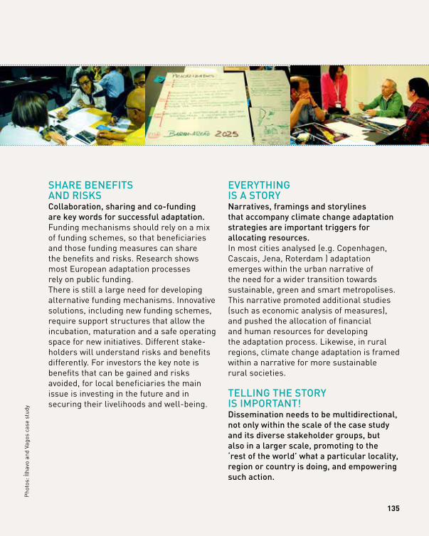
ShArE BEnEfitS And riSkScollaboration, sharing and co-funding are key words for successful adaptation. Funding mechanisms should rely on a mix of funding schemes, so that beneficiaries and those funding measures can share the benefits and risks. Research shows most European adaptation processes rely on public funding. There is still a large need for developing alternative funding mechanisms. Innovative solutions, including new funding schemes, require support structures that allow the incubation, maturation and a safe operating space for new initiatives. Different stake-holders will understand risks and benefits differently. For investors the key note is benefits that can be gained and risks avoided, for local beneficiaries the main issue is investing in the future and in securing their livelihoods and well-being.
EvErything iS A Storynarratives, framings and storylines that accompany climate change adaptation strategies are important triggers for allocating resources. In most cities analysed (e.g. Copenhagen, Cascais, Jena, Roterdam ) adaptation emerges within the urban narrative of the need for a wider transition towards sustainable, green and smart metropolises. This narrative promoted additional studies (such as economic analysis of measures), and pushed the allocation of financial and human resources for developing the adaptation process. Likewise, in rural regions, climate change adaptation is framed within a narrative for more sustainable rural societies.
tElling thE Story iS importAnt! dissemination needs to be multidirectional, not only within the scale of the case study and its diverse stakeholder groups, but also in a larger scale, promoting to the ‘rest of the world’ what a particular locality, region or country is doing, and empowering such action.
135
Pho
tos:
Ílha
vo a
nd V
agos
cas
e st
udy
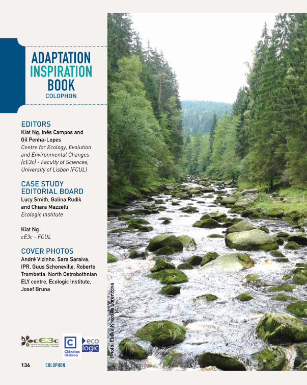
EditorSKiat Ng, Inês Campos and Gil Penha-Lopes Centre for Ecology, Evolution and Environmental Changes (cE3c) - Faculty of Sciences, University of Lisbon (FCUL)
cASE Study EditoriAl BoArdLucy Smith, Galina Rudik and Chiara Mazzetti Ecologic Institute
Kiat Ng cE3c - FCUL
covEr photoS André Vizinho, Sara Saraiva,IPR, Guus Schoneville, Roberto Trombetta, North Ostrobothnian ELY centre, Ecologic Institute, Josef Bruna
ADAPTATION INSPIRATION
BOOKcolophon
Phot
o: E
liška
Krk
oška
Lor
enco
vá
136 cOlOPhON
AgRIculTuRe & FOReSTRy/ BIODIveRSITy & ecOSySTemAndré Vizinho, Inês Campos, Filipe Moreira Alves, Ana Lúcia Fonseca and Gil Penha-Lopes cE3c - FCUL
Roos M. den Uyl and Duncan Russel University of Exeter
Ana Iglesias, Pedro Iglesias, Luis Garrote, Alvaro Sordo, Luis Mediero and Berta Sanchez UPM
Anders Branth Pedersen, Helle Ørsted Nielsen, Marianne Zandersen, Mette Termansen and Jakob Stoktoft Oddershede Aarhus University
Eliška Lorencová, David Vačkář and Blanka Loučková CzechGlobe
Zuzana Harmáčková, Eliška Lorencová, David Vačkář and Blanka Loučková CzechGlobe
Eliška Lorencová, David Vačkář and Blanka Loučková CzechGlobe
wATeR ReSOuRceS & heAlThSahran Higgins, Tim Taylor and Ben Wheeler University of Exeter
Tim Taylor and Sahran Higgins University of Exeter
Rutger van de Brugge, Suzanne van der Horst and Mark Zandvoort Deltares
Anne-Mari Rytkönen, Milla Mäenpää, Turo Hjerppe, Noora Veijalainen, Inese Huttunen, Markus Huttunen, Tiia Vento, Mika Marttunen, Antti Parjanne and Virpi Lehtoranta SYKE
Ana Iglesias, Pedro Iglesias, Luis Garrote, Alvaro Sordo, Luis Mediero and Berta Sanchez UPM
Aline Chiabai, Sebastien Foudi, Marc Neumann, Marta Olazabal and Joseph Spadaro BC3
cOASTAl ZONeS/ humAN SeTTlemeNTS & INFRASTRucTuReFilipe Moreira Alves, Inês Campos, André Vizinho, Ana Lúcia Fonseca and Gil Penha-Lopes cE3c - FCUL
Andreas Hastrup Clemmensen and Anne Haugvaldstad DBT
Anne Jensen Aarhus University
Roos M. den Uyl and Duncan Russel University of Exeter
Inês Campos, André Vizinho, Ana Lúcia Fonseca, Filipe Moreira Alves and Gil Penha-Lopes cE3c - FCUL
Oliver Gebhardt and Volker Meyer UFZ
Andreas Hastrup Clemmensen and Jeanne Svalebech DBT
Olivia Rendon, Jouni Paavola, Dabo Guan and Xin Li University of Leeds
Eliška Lorencová, Marie Hubatová, Blanka Loučková and David Vačkář CzechGlobe
Mark Zandvoort, Femke Schasfoort and Ad Jeuken Deltares
Grit Martinez, Jenny Tröltzsch and Nico Stelljes Ecologic Institute
Margaretha Breil CMCC
cASE Study AuthorS
137
dAtA SourcEEu fp7 project BASEwww.base-adaptation.eu
Art-dirEction, grAphic dESign And illuStrAtionSmarion Brogyanyi & martykreativzentrale.aticonS: Studio lakmoes, the netherlands
printingetigrafe
BASE proJEct coordinAtiondepartment of Environmental ScienceAarhus universityAarhus, denmarkcontact: hans Sanderson [email protected]
ADAPTATION INSPIRATION
BOOKcolophon
BASE AdAptAtion inSpirAtion Book coordinAtionclimate change impacts Adaptation and modeling research group (cciAm)centre for Ecology, Evolution and Environmental changes (cE3c)faculty of Sciences, university of lisbon (fcul)lisbon, portugalcontact: gil penha-lopes [email protected]
for BiBliogrAphic purpoSES, plEASE citE thiS Book AS followS:ng, k., campos, i., & penha-lopes, g. (Eds.). (2016). BASE adaptation inspiration book: 23 European cases of climate change adaptation to inspire European decision-makers, practitioners and citizens. lisbon: faculty of Sciences, university of lisbon
© 2016depósito legal: 417205/16ISBN: 978-989-99697-6-6
A multistakeholder group discusses coastal protection measures using high resolution risk assessment maps(Ílhavo and vagos case study)
138 cOlOPhON
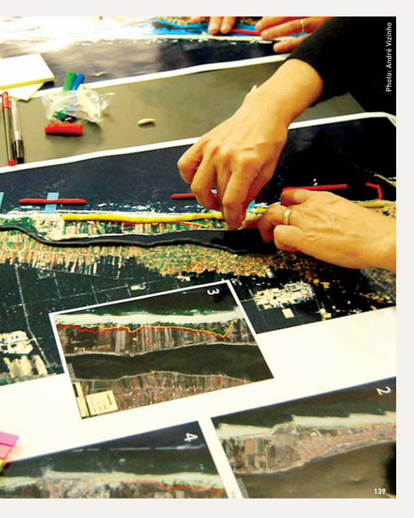
pho
to: A
ndré
viz
inho
139
ADAPTATION INSPIRATION
BOOKBASE rESEArch pArtnErS
Pho
to: B
AS
E

23 EuropEan casEs second in the adaptation inspiration Book series developed
by the faculty of sciences at university of lisbon, this inspiration book shares lessons learnt and key
messages distilled from four years of case study research carried out within the Eu fp7 project BasE:
Bottom-up climate adaptation strategies towards a sustainable Europe (2012-2016).
featuring a set of 23 case studies across European regions and sectors, it presents diverse climate change adaptation experiences. case studies illustrate the relevance of local
contexts. focal methods selected for each case study range from participatory and social learning approaches,
to economic assessment and implementation analyses.
We hope this book will inspirE, guidE & motivatE
European decision-makers, practitioners and citizens towards a more sustainable Europe in a changing climate.
BasE


![[XLS] · Web view3/5/2016. 2012. 2016. 2009. 2010. 2011. ... present adaptation actions conducted at the utility level for inspiration; 3) ... EPA PowerPoint presentation on WARN](https://img.pdfslide.net/doc/110x75/5aa60eea7f8b9a1d728df583/xls-view352016-2012-2016-2009-2010-2011-present-adaptation-actions.jpg)