Embed Size (px)
Citation preview
1
Good afternoon and welcome everyone to today’s 3D Elevation Program public meeting.
I am Diane Eldridge, the 3DEP Data Acquisition Coordinator in the National Geospatial Program of the USGS.
We appreciate your interest in the 3DEP program and are happy that you’ve taken the time to join us today.
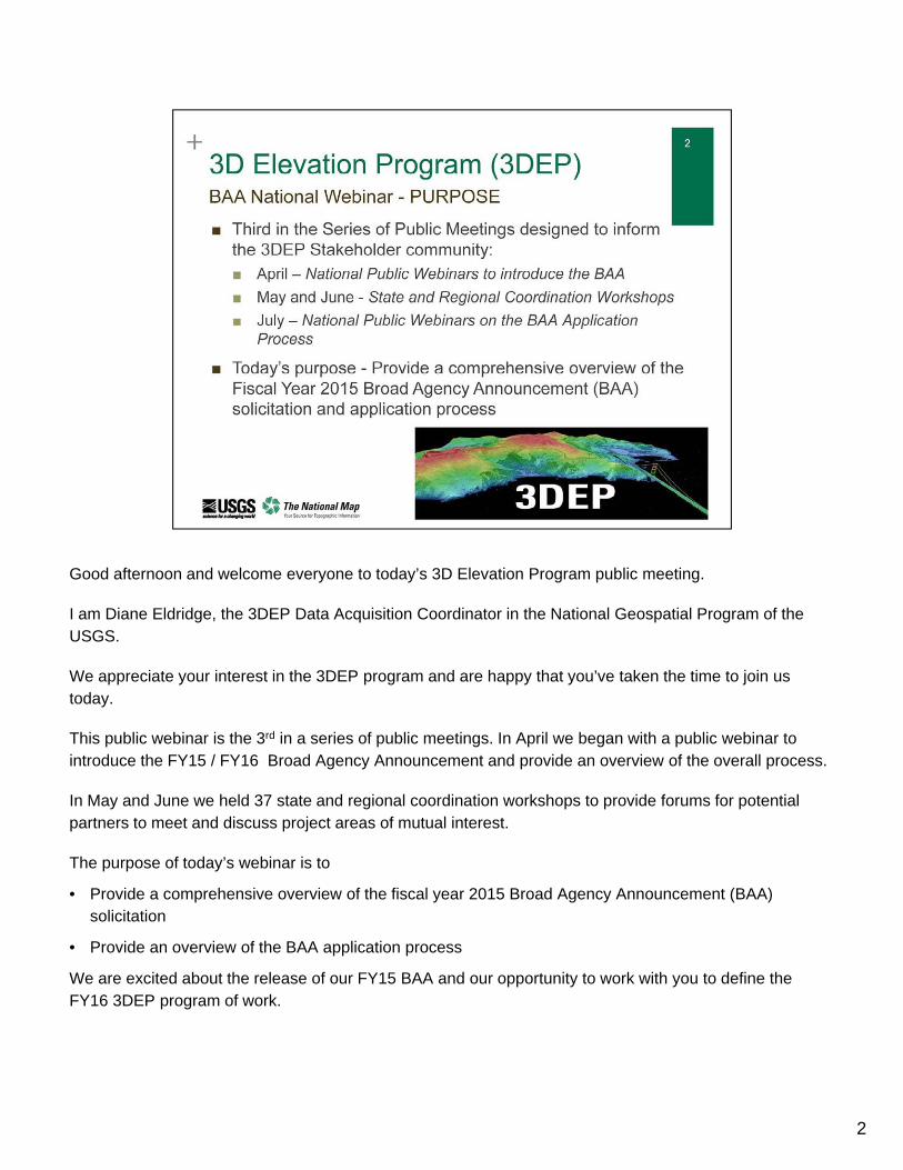
This public webinar is the 3rd in a series of public meetings. In April we began with a public webinar to introduce the FY15 / FY16 Broad Agency Announcement and provide an overview of the overall process.
In May and June we held 37 state and regional coordination workshops to provide forums for potential partners to meet and discuss project areas of mutual interest.
The purpose of today’s webinar is to
• Provide a comprehensive overview of the fiscal year 2015 Broad Agency Announcement (BAA) solicitation
• Provide an overview of the BAA application process
We are excited about the release of our FY15 BAA and our opportunity to work with you to define the FY16 3DEP program of work.
2
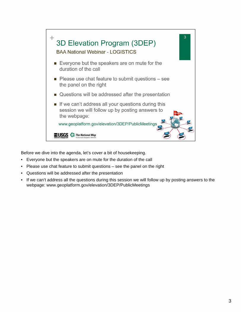
Before we dive into the agenda, let’s cover a bit of housekeeping.
• Everyone but the speakers are on mute for the duration of the call
• Please use chat feature to submit questions – see the panel on the right
• Questions will be addressed after the presentation
• If we can’t address all the questions during this session we will follow up by posting answers to the webpage: www.geoplatform.gov/elevation/3DEP/PublicMeetings
3
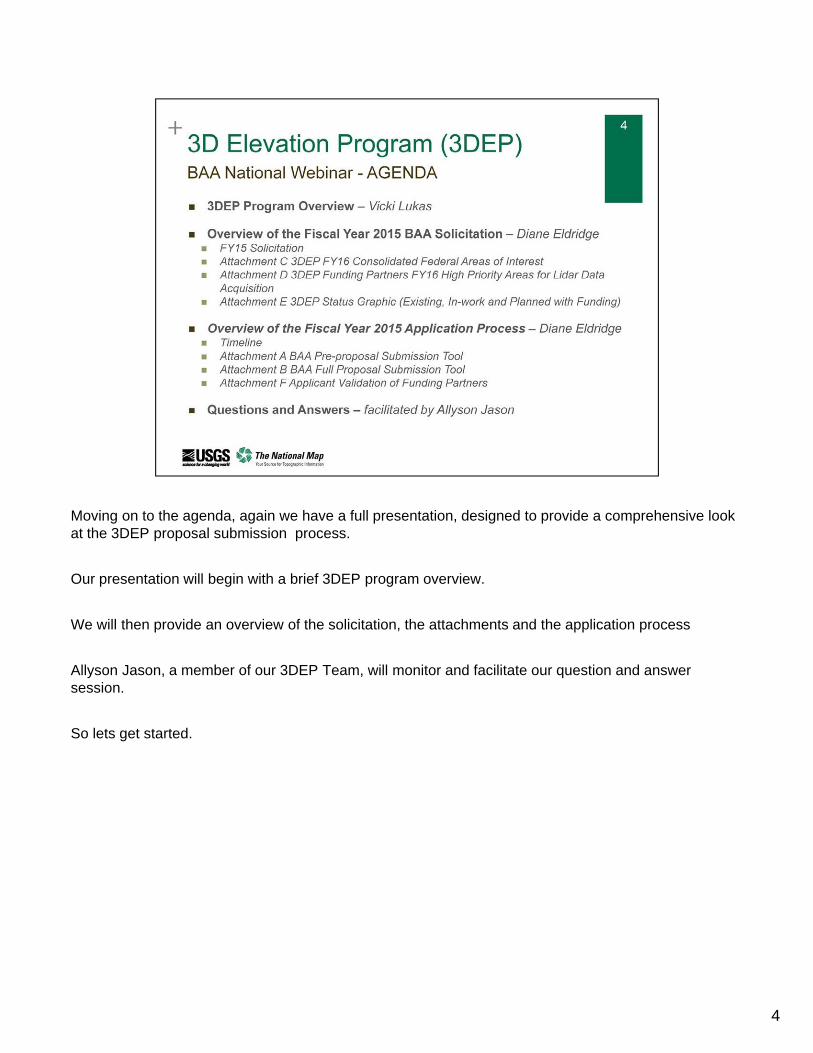
Moving on to the agenda, again we have a full presentation, designed to provide a comprehensive look at the 3DEP proposal submission process.
Our presentation will begin with a brief 3DEP program overview.
We will then provide an overview of the solicitation, the attachments and the application process
Allyson Jason, a member of our 3DEP Team, will monitor and facilitate our question and answer session.
So lets get started.
4
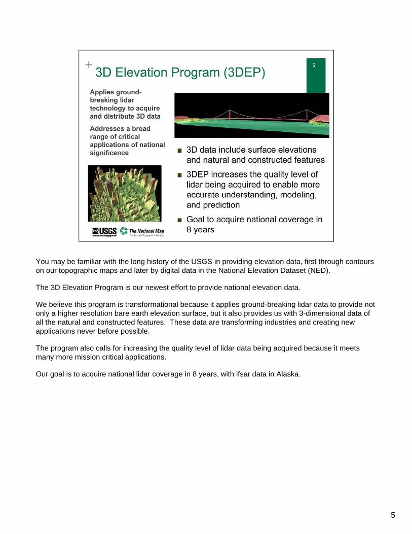
You may be familiar with the long history of the USGS in providing elevation data, first through contours on our topographic maps and later by digital data in the National Elevation Dataset (NED).
The 3D Elevation Program is our newest effort to provide national elevation data.
We believe this program is transformational because it applies ground-breaking lidar data to provide not only a higher resolution bare earth elevation surface, but it also provides us with 3-dimensional data of all the natural and constructed features. These data are transforming industries and creating new applications never before possible.
The program also calls for increasing the quality level of lidar data being acquired because it meets many more mission critical applications.
Our goal is to acquire national lidar coverage in 8 years, with ifsar data in Alaska.
5
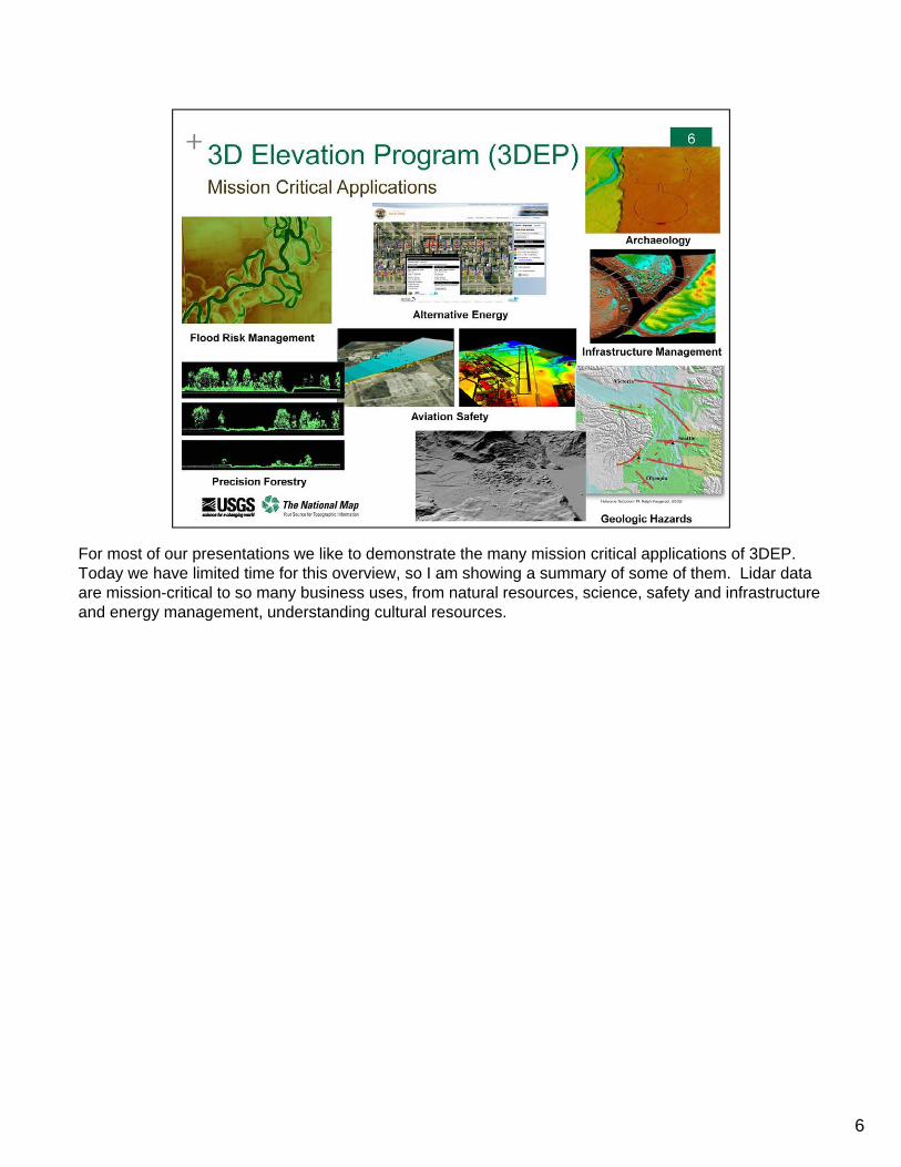
For most of our presentations we like to demonstrate the many mission critical applications of 3DEP. Today we have limited time for this overview, so I am showing a summary of some of them. Lidar data are mission-critical to so many business uses, from natural resources, science, safety and infrastructure and energy management, understanding cultural resources.
6
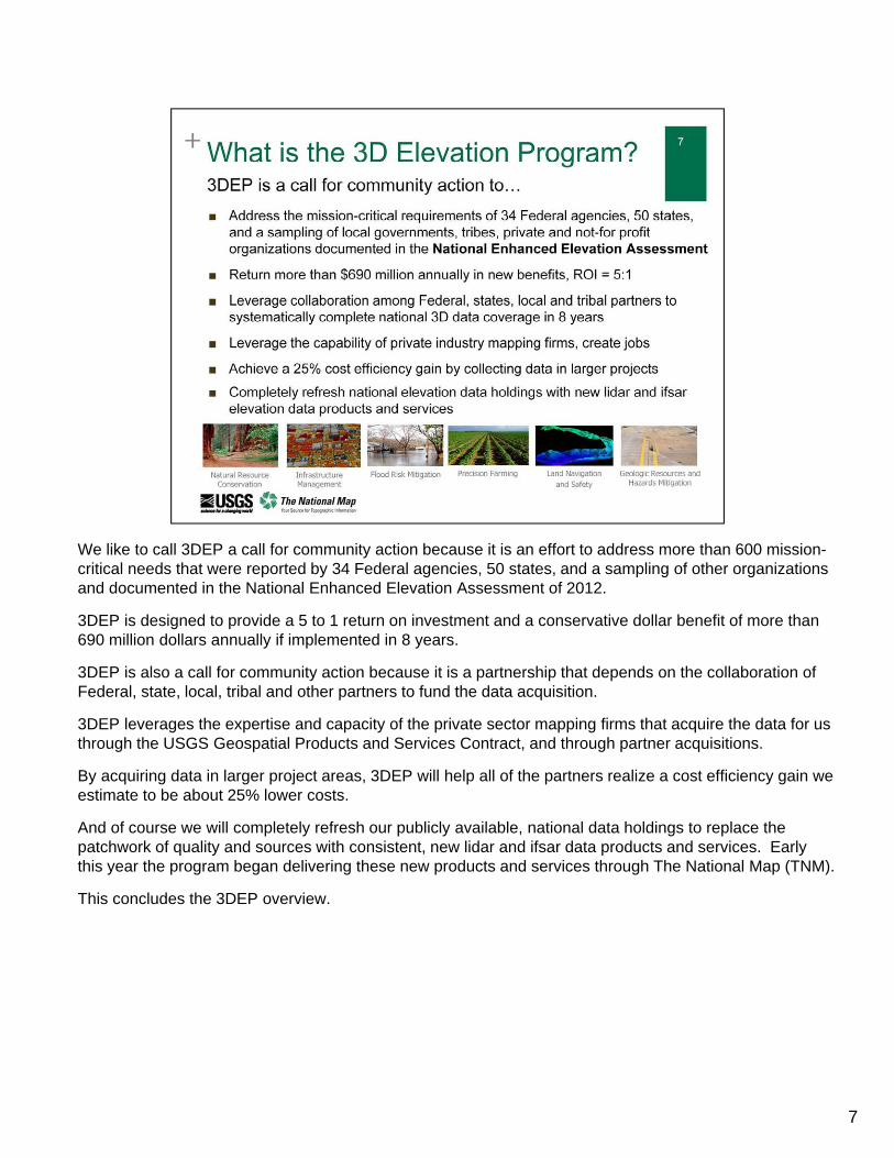
We like to call 3DEP a call for community action because it is an effort to address more than 600 mission-critical needs that were reported by 34 Federal agencies, 50 states, and a sampling of other organizations and documented in the National Enhanced Elevation Assessment of 2012.
3DEP is designed to provide a 5 to 1 return on investment and a conservative dollar benefit of more than 690 million dollars annually if implemented in 8 years.
3DEP is also a call for community action because it is a partnership that depends on the collaboration of Federal, state, local, tribal and other partners to fund the data acquisition.
3DEP leverages the expertise and capacity of the private sector mapping firms that acquire the data for us through the USGS Geospatial Products and Services Contract, and through partner acquisitions.
By acquiring data in larger project areas, 3DEP will help all of the partners realize a cost efficiency gain we estimate to be about 25% lower costs.
And of course we will completely refresh our publicly available, national data holdings to replace the patchwork of quality and sources with consistent, new lidar and ifsar data products and services. Early this year the program began delivering these new products and services through The National Map (TNM).
This concludes the 3DEP overview.
7
Once again good afternoon and thanks for participating in today’s webinar.
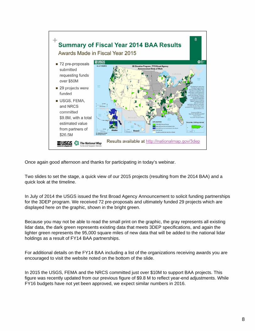
Two slides to set the stage, a quick view of our 2015 projects (resulting from the 2014 BAA) and a quick look at the timeline.
In July of 2014 the USGS issued the first Broad Agency Announcement to solicit funding partnerships for the 3DEP program. We received 72 pre-proposals and ultimately funded 29 projects which are displayed here on the graphic, shown in the bright green.
Because you may not be able to read the small print on the graphic, the gray represents all existing lidar data, the dark green represents existing data that meets 3DEP specifications, and again the lighter green represents the 95,000 square miles of new data that will be added to the national lidar holdings as a result of FY14 BAA partnerships.
For additional details on the FY14 BAA including a list of the organizations receiving awards you are encouraged to visit the website noted on the bottom of the slide.
In 2015 the USGS, FEMA and the NRCS committed just over $10M to support BAA projects. This figure was recently updated from our previous figure of $9.8 M to reflect year-end adjustments. While FY16 budgets have not yet been approved, we expect similar numbers in 2016.
8
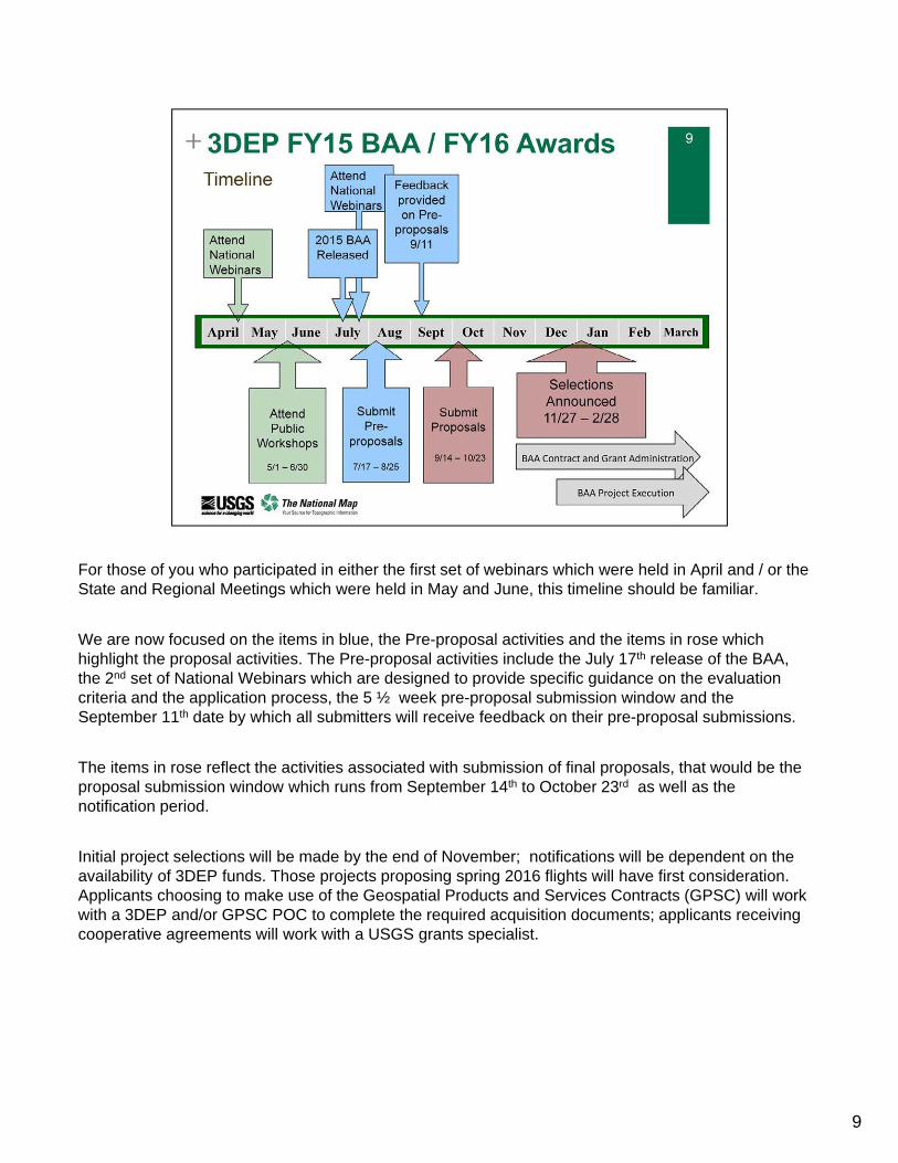
For those of you who participated in either the first set of webinars which were held in April and / or the State and Regional Meetings which were held in May and June, this timeline should be familiar.
We are now focused on the items in blue, the Pre-proposal activities and the items in rose which highlight the proposal activities. The Pre-proposal activities include the July 17th release of the BAA, the 2nd set of National Webinars which are designed to provide specific guidance on the evaluation criteria and the application process, the 5 ½ week pre-proposal submission window and the September 11th date by which all submitters will receive feedback on their pre-proposal submissions.
The items in rose reflect the activities associated with submission of final proposals, that would be the proposal submission window which runs from September 14th to October 23rd as well as the notification period.
Initial project selections will be made by the end of November; notifications will be dependent on the availability of 3DEP funds. Those projects proposing spring 2016 flights will have first consideration. Applicants choosing to make use of the Geospatial Products and Services Contracts (GPSC) will work with a 3DEP and/or GPSC POC to complete the required acquisition documents; applicants receiving cooperative agreements will work with a USGS grants specialist.
9
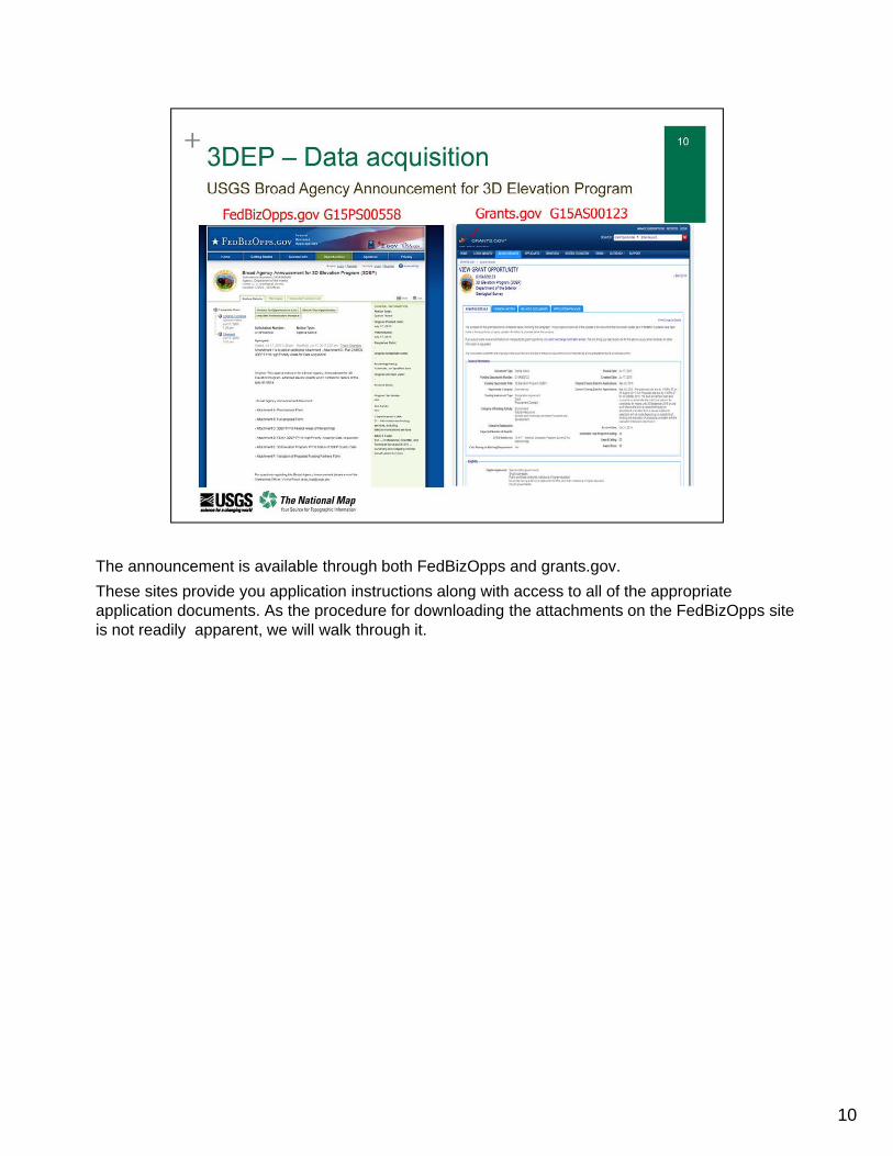
The announcement is available through both FedBizOpps and grants.gov.
These sites provide you application instructions along with access to all of the appropriate application documents. As the procedure for downloading the attachments on the FedBizOpps site is not readily apparent, we will walk through it.
10
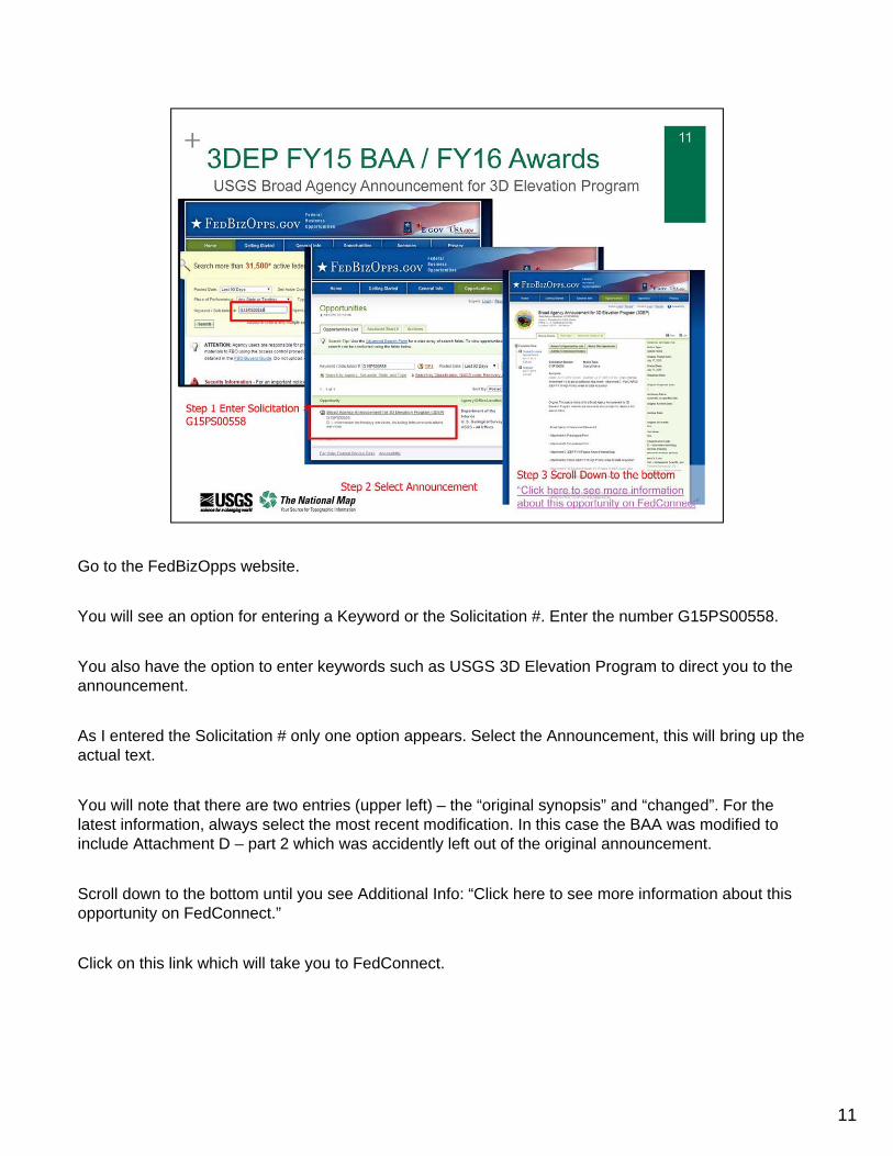
Go to the FedBizOpps website.
You will see an option for entering a Keyword or the Solicitation #. Enter the number G15PS00558.
You also have the option to enter keywords such as USGS 3D Elevation Program to direct you to the announcement.
As I entered the Solicitation # only one option appears. Select the Announcement, this will bring up the actual text.
You will note that there are two entries (upper left) – the “original synopsis” and “changed”. For the latest information, always select the most recent modification. In this case the BAA was modified to include Attachment D – part 2 which was accidently left out of the original announcement.
Scroll down to the bottom until you see Additional Info: “Click here to see more information about this opportunity on FedConnect.”
Click on this link which will take you to FedConnect.
11
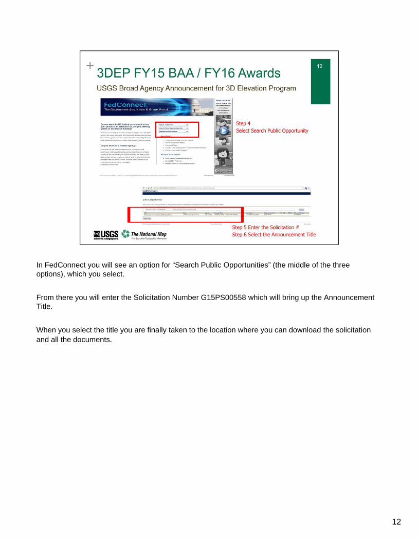
In FedConnect you will see an option for “Search Public Opportunities” (the middle of the three options), which you select.
From there you will enter the Solicitation Number G15PS00558 which will bring up the Announcement Title.
When you select the title you are finally taken to the location where you can download the solicitation and all the documents.
12
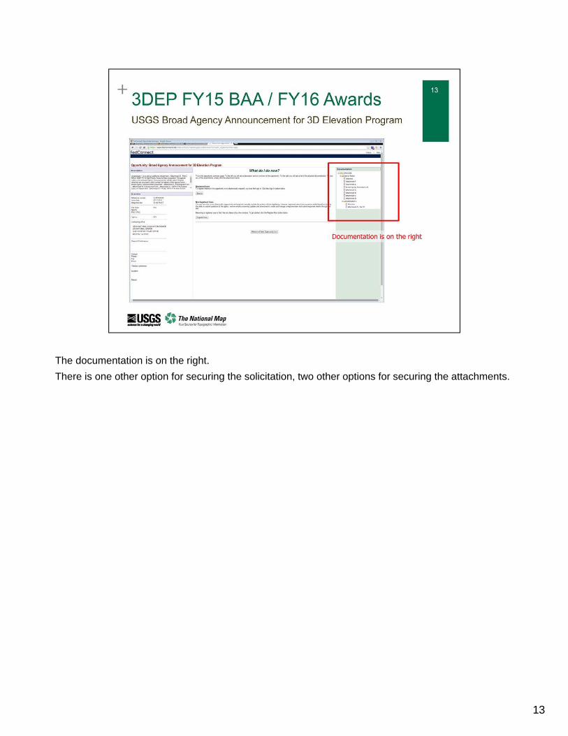
The documentation is on the right.
There is one other option for securing the solicitation, two other options for securing the attachments.
13
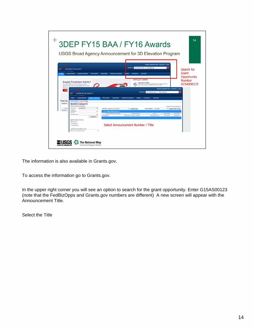
The information is also available in Grants.gov.
To access the information go to Grants.gov.
In the upper right corner you will see an option to search for the grant opportunity. Enter G15AS00123 (note that the FedBizOpps and Grants.gov numbers are different) A new screen will appear with the Announcement Title.
Select the Title
14
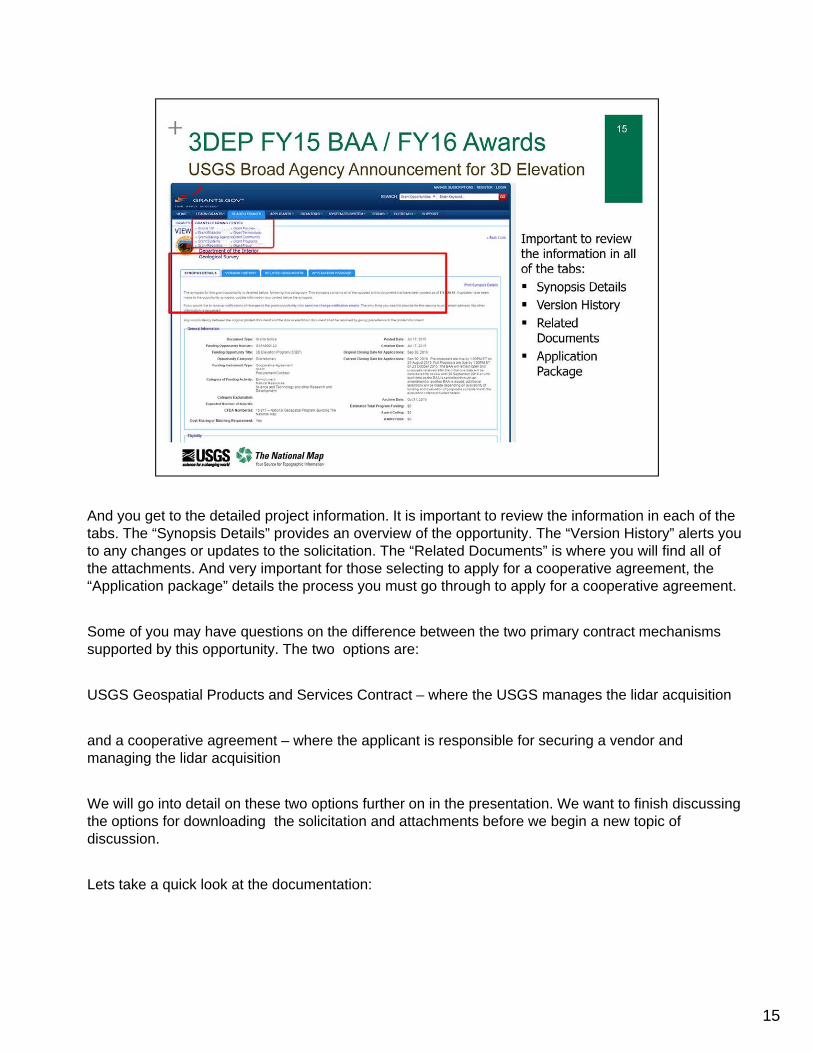
And you get to the detailed project information. It is important to review the information in each of the tabs. The “Synopsis Details” provides an overview of the opportunity. The “Version History” alerts you to any changes or updates to the solicitation. The “Related Documents” is where you will find all of the attachments. And very important for those selecting to apply for a cooperative agreement, the “Application package” details the process you must go through to apply for a cooperative agreement.
Some of you may have questions on the difference between the two primary contract mechanisms supported by this opportunity. The two options are:
USGS Geospatial Products and Services Contract – where the USGS manages the lidar acquisition
and a cooperative agreement – where the applicant is responsible for securing a vendor and managing the lidar acquisition
We will go into detail on these two options further on in the presentation. We want to finish discussing the options for downloading the solicitation and attachments before we begin a new topic of discussion.
Lets take a quick look at the documentation:
15
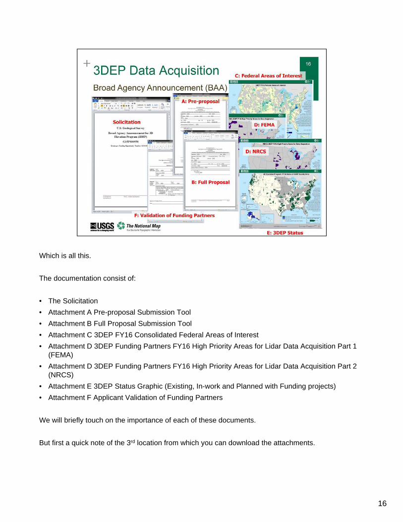
Which is all this.
The documentation consist of:
• The Solicitation
• Attachment A Pre-proposal Submission Tool
• Attachment B Full Proposal Submission Tool
• Attachment C 3DEP FY16 Consolidated Federal Areas of Interest
• Attachment D 3DEP Funding Partners FY16 High Priority Areas for Lidar Data Acquisition Part 1 (FEMA)
• Attachment D 3DEP Funding Partners FY16 High Priority Areas for Lidar Data Acquisition Part 2 (NRCS)
• Attachment E 3DEP Status Graphic (Existing, In-work and Planned with Funding projects)
• Attachment F Applicant Validation of Funding Partners
We will briefly touch on the importance of each of these documents.
But first a quick note of the 3rd location from which you can download the attachments.
16
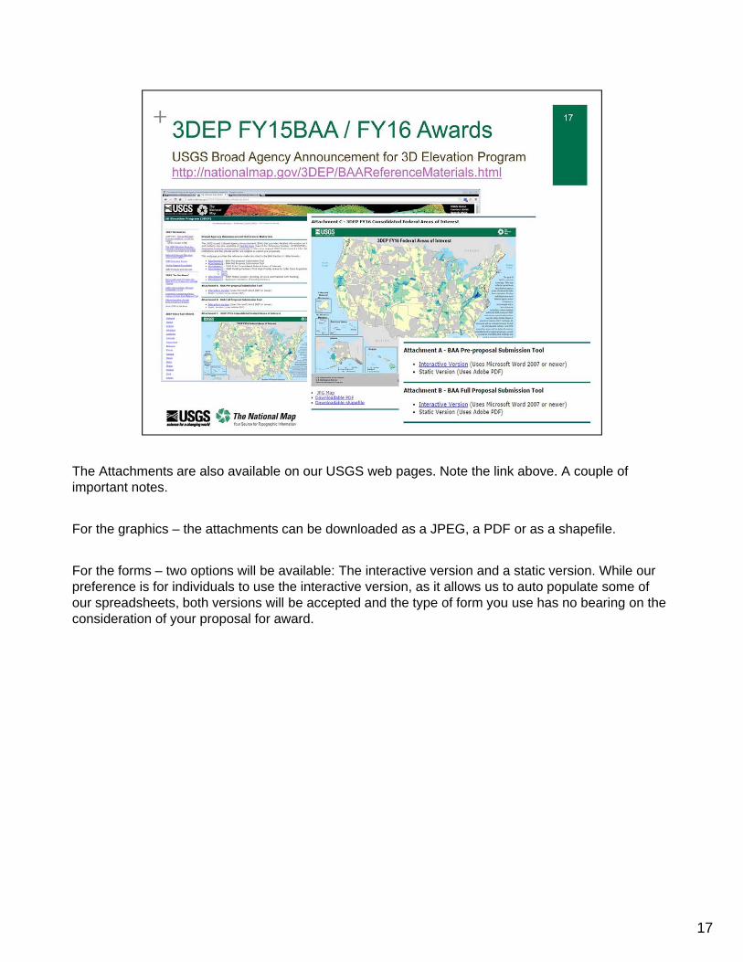
The Attachments are also available on our USGS web pages. Note the link above. A couple of important notes.
For the graphics – the attachments can be downloaded as a JPEG, a PDF or as a shapefile.
For the forms – two options will be available: The interactive version and a static version. While our preference is for individuals to use the interactive version, as it allows us to auto populate some of our spreadsheets, both versions will be accepted and the type of form you use has no bearing on the consideration of your proposal for award.
17
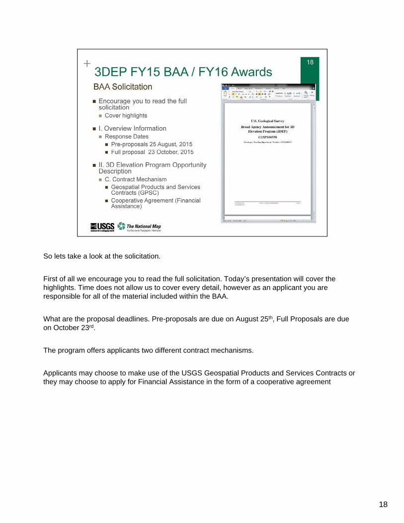
So lets take a look at the solicitation.
First of all we encourage you to read the full solicitation. Today’s presentation will cover the highlights. Time does not allow us to cover every detail, however as an applicant you are responsible for all of the material included within the BAA.
What are the proposal deadlines. Pre-proposals are due on August 25th, Full Proposals are due on October 23rd.
The program offers applicants two different contract mechanisms.
Applicants may choose to make use of the USGS Geospatial Products and Services Contracts or they may choose to apply for Financial Assistance in the form of a cooperative agreement
18
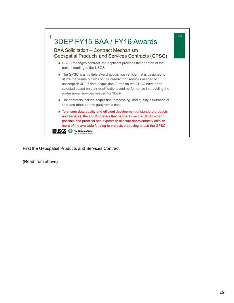
First the Geospatial Products and Services Contract
(Read from above)
19
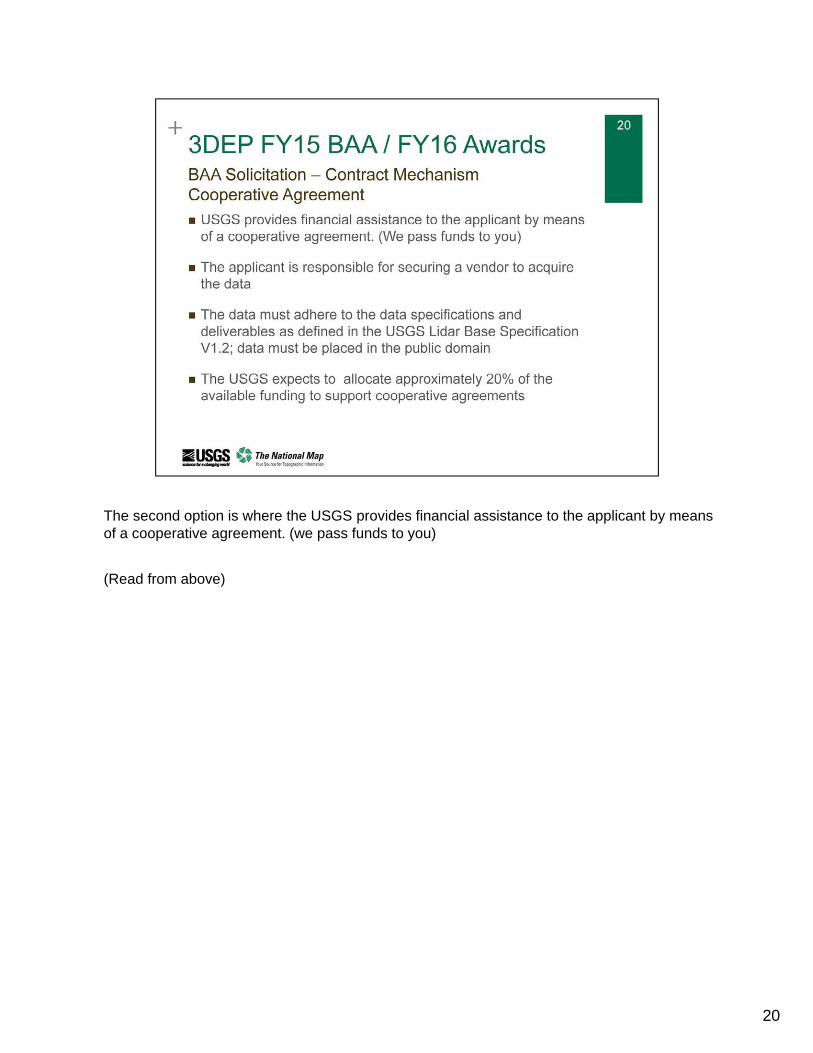
The second option is where the USGS provides financial assistance to the applicant by means of a cooperative agreement. (we pass funds to you)
(Read from above)
20
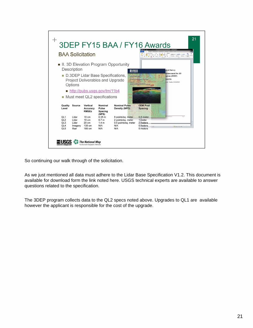
So continuing our walk through of the solicitation.
As we just mentioned all data must adhere to the Lidar Base Specification V1.2. This document is available for download form the link noted here. USGS technical experts are available to answer questions related to the specification.
The 3DEP program collects data to the QL2 specs noted above. Upgrades to QL1 are available however the applicant is responsible for the cost of the upgrade.
21
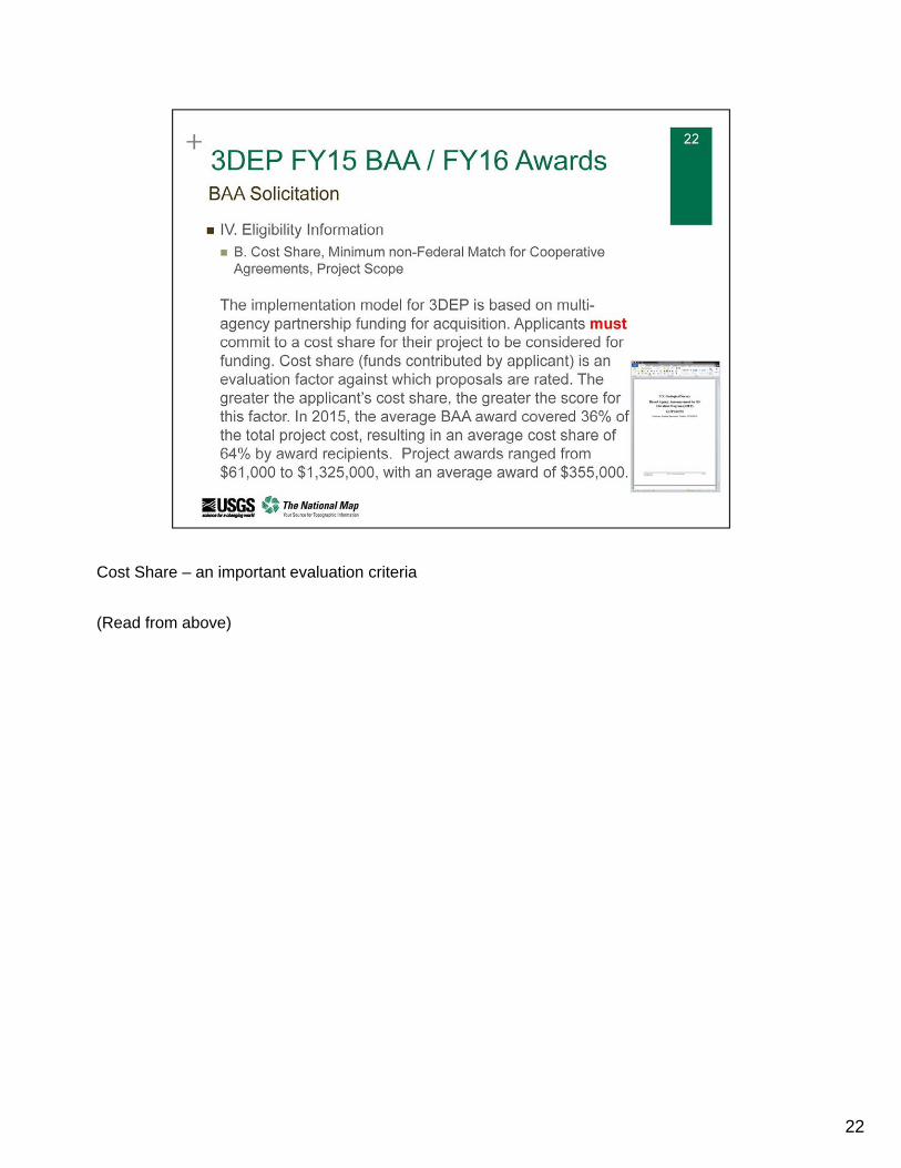
Cost Share – an important evaluation criteria
(Read from above)
22
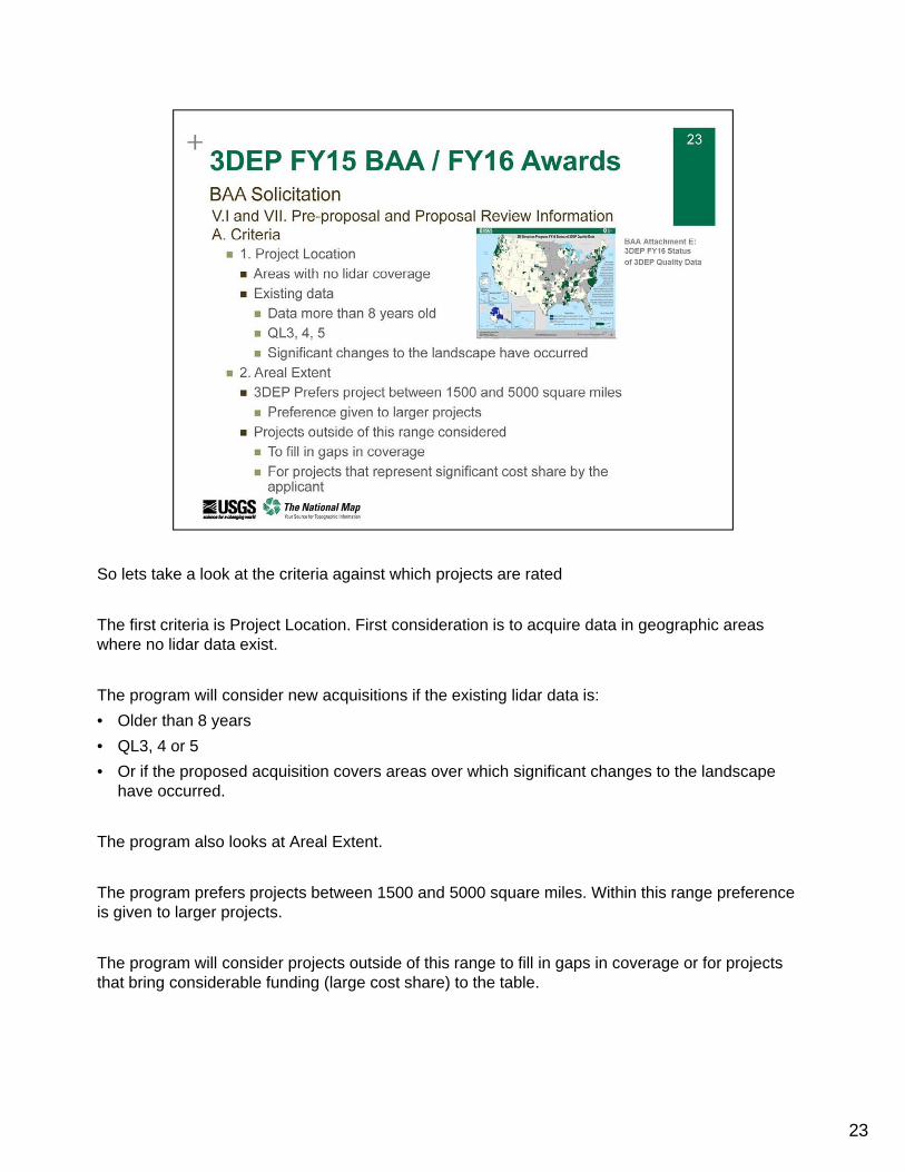
So lets take a look at the criteria against which projects are rated
The first criteria is Project Location. First consideration is to acquire data in geographic areas where no lidar data exist.
The program will consider new acquisitions if the existing lidar data is:
• Older than 8 years
• QL3, 4 or 5
• Or if the proposed acquisition covers areas over which significant changes to the landscape have occurred.
The program also looks at Areal Extent.
The program prefers projects between 1500 and 5000 square miles. Within this range preference is given to larger projects.
The program will consider projects outside of this range to fill in gaps in coverage or for projects that bring considerable funding (large cost share) to the table.
23
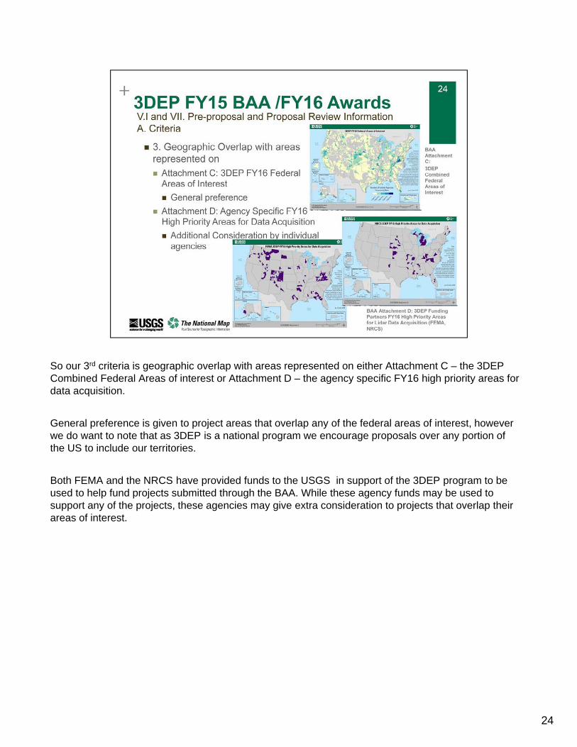
So our 3rd criteria is geographic overlap with areas represented on either Attachment C – the 3DEP Combined Federal Areas of interest or Attachment D – the agency specific FY16 high priority areas for data acquisition.
General preference is given to project areas that overlap any of the federal areas of interest, however we do want to note that as 3DEP is a national program we encourage proposals over any portion of the US to include our territories.
Both FEMA and the NRCS have provided funds to the USGS in support of the 3DEP program to be used to help fund projects submitted through the BAA. While these agency funds may be used to support any of the projects, these agencies may give extra consideration to projects that overlap their areas of interest.
24
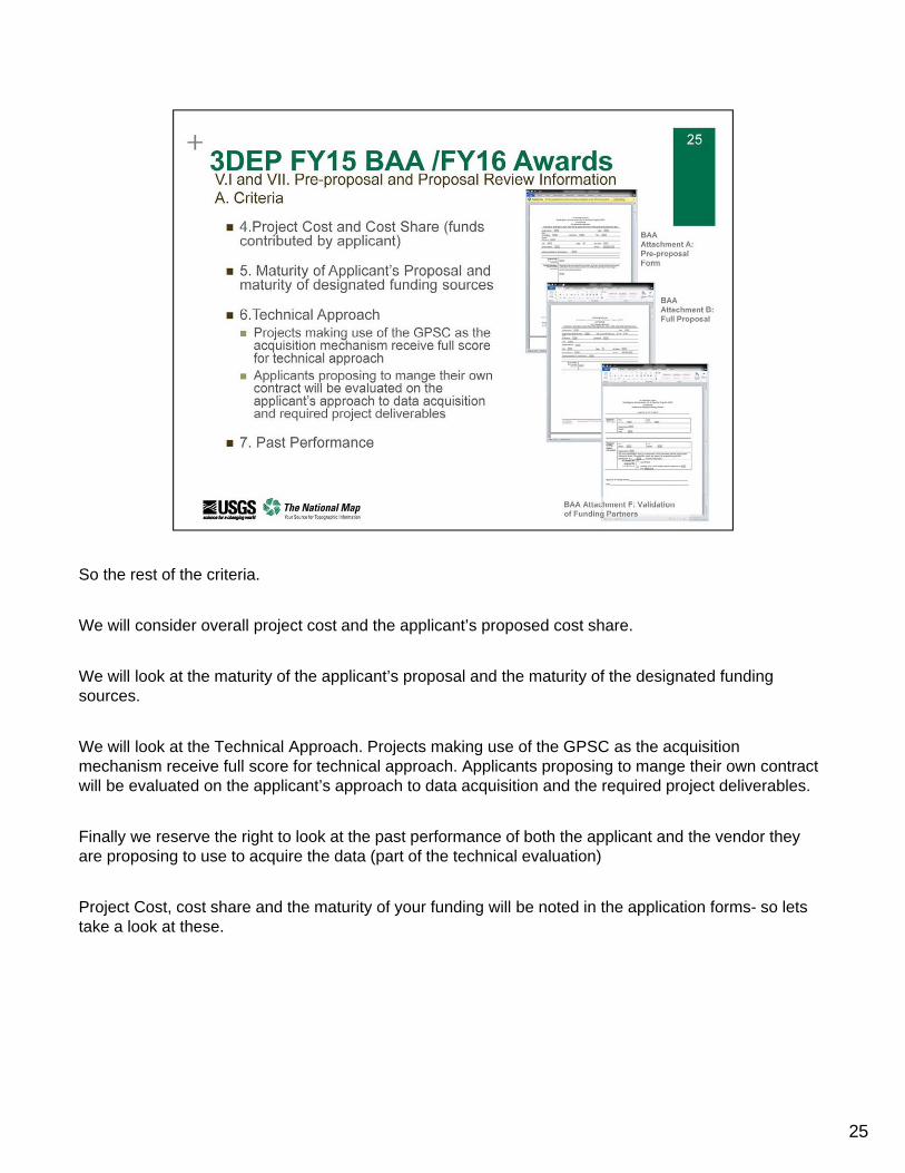
So the rest of the criteria.
We will consider overall project cost and the applicant’s proposed cost share.
We will look at the maturity of the applicant’s proposal and the maturity of the designated funding sources.
We will look at the Technical Approach. Projects making use of the GPSC as the acquisition mechanism receive full score for technical approach. Applicants proposing to mange their own contract will be evaluated on the applicant’s approach to data acquisition and the required project deliverables.
Finally we reserve the right to look at the past performance of both the applicant and the vendor they are proposing to use to acquire the data (part of the technical evaluation)
Project Cost, cost share and the maturity of your funding will be noted in the application forms- so lets take a look at these.
25
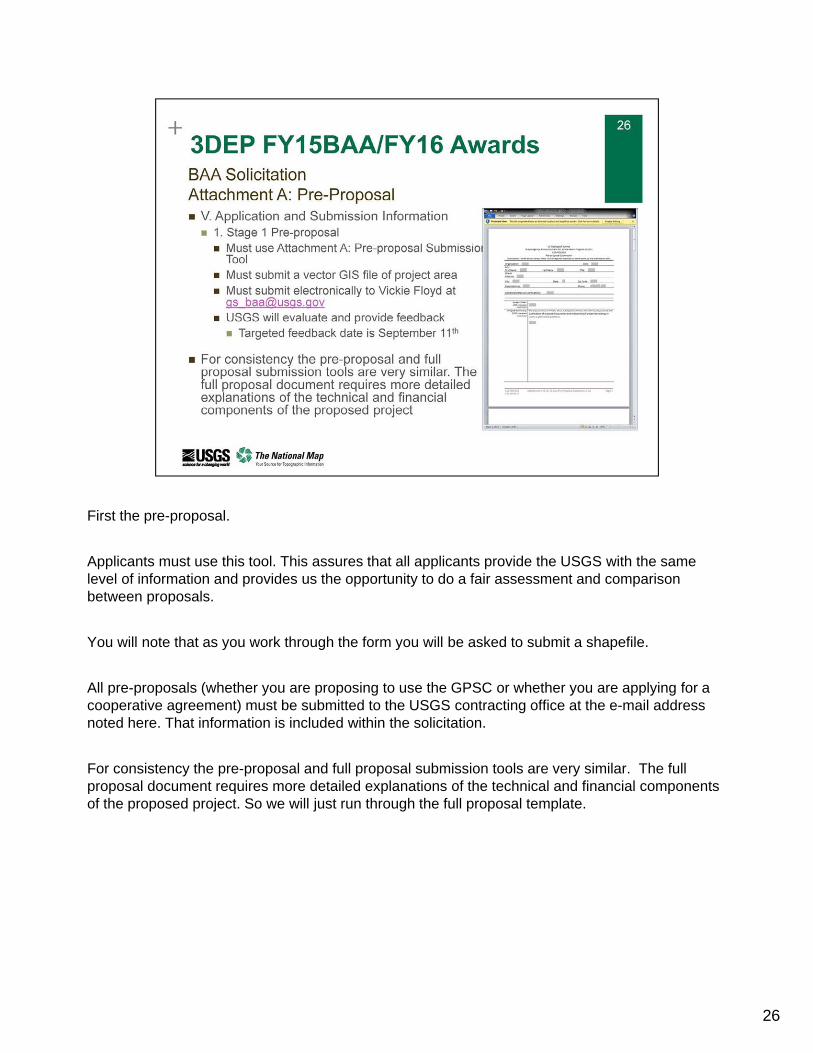
First the pre-proposal.
Applicants must use this tool. This assures that all applicants provide the USGS with the same level of information and provides us the opportunity to do a fair assessment and comparison between proposals.
You will note that as you work through the form you will be asked to submit a shapefile.
All pre-proposals (whether you are proposing to use the GPSC or whether you are applying for a cooperative agreement) must be submitted to the USGS contracting office at the e-mail address noted here. That information is included within the solicitation.
For consistency the pre-proposal and full proposal submission tools are very similar. The full proposal document requires more detailed explanations of the technical and financial components of the proposed project. So we will just run through the full proposal template.
26
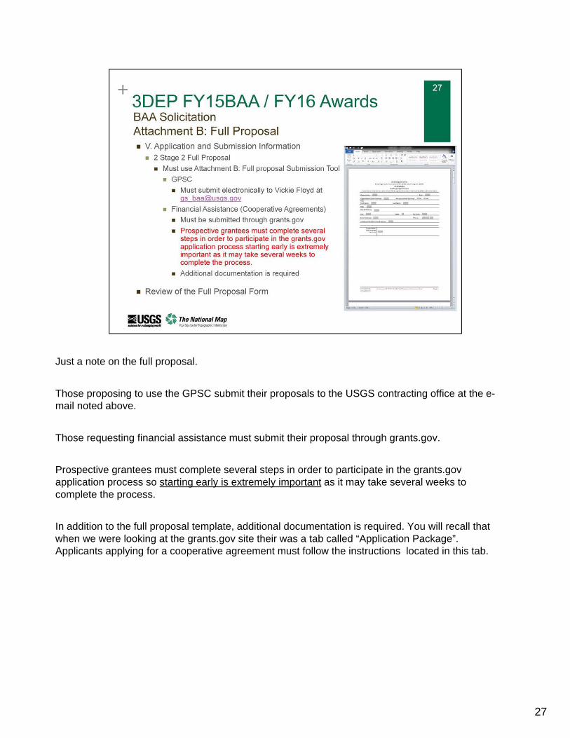
Just a note on the full proposal.
Those proposing to use the GPSC submit their proposals to the USGS contracting office at the e-mail noted above.
Those requesting financial assistance must submit their proposal through grants.gov.
Prospective grantees must complete several steps in order to participate in the grants.gov application process so starting early is extremely important as it may take several weeks to complete the process.
In addition to the full proposal template, additional documentation is required. You will recall that when we were looking at the grants.gov site their was a tab called “Application Package”. Applicants applying for a cooperative agreement must follow the instructions located in this tab.
27
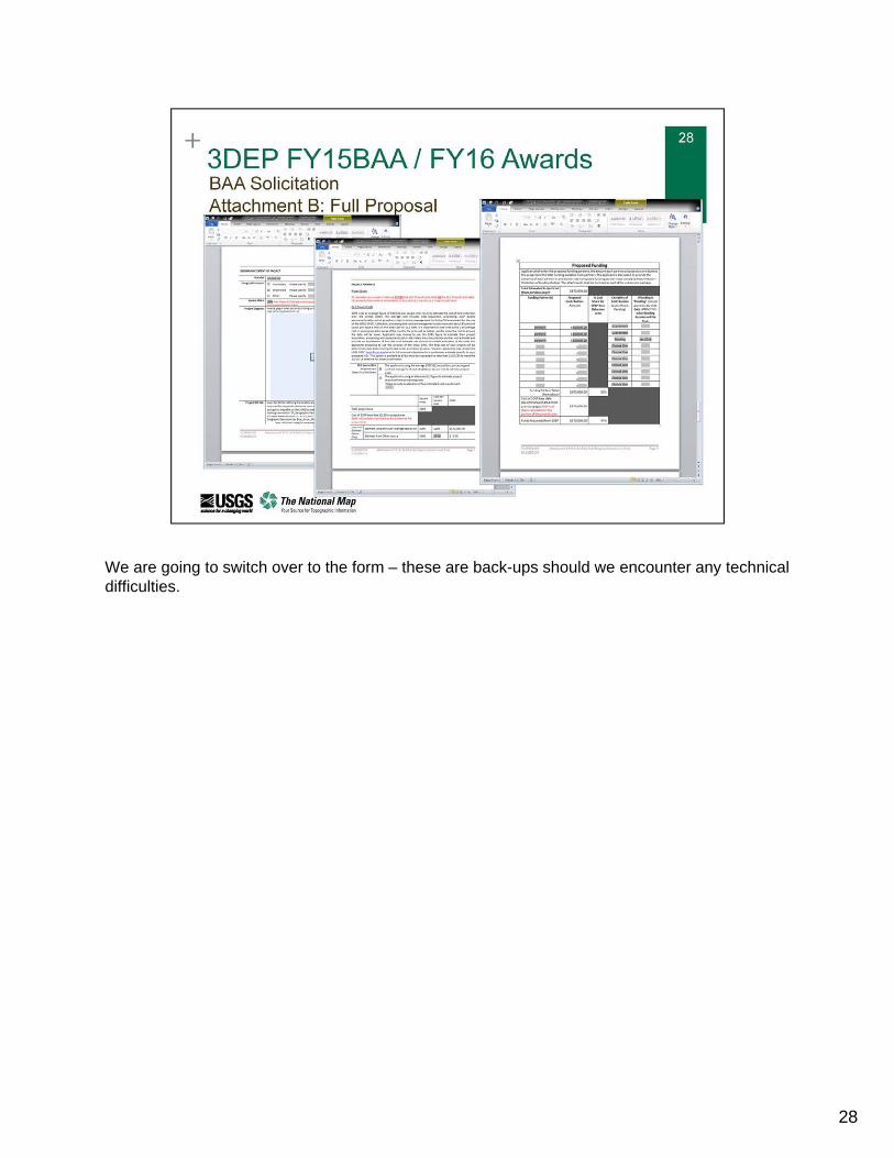
We are going to switch over to the form – these are back-ups should we encounter any technical difficulties.
28
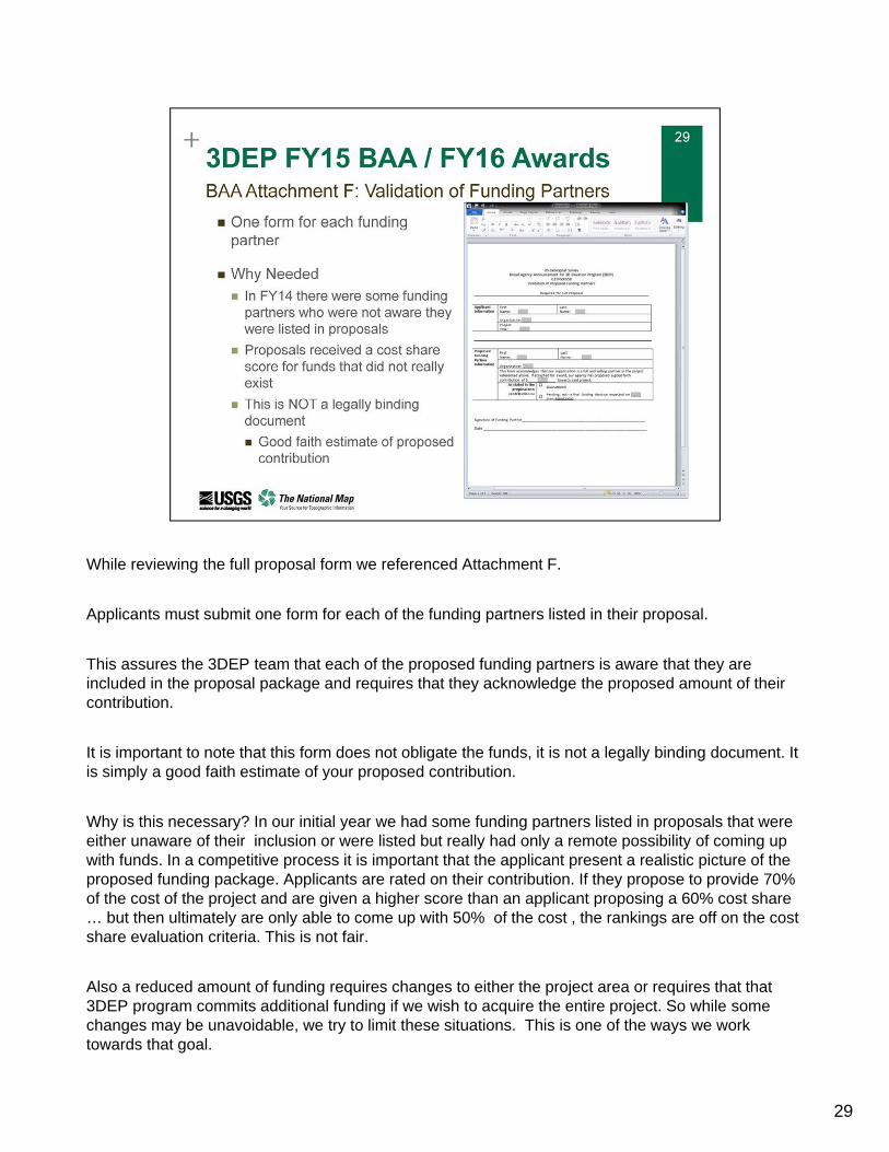
While reviewing the full proposal form we referenced Attachment F.
Applicants must submit one form for each of the funding partners listed in their proposal.
This assures the 3DEP team that each of the proposed funding partners is aware that they are included in the proposal package and requires that they acknowledge the proposed amount of their contribution.
It is important to note that this form does not obligate the funds, it is not a legally binding document. It is simply a good faith estimate of your proposed contribution.
Why is this necessary? In our initial year we had some funding partners listed in proposals that were either unaware of their inclusion or were listed but really had only a remote possibility of coming up with funds. In a competitive process it is important that the applicant present a realistic picture of the proposed funding package. Applicants are rated on their contribution. If they propose to provide 70% of the cost of the project and are given a higher score than an applicant proposing a 60% cost share … but then ultimately are only able to come up with 50% of the cost , the rankings are off on the cost share evaluation criteria. This is not fair.
Also a reduced amount of funding requires changes to either the project area or requires that that 3DEP program commits additional funding if we wish to acquire the entire project. So while some changes may be unavoidable, we try to limit these situations. This is one of the ways we work towards that goal.
29
30
That ends the formal presentation, we will now address questions. Note that responses to the questions asked on both of our national webinars will be documented and presented on our 3DEP information sharing site web site. The written responses may be more thorough than our initial response to provide an opportunity for the 3DEP program to provide background and/or contextual information necessary to completely respond to your question.
Allyson Jason from our USGS 3DEP team will now facilitate the Question and Answer session.
31
32