Embed Size (px)
Citation preview

Photo by: Gina Shirey-Potts
The Bering Straits Coastal Resource Service Area (CRSA) includes both Iñupiat and Yup’ik Eskimos. There are approximately 21 groups of Eskimo Natives in this region separated by cultural, linguistic, and geographic factors. Traditionally, an extensive trading network allowed people in a village to harvest local resources that could be traded with other villages. Products from Siberia such as iron, tea, and tobacco reached the region long before Russians explored the area. The locals were adaptable and moved whenever it was necessary to respond to changing animal migration patterns, flooding, landslides, and changing river courses. As caribou populations dwindled in the 1870s, most villagers moved to the coast. After a whaler found silver ore in Golovin Bay in the late 1870s, mineral interest in the region increased. By 1910, the most accessible mineral deposits were depleted, and few miners remained in area. Beginning in the 1960s, local residents began commercial fishing, and this activity continues today.
Brief History:
Bering Straits CRSA
Pg. 4 State of Alaska

Distance between Bering Straits and
Anchorage: 539 miles
Seattle: 1,976 miles
Miami: 4,488 miles
Washington D.C. : 3,797 miles
5,566
3,263 miles
20,314 square miles
10-20”
30-60”
20 hours, 5 min
6 hours, 17 min
Bering Straits Native Corp
39 T
Population (2007):
Shoreline:
Coastal Area:
Annual Precipitation:
Annual Snowfall:
Hours of Daylight Summer:
Hours of Daylight Winter:
Regional Native Corporation:
Legislative District:
Photo by: Randy Bates
Photo by: Randy BatesPg. 5Division of Coastal & Ocean Management

AKCIAP_NR_BSCRSA_T1-01
1
STATE OF ALASKA COASTAL IMPACT ASSISTANCE PROGRAM
BERING STRAITS COASTAL RESOURCE SERVICE AREA
The CRSA will be conducting this project as a legislatively named CIAP recipient on behalf of the State of Alaska
PROJECT TITLE: Coastal Management Plan Update PROJECT CONTACT
Contact Name: Paul Rookok Sr. Address: P.O. Box 28, Unalakleet, AK 99684 Telephone Number: (907) 624-3531 Fax Number: (907) 624-3833 Email Address: [email protected]
PROJECT LOCATION This project will update the Bering Straits Coastal Resource Service Area (BSCRSA) Coastal Management Plan which includes all areas within the coastal zone of the BSCRSA. PROJECT DURATION 3 years ESTIMATED COST:
Spending Estimate ($) TOTAL Year 1 Year 2 Year 3 Year 4 $129,800 $68,300 $56,000 $5,500 0
Funding per Allocation Year of CIAP ($)
TOTAL FY 07 FY 08 FY 09 FY 10 $129,800 $129,800
PROJECT DESCRIPTION: The purpose of this project is to update the BSCRSA Coastal Management Plan. This update serves several purposes. It will be used to implement the statewide standards of the federally-approved Alaska Coastal Management Program (ACMP). It will also be used to update the Coastal Management Plan for the BSCRSA which is expected to receive federal approval during 2010. The currently proposed coastal management plan for the BSCRSA received approval from the Alaska Department of Natural Resources (DNR) Commissioner on November 1, 2007, and it is expected to receive federal approval in 2010. In addition to its usefulness for coastal management, the plan update will include information that will be used during state and federal permit reviews and during agency planning by providing critical information needed to manage coastal areas and resources.

AKCIAP_NR_BSCRSA_T1-01
2
Each of the project components will benefit the natural coastal environment of the BSCRSA. Development projects impact coastal resources and uses, and this project will provide useful tools to protect coastal areas that are not available in the current DNR-approved plan.
Area Designations: The designation of subsistence use and important habitat areas will improve the ability for state agencies and the BSCRSA to minimize impacts to the natural coastal environment. Designation of subsistence use areas will enable the BSCRSA and the State of Alaska to protect subsistence use areas because without designated areas, the statewide subsistence standard (11 AAC 112.270) cannot be used. Similarly, the statewide habitats standard (11 AAC 112.300) does not apply to upland habitats unless an area is designated as important habitat. Areas must first be designated before approval of enforceable policies for subsistence use or important habitat (11 AAC 112.270)
Enforceable Policies: Enforceable policies will directly benefit the natural coastal environment by providing requirements that avoid, minimize or mitigate impacts to coastal areas. Also, enforceable policies enable state agencies and the BSCRSA to propose alternative measures to address potential impacts from a development project. Applicants must incorporate alternative measures into their project description.
New Maps: The electronic maps produced for this project will allow the maps to be shared with a broader audience and provide critical information that will enhance decisions about activities that affect the coastal environment. These maps will be used by residents, state and federal agencies and project applicants.
Updated Information: New information will be added to the resource inventory and analysis of the Coastal Management Plan. Like the maps, up-to-date information will be useful to state and federal agencies in their efforts to protect coastal areas.
The BSCRSA board has determined subsistence use is the most important coastal use to the residents of the region. Subsistence provides a nutritious food source, a bond among community residents and cultural identity. The high cost of food and the lack of employment opportunities make subsistence a necessity for many families in the BSCRSA’s 15 rural villages. Subsistence foods are often shared among people in the BSCRSA and with people in other regions of the state. Of equal importance, subsistence provides a direct link to the Inupiat and Yupik cultures. Personnel: The BSCRSA Program Manager will be an active participant in the project, and this position will manage project contractors. A request for proposals will be issued for one or more contractors to provide GIS mapping services and for updating the Coastal Management Plan. Subsistence Use Area Designations and Policies: During year one, maps of subsistence uses will be prepared at a scale of 1:250,000 in compliance with State of Alaska Geographic Information System (GIS) protocols. Information from maps in the 1984 BSCRSA Resource Inventory will be used to develop the draft GIS maps.1 There are 11 quadrangles in the BSCRSA, and it is expected that four maps will be prepared for each quadrangle for an estimated total of 44 maps. Creating new maps will require assistance from a GIS specialist to digitize all of the existing information and ensure all data points are geographically referenced. Although the 1984 maps were prepared from information provided by subsistence users in each of the BSCRSA communities, hard copies of the draft maps will be distributed to the
1 The DNR has determined that the 1984 maps cannot be used for designated subsistence areas because they are the wrong scale.

AKCIAP_NR_BSCRSA_T1-01
3
communities to incorporate new information and to ensure the areas identified on the maps reflect customary and traditional subsistence use of wild, renewable resources. The maps will also be made available to interested state and federal agencies for review and comment. The maps will be amended as appropriate to respond to comments and include new information. Federal and state agencies and local organizations will be contacted to determine if new information about subsistence use has become available since completion of the current Coastal Management Plan. While the BSCRSA is not aware of any mapping efforts for subsistence other than the 1984 maps, it is possible that other kinds of subsistence studies have been conducted. Important Habitat Area and Policies: Also during year one, communities and state and federal agencies will be contacted to determine if there are any significant habitats that merit designation as important habitat in the BSCRSA Coastal Management Plan. These areas will be either described or mapped in accordance with the requirements of the ACMP regulations (11 AAC 114.270(g)). The resource inventory and analysis will be updated to include supporting information for the proposed designated areas. Important habitat areas will be proposed for areas identified by the communities that meet the criteria in 11 AAC 114.250(h): (1) Use of designated areas must have a direct and significant impact on coastal waters, and (2) the designated areas must be shown by written scientific evidence to be biologically and significantly productive. Enforceable policies will be developed for the important habitat areas. Other Resources and Uses: In addition to the subsistence use and important habitat area designations described above, the plan will be updated to include more detailed information about other coastal resources and uses. The consultant will compile information through a literature search, review of agency websites and databases, contacts with state and federal management agencies, and contacts with Native corporations, tribes and nonprofit organizations. Maps will be prepared for the following resources and uses: Linguistic (cultural) boundaries, reindeer grazing areas, natural hazards, geologic resources, coastal habitats,2 fish and shellfish, marine mammals, land mammals, commercial fishing districts, and landownership. The maps in the 1984 Resource Inventory of the BSCRSA (Volume 1 of the Coastal Management Plan) will be used as a starting point for preparing new maps. Since these maps are not in electronic format, a GIS specialist will develop new maps using information from the 1984 maps and any other maps produced since then by state or federal agencies. Coastal Management Plan Revision: The consultant will assist the BSCRSA in meeting the requirements for a major program amendment in ACMP regulations and statutes, including 11 AAC 114.300–335, AS 46.40.030 and AS 46.40.070. Plan revisions must be closely coordinated with the DNR Division of Coastal and Ocean Management (DCOM), including an initial issues meeting, development of a public hearing draft, distribution of the draft, holding a public comment period, development of a revised public hearing draft, development of a concept-approved draft, and development of a final plan amendment. Major plan amendments involve a complex process that usually takes 2 or more years to complete, and it is not uncommon to involve several revisions to plan components including maps, designated area descriptions and plan chapters. Once the plan revision receives state approval, it will then be submitted to the federal Office of Ocean and Coastal Resource Management (OCRM) in NOAA for approval. 2 These maps will indentify general habitat types throughout the entire BSCRSA. Other maps will identify the distribution of fish and wildlife, and the important habitat maps described in the previous section will address only specific designated areas.

AKCIAP_NR_BSCRSA_T1-01
4
Because of the importance of subsistence to the BSCRSA, the subsistence use area designations are anticipated to be submitted as an initial program change followed by a second program change for the important habitat areas and other coastal maps. MEASUREABLE GOALS AND OBJECTIVES: Year 1:
Complete a literature search and data gap analysis. Prepare an estimated 44 electronic subsistence use maps depicting specific defined areas
for different types of subsistence uses. Develop proposed subsistence use enforceable policies. Conduct in-person and teleconferenced meetings with DCOM to ensure maps, designated
area descriptions and plan chapters meet regulatory requirements. Prepare the draft amendment to the subsistence sections of the resource inventory and
analysis chapter of the BSCRSA Coastal Management Plan to incorporate new information and to support the proposed designation of subsistence use areas.
Draft amendment to the habitat sections of the resource inventory and analysis chapter of the BSCRSA Coastal Management Plan to support the proposed designated areas for important habitat.
Year 2: Develop draft electronic maps for linguistic (cultural) boundaries, reindeer grazing areas,
natural hazards, geologic resources, coastal habitats, fish and shellfish, marine mammals, land mammals, commercial fishing districts, and landownership.
Develop draft maps of important habitat areas and applicable enforceable policies. Prepare Public Hearing Draft of the Coastal Management Plan. Prepare Concept-Approved Draft of the Coastal Management Plan.
Year 3 Finalize Coastal Management Plan Revision incorporating comments. Produce 50 electronic and 20 hard copies of the Final Coastal Management Plan. Produce 10 full-size hard copies of the final maps.
PROJECT CONSISTENCY WITH CIAP AUTHORIZED USE: This project is consistent with authorized use 4: Implementation of a federally-approved marine, coastal or comprehensive conservation management plan. This project implements the June 2, 2005 The Alaska Coastal Management Program, As Amended which received federal approval on December 29, 2005. The revision to the BSCRSA Coastal Management Plan addresses all 8 objectives of the ACMP which are listed on pages 10-11 of the approved program:
(1) Use, management, restoration, and enhancement of the overall quality of the coastal environment;
(2) Development of industrial or commercial enterprises that are consistent with the social, cultural, historic, economic, and environmental interests of the people of the state;
(3) Orderly, balanced utilization and protection of the resources of the coastal area consistent with sound conservation and sustained yield principles;
(4) Management of coastal land and water uses in such a manner that, generally, those uses which are economically or physically dependent on a coastal location are given higher priority when compared to uses which do not economically or physically require a coastal location;

AKCIAP_NR_BSCRSA_T1-01
5
(5) Protection and management of significant historic, cultural, natural, and aesthetic values and natural systems or processes within the coastal area;
(6) Prevention of damage to or degradation of land and water reserved for their natural values as a result of inconsistent land or water usages adjacent to that land;
(7) Recognition of the need for a continuing supply of energy to meet the requirements of the state and the contribution of a share of the state's resources to meet national energy needs; and
(8) Full and fair evaluation of all demands on the land and water in the coastal area.
This project will provide critical information needed to implement all of these objectives. Since the BSCRSA is the only regional government in this area, its Coastal Management Plan provides the single most important source for information about coastal areas. This project will directly benefit the natural coastal environment in a number of ways. The designated areas will provide specific protections for subsistence use important habitat areas. In addition, project applicants must comply with the ACMP enforceable policies (statewide standards and district policies) which are designed to protect coastal areas. These enforceable policies are necessary in order to require site-specific protections for coastal areas. The maps and information in the resource inventory and analysis will fill information gaps, provide state and federal permitting agencies with up-to-date information, and help ensure that informed decisions are made. This information that will enhance the ability of the BSCRSA Program Director to provide relevant comments during agency permit reviews. COORDINATION WITH FEDERAL RESOURCES OR PROGRAMS: The BSCRSA coastal management plan is a component of the federally-approved ACMP, and all amendments to the ACMP must be approved by OCRM. NOAA provides funding to the State of Alaska for implementation of the ACMP, but only limited funds are available for revisions to coastal district plans. The ACMP has a direct link to federal agencies because federal activities and federally-permitted activities must be consistent with the ACMP enforceable policies. In addition, federal agencies often participate in ACMP project consistency reviews, and ACMP reviews are often coordinated with reviews of federal environmental assessments and environmental impact statements. COST SHARING OR MATCHING OF FUNDS: The BSCRSA has no plans to use the CIAP funds as cost sharing or matching funds.
The BSCRSA Coastal District is located in Western Alaska. While most of the BSCRSA is located adjacent to the Bering Sea and Norton Sound, the northern part of the coastal district is located above the Bering Strait adjacent to the Chukchi Sea.

AKCIAP_NR_BSCRSA_T1-01
6
The first Coastal Management Plan for the Bering Straits CRSA was approved in 1986. The most current revision received state approval in 2006 and is expected to receive federal approval during 2010.
The community of Shaktoolik is located on the eastern shore of Norton Sound just north of Unalakleet. It is one of the 6 communities determined by the State of Alaska to be most vulnerable to climate change including storm surges and erosion.
Photo courtesy of Glenn Gray

AKCIAP_NR_BSCRSA_T1-02
1
STATE OF ALASKA COASTAL IMPACT ASSISTANCE PROGRAM
BERING STRAITS COASTAL RESOURCE SERVICE AREA
The CRSA will be conducting this project as a legislatively named CIAP recipient on behalf of the State of Alaska
PROJECT TITLE: Improving Community Capacity to Protect Coastal Areas (Tier 1) PROJECT CONTACT
Contact Name: Paul Rookok Sr. Address: P.O. Box 28, Unalakleet, AK 99684 Telephone Number: (907) 624-3531 Fax Number: (907) 624-3833 Email Address: [email protected]
PROJECT LOCATION This project involves each of the 15 communities within the Bering Straits Coastal Resource Area (BSCRSA) coastal district.3 PROJECT DURATION This is a 3-year project. ESTIMATED COST:
Spending Estimate ($) TOTAL Year 1 Year 2 Year 3 Year 4 $227,010 $87,350 $89,650 50,010 0
Funding per Allocation Year of CIAP ($)
TOTAL FY 07 FY 08 FY 09 FY 10 $227,010 0 0 0 $227,010
PROJECT DESCRIPTION: The purpose of this project is to improve community capacity and information available to benefit the natural coastal environment through each of the 3 project components: Community capacity building, creating community inventories and developing a handbook. Increased community capacity will improve the ability of local governments to protect the coastal environment through local ordinances and when proposing conditions for state and federal permits. The community inventories will provide information about coastal areas that need special consideration as well as measures that will conserve and protect these areas. This information will be used by the Program Director and communities when making comments, and
3 Brevig Mission, Diomede, Elim, Gambell, Golovin, Koyuk, Savoonga, Shaktoolik, Shishmaref, St. Michael, Stebbins, Teller, Unalakleet, Wales, and White Mountain are all located within the coastal zone.

AKCIAP_NR_BSCRSA_T1-02
2
it will improve information available to local, state and federal agencies that manage coastal resources and uses. The handbook will assist agencies in obtaining local and traditional knowledge from area residents for protecting, conserving and restoring coastal areas.4 At the outset of the project, the BSCRSA Program Director will contact each of the 15 incorporated communities to solicit interest in the project and obtain written letters of agreement. Each participating community will assign a local project contact. A planning grant will be awarded to each participating community to ensure the community has adequate resources to participate effectively in the project. The Program Director and consultant will visit each participating community at the outset of the project to meet with the municipality, tribe and local Native corporation. At the end of the project, meetings will be held in each community to discuss results from the project and distribute reports. Personnel: The BSCRSA will issue a request for proposals from qualified consultants to assist the Program Director in meeting the project’s goals and objectives. The Program Director will actively participate in the project and manage the contract as directed by the BSCRSA board. Capacity Building: A major premise for this project is that people who live closest to a coastal area are best suited to know how to protect it. The following bullets describe how the project will provide BSCRSA residents with increased capacity to participate more effectively in agency permitting processes and local decisions that affect the coastal environment.
Training – Prepare training materials and complete training sessions for community leaders about local actions that can be taken (e.g., ordinances or local projects) and opportunities for participation in state and federal decision-making. (Year 1)
Mining Workshop – A 2-day workshop will be held in Unalakleet with potentially affected communities, tribes, and Native corporations and nonprofit organizations. State and federal agencies and nonprofits with mining expertise will be invited to participate in workshop presentations, panels and group discussions. The consultant will prepare workshop notebooks with background about mineralized areas, current exploration and development projects, coastal impacts, agency permitting, and opportunities for local involvement. The consultant will interview workshop participants after the workshop to develop a list of potential mitigation measures and recommended actions communities and the BSCRSA can take to improve protections for the coastal environment. (Year 2)
Community Inventories: The consultant will prepare detailed inventories of important resource areas and sensitive areas that merit special consideration. This inventory will serve three important purposes. First, it will provide baseline information for each community that can be used to evaluate future changes. Second, the inventory will provide a single source for information about important coastal areas that need special protection. Third, it will identify special practices and permit conditions that will protect these areas. The methodology for preparing the interviews includes research, meetings with community leaders and public meetings. The inventory will include the following information.
Issue Identification – Identify flooding and erosion risks, invasive species, changes to distribution and numbers of species, and impacts from development. (Years 1-2)
4 This project will compliment the Coastal Management Plans without duplicating it. This project will address coastal issues that are not part of the Coastal Management Plan and complete detailed community inventories.
AKCIAP_NR_BSCRSA_T1-02
3
Infrastructure – Describe community infrastructure that may adversely affect coastal resources (e.g., landfill, sewer systems and contaminated sites). (Years 1-2)
Important Areas - Identify areas important to communities including areas sensitive to development, productive and sensitive habitats, and cultural areas. (Years 1-2).
Actions that Protect Coastal Environments - Identify actions community residents can take to protect coastal resources and uses. (Years 1-3)
Reports – Compile a list of reports, plans and other documents that address land use, coastal resources, and coastal uses for each community. (Years 1-2)
Handbook: A workgroup will be convened to provide direction for development of a handbook for use by outside state and federal agencies, researchers, organizations, and developers who work with communities in the BSCRSA. The purpose of the handbook is to provide practical information about how to obtain local and traditional knowledge and how to conduct activities to help prevent or reduce coastal impacts to areas important for access, recreation, subsistence, cultural practices, commercial fishing, and habitats. This handbook will provide a starting point for communities that wish to develop village-specific protocols for working with municipal or tribal governments. The following tasks will be completed for this component of the project.
Workgroup: Select 6 workgroup members to represent the BSCRSA communities. Members will consult with the tribes and municipalities they represent. (Year 1)
Meetings: Prepare notebooks for workgroup meeting and conduct an in-person workgroup meeting in Unalakleet and 3 follow up teleconferences. (Year 1)
Draft Handbook: Prepares a draft handbook for review and comment. (Year 1) Final Handbook: Prepare electronic and written copies of the handbook. (Year 1)
MEASUREABLE GOALS AND OBJECTIVES: Year 1
Initial Community Visits - The Program Director and consultant will visit each community to obtain letters of agreement and meet with community leaders.
Training - Develop a training notebook with information about methods local governments can use to protect coastal areas. Invite communities to send 2 leaders to a 2-day training session about methods for local protection of coastal areas.
Community Inventories – Begin research for community inventories: Issue identification, permit conditions to protect and conserve coastal areas, infrastructure with a potential to affect coastal areas, and areas with important resources needing special consideration (cultural areas, historic areas, subsistence areas, significant habitats, wetlands, and areas vulnerable to flooding, erosion and permafrost melting).
Handbook Workgroup – Establish workgroup for handbook and hold meeting in Unalakleet. Develop notebook with background information about other similar efforts for the workgroup. Hold 3 follow up teleconferences with workgroup. Develop draft handbook for review by workgroup and city and tribal staff in the 15 villages.
Article: Submit an article to the Nome Nugget and statewide papers about the project. Year 2
AKCIAP_NR_BSCRSA_T1-02
4
Mining Workshop: Hold a two-day mining workshop in Unalakleet that identifies potential impacts, identifies strategies to prevent or reduce impacts, and educates participants about the role of local, state and federal agencies in managing mining activities. Prepare workshop notebooks with information about mining-related resources. Prepare and distribute a summary of the workshop for distribution to participants.
Community Inventories – Continue work on community inventories.
Handbook – Produce 25 copies of the final handbook and 50 electronic copies and distribute to state and federal agencies and applicants proposing projects in the BSCRSA. Distribute the draft handbook for review by the workgroup and CRSA board.
Year 3 Community Inventories – Develop draft inventories for public comment and final
inventories. Prepare 30 CDs and 20 hard copies of the inventories for each community. Distribute inventories to state and federal agencies and communities.
Final Meetings: Hold a final meeting in each village to present findings and reports.
Final Report: Complete a draft report for comment and a final report summarizing how project objectives were met and lessons learned (30 CDs and 20 hard copies).
PROJECT CONSISTENCY WITH CIAP AUTHORIZED USE: This project is consistent with Authorized Use #1 – Projects and activities for the conservation, protection, or restoration of coastal areas, including wetlands. During recent years, the BSCRSA has experienced growing pressures on the coastal environment as a result of increased natural hazards and resource use activities. As a result of later freeze up of marine waters, coastal areas are subject to increased damage from fall storms, flooding, erosion, and ocean acidification. Three of the 6 Alaska communities most vulnerable to climate change are located in the BSCRSA.5 During the past few years, there has been an increase in proposals for offshore and onshore mining exploration and development projects, marine-based tourism, airport expansions, port expansions, community expansions, and new local roads. In addition, a 2010 state-funded study examined the possibility of a 500-mile road connecting Nome to the Alaska road system. The purpose of the proposed road is to spur new development projects. The three components of this project will benefit coastal areas: Community capacity building, community inventories and a handbook. This project will provide immediate indirect benefits to public access, recreation, cultural, and subsistence and future direct benefits to all coastal areas because of increased community capacity and new information about important coastal areas. Capacity building will benefit the coastal environment because communities and the Program Director will have increased skills and information to participate more effectively in project reviews. City governments will also have more information to develop local controls to benefit coastal areas such as local ordinances. The people who live closest to an area have the best information about its coastal values, and improving their capacity will have a direct benefit to
5 The State of Alaska has determined that the communities of Shishmaref, Shaktoolik and Unalakleet face immediate danger from increased natural hazards. Two additional communities, Teller and Golovin, are experiencing flooding and erosion threats and may need to be partially relocated.
AKCIAP_NR_BSCRSA_T1-02
5
coastal areas and resources through development of local ordinances and adoption of local recommendations by state and federal agencies. The community inventories will improve information available for local, state and federal decision-making. The inventories will identify areas that need special consideration because of their sensitivity or high cultural, subsistence, habitat, or wetland values. In addition, the inventories will identify effective permit conditions and local actions that can be taken to protect coastal areas. The inventories will provide a baseline assessment of coastal conditions in the communities that can be used in the future to monitor impacts from development. The handbook will also provide information that will lead to improved decision making for coastal areas. It will provide information on how to solicit local and traditional knowledge, identify regional environmental issues, and increase awareness of how development can impact coastal areas. State and federal agencies and applicants using the handbook will become more attuned to potential impacts to coastal uses and areas important to BSCRSA residents. Applicants can then design their projects and mitigation measures to prevent or reduce impacts. Agencies have the ability to develop permit stipulations and alternative measures during ACMP consistency reviews that will prevent or reduce coastal impacts. The handbook will also assist scientists doing research in the BSCRSA by informing them of potential impacts of their work which will allow them to design research projects to prevent or reduce impacts. This project will help the BSCRSA implement its goal to ensure responsible management of coastal resources and uses. The BSCRSA is located in what is known as the “unorganized borough” where there is no regional government. As a subdivision of the State of Alaska, the BSCRSA acts as the regional authority for coastal management. It is important that the BSCRSA and its communities have effective capacity and information to participate in efforts to protect the natural coastal environment. Like many rural Alaska villages, communities in the BSCRSA face many challenges related to reducing local environmental impacts. The lack of resources, training and funds often results in local impacts that could be avoided. COORDINATION WITH FEDERAL RESOURCES OR PROGRAMS: The Program Director and consultant will contact state and federal land management agencies to obtain materials that would be useful in promoting local environmental stewardship and invite their participation in the project. COST SHARING OR MATCHING OF FUNDS: No funds for this project will be used for cost sharing of project matching of funds.
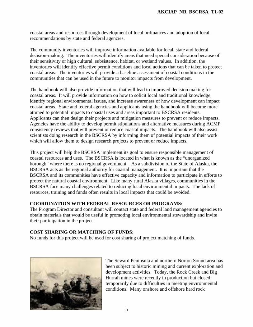
The Seward Peninsula and northern Norton Sound area has been subject to historic mining and current exploration and development activities. Today, the Rock Creek and Big Hurrah mines were recently in production but closed temporarily due to difficulties in meeting environmental conditions. Many onshore and offshore hard rock

AKCIAP_NR_BSCRSA_T1-02
6
exploration projects are occurring in the BSCRSA, and a number of offshore and onshore placer mines are in operation. Rock Creek Mine near Nome. Rock Creek Mine
Source: State of Alaska, DCCED Source: State of Alaska, DCCED
Poster prepared by Elim students in response to a nearby Uranium exploration project. Elim and other communities near mining activities have few resources to become involved in mine planning and permitting.
Source: Indigenous Environmental Network
AKCIAP_NR_BSCRSA_T1-03
1
STATE OF ALASKA COASTAL IMPACT ASSISTANCE PROGRAM
BERING STRAITS COASTAL RESOURCE SERVICE AREA
The CRSA will be conducting this project as a legislatively named CIAP recipient on behalf of the State of Alaska
PROJECT TITLE: Bering Straits CRSA CIAP Administration by CRSA Board of Directors (Tier 1) PROJECT CONTACT
Contact Name: Paul Rookok Sr. Address: P.O. Box 28, Unalakleet, AK 99684 Telephone Number: (907) 984-6329 Fax Number: (907) 984-6329 Email Address: [email protected]
PROJECT LOCATION This project will occur in Unalakleet, and it involves projects within the coastal zone of the Bering Straits Coastal Resource Service Area (BSCRSA). PROJECT DURATION 4 years ESTIMATED COST:
Spending Estimate ($) TOTAL Year 1 Year 2 Year 3 Year 4 $26,750 $6,689 $6,687 $6,687 $6,687
Funding per Allocation Year of CIAP ($) TOTAL FY 07 FY 08 FY 09 FY 10 $26,750 0 0 0 $26,750
PROJECT DESCRIPTION: The purpose of this project is to provide funding for administration of the CIAP grants by the BSCRSA board of directors. The BSCRSA board has ultimate responsibility for all finances and grant programs, including the CIAP. The board will provide oversight for the grants, including assurance that the grants are implemented as approved, approve contracts, make sure contracts are properly executed, ensure reports are submitted in a timely and accurate manner, and check to be sure grant accounting meets requirements. The BSCRSA has an agreement with the City of Unalakleet to provide financial accounting and reporting services for its grants. Indirect costs for the City of Unalakleet will be included in each grant.

AKCIAP_NR_BSCRSA_T1-03
2
The BSCRSA is located in what is known as the “unorganized borough” of the State of Alaska where there is no regional government (boroughs). The BSCRSA acts as the regional authority for coastal management, and while not a municipality, it is a subdivision of the state, and board members are elected as part of the State of Alaska election process. The federal Office of Coastal and Resource Management provides federal funds for operation of the BSCRA’s program through the State of Alaska, but these funds cannot be used to manage CIAP grants. Legislation passed by the Alaska State Legislature in 2005 named the BSCRSA as a recipient of a portion of the CIAP funds allocated to the State of Alaska. The projects funded by the CIAP will assist the BSCRSA in implementing its goal for responsible management of coastal resources and areas. This project will provide funding for the following meetings and teleconferences and distribution of information to the board.
Travel costs for 7 board members to attend an annual board meeting in Unalakleet during each of the 4 years of the CIAP.
8 teleconferenced board meetings (2 teleconferences during each of the 4 years of the CIAP).
Distribution of CIAP project descriptions, progress reports and final reports to board members.
During the in-person meetings and teleconferences, the board will carry out its oversight responsibilities. Specifically, the meetings will be used to:
Approve contracts issued to consultants, Receive updates on the progress of CIAP projects from the Program Director, and as
appropriate, by consultants or State of Alaska staff, Review financial reports and separate accounting for the grants prepared by the City of
Unalakleet, Ensure that project grant reporting is occurring as required, Review and comment on draft project reports prepared by consultants, Ensure projects are being implemented as proposed, Provide guidance to the Program Director and the City of Unalakleet regarding any
difficulties encountered in implementing the grants. This project only addresses the CRSA board administration of the CIAP. Additional indirect costs for financial management and reporting of the grants will be included in each project proposal. MEASUREABLE GOALS AND OBJECTIVES:
Board review of monthly progress reports from the program director.
Minutes of board meetings summarizing board oversight of CIAP projects.
Board approval of CIAP contracts.
Board comments on draft reports for all CIAP projects, including comments about the success of meeting project goals and objectives.
Board approval of final reports.

AKCIAP_NR_BSCRSA_T1-03
3
Timely submittal of all CIAP progress reports to the State of Alaska.
PROJECT CONSISTENCY WITH CIAP AUTHORIZED USE: Authorized use # 3: Planning assistance and the administrative costs of complying with CIAP. This project will ensure that the BSCRSA board completes its oversight responsibilities for the CIAP projects. This oversight will ensure project goals and objectives are met and that the projects meet the requirements for benefiting the natural coastal environment. COORDINATION WITH FEDERAL RESOURCES OR PROGRAMS: This project does not require coordination with federal resources or programs other than the CIAP. Federal funds provided by the Office of Coastal and Resource Management are passed through the State of Alaska for implementing the BSCRSA coastal management plan. These funds ensure the continued operation of the BSCRSA, but they cannot be used to implement the CIAP. COST SHARING OR MATCHING OF FUNDS: No CIAP funds will be used for cost sharing or matching funding. BSCRSA Board meeting in Koyuk. Barge in Unalakleet delivering cars.
Photo courtesy of Glenn Gray Photo courtesy of Glenn Gray

AKCIAP_NR_BSCRSA_T1-04
1
STATE OF ALASKA COASTAL IMPACT ASSISTANCE PROGRAM
BERING STRAITS COASTAL RESOURCE SERVICE AREA
The CRSA will be conducting this project as a legislatively named CIAP recipient on behalf of the State of Alaska
PROJECT TITLE: Identification of Important Wildlife to Protect Coastal Areas of St. Lawrence Island (Tier 1) PROJECT CONTACT
Contact Name: Paul Rookok Sr. Address: P.O. Box 28, Unalakleet, AK 99684 Telephone Number: (907) 624-3531 Fax Number: (907) 624-3833 Email Address: [email protected]
PROJECT LOCATION The project area includes St. Lawrence Island and its adjacent waters which are within the coastal zone of the Bering Straits Coastal Resource Service Area (BSCRSA). PROJECT DURATION 2 years ESTIMATED COST:
Spending Estimate ($) TOTAL Year 1 Year 2 Year 3 Year 4 $43,890 $37,790 $6,100 0 0
Funding per Allocation Year of CIAP ($)
TOTAL FY 07 FY 08 FY 09 FY 10 $43,890 $43,890
PROJECT DESCRIPTION: The purpose of this project is to gain a better understanding of the importance of St. Lawrence Island and surrounding waters to wildlife. It will also include an assessment of risks to wildlife species and identify measures to prevent or reduce impacts to coastal habitats. Wildlife areas to be addressed in the project include habitats for bird species such as spectacled and Steller’s Eiders and habitat areas for marine mammals including beluga whales, bowhead whales, walrus, and seals. This study will compile existing information and obtain new information about the importance of this area to feeding, reproduction, and rearing of these species. This project will benefit the natural coastal environment of St. Lawrence Island through the development of information that will result in improved information that will lead to informed

AKCIAP_NR_BSCRSA_T1-04
2
decisions. In addition, the project will result in coastal benefits by providing St. Lawrence Island residents an improved understanding of the importance of wildlife habitats and how their actions affect those habitats. In addition, agencies will have access to a single document that synthesizes existing information and incorporates local and traditional knowledge which will lead to improved decisions. The BSCRSA Program Manager will manage this project and complete project goals and objectives with assistance from a consultant experienced in coastal Alaska wildlife habitats. The Program Director will develop a request for proposals for a qualified consultant to assist in completing the project goals and objectives. With approval of the board, the Program Director will enter into a contract with the consultant. The consultant will assist with the following project tasks. Year 1
Develop the final study design which will address priorities identified by the BSCRSA.
Complete a literature search to determine what studies have been completed about wildlife species in the St. Lawrence Island area.
Complete an annotated bibliography about sources of information about use of the area by wildlife species.
Contact state and federal agencies to determine what unpublished information they have about wildlife habitats in the project area and information gaps that exist.
Conduct interviews with community leaders and elders from Gambell and Savoonga to gather local and traditional knowledge about use of habitats by wildlife species.
Year 2
Complete and distribute a draft report for comment that synthesizes existing information and incorporates local and traditional knowledge about wildlife in the St. Lawrence area.
Complete a final report that responds to comments on the draft as appropriate.
This project requires consultation with state and federal agencies to determine what research and studies have been conducted in the project area. MEASUREABLE GOALS AND OBJECTIVES: The project includes the following goals and objectives. Year 1
Complete an annotated bibliography about existing wildlife studies for the St. Lawrence Island area.
At least 25 interviews completed with residents of Gambell and Savoonga about local and traditional knowledge that supplements existing studies. The interviews will include questions about changing environmental conditions, risks to wildlife habitat and potential measures that would reduce impacts from these risks.
Complete the draft study and distribute it for review and comment by agencies and the communities of Savoonga and Gambell.
Year 2

AKCIAP_NR_BSCRSA_T1-04
3
Complete and distribute the final report (20 hard copies and 20 CDs to the BSCRSA and additional copies to each of the agencies contacted during the research for this project).
PROJECT CONSISTENCY WITH CIAP AUTHORIZED USE: This project is consistent with Authorized Use #1 – Projects and activities for the conservation, protection, or restoration of coastal areas, including wetlands. Information from this study will result in improved conservation and protection of coastal areas. It will lead to a reduction of impacts because the project will identify risks to wildlife habitat and measures to avoid, minimize or mitigate impacts. The project will give St. Lawrence Island residents an improved understanding of the importance of wildlife habitats and how their actions affect those habitats. In addition, agencies will have access to a single document that synthesizes existing information and incorporates local and traditional knowledge. A greater understanding of the area’s wildlife by state and federal agencies will benefit the natural coastal environment because permitting agencies have the ability to add stipulations to their permits to protect sensitive habitats. COORDINATION WITH FEDERAL RESOURCES OR PROGRAMS: This project will require close coordination with federal agencies that have conducted or plan to conduct studies in the St. Lawrence Island areas. COST SHARING OR MATCHING OF FUNDS: Funds from this project will not be used for cost sharing or federal match.
Spectacled Eiders wintering south of St. Lawrence Island
Source: Fish and Wildlife Service

AKCIAP_NR_BSCRSA_T1-05
1
STATE OF ALASKA COASTAL IMPACT ASSISTANCE PROGRAM
BERING STRAITS COASTAL RESOURCE SERVICE AREA
The CRSA will be conducting this project as a legislatively named CIAP recipient on behalf of the State of Alaska
PROJECT TITLE: Protecting and Conserving Subsistence in Coastal Areas (Tier 1) PROJECT CONTACT
Contact Name: Paul Rookok Sr. Address: P.O. Box 28, Unalakleet, AK 99684 Telephone Number: (907) 624-3531 Fax Number: (907) 624-3833 Email Address: [email protected]
PROJECT LOCATION This project is located throughout the coastal zone of the Bering Straits Coastal Resource Service Area (BSCRSA). PROJECT DURATION 2 years ESTIMATED COST:
Spending Estimate ($) TOTAL Year 1 Year 2 Year 3 Year 4 $104,000 $74,000 $30,000
Funding per Allocation Year of CIAP ($)
TOTAL FY 07 FY 08 FY 09 FY 10 $104,000 $104,000
PROJECT DESCRIPTION: The purpose of this project is to protect and conserve coastal areas through the collection and dissemination of key information about subsistence species and areas. This project will occur during the second year of CIAP project implementation in order to take advantage of information about subsistence developed during the revision to the coastal management plan.6 The project will benefit the natural coastal environment of the Bering Straits region by providing state and federal resource managers and permitting agencies with a single source of information about subsistence. Easy access to the following information will lead better decisions: Current areas of subsistence use, a summary of all studies about subsistence in the area, an analysis of data
6 The Coastal Management Plan revision is a 3-year project, but the emphasis of the first year will be to address subsistence issues and develop subsistence use maps.

AKCIAP_NR_BSCRSA_T1-05
2
gaps, information about changes in distribution of subsistence species, information about impacts to subsistence areas from a changing climate, and information about the condition of subsistence species. The products from this study will lead to more informed management decisions because resource managers will have more information about risk and uncertainty. The more information managers have, the greater the benefit to the natural coastal environment. An added benefit will result from improved local stewardship because residents will have information about current conditions and how their actions can reduce impacts to subsistence areas and habitats for subsistence species. Subsistence has been identified as the highest priority in both the original and revised BSCRSA Coastal Management Plan. Subsistence provides an important source of nutritious food, it sustains cultural traditions, and it is a way of life. Area residents are concerned about potential threats to subsistence uses from development, from increased hunting pressure from outsiders and from impacts from climate change. Concerns about development projects include an increase in mining development and offshore and onshore mining exploration projects. Potential pressures on subsistence use areas include increases in tourism, expansion of commercial trawling in Norton Sound, and proposed new roads. These activities could result in degradation of coastal areas, displacement of subsistence species, impacts to access to subsistence resources, and changes to migration patterns. Changing climate and long-distance transport of pollutants has raised concerns about impacts to subsistence habitats. Residents have noted changes in migration and distribution patterns, changes in the numbers of subsistence species, anomalies in the condition of fish and wildlife, and new species not seen previously in the region. The BSCRSA Program Manager will manage this project and complete project goals and objectives with assistance from a subsistence specialist. The Program Director will develop a request for proposals for a qualified consultant to assist in meeting the project goals and objectives. With approval from the BSCRSA board, the Program Director will select the consultant and enter into a contract. The contract will describe the project approach and methodology. The consultant will assist with the project tasks described below during the 2-year project. Year 1
Complete a literature search, web search and agency inquiry about information related to subsistence uses and impacts to subsistence use areas in the region from climate change, pollutants and other factors. Information from the Coastal Management Plan revision will be used as a starting point for this effort.
Complete an annotated bibliography of studies and reports about subsistence use, changing environmental conditions and impacts to subsistence.
Complete an analysis of data gaps and information needs. Interview state and federal subsistence specialists to determine their priorities for future
subsistence research. Interview community leaders in the 15 BSCRSA communities about their priorities for
future subsistence studies. Hold public meetings in at least 5 BSCRSA communities to discuss impacts observed by
residents to subsistence habitats, including impacts from changing climatic conditions, impacts from development, and local and long distance transport of pollutants.
AKCIAP_NR_BSCRSA_T1-05
3
Develop a system for BSCRSA residents to report unusual conditions related to use of habitats by subsistence species (e.g., changes in location, numbers, migration patterns, or appearance).
Year 2 Distribute copies of the most relevant existing studies to school libraries in the 15
BSCRSA communities. Complete a final report summarizing major findings of relevant studies, information
identified during the public meetings, and information from residents about the condition of subsistence species.
Distribute copies of the final report to the 15 BSCRSA communities, state and federal resource management agencies and to others upon request.
Produce a brochure for distribution to BSCRSA residents about impacts to subsistence species and what local actions can be taken to conserve and protect these species.
The Program Director will invite the communities, the Alaska Department of Fish and Game Division of Subsistence and the Environmental Public Health Program of the Alaska Department of Health and Social Services to participate in this project. MEASUREABLE GOALS AND OBJECTIVES: Year 1
Complete an annotated bibliography of subsistence studies.
Complete summary of interviews with state and federal subsistence managers, researchers and tribal and city government leaders from each of the 15 communities within the CRSA.
Develop a system for reporting unusual conditions of subsistence species including a webpage where reports are posted.
Provide copies of all reports and brochures to state and federal permitting agencies that manage subsistence species and their habitat for their use in resource management decisions.
Year 2 Develop a brochure about the project findings for distribution among BSCRSA
communities.
Distribute copies of relevant studies to libraries in the 15 BSCRSA communities.
Complete draft and final reports with an analysis of subsistence studies, local and traditional knowledge, data gaps, subsistence research priorities for the future, and actions residents and state and federal managers can take to conserve and protect subsistence areas.
Distribute final report to community leaders within the CRSA and state and federal agencies that manage coastal resources.
PROJECT CONSISTENCY WITH CIAP AUTHORIZED USE:

AKCIAP_NR_BSCRSA_T1-05
4
This project is consistent with Authorized Use #1 – Projects and activities for the conservation, protection, or restoration of coastal areas, including wetlands. Subsistence uses and resources are extremely important to the people of the BSCRSA, and subsistence is recognized as a coastal use under state coastal management regulations (11 AAC 112.270). Cultural preservation is recognized by federal regulation as a coastal use (15 CFR 930.11(b)), and subsistence is a vital part of cultural preservation in the BSCRSA. Also, subsistence provides a healthy and economic food source. A direct connection has existed between the people of this region and the subsistence way of life for thousands of years. This project will educate local residents and state and federal agencies about ways to protect and conserve subsistence species and subsistence use areas. The indirect benefit will be informed management decisions through improved information about the condition of subsistence species and use areas and impacts from development and changing environmental conditions. Specifically, the following benefits will result from this project.
Synthesis of existing information about subsistence in one document will provide state and federal resource managers and permitting agencies with a single source for information.7
The study will indentify existing gaps in information that will lead to more informed decisions. Knowing what information gaps exist will allow managers to consider potential risks and uncertainty from management decisions.
Information about subsistence is important for managing coastal subsistence and fish and wildlife areas. Subsistence is addressed under the Alaska National Interest Lands Conservation Act (ANILCA) and in the Alaska Coastal Management Program (ACMP) subsistence standard (11 AAC 112.270), energy facilities standard (11 AAC 112.230) and the habitats standard (11 AAC 112.300). Easy access to subsistence information will lead to better decisions when considering impacts to both subsistence species and their habitats. During recent years, growing pressure on subsistence areas have resulted from an increase in mining exploration and development projects, and potential expansion of commercial trawling areas and roads will lead to more pressure on subsistence areas.
The final project document will include recommendations for future subsistence studies gathered from interviews with communities and state and federal agencies. These recommendations will help managers target data gaps when allocating future funds. Subsistence information benefit to managers when addressing impacts to subsistence, subsistence resources and habitats of subsistence resources.
COORDINATION WITH FEDERAL RESOURCES OR PROGRAMS: This project will require coordination with federal agencies to obtain up-to-date information about long-distance transport of pollutants and benefits and risks of consuming subsistence foods. COST SHARING OR MATCHING OF FUNDS: Funds from this project will not be used for cost sharing or federal match.
7 This information will build on information in the BSCRSA Coastal Management Plan about subsistence uses by adding information from studies about impacts to subsistence from development, climate change and long distance transport of pollution.

AKCIAP_NR_BSCRSA_T1-05
5
Walrus meat drying in Gambell
Source: Alaska Department of Commerce, Community and Economic Development
Polar bears harvested one mile from Gambell
Source: Alaska Department of Commerce, Community and Economic Development

AKCIAP_NR_BSCRSA_T1-06
1
STATE OF ALASKA COASTAL IMPACT ASSISTANCE PROGRAM
BERING STRAITS COASTAL RESOURCE SERVICE AREA
The CRSA will be conducting this project as a legislatively named CIAP recipient on behalf of the State of Alaska
PROJECT TITLE: Outreach and Education to Protect Coastal Areas (Tier 1) PROJECT CONTACT
Contact Name: Paul Rookok Sr. Address: P.O. Box 28, Unalakleet, AK 99684 Telephone Number: (907) 624-3531 Fax Number: (907) 624-3833 Email Address: [email protected]
PROJECT LOCATION This project will be located in all 15 communities within the coastal zone of the Bering Straits Coastal Resource Service Area (BSCRSA). PROJECT DURATION 2 years ESTIMATED COST:
Spending Estimate ($) TOTAL Year 1 Year 2 Year 3 Year 4 $104,100 $43,000 $39,000 $22,100 $10,000
Funding per Allocation Year of CIAP ($)
TOTAL FY 07 FY 08 FY 09 FY 10 $104,100 $104,100
PROJECT DESCRIPTION: The purpose of this project is to increase awareness in the BSCRSA about coastal issues that will lead to conservation, protection and restoration of the coastal environment. The intent of the project is to accomplish two major objectives: Increased knowledge about how individual efforts can protect coastal areas and increased involvement in the Alaska Coastal Management Program (ACMP) through education and outreach. The direct benefits to the coastal environment include education in all 15 high schools and implementation of community service projects in at least 3 high schools. The indirect benefits will be improved local stewardship, a reduction in coastal environmental impacts, more involvement in the ACMP, and an increase in locals filling environmental jobs in the BSCRSA.

AKCIAP_NR_BSCRSA_T1-06
2
Environmental Education Component: This project component involves a cooperative effort with the Bering Straits School District to develop an environmental education curriculum throughout the district and class environmental projects in 3 BSCRSA high schools. This component involves a class project where students research current environmental issues facing their community, identify potential impacts from climate change or development projects, and develop local solutions to reduce environmental impacts. The project will also include training about how students can prepare for careers in coastal and environmental management.
Curriculum: Consultant will develop a curriculum for a set of 5 modules for environmental education training that will be conducted in 3 BSCRSA high schools. The modules will address the following topics: (1) Ocean ecosystems, (2) Coastal habitats, (3) Impacts from a changing climate, (4) Land management agency roles in protecting the coastal environment, and (5) Careers in an environmental field. The curriculum will be designed to be expanded to other high schools in each of the 15 communities in future years. (Year 1)
Essay Contest: Essay contest open to all 15 schools about how local actions can help resolve a coastal environmental issue. The winning essay will be submitted for publication in the Nome Nugget, the regional newspaper. (Year 1)
School Visits: Visits to each of the 3 schools by Program Director and consultant to initiate class projects. (Year 1)
Class Projects: Classes will be selected in at least 3 high schools to design and conduct a public service project. It is important to allow each class to choose the specific project they will work on to ensure it will be relevant to their community and that they will have the ownership in the results of the project. Projects will be required to have measurable outcomes (e.g., beach re-vegetation, restoration of damage from off-road vehicles, trail hardening, invasive species eradication, water quality sampling, coastal environment website, or responses to environmental damage from climate change). (Years 1 & 2)
Project Summaries: Classes will prepare materials to publicize their projects which will be distributed to other schools in the BSCRSA (e.g., posters, videos, brochures, or project summaries). (Year 2)
Environmental Professionals: An Environmental Professionals Program will be implemented in BSCRSA high schools. The program will involve presentations about coastal environmental issues, class room discussions and what how students can prepare for a career in an environmental field. A guide will be developed to help teachers and speakers implement the program. Environmental professionals will be sought who work in the region or for agencies that manage land in the BSCRSA. (Years 1 & 2)
Final Report: A final report will be prepared for this component of the overall project. It will summarize the project accomplishments, evaluate outcomes and include recommendations for replicating it elsewhere. (Year 2)
Alaska Coastal Management Program Outreach Component: The purpose of this project is to educate and involve CRSA residents, tribes, city governments, state and federal agencies, and project applicants in the ACMP, including programs of the BSCRSA. This outreach will involve a variety of media to inform people about the coastal management program and how it relates to the BSCRSA.

AKCIAP_NR_BSCRSA_T1-06
3
Phone Calls: The BSCRSA will contact state and federal agencies that manage land or resources within the coastal zone to discuss opportunities to cooperate with the BSCRSA to benefit the natural coastal environment. (Years 1-4)
Press Releases and News Articles: The project will include outreach to local media and development of a series of press releases and articles about the BSCRSA and its coastal management plan. (Years 1–4)
Handout: A handout will be prepared for applicants and agencies to inform them about opportunities for involvement in the ACMP. (Year 1)
Brochure: A brochure will be created to explain the BSCRSA program. (Year 2) Newsletter: Newsletters will provide information about BSCRSA activities and
programs. (Years 1-4) Webpage: A webpage will be developed for the BSCRSA that includes information
about the ACMP and a link to the coastal management plan. (Year 2) School Visits: The project will involve outreach visits to area schools. (Years 1-4) Meetings: Meetings will be set up with state and federal agencies that manage coastal
areas or resources, tribes and communities to discuss the coastal management program and how it can help these organizations implement their mission. (Year 1)
Final Report: A final report will be prepared for this component of the project. It will summarize the project accomplishments, evaluate outcomes and include recommendations for future education and outreach for the ACMP. (Year 2)
Personnel: The BSCRSA will complete a request for proposals (RFP) for a qualified consultant(s) to assist in completing the project goals and objectives. The RFP will be structured to allow respondents to submit a proposal for one or both project components. With approval from the BSCRSA board, the Program Director will enter into a contract with the consultant(s). MEASUREABLE GOALS AND OBJECTIVES: Environmental Education Component: Year 1
Develop environmental education curriculum including 5 modules: (1) Ocean ecosystems, (2) Coastal habitats, (3) Impacts from a changing climate, (4) Land management agency roles in protecting the coastal environment, and (5) Careers in an environmental field. The curriculum will be designed to be used in future years.
Complete essay contest open to all 15 schools about how local actions can help resolve a coastal environmental issue. Submit article to the Nome Nugget with winning essays.
Purchase and distribute at least 5 books for each of the 15 school libraries about careers in environmental fields.
Distribute information about environmental studies to all 15 BSCRSA high schools.
Submit article to the Nome Nugget about the project.
Design and initiate class projects in 3 high schools in the BSCRSA. Projects will be required to have measurable results (e.g., beach re-vegetation, restoration of damage from off-road vehicles, trail hardening, invasive species eradication, water quality sampling,

AKCIAP_NR_BSCRSA_T1-06
4
coastal environment website, or responses to environmental damage from climate change).
Initiate Environmental Professionals Program where professionals visit BSCRSA schools to give presentations about coastal environmental issues and provide information on how to prepare for an environmental career. Prepare guidance for teachers and speakers. At least 30 presentations will be made to area the schools.
Year 2 Continue and complete class projects in the 3 high schools.
Continue and complete Visiting Professional Program.
Distribute results of school project to other schools in BSCRSA (e.g., posters, videos, brochures, or project summaries).
Prepare final report that summarizes project accomplishments, evaluates outcomes and includes recommendations for replicating the project elsewhere.
Alaska Coastal Management Program Outreach Component: Year 1
Schedule and attend at least one meeting each with the Alaska Departments of Natural Resources, Environmental Conservation, and Fish and Game, Bureau of Land Management, Fish and Wildlife Service, National Marine Fisheries Service, North Pacific Management Council, and National Park Service.
Send a BSCRSA representative to at least 2 meetings sponsored by state or federal agencies about issues related to the BSCRSA coastal management program.
Develop 500 copies of a handout for applicants and agencies about the BSCRSA.
Hold public meetings in 7 BSCRSA communities.
Develop 2 news articles and 3 public service announcements about the BSCRSA.
Issue 2 newsletters about BSCRSA activities. Year 2
Create 200 copies of a brochure about the BSCRSA and ACMP. Distribute them to city and tribal governments, regional organizations, applicants and state and federal agencies.
Develop a webpage for the BSCRSA.
Develop 2 news articles and 4 public service announcements about the BSCRSA.
Hold at least one public meeting in each of 7 BSCRSA communities.
Send a representative from the BSCRSA to attend 2 meetings sponsored by state or federal agencies about issues related to the BSCRSA coastal management plan.
Issue 2 newsletters about BSCRSA activities. Year 3
Attend 2 meetings held by state or federal agencies about issues related to the BSCRSA.
Issue 2 newsletters about BSCRSA activities.
Hold public meetings in 2 BSCRSA communities.
Develop 2 news articles and 4 public service announcements about the BSCRSA.
AKCIAP_NR_BSCRSA_T1-06
5
Year 4 Attend 2 meetings held by state or federal agencies about issues related to the BSCRSA.
Issue 2 newsletters about BSCRSA activities.
Hold public meetings in 2 BSCRSA communities.
Develop 2 news articles and 4 public service announcements about the BSCRSA.
Complete a final report summarizing the outreach effort. PROJECT CONSISTENCY WITH CIAP AUTHORIZED USE: This project is consistent with Authorized Use #1 – Conservation, protection or restoration of coastal areas, including wetlands. The project is consistent with this authorized use because it will increase local efforts to conserve, protect and restore the natural coastal environment. Direct benefits to the coastal environment will result from implementation of class environmental projects in at least 3 high schools, including projects such as beach re-vegetation, restoration of damage from off-road vehicles, trail hardening, or invasive species eradication. Indirect benefits include education in all 15 high schools from the environmental education program. The environmental education and ACMP outreach efforts will likely lead to immediate results during the project as well as in future years. For example, an understanding of how off-road vehicle use is damaging coastal habitat or aggravating beach erosion will lead at some residents to avoid sensitive areas. Likewise, a greater understanding of environmental risks from improper disposal of hazardous materials will likely lead to an immediate reduction in the amount of contaminants entering the coastal environment. The future results from the environmental education and ACMP outreach are expected to have direct benefits to the coastal environment. Specifically, this project will increase local awareness and stewardship that will lead to local actions to reduce environmental impacts, greater participation in ACMP project reviews, a reduction in coastal environmental impacts, more involvement in the ACMP, and an increase in locals filling environmental jobs in the BSCRSA. Improved participation in ACMP reviews will result in more relevant public comments that propose alternative measures that will protect, conserve and restore the natural coastal environment. COORDINATION WITH FEDERAL RESOURCES OR PROGRAMS: State and federal agencies that work in the BSCRSA will be invited to participate in this project. COST SHARING OR MATCHING OF FUNDS: Funds from this project will not be used for cost sharing or federal match.

AKCIAP_NR_BSCRSA_T1-07
1
STATE OF ALASKA COASTAL IMPACT ASSISTANCE PROGRAM
BERING STRAITS COASTAL RESOURCE SERVICE AREA
The CRSA will be conducting this project as a legislatively named CIAP recipient on behalf of the State of Alaska
PROJECT TITLE: Coastal Habitat Restoration Project (Tier 1) PROJECT CONTACT
Contact Name: Paul Rookok Sr. Address: P.O. Box 28, Unalakleet, AK 99684 Telephone Number: (907) 624-3531 Fax Number: (907) 624-3833 Email Address: [email protected]
PROJECT LOCATION This project is located within the coastal area of the Bering Straits Coastal Resource Service Area (BSCRSA). The habitat restoration site will be located in one of the 15 communities within the BSCRSA or within an area outside a community disturbed by past mining operations. PROJECT DURATION 2 years ESTIMATED COST:
Spending Estimate ($) TOTAL Year 1 Year 2 Year 3 Year 4 $77,000 $26,000 $51,000 0 0
Funding per Allocation Year of CIAP ($)
TOTAL FY 07 FY 08 FY 09 FY 10 $77,000 $77,000
PROJECT DESCRIPTION: This project will result in a list of habitat restoration needs, a priority list of restoration projects and completion of a restoration project for one of these sites. It will provide a direct benefit to the natural coastal environment of the Bering Straits region by carrying out habitat improvements to a site within the BSCRSA that will restore habitat functions affected by either human activities or adverse natural conditions. One of the products of the project will be a priority list of areas meriting habitat restoration which will be provided to area land managers in an effort to encourage support for future restoration projects. An indirect benefit will be education of area residents through raising local awareness about habitat restoration needs, the causes of the habitat degradation, and actions BSCRSA residents can take to prevent future degradation to habitats.

AKCIAP_NR_BSCRSA_T1-07
2
The BSCRSA Program Manager will manage this project and complete project goals and objectives with assistance from a consultant with experience in habitat restoration. The Program Director will develop a request for proposals for a qualified consultant to assist in completing the project goals and objectives. With direction from the board, the Program Director will select the consultant and enter into a contract. The consultant will assist with the following project tasks. Year 1
Develop criteria for ranking habitat restoration projects. Contact community representatives (tribal, municipal or local Native corporation) and
Kawerak Inc., the regional Native nonprofit, to identify areas in need of habitat restoration.
Work with the Program Director to rank the potential projects. Visit top three project sites to evaluate their feasibility for restoration and develop
estimated costs for restoration. Visit a high school class in each village to explain the project and solicit potential volunteers for the restoration project.
Work with the Program Director to select the final project site and obtain permission from the landowner and obtain any necessary permits.8
After consulting with the area biologist for the Alaska Department of Fish and Game and other appropriate agencies, develop a restoration plan including estimated costs for restoration of the site. Agencies will be contacted to determine if previous habitat restoration projects have been conducted in the BSCRSA, and if so, what techniques were used and whether any problems were encountered.
Year 2
Order supplies and make final arrangements for the restoration project including solicitation for volunteers.
Conduct the restoration project using volunteers from the community, including high school students and adults.
Distribute a summary of the project to all communities within the CRSA. The summary will be useful to other communities because it will identify the process and techniques used for habitat restoration.
Prepare a final report on the restoration effort which will include a monitoring plan to determine the success of the project.
MEASUREABLE GOALS AND OBJECTIVES: Year 1
Prioritized list of sites meriting habitat restoration in the CRSA. Year 2
Complete one habitat restoration project that will involve at least 50’ of stream bank or at least 2,500 square feet of upland area.
8 A permit is not expected to be needed, but appropriate agencies will be contacted to confirm this assumption.

AKCIAP_NR_BSCRSA_T1-07
3
Complete final project report that summarizes habitat restoration efforts, identifies priorities for future restoration, and specifies specific actions residents can take to prevent future habitat damage.
PROJECT CONSISTENCY WITH CIAP AUTHORIZED USE: This project is consistent with Authorized Use #1 – Projects and other activities for the conservation, protection, or restoration of coastal areas, including wetlands. This project will result in both direct and indirect benefits to the natural coastal environment. Direct benefits will result from the actual restoration of one or more habitats. Indirect benefits to the natural coastal environment will result from development of a prioritized list of habitat restoration needs and through education of local residents about actions they can take to prevent future damage to habitats. While these added benefits may not result in direct improvements to the environment during the project, they are expected to result in direct benefits in the future. Development of a list of habitat restoration priorities will encourage local communities to apply for grants to fund restoration efforts or for land owners to complete the restoration on their own. Identification of actions local residents can take to prevent habitat degradation or restore habitats will lead to future direct benefits such as:
Avoidance of off-road travel in sensitive areas which will result in natural regeneration of vegetation,
Reduced use and proper disposal of plastic bags and other materials that are known to entangle wildlife,
Improved disposal practices for hazardous materials which will wastes which would otherwise leak contaminants into the environment, or
Voluntary efforts to remove marine debris, petroleum drums and other hazardous materials from habitats.
Without development of a list of restoration priorities and local education, these future direct benefits to the natural coastal environment will not likely happen. The power of education should not be underestimated. COORDINATION WITH FEDERAL RESOURCES OR PROGRAMS: The consultant and Program Director will coordinate efforts with appropriate federal agencies. In addition, agencies with a presence in the region will be contacted to determine if they would be interested in participating in the project and to understand how this project may complement their habitat restoration efforts. COST SHARING OR MATCHING OF FUNDS: No funds for this project will be used for federal match or cost sharing.

AKCIAP_NR_BSCRSA_T1-08
1
STATE OF ALASKA COASTAL IMPACT ASSISTANCE PROGRAM
BERING STRAITS COASTAL RESOURCE SERVICE AREA
The CRSA will be conducting this project as a legislatively named CIAP recipient on behalf of the State of Alaska
PROJECT TITLE: Improving Waste Disposal to Protect Coastal Areas (Tier 1) PROJECT CONTACT
Contact Name: Paul Rookok Sr. Address: P.O. Box 28, Unalakleet, AK 99684 Telephone Number: (907) 624-3531 Fax Number: (907) 624-3833 Email Address: [email protected]
PROJECT LOCATION This project is located in all 15 communities within the coastal zone of the Bering Straits Coastal Resource Service Area (BSCRSA). PROJECT DURATION 3 years ESTIMATED COST:
Spending Estimate ($) TOTAL Year 1 Year 2 Year 3 Year 4 $180,071 $48,000 $90,000 $42,071 0
Funding per Allocation Year of CIAP ($)
TOTAL FY 07 FY 08 FY 09 FY 10 $180,071 $180,071
PROJECT DESCRIPTION: The purpose of this project is to reduce impacts to the natural coastal environment from human-generated waste. The project involves a multifaceted approach that includes components to characterize current waste management practices in the Bering Straits region, complete an education and outreach effort, encourage recycling efforts, and fund several community projects that will improve waste management practices. This project will result in direct and indirect benefits to the conservation and protection of BSCRA coastal areas by encouraging reduction of wastes, recycling, backhauling wastes to proper disposal facilities, proper treatment and disposal human wastes, and improvements to landfill and waste collection systems. Efforts to reduce, reuse and recycle waste and prevent environmental contamination will protect, conserve and restore the coastal area.

AKCIAP_NR_BSCRSA_T1-08
2
At the beginning of the project, the Alaska Department of Environmental Conservation (DEC), the Environmental Protection Agency (EPA) and tribal environmental staff will be contacted to determine how the project can complement their efforts in the BSCRSA without duplicating them.9 The BSCRSA Program Manager will manage the project and complete project goals and objectives with assistance from a consultant experienced in solid waste issues in rural Alaska. The Program Director will develop a request for proposals for a qualified consultant. The Program Director will evaluate the proposals, and with approval of the board, select a consultant and enter into a contract. The consultant will assist with completion of project tasks during the 3-year project. The first year involves information gathering which will be used in years 2 and 3 to provide direct and indirect environmental benefits. Without an accurate inventory, efforts to conserve, protect or restore the natural coastal environment from human-generated wastes will not be successful. Year 1
Contact each of the 15 communities in the BSCRSA to determine interest in participating in the project. Initial contacts will be made with municipal staff and the local environmental coordinator for the EPA’s IGAP program.10 The local governments will select a community contact for the project.
Interview community contacts to determine how waste is currently handled, including: o Whether the community has an approved landfill, o Whether there are any concerns about the landfill or waste management system, o How waste is collected and deposited in the landfill and whether someone is
employed to manage the landfill, o How hazardous wastes and petroleum products are treated, o How human waste is dealt with, o Whether any contaminated sites exist in or near the community, o Whether the community has a recycling program, o Whether the community has experience backhauling electronics or other
materials, o Whether the community has participated in previous community clean up or
marine debris removal projects, and o If there have been any problems with waste disposal outside of the community
boundary. Contact agencies and organizations to supplement information provided by the
communities including appropriate divisions within the DEC, EPA, Alaska Native Tribal Health Consortium, and Kawerak, Inc.
9 For example, EPA funds tribes to develop environmental programs, and some of these programs address solid waste issues. In addition, another CIAP project proposed by DEC will result in an inventory and action plans for eroding contaminated sites, landfills and dumps. The DEC project may address a few sites in the BSCRSA, but its project focuses on eroding sites and includes former military sites. The BSCRSA project targets practices that will prevent or minimize impacts to the coastal environment or restore existing sites. 10 IGAP stands for Indian Environmental General Assistance Program.
AKCIAP_NR_BSCRSA_T1-08
3
Contact permitting agencies to determine their requirements for handling wastes for development projects in areas outside of the 15 communities. Complete a summary of these practices.
Complete a written inventory of how wastes are handled in the BSCRSA including information about successful approaches.
Year 2 Provide presentations to at least 3 high school classes in the BSCRSA about the project
and future actions community residents can take to reduce generation of wastes and properly dispose of hazardous materials. Educating youth will encourage immediate actions be taken during the project and future action that will directly benefit the coastal environment. Educating tomorrow’s leaders today will instill an environmental ethic that could last for generations.
Obtain commitments from each of the participating communities on waste management actions they will take during this project to directly benefit the coastal environment.
Issue a request for proposals to the 15 BSCRSA communities for local waste management projects. Projects will be required to have a direct benefit to the coastal environment (e.g., such as reducing the amount of waste generated by the community, segregating hazardous materials from the general waste stream, removing marine debris, removing human-generated wastes from the environment, containing wastes at dump sites, backhauling materials to disposal sites outside of the region, or enacting local ordinances to reduce impacts to coastal areas from wastes).
Review community project proposals according to criteria and award grants to at least 3 communities. The consultant and program director will work with the communities to ensure the goals and objectives outlined in their grant agreement are implemented.
Year 3 Evaluate the success of the community grants in meeting the goals and objectives in the
grant agreement. The full proposal for this project will provide specific criteria and evaluation methods for determining success of the individual projects.
Complete a draft report for review by agencies and communities with the following components:
o Summary of community projects and their success in benefiting the natural coastal environment,
o Analysis of current waste management approaches in the region and how practices could be improved considering lessons learned from other rural areas,
o Waste management practices communities are already taking, or have committed to take as part of this project, to conserve, protect or restore the coastal environment,
o Recommended next steps to improve waste handling in the region, o Recommended regulatory approaches to improve waste management such as
model permit stipulations or proposed changes to local, state or federal regulations.
Evaluate success of community waste management projects upon their completion. Complete a final project report summarizing what the project accomplished including the
community waste management projects. MEASUREABLE GOALS AND OBJECTIVES:

AKCIAP_NR_BSCRSA_T1-08
4
Year 1 Complete inventory of how the 15 communities in the BSCRSA handle their wastes.
Complete a summary of information provided by organizations, agencies and major landowners in the BSCRSA regarding waste management requirements and practices.
Year 2 Develop educational materials and complete presentations in at least 3 BSCRSA high
schools waste management issues.
Implement waste management actions committed to by the communities participating in the project that will reduce impacts to the coastal environment from human wastes, plastics that can become entangled with wildlife, and leachates from hazardous liquids, cleaners, pesticides, and batteries.
Implement waste management community projects in at least 3 BSCRSA villages. Year 3
Evaluate the 3 community waste management projects.
Complete draft project report for review and comment with recommended strategies for improving waste handling in the BSCRSA, summaries of the 3 community waste management projects and efforts by other communities to reduce impacts to coastal areas.
Complete final project and distribute it to all 15 BSCRSA communities, participating agencies and organizations, and other communities and upon request.
PROJECT CONSISTENCY WITH CIAP AUTHORIZED USE: This project is consistent with Authorized Use #1 – Projects and activities for the conservation, protection, or restoration of coastal areas, including wetlands. This project will lead to direct benefits to the coastal environment through the results of the 3 community projects and commitments made by communities to implement waste management actions to decrease impacts. Such actions will include reduction of wastes, containment of waste at dump sites so materials do not spread to other coastal areas, separation of hazardous materials, backhaul of electronics and hazardous materials, and improvements to landfill and waste collection systems. Indirect benefits, such as the inventory of current waste management practices, summary of success stories, and education, will result in future direct benefits to the environment. Education is the best way to develop awareness of how individuals and communities can alter their behavior to provide benefits to the coastal environment. Development of an environmental ethic among young people will result in benefits for generations to come. Current waste management practices in rural Alaska adversely affect the coastal environment. Many communities in rural Alaska do not adequately manage solid wastes, and some communities do not separate toxic wastes from the general waste stream. Leachate from hazardous waste adversely impacts the environment and can negatively impact fish, wildlife and humans. If not properly treated, human waste can introduce harmful coliform bacteria into the environment. Improper disposal of plastic trash adversely affects fish and wildlife and can lead to mortality. This project will assess current practices and recommend strategies to improve current waste management.

AKCIAP_NR_BSCRSA_T1-08
5
A regional approach to waste management will result in greater benefits to the natural environment than ad hoc efforts by individual communities. Because there is no regional municipal government, leadership from the BSCRSA for waste management issues will provide a needed service.11 Most of the 15 communities are connected by a road system, and the high costs of water and air transportation make it difficult to properly manage wastes. This project will include consideration of unique circumstances facing each community and identify solutions that have worked for other similar rural communities. Most villages in the region face enormous challenges with limited capacity to manage human-generated wastes. Solid waste continues to grow as planes and barges bring in tons of cargo to every village, but few items ever leave the villages. Waste ends up in the village dump which may not be actively managed or monitored. Fencing is often inadequate, and in some cases sites may be located too close to airports. Some wastes, such as plastic bags and “six-pack rings” adversely affect wildlife because of entanglement. Smoke from open burning or spontaneous –combustion of trash produces PCBs, dioxins, and other toxins that impact the coastal environment. Emptying of “honey buckets” into the dump site from households without sewer systems pose environmental and human health risks. In most villages, trash is hauled by individuals, and there are no systems to separate recyclables or hazard materials. These waste sites are often located near waters or wetlands that provide a direct link for wide distribution of contaminants. Without proper disposal, leachates from cleaning fluids, pesticides, batteries, paint, electronics, and other wastes pose a significant environmental threat. COORDINATION WITH FEDERAL RESOURCES OR PROGRAMS: The project will involve coordination with federal agencies as appropriate. For example, coordination will occur with the IGAP program managed by the EPA to make sure this project does not duplicate other efforts in the communities under that program. Federal landowners will be surveyed to determine their waste management practices and regulations. COST SHARING OR MATCHING OF FUNDS: No funds from this project will be used for cost sharing or federal match.
11 Regional Alaska municipalities, called boroughs, provide services similar to counties in other parts of the country. Some regions in Alaska, like the BSCRSA, do not have a borough government, and most of the villages govern limited geographic areas that have small populations.

AKCIAP_NR_BSCRSA_T1-08
6
Burn boxes reduce quantity of solid waste
Source: Alaska Energy Authority
Dump Site in Western Alaska
Source: Journal of Rural and Community Development
AKCIAP_NR_BSCRSA_T2-01
1
STATE OF ALASKA COASTAL IMPACT ASSISTANCE PROGRAM
BERING STRAITS COASTAL RESOURCE SERVICE AREA
The CRSA will be conducting this project as a legislatively named CIAP recipient on behalf of the State of Alaska
PROJECT TITLE: Effective Local Participation During Agency Planning and Permitting to Enhance Protection of Coastal Areas (Tier 2) PROJECT CONTACT
Contact Name: Paul Rookok Sr. Address: P.O. Box 28, Unalakleet, AK 99684 Telephone Number: (907) 624-3531 Fax Number: (907) 624-3833 Email Address: [email protected]
PROJECT LOCATION The training associated with this project will be located in a community within Bering Straits Coastal Resource Service Area (BSCRSA), and the coastal area of the coastal district is the focus of this project. PROJECT DURATION 2 years ESTIMATED COST:
Spending Estimate ($) TOTAL Year 1 Year 2 Year 3 Year 4 $50,000 $44,000 $6,000 0 0
Funding per Allocation Year of CIAP ($)
TOTAL FY 07 FY 08 FY 09 FY 10 $50,000 $50,000
PROJECT DESCRIPTION: The purpose of this project is to improve the ability of BSCRSA residents to participate in agency planning and permitting activities that address growing pressures on the coastal environment. The state and federal coastal resource management agency processes addressed by this project include those of the Fish and Wildlife Service, Bureau of Land Management, National Park Service, and the Alaska Department of Natural Resources. Each of these agencies develops and implements land use plans that determine how lands will be managed. In addition to ongoing planning processes by these agencies, in December 2009, the federal Interagency Ocean Policy Task Force developed a framework for marine spatial planning which will include Alaska waters. This project will improve the capacity of BSCRSA staff and its communities to participate in the planning processes.

AKCIAP_NR_BSCRSA_T2-01
2
The BSCRSA has experienced increased pressures on the coastal environment in recent years due to increases in natural hazards and resource development projects. As a result of later freeze up of marine waters, coastal areas are subject to increased damage from fall storms, including flooding and erosion. Three of the 6 Alaska communities most vulnerable to climate change are located in the BSCRSA.12 During the past few years, there has been an increase in proposals for offshore and onshore mining exploration and development projects, marine-based tourism, airport expansions, port expansions, community expansion and relocations, and new local roads. State and federal agencies complete permit and reviews for these types of activities. In addition, a 2010 state-funded study examined the possibility of a 500-mile road connecting Nome to the Alaska road system. The purpose of the proposed road is to spur new development projects. More effective participation by area residents and BSCRSA staff in planning and permitting processes will benefit the natural coastal environment. Local and traditional knowledge provided by area residents will lead to more informed agency planning, and it will encourage adoption of permit conditions that are effective to protect and conserve sensitive areas, subsistence areas and other coastal areas with high-value resources. For example, during a project review, local residents will have first-hand knowledge of local habitats, and they will have the opportunity to propose conditions that will avoid disturbing these areas during critical periods. The BSCRSA Program Manager will manage the project and complete project goals and objectives with assistance from a consultant with experience in public participation. The Program Director will develop a request for proposals for a qualified consultant to assist in completing the project goals and objectives. With approval from the board, the Program Director will select the consultant and enter into a contract. The consultant will assist with the following project tasks. Year 1
Solicit interest for up to 30 participants (2 from each BSCRSA community) to participate in the training.
Invite state and federal land management agencies to participate in the training. Select a date for the 2-day training, select community participants, and make travel
arrangements. Prepare training materials that will include the following information: Relevant parts of
the federal plans and regulations, a summary of opportunities for public involvement and the basics of public participation including materials on how to prepare effective testimony and written comments.
Prepare evaluation forms for completion by participants at the end of the training. Prepare a summary of the training and address any questions that were not answered
during the training. Year 2
12 The State of Alaska has determined that the communities of Shishmaref, Shaktoolik and Unalakleet face immediate danger from increased natural hazards. Two additional communities, Teller and Golovin, are experiencing flooding and erosion threats and may need to be partially relocated.

AKCIAP_NR_BSCRSA_T2-01
3
Prepare final project report that describes how the project was designed and conducted and how the project goals and objectives were met.
This project will require close cooperation and involvement of state and federal land management agencies. These agencies will be involved in the design of the workshop and in review of project documents. MEASUREABLE GOALS AND OBJECTIVES: The project involves the following measurable goals and objectives.
Develop training materials including relevant parts of the state and federal agency management documents related to coastal resources and areas, a summary of opportunities for public involvement in the implementation of the plans, and the basics of public participation, including materials on how to prepare effective testimony and written comments to promote protection of important coastal areas.
Conduct the 2-day training for up to 30 representatives from local government on how to participate effectively in planning and permitting activities that affect coastal resources.
Complete a summary of the 2-day training.
Complete an evaluation of the training using information from the individual evaluations completed by the workshop participants of the training.
Complete a final report summarizing the project. PROJECT CONSISTENCY WITH CIAP AUTHORIZED USE: This project is consistent with Authorized Use #1 – Projects and other activities for the conservation, protection, or restoration of coastal areas, including wetlands. Consistency with this authorized use will result from training up to 30 participants about effective participation for land management activities of state and federal agencies operating in the BSCRSA. The BSCRSA is the only regional government in the area, and its primary purpose is to administer its Coastal Management Plan. This project will provide the BSCRSA staff and communities with increased capacity to respond to increased pressures on the coastal environment from growing natural hazards, increased mining exploration and development, airport expansions, community relocation and expansion, and increased marine tourism. The project will provide immediate indirect benefits to the natural coastal environment, including benefits to areas important for public access, recreation, cultural, and subsistence. The training will give workshop participants an understanding of how to participate effectively in permitting and other public processes conducted by land management agencies. Effective public participation by area residents will likely result in direct benefits to the natural coastal environment because agencies will be more likely to incorporate local comments that are relevant and based on verifiable information about local coastal areas. While there is no guarantee agencies will adopt local proposals for land use plans and permit conditions, the agencies will have more information about sensitive areas and important resource areas to make informed decisions. COORDINATION WITH FEDERAL RESOURCES OR PROGRAMS:

AKCIAP_NR_BSCRSA_T2-01
4
This project will require close coordination with all federal agencies that manage lands or issue land use permits in the BSCRSA. These agencies include the National Park Service, Bureau of Land Management, and the Fish and Wildlife Service. COST SHARING OR MATCHING OF FUNDS: Funds from this project will not be used for cost sharing or federal match. Public meeting in Shaktoolik in the Norton Sound area
Photo courtesy of Glenn Gray Proposed Route of road to Nome through the BSCRSA
Source: Dowl-HKM 2010

AKCIAP_NR_BSCRSA_T2-02
1
STATE OF ALASKA COASTAL IMPACT ASSISTANCE PROGRAM
BERING STRAITS COASTAL RESOURCE SERVICE AREA
The CRSA will be conducting this project as a legislatively named CIAP recipient on behalf of the State of Alaska
PROJECT TITLE: Marine Debris Cleanup to Restore and Protect Coastal Areas (Tier 2) PROJECT CONTACT
Contact Name: Paul Rookok Sr. Address: P.O. Box 28, Unalakleet, AK 99684 Telephone Number: (907) 624-3531 Fax Number: (907) 624-3833 Email Address: [email protected]
PROJECT LOCATION This project is located within the coastal area of the Bering Straits Coastal Resource Service Area (BSCRSA) along the shoreline of St. Lawrence Island. PROJECT DURATION 2 years ESTIMATED COST:
Spending Estimate ($) TOTAL Year 1 Year 2 Year 3 Year 4 $82,500 $82,5000 0 0 0
Funding per Allocation Year of CIAP ($)
TOTAL FY 07 FY 08 FY 09 FY 10 $82,500 $82,500
PROJECT DESCRIPTION: This project will result in clean up of marine debris along the coast of St. Lawrence Island. It will directly benefit the natural coastal environment by restoring beaches to their natural habitat through the removal of marine debris. The project will involve a cooperative agreement between the BSCRSA and the Marine Conservation Alliance Foundation (MCAF) which is an Alaska-based nonprofit organization. Since 2003, the MCAF has coordinated marine debris cleanup projects throughout Alaska, often in partnership with local communities and organizations. The successful record of this organization will ensure this project will be successful in meeting the project goals and objectives. The BSCRSA Program Director will manage this project and work closely with the MCAF to complete the following tasks.

AKCIAP_NR_BSCRSA_T2-02
2
Contact St. Lawrence Island communities and organizations to agree on details and dates for the marine debris cleanup and roles of participants.
Complete a public outreach about the clean up, including press releases, web postings, flyers, radio interviews, and an article in the Nome Nugget.
Arrange for containers to be delivered to collect marine debris and picked up for disposal of debris in an approved disposal site.
Contact each of the 15 BSCRSA communities to encourage them to establish an annual beach cleanup event. Distribute a handout to the communities about how to organize cleanup events.
MEASUREABLE GOALS AND OBJECTIVES:
Clean up 2 miles of shoreline along the coast of St. Lawrence Island.
Develop a document explaining how to organize a beach clean up event. PROJECT CONSISTENCY WITH CIAP AUTHORIZED USE: This project is consistent with Authorized Use #1 – Projects and other activities for the conservation, protection, or restoration of coastal areas, including wetlands. This project will directly benefit the natural coastal environment by restoring beaches to their natural habitat through the removal of marine debris. Cleaning up marine debris is a national, state and local concern. The U.S. Commission on Ocean Policy identified marine debris as a serious threat to fish, wildlife, habitats and human health and safety. NOAA manages a marine debris program through its Office of Response and Restoration, and the NOAA Office of Coastal and Ocean Resource Management identifies marine debris as an important coastal issue. Many of Alaska’s coastal districts have identified marine debris as a priority issue. Marine debris adversely affects fish and wildlife and their habitat. According to the MCAF, most debris in rural Alaska consists of fishing nets and lines, buoys, other derelict fishing equipment, and plastic bottles. Marine debris can entangle marine mammals and seabirds. Lost fishing gear can continue to entrap fish. Colored plastics mistaken as food can clog digestion tracks of seabirds and marine mammals. Removal of this debris will protect wildlife from such impacts. Additionally, derelict boats and other motorized vehicles found in coastal areas erode often leak fluids and contaminate coastal habitats. Their removal will help protect, preserve, and restore these coastal areas. The MCAF has coordinated previous clean ups near the communities of Gambell and Savoonga, and it has identified other areas of St. Lawrence Island as a priority for future cleanup efforts in the BSCRSA. COORDINATION WITH FEDERAL RESOURCES OR PROGRAMS: This project will be coordinated with marine debris program of the federal Office of Response and Restoration in NOAA.

AKCIAP_NR_BSCRSA_T2-02
3
COST SHARING OR MATCHING OF FUNDS: No funds for this project will be used for federal match or cost sharing.
Marine Debris Clean Up in Alaska
Source: Marine Conservation Alliance Foundation
Northern Fur Sea Entangled in Marine Debris
Source: National Marine Mammal Laboratory

AKCIAP_NR_BSCRSA_T2-03
1
STATE OF ALASKA COASTAL IMPACT ASSISTANCE PROGRAM
BERING STRAITS COASTAL RESOURCE SERVICE AREA
The CRSA will be conducting this project as a legislatively named CIAP recipient on behalf of the State of Alaska
PROJECT TITLE: Responding to Environmental Change in Teller (Tier 2) PROJECT CONTACT
Contact Name: Paul Rookok Sr. Address: P.O. Box 28, Unalakleet, AK 99684 Telephone Number: (907) 624-3531 Fax Number: (907) 624-3833 Email Address: [email protected]
PROJECT LOCATION This project is located in and around the City of Teller which is situated north of Nome just south of the Community of Brevig Mission. The community is located in the coastal zone of the Bering Straits Coastal Resource Service Area (BSCRSA). PROJECT DURATION 2 years ESTIMATED COST:
Spending Estimate ($) TOTAL Year 1 Year 2 Year 3 Year 4 $76,000 $50,000 $26,000 0 0
Funding per Allocation Year of CIAP ($)
TOTAL FY 07 FY 08 FY 09 FY 10 $76,000 $76,000
PROJECT DESCRIPTION: The purpose of this project is to evaluate environmental changes affecting the community of Teller and to work with residents to respond to these changes. The project will involve consideration of impacts to coastal resources and uses and development of alternatives that will benefit the natural coastal environment. Teller is facing growing challenges from environmental changes including flooding, erosion, melting permafrost, and ocean acidification. Warming temperatures have led to later freeze up and earlier break up. Fall storms are increasing in intensity resulting in growing threats of storm surges, flooding and erosion. As a result of climate change and natural cycles, changes are occurring to the numbers, location and migration patterns of existing species. In addition, observations are increasing of new species never seen before, and the potential for invasive species to compete with native species are a concern. In addition to changes affecting fish, wildlife, plants and their habitat, environmental changes will

AKCIAP_NR_BSCRSA_T2-03
2
also affect residents because of their dependence on healthy subsistence areas. The project will involve consideration of impacts to coastal resources and areas and develop alternatives that will benefit the natural coastal environment. The Program Director will manage this project in cooperation with Kawerak, Inc., the Native nonprofit organization for the BSCRSA. A request for proposals will be issued for a qualified consultant to assist in completing the project goals and objectives. The consultant will assist with the following project tasks. Year 1
Work with community leaders from the municipality, Native village and local Native corporation to make final arrangements for the meeting and establish points of contact for the three organizations.
Hold a community meeting at the outset of the project to explain the purpose of the project and to obtain initial comments.
Conduct a door-to-door survey of Teller residents to obtain local knowledge about environmental changes, risks from natural hazards (e.g., storm surges, flooding and erosion), and opinions about responses the community should take to these changes.
Hold a second community meeting in conjunction with the door-to-door survey. Complete a summary of the door-to-door survey. Complete an annotated bibliography of studies related to environmental changes in the
community and the region. Complete a draft Situation Assessment documenting local and traditional knowledge,
scientific studies and reports about environmental changes facing Teller and the surrounding areas.
Year 2
Hold a workshop in the community to discuss the draft Situation Assessment and to establish project teams which will address problems identified during the door-to-door survey and in the draft Situation Assessment.
Project teams will meet over the course of several months to consider alternatives and develop recommendations for how the community can respond to environmental changes in a way that benefits the natural coastal environment.
Hold a second community workshop where project teams will present their findings and recommendations regarding short- and long-term responses to environmental change.
Complete a final Situation Assessment that incorporates comments on the draft. Develop a final report that includes recommendations from the team.

AKCIAP_NR_BSCRSA_T2-03
3
MEASUREABLE GOALS AND OBJECTIVES: Year 1
Hold two community meetings and develop summaries of discussions during the meetings to identify the impacts of environmental changes to coastal resources and areas and to develop alternatives that will benefit the natural coastal environment.
Conduct a door-to-door survey and summary of responses to the survey. The door-to-door survey will include questions about changes to the coastal environment based on local and traditional knowledge.
Complete an annotated bibliography of studies relating changing environmental conditions and natural hazards affecting the community.
Complete a draft Situation Assessment about natural hazards facing the community and changing conditions of the coastal environment.
Year 2 Hold two community workshops and develop workshop summaries. The first workshop
will involve establishment of project teams that will develop environmentally-preferable alternatives for addressing natural hazards.
Project teams meet over the course of several months. Complete a final Situation Assessment. Complete a final project report with recommended next steps for the community in
responding to natural hazards in way that protects and conserves the natural environment. PROJECT CONSISTENCY WITH CIAP AUTHORIZED USE: This project is consistent with Authorized Use #1 – Projects and other activities for the conservation, protection, or restoration of coastal areas, including wetlands. This project will identify environmental changes facing the community of Golovin, evaluate alternative responses and develop recommended short- and long-term responses to those changes. The community will be encouraged to develop alternatives that benefit the natural coastal environment. For example, alternatives might include establishing trails for off-road vehicle travel that avoid eroding areas, prohibiting use of beach materials that would accelerate erosion, or in the event relocation of part of the community is necessary, choosing a new site that would result in minimal coastal impacts. Similar to a number of other coastal communities in the region, Teller facing growing challenges from environmental changes. Warming temperature changes have led to later freeze up and earlier break up. Fall storms are increasing in intensity resulting in growing threats of storm surges, flooding and erosion. As a result of climate change and natural cycles, changes are occurring to the numbers, location and migration patterns of existing species. In addition, observations are increasing of new species never seen before. The potential for invasive species to compete with native species are a concern. In addition to changes affecting fish, wildlife, plants and their habitat, environmental changes will also affect residents because of their dependence on healthy and productive subsistence areas.

AKCIAP_NR_BSCRSA_T2-03
4
Environmental changes are already affecting Teller, and the community will need to respond to these changes as their impact increases. As the community chooses future alternatives, it will be important to evaluate how those alternatives affect coastal uses and resources. The situation assessment will provide a single source of information for community residents, community leaders and state and federal agencies. It will provide a detailed evaluation of impacts to the coastal environment from alternatives the community may wish to consider. The situation assessment will be used by the community to determine its next steps, and the more information community leaders have about impacts, the better the coastal environment will be protected. The direct benefits of this project will be education to residents, community leaders and state and federal agencies about environmentally-preferred actions that will adequately respond to the threats of natural hazards while minimizing impacts to the coastal environment. The project will have an indirect link to the natural and coastal environment through the identification of methods to protect subsistence areas, cultural area and local coastal recreation areas. Direct benefits to the coastal environment are expected to result from the efforts of this project when the community chooses its next steps include methods to protect shorelines from erosion and other actions to protect and conserve the natural coastal environment. COORDINATION WITH FEDERAL RESOURCES OR PROGRAMS: This project will involve consultation with federal agencies including the National Ocean Service of NOAA and the U.S. Army Corps of Engineers. COST SHARING OR MATCHING OF FUNDS: No funds for this project will be used for cost sharing of project matching of funds.
Fish drying on the shoreline of Teller.
Source: Alaska Department of Commerce, Community and Economic Development
AKCIAP_NR_BSCRSA_T2-04
1
STATE OF ALASKA COASTAL IMPACT ASSISTANCE PROGRAM
BERING STRAITS COASTAL RESOURCE SERVICE AREA
The CRSA will be conducting this project as a legislatively named CIAP recipient on behalf of the State of Alaska
PROJECT TITLE: Responding to Environmental Change in Golovin (Tier 2) PROJECT CONTACT
Contact Name: Paul Rookok Sr. Address: P.O. Box 28, Unalakleet, AK 99684 Telephone Number: (907) 624-3531 Fax Number: (907) 624-3833 Email Address: [email protected]
PROJECT LOCATION This project is located in the City of Golovin which is situated in the northern edge of Norton Sound between the communities of Elim and White Mountain. The community is located in the coastal zone of the Bering Straits Coastal Resource Service Area (BSCRSA). PROJECT DURATION 2 years ESTIMATED COST:
Spending Estimate ($) TOTAL Year 1 Year 2 Year 3 Year 4 $76,000 $26,000 $50,000 0 0
Funding per Allocation Year of CIAP ($)
TOTAL FY 07 FY 08 FY 09 FY 10 $76,000 $76,000
PROJECT DESCRIPTION: The purpose of this project is to evaluate environmental changes affecting the community of Golovin and to work with residents to respond to these changes. The project will involve consideration of impacts to coastal resources and uses and development of alternatives that will benefit the natural coastal environment. Golovin is facing growing challenges from environmental changes including flooding, erosion, melting permafrost, and ocean acidification. Warming temperatures have led to later freeze up and earlier break up. Fall storms are increasing in intensity resulting in growing threats of storm surges, flooding and erosion. As a result of climate change and natural cycles, changes are occurring to the numbers, location and migration patterns of existing species. In addition, observations are increasing of new species never seen before, and the potential for invasive species to compete with native species are a concern. In addition to changes affecting fish, wildlife, plants and their habitat, environmental

AKCIAP_NR_BSCRSA_T2-04
2
changes will also affect residents because of their dependence on healthy subsistence areas. The project will involve consideration of impacts to coastal resources and areas and develop alternatives that will benefit the natural coastal environment. The Program Director will manage this project in cooperation with Kawerak, Inc., the Native nonprofit organization for the BSCRSA. A request for proposals will be issued for a qualified consultant to assist in completing the project goals and objectives. The consultant will assist with the following project tasks. Year 1
Work with community leaders from the municipality, Native village and local Native corporation to make final arrangements for the meeting and establish points of contact for the three organizations.
Hold a community meeting at the outset of the project to explain the purpose of the project and to obtain initial comments.
Conduct a door-to-door survey of Golovin residents to obtain local knowledge about environmental changes, risks from natural hazards (e.g., storm surges, flooding and erosion), and opinions about responses the community should take to these changes.
Hold a second community meeting in conjunction with the door-to-door survey. Complete a summary of the door-to-door survey. Complete an annotated bibliography of studies related to environmental changes in the
community and the region. Complete a draft Situation Assessment documenting local and traditional knowledge,
scientific studies and reports about environmental changes facing Golovin and the surrounding areas.
Year 2
Hold a workshop in the community to discuss the draft Situation Assessment and to establish project teams which will address problems identified during the door-to-door survey and in the draft Situation Assessment.
Project teams will meet over the course of several months to consider alternatives and develop recommendations for how the community can respond to environmental changes in a way that benefits the natural coastal environment.
Hold a second community workshop where project teams will present their findings and recommendations regarding short- and long-term responses to environmental change.
Complete a final Situation Assessment that incorporates comments on the draft. Develop a final report that includes recommendations from the team.
AKCIAP_NR_BSCRSA_T2-04
3
MEASUREABLE GOALS AND OBJECTIVES: Year 1
Hold two community meetings and develop summaries of discussions during the meetings to identify the impacts of environmental changes to coastal resources and areas and to develop alternatives that will benefit the natural coastal environment.
Conduct a door-to-door survey and summary of responses to the survey. The door-to-door survey will include questions about changes to the coastal environment based on local and traditional knowledge.
Complete an annotated bibliography of studies relating changing environmental conditions and natural hazards affecting the community.
Complete a draft Situation Assessment about natural hazards facing the community and changing conditions of the coastal environment.
Year 2 Hold two community workshops and develop workshop summaries. The first workshop
will involve establishment of project teams that will develop environmentally-preferable alternatives for addressing natural hazards.
Project teams meet over the course of several months. Complete a final Situation Assessment. Complete a final project report with recommended next steps for the community in
responding to natural hazards in way that protects and conserves the natural environment. PROJECT CONSISTENCY WITH CIAP AUTHORIZED USE: This project is consistent with Authorized Use #1 – Projects and other activities for the conservation, protection, or restoration of coastal areas, including wetlands. This project will identify environmental changes facing the community of Golovin, evaluate alternative responses and develop recommended short- and long-term responses to those changes. The community will be encouraged to develop alternatives that benefit the natural coastal environment. For example, alternatives might include establishing trails for off-road vehicle travel that avoid eroding areas, prohibiting use of beach materials that would accelerate erosion, or in the event relocation of part of the community is necessary, choosing a new site that would result in minimal coastal impacts. Similar to a number of other coastal communities in the region, Golovin facing growing challenges from environmental changes. Warming temperature changes have led to later freeze up and earlier break up. Fall storms are increasing in intensity resulting in growing threats of storm surges, flooding and erosion. As a result of climate change and natural cycles, changes are occurring to the numbers, location and migration patterns of existing species. In addition, observations are increasing of new species never seen before. The potential for invasive species to compete with native species are a concern. In addition to changes affecting fish, wildlife, plants and their habitat, environmental changes will also affect residents because of their dependence on healthy and productive subsistence species.

AKCIAP_NR_BSCRSA_T2-04
4
Environmental changes are already affecting Golovin, and the community will need to respond to these changes as their impact increases. As the community chooses future alternatives, it will be important to evaluate how those alternatives affect coastal uses and resources. The situation assessment will provide a single source of information for community residents, community leaders and state and federal agencies. It will provide a detailed evaluation of impacts to the coastal environment from alternatives the community may wish to consider. The situation assessment will be used by the community to determine its next steps, and the more information community leaders have about impacts, the better the coastal environment will be protected. The direct benefits of this project will be education to residents, community leaders and state and federal agencies about environmentally-preferred actions that will adequately respond to the threats of natural hazards while minimizing impacts to the coastal environment. The project will have an indirect link to the natural and coastal environment through the identification of methods to protect subsistence areas, cultural area and local coastal recreation areas. Direct benefits to the coastal environment are expected to result from the efforts of this project when the community chooses its next steps which will include methods to protect shorelines from erosion and other actions to protect and conserve the natural coastal environment. COORDINATION WITH FEDERAL RESOURCES OR PROGRAMS: This project will involve consultation with federal agencies including the National Ocean Service of NOAA and the U.S. Army Corps of Engineers. COST SHARING OR MATCHING OF FUNDS: No funds for this project will be used for cost sharing of project matching of funds.
Aerial view of the City of Golovin.
Source: Alaska Department of Commerce, Community and Economic Development

AKCIAP_NR_BSCRSA_T2-04
5