Embed Size (px)
Citation preview
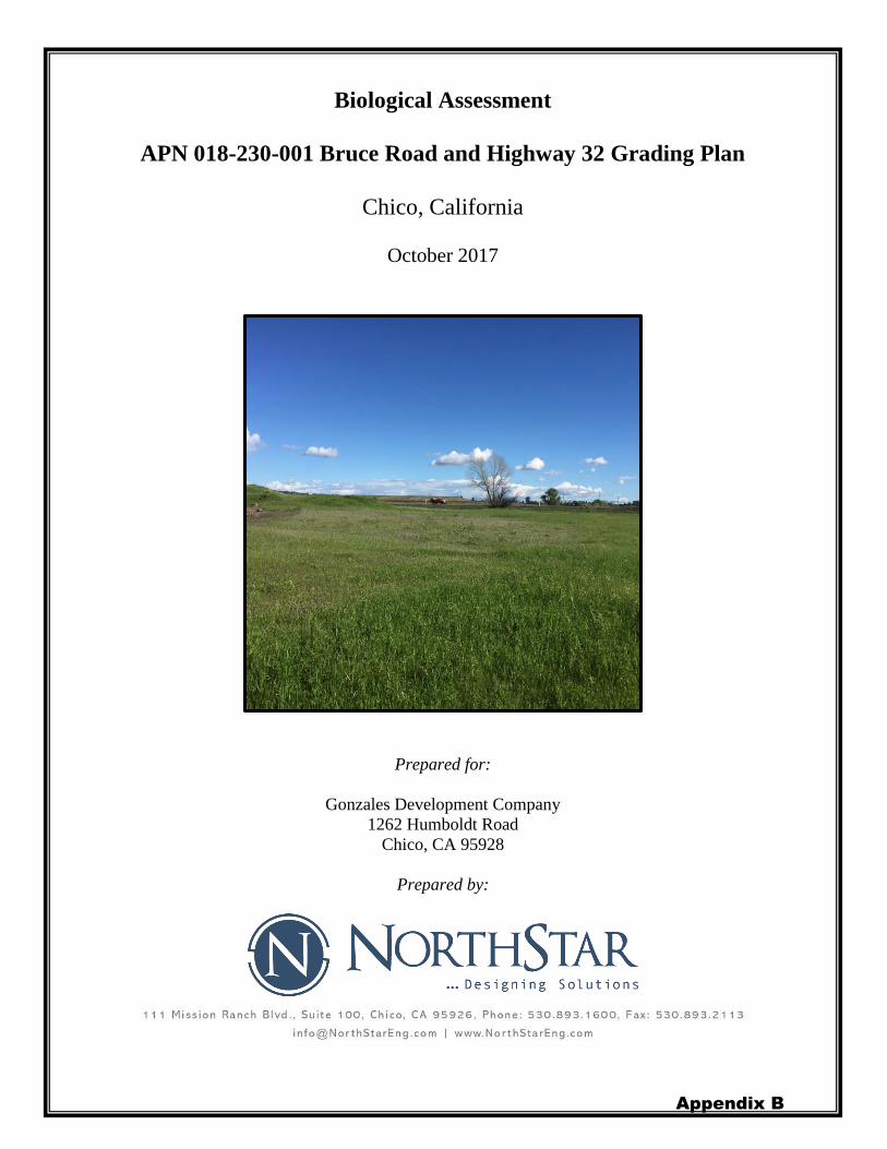
Biological Assessment
APN 018-230-001 Bruce Road and Highway 32 Grading Plan
Chico, California
October 2017
Prepared for:
Gonzales Development Company
1262 Humboldt Road
Chico, CA 95928
Prepared by:
Appendix B
Biological Assessment
APN 018-230-001 Bruce Road and Highway 32 Grading Plan
City of Chico, Calif omia
October 2017
Location: Butte County, California Within Section 19, Township 22N, Range 2E121 °47'26.84" w, 39°44'33.92''N Chico USGS 7.5' Quadrangle
PreparedBy: A�B._C-7 Date: /P/(3/-:,--M�----Hi<-++-"o--"g -er-s A___,s,._so-c -ia�te -B -io-lo -g -ist___ ' 1
NorthStar 111 Mission Ranch Blvd, Suite 100, Chico, CA(530) 893-1600 Prepared for:
Dan Gonzales Gonzales Development Company1262 Humboldt Road Chico, CA 95928
Prepared by:
111 Mission Ranch Blvd. Suite 100. Chico, CA 95926. Phone: 530 893 1600. Fax· 530 893 2113
info@NorthStarEng com I www NorthStarEng com
Appendix B

Page intentionally left blank
Appendix B
Table of Contents
1. EXECUTIVE SUMMARY ..................................................................................................... 1
2. INTRODUCTION.................................................................................................................... 2
2.1 Project Area ............................................................................................................................... 2 2.2 Description of Proposed Action ................................................................................................. 2 2.3 Threatened, Endangered, Proposed Threatened, Proposed Endangered, or Candidate
Species ....................................................................................................................................... 4 2.4 Critical Habitat ........................................................................................................................... 5 2.5 Consultation to Date .................................................................................................................. 5 2.6 Current Management Direction ................................................................................................. 7
3. SPECIES ACCOUNTS AND STATUS OF SPECIES AND HABITAT OCCURRING IN
THE PROJECT AREA ........................................................................................................................ 7 3.1 Giant Garter Snake ..................................................................................................................... 7 3.2 Butte County Meadowfoam ..................................................................................................... 10
4. EFFECTS OF THE PROPOSED PROJECT, CONSERVATION AND MITIGATION
MEASURES ........................................................................................................................................ 11 4.1 Giant Garter Snake ................................................................................................................... 11
4.1.1 Factors Affecting GGS in the City of Chico, CA ............................................................ 11 4.1.2 Direct and Indirect Effects to GGS .................................................................................. 11 4.1.3 GGS Avoidance and Minimization .................................................................................. 13
4.2 Butte County Meadowfoam ..................................................................................................... 14 4.2.1 Factors Affecting Butte County Meadowfoam in the City of Chico, CA ........................ 14 4.2.2 Direct and Indirect Effects to BCM ................................................................................. 15 4.2.3 BCM Avoidance and Minimization ................................................................................. 15
4.3 Interrelated and/or Interdependent Effects from Other Projects within the Vicinity ............... 15 4.4 Cumulative Effects................................................................................................................... 15
5. DETERMINATION .............................................................................................................. 15
6. REFERENCES ....................................................................................................................... 17
Appendix B
List of Figures Figure 1. Project Location............................................................................................................... 3 Figure 2. CNDDB Occurrence Map ............................................................................................... 6 Figure 3. Giant Garter Snake Habitat Map ..................................................................................... 9 Figure 4. Butte County Meadowfoam Habitat Map ..................................................................... 12
List of Tables Table 1. Species which are known not to occur within the project area. ........................................ 4
Appendices
Appendix A - USFWS Species List
Appendix B - CNDDB Species List
Appendix C - CNPS Species List
Appendix D - Species Observed in the Project Area by NorthStar biologists
Appendix E - Surveyor Qualifications
Appendix B

1. EXECUTIVE SUMMARY
Gonzales Development Company is proposing grading of a parcel (APN 018-230-001) in the
City of Chico, Butte County, California. The proposed project involves grading and leveling the
site in anticipation of selling the site; no development project is currently proposed.
The project site is primarily disturbed annual grassland with a small area of riparian vegetation in
the southwestern corner of the property where the South Fork of Dead Horse Slough enters the
site. The site is bordered to the north by the overflow for the California Park Lake, Sierra Sunrise
Terrace to the northeast, a Caltrans right-of-way adjacent to State Route 32 to the south, and
Bruce Road to the west. The site and immediate vicinity are zoned Community Commerical in
the City of Chico Zoning Map and designated Commercial Mixed Use in the City of Chico
General Plan.
NorthStar conducted biological surveys on March 22 and July 8, 2016, as well as March 28 and
May 15, 2017. The March 22, 2016 survey was conducted by NorthStar biologist, Carol Wallen
and qualified consulting botanist, Mary Bailey. The July 8, 2016 survey was performed by
NorthStar biologists, Carol Wallen and Matt Rogers. As part of the July 8, 2016 site visit Ms.
Wallen and Mr. Rogers conducted an aquatic resources delineation. In addition to field surveys,
NorthStar compiled a list of special-status plant and wildlife species from information provided
by the U.S. Fish and Wildlife Service (USFWS), the California Department of Fish and Wildlife
(CDFW), and the California Native Plant Society (CNPS). This information, in combination with
field inspections, was evaluated to determine the likelihood of federally endangered and
threatened species within the project area and to determine if these species would be impacted by
the proposed project.
Two Federally listed species were determined to have the potential to occur within the project
area, giant garter snake (GGS) (Thamnophis gigas) and Butte County meadowfoam (BCM)
(Limnanthes floccosa ssp. californica). However, the proposed project site does not provide the
four essential GGS habitat components, as defined in the November 13, 1997 United States
Army Corps of Engineers (USACE) Programmatic Formal Consultation regarding GGS within
various Northern California counties, including Butte County. Although there is lack of suitable
habitat for GGS, the project will still comply with the “GGS Avoidance and Minimization
Measures” described within this document. Through the use of avoidance measures and the
timing of construction, no impacts to GGS are expected to occur. Two years of protocol level
surveys with negative findings for the presence of BCM were completed in March of 2016 and
March of 2017. It is not anticipated that project activities will have an effect on BCM.
Appendix B
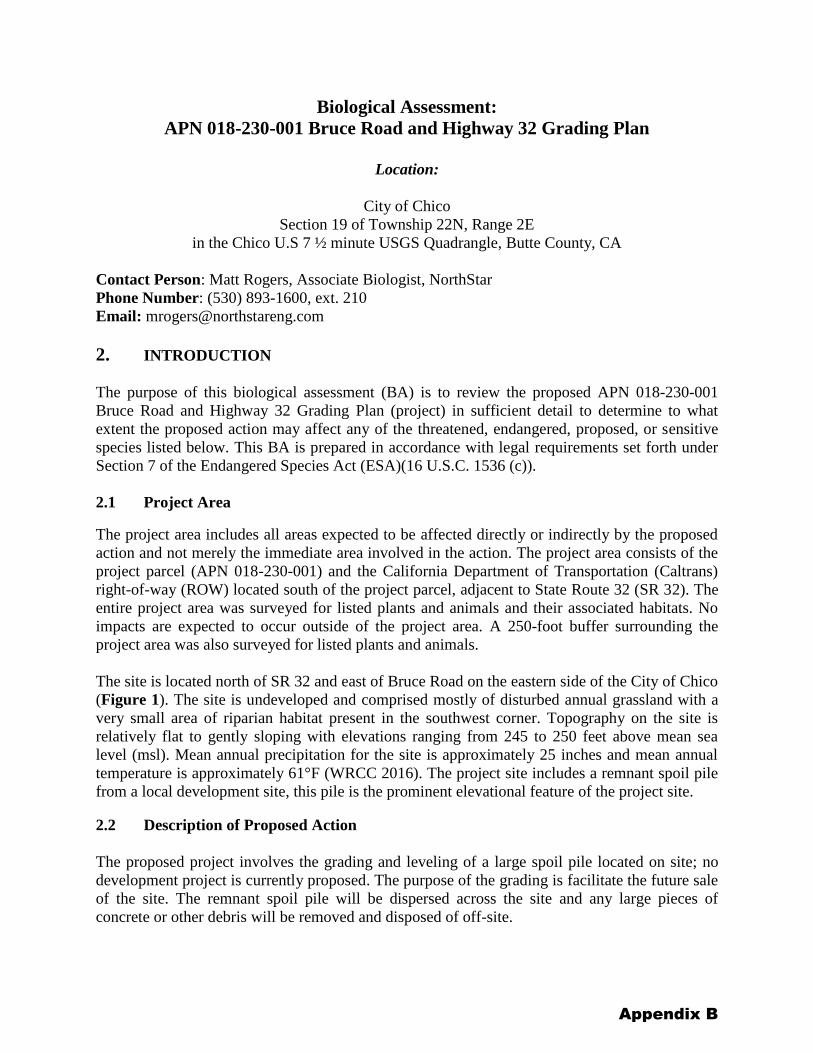
Biological Assessment:
APN 018-230-001 Bruce Road and Highway 32 Grading Plan
Location:
City of Chico
Section 19 of Township 22N, Range 2E
in the Chico U.S 7 ½ minute USGS Quadrangle, Butte County, CA
Contact Person: Matt Rogers, Associate Biologist, NorthStar
Phone Number: (530) 893-1600, ext. 210
Email: [email protected]
2. INTRODUCTION
The purpose of this biological assessment (BA) is to review the proposed APN 018-230-001
Bruce Road and Highway 32 Grading Plan (project) in sufficient detail to determine to what
extent the proposed action may affect any of the threatened, endangered, proposed, or sensitive
species listed below. This BA is prepared in accordance with legal requirements set forth under
Section 7 of the Endangered Species Act (ESA)(16 U.S.C. 1536 (c)).
2.1 Project Area
The project area includes all areas expected to be affected directly or indirectly by the proposed
action and not merely the immediate area involved in the action. The project area consists of the
project parcel (APN 018-230-001) and the California Department of Transportation (Caltrans)
right-of-way (ROW) located south of the project parcel, adjacent to State Route 32 (SR 32). The
entire project area was surveyed for listed plants and animals and their associated habitats. No
impacts are expected to occur outside of the project area. A 250-foot buffer surrounding the
project area was also surveyed for listed plants and animals.
The site is located north of SR 32 and east of Bruce Road on the eastern side of the City of Chico
(Figure 1). The site is undeveloped and comprised mostly of disturbed annual grassland with a
very small area of riparian habitat present in the southwest corner. Topography on the site is
relatively flat to gently sloping with elevations ranging from 245 to 250 feet above mean sea
level (msl). Mean annual precipitation for the site is approximately 25 inches and mean annual
temperature is approximately 61°F (WRCC 2016). The project site includes a remnant spoil pile
from a local development site, this pile is the prominent elevational feature of the project site.
2.2 Description of Proposed Action
The proposed project involves the grading and leveling of a large spoil pile located on site; no
development project is currently proposed. The purpose of the grading is facilitate the future sale
of the site. The remnant spoil pile will be dispersed across the site and any large pieces of
concrete or other debris will be removed and disposed of off-site.
Appendix B
Copyright:© 2013 National Geographic Society, i-cubed
BUTTE
TEHAMA
GLENN
Content may not reflect National
Geographic's current map policy.Sources: National Geographic, Esri,DeLorme, HERE, UNEP-WCMC,
USGS, NASA, ESA, METI, NRCAN,GEBCO, NOAA, increment P Corp.
Imagery Source:USGS TopoInset Imagery:National Geographic
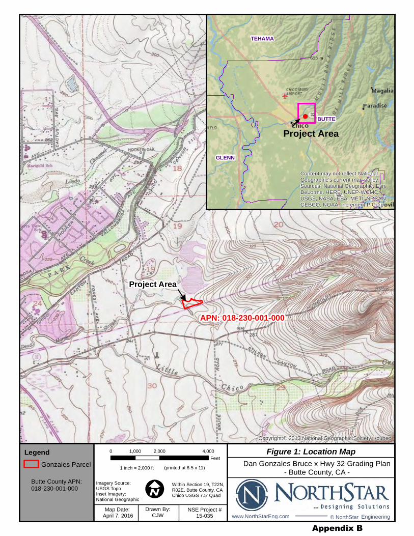
Figure 1: Location Map
Within Section 19, T22N,R02E, Butte County, CAChico USGS 7.5' Quad
0 2,000 4,0001,000
Feet
Project Area
Project Area
Dan Gonzales Bruce x Hwy 32 Grading Plan
- Butte County, CA -
Map Date: April 7, 2016
Drawn By:CJW
NSE Project #15-035
LegendGonzales Parcel
APN: 018-230-001-000
1 inch = 2,000 ft (printed at 8.5 x 11)
Butte County APN:018-230-001-000
www.NorthStarEng.com © NorthStar Engineering
Appendix B
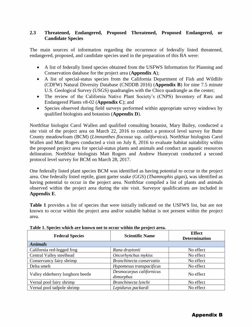
2.3 Threatened, Endangered, Proposed Threatened, Proposed Endangered, or
Candidate Species
The main sources of information regarding the occurrence of federally listed threatened,
endangered, proposed, and candidate species used in the preparation of this BA were:
• A list of federally listed species obtained from the USFWS Information for Planning and
Conservation database for the project area (Appendix A);
• A list of special-status species from the California Department of Fish and Wildlife
(CDFW) Natural Diversity Database (CNDDB 2016) (Appendix B) for nine 7.5 minute
U.S. Geological Survey (USGS) quadrangles with the Chico quadrangle as the center;
• The review of the California Native Plant Society’s (CNPS) Inventory of Rare and
Endangered Plants v8-02 (Appendix C); and
• Species observed during field surveys performed within appropriate survey windows by
qualified biologists and botanists (Appendix D).
NorthStar biologist Carol Wallen and qualified consulting botanist, Mary Bailey, conducted a
site visit of the project area on March 22, 2016 to conduct a protocol level survey for Butte
County meadowfoam (BCM) (Limnanthes flocossa ssp. californica). NorthStar biologists Carol
Wallen and Matt Rogers conducted a visit on July 8, 2016 to evaluate habitat suitability within
the proposed project area for special-status plants and animals and conduct an aquatic resources
delineation. NorthStar biologists Matt Rogers and Andrew Huneycutt conducted a second
protocol level survey for BCM on March 28, 2017.
One federally listed plant species BCM was identified as having potential to occur in the project
area. One federally listed reptile, giant garter snake (GGS) (Thamnophis gigas), was identified as
having potential to occur in the project area. NorthStar compiled a list of plants and animals
observed within the project area during the site visit. Surveyor qualifications are included in
Appendix E.
Table 1 provides a list of species that were initially indicated on the USFWS list, but are not
known to occur within the project area and/or suitable habitat is not present within the project
area.
Table 1. Species which are known not to occur within the project area.
Federal Species Scientific Name Effect
Determination
Animals California red-legged frog Rana draytonii No effect
Central Valley steelhead Oncorhynchus mykiss No effect
Conservancy fairy shrimp Branchinecta conservatio No effect
Delta smelt Hypomesus transpacificus No effect
Valley elderberry longhorn beetle Desmocarpus californicus
dimorphus No effect
Vernal pool fairy shrimp Branchinecta lynchi No effect
Vernal pool tadpole shrimp Lepidurus packardi No effect
Appendix B
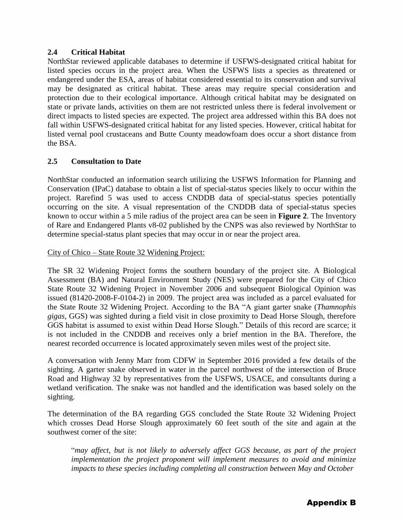
2.4 Critical Habitat
NorthStar reviewed applicable databases to determine if USFWS-designated critical habitat for
listed species occurs in the project area. When the USFWS lists a species as threatened or
endangered under the ESA, areas of habitat considered essential to its conservation and survival
may be designated as critical habitat. These areas may require special consideration and
protection due to their ecological importance. Although critical habitat may be designated on
state or private lands, activities on them are not restricted unless there is federal involvement or
direct impacts to listed species are expected. The project area addressed within this BA does not
fall within USFWS-designated critical habitat for any listed species. However, critical habitat for
listed vernal pool crustaceans and Butte County meadowfoam does occur a short distance from
the BSA.
2.5 Consultation to Date
NorthStar conducted an information search utilizing the USFWS Information for Planning and
Conservation (IPaC) database to obtain a list of special-status species likely to occur within the
project. Rarefind 5 was used to access CNDDB data of special-status species potentially
occurring on the site. A visual representation of the CNDDB data of special-status species
known to occur within a 5 mile radius of the project area can be seen in Figure 2. The Inventory
of Rare and Endangered Plants v8-02 published by the CNPS was also reviewed by NorthStar to
determine special-status plant species that may occur in or near the project area.
City of Chico – State Route 32 Widening Project:
The SR 32 Widening Project forms the southern boundary of the project site. A Biological
Assessment (BA) and Natural Environment Study (NES) were prepared for the City of Chico
State Route 32 Widening Project in November 2006 and subsequent Biological Opinion was
issued (81420-2008-F-0104-2) in 2009. The project area was included as a parcel evaluated for
the State Route 32 Widening Project. According to the BA “A giant garter snake (Thamnophis
gigas, GGS) was sighted during a field visit in close proximity to Dead Horse Slough, therefore
GGS habitat is assumed to exist within Dead Horse Slough.” Details of this record are scarce; it
is not included in the CNDDB and receives only a brief mention in the BA. Therefore, the
nearest recorded occurrence is located approximately seven miles west of the project site.
A conversation with Jenny Marr from CDFW in September 2016 provided a few details of the
sighting. A garter snake observed in water in the parcel northwest of the intersection of Bruce
Road and Highway 32 by representatives from the USFWS, USACE, and consultants during a
wetland verification. The snake was not handled and the identification was based solely on the
sighting.
The determination of the BA regarding GGS concluded the State Route 32 Widening Project
which crosses Dead Horse Slough approximately 60 feet south of the site and again at the
southwest corner of the site:
“may affect, but is not likely to adversely affect GGS because, as part of the project
implementation the project proponent will implement measures to avoid and minimize
impacts to these species including completing all construction between May and October
Appendix B
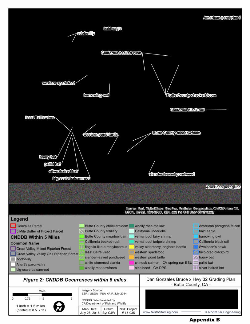
Figure 2: CNDDB Occurences within 5 miles
American peregrine falcon
American peregrine falcon
pallid bathoary bat
bald eagle
silver-haired bat
least Bell's vireo
big-scale balsamroot
California black rail
adobe-lily
western spadefoot
adobe-lily
slender-leaved pondweed
burrowing owl Butte County checkerbloom
California beaked-rush
western pond turtlewestern pond turtle
California beaked-rush
Butte County checkerbloom
Butte County meadowfoamButte County meadowfoam
Butte County checkerbloom
Source: Esri, DigitalGlobe, GeoEye, Earthstar Geographics, CNES/Airbus DS,USDA, USGS, AeroGRID, IGN, and the GIS User Community
LegendGonzales Parcel5 Mile Buffer of Project Parcel
CNDDB Within 5 MilesCommon Name
Great Valley Mixed Riparian ForestGreat Valley Valley Oak Riparian Forestadobe-lilyAhart's paronychiabig-scale balsamroot
Butte County checkerbloomButte County fritillaryButte County meadowfoamCalifornia beaked-rushflagella-like atractylocarpusleast Bell's vireoslender-leaved pondweedwhite-stemmed clarkiawoolly meadowfoam
woolly rose-mallowCalifornia linderiellavernal pool fairy shrimpvernal pool tadpole shrimpvalley elderberry longhorn beetlewestern spadefootwestern pond turtlechinook salmon - CV spring-run ESUsteelhead - CV DPS
American peregrine falconbald eagleburrowing owlCalifornia black railSwainson's hawktricolored blackbirdhoary batpallid batsilver-haired bat
!I(printed at 8.5 x 11)
Imagery Source:ESRI: USDA - FSA NAIP, July 2014;CNDDB Data Provided By:CA Department of Fish and Wildlife
0 1.5 30.75
Miles
1 inch = 1.5 miles Map Date:July 26, 2016
DrawnBy: CJW
NSE Project# 15-035 www.NorthStarEng.com © NorthStar Engineering
Dan Gonzales Bruce x Hwy 32 Grading Plan- Butte County, CA -
Appendix B
1, when GGS are active and the slough is dry and compensating for habitat loss through
the appropriate mitigation.”
Within the USFWS’s Biological Opinion the service concluded that
“The proposed project site provides suitable snake habitat including both upland and
aquatic habitats. The snake is assumed to occur in Dead Horse Slough, and because of
the presence of suitable habitat, the Service believes that the snake is reasonably certain
to occur within the proposed project’s action area and, therefore, the proposed project is
likely to adversely affect the snake through temporary loss of 0.227 acres of potential
aquatic habitat and permanently
destroy 1.519 acres of upland habitat and 0.093 acres of aquatic habitat.”
2.6 Current Management Direction
As the lead agency under the CEQA, the City of Chico is required to establish the presence or
absence of state or federally listed rare, endangered, threatened, and candidate species through
literature review and field surveys. The CNDDB, and the most recent available list of special-
status species documented by USFWS were reviewed and appropriate field surveys were
performed.
3. SPECIES ACCOUNTS AND STATUS OF SPECIES AND HABITAT
OCCURRING IN THE PROJECT AREA
3.1 Giant Garter Snake
The giant garter snake is a federal and state listed threatened species. Giant garter snakes inhabit
agricultural wetlands and other waterways such as irrigation and drainage canals, sloughs, ponds,
small lakes, low gradient streams, and adjacent uplands in the Central Valley. Because of the
direct loss of natural habitat, GGS relies heavily on rice fields in the Sacramento and San
Joaquin Valley, but also uses managed marsh areas in federal national wildlife refuges and state
wildlife areas. Giant garter snakes are typically absent from 1) larger rivers, secondary to a lack
of suitable habitat and emergent vegetative cover and 2) wetlands with sand, gravel, or rock
substrates. Riparian woodlands typically do not provide suitable habitat because of excessive
shade, lack of basking sites, and absence of prey populations. However, some riparian
woodlands can provide adequate habitat.
Primary habitat requirements consist of 1) adequate water during the snake's active season
(early-spring through mid-fall) to provide food and cover; 2) emergent, herbaceous wetland
vegetation, such as cattails and bulrushes, for escape cover and foraging habitat during the active
season; 3) grassy banks and openings in waterside vegetation for basking; and 4) higher
elevation uplands for cover and refuge from floodwaters during the snake's dormant season in
the winter (USFWS 2006).
Giant garter snakes feed primarily on small fish, tadpoles, and frogs. The GGS inhabits small
mammal burrows and other soil crevices above prevailing flood elevations throughout its winter
dormancy period. The snakes typically select burrows with sunny exposure along south and west
Appendix B
facing slopes. The breeding season extends through March and April, and females give birth to
live young from late July through early September. Brood size is variable, ranging from 10 to 46
young, with a mean of 23 (Hansen and Hansen, 1990). Young immediately scatter into dense
cover and absorb their yolk sacs, after which they begin feeding on their own. Although growth
rates are variable, young typically more than double in size within the first year; sexual maturity
averages three years for males and five years for females (Hansen and Hansen, 1990).
NorthStar biologists Carol Wallen and Matt Rogers conducted a field survey on July 8, 2016
(Surveyor Qualifications in Appendix E) to evaluate habitat suitability in the project area for
plants and animals, specifically GGS. Dead Horse Slough is hydrologically connected to Little
Chico Creek which has confirmed occurrences of GGS over seven miles west of the project site.
The USFWS previously identified Dead Horse Slough as a movement corridor. A 2010 habitat
suitability model by Halstead, Wylie, and Casazza indicated that GGS primarily occurs in areas
with dense networks of canals among rice agriculture and wetlands. The model suggests there is
very little suitable habitat present east of Highway 99 and north of Highway 32.
The project area does not meet the four essential GGS habitat components, as set forth in the
November 13, 1997 USACE Programmatic Formal Consultation for GGS within the Northern
California counties, including Butte County. Without the first two primary habitat components
being met the final two are not met, and thus the area is unlikely to be utilized by the species
(Figure 3).
Primary habitat requirements consist of:
1. Adequate water during the snake's active season (early-spring through mid-fall) to
provide food and cover.
Dead Horse Slough is an intermittent tributary to Little Chico Creek; it is fed by seasonal
rains that occur primarily between November and March. Little to no water is present within
Dead Horse Slough during the snake’s active season and thus, should be considered
inadequate habitat. Rainfall that may occur early in the active season (May-June) typically is
light rainfall and yields low totals (as consistent with a Mediterranean Climate). Thus, water
does not remain in Dead Horse Slough through the summer. Dead Horse Slough is dry during
the active season for GGS when aquatic habitat is required for feeding, transportation, and
cover.
2. Emergent, herbaceous wetland vegetation, such as cattails and bulrushes, for escape
cover and foraging habitat during the active season.
Because Dead Horse Slough does not hold water during the late spring and early summer
months, it does not support a wetland habitat and therefore does not support the growth of
emergent, herbaceous wetland vegetation. Ruderal vegetation (mainly grasses) is found
within the banks of the portion of Dead Horse Slough within the property; the grasses do not
provide adequate escape cover. The lack of water and emergent wetland vegetation also
create an absence of typical prey for GGS (i.e. small fish, tadpoles, and frogs). Dead Horse
Slough does not provide emergent, herbaceous wetland vegetation for escape and foraging
habitat during the active season.
Appendix B

So
urc
e: E
sri
, D
igita
lGlo
be,
Geo
Eye,
Ea
rth
sta
r G
eo
gra
phic
s,
CN
ES
/Airb
us D
S,
US
DA
, U
SG
S,
Aero
GR
ID, IG
N,
and
th
e G
IS U
se
r C
om
mun
ity
Imag
ery
Sou
rce:
ES
RI
US
DA
FS
A N
AIP
(7/1
3/1
6)
Within
Section
19,
To
wnsh
ip 2
2N
, R
ang
e 0
2E
,
Butt
e C
ou
nty
, C
AC
hic
o U
SG
S 7
.5' Q
uad
0140
280
70
Fe
et
! IM
ap D
ate
:9/2
2/1
7D
raw
n B
y:
CJW
NS
E P
roje
ct
# 1
5-0
35
Lege
nd Bio
logic
al S
urv
ey
US
AC
E S
urv
ey
Lim
it o
f D
istu
rban
ce
Flo
w o
f W
ate
rT
hro
ugh
BS
A
ACAD
- Exis
ting S
iteCo
nditio
nsE
xis
ting
Ea
rth
/Rock
Mo
und
Exis
ting
Con
tou
r -
Ma
jor
Exis
ting
Con
tou
r -
Min
or
Exis
ting
To
p o
f S
lop
e
1 in
ch =
140
ft
(pri
nte
d a
t 8.5
x 1
1)
Coo
rdin
ate
Syste
m:
NA
D 1
98
3 U
TM
Zon
e 1
0
Pro
jection
: T
ransvers
e M
erc
ato
rD
atu
m: N
ort
h A
meri
ca
n 1
98
3
Surv
ey D
ate
s:
Surv
eyor(
s)
3/2
2/1
6
(C
JW
& M
SR
)
7/8
/16
(
CJW
& M
SR
) 3
/28
/17
(M
SR
& A
H)
5/1
5/1
7
(M
SR
)
111 M
ISSIO
N RA
NCH
BLVD
., SUI
TE 10
0 CHI
CO, C
A 95
926
PHON
E: (5
30) 8
93-16
00 - w
ww.N
orth
Star
Eng.c
om - ©
Nor
thStar
APN
018-2
30-00
1 Grad
ing Pl
an-C
ity of
Chic
o, Bu
tte C
ounty
, CA -
Figur
e 3: G
GS H
abita
t With
in Pr
oject
Area
Appendix B
3. Grassy banks and openings in waterside vegetation for basking.
The portion of Dead Horse Slough found within the project area does have grassy banks for
basking. In order for the grassy banks to be utilized for basking by a snake, water would need
to be present within the slough during the active season for a snake to access the site.
Additionally, water and emergent vegetation is not present to provide escape cover.
4. Higher elevation uplands for cover and refuge from floodwaters during the snake's
dormant season in the winter.
The higher elevation uplands do contain refugia, which the snake inhabits during winter
months. However, in order for the higher upland elevations to be utilized by the GGS in the
dormant season, water would need to be present in Little Chico Creek and Dead Horse
Slough consistently during the summer months for snakes to access the site.
No GGS were detected during surveys and the nearest known occurrence listed in the CNDDB is
over seven miles west of the project boundary at the City of Chico’s Water Pollution Control
Plant which provides all four critical habitat components. Details of the occurrence mentioned in
the BA for the State Route 32 Widening Project are scarce. It is not found in the CNDDB nor is
it found in any literature other than brief mentions. The snake was not handled by the observers,
therefore, positive identification via labial scale counts could not be performed. Additionally,
that sighting would represent a range expansion of over seven miles to the northeast through
unsuitable wooded riparian corridors that are mostly dry during the active season for GGS. For
these reasons, as well as the reasoning listed above, NorthStar believes this area has an extremely
low potential to support GGS. Although Dead Horse Slough is not likely to provide adequate
GGS habitat, in order to reduce effects to the snake, the project proponent will comply with the
conservation measures described in Section 4.3–GGS Avoidance and Minimization Measures.
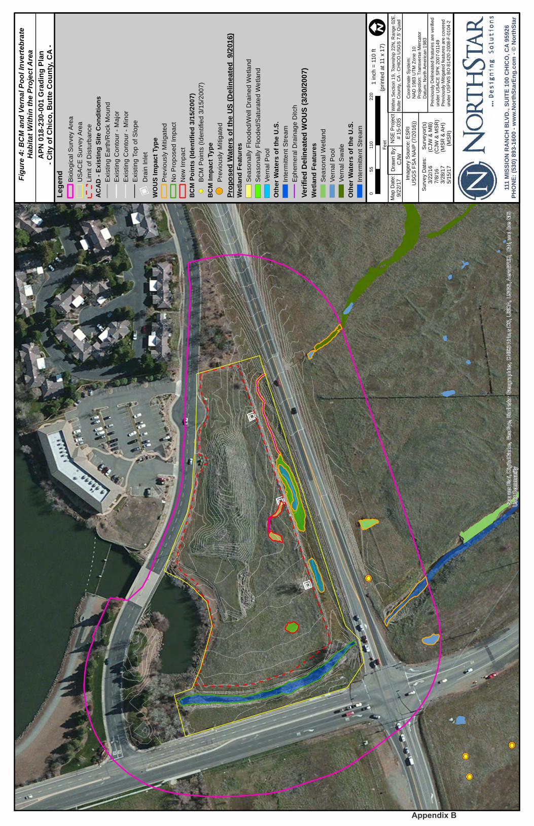
3.2 Butte County Meadowfoam
Butte County meadowfoam (Limnanthes flocossa ssp. californica) (BCM) is a state and federal
listed endangered species and critical habitat has been designated by the USFWS. Butte County
meadowfoam is a small annual with densely hairy leaves and stems. The leaves are alternate and
pinnately compound. Flowers are five-merous, cup shaped, and white with yellow stripes.
It has been identified exclusively in a narrow 25-mile strip along the eastern edge of the
Sacramento Valley from central Butte County to the northern portion of the City of Chico. The
winter annual herb belonging to the false meadowfoam family (Limnanthacea) occurs in shallow
soils within vernal swales, along the edges of vernal pools and ephemeral streams, and less
frequently around the edges of isolated vernal pools. It has also been observed occurring on
uplands immediately adjacent to vernal swales and pools and within abandoned irrigation canals
and roadside drainage ditches. Species found in association with BCM are common vernal pool
inhabitants including Fremont’s tidy tips (Layia fremontii), California goldfields (Lasthenia
californica ssp californica), yellow carpet (Blennosperma nanum), and coyote thistle (Eryngium
vaseyi) (Dole and Sun 1992). Butte County meadowfoam is adapted to cross pollination by
insects, however, past research has suggested it undergoes substantial amounts of self-
pollination. The genetic variation within populations is quite low suggesting very little gene flow
Appendix B
between populations. The low genetic variability in association with the large population
fluctuations observed in BCM could expose it to increased risks of extinction (Sloop et al. 2010).
NorthStar biologist, Carol Wallen and qualified botanist, Mary Bailey conducted a protocol level
survey on March 22, 2016 for BCM within the project site. No BCM was encountered during the
survey of the project site. Additionally, no special-status plant species were observed on the
property during the survey. NorthStar biologists Matt Rogers and Andrew Huneycutt conducted
a protocol level survey on March 28, 2017 for BCM within the project site. No BCM was
encountered during the survey nor were any additional special-status plant species observed on
the property.
The grassland habitat within the project site provides potentially suitable habitat for BCM, the
property is adjacent to a few large BCM population centers that occur along the eastern side of
the City of Chico (Figure 4). A majority of the project site is comprised of a soil map unit,
Doemill-Jokerst complex 3-8% slopes, that supports BCM populations in the surrounding
population centers. However, there is very little mesic habitat present on-site that could support
BCM. The South Fork of Dead Horse Slough on the site is likely sub-marginal habitat for BCM
as there is little saturated soil that is not completely inundated. The ephemeral drainage ditches
with wetland characteristics within the project parcel may provide potentially suitable habitat for
BCM. Additionally, the vernal pools within the Caltrans ROW may provide potentially suitable
habitat for BCM. While BCM has been observed in upland habitat away from vernal pools it is
very rare. In addition, the upland habitat within the project site is heavily invaded with slender
oat (Avena barbata) and medusa head (Elymus caput-medusae) which would likely exclude
BCM from the uplands and potentially mesic sites as well. The BCM surveys conducted in
March of 2016 and March of 2017 had a negative finding for the species within the project site.
4. EFFECTS OF THE PROPOSED PROJECT, CONSERVATION AND
MITIGATION MEASURES
4.1 Giant Garter Snake
4.1.1 Factors Affecting GGS in the City of Chico, CA
Habitat loss and fragmentation, flood control activities, changes in agricultural and land
management practices, in addition to predation from introduced species, parasites, and water
pollution are the main causes for the decline of this species. However, when abundant cover is
available, GGS may be able to persist with numerous predators that share the same habitats
(Hansen 1988).
4.1.2 Direct and Indirect Effects to GGS
Direct effects are those that occur at, or very close to, the time of the action itself. Examples
include loss of habitat or sedimentation resulting from construction activities. Indirect effects are
caused by, or result from a proposed action, occur later in time, and are reasonably certain to
occur. There is one CNDDB GGS occurrence approximately 7.4 miles from the project area at
the City of Chico Water Pollution Control Plant. Although this occurrence is within a waterway
that is hydrologically connected to Dead Horse Slough, an individual would have to traverse
Appendix B
So
urc
e: E
sri
, D
igita
lGlo
be,
Geo
Eye,
Ea
rth
sta
r G
eo
gra
phic
s,
CN
ES
/Air
bu
s D
S,
US
DA
, U
SG
S, A
ero
GR
ID,
IGN
, an
d th
e G
IS
Use
r C
om
mun
ity
Imag
ery
Sou
rce:
ES
RI
US
GS
FS
A N
AIP
(7/2
016
))
Within
Se
ction 1
9, Tow
nsh
ip 2
2N
, R
ange
02E
,B
utte
Coun
ty,
CA
- C
HIC
O U
SG
S 7
.5' Q
uad
0110
220
55
Fe
et
! IM
ap D
ate
:9/2
2/1
7D
raw
n B
y:
CJW
NS
E P
roje
ct
# 1
5-0
35
Lege
nd Bio
log
ica
l S
urv
ey A
rea
US
AC
E S
urv
ey A
rea
Lim
it o
f D
istu
rban
ce
ACAD
- Exis
ting S
ite C
ondit
ions
Exis
tin
g E
art
h/R
ock M
ou
nd
Exis
tin
g C
on
tou
r -
Majo
r
Exis
tin
g C
on
tou
r -
Min
or
Exis
tin
g T
op
of S
lop
e
))D
rain
In
let
WOUS
Impa
ct Ty
peP
revio
usly
Mitig
ate
d
No P
rop
osed
Im
pa
ct
New
Im
pa
ct
BCM
Point
s (Ide
ntifie
d 3/15
/2007
)! (
BC
M P
oin
ts (
Iden
tifie
d 3
/15/2
007
)
BCM
Impa
ct Ty
pe! (
Pre
vio
usly
Mitig
ate
d
Prop
osed
Wate
rs of
the U
S (De
linea
ted 9
/2016
)We
tland
Featu
resS
ea
so
na
lly F
loo
ded
/Well
Dra
ine
d W
etla
nd
Sea
so
na
lly F
loo
ded
/Sa
tura
ted W
etla
nd
Ve
rna
l P
oo
l
Othe
r Wate
rs of
the U
.S.
Inte
rmitte
nt
Str
ea
m
Eph
em
era
l D
rain
ag
e D
itch
Verif
ied D
eline
ated W
OUS (
3/30/2
007)
Wetla
nd Fe
atures
Sea
so
na
l W
etla
nd
Ve
rna
l P
oo
l
Ve
rna
l S
wale
Othe
r Wate
rs of
the U
.S.
Inte
rmitte
nt
Str
ea
m
1 in
ch
= 1
10
ft
(pri
nte
d a
t 11
x 1
7)
Coord
inate
Syste
m:
NA
D 1
983 U
TM
Zone 1
0P
roje
ction: T
ransve
rse M
erc
ato
rD
atu
m: N
ort
h A
merican 1
983
Surv
ey D
ate
s:
Surv
eyor(
s)
3/2
2/1
6
(C
JW
& M
B)
7/8
/16
(
CJW
& M
SR
) 3
/28
/17
(M
SR
& A
H)
5/1
5/1
7
(M
SR
)
111 M
ISSIO
N RA
NCH
BLVD
., SUI
TE 10
0 CHI
CO, C
A 95
926
PHON
E: (5
30) 8
93-16
00 - w
ww.N
orthS
tarEn
g.com
- © N
orth
Star
APN
018-2
30-00
1 Gra
ding P
lan-C
ity of
Chic
o, Bu
tte C
ounty
, CA
-
Figur
e 4: B
CM an
d Vern
al Po
ol Inv
erteb
rate
Habit
at Wi
thin t
he P
rojec
t Area
Pre
vio
usly
Delin
ea
ted fe
atu
res a
re v
erified
under
US
AC
E S
PK
200
7-0
1149
Pre
vio
usly
Mitig
ate
d fea
ture
s a
re c
overe
dunder
US
FW
S B
O 8
1420
-2008-F
-0104
-2
Appendix B
B
through over seven miles of unsuitable riparian habitat to reach the portion of the South Fork of
Dead Horse Slough. Additionally, the land surrounding Little Chico Creek outside of the City of
Chico city limits is primarily orchards and not agricultural uses conducive to GGS use. No GGS
have been observed on the site during the biological surveys conducted by NorthStar. The
portion of the South Fork of Dead Horse Slough is not considered potential habitat for GGS
because it is dry throughout the summer months when GGS are active and require aquatic
habitat. Because the South Fork of Dead Horse Slough is dry in the summer and not considered
aquatic habitat, the associated banks of the South Fork of Dead Horse Slough are not considered
upland GGS habitat. Therefore, earthmoving activities associated with the grading of the site will
not affect GGS. The proposed project will not directly or permanently impact GGS, potential
GGS aquatic habitat, or any potential GGS upland habitat.
4.1.3 GGS Avoidance and Minimization
As a precaution, if for any reason GGS are found traveling through the area during an atypical
summer storm, which could potentially create water in Dead Horse Slough, several protective
measures will be implemented by the project proponent and its contractors to ensure GGS are not
impacted by this project. These proposed measures to protect GGS are as follows:
1. Grading activities and all earth-movement within 200 feet of the Dead Horse Slough shall
be conducted between May 1 and October 1, when snakes are active and can presumably
avoid danger on their own. In the unlikely event that grading needs to occur in these areas
between October 2 and April 30, a USFWS approved biologist will monitoring grading
activities.
2. Twenty-four-hours prior to the commencement of grading activities within 200 feet of the
Dead Horse Slough, the project area shall be surveyed by a Service-approved biologist to
document the presence or absence of GGS. The biologist will provide the Service with a
written report that adequately documents the monitoring efforts within 24-hours of
commencement of construction activities. The project area shall be re-inspected by the
monitoring biologist whenever a lapse in construction activity of two weeks or greater
has occurred. All efforts will be made to minimize ground disturbing activities within the
project area where no permanent modifications are to occur. If any GGS habitat is
identified within the project area during the pre-construction survey, exclusionary fencing
(orange construction barrier fencing) shall be placed around potential habitat to identify
areas to be avoided during construction activity.
3. Construction personnel will participate in a USFWS Worker Environmental Awareness
Training program prior to the initiation of construction activities. The training will
educate all workers and site personnel about identification of GGS and appropriate
actions to be taken in the event GGS are observed during construction. Under this
training, workers shall be informed about the presence of GGS and the habitat associated
with the species and that unlawful take of the animal or destruction of its habitat is a
violation of the Endangered Species Act. The training shall include specific information
regarding:
a. The life history of the GGS;
b. The importance of irrigation canals, marshes/wetlands, and seasonally flooded
Appendix B
areas, to GGS; and
c. A description of activities that qualify as take of the species including harassment,
destruction of habitat, and the death of a GGS.
4. During grading operations, stockpiling of construction materials, portable equipment,
vehicles, and supplies will be restricted to the designated construction staging areas and
all operations will be confined to the minimal area necessary. Additionally, project-
related vehicles will observe a 10-mile-per-hour speed limit within construction areas,
except on existing paved roads where they will adhere to the posted speed limits.
5. Best Management Practices (BMPs) will be implemented to minimize the potential for
erosion and sedimentation into Dead Horse Slough. Timing of work with consideration of
dry weather will be utilized.
6. After completion of grading activities, the applicant will remove any temporary fill and
construction debris and, wherever feasible, restore disturbed areas to pre-project
conditions.
7. A photo documentation report showing pre- and post-construction project area conditions
will be submitted to the Service one (1) month after the completion of the project including
stabilization.
8. In the unlikely event a GGS is encountered, the USFWS-approved biologist shall notify
the USFWS immediately if GGS is found on-site. The USFWS-approved biologist shall
submit locality information to the CDFW, using completed California Native Species
Field Survey Forms or their equivalent, no more than 90 calendar days after completing
the last field visit of the project area. Each form shall have an accompanying scale map of
the site such as a photocopy of a portion of the appropriate 7.5-minute USGS map and
shall provide at least the following information: township, range, and quarter section;
name of the 7.5-minute or 15-minute quadrangle; dates (day, month, year) of field work;
number of individuals and life stage (where appropriate) encountered; and a description
of the habitat by community-vegetation type.
4.2 Butte County Meadowfoam
4.2.1 Factors Affecting Butte County Meadowfoam in the City of Chico, CA
Butte County meadowfoam is fragmented throughout its limited range due to past habitat
conversion for both urban and agricultural uses. The primary threat to BCM is habitat loss and
fragmentation. Nearly all the remaining populations are threatened by urban development,
airport maintenance activities, conversion of agricultural lands to other uses, and changes in
grazing. Additional threats include competition with invasive species, hydrological changes,
trampling (human or grazing), climate change, and stochastic events.
Appendix B
4.2.2 Direct and Indirect Effects to BCM
No BCM was observed during the March 22, 2016 or March 28, 2017 protocol level surveys of
the site. The habitat present on the site is not ideal for BCM as there are no vernal pools or vernal
swales within the property, additionally, the uplands are heavily invaded with non-native grass
species. No direct impacts are anticipated to occur to BCM as a result of project activities.
4.2.3 BCM Avoidance and Minimization
Based on the lack of suitable vernal pool and vernal swale habitat within the site, the proposed
project will have no effect on this federally endangered species.
4.3 Interrelated and/or Interdependent Effects from Other Projects within the Vicinity
Interdependent actions are actions having no interdependent utility apart from the proposed
action. Interrelated actions are part of a larger action and depend on the larger actions for their
justification (50 CFR 402.02). The analysis of whether other activities are interrelated to, or
interdependent with, the proposed action should be conducted by applying the “but for” test to
the proposed action in relation to other projects within the vicinity.
There were no interdependent or interrelated effects identified for this project.
4.4 Cumulative Effects
Cumulative effects are those impacts of future state, local and private actions affecting
endangered and threatened species that are likely to occur in the project area (USFWS 1996).
Future federal actions that are unrelated to the proposed action are not considered in this section
because they require separate consultation pursuant to Section 7 of the ESA.
No known state, local, or private actions that will not require separate Section 7 consultation
other than those described in this BA are expected to occur; therefore, no cumulative effects are
expected to occur within the project area.
5. DETERMINATION
Based on the analysis as documented in this BA, the project site does not contain suitable aquatic
or upland habitat for GGS, nor does it provide suitable vernal pool and vernal swale habitat for
BCM, the proposed Gonzales Bruce Road and Highway 32 Grading project:
“Is not likely to adversely affect the giant garter snake” with the implementation of the measures
to avoid and minimize impacts to GGS as outlined in the GGS Avoidance and Minimization
Measures, including following all BMPs, conducting pre-construction surveys, and conducting
all initial earth movement when GGS are active, as required impacts would be “insignificant” as
defined by the USFWS Final ESA Section 7 Consultation Handbook (USFWS & NMFS 1998).
Appendix B

“No effect to Butte County meadowfoam”- BCM was not observed during the two years of
protocol level surveys within the project site. Both surveys resulted in a negative finding for the
presence of BCM.
Appendix B
6. REFERENCES
Baldwin, B.G., D.H. Goldman, D.J. Keil, R. Patterson, T.J. Rosatti, and D.H. Wilken, editors.
2012. The Jepson Manual: Vascular Plants of California, Second Edition. University of
California Press, Berkeley.
California Department of Fish and Game. 1983. Guidelines for Assessing the Effects of Proposed
Projects on Rare, Threatened, and Endangered Plants and Natural Communities. CDFG.
Sacramento, CA. Revised May 2000.
City of Chico. 2011. City of Chico General Plan, adopted April 12, 2011
CNDDB. 2016. California Department of Fish and Wildlife Biogeographic Data Branch.
California Natural Diversity Database. RareFind v.5.1.1
CNPS. Rare Plant Program. 2016. Inventory of Rare and Endangered Plants (online edition, v8-
02). California Native Plant Society, Sacramento, CA. Website.
http:www.rareplants.cnps.org.
. Rare Plant Advisory Committee. February 1991. (Revised April 1998) Mitigation
Guidelines Regarding Impacts to Rare, Threatened, and Endangered Plants. California
Native Plant Society. Sacramento, CA.
Dole, J.A., and M. Sun. 1992. Field and genetic survey of the endangered Butte County
Meadowfoam-Limnanthes floccosa subsp. californica. (Limnanthaceae). Conservation
Biology 6:549-558.
Gallaway Consulting Inc. 2006. Biological Assessment for the State Route 32 Road Widening
Project. City of Chico, CA.
Gallaway Consulting Inc. 2006. Natural Environment Study for the State Route 32 Road
Widening Project. City of Chico, CA.
Hansen G.E. 1988. Review of the status of the giant garter snake (Thamnophis gigas) and its
supporting habita during. 1986-1987. Final Report for California Department of Fish and
Game, Contract C-2060..
Hansen, R. W. and G. E. Hansen. 1990. Thamnophis gigas (giant garter snake) reproduction.
Herpetological Review. 21(4): 93-94.
Jennings, M.R. and M.P. Hayes. 1994. Amphibian and reptile species of special concern in
California. California Department of Fish and Game. Rancho Cordova. 255 pp.
Skinner, M. and B. Pavlik. 2001. Inventory of rare and endangered vascular plants of
California, 5th edition. California Native Plant Society. Sacramento, CA.
Appendix B
Sloop, C.M., et al. 2011. Conservation genetics of Butte County meadowfoam (Limnanthes
floccosa ssp. californica Arroyo), an endangered vernal pool endemic. Conservation
Genetics. 12(1):311-323.
USFWS. 2016. Information for Planning and Conservation. Environmental Conservation Online
System. Website. http://ecos.fws.gov/ipac
. 2013. Formal Consultation on the FRWLP Sutter County, CA. USFWS# 08ESMF00-
2013-F-0342-1. Sacramento, CA
. 2009. Biological Opinion (81420-2008-F-0104-2).Review of the Proposed State Route
32 Widening Project (Corps file Number 200600254), Sacramento County, California, for
Inclusion with the Vernal Pool Crustaceans Programmatic Consultation(Service file no. 1-1-
96-F-001), the Programmatic Consultation for U.S. Army Corps of Engineers 404 Permitted
Projects with Relatively Small Effects on the Giant Garter Snake (1-1-F-97-149), and the
Valley Elderberry Longhorn Beetle Programmatic Consultation (1-1-96-F-0066).
. 2000. Guidelines for Conducting and Reporting Botanical Inventories for Federally
Listed, Proposed and Candidate Plants. Sacramento, CA.
. 1998. Endangered Species Consultation Handbook Procedures for Conducting
Consultation and Conferences Activities Under Section 7 of the Endangered Species Act.
http://www.fws.gov/endangered/esa-library/pdf/esa_section7_handbook.pdf.
. 1997. Programmatic Formal Consultation for U.S. Army Corps of Engineers 404
Permitted Projects with Relatively Small Effects on the Giant Garter Snake within Butte,
Colusa, Glenn, Fresno, Merced, Sacramento, San Joaquin, Solano, Stanislaus, Sutter, and
Yolo Counties, California.
Personal Communications
Marr, Jenny. September 8, 2016. CDFW, Chico, CA. Telephone conversation with Matt Rogers.
Appendix B
List of Preparers
Matt Rogers. Associate Biologist. B.S. in Biological Sciences. CSU, Chico. Nine years of
experience conducting wildlife surveys for a variety of listed species, wetland delineations,
environmental assessments, and preparing reports.
Carol Wallen. Senior Biologist. B.S. in Biological Sciences. CSU, Chico. Eight years of
experience conducting wetland delineations, wildlife surveys, regulatory coordination, and report
preparation.
Appendix B

Appendix A USFWS Species List
Appendix B
IPaC - Information for Planning and Conservation ( ): A project planning tool to helphttps://ecos.fws.gov/ipac/streamline the U.S. Fish & Wildlife Service environmental review process.
U.S. Fish & Wildlife Service
Gonzales Bruce Road andHighway 32 Grading PlanIPaC Trust Resources ReportGenerated July 05, 2016 12:19 PM MDT, IPaC v3.0.8
This report is for informational purposes only and should not be used for planning oranalyzing project level impacts. For project reviews that require U.S. Fish & WildlifeService review or concurrence, please return to the IPaC website and request an officialspecies list from the Regulatory Documents page.
Appendix B
Table of Contents
IPaC Trust Resources Report . . . . . . . . . . . . . . . . . . . . . . . . . . . . . . . . . . . . . . . . . . . . . . . . . . . . . . . 1
Project Description . . . . . . . . . . . . . . . . . . . . . . . . . . . . . . . . . . . . . . . . . . . . . . . . . . . . . . . . . . . . . . 1
Endangered Species . . . . . . . . . . . . . . . . . . . . . . . . . . . . . . . . . . . . . . . . . . . . . . . . . . . . . . . . . . . . 2
Migratory Birds . . . . . . . . . . . . . . . . . . . . . . . . . . . . . . . . . . . . . . . . . . . . . . . . . . . . . . . . . . . . . . . . . 5
Refuges & Hatcheries . . . . . . . . . . . . . . . . . . . . . . . . . . . . . . . . . . . . . . . . . . . . . . . . . . . . . . . . . . . 8
Wetlands . . . . . . . . . . . . . . . . . . . . . . . . . . . . . . . . . . . . . . . . . . . . . . . . . . . . . . . . . . . . . . . . . . . . . 9
Appendix B
U.S. Fish & Wildlife Service
IPaC Trust Resources Report
NAME
Gonzales Bruce Road and Highway 32Grading Plan
LOCATION
Butte County, California
IPAC LINK
https://ecos.fws.gov/ipac/project/S5QOK-PKIDJ-F6NNL-3EM5H-PKIERE
U.S. Fish & Wildlife Service Contact InformationTrust resources in this location are managed by:
Sacramento Fish And Wildlife OfficeFederal Building2800 Cottage Way, Room W-2605Sacramento, CA 95825-1846 (916) 414-6600
Appendix B
Threatened
Endangered SpeciesProposed, candidate, threatened, and endangered species are managed by the
of the U.S. Fish & Wildlife Service.Endangered Species Program
This USFWS trust resource report is for informational purposes only and shouldnot be used for planning or analyzing project level impacts.
For project evaluations that require USFWS concurrence/review, please return to theIPaC website and request an official species list from the Regulatory Documentssection.
of the Endangered Species Act Federal agencies to "request of theSection 7 requiresSecretary information whether any species which is listed or proposed to be listed maybe present in the area of such proposed action" for any project that is conducted,permitted, funded, or licensed by any Federal agency.
A letter from the local office and a species list which fulfills this requirement canonly be obtained by requesting an official species list either from the RegulatoryDocuments section in IPaC or from the local field office directly.
The list of species below are those that may occur or could potentially be affected byactivities in this location:
Amphibians California Red-legged Frog Rana draytonii
CRITICAL HABITAT
There is critical habitat designated for this species.final
http://ecos.fws.gov/tess_public/profile/speciesProfile.action?spcode=D02D
IPaC Trust Resources ReportEndangered Species
7/5/2016 12:19 PM IPaC v3.0.8 Page 2
Appendix B
Threatened
Endangered
Threatened
Threatened
Endangered
Threatened
Endangered
Crustaceans Conservancy Fairy Shrimp Branchinecta conservatio
CRITICAL HABITAT
There is critical habitat designated for this species.final
http://ecos.fws.gov/tess_public/profile/speciesProfile.action?spcode=K03D
Vernal Pool Fairy Shrimp Branchinecta lynchiCRITICAL HABITAT
There is critical habitat designated for this species.final
http://ecos.fws.gov/tess_public/profile/speciesProfile.action?spcode=K03G
Vernal Pool Tadpole Shrimp Lepidurus packardiCRITICAL HABITAT
There is critical habitat designated for this species.final
http://ecos.fws.gov/tess_public/profile/speciesProfile.action?spcode=K048
Fishes Delta Smelt Hypomesus transpacificus
CRITICAL HABITAT
There is critical habitat designated for this species.final
http://ecos.fws.gov/tess_public/profile/speciesProfile.action?spcode=E070
Steelhead Oncorhynchus (=Salmo) mykissCRITICAL HABITAT
There is critical habitat designated for this species.final
http://ecos.fws.gov/tess_public/profile/speciesProfile.action?spcode=E08D
Flowering Plants Butte County Meadowfoam Limnanthes floccosa ssp. californica
CRITICAL HABITAT
There is critical habitat designated for this species.final
http://ecos.fws.gov/tess_public/profile/speciesProfile.action?spcode=Q2YE
Insects Valley Elderberry Longhorn Beetle Desmocerus californicus dimorphus
CRITICAL HABITAT
There is critical habitat designated for this species.final
http://ecos.fws.gov/tess_public/profile/speciesProfile.action?spcode=I01L
IPaC Trust Resources ReportEndangered Species
7/5/2016 12:19 PM IPaC v3.0.8 Page 3
Appendix B
Threatened
Reptiles Giant Garter Snake Thamnophis gigas
CRITICAL HABITAT
has been designated for this species.No critical habitat
http://ecos.fws.gov/tess_public/profile/speciesProfile.action?spcode=C057
Critical HabitatsThere are no critical habitats in this location
IPaC Trust Resources ReportEndangered Species
7/5/2016 12:19 PM IPaC v3.0.8 Page 4
Appendix B
Bird of conservation concern
Bird of conservation concern
Bird of conservation concern
Bird of conservation concern
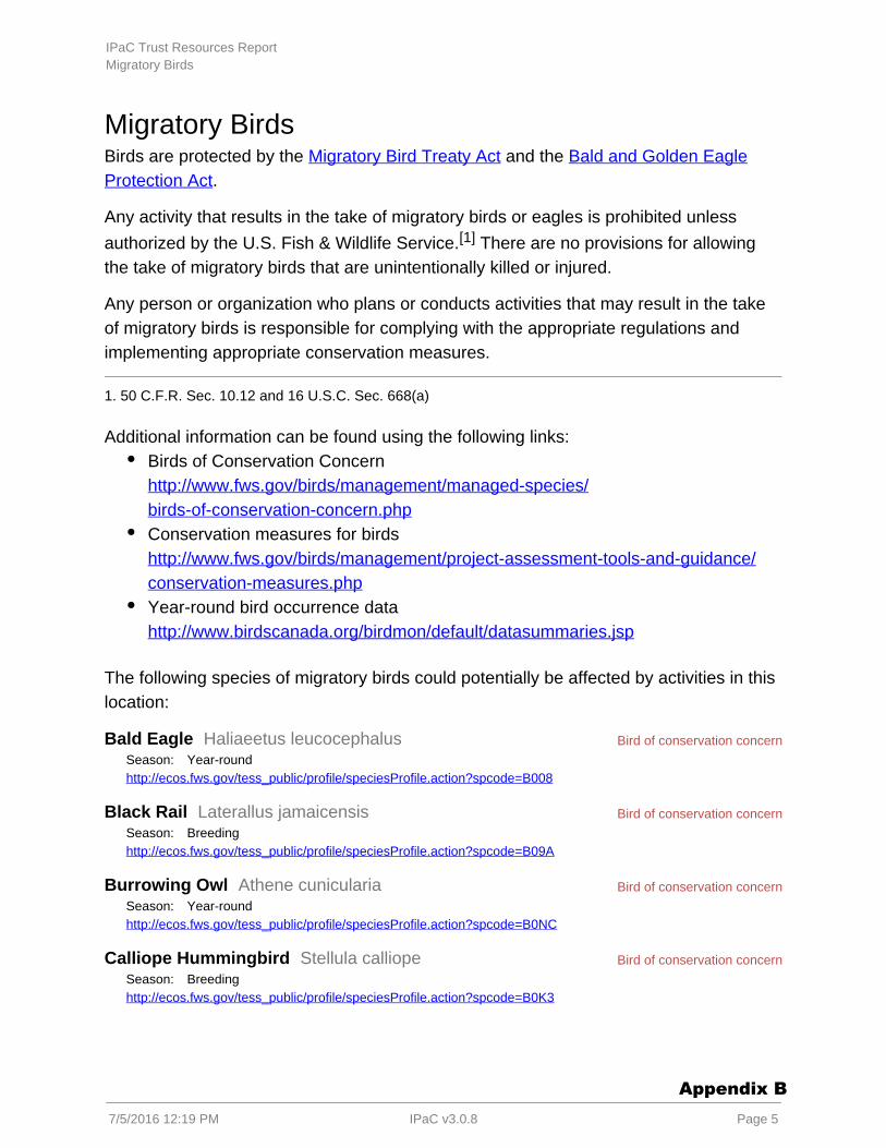
Migratory BirdsBirds are protected by the and the Migratory Bird Treaty Act Bald and Golden Eagle
.Protection Act
Any activity that results in the of migratory birds or eagles is prohibited unlesstake
authorized by the U.S. Fish & Wildlife Service. There are no provisions for allowing[1]
the take of migratory birds that are unintentionally killed or injured.
Any person or organization who plans or conducts activities that may result in the takeof migratory birds is responsible for complying with the appropriate regulations andimplementing appropriate conservation measures.
1. 50 C.F.R. Sec. 10.12 and 16 U.S.C. Sec. 668(a)
Additional information can be found using the following links:Birds of Conservation Concern http://www.fws.gov/birds/management/managed-species/birds-of-conservation-concern.phpConservation measures for birds http://www.fws.gov/birds/management/project-assessment-tools-and-guidance/conservation-measures.phpYear-round bird occurrence data http://www.birdscanada.org/birdmon/default/datasummaries.jsp
The following species of migratory birds could potentially be affected by activities in thislocation:
Bald Eagle Haliaeetus leucocephalusSeason: Year-roundhttp://ecos.fws.gov/tess_public/profile/speciesProfile.action?spcode=B008
Black Rail Laterallus jamaicensisSeason: Breedinghttp://ecos.fws.gov/tess_public/profile/speciesProfile.action?spcode=B09A
Burrowing Owl Athene cuniculariaSeason: Year-roundhttp://ecos.fws.gov/tess_public/profile/speciesProfile.action?spcode=B0NC
Calliope Hummingbird Stellula calliopeSeason: Breedinghttp://ecos.fws.gov/tess_public/profile/speciesProfile.action?spcode=B0K3
IPaC Trust Resources ReportMigratory Birds
7/5/2016 12:19 PM IPaC v3.0.8 Page 5
Appendix B
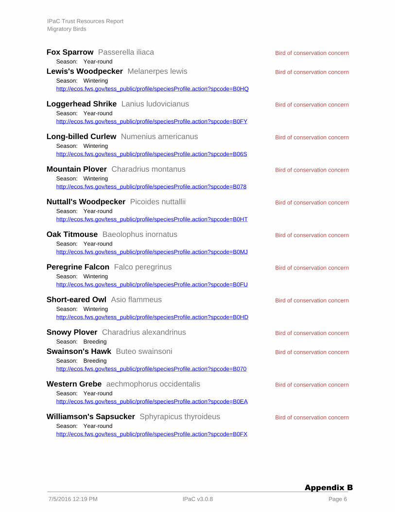
Bird of conservation concern
Bird of conservation concern
Bird of conservation concern
Bird of conservation concern
Bird of conservation concern
Bird of conservation concern
Bird of conservation concern
Bird of conservation concern
Bird of conservation concern
Bird of conservation concern
Bird of conservation concern
Bird of conservation concern
Bird of conservation concern Fox Sparrow Passerella iliacaSeason: Year-round
Lewis's Woodpecker Melanerpes lewisSeason: Winteringhttp://ecos.fws.gov/tess_public/profile/speciesProfile.action?spcode=B0HQ
Loggerhead Shrike Lanius ludovicianusSeason: Year-roundhttp://ecos.fws.gov/tess_public/profile/speciesProfile.action?spcode=B0FY
Long-billed Curlew Numenius americanusSeason: Winteringhttp://ecos.fws.gov/tess_public/profile/speciesProfile.action?spcode=B06S
Mountain Plover Charadrius montanusSeason: Winteringhttp://ecos.fws.gov/tess_public/profile/speciesProfile.action?spcode=B078
Nuttall's Woodpecker Picoides nuttalliiSeason: Year-roundhttp://ecos.fws.gov/tess_public/profile/speciesProfile.action?spcode=B0HT
Oak Titmouse Baeolophus inornatusSeason: Year-roundhttp://ecos.fws.gov/tess_public/profile/speciesProfile.action?spcode=B0MJ
Peregrine Falcon Falco peregrinusSeason: Winteringhttp://ecos.fws.gov/tess_public/profile/speciesProfile.action?spcode=B0FU
Short-eared Owl Asio flammeusSeason: Winteringhttp://ecos.fws.gov/tess_public/profile/speciesProfile.action?spcode=B0HD
Snowy Plover Charadrius alexandrinusSeason: Breeding
Swainson's Hawk Buteo swainsoniSeason: Breedinghttp://ecos.fws.gov/tess_public/profile/speciesProfile.action?spcode=B070
Western Grebe aechmophorus occidentalisSeason: Year-roundhttp://ecos.fws.gov/tess_public/profile/speciesProfile.action?spcode=B0EA
Williamson's Sapsucker Sphyrapicus thyroideusSeason: Year-roundhttp://ecos.fws.gov/tess_public/profile/speciesProfile.action?spcode=B0FX
IPaC Trust Resources ReportMigratory Birds
7/5/2016 12:19 PM IPaC v3.0.8 Page 6
Appendix B

Bird of conservation concern
Bird of conservation concern Willow Flycatcher Empidonax trailliiSeason: Breedinghttp://ecos.fws.gov/tess_public/profile/speciesProfile.action?spcode=B0F6
Yellow-billed Magpie Pica nuttalliSeason: Year-roundhttp://ecos.fws.gov/tess_public/profile/speciesProfile.action?spcode=B0N8
IPaC Trust Resources ReportMigratory Birds
7/5/2016 12:19 PM IPaC v3.0.8 Page 7
Appendix B
Wildlife refuges and fish hatcheriesThere are no refuges or fish hatcheries in this location
IPaC Trust Resources ReportRefuges & Hatcheries
7/5/2016 12:19 PM IPaC v3.0.8 Page 8
Appendix B
Wetlands in the National Wetlands InventoryImpacts to and other aquatic habitats may be subject to regulation underNWI wetlandsSection 404 of the Clean Water Act, or other State/Federal statutes.
For more information please contact the Regulatory Program of the local U.S. Army.Corps of Engineers District
DATA LIMITATIONS
The Service's objective of mapping wetlands and deepwater habitats is to produce reconnaissance level informationon the location, type and size of these resources. The maps are prepared from the analysis of high altitude imagery.Wetlands are identified based on vegetation, visible hydrology and geography. A margin of error is inherent in the useof imagery; thus, detailed on-the-ground inspection of any particular site may result in revision of the wetlandboundaries or classification established through image analysis.
The accuracy of image interpretation depends on the quality of the imagery, the experience of the image analysts,the amount and quality of the collateral data and the amount of ground truth verification work conducted. Metadatashould be consulted to determine the date of the source imagery used and any mapping problems.
Wetlands or other mapped features may have changed since the date of the imagery or field work. There may beoccasional differences in polygon boundaries or classifications between the information depicted on the map and theactual conditions on site.
DATA EXCLUSIONS
Certain wetland habitats are excluded from the National mapping program because of the limitations of aerialimagery as the primary data source used to detect wetlands. These habitats include seagrasses or submergedaquatic vegetation that are found in the intertidal and subtidal zones of estuaries and nearshore coastal waters.Some deepwater reef communities (coral or tuberficid worm reefs) have also been excluded from the inventory.These habitats, because of their depth, go undetected by aerial imagery.
DATA PRECAUTIONS
Federal, state, and local regulatory agencies with jurisdiction over wetlands may define and describe wetlands in adifferent manner than that used in this inventory. There is no attempt, in either the design or products of thisinventory, to define the limits of proprietary jurisdiction of any Federal, state, or local government or to establish thegeographical scope of the regulatory programs of government agencies. Persons intending to engage in activitiesinvolving modifications within or adjacent to wetland areas should seek the advice of appropriate federal, state, orlocal agencies concerning specified agency regulatory programs and proprietary jurisdictions that may affect suchactivities.
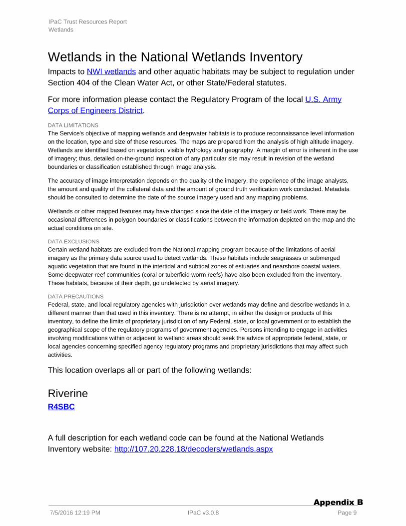
This location overlaps all or part of the following wetlands:
RiverineR4SBC
A full description for each wetland code can be found at the National WetlandsInventory website: http://107.20.228.18/decoders/wetlands.aspx
IPaC Trust Resources ReportWetlands
7/5/2016 12:19 PM IPaC v3.0.8 Page 9
Appendix B

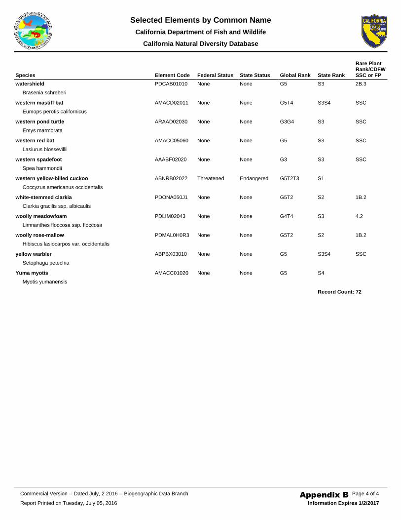
Appendix B CNDDB Species List
Appendix B
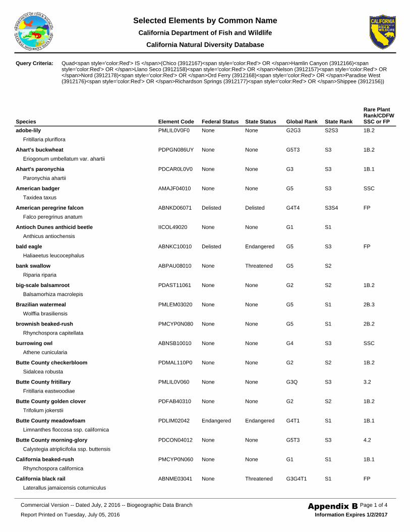
Species Element Code Federal Status State Status Global Rank State Rank
Rare Plant Rank/CDFW SSC or FP
adobe-lily
Fritillaria pluriflora
PMLIL0V0F0 None None G2G3 S2S3 1B.2
Ahart's buckwheat
Eriogonum umbellatum var. ahartii
PDPGN086UY None None G5T3 S3 1B.2
Ahart's paronychia
Paronychia ahartii
PDCAR0L0V0 None None G3 S3 1B.1
American badger
Taxidea taxus
AMAJF04010 None None G5 S3 SSC
American peregrine falcon
Falco peregrinus anatum
ABNKD06071 Delisted Delisted G4T4 S3S4 FP
Antioch Dunes anthicid beetle
Anthicus antiochensis
IICOL49020 None None G1 S1
bald eagle
Haliaeetus leucocephalus
ABNKC10010 Delisted Endangered G5 S3 FP
bank swallow
Riparia riparia
ABPAU08010 None Threatened G5 S2
big-scale balsamroot
Balsamorhiza macrolepis
PDAST11061 None None G2 S2 1B.2
Brazilian watermeal
Wolffia brasiliensis
PMLEM03020 None None G5 S1 2B.3
brownish beaked-rush
Rhynchospora capitellata
PMCYP0N080 None None G5 S1 2B.2
burrowing owl
Athene cunicularia
ABNSB10010 None None G4 S3 SSC
Butte County checkerbloom
Sidalcea robusta
PDMAL110P0 None None G2 S2 1B.2
Butte County fritillary
Fritillaria eastwoodiae
PMLIL0V060 None None G3Q S3 3.2
Butte County golden clover
Trifolium jokerstii
PDFAB40310 None None G2 S2 1B.2
Butte County meadowfoam
Limnanthes floccosa ssp. californica
PDLIM02042 Endangered Endangered G4T1 S1 1B.1
Butte County morning-glory
Calystegia atriplicifolia ssp. buttensis
PDCON04012 None None G5T3 S3 4.2
California beaked-rush
Rhynchospora californica
PMCYP0N060 None None G1 S1 1B.1
California black rail
Laterallus jamaicensis coturniculus
ABNME03041 None Threatened G3G4T1 S1 FP
Query Criteria: Quad<span style='color:Red'> IS </span>(Chico (3912167)<span style='color:Red'> OR </span>Hamlin Canyon (3912166)<span style='color:Red'> OR </span>Llano Seco (3912158)<span style='color:Red'> OR </span>Nelson (3912157)<span style='color:Red'> OR </span>Nord (3912178)<span style='color:Red'> OR </span>Ord Ferry (3912168)<span style='color:Red'> OR </span>Paradise West (3912176)<span style='color:Red'> OR </span>Richardson Springs (3912177)<span style='color:Red'> OR </span>Shippee (3912156))
Report Printed on Tuesday, July 05, 2016
Page 1 of 4Commercial Version -- Dated July, 2 2016 -- Biogeographic Data Branch
Information Expires 1/2/2017
Selected Elements by Common NameCalifornia Department of Fish and Wildlife
California Natural Diversity Database
Appendix B
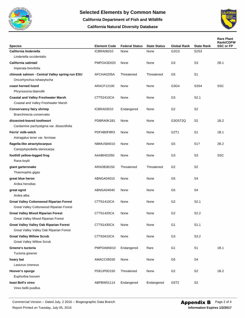
Species Element Code Federal Status State Status Global Rank State Rank
Rare Plant Rank/CDFW SSC or FP
California linderiella
Linderiella occidentalis
ICBRA06010 None None G2G3 S2S3
California satintail
Imperata brevifolia
PMPOA3D020 None None G3 S3 2B.1
chinook salmon - Central Valley spring-run ESU
Oncorhynchus tshawytscha
AFCHA0205A Threatened Threatened G5 S1
coast horned lizard
Phrynosoma blainvillii
ARACF12100 None None G3G4 S3S4 SSC
Coastal and Valley Freshwater Marsh
Coastal and Valley Freshwater Marsh
CTT52410CA None None G3 S2.1
Conservancy fairy shrimp
Branchinecta conservatio
ICBRA03010 Endangered None G2 S2
dissected-leaved toothwort
Cardamine pachystigma var. dissectifolia
PDBRA0K1B1 None None G3G5T2Q S2 1B.2
Ferris' milk-vetch
Astragalus tener var. ferrisiae
PDFAB0F8R3 None None G2T1 S1 1B.1
flagella-like atractylocarpus
Campylopodiella stenocarpa
NBMUS84010 None None G5 S1? 2B.2
foothill yellow-legged frog
Rana boylii
AAABH01050 None None G3 S3 SSC
giant gartersnake
Thamnophis gigas
ARADB36150 Threatened Threatened G2 S2
great blue heron
Ardea herodias
ABNGA04010 None None G5 S4
great egret
Ardea alba
ABNGA04040 None None G5 S4
Great Valley Cottonwood Riparian Forest
Great Valley Cottonwood Riparian Forest
CTT61410CA None None G2 S2.1
Great Valley Mixed Riparian Forest
Great Valley Mixed Riparian Forest
CTT61420CA None None G2 S2.2
Great Valley Valley Oak Riparian Forest
Great Valley Valley Oak Riparian Forest
CTT61430CA None None G1 S1.1
Great Valley Willow Scrub
Great Valley Willow Scrub
CTT63410CA None None G3 S3.2
Greene's tuctoria
Tuctoria greenei
PMPOA6N010 Endangered Rare G1 S1 1B.1
hoary bat
Lasiurus cinereus
AMACC05030 None None G5 S4
Hoover's spurge
Euphorbia hooveri
PDEUP0D150 Threatened None G2 S2 1B.2
least Bell's vireo
Vireo bellii pusillus
ABPBW01114 Endangered Endangered G5T2 S2
Report Printed on Tuesday, July 05, 2016
Page 2 of 4Commercial Version -- Dated July, 2 2016 -- Biogeographic Data Branch
Information Expires 1/2/2017
Selected Elements by Common NameCalifornia Department of Fish and Wildlife
California Natural Diversity Database
Appendix B
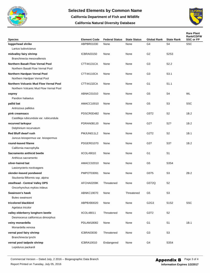
Species Element Code Federal Status State Status Global Rank State Rank
Rare Plant Rank/CDFW SSC or FP
loggerhead shrike
Lanius ludovicianus
ABPBR01030 None None G4 S4 SSC
midvalley fairy shrimp
Branchinecta mesovallensis
ICBRA03150 None None G2 S2S3
Northern Basalt Flow Vernal Pool
Northern Basalt Flow Vernal Pool
CTT44131CA None None G3 S2.2
Northern Hardpan Vernal Pool
Northern Hardpan Vernal Pool
CTT44110CA None None G3 S3.1
Northern Volcanic Mud Flow Vernal Pool
Northern Volcanic Mud Flow Vernal Pool
CTT44132CA None None G1 S1.1
osprey
Pandion haliaetus
ABNKC01010 None None G5 S4 WL
pallid bat
Antrozous pallidus
AMACC10010 None None G5 S3 SSC
pink creamsacs
Castilleja rubicundula var. rubicundula
PDSCR0D482 None None G5T2 S2 1B.2
recurved larkspur
Delphinium recurvatum
PDRAN0B1J0 None None G2? S2? 1B.2
Red Bluff dwarf rush
Juncus leiospermus var. leiospermus
PMJUN011L2 None None G2T2 S2 1B.1
round-leaved filaree
California macrophylla
PDGER01070 None None G3? S3? 1B.2
Sacramento anthicid beetle
Anthicus sacramento
IICOL49010 None None G1 S1
silver-haired bat
Lasionycteris noctivagans
AMACC02010 None None G5 S3S4
slender-leaved pondweed
Stuckenia filiformis ssp. alpina
PMPOT03091 None None G5T5 S3 2B.2
steelhead - Central Valley DPS
Oncorhynchus mykiss irideus
AFCHA0209K Threatened None G5T2Q S2
Swainson's hawk
Buteo swainsoni
ABNKC19070 None Threatened G5 S3
tricolored blackbird
Agelaius tricolor
ABPBXB0020 None None G2G3 S1S2 SSC
valley elderberry longhorn beetle
Desmocerus californicus dimorphus
IICOL48011 Threatened None G3T2 S2
veiny monardella
Monardella venosa
PDLAM18082 None None G1 S1 1B.1
vernal pool fairy shrimp
Branchinecta lynchi
ICBRA03030 Threatened None G3 S3
vernal pool tadpole shrimp
Lepidurus packardi
ICBRA10010 Endangered None G4 S3S4
Report Printed on Tuesday, July 05, 2016
Page 3 of 4Commercial Version -- Dated July, 2 2016 -- Biogeographic Data Branch
Information Expires 1/2/2017
Selected Elements by Common NameCalifornia Department of Fish and Wildlife
California Natural Diversity Database
Appendix B
Species Element Code Federal Status State Status Global Rank State Rank
Rare Plant Rank/CDFW SSC or FP
watershield
Brasenia schreberi
PDCAB01010 None None G5 S3 2B.3
western mastiff bat
Eumops perotis californicus
AMACD02011 None None G5T4 S3S4 SSC
western pond turtle
Emys marmorata
ARAAD02030 None None G3G4 S3 SSC
western red bat
Lasiurus blossevillii
AMACC05060 None None G5 S3 SSC
western spadefoot
Spea hammondii
AAABF02020 None None G3 S3 SSC
western yellow-billed cuckoo
Coccyzus americanus occidentalis
ABNRB02022 Threatened Endangered G5T2T3 S1
white-stemmed clarkia
Clarkia gracilis ssp. albicaulis
PDONA050J1 None None G5T2 S2 1B.2
woolly meadowfoam
Limnanthes floccosa ssp. floccosa
PDLIM02043 None None G4T4 S3 4.2
woolly rose-mallow
Hibiscus lasiocarpos var. occidentalis
PDMAL0H0R3 None None G5T2 S2 1B.2
yellow warbler
Setophaga petechia
ABPBX03010 None None G5 S3S4 SSC
Yuma myotis
Myotis yumanensis
AMACC01020 None None G5 S4
Record Count: 72
Report Printed on Tuesday, July 05, 2016
Page 4 of 4Commercial Version -- Dated July, 2 2016 -- Biogeographic Data Branch
Information Expires 1/2/2017
Selected Elements by Common NameCalifornia Department of Fish and Wildlife
California Natural Diversity Database
Appendix B

Appendix C CNPS Species List
Appendix B
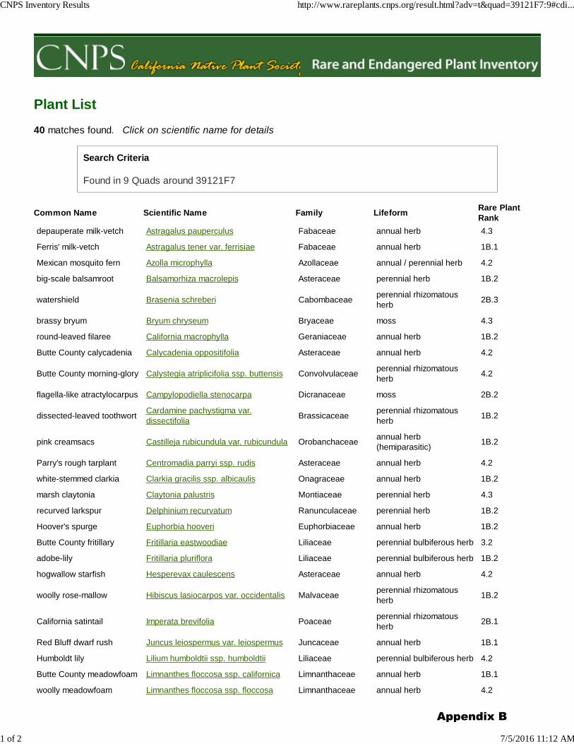
Plant List
40 matches found. Click on scientific name for details
Search Criteria
Found in 9 Quads around 39121F7
Common Name Scientific Name Family LifeformRare Plant
Rank
depauperate milk-vetch Astragalus pauperculus Fabaceae annual herb 4.3
Ferris' milk-vetch Astragalus tener var. ferrisiae Fabaceae annual herb 1B.1
Mexican mosquito fern Azolla microphylla Azollaceae annual / perennial herb 4.2
big-scale balsamroot Balsamorhiza macrolepis Asteraceae perennial herb 1B.2
watershield Brasenia schreberi Cabombaceaeperennial rhizomatous
herb2B.3
brassy bryum Bryum chryseum Bryaceae moss 4.3
round-leaved filaree California macrophylla Geraniaceae annual herb 1B.2
Butte County calycadenia Calycadenia oppositifolia Asteraceae annual herb 4.2
Butte County morning-glory Calystegia atriplicifolia ssp. buttensis Convolvulaceaeperennial rhizomatous
herb4.2
flagella-like atractylocarpus Campylopodiella stenocarpa Dicranaceae moss 2B.2
dissected-leaved toothwortCardamine pachystigma var.
dissectifoliaBrassicaceae
perennial rhizomatous
herb1B.2
pink creamsacs Castilleja rubicundula var. rubicundula Orobanchaceaeannual herb
(hemiparasitic)1B.2
Parry's rough tarplant Centromadia parryi ssp. rudis Asteraceae annual herb 4.2
white-stemmed clarkia Clarkia gracilis ssp. albicaulis Onagraceae annual herb 1B.2
marsh claytonia Claytonia palustris Montiaceae perennial herb 4.3
recurved larkspur Delphinium recurvatum Ranunculaceae perennial herb 1B.2
Hoover's spurge Euphorbia hooveri Euphorbiaceae annual herb 1B.2
Butte County fritillary Fritillaria eastwoodiae Liliaceae perennial bulbiferous herb 3.2
adobe-lily Fritillaria pluriflora Liliaceae perennial bulbiferous herb 1B.2
hogwallow starfish Hesperevax caulescens Asteraceae annual herb 4.2
woolly rose-mallow Hibiscus lasiocarpos var. occidentalis Malvaceaeperennial rhizomatous
herb1B.2
California satintail Imperata brevifolia Poaceaeperennial rhizomatous
herb2B.1
Red Bluff dwarf rush Juncus leiospermus var. leiospermus Juncaceae annual herb 1B.1
Humboldt lily Lilium humboldtii ssp. humboldtii Liliaceae perennial bulbiferous herb 4.2
Butte County meadowfoam Limnanthes floccosa ssp. californica Limnanthaceae annual herb 1B.1
woolly meadowfoam Limnanthes floccosa ssp. floccosa Limnanthaceae annual herb 4.2
CNPS Inventory Results http://www.rareplants.cnps.org/result.html?adv=t&quad=39121F7:9#cdi...
1 of 2 7/5/2016 11:12 AM
Appendix B
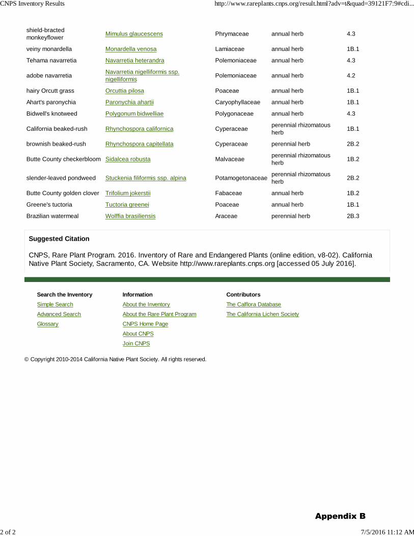
Search the Inventory
Simple Search
Advanced Search
Glossary
Information
About the Inventory
About the Rare Plant Program
CNPS Home Page
About CNPS
Join CNPS
Contributors
The Calflora Database
The California Lichen Society
shield-bracted
monkeyflowerMimulus glaucescens Phrymaceae annual herb 4.3
veiny monardella Monardella venosa Lamiaceae annual herb 1B.1
Tehama navarretia Navarretia heterandra Polemoniaceae annual herb 4.3
adobe navarretiaNavarretia nigelliformis ssp.
nigelliformisPolemoniaceae annual herb 4.2
hairy Orcutt grass Orcuttia pilosa Poaceae annual herb 1B.1
Ahart's paronychia Paronychia ahartii Caryophyllaceae annual herb 1B.1
Bidwell's knotweed Polygonum bidwelliae Polygonaceae annual herb 4.3
California beaked-rush Rhynchospora californica Cyperaceaeperennial rhizomatous
herb1B.1
brownish beaked-rush Rhynchospora capitellata Cyperaceae perennial herb 2B.2
Butte County checkerbloom Sidalcea robusta Malvaceaeperennial rhizomatous
herb1B.2
slender-leaved pondweed Stuckenia filiformis ssp. alpina Potamogetonaceaeperennial rhizomatous
herb2B.2
Butte County golden clover Trifolium jokerstii Fabaceae annual herb 1B.2
Greene's tuctoria Tuctoria greenei Poaceae annual herb 1B.1
Brazilian watermeal Wolffia brasiliensis Araceae perennial herb 2B.3
Suggested Citation
CNPS, Rare Plant Program. 2016. Inventory of Rare and Endangered Plants (online edition, v8-02). California
Native Plant Society, Sacramento, CA. Website http://www.rareplants.cnps.org [accessed 05 July 2016].
© Copyright 2010-2014 California Native Plant Society. All rights reserved.
CNPS Inventory Results http://www.rareplants.cnps.org/result.html?adv=t&quad=39121F7:9#cdi...
2 of 2 7/5/2016 11:12 AM
Appendix B
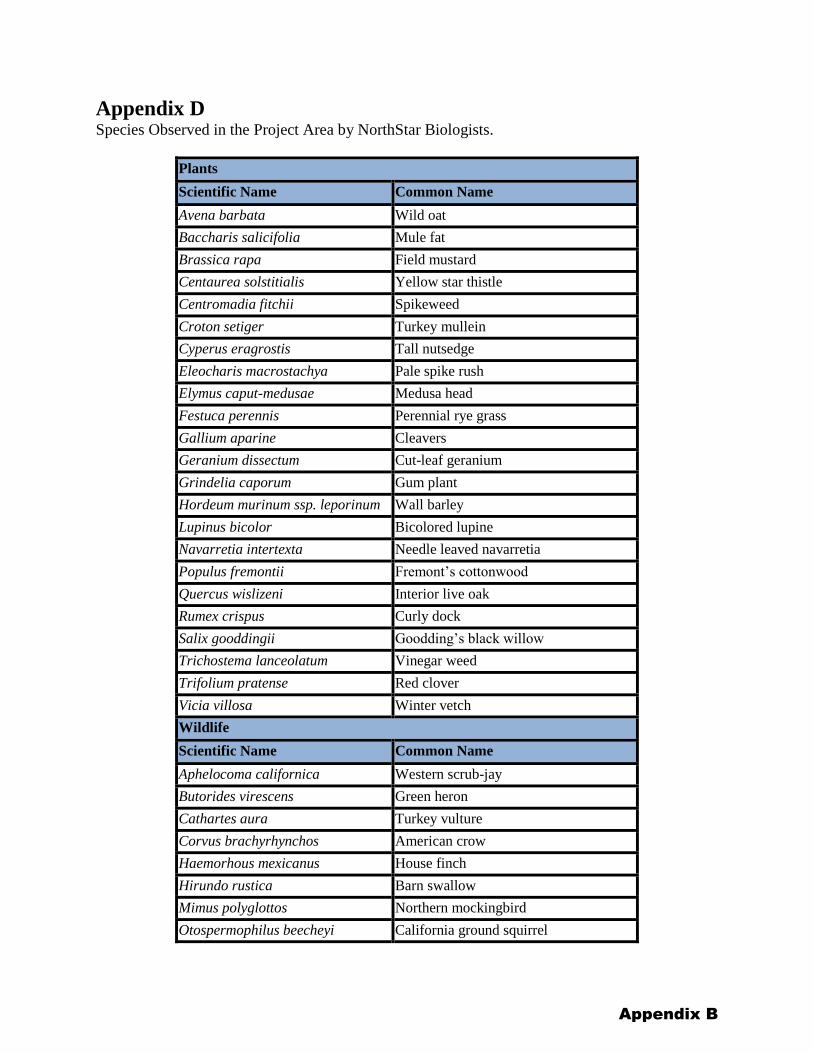
Appendix D Species Observed in the Project Area by NorthStar Biologists.
Plants
Scientific Name Common Name
Avena barbata Wild oat
Baccharis salicifolia Mule fat
Brassica rapa Field mustard
Centaurea solstitialis Yellow star thistle
Centromadia fitchii Spikeweed
Croton setiger Turkey mullein
Cyperus eragrostis Tall nutsedge
Eleocharis macrostachya Pale spike rush
Elymus caput-medusae Medusa head
Festuca perennis Perennial rye grass
Gallium aparine Cleavers
Geranium dissectum Cut-leaf geranium
Grindelia caporum Gum plant
Hordeum murinum ssp. leporinum Wall barley
Lupinus bicolor Bicolored lupine
Navarretia intertexta Needle leaved navarretia
Populus fremontii Fremont’s cottonwood
Quercus wislizeni Interior live oak
Rumex crispus Curly dock
Salix gooddingii Goodding’s black willow
Trichostema lanceolatum Vinegar weed
Trifolium pratense Red clover
Vicia villosa Winter vetch
Wildlife
Scientific Name Common Name
Aphelocoma californica Western scrub-jay
Butorides virescens Green heron
Cathartes aura Turkey vulture
Corvus brachyrhynchos American crow
Haemorhous mexicanus House finch
Hirundo rustica Barn swallow
Mimus polyglottos Northern mockingbird
Otospermophilus beecheyi California ground squirrel
Appendix B

Pterochelidon pyrrhonota Cliff swallow
Sceloporus occidentalis Western fence lizard
Spinus psaltria Lesser goldfinch
Tachycineta bicolor Tree swallow
Thryomanes bewickii Bewick’s wren
Appendix B

Appendix E Surveyor Qualifications
Appendix B

P e o p l e P e r f o r m a n c e P r o f e s s i o n a l i s m
CAROL WALLEN, QSP
ASSOCIATE BIOLOGIST/GIS ANALYST
Carol Wallen
Education
B.S. Biological Sciences, California State University, Chico, 2009
Additional Training
38-Hour USACE WetlandDelineation Training Program
GGS Volunteer with USGS
Rare Pond Species SurveyTechniques (focus: Californiared-legged frog and Californiatiger salamander)
American Kestrel Banding andHandling
Vernal Pool Fairy Shrimp andTadpole Shrimp Sampling
Avian Interactions
Experience
NorthStar Engineering, Biologist,QSP, GIS Analyst
United States Dept. of Defense, Beale Air Force, Staff Biologist, Environmental Field Inspector
Roles and Responsibilities:
Ms. Wallen specializes in permit implementation to ensure construction projects are compliance with the federal and state Endangered Species Acts (ESA and CESA), Clean Water Act (CWA), Migratory Bird Treaty Act (MBTA), USFWS Biological Opinions, Fish and Game Code (FGC), FGC 1600, and CEQA/NEPA mitigation and project specific avoidance, minimization and mitigation measures. Ms. Wallen is also a Qualified SWPPP Practitioner (QSP) and evaluates sites for water quality compliance, including the CA Construction General Permit. As a wildlife biologist, Ms. Wallen conducts pre- and post-construction surveys; protocol level surveys for special status, threatened, and endangered species; and habitat assessments for vernal pool fairy shrimp, vernal pool tadpole shrimp, giant garter snake (GGS), Valley elderberry longhorn beetle (VELB), California red-legged frog (CRLF), western burrowing owl, and Swainson’s hawk, as well as numerous surveys for migratory birds, including the installation and maintenance of exclusionary devices on structures. Ms. Wallen also conducts Biological Resource Assessments, Biological Assessments, Wetland Delineations, and Site Opportunities and Constraints Analyses.
Select Biological and Permitting Project Experience:
Sutter County Bridge Preventative Maintenance Project, WetlandDelineation, GIS Mapping, Permitting (current) - Sutter County
CSU Chico Gus Manolis Bridge Replacement, Permitting, VELBTechnical Analysis - California State University, Chico
CSU Chico Emergency Vehicle/Physical Sciences Bridge Replacement,Permitting, VELB Technical Analysis - California State University, Chico
Live Oak Soccer Complex and Outfall Project, GGS Technical Analysis,Permitting – City of Live Oak
CR 44 Safety Improvements, Permitting, Biological Technical Studiesfor GGS, Construction Monitoring, - Glenn County
Pennington Road Bridge Replacement, GGS Impacts Map forRegulatory Permitting - Sutter County
SR 32 Widening and Bridge Replacement and Expansion, RegulatoryCompliance, Construction Monitoring - City of Chico
SR 99 Auxiliary Lane, Regulatory Compliance, Construction Monitoring- City of Chico
Butte College 3-Creeks Culvert Replacement Projects, WetlandDelineation, Permitting - Butte Community College District
Appendix B
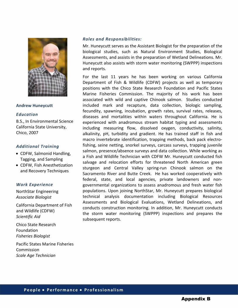
P e o p l e • P e r f o r m a n c e • P r o f e s s i o n a l i s m
Andrew Huneycutt
Education B.S., In Environmental ScienceCalifornia State University,Chico, 2007
Additional Training • CDFW, Salmonid Handling,
Tagging, and Sampling• CDFW, Fish Anesthetization
and Recovery Techniques
Work Experience NorthStar Engineering Associate Biologist
California Department of Fish and Wildlife (CDFW) Scientific Aid
Chico State Research Foundation Fisheries Biologist
Pacific States Marine Fisheries Commission Scale Age Technician
Roles and Responsibilities: Mr. Huneycutt serves as the Assistant Biologist for the preparation of the biological studies, such as Natural Environment Studies, Biological Assessments, and assists in the preparation of Wetland Delineations. Mr. Huneycutt also assists with storm water monitoring (SWPPP) inspections and reports.
For the last 11 years he has been working on various California Department of Fish & Wildlife (CDFW) projects as well as temporary positions with the Chico State Research Foundation and Pacific States Marine Fisheries Commission. The majority of his work has been associated with wild and captive Chinook salmon. Studies conducted included mark and recapture, data collection, biologic sampling, fecundity, spawning, incubation, growth rates, survival rates, releases, diseases and mortalities within waters throughout California. He is experienced with anadromous stream habitat typing and assessments including measuring flow, dissolved oxygen, conductivity, salinity, alkalinity, pH, turbidity and gradient. He has trained staff in fish and macro invertebrate identification, trapping methods, back pack electro-fishing, seine netting, snorkel surveys, carcass surveys, trapping juvenile salmon, presence/absence surveys and data collection. While working as a Fish and Wildlife Technician with CDFW Mr. Huneycutt conducted fish salvage and relocation efforts for threatened North American green sturgeon and Central Valley spring-run Chinook salmon on the Sacramento River and Butte Creek. He has worked cooperatively with federal, state, and local agencies, private landowners and non-governmental organizations to assess anadromous and fresh water fish populations. Upon joining NorthStar, Mr. Huneycutt prepares biological technical analysis documentation including Biological Resources Assessments and Biological Evaluations, Wetland Delineations, and conducts construction monitoring. In addition, Mr. Huneycutt conducts the storm water monitoring (SWPPP) inspections and prepares the subsequent reports.
Appendix B
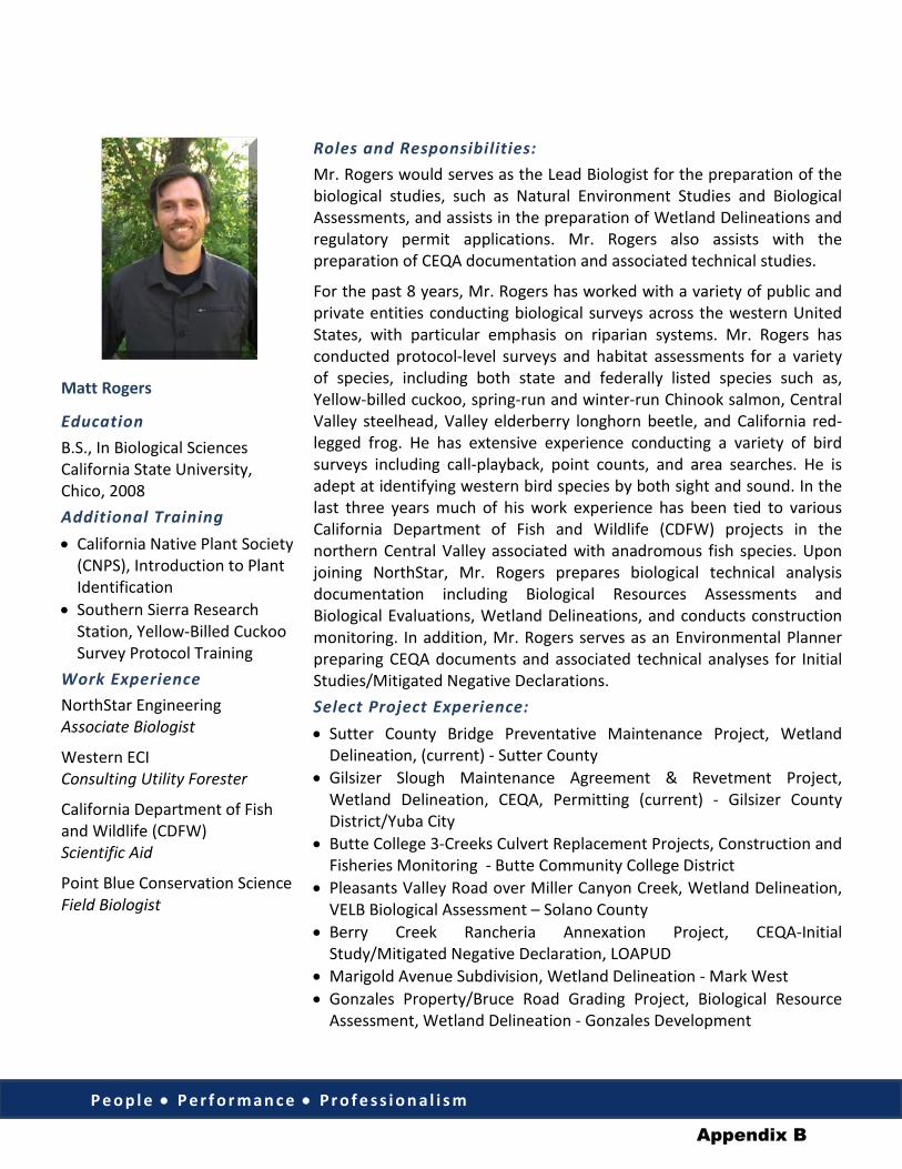
P e o p l e • P e r f o r m a n c e • P r o f e s s i o n a l i s m
Matt Rogers
Education B.S., In Biological SciencesCalifornia State University,Chico, 2008Additional Training • California Native Plant Society
(CNPS), Introduction to PlantIdentification
• Southern Sierra ResearchStation, Yellow-Billed CuckooSurvey Protocol Training
Work Experience NorthStar Engineering Associate Biologist
Western ECI Consulting Utility Forester
California Department of Fish and Wildlife (CDFW) Scientific Aid
Point Blue Conservation Science Field Biologist
Roles and Responsibilities: Mr. Rogers would serves as the Lead Biologist for the preparation of the biological studies, such as Natural Environment Studies and Biological Assessments, and assists in the preparation of Wetland Delineations and regulatory permit applications. Mr. Rogers also assists with the preparation of CEQA documentation and associated technical studies.
For the past 8 years, Mr. Rogers has worked with a variety of public and private entities conducting biological surveys across the western United States, with particular emphasis on riparian systems. Mr. Rogers has conducted protocol-level surveys and habitat assessments for a variety of species, including both state and federally listed species such as, Yellow-billed cuckoo, spring-run and winter-run Chinook salmon, Central Valley steelhead, Valley elderberry longhorn beetle, and California red-legged frog. He has extensive experience conducting a variety of bird surveys including call-playback, point counts, and area searches. He is adept at identifying western bird species by both sight and sound. In the last three years much of his work experience has been tied to various California Department of Fish and Wildlife (CDFW) projects in the northern Central Valley associated with anadromous fish species. Upon joining NorthStar, Mr. Rogers prepares biological technical analysis documentation including Biological Resources Assessments and Biological Evaluations, Wetland Delineations, and conducts construction monitoring. In addition, Mr. Rogers serves as an Environmental Planner preparing CEQA documents and associated technical analyses for Initial Studies/Mitigated Negative Declarations. Select Project Experience: • Sutter County Bridge Preventative Maintenance Project, Wetland
Delineation, (current) - Sutter County• Gilsizer Slough Maintenance Agreement & Revetment Project,
Wetland Delineation, CEQA, Permitting (current) - Gilsizer CountyDistrict/Yuba City
• Butte College 3-Creeks Culvert Replacement Projects, Construction andFisheries Monitoring - Butte Community College District
• Pleasants Valley Road over Miller Canyon Creek, Wetland Delineation,VELB Biological Assessment – Solano County
• Berry Creek Rancheria Annexation Project, CEQA-InitialStudy/Mitigated Negative Declaration, LOAPUD
• Marigold Avenue Subdivision, Wetland Delineation - Mark West• Gonzales Property/Bruce Road Grading Project, Biological Resource
Assessment, Wetland Delineation - Gonzales Development
Appendix B
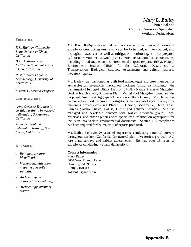
Mary L. Bailey Botanical and
Cultural Resources Specialist, Wetland Delineations
Page | 1
Ms. Mary Bailey is a cultural resource specialist with over 20 years of experience conducting onsite surveys for botanical, archaeological, and biological resources, as well as mitigation monitoring. She has prepared California Environmental Quality Act environmental compliance documents, including Initial Studies and Environmental Impact Reports (EIRs), Natural Environment Studies (NESs) for the California Department of Transportation, Biological Resource Assessments and cultural resource inventory reports.
Ms. Bailey has functioned as both lead archeologist and crew member for archaeological inventories throughout northern California including: the Sacramento Municipal Utility District (SMUD) Nature Preserve Mitigation Bank at Rancho Seco, Stillwater Plains Vernal Pool Mitigation Bank, and the proposed Pine Creek Aggregate Operation in Butte County. Ms. Bailey has conducted cultural resource investigations and archaeological surveys for numerous projects covering Placer, El Dorado, Sacramento, Butte, Lake, Plumas, Solano, Shasta, Colusa, Glenn, and Tehama Counties. She has managed and developed contacts with Native American groups, local historians, and other agencies with specialized information appropriate for inclusion into various environmental documents. Section 106 compliance has been required for the majority of reports produced.
Ms. Bailey has over 20 years of experience conducting botanical surveys throughout northern California, for general plant inventories, protocol level rare plant surveys and habitat assessments. She has over 15 years of experience conducting wetland delineations.
Contact information: Mary Bailey 3807 West Branch Lane Oroville, CA 95965 (530) [email protected]
EDUCATION
B.S., Biology, CaliforniaState University Chico,California
B.A., Anthropology,California State UniversityChico, California
Postgraduate Diploma, Archaeology, University of Leicester, UK.
Master’s Thesis in Progress
CERTIFICATIONS
Army Corps of Engineer’s certified training in wetland delineation, Sacramento, California
Advanced wetland delineation training, San Diego, California
KEY SKILLS
Botanical resourceidentification
Wetland identification,mapping and soilssampling
Archaeologicalconstruction monitoring
Archaeology inventorystudies
Appendix B


![AWS Va - Amazon S3€¦ · AWS (DCX) IoT / APN 4 APN / APN 4 APN 18 . AWS 1.0 ... 5.1 AWS APN AWS APN competency-checklist@amazon.com “[APN Partner Name], Retail Competency Technology](https://img.pdfslide.net/doc/110x75/6148a9252918e2056c22d513/aws-va-amazon-s3-aws-dcx-iot-apn-4-apn-apn-4-apn-18-aws-10-51-aws.jpg)