Embed Size (px)
Citation preview
20
Blue Mountains East Timor Friendship Committee
The Friendship Committee was formed in 2006 as part of an Australia-wide initiative
to develop friendship agreements with communities in Timor-Leste. To date, more than 40 councils across Australia have participated. The Blue Mountains committee is made up of community members, councillors and council staff from Blue Mountains City Council, all committed to improving the lives of the rural community of Hato Builico. A partner committee of residents of Hato Builico assesses the needs of the community and liaises with the Blue Mountains to progress projects. Fundraising events are organised regularly by volunteers. If you live in or plan to visit Australia in 2012, what about raising funds for Hato Builico by joining the sponsored Trek for Timor Blue Mountains on September 15th 2012. 50km or 15km - the choice is yours. www.trekfortimorbm.org.au
Members of the Blue Mountains committee visit regularly on self-funded trips to monitor progress of projects and to talk to villagers about their needs. In 2011, a volunteer from Australian Volunteers International will spend extended periods in Hato Builico to work on local projects. Projects so far have included:
Refurbishment of a community centre for training and community meetings
Scholarships for 43 students to attend primary school, high school and university
Collaborations between schools in East Timor and Blue Mountains
Hedge seedlings to counteract the effects of deforestation
Solar panels for the community centre
Two water tanks for the community centre (supported by Rotary)
Sports equipment, school equipment, readers and guitars for schools as well as participation in training for sports teaching
And of course – this project! Two volunteers from the Blue Mountains spent three months living in Hato Builico and developing this series of guided walks.
More information from http://www.bmcc.nsw.gov.au/yourcouncil/
easttimorfriendship/ Email: [email protected]
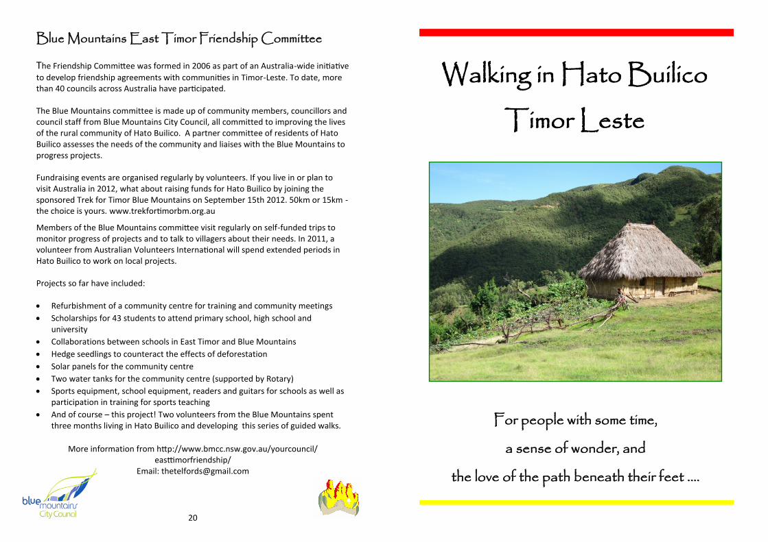
Walking in Hato Builico
Timor Leste
For people with some time,
a sense of wonder, and
the love of the path beneath their feet ....
2
This guide has been written from a collaboration between community members of Hato Builico Sub-district, Ainaro, Timor Leste, and volunteers from Australia. We thank you for your interest and hope to help you plan and enjoy a wonderful visit.
The guide is intended to help you chose guided walks and, through use of pictures and local place names, communicate your choice to a local guide. There is not intended to be enough information to undertake “guided” walks without a guide.
Project collaborators
Sr Orlando de Jesus Mota Sr.Domingus Lopez Sr. Manuel Ussa da Silva Sr. Antonio M. Lopez Sr. Antonio del Arogo Sr. Moises Mola Anne McKenzie Fiona Christian
Support and resources generously provided by
Beba Sequiera, Asia Pacific Support Collective, Timor-Leste Blue Mountains East Timor Friendship Committee, NSW, Australia All Photographs Copyright Fiona Christian 2010 and Maggi Williams 2010
For more information on trekking in Hato Builico go to http://hatobuilico.wordpress.com
DIsclaimer: Information was correct at the time of writing. While every care has been taken over the production of this booklet, the writers cannot take responsibility for any omissions or errors. Distances and times are approximate; use your discretion and knowledge of your own fitness and capability in determining which walks to undertake.
19
Accommodation
Moun Batista and Mana Marta's Homestay, 7km south of Maubisse
To book, text a brief message *eg “can 2 people stay on (date)?”+ to +6707426190. They are a lovely family and cook good food. There is a double bed to sleep in but you will need sleeping bags, and mats if more than 2 people. There is a squat toilet and running water. Expect to pay about $15 per person per night for dinner, bed and breakfast.
Camping at Mana Anabela's, Muluhulu
Mana Anabela (Moun Batista's sister) and her family live in a traditional circular thatched house on a promontory over the valley, visible from the road. There is a flat grassy area next to the house where you can camp and a simple toilet and running water. Mana Anabella will cook traditional food on request, or bring your own food. Expect to pay about $5 per person to camp, and $2 to $3 per person for a meal.
Manuel’s Guesthouse, Queorema (being built when we were there)
Alecrim Guesthouse, Hato Builico
Levy's Guesthouse, Hato Builico
All have multiple rooms with beds and blankets; you may want to bring sheets and sleeping bags. All have meals on request. Expect to pay about $10 per person per night for accommodation and $2 to $3 per person per meal.
Guide to Grades E Easy – on tracks, relatively flat, suits beginners – under
E-M Easy-medium – slightly rougher walking, will include moderate climbs and descents, reasonable fitness level –
M Medium – rougher walking, agility & good fitness
H Hard – narrow or eroded tracks or bushbashing, steep & long climbs/descents, good fitness & stamina levels required, some scrambling or rock hopping – under 22km
VH Very Hard – strenuous walking, difficult terrain, some exploratory, steep & long climbs and descents, fit and experienced walkers – over 22km
With thanks to Joc Williams
18
Section 1 – Maubisse Market to Hato Builico Turn-off; 10kms.
Follow the main road south from the market through coffee plantations where farmers use a variety of different shade trees. You will share the road with some vehicles and many people walking. At times coffee gives way to vegetable gardens and there are views of the valley and the ridges above. After about 1.5 hours (7kms) just past the ‘Same 35, Dili 78, Ainairo 31’ mile post is the first homestay, Batista and Marta's, on your right.
The road winds more steeply up another 3kms to the turn-off to Hato Builico. This is an important intersection for local people who often wait here to get their produce on trucks to Dili, Same and Ainaro. The small shop sells drinks and snacks.
Section 2 – Hato Builico Turn-off to Queorema; 11kms.
After initially winding along the left side of the valley in which Maubisse sits, the road soon crosses the first pass at the small settlement of Lauheli and from there winds along the right wall of the heads of the valleys that run down to the Belucic River. The valley wall is at times very steep, with grazing land, vegetable fields and farmed forest rising steeply above and falling away below. Many traditional and newer style dwellings can be seen.
After 5kms easy walking is the village of Mulohulu. If you wish to camp here, ask for directions to Mana Anabela's, turning left just past the lower side of the school.
The road winds up through the village, crosses the second pass with views of Mt Ramelau, then continues through beautiful steep country with farms and forests. There are a couple of small turn-offs, but the main road is always clear. 6kms easy walking brings you to Queorema. Just pass the large yellow school on the right is Manuel’s guest house on the left. Queorema is a good base for an easy approach to Walks 3 and 4, and the destination of Walk 2 can also be easily approached from here.
Section 3 – Queorema to Hato Builico; 7kms.
Continuing along the road brings you to the last pass into the valley where Mt. Ramelau rises above the village. Continue along the road or take the foot path as described in reverse in Self guided Walk 8. Both are beautiful. 1.5 to 3 hours will bring you to the village of Hato Builico, which stretches several kilometers along the road, with the guest houses at the far end, in the direction of the Portuguese Pousada.
3
Table of Contents
Preparation ................................................................................................. 4
Getting to Hato Builico................................................................................ 5
Why use Guides? ........................................................................................ 6
Guided Walks .............................................................................................. 7
1. Mt Ramelau .................................................................................... 7
2. Nunurlau and Aimeta ..................................................................... 8
3. Leilori, Bleheto Tuan and Nador ...................................................... 9
4. Usluli via Dona and Ukmaumali .................................................... 10
5. Hato-Builico Lau and Hau'ubu ....................................................... 11
6. Suleru Dasi Mali and Fatuk Bidau, Aituto ..................................... 12
7. Doko Mali Waterfall, Lepolau ....................................................... 13
Self-Guided Walks ..................................................................................... 14
8. Dalan Korta to Queorema, Estrada to Hato Builico ....................... 15
9. Mometakeo, Mt. Sisdio and Haturabi ........................................... 16
10. Maubisse to Hato Builico .............................................................. 17
Guide to Grades ........................................................................................ 19
Blue Mountains East Timor Friendship Committee .................................. 20
4
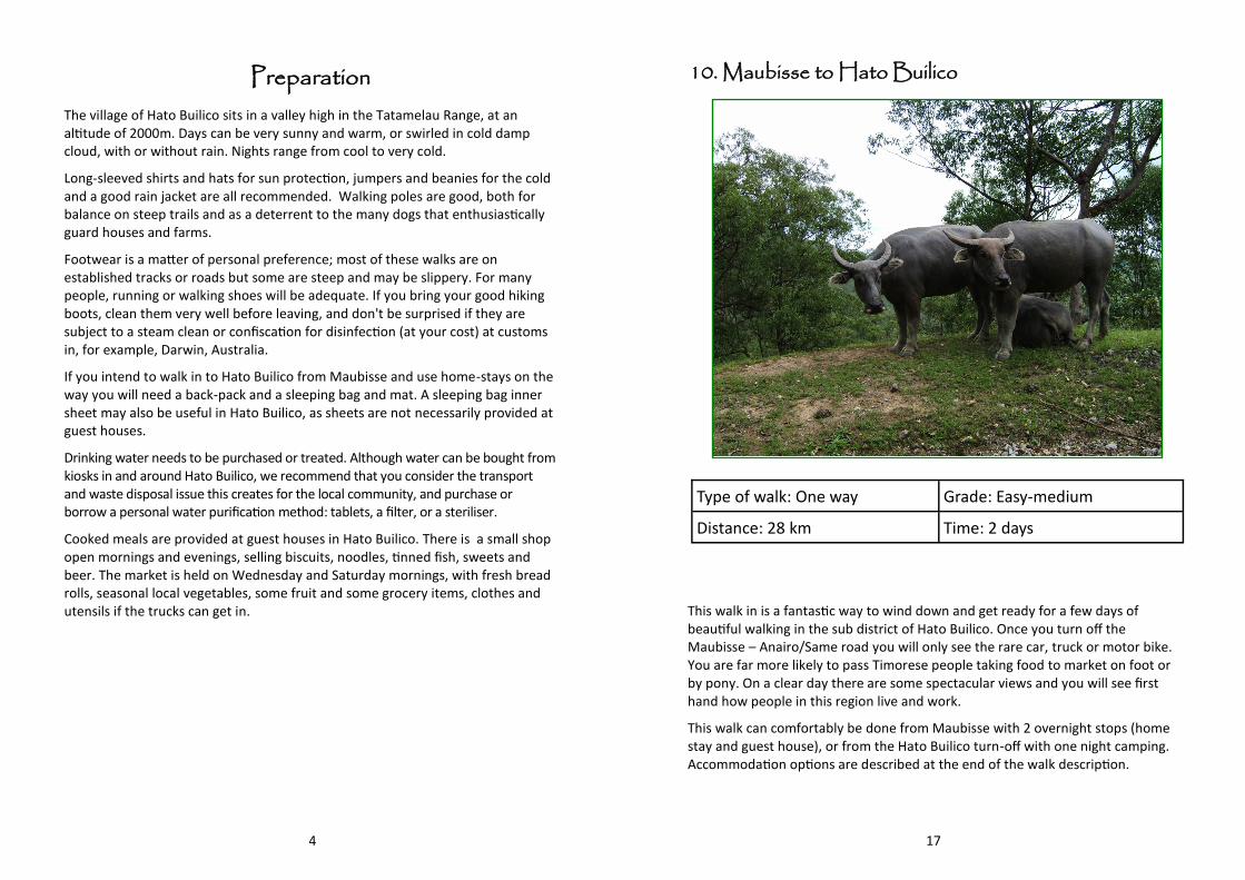
Preparation The village of Hato Builico sits in a valley high in the Tatamelau Range, at an altitude of 2000m. Days can be very sunny and warm, or swirled in cold damp cloud, with or without rain. Nights range from cool to very cold.
Long-sleeved shirts and hats for sun protection, jumpers and beanies for the cold and a good rain jacket are all recommended. Walking poles are good, both for balance on steep trails and as a deterrent to the many dogs that enthusiastically guard houses and farms.
Footwear is a matter of personal preference; most of these walks are on established tracks or roads but some are steep and may be slippery. For many people, running or walking shoes will be adequate. If you bring your good hiking boots, clean them very well before leaving, and don't be surprised if they are subject to a steam clean or confiscation for disinfection (at your cost) at customs in, for example, Darwin, Australia.
If you intend to walk in to Hato Builico from Maubisse and use home-stays on the way you will need a back-pack and a sleeping bag and mat. A sleeping bag inner sheet may also be useful in Hato Builico, as sheets are not necessarily provided at guest houses.
Drinking water needs to be purchased or treated. Although water can be bought from kiosks in and around Hato Builico, we recommend that you consider the transport and waste disposal issue this creates for the local community, and purchase or borrow a personal water purification method: tablets, a filter, or a steriliser.
Cooked meals are provided at guest houses in Hato Builico. There is a small shop open mornings and evenings, selling biscuits, noodles, tinned fish, sweets and beer. The market is held on Wednesday and Saturday mornings, with fresh bread rolls, seasonal local vegetables, some fruit and some grocery items, clothes and utensils if the trucks can get in.
17
10. Maubisse to Hato Builico
Type of walk: One way Grade: Easy-medium
Distance: 28 km Time: 2 days
This walk in is a fantastic way to wind down and get ready for a few days of beautiful walking in the sub district of Hato Builico. Once you turn off the Maubisse – Anairo/Same road you will only see the rare car, truck or motor bike. You are far more likely to pass Timorese people taking food to market on foot or by pony. On a clear day there are some spectacular views and you will see first hand how people in this region live and work.
This walk can comfortably be done from Maubisse with 2 overnight stops (home stay and guest house), or from the Hato Builico turn-off with one night camping. Accommodation options are described at the end of the walk description.
16
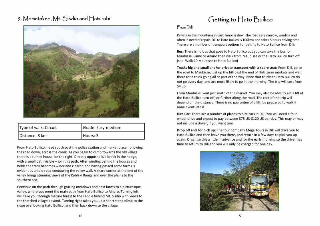
9. Mometakeo, Mt. Sisdio and Haturabi
Type of walk: Circuit Grade: Easy-medium
Distance: 8 km Hours: 3
From Hato Builico, head south past the police station and market place, following the road down, across the creek. As you begin to climb towards the old village there is a ruined house on the right. Directly opposite is a break in the hedge, with a small path visible – join this path. After winding behind the houses and fields the track becomes wider and clearer, and having passed some farms is evident as an old road contouring the valley wall. A sharp corner at the end of the valley brings stunning views of the Kablaki Range and over the plains to the southern sea.
Continue on the path through grazing meadows and past farms to a picturesque valley, where you meet the main path from Hato Builico to Ainaro. Turning left will take you through mature forest to the saddle behind Mt. Sisdio with views to the thatched village beyond. Turning right takes you up a short steep climb to the ridge overlooking Hato Builico, and then back down to the village.
5
Getting to Hato Builico From Dili
Driving in the mountains in East Timor is slow. The roads are narrow, winding and often in need of repair. Dili to Hato Builico is 100kms and takes 5 hours driving time. There are a number of transport options for getting to Hato Builico from Dili:
Bus: There is no bus that goes to Hato Builico but you can take the bus for Maubisse, Same or Anairo then walk from Maubisse or the Hato Builico turn off (see Walk 10 Maubisse to Hato Builico)
Trucks big and small and/or private transport with a spare seat: From Dili, go to the road to Maubisse, just up the hill past the end of Hali Laran markets and wait there for a truck going all or part of the way. Note that trucks to Hato Builico do not go every day, and are more likely to go in the morning. The trip will cost from $4 up.
From Maubisse, wait just south of the market. You may also be able to get a lift at the Hato Builico turn-off, or further along the road. The cost of the trip will depend on the distance. There is no guarantee of a lift; be prepared to walk if none eventuates!
Hire Car: There are a number of places to hire cars in Dili. You will need a four-wheel-drive and expect to pay between $75 US-$120 US per day. This may or may not include a driver, if you want one.
Drop off and /or pick up: The tour company Mega Tours in Dili will drive you to Hato Builico and then leave you there, and return in a few days to pick you up again. Organise this a little in advance and for the early morning so the driver has time to return to Dili and you will only be charged for one day.
6
Why use Guides?
We recommend the use of guides on all but three of these walks for cultural and economic reasons, as well as for safety and courtesy.
Culturally the area of Hato Builico is one where traditional cultural practice continues. Significant days of mountains are celebrated. The deities of old and newer religions are both appeased and thanked for rain and harvest. There are many sites of power open only to some, or only at some times, or only to those in the company of people known to that place.
The community of Hato Builico has agreed to the inclusion of the walks in this guide on the condition that they are guided walks. They have not agreed to foreigners bringing misfortune on themselves and the community by visiting places they have no right to be. Please respect their wishes.
Timor Leste is one of the poorest countries in Asia. Unemployment is high and poor roads make it difficult for farming families in this isolated area to sell produce in the regional markets, or in Dili. The Senior High School in Hato Builico is being built. Currently, to complete secondary school and undertake tertiary education, families must raise money for travel, board and fees. The money young men earn through guiding will not only support their own educational aspirations, but also those of their siblings.
Trails around Hato Builico can be narrow, steep and slippery. They also pass close to or even right through family compounds, which usually have guard dogs. A guide can quickly get assistance in the event of a fall or a twisted ankle, gain permission to cross family compounds, and deal with guard dogs.
Guides for these walks can be arranged through the guest houses. Expect to pay $5 per person per day. For a larger group climbing Mt. Ramelau, negotiate for 2 guides, in case some people wish to stop or turn back. Payment on completion of the walk is common practice.
15
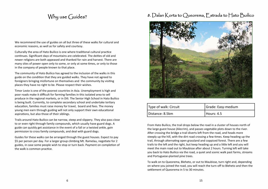
8. Dalan Korta to Queorema, Estrada to Hato Builico
Type of walk: Circuit Grade: Easy-medium
Distance: 8.5km Hours: 4.5
From Hato Builico, the trail drops below the road in a cluster of houses north of the large guest house (Alecrim), and passes vegetable plots down to the river. After crossing the bridge a trail diverts left from the road, and heads more steeply up the hill, with the dirt road crossing a few times. Keep heading up the trail, through alternating open grassland and coppiced forest. There are a few trails to the left and the right, but keep heading up and a little left and you will meet the main road out to Maubisse after about 2 hours. Turning left will take you back to Hato Builico via the road, a quiet and scenic walk past farms, streams and Portuguese-planted pine trees.
To walk on to Queorema, Bleheto, or out to Maubisse, turn right and, depending on where you joined the road, you will reach the turn-off to Bleheto and then the settlement of Queorema in 5 to 30 minutes.
14
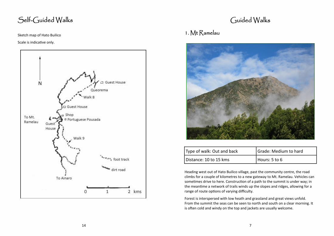
Self-Guided Walks
Sketch map of Hato Builico
Scale is indicative only.
7
Guided Walks
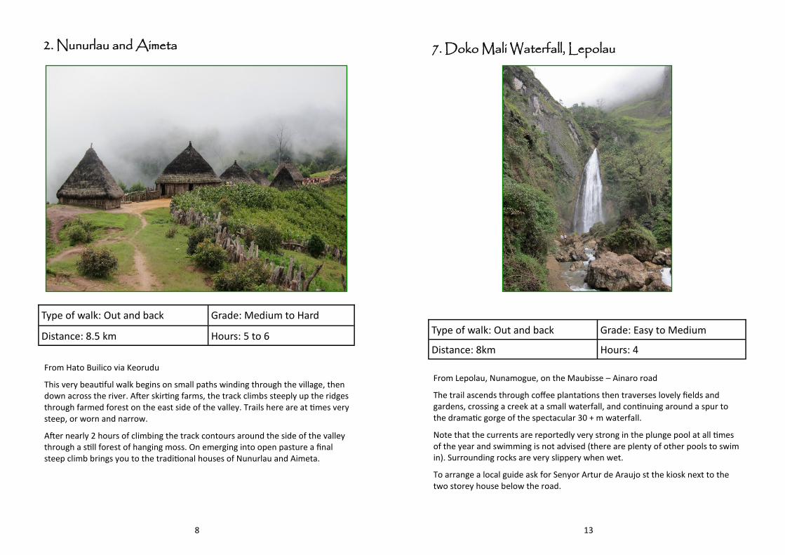
1. Mt Ramelau
Type of walk: Out and back Grade: Medium to hard
Distance: 10 to 15 kms Hours: 5 to 6
Heading west out of Hato Builico village, past the community centre, the road climbs for a couple of kilometres to a new gateway to Mt. Ramelau. Vehicles can sometimes drive to here. Construction of a path to the summit is under way; in the meantime a network of trails winds up the slopes and ridges, allowing for a range of route options of varying difficulty.
Forest is interspersed with low heath and grassland and great views unfold. From the summit the seas can be seen to north and south on a clear morning. It is often cold and windy on the top and jackets are usually welcome.
8
2. Nunurlau and Aimeta
Type of walk: Out and back Grade: Medium to Hard
Distance: 8.5 km Hours: 5 to 6
From Hato Builico via Keorudu
This very beautiful walk begins on small paths winding through the village, then down across the river. After skirting farms, the track climbs steeply up the ridges through farmed forest on the east side of the valley. Trails here are at times very steep, or worn and narrow.
After nearly 2 hours of climbing the track contours around the side of the valley through a still forest of hanging moss. On emerging into open pasture a final steep climb brings you to the traditional houses of Nunurlau and Aimeta.
13
7. Doko Mali Waterfall, Lepolau
Type of walk: Out and back Grade: Easy to Medium
Distance: 8km Hours: 4
From Lepolau, Nunamogue, on the Maubisse – Ainaro road
The trail ascends through coffee plantations then traverses lovely fields and gardens, crossing a creek at a small waterfall, and continuing around a spur to the dramatic gorge of the spectacular 30 + m waterfall.
Note that the currents are reportedly very strong in the plunge pool at all times of the year and swimming is not advised (there are plenty of other pools to swim in). Surrounding rocks are very slippery when wet.
To arrange a local guide ask for Senyor Artur de Araujo st the kiosk next to the two storey house below the road.
12
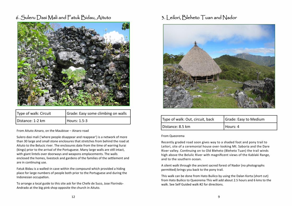
6. Suleru Dasi Mali and Fatuk Bidau, Aituto
Type of walk: Circuit Grade: Easy some climbing on walls
Distance: 1-2 km Hours: 1.5-3
From Aituto Ainaro, on the Maubisse – Ainaro road
Sulero dasi mali (‘where people disappear and reappear’) is a network of more than 30 large and small stone enclosures that stretches from behind the road at Aituto to the Belucic river. The enclosures date from the time of warring liurai (kings) prior to the arrival of the Portuguese. Many large walls are still intact, with giant lintels over doorways and weapons emplacements. The walls enclosed the homes, livestock and gardens of the families of the settlement and are in continuing use.
Fatuk Bidau is a walled-in cave within the compound which provided a hiding place for large numbers of people both prior to the Portuguese and during the Indonesian occupation.
To arrange a local guide to this site ask for the Chefe de Suco, Jose Florindo-Andrado at the big pink shop opposite the church in Aituto.
9
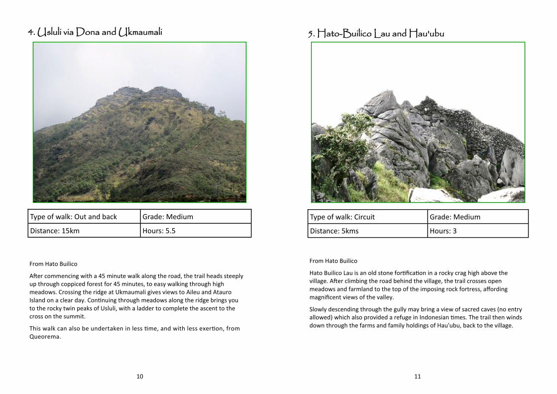
2. Nunurlau and Aimeta 3. Leilori, Bleheto Tuan and Nador
Type of walk: Out, circuit, back Grade: Easy to Medium
Distance: 8.5 km Hours: 4
From Queorema
Recently graded road soon gives way to a shaded foot and pony trail to Leilori, site of a ceremonial house over-looking Mt. Saboria and the Dare River valley. Continuing on to Old Bleheto (Bleheto Tuan) the trail winds high above the Belulic River with magnificent views of the Kablaki Range, and to the southern ocean.
A silent walk through the ancient sacred forest of Nador (no photographs permitted) brings you back to the pony trail.
This walk can be done from Hato Builico by using the Dalan Korta (short cut) from Hato Builico to Queorema This will add about 2.5 hours and 6 kms to the walk. See Self Guided walk #2 for directions.
10
4. Usluli via Dona and Ukmaumali
Type of walk: Out and back Grade: Medium
Distance: 15km Hours: 5.5
From Hato Builico
After commencing with a 45 minute walk along the road, the trail heads steeply up through coppiced forest for 45 minutes, to easy walking through high meadows. Crossing the ridge at Ukmaumali gives views to Aileu and Atauro Island on a clear day. Continuing through meadows along the ridge brings you to the rocky twin peaks of Usluli, with a ladder to complete the ascent to the cross on the summit.
This walk can also be undertaken in less time, and with less exertion, from Queorema.
11
5. Hato-Builico Lau and Hau'ubu
Type of walk: Circuit Grade: Medium
Distance: 5kms Hours: 3
From Hato Builico
Hato Builico Lau is an old stone fortification in a rocky crag high above the village. After climbing the road behind the village, the trail crosses open meadows and farmland to the top of the imposing rock fortress, affording magnificent views of the valley.
Slowly descending through the gully may bring a view of sacred caves (no entry allowed) which also provided a refuge in Indonesian times. The trail then winds down through the farms and family holdings of Hau'ubu, back to the village.