Embed Size (px)
Citation preview
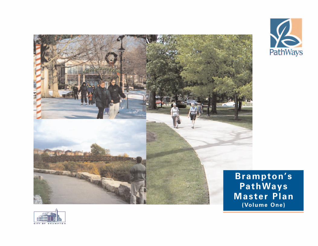
Brampton’s PathWays
Master Plan (Volume One)
DRAFT
Brampton’s PathWays Master Plan
June 28, 2002
Mr. Karl WalshDirector of Community Design, Parks Planning and DevelopmentCity of Brampton2 Wellington Street WestBrampton, ON L6Y 4R2
Dear Mr. Karl Walsh,
Re: Brampton's Pathways Master Plan
We are pleased to provide you with the Final report of the Brampton PathWays Master Plan. The plan consists of three volumes:
• Brampton's PathWays Master Plan (Volume One)• Brampton Planning and Design Guidelines (Volume Two)• Brampton PathWays Technical Appendices (Volume Three)
The PathWays Master plan is intended to outline Brampton's plan to create a unique community that builds on the City's natural, cultural and heritage features. Key to the plan is the ability to create/capture a unique identity while connecting destinations that will leave pathway users with lasting impressions of the experience. In this regard, the strategic plan, founded on consultation and collaboration, is crucial inBrampton's attempts to attain a safe, seamless pathway system that best reflects the needs of the community and supports the inter-modal activities they enjoy!
Yours truly,
Marshall Macklin Monaghan Limited
Jamie Lowery Dave McLaughlinSenior Project Manager & Associate Project Manager & AssociatePlanning Transportation
Brampton’s PathWays Master Plan
City of Brampton:
Rick BarreiroBob CranchDennis CutajarAlex DoboWalter FischerDave KenthJoseph LillyColleen MurraySteve PrestonAdrian SmithBryan SmithKarl Walsh (City's Project Manager)Henrik Zbogar
Environics Research Group:
Jane ArmstrongMary Jane Lennon
ESG International:
Ken BuckJay Cranstone
Marshall Macklin Monaghan Limited:
Jamie Lowery (Consultant's Project Manager)David McLaughlinDavid RichardsonRandall RothBruce SingbushRyan VanderPutten
Acknowledgements(in alphabetical order)
1.0 Achieving the Vision . . . . . . . . . . . . . . . . . . . . . . . . . . . . . . . . . . . . . . . . . . .1-2Brampton’s PathWays Plan . . . . . . . . . . . . . . . . . . . . . . . . . . . . . . . . . . . . . . .1-3
2.0 Seeds for Success . . . . . . . . . . . . . . . . . . . . . . . . . . . . . . . . . . . . . . . . . . . . .2-2Listening to Residents . . . . . . . . . . . . . . . . . . . . . . . . . . . . . . . . . . . . . . . . . . .2-2
Public Attitude Survey . . . . . . . . . . . . . . . . . . . . . . . . . . . . . . . . . . . . . . . .2-2Public and Stakeholders Events . . . . . . . . . . . . . . . . . . . . . . . . . . . . . . . .2-6
3.0 Growing Success . . . . . . . . . . . . . . . . . . . . . . . . . . . . . . . . . . . . . . . . . . . . .3-24.0 Campaign for Customer Driven PathWays . . . . . . . . . . . . . . . . . . . . . . . . . .4-2
Goals . . . . . . . . . . . . . . . . . . . . . . . . . . . . . . . . . . . . . . . . . . . . . . . . . . . . . . .4-2Objectives . . . . . . . . . . . . . . . . . . . . . . . . . . . . . . . . . . . . . . . . . . . . . . . . . . . .4-2Actions . . . . . . . . . . . . . . . . . . . . . . . . . . . . . . . . . . . . . . . . . . . . . . . . . . . . . .4-2
Develop Pathways for All Users . . . . . . . . . . . . . . . . . . . . . . . . . . . . . . . .4-3Adopt the Pathway Network Map . . . . . . . . . . . . . . . . . . . . . . . . . . . . . . .4-4Improve and Expand Pathways in a Logical Manner . . . . . . . . . . . . . . . .4-10Adopt a Maintenance Regime . . . . . . . . . . . . . . . . . . . . . . . . . . . . . . . . .4-12
5.0 Campaign for a Beautiful Pathway . . . . . . . . . . . . . . . . . . . . . . . . . . . . . . . .5-2Objectives . . . . . . . . . . . . . . . . . . . . . . . . . . . . . . . . . . . . . . . . . . . . . . . . . . . .5-2Actions . . . . . . . . . . . . . . . . . . . . . . . . . . . . . . . . . . . . . . . . . . . . . . . . . . . . . .5-2
Establish Pathwayss Themes that Reflect Brampton . . . . . . . . . . . . . . . . .5-3Adopt Design Standards and Guidelines . . . . . . . . . . . . . . . . . . . . . . . . . .5-6Enhance Strategic Points of Interests and Focal Areas Along the Network .5-10Provide Appropriate Signage . . . . . . . . . . . . . . . . . . . . . . . . . . . . . . . . . .5-12
6.0 Campaign for Valued PathWays . . . . . . . . . . . . . . . . . . . . . . . . . . . . . . . . . .6-2Goals . . . . . . . . . . . . . . . . . . . . . . . . . . . . . . . . . . . . . . . . . . . . . . . . . . . . . . .6-2Objectives . . . . . . . . . . . . . . . . . . . . . . . . . . . . . . . . . . . . . . . . . . . . . . . . . . . .6-2Actions . . . . . . . . . . . . . . . . . . . . . . . . . . . . . . . . . . . . . . . . . . . . . . . . . . . . . .6-2
Encourage PathWays Use . . . . . . . . . . . . . . . . . . . . . . . . . . . . . . . . . . . .6-3
Educate PathWays User About Proper Trail Etiquette . . . . . . . . . . . . . . . .6-4Promote Stewardship and Foster Partnership . . . . . . . . . . . . . . . . . . . . . .6-7Understand the Community Volunteer Base . . . . . . . . . . . . . . . . . . . . . . .6-8Rationalize the City Services with the Volunteer Mandates . . . . . . . . . . . .6-8Prepare a Community Involvement Strategy . . . . . . . . . . . . . . . . . . . . . . .6-9Initiate Programs with Enthusiasm . . . . . . . . . . . . . . . . . . . . . . . . . . . . . .6-9Monitor the Effectiveness of the Programs . . . . . . . . . . . . . . . . . . . . . . . .6-9Recognize Volunteer Efforts . . . . . . . . . . . . . . . . . . . . . . . . . . . . . . . . . . .6-9
7.0 Cultivating Success . . . . . . . . . . . . . . . . . . . . . . . . . . . . . . . . . . . . . . . . . . . .7-2Implementing Actions . . . . . . . . . . . . . . . . . . . . . . . . . . . . . . . . . . . . . . . . . . . .7-2
Define, Refine and Deliver PathWays Network . . . . . . . . . . . . . . . . . . . . .7-2Incorporate Key PathWays Elements in the Official Plan . . . . . . . . . . . . . .7-6Provide an Administrative Structure to Achieve Success . . . . . . . . . . . . . .7-6Fund PathWays Projects on an Annual Basis . . . . . . . . . . . . . . . . . . . . . .7-8Resource the Necessary Maintenance Regime . . . . . . . . . . . . . . . . . . . . .7-9Market, Promote and Inspire Stewardship . . . . . . . . . . . . . . . . . . . . . . . . .7-9
MapsMap A - Existing PathWays . . . . . . . . . . . . . . . . . . . . . . . . . . . . . . . . . . . . . . .2-3Map B - Destinations . . . . . . . . . . . . . . . . . . . . . . . . . . . . . . . . . . . . . . . . . . . .4-5Map C - Opportunities and Barriers . . . . . . . . . . . . . . . . . . . . . . . . . . . . . . . . .4-6Map D - Recommended PathWays Network . . . . . . . . . . . . . . . . . . . . . . . . . .4-7Map E - Recommended PathWays Facility Types . . . . . . . . . . . . . . . . . . . . . .4-9Map F - Recommended Phasing Program . . . . . . . . . . . . . . . . . . . . . . . . . . .4-11Map G - Special Study Areas . . . . . . . . . . . . . . . . . . . . . . . . . . . . . . . . . . . . .5-11
AppendicesAppendix A - A Suggested Framework for Official Plan Amendment Provisions .A-1Appendix B - Costing . . . . . . . . . . . . . . . . . . . . . . . . . . . . . . . . . . . . . . . . . . .B-1
i-1
Table of Contents
Page No. Page No.
Brampton’s PathWays Master Plan
1-1
1A1B 1C
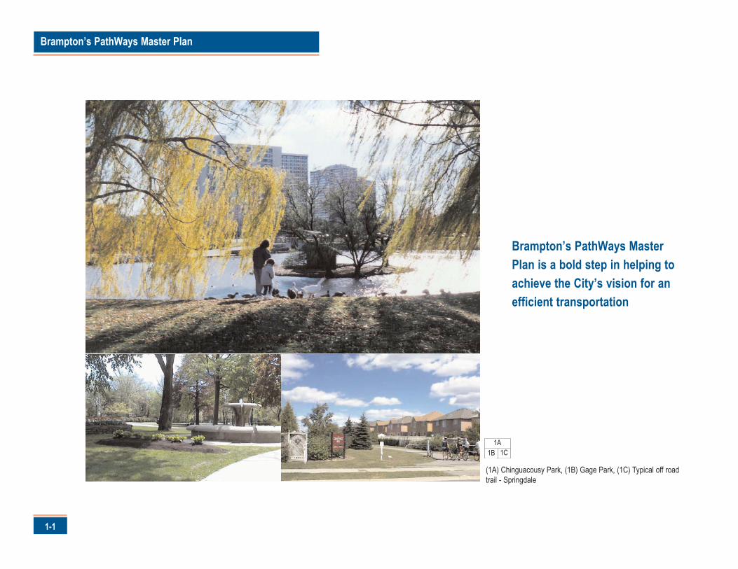
(1A) Chinguacousy Park, (1B) Gage Park, (1C) Typical off roadtrail - Springdale
Brampton’s PathWays MasterPlan is a bold step in helping toachieve the City’s vision for anefficient transportation
rampton has a vision. A vision for a high quality of community
life, a prosperous and diversified economy, excellence in local
government and an efficient transportation network.
The City of Brampton is committed to achieving this vision. Their mission is
to make Brampton "a vibrant and attractive City of opportunity, where well-
planned and organized services and facilities make it possible for families,
individuals and the business community to grow, prosper and enjoy a high
quality of life."
An important step in realizing the vision is to build on Brampton's open
space infrastructure, a community asset over which the City has great
influence and one that has helped to distinguish Brampton from other
communities in Ontario.
Open space helps to define Brampton's image by establishing a contextual
relationship with the built form and providing an avenue for community
stewardship and health.
The PathWays system is an important component of the city's open space
infrastructure. They knit parks and valleys together and provide convenient
pedestrian and cycling routes across Brampton.
Brampton's PathWays Master Plan is a bold step in helping the City to
improve its pathways trail system and achieve the vision.
1-2
1.0 Achieving the Vision
B

Brampton’s PathWays Master Plan
1-3
Brampton's PathWays Master Plan
Brampton's residents value their pathways.
Through the public process used to develop this Plan, it was established that:
• Walkers, cyclists and in-line skaters actively use the existing 89 km of pathways. In 2001 alone, anestimated two-thirds of Brampton residents used pathways for recreation, exercise and practicalpurposes.
• Existing pathways, such as the Etobicoke Creek Trail, Professor's Lake Trail and Chinguacousy ParkTrail, are attractive amenities that help to define the identity and character of Brampton'sneighbourhoods.
• New pathways, such as those in Springdale and Fletcher's Meadow, are being used to connect andmarket Brampton's newest neighbourhoods.
• Residents clearly support better and expanded pathways. In a public attitude survey conducted forthis study, nine-in-ten respondents stated they favour the City of Brampton spending money tomaintain, expand and improve the pathways system
3A3B
(3A) PathWays vista in Springdale, (3B) PathWays will become a valued community asset
The City is listening to the public’s comments, and through a collaborative
process, have turned it into a mandate to make improvements to
Brampton's PathWays.
Brampton's PathWays Plan (the Plan) spells out responses to key public
priorities and opportunities and establishes an implementation process to
ensure results. The Plan focuses on core objectives and strategic actions,
leaving site-specific details to planning and functional design studies that
will be completed based on the recommendations of the Plan.
The Plan is divided into these volumes. These are:
1. Brampton’s PathWays Master Plan (Volume One) - consist of thisreport, which provides the core objectives and strategic actionsresulting from the study.
2. Brampton’s PathWays Planning and Design Guidelines (Volume 2) -are guidelines to assist the City in the development and maintenance
of the system.3. Brampton’s Pathways Technical Appendices (Volume 3) - consists of a
record of the public information collected over the course of the study.
The Plan focuses on three campaigns that will direct the revitalization and
expansion of pathways . The campaigns, with their associated goals and
objectives, will be valuable measuring devices for ensuring that pathways
help achieve Brampton's vision.
For each campaign, the Plan sets out strategic actions - 17 in all - that will
make Brampton's pathways a valuable community amenity and the envy of
towns and cities across Canada. The Plan also establishes the design and
policy framework and community involvement ideas within which the
strategic actions will be realized.
It is time for Brampton's pathway's to bloom!1-4
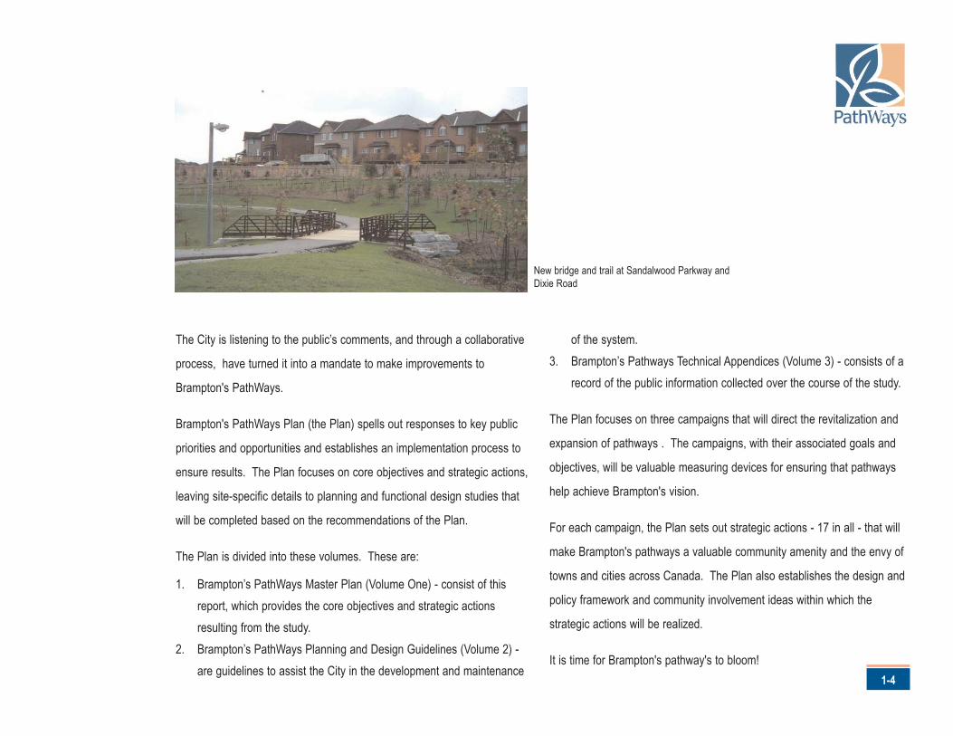
New bridge and trail at Sandalwood Parkway andDixie Road
Brampton’s PathWays Master Plan
2-1
1B1C
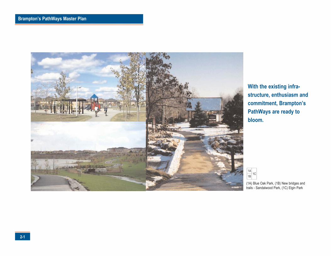
(1A) Blue Oak Park, (1B) New bridges andtrails - Sandalwood Park, (1C) Elgin Park
1A
With the existing infra-structure, enthusiasm andcommitment, Brampton’sPathWays are ready tobloom.
rampton has invested in pathways for over two decades.
Invested in pathways planning, design, development,
maintenance and marketing.
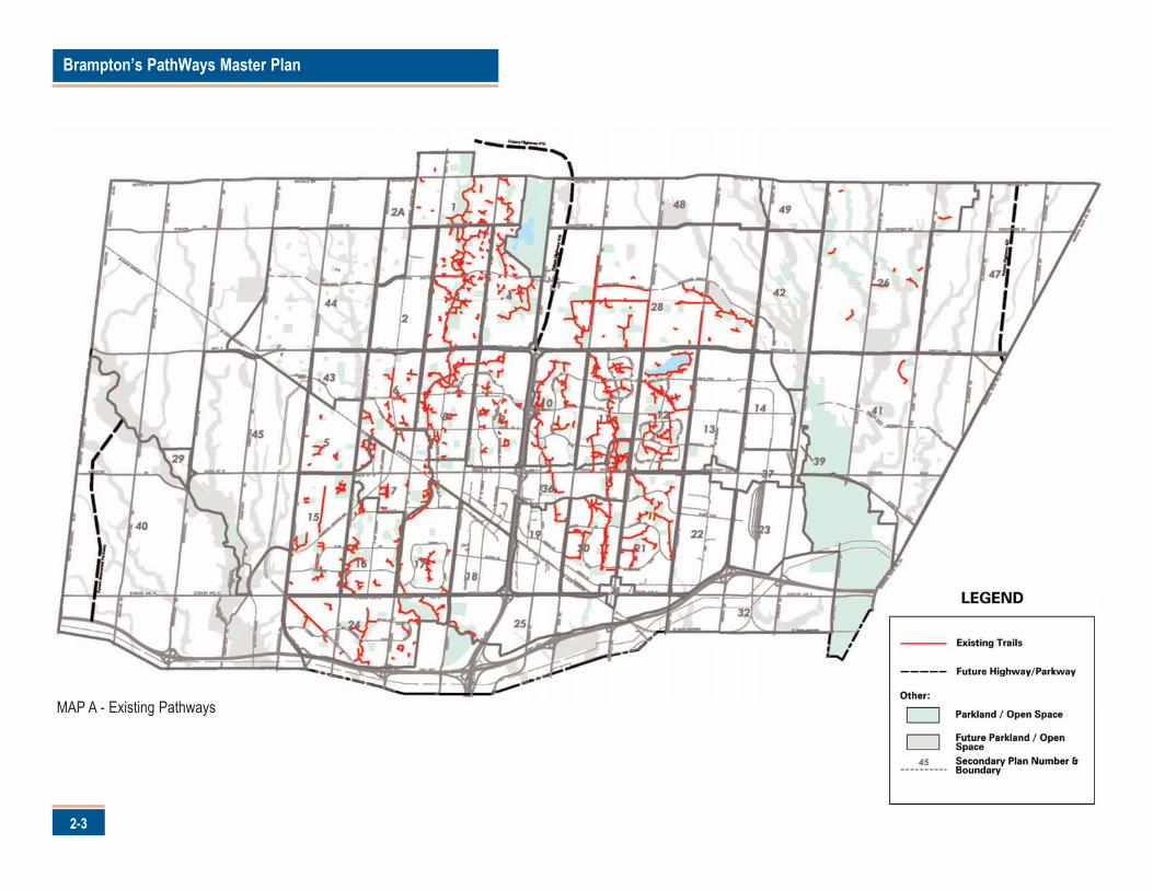
As highlighted on Map A, Brampton's investment is most evident in the
89 km of existing off-road trails - trails such as Professor's Lake, which is a
popular destination for residents seeking exercise, relaxation and social
interaction.
LISTENING TO RESIDENTS
Investing in pathways involves choices - choices that should reflect the
needs and expectations of residents and local business.
A city-wide public attitude study was commissioned specifically for this Plan.
In addition, meetings, open houses and information sessions were held for
the public and stakeholders throughout its development.
The results of these activities indicate residents' attitudes toward existing
pathways and their desires for future pathways.
Public Attitude Survey
Environics Research Group conducted a statistically valid city-wide public
attitude survey over the telephone to a random sample of Brampton
households. A total of 528 interviews were completed as a part of the
survey and the results have a margin of error of less than 5%.
The survey results yielded seven key findings. These are:
1. Pathways benefit Brampton
Residents recognized that the trail system offers numerous benefits to
individuals and the entire City. The greatest benefits of the trail system
noted by residents relate to health (51%), social benefits and the fostering
of community pride (16%), and the preservation of nature and green spaces
(14%).
2-2
2.0 Seeds for Success
B
Brampton’s PathWays Master Plan
2-3
MAP A - Existing Pathways
2. Pathways are well used
The majority of residents (66%) reported that they, or someone in their household, used the trail system
within the past year.
3. Pathways serve a variety of roles
Walking is the primary mode of choice among recreational and practical users, followed by cycling, jogging
and in-line skating.
4. Pathways can be made even better
Despite the fact that 48% of residents evaluate the existing pathways as "good", less than two-in-ten
viewed them as "excellent". A further two-in-ten rate the existing pathways as "fair" (17%) or "poor" (4%).
5. Pathways must be well designed
Residents identified the hallmarks of good pathways as providing safe ways to cross busy roadways or rail
lines (88%), well-maintained surfaces (85%), good lighting for evening use (84%) and good signs to help
people find their way (78%).
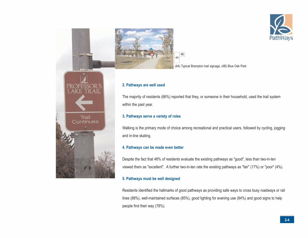
4A4B
(4A) Typical Brampton trail signage, (4B) Blue Oak Park
2-4
Brampton’s PathWays Master Plan
2-5
Residents also place a great deal of importance on establishing links
between trail use and environmental considerations and on the need to
accommodate a wide range of users. About half of the respondents placed
a high importance on the aesthetics of the trail and on amenities or
services, such as reserved bike lanes and restrooms.
6. Pathways use can be increased
To encourage recreational use of the trail system, residents suggested easy
access to brochures/maps (75%), greater interest and use among family
and friends (63%), public restrooms along the trails (59%), emergency
phones (57%), educational programs (55%), access to nearby venues
(47%) and equipment rentals at primary staging points of the trail (43%).
To encourage increased practical use of the trail system, residents
suggested that the trails should be expanded to make the trails more
convenient or useful (15%), provide more information about the trails (7%)
and undertake safety (5%) and maintenance improvements (4%).
7. Residents support paying for Pathways
Residents expressed strong support for the City of Brampton spending
money to maintain, expand and improve the trail system.
Nine-in-ten residents are strongly (39%) or somewhat (51%) in favour of the
City of Brampton spending money to maintain, expand and improve
pathways, while fewer than one-in-ten are strongly (3%) or somewhat (5%)
opposed.
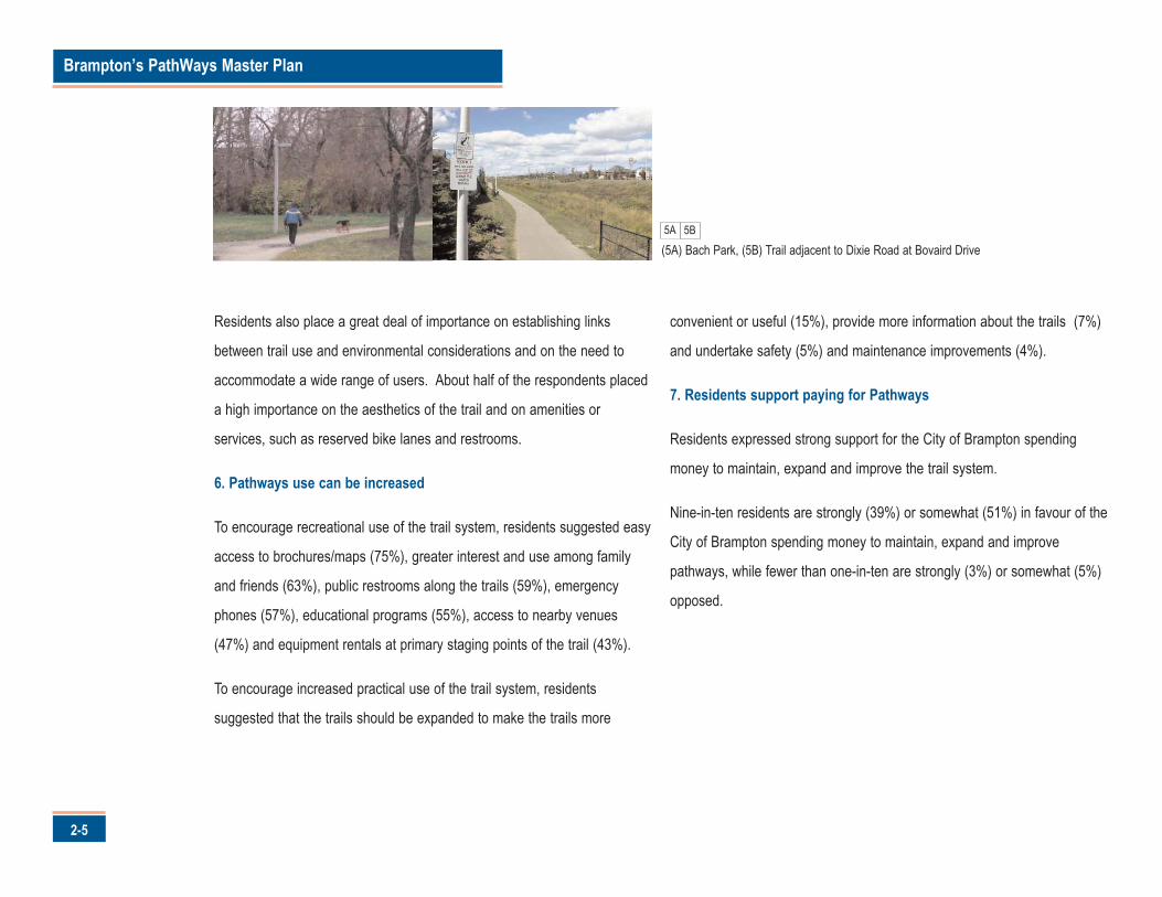
5A
(5A) Bach Park, (5B) Trail adjacent to Dixie Road at Bovaird Drive 5B
2-6
Public and Stakeholder Events
Five public and stakeholder events were held during the development of this Plan.
These events provided over 100 individuals and groups the opportunity to identify their
interests, issues and directions for the PathWays system.
The public and stakeholder events yielded seven key findings. These are:
1. PathWays must be better maintained
Residents and stakeholders indicated that the City must improve and maintain the
existing PathWays. This includes repairing existing sections where the trail surface has
degraded over time and regularly cleaning the system of debris.
2. PathWays should be connected and accessible
Residents and stakeholders indicated they wanted PathWays that are: accessible to all
members of the community; within a 15 minute walk from their home; provide better
east-west connections; and are accessible by public transit.
3. PathWays should be safe
Residents and stakeholders want safe PathWays. This includes support for programs
that deliver trail etiquette messages, and security features such as appropriate design
measures.
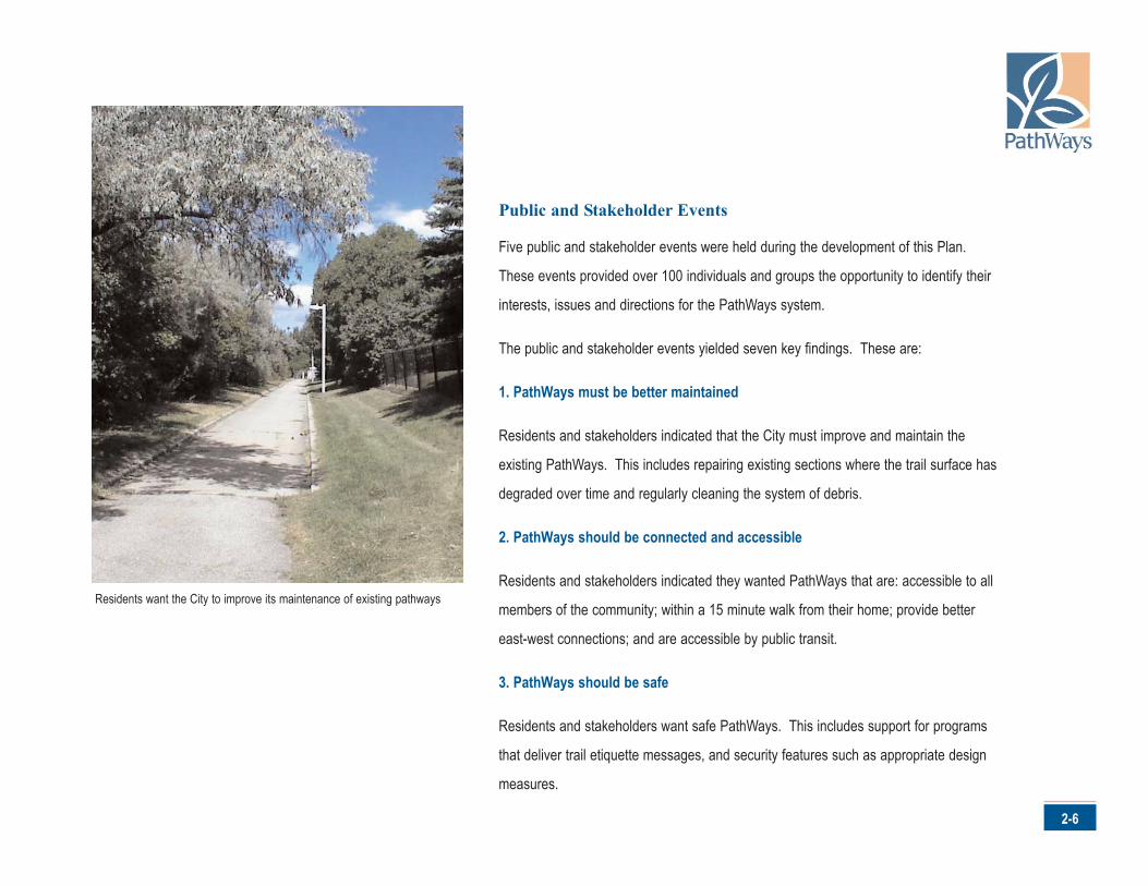
Residents want the City to improve its maintenance of existing pathways
Brampton’s PathWays Master Plan
2-7
4. PathWays should be green
Residents and stakeholders are seeking environmentally progressive
PathWays. They support the appropriate integration of PathWays into
natural areas and the greening of the existing system.
5. PathWays should accommodate multiple users
Residents and stakeholders support multiple users of the PathWays
system, including walkers, joggers, dog walkers, cyclists and in-line
skaters. At the same time, they recognize the existing PathWays are too
narrow to accommodate all users and that some uses may not be
appropriate in environmentally sensitive areas.
6. PathWays marketing should be improved
Residents and stakeholders want more information about the PathWays
system, particularly maps. The also indicated that the City should
communicate the PathWays successes better to the community.
7. PathWays development should involve the community
Residents and stakeholders are clearly interested in helping the City
develop PathWays. A variety of public involvement and outreach
mechanisms were suggested by participants, including adopt-a-trails,
stewardship programs and corporate sponsorship.
The results of the public attitude survey are consistent with those from
the public and stakeholder events. They emphasize the importance of a
well-connected and maintained pathways system for all users as well as
the desire for improved promotion and material.
For a complete review of the public attitude survey, as well as the results
of the various public and stakeholder events, please consult the
Brampton’s PathWays Technical Appendix (Volume Three).
7A
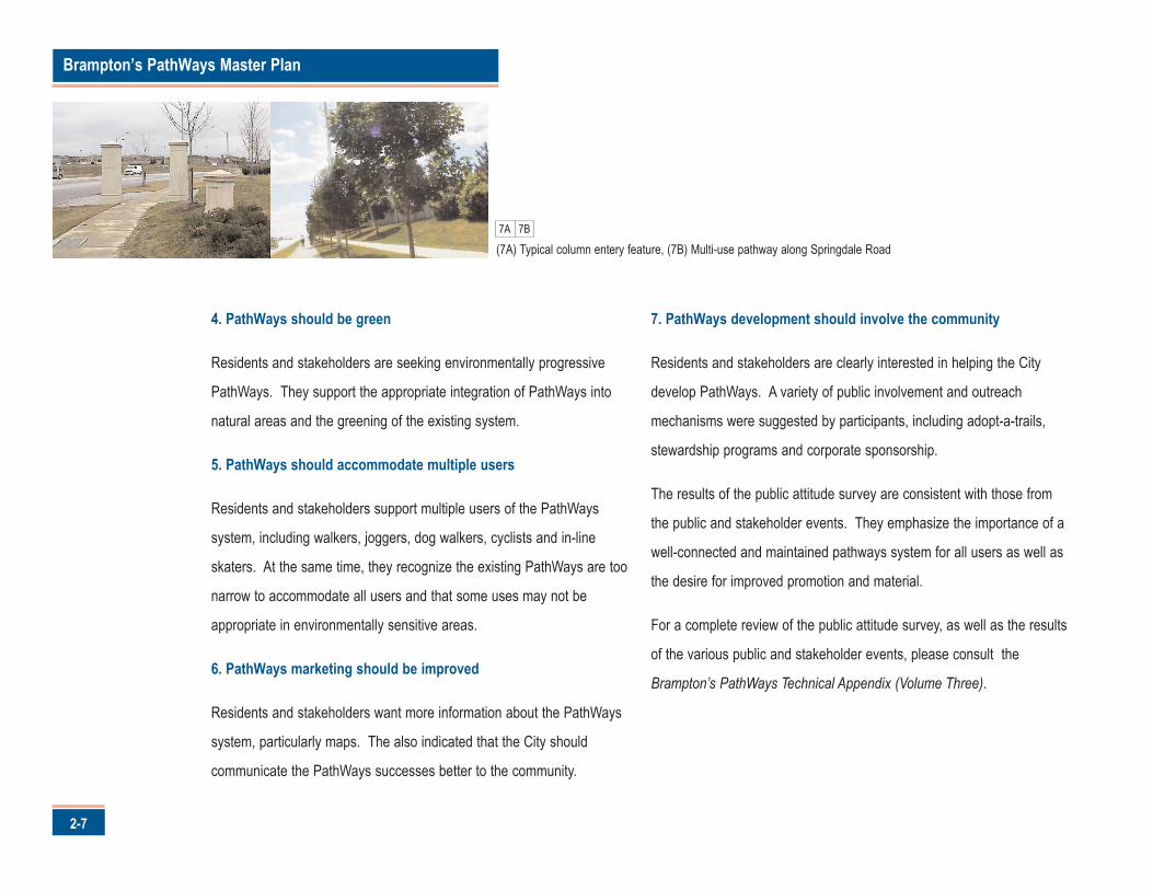
(7A) Typical column entery feature, (7B) Multi-use pathway along Springdale Road7B
2-8
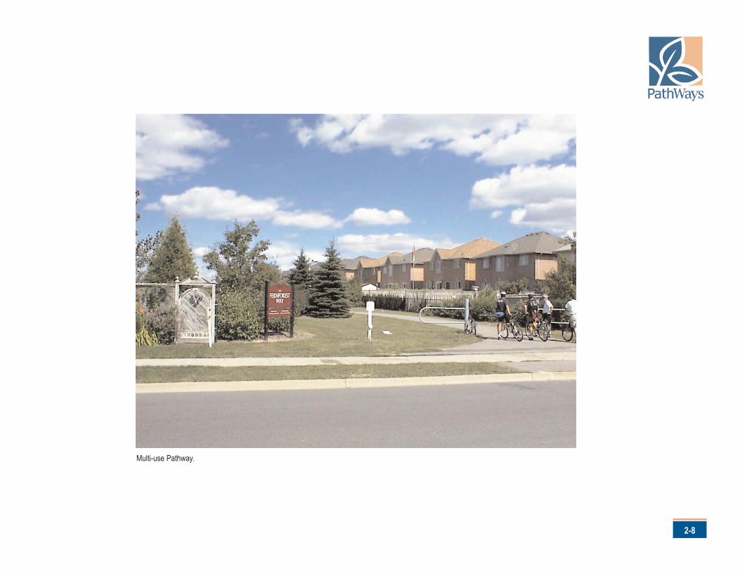
Multi-use Pathway.
Brampton’s PathWays Master Plan
3-1
1B1C
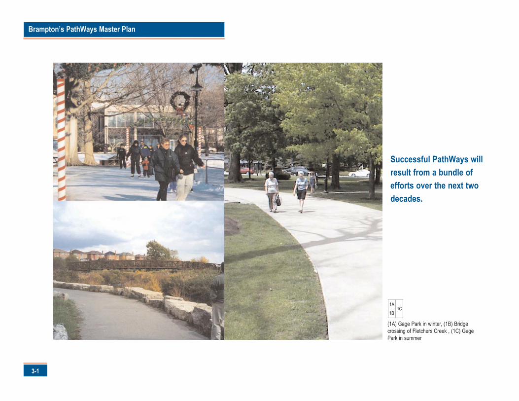
(1A) Gage Park in winter, (1B) Bridgecrossing of Fletchers Creek , (1C) GagePark in summer
1A
Successful PathWays willresult from a bundle ofefforts over the next twodecades.
uccessful pathways will not result from a single project or
activity. Rather, it will result from a bundle of efforts that will
carry on over the next two decades.
This Plan provides direction for Brampton's PathWays in keeping with
residents' needs and expectations as expressed in the previous chapter.
The Plan is founded on three primary campaigns derived primarily from the
interactive consultation program. These are:
1. Campaign for Customer Driven Pathways2. Campaign for Beautiful Pathways3. Campaign for Valued Pathways
Each campaign is divided into three parts: the "Goals" that will establish the
benchmark for Brampton's pathways; the "Objectives" that call for specific
strategies to meet them and the "Actions" that will enable the vision to
bloom.
In describing the campaigns, words such as "will" are used. It is recognized
that the implementation of this Plan will take time. The use of these words
should not be construed as Council's commitment to proceed with
undertakings immediately. This will be done in a phased manner, subject to
budgeting and program availability.
It should be also noted that the campaigns are not intended to be static.
The timing and details related to the "Actions" can and should evolve
through community consultation and detailed technical studies as
appropriate. Similarly, monitoring mechanisms such as customer
satisfaction surveys must also be used in order for the City to measure
success and/or make adjustments to the Plan. At the same time, however,
the extensive community effort that established the overall direction for this
Plan must be respected. Therefore, specific changes to alignments, facility
types, awareness initiatives and implementation priorities should be
evaluated in the context of such a decision's impact upon the community's
desire to achieve Brampton's vision.
3-2
3.0 Growing Success
S
Brampton’s PathWays Master Plan
4-1
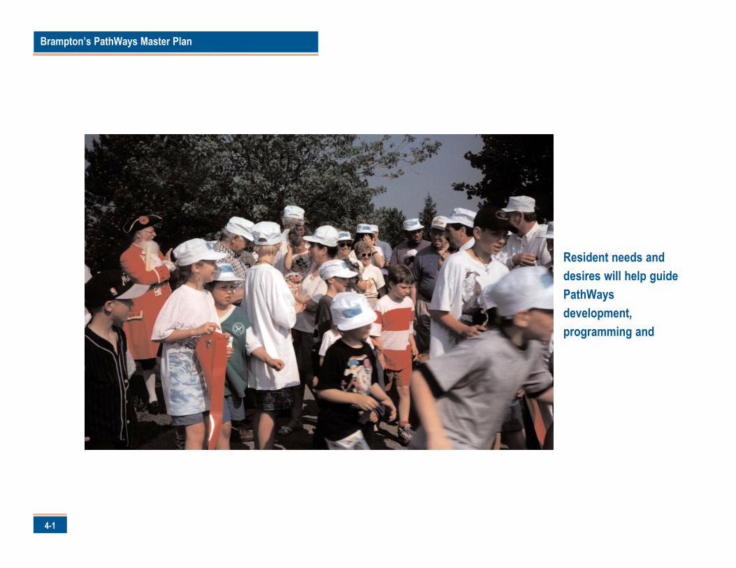
Resident needs anddesires will help guidePathWaysdevelopment,programming and
athways must reflect and respond to residents' needs and
desires. This will promote PathWays use and encourage a
wider user base. The first campaign of this Plan is for customer
driven pathways.
Brampton's customers are the people who currently make use of the
system, as well as those that could make use of the system in the future.
Customer use is important since setting the right conditions to maintain
current use and broaden the appeal for increased growth is one of the
measures of success for this Plan.
Goals
The Campaign for Customer Driven PathWays is directed at achieving
pathways that are designed by the community, for the community.
Pathways that will:
• minimize the risk to its customers;• serve residents’ modal choices;• take residents where they want to go; and• offer the experiences sought by residents.
Objectives
The success of the Campaign for Customer Driven PathWays will be
measured by five objectives. These are:
1. Pathways will serve a broad range of users and interests.2. Pathways will provide safe and diverse on and off-road experiences.3. Pathways will link all residents with desirable or important destinations.4. Pathways will be accessible to all residents within a five-minute bike
ride or fifteen (15)-minute walk.5. Pathway design will be flexible to meet the evolving needs of residents.
Actions
There are four actions to achieve Customer Driven PathWays:
1. Develop pathways for all uses.2. Adopt the PathWays Network Plan.3. Improve and expand PathWays in a logical manner - one that
capitalizes on bringing the current inventory up to the recommendedstandards followed by an expansion of the network in a reasonabletimeframe.
4. Adopt a maintenance regime that the City can resource, at a level thecommunity expects.
Each action is described in detail in the following sections.
4-2
4.0 Campaign for Customer Driven PathWays
P
Brampton’s PathWays Master Plan
4-3
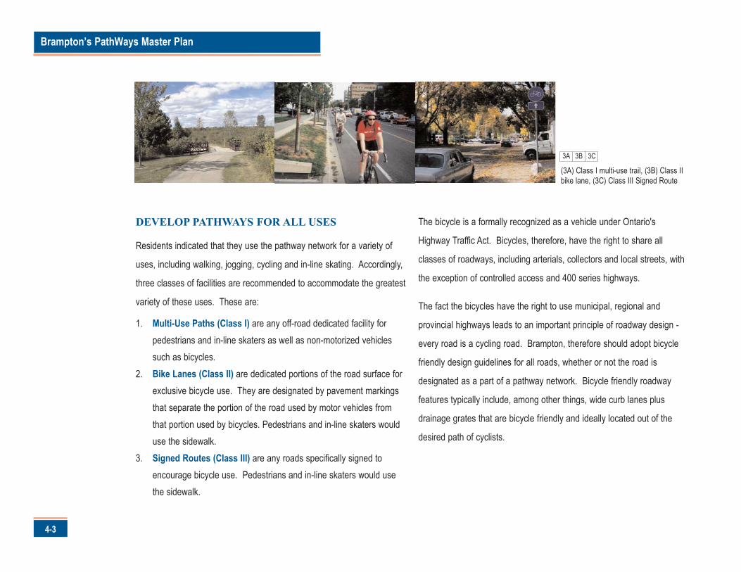
DEVELOP PATHWAYS FOR ALL USES
Residents indicated that they use the pathway network for a variety of
uses, including walking, jogging, cycling and in-line skating. Accordingly,
three classes of facilities are recommended to accommodate the greatest
variety of these uses. These are:
1. Multi-Use Paths (Class I) are any off-road dedicated facility forpedestrians and in-line skaters as well as non-motorized vehiclessuch as bicycles.
2. Bike Lanes (Class II) are dedicated portions of the road surface forexclusive bicycle use. They are designated by pavement markingsthat separate the portion of the road used by motor vehicles fromthat portion used by bicycles. Pedestrians and in-line skaters woulduse the sidewalk.
3. Signed Routes (Class III) are any roads specifically signed toencourage bicycle use. Pedestrians and in-line skaters would usethe sidewalk.
The bicycle is a formally recognized as a vehicle under Ontario's
Highway Traffic Act. Bicycles, therefore, have the right to share all
classes of roadways, including arterials, collectors and local streets, with
the exception of controlled access and 400 series highways.
The fact the bicycles have the right to use municipal, regional and
provincial highways leads to an important principle of roadway design -
every road is a cycling road. Brampton, therefore should adopt bicycle
friendly design guidelines for all roads, whether or not the road is
designated as a part of a pathway network. Bicycle friendly roadway
features typically include, among other things, wide curb lanes plus
drainage grates that are bicycle friendly and ideally located out of the
desired path of cyclists.
(3A) Class I multi-use trail, (3B) Class IIbike lane, (3C) Class III Signed Route
3A 3B 3C
4-4
It is imperative that the City recognize that providing a pathway system to
serve the community does not release it from an obligation to ensure that
all roadways in Brampton are designed, updated and maintained in a
manner that promotes a safe environment for cycling.
Detailed planning and design guidelines for each PathWays facility class, as
well as bicycle friendly streets, is provided in the Brampton PathWays
Planning and Design Guidelines (Volume Two) under separate cover.
ADOPT THE PATHWAY NETWORK MAP
Residents indicated that they use pathways for two purposes: recreational
pursuits and utilitarian trips. Utilitarian trips mean activities where the
destination is of primary importance, such as going to work, school,
shopping or visiting friends.
Residents also indicated that convenient access to the pathway network
was important. This is interpreted as connections within a 15 minute walk
or five minute bike ride from any given point in the City of Brampton.
With this in mind, the recommended PathWays Network was developed
using a three phase process, which is summarized as follows:
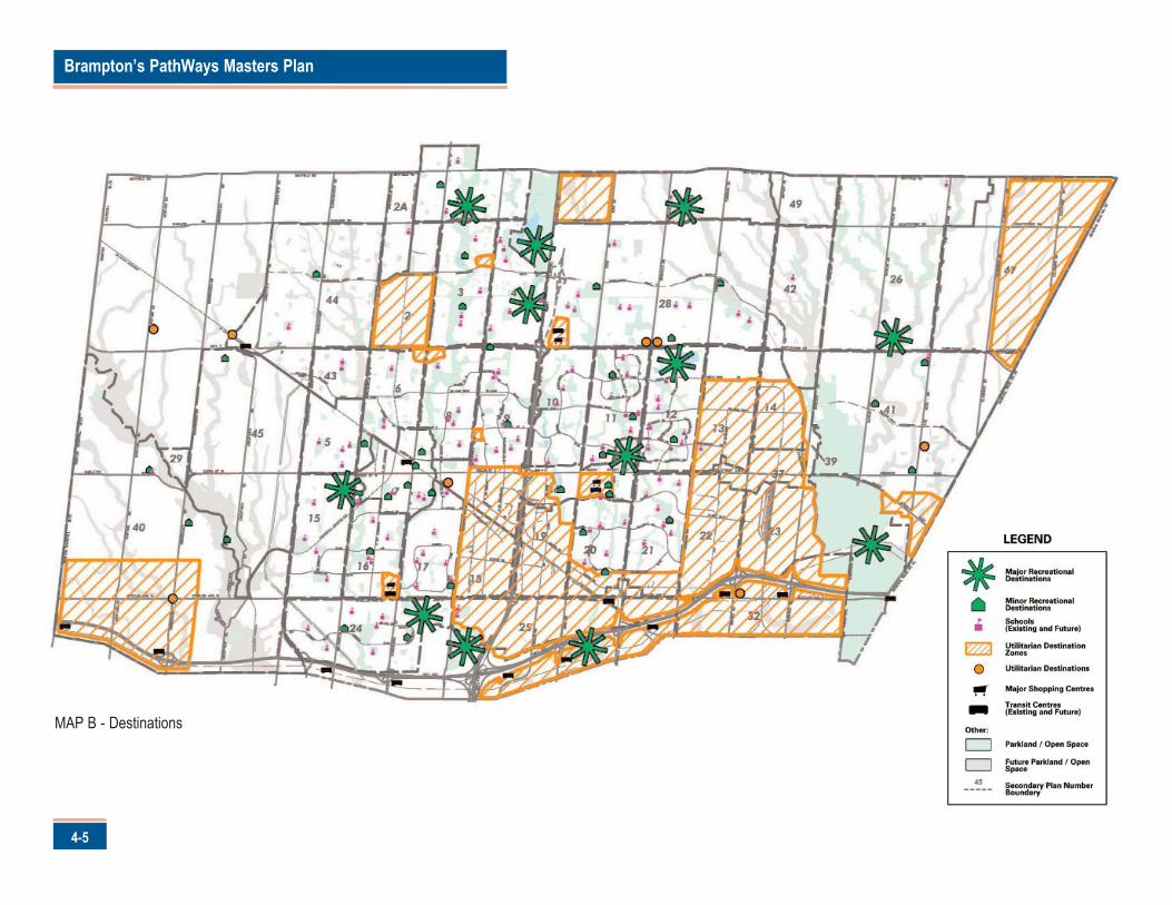
1. Identify Destinations. Map B illustrates some of the majordestinations in Brampton, such as recreational and employmentcentres. Commercial, institutional, recreation centres, parks andtransportation nodes were also identified and categorized.
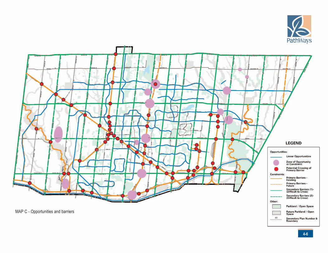
2. Identify Opportunities and Constraints. Map C illustrates some ofthe major constraints in Brampton, including the 400 series ofhighways, railway corridors, major arterial roads and right-of-ways.These constraints should also be considered opportunities. Forexample, under a re-development scenario, a major arterial road couldpresent an opportunity to expand the network in the boulevard.
3. Develop and Evaluate Candidate PathWays Routes. Candidatepathway routes were developed with staff, the public and consultingteam. Subsequently, each route was evaluated by the consulting teamand staff through field visits and the consideration of various evaluationfactors such as continuity, safety, traffic volumes available space andattractiveness. The selection of routes underwent several iterationswith input from the public, stakeholders and City staff until the preferredcorridors where chosen.
Brampton’s PathWays Masters Plan
4-5
MAP B - Destinations
4-6
MAP C - Opportunities and barriers
Brampton’s PathWays Master Plan
4-7
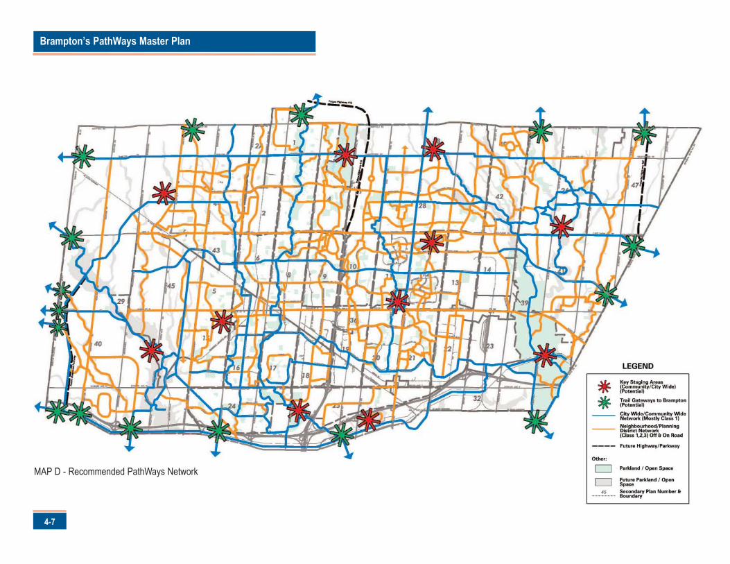
MAP D - Recommended PathWays Network
4-8
The recommended PathWays Network is provided on Map D. It
represents a grid of north-south and east-west routes spaced
approximately 2 kilometres apart. This spacing will ensure that all
residents will be within a 15 minute walk or five minute bike ride from the
network.
Like most transportation related systems or networks, such as roads with
highway, collector and local designations, the Brampton PathWays
system is represented in categories. The categories do not represent a
formal hierarchy; however, they are used as an organizing tool to
applying design criteria.
The "Community Network" identified on Map D will function as the spine
of the PathWays network, providing connections across Brampton and to
neighbouring municipalities.
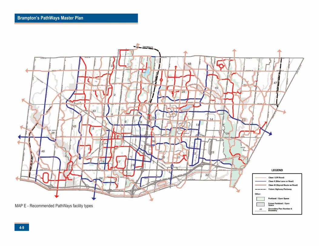
The Community Network is intended to be composed primarily of multi-
use paths (Class I facilities) as illustrated on Map E. However, given
physical constraints and funding realities, it is recognized that this is a
long-term goal. Therefore, the Community Network will also consist of
bike lanes (Class 2 facilities), where appropriate.
The Community Network is expected to accommodate:
• high recreational user volumes; and• PathWays traffic that is utilitarian oriented to locations such as
community facilities and major employers.
The Neighbourhood Network identified on Map D is intended to provide
neighbourhood connections to the Community Network. This network
provides short loops for recreational activities as well as healthy
community benefits.
The Neighbourhood Network is intended to be composed of all facility
classes as illustrated on Map E.
Brampton’s PathWays Master Plan
4-9
MAP E - Recommended PathWays facility types
4-10
The Neighbourhood Network is expected to accommodate:
• both recreational and utilitarian pathway users;• Pathway traffic that is neighbourhood oriented, recognizing that this
network will also connect to the Community Network.
The staging areas identified on Map D are intended to identify significant
activity nodes. These areas are envisioned as providing residents and
visitors opportunities to access pathway facilities from areas where
parking or public transit is available for trail users. They will also contain
amenities, such as water fountains, washrooms and benches, to better
serve residents.
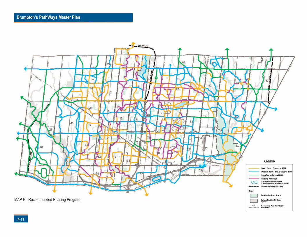
IMPROVE AND EXPAND PATHWAYS IN A
LOGICAL MANNER
Residents were clear on the issue of phasing the expansion of the
Pathway system. During focus groups and public forums, residents
stated they wanted the current system improved and the necessary
repairs made prior to expansion, unless the expansion meant that the
existing system would become more accessible and/or seamless.
With this in mind, Map F identifies the recommended phasing for the
PathWays network. The recommended phasing reflects community input
as well as the following considerations:
• scheduled improvements funded by SuperBuild;• the location and timing of planned road and public works projects;• scheduled and planned road and bridge environmental assessments;
and• the development of a mid-term spine that will serve to build the
PathWays system.
Brampton’s PathWays Master Plan
4-11
MAP F - Recommended Phasing Program
4-12
The full build-out of the PathWays system is expected to take 20 years.
Accordingly, the phasing program is divided into three phases: short term
(2002-2003), medium term (2004-2008), and long term (2009+).
The recommended phasing should not be viewed rigidly. Opportunities to
expand the pathway system as a part of new public or private
development or redevelopment projects, such as subdivisions and road
reconstruction, should be seized. Accordingly, it is recommended that
staff actively seek these opportunities wherever feasible.
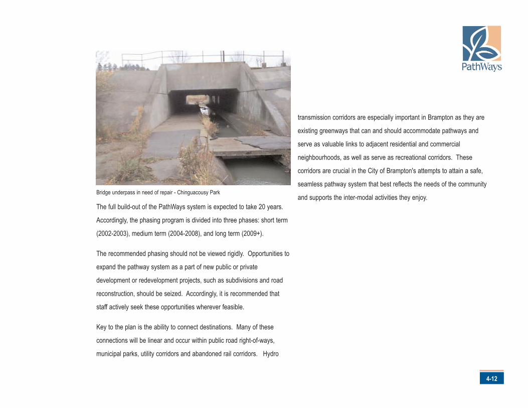
Key to the plan is the ability to connect destinations. Many of these
connections will be linear and occur within public road right-of-ways,
municipal parks, utility corridors and abandoned rail corridors. Hydro
transmission corridors are especially important in Brampton as they are
existing greenways that can and should accommodate pathways and
serve as valuable links to adjacent residential and commercial
neighbourhoods, as well as serve as recreational corridors. These
corridors are crucial in the City of Brampton's attempts to attain a safe,
seamless pathway system that best reflects the needs of the community
and supports the inter-modal activities they enjoy.Bridge underpass in need of repair - Chinguacousy Park
Brampton’s PathWays Master Plan
4-13
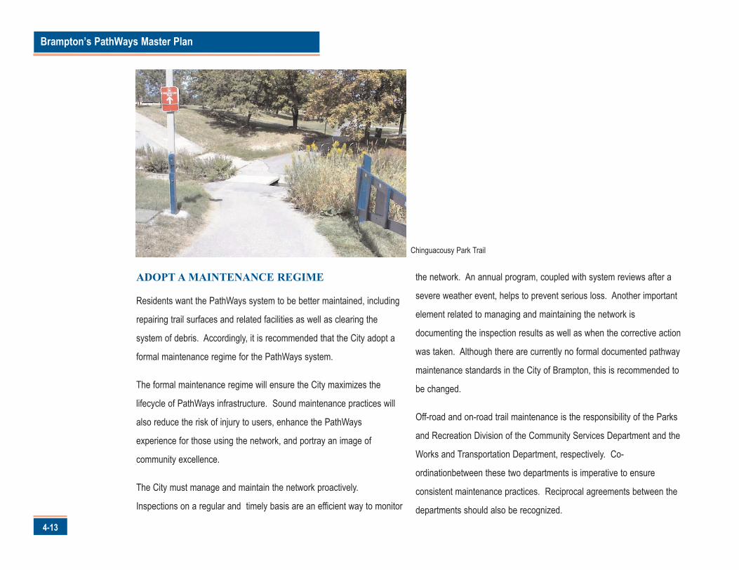
ADOPT A MAINTENANCE REGIME
Residents want the PathWays system to be better maintained, including
repairing trail surfaces and related facilities as well as clearing the
system of debris. Accordingly, it is recommended that the City adopt a
formal maintenance regime for the PathWays system.
The formal maintenance regime will ensure the City maximizes the
lifecycle of PathWays infrastructure. Sound maintenance practices will
also reduce the risk of injury to users, enhance the PathWays
experience for those using the network, and portray an image of
community excellence.
The City must manage and maintain the network proactively.
Inspections on a regular and timely basis are an efficient way to monitor
the network. An annual program, coupled with system reviews after a
severe weather event, helps to prevent serious loss. Another important
element related to managing and maintaining the network is
documenting the inspection results as well as when the corrective action
was taken. Although there are currently no formal documented pathway
maintenance standards in the City of Brampton, this is recommended to
be changed.
Off-road and on-road trail maintenance is the responsibility of the Parks
and Recreation Division of the Community Services Department and the
Works and Transportation Department, respectively. Co-
ordinationbetween these two departments is imperative to ensure
consistent maintenance practices. Reciprocal agreements between the
departments should also be recognized.
Chinguacousy Park Trail
4-14
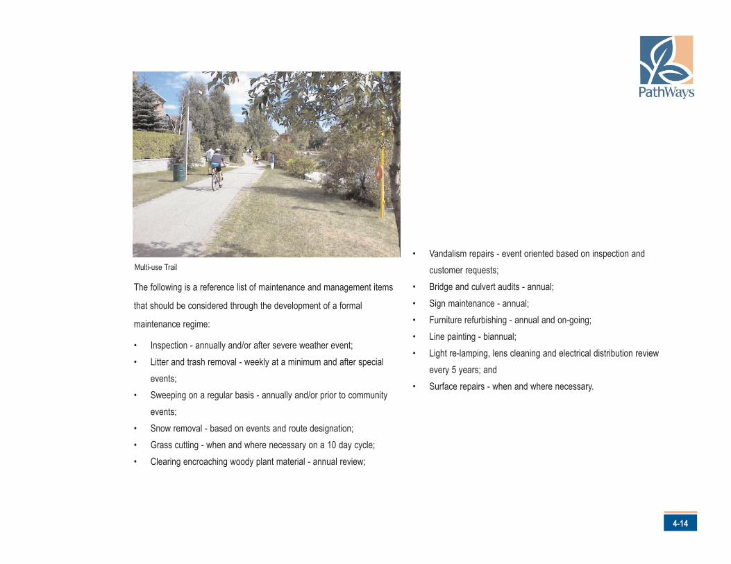
The following is a reference list of maintenance and management items
that should be considered through the development of a formal
maintenance regime:
• Inspection - annually and/or after severe weather event;• Litter and trash removal - weekly at a minimum and after special
events;• Sweeping on a regular basis - annually and/or prior to community
events; • Snow removal - based on events and route designation;• Grass cutting - when and where necessary on a 10 day cycle;• Clearing encroaching woody plant material - annual review;
• Vandalism repairs - event oriented based on inspection andcustomer requests;
• Bridge and culvert audits - annual;• Sign maintenance - annual;• Furniture refurbishing - annual and on-going;• Line painting - biannual;• Light re-lamping, lens cleaning and electrical distribution review
every 5 years; and• Surface repairs - when and where necessary.
Multi-use Trail
Brampton’s PathWays Master Plan
5-1
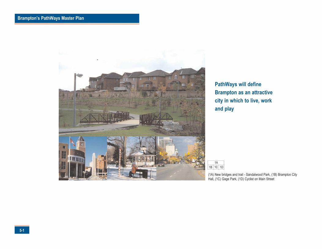
PathWays will defineBrampton as an attractivecity in which to live, workand play
1A1B 1C
(1A) New bridges and trail - Sandalwood Park, (1B) Brampton CityHall, (1C) Gage Park, (1D) Cyclist on Main Street
1D
or the pathways to truly set Brampton apart from other
communities, they must celebrate the City's history and define
its character. The second campaign of this Plan is for beautiful
pathways.
Goal
The Campaign for Beautiful PathWays is directed at achieving attractive
and memorable pathways unique to Brampton. Pathways that will:
• evoke Brampton's "floral" heritage in a thematic, symbolic andmeaningful manner;
• feature appealing views and vistas, creating excitement and drawingresidents onto and along the pathways;
• offer a wide range of experiences both in natural and urban contexts; • seamlessly blend with neighbourhoods and natural areas; and• possess unifying elements that clearly identify the system as part of
Brampton.
Objectives
The success of the Campaign for Beautiful PathWays will be measured
through three objectives. These are:
1. Pathways will be designed to maximize the safety of all users.2. Pathways will respect and enhance the character of the built forms
within and connecting neighbourhoods.3. Pathways will provide community meeting places to facilitate social,
cultural and leisure interaction.
Actions
There are four actions that will achieve Beautiful PathWays. These are:
1. Establish PathWays themes that reflect Brampton.2. Adopt consistent design standards and guidelines.3. Enhance strategic points of interests and focal areas along the
PathWays. 4. Provide appropriate signage.
Each action is described in detail in the following section.
5-2
5.0 Campaign for Beautiful Pathways
F
Brampton’s PathWays Master Plan
5-3
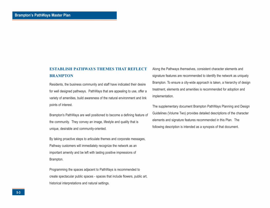
ESTABLISH PATHWAYS THEMES THAT REFLECT
BRAMPTON
Residents, the business community and staff have indicated their desire
for well designed pathways. PathWays that are appealing to use, offer a
variety of amenities, build awareness of the natural environment and link
points of interest.
Brampton's PathWays are well positioned to become a defining feature of
the community. They convey an image, lifestyle and quality that is
unique, desirable and community-oriented.
By taking proactive steps to articulate themes and corporate messages,
Pathway customers will immediately recognize the network as an
important amenity and be left with lasting positive impressions of
Brampton.
Programming the spaces adjacent to PathWays is recommended to
create spectacular public spaces - spaces that include flowers, public art,
historical interpretations and natural settings.
Along the Pathways themselves, consistent character elements and
signature features are recommended to identify the network as uniquely
Brampton. To ensure a city-wide approach is taken, a hierarchy of design
treatment, elements and amenities is recommended for adoption and
implementation.
The supplementary document Brampton PathWays Planning and Design
Guidelines (Volume Two) provides detailed descriptions of the character
elements and signature features recommended in this Plan. The
following description is intended as a synopsis of that document.
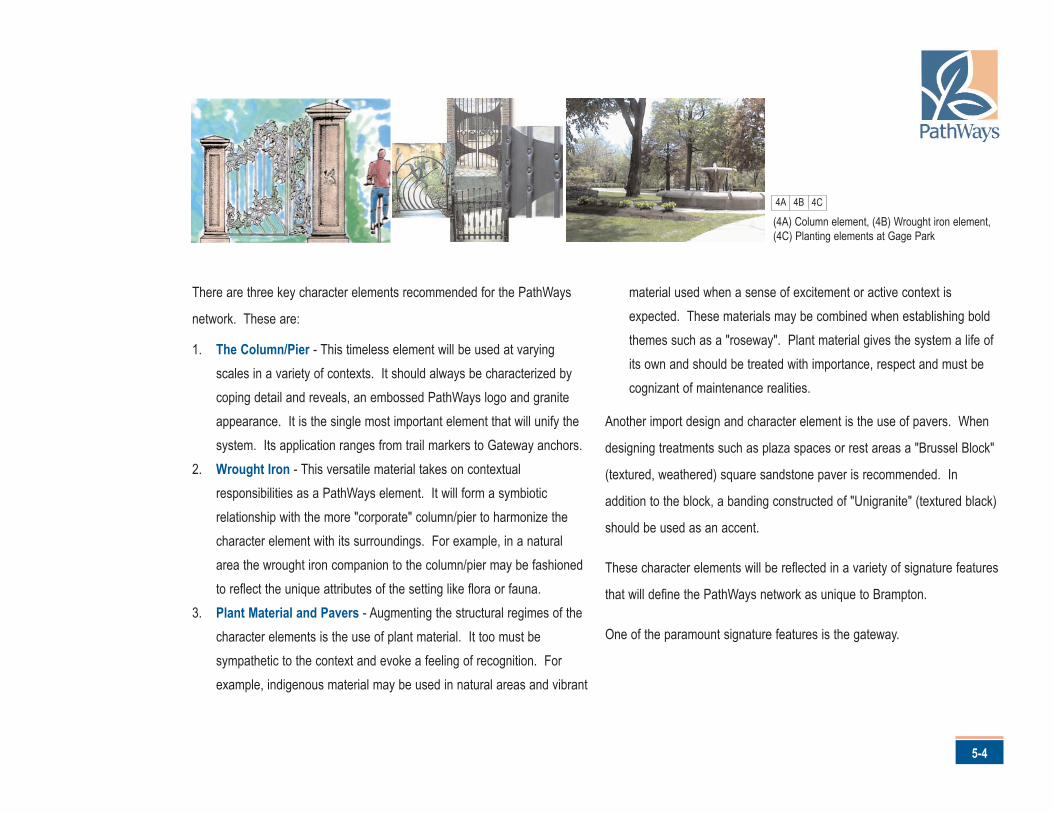
There are three key character elements recommended for the PathWays
network. These are:
1. The Column/Pier - This timeless element will be used at varyingscales in a variety of contexts. It should always be characterized bycoping detail and reveals, an embossed PathWays logo and graniteappearance. It is the single most important element that will unify thesystem. Its application ranges from trail markers to Gateway anchors.
2. Wrought Iron - This versatile material takes on contextualresponsibilities as a PathWays element. It will form a symbioticrelationship with the more "corporate" column/pier to harmonize thecharacter element with its surroundings. For example, in a naturalarea the wrought iron companion to the column/pier may be fashionedto reflect the unique attributes of the setting like flora or fauna.
3. Plant Material and Pavers - Augmenting the structural regimes of thecharacter elements is the use of plant material. It too must besympathetic to the context and evoke a feeling of recognition. Forexample, indigenous material may be used in natural areas and vibrant
material used when a sense of excitement or active context isexpected. These materials may be combined when establishing boldthemes such as a "roseway". Plant material gives the system a life ofits own and should be treated with importance, respect and must becognizant of maintenance realities.
Another import design and character element is the use of pavers. When
designing treatments such as plaza spaces or rest areas a "Brussel Block"
(textured, weathered) square sandstone paver is recommended. In
addition to the block, a banding constructed of "Unigranite" (textured black)
should be used as an accent.
These character elements will be reflected in a variety of signature features
that will define the PathWays network as unique to Brampton.
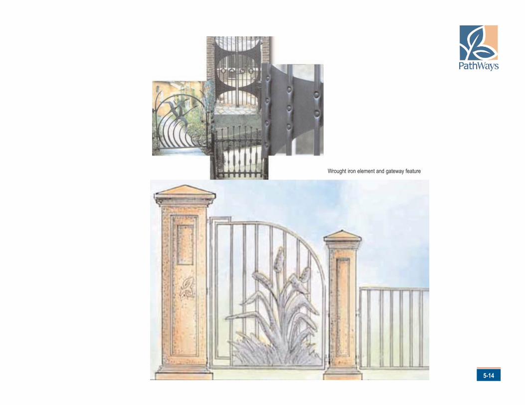
One of the paramount signature features is the gateway.
5-4
(4A) Column element, (4B) Wrought iron element,(4C) Planting elements at Gage Park
4A 4B 4C
Brampton’s PathWays Master Plan
5-5
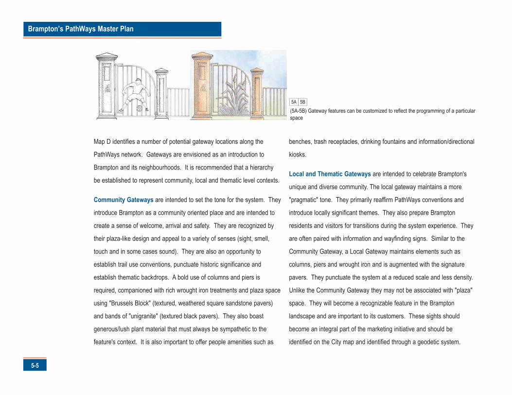
Map D identifies a number of potential gateway locations along the
PathWays network. Gateways are envisioned as an introduction to
Brampton and its neighbourhoods. It is recommended that a hierarchy
be established to represent community, local and thematic level contexts.
Community Gateways are intended to set the tone for the system. They
introduce Brampton as a community oriented place and are intended to
create a sense of welcome, arrival and safety. They are recognized by
their plaza-like design and appeal to a variety of senses (sight, smell,
touch and in some cases sound). They are also an opportunity to
establish trail use conventions, punctuate historic significance and
establish thematic backdrops. A bold use of columns and piers is
required, companioned with rich wrought iron treatments and plaza space
using "Brussels Block" (textured, weathered square sandstone pavers)
and bands of "unigranite" (textured black pavers). They also boast
generous/lush plant material that must always be sympathetic to the
feature's context. It is also important to offer people amenities such as
benches, trash receptacles, drinking fountains and information/directional
kiosks.
Local and Thematic Gateways are intended to celebrate Brampton's
unique and diverse community. The local gateway maintains a more
"pragmatic" tone. They primarily reaffirm PathWays conventions and
introduce locally significant themes. They also prepare Brampton
residents and visitors for transitions during the system experience. They
are often paired with information and wayfinding signs. Similar to the
Community Gateway, a Local Gateway maintains elements such as
columns, piers and wrought iron and is augmented with the signature
pavers. They punctuate the system at a reduced scale and less density.
Unlike the Community Gateway they may not be associated with "plaza"
space. They will become a recognizable feature in the Brampton
landscape and are important to its customers. These sights should
become an integral part of the marketing initiative and should be
identified on the City map and identified through a geodetic system.
5A
(5A-5B) Gateway features can be customized to reflect the programming of a particularspace
5B
5-6
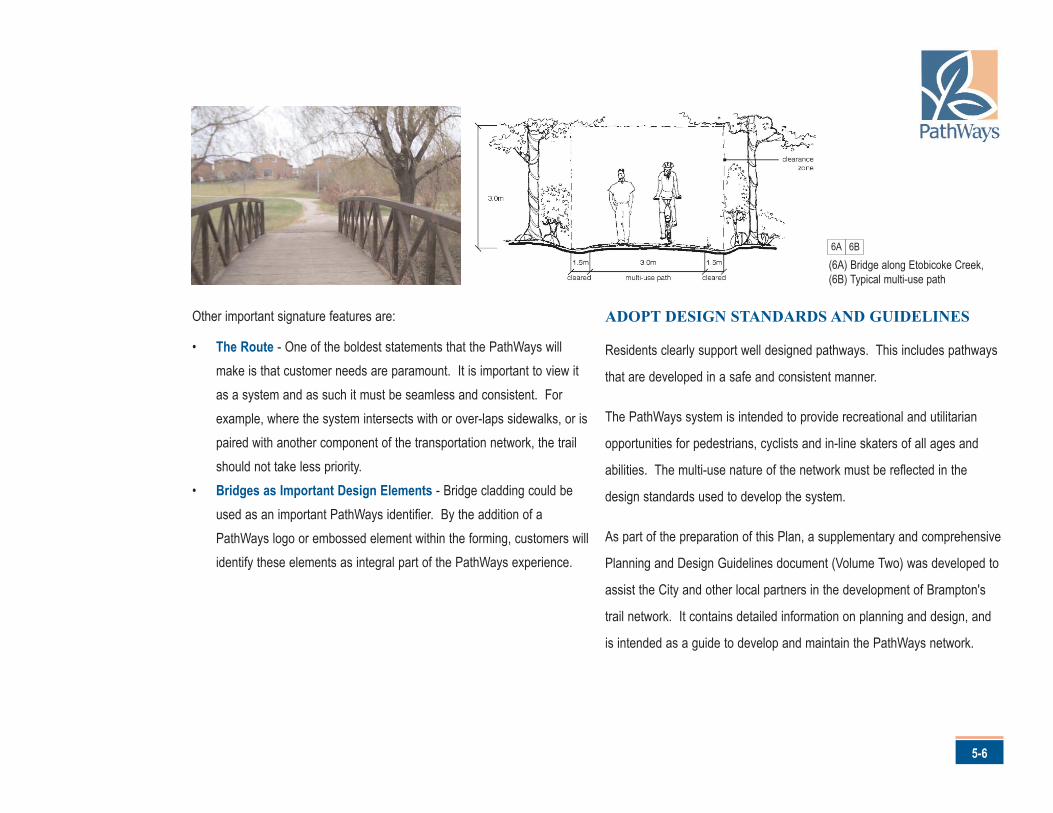
Other important signature features are:
• The Route - One of the boldest statements that the PathWays willmake is that customer needs are paramount. It is important to view itas a system and as such it must be seamless and consistent. Forexample, where the system intersects with or over-laps sidewalks, or ispaired with another component of the transportation network, the trailshould not take less priority.
• Bridges as Important Design Elements - Bridge cladding could beused as an important PathWays identifier. By the addition of aPathWays logo or embossed element within the forming, customers willidentify these elements as integral part of the PathWays experience.
ADOPT DESIGN STANDARDS AND GUIDELINES
Residents clearly support well designed pathways. This includes pathways
that are developed in a safe and consistent manner.
The PathWays system is intended to provide recreational and utilitarian
opportunities for pedestrians, cyclists and in-line skaters of all ages and
abilities. The multi-use nature of the network must be reflected in the
design standards used to develop the system.
As part of the preparation of this Plan, a supplementary and comprehensive
Planning and Design Guidelines document (Volume Two) was developed to
assist the City and other local partners in the development of Brampton's
trail network. It contains detailed information on planning and design, and
is intended as a guide to develop and maintain the PathWays network.
6A
(6A) Bridge along Etobicoke Creek,(6B) Typical multi-use path
6B
Brampton’s PathWays Master Plan
5-7
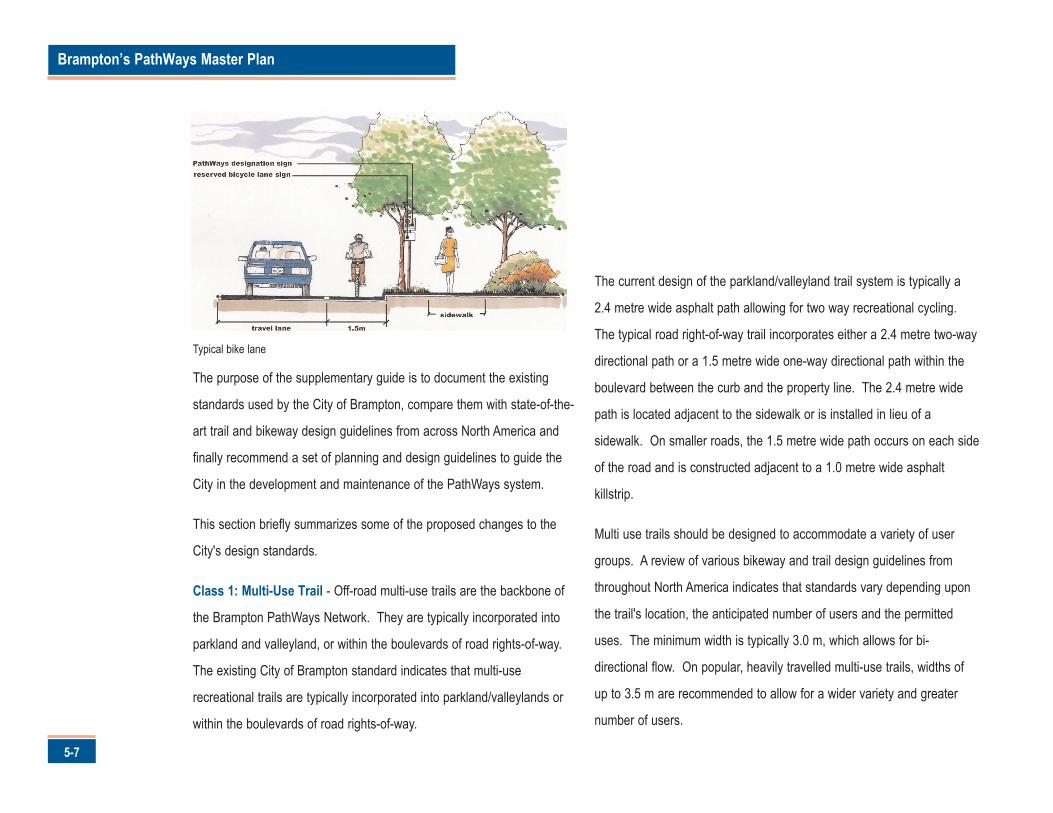
The purpose of the supplementary guide is to document the existing
standards used by the City of Brampton, compare them with state-of-the-
art trail and bikeway design guidelines from across North America and
finally recommend a set of planning and design guidelines to guide the
City in the development and maintenance of the PathWays system.
This section briefly summarizes some of the proposed changes to the
City's design standards.
Class 1: Multi-Use Trail - Off-road multi-use trails are the backbone of
the Brampton PathWays Network. They are typically incorporated into
parkland and valleyland, or within the boulevards of road rights-of-way.
The existing City of Brampton standard indicates that multi-use
recreational trails are typically incorporated into parkland/valleylands or
within the boulevards of road rights-of-way.
The current design of the parkland/valleyland trail system is typically a
2.4 metre wide asphalt path allowing for two way recreational cycling.
The typical road right-of-way trail incorporates either a 2.4 metre two-way
directional path or a 1.5 metre wide one-way directional path within the
boulevard between the curb and the property line. The 2.4 metre wide
path is located adjacent to the sidewalk or is installed in lieu of a
sidewalk. On smaller roads, the 1.5 metre wide path occurs on each side
of the road and is constructed adjacent to a 1.0 metre wide asphalt
killstrip.
Multi use trails should be designed to accommodate a variety of user
groups. A review of various bikeway and trail design guidelines from
throughout North America indicates that standards vary depending upon
the trail's location, the anticipated number of users and the permitted
uses. The minimum width is typically 3.0 m, which allows for bi-
directional flow. On popular, heavily travelled multi-use trails, widths of
up to 3.5 m are recommended to allow for a wider variety and greater
number of users.
Typical bike lane
5-8
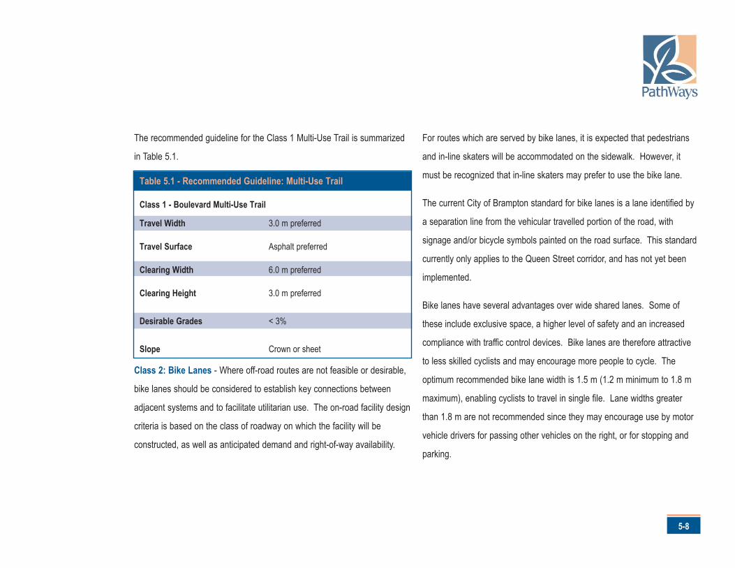
The recommended guideline for the Class 1 Multi-Use Trail is summarized
in Table 5.1.
Class 2: Bike Lanes - Where off-road routes are not feasible or desirable,
bike lanes should be considered to establish key connections between
adjacent systems and to facilitate utilitarian use. The on-road facility design
criteria is based on the class of roadway on which the facility will be
constructed, as well as anticipated demand and right-of-way availability.
For routes which are served by bike lanes, it is expected that pedestrians
and in-line skaters will be accommodated on the sidewalk. However, it
must be recognized that in-line skaters may prefer to use the bike lane.
The current City of Brampton standard for bike lanes is a lane identified by
a separation line from the vehicular travelled portion of the road, with
signage and/or bicycle symbols painted on the road surface. This standard
currently only applies to the Queen Street corridor, and has not yet been
implemented.
Bike lanes have several advantages over wide shared lanes. Some of
these include exclusive space, a higher level of safety and an increased
compliance with traffic control devices. Bike lanes are therefore attractive
to less skilled cyclists and may encourage more people to cycle. The
optimum recommended bike lane width is 1.5 m (1.2 m minimum to 1.8 m
maximum), enabling cyclists to travel in single file. Lane widths greater
than 1.8 m are not recommended since they may encourage use by motor
vehicle drivers for passing other vehicles on the right, or for stopping and
parking.
Table 5.1 - Recommended Guideline: Multi-Use Trail
Class 1 - Boulevard Multi-Use Trail
Travel Width 3.0 m preferred
Travel Surface Asphalt preferred
Clearing Width 6.0 m preferred
Clearing Height 3.0 m preferred
Desirable Grades < 3%
Slope Crown or sheet
Brampton’s PathWays Master Plan
5-9
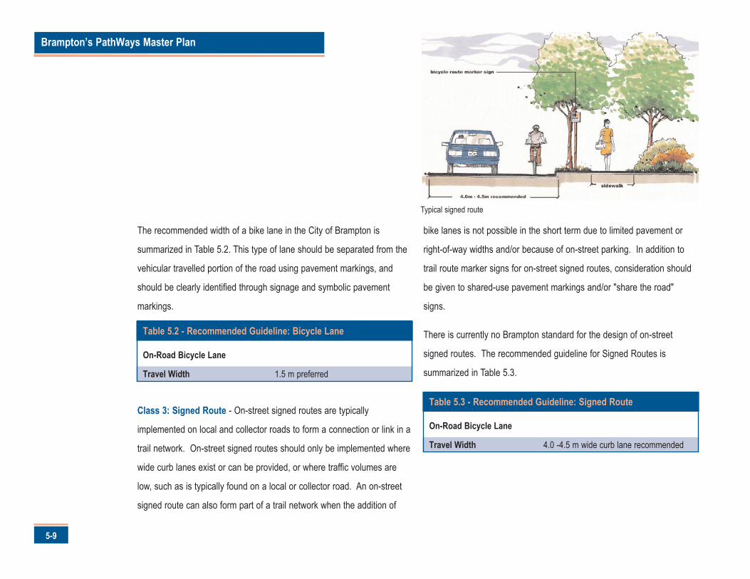
The recommended width of a bike lane in the City of Brampton is
summarized in Table 5.2. This type of lane should be separated from the
vehicular travelled portion of the road using pavement markings, and
should be clearly identified through signage and symbolic pavement
markings.
Class 3: Signed Route - On-street signed routes are typically
implemented on local and collector roads to form a connection or link in a
trail network. On-street signed routes should only be implemented where
wide curb lanes exist or can be provided, or where traffic volumes are
low, such as is typically found on a local or collector road. An on-street
signed route can also form part of a trail network when the addition of
bike lanes is not possible in the short term due to limited pavement or
right-of-way widths and/or because of on-street parking. In addition to
trail route marker signs for on-street signed routes, consideration should
be given to shared-use pavement markings and/or "share the road"
signs.
There is currently no Brampton standard for the design of on-street
signed routes. The recommended guideline for Signed Routes is
summarized in Table 5.3.
Table 5.2 - Recommended Guideline: Bicycle Lane
On-Road Bicycle Lane
Travel Width 1.5 m preferred
Table 5.3 - Recommended Guideline: Signed Route
On-Road Bicycle Lane
Travel Width 4.0 -4.5 m wide curb lane recommended
Typical signed route
5-10
Table 5.4 provides a summary of recommended design standards
described in this section.
Lighting - the City of Brampton presently illuminates all existing multi-use
trails. Lighting, however, can have a significant effect on the environmental
values of many of the valley trails. Further, residents indicated that lighting
was not a major deciding factor when they determined whether or not to
use a trail at night. In fact, concerns were expressed that illumination
creates a false sense of security. Therefore, it is recommended that the
installation of trail lighting by the City be discontinued, except along trails
that have a high volume of evening use and at gateways.
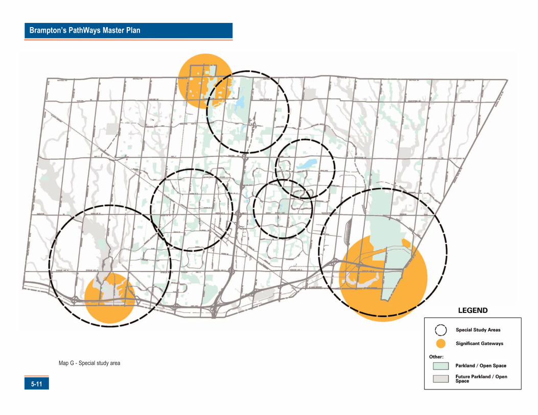
ENHANCE STRATEGIC POINTS OF INTERESTS
AND FOCAL AREAS ALONG THE NETWORK
Residents stated they wanted the pathways to access points of interest.
Creating destination is also important to encouraging network use and to
build City attractions that could potentially increase tourism and provide
economic stimulus.
Fortunately, Brampton has been blessed with many unique natural features
and a rich cultural history.
A number of strategic points of interested were identified through the
development of this Plan and are shown on Map G. The areas
recommended for specific design exercises to create strategic points of
interest and focal areas along the PathWays are:
Gateways
• Clairville• Churchville• Heart Lake• Halton Hills• Vaughan• Chincousauy Park
Table 5.4 - Summary of Design Standards
Trail Type Travel WidthExisting Brampton Proposed Brampton
Standard Standard
Class 1 - Multi-Use Path 2.4 m 3.0 m
Class 2 - Bike Lane
No On-Street Parking 1.5 m 1.5 m
On-Street Parking N/A 1.8 m + 2.2 m parking aisle
Class 3 - Signed Route N/A 4.0 m - 4.5 mwide curb lane
Brampton’s PathWays Master Plan
5-11
Map G - Special study area
Thematic and Local• Downtown• Districts/Floral City/
Points of Interest
• Loafers Lake• Professors Lake• Recreation Centres• Business Park• Various Historically Significant sites• Institutional sites (i.e. Hospital)
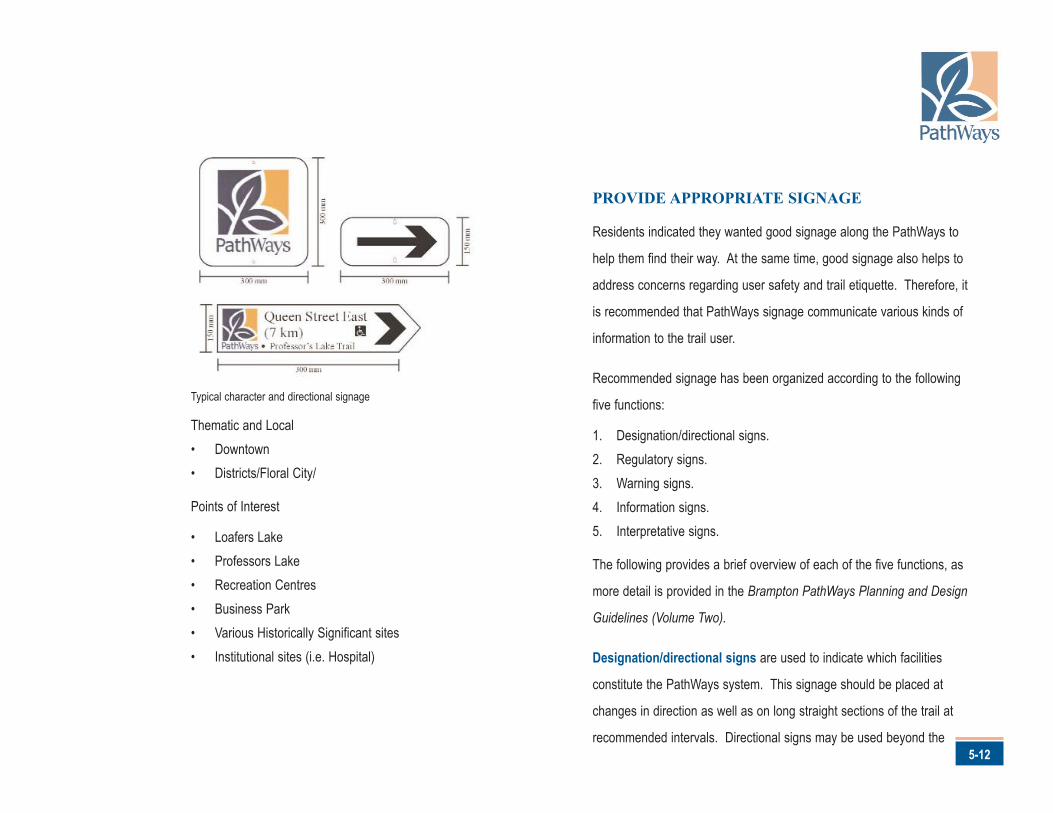
PROVIDE APPROPRIATE SIGNAGE
Residents indicated they wanted good signage along the PathWays to
help them find their way. At the same time, good signage also helps to
address concerns regarding user safety and trail etiquette. Therefore, it
is recommended that PathWays signage communicate various kinds of
information to the trail user.
Recommended signage has been organized according to the following
five functions:
1. Designation/directional signs.2. Regulatory signs.3. Warning signs.4. Information signs.5. Interpretative signs.
The following provides a brief overview of each of the five functions, as
more detail is provided in the Brampton PathWays Planning and Design
Guidelines (Volume Two).
Designation/directional signs are used to indicate which facilities
constitute the PathWays system. This signage should be placed at
changes in direction as well as on long straight sections of the trail at
recommended intervals. Directional signs may be used beyond the5-12
Typical character and directional signage
Brampton’s PathWays Master Plan
5-13
system itself, in adjacent park space for example, to guide the way to the
trail access points. The PathWays logo is prevalent in this signage.
Regulatory signs are intended to control particular aspects of travel and
use along the trail. Signage restricting or requiring specific behaviour is not
legally enforceable unless it is associated with a provincial law or municipal
by-law. Where applicable, it is recommended that authorities discreetly
include the municipal by-law number on signs to reinforce their regulatory
function.
Warning signs are used to highlight trail conditions that may pose a
potential safety or convenience concern to trail users. Examples are steep
slopes, railway crossings and pavement changes. These signs are
diamond in shape, with a black legend on a yellow background.
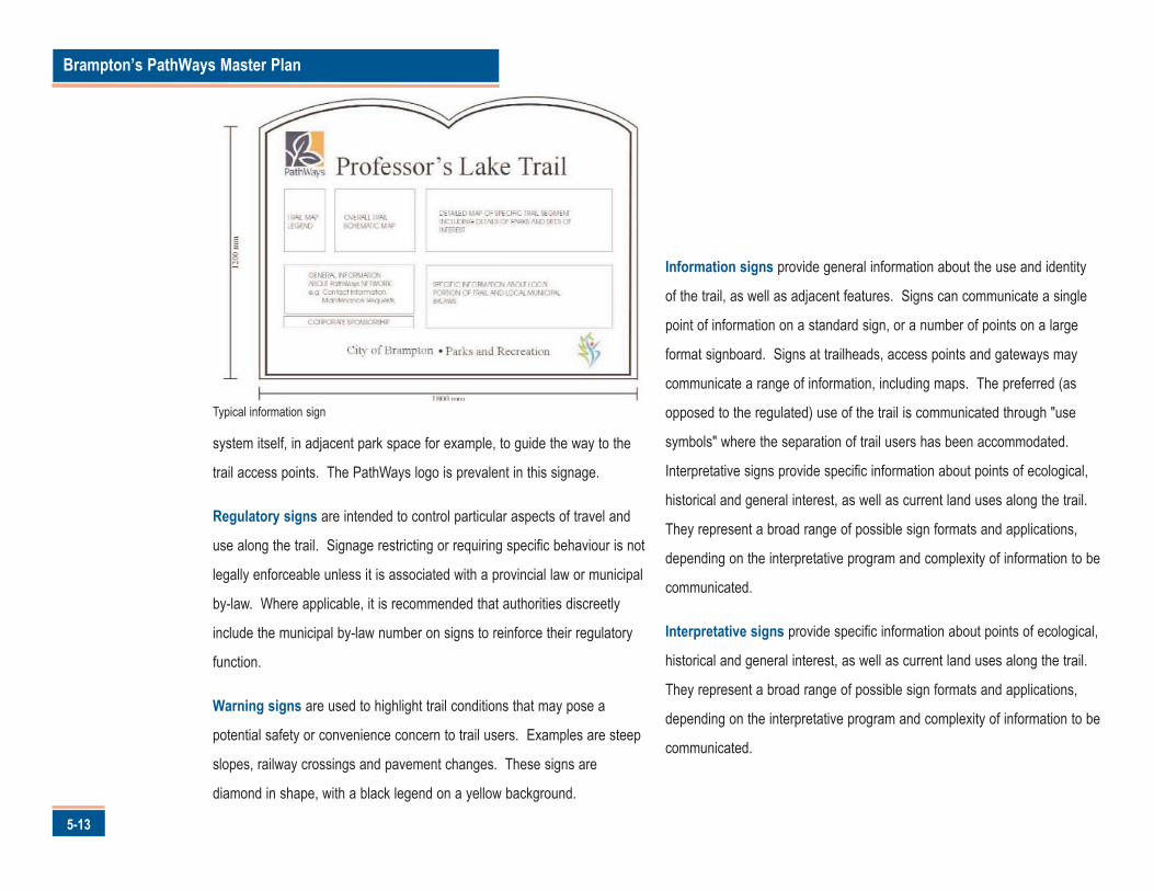
Information signs provide general information about the use and identity
of the trail, as well as adjacent features. Signs can communicate a single
point of information on a standard sign, or a number of points on a large
format signboard. Signs at trailheads, access points and gateways may
communicate a range of information, including maps. The preferred (as
opposed to the regulated) use of the trail is communicated through "use
symbols" where the separation of trail users has been accommodated.
Interpretative signs provide specific information about points of ecological,
historical and general interest, as well as current land uses along the trail.
They represent a broad range of possible sign formats and applications,
depending on the interpretative program and complexity of information to be
communicated.
Typical information sign
5-14
Wrought iron element and gateway feature
Brampton’s PathWays Master Plan
6-1
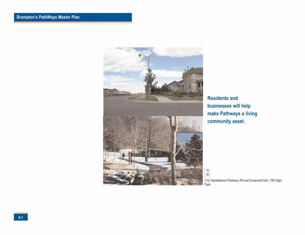
(1A) Sandalwood Parkway off-road boulevard trail, (1B) ElginPark
Residents andbusinesses will helpmake Pathways a livingcommunity asset.
1A1B
or the PathWays network to become a "living" asset, it must
engender a sense of pride and ownership within Brampton.
This requires effort, time and a passion to succeed. The third
and most challenging campaign of this Plan is for Brampton to establish a
valued pathways network.
Goal
The Campaign for Valued PathWays is directed at achieving pathway
ownership and pride among the Brampton business community and
residents. A campaign that will:
• engage, customers, stakeholders, business and residents; • inspire action by those that are engaged;• create a sense of ownership and pride; and• proclaim champions.
Objectives
The success of the Campaign for Valued PathWays will be measured
through five objectives. These are:
1. Public awareness of pathways will be increased.
2. Residents and visitors will use the pathways more frequently.
3. Pathways will be promoted as an important amenity and integralcomponent of the City's leisure and transportation systems.
4. Pathway users will be educated on proper pathway etiquette.
5. A sense of pathway ownership will be developed.
Actions
There are three actions that will achieve Valued PathWays. These are:
1. Encourage pathway use.2. Educate pathway users about proper trail etiquette.3. Promote stewardship and foster partnerships.
Each of these actions is described in detail in the following sections.
6-2
6.0 Campaign for Valued PathWays
F
Brampton’s PathWays Master Plan
6-3
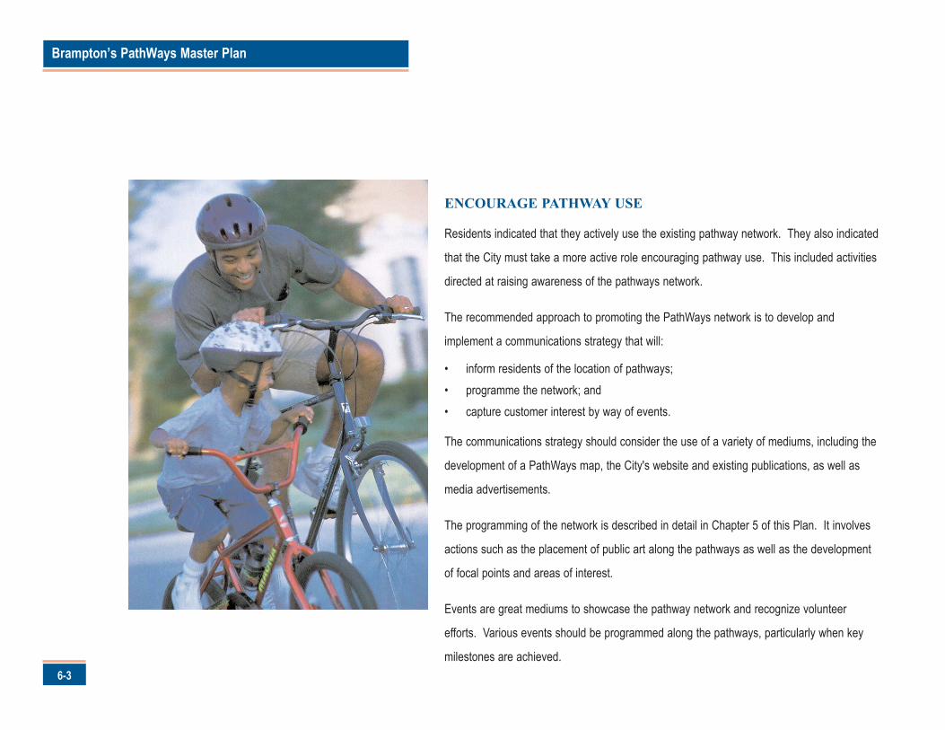
ENCOURAGE PATHWAY USE
Residents indicated that they actively use the existing pathway network. They also indicated
that the City must take a more active role encouraging pathway use. This included activities
directed at raising awareness of the pathways network.
The recommended approach to promoting the PathWays network is to develop and
implement a communications strategy that will:
• inform residents of the location of pathways;• programme the network; and• capture customer interest by way of events.
The communications strategy should consider the use of a variety of mediums, including the
development of a PathWays map, the City's website and existing publications, as well as
media advertisements.
The programming of the network is described in detail in Chapter 5 of this Plan. It involves
actions such as the placement of public art along the pathways as well as the development
of focal points and areas of interest.
Events are great mediums to showcase the pathway network and recognize volunteer
efforts. Various events should be programmed along the pathways, particularly when key
milestones are achieved.
6-4
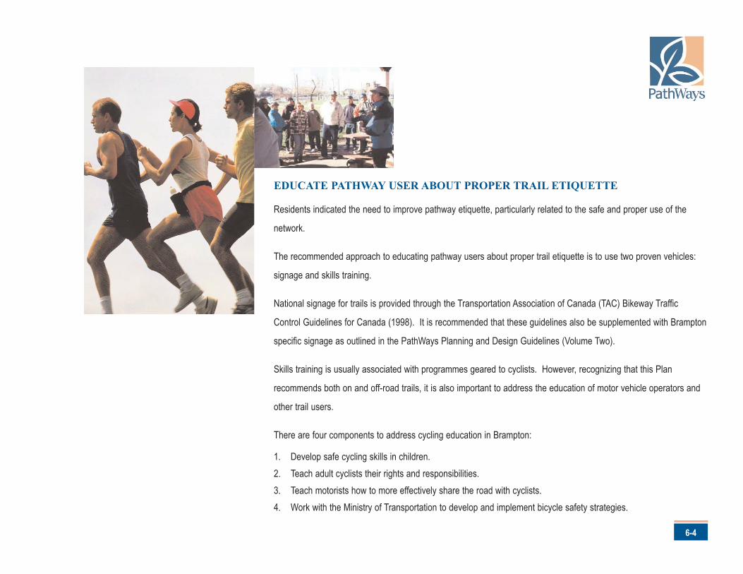
EDUCATE PATHWAY USER ABOUT PROPER TRAIL ETIQUETTE
Residents indicated the need to improve pathway etiquette, particularly related to the safe and proper use of the
network.
The recommended approach to educating pathway users about proper trail etiquette is to use two proven vehicles:
signage and skills training.
National signage for trails is provided through the Transportation Association of Canada (TAC) Bikeway Traffic
Control Guidelines for Canada (1998). It is recommended that these guidelines also be supplemented with Brampton
specific signage as outlined in the PathWays Planning and Design Guidelines (Volume Two).
Skills training is usually associated with programmes geared to cyclists. However, recognizing that this Plan
recommends both on and off-road trails, it is also important to address the education of motor vehicle operators and
other trail users.
There are four components to address cycling education in Brampton:
1. Develop safe cycling skills in children.2. Teach adult cyclists their rights and responsibilities.3. Teach motorists how to more effectively share the road with cyclists.4. Work with the Ministry of Transportation to develop and implement bicycle safety strategies.
Brampton’s PathWays Master Plan
6-5
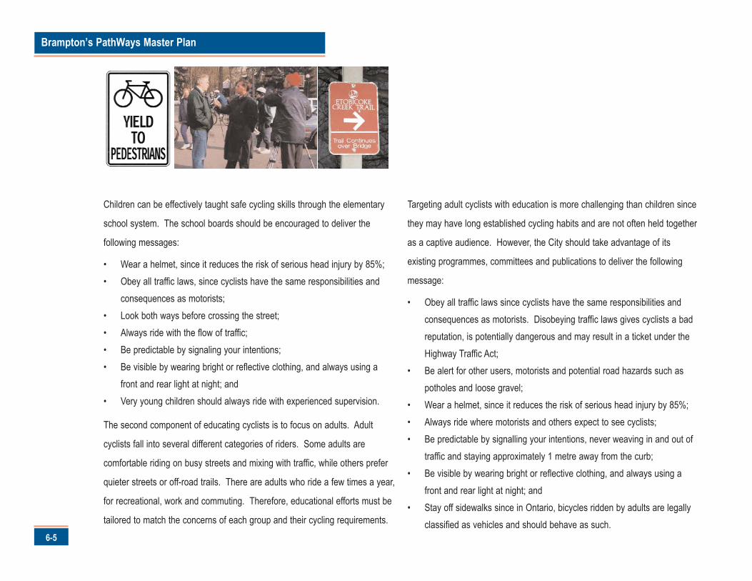
Children can be effectively taught safe cycling skills through the elementary
school system. The school boards should be encouraged to deliver the
following messages:
• Wear a helmet, since it reduces the risk of serious head injury by 85%;• Obey all traffic laws, since cyclists have the same responsibilities and
consequences as motorists;• Look both ways before crossing the street;• Always ride with the flow of traffic;• Be predictable by signaling your intentions;• Be visible by wearing bright or reflective clothing, and always using a
front and rear light at night; and• Very young children should always ride with experienced supervision.
The second component of educating cyclists is to focus on adults. Adult
cyclists fall into several different categories of riders. Some adults are
comfortable riding on busy streets and mixing with traffic, while others prefer
quieter streets or off-road trails. There are adults who ride a few times a year,
for recreational, work and commuting. Therefore, educational efforts must be
tailored to match the concerns of each group and their cycling requirements.
Targeting adult cyclists with education is more challenging than children since
they may have long established cycling habits and are not often held together
as a captive audience. However, the City should take advantage of its
existing programmes, committees and publications to deliver the following
message:
• Obey all traffic laws since cyclists have the same responsibilities andconsequences as motorists. Disobeying traffic laws gives cyclists a badreputation, is potentially dangerous and may result in a ticket under theHighway Traffic Act;
• Be alert for other users, motorists and potential road hazards such aspotholes and loose gravel;
• Wear a helmet, since it reduces the risk of serious head injury by 85%;• Always ride where motorists and others expect to see cyclists;• Be predictable by signalling your intentions, never weaving in and out of
traffic and staying approximately 1 metre away from the curb;• Be visible by wearing bright or reflective clothing, and always using a
front and rear light at night; and• Stay off sidewalks since in Ontario, bicycles ridden by adults are legally
classified as vehicles and should behave as such.
6-6
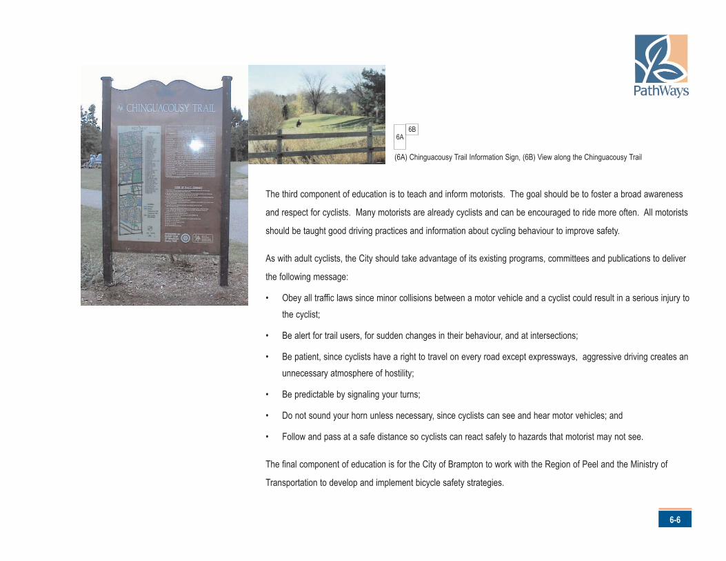
The third component of education is to teach and inform motorists. The goal should be to foster a broad awareness
and respect for cyclists. Many motorists are already cyclists and can be encouraged to ride more often. All motorists
should be taught good driving practices and information about cycling behaviour to improve safety.
As with adult cyclists, the City should take advantage of its existing programs, committees and publications to deliver
the following message:
• Obey all traffic laws since minor collisions between a motor vehicle and a cyclist could result in a serious injury tothe cyclist;
• Be alert for trail users, for sudden changes in their behaviour, and at intersections;
• Be patient, since cyclists have a right to travel on every road except expressways, aggressive driving creates anunnecessary atmosphere of hostility;
• Be predictable by signaling your turns;
• Do not sound your horn unless necessary, since cyclists can see and hear motor vehicles; and
• Follow and pass at a safe distance so cyclists can react safely to hazards that motorist may not see.
The final component of education is for the City of Brampton to work with the Region of Peel and the Ministry of
Transportation to develop and implement bicycle safety strategies.
6A6B
(6A) Chinguacousy Trail Information Sign, (6B) View along the Chinguacousy Trail
Brampton’s PathWays Master Plan
6-7
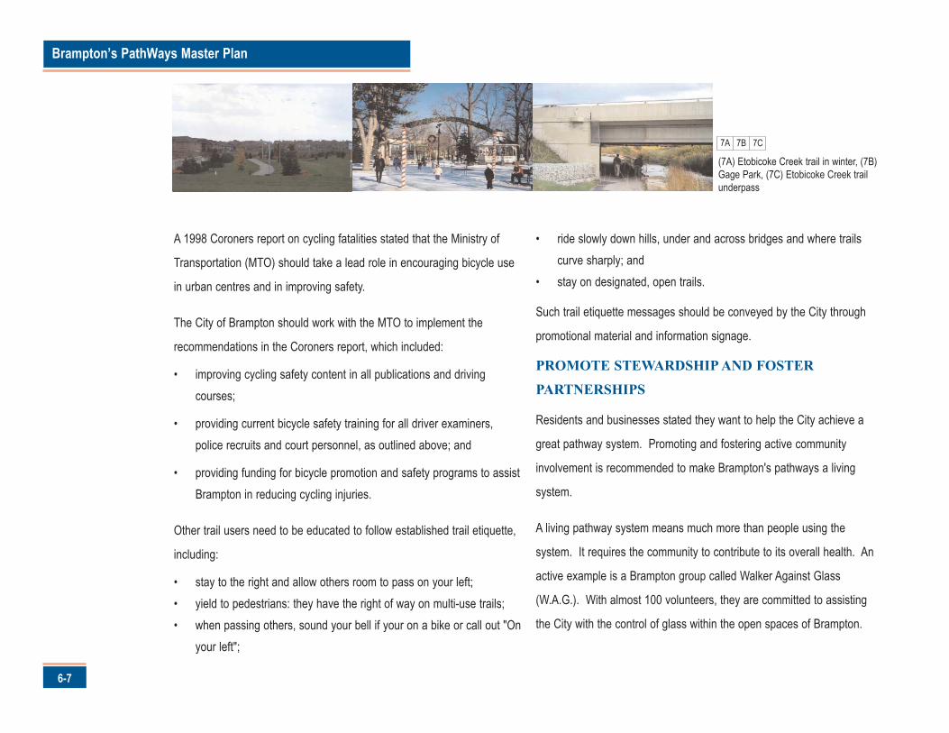
A 1998 Coroners report on cycling fatalities stated that the Ministry of
Transportation (MTO) should take a lead role in encouraging bicycle use
in urban centres and in improving safety.
The City of Brampton should work with the MTO to implement the
recommendations in the Coroners report, which included:
• improving cycling safety content in all publications and drivingcourses;
• providing current bicycle safety training for all driver examiners,police recruits and court personnel, as outlined above; and
• providing funding for bicycle promotion and safety programs to assistBrampton in reducing cycling injuries.
Other trail users need to be educated to follow established trail etiquette,
including:
• stay to the right and allow others room to pass on your left;• yield to pedestrians: they have the right of way on multi-use trails;• when passing others, sound your bell if your on a bike or call out "On
your left";
• ride slowly down hills, under and across bridges and where trailscurve sharply; and
• stay on designated, open trails.
Such trail etiquette messages should be conveyed by the City through
promotional material and information signage.
PROMOTE STEWARDSHIP AND FOSTER
PARTNERSHIPS
Residents and businesses stated they want to help the City achieve a
great pathway system. Promoting and fostering active community
involvement is recommended to make Brampton's pathways a living
system.
A living pathway system means much more than people using the
system. It requires the community to contribute to its overall health. An
active example is a Brampton group called Walker Against Glass
(W.A.G.). With almost 100 volunteers, they are committed to assisting
the City with the control of glass within the open spaces of Brampton.
(7A) Etobicoke Creek trail in winter, (7B)Gage Park, (7C) Etobicoke Creek trailunderpass
7A 7B 7C
6-8
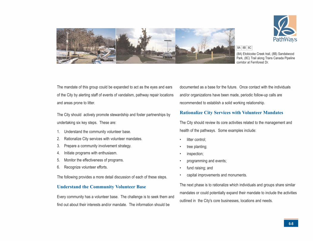
The mandate of this group could be expanded to act as the eyes and ears
of the City by alerting staff of events of vandalism, pathway repair locations
and areas prone to litter.
The City should actively promote stewardship and foster partnerships by
undertaking six key steps. These are:
1. Understand the community volunteer base.2. Rationalize City services with volunteer mandates.3. Prepare a community involvement strategy.4. Initiate programs with enthusiasm.5. Monitor the effectiveness of programs.6. Recognize volunteer efforts.
The following provides a more detail discussion of each of these steps.
Understand the Community Volunteer Base
Every community has a volunteer base. The challenge is to seek them and
find out about their interests and/or mandate. The information should be
documented as a base for the future. Once contact with the individuals
and/or organizations have been made, periodic follow-up calls are
recommended to establish a solid working relationship.
Rationalize City Services with Volunteer Mandates
The City should review its core activities related to the management and
health of the pathways. Some examples include:
• litter control;• tree planting;• inspection;• programming and events;• fund raising; and• capital improvements and monuments.
The next phase is to rationalize which individuals and groups share similar
mandates or could potentially expand their mandate to include the activities
outlined in the City's core businesses, locations and needs.
(8A) Etobicoke Creek trail, (8B) SandalwoodPark, (8C) Trail along Trans Canada Pipelinecorridor at Fernforest Dr.
8A 8B 8C
Brampton’s PathWays Master Plan
6-9
Prepare a Community Involvement Strategy
Before going to the volunteer base, a clear plan with concise objectives
and the level of commitment required must be developed. This strategy
should include the following components:
• marketing /communication plan;• volunteer protocol agreements, which identify items such as the
frequency of involvement, insurance obligations and the length of theagreement;
• a detailed understanding of the City's role in the partnership;• recognition strategy;• goals and objectives of each partnership; and• administrative format and/or staff contact for each program.
Initiate Programmes with Enthusiasm
The greatest challenge with any volunteer based programme is to inspire
volunteers to participate in a given program.
Working with volunteers takes a special individual and/or organization.
Many management-consulting firms agree that motivating people to
volunteer is one of the purist forms of leadership. It should be noted that
this venture truly takes time and diligence.
Monitor the Effectiveness of Programs
As the groups and organizations begin their role in the partnership
arrangement, staff must monitor their progress and follow-up to ensure
the City has met their obligations to the partnership. A call, a visit, or
some popsicles for the children involved are all signs of good-will and go
a long way in cultivating these important relationships.
Recognize Volunteer Efforts
As mentioned, programmes involving community members requires a
recognition programme to companion sponsorship and in-kind
programmes. This could simply be in the form of a participation
certificate, volunteer luncheon or sign noting the contribution. There is a
greater chance of success when the sponsorship and partnerships
programmes are companioned with a recognition programme. Very often
recognition is the catalyst required to engage volunteers.
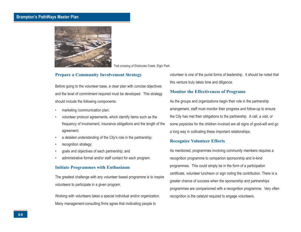
Trail crossing of Etobicoke Creek, Elgin Park
6-10
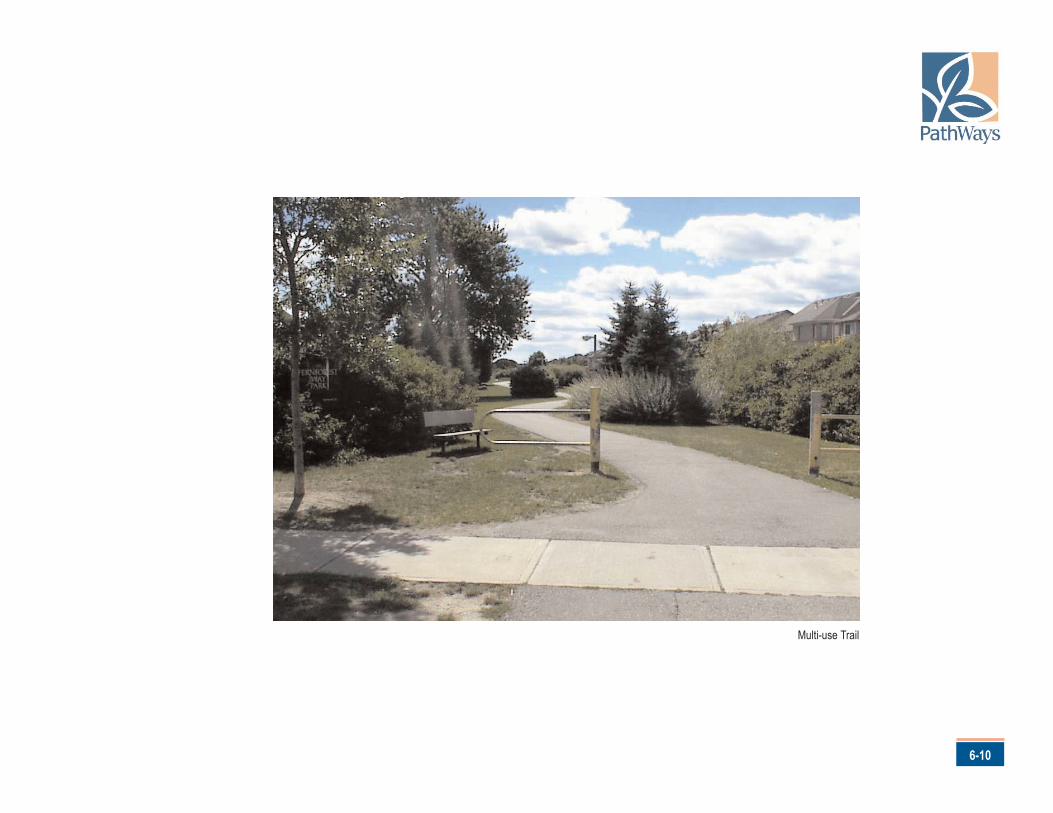
Multi-use Trail
Brampton’s PathWays Master Plan
7-1
1B1C
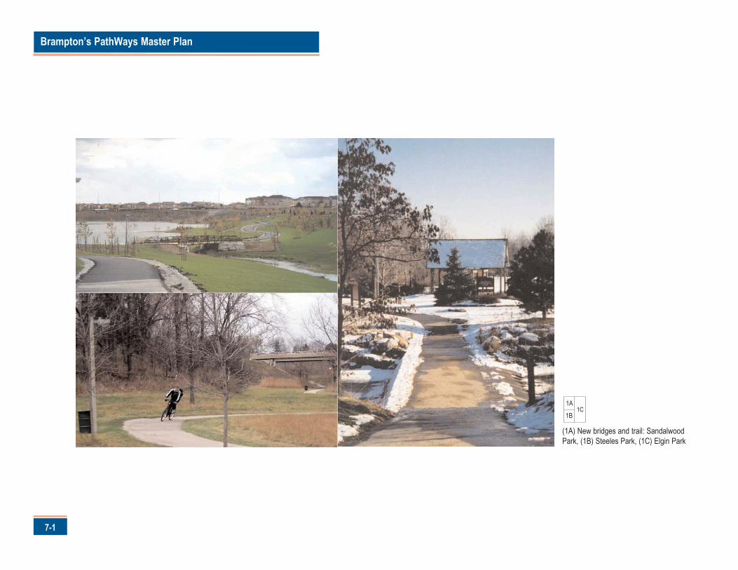
(1A) New bridges and trail: SandalwoodPark, (1B) Steeles Park, (1C) Elgin Park
1A
his Plan is not static.
The timing and details related to its implementation,
particularly the location of recommended routes and facility
types, can and should evolve through continued community consultation
and detailed technical studies when and where appropriate.
At the same time, however, the extensive City and community effort that
established the overall direction for this Plan should be respected.
Cultivating this success requires the following tools and mechanisms
necessary to implement this Plan.
Implementing Actions
There are six actions that will cultivate the success of this plan. These are:
1. Define, refine and deliver the PathWays.2. Incorporate key PathWay elements in the Official Plan3. Provide an administrative structure to achieve success.4. Fund PathWays projects on an annual basis.
5. Resource the necessary maintenance regime6. Market, promote and inspire stewardship
Each action is described in detail in the following sections.
Define, Refine and Deliver the PathWays Network
The recommended PathWays network illustrated on Map D will evolve
through the implementation process in response to physical challenges and
opportunities as well as funding realties.
The actual construction of the Pathways network will result from three
steps: define, refine and deliver. These steps are summarized in Table 1
and described in the following section.
7-2
7.0 Cultivating Success
T
Brampton’s PathWays Master Plan
7-3
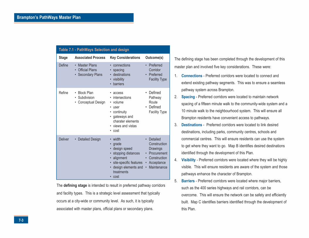
The defining stage is intended to result in preferred pathway corridors
and facility types. This is a strategic level assessment that typically
occurs at a city-wide or community level. As such, it is typically
associated with master plans, official plans or secondary plans.
The defining stage has been completed through the development of this
master plan and involved five key considerations. These were:
1. Connections - Preferred corridors were located to connect andextend existing pathway segments. This was to ensure a seamlesspathway system across Brampton.
2. Spacing - Preferred corridors were located to maintain networkspacing of a fifteen minute walk to the community-wide system and a10 minute walk to the neighbourhood system. This will ensure allBrampton residents have convenient access to pathways.
3. Destinations - Preferred corridors were located to link desireddestinations, including parks, community centres, schools andcommercial centres. This will ensure residents can use the systemto get where they want to go. Map B identifies desired destinationsidentified through the development of this Plan.
4. Visibility - Preferred corridors were located where they will be highlyvisible. This will ensure residents are aware of the system and thosepathways enhance the character of Brampton.
5. Barriers - Preferred corridors were located where major barriers,such as the 400 series highways and rail corridors, can beovercome. This will ensure the network can be safety and efficientlybuilt. Map C identifies barriers identified through the development ofthis Plan.
Table 7.1 - PathWays Selection and design
Stage Associated Process Key Considerations Outcome(s)
Define • Master Plans • connections • Preferred• Official Plans • spacing Corridor• Secondary Plans • destinations • Preferred
• visibility Facility Type• barriers
Refine • Block Plan • access • Defined• Subdivision • intersections Pathway • Conceptual Design • volume Route
• user • Defined• continuity Facility Type• gateways and
charater elements• views and vistas• cost
Deliver • Detailed Design • width • Detailed• grade Construction• design speed Drawings• stopping distances • Procurement• alignment • Construction• site-specific features • Acceptance• design elements and • Maintenance
treatments• cost
7-4
The refining stage confirms the pathway route and facility type. This
involved a focused assessment of a preferred corridor and is typically
associated with block plans, plans of subdivision or conceptual design.
Refining a preferred corridor to confirm the pathway route and facility type
involves six key considerations. These are:
1. Access - Defined pathway routes will provide direct and convenientaccess to destinations. This will ensure the pathway serves the needsof Brampton's residents.
2. Intersections - Defined pathway routes will intersect with otherpathways at key nodes and overcome barriers, such as arterial roadsand rail lines. This will ensure efficient and safe movement along thepathway system.
3. Volume - Defined pathway routes and facility types will be appropriatefor the volume of traffic expected on and/or adjacent to the facility.This will ensure the route and facility is integrated with Brampton'stransportation system.
4. User - Defined pathway routes and facility types will accommodateexpected users of the system, including pedestrians, cyclists and/or in-
line skaters. This will ensure the route and facility meets the needs ofBrampton residents.
5. Continuity - Defined pathway routes and facility types will providecontinuity between existing and planned pathways. This will ensuresafe and extended use of the system by various skill levels and modes.
6. Gateways and Character Elements - Defined pathway routes willhave prominent city and neighbourhood entry points as well as variouscharacter elements. This will ensure pathways are defining features ofBrampton.
7. Views and Vistas - Defined pathway routes will provide views andvistas of prominent landmarks, community and neighbourhood featuresand open spaces. This will ensure residents a diverse experiencealong the pathway system.
These considerations were used at a conceptual level to develop the
recommended pathway types shown on Map D. These types should be
confirmed on a site-by-site basis in keeping with the directions of this Plan
and the detailed provisions of the Brampton PathWays Planning and
Design Guidelines.
Brampton’s PathWays Master Plan
7-5
The delivery stage results in the design and development of a pathway
route to accommodate a specific facility type. This involves a detailed
assessment that is typically associated with the preparation of
construction drawings, as well as its construction, acceptance and
maintenance.
Delivering a pathway involves eight key considerations: width, grade,
design speed, stopping distances, alignment, site-specific features,
design treatments and elements, as well as construction and
maintenance costs. These considerations are discussed in detail in the
Brampton PathWays Planning and Design Guidelines as well as other
technical publications.
From a staff perspective, the define, refine and deliver process will result
in seven key steps. These steps are illustrated in Figure 1. These are:
1. Candidate Route - will be identified for development orredevelopment in a particular area of Brampton.
2. Route Analysis - the feasibility of the candidate route will bedetermined through an analysis of the site-specific characteristics ofthe route in keeping with the considerations outlined in the BramptonPathWays Planning and Design Guidelines. As well, public input intothe route analysis should be sought to make the public aware of theplanned pathway and seek their comments and suggestions onpathway design and development.
3. Concept Plans - will be developed to evaluate alternative means ofaccommodating a specific connection through an area in keepingwith the considerations outlined in the Brampton PathWays Planningand Design Guidelines. Again, public input should be sought onthese concept plans to ensure the pathway reflects the needs of thecustomers.
Caption to come
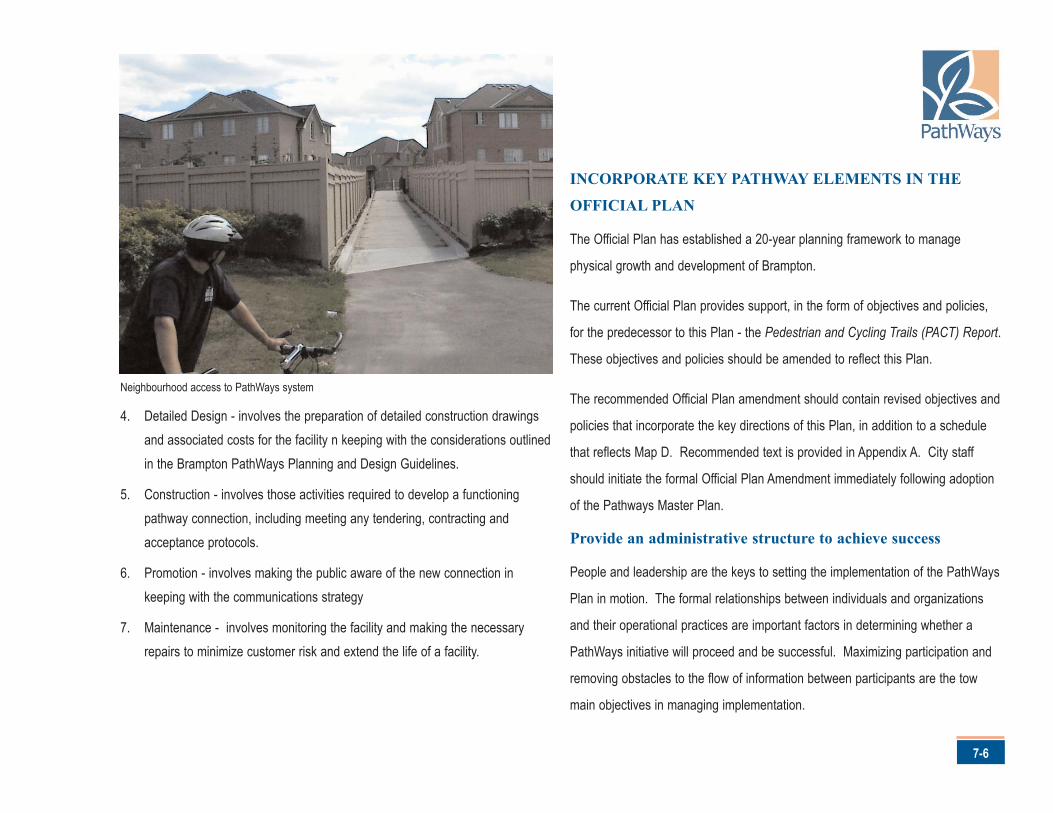
4. Detailed Design - involves the preparation of detailed construction drawingsand associated costs for the facility n keeping with the considerations outlinedin the Brampton PathWays Planning and Design Guidelines.
5. Construction - involves those activities required to develop a functioningpathway connection, including meeting any tendering, contracting andacceptance protocols.
6. Promotion - involves making the public aware of the new connection inkeeping with the communications strategy
7. Maintenance - involves monitoring the facility and making the necessaryrepairs to minimize customer risk and extend the life of a facility.
INCORPORATE KEY PATHWAY ELEMENTS IN THE
OFFICIAL PLAN
The Official Plan has established a 20-year planning framework to manage
physical growth and development of Brampton.
The current Official Plan provides support, in the form of objectives and policies,
for the predecessor to this Plan - the Pedestrian and Cycling Trails (PACT) Report.
These objectives and policies should be amended to reflect this Plan.
The recommended Official Plan amendment should contain revised objectives and
policies that incorporate the key directions of this Plan, in addition to a schedule
that reflects Map D. Recommended text is provided in Appendix A. City staff
should initiate the formal Official Plan Amendment immediately following adoption
of the Pathways Master Plan.
Provide an administrative structure to achieve success
People and leadership are the keys to setting the implementation of the PathWays
Plan in motion. The formal relationships between individuals and organizations
and their operational practices are important factors in determining whether a
PathWays initiative will proceed and be successful. Maximizing participation and
removing obstacles to the flow of information between participants are the tow
main objectives in managing implementation.
7-6
Neighbourhood access to PathWays system
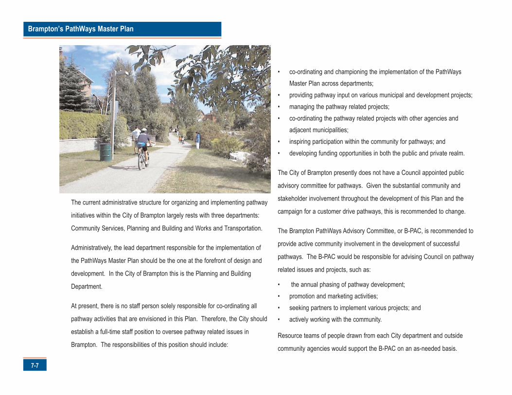
Brampton’s PathWays Master Plan
7-7
The current administrative structure for organizing and implementing pathway
initiatives within the City of Brampton largely rests with three departments:
Community Services, Planning and Building and Works and Transportation.
Administratively, the lead department responsible for the implementation of
the PathWays Master Plan should be the one at the forefront of design and
development. In the City of Brampton this is the Planning and Building
Department.
At present, there is no staff person solely responsible for co-ordinating all
pathway activities that are envisioned in this Plan. Therefore, the City should
establish a full-time staff position to oversee pathway related issues in
Brampton. The responsibilities of this position should include:
• co-ordinating and championing the implementation of the PathWaysMaster Plan across departments;
• providing pathway input on various municipal and development projects;• managing the pathway related projects;• co-ordinating the pathway related projects with other agencies and
adjacent municipalities;• inspiring participation within the community for pathways; and• developing funding opportunities in both the public and private realm.
The City of Brampton presently does not have a Council appointed public
advisory committee for pathways. Given the substantial community and
stakeholder involvement throughout the development of this Plan and the
campaign for a customer drive pathways, this is recommended to change.
The Brampton PathWays Advisory Committee, or B-PAC, is recommended to
provide active community involvement in the development of successful
pathways. The B-PAC would be responsible for advising Council on pathway
related issues and projects, such as:
• the annual phasing of pathway development;• promotion and marketing activities;• seeking partners to implement various projects; and• actively working with the community.
Resource teams of people drawn from each City department and outside
community agencies would support the B-PAC on an as-needed basis.
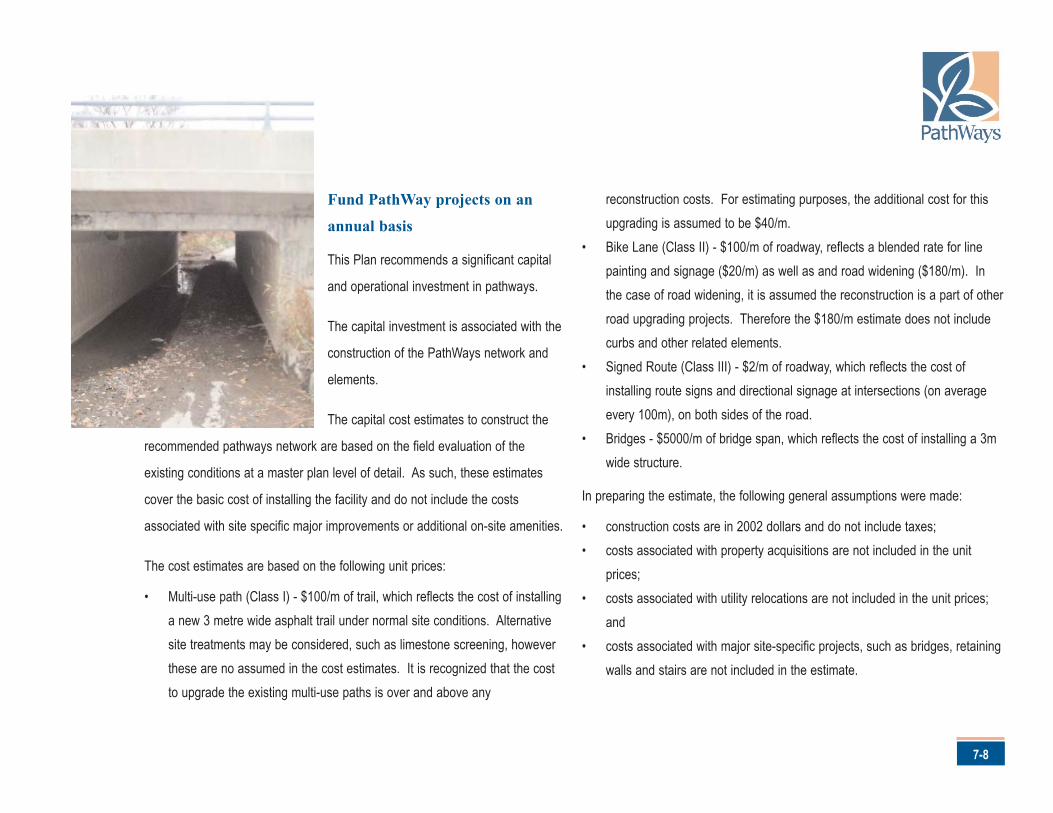
7-8
Fund PathWay projects on an
annual basis
This Plan recommends a significant capital
and operational investment in pathways.
The capital investment is associated with the
construction of the PathWays network and
elements.
The capital cost estimates to construct the
recommended pathways network are based on the field evaluation of the
existing conditions at a master plan level of detail. As such, these estimates
cover the basic cost of installing the facility and do not include the costs
associated with site specific major improvements or additional on-site amenities.
The cost estimates are based on the following unit prices:
• Multi-use path (Class I) - $100/m of trail, which reflects the cost of installinga new 3 metre wide asphalt trail under normal site conditions. Alternativesite treatments may be considered, such as limestone screening, howeverthese are no assumed in the cost estimates. It is recognized that the costto upgrade the existing multi-use paths is over and above any
reconstruction costs. For estimating purposes, the additional cost for thisupgrading is assumed to be $40/m.
• Bike Lane (Class II) - $100/m of roadway, reflects a blended rate for linepainting and signage ($20/m) as well as and road widening ($180/m). Inthe case of road widening, it is assumed the reconstruction is a part of otherroad upgrading projects. Therefore the $180/m estimate does not includecurbs and other related elements.
• Signed Route (Class III) - $2/m of roadway, which reflects the cost ofinstalling route signs and directional signage at intersections (on averageevery 100m), on both sides of the road.
• Bridges - $5000/m of bridge span, which reflects the cost of installing a 3mwide structure.
In preparing the estimate, the following general assumptions were made:
• construction costs are in 2002 dollars and do not include taxes;• costs associated with property acquisitions are not included in the unit
prices;• costs associated with utility relocations are not included in the unit prices;
and• costs associated with major site-specific projects, such as bridges, retaining
walls and stairs are not included in the estimate.
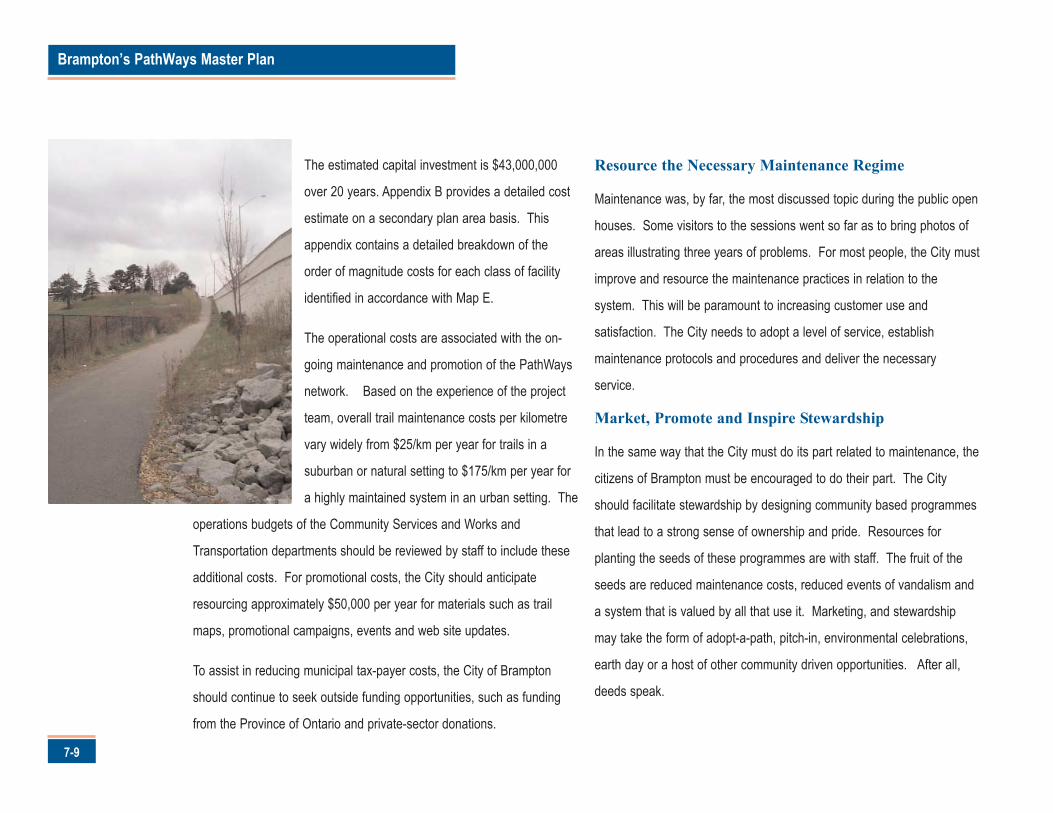
Brampton’s PathWays Master Plan
7-9
The estimated capital investment is $43,000,000
over 20 years. Appendix B provides a detailed cost
estimate on a secondary plan area basis. This
appendix contains a detailed breakdown of the
order of magnitude costs for each class of facility
identified in accordance with Map E.
The operational costs are associated with the on-
going maintenance and promotion of the PathWays
network. Based on the experience of the project
team, overall trail maintenance costs per kilometre
vary widely from $25/km per year for trails in a
suburban or natural setting to $175/km per year for
a highly maintained system in an urban setting. The
operations budgets of the Community Services and Works and
Transportation departments should be reviewed by staff to include these
additional costs. For promotional costs, the City should anticipate
resourcing approximately $50,000 per year for materials such as trail
maps, promotional campaigns, events and web site updates.
To assist in reducing municipal tax-payer costs, the City of Brampton
should continue to seek outside funding opportunities, such as funding
from the Province of Ontario and private-sector donations.
Resource the Necessary Maintenance Regime
Maintenance was, by far, the most discussed topic during the public open
houses. Some visitors to the sessions went so far as to bring photos of
areas illustrating three years of problems. For most people, the City must
improve and resource the maintenance practices in relation to the
system. This will be paramount to increasing customer use and
satisfaction. The City needs to adopt a level of service, establish
maintenance protocols and procedures and deliver the necessary
service.
Market, Promote and Inspire Stewardship
In the same way that the City must do its part related to maintenance, the
citizens of Brampton must be encouraged to do their part. The City
should facilitate stewardship by designing community based programmes
that lead to a strong sense of ownership and pride. Resources for
planting the seeds of these programmes are with staff. The fruit of the
seeds are reduced maintenance costs, reduced events of vandalism and
a system that is valued by all that use it. Marketing, and stewardship
may take the form of adopt-a-path, pitch-in, environmental celebrations,
earth day or a host of other community driven opportunities. After all,
deeds speak.
A-1
Brampton’s PathWays Master Plan
Appendix A - Suggested Framework for Official Plan Amendment Provisions
The following provides the recommended amendment provisions to incorporate the
key elements of the Brampton PathWays Plan into the Official Plan. While the
exact wording of these provisions may be refined through the on-going Official
Plan review process, the intent of the suggested provisions should be maintained.
The amendment will be comprised of text and a schedule. The text is provided in
the following section. The schedule should reflect Map D of Volume 1.
The following text is intended to provide an initial framework to replace the existing
preamble, objectives and cycling trails policies provided in sections 4.3.6 and 4.5.9
of the Official Plan.
Amendment Text
The City is committed to meeting the needs of non-motorized modes of travel,
such as walking and cycling, as part of Brampton's overall transportation strategy.
The PathWays system is an important component of this strategy. This planned
on and off-road network of multi-use trails, bike lanes and signed routes will
provide a means to establish Brampton as a vibrant and attractive city.
Objectives
To establish and maintain a city-wide on and off-road walking and cycling network
for a broad range of users and interests.
To achieve an attractive and memorable PathWays trail system that is unique to
Brampton.
To achieve a PathWays trail system that is designed by the community, for the
community.
To achieve PathWays ownership and foster pride within the Brampton business
community and among residents.
Policies
Policies should ensure that the key considerations and outcomes identified in
Table 7.1 (see page 7-3) are addressed.
Brampton’s PathWays Master Plan
A-2
The City shall require all proposed developments and infrastructure
undertakings to provide facilities for PathWays wherever appropriate in
keeping with the provisions of this Plan and the Brampton PathWays
Plan.
The City shall provide for the development of PathWays by:
(i) designating PathWays on Schedule _ and in secondary plans, whereappropriate;
(ii) implementing, monitoring and updating the Brampton PathWaysPlan;
(iii) providing for the development and maintenance of PathWaysfacilities;
(iv) ensuring that the design of PathWays complement and connect withthe City's open space infrastructure, key destinations and transitstations where feasible;
(v) ensuring that all new development proposals and infrastructureundertakings include extensions and improvements to PathWays asa part of the up-front stages of construction wherever appropriate.
The City may require the installation of PathWays features, elements and
supportive facilities, such as bicycle racks, as a part of residential,
commercial and industrial developments.
The City shall coordinate the development and expansion of PathWays
with adjacent municipalities and other agencies as appropriate.
The City shall minimize the risk to pedestrians, cyclists and motorists
through the appropriate design of PathWays facilities, the provision of
signage and support for educational activities and programs.
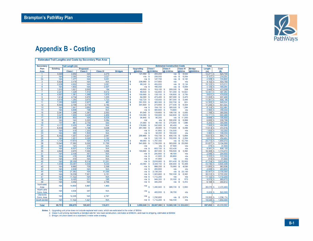
B-1
Brampton’s PathWay Plan
Appendix B - Costing