Embed Size (px)
Citation preview
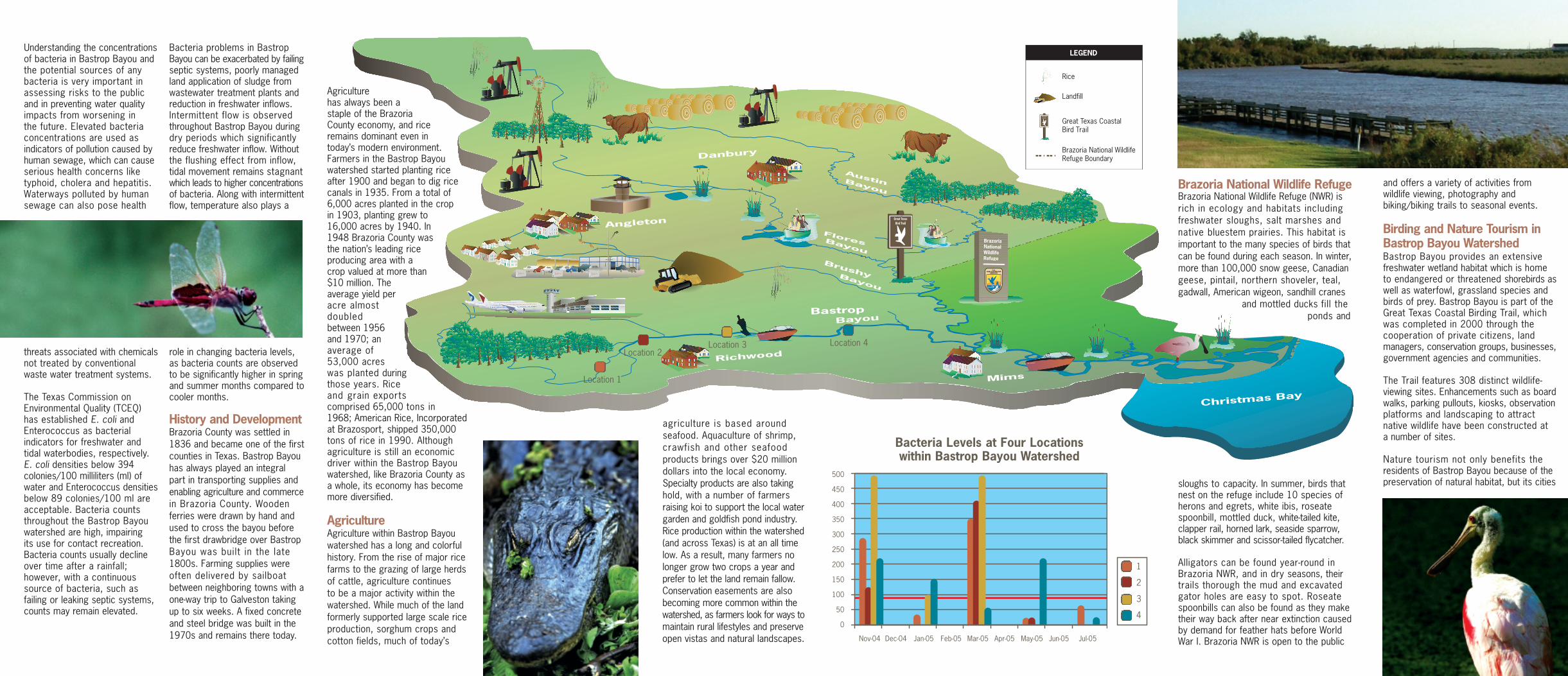
Brazoria National Wildlife RefugeBrazoria National Wildlife Refuge (NWR) isrich in ecology and habitats includingfreshwater sloughs, salt marshes andnative bluestem prairies. This habitat isimportant to the many species of birds thatcan be found during each season. In winter,more than 100,000 snow geese, Canadiangeese, pintail, northern shoveler, teal,gadwall, American wigeon, sandhill cranes
and mottled ducks fill theponds and
sloughs to capacity. In summer, birds thatnest on the refuge include 10 species ofherons and egrets, white ibis, roseatespoonbill, mottled duck, white-tailed kite,clapper rail, horned lark, seaside sparrow,black skimmer and scissor-tailed flycatcher.
Alligators can be found year-round inBrazoria NWR, and in dry seasons, theirtrails thorough the mud and excavatedgator holes are easy to spot. Roseatespoonbills can also be found as they maketheir way back after near extinction causedby demand for feather hats before WorldWar I. Brazoria NWR is open to the public
BastropBayou
BrushyBayou
FloresBayou
Bayou
Austin
Christmas Bay
Richwood
Mims
Angleton
Danbury Brazoria National WildlifeRefuge Boundary
Great Texas Coastal Bird Trail
Landfill
Rice
LEGENDUnderstanding the concentrationsof bacteria in Bastrop Bayou andthe potential sources of any bacteria is very important inassessing risks to the public and in preventing water qualityimpacts from worsening in the future. Elevated bacteria concentrations are used as indicators of pollution caused byhuman sewage, which can causeserious health concerns liketyphoid, cholera and hepatitis.Waterways polluted by humansewage can also pose health
threats associated with chemicalsnot treated by conventional waste water treatment systems.
The Texas Commission onEnvironmental Quality (TCEQ) has established E. coli andEnterococcus as bacterial indicators for freshwater and tidal waterbodies, respectively. E. coli densities below 394colonies/100 milliliters (ml) ofwater and Enterococcus densitiesbelow 89 colonies/100 ml areacceptable. Bacteria countsthroughout the Bastrop Bayouwatershed are high, impairing its use for contact recreation.Bacteria counts usually declineover time after a rainfall; however, with a continuoussource of bacteria, such as failing or leaking septic systems, counts may remain elevated.
Bacteria problems in BastropBayou can be exacerbated by failingseptic systems, poorly managedland application of sludge fromwastewater treatment plants andreduction in freshwater inflows.Intermittent flow is observedthroughout Bastrop Bayou duringdry periods which significantlyreduce freshwater inflow. Withoutthe flushing effect from inflow,tidal movement remains stagnantwhich leads to higher concentrationsof bacteria. Along with intermittentflow, temperature also plays a
role in changing bacteria levels,as bacteria counts are observed to be significantly higher in springand summer months compared tocooler months.
History and DevelopmentBrazoria County was settled in1836 and became one of the firstcounties in Texas. Bastrop Bayouhas always played an integralpart in transporting supplies andenabling agriculture and commercein Brazoria County. Woodenferries were drawn by hand andused to cross the bayou beforethe first drawbridge over BastropBayou was built in the late1800s. Farming supplies wereoften delivered by sailboatbetween neighboring towns with aone-way trip to Galveston takingup to six weeks. A fixed concreteand steel bridge was built in the1970s and remains there today.
Agriculturehas always been astaple of the BrazoriaCounty economy, and riceremains dominant even intoday’s modern environment.Farmers in the Bastrop Bayouwatershed started planting riceafter 1900 and began to dig ricecanals in 1935. From a total of6,000 acres planted in the cropin 1903, planting grew to16,000 acres by 1940. In1948 Brazoria County wasthe nation’s leading riceproducing area with a crop valued at more than$10 million. Theaverage yield peracre almostdoubledbetween 1956and 1970; anaverage of53,000 acreswas planted duringthose years. Riceand grain exportscomprised 65,000 tons in1968; American Rice, Incorporatedat Brazosport, shipped 350,000tons of rice in 1990. Although agriculture is still an economic driver within the Bastrop Bayouwatershed, like Brazoria County asa whole, its economy has becomemore diversified.
AgricultureAgriculture within Bastrop Bayouwatershed has a long and colorfulhistory. From the rise of major ricefarms to the grazing of large herdsof cattle, agriculture continues to be a major activity within thewatershed. While much of the landformerly supported large scale rice production, sorghum crops and cotton fields, much of today’s
and offers a variety of activities fromwildlife viewing, photography andbiking/biking trails to seasonal events.
Birding and Nature Tourism inBastrop Bayou WatershedBastrop Bayou provides an extensivefreshwater wetland habitat which is hometo endangered or threatened shorebirds aswell as waterfowl, grassland species andbirds of prey. Bastrop Bayou is part of theGreat Texas Coastal Birding Trail, whichwas completed in 2000 through thecooperation of private citizens, landmanagers, conservation groups, businesses,government agencies and communities.
The Trail features 308 distinct wildlife-viewing sites. Enhancements such as boardwalks, parking pullouts, kiosks, observationplatforms and landscaping to attract native wildlife have been constructed at a number of sites.
Nature tourism not only benefits the residents of Bastrop Bayou because of thepreservation of natural habitat, but its cities
agriculture is based aroundseafood. Aquaculture of shrimp,crawfish and other seafoodproducts brings over $20 milliondollars into the local economy.Specialty products are also takinghold, with a number of farmersraising koi to support the local watergarden and goldfish pond industry.Rice production within the watershed(and across Texas) is at an all timelow. As a result, many farmers nolonger grow two crops a year andprefer to let the land remain fallow.Conservation easements are alsobecoming more common within thewatershed, as farmers look for ways tomaintain rural lifestyles and preserveopen vistas and natural landscapes.
Bacteria Levels at Four Locationswithin Bastrop Bayou Watershed
1
2
3
4
500
450
400
350
300
250
200
150
100
50
0
Nov-04 Dec-04 Jan-05 Feb-05 Mar-05 Apr-05 May-05 Jun-05 Jul-05
Location 1
Location 2Location 3 Location 4
No matter where we live,
work or play we are
always in a watershed –
an area of land that
drains to a creek, river,
bayou or lake. As a
result, everything we put
on the ground, from lawn
fertilizer to litter, can end
up washing into our
waterways.
As our population grows andactivities throughout the watershed increase, so do therisks to our waterways.
ContactsFor more information about your watershed, please contact the following:
Houston-Galveston Area CouncilP.O. Box 22777Houston, TX 77027(713) 627-3200www.h-gac.com
Galveston Bay Estuary Program711 West Bay Area Blvd., Suite 210Webster, TX 77598(281) 332-9937www.gbep.state.tx.us
Texas Commission on Environmental Quality(512) 239-4491www.tceq.state.tx.us
Texas Parks and Wildlife4200 Smith School RoadAustin, TX 78744(800) 792-1112www.tpwd.state.tx.us/
Brazoria National Wildlife Refuge1212 North Velasco, Suite 200Angleton, Texas 77515(409) 849-7771www.fws.gov
Galveston Bay Foundation17324A Highway 3 Webster, Texas 77598-4133 (281) 332-3381 www.galvbay.org
Friends of Brazoria Wildlife RefugesP.O. Box 505Lake Jackson, Texas 77566(979) 849-6062www.refugefriends.org
Christmas Bay Foundationwww.christmasbay.org
Photographs Courtesy of Harris County Flood Control District, Houston-Galveston Area Council, philip.greenspun.com and U.S. Army Corps of Engineers
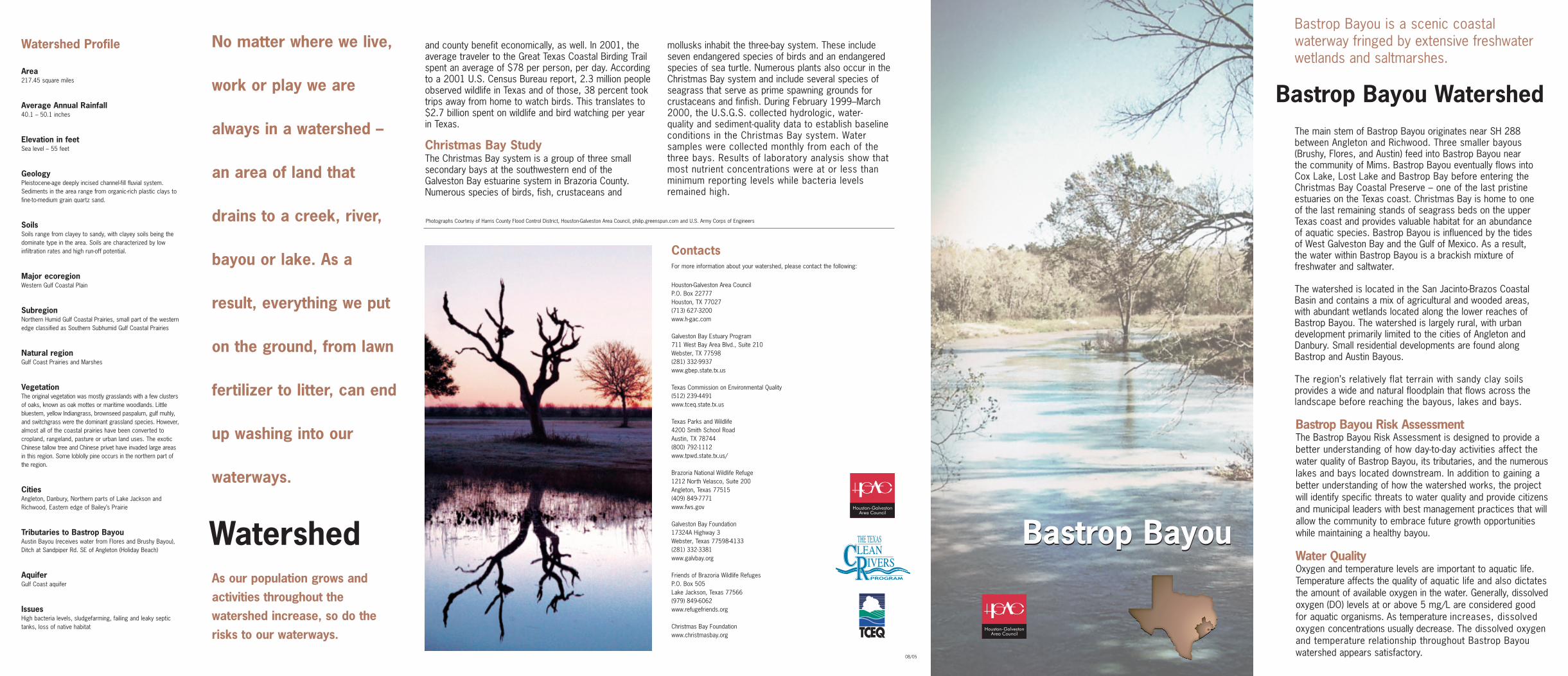
Bastrop Bayou is a scenic coastal waterway fringed by extensive freshwater wetlands and saltmarshes.
The main stem of Bastrop Bayou originates near SH 288between Angleton and Richwood. Three smaller bayous(Brushy, Flores, and Austin) feed into Bastrop Bayou near the community of Mims. Bastrop Bayou eventually flows intoCox Lake, Lost Lake and Bastrop Bay before entering theChristmas Bay Coastal Preserve – one of the last pristineestuaries on the Texas coast. Christmas Bay is home to oneof the last remaining stands of seagrass beds on the upperTexas coast and provides valuable habitat for an abundanceof aquatic species. Bastrop Bayou is influenced by the tidesof West Galveston Bay and the Gulf of Mexico. As a result,the water within Bastrop Bayou is a brackish mixture offreshwater and saltwater.
The watershed is located in the San Jacinto-Brazos CoastalBasin and contains a mix of agricultural and wooded areas,with abundant wetlands located along the lower reaches ofBastrop Bayou. The watershed is largely rural, with urbandevelopment primarily limited to the cities of Angleton andDanbury. Small residential developments are found alongBastrop and Austin Bayous.
The region’s relatively flat terrain with sandy clay soilsprovides a wide and natural floodplain that flows across thelandscape before reaching the bayous, lakes and bays.
Bastrop Bayou Risk AssessmentThe Bastrop Bayou Risk Assessment is designed to provide abetter understanding of how day-to-day activities affect thewater quality of Bastrop Bayou, its tributaries, and the numerouslakes and bays located downstream. In addition to gaining abetter understanding of how the watershed works, the projectwill identify specific threats to water quality and provide citizensand municipal leaders with best management practices that willallow the community to embrace future growth opportunitieswhile maintaining a healthy bayou.
Water QualityOxygen and temperature levels are important to aquatic life.Temperature affects the quality of aquatic life and also dictatesthe amount of available oxygen in the water. Generally, dissolvedoxygen (DO) levels at or above 5 mg/L are considered goodfor aquatic organisms. As temperature increases, dissolvedoxygen concentrations usually decrease. The dissolved oxygenand temperature relationship throughout Bastrop Bayouwatershed appears satisfactory.
Watershed Profile
Area217.45 square miles
Average Annual Rainfall40.1 – 50.1 inches
Elevation in feetSea level – 55 feet
Geology Pleistocene-age deeply incised channel-fill fluvial system.Sediments in the area range from organic-rich plastic clays tofine-to-medium grain quartz sand.
SoilsSoils range from clayey to sandy, with clayey soils being thedominate type in the area. Soils are characterized by low infiltration rates and high run-off potential.
Major ecoregionWestern Gulf Coastal Plain
SubregionNorthern Humid Gulf Coastal Prairies, small part of the westernedge classified as Southern Subhumid Gulf Coastal Prairies
Natural regionGulf Coast Prairies and Marshes
VegetationThe original vegetation was mostly grasslands with a few clustersof oaks, known as oak mottes or maritime woodlands. Littlebluestem, yellow Indiangrass, brownseed paspalum, gulf muhly,and switchgrass were the dominant grassland species. However,almost all of the coastal prairies have been converted to cropland, rangeland, pasture or urban land uses. The exoticChinese tallow tree and Chinese privet have invaded large areasin this region. Some loblolly pine occurs in the northern part ofthe region.
CitiesAngleton, Danbury, Northern parts of Lake Jackson andRichwood, Eastern edge of Bailey’s Prairie
Tributaries to Bastrop BayouAustin Bayou (receives water from Flores and Brushy Bayou),Ditch at Sandpiper Rd. SE of Angleton (Holiday Beach)
AquiferGulf Coast aquifer
IssuesHigh bacteria levels, sludgefarming, failing and leaky septictanks, loss of native habitat
and county benefit economically, as well. In 2001, theaverage traveler to the Great Texas Coastal Birding Trailspent an average of $78 per person, per day. Accordingto a 2001 U.S. Census Bureau report, 2.3 million peopleobserved wildlife in Texas and of those, 38 percent tooktrips away from home to watch birds. This translates to$2.7 billion spent on wildlife and bird watching per yearin Texas.
Christmas Bay StudyThe Christmas Bay system is a group of three small secondary bays at the southwestern end of theGalveston Bay estuarine system in Brazoria County.Numerous species of birds, fish, crustaceans and
mollusks inhabit the three-bay system. These includeseven endangered species of birds and an endangeredspecies of sea turtle. Numerous plants also occur in theChristmas Bay system and include several species ofseagrass that serve as prime spawning grounds forcrustaceans and finfish. During February 1999–March2000, the U.S.G.S. collected hydrologic, water-quality and sediment-quality data to establish baselineconditions in the Christmas Bay system. Water samples were collected monthly from each of thethree bays. Results of laboratory analysis show thatmost nutrient concentrations were at or less than minimum reporting levels while bacteria levelsremained high.
08/05
Bastrop Bayou Watershed
Bastrop BayouWatershed Bastrop Bayou