Embed Size (px)
Citation preview
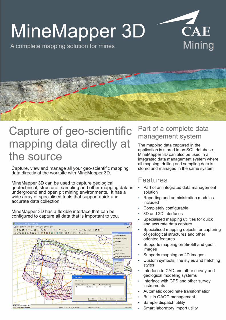
MiningMineMapper 3DA complete mapping solution for mines
Capture of geo-scientific mapping data directly at the source
Capture, view and manage all your geo-scientific mapping data directly at the worksite with MineMapper 3D.
MineMapper 3D can be used to capture geological, geotechnical, structural, sampling and other mapping data in underground and open pit mining environments. It has a wide array of specialised tools that support quick and accurate data collection.
MineMapper 3D has a flexible interface that can be configured to capture all data that is important to you.
Part of a complete data management systemThe mapping data captured in the application is stored in an SQL database. MineMapper 3D can also be used in a integrated data management system where all mapping, drilling and sampling data is stored and managed in the same system.
FeaturesŸ
Ÿ
Ÿ
Ÿ
Ÿ
Ÿ
Ÿ
Ÿ
Ÿ
Ÿ
Ÿ
Ÿ
Ÿ
Part of an integrated data management solution
Reporting and administration modules included
Completely configurable
3D and 2D interfaces
Specialised mapping utilities for quick and accurate data capture
Specialised mapping objects for capturing of geological structures and other oriented features
Supports mapping on Sirotiff and geotiff images
Supports mapping on 2D images
Ÿ Built in QAQC management
Sample dispatch utility
Smart laboratory import utility
Custom symbols, line styles and hatching styles
Interface to CAD and other survey and geological modeling systems
Interface with GPS and other survey instruments
Ÿ Automatic coordinate transformation
INDIA
PERU
SOUTH AFRICA
UNITED KINGDOM
USA
New Delhi
Lima
Johannesburg
Wells
Denver
Tel: +91 11 2694 8393
Tel: +51 1 222 6000
Tel: +27 11 253 3360
Tel: +44 1749 683 350
Toll-free: 1 800 499 7877
Tel: +1 303 985 7713
AUSTRALIATel: +61 8 9479 1771
Tel: +61 7 3220 0670
BRAZIL
Tel: +55 31 3264 9377
CANADA
Toll-free: 1 800 240 6941
Tel: +1 705 688 0101
Tel: +56 2 334 5952
Perth
Brisbane
Belo Horizonte
Sudbury
Santiago
CHILE
Global officesEMAIL
WEB
cae.com/mining
Mining
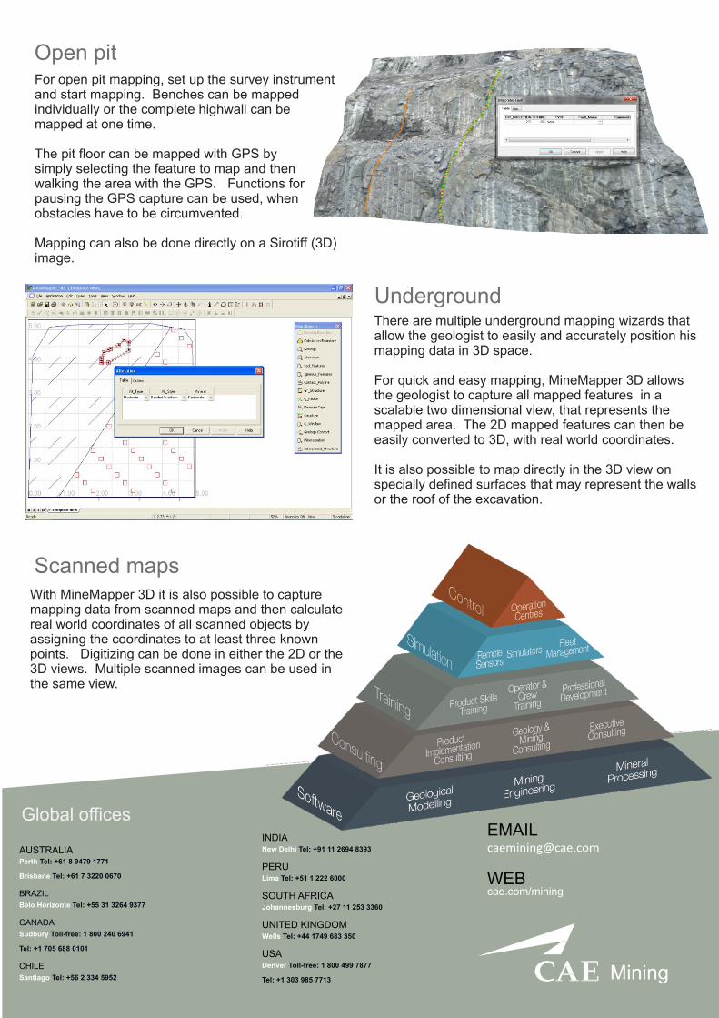
Open pit
There are multiple underground mapping wizards that allow the geologist to easily and accurately position his mapping data in 3D space.
For quick and easy mapping, MineMapper 3D allows the geologist to capture all mapped features in a scalable two dimensional view, that represents the mapped area. The 2D mapped features can then be easily converted to 3D, with real world coordinates.
It is also possible to map directly in the 3D view on specially defined surfaces that may represent the walls or the roof of the excavation.
Underground
For open pit mapping, set up the survey instrument and start mapping. Benches can be mapped individually or the complete highwall can be mapped at one time.
The pit floor can be mapped with GPS by simply selecting the feature to map and then walking the area with the GPS. Functions for pausing the GPS capture can be used, when obstacles have to be circumvented.
Mapping can also be done directly on a Sirotiff (3D) image.
Scanned mapsWith MineMapper 3D it is also possible to capture mapping data from scanned maps and then calculate real world coordinates of all scanned objects by assigning the coordinates to at least three known points. Digitizing can be done in either the 2D or the 3D views. Multiple scanned images can be used in the same view.


![Estudo de Classificação de Áreas em CAD 3D e CAE[1]](https://img.pdfslide.net/doc/110x75/5571fe6749795991699b4f73/estudo-de-classificacao-de-areas-em-cad-3d-e-cae1.jpg)