Embed Size (px)
Citation preview

Fal l Ed it ion , 2021
Carolina SkyWatcher
In This Issue:
NWS Morehead City Hosts
Students for Summer
Programs
This past summer, the NWS
Morehead City team had the
pleasure to host two rising
meteorology students who
worked on local research pro-
jects to help improve forecasts
for Eastern North Carolina.
Page 4
NOAA Updates Atlantic
Hurricane Season Outlook
for 2021
In an annual mid-season up-
date for the Atlantic Hurricane
Season Outlook, the Climate
Prediction Center increases
the chances for an above-
normal 2021 season. What
does that mean for us?
Page 2
NWS Morehead City
Hurricane Ida, August 29, 2021 | Source: NOAA
Breaking the Ice: Meeting
Ryan Fucheck
Get to know our newest NWS
meteorologist!
Page 6
Hurricane Irene 10 Years
Later
We look back on Hurricane
Irene in 2011.
Page 8

NWS Morehead City
2
September 12, 2021
Carolina SkyWatcher
The Atlantic Hurricane Season is showing no signs of slowing. NOAA’s Climate Prediction Center
(CPC), a division of the National Weather Service, released a mid-season update last month for
their 2021 Atlantic Hurricane Season Outlook. The latest outlook now calls for a 65% chance of an
above-normal hurricane season, with 15-21 named storms, including 7-10 hurricanes, 3-5 of
which could become major hurricanes. These numbers are up from the 13-20 named storms and
6-10 hurricanes from the first outlook issued in May.
“A mix of competing oceanic and atmospheric conditions generally favor above-average activity
for the remainder of the Atlantic hurricane season, including the potential return of La Niña in the
months ahead,” said Matthew Rosencrans, lead seasonal hurricane forecaster at the CPC.
Warm ocean temperatures, reduced vertical wind shear, and an enhanced west African monsoon
are also expected to contribute to an active hurricane season. Additionally, these factors are
compounded with the ongoing warm phase of the Atlantic Multi-Decadal Oscillation, which favors
a more active hurricane season.
NOAA Updates Atlantic Hurricane Season Outlook for 2021 By: Michael Lee, Meteorologist

NWS Morehead City
3
September 12, 2021
Carolina SkyWatcher
So far in the 2021 Atlantic
Hurricane Season, we have
seen 14 named storms, in-
cluding five hurricanes,
three of which have been
major hurricanes. This
keeps us right on par with
the CPC’s seasonal outlook
as we reach the climato-
logical peak of hurricane
season in mid-September,
with two and a half months
left of hurricane season,
which ends November 30th.
Right here in Eastern North Carolina, we have experienced direct impacts from two tropical
storms so far this year: Claudette and Elsa. Claudette brought heavy rain to the region from June
20th-21st while Elsa brought wind gusts over 50 mph and a confirmed tornado in Fairfield, NC just
a few weeks later on July 8th. While the tornado in Fairfield was confirmed visually using photos
and videos, it caused no damage from which our survey team could assign an EF-scale rating,
thus it was rated as an EF-U (unknown).
As we continue through an already
active 2021 Atlantic Hurricane Sea-
son, it is important to remain vigi-
lant and stay Weather Ready. Folks
in Eastern North Carolina should
perform an annual check on their
hurricane preparedness plans and
supplies if they have not done so al-
ready. Use the link below to get
started today!
NOAA Updates Atlantic Hurricane Season Outlook for 2021 (continued)
Tornado from Tropical Storm Elsa
Fairfield, NC | Credit: Lindsey Mooney

NWS Morehead City
4
September 12, 2021
Carolina SkyWatcher
This summer, NWS Morehead City had the pleasure of hosting not one but two students virtually
to work on a couple of local research projects. The first was Zachary Chalmers, an Earnest F.
Hollings Undergraduate Scholarship recipient. The Hollings program was established in 2005 un-
der the Consolidated Appropriations Act and its purpose is fourfold:
1. Increase undergraduate training in oceanic and atmospheric science, research, tech-
nology, and education and foster multidisciplinary training opportunities;
2. Increase public understanding and support for stewardship of the ocean and atmos-
phere and improve environmental literacy;
3. Recruit and prepare students for public service careers with the National Oceanic and
Atmospheric Administration and other natural resource and science agencies at the
federal, state and local levels of government; and,
4. Recruit and prepare students for careers as teachers and educators in oceanic and at-
mospheric science and to improve scientific and environmental education in the United
States.
Zach joined us remotely from the University of Illinois and partici-
pated in a study that looked at the conditions favorable for water-
spouts in Eastern North Carolina. Zach built off of previous work
by NWS offices in Wilmington, NC, Charleston, SC and Key West,
FL. Zach used Python programming to look through data from
atmospheric soundings (weather balloons) to find variables that
could potentially play a role in waterspout formation. After find-
ing the ones that fit best, Zach was able to combine them into a
waterspout index that forecasters are able to use in operations to
better identify days that could potentially yield waterspouts. His
work was presented at a forum at the office and will be submitted
for presentation at the American Meteorological Society’s 2022
Annual Meeting in Houston, TX.
We are happy to also report that Zach will be continuing this work
with us through the Capstone research program working with us
and his advisor at the University of Illinois.
NWS Morehead City Hosts Students for Summer Programs By: Ryan Ellis, Science and Operations Officer
Zachary Chalmers, Hollings
Scholar, University of Illinois

NWS Morehead City
5
September 12, 2021
Carolina SkyWatcher
Our office also had the pleasure of hosting Elizabeth Danco,
a student volunteer and rising senior at Virginia Tech Uni-
versity. Elizabeth took on her first big data project, a foray
into something we call the National Blend of Models (NBM),
a forecasting system that NWS forecasters use to try and
objectively account for and decipher the wide array of fore-
cast model solutions available to them. Specifically, Eliza-
beth looked at temperature verification of the NBM over the
Outer Banks, an area notoriously difficult to forecast for.
Because of the relatively narrow strip of land surrounded
by water, forecast models have a difficult time accurately
predicting things like high and low temperatures. Eliza-
beth’s conclusions will help forecasters to adjust the output of the NBM to more representative
values for the Outer Banks. Her work will be expanded this fall by a team of forecasters and the
findings also presented at the AMS Annual Meeting.
Elizabeth will now move on to a Capstone project with the NWS office in Blacksburg, VA, also on
the campus of Virginia Tech.
In addition to the research experience that both students received this year, NWS staff provided
virtual operations training where the students could experience what it was like to work in oper-
ations and be a part of the forecasting team. They looked at various weather patterns in Eastern
NC, were able to see what systems forecasters use to make their predictions and also were able
to understand how the NWS connects with core partners such as Emergency Managers and the
media to help drive the mission of saving life and property and building a more weather ready na-
tion.
Finally, students were exposed to various leadership topics that will help them build their inter-
personal skills as they move into a phase in their lives where they will be applying for jobs or
graduate school. Discussions included topics such as organization and productivity, interperson-
al skills such as personality type training and networking, and finally, culture topics aimed at
bringing ideas to fruition and working successfully in a team environment.
It is always rewarding for us to be able to mentor the students and watch as their journeys take
shape. Inevitably we always end up learning as much from them than they do from us. It was a
joy to have them and we wish them both the best of luck moving forward in their education and
careers.
NWS Newport/Morehead City Hosts Students for Summer Programs (continued)
Elizabeth Danco, Student Volunteer,
Virginia Tech University
NWS Morehead City
6
September 12, 2021
Carolina SkyWatcher
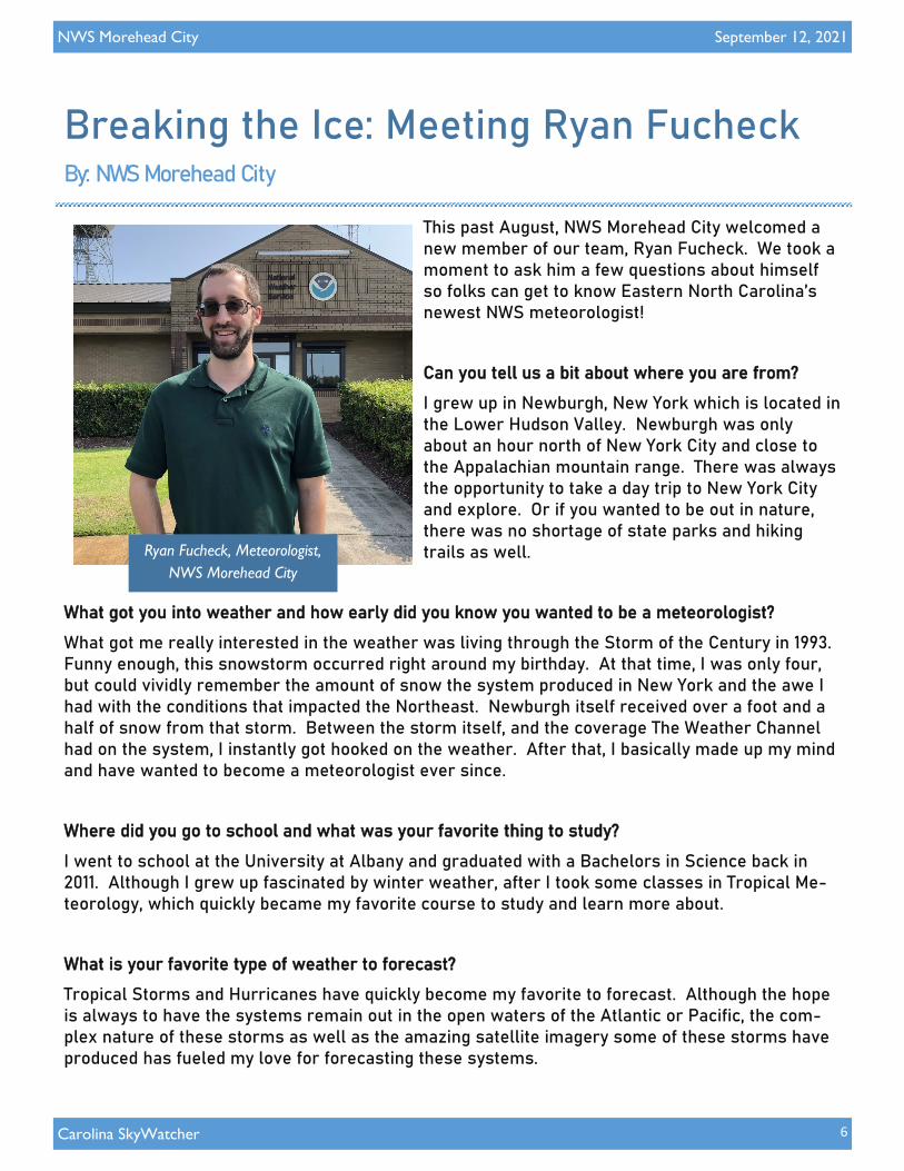
This past August, NWS Morehead City welcomed a new member of our team, Ryan Fucheck. We took a moment to ask him a few questions about himself so folks can get to know Eastern North Carolina’s newest NWS meteorologist!
Can you tell us a bit about where you are from?
I grew up in Newburgh, New York which is located in the Lower Hudson Valley. Newburgh was only about an hour north of New York City and close to the Appalachian mountain range. There was always the opportunity to take a day trip to New York City and explore. Or if you wanted to be out in nature, there was no shortage of state parks and hiking trails as well.
What got you into weather and how early did you know you wanted to be a meteorologist?
What got me really interested in the weather was living through the Storm of the Century in 1993. Funny enough, this snowstorm occurred right around my birthday. At that time, I was only four, but could vividly remember the amount of snow the system produced in New York and the awe I had with the conditions that impacted the Northeast. Newburgh itself received over a foot and a half of snow from that storm. Between the storm itself, and the coverage The Weather Channel had on the system, I instantly got hooked on the weather. After that, I basically made up my mind and have wanted to become a meteorologist ever since.
Where did you go to school and what was your favorite thing to study?
I went to school at the University at Albany and graduated with a Bachelors in Science back in 2011. Although I grew up fascinated by winter weather, after I took some classes in Tropical Me-teorology, which quickly became my favorite course to study and learn more about.
What is your favorite type of weather to forecast?
Tropical Storms and Hurricanes have quickly become my favorite to forecast. Although the hope is always to have the systems remain out in the open waters of the Atlantic or Pacific, the com-plex nature of these storms as well as the amazing satellite imagery some of these storms have produced has fueled my love for forecasting these systems.
Breaking the Ice: Meeting Ryan Fucheck By: NWS Morehead City
Ryan Fucheck, Meteorologist,
NWS Morehead City

NWS Morehead City
7
September 12, 2021
Carolina SkyWatcher
What was your career path like on the road to coming to NWS Newport/Morehead City?
I originally started my career in 2011 in Hopewell Junction, New York as a Marine Meteorologist at a company called FleetWeather. While I worked there, I was able to get my foot in the door as an operational meteorologist. In addition to that, I was also able to learn something I knew little about when I first got out of college: marine meteorology and ship routing. After about four and a half years, I left FleetWeather and began working in Norman, Oklahoma as an operational mete-orologist at another private company called Weather Decision Technologies in 2016. Here I was able to hone my skills as a forecaster and a risk communicator. The team had a wide range of clients from oil rigs out in the Gulf of Mexico, emergency managers from varying cities, school districts/colleges, T.V. networks, and even stage managers at concert venues across the globe. I was able to learn more about tropical meteorology, winter weather, and severe weather through-out my years working here. The company stayed in Norman, Oklahoma until they were bought by another private weather company, DTN, and moved the forecast office up to Burnsville, Minnesota in the summer of 2020. After that, the rest is history as I jumped at the chance to join the team in Newport.
What is the most memorable weather event you have covered in your career?
The most memorable weather event I have ever forecasted for was Hurricane Harvey when it im-pacted Texas in 2017. Unfortunately, the models were in strong agreement that Harvey would not only bring hurricane-force conditions to the region, but also stall and dump prolific amounts of rain across the area. The silver lining, though, was that it made messaging the impacts of the system straightforward. Not only that, but the satellite and radar images were also very interest-ing to see.
What do you like to do in your spare time?
I like to spend my time outdoors if I can; biking, hiking, or kayaking if the weather is nice enough. I also enjoy watching football and baseball and I am an avid Green Bay Packers and New York Mets fan.
Breaking the Ice: Ryan Fucheck (continued)
“Tropical Storms and Hurricanes have quickly become
my favorite to forecast for.”
-Ryan Fucheck

NWS Morehead City
8
September 12, 2021
Carolina SkyWatcher
This year marks 10 years since Hurricane Irene wrecked havoc across Eastern North Carolina on
August 26-27, 2011. In its wake, Irene left extensive flooding, storm surge, and wind damage
across the region. The hurricane also spawned several tornadoes, including one EF-2 tornado
near Colombia in Tyrrell County. In total, Irene was responsible for 5 deaths in North Carolina.
Irene began as a tropical depression on August 20th as it
approached the Lesser Antilles before becoming a named
tropical storm later that day. Two days later, as it was
making landfall over Puerto Rico, Irene became a category
1 hurricane. Soon after, the storm began to rapidly inten-
sify as it moved over the warm waters of the Bahamas,
strengthening into a category 3 hurricane on August 24th.
While Irene began to weaken and lose maximum wind
speed as it continued barreling toward North Carolina, it
began to grow in size. By the time it made landfall on Au-
gust 27th at Cape Lookout, Irene was a massive hurricane,
Hurricane Irene 10 Years Later By: Michael Lee, Meteorologist
Hurricane Irene makes landfall near Cape Lookout, NC on August 27, 2011 | Source: NASA
Track of Hurricane Irene
August 20-29, 2011

NWS Morehead City
9
September 12, 2021
Carolina SkyWatcher
with maximum sustained winds over 85 mph and an
expansive wind field with hurricane-force winds ex-
panding outwards to 80 nautical miles from the cen-
ter of the storm. Irene then continued northward,
impacting locations along the East Coast and New
England.
After it was all said and done, Irene left large
swaths of damage across North Carolina and the
Eastern Seaboard. Widespread heavy rain left many
communities with over a foot of measured precipita-
tion, including the community of Bayboro, NC that
came in with the highest rainfall total at 15.74 inch-
es, resulting in extensive flooding throughout the
region. While Irene’s maximum sustained winds
were measured around 85 mph, some locations saw
wind gusts exceeding 100 mph. The EF-2 tornado
near Columbia, NC demolished at least four homes
and overturned many vehicles. Numerous downed
trees across Eastern North Carolina resulted in
thousands without power. Storm surge from the
Atlantic Ocean and Pamlico Sound covered portions
of Highway 12 along the Outer Banks, causing nu-
merous breaches throughout the barrier island.
While an entire decade can seem like a long
time, for many, Irene felt like yesterday. If you
have a story you would like to share from
Hurricane Irene, we’d like to hear it. Send us
an email with your story and any pictures you
have from Irene to [email protected]. You
can also read more about Hurricane Irene in
the National Hurricane Center’s Tropical Cy-
clone Report for Irene and on the NWS More-
head City’s Event Review for Irene.
Hurricane Irene 10 Years Later (continued)
Irene rainfall totals, David Roth,
Weather Prediction Center
Storm surge damage near Rodanthe, NC
after Hurricane Irene in 2011, USGS
NWS Morehead City
10
September 12, 2021
Carolina SkyWatcher
Follow Us on Social Media!
facebook.com/NWSMoreheadCity
@NWSMoreheadCity youtube.com/
NWSMoreheadCity @nwsmoreheadcity
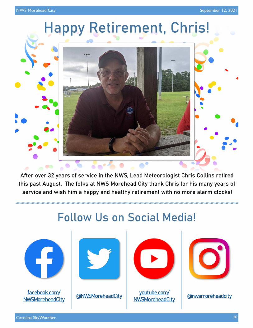
Happy Retirement, Chris!
After over 32 years of service in the NWS, Lead Meteorologist Chris Collins retired
this past August. The folks at NWS Morehead City thank Chris for his many years of
service and wish him a happy and healthy retirement with no more alarm clocks!