Embed Size (px)
Citation preview

© BUSHFIRE CRC LTD 2014
CASE STUDY FOR THE CFA GRASSLAND CURING AND FIRE DANGER RATING PROJECT Country Fire Authority

Case Study for the CFA Grassland Curing and Fire Danger Rating Project 1
Table of Contents
Executive Summary ................................................................................................................................. 2
Achievements against five objectives ..................................................................................................... 2
Critical Success Factors for the project ................................................................................................... 3
Context of Project ................................................................................................................................... 5
The problem ........................................................................................................................................ 5
The opportunity .................................................................................................................................. 6
Outline of project ................................................................................................................................ 6
Next steps ........................................................................................................................................... 9
Conclusion ............................................................................................................................................... 9
Potential Application in other States and Territories ............................................................................. 9
Appendix 1. Evolution of the Grassland Curing Map in Victoria ..................................................... 12
Appendix 2. Grassland Curing Field Card ........................................................................................ 14
Acknowledgements ............................................................................................................................... 16
References & Support Materials ........................................................................................................... 16
Key contacts .......................................................................................................................................... 17

Case Study for the CFA Grassland Curing and Fire Danger Rating Project 2
Case Study for the CFA Grassland Curing and Fire Danger Rating Project
Purpose:
Identify how Bushfire Cooperative Research Centre (CRC) research contributed to improving
practices in an emergency organisation.
Document the success factors for the Grassland Curing and Fire Danger Rating Project in
improving business practices in Victoria.
Audience: Fire management practitioners
Executive Summary
Understanding the rate and degree of grassland curing is critical in fire management particularly in
assisting fire management agencies in making decisions on bans, warnings, resource allocation, grass
fire behaviour models, preparedness planning and prescribed burning operations. The Victorian
Country Fire Authority (CFA) developed a project that would deliver improved, accurate and timely
grassland curing information that could be directly integrated into the Victorian fire danger rating
system. The Grassland Curing and Fire Danger Rating Project sought to achieve this through using
the latest research to develop best practice in collecting, analysing and representing data. Previous
research carried out by the Bushfire CRC Program “Improved Methods for the Assessment and
Prediction of Grassland Curing” was a central piece of research for this project.
The Grassland Curing and Fire Danger Rating Project has resulted in a new and improved curing
product by combining field data and satellite data to accurately estimate grassland curing
throughout Victoria. This was achieved through increasing the number of volunteer observers to
collect data and improving their training, integrating satellite imagery to improve the spatial
resolution, developing an automated online system to collect, store and retrieve data and carrying
out field trails to assess fire behaviour in grasslands at different curing levels. The CFA now has a
system that automatically amalgamates satellite imagery and field observations to calculate the
Grassland Fire Danger Index for Victoria. Diagram 1 gives an overview of this system.
Achievements against five objectives
1. Increased the number of volunteer observers to provide better spatial coverage of field
data.
There has been an increase in the number of volunteer observers from 60 in 2010 to over
150 at the start of the 2013/2014 fire season. This has not only resulted in improving the
amount of timely data collected but also improved the spread of curing data across Victoria.
2. Provided online training for observers to improve the quality of field data.
A new online training course training package has been developed to enable grassland
curing observers to make accurate and repeatable observations, no matter where they are
located in Victoria.
3. Integrated satellite data to improve the spatial resolution of the curing map.

Case Study for the CFA Grassland Curing and Fire Danger Rating Project 3
The CFA has developed a new grassland curing map (named MapVictoria) tailored for
Victorian grasslands. Using the MapVictoria equation the Bureau of Meteorology (the
Bureau) now provides CFA with a satellite curing map every day.
4. Built an automated online system for the collection and storage of field data.
An online system allows for easy data entry and collation of observations from the field. The
system is user friendly and can be used with PCs, smartphones or tablets. The online system
replaces a manual system of collecting and storing data.
The online system also imports on a weekly basis the most recent MapVictoria satellite map
(from the Bureau), and the most recent field observations (from volunteer observers) and
calculates Grassland Curing for Victoria; the Victorian Improved Satellite Curing Algorithm
(VISCA).
5. Improved the current understanding of fire behaviour in grasslands through field
experiments
Field experiments are currently being conducted to quantify the effect of grass curing on
rate of spread of fire and associated fire behaviour. This component of the project aims to
build the understanding of fire characteristics in grasslands at different curing levels.
Building this understanding will ultimately contribute to improved fire behaviour prediction
in grasslands.
Critical Success Factors for the project
1. External funding meant the project was adequately resourced.
2. Bushfire CRC research “Improved methods for the assessment and prediction of
grassland curing” being carried out provided the ground work for developing the
MapVictoria equation.
3. The Bureau having direct access to MODIS satellite data and their willingness to
support the project provided easy access to data and automatic production of the
curing map.
4. The project was built on an established program and culture of receiving
information from volunteer observers. There was no need to build from scratch.

Case Study for the CFA Grassland Curing and Fire Danger Rating Project 4
DIAGRAM 1. OVERVIEW OF GRASSLAND CURING AND FIRE DANGER RATING PROJECT
THE NEW SYSTEM FOR DEVELOPING THE WEEKLY GRASSLAND CURING MAP FOR VICTORIA
direct feed to the Bureau
Online automated system for collation of
Field observations
calculated by the
Bureau for Victoria CFA automatically
combines data
The Bureau provides
CFA with automated
satellite curing map
Standardised training with
supporting materials
Volunteer recruitment
program
CFA imports field observations
on Mondays from CFA database
CFA imports satellite maps
on Mondays from the
Bureau
MapVictoria Model,
developed at CFA,
following research and
findings from Bushfire CRC
National Curing Models Acronyms
The Bureau – Bureau of Meteorology
CFA - Country Fire Authority
VISCA -Victorian Improved Satellite Curing
Algorithm

Case Study for the CFA Grassland Curing and Fire Danger Rating Project 5
Context of Project
Understanding the rate of grassland curing is critical in fire management. During the fire
season, fire management agencies make decisions on bans, warnings and ratings, resource
allocation, preparedness planning and prescribed burning operations based on various
operational inputs, one of which is grassland curing. It is important that these decisions are
based on the most accurate and up-to-date information available.
The degree of grassland curing, defined as the fraction of dead material in grassland, has a
significant impact on fire behaviour. Once the curing exceeds 50%, fires are much more
likely to develop and spread. There is a major increase in the fire spread-rate as the degree
of curing progresses from around 70% to 90%. The degree of curing is therefore a very
important input to fire behaviour models and fire danger rating systems.
Given the highly dynamic nature of curing in the lead up to the fire season, the Victorian CFA
saw the need to develop a project that would deliver improved, timely curing information
that can be directly integrated into the Victorian fire danger rating system. The CFA also
wanted to build their understanding of fire behaviour in grasslands at different levels of
curing so that more accurate fire predictions could be made.
The Victorian Bushfire Royal Commission supported this approach and funded the project as
part of improving the fire danger rating system in Victoria (Royal Commission
Recommendation from the preliminary report).
The problem
In Victoria, the method for quantifying grassland curing has always been visual estimations
in the field. At the start of the project in 2010, about 60 volunteer observers from across the
State collected grassland curing data and submitted their observations into CFA every
Sunday during the fire season. Observations were collated at CFA every Monday, validated
within each CFA District, and manually processed. The weekly grassland curing map was
then hand-drawn (see Figure1) and published.
Data collection
The CFA identified a number of problems with the process of collecting data for the
grassland curing map. The measurements were generally sparse over both space and time
and their accuracy varied depending on the observer’s experience. Each observer was given
a Field Guide booklet, however no consistent training program for volunteer observers was
in place. The low number of observations (less than 60) resulted in large geographic gaps in
the data. The process of collating data and manually processing and validating the data was
slow and resource intensive.
The weekly grassland curing map was prepared manually and was somewhat subjective
depending on the officer carrying out the task, particularly in the drawing of contours which
could vary between individuals.

Case Study for the CFA Grassland Curing and Fire Danger Rating Project 6
The opportunity
CFA researchers knew satellite technology was under-utilised and had substantial potential
in improving the mapping of grassland curing in Victoria. Research from the Bushfire CRC
Program: A1.4 “Improved Methods for the Assessment and Prediction of Grassland Curing”
had developed four models for grassland curing across Australia. The CFA decided to use
the findings from this research and develop its own model specifically for Victorian
conditions.
Given issues of receiving reliable satellite data during weeks of consecutive cloud cover, the
CFA decided not to rely solely on satellite imagery to build a grassland curing map, but
rather build on the existing system of field observations incorporating this with satellite
imagery.
The CFA fire behaviour researchers also saw the opportunity to build their understanding of
fire behaviour through conducting field experiments and using this research to improve the
current fire behaviour models.
Outline of project
The CFA commenced the four year Grassland Curing and Fire Danger Rating project in 2010.
The aim of this project was to develop a new and improved curing product with the ability to
combine field data and satellite data to accurately estimate grassland curing throughout
Victoria.
To achieve this, five objectives were developed:
1. Increase the number of volunteer observers to provide better spatial coverage of
field data.
2. Provide online training for observers to improve the quality of field data.
3. Integrate satellite data to improve the spatial resolution of the curing map.
4. Build an automated online system for the collection and storage of field data.
5. Improved the current understanding of fire behaviour in grasslands through field
experiments.
1. Increasing volunteer observers
The CFA developed a program to recruit volunteers to increase coverage of observers across
Victoria. Originally the recruitment program was delivered in the regions by discussion
between Operational managers and project members. Additional recruitment was achieved
by promotion at field events across Victoria. As the project progressed, the recruitment
program expanded to include local media such as radio and newspapers. A new webpage
was also developed to support and promote the project.
Achievements to date have seen an increase in the number of volunteer observers from 60
in 2010 to over 150 at the start of the 2013/2014 fire season. This has not only resulted in
improving the amount of timely data collected but also resulted in an improvement in the
quality of the data collected and the spread of curing data across Victoria.

Case Study for the CFA Grassland Curing and Fire Danger Rating Project 7
An additional benefit of engaging volunteer observers has been improved knowledge at a
local level on state-wide grassland curing and its impact on warnings and fire management.
A local grassland curing observer with access to maps has a view of curing beyond their local
area and can identify trends and inform others.
2. Improving training of volunteer observers
Standardised training
A classroom-based training package was developed at the start of the project, and has now
been superseded by an online training course. The aim of the course is to ensure that
grassland curing observers are able to make accurate and repeatable observations, no
matter where they are located in Victoria. The training is designed to give observers a
greater understanding of how to undertake grassland curing measurements, and to
introduce them to the new tools developed in the project.
The course breaks the task down into measuring the height, curing and cover (an estimate of
grass quantity) and reporting the data consistently. It is designed to be used by people with
low literacy and low computer literacy. It uses images of burning grass and grassfire
management to show the reality of grassfire and some examples of grassland management,
all of which are impacted by grassland curing knowledge.
The videos from the package, which are delivered to observers on DVD, can be viewed
online at:
http://cfaonline.cfa.vic.gov.au/mycfa/Show?pageId=colGrasslandCuringMap#training
Grassland Curing Field Card
The Grassland Curing Field Card (see appendix 2) was developed as a quick and easy
reference card to assist observers in making visual measurements in the field. Its aim was to
improve the consistency in observations in Victoria and to rectify some common
communication and measurement errors.
The card is a ‘tick and flick’ method for reliably estimating grassland conditions based on
photos and diagrams. It is colour coded and logical. As observers progress from the top of
the front of the card to the bottom of the back, they are prompted to generate a good
quality report with no missing data. The details for submitting data are included on the card.
Prior to the project communication and consistency issues impacted on data quality. This
included occasional reporting of grass at 80% cured as ‘20% green’ or reporting that grass
that would burn as 100% cured, whereas in reality it was often between 70 and 100%. The
easily accessible photo series on the card eliminated these problems.
Missing data was also an issue. Some observers would report on many grassland
parameters without reporting a curing figure. This problem was minimised after the release
of the field card and eliminated by the online data reporting system.
Case Study for the CFA Grassland Curing and Fire Danger Rating Project 8
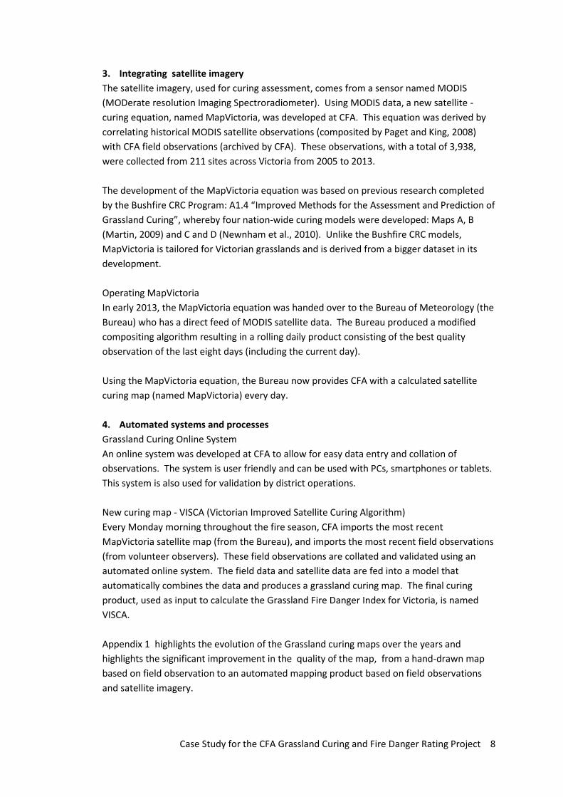
3. Integrating satellite imagery
The satellite imagery, used for curing assessment, comes from a sensor named MODIS
(MODerate resolution Imaging Spectroradiometer). Using MODIS data, a new satellite -
curing equation, named MapVictoria, was developed at CFA. This equation was derived by
correlating historical MODIS satellite observations (composited by Paget and King, 2008)
with CFA field observations (archived by CFA). These observations, with a total of 3,938,
were collected from 211 sites across Victoria from 2005 to 2013.
The development of the MapVictoria equation was based on previous research completed
by the Bushfire CRC Program: A1.4 “Improved Methods for the Assessment and Prediction of
Grassland Curing”, whereby four nation-wide curing models were developed: Maps A, B
(Martin, 2009) and C and D (Newnham et al., 2010). Unlike the Bushfire CRC models,
MapVictoria is tailored for Victorian grasslands and is derived from a bigger dataset in its
development.
Operating MapVictoria
In early 2013, the MapVictoria equation was handed over to the Bureau of Meteorology (the
Bureau) who has a direct feed of MODIS satellite data. The Bureau produced a modified
compositing algorithm resulting in a rolling daily product consisting of the best quality
observation of the last eight days (including the current day).
Using the MapVictoria equation, the Bureau now provides CFA with a calculated satellite
curing map (named MapVictoria) every day.
4. Automated systems and processes
Grassland Curing Online System
An online system was developed at CFA to allow for easy data entry and collation of
observations. The system is user friendly and can be used with PCs, smartphones or tablets.
This system is also used for validation by district operations.
New curing map - VISCA (Victorian Improved Satellite Curing Algorithm)
Every Monday morning throughout the fire season, CFA imports the most recent
MapVictoria satellite map (from the Bureau), and imports the most recent field observations
(from volunteer observers). These field observations are collated and validated using an
automated online system. The field data and satellite data are fed into a model that
automatically combines the data and produces a grassland curing map. The final curing
product, used as input to calculate the Grassland Fire Danger Index for Victoria, is named
VISCA.
Appendix 1 highlights the evolution of the Grassland curing maps over the years and
highlights the significant improvement in the quality of the map, from a hand-drawn map
based on field observation to an automated mapping product based on field observations
and satellite imagery.

Case Study for the CFA Grassland Curing and Fire Danger Rating Project 9
5. Field experiments on fire behaviour in grasslands
Understanding fire characteristics in grasslands at different curing levels is critical in fire
prediction. CFA researchers, in collaboration with the Commonwealth Scientific Research
and Industrial Organisation (CSIRO), are currently conducting a series of field experiments
aimed at quantifying the effect of curing on the rate of fire spread and associated fire
behaviour (e.g. flame height, residence time) in grasslands. The experiments consists of a
series of field scale plot burns conducted at different curing rates (40, 60 and 80%) and
compared with 100% cured plots.
The data collected from these field experiments will build the CFA’s understanding of fire
behaviour at different curing levels and ultimately contribute to improve fire prediction in
grasslands.
Next steps
With the project drawing to a close in 2014, the CFA is now in the final stages of delivering
an automated curing product. The systems and processes that have been developed over
the last three years are now becoming part of ‘every-day’ business for CFA. The CFA is
looking to continue to train more volunteer observers and improve on the spatial coverage
across Victoria. New training packages will be delivered via the online training system with
coordination from the grassland curing project. Prior to the end of the project, an upgraded
Field Guide will be released.
From July 2014 onwards, CFA will maintain the systems and processes for the grassland
curing map throughout the fire danger period. The results of the grass fire behaviour field
experiments will be incorporated into grass fire behaviour predictions in the future.
Conclusion
The CFAs ability to combine field and satellite data to accurately estimate grassland curing
within Victoria has been achieved. The CFA has improved its accuracy in calculating curing
for input into the Fire Danger Ratings in Victoria through approaching the problems on a
number of fronts. Increasing the number of volunteer observers and standardising training
has improved the quality of field data. Developing tools, such as the easy to use field card,
has led to improved consistency between observers, resulting in better quality data.
The development of MapVictoria has resulted in a more accurate grassland curing model
tailored specifically for Victorian conditions. The automated online system for the
collection, validation and storage of field data has been critical in the provision of timely
data collation. In particular, the development of the VISCA model which integrates field data
and satellite data to automatically produce the grassland curing map.
Field experiment data will contribute to improving fire prediction in grasslands.
Potential Application in other States and Territories
The MapVictoria product itself has the potential to be used by other States. However it is
important to keep in mind, this is a Victorian-based product only validated in Victoria. The

Case Study for the CFA Grassland Curing and Fire Danger Rating Project 10
masking out of water bodies is a significant improvement compared to the Bushfire CRC
nation-wide models (this “masking”, however, has had limited testing and has had no
ground truthing).
Since MapVictoria and the nation-wide models are all based on MODIS data, it was of
interest to compare the derivation of all models. The nation-wide models are derived from
343 (Levy rod) observations collected from 25 field sites across Australia (Newnham et al.,
2010). MapVictoria, on the other hand, is derived from a total of 3,938 (visual) observations
collected from 211 sites across Victoria. This extensive coverage of data across the state
gives confidence in using the MapVictoria model in Victoria as it is tailored specifically for
Victorian Grasslands.
The results of the grass fire behaviour field experiments could be applied to other states and
territories with similar grass fuel characteristics but should be locally validated to improve
fire behaviour predictions.
Critical Success Factors
The CFA project team identified the key critical success factors for the Grassland Curing and
Fire Danger Rating Project.
Critical Success Factor Why was this factor critical to the project’s success?
External funding was available for the project by the Victorian Royal Commission into 2009 bushfires.
The project was adequately resourced.
Bushfire CRC research “Improved methods for the assessment and prediction of grassland curing” is being carried out.
The MapVictoria equation was based on this Bushfire CRC research.
The Bureau having direct access to MODIS satellite date and their willingness to support the project.
Easy access to data and automatic production of map.
Project built on the existing CFA grassland curing process.
CFA had an established program and culture of receiving information from volunteer observers. Did not need to build program from scratch.
Resources required
A diverse range of skills were required to implement this project including skills in research, system
design and implementation, satellite data analysis, training and development, GIS and project
management. Resources went to employing 5 people fulltime for two years within the CFA plus
additional resources for the CSIRO research component.
Ongoing evaluation
This project is being evaluated against its objectives as part of the evaluation of projects funded out
as part of the Victorian Royal Commission into the 2009 bushfires.

Case Study for the CFA Grassland Curing and Fire Danger Rating Project 11
Project outcomes will be operationally validated during the Victorian Fire Danger Period
commencing the 2013-2014 fire season.
Findings will also be published in peer review journals.

Case Study for the CFA Grassland Curing and Fire Danger Rating Project 12
Appendix 1. Evolution of the Grassland Curing Map in Victoria
Since the 1980s, throughout each fire season, CFA volunteers have provided visual curing
observations from the field every week. Since 2010, the number of volunteer observers has grown
dramatically, and the methods used to produce curing maps have changed throughout the years.
With fewer observers up to 2010, compared to 2013, maps were hand drawn using Photoshop
(figure 1). After the project started in the 2010/2011 fire season, GIS was used for mapping.
Thiessen polygons were used first (figure 2), this progressed to the Kriging technique (figure 3), and
then to the use of satellite data (figure 4).
The map is delivered to the Bureau, it is published to the internet and is also provided as a layer in
eMap.
Figure 1 Curing Map: Hand drawn using Photoshop
Figure 2 Curing Map: Thiessen Polygons

Case Study for the CFA Grassland Curing and Fire Danger Rating Project 13
Figure 3 Curing Map: Kriging Technique
Figure 4 Curing Map: VISCA; combined field data and satellite data

From early growth to start of seed
head development.0
Seed heads formed and fl owering. 10
Name
LocationSeed heads
maturing and someseed dropping.
20Date
Point Most seed heads mature and some seed dropping.
30Height (cm) Curing % Cover % Fuel Load
Seed heads mature and some seed dropping.
40
Up to half of allstems have dropped
their seed.50
Over half of allstems have dropped
their seed.60
Landscape Most seed heads have dropped their seed, lower third ofstalk may be green.
70Height (cm) Curing % Cover % Fuel Load
Almost all seeddropped, lower third
of stalk may be green.80
Essentially all seedhas dropped, odd
individual stalk maybe green.
90
All stalks fully cured,seed heads and stalks
break easily.100
Grassland CuringField Card
100
100
80
80
60
60
40
40
20
20
0
0
2015
105
0

0
Cover %
10
20
30
40
50
60
70
80
90
100
Fuel Load (dry t/Ha)
Height Cover %(cm) 10 20 30 40 50 60 70 80 90 100
10 0.1 0.6 0.8 1.0 1.1 1.2 1.4 1.5 1.6 1.8
20 0.6 0.9 1.1 1.4 1.6 1.8 2.0 2.1 2.3 2.5
30 0.7 1.1 1.4 1.7 2.0 2.2 2.5 2.7 2.9 3.2
40 0.8 1.3 1.7 2.0 2.3 2.6 2.9 3.2 3.5 3.8
50 1.0 1.5 1.9 2.3 2.6 3.0 3.4 3.7 4.0 4.3
60 1.1 1.6 2.1 2.5 3.0 3.4 3.8 4.1 4.5 4.9
70 1.1 1.8 2.3 2.8 3.3 3.7 4.2 4.6 5.0 5.4
80 1.2 1.9 2.5 3.1 3.6 4.1 4.6 5.0 5.5 6.0
90 1.3 2.1 2.7 3.3 3.9 4.4 4.9 5.5 6.0 6.5
100 1.4 2.2 2.9 3.5 4.1 4.7 5.3 5.9 6.4 7.0
Weekly rainfall (mm)
Rate of Drying
Rapid Slow
Unchanged Greening Up
Contact us
Website: www.cfa.vic.gov.au/grassPhone: 1800 100 168Email: [email protected]
To report grassland curing, please provide your name, location,
height, curing and cover.
To join the Grassland Curing network, please use the contact
details above.
Edition 3 – July 2013
Case Study for the CFA Grassland Curing and Fire Danger Rating Project 16
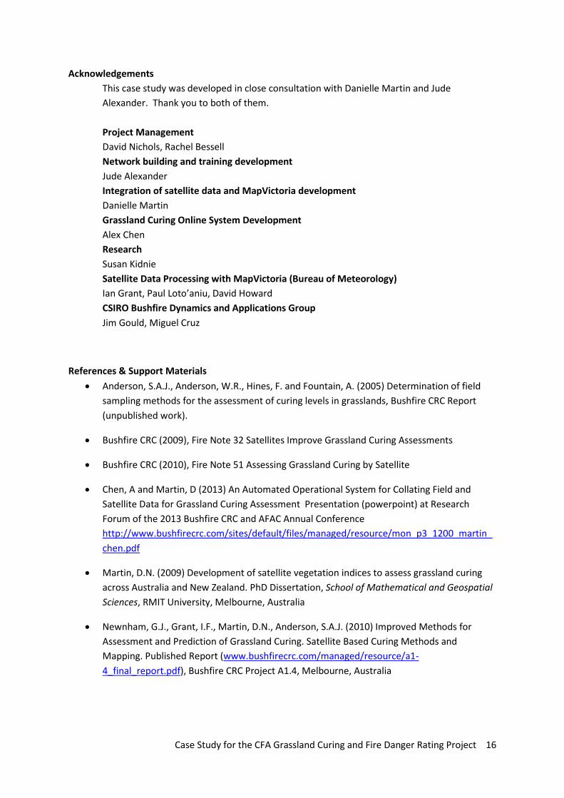
Acknowledgements
This case study was developed in close consultation with Danielle Martin and Jude
Alexander. Thank you to both of them.
Project Management
David Nichols, Rachel Bessell
Network building and training development
Jude Alexander
Integration of satellite data and MapVictoria development
Danielle Martin
Grassland Curing Online System Development
Alex Chen
Research
Susan Kidnie
Satellite Data Processing with MapVictoria (Bureau of Meteorology)
Ian Grant, Paul Loto’aniu, David Howard
CSIRO Bushfire Dynamics and Applications Group
Jim Gould, Miguel Cruz
References & Support Materials
Anderson, S.A.J., Anderson, W.R., Hines, F. and Fountain, A. (2005) Determination of field
sampling methods for the assessment of curing levels in grasslands, Bushfire CRC Report
(unpublished work).
Bushfire CRC (2009), Fire Note 32 Satellites Improve Grassland Curing Assessments
Bushfire CRC (2010), Fire Note 51 Assessing Grassland Curing by Satellite
Chen, A and Martin, D (2013) An Automated Operational System for Collating Field and
Satellite Data for Grassland Curing Assessment Presentation (powerpoint) at Research
Forum of the 2013 Bushfire CRC and AFAC Annual Conference
http://www.bushfirecrc.com/sites/default/files/managed/resource/mon_p3_1200_martin_
chen.pdf
Martin, D.N. (2009) Development of satellite vegetation indices to assess grassland curing
across Australia and New Zealand. PhD Dissertation, School of Mathematical and Geospatial
Sciences, RMIT University, Melbourne, Australia
Newnham, G.J., Grant, I.F., Martin, D.N., Anderson, S.A.J. (2010) Improved Methods for
Assessment and Prediction of Grassland Curing. Satellite Based Curing Methods and
Mapping. Published Report (www.bushfirecrc.com/managed/resource/a1-
4_final_report.pdf), Bushfire CRC Project A1.4, Melbourne, Australia

Case Study for the CFA Grassland Curing and Fire Danger Rating Project 17
Paget, M.J. and King, E.A. (2008) MODIS Land data sets for the Australian region. CSIRO
Marine and Atmospheric Research Internal Report No. 004.
(https://lpdaac.usgs.gov/lpdaac/products/modis_policies)
Victorian Royal Commission (2009) Interim Report
(http://www.royalcommission.vic.gov.au/Interim-Reports/Interim-Report/Interactive-
Version)
Useful websites
Bushfire Cooperative Research Centre www.bushfirecrc.com
Victorian Country Fire Authority – www.cfaonline.cfa.vic.gov.au
Key contacts
David Nichols: Phone: 03 9262 8264, Email: [email protected]
Rachel Bessell: Phone: 03 9262 8607, Email: [email protected]
Grassland Curing Team: Email: [email protected]