Embed Size (px)
DESCRIPTION
sgsfsgsg
Citation preview

Decision Support Systems for Supply Chain
Management
Chap 10 王仁宏 助理教授
國立中正大學企業管理學系
©Copyright 2001 製商整合科技中心
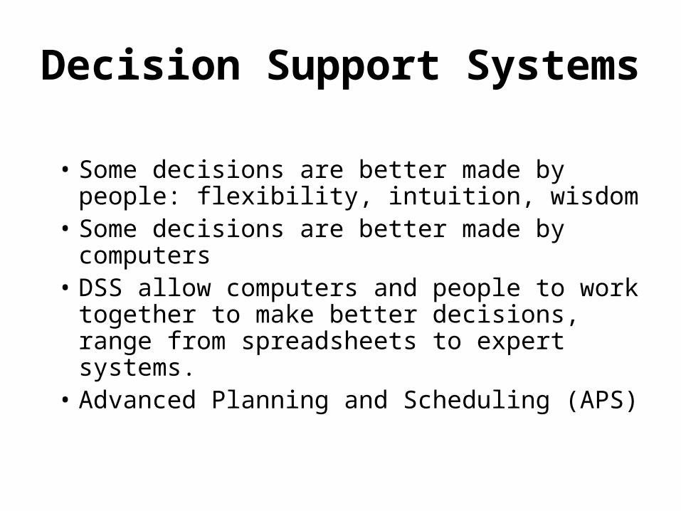
Decision Support Systems
• Some decisions are better made by people: flexibility, intuition, wisdom
• Some decisions are better made by computers
• DSS allow computers and people to work together to make better decisions, range from spreadsheets to expert systems.
• Advanced Planning and Scheduling (APS)
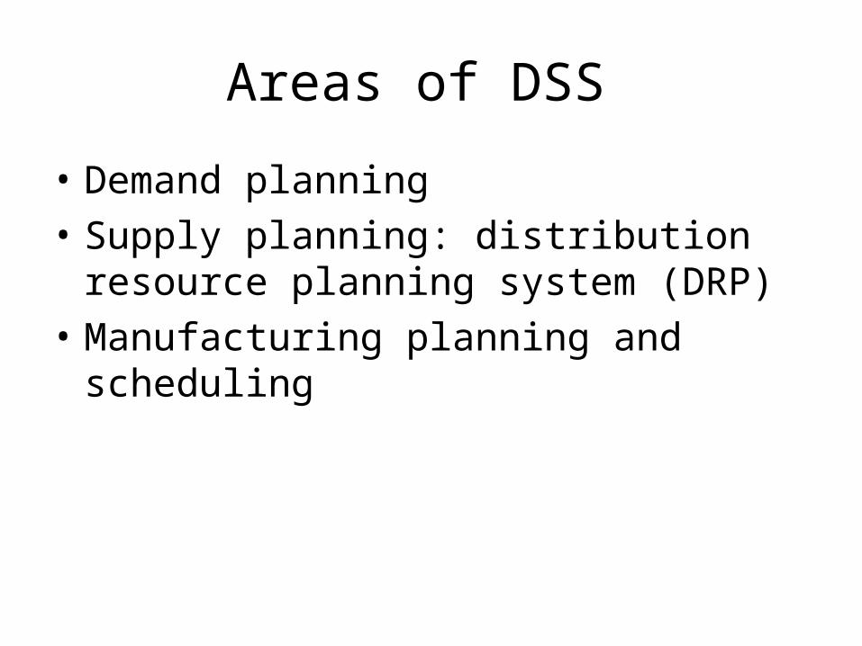
Areas of DSS
• Demand planning
• Supply planning: distribution resource planning system (DRP)
• Manufacturing planning and scheduling

Mathematical Tools of DSS
• Operations research: developed in World War II
• Artificial intelligence (AI): intelligent agents
• Expert systems: a kind of AI, rely on an extensive database of knowledge
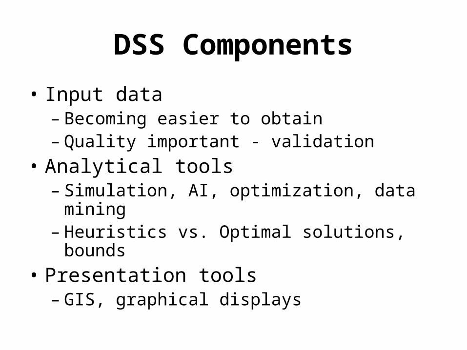
DSS Components
• Input data– Becoming easier to obtain– Quality important - validation
• Analytical tools– Simulation, AI, optimization, data mining– Heuristics vs. Optimal solutions, bounds
• Presentation tools– GIS, graphical displays

Analytical Tools
• Queries• Statistical analysis• Data mining• Online analytical processing (OLAP) tools• Calculators• Simulation• Artificial intelligence• Mathematical models and algorithms

Choose Appropriate Analytical Tools
• The type of problem being considered• Required accuracy of the solution• Problem Complexity• Number and type of quantifiable output
measures• Required speed of DSS• Number of objectives or goals of the
decision maker
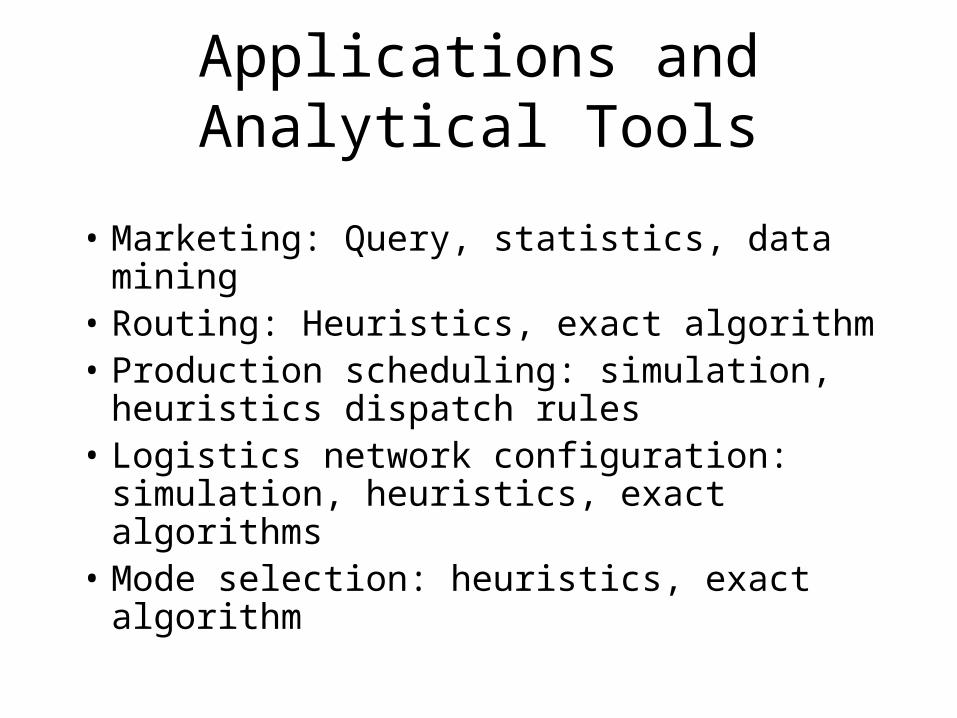
Applications and Analytical Tools
• Marketing: Query, statistics, data mining• Routing: Heuristics, exact algorithm• Production scheduling: simulation,
heuristics dispatch rules• Logistics network configuration:
simulation, heuristics, exact algorithms• Mode selection: heuristics, exact
algorithm

Presentation Tools
• Reports
• Charts
• Spreadsheet tables
• Animation
• Specialized graphic formats: layout
• Geographic Information System (GIS)

GIS Capabilities
• Mapping and thematic mapping• Database management• Interactive data query• Spatial data retrieval• Geographic data manipulation• Spatial data analysis• Geocoding: translate addresses into geographic coordinates
• Geographic data import/export• Buffering/polygon overlay
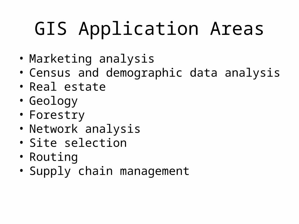
GIS Application Areas
• Marketing analysis• Census and demographic data analysis• Real estate• Geology• Forestry• Network analysis• Site selection• Routing• Supply chain management

DSS Evaluation
• P. 272

Logistics Network Design

DSS Examples
• Logistics Network Design
• Supply Chain Planning
• Vehicle Routing and Scheduling

Logistics Network Design
• Data:– A listing of all products– Location of customers, existing warehouses and
sources– Demand for each product by customer location– Transportation rates– Variable production costs– Warehousing costs– Shipment sizes by product
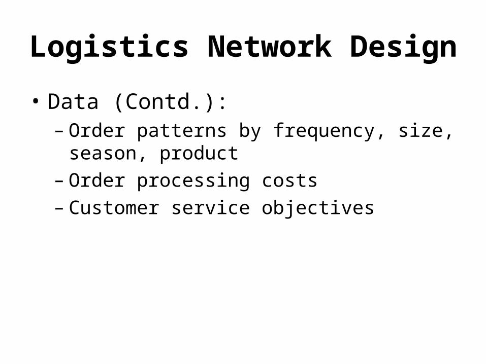
Logistics Network Design
• Data (Contd.):– Order patterns by frequency, size, season,
product– Order processing costs– Customer service objectives

Logistics Network Design

Logistics Network Design
• The Key Issues:– Number of warehouses– Location of each warehouse– Size of each warehouse– Allocation of products to the different
warehouses– Allocation of customers to each warehouse

Logistics Network Design
• The Objective is to balance service level against– production/ purchasing costs,– inventory carrying costs,– facility costs
• storage,• handling,• fixed,
– transportation costs.

Logistics Network Design

Supply Chain Planning
• Data:– Information regarding suppliers,
manufacturers, warehouses and retail stores.– Forecast demands for each store.– Available transportation modes, transportation
costs and inventory costs.

Supply Chain Planning
• Demand planning
• Production planning and detailed scheduling
• Distribution planning

Supply Chain Planning
• Constraints:– Each store receives its demand.– Warehouse Capacity.– Supplier/ Manufacturer limitations.– Delivery Time.– Service Level.
• Goal:– Design production and distribution schedules so
that no constraint is violated and total cost including manufacturing, inventory and transportation is as small as possible.

Vehicle Routing
• Data:– A set of vehicles,– demand locations (or customers) where
demand is picked up, – depots.

Vehicle Routing

Vehicle Routing
• Constraints:– Each demand location is visited and the
demand is picked– Vehicle Capacity.– Distance Constraint.– Time Window Constraints:
• Earliest Pick-up time,• Service time,• Latest pick-up time.

Vehicle Routing
• Goal:– Design routes for vehicles such that no
constraint is violated and either• total length of routes is as small as possible, or• number of vehicles is minimized.
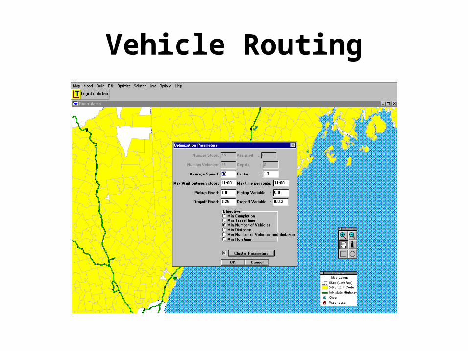
Vehicle Routing

Vehicle Routing
DSS: Past Approaches and Limitations
• Many procedures have been developed.– A common limitation of these procedures is
the lack of robustness
• Lack of inexpensive graphical representation tools for geographic data.
• Inability to solve large scale problems on desk-top computers.

New Developments
• Deeper understanding of – the underlying structure of effective strategies for
large scale models,– uncertainty issues.
• Development of new procedures that are– robust– efficient– practical– fast.
New Developments
• Significant increase in computing power.
• Development of desk-top Decision Support tools such as Geographic Information Systems (GIS).

Geographic Information Systems (GIS)
• Definition: A GIS is an integrated computer mapping and database management system that provides functions for the storage, retrieval, management, analysis and display of geographic data.

Typical GIS Capabilities
• Mapping
• Database management
• Geographic Data Retrieval
• Geographic Data Manipulation
• Geographic Data Analysis

Typical GIS Interface

Typical GIS Applications
• Census and Demographic Data Analysis• Market Analysis• Land Use/ Parcel Mapping• Network Analysis
– Transportation,– Telecommunications
• Site Location Modeling• Distribution, Logistics and Supply-Chain
Management.

Benefits of Integrating GIS with Optimization
• Development of Model Input• Visualization of Data• Provides Accurate Street Level Data Base
– One Way Streets– Turn Difficulties
• Visualization of Strategies Generated by the Procedure

Benefits of IntegratingGIS with Optimization
• Incorporate Travel Time Estimation• Model Evaluation• Interactive Decision Support System.

Table 1:Software Vendors/Logistics
Topic CAPS Logistics Insight Intertrans LogicTools
Established 1979 1978 1991 1995
Home page www.caps.com www.insight-mss.com
www.itls.com www.logictool.com
Products Supply ChainDesigner,Supply ChainCoordinator,Transpro,Routepro
SAILSGSCMSHIPCONS IIBDS
Supply Chain StrategistGlobal Logistics ManagerCarrier bid optimizerTransportation ModelerTransportation OptimizerTransportation Manager
LogicNetLogicChain
Platform MS Windows MS Windows Client/server MS Windows

A Step Back: Information Technology
• Internal and external systems connecting the parts of the firm to each other, customers and suppliers
• Companies employ various systems:– Decision support systems– Warehouse management systems– Production planning and tracking– Transaction and sales processing– Communications systems: Email, Intranets

Memo
![Chapter 10 10ic.arc.losrios.edu/~mirzaam/math400/PPT/CH10P6.pdfMicrosoft PowerPoint - CH10.ppt [Compatibility Mode] Author: All Created Date: 8/3/2015 12:27:02 AM](https://img.pdfslide.net/doc/110x75/5b0297e17f8b9ad85d8fcc68/chapter-10-10icarc-mirzaammath400pptch10p6pdfmicrosoft-powerpoint-ch10ppt.jpg)
![HP20e PPT ch10.ppt [Read-Only] - …docshare01.docshare.tips/files/27706/277061205.pdfCredit Memorandum • Issued by the seller indicating the customer’s accounts receivable account](https://img.pdfslide.net/doc/110x75/5b0297e17f8b9ad85d8fcc9e/hp20e-ppt-ch10ppt-read-only-memorandum-issued-by-the-seller-indicating.jpg)

![Chapter 10ic.arc.losrios.edu/~mirzaam/math400/PPT/CH10.pdfTitle: Microsoft PowerPoint - CH10.ppt [Compatibility Mode] Author: All Created Date: 8/2/2015 11:41:54 PM](https://img.pdfslide.net/doc/110x75/5b0297e07f8b9ad85d8fcc33/chapter-10icarc-mirzaammath400pptch10pdftitle-microsoft-powerpoint-ch10ppt.jpg)