Embed Size (px)
Citation preview

7/24/2019 Chapter 3 Surface Runoff
http://slidepdf.com/reader/full/chapter-3-surface-runoff 1/10
CHAPTER 3 - SURFACE RUNOFF CC606-HYDROLOGY
3
SURFACE RUNOFF
3.0 INTRODUCTION
Runoff is generated by rainstorms and its occurrence and quantity are dependent on the characteristics ofthe rainfall event, i.e. intensity, duration and distribution. There are important factors which influence therunoff generating process.
Surface runoff is a term used to describe when soil is infiltrated to full capacity and excess water, fromrain, snowmelt, or other sources flow over the land. This is a major component of the water cycle or thehydrological cycle.
Surface runoff can be generated either by rainfall or by the melting of snow or glaciers. Based on thehydrological cycle, runoff is flow from a drainage basin or watershed that appears in surface streams. Theflow is made by parts of precipitation that falls directly into the stream, surface runoff, subsurface runoff,and groundwater runoff.
In hydrology, quantity of water discharged in surface streams. Runoff includes not only the waters thattravel over the land surface and through channels to reach a stream but also interflow , the water thatinfiltrates the soil surface and travels by means of gravity toward a stream channel (always above themain groundwater level) and eventually empties into the channel.

7/24/2019 Chapter 3 Surface Runoff
http://slidepdf.com/reader/full/chapter-3-surface-runoff 2/10
CHAPTER 3 - SURFACE RUNOFF CC606-HYDROLOGY
Figure 3.0 :Illustrating basin relationship between Precipitation(rainfall), infiltration and runoff
Can we learn anything about the basin from a measured runoff event?
Rainfall excess or direct runoff = Overland Flow
Streamflow = Direct Runoff + Baseflow
Direct Runoff = rainfall excess
rainfall excess= rainfall - losses
When rain falls, the first drops of water are intercepted by the leaves and stems of the vegetation. This isusually referred to as interception storage.
3.1 Rainfall-runoff relationship.
As the rain continues, water reaching the ground surface infiltrates into the soil until it reaches a stagewhere the rate of rainfall (intensity) exceeds the infiltration capacity of the soil. Thereafter, surfacepuddles, ditches, and other depressions are filled (depression storage), after which runoff is generated.
Losses = interception, infiltration, depressionstorage,etc. (sometimes called basin
recharge)
Precipitation

7/24/2019 Chapter 3 Surface Runoff
http://slidepdf.com/reader/full/chapter-3-surface-runoff 3/10
CHAPTER 3 - SURFACE RUNOFF CC606-HYDROLOGY
The infiltration capacity of the soil depends on its texture and structure, as well as on the soil moisturecontent. The initial capacity (of a dry soil) is high but, as the storm continues, it decreases until it reachesa steady value termed as final infiltration rate (see Figure 3.1).
The process of runoff generation continues as long as the rainfall intensity exceeds the actual infiltrationcapacity of the soil but it stops as soon as the rate of rainfall drops below the actual rate of infiltration.
Figure 3.1 :Schematic diagram illustrating relationship between rainfall, infiltration and runoff (Source: Linsley et al. 1958)
3.2 Factors affecting runoff
What factors influence surface runoff?
Catchments characteristics affecting runoff;
i. sizeii. shapeiii. slopeiv. land use (cover)v. soil typevi. antecedent conditions
Rainfall characteristics affecting runoff;
i. Storm characteristicsii. storm intensity (i(t) and total depth)iii. storm durationiv. spatial variationv. movement
7/24/2019 Chapter 3 Surface Runoff
http://slidepdf.com/reader/full/chapter-3-surface-runoff 4/10
CHAPTER 3 - SURFACE RUNOFF CC606-HYDROLOGY
The influence of the rainfall-runoff process are described below.
i. Soil type
The infiltration capacity is among others dependent on the porosity of a soil which determines the waterstorage capacity and affects the resistance of water to flow into deeper layers.
Porosity differs from one soil type to the other. The highest infiltration capacities are observed in loose,sandy soils while heavy clay or loamy soils have considerable smaller infiltration capacities.
ii. Vegetation
The amount of rain lost to interception storage on the foliage depends on the kind of vegetation and itsgrowth stage. Values of interception are between 1 and 4 mm. A cereal crop, for example, has a smallerstorage capacity than a dense grass cover.
More significant is the effect the vegetation has on the infiltration capacity of the soil. A dense vegetationcover shields the soil from the raindrop impact and reduces the crusting effect as described earlier.
In addition, the root system as well as organic matter in the soil increase the soil porosity thus allowingmore water to infiltrate. Vegetation also retards the surface flow particularly on gentle slopes, giving thewater more time to infiltrate and to evaporate.
In conclusion, an area densely covered with vegetation, yields less runoff than bare ground.
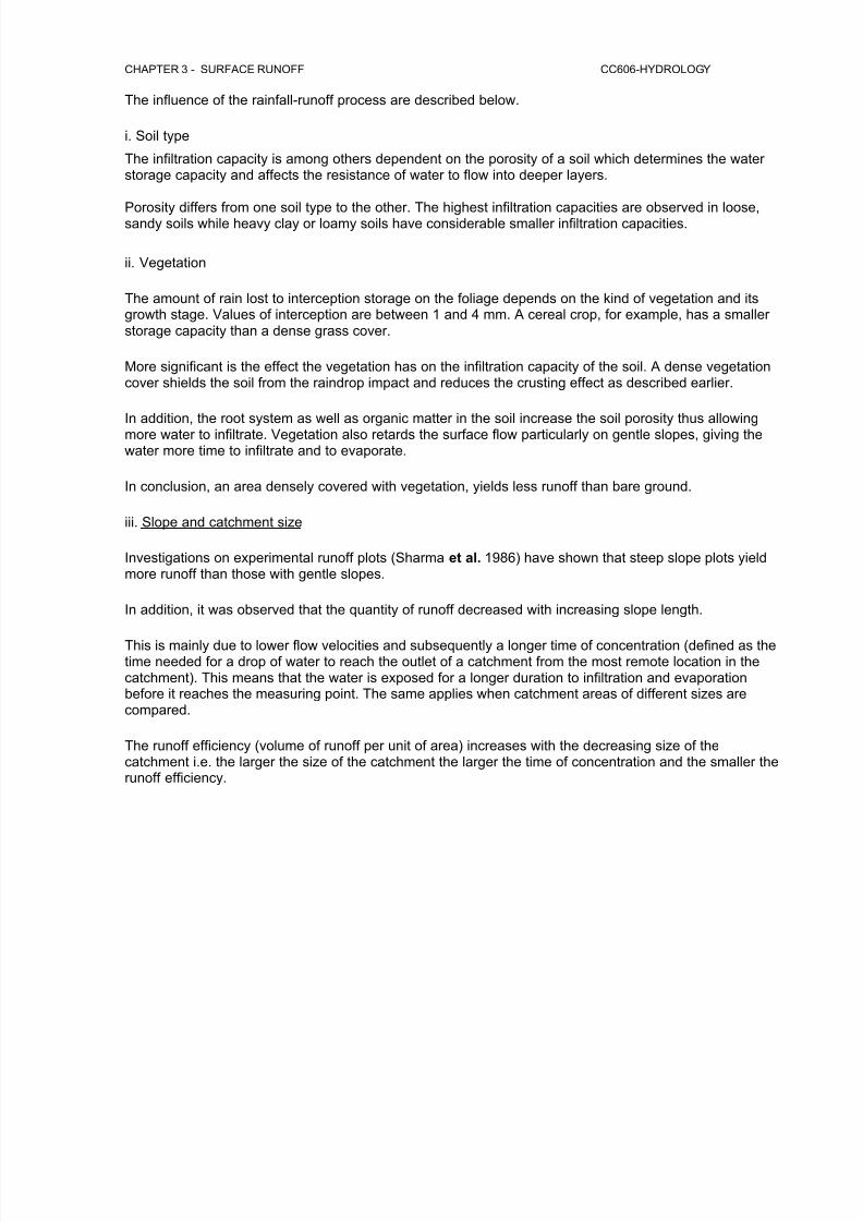
iii. Slope and catchment size
Investigations on experimental runoff plots (Sharma et al. 1986) have shown that steep slope plots yieldmore runoff than those with gentle slopes.
In addition, it was observed that the quantity of runoff decreased with increasing slope length.
This is mainly due to lower flow velocities and subsequently a longer time of concentration (defined as thetime needed for a drop of water to reach the outlet of a catchment from the most remote location in thecatchment). This means that the water is exposed for a longer duration to infiltration and evaporationbefore it reaches the measuring point. The same applies when catchment areas of different sizes arecompared.
The runoff efficiency (volume of runoff per unit of area) increases with the decreasing size of thecatchment i.e. the larger the size of the catchment the larger the time of concentration and the smaller therunoff efficiency.

7/24/2019 Chapter 3 Surface Runoff
http://slidepdf.com/reader/full/chapter-3-surface-runoff 5/10
CHAPTER 3 - SURFACE RUNOFF CC606-HYDROLOGY
3.3 Streamflow Measurement
Figure 3.3; A man gages a stream by measuring water velocity (using a current meter) andwater depth
The water which constitutes the flow in the surface stream is called streamflow. If the streamflow isunaffected by the artificial diversions, storage, or other works of man in or on the stream channels, then itis called as runoff. Streamflow forms the most important data for engineers and hydrologists since theyare concerned mainly with estimating rates and volumes of the streamflow to be used in the design ofwater resources projects, rainfall-runoff relations, unit hydrograph studies, design flood estimation etc.
3.3.1 Measurement of stage.
The river stage has been defined as the height of the water surface in the river at a given sectionabove any arbitrary datum. It is usually expressed in meters. The stage can be easily measuredby installing a vertical staff gauge which is nothing but a graduated scale such the a portion of it isalways in the water at all times.it can be conveniently attached to a bridge pier or any otherexisting structure. It is read manually by noting the level of water surface in contact with it.
Figure 3.3.1; Measurement of stage in the river

7/24/2019 Chapter 3 Surface Runoff
http://slidepdf.com/reader/full/chapter-3-surface-runoff 6/10
CHAPTER 3 - SURFACE RUNOFF CC606-HYDROLOGY
3.3.2 Measurement of velocity.
Stream gaging is a technique used to measure the discharge, or the volume of water movingthrough a channel per unit time, of a stream. The height of water in the stream channel, known asa stage or gage height, can be used to determine the discharge in a stream. When used inconjunction with velocity and cross-sectional area measurements, stage height can be related todischarge for a stream. If a weir or flume (devices, generally made of concrete, located in astream channel that have a constant, known shape and size) is used, mathematical equationsbased on the weir or flume shape can be used in conjunction with stage height, negating theneed for velocity measurements.
Stream discharge can be measured using;(1) volumetric gauging,
(2) float gauging,(3) current metering,(4) dilution gauging (constant injection or gulp methods),(5) structural methods, and(6) slope-area methods.
The choice of method depends on the characteristics of the stream and on the application.
(1) Volum etr ic gauging:
Stream discharge (in cumecs@m 3/s) at one point in time (i.e., a 'spot discharge') can bemeasured directly with volumetric gauging, though this is only possible with small river-flows, orindirectly with the velocity-area methods of float gauging and current metering.
(2) Float gauging :
Involves measuring the velocity of a neutral buoyancy object and multiplying this by the averagecross-sectional area (using a tape and rule) of the river. These objects do, however, float close tothe river surface, which is faster then the average velocity of the water profile and must, therefore,
be reduced by a coefficient (e.g., a river 0.9 m deep has a coefficient of 0.7). Some rivers alsohave large changes in velocity across the river channel. This cannot be corrected, so the moreaccurate current metering method is recommended.
Figure 3.3.2(1); Price AA current meter

7/24/2019 Chapter 3 Surface Runoff
http://slidepdf.com/reader/full/chapter-3-surface-runoff 7/10
CHAPTER 3 - SURFACE RUNOFF CC606-HYDROLOGY
(3) Current m eter ing:
With current metering the rotation of a current meter's impeller (Figure 3.3.2(1) ) gives the localwater velocity following application of a calibration equation (called a rating equation). To cope
with the vertical distribution of velocity, measurements should be made at different depths (D) inthe water profile. If only two depths are used for measurement, then an average of 0.2D and 0.8Dgives a good representation of the profile velocity, or 0.6D if only one depth is used (Hewlett,1982 p99). The transverse (i.e., 'across-river') distribution of velocity can be characterised by firstdividing the channel cross-section into a number of 'segments'. The edge of these segments arecalled 'verticals' and these are the locations at which the measurements to calculated the profile-average velocity should be made (Figure 3.3.2(2)). The 'Mean-Section Method' or 'Mid-SectionMethod' can then be used to calculate the discharge for each segment (Dingman, 1993 p536-541).
Figure 3.3.2 (2). Gauging water velocity at a 'vertical'
Figure 3.3.2 (2) . Current Meter Discharge Measurement

7/24/2019 Chapter 3 Surface Runoff
http://slidepdf.com/reader/full/chapter-3-surface-runoff 8/10
CHAPTER 3 - SURFACE RUNOFF CC606-HYDROLOGY
Where the ‘Mean -Section Method’ is used to calculate dischar ge for each segment using:
Qseg = 0.5( v1+v2 ) ´ 0.5( d1 +d2 ) ´b
where Qseg is the discharge for each channel segment (cumecs), v1 and v2 are the profile-average water velocities at vertical 1 and 2 respectively (either side of the segment), d1 and d2 are the depths of the flow at verticals 1 and 2 respectively, and b is the chosen width of eachchannel segment. The average velocity of the water in the two 'end segments' (adjacent to theriver banks) are calculated by assuming zero depth and zero velocity at the water's edge. Currentmetering is an accurate method of river gauging except where the river is very shallow. Undersuch conditions, an alternative method of dilution gauging can be used.
(4) Dilution g auging : This method is based on 'the two component mixing equation', i.e.,
where Q is the unknown upstream river discharge, q is the tracer discharge, C2 is the mixeddownstream concentration, C1 is the concentration of the tracer to be added, and C0 is thebackground tracer concentration in the river (may be zero). Sodium chloride (common salt) is agood tracer for dilution gauging as it is (a) 'chemically conservative', i.e., does not adsorb('chemically bind') onto river sediments, (b) has a high solubility in water, (c) is relatively non-toxic, (d) can be measured in the field indirectly with a conductivity meter, and (e) is cheap andreadily available. Where large rivers are to be gauged, then alternative tracers that can be tracedat ppb (part per billion) levels are normally used, e.g., the fluorescent Rhodamine WT. Twoapproaches to dilution gauging can be used - 'constant injection method' and the 'integration orgulp injection method'. The (3a) constant injection method is the most difficult to employ in thefield, but the simplest to understand as it involves a direct transformation of the two componentmixing equation, i.e.,
With this method a known tracer concentration ( C 1) is trickled into the river at a fixed rate ( q;using a 'Mariotte device'). At a downstream point, the background concentration ( C 0) is measuredfollowed by this concentration mixed with the tracer ( C 2). In some contrast, the (3b) integration orgulp method involves the addition of a known volume and concentration of a tracer (i.e., the VC 1term) into the river as a single 'slug'. The downstream (mixed) concentration is then measured(C 2), the background concentration ( C 0) subtracted and the area beneath C 2-C 0 versus time ( t )curve calculated giving the term:

7/24/2019 Chapter 3 Surface Runoff
http://slidepdf.com/reader/full/chapter-3-surface-runoff 9/10
CHAPTER 3 - SURFACE RUNOFF CC606-HYDROLOGY
The river discharge is then:
These four methods of volumetric, float, current-meter and dilution gauging (see e.g., Dingman,1993 p541-542) give only spot discharges, for continuous traces of river discharge (e.g., a singleriver hydrograph or a series of several storm hydrographs), the structural method is required.
(5) Structu ra l method: Within this method, a relationship between the height of water in the river(called the 'stage') and several spot discharge measurements (by current metering or dilutiongauging) is established and called the rating curve . Within a natural river reach the relationshipbetween the stage and discharge follows many different curves, changing because the riverchanges from subcritical flow (also called 'tranquil' flow with a Froude number <1) to supercriticalflow (or 'fast/shooting' flow with a Froude number >1). For example, as river-water flows over aboulder it moves from subcritical flow to supercritical flow (a 'hydraulic drop') at the top of theboulder and then 'jumps back up' to subcritical flow shortly after (at the 'hydraulic jump') (Gordonet al ., 1992). If, however, one forces a river through a stable and large hydraulic drop, then justupstream of that point, that river is always subcritical and, therefore, has only one relationshipbetween stage and discharge. Thus by building a structure to create this hydraulic drop anaccurate discharge trace can be calculated. River gauging structures called weirs force the rivergenerate this hydraulic drop as the water falls from a stilling pool , while flumes normally use aconstriction to generate the hydraulic drop. There are many types of weirs from V-notch (Figure3.3.2(5/1)) to rectangular thin-plate to Crump weirs, and many types of flumes from trapezoidal(Figure 3.3.2(5/2).) to H-flume types.
Figure 3.3.2(5/1). V-notch thin-plate weir (Tir Gwyn catchment, mid-Wales)

7/24/2019 Chapter 3 Surface Runoff
http://slidepdf.com/reader/full/chapter-3-surface-runoff 10/10
CHAPTER 3 - SURFACE RUNOFF CC606-HYDROLOGY
Figure3.3.2(5/2). Trapezoidal flume (Tir Gwyn catchment, mid-Wales)
The river stage upstream of the weir and upstream or within a flume is then measured in a stillingwell using a float-actuated chart recorder, an electronic potentiometer or electronic pressuretransducer (and datalogger). If the peak discharge during a flood is required for flood prediction ata site where only the maximum height of the flood is known or where river-gauges have beenover-topped, then slope-area methods can be used.
(6) Slope-area m ethods : Perhaps the most common slope-area method involves the use of theManning Equation , i.e.,
and
where V is the river velocity (or 'specific discharge'), R is the 'hydraulic radius' which is the cross-sectional area of the flow divided by the wetted perimeter, S is approximated by the downstreamslope on the river surface, and n is Manning's roughness coefficient (which varies between 0.025and 0.07 in natural channels). In other words, if the water-surface slope and the 'hydraulic meandepth' (» 'hydraulic radius') increase so does the river's velocity, while if the channel roughnessincreases, the river velocity reduces (Hewlett, 1982 p102-103).