Embed Size (px)
Citation preview
City of Pharr, TX - GIS
L David Flores, Jr., CPM GIS Coordinator

Agenda
• The History
• The Beginning
• The First Year
• The Next Five
• Present
• Our Future

The History
• Early Mapping-Beard Maps
• AutoCAD
• 1996 – Consultant
• 2000 – City Engineer
• 2006 – The Beginning
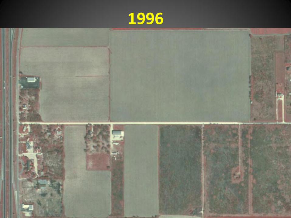
1996
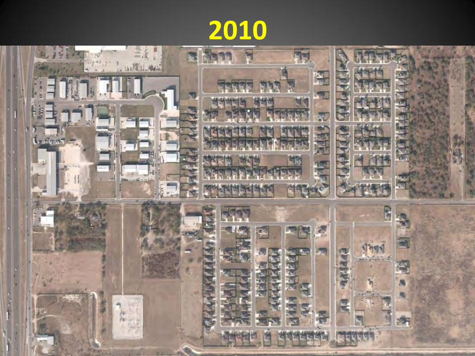
2010
The Beginning
• Analyze multiple data set and layers
• Geo-Reference
• ACAD
• SHP
• Stave off disasters
The First Year
• Analyze
• Geo-Reference
• Correct
• Create GDB/SHP

The Next Five Years
• ArcReader
• Utilities Infrastructure
• Addressing
• GPS - ArcPad
• RGVAUG
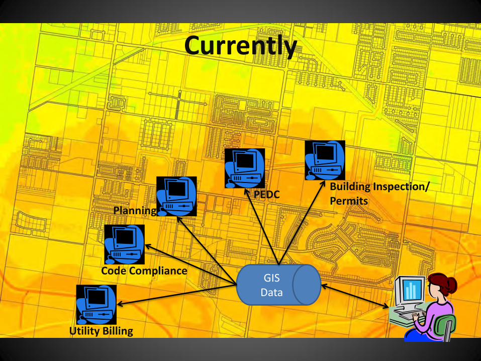
Currently
GIS Data
Utility Billing
Code Compliance
Planning
PEDC Building Inspection/ Permits
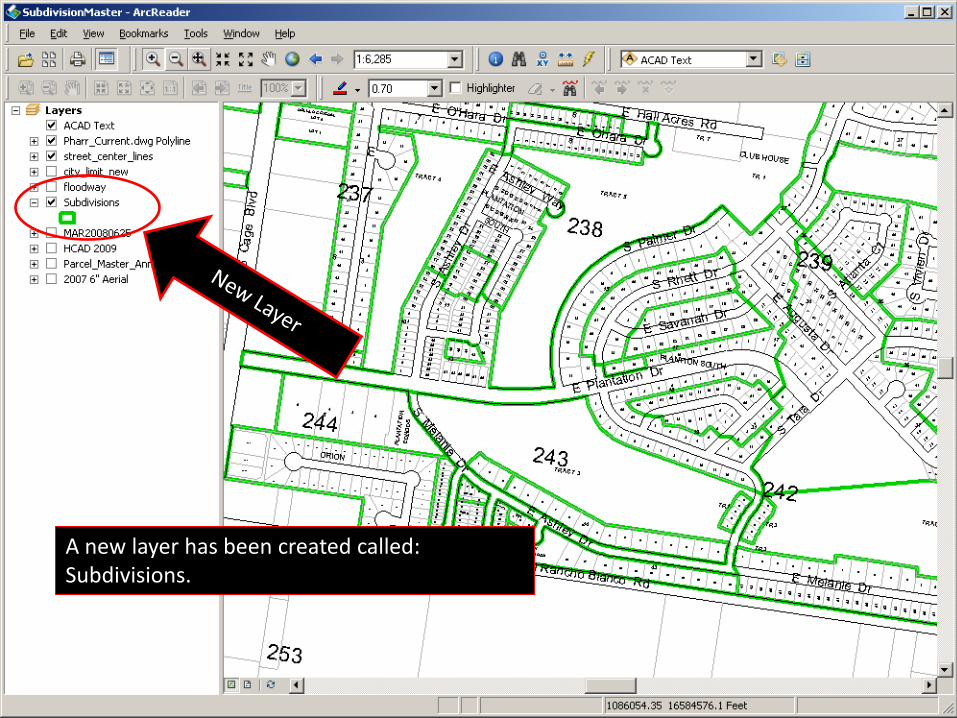
A new layer has been created called: Subdivisions.
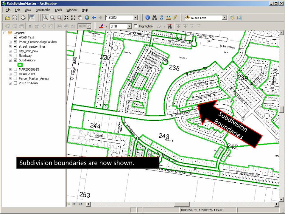
Subdivision boundaries are now shown.
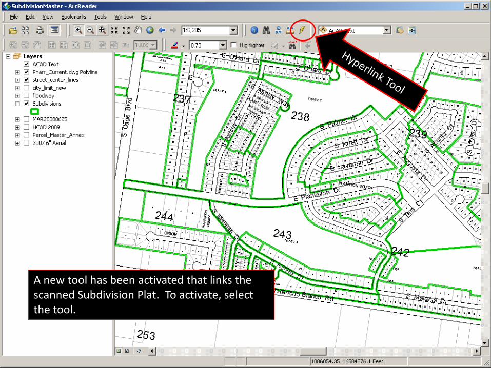
A new tool has been activated that links the scanned Subdivision Plat. To activate, select the tool.
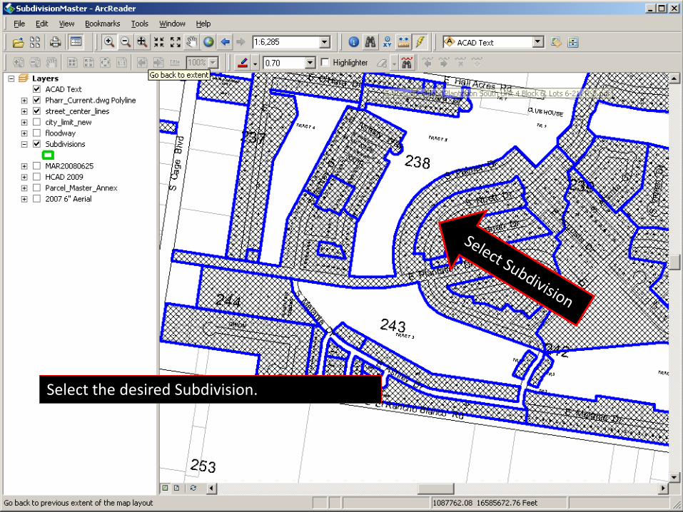
Select the desired Subdivision.
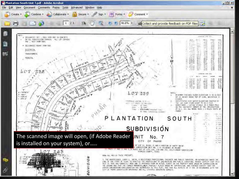
The scanned image will open, (if Adobe Reader is installed on your system), or…..
Present
• A great interest
• LIDAR
• Ortho Acquisition
• PD, Fire, Public Works
• NWS
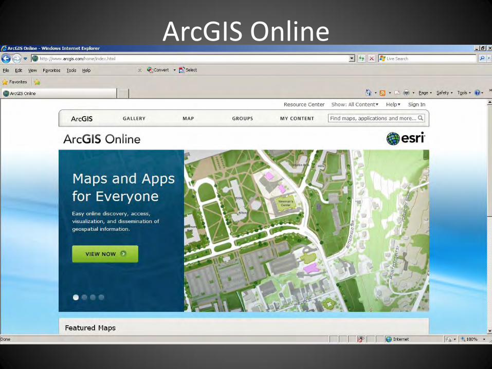
• ArcGIS Online
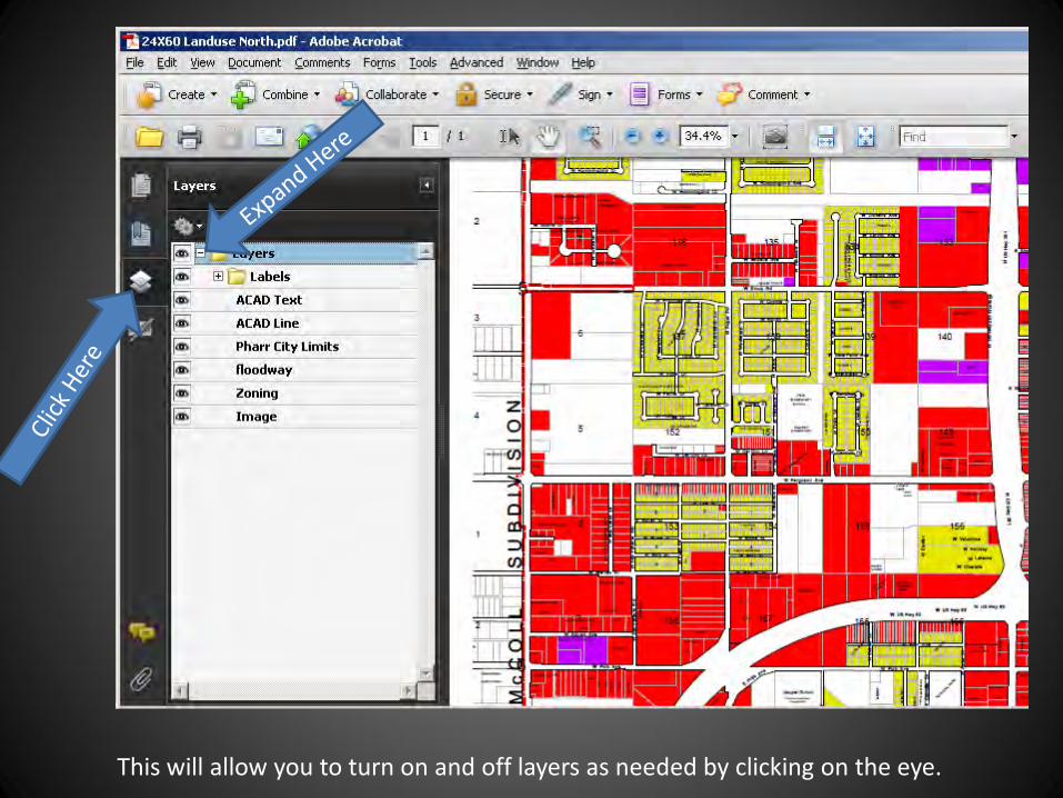
This will allow you to turn on and off layers as needed by clicking on the eye.
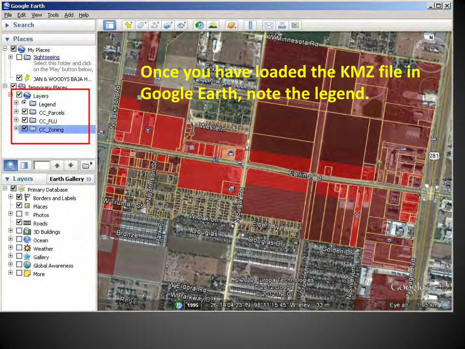
Once you have loaded the KMZ file in Google Earth, note the legend.
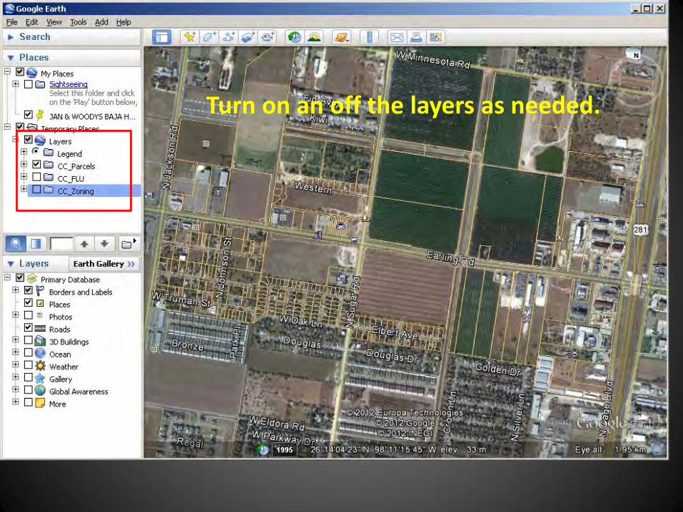
Turn on an off the layers as needed.
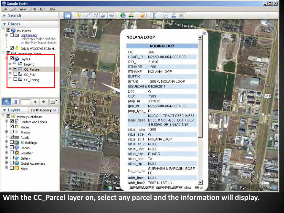
With the CC_Parcel layer on, select any parcel and the information will display.
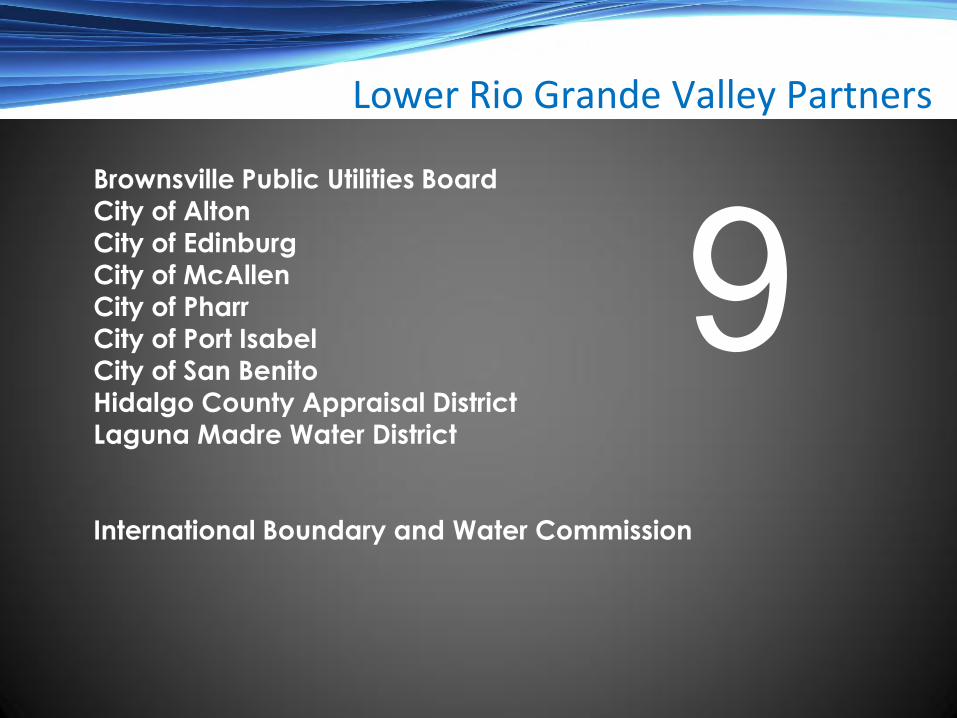
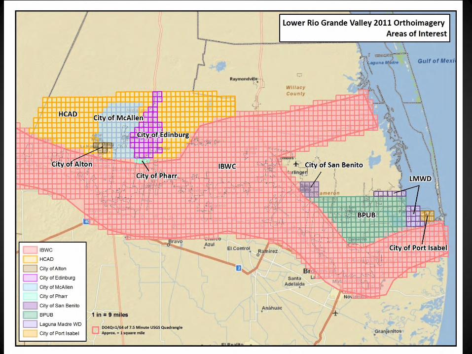
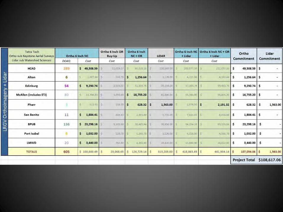
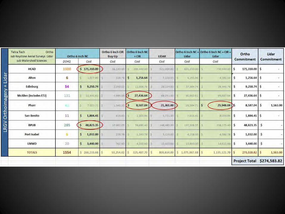
Brownsville Public Utilities Board
City of Alton
City of Edinburg
City of McAllen
City of Pharr City of Port Isabel
City of San Benito
Hidalgo County Appraisal District
Laguna Madre Water District
International Boundary and Water Commission
Lower Rio Grande Valley Partners
9
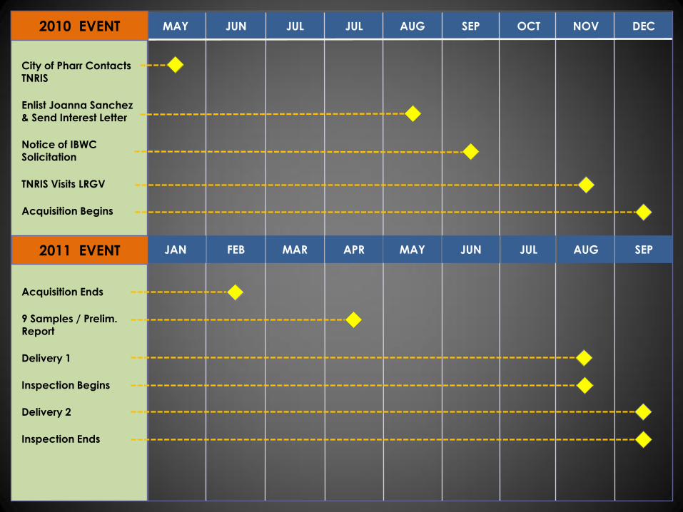
MAY JUN JUL JUL AUG SEP OCT NOV DEC
City of Pharr Contacts TNRIS
Enlist Joanna Sanchez & Send Interest Letter
Notice of IBWC Solicitation
TNRIS Visits LRGV
Acquisition Begins
Acquisition Ends
9 Samples / Prelim. Report
Delivery 1
Inspection Begins
Delivery 2
Inspection Ends
2010 EVENT
2011 EVENT JAN FEB MAR APR MAY JUN JUL AUG SEP
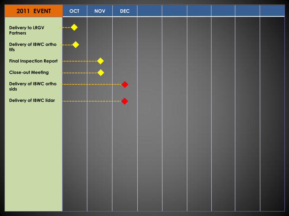
OCT NOV DEC
Delivery to LRGV Partners
Delivery of IBWC ortho tifs
Final Inspection Report
Close-out Meeting
Delivery of IBWC ortho sids
Delivery of IBWC lidar
2011 EVENT
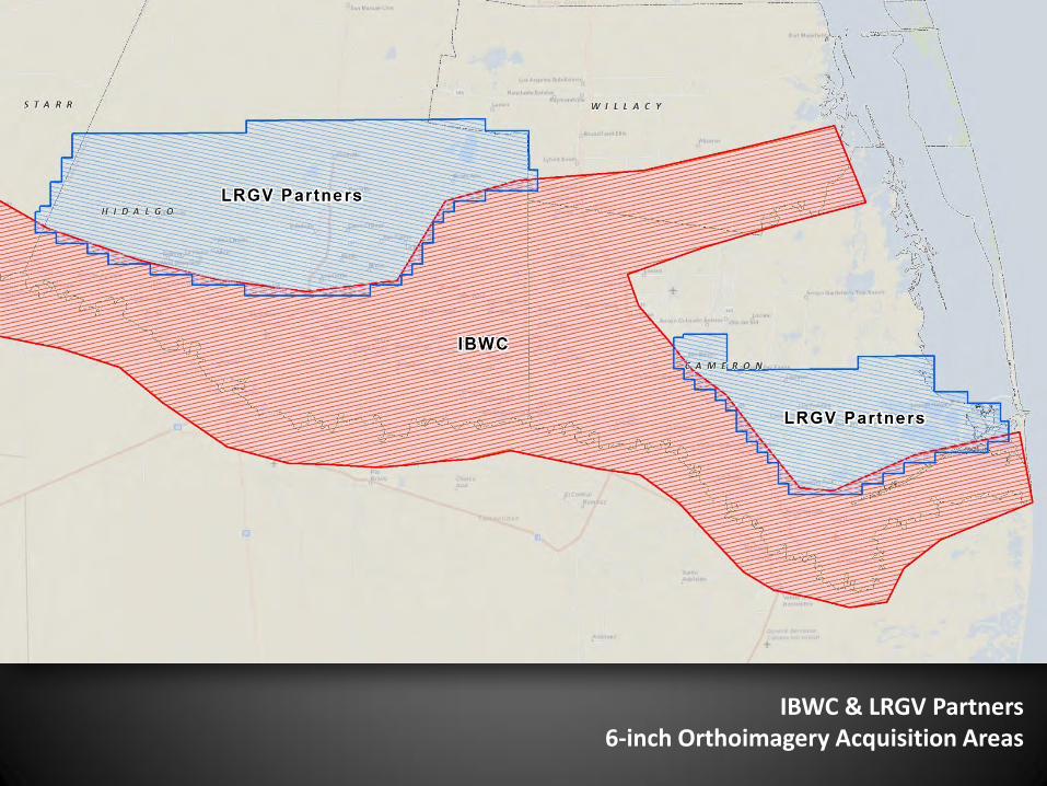
IBWC & LRGV Partners 6-inch Orthoimagery Acquisition Areas
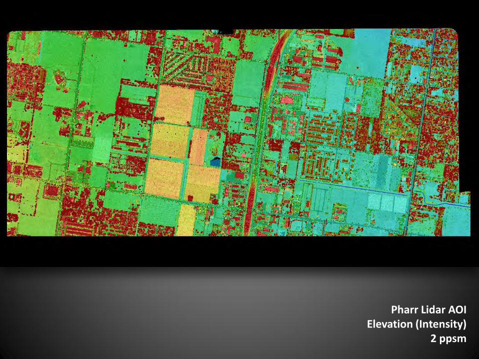
Pharr Lidar AOI Elevation (Intensity)
2 ppsm
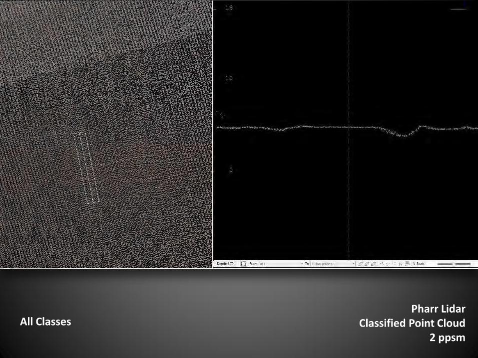
Pharr Lidar Classified Point Cloud
2 ppsm
All Classes

Pharr Lidar DEM
Hydro-conditioned Enforced
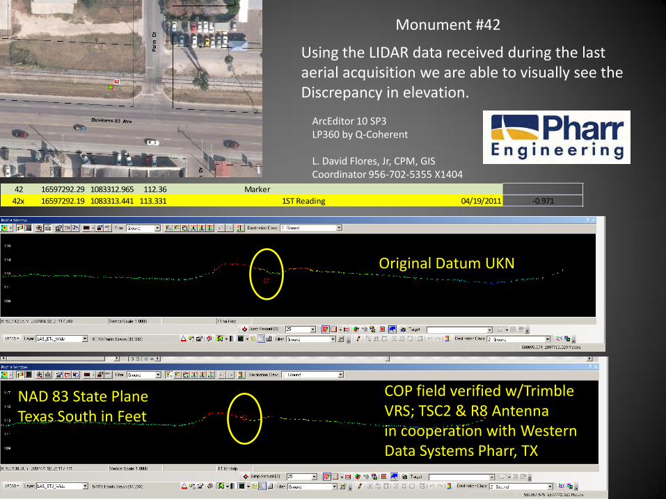
Original Datum UKN
COP field verified w/Trimble VRS; TSC2 & R8 Antenna in cooperation with Western Data Systems Pharr, TX
Using the LIDAR data received during the last aerial acquisition we are able to visually see the Discrepancy in elevation.
Monument #42
42 16597292.29 1083312.965 112.36 Marker
42x 16597292.19 1083313.441 113.331 1ST Reading 04/19/2011 -0.971
ArcEditor 10 SP3 LP360 by Q-Coherent L. David Flores, Jr, CPM, GIS Coordinator 956-702-5355 X1404
NAD 83 State Plane Texas South in Feet
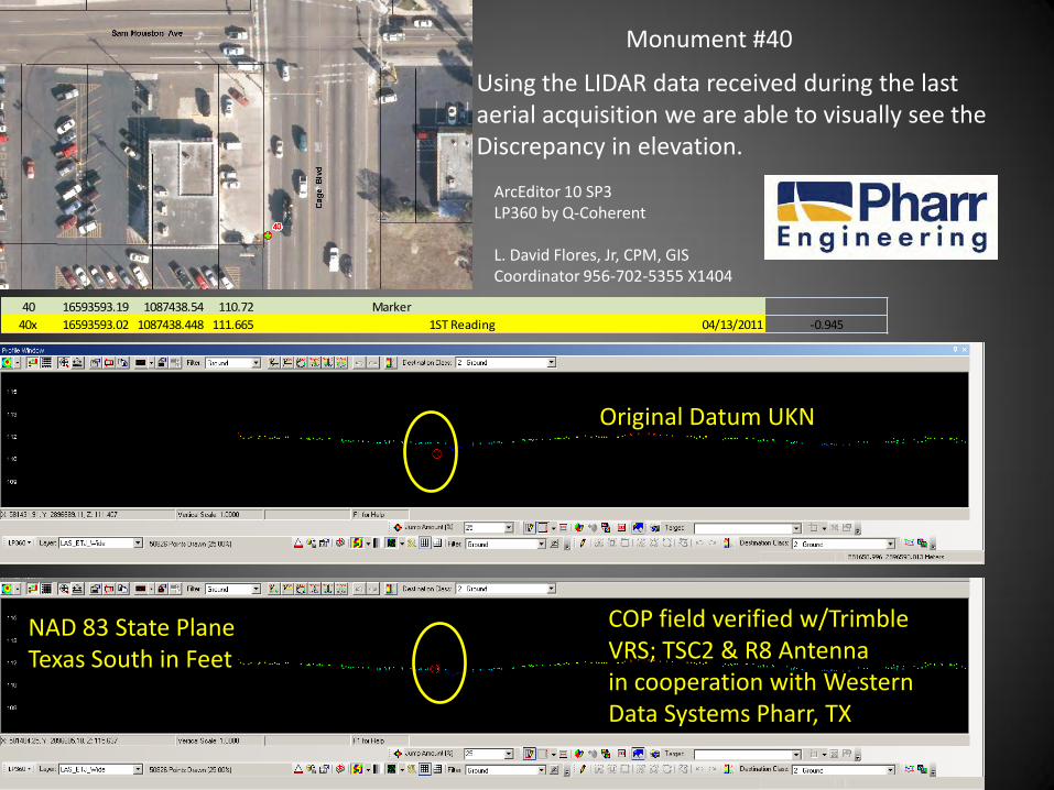
COP field verified w/Trimble VRS; TSC2 & R8 Antenna in cooperation with Western Data Systems Pharr, TX
Using the LIDAR data received during the last aerial acquisition we are able to visually see the Discrepancy in elevation.
Monument #40
40 16593593.19 1087438.54 110.72 Marker
40x 16593593.02 1087438.448 111.665 1ST Reading 04/13/2011 -0.945
ArcEditor 10 SP3 LP360 by Q-Coherent L. David Flores, Jr, CPM, GIS Coordinator 956-702-5355 X1404
Original Datum UKN
NAD 83 State Plane Texas South in Feet
Future
• Education
• The Need for Maps
• Many Requests
• Online for the Public
• MOTS – ArcReader
• ArcGIS Online
• ArcServer
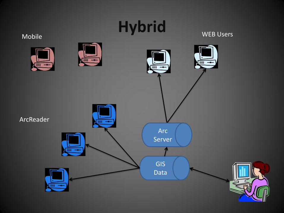
Hybrid
GIS Data
ArcReader
WEB Users Mobile
Arc Server
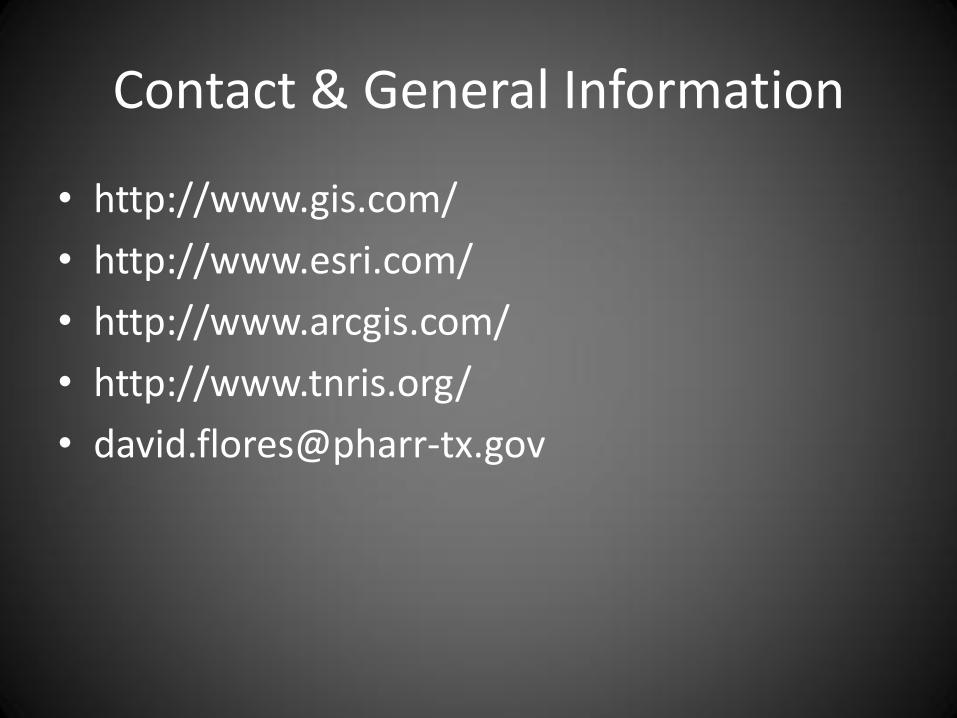
Contact & General Information
• http://www.gis.com/
• http://www.esri.com/
• http://www.arcgis.com/
• http://www.tnris.org/

QUESTIONS