Embed Size (px)
Citation preview
Clyde Extension Wind FarmEnvironmental Statement
Non-Technical Summary
October 2011
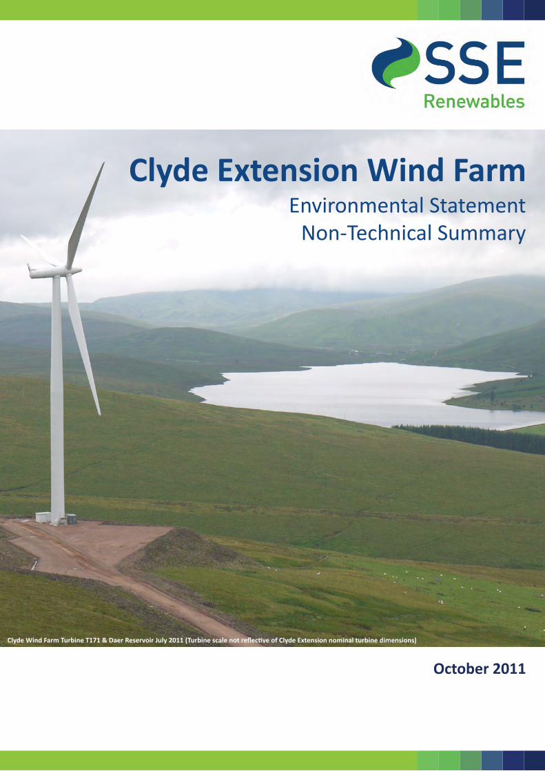
Clyde Wind Farm Turbine T171 & Daer Reservoir July 2011 (Turbine scale not reflective of Clyde Extension nominal turbine dimensions)

Clyde Extension Wind Farm Environmental Statement Non‐Technical Summary
October 2011 Page i
Preface
This document forms the non‐technical summary (NTS) of the Environmental Statement (ES) that accompanies an application made by Clyde Windfarm (Scotland) Ltd for consent under Section 36 of the Electricity Act 1989 for the construction and generation of electricity from the Clyde Extension Wind Farm (herein referred to as the ‘Development’), and deemed planning permission for the same development under Section 57(2), of the Town and Country Planning (Scotland) Act 1997 (as amended by The Planning etc. (Scotland) Act 2006). The ES comprises three volumes:
Volume I: Text;
Volume II: Figures; and
Volume III A and B: Technical Appendices. Additional documentation that will be submitted with the Section 36 application includes:
Planning Statement;
Design and Access Statement;
Pre‐application Consultation Report; and
Non‐Technical Summary. The ES (Text, Figures and Technical Appendices) and associated documents will be available for viewing during normal business hours at the following locations:
South Lanarkshire Council Enterprise Resources Planning & Building Standards Service HQ Montrose House 154 Montrose House Hamilton ML3 6LB
South Lanarkshire Council Enterprise Resources Planning & Building Standards Service South Vennel Lanark ML11 7TJ
Moffat Town Hall Customer Service Centre High Street Moffat Dumfries and Galloway DG10 9HF
Scottish Borders Council Contact Centre High Street Peebles EH45 8AF
Biggar Library Market Road Biggar South Lanarkshire ML12 6FX
The ES will also be available for purchase, at £200 for paper copies and £25 for an electronic version on CD, from:
Clyde Windfarm (Scotland) Ltd c/o SSE Renewables Developments (UK) Ltd 1 Waterloo Street 5th Floor Glasgow G2 6AY

Clyde Extension Wind Farm Non‐Technical Summary Environmental Statement
Page ii October 2011
Paper copies of the NTS are available free of charge. The Application and ES will be advertised in the following newspapers:
Moffat News;
Peebleshire News;
Hamilton Advertiser;
Herald Newspaper;
Lanark and Carluke Gazette; and
Edinburgh Gazette.

Clyde Extension Wind Farm Environmental Statement Non‐Technical Summary
October 2011 Page 1
1 Introduction
This Non‐Technical Summary (NTS) forms part of the Environmental Statement (ES) which accompanies an application by Clyde Windfarm (Scotland) Ltd (the ‘Applicant’) to the Scottish Government for consent under Section 36 of the Electricity Act 1989 for the construction and operation of Clyde Extension Wind Farm (hereafter referred to as ‘the Development’). The Development will comprise 57 wind turbines and associated infrastructure with a total potential installed capacity of up to 171 MegaWatts (MW). It is located in the Upper Clyde Valley, between Biggar, Abington and Moffat within both South Lanarkshire and Scottish Borders Council Areas as shown on Figure NTS 1. The Development forms an extension to the nearby consented Clyde Wind Farm. The Clyde Wind Farm lies directly to the west and south of the Development, and comprises 152 wind turbines and associated infrastructure with a total installed capacity of 350MW. Consent for Clyde Wind Farm was granted by Scottish Ministers under Section 36 of the Electricity Act 1989 (as amended) in July 2008 and construction activities are underway at the time of writing.
The Applicant is a company incorporated under the laws of Scotland and is a 100% owned subsidiary of the publically quoted company Scottish and Southern Energy plc (SSE). SSE is a FTSE‐100 company, formed in 1998 from the merger of Scottish Hydro Electric plc and Southern Electric plc. The company is headquartered in Perth, Scotland and employs more than 20,000 people. Core activities include electricity generation, transmission distribution and supply; gas storage, distribution and supply; the operation of a telecoms network; utility contracting; and electrical and gas appliance retailing. The company has a market capitalisation of around £10 billion, and supplies over 9.59 million customers in Great Britain and Ireland under the Scottish Hydro‐Electric, Southern Electric, Swalec and Atlantic and Airtricity brands. The company is co‐owner of Scotia Gas Networks, which owns and operates the ‘Scotland’ and ‘South of England’ regional gas distribution networks. The gas network business employs around a further 5,000 staff. SSE’s power generation assets total around 11,410MW, comprising 4,590MW of gas and oil‐fired capacity; 4,370MW coal‐fired capacity and 2,450MW of renewable (including pumped storage, hydro, wind and biomass) capacity. SSE Renewables Developments (UK) Ltd is the renewable energy development division of SSE (Scottish and Southern Energy plc). SSE has over 20 onshore wind farms in operation in Scotland and Ireland totalling over 915MW. Wind farms totalling over 705MW are under construction and a further 275MW with consent for development.
2 EIA Process and Methodology
Environmental Impact Assessment (EIA) is a process aimed to ensure that permissions for developments with potentially significant effects on the environment are granted only after assessment of the likely significant environmental effects has been undertaken. The assessment must be carried out following consultation with statutory consultees, other interested bodies and members of the public. The information that an applicant is required to submit as part of the EIA process (as specified in Schedule 4 of the EIA Regulations) is presented in the ES. Consultation has formed an integral role throughout the EIA process, including at the following key stages:
Clyde Extension Wind Farm Non‐Technical Summary Environmental Statement
Page 2 October 2011
Pre‐Scoping ‐ obtaining initial feedback on the Development;
Scoping ‐ identification of key issues;
Technical Assessments ‐ collecting baseline information and confirming survey methodologies;
Informing site design ‐ communication with local communities; and
Discussing opportunities for mitigation and enhancement. As part of the wider consultation process, public exhibitions were held in June 2010 and in February 2011. The exhibitions provided members of the public the opportunity to learn more about the Development, feed in to the design process and to ask any questions. Following the initial public exhibitions a scoping opinion request was issued on 15th June 2010 with the accompanying Scoping Report. This was submitted to the Energy Consents Unit alongside other consultees and interested bodies. All responses to the scoping report have been compiled and distributed to the relevant technical disciplines for inclusion within the appropriate assessment. Further detail on the community consultation process is provided in a separate Pre‐Application Consultation Report submitted to accompany the application.
3 Renewable Energy Policy Context and Alternative Technologies
In 2008 the European Commission published proposals for reducing the EU’s greenhouse gas emissions by 20% and increasing the proportion of final energy consumption from renewable sources to 20%. Both targets are to be achieved by 2020. For the UK, the European Commission’s proposals include 16% reduction in UK greenhouse gas emissions by 2020 and for 15% of all energy consumed in the UK to come from renewable sources by 20201. The UK Renewable Energy Strategy (UKRES) sets out the means by which the UK can meet the legally binding target of 15% of energy consumption from renewable sources by 2020. This will mean a very substantial increase in the share of renewables in about a decade. The majority of this is expected to come from wind power, both on and offshore. The document makes it clear that the UKRES is an integral part of the Government’s overall UK Low Carbon Transition Plan and that the Devolved Administrations have a leadership role to undertake. The Scottish Government is committed to promoting the increased use of renewable energy sources to help tackle climate change and to support economic growth in Scotland. In July 2011 the Scottish Government published the “Routemap for Renewable Energy in Scotland” (’the Routemap’). This document outlines Scotland’s renewables ambition and paths to delivery and provides an increase in Scottish Government’s renewable energy generation target to 100% by 2020. This is a significant increase in targets set in previous years. The Routemap specifically recognises the scale of the challenge that requires to be addressed to meet the revised 2020 targets and provides a summary of the main challenges that require to be addressed to meet the 2020 renewables targets, one of which is ‘consents and planning’.
1 This 15% figure compares to only 3% in 2009, as confirmed in the National Renewable Energy Action Plan for the UK, page 5, July 2010.

Clyde Extension Wind Farm Environmental Statement Non‐Technical Summary
October 2011 Page 3
The mechanism introduced to achieve the UK and Scottish renewables targets is the Renewables Obligation, which aims to incentivise the further development of renewables. The Renewables Obligation obliges electricity supply companies to source prescribed proportions of their total supply from eligible renewable resources, or pay a ‘buy out’ fee per MWh of shortfall. In order to meet its obligation, the Applicant must develop eligible renewable energy sources on a large scale. The Applicant’s renewable energy strategy to meet its Renewable Obligation is diverse and a wide range of alternative technologies has been considered. In all, SSE now has 3,780MW of renewable energy capacity (onshore wind, offshore wind, hydro and dedicated biomass) in operation, under construction or with consent for development in the UK and the Republic of Ireland. The Development therefore forms part of a broader renewable energy strategy being implemented by the Applicant in response to UK and Scottish Government policy.
4 Design Evolution
The Applicant’s approach to site selection is an ongoing process where candidate sites are identified in accordance with national and local planning policy, government targets, Renewable UK guidance and a range of environmental and technical parameters. It is the Applicant’s opinion that the site selection process and the detailed work undertaken for the EIA has confirmed the Clyde Extension site is an acceptable site for wind farm development. The design process is a balance between minimising negative environmental effects, achieving a technically viable site and maximising energy yield, and the wind farm layout has evolved throughout the duration of the EIA. This iterative approach has allowed the findings of the public consultation exercise along with results from the EIA to guide the evolution of the wind farm design and has allowed the Development to be modified in order to avoid, reduce or mitigate potential effects as far as reasonably practicable. Specific environmental drivers have been:
Landscape and visual;
Ornithology;
Ecology;
Hydrology;
Cultural heritage;
Noise; and
Peat stability. The design process commenced with a preliminary layout which optimised wind yield and took account of topographical constraints and characteristics such as slope and watercourses. This layout comprised 67 turbines and formed the submitted ‘Scoping’ layout. Following consideration of the EIA the layout was refined to result in the final design of 57 turbines and associated infrastructure.
5 Description of Development
The operational Development would comprise:
57 wind turbines up to 142m (to tip) height and associated infrastructure including, foundations and crane hardstanding areas;
Site entrances and access tracks from the public road;

Clyde Extension Wind Farm Non‐Technical Summary Environmental Statement
Page 4 October 2011
On‐site access tracks between turbines, including passing bays and four new watercourse crossings;
Three permanent meteorological masts nominal height 90m;
On‐site power collection system including turbine transformers, underground cables, electrical control building and satellite office/welfare building;
Permanent signage; and
Permission to extend the operational consent period of the consented Clyde north substation and Clyde south substation infrastructure.
The proposed layout of the Development is shown in Figure NTS 2. Construction would take place over a 24 month period and may involve the following associated components:
Up to three temporary construction compounds adjacent to site access points;
Up to ten on‐site borrow pits;
On‐site concrete batching;
Three temporary meteorological assessment masts;
Forestry operations; and
Site signage. The core development area covers approximately 2760ha, however the Development infrastructure will only occupy an approximate area of 38.5 hectares (ha) or less than 1.5%. During the construction phase, further land on‐site will be required and restored mainly for construction compounds, lay‐down areas and borrow pits. Further detailed surveys will be undertaken during the pre‐construction phase and turbines, associated infrastructure and associated access tracks may be sited up to 50m – in any direction – with the approval of on‐site archaeologists, ecologists or any other relevant specialist supervising the works, or by up to 100m with the approval of the Planning Authority and appropriate consultees such as Scottish Environment Protection Agency (SEPA) and Scottish Natural Heritage (SNH). Two access points from the consented Clyde Wind Farm will be utilised and upgraded (where necessary) to provide access to the Development. These include routes from the M74 from the south and west. An additional length of track of approximately 1.2km will be required in order to utilise the existing Clyde Wind Farm Access B. In addition, the formation of a new access route from the A701 in the east will be required with a site entrance at grid reference 305403 619806. This utilises an existing forestry track and entrance which will be upgraded as part of the construction works for the Development. The total length of new access tracks required within the core development area would be approximately 33.5km. New access tracks will have a typical running width of 6m. Peat depths measured on site are generally less than 1.5m suggesting that the majority, if not all, of the tracks will be ‘cut track’ design. The access tracks will be retained throughout the operational life of the Development to enable maintenance of the turbines and replacement of any turbine components. Access tracks may also be retained following decommissioning for use by landowners. It is estimated that approximately 276,000m3 of stone will be required for construction of the Development and it is anticipated that the majority will be sourced from on‐site borrow pits in order to minimise haulage distances. However, where aggregate of suitable
Clyde Extension Wind Farm Environmental Statement Non‐Technical Summary
October 2011 Page 5
quality is not available from on‐site borrow pits, material may be imported from offsite commercial quarries. A total of ten locations for potential borrow pits have been identified, with the potential volume of rock available estimated to be approximately 421,500 m³, sufficient to supply the required quantities. It is planned to connect the Development into the Clyde North Substation (CNS) and possibly also the Clyde South Substation (CSS) at NGR 298745 620207 and 298278 613415, respectively, and integrate the Development in the consented Clyde Wind Farm making use of existing grid connection infrastructure. No external extension works are proposed as part of this application to the CNS and CSS buildings or compounds however the Section 36 application for the Development seeks to extend the operational life of the CNS and CSS infrastructure to coincide with the operational consent period of the Development. Cabling will be underground and will follow infrastructure such as on‐site access tracks where possible. The Development will also involve changes to the forestry on‐site which is described within the ES. Of the 245ha of felling, all but 22ha would be replanted. The assessment concludes that there will be no necessity for compensatory planting given that there will be no net deforestation as a result of the Development. The outline Habitat Management Plan (HMP) for the Development (Technical Appendix 9.4) includes commitments to restore bog habitat around the forestry edges and to create approximately twelve hectares of high quality native woodland (including native birch, rowan, alder and hazel) located in a series of copses throughout the site. This planting constitutes wider biodiversity benefits and is proposed to off‐set residual ecological effects but will also provide additional benefits in terms of achieving objectives for Government Policy on woodland enhancement/creation.
A draft Site Environmental Management Plan (SEMP) has been provided as Technical Appendix 5.4. This will be refined, developed and streamlined as the project proceeds in consultation with relevant statutory consultees and would be monitored by the relevant site project manager for compliance.
6 Planning
The Development, due to the electricity generation capacity exceeding 50 MW, is submitted under the terms of Section 36 of the Electricity Act 1989 and Section 57 of the Town and Country Planning (Scotland) Act 1997. In considering the application under Section 36 of the Electricity Act 1989 the Scottish Ministers must also fulfil the requirements of Paragraph 3 of Schedule 9 to that Act. If Section 36 consent is granted the Scottish Ministers may also direct that planning permission for the Development is deemed to be granted. The Structure and Local Plans, national policy and guidance (material considerations) provide the relevant planning policy context against which to assess the Development. The Local and Structure Plans that form the statutory Development Plans for the Development are as follows:
The Glasgow and Clyde Valley Joint Structure Plan 2000 (as altered);
The South Lanarkshire Local Plan (adopted 2009);
The South Lanarkshire Minerals Local Plan 2002;
The Scottish Borders Structure Plan (2001 – 2011)(approved 2002 and as altered in 2005 and 2009); and
The Scottish Borders Local Plan (adopted 2008 and altered 2010).
Clyde Extension Wind Farm Non‐Technical Summary Environmental Statement
Page 6 October 2011
The Development Plan policies of potential relevance to the Development are referred to within Chapter 6 of the ES ‘Planning Policy Context’ and are quoted within Appendix 6.1: Development Plan Policies. There is also a suite of national planning policy, Planning Advice Notes (PANs), an emerging Strategic Development Plan and Supplementary Planning Guidance that are also of some relevance to the Development. These include:
The National Planning Framework 2;
Scottish Planning Policy;
The Glasgow and the Clyde Valley Strategic Development Plan ‐ Proposed Plan;
The Scottish Government’s Web Based Renewables Guidance;
Scottish Historic Environment Policy;
South Lanarkshire Council SPG ‘Renewable Energy’; and
Scottish Borders Council SPG ‘Wind Energy’. The Applicant has submitted a separate Planning Statement which assesses, in detail, the Development in the context of the relevant Development Plan policies, national planning policy and advice, renewable energy policy, SPG and other material considerations.
7 Landscape and Visual Assessment
The Landscape and Visual Assessment aims to identify significant effects that would arise as a result of the Development. The assessment considers the effect on the landscape resource (both directly and on how the landscape is perceived) and the effect on visual amenity. Cumulative effects, arising from the effect of the Development in conjunction with other wind farms, are also considered. SNH has prepared landscape character assessments for Scotland however in 2010 South Lanarkshire Council updated the original 1999 SNH character assessment for those areas within its authority boundary. The study area in the assessments is divided into distinct Landscape Types, Sub Types and Units. The main changes to landscape character resulting from the Development would arise in the Southern Uplands: Lowther Hills and Southern Upland and the Southern Upland with Scattered Forest: Broadlaw Group landscape units as the wind farm would be physically located with these landscape units. Both units have similar characteristics and the baseline conditions of the landscape have and are being further changed by wind farms, most notably the consented Clyde Wind Farm, which is currently under construction. This wind farm, which lies immediately adjacent to the Development will contribute strongly to the baseline landscape character. The level of effect of the Development on these landscape units is assessed as not significant, because they would continue to be defined principally by their baseline characteristics, which include wind farms. Although the landscape is essentially remote the underlying upland character has been substantially altered by commercial forestry, and wind turbines are becoming a prevailing influence, forming a ‘Southern Upland, Windfarm’ landscape sub type adjacent to the Development. It is considered that the Development would not constitute a material change from the baseline conditions and that while it would extend the influence of turbines within the landscape, the effect on landscape character is assessed as being not significant. Similarly, it is considered that there would be no significant effects on the landscape character of designated landscapes within the study area, which include the Upper Tweeddale National Scenic Area (NSA), the Upper Clyde and

Clyde Extension Wind Farm Environmental Statement Non‐Technical Summary
October 2011 Page 7
Tinto Special Landscape Areas (SLA) and the Tweedsmuir Area of Great Landscape Value (AGLV). Twenty five representative viewpoints and a number of transport routes chosen for the assessment of visual effects were selected in consultation with SNH, Scottish Borders Council and South Lanarkshire Council. The assessment of effects on views indicates that the Development would have relatively few significant effects on views and visual receptors. Seven viewpoints were considered to be significantly affected during the operation of the Development. Six of these lie within a 5km radius of the outermost turbine, and of these, four are to the east of the site along the A701. These six viewpoints would gain views of the Development turbines at closer proximity than those of the consented Clyde Wind Farm, which would also be visible but less prominent. The viewpoint at Grains beside Camps Reservoir lies closest to the Development with turbines prominent in views. Culter Fell overlooks the Development site, and while the consented Clyde Wind Farm turbines will be clearly visible from this location, the new turbines would be more visually prominent in front of them. The seventh viewpoint considered to be significantly affected is situated at the summit of Trahenna Hill to the north‐east of the Development at a distance of approximately 15.3km, and would be significantly affected due to the increase in the visual prominence of wind turbines on the skyline in views to the south‐west. For the majority of the remaining 18 representative viewpoints the consented Clyde Wind Farm will be a prevailing element in views so the nature of the views would not change significantly and the Development would appear as a logical extension of the existing wind farm. To the west of the Development, the extent of effects on views is very limited as the Development would generally be seen behind the consented Clyde Wind Farm. This ensures that the influence of the consented wind farm is prevalent, and the Development would have a limited additional effect when seen at distance and behind the consented Clyde Wind Farm turbines, and no significant effects are predicted. The assessment of the effects of the Development on views from route corridors and settlements has found that new turbines would be prominent features in a sequence of views from approximately 13km of the A701 to the north of Moffat. The consented Clyde Wind Farm will also be visible from many of the same sections of the route, with screening provided by forestry along the route corridor, however, the effect of the Development on this route would be significant due to the scenic nature of available view. The Development has been assessed as having no significant effects upon the route corridors of the M74/A74(M), A702, A721, Southern Upland Way and National Cycle Route 74. The Development is also considered to have no significant effects on settlements including Tweedsmuir and Crawford, which are the two closest villages. As well as assessing the effects of the Development in its own right, the landscape and visual assessment also assessed the cumulative effect that the addition of the Development may have in conjunction with other operational/under construction, consented or application stage wind farms. The landscape and visual amenity in the vicinity of the Development site and the wider study area have been altered by wind farms, most notably the consented Clyde Wind Farm, which will contribute strongly to the baseline landscape character and views. The Development is not considered material to the creation of a ‘wind farm landscape’ and would represent a relatively small change to the cumulative scenarios considered.
Clyde Extension Wind Farm Non‐Technical Summary Environmental Statement
Page 8 October 2011
The assessment of cumulative effects of the Development on landscape character concluded that although the Development would have cumulative effects on landscape character and designations, for the majority of landscape types and all the designations, these would not be significant in relation to the operational/under construction, consented or application wind farms. In nearly all instances when the Development would affect the landscape character, it would generally appear in combination with the consented Clyde Wind Farm and would not cause additional effects for the affected areas. Only the Upper Glen: Culter Water & Cow Gill landscape unit would experience a significant cumulative effect from the Development in combination with the consented Clyde Wind Farm. This area is relatively unaffected by the visual influence of surrounding wind farms, is situated in an SLA and is considered to be of medium to high sensitivity. Although the development would not physically encroach upon this landscape unit, the addition of the Development would cause a medium magnitude of change. The large number of other wind farm developments that are proposed will result in turbines becoming common landscape features within the study area, with the Glenkerie wind farm (currently under construction) and Earlshaugh (application stage) wind farm (if consented), likely to increase the influence of turbines on the character of the affected landscape units and designated areas, which would also help to limit the significance of the effects of the Development on the landscape. The Development would be located immediately adjacent to the considerably larger consented Clyde Wind Farm and it would be largely viewed in combination with the existing turbines, giving cumulative visual effects for the majority of viewpoints. In consequence there are only relatively small parts of the study area from which views of the Development would be available without the consented Clyde Wind Farm turbines also being visible. The assessment of cumulative effects on views has found that the Development would have significant visual effects on five of the twenty five representative viewpoints assessed, all of which are within 5km of the Development, and would be seen in combination with the consented Clyde Wind Farm. These include Camps Reservoir at Grains, viewpoints along the A701 and the summit of Culter Fell. Cumulative effects would not be significant from the other twenty viewpoints as the Development would generally be seen within the same section of views as the consented Clyde Wind Farm and several other schemes, with numerous other wind farms visible across the surrounding area within the available panoramic views, so would not cause notable cumulative effects on the visual amenity. The assessment of cumulative effects on settlements and route corridors has found that the development would not have a significant cumulative effect on settlements or route corridors within the study area. Views of the Development would be notable from the A701 as it passes along the scenic route through the River Tweed valley, but it would be seen as one of a sequence of wind farms that would include the consented Clyde Wind Farm and the cumulative effects of the Development on this route are considered not significant. Based on the findings of the landscape and visual assessment, it is considered that while the Development would increase the influence of turbines within the Southern Uplands and Southern Uplands with Scattered Forest landscape types, would have significant local effects on views within 5km to the east and north of the Development, from a hilltop 15km to the north‐east and from the A701 corridor during construction and operation, the
Clyde Extension Wind Farm Environmental Statement Non‐Technical Summary
October 2011 Page 9
landscape has the capacity to accommodate development of the scale proposed. The operational effects would be long term (for the life of the wind farm) but reversible, such that following decommissioning these effects would not exist.
8 Ornithology
The possible key ornithological effects relating to the Development are its potential to adversely affect the conservation status of bird populations (particularly those given the highest levels of statutory protection through inclusion in Annex I of the EU Birds Directive and/or Schedule 1 of the Wildlife and Countryside Act 1981 (as amended)) through land‐take, disturbance, displacement, collisions with the turbines and/or barrier effects. Some or all of these effects may occur as a result of construction activities, operation of the wind farm and decommissioning activities. The baseline‐gathering process involved a combination of desk studies and field surveys, carried out in 2009‐10. Surveys ensured that all months were covered, and included two breeding seasons as well as the intervening winter and spring/autumn migratory periods. A total of 62 species were recorded during breeding bird surveys. The key bird species found breeding within the study area were moorland‐breeding raptors (hen harrier and merlin), osprey, waders (in particular golden plover and curlew) and black grouse. Most activity was recorded during summer months before birds migrated from the site, although some passerine and raptor species make use of forestry habitats, and are present all year round. The site is crossed regularly by pink‐footed goose on migration between roost and staging sites. Other key species recorded (e.g. peregrine, goshawk, skylark) were not considered likely to be subject to any significant effects due to scarcity on‐site or relatively small numbers compared to regional populations. Direct habitat loss through wind farm construction was considered to be not significant for birds, as construction usually only involves small losses of land associated with turbine bases, access tracks and other infrastructure. An exception to this was where the felling of a tree used for nest‐building activities by a young non‐breeding osprey pair in 2010 would have resulted in the loss of a potential future breeding pair. All trees used by ospreys for nesting purposes will therefore be excluded from felling as part of the mitigation measures outlined in the ornithology chapter. Disturbance caused by construction operations may directly displace birds from breeding sites and/or foraging areas. In addition, the active nests of nearly all bird species are protected against destruction by the law and it is necessary to take measures to ensure compliance with the appropriate legislation. It was considered that, based on a literature review of disturbance distances for each species, it was possible that one pair each of hen harrier and merlin, plus one lekking black grouse may be disturbed in the short‐term by unmitigated construction activity. However, these birds would likely be able to continue unaffected as the topography of chosen nest/lekking areas shield the birds from visual and noise disturbance. Depending on the exact location of future nesting sites, a small number of golden plover and curlew breeding pairs may be disturbed during construction, although these would be insignificant in the context of the Natural Heritage Zone populations. Potentially significant disturbance effects on protected species will also be minimised by employing Best Practice measures during construction (e.g. timing and location of construction activities to avoid breeding birds, cordoning off specified construction areas prior to the breeding season to discourage nesting) and by enhancing habitat for all species

Clyde Extension Wind Farm Non‐Technical Summary Environmental Statement
Page 10 October 2011
elsewhere via the Habitat Management Plan. In areas where work is unavoidable during the breeding season, visual deterrent devices may be placed within a restricted area well in advance so that birds are deterred from nesting within that locality. Although a non‐breeding osprey pair was recorded within potential construction disturbance distances, any nearby forest felling activity of any breeding nest will take place outside of the breeding season and risks will be minimised. Displacement due to an operational wind farm effectively leads to exclusion from areas of suitable habitat, which in turn, can lead to reduced breeding success and individual survival or abandonment of the territory. There were no predicted significant displacement effects on hen harrier or merlin due to the species’ apparent abilities of tolerating wind farms, and the availability of alternative nesting habitat away from recognised displacement distances. For osprey and black grouse, the distances to the nearest turbines, and shielding topography are sufficient to avoid disturbance‐displacement effects. A reduction of the breeding population of up to seven pairs of golden plover and twelve pairs of curlew may occur within the core development area in the long‐term (worst‐case scenario), but this is not considered significant in terms of the overall regional populations, despite recent declines in numbers. Collision risk modelling was run for the key species potentially at risk: pink‐footed goose, hen harrier, merlin, peregrine, osprey, golden plover, curlew and snipe. The collision risk assessment demonstrated that there will be no significant impact to any of the species modelled. The majority of species recorded using or passing through the site are considered to be at negligible or low risk because of their behaviour (e.g. low altitude flights), scarcity on the site, or relatively high regional populations. Although collision risk modelling predicted that a number of pink‐footed goose may collide with turbines each year, when comparing the potential effects at the relevant scale (the national/flyway level), it was concluded that the additional mortality will be not significant (up to 0.42% of the UK mortality rate), and that the conservation status of the species (which is currently favourable) will be unaffected by the Development. Since the area is not part of any daily commute for geese from roost to feeding sites, any barrier effects which would alter flight paths of flocks would be negligible in terms of overall energy expenditure, compared to the overall flight distance for each bird. No barrier effects were predicted for any other species. The assessment of the likely effects of the Development during the construction, operation and decommissioning stages concluded that, provided best practice is followed to avoid disturbance to breeding birds, plus species–specific mitigation measures to minimise displacement effects are implemented, there will be no significant effects on any species, either alone or in‐combination with other projects in the area, and their conservation status will be maintained. There are also no predicted effects on any designated sites.
9 Ecology
An ecological impact assessment has been carried out in accordance with Institute of Ecology and Environmental Management (IEEM) (2006)2 Guidelines. This was based on data from a series of ecological surveys, consultations and desk based literature reviews that followed recognised ecological guidelines. The information was used to generate a picture of the ecological baseline and assess the effects of the proposed development on the ecological interests of the area.
2 IEEM (2006) Guidelines for Ecological Impact Assessment in the United Kingdom (version 7 July 2006)
Clyde Extension Wind Farm Environmental Statement Non‐Technical Summary
October 2011 Page 11
The desk‐based assessment identified five statutory designated sites within 15km of the survey area. This includes Special Areas of Conservation (SAC) and Sites of Special Scientific Interest (SSSI). The closest such site is the River Tweed SAC/SSSI located 1.3km from the survey area. This site is designated for a range of protected species including Atlantic Salmon, Brook, Sea and River Lamprey, otter and a number of invertebrates and vascular plants. No non‐statutory sites were identified within 15km of the survey area. The survey area is dominated by upland peatland habitats, including a mosaic of blanket bog, heathland and acid grassland. Additionally large areas of commercial conifer plantation are located to the east. A number of small burns run across the survey area feeding into Camps Reservoir and the Tweed catchment. Species that were recorded within the survey area considered to be of conservation value and/or requiring legal consideration include otter, common pipistrelle bat, soprano pipistrelle bat, brown long eared bat, noctule bat and common lizard. However bat activity was predominantly associated with sheltered features outwith the development footprint such as Camps Reservoir and woodland edges at the lower reaches of the site. Very little bat activity was recorded within the turbine envelope, with this area being at a relatively high altitude and very exposed. Red squirrel were not confirmed in the survey area but may be present in forestry at low density. Protection measures will be implemented if this species is found within the survey area at the pre‐construction/ construction phases. Potential effects on the habitats and species found to be present within the survey area include habitat loss, displacement, direct mortality, disturbance and indirect effects. These effects were minimised during the design of the wind farm, by locating the wind turbines away from the most sensitive habitat features such as watercourses, woodland edges and Camps Reservoir. Access tracks and other infrastructure have been located to use existing tracks where possible and to minimise loss of valuable habitats such as blanket bog. Survey results and a detailed assessment have identified the majority of effects on ecology as being not significant. However, although minimised through the design process, the loss of blanket bog habitat as a result of the development has been assessed as a significant effect given the national value of this habitat and the extent of loss. In light of this significant effect it is proposed to provide compensation through an outline Habitat Management Plan (HMP). Within this document it is proposed to restore afforested areas of blanket bog and manage existing blanket bog habitats to prevent further degradation. Wider biodiversity benefits are proposed through native woodland planting which will contribute to South Lanarkshire Council’s Woodland Habitat Action Plan, benefit black grouse habitat, and provide insect‐rich foraging areas for bats. Woodland planting along watercourses is also likely to benefit otters by providing cover in the long‐term. These benefits further off‐set residual effects. Overall, taking into consideration current proposed compensation in relation to effects on peatland habitats, there is considered to be no significant residual effect on blanket bog habitats as a result of the proposed Development. A number of consented and proposed wind farms are located within 10km of the survey area. However a cumulative assessment taking into consideration such developments has not predicted any further significant effects on ecology.

Clyde Extension Wind Farm Non‐Technical Summary Environmental Statement
Page 12 October 2011
10 Traffic and Transportation
The Traffic and Transportation chapter has assessed potential roads and traffic effects identified during the scoping of the environmental assessment. The road network in the study area features several strategic A‐class roads and the M74/A74(M), which leads ultimately between the Scotland/England border to Edinburgh and Glasgow. Between these there is a network of local roads linking communities and settlements. The proposed site is easily accessed using a well developed road network, without the need to use local roads. National and local transport policies were reviewed to allow a desktop hierarchy of roads to be prepared, and site visits were undertaken to gain a visual review of conditions, and to identify sensitive receptors. Potential routes for construction traffic were derived, based upon their suitability to carry the types and numbers of construction vehicles predicted. The quantities of plant, equipment and materials required for the construction effort were considered, and a delivery profile established, identifying the average number of construction vehicle movements. These movements were then compared in relation to historic traffic flow data to allow the level of impact of increased traffic volumes to be assessed. The additional traffic associated with the construction of the Development (including abnormal loads) is numerically low although at some locations this is classified as being medium in statistical terms from the impact magnitude analysis undertaken. A worst‐case scenario has been assessed assuming that the generated construction vehicles would exclusively use the routes considered, in fact they might disperse prior to reaching the receptors assessed, and assuming that ready mix concrete is delivered to site, when in fact it is hoped that concrete can be batched on‐site. The impact magnitude is quantified in this worst‐case scenario as being low or medium resulting in no significant environmental effects. To offset any limited effects of the construction traffic, the developer could employ a range of options that can influence construction traffic behaviour, the details of which would be discussed with the appropriate transport authorities. The effects described in this chapter are described in terms of statistical significance and not in practical significance. The introduction of a low number of additional HGV movements on a route that does not currently have a large number of HGV trips will be recorded as being highly statistically significant, even though the actual numbers of additional trips are small. Considering the abnormal loads in isolation, each turbine will result in an average of nine abnormal loads. In order to transport the sections in safety, various small scale mitigation works such as the temporary removal of street furniture and cutting back overgrown vegetation are likely to be required. It should be noted that all the abnormal load deliveries will be travelling to the site under escort and require police approval for transit.
11 Hydrology and Hydrogeology
The effects of the Development have been assessed with regard to the water environment (surface water, groundwater and soil) within the development site and its surroundings. The effects of all activities associated with the Development including forestry operations have been assessed. The surface water and groundwater assessment comprised a desk based information review, including consultation with SEPA, Scottish Borders Council, South Lanarkshire Council, Scottish Water, and the Tweed and Clyde fishery foundations, and a number of
Clyde Extension Wind Farm Environmental Statement Non‐Technical Summary
October 2011 Page 13
site visits to identify the watercourse network, water features, water dependent habitats and private water supplies. The site is located in the headwaters of both the River Clyde and the River Tweed SAC/SSSI. There are many natural watercourses and man‐made drainage channels on the agricultural land and throughout the forested land. The site is located within the surface water catchment of two public drinking water supply reservoirs, owned and operated by Scottish Water, Camps Water and Coulter Reservoir. The Camps Reservoir is also used as a recreational fishing facility. The public water supply reservoirs Cowgill Upper Reservoir and Cowgill Lower Reservoir are outwith the surface water catchment from the Development. Flooding on the site does not generally occur with the exception of the Grains Burn and the Camps Water. No new infrastructure as part of this development is proposed within flood risk areas. There are a number of private water supplies within the vicinity of the site. The majority are not supplied with water originating from the wind farm development area, and therefore will not be affected by the Development. Two potable private water supplies are taken from the Glenbreck Burn, these supplies are a considerable distance from any proposed infrastructure and the infrastructure in this catchment has been kept to a minimum. The two private water supplies and the River Tweed (SAC and SSSI) are down gradient of proposed forestry operations. A pollution incident affecting Surface Water Quality during the construction period is potentially the most significant effect on the water environment. Other effects associated with the construction and operation of the Development, including the removal of forested areas, include:
Erosion and sediment transport;
Changes to soil and water quality;
Alteration of natural drainage patterns/runoff volumes and rates; and
Increase in the magnitude or frequency of flood events.
In addition to influencing the design of the wind farm layout through micro‐siting of turbines, access tracks and borrow pits as far as practical away from watercourses, water sources and water supplies, best practice management strategies have been developed and will be followed to minimise the potential effects on the water environment. Management strategies include; appropriate construction methods for tracks, watercourse crossings and drainage systems including the incorporation of surface water attenuation ponds; adhering to the pollution prevention guidelines issued by SEPA; Good Practice Guidelines During Windfarm Construction (SEPA, SNH, Scottish Renewables and Forestry Commission), and the production of an emergency response plan for potential pollution incidents. These measures focus on reducing and controlling runoff from access tracks and preventing/managing spills, leaks or concrete contamination of groundwater and surface water. With the implementation of standard erosion control techniques, sediment control structures and other best practice measures as described in the accompanying drat Site Environmental Management Plan (Appendix 5.4) and the site specific mitigation measures during forestry operations as described within Chapter 11: Hydrology and Hydrogeology of the ES, the effects of the development on the water environment during forestry operations, construction and operation are concluded to be negligible to minor/moderate.

Clyde Extension Wind Farm Non‐Technical Summary Environmental Statement
Page 14 October 2011
Overall, it is considered that no significant residual effects are predicted on hydrology and hydrogeology provided best practice and site specific mitigation procedures are maintained.
12 Cultural Heritage and Archaeology
The cultural heritage chapter has considered the potential effects of the Development upon cultural heritage assets, defined here as relict features predating the First Edition Ordnance Survey map, selected later features of historic interest, such as wartime and industrial features, and all designated assets such as listed buildings and scheduled monuments. Potential effects upon the physical fabric and setting of assets have been considered. A desk‐based study, walkover survey and site visits have been carried out in order to identify assets that may be affected by the Development and establish their current condition. This work also provided information upon which to base the assessment of archaeological potential. Within the Inner Study Area there are seven scheduled monuments and a further 29 undesignated cultural heritage assets. There is low to moderate potential for previously unrecorded archaeological features to be present. This potential is greatest below 400mAOD where both in the historic and prehistoric periods, activity has been more intense, but successive phases of activity have removed surface traces of earlier features. There are 45 scheduled monuments and ten listed buildings within 5km of the proposed development. The cable route outwith the core development area runs along the line of the scheduled Roman road (HA78) for a distance of some 500m. The line of the road will be crossed by a cable trench up to 2m wide and the surface will be reinstated following cable installation. The effect on the Roman road will be offset through a programme of recording that will allow for the preservation by record of affected elements. Work within the scheduled area will require Scheduled Monument Consent and the recording work will be undertaken in line with a Written Scheme of Investigation to be agreed with Historic Scotland. Potential effects on cultural heritage assets have been avoided as far as possible through the design process. No construction effects are predicted for any known cultural heritage asset. The potential for previously unrecorded cultural heritage assets above 400m AOD is low and it is highly unlikely that unknown assets in this area will fall within the construction footprint. Below 400mAOD the potential for previously unrecorded cultural heritage assets is moderate and the potential for them to be affected by groundworks is likewise considered moderate. Potential effects on previously unrecorded assets below 400mAOD will be mitigated through the implementation of a programme of archaeological works that will allow for the preservation by record of the assets affected. The effect significance for previously unrecorded cultural heritage assets cannot be meaningfully assessed; as neither the sensitivity of the receptor, nor the magnitude of the effect is known. Consequently, the significance of residual construction effects is unknown. The predicted operational effects of the Development were considered for all designated cultural heritage assets in the surrounding 5km. The potential for such impacts was considered at the design stage and changes made to prevent/reduce impacts. Following this, it was concluded that effects were confined to the setting of four cultural heritage

Clyde Extension Wind Farm Environmental Statement Non‐Technical Summary
October 2011 Page 15
assets: Great Hill Cairn, Windgate House, Camps Knowe Wood Fort and Normangill Henge. These effects have been assessed as ranging from negligible to minor significance. No mitigation is proposed for these operational effects and they will persist through the lifetime of the Development and cease upon decommissioning. The potential operational effect on the palimpsest landscape of the adjacent Tweed Valley was also considered. It was concluded that due to the nature of the palimpsest landscape and the location of the turbines in relation to this landscape that there would be no operational effect. The potential for cumulative impacts resulting from this Development and other wind farm developments within 10km have been considered. It has been concluded that there will be no cumulative effects on cultural heritage assets. It is concluded that the proposed development will have no effects of greater than minor significance on cultural heritage assets. Such effects are not significant in the terms of the EIA Regulations.
13 Noise
Noise will be emitted by equipment and vehicles used during construction and decommissioning of the wind farm and by the turbines during operation. The level of noise emitted by the sources and the distance from those sources to the receiver locations are the main factors determining levels of noise at receptor locations. Construction Noise Construction noise has been assessed by a desk based study of a potential construction programme and by assuming the wind farm is constructed using standard and common methods. Noise levels have been calculated for receiver locations closest to the areas of work and compared with guideline and baseline values. Construction noise, by its very nature, tends to be temporary and highly variable and therefore much less likely to cause an adverse impact. Various mitigation methods have been suggested to reduce the impact of construction noise, the most important of these being suggested restrictions of hours of working. It is concluded that overall impacts relating to noise generated through construction activities will be negligible. De‐commissioning is likely to result in less noise impact than during construction of the wind farm. The construction phase has been considered to have a negligible noise impact, therefore de‐commissioning will, in the worst case, also have a negligible noise impact. Operational Noise Operational turbines emit noise from the rotating blades as they pass through the air. This noise can sometimes be described as having a regular ‘swish’. The amount of noise emitted tends to vary depending on the wind speed. When there is little wind the turbine rotors will turn slowly and produce lower noise levels than during high winds when the turbine reaches its maximum output and maximum rotational speed. Background noise levels at nearby properties will also change with wind speed, increasing in level as wind speeds rise due to wind in trees and around buildings, etc. Noise levels from operation of the turbines have been predicted for those locations around the site most likely to be affected by noise. Known baseline noise levels at a number of these properties were referenced. Noise limits have been derived from data gathered on

Clyde Extension Wind Farm Non‐Technical Summary Environmental Statement
Page 16 October 2011
the existing noise environment following the method stipulated in national planning guidance. Predicted operational noise levels have been compared to the limit values to demonstrate that turbines of the type and size which would be installed can operate within the limits so derived. It is concluded therefore that operational noise levels from the wind farm will be within levels deemed, by national guidance, to be acceptable for wind energy schemes.
14 Other Considerations
Other considerations include:
Telecommunications, aviation and other infrastructure;
Land‐use, tourism and recreation, and socio‐economics;
Shadow flicker;
Safety of structures in extreme weather;
Driver distraction; and
Climate and carbon emissions.
14.1 TELECOMMUNICATIONS, AVIATION AND OTHER INFRASTRUCTURE
Due to their size and nature, wind turbines have the potential to interfere with electromagnetic signals. Infrastructure that could be affected includes civil and military aviation operations including impacts on radar, telecommunication links, and television reception. Desk based study and extensive consultation was undertaken in order to identify and assess existing telecommunications and utilities infrastructure and aviation facilities within a specific distance from the Development.
14.1.1 Aviation and Radar
No civil aerodromes or aviation operations are likely to be affected by the Development. The Applicant is currently working closely with NERL to mitigate the consented Clyde Wind Farm, and will assess the effectiveness of that mitigation for the Development when it is operational. It is noted from their scoping response that the MOD do not anticipate any effects resulting from the Development on TTA20. In relation to the Eskdalemuir seismic recording station, should any issues be raised by the MOD it is believed that suitable mitigation can be developed.
14.1.2 Television and Telecommunications
Structures such as wind turbines, and others with similar characteristics, have the potential to cause interference with television and telecommunication transmissions. The BBC Wind Farm Tool shows there to be the potential for up to one dwelling with no alternate off‐air television service to be affected by the Development. The Applicant will undertake a television survey in the area surrounding the Development to determine the extent of any television reception effects.
14.1.3 On‐site Utilities
No on‐site utilities have been identified.
14.2 LAND‐USE, TOURISM AND RECREATION, AND SOCIO‐ECONOMICS
14.2.1 Land‐Use
The Development encompasses areas of forestry and open‐ground constituted of rough grazing moorland. Construction activities will accommodate agricultural activities on‐site, however site infrastructure will result in a land‐take of around 0.93%. Operation of the

Clyde Extension Wind Farm Environmental Statement Non‐Technical Summary
October 2011 Page 17
Development will also require that trees are felled as outlined in Chapter 5 of the ES. These effects on land‐use are considered to be not significant.
14.2.2 Tourism and Recreation
A desk based study identified on‐site and nearby tourism and recreation resources. Potential effects on tourism and recreation resources could be direct physical effects, or indirect effects (such as changes in views). The study concluded that during the construction phase some sections of recreation routes would have restricted access to fulfil health and safety requirements, and that nearby resources could experience intermittent noise and increased traffic levels. During the operational phase of the Development land and access tracks within the site boundary will be accessible to the public at all times of the year, except during times where essential maintenance is required. No significant effects on tourism and recreation are predicted.
14.2.3 Socio‐Economics
Investment in the Development has the potential to generate opportunities for local business and may also result in contract opportunities for local and regional contractors.
14.3 SHADOW FLICKER
Shadow Flicker is an effect that can occur when the sun moves behind a wind turbine rotor and the shadow of a moving wind turbine blade passes over a small opening (window) within a property, briefly reducing the intensity of light within the room and causing a flickering to be perceived. The likelihood and duration of shadow flicker depends upon the positioning of the sun, turbine and window locations, turbine orientation, time of day, time of the year and weather conditions. Guidance states that only properties within 130 degrees either side of north relative to the turbines can be affected; as shadows are not cast to the south and that at distances greater than 10 rotor diameters the likelihood of flicker is very low. No dwellings were found to be within 10 rotor diameters and 130 degrees north of the proposed turbine locations, therefore no effects are predicted.
14.4 SAFETY OF STRUCTURE IN EXTREME WEATHER
Due to the exposed nature of wind farm sites, wind turbines are designed to withstand extreme weather conditions. Wind turbines are equipped with features to safely deal with extreme weather conditions such as extreme winds, lightning strike and ice throw.
14.5 DRIVER DISTRACTION
The closest public highway to the site is located approximately 1.33km from the nearest turbine (turbine 44), this is the A701 which passes through Broughton and Moffat. Evidence from existing wind farms would suggest that the presence of the Development would not directly cause any decrease in highway safety.
14.6 CLIMATE AND CARBON EMISSIONS
The operation of wind farms offsets carbon from other forms of energy generation, but there are carbon costs associated with the construction of wind farms, especially where they are located in carbon rich soils such as peatlands. A carbon assessment has been undertaken in accordance with Scottish Government recommended methodology, the carbon calculator predicts an average carbon payback period of between 2.0 and 2.8 years depending on whether a “fossil fuel mix” or “grid mix” emissions factor is used for comparison.

Clyde Extension Wind Farm Non‐Technical Summary Environmental Statement
Page 18 October 2011
This page is intentionally blank

!
0 10 205 km
±Scale @ A31:500,000
Site LocationFigure NTS 1
Clyde Extension Wind FarmEnvironmental Statement
KeyClyde Extension Site Location
Reproduced from, or based upon the OS map with the sanction of HM Stationery Office Crown Copyright Reserved 100034870CLYDE Ext_FIGURES_Fig 1.1 Site Location

Scale @ A3
!(
Access Route 1
Access Route 1
Access Route 2
Access Route 3
PMM3
PMM2
PMM1
T6ET5E
T9E
T8E
T7E
T4E
T3ET2E
T1E
T42E
T12E
T57E
T10E
T11E
T13ET14E
T17ET16ET15E
T18E
T19ET21E
T20ET23E
T22E
T24E T25ET26E
T27E T28E
T33ET32E
T35ET34E
T31E
T36E T40ET39E
T41ET38ET37E
T43E
T48E
T45ET46E
T47ET49E
T50E
T53E T51E
T54E T56ET55E
T30ET29E
T44E
T52E
0 1 20.5 km
±1:60,000
Application SiteFigure NTS 2
Clyde Extension Wind FarmEnvironmental Statement
Key! Welfare/Store Building & CompoundE Turbine! Permanent Met Mast
Internal Track LayoutAccess RoutesElectrical Control Building & CompoundClyde Substation Building & CompoundCore Development AreaApplication Boundary
Reproduced from, or based upon the OS map with the sanction of HM Stationery Office Crown Copyright Reserved 100034870CLYDE Ext_FIGURES_Fig 1.2 Application Site