Embed Size (px)
Citation preview
- 1 -Copyright @ 2015 Hansa Luftbild AG
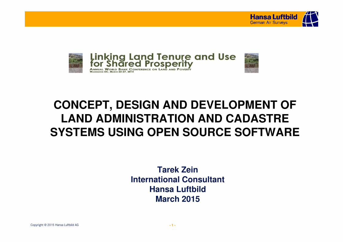
CONCEPT, DESIGN AND DEVELOPMENT OF LAND ADMINISTRATION AND CADASTRE
SYSTEMS USING OPEN SOURCE SOFTWARE
Tarek ZeinInternational Consultant
Hansa LuftbildMarch 2015
- 2 -Copyright @ 2015 Hansa Luftbild AG
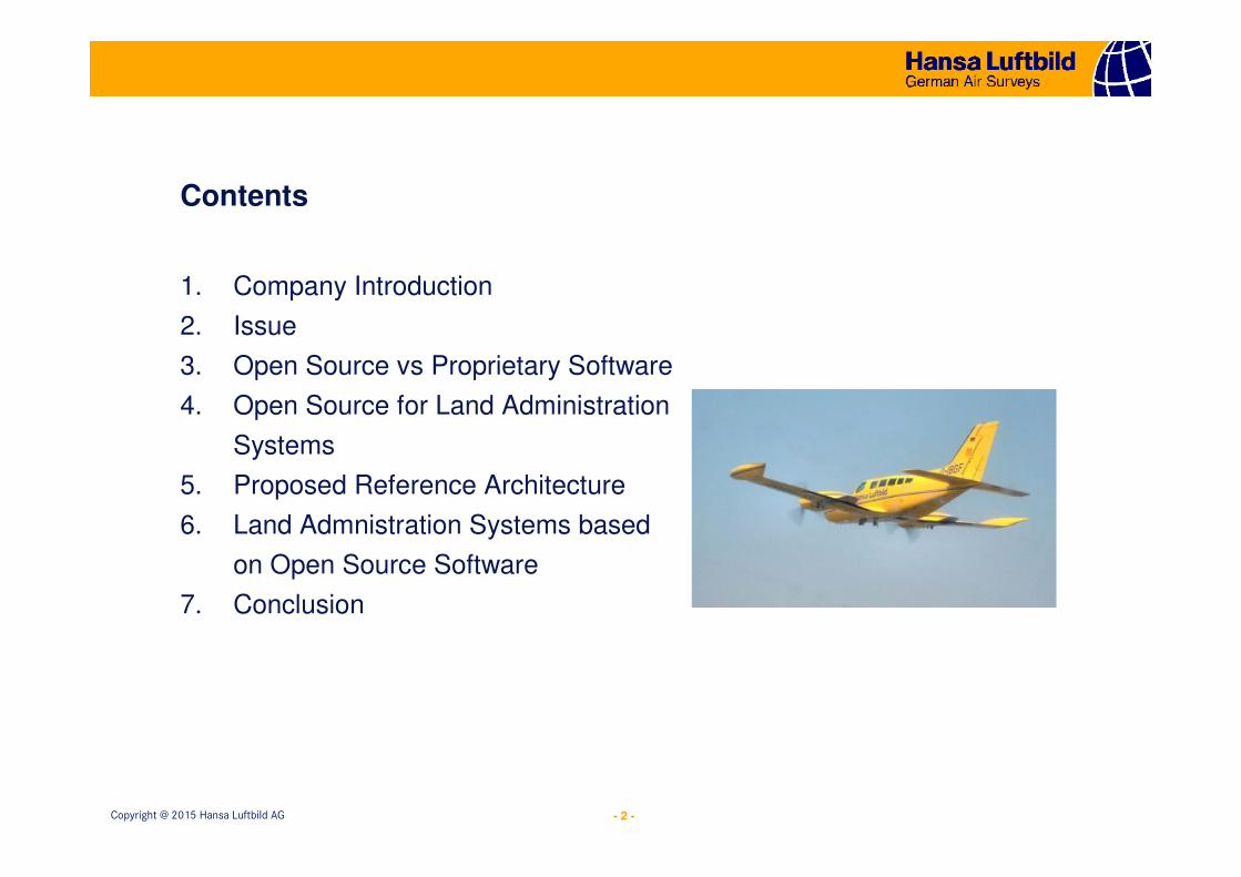
1. Company Introduction
2. Issue
3. Open Source vs Proprietary Software
4. Open Source for Land Administration
Systems
5. Proposed Reference Architecture
6. Land Admnistration Systems based
on Open Source Software
7. Conclusion
Contents
- 3 -Copyright @ 2015 Hansa Luftbild AG
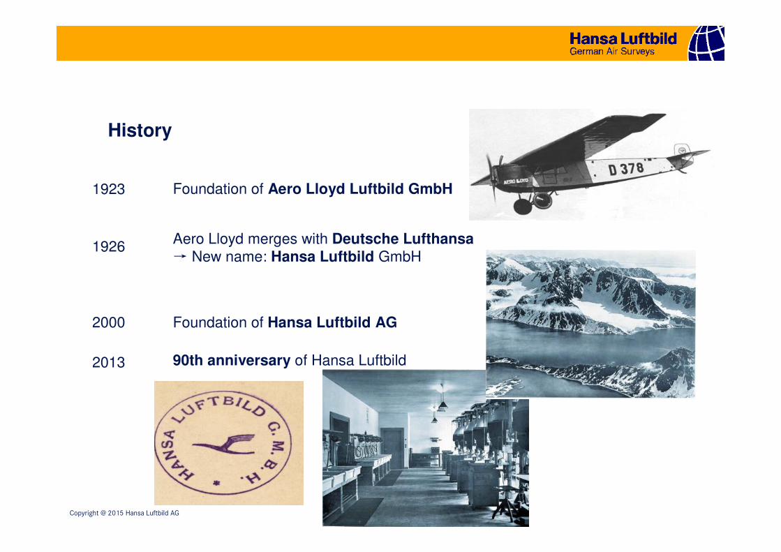
History
Aero Lloyd merges with Deutsche Lufthansa→ New name: Hansa Luftbild GmbH
1926
1923 Foundation of Aero Lloyd Luftbild GmbH
2013
2000 Foundation of Hansa Luftbild AG
90th anniversary of Hansa Luftbild
- 4 -Copyright @ 2015 Hansa Luftbild AG
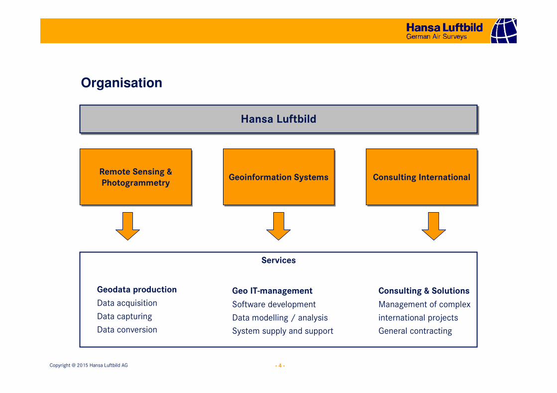
Services
Hansa LuftbildHansa Luftbild
Remote Sensing &
Photogrammetry
Remote Sensing &
PhotogrammetryConsulting InternationalConsulting InternationalGeoinformation SystemsGeoinformation Systems
Geodata production
Data acquisition
Data capturing
Data conversion
Geo IT-management
Software development
Data modelling / analysis
System supply and support
Consulting & Solutions
Management of complex
international projects
General contracting
Organisation
- 5 -Copyright @ 2015 Hansa Luftbild AG
Issue
In deploying new or modernizing existing land administration and cadastre systems (LAS) authorities / agencies are often confronted with an important decision:
open source or proprietary software?
� Neither open source nor proprietary software caters to the full requirements of land administration and cadastre authorities.
� These platforms will require customization to adhere to the requirements of the requesting authority, region or country.
- 6 -Copyright @ 2015 Hansa Luftbild AG
Open Source vs Proprietary Software
Motivation
• proprietary software companies want to make a profit, sell more licences, earn more money through new upgrades, new versions etc.; knowledge is monopolised
• open source community wants to solve problems, share knowledge, make software accessible to all; commercial interests are there, not for selling licences but for services and solutions
- 7 -Copyright @ 2015 Hansa Luftbild AG
Open Source vs Proprietary Software
Many online discussions and blogs address the issue of the relative advantages of open source based solutions versus those of proprietary
based solutions
Ben Kepes writes:Open source is good, but proprietary is still winning
(www.forbes.com)
Virginia Backaitis writes:
There is no clear winner (www.cmswire.com)
David A. Wheeler writes:using open source software / free software is a reasonable or even
superior approach to using proprietary…..(www.dwheeler.com)
- 8 -Copyright @ 2015 Hansa Luftbild AG
Open Source vs Proprietary Software
…, it's no longer a case of open source or proprietary. The reality is that a combination of both types of software used in one infrastructure with each meeting specific requirements of an organisation is the best way forward.
March Evans (www.quru.com)
- 9 -Copyright @ 2015 Hansa Luftbild AG
Open Source vs Proprietary Software
The (US) Department of Homeland Security has developed its own intrusion detection system called Suricata – a complete suite that is based on open source.
The National Security Agency (NSA) supports other open source projects, one of which is Security Enhanced Linux (SE-Linux) for which it has developed an access control module called Flask, hosted at the University of Utah.
Mark Evans (www.quru.com)
- 10 -Copyright @ 2015 Hansa Luftbild AG
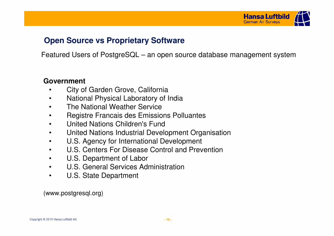
Open Source vs Proprietary Software
Government
• City of Garden Grove, California• National Physical Laboratory of India• The National Weather Service• Registre Francais des Emissions Polluantes• United Nations Children's Fund• United Nations Industrial Development Organisation• U.S. Agency for International Development• U.S. Centers For Disease Control and Prevention• U.S. Department of Labor• U.S. General Services Administration• U.S. State Department
(www.postgresql.org)
Featured Users of PostgreSQL – an open source database management system
- 11 -Copyright @ 2015 Hansa Luftbild AG
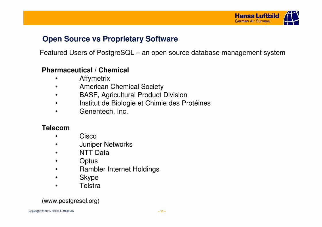
Open Source vs Proprietary Software
Pharmaceutical / Chemical
• Affymetrix• American Chemical Society• BASF, Agricultural Product Division• Institut de Biologie et Chimie des Protéines• Genentech, Inc.
Telecom• Cisco• Juniper Networks• NTT Data• Optus• Rambler Internet Holdings• Skype• Telstra
(www.postgresql.org)
Featured Users of PostgreSQL – an open source database management system
- 12 -Copyright @ 2015 Hansa Luftbild AG
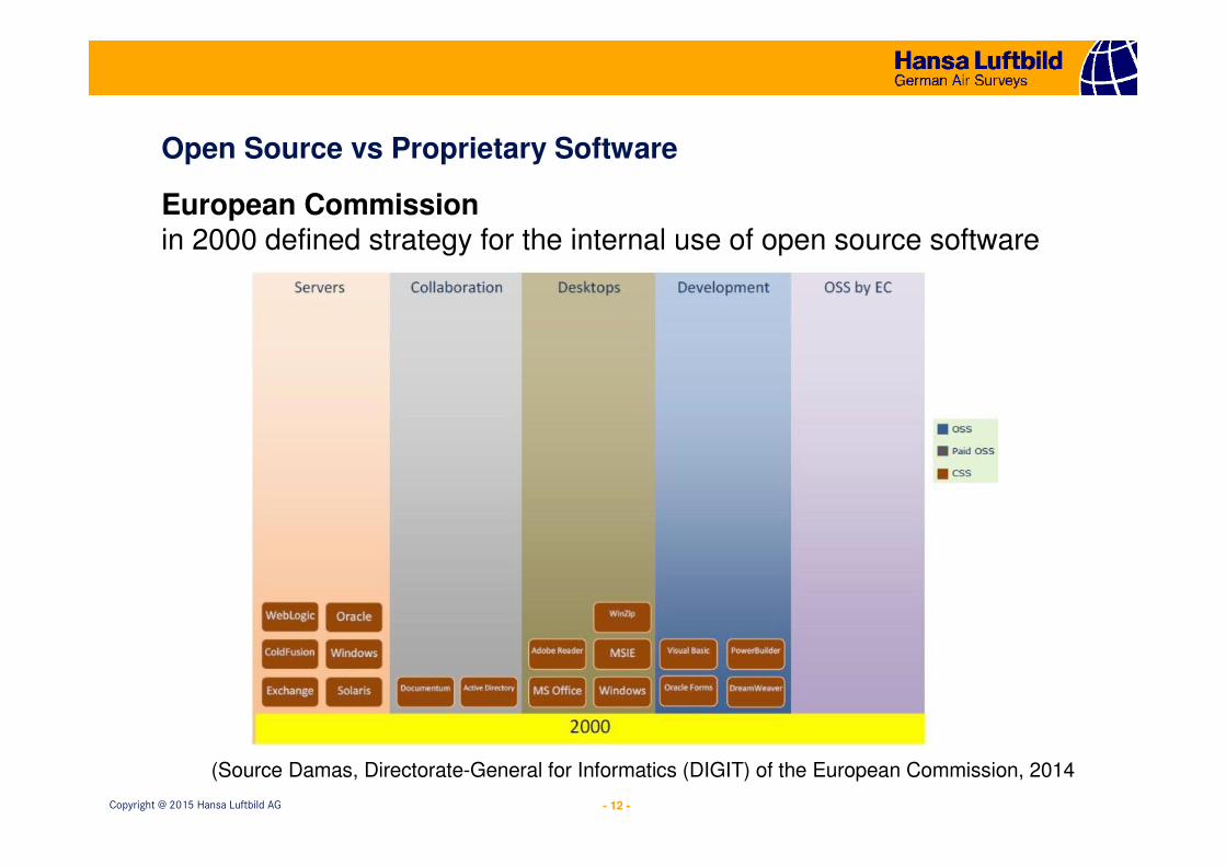
Open Source vs Proprietary Software
European Commissionin 2000 defined strategy for the internal use of open source software
(Source Damas, Directorate-General for Informatics (DIGIT) of the European Commission, 2014
- 13 -Copyright @ 2015 Hansa Luftbild AG
Open Source vs Proprietary Software
European Commission
Two of the key components of the EC strategy for the internal use of open source software covering the period 2011-2013 are:
1. continue to adopt formally (through the Product Management procedure) the use of open source software technologies and products where a clear benefit can be expected, and
2. consider open source software solutions alongside proprietary ones in IT procurements. Contracts to be awarded on a "value for money" basis.
(http://ec.europa.eu/dgs/informatics/oss_tech/index_en.htm)
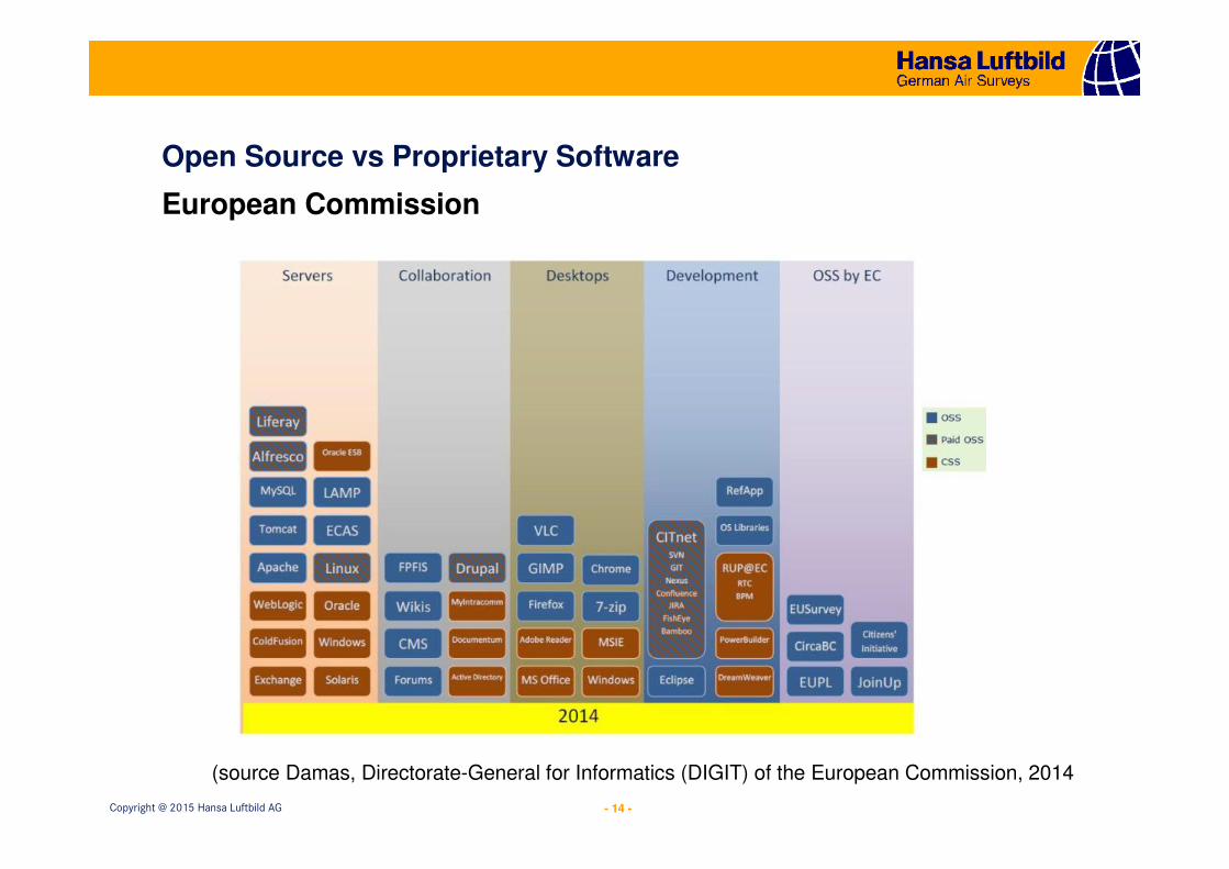
- 14 -Copyright @ 2015 Hansa Luftbild AG
Open Source vs Proprietary Software
European Commission
(source Damas, Directorate-General for Informatics (DIGIT) of the European Commission, 2014
- 15 -Copyright @ 2015 Hansa Luftbild AG
Land Information Systems (LAS)
Land administration is defined as “…the processes of recording and disseminating information about the ownership, value and use of land and its associated resources.”
(UN-ECE, 1996)
Williamson et al. (2010) in their book Land Administration for Sustainable Development state that the LAS must support four main land management functions :land tenure, land value, land use, and land development
- 16 -Copyright @ 2015 Hansa Luftbild AG
Land Information Systems (LAS)
Williamson et al. (2010) statefour main ingredients to implementing a sustainable and successful LAS:
• The land management paradigm with its core administration functions• The common processes found in every system• A toolbox approach offering tools and implementation options• A role for land administration in supporting sustainable development
- 17 -Copyright @ 2015 Hansa Luftbild AG
Land Information Systems (LAS)
• Land management paradigm covers the four main land management functions: land tenure, land value, land use, and land development
• Common processes which are found in every LAS: dividing up land,tracking changes, or distributing land
• Toolbox containing a set of tools (abstract or technical) which can be used for setting up an LAS
• Role of LAS is to provide the necessary information about land to support decisions related to the environment, the economy and the society
Focus will be on the technical tools common to all LASs
- 18 -Copyright @ 2015 Hansa Luftbild AG
Land Administration Domain Model (LADM) for LAS
Development of LAS requires a data model which falls within the land admnistration domain
ISO 19512:2012 Land Administration Domain Model (LADM) provides all necessary data modelling and data structure related to the design and implementation of an LAS
ISO 19152 is the result of wide-ranging consultations between many international expertsLADM has two main goals:
• providing an extensible basis for the development and refinement of efficient and effective land administration systems, based on a Model Driven Architecture (MDA), and
• enabling the involved parties, both within one country and between different countries, to communicate, based on the shared vocabulary implied by the model
- 19 -Copyright @ 2015 Hansa Luftbild AG
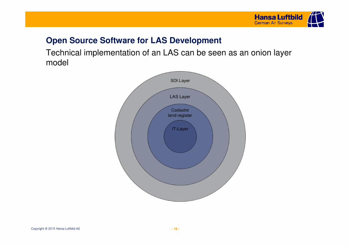
Open Source Software for LAS Development
Technical implementation of an LAS can be seen as an onion layermodel
- 20 -Copyright @ 2015 Hansa Luftbild AG
Open Source Software for LAS Development
• Inner/first layer, the IT layer, is the general purpose IT system;
completely domain independent; main components are the
database and geographic information systems (GIS).
• Second layer, the cadastre and land register layer contains the
cadastre and land registration system, providing the general
functionality which all LAS have in common.
• Third layer, the LAS layer, contains the implementation which is
specific to a concrete LAS and includes the processes and the
models.
• Outer layer, the spatial data infrastructure (SDI) layer, contains
the interface to services and systems based on land information
and to spatially enabled government processes, ensuring
sustainable development.
- 21 -Copyright @ 2015 Hansa Luftbild AG
Open Source Software for LAS Development
The IT layer and the cadastre and land register layer are independent
from a concrete LAS. Therefore these layers are ideal candidates for an
OSS implementation based on the collaborative approach
OSS components:
• PostgreSQL with PostGIS for implementing database with spatial
data handling
• QGIS for implementing the GIS component• GeoServer for implementing all OGC compliant services• OpenLayers for implementing all web client related applications
� On the basis of these OSS components another web application with the name ExperMaps has been developed
www.expermaps.com
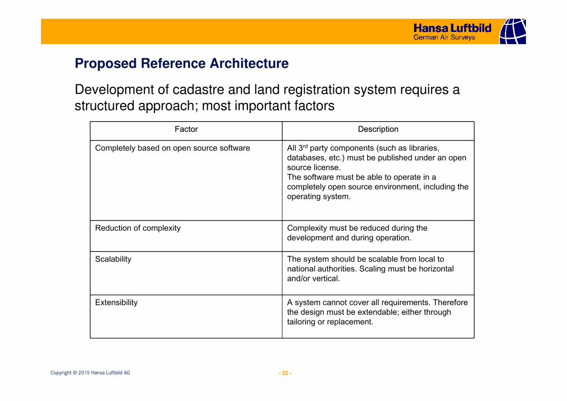
- 22 -Copyright @ 2015 Hansa Luftbild AG
Proposed Reference Architecture
Development of cadastre and land registration system requires a structured approach; most important factors
Factor Description
Completely based on open source software All 3rd party components (such as libraries, databases, etc.) must be published under an open source license.The software must be able to operate in a completely open source environment, including the operating system.
Reduction of complexity Complexity must be reduced during the development and during operation.
Scalability The system should be scalable from local to national authorities. Scaling must be horizontal and/or vertical.
Extensibility A system cannot cover all requirements. Therefore the design must be extendable; either through tailoring or replacement.
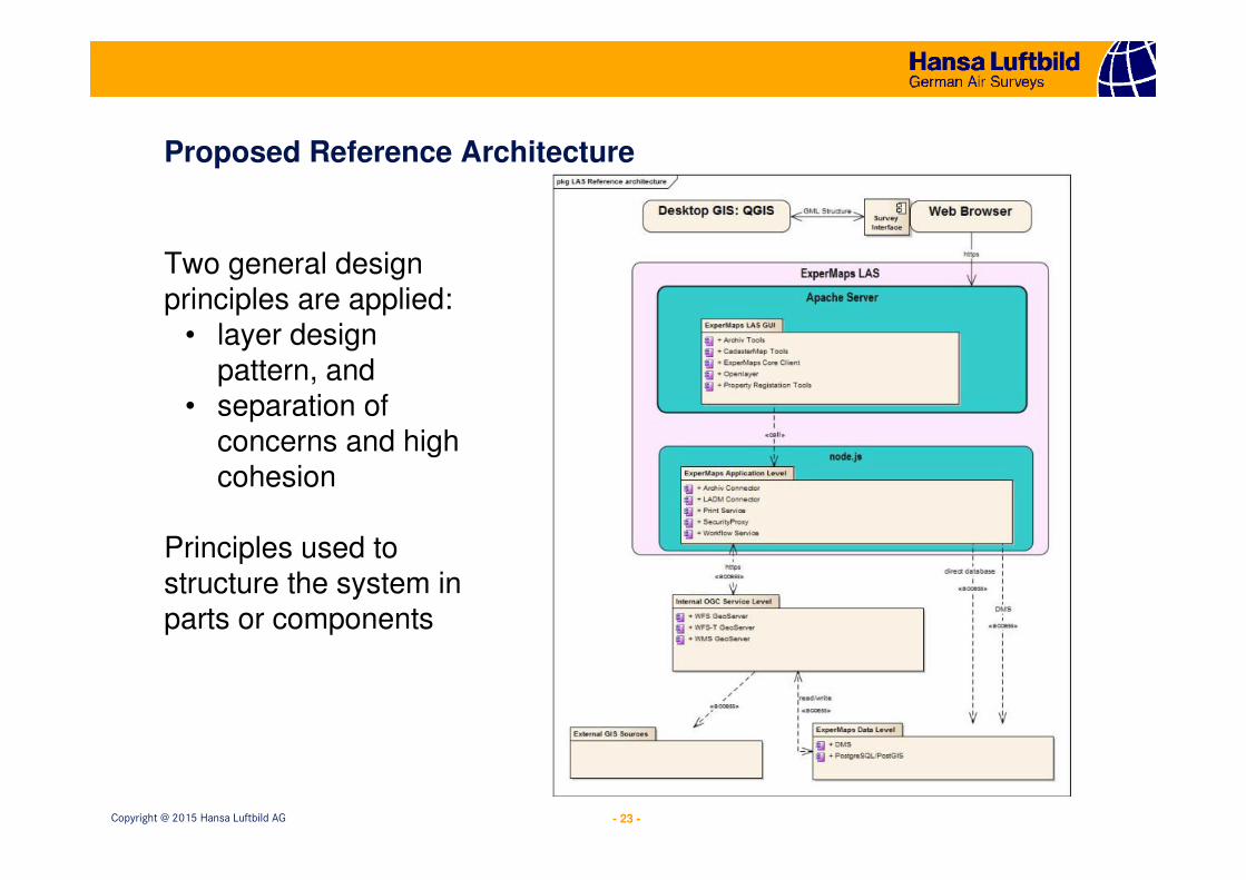
- 23 -Copyright @ 2015 Hansa Luftbild AG
Proposed Reference Architecture
Two general design principles are applied:
• layer design pattern, and
• separation of concerns and high cohesion
Principles used to structure the system in parts or components
- 24 -Copyright @ 2015 Hansa Luftbild AG
Proposed Reference Architecture
System is structured in four main component levels:
1.ExperMaps Data Level
2.Internal OGC Service Level
3.ExperMaps LAS
4.Desktop GIS - QGIS
- 25 -Copyright @ 2015 Hansa Luftbild AG
Proposed Reference Architecture
1. ExperMaps Data Level• provides the persistence services for the entire system and is
implemented in PostgreSQL / PostGIS database. The database hosts an LADM compliant data model;
• integrates a document management system (DMS) implemented in Alfresco or Agorum, both are OSS developments
2. Internal OGC Service Level• provides OGC compliant services and is implemented on a
GeoServer.
- 26 -Copyright @ 2015 Hansa Luftbild AG
Proposed Reference Architecture
3. ExperMaps LAS• is the core component of the system and is implemeted with
ExperMaps. It includes all domain specific functionalities. • separated into two parts, the application level and the user
interface (GUI)• application level uses node.js as a runtime environment• GUI is front end of the system and is based on OpenLayers and
is implemented in JavaScript
4. Desktop GIS – QGIS• desktop GIS implemented in QGIS used for advanced GIS
operations, such as cartography, in-depth spatial analysis, importing and edit of surveying data, etc..
• data transfer between QGIS and ExperMaps LAS performed via standard interfaces, such as the Web Feature Service (WFS) or the Georaphic Markup Language (GML).
- 27 -Copyright @ 2015 Hansa Luftbild AG
Open Source in Land Administration and Spatial Data Infrastructure
Solutions for Open Land Administration SOLA
(Source: Bonn City Administration 2014)
Two constraints were applied to the SOLA development
1. Open source software to be used in the implementation
2. System should be portable to a wide range of major
hardware and operating system platforms
- 28 -Copyright @ 2015 Hansa Luftbild AG
Open Source in Land Administration and Spatial Data Infrastructure
Solutions for Open Land Administration SOLA
The outcome of the processes’ definition and requirements was an architecture based on a modular generic core customizable according to the needs of land and cadastre authorities or agencies in different countries
SOLA database design is based on the Land Admnistration Domain Model (LADM)
- 29 -Copyright @ 2015 Hansa Luftbild AG
Open Source in Land Administration and Spatial Data Infrastructure
Solutions for Open Land Administration SOLA
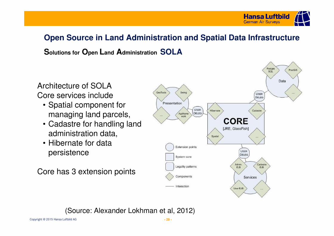
Architecture of SOLACore services include
• Spatial component for managing land parcels,
• Cadastre for handling land administration data,
• Hibernate for data persistence
Core has 3 extension points
(Source: Alexander Lokhman et al, 2012)
- 30 -Copyright @ 2015 Hansa Luftbild AG
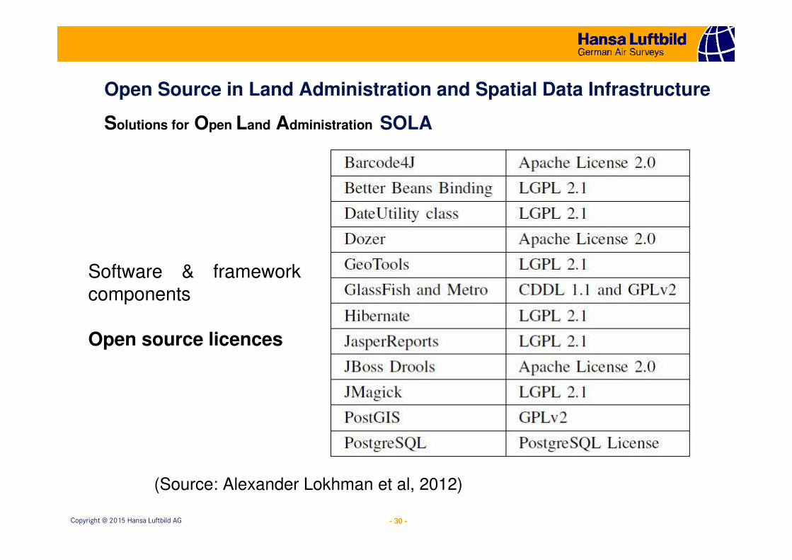
Open Source in Land Administration and Spatial Data Infrastructure
Solutions for Open Land Administration SOLA
Software & framework components
Open source licences
(Source: Alexander Lokhman et al, 2012)
- 31 -Copyright @ 2015 Hansa Luftbild AG
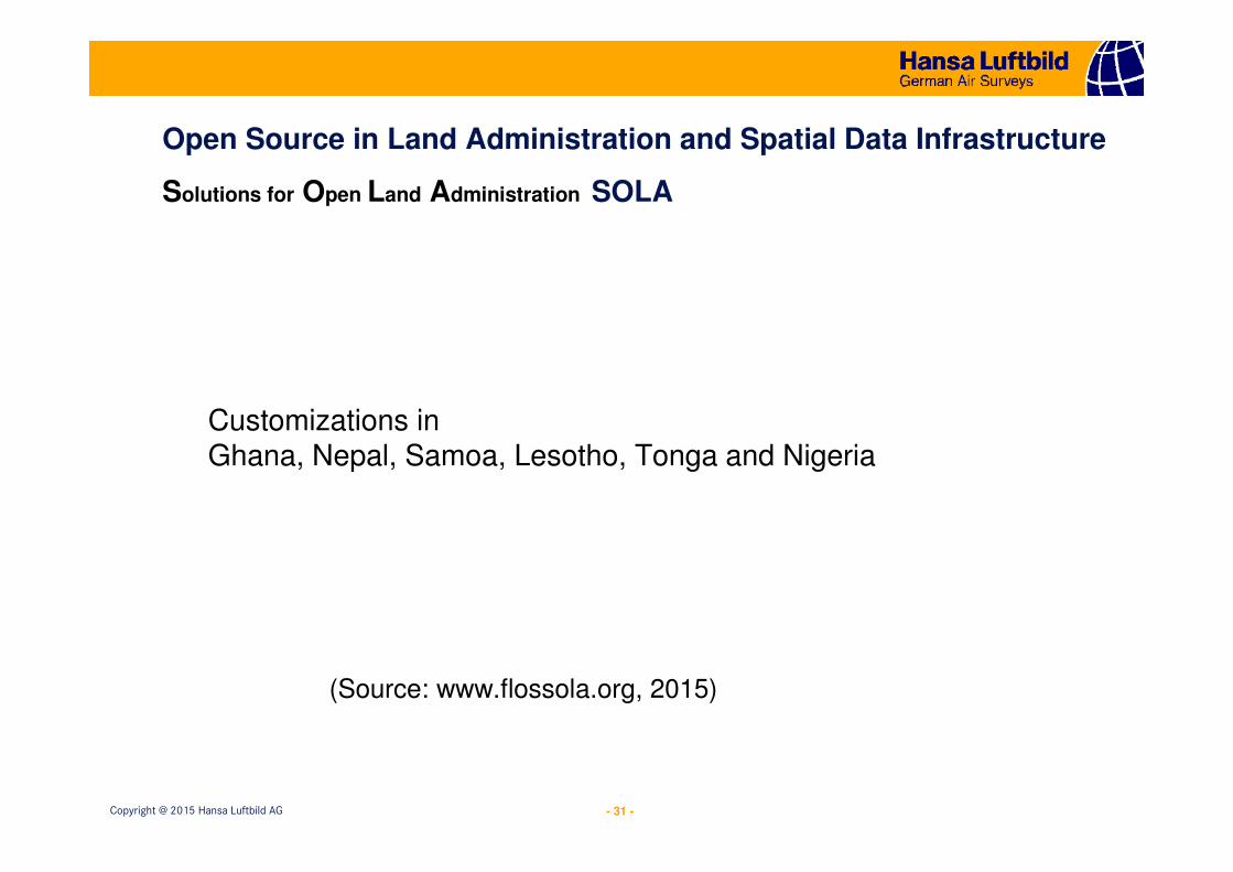
Open Source in Land Administration and Spatial Data Infrastructure
Solutions for Open Land Administration SOLA
Customizations in Ghana, Nepal, Samoa, Lesotho, Tonga and Nigeria
(Source: www.flossola.org, 2015)
- 32 -Copyright @ 2015 Hansa Luftbild AG
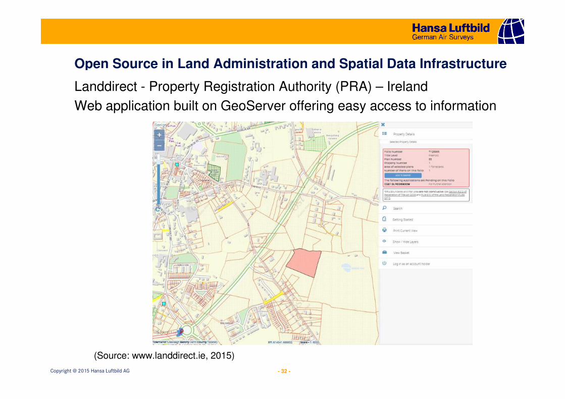
Open Source in Land Administration and Spatial Data Infrastructure
(Source: www.landdirect.ie, 2015)
Landdirect - Property Registration Authority (PRA) – Ireland
Web application built on GeoServer offering easy access to information
- 33 -Copyright @ 2015 Hansa Luftbild AG
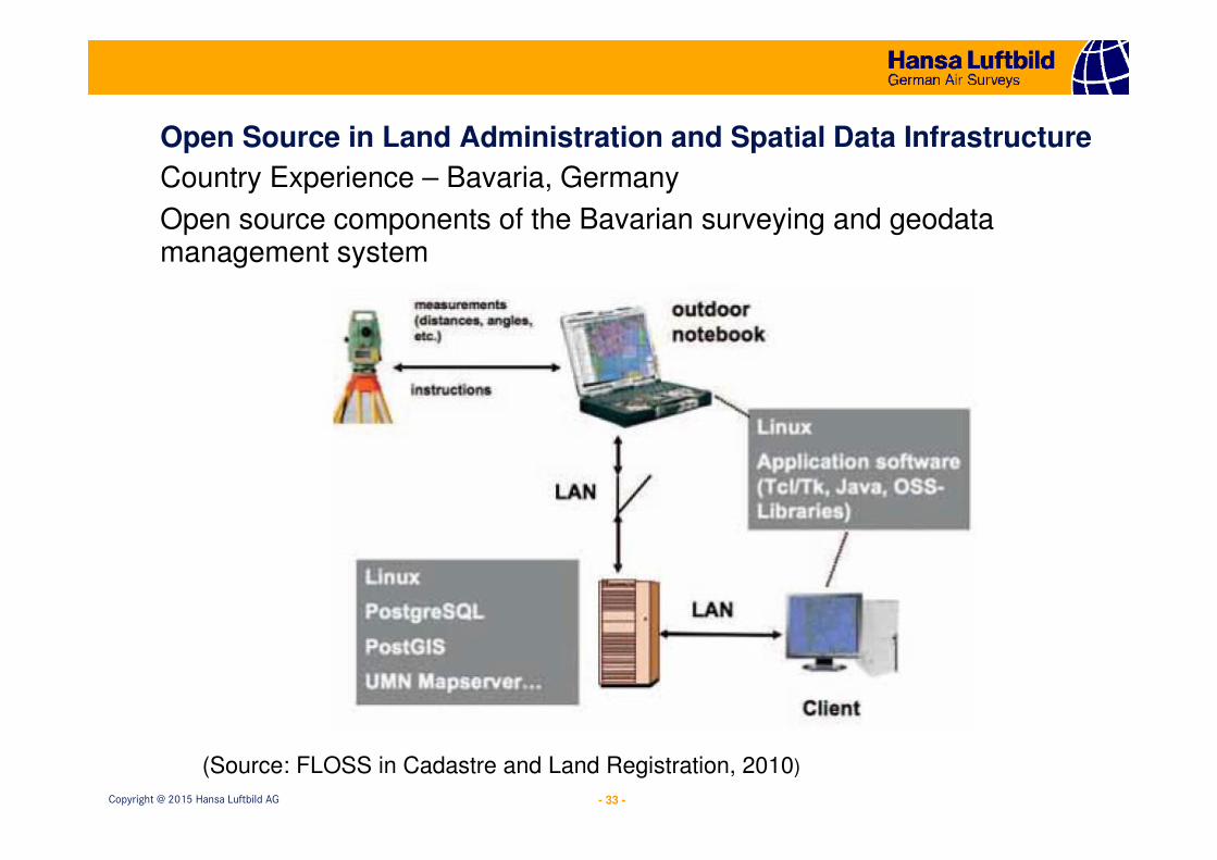
Open Source in Land Administration and Spatial Data Infrastructure
(Source: FLOSS in Cadastre and Land Registration, 2010)
Country Experience – Bavaria, Germany
Open source components of the Bavarian surveying and geodata management system
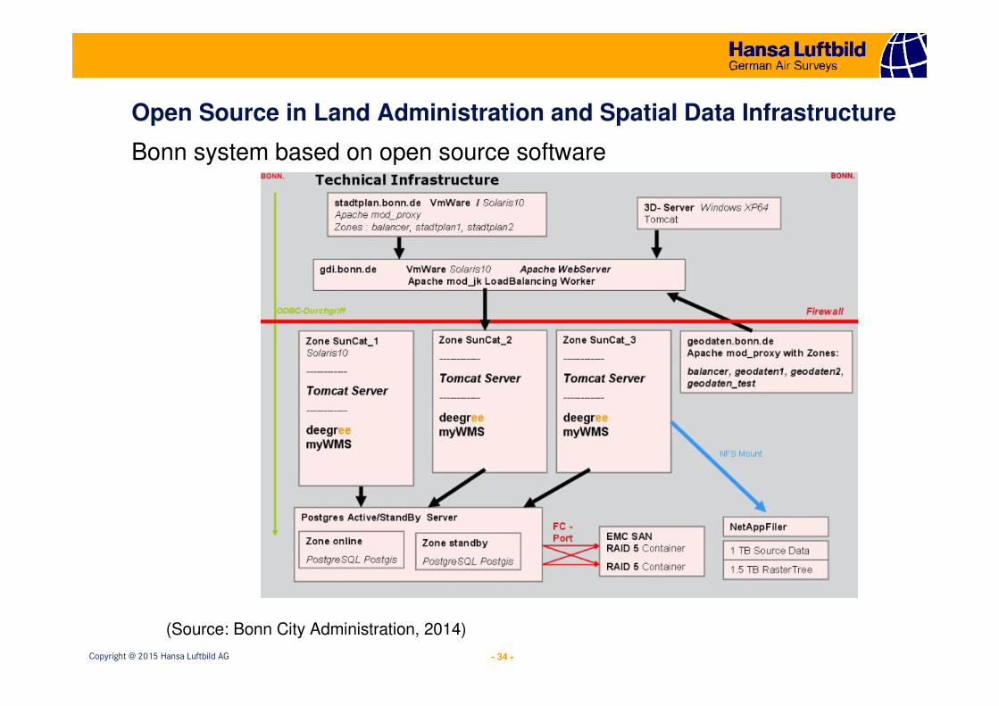
- 34 -Copyright @ 2015 Hansa Luftbild AG
Open Source in Land Administration and Spatial Data Infrastructure
Bonn system based on open source software
(Source: Bonn City Administration, 2014)
- 35 -Copyright @ 2015 Hansa Luftbild AG
Conclusion
The use of open source software provides a good opportunity for developing countries to own a cost efficient land administrationsoftware solution which can ensure sustainable development
- 36 -Copyright @ 2015 Hansa Luftbild AG
Thank you for your attention
Hansa Luftbild AGNevinghoff 20 48147 MuensterGermany
Tel.: +49-251-2330-0Fax.: +49-251-2330-112