Embed Size (px)
Citation preview
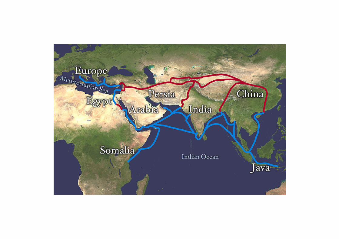
CONTINENTAL /
SUB-CONTINENTAL REGION
SOUTH ASIA
India, Pakistan, Bangladesh,
Sri-Lanka
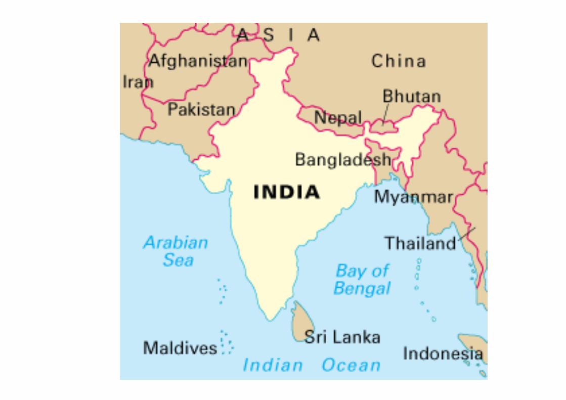
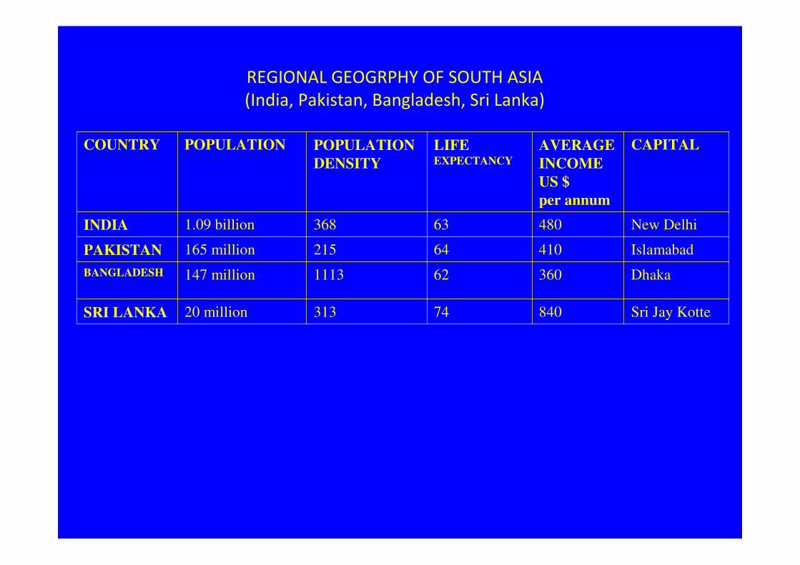
REGIONAL GEOGRPHY OF SOUTH ASIA
(India, Pakistan, Bangladesh, Sri Lanka)
COUNTRY POPULATION POPULATION
DENSITY
LIFE EXPECTANCY
AVERAGE
INCOME
US $
per annum
CAPITAL
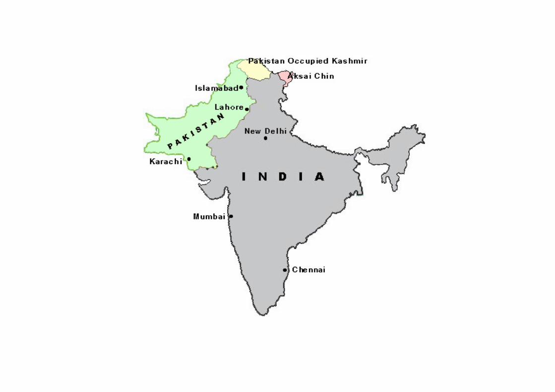
INDIA 1.09 billion 368 63 480 New Delhi
PAKISTAN 165 million 215 64 410 Islamabad
BANGLADESH 147 million 1113 62 360 Dhaka
SRI LANKA 20 million 313 74 840 Sri Jay Kotte
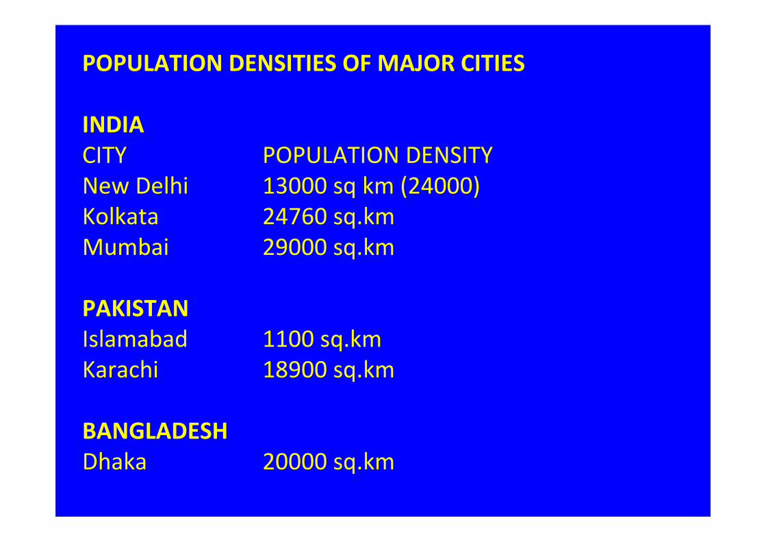
POPULATION DENSITIES OF MAJOR CITIES
INDIA
CITY POPULATION DENSITY
New Delhi 13000 sq km (24000)
Kolkata 24760 sq.km
Mumbai 29000 sq.km
PAKISTAN
Islamabad 1100 sq.km
Karachi 18900 sq.km
BANGLADESH
Dhaka 20000 sq.km
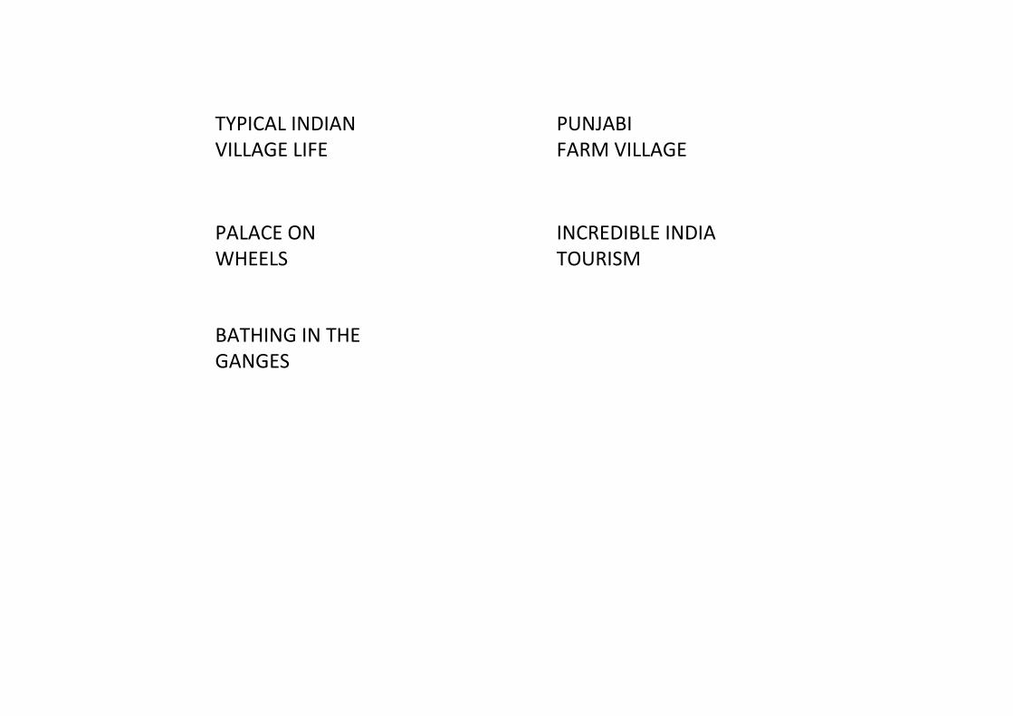
TYPICAL INDIAN
VILLAGE LIFE
PUNJABI
FARM VILLAGE
PALACE ON
WHEELS
INCREDIBLE INDIA
TOURISM
BATHING IN THE
GANGES
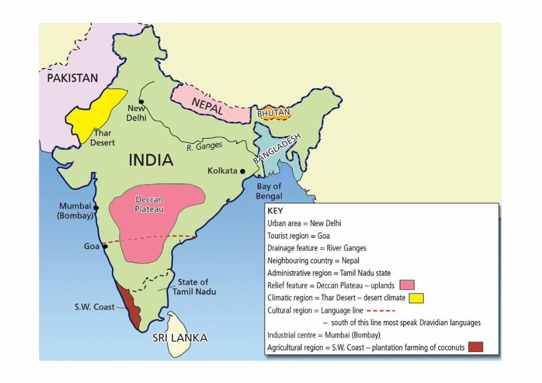
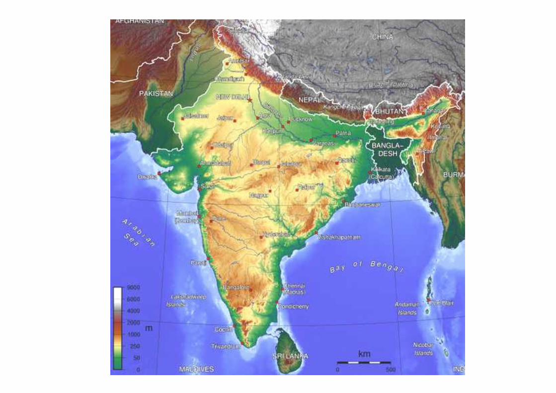
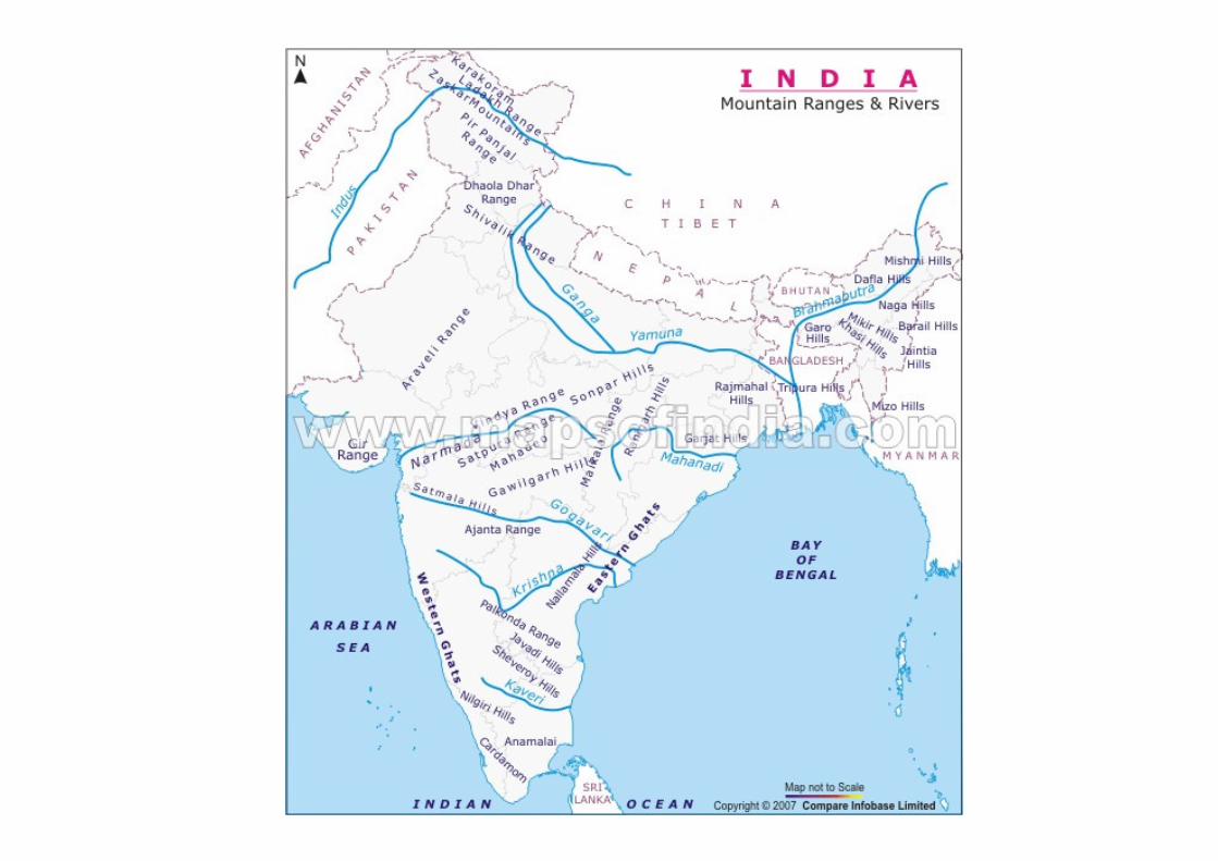
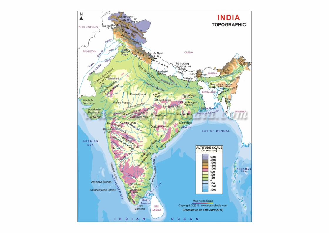
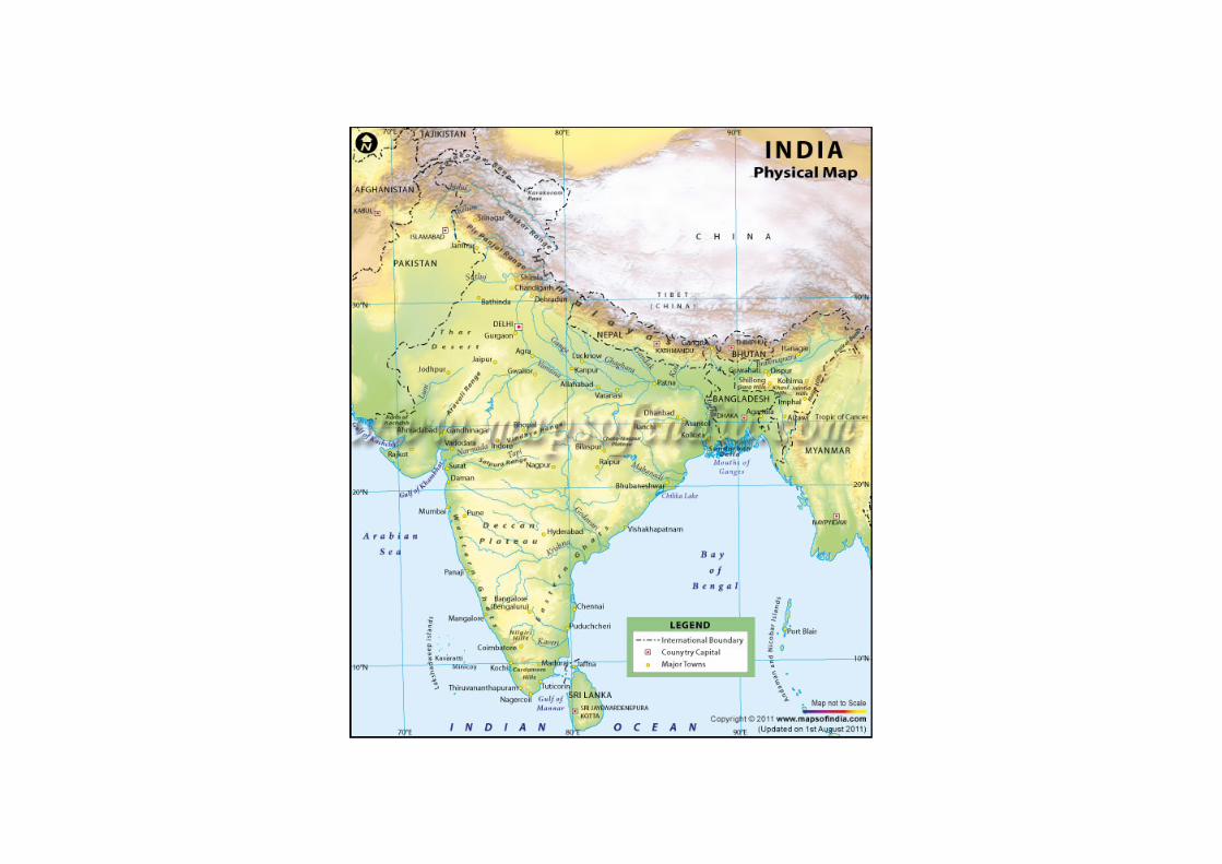
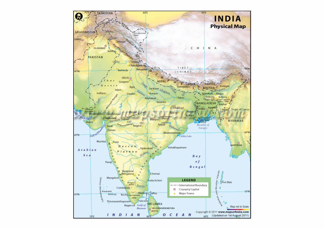
PHYSICAL GEOGRAPHY
RELIEF
Himalya
100 to 150 km wide
Over 1000 km long
Some peaks over 8000m high
Middle Himalaya over 5000m high
Foothills 1200m
Glaciers and snow feed rivers like the Ganges
Ganges Plain
The Ganges Plain is a broad, alluvial lowland, 100 to 300 miles (160 to 480 km) wide, spanning the country south of the
Himalayas. It consists mainly of the fertile basin of the Ganges River.
Deccan Plateau
The Deccan Plateau, often called simply the Deccan, occupies the peninsula south of the Ganges Plain. It is roughly
triangular in shape and consists of a vast tableland broken by river valleys, with areas of rolling hills. The land slopes gently
downward toward the east.
Western Ghats
The Western Ghats, 3,000 to 5,000 feet (900 to 1,500 m) high, form a sheer wall that drops abruptly to a narrow coastal
plain along the Arabian Sea.
Eastern Ghats
The Eastern Ghats, in contrast, consist of low, disconnected ranges that slope gently toward a broader coastal plain along
the Bay of Bengal
DRAINAGE
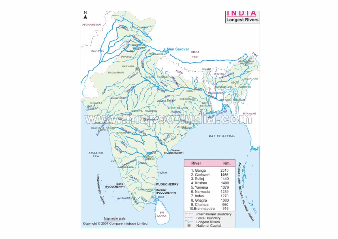
Ganges River
India's principal river is the Ganges. It flows from the western Himalayas to the Bay of Bengal—a distance of
more than 1,500 miles (2,400 km). Together with such tributaries as the Yamuna, Son, Ghaghara, and Gandak,
the Ganges drains most of the mountains and the plains and part of the Deccan.
Brahmaputra River
In the northeast the Brahmaputra River follows a tortuous course through the Assam Valley from China and
merges with the Ganges to form a vast delta, lying partly in India and partly in Bangladesh. The Ravi and Sutlej
rivers, part of the Indus system, flow across northern India to Pakistan.
Deccan Plateau Rivers
The Deccan is drained primarily by the eastward-flowing Mahanadi, Godavari, Krishna, and Cauvery rivers. They
form large, fertile deltas at their mouths on the Bay of Bengal. The Narmada and Tapti are the only sizable rivers
flowing to the Arabian Sea.
India's rivers are used extensively for irrigation; they are also used for hydroelectric power and navigation. Of
particular importance is the Indus River system, which provides water for the dry Punjab region of India and
Pakistan. The Indus Waters Treaty of 1960 allocates the waters of the Ravi and Sutlej to India and the waters of
the Indus and its other major tributaries to Pakistan. Bhakra Dam, on the Sutlej River, is the largest of many
dams in India and one of the highest dams in the world.
CLIMATE
MONSOON MONSOON MONSOONThree seasons are generally recognized in India—the cool, the hot, and the rainy.
The cool season lasts from October or November until early March. Average temperatures in December and
January, the coolest months, vary from about 55°F. (13°C.) on the northern edge of the Ganges Plain to
between 70°and 80°F. (21°and 27°C.) in the coastal cities of the south. For most of the country this is the
dry season. A notable exception is the southeastern coast, which receives much of its annual rainfall with the
winter, or northeast, monsoon in October, November, and December. There is heavy snowfall in the
Himalayas.
The hot season prevails from about mid-March until June; it is extremely dry. Temperatures rise rapidly over
most of the country, reaching averages of 85°to 95°F. (29°to 35°C.) in May, the hottest month. Daytime
highs often exceed 100°F. (38°C.), especially on the Ganges Plain. Nights bring only slight relief from the
intense heat.
The rainy season begins in June with the onset of the summer, or southwest, monsoon and continues
through September. Most of India receives more than 80 per cent of its annual rainfall during this period. In
addition to rain, the summer monsoon brings a reduction in the heat, but causes high, often oppressive,
humidity. The heaviest rains, totaling more than 100 inches (2,540 mm) a year, occur in the northeast and
along the Malabar Coast in the southwest. At Cherrapunji, in Meghalaya state in the northeast, the annual
average is about 425 inches (10,800 mm)—one of the highest in the world. Elsewhere rainfall usually varies
from 20 to 80 inches (500 to 2,000 mm) a year. Only the Thar Desert receives less than 10 inches (250 mm).
The summer monsoon is vital to India's agriculture. The timing and the amount of the rains can mean the
difference between a successful harvest and widespread crop failure and famine.
ECONOMIC ACTIVITIES
PRIMARY ECONOMIC ACTIVITIES
Agriculture
Over 65% of subcontinent’s workforce employed in agriculture
India
At present, in terms of agricultural production, the country holds the second position all over
the world.
In 2007, agriculture and other associated industries such as lumbering and forestry represented
around 16.6% of the Gross Domestic Product of the country. In addition, the sector recruited
about 52% of the entire manpower.
It contributes approximately one-fifth of total gross domestic product (GDP). Agriculture
accounts for about 10 per cent of the total export earnings and provides raw material to a large
number of industries.
About 10% of the fruits produced in the world are produced in India
India houses the biggest number of livestock in the world and the count is 281 million.
The total arable territory in India is about 56.78% of the overall land zone of the country.
Mean yearly precipitation of 1,100 mm.
Irrigation represents 92% of the consumption of water.
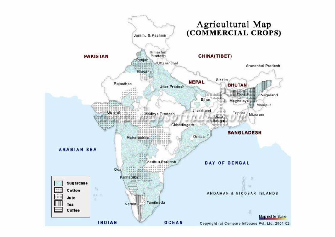
AGRICULTURAL PRODUCTS
India ranks first in producing the following agricultural outputs:
• Fresh fruit
• Badian
• Fennel
• Tropical fresh fruit
• Coriander
• Pigeon peas
• Jute
• Spices
• Pulses
• Castor oil seed
• Millets
• Safflower seeds
• Sesame seeds
• Limes
• Lemons
• Dry chillies and peppers
• Cow's milk
• Cashew nuts
• Chickpeas
• Ginger
• Okra
• Guavas
• Turmeric
• Goat milk
• Mangoes
• Meat
• Buffalo milk
India is fast emerging as a global manufacturing hub. India has all the requisite
skills in product, process and capital engineering, thanks to its long
manufacturing history and higher education system.
India's cheap, skilled manpower is attracting a number of companies, spanning
diverse industries, making India a global manufacturing powerhouse. India with
its vast design skills has attracted a lot of outsourcing technological orders.
Manufacturing
• In 1947 only 2% of workforce in manufacturing
• Industry now accounts for 28% of the GDP and employ 17% of the total workforce.
• In absolute terms, India is 12th in the world in terms of nominal factory output.
• The Indian industrial sector underwent significant changes as a result of the economic reforms of 1991, which removed import restrictions, brought in foreign competition, led to privatisation of certain public sector industries, liberalised the FDI regime & improved infrastructure.
• Post-liberalisation, the Indian private sector was faced with increasing domestic as well as foreign competition, including the threat of cheaper Chinese imports. It has since handled the change by squeezing costs, revamping management, and relying on cheap labour and new technology.
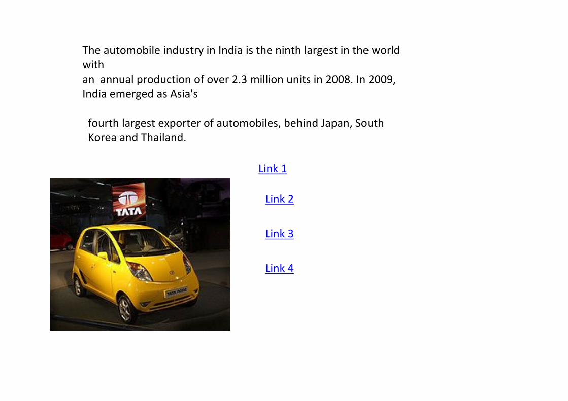
The automobile industry in India is the ninth largest in the world
with
an annual production of over 2.3 million units in 2008. In 2009,
India emerged as Asia's
fourth largest exporter of automobiles, behind Japan, South
Korea and Thailand.
Link 1
Link 2
Link 3
Link 4
India has emerged as one of the world's largest manufacturers of small cars. According to
New York Times, India's strong engineering base and expertise in the manufacturing of low-
cost, fuel-efficient cars has resulted in the expansion of manufacturing facilities of several
automobile companies like Hyundai Motors, Nissan, Toyota, Volkswagen and Suzuki
In 2008, Hyundai Motors alone exported 240,000 cars made in India.
Nissan Motors plans to export 250,000 vehicles manufactured in its India plant by 2011.
Similarly, General Motors announced its plans to export about 50,000 cars manufactured in
India by 2011.
In September 2009, Ford Motors announced its plans to setup a plant in India with an annual
capacity of 250,000 cars for US$500 million. The cars will be manufactured both for the Indian
market and for export. The company said that the plant was a part of its plan to make India
the hub for its global production business. Fiat Motors also announced that it would source
more than US$1 billion worth auto components from India.
Textile manufacturing is the second largest source of employment after agriculture
and accounts for 20% of manufacturing output, providing employment to over 20
million people.
The transformation of the textile industry from a degrading to rapidly developing
industry, has become the biggest achievement of the central government.
After freeing the industry in 2004–2005 from a number of limitations, primarily
financial, the government gave the green light to the flow of massive investment –
both domestic and foreign.
During the period from 2004 to 2008, total investment amounted to 27 billion
dollars.
By 2012, still convinced of the government, this figure will reach 38 billion as
expected; these investments in 2012 will create an additional sector of more than
17 million jobs.
Ludhiana produces 90% of woollens in India and is known as the Manchester of
India. Tirupur has gained universal recognition as the leading source of hosiery,
knitted garments, casual wear and sportswear.
• In textiles, the country is ranked fourth after China, USA and Italy, while in
electrical machinery and apparatus, it is ranked fifth.
• It holds sixth position in the basic metals category; seventh in chemicals and
chemical products;
• 10th in leather, leather products, refined petroleum products and nuclear fuel;
twelfth in machinery and equipment and motor vehicles.
• Quarterly estimate of GDP for July-September (Q2) 2009-10, according to data
released by the Central Statistical Organisation (CSO), for manufacturing stood at
US$ 46.42 billion at current prices, 9.4 per cent higher than during the same
period in 2008-09.
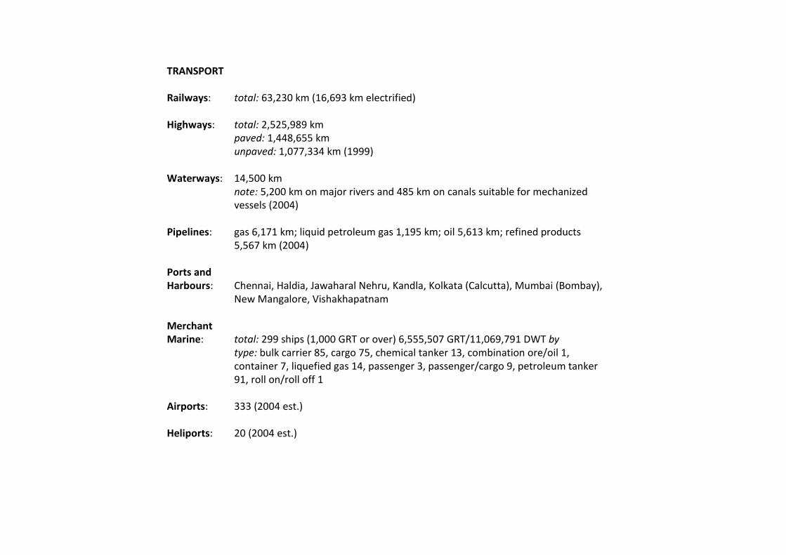
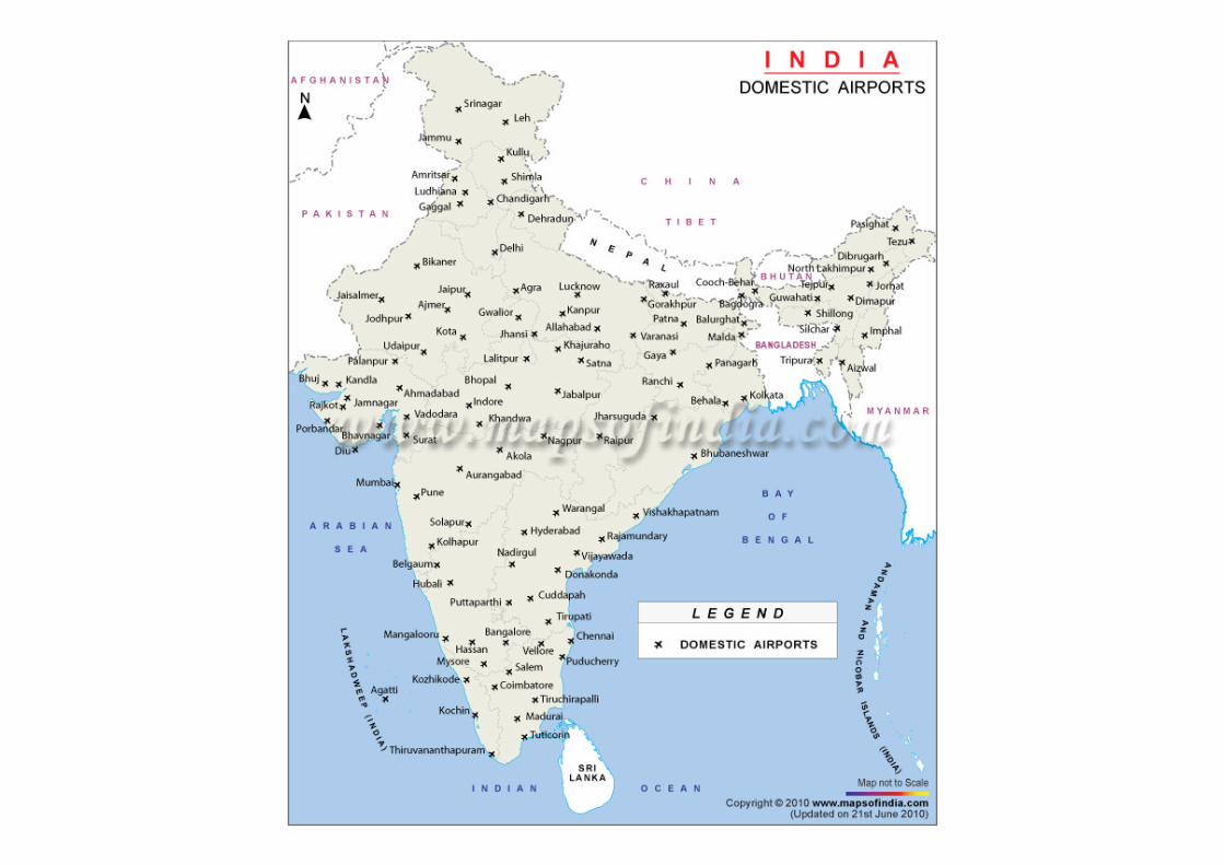
TRANSPORT
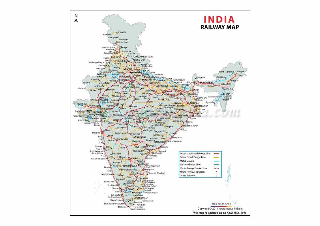
Railways: total: 63,230 km (16,693 km electrified)
Highways: total: 2,525,989 km
paved: 1,448,655 km
unpaved: 1,077,334 km (1999)
Waterways: 14,500 km
note: 5,200 km on major rivers and 485 km on canals suitable for mechanized
vessels (2004)
Pipelines: gas 6,171 km; liquid petroleum gas 1,195 km; oil 5,613 km; refined products
5,567 km (2004)
Ports and
Harbours: Chennai, Haldia, Jawaharal Nehru, Kandla, Kolkata (Calcutta), Mumbai (Bombay),
New Mangalore, Vishakhapatnam
Merchant
Marine: total: 299 ships (1,000 GRT or over) 6,555,507 GRT/11,069,791 DWT by
type: bulk carrier 85, cargo 75, chemical tanker 13, combination ore/oil 1,
container 7, liquefied gas 14, passenger 3, passenger/cargo 9, petroleum tanker
91, roll on/roll off 1
Airports: 333 (2004 est.)
Heliports: 20 (2004 est.)