Embed Size (px)
Citation preview
CPIT Meeting – April 26, 2011
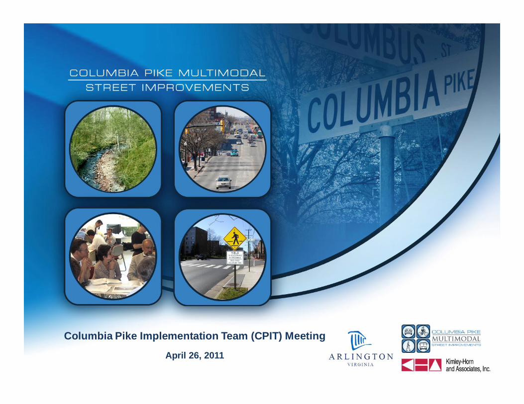
Columbia Pike Implementation Team (CPIT) Meeting
April 26, 2011

CPIT Meeting – April 26, 2011
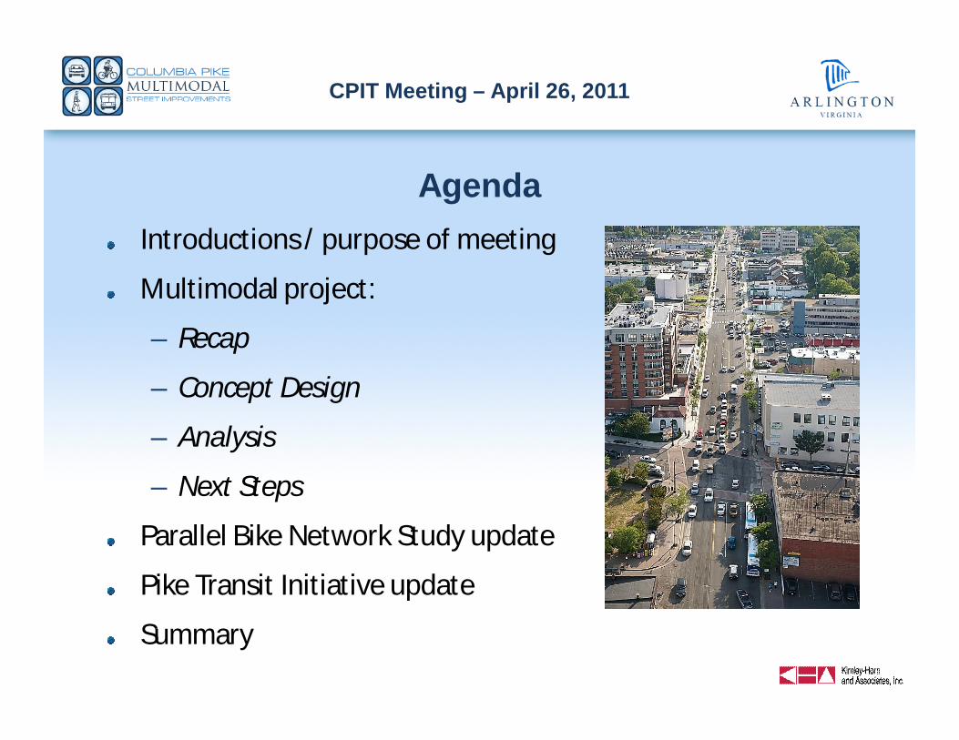
AgendaIntroductions / purpose of meeting
Multimodal project:
– Recap
– Concept Design
– Analysis
– Next Steps
Parallel Bike Network Study update
Pike Transit Initiative update
Summary
PHOTO
CPIT Meeting – April 26, 2011
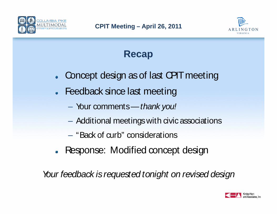
Recap
Concept design as of last CPIT meeting
Feedback since last meeting
– Your comments — thank you!
– Additional meetings with civic associations
– “Back of curb” considerations
Response: Modified concept design
Your feedback is requested tonight on revised design

CPIT Meeting – April 26, 2011
Project Vision and Objectives
Vision: Near-term implementation of a complete street thatachieves an appropriate balance of travel modes and thatsupports future high-quality, high-frequency transit service
Objectives:– Build on Street Space Planning Task Force recommendations
– Coordinate with many other on-going efforts
– Provide a complete street design to meet Arlington, VDOT, andFHWA approvals
– Complete a multimodal transportation analysis
– Complete necessary environmental studies and NEPAdocumentation
CPIT Meeting – April 26, 2011
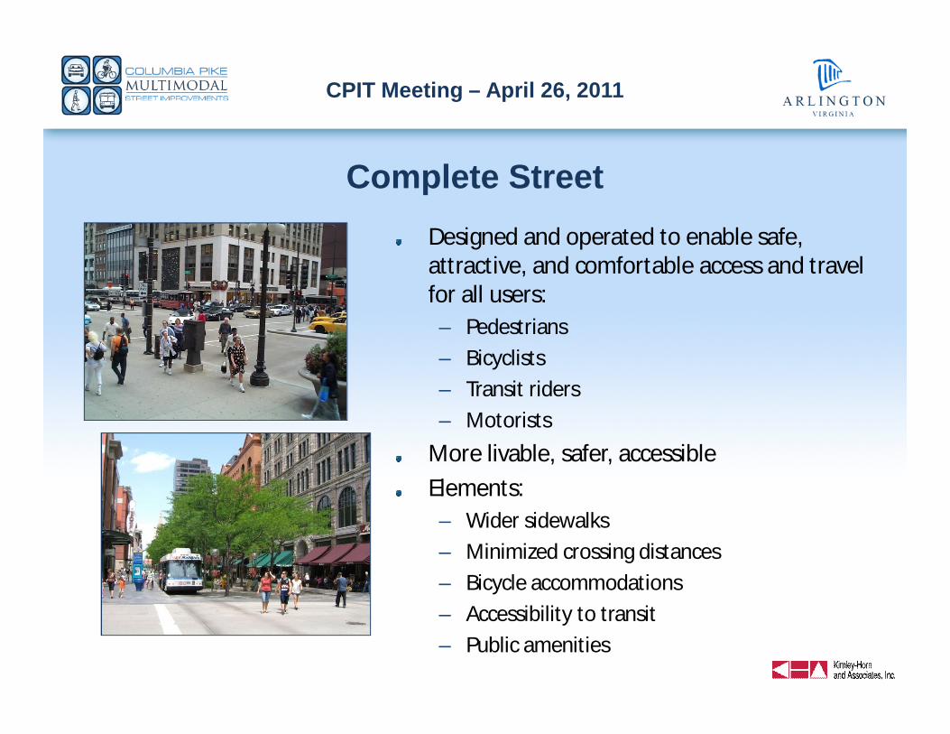
Complete StreetDesigned and operated to enable safe,attractive, and comfortable access and travelfor all users:
– Pedestrians
– Bicyclists
– Transit riders
– Motorists
More livable, safer, accessible
Elements:– Wider sidewalks
– Minimized crossing distances
– Bicycle accommodations
– Accessibility to transit
– Public amenities
CPIT Meeting – April 26, 2011
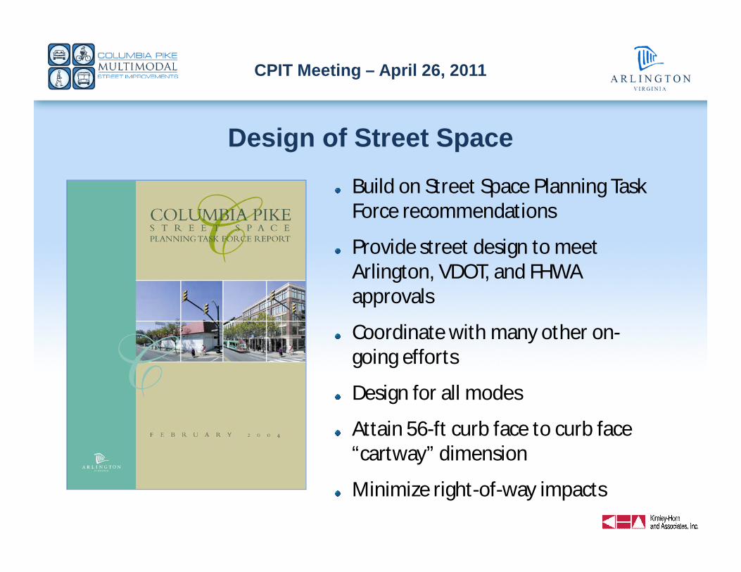
Design of Street Space
Build on Street Space Planning TaskForce recommendations
Provide street design to meetArlington, VDOT, and FHWAapprovals
Coordinate with many other on-going efforts
Design for all modes
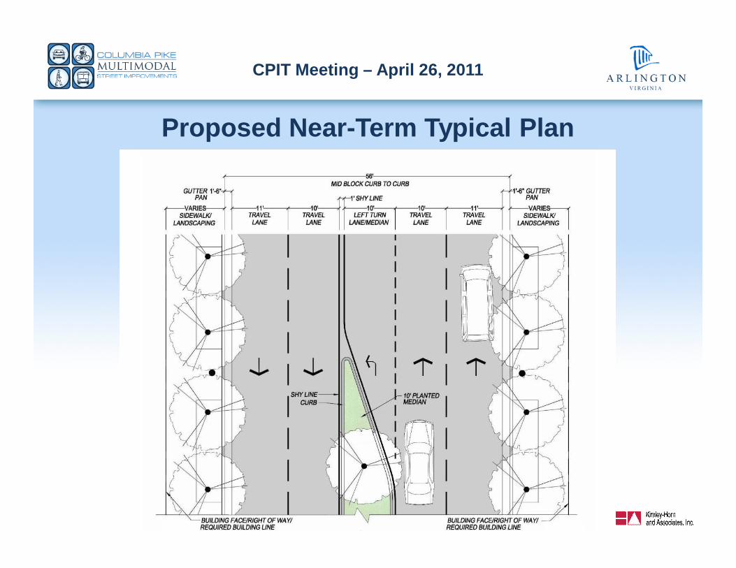
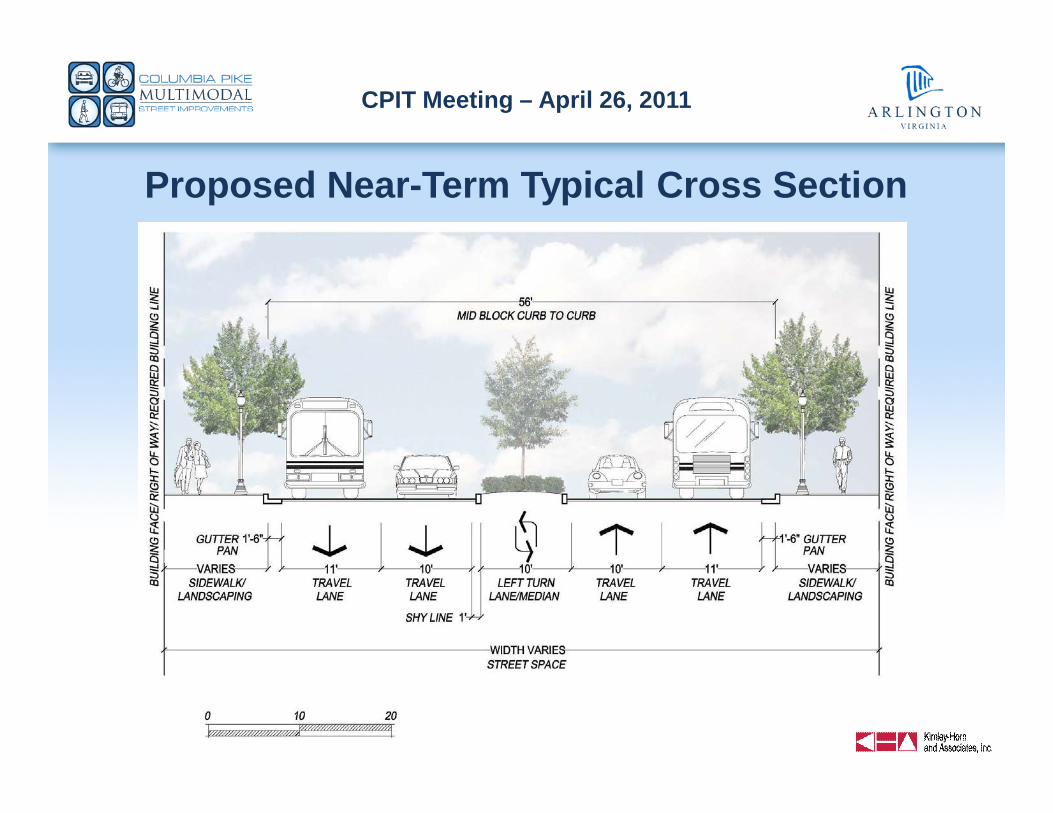
Attain 56-ft curb face to curb face“cartway” dimension
Minimize right-of-way impacts
CPIT Meeting – April 26, 2011
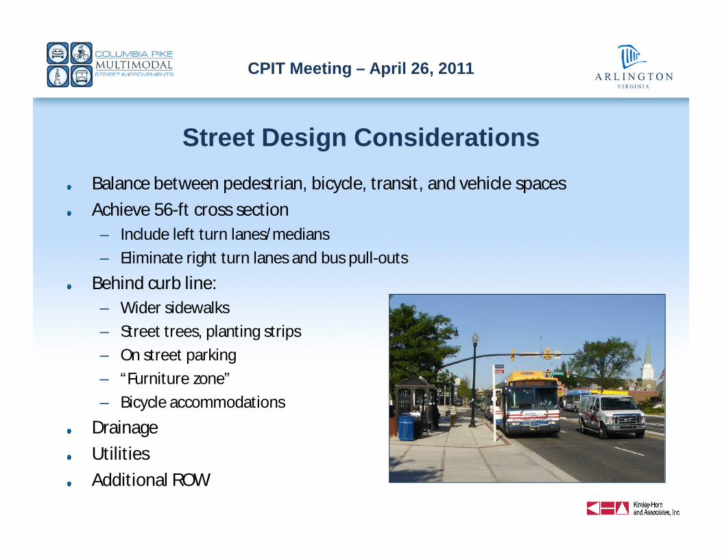
Street Design ConsiderationsBalance between pedestrian, bicycle, transit, and vehicle spaces
Achieve 56-ft cross section– Include left turn lanes/medians
– Eliminate right turn lanes and bus pull-outs
Behind curb line:– Wider sidewalks
– Street trees, planting strips
– On street parking
– “Furniture zone”
– Bicycle accommodations
Drainage
Utilities
Additional ROW
CPIT Meeting – April 26, 2011
Proposed Near-Term Typical Plan
CPIT Meeting – April 26, 2011
Proposed Near-Term Typical Cross Section
CPIT Meeting – April 26, 2011
CPIT Meeting – April 26, 2011
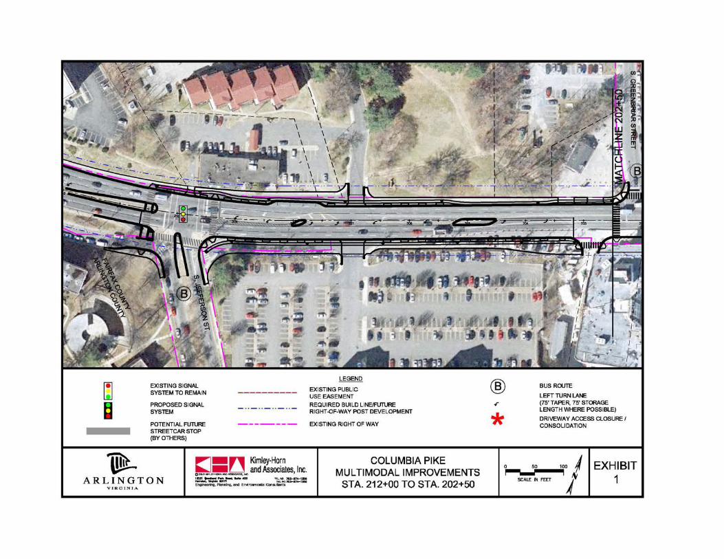
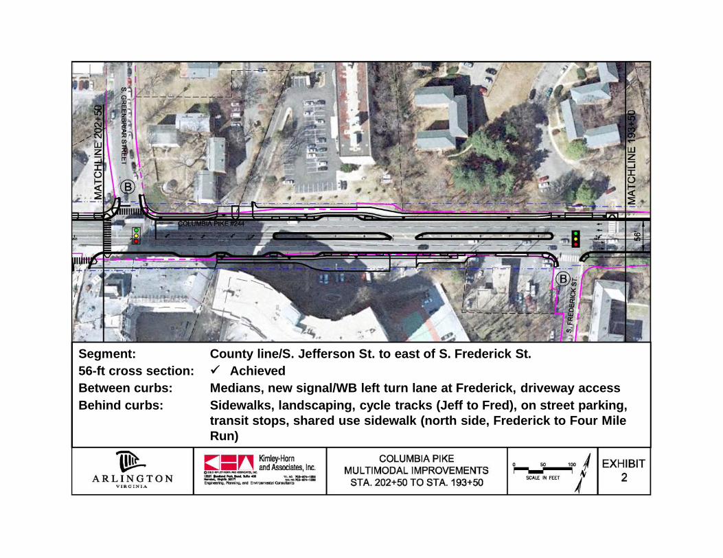
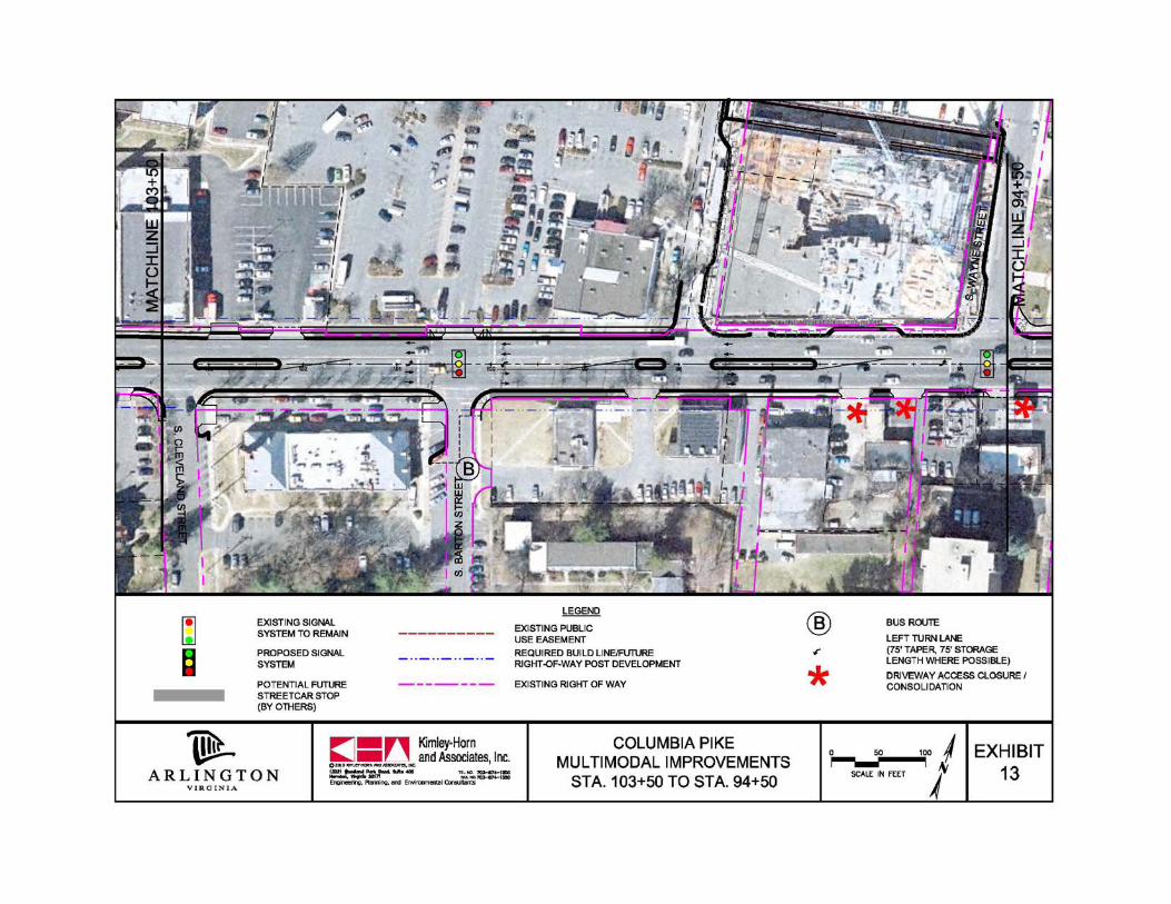
Segment: County line/S. Jefferson St. to east of S. Frederick St.56-ft cross section: AchievedBetween curbs: Medians, new signal/WB left turn lane at Frederick, driveway accessBehind curbs: Sidewalks, landscaping, cycle tracks (Jeff to Fred), on street parking,
transit stops, shared use sidewalk (north side, Frederick to Four MileRun)
CPIT Meeting – April 26, 2011
CPIT Meeting – April 26, 2011
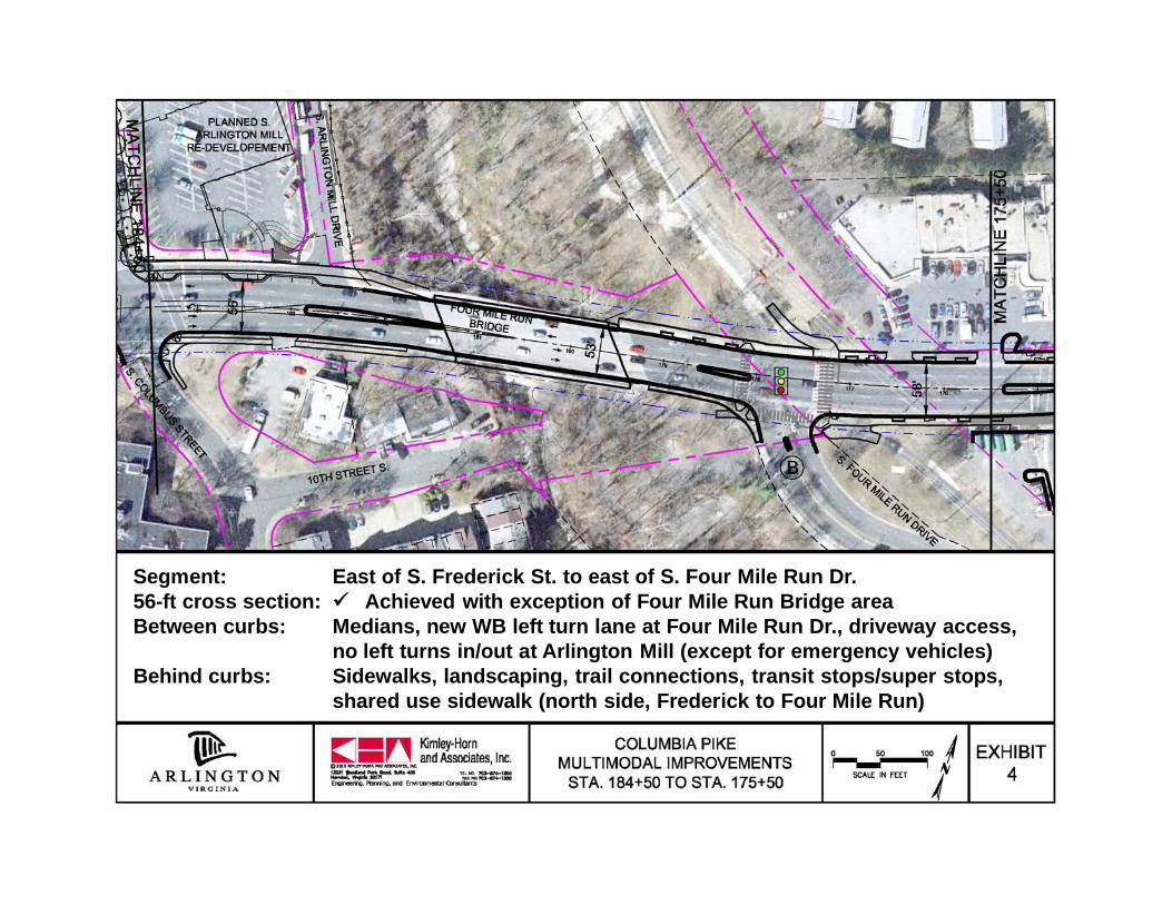
Segment: East of S. Frederick St. to east of S. Four Mile Run Dr.56-ft cross section: Achieved with exception of Four Mile Run Bridge areaBetween curbs: Medians, new WB left turn lane at Four Mile Run Dr., driveway access,
no left turns in/out at Arlington Mill (except for emergency vehicles)Behind curbs: Sidewalks, landscaping, trail connections, transit stops/super stops,
shared use sidewalk (north side, Frederick to Four Mile Run)
CPIT Meeting – April 26, 2011
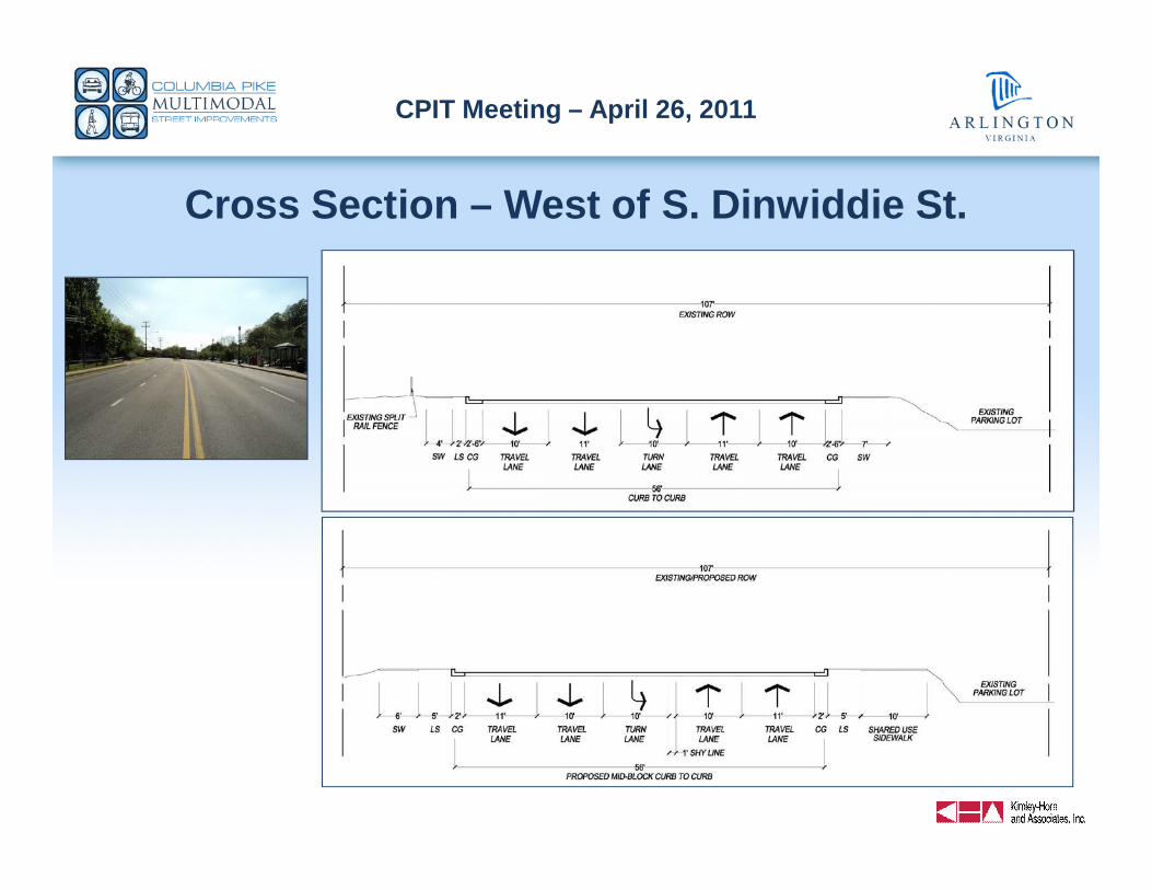
Cross Section – West of S. Dinwiddie St.
CPIT Meeting – April 26, 2011
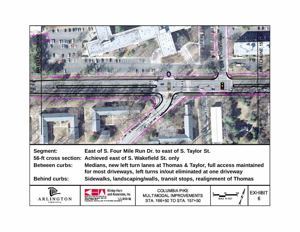
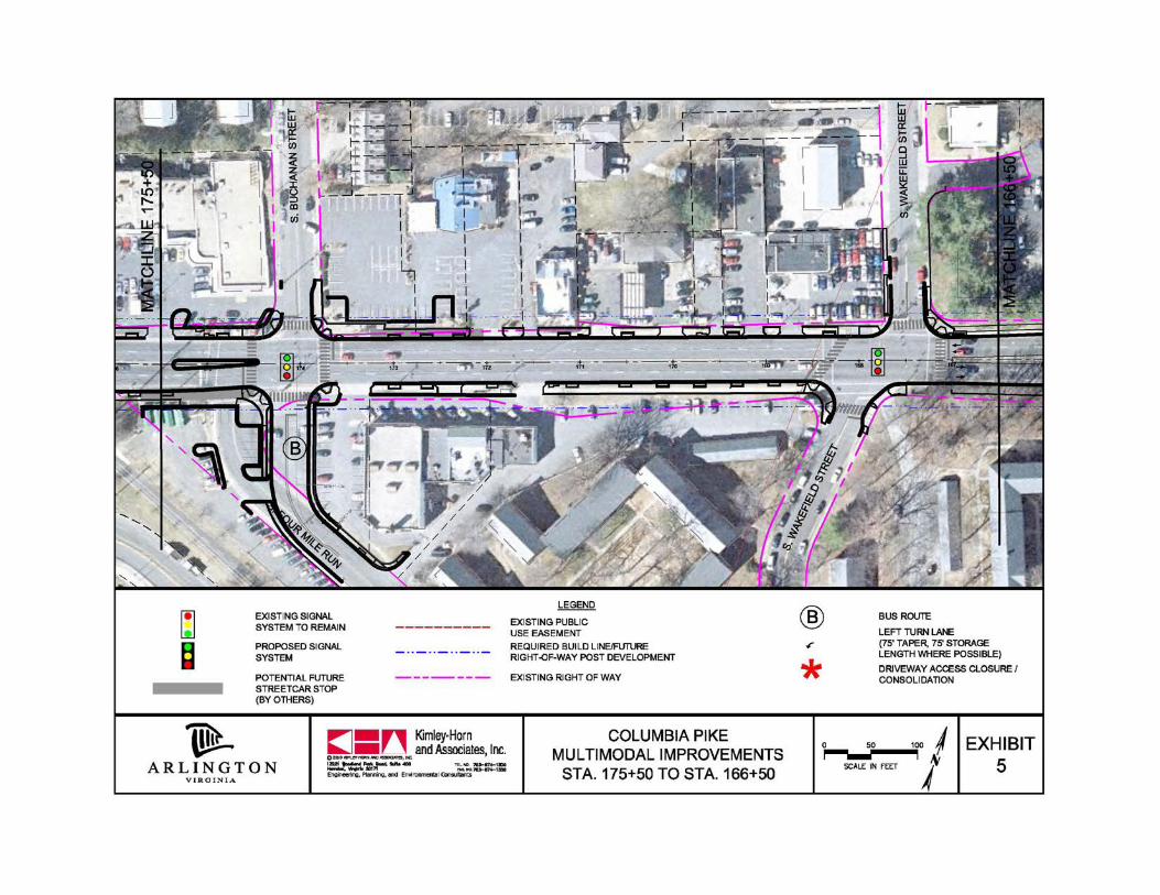
CPIT Meeting – April 26, 2011
Segment: East of S. Four Mile Run Dr. to east of S. Taylor St.56-ft cross section: Achieved east of S. Wakefield St. onlyBetween curbs: Medians, new left turn lanes at Thomas & Taylor, full access maintained
for most driveways, left turns in/out eliminated at one drivewayBehind curbs: Sidewalks, landscaping/walls, transit stops, realignment of Thomas
CPIT Meeting – April 26, 2011
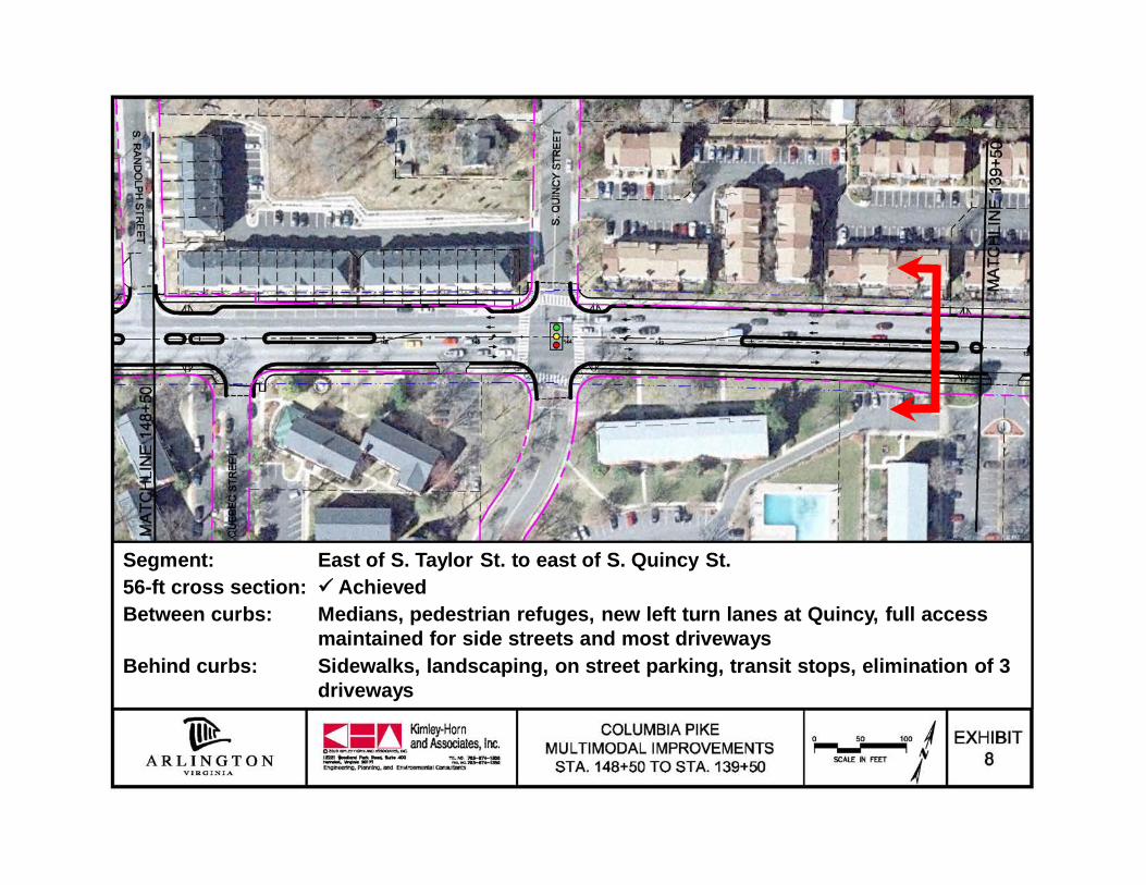
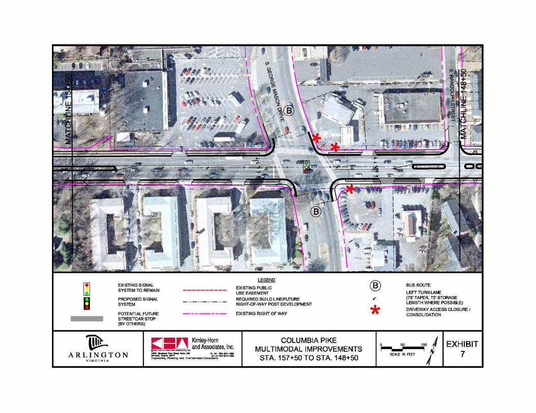
CPIT Meeting – April 26, 2011
Segment: East of S. Taylor St. to east of S. Quincy St.56-ft cross section: AchievedBetween curbs: Medians, pedestrian refuges, new left turn lanes at Quincy, full access
maintained for side streets and most drivewaysBehind curbs: Sidewalks, landscaping, on street parking, transit stops, elimination of 3
driveways
CPIT Meeting – April 26, 2011
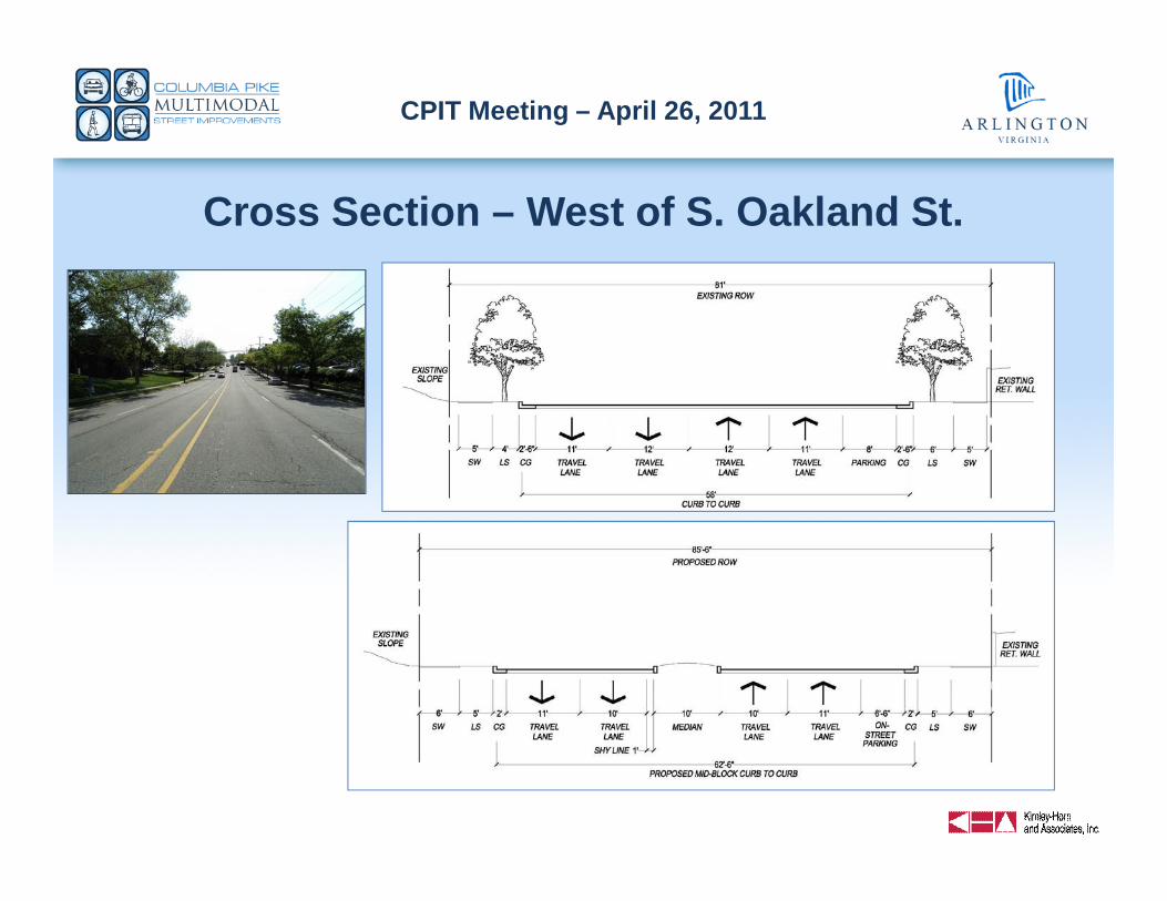
Cross Section – West of S. Oakland St.
CPIT Meeting – April 26, 2011
CPIT Meeting – April 26, 2011
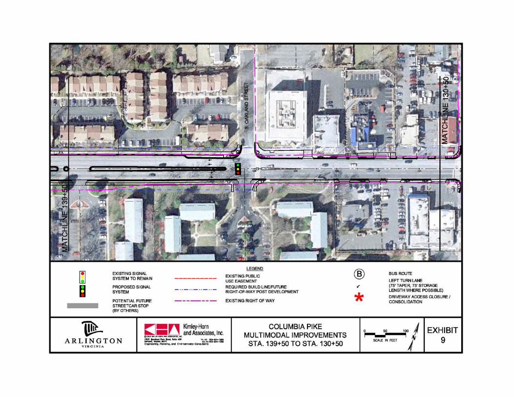
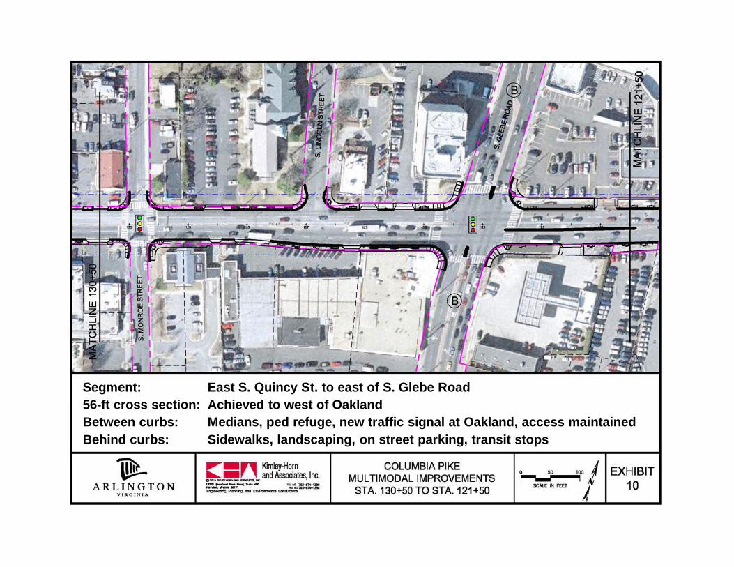
Segment: East S. Quincy St. to east of S. Glebe Road56-ft cross section: Achieved to west of OaklandBetween curbs: Medians, ped refuge, new traffic signal at Oakland, access maintainedBehind curbs: Sidewalks, landscaping, on street parking, transit stops
CPIT Meeting – April 26, 2011

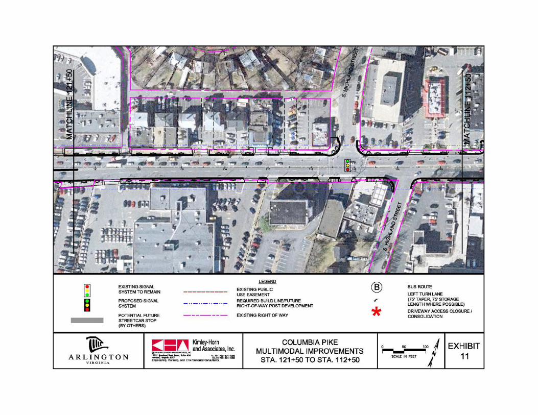
CPIT Meeting – April 26, 2011
Segment: East of S. Glebe Rd. to S. Cleveland St.56-ft cross section: Achieved east of GarfieldBetween curbs: Median in Town Center area, full access maintained for most drivewaysBehind curbs: Sidewalks, landscaping, transit stops/super stop
CPIT Meeting – April 26, 2011
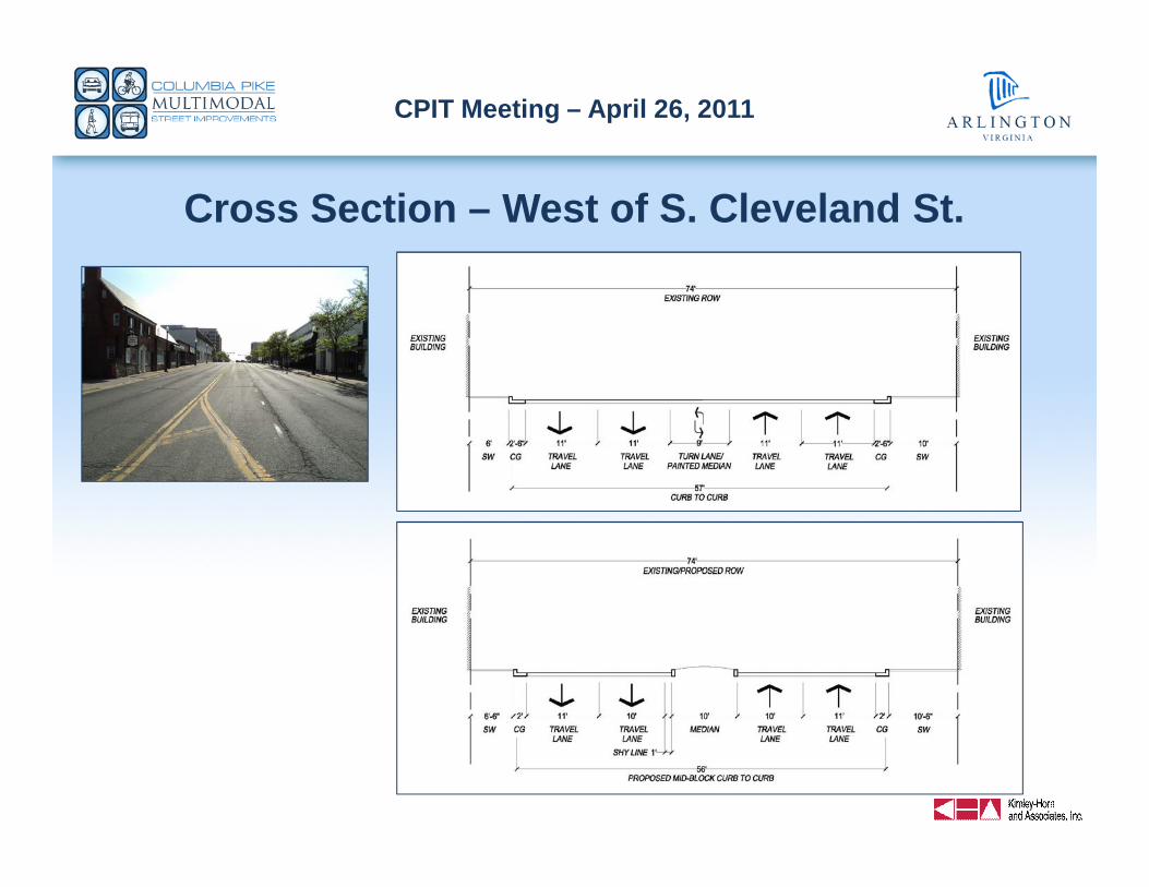
Cross Section – West of S. Cleveland St.
CPIT Meeting – April 26, 2011
CPIT Meeting – April 26, 2011
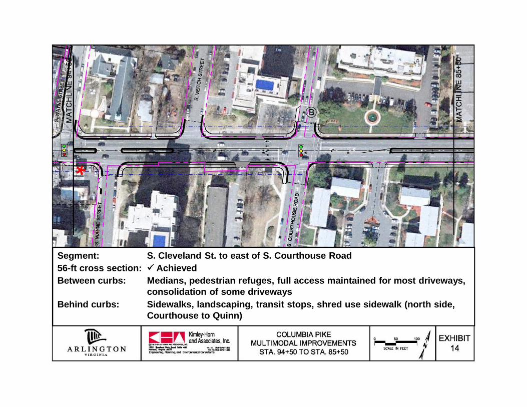
Segment: S. Cleveland St. to east of S. Courthouse Road56-ft cross section: AchievedBetween curbs: Medians, pedestrian refuges, full access maintained for most driveways,
consolidation of some drivewaysBehind curbs: Sidewalks, landscaping, transit stops, shred use sidewalk (north side,
Courthouse to Quinn)
CPIT Meeting – April 26, 2011
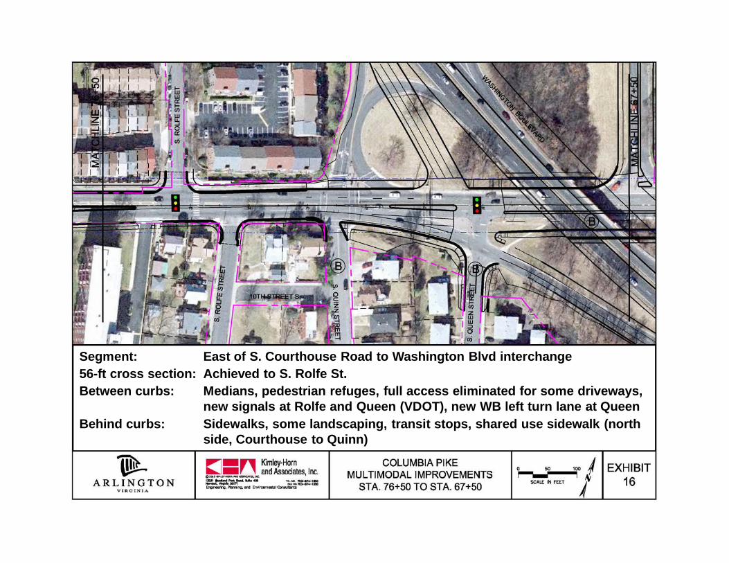
CPIT Meeting – April 26, 2011
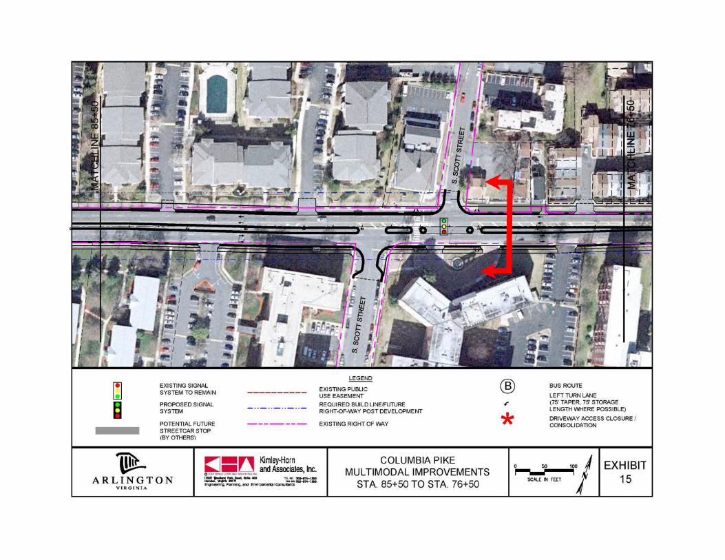
Segment: East of S. Courthouse Road to Washington Blvd interchange56-ft cross section: Achieved to S. Rolfe St.Between curbs: Medians, pedestrian refuges, full access eliminated for some driveways,
new signals at Rolfe and Queen (VDOT), new WB left turn lane at QueenBehind curbs: Sidewalks, some landscaping, transit stops, shared use sidewalk (north
side, Courthouse to Quinn)
CPIT Meeting – April 26, 2011
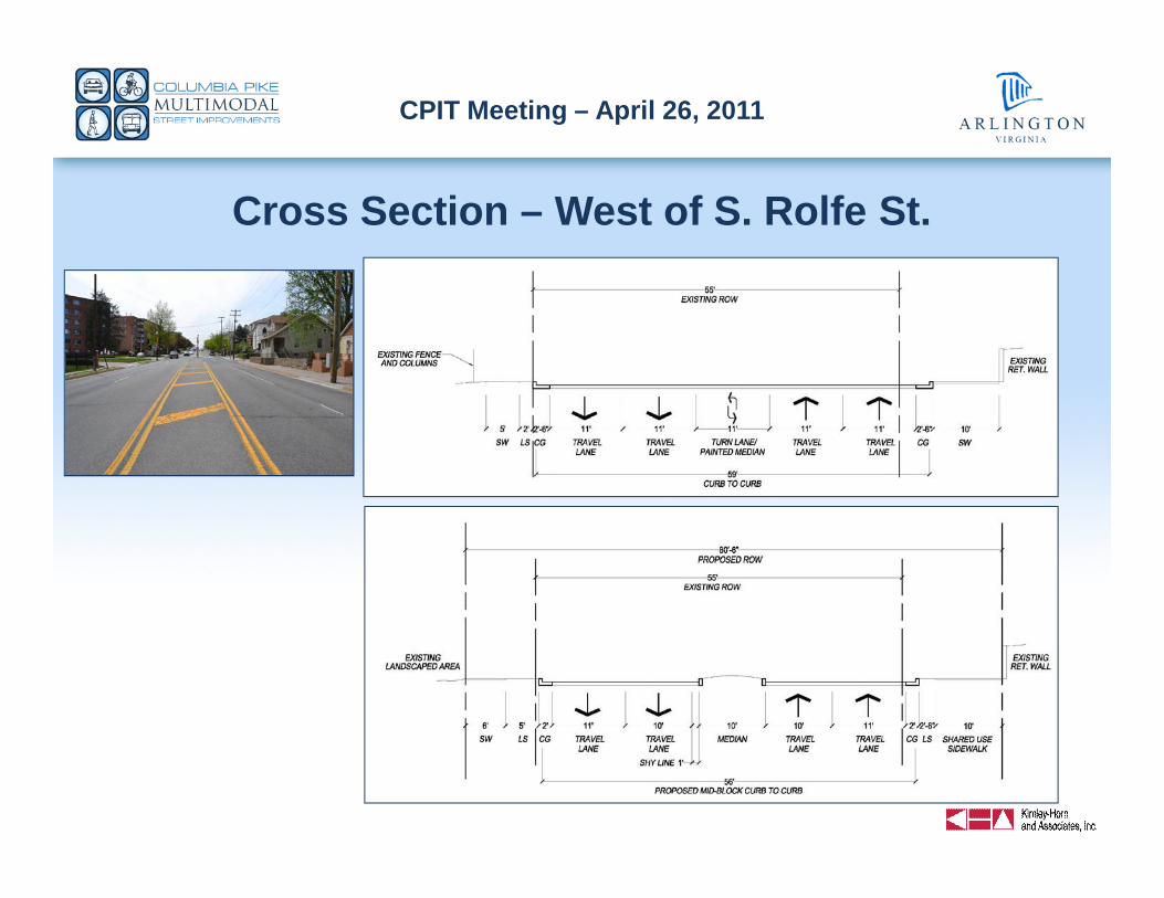
Cross Section – West of S. Rolfe St.
CPIT Meeting – April 26, 2011
CPIT Meeting – April 26, 2011
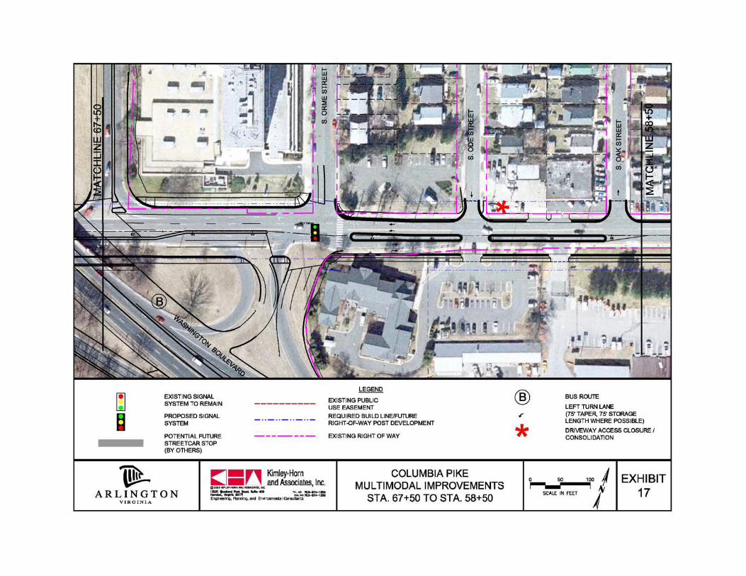
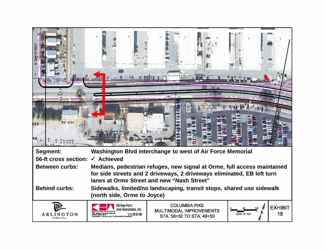
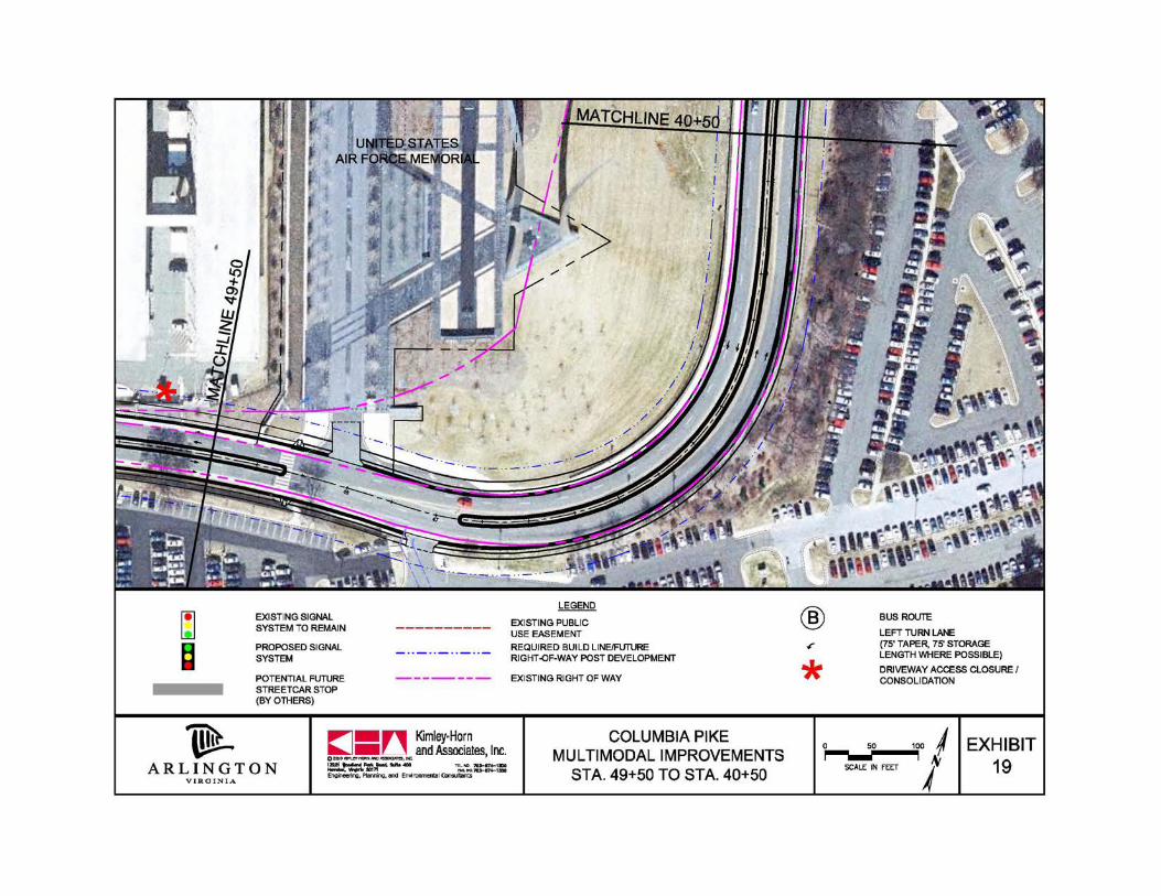
Segment: Washington Blvd interchange to west of Air Force Memorial56-ft cross section: AchievedBetween curbs: Medians, pedestrian refuges, new signal at Orme, full access maintained
for side streets and 2 driveways, 2 driveways eliminated, EB left turnlanes at Orme Street and new “Nash Street”
Behind curbs: Sidewalks, limited/no landscaping, transit stops, shared use sidewalk(north side, Orme to Joyce)

CPIT Meeting – April 26, 2011
Cross Section – East of Future Nash St.
CPIT Meeting – April 26, 2011
CPIT Meeting – April 26, 2011
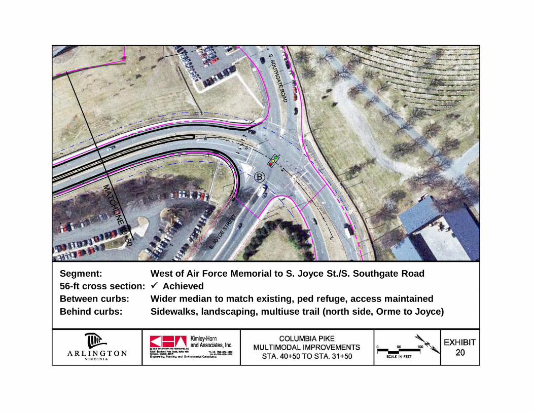
Segment: West of Air Force Memorial to S. Joyce St./S. Southgate Road56-ft cross section: AchievedBetween curbs: Wider median to match existing, ped refuge, access maintainedBehind curbs: Sidewalks, landscaping, multiuse trail (north side, Orme to Joyce)
CPIT Meeting – April 26, 2011
CONCEPT DESIGN
FEEDBACK?
CPIT Meeting – April 26, 2011
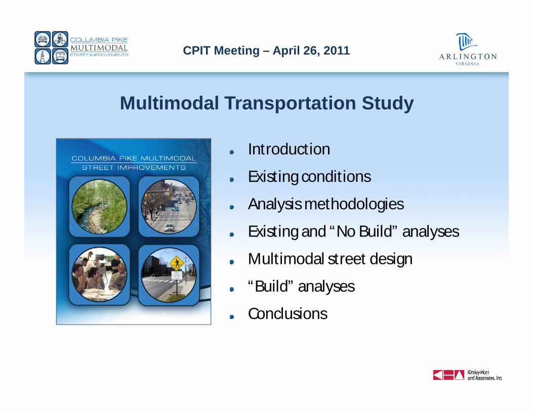
Multimodal Transportation Study
Introduction
Existing conditions
Analysis methodologies
Existing and “No Build” analyses
Multimodal street design
“Build” analyses
Conclusions
CPIT Meeting – April 26, 2011
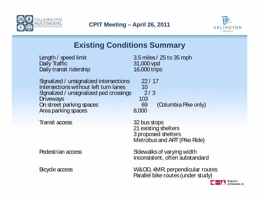
Existing Conditions SummaryLength / speed limit 3.5 miles / 25 to 35 mphDaily Traffic 31,000 vpdDaily transit ridership 16,000 trips
Signalized / unsignalized intersections 22 / 17Intersections without left turn lanes 10Signalized / unsignalized ped crossings 2 / 3Driveways 103On street parking spaces 69 (Columbia Pike only)Area parking spaces 8,000
Transit access 32 bus stops21 existing shelters3 proposed sheltersMetrobus and ART (Pike Ride)
Pedestrian access Sidewalks of varying widthInconsistent, often substandard
Bicycle access W&OD, 4MR, perpendicular routesParallel bike routes (under study)
CPIT Meeting – April 26, 2011
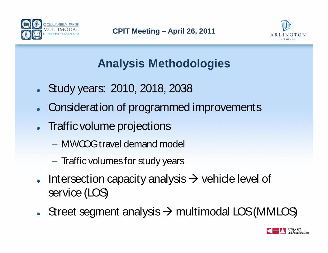
Analysis Methodologies
Study years: 2010, 2018, 2038
Consideration of programmed improvements
Traffic volume projections
– MWCOG travel demand model
– Traffic volumes for study years
Intersection capacity analysis vehicle level ofservice (LOS)
Street segment analysis multimodal LOS (MMLOS)
CPIT Meeting – April 26, 2011
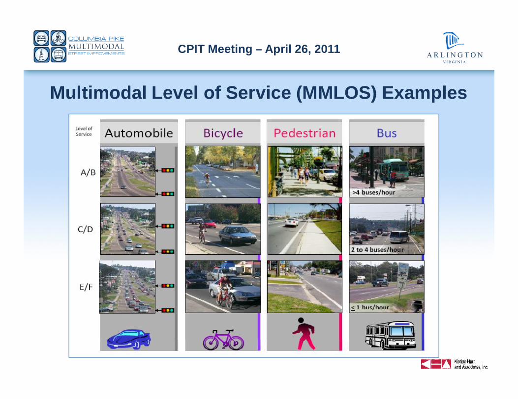
Multimodal Level of Service (MMLOS) Examples
CPIT Meeting – April 26, 2011
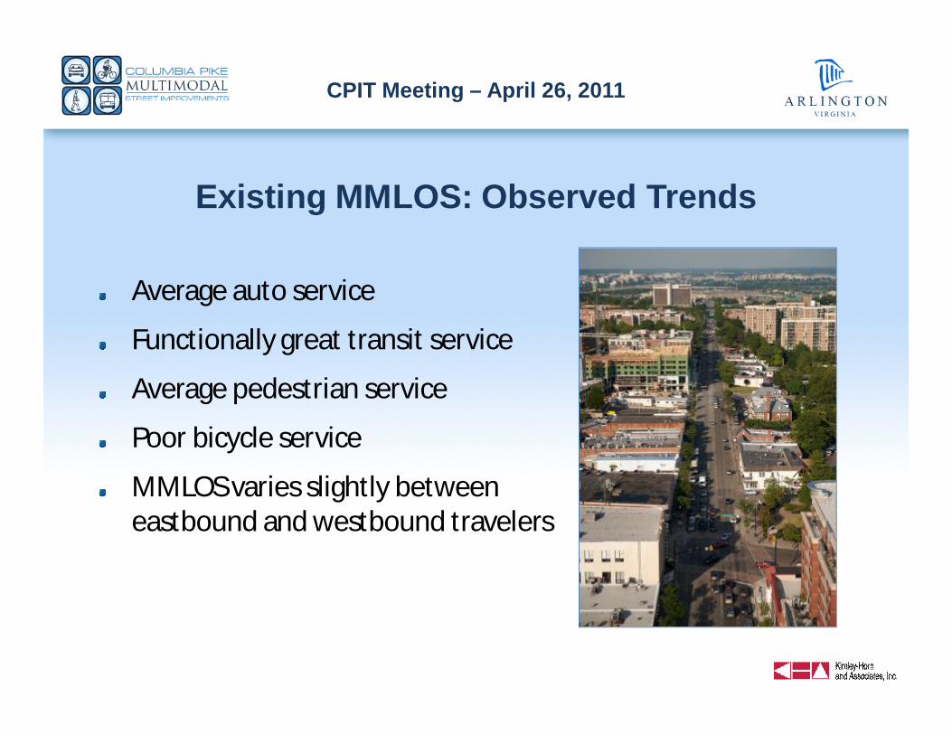
Existing MMLOS: Observed Trends
Average auto service
Functionally great transit service
Average pedestrian service
Poor bicycle service
MMLOS varies slightly betweeneastbound and westbound travelers
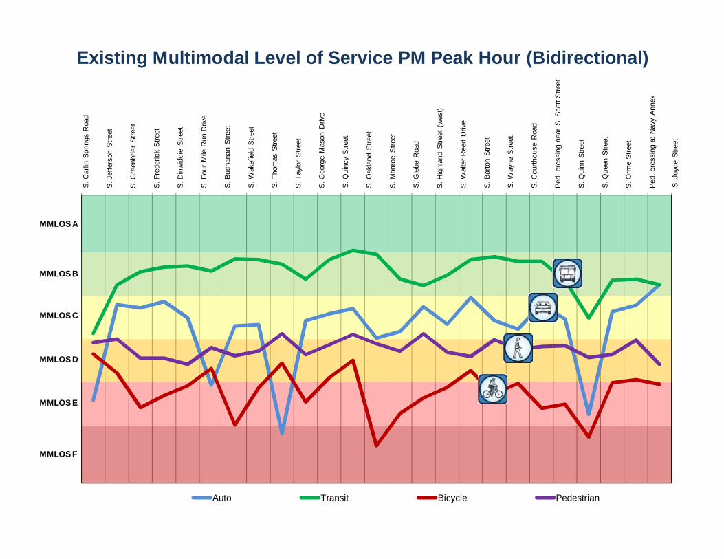
CPIT Meeting – April 26, 2011Existing Multimodal Level of Service PM Peak Hour (Bidirectional)S.
Car
lin S
prin
gs R
oad
S. J
effe
rson
Stre
et
S. G
reen
brie
r S
treet
S. F
rede
rick
Stre
et
S. D
inw
iddi
e S
treet
S. F
our
Mile
Run
Driv
e
S. B
ucha
nan
Stre
et
S. W
akef
ield
Stre
et
S. T
hom
as S
treet
S. T
aylo
r S
treet
S. G
eorg
e M
ason
Driv
e
S. Q
uinc
y St
reet
S. O
akla
nd S
treet
S. M
onro
e S
treet
S. G
lebe
Roa
d
S. H
ighl
and
Stre
et (
wes
t)
S. W
alte
r Ree
d D
rive
S. B
arto
n S
treet
S. W
ayne
Stre
et
S. C
ourth
ouse
Roa
d
Ped
. cro
ssin
g ne
ar S
. Sco
tt S
treet
S. Q
uinn
Stre
et
S. Q
ueen
Stre
et
S. O
rme
Stre
et
Ped
. cro
ssin
g at
Nav
y A
nnex
Auto Transit Bicycle Pedestrian
S.J
oyce
Stre
et
MMLOS A
MMLOS B
MMLOS D
MMLOS F
MMLOS E
MMLOS C
CPIT Meeting – April 26, 2011
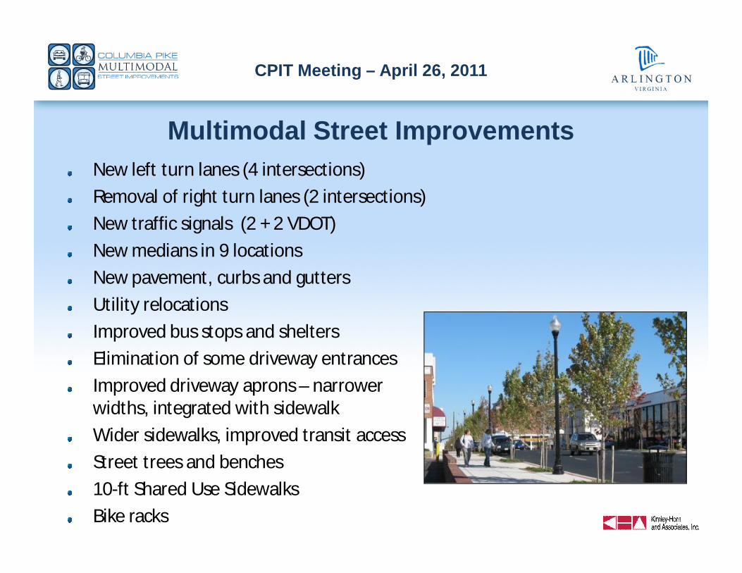
Multimodal Street ImprovementsNew left turn lanes (4 intersections)
Removal of right turn lanes (2 intersections)
New traffic signals (2 + 2 VDOT)
New medians in 9 locations
New pavement, curbs and gutters
Utility relocations
Improved bus stops and shelters
Elimination of some driveway entrances
Improved driveway aprons – narrowerwidths, integrated with sidewalk
Wider sidewalks, improved transit access
Street trees and benches
10-ft Shared Use Sidewalks
Bike racks
CPIT Meeting – April 26, 2011S.
Car
lin S
prin
gs R
oad
S. J
effe
rson
Stre
et
S. G
reen
brie
r S
treet
S. F
rede
rick
Stre
et
S. D
inw
iddi
e S
treet
S. F
our
Mile
Run
Driv
e
S. B
ucha
nan
Stre
et
S. W
akef
ield
Stre
et
S. T
hom
as S
treet
S. T
aylo
r S
treet
S. G
eorg
e M
ason
Driv
e
S. Q
uinc
y St
reet
S. O
akla
nd S
treet
S. M
onro
e S
treet
S. G
lebe
Roa
d
S. H
ighl
and
Stre
et (
wes
t)
S. W
alte
r Ree
d D
rive
S. B
arto
n S
treet
S. W
ayne
Stre
et
S. C
ourth
ouse
Roa
d
Ped
. cro
ssin
g ne
ar S
. Sco
tt S
treet
S. Q
uinn
Stre
et
S. Q
ueen
Stre
et
S. O
rme
Stre
et
Ped
. cro
ssin
g at
Nav
y A
nnex
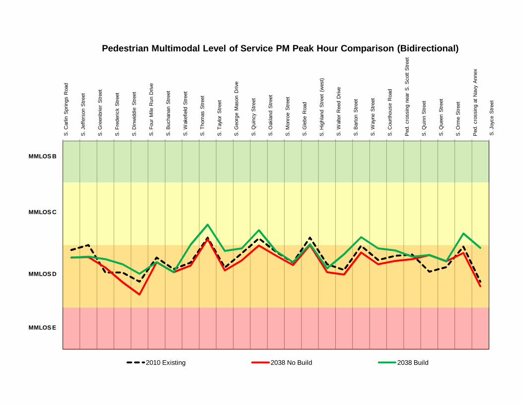
Pedestrian Multimodal Level of Service PM Peak Hour Comparison (Bidirectional)
2010 Existing 2038 No Build 2038 Build
S.J
oyce
Stre
et
MMLOS B
MMLOS C
MMLOS D
MMLOS E
CPIT Meeting – April 26, 2011S.
Car
lin S
prin
gs R
oad
S. J
effe
rson
Stre
et
S. G
reen
brie
r S
treet
S. F
rede
rick
Stre
et
S. D
inw
iddi
e S
treet
S. F
our
Mile
Run
Driv
e
S. B
ucha
nan
Stre
et
S. W
akef
ield
Stre
et
S. T
hom
as S
treet
S. T
aylo
r S
treet
S. G
eorg
e M
ason
Driv
e
S. Q
uinc
y St
reet
S. O
akla
nd S
treet
S. M
onro
e S
treet
S. G
lebe
Roa
d
S. H
ighl
and
Stre
et (
wes
t)
S. W
alte
r Ree
d D
rive
S. B
arto
n S
treet
S. W
ayne
Stre
et
S. C
ourth
ouse
Roa
d
Ped
. cro
ssin
g ne
ar S
. Sco
tt S
treet
S. Q
uinn
Stre
et
S. Q
ueen
Stre
et
S. O
rme
Stre
et
Ped
. cro
ssin
g at
Nav
y A
nnex
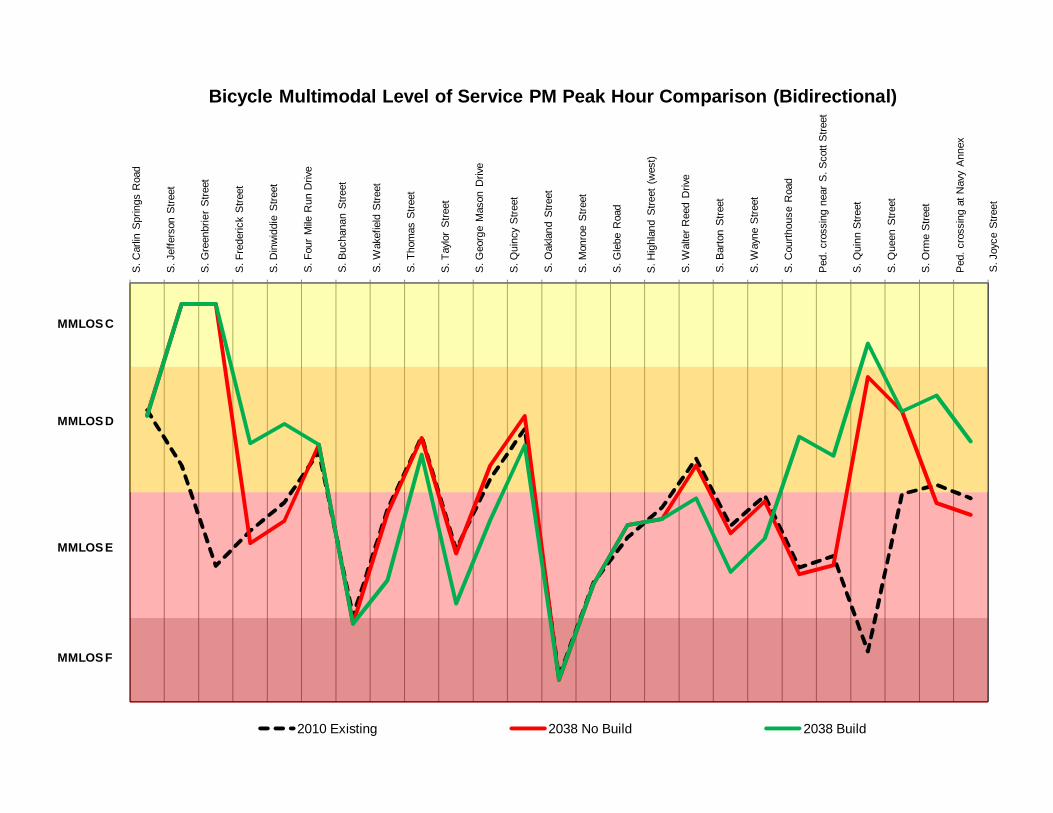
Bicycle Multimodal Level of Service PM Peak Hour Comparison (Bidirectional)
2010 Existing 2038 No Build 2038 Build
S.J
oyce
Stre
et
MMLOS C
MMLOS D
MMLOS E
MMLOS F
CPIT Meeting – April 26, 2011
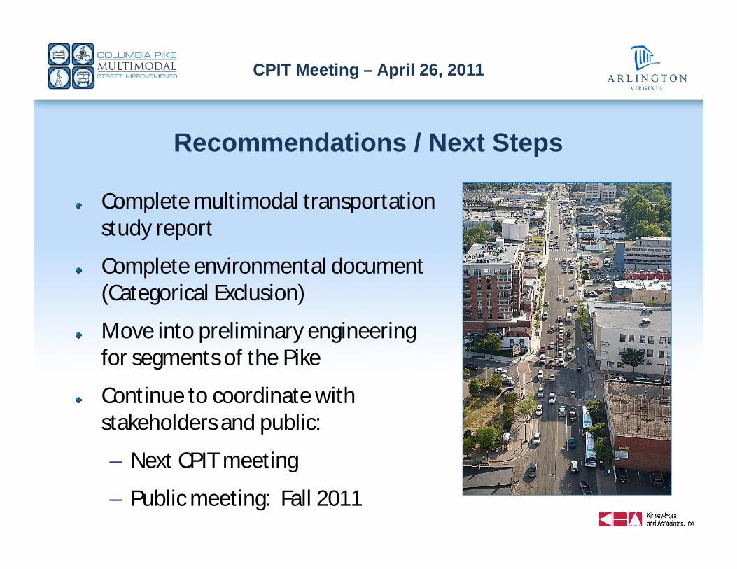
Recommendations / Next Steps
Complete multimodal transportationstudy report
Complete environmental document(Categorical Exclusion)
Move into preliminary engineeringfor segments of the Pike
Continue to coordinate withstakeholders and public:
– Next CPIT meeting
– Public meeting: Fall 2011

CPIT Meeting – April 26, 2011
Community Input Process
Goal: inform/seek feedback
Website: www.pikemultimodal.com
CPIT meetings and public meetings
“Progress on the Pike” e-newsletter onArlington website
Presentations
– Transportation Commission
– County Board
CPIT Meeting – April 26, 2011
AgendaIntroductions / purpose of meeting
Multimodal project:
– Recap
– Concept Design
– Analysis
– Next Steps
Parallel Bike Network Study update
Pike Transit Initiative update
Summary
PHOTO
CPIT Meeting – April 26, 2011
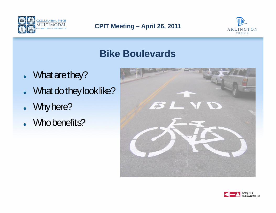
Bike Boulevards
What are they?
What do they look like?
Why here?
Who benefits?
CPIT Meeting – April 26, 2011
Bike Boulevards: What are they?Attractive, convenient, and safe alternative routes to busy, congested arterials fornon-motorized users (i.e, bikes and peds)
– Optimized for bicycle travel
– Can also provide significant safety benefits for pedestrians, transit users, and even cars
Design of each bike boulevard is unique – customized to its specific location andsituation, BUT…
All bike boulevards share a set of similar characteristics:– “Shared” roadways
– Low traffic volume (w/significantly reduced cut through traffic)
– Low speeds
– Reduced delay for cyclists
– Well-marked routes and directional signage
– Convenient access to destinations
– Comfortable, safe intersection crossings (for cyclists and pedestrians)
– Maintains local vehicular access to properties
CPIT Meeting – April 26, 2011
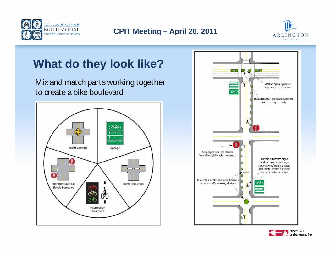
What do they look like?Mix and match parts working togetherto create a bike boulevard
CPIT Meeting – April 26, 2011
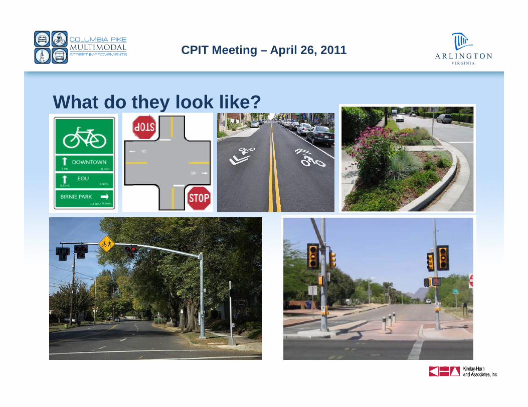
What do they look like?
CPIT Meeting – April 26, 2011
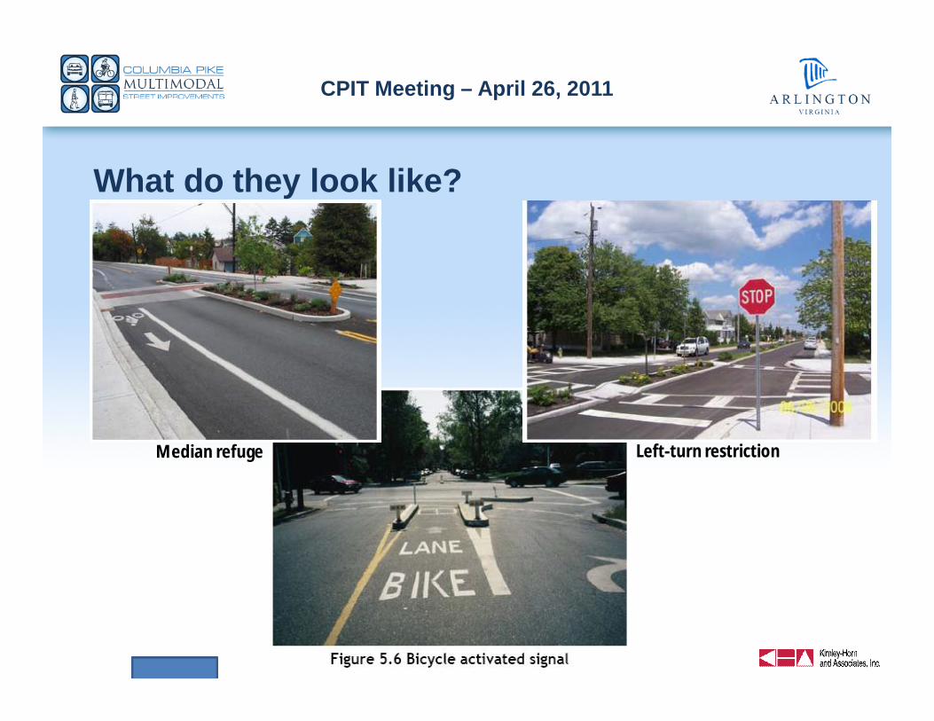
What do they look like?
Left-turn restrictionMedian refuge
CPIT Meeting – April 26, 2011
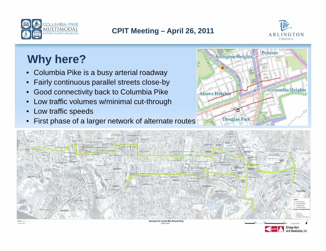
Why here?• Columbia Pike is a busy arterial roadway• Fairly continuous parallel streets close-by• Good connectivity back to Columbia Pike• Low traffic volumes w/minimal cut-through• Low traffic speeds• First phase of a larger network of alternate routes
CPIT Meeting – April 26, 2011
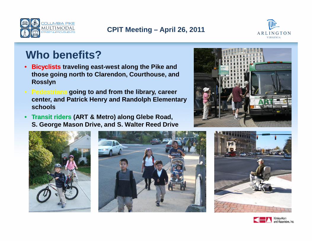
Who benefits?•• BicyclistsBicyclists traveling east-west along the Pike and
those going north to Clarendon, Courthouse, andRosslyn
•• PedestriansPedestrians going to and from the library, careercenter, and Patrick Henry and Randolph Elementaryschools
•• Transit ridersTransit riders (ART & Metro) along Glebe Road,S. George Mason Drive, and S. Walter Reed Drive

CPIT Meeting – April 26, 2011
AgendaIntroductions / purpose of meeting
Multimodal project:
– Recap
– Concept Design
– Analysis
– Next Steps
Parallel Bike Network Study update
Pike Transit Initiative update
Summary
PHOTO
CPIT Meeting – April 26, 2011
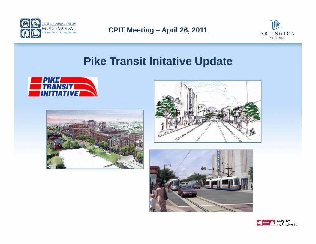
Pike Transit Initative Update
CPIT Meeting – April 26, 2011
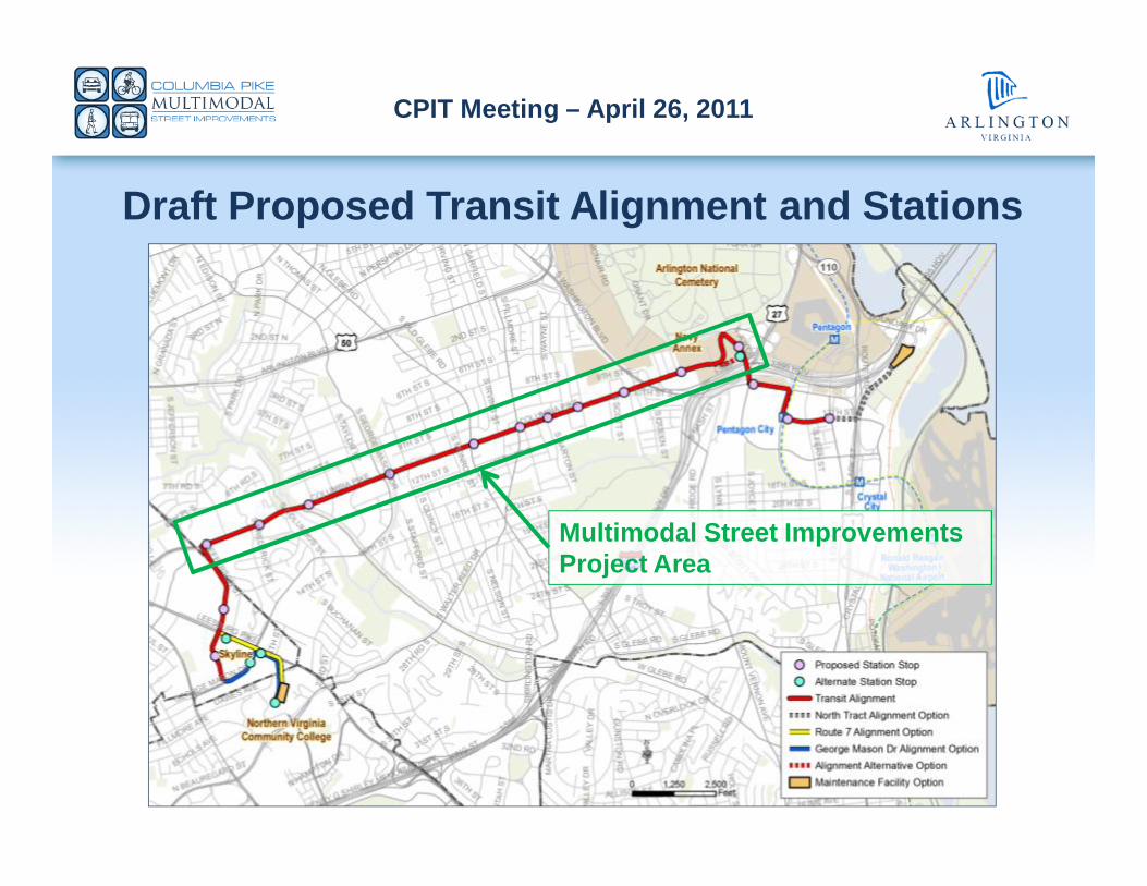
Draft Proposed Transit Alignment and Stations
Multimodal Street ImprovementsProject Area

CPIT Meeting – April 26, 2011
AgendaIntroductions / purpose of meeting
Multimodal project:
– Recap
– Concept Design
– Analysis
– Next Steps
Parallel Bike Network Study update
Pike Transit Initiative update
Summary
PHOTO

CPIT Meeting – April 26, 2011
Columbia Pike Implementation Team (CPIT) Meeting
April 26, 2011