Embed Size (px)
Citation preview
Ashutosh Limaye
NASA/Marshall Space Flight Center
National Aeronautics And Space Administration
www.nasa.gov
SERVIR Brief Perspective & Future Directions
Public Health Program Review San Antonio, Sept 29, 2010
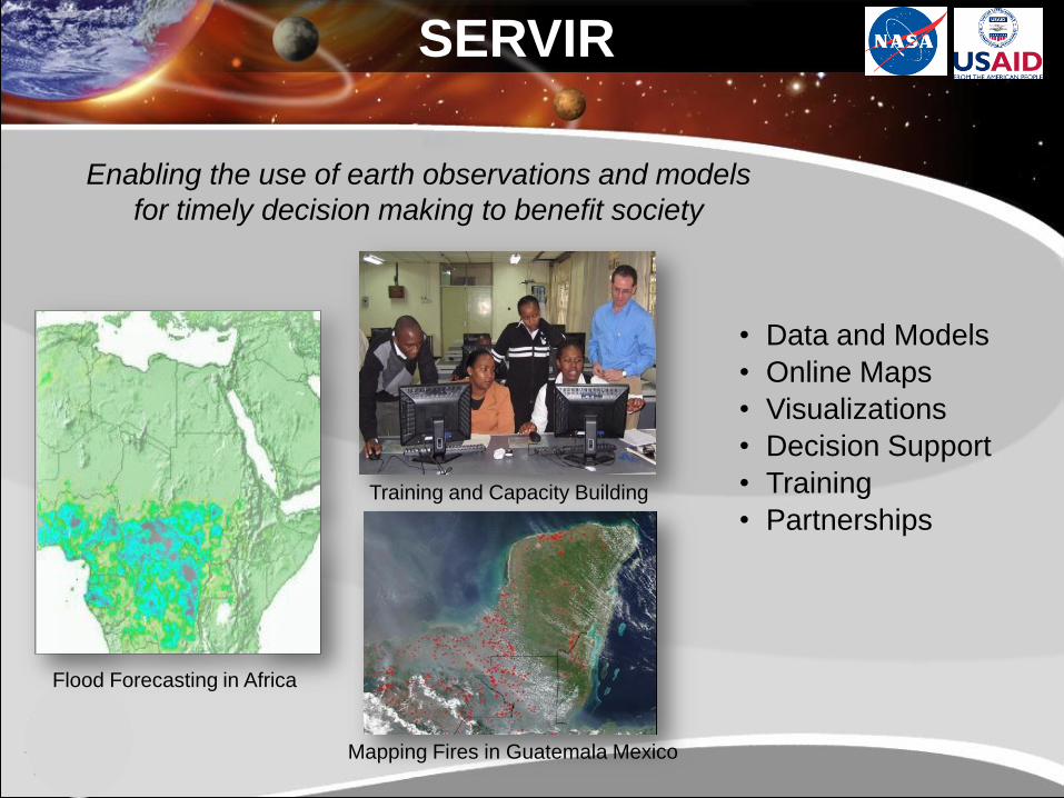
• Data and Models
• Online Maps
• Visualizations
• Decision Support
• Training
• Partnerships
Mapping Fires in Guatemala Mexico
Training and Capacity Building
Flood Forecasting in Africa
SERVIR
Enabling the use of earth observations and models
for timely decision making to benefit society
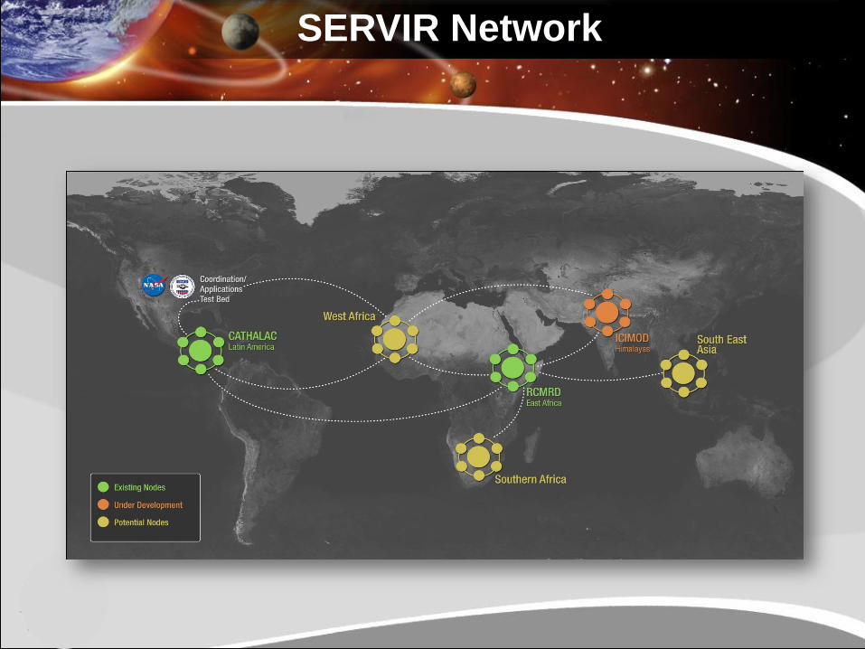
SERVIR Network
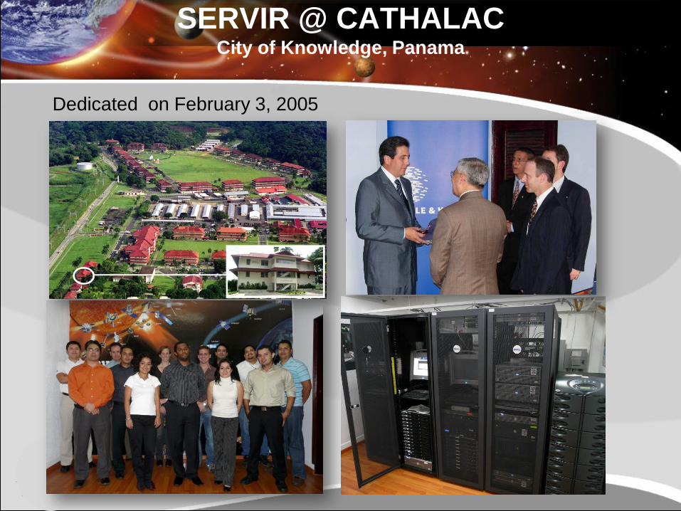
SERVIR @ CATHALACCity of Knowledge, Panama
Dedicated on February 3, 2005
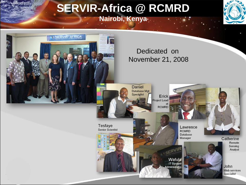
SERVIR-Africa @ RCMRDNairobi, Kenya
Dedicated on
November 21, 2008
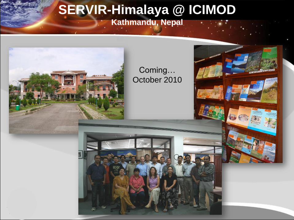
SERVIR-Himalaya @ ICIMODKathmandu, Nepal
Coming…
October 2010
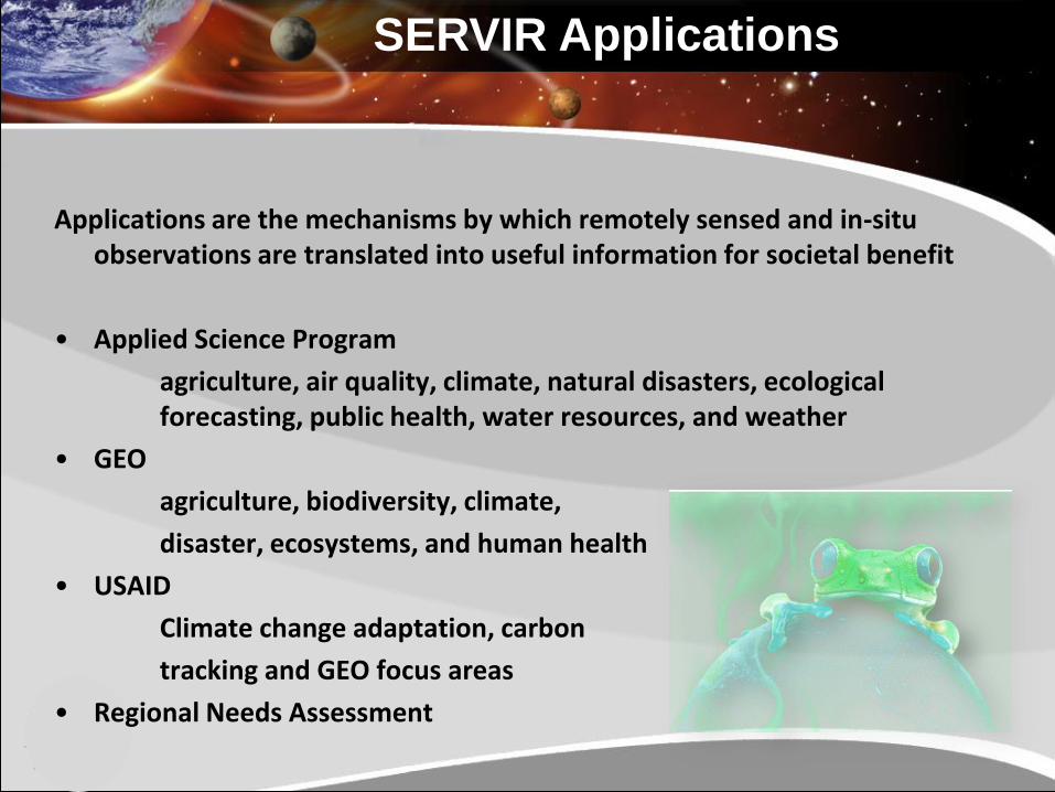
Applications are the mechanisms by which remotely sensed and in-situ observations are translated into useful information for societal benefit
• Applied Science Program
agriculture, air quality, climate, natural disasters, ecological forecasting, public health, water resources, and weather
• GEO
agriculture, biodiversity, climate,
disaster, ecosystems, and human health
• USAID
Climate change adaptation, carbon
tracking and GEO focus areas
• Regional Needs Assessment
SERVIR Applications
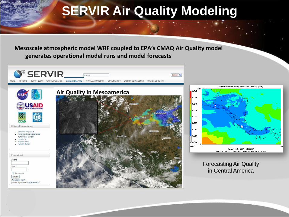
Mesoscale atmospheric model WRF coupled to EPA’s CMAQ Air Quality model generates operational model runs and model forecasts
Forecasting Air Quality
in Central America
SERVIR Air Quality Modeling
Air Quality in Mesoamerica
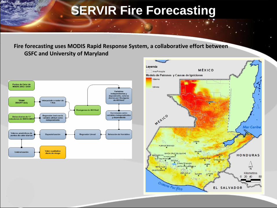
Fire forecasting uses MODIS Rapid Response System, a collaborative effort between GSFC and University of Maryland
Forecasting Air Quality
in Central America
SERVIR Fire Forecasting
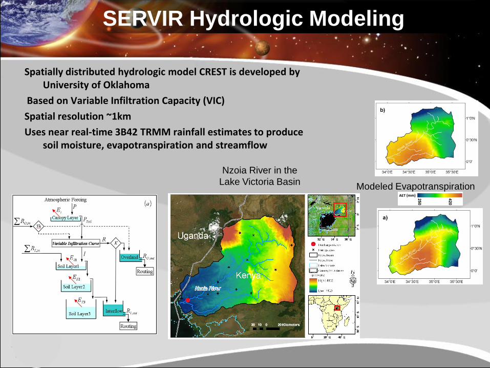
Spatially distributed hydrologic model CREST is developed by University of Oklahoma
Based on Variable Infiltration Capacity (VIC)
Spatial resolution ~1km
Uses near real-time 3B42 TRMM rainfall estimates to produce soil moisture, evapotranspiration and streamflow
Nzoia River in the
Lake Victoria Basin
CREST model
SERVIR Hydrologic Modeling
Modeled Evapotranspiration
Model
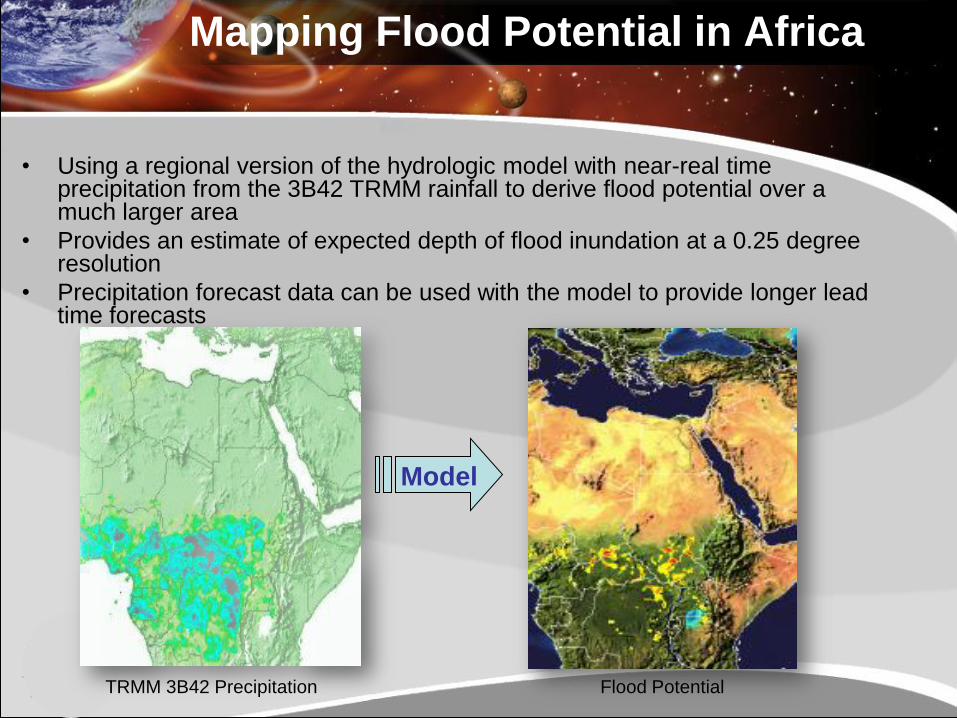
Flood Potential TRMM 3B42 Precipitation
Mapping Flood Potential in Africa
• Using a regional version of the hydrologic model with near-real time precipitation from the 3B42 TRMM rainfall to derive flood potential over a much larger area
• Provides an estimate of expected depth of flood inundation at a 0.25 degree resolution
• Precipitation forecast data can be used with the model to provide longer lead time forecasts
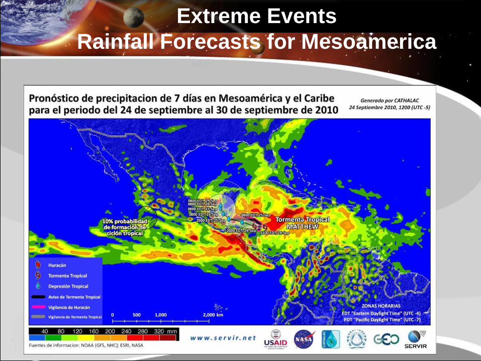
Extreme Events
Rainfall Forecasts for Mesoamerica
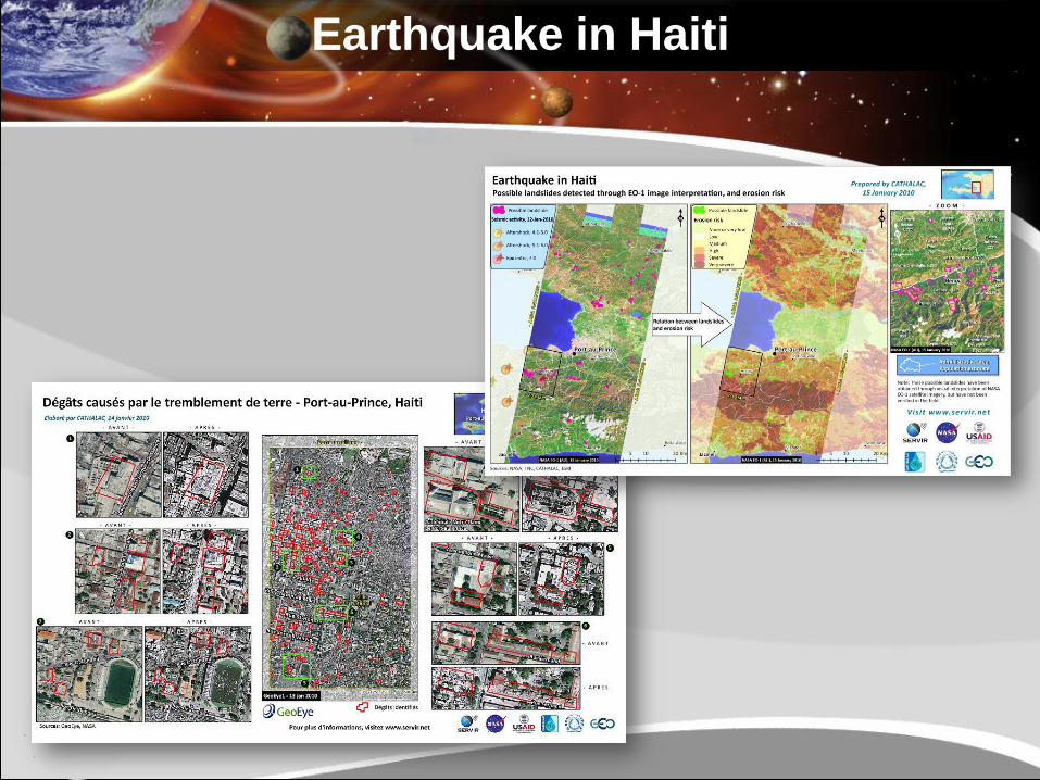
Earthquake in Haiti
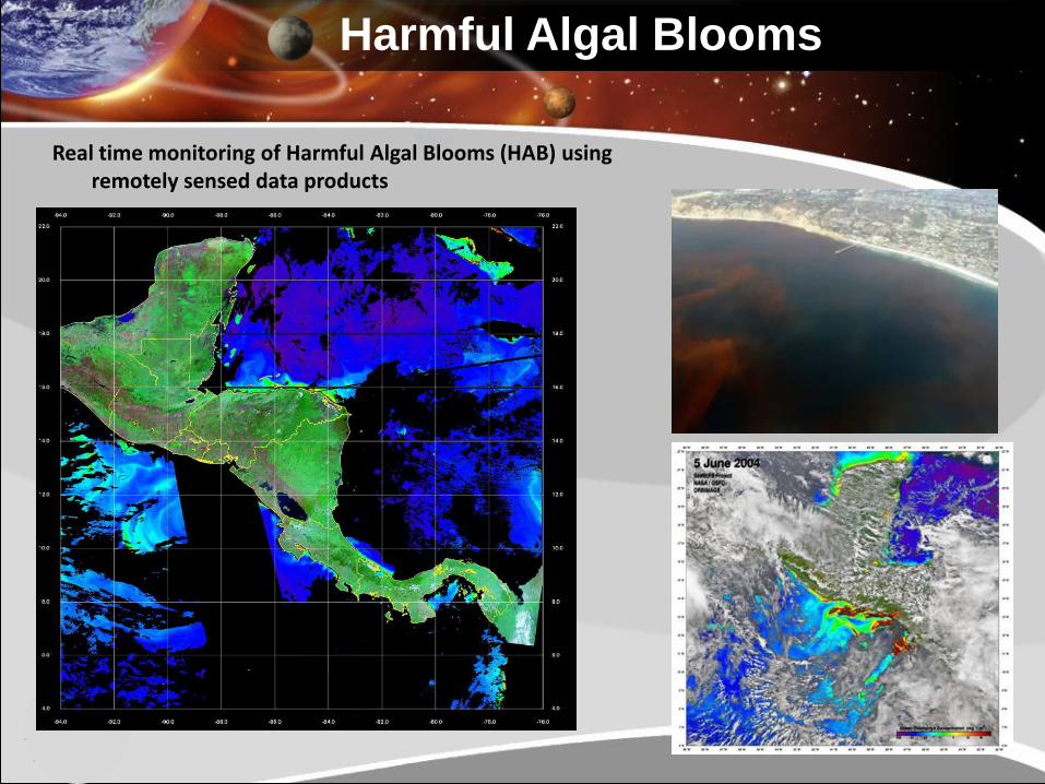
Harmful Algal Blooms
Real time monitoring of Harmful Algal Blooms (HAB) using remotely sensed data products
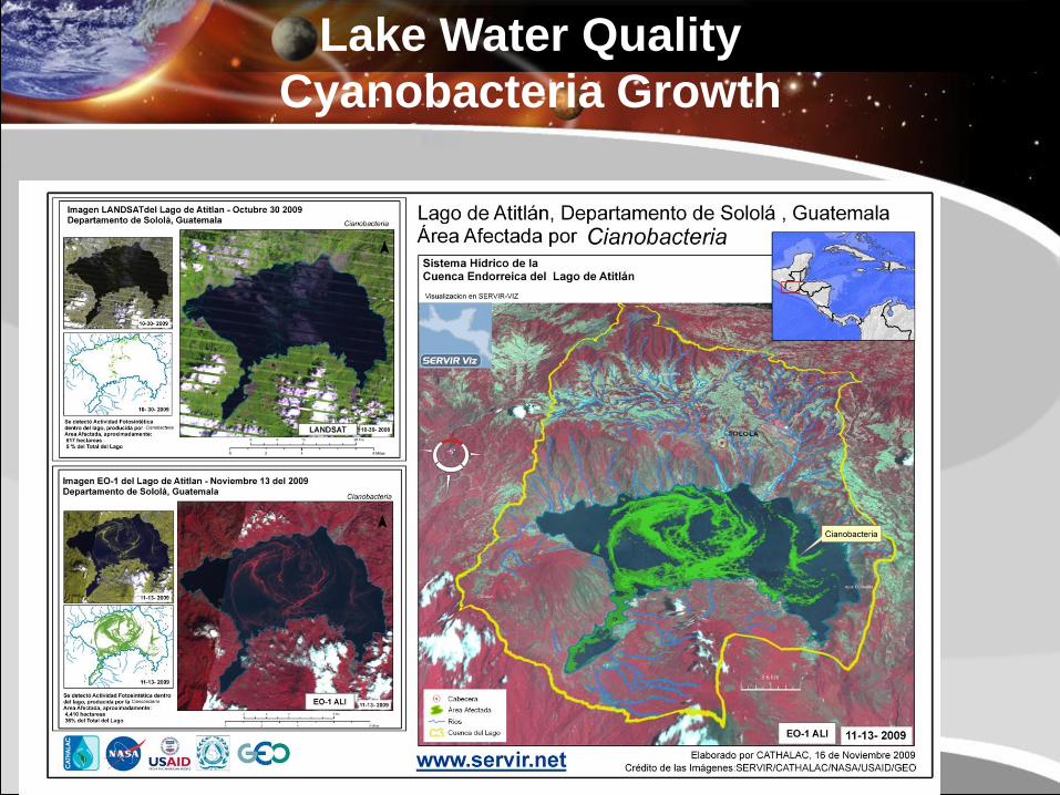
Lake Water Quality
Cyanobacteria Growth
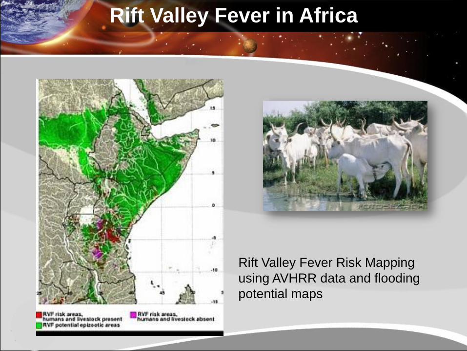
Rift Valley Fever in Africa
Rift Valley Fever Risk Mapping
using AVHRR data and flooding
potential maps
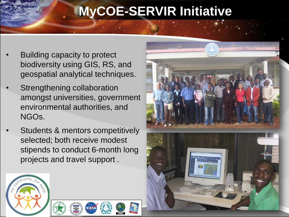
MyCOE-SERVIR Initiative
• Building capacity to protect
biodiversity using GIS, RS, and
geospatial analytical techniques.
• Strengthening collaboration
amongst universities, government
environmental authorities, and
NGOs.
• Students & mentors competitively
selected; both receive modest
stipends to conduct 6-month long
projects and travel support .
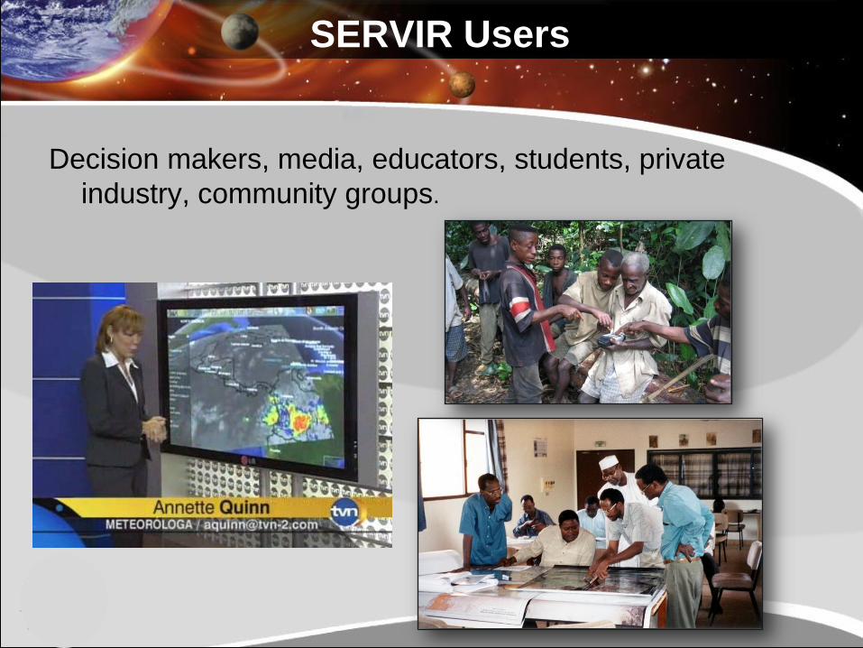
SERVIR Users
Decision makers, media, educators, students, private
industry, community groups.
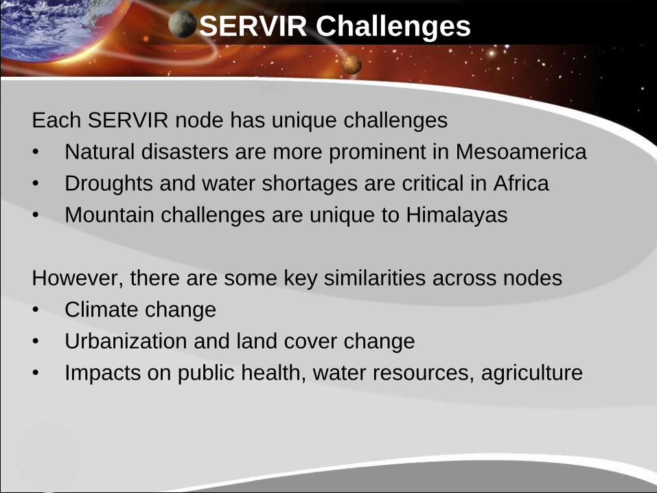
SERVIR Challenges
Each SERVIR node has unique challenges
• Natural disasters are more prominent in Mesoamerica
• Droughts and water shortages are critical in Africa
• Mountain challenges are unique to Himalayas
However, there are some key similarities across nodes
• Climate change
• Urbanization and land cover change
• Impacts on public health, water resources, agriculture
Historical Analysis
• Typically, we rely on past observations to “benchmark” the
analysis of remotely sensed data and products
• However, recorded observations are hard to come by in
developing countries
• Hindcasting of key products provide a historic
perspective, which can be inferred on such data sparse
regions.
• For example, NASA GSFC’s Global Land Data
Assimilation System (GLDAS), based on Land Information
System (LIS) employs historic re-analysis datasets and
are available for over 30-years.
Near Real-time Analysis
• These long term historic datasets give much needed
perspective for the analysis of real time products.
• Anticipate expansion of SERVIR application portfolio in
public health, agriculture and water resources
• Analysis grounded in historic perspective, and using
near-real time observations and data products enables
improved decision making
Climate Change and Impacts
• Analysis based on long term reanalysis datasets can also
give us a perspective for the analysis of climate change
scenarios.
• Changes in probabilities of atmospheric variables can be
implemented in an ensemble sense as perturbations on the
reanalysis datasets.
• Climate change adaptation is a very important topic for
USAID. Providing policy relevant information to nodes and
their partners will be critical.
In a Nutshell……
• SERVIR is eager to collaborate with other Applied
Science projects, the synergy is critical for the program
• Agriculture, Water Resources and Public Health continue
to be key issues for SERVIR