Embed Size (px)
Citation preview
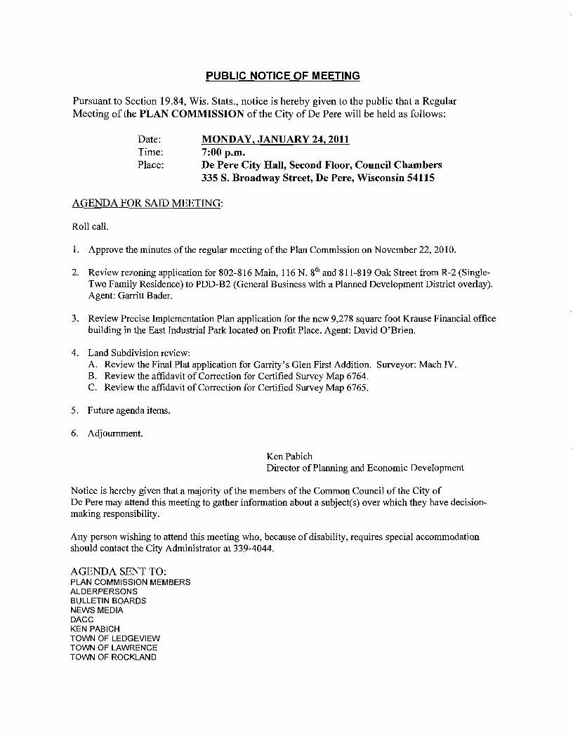
PUBLIC NOTICE OF MEETING
Pursuant to Section 1984 Wis Stats notice is hereby given to the public that a Regular Meeting of the PLAN COMMISSION of the City of De Pere will be held as follows
Date MONDAY JANUARY 24 2011 Time 700 pm Place De Pere City Hall Second Floor Council Chambers
335 S Broadway Street De Pere Wisconsin 54115
AGENDA FOR SAID MEETING
Roll call
1 Approve the minutes of the regular meeting of the Plan Commission on November 222010
2 Review rezoning application for 802-816 Main 116 N 8th and 811-819 Oak Street from R-2 (SingleshyTwo Family Residence) to PDD-B2 (General Business with a Planned Development District overlay) Agent Garritt Bader
3 Review Precise Implementation Plan application for the new 9278 square foot Krause Financial office building in the East Industrial Park located on Profit Place Agent David OBrien
4 Land Subdivision review A Review the Final Plat application for Garritys Glen First Addition Surveyor Mach IV E Review the affidavit of Correction for Certified Survey Map 6764 C Review the affidavit of Correction for Certified Survey Map 6765
5 Future agenda items
6 Adjournment
KenPabich Director of Planning and Economic Development
Notice is hereby given that a majority of the members of the Common Council of the City of De Pere may attend this meeting to gather information about a subject(s) over which they have decisionshymaking responsibility
Any person wishing to attend this meeting who because of disability requires special accommodation should contact the City Administrator at 339-4044
AGENDA SENT TO PLAN COMMISSION MEMBERS ALDERPERSONS BULLETIN BOARDS NEWS MEDIA DACC KEN PABICH TOWN OF LEDGEVIEW TOWN OF LAWRENCE TOWN OF ROCKLAND
ITEM 2 DALE KRAUSE DAVID OBRIEN
ITEM 3 GARRIT BADER JOHN BAUMANN KENNETH W amp BARBARA A DEQUAINE STEVE amp BARBARA NOHR PLNR PROPERTIES LLC CONSTRUCTION RESOURCES PETER J amp SARA D JUNTUNEN K K B PROPERTIES LLC PJ S OF DE PERE LLP MARGARET PAUWELS JULIE A REINDL JERRY T amp ELLEN L LANDWEHR ADELE HEUVELMANS JOHNSON BANK GERALD E amp BARBARA S HANSFORD WAYNE J HOFFMAN JAMES R THIEM RYAN L amp JENNIFER L DEL MARCELLE CARLYN H COOPER SUZETTE D FRANKLIN TAMMIE L PEROCK CRAIG L ANDERSEN SUZETTE D FRANKLIN ROBERTLLOONSFOOT DAVID MILLER amp JO ANN M ZASTROW PETER J RIETVELD THOMAS J HARRIS HENRY N amp LORI L VAN STEDUM ELMER G SCHILL KONKLE INVESTMENTS LLC MARY E amp JAMES T JONES MATTHEW R SCHNEIDER PATRICIA L WILLEMS AMY E MERCURE GARY A amp GAIL M SEES LAURETTA MC KEE LORI A DUPUIS DANIEL R amp JENNIFER M LAUNER JOSEPH K HENRIGILLIS LANCE A SKALESKI RICHARD J amp VIRGINIA I HEUVELMANS CAROL J PORATH EMILY A amp ZACHARY J PAUL JAMES E CLANCY amp SHANNON WILKINS RICHARD T amp DIANE M BALDWIN BENJAMIN L BACKUS NEAL D GUZEK WILLIAM K ELLIOTT JOHN M PHILLIPS WARREN L CONARD NELLA GRANT MARKA NELSEN amp DANIEL J ULLMAN JENNIFER M TITULAER KJB DEVELOPMENT LLC CHERYL M FRAWLEY WS ENTERPRISES LLC ALBIN J HOES CHRISTOPHER WIRTH BANK MUTUAL LAURENCE A POLZAK JR M amp B BUILDINGS LLC
ITEM 4 PAT KASTER
BAYLAND BUILDINGS
GB REAL ESTATE VELMEIR
CIO MIKE FLEMING
RIVER CITY REALTORS
1234 ENTERPRISE DR PO BOX 13571
3206 S ESPERANZA AVE 5757 W MAPLE SUITE 800 5289 OAK ORCHARD RD 1638 TIFFANY CT 2874 NOSTALGIC CT 1251 SCHEURING RD UNIT B 115 S EIGHTH ST 746 MAIN AV 841 MAINAV 822 MAIN AV 816 MAIN AV 808 MAIN AV 804 MAIN AV 840 MAIN AV 828 MAIN AV 116 N EIGHTH ST 209 N EIGHTH ST 219 N EIGHTH ST 218 N EIGHTH ST 7490AKST 741 OAK ST 7270AKST 7490AKST 7260AKST 7340AKST 746 OAK ST 8150AKST 8190AKST 8230AKST 827 OAK ST 8310AKST 8370AKST 843 OAK ST 816 OAK ST 826 OAK ST 8280AKST 8340AKST 8400AKST 844 OAK ST 8460AKST 731 PINE ST 735 PINE ST 8120AKST 807 PINE ST 813 PINE ST 829 PINE ST 837 PINE ST 839 PINE ST 843 PINE ST 849 PINE ST 1508 FOX RIDGE CT 6258 WCHERNEY RD 811 OAK ST 808 BAYLAND CT 2159 EARLY ST PO BOX 9753 3093 GLENDALE AVE 1567 BRUCE LN PO BOX 245034 11407 DORCHESTER LN N8140 STH 55
1317 LOMBARDI ACCESS RD
DE PERE WI 54115 GREEN BAY WI 54307
TAMPA FL 33629 WEST BLOOMFIELD MI 48322 ABRAMS WI 54101-9759 DE PERE WI 54115 DE PERE WI 54115 DE PEREW154115-1003 DE PEREW154115-1315 DE PERE WI 54115-1333 DE PERE WI 54115-1334 DE PERE WI 54115-1335 DE PEREW154115-1335 DE PERE WI 54115-1335 DE PERE WI 54115-1335 DE PERE WI 54115-1335 DE PERE WI 54115-1335 DE PERE WI 54115-1511 DE PERE WI 54115-1512 DE PERE WI 54115-1512 DE PERE WI 54115-1513 DE PERE WI 54115-1530 DE PEREW154115-1530 DE PERE WI 54115-1530 DE PERE WI 54115-1530 DE PERE WI 54115-1531 DE PERE WI 54115-1531 DE PERE WI 54115-1531 DE PERE WI 54115-1532 DE PERE WI 54115-1532 DE PERE WI 54115-1532 DE PERE WI 54115-1532 DE PERE WI 54115-1532 DE PERE WI 54115-1532 DE PERE WI 54115-1532 DE PERE WI 54115-1533 DE PERE WI 54115-1533 DE PERE WI 54115-1533 DE PERE WI 54115-1533 DE PERE WI 54115-1533 DE PERE WI 54115-1533 DE PERE WI 54115-1533 DE PERE WI 54115-1534 DE PERE WI 54115-1534 DE PERE WI 54115-1535 DE PERE WI 54115-1536 DE PERE WI 54115-1536 DE PERE WI 54115-1536 DE PERE WI 54115-1536 DE PERE WI 54115-1536 DE PERE WI 54115-1536 DE PERE WI 54115-1536 DE PERE WI 54115-1908 DENMARK WI 54208 DEPERE WI 54115-1532 GREEN BAY WI 54304-4743 GREEN BAY WI 54304-4854 GREEN BAY WI 54308-9753 GREEN BAY WI 54313 GREEN BAY WI 54313-5527 MILWAUKEE WI 53224-9534 ROCKVILLE MD 20852 SEYMOUR WI 54165-8858
GREEN BAY WI 54304 BEN LACOUNT MACH IV 211 N BROADWAY SUITE 114 GREEN BAY WI 54303
ITEM 5 NONE
CITY PLAN COMMISSION November 222010 De Pere Wisconsin
A regular meeting of the City Plan Commission was held today at 700 pm in the Council Chambers
Roll Call Mayor Michael Walsh called the meeting to order
Members present Citizen Members Derek Beiderwieden and James Kalny Alderperson Robert Wilmet and Mayor Walsh
Members excused Alderperson Kathleen Van Vonderen
Also present City Planning Director Kenneth Pabich and members of the public
1 Approve the minutes of the regular meeting of the Plan Commission on October 25 2010
Moved by Tom Walsh to approve the minutes as presented Seconded by Jim Kalny Motion carried
2 Review the Saint Norbert College Welcome Center expansion project
A Review Conditional Use Application B Review Site Plan Application
Planning Director Ken Pabich reviewed the staff report for this agenda item (said report shall henceforth be considered a part of these minutes)
Moved by Jim Kalny to approve the staff recommendation for the Conditional Use Application and Site Plan Application as presented Seconded by Tom Walsh
Moved by Mayor Walsh to open the meeting to the public Seconded by Alderperson Wilmet Motion carried
Ryan Maher 184 Desplaine Road De Pere Wisconsin introduced himself to the Commission Ryan questioned the parking at the 300 block of College Avenue (north side) Ryan indicated he has property located at 330 College Avenue He indicated that it seemed that since the library went up its gotten worse as people are trying to park there Hes had instances ofpeople blocking the apron to his driveway Numerous instances of not being able to get into the driveway He now has tenants and assumes the same problems will exist for them
Mayor Walsh asked Police ChiefBeiderwieden andPlanning Director Pabich to address his concerns Derek indicated his suggestion would be for people to park on the south side of the street instead of the north side That way you avoid the apron issue and you avoid any problems with
garbage pickup
Planning Director Pabich suggested that Ryan send him an e-mail with his concerns and then he would bring those concerns to the Citys Parking Review Committee
Moved by Mayor Walsh to return to regular order Seconded by Derek Beiderwieden Motion carried
There being no further questions the motion that was previously made was then carried
3 Land Subdivision review
A CSM Review for an extraterritorial CSM for 4 lots on Wrightstown Road in the Town of Wrightstown Agent Duane Tetzlaff
Planning Director Ken Pabich reviewed the staff report for this agenda item (said report shall henceforth be considered a part of these minutes)
Moved by Mayor Walsh to approve the CSM as presented Seconded by Jim Kalny Motion carried
4 Review amendments to Chapter 46 Platting and Division of Land
Planning Director Ken Pabich reviewed the staff report for this agenda item (said report shall henceforth be considered a part of these minutes)
Moved by Mayor Walsh to approve the amendments Seconded by Jim Kalny Motion carried
5 Future agenda items
The meeting in December is scheduled for the 27thbull Ken asked the Commission if they wanted
to move the date up The Plan Commission decided to move the meeting up to December 20 2010
6 Adjournment
Moved by Mayor Walsh to adjourn the meeting Seconded by Derek Beiderwieden Motion carried Time 720 pm
Lori Philips Recording Secretary
City ofDe Pere Plan Commission StaffComments Jan 24 2011
Item 2 Review Rezoning application for 802-816 Main 116 N 8th and 811-819 Oak Street from R-2 (Single-Two Family Residence) to PDD-B2 (General Business with a Planned Development District overlay) Agent Garritt Bader
A Review of Rezoning Application
Description Location 802-816 Main 116 N 8th and 811-819 Oak Street west side of De Pere
Zoning Existing Zoning The R-2 Single and Two-Family Residence District is designed to accommodate single-family homes and duplexes along with compatible uses that are characteristic oflow to medium density neighborhoods
Proposed Zoning Planned Development District is intended to promote the maximum benefit for coordinated area site planning diversified location of structures mixed compatible uses provide for a safe and efficient system of pedestrian and vehicular traffic attractive recreation and landscaped open spaces economic design and location of public and private utilities and assure adequate standards of construction and planning
Adjacent Zoning B-2 to the south B-3 to the east R-2 to the west and north
Land Use Current use The site is occupied with existing single-family homes The entire site would be re-developed
Use of Adjacent Property Uses are all consistent with the zoning
Suitability to Existing Zoning The proposed use would not be allowed in the R-2 District
Suitability to Proposed Zoning This area was identified in the Comprehensive Plan for future commercial use The CVS would be a suitable use for the proposed zoning
Effects of Proposed Rezoning Densities Change Traffic Increase Highway Access NA Pollution No change
Utilities Pedestrian Garbage Schools
Change Increase NA Decrease
Police and Fire Parking Property Value
Change Provided on site Increase
Recommendation Based on the review of staff we would recommend the following
1 That the rezoning be approved and forwarded for the required public hearing 2 That the project would need to meet the requirements outlined in the General Development Plan
under item B
City ofDe Pere Plan Commission StaffComments Jan 24 2011 Item 2 B General Development Plan
The site would be re-developed for the future location of CVS Pharmacy The existing homes would be removed The new building would be 13225 square feet For the General Development Plan a full set of drawings is not required The building would have two primary access points with one off of 8 th Street and one off of Main Street The plan also shows a right out only on Oak Street which would accommodate exiting from the site for deliveries and it would protect the residents west of the development
DYes D No bull NA Does the project meet the City Stormwater regulations
Sewer properly connected
Water properly connected
Access properly designed (driveway and sidewalks)
Are there any issues with easements or right-of-ways
Are there other items that need to be addressed
_ Yes
_Yes
_Yes
_Yes
_Yes
D No
D No
D No
D No
D No
DNA
DNA
DNA
DNA
DNA RequiredActions 1 The City storm sewer is designed to transport a peak discharge of a 5-year rain event for commercial land use
Provide calculations for the peak discharge off the site 2 Provide a stormwater management plan 40 Total Suspended Solids reduction is required for post stormwater
management per the December 2010 update to the State of Wisconsin Administrative Code NR151 A long-term maintenance plan will be required The plan is to be recorded with the parcel
3 Provide a curb head cut at the new access point Donot remove the entire curb unless the curb is deteriorated Remove the curb cut detail from the plan set
4 Change Main Street to Main Avenue 5 Show the two residential driveways on the north as being removed 6 Provide an erosion control plan 7 Provide the City with 2 of right-of-way along MainAvenue The aisle width can be reduced to 22 to accommodate
the right-of-way change if necessary 8 Provide a minimum 5 terrace between the back of curb and sidewalk along 8 th Street at the right turn lane 9 Obtain permission from the County for the driveway along Main Avenue 10 Water laterals from the removed homes must be disconnected at the main iltiixi lt iii Does the project meet the City Landscaping Regulations DYes 0 No _ NA
RequiredActions 1 There are not any planting diagrams included on the plan All planting mulching and staking should be in
accordance with WDNRrecommendations and current proper practices 2 All plant material and beds should have a follow up schedule for maintenance and replacement It is essential that
this schedule be established to ensure that the plants are maintained for health and any compromised plants are to be replaced in a timely manner This maintenance schedule should include provisions to protect plants in the winter as some of these may be susceptible to animal feeding or damage
3 A preservation and protection plan for existing vegetation and trees including City owned trees and shrubs should be included on plans when applicable
RecommendedActions 4 It appears there would be room for additional plantings of trees on the perimeter of the property Other tree
varieties and species could be into the plan y
Does the project meet City Fire Codes _ Yes D No DNA
RequiredActions 1 Provide complete detailed plans for construction review prior to start of construction Provide details of use for all
areas of structure 2 Provide a floor plan for complete storage arrangement Provide details of storage quantities of flammable liquids
within this structure 3 Separation of hazardsuse may be required 4 Provide details defining the means of egress Provide exitemergency lighting throughout the means of egress 5 No smoking signage and floor loading signage may be required 6 Provide fire extinguishers at maximum 75 travel distances from any point Locate extinguishers towards the exits 7 Provide sprinkler system drawings for approval prior to installation of this system System shall comply with NFPA
requirements 8 Provide fire alarm system drawings for approval prior to installation of this system 9 Fire department connection not indicated
City ofDe Pere Plan Commission StaffComments Jan 24 2011
CC CC C
Does the project meet the design regulations (exterior building elevationsmaterials) DNAbull Yes D No Does the project meet the City setback requirements DNAbull Yes D No Does the project meet the City parking requirements Yes DNo DNA Does the project meet the City lighting requirements DYes D No NA Is the refuse properly sited and screened DNAbull Yes D No Does the signage meet the Citycode DNAbull Yes D No Are there other items that need to be addressed DYes No DNA Required Actions 1 The design and materials of the building are fine however the plan should include a decorative masonry half wall
around the parking lot to buffer parking stalls on 8 th and Main 2 A CSM will need to be completed for the project 3 Lighting for the drive thru will need to be reviewed to ensure it does not affect residents to the north 4 Refuse is properly designed the gates should not be a chain link fence 5 Decorative fencing will be required along the west property line The fence should be designed to buffer both lights
and noise 6 Signage details will need to be submitted for review 7 While a landscape plan was not required with the general development plan the City is expecting that the north and
west property lines will be landscape to minimize the impact to the residential properties
Recommendation Staff would recommend the following
1 Approve the General Development Plan and forward to Common Council 2 A Precise Implementation Plan be prepared according to Section 1459(9)(2) of our code
CITY OF DE PERE Fee $ 24500 Receipt _
APPLICATION FOR REZONING Date
Please print or type using black ink for duplicating purposes
Please see attached addendum A Property Owner Name ---=-=-========== _
Mailing Address ---- shy
Phone _
Signature Date _
I hereby appoint the following as my agent for purposes of this application
Agent Name Garritt Bader 0 ~tltJ 27~~
Mailing Address _
Phone 813-500-0296
Signature Date _
B Property Information
AddressLocation of Property 802-816 Main amp 116 N 8th amp 811-819 Oak Parcel _
Parcel Dimension WD-527 DEPERE COS ADDN LOTS 51 amp 53 BLK 34 WD-529 DEPERECOS ADDN LOTS 55 amp 57 BLK 34
Legal Description WD-530 DEPERECOS ADDN LOTS 596163 amp 65 BLK 34 ______WD-532 DEPERECOS ADDN LOTS 67 amp 69 BLK 34
WD-528 DEPERE COS ADDN LOTS 525456 amp 58BLK 34 ______WD-531 DEPERECOS ADDN LOTS 60 amp 62 BLK 34
WO-531-1DEPERE COS ADDN LOTS 64 amp 66 BLK 34 ______WO-533 DEPERECOS ADDN LOTS 68 amp 70 amp E 12OF LOT 72 BLK34
C Rezoning Application
Existing Zoning R-2 Single and Two Family Residence
Proposed Zoning PDD B-2 General Business Planned Development District
Adjacent Zoning North -=R--2-shy South 8--2=-shy _
East B--3--shy West RC--2=-- _
Zoning Classification Within General Area
General business and residential uses
Continued on next a e
Land Use Present Use of Parcel
Residential uses
Proposed Use of Parcel
Site to be re-developed for a Pharmacy
Present Use of Adjacent Properties
General business and residential uses
SIGNED AUTHORIZATION Please see attached addendum
I being the owner of the above-described property do hereby authorize the City ofDe Pere to install and place a temporary ZoningNotice sign upon said property in a location which will give a reasonable notice to the public that said property is being considered for such change by the Common Council
I 1 1 Date
REZONING ADDENDUM
MARK A amp BRANDY J NELSEN LIVING TRUST OF 2004 DIDIO NOVEMBER 12004 AND DAll1EL J ULLMAN 6258 V CHERNEY RD DENMARK WI 54208
I MARK A amp BRANDY J NELSEN LiVING TRUST OF 2004 UDO NOVEMBER I 2004 AND DANIEL 1 ULLMAN being the owner of tile above-described property do hereby authorize tile City of De Perc to install and place a temporary Zoning Notice sign upon said property in a location which will give a reasonable notice to the public that said property is being considered for such change by the
Common Council
Date
Jlft Lief (tltttQ(JQ-0 Signature ) j Date
Date
i -
i
tLl~~
l- - Signature Date
REZONING ADDENDUM
WAYNE 1 HOFFMAN 116 N EIGHTH ST DE PERE WI 54115-1511
I VAYNE J HOFFMAN being the owner of the above-described property do hereby authorize the City of De Perc to install and place a temporary Zoning Notice sign upon said property in a location which will give a reasonable notice to the public that said property is being considered for such change by the Common Council
REZONING ADDENDUM
ADELE HEUVELMANS 804 MAIN AV DE PERE VI 54115-1335
I ADELE HEUVELMANS being the owner of the above-described propertydo hereby authorize the City of De Pere to install and place a temporary Zoning Notice sign upon said property in a location which will give a reasonable notice to the public that said property is being considered for such change by the Common Council
Od4 7 middot7lt-f-vtA-e~-te-i-+_ -1- Signature Date
REZONING ADDENDUM
JERRY T amp ELLEN L LANDWEHR 808 MAIN AV DE PERF WI 54115-1335
I JERRY T amp ELLEN L LANDWEHR being the owner of the above-described property do hereby authorize the City of De Pere 10 install and place a temporary Zoning Notice sign upon said property in a location which will give a reasonable notice to the public that said property is being considered for such change bythe Common Council
Date
Date
REZONING ADDENDUM
rENNTFER M TITULAER 811 OAK ST DEPERE WI 54115-1532
I J ENN [FER M TITULAER being the owner of the above-described property do hereby authorize the City of De Pere to install and place a temporary Zoning Notice sign upon said property in a location vhi9~1 will give a reasonable notice to the public that said property is being considered for such change by
the C~tl10rt r
7~ GUfj l d II Sjgnarure Date I I
(
REZONING ADDENDUM
THOMAS J HARRIS 815 OAK ST DE PERE WI 54115-1532
L THOMAS J HARRIS being the owner of the above-described property do hereby authorize the City of De Perc to install and place a temporary Zoning Notice sign upon said property in a location which will give a reasonable notice to the public that said property is being considered for such change by the Common Council
J -
Signature Date
SIgnature j Date
REZONING ADDENDUM
JULIE A REINDL 816 MAIN AV DE PERE WI 54115-1335
I JULIE A REINDL being the owner of the above-described property do hereby authorize the City of De Pere to install and place a temporary Zoning Notice sign upon said property in a location which will give a reasonable notice to the public that said property is being considered for such change by the Common Council
Signature Date
REZONING ADDENDUM
HENRYN amp LORI L VAN STEDUM 819 OAK ST DE PERE WI 54115-1532
I HENRY N amp LORI L VAN STEDUM being the owner of the above-described property do hereby authorize the City of De Perc to install and place a temporary Zoning Notice sign upon said property in a location which will give a reasonable notice to the public that said property is being considered for such change by the Common Council
-0 -W01l Date
- O -tiJa 1 Date
COMPANIES
PARTNERS IN DEVELOPMENT
January 14 2011
Mr Ken Pabich Director of Planning and Economic Development 335 S Broadway Street De Pere WI 54115
RE Project Description and Re-zoning Request Residential Properties Located at the NWC ofMain St and 8th St
Dear Mr Pabich
The purpose of the re-zoning request to the city is to demolish the 14 existing dwelling garage and storage structures on the subject properties and to construct a new 13225 sf CVS Pharmacy with a Drive-thru facility One dwelling and garage located at 219 8ID St N is to be relocated to the lTWC of 9th St N and Pine St Please advise any additional information required for this re-zoning request
Sincerely The Velmeir Companies
John C Baumann Director of Construction
4
LOCATION MAP NTS
[pJ
(QJtegIAI~e
P~crbrtLoieg
l
f
L
CIW OF DEe ~ -
p
yenljs1tlart A4$
a Esf~ [)r c l1l -E Hettn~ Ave
Giant St EEi
ECT ATI9N
middott~
(I)
1 ~
~~I
shy
)
I J
I I I I I I s I l~
1~~
I
-- 3IJrL I
t r [_1 1851
I I I I I I
1
~~~~~~~~L __t I= -~
DESCRIPlION
andEgintmng lli1- W-l- __ W1~
262-7I-IlOO_H02--N66www~
RA Smith National -----shy sm
SITE PLAN
CVS PHARMACY
CITY OF DE PERE WIo N
o
I~[~I~~~~~lC~ Dr5 shy lWTE~AA
(~S - PfwtT BllCE
ALUIISTOR(fRQllTshyQ(NlAllOO2poundO
IINIA_C-O[[PREO
ALUliAU10llAllCDOCRshyCUNl~OOIZ[O
MAI N 5 T R E E T E LEV AT ION
PREIllI5IpoundO ~EA1 CCFINC -CtxOillOYAlt)1IW1D1TM
ur5 - 10UM
AlUWS1QR(fIl~~shya[AA~QOIltO
SPlllr1CWUshy$CIl conI) lH1LA~C-O[[PR(D
~~~~~ngOCOl_
NOR T H 8 T H 5 T RE ET E LEV AT ION
~
OAK 5 T R E E T E LEV AT ION SCAlEIlTS
REA R E LEV AT ION
NORR ARCHITECTS INGINEIIlS UNNEAS
719 Grhwoln Strc~r
sene 1000 Detmh M14~2l6
wwwecrrccm SCAlENTS
City ofDe Pere Plan Commission StaffComments Jan 24 2011 D
Item 3 Review Precise Implementation Plan for the new 9278 square foot Krause Financial office building in the East Industrial Park located on Profit Place Agent David OBrien
New office building for Krause Financial is to be located in the East Industrial Park on Profit Place The office building is 9278 square feet and is designed for future expansion to the south
Does the project meet the City Stormwater regulations
Sewer properly connected
Water properly connected
Access properly designed (driveway and sidewalks)
Are there any issues with easements or right-of-ways
Are there other items that need to be addressed
DYes _ No DNA _ Yes D No DNA _ Yes D No DNA _ Yes IJ No DNA DYes _ No DNA DYes _ No DNA
RequiredActions 1 The City storm sewer is designed to transport a peak discharge of a S-year rain event for industrial land use
Provide calculations for the peak discharge off the site Include the vacant property to the south under a developed condition
2 Provide a curb head cut at the new access point Do not remove the entire curb unless the curb is deteriorated Remove the curb cut detail from the plan set
3 Plan states that sanitary lateral is 6 lined The sanitary is 6 in diameter but has not been lined 4 The storm sewer tap at the inlet is to be core drilled The City Engineer is to be notified 24 hours prior to
construction An excavation permit will be required for the storm sewer work in the right-of-way S Insulate the water main if there is less than 18 of vertical clearance between the bottom of the new storm sewer
and top of the water main
Does the project meet the City Landscaping Regulations _ Yes D No DNA
RequiredActions 1 The southern portion of the lot must be maintained as lawn and cannot remain as existing conditions 2 All planting mulehing and staking should be in accordance with WDNR recommendations and current proper
practices 3 Allplant material and beds should have a follow up schedule for maintenance and replacement It is essential that
this schedule be established to ensure that the plants are maintained for health and any compromised plants are to be replaced in a timely manner This maintenance schedule should include provisions to protect plants in the winter as some of these may be susceptible to animal feeding or damage
4 A preservation and protection plan for existing vegetation and trees including City owned trees and shrubs should be included on plans when applicable
RecommendedActions S It appears there would be room for additional plantings of trees on the perimeter of the property Other tree
varieties and species could be incorporated into the plan
Does the project meet City Fire Codes _ Yes D No DNA
RequiredActions 1 Provide detailed plans for construction review prior to the start of work provide details of use for all areas of
structure Define uses for all areas of the building 2 Detail means of egress in all areas of building and provide capacity and exit width detail 3 Separation of hazardsuse is required in accordance with FCLSC Fire rated assemblies are required for the
furnace room and general storage areas 4 Provide exitemergency lighting throughout the means of egress S Provide fire extinguishers at maximum 75 travel distances from any point Locate extinguishers towards the exits 6 Installation of key box for fire department access RecommendedActions 7 Recommend installation of a fire alarm system should such a system be desired submission of detailed plans with
cut sheets and battery cales is required prior to installation 8 Recommend installation ofa fire sprinkler system based on size and construction type should such a system be
desired submission of detailed plans with cut sheets and hydraulic cales is required prior to installation
City ofDe Pere Plan Commission StaffComments Jan 24 2011
I 09 u CIl 0 5 be
sectI
oS Ql
oCl be I deg2 I ltII
E
Does the project meet the design regulations (exterior building elevationsmaterials) _ Yes D No DNA Does the project meet the City setback requirements _ Yes D No DNA Does the project meet the City parking requirements _ Yes D No DNA Does the project meet the City lighting requirements _ Yes D No DNA Is the refuse properly sited and screened _ Yes D No DNA Does the signage meet the Citycode _ Yes D No DNA Are there other items that need to be addressed DYes _ No DNA RequiredActions 1 Color for the building shall be earth tone in color 2 For parking traditional standards would require 38 stalls Under the 1-1zoning the Plan Commission can reduce
this requirement based on need We were told by the owner that 30 stalls would meet their needs The Plan Commission may want to request a letter from the owner to place on file to ensure there is no parking on the street in the future
3 The south gable end finish material should be modified to bring the design back into scale 4 Refuse enclosure shall be a matching split face concrete block with non-metal gates 5 As a note the two parcels will need to be combined before permits can be issued
Recommendation Staff would recommend approval with all required actions being implemented and the Precise Implementation Plan be forwarded to City Council for approval
CITY OF DE PERE Fee $ 24500
Receipt _-=6--I--=tu---O _
APPLICATION FOR SITE PLAN REVIEW Date
Please print or type using black ink for duplicating purposes
A Property Owner Name 1) C-e 6 y togtgt-t
V 1
- ffi
----)--2~L=--poundL-2lt3-k-_P~v)S~-4Jy
I hereby appoint the following as my agent for purposes of this application
Agent Name uCLvd e8r~~ ------- shyMailing Address -p 130 l ( ~S- Phone t9amp~930D
Signature DatelO I tJ6 1M It
B Property Information
AddressLocation of Property ~~ ~T-N f ~o-h t- Parcel pound D ~ pound0081-Z ~ CJ etmiddot- FbcR -Z-- t
Parcel Dimension t7f)( gttl3 Parcel Area -l7~~r-JcentLJ2--------shyLegal Description _
A Site Plan Review is requested as authorized by the De Pere Zoning Code Section(s) Article XIII
SectiOn146~middot0
Signed ApplicantAgentJLLOh-= Dated 111 II(
A plan consisting of all applicable information listed on the attached shall be submitted with this application
SITE PLAN REVIEW REQUIREMENTS
KRAUSE FINANCIAL SERVICES INC FOR BAYLAND BUILDINGS INC
CITY OF DE PERE BROWN COUNTY WISCONSIN AnENTIONI OOWNLOAOED PLANSARENOTSCALEASLE NEITHER THE OWNERORTHE ENGINEER SHALLSE HELDRESPONSIBLE FORTHESCALEOF DOWNLOADED PLANSONLYPRINTED PLANSFROMBLUEPRINTSERViCECO INCSHALLBE CONSIDERED TO BESCALEABLE PLANS
VICINITYMAP
fl(CAAl1ll~
II 1
1 l
Non ElClSnNlJ UTlUlIESSItC)MIONPLAH9AREAPPRO)jlW1Enil CON11IACTOR SliAlJBE RESPONSIBlE FOROIl1AININCI EXACTLOCATlDHS ANDELEVATIONS OFALLvnmas MIETlIERllHOWNDRNOTFROMTHECJVrNEP6 OFTHEREampPECTlYE umnlEs ALLUntTY OWNEASSHALt BENl1TJFIEO FORLOCATES avmE OOtmUlcrOR n HOlIll5PRIORTO
ouEA03ION CONTROL loIEAIilUREIilSWltLL 8E ~ PLACE PAIORTOCONSTFlUCTlDN AHOSfULlCOlolFOlllol TOlHEW1ampcOf1lWl OEPAPl1olENTOF IoUruIW RUOLIRCn CONSllIOCTlOfj mE EROSIONCOI4mOl AHOlECHtlICAL 5fANDAAOS
INDEXTO DRAWINGS SHTNO DESCRIPTION
1 LOCATiON MAPSANDINDEXTODRAWINGS 2 EXISTING SiTE CONDmONS 3 SITEPLAN UTILITYPLAN 5 GRADING ANDEROSiONCONTROL PLAN 6 DETAILS 7 DETAILS a EROSiON CONTROL DETAILS -INLET PROTECTION L----shyANDMISCELLANEOUS DETAILS Q EROSiON CONTROL DETAILSmiddot DITCHCHECKDETAILS 10 EROSiON CONTROL DETAILS- DITCHCHECKDETAILS
JoSPRfN DATE I APPROV REVlSIOJf KRAUSEFINANCiALSERVICES INCD
4 Robert E Lee amp Associates Inc
~~ECKEO FORBAYLAND BUILDINGS INC ENGJNEEftJNG 5~G ENVlRONltEmAL SERVtCESLOCATION MAPSANDINDEXTO DRAWINGSCiTYOF DE PERE eeeeeec --lBROWNCOUNTYWISCONSiN
LOCATION MAP
------ --- shyUTILITY INfORMATION I~~~rl
DESTINY DRIVE UTILITIES PRESENT crrvOF DEPEREWISCONSINPUBUCSERVICES6C TIMEWARNERCABLEl usSiGNAL I ~ 0 ___ bullbull
UTIUTlESSHOWNON THis MAP AREBASEDON lOCATES FAD I ~~ ~~~~100k=I
~--L (~ I 4 11 OIGGERS HDTUNETICKETNUlolaEA201~02Isa DATED 1223J2010 VISlBLEOB6EAVATIDN oN 12l2~01D AND i [ ~--- -__ ~~BR~EU~~~~~~~~NJiU~~~~O~~DEE~F~~g~ ~~U~~p~E VEFlIFleDPRIORTO 1Hf DIGGING I
1
11 ~ r u nn n~-=--=-~----- ~ ~ _ ~~_=~_--_DIGGERSliaTUIIlE HOo-242middota511
n -- 0_i 1j t ~ r -- L ~~Ju o~ gt 11 WATBIISAtHTAAYJtm]AU SCWlR~ GAS ELEGTJUO TelEPHONE C~BLE TV DEPARTNENTOf PUBUCWOIII(S WISCONSIN PUBLic SpoundRVIOE COItJgt no TIME WAflNER CABLE CNOFDEPEAE 6OONORTliMJMUgt6T lIaiampSFEJlSON6T 1OQ1KENNEOt AVE e25SXTHST Po BO)(180Dll GRiIENBAY W154~ KIUBliRlY WIUI)l i 11 fl~ ----~~----7~----- ~tmiddot r~1 DEPpoundREW1541gtS OrtEENBAYW16Q07
tQ~Q~-lIl47 820)11111207 (lI1l0jU9-5G7amp (InI4JJ~3 Ii ~n I I I lt0 I II
iJ - ---- -- I 1-I r1
tlll bullbullbullbullbull 111 i I lt1 ~ -11 I I IOWNER INfORMATION coNTRACTOR INfORMATION
ICFlAUSE FINANCIAL SERVICES INc BAYlANDBUILDINGS INC 1234ENrERPRI5E DRIVE POBOX13571 II-- i DEPEREW1 54115 GREEN6AYWI amp43D7middot3571 1
t 1_~I dl~i~ I I
I
II
~I~I I)0
j I ) I ~I i iI 5 III
(B6ampaS5-7437 (B20)3711i20D ) k I 1 IIL iIol 1 i ICONTACT DALE KRAUSE CONTACT DAVIDOBRIEN ~ ~I i 1 ) II) II Iti II
LEGEND -6 FIREHYDRANT I I i
tal ~ DECIDUOUS TREE I~I bull I
WATERVALVECURB STOP I gt I 1 I ~ i [ I I LOll I I tiWATERMANHOLE ~ bull _ bull o CONIFEROUS TREE j e I o SANITAAV tlANHOLE ~ 11 11 ~ r ese sr I I I Io BUSH o STORMMANHOlE II i r l ~ 1 ~ I I ~ ~ t~3B21 OP~ STORMIlANHOLE
RIPRAPbull J l ~ i i raquo I I 1151 lINIlIIll STORMINLET j shy glOOMINLETMANHOLE ~ZJf)IofI SPOTELEVATION III POWERPOLE r- ) i ~)i J I II ~
W~h FIRSTFLOCIRotlASEIrlENT ELEVATiON bull ~bullbull_ iEJ-oPOWERPOlE WGIN WIRE i4iL-i-l 0 ~ i al ~IUGHTPOLE N -rorAPPROXIMATE ROCKElEVATIONo ELECTRICMANIiOLE
III ELECTRICtlElER r III ll i I __ __ ) - I If__ 12 EXISTINGCULVERT
laquoI GASVALVE tii i I -- n iii ~ 1 I - -- - - - - - +-1- - i I I ti i ~ GASUETER o CONCRETE 81 MAIlBOX
CZJ WET1ANDS ~ - I I I I Iof SIGN
POST I f i
~ HANDICAP PARKING IRONPIPEJROD 11 ~ I I if I
4 PKNAlL ji rill I i i I 1 II I EXISTINGSANITARY SEWER (SIZENOTED) i 11 I 1 bull
EDGEOF PAVEMENT EXISlINGFORCEJJAlN (SIZENOTED)II ill- h i~ 1 ml i II ImiddotI ii -10C- ~ISlING STORMSEWER(SIZENOTED)
EDGEOF MAVEL k --N-- EXISlINGWATERMAIN (SIZENOTED) 1 I I 1i1 --0-- GASUNE C Ii
EXISTINGCURBamp GUTTEA I I ill 1 II i LOI I [I II --oc-- oVERHEADTELEPHONE UNE ---- UNDERGROUND TELEPHONE LINE 1
- TREEiBRUSH UNE --oc-- OVERHEAD ELECTRICUNE ) i ]1 n _ 1 I~ I
---- UNDERGROUNOELfCTRICUNE bullbull vse-bullbullbullbullbull EXISlINGCONTOURUNE i 11 -- t I
- OTV- OVERHEAD CABLE1VUNE --N-- CAaLElVLlHE I
RETAINING WAll 1 lilgtlll II ilmiddotMVUNE PROPERlYUNE H j i I I I
GUARDRAIL - EASEMENT UNE
~ FENCE BUILDING SETBACK UNE i I I ~ - i I II I ISEcnONUNE NOHIGHWAYACCESS
I I I II i ) I Ii i I I I i I l I I I I shy bull I1 1I~ I ~ ii k i I I J _ -J- _J ---- _ _ _ _ _ _ _ _ _ - - - - - - - - - - - - ~-- - LilI
gll~~ ~ NOTE D-t1 bullj I ELEVATIONs SHOWNAREBASEOON APREVIOUSCITY OF DEPEREEASTalOEDATUM SUSTRACT 091 TO ~mtII 8U) 0 CONVERTTO NAVOsl l
-0ampOATE IIoPPRrN OMWN KRAUSEFINANCiAL SERVICES INC-- shy FORBAYLAND BUILDINGS INC CITYOFDEPERE
~CJltQ) EXISTING SITECONDITIONS
~~SlCNEO BROWNCOUNTY WISCOSNIN
~r---L-j m1--Igill~~ ~~i~~~ 1131 bullI 1 -bull I 1 middot bullbullbull ]~) (SI1
~ e sr ------ shy
(I [a
[
I ar
I 1 I
r I
[ I [
I 1 f I r Ii
r
I I I I I I I I I I I I I
I I I I I I I I I I I I I I I I
I
I I 1 f-I ~I i~
I I
I
~ ~ ~I E~SnNG SURFACE TO AEMAIN I
~ 1 I ITJ I
I shyI II I
I I
I I 1 f~
I I I I
[1] I ~ ~ I I
I I ~ I I I I I I I ~ I I I I II
II l I I I _L II I8 I ----- ~ I I I I _------- ~ I
I f- I I - - -- - i7Jr I II I L_-J---- ~
I I amp-0~~ RlVlSlON KRAUSE FINANCiALSERVICES INC
I ri
-------------------------- ---------p----shyLOCAlED UMENT ON DESTINYDRIVE FROMEXl971NO OFFICE WITHNEW MASONRV BASE ANDELECTRICAL EX IHIEAGIUL CIJRlI ltlGUnER
shyNOCCESS _ 100 29917
~ ltgt3 J SLAND6CAPEAREAWlTH bull bullbullbullbull I io middott 5PRINKLEASYGTEM f
~ PROfr2~~ ~~DING
~~ FF ELEV63900
~ k 11I i I I I I I
I iii I f- I ~I J
f- I sect I
-- shyI I I I I I I I I I I I I I
w I I~
c I I I I I I I I I I
PROVlDE~1R6OPENING I ~~~g~ ~D~~~~~~~~SfARY VERIFYW H CITYBEFOREREMO~ING
DRIVEWA OPENINGCONCl1iTE I
I - shy
rIJ
SCIII2INFEET
NOTE ELEVATIONS SHOWNAREBASEDON APREVIOUS CITY OF DEFEREEASTSIDEDATUMSUBTRACT cer TO CONVERTTONAVDse
I~ l I
I II
NOTE ALLAREAS DESIGNATED ASGREENSPACE OR LAWN SHAll BE TOPSOILED TO A DEPTH OF e INCHES SEEOED ANDMUUHED AREA TO BE RAKEDFAEEOFSTONESAtJO CLUMPS
PARKINGVATA TOTALPARKINGSPACESPROVIDED 30
HANDICAP ACCESSIBlfPARKING SPACES 2
TOTALPARKING SPACESAEQUIRED24
SITEVATA TOTALAREA 223ACRES97212 SF
BUILDING AREA 021ACRES921aSF(amp5710)
SIOEWAlKIPARKING LOTAREA 032ACRES13B37SF(14jl3j
GREENSPACE090 ACRES39202BF(4033)
UNDISTURBED AREA 080ACRES348995F (35874)
ZONING
CONSTRUCnON CLASSIFICA nON vbull
PAllCEL NO EDF0081-2
EDmiddotFOOB1-2middot
LEGfNV
o CONCRETE PAVE~ENT
IRJ ASPHALT PAVEMENT
~ GREENSPACE
LANDSCAPED AREA
__ PROPOSEDie-CURBamp GoUTIER -- (UNLESS OThERWISENOTED)
~ PROPOSED SHEDDINCl CURBamp ClUTIER
PAINlED FIRElANE wlt
TRAFFICFLOWARROW ltgt HANDICAPPED PARKING~
NOTEALLCURBRADIIARETO THEFACEOF CURB
I I
I I I I
I I I
I I I
I I I I I
I I I
I I I
I
III
II I
I
I I I
II
I I I
I III
I10 I
I
I
t II I
I
I I If-shy
U) I I I
I I I
I I I
I III
I I I
I I
II I
I
I I I I
II I
I
I I
~ CHrtKlD FORBAYlAND BUILDINGS INC SITEPLAN --l ~ NeesaR UIl ENVIllONgtltBNTAI
CiTYOF DEPERE ~SICHEO BROWNCOUNTY WISCONSiN
3
-------------- shy WATERANOSMIITAAfLATERALS I AREESTl~ATED TO BE6 LINED DESTINYDRIVE
CONTACToRTO VERIFYEXACT [xlHlE~CIRfIampCln1m LOCATION ANDELEVAll0ItJI
I
I
I I
LE~IIIV --------PROPOSED SANlTARYSEWER I----~-- EXlSTlNG SANITARY SElJJER (SIZENOTED)
I bull - bullbullbull EX(STINGSTORMSEWER(SIZENOTED) =bull - bull - bull - bull - bull -PROPOSED WATERIolAlN
= == == PADPDSEOSTORM SEWER
---~-6w-6- EXISTlNGWATERIAIN (SI2ENOIED) I
I
~ ~ ~ ~ ~ I-6 -6 FIREHYDRANT I II $ WATERVALVEICURBSTOP l reg WATER MANHOLE V l REOUCER1NCREASER a 0 ISANITAAYMAIIHOlE C 0 STORMMANHOLE I I OPENSTOIUlMANHOLE UU lI STeAL( INLET C () STORMINLETMANHOLE I
I C
PLUM13ING VA TA CI
DRAINAGE FIXTURE UNITS 24 I I WATER FIXTURE UNITS 28 I m
NOTE I II MINIMUMOF S5FEETOF COVERSHALLSE MAINTAINEo I OVER ALL WATERMAIN
SANITARYSEWER WATERMA1N AND STORMSEWER5HALL BE CONSTRUCTEDIN ACCORDANCEWllrl TIIESTAIIOARD I6P~IFICAnONS FORSEWERANDWATERCONSTRUCTION IN WISCONSINAND ADMINISTRATIVE CODE CIAPTEASCOMM81middot87 I
rI
f~jil 3 FIELDVERIFYLOCATION OF EXISTINGUTILITIES IF EXISTING
LOCATIONSDIFFERFROMWHAT IS INDICATEDON 11-tEPLANS CONTACT ENGINEERPRIOR TOCONTlNUEOWORK I STORMLATERALSSHALL BE EQUIPPEDWITHTRACERMRE
i11 I
I
Ibull All DOWNSPOUTSSHALLBECLEANOUTDOWNSPOUTS
I I
I I
I I
I
IPROV 001[ I)fgtPROV ORoWH KRAUSEFINANCIALSERVICESINC ~E~00 FORBAVLAND BUILDINGS INC
CITYOF DEPERE UTIUlYPLAN ~SIGNEO BROWN COUNTY WISCONSIN
r-- shyI I I I I I I
I I I I I I I I I
I -shy
lOCAlEIHFUT
NOTE ELEVATIoNS sHoWN AREBASEDONAPREVlouaCllY OF DEPEREEASTSIOlDATUM sUBTRACTDe1TO
~-o CONVERTTONAVDB6
n srta r rl6367T1------shyOl~
~~~ g~~~ 10j ~L--ri-~ ---_~----r--___-~~7_
EXST utl l
LEIiRVV TOPOFCURBELEVATION~lcStltlil
FLOWUNE ELEVATION~F- TOPOFSIDEWALKELEVATION~SNJ66666
EDGEOF PAVEMeNTELEVATION~55
TOPOF RETAINING WALLELEVATION~RN444
~3J333 ORQIIIOELEVATION
DR-JNAGE SWAlE
DRAINAGE DIVIDE
---x- SlLTFENCe
~ BALE DITCH CHECK
FLOWAAAOW
TRACKlNCiPAOmmli INLETPROTECTION
NOTE ALLSANITARYSEWERSTORMSEWER ANDWATER SERVIcESIMAINSSHALLBE PROVIDED WITHTRACER WIREOA OTHER METHODTO BE lOCATED
STOlL IIIAITR MANAGEMRVT THISsrrsISTREATEQBY REGIONAL STORMWATER PONDTHAT IS LOCATEDSOUTHNeWEST OF THE END OFTHE CUL DEBAC OF PROFIT P~CE
ELOSWN cONT1WL NOTE All EROSrON CONTROLPRACTICE61NDICATEDON THIS PlAN ME APPROXIMATE LOCATIONSONLY THEACTUALSITEMAY REClUIREMOREOR LESSEROSiONCONTROLDEPENDINGON THE CURRENTCONDITIONOF THE SITE ~ SILT FENCEIS REQUIREDDOWNSLOPEOF ANY DISTURSED
LANDTHAT MAYCARRYSEDIMEtiTS OFF SITEl ltl
A TRACKINGPADIS REQUIREDAT ANYINGRESSIEGRESS LOCATIONWHERESEDII1ENT MAY BETRACKEDOFF-5ITE
II
PROPERIfLET PROTECTION6HAll BE U6ED OEPENDING ONTHE INLETTYPE
-4 SEDIMENTBASKET GH-ll BE USEDFOR ANY 6ITE DEWATERING
I I
I
I
I
in [)j j Ul
R1I4l7l1i1 0_S75I -- shy1 I~~~ m ~ 2lt 1 1 IIMampJl24(Wst)
Ii 1 I I r I i I
II i I I I j I I
STIHL4 r~ ~ I
t III
~ NLET(TYP) ~T~~ I
I j lJ I
OSTllILll Ii rL63s92
1I D_4045 It lW6l247 (W IN) llN6l U 71(15middotSO i I G ~ I
I
STING w o i a
I shy u ~921 I a i -(~ I i i 1160 II a
I L I - -1--+ ~ I f l I i I I ~ I II f j I I II J
I
J i I I I I 12 - shyI 1 ( I i I ~I ~ I 1 A I - I ~
f ~ I
i Iil71
_ - V~ - - - -- -- - ~-- - L Y Dwnall 111163U)
0-1117 NOTE ELEVATIONS sHoWN AREBASEDON A PREVIOOS CITY~~~ ~8 amp-0 g~~~~~RioE~~Jo~E DATUM SUBTRACTO91 TO001pound I APPRO KRAUSEFINANCIAL SERVICES INC IrQb~ Lee ampAsSOc]iite IncON ~~
CHECKED FORBAYLAND BUILDINGS NC EIGltiEERlNG SIJRVElING ENVIROHlWnALSUVlCpoundSGRADING ANDERosiON CONmOL PLAN 4664 COLOEN PONOPARltCOURTCITYOF DEPERE
~CNED ~oWl~~~lnltltom ~~~j~~2~)6~jN41BROWNCOUNTY WSCONSIN
NOTENEENAH R-3275OREQUALWITH TYPEA GRATEORRmiddot3246AOR Rmiddot3Dfl7WITHTYPEL GRATE
LESSTHAN4SHAlL BE RUBBER)
CLARlTY1
I 10$1 ~
~
il4R TO BEADOF ADJUSTlfIG RING CLEANOUT LINETOBElHE SAIlE ANDCASTlNGSEALANT OREQUAL SIZE5 MATERIAL ASSEWERIlAIN BElWEEN ADJUSTlNG RINGSAND NOTE CLEAWOUlLINETO BETHE
CONCRETE ADJUSTlNG RINGS SAME SIZEaIlATERIALASSEWER MIIN
ADAJSTlNG RINBSONLYWITH CASTING COATOUTSIDE OF
ASREOUIRED (4MINAND12 MAX UNLESSOTHERWISESEWERJOltlT COl4iOUNDND NOTEDALlADJUSTING RINGSWRAPWITHMIN8 MIL
~ GRADEPOLYETHI1ENE
ECCENTRIC REDUCING CONE (VERTICALWALL OF
PVCCOATEDCASTIRON 24 SQUARE LlHSTEPSmiddotOC CONePAD CLEANOUT PWB
ECCENTRiC CONESHALLBE ONDOINSTREAM SIDEOF MANHOLE THISDETAIL 4 (MIN)GRAVEL NOTESHOWNROTATED W FOR ADJUSTTOGRADEBY
CLEANoUTPLUG
II SUDINGVERTICALLY UPORDOWNOVER
PVQPIPESEWER 21 r~~~~~~~~~~~~4 SERVICE EACHJOINT
PROVIDE FROSTSLfEVE SERVICEPEAoCOM1l8236 (5)A)2
PROVIDEFROSTSLEEVE PEROCOMM8235 (6) fAJ2~~ TONGUE ampGROOVE PVCPIPE
n 45 BEND JOINTREQUIRED
PVCPIPE
FLEXIBLE PIPE To MANHOlE 45- BEND CONNECTOR REaUIRED
6PECUBEDDING
8 PRECAST S-8IlIN CONCRETE SASE SPECD SEODINGI I
SANITARYAND STORM CLEAN-OUT DETAIL CLEAN-OUT DETAIL STANDARD MANHOLE (TRAVELED AREAS) (NON-TRAVELED AREAS)
8-24(INCLUSIVE)
314-ro r
eunPOLYETHYLENE
I
~rd 81 ~I
~I
~
HDPEtPVC SEWERamp WATERMAIN amp FORCEMAINSTORM MANHOLE INLET PAVEMENT RESTORATION BEDDING ampTRENCHSECTIONTYPE A
MgtPFt(N ~T[ I WPROV REVISlCIH ~ampWN KRAUSEFINANCiAL SERVICES INC FORBAVLAND BUILDINGS INC~CKED DETAILS ~uCITYOFDEPERE
~IONEO BROWN COUNTY WISCONSIN
o
~ Io
I
W(IlAXJ12+00J2 W(MIN)-6oi-00J2
COMPACTEO BEDDING ANDCQVER SOILCLASSA-7
INITAL3 OFSOILCLASS ASIN WETORUNSTASLE TRENCH AS DIRECTED SYTHEENGINEER
WITHOUT EXTRACOST TOQWNER
I
ampolLCtASSG-l OR C-31FREQUIRED PER SPECIFlCAllONS
NOTE SUFlFACE RESTORATION REQUIREMENTS PERTHE SPECIFICATIONS
UNDER BARREL (8 FORBEDROCK EXCAVATiON
UTILITYTRENCH
t ENRENGTH ORENcH I bull -j _middot~middoti middotbullIc-~~~
PIPEUNE
SAWCUT CONStSTENTWlDTH
Imiddot I II I I 11--- -THiCKMANHOLE TOP
PVCCOAlEDCAST IRONIlHSTEPSmiddot 10C
BEADOF ADJUSTING NEENAH R-3215OREOUALWITH RINGANDCASTING SEALANT OR TYPEA GRATEORRmiddot1246AOR EQUALBETWEEN ADJSllNG Rmiddot3067WITHTYPEL BAATE RINGSANDCASTING COAT CONCRETE ADJUSTING RINGS OUT6IDEOF ADJUSTING RINGS 4SREQUiRED 14MINAND 12 ONLYWITHSEWER JOINT MAX UNLESS OTHERIIJISE
COMPOUND ANDWRAPWITH1l~N~~-~~~~L NOTEDALLADJUSTlNG RINGSLESSTHAN4SHALLBE RUBBER)
WAlllt CONTRACTION JOINTSPACING EXPANSION WIDTH TRANSVERSE LONGITUDINAL JOINTSPACING
NOTREQD 100lJAX
s NOTREQD 100lJAX 0 S NOTRECD 100lJAX 0 100lJAX e 100lJAX s 0 lOOlJAX
~
oj ~
~y
PROVIDE CONTRAClloH JOINlS 6CONCRETE ASDIRECTED BY ATUAXItlUlJ 20SPACING BY GENERALCONTRACTOR SAWCUTTINGOFtINSERTIONOF
DIVIDER PLATES
12 OFNO3 ORNO4 GRADATION R E6AR S LE EVES ~MINllJUMVOID rrEXPANSION MATERIAL WILLBEPLACEO ONEACHSlOEOFTHEORNEASUITINGTHE THERIlALEXPANSION SPliCEATENDOFSLEEVE FOR
SIDEWAUlt SIDEWALK ANDDRIVEWAY APRON SHAll BECONSTRUCTED SEPARATELY UNLESSOlHEfWJSE APPROVED BY THEDIRECTOROF PUBLICWORXS BACXOf CUAB COMPACTEDSUBGRADE
CONCRETE PAVEMENTDETAIL ~I 3~l rI~1 1 ABPHALTSATURATED fELT EXPANSION JOINTFILLERPLACED ~ ~rQ ATlJAXllgttUM 300middot SPACING AND
middotB1TUMINOUSSlJRFACE ATAll ENDSOf RADII 1 34 BITUMINOUS BINDER
18 LONG12 DIAlJmRIt REINfORCINGRODS 12 OF NO3 ORNO4 GRADATION ~
DRILL518HOLEMIN9 INTOEXISTINGCURB
CURBTIE-IN DETAIL lPAOPOSEDTO EXISTING)
COMPACTED SUBGRADE
ASPHALT PAVEMENT DETAIL SAWCUlCURBTRANSVERSELY PRIORTO RElJOVAl
~
12middotR60
COItRETE 4 APRONbull
DIMENSION VARIES SEEPlAN
I NOTE REFERTO SPECIFICATIONS FORREINFORCElJENlS
IiI CURBREMOVAL FORDRIVEWAY OPENINGWITH ~ CONCRETE APRON ONCONCRETE SURFAcESTREETS l
bull
EXPANSION JOINT TOOLED
CONTRACTION JOINT
PAVEMENT ANDBASECOURBE
SIDEWALKWITH INTEGRAL CURBCURBREMOVAL FORDRIVEWAYOPENING WITHCONCRETE APRON ON ASPHALT OVERCONCRETE
SURFACE STREETS
CURB REMOVAL DETAIL SIDEWALKDETAIL
bull VERIFYDETAILMATCHES crrv Of OEPERESTANOMDS
4 EXliTlNc CONCRjre
BREAK
VARIES
S SIDEWALK t ~ ~~~ ~~- z --~~~~N~N-~--~ ---~~
ALLARCUND(TYP) iii 11) gt
All RESIDENTIAL DRiVewAY APRONSSHALL BE FLAREDIF FIELDCONDITIONS PERMI1
THEflAAE BHALl NOTE)(CEED3-0
8middot ORJVEWAYAPRONrshy
~I ~t
bullbull _
1--( middotHmiddot bull middot ~ y ~h~raquo~gtY)1-S
~~ ~
L I bull bullbull bull bull ~ bull _ bullbullbull
CUflBA GUTIER 12 EXPANSION JOINT
DRIVEWAY APRON DETAIL
6lc6WmiddotIN211 W2WWf CENTERIN SLAB
-
CONCAETESlAB
4CONTINUOUS
12 EXPANSIONJOINTWITHSELF LEVEUNGSEALANTWHENCAST AGAINSTSTRUCTUIIE
MINIICOlJPACTED SOILCLASS C-3 MOISTENIMlJEOIATELY BEFOREPlACING CONCRElE
TYPICALSIDEWALK ADJACENT TO STRUCTURE
2RAD
SPECIFIED BITUlJlNOUS
4 CONTINUOUS TOP6 BOTTOM
DATE I APPROY AUSEFINANCiAL SERVICES INCm- TE At Robert E Lee amp Associates Inc SIl[D NO FORBAYLAND BUILDINGS INC~lEC1ltEO a ENGtNBeJUNO SURVEYINO BNVlRONWENTu SEJMCES
CrN OF DEPERE DETAILS fluU BROWNCOUNTY WISCONSIN
7
OR WASHEDSTONE
INLETPROTECTION NOTES
INIHAlUT10NtJDTESR W I4ANUFACTUAEO ilLTERN1TlVES 6PPROVED AND1t(if if f TYPE-e-a-c-USTEDONTIiEWOOTPRODUCTACCEPTABIUTV LJSr AAV BESUBSTITUTED
R TRJM EXCESS FABRIC INTHEFLOWUNETOWITHIN3J fq ~ if OF-THE GRATE
I WHEN ReMOVING ORMAINTAtlllNClINlET PROl1CTION CARESHAll Be TAKEN so THATTHE
50 MIN SEDIMENT TRAPPED ONTHEGEoTEXTllEFABRIC THECONTRaCTOR SHALLOEUClIISTRATE A METHOD OOESNOTFALLINTOTHE INLET NolVMATERIAL Of MAI~ENANCE USINGII SEWNFLAPHANDHOLDS
OROTHER ME11-tOQ TOPREVENT ACCUI4utATEO IMMED1AmV FlLUNGI~O THE INLETSHMl BE RELioVED PLANVIEW SED114ENT FROMe~EAING THEINleT
TYPE0 (j) FINIBHEDSIZEINCLUDINGFLAP POCKETS
WHEREREOUIREDBHALLEXTENDA MINIMUM ~ 2299 00 NOTINSTAllINLET PROTECTION TYPE0 ININLETS
SHALLOWERTHAN3DMEASUREDFROMTHEBOlTQlI PROFILE VIEW MAINl1NANCEOR REMOVAL Of THEINLETTQTHE TOPOFlHE GRATE
Of 10AROUNDTHEPfAIMEllR TO FACIUlATE
reg FDA INLETPROTECTIONNPE C (WITHCURB TRIMEXCESS FABRIC INTHEFLOWUNETOWITHIN 3 middot4 MIN OR FULLWIDTHOF THE EGRESSPOINT BOX)AN ADDITIONAL1SOF fABRIC IS Of THEGRATE REFERENCEWDNRTECHNICALSTANDARD1~1 WRAPPEDAROUNDTHEWOODAND SECURE1l
WITH STAPLESTHE WOCOSHALLNOT SlOCK THEINsTAuEOBAGSHALLHAVEII MINIMUMSiDE THE ENTIREHEIGHTOFTHECUR8 BOX CLENIANCE BElWEEN THE INlET WALLSANDTHE TRACKING PADDETAIL BAGMEASUREDATTIiE eorrouOF THE OVERFLOW OPENING
I
(IF APPUCABlEj HOLESOF 3 WHERENECESSARYTHE
reg FLAPPOCKETSSHALLBE URGE ENOUQHTO CONTRACTOR SHALLCINCHTHE BAG USINGPlASTIC ACCEPTWOOD2X4 ZIPTIESTOACHIEVETHE3ClEARANCETHE TIES
SliALL BE PuCED ATTHE MAXIMUMOF4 FROMTHE BonOM OF THEBAG
1 II
I 4XS OVALHOLESHAlL BE HEAT CUTI~D ALL fOUR SIDEPANELS 3
~ -USEREBAROR SllEL ROD
FORREMOVAL
] Of
FORINLETSWITHCASTCURB 80X USEWOOD2)(4 EXTEND10BEVOtlO GRATE WIDTHONBOTHSIDES LEMCJTH VARIES SECURETO GRATEWITHWIREOR PLASTICTIES
II
WOCO2 X 4 EXTENDS8 MINII4UI4 DOUBLESTITCHED BEYONDaRATe WIDTHON SEAMSALL AROUNOSIDE sorx SIDES LENGTHVARIES PIECESANDON FLAP SECURETo GRAll WITH POCKETS WIREOR PLASTiCTIES
INLET PROTECTION TYPE C INLETPROTECTiON TYPE 0 (WITHCURB BOX) (CAN BEINSTA1lEDIN mf INLETTYPEWITH ORWITHOUTCUM BOX AS PERNoTE Z)
INLETPROTECTION TYPE A
INLETPROTECTION TYPE B (WITHOUTCURB BOX)
(CAN BE INSTALLED IN ANV INLET WITHOUT A CURB BOXI
~~ KRAUSEFINANCiAL SERVICES INC ~ICEI) FORBAYLAND BUILDINGS INC Robert E Lee amp Associates IncEROSION CONTll0L
ENCINEERING SURVETING ENVliOtOlENTAL SERYXCESINLETPROTECTION ANDCiTY OFDE PERE OESlGNEO MiSCELLANEOUS DETAILS ---1 4 8
SUBGRAOE
WOODSTAKES(z PERBoLE) NOMINAL2 X T X 30 MIN LENGTHOR eQUIVALENT
CROSSSECTIONAL VIEW HOPEHIGH DENSITY POlVETHVLENE FABRIC SILTfENCE
FILTERBAG DETAIL
8HEETFLOW lt COURSE AGGREaATEINFORMATION
NOTE 1-shySIZENO ALlOlIJENS1ONS siEVESIZE AASHTO No87 (l)
AREAPPROXltrlAre SHEETFLOW 2 INCH(SO mm) 11fiINCH(375mm)
EMBEO BALES 1INet (250mm) 100 ~NEUZED FLOW314INCt1(111Olnm lMl-IOO 318INCIt(ll5mm) 20-55
PLANVIEW Wo-I175mm 0-10
i Wo8(200mrnl IJ-5
SECTION A-A ~ (1 SiZENoACCORDtNpound To AASHTO1l-l3
L THEDiSTANCE SUCH THAT POINTSIANDB AREOF EQUAL ELEvATIONNOTES
l 18X30middot ROCKFILLED FILTER al3 SHAll BEcOMPRISED OFTHEFOllOWllllB ~ HOPE HIGH DENSlNfOIETHYLENEFORSCOURPROTECTION USE HOPE HIGH DENSITY POLYETHVLENE DRAW sTRINGKt-ITTED DlREOllYlHToBAGOPENINGEROSIONMATFORCHANNELUNING 60 FABRIC CLOSURE WIlli APPARENT OPENINllSIZENOLARGER THAN 118middot X 18middot LAPMATUNDERUPSlREAM BALEB ROLleD BEAMUSINGA IlINttuuOF-180DENIERPOLYESTER SEWINGYARNFOR STRENC1T1-t ANDDURABILITYI ANDSECUREFABRiCWITHWOOD SIDEVIEW
STAKESATmiddotFOOTINTERVALSI USEWELLGRADEDCOURSEAGGREGATE CQNFORIolING TOTHE FOUOWINGGRAOATlON REQUIREMENTS
DITCHCHECKDETAIL
ROCK FILLED EROSiON CONTROL BAGS TYPEB
bull WELLGAADEDANGULARsTONE
OF 3 INCHOR GREATER
Ii~
STAGGERJOINTSBETWEEN ADJACENTROWSoF BALESa PLANVIEW
il STAKESDRIVENflUSH WHEN SOILCONDITIONS PERMITd
n
-------------~~~~~~~~~~~ WELLGRADEDANGULARSTONE OF3 INCHORQREATER
~~~
t-~~ ~1~80nOM ELEvATIONOF ENDSALE SHALLBE EOUALTOOR GREATER THANTOPOF LOWESTMIDDLEBALE IDROP
STAGGERJOINTSWITHDOUBLEROW SIDEVIEW FRONTELEVATION
TEMPORARY DITCH CHECK USING STONE TEMPORARY DITCH CHECK USING EROSiON BALES TYPECTYPE A
RrvISION OATpound I JJgtPRCN ~WH KRAUSE FINANCIAL SERVICES INC CHECKED FORBAYLAND BUILDINGS INC EROSION CONTROL
CllY OFDEPERE DITCH CHECK DETAILS OESICNED BROWN CQUNlYWISCONSIN
L OTENTlAlSCOlJAAREA USEERDSION )MAT OROTHERDEVICE WHEN DIRECTED BYTHEENGINEER
DIRECTIoN
~ ~FlOW
I II Id n
II I
I II
ENDTREATMENT ONSlOPES BACKFILL ampcOMP-cT TOBESIMII1IR TOCHANNEL TREHCHWITH flOW DETAIL
PLAN VIEW (WHEN LTERING THEDIRECTlON Of flOW)
I I I l--- TOEOFSLOPE I I I I I I
[ deg6~E~~~ I I I
PLANVIEW
rSTAKES DRIVENFLUSHWHEN SOILCONDITIClN$ PERMIT
8middot0plusmn
FILLSLOPE
DIRECTION OFFLOW
I II I 1111 ~ - EXISTING GROUND1111 II II BAneR STAXESIN OPPOSITE DIRECTION (TYPICAL)nuVV
FRONT ELEVATION WHENEXISTING GROUNDSLOPESAW~Y fROM FILLSLOPE
EROSION BALESFOR SHEETFLOW
MTE IpPRCN ~1RfWN KRAUSE FiNANCIAL SERVICES INC Leeamp AssDemes IncFORBAYLAND BUILDINGS INC EROSION CONTROl ---iENGUfEERlNG SURYrlTNG ENVlROlnlpoundNTAL SBRvtCllS
CIT OF DEPEAE SHEETFLOWDETAILs BROWNCOUNTWiSCONSIN
~CXEO
EXCAVATED SOIL GEOTEXTlLf FABRIC
WITH ALTERNTlVE SUPPORT COMPONENTS
~ (D
_~uJOiE~
NOTE DEPTH ORTIE ADDITiONAL~~OUIRED IN
SILTFENCENOTES
EROSIONCONTROL SHll BE PROVIDED IN AcCORONCEWITHWDNR SILTFENCEDETAIL ~~~~YSOIl6 TECHNICAL sTANDARD
reg CROSS8AACEWITH2X4~wC()QEN FRAMEOR EQUIVALENT ATTOP ~~
ANCHOR STAKEUIN18lONGWHEN REaD BYENG
SILT FENCETIE BACK
z
~
OFPOSTSASDIRECTED BYmE ENIlINEEAsl reg ~INIMUM 14GAUGE WIREREQUIRED FOLDFABRIC3OYEA THEWIRE~D STAPlE OR PLACEWIRERINGSON 12middot cc
cEOTEILEF )
CD EXCAVATE A TREWCH AMINIMUM of 4W1DE amp6 DEEPrOBURY ANDANCHORTHEGEOTEXTILE FABRIC fOLD MATERIALroFIT TRENCH ANDBACKFILL ampCOflPACTTRENCH WITHEXCAVATED SOIL
d
L WOODPOST reg WIRESUPPORT FENCESHALLBE14GAUGEMINIMUM WOVENWIJlE WITH AMAXlMUMMESH SPACING Of 6 SECURE TOPOFGEOlEXTAE FABRIC
GEOTE)ffi~EFABRlc TOTOPOF FENcEWITHSTAPLES ORWIRERINGSAT 12 cc (TYPE8)
reg ~~=~R~~~~~~~~~~~~~ ~~~~~~~T~t~40Ro 0 EOUAL A HEAW DUlY NYLONTOPSUPPORT CORDOREQUIVALENT IS
WOODPOST REQUIRED (TYPEA)
o STEELPOSTSSHALLBE STUDDED TEEORl lYPE WITHA MINIMUM
GEOTEXTILEFABRIc) WEIGHTOF 128LBSAJNrr (INITHOUT ANCHOR) FlN ANCI~ORS SUFFICiENT TORESISTPOSTMOVEMENT AREREQUIRED WOODPOSfS SHAlL8E A t4INIt4UU SIZEOF 1118X1 lIBmiddot OFOAKORHICKORY
reg CONSTAUCT SILTFENCEFROMA CONTINUOUs ROLLIF POSSIBLE BYd 18lL-__-w-__1Y curnsnLENGTHS TOAYCiDJOINTSIF A JOINTIS NECESSARY USE ONEOFWE FOLLOWINO TWOMETHODS AI1WSTMETHODshyOYERLAP THEENDPOSTSANDTWISTORROTATEATLEAST180 OEGREES B)HOOKMETHOD - HOOKTHEENDOF EACHSILTFENCE LENGTH
reg THEMAXIMUM SPfoClNG OFPOSTSFORWOVENFA8RICBILT FENCE
TWIST METHODreg SHALLBE8 FEETANOFORNoNmiddotWOVENFA8RICJ FEET
EROSiONCONTROL SHEETFLOW NOTES GEOTEXTIlEFABRIC
1 A~ SOILSTOCKPILEDlJiATREMAINS FORMORETHAN7 DAYSSHALLBEcovERED ORTREATED WITHST~BIUZAOON PRACTICES SUCl-lAS TEMPORARY ORPERt4ANEtfT WooDPOST ~ SEEDINGANDMULCHING
2 A MINIMUMOF4 INCHESOFTOPSOIL MUSTBEAPPUEDTOAlLAREASTOBESEEDED ORSODDED
L J All WASTEANDUNUSEDBUILDING MATERIALS (INCLUDING GARBAGE DEBRISCLEANING WASTES WASTEWATER TOXICMATERI4JS ORHAZARDOUS t4ATER1ALS)TE1ltTILEFA8RIC SHALLBEPROPERLY DISPOSED of ~ND NOTALlOWEDTOBECARRIED OFF-8ITEBYRUNOFF ORWIND
4 All OFF-SITE SEDIMENT DEPOSITS OCCURRING ASA RESULTOFCONSmUCTlONWORKORASTORMEVENTSH4JLBE CLEINEO UPBY THEENDOf EACHDAY FWSHINGsH~U NOTBE ALLOWED 5 NVYSOiLEROSiON lJiAT OCCURSAFTERfINAL GRADINGANDOR lliE APPLICATION OF STABILIZATION MlASUREsMUSTBEREPNREDANDTHESTABILIZATION WORK REDONE
WOQDPOST B FORANYDiSTURBED AREATHATREMAINS INACTIVE FORGREATER THAN 7WORKINGDAYSORlNHEREGRADING WORKEXTENDS BEYONDTHEPERMANENT SEEDING
middot C[-r 2middotOMIN DEAOUNES THEsrreeuetBETREATED WITHTEMPORARY sTAB1LI2ATlClN MEASURES SUCHASSOILTREATMENT TEMPORARY SEEDINGANlWfI MULCHING
7bullAU TEMPORARY EROSION CONTROL PRACTICES SHALL8EMlI1NTAINEDUNTllTHESITEIS STABluzEDWITH70 VEGETATION ANDA NOTiCEOFTERt4INATIDN HASBEEN MPROVEDBVTHE DNR 8 WINDEROSION SHALLBEKEPTTO~ MINMUM IXJRJNG cONSTRUCTlON WATEAJNG MULCHORA TACKING AGENTMAYNEEDTO BEUTILIZEDTOPROTECT NEARBY
HOOK METHOD reg AES10ENCESMlATER RESOURCES 9 THECONTRACTOR SHALLBERESPONSIBLE FORMALNTA1NNG AlL THEEROSION CONTFlOlMEAsURES IN CONFORMANCE WITHTHEINDNRCONSERVATlON PRACTlCE STANDARDS LATESTEDITION bull
JOININGTWO LENGTHS OF SiLT FENCE 10 UPONCQIvlPLETIDN OFSTORMJNLETCONSTAVcmON THECONTFIACTOR SHAll INSTAlLSTQRMDRAININLETPROTECTION FORCONSTRUCTiON SiTEASSPECifiED 11 FINESEOIMENT ACCUMULATIONS SHALLBECLEANED FROMSTREETS PRIYATEDRIYES ORPARKING AREASf1( MANUALORMECHANICAL SWEEPING A MINIt4UM OF ONCEPERWEEKANDBEFORE~LL IMMINENT RAINS 12 EFOBION ANDSEDIMENT COtlTROLSTRUCTURES SHALLaEINSPECTED WEEklYANDWITrIJNoj HOURSOFRAINFALL OF05INCHORMORE
MIt RODell E 10
I ~
BAYlAND BUILDINGS INC PGIClCL1IIn 1IIDIIIQWlNII7(IZD) _~
llESDI~au-CIJlIlWCJDlIt
eAYLAND
ppHr~ 1 ~ Ii rv ~ ~ J s ~Hmf I ~ bullH I ~ IH~O fFr Imiddot~IIsectsect ~ - 0
lUll 1l10~jl
I ~I l ~
HrLl~ ~
0 1 sect secti i 0
II t I S - s -j II
I~ I
I IrIII i I I
z I~~I0 0 II] ~ rn
~ ~
I~~I
Qli ~ ~ ~
~d I~~I
lUi I i i
I ] t s t r i 1
t ~ ij H~
~ 3 0 ~
i ~ ~ ~ bull
PROPOSED NEW BUILDING FOR 110-6065 DEPERE WISCONSIN BROWN COUNtY ~ REPJIM THYES (920) 371-2011 JOB NOshy AltCH) FU - orre 122110
8AY1AND 8UIlDINGSINC
Iigt
2W copyJ
11 ~ ~ ~
HT~llHgt065I(1wseF~5elIIaI(c-I2-lJ~c-liQ6SoltU~1I11lCfll1742AH
)
cJcJ 0 cJ cJ 0
cJ cJ 0 cJ cJ 0
Eil~ 1~ E~ ~I~ ~Isect sect sect sectsectEi sect 11111i 11111 ~ ~ I~ ~~
~lll~ ~ ~ II + - iii- Yamp ClCIltgtltgtltgtltgtltgtOoooltgt ltgt ~
I I 111 ~sect ~
~ I ~ I ~ 11Hmlqwl~11
1-1++middotmiddotmiddotmiddotmiddot1++middotmiddot +1- Ejmiddot1 1 ~
~ ilfl~l~ i ~ i ~ i i j ~i~li i -tmiddot i 1 t ~ ~lii~i~~iff~i~ltgt
111 1~ ~ ~ 1 I I IE ~I ~ ~ E I -1-1-1-1- +1-1+ + 1 ~ iii Ii i ilili ilili i iii i )i iii i i
tmiddot middotIt tmiddotmiddotttlmiddotmiddot cbullbullbullbull t~Imiddotmiddotmiddotmiddotmiddot Q~ ~i
I I III I Iii i ~ ~
1 I III I r1111
~ ~
~ii Iio
~~U d~i QIII ~
l r ---------shyi I
------_~===
BIYLANDBUILDINGSINC c aITl 1IlDIbull llIUn(aD)-D _-0 -alMJl ~
L~~=-l imiddot
11 i i
___dI~
eAYLAND
----1 o r Jle
I~
~i
~~ o
ki a
PROPOSED NEW BUILDING FOR fl0-60115 OEPERE WISCONSIN BROWN COUNTY SNES REP JIM TIffES (920) 371-2011 JOB NO I~ JCBNO--NtttO tnE=_ DlQEI22110 DAAJI)IEllDUD
BAYlANll BUIlDINGSINC
~ WJ WJ dm copyl
rr~
[]
NlimWrelIIl-6065~fillltlcizlStrnolIo-12middot23~~ll1I1111JJ117gt48lONol
H _
II II II II
I11
n---shy
II
Ii
Il PROPOSED NEW BUILDING FOR 10-6065 DE PERE WISCONSIN COUNlY OF BROWN ~ REP JIJI 1HYES (920) 371-201 1 lOR NO 1~
IlElrlaquol-(ARCH) fUshy DlaE122110 DRAW1IBlSWJ
BAYlAND BUILDINGSllltC
eAYLANo BAYLANDBUILDINGSINC 1QIDloDn GlIDIMrIfIKlllT (JlIl) 1M (Ira)
telQM bull -n clWIIIIIIClD
1fFalTlPnfirntlHlli5lCnnac~ ScniaIto-12middotUllerltldlll-6lJ6SAllHUlwg 111J2011741125AM
H II
1
ii
II
~i- il 1------ I
11 Ii 1j Ii ~ II
1 i u---shy1 g 11 ~ II
~ II ~ 11 3 II
jQ
Ii Ii Ii II II II
I ~ II II
~ ~ II It II I II II 11 11 II II II II II II II
[ il J 11 11 II
u------1 i
_
rlshy
_
1
PROPOSED NEW BUILDING FOR 10-6065 BAYLANDBUILDINGSINC DE PERE WISCONSIN COUNTY OF BROWN a_wn ~-DQJ7eAYLAND
(DIXt taOSALES REPJllil nNES (920) 371-2011 JOElNO te-eces raDI l1liMIl - ClIIIIIlifICftI108 NO- CAAai) fIL - CiTE 122710 OAAWX Err SWJ
BAYlANO BUILIllNQSINC
11~l2allJa2S]~1OXgtcPOf
r Ggt
1 ltI
~ Q ~ ~sect ij q Q (j)
oz
T z -u
~ ~ ~9 0 lt
~~ ~6 z i ~5i ~~ ~
~ ~ ~~ sect
~ lt
8~
I
PROPOSED NEW BUILDING FOR
~WISCONSIN BROWN COUNIY SALES REPJIW THYES (920) 371-2011 oIl8l1D 1o-eoel
oIl8 NO - CNOf) flLpound - bQf 122110 I- 8l till)
1lAINI) BUILlIHlSINC
SQ1Ilpound--O---- - amp--shyf------
sAYLANo BAYLAND BUILDINGS INCPamp_ _ ------_ __shy
0
lii2~JI~r~liI
1~~mUlnsectmiddotUmiddotjmiddotmiddotmiddotmiddot~~~)iinl~ ssses ~
~O~~~~_
m~u~imI~~ ~OI z z
~~ Ii~~~~sect~~ i ~ ~
~~~~~~~~~~~ rlt ~ l
I lt
lt I lt
lt middot~dOa lt lt lt
1 lt lt I II
i1 bullbull ~ e~~~
~ iP o~ pound
~ ~~ ~ ~ ~I ~
~B ~
~ ~ c~
Rsect
~i s ~~
- i
lt
~ ~ (J) (J
~ tl ~ ~
lt lt
lt
lt Igt ~oo
-c
I I
i I
I
~~ ~ bull -0
g ~~
~
8~
1 I
1 I
1 I
1 l I I
f) ~Q ~ B
01 If
1 I
I1 l I I
1 I l I
l1 I I I I
I I I
1 ~ I
1 I
i shy
SCALE 1IDlIF1CA11ONPROPOSED NEW BUIlJ)ING FOR 10-6065 DEPERE WISCONSIN BROWN COUNTY SALES REP 1M lHYES (920) 371-2011 JOe NO -~ ru - MTE 112110
BAYLA O BUILDINGS INC
eAYLANo BAYLAND BUILDINGS INC PO BOX 1l511 GilEEN 801 ~~7 (920) ge-93OQ FAX(920) ge-3OU
DESeN a BUILD CENERAL IOIlROCTOIi
City ofDe Pere Plan Commission StaffComments Jan 24 2011
Item 4 Land Subdivision review
A Review the Final Plat application for Garritys Glen First Addition Surveyor Mach IV
The final plat has been submitted for Garritys Glen First Addition The plat has 17 news lots which are located on Galway Lane and Tullig Place The design of the subdivision and lot layout was approved under the preliminary plat review This subdivision is zoned PDD-R-l which is Single Family Residential with a Planned Development District overlay The size and area of the lots conform with the original General Development Plan
The plat has three outlots shown on Galway Lane Outlots 1 and 2 are provided to meet the long-term plan which is to vacate the right-of-way and create a new lot with 80 offrontage Outlot 3 will be dedicated to the City of De Pere This lot will be attached to our City stormwater pond to the east
Recommendation Staff would recommend the following
1 Approval of the final plat 2 The final plat be forwarded to the City Council for approval
CITY OF DE PERE
APPLICATION FOR PLAT REVIEW
Fee Receipt
Date
A Review Type o Preliminary Plat ~ Final Plat
Preliminary Plat Fee $250 + ~ of lots $35) =
Final Plat Fee $150
_
Please print or type using black ink for duplicating purposes
B Property Owner Name Garri ty r s Glen LLC (Patricia Kaster)
Mailing Address 1317 Lombardi Access Rd Ste 101 Green Bay WI 54304
Phone 9~7-5090 ~
Signature jtib~~ Date _1_-_1_3_-_1_1 _
I hereby appoint the following as my agent for purposes of this application
Agent Name --=B=enja=m=inL=aCount=----- ~ ~ _
Mailing Address 211 N Broadway Suite 114 Green Bay WI 54303
Phone 920 - 569-5765
Signature $ ~~ Date _1_-_1_3_-_1_1 _
B Property Information WD-1754 WD-1755
Galway Lane amp Tullig Place 1 WD-1756 amp WD-1757AddressILocation of Property Parce _
A Plat Review is requested as authorized by the De Pere Municipal Code Chapter 46
ApplicanUAgent
v I
~~I I
I
~~~
I
Garritys Glen First Addition All of Outlets 2 and 3 and part of Outlets and 5 of Carritys Glen recorded in
Volume 22 Plats Page 241 Document Number 2193288 Brown County Records located in part of Lots 102 and 103 of the Williams Crant Subdivision being in the
City of DePere Brown County Wisconsin [(1 1[
GrlllhicScale
~s
~
~ ~~
~~~ copy
SITE MAP WILLIAMS GRANT SUBDIVISION
CITYOF OEPERE BROWN COUNTY
WISCONSIN
~~J8W
169011 O04c
Legend o 236middot(nd)~1811lll
oIggtg 36~ tl - foaIl
bull middotkonplpeloa bull Tlronplpero_ lf9r_eoyM_nl
bull lp qj
+COPoJ1qjpglnl(llOIJrlglltll)
middotoIcIlCM -aOlln a 1J10lt1) 1 Iralp1p1
M~~~~~~ bNn 10Vl tunormnaf ~
bull lInc __fM O QJI1 rclogtl1l
WBlaquoIdnv IOampIu nollXll --r shy~2Ullmllll(Io odJ
IWa~ SOnllWalCO~gpound1
mtplusmnplusmnI R lrtClud-u(bullbullbull nalolhihlI2J
[
Surveyors Certificate I Andrew 5 C18v8l0ndRegillered Land SurejOCf tlGloll1lt60111
Thai In rullcompDIIIlCll Ilh lhll prom Ion or Chapter 236 WICOnlnSlatula and uie u~lblon regulaUOon or ae Cy01OePera end BrownCounly III1dunder lhedi1lUon 01 jne ClWnented rllOnlTue lulVeyeddlvlded and mapped Gamly Glen 1$1 AddIUonendthDtubpl8tconacllyroproontsdelllorloibounda~eandtho
ubdlllonorlhalandulV81ampdlllldliaJloIOuUole2end3I111dpertoIOuUo1l48nd501 Garrllye GI~n reCOrdedlrlVolume 22 Plets Page 241 oeecmem Number 2lgnBB Brown Coonly Recorolocalampd Inpatl ollota102 and 103 of the Vll1IL1m Granl 5u~Mllon belng In the Cily of OePere Brown Counly W1SCOl19lr1 mora fulyducrlbed a51010$
Beginning al the 50ulheal comer or Lg 41 of Gam I) Glen f8lCnledIn Volume 22 Plall Page 241 OOCJmantNumber 219J2U Brown Counly Rerord thence NJ12358E 13500 feel lc tha NClt1heAlI Il)meror Mid Lo141 Ihenea S52J602E 29461eel tc lhe Well f1ghl-orw01Yne01 TuUlgPloea lbenea S3O0259 E6971aello lheEnlrlilI-orwaylineofaJdTuIU9Ptllc8lharneS~23602middotE13993feetloanEat
line or Oullo 5 of Mid middotG8r~ly Glen lllanceS41583lW 443 leet alon9 581dE0111lne lhllnca 51B~748W 23389 leel lton9 IW EUlline end the ulenslon thereof acron tha 119hlImiddotwoy of Galway Lane end llkonglin Ell IIn8of Ollllal 2 of aid Gar~ly Glan thonce S393953117891 reel8long lld Eal Unlto a South linear 5ald Outlot2 thonceN523602W149718l1Ialon9ealdSoutUn81oanEaI11n1lol8IdOuOo12 thonn 53723581119055 leolalon9 Uld E08lllrle to a South nne of 581dOutlot 2 thiincil 576215711721 lelllio llle NoMent comer of LOlJO of Illd Glrrlly Glen thenci N88419W 15742 f08110the NoMwul comer 01 Lol31 of Gemly Gwn lhence N3S36rE 13068 leel tc llle NoMu1 corner of LOlJ4 of Gem I) Glen and thl $ouIlIrl1 rIsIt-olweyline of County Clere Road thanea N031109EllJ90luet to llli North rlghl-crmiddot1 Une01Mid Counly Clarg Road end the Southanlll)rner of lol 35 or Garrllya Glan thenca N37235SE 13000 108110lhe NoMnat comer of 581dLo135 lllonco N523i02w 3~OOO reel 10 lhe SouU1eul ecmercr LOl40 oIGOlrll1l Gion uienee N372358E 13500 leollc the Northoul comor 01 nldlol40 IIIldIhe South 19h1-ofwlYline of Galway Line thenco N32273SE 6023 reelLo th poln of beginning Lesland~lCBpUngthalpllrtpleenUybeln9ulampdrorfldpurpoau
5aldparc81conlaln 223930 IlqnI514 AltJe50l1andmoro orlass 5ubacl 10 ell aaMments Ind rnlr1C11al 01rllCOld
AndrowSC1eeland DaIBJanuary72011
i ThcrcM bjluJ) lrrIhipl1 wilhrcpeltllu Sm 23~I~ 23616 2Jb2IJanu1)fl2Irl)31K1(2j Wi~ i1Igt J pu~~~ bygt 2)(12 W SUtgt
____~20_
shy a u fa I
l ii b~ st-
~ ~ lid ~( J~
ltIJ5 ~
~ ~~ S~~
~ i~ ~~
lt~6( ~~ ~
g DATE 1-7middot11
DRAFTED BY BJL
JI~middot~~~middot~~ ~~~~ PROJEcTIl 0336-0111
SCALE 150
SHEET NUMBER
10F2 DRAWING NUMBER
Department(IfAdmlnlsteatlon 409
Garritys Glen First Addition All of Outlot ~ and 3 and part of Outlot 4 and 5 of Garritys Glen recorded in
Volume 22 Plats Page 241 Document Number 2193288 Brown County Records located in part of Lots 102 and 103 ofthe Williams Grant Subdivision being in the
City of DePere Brown County Wisconsin
Certificate for the City of De lere ApprowodJorlhoCllyolDoPao thlli_dayal 20_
KonPbldl OlraClorolPlannlnog
Certificate Or the City of Del-ere Common Council RUolvedthaIthe ptal knownaemiddotGarrUy1Glen First AddlUonmiddot whlcl11Ia bolendUI~ lIledlor allptClvA oIlhe CommOl1 CounclloIlhe City or O~Pere blenells heretl~ apprOooed It QIlIrampltl b~ thapler 236 MsCOOtln SlamplutEl5
I do haratl1 cenlly the aboe Is I lfUeand oarrecl alpy 01a letalullon adopllltlb1lhe CommonCouncllollhe Cityof DePere on 1111 _dayor__~20_
ChartenaMPelerson Dale DePerlCllyCler)
Treasurers Certificate ~ dulyeleded CityorOePera Trdnurar Ind BrownCountyTreaSUlerWe herab~ car1lfy thellha records Inouromee show flO
unredeemed tax sales and no IInpaldtaxes or speclamplaneuments allectlngany 01lhe lendl IncludedInlhls Plalaeof lh dalasll9ted bolo
ChaneneMPeleDon Oale KerryMBtaney Dale Citycrceeere Treesurer BrownCounlyTraasurer
Consent of Corporate Mortgagee TIloBuslnon Bonke corporationdulyO19anlzod and atlstlngundor and by vrlue01he aWl ofYl9conlJnmongegoo of lho eeeee dosa1bedlanddoolhoroby~nsontlolhosulldylngdllldlngmepplngend dedketlonor the land dosc1bodon IhIIpial end doon hereby consent 10the allove eenlfteetal of Ganllyl Glen LlC awners INWITNESSWHEREOFThe Business Bankhel COUladthese prasentllo bo 81gnedby Devldlorltl ItaPlesldent and eounlel1llgned
Limited Liability Company Owners Certificate GARRITYSOLEN LLC 8 UmlledIIl1cUlly ltQmpany duly orgiU1Llvd andexlsUngunderandby vll1u8altha laws of theSIBIsof W1sconaTn dooshoreby rlJr1IIy tha W8CBuud Ihaland dBSQlbodon GARRITYSGLEN FIRSTADDITION10bu urvoyoo dlvldod mappedand daclhated as lepf8luntad herlion GARRITYSOLENLLC also earllRu lhallhls PJalLsraqulrEld by 523610or 523612 lOooliubmlltodtolhafoIlOYolngforapprovlllorob]acllon
CITYOF OEPERE BROWNCOUNTYPLANNINGCOMMISSION DEPTOF ADMINISTRATION
In Wltnen WherQOf Ihe 3ald GARRlTIS GLENLLCh81 CIIund lhGSe pruenli 10be 31j1ned by PalrtclaA Katler end DaMls P LaYdanllsmanagarsonthls_dayof__~20~
PalrtclaA Kailar DennisP Layden ManejlIll_Garrltys Olen LLC MenajlerOanltysGlenLLC
Persotlal1Cama bero ma thls_da1 or 20-- tha above named managars orsaId LlmlledLlablilly Company and acknowladgedlhat he uacvled lhe loregolngInstrUmant asSlIehmandgers althe dead or slllltlUmlladUabllltyCompany by 11amp aulhorlly
NotaryPubllQ M~CommllalonExplraa _ BrownCount~ WIsconsin
STATEOF WISCONSIN 1 ISS
COUNTY OF BROWN1
Grant (If Easement TIlere11hereby granled Joln~y to I1eCityof OePele Wliconslne munlclpaloarporsUOI1 WlswnlJn PublicSaMcaCorporaUon Ind lha WlscooslnTelapoone Compen~ bolhpubllculDl1ltInd lhelrsuccessors and aulgns a perpatualrlghlof wayover end eaou an nsementln elllands designated haln 8S middotUtllJUI1 EasemantamiddotIOItha purpose of conltrUcUnglnstallallon and malnlanancaoftha watar dlllrtbudonIyltem aanllaryend storm sewers draJnogaawales gn and alactrk dllllrllludon aylltamstalephona Iylleml lind eablatalevlslonsyslems NOhebltallleatruelureloraCCllsorybulldlngashailbacooslnJetedwllhlnoruponaaklIBaemanli All gradl1althertOnstructedoreslabDshadwlthlnsaldaasemenlihaUnolbedlslurbadorallarad TIlIIenemenlls perpetual
~ ~ s ~ i~
e ~ ~ ~~ ~~ ltl ~~ b(J S-~ J~ ~~~ ~~~~ ~~
~Imiddotmiddotmiddotmiddotmiddotmiddotmiddot
gt1 c u 0 ~ bull c I()LJ)
0 U 0 ~6d --lt ~ ~ ~ ~ ~~
i - p t() OllSo~ gt1 S gt_-O~~So~ ~ Co) I~H () ltJ bull -
-0 ~ by LaurlOOlsonltaVlClJProsldenLet creen BayYl9conslnIhls- dey of 20_
OaldLOfIll
PersonaUYCBmeberoremethLs_d8yor__~20-----lheabovenamedomearsolaaldcorpolBtlofItomeMOWI1 to eeu-e pel$Onlwho a~~liIltllhe foregolngInstrumenland 10me knOWl110 oe such omears or laid cotpOl1lllon and ecknOMedged lhet theyulletlledtheforegalnglnslrumenlal8ucholfteereesl1adeedolsaldoarporallonbylLseulhorlly
NotaryPublic MyCommlslllonExpll1Il _ BrownCounlyWlswnsln
STATEOF WISCONSIN I JSS
COUNTOF BROWN1
Restrictive Covenanls 1jTIle 11Ind 011all slde andreerlolUJlS crall Iotashell bolgraded by the propeny ownerandmalntalnldbytheebulUngproparly Olaquoners lo provloeloradequale drelnageolsurfa~ewaler
2) Eaclliol owner Shallgrade the properly10confOlm10the edopted sidewalkgrade elevaUonand malntalnaalde1eallonlor future Id_alks
J)NO poles pedeslal orbwled eeble are 10be pieced so 85 10dlslurbany sUlleyllake OfobSlruetvisionllIongey lollines orSllH or 5lteelllne e dlsurbancaof a IUlleyswka b1 anyone lIi a YiolaUOn ofleCUon23632oftheWlswnsinStalules
Notes 1)AllroadswllhlnlhepialboundaryeflldadlcaledlOlhapuoDc
2JOuUol3 1110boldedleeledlO the CllyofOePere
3) Lot6 and Lol7 are reslrtcledIromu9lngGalwayLiI1e fordrlvewa1purposes and must use Tullg PIa fordrlawe1enltan
4) PurSllent10 SQetIoltl456 DoPeroMunldpalCodQPublicSilol and Opon Spas tho CI11orOaPore requltel lhe paymonlofa lao InIlOu or Part OedleeUOI1 prior 10lhe luuenee of e BullolngPorrnlllor oilIolsInhIelubdlvlelon
5) Sidewalksare raqu1flld on aDSltaela SidewalkInltallaUonshall be cornplled prlor10IUllanee ofany occupancy parmltby thl City of DePere
6) The plOpln1 ownar althe lime 01wnstrudlon shllilImplamantthe epPOPriale sol eroaloncoolrolmethodl ouUlnedI the Yl9conlnOeparlmenl01NeluralResources OWlICORsln Conslrudlon Sila BlIslManegementPraCUeaHendboohmiddotlo preventBOIl erollon HoweverIftha Cily01DaPare alhe Umeof construellonhas edopted a aollerollon tOnLrol Ofdlnarne IllhaDgovem over lhlsrequltamenL ThlsprOoolsloneppll8810anycooSltueUOnorlnslallatlonreletedeetMUeS09soolaledwllhilraataendutlllUel
Curve Data
i07o71
~
furv M Ra~~ o~onl H1710 n~
~
lJ~
~ ~ ~
iirIi W iiUi5 uco
~17g
Sellgtack FIOntil~es ~
iiOO 1iW i iiiiiO iiOi illi iW uomn iii5
11 I ----0
(1-- Wraquo
ilgt1lT
MMiT ~
~ I~ ~ I ~1mI ~
I g
DATE 1-7-11
DRAFTED BY BJL
IImiddot~~~middot~middot~~middot~middotmiddot~~middotmiddot~middot~~ PROJECT OJJ~1-11There are no abjectiunlUIhipl~1 ~ilh rc~P~IIl
gteC513~I~23~162J6lOalldD62Irllendl2l SCAlE 150
WI~l141 bull 11prviddbyDfIllWIS18tl SHEET NUMBER
Cecd 20_ 2 OF 2
8ltmiddotmiddotDRAWING NUMBERilll II
Dcpanmcmuf Alimini~trJli(ln bull 409
City ofDe Pere Plan Commission StaffComments Jan 24 2011
Item 4 Land Subdivision review
B Review the affidavit of Correction for Certified Survey Map 6764 C Review the affidavit of Correction for Certified Survey Map 6765
Certified survey map 6764 and 6765 cover the Planned Development District by the former Sportsman Warehouse and Wal-Mart Based on some initial activity for potential development on these lots we have found an error on the CSMs which severely limits the development of the two frontage lots The CSMs have setbacks where both building and improvements are not permitted
To correct the CSMs we need to obtain approval from WI DOT DOT staff actually drafted the affidavits of correction
Recommendation Staff would recommend the following
1 Approval of filing the affidavits
Document Number AFFIDAVIT OF CORRECTION
Pursuant to s236295(l)(a) Wis Stats I William J Dorsey authorized Wisconsin Department ofTransportation representative hereby certify that Certified Survey Map Number 6764 recorded on March 5 2003 in Volume 45 Pages 193-197 as document number 1987796 and was recorded in Brown County State of Wisconsin contained the following language
Sheet 1 - 5000 Highway Setback Une Caution - Highway Setback Restrictions Prohibit Improvements SeeSheet 2 Sheet 2 - No improvements or structures are allowed between the right-ofshyway line and the highway setback line Improvements and structures include but are not limited to signs parking areas driveways wells septic systems drainage facilities buildings and retaining walls It is expressly intended that this restriction is for the benefit of the public as provided in section 236293 Wisconsin Statutes and shall be enforceable by the Wisconsin Department of Transportation or its assigns
AFFIANT makes this Affidavit for the purpose ofmodifying the above document by removing these restrictions in their entirety
Signed
I (Date)
This space is reserved for recording data
Return to Wisconsin Department of Transportation 944 Vanderperren Way Green Bay WI 54304 Attention JackieEisch
Parcel Identification lIumber(Tax Key N~mber
Wl)OOO2o-S WOmiddotDOOllmiddot4 Wo-OOOl1-1 WD-00020 WOshy
00011-2 WO-DOOl1-3 and W[-OOOl1
(Print Name)
This Instrument was drafted by the Wisconsin Department of Transportation Page 1 of2
Approval Certification
(Date)
(Name of local Government)
Approved far recording by the government identified above
(Clerk signature)
(Print or Type Name of Clerk)
This Instrument was drafted by the Wisconsin Department of Transportation Page 2 of2
1987796 NO _CERTIFIED SURVEY MAP
Part of Porcels C and D Volume 2 Cerlified Survey Maps page 67 Brown County Records all of Parcel G Volume 2 Certified Survey Maps poge 305 Brown County Records Lots 1 and 2 Volume 11 Certified Survey Mops poge 133 Brown County Records ond ports of the Northwest 14 Southwest 14 Northeost 14 ond the Southeost 14 of the Southwest 14 of Section 29 Town 23 North Range 20 Eost City of Depere Brown County Wisconsin
DOT FILE NUMBER 05-041-0883-02
S UNE sw - SEC 29 CUT CROSS IN CONCRETE SE COR OF SW 14 OF
A GRAPHIC SCALE
SEC 29-23-20
N 150 0 75 150 300
5CoolXI 1middot bull agocr J --shy ( IN FEET)
Inch = 300 ft
45 ~~GE193~
SHEET 1 OF 5
-r
CERTIFIED SURVEY MAP NO
Part of Parcels C and D Volume 2 Certified Survey Maps page 67 Brown County Records all of Parcel G Volume 2 Certified Survey Maps page 305 Brown County Records Lots 1 and 2 Volume 11 Certified Survey Maps page 133 Bmwn County Records and parts of the Northwest 14 Southwest 14 Northeast 14 and the Southeast 14 of the Southwest 14 of Section 29 Town 23 North Range 20 East City of DePere Brown County Wisconsin
SURfEXORS CERnFICATI
STATE OF WISCONSIN SS
WAUKESHA COUNTY
I JOHN P CASUCCI Registered Land Surveyor do hereby certify
THAT J have surveyed divided and mapped a Part of Parcels C and D Volume 2 Certified Survey Maps page 67 Brown County Records all of Parcel G Volume 2 Certified Survey Maps page 305 Brown County Records Lots 1 and 2 Volume 11 Certified Survey Maps page 133 Brown County Records and parts of the Northwest 14 Southwest 14 Northeast 14 and the Southeast 14 of the Southwest 14 of Section 29 Town 23 North Range 20 East City of DePere Brown County Wisconsin bounded and described as follOWs
COMMENCING at the Southeast comer of said 14 Section 29 Town 23 North Range 20 East thence North 00deg2013 East 23275 feet along the East line of said 14 section to the point of beginning of lands to be described thence North 88deg4858 West 18499 feet to a point thence South 00deg2013 West 7600 feet to a point thence North 88deg4858 West 14500 feet to a point thence South 00deg2013 West 7587 feet to a point in the Northerly right of way line of CTH P also known as SCheuring Road thence North 88deg3948 West along said North line 149115 feet to a point thence North 45deg5622W West along said line 10999 feet to a point in the East right otway line of Lawrence Drive thence North 06deg1609 West along said line 17223 feet to a point thence North 01deg1623 West along said line 24588 feet to a point thence Northeasterly 66297 feet along said line and the arc of a curve whose center lies to the Southeast whose radius is 76851 feet and whose chord bealS North 23deg2114 East 64260 feet to a point thence North 48deg0852 East along said line 69192 feet to a point thence North 64deg3024 East along said line 20485 feet to a point thence North 49deg0002 East along said line 10000 feet to a point thence North 49deg1122 East along said line 10000 feet to a point thence North 33deg4852 East along said line 20742 feet to a point thence North 49deg1122 East along said line 14170 feet to a poirrt thence South 40deg4838 East 53922 feet to a point thence South 89deg3138 East 25246 feet to a point in the East line of said 14 Section thence South 00deg2013 West along said East line 150875 feet to the point of beginning
THAT I have made such survey land division and map by the direction of BOULDER VENTURE 14 LLC WAL-MART REAL ESTATE BUSINESS TRUST AND MENARD INC owners
THAT such map is a correct representation of all the exterior boundaries of the land surveyed and the land division thereof made COIIl~
C Veo e-_~ bullbullbullbullbullbullbull ~M~~THAT I have fUlly complied with the provisions of Chapter 23634 of the Wisconsin ~~indttiemiddotmiddot bullbull y ~
City of DePere Land Ordinance in surveying diViding mapping dedicating said lands 2 JOHN P ~
AI 71 = CASUCCI bull shyWrIW~laquo- 3 ZodZ- (tptt-e-- _ sectoEOOyen DATE HN P CASUCCI _ IDItGWocmiddot ~
EGISTERED LAND SURVEYO~_~-ft-~ Wi bullbullbullmiddot0middot shy se- -7vD bullbullbull middotc -c-
ACCESS RESTRICTION SUR l All lots and blocks are hereby restrletecl so that no owner possessor user licensee or other person may have any right oIlIU l vehicular Ingres from Dr egtess to any highway lying within the rlght~1-way01 USH 41 It Is expressly Intended that this restriction constitute a restriction for the benefit of the public as prOVided In s 236293 Stats and shall b8 enforceable by the departmenl Dr Its assigns Any access allowad by speelal excaption shall be contlrmed and granlad only through the drivewy permitting process nd all permits are revocable (access to Lawrence Orie and ScheUring Rod permitted)
NOISE ABATEMENT The lots of this land divisIon may experience nolsa atlevels exceeding tha revels In s Trans 40504 Table 1 These levels ate based on federal standards The department of transportallon Is not responsible for ablITlg netse from existing state tlJnk highways or connecting highways In the absence of any Increase by the department to the highways ttlrough-Iane capaclty
HIGHWAY SETBACK RESTRICTION No improvements or strudUres are allowed between the r1gtlt-of-way line and ttle highwaY setback line Improvements and structures include but are not Ihnltad to sIgns par1lting areas driveways wells septic syslems drainage 13olllle5 buildings and retelnlng walls It is expressly Intended that this reslrlcllon Is for the benellt of the public as provided In section 236293 Wisco nsin Statutes and shall be enforceable by the WIsconsin Department of Transportallon Dr ils assigns
Sheet 2 of 5 Sheets
CERTIFIED SURVEY MAP NO
Part of Parcels C and D Volume 2 Certified Survey Maps page 67 Brown County Records all of Parcel G Volume 2 Certified ~urvey Maps page 305 Brown County Records Lots 1 and 2 Volume 11 Certified Survey Maps page 133 Brown County Records and parts of the Northwest 14 Southwest 14 Northeast 14 and the Southeast 14 of the Southwest 14 of Section 29 Town 23 North Range 20 East City of DePere Brown County Wisconsin
CORPORATE OWNERS CERTIFICATE (Lot 1 2 Outlot 1 amp partial Lot 3)
BOULDER VENTURE 14 LLC a limited liability company duly organized and existing under and by virtue of the laws of the Slate of Wisconsin as owner certify that aid company caused the land described On this map to the surveyed dlvldad mapped and dedicated as represented on this map
BOULDER VENTURE 14 LLC does fUrther certify that this map is requited by S23610 or 23612 to be sUbmitted to the following for epproval or objedion City OfDePere and Wisconin Department ofTransportation
WITNESS the hend and seal of BOULDER VENTIJR~~_LLC has caued these preiifjnts to ba signed by ROBERT E SCHMIDT III it Member this r 2~ day of ~t9PA 200b
STATE OF WISCONSiN
CONSENT OF CORPORATE MoRTGAGEE
MARINE BANK a corporation duly orgenized and existing under and by virtue of the laws of the Slate of Wisconsin mortgagee of the ebove-described land does hereby consent to the surveying dividing mapping and dedication ofltle land described on this plat and does hereby consent to the above certificate of BOULDER VENTURe 14 LLC owner
IN WITNESS WHEREOF the said MARINE BANK has caused these presents t be signed by bull its President and countersigned by Its Secretary at
--------------- bull and Its ccrporata seal to be hereunto affixed thl __day of ________~ 200_shy
PRESIDENT SECRETARY
STATE OFWJSCONSIN SS
_____COUNTY
PERSONALLY came before me this day of 200 the above named ---_-------__---------__~ President and Secretary of the above-named corporation to me known to be the persons who executed the foregoing In trument and to me known to e such President and Secretary of said corporation acknOWledged that they executed the foregoing instrument as such officers by its authority
Notary public State ofWisconsin My comrmsston expires _---- _ My commission is permanent
Sheet 3 of 5 Sheets
----------_~----------~-~------__--------------------------
CERTIFIED SURVEY MAP NO
Part of Parcels C and D Volume 2 certified Survey Maps page 67 Brown County Records aU of Parcel G Volume 2 Certified Survey Maps page 305 Brown County Records Lots 1 and 2 Volume 11 Certified Survey Maps page 133 Brown County Records and parts of the Northwest 14 Southwest 14 Northeast 14 and the Southeast 14 of the Southwest 14 of Section 29 Town 23 North Range 20 East City of DePere Brown County Wisconsin
CORPQRATE OWNERS CERTIFICATE (oartia Lot 3)
WAL-MART REAL ESTATE BUSINESS TRUST a Delaware~~dulY organized and existing under and by virtue of the laws of the State of Delaware as owner certifies that said trust caused the land described on this map to the surveyed dMded mapped and dedicated as represented on this map
WAL-MART REAL ESTATE BUSINESS TRUST does further certify that this map is required by S23610 or 23612 to be submitted to the following for approval or objection Clly of DePere and WiampCOnsin Department of Transportation
WITNESS the hand and seal of WAL-MART REAL ESTATE BUSINESS TRUST has caused thase presents to be signed by M4-ad e ampAlUNampfi its MMMbnt-Iiuc~ = this 1 ~~ay of )a N 80j 200
W~~S~UST Assistant Vice PresidentIt rt1-PN~tS
STATE OF HI ~ SS
eCOUNTY
PERSONALLY came before me this t day of J2Pluar(sect 2003 the above named vh IE G-APntPpound to me known to be the person who exeCuted thlt foregoing inslnJment and to me known to be such -4llu~t of said trust and acknowled at he cuted the foregoing Instrument as such officer by ~ ~uthorttymiddot ~
MENARD INC a corporetion duly organized and exis1jng under and by virtue of the laws of the State of Wisconsin as owner certify that said corporation caused the land described on this map to the surveyed divided mapped and dedicated as represented on this map
MENARD INCbullbull does further certify that this map is required by S23610 or 23612 to be submitted to the following for approval or objection City of DePere and WIsconsin Department ofTrensportetion
~A f WITNESS the hand and seal of MENARD INC nas caused these presents to be signed by Rv rROlHAS KA its V ICE PRe I D l-NT this 2L(-4~ day of bIlIIA f2t 2003
MENARO INC
STATE OF WISCONSIN EAV cLAI~ SS
S COUNTY _
ER~Olle-LLYcame before me this ltf+r day of JANVA(l1 200~~1he~ ~)feraquo_ named V t~Ov SIL to me known to be the parson who executed the foregoing iDStrbme~ndor me known to be such PEN of said corporation and acknowledged thattlN ~xeamptedtIi bull -~ _ - foregoing Instrument as such officer by its authority -r-~L A bull ~~fIi l i -l 1~ ~
~~LlIlllll I nvvV1NV~ IIV_ ~ ~SGlfJ~ I= ~ COtv II J EA_ i ~S S NotaryPubliOStateofWisconsirr-- middotmiddotmiddot-middot 1 ~o
~~middotmiddotmiddotmiddotmiddotmiddot~middotr~~ bull i ~ ~ -_ ~ ) ~olgt --f to- ampr~1fc -~ My commission is permanent bullbull ~
S 5 2055 ClCOlrotoIOW _ Sheet 4 of 5 Sheets -~bullbull WI ~ 140 rJ-O~
~ SUR II T5 100It VOl bull f PASE
1987796 CERTIFIED SURVEY MAP NO _
Part of Parcels C and D Volume 2 Certified Survey Maps page 67 Brown County Records all of Parcel G Volume 2 Certified Survey Maps page 305 Brown County Records Lots 1 and 2 Volume 11 Certified Survey Maps page 133 Brown County Records and parts of the Northwest 14 Southwest 114 Northeast 14 and the Southeast 14 of the Southwest 14 of Section 29 Town 23 North Range 20 ~ast City of DePere Brown County Wisconsin
PLANNING COMMISSION APPROVAL
SV A ~ lt bull 2003 APPROVED by the Plan Commission of the City of DePere on this _----L--=__ day of
REGIsnRS OFFIce
8mwnCOWIs ~ Received fw IOCOfIIIfle dayof ]2r-ceb AD at i ocloCk M and recooIed in Vol of Certified SurveyMaps on PCIlIlI
~41~-lt (9Ruglsklf 0Daeds
THIS INSTRUMENT WAS DRAFTED BY JOHN P CASUCCI 1604B6CSM REGISTERED LAN D SURVEYOR 8-2055 Sheet 5 of 5 Sheets
VOL 45 lAcpound197
Document Number AFFfDAVIT OF CORRECTION
Pursuant to s236295(l)(a) Wis Stats I William J Dorsey authorized Wisconsin Department of Transportation representative hereby certify that Certified Survey Map Number 6765 recorded on March 5 2003 in Volume 45 Pages 198-203 as docwnent number] 987797 and was recorded in Brown County State of Wisconsin contained the following language
Sheet 1 - 5000 Highway Setback Line Caution - Highway Setback Restrictions Prohibit Improvements SeeSheet 2 Sheet 2 - No improvements or structures are allowed between the right-ofshyway line and the highway setback line Improvements and structures include but are not limited to signs parking areasdriveways wells septic systems drainage facilities buildings and retaining walls It is expressly intended that this restriction is for the benefit ofthe public as provided in section 236293 Wisconsin Statutes and shall be enforceable by the Wisconsin Department of Transportation or its assigns
AFFIANT makes this Affidavit for the purpose of modifying the above document by removing these restrictions in their entirety
Signed
State of Wisconsin )o ) ss O(6tJQ County )
On the above date this instrument was acknowledged before me
by the nam~ officers J r l4 P V(h1 ~
(Signature Notary Public State of Wisconsin)
Curtis D Van Erem (Print or Type N~e Notary Public State of Wisconsin)
II ~~201J
This space is reserved for recording data
Return to Wisconsin Department of Transportation 944 Vanderperren Way Green Bay WI 54304 Attention Jackie Eisch
ParcelIdentification Numberfax Key Number
WD-DOO2(S WD-DOOl1-4 WD-DOOll-1 WO-DOO20 WDshy
100011-2 WOmiddotOOOl1-3 and WD-DOO11
William J Dorsey (Print Name)
(~ate ommission Expires)
This Instrument was drafted by the Wisconsin Department of Transportation Page 1 of2
Approva I Certification
(Date)
(Name of Local Government)
Approved for recording by the government identified above
(Clerk signature)
(Print or Type Name of Clerk)
This Instrument was drafted by the WIsconsin Department of Transportation Page 2 of2
67651987797 CERTIFIED SURVEY MAP NO
A Division Lot 3 Volume of5 Certified Survey Mops page Lj~ Brown County Records 011 being port of the Northwest 14 Southwest 14 Southeast 14 and the Northeast 14 of the Southwest 14 of Section 29 Town 23 North Ronge 20 East City of DePere Brown County Wisconsin
I ~I litj ~ 5
z
ili 5 w lliIlz
W
CUT CROSS IN CONCRETE SE COR OF SW 14 OF SEC 29-23-20
SHEET 1 OF 6
UNPlATTEO -LJNDs-
LOT CSM NO
ill ~ EXISTING euLDIHGS TO BE RAZED
-------~----
GRAPHIC SCALE 150 0 75 150 300
~--- I ( IN FEET )
1 inch = 300 ft
SCFffiURING RDshy S UNE SW 1 SEC iii 120 PUBUC ROAD
VOL SIA1I bullbull zooo
VICINITY MAP SCIUTHWEP 1
OFaanONZbullbull T2SNIIlZCC
I-~-I
I NwbullbullIN E
~ J
I sw I SE
L_~e--Re~
INDICATES 2 IRON PIPE (FOUND) tgt INDICATES 34 IRON PIPE (FOUND)
bull INDICATES I IRON PIPE (FOUND)
o INDICATES SET 35 00 IRON PIPE 24 IN LENGTH 168 LBS PER UNEAL FOOT
All DIIoAENSIONS SKOWN ARE MEASURED TO THE NEAREST HUNDREDTl-l OF A FOOT AlL BEARINGS ARE REFERENCED TO THE EAST UNE OF THE SW 4 OF SECTION 29 T 23 N R 20 E WHICH BEARS N 00203 E
DOT FILE NUMBER 05-041-0882-02
CERTIFIED SURVEY MAP NO __ A Division Lot 3 Volume 15 Certified Survey Mops page Ji3 Brown County Records all being port of the Northwest 14 Southwest 4 Southeast 14 ond the Northeost 14 of the Southwest 14 of Section 29 Town 23 North Ronge 20 East CIty of DePere Brown County Wisconsin
ACCESS RESTRICTION An lots and blocks ere hereby reslrlcted so that no owner possessor user licensee or other person may have any right of direct vehIcular Ingress from or egress to any highway lying within the right-of-way of USH -41lt Is expressly Intended that this restriction constitute a restrlcaon for the benefit of the public as provided In s 236293 Stats and shall be enforoaable by the department or Its assigns My access allowed by special exception shell be oonfinned and granted only through the driveway pennllting process and all permits are revocable (access to Lewrence Drive and SchelJring Road pennltted)
NOISE ABATEMENT The lots 01 this land division may experience noise at lavels exceeding the levels In s Trans 40504 Table 1 Thssa levels are based on federal standards The department of transportaUon Is not responsible for abating noise from exlsUng state trunk highways or connecting highways in Ihe absence of any Inaeasa by the department to Iha highways through-Ia capaclty
HIGHWAY SETBACK RESTRICTION No Improvemenl$ or structuras are allowed between the right-of-way line and Ihe highway setback line Improvemenl$ and structures Include but are not limited to signs parking arsas driveways wells septic systems drainage faelllUas buildings and retaining walla It la expre$$ly Intended Ihat Ihls restr1ctlon Is for the benafit 01 the public as provided In section 236293 Wisconsin Statutes and shall be enforceable by the WlSCOflsin Dapartment of TransportaUon or Its assigns
SCALEGRAPHIC 134502 sf ft 30877 acres g
OUTLOT 1 36772 sq ft 08901 acres
21875 S42OOSSE 21875
S41OZ1E 23776
t----- 12 UllUTY ES middotT
I
I
I I I 11I I 350
~
~
rJ ~ t5
rI x
I I I
1 ~
- I
~ a Cl
I shyl -c I
ampl lt
OUTLOT 2
11 50 0 25 50 100 200
Iw-~ I1 ( IN FEET ) Inch 100 ftA1
NtItIonaI ~ amp EI_-N 104aIIft=m~ L ~+
SHEET 2 OF G ~ -~
VOL 45 PACE199Cl
CERTIFIED SURVEY MAP NO __
A Division Lot 3 VolumeiJi Certified Survey Maps page 13 Brown County Records all being part of the Northwest 14 Southwest 14 Southeast 14 and the Northeast 14 of the Southwest 14 of Section 29 Town 23 North Range 20 East City of DePere Brown County Wisconsin
SUIDEYORS CERTIFICATE
STATE OF WISCONSIN SS
WAUKESHA COUNTY
I JOHN P CASUCCI Registered Land Surveyor do hereby certify
THAT I have surveyed divided and mapped a division of Lot 3 of Certified Survey Map No __ Brown County Records all being part of the Northwest 14 Southwest 14 Southeast 14 and the Northeast 14 of the Southwest 14 of Section 29 Town 23 North Range 20 East City of DePere Brown County Wisconsin
COMMENCING at the Southeast comer of said 14 Section thence North 00deg2013 East along the East line of said 14 section 116230 feet to the point of beginning of lands to be described thence South 48deg3934 West 56015 feet to a point thence South 61~156 West 18684 feet to a point thence southwesterly 3889 feet along an arc of a curve whose center lies to the southeast whose radius Is 9500 feet whose chord bears South 49deg3812 East 3862 feet to a point thence South 37deg5428 West 21211 feet to a point thence South 48deg3814 West 36839 feet to a point thence Northwesterly 5970 feet along an arc of a curve whose center lies to the Southwest whose radius is 12400 feet and whose chord bears North 27deg3412 West 5913 feet to a point thence North 41deg2146 West 107024 feet to a point in the Southeasterly right of way of Lawrence Drive thence Northeasterly 11550 feet along said right of way and an arc of a curve whose center lies to the Southeast whose radius is 76851 feet and whose chord bears North 43deg4543 East 11539 teet thence North 48deg0852 East along said line 69192 feet to a point thence North 64deg3024 East along said line 20485 feet to a point thence North 49deg0002 East along said line 10000 feet to a point thence North 49deg1122 East along said line 10000 feet to a point thence North 33deg4852 East along said line 20742 feet to a point thence North 49deg1122 East along said line 14170 feet to a point thence South 40deg4838 East 53922 feet to a point thence South 89deg3138 East 25246 feet to a point in tlie East line of said 14 sec thence South 00deg2013 West along said East line 57920 feet to the point of beginning
THAT I have made such survey land division and map by the direction of BOULDER VENTURE 14 LLC WAL-MART REAL ESTATE BUSINESS TRUST AND MENARD INC owners
THAT such map is a correct representation of all the exterior boundaries of the land surveyed and the land division thereof made
THAT I have fully complied with the provisions of Chapter 23634 of the Wisconsin Statutes and the City of DePere Land Ordinance In surveying dividing and mapping said lands 001111111
c No -~ ~~ ~ -11 ~
E JOHN P bullbull ~ bull - CASUCCI bull shy
~ ~ ~lh j shyts ZoOz N P CASUCCI OCONOMGWOC bullbull
GISTERED LAND SURV~~~55wr bullbull middotmiddot0middotR-~ ~Y rrD ~ 1 SURll -
rlU1
Sheet 3 of 6 Sheets
VOL 45 PASE200
CERTIFIED SURVEY MAP NO __
A Division Lot 3 Volume ~ Certified Survey Maps page r-3 Brown County Records all being part of the Northwest 14 Southwest 14 Southeast 14 and the Northeast 14 of the Southwest 14 of Section 29 Town 23 North Range 20 East City of DePere Brown County Wisconsin
CORPORATE OWNERS CERTIFICATE (Outlot 1 and 2)
BOULDER VENTURE 14 LLC a limited liability company dUly organized and existing under and by virtue of the laws of the State of Wisconsin as owner certify that said company caused the land described on this map to the surveyed divided and mapped as represented on this map
BOULDER VENTURE 14 LLC does further certify that this map is required by S2361 0 or 23612 to be submitted to the following for approval or objection City of DePere and Wisconsin Department of Transportation
WITNESS the hand and seal of BOULDER VENTURE 14 LLC has caused these presents to ~ signed by ROBERT E SCHMIDT III Its Member this 13fk day of ~bCC 200laquo=
B~LC
ROBERT E SCHMIDT III MEMBER
STATE OF WiSCONSIN ss
MILWAUKEE COUNTY
PERSONALLY came before me this ~ gK day of ~ 204 the above named ROBERT E SCHMIDT Ill to me known to be the person who executed the foregoing instrument and to me known to be such Member of said company and acknowledged that he executed the foregoing instrument as such officer by its authority
11 cCONn ~ bullbullbull oz$ ~--bullbullbull -middotv ~
JOHN P - - ~ I bull -CASUCCJ bull 5-2055 S ~ OOONOMOWOC - ~
~~~d~~~~~~ ~ 7~~-Y-degl-Sheet 4 of 6 Sheets
VOl 45 PAC201
CERTIFIED SURVEY MAP NO
A Division Lot 3 Volumel Certified Survey Maps page I B Brown County Records all being part of the Northwest 14 Southwest 14 Southeast 14 and the Northeast 14 of the Southwest 14 of Section 29 Town 23 North Range 20 East City of DePere Brown County Wisconsin
CORPORATE OWNERS CERTIFCATEt~tt2)
WA~-MARTREAL ESTATE BUSINESS TRUST a DelawarefiBs~ulyorganioed and eXisting under and by virtue of the laws of the State of Delaware as owner certifies that said trust caused the land described on his map to the surveyed divided and mapped as represented on this map
WAL-MART REAL ESTATE BUSINESS TRUST does further certify that this map is required by S23610 or 23612 to be submitted to the followtng for approval or ObJection City of DePere and Wisconsin Department of Transportation
WITNESS the hand and seal ofWAL-MARTREAL ESTATE BUSINESS TRUST has C8tyened these presents ~beSjgnedbY MdtaelE lia~ itsJtJS$bnt-Vvlt-fht~T this r~ day of
-~ zoo W~T
11tel-M1 e Ato me known to be the person who executed the foregoing instrument and to me
55tS an STATE OFWA-N5~~ ~ SS ~ECOUNTY
PERSONALLY came before me this r~ day of Jnu0rt4 2003 the above named tJAp~
known to be such _ v amp_Id of said trust and acknowl e th oragolng Inslnlment as such officer by Its authority
OFFICIAL6EAL ROBiN M leMEUR
NOTARY PUBUC-A1UCANSA8 bull BaiTOH COUNtY
M-CQmmIAlan Exwea MAY
MENARD INC a corporation duly organized and existing under and by virtue of the laws of the Stata of Wisconsin as owner certify that said corporauon caused the land described on this map to the surveyed divided and mapped as represented on this map
MENARD INC does further certify that this map is required by S23610 or 23612 to be submitted to the following for approval Of objection City of DePere and Wisconsin Department of Transportation
SS the hand and seal ofMENARQ INC llas caused tnese presents to be s9id by ()C ASKA its LIe- PIlE()(N-r this 2~ day
of-lo-uuLlltJO=7- ~ 2003
STATE OF WISCONSIN
MILWAUKEE COUNTY
JOHN P CASUCCI
S-2055 _ bull OGO(lOMOWO
~ lt -laquo - ~ 9JID aide- - SU
IllS
VOL 45 Aamppound202
1987797 CERTIFIED SURVEY MAP NO _
A DIvIsion Lot 3 Volume Certified Survey Maps page I q3 Brown County Records all being part of the Northwest 14 Southwest 14 Southeast 14 and the Northeast 14 of the Southwest 14 of Section 29 Town 23 North Range 20 East City of DePere Brown ~ounty Wisconsin
PLANNING COMMISSiON APPROVAL
APPROV1=D by the Plan Commission of the City of DePere on this 2gt camp day of ttocr~ 2005
-
lilli cCONc-~ bullbullbullbullbull umiddotyen
~~ bullbull r bull r~$ Ia- ~
JOHN P bullbull -= CASUCCI 8-2055 = ~ oca~NOMO~lF1 oIA~ ~ Wl E~ - shy
-e- --1110 bullbullbullbullbull ~ SU I I-I) -oz
lUI
THIS INSTRUMENT WAS DRAFTED BY JOHN P CASUCCI 160486CSM2 REGISTERED LAND SURVEYOR S-2055 Sheet 6 of 6 Sheets
VOL 45 PAGE203
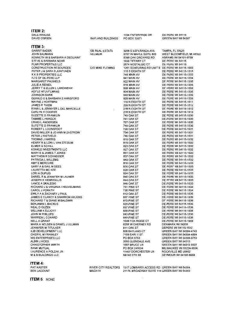
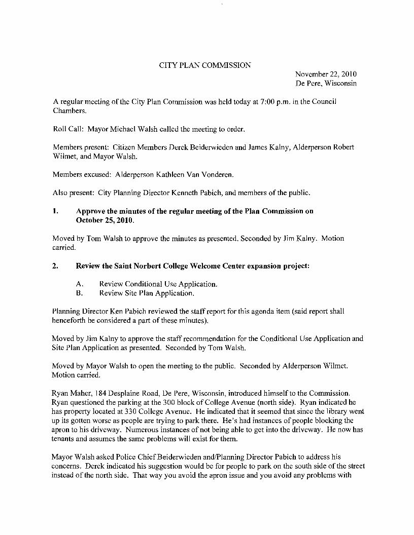
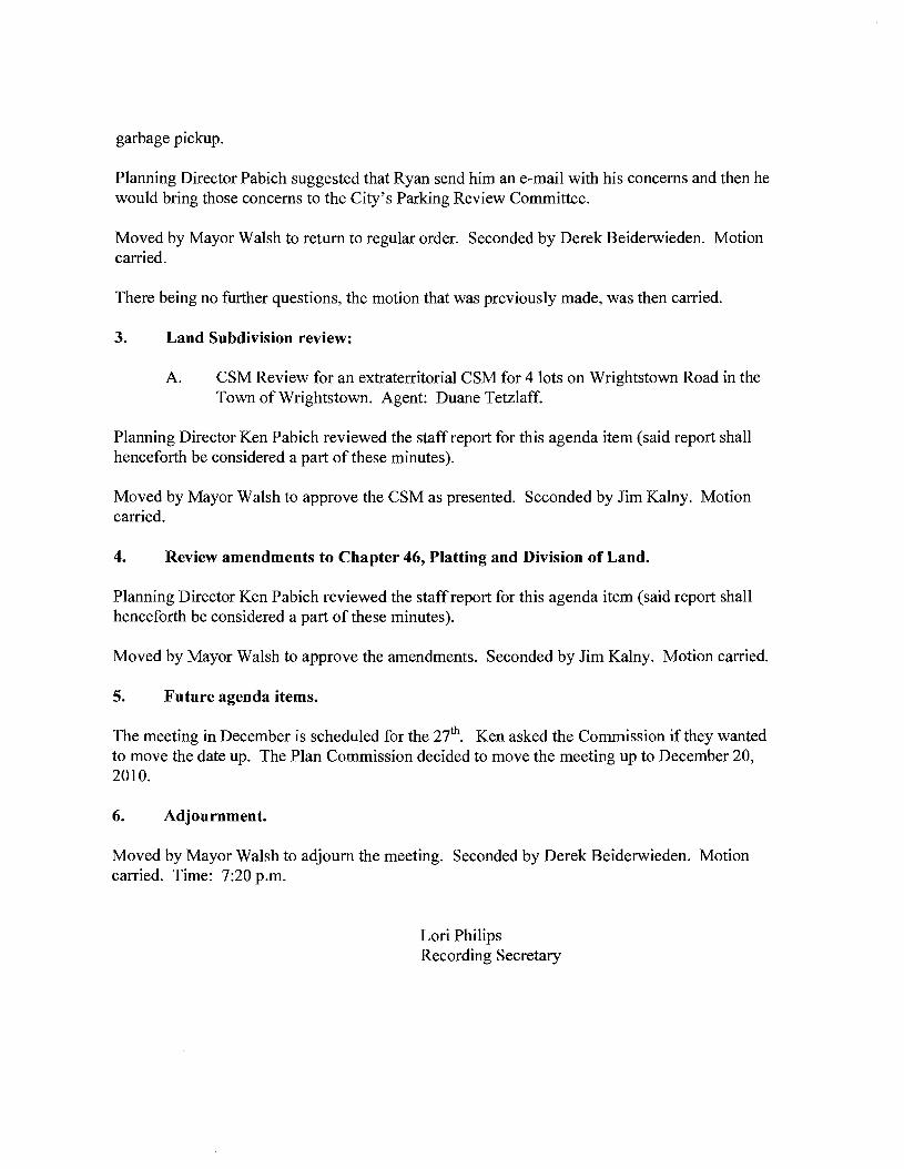
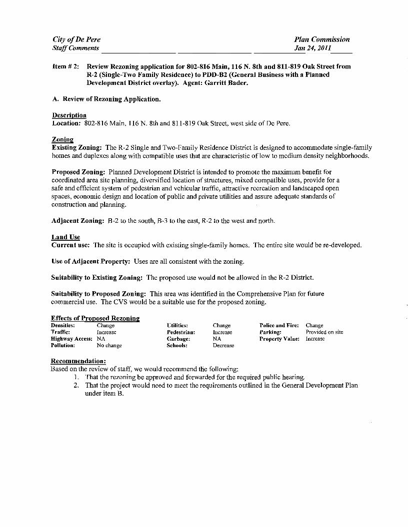
City ofDe Pere Plan Commission StaffComments Jan 24 2011
Item 2 Review Rezoning application for 802-816 Main 116 N 8th and 811-819 Oak Street from R-2 (Single-Two Family Residence) to PDD-B2 (General Business with a Planned Development District overlay) Agent Garritt Bader
A Review of Rezoning Application
Description Location 802-816 Main 116 N 8th and 811-819 Oak Street west side of De Pere
Zoning Existing Zoning The R-2 Single and Two-Family Residence District is designed to accommodate single-family homes and duplexes along with compatible uses that are characteristic oflow to medium density neighborhoods
Proposed Zoning Planned Development District is intended to promote the maximum benefit for coordinated area site planning diversified location of structures mixed compatible uses provide for a safe and efficient system of pedestrian and vehicular traffic attractive recreation and landscaped open spaces economic design and location of public and private utilities and assure adequate standards of construction and planning
Adjacent Zoning B-2 to the south B-3 to the east R-2 to the west and north
Land Use Current use The site is occupied with existing single-family homes The entire site would be re-developed
Use of Adjacent Property Uses are all consistent with the zoning
Suitability to Existing Zoning The proposed use would not be allowed in the R-2 District
Suitability to Proposed Zoning This area was identified in the Comprehensive Plan for future commercial use The CVS would be a suitable use for the proposed zoning
Effects of Proposed Rezoning Densities Change Traffic Increase Highway Access NA Pollution No change
Utilities Pedestrian Garbage Schools
Change Increase NA Decrease
Police and Fire Parking Property Value
Change Provided on site Increase
Recommendation Based on the review of staff we would recommend the following
1 That the rezoning be approved and forwarded for the required public hearing 2 That the project would need to meet the requirements outlined in the General Development Plan
under item B
City ofDe Pere Plan Commission StaffComments Jan 24 2011 Item 2 B General Development Plan
The site would be re-developed for the future location of CVS Pharmacy The existing homes would be removed The new building would be 13225 square feet For the General Development Plan a full set of drawings is not required The building would have two primary access points with one off of 8 th Street and one off of Main Street The plan also shows a right out only on Oak Street which would accommodate exiting from the site for deliveries and it would protect the residents west of the development
DYes D No bull NA Does the project meet the City Stormwater regulations
Sewer properly connected
Water properly connected
Access properly designed (driveway and sidewalks)
Are there any issues with easements or right-of-ways
Are there other items that need to be addressed
_ Yes
_Yes
_Yes
_Yes
_Yes
D No
D No
D No
D No
D No
DNA
DNA
DNA
DNA
DNA RequiredActions 1 The City storm sewer is designed to transport a peak discharge of a 5-year rain event for commercial land use
Provide calculations for the peak discharge off the site 2 Provide a stormwater management plan 40 Total Suspended Solids reduction is required for post stormwater
management per the December 2010 update to the State of Wisconsin Administrative Code NR151 A long-term maintenance plan will be required The plan is to be recorded with the parcel
3 Provide a curb head cut at the new access point Donot remove the entire curb unless the curb is deteriorated Remove the curb cut detail from the plan set
4 Change Main Street to Main Avenue 5 Show the two residential driveways on the north as being removed 6 Provide an erosion control plan 7 Provide the City with 2 of right-of-way along MainAvenue The aisle width can be reduced to 22 to accommodate
the right-of-way change if necessary 8 Provide a minimum 5 terrace between the back of curb and sidewalk along 8 th Street at the right turn lane 9 Obtain permission from the County for the driveway along Main Avenue 10 Water laterals from the removed homes must be disconnected at the main iltiixi lt iii Does the project meet the City Landscaping Regulations DYes 0 No _ NA
RequiredActions 1 There are not any planting diagrams included on the plan All planting mulching and staking should be in
accordance with WDNRrecommendations and current proper practices 2 All plant material and beds should have a follow up schedule for maintenance and replacement It is essential that
this schedule be established to ensure that the plants are maintained for health and any compromised plants are to be replaced in a timely manner This maintenance schedule should include provisions to protect plants in the winter as some of these may be susceptible to animal feeding or damage
3 A preservation and protection plan for existing vegetation and trees including City owned trees and shrubs should be included on plans when applicable
RecommendedActions 4 It appears there would be room for additional plantings of trees on the perimeter of the property Other tree
varieties and species could be into the plan y
Does the project meet City Fire Codes _ Yes D No DNA
RequiredActions 1 Provide complete detailed plans for construction review prior to start of construction Provide details of use for all
areas of structure 2 Provide a floor plan for complete storage arrangement Provide details of storage quantities of flammable liquids
within this structure 3 Separation of hazardsuse may be required 4 Provide details defining the means of egress Provide exitemergency lighting throughout the means of egress 5 No smoking signage and floor loading signage may be required 6 Provide fire extinguishers at maximum 75 travel distances from any point Locate extinguishers towards the exits 7 Provide sprinkler system drawings for approval prior to installation of this system System shall comply with NFPA
requirements 8 Provide fire alarm system drawings for approval prior to installation of this system 9 Fire department connection not indicated
City ofDe Pere Plan Commission StaffComments Jan 24 2011
CC CC C
Does the project meet the design regulations (exterior building elevationsmaterials) DNAbull Yes D No Does the project meet the City setback requirements DNAbull Yes D No Does the project meet the City parking requirements Yes DNo DNA Does the project meet the City lighting requirements DYes D No NA Is the refuse properly sited and screened DNAbull Yes D No Does the signage meet the Citycode DNAbull Yes D No Are there other items that need to be addressed DYes No DNA Required Actions 1 The design and materials of the building are fine however the plan should include a decorative masonry half wall
around the parking lot to buffer parking stalls on 8 th and Main 2 A CSM will need to be completed for the project 3 Lighting for the drive thru will need to be reviewed to ensure it does not affect residents to the north 4 Refuse is properly designed the gates should not be a chain link fence 5 Decorative fencing will be required along the west property line The fence should be designed to buffer both lights
and noise 6 Signage details will need to be submitted for review 7 While a landscape plan was not required with the general development plan the City is expecting that the north and
west property lines will be landscape to minimize the impact to the residential properties
Recommendation Staff would recommend the following
1 Approve the General Development Plan and forward to Common Council 2 A Precise Implementation Plan be prepared according to Section 1459(9)(2) of our code
CITY OF DE PERE Fee $ 24500 Receipt _
APPLICATION FOR REZONING Date
Please print or type using black ink for duplicating purposes
Please see attached addendum A Property Owner Name ---=-=-========== _
Mailing Address ---- shy
Phone _
Signature Date _
I hereby appoint the following as my agent for purposes of this application
Agent Name Garritt Bader 0 ~tltJ 27~~
Mailing Address _
Phone 813-500-0296
Signature Date _
B Property Information
AddressLocation of Property 802-816 Main amp 116 N 8th amp 811-819 Oak Parcel _
Parcel Dimension WD-527 DEPERE COS ADDN LOTS 51 amp 53 BLK 34 WD-529 DEPERECOS ADDN LOTS 55 amp 57 BLK 34
Legal Description WD-530 DEPERECOS ADDN LOTS 596163 amp 65 BLK 34 ______WD-532 DEPERECOS ADDN LOTS 67 amp 69 BLK 34
WD-528 DEPERE COS ADDN LOTS 525456 amp 58BLK 34 ______WD-531 DEPERECOS ADDN LOTS 60 amp 62 BLK 34
WO-531-1DEPERE COS ADDN LOTS 64 amp 66 BLK 34 ______WO-533 DEPERECOS ADDN LOTS 68 amp 70 amp E 12OF LOT 72 BLK34
C Rezoning Application
Existing Zoning R-2 Single and Two Family Residence
Proposed Zoning PDD B-2 General Business Planned Development District
Adjacent Zoning North -=R--2-shy South 8--2=-shy _
East B--3--shy West RC--2=-- _
Zoning Classification Within General Area
General business and residential uses
Continued on next a e
Land Use Present Use of Parcel
Residential uses
Proposed Use of Parcel
Site to be re-developed for a Pharmacy
Present Use of Adjacent Properties
General business and residential uses
SIGNED AUTHORIZATION Please see attached addendum
I being the owner of the above-described property do hereby authorize the City ofDe Pere to install and place a temporary ZoningNotice sign upon said property in a location which will give a reasonable notice to the public that said property is being considered for such change by the Common Council
I 1 1 Date
REZONING ADDENDUM
MARK A amp BRANDY J NELSEN LIVING TRUST OF 2004 DIDIO NOVEMBER 12004 AND DAll1EL J ULLMAN 6258 V CHERNEY RD DENMARK WI 54208
I MARK A amp BRANDY J NELSEN LiVING TRUST OF 2004 UDO NOVEMBER I 2004 AND DANIEL 1 ULLMAN being the owner of tile above-described property do hereby authorize tile City of De Perc to install and place a temporary Zoning Notice sign upon said property in a location which will give a reasonable notice to the public that said property is being considered for such change by the
Common Council
Date
Jlft Lief (tltttQ(JQ-0 Signature ) j Date
Date
i -
i
tLl~~
l- - Signature Date
REZONING ADDENDUM
WAYNE 1 HOFFMAN 116 N EIGHTH ST DE PERE WI 54115-1511
I VAYNE J HOFFMAN being the owner of the above-described property do hereby authorize the City of De Perc to install and place a temporary Zoning Notice sign upon said property in a location which will give a reasonable notice to the public that said property is being considered for such change by the Common Council
REZONING ADDENDUM
ADELE HEUVELMANS 804 MAIN AV DE PERE VI 54115-1335
I ADELE HEUVELMANS being the owner of the above-described propertydo hereby authorize the City of De Pere to install and place a temporary Zoning Notice sign upon said property in a location which will give a reasonable notice to the public that said property is being considered for such change by the Common Council
Od4 7 middot7lt-f-vtA-e~-te-i-+_ -1- Signature Date
REZONING ADDENDUM
JERRY T amp ELLEN L LANDWEHR 808 MAIN AV DE PERF WI 54115-1335
I JERRY T amp ELLEN L LANDWEHR being the owner of the above-described property do hereby authorize the City of De Pere 10 install and place a temporary Zoning Notice sign upon said property in a location which will give a reasonable notice to the public that said property is being considered for such change bythe Common Council
Date
Date
REZONING ADDENDUM
rENNTFER M TITULAER 811 OAK ST DEPERE WI 54115-1532
I J ENN [FER M TITULAER being the owner of the above-described property do hereby authorize the City of De Pere to install and place a temporary Zoning Notice sign upon said property in a location vhi9~1 will give a reasonable notice to the public that said property is being considered for such change by
the C~tl10rt r
7~ GUfj l d II Sjgnarure Date I I
(
REZONING ADDENDUM
THOMAS J HARRIS 815 OAK ST DE PERE WI 54115-1532
L THOMAS J HARRIS being the owner of the above-described property do hereby authorize the City of De Perc to install and place a temporary Zoning Notice sign upon said property in a location which will give a reasonable notice to the public that said property is being considered for such change by the Common Council
J -
Signature Date
SIgnature j Date
REZONING ADDENDUM
JULIE A REINDL 816 MAIN AV DE PERE WI 54115-1335
I JULIE A REINDL being the owner of the above-described property do hereby authorize the City of De Pere to install and place a temporary Zoning Notice sign upon said property in a location which will give a reasonable notice to the public that said property is being considered for such change by the Common Council
Signature Date
REZONING ADDENDUM
HENRYN amp LORI L VAN STEDUM 819 OAK ST DE PERE WI 54115-1532
I HENRY N amp LORI L VAN STEDUM being the owner of the above-described property do hereby authorize the City of De Perc to install and place a temporary Zoning Notice sign upon said property in a location which will give a reasonable notice to the public that said property is being considered for such change by the Common Council
-0 -W01l Date
- O -tiJa 1 Date
COMPANIES
PARTNERS IN DEVELOPMENT
January 14 2011
Mr Ken Pabich Director of Planning and Economic Development 335 S Broadway Street De Pere WI 54115
RE Project Description and Re-zoning Request Residential Properties Located at the NWC ofMain St and 8th St
Dear Mr Pabich
The purpose of the re-zoning request to the city is to demolish the 14 existing dwelling garage and storage structures on the subject properties and to construct a new 13225 sf CVS Pharmacy with a Drive-thru facility One dwelling and garage located at 219 8ID St N is to be relocated to the lTWC of 9th St N and Pine St Please advise any additional information required for this re-zoning request
Sincerely The Velmeir Companies
John C Baumann Director of Construction
4
LOCATION MAP NTS
[pJ
(QJtegIAI~e
P~crbrtLoieg
l
f
L
CIW OF DEe ~ -
p
yenljs1tlart A4$
a Esf~ [)r c l1l -E Hettn~ Ave
Giant St EEi
ECT ATI9N
middott~
(I)
1 ~
~~I
shy
)
I J
I I I I I I s I l~
1~~
I
-- 3IJrL I
t r [_1 1851
I I I I I I
1
~~~~~~~~L __t I= -~
DESCRIPlION
andEgintmng lli1- W-l- __ W1~
262-7I-IlOO_H02--N66www~
RA Smith National -----shy sm
SITE PLAN
CVS PHARMACY
CITY OF DE PERE WIo N
o
I~[~I~~~~~lC~ Dr5 shy lWTE~AA
(~S - PfwtT BllCE
ALUIISTOR(fRQllTshyQ(NlAllOO2poundO
IINIA_C-O[[PREO
ALUliAU10llAllCDOCRshyCUNl~OOIZ[O
MAI N 5 T R E E T E LEV AT ION
PREIllI5IpoundO ~EA1 CCFINC -CtxOillOYAlt)1IW1D1TM
ur5 - 10UM
AlUWS1QR(fIl~~shya[AA~QOIltO
SPlllr1CWUshy$CIl conI) lH1LA~C-O[[PR(D
~~~~~ngOCOl_
NOR T H 8 T H 5 T RE ET E LEV AT ION
~
OAK 5 T R E E T E LEV AT ION SCAlEIlTS
REA R E LEV AT ION
NORR ARCHITECTS INGINEIIlS UNNEAS
719 Grhwoln Strc~r
sene 1000 Detmh M14~2l6
wwwecrrccm SCAlENTS
City ofDe Pere Plan Commission StaffComments Jan 24 2011 D
Item 3 Review Precise Implementation Plan for the new 9278 square foot Krause Financial office building in the East Industrial Park located on Profit Place Agent David OBrien
New office building for Krause Financial is to be located in the East Industrial Park on Profit Place The office building is 9278 square feet and is designed for future expansion to the south
Does the project meet the City Stormwater regulations
Sewer properly connected
Water properly connected
Access properly designed (driveway and sidewalks)
Are there any issues with easements or right-of-ways
Are there other items that need to be addressed
DYes _ No DNA _ Yes D No DNA _ Yes D No DNA _ Yes IJ No DNA DYes _ No DNA DYes _ No DNA
RequiredActions 1 The City storm sewer is designed to transport a peak discharge of a S-year rain event for industrial land use
Provide calculations for the peak discharge off the site Include the vacant property to the south under a developed condition
2 Provide a curb head cut at the new access point Do not remove the entire curb unless the curb is deteriorated Remove the curb cut detail from the plan set
3 Plan states that sanitary lateral is 6 lined The sanitary is 6 in diameter but has not been lined 4 The storm sewer tap at the inlet is to be core drilled The City Engineer is to be notified 24 hours prior to
construction An excavation permit will be required for the storm sewer work in the right-of-way S Insulate the water main if there is less than 18 of vertical clearance between the bottom of the new storm sewer
and top of the water main
Does the project meet the City Landscaping Regulations _ Yes D No DNA
RequiredActions 1 The southern portion of the lot must be maintained as lawn and cannot remain as existing conditions 2 All planting mulehing and staking should be in accordance with WDNR recommendations and current proper
practices 3 Allplant material and beds should have a follow up schedule for maintenance and replacement It is essential that
this schedule be established to ensure that the plants are maintained for health and any compromised plants are to be replaced in a timely manner This maintenance schedule should include provisions to protect plants in the winter as some of these may be susceptible to animal feeding or damage
4 A preservation and protection plan for existing vegetation and trees including City owned trees and shrubs should be included on plans when applicable
RecommendedActions S It appears there would be room for additional plantings of trees on the perimeter of the property Other tree
varieties and species could be incorporated into the plan
Does the project meet City Fire Codes _ Yes D No DNA
RequiredActions 1 Provide detailed plans for construction review prior to the start of work provide details of use for all areas of
structure Define uses for all areas of the building 2 Detail means of egress in all areas of building and provide capacity and exit width detail 3 Separation of hazardsuse is required in accordance with FCLSC Fire rated assemblies are required for the
furnace room and general storage areas 4 Provide exitemergency lighting throughout the means of egress S Provide fire extinguishers at maximum 75 travel distances from any point Locate extinguishers towards the exits 6 Installation of key box for fire department access RecommendedActions 7 Recommend installation of a fire alarm system should such a system be desired submission of detailed plans with
cut sheets and battery cales is required prior to installation 8 Recommend installation ofa fire sprinkler system based on size and construction type should such a system be
desired submission of detailed plans with cut sheets and hydraulic cales is required prior to installation
City ofDe Pere Plan Commission StaffComments Jan 24 2011
I 09 u CIl 0 5 be
sectI
oS Ql
oCl be I deg2 I ltII
E
Does the project meet the design regulations (exterior building elevationsmaterials) _ Yes D No DNA Does the project meet the City setback requirements _ Yes D No DNA Does the project meet the City parking requirements _ Yes D No DNA Does the project meet the City lighting requirements _ Yes D No DNA Is the refuse properly sited and screened _ Yes D No DNA Does the signage meet the Citycode _ Yes D No DNA Are there other items that need to be addressed DYes _ No DNA RequiredActions 1 Color for the building shall be earth tone in color 2 For parking traditional standards would require 38 stalls Under the 1-1zoning the Plan Commission can reduce
this requirement based on need We were told by the owner that 30 stalls would meet their needs The Plan Commission may want to request a letter from the owner to place on file to ensure there is no parking on the street in the future
3 The south gable end finish material should be modified to bring the design back into scale 4 Refuse enclosure shall be a matching split face concrete block with non-metal gates 5 As a note the two parcels will need to be combined before permits can be issued
Recommendation Staff would recommend approval with all required actions being implemented and the Precise Implementation Plan be forwarded to City Council for approval
CITY OF DE PERE Fee $ 24500
Receipt _-=6--I--=tu---O _
APPLICATION FOR SITE PLAN REVIEW Date
Please print or type using black ink for duplicating purposes
A Property Owner Name 1) C-e 6 y togtgt-t
V 1
- ffi
----)--2~L=--poundL-2lt3-k-_P~v)S~-4Jy
I hereby appoint the following as my agent for purposes of this application
Agent Name uCLvd e8r~~ ------- shyMailing Address -p 130 l ( ~S- Phone t9amp~930D
Signature DatelO I tJ6 1M It
B Property Information
AddressLocation of Property ~~ ~T-N f ~o-h t- Parcel pound D ~ pound0081-Z ~ CJ etmiddot- FbcR -Z-- t
Parcel Dimension t7f)( gttl3 Parcel Area -l7~~r-JcentLJ2--------shyLegal Description _
A Site Plan Review is requested as authorized by the De Pere Zoning Code Section(s) Article XIII
SectiOn146~middot0
Signed ApplicantAgentJLLOh-= Dated 111 II(
A plan consisting of all applicable information listed on the attached shall be submitted with this application
SITE PLAN REVIEW REQUIREMENTS
KRAUSE FINANCIAL SERVICES INC FOR BAYLAND BUILDINGS INC
CITY OF DE PERE BROWN COUNTY WISCONSIN AnENTIONI OOWNLOAOED PLANSARENOTSCALEASLE NEITHER THE OWNERORTHE ENGINEER SHALLSE HELDRESPONSIBLE FORTHESCALEOF DOWNLOADED PLANSONLYPRINTED PLANSFROMBLUEPRINTSERViCECO INCSHALLBE CONSIDERED TO BESCALEABLE PLANS
VICINITYMAP
fl(CAAl1ll~
II 1
1 l
Non ElClSnNlJ UTlUlIESSItC)MIONPLAH9AREAPPRO)jlW1Enil CON11IACTOR SliAlJBE RESPONSIBlE FOROIl1AININCI EXACTLOCATlDHS ANDELEVATIONS OFALLvnmas MIETlIERllHOWNDRNOTFROMTHECJVrNEP6 OFTHEREampPECTlYE umnlEs ALLUntTY OWNEASSHALt BENl1TJFIEO FORLOCATES avmE OOtmUlcrOR n HOlIll5PRIORTO
ouEA03ION CONTROL loIEAIilUREIilSWltLL 8E ~ PLACE PAIORTOCONSTFlUCTlDN AHOSfULlCOlolFOlllol TOlHEW1ampcOf1lWl OEPAPl1olENTOF IoUruIW RUOLIRCn CONSllIOCTlOfj mE EROSIONCOI4mOl AHOlECHtlICAL 5fANDAAOS
INDEXTO DRAWINGS SHTNO DESCRIPTION
1 LOCATiON MAPSANDINDEXTODRAWINGS 2 EXISTING SiTE CONDmONS 3 SITEPLAN UTILITYPLAN 5 GRADING ANDEROSiONCONTROL PLAN 6 DETAILS 7 DETAILS a EROSiON CONTROL DETAILS -INLET PROTECTION L----shyANDMISCELLANEOUS DETAILS Q EROSiON CONTROL DETAILSmiddot DITCHCHECKDETAILS 10 EROSiON CONTROL DETAILS- DITCHCHECKDETAILS
JoSPRfN DATE I APPROV REVlSIOJf KRAUSEFINANCiALSERVICES INCD
4 Robert E Lee amp Associates Inc
~~ECKEO FORBAYLAND BUILDINGS INC ENGJNEEftJNG 5~G ENVlRONltEmAL SERVtCESLOCATION MAPSANDINDEXTO DRAWINGSCiTYOF DE PERE eeeeeec --lBROWNCOUNTYWISCONSiN
LOCATION MAP
------ --- shyUTILITY INfORMATION I~~~rl
DESTINY DRIVE UTILITIES PRESENT crrvOF DEPEREWISCONSINPUBUCSERVICES6C TIMEWARNERCABLEl usSiGNAL I ~ 0 ___ bullbull
UTIUTlESSHOWNON THis MAP AREBASEDON lOCATES FAD I ~~ ~~~~100k=I
~--L (~ I 4 11 OIGGERS HDTUNETICKETNUlolaEA201~02Isa DATED 1223J2010 VISlBLEOB6EAVATIDN oN 12l2~01D AND i [ ~--- -__ ~~BR~EU~~~~~~~~NJiU~~~~O~~DEE~F~~g~ ~~U~~p~E VEFlIFleDPRIORTO 1Hf DIGGING I
1
11 ~ r u nn n~-=--=-~----- ~ ~ _ ~~_=~_--_DIGGERSliaTUIIlE HOo-242middota511
n -- 0_i 1j t ~ r -- L ~~Ju o~ gt 11 WATBIISAtHTAAYJtm]AU SCWlR~ GAS ELEGTJUO TelEPHONE C~BLE TV DEPARTNENTOf PUBUCWOIII(S WISCONSIN PUBLic SpoundRVIOE COItJgt no TIME WAflNER CABLE CNOFDEPEAE 6OONORTliMJMUgt6T lIaiampSFEJlSON6T 1OQ1KENNEOt AVE e25SXTHST Po BO)(180Dll GRiIENBAY W154~ KIUBliRlY WIUI)l i 11 fl~ ----~~----7~----- ~tmiddot r~1 DEPpoundREW1541gtS OrtEENBAYW16Q07
tQ~Q~-lIl47 820)11111207 (lI1l0jU9-5G7amp (InI4JJ~3 Ii ~n I I I lt0 I II
iJ - ---- -- I 1-I r1
tlll bullbullbullbullbull 111 i I lt1 ~ -11 I I IOWNER INfORMATION coNTRACTOR INfORMATION
ICFlAUSE FINANCIAL SERVICES INc BAYlANDBUILDINGS INC 1234ENrERPRI5E DRIVE POBOX13571 II-- i DEPEREW1 54115 GREEN6AYWI amp43D7middot3571 1
t 1_~I dl~i~ I I
I
II
~I~I I)0
j I ) I ~I i iI 5 III
(B6ampaS5-7437 (B20)3711i20D ) k I 1 IIL iIol 1 i ICONTACT DALE KRAUSE CONTACT DAVIDOBRIEN ~ ~I i 1 ) II) II Iti II
LEGEND -6 FIREHYDRANT I I i
tal ~ DECIDUOUS TREE I~I bull I
WATERVALVECURB STOP I gt I 1 I ~ i [ I I LOll I I tiWATERMANHOLE ~ bull _ bull o CONIFEROUS TREE j e I o SANITAAV tlANHOLE ~ 11 11 ~ r ese sr I I I Io BUSH o STORMMANHOlE II i r l ~ 1 ~ I I ~ ~ t~3B21 OP~ STORMIlANHOLE
RIPRAPbull J l ~ i i raquo I I 1151 lINIlIIll STORMINLET j shy glOOMINLETMANHOLE ~ZJf)IofI SPOTELEVATION III POWERPOLE r- ) i ~)i J I II ~
W~h FIRSTFLOCIRotlASEIrlENT ELEVATiON bull ~bullbull_ iEJ-oPOWERPOlE WGIN WIRE i4iL-i-l 0 ~ i al ~IUGHTPOLE N -rorAPPROXIMATE ROCKElEVATIONo ELECTRICMANIiOLE
III ELECTRICtlElER r III ll i I __ __ ) - I If__ 12 EXISTINGCULVERT
laquoI GASVALVE tii i I -- n iii ~ 1 I - -- - - - - - +-1- - i I I ti i ~ GASUETER o CONCRETE 81 MAIlBOX
CZJ WET1ANDS ~ - I I I I Iof SIGN
POST I f i
~ HANDICAP PARKING IRONPIPEJROD 11 ~ I I if I
4 PKNAlL ji rill I i i I 1 II I EXISTINGSANITARY SEWER (SIZENOTED) i 11 I 1 bull
EDGEOF PAVEMENT EXISlINGFORCEJJAlN (SIZENOTED)II ill- h i~ 1 ml i II ImiddotI ii -10C- ~ISlING STORMSEWER(SIZENOTED)
EDGEOF MAVEL k --N-- EXISlINGWATERMAIN (SIZENOTED) 1 I I 1i1 --0-- GASUNE C Ii
EXISTINGCURBamp GUTTEA I I ill 1 II i LOI I [I II --oc-- oVERHEADTELEPHONE UNE ---- UNDERGROUND TELEPHONE LINE 1
- TREEiBRUSH UNE --oc-- OVERHEAD ELECTRICUNE ) i ]1 n _ 1 I~ I
---- UNDERGROUNOELfCTRICUNE bullbull vse-bullbullbullbullbull EXISlINGCONTOURUNE i 11 -- t I
- OTV- OVERHEAD CABLE1VUNE --N-- CAaLElVLlHE I
RETAINING WAll 1 lilgtlll II ilmiddotMVUNE PROPERlYUNE H j i I I I
GUARDRAIL - EASEMENT UNE
~ FENCE BUILDING SETBACK UNE i I I ~ - i I II I ISEcnONUNE NOHIGHWAYACCESS
I I I II i ) I Ii i I I I i I l I I I I shy bull I1 1I~ I ~ ii k i I I J _ -J- _J ---- _ _ _ _ _ _ _ _ _ - - - - - - - - - - - - ~-- - LilI
gll~~ ~ NOTE D-t1 bullj I ELEVATIONs SHOWNAREBASEOON APREVIOUSCITY OF DEPEREEASTalOEDATUM SUSTRACT 091 TO ~mtII 8U) 0 CONVERTTO NAVOsl l
-0ampOATE IIoPPRrN OMWN KRAUSEFINANCiAL SERVICES INC-- shy FORBAYLAND BUILDINGS INC CITYOFDEPERE
~CJltQ) EXISTING SITECONDITIONS
~~SlCNEO BROWNCOUNTY WISCOSNIN
~r---L-j m1--Igill~~ ~~i~~~ 1131 bullI 1 -bull I 1 middot bullbullbull ]~) (SI1
~ e sr ------ shy
(I [a
[
I ar
I 1 I
r I
[ I [
I 1 f I r Ii
r
I I I I I I I I I I I I I
I I I I I I I I I I I I I I I I
I
I I 1 f-I ~I i~
I I
I
~ ~ ~I E~SnNG SURFACE TO AEMAIN I
~ 1 I ITJ I
I shyI II I
I I
I I 1 f~
I I I I
[1] I ~ ~ I I
I I ~ I I I I I I I ~ I I I I II
II l I I I _L II I8 I ----- ~ I I I I _------- ~ I
I f- I I - - -- - i7Jr I II I L_-J---- ~
I I amp-0~~ RlVlSlON KRAUSE FINANCiALSERVICES INC
I ri
-------------------------- ---------p----shyLOCAlED UMENT ON DESTINYDRIVE FROMEXl971NO OFFICE WITHNEW MASONRV BASE ANDELECTRICAL EX IHIEAGIUL CIJRlI ltlGUnER
shyNOCCESS _ 100 29917
~ ltgt3 J SLAND6CAPEAREAWlTH bull bullbullbullbull I io middott 5PRINKLEASYGTEM f
~ PROfr2~~ ~~DING
~~ FF ELEV63900
~ k 11I i I I I I I
I iii I f- I ~I J
f- I sect I
-- shyI I I I I I I I I I I I I I
w I I~
c I I I I I I I I I I
PROVlDE~1R6OPENING I ~~~g~ ~D~~~~~~~~SfARY VERIFYW H CITYBEFOREREMO~ING
DRIVEWA OPENINGCONCl1iTE I
I - shy
rIJ
SCIII2INFEET
NOTE ELEVATIONS SHOWNAREBASEDON APREVIOUS CITY OF DEFEREEASTSIDEDATUMSUBTRACT cer TO CONVERTTONAVDse
I~ l I
I II
NOTE ALLAREAS DESIGNATED ASGREENSPACE OR LAWN SHAll BE TOPSOILED TO A DEPTH OF e INCHES SEEOED ANDMUUHED AREA TO BE RAKEDFAEEOFSTONESAtJO CLUMPS
PARKINGVATA TOTALPARKINGSPACESPROVIDED 30
HANDICAP ACCESSIBlfPARKING SPACES 2
TOTALPARKING SPACESAEQUIRED24
SITEVATA TOTALAREA 223ACRES97212 SF
BUILDING AREA 021ACRES921aSF(amp5710)
SIOEWAlKIPARKING LOTAREA 032ACRES13B37SF(14jl3j
GREENSPACE090 ACRES39202BF(4033)
UNDISTURBED AREA 080ACRES348995F (35874)
ZONING
CONSTRUCnON CLASSIFICA nON vbull
PAllCEL NO EDF0081-2
EDmiddotFOOB1-2middot
LEGfNV
o CONCRETE PAVE~ENT
IRJ ASPHALT PAVEMENT
~ GREENSPACE
LANDSCAPED AREA
__ PROPOSEDie-CURBamp GoUTIER -- (UNLESS OThERWISENOTED)
~ PROPOSED SHEDDINCl CURBamp ClUTIER
PAINlED FIRElANE wlt
TRAFFICFLOWARROW ltgt HANDICAPPED PARKING~
NOTEALLCURBRADIIARETO THEFACEOF CURB
I I
I I I I
I I I
I I I
I I I I I
I I I
I I I
I
III
II I
I
I I I
II
I I I
I III
I10 I
I
I
t II I
I
I I If-shy
U) I I I
I I I
I I I
I III
I I I
I I
II I
I
I I I I
II I
I
I I
~ CHrtKlD FORBAYlAND BUILDINGS INC SITEPLAN --l ~ NeesaR UIl ENVIllONgtltBNTAI
CiTYOF DEPERE ~SICHEO BROWNCOUNTY WISCONSiN
3
-------------- shy WATERANOSMIITAAfLATERALS I AREESTl~ATED TO BE6 LINED DESTINYDRIVE
CONTACToRTO VERIFYEXACT [xlHlE~CIRfIampCln1m LOCATION ANDELEVAll0ItJI
I
I
I I
LE~IIIV --------PROPOSED SANlTARYSEWER I----~-- EXlSTlNG SANITARY SElJJER (SIZENOTED)
I bull - bullbullbull EX(STINGSTORMSEWER(SIZENOTED) =bull - bull - bull - bull - bull -PROPOSED WATERIolAlN
= == == PADPDSEOSTORM SEWER
---~-6w-6- EXISTlNGWATERIAIN (SI2ENOIED) I
I
~ ~ ~ ~ ~ I-6 -6 FIREHYDRANT I II $ WATERVALVEICURBSTOP l reg WATER MANHOLE V l REOUCER1NCREASER a 0 ISANITAAYMAIIHOlE C 0 STORMMANHOLE I I OPENSTOIUlMANHOLE UU lI STeAL( INLET C () STORMINLETMANHOLE I
I C
PLUM13ING VA TA CI
DRAINAGE FIXTURE UNITS 24 I I WATER FIXTURE UNITS 28 I m
NOTE I II MINIMUMOF S5FEETOF COVERSHALLSE MAINTAINEo I OVER ALL WATERMAIN
SANITARYSEWER WATERMA1N AND STORMSEWER5HALL BE CONSTRUCTEDIN ACCORDANCEWllrl TIIESTAIIOARD I6P~IFICAnONS FORSEWERANDWATERCONSTRUCTION IN WISCONSINAND ADMINISTRATIVE CODE CIAPTEASCOMM81middot87 I
rI
f~jil 3 FIELDVERIFYLOCATION OF EXISTINGUTILITIES IF EXISTING
LOCATIONSDIFFERFROMWHAT IS INDICATEDON 11-tEPLANS CONTACT ENGINEERPRIOR TOCONTlNUEOWORK I STORMLATERALSSHALL BE EQUIPPEDWITHTRACERMRE
i11 I
I
Ibull All DOWNSPOUTSSHALLBECLEANOUTDOWNSPOUTS
I I
I I
I I
I
IPROV 001[ I)fgtPROV ORoWH KRAUSEFINANCIALSERVICESINC ~E~00 FORBAVLAND BUILDINGS INC
CITYOF DEPERE UTIUlYPLAN ~SIGNEO BROWN COUNTY WISCONSIN
r-- shyI I I I I I I
I I I I I I I I I
I -shy
lOCAlEIHFUT
NOTE ELEVATIoNS sHoWN AREBASEDONAPREVlouaCllY OF DEPEREEASTSIOlDATUM sUBTRACTDe1TO
~-o CONVERTTONAVDB6
n srta r rl6367T1------shyOl~
~~~ g~~~ 10j ~L--ri-~ ---_~----r--___-~~7_
EXST utl l
LEIiRVV TOPOFCURBELEVATION~lcStltlil
FLOWUNE ELEVATION~F- TOPOFSIDEWALKELEVATION~SNJ66666
EDGEOF PAVEMeNTELEVATION~55
TOPOF RETAINING WALLELEVATION~RN444
~3J333 ORQIIIOELEVATION
DR-JNAGE SWAlE
DRAINAGE DIVIDE
---x- SlLTFENCe
~ BALE DITCH CHECK
FLOWAAAOW
TRACKlNCiPAOmmli INLETPROTECTION
NOTE ALLSANITARYSEWERSTORMSEWER ANDWATER SERVIcESIMAINSSHALLBE PROVIDED WITHTRACER WIREOA OTHER METHODTO BE lOCATED
STOlL IIIAITR MANAGEMRVT THISsrrsISTREATEQBY REGIONAL STORMWATER PONDTHAT IS LOCATEDSOUTHNeWEST OF THE END OFTHE CUL DEBAC OF PROFIT P~CE
ELOSWN cONT1WL NOTE All EROSrON CONTROLPRACTICE61NDICATEDON THIS PlAN ME APPROXIMATE LOCATIONSONLY THEACTUALSITEMAY REClUIREMOREOR LESSEROSiONCONTROLDEPENDINGON THE CURRENTCONDITIONOF THE SITE ~ SILT FENCEIS REQUIREDDOWNSLOPEOF ANY DISTURSED
LANDTHAT MAYCARRYSEDIMEtiTS OFF SITEl ltl
A TRACKINGPADIS REQUIREDAT ANYINGRESSIEGRESS LOCATIONWHERESEDII1ENT MAY BETRACKEDOFF-5ITE
II
PROPERIfLET PROTECTION6HAll BE U6ED OEPENDING ONTHE INLETTYPE
-4 SEDIMENTBASKET GH-ll BE USEDFOR ANY 6ITE DEWATERING
I I
I
I
I
in [)j j Ul
R1I4l7l1i1 0_S75I -- shy1 I~~~ m ~ 2lt 1 1 IIMampJl24(Wst)
Ii 1 I I r I i I
II i I I I j I I
STIHL4 r~ ~ I
t III
~ NLET(TYP) ~T~~ I
I j lJ I
OSTllILll Ii rL63s92
1I D_4045 It lW6l247 (W IN) llN6l U 71(15middotSO i I G ~ I
I
STING w o i a
I shy u ~921 I a i -(~ I i i 1160 II a
I L I - -1--+ ~ I f l I i I I ~ I II f j I I II J
I
J i I I I I 12 - shyI 1 ( I i I ~I ~ I 1 A I - I ~
f ~ I
i Iil71
_ - V~ - - - -- -- - ~-- - L Y Dwnall 111163U)
0-1117 NOTE ELEVATIONS sHoWN AREBASEDON A PREVIOOS CITY~~~ ~8 amp-0 g~~~~~RioE~~Jo~E DATUM SUBTRACTO91 TO001pound I APPRO KRAUSEFINANCIAL SERVICES INC IrQb~ Lee ampAsSOc]iite IncON ~~
CHECKED FORBAYLAND BUILDINGS NC EIGltiEERlNG SIJRVElING ENVIROHlWnALSUVlCpoundSGRADING ANDERosiON CONmOL PLAN 4664 COLOEN PONOPARltCOURTCITYOF DEPERE
~CNED ~oWl~~~lnltltom ~~~j~~2~)6~jN41BROWNCOUNTY WSCONSIN
NOTENEENAH R-3275OREQUALWITH TYPEA GRATEORRmiddot3246AOR Rmiddot3Dfl7WITHTYPEL GRATE
LESSTHAN4SHAlL BE RUBBER)
CLARlTY1
I 10$1 ~
~
il4R TO BEADOF ADJUSTlfIG RING CLEANOUT LINETOBElHE SAIlE ANDCASTlNGSEALANT OREQUAL SIZE5 MATERIAL ASSEWERIlAIN BElWEEN ADJUSTlNG RINGSAND NOTE CLEAWOUlLINETO BETHE
CONCRETE ADJUSTlNG RINGS SAME SIZEaIlATERIALASSEWER MIIN
ADAJSTlNG RINBSONLYWITH CASTING COATOUTSIDE OF
ASREOUIRED (4MINAND12 MAX UNLESSOTHERWISESEWERJOltlT COl4iOUNDND NOTEDALlADJUSTING RINGSWRAPWITHMIN8 MIL
~ GRADEPOLYETHI1ENE
ECCENTRIC REDUCING CONE (VERTICALWALL OF
PVCCOATEDCASTIRON 24 SQUARE LlHSTEPSmiddotOC CONePAD CLEANOUT PWB
ECCENTRiC CONESHALLBE ONDOINSTREAM SIDEOF MANHOLE THISDETAIL 4 (MIN)GRAVEL NOTESHOWNROTATED W FOR ADJUSTTOGRADEBY
CLEANoUTPLUG
II SUDINGVERTICALLY UPORDOWNOVER
PVQPIPESEWER 21 r~~~~~~~~~~~~4 SERVICE EACHJOINT
PROVIDE FROSTSLfEVE SERVICEPEAoCOM1l8236 (5)A)2
PROVIDEFROSTSLEEVE PEROCOMM8235 (6) fAJ2~~ TONGUE ampGROOVE PVCPIPE
n 45 BEND JOINTREQUIRED
PVCPIPE
FLEXIBLE PIPE To MANHOlE 45- BEND CONNECTOR REaUIRED
6PECUBEDDING
8 PRECAST S-8IlIN CONCRETE SASE SPECD SEODINGI I
SANITARYAND STORM CLEAN-OUT DETAIL CLEAN-OUT DETAIL STANDARD MANHOLE (TRAVELED AREAS) (NON-TRAVELED AREAS)
8-24(INCLUSIVE)
314-ro r
eunPOLYETHYLENE
I
~rd 81 ~I
~I
~
HDPEtPVC SEWERamp WATERMAIN amp FORCEMAINSTORM MANHOLE INLET PAVEMENT RESTORATION BEDDING ampTRENCHSECTIONTYPE A
MgtPFt(N ~T[ I WPROV REVISlCIH ~ampWN KRAUSEFINANCiAL SERVICES INC FORBAVLAND BUILDINGS INC~CKED DETAILS ~uCITYOFDEPERE
~IONEO BROWN COUNTY WISCONSIN
o
~ Io
I
W(IlAXJ12+00J2 W(MIN)-6oi-00J2
COMPACTEO BEDDING ANDCQVER SOILCLASSA-7
INITAL3 OFSOILCLASS ASIN WETORUNSTASLE TRENCH AS DIRECTED SYTHEENGINEER
WITHOUT EXTRACOST TOQWNER
I
ampolLCtASSG-l OR C-31FREQUIRED PER SPECIFlCAllONS
NOTE SUFlFACE RESTORATION REQUIREMENTS PERTHE SPECIFICATIONS
UNDER BARREL (8 FORBEDROCK EXCAVATiON
UTILITYTRENCH
t ENRENGTH ORENcH I bull -j _middot~middoti middotbullIc-~~~
PIPEUNE
SAWCUT CONStSTENTWlDTH
Imiddot I II I I 11--- -THiCKMANHOLE TOP
PVCCOAlEDCAST IRONIlHSTEPSmiddot 10C
BEADOF ADJUSTING NEENAH R-3215OREOUALWITH RINGANDCASTING SEALANT OR TYPEA GRATEORRmiddot1246AOR EQUALBETWEEN ADJSllNG Rmiddot3067WITHTYPEL BAATE RINGSANDCASTING COAT CONCRETE ADJUSTING RINGS OUT6IDEOF ADJUSTING RINGS 4SREQUiRED 14MINAND 12 ONLYWITHSEWER JOINT MAX UNLESS OTHERIIJISE
COMPOUND ANDWRAPWITH1l~N~~-~~~~L NOTEDALLADJUSTlNG RINGSLESSTHAN4SHALLBE RUBBER)
WAlllt CONTRACTION JOINTSPACING EXPANSION WIDTH TRANSVERSE LONGITUDINAL JOINTSPACING
NOTREQD 100lJAX
s NOTREQD 100lJAX 0 S NOTRECD 100lJAX 0 100lJAX e 100lJAX s 0 lOOlJAX
~
oj ~
~y
PROVIDE CONTRAClloH JOINlS 6CONCRETE ASDIRECTED BY ATUAXItlUlJ 20SPACING BY GENERALCONTRACTOR SAWCUTTINGOFtINSERTIONOF
DIVIDER PLATES
12 OFNO3 ORNO4 GRADATION R E6AR S LE EVES ~MINllJUMVOID rrEXPANSION MATERIAL WILLBEPLACEO ONEACHSlOEOFTHEORNEASUITINGTHE THERIlALEXPANSION SPliCEATENDOFSLEEVE FOR
SIDEWAUlt SIDEWALK ANDDRIVEWAY APRON SHAll BECONSTRUCTED SEPARATELY UNLESSOlHEfWJSE APPROVED BY THEDIRECTOROF PUBLICWORXS BACXOf CUAB COMPACTEDSUBGRADE
CONCRETE PAVEMENTDETAIL ~I 3~l rI~1 1 ABPHALTSATURATED fELT EXPANSION JOINTFILLERPLACED ~ ~rQ ATlJAXllgttUM 300middot SPACING AND
middotB1TUMINOUSSlJRFACE ATAll ENDSOf RADII 1 34 BITUMINOUS BINDER
18 LONG12 DIAlJmRIt REINfORCINGRODS 12 OF NO3 ORNO4 GRADATION ~
DRILL518HOLEMIN9 INTOEXISTINGCURB
CURBTIE-IN DETAIL lPAOPOSEDTO EXISTING)
COMPACTED SUBGRADE
ASPHALT PAVEMENT DETAIL SAWCUlCURBTRANSVERSELY PRIORTO RElJOVAl
~
12middotR60
COItRETE 4 APRONbull
DIMENSION VARIES SEEPlAN
I NOTE REFERTO SPECIFICATIONS FORREINFORCElJENlS
IiI CURBREMOVAL FORDRIVEWAY OPENINGWITH ~ CONCRETE APRON ONCONCRETE SURFAcESTREETS l
bull
EXPANSION JOINT TOOLED
CONTRACTION JOINT
PAVEMENT ANDBASECOURBE
SIDEWALKWITH INTEGRAL CURBCURBREMOVAL FORDRIVEWAYOPENING WITHCONCRETE APRON ON ASPHALT OVERCONCRETE
SURFACE STREETS
CURB REMOVAL DETAIL SIDEWALKDETAIL
bull VERIFYDETAILMATCHES crrv Of OEPERESTANOMDS
4 EXliTlNc CONCRjre
BREAK
VARIES
S SIDEWALK t ~ ~~~ ~~- z --~~~~N~N-~--~ ---~~
ALLARCUND(TYP) iii 11) gt
All RESIDENTIAL DRiVewAY APRONSSHALL BE FLAREDIF FIELDCONDITIONS PERMI1
THEflAAE BHALl NOTE)(CEED3-0
8middot ORJVEWAYAPRONrshy
~I ~t
bullbull _
1--( middotHmiddot bull middot ~ y ~h~raquo~gtY)1-S
~~ ~
L I bull bullbull bull bull ~ bull _ bullbullbull
CUflBA GUTIER 12 EXPANSION JOINT
DRIVEWAY APRON DETAIL
6lc6WmiddotIN211 W2WWf CENTERIN SLAB
-
CONCAETESlAB
4CONTINUOUS
12 EXPANSIONJOINTWITHSELF LEVEUNGSEALANTWHENCAST AGAINSTSTRUCTUIIE
MINIICOlJPACTED SOILCLASS C-3 MOISTENIMlJEOIATELY BEFOREPlACING CONCRElE
TYPICALSIDEWALK ADJACENT TO STRUCTURE
2RAD
SPECIFIED BITUlJlNOUS
4 CONTINUOUS TOP6 BOTTOM
DATE I APPROY AUSEFINANCiAL SERVICES INCm- TE At Robert E Lee amp Associates Inc SIl[D NO FORBAYLAND BUILDINGS INC~lEC1ltEO a ENGtNBeJUNO SURVEYINO BNVlRONWENTu SEJMCES
CrN OF DEPERE DETAILS fluU BROWNCOUNTY WISCONSIN
7
OR WASHEDSTONE
INLETPROTECTION NOTES
INIHAlUT10NtJDTESR W I4ANUFACTUAEO ilLTERN1TlVES 6PPROVED AND1t(if if f TYPE-e-a-c-USTEDONTIiEWOOTPRODUCTACCEPTABIUTV LJSr AAV BESUBSTITUTED
R TRJM EXCESS FABRIC INTHEFLOWUNETOWITHIN3J fq ~ if OF-THE GRATE
I WHEN ReMOVING ORMAINTAtlllNClINlET PROl1CTION CARESHAll Be TAKEN so THATTHE
50 MIN SEDIMENT TRAPPED ONTHEGEoTEXTllEFABRIC THECONTRaCTOR SHALLOEUClIISTRATE A METHOD OOESNOTFALLINTOTHE INLET NolVMATERIAL Of MAI~ENANCE USINGII SEWNFLAPHANDHOLDS
OROTHER ME11-tOQ TOPREVENT ACCUI4utATEO IMMED1AmV FlLUNGI~O THE INLETSHMl BE RELioVED PLANVIEW SED114ENT FROMe~EAING THEINleT
TYPE0 (j) FINIBHEDSIZEINCLUDINGFLAP POCKETS
WHEREREOUIREDBHALLEXTENDA MINIMUM ~ 2299 00 NOTINSTAllINLET PROTECTION TYPE0 ININLETS
SHALLOWERTHAN3DMEASUREDFROMTHEBOlTQlI PROFILE VIEW MAINl1NANCEOR REMOVAL Of THEINLETTQTHE TOPOFlHE GRATE
Of 10AROUNDTHEPfAIMEllR TO FACIUlATE
reg FDA INLETPROTECTIONNPE C (WITHCURB TRIMEXCESS FABRIC INTHEFLOWUNETOWITHIN 3 middot4 MIN OR FULLWIDTHOF THE EGRESSPOINT BOX)AN ADDITIONAL1SOF fABRIC IS Of THEGRATE REFERENCEWDNRTECHNICALSTANDARD1~1 WRAPPEDAROUNDTHEWOODAND SECURE1l
WITH STAPLESTHE WOCOSHALLNOT SlOCK THEINsTAuEOBAGSHALLHAVEII MINIMUMSiDE THE ENTIREHEIGHTOFTHECUR8 BOX CLENIANCE BElWEEN THE INlET WALLSANDTHE TRACKING PADDETAIL BAGMEASUREDATTIiE eorrouOF THE OVERFLOW OPENING
I
(IF APPUCABlEj HOLESOF 3 WHERENECESSARYTHE
reg FLAPPOCKETSSHALLBE URGE ENOUQHTO CONTRACTOR SHALLCINCHTHE BAG USINGPlASTIC ACCEPTWOOD2X4 ZIPTIESTOACHIEVETHE3ClEARANCETHE TIES
SliALL BE PuCED ATTHE MAXIMUMOF4 FROMTHE BonOM OF THEBAG
1 II
I 4XS OVALHOLESHAlL BE HEAT CUTI~D ALL fOUR SIDEPANELS 3
~ -USEREBAROR SllEL ROD
FORREMOVAL
] Of
FORINLETSWITHCASTCURB 80X USEWOOD2)(4 EXTEND10BEVOtlO GRATE WIDTHONBOTHSIDES LEMCJTH VARIES SECURETO GRATEWITHWIREOR PLASTICTIES
II
WOCO2 X 4 EXTENDS8 MINII4UI4 DOUBLESTITCHED BEYONDaRATe WIDTHON SEAMSALL AROUNOSIDE sorx SIDES LENGTHVARIES PIECESANDON FLAP SECURETo GRAll WITH POCKETS WIREOR PLASTiCTIES
INLET PROTECTION TYPE C INLETPROTECTiON TYPE 0 (WITHCURB BOX) (CAN BEINSTA1lEDIN mf INLETTYPEWITH ORWITHOUTCUM BOX AS PERNoTE Z)
INLETPROTECTION TYPE A
INLETPROTECTION TYPE B (WITHOUTCURB BOX)
(CAN BE INSTALLED IN ANV INLET WITHOUT A CURB BOXI
~~ KRAUSEFINANCiAL SERVICES INC ~ICEI) FORBAYLAND BUILDINGS INC Robert E Lee amp Associates IncEROSION CONTll0L
ENCINEERING SURVETING ENVliOtOlENTAL SERYXCESINLETPROTECTION ANDCiTY OFDE PERE OESlGNEO MiSCELLANEOUS DETAILS ---1 4 8
SUBGRAOE
WOODSTAKES(z PERBoLE) NOMINAL2 X T X 30 MIN LENGTHOR eQUIVALENT
CROSSSECTIONAL VIEW HOPEHIGH DENSITY POlVETHVLENE FABRIC SILTfENCE
FILTERBAG DETAIL
8HEETFLOW lt COURSE AGGREaATEINFORMATION
NOTE 1-shySIZENO ALlOlIJENS1ONS siEVESIZE AASHTO No87 (l)
AREAPPROXltrlAre SHEETFLOW 2 INCH(SO mm) 11fiINCH(375mm)
EMBEO BALES 1INet (250mm) 100 ~NEUZED FLOW314INCt1(111Olnm lMl-IOO 318INCIt(ll5mm) 20-55
PLANVIEW Wo-I175mm 0-10
i Wo8(200mrnl IJ-5
SECTION A-A ~ (1 SiZENoACCORDtNpound To AASHTO1l-l3
L THEDiSTANCE SUCH THAT POINTSIANDB AREOF EQUAL ELEvATIONNOTES
l 18X30middot ROCKFILLED FILTER al3 SHAll BEcOMPRISED OFTHEFOllOWllllB ~ HOPE HIGH DENSlNfOIETHYLENEFORSCOURPROTECTION USE HOPE HIGH DENSITY POLYETHVLENE DRAW sTRINGKt-ITTED DlREOllYlHToBAGOPENINGEROSIONMATFORCHANNELUNING 60 FABRIC CLOSURE WIlli APPARENT OPENINllSIZENOLARGER THAN 118middot X 18middot LAPMATUNDERUPSlREAM BALEB ROLleD BEAMUSINGA IlINttuuOF-180DENIERPOLYESTER SEWINGYARNFOR STRENC1T1-t ANDDURABILITYI ANDSECUREFABRiCWITHWOOD SIDEVIEW
STAKESATmiddotFOOTINTERVALSI USEWELLGRADEDCOURSEAGGREGATE CQNFORIolING TOTHE FOUOWINGGRAOATlON REQUIREMENTS
DITCHCHECKDETAIL
ROCK FILLED EROSiON CONTROL BAGS TYPEB
bull WELLGAADEDANGULARsTONE
OF 3 INCHOR GREATER
Ii~
STAGGERJOINTSBETWEEN ADJACENTROWSoF BALESa PLANVIEW
il STAKESDRIVENflUSH WHEN SOILCONDITIONS PERMITd
n
-------------~~~~~~~~~~~ WELLGRADEDANGULARSTONE OF3 INCHORQREATER
~~~
t-~~ ~1~80nOM ELEvATIONOF ENDSALE SHALLBE EOUALTOOR GREATER THANTOPOF LOWESTMIDDLEBALE IDROP
STAGGERJOINTSWITHDOUBLEROW SIDEVIEW FRONTELEVATION
TEMPORARY DITCH CHECK USING STONE TEMPORARY DITCH CHECK USING EROSiON BALES TYPECTYPE A
RrvISION OATpound I JJgtPRCN ~WH KRAUSE FINANCIAL SERVICES INC CHECKED FORBAYLAND BUILDINGS INC EROSION CONTROL
CllY OFDEPERE DITCH CHECK DETAILS OESICNED BROWN CQUNlYWISCONSIN
L OTENTlAlSCOlJAAREA USEERDSION )MAT OROTHERDEVICE WHEN DIRECTED BYTHEENGINEER
DIRECTIoN
~ ~FlOW
I II Id n
II I
I II
ENDTREATMENT ONSlOPES BACKFILL ampcOMP-cT TOBESIMII1IR TOCHANNEL TREHCHWITH flOW DETAIL
PLAN VIEW (WHEN LTERING THEDIRECTlON Of flOW)
I I I l--- TOEOFSLOPE I I I I I I
[ deg6~E~~~ I I I
PLANVIEW
rSTAKES DRIVENFLUSHWHEN SOILCONDITIClN$ PERMIT
8middot0plusmn
FILLSLOPE
DIRECTION OFFLOW
I II I 1111 ~ - EXISTING GROUND1111 II II BAneR STAXESIN OPPOSITE DIRECTION (TYPICAL)nuVV
FRONT ELEVATION WHENEXISTING GROUNDSLOPESAW~Y fROM FILLSLOPE
EROSION BALESFOR SHEETFLOW
MTE IpPRCN ~1RfWN KRAUSE FiNANCIAL SERVICES INC Leeamp AssDemes IncFORBAYLAND BUILDINGS INC EROSION CONTROl ---iENGUfEERlNG SURYrlTNG ENVlROlnlpoundNTAL SBRvtCllS
CIT OF DEPEAE SHEETFLOWDETAILs BROWNCOUNTWiSCONSIN
~CXEO
EXCAVATED SOIL GEOTEXTlLf FABRIC
WITH ALTERNTlVE SUPPORT COMPONENTS
~ (D
_~uJOiE~
NOTE DEPTH ORTIE ADDITiONAL~~OUIRED IN
SILTFENCENOTES
EROSIONCONTROL SHll BE PROVIDED IN AcCORONCEWITHWDNR SILTFENCEDETAIL ~~~~YSOIl6 TECHNICAL sTANDARD
reg CROSS8AACEWITH2X4~wC()QEN FRAMEOR EQUIVALENT ATTOP ~~
ANCHOR STAKEUIN18lONGWHEN REaD BYENG
SILT FENCETIE BACK
z
~
OFPOSTSASDIRECTED BYmE ENIlINEEAsl reg ~INIMUM 14GAUGE WIREREQUIRED FOLDFABRIC3OYEA THEWIRE~D STAPlE OR PLACEWIRERINGSON 12middot cc
cEOTEILEF )
CD EXCAVATE A TREWCH AMINIMUM of 4W1DE amp6 DEEPrOBURY ANDANCHORTHEGEOTEXTILE FABRIC fOLD MATERIALroFIT TRENCH ANDBACKFILL ampCOflPACTTRENCH WITHEXCAVATED SOIL
d
L WOODPOST reg WIRESUPPORT FENCESHALLBE14GAUGEMINIMUM WOVENWIJlE WITH AMAXlMUMMESH SPACING Of 6 SECURE TOPOFGEOlEXTAE FABRIC
GEOTE)ffi~EFABRlc TOTOPOF FENcEWITHSTAPLES ORWIRERINGSAT 12 cc (TYPE8)
reg ~~=~R~~~~~~~~~~~~~ ~~~~~~~T~t~40Ro 0 EOUAL A HEAW DUlY NYLONTOPSUPPORT CORDOREQUIVALENT IS
WOODPOST REQUIRED (TYPEA)
o STEELPOSTSSHALLBE STUDDED TEEORl lYPE WITHA MINIMUM
GEOTEXTILEFABRIc) WEIGHTOF 128LBSAJNrr (INITHOUT ANCHOR) FlN ANCI~ORS SUFFICiENT TORESISTPOSTMOVEMENT AREREQUIRED WOODPOSfS SHAlL8E A t4INIt4UU SIZEOF 1118X1 lIBmiddot OFOAKORHICKORY
reg CONSTAUCT SILTFENCEFROMA CONTINUOUs ROLLIF POSSIBLE BYd 18lL-__-w-__1Y curnsnLENGTHS TOAYCiDJOINTSIF A JOINTIS NECESSARY USE ONEOFWE FOLLOWINO TWOMETHODS AI1WSTMETHODshyOYERLAP THEENDPOSTSANDTWISTORROTATEATLEAST180 OEGREES B)HOOKMETHOD - HOOKTHEENDOF EACHSILTFENCE LENGTH
reg THEMAXIMUM SPfoClNG OFPOSTSFORWOVENFA8RICBILT FENCE
TWIST METHODreg SHALLBE8 FEETANOFORNoNmiddotWOVENFA8RICJ FEET
EROSiONCONTROL SHEETFLOW NOTES GEOTEXTIlEFABRIC
1 A~ SOILSTOCKPILEDlJiATREMAINS FORMORETHAN7 DAYSSHALLBEcovERED ORTREATED WITHST~BIUZAOON PRACTICES SUCl-lAS TEMPORARY ORPERt4ANEtfT WooDPOST ~ SEEDINGANDMULCHING
2 A MINIMUMOF4 INCHESOFTOPSOIL MUSTBEAPPUEDTOAlLAREASTOBESEEDED ORSODDED
L J All WASTEANDUNUSEDBUILDING MATERIALS (INCLUDING GARBAGE DEBRISCLEANING WASTES WASTEWATER TOXICMATERI4JS ORHAZARDOUS t4ATER1ALS)TE1ltTILEFA8RIC SHALLBEPROPERLY DISPOSED of ~ND NOTALlOWEDTOBECARRIED OFF-8ITEBYRUNOFF ORWIND
4 All OFF-SITE SEDIMENT DEPOSITS OCCURRING ASA RESULTOFCONSmUCTlONWORKORASTORMEVENTSH4JLBE CLEINEO UPBY THEENDOf EACHDAY FWSHINGsH~U NOTBE ALLOWED 5 NVYSOiLEROSiON lJiAT OCCURSAFTERfINAL GRADINGANDOR lliE APPLICATION OF STABILIZATION MlASUREsMUSTBEREPNREDANDTHESTABILIZATION WORK REDONE
WOQDPOST B FORANYDiSTURBED AREATHATREMAINS INACTIVE FORGREATER THAN 7WORKINGDAYSORlNHEREGRADING WORKEXTENDS BEYONDTHEPERMANENT SEEDING
middot C[-r 2middotOMIN DEAOUNES THEsrreeuetBETREATED WITHTEMPORARY sTAB1LI2ATlClN MEASURES SUCHASSOILTREATMENT TEMPORARY SEEDINGANlWfI MULCHING
7bullAU TEMPORARY EROSION CONTROL PRACTICES SHALL8EMlI1NTAINEDUNTllTHESITEIS STABluzEDWITH70 VEGETATION ANDA NOTiCEOFTERt4INATIDN HASBEEN MPROVEDBVTHE DNR 8 WINDEROSION SHALLBEKEPTTO~ MINMUM IXJRJNG cONSTRUCTlON WATEAJNG MULCHORA TACKING AGENTMAYNEEDTO BEUTILIZEDTOPROTECT NEARBY
HOOK METHOD reg AES10ENCESMlATER RESOURCES 9 THECONTRACTOR SHALLBERESPONSIBLE FORMALNTA1NNG AlL THEEROSION CONTFlOlMEAsURES IN CONFORMANCE WITHTHEINDNRCONSERVATlON PRACTlCE STANDARDS LATESTEDITION bull
JOININGTWO LENGTHS OF SiLT FENCE 10 UPONCQIvlPLETIDN OFSTORMJNLETCONSTAVcmON THECONTFIACTOR SHAll INSTAlLSTQRMDRAININLETPROTECTION FORCONSTRUCTiON SiTEASSPECifiED 11 FINESEOIMENT ACCUMULATIONS SHALLBECLEANED FROMSTREETS PRIYATEDRIYES ORPARKING AREASf1( MANUALORMECHANICAL SWEEPING A MINIt4UM OF ONCEPERWEEKANDBEFORE~LL IMMINENT RAINS 12 EFOBION ANDSEDIMENT COtlTROLSTRUCTURES SHALLaEINSPECTED WEEklYANDWITrIJNoj HOURSOFRAINFALL OF05INCHORMORE
MIt RODell E 10
I ~
BAYlAND BUILDINGS INC PGIClCL1IIn 1IIDIIIQWlNII7(IZD) _~
llESDI~au-CIJlIlWCJDlIt
eAYLAND
ppHr~ 1 ~ Ii rv ~ ~ J s ~Hmf I ~ bullH I ~ IH~O fFr Imiddot~IIsectsect ~ - 0
lUll 1l10~jl
I ~I l ~
HrLl~ ~
0 1 sect secti i 0
II t I S - s -j II
I~ I
I IrIII i I I
z I~~I0 0 II] ~ rn
~ ~
I~~I
Qli ~ ~ ~
~d I~~I
lUi I i i
I ] t s t r i 1
t ~ ij H~
~ 3 0 ~
i ~ ~ ~ bull
PROPOSED NEW BUILDING FOR 110-6065 DEPERE WISCONSIN BROWN COUNtY ~ REPJIM THYES (920) 371-2011 JOB NOshy AltCH) FU - orre 122110
8AY1AND 8UIlDINGSINC
Iigt
2W copyJ
11 ~ ~ ~
HT~llHgt065I(1wseF~5elIIaI(c-I2-lJ~c-liQ6SoltU~1I11lCfll1742AH
)
cJcJ 0 cJ cJ 0
cJ cJ 0 cJ cJ 0
Eil~ 1~ E~ ~I~ ~Isect sect sect sectsectEi sect 11111i 11111 ~ ~ I~ ~~
~lll~ ~ ~ II + - iii- Yamp ClCIltgtltgtltgtltgtltgtOoooltgt ltgt ~
I I 111 ~sect ~
~ I ~ I ~ 11Hmlqwl~11
1-1++middotmiddotmiddotmiddotmiddot1++middotmiddot +1- Ejmiddot1 1 ~
~ ilfl~l~ i ~ i ~ i i j ~i~li i -tmiddot i 1 t ~ ~lii~i~~iff~i~ltgt
111 1~ ~ ~ 1 I I IE ~I ~ ~ E I -1-1-1-1- +1-1+ + 1 ~ iii Ii i ilili ilili i iii i )i iii i i
tmiddot middotIt tmiddotmiddotttlmiddotmiddot cbullbullbullbull t~Imiddotmiddotmiddotmiddotmiddot Q~ ~i
I I III I Iii i ~ ~
1 I III I r1111
~ ~
~ii Iio
~~U d~i QIII ~
l r ---------shyi I
------_~===
BIYLANDBUILDINGSINC c aITl 1IlDIbull llIUn(aD)-D _-0 -alMJl ~
L~~=-l imiddot
11 i i
___dI~
eAYLAND
----1 o r Jle
I~
~i
~~ o
ki a
PROPOSED NEW BUILDING FOR fl0-60115 OEPERE WISCONSIN BROWN COUNTY SNES REP JIM TIffES (920) 371-2011 JOB NO I~ JCBNO--NtttO tnE=_ DlQEI22110 DAAJI)IEllDUD
BAYlANll BUIlDINGSINC
~ WJ WJ dm copyl
rr~
[]
NlimWrelIIl-6065~fillltlcizlStrnolIo-12middot23~~ll1I1111JJ117gt48lONol
H _
II II II II
I11
n---shy
II
Ii
Il PROPOSED NEW BUILDING FOR 10-6065 DE PERE WISCONSIN COUNlY OF BROWN ~ REP JIJI 1HYES (920) 371-201 1 lOR NO 1~
IlElrlaquol-(ARCH) fUshy DlaE122110 DRAW1IBlSWJ
BAYlAND BUILDINGSllltC
eAYLANo BAYLANDBUILDINGSINC 1QIDloDn GlIDIMrIfIKlllT (JlIl) 1M (Ira)
telQM bull -n clWIIIIIIClD
1fFalTlPnfirntlHlli5lCnnac~ ScniaIto-12middotUllerltldlll-6lJ6SAllHUlwg 111J2011741125AM
H II
1
ii
II
~i- il 1------ I
11 Ii 1j Ii ~ II
1 i u---shy1 g 11 ~ II
~ II ~ 11 3 II
jQ
Ii Ii Ii II II II
I ~ II II
~ ~ II It II I II II 11 11 II II II II II II II
[ il J 11 11 II
u------1 i
_
rlshy
_
1
PROPOSED NEW BUILDING FOR 10-6065 BAYLANDBUILDINGSINC DE PERE WISCONSIN COUNTY OF BROWN a_wn ~-DQJ7eAYLAND
(DIXt taOSALES REPJllil nNES (920) 371-2011 JOElNO te-eces raDI l1liMIl - ClIIIIIlifICftI108 NO- CAAai) fIL - CiTE 122710 OAAWX Err SWJ
BAYlANO BUILIllNQSINC
11~l2allJa2S]~1OXgtcPOf
r Ggt
1 ltI
~ Q ~ ~sect ij q Q (j)
oz
T z -u
~ ~ ~9 0 lt
~~ ~6 z i ~5i ~~ ~
~ ~ ~~ sect
~ lt
8~
I
PROPOSED NEW BUILDING FOR
~WISCONSIN BROWN COUNIY SALES REPJIW THYES (920) 371-2011 oIl8l1D 1o-eoel
oIl8 NO - CNOf) flLpound - bQf 122110 I- 8l till)
1lAINI) BUILlIHlSINC
SQ1Ilpound--O---- - amp--shyf------
sAYLANo BAYLAND BUILDINGS INCPamp_ _ ------_ __shy
0
lii2~JI~r~liI
1~~mUlnsectmiddotUmiddotjmiddotmiddotmiddotmiddot~~~)iinl~ ssses ~
~O~~~~_
m~u~imI~~ ~OI z z
~~ Ii~~~~sect~~ i ~ ~
~~~~~~~~~~~ rlt ~ l
I lt
lt I lt
lt middot~dOa lt lt lt
1 lt lt I II
i1 bullbull ~ e~~~
~ iP o~ pound
~ ~~ ~ ~ ~I ~
~B ~
~ ~ c~
Rsect
~i s ~~
- i
lt
~ ~ (J) (J
~ tl ~ ~
lt lt
lt
lt Igt ~oo
-c
I I
i I
I
~~ ~ bull -0
g ~~
~
8~
1 I
1 I
1 I
1 l I I
f) ~Q ~ B
01 If
1 I
I1 l I I
1 I l I
l1 I I I I
I I I
1 ~ I
1 I
i shy
SCALE 1IDlIF1CA11ONPROPOSED NEW BUIlJ)ING FOR 10-6065 DEPERE WISCONSIN BROWN COUNTY SALES REP 1M lHYES (920) 371-2011 JOe NO -~ ru - MTE 112110
BAYLA O BUILDINGS INC
eAYLANo BAYLAND BUILDINGS INC PO BOX 1l511 GilEEN 801 ~~7 (920) ge-93OQ FAX(920) ge-3OU
DESeN a BUILD CENERAL IOIlROCTOIi
City ofDe Pere Plan Commission StaffComments Jan 24 2011
Item 4 Land Subdivision review
A Review the Final Plat application for Garritys Glen First Addition Surveyor Mach IV
The final plat has been submitted for Garritys Glen First Addition The plat has 17 news lots which are located on Galway Lane and Tullig Place The design of the subdivision and lot layout was approved under the preliminary plat review This subdivision is zoned PDD-R-l which is Single Family Residential with a Planned Development District overlay The size and area of the lots conform with the original General Development Plan
The plat has three outlots shown on Galway Lane Outlots 1 and 2 are provided to meet the long-term plan which is to vacate the right-of-way and create a new lot with 80 offrontage Outlot 3 will be dedicated to the City of De Pere This lot will be attached to our City stormwater pond to the east
Recommendation Staff would recommend the following
1 Approval of the final plat 2 The final plat be forwarded to the City Council for approval
CITY OF DE PERE
APPLICATION FOR PLAT REVIEW
Fee Receipt
Date
A Review Type o Preliminary Plat ~ Final Plat
Preliminary Plat Fee $250 + ~ of lots $35) =
Final Plat Fee $150
_
Please print or type using black ink for duplicating purposes
B Property Owner Name Garri ty r s Glen LLC (Patricia Kaster)
Mailing Address 1317 Lombardi Access Rd Ste 101 Green Bay WI 54304
Phone 9~7-5090 ~
Signature jtib~~ Date _1_-_1_3_-_1_1 _
I hereby appoint the following as my agent for purposes of this application
Agent Name --=B=enja=m=inL=aCount=----- ~ ~ _
Mailing Address 211 N Broadway Suite 114 Green Bay WI 54303
Phone 920 - 569-5765
Signature $ ~~ Date _1_-_1_3_-_1_1 _
B Property Information WD-1754 WD-1755
Galway Lane amp Tullig Place 1 WD-1756 amp WD-1757AddressILocation of Property Parce _
A Plat Review is requested as authorized by the De Pere Municipal Code Chapter 46
ApplicanUAgent
v I
~~I I
I
~~~
I
Garritys Glen First Addition All of Outlets 2 and 3 and part of Outlets and 5 of Carritys Glen recorded in
Volume 22 Plats Page 241 Document Number 2193288 Brown County Records located in part of Lots 102 and 103 of the Williams Crant Subdivision being in the
City of DePere Brown County Wisconsin [(1 1[
GrlllhicScale
~s
~
~ ~~
~~~ copy
SITE MAP WILLIAMS GRANT SUBDIVISION
CITYOF OEPERE BROWN COUNTY
WISCONSIN
~~J8W
169011 O04c
Legend o 236middot(nd)~1811lll
oIggtg 36~ tl - foaIl
bull middotkonplpeloa bull Tlronplpero_ lf9r_eoyM_nl
bull lp qj
+COPoJ1qjpglnl(llOIJrlglltll)
middotoIcIlCM -aOlln a 1J10lt1) 1 Iralp1p1
M~~~~~~ bNn 10Vl tunormnaf ~
bull lInc __fM O QJI1 rclogtl1l
WBlaquoIdnv IOampIu nollXll --r shy~2Ullmllll(Io odJ
IWa~ SOnllWalCO~gpound1
mtplusmnplusmnI R lrtClud-u(bullbullbull nalolhihlI2J
[
Surveyors Certificate I Andrew 5 C18v8l0ndRegillered Land SurejOCf tlGloll1lt60111
Thai In rullcompDIIIlCll Ilh lhll prom Ion or Chapter 236 WICOnlnSlatula and uie u~lblon regulaUOon or ae Cy01OePera end BrownCounly III1dunder lhedi1lUon 01 jne ClWnented rllOnlTue lulVeyeddlvlded and mapped Gamly Glen 1$1 AddIUonendthDtubpl8tconacllyroproontsdelllorloibounda~eandtho
ubdlllonorlhalandulV81ampdlllldliaJloIOuUole2end3I111dpertoIOuUo1l48nd501 Garrllye GI~n reCOrdedlrlVolume 22 Plets Page 241 oeecmem Number 2lgnBB Brown Coonly Recorolocalampd Inpatl ollota102 and 103 of the Vll1IL1m Granl 5u~Mllon belng In the Cily of OePere Brown Counly W1SCOl19lr1 mora fulyducrlbed a51010$
Beginning al the 50ulheal comer or Lg 41 of Gam I) Glen f8lCnledIn Volume 22 Plall Page 241 OOCJmantNumber 219J2U Brown Counly Rerord thence NJ12358E 13500 feel lc tha NClt1heAlI Il)meror Mid Lo141 Ihenea S52J602E 29461eel tc lhe Well f1ghl-orw01Yne01 TuUlgPloea lbenea S3O0259 E6971aello lheEnlrlilI-orwaylineofaJdTuIU9Ptllc8lharneS~23602middotE13993feetloanEat
line or Oullo 5 of Mid middotG8r~ly Glen lllanceS41583lW 443 leet alon9 581dE0111lne lhllnca 51B~748W 23389 leel lton9 IW EUlline end the ulenslon thereof acron tha 119hlImiddotwoy of Galway Lane end llkonglin Ell IIn8of Ollllal 2 of aid Gar~ly Glan thonce S393953117891 reel8long lld Eal Unlto a South linear 5ald Outlot2 thonceN523602W149718l1Ialon9ealdSoutUn81oanEaI11n1lol8IdOuOo12 thonn 53723581119055 leolalon9 Uld E08lllrle to a South nne of 581dOutlot 2 thiincil 576215711721 lelllio llle NoMent comer of LOlJO of Illd Glrrlly Glen thenci N88419W 15742 f08110the NoMwul comer 01 Lol31 of Gemly Gwn lhence N3S36rE 13068 leel tc llle NoMu1 corner of LOlJ4 of Gem I) Glen and thl $ouIlIrl1 rIsIt-olweyline of County Clere Road thanea N031109EllJ90luet to llli North rlghl-crmiddot1 Une01Mid Counly Clarg Road end the Southanlll)rner of lol 35 or Garrllya Glan thenca N37235SE 13000 108110lhe NoMnat comer of 581dLo135 lllonco N523i02w 3~OOO reel 10 lhe SouU1eul ecmercr LOl40 oIGOlrll1l Gion uienee N372358E 13500 leollc the Northoul comor 01 nldlol40 IIIldIhe South 19h1-ofwlYline of Galway Line thenco N32273SE 6023 reelLo th poln of beginning Lesland~lCBpUngthalpllrtpleenUybeln9ulampdrorfldpurpoau
5aldparc81conlaln 223930 IlqnI514 AltJe50l1andmoro orlass 5ubacl 10 ell aaMments Ind rnlr1C11al 01rllCOld
AndrowSC1eeland DaIBJanuary72011
i ThcrcM bjluJ) lrrIhipl1 wilhrcpeltllu Sm 23~I~ 23616 2Jb2IJanu1)fl2Irl)31K1(2j Wi~ i1Igt J pu~~~ bygt 2)(12 W SUtgt
____~20_
shy a u fa I
l ii b~ st-
~ ~ lid ~( J~
ltIJ5 ~
~ ~~ S~~
~ i~ ~~
lt~6( ~~ ~
g DATE 1-7middot11
DRAFTED BY BJL
JI~middot~~~middot~~ ~~~~ PROJEcTIl 0336-0111
SCALE 150
SHEET NUMBER
10F2 DRAWING NUMBER
Department(IfAdmlnlsteatlon 409
Garritys Glen First Addition All of Outlot ~ and 3 and part of Outlot 4 and 5 of Garritys Glen recorded in
Volume 22 Plats Page 241 Document Number 2193288 Brown County Records located in part of Lots 102 and 103 ofthe Williams Grant Subdivision being in the
City of DePere Brown County Wisconsin
Certificate for the City of De lere ApprowodJorlhoCllyolDoPao thlli_dayal 20_
KonPbldl OlraClorolPlannlnog
Certificate Or the City of Del-ere Common Council RUolvedthaIthe ptal knownaemiddotGarrUy1Glen First AddlUonmiddot whlcl11Ia bolendUI~ lIledlor allptClvA oIlhe CommOl1 CounclloIlhe City or O~Pere blenells heretl~ apprOooed It QIlIrampltl b~ thapler 236 MsCOOtln SlamplutEl5
I do haratl1 cenlly the aboe Is I lfUeand oarrecl alpy 01a letalullon adopllltlb1lhe CommonCouncllollhe Cityof DePere on 1111 _dayor__~20_
ChartenaMPelerson Dale DePerlCllyCler)
Treasurers Certificate ~ dulyeleded CityorOePera Trdnurar Ind BrownCountyTreaSUlerWe herab~ car1lfy thellha records Inouromee show flO
unredeemed tax sales and no IInpaldtaxes or speclamplaneuments allectlngany 01lhe lendl IncludedInlhls Plalaeof lh dalasll9ted bolo
ChaneneMPeleDon Oale KerryMBtaney Dale Citycrceeere Treesurer BrownCounlyTraasurer
Consent of Corporate Mortgagee TIloBuslnon Bonke corporationdulyO19anlzod and atlstlngundor and by vrlue01he aWl ofYl9conlJnmongegoo of lho eeeee dosa1bedlanddoolhoroby~nsontlolhosulldylngdllldlngmepplngend dedketlonor the land dosc1bodon IhIIpial end doon hereby consent 10the allove eenlfteetal of Ganllyl Glen LlC awners INWITNESSWHEREOFThe Business Bankhel COUladthese prasentllo bo 81gnedby Devldlorltl ItaPlesldent and eounlel1llgned
Limited Liability Company Owners Certificate GARRITYSOLEN LLC 8 UmlledIIl1cUlly ltQmpany duly orgiU1Llvd andexlsUngunderandby vll1u8altha laws of theSIBIsof W1sconaTn dooshoreby rlJr1IIy tha W8CBuud Ihaland dBSQlbodon GARRITYSGLEN FIRSTADDITION10bu urvoyoo dlvldod mappedand daclhated as lepf8luntad herlion GARRITYSOLENLLC also earllRu lhallhls PJalLsraqulrEld by 523610or 523612 lOooliubmlltodtolhafoIlOYolngforapprovlllorob]acllon
CITYOF OEPERE BROWNCOUNTYPLANNINGCOMMISSION DEPTOF ADMINISTRATION
In Wltnen WherQOf Ihe 3ald GARRlTIS GLENLLCh81 CIIund lhGSe pruenli 10be 31j1ned by PalrtclaA Katler end DaMls P LaYdanllsmanagarsonthls_dayof__~20~
PalrtclaA Kailar DennisP Layden ManejlIll_Garrltys Olen LLC MenajlerOanltysGlenLLC
Persotlal1Cama bero ma thls_da1 or 20-- tha above named managars orsaId LlmlledLlablilly Company and acknowladgedlhat he uacvled lhe loregolngInstrUmant asSlIehmandgers althe dead or slllltlUmlladUabllltyCompany by 11amp aulhorlly
NotaryPubllQ M~CommllalonExplraa _ BrownCount~ WIsconsin
STATEOF WISCONSIN 1 ISS
COUNTY OF BROWN1
Grant (If Easement TIlere11hereby granled Joln~y to I1eCityof OePele Wliconslne munlclpaloarporsUOI1 WlswnlJn PublicSaMcaCorporaUon Ind lha WlscooslnTelapoone Compen~ bolhpubllculDl1ltInd lhelrsuccessors and aulgns a perpatualrlghlof wayover end eaou an nsementln elllands designated haln 8S middotUtllJUI1 EasemantamiddotIOItha purpose of conltrUcUnglnstallallon and malnlanancaoftha watar dlllrtbudonIyltem aanllaryend storm sewers draJnogaawales gn and alactrk dllllrllludon aylltamstalephona Iylleml lind eablatalevlslonsyslems NOhebltallleatruelureloraCCllsorybulldlngashailbacooslnJetedwllhlnoruponaaklIBaemanli All gradl1althertOnstructedoreslabDshadwlthlnsaldaasemenlihaUnolbedlslurbadorallarad TIlIIenemenlls perpetual
~ ~ s ~ i~
e ~ ~ ~~ ~~ ltl ~~ b(J S-~ J~ ~~~ ~~~~ ~~
~Imiddotmiddotmiddotmiddotmiddotmiddotmiddot
gt1 c u 0 ~ bull c I()LJ)
0 U 0 ~6d --lt ~ ~ ~ ~ ~~
i - p t() OllSo~ gt1 S gt_-O~~So~ ~ Co) I~H () ltJ bull -
-0 ~ by LaurlOOlsonltaVlClJProsldenLet creen BayYl9conslnIhls- dey of 20_
OaldLOfIll
PersonaUYCBmeberoremethLs_d8yor__~20-----lheabovenamedomearsolaaldcorpolBtlofItomeMOWI1 to eeu-e pel$Onlwho a~~liIltllhe foregolngInstrumenland 10me knOWl110 oe such omears or laid cotpOl1lllon and ecknOMedged lhet theyulletlledtheforegalnglnslrumenlal8ucholfteereesl1adeedolsaldoarporallonbylLseulhorlly
NotaryPublic MyCommlslllonExpll1Il _ BrownCounlyWlswnsln
STATEOF WISCONSIN I JSS
COUNTOF BROWN1
Restrictive Covenanls 1jTIle 11Ind 011all slde andreerlolUJlS crall Iotashell bolgraded by the propeny ownerandmalntalnldbytheebulUngproparly Olaquoners lo provloeloradequale drelnageolsurfa~ewaler
2) Eaclliol owner Shallgrade the properly10confOlm10the edopted sidewalkgrade elevaUonand malntalnaalde1eallonlor future Id_alks
J)NO poles pedeslal orbwled eeble are 10be pieced so 85 10dlslurbany sUlleyllake OfobSlruetvisionllIongey lollines orSllH or 5lteelllne e dlsurbancaof a IUlleyswka b1 anyone lIi a YiolaUOn ofleCUon23632oftheWlswnsinStalules
Notes 1)AllroadswllhlnlhepialboundaryeflldadlcaledlOlhapuoDc
2JOuUol3 1110boldedleeledlO the CllyofOePere
3) Lot6 and Lol7 are reslrtcledIromu9lngGalwayLiI1e fordrlvewa1purposes and must use Tullg PIa fordrlawe1enltan
4) PurSllent10 SQetIoltl456 DoPeroMunldpalCodQPublicSilol and Opon Spas tho CI11orOaPore requltel lhe paymonlofa lao InIlOu or Part OedleeUOI1 prior 10lhe luuenee of e BullolngPorrnlllor oilIolsInhIelubdlvlelon
5) Sidewalksare raqu1flld on aDSltaela SidewalkInltallaUonshall be cornplled prlor10IUllanee ofany occupancy parmltby thl City of DePere
6) The plOpln1 ownar althe lime 01wnstrudlon shllilImplamantthe epPOPriale sol eroaloncoolrolmethodl ouUlnedI the Yl9conlnOeparlmenl01NeluralResources OWlICORsln Conslrudlon Sila BlIslManegementPraCUeaHendboohmiddotlo preventBOIl erollon HoweverIftha Cily01DaPare alhe Umeof construellonhas edopted a aollerollon tOnLrol Ofdlnarne IllhaDgovem over lhlsrequltamenL ThlsprOoolsloneppll8810anycooSltueUOnorlnslallatlonreletedeetMUeS09soolaledwllhilraataendutlllUel
Curve Data
i07o71
~
furv M Ra~~ o~onl H1710 n~
~
lJ~
~ ~ ~
iirIi W iiUi5 uco
~17g
Sellgtack FIOntil~es ~
iiOO 1iW i iiiiiO iiOi illi iW uomn iii5
11 I ----0
(1-- Wraquo
ilgt1lT
MMiT ~
~ I~ ~ I ~1mI ~
I g
DATE 1-7-11
DRAFTED BY BJL
IImiddot~~~middot~middot~~middot~middotmiddot~~middotmiddot~middot~~ PROJECT OJJ~1-11There are no abjectiunlUIhipl~1 ~ilh rc~P~IIl
gteC513~I~23~162J6lOalldD62Irllendl2l SCAlE 150
WI~l141 bull 11prviddbyDfIllWIS18tl SHEET NUMBER
Cecd 20_ 2 OF 2
8ltmiddotmiddotDRAWING NUMBERilll II
Dcpanmcmuf Alimini~trJli(ln bull 409
City ofDe Pere Plan Commission StaffComments Jan 24 2011
Item 4 Land Subdivision review
B Review the affidavit of Correction for Certified Survey Map 6764 C Review the affidavit of Correction for Certified Survey Map 6765
Certified survey map 6764 and 6765 cover the Planned Development District by the former Sportsman Warehouse and Wal-Mart Based on some initial activity for potential development on these lots we have found an error on the CSMs which severely limits the development of the two frontage lots The CSMs have setbacks where both building and improvements are not permitted
To correct the CSMs we need to obtain approval from WI DOT DOT staff actually drafted the affidavits of correction
Recommendation Staff would recommend the following
1 Approval of filing the affidavits
Document Number AFFIDAVIT OF CORRECTION
Pursuant to s236295(l)(a) Wis Stats I William J Dorsey authorized Wisconsin Department ofTransportation representative hereby certify that Certified Survey Map Number 6764 recorded on March 5 2003 in Volume 45 Pages 193-197 as document number 1987796 and was recorded in Brown County State of Wisconsin contained the following language
Sheet 1 - 5000 Highway Setback Une Caution - Highway Setback Restrictions Prohibit Improvements SeeSheet 2 Sheet 2 - No improvements or structures are allowed between the right-ofshyway line and the highway setback line Improvements and structures include but are not limited to signs parking areas driveways wells septic systems drainage facilities buildings and retaining walls It is expressly intended that this restriction is for the benefit of the public as provided in section 236293 Wisconsin Statutes and shall be enforceable by the Wisconsin Department of Transportation or its assigns
AFFIANT makes this Affidavit for the purpose ofmodifying the above document by removing these restrictions in their entirety
Signed
I (Date)
This space is reserved for recording data
Return to Wisconsin Department of Transportation 944 Vanderperren Way Green Bay WI 54304 Attention JackieEisch
Parcel Identification lIumber(Tax Key N~mber
Wl)OOO2o-S WOmiddotDOOllmiddot4 Wo-OOOl1-1 WD-00020 WOshy
00011-2 WO-DOOl1-3 and W[-OOOl1
(Print Name)
This Instrument was drafted by the Wisconsin Department of Transportation Page 1 of2
Approval Certification
(Date)
(Name of local Government)
Approved far recording by the government identified above
(Clerk signature)
(Print or Type Name of Clerk)
This Instrument was drafted by the Wisconsin Department of Transportation Page 2 of2
1987796 NO _CERTIFIED SURVEY MAP
Part of Porcels C and D Volume 2 Cerlified Survey Maps page 67 Brown County Records all of Parcel G Volume 2 Certified Survey Maps poge 305 Brown County Records Lots 1 and 2 Volume 11 Certified Survey Mops poge 133 Brown County Records ond ports of the Northwest 14 Southwest 14 Northeost 14 ond the Southeost 14 of the Southwest 14 of Section 29 Town 23 North Range 20 Eost City of Depere Brown County Wisconsin
DOT FILE NUMBER 05-041-0883-02
S UNE sw - SEC 29 CUT CROSS IN CONCRETE SE COR OF SW 14 OF
A GRAPHIC SCALE
SEC 29-23-20
N 150 0 75 150 300
5CoolXI 1middot bull agocr J --shy ( IN FEET)
Inch = 300 ft
45 ~~GE193~
SHEET 1 OF 5
-r
CERTIFIED SURVEY MAP NO
Part of Parcels C and D Volume 2 Certified Survey Maps page 67 Brown County Records all of Parcel G Volume 2 Certified Survey Maps page 305 Brown County Records Lots 1 and 2 Volume 11 Certified Survey Maps page 133 Bmwn County Records and parts of the Northwest 14 Southwest 14 Northeast 14 and the Southeast 14 of the Southwest 14 of Section 29 Town 23 North Range 20 East City of DePere Brown County Wisconsin
SURfEXORS CERnFICATI
STATE OF WISCONSIN SS
WAUKESHA COUNTY
I JOHN P CASUCCI Registered Land Surveyor do hereby certify
THAT J have surveyed divided and mapped a Part of Parcels C and D Volume 2 Certified Survey Maps page 67 Brown County Records all of Parcel G Volume 2 Certified Survey Maps page 305 Brown County Records Lots 1 and 2 Volume 11 Certified Survey Maps page 133 Brown County Records and parts of the Northwest 14 Southwest 14 Northeast 14 and the Southeast 14 of the Southwest 14 of Section 29 Town 23 North Range 20 East City of DePere Brown County Wisconsin bounded and described as follOWs
COMMENCING at the Southeast comer of said 14 Section 29 Town 23 North Range 20 East thence North 00deg2013 East 23275 feet along the East line of said 14 section to the point of beginning of lands to be described thence North 88deg4858 West 18499 feet to a point thence South 00deg2013 West 7600 feet to a point thence North 88deg4858 West 14500 feet to a point thence South 00deg2013 West 7587 feet to a point in the Northerly right of way line of CTH P also known as SCheuring Road thence North 88deg3948 West along said North line 149115 feet to a point thence North 45deg5622W West along said line 10999 feet to a point in the East right otway line of Lawrence Drive thence North 06deg1609 West along said line 17223 feet to a point thence North 01deg1623 West along said line 24588 feet to a point thence Northeasterly 66297 feet along said line and the arc of a curve whose center lies to the Southeast whose radius is 76851 feet and whose chord bealS North 23deg2114 East 64260 feet to a point thence North 48deg0852 East along said line 69192 feet to a point thence North 64deg3024 East along said line 20485 feet to a point thence North 49deg0002 East along said line 10000 feet to a point thence North 49deg1122 East along said line 10000 feet to a point thence North 33deg4852 East along said line 20742 feet to a point thence North 49deg1122 East along said line 14170 feet to a poirrt thence South 40deg4838 East 53922 feet to a point thence South 89deg3138 East 25246 feet to a point in the East line of said 14 Section thence South 00deg2013 West along said East line 150875 feet to the point of beginning
THAT I have made such survey land division and map by the direction of BOULDER VENTURE 14 LLC WAL-MART REAL ESTATE BUSINESS TRUST AND MENARD INC owners
THAT such map is a correct representation of all the exterior boundaries of the land surveyed and the land division thereof made COIIl~
C Veo e-_~ bullbullbullbullbullbullbull ~M~~THAT I have fUlly complied with the provisions of Chapter 23634 of the Wisconsin ~~indttiemiddotmiddot bullbull y ~
City of DePere Land Ordinance in surveying diViding mapping dedicating said lands 2 JOHN P ~
AI 71 = CASUCCI bull shyWrIW~laquo- 3 ZodZ- (tptt-e-- _ sectoEOOyen DATE HN P CASUCCI _ IDItGWocmiddot ~
EGISTERED LAND SURVEYO~_~-ft-~ Wi bullbullbullmiddot0middot shy se- -7vD bullbullbull middotc -c-
ACCESS RESTRICTION SUR l All lots and blocks are hereby restrletecl so that no owner possessor user licensee or other person may have any right oIlIU l vehicular Ingres from Dr egtess to any highway lying within the rlght~1-way01 USH 41 It Is expressly Intended that this restriction constitute a restriction for the benefit of the public as prOVided In s 236293 Stats and shall b8 enforceable by the departmenl Dr Its assigns Any access allowad by speelal excaption shall be contlrmed and granlad only through the drivewy permitting process nd all permits are revocable (access to Lawrence Orie and ScheUring Rod permitted)
NOISE ABATEMENT The lots of this land divisIon may experience nolsa atlevels exceeding tha revels In s Trans 40504 Table 1 These levels ate based on federal standards The department of transportallon Is not responsible for ablITlg netse from existing state tlJnk highways or connecting highways In the absence of any Increase by the department to the highways ttlrough-Iane capaclty
HIGHWAY SETBACK RESTRICTION No improvements or strudUres are allowed between the r1gtlt-of-way line and ttle highwaY setback line Improvements and structures include but are not Ihnltad to sIgns par1lting areas driveways wells septic syslems drainage 13olllle5 buildings and retelnlng walls It is expressly Intended that this reslrlcllon Is for the benellt of the public as provided In section 236293 Wisco nsin Statutes and shall be enforceable by the WIsconsin Department of Transportallon Dr ils assigns
Sheet 2 of 5 Sheets
CERTIFIED SURVEY MAP NO
Part of Parcels C and D Volume 2 Certified Survey Maps page 67 Brown County Records all of Parcel G Volume 2 Certified ~urvey Maps page 305 Brown County Records Lots 1 and 2 Volume 11 Certified Survey Maps page 133 Brown County Records and parts of the Northwest 14 Southwest 14 Northeast 14 and the Southeast 14 of the Southwest 14 of Section 29 Town 23 North Range 20 East City of DePere Brown County Wisconsin
CORPORATE OWNERS CERTIFICATE (Lot 1 2 Outlot 1 amp partial Lot 3)
BOULDER VENTURE 14 LLC a limited liability company duly organized and existing under and by virtue of the laws of the Slate of Wisconsin as owner certify that aid company caused the land described On this map to the surveyed dlvldad mapped and dedicated as represented on this map
BOULDER VENTURE 14 LLC does fUrther certify that this map is requited by S23610 or 23612 to be sUbmitted to the following for epproval or objedion City OfDePere and Wisconin Department ofTransportation
WITNESS the hend and seal of BOULDER VENTIJR~~_LLC has caued these preiifjnts to ba signed by ROBERT E SCHMIDT III it Member this r 2~ day of ~t9PA 200b
STATE OF WISCONSiN
CONSENT OF CORPORATE MoRTGAGEE
MARINE BANK a corporation duly orgenized and existing under and by virtue of the laws of the Slate of Wisconsin mortgagee of the ebove-described land does hereby consent to the surveying dividing mapping and dedication ofltle land described on this plat and does hereby consent to the above certificate of BOULDER VENTURe 14 LLC owner
IN WITNESS WHEREOF the said MARINE BANK has caused these presents t be signed by bull its President and countersigned by Its Secretary at
--------------- bull and Its ccrporata seal to be hereunto affixed thl __day of ________~ 200_shy
PRESIDENT SECRETARY
STATE OFWJSCONSIN SS
_____COUNTY
PERSONALLY came before me this day of 200 the above named ---_-------__---------__~ President and Secretary of the above-named corporation to me known to be the persons who executed the foregoing In trument and to me known to e such President and Secretary of said corporation acknOWledged that they executed the foregoing instrument as such officers by its authority
Notary public State ofWisconsin My comrmsston expires _---- _ My commission is permanent
Sheet 3 of 5 Sheets
----------_~----------~-~------__--------------------------
CERTIFIED SURVEY MAP NO
Part of Parcels C and D Volume 2 certified Survey Maps page 67 Brown County Records aU of Parcel G Volume 2 Certified Survey Maps page 305 Brown County Records Lots 1 and 2 Volume 11 Certified Survey Maps page 133 Brown County Records and parts of the Northwest 14 Southwest 14 Northeast 14 and the Southeast 14 of the Southwest 14 of Section 29 Town 23 North Range 20 East City of DePere Brown County Wisconsin
CORPQRATE OWNERS CERTIFICATE (oartia Lot 3)
WAL-MART REAL ESTATE BUSINESS TRUST a Delaware~~dulY organized and existing under and by virtue of the laws of the State of Delaware as owner certifies that said trust caused the land described on this map to the surveyed dMded mapped and dedicated as represented on this map
WAL-MART REAL ESTATE BUSINESS TRUST does further certify that this map is required by S23610 or 23612 to be submitted to the following for approval or objection Clly of DePere and WiampCOnsin Department of Transportation
WITNESS the hand and seal of WAL-MART REAL ESTATE BUSINESS TRUST has caused thase presents to be signed by M4-ad e ampAlUNampfi its MMMbnt-Iiuc~ = this 1 ~~ay of )a N 80j 200
W~~S~UST Assistant Vice PresidentIt rt1-PN~tS
STATE OF HI ~ SS
eCOUNTY
PERSONALLY came before me this t day of J2Pluar(sect 2003 the above named vh IE G-APntPpound to me known to be the person who exeCuted thlt foregoing inslnJment and to me known to be such -4llu~t of said trust and acknowled at he cuted the foregoing Instrument as such officer by ~ ~uthorttymiddot ~
MENARD INC a corporetion duly organized and exis1jng under and by virtue of the laws of the State of Wisconsin as owner certify that said corporation caused the land described on this map to the surveyed divided mapped and dedicated as represented on this map
MENARD INCbullbull does further certify that this map is required by S23610 or 23612 to be submitted to the following for approval or objection City of DePere and WIsconsin Department ofTrensportetion
~A f WITNESS the hand and seal of MENARD INC nas caused these presents to be signed by Rv rROlHAS KA its V ICE PRe I D l-NT this 2L(-4~ day of bIlIIA f2t 2003
MENARO INC
STATE OF WISCONSIN EAV cLAI~ SS
S COUNTY _
ER~Olle-LLYcame before me this ltf+r day of JANVA(l1 200~~1he~ ~)feraquo_ named V t~Ov SIL to me known to be the parson who executed the foregoing iDStrbme~ndor me known to be such PEN of said corporation and acknowledged thattlN ~xeamptedtIi bull -~ _ - foregoing Instrument as such officer by its authority -r-~L A bull ~~fIi l i -l 1~ ~
~~LlIlllll I nvvV1NV~ IIV_ ~ ~SGlfJ~ I= ~ COtv II J EA_ i ~S S NotaryPubliOStateofWisconsirr-- middotmiddotmiddot-middot 1 ~o
~~middotmiddotmiddotmiddotmiddotmiddot~middotr~~ bull i ~ ~ -_ ~ ) ~olgt --f to- ampr~1fc -~ My commission is permanent bullbull ~
S 5 2055 ClCOlrotoIOW _ Sheet 4 of 5 Sheets -~bullbull WI ~ 140 rJ-O~
~ SUR II T5 100It VOl bull f PASE
1987796 CERTIFIED SURVEY MAP NO _
Part of Parcels C and D Volume 2 Certified Survey Maps page 67 Brown County Records all of Parcel G Volume 2 Certified Survey Maps page 305 Brown County Records Lots 1 and 2 Volume 11 Certified Survey Maps page 133 Brown County Records and parts of the Northwest 14 Southwest 114 Northeast 14 and the Southeast 14 of the Southwest 14 of Section 29 Town 23 North Range 20 ~ast City of DePere Brown County Wisconsin
PLANNING COMMISSION APPROVAL
SV A ~ lt bull 2003 APPROVED by the Plan Commission of the City of DePere on this _----L--=__ day of
REGIsnRS OFFIce
8mwnCOWIs ~ Received fw IOCOfIIIfle dayof ]2r-ceb AD at i ocloCk M and recooIed in Vol of Certified SurveyMaps on PCIlIlI
~41~-lt (9Ruglsklf 0Daeds
THIS INSTRUMENT WAS DRAFTED BY JOHN P CASUCCI 1604B6CSM REGISTERED LAN D SURVEYOR 8-2055 Sheet 5 of 5 Sheets
VOL 45 lAcpound197
Document Number AFFfDAVIT OF CORRECTION
Pursuant to s236295(l)(a) Wis Stats I William J Dorsey authorized Wisconsin Department of Transportation representative hereby certify that Certified Survey Map Number 6765 recorded on March 5 2003 in Volume 45 Pages 198-203 as docwnent number] 987797 and was recorded in Brown County State of Wisconsin contained the following language
Sheet 1 - 5000 Highway Setback Line Caution - Highway Setback Restrictions Prohibit Improvements SeeSheet 2 Sheet 2 - No improvements or structures are allowed between the right-ofshyway line and the highway setback line Improvements and structures include but are not limited to signs parking areasdriveways wells septic systems drainage facilities buildings and retaining walls It is expressly intended that this restriction is for the benefit ofthe public as provided in section 236293 Wisconsin Statutes and shall be enforceable by the Wisconsin Department of Transportation or its assigns
AFFIANT makes this Affidavit for the purpose of modifying the above document by removing these restrictions in their entirety
Signed
State of Wisconsin )o ) ss O(6tJQ County )
On the above date this instrument was acknowledged before me
by the nam~ officers J r l4 P V(h1 ~
(Signature Notary Public State of Wisconsin)
Curtis D Van Erem (Print or Type N~e Notary Public State of Wisconsin)
II ~~201J
This space is reserved for recording data
Return to Wisconsin Department of Transportation 944 Vanderperren Way Green Bay WI 54304 Attention Jackie Eisch
ParcelIdentification Numberfax Key Number
WD-DOO2(S WD-DOOl1-4 WD-DOOll-1 WO-DOO20 WDshy
100011-2 WOmiddotOOOl1-3 and WD-DOO11
William J Dorsey (Print Name)
(~ate ommission Expires)
This Instrument was drafted by the Wisconsin Department of Transportation Page 1 of2
Approva I Certification
(Date)
(Name of Local Government)
Approved for recording by the government identified above
(Clerk signature)
(Print or Type Name of Clerk)
This Instrument was drafted by the WIsconsin Department of Transportation Page 2 of2
67651987797 CERTIFIED SURVEY MAP NO
A Division Lot 3 Volume of5 Certified Survey Mops page Lj~ Brown County Records 011 being port of the Northwest 14 Southwest 14 Southeast 14 and the Northeast 14 of the Southwest 14 of Section 29 Town 23 North Ronge 20 East City of DePere Brown County Wisconsin
I ~I litj ~ 5
z
ili 5 w lliIlz
W
CUT CROSS IN CONCRETE SE COR OF SW 14 OF SEC 29-23-20
SHEET 1 OF 6
UNPlATTEO -LJNDs-
LOT CSM NO
ill ~ EXISTING euLDIHGS TO BE RAZED
-------~----
GRAPHIC SCALE 150 0 75 150 300
~--- I ( IN FEET )
1 inch = 300 ft
SCFffiURING RDshy S UNE SW 1 SEC iii 120 PUBUC ROAD
VOL SIA1I bullbull zooo
VICINITY MAP SCIUTHWEP 1
OFaanONZbullbull T2SNIIlZCC
I-~-I
I NwbullbullIN E
~ J
I sw I SE
L_~e--Re~
INDICATES 2 IRON PIPE (FOUND) tgt INDICATES 34 IRON PIPE (FOUND)
bull INDICATES I IRON PIPE (FOUND)
o INDICATES SET 35 00 IRON PIPE 24 IN LENGTH 168 LBS PER UNEAL FOOT
All DIIoAENSIONS SKOWN ARE MEASURED TO THE NEAREST HUNDREDTl-l OF A FOOT AlL BEARINGS ARE REFERENCED TO THE EAST UNE OF THE SW 4 OF SECTION 29 T 23 N R 20 E WHICH BEARS N 00203 E
DOT FILE NUMBER 05-041-0882-02
CERTIFIED SURVEY MAP NO __ A Division Lot 3 Volume 15 Certified Survey Mops page Ji3 Brown County Records all being port of the Northwest 14 Southwest 4 Southeast 14 ond the Northeost 14 of the Southwest 14 of Section 29 Town 23 North Ronge 20 East CIty of DePere Brown County Wisconsin
ACCESS RESTRICTION An lots and blocks ere hereby reslrlcted so that no owner possessor user licensee or other person may have any right of direct vehIcular Ingress from or egress to any highway lying within the right-of-way of USH -41lt Is expressly Intended that this restriction constitute a restrlcaon for the benefit of the public as provided In s 236293 Stats and shall be enforoaable by the department or Its assigns My access allowed by special exception shell be oonfinned and granted only through the driveway pennllting process and all permits are revocable (access to Lewrence Drive and SchelJring Road pennltted)
NOISE ABATEMENT The lots 01 this land division may experience noise at lavels exceeding the levels In s Trans 40504 Table 1 Thssa levels are based on federal standards The department of transportaUon Is not responsible for abating noise from exlsUng state trunk highways or connecting highways in Ihe absence of any Inaeasa by the department to Iha highways through-Ia capaclty
HIGHWAY SETBACK RESTRICTION No Improvemenl$ or structuras are allowed between the right-of-way line and Ihe highway setback line Improvemenl$ and structures Include but are not limited to signs parking arsas driveways wells septic systems drainage faelllUas buildings and retaining walla It la expre$$ly Intended Ihat Ihls restr1ctlon Is for the benafit 01 the public as provided In section 236293 Wisconsin Statutes and shall be enforceable by the WlSCOflsin Dapartment of TransportaUon or Its assigns
SCALEGRAPHIC 134502 sf ft 30877 acres g
OUTLOT 1 36772 sq ft 08901 acres
21875 S42OOSSE 21875
S41OZ1E 23776
t----- 12 UllUTY ES middotT
I
I
I I I 11I I 350
~
~
rJ ~ t5
rI x
I I I
1 ~
- I
~ a Cl
I shyl -c I
ampl lt
OUTLOT 2
11 50 0 25 50 100 200
Iw-~ I1 ( IN FEET ) Inch 100 ftA1
NtItIonaI ~ amp EI_-N 104aIIft=m~ L ~+
SHEET 2 OF G ~ -~
VOL 45 PACE199Cl
CERTIFIED SURVEY MAP NO __
A Division Lot 3 VolumeiJi Certified Survey Maps page 13 Brown County Records all being part of the Northwest 14 Southwest 14 Southeast 14 and the Northeast 14 of the Southwest 14 of Section 29 Town 23 North Range 20 East City of DePere Brown County Wisconsin
SUIDEYORS CERTIFICATE
STATE OF WISCONSIN SS
WAUKESHA COUNTY
I JOHN P CASUCCI Registered Land Surveyor do hereby certify
THAT I have surveyed divided and mapped a division of Lot 3 of Certified Survey Map No __ Brown County Records all being part of the Northwest 14 Southwest 14 Southeast 14 and the Northeast 14 of the Southwest 14 of Section 29 Town 23 North Range 20 East City of DePere Brown County Wisconsin
COMMENCING at the Southeast comer of said 14 Section thence North 00deg2013 East along the East line of said 14 section 116230 feet to the point of beginning of lands to be described thence South 48deg3934 West 56015 feet to a point thence South 61~156 West 18684 feet to a point thence southwesterly 3889 feet along an arc of a curve whose center lies to the southeast whose radius Is 9500 feet whose chord bears South 49deg3812 East 3862 feet to a point thence South 37deg5428 West 21211 feet to a point thence South 48deg3814 West 36839 feet to a point thence Northwesterly 5970 feet along an arc of a curve whose center lies to the Southwest whose radius is 12400 feet and whose chord bears North 27deg3412 West 5913 feet to a point thence North 41deg2146 West 107024 feet to a point in the Southeasterly right of way of Lawrence Drive thence Northeasterly 11550 feet along said right of way and an arc of a curve whose center lies to the Southeast whose radius is 76851 feet and whose chord bears North 43deg4543 East 11539 teet thence North 48deg0852 East along said line 69192 feet to a point thence North 64deg3024 East along said line 20485 feet to a point thence North 49deg0002 East along said line 10000 feet to a point thence North 49deg1122 East along said line 10000 feet to a point thence North 33deg4852 East along said line 20742 feet to a point thence North 49deg1122 East along said line 14170 feet to a point thence South 40deg4838 East 53922 feet to a point thence South 89deg3138 East 25246 feet to a point in tlie East line of said 14 sec thence South 00deg2013 West along said East line 57920 feet to the point of beginning
THAT I have made such survey land division and map by the direction of BOULDER VENTURE 14 LLC WAL-MART REAL ESTATE BUSINESS TRUST AND MENARD INC owners
THAT such map is a correct representation of all the exterior boundaries of the land surveyed and the land division thereof made
THAT I have fully complied with the provisions of Chapter 23634 of the Wisconsin Statutes and the City of DePere Land Ordinance In surveying dividing and mapping said lands 001111111
c No -~ ~~ ~ -11 ~
E JOHN P bullbull ~ bull - CASUCCI bull shy
~ ~ ~lh j shyts ZoOz N P CASUCCI OCONOMGWOC bullbull
GISTERED LAND SURV~~~55wr bullbull middotmiddot0middotR-~ ~Y rrD ~ 1 SURll -
rlU1
Sheet 3 of 6 Sheets
VOL 45 PASE200
CERTIFIED SURVEY MAP NO __
A Division Lot 3 Volume ~ Certified Survey Maps page r-3 Brown County Records all being part of the Northwest 14 Southwest 14 Southeast 14 and the Northeast 14 of the Southwest 14 of Section 29 Town 23 North Range 20 East City of DePere Brown County Wisconsin
CORPORATE OWNERS CERTIFICATE (Outlot 1 and 2)
BOULDER VENTURE 14 LLC a limited liability company dUly organized and existing under and by virtue of the laws of the State of Wisconsin as owner certify that said company caused the land described on this map to the surveyed divided and mapped as represented on this map
BOULDER VENTURE 14 LLC does further certify that this map is required by S2361 0 or 23612 to be submitted to the following for approval or objection City of DePere and Wisconsin Department of Transportation
WITNESS the hand and seal of BOULDER VENTURE 14 LLC has caused these presents to ~ signed by ROBERT E SCHMIDT III Its Member this 13fk day of ~bCC 200laquo=
B~LC
ROBERT E SCHMIDT III MEMBER
STATE OF WiSCONSIN ss
MILWAUKEE COUNTY
PERSONALLY came before me this ~ gK day of ~ 204 the above named ROBERT E SCHMIDT Ill to me known to be the person who executed the foregoing instrument and to me known to be such Member of said company and acknowledged that he executed the foregoing instrument as such officer by its authority
11 cCONn ~ bullbullbull oz$ ~--bullbullbull -middotv ~
JOHN P - - ~ I bull -CASUCCJ bull 5-2055 S ~ OOONOMOWOC - ~
~~~d~~~~~~ ~ 7~~-Y-degl-Sheet 4 of 6 Sheets
VOl 45 PAC201
CERTIFIED SURVEY MAP NO
A Division Lot 3 Volumel Certified Survey Maps page I B Brown County Records all being part of the Northwest 14 Southwest 14 Southeast 14 and the Northeast 14 of the Southwest 14 of Section 29 Town 23 North Range 20 East City of DePere Brown County Wisconsin
CORPORATE OWNERS CERTIFCATEt~tt2)
WA~-MARTREAL ESTATE BUSINESS TRUST a DelawarefiBs~ulyorganioed and eXisting under and by virtue of the laws of the State of Delaware as owner certifies that said trust caused the land described on his map to the surveyed divided and mapped as represented on this map
WAL-MART REAL ESTATE BUSINESS TRUST does further certify that this map is required by S23610 or 23612 to be submitted to the followtng for approval or ObJection City of DePere and Wisconsin Department of Transportation
WITNESS the hand and seal ofWAL-MARTREAL ESTATE BUSINESS TRUST has C8tyened these presents ~beSjgnedbY MdtaelE lia~ itsJtJS$bnt-Vvlt-fht~T this r~ day of
-~ zoo W~T
11tel-M1 e Ato me known to be the person who executed the foregoing instrument and to me
55tS an STATE OFWA-N5~~ ~ SS ~ECOUNTY
PERSONALLY came before me this r~ day of Jnu0rt4 2003 the above named tJAp~
known to be such _ v amp_Id of said trust and acknowl e th oragolng Inslnlment as such officer by Its authority
OFFICIAL6EAL ROBiN M leMEUR
NOTARY PUBUC-A1UCANSA8 bull BaiTOH COUNtY
M-CQmmIAlan Exwea MAY
MENARD INC a corporation duly organized and existing under and by virtue of the laws of the Stata of Wisconsin as owner certify that said corporauon caused the land described on this map to the surveyed divided and mapped as represented on this map
MENARD INC does further certify that this map is required by S23610 or 23612 to be submitted to the following for approval Of objection City of DePere and Wisconsin Department of Transportation
SS the hand and seal ofMENARQ INC llas caused tnese presents to be s9id by ()C ASKA its LIe- PIlE()(N-r this 2~ day
of-lo-uuLlltJO=7- ~ 2003
STATE OF WISCONSIN
MILWAUKEE COUNTY
JOHN P CASUCCI
S-2055 _ bull OGO(lOMOWO
~ lt -laquo - ~ 9JID aide- - SU
IllS
VOL 45 Aamppound202
1987797 CERTIFIED SURVEY MAP NO _
A DIvIsion Lot 3 Volume Certified Survey Maps page I q3 Brown County Records all being part of the Northwest 14 Southwest 14 Southeast 14 and the Northeast 14 of the Southwest 14 of Section 29 Town 23 North Range 20 East City of DePere Brown ~ounty Wisconsin
PLANNING COMMISSiON APPROVAL
APPROV1=D by the Plan Commission of the City of DePere on this 2gt camp day of ttocr~ 2005
-
lilli cCONc-~ bullbullbullbullbull umiddotyen
~~ bullbull r bull r~$ Ia- ~
JOHN P bullbull -= CASUCCI 8-2055 = ~ oca~NOMO~lF1 oIA~ ~ Wl E~ - shy
-e- --1110 bullbullbullbullbull ~ SU I I-I) -oz
lUI
THIS INSTRUMENT WAS DRAFTED BY JOHN P CASUCCI 160486CSM2 REGISTERED LAND SURVEYOR S-2055 Sheet 6 of 6 Sheets
VOL 45 PAGE203
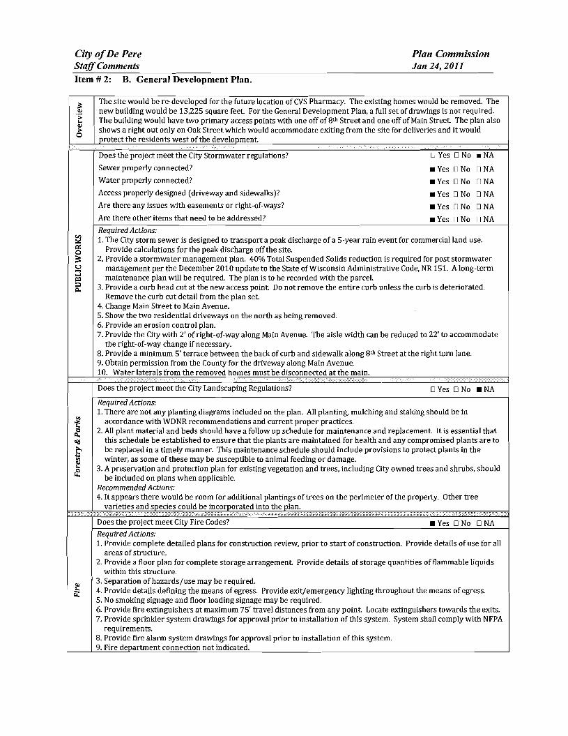
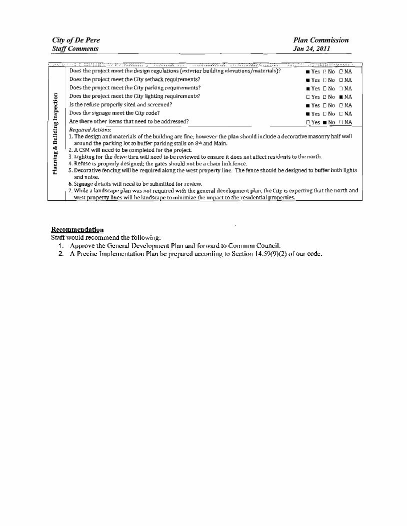
City ofDe Pere Plan Commission StaffComments Jan 24 2011
CC CC C
Does the project meet the design regulations (exterior building elevationsmaterials) DNAbull Yes D No Does the project meet the City setback requirements DNAbull Yes D No Does the project meet the City parking requirements Yes DNo DNA Does the project meet the City lighting requirements DYes D No NA Is the refuse properly sited and screened DNAbull Yes D No Does the signage meet the Citycode DNAbull Yes D No Are there other items that need to be addressed DYes No DNA Required Actions 1 The design and materials of the building are fine however the plan should include a decorative masonry half wall
around the parking lot to buffer parking stalls on 8 th and Main 2 A CSM will need to be completed for the project 3 Lighting for the drive thru will need to be reviewed to ensure it does not affect residents to the north 4 Refuse is properly designed the gates should not be a chain link fence 5 Decorative fencing will be required along the west property line The fence should be designed to buffer both lights
and noise 6 Signage details will need to be submitted for review 7 While a landscape plan was not required with the general development plan the City is expecting that the north and
west property lines will be landscape to minimize the impact to the residential properties
Recommendation Staff would recommend the following
1 Approve the General Development Plan and forward to Common Council 2 A Precise Implementation Plan be prepared according to Section 1459(9)(2) of our code
CITY OF DE PERE Fee $ 24500 Receipt _
APPLICATION FOR REZONING Date
Please print or type using black ink for duplicating purposes
Please see attached addendum A Property Owner Name ---=-=-========== _
Mailing Address ---- shy
Phone _
Signature Date _
I hereby appoint the following as my agent for purposes of this application
Agent Name Garritt Bader 0 ~tltJ 27~~
Mailing Address _
Phone 813-500-0296
Signature Date _
B Property Information
AddressLocation of Property 802-816 Main amp 116 N 8th amp 811-819 Oak Parcel _
Parcel Dimension WD-527 DEPERE COS ADDN LOTS 51 amp 53 BLK 34 WD-529 DEPERECOS ADDN LOTS 55 amp 57 BLK 34
Legal Description WD-530 DEPERECOS ADDN LOTS 596163 amp 65 BLK 34 ______WD-532 DEPERECOS ADDN LOTS 67 amp 69 BLK 34
WD-528 DEPERE COS ADDN LOTS 525456 amp 58BLK 34 ______WD-531 DEPERECOS ADDN LOTS 60 amp 62 BLK 34
WO-531-1DEPERE COS ADDN LOTS 64 amp 66 BLK 34 ______WO-533 DEPERECOS ADDN LOTS 68 amp 70 amp E 12OF LOT 72 BLK34
C Rezoning Application
Existing Zoning R-2 Single and Two Family Residence
Proposed Zoning PDD B-2 General Business Planned Development District
Adjacent Zoning North -=R--2-shy South 8--2=-shy _
East B--3--shy West RC--2=-- _
Zoning Classification Within General Area
General business and residential uses
Continued on next a e
Land Use Present Use of Parcel
Residential uses
Proposed Use of Parcel
Site to be re-developed for a Pharmacy
Present Use of Adjacent Properties
General business and residential uses
SIGNED AUTHORIZATION Please see attached addendum
I being the owner of the above-described property do hereby authorize the City ofDe Pere to install and place a temporary ZoningNotice sign upon said property in a location which will give a reasonable notice to the public that said property is being considered for such change by the Common Council
I 1 1 Date
REZONING ADDENDUM
MARK A amp BRANDY J NELSEN LIVING TRUST OF 2004 DIDIO NOVEMBER 12004 AND DAll1EL J ULLMAN 6258 V CHERNEY RD DENMARK WI 54208
I MARK A amp BRANDY J NELSEN LiVING TRUST OF 2004 UDO NOVEMBER I 2004 AND DANIEL 1 ULLMAN being the owner of tile above-described property do hereby authorize tile City of De Perc to install and place a temporary Zoning Notice sign upon said property in a location which will give a reasonable notice to the public that said property is being considered for such change by the
Common Council
Date
Jlft Lief (tltttQ(JQ-0 Signature ) j Date
Date
i -
i
tLl~~
l- - Signature Date
REZONING ADDENDUM
WAYNE 1 HOFFMAN 116 N EIGHTH ST DE PERE WI 54115-1511
I VAYNE J HOFFMAN being the owner of the above-described property do hereby authorize the City of De Perc to install and place a temporary Zoning Notice sign upon said property in a location which will give a reasonable notice to the public that said property is being considered for such change by the Common Council
REZONING ADDENDUM
ADELE HEUVELMANS 804 MAIN AV DE PERE VI 54115-1335
I ADELE HEUVELMANS being the owner of the above-described propertydo hereby authorize the City of De Pere to install and place a temporary Zoning Notice sign upon said property in a location which will give a reasonable notice to the public that said property is being considered for such change by the Common Council
Od4 7 middot7lt-f-vtA-e~-te-i-+_ -1- Signature Date
REZONING ADDENDUM
JERRY T amp ELLEN L LANDWEHR 808 MAIN AV DE PERF WI 54115-1335
I JERRY T amp ELLEN L LANDWEHR being the owner of the above-described property do hereby authorize the City of De Pere 10 install and place a temporary Zoning Notice sign upon said property in a location which will give a reasonable notice to the public that said property is being considered for such change bythe Common Council
Date
Date
REZONING ADDENDUM
rENNTFER M TITULAER 811 OAK ST DEPERE WI 54115-1532
I J ENN [FER M TITULAER being the owner of the above-described property do hereby authorize the City of De Pere to install and place a temporary Zoning Notice sign upon said property in a location vhi9~1 will give a reasonable notice to the public that said property is being considered for such change by
the C~tl10rt r
7~ GUfj l d II Sjgnarure Date I I
(
REZONING ADDENDUM
THOMAS J HARRIS 815 OAK ST DE PERE WI 54115-1532
L THOMAS J HARRIS being the owner of the above-described property do hereby authorize the City of De Perc to install and place a temporary Zoning Notice sign upon said property in a location which will give a reasonable notice to the public that said property is being considered for such change by the Common Council
J -
Signature Date
SIgnature j Date
REZONING ADDENDUM
JULIE A REINDL 816 MAIN AV DE PERE WI 54115-1335
I JULIE A REINDL being the owner of the above-described property do hereby authorize the City of De Pere to install and place a temporary Zoning Notice sign upon said property in a location which will give a reasonable notice to the public that said property is being considered for such change by the Common Council
Signature Date
REZONING ADDENDUM
HENRYN amp LORI L VAN STEDUM 819 OAK ST DE PERE WI 54115-1532
I HENRY N amp LORI L VAN STEDUM being the owner of the above-described property do hereby authorize the City of De Perc to install and place a temporary Zoning Notice sign upon said property in a location which will give a reasonable notice to the public that said property is being considered for such change by the Common Council
-0 -W01l Date
- O -tiJa 1 Date
COMPANIES
PARTNERS IN DEVELOPMENT
January 14 2011
Mr Ken Pabich Director of Planning and Economic Development 335 S Broadway Street De Pere WI 54115
RE Project Description and Re-zoning Request Residential Properties Located at the NWC ofMain St and 8th St
Dear Mr Pabich
The purpose of the re-zoning request to the city is to demolish the 14 existing dwelling garage and storage structures on the subject properties and to construct a new 13225 sf CVS Pharmacy with a Drive-thru facility One dwelling and garage located at 219 8ID St N is to be relocated to the lTWC of 9th St N and Pine St Please advise any additional information required for this re-zoning request
Sincerely The Velmeir Companies
John C Baumann Director of Construction
4
LOCATION MAP NTS
[pJ
(QJtegIAI~e
P~crbrtLoieg
l
f
L
CIW OF DEe ~ -
p
yenljs1tlart A4$
a Esf~ [)r c l1l -E Hettn~ Ave
Giant St EEi
ECT ATI9N
middott~
(I)
1 ~
~~I
shy
)
I J
I I I I I I s I l~
1~~
I
-- 3IJrL I
t r [_1 1851
I I I I I I
1
~~~~~~~~L __t I= -~
DESCRIPlION
andEgintmng lli1- W-l- __ W1~
262-7I-IlOO_H02--N66www~
RA Smith National -----shy sm
SITE PLAN
CVS PHARMACY
CITY OF DE PERE WIo N
o
I~[~I~~~~~lC~ Dr5 shy lWTE~AA
(~S - PfwtT BllCE
ALUIISTOR(fRQllTshyQ(NlAllOO2poundO
IINIA_C-O[[PREO
ALUliAU10llAllCDOCRshyCUNl~OOIZ[O
MAI N 5 T R E E T E LEV AT ION
PREIllI5IpoundO ~EA1 CCFINC -CtxOillOYAlt)1IW1D1TM
ur5 - 10UM
AlUWS1QR(fIl~~shya[AA~QOIltO
SPlllr1CWUshy$CIl conI) lH1LA~C-O[[PR(D
~~~~~ngOCOl_
NOR T H 8 T H 5 T RE ET E LEV AT ION
~
OAK 5 T R E E T E LEV AT ION SCAlEIlTS
REA R E LEV AT ION
NORR ARCHITECTS INGINEIIlS UNNEAS
719 Grhwoln Strc~r
sene 1000 Detmh M14~2l6
wwwecrrccm SCAlENTS
City ofDe Pere Plan Commission StaffComments Jan 24 2011 D
Item 3 Review Precise Implementation Plan for the new 9278 square foot Krause Financial office building in the East Industrial Park located on Profit Place Agent David OBrien
New office building for Krause Financial is to be located in the East Industrial Park on Profit Place The office building is 9278 square feet and is designed for future expansion to the south
Does the project meet the City Stormwater regulations
Sewer properly connected
Water properly connected
Access properly designed (driveway and sidewalks)
Are there any issues with easements or right-of-ways
Are there other items that need to be addressed
DYes _ No DNA _ Yes D No DNA _ Yes D No DNA _ Yes IJ No DNA DYes _ No DNA DYes _ No DNA
RequiredActions 1 The City storm sewer is designed to transport a peak discharge of a S-year rain event for industrial land use
Provide calculations for the peak discharge off the site Include the vacant property to the south under a developed condition
2 Provide a curb head cut at the new access point Do not remove the entire curb unless the curb is deteriorated Remove the curb cut detail from the plan set
3 Plan states that sanitary lateral is 6 lined The sanitary is 6 in diameter but has not been lined 4 The storm sewer tap at the inlet is to be core drilled The City Engineer is to be notified 24 hours prior to
construction An excavation permit will be required for the storm sewer work in the right-of-way S Insulate the water main if there is less than 18 of vertical clearance between the bottom of the new storm sewer
and top of the water main
Does the project meet the City Landscaping Regulations _ Yes D No DNA
RequiredActions 1 The southern portion of the lot must be maintained as lawn and cannot remain as existing conditions 2 All planting mulehing and staking should be in accordance with WDNR recommendations and current proper
practices 3 Allplant material and beds should have a follow up schedule for maintenance and replacement It is essential that
this schedule be established to ensure that the plants are maintained for health and any compromised plants are to be replaced in a timely manner This maintenance schedule should include provisions to protect plants in the winter as some of these may be susceptible to animal feeding or damage
4 A preservation and protection plan for existing vegetation and trees including City owned trees and shrubs should be included on plans when applicable
RecommendedActions S It appears there would be room for additional plantings of trees on the perimeter of the property Other tree
varieties and species could be incorporated into the plan
Does the project meet City Fire Codes _ Yes D No DNA
RequiredActions 1 Provide detailed plans for construction review prior to the start of work provide details of use for all areas of
structure Define uses for all areas of the building 2 Detail means of egress in all areas of building and provide capacity and exit width detail 3 Separation of hazardsuse is required in accordance with FCLSC Fire rated assemblies are required for the
furnace room and general storage areas 4 Provide exitemergency lighting throughout the means of egress S Provide fire extinguishers at maximum 75 travel distances from any point Locate extinguishers towards the exits 6 Installation of key box for fire department access RecommendedActions 7 Recommend installation of a fire alarm system should such a system be desired submission of detailed plans with
cut sheets and battery cales is required prior to installation 8 Recommend installation ofa fire sprinkler system based on size and construction type should such a system be
desired submission of detailed plans with cut sheets and hydraulic cales is required prior to installation
City ofDe Pere Plan Commission StaffComments Jan 24 2011
I 09 u CIl 0 5 be
sectI
oS Ql
oCl be I deg2 I ltII
E
Does the project meet the design regulations (exterior building elevationsmaterials) _ Yes D No DNA Does the project meet the City setback requirements _ Yes D No DNA Does the project meet the City parking requirements _ Yes D No DNA Does the project meet the City lighting requirements _ Yes D No DNA Is the refuse properly sited and screened _ Yes D No DNA Does the signage meet the Citycode _ Yes D No DNA Are there other items that need to be addressed DYes _ No DNA RequiredActions 1 Color for the building shall be earth tone in color 2 For parking traditional standards would require 38 stalls Under the 1-1zoning the Plan Commission can reduce
this requirement based on need We were told by the owner that 30 stalls would meet their needs The Plan Commission may want to request a letter from the owner to place on file to ensure there is no parking on the street in the future
3 The south gable end finish material should be modified to bring the design back into scale 4 Refuse enclosure shall be a matching split face concrete block with non-metal gates 5 As a note the two parcels will need to be combined before permits can be issued
Recommendation Staff would recommend approval with all required actions being implemented and the Precise Implementation Plan be forwarded to City Council for approval
CITY OF DE PERE Fee $ 24500
Receipt _-=6--I--=tu---O _
APPLICATION FOR SITE PLAN REVIEW Date
Please print or type using black ink for duplicating purposes
A Property Owner Name 1) C-e 6 y togtgt-t
V 1
- ffi
----)--2~L=--poundL-2lt3-k-_P~v)S~-4Jy
I hereby appoint the following as my agent for purposes of this application
Agent Name uCLvd e8r~~ ------- shyMailing Address -p 130 l ( ~S- Phone t9amp~930D
Signature DatelO I tJ6 1M It
B Property Information
AddressLocation of Property ~~ ~T-N f ~o-h t- Parcel pound D ~ pound0081-Z ~ CJ etmiddot- FbcR -Z-- t
Parcel Dimension t7f)( gttl3 Parcel Area -l7~~r-JcentLJ2--------shyLegal Description _
A Site Plan Review is requested as authorized by the De Pere Zoning Code Section(s) Article XIII
SectiOn146~middot0
Signed ApplicantAgentJLLOh-= Dated 111 II(
A plan consisting of all applicable information listed on the attached shall be submitted with this application
SITE PLAN REVIEW REQUIREMENTS
KRAUSE FINANCIAL SERVICES INC FOR BAYLAND BUILDINGS INC
CITY OF DE PERE BROWN COUNTY WISCONSIN AnENTIONI OOWNLOAOED PLANSARENOTSCALEASLE NEITHER THE OWNERORTHE ENGINEER SHALLSE HELDRESPONSIBLE FORTHESCALEOF DOWNLOADED PLANSONLYPRINTED PLANSFROMBLUEPRINTSERViCECO INCSHALLBE CONSIDERED TO BESCALEABLE PLANS
VICINITYMAP
fl(CAAl1ll~
II 1
1 l
Non ElClSnNlJ UTlUlIESSItC)MIONPLAH9AREAPPRO)jlW1Enil CON11IACTOR SliAlJBE RESPONSIBlE FOROIl1AININCI EXACTLOCATlDHS ANDELEVATIONS OFALLvnmas MIETlIERllHOWNDRNOTFROMTHECJVrNEP6 OFTHEREampPECTlYE umnlEs ALLUntTY OWNEASSHALt BENl1TJFIEO FORLOCATES avmE OOtmUlcrOR n HOlIll5PRIORTO
ouEA03ION CONTROL loIEAIilUREIilSWltLL 8E ~ PLACE PAIORTOCONSTFlUCTlDN AHOSfULlCOlolFOlllol TOlHEW1ampcOf1lWl OEPAPl1olENTOF IoUruIW RUOLIRCn CONSllIOCTlOfj mE EROSIONCOI4mOl AHOlECHtlICAL 5fANDAAOS
INDEXTO DRAWINGS SHTNO DESCRIPTION
1 LOCATiON MAPSANDINDEXTODRAWINGS 2 EXISTING SiTE CONDmONS 3 SITEPLAN UTILITYPLAN 5 GRADING ANDEROSiONCONTROL PLAN 6 DETAILS 7 DETAILS a EROSiON CONTROL DETAILS -INLET PROTECTION L----shyANDMISCELLANEOUS DETAILS Q EROSiON CONTROL DETAILSmiddot DITCHCHECKDETAILS 10 EROSiON CONTROL DETAILS- DITCHCHECKDETAILS
JoSPRfN DATE I APPROV REVlSIOJf KRAUSEFINANCiALSERVICES INCD
4 Robert E Lee amp Associates Inc
~~ECKEO FORBAYLAND BUILDINGS INC ENGJNEEftJNG 5~G ENVlRONltEmAL SERVtCESLOCATION MAPSANDINDEXTO DRAWINGSCiTYOF DE PERE eeeeeec --lBROWNCOUNTYWISCONSiN
LOCATION MAP
------ --- shyUTILITY INfORMATION I~~~rl
DESTINY DRIVE UTILITIES PRESENT crrvOF DEPEREWISCONSINPUBUCSERVICES6C TIMEWARNERCABLEl usSiGNAL I ~ 0 ___ bullbull
UTIUTlESSHOWNON THis MAP AREBASEDON lOCATES FAD I ~~ ~~~~100k=I
~--L (~ I 4 11 OIGGERS HDTUNETICKETNUlolaEA201~02Isa DATED 1223J2010 VISlBLEOB6EAVATIDN oN 12l2~01D AND i [ ~--- -__ ~~BR~EU~~~~~~~~NJiU~~~~O~~DEE~F~~g~ ~~U~~p~E VEFlIFleDPRIORTO 1Hf DIGGING I
1
11 ~ r u nn n~-=--=-~----- ~ ~ _ ~~_=~_--_DIGGERSliaTUIIlE HOo-242middota511
n -- 0_i 1j t ~ r -- L ~~Ju o~ gt 11 WATBIISAtHTAAYJtm]AU SCWlR~ GAS ELEGTJUO TelEPHONE C~BLE TV DEPARTNENTOf PUBUCWOIII(S WISCONSIN PUBLic SpoundRVIOE COItJgt no TIME WAflNER CABLE CNOFDEPEAE 6OONORTliMJMUgt6T lIaiampSFEJlSON6T 1OQ1KENNEOt AVE e25SXTHST Po BO)(180Dll GRiIENBAY W154~ KIUBliRlY WIUI)l i 11 fl~ ----~~----7~----- ~tmiddot r~1 DEPpoundREW1541gtS OrtEENBAYW16Q07
tQ~Q~-lIl47 820)11111207 (lI1l0jU9-5G7amp (InI4JJ~3 Ii ~n I I I lt0 I II
iJ - ---- -- I 1-I r1
tlll bullbullbullbullbull 111 i I lt1 ~ -11 I I IOWNER INfORMATION coNTRACTOR INfORMATION
ICFlAUSE FINANCIAL SERVICES INc BAYlANDBUILDINGS INC 1234ENrERPRI5E DRIVE POBOX13571 II-- i DEPEREW1 54115 GREEN6AYWI amp43D7middot3571 1
t 1_~I dl~i~ I I
I
II
~I~I I)0
j I ) I ~I i iI 5 III
(B6ampaS5-7437 (B20)3711i20D ) k I 1 IIL iIol 1 i ICONTACT DALE KRAUSE CONTACT DAVIDOBRIEN ~ ~I i 1 ) II) II Iti II
LEGEND -6 FIREHYDRANT I I i
tal ~ DECIDUOUS TREE I~I bull I
WATERVALVECURB STOP I gt I 1 I ~ i [ I I LOll I I tiWATERMANHOLE ~ bull _ bull o CONIFEROUS TREE j e I o SANITAAV tlANHOLE ~ 11 11 ~ r ese sr I I I Io BUSH o STORMMANHOlE II i r l ~ 1 ~ I I ~ ~ t~3B21 OP~ STORMIlANHOLE
RIPRAPbull J l ~ i i raquo I I 1151 lINIlIIll STORMINLET j shy glOOMINLETMANHOLE ~ZJf)IofI SPOTELEVATION III POWERPOLE r- ) i ~)i J I II ~
W~h FIRSTFLOCIRotlASEIrlENT ELEVATiON bull ~bullbull_ iEJ-oPOWERPOlE WGIN WIRE i4iL-i-l 0 ~ i al ~IUGHTPOLE N -rorAPPROXIMATE ROCKElEVATIONo ELECTRICMANIiOLE
III ELECTRICtlElER r III ll i I __ __ ) - I If__ 12 EXISTINGCULVERT
laquoI GASVALVE tii i I -- n iii ~ 1 I - -- - - - - - +-1- - i I I ti i ~ GASUETER o CONCRETE 81 MAIlBOX
CZJ WET1ANDS ~ - I I I I Iof SIGN
POST I f i
~ HANDICAP PARKING IRONPIPEJROD 11 ~ I I if I
4 PKNAlL ji rill I i i I 1 II I EXISTINGSANITARY SEWER (SIZENOTED) i 11 I 1 bull
EDGEOF PAVEMENT EXISlINGFORCEJJAlN (SIZENOTED)II ill- h i~ 1 ml i II ImiddotI ii -10C- ~ISlING STORMSEWER(SIZENOTED)
EDGEOF MAVEL k --N-- EXISlINGWATERMAIN (SIZENOTED) 1 I I 1i1 --0-- GASUNE C Ii
EXISTINGCURBamp GUTTEA I I ill 1 II i LOI I [I II --oc-- oVERHEADTELEPHONE UNE ---- UNDERGROUND TELEPHONE LINE 1
- TREEiBRUSH UNE --oc-- OVERHEAD ELECTRICUNE ) i ]1 n _ 1 I~ I
---- UNDERGROUNOELfCTRICUNE bullbull vse-bullbullbullbullbull EXISlINGCONTOURUNE i 11 -- t I
- OTV- OVERHEAD CABLE1VUNE --N-- CAaLElVLlHE I
RETAINING WAll 1 lilgtlll II ilmiddotMVUNE PROPERlYUNE H j i I I I
GUARDRAIL - EASEMENT UNE
~ FENCE BUILDING SETBACK UNE i I I ~ - i I II I ISEcnONUNE NOHIGHWAYACCESS
I I I II i ) I Ii i I I I i I l I I I I shy bull I1 1I~ I ~ ii k i I I J _ -J- _J ---- _ _ _ _ _ _ _ _ _ - - - - - - - - - - - - ~-- - LilI
gll~~ ~ NOTE D-t1 bullj I ELEVATIONs SHOWNAREBASEOON APREVIOUSCITY OF DEPEREEASTalOEDATUM SUSTRACT 091 TO ~mtII 8U) 0 CONVERTTO NAVOsl l
-0ampOATE IIoPPRrN OMWN KRAUSEFINANCiAL SERVICES INC-- shy FORBAYLAND BUILDINGS INC CITYOFDEPERE
~CJltQ) EXISTING SITECONDITIONS
~~SlCNEO BROWNCOUNTY WISCOSNIN
~r---L-j m1--Igill~~ ~~i~~~ 1131 bullI 1 -bull I 1 middot bullbullbull ]~) (SI1
~ e sr ------ shy
(I [a
[
I ar
I 1 I
r I
[ I [
I 1 f I r Ii
r
I I I I I I I I I I I I I
I I I I I I I I I I I I I I I I
I
I I 1 f-I ~I i~
I I
I
~ ~ ~I E~SnNG SURFACE TO AEMAIN I
~ 1 I ITJ I
I shyI II I
I I
I I 1 f~
I I I I
[1] I ~ ~ I I
I I ~ I I I I I I I ~ I I I I II
II l I I I _L II I8 I ----- ~ I I I I _------- ~ I
I f- I I - - -- - i7Jr I II I L_-J---- ~
I I amp-0~~ RlVlSlON KRAUSE FINANCiALSERVICES INC
I ri
-------------------------- ---------p----shyLOCAlED UMENT ON DESTINYDRIVE FROMEXl971NO OFFICE WITHNEW MASONRV BASE ANDELECTRICAL EX IHIEAGIUL CIJRlI ltlGUnER
shyNOCCESS _ 100 29917
~ ltgt3 J SLAND6CAPEAREAWlTH bull bullbullbullbull I io middott 5PRINKLEASYGTEM f
~ PROfr2~~ ~~DING
~~ FF ELEV63900
~ k 11I i I I I I I
I iii I f- I ~I J
f- I sect I
-- shyI I I I I I I I I I I I I I
w I I~
c I I I I I I I I I I
PROVlDE~1R6OPENING I ~~~g~ ~D~~~~~~~~SfARY VERIFYW H CITYBEFOREREMO~ING
DRIVEWA OPENINGCONCl1iTE I
I - shy
rIJ
SCIII2INFEET
NOTE ELEVATIONS SHOWNAREBASEDON APREVIOUS CITY OF DEFEREEASTSIDEDATUMSUBTRACT cer TO CONVERTTONAVDse
I~ l I
I II
NOTE ALLAREAS DESIGNATED ASGREENSPACE OR LAWN SHAll BE TOPSOILED TO A DEPTH OF e INCHES SEEOED ANDMUUHED AREA TO BE RAKEDFAEEOFSTONESAtJO CLUMPS
PARKINGVATA TOTALPARKINGSPACESPROVIDED 30
HANDICAP ACCESSIBlfPARKING SPACES 2
TOTALPARKING SPACESAEQUIRED24
SITEVATA TOTALAREA 223ACRES97212 SF
BUILDING AREA 021ACRES921aSF(amp5710)
SIOEWAlKIPARKING LOTAREA 032ACRES13B37SF(14jl3j
GREENSPACE090 ACRES39202BF(4033)
UNDISTURBED AREA 080ACRES348995F (35874)
ZONING
CONSTRUCnON CLASSIFICA nON vbull
PAllCEL NO EDF0081-2
EDmiddotFOOB1-2middot
LEGfNV
o CONCRETE PAVE~ENT
IRJ ASPHALT PAVEMENT
~ GREENSPACE
LANDSCAPED AREA
__ PROPOSEDie-CURBamp GoUTIER -- (UNLESS OThERWISENOTED)
~ PROPOSED SHEDDINCl CURBamp ClUTIER
PAINlED FIRElANE wlt
TRAFFICFLOWARROW ltgt HANDICAPPED PARKING~
NOTEALLCURBRADIIARETO THEFACEOF CURB
I I
I I I I
I I I
I I I
I I I I I
I I I
I I I
I
III
II I
I
I I I
II
I I I
I III
I10 I
I
I
t II I
I
I I If-shy
U) I I I
I I I
I I I
I III
I I I
I I
II I
I
I I I I
II I
I
I I
~ CHrtKlD FORBAYlAND BUILDINGS INC SITEPLAN --l ~ NeesaR UIl ENVIllONgtltBNTAI
CiTYOF DEPERE ~SICHEO BROWNCOUNTY WISCONSiN
3
-------------- shy WATERANOSMIITAAfLATERALS I AREESTl~ATED TO BE6 LINED DESTINYDRIVE
CONTACToRTO VERIFYEXACT [xlHlE~CIRfIampCln1m LOCATION ANDELEVAll0ItJI
I
I
I I
LE~IIIV --------PROPOSED SANlTARYSEWER I----~-- EXlSTlNG SANITARY SElJJER (SIZENOTED)
I bull - bullbullbull EX(STINGSTORMSEWER(SIZENOTED) =bull - bull - bull - bull - bull -PROPOSED WATERIolAlN
= == == PADPDSEOSTORM SEWER
---~-6w-6- EXISTlNGWATERIAIN (SI2ENOIED) I
I
~ ~ ~ ~ ~ I-6 -6 FIREHYDRANT I II $ WATERVALVEICURBSTOP l reg WATER MANHOLE V l REOUCER1NCREASER a 0 ISANITAAYMAIIHOlE C 0 STORMMANHOLE I I OPENSTOIUlMANHOLE UU lI STeAL( INLET C () STORMINLETMANHOLE I
I C
PLUM13ING VA TA CI
DRAINAGE FIXTURE UNITS 24 I I WATER FIXTURE UNITS 28 I m
NOTE I II MINIMUMOF S5FEETOF COVERSHALLSE MAINTAINEo I OVER ALL WATERMAIN
SANITARYSEWER WATERMA1N AND STORMSEWER5HALL BE CONSTRUCTEDIN ACCORDANCEWllrl TIIESTAIIOARD I6P~IFICAnONS FORSEWERANDWATERCONSTRUCTION IN WISCONSINAND ADMINISTRATIVE CODE CIAPTEASCOMM81middot87 I
rI
f~jil 3 FIELDVERIFYLOCATION OF EXISTINGUTILITIES IF EXISTING
LOCATIONSDIFFERFROMWHAT IS INDICATEDON 11-tEPLANS CONTACT ENGINEERPRIOR TOCONTlNUEOWORK I STORMLATERALSSHALL BE EQUIPPEDWITHTRACERMRE
i11 I
I
Ibull All DOWNSPOUTSSHALLBECLEANOUTDOWNSPOUTS
I I
I I
I I
I
IPROV 001[ I)fgtPROV ORoWH KRAUSEFINANCIALSERVICESINC ~E~00 FORBAVLAND BUILDINGS INC
CITYOF DEPERE UTIUlYPLAN ~SIGNEO BROWN COUNTY WISCONSIN
r-- shyI I I I I I I
I I I I I I I I I
I -shy
lOCAlEIHFUT
NOTE ELEVATIoNS sHoWN AREBASEDONAPREVlouaCllY OF DEPEREEASTSIOlDATUM sUBTRACTDe1TO
~-o CONVERTTONAVDB6
n srta r rl6367T1------shyOl~
~~~ g~~~ 10j ~L--ri-~ ---_~----r--___-~~7_
EXST utl l
LEIiRVV TOPOFCURBELEVATION~lcStltlil
FLOWUNE ELEVATION~F- TOPOFSIDEWALKELEVATION~SNJ66666
EDGEOF PAVEMeNTELEVATION~55
TOPOF RETAINING WALLELEVATION~RN444
~3J333 ORQIIIOELEVATION
DR-JNAGE SWAlE
DRAINAGE DIVIDE
---x- SlLTFENCe
~ BALE DITCH CHECK
FLOWAAAOW
TRACKlNCiPAOmmli INLETPROTECTION
NOTE ALLSANITARYSEWERSTORMSEWER ANDWATER SERVIcESIMAINSSHALLBE PROVIDED WITHTRACER WIREOA OTHER METHODTO BE lOCATED
STOlL IIIAITR MANAGEMRVT THISsrrsISTREATEQBY REGIONAL STORMWATER PONDTHAT IS LOCATEDSOUTHNeWEST OF THE END OFTHE CUL DEBAC OF PROFIT P~CE
ELOSWN cONT1WL NOTE All EROSrON CONTROLPRACTICE61NDICATEDON THIS PlAN ME APPROXIMATE LOCATIONSONLY THEACTUALSITEMAY REClUIREMOREOR LESSEROSiONCONTROLDEPENDINGON THE CURRENTCONDITIONOF THE SITE ~ SILT FENCEIS REQUIREDDOWNSLOPEOF ANY DISTURSED
LANDTHAT MAYCARRYSEDIMEtiTS OFF SITEl ltl
A TRACKINGPADIS REQUIREDAT ANYINGRESSIEGRESS LOCATIONWHERESEDII1ENT MAY BETRACKEDOFF-5ITE
II
PROPERIfLET PROTECTION6HAll BE U6ED OEPENDING ONTHE INLETTYPE
-4 SEDIMENTBASKET GH-ll BE USEDFOR ANY 6ITE DEWATERING
I I
I
I
I
in [)j j Ul
R1I4l7l1i1 0_S75I -- shy1 I~~~ m ~ 2lt 1 1 IIMampJl24(Wst)
Ii 1 I I r I i I
II i I I I j I I
STIHL4 r~ ~ I
t III
~ NLET(TYP) ~T~~ I
I j lJ I
OSTllILll Ii rL63s92
1I D_4045 It lW6l247 (W IN) llN6l U 71(15middotSO i I G ~ I
I
STING w o i a
I shy u ~921 I a i -(~ I i i 1160 II a
I L I - -1--+ ~ I f l I i I I ~ I II f j I I II J
I
J i I I I I 12 - shyI 1 ( I i I ~I ~ I 1 A I - I ~
f ~ I
i Iil71
_ - V~ - - - -- -- - ~-- - L Y Dwnall 111163U)
0-1117 NOTE ELEVATIONS sHoWN AREBASEDON A PREVIOOS CITY~~~ ~8 amp-0 g~~~~~RioE~~Jo~E DATUM SUBTRACTO91 TO001pound I APPRO KRAUSEFINANCIAL SERVICES INC IrQb~ Lee ampAsSOc]iite IncON ~~
CHECKED FORBAYLAND BUILDINGS NC EIGltiEERlNG SIJRVElING ENVIROHlWnALSUVlCpoundSGRADING ANDERosiON CONmOL PLAN 4664 COLOEN PONOPARltCOURTCITYOF DEPERE
~CNED ~oWl~~~lnltltom ~~~j~~2~)6~jN41BROWNCOUNTY WSCONSIN
NOTENEENAH R-3275OREQUALWITH TYPEA GRATEORRmiddot3246AOR Rmiddot3Dfl7WITHTYPEL GRATE
LESSTHAN4SHAlL BE RUBBER)
CLARlTY1
I 10$1 ~
~
il4R TO BEADOF ADJUSTlfIG RING CLEANOUT LINETOBElHE SAIlE ANDCASTlNGSEALANT OREQUAL SIZE5 MATERIAL ASSEWERIlAIN BElWEEN ADJUSTlNG RINGSAND NOTE CLEAWOUlLINETO BETHE
CONCRETE ADJUSTlNG RINGS SAME SIZEaIlATERIALASSEWER MIIN
ADAJSTlNG RINBSONLYWITH CASTING COATOUTSIDE OF
ASREOUIRED (4MINAND12 MAX UNLESSOTHERWISESEWERJOltlT COl4iOUNDND NOTEDALlADJUSTING RINGSWRAPWITHMIN8 MIL
~ GRADEPOLYETHI1ENE
ECCENTRIC REDUCING CONE (VERTICALWALL OF
PVCCOATEDCASTIRON 24 SQUARE LlHSTEPSmiddotOC CONePAD CLEANOUT PWB
ECCENTRiC CONESHALLBE ONDOINSTREAM SIDEOF MANHOLE THISDETAIL 4 (MIN)GRAVEL NOTESHOWNROTATED W FOR ADJUSTTOGRADEBY
CLEANoUTPLUG
II SUDINGVERTICALLY UPORDOWNOVER
PVQPIPESEWER 21 r~~~~~~~~~~~~4 SERVICE EACHJOINT
PROVIDE FROSTSLfEVE SERVICEPEAoCOM1l8236 (5)A)2
PROVIDEFROSTSLEEVE PEROCOMM8235 (6) fAJ2~~ TONGUE ampGROOVE PVCPIPE
n 45 BEND JOINTREQUIRED
PVCPIPE
FLEXIBLE PIPE To MANHOlE 45- BEND CONNECTOR REaUIRED
6PECUBEDDING
8 PRECAST S-8IlIN CONCRETE SASE SPECD SEODINGI I
SANITARYAND STORM CLEAN-OUT DETAIL CLEAN-OUT DETAIL STANDARD MANHOLE (TRAVELED AREAS) (NON-TRAVELED AREAS)
8-24(INCLUSIVE)
314-ro r
eunPOLYETHYLENE
I
~rd 81 ~I
~I
~
HDPEtPVC SEWERamp WATERMAIN amp FORCEMAINSTORM MANHOLE INLET PAVEMENT RESTORATION BEDDING ampTRENCHSECTIONTYPE A
MgtPFt(N ~T[ I WPROV REVISlCIH ~ampWN KRAUSEFINANCiAL SERVICES INC FORBAVLAND BUILDINGS INC~CKED DETAILS ~uCITYOFDEPERE
~IONEO BROWN COUNTY WISCONSIN
o
~ Io
I
W(IlAXJ12+00J2 W(MIN)-6oi-00J2
COMPACTEO BEDDING ANDCQVER SOILCLASSA-7
INITAL3 OFSOILCLASS ASIN WETORUNSTASLE TRENCH AS DIRECTED SYTHEENGINEER
WITHOUT EXTRACOST TOQWNER
I
ampolLCtASSG-l OR C-31FREQUIRED PER SPECIFlCAllONS
NOTE SUFlFACE RESTORATION REQUIREMENTS PERTHE SPECIFICATIONS
UNDER BARREL (8 FORBEDROCK EXCAVATiON
UTILITYTRENCH
t ENRENGTH ORENcH I bull -j _middot~middoti middotbullIc-~~~
PIPEUNE
SAWCUT CONStSTENTWlDTH
Imiddot I II I I 11--- -THiCKMANHOLE TOP
PVCCOAlEDCAST IRONIlHSTEPSmiddot 10C
BEADOF ADJUSTING NEENAH R-3215OREOUALWITH RINGANDCASTING SEALANT OR TYPEA GRATEORRmiddot1246AOR EQUALBETWEEN ADJSllNG Rmiddot3067WITHTYPEL BAATE RINGSANDCASTING COAT CONCRETE ADJUSTING RINGS OUT6IDEOF ADJUSTING RINGS 4SREQUiRED 14MINAND 12 ONLYWITHSEWER JOINT MAX UNLESS OTHERIIJISE
COMPOUND ANDWRAPWITH1l~N~~-~~~~L NOTEDALLADJUSTlNG RINGSLESSTHAN4SHALLBE RUBBER)
WAlllt CONTRACTION JOINTSPACING EXPANSION WIDTH TRANSVERSE LONGITUDINAL JOINTSPACING
NOTREQD 100lJAX
s NOTREQD 100lJAX 0 S NOTRECD 100lJAX 0 100lJAX e 100lJAX s 0 lOOlJAX
~
oj ~
~y
PROVIDE CONTRAClloH JOINlS 6CONCRETE ASDIRECTED BY ATUAXItlUlJ 20SPACING BY GENERALCONTRACTOR SAWCUTTINGOFtINSERTIONOF
DIVIDER PLATES
12 OFNO3 ORNO4 GRADATION R E6AR S LE EVES ~MINllJUMVOID rrEXPANSION MATERIAL WILLBEPLACEO ONEACHSlOEOFTHEORNEASUITINGTHE THERIlALEXPANSION SPliCEATENDOFSLEEVE FOR
SIDEWAUlt SIDEWALK ANDDRIVEWAY APRON SHAll BECONSTRUCTED SEPARATELY UNLESSOlHEfWJSE APPROVED BY THEDIRECTOROF PUBLICWORXS BACXOf CUAB COMPACTEDSUBGRADE
CONCRETE PAVEMENTDETAIL ~I 3~l rI~1 1 ABPHALTSATURATED fELT EXPANSION JOINTFILLERPLACED ~ ~rQ ATlJAXllgttUM 300middot SPACING AND
middotB1TUMINOUSSlJRFACE ATAll ENDSOf RADII 1 34 BITUMINOUS BINDER
18 LONG12 DIAlJmRIt REINfORCINGRODS 12 OF NO3 ORNO4 GRADATION ~
DRILL518HOLEMIN9 INTOEXISTINGCURB
CURBTIE-IN DETAIL lPAOPOSEDTO EXISTING)
COMPACTED SUBGRADE
ASPHALT PAVEMENT DETAIL SAWCUlCURBTRANSVERSELY PRIORTO RElJOVAl
~
12middotR60
COItRETE 4 APRONbull
DIMENSION VARIES SEEPlAN
I NOTE REFERTO SPECIFICATIONS FORREINFORCElJENlS
IiI CURBREMOVAL FORDRIVEWAY OPENINGWITH ~ CONCRETE APRON ONCONCRETE SURFAcESTREETS l
bull
EXPANSION JOINT TOOLED
CONTRACTION JOINT
PAVEMENT ANDBASECOURBE
SIDEWALKWITH INTEGRAL CURBCURBREMOVAL FORDRIVEWAYOPENING WITHCONCRETE APRON ON ASPHALT OVERCONCRETE
SURFACE STREETS
CURB REMOVAL DETAIL SIDEWALKDETAIL
bull VERIFYDETAILMATCHES crrv Of OEPERESTANOMDS
4 EXliTlNc CONCRjre
BREAK
VARIES
S SIDEWALK t ~ ~~~ ~~- z --~~~~N~N-~--~ ---~~
ALLARCUND(TYP) iii 11) gt
All RESIDENTIAL DRiVewAY APRONSSHALL BE FLAREDIF FIELDCONDITIONS PERMI1
THEflAAE BHALl NOTE)(CEED3-0
8middot ORJVEWAYAPRONrshy
~I ~t
bullbull _
1--( middotHmiddot bull middot ~ y ~h~raquo~gtY)1-S
~~ ~
L I bull bullbull bull bull ~ bull _ bullbullbull
CUflBA GUTIER 12 EXPANSION JOINT
DRIVEWAY APRON DETAIL
6lc6WmiddotIN211 W2WWf CENTERIN SLAB
-
CONCAETESlAB
4CONTINUOUS
12 EXPANSIONJOINTWITHSELF LEVEUNGSEALANTWHENCAST AGAINSTSTRUCTUIIE
MINIICOlJPACTED SOILCLASS C-3 MOISTENIMlJEOIATELY BEFOREPlACING CONCRElE
TYPICALSIDEWALK ADJACENT TO STRUCTURE
2RAD
SPECIFIED BITUlJlNOUS
4 CONTINUOUS TOP6 BOTTOM
DATE I APPROY AUSEFINANCiAL SERVICES INCm- TE At Robert E Lee amp Associates Inc SIl[D NO FORBAYLAND BUILDINGS INC~lEC1ltEO a ENGtNBeJUNO SURVEYINO BNVlRONWENTu SEJMCES
CrN OF DEPERE DETAILS fluU BROWNCOUNTY WISCONSIN
7
OR WASHEDSTONE
INLETPROTECTION NOTES
INIHAlUT10NtJDTESR W I4ANUFACTUAEO ilLTERN1TlVES 6PPROVED AND1t(if if f TYPE-e-a-c-USTEDONTIiEWOOTPRODUCTACCEPTABIUTV LJSr AAV BESUBSTITUTED
R TRJM EXCESS FABRIC INTHEFLOWUNETOWITHIN3J fq ~ if OF-THE GRATE
I WHEN ReMOVING ORMAINTAtlllNClINlET PROl1CTION CARESHAll Be TAKEN so THATTHE
50 MIN SEDIMENT TRAPPED ONTHEGEoTEXTllEFABRIC THECONTRaCTOR SHALLOEUClIISTRATE A METHOD OOESNOTFALLINTOTHE INLET NolVMATERIAL Of MAI~ENANCE USINGII SEWNFLAPHANDHOLDS
OROTHER ME11-tOQ TOPREVENT ACCUI4utATEO IMMED1AmV FlLUNGI~O THE INLETSHMl BE RELioVED PLANVIEW SED114ENT FROMe~EAING THEINleT
TYPE0 (j) FINIBHEDSIZEINCLUDINGFLAP POCKETS
WHEREREOUIREDBHALLEXTENDA MINIMUM ~ 2299 00 NOTINSTAllINLET PROTECTION TYPE0 ININLETS
SHALLOWERTHAN3DMEASUREDFROMTHEBOlTQlI PROFILE VIEW MAINl1NANCEOR REMOVAL Of THEINLETTQTHE TOPOFlHE GRATE
Of 10AROUNDTHEPfAIMEllR TO FACIUlATE
reg FDA INLETPROTECTIONNPE C (WITHCURB TRIMEXCESS FABRIC INTHEFLOWUNETOWITHIN 3 middot4 MIN OR FULLWIDTHOF THE EGRESSPOINT BOX)AN ADDITIONAL1SOF fABRIC IS Of THEGRATE REFERENCEWDNRTECHNICALSTANDARD1~1 WRAPPEDAROUNDTHEWOODAND SECURE1l
WITH STAPLESTHE WOCOSHALLNOT SlOCK THEINsTAuEOBAGSHALLHAVEII MINIMUMSiDE THE ENTIREHEIGHTOFTHECUR8 BOX CLENIANCE BElWEEN THE INlET WALLSANDTHE TRACKING PADDETAIL BAGMEASUREDATTIiE eorrouOF THE OVERFLOW OPENING
I
(IF APPUCABlEj HOLESOF 3 WHERENECESSARYTHE
reg FLAPPOCKETSSHALLBE URGE ENOUQHTO CONTRACTOR SHALLCINCHTHE BAG USINGPlASTIC ACCEPTWOOD2X4 ZIPTIESTOACHIEVETHE3ClEARANCETHE TIES
SliALL BE PuCED ATTHE MAXIMUMOF4 FROMTHE BonOM OF THEBAG
1 II
I 4XS OVALHOLESHAlL BE HEAT CUTI~D ALL fOUR SIDEPANELS 3
~ -USEREBAROR SllEL ROD
FORREMOVAL
] Of
FORINLETSWITHCASTCURB 80X USEWOOD2)(4 EXTEND10BEVOtlO GRATE WIDTHONBOTHSIDES LEMCJTH VARIES SECURETO GRATEWITHWIREOR PLASTICTIES
II
WOCO2 X 4 EXTENDS8 MINII4UI4 DOUBLESTITCHED BEYONDaRATe WIDTHON SEAMSALL AROUNOSIDE sorx SIDES LENGTHVARIES PIECESANDON FLAP SECURETo GRAll WITH POCKETS WIREOR PLASTiCTIES
INLET PROTECTION TYPE C INLETPROTECTiON TYPE 0 (WITHCURB BOX) (CAN BEINSTA1lEDIN mf INLETTYPEWITH ORWITHOUTCUM BOX AS PERNoTE Z)
INLETPROTECTION TYPE A
INLETPROTECTION TYPE B (WITHOUTCURB BOX)
(CAN BE INSTALLED IN ANV INLET WITHOUT A CURB BOXI
~~ KRAUSEFINANCiAL SERVICES INC ~ICEI) FORBAYLAND BUILDINGS INC Robert E Lee amp Associates IncEROSION CONTll0L
ENCINEERING SURVETING ENVliOtOlENTAL SERYXCESINLETPROTECTION ANDCiTY OFDE PERE OESlGNEO MiSCELLANEOUS DETAILS ---1 4 8
SUBGRAOE
WOODSTAKES(z PERBoLE) NOMINAL2 X T X 30 MIN LENGTHOR eQUIVALENT
CROSSSECTIONAL VIEW HOPEHIGH DENSITY POlVETHVLENE FABRIC SILTfENCE
FILTERBAG DETAIL
8HEETFLOW lt COURSE AGGREaATEINFORMATION
NOTE 1-shySIZENO ALlOlIJENS1ONS siEVESIZE AASHTO No87 (l)
AREAPPROXltrlAre SHEETFLOW 2 INCH(SO mm) 11fiINCH(375mm)
EMBEO BALES 1INet (250mm) 100 ~NEUZED FLOW314INCt1(111Olnm lMl-IOO 318INCIt(ll5mm) 20-55
PLANVIEW Wo-I175mm 0-10
i Wo8(200mrnl IJ-5
SECTION A-A ~ (1 SiZENoACCORDtNpound To AASHTO1l-l3
L THEDiSTANCE SUCH THAT POINTSIANDB AREOF EQUAL ELEvATIONNOTES
l 18X30middot ROCKFILLED FILTER al3 SHAll BEcOMPRISED OFTHEFOllOWllllB ~ HOPE HIGH DENSlNfOIETHYLENEFORSCOURPROTECTION USE HOPE HIGH DENSITY POLYETHVLENE DRAW sTRINGKt-ITTED DlREOllYlHToBAGOPENINGEROSIONMATFORCHANNELUNING 60 FABRIC CLOSURE WIlli APPARENT OPENINllSIZENOLARGER THAN 118middot X 18middot LAPMATUNDERUPSlREAM BALEB ROLleD BEAMUSINGA IlINttuuOF-180DENIERPOLYESTER SEWINGYARNFOR STRENC1T1-t ANDDURABILITYI ANDSECUREFABRiCWITHWOOD SIDEVIEW
STAKESATmiddotFOOTINTERVALSI USEWELLGRADEDCOURSEAGGREGATE CQNFORIolING TOTHE FOUOWINGGRAOATlON REQUIREMENTS
DITCHCHECKDETAIL
ROCK FILLED EROSiON CONTROL BAGS TYPEB
bull WELLGAADEDANGULARsTONE
OF 3 INCHOR GREATER
Ii~
STAGGERJOINTSBETWEEN ADJACENTROWSoF BALESa PLANVIEW
il STAKESDRIVENflUSH WHEN SOILCONDITIONS PERMITd
n
-------------~~~~~~~~~~~ WELLGRADEDANGULARSTONE OF3 INCHORQREATER
~~~
t-~~ ~1~80nOM ELEvATIONOF ENDSALE SHALLBE EOUALTOOR GREATER THANTOPOF LOWESTMIDDLEBALE IDROP
STAGGERJOINTSWITHDOUBLEROW SIDEVIEW FRONTELEVATION
TEMPORARY DITCH CHECK USING STONE TEMPORARY DITCH CHECK USING EROSiON BALES TYPECTYPE A
RrvISION OATpound I JJgtPRCN ~WH KRAUSE FINANCIAL SERVICES INC CHECKED FORBAYLAND BUILDINGS INC EROSION CONTROL
CllY OFDEPERE DITCH CHECK DETAILS OESICNED BROWN CQUNlYWISCONSIN
L OTENTlAlSCOlJAAREA USEERDSION )MAT OROTHERDEVICE WHEN DIRECTED BYTHEENGINEER
DIRECTIoN
~ ~FlOW
I II Id n
II I
I II
ENDTREATMENT ONSlOPES BACKFILL ampcOMP-cT TOBESIMII1IR TOCHANNEL TREHCHWITH flOW DETAIL
PLAN VIEW (WHEN LTERING THEDIRECTlON Of flOW)
I I I l--- TOEOFSLOPE I I I I I I
[ deg6~E~~~ I I I
PLANVIEW
rSTAKES DRIVENFLUSHWHEN SOILCONDITIClN$ PERMIT
8middot0plusmn
FILLSLOPE
DIRECTION OFFLOW
I II I 1111 ~ - EXISTING GROUND1111 II II BAneR STAXESIN OPPOSITE DIRECTION (TYPICAL)nuVV
FRONT ELEVATION WHENEXISTING GROUNDSLOPESAW~Y fROM FILLSLOPE
EROSION BALESFOR SHEETFLOW
MTE IpPRCN ~1RfWN KRAUSE FiNANCIAL SERVICES INC Leeamp AssDemes IncFORBAYLAND BUILDINGS INC EROSION CONTROl ---iENGUfEERlNG SURYrlTNG ENVlROlnlpoundNTAL SBRvtCllS
CIT OF DEPEAE SHEETFLOWDETAILs BROWNCOUNTWiSCONSIN
~CXEO
EXCAVATED SOIL GEOTEXTlLf FABRIC
WITH ALTERNTlVE SUPPORT COMPONENTS
~ (D
_~uJOiE~
NOTE DEPTH ORTIE ADDITiONAL~~OUIRED IN
SILTFENCENOTES
EROSIONCONTROL SHll BE PROVIDED IN AcCORONCEWITHWDNR SILTFENCEDETAIL ~~~~YSOIl6 TECHNICAL sTANDARD
reg CROSS8AACEWITH2X4~wC()QEN FRAMEOR EQUIVALENT ATTOP ~~
ANCHOR STAKEUIN18lONGWHEN REaD BYENG
SILT FENCETIE BACK
z
~
OFPOSTSASDIRECTED BYmE ENIlINEEAsl reg ~INIMUM 14GAUGE WIREREQUIRED FOLDFABRIC3OYEA THEWIRE~D STAPlE OR PLACEWIRERINGSON 12middot cc
cEOTEILEF )
CD EXCAVATE A TREWCH AMINIMUM of 4W1DE amp6 DEEPrOBURY ANDANCHORTHEGEOTEXTILE FABRIC fOLD MATERIALroFIT TRENCH ANDBACKFILL ampCOflPACTTRENCH WITHEXCAVATED SOIL
d
L WOODPOST reg WIRESUPPORT FENCESHALLBE14GAUGEMINIMUM WOVENWIJlE WITH AMAXlMUMMESH SPACING Of 6 SECURE TOPOFGEOlEXTAE FABRIC
GEOTE)ffi~EFABRlc TOTOPOF FENcEWITHSTAPLES ORWIRERINGSAT 12 cc (TYPE8)
reg ~~=~R~~~~~~~~~~~~~ ~~~~~~~T~t~40Ro 0 EOUAL A HEAW DUlY NYLONTOPSUPPORT CORDOREQUIVALENT IS
WOODPOST REQUIRED (TYPEA)
o STEELPOSTSSHALLBE STUDDED TEEORl lYPE WITHA MINIMUM
GEOTEXTILEFABRIc) WEIGHTOF 128LBSAJNrr (INITHOUT ANCHOR) FlN ANCI~ORS SUFFICiENT TORESISTPOSTMOVEMENT AREREQUIRED WOODPOSfS SHAlL8E A t4INIt4UU SIZEOF 1118X1 lIBmiddot OFOAKORHICKORY
reg CONSTAUCT SILTFENCEFROMA CONTINUOUs ROLLIF POSSIBLE BYd 18lL-__-w-__1Y curnsnLENGTHS TOAYCiDJOINTSIF A JOINTIS NECESSARY USE ONEOFWE FOLLOWINO TWOMETHODS AI1WSTMETHODshyOYERLAP THEENDPOSTSANDTWISTORROTATEATLEAST180 OEGREES B)HOOKMETHOD - HOOKTHEENDOF EACHSILTFENCE LENGTH
reg THEMAXIMUM SPfoClNG OFPOSTSFORWOVENFA8RICBILT FENCE
TWIST METHODreg SHALLBE8 FEETANOFORNoNmiddotWOVENFA8RICJ FEET
EROSiONCONTROL SHEETFLOW NOTES GEOTEXTIlEFABRIC
1 A~ SOILSTOCKPILEDlJiATREMAINS FORMORETHAN7 DAYSSHALLBEcovERED ORTREATED WITHST~BIUZAOON PRACTICES SUCl-lAS TEMPORARY ORPERt4ANEtfT WooDPOST ~ SEEDINGANDMULCHING
2 A MINIMUMOF4 INCHESOFTOPSOIL MUSTBEAPPUEDTOAlLAREASTOBESEEDED ORSODDED
L J All WASTEANDUNUSEDBUILDING MATERIALS (INCLUDING GARBAGE DEBRISCLEANING WASTES WASTEWATER TOXICMATERI4JS ORHAZARDOUS t4ATER1ALS)TE1ltTILEFA8RIC SHALLBEPROPERLY DISPOSED of ~ND NOTALlOWEDTOBECARRIED OFF-8ITEBYRUNOFF ORWIND
4 All OFF-SITE SEDIMENT DEPOSITS OCCURRING ASA RESULTOFCONSmUCTlONWORKORASTORMEVENTSH4JLBE CLEINEO UPBY THEENDOf EACHDAY FWSHINGsH~U NOTBE ALLOWED 5 NVYSOiLEROSiON lJiAT OCCURSAFTERfINAL GRADINGANDOR lliE APPLICATION OF STABILIZATION MlASUREsMUSTBEREPNREDANDTHESTABILIZATION WORK REDONE
WOQDPOST B FORANYDiSTURBED AREATHATREMAINS INACTIVE FORGREATER THAN 7WORKINGDAYSORlNHEREGRADING WORKEXTENDS BEYONDTHEPERMANENT SEEDING
middot C[-r 2middotOMIN DEAOUNES THEsrreeuetBETREATED WITHTEMPORARY sTAB1LI2ATlClN MEASURES SUCHASSOILTREATMENT TEMPORARY SEEDINGANlWfI MULCHING
7bullAU TEMPORARY EROSION CONTROL PRACTICES SHALL8EMlI1NTAINEDUNTllTHESITEIS STABluzEDWITH70 VEGETATION ANDA NOTiCEOFTERt4INATIDN HASBEEN MPROVEDBVTHE DNR 8 WINDEROSION SHALLBEKEPTTO~ MINMUM IXJRJNG cONSTRUCTlON WATEAJNG MULCHORA TACKING AGENTMAYNEEDTO BEUTILIZEDTOPROTECT NEARBY
HOOK METHOD reg AES10ENCESMlATER RESOURCES 9 THECONTRACTOR SHALLBERESPONSIBLE FORMALNTA1NNG AlL THEEROSION CONTFlOlMEAsURES IN CONFORMANCE WITHTHEINDNRCONSERVATlON PRACTlCE STANDARDS LATESTEDITION bull
JOININGTWO LENGTHS OF SiLT FENCE 10 UPONCQIvlPLETIDN OFSTORMJNLETCONSTAVcmON THECONTFIACTOR SHAll INSTAlLSTQRMDRAININLETPROTECTION FORCONSTRUCTiON SiTEASSPECifiED 11 FINESEOIMENT ACCUMULATIONS SHALLBECLEANED FROMSTREETS PRIYATEDRIYES ORPARKING AREASf1( MANUALORMECHANICAL SWEEPING A MINIt4UM OF ONCEPERWEEKANDBEFORE~LL IMMINENT RAINS 12 EFOBION ANDSEDIMENT COtlTROLSTRUCTURES SHALLaEINSPECTED WEEklYANDWITrIJNoj HOURSOFRAINFALL OF05INCHORMORE
MIt RODell E 10
I ~
BAYlAND BUILDINGS INC PGIClCL1IIn 1IIDIIIQWlNII7(IZD) _~
llESDI~au-CIJlIlWCJDlIt
eAYLAND
ppHr~ 1 ~ Ii rv ~ ~ J s ~Hmf I ~ bullH I ~ IH~O fFr Imiddot~IIsectsect ~ - 0
lUll 1l10~jl
I ~I l ~
HrLl~ ~
0 1 sect secti i 0
II t I S - s -j II
I~ I
I IrIII i I I
z I~~I0 0 II] ~ rn
~ ~
I~~I
Qli ~ ~ ~
~d I~~I
lUi I i i
I ] t s t r i 1
t ~ ij H~
~ 3 0 ~
i ~ ~ ~ bull
PROPOSED NEW BUILDING FOR 110-6065 DEPERE WISCONSIN BROWN COUNtY ~ REPJIM THYES (920) 371-2011 JOB NOshy AltCH) FU - orre 122110
8AY1AND 8UIlDINGSINC
Iigt
2W copyJ
11 ~ ~ ~
HT~llHgt065I(1wseF~5elIIaI(c-I2-lJ~c-liQ6SoltU~1I11lCfll1742AH
)
cJcJ 0 cJ cJ 0
cJ cJ 0 cJ cJ 0
Eil~ 1~ E~ ~I~ ~Isect sect sect sectsectEi sect 11111i 11111 ~ ~ I~ ~~
~lll~ ~ ~ II + - iii- Yamp ClCIltgtltgtltgtltgtltgtOoooltgt ltgt ~
I I 111 ~sect ~
~ I ~ I ~ 11Hmlqwl~11
1-1++middotmiddotmiddotmiddotmiddot1++middotmiddot +1- Ejmiddot1 1 ~
~ ilfl~l~ i ~ i ~ i i j ~i~li i -tmiddot i 1 t ~ ~lii~i~~iff~i~ltgt
111 1~ ~ ~ 1 I I IE ~I ~ ~ E I -1-1-1-1- +1-1+ + 1 ~ iii Ii i ilili ilili i iii i )i iii i i
tmiddot middotIt tmiddotmiddotttlmiddotmiddot cbullbullbullbull t~Imiddotmiddotmiddotmiddotmiddot Q~ ~i
I I III I Iii i ~ ~
1 I III I r1111
~ ~
~ii Iio
~~U d~i QIII ~
l r ---------shyi I
------_~===
BIYLANDBUILDINGSINC c aITl 1IlDIbull llIUn(aD)-D _-0 -alMJl ~
L~~=-l imiddot
11 i i
___dI~
eAYLAND
----1 o r Jle
I~
~i
~~ o
ki a
PROPOSED NEW BUILDING FOR fl0-60115 OEPERE WISCONSIN BROWN COUNTY SNES REP JIM TIffES (920) 371-2011 JOB NO I~ JCBNO--NtttO tnE=_ DlQEI22110 DAAJI)IEllDUD
BAYlANll BUIlDINGSINC
~ WJ WJ dm copyl
rr~
[]
NlimWrelIIl-6065~fillltlcizlStrnolIo-12middot23~~ll1I1111JJ117gt48lONol
H _
II II II II
I11
n---shy
II
Ii
Il PROPOSED NEW BUILDING FOR 10-6065 DE PERE WISCONSIN COUNlY OF BROWN ~ REP JIJI 1HYES (920) 371-201 1 lOR NO 1~
IlElrlaquol-(ARCH) fUshy DlaE122110 DRAW1IBlSWJ
BAYlAND BUILDINGSllltC
eAYLANo BAYLANDBUILDINGSINC 1QIDloDn GlIDIMrIfIKlllT (JlIl) 1M (Ira)
telQM bull -n clWIIIIIIClD
1fFalTlPnfirntlHlli5lCnnac~ ScniaIto-12middotUllerltldlll-6lJ6SAllHUlwg 111J2011741125AM
H II
1
ii
II
~i- il 1------ I
11 Ii 1j Ii ~ II
1 i u---shy1 g 11 ~ II
~ II ~ 11 3 II
jQ
Ii Ii Ii II II II
I ~ II II
~ ~ II It II I II II 11 11 II II II II II II II
[ il J 11 11 II
u------1 i
_
rlshy
_
1
PROPOSED NEW BUILDING FOR 10-6065 BAYLANDBUILDINGSINC DE PERE WISCONSIN COUNTY OF BROWN a_wn ~-DQJ7eAYLAND
(DIXt taOSALES REPJllil nNES (920) 371-2011 JOElNO te-eces raDI l1liMIl - ClIIIIIlifICftI108 NO- CAAai) fIL - CiTE 122710 OAAWX Err SWJ
BAYlANO BUILIllNQSINC
11~l2allJa2S]~1OXgtcPOf
r Ggt
1 ltI
~ Q ~ ~sect ij q Q (j)
oz
T z -u
~ ~ ~9 0 lt
~~ ~6 z i ~5i ~~ ~
~ ~ ~~ sect
~ lt
8~
I
PROPOSED NEW BUILDING FOR
~WISCONSIN BROWN COUNIY SALES REPJIW THYES (920) 371-2011 oIl8l1D 1o-eoel
oIl8 NO - CNOf) flLpound - bQf 122110 I- 8l till)
1lAINI) BUILlIHlSINC
SQ1Ilpound--O---- - amp--shyf------
sAYLANo BAYLAND BUILDINGS INCPamp_ _ ------_ __shy
0
lii2~JI~r~liI
1~~mUlnsectmiddotUmiddotjmiddotmiddotmiddotmiddot~~~)iinl~ ssses ~
~O~~~~_
m~u~imI~~ ~OI z z
~~ Ii~~~~sect~~ i ~ ~
~~~~~~~~~~~ rlt ~ l
I lt
lt I lt
lt middot~dOa lt lt lt
1 lt lt I II
i1 bullbull ~ e~~~
~ iP o~ pound
~ ~~ ~ ~ ~I ~
~B ~
~ ~ c~
Rsect
~i s ~~
- i
lt
~ ~ (J) (J
~ tl ~ ~
lt lt
lt
lt Igt ~oo
-c
I I
i I
I
~~ ~ bull -0
g ~~
~
8~
1 I
1 I
1 I
1 l I I
f) ~Q ~ B
01 If
1 I
I1 l I I
1 I l I
l1 I I I I
I I I
1 ~ I
1 I
i shy
SCALE 1IDlIF1CA11ONPROPOSED NEW BUIlJ)ING FOR 10-6065 DEPERE WISCONSIN BROWN COUNTY SALES REP 1M lHYES (920) 371-2011 JOe NO -~ ru - MTE 112110
BAYLA O BUILDINGS INC
eAYLANo BAYLAND BUILDINGS INC PO BOX 1l511 GilEEN 801 ~~7 (920) ge-93OQ FAX(920) ge-3OU
DESeN a BUILD CENERAL IOIlROCTOIi
City ofDe Pere Plan Commission StaffComments Jan 24 2011
Item 4 Land Subdivision review
A Review the Final Plat application for Garritys Glen First Addition Surveyor Mach IV
The final plat has been submitted for Garritys Glen First Addition The plat has 17 news lots which are located on Galway Lane and Tullig Place The design of the subdivision and lot layout was approved under the preliminary plat review This subdivision is zoned PDD-R-l which is Single Family Residential with a Planned Development District overlay The size and area of the lots conform with the original General Development Plan
The plat has three outlots shown on Galway Lane Outlots 1 and 2 are provided to meet the long-term plan which is to vacate the right-of-way and create a new lot with 80 offrontage Outlot 3 will be dedicated to the City of De Pere This lot will be attached to our City stormwater pond to the east
Recommendation Staff would recommend the following
1 Approval of the final plat 2 The final plat be forwarded to the City Council for approval
CITY OF DE PERE
APPLICATION FOR PLAT REVIEW
Fee Receipt
Date
A Review Type o Preliminary Plat ~ Final Plat
Preliminary Plat Fee $250 + ~ of lots $35) =
Final Plat Fee $150
_
Please print or type using black ink for duplicating purposes
B Property Owner Name Garri ty r s Glen LLC (Patricia Kaster)
Mailing Address 1317 Lombardi Access Rd Ste 101 Green Bay WI 54304
Phone 9~7-5090 ~
Signature jtib~~ Date _1_-_1_3_-_1_1 _
I hereby appoint the following as my agent for purposes of this application
Agent Name --=B=enja=m=inL=aCount=----- ~ ~ _
Mailing Address 211 N Broadway Suite 114 Green Bay WI 54303
Phone 920 - 569-5765
Signature $ ~~ Date _1_-_1_3_-_1_1 _
B Property Information WD-1754 WD-1755
Galway Lane amp Tullig Place 1 WD-1756 amp WD-1757AddressILocation of Property Parce _
A Plat Review is requested as authorized by the De Pere Municipal Code Chapter 46
ApplicanUAgent
v I
~~I I
I
~~~
I
Garritys Glen First Addition All of Outlets 2 and 3 and part of Outlets and 5 of Carritys Glen recorded in
Volume 22 Plats Page 241 Document Number 2193288 Brown County Records located in part of Lots 102 and 103 of the Williams Crant Subdivision being in the
City of DePere Brown County Wisconsin [(1 1[
GrlllhicScale
~s
~
~ ~~
~~~ copy
SITE MAP WILLIAMS GRANT SUBDIVISION
CITYOF OEPERE BROWN COUNTY
WISCONSIN
~~J8W
169011 O04c
Legend o 236middot(nd)~1811lll
oIggtg 36~ tl - foaIl
bull middotkonplpeloa bull Tlronplpero_ lf9r_eoyM_nl
bull lp qj
+COPoJ1qjpglnl(llOIJrlglltll)
middotoIcIlCM -aOlln a 1J10lt1) 1 Iralp1p1
M~~~~~~ bNn 10Vl tunormnaf ~
bull lInc __fM O QJI1 rclogtl1l
WBlaquoIdnv IOampIu nollXll --r shy~2Ullmllll(Io odJ
IWa~ SOnllWalCO~gpound1
mtplusmnplusmnI R lrtClud-u(bullbullbull nalolhihlI2J
[
Surveyors Certificate I Andrew 5 C18v8l0ndRegillered Land SurejOCf tlGloll1lt60111
Thai In rullcompDIIIlCll Ilh lhll prom Ion or Chapter 236 WICOnlnSlatula and uie u~lblon regulaUOon or ae Cy01OePera end BrownCounly III1dunder lhedi1lUon 01 jne ClWnented rllOnlTue lulVeyeddlvlded and mapped Gamly Glen 1$1 AddIUonendthDtubpl8tconacllyroproontsdelllorloibounda~eandtho
ubdlllonorlhalandulV81ampdlllldliaJloIOuUole2end3I111dpertoIOuUo1l48nd501 Garrllye GI~n reCOrdedlrlVolume 22 Plets Page 241 oeecmem Number 2lgnBB Brown Coonly Recorolocalampd Inpatl ollota102 and 103 of the Vll1IL1m Granl 5u~Mllon belng In the Cily of OePere Brown Counly W1SCOl19lr1 mora fulyducrlbed a51010$
Beginning al the 50ulheal comer or Lg 41 of Gam I) Glen f8lCnledIn Volume 22 Plall Page 241 OOCJmantNumber 219J2U Brown Counly Rerord thence NJ12358E 13500 feel lc tha NClt1heAlI Il)meror Mid Lo141 Ihenea S52J602E 29461eel tc lhe Well f1ghl-orw01Yne01 TuUlgPloea lbenea S3O0259 E6971aello lheEnlrlilI-orwaylineofaJdTuIU9Ptllc8lharneS~23602middotE13993feetloanEat
line or Oullo 5 of Mid middotG8r~ly Glen lllanceS41583lW 443 leet alon9 581dE0111lne lhllnca 51B~748W 23389 leel lton9 IW EUlline end the ulenslon thereof acron tha 119hlImiddotwoy of Galway Lane end llkonglin Ell IIn8of Ollllal 2 of aid Gar~ly Glan thonce S393953117891 reel8long lld Eal Unlto a South linear 5ald Outlot2 thonceN523602W149718l1Ialon9ealdSoutUn81oanEaI11n1lol8IdOuOo12 thonn 53723581119055 leolalon9 Uld E08lllrle to a South nne of 581dOutlot 2 thiincil 576215711721 lelllio llle NoMent comer of LOlJO of Illd Glrrlly Glen thenci N88419W 15742 f08110the NoMwul comer 01 Lol31 of Gemly Gwn lhence N3S36rE 13068 leel tc llle NoMu1 corner of LOlJ4 of Gem I) Glen and thl $ouIlIrl1 rIsIt-olweyline of County Clere Road thanea N031109EllJ90luet to llli North rlghl-crmiddot1 Une01Mid Counly Clarg Road end the Southanlll)rner of lol 35 or Garrllya Glan thenca N37235SE 13000 108110lhe NoMnat comer of 581dLo135 lllonco N523i02w 3~OOO reel 10 lhe SouU1eul ecmercr LOl40 oIGOlrll1l Gion uienee N372358E 13500 leollc the Northoul comor 01 nldlol40 IIIldIhe South 19h1-ofwlYline of Galway Line thenco N32273SE 6023 reelLo th poln of beginning Lesland~lCBpUngthalpllrtpleenUybeln9ulampdrorfldpurpoau
5aldparc81conlaln 223930 IlqnI514 AltJe50l1andmoro orlass 5ubacl 10 ell aaMments Ind rnlr1C11al 01rllCOld
AndrowSC1eeland DaIBJanuary72011
i ThcrcM bjluJ) lrrIhipl1 wilhrcpeltllu Sm 23~I~ 23616 2Jb2IJanu1)fl2Irl)31K1(2j Wi~ i1Igt J pu~~~ bygt 2)(12 W SUtgt
____~20_
shy a u fa I
l ii b~ st-
~ ~ lid ~( J~
ltIJ5 ~
~ ~~ S~~
~ i~ ~~
lt~6( ~~ ~
g DATE 1-7middot11
DRAFTED BY BJL
JI~middot~~~middot~~ ~~~~ PROJEcTIl 0336-0111
SCALE 150
SHEET NUMBER
10F2 DRAWING NUMBER
Department(IfAdmlnlsteatlon 409
Garritys Glen First Addition All of Outlot ~ and 3 and part of Outlot 4 and 5 of Garritys Glen recorded in
Volume 22 Plats Page 241 Document Number 2193288 Brown County Records located in part of Lots 102 and 103 ofthe Williams Grant Subdivision being in the
City of DePere Brown County Wisconsin
Certificate for the City of De lere ApprowodJorlhoCllyolDoPao thlli_dayal 20_
KonPbldl OlraClorolPlannlnog
Certificate Or the City of Del-ere Common Council RUolvedthaIthe ptal knownaemiddotGarrUy1Glen First AddlUonmiddot whlcl11Ia bolendUI~ lIledlor allptClvA oIlhe CommOl1 CounclloIlhe City or O~Pere blenells heretl~ apprOooed It QIlIrampltl b~ thapler 236 MsCOOtln SlamplutEl5
I do haratl1 cenlly the aboe Is I lfUeand oarrecl alpy 01a letalullon adopllltlb1lhe CommonCouncllollhe Cityof DePere on 1111 _dayor__~20_
ChartenaMPelerson Dale DePerlCllyCler)
Treasurers Certificate ~ dulyeleded CityorOePera Trdnurar Ind BrownCountyTreaSUlerWe herab~ car1lfy thellha records Inouromee show flO
unredeemed tax sales and no IInpaldtaxes or speclamplaneuments allectlngany 01lhe lendl IncludedInlhls Plalaeof lh dalasll9ted bolo
ChaneneMPeleDon Oale KerryMBtaney Dale Citycrceeere Treesurer BrownCounlyTraasurer
Consent of Corporate Mortgagee TIloBuslnon Bonke corporationdulyO19anlzod and atlstlngundor and by vrlue01he aWl ofYl9conlJnmongegoo of lho eeeee dosa1bedlanddoolhoroby~nsontlolhosulldylngdllldlngmepplngend dedketlonor the land dosc1bodon IhIIpial end doon hereby consent 10the allove eenlfteetal of Ganllyl Glen LlC awners INWITNESSWHEREOFThe Business Bankhel COUladthese prasentllo bo 81gnedby Devldlorltl ItaPlesldent and eounlel1llgned
Limited Liability Company Owners Certificate GARRITYSOLEN LLC 8 UmlledIIl1cUlly ltQmpany duly orgiU1Llvd andexlsUngunderandby vll1u8altha laws of theSIBIsof W1sconaTn dooshoreby rlJr1IIy tha W8CBuud Ihaland dBSQlbodon GARRITYSGLEN FIRSTADDITION10bu urvoyoo dlvldod mappedand daclhated as lepf8luntad herlion GARRITYSOLENLLC also earllRu lhallhls PJalLsraqulrEld by 523610or 523612 lOooliubmlltodtolhafoIlOYolngforapprovlllorob]acllon
CITYOF OEPERE BROWNCOUNTYPLANNINGCOMMISSION DEPTOF ADMINISTRATION
In Wltnen WherQOf Ihe 3ald GARRlTIS GLENLLCh81 CIIund lhGSe pruenli 10be 31j1ned by PalrtclaA Katler end DaMls P LaYdanllsmanagarsonthls_dayof__~20~
PalrtclaA Kailar DennisP Layden ManejlIll_Garrltys Olen LLC MenajlerOanltysGlenLLC
Persotlal1Cama bero ma thls_da1 or 20-- tha above named managars orsaId LlmlledLlablilly Company and acknowladgedlhat he uacvled lhe loregolngInstrUmant asSlIehmandgers althe dead or slllltlUmlladUabllltyCompany by 11amp aulhorlly
NotaryPubllQ M~CommllalonExplraa _ BrownCount~ WIsconsin
STATEOF WISCONSIN 1 ISS
COUNTY OF BROWN1
Grant (If Easement TIlere11hereby granled Joln~y to I1eCityof OePele Wliconslne munlclpaloarporsUOI1 WlswnlJn PublicSaMcaCorporaUon Ind lha WlscooslnTelapoone Compen~ bolhpubllculDl1ltInd lhelrsuccessors and aulgns a perpatualrlghlof wayover end eaou an nsementln elllands designated haln 8S middotUtllJUI1 EasemantamiddotIOItha purpose of conltrUcUnglnstallallon and malnlanancaoftha watar dlllrtbudonIyltem aanllaryend storm sewers draJnogaawales gn and alactrk dllllrllludon aylltamstalephona Iylleml lind eablatalevlslonsyslems NOhebltallleatruelureloraCCllsorybulldlngashailbacooslnJetedwllhlnoruponaaklIBaemanli All gradl1althertOnstructedoreslabDshadwlthlnsaldaasemenlihaUnolbedlslurbadorallarad TIlIIenemenlls perpetual
~ ~ s ~ i~
e ~ ~ ~~ ~~ ltl ~~ b(J S-~ J~ ~~~ ~~~~ ~~
~Imiddotmiddotmiddotmiddotmiddotmiddotmiddot
gt1 c u 0 ~ bull c I()LJ)
0 U 0 ~6d --lt ~ ~ ~ ~ ~~
i - p t() OllSo~ gt1 S gt_-O~~So~ ~ Co) I~H () ltJ bull -
-0 ~ by LaurlOOlsonltaVlClJProsldenLet creen BayYl9conslnIhls- dey of 20_
OaldLOfIll
PersonaUYCBmeberoremethLs_d8yor__~20-----lheabovenamedomearsolaaldcorpolBtlofItomeMOWI1 to eeu-e pel$Onlwho a~~liIltllhe foregolngInstrumenland 10me knOWl110 oe such omears or laid cotpOl1lllon and ecknOMedged lhet theyulletlledtheforegalnglnslrumenlal8ucholfteereesl1adeedolsaldoarporallonbylLseulhorlly
NotaryPublic MyCommlslllonExpll1Il _ BrownCounlyWlswnsln
STATEOF WISCONSIN I JSS
COUNTOF BROWN1
Restrictive Covenanls 1jTIle 11Ind 011all slde andreerlolUJlS crall Iotashell bolgraded by the propeny ownerandmalntalnldbytheebulUngproparly Olaquoners lo provloeloradequale drelnageolsurfa~ewaler
2) Eaclliol owner Shallgrade the properly10confOlm10the edopted sidewalkgrade elevaUonand malntalnaalde1eallonlor future Id_alks
J)NO poles pedeslal orbwled eeble are 10be pieced so 85 10dlslurbany sUlleyllake OfobSlruetvisionllIongey lollines orSllH or 5lteelllne e dlsurbancaof a IUlleyswka b1 anyone lIi a YiolaUOn ofleCUon23632oftheWlswnsinStalules
Notes 1)AllroadswllhlnlhepialboundaryeflldadlcaledlOlhapuoDc
2JOuUol3 1110boldedleeledlO the CllyofOePere
3) Lot6 and Lol7 are reslrtcledIromu9lngGalwayLiI1e fordrlvewa1purposes and must use Tullg PIa fordrlawe1enltan
4) PurSllent10 SQetIoltl456 DoPeroMunldpalCodQPublicSilol and Opon Spas tho CI11orOaPore requltel lhe paymonlofa lao InIlOu or Part OedleeUOI1 prior 10lhe luuenee of e BullolngPorrnlllor oilIolsInhIelubdlvlelon
5) Sidewalksare raqu1flld on aDSltaela SidewalkInltallaUonshall be cornplled prlor10IUllanee ofany occupancy parmltby thl City of DePere
6) The plOpln1 ownar althe lime 01wnstrudlon shllilImplamantthe epPOPriale sol eroaloncoolrolmethodl ouUlnedI the Yl9conlnOeparlmenl01NeluralResources OWlICORsln Conslrudlon Sila BlIslManegementPraCUeaHendboohmiddotlo preventBOIl erollon HoweverIftha Cily01DaPare alhe Umeof construellonhas edopted a aollerollon tOnLrol Ofdlnarne IllhaDgovem over lhlsrequltamenL ThlsprOoolsloneppll8810anycooSltueUOnorlnslallatlonreletedeetMUeS09soolaledwllhilraataendutlllUel
Curve Data
i07o71
~
furv M Ra~~ o~onl H1710 n~
~
lJ~
~ ~ ~
iirIi W iiUi5 uco
~17g
Sellgtack FIOntil~es ~
iiOO 1iW i iiiiiO iiOi illi iW uomn iii5
11 I ----0
(1-- Wraquo
ilgt1lT
MMiT ~
~ I~ ~ I ~1mI ~
I g
DATE 1-7-11
DRAFTED BY BJL
IImiddot~~~middot~middot~~middot~middotmiddot~~middotmiddot~middot~~ PROJECT OJJ~1-11There are no abjectiunlUIhipl~1 ~ilh rc~P~IIl
gteC513~I~23~162J6lOalldD62Irllendl2l SCAlE 150
WI~l141 bull 11prviddbyDfIllWIS18tl SHEET NUMBER
Cecd 20_ 2 OF 2
8ltmiddotmiddotDRAWING NUMBERilll II
Dcpanmcmuf Alimini~trJli(ln bull 409
City ofDe Pere Plan Commission StaffComments Jan 24 2011
Item 4 Land Subdivision review
B Review the affidavit of Correction for Certified Survey Map 6764 C Review the affidavit of Correction for Certified Survey Map 6765
Certified survey map 6764 and 6765 cover the Planned Development District by the former Sportsman Warehouse and Wal-Mart Based on some initial activity for potential development on these lots we have found an error on the CSMs which severely limits the development of the two frontage lots The CSMs have setbacks where both building and improvements are not permitted
To correct the CSMs we need to obtain approval from WI DOT DOT staff actually drafted the affidavits of correction
Recommendation Staff would recommend the following
1 Approval of filing the affidavits
Document Number AFFIDAVIT OF CORRECTION
Pursuant to s236295(l)(a) Wis Stats I William J Dorsey authorized Wisconsin Department ofTransportation representative hereby certify that Certified Survey Map Number 6764 recorded on March 5 2003 in Volume 45 Pages 193-197 as document number 1987796 and was recorded in Brown County State of Wisconsin contained the following language
Sheet 1 - 5000 Highway Setback Une Caution - Highway Setback Restrictions Prohibit Improvements SeeSheet 2 Sheet 2 - No improvements or structures are allowed between the right-ofshyway line and the highway setback line Improvements and structures include but are not limited to signs parking areas driveways wells septic systems drainage facilities buildings and retaining walls It is expressly intended that this restriction is for the benefit of the public as provided in section 236293 Wisconsin Statutes and shall be enforceable by the Wisconsin Department of Transportation or its assigns
AFFIANT makes this Affidavit for the purpose ofmodifying the above document by removing these restrictions in their entirety
Signed
I (Date)
This space is reserved for recording data
Return to Wisconsin Department of Transportation 944 Vanderperren Way Green Bay WI 54304 Attention JackieEisch
Parcel Identification lIumber(Tax Key N~mber
Wl)OOO2o-S WOmiddotDOOllmiddot4 Wo-OOOl1-1 WD-00020 WOshy
00011-2 WO-DOOl1-3 and W[-OOOl1
(Print Name)
This Instrument was drafted by the Wisconsin Department of Transportation Page 1 of2
Approval Certification
(Date)
(Name of local Government)
Approved far recording by the government identified above
(Clerk signature)
(Print or Type Name of Clerk)
This Instrument was drafted by the Wisconsin Department of Transportation Page 2 of2
1987796 NO _CERTIFIED SURVEY MAP
Part of Porcels C and D Volume 2 Cerlified Survey Maps page 67 Brown County Records all of Parcel G Volume 2 Certified Survey Maps poge 305 Brown County Records Lots 1 and 2 Volume 11 Certified Survey Mops poge 133 Brown County Records ond ports of the Northwest 14 Southwest 14 Northeost 14 ond the Southeost 14 of the Southwest 14 of Section 29 Town 23 North Range 20 Eost City of Depere Brown County Wisconsin
DOT FILE NUMBER 05-041-0883-02
S UNE sw - SEC 29 CUT CROSS IN CONCRETE SE COR OF SW 14 OF
A GRAPHIC SCALE
SEC 29-23-20
N 150 0 75 150 300
5CoolXI 1middot bull agocr J --shy ( IN FEET)
Inch = 300 ft
45 ~~GE193~
SHEET 1 OF 5
-r
CERTIFIED SURVEY MAP NO
Part of Parcels C and D Volume 2 Certified Survey Maps page 67 Brown County Records all of Parcel G Volume 2 Certified Survey Maps page 305 Brown County Records Lots 1 and 2 Volume 11 Certified Survey Maps page 133 Bmwn County Records and parts of the Northwest 14 Southwest 14 Northeast 14 and the Southeast 14 of the Southwest 14 of Section 29 Town 23 North Range 20 East City of DePere Brown County Wisconsin
SURfEXORS CERnFICATI
STATE OF WISCONSIN SS
WAUKESHA COUNTY
I JOHN P CASUCCI Registered Land Surveyor do hereby certify
THAT J have surveyed divided and mapped a Part of Parcels C and D Volume 2 Certified Survey Maps page 67 Brown County Records all of Parcel G Volume 2 Certified Survey Maps page 305 Brown County Records Lots 1 and 2 Volume 11 Certified Survey Maps page 133 Brown County Records and parts of the Northwest 14 Southwest 14 Northeast 14 and the Southeast 14 of the Southwest 14 of Section 29 Town 23 North Range 20 East City of DePere Brown County Wisconsin bounded and described as follOWs
COMMENCING at the Southeast comer of said 14 Section 29 Town 23 North Range 20 East thence North 00deg2013 East 23275 feet along the East line of said 14 section to the point of beginning of lands to be described thence North 88deg4858 West 18499 feet to a point thence South 00deg2013 West 7600 feet to a point thence North 88deg4858 West 14500 feet to a point thence South 00deg2013 West 7587 feet to a point in the Northerly right of way line of CTH P also known as SCheuring Road thence North 88deg3948 West along said North line 149115 feet to a point thence North 45deg5622W West along said line 10999 feet to a point in the East right otway line of Lawrence Drive thence North 06deg1609 West along said line 17223 feet to a point thence North 01deg1623 West along said line 24588 feet to a point thence Northeasterly 66297 feet along said line and the arc of a curve whose center lies to the Southeast whose radius is 76851 feet and whose chord bealS North 23deg2114 East 64260 feet to a point thence North 48deg0852 East along said line 69192 feet to a point thence North 64deg3024 East along said line 20485 feet to a point thence North 49deg0002 East along said line 10000 feet to a point thence North 49deg1122 East along said line 10000 feet to a point thence North 33deg4852 East along said line 20742 feet to a point thence North 49deg1122 East along said line 14170 feet to a poirrt thence South 40deg4838 East 53922 feet to a point thence South 89deg3138 East 25246 feet to a point in the East line of said 14 Section thence South 00deg2013 West along said East line 150875 feet to the point of beginning
THAT I have made such survey land division and map by the direction of BOULDER VENTURE 14 LLC WAL-MART REAL ESTATE BUSINESS TRUST AND MENARD INC owners
THAT such map is a correct representation of all the exterior boundaries of the land surveyed and the land division thereof made COIIl~
C Veo e-_~ bullbullbullbullbullbullbull ~M~~THAT I have fUlly complied with the provisions of Chapter 23634 of the Wisconsin ~~indttiemiddotmiddot bullbull y ~
City of DePere Land Ordinance in surveying diViding mapping dedicating said lands 2 JOHN P ~
AI 71 = CASUCCI bull shyWrIW~laquo- 3 ZodZ- (tptt-e-- _ sectoEOOyen DATE HN P CASUCCI _ IDItGWocmiddot ~
EGISTERED LAND SURVEYO~_~-ft-~ Wi bullbullbullmiddot0middot shy se- -7vD bullbullbull middotc -c-
ACCESS RESTRICTION SUR l All lots and blocks are hereby restrletecl so that no owner possessor user licensee or other person may have any right oIlIU l vehicular Ingres from Dr egtess to any highway lying within the rlght~1-way01 USH 41 It Is expressly Intended that this restriction constitute a restriction for the benefit of the public as prOVided In s 236293 Stats and shall b8 enforceable by the departmenl Dr Its assigns Any access allowad by speelal excaption shall be contlrmed and granlad only through the drivewy permitting process nd all permits are revocable (access to Lawrence Orie and ScheUring Rod permitted)
NOISE ABATEMENT The lots of this land divisIon may experience nolsa atlevels exceeding tha revels In s Trans 40504 Table 1 These levels ate based on federal standards The department of transportallon Is not responsible for ablITlg netse from existing state tlJnk highways or connecting highways In the absence of any Increase by the department to the highways ttlrough-Iane capaclty
HIGHWAY SETBACK RESTRICTION No improvements or strudUres are allowed between the r1gtlt-of-way line and ttle highwaY setback line Improvements and structures include but are not Ihnltad to sIgns par1lting areas driveways wells septic syslems drainage 13olllle5 buildings and retelnlng walls It is expressly Intended that this reslrlcllon Is for the benellt of the public as provided In section 236293 Wisco nsin Statutes and shall be enforceable by the WIsconsin Department of Transportallon Dr ils assigns
Sheet 2 of 5 Sheets
CERTIFIED SURVEY MAP NO
Part of Parcels C and D Volume 2 Certified Survey Maps page 67 Brown County Records all of Parcel G Volume 2 Certified ~urvey Maps page 305 Brown County Records Lots 1 and 2 Volume 11 Certified Survey Maps page 133 Brown County Records and parts of the Northwest 14 Southwest 14 Northeast 14 and the Southeast 14 of the Southwest 14 of Section 29 Town 23 North Range 20 East City of DePere Brown County Wisconsin
CORPORATE OWNERS CERTIFICATE (Lot 1 2 Outlot 1 amp partial Lot 3)
BOULDER VENTURE 14 LLC a limited liability company duly organized and existing under and by virtue of the laws of the Slate of Wisconsin as owner certify that aid company caused the land described On this map to the surveyed dlvldad mapped and dedicated as represented on this map
BOULDER VENTURE 14 LLC does fUrther certify that this map is requited by S23610 or 23612 to be sUbmitted to the following for epproval or objedion City OfDePere and Wisconin Department ofTransportation
WITNESS the hend and seal of BOULDER VENTIJR~~_LLC has caued these preiifjnts to ba signed by ROBERT E SCHMIDT III it Member this r 2~ day of ~t9PA 200b
STATE OF WISCONSiN
CONSENT OF CORPORATE MoRTGAGEE
MARINE BANK a corporation duly orgenized and existing under and by virtue of the laws of the Slate of Wisconsin mortgagee of the ebove-described land does hereby consent to the surveying dividing mapping and dedication ofltle land described on this plat and does hereby consent to the above certificate of BOULDER VENTURe 14 LLC owner
IN WITNESS WHEREOF the said MARINE BANK has caused these presents t be signed by bull its President and countersigned by Its Secretary at
--------------- bull and Its ccrporata seal to be hereunto affixed thl __day of ________~ 200_shy
PRESIDENT SECRETARY
STATE OFWJSCONSIN SS
_____COUNTY
PERSONALLY came before me this day of 200 the above named ---_-------__---------__~ President and Secretary of the above-named corporation to me known to be the persons who executed the foregoing In trument and to me known to e such President and Secretary of said corporation acknOWledged that they executed the foregoing instrument as such officers by its authority
Notary public State ofWisconsin My comrmsston expires _---- _ My commission is permanent
Sheet 3 of 5 Sheets
----------_~----------~-~------__--------------------------
CERTIFIED SURVEY MAP NO
Part of Parcels C and D Volume 2 certified Survey Maps page 67 Brown County Records aU of Parcel G Volume 2 Certified Survey Maps page 305 Brown County Records Lots 1 and 2 Volume 11 Certified Survey Maps page 133 Brown County Records and parts of the Northwest 14 Southwest 14 Northeast 14 and the Southeast 14 of the Southwest 14 of Section 29 Town 23 North Range 20 East City of DePere Brown County Wisconsin
CORPQRATE OWNERS CERTIFICATE (oartia Lot 3)
WAL-MART REAL ESTATE BUSINESS TRUST a Delaware~~dulY organized and existing under and by virtue of the laws of the State of Delaware as owner certifies that said trust caused the land described on this map to the surveyed dMded mapped and dedicated as represented on this map
WAL-MART REAL ESTATE BUSINESS TRUST does further certify that this map is required by S23610 or 23612 to be submitted to the following for approval or objection Clly of DePere and WiampCOnsin Department of Transportation
WITNESS the hand and seal of WAL-MART REAL ESTATE BUSINESS TRUST has caused thase presents to be signed by M4-ad e ampAlUNampfi its MMMbnt-Iiuc~ = this 1 ~~ay of )a N 80j 200
W~~S~UST Assistant Vice PresidentIt rt1-PN~tS
STATE OF HI ~ SS
eCOUNTY
PERSONALLY came before me this t day of J2Pluar(sect 2003 the above named vh IE G-APntPpound to me known to be the person who exeCuted thlt foregoing inslnJment and to me known to be such -4llu~t of said trust and acknowled at he cuted the foregoing Instrument as such officer by ~ ~uthorttymiddot ~
MENARD INC a corporetion duly organized and exis1jng under and by virtue of the laws of the State of Wisconsin as owner certify that said corporation caused the land described on this map to the surveyed divided mapped and dedicated as represented on this map
MENARD INCbullbull does further certify that this map is required by S23610 or 23612 to be submitted to the following for approval or objection City of DePere and WIsconsin Department ofTrensportetion
~A f WITNESS the hand and seal of MENARD INC nas caused these presents to be signed by Rv rROlHAS KA its V ICE PRe I D l-NT this 2L(-4~ day of bIlIIA f2t 2003
MENARO INC
STATE OF WISCONSIN EAV cLAI~ SS
S COUNTY _
ER~Olle-LLYcame before me this ltf+r day of JANVA(l1 200~~1he~ ~)feraquo_ named V t~Ov SIL to me known to be the parson who executed the foregoing iDStrbme~ndor me known to be such PEN of said corporation and acknowledged thattlN ~xeamptedtIi bull -~ _ - foregoing Instrument as such officer by its authority -r-~L A bull ~~fIi l i -l 1~ ~
~~LlIlllll I nvvV1NV~ IIV_ ~ ~SGlfJ~ I= ~ COtv II J EA_ i ~S S NotaryPubliOStateofWisconsirr-- middotmiddotmiddot-middot 1 ~o
~~middotmiddotmiddotmiddotmiddotmiddot~middotr~~ bull i ~ ~ -_ ~ ) ~olgt --f to- ampr~1fc -~ My commission is permanent bullbull ~
S 5 2055 ClCOlrotoIOW _ Sheet 4 of 5 Sheets -~bullbull WI ~ 140 rJ-O~
~ SUR II T5 100It VOl bull f PASE
1987796 CERTIFIED SURVEY MAP NO _
Part of Parcels C and D Volume 2 Certified Survey Maps page 67 Brown County Records all of Parcel G Volume 2 Certified Survey Maps page 305 Brown County Records Lots 1 and 2 Volume 11 Certified Survey Maps page 133 Brown County Records and parts of the Northwest 14 Southwest 114 Northeast 14 and the Southeast 14 of the Southwest 14 of Section 29 Town 23 North Range 20 ~ast City of DePere Brown County Wisconsin
PLANNING COMMISSION APPROVAL
SV A ~ lt bull 2003 APPROVED by the Plan Commission of the City of DePere on this _----L--=__ day of
REGIsnRS OFFIce
8mwnCOWIs ~ Received fw IOCOfIIIfle dayof ]2r-ceb AD at i ocloCk M and recooIed in Vol of Certified SurveyMaps on PCIlIlI
~41~-lt (9Ruglsklf 0Daeds
THIS INSTRUMENT WAS DRAFTED BY JOHN P CASUCCI 1604B6CSM REGISTERED LAN D SURVEYOR 8-2055 Sheet 5 of 5 Sheets
VOL 45 lAcpound197
Document Number AFFfDAVIT OF CORRECTION
Pursuant to s236295(l)(a) Wis Stats I William J Dorsey authorized Wisconsin Department of Transportation representative hereby certify that Certified Survey Map Number 6765 recorded on March 5 2003 in Volume 45 Pages 198-203 as docwnent number] 987797 and was recorded in Brown County State of Wisconsin contained the following language
Sheet 1 - 5000 Highway Setback Line Caution - Highway Setback Restrictions Prohibit Improvements SeeSheet 2 Sheet 2 - No improvements or structures are allowed between the right-ofshyway line and the highway setback line Improvements and structures include but are not limited to signs parking areasdriveways wells septic systems drainage facilities buildings and retaining walls It is expressly intended that this restriction is for the benefit ofthe public as provided in section 236293 Wisconsin Statutes and shall be enforceable by the Wisconsin Department of Transportation or its assigns
AFFIANT makes this Affidavit for the purpose of modifying the above document by removing these restrictions in their entirety
Signed
State of Wisconsin )o ) ss O(6tJQ County )
On the above date this instrument was acknowledged before me
by the nam~ officers J r l4 P V(h1 ~
(Signature Notary Public State of Wisconsin)
Curtis D Van Erem (Print or Type N~e Notary Public State of Wisconsin)
II ~~201J
This space is reserved for recording data
Return to Wisconsin Department of Transportation 944 Vanderperren Way Green Bay WI 54304 Attention Jackie Eisch
ParcelIdentification Numberfax Key Number
WD-DOO2(S WD-DOOl1-4 WD-DOOll-1 WO-DOO20 WDshy
100011-2 WOmiddotOOOl1-3 and WD-DOO11
William J Dorsey (Print Name)
(~ate ommission Expires)
This Instrument was drafted by the Wisconsin Department of Transportation Page 1 of2
Approva I Certification
(Date)
(Name of Local Government)
Approved for recording by the government identified above
(Clerk signature)
(Print or Type Name of Clerk)
This Instrument was drafted by the WIsconsin Department of Transportation Page 2 of2
67651987797 CERTIFIED SURVEY MAP NO
A Division Lot 3 Volume of5 Certified Survey Mops page Lj~ Brown County Records 011 being port of the Northwest 14 Southwest 14 Southeast 14 and the Northeast 14 of the Southwest 14 of Section 29 Town 23 North Ronge 20 East City of DePere Brown County Wisconsin
I ~I litj ~ 5
z
ili 5 w lliIlz
W
CUT CROSS IN CONCRETE SE COR OF SW 14 OF SEC 29-23-20
SHEET 1 OF 6
UNPlATTEO -LJNDs-
LOT CSM NO
ill ~ EXISTING euLDIHGS TO BE RAZED
-------~----
GRAPHIC SCALE 150 0 75 150 300
~--- I ( IN FEET )
1 inch = 300 ft
SCFffiURING RDshy S UNE SW 1 SEC iii 120 PUBUC ROAD
VOL SIA1I bullbull zooo
VICINITY MAP SCIUTHWEP 1
OFaanONZbullbull T2SNIIlZCC
I-~-I
I NwbullbullIN E
~ J
I sw I SE
L_~e--Re~
INDICATES 2 IRON PIPE (FOUND) tgt INDICATES 34 IRON PIPE (FOUND)
bull INDICATES I IRON PIPE (FOUND)
o INDICATES SET 35 00 IRON PIPE 24 IN LENGTH 168 LBS PER UNEAL FOOT
All DIIoAENSIONS SKOWN ARE MEASURED TO THE NEAREST HUNDREDTl-l OF A FOOT AlL BEARINGS ARE REFERENCED TO THE EAST UNE OF THE SW 4 OF SECTION 29 T 23 N R 20 E WHICH BEARS N 00203 E
DOT FILE NUMBER 05-041-0882-02
CERTIFIED SURVEY MAP NO __ A Division Lot 3 Volume 15 Certified Survey Mops page Ji3 Brown County Records all being port of the Northwest 14 Southwest 4 Southeast 14 ond the Northeost 14 of the Southwest 14 of Section 29 Town 23 North Ronge 20 East CIty of DePere Brown County Wisconsin
ACCESS RESTRICTION An lots and blocks ere hereby reslrlcted so that no owner possessor user licensee or other person may have any right of direct vehIcular Ingress from or egress to any highway lying within the right-of-way of USH -41lt Is expressly Intended that this restriction constitute a restrlcaon for the benefit of the public as provided In s 236293 Stats and shall be enforoaable by the department or Its assigns My access allowed by special exception shell be oonfinned and granted only through the driveway pennllting process and all permits are revocable (access to Lewrence Drive and SchelJring Road pennltted)
NOISE ABATEMENT The lots 01 this land division may experience noise at lavels exceeding the levels In s Trans 40504 Table 1 Thssa levels are based on federal standards The department of transportaUon Is not responsible for abating noise from exlsUng state trunk highways or connecting highways in Ihe absence of any Inaeasa by the department to Iha highways through-Ia capaclty
HIGHWAY SETBACK RESTRICTION No Improvemenl$ or structuras are allowed between the right-of-way line and Ihe highway setback line Improvemenl$ and structures Include but are not limited to signs parking arsas driveways wells septic systems drainage faelllUas buildings and retaining walla It la expre$$ly Intended Ihat Ihls restr1ctlon Is for the benafit 01 the public as provided In section 236293 Wisconsin Statutes and shall be enforceable by the WlSCOflsin Dapartment of TransportaUon or Its assigns
SCALEGRAPHIC 134502 sf ft 30877 acres g
OUTLOT 1 36772 sq ft 08901 acres
21875 S42OOSSE 21875
S41OZ1E 23776
t----- 12 UllUTY ES middotT
I
I
I I I 11I I 350
~
~
rJ ~ t5
rI x
I I I
1 ~
- I
~ a Cl
I shyl -c I
ampl lt
OUTLOT 2
11 50 0 25 50 100 200
Iw-~ I1 ( IN FEET ) Inch 100 ftA1
NtItIonaI ~ amp EI_-N 104aIIft=m~ L ~+
SHEET 2 OF G ~ -~
VOL 45 PACE199Cl
CERTIFIED SURVEY MAP NO __
A Division Lot 3 VolumeiJi Certified Survey Maps page 13 Brown County Records all being part of the Northwest 14 Southwest 14 Southeast 14 and the Northeast 14 of the Southwest 14 of Section 29 Town 23 North Range 20 East City of DePere Brown County Wisconsin
SUIDEYORS CERTIFICATE
STATE OF WISCONSIN SS
WAUKESHA COUNTY
I JOHN P CASUCCI Registered Land Surveyor do hereby certify
THAT I have surveyed divided and mapped a division of Lot 3 of Certified Survey Map No __ Brown County Records all being part of the Northwest 14 Southwest 14 Southeast 14 and the Northeast 14 of the Southwest 14 of Section 29 Town 23 North Range 20 East City of DePere Brown County Wisconsin
COMMENCING at the Southeast comer of said 14 Section thence North 00deg2013 East along the East line of said 14 section 116230 feet to the point of beginning of lands to be described thence South 48deg3934 West 56015 feet to a point thence South 61~156 West 18684 feet to a point thence southwesterly 3889 feet along an arc of a curve whose center lies to the southeast whose radius Is 9500 feet whose chord bears South 49deg3812 East 3862 feet to a point thence South 37deg5428 West 21211 feet to a point thence South 48deg3814 West 36839 feet to a point thence Northwesterly 5970 feet along an arc of a curve whose center lies to the Southwest whose radius is 12400 feet and whose chord bears North 27deg3412 West 5913 feet to a point thence North 41deg2146 West 107024 feet to a point in the Southeasterly right of way of Lawrence Drive thence Northeasterly 11550 feet along said right of way and an arc of a curve whose center lies to the Southeast whose radius is 76851 feet and whose chord bears North 43deg4543 East 11539 teet thence North 48deg0852 East along said line 69192 feet to a point thence North 64deg3024 East along said line 20485 feet to a point thence North 49deg0002 East along said line 10000 feet to a point thence North 49deg1122 East along said line 10000 feet to a point thence North 33deg4852 East along said line 20742 feet to a point thence North 49deg1122 East along said line 14170 feet to a point thence South 40deg4838 East 53922 feet to a point thence South 89deg3138 East 25246 feet to a point in tlie East line of said 14 sec thence South 00deg2013 West along said East line 57920 feet to the point of beginning
THAT I have made such survey land division and map by the direction of BOULDER VENTURE 14 LLC WAL-MART REAL ESTATE BUSINESS TRUST AND MENARD INC owners
THAT such map is a correct representation of all the exterior boundaries of the land surveyed and the land division thereof made
THAT I have fully complied with the provisions of Chapter 23634 of the Wisconsin Statutes and the City of DePere Land Ordinance In surveying dividing and mapping said lands 001111111
c No -~ ~~ ~ -11 ~
E JOHN P bullbull ~ bull - CASUCCI bull shy
~ ~ ~lh j shyts ZoOz N P CASUCCI OCONOMGWOC bullbull
GISTERED LAND SURV~~~55wr bullbull middotmiddot0middotR-~ ~Y rrD ~ 1 SURll -
rlU1
Sheet 3 of 6 Sheets
VOL 45 PASE200
CERTIFIED SURVEY MAP NO __
A Division Lot 3 Volume ~ Certified Survey Maps page r-3 Brown County Records all being part of the Northwest 14 Southwest 14 Southeast 14 and the Northeast 14 of the Southwest 14 of Section 29 Town 23 North Range 20 East City of DePere Brown County Wisconsin
CORPORATE OWNERS CERTIFICATE (Outlot 1 and 2)
BOULDER VENTURE 14 LLC a limited liability company dUly organized and existing under and by virtue of the laws of the State of Wisconsin as owner certify that said company caused the land described on this map to the surveyed divided and mapped as represented on this map
BOULDER VENTURE 14 LLC does further certify that this map is required by S2361 0 or 23612 to be submitted to the following for approval or objection City of DePere and Wisconsin Department of Transportation
WITNESS the hand and seal of BOULDER VENTURE 14 LLC has caused these presents to ~ signed by ROBERT E SCHMIDT III Its Member this 13fk day of ~bCC 200laquo=
B~LC
ROBERT E SCHMIDT III MEMBER
STATE OF WiSCONSIN ss
MILWAUKEE COUNTY
PERSONALLY came before me this ~ gK day of ~ 204 the above named ROBERT E SCHMIDT Ill to me known to be the person who executed the foregoing instrument and to me known to be such Member of said company and acknowledged that he executed the foregoing instrument as such officer by its authority
11 cCONn ~ bullbullbull oz$ ~--bullbullbull -middotv ~
JOHN P - - ~ I bull -CASUCCJ bull 5-2055 S ~ OOONOMOWOC - ~
~~~d~~~~~~ ~ 7~~-Y-degl-Sheet 4 of 6 Sheets
VOl 45 PAC201
CERTIFIED SURVEY MAP NO
A Division Lot 3 Volumel Certified Survey Maps page I B Brown County Records all being part of the Northwest 14 Southwest 14 Southeast 14 and the Northeast 14 of the Southwest 14 of Section 29 Town 23 North Range 20 East City of DePere Brown County Wisconsin
CORPORATE OWNERS CERTIFCATEt~tt2)
WA~-MARTREAL ESTATE BUSINESS TRUST a DelawarefiBs~ulyorganioed and eXisting under and by virtue of the laws of the State of Delaware as owner certifies that said trust caused the land described on his map to the surveyed divided and mapped as represented on this map
WAL-MART REAL ESTATE BUSINESS TRUST does further certify that this map is required by S23610 or 23612 to be submitted to the followtng for approval or ObJection City of DePere and Wisconsin Department of Transportation
WITNESS the hand and seal ofWAL-MARTREAL ESTATE BUSINESS TRUST has C8tyened these presents ~beSjgnedbY MdtaelE lia~ itsJtJS$bnt-Vvlt-fht~T this r~ day of
-~ zoo W~T
11tel-M1 e Ato me known to be the person who executed the foregoing instrument and to me
55tS an STATE OFWA-N5~~ ~ SS ~ECOUNTY
PERSONALLY came before me this r~ day of Jnu0rt4 2003 the above named tJAp~
known to be such _ v amp_Id of said trust and acknowl e th oragolng Inslnlment as such officer by Its authority
OFFICIAL6EAL ROBiN M leMEUR
NOTARY PUBUC-A1UCANSA8 bull BaiTOH COUNtY
M-CQmmIAlan Exwea MAY
MENARD INC a corporation duly organized and existing under and by virtue of the laws of the Stata of Wisconsin as owner certify that said corporauon caused the land described on this map to the surveyed divided and mapped as represented on this map
MENARD INC does further certify that this map is required by S23610 or 23612 to be submitted to the following for approval Of objection City of DePere and Wisconsin Department of Transportation
SS the hand and seal ofMENARQ INC llas caused tnese presents to be s9id by ()C ASKA its LIe- PIlE()(N-r this 2~ day
of-lo-uuLlltJO=7- ~ 2003
STATE OF WISCONSIN
MILWAUKEE COUNTY
JOHN P CASUCCI
S-2055 _ bull OGO(lOMOWO
~ lt -laquo - ~ 9JID aide- - SU
IllS
VOL 45 Aamppound202
1987797 CERTIFIED SURVEY MAP NO _
A DIvIsion Lot 3 Volume Certified Survey Maps page I q3 Brown County Records all being part of the Northwest 14 Southwest 14 Southeast 14 and the Northeast 14 of the Southwest 14 of Section 29 Town 23 North Range 20 East City of DePere Brown ~ounty Wisconsin
PLANNING COMMISSiON APPROVAL
APPROV1=D by the Plan Commission of the City of DePere on this 2gt camp day of ttocr~ 2005
-
lilli cCONc-~ bullbullbullbullbull umiddotyen
~~ bullbull r bull r~$ Ia- ~
JOHN P bullbull -= CASUCCI 8-2055 = ~ oca~NOMO~lF1 oIA~ ~ Wl E~ - shy
-e- --1110 bullbullbullbullbull ~ SU I I-I) -oz
lUI
THIS INSTRUMENT WAS DRAFTED BY JOHN P CASUCCI 160486CSM2 REGISTERED LAND SURVEYOR S-2055 Sheet 6 of 6 Sheets
VOL 45 PAGE203
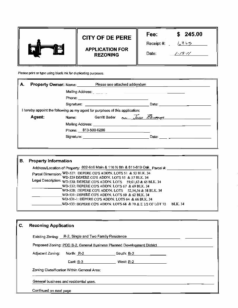
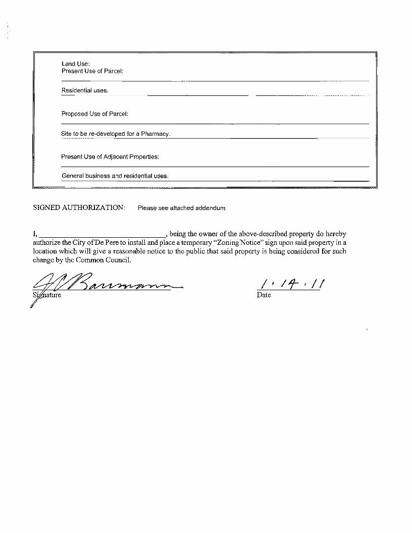
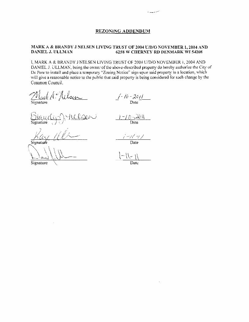
REZONING ADDENDUM
MARK A amp BRANDY J NELSEN LIVING TRUST OF 2004 DIDIO NOVEMBER 12004 AND DAll1EL J ULLMAN 6258 V CHERNEY RD DENMARK WI 54208
I MARK A amp BRANDY J NELSEN LiVING TRUST OF 2004 UDO NOVEMBER I 2004 AND DANIEL 1 ULLMAN being the owner of tile above-described property do hereby authorize tile City of De Perc to install and place a temporary Zoning Notice sign upon said property in a location which will give a reasonable notice to the public that said property is being considered for such change by the
Common Council
Date
Jlft Lief (tltttQ(JQ-0 Signature ) j Date
Date
i -
i
tLl~~
l- - Signature Date
REZONING ADDENDUM
WAYNE 1 HOFFMAN 116 N EIGHTH ST DE PERE WI 54115-1511
I VAYNE J HOFFMAN being the owner of the above-described property do hereby authorize the City of De Perc to install and place a temporary Zoning Notice sign upon said property in a location which will give a reasonable notice to the public that said property is being considered for such change by the Common Council
REZONING ADDENDUM
ADELE HEUVELMANS 804 MAIN AV DE PERE VI 54115-1335
I ADELE HEUVELMANS being the owner of the above-described propertydo hereby authorize the City of De Pere to install and place a temporary Zoning Notice sign upon said property in a location which will give a reasonable notice to the public that said property is being considered for such change by the Common Council
Od4 7 middot7lt-f-vtA-e~-te-i-+_ -1- Signature Date
REZONING ADDENDUM
JERRY T amp ELLEN L LANDWEHR 808 MAIN AV DE PERF WI 54115-1335
I JERRY T amp ELLEN L LANDWEHR being the owner of the above-described property do hereby authorize the City of De Pere 10 install and place a temporary Zoning Notice sign upon said property in a location which will give a reasonable notice to the public that said property is being considered for such change bythe Common Council
Date
Date
REZONING ADDENDUM
rENNTFER M TITULAER 811 OAK ST DEPERE WI 54115-1532
I J ENN [FER M TITULAER being the owner of the above-described property do hereby authorize the City of De Pere to install and place a temporary Zoning Notice sign upon said property in a location vhi9~1 will give a reasonable notice to the public that said property is being considered for such change by
the C~tl10rt r
7~ GUfj l d II Sjgnarure Date I I
(
REZONING ADDENDUM
THOMAS J HARRIS 815 OAK ST DE PERE WI 54115-1532
L THOMAS J HARRIS being the owner of the above-described property do hereby authorize the City of De Perc to install and place a temporary Zoning Notice sign upon said property in a location which will give a reasonable notice to the public that said property is being considered for such change by the Common Council
J -
Signature Date
SIgnature j Date
REZONING ADDENDUM
JULIE A REINDL 816 MAIN AV DE PERE WI 54115-1335
I JULIE A REINDL being the owner of the above-described property do hereby authorize the City of De Pere to install and place a temporary Zoning Notice sign upon said property in a location which will give a reasonable notice to the public that said property is being considered for such change by the Common Council
Signature Date
REZONING ADDENDUM
HENRYN amp LORI L VAN STEDUM 819 OAK ST DE PERE WI 54115-1532
I HENRY N amp LORI L VAN STEDUM being the owner of the above-described property do hereby authorize the City of De Perc to install and place a temporary Zoning Notice sign upon said property in a location which will give a reasonable notice to the public that said property is being considered for such change by the Common Council
-0 -W01l Date
- O -tiJa 1 Date
COMPANIES
PARTNERS IN DEVELOPMENT
January 14 2011
Mr Ken Pabich Director of Planning and Economic Development 335 S Broadway Street De Pere WI 54115
RE Project Description and Re-zoning Request Residential Properties Located at the NWC ofMain St and 8th St
Dear Mr Pabich
The purpose of the re-zoning request to the city is to demolish the 14 existing dwelling garage and storage structures on the subject properties and to construct a new 13225 sf CVS Pharmacy with a Drive-thru facility One dwelling and garage located at 219 8ID St N is to be relocated to the lTWC of 9th St N and Pine St Please advise any additional information required for this re-zoning request
Sincerely The Velmeir Companies
John C Baumann Director of Construction
4
LOCATION MAP NTS
[pJ
(QJtegIAI~e
P~crbrtLoieg
l
f
L
CIW OF DEe ~ -
p
yenljs1tlart A4$
a Esf~ [)r c l1l -E Hettn~ Ave
Giant St EEi
ECT ATI9N
middott~
(I)
1 ~
~~I
shy
)
I J
I I I I I I s I l~
1~~
I
-- 3IJrL I
t r [_1 1851
I I I I I I
1
~~~~~~~~L __t I= -~
DESCRIPlION
andEgintmng lli1- W-l- __ W1~
262-7I-IlOO_H02--N66www~
RA Smith National -----shy sm
SITE PLAN
CVS PHARMACY
CITY OF DE PERE WIo N
o
I~[~I~~~~~lC~ Dr5 shy lWTE~AA
(~S - PfwtT BllCE
ALUIISTOR(fRQllTshyQ(NlAllOO2poundO
IINIA_C-O[[PREO
ALUliAU10llAllCDOCRshyCUNl~OOIZ[O
MAI N 5 T R E E T E LEV AT ION
PREIllI5IpoundO ~EA1 CCFINC -CtxOillOYAlt)1IW1D1TM
ur5 - 10UM
AlUWS1QR(fIl~~shya[AA~QOIltO
SPlllr1CWUshy$CIl conI) lH1LA~C-O[[PR(D
~~~~~ngOCOl_
NOR T H 8 T H 5 T RE ET E LEV AT ION
~
OAK 5 T R E E T E LEV AT ION SCAlEIlTS
REA R E LEV AT ION
NORR ARCHITECTS INGINEIIlS UNNEAS
719 Grhwoln Strc~r
sene 1000 Detmh M14~2l6
wwwecrrccm SCAlENTS
City ofDe Pere Plan Commission StaffComments Jan 24 2011 D
Item 3 Review Precise Implementation Plan for the new 9278 square foot Krause Financial office building in the East Industrial Park located on Profit Place Agent David OBrien
New office building for Krause Financial is to be located in the East Industrial Park on Profit Place The office building is 9278 square feet and is designed for future expansion to the south
Does the project meet the City Stormwater regulations
Sewer properly connected
Water properly connected
Access properly designed (driveway and sidewalks)
Are there any issues with easements or right-of-ways
Are there other items that need to be addressed
DYes _ No DNA _ Yes D No DNA _ Yes D No DNA _ Yes IJ No DNA DYes _ No DNA DYes _ No DNA
RequiredActions 1 The City storm sewer is designed to transport a peak discharge of a S-year rain event for industrial land use
Provide calculations for the peak discharge off the site Include the vacant property to the south under a developed condition
2 Provide a curb head cut at the new access point Do not remove the entire curb unless the curb is deteriorated Remove the curb cut detail from the plan set
3 Plan states that sanitary lateral is 6 lined The sanitary is 6 in diameter but has not been lined 4 The storm sewer tap at the inlet is to be core drilled The City Engineer is to be notified 24 hours prior to
construction An excavation permit will be required for the storm sewer work in the right-of-way S Insulate the water main if there is less than 18 of vertical clearance between the bottom of the new storm sewer
and top of the water main
Does the project meet the City Landscaping Regulations _ Yes D No DNA
RequiredActions 1 The southern portion of the lot must be maintained as lawn and cannot remain as existing conditions 2 All planting mulehing and staking should be in accordance with WDNR recommendations and current proper
practices 3 Allplant material and beds should have a follow up schedule for maintenance and replacement It is essential that
this schedule be established to ensure that the plants are maintained for health and any compromised plants are to be replaced in a timely manner This maintenance schedule should include provisions to protect plants in the winter as some of these may be susceptible to animal feeding or damage
4 A preservation and protection plan for existing vegetation and trees including City owned trees and shrubs should be included on plans when applicable
RecommendedActions S It appears there would be room for additional plantings of trees on the perimeter of the property Other tree
varieties and species could be incorporated into the plan
Does the project meet City Fire Codes _ Yes D No DNA
RequiredActions 1 Provide detailed plans for construction review prior to the start of work provide details of use for all areas of
structure Define uses for all areas of the building 2 Detail means of egress in all areas of building and provide capacity and exit width detail 3 Separation of hazardsuse is required in accordance with FCLSC Fire rated assemblies are required for the
furnace room and general storage areas 4 Provide exitemergency lighting throughout the means of egress S Provide fire extinguishers at maximum 75 travel distances from any point Locate extinguishers towards the exits 6 Installation of key box for fire department access RecommendedActions 7 Recommend installation of a fire alarm system should such a system be desired submission of detailed plans with
cut sheets and battery cales is required prior to installation 8 Recommend installation ofa fire sprinkler system based on size and construction type should such a system be
desired submission of detailed plans with cut sheets and hydraulic cales is required prior to installation
City ofDe Pere Plan Commission StaffComments Jan 24 2011
I 09 u CIl 0 5 be
sectI
oS Ql
oCl be I deg2 I ltII
E
Does the project meet the design regulations (exterior building elevationsmaterials) _ Yes D No DNA Does the project meet the City setback requirements _ Yes D No DNA Does the project meet the City parking requirements _ Yes D No DNA Does the project meet the City lighting requirements _ Yes D No DNA Is the refuse properly sited and screened _ Yes D No DNA Does the signage meet the Citycode _ Yes D No DNA Are there other items that need to be addressed DYes _ No DNA RequiredActions 1 Color for the building shall be earth tone in color 2 For parking traditional standards would require 38 stalls Under the 1-1zoning the Plan Commission can reduce
this requirement based on need We were told by the owner that 30 stalls would meet their needs The Plan Commission may want to request a letter from the owner to place on file to ensure there is no parking on the street in the future
3 The south gable end finish material should be modified to bring the design back into scale 4 Refuse enclosure shall be a matching split face concrete block with non-metal gates 5 As a note the two parcels will need to be combined before permits can be issued
Recommendation Staff would recommend approval with all required actions being implemented and the Precise Implementation Plan be forwarded to City Council for approval
CITY OF DE PERE Fee $ 24500
Receipt _-=6--I--=tu---O _
APPLICATION FOR SITE PLAN REVIEW Date
Please print or type using black ink for duplicating purposes
A Property Owner Name 1) C-e 6 y togtgt-t
V 1
- ffi
----)--2~L=--poundL-2lt3-k-_P~v)S~-4Jy
I hereby appoint the following as my agent for purposes of this application
Agent Name uCLvd e8r~~ ------- shyMailing Address -p 130 l ( ~S- Phone t9amp~930D
Signature DatelO I tJ6 1M It
B Property Information
AddressLocation of Property ~~ ~T-N f ~o-h t- Parcel pound D ~ pound0081-Z ~ CJ etmiddot- FbcR -Z-- t
Parcel Dimension t7f)( gttl3 Parcel Area -l7~~r-JcentLJ2--------shyLegal Description _
A Site Plan Review is requested as authorized by the De Pere Zoning Code Section(s) Article XIII
SectiOn146~middot0
Signed ApplicantAgentJLLOh-= Dated 111 II(
A plan consisting of all applicable information listed on the attached shall be submitted with this application
SITE PLAN REVIEW REQUIREMENTS
KRAUSE FINANCIAL SERVICES INC FOR BAYLAND BUILDINGS INC
CITY OF DE PERE BROWN COUNTY WISCONSIN AnENTIONI OOWNLOAOED PLANSARENOTSCALEASLE NEITHER THE OWNERORTHE ENGINEER SHALLSE HELDRESPONSIBLE FORTHESCALEOF DOWNLOADED PLANSONLYPRINTED PLANSFROMBLUEPRINTSERViCECO INCSHALLBE CONSIDERED TO BESCALEABLE PLANS
VICINITYMAP
fl(CAAl1ll~
II 1
1 l
Non ElClSnNlJ UTlUlIESSItC)MIONPLAH9AREAPPRO)jlW1Enil CON11IACTOR SliAlJBE RESPONSIBlE FOROIl1AININCI EXACTLOCATlDHS ANDELEVATIONS OFALLvnmas MIETlIERllHOWNDRNOTFROMTHECJVrNEP6 OFTHEREampPECTlYE umnlEs ALLUntTY OWNEASSHALt BENl1TJFIEO FORLOCATES avmE OOtmUlcrOR n HOlIll5PRIORTO
ouEA03ION CONTROL loIEAIilUREIilSWltLL 8E ~ PLACE PAIORTOCONSTFlUCTlDN AHOSfULlCOlolFOlllol TOlHEW1ampcOf1lWl OEPAPl1olENTOF IoUruIW RUOLIRCn CONSllIOCTlOfj mE EROSIONCOI4mOl AHOlECHtlICAL 5fANDAAOS
INDEXTO DRAWINGS SHTNO DESCRIPTION
1 LOCATiON MAPSANDINDEXTODRAWINGS 2 EXISTING SiTE CONDmONS 3 SITEPLAN UTILITYPLAN 5 GRADING ANDEROSiONCONTROL PLAN 6 DETAILS 7 DETAILS a EROSiON CONTROL DETAILS -INLET PROTECTION L----shyANDMISCELLANEOUS DETAILS Q EROSiON CONTROL DETAILSmiddot DITCHCHECKDETAILS 10 EROSiON CONTROL DETAILS- DITCHCHECKDETAILS
JoSPRfN DATE I APPROV REVlSIOJf KRAUSEFINANCiALSERVICES INCD
4 Robert E Lee amp Associates Inc
~~ECKEO FORBAYLAND BUILDINGS INC ENGJNEEftJNG 5~G ENVlRONltEmAL SERVtCESLOCATION MAPSANDINDEXTO DRAWINGSCiTYOF DE PERE eeeeeec --lBROWNCOUNTYWISCONSiN
LOCATION MAP
------ --- shyUTILITY INfORMATION I~~~rl
DESTINY DRIVE UTILITIES PRESENT crrvOF DEPEREWISCONSINPUBUCSERVICES6C TIMEWARNERCABLEl usSiGNAL I ~ 0 ___ bullbull
UTIUTlESSHOWNON THis MAP AREBASEDON lOCATES FAD I ~~ ~~~~100k=I
~--L (~ I 4 11 OIGGERS HDTUNETICKETNUlolaEA201~02Isa DATED 1223J2010 VISlBLEOB6EAVATIDN oN 12l2~01D AND i [ ~--- -__ ~~BR~EU~~~~~~~~NJiU~~~~O~~DEE~F~~g~ ~~U~~p~E VEFlIFleDPRIORTO 1Hf DIGGING I
1
11 ~ r u nn n~-=--=-~----- ~ ~ _ ~~_=~_--_DIGGERSliaTUIIlE HOo-242middota511
n -- 0_i 1j t ~ r -- L ~~Ju o~ gt 11 WATBIISAtHTAAYJtm]AU SCWlR~ GAS ELEGTJUO TelEPHONE C~BLE TV DEPARTNENTOf PUBUCWOIII(S WISCONSIN PUBLic SpoundRVIOE COItJgt no TIME WAflNER CABLE CNOFDEPEAE 6OONORTliMJMUgt6T lIaiampSFEJlSON6T 1OQ1KENNEOt AVE e25SXTHST Po BO)(180Dll GRiIENBAY W154~ KIUBliRlY WIUI)l i 11 fl~ ----~~----7~----- ~tmiddot r~1 DEPpoundREW1541gtS OrtEENBAYW16Q07
tQ~Q~-lIl47 820)11111207 (lI1l0jU9-5G7amp (InI4JJ~3 Ii ~n I I I lt0 I II
iJ - ---- -- I 1-I r1
tlll bullbullbullbullbull 111 i I lt1 ~ -11 I I IOWNER INfORMATION coNTRACTOR INfORMATION
ICFlAUSE FINANCIAL SERVICES INc BAYlANDBUILDINGS INC 1234ENrERPRI5E DRIVE POBOX13571 II-- i DEPEREW1 54115 GREEN6AYWI amp43D7middot3571 1
t 1_~I dl~i~ I I
I
II
~I~I I)0
j I ) I ~I i iI 5 III
(B6ampaS5-7437 (B20)3711i20D ) k I 1 IIL iIol 1 i ICONTACT DALE KRAUSE CONTACT DAVIDOBRIEN ~ ~I i 1 ) II) II Iti II
LEGEND -6 FIREHYDRANT I I i
tal ~ DECIDUOUS TREE I~I bull I
WATERVALVECURB STOP I gt I 1 I ~ i [ I I LOll I I tiWATERMANHOLE ~ bull _ bull o CONIFEROUS TREE j e I o SANITAAV tlANHOLE ~ 11 11 ~ r ese sr I I I Io BUSH o STORMMANHOlE II i r l ~ 1 ~ I I ~ ~ t~3B21 OP~ STORMIlANHOLE
RIPRAPbull J l ~ i i raquo I I 1151 lINIlIIll STORMINLET j shy glOOMINLETMANHOLE ~ZJf)IofI SPOTELEVATION III POWERPOLE r- ) i ~)i J I II ~
W~h FIRSTFLOCIRotlASEIrlENT ELEVATiON bull ~bullbull_ iEJ-oPOWERPOlE WGIN WIRE i4iL-i-l 0 ~ i al ~IUGHTPOLE N -rorAPPROXIMATE ROCKElEVATIONo ELECTRICMANIiOLE
III ELECTRICtlElER r III ll i I __ __ ) - I If__ 12 EXISTINGCULVERT
laquoI GASVALVE tii i I -- n iii ~ 1 I - -- - - - - - +-1- - i I I ti i ~ GASUETER o CONCRETE 81 MAIlBOX
CZJ WET1ANDS ~ - I I I I Iof SIGN
POST I f i
~ HANDICAP PARKING IRONPIPEJROD 11 ~ I I if I
4 PKNAlL ji rill I i i I 1 II I EXISTINGSANITARY SEWER (SIZENOTED) i 11 I 1 bull
EDGEOF PAVEMENT EXISlINGFORCEJJAlN (SIZENOTED)II ill- h i~ 1 ml i II ImiddotI ii -10C- ~ISlING STORMSEWER(SIZENOTED)
EDGEOF MAVEL k --N-- EXISlINGWATERMAIN (SIZENOTED) 1 I I 1i1 --0-- GASUNE C Ii
EXISTINGCURBamp GUTTEA I I ill 1 II i LOI I [I II --oc-- oVERHEADTELEPHONE UNE ---- UNDERGROUND TELEPHONE LINE 1
- TREEiBRUSH UNE --oc-- OVERHEAD ELECTRICUNE ) i ]1 n _ 1 I~ I
---- UNDERGROUNOELfCTRICUNE bullbull vse-bullbullbullbullbull EXISlINGCONTOURUNE i 11 -- t I
- OTV- OVERHEAD CABLE1VUNE --N-- CAaLElVLlHE I
RETAINING WAll 1 lilgtlll II ilmiddotMVUNE PROPERlYUNE H j i I I I
GUARDRAIL - EASEMENT UNE
~ FENCE BUILDING SETBACK UNE i I I ~ - i I II I ISEcnONUNE NOHIGHWAYACCESS
I I I II i ) I Ii i I I I i I l I I I I shy bull I1 1I~ I ~ ii k i I I J _ -J- _J ---- _ _ _ _ _ _ _ _ _ - - - - - - - - - - - - ~-- - LilI
gll~~ ~ NOTE D-t1 bullj I ELEVATIONs SHOWNAREBASEOON APREVIOUSCITY OF DEPEREEASTalOEDATUM SUSTRACT 091 TO ~mtII 8U) 0 CONVERTTO NAVOsl l
-0ampOATE IIoPPRrN OMWN KRAUSEFINANCiAL SERVICES INC-- shy FORBAYLAND BUILDINGS INC CITYOFDEPERE
~CJltQ) EXISTING SITECONDITIONS
~~SlCNEO BROWNCOUNTY WISCOSNIN
~r---L-j m1--Igill~~ ~~i~~~ 1131 bullI 1 -bull I 1 middot bullbullbull ]~) (SI1
~ e sr ------ shy
(I [a
[
I ar
I 1 I
r I
[ I [
I 1 f I r Ii
r
I I I I I I I I I I I I I
I I I I I I I I I I I I I I I I
I
I I 1 f-I ~I i~
I I
I
~ ~ ~I E~SnNG SURFACE TO AEMAIN I
~ 1 I ITJ I
I shyI II I
I I
I I 1 f~
I I I I
[1] I ~ ~ I I
I I ~ I I I I I I I ~ I I I I II
II l I I I _L II I8 I ----- ~ I I I I _------- ~ I
I f- I I - - -- - i7Jr I II I L_-J---- ~
I I amp-0~~ RlVlSlON KRAUSE FINANCiALSERVICES INC
I ri
-------------------------- ---------p----shyLOCAlED UMENT ON DESTINYDRIVE FROMEXl971NO OFFICE WITHNEW MASONRV BASE ANDELECTRICAL EX IHIEAGIUL CIJRlI ltlGUnER
shyNOCCESS _ 100 29917
~ ltgt3 J SLAND6CAPEAREAWlTH bull bullbullbullbull I io middott 5PRINKLEASYGTEM f
~ PROfr2~~ ~~DING
~~ FF ELEV63900
~ k 11I i I I I I I
I iii I f- I ~I J
f- I sect I
-- shyI I I I I I I I I I I I I I
w I I~
c I I I I I I I I I I
PROVlDE~1R6OPENING I ~~~g~ ~D~~~~~~~~SfARY VERIFYW H CITYBEFOREREMO~ING
DRIVEWA OPENINGCONCl1iTE I
I - shy
rIJ
SCIII2INFEET
NOTE ELEVATIONS SHOWNAREBASEDON APREVIOUS CITY OF DEFEREEASTSIDEDATUMSUBTRACT cer TO CONVERTTONAVDse
I~ l I
I II
NOTE ALLAREAS DESIGNATED ASGREENSPACE OR LAWN SHAll BE TOPSOILED TO A DEPTH OF e INCHES SEEOED ANDMUUHED AREA TO BE RAKEDFAEEOFSTONESAtJO CLUMPS
PARKINGVATA TOTALPARKINGSPACESPROVIDED 30
HANDICAP ACCESSIBlfPARKING SPACES 2
TOTALPARKING SPACESAEQUIRED24
SITEVATA TOTALAREA 223ACRES97212 SF
BUILDING AREA 021ACRES921aSF(amp5710)
SIOEWAlKIPARKING LOTAREA 032ACRES13B37SF(14jl3j
GREENSPACE090 ACRES39202BF(4033)
UNDISTURBED AREA 080ACRES348995F (35874)
ZONING
CONSTRUCnON CLASSIFICA nON vbull
PAllCEL NO EDF0081-2
EDmiddotFOOB1-2middot
LEGfNV
o CONCRETE PAVE~ENT
IRJ ASPHALT PAVEMENT
~ GREENSPACE
LANDSCAPED AREA
__ PROPOSEDie-CURBamp GoUTIER -- (UNLESS OThERWISENOTED)
~ PROPOSED SHEDDINCl CURBamp ClUTIER
PAINlED FIRElANE wlt
TRAFFICFLOWARROW ltgt HANDICAPPED PARKING~
NOTEALLCURBRADIIARETO THEFACEOF CURB
I I
I I I I
I I I
I I I
I I I I I
I I I
I I I
I
III
II I
I
I I I
II
I I I
I III
I10 I
I
I
t II I
I
I I If-shy
U) I I I
I I I
I I I
I III
I I I
I I
II I
I
I I I I
II I
I
I I
~ CHrtKlD FORBAYlAND BUILDINGS INC SITEPLAN --l ~ NeesaR UIl ENVIllONgtltBNTAI
CiTYOF DEPERE ~SICHEO BROWNCOUNTY WISCONSiN
3
-------------- shy WATERANOSMIITAAfLATERALS I AREESTl~ATED TO BE6 LINED DESTINYDRIVE
CONTACToRTO VERIFYEXACT [xlHlE~CIRfIampCln1m LOCATION ANDELEVAll0ItJI
I
I
I I
LE~IIIV --------PROPOSED SANlTARYSEWER I----~-- EXlSTlNG SANITARY SElJJER (SIZENOTED)
I bull - bullbullbull EX(STINGSTORMSEWER(SIZENOTED) =bull - bull - bull - bull - bull -PROPOSED WATERIolAlN
= == == PADPDSEOSTORM SEWER
---~-6w-6- EXISTlNGWATERIAIN (SI2ENOIED) I
I
~ ~ ~ ~ ~ I-6 -6 FIREHYDRANT I II $ WATERVALVEICURBSTOP l reg WATER MANHOLE V l REOUCER1NCREASER a 0 ISANITAAYMAIIHOlE C 0 STORMMANHOLE I I OPENSTOIUlMANHOLE UU lI STeAL( INLET C () STORMINLETMANHOLE I
I C
PLUM13ING VA TA CI
DRAINAGE FIXTURE UNITS 24 I I WATER FIXTURE UNITS 28 I m
NOTE I II MINIMUMOF S5FEETOF COVERSHALLSE MAINTAINEo I OVER ALL WATERMAIN
SANITARYSEWER WATERMA1N AND STORMSEWER5HALL BE CONSTRUCTEDIN ACCORDANCEWllrl TIIESTAIIOARD I6P~IFICAnONS FORSEWERANDWATERCONSTRUCTION IN WISCONSINAND ADMINISTRATIVE CODE CIAPTEASCOMM81middot87 I
rI
f~jil 3 FIELDVERIFYLOCATION OF EXISTINGUTILITIES IF EXISTING
LOCATIONSDIFFERFROMWHAT IS INDICATEDON 11-tEPLANS CONTACT ENGINEERPRIOR TOCONTlNUEOWORK I STORMLATERALSSHALL BE EQUIPPEDWITHTRACERMRE
i11 I
I
Ibull All DOWNSPOUTSSHALLBECLEANOUTDOWNSPOUTS
I I
I I
I I
I
IPROV 001[ I)fgtPROV ORoWH KRAUSEFINANCIALSERVICESINC ~E~00 FORBAVLAND BUILDINGS INC
CITYOF DEPERE UTIUlYPLAN ~SIGNEO BROWN COUNTY WISCONSIN
r-- shyI I I I I I I
I I I I I I I I I
I -shy
lOCAlEIHFUT
NOTE ELEVATIoNS sHoWN AREBASEDONAPREVlouaCllY OF DEPEREEASTSIOlDATUM sUBTRACTDe1TO
~-o CONVERTTONAVDB6
n srta r rl6367T1------shyOl~
~~~ g~~~ 10j ~L--ri-~ ---_~----r--___-~~7_
EXST utl l
LEIiRVV TOPOFCURBELEVATION~lcStltlil
FLOWUNE ELEVATION~F- TOPOFSIDEWALKELEVATION~SNJ66666
EDGEOF PAVEMeNTELEVATION~55
TOPOF RETAINING WALLELEVATION~RN444
~3J333 ORQIIIOELEVATION
DR-JNAGE SWAlE
DRAINAGE DIVIDE
---x- SlLTFENCe
~ BALE DITCH CHECK
FLOWAAAOW
TRACKlNCiPAOmmli INLETPROTECTION
NOTE ALLSANITARYSEWERSTORMSEWER ANDWATER SERVIcESIMAINSSHALLBE PROVIDED WITHTRACER WIREOA OTHER METHODTO BE lOCATED
STOlL IIIAITR MANAGEMRVT THISsrrsISTREATEQBY REGIONAL STORMWATER PONDTHAT IS LOCATEDSOUTHNeWEST OF THE END OFTHE CUL DEBAC OF PROFIT P~CE
ELOSWN cONT1WL NOTE All EROSrON CONTROLPRACTICE61NDICATEDON THIS PlAN ME APPROXIMATE LOCATIONSONLY THEACTUALSITEMAY REClUIREMOREOR LESSEROSiONCONTROLDEPENDINGON THE CURRENTCONDITIONOF THE SITE ~ SILT FENCEIS REQUIREDDOWNSLOPEOF ANY DISTURSED
LANDTHAT MAYCARRYSEDIMEtiTS OFF SITEl ltl
A TRACKINGPADIS REQUIREDAT ANYINGRESSIEGRESS LOCATIONWHERESEDII1ENT MAY BETRACKEDOFF-5ITE
II
PROPERIfLET PROTECTION6HAll BE U6ED OEPENDING ONTHE INLETTYPE
-4 SEDIMENTBASKET GH-ll BE USEDFOR ANY 6ITE DEWATERING
I I
I
I
I
in [)j j Ul
R1I4l7l1i1 0_S75I -- shy1 I~~~ m ~ 2lt 1 1 IIMampJl24(Wst)
Ii 1 I I r I i I
II i I I I j I I
STIHL4 r~ ~ I
t III
~ NLET(TYP) ~T~~ I
I j lJ I
OSTllILll Ii rL63s92
1I D_4045 It lW6l247 (W IN) llN6l U 71(15middotSO i I G ~ I
I
STING w o i a
I shy u ~921 I a i -(~ I i i 1160 II a
I L I - -1--+ ~ I f l I i I I ~ I II f j I I II J
I
J i I I I I 12 - shyI 1 ( I i I ~I ~ I 1 A I - I ~
f ~ I
i Iil71
_ - V~ - - - -- -- - ~-- - L Y Dwnall 111163U)
0-1117 NOTE ELEVATIONS sHoWN AREBASEDON A PREVIOOS CITY~~~ ~8 amp-0 g~~~~~RioE~~Jo~E DATUM SUBTRACTO91 TO001pound I APPRO KRAUSEFINANCIAL SERVICES INC IrQb~ Lee ampAsSOc]iite IncON ~~
CHECKED FORBAYLAND BUILDINGS NC EIGltiEERlNG SIJRVElING ENVIROHlWnALSUVlCpoundSGRADING ANDERosiON CONmOL PLAN 4664 COLOEN PONOPARltCOURTCITYOF DEPERE
~CNED ~oWl~~~lnltltom ~~~j~~2~)6~jN41BROWNCOUNTY WSCONSIN
NOTENEENAH R-3275OREQUALWITH TYPEA GRATEORRmiddot3246AOR Rmiddot3Dfl7WITHTYPEL GRATE
LESSTHAN4SHAlL BE RUBBER)
CLARlTY1
I 10$1 ~
~
il4R TO BEADOF ADJUSTlfIG RING CLEANOUT LINETOBElHE SAIlE ANDCASTlNGSEALANT OREQUAL SIZE5 MATERIAL ASSEWERIlAIN BElWEEN ADJUSTlNG RINGSAND NOTE CLEAWOUlLINETO BETHE
CONCRETE ADJUSTlNG RINGS SAME SIZEaIlATERIALASSEWER MIIN
ADAJSTlNG RINBSONLYWITH CASTING COATOUTSIDE OF
ASREOUIRED (4MINAND12 MAX UNLESSOTHERWISESEWERJOltlT COl4iOUNDND NOTEDALlADJUSTING RINGSWRAPWITHMIN8 MIL
~ GRADEPOLYETHI1ENE
ECCENTRIC REDUCING CONE (VERTICALWALL OF
PVCCOATEDCASTIRON 24 SQUARE LlHSTEPSmiddotOC CONePAD CLEANOUT PWB
ECCENTRiC CONESHALLBE ONDOINSTREAM SIDEOF MANHOLE THISDETAIL 4 (MIN)GRAVEL NOTESHOWNROTATED W FOR ADJUSTTOGRADEBY
CLEANoUTPLUG
II SUDINGVERTICALLY UPORDOWNOVER
PVQPIPESEWER 21 r~~~~~~~~~~~~4 SERVICE EACHJOINT
PROVIDE FROSTSLfEVE SERVICEPEAoCOM1l8236 (5)A)2
PROVIDEFROSTSLEEVE PEROCOMM8235 (6) fAJ2~~ TONGUE ampGROOVE PVCPIPE
n 45 BEND JOINTREQUIRED
PVCPIPE
FLEXIBLE PIPE To MANHOlE 45- BEND CONNECTOR REaUIRED
6PECUBEDDING
8 PRECAST S-8IlIN CONCRETE SASE SPECD SEODINGI I
SANITARYAND STORM CLEAN-OUT DETAIL CLEAN-OUT DETAIL STANDARD MANHOLE (TRAVELED AREAS) (NON-TRAVELED AREAS)
8-24(INCLUSIVE)
314-ro r
eunPOLYETHYLENE
I
~rd 81 ~I
~I
~
HDPEtPVC SEWERamp WATERMAIN amp FORCEMAINSTORM MANHOLE INLET PAVEMENT RESTORATION BEDDING ampTRENCHSECTIONTYPE A
MgtPFt(N ~T[ I WPROV REVISlCIH ~ampWN KRAUSEFINANCiAL SERVICES INC FORBAVLAND BUILDINGS INC~CKED DETAILS ~uCITYOFDEPERE
~IONEO BROWN COUNTY WISCONSIN
o
~ Io
I
W(IlAXJ12+00J2 W(MIN)-6oi-00J2
COMPACTEO BEDDING ANDCQVER SOILCLASSA-7
INITAL3 OFSOILCLASS ASIN WETORUNSTASLE TRENCH AS DIRECTED SYTHEENGINEER
WITHOUT EXTRACOST TOQWNER
I
ampolLCtASSG-l OR C-31FREQUIRED PER SPECIFlCAllONS
NOTE SUFlFACE RESTORATION REQUIREMENTS PERTHE SPECIFICATIONS
UNDER BARREL (8 FORBEDROCK EXCAVATiON
UTILITYTRENCH
t ENRENGTH ORENcH I bull -j _middot~middoti middotbullIc-~~~
PIPEUNE
SAWCUT CONStSTENTWlDTH
Imiddot I II I I 11--- -THiCKMANHOLE TOP
PVCCOAlEDCAST IRONIlHSTEPSmiddot 10C
BEADOF ADJUSTING NEENAH R-3215OREOUALWITH RINGANDCASTING SEALANT OR TYPEA GRATEORRmiddot1246AOR EQUALBETWEEN ADJSllNG Rmiddot3067WITHTYPEL BAATE RINGSANDCASTING COAT CONCRETE ADJUSTING RINGS OUT6IDEOF ADJUSTING RINGS 4SREQUiRED 14MINAND 12 ONLYWITHSEWER JOINT MAX UNLESS OTHERIIJISE
COMPOUND ANDWRAPWITH1l~N~~-~~~~L NOTEDALLADJUSTlNG RINGSLESSTHAN4SHALLBE RUBBER)
WAlllt CONTRACTION JOINTSPACING EXPANSION WIDTH TRANSVERSE LONGITUDINAL JOINTSPACING
NOTREQD 100lJAX
s NOTREQD 100lJAX 0 S NOTRECD 100lJAX 0 100lJAX e 100lJAX s 0 lOOlJAX
~
oj ~
~y
PROVIDE CONTRAClloH JOINlS 6CONCRETE ASDIRECTED BY ATUAXItlUlJ 20SPACING BY GENERALCONTRACTOR SAWCUTTINGOFtINSERTIONOF
DIVIDER PLATES
12 OFNO3 ORNO4 GRADATION R E6AR S LE EVES ~MINllJUMVOID rrEXPANSION MATERIAL WILLBEPLACEO ONEACHSlOEOFTHEORNEASUITINGTHE THERIlALEXPANSION SPliCEATENDOFSLEEVE FOR
SIDEWAUlt SIDEWALK ANDDRIVEWAY APRON SHAll BECONSTRUCTED SEPARATELY UNLESSOlHEfWJSE APPROVED BY THEDIRECTOROF PUBLICWORXS BACXOf CUAB COMPACTEDSUBGRADE
CONCRETE PAVEMENTDETAIL ~I 3~l rI~1 1 ABPHALTSATURATED fELT EXPANSION JOINTFILLERPLACED ~ ~rQ ATlJAXllgttUM 300middot SPACING AND
middotB1TUMINOUSSlJRFACE ATAll ENDSOf RADII 1 34 BITUMINOUS BINDER
18 LONG12 DIAlJmRIt REINfORCINGRODS 12 OF NO3 ORNO4 GRADATION ~
DRILL518HOLEMIN9 INTOEXISTINGCURB
CURBTIE-IN DETAIL lPAOPOSEDTO EXISTING)
COMPACTED SUBGRADE
ASPHALT PAVEMENT DETAIL SAWCUlCURBTRANSVERSELY PRIORTO RElJOVAl
~
12middotR60
COItRETE 4 APRONbull
DIMENSION VARIES SEEPlAN
I NOTE REFERTO SPECIFICATIONS FORREINFORCElJENlS
IiI CURBREMOVAL FORDRIVEWAY OPENINGWITH ~ CONCRETE APRON ONCONCRETE SURFAcESTREETS l
bull
EXPANSION JOINT TOOLED
CONTRACTION JOINT
PAVEMENT ANDBASECOURBE
SIDEWALKWITH INTEGRAL CURBCURBREMOVAL FORDRIVEWAYOPENING WITHCONCRETE APRON ON ASPHALT OVERCONCRETE
SURFACE STREETS
CURB REMOVAL DETAIL SIDEWALKDETAIL
bull VERIFYDETAILMATCHES crrv Of OEPERESTANOMDS
4 EXliTlNc CONCRjre
BREAK
VARIES
S SIDEWALK t ~ ~~~ ~~- z --~~~~N~N-~--~ ---~~
ALLARCUND(TYP) iii 11) gt
All RESIDENTIAL DRiVewAY APRONSSHALL BE FLAREDIF FIELDCONDITIONS PERMI1
THEflAAE BHALl NOTE)(CEED3-0
8middot ORJVEWAYAPRONrshy
~I ~t
bullbull _
1--( middotHmiddot bull middot ~ y ~h~raquo~gtY)1-S
~~ ~
L I bull bullbull bull bull ~ bull _ bullbullbull
CUflBA GUTIER 12 EXPANSION JOINT
DRIVEWAY APRON DETAIL
6lc6WmiddotIN211 W2WWf CENTERIN SLAB
-
CONCAETESlAB
4CONTINUOUS
12 EXPANSIONJOINTWITHSELF LEVEUNGSEALANTWHENCAST AGAINSTSTRUCTUIIE
MINIICOlJPACTED SOILCLASS C-3 MOISTENIMlJEOIATELY BEFOREPlACING CONCRElE
TYPICALSIDEWALK ADJACENT TO STRUCTURE
2RAD
SPECIFIED BITUlJlNOUS
4 CONTINUOUS TOP6 BOTTOM
DATE I APPROY AUSEFINANCiAL SERVICES INCm- TE At Robert E Lee amp Associates Inc SIl[D NO FORBAYLAND BUILDINGS INC~lEC1ltEO a ENGtNBeJUNO SURVEYINO BNVlRONWENTu SEJMCES
CrN OF DEPERE DETAILS fluU BROWNCOUNTY WISCONSIN
7
OR WASHEDSTONE
INLETPROTECTION NOTES
INIHAlUT10NtJDTESR W I4ANUFACTUAEO ilLTERN1TlVES 6PPROVED AND1t(if if f TYPE-e-a-c-USTEDONTIiEWOOTPRODUCTACCEPTABIUTV LJSr AAV BESUBSTITUTED
R TRJM EXCESS FABRIC INTHEFLOWUNETOWITHIN3J fq ~ if OF-THE GRATE
I WHEN ReMOVING ORMAINTAtlllNClINlET PROl1CTION CARESHAll Be TAKEN so THATTHE
50 MIN SEDIMENT TRAPPED ONTHEGEoTEXTllEFABRIC THECONTRaCTOR SHALLOEUClIISTRATE A METHOD OOESNOTFALLINTOTHE INLET NolVMATERIAL Of MAI~ENANCE USINGII SEWNFLAPHANDHOLDS
OROTHER ME11-tOQ TOPREVENT ACCUI4utATEO IMMED1AmV FlLUNGI~O THE INLETSHMl BE RELioVED PLANVIEW SED114ENT FROMe~EAING THEINleT
TYPE0 (j) FINIBHEDSIZEINCLUDINGFLAP POCKETS
WHEREREOUIREDBHALLEXTENDA MINIMUM ~ 2299 00 NOTINSTAllINLET PROTECTION TYPE0 ININLETS
SHALLOWERTHAN3DMEASUREDFROMTHEBOlTQlI PROFILE VIEW MAINl1NANCEOR REMOVAL Of THEINLETTQTHE TOPOFlHE GRATE
Of 10AROUNDTHEPfAIMEllR TO FACIUlATE
reg FDA INLETPROTECTIONNPE C (WITHCURB TRIMEXCESS FABRIC INTHEFLOWUNETOWITHIN 3 middot4 MIN OR FULLWIDTHOF THE EGRESSPOINT BOX)AN ADDITIONAL1SOF fABRIC IS Of THEGRATE REFERENCEWDNRTECHNICALSTANDARD1~1 WRAPPEDAROUNDTHEWOODAND SECURE1l
WITH STAPLESTHE WOCOSHALLNOT SlOCK THEINsTAuEOBAGSHALLHAVEII MINIMUMSiDE THE ENTIREHEIGHTOFTHECUR8 BOX CLENIANCE BElWEEN THE INlET WALLSANDTHE TRACKING PADDETAIL BAGMEASUREDATTIiE eorrouOF THE OVERFLOW OPENING
I
(IF APPUCABlEj HOLESOF 3 WHERENECESSARYTHE
reg FLAPPOCKETSSHALLBE URGE ENOUQHTO CONTRACTOR SHALLCINCHTHE BAG USINGPlASTIC ACCEPTWOOD2X4 ZIPTIESTOACHIEVETHE3ClEARANCETHE TIES
SliALL BE PuCED ATTHE MAXIMUMOF4 FROMTHE BonOM OF THEBAG
1 II
I 4XS OVALHOLESHAlL BE HEAT CUTI~D ALL fOUR SIDEPANELS 3
~ -USEREBAROR SllEL ROD
FORREMOVAL
] Of
FORINLETSWITHCASTCURB 80X USEWOOD2)(4 EXTEND10BEVOtlO GRATE WIDTHONBOTHSIDES LEMCJTH VARIES SECURETO GRATEWITHWIREOR PLASTICTIES
II
WOCO2 X 4 EXTENDS8 MINII4UI4 DOUBLESTITCHED BEYONDaRATe WIDTHON SEAMSALL AROUNOSIDE sorx SIDES LENGTHVARIES PIECESANDON FLAP SECURETo GRAll WITH POCKETS WIREOR PLASTiCTIES
INLET PROTECTION TYPE C INLETPROTECTiON TYPE 0 (WITHCURB BOX) (CAN BEINSTA1lEDIN mf INLETTYPEWITH ORWITHOUTCUM BOX AS PERNoTE Z)
INLETPROTECTION TYPE A
INLETPROTECTION TYPE B (WITHOUTCURB BOX)
(CAN BE INSTALLED IN ANV INLET WITHOUT A CURB BOXI
~~ KRAUSEFINANCiAL SERVICES INC ~ICEI) FORBAYLAND BUILDINGS INC Robert E Lee amp Associates IncEROSION CONTll0L
ENCINEERING SURVETING ENVliOtOlENTAL SERYXCESINLETPROTECTION ANDCiTY OFDE PERE OESlGNEO MiSCELLANEOUS DETAILS ---1 4 8
SUBGRAOE
WOODSTAKES(z PERBoLE) NOMINAL2 X T X 30 MIN LENGTHOR eQUIVALENT
CROSSSECTIONAL VIEW HOPEHIGH DENSITY POlVETHVLENE FABRIC SILTfENCE
FILTERBAG DETAIL
8HEETFLOW lt COURSE AGGREaATEINFORMATION
NOTE 1-shySIZENO ALlOlIJENS1ONS siEVESIZE AASHTO No87 (l)
AREAPPROXltrlAre SHEETFLOW 2 INCH(SO mm) 11fiINCH(375mm)
EMBEO BALES 1INet (250mm) 100 ~NEUZED FLOW314INCt1(111Olnm lMl-IOO 318INCIt(ll5mm) 20-55
PLANVIEW Wo-I175mm 0-10
i Wo8(200mrnl IJ-5
SECTION A-A ~ (1 SiZENoACCORDtNpound To AASHTO1l-l3
L THEDiSTANCE SUCH THAT POINTSIANDB AREOF EQUAL ELEvATIONNOTES
l 18X30middot ROCKFILLED FILTER al3 SHAll BEcOMPRISED OFTHEFOllOWllllB ~ HOPE HIGH DENSlNfOIETHYLENEFORSCOURPROTECTION USE HOPE HIGH DENSITY POLYETHVLENE DRAW sTRINGKt-ITTED DlREOllYlHToBAGOPENINGEROSIONMATFORCHANNELUNING 60 FABRIC CLOSURE WIlli APPARENT OPENINllSIZENOLARGER THAN 118middot X 18middot LAPMATUNDERUPSlREAM BALEB ROLleD BEAMUSINGA IlINttuuOF-180DENIERPOLYESTER SEWINGYARNFOR STRENC1T1-t ANDDURABILITYI ANDSECUREFABRiCWITHWOOD SIDEVIEW
STAKESATmiddotFOOTINTERVALSI USEWELLGRADEDCOURSEAGGREGATE CQNFORIolING TOTHE FOUOWINGGRAOATlON REQUIREMENTS
DITCHCHECKDETAIL
ROCK FILLED EROSiON CONTROL BAGS TYPEB
bull WELLGAADEDANGULARsTONE
OF 3 INCHOR GREATER
Ii~
STAGGERJOINTSBETWEEN ADJACENTROWSoF BALESa PLANVIEW
il STAKESDRIVENflUSH WHEN SOILCONDITIONS PERMITd
n
-------------~~~~~~~~~~~ WELLGRADEDANGULARSTONE OF3 INCHORQREATER
~~~
t-~~ ~1~80nOM ELEvATIONOF ENDSALE SHALLBE EOUALTOOR GREATER THANTOPOF LOWESTMIDDLEBALE IDROP
STAGGERJOINTSWITHDOUBLEROW SIDEVIEW FRONTELEVATION
TEMPORARY DITCH CHECK USING STONE TEMPORARY DITCH CHECK USING EROSiON BALES TYPECTYPE A
RrvISION OATpound I JJgtPRCN ~WH KRAUSE FINANCIAL SERVICES INC CHECKED FORBAYLAND BUILDINGS INC EROSION CONTROL
CllY OFDEPERE DITCH CHECK DETAILS OESICNED BROWN CQUNlYWISCONSIN
L OTENTlAlSCOlJAAREA USEERDSION )MAT OROTHERDEVICE WHEN DIRECTED BYTHEENGINEER
DIRECTIoN
~ ~FlOW
I II Id n
II I
I II
ENDTREATMENT ONSlOPES BACKFILL ampcOMP-cT TOBESIMII1IR TOCHANNEL TREHCHWITH flOW DETAIL
PLAN VIEW (WHEN LTERING THEDIRECTlON Of flOW)
I I I l--- TOEOFSLOPE I I I I I I
[ deg6~E~~~ I I I
PLANVIEW
rSTAKES DRIVENFLUSHWHEN SOILCONDITIClN$ PERMIT
8middot0plusmn
FILLSLOPE
DIRECTION OFFLOW
I II I 1111 ~ - EXISTING GROUND1111 II II BAneR STAXESIN OPPOSITE DIRECTION (TYPICAL)nuVV
FRONT ELEVATION WHENEXISTING GROUNDSLOPESAW~Y fROM FILLSLOPE
EROSION BALESFOR SHEETFLOW
MTE IpPRCN ~1RfWN KRAUSE FiNANCIAL SERVICES INC Leeamp AssDemes IncFORBAYLAND BUILDINGS INC EROSION CONTROl ---iENGUfEERlNG SURYrlTNG ENVlROlnlpoundNTAL SBRvtCllS
CIT OF DEPEAE SHEETFLOWDETAILs BROWNCOUNTWiSCONSIN
~CXEO
EXCAVATED SOIL GEOTEXTlLf FABRIC
WITH ALTERNTlVE SUPPORT COMPONENTS
~ (D
_~uJOiE~
NOTE DEPTH ORTIE ADDITiONAL~~OUIRED IN
SILTFENCENOTES
EROSIONCONTROL SHll BE PROVIDED IN AcCORONCEWITHWDNR SILTFENCEDETAIL ~~~~YSOIl6 TECHNICAL sTANDARD
reg CROSS8AACEWITH2X4~wC()QEN FRAMEOR EQUIVALENT ATTOP ~~
ANCHOR STAKEUIN18lONGWHEN REaD BYENG
SILT FENCETIE BACK
z
~
OFPOSTSASDIRECTED BYmE ENIlINEEAsl reg ~INIMUM 14GAUGE WIREREQUIRED FOLDFABRIC3OYEA THEWIRE~D STAPlE OR PLACEWIRERINGSON 12middot cc
cEOTEILEF )
CD EXCAVATE A TREWCH AMINIMUM of 4W1DE amp6 DEEPrOBURY ANDANCHORTHEGEOTEXTILE FABRIC fOLD MATERIALroFIT TRENCH ANDBACKFILL ampCOflPACTTRENCH WITHEXCAVATED SOIL
d
L WOODPOST reg WIRESUPPORT FENCESHALLBE14GAUGEMINIMUM WOVENWIJlE WITH AMAXlMUMMESH SPACING Of 6 SECURE TOPOFGEOlEXTAE FABRIC
GEOTE)ffi~EFABRlc TOTOPOF FENcEWITHSTAPLES ORWIRERINGSAT 12 cc (TYPE8)
reg ~~=~R~~~~~~~~~~~~~ ~~~~~~~T~t~40Ro 0 EOUAL A HEAW DUlY NYLONTOPSUPPORT CORDOREQUIVALENT IS
WOODPOST REQUIRED (TYPEA)
o STEELPOSTSSHALLBE STUDDED TEEORl lYPE WITHA MINIMUM
GEOTEXTILEFABRIc) WEIGHTOF 128LBSAJNrr (INITHOUT ANCHOR) FlN ANCI~ORS SUFFICiENT TORESISTPOSTMOVEMENT AREREQUIRED WOODPOSfS SHAlL8E A t4INIt4UU SIZEOF 1118X1 lIBmiddot OFOAKORHICKORY
reg CONSTAUCT SILTFENCEFROMA CONTINUOUs ROLLIF POSSIBLE BYd 18lL-__-w-__1Y curnsnLENGTHS TOAYCiDJOINTSIF A JOINTIS NECESSARY USE ONEOFWE FOLLOWINO TWOMETHODS AI1WSTMETHODshyOYERLAP THEENDPOSTSANDTWISTORROTATEATLEAST180 OEGREES B)HOOKMETHOD - HOOKTHEENDOF EACHSILTFENCE LENGTH
reg THEMAXIMUM SPfoClNG OFPOSTSFORWOVENFA8RICBILT FENCE
TWIST METHODreg SHALLBE8 FEETANOFORNoNmiddotWOVENFA8RICJ FEET
EROSiONCONTROL SHEETFLOW NOTES GEOTEXTIlEFABRIC
1 A~ SOILSTOCKPILEDlJiATREMAINS FORMORETHAN7 DAYSSHALLBEcovERED ORTREATED WITHST~BIUZAOON PRACTICES SUCl-lAS TEMPORARY ORPERt4ANEtfT WooDPOST ~ SEEDINGANDMULCHING
2 A MINIMUMOF4 INCHESOFTOPSOIL MUSTBEAPPUEDTOAlLAREASTOBESEEDED ORSODDED
L J All WASTEANDUNUSEDBUILDING MATERIALS (INCLUDING GARBAGE DEBRISCLEANING WASTES WASTEWATER TOXICMATERI4JS ORHAZARDOUS t4ATER1ALS)TE1ltTILEFA8RIC SHALLBEPROPERLY DISPOSED of ~ND NOTALlOWEDTOBECARRIED OFF-8ITEBYRUNOFF ORWIND
4 All OFF-SITE SEDIMENT DEPOSITS OCCURRING ASA RESULTOFCONSmUCTlONWORKORASTORMEVENTSH4JLBE CLEINEO UPBY THEENDOf EACHDAY FWSHINGsH~U NOTBE ALLOWED 5 NVYSOiLEROSiON lJiAT OCCURSAFTERfINAL GRADINGANDOR lliE APPLICATION OF STABILIZATION MlASUREsMUSTBEREPNREDANDTHESTABILIZATION WORK REDONE
WOQDPOST B FORANYDiSTURBED AREATHATREMAINS INACTIVE FORGREATER THAN 7WORKINGDAYSORlNHEREGRADING WORKEXTENDS BEYONDTHEPERMANENT SEEDING
middot C[-r 2middotOMIN DEAOUNES THEsrreeuetBETREATED WITHTEMPORARY sTAB1LI2ATlClN MEASURES SUCHASSOILTREATMENT TEMPORARY SEEDINGANlWfI MULCHING
7bullAU TEMPORARY EROSION CONTROL PRACTICES SHALL8EMlI1NTAINEDUNTllTHESITEIS STABluzEDWITH70 VEGETATION ANDA NOTiCEOFTERt4INATIDN HASBEEN MPROVEDBVTHE DNR 8 WINDEROSION SHALLBEKEPTTO~ MINMUM IXJRJNG cONSTRUCTlON WATEAJNG MULCHORA TACKING AGENTMAYNEEDTO BEUTILIZEDTOPROTECT NEARBY
HOOK METHOD reg AES10ENCESMlATER RESOURCES 9 THECONTRACTOR SHALLBERESPONSIBLE FORMALNTA1NNG AlL THEEROSION CONTFlOlMEAsURES IN CONFORMANCE WITHTHEINDNRCONSERVATlON PRACTlCE STANDARDS LATESTEDITION bull
JOININGTWO LENGTHS OF SiLT FENCE 10 UPONCQIvlPLETIDN OFSTORMJNLETCONSTAVcmON THECONTFIACTOR SHAll INSTAlLSTQRMDRAININLETPROTECTION FORCONSTRUCTiON SiTEASSPECifiED 11 FINESEOIMENT ACCUMULATIONS SHALLBECLEANED FROMSTREETS PRIYATEDRIYES ORPARKING AREASf1( MANUALORMECHANICAL SWEEPING A MINIt4UM OF ONCEPERWEEKANDBEFORE~LL IMMINENT RAINS 12 EFOBION ANDSEDIMENT COtlTROLSTRUCTURES SHALLaEINSPECTED WEEklYANDWITrIJNoj HOURSOFRAINFALL OF05INCHORMORE
MIt RODell E 10
I ~
BAYlAND BUILDINGS INC PGIClCL1IIn 1IIDIIIQWlNII7(IZD) _~
llESDI~au-CIJlIlWCJDlIt
eAYLAND
ppHr~ 1 ~ Ii rv ~ ~ J s ~Hmf I ~ bullH I ~ IH~O fFr Imiddot~IIsectsect ~ - 0
lUll 1l10~jl
I ~I l ~
HrLl~ ~
0 1 sect secti i 0
II t I S - s -j II
I~ I
I IrIII i I I
z I~~I0 0 II] ~ rn
~ ~
I~~I
Qli ~ ~ ~
~d I~~I
lUi I i i
I ] t s t r i 1
t ~ ij H~
~ 3 0 ~
i ~ ~ ~ bull
PROPOSED NEW BUILDING FOR 110-6065 DEPERE WISCONSIN BROWN COUNtY ~ REPJIM THYES (920) 371-2011 JOB NOshy AltCH) FU - orre 122110
8AY1AND 8UIlDINGSINC
Iigt
2W copyJ
11 ~ ~ ~
HT~llHgt065I(1wseF~5elIIaI(c-I2-lJ~c-liQ6SoltU~1I11lCfll1742AH
)
cJcJ 0 cJ cJ 0
cJ cJ 0 cJ cJ 0
Eil~ 1~ E~ ~I~ ~Isect sect sect sectsectEi sect 11111i 11111 ~ ~ I~ ~~
~lll~ ~ ~ II + - iii- Yamp ClCIltgtltgtltgtltgtltgtOoooltgt ltgt ~
I I 111 ~sect ~
~ I ~ I ~ 11Hmlqwl~11
1-1++middotmiddotmiddotmiddotmiddot1++middotmiddot +1- Ejmiddot1 1 ~
~ ilfl~l~ i ~ i ~ i i j ~i~li i -tmiddot i 1 t ~ ~lii~i~~iff~i~ltgt
111 1~ ~ ~ 1 I I IE ~I ~ ~ E I -1-1-1-1- +1-1+ + 1 ~ iii Ii i ilili ilili i iii i )i iii i i
tmiddot middotIt tmiddotmiddotttlmiddotmiddot cbullbullbullbull t~Imiddotmiddotmiddotmiddotmiddot Q~ ~i
I I III I Iii i ~ ~
1 I III I r1111
~ ~
~ii Iio
~~U d~i QIII ~
l r ---------shyi I
------_~===
BIYLANDBUILDINGSINC c aITl 1IlDIbull llIUn(aD)-D _-0 -alMJl ~
L~~=-l imiddot
11 i i
___dI~
eAYLAND
----1 o r Jle
I~
~i
~~ o
ki a
PROPOSED NEW BUILDING FOR fl0-60115 OEPERE WISCONSIN BROWN COUNTY SNES REP JIM TIffES (920) 371-2011 JOB NO I~ JCBNO--NtttO tnE=_ DlQEI22110 DAAJI)IEllDUD
BAYlANll BUIlDINGSINC
~ WJ WJ dm copyl
rr~
[]
NlimWrelIIl-6065~fillltlcizlStrnolIo-12middot23~~ll1I1111JJ117gt48lONol
H _
II II II II
I11
n---shy
II
Ii
Il PROPOSED NEW BUILDING FOR 10-6065 DE PERE WISCONSIN COUNlY OF BROWN ~ REP JIJI 1HYES (920) 371-201 1 lOR NO 1~
IlElrlaquol-(ARCH) fUshy DlaE122110 DRAW1IBlSWJ
BAYlAND BUILDINGSllltC
eAYLANo BAYLANDBUILDINGSINC 1QIDloDn GlIDIMrIfIKlllT (JlIl) 1M (Ira)
telQM bull -n clWIIIIIIClD
1fFalTlPnfirntlHlli5lCnnac~ ScniaIto-12middotUllerltldlll-6lJ6SAllHUlwg 111J2011741125AM
H II
1
ii
II
~i- il 1------ I
11 Ii 1j Ii ~ II
1 i u---shy1 g 11 ~ II
~ II ~ 11 3 II
jQ
Ii Ii Ii II II II
I ~ II II
~ ~ II It II I II II 11 11 II II II II II II II
[ il J 11 11 II
u------1 i
_
rlshy
_
1
PROPOSED NEW BUILDING FOR 10-6065 BAYLANDBUILDINGSINC DE PERE WISCONSIN COUNTY OF BROWN a_wn ~-DQJ7eAYLAND
(DIXt taOSALES REPJllil nNES (920) 371-2011 JOElNO te-eces raDI l1liMIl - ClIIIIIlifICftI108 NO- CAAai) fIL - CiTE 122710 OAAWX Err SWJ
BAYlANO BUILIllNQSINC
11~l2allJa2S]~1OXgtcPOf
r Ggt
1 ltI
~ Q ~ ~sect ij q Q (j)
oz
T z -u
~ ~ ~9 0 lt
~~ ~6 z i ~5i ~~ ~
~ ~ ~~ sect
~ lt
8~
I
PROPOSED NEW BUILDING FOR
~WISCONSIN BROWN COUNIY SALES REPJIW THYES (920) 371-2011 oIl8l1D 1o-eoel
oIl8 NO - CNOf) flLpound - bQf 122110 I- 8l till)
1lAINI) BUILlIHlSINC
SQ1Ilpound--O---- - amp--shyf------
sAYLANo BAYLAND BUILDINGS INCPamp_ _ ------_ __shy
0
lii2~JI~r~liI
1~~mUlnsectmiddotUmiddotjmiddotmiddotmiddotmiddot~~~)iinl~ ssses ~
~O~~~~_
m~u~imI~~ ~OI z z
~~ Ii~~~~sect~~ i ~ ~
~~~~~~~~~~~ rlt ~ l
I lt
lt I lt
lt middot~dOa lt lt lt
1 lt lt I II
i1 bullbull ~ e~~~
~ iP o~ pound
~ ~~ ~ ~ ~I ~
~B ~
~ ~ c~
Rsect
~i s ~~
- i
lt
~ ~ (J) (J
~ tl ~ ~
lt lt
lt
lt Igt ~oo
-c
I I
i I
I
~~ ~ bull -0
g ~~
~
8~
1 I
1 I
1 I
1 l I I
f) ~Q ~ B
01 If
1 I
I1 l I I
1 I l I
l1 I I I I
I I I
1 ~ I
1 I
i shy
SCALE 1IDlIF1CA11ONPROPOSED NEW BUIlJ)ING FOR 10-6065 DEPERE WISCONSIN BROWN COUNTY SALES REP 1M lHYES (920) 371-2011 JOe NO -~ ru - MTE 112110
BAYLA O BUILDINGS INC
eAYLANo BAYLAND BUILDINGS INC PO BOX 1l511 GilEEN 801 ~~7 (920) ge-93OQ FAX(920) ge-3OU
DESeN a BUILD CENERAL IOIlROCTOIi
City ofDe Pere Plan Commission StaffComments Jan 24 2011
Item 4 Land Subdivision review
A Review the Final Plat application for Garritys Glen First Addition Surveyor Mach IV
The final plat has been submitted for Garritys Glen First Addition The plat has 17 news lots which are located on Galway Lane and Tullig Place The design of the subdivision and lot layout was approved under the preliminary plat review This subdivision is zoned PDD-R-l which is Single Family Residential with a Planned Development District overlay The size and area of the lots conform with the original General Development Plan
The plat has three outlots shown on Galway Lane Outlots 1 and 2 are provided to meet the long-term plan which is to vacate the right-of-way and create a new lot with 80 offrontage Outlot 3 will be dedicated to the City of De Pere This lot will be attached to our City stormwater pond to the east
Recommendation Staff would recommend the following
1 Approval of the final plat 2 The final plat be forwarded to the City Council for approval
CITY OF DE PERE
APPLICATION FOR PLAT REVIEW
Fee Receipt
Date
A Review Type o Preliminary Plat ~ Final Plat
Preliminary Plat Fee $250 + ~ of lots $35) =
Final Plat Fee $150
_
Please print or type using black ink for duplicating purposes
B Property Owner Name Garri ty r s Glen LLC (Patricia Kaster)
Mailing Address 1317 Lombardi Access Rd Ste 101 Green Bay WI 54304
Phone 9~7-5090 ~
Signature jtib~~ Date _1_-_1_3_-_1_1 _
I hereby appoint the following as my agent for purposes of this application
Agent Name --=B=enja=m=inL=aCount=----- ~ ~ _
Mailing Address 211 N Broadway Suite 114 Green Bay WI 54303
Phone 920 - 569-5765
Signature $ ~~ Date _1_-_1_3_-_1_1 _
B Property Information WD-1754 WD-1755
Galway Lane amp Tullig Place 1 WD-1756 amp WD-1757AddressILocation of Property Parce _
A Plat Review is requested as authorized by the De Pere Municipal Code Chapter 46
ApplicanUAgent
v I
~~I I
I
~~~
I
Garritys Glen First Addition All of Outlets 2 and 3 and part of Outlets and 5 of Carritys Glen recorded in
Volume 22 Plats Page 241 Document Number 2193288 Brown County Records located in part of Lots 102 and 103 of the Williams Crant Subdivision being in the
City of DePere Brown County Wisconsin [(1 1[
GrlllhicScale
~s
~
~ ~~
~~~ copy
SITE MAP WILLIAMS GRANT SUBDIVISION
CITYOF OEPERE BROWN COUNTY
WISCONSIN
~~J8W
169011 O04c
Legend o 236middot(nd)~1811lll
oIggtg 36~ tl - foaIl
bull middotkonplpeloa bull Tlronplpero_ lf9r_eoyM_nl
bull lp qj
+COPoJ1qjpglnl(llOIJrlglltll)
middotoIcIlCM -aOlln a 1J10lt1) 1 Iralp1p1
M~~~~~~ bNn 10Vl tunormnaf ~
bull lInc __fM O QJI1 rclogtl1l
WBlaquoIdnv IOampIu nollXll --r shy~2Ullmllll(Io odJ
IWa~ SOnllWalCO~gpound1
mtplusmnplusmnI R lrtClud-u(bullbullbull nalolhihlI2J
[
Surveyors Certificate I Andrew 5 C18v8l0ndRegillered Land SurejOCf tlGloll1lt60111
Thai In rullcompDIIIlCll Ilh lhll prom Ion or Chapter 236 WICOnlnSlatula and uie u~lblon regulaUOon or ae Cy01OePera end BrownCounly III1dunder lhedi1lUon 01 jne ClWnented rllOnlTue lulVeyeddlvlded and mapped Gamly Glen 1$1 AddIUonendthDtubpl8tconacllyroproontsdelllorloibounda~eandtho
ubdlllonorlhalandulV81ampdlllldliaJloIOuUole2end3I111dpertoIOuUo1l48nd501 Garrllye GI~n reCOrdedlrlVolume 22 Plets Page 241 oeecmem Number 2lgnBB Brown Coonly Recorolocalampd Inpatl ollota102 and 103 of the Vll1IL1m Granl 5u~Mllon belng In the Cily of OePere Brown Counly W1SCOl19lr1 mora fulyducrlbed a51010$
Beginning al the 50ulheal comer or Lg 41 of Gam I) Glen f8lCnledIn Volume 22 Plall Page 241 OOCJmantNumber 219J2U Brown Counly Rerord thence NJ12358E 13500 feel lc tha NClt1heAlI Il)meror Mid Lo141 Ihenea S52J602E 29461eel tc lhe Well f1ghl-orw01Yne01 TuUlgPloea lbenea S3O0259 E6971aello lheEnlrlilI-orwaylineofaJdTuIU9Ptllc8lharneS~23602middotE13993feetloanEat
line or Oullo 5 of Mid middotG8r~ly Glen lllanceS41583lW 443 leet alon9 581dE0111lne lhllnca 51B~748W 23389 leel lton9 IW EUlline end the ulenslon thereof acron tha 119hlImiddotwoy of Galway Lane end llkonglin Ell IIn8of Ollllal 2 of aid Gar~ly Glan thonce S393953117891 reel8long lld Eal Unlto a South linear 5ald Outlot2 thonceN523602W149718l1Ialon9ealdSoutUn81oanEaI11n1lol8IdOuOo12 thonn 53723581119055 leolalon9 Uld E08lllrle to a South nne of 581dOutlot 2 thiincil 576215711721 lelllio llle NoMent comer of LOlJO of Illd Glrrlly Glen thenci N88419W 15742 f08110the NoMwul comer 01 Lol31 of Gemly Gwn lhence N3S36rE 13068 leel tc llle NoMu1 corner of LOlJ4 of Gem I) Glen and thl $ouIlIrl1 rIsIt-olweyline of County Clere Road thanea N031109EllJ90luet to llli North rlghl-crmiddot1 Une01Mid Counly Clarg Road end the Southanlll)rner of lol 35 or Garrllya Glan thenca N37235SE 13000 108110lhe NoMnat comer of 581dLo135 lllonco N523i02w 3~OOO reel 10 lhe SouU1eul ecmercr LOl40 oIGOlrll1l Gion uienee N372358E 13500 leollc the Northoul comor 01 nldlol40 IIIldIhe South 19h1-ofwlYline of Galway Line thenco N32273SE 6023 reelLo th poln of beginning Lesland~lCBpUngthalpllrtpleenUybeln9ulampdrorfldpurpoau
5aldparc81conlaln 223930 IlqnI514 AltJe50l1andmoro orlass 5ubacl 10 ell aaMments Ind rnlr1C11al 01rllCOld
AndrowSC1eeland DaIBJanuary72011
i ThcrcM bjluJ) lrrIhipl1 wilhrcpeltllu Sm 23~I~ 23616 2Jb2IJanu1)fl2Irl)31K1(2j Wi~ i1Igt J pu~~~ bygt 2)(12 W SUtgt
____~20_
shy a u fa I
l ii b~ st-
~ ~ lid ~( J~
ltIJ5 ~
~ ~~ S~~
~ i~ ~~
lt~6( ~~ ~
g DATE 1-7middot11
DRAFTED BY BJL
JI~middot~~~middot~~ ~~~~ PROJEcTIl 0336-0111
SCALE 150
SHEET NUMBER
10F2 DRAWING NUMBER
Department(IfAdmlnlsteatlon 409
Garritys Glen First Addition All of Outlot ~ and 3 and part of Outlot 4 and 5 of Garritys Glen recorded in
Volume 22 Plats Page 241 Document Number 2193288 Brown County Records located in part of Lots 102 and 103 ofthe Williams Grant Subdivision being in the
City of DePere Brown County Wisconsin
Certificate for the City of De lere ApprowodJorlhoCllyolDoPao thlli_dayal 20_
KonPbldl OlraClorolPlannlnog
Certificate Or the City of Del-ere Common Council RUolvedthaIthe ptal knownaemiddotGarrUy1Glen First AddlUonmiddot whlcl11Ia bolendUI~ lIledlor allptClvA oIlhe CommOl1 CounclloIlhe City or O~Pere blenells heretl~ apprOooed It QIlIrampltl b~ thapler 236 MsCOOtln SlamplutEl5
I do haratl1 cenlly the aboe Is I lfUeand oarrecl alpy 01a letalullon adopllltlb1lhe CommonCouncllollhe Cityof DePere on 1111 _dayor__~20_
ChartenaMPelerson Dale DePerlCllyCler)
Treasurers Certificate ~ dulyeleded CityorOePera Trdnurar Ind BrownCountyTreaSUlerWe herab~ car1lfy thellha records Inouromee show flO
unredeemed tax sales and no IInpaldtaxes or speclamplaneuments allectlngany 01lhe lendl IncludedInlhls Plalaeof lh dalasll9ted bolo
ChaneneMPeleDon Oale KerryMBtaney Dale Citycrceeere Treesurer BrownCounlyTraasurer
Consent of Corporate Mortgagee TIloBuslnon Bonke corporationdulyO19anlzod and atlstlngundor and by vrlue01he aWl ofYl9conlJnmongegoo of lho eeeee dosa1bedlanddoolhoroby~nsontlolhosulldylngdllldlngmepplngend dedketlonor the land dosc1bodon IhIIpial end doon hereby consent 10the allove eenlfteetal of Ganllyl Glen LlC awners INWITNESSWHEREOFThe Business Bankhel COUladthese prasentllo bo 81gnedby Devldlorltl ItaPlesldent and eounlel1llgned
Limited Liability Company Owners Certificate GARRITYSOLEN LLC 8 UmlledIIl1cUlly ltQmpany duly orgiU1Llvd andexlsUngunderandby vll1u8altha laws of theSIBIsof W1sconaTn dooshoreby rlJr1IIy tha W8CBuud Ihaland dBSQlbodon GARRITYSGLEN FIRSTADDITION10bu urvoyoo dlvldod mappedand daclhated as lepf8luntad herlion GARRITYSOLENLLC also earllRu lhallhls PJalLsraqulrEld by 523610or 523612 lOooliubmlltodtolhafoIlOYolngforapprovlllorob]acllon
CITYOF OEPERE BROWNCOUNTYPLANNINGCOMMISSION DEPTOF ADMINISTRATION
In Wltnen WherQOf Ihe 3ald GARRlTIS GLENLLCh81 CIIund lhGSe pruenli 10be 31j1ned by PalrtclaA Katler end DaMls P LaYdanllsmanagarsonthls_dayof__~20~
PalrtclaA Kailar DennisP Layden ManejlIll_Garrltys Olen LLC MenajlerOanltysGlenLLC
Persotlal1Cama bero ma thls_da1 or 20-- tha above named managars orsaId LlmlledLlablilly Company and acknowladgedlhat he uacvled lhe loregolngInstrUmant asSlIehmandgers althe dead or slllltlUmlladUabllltyCompany by 11amp aulhorlly
NotaryPubllQ M~CommllalonExplraa _ BrownCount~ WIsconsin
STATEOF WISCONSIN 1 ISS
COUNTY OF BROWN1
Grant (If Easement TIlere11hereby granled Joln~y to I1eCityof OePele Wliconslne munlclpaloarporsUOI1 WlswnlJn PublicSaMcaCorporaUon Ind lha WlscooslnTelapoone Compen~ bolhpubllculDl1ltInd lhelrsuccessors and aulgns a perpatualrlghlof wayover end eaou an nsementln elllands designated haln 8S middotUtllJUI1 EasemantamiddotIOItha purpose of conltrUcUnglnstallallon and malnlanancaoftha watar dlllrtbudonIyltem aanllaryend storm sewers draJnogaawales gn and alactrk dllllrllludon aylltamstalephona Iylleml lind eablatalevlslonsyslems NOhebltallleatruelureloraCCllsorybulldlngashailbacooslnJetedwllhlnoruponaaklIBaemanli All gradl1althertOnstructedoreslabDshadwlthlnsaldaasemenlihaUnolbedlslurbadorallarad TIlIIenemenlls perpetual
~ ~ s ~ i~
e ~ ~ ~~ ~~ ltl ~~ b(J S-~ J~ ~~~ ~~~~ ~~
~Imiddotmiddotmiddotmiddotmiddotmiddotmiddot
gt1 c u 0 ~ bull c I()LJ)
0 U 0 ~6d --lt ~ ~ ~ ~ ~~
i - p t() OllSo~ gt1 S gt_-O~~So~ ~ Co) I~H () ltJ bull -
-0 ~ by LaurlOOlsonltaVlClJProsldenLet creen BayYl9conslnIhls- dey of 20_
OaldLOfIll
PersonaUYCBmeberoremethLs_d8yor__~20-----lheabovenamedomearsolaaldcorpolBtlofItomeMOWI1 to eeu-e pel$Onlwho a~~liIltllhe foregolngInstrumenland 10me knOWl110 oe such omears or laid cotpOl1lllon and ecknOMedged lhet theyulletlledtheforegalnglnslrumenlal8ucholfteereesl1adeedolsaldoarporallonbylLseulhorlly
NotaryPublic MyCommlslllonExpll1Il _ BrownCounlyWlswnsln
STATEOF WISCONSIN I JSS
COUNTOF BROWN1
Restrictive Covenanls 1jTIle 11Ind 011all slde andreerlolUJlS crall Iotashell bolgraded by the propeny ownerandmalntalnldbytheebulUngproparly Olaquoners lo provloeloradequale drelnageolsurfa~ewaler
2) Eaclliol owner Shallgrade the properly10confOlm10the edopted sidewalkgrade elevaUonand malntalnaalde1eallonlor future Id_alks
J)NO poles pedeslal orbwled eeble are 10be pieced so 85 10dlslurbany sUlleyllake OfobSlruetvisionllIongey lollines orSllH or 5lteelllne e dlsurbancaof a IUlleyswka b1 anyone lIi a YiolaUOn ofleCUon23632oftheWlswnsinStalules
Notes 1)AllroadswllhlnlhepialboundaryeflldadlcaledlOlhapuoDc
2JOuUol3 1110boldedleeledlO the CllyofOePere
3) Lot6 and Lol7 are reslrtcledIromu9lngGalwayLiI1e fordrlvewa1purposes and must use Tullg PIa fordrlawe1enltan
4) PurSllent10 SQetIoltl456 DoPeroMunldpalCodQPublicSilol and Opon Spas tho CI11orOaPore requltel lhe paymonlofa lao InIlOu or Part OedleeUOI1 prior 10lhe luuenee of e BullolngPorrnlllor oilIolsInhIelubdlvlelon
5) Sidewalksare raqu1flld on aDSltaela SidewalkInltallaUonshall be cornplled prlor10IUllanee ofany occupancy parmltby thl City of DePere
6) The plOpln1 ownar althe lime 01wnstrudlon shllilImplamantthe epPOPriale sol eroaloncoolrolmethodl ouUlnedI the Yl9conlnOeparlmenl01NeluralResources OWlICORsln Conslrudlon Sila BlIslManegementPraCUeaHendboohmiddotlo preventBOIl erollon HoweverIftha Cily01DaPare alhe Umeof construellonhas edopted a aollerollon tOnLrol Ofdlnarne IllhaDgovem over lhlsrequltamenL ThlsprOoolsloneppll8810anycooSltueUOnorlnslallatlonreletedeetMUeS09soolaledwllhilraataendutlllUel
Curve Data
i07o71
~
furv M Ra~~ o~onl H1710 n~
~
lJ~
~ ~ ~
iirIi W iiUi5 uco
~17g
Sellgtack FIOntil~es ~
iiOO 1iW i iiiiiO iiOi illi iW uomn iii5
11 I ----0
(1-- Wraquo
ilgt1lT
MMiT ~
~ I~ ~ I ~1mI ~
I g
DATE 1-7-11
DRAFTED BY BJL
IImiddot~~~middot~middot~~middot~middotmiddot~~middotmiddot~middot~~ PROJECT OJJ~1-11There are no abjectiunlUIhipl~1 ~ilh rc~P~IIl
gteC513~I~23~162J6lOalldD62Irllendl2l SCAlE 150
WI~l141 bull 11prviddbyDfIllWIS18tl SHEET NUMBER
Cecd 20_ 2 OF 2
8ltmiddotmiddotDRAWING NUMBERilll II
Dcpanmcmuf Alimini~trJli(ln bull 409
City ofDe Pere Plan Commission StaffComments Jan 24 2011
Item 4 Land Subdivision review
B Review the affidavit of Correction for Certified Survey Map 6764 C Review the affidavit of Correction for Certified Survey Map 6765
Certified survey map 6764 and 6765 cover the Planned Development District by the former Sportsman Warehouse and Wal-Mart Based on some initial activity for potential development on these lots we have found an error on the CSMs which severely limits the development of the two frontage lots The CSMs have setbacks where both building and improvements are not permitted
To correct the CSMs we need to obtain approval from WI DOT DOT staff actually drafted the affidavits of correction
Recommendation Staff would recommend the following
1 Approval of filing the affidavits
Document Number AFFIDAVIT OF CORRECTION
Pursuant to s236295(l)(a) Wis Stats I William J Dorsey authorized Wisconsin Department ofTransportation representative hereby certify that Certified Survey Map Number 6764 recorded on March 5 2003 in Volume 45 Pages 193-197 as document number 1987796 and was recorded in Brown County State of Wisconsin contained the following language
Sheet 1 - 5000 Highway Setback Une Caution - Highway Setback Restrictions Prohibit Improvements SeeSheet 2 Sheet 2 - No improvements or structures are allowed between the right-ofshyway line and the highway setback line Improvements and structures include but are not limited to signs parking areas driveways wells septic systems drainage facilities buildings and retaining walls It is expressly intended that this restriction is for the benefit of the public as provided in section 236293 Wisconsin Statutes and shall be enforceable by the Wisconsin Department of Transportation or its assigns
AFFIANT makes this Affidavit for the purpose ofmodifying the above document by removing these restrictions in their entirety
Signed
I (Date)
This space is reserved for recording data
Return to Wisconsin Department of Transportation 944 Vanderperren Way Green Bay WI 54304 Attention JackieEisch
Parcel Identification lIumber(Tax Key N~mber
Wl)OOO2o-S WOmiddotDOOllmiddot4 Wo-OOOl1-1 WD-00020 WOshy
00011-2 WO-DOOl1-3 and W[-OOOl1
(Print Name)
This Instrument was drafted by the Wisconsin Department of Transportation Page 1 of2
Approval Certification
(Date)
(Name of local Government)
Approved far recording by the government identified above
(Clerk signature)
(Print or Type Name of Clerk)
This Instrument was drafted by the Wisconsin Department of Transportation Page 2 of2
1987796 NO _CERTIFIED SURVEY MAP
Part of Porcels C and D Volume 2 Cerlified Survey Maps page 67 Brown County Records all of Parcel G Volume 2 Certified Survey Maps poge 305 Brown County Records Lots 1 and 2 Volume 11 Certified Survey Mops poge 133 Brown County Records ond ports of the Northwest 14 Southwest 14 Northeost 14 ond the Southeost 14 of the Southwest 14 of Section 29 Town 23 North Range 20 Eost City of Depere Brown County Wisconsin
DOT FILE NUMBER 05-041-0883-02
S UNE sw - SEC 29 CUT CROSS IN CONCRETE SE COR OF SW 14 OF
A GRAPHIC SCALE
SEC 29-23-20
N 150 0 75 150 300
5CoolXI 1middot bull agocr J --shy ( IN FEET)
Inch = 300 ft
45 ~~GE193~
SHEET 1 OF 5
-r
CERTIFIED SURVEY MAP NO
Part of Parcels C and D Volume 2 Certified Survey Maps page 67 Brown County Records all of Parcel G Volume 2 Certified Survey Maps page 305 Brown County Records Lots 1 and 2 Volume 11 Certified Survey Maps page 133 Bmwn County Records and parts of the Northwest 14 Southwest 14 Northeast 14 and the Southeast 14 of the Southwest 14 of Section 29 Town 23 North Range 20 East City of DePere Brown County Wisconsin
SURfEXORS CERnFICATI
STATE OF WISCONSIN SS
WAUKESHA COUNTY
I JOHN P CASUCCI Registered Land Surveyor do hereby certify
THAT J have surveyed divided and mapped a Part of Parcels C and D Volume 2 Certified Survey Maps page 67 Brown County Records all of Parcel G Volume 2 Certified Survey Maps page 305 Brown County Records Lots 1 and 2 Volume 11 Certified Survey Maps page 133 Brown County Records and parts of the Northwest 14 Southwest 14 Northeast 14 and the Southeast 14 of the Southwest 14 of Section 29 Town 23 North Range 20 East City of DePere Brown County Wisconsin bounded and described as follOWs
COMMENCING at the Southeast comer of said 14 Section 29 Town 23 North Range 20 East thence North 00deg2013 East 23275 feet along the East line of said 14 section to the point of beginning of lands to be described thence North 88deg4858 West 18499 feet to a point thence South 00deg2013 West 7600 feet to a point thence North 88deg4858 West 14500 feet to a point thence South 00deg2013 West 7587 feet to a point in the Northerly right of way line of CTH P also known as SCheuring Road thence North 88deg3948 West along said North line 149115 feet to a point thence North 45deg5622W West along said line 10999 feet to a point in the East right otway line of Lawrence Drive thence North 06deg1609 West along said line 17223 feet to a point thence North 01deg1623 West along said line 24588 feet to a point thence Northeasterly 66297 feet along said line and the arc of a curve whose center lies to the Southeast whose radius is 76851 feet and whose chord bealS North 23deg2114 East 64260 feet to a point thence North 48deg0852 East along said line 69192 feet to a point thence North 64deg3024 East along said line 20485 feet to a point thence North 49deg0002 East along said line 10000 feet to a point thence North 49deg1122 East along said line 10000 feet to a point thence North 33deg4852 East along said line 20742 feet to a point thence North 49deg1122 East along said line 14170 feet to a poirrt thence South 40deg4838 East 53922 feet to a point thence South 89deg3138 East 25246 feet to a point in the East line of said 14 Section thence South 00deg2013 West along said East line 150875 feet to the point of beginning
THAT I have made such survey land division and map by the direction of BOULDER VENTURE 14 LLC WAL-MART REAL ESTATE BUSINESS TRUST AND MENARD INC owners
THAT such map is a correct representation of all the exterior boundaries of the land surveyed and the land division thereof made COIIl~
C Veo e-_~ bullbullbullbullbullbullbull ~M~~THAT I have fUlly complied with the provisions of Chapter 23634 of the Wisconsin ~~indttiemiddotmiddot bullbull y ~
City of DePere Land Ordinance in surveying diViding mapping dedicating said lands 2 JOHN P ~
AI 71 = CASUCCI bull shyWrIW~laquo- 3 ZodZ- (tptt-e-- _ sectoEOOyen DATE HN P CASUCCI _ IDItGWocmiddot ~
EGISTERED LAND SURVEYO~_~-ft-~ Wi bullbullbullmiddot0middot shy se- -7vD bullbullbull middotc -c-
ACCESS RESTRICTION SUR l All lots and blocks are hereby restrletecl so that no owner possessor user licensee or other person may have any right oIlIU l vehicular Ingres from Dr egtess to any highway lying within the rlght~1-way01 USH 41 It Is expressly Intended that this restriction constitute a restriction for the benefit of the public as prOVided In s 236293 Stats and shall b8 enforceable by the departmenl Dr Its assigns Any access allowad by speelal excaption shall be contlrmed and granlad only through the drivewy permitting process nd all permits are revocable (access to Lawrence Orie and ScheUring Rod permitted)
NOISE ABATEMENT The lots of this land divisIon may experience nolsa atlevels exceeding tha revels In s Trans 40504 Table 1 These levels ate based on federal standards The department of transportallon Is not responsible for ablITlg netse from existing state tlJnk highways or connecting highways In the absence of any Increase by the department to the highways ttlrough-Iane capaclty
HIGHWAY SETBACK RESTRICTION No improvements or strudUres are allowed between the r1gtlt-of-way line and ttle highwaY setback line Improvements and structures include but are not Ihnltad to sIgns par1lting areas driveways wells septic syslems drainage 13olllle5 buildings and retelnlng walls It is expressly Intended that this reslrlcllon Is for the benellt of the public as provided In section 236293 Wisco nsin Statutes and shall be enforceable by the WIsconsin Department of Transportallon Dr ils assigns
Sheet 2 of 5 Sheets
CERTIFIED SURVEY MAP NO
Part of Parcels C and D Volume 2 Certified Survey Maps page 67 Brown County Records all of Parcel G Volume 2 Certified ~urvey Maps page 305 Brown County Records Lots 1 and 2 Volume 11 Certified Survey Maps page 133 Brown County Records and parts of the Northwest 14 Southwest 14 Northeast 14 and the Southeast 14 of the Southwest 14 of Section 29 Town 23 North Range 20 East City of DePere Brown County Wisconsin
CORPORATE OWNERS CERTIFICATE (Lot 1 2 Outlot 1 amp partial Lot 3)
BOULDER VENTURE 14 LLC a limited liability company duly organized and existing under and by virtue of the laws of the Slate of Wisconsin as owner certify that aid company caused the land described On this map to the surveyed dlvldad mapped and dedicated as represented on this map
BOULDER VENTURE 14 LLC does fUrther certify that this map is requited by S23610 or 23612 to be sUbmitted to the following for epproval or objedion City OfDePere and Wisconin Department ofTransportation
WITNESS the hend and seal of BOULDER VENTIJR~~_LLC has caued these preiifjnts to ba signed by ROBERT E SCHMIDT III it Member this r 2~ day of ~t9PA 200b
STATE OF WISCONSiN
CONSENT OF CORPORATE MoRTGAGEE
MARINE BANK a corporation duly orgenized and existing under and by virtue of the laws of the Slate of Wisconsin mortgagee of the ebove-described land does hereby consent to the surveying dividing mapping and dedication ofltle land described on this plat and does hereby consent to the above certificate of BOULDER VENTURe 14 LLC owner
IN WITNESS WHEREOF the said MARINE BANK has caused these presents t be signed by bull its President and countersigned by Its Secretary at
--------------- bull and Its ccrporata seal to be hereunto affixed thl __day of ________~ 200_shy
PRESIDENT SECRETARY
STATE OFWJSCONSIN SS
_____COUNTY
PERSONALLY came before me this day of 200 the above named ---_-------__---------__~ President and Secretary of the above-named corporation to me known to be the persons who executed the foregoing In trument and to me known to e such President and Secretary of said corporation acknOWledged that they executed the foregoing instrument as such officers by its authority
Notary public State ofWisconsin My comrmsston expires _---- _ My commission is permanent
Sheet 3 of 5 Sheets
----------_~----------~-~------__--------------------------
CERTIFIED SURVEY MAP NO
Part of Parcels C and D Volume 2 certified Survey Maps page 67 Brown County Records aU of Parcel G Volume 2 Certified Survey Maps page 305 Brown County Records Lots 1 and 2 Volume 11 Certified Survey Maps page 133 Brown County Records and parts of the Northwest 14 Southwest 14 Northeast 14 and the Southeast 14 of the Southwest 14 of Section 29 Town 23 North Range 20 East City of DePere Brown County Wisconsin
CORPQRATE OWNERS CERTIFICATE (oartia Lot 3)
WAL-MART REAL ESTATE BUSINESS TRUST a Delaware~~dulY organized and existing under and by virtue of the laws of the State of Delaware as owner certifies that said trust caused the land described on this map to the surveyed dMded mapped and dedicated as represented on this map
WAL-MART REAL ESTATE BUSINESS TRUST does further certify that this map is required by S23610 or 23612 to be submitted to the following for approval or objection Clly of DePere and WiampCOnsin Department of Transportation
WITNESS the hand and seal of WAL-MART REAL ESTATE BUSINESS TRUST has caused thase presents to be signed by M4-ad e ampAlUNampfi its MMMbnt-Iiuc~ = this 1 ~~ay of )a N 80j 200
W~~S~UST Assistant Vice PresidentIt rt1-PN~tS
STATE OF HI ~ SS
eCOUNTY
PERSONALLY came before me this t day of J2Pluar(sect 2003 the above named vh IE G-APntPpound to me known to be the person who exeCuted thlt foregoing inslnJment and to me known to be such -4llu~t of said trust and acknowled at he cuted the foregoing Instrument as such officer by ~ ~uthorttymiddot ~
MENARD INC a corporetion duly organized and exis1jng under and by virtue of the laws of the State of Wisconsin as owner certify that said corporation caused the land described on this map to the surveyed divided mapped and dedicated as represented on this map
MENARD INCbullbull does further certify that this map is required by S23610 or 23612 to be submitted to the following for approval or objection City of DePere and WIsconsin Department ofTrensportetion
~A f WITNESS the hand and seal of MENARD INC nas caused these presents to be signed by Rv rROlHAS KA its V ICE PRe I D l-NT this 2L(-4~ day of bIlIIA f2t 2003
MENARO INC
STATE OF WISCONSIN EAV cLAI~ SS
S COUNTY _
ER~Olle-LLYcame before me this ltf+r day of JANVA(l1 200~~1he~ ~)feraquo_ named V t~Ov SIL to me known to be the parson who executed the foregoing iDStrbme~ndor me known to be such PEN of said corporation and acknowledged thattlN ~xeamptedtIi bull -~ _ - foregoing Instrument as such officer by its authority -r-~L A bull ~~fIi l i -l 1~ ~
~~LlIlllll I nvvV1NV~ IIV_ ~ ~SGlfJ~ I= ~ COtv II J EA_ i ~S S NotaryPubliOStateofWisconsirr-- middotmiddotmiddot-middot 1 ~o
~~middotmiddotmiddotmiddotmiddotmiddot~middotr~~ bull i ~ ~ -_ ~ ) ~olgt --f to- ampr~1fc -~ My commission is permanent bullbull ~
S 5 2055 ClCOlrotoIOW _ Sheet 4 of 5 Sheets -~bullbull WI ~ 140 rJ-O~
~ SUR II T5 100It VOl bull f PASE
1987796 CERTIFIED SURVEY MAP NO _
Part of Parcels C and D Volume 2 Certified Survey Maps page 67 Brown County Records all of Parcel G Volume 2 Certified Survey Maps page 305 Brown County Records Lots 1 and 2 Volume 11 Certified Survey Maps page 133 Brown County Records and parts of the Northwest 14 Southwest 114 Northeast 14 and the Southeast 14 of the Southwest 14 of Section 29 Town 23 North Range 20 ~ast City of DePere Brown County Wisconsin
PLANNING COMMISSION APPROVAL
SV A ~ lt bull 2003 APPROVED by the Plan Commission of the City of DePere on this _----L--=__ day of
REGIsnRS OFFIce
8mwnCOWIs ~ Received fw IOCOfIIIfle dayof ]2r-ceb AD at i ocloCk M and recooIed in Vol of Certified SurveyMaps on PCIlIlI
~41~-lt (9Ruglsklf 0Daeds
THIS INSTRUMENT WAS DRAFTED BY JOHN P CASUCCI 1604B6CSM REGISTERED LAN D SURVEYOR 8-2055 Sheet 5 of 5 Sheets
VOL 45 lAcpound197
Document Number AFFfDAVIT OF CORRECTION
Pursuant to s236295(l)(a) Wis Stats I William J Dorsey authorized Wisconsin Department of Transportation representative hereby certify that Certified Survey Map Number 6765 recorded on March 5 2003 in Volume 45 Pages 198-203 as docwnent number] 987797 and was recorded in Brown County State of Wisconsin contained the following language
Sheet 1 - 5000 Highway Setback Line Caution - Highway Setback Restrictions Prohibit Improvements SeeSheet 2 Sheet 2 - No improvements or structures are allowed between the right-ofshyway line and the highway setback line Improvements and structures include but are not limited to signs parking areasdriveways wells septic systems drainage facilities buildings and retaining walls It is expressly intended that this restriction is for the benefit ofthe public as provided in section 236293 Wisconsin Statutes and shall be enforceable by the Wisconsin Department of Transportation or its assigns
AFFIANT makes this Affidavit for the purpose of modifying the above document by removing these restrictions in their entirety
Signed
State of Wisconsin )o ) ss O(6tJQ County )
On the above date this instrument was acknowledged before me
by the nam~ officers J r l4 P V(h1 ~
(Signature Notary Public State of Wisconsin)
Curtis D Van Erem (Print or Type N~e Notary Public State of Wisconsin)
II ~~201J
This space is reserved for recording data
Return to Wisconsin Department of Transportation 944 Vanderperren Way Green Bay WI 54304 Attention Jackie Eisch
ParcelIdentification Numberfax Key Number
WD-DOO2(S WD-DOOl1-4 WD-DOOll-1 WO-DOO20 WDshy
100011-2 WOmiddotOOOl1-3 and WD-DOO11
William J Dorsey (Print Name)
(~ate ommission Expires)
This Instrument was drafted by the Wisconsin Department of Transportation Page 1 of2
Approva I Certification
(Date)
(Name of Local Government)
Approved for recording by the government identified above
(Clerk signature)
(Print or Type Name of Clerk)
This Instrument was drafted by the WIsconsin Department of Transportation Page 2 of2
67651987797 CERTIFIED SURVEY MAP NO
A Division Lot 3 Volume of5 Certified Survey Mops page Lj~ Brown County Records 011 being port of the Northwest 14 Southwest 14 Southeast 14 and the Northeast 14 of the Southwest 14 of Section 29 Town 23 North Ronge 20 East City of DePere Brown County Wisconsin
I ~I litj ~ 5
z
ili 5 w lliIlz
W
CUT CROSS IN CONCRETE SE COR OF SW 14 OF SEC 29-23-20
SHEET 1 OF 6
UNPlATTEO -LJNDs-
LOT CSM NO
ill ~ EXISTING euLDIHGS TO BE RAZED
-------~----
GRAPHIC SCALE 150 0 75 150 300
~--- I ( IN FEET )
1 inch = 300 ft
SCFffiURING RDshy S UNE SW 1 SEC iii 120 PUBUC ROAD
VOL SIA1I bullbull zooo
VICINITY MAP SCIUTHWEP 1
OFaanONZbullbull T2SNIIlZCC
I-~-I
I NwbullbullIN E
~ J
I sw I SE
L_~e--Re~
INDICATES 2 IRON PIPE (FOUND) tgt INDICATES 34 IRON PIPE (FOUND)
bull INDICATES I IRON PIPE (FOUND)
o INDICATES SET 35 00 IRON PIPE 24 IN LENGTH 168 LBS PER UNEAL FOOT
All DIIoAENSIONS SKOWN ARE MEASURED TO THE NEAREST HUNDREDTl-l OF A FOOT AlL BEARINGS ARE REFERENCED TO THE EAST UNE OF THE SW 4 OF SECTION 29 T 23 N R 20 E WHICH BEARS N 00203 E
DOT FILE NUMBER 05-041-0882-02
CERTIFIED SURVEY MAP NO __ A Division Lot 3 Volume 15 Certified Survey Mops page Ji3 Brown County Records all being port of the Northwest 14 Southwest 4 Southeast 14 ond the Northeost 14 of the Southwest 14 of Section 29 Town 23 North Ronge 20 East CIty of DePere Brown County Wisconsin
ACCESS RESTRICTION An lots and blocks ere hereby reslrlcted so that no owner possessor user licensee or other person may have any right of direct vehIcular Ingress from or egress to any highway lying within the right-of-way of USH -41lt Is expressly Intended that this restriction constitute a restrlcaon for the benefit of the public as provided In s 236293 Stats and shall be enforoaable by the department or Its assigns My access allowed by special exception shell be oonfinned and granted only through the driveway pennllting process and all permits are revocable (access to Lewrence Drive and SchelJring Road pennltted)
NOISE ABATEMENT The lots 01 this land division may experience noise at lavels exceeding the levels In s Trans 40504 Table 1 Thssa levels are based on federal standards The department of transportaUon Is not responsible for abating noise from exlsUng state trunk highways or connecting highways in Ihe absence of any Inaeasa by the department to Iha highways through-Ia capaclty
HIGHWAY SETBACK RESTRICTION No Improvemenl$ or structuras are allowed between the right-of-way line and Ihe highway setback line Improvemenl$ and structures Include but are not limited to signs parking arsas driveways wells septic systems drainage faelllUas buildings and retaining walla It la expre$$ly Intended Ihat Ihls restr1ctlon Is for the benafit 01 the public as provided In section 236293 Wisconsin Statutes and shall be enforceable by the WlSCOflsin Dapartment of TransportaUon or Its assigns
SCALEGRAPHIC 134502 sf ft 30877 acres g
OUTLOT 1 36772 sq ft 08901 acres
21875 S42OOSSE 21875
S41OZ1E 23776
t----- 12 UllUTY ES middotT
I
I
I I I 11I I 350
~
~
rJ ~ t5
rI x
I I I
1 ~
- I
~ a Cl
I shyl -c I
ampl lt
OUTLOT 2
11 50 0 25 50 100 200
Iw-~ I1 ( IN FEET ) Inch 100 ftA1
NtItIonaI ~ amp EI_-N 104aIIft=m~ L ~+
SHEET 2 OF G ~ -~
VOL 45 PACE199Cl
CERTIFIED SURVEY MAP NO __
A Division Lot 3 VolumeiJi Certified Survey Maps page 13 Brown County Records all being part of the Northwest 14 Southwest 14 Southeast 14 and the Northeast 14 of the Southwest 14 of Section 29 Town 23 North Range 20 East City of DePere Brown County Wisconsin
SUIDEYORS CERTIFICATE
STATE OF WISCONSIN SS
WAUKESHA COUNTY
I JOHN P CASUCCI Registered Land Surveyor do hereby certify
THAT I have surveyed divided and mapped a division of Lot 3 of Certified Survey Map No __ Brown County Records all being part of the Northwest 14 Southwest 14 Southeast 14 and the Northeast 14 of the Southwest 14 of Section 29 Town 23 North Range 20 East City of DePere Brown County Wisconsin
COMMENCING at the Southeast comer of said 14 Section thence North 00deg2013 East along the East line of said 14 section 116230 feet to the point of beginning of lands to be described thence South 48deg3934 West 56015 feet to a point thence South 61~156 West 18684 feet to a point thence southwesterly 3889 feet along an arc of a curve whose center lies to the southeast whose radius Is 9500 feet whose chord bears South 49deg3812 East 3862 feet to a point thence South 37deg5428 West 21211 feet to a point thence South 48deg3814 West 36839 feet to a point thence Northwesterly 5970 feet along an arc of a curve whose center lies to the Southwest whose radius is 12400 feet and whose chord bears North 27deg3412 West 5913 feet to a point thence North 41deg2146 West 107024 feet to a point in the Southeasterly right of way of Lawrence Drive thence Northeasterly 11550 feet along said right of way and an arc of a curve whose center lies to the Southeast whose radius is 76851 feet and whose chord bears North 43deg4543 East 11539 teet thence North 48deg0852 East along said line 69192 feet to a point thence North 64deg3024 East along said line 20485 feet to a point thence North 49deg0002 East along said line 10000 feet to a point thence North 49deg1122 East along said line 10000 feet to a point thence North 33deg4852 East along said line 20742 feet to a point thence North 49deg1122 East along said line 14170 feet to a point thence South 40deg4838 East 53922 feet to a point thence South 89deg3138 East 25246 feet to a point in tlie East line of said 14 sec thence South 00deg2013 West along said East line 57920 feet to the point of beginning
THAT I have made such survey land division and map by the direction of BOULDER VENTURE 14 LLC WAL-MART REAL ESTATE BUSINESS TRUST AND MENARD INC owners
THAT such map is a correct representation of all the exterior boundaries of the land surveyed and the land division thereof made
THAT I have fully complied with the provisions of Chapter 23634 of the Wisconsin Statutes and the City of DePere Land Ordinance In surveying dividing and mapping said lands 001111111
c No -~ ~~ ~ -11 ~
E JOHN P bullbull ~ bull - CASUCCI bull shy
~ ~ ~lh j shyts ZoOz N P CASUCCI OCONOMGWOC bullbull
GISTERED LAND SURV~~~55wr bullbull middotmiddot0middotR-~ ~Y rrD ~ 1 SURll -
rlU1
Sheet 3 of 6 Sheets
VOL 45 PASE200
CERTIFIED SURVEY MAP NO __
A Division Lot 3 Volume ~ Certified Survey Maps page r-3 Brown County Records all being part of the Northwest 14 Southwest 14 Southeast 14 and the Northeast 14 of the Southwest 14 of Section 29 Town 23 North Range 20 East City of DePere Brown County Wisconsin
CORPORATE OWNERS CERTIFICATE (Outlot 1 and 2)
BOULDER VENTURE 14 LLC a limited liability company dUly organized and existing under and by virtue of the laws of the State of Wisconsin as owner certify that said company caused the land described on this map to the surveyed divided and mapped as represented on this map
BOULDER VENTURE 14 LLC does further certify that this map is required by S2361 0 or 23612 to be submitted to the following for approval or objection City of DePere and Wisconsin Department of Transportation
WITNESS the hand and seal of BOULDER VENTURE 14 LLC has caused these presents to ~ signed by ROBERT E SCHMIDT III Its Member this 13fk day of ~bCC 200laquo=
B~LC
ROBERT E SCHMIDT III MEMBER
STATE OF WiSCONSIN ss
MILWAUKEE COUNTY
PERSONALLY came before me this ~ gK day of ~ 204 the above named ROBERT E SCHMIDT Ill to me known to be the person who executed the foregoing instrument and to me known to be such Member of said company and acknowledged that he executed the foregoing instrument as such officer by its authority
11 cCONn ~ bullbullbull oz$ ~--bullbullbull -middotv ~
JOHN P - - ~ I bull -CASUCCJ bull 5-2055 S ~ OOONOMOWOC - ~
~~~d~~~~~~ ~ 7~~-Y-degl-Sheet 4 of 6 Sheets
VOl 45 PAC201
CERTIFIED SURVEY MAP NO
A Division Lot 3 Volumel Certified Survey Maps page I B Brown County Records all being part of the Northwest 14 Southwest 14 Southeast 14 and the Northeast 14 of the Southwest 14 of Section 29 Town 23 North Range 20 East City of DePere Brown County Wisconsin
CORPORATE OWNERS CERTIFCATEt~tt2)
WA~-MARTREAL ESTATE BUSINESS TRUST a DelawarefiBs~ulyorganioed and eXisting under and by virtue of the laws of the State of Delaware as owner certifies that said trust caused the land described on his map to the surveyed divided and mapped as represented on this map
WAL-MART REAL ESTATE BUSINESS TRUST does further certify that this map is required by S23610 or 23612 to be submitted to the followtng for approval or ObJection City of DePere and Wisconsin Department of Transportation
WITNESS the hand and seal ofWAL-MARTREAL ESTATE BUSINESS TRUST has C8tyened these presents ~beSjgnedbY MdtaelE lia~ itsJtJS$bnt-Vvlt-fht~T this r~ day of
-~ zoo W~T
11tel-M1 e Ato me known to be the person who executed the foregoing instrument and to me
55tS an STATE OFWA-N5~~ ~ SS ~ECOUNTY
PERSONALLY came before me this r~ day of Jnu0rt4 2003 the above named tJAp~
known to be such _ v amp_Id of said trust and acknowl e th oragolng Inslnlment as such officer by Its authority
OFFICIAL6EAL ROBiN M leMEUR
NOTARY PUBUC-A1UCANSA8 bull BaiTOH COUNtY
M-CQmmIAlan Exwea MAY
MENARD INC a corporation duly organized and existing under and by virtue of the laws of the Stata of Wisconsin as owner certify that said corporauon caused the land described on this map to the surveyed divided and mapped as represented on this map
MENARD INC does further certify that this map is required by S23610 or 23612 to be submitted to the following for approval Of objection City of DePere and Wisconsin Department of Transportation
SS the hand and seal ofMENARQ INC llas caused tnese presents to be s9id by ()C ASKA its LIe- PIlE()(N-r this 2~ day
of-lo-uuLlltJO=7- ~ 2003
STATE OF WISCONSIN
MILWAUKEE COUNTY
JOHN P CASUCCI
S-2055 _ bull OGO(lOMOWO
~ lt -laquo - ~ 9JID aide- - SU
IllS
VOL 45 Aamppound202
1987797 CERTIFIED SURVEY MAP NO _
A DIvIsion Lot 3 Volume Certified Survey Maps page I q3 Brown County Records all being part of the Northwest 14 Southwest 14 Southeast 14 and the Northeast 14 of the Southwest 14 of Section 29 Town 23 North Range 20 East City of DePere Brown ~ounty Wisconsin
PLANNING COMMISSiON APPROVAL
APPROV1=D by the Plan Commission of the City of DePere on this 2gt camp day of ttocr~ 2005
-
lilli cCONc-~ bullbullbullbullbull umiddotyen
~~ bullbull r bull r~$ Ia- ~
JOHN P bullbull -= CASUCCI 8-2055 = ~ oca~NOMO~lF1 oIA~ ~ Wl E~ - shy
-e- --1110 bullbullbullbullbull ~ SU I I-I) -oz
lUI
THIS INSTRUMENT WAS DRAFTED BY JOHN P CASUCCI 160486CSM2 REGISTERED LAND SURVEYOR S-2055 Sheet 6 of 6 Sheets
VOL 45 PAGE203
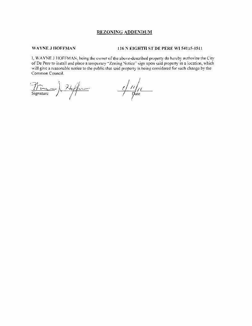
REZONING ADDENDUM
WAYNE 1 HOFFMAN 116 N EIGHTH ST DE PERE WI 54115-1511
I VAYNE J HOFFMAN being the owner of the above-described property do hereby authorize the City of De Perc to install and place a temporary Zoning Notice sign upon said property in a location which will give a reasonable notice to the public that said property is being considered for such change by the Common Council
REZONING ADDENDUM
ADELE HEUVELMANS 804 MAIN AV DE PERE VI 54115-1335
I ADELE HEUVELMANS being the owner of the above-described propertydo hereby authorize the City of De Pere to install and place a temporary Zoning Notice sign upon said property in a location which will give a reasonable notice to the public that said property is being considered for such change by the Common Council
Od4 7 middot7lt-f-vtA-e~-te-i-+_ -1- Signature Date
REZONING ADDENDUM
JERRY T amp ELLEN L LANDWEHR 808 MAIN AV DE PERF WI 54115-1335
I JERRY T amp ELLEN L LANDWEHR being the owner of the above-described property do hereby authorize the City of De Pere 10 install and place a temporary Zoning Notice sign upon said property in a location which will give a reasonable notice to the public that said property is being considered for such change bythe Common Council
Date
Date
REZONING ADDENDUM
rENNTFER M TITULAER 811 OAK ST DEPERE WI 54115-1532
I J ENN [FER M TITULAER being the owner of the above-described property do hereby authorize the City of De Pere to install and place a temporary Zoning Notice sign upon said property in a location vhi9~1 will give a reasonable notice to the public that said property is being considered for such change by
the C~tl10rt r
7~ GUfj l d II Sjgnarure Date I I
(
REZONING ADDENDUM
THOMAS J HARRIS 815 OAK ST DE PERE WI 54115-1532
L THOMAS J HARRIS being the owner of the above-described property do hereby authorize the City of De Perc to install and place a temporary Zoning Notice sign upon said property in a location which will give a reasonable notice to the public that said property is being considered for such change by the Common Council
J -
Signature Date
SIgnature j Date
REZONING ADDENDUM
JULIE A REINDL 816 MAIN AV DE PERE WI 54115-1335
I JULIE A REINDL being the owner of the above-described property do hereby authorize the City of De Pere to install and place a temporary Zoning Notice sign upon said property in a location which will give a reasonable notice to the public that said property is being considered for such change by the Common Council
Signature Date
REZONING ADDENDUM
HENRYN amp LORI L VAN STEDUM 819 OAK ST DE PERE WI 54115-1532
I HENRY N amp LORI L VAN STEDUM being the owner of the above-described property do hereby authorize the City of De Perc to install and place a temporary Zoning Notice sign upon said property in a location which will give a reasonable notice to the public that said property is being considered for such change by the Common Council
-0 -W01l Date
- O -tiJa 1 Date
COMPANIES
PARTNERS IN DEVELOPMENT
January 14 2011
Mr Ken Pabich Director of Planning and Economic Development 335 S Broadway Street De Pere WI 54115
RE Project Description and Re-zoning Request Residential Properties Located at the NWC ofMain St and 8th St
Dear Mr Pabich
The purpose of the re-zoning request to the city is to demolish the 14 existing dwelling garage and storage structures on the subject properties and to construct a new 13225 sf CVS Pharmacy with a Drive-thru facility One dwelling and garage located at 219 8ID St N is to be relocated to the lTWC of 9th St N and Pine St Please advise any additional information required for this re-zoning request
Sincerely The Velmeir Companies
John C Baumann Director of Construction
4
LOCATION MAP NTS
[pJ
(QJtegIAI~e
P~crbrtLoieg
l
f
L
CIW OF DEe ~ -
p
yenljs1tlart A4$
a Esf~ [)r c l1l -E Hettn~ Ave
Giant St EEi
ECT ATI9N
middott~
(I)
1 ~
~~I
shy
)
I J
I I I I I I s I l~
1~~
I
-- 3IJrL I
t r [_1 1851
I I I I I I
1
~~~~~~~~L __t I= -~
DESCRIPlION
andEgintmng lli1- W-l- __ W1~
262-7I-IlOO_H02--N66www~
RA Smith National -----shy sm
SITE PLAN
CVS PHARMACY
CITY OF DE PERE WIo N
o
I~[~I~~~~~lC~ Dr5 shy lWTE~AA
(~S - PfwtT BllCE
ALUIISTOR(fRQllTshyQ(NlAllOO2poundO
IINIA_C-O[[PREO
ALUliAU10llAllCDOCRshyCUNl~OOIZ[O
MAI N 5 T R E E T E LEV AT ION
PREIllI5IpoundO ~EA1 CCFINC -CtxOillOYAlt)1IW1D1TM
ur5 - 10UM
AlUWS1QR(fIl~~shya[AA~QOIltO
SPlllr1CWUshy$CIl conI) lH1LA~C-O[[PR(D
~~~~~ngOCOl_
NOR T H 8 T H 5 T RE ET E LEV AT ION
~
OAK 5 T R E E T E LEV AT ION SCAlEIlTS
REA R E LEV AT ION
NORR ARCHITECTS INGINEIIlS UNNEAS
719 Grhwoln Strc~r
sene 1000 Detmh M14~2l6
wwwecrrccm SCAlENTS
City ofDe Pere Plan Commission StaffComments Jan 24 2011 D
Item 3 Review Precise Implementation Plan for the new 9278 square foot Krause Financial office building in the East Industrial Park located on Profit Place Agent David OBrien
New office building for Krause Financial is to be located in the East Industrial Park on Profit Place The office building is 9278 square feet and is designed for future expansion to the south
Does the project meet the City Stormwater regulations
Sewer properly connected
Water properly connected
Access properly designed (driveway and sidewalks)
Are there any issues with easements or right-of-ways
Are there other items that need to be addressed
DYes _ No DNA _ Yes D No DNA _ Yes D No DNA _ Yes IJ No DNA DYes _ No DNA DYes _ No DNA
RequiredActions 1 The City storm sewer is designed to transport a peak discharge of a S-year rain event for industrial land use
Provide calculations for the peak discharge off the site Include the vacant property to the south under a developed condition
2 Provide a curb head cut at the new access point Do not remove the entire curb unless the curb is deteriorated Remove the curb cut detail from the plan set
3 Plan states that sanitary lateral is 6 lined The sanitary is 6 in diameter but has not been lined 4 The storm sewer tap at the inlet is to be core drilled The City Engineer is to be notified 24 hours prior to
construction An excavation permit will be required for the storm sewer work in the right-of-way S Insulate the water main if there is less than 18 of vertical clearance between the bottom of the new storm sewer
and top of the water main
Does the project meet the City Landscaping Regulations _ Yes D No DNA
RequiredActions 1 The southern portion of the lot must be maintained as lawn and cannot remain as existing conditions 2 All planting mulehing and staking should be in accordance with WDNR recommendations and current proper
practices 3 Allplant material and beds should have a follow up schedule for maintenance and replacement It is essential that
this schedule be established to ensure that the plants are maintained for health and any compromised plants are to be replaced in a timely manner This maintenance schedule should include provisions to protect plants in the winter as some of these may be susceptible to animal feeding or damage
4 A preservation and protection plan for existing vegetation and trees including City owned trees and shrubs should be included on plans when applicable
RecommendedActions S It appears there would be room for additional plantings of trees on the perimeter of the property Other tree
varieties and species could be incorporated into the plan
Does the project meet City Fire Codes _ Yes D No DNA
RequiredActions 1 Provide detailed plans for construction review prior to the start of work provide details of use for all areas of
structure Define uses for all areas of the building 2 Detail means of egress in all areas of building and provide capacity and exit width detail 3 Separation of hazardsuse is required in accordance with FCLSC Fire rated assemblies are required for the
furnace room and general storage areas 4 Provide exitemergency lighting throughout the means of egress S Provide fire extinguishers at maximum 75 travel distances from any point Locate extinguishers towards the exits 6 Installation of key box for fire department access RecommendedActions 7 Recommend installation of a fire alarm system should such a system be desired submission of detailed plans with
cut sheets and battery cales is required prior to installation 8 Recommend installation ofa fire sprinkler system based on size and construction type should such a system be
desired submission of detailed plans with cut sheets and hydraulic cales is required prior to installation
City ofDe Pere Plan Commission StaffComments Jan 24 2011
I 09 u CIl 0 5 be
sectI
oS Ql
oCl be I deg2 I ltII
E
Does the project meet the design regulations (exterior building elevationsmaterials) _ Yes D No DNA Does the project meet the City setback requirements _ Yes D No DNA Does the project meet the City parking requirements _ Yes D No DNA Does the project meet the City lighting requirements _ Yes D No DNA Is the refuse properly sited and screened _ Yes D No DNA Does the signage meet the Citycode _ Yes D No DNA Are there other items that need to be addressed DYes _ No DNA RequiredActions 1 Color for the building shall be earth tone in color 2 For parking traditional standards would require 38 stalls Under the 1-1zoning the Plan Commission can reduce
this requirement based on need We were told by the owner that 30 stalls would meet their needs The Plan Commission may want to request a letter from the owner to place on file to ensure there is no parking on the street in the future
3 The south gable end finish material should be modified to bring the design back into scale 4 Refuse enclosure shall be a matching split face concrete block with non-metal gates 5 As a note the two parcels will need to be combined before permits can be issued
Recommendation Staff would recommend approval with all required actions being implemented and the Precise Implementation Plan be forwarded to City Council for approval
CITY OF DE PERE Fee $ 24500
Receipt _-=6--I--=tu---O _
APPLICATION FOR SITE PLAN REVIEW Date
Please print or type using black ink for duplicating purposes
A Property Owner Name 1) C-e 6 y togtgt-t
V 1
- ffi
----)--2~L=--poundL-2lt3-k-_P~v)S~-4Jy
I hereby appoint the following as my agent for purposes of this application
Agent Name uCLvd e8r~~ ------- shyMailing Address -p 130 l ( ~S- Phone t9amp~930D
Signature DatelO I tJ6 1M It
B Property Information
AddressLocation of Property ~~ ~T-N f ~o-h t- Parcel pound D ~ pound0081-Z ~ CJ etmiddot- FbcR -Z-- t
Parcel Dimension t7f)( gttl3 Parcel Area -l7~~r-JcentLJ2--------shyLegal Description _
A Site Plan Review is requested as authorized by the De Pere Zoning Code Section(s) Article XIII
SectiOn146~middot0
Signed ApplicantAgentJLLOh-= Dated 111 II(
A plan consisting of all applicable information listed on the attached shall be submitted with this application
SITE PLAN REVIEW REQUIREMENTS
KRAUSE FINANCIAL SERVICES INC FOR BAYLAND BUILDINGS INC
CITY OF DE PERE BROWN COUNTY WISCONSIN AnENTIONI OOWNLOAOED PLANSARENOTSCALEASLE NEITHER THE OWNERORTHE ENGINEER SHALLSE HELDRESPONSIBLE FORTHESCALEOF DOWNLOADED PLANSONLYPRINTED PLANSFROMBLUEPRINTSERViCECO INCSHALLBE CONSIDERED TO BESCALEABLE PLANS
VICINITYMAP
fl(CAAl1ll~
II 1
1 l
Non ElClSnNlJ UTlUlIESSItC)MIONPLAH9AREAPPRO)jlW1Enil CON11IACTOR SliAlJBE RESPONSIBlE FOROIl1AININCI EXACTLOCATlDHS ANDELEVATIONS OFALLvnmas MIETlIERllHOWNDRNOTFROMTHECJVrNEP6 OFTHEREampPECTlYE umnlEs ALLUntTY OWNEASSHALt BENl1TJFIEO FORLOCATES avmE OOtmUlcrOR n HOlIll5PRIORTO
ouEA03ION CONTROL loIEAIilUREIilSWltLL 8E ~ PLACE PAIORTOCONSTFlUCTlDN AHOSfULlCOlolFOlllol TOlHEW1ampcOf1lWl OEPAPl1olENTOF IoUruIW RUOLIRCn CONSllIOCTlOfj mE EROSIONCOI4mOl AHOlECHtlICAL 5fANDAAOS
INDEXTO DRAWINGS SHTNO DESCRIPTION
1 LOCATiON MAPSANDINDEXTODRAWINGS 2 EXISTING SiTE CONDmONS 3 SITEPLAN UTILITYPLAN 5 GRADING ANDEROSiONCONTROL PLAN 6 DETAILS 7 DETAILS a EROSiON CONTROL DETAILS -INLET PROTECTION L----shyANDMISCELLANEOUS DETAILS Q EROSiON CONTROL DETAILSmiddot DITCHCHECKDETAILS 10 EROSiON CONTROL DETAILS- DITCHCHECKDETAILS
JoSPRfN DATE I APPROV REVlSIOJf KRAUSEFINANCiALSERVICES INCD
4 Robert E Lee amp Associates Inc
~~ECKEO FORBAYLAND BUILDINGS INC ENGJNEEftJNG 5~G ENVlRONltEmAL SERVtCESLOCATION MAPSANDINDEXTO DRAWINGSCiTYOF DE PERE eeeeeec --lBROWNCOUNTYWISCONSiN
LOCATION MAP
------ --- shyUTILITY INfORMATION I~~~rl
DESTINY DRIVE UTILITIES PRESENT crrvOF DEPEREWISCONSINPUBUCSERVICES6C TIMEWARNERCABLEl usSiGNAL I ~ 0 ___ bullbull
UTIUTlESSHOWNON THis MAP AREBASEDON lOCATES FAD I ~~ ~~~~100k=I
~--L (~ I 4 11 OIGGERS HDTUNETICKETNUlolaEA201~02Isa DATED 1223J2010 VISlBLEOB6EAVATIDN oN 12l2~01D AND i [ ~--- -__ ~~BR~EU~~~~~~~~NJiU~~~~O~~DEE~F~~g~ ~~U~~p~E VEFlIFleDPRIORTO 1Hf DIGGING I
1
11 ~ r u nn n~-=--=-~----- ~ ~ _ ~~_=~_--_DIGGERSliaTUIIlE HOo-242middota511
n -- 0_i 1j t ~ r -- L ~~Ju o~ gt 11 WATBIISAtHTAAYJtm]AU SCWlR~ GAS ELEGTJUO TelEPHONE C~BLE TV DEPARTNENTOf PUBUCWOIII(S WISCONSIN PUBLic SpoundRVIOE COItJgt no TIME WAflNER CABLE CNOFDEPEAE 6OONORTliMJMUgt6T lIaiampSFEJlSON6T 1OQ1KENNEOt AVE e25SXTHST Po BO)(180Dll GRiIENBAY W154~ KIUBliRlY WIUI)l i 11 fl~ ----~~----7~----- ~tmiddot r~1 DEPpoundREW1541gtS OrtEENBAYW16Q07
tQ~Q~-lIl47 820)11111207 (lI1l0jU9-5G7amp (InI4JJ~3 Ii ~n I I I lt0 I II
iJ - ---- -- I 1-I r1
tlll bullbullbullbullbull 111 i I lt1 ~ -11 I I IOWNER INfORMATION coNTRACTOR INfORMATION
ICFlAUSE FINANCIAL SERVICES INc BAYlANDBUILDINGS INC 1234ENrERPRI5E DRIVE POBOX13571 II-- i DEPEREW1 54115 GREEN6AYWI amp43D7middot3571 1
t 1_~I dl~i~ I I
I
II
~I~I I)0
j I ) I ~I i iI 5 III
(B6ampaS5-7437 (B20)3711i20D ) k I 1 IIL iIol 1 i ICONTACT DALE KRAUSE CONTACT DAVIDOBRIEN ~ ~I i 1 ) II) II Iti II
LEGEND -6 FIREHYDRANT I I i
tal ~ DECIDUOUS TREE I~I bull I
WATERVALVECURB STOP I gt I 1 I ~ i [ I I LOll I I tiWATERMANHOLE ~ bull _ bull o CONIFEROUS TREE j e I o SANITAAV tlANHOLE ~ 11 11 ~ r ese sr I I I Io BUSH o STORMMANHOlE II i r l ~ 1 ~ I I ~ ~ t~3B21 OP~ STORMIlANHOLE
RIPRAPbull J l ~ i i raquo I I 1151 lINIlIIll STORMINLET j shy glOOMINLETMANHOLE ~ZJf)IofI SPOTELEVATION III POWERPOLE r- ) i ~)i J I II ~
W~h FIRSTFLOCIRotlASEIrlENT ELEVATiON bull ~bullbull_ iEJ-oPOWERPOlE WGIN WIRE i4iL-i-l 0 ~ i al ~IUGHTPOLE N -rorAPPROXIMATE ROCKElEVATIONo ELECTRICMANIiOLE
III ELECTRICtlElER r III ll i I __ __ ) - I If__ 12 EXISTINGCULVERT
laquoI GASVALVE tii i I -- n iii ~ 1 I - -- - - - - - +-1- - i I I ti i ~ GASUETER o CONCRETE 81 MAIlBOX
CZJ WET1ANDS ~ - I I I I Iof SIGN
POST I f i
~ HANDICAP PARKING IRONPIPEJROD 11 ~ I I if I
4 PKNAlL ji rill I i i I 1 II I EXISTINGSANITARY SEWER (SIZENOTED) i 11 I 1 bull
EDGEOF PAVEMENT EXISlINGFORCEJJAlN (SIZENOTED)II ill- h i~ 1 ml i II ImiddotI ii -10C- ~ISlING STORMSEWER(SIZENOTED)
EDGEOF MAVEL k --N-- EXISlINGWATERMAIN (SIZENOTED) 1 I I 1i1 --0-- GASUNE C Ii
EXISTINGCURBamp GUTTEA I I ill 1 II i LOI I [I II --oc-- oVERHEADTELEPHONE UNE ---- UNDERGROUND TELEPHONE LINE 1
- TREEiBRUSH UNE --oc-- OVERHEAD ELECTRICUNE ) i ]1 n _ 1 I~ I
---- UNDERGROUNOELfCTRICUNE bullbull vse-bullbullbullbullbull EXISlINGCONTOURUNE i 11 -- t I
- OTV- OVERHEAD CABLE1VUNE --N-- CAaLElVLlHE I
RETAINING WAll 1 lilgtlll II ilmiddotMVUNE PROPERlYUNE H j i I I I
GUARDRAIL - EASEMENT UNE
~ FENCE BUILDING SETBACK UNE i I I ~ - i I II I ISEcnONUNE NOHIGHWAYACCESS
I I I II i ) I Ii i I I I i I l I I I I shy bull I1 1I~ I ~ ii k i I I J _ -J- _J ---- _ _ _ _ _ _ _ _ _ - - - - - - - - - - - - ~-- - LilI
gll~~ ~ NOTE D-t1 bullj I ELEVATIONs SHOWNAREBASEOON APREVIOUSCITY OF DEPEREEASTalOEDATUM SUSTRACT 091 TO ~mtII 8U) 0 CONVERTTO NAVOsl l
-0ampOATE IIoPPRrN OMWN KRAUSEFINANCiAL SERVICES INC-- shy FORBAYLAND BUILDINGS INC CITYOFDEPERE
~CJltQ) EXISTING SITECONDITIONS
~~SlCNEO BROWNCOUNTY WISCOSNIN
~r---L-j m1--Igill~~ ~~i~~~ 1131 bullI 1 -bull I 1 middot bullbullbull ]~) (SI1
~ e sr ------ shy
(I [a
[
I ar
I 1 I
r I
[ I [
I 1 f I r Ii
r
I I I I I I I I I I I I I
I I I I I I I I I I I I I I I I
I
I I 1 f-I ~I i~
I I
I
~ ~ ~I E~SnNG SURFACE TO AEMAIN I
~ 1 I ITJ I
I shyI II I
I I
I I 1 f~
I I I I
[1] I ~ ~ I I
I I ~ I I I I I I I ~ I I I I II
II l I I I _L II I8 I ----- ~ I I I I _------- ~ I
I f- I I - - -- - i7Jr I II I L_-J---- ~
I I amp-0~~ RlVlSlON KRAUSE FINANCiALSERVICES INC
I ri
-------------------------- ---------p----shyLOCAlED UMENT ON DESTINYDRIVE FROMEXl971NO OFFICE WITHNEW MASONRV BASE ANDELECTRICAL EX IHIEAGIUL CIJRlI ltlGUnER
shyNOCCESS _ 100 29917
~ ltgt3 J SLAND6CAPEAREAWlTH bull bullbullbullbull I io middott 5PRINKLEASYGTEM f
~ PROfr2~~ ~~DING
~~ FF ELEV63900
~ k 11I i I I I I I
I iii I f- I ~I J
f- I sect I
-- shyI I I I I I I I I I I I I I
w I I~
c I I I I I I I I I I
PROVlDE~1R6OPENING I ~~~g~ ~D~~~~~~~~SfARY VERIFYW H CITYBEFOREREMO~ING
DRIVEWA OPENINGCONCl1iTE I
I - shy
rIJ
SCIII2INFEET
NOTE ELEVATIONS SHOWNAREBASEDON APREVIOUS CITY OF DEFEREEASTSIDEDATUMSUBTRACT cer TO CONVERTTONAVDse
I~ l I
I II
NOTE ALLAREAS DESIGNATED ASGREENSPACE OR LAWN SHAll BE TOPSOILED TO A DEPTH OF e INCHES SEEOED ANDMUUHED AREA TO BE RAKEDFAEEOFSTONESAtJO CLUMPS
PARKINGVATA TOTALPARKINGSPACESPROVIDED 30
HANDICAP ACCESSIBlfPARKING SPACES 2
TOTALPARKING SPACESAEQUIRED24
SITEVATA TOTALAREA 223ACRES97212 SF
BUILDING AREA 021ACRES921aSF(amp5710)
SIOEWAlKIPARKING LOTAREA 032ACRES13B37SF(14jl3j
GREENSPACE090 ACRES39202BF(4033)
UNDISTURBED AREA 080ACRES348995F (35874)
ZONING
CONSTRUCnON CLASSIFICA nON vbull
PAllCEL NO EDF0081-2
EDmiddotFOOB1-2middot
LEGfNV
o CONCRETE PAVE~ENT
IRJ ASPHALT PAVEMENT
~ GREENSPACE
LANDSCAPED AREA
__ PROPOSEDie-CURBamp GoUTIER -- (UNLESS OThERWISENOTED)
~ PROPOSED SHEDDINCl CURBamp ClUTIER
PAINlED FIRElANE wlt
TRAFFICFLOWARROW ltgt HANDICAPPED PARKING~
NOTEALLCURBRADIIARETO THEFACEOF CURB
I I
I I I I
I I I
I I I
I I I I I
I I I
I I I
I
III
II I
I
I I I
II
I I I
I III
I10 I
I
I
t II I
I
I I If-shy
U) I I I
I I I
I I I
I III
I I I
I I
II I
I
I I I I
II I
I
I I
~ CHrtKlD FORBAYlAND BUILDINGS INC SITEPLAN --l ~ NeesaR UIl ENVIllONgtltBNTAI
CiTYOF DEPERE ~SICHEO BROWNCOUNTY WISCONSiN
3
-------------- shy WATERANOSMIITAAfLATERALS I AREESTl~ATED TO BE6 LINED DESTINYDRIVE
CONTACToRTO VERIFYEXACT [xlHlE~CIRfIampCln1m LOCATION ANDELEVAll0ItJI
I
I
I I
LE~IIIV --------PROPOSED SANlTARYSEWER I----~-- EXlSTlNG SANITARY SElJJER (SIZENOTED)
I bull - bullbullbull EX(STINGSTORMSEWER(SIZENOTED) =bull - bull - bull - bull - bull -PROPOSED WATERIolAlN
= == == PADPDSEOSTORM SEWER
---~-6w-6- EXISTlNGWATERIAIN (SI2ENOIED) I
I
~ ~ ~ ~ ~ I-6 -6 FIREHYDRANT I II $ WATERVALVEICURBSTOP l reg WATER MANHOLE V l REOUCER1NCREASER a 0 ISANITAAYMAIIHOlE C 0 STORMMANHOLE I I OPENSTOIUlMANHOLE UU lI STeAL( INLET C () STORMINLETMANHOLE I
I C
PLUM13ING VA TA CI
DRAINAGE FIXTURE UNITS 24 I I WATER FIXTURE UNITS 28 I m
NOTE I II MINIMUMOF S5FEETOF COVERSHALLSE MAINTAINEo I OVER ALL WATERMAIN
SANITARYSEWER WATERMA1N AND STORMSEWER5HALL BE CONSTRUCTEDIN ACCORDANCEWllrl TIIESTAIIOARD I6P~IFICAnONS FORSEWERANDWATERCONSTRUCTION IN WISCONSINAND ADMINISTRATIVE CODE CIAPTEASCOMM81middot87 I
rI
f~jil 3 FIELDVERIFYLOCATION OF EXISTINGUTILITIES IF EXISTING
LOCATIONSDIFFERFROMWHAT IS INDICATEDON 11-tEPLANS CONTACT ENGINEERPRIOR TOCONTlNUEOWORK I STORMLATERALSSHALL BE EQUIPPEDWITHTRACERMRE
i11 I
I
Ibull All DOWNSPOUTSSHALLBECLEANOUTDOWNSPOUTS
I I
I I
I I
I
IPROV 001[ I)fgtPROV ORoWH KRAUSEFINANCIALSERVICESINC ~E~00 FORBAVLAND BUILDINGS INC
CITYOF DEPERE UTIUlYPLAN ~SIGNEO BROWN COUNTY WISCONSIN
r-- shyI I I I I I I
I I I I I I I I I
I -shy
lOCAlEIHFUT
NOTE ELEVATIoNS sHoWN AREBASEDONAPREVlouaCllY OF DEPEREEASTSIOlDATUM sUBTRACTDe1TO
~-o CONVERTTONAVDB6
n srta r rl6367T1------shyOl~
~~~ g~~~ 10j ~L--ri-~ ---_~----r--___-~~7_
EXST utl l
LEIiRVV TOPOFCURBELEVATION~lcStltlil
FLOWUNE ELEVATION~F- TOPOFSIDEWALKELEVATION~SNJ66666
EDGEOF PAVEMeNTELEVATION~55
TOPOF RETAINING WALLELEVATION~RN444
~3J333 ORQIIIOELEVATION
DR-JNAGE SWAlE
DRAINAGE DIVIDE
---x- SlLTFENCe
~ BALE DITCH CHECK
FLOWAAAOW
TRACKlNCiPAOmmli INLETPROTECTION
NOTE ALLSANITARYSEWERSTORMSEWER ANDWATER SERVIcESIMAINSSHALLBE PROVIDED WITHTRACER WIREOA OTHER METHODTO BE lOCATED
STOlL IIIAITR MANAGEMRVT THISsrrsISTREATEQBY REGIONAL STORMWATER PONDTHAT IS LOCATEDSOUTHNeWEST OF THE END OFTHE CUL DEBAC OF PROFIT P~CE
ELOSWN cONT1WL NOTE All EROSrON CONTROLPRACTICE61NDICATEDON THIS PlAN ME APPROXIMATE LOCATIONSONLY THEACTUALSITEMAY REClUIREMOREOR LESSEROSiONCONTROLDEPENDINGON THE CURRENTCONDITIONOF THE SITE ~ SILT FENCEIS REQUIREDDOWNSLOPEOF ANY DISTURSED
LANDTHAT MAYCARRYSEDIMEtiTS OFF SITEl ltl
A TRACKINGPADIS REQUIREDAT ANYINGRESSIEGRESS LOCATIONWHERESEDII1ENT MAY BETRACKEDOFF-5ITE
II
PROPERIfLET PROTECTION6HAll BE U6ED OEPENDING ONTHE INLETTYPE
-4 SEDIMENTBASKET GH-ll BE USEDFOR ANY 6ITE DEWATERING
I I
I
I
I
in [)j j Ul
R1I4l7l1i1 0_S75I -- shy1 I~~~ m ~ 2lt 1 1 IIMampJl24(Wst)
Ii 1 I I r I i I
II i I I I j I I
STIHL4 r~ ~ I
t III
~ NLET(TYP) ~T~~ I
I j lJ I
OSTllILll Ii rL63s92
1I D_4045 It lW6l247 (W IN) llN6l U 71(15middotSO i I G ~ I
I
STING w o i a
I shy u ~921 I a i -(~ I i i 1160 II a
I L I - -1--+ ~ I f l I i I I ~ I II f j I I II J
I
J i I I I I 12 - shyI 1 ( I i I ~I ~ I 1 A I - I ~
f ~ I
i Iil71
_ - V~ - - - -- -- - ~-- - L Y Dwnall 111163U)
0-1117 NOTE ELEVATIONS sHoWN AREBASEDON A PREVIOOS CITY~~~ ~8 amp-0 g~~~~~RioE~~Jo~E DATUM SUBTRACTO91 TO001pound I APPRO KRAUSEFINANCIAL SERVICES INC IrQb~ Lee ampAsSOc]iite IncON ~~
CHECKED FORBAYLAND BUILDINGS NC EIGltiEERlNG SIJRVElING ENVIROHlWnALSUVlCpoundSGRADING ANDERosiON CONmOL PLAN 4664 COLOEN PONOPARltCOURTCITYOF DEPERE
~CNED ~oWl~~~lnltltom ~~~j~~2~)6~jN41BROWNCOUNTY WSCONSIN
NOTENEENAH R-3275OREQUALWITH TYPEA GRATEORRmiddot3246AOR Rmiddot3Dfl7WITHTYPEL GRATE
LESSTHAN4SHAlL BE RUBBER)
CLARlTY1
I 10$1 ~
~
il4R TO BEADOF ADJUSTlfIG RING CLEANOUT LINETOBElHE SAIlE ANDCASTlNGSEALANT OREQUAL SIZE5 MATERIAL ASSEWERIlAIN BElWEEN ADJUSTlNG RINGSAND NOTE CLEAWOUlLINETO BETHE
CONCRETE ADJUSTlNG RINGS SAME SIZEaIlATERIALASSEWER MIIN
ADAJSTlNG RINBSONLYWITH CASTING COATOUTSIDE OF
ASREOUIRED (4MINAND12 MAX UNLESSOTHERWISESEWERJOltlT COl4iOUNDND NOTEDALlADJUSTING RINGSWRAPWITHMIN8 MIL
~ GRADEPOLYETHI1ENE
ECCENTRIC REDUCING CONE (VERTICALWALL OF
PVCCOATEDCASTIRON 24 SQUARE LlHSTEPSmiddotOC CONePAD CLEANOUT PWB
ECCENTRiC CONESHALLBE ONDOINSTREAM SIDEOF MANHOLE THISDETAIL 4 (MIN)GRAVEL NOTESHOWNROTATED W FOR ADJUSTTOGRADEBY
CLEANoUTPLUG
II SUDINGVERTICALLY UPORDOWNOVER
PVQPIPESEWER 21 r~~~~~~~~~~~~4 SERVICE EACHJOINT
PROVIDE FROSTSLfEVE SERVICEPEAoCOM1l8236 (5)A)2
PROVIDEFROSTSLEEVE PEROCOMM8235 (6) fAJ2~~ TONGUE ampGROOVE PVCPIPE
n 45 BEND JOINTREQUIRED
PVCPIPE
FLEXIBLE PIPE To MANHOlE 45- BEND CONNECTOR REaUIRED
6PECUBEDDING
8 PRECAST S-8IlIN CONCRETE SASE SPECD SEODINGI I
SANITARYAND STORM CLEAN-OUT DETAIL CLEAN-OUT DETAIL STANDARD MANHOLE (TRAVELED AREAS) (NON-TRAVELED AREAS)
8-24(INCLUSIVE)
314-ro r
eunPOLYETHYLENE
I
~rd 81 ~I
~I
~
HDPEtPVC SEWERamp WATERMAIN amp FORCEMAINSTORM MANHOLE INLET PAVEMENT RESTORATION BEDDING ampTRENCHSECTIONTYPE A
MgtPFt(N ~T[ I WPROV REVISlCIH ~ampWN KRAUSEFINANCiAL SERVICES INC FORBAVLAND BUILDINGS INC~CKED DETAILS ~uCITYOFDEPERE
~IONEO BROWN COUNTY WISCONSIN
o
~ Io
I
W(IlAXJ12+00J2 W(MIN)-6oi-00J2
COMPACTEO BEDDING ANDCQVER SOILCLASSA-7
INITAL3 OFSOILCLASS ASIN WETORUNSTASLE TRENCH AS DIRECTED SYTHEENGINEER
WITHOUT EXTRACOST TOQWNER
I
ampolLCtASSG-l OR C-31FREQUIRED PER SPECIFlCAllONS
NOTE SUFlFACE RESTORATION REQUIREMENTS PERTHE SPECIFICATIONS
UNDER BARREL (8 FORBEDROCK EXCAVATiON
UTILITYTRENCH
t ENRENGTH ORENcH I bull -j _middot~middoti middotbullIc-~~~
PIPEUNE
SAWCUT CONStSTENTWlDTH
Imiddot I II I I 11--- -THiCKMANHOLE TOP
PVCCOAlEDCAST IRONIlHSTEPSmiddot 10C
BEADOF ADJUSTING NEENAH R-3215OREOUALWITH RINGANDCASTING SEALANT OR TYPEA GRATEORRmiddot1246AOR EQUALBETWEEN ADJSllNG Rmiddot3067WITHTYPEL BAATE RINGSANDCASTING COAT CONCRETE ADJUSTING RINGS OUT6IDEOF ADJUSTING RINGS 4SREQUiRED 14MINAND 12 ONLYWITHSEWER JOINT MAX UNLESS OTHERIIJISE
COMPOUND ANDWRAPWITH1l~N~~-~~~~L NOTEDALLADJUSTlNG RINGSLESSTHAN4SHALLBE RUBBER)
WAlllt CONTRACTION JOINTSPACING EXPANSION WIDTH TRANSVERSE LONGITUDINAL JOINTSPACING
NOTREQD 100lJAX
s NOTREQD 100lJAX 0 S NOTRECD 100lJAX 0 100lJAX e 100lJAX s 0 lOOlJAX
~
oj ~
~y
PROVIDE CONTRAClloH JOINlS 6CONCRETE ASDIRECTED BY ATUAXItlUlJ 20SPACING BY GENERALCONTRACTOR SAWCUTTINGOFtINSERTIONOF
DIVIDER PLATES
12 OFNO3 ORNO4 GRADATION R E6AR S LE EVES ~MINllJUMVOID rrEXPANSION MATERIAL WILLBEPLACEO ONEACHSlOEOFTHEORNEASUITINGTHE THERIlALEXPANSION SPliCEATENDOFSLEEVE FOR
SIDEWAUlt SIDEWALK ANDDRIVEWAY APRON SHAll BECONSTRUCTED SEPARATELY UNLESSOlHEfWJSE APPROVED BY THEDIRECTOROF PUBLICWORXS BACXOf CUAB COMPACTEDSUBGRADE
CONCRETE PAVEMENTDETAIL ~I 3~l rI~1 1 ABPHALTSATURATED fELT EXPANSION JOINTFILLERPLACED ~ ~rQ ATlJAXllgttUM 300middot SPACING AND
middotB1TUMINOUSSlJRFACE ATAll ENDSOf RADII 1 34 BITUMINOUS BINDER
18 LONG12 DIAlJmRIt REINfORCINGRODS 12 OF NO3 ORNO4 GRADATION ~
DRILL518HOLEMIN9 INTOEXISTINGCURB
CURBTIE-IN DETAIL lPAOPOSEDTO EXISTING)
COMPACTED SUBGRADE
ASPHALT PAVEMENT DETAIL SAWCUlCURBTRANSVERSELY PRIORTO RElJOVAl
~
12middotR60
COItRETE 4 APRONbull
DIMENSION VARIES SEEPlAN
I NOTE REFERTO SPECIFICATIONS FORREINFORCElJENlS
IiI CURBREMOVAL FORDRIVEWAY OPENINGWITH ~ CONCRETE APRON ONCONCRETE SURFAcESTREETS l
bull
EXPANSION JOINT TOOLED
CONTRACTION JOINT
PAVEMENT ANDBASECOURBE
SIDEWALKWITH INTEGRAL CURBCURBREMOVAL FORDRIVEWAYOPENING WITHCONCRETE APRON ON ASPHALT OVERCONCRETE
SURFACE STREETS
CURB REMOVAL DETAIL SIDEWALKDETAIL
bull VERIFYDETAILMATCHES crrv Of OEPERESTANOMDS
4 EXliTlNc CONCRjre
BREAK
VARIES
S SIDEWALK t ~ ~~~ ~~- z --~~~~N~N-~--~ ---~~
ALLARCUND(TYP) iii 11) gt
All RESIDENTIAL DRiVewAY APRONSSHALL BE FLAREDIF FIELDCONDITIONS PERMI1
THEflAAE BHALl NOTE)(CEED3-0
8middot ORJVEWAYAPRONrshy
~I ~t
bullbull _
1--( middotHmiddot bull middot ~ y ~h~raquo~gtY)1-S
~~ ~
L I bull bullbull bull bull ~ bull _ bullbullbull
CUflBA GUTIER 12 EXPANSION JOINT
DRIVEWAY APRON DETAIL
6lc6WmiddotIN211 W2WWf CENTERIN SLAB
-
CONCAETESlAB
4CONTINUOUS
12 EXPANSIONJOINTWITHSELF LEVEUNGSEALANTWHENCAST AGAINSTSTRUCTUIIE
MINIICOlJPACTED SOILCLASS C-3 MOISTENIMlJEOIATELY BEFOREPlACING CONCRElE
TYPICALSIDEWALK ADJACENT TO STRUCTURE
2RAD
SPECIFIED BITUlJlNOUS
4 CONTINUOUS TOP6 BOTTOM
DATE I APPROY AUSEFINANCiAL SERVICES INCm- TE At Robert E Lee amp Associates Inc SIl[D NO FORBAYLAND BUILDINGS INC~lEC1ltEO a ENGtNBeJUNO SURVEYINO BNVlRONWENTu SEJMCES
CrN OF DEPERE DETAILS fluU BROWNCOUNTY WISCONSIN
7
OR WASHEDSTONE
INLETPROTECTION NOTES
INIHAlUT10NtJDTESR W I4ANUFACTUAEO ilLTERN1TlVES 6PPROVED AND1t(if if f TYPE-e-a-c-USTEDONTIiEWOOTPRODUCTACCEPTABIUTV LJSr AAV BESUBSTITUTED
R TRJM EXCESS FABRIC INTHEFLOWUNETOWITHIN3J fq ~ if OF-THE GRATE
I WHEN ReMOVING ORMAINTAtlllNClINlET PROl1CTION CARESHAll Be TAKEN so THATTHE
50 MIN SEDIMENT TRAPPED ONTHEGEoTEXTllEFABRIC THECONTRaCTOR SHALLOEUClIISTRATE A METHOD OOESNOTFALLINTOTHE INLET NolVMATERIAL Of MAI~ENANCE USINGII SEWNFLAPHANDHOLDS
OROTHER ME11-tOQ TOPREVENT ACCUI4utATEO IMMED1AmV FlLUNGI~O THE INLETSHMl BE RELioVED PLANVIEW SED114ENT FROMe~EAING THEINleT
TYPE0 (j) FINIBHEDSIZEINCLUDINGFLAP POCKETS
WHEREREOUIREDBHALLEXTENDA MINIMUM ~ 2299 00 NOTINSTAllINLET PROTECTION TYPE0 ININLETS
SHALLOWERTHAN3DMEASUREDFROMTHEBOlTQlI PROFILE VIEW MAINl1NANCEOR REMOVAL Of THEINLETTQTHE TOPOFlHE GRATE
Of 10AROUNDTHEPfAIMEllR TO FACIUlATE
reg FDA INLETPROTECTIONNPE C (WITHCURB TRIMEXCESS FABRIC INTHEFLOWUNETOWITHIN 3 middot4 MIN OR FULLWIDTHOF THE EGRESSPOINT BOX)AN ADDITIONAL1SOF fABRIC IS Of THEGRATE REFERENCEWDNRTECHNICALSTANDARD1~1 WRAPPEDAROUNDTHEWOODAND SECURE1l
WITH STAPLESTHE WOCOSHALLNOT SlOCK THEINsTAuEOBAGSHALLHAVEII MINIMUMSiDE THE ENTIREHEIGHTOFTHECUR8 BOX CLENIANCE BElWEEN THE INlET WALLSANDTHE TRACKING PADDETAIL BAGMEASUREDATTIiE eorrouOF THE OVERFLOW OPENING
I
(IF APPUCABlEj HOLESOF 3 WHERENECESSARYTHE
reg FLAPPOCKETSSHALLBE URGE ENOUQHTO CONTRACTOR SHALLCINCHTHE BAG USINGPlASTIC ACCEPTWOOD2X4 ZIPTIESTOACHIEVETHE3ClEARANCETHE TIES
SliALL BE PuCED ATTHE MAXIMUMOF4 FROMTHE BonOM OF THEBAG
1 II
I 4XS OVALHOLESHAlL BE HEAT CUTI~D ALL fOUR SIDEPANELS 3
~ -USEREBAROR SllEL ROD
FORREMOVAL
] Of
FORINLETSWITHCASTCURB 80X USEWOOD2)(4 EXTEND10BEVOtlO GRATE WIDTHONBOTHSIDES LEMCJTH VARIES SECURETO GRATEWITHWIREOR PLASTICTIES
II
WOCO2 X 4 EXTENDS8 MINII4UI4 DOUBLESTITCHED BEYONDaRATe WIDTHON SEAMSALL AROUNOSIDE sorx SIDES LENGTHVARIES PIECESANDON FLAP SECURETo GRAll WITH POCKETS WIREOR PLASTiCTIES
INLET PROTECTION TYPE C INLETPROTECTiON TYPE 0 (WITHCURB BOX) (CAN BEINSTA1lEDIN mf INLETTYPEWITH ORWITHOUTCUM BOX AS PERNoTE Z)
INLETPROTECTION TYPE A
INLETPROTECTION TYPE B (WITHOUTCURB BOX)
(CAN BE INSTALLED IN ANV INLET WITHOUT A CURB BOXI
~~ KRAUSEFINANCiAL SERVICES INC ~ICEI) FORBAYLAND BUILDINGS INC Robert E Lee amp Associates IncEROSION CONTll0L
ENCINEERING SURVETING ENVliOtOlENTAL SERYXCESINLETPROTECTION ANDCiTY OFDE PERE OESlGNEO MiSCELLANEOUS DETAILS ---1 4 8
SUBGRAOE
WOODSTAKES(z PERBoLE) NOMINAL2 X T X 30 MIN LENGTHOR eQUIVALENT
CROSSSECTIONAL VIEW HOPEHIGH DENSITY POlVETHVLENE FABRIC SILTfENCE
FILTERBAG DETAIL
8HEETFLOW lt COURSE AGGREaATEINFORMATION
NOTE 1-shySIZENO ALlOlIJENS1ONS siEVESIZE AASHTO No87 (l)
AREAPPROXltrlAre SHEETFLOW 2 INCH(SO mm) 11fiINCH(375mm)
EMBEO BALES 1INet (250mm) 100 ~NEUZED FLOW314INCt1(111Olnm lMl-IOO 318INCIt(ll5mm) 20-55
PLANVIEW Wo-I175mm 0-10
i Wo8(200mrnl IJ-5
SECTION A-A ~ (1 SiZENoACCORDtNpound To AASHTO1l-l3
L THEDiSTANCE SUCH THAT POINTSIANDB AREOF EQUAL ELEvATIONNOTES
l 18X30middot ROCKFILLED FILTER al3 SHAll BEcOMPRISED OFTHEFOllOWllllB ~ HOPE HIGH DENSlNfOIETHYLENEFORSCOURPROTECTION USE HOPE HIGH DENSITY POLYETHVLENE DRAW sTRINGKt-ITTED DlREOllYlHToBAGOPENINGEROSIONMATFORCHANNELUNING 60 FABRIC CLOSURE WIlli APPARENT OPENINllSIZENOLARGER THAN 118middot X 18middot LAPMATUNDERUPSlREAM BALEB ROLleD BEAMUSINGA IlINttuuOF-180DENIERPOLYESTER SEWINGYARNFOR STRENC1T1-t ANDDURABILITYI ANDSECUREFABRiCWITHWOOD SIDEVIEW
STAKESATmiddotFOOTINTERVALSI USEWELLGRADEDCOURSEAGGREGATE CQNFORIolING TOTHE FOUOWINGGRAOATlON REQUIREMENTS
DITCHCHECKDETAIL
ROCK FILLED EROSiON CONTROL BAGS TYPEB
bull WELLGAADEDANGULARsTONE
OF 3 INCHOR GREATER
Ii~
STAGGERJOINTSBETWEEN ADJACENTROWSoF BALESa PLANVIEW
il STAKESDRIVENflUSH WHEN SOILCONDITIONS PERMITd
n
-------------~~~~~~~~~~~ WELLGRADEDANGULARSTONE OF3 INCHORQREATER
~~~
t-~~ ~1~80nOM ELEvATIONOF ENDSALE SHALLBE EOUALTOOR GREATER THANTOPOF LOWESTMIDDLEBALE IDROP
STAGGERJOINTSWITHDOUBLEROW SIDEVIEW FRONTELEVATION
TEMPORARY DITCH CHECK USING STONE TEMPORARY DITCH CHECK USING EROSiON BALES TYPECTYPE A
RrvISION OATpound I JJgtPRCN ~WH KRAUSE FINANCIAL SERVICES INC CHECKED FORBAYLAND BUILDINGS INC EROSION CONTROL
CllY OFDEPERE DITCH CHECK DETAILS OESICNED BROWN CQUNlYWISCONSIN
L OTENTlAlSCOlJAAREA USEERDSION )MAT OROTHERDEVICE WHEN DIRECTED BYTHEENGINEER
DIRECTIoN
~ ~FlOW
I II Id n
II I
I II
ENDTREATMENT ONSlOPES BACKFILL ampcOMP-cT TOBESIMII1IR TOCHANNEL TREHCHWITH flOW DETAIL
PLAN VIEW (WHEN LTERING THEDIRECTlON Of flOW)
I I I l--- TOEOFSLOPE I I I I I I
[ deg6~E~~~ I I I
PLANVIEW
rSTAKES DRIVENFLUSHWHEN SOILCONDITIClN$ PERMIT
8middot0plusmn
FILLSLOPE
DIRECTION OFFLOW
I II I 1111 ~ - EXISTING GROUND1111 II II BAneR STAXESIN OPPOSITE DIRECTION (TYPICAL)nuVV
FRONT ELEVATION WHENEXISTING GROUNDSLOPESAW~Y fROM FILLSLOPE
EROSION BALESFOR SHEETFLOW
MTE IpPRCN ~1RfWN KRAUSE FiNANCIAL SERVICES INC Leeamp AssDemes IncFORBAYLAND BUILDINGS INC EROSION CONTROl ---iENGUfEERlNG SURYrlTNG ENVlROlnlpoundNTAL SBRvtCllS
CIT OF DEPEAE SHEETFLOWDETAILs BROWNCOUNTWiSCONSIN
~CXEO
EXCAVATED SOIL GEOTEXTlLf FABRIC
WITH ALTERNTlVE SUPPORT COMPONENTS
~ (D
_~uJOiE~
NOTE DEPTH ORTIE ADDITiONAL~~OUIRED IN
SILTFENCENOTES
EROSIONCONTROL SHll BE PROVIDED IN AcCORONCEWITHWDNR SILTFENCEDETAIL ~~~~YSOIl6 TECHNICAL sTANDARD
reg CROSS8AACEWITH2X4~wC()QEN FRAMEOR EQUIVALENT ATTOP ~~
ANCHOR STAKEUIN18lONGWHEN REaD BYENG
SILT FENCETIE BACK
z
~
OFPOSTSASDIRECTED BYmE ENIlINEEAsl reg ~INIMUM 14GAUGE WIREREQUIRED FOLDFABRIC3OYEA THEWIRE~D STAPlE OR PLACEWIRERINGSON 12middot cc
cEOTEILEF )
CD EXCAVATE A TREWCH AMINIMUM of 4W1DE amp6 DEEPrOBURY ANDANCHORTHEGEOTEXTILE FABRIC fOLD MATERIALroFIT TRENCH ANDBACKFILL ampCOflPACTTRENCH WITHEXCAVATED SOIL
d
L WOODPOST reg WIRESUPPORT FENCESHALLBE14GAUGEMINIMUM WOVENWIJlE WITH AMAXlMUMMESH SPACING Of 6 SECURE TOPOFGEOlEXTAE FABRIC
GEOTE)ffi~EFABRlc TOTOPOF FENcEWITHSTAPLES ORWIRERINGSAT 12 cc (TYPE8)
reg ~~=~R~~~~~~~~~~~~~ ~~~~~~~T~t~40Ro 0 EOUAL A HEAW DUlY NYLONTOPSUPPORT CORDOREQUIVALENT IS
WOODPOST REQUIRED (TYPEA)
o STEELPOSTSSHALLBE STUDDED TEEORl lYPE WITHA MINIMUM
GEOTEXTILEFABRIc) WEIGHTOF 128LBSAJNrr (INITHOUT ANCHOR) FlN ANCI~ORS SUFFICiENT TORESISTPOSTMOVEMENT AREREQUIRED WOODPOSfS SHAlL8E A t4INIt4UU SIZEOF 1118X1 lIBmiddot OFOAKORHICKORY
reg CONSTAUCT SILTFENCEFROMA CONTINUOUs ROLLIF POSSIBLE BYd 18lL-__-w-__1Y curnsnLENGTHS TOAYCiDJOINTSIF A JOINTIS NECESSARY USE ONEOFWE FOLLOWINO TWOMETHODS AI1WSTMETHODshyOYERLAP THEENDPOSTSANDTWISTORROTATEATLEAST180 OEGREES B)HOOKMETHOD - HOOKTHEENDOF EACHSILTFENCE LENGTH
reg THEMAXIMUM SPfoClNG OFPOSTSFORWOVENFA8RICBILT FENCE
TWIST METHODreg SHALLBE8 FEETANOFORNoNmiddotWOVENFA8RICJ FEET
EROSiONCONTROL SHEETFLOW NOTES GEOTEXTIlEFABRIC
1 A~ SOILSTOCKPILEDlJiATREMAINS FORMORETHAN7 DAYSSHALLBEcovERED ORTREATED WITHST~BIUZAOON PRACTICES SUCl-lAS TEMPORARY ORPERt4ANEtfT WooDPOST ~ SEEDINGANDMULCHING
2 A MINIMUMOF4 INCHESOFTOPSOIL MUSTBEAPPUEDTOAlLAREASTOBESEEDED ORSODDED
L J All WASTEANDUNUSEDBUILDING MATERIALS (INCLUDING GARBAGE DEBRISCLEANING WASTES WASTEWATER TOXICMATERI4JS ORHAZARDOUS t4ATER1ALS)TE1ltTILEFA8RIC SHALLBEPROPERLY DISPOSED of ~ND NOTALlOWEDTOBECARRIED OFF-8ITEBYRUNOFF ORWIND
4 All OFF-SITE SEDIMENT DEPOSITS OCCURRING ASA RESULTOFCONSmUCTlONWORKORASTORMEVENTSH4JLBE CLEINEO UPBY THEENDOf EACHDAY FWSHINGsH~U NOTBE ALLOWED 5 NVYSOiLEROSiON lJiAT OCCURSAFTERfINAL GRADINGANDOR lliE APPLICATION OF STABILIZATION MlASUREsMUSTBEREPNREDANDTHESTABILIZATION WORK REDONE
WOQDPOST B FORANYDiSTURBED AREATHATREMAINS INACTIVE FORGREATER THAN 7WORKINGDAYSORlNHEREGRADING WORKEXTENDS BEYONDTHEPERMANENT SEEDING
middot C[-r 2middotOMIN DEAOUNES THEsrreeuetBETREATED WITHTEMPORARY sTAB1LI2ATlClN MEASURES SUCHASSOILTREATMENT TEMPORARY SEEDINGANlWfI MULCHING
7bullAU TEMPORARY EROSION CONTROL PRACTICES SHALL8EMlI1NTAINEDUNTllTHESITEIS STABluzEDWITH70 VEGETATION ANDA NOTiCEOFTERt4INATIDN HASBEEN MPROVEDBVTHE DNR 8 WINDEROSION SHALLBEKEPTTO~ MINMUM IXJRJNG cONSTRUCTlON WATEAJNG MULCHORA TACKING AGENTMAYNEEDTO BEUTILIZEDTOPROTECT NEARBY
HOOK METHOD reg AES10ENCESMlATER RESOURCES 9 THECONTRACTOR SHALLBERESPONSIBLE FORMALNTA1NNG AlL THEEROSION CONTFlOlMEAsURES IN CONFORMANCE WITHTHEINDNRCONSERVATlON PRACTlCE STANDARDS LATESTEDITION bull
JOININGTWO LENGTHS OF SiLT FENCE 10 UPONCQIvlPLETIDN OFSTORMJNLETCONSTAVcmON THECONTFIACTOR SHAll INSTAlLSTQRMDRAININLETPROTECTION FORCONSTRUCTiON SiTEASSPECifiED 11 FINESEOIMENT ACCUMULATIONS SHALLBECLEANED FROMSTREETS PRIYATEDRIYES ORPARKING AREASf1( MANUALORMECHANICAL SWEEPING A MINIt4UM OF ONCEPERWEEKANDBEFORE~LL IMMINENT RAINS 12 EFOBION ANDSEDIMENT COtlTROLSTRUCTURES SHALLaEINSPECTED WEEklYANDWITrIJNoj HOURSOFRAINFALL OF05INCHORMORE
MIt RODell E 10
I ~
BAYlAND BUILDINGS INC PGIClCL1IIn 1IIDIIIQWlNII7(IZD) _~
llESDI~au-CIJlIlWCJDlIt
eAYLAND
ppHr~ 1 ~ Ii rv ~ ~ J s ~Hmf I ~ bullH I ~ IH~O fFr Imiddot~IIsectsect ~ - 0
lUll 1l10~jl
I ~I l ~
HrLl~ ~
0 1 sect secti i 0
II t I S - s -j II
I~ I
I IrIII i I I
z I~~I0 0 II] ~ rn
~ ~
I~~I
Qli ~ ~ ~
~d I~~I
lUi I i i
I ] t s t r i 1
t ~ ij H~
~ 3 0 ~
i ~ ~ ~ bull
PROPOSED NEW BUILDING FOR 110-6065 DEPERE WISCONSIN BROWN COUNtY ~ REPJIM THYES (920) 371-2011 JOB NOshy AltCH) FU - orre 122110
8AY1AND 8UIlDINGSINC
Iigt
2W copyJ
11 ~ ~ ~
HT~llHgt065I(1wseF~5elIIaI(c-I2-lJ~c-liQ6SoltU~1I11lCfll1742AH
)
cJcJ 0 cJ cJ 0
cJ cJ 0 cJ cJ 0
Eil~ 1~ E~ ~I~ ~Isect sect sect sectsectEi sect 11111i 11111 ~ ~ I~ ~~
~lll~ ~ ~ II + - iii- Yamp ClCIltgtltgtltgtltgtltgtOoooltgt ltgt ~
I I 111 ~sect ~
~ I ~ I ~ 11Hmlqwl~11
1-1++middotmiddotmiddotmiddotmiddot1++middotmiddot +1- Ejmiddot1 1 ~
~ ilfl~l~ i ~ i ~ i i j ~i~li i -tmiddot i 1 t ~ ~lii~i~~iff~i~ltgt
111 1~ ~ ~ 1 I I IE ~I ~ ~ E I -1-1-1-1- +1-1+ + 1 ~ iii Ii i ilili ilili i iii i )i iii i i
tmiddot middotIt tmiddotmiddotttlmiddotmiddot cbullbullbullbull t~Imiddotmiddotmiddotmiddotmiddot Q~ ~i
I I III I Iii i ~ ~
1 I III I r1111
~ ~
~ii Iio
~~U d~i QIII ~
l r ---------shyi I
------_~===
BIYLANDBUILDINGSINC c aITl 1IlDIbull llIUn(aD)-D _-0 -alMJl ~
L~~=-l imiddot
11 i i
___dI~
eAYLAND
----1 o r Jle
I~
~i
~~ o
ki a
PROPOSED NEW BUILDING FOR fl0-60115 OEPERE WISCONSIN BROWN COUNTY SNES REP JIM TIffES (920) 371-2011 JOB NO I~ JCBNO--NtttO tnE=_ DlQEI22110 DAAJI)IEllDUD
BAYlANll BUIlDINGSINC
~ WJ WJ dm copyl
rr~
[]
NlimWrelIIl-6065~fillltlcizlStrnolIo-12middot23~~ll1I1111JJ117gt48lONol
H _
II II II II
I11
n---shy
II
Ii
Il PROPOSED NEW BUILDING FOR 10-6065 DE PERE WISCONSIN COUNlY OF BROWN ~ REP JIJI 1HYES (920) 371-201 1 lOR NO 1~
IlElrlaquol-(ARCH) fUshy DlaE122110 DRAW1IBlSWJ
BAYlAND BUILDINGSllltC
eAYLANo BAYLANDBUILDINGSINC 1QIDloDn GlIDIMrIfIKlllT (JlIl) 1M (Ira)
telQM bull -n clWIIIIIIClD
1fFalTlPnfirntlHlli5lCnnac~ ScniaIto-12middotUllerltldlll-6lJ6SAllHUlwg 111J2011741125AM
H II
1
ii
II
~i- il 1------ I
11 Ii 1j Ii ~ II
1 i u---shy1 g 11 ~ II
~ II ~ 11 3 II
jQ
Ii Ii Ii II II II
I ~ II II
~ ~ II It II I II II 11 11 II II II II II II II
[ il J 11 11 II
u------1 i
_
rlshy
_
1
PROPOSED NEW BUILDING FOR 10-6065 BAYLANDBUILDINGSINC DE PERE WISCONSIN COUNTY OF BROWN a_wn ~-DQJ7eAYLAND
(DIXt taOSALES REPJllil nNES (920) 371-2011 JOElNO te-eces raDI l1liMIl - ClIIIIIlifICftI108 NO- CAAai) fIL - CiTE 122710 OAAWX Err SWJ
BAYlANO BUILIllNQSINC
11~l2allJa2S]~1OXgtcPOf
r Ggt
1 ltI
~ Q ~ ~sect ij q Q (j)
oz
T z -u
~ ~ ~9 0 lt
~~ ~6 z i ~5i ~~ ~
~ ~ ~~ sect
~ lt
8~
I
PROPOSED NEW BUILDING FOR
~WISCONSIN BROWN COUNIY SALES REPJIW THYES (920) 371-2011 oIl8l1D 1o-eoel
oIl8 NO - CNOf) flLpound - bQf 122110 I- 8l till)
1lAINI) BUILlIHlSINC
SQ1Ilpound--O---- - amp--shyf------
sAYLANo BAYLAND BUILDINGS INCPamp_ _ ------_ __shy
0
lii2~JI~r~liI
1~~mUlnsectmiddotUmiddotjmiddotmiddotmiddotmiddot~~~)iinl~ ssses ~
~O~~~~_
m~u~imI~~ ~OI z z
~~ Ii~~~~sect~~ i ~ ~
~~~~~~~~~~~ rlt ~ l
I lt
lt I lt
lt middot~dOa lt lt lt
1 lt lt I II
i1 bullbull ~ e~~~
~ iP o~ pound
~ ~~ ~ ~ ~I ~
~B ~
~ ~ c~
Rsect
~i s ~~
- i
lt
~ ~ (J) (J
~ tl ~ ~
lt lt
lt
lt Igt ~oo
-c
I I
i I
I
~~ ~ bull -0
g ~~
~
8~
1 I
1 I
1 I
1 l I I
f) ~Q ~ B
01 If
1 I
I1 l I I
1 I l I
l1 I I I I
I I I
1 ~ I
1 I
i shy
SCALE 1IDlIF1CA11ONPROPOSED NEW BUIlJ)ING FOR 10-6065 DEPERE WISCONSIN BROWN COUNTY SALES REP 1M lHYES (920) 371-2011 JOe NO -~ ru - MTE 112110
BAYLA O BUILDINGS INC
eAYLANo BAYLAND BUILDINGS INC PO BOX 1l511 GilEEN 801 ~~7 (920) ge-93OQ FAX(920) ge-3OU
DESeN a BUILD CENERAL IOIlROCTOIi
City ofDe Pere Plan Commission StaffComments Jan 24 2011
Item 4 Land Subdivision review
A Review the Final Plat application for Garritys Glen First Addition Surveyor Mach IV
The final plat has been submitted for Garritys Glen First Addition The plat has 17 news lots which are located on Galway Lane and Tullig Place The design of the subdivision and lot layout was approved under the preliminary plat review This subdivision is zoned PDD-R-l which is Single Family Residential with a Planned Development District overlay The size and area of the lots conform with the original General Development Plan
The plat has three outlots shown on Galway Lane Outlots 1 and 2 are provided to meet the long-term plan which is to vacate the right-of-way and create a new lot with 80 offrontage Outlot 3 will be dedicated to the City of De Pere This lot will be attached to our City stormwater pond to the east
Recommendation Staff would recommend the following
1 Approval of the final plat 2 The final plat be forwarded to the City Council for approval
CITY OF DE PERE
APPLICATION FOR PLAT REVIEW
Fee Receipt
Date
A Review Type o Preliminary Plat ~ Final Plat
Preliminary Plat Fee $250 + ~ of lots $35) =
Final Plat Fee $150
_
Please print or type using black ink for duplicating purposes
B Property Owner Name Garri ty r s Glen LLC (Patricia Kaster)
Mailing Address 1317 Lombardi Access Rd Ste 101 Green Bay WI 54304
Phone 9~7-5090 ~
Signature jtib~~ Date _1_-_1_3_-_1_1 _
I hereby appoint the following as my agent for purposes of this application
Agent Name --=B=enja=m=inL=aCount=----- ~ ~ _
Mailing Address 211 N Broadway Suite 114 Green Bay WI 54303
Phone 920 - 569-5765
Signature $ ~~ Date _1_-_1_3_-_1_1 _
B Property Information WD-1754 WD-1755
Galway Lane amp Tullig Place 1 WD-1756 amp WD-1757AddressILocation of Property Parce _
A Plat Review is requested as authorized by the De Pere Municipal Code Chapter 46
ApplicanUAgent
v I
~~I I
I
~~~
I
Garritys Glen First Addition All of Outlets 2 and 3 and part of Outlets and 5 of Carritys Glen recorded in
Volume 22 Plats Page 241 Document Number 2193288 Brown County Records located in part of Lots 102 and 103 of the Williams Crant Subdivision being in the
City of DePere Brown County Wisconsin [(1 1[
GrlllhicScale
~s
~
~ ~~
~~~ copy
SITE MAP WILLIAMS GRANT SUBDIVISION
CITYOF OEPERE BROWN COUNTY
WISCONSIN
~~J8W
169011 O04c
Legend o 236middot(nd)~1811lll
oIggtg 36~ tl - foaIl
bull middotkonplpeloa bull Tlronplpero_ lf9r_eoyM_nl
bull lp qj
+COPoJ1qjpglnl(llOIJrlglltll)
middotoIcIlCM -aOlln a 1J10lt1) 1 Iralp1p1
M~~~~~~ bNn 10Vl tunormnaf ~
bull lInc __fM O QJI1 rclogtl1l
WBlaquoIdnv IOampIu nollXll --r shy~2Ullmllll(Io odJ
IWa~ SOnllWalCO~gpound1
mtplusmnplusmnI R lrtClud-u(bullbullbull nalolhihlI2J
[
Surveyors Certificate I Andrew 5 C18v8l0ndRegillered Land SurejOCf tlGloll1lt60111
Thai In rullcompDIIIlCll Ilh lhll prom Ion or Chapter 236 WICOnlnSlatula and uie u~lblon regulaUOon or ae Cy01OePera end BrownCounly III1dunder lhedi1lUon 01 jne ClWnented rllOnlTue lulVeyeddlvlded and mapped Gamly Glen 1$1 AddIUonendthDtubpl8tconacllyroproontsdelllorloibounda~eandtho
ubdlllonorlhalandulV81ampdlllldliaJloIOuUole2end3I111dpertoIOuUo1l48nd501 Garrllye GI~n reCOrdedlrlVolume 22 Plets Page 241 oeecmem Number 2lgnBB Brown Coonly Recorolocalampd Inpatl ollota102 and 103 of the Vll1IL1m Granl 5u~Mllon belng In the Cily of OePere Brown Counly W1SCOl19lr1 mora fulyducrlbed a51010$
Beginning al the 50ulheal comer or Lg 41 of Gam I) Glen f8lCnledIn Volume 22 Plall Page 241 OOCJmantNumber 219J2U Brown Counly Rerord thence NJ12358E 13500 feel lc tha NClt1heAlI Il)meror Mid Lo141 Ihenea S52J602E 29461eel tc lhe Well f1ghl-orw01Yne01 TuUlgPloea lbenea S3O0259 E6971aello lheEnlrlilI-orwaylineofaJdTuIU9Ptllc8lharneS~23602middotE13993feetloanEat
line or Oullo 5 of Mid middotG8r~ly Glen lllanceS41583lW 443 leet alon9 581dE0111lne lhllnca 51B~748W 23389 leel lton9 IW EUlline end the ulenslon thereof acron tha 119hlImiddotwoy of Galway Lane end llkonglin Ell IIn8of Ollllal 2 of aid Gar~ly Glan thonce S393953117891 reel8long lld Eal Unlto a South linear 5ald Outlot2 thonceN523602W149718l1Ialon9ealdSoutUn81oanEaI11n1lol8IdOuOo12 thonn 53723581119055 leolalon9 Uld E08lllrle to a South nne of 581dOutlot 2 thiincil 576215711721 lelllio llle NoMent comer of LOlJO of Illd Glrrlly Glen thenci N88419W 15742 f08110the NoMwul comer 01 Lol31 of Gemly Gwn lhence N3S36rE 13068 leel tc llle NoMu1 corner of LOlJ4 of Gem I) Glen and thl $ouIlIrl1 rIsIt-olweyline of County Clere Road thanea N031109EllJ90luet to llli North rlghl-crmiddot1 Une01Mid Counly Clarg Road end the Southanlll)rner of lol 35 or Garrllya Glan thenca N37235SE 13000 108110lhe NoMnat comer of 581dLo135 lllonco N523i02w 3~OOO reel 10 lhe SouU1eul ecmercr LOl40 oIGOlrll1l Gion uienee N372358E 13500 leollc the Northoul comor 01 nldlol40 IIIldIhe South 19h1-ofwlYline of Galway Line thenco N32273SE 6023 reelLo th poln of beginning Lesland~lCBpUngthalpllrtpleenUybeln9ulampdrorfldpurpoau
5aldparc81conlaln 223930 IlqnI514 AltJe50l1andmoro orlass 5ubacl 10 ell aaMments Ind rnlr1C11al 01rllCOld
AndrowSC1eeland DaIBJanuary72011
i ThcrcM bjluJ) lrrIhipl1 wilhrcpeltllu Sm 23~I~ 23616 2Jb2IJanu1)fl2Irl)31K1(2j Wi~ i1Igt J pu~~~ bygt 2)(12 W SUtgt
____~20_
shy a u fa I
l ii b~ st-
~ ~ lid ~( J~
ltIJ5 ~
~ ~~ S~~
~ i~ ~~
lt~6( ~~ ~
g DATE 1-7middot11
DRAFTED BY BJL
JI~middot~~~middot~~ ~~~~ PROJEcTIl 0336-0111
SCALE 150
SHEET NUMBER
10F2 DRAWING NUMBER
Department(IfAdmlnlsteatlon 409
Garritys Glen First Addition All of Outlot ~ and 3 and part of Outlot 4 and 5 of Garritys Glen recorded in
Volume 22 Plats Page 241 Document Number 2193288 Brown County Records located in part of Lots 102 and 103 ofthe Williams Grant Subdivision being in the
City of DePere Brown County Wisconsin
Certificate for the City of De lere ApprowodJorlhoCllyolDoPao thlli_dayal 20_
KonPbldl OlraClorolPlannlnog
Certificate Or the City of Del-ere Common Council RUolvedthaIthe ptal knownaemiddotGarrUy1Glen First AddlUonmiddot whlcl11Ia bolendUI~ lIledlor allptClvA oIlhe CommOl1 CounclloIlhe City or O~Pere blenells heretl~ apprOooed It QIlIrampltl b~ thapler 236 MsCOOtln SlamplutEl5
I do haratl1 cenlly the aboe Is I lfUeand oarrecl alpy 01a letalullon adopllltlb1lhe CommonCouncllollhe Cityof DePere on 1111 _dayor__~20_
ChartenaMPelerson Dale DePerlCllyCler)
Treasurers Certificate ~ dulyeleded CityorOePera Trdnurar Ind BrownCountyTreaSUlerWe herab~ car1lfy thellha records Inouromee show flO
unredeemed tax sales and no IInpaldtaxes or speclamplaneuments allectlngany 01lhe lendl IncludedInlhls Plalaeof lh dalasll9ted bolo
ChaneneMPeleDon Oale KerryMBtaney Dale Citycrceeere Treesurer BrownCounlyTraasurer
Consent of Corporate Mortgagee TIloBuslnon Bonke corporationdulyO19anlzod and atlstlngundor and by vrlue01he aWl ofYl9conlJnmongegoo of lho eeeee dosa1bedlanddoolhoroby~nsontlolhosulldylngdllldlngmepplngend dedketlonor the land dosc1bodon IhIIpial end doon hereby consent 10the allove eenlfteetal of Ganllyl Glen LlC awners INWITNESSWHEREOFThe Business Bankhel COUladthese prasentllo bo 81gnedby Devldlorltl ItaPlesldent and eounlel1llgned
Limited Liability Company Owners Certificate GARRITYSOLEN LLC 8 UmlledIIl1cUlly ltQmpany duly orgiU1Llvd andexlsUngunderandby vll1u8altha laws of theSIBIsof W1sconaTn dooshoreby rlJr1IIy tha W8CBuud Ihaland dBSQlbodon GARRITYSGLEN FIRSTADDITION10bu urvoyoo dlvldod mappedand daclhated as lepf8luntad herlion GARRITYSOLENLLC also earllRu lhallhls PJalLsraqulrEld by 523610or 523612 lOooliubmlltodtolhafoIlOYolngforapprovlllorob]acllon
CITYOF OEPERE BROWNCOUNTYPLANNINGCOMMISSION DEPTOF ADMINISTRATION
In Wltnen WherQOf Ihe 3ald GARRlTIS GLENLLCh81 CIIund lhGSe pruenli 10be 31j1ned by PalrtclaA Katler end DaMls P LaYdanllsmanagarsonthls_dayof__~20~
PalrtclaA Kailar DennisP Layden ManejlIll_Garrltys Olen LLC MenajlerOanltysGlenLLC
Persotlal1Cama bero ma thls_da1 or 20-- tha above named managars orsaId LlmlledLlablilly Company and acknowladgedlhat he uacvled lhe loregolngInstrUmant asSlIehmandgers althe dead or slllltlUmlladUabllltyCompany by 11amp aulhorlly
NotaryPubllQ M~CommllalonExplraa _ BrownCount~ WIsconsin
STATEOF WISCONSIN 1 ISS
COUNTY OF BROWN1
Grant (If Easement TIlere11hereby granled Joln~y to I1eCityof OePele Wliconslne munlclpaloarporsUOI1 WlswnlJn PublicSaMcaCorporaUon Ind lha WlscooslnTelapoone Compen~ bolhpubllculDl1ltInd lhelrsuccessors and aulgns a perpatualrlghlof wayover end eaou an nsementln elllands designated haln 8S middotUtllJUI1 EasemantamiddotIOItha purpose of conltrUcUnglnstallallon and malnlanancaoftha watar dlllrtbudonIyltem aanllaryend storm sewers draJnogaawales gn and alactrk dllllrllludon aylltamstalephona Iylleml lind eablatalevlslonsyslems NOhebltallleatruelureloraCCllsorybulldlngashailbacooslnJetedwllhlnoruponaaklIBaemanli All gradl1althertOnstructedoreslabDshadwlthlnsaldaasemenlihaUnolbedlslurbadorallarad TIlIIenemenlls perpetual
~ ~ s ~ i~
e ~ ~ ~~ ~~ ltl ~~ b(J S-~ J~ ~~~ ~~~~ ~~
~Imiddotmiddotmiddotmiddotmiddotmiddotmiddot
gt1 c u 0 ~ bull c I()LJ)
0 U 0 ~6d --lt ~ ~ ~ ~ ~~
i - p t() OllSo~ gt1 S gt_-O~~So~ ~ Co) I~H () ltJ bull -
-0 ~ by LaurlOOlsonltaVlClJProsldenLet creen BayYl9conslnIhls- dey of 20_
OaldLOfIll
PersonaUYCBmeberoremethLs_d8yor__~20-----lheabovenamedomearsolaaldcorpolBtlofItomeMOWI1 to eeu-e pel$Onlwho a~~liIltllhe foregolngInstrumenland 10me knOWl110 oe such omears or laid cotpOl1lllon and ecknOMedged lhet theyulletlledtheforegalnglnslrumenlal8ucholfteereesl1adeedolsaldoarporallonbylLseulhorlly
NotaryPublic MyCommlslllonExpll1Il _ BrownCounlyWlswnsln
STATEOF WISCONSIN I JSS
COUNTOF BROWN1
Restrictive Covenanls 1jTIle 11Ind 011all slde andreerlolUJlS crall Iotashell bolgraded by the propeny ownerandmalntalnldbytheebulUngproparly Olaquoners lo provloeloradequale drelnageolsurfa~ewaler
2) Eaclliol owner Shallgrade the properly10confOlm10the edopted sidewalkgrade elevaUonand malntalnaalde1eallonlor future Id_alks
J)NO poles pedeslal orbwled eeble are 10be pieced so 85 10dlslurbany sUlleyllake OfobSlruetvisionllIongey lollines orSllH or 5lteelllne e dlsurbancaof a IUlleyswka b1 anyone lIi a YiolaUOn ofleCUon23632oftheWlswnsinStalules
Notes 1)AllroadswllhlnlhepialboundaryeflldadlcaledlOlhapuoDc
2JOuUol3 1110boldedleeledlO the CllyofOePere
3) Lot6 and Lol7 are reslrtcledIromu9lngGalwayLiI1e fordrlvewa1purposes and must use Tullg PIa fordrlawe1enltan
4) PurSllent10 SQetIoltl456 DoPeroMunldpalCodQPublicSilol and Opon Spas tho CI11orOaPore requltel lhe paymonlofa lao InIlOu or Part OedleeUOI1 prior 10lhe luuenee of e BullolngPorrnlllor oilIolsInhIelubdlvlelon
5) Sidewalksare raqu1flld on aDSltaela SidewalkInltallaUonshall be cornplled prlor10IUllanee ofany occupancy parmltby thl City of DePere
6) The plOpln1 ownar althe lime 01wnstrudlon shllilImplamantthe epPOPriale sol eroaloncoolrolmethodl ouUlnedI the Yl9conlnOeparlmenl01NeluralResources OWlICORsln Conslrudlon Sila BlIslManegementPraCUeaHendboohmiddotlo preventBOIl erollon HoweverIftha Cily01DaPare alhe Umeof construellonhas edopted a aollerollon tOnLrol Ofdlnarne IllhaDgovem over lhlsrequltamenL ThlsprOoolsloneppll8810anycooSltueUOnorlnslallatlonreletedeetMUeS09soolaledwllhilraataendutlllUel
Curve Data
i07o71
~
furv M Ra~~ o~onl H1710 n~
~
lJ~
~ ~ ~
iirIi W iiUi5 uco
~17g
Sellgtack FIOntil~es ~
iiOO 1iW i iiiiiO iiOi illi iW uomn iii5
11 I ----0
(1-- Wraquo
ilgt1lT
MMiT ~
~ I~ ~ I ~1mI ~
I g
DATE 1-7-11
DRAFTED BY BJL
IImiddot~~~middot~middot~~middot~middotmiddot~~middotmiddot~middot~~ PROJECT OJJ~1-11There are no abjectiunlUIhipl~1 ~ilh rc~P~IIl
gteC513~I~23~162J6lOalldD62Irllendl2l SCAlE 150
WI~l141 bull 11prviddbyDfIllWIS18tl SHEET NUMBER
Cecd 20_ 2 OF 2
8ltmiddotmiddotDRAWING NUMBERilll II
Dcpanmcmuf Alimini~trJli(ln bull 409
City ofDe Pere Plan Commission StaffComments Jan 24 2011
Item 4 Land Subdivision review
B Review the affidavit of Correction for Certified Survey Map 6764 C Review the affidavit of Correction for Certified Survey Map 6765
Certified survey map 6764 and 6765 cover the Planned Development District by the former Sportsman Warehouse and Wal-Mart Based on some initial activity for potential development on these lots we have found an error on the CSMs which severely limits the development of the two frontage lots The CSMs have setbacks where both building and improvements are not permitted
To correct the CSMs we need to obtain approval from WI DOT DOT staff actually drafted the affidavits of correction
Recommendation Staff would recommend the following
1 Approval of filing the affidavits
Document Number AFFIDAVIT OF CORRECTION
Pursuant to s236295(l)(a) Wis Stats I William J Dorsey authorized Wisconsin Department ofTransportation representative hereby certify that Certified Survey Map Number 6764 recorded on March 5 2003 in Volume 45 Pages 193-197 as document number 1987796 and was recorded in Brown County State of Wisconsin contained the following language
Sheet 1 - 5000 Highway Setback Une Caution - Highway Setback Restrictions Prohibit Improvements SeeSheet 2 Sheet 2 - No improvements or structures are allowed between the right-ofshyway line and the highway setback line Improvements and structures include but are not limited to signs parking areas driveways wells septic systems drainage facilities buildings and retaining walls It is expressly intended that this restriction is for the benefit of the public as provided in section 236293 Wisconsin Statutes and shall be enforceable by the Wisconsin Department of Transportation or its assigns
AFFIANT makes this Affidavit for the purpose ofmodifying the above document by removing these restrictions in their entirety
Signed
I (Date)
This space is reserved for recording data
Return to Wisconsin Department of Transportation 944 Vanderperren Way Green Bay WI 54304 Attention JackieEisch
Parcel Identification lIumber(Tax Key N~mber
Wl)OOO2o-S WOmiddotDOOllmiddot4 Wo-OOOl1-1 WD-00020 WOshy
00011-2 WO-DOOl1-3 and W[-OOOl1
(Print Name)
This Instrument was drafted by the Wisconsin Department of Transportation Page 1 of2
Approval Certification
(Date)
(Name of local Government)
Approved far recording by the government identified above
(Clerk signature)
(Print or Type Name of Clerk)
This Instrument was drafted by the Wisconsin Department of Transportation Page 2 of2
1987796 NO _CERTIFIED SURVEY MAP
Part of Porcels C and D Volume 2 Cerlified Survey Maps page 67 Brown County Records all of Parcel G Volume 2 Certified Survey Maps poge 305 Brown County Records Lots 1 and 2 Volume 11 Certified Survey Mops poge 133 Brown County Records ond ports of the Northwest 14 Southwest 14 Northeost 14 ond the Southeost 14 of the Southwest 14 of Section 29 Town 23 North Range 20 Eost City of Depere Brown County Wisconsin
DOT FILE NUMBER 05-041-0883-02
S UNE sw - SEC 29 CUT CROSS IN CONCRETE SE COR OF SW 14 OF
A GRAPHIC SCALE
SEC 29-23-20
N 150 0 75 150 300
5CoolXI 1middot bull agocr J --shy ( IN FEET)
Inch = 300 ft
45 ~~GE193~
SHEET 1 OF 5
-r
CERTIFIED SURVEY MAP NO
Part of Parcels C and D Volume 2 Certified Survey Maps page 67 Brown County Records all of Parcel G Volume 2 Certified Survey Maps page 305 Brown County Records Lots 1 and 2 Volume 11 Certified Survey Maps page 133 Bmwn County Records and parts of the Northwest 14 Southwest 14 Northeast 14 and the Southeast 14 of the Southwest 14 of Section 29 Town 23 North Range 20 East City of DePere Brown County Wisconsin
SURfEXORS CERnFICATI
STATE OF WISCONSIN SS
WAUKESHA COUNTY
I JOHN P CASUCCI Registered Land Surveyor do hereby certify
THAT J have surveyed divided and mapped a Part of Parcels C and D Volume 2 Certified Survey Maps page 67 Brown County Records all of Parcel G Volume 2 Certified Survey Maps page 305 Brown County Records Lots 1 and 2 Volume 11 Certified Survey Maps page 133 Brown County Records and parts of the Northwest 14 Southwest 14 Northeast 14 and the Southeast 14 of the Southwest 14 of Section 29 Town 23 North Range 20 East City of DePere Brown County Wisconsin bounded and described as follOWs
COMMENCING at the Southeast comer of said 14 Section 29 Town 23 North Range 20 East thence North 00deg2013 East 23275 feet along the East line of said 14 section to the point of beginning of lands to be described thence North 88deg4858 West 18499 feet to a point thence South 00deg2013 West 7600 feet to a point thence North 88deg4858 West 14500 feet to a point thence South 00deg2013 West 7587 feet to a point in the Northerly right of way line of CTH P also known as SCheuring Road thence North 88deg3948 West along said North line 149115 feet to a point thence North 45deg5622W West along said line 10999 feet to a point in the East right otway line of Lawrence Drive thence North 06deg1609 West along said line 17223 feet to a point thence North 01deg1623 West along said line 24588 feet to a point thence Northeasterly 66297 feet along said line and the arc of a curve whose center lies to the Southeast whose radius is 76851 feet and whose chord bealS North 23deg2114 East 64260 feet to a point thence North 48deg0852 East along said line 69192 feet to a point thence North 64deg3024 East along said line 20485 feet to a point thence North 49deg0002 East along said line 10000 feet to a point thence North 49deg1122 East along said line 10000 feet to a point thence North 33deg4852 East along said line 20742 feet to a point thence North 49deg1122 East along said line 14170 feet to a poirrt thence South 40deg4838 East 53922 feet to a point thence South 89deg3138 East 25246 feet to a point in the East line of said 14 Section thence South 00deg2013 West along said East line 150875 feet to the point of beginning
THAT I have made such survey land division and map by the direction of BOULDER VENTURE 14 LLC WAL-MART REAL ESTATE BUSINESS TRUST AND MENARD INC owners
THAT such map is a correct representation of all the exterior boundaries of the land surveyed and the land division thereof made COIIl~
C Veo e-_~ bullbullbullbullbullbullbull ~M~~THAT I have fUlly complied with the provisions of Chapter 23634 of the Wisconsin ~~indttiemiddotmiddot bullbull y ~
City of DePere Land Ordinance in surveying diViding mapping dedicating said lands 2 JOHN P ~
AI 71 = CASUCCI bull shyWrIW~laquo- 3 ZodZ- (tptt-e-- _ sectoEOOyen DATE HN P CASUCCI _ IDItGWocmiddot ~
EGISTERED LAND SURVEYO~_~-ft-~ Wi bullbullbullmiddot0middot shy se- -7vD bullbullbull middotc -c-
ACCESS RESTRICTION SUR l All lots and blocks are hereby restrletecl so that no owner possessor user licensee or other person may have any right oIlIU l vehicular Ingres from Dr egtess to any highway lying within the rlght~1-way01 USH 41 It Is expressly Intended that this restriction constitute a restriction for the benefit of the public as prOVided In s 236293 Stats and shall b8 enforceable by the departmenl Dr Its assigns Any access allowad by speelal excaption shall be contlrmed and granlad only through the drivewy permitting process nd all permits are revocable (access to Lawrence Orie and ScheUring Rod permitted)
NOISE ABATEMENT The lots of this land divisIon may experience nolsa atlevels exceeding tha revels In s Trans 40504 Table 1 These levels ate based on federal standards The department of transportallon Is not responsible for ablITlg netse from existing state tlJnk highways or connecting highways In the absence of any Increase by the department to the highways ttlrough-Iane capaclty
HIGHWAY SETBACK RESTRICTION No improvements or strudUres are allowed between the r1gtlt-of-way line and ttle highwaY setback line Improvements and structures include but are not Ihnltad to sIgns par1lting areas driveways wells septic syslems drainage 13olllle5 buildings and retelnlng walls It is expressly Intended that this reslrlcllon Is for the benellt of the public as provided In section 236293 Wisco nsin Statutes and shall be enforceable by the WIsconsin Department of Transportallon Dr ils assigns
Sheet 2 of 5 Sheets
CERTIFIED SURVEY MAP NO
Part of Parcels C and D Volume 2 Certified Survey Maps page 67 Brown County Records all of Parcel G Volume 2 Certified ~urvey Maps page 305 Brown County Records Lots 1 and 2 Volume 11 Certified Survey Maps page 133 Brown County Records and parts of the Northwest 14 Southwest 14 Northeast 14 and the Southeast 14 of the Southwest 14 of Section 29 Town 23 North Range 20 East City of DePere Brown County Wisconsin
CORPORATE OWNERS CERTIFICATE (Lot 1 2 Outlot 1 amp partial Lot 3)
BOULDER VENTURE 14 LLC a limited liability company duly organized and existing under and by virtue of the laws of the Slate of Wisconsin as owner certify that aid company caused the land described On this map to the surveyed dlvldad mapped and dedicated as represented on this map
BOULDER VENTURE 14 LLC does fUrther certify that this map is requited by S23610 or 23612 to be sUbmitted to the following for epproval or objedion City OfDePere and Wisconin Department ofTransportation
WITNESS the hend and seal of BOULDER VENTIJR~~_LLC has caued these preiifjnts to ba signed by ROBERT E SCHMIDT III it Member this r 2~ day of ~t9PA 200b
STATE OF WISCONSiN
CONSENT OF CORPORATE MoRTGAGEE
MARINE BANK a corporation duly orgenized and existing under and by virtue of the laws of the Slate of Wisconsin mortgagee of the ebove-described land does hereby consent to the surveying dividing mapping and dedication ofltle land described on this plat and does hereby consent to the above certificate of BOULDER VENTURe 14 LLC owner
IN WITNESS WHEREOF the said MARINE BANK has caused these presents t be signed by bull its President and countersigned by Its Secretary at
--------------- bull and Its ccrporata seal to be hereunto affixed thl __day of ________~ 200_shy
PRESIDENT SECRETARY
STATE OFWJSCONSIN SS
_____COUNTY
PERSONALLY came before me this day of 200 the above named ---_-------__---------__~ President and Secretary of the above-named corporation to me known to be the persons who executed the foregoing In trument and to me known to e such President and Secretary of said corporation acknOWledged that they executed the foregoing instrument as such officers by its authority
Notary public State ofWisconsin My comrmsston expires _---- _ My commission is permanent
Sheet 3 of 5 Sheets
----------_~----------~-~------__--------------------------
CERTIFIED SURVEY MAP NO
Part of Parcels C and D Volume 2 certified Survey Maps page 67 Brown County Records aU of Parcel G Volume 2 Certified Survey Maps page 305 Brown County Records Lots 1 and 2 Volume 11 Certified Survey Maps page 133 Brown County Records and parts of the Northwest 14 Southwest 14 Northeast 14 and the Southeast 14 of the Southwest 14 of Section 29 Town 23 North Range 20 East City of DePere Brown County Wisconsin
CORPQRATE OWNERS CERTIFICATE (oartia Lot 3)
WAL-MART REAL ESTATE BUSINESS TRUST a Delaware~~dulY organized and existing under and by virtue of the laws of the State of Delaware as owner certifies that said trust caused the land described on this map to the surveyed dMded mapped and dedicated as represented on this map
WAL-MART REAL ESTATE BUSINESS TRUST does further certify that this map is required by S23610 or 23612 to be submitted to the following for approval or objection Clly of DePere and WiampCOnsin Department of Transportation
WITNESS the hand and seal of WAL-MART REAL ESTATE BUSINESS TRUST has caused thase presents to be signed by M4-ad e ampAlUNampfi its MMMbnt-Iiuc~ = this 1 ~~ay of )a N 80j 200
W~~S~UST Assistant Vice PresidentIt rt1-PN~tS
STATE OF HI ~ SS
eCOUNTY
PERSONALLY came before me this t day of J2Pluar(sect 2003 the above named vh IE G-APntPpound to me known to be the person who exeCuted thlt foregoing inslnJment and to me known to be such -4llu~t of said trust and acknowled at he cuted the foregoing Instrument as such officer by ~ ~uthorttymiddot ~
MENARD INC a corporetion duly organized and exis1jng under and by virtue of the laws of the State of Wisconsin as owner certify that said corporation caused the land described on this map to the surveyed divided mapped and dedicated as represented on this map
MENARD INCbullbull does further certify that this map is required by S23610 or 23612 to be submitted to the following for approval or objection City of DePere and WIsconsin Department ofTrensportetion
~A f WITNESS the hand and seal of MENARD INC nas caused these presents to be signed by Rv rROlHAS KA its V ICE PRe I D l-NT this 2L(-4~ day of bIlIIA f2t 2003
MENARO INC
STATE OF WISCONSIN EAV cLAI~ SS
S COUNTY _
ER~Olle-LLYcame before me this ltf+r day of JANVA(l1 200~~1he~ ~)feraquo_ named V t~Ov SIL to me known to be the parson who executed the foregoing iDStrbme~ndor me known to be such PEN of said corporation and acknowledged thattlN ~xeamptedtIi bull -~ _ - foregoing Instrument as such officer by its authority -r-~L A bull ~~fIi l i -l 1~ ~
~~LlIlllll I nvvV1NV~ IIV_ ~ ~SGlfJ~ I= ~ COtv II J EA_ i ~S S NotaryPubliOStateofWisconsirr-- middotmiddotmiddot-middot 1 ~o
~~middotmiddotmiddotmiddotmiddotmiddot~middotr~~ bull i ~ ~ -_ ~ ) ~olgt --f to- ampr~1fc -~ My commission is permanent bullbull ~
S 5 2055 ClCOlrotoIOW _ Sheet 4 of 5 Sheets -~bullbull WI ~ 140 rJ-O~
~ SUR II T5 100It VOl bull f PASE
1987796 CERTIFIED SURVEY MAP NO _
Part of Parcels C and D Volume 2 Certified Survey Maps page 67 Brown County Records all of Parcel G Volume 2 Certified Survey Maps page 305 Brown County Records Lots 1 and 2 Volume 11 Certified Survey Maps page 133 Brown County Records and parts of the Northwest 14 Southwest 114 Northeast 14 and the Southeast 14 of the Southwest 14 of Section 29 Town 23 North Range 20 ~ast City of DePere Brown County Wisconsin
PLANNING COMMISSION APPROVAL
SV A ~ lt bull 2003 APPROVED by the Plan Commission of the City of DePere on this _----L--=__ day of
REGIsnRS OFFIce
8mwnCOWIs ~ Received fw IOCOfIIIfle dayof ]2r-ceb AD at i ocloCk M and recooIed in Vol of Certified SurveyMaps on PCIlIlI
~41~-lt (9Ruglsklf 0Daeds
THIS INSTRUMENT WAS DRAFTED BY JOHN P CASUCCI 1604B6CSM REGISTERED LAN D SURVEYOR 8-2055 Sheet 5 of 5 Sheets
VOL 45 lAcpound197
Document Number AFFfDAVIT OF CORRECTION
Pursuant to s236295(l)(a) Wis Stats I William J Dorsey authorized Wisconsin Department of Transportation representative hereby certify that Certified Survey Map Number 6765 recorded on March 5 2003 in Volume 45 Pages 198-203 as docwnent number] 987797 and was recorded in Brown County State of Wisconsin contained the following language
Sheet 1 - 5000 Highway Setback Line Caution - Highway Setback Restrictions Prohibit Improvements SeeSheet 2 Sheet 2 - No improvements or structures are allowed between the right-ofshyway line and the highway setback line Improvements and structures include but are not limited to signs parking areasdriveways wells septic systems drainage facilities buildings and retaining walls It is expressly intended that this restriction is for the benefit ofthe public as provided in section 236293 Wisconsin Statutes and shall be enforceable by the Wisconsin Department of Transportation or its assigns
AFFIANT makes this Affidavit for the purpose of modifying the above document by removing these restrictions in their entirety
Signed
State of Wisconsin )o ) ss O(6tJQ County )
On the above date this instrument was acknowledged before me
by the nam~ officers J r l4 P V(h1 ~
(Signature Notary Public State of Wisconsin)
Curtis D Van Erem (Print or Type N~e Notary Public State of Wisconsin)
II ~~201J
This space is reserved for recording data
Return to Wisconsin Department of Transportation 944 Vanderperren Way Green Bay WI 54304 Attention Jackie Eisch
ParcelIdentification Numberfax Key Number
WD-DOO2(S WD-DOOl1-4 WD-DOOll-1 WO-DOO20 WDshy
100011-2 WOmiddotOOOl1-3 and WD-DOO11
William J Dorsey (Print Name)
(~ate ommission Expires)
This Instrument was drafted by the Wisconsin Department of Transportation Page 1 of2
Approva I Certification
(Date)
(Name of Local Government)
Approved for recording by the government identified above
(Clerk signature)
(Print or Type Name of Clerk)
This Instrument was drafted by the WIsconsin Department of Transportation Page 2 of2
67651987797 CERTIFIED SURVEY MAP NO
A Division Lot 3 Volume of5 Certified Survey Mops page Lj~ Brown County Records 011 being port of the Northwest 14 Southwest 14 Southeast 14 and the Northeast 14 of the Southwest 14 of Section 29 Town 23 North Ronge 20 East City of DePere Brown County Wisconsin
I ~I litj ~ 5
z
ili 5 w lliIlz
W
CUT CROSS IN CONCRETE SE COR OF SW 14 OF SEC 29-23-20
SHEET 1 OF 6
UNPlATTEO -LJNDs-
LOT CSM NO
ill ~ EXISTING euLDIHGS TO BE RAZED
-------~----
GRAPHIC SCALE 150 0 75 150 300
~--- I ( IN FEET )
1 inch = 300 ft
SCFffiURING RDshy S UNE SW 1 SEC iii 120 PUBUC ROAD
VOL SIA1I bullbull zooo
VICINITY MAP SCIUTHWEP 1
OFaanONZbullbull T2SNIIlZCC
I-~-I
I NwbullbullIN E
~ J
I sw I SE
L_~e--Re~
INDICATES 2 IRON PIPE (FOUND) tgt INDICATES 34 IRON PIPE (FOUND)
bull INDICATES I IRON PIPE (FOUND)
o INDICATES SET 35 00 IRON PIPE 24 IN LENGTH 168 LBS PER UNEAL FOOT
All DIIoAENSIONS SKOWN ARE MEASURED TO THE NEAREST HUNDREDTl-l OF A FOOT AlL BEARINGS ARE REFERENCED TO THE EAST UNE OF THE SW 4 OF SECTION 29 T 23 N R 20 E WHICH BEARS N 00203 E
DOT FILE NUMBER 05-041-0882-02
CERTIFIED SURVEY MAP NO __ A Division Lot 3 Volume 15 Certified Survey Mops page Ji3 Brown County Records all being port of the Northwest 14 Southwest 4 Southeast 14 ond the Northeost 14 of the Southwest 14 of Section 29 Town 23 North Ronge 20 East CIty of DePere Brown County Wisconsin
ACCESS RESTRICTION An lots and blocks ere hereby reslrlcted so that no owner possessor user licensee or other person may have any right of direct vehIcular Ingress from or egress to any highway lying within the right-of-way of USH -41lt Is expressly Intended that this restriction constitute a restrlcaon for the benefit of the public as provided In s 236293 Stats and shall be enforoaable by the department or Its assigns My access allowed by special exception shell be oonfinned and granted only through the driveway pennllting process and all permits are revocable (access to Lewrence Drive and SchelJring Road pennltted)
NOISE ABATEMENT The lots 01 this land division may experience noise at lavels exceeding the levels In s Trans 40504 Table 1 Thssa levels are based on federal standards The department of transportaUon Is not responsible for abating noise from exlsUng state trunk highways or connecting highways in Ihe absence of any Inaeasa by the department to Iha highways through-Ia capaclty
HIGHWAY SETBACK RESTRICTION No Improvemenl$ or structuras are allowed between the right-of-way line and Ihe highway setback line Improvemenl$ and structures Include but are not limited to signs parking arsas driveways wells septic systems drainage faelllUas buildings and retaining walla It la expre$$ly Intended Ihat Ihls restr1ctlon Is for the benafit 01 the public as provided In section 236293 Wisconsin Statutes and shall be enforceable by the WlSCOflsin Dapartment of TransportaUon or Its assigns
SCALEGRAPHIC 134502 sf ft 30877 acres g
OUTLOT 1 36772 sq ft 08901 acres
21875 S42OOSSE 21875
S41OZ1E 23776
t----- 12 UllUTY ES middotT
I
I
I I I 11I I 350
~
~
rJ ~ t5
rI x
I I I
1 ~
- I
~ a Cl
I shyl -c I
ampl lt
OUTLOT 2
11 50 0 25 50 100 200
Iw-~ I1 ( IN FEET ) Inch 100 ftA1
NtItIonaI ~ amp EI_-N 104aIIft=m~ L ~+
SHEET 2 OF G ~ -~
VOL 45 PACE199Cl
CERTIFIED SURVEY MAP NO __
A Division Lot 3 VolumeiJi Certified Survey Maps page 13 Brown County Records all being part of the Northwest 14 Southwest 14 Southeast 14 and the Northeast 14 of the Southwest 14 of Section 29 Town 23 North Range 20 East City of DePere Brown County Wisconsin
SUIDEYORS CERTIFICATE
STATE OF WISCONSIN SS
WAUKESHA COUNTY
I JOHN P CASUCCI Registered Land Surveyor do hereby certify
THAT I have surveyed divided and mapped a division of Lot 3 of Certified Survey Map No __ Brown County Records all being part of the Northwest 14 Southwest 14 Southeast 14 and the Northeast 14 of the Southwest 14 of Section 29 Town 23 North Range 20 East City of DePere Brown County Wisconsin
COMMENCING at the Southeast comer of said 14 Section thence North 00deg2013 East along the East line of said 14 section 116230 feet to the point of beginning of lands to be described thence South 48deg3934 West 56015 feet to a point thence South 61~156 West 18684 feet to a point thence southwesterly 3889 feet along an arc of a curve whose center lies to the southeast whose radius Is 9500 feet whose chord bears South 49deg3812 East 3862 feet to a point thence South 37deg5428 West 21211 feet to a point thence South 48deg3814 West 36839 feet to a point thence Northwesterly 5970 feet along an arc of a curve whose center lies to the Southwest whose radius is 12400 feet and whose chord bears North 27deg3412 West 5913 feet to a point thence North 41deg2146 West 107024 feet to a point in the Southeasterly right of way of Lawrence Drive thence Northeasterly 11550 feet along said right of way and an arc of a curve whose center lies to the Southeast whose radius is 76851 feet and whose chord bears North 43deg4543 East 11539 teet thence North 48deg0852 East along said line 69192 feet to a point thence North 64deg3024 East along said line 20485 feet to a point thence North 49deg0002 East along said line 10000 feet to a point thence North 49deg1122 East along said line 10000 feet to a point thence North 33deg4852 East along said line 20742 feet to a point thence North 49deg1122 East along said line 14170 feet to a point thence South 40deg4838 East 53922 feet to a point thence South 89deg3138 East 25246 feet to a point in tlie East line of said 14 sec thence South 00deg2013 West along said East line 57920 feet to the point of beginning
THAT I have made such survey land division and map by the direction of BOULDER VENTURE 14 LLC WAL-MART REAL ESTATE BUSINESS TRUST AND MENARD INC owners
THAT such map is a correct representation of all the exterior boundaries of the land surveyed and the land division thereof made
THAT I have fully complied with the provisions of Chapter 23634 of the Wisconsin Statutes and the City of DePere Land Ordinance In surveying dividing and mapping said lands 001111111
c No -~ ~~ ~ -11 ~
E JOHN P bullbull ~ bull - CASUCCI bull shy
~ ~ ~lh j shyts ZoOz N P CASUCCI OCONOMGWOC bullbull
GISTERED LAND SURV~~~55wr bullbull middotmiddot0middotR-~ ~Y rrD ~ 1 SURll -
rlU1
Sheet 3 of 6 Sheets
VOL 45 PASE200
CERTIFIED SURVEY MAP NO __
A Division Lot 3 Volume ~ Certified Survey Maps page r-3 Brown County Records all being part of the Northwest 14 Southwest 14 Southeast 14 and the Northeast 14 of the Southwest 14 of Section 29 Town 23 North Range 20 East City of DePere Brown County Wisconsin
CORPORATE OWNERS CERTIFICATE (Outlot 1 and 2)
BOULDER VENTURE 14 LLC a limited liability company dUly organized and existing under and by virtue of the laws of the State of Wisconsin as owner certify that said company caused the land described on this map to the surveyed divided and mapped as represented on this map
BOULDER VENTURE 14 LLC does further certify that this map is required by S2361 0 or 23612 to be submitted to the following for approval or objection City of DePere and Wisconsin Department of Transportation
WITNESS the hand and seal of BOULDER VENTURE 14 LLC has caused these presents to ~ signed by ROBERT E SCHMIDT III Its Member this 13fk day of ~bCC 200laquo=
B~LC
ROBERT E SCHMIDT III MEMBER
STATE OF WiSCONSIN ss
MILWAUKEE COUNTY
PERSONALLY came before me this ~ gK day of ~ 204 the above named ROBERT E SCHMIDT Ill to me known to be the person who executed the foregoing instrument and to me known to be such Member of said company and acknowledged that he executed the foregoing instrument as such officer by its authority
11 cCONn ~ bullbullbull oz$ ~--bullbullbull -middotv ~
JOHN P - - ~ I bull -CASUCCJ bull 5-2055 S ~ OOONOMOWOC - ~
~~~d~~~~~~ ~ 7~~-Y-degl-Sheet 4 of 6 Sheets
VOl 45 PAC201
CERTIFIED SURVEY MAP NO
A Division Lot 3 Volumel Certified Survey Maps page I B Brown County Records all being part of the Northwest 14 Southwest 14 Southeast 14 and the Northeast 14 of the Southwest 14 of Section 29 Town 23 North Range 20 East City of DePere Brown County Wisconsin
CORPORATE OWNERS CERTIFCATEt~tt2)
WA~-MARTREAL ESTATE BUSINESS TRUST a DelawarefiBs~ulyorganioed and eXisting under and by virtue of the laws of the State of Delaware as owner certifies that said trust caused the land described on his map to the surveyed divided and mapped as represented on this map
WAL-MART REAL ESTATE BUSINESS TRUST does further certify that this map is required by S23610 or 23612 to be submitted to the followtng for approval or ObJection City of DePere and Wisconsin Department of Transportation
WITNESS the hand and seal ofWAL-MARTREAL ESTATE BUSINESS TRUST has C8tyened these presents ~beSjgnedbY MdtaelE lia~ itsJtJS$bnt-Vvlt-fht~T this r~ day of
-~ zoo W~T
11tel-M1 e Ato me known to be the person who executed the foregoing instrument and to me
55tS an STATE OFWA-N5~~ ~ SS ~ECOUNTY
PERSONALLY came before me this r~ day of Jnu0rt4 2003 the above named tJAp~
known to be such _ v amp_Id of said trust and acknowl e th oragolng Inslnlment as such officer by Its authority
OFFICIAL6EAL ROBiN M leMEUR
NOTARY PUBUC-A1UCANSA8 bull BaiTOH COUNtY
M-CQmmIAlan Exwea MAY
MENARD INC a corporation duly organized and existing under and by virtue of the laws of the Stata of Wisconsin as owner certify that said corporauon caused the land described on this map to the surveyed divided and mapped as represented on this map
MENARD INC does further certify that this map is required by S23610 or 23612 to be submitted to the following for approval Of objection City of DePere and Wisconsin Department of Transportation
SS the hand and seal ofMENARQ INC llas caused tnese presents to be s9id by ()C ASKA its LIe- PIlE()(N-r this 2~ day
of-lo-uuLlltJO=7- ~ 2003
STATE OF WISCONSIN
MILWAUKEE COUNTY
JOHN P CASUCCI
S-2055 _ bull OGO(lOMOWO
~ lt -laquo - ~ 9JID aide- - SU
IllS
VOL 45 Aamppound202
1987797 CERTIFIED SURVEY MAP NO _
A DIvIsion Lot 3 Volume Certified Survey Maps page I q3 Brown County Records all being part of the Northwest 14 Southwest 14 Southeast 14 and the Northeast 14 of the Southwest 14 of Section 29 Town 23 North Range 20 East City of DePere Brown ~ounty Wisconsin
PLANNING COMMISSiON APPROVAL
APPROV1=D by the Plan Commission of the City of DePere on this 2gt camp day of ttocr~ 2005
-
lilli cCONc-~ bullbullbullbullbull umiddotyen
~~ bullbull r bull r~$ Ia- ~
JOHN P bullbull -= CASUCCI 8-2055 = ~ oca~NOMO~lF1 oIA~ ~ Wl E~ - shy
-e- --1110 bullbullbullbullbull ~ SU I I-I) -oz
lUI
THIS INSTRUMENT WAS DRAFTED BY JOHN P CASUCCI 160486CSM2 REGISTERED LAND SURVEYOR S-2055 Sheet 6 of 6 Sheets
VOL 45 PAGE203
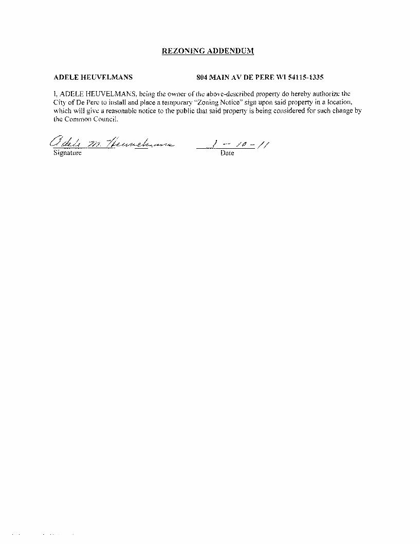
REZONING ADDENDUM
ADELE HEUVELMANS 804 MAIN AV DE PERE VI 54115-1335
I ADELE HEUVELMANS being the owner of the above-described propertydo hereby authorize the City of De Pere to install and place a temporary Zoning Notice sign upon said property in a location which will give a reasonable notice to the public that said property is being considered for such change by the Common Council
Od4 7 middot7lt-f-vtA-e~-te-i-+_ -1- Signature Date
REZONING ADDENDUM
JERRY T amp ELLEN L LANDWEHR 808 MAIN AV DE PERF WI 54115-1335
I JERRY T amp ELLEN L LANDWEHR being the owner of the above-described property do hereby authorize the City of De Pere 10 install and place a temporary Zoning Notice sign upon said property in a location which will give a reasonable notice to the public that said property is being considered for such change bythe Common Council
Date
Date
REZONING ADDENDUM
rENNTFER M TITULAER 811 OAK ST DEPERE WI 54115-1532
I J ENN [FER M TITULAER being the owner of the above-described property do hereby authorize the City of De Pere to install and place a temporary Zoning Notice sign upon said property in a location vhi9~1 will give a reasonable notice to the public that said property is being considered for such change by
the C~tl10rt r
7~ GUfj l d II Sjgnarure Date I I
(
REZONING ADDENDUM
THOMAS J HARRIS 815 OAK ST DE PERE WI 54115-1532
L THOMAS J HARRIS being the owner of the above-described property do hereby authorize the City of De Perc to install and place a temporary Zoning Notice sign upon said property in a location which will give a reasonable notice to the public that said property is being considered for such change by the Common Council
J -
Signature Date
SIgnature j Date
REZONING ADDENDUM
JULIE A REINDL 816 MAIN AV DE PERE WI 54115-1335
I JULIE A REINDL being the owner of the above-described property do hereby authorize the City of De Pere to install and place a temporary Zoning Notice sign upon said property in a location which will give a reasonable notice to the public that said property is being considered for such change by the Common Council
Signature Date
REZONING ADDENDUM
HENRYN amp LORI L VAN STEDUM 819 OAK ST DE PERE WI 54115-1532
I HENRY N amp LORI L VAN STEDUM being the owner of the above-described property do hereby authorize the City of De Perc to install and place a temporary Zoning Notice sign upon said property in a location which will give a reasonable notice to the public that said property is being considered for such change by the Common Council
-0 -W01l Date
- O -tiJa 1 Date
COMPANIES
PARTNERS IN DEVELOPMENT
January 14 2011
Mr Ken Pabich Director of Planning and Economic Development 335 S Broadway Street De Pere WI 54115
RE Project Description and Re-zoning Request Residential Properties Located at the NWC ofMain St and 8th St
Dear Mr Pabich
The purpose of the re-zoning request to the city is to demolish the 14 existing dwelling garage and storage structures on the subject properties and to construct a new 13225 sf CVS Pharmacy with a Drive-thru facility One dwelling and garage located at 219 8ID St N is to be relocated to the lTWC of 9th St N and Pine St Please advise any additional information required for this re-zoning request
Sincerely The Velmeir Companies
John C Baumann Director of Construction
4
LOCATION MAP NTS
[pJ
(QJtegIAI~e
P~crbrtLoieg
l
f
L
CIW OF DEe ~ -
p
yenljs1tlart A4$
a Esf~ [)r c l1l -E Hettn~ Ave
Giant St EEi
ECT ATI9N
middott~
(I)
1 ~
~~I
shy
)
I J
I I I I I I s I l~
1~~
I
-- 3IJrL I
t r [_1 1851
I I I I I I
1
~~~~~~~~L __t I= -~
DESCRIPlION
andEgintmng lli1- W-l- __ W1~
262-7I-IlOO_H02--N66www~
RA Smith National -----shy sm
SITE PLAN
CVS PHARMACY
CITY OF DE PERE WIo N
o
I~[~I~~~~~lC~ Dr5 shy lWTE~AA
(~S - PfwtT BllCE
ALUIISTOR(fRQllTshyQ(NlAllOO2poundO
IINIA_C-O[[PREO
ALUliAU10llAllCDOCRshyCUNl~OOIZ[O
MAI N 5 T R E E T E LEV AT ION
PREIllI5IpoundO ~EA1 CCFINC -CtxOillOYAlt)1IW1D1TM
ur5 - 10UM
AlUWS1QR(fIl~~shya[AA~QOIltO
SPlllr1CWUshy$CIl conI) lH1LA~C-O[[PR(D
~~~~~ngOCOl_
NOR T H 8 T H 5 T RE ET E LEV AT ION
~
OAK 5 T R E E T E LEV AT ION SCAlEIlTS
REA R E LEV AT ION
NORR ARCHITECTS INGINEIIlS UNNEAS
719 Grhwoln Strc~r
sene 1000 Detmh M14~2l6
wwwecrrccm SCAlENTS
City ofDe Pere Plan Commission StaffComments Jan 24 2011 D
Item 3 Review Precise Implementation Plan for the new 9278 square foot Krause Financial office building in the East Industrial Park located on Profit Place Agent David OBrien
New office building for Krause Financial is to be located in the East Industrial Park on Profit Place The office building is 9278 square feet and is designed for future expansion to the south
Does the project meet the City Stormwater regulations
Sewer properly connected
Water properly connected
Access properly designed (driveway and sidewalks)
Are there any issues with easements or right-of-ways
Are there other items that need to be addressed
DYes _ No DNA _ Yes D No DNA _ Yes D No DNA _ Yes IJ No DNA DYes _ No DNA DYes _ No DNA
RequiredActions 1 The City storm sewer is designed to transport a peak discharge of a S-year rain event for industrial land use
Provide calculations for the peak discharge off the site Include the vacant property to the south under a developed condition
2 Provide a curb head cut at the new access point Do not remove the entire curb unless the curb is deteriorated Remove the curb cut detail from the plan set
3 Plan states that sanitary lateral is 6 lined The sanitary is 6 in diameter but has not been lined 4 The storm sewer tap at the inlet is to be core drilled The City Engineer is to be notified 24 hours prior to
construction An excavation permit will be required for the storm sewer work in the right-of-way S Insulate the water main if there is less than 18 of vertical clearance between the bottom of the new storm sewer
and top of the water main
Does the project meet the City Landscaping Regulations _ Yes D No DNA
RequiredActions 1 The southern portion of the lot must be maintained as lawn and cannot remain as existing conditions 2 All planting mulehing and staking should be in accordance with WDNR recommendations and current proper
practices 3 Allplant material and beds should have a follow up schedule for maintenance and replacement It is essential that
this schedule be established to ensure that the plants are maintained for health and any compromised plants are to be replaced in a timely manner This maintenance schedule should include provisions to protect plants in the winter as some of these may be susceptible to animal feeding or damage
4 A preservation and protection plan for existing vegetation and trees including City owned trees and shrubs should be included on plans when applicable
RecommendedActions S It appears there would be room for additional plantings of trees on the perimeter of the property Other tree
varieties and species could be incorporated into the plan
Does the project meet City Fire Codes _ Yes D No DNA
RequiredActions 1 Provide detailed plans for construction review prior to the start of work provide details of use for all areas of
structure Define uses for all areas of the building 2 Detail means of egress in all areas of building and provide capacity and exit width detail 3 Separation of hazardsuse is required in accordance with FCLSC Fire rated assemblies are required for the
furnace room and general storage areas 4 Provide exitemergency lighting throughout the means of egress S Provide fire extinguishers at maximum 75 travel distances from any point Locate extinguishers towards the exits 6 Installation of key box for fire department access RecommendedActions 7 Recommend installation of a fire alarm system should such a system be desired submission of detailed plans with
cut sheets and battery cales is required prior to installation 8 Recommend installation ofa fire sprinkler system based on size and construction type should such a system be
desired submission of detailed plans with cut sheets and hydraulic cales is required prior to installation
City ofDe Pere Plan Commission StaffComments Jan 24 2011
I 09 u CIl 0 5 be
sectI
oS Ql
oCl be I deg2 I ltII
E
Does the project meet the design regulations (exterior building elevationsmaterials) _ Yes D No DNA Does the project meet the City setback requirements _ Yes D No DNA Does the project meet the City parking requirements _ Yes D No DNA Does the project meet the City lighting requirements _ Yes D No DNA Is the refuse properly sited and screened _ Yes D No DNA Does the signage meet the Citycode _ Yes D No DNA Are there other items that need to be addressed DYes _ No DNA RequiredActions 1 Color for the building shall be earth tone in color 2 For parking traditional standards would require 38 stalls Under the 1-1zoning the Plan Commission can reduce
this requirement based on need We were told by the owner that 30 stalls would meet their needs The Plan Commission may want to request a letter from the owner to place on file to ensure there is no parking on the street in the future
3 The south gable end finish material should be modified to bring the design back into scale 4 Refuse enclosure shall be a matching split face concrete block with non-metal gates 5 As a note the two parcels will need to be combined before permits can be issued
Recommendation Staff would recommend approval with all required actions being implemented and the Precise Implementation Plan be forwarded to City Council for approval
CITY OF DE PERE Fee $ 24500
Receipt _-=6--I--=tu---O _
APPLICATION FOR SITE PLAN REVIEW Date
Please print or type using black ink for duplicating purposes
A Property Owner Name 1) C-e 6 y togtgt-t
V 1
- ffi
----)--2~L=--poundL-2lt3-k-_P~v)S~-4Jy
I hereby appoint the following as my agent for purposes of this application
Agent Name uCLvd e8r~~ ------- shyMailing Address -p 130 l ( ~S- Phone t9amp~930D
Signature DatelO I tJ6 1M It
B Property Information
AddressLocation of Property ~~ ~T-N f ~o-h t- Parcel pound D ~ pound0081-Z ~ CJ etmiddot- FbcR -Z-- t
Parcel Dimension t7f)( gttl3 Parcel Area -l7~~r-JcentLJ2--------shyLegal Description _
A Site Plan Review is requested as authorized by the De Pere Zoning Code Section(s) Article XIII
SectiOn146~middot0
Signed ApplicantAgentJLLOh-= Dated 111 II(
A plan consisting of all applicable information listed on the attached shall be submitted with this application
SITE PLAN REVIEW REQUIREMENTS
KRAUSE FINANCIAL SERVICES INC FOR BAYLAND BUILDINGS INC
CITY OF DE PERE BROWN COUNTY WISCONSIN AnENTIONI OOWNLOAOED PLANSARENOTSCALEASLE NEITHER THE OWNERORTHE ENGINEER SHALLSE HELDRESPONSIBLE FORTHESCALEOF DOWNLOADED PLANSONLYPRINTED PLANSFROMBLUEPRINTSERViCECO INCSHALLBE CONSIDERED TO BESCALEABLE PLANS
VICINITYMAP
fl(CAAl1ll~
II 1
1 l
Non ElClSnNlJ UTlUlIESSItC)MIONPLAH9AREAPPRO)jlW1Enil CON11IACTOR SliAlJBE RESPONSIBlE FOROIl1AININCI EXACTLOCATlDHS ANDELEVATIONS OFALLvnmas MIETlIERllHOWNDRNOTFROMTHECJVrNEP6 OFTHEREampPECTlYE umnlEs ALLUntTY OWNEASSHALt BENl1TJFIEO FORLOCATES avmE OOtmUlcrOR n HOlIll5PRIORTO
ouEA03ION CONTROL loIEAIilUREIilSWltLL 8E ~ PLACE PAIORTOCONSTFlUCTlDN AHOSfULlCOlolFOlllol TOlHEW1ampcOf1lWl OEPAPl1olENTOF IoUruIW RUOLIRCn CONSllIOCTlOfj mE EROSIONCOI4mOl AHOlECHtlICAL 5fANDAAOS
INDEXTO DRAWINGS SHTNO DESCRIPTION
1 LOCATiON MAPSANDINDEXTODRAWINGS 2 EXISTING SiTE CONDmONS 3 SITEPLAN UTILITYPLAN 5 GRADING ANDEROSiONCONTROL PLAN 6 DETAILS 7 DETAILS a EROSiON CONTROL DETAILS -INLET PROTECTION L----shyANDMISCELLANEOUS DETAILS Q EROSiON CONTROL DETAILSmiddot DITCHCHECKDETAILS 10 EROSiON CONTROL DETAILS- DITCHCHECKDETAILS
JoSPRfN DATE I APPROV REVlSIOJf KRAUSEFINANCiALSERVICES INCD
4 Robert E Lee amp Associates Inc
~~ECKEO FORBAYLAND BUILDINGS INC ENGJNEEftJNG 5~G ENVlRONltEmAL SERVtCESLOCATION MAPSANDINDEXTO DRAWINGSCiTYOF DE PERE eeeeeec --lBROWNCOUNTYWISCONSiN
LOCATION MAP
------ --- shyUTILITY INfORMATION I~~~rl
DESTINY DRIVE UTILITIES PRESENT crrvOF DEPEREWISCONSINPUBUCSERVICES6C TIMEWARNERCABLEl usSiGNAL I ~ 0 ___ bullbull
UTIUTlESSHOWNON THis MAP AREBASEDON lOCATES FAD I ~~ ~~~~100k=I
~--L (~ I 4 11 OIGGERS HDTUNETICKETNUlolaEA201~02Isa DATED 1223J2010 VISlBLEOB6EAVATIDN oN 12l2~01D AND i [ ~--- -__ ~~BR~EU~~~~~~~~NJiU~~~~O~~DEE~F~~g~ ~~U~~p~E VEFlIFleDPRIORTO 1Hf DIGGING I
1
11 ~ r u nn n~-=--=-~----- ~ ~ _ ~~_=~_--_DIGGERSliaTUIIlE HOo-242middota511
n -- 0_i 1j t ~ r -- L ~~Ju o~ gt 11 WATBIISAtHTAAYJtm]AU SCWlR~ GAS ELEGTJUO TelEPHONE C~BLE TV DEPARTNENTOf PUBUCWOIII(S WISCONSIN PUBLic SpoundRVIOE COItJgt no TIME WAflNER CABLE CNOFDEPEAE 6OONORTliMJMUgt6T lIaiampSFEJlSON6T 1OQ1KENNEOt AVE e25SXTHST Po BO)(180Dll GRiIENBAY W154~ KIUBliRlY WIUI)l i 11 fl~ ----~~----7~----- ~tmiddot r~1 DEPpoundREW1541gtS OrtEENBAYW16Q07
tQ~Q~-lIl47 820)11111207 (lI1l0jU9-5G7amp (InI4JJ~3 Ii ~n I I I lt0 I II
iJ - ---- -- I 1-I r1
tlll bullbullbullbullbull 111 i I lt1 ~ -11 I I IOWNER INfORMATION coNTRACTOR INfORMATION
ICFlAUSE FINANCIAL SERVICES INc BAYlANDBUILDINGS INC 1234ENrERPRI5E DRIVE POBOX13571 II-- i DEPEREW1 54115 GREEN6AYWI amp43D7middot3571 1
t 1_~I dl~i~ I I
I
II
~I~I I)0
j I ) I ~I i iI 5 III
(B6ampaS5-7437 (B20)3711i20D ) k I 1 IIL iIol 1 i ICONTACT DALE KRAUSE CONTACT DAVIDOBRIEN ~ ~I i 1 ) II) II Iti II
LEGEND -6 FIREHYDRANT I I i
tal ~ DECIDUOUS TREE I~I bull I
WATERVALVECURB STOP I gt I 1 I ~ i [ I I LOll I I tiWATERMANHOLE ~ bull _ bull o CONIFEROUS TREE j e I o SANITAAV tlANHOLE ~ 11 11 ~ r ese sr I I I Io BUSH o STORMMANHOlE II i r l ~ 1 ~ I I ~ ~ t~3B21 OP~ STORMIlANHOLE
RIPRAPbull J l ~ i i raquo I I 1151 lINIlIIll STORMINLET j shy glOOMINLETMANHOLE ~ZJf)IofI SPOTELEVATION III POWERPOLE r- ) i ~)i J I II ~
W~h FIRSTFLOCIRotlASEIrlENT ELEVATiON bull ~bullbull_ iEJ-oPOWERPOlE WGIN WIRE i4iL-i-l 0 ~ i al ~IUGHTPOLE N -rorAPPROXIMATE ROCKElEVATIONo ELECTRICMANIiOLE
III ELECTRICtlElER r III ll i I __ __ ) - I If__ 12 EXISTINGCULVERT
laquoI GASVALVE tii i I -- n iii ~ 1 I - -- - - - - - +-1- - i I I ti i ~ GASUETER o CONCRETE 81 MAIlBOX
CZJ WET1ANDS ~ - I I I I Iof SIGN
POST I f i
~ HANDICAP PARKING IRONPIPEJROD 11 ~ I I if I
4 PKNAlL ji rill I i i I 1 II I EXISTINGSANITARY SEWER (SIZENOTED) i 11 I 1 bull
EDGEOF PAVEMENT EXISlINGFORCEJJAlN (SIZENOTED)II ill- h i~ 1 ml i II ImiddotI ii -10C- ~ISlING STORMSEWER(SIZENOTED)
EDGEOF MAVEL k --N-- EXISlINGWATERMAIN (SIZENOTED) 1 I I 1i1 --0-- GASUNE C Ii
EXISTINGCURBamp GUTTEA I I ill 1 II i LOI I [I II --oc-- oVERHEADTELEPHONE UNE ---- UNDERGROUND TELEPHONE LINE 1
- TREEiBRUSH UNE --oc-- OVERHEAD ELECTRICUNE ) i ]1 n _ 1 I~ I
---- UNDERGROUNOELfCTRICUNE bullbull vse-bullbullbullbullbull EXISlINGCONTOURUNE i 11 -- t I
- OTV- OVERHEAD CABLE1VUNE --N-- CAaLElVLlHE I
RETAINING WAll 1 lilgtlll II ilmiddotMVUNE PROPERlYUNE H j i I I I
GUARDRAIL - EASEMENT UNE
~ FENCE BUILDING SETBACK UNE i I I ~ - i I II I ISEcnONUNE NOHIGHWAYACCESS
I I I II i ) I Ii i I I I i I l I I I I shy bull I1 1I~ I ~ ii k i I I J _ -J- _J ---- _ _ _ _ _ _ _ _ _ - - - - - - - - - - - - ~-- - LilI
gll~~ ~ NOTE D-t1 bullj I ELEVATIONs SHOWNAREBASEOON APREVIOUSCITY OF DEPEREEASTalOEDATUM SUSTRACT 091 TO ~mtII 8U) 0 CONVERTTO NAVOsl l
-0ampOATE IIoPPRrN OMWN KRAUSEFINANCiAL SERVICES INC-- shy FORBAYLAND BUILDINGS INC CITYOFDEPERE
~CJltQ) EXISTING SITECONDITIONS
~~SlCNEO BROWNCOUNTY WISCOSNIN
~r---L-j m1--Igill~~ ~~i~~~ 1131 bullI 1 -bull I 1 middot bullbullbull ]~) (SI1
~ e sr ------ shy
(I [a
[
I ar
I 1 I
r I
[ I [
I 1 f I r Ii
r
I I I I I I I I I I I I I
I I I I I I I I I I I I I I I I
I
I I 1 f-I ~I i~
I I
I
~ ~ ~I E~SnNG SURFACE TO AEMAIN I
~ 1 I ITJ I
I shyI II I
I I
I I 1 f~
I I I I
[1] I ~ ~ I I
I I ~ I I I I I I I ~ I I I I II
II l I I I _L II I8 I ----- ~ I I I I _------- ~ I
I f- I I - - -- - i7Jr I II I L_-J---- ~
I I amp-0~~ RlVlSlON KRAUSE FINANCiALSERVICES INC
I ri
-------------------------- ---------p----shyLOCAlED UMENT ON DESTINYDRIVE FROMEXl971NO OFFICE WITHNEW MASONRV BASE ANDELECTRICAL EX IHIEAGIUL CIJRlI ltlGUnER
shyNOCCESS _ 100 29917
~ ltgt3 J SLAND6CAPEAREAWlTH bull bullbullbullbull I io middott 5PRINKLEASYGTEM f
~ PROfr2~~ ~~DING
~~ FF ELEV63900
~ k 11I i I I I I I
I iii I f- I ~I J
f- I sect I
-- shyI I I I I I I I I I I I I I
w I I~
c I I I I I I I I I I
PROVlDE~1R6OPENING I ~~~g~ ~D~~~~~~~~SfARY VERIFYW H CITYBEFOREREMO~ING
DRIVEWA OPENINGCONCl1iTE I
I - shy
rIJ
SCIII2INFEET
NOTE ELEVATIONS SHOWNAREBASEDON APREVIOUS CITY OF DEFEREEASTSIDEDATUMSUBTRACT cer TO CONVERTTONAVDse
I~ l I
I II
NOTE ALLAREAS DESIGNATED ASGREENSPACE OR LAWN SHAll BE TOPSOILED TO A DEPTH OF e INCHES SEEOED ANDMUUHED AREA TO BE RAKEDFAEEOFSTONESAtJO CLUMPS
PARKINGVATA TOTALPARKINGSPACESPROVIDED 30
HANDICAP ACCESSIBlfPARKING SPACES 2
TOTALPARKING SPACESAEQUIRED24
SITEVATA TOTALAREA 223ACRES97212 SF
BUILDING AREA 021ACRES921aSF(amp5710)
SIOEWAlKIPARKING LOTAREA 032ACRES13B37SF(14jl3j
GREENSPACE090 ACRES39202BF(4033)
UNDISTURBED AREA 080ACRES348995F (35874)
ZONING
CONSTRUCnON CLASSIFICA nON vbull
PAllCEL NO EDF0081-2
EDmiddotFOOB1-2middot
LEGfNV
o CONCRETE PAVE~ENT
IRJ ASPHALT PAVEMENT
~ GREENSPACE
LANDSCAPED AREA
__ PROPOSEDie-CURBamp GoUTIER -- (UNLESS OThERWISENOTED)
~ PROPOSED SHEDDINCl CURBamp ClUTIER
PAINlED FIRElANE wlt
TRAFFICFLOWARROW ltgt HANDICAPPED PARKING~
NOTEALLCURBRADIIARETO THEFACEOF CURB
I I
I I I I
I I I
I I I
I I I I I
I I I
I I I
I
III
II I
I
I I I
II
I I I
I III
I10 I
I
I
t II I
I
I I If-shy
U) I I I
I I I
I I I
I III
I I I
I I
II I
I
I I I I
II I
I
I I
~ CHrtKlD FORBAYlAND BUILDINGS INC SITEPLAN --l ~ NeesaR UIl ENVIllONgtltBNTAI
CiTYOF DEPERE ~SICHEO BROWNCOUNTY WISCONSiN
3
-------------- shy WATERANOSMIITAAfLATERALS I AREESTl~ATED TO BE6 LINED DESTINYDRIVE
CONTACToRTO VERIFYEXACT [xlHlE~CIRfIampCln1m LOCATION ANDELEVAll0ItJI
I
I
I I
LE~IIIV --------PROPOSED SANlTARYSEWER I----~-- EXlSTlNG SANITARY SElJJER (SIZENOTED)
I bull - bullbullbull EX(STINGSTORMSEWER(SIZENOTED) =bull - bull - bull - bull - bull -PROPOSED WATERIolAlN
= == == PADPDSEOSTORM SEWER
---~-6w-6- EXISTlNGWATERIAIN (SI2ENOIED) I
I
~ ~ ~ ~ ~ I-6 -6 FIREHYDRANT I II $ WATERVALVEICURBSTOP l reg WATER MANHOLE V l REOUCER1NCREASER a 0 ISANITAAYMAIIHOlE C 0 STORMMANHOLE I I OPENSTOIUlMANHOLE UU lI STeAL( INLET C () STORMINLETMANHOLE I
I C
PLUM13ING VA TA CI
DRAINAGE FIXTURE UNITS 24 I I WATER FIXTURE UNITS 28 I m
NOTE I II MINIMUMOF S5FEETOF COVERSHALLSE MAINTAINEo I OVER ALL WATERMAIN
SANITARYSEWER WATERMA1N AND STORMSEWER5HALL BE CONSTRUCTEDIN ACCORDANCEWllrl TIIESTAIIOARD I6P~IFICAnONS FORSEWERANDWATERCONSTRUCTION IN WISCONSINAND ADMINISTRATIVE CODE CIAPTEASCOMM81middot87 I
rI
f~jil 3 FIELDVERIFYLOCATION OF EXISTINGUTILITIES IF EXISTING
LOCATIONSDIFFERFROMWHAT IS INDICATEDON 11-tEPLANS CONTACT ENGINEERPRIOR TOCONTlNUEOWORK I STORMLATERALSSHALL BE EQUIPPEDWITHTRACERMRE
i11 I
I
Ibull All DOWNSPOUTSSHALLBECLEANOUTDOWNSPOUTS
I I
I I
I I
I
IPROV 001[ I)fgtPROV ORoWH KRAUSEFINANCIALSERVICESINC ~E~00 FORBAVLAND BUILDINGS INC
CITYOF DEPERE UTIUlYPLAN ~SIGNEO BROWN COUNTY WISCONSIN
r-- shyI I I I I I I
I I I I I I I I I
I -shy
lOCAlEIHFUT
NOTE ELEVATIoNS sHoWN AREBASEDONAPREVlouaCllY OF DEPEREEASTSIOlDATUM sUBTRACTDe1TO
~-o CONVERTTONAVDB6
n srta r rl6367T1------shyOl~
~~~ g~~~ 10j ~L--ri-~ ---_~----r--___-~~7_
EXST utl l
LEIiRVV TOPOFCURBELEVATION~lcStltlil
FLOWUNE ELEVATION~F- TOPOFSIDEWALKELEVATION~SNJ66666
EDGEOF PAVEMeNTELEVATION~55
TOPOF RETAINING WALLELEVATION~RN444
~3J333 ORQIIIOELEVATION
DR-JNAGE SWAlE
DRAINAGE DIVIDE
---x- SlLTFENCe
~ BALE DITCH CHECK
FLOWAAAOW
TRACKlNCiPAOmmli INLETPROTECTION
NOTE ALLSANITARYSEWERSTORMSEWER ANDWATER SERVIcESIMAINSSHALLBE PROVIDED WITHTRACER WIREOA OTHER METHODTO BE lOCATED
STOlL IIIAITR MANAGEMRVT THISsrrsISTREATEQBY REGIONAL STORMWATER PONDTHAT IS LOCATEDSOUTHNeWEST OF THE END OFTHE CUL DEBAC OF PROFIT P~CE
ELOSWN cONT1WL NOTE All EROSrON CONTROLPRACTICE61NDICATEDON THIS PlAN ME APPROXIMATE LOCATIONSONLY THEACTUALSITEMAY REClUIREMOREOR LESSEROSiONCONTROLDEPENDINGON THE CURRENTCONDITIONOF THE SITE ~ SILT FENCEIS REQUIREDDOWNSLOPEOF ANY DISTURSED
LANDTHAT MAYCARRYSEDIMEtiTS OFF SITEl ltl
A TRACKINGPADIS REQUIREDAT ANYINGRESSIEGRESS LOCATIONWHERESEDII1ENT MAY BETRACKEDOFF-5ITE
II
PROPERIfLET PROTECTION6HAll BE U6ED OEPENDING ONTHE INLETTYPE
-4 SEDIMENTBASKET GH-ll BE USEDFOR ANY 6ITE DEWATERING
I I
I
I
I
in [)j j Ul
R1I4l7l1i1 0_S75I -- shy1 I~~~ m ~ 2lt 1 1 IIMampJl24(Wst)
Ii 1 I I r I i I
II i I I I j I I
STIHL4 r~ ~ I
t III
~ NLET(TYP) ~T~~ I
I j lJ I
OSTllILll Ii rL63s92
1I D_4045 It lW6l247 (W IN) llN6l U 71(15middotSO i I G ~ I
I
STING w o i a
I shy u ~921 I a i -(~ I i i 1160 II a
I L I - -1--+ ~ I f l I i I I ~ I II f j I I II J
I
J i I I I I 12 - shyI 1 ( I i I ~I ~ I 1 A I - I ~
f ~ I
i Iil71
_ - V~ - - - -- -- - ~-- - L Y Dwnall 111163U)
0-1117 NOTE ELEVATIONS sHoWN AREBASEDON A PREVIOOS CITY~~~ ~8 amp-0 g~~~~~RioE~~Jo~E DATUM SUBTRACTO91 TO001pound I APPRO KRAUSEFINANCIAL SERVICES INC IrQb~ Lee ampAsSOc]iite IncON ~~
CHECKED FORBAYLAND BUILDINGS NC EIGltiEERlNG SIJRVElING ENVIROHlWnALSUVlCpoundSGRADING ANDERosiON CONmOL PLAN 4664 COLOEN PONOPARltCOURTCITYOF DEPERE
~CNED ~oWl~~~lnltltom ~~~j~~2~)6~jN41BROWNCOUNTY WSCONSIN
NOTENEENAH R-3275OREQUALWITH TYPEA GRATEORRmiddot3246AOR Rmiddot3Dfl7WITHTYPEL GRATE
LESSTHAN4SHAlL BE RUBBER)
CLARlTY1
I 10$1 ~
~
il4R TO BEADOF ADJUSTlfIG RING CLEANOUT LINETOBElHE SAIlE ANDCASTlNGSEALANT OREQUAL SIZE5 MATERIAL ASSEWERIlAIN BElWEEN ADJUSTlNG RINGSAND NOTE CLEAWOUlLINETO BETHE
CONCRETE ADJUSTlNG RINGS SAME SIZEaIlATERIALASSEWER MIIN
ADAJSTlNG RINBSONLYWITH CASTING COATOUTSIDE OF
ASREOUIRED (4MINAND12 MAX UNLESSOTHERWISESEWERJOltlT COl4iOUNDND NOTEDALlADJUSTING RINGSWRAPWITHMIN8 MIL
~ GRADEPOLYETHI1ENE
ECCENTRIC REDUCING CONE (VERTICALWALL OF
PVCCOATEDCASTIRON 24 SQUARE LlHSTEPSmiddotOC CONePAD CLEANOUT PWB
ECCENTRiC CONESHALLBE ONDOINSTREAM SIDEOF MANHOLE THISDETAIL 4 (MIN)GRAVEL NOTESHOWNROTATED W FOR ADJUSTTOGRADEBY
CLEANoUTPLUG
II SUDINGVERTICALLY UPORDOWNOVER
PVQPIPESEWER 21 r~~~~~~~~~~~~4 SERVICE EACHJOINT
PROVIDE FROSTSLfEVE SERVICEPEAoCOM1l8236 (5)A)2
PROVIDEFROSTSLEEVE PEROCOMM8235 (6) fAJ2~~ TONGUE ampGROOVE PVCPIPE
n 45 BEND JOINTREQUIRED
PVCPIPE
FLEXIBLE PIPE To MANHOlE 45- BEND CONNECTOR REaUIRED
6PECUBEDDING
8 PRECAST S-8IlIN CONCRETE SASE SPECD SEODINGI I
SANITARYAND STORM CLEAN-OUT DETAIL CLEAN-OUT DETAIL STANDARD MANHOLE (TRAVELED AREAS) (NON-TRAVELED AREAS)
8-24(INCLUSIVE)
314-ro r
eunPOLYETHYLENE
I
~rd 81 ~I
~I
~
HDPEtPVC SEWERamp WATERMAIN amp FORCEMAINSTORM MANHOLE INLET PAVEMENT RESTORATION BEDDING ampTRENCHSECTIONTYPE A
MgtPFt(N ~T[ I WPROV REVISlCIH ~ampWN KRAUSEFINANCiAL SERVICES INC FORBAVLAND BUILDINGS INC~CKED DETAILS ~uCITYOFDEPERE
~IONEO BROWN COUNTY WISCONSIN
o
~ Io
I
W(IlAXJ12+00J2 W(MIN)-6oi-00J2
COMPACTEO BEDDING ANDCQVER SOILCLASSA-7
INITAL3 OFSOILCLASS ASIN WETORUNSTASLE TRENCH AS DIRECTED SYTHEENGINEER
WITHOUT EXTRACOST TOQWNER
I
ampolLCtASSG-l OR C-31FREQUIRED PER SPECIFlCAllONS
NOTE SUFlFACE RESTORATION REQUIREMENTS PERTHE SPECIFICATIONS
UNDER BARREL (8 FORBEDROCK EXCAVATiON
UTILITYTRENCH
t ENRENGTH ORENcH I bull -j _middot~middoti middotbullIc-~~~
PIPEUNE
SAWCUT CONStSTENTWlDTH
Imiddot I II I I 11--- -THiCKMANHOLE TOP
PVCCOAlEDCAST IRONIlHSTEPSmiddot 10C
BEADOF ADJUSTING NEENAH R-3215OREOUALWITH RINGANDCASTING SEALANT OR TYPEA GRATEORRmiddot1246AOR EQUALBETWEEN ADJSllNG Rmiddot3067WITHTYPEL BAATE RINGSANDCASTING COAT CONCRETE ADJUSTING RINGS OUT6IDEOF ADJUSTING RINGS 4SREQUiRED 14MINAND 12 ONLYWITHSEWER JOINT MAX UNLESS OTHERIIJISE
COMPOUND ANDWRAPWITH1l~N~~-~~~~L NOTEDALLADJUSTlNG RINGSLESSTHAN4SHALLBE RUBBER)
WAlllt CONTRACTION JOINTSPACING EXPANSION WIDTH TRANSVERSE LONGITUDINAL JOINTSPACING
NOTREQD 100lJAX
s NOTREQD 100lJAX 0 S NOTRECD 100lJAX 0 100lJAX e 100lJAX s 0 lOOlJAX
~
oj ~
~y
PROVIDE CONTRAClloH JOINlS 6CONCRETE ASDIRECTED BY ATUAXItlUlJ 20SPACING BY GENERALCONTRACTOR SAWCUTTINGOFtINSERTIONOF
DIVIDER PLATES
12 OFNO3 ORNO4 GRADATION R E6AR S LE EVES ~MINllJUMVOID rrEXPANSION MATERIAL WILLBEPLACEO ONEACHSlOEOFTHEORNEASUITINGTHE THERIlALEXPANSION SPliCEATENDOFSLEEVE FOR
SIDEWAUlt SIDEWALK ANDDRIVEWAY APRON SHAll BECONSTRUCTED SEPARATELY UNLESSOlHEfWJSE APPROVED BY THEDIRECTOROF PUBLICWORXS BACXOf CUAB COMPACTEDSUBGRADE
CONCRETE PAVEMENTDETAIL ~I 3~l rI~1 1 ABPHALTSATURATED fELT EXPANSION JOINTFILLERPLACED ~ ~rQ ATlJAXllgttUM 300middot SPACING AND
middotB1TUMINOUSSlJRFACE ATAll ENDSOf RADII 1 34 BITUMINOUS BINDER
18 LONG12 DIAlJmRIt REINfORCINGRODS 12 OF NO3 ORNO4 GRADATION ~
DRILL518HOLEMIN9 INTOEXISTINGCURB
CURBTIE-IN DETAIL lPAOPOSEDTO EXISTING)
COMPACTED SUBGRADE
ASPHALT PAVEMENT DETAIL SAWCUlCURBTRANSVERSELY PRIORTO RElJOVAl
~
12middotR60
COItRETE 4 APRONbull
DIMENSION VARIES SEEPlAN
I NOTE REFERTO SPECIFICATIONS FORREINFORCElJENlS
IiI CURBREMOVAL FORDRIVEWAY OPENINGWITH ~ CONCRETE APRON ONCONCRETE SURFAcESTREETS l
bull
EXPANSION JOINT TOOLED
CONTRACTION JOINT
PAVEMENT ANDBASECOURBE
SIDEWALKWITH INTEGRAL CURBCURBREMOVAL FORDRIVEWAYOPENING WITHCONCRETE APRON ON ASPHALT OVERCONCRETE
SURFACE STREETS
CURB REMOVAL DETAIL SIDEWALKDETAIL
bull VERIFYDETAILMATCHES crrv Of OEPERESTANOMDS
4 EXliTlNc CONCRjre
BREAK
VARIES
S SIDEWALK t ~ ~~~ ~~- z --~~~~N~N-~--~ ---~~
ALLARCUND(TYP) iii 11) gt
All RESIDENTIAL DRiVewAY APRONSSHALL BE FLAREDIF FIELDCONDITIONS PERMI1
THEflAAE BHALl NOTE)(CEED3-0
8middot ORJVEWAYAPRONrshy
~I ~t
bullbull _
1--( middotHmiddot bull middot ~ y ~h~raquo~gtY)1-S
~~ ~
L I bull bullbull bull bull ~ bull _ bullbullbull
CUflBA GUTIER 12 EXPANSION JOINT
DRIVEWAY APRON DETAIL
6lc6WmiddotIN211 W2WWf CENTERIN SLAB
-
CONCAETESlAB
4CONTINUOUS
12 EXPANSIONJOINTWITHSELF LEVEUNGSEALANTWHENCAST AGAINSTSTRUCTUIIE
MINIICOlJPACTED SOILCLASS C-3 MOISTENIMlJEOIATELY BEFOREPlACING CONCRElE
TYPICALSIDEWALK ADJACENT TO STRUCTURE
2RAD
SPECIFIED BITUlJlNOUS
4 CONTINUOUS TOP6 BOTTOM
DATE I APPROY AUSEFINANCiAL SERVICES INCm- TE At Robert E Lee amp Associates Inc SIl[D NO FORBAYLAND BUILDINGS INC~lEC1ltEO a ENGtNBeJUNO SURVEYINO BNVlRONWENTu SEJMCES
CrN OF DEPERE DETAILS fluU BROWNCOUNTY WISCONSIN
7
OR WASHEDSTONE
INLETPROTECTION NOTES
INIHAlUT10NtJDTESR W I4ANUFACTUAEO ilLTERN1TlVES 6PPROVED AND1t(if if f TYPE-e-a-c-USTEDONTIiEWOOTPRODUCTACCEPTABIUTV LJSr AAV BESUBSTITUTED
R TRJM EXCESS FABRIC INTHEFLOWUNETOWITHIN3J fq ~ if OF-THE GRATE
I WHEN ReMOVING ORMAINTAtlllNClINlET PROl1CTION CARESHAll Be TAKEN so THATTHE
50 MIN SEDIMENT TRAPPED ONTHEGEoTEXTllEFABRIC THECONTRaCTOR SHALLOEUClIISTRATE A METHOD OOESNOTFALLINTOTHE INLET NolVMATERIAL Of MAI~ENANCE USINGII SEWNFLAPHANDHOLDS
OROTHER ME11-tOQ TOPREVENT ACCUI4utATEO IMMED1AmV FlLUNGI~O THE INLETSHMl BE RELioVED PLANVIEW SED114ENT FROMe~EAING THEINleT
TYPE0 (j) FINIBHEDSIZEINCLUDINGFLAP POCKETS
WHEREREOUIREDBHALLEXTENDA MINIMUM ~ 2299 00 NOTINSTAllINLET PROTECTION TYPE0 ININLETS
SHALLOWERTHAN3DMEASUREDFROMTHEBOlTQlI PROFILE VIEW MAINl1NANCEOR REMOVAL Of THEINLETTQTHE TOPOFlHE GRATE
Of 10AROUNDTHEPfAIMEllR TO FACIUlATE
reg FDA INLETPROTECTIONNPE C (WITHCURB TRIMEXCESS FABRIC INTHEFLOWUNETOWITHIN 3 middot4 MIN OR FULLWIDTHOF THE EGRESSPOINT BOX)AN ADDITIONAL1SOF fABRIC IS Of THEGRATE REFERENCEWDNRTECHNICALSTANDARD1~1 WRAPPEDAROUNDTHEWOODAND SECURE1l
WITH STAPLESTHE WOCOSHALLNOT SlOCK THEINsTAuEOBAGSHALLHAVEII MINIMUMSiDE THE ENTIREHEIGHTOFTHECUR8 BOX CLENIANCE BElWEEN THE INlET WALLSANDTHE TRACKING PADDETAIL BAGMEASUREDATTIiE eorrouOF THE OVERFLOW OPENING
I
(IF APPUCABlEj HOLESOF 3 WHERENECESSARYTHE
reg FLAPPOCKETSSHALLBE URGE ENOUQHTO CONTRACTOR SHALLCINCHTHE BAG USINGPlASTIC ACCEPTWOOD2X4 ZIPTIESTOACHIEVETHE3ClEARANCETHE TIES
SliALL BE PuCED ATTHE MAXIMUMOF4 FROMTHE BonOM OF THEBAG
1 II
I 4XS OVALHOLESHAlL BE HEAT CUTI~D ALL fOUR SIDEPANELS 3
~ -USEREBAROR SllEL ROD
FORREMOVAL
] Of
FORINLETSWITHCASTCURB 80X USEWOOD2)(4 EXTEND10BEVOtlO GRATE WIDTHONBOTHSIDES LEMCJTH VARIES SECURETO GRATEWITHWIREOR PLASTICTIES
II
WOCO2 X 4 EXTENDS8 MINII4UI4 DOUBLESTITCHED BEYONDaRATe WIDTHON SEAMSALL AROUNOSIDE sorx SIDES LENGTHVARIES PIECESANDON FLAP SECURETo GRAll WITH POCKETS WIREOR PLASTiCTIES
INLET PROTECTION TYPE C INLETPROTECTiON TYPE 0 (WITHCURB BOX) (CAN BEINSTA1lEDIN mf INLETTYPEWITH ORWITHOUTCUM BOX AS PERNoTE Z)
INLETPROTECTION TYPE A
INLETPROTECTION TYPE B (WITHOUTCURB BOX)
(CAN BE INSTALLED IN ANV INLET WITHOUT A CURB BOXI
~~ KRAUSEFINANCiAL SERVICES INC ~ICEI) FORBAYLAND BUILDINGS INC Robert E Lee amp Associates IncEROSION CONTll0L
ENCINEERING SURVETING ENVliOtOlENTAL SERYXCESINLETPROTECTION ANDCiTY OFDE PERE OESlGNEO MiSCELLANEOUS DETAILS ---1 4 8
SUBGRAOE
WOODSTAKES(z PERBoLE) NOMINAL2 X T X 30 MIN LENGTHOR eQUIVALENT
CROSSSECTIONAL VIEW HOPEHIGH DENSITY POlVETHVLENE FABRIC SILTfENCE
FILTERBAG DETAIL
8HEETFLOW lt COURSE AGGREaATEINFORMATION
NOTE 1-shySIZENO ALlOlIJENS1ONS siEVESIZE AASHTO No87 (l)
AREAPPROXltrlAre SHEETFLOW 2 INCH(SO mm) 11fiINCH(375mm)
EMBEO BALES 1INet (250mm) 100 ~NEUZED FLOW314INCt1(111Olnm lMl-IOO 318INCIt(ll5mm) 20-55
PLANVIEW Wo-I175mm 0-10
i Wo8(200mrnl IJ-5
SECTION A-A ~ (1 SiZENoACCORDtNpound To AASHTO1l-l3
L THEDiSTANCE SUCH THAT POINTSIANDB AREOF EQUAL ELEvATIONNOTES
l 18X30middot ROCKFILLED FILTER al3 SHAll BEcOMPRISED OFTHEFOllOWllllB ~ HOPE HIGH DENSlNfOIETHYLENEFORSCOURPROTECTION USE HOPE HIGH DENSITY POLYETHVLENE DRAW sTRINGKt-ITTED DlREOllYlHToBAGOPENINGEROSIONMATFORCHANNELUNING 60 FABRIC CLOSURE WIlli APPARENT OPENINllSIZENOLARGER THAN 118middot X 18middot LAPMATUNDERUPSlREAM BALEB ROLleD BEAMUSINGA IlINttuuOF-180DENIERPOLYESTER SEWINGYARNFOR STRENC1T1-t ANDDURABILITYI ANDSECUREFABRiCWITHWOOD SIDEVIEW
STAKESATmiddotFOOTINTERVALSI USEWELLGRADEDCOURSEAGGREGATE CQNFORIolING TOTHE FOUOWINGGRAOATlON REQUIREMENTS
DITCHCHECKDETAIL
ROCK FILLED EROSiON CONTROL BAGS TYPEB
bull WELLGAADEDANGULARsTONE
OF 3 INCHOR GREATER
Ii~
STAGGERJOINTSBETWEEN ADJACENTROWSoF BALESa PLANVIEW
il STAKESDRIVENflUSH WHEN SOILCONDITIONS PERMITd
n
-------------~~~~~~~~~~~ WELLGRADEDANGULARSTONE OF3 INCHORQREATER
~~~
t-~~ ~1~80nOM ELEvATIONOF ENDSALE SHALLBE EOUALTOOR GREATER THANTOPOF LOWESTMIDDLEBALE IDROP
STAGGERJOINTSWITHDOUBLEROW SIDEVIEW FRONTELEVATION
TEMPORARY DITCH CHECK USING STONE TEMPORARY DITCH CHECK USING EROSiON BALES TYPECTYPE A
RrvISION OATpound I JJgtPRCN ~WH KRAUSE FINANCIAL SERVICES INC CHECKED FORBAYLAND BUILDINGS INC EROSION CONTROL
CllY OFDEPERE DITCH CHECK DETAILS OESICNED BROWN CQUNlYWISCONSIN
L OTENTlAlSCOlJAAREA USEERDSION )MAT OROTHERDEVICE WHEN DIRECTED BYTHEENGINEER
DIRECTIoN
~ ~FlOW
I II Id n
II I
I II
ENDTREATMENT ONSlOPES BACKFILL ampcOMP-cT TOBESIMII1IR TOCHANNEL TREHCHWITH flOW DETAIL
PLAN VIEW (WHEN LTERING THEDIRECTlON Of flOW)
I I I l--- TOEOFSLOPE I I I I I I
[ deg6~E~~~ I I I
PLANVIEW
rSTAKES DRIVENFLUSHWHEN SOILCONDITIClN$ PERMIT
8middot0plusmn
FILLSLOPE
DIRECTION OFFLOW
I II I 1111 ~ - EXISTING GROUND1111 II II BAneR STAXESIN OPPOSITE DIRECTION (TYPICAL)nuVV
FRONT ELEVATION WHENEXISTING GROUNDSLOPESAW~Y fROM FILLSLOPE
EROSION BALESFOR SHEETFLOW
MTE IpPRCN ~1RfWN KRAUSE FiNANCIAL SERVICES INC Leeamp AssDemes IncFORBAYLAND BUILDINGS INC EROSION CONTROl ---iENGUfEERlNG SURYrlTNG ENVlROlnlpoundNTAL SBRvtCllS
CIT OF DEPEAE SHEETFLOWDETAILs BROWNCOUNTWiSCONSIN
~CXEO
EXCAVATED SOIL GEOTEXTlLf FABRIC
WITH ALTERNTlVE SUPPORT COMPONENTS
~ (D
_~uJOiE~
NOTE DEPTH ORTIE ADDITiONAL~~OUIRED IN
SILTFENCENOTES
EROSIONCONTROL SHll BE PROVIDED IN AcCORONCEWITHWDNR SILTFENCEDETAIL ~~~~YSOIl6 TECHNICAL sTANDARD
reg CROSS8AACEWITH2X4~wC()QEN FRAMEOR EQUIVALENT ATTOP ~~
ANCHOR STAKEUIN18lONGWHEN REaD BYENG
SILT FENCETIE BACK
z
~
OFPOSTSASDIRECTED BYmE ENIlINEEAsl reg ~INIMUM 14GAUGE WIREREQUIRED FOLDFABRIC3OYEA THEWIRE~D STAPlE OR PLACEWIRERINGSON 12middot cc
cEOTEILEF )
CD EXCAVATE A TREWCH AMINIMUM of 4W1DE amp6 DEEPrOBURY ANDANCHORTHEGEOTEXTILE FABRIC fOLD MATERIALroFIT TRENCH ANDBACKFILL ampCOflPACTTRENCH WITHEXCAVATED SOIL
d
L WOODPOST reg WIRESUPPORT FENCESHALLBE14GAUGEMINIMUM WOVENWIJlE WITH AMAXlMUMMESH SPACING Of 6 SECURE TOPOFGEOlEXTAE FABRIC
GEOTE)ffi~EFABRlc TOTOPOF FENcEWITHSTAPLES ORWIRERINGSAT 12 cc (TYPE8)
reg ~~=~R~~~~~~~~~~~~~ ~~~~~~~T~t~40Ro 0 EOUAL A HEAW DUlY NYLONTOPSUPPORT CORDOREQUIVALENT IS
WOODPOST REQUIRED (TYPEA)
o STEELPOSTSSHALLBE STUDDED TEEORl lYPE WITHA MINIMUM
GEOTEXTILEFABRIc) WEIGHTOF 128LBSAJNrr (INITHOUT ANCHOR) FlN ANCI~ORS SUFFICiENT TORESISTPOSTMOVEMENT AREREQUIRED WOODPOSfS SHAlL8E A t4INIt4UU SIZEOF 1118X1 lIBmiddot OFOAKORHICKORY
reg CONSTAUCT SILTFENCEFROMA CONTINUOUs ROLLIF POSSIBLE BYd 18lL-__-w-__1Y curnsnLENGTHS TOAYCiDJOINTSIF A JOINTIS NECESSARY USE ONEOFWE FOLLOWINO TWOMETHODS AI1WSTMETHODshyOYERLAP THEENDPOSTSANDTWISTORROTATEATLEAST180 OEGREES B)HOOKMETHOD - HOOKTHEENDOF EACHSILTFENCE LENGTH
reg THEMAXIMUM SPfoClNG OFPOSTSFORWOVENFA8RICBILT FENCE
TWIST METHODreg SHALLBE8 FEETANOFORNoNmiddotWOVENFA8RICJ FEET
EROSiONCONTROL SHEETFLOW NOTES GEOTEXTIlEFABRIC
1 A~ SOILSTOCKPILEDlJiATREMAINS FORMORETHAN7 DAYSSHALLBEcovERED ORTREATED WITHST~BIUZAOON PRACTICES SUCl-lAS TEMPORARY ORPERt4ANEtfT WooDPOST ~ SEEDINGANDMULCHING
2 A MINIMUMOF4 INCHESOFTOPSOIL MUSTBEAPPUEDTOAlLAREASTOBESEEDED ORSODDED
L J All WASTEANDUNUSEDBUILDING MATERIALS (INCLUDING GARBAGE DEBRISCLEANING WASTES WASTEWATER TOXICMATERI4JS ORHAZARDOUS t4ATER1ALS)TE1ltTILEFA8RIC SHALLBEPROPERLY DISPOSED of ~ND NOTALlOWEDTOBECARRIED OFF-8ITEBYRUNOFF ORWIND
4 All OFF-SITE SEDIMENT DEPOSITS OCCURRING ASA RESULTOFCONSmUCTlONWORKORASTORMEVENTSH4JLBE CLEINEO UPBY THEENDOf EACHDAY FWSHINGsH~U NOTBE ALLOWED 5 NVYSOiLEROSiON lJiAT OCCURSAFTERfINAL GRADINGANDOR lliE APPLICATION OF STABILIZATION MlASUREsMUSTBEREPNREDANDTHESTABILIZATION WORK REDONE
WOQDPOST B FORANYDiSTURBED AREATHATREMAINS INACTIVE FORGREATER THAN 7WORKINGDAYSORlNHEREGRADING WORKEXTENDS BEYONDTHEPERMANENT SEEDING
middot C[-r 2middotOMIN DEAOUNES THEsrreeuetBETREATED WITHTEMPORARY sTAB1LI2ATlClN MEASURES SUCHASSOILTREATMENT TEMPORARY SEEDINGANlWfI MULCHING
7bullAU TEMPORARY EROSION CONTROL PRACTICES SHALL8EMlI1NTAINEDUNTllTHESITEIS STABluzEDWITH70 VEGETATION ANDA NOTiCEOFTERt4INATIDN HASBEEN MPROVEDBVTHE DNR 8 WINDEROSION SHALLBEKEPTTO~ MINMUM IXJRJNG cONSTRUCTlON WATEAJNG MULCHORA TACKING AGENTMAYNEEDTO BEUTILIZEDTOPROTECT NEARBY
HOOK METHOD reg AES10ENCESMlATER RESOURCES 9 THECONTRACTOR SHALLBERESPONSIBLE FORMALNTA1NNG AlL THEEROSION CONTFlOlMEAsURES IN CONFORMANCE WITHTHEINDNRCONSERVATlON PRACTlCE STANDARDS LATESTEDITION bull
JOININGTWO LENGTHS OF SiLT FENCE 10 UPONCQIvlPLETIDN OFSTORMJNLETCONSTAVcmON THECONTFIACTOR SHAll INSTAlLSTQRMDRAININLETPROTECTION FORCONSTRUCTiON SiTEASSPECifiED 11 FINESEOIMENT ACCUMULATIONS SHALLBECLEANED FROMSTREETS PRIYATEDRIYES ORPARKING AREASf1( MANUALORMECHANICAL SWEEPING A MINIt4UM OF ONCEPERWEEKANDBEFORE~LL IMMINENT RAINS 12 EFOBION ANDSEDIMENT COtlTROLSTRUCTURES SHALLaEINSPECTED WEEklYANDWITrIJNoj HOURSOFRAINFALL OF05INCHORMORE
MIt RODell E 10
I ~
BAYlAND BUILDINGS INC PGIClCL1IIn 1IIDIIIQWlNII7(IZD) _~
llESDI~au-CIJlIlWCJDlIt
eAYLAND
ppHr~ 1 ~ Ii rv ~ ~ J s ~Hmf I ~ bullH I ~ IH~O fFr Imiddot~IIsectsect ~ - 0
lUll 1l10~jl
I ~I l ~
HrLl~ ~
0 1 sect secti i 0
II t I S - s -j II
I~ I
I IrIII i I I
z I~~I0 0 II] ~ rn
~ ~
I~~I
Qli ~ ~ ~
~d I~~I
lUi I i i
I ] t s t r i 1
t ~ ij H~
~ 3 0 ~
i ~ ~ ~ bull
PROPOSED NEW BUILDING FOR 110-6065 DEPERE WISCONSIN BROWN COUNtY ~ REPJIM THYES (920) 371-2011 JOB NOshy AltCH) FU - orre 122110
8AY1AND 8UIlDINGSINC
Iigt
2W copyJ
11 ~ ~ ~
HT~llHgt065I(1wseF~5elIIaI(c-I2-lJ~c-liQ6SoltU~1I11lCfll1742AH
)
cJcJ 0 cJ cJ 0
cJ cJ 0 cJ cJ 0
Eil~ 1~ E~ ~I~ ~Isect sect sect sectsectEi sect 11111i 11111 ~ ~ I~ ~~
~lll~ ~ ~ II + - iii- Yamp ClCIltgtltgtltgtltgtltgtOoooltgt ltgt ~
I I 111 ~sect ~
~ I ~ I ~ 11Hmlqwl~11
1-1++middotmiddotmiddotmiddotmiddot1++middotmiddot +1- Ejmiddot1 1 ~
~ ilfl~l~ i ~ i ~ i i j ~i~li i -tmiddot i 1 t ~ ~lii~i~~iff~i~ltgt
111 1~ ~ ~ 1 I I IE ~I ~ ~ E I -1-1-1-1- +1-1+ + 1 ~ iii Ii i ilili ilili i iii i )i iii i i
tmiddot middotIt tmiddotmiddotttlmiddotmiddot cbullbullbullbull t~Imiddotmiddotmiddotmiddotmiddot Q~ ~i
I I III I Iii i ~ ~
1 I III I r1111
~ ~
~ii Iio
~~U d~i QIII ~
l r ---------shyi I
------_~===
BIYLANDBUILDINGSINC c aITl 1IlDIbull llIUn(aD)-D _-0 -alMJl ~
L~~=-l imiddot
11 i i
___dI~
eAYLAND
----1 o r Jle
I~
~i
~~ o
ki a
PROPOSED NEW BUILDING FOR fl0-60115 OEPERE WISCONSIN BROWN COUNTY SNES REP JIM TIffES (920) 371-2011 JOB NO I~ JCBNO--NtttO tnE=_ DlQEI22110 DAAJI)IEllDUD
BAYlANll BUIlDINGSINC
~ WJ WJ dm copyl
rr~
[]
NlimWrelIIl-6065~fillltlcizlStrnolIo-12middot23~~ll1I1111JJ117gt48lONol
H _
II II II II
I11
n---shy
II
Ii
Il PROPOSED NEW BUILDING FOR 10-6065 DE PERE WISCONSIN COUNlY OF BROWN ~ REP JIJI 1HYES (920) 371-201 1 lOR NO 1~
IlElrlaquol-(ARCH) fUshy DlaE122110 DRAW1IBlSWJ
BAYlAND BUILDINGSllltC
eAYLANo BAYLANDBUILDINGSINC 1QIDloDn GlIDIMrIfIKlllT (JlIl) 1M (Ira)
telQM bull -n clWIIIIIIClD
1fFalTlPnfirntlHlli5lCnnac~ ScniaIto-12middotUllerltldlll-6lJ6SAllHUlwg 111J2011741125AM
H II
1
ii
II
~i- il 1------ I
11 Ii 1j Ii ~ II
1 i u---shy1 g 11 ~ II
~ II ~ 11 3 II
jQ
Ii Ii Ii II II II
I ~ II II
~ ~ II It II I II II 11 11 II II II II II II II
[ il J 11 11 II
u------1 i
_
rlshy
_
1
PROPOSED NEW BUILDING FOR 10-6065 BAYLANDBUILDINGSINC DE PERE WISCONSIN COUNTY OF BROWN a_wn ~-DQJ7eAYLAND
(DIXt taOSALES REPJllil nNES (920) 371-2011 JOElNO te-eces raDI l1liMIl - ClIIIIIlifICftI108 NO- CAAai) fIL - CiTE 122710 OAAWX Err SWJ
BAYlANO BUILIllNQSINC
11~l2allJa2S]~1OXgtcPOf
r Ggt
1 ltI
~ Q ~ ~sect ij q Q (j)
oz
T z -u
~ ~ ~9 0 lt
~~ ~6 z i ~5i ~~ ~
~ ~ ~~ sect
~ lt
8~
I
PROPOSED NEW BUILDING FOR
~WISCONSIN BROWN COUNIY SALES REPJIW THYES (920) 371-2011 oIl8l1D 1o-eoel
oIl8 NO - CNOf) flLpound - bQf 122110 I- 8l till)
1lAINI) BUILlIHlSINC
SQ1Ilpound--O---- - amp--shyf------
sAYLANo BAYLAND BUILDINGS INCPamp_ _ ------_ __shy
0
lii2~JI~r~liI
1~~mUlnsectmiddotUmiddotjmiddotmiddotmiddotmiddot~~~)iinl~ ssses ~
~O~~~~_
m~u~imI~~ ~OI z z
~~ Ii~~~~sect~~ i ~ ~
~~~~~~~~~~~ rlt ~ l
I lt
lt I lt
lt middot~dOa lt lt lt
1 lt lt I II
i1 bullbull ~ e~~~
~ iP o~ pound
~ ~~ ~ ~ ~I ~
~B ~
~ ~ c~
Rsect
~i s ~~
- i
lt
~ ~ (J) (J
~ tl ~ ~
lt lt
lt
lt Igt ~oo
-c
I I
i I
I
~~ ~ bull -0
g ~~
~
8~
1 I
1 I
1 I
1 l I I
f) ~Q ~ B
01 If
1 I
I1 l I I
1 I l I
l1 I I I I
I I I
1 ~ I
1 I
i shy
SCALE 1IDlIF1CA11ONPROPOSED NEW BUIlJ)ING FOR 10-6065 DEPERE WISCONSIN BROWN COUNTY SALES REP 1M lHYES (920) 371-2011 JOe NO -~ ru - MTE 112110
BAYLA O BUILDINGS INC
eAYLANo BAYLAND BUILDINGS INC PO BOX 1l511 GilEEN 801 ~~7 (920) ge-93OQ FAX(920) ge-3OU
DESeN a BUILD CENERAL IOIlROCTOIi
City ofDe Pere Plan Commission StaffComments Jan 24 2011
Item 4 Land Subdivision review
A Review the Final Plat application for Garritys Glen First Addition Surveyor Mach IV
The final plat has been submitted for Garritys Glen First Addition The plat has 17 news lots which are located on Galway Lane and Tullig Place The design of the subdivision and lot layout was approved under the preliminary plat review This subdivision is zoned PDD-R-l which is Single Family Residential with a Planned Development District overlay The size and area of the lots conform with the original General Development Plan
The plat has three outlots shown on Galway Lane Outlots 1 and 2 are provided to meet the long-term plan which is to vacate the right-of-way and create a new lot with 80 offrontage Outlot 3 will be dedicated to the City of De Pere This lot will be attached to our City stormwater pond to the east
Recommendation Staff would recommend the following
1 Approval of the final plat 2 The final plat be forwarded to the City Council for approval
CITY OF DE PERE
APPLICATION FOR PLAT REVIEW
Fee Receipt
Date
A Review Type o Preliminary Plat ~ Final Plat
Preliminary Plat Fee $250 + ~ of lots $35) =
Final Plat Fee $150
_
Please print or type using black ink for duplicating purposes
B Property Owner Name Garri ty r s Glen LLC (Patricia Kaster)
Mailing Address 1317 Lombardi Access Rd Ste 101 Green Bay WI 54304
Phone 9~7-5090 ~
Signature jtib~~ Date _1_-_1_3_-_1_1 _
I hereby appoint the following as my agent for purposes of this application
Agent Name --=B=enja=m=inL=aCount=----- ~ ~ _
Mailing Address 211 N Broadway Suite 114 Green Bay WI 54303
Phone 920 - 569-5765
Signature $ ~~ Date _1_-_1_3_-_1_1 _
B Property Information WD-1754 WD-1755
Galway Lane amp Tullig Place 1 WD-1756 amp WD-1757AddressILocation of Property Parce _
A Plat Review is requested as authorized by the De Pere Municipal Code Chapter 46
ApplicanUAgent
v I
~~I I
I
~~~
I
Garritys Glen First Addition All of Outlets 2 and 3 and part of Outlets and 5 of Carritys Glen recorded in
Volume 22 Plats Page 241 Document Number 2193288 Brown County Records located in part of Lots 102 and 103 of the Williams Crant Subdivision being in the
City of DePere Brown County Wisconsin [(1 1[
GrlllhicScale
~s
~
~ ~~
~~~ copy
SITE MAP WILLIAMS GRANT SUBDIVISION
CITYOF OEPERE BROWN COUNTY
WISCONSIN
~~J8W
169011 O04c
Legend o 236middot(nd)~1811lll
oIggtg 36~ tl - foaIl
bull middotkonplpeloa bull Tlronplpero_ lf9r_eoyM_nl
bull lp qj
+COPoJ1qjpglnl(llOIJrlglltll)
middotoIcIlCM -aOlln a 1J10lt1) 1 Iralp1p1
M~~~~~~ bNn 10Vl tunormnaf ~
bull lInc __fM O QJI1 rclogtl1l
WBlaquoIdnv IOampIu nollXll --r shy~2Ullmllll(Io odJ
IWa~ SOnllWalCO~gpound1
mtplusmnplusmnI R lrtClud-u(bullbullbull nalolhihlI2J
[
Surveyors Certificate I Andrew 5 C18v8l0ndRegillered Land SurejOCf tlGloll1lt60111
Thai In rullcompDIIIlCll Ilh lhll prom Ion or Chapter 236 WICOnlnSlatula and uie u~lblon regulaUOon or ae Cy01OePera end BrownCounly III1dunder lhedi1lUon 01 jne ClWnented rllOnlTue lulVeyeddlvlded and mapped Gamly Glen 1$1 AddIUonendthDtubpl8tconacllyroproontsdelllorloibounda~eandtho
ubdlllonorlhalandulV81ampdlllldliaJloIOuUole2end3I111dpertoIOuUo1l48nd501 Garrllye GI~n reCOrdedlrlVolume 22 Plets Page 241 oeecmem Number 2lgnBB Brown Coonly Recorolocalampd Inpatl ollota102 and 103 of the Vll1IL1m Granl 5u~Mllon belng In the Cily of OePere Brown Counly W1SCOl19lr1 mora fulyducrlbed a51010$
Beginning al the 50ulheal comer or Lg 41 of Gam I) Glen f8lCnledIn Volume 22 Plall Page 241 OOCJmantNumber 219J2U Brown Counly Rerord thence NJ12358E 13500 feel lc tha NClt1heAlI Il)meror Mid Lo141 Ihenea S52J602E 29461eel tc lhe Well f1ghl-orw01Yne01 TuUlgPloea lbenea S3O0259 E6971aello lheEnlrlilI-orwaylineofaJdTuIU9Ptllc8lharneS~23602middotE13993feetloanEat
line or Oullo 5 of Mid middotG8r~ly Glen lllanceS41583lW 443 leet alon9 581dE0111lne lhllnca 51B~748W 23389 leel lton9 IW EUlline end the ulenslon thereof acron tha 119hlImiddotwoy of Galway Lane end llkonglin Ell IIn8of Ollllal 2 of aid Gar~ly Glan thonce S393953117891 reel8long lld Eal Unlto a South linear 5ald Outlot2 thonceN523602W149718l1Ialon9ealdSoutUn81oanEaI11n1lol8IdOuOo12 thonn 53723581119055 leolalon9 Uld E08lllrle to a South nne of 581dOutlot 2 thiincil 576215711721 lelllio llle NoMent comer of LOlJO of Illd Glrrlly Glen thenci N88419W 15742 f08110the NoMwul comer 01 Lol31 of Gemly Gwn lhence N3S36rE 13068 leel tc llle NoMu1 corner of LOlJ4 of Gem I) Glen and thl $ouIlIrl1 rIsIt-olweyline of County Clere Road thanea N031109EllJ90luet to llli North rlghl-crmiddot1 Une01Mid Counly Clarg Road end the Southanlll)rner of lol 35 or Garrllya Glan thenca N37235SE 13000 108110lhe NoMnat comer of 581dLo135 lllonco N523i02w 3~OOO reel 10 lhe SouU1eul ecmercr LOl40 oIGOlrll1l Gion uienee N372358E 13500 leollc the Northoul comor 01 nldlol40 IIIldIhe South 19h1-ofwlYline of Galway Line thenco N32273SE 6023 reelLo th poln of beginning Lesland~lCBpUngthalpllrtpleenUybeln9ulampdrorfldpurpoau
5aldparc81conlaln 223930 IlqnI514 AltJe50l1andmoro orlass 5ubacl 10 ell aaMments Ind rnlr1C11al 01rllCOld
AndrowSC1eeland DaIBJanuary72011
i ThcrcM bjluJ) lrrIhipl1 wilhrcpeltllu Sm 23~I~ 23616 2Jb2IJanu1)fl2Irl)31K1(2j Wi~ i1Igt J pu~~~ bygt 2)(12 W SUtgt
____~20_
shy a u fa I
l ii b~ st-
~ ~ lid ~( J~
ltIJ5 ~
~ ~~ S~~
~ i~ ~~
lt~6( ~~ ~
g DATE 1-7middot11
DRAFTED BY BJL
JI~middot~~~middot~~ ~~~~ PROJEcTIl 0336-0111
SCALE 150
SHEET NUMBER
10F2 DRAWING NUMBER
Department(IfAdmlnlsteatlon 409
Garritys Glen First Addition All of Outlot ~ and 3 and part of Outlot 4 and 5 of Garritys Glen recorded in
Volume 22 Plats Page 241 Document Number 2193288 Brown County Records located in part of Lots 102 and 103 ofthe Williams Grant Subdivision being in the
City of DePere Brown County Wisconsin
Certificate for the City of De lere ApprowodJorlhoCllyolDoPao thlli_dayal 20_
KonPbldl OlraClorolPlannlnog
Certificate Or the City of Del-ere Common Council RUolvedthaIthe ptal knownaemiddotGarrUy1Glen First AddlUonmiddot whlcl11Ia bolendUI~ lIledlor allptClvA oIlhe CommOl1 CounclloIlhe City or O~Pere blenells heretl~ apprOooed It QIlIrampltl b~ thapler 236 MsCOOtln SlamplutEl5
I do haratl1 cenlly the aboe Is I lfUeand oarrecl alpy 01a letalullon adopllltlb1lhe CommonCouncllollhe Cityof DePere on 1111 _dayor__~20_
ChartenaMPelerson Dale DePerlCllyCler)
Treasurers Certificate ~ dulyeleded CityorOePera Trdnurar Ind BrownCountyTreaSUlerWe herab~ car1lfy thellha records Inouromee show flO
unredeemed tax sales and no IInpaldtaxes or speclamplaneuments allectlngany 01lhe lendl IncludedInlhls Plalaeof lh dalasll9ted bolo
ChaneneMPeleDon Oale KerryMBtaney Dale Citycrceeere Treesurer BrownCounlyTraasurer
Consent of Corporate Mortgagee TIloBuslnon Bonke corporationdulyO19anlzod and atlstlngundor and by vrlue01he aWl ofYl9conlJnmongegoo of lho eeeee dosa1bedlanddoolhoroby~nsontlolhosulldylngdllldlngmepplngend dedketlonor the land dosc1bodon IhIIpial end doon hereby consent 10the allove eenlfteetal of Ganllyl Glen LlC awners INWITNESSWHEREOFThe Business Bankhel COUladthese prasentllo bo 81gnedby Devldlorltl ItaPlesldent and eounlel1llgned
Limited Liability Company Owners Certificate GARRITYSOLEN LLC 8 UmlledIIl1cUlly ltQmpany duly orgiU1Llvd andexlsUngunderandby vll1u8altha laws of theSIBIsof W1sconaTn dooshoreby rlJr1IIy tha W8CBuud Ihaland dBSQlbodon GARRITYSGLEN FIRSTADDITION10bu urvoyoo dlvldod mappedand daclhated as lepf8luntad herlion GARRITYSOLENLLC also earllRu lhallhls PJalLsraqulrEld by 523610or 523612 lOooliubmlltodtolhafoIlOYolngforapprovlllorob]acllon
CITYOF OEPERE BROWNCOUNTYPLANNINGCOMMISSION DEPTOF ADMINISTRATION
In Wltnen WherQOf Ihe 3ald GARRlTIS GLENLLCh81 CIIund lhGSe pruenli 10be 31j1ned by PalrtclaA Katler end DaMls P LaYdanllsmanagarsonthls_dayof__~20~
PalrtclaA Kailar DennisP Layden ManejlIll_Garrltys Olen LLC MenajlerOanltysGlenLLC
Persotlal1Cama bero ma thls_da1 or 20-- tha above named managars orsaId LlmlledLlablilly Company and acknowladgedlhat he uacvled lhe loregolngInstrUmant asSlIehmandgers althe dead or slllltlUmlladUabllltyCompany by 11amp aulhorlly
NotaryPubllQ M~CommllalonExplraa _ BrownCount~ WIsconsin
STATEOF WISCONSIN 1 ISS
COUNTY OF BROWN1
Grant (If Easement TIlere11hereby granled Joln~y to I1eCityof OePele Wliconslne munlclpaloarporsUOI1 WlswnlJn PublicSaMcaCorporaUon Ind lha WlscooslnTelapoone Compen~ bolhpubllculDl1ltInd lhelrsuccessors and aulgns a perpatualrlghlof wayover end eaou an nsementln elllands designated haln 8S middotUtllJUI1 EasemantamiddotIOItha purpose of conltrUcUnglnstallallon and malnlanancaoftha watar dlllrtbudonIyltem aanllaryend storm sewers draJnogaawales gn and alactrk dllllrllludon aylltamstalephona Iylleml lind eablatalevlslonsyslems NOhebltallleatruelureloraCCllsorybulldlngashailbacooslnJetedwllhlnoruponaaklIBaemanli All gradl1althertOnstructedoreslabDshadwlthlnsaldaasemenlihaUnolbedlslurbadorallarad TIlIIenemenlls perpetual
~ ~ s ~ i~
e ~ ~ ~~ ~~ ltl ~~ b(J S-~ J~ ~~~ ~~~~ ~~
~Imiddotmiddotmiddotmiddotmiddotmiddotmiddot
gt1 c u 0 ~ bull c I()LJ)
0 U 0 ~6d --lt ~ ~ ~ ~ ~~
i - p t() OllSo~ gt1 S gt_-O~~So~ ~ Co) I~H () ltJ bull -
-0 ~ by LaurlOOlsonltaVlClJProsldenLet creen BayYl9conslnIhls- dey of 20_
OaldLOfIll
PersonaUYCBmeberoremethLs_d8yor__~20-----lheabovenamedomearsolaaldcorpolBtlofItomeMOWI1 to eeu-e pel$Onlwho a~~liIltllhe foregolngInstrumenland 10me knOWl110 oe such omears or laid cotpOl1lllon and ecknOMedged lhet theyulletlledtheforegalnglnslrumenlal8ucholfteereesl1adeedolsaldoarporallonbylLseulhorlly
NotaryPublic MyCommlslllonExpll1Il _ BrownCounlyWlswnsln
STATEOF WISCONSIN I JSS
COUNTOF BROWN1
Restrictive Covenanls 1jTIle 11Ind 011all slde andreerlolUJlS crall Iotashell bolgraded by the propeny ownerandmalntalnldbytheebulUngproparly Olaquoners lo provloeloradequale drelnageolsurfa~ewaler
2) Eaclliol owner Shallgrade the properly10confOlm10the edopted sidewalkgrade elevaUonand malntalnaalde1eallonlor future Id_alks
J)NO poles pedeslal orbwled eeble are 10be pieced so 85 10dlslurbany sUlleyllake OfobSlruetvisionllIongey lollines orSllH or 5lteelllne e dlsurbancaof a IUlleyswka b1 anyone lIi a YiolaUOn ofleCUon23632oftheWlswnsinStalules
Notes 1)AllroadswllhlnlhepialboundaryeflldadlcaledlOlhapuoDc
2JOuUol3 1110boldedleeledlO the CllyofOePere
3) Lot6 and Lol7 are reslrtcledIromu9lngGalwayLiI1e fordrlvewa1purposes and must use Tullg PIa fordrlawe1enltan
4) PurSllent10 SQetIoltl456 DoPeroMunldpalCodQPublicSilol and Opon Spas tho CI11orOaPore requltel lhe paymonlofa lao InIlOu or Part OedleeUOI1 prior 10lhe luuenee of e BullolngPorrnlllor oilIolsInhIelubdlvlelon
5) Sidewalksare raqu1flld on aDSltaela SidewalkInltallaUonshall be cornplled prlor10IUllanee ofany occupancy parmltby thl City of DePere
6) The plOpln1 ownar althe lime 01wnstrudlon shllilImplamantthe epPOPriale sol eroaloncoolrolmethodl ouUlnedI the Yl9conlnOeparlmenl01NeluralResources OWlICORsln Conslrudlon Sila BlIslManegementPraCUeaHendboohmiddotlo preventBOIl erollon HoweverIftha Cily01DaPare alhe Umeof construellonhas edopted a aollerollon tOnLrol Ofdlnarne IllhaDgovem over lhlsrequltamenL ThlsprOoolsloneppll8810anycooSltueUOnorlnslallatlonreletedeetMUeS09soolaledwllhilraataendutlllUel
Curve Data
i07o71
~
furv M Ra~~ o~onl H1710 n~
~
lJ~
~ ~ ~
iirIi W iiUi5 uco
~17g
Sellgtack FIOntil~es ~
iiOO 1iW i iiiiiO iiOi illi iW uomn iii5
11 I ----0
(1-- Wraquo
ilgt1lT
MMiT ~
~ I~ ~ I ~1mI ~
I g
DATE 1-7-11
DRAFTED BY BJL
IImiddot~~~middot~middot~~middot~middotmiddot~~middotmiddot~middot~~ PROJECT OJJ~1-11There are no abjectiunlUIhipl~1 ~ilh rc~P~IIl
gteC513~I~23~162J6lOalldD62Irllendl2l SCAlE 150
WI~l141 bull 11prviddbyDfIllWIS18tl SHEET NUMBER
Cecd 20_ 2 OF 2
8ltmiddotmiddotDRAWING NUMBERilll II
Dcpanmcmuf Alimini~trJli(ln bull 409
City ofDe Pere Plan Commission StaffComments Jan 24 2011
Item 4 Land Subdivision review
B Review the affidavit of Correction for Certified Survey Map 6764 C Review the affidavit of Correction for Certified Survey Map 6765
Certified survey map 6764 and 6765 cover the Planned Development District by the former Sportsman Warehouse and Wal-Mart Based on some initial activity for potential development on these lots we have found an error on the CSMs which severely limits the development of the two frontage lots The CSMs have setbacks where both building and improvements are not permitted
To correct the CSMs we need to obtain approval from WI DOT DOT staff actually drafted the affidavits of correction
Recommendation Staff would recommend the following
1 Approval of filing the affidavits
Document Number AFFIDAVIT OF CORRECTION
Pursuant to s236295(l)(a) Wis Stats I William J Dorsey authorized Wisconsin Department ofTransportation representative hereby certify that Certified Survey Map Number 6764 recorded on March 5 2003 in Volume 45 Pages 193-197 as document number 1987796 and was recorded in Brown County State of Wisconsin contained the following language
Sheet 1 - 5000 Highway Setback Une Caution - Highway Setback Restrictions Prohibit Improvements SeeSheet 2 Sheet 2 - No improvements or structures are allowed between the right-ofshyway line and the highway setback line Improvements and structures include but are not limited to signs parking areas driveways wells septic systems drainage facilities buildings and retaining walls It is expressly intended that this restriction is for the benefit of the public as provided in section 236293 Wisconsin Statutes and shall be enforceable by the Wisconsin Department of Transportation or its assigns
AFFIANT makes this Affidavit for the purpose ofmodifying the above document by removing these restrictions in their entirety
Signed
I (Date)
This space is reserved for recording data
Return to Wisconsin Department of Transportation 944 Vanderperren Way Green Bay WI 54304 Attention JackieEisch
Parcel Identification lIumber(Tax Key N~mber
Wl)OOO2o-S WOmiddotDOOllmiddot4 Wo-OOOl1-1 WD-00020 WOshy
00011-2 WO-DOOl1-3 and W[-OOOl1
(Print Name)
This Instrument was drafted by the Wisconsin Department of Transportation Page 1 of2
Approval Certification
(Date)
(Name of local Government)
Approved far recording by the government identified above
(Clerk signature)
(Print or Type Name of Clerk)
This Instrument was drafted by the Wisconsin Department of Transportation Page 2 of2
1987796 NO _CERTIFIED SURVEY MAP
Part of Porcels C and D Volume 2 Cerlified Survey Maps page 67 Brown County Records all of Parcel G Volume 2 Certified Survey Maps poge 305 Brown County Records Lots 1 and 2 Volume 11 Certified Survey Mops poge 133 Brown County Records ond ports of the Northwest 14 Southwest 14 Northeost 14 ond the Southeost 14 of the Southwest 14 of Section 29 Town 23 North Range 20 Eost City of Depere Brown County Wisconsin
DOT FILE NUMBER 05-041-0883-02
S UNE sw - SEC 29 CUT CROSS IN CONCRETE SE COR OF SW 14 OF
A GRAPHIC SCALE
SEC 29-23-20
N 150 0 75 150 300
5CoolXI 1middot bull agocr J --shy ( IN FEET)
Inch = 300 ft
45 ~~GE193~
SHEET 1 OF 5
-r
CERTIFIED SURVEY MAP NO
Part of Parcels C and D Volume 2 Certified Survey Maps page 67 Brown County Records all of Parcel G Volume 2 Certified Survey Maps page 305 Brown County Records Lots 1 and 2 Volume 11 Certified Survey Maps page 133 Bmwn County Records and parts of the Northwest 14 Southwest 14 Northeast 14 and the Southeast 14 of the Southwest 14 of Section 29 Town 23 North Range 20 East City of DePere Brown County Wisconsin
SURfEXORS CERnFICATI
STATE OF WISCONSIN SS
WAUKESHA COUNTY
I JOHN P CASUCCI Registered Land Surveyor do hereby certify
THAT J have surveyed divided and mapped a Part of Parcels C and D Volume 2 Certified Survey Maps page 67 Brown County Records all of Parcel G Volume 2 Certified Survey Maps page 305 Brown County Records Lots 1 and 2 Volume 11 Certified Survey Maps page 133 Brown County Records and parts of the Northwest 14 Southwest 14 Northeast 14 and the Southeast 14 of the Southwest 14 of Section 29 Town 23 North Range 20 East City of DePere Brown County Wisconsin bounded and described as follOWs
COMMENCING at the Southeast comer of said 14 Section 29 Town 23 North Range 20 East thence North 00deg2013 East 23275 feet along the East line of said 14 section to the point of beginning of lands to be described thence North 88deg4858 West 18499 feet to a point thence South 00deg2013 West 7600 feet to a point thence North 88deg4858 West 14500 feet to a point thence South 00deg2013 West 7587 feet to a point in the Northerly right of way line of CTH P also known as SCheuring Road thence North 88deg3948 West along said North line 149115 feet to a point thence North 45deg5622W West along said line 10999 feet to a point in the East right otway line of Lawrence Drive thence North 06deg1609 West along said line 17223 feet to a point thence North 01deg1623 West along said line 24588 feet to a point thence Northeasterly 66297 feet along said line and the arc of a curve whose center lies to the Southeast whose radius is 76851 feet and whose chord bealS North 23deg2114 East 64260 feet to a point thence North 48deg0852 East along said line 69192 feet to a point thence North 64deg3024 East along said line 20485 feet to a point thence North 49deg0002 East along said line 10000 feet to a point thence North 49deg1122 East along said line 10000 feet to a point thence North 33deg4852 East along said line 20742 feet to a point thence North 49deg1122 East along said line 14170 feet to a poirrt thence South 40deg4838 East 53922 feet to a point thence South 89deg3138 East 25246 feet to a point in the East line of said 14 Section thence South 00deg2013 West along said East line 150875 feet to the point of beginning
THAT I have made such survey land division and map by the direction of BOULDER VENTURE 14 LLC WAL-MART REAL ESTATE BUSINESS TRUST AND MENARD INC owners
THAT such map is a correct representation of all the exterior boundaries of the land surveyed and the land division thereof made COIIl~
C Veo e-_~ bullbullbullbullbullbullbull ~M~~THAT I have fUlly complied with the provisions of Chapter 23634 of the Wisconsin ~~indttiemiddotmiddot bullbull y ~
City of DePere Land Ordinance in surveying diViding mapping dedicating said lands 2 JOHN P ~
AI 71 = CASUCCI bull shyWrIW~laquo- 3 ZodZ- (tptt-e-- _ sectoEOOyen DATE HN P CASUCCI _ IDItGWocmiddot ~
EGISTERED LAND SURVEYO~_~-ft-~ Wi bullbullbullmiddot0middot shy se- -7vD bullbullbull middotc -c-
ACCESS RESTRICTION SUR l All lots and blocks are hereby restrletecl so that no owner possessor user licensee or other person may have any right oIlIU l vehicular Ingres from Dr egtess to any highway lying within the rlght~1-way01 USH 41 It Is expressly Intended that this restriction constitute a restriction for the benefit of the public as prOVided In s 236293 Stats and shall b8 enforceable by the departmenl Dr Its assigns Any access allowad by speelal excaption shall be contlrmed and granlad only through the drivewy permitting process nd all permits are revocable (access to Lawrence Orie and ScheUring Rod permitted)
NOISE ABATEMENT The lots of this land divisIon may experience nolsa atlevels exceeding tha revels In s Trans 40504 Table 1 These levels ate based on federal standards The department of transportallon Is not responsible for ablITlg netse from existing state tlJnk highways or connecting highways In the absence of any Increase by the department to the highways ttlrough-Iane capaclty
HIGHWAY SETBACK RESTRICTION No improvements or strudUres are allowed between the r1gtlt-of-way line and ttle highwaY setback line Improvements and structures include but are not Ihnltad to sIgns par1lting areas driveways wells septic syslems drainage 13olllle5 buildings and retelnlng walls It is expressly Intended that this reslrlcllon Is for the benellt of the public as provided In section 236293 Wisco nsin Statutes and shall be enforceable by the WIsconsin Department of Transportallon Dr ils assigns
Sheet 2 of 5 Sheets
CERTIFIED SURVEY MAP NO
Part of Parcels C and D Volume 2 Certified Survey Maps page 67 Brown County Records all of Parcel G Volume 2 Certified ~urvey Maps page 305 Brown County Records Lots 1 and 2 Volume 11 Certified Survey Maps page 133 Brown County Records and parts of the Northwest 14 Southwest 14 Northeast 14 and the Southeast 14 of the Southwest 14 of Section 29 Town 23 North Range 20 East City of DePere Brown County Wisconsin
CORPORATE OWNERS CERTIFICATE (Lot 1 2 Outlot 1 amp partial Lot 3)
BOULDER VENTURE 14 LLC a limited liability company duly organized and existing under and by virtue of the laws of the Slate of Wisconsin as owner certify that aid company caused the land described On this map to the surveyed dlvldad mapped and dedicated as represented on this map
BOULDER VENTURE 14 LLC does fUrther certify that this map is requited by S23610 or 23612 to be sUbmitted to the following for epproval or objedion City OfDePere and Wisconin Department ofTransportation
WITNESS the hend and seal of BOULDER VENTIJR~~_LLC has caued these preiifjnts to ba signed by ROBERT E SCHMIDT III it Member this r 2~ day of ~t9PA 200b
STATE OF WISCONSiN
CONSENT OF CORPORATE MoRTGAGEE
MARINE BANK a corporation duly orgenized and existing under and by virtue of the laws of the Slate of Wisconsin mortgagee of the ebove-described land does hereby consent to the surveying dividing mapping and dedication ofltle land described on this plat and does hereby consent to the above certificate of BOULDER VENTURe 14 LLC owner
IN WITNESS WHEREOF the said MARINE BANK has caused these presents t be signed by bull its President and countersigned by Its Secretary at
--------------- bull and Its ccrporata seal to be hereunto affixed thl __day of ________~ 200_shy
PRESIDENT SECRETARY
STATE OFWJSCONSIN SS
_____COUNTY
PERSONALLY came before me this day of 200 the above named ---_-------__---------__~ President and Secretary of the above-named corporation to me known to be the persons who executed the foregoing In trument and to me known to e such President and Secretary of said corporation acknOWledged that they executed the foregoing instrument as such officers by its authority
Notary public State ofWisconsin My comrmsston expires _---- _ My commission is permanent
Sheet 3 of 5 Sheets
----------_~----------~-~------__--------------------------
CERTIFIED SURVEY MAP NO
Part of Parcels C and D Volume 2 certified Survey Maps page 67 Brown County Records aU of Parcel G Volume 2 Certified Survey Maps page 305 Brown County Records Lots 1 and 2 Volume 11 Certified Survey Maps page 133 Brown County Records and parts of the Northwest 14 Southwest 14 Northeast 14 and the Southeast 14 of the Southwest 14 of Section 29 Town 23 North Range 20 East City of DePere Brown County Wisconsin
CORPQRATE OWNERS CERTIFICATE (oartia Lot 3)
WAL-MART REAL ESTATE BUSINESS TRUST a Delaware~~dulY organized and existing under and by virtue of the laws of the State of Delaware as owner certifies that said trust caused the land described on this map to the surveyed dMded mapped and dedicated as represented on this map
WAL-MART REAL ESTATE BUSINESS TRUST does further certify that this map is required by S23610 or 23612 to be submitted to the following for approval or objection Clly of DePere and WiampCOnsin Department of Transportation
WITNESS the hand and seal of WAL-MART REAL ESTATE BUSINESS TRUST has caused thase presents to be signed by M4-ad e ampAlUNampfi its MMMbnt-Iiuc~ = this 1 ~~ay of )a N 80j 200
W~~S~UST Assistant Vice PresidentIt rt1-PN~tS
STATE OF HI ~ SS
eCOUNTY
PERSONALLY came before me this t day of J2Pluar(sect 2003 the above named vh IE G-APntPpound to me known to be the person who exeCuted thlt foregoing inslnJment and to me known to be such -4llu~t of said trust and acknowled at he cuted the foregoing Instrument as such officer by ~ ~uthorttymiddot ~
MENARD INC a corporetion duly organized and exis1jng under and by virtue of the laws of the State of Wisconsin as owner certify that said corporation caused the land described on this map to the surveyed divided mapped and dedicated as represented on this map
MENARD INCbullbull does further certify that this map is required by S23610 or 23612 to be submitted to the following for approval or objection City of DePere and WIsconsin Department ofTrensportetion
~A f WITNESS the hand and seal of MENARD INC nas caused these presents to be signed by Rv rROlHAS KA its V ICE PRe I D l-NT this 2L(-4~ day of bIlIIA f2t 2003
MENARO INC
STATE OF WISCONSIN EAV cLAI~ SS
S COUNTY _
ER~Olle-LLYcame before me this ltf+r day of JANVA(l1 200~~1he~ ~)feraquo_ named V t~Ov SIL to me known to be the parson who executed the foregoing iDStrbme~ndor me known to be such PEN of said corporation and acknowledged thattlN ~xeamptedtIi bull -~ _ - foregoing Instrument as such officer by its authority -r-~L A bull ~~fIi l i -l 1~ ~
~~LlIlllll I nvvV1NV~ IIV_ ~ ~SGlfJ~ I= ~ COtv II J EA_ i ~S S NotaryPubliOStateofWisconsirr-- middotmiddotmiddot-middot 1 ~o
~~middotmiddotmiddotmiddotmiddotmiddot~middotr~~ bull i ~ ~ -_ ~ ) ~olgt --f to- ampr~1fc -~ My commission is permanent bullbull ~
S 5 2055 ClCOlrotoIOW _ Sheet 4 of 5 Sheets -~bullbull WI ~ 140 rJ-O~
~ SUR II T5 100It VOl bull f PASE
1987796 CERTIFIED SURVEY MAP NO _
Part of Parcels C and D Volume 2 Certified Survey Maps page 67 Brown County Records all of Parcel G Volume 2 Certified Survey Maps page 305 Brown County Records Lots 1 and 2 Volume 11 Certified Survey Maps page 133 Brown County Records and parts of the Northwest 14 Southwest 114 Northeast 14 and the Southeast 14 of the Southwest 14 of Section 29 Town 23 North Range 20 ~ast City of DePere Brown County Wisconsin
PLANNING COMMISSION APPROVAL
SV A ~ lt bull 2003 APPROVED by the Plan Commission of the City of DePere on this _----L--=__ day of
REGIsnRS OFFIce
8mwnCOWIs ~ Received fw IOCOfIIIfle dayof ]2r-ceb AD at i ocloCk M and recooIed in Vol of Certified SurveyMaps on PCIlIlI
~41~-lt (9Ruglsklf 0Daeds
THIS INSTRUMENT WAS DRAFTED BY JOHN P CASUCCI 1604B6CSM REGISTERED LAN D SURVEYOR 8-2055 Sheet 5 of 5 Sheets
VOL 45 lAcpound197
Document Number AFFfDAVIT OF CORRECTION
Pursuant to s236295(l)(a) Wis Stats I William J Dorsey authorized Wisconsin Department of Transportation representative hereby certify that Certified Survey Map Number 6765 recorded on March 5 2003 in Volume 45 Pages 198-203 as docwnent number] 987797 and was recorded in Brown County State of Wisconsin contained the following language
Sheet 1 - 5000 Highway Setback Line Caution - Highway Setback Restrictions Prohibit Improvements SeeSheet 2 Sheet 2 - No improvements or structures are allowed between the right-ofshyway line and the highway setback line Improvements and structures include but are not limited to signs parking areasdriveways wells septic systems drainage facilities buildings and retaining walls It is expressly intended that this restriction is for the benefit ofthe public as provided in section 236293 Wisconsin Statutes and shall be enforceable by the Wisconsin Department of Transportation or its assigns
AFFIANT makes this Affidavit for the purpose of modifying the above document by removing these restrictions in their entirety
Signed
State of Wisconsin )o ) ss O(6tJQ County )
On the above date this instrument was acknowledged before me
by the nam~ officers J r l4 P V(h1 ~
(Signature Notary Public State of Wisconsin)
Curtis D Van Erem (Print or Type N~e Notary Public State of Wisconsin)
II ~~201J
This space is reserved for recording data
Return to Wisconsin Department of Transportation 944 Vanderperren Way Green Bay WI 54304 Attention Jackie Eisch
ParcelIdentification Numberfax Key Number
WD-DOO2(S WD-DOOl1-4 WD-DOOll-1 WO-DOO20 WDshy
100011-2 WOmiddotOOOl1-3 and WD-DOO11
William J Dorsey (Print Name)
(~ate ommission Expires)
This Instrument was drafted by the Wisconsin Department of Transportation Page 1 of2
Approva I Certification
(Date)
(Name of Local Government)
Approved for recording by the government identified above
(Clerk signature)
(Print or Type Name of Clerk)
This Instrument was drafted by the WIsconsin Department of Transportation Page 2 of2
67651987797 CERTIFIED SURVEY MAP NO
A Division Lot 3 Volume of5 Certified Survey Mops page Lj~ Brown County Records 011 being port of the Northwest 14 Southwest 14 Southeast 14 and the Northeast 14 of the Southwest 14 of Section 29 Town 23 North Ronge 20 East City of DePere Brown County Wisconsin
I ~I litj ~ 5
z
ili 5 w lliIlz
W
CUT CROSS IN CONCRETE SE COR OF SW 14 OF SEC 29-23-20
SHEET 1 OF 6
UNPlATTEO -LJNDs-
LOT CSM NO
ill ~ EXISTING euLDIHGS TO BE RAZED
-------~----
GRAPHIC SCALE 150 0 75 150 300
~--- I ( IN FEET )
1 inch = 300 ft
SCFffiURING RDshy S UNE SW 1 SEC iii 120 PUBUC ROAD
VOL SIA1I bullbull zooo
VICINITY MAP SCIUTHWEP 1
OFaanONZbullbull T2SNIIlZCC
I-~-I
I NwbullbullIN E
~ J
I sw I SE
L_~e--Re~
INDICATES 2 IRON PIPE (FOUND) tgt INDICATES 34 IRON PIPE (FOUND)
bull INDICATES I IRON PIPE (FOUND)
o INDICATES SET 35 00 IRON PIPE 24 IN LENGTH 168 LBS PER UNEAL FOOT
All DIIoAENSIONS SKOWN ARE MEASURED TO THE NEAREST HUNDREDTl-l OF A FOOT AlL BEARINGS ARE REFERENCED TO THE EAST UNE OF THE SW 4 OF SECTION 29 T 23 N R 20 E WHICH BEARS N 00203 E
DOT FILE NUMBER 05-041-0882-02
CERTIFIED SURVEY MAP NO __ A Division Lot 3 Volume 15 Certified Survey Mops page Ji3 Brown County Records all being port of the Northwest 14 Southwest 4 Southeast 14 ond the Northeost 14 of the Southwest 14 of Section 29 Town 23 North Ronge 20 East CIty of DePere Brown County Wisconsin
ACCESS RESTRICTION An lots and blocks ere hereby reslrlcted so that no owner possessor user licensee or other person may have any right of direct vehIcular Ingress from or egress to any highway lying within the right-of-way of USH -41lt Is expressly Intended that this restriction constitute a restrlcaon for the benefit of the public as provided In s 236293 Stats and shall be enforoaable by the department or Its assigns My access allowed by special exception shell be oonfinned and granted only through the driveway pennllting process and all permits are revocable (access to Lewrence Drive and SchelJring Road pennltted)
NOISE ABATEMENT The lots 01 this land division may experience noise at lavels exceeding the levels In s Trans 40504 Table 1 Thssa levels are based on federal standards The department of transportaUon Is not responsible for abating noise from exlsUng state trunk highways or connecting highways in Ihe absence of any Inaeasa by the department to Iha highways through-Ia capaclty
HIGHWAY SETBACK RESTRICTION No Improvemenl$ or structuras are allowed between the right-of-way line and Ihe highway setback line Improvemenl$ and structures Include but are not limited to signs parking arsas driveways wells septic systems drainage faelllUas buildings and retaining walla It la expre$$ly Intended Ihat Ihls restr1ctlon Is for the benafit 01 the public as provided In section 236293 Wisconsin Statutes and shall be enforceable by the WlSCOflsin Dapartment of TransportaUon or Its assigns
SCALEGRAPHIC 134502 sf ft 30877 acres g
OUTLOT 1 36772 sq ft 08901 acres
21875 S42OOSSE 21875
S41OZ1E 23776
t----- 12 UllUTY ES middotT
I
I
I I I 11I I 350
~
~
rJ ~ t5
rI x
I I I
1 ~
- I
~ a Cl
I shyl -c I
ampl lt
OUTLOT 2
11 50 0 25 50 100 200
Iw-~ I1 ( IN FEET ) Inch 100 ftA1
NtItIonaI ~ amp EI_-N 104aIIft=m~ L ~+
SHEET 2 OF G ~ -~
VOL 45 PACE199Cl
CERTIFIED SURVEY MAP NO __
A Division Lot 3 VolumeiJi Certified Survey Maps page 13 Brown County Records all being part of the Northwest 14 Southwest 14 Southeast 14 and the Northeast 14 of the Southwest 14 of Section 29 Town 23 North Range 20 East City of DePere Brown County Wisconsin
SUIDEYORS CERTIFICATE
STATE OF WISCONSIN SS
WAUKESHA COUNTY
I JOHN P CASUCCI Registered Land Surveyor do hereby certify
THAT I have surveyed divided and mapped a division of Lot 3 of Certified Survey Map No __ Brown County Records all being part of the Northwest 14 Southwest 14 Southeast 14 and the Northeast 14 of the Southwest 14 of Section 29 Town 23 North Range 20 East City of DePere Brown County Wisconsin
COMMENCING at the Southeast comer of said 14 Section thence North 00deg2013 East along the East line of said 14 section 116230 feet to the point of beginning of lands to be described thence South 48deg3934 West 56015 feet to a point thence South 61~156 West 18684 feet to a point thence southwesterly 3889 feet along an arc of a curve whose center lies to the southeast whose radius Is 9500 feet whose chord bears South 49deg3812 East 3862 feet to a point thence South 37deg5428 West 21211 feet to a point thence South 48deg3814 West 36839 feet to a point thence Northwesterly 5970 feet along an arc of a curve whose center lies to the Southwest whose radius is 12400 feet and whose chord bears North 27deg3412 West 5913 feet to a point thence North 41deg2146 West 107024 feet to a point in the Southeasterly right of way of Lawrence Drive thence Northeasterly 11550 feet along said right of way and an arc of a curve whose center lies to the Southeast whose radius is 76851 feet and whose chord bears North 43deg4543 East 11539 teet thence North 48deg0852 East along said line 69192 feet to a point thence North 64deg3024 East along said line 20485 feet to a point thence North 49deg0002 East along said line 10000 feet to a point thence North 49deg1122 East along said line 10000 feet to a point thence North 33deg4852 East along said line 20742 feet to a point thence North 49deg1122 East along said line 14170 feet to a point thence South 40deg4838 East 53922 feet to a point thence South 89deg3138 East 25246 feet to a point in tlie East line of said 14 sec thence South 00deg2013 West along said East line 57920 feet to the point of beginning
THAT I have made such survey land division and map by the direction of BOULDER VENTURE 14 LLC WAL-MART REAL ESTATE BUSINESS TRUST AND MENARD INC owners
THAT such map is a correct representation of all the exterior boundaries of the land surveyed and the land division thereof made
THAT I have fully complied with the provisions of Chapter 23634 of the Wisconsin Statutes and the City of DePere Land Ordinance In surveying dividing and mapping said lands 001111111
c No -~ ~~ ~ -11 ~
E JOHN P bullbull ~ bull - CASUCCI bull shy
~ ~ ~lh j shyts ZoOz N P CASUCCI OCONOMGWOC bullbull
GISTERED LAND SURV~~~55wr bullbull middotmiddot0middotR-~ ~Y rrD ~ 1 SURll -
rlU1
Sheet 3 of 6 Sheets
VOL 45 PASE200
CERTIFIED SURVEY MAP NO __
A Division Lot 3 Volume ~ Certified Survey Maps page r-3 Brown County Records all being part of the Northwest 14 Southwest 14 Southeast 14 and the Northeast 14 of the Southwest 14 of Section 29 Town 23 North Range 20 East City of DePere Brown County Wisconsin
CORPORATE OWNERS CERTIFICATE (Outlot 1 and 2)
BOULDER VENTURE 14 LLC a limited liability company dUly organized and existing under and by virtue of the laws of the State of Wisconsin as owner certify that said company caused the land described on this map to the surveyed divided and mapped as represented on this map
BOULDER VENTURE 14 LLC does further certify that this map is required by S2361 0 or 23612 to be submitted to the following for approval or objection City of DePere and Wisconsin Department of Transportation
WITNESS the hand and seal of BOULDER VENTURE 14 LLC has caused these presents to ~ signed by ROBERT E SCHMIDT III Its Member this 13fk day of ~bCC 200laquo=
B~LC
ROBERT E SCHMIDT III MEMBER
STATE OF WiSCONSIN ss
MILWAUKEE COUNTY
PERSONALLY came before me this ~ gK day of ~ 204 the above named ROBERT E SCHMIDT Ill to me known to be the person who executed the foregoing instrument and to me known to be such Member of said company and acknowledged that he executed the foregoing instrument as such officer by its authority
11 cCONn ~ bullbullbull oz$ ~--bullbullbull -middotv ~
JOHN P - - ~ I bull -CASUCCJ bull 5-2055 S ~ OOONOMOWOC - ~
~~~d~~~~~~ ~ 7~~-Y-degl-Sheet 4 of 6 Sheets
VOl 45 PAC201
CERTIFIED SURVEY MAP NO
A Division Lot 3 Volumel Certified Survey Maps page I B Brown County Records all being part of the Northwest 14 Southwest 14 Southeast 14 and the Northeast 14 of the Southwest 14 of Section 29 Town 23 North Range 20 East City of DePere Brown County Wisconsin
CORPORATE OWNERS CERTIFCATEt~tt2)
WA~-MARTREAL ESTATE BUSINESS TRUST a DelawarefiBs~ulyorganioed and eXisting under and by virtue of the laws of the State of Delaware as owner certifies that said trust caused the land described on his map to the surveyed divided and mapped as represented on this map
WAL-MART REAL ESTATE BUSINESS TRUST does further certify that this map is required by S23610 or 23612 to be submitted to the followtng for approval or ObJection City of DePere and Wisconsin Department of Transportation
WITNESS the hand and seal ofWAL-MARTREAL ESTATE BUSINESS TRUST has C8tyened these presents ~beSjgnedbY MdtaelE lia~ itsJtJS$bnt-Vvlt-fht~T this r~ day of
-~ zoo W~T
11tel-M1 e Ato me known to be the person who executed the foregoing instrument and to me
55tS an STATE OFWA-N5~~ ~ SS ~ECOUNTY
PERSONALLY came before me this r~ day of Jnu0rt4 2003 the above named tJAp~
known to be such _ v amp_Id of said trust and acknowl e th oragolng Inslnlment as such officer by Its authority
OFFICIAL6EAL ROBiN M leMEUR
NOTARY PUBUC-A1UCANSA8 bull BaiTOH COUNtY
M-CQmmIAlan Exwea MAY
MENARD INC a corporation duly organized and existing under and by virtue of the laws of the Stata of Wisconsin as owner certify that said corporauon caused the land described on this map to the surveyed divided and mapped as represented on this map
MENARD INC does further certify that this map is required by S23610 or 23612 to be submitted to the following for approval Of objection City of DePere and Wisconsin Department of Transportation
SS the hand and seal ofMENARQ INC llas caused tnese presents to be s9id by ()C ASKA its LIe- PIlE()(N-r this 2~ day
of-lo-uuLlltJO=7- ~ 2003
STATE OF WISCONSIN
MILWAUKEE COUNTY
JOHN P CASUCCI
S-2055 _ bull OGO(lOMOWO
~ lt -laquo - ~ 9JID aide- - SU
IllS
VOL 45 Aamppound202
1987797 CERTIFIED SURVEY MAP NO _
A DIvIsion Lot 3 Volume Certified Survey Maps page I q3 Brown County Records all being part of the Northwest 14 Southwest 14 Southeast 14 and the Northeast 14 of the Southwest 14 of Section 29 Town 23 North Range 20 East City of DePere Brown ~ounty Wisconsin
PLANNING COMMISSiON APPROVAL
APPROV1=D by the Plan Commission of the City of DePere on this 2gt camp day of ttocr~ 2005
-
lilli cCONc-~ bullbullbullbullbull umiddotyen
~~ bullbull r bull r~$ Ia- ~
JOHN P bullbull -= CASUCCI 8-2055 = ~ oca~NOMO~lF1 oIA~ ~ Wl E~ - shy
-e- --1110 bullbullbullbullbull ~ SU I I-I) -oz
lUI
THIS INSTRUMENT WAS DRAFTED BY JOHN P CASUCCI 160486CSM2 REGISTERED LAND SURVEYOR S-2055 Sheet 6 of 6 Sheets
VOL 45 PAGE203
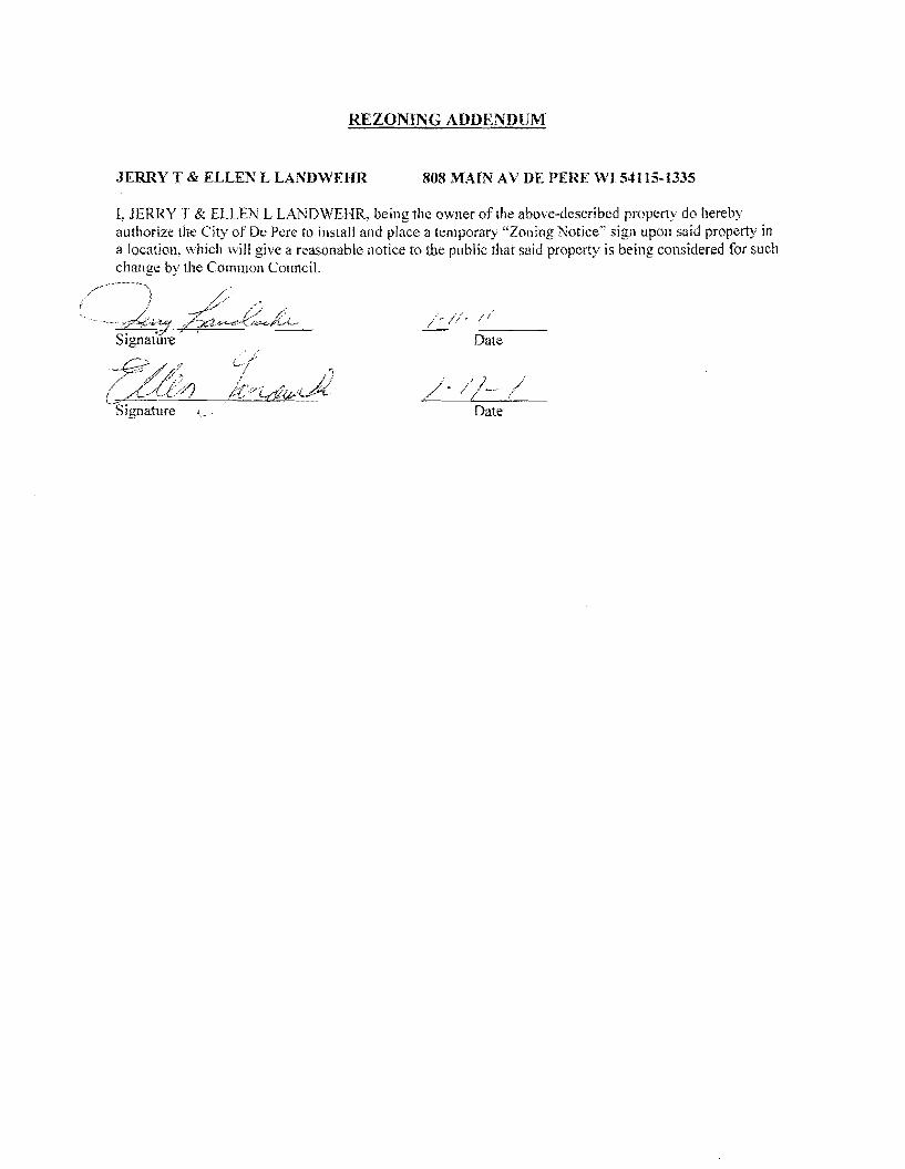
REZONING ADDENDUM
JERRY T amp ELLEN L LANDWEHR 808 MAIN AV DE PERF WI 54115-1335
I JERRY T amp ELLEN L LANDWEHR being the owner of the above-described property do hereby authorize the City of De Pere 10 install and place a temporary Zoning Notice sign upon said property in a location which will give a reasonable notice to the public that said property is being considered for such change bythe Common Council
Date
Date
REZONING ADDENDUM
rENNTFER M TITULAER 811 OAK ST DEPERE WI 54115-1532
I J ENN [FER M TITULAER being the owner of the above-described property do hereby authorize the City of De Pere to install and place a temporary Zoning Notice sign upon said property in a location vhi9~1 will give a reasonable notice to the public that said property is being considered for such change by
the C~tl10rt r
7~ GUfj l d II Sjgnarure Date I I
(
REZONING ADDENDUM
THOMAS J HARRIS 815 OAK ST DE PERE WI 54115-1532
L THOMAS J HARRIS being the owner of the above-described property do hereby authorize the City of De Perc to install and place a temporary Zoning Notice sign upon said property in a location which will give a reasonable notice to the public that said property is being considered for such change by the Common Council
J -
Signature Date
SIgnature j Date
REZONING ADDENDUM
JULIE A REINDL 816 MAIN AV DE PERE WI 54115-1335
I JULIE A REINDL being the owner of the above-described property do hereby authorize the City of De Pere to install and place a temporary Zoning Notice sign upon said property in a location which will give a reasonable notice to the public that said property is being considered for such change by the Common Council
Signature Date
REZONING ADDENDUM
HENRYN amp LORI L VAN STEDUM 819 OAK ST DE PERE WI 54115-1532
I HENRY N amp LORI L VAN STEDUM being the owner of the above-described property do hereby authorize the City of De Perc to install and place a temporary Zoning Notice sign upon said property in a location which will give a reasonable notice to the public that said property is being considered for such change by the Common Council
-0 -W01l Date
- O -tiJa 1 Date
COMPANIES
PARTNERS IN DEVELOPMENT
January 14 2011
Mr Ken Pabich Director of Planning and Economic Development 335 S Broadway Street De Pere WI 54115
RE Project Description and Re-zoning Request Residential Properties Located at the NWC ofMain St and 8th St
Dear Mr Pabich
The purpose of the re-zoning request to the city is to demolish the 14 existing dwelling garage and storage structures on the subject properties and to construct a new 13225 sf CVS Pharmacy with a Drive-thru facility One dwelling and garage located at 219 8ID St N is to be relocated to the lTWC of 9th St N and Pine St Please advise any additional information required for this re-zoning request
Sincerely The Velmeir Companies
John C Baumann Director of Construction
4
LOCATION MAP NTS
[pJ
(QJtegIAI~e
P~crbrtLoieg
l
f
L
CIW OF DEe ~ -
p
yenljs1tlart A4$
a Esf~ [)r c l1l -E Hettn~ Ave
Giant St EEi
ECT ATI9N
middott~
(I)
1 ~
~~I
shy
)
I J
I I I I I I s I l~
1~~
I
-- 3IJrL I
t r [_1 1851
I I I I I I
1
~~~~~~~~L __t I= -~
DESCRIPlION
andEgintmng lli1- W-l- __ W1~
262-7I-IlOO_H02--N66www~
RA Smith National -----shy sm
SITE PLAN
CVS PHARMACY
CITY OF DE PERE WIo N
o
I~[~I~~~~~lC~ Dr5 shy lWTE~AA
(~S - PfwtT BllCE
ALUIISTOR(fRQllTshyQ(NlAllOO2poundO
IINIA_C-O[[PREO
ALUliAU10llAllCDOCRshyCUNl~OOIZ[O
MAI N 5 T R E E T E LEV AT ION
PREIllI5IpoundO ~EA1 CCFINC -CtxOillOYAlt)1IW1D1TM
ur5 - 10UM
AlUWS1QR(fIl~~shya[AA~QOIltO
SPlllr1CWUshy$CIl conI) lH1LA~C-O[[PR(D
~~~~~ngOCOl_
NOR T H 8 T H 5 T RE ET E LEV AT ION
~
OAK 5 T R E E T E LEV AT ION SCAlEIlTS
REA R E LEV AT ION
NORR ARCHITECTS INGINEIIlS UNNEAS
719 Grhwoln Strc~r
sene 1000 Detmh M14~2l6
wwwecrrccm SCAlENTS
City ofDe Pere Plan Commission StaffComments Jan 24 2011 D
Item 3 Review Precise Implementation Plan for the new 9278 square foot Krause Financial office building in the East Industrial Park located on Profit Place Agent David OBrien
New office building for Krause Financial is to be located in the East Industrial Park on Profit Place The office building is 9278 square feet and is designed for future expansion to the south
Does the project meet the City Stormwater regulations
Sewer properly connected
Water properly connected
Access properly designed (driveway and sidewalks)
Are there any issues with easements or right-of-ways
Are there other items that need to be addressed
DYes _ No DNA _ Yes D No DNA _ Yes D No DNA _ Yes IJ No DNA DYes _ No DNA DYes _ No DNA
RequiredActions 1 The City storm sewer is designed to transport a peak discharge of a S-year rain event for industrial land use
Provide calculations for the peak discharge off the site Include the vacant property to the south under a developed condition
2 Provide a curb head cut at the new access point Do not remove the entire curb unless the curb is deteriorated Remove the curb cut detail from the plan set
3 Plan states that sanitary lateral is 6 lined The sanitary is 6 in diameter but has not been lined 4 The storm sewer tap at the inlet is to be core drilled The City Engineer is to be notified 24 hours prior to
construction An excavation permit will be required for the storm sewer work in the right-of-way S Insulate the water main if there is less than 18 of vertical clearance between the bottom of the new storm sewer
and top of the water main
Does the project meet the City Landscaping Regulations _ Yes D No DNA
RequiredActions 1 The southern portion of the lot must be maintained as lawn and cannot remain as existing conditions 2 All planting mulehing and staking should be in accordance with WDNR recommendations and current proper
practices 3 Allplant material and beds should have a follow up schedule for maintenance and replacement It is essential that
this schedule be established to ensure that the plants are maintained for health and any compromised plants are to be replaced in a timely manner This maintenance schedule should include provisions to protect plants in the winter as some of these may be susceptible to animal feeding or damage
4 A preservation and protection plan for existing vegetation and trees including City owned trees and shrubs should be included on plans when applicable
RecommendedActions S It appears there would be room for additional plantings of trees on the perimeter of the property Other tree
varieties and species could be incorporated into the plan
Does the project meet City Fire Codes _ Yes D No DNA
RequiredActions 1 Provide detailed plans for construction review prior to the start of work provide details of use for all areas of
structure Define uses for all areas of the building 2 Detail means of egress in all areas of building and provide capacity and exit width detail 3 Separation of hazardsuse is required in accordance with FCLSC Fire rated assemblies are required for the
furnace room and general storage areas 4 Provide exitemergency lighting throughout the means of egress S Provide fire extinguishers at maximum 75 travel distances from any point Locate extinguishers towards the exits 6 Installation of key box for fire department access RecommendedActions 7 Recommend installation of a fire alarm system should such a system be desired submission of detailed plans with
cut sheets and battery cales is required prior to installation 8 Recommend installation ofa fire sprinkler system based on size and construction type should such a system be
desired submission of detailed plans with cut sheets and hydraulic cales is required prior to installation
City ofDe Pere Plan Commission StaffComments Jan 24 2011
I 09 u CIl 0 5 be
sectI
oS Ql
oCl be I deg2 I ltII
E
Does the project meet the design regulations (exterior building elevationsmaterials) _ Yes D No DNA Does the project meet the City setback requirements _ Yes D No DNA Does the project meet the City parking requirements _ Yes D No DNA Does the project meet the City lighting requirements _ Yes D No DNA Is the refuse properly sited and screened _ Yes D No DNA Does the signage meet the Citycode _ Yes D No DNA Are there other items that need to be addressed DYes _ No DNA RequiredActions 1 Color for the building shall be earth tone in color 2 For parking traditional standards would require 38 stalls Under the 1-1zoning the Plan Commission can reduce
this requirement based on need We were told by the owner that 30 stalls would meet their needs The Plan Commission may want to request a letter from the owner to place on file to ensure there is no parking on the street in the future
3 The south gable end finish material should be modified to bring the design back into scale 4 Refuse enclosure shall be a matching split face concrete block with non-metal gates 5 As a note the two parcels will need to be combined before permits can be issued
Recommendation Staff would recommend approval with all required actions being implemented and the Precise Implementation Plan be forwarded to City Council for approval
CITY OF DE PERE Fee $ 24500
Receipt _-=6--I--=tu---O _
APPLICATION FOR SITE PLAN REVIEW Date
Please print or type using black ink for duplicating purposes
A Property Owner Name 1) C-e 6 y togtgt-t
V 1
- ffi
----)--2~L=--poundL-2lt3-k-_P~v)S~-4Jy
I hereby appoint the following as my agent for purposes of this application
Agent Name uCLvd e8r~~ ------- shyMailing Address -p 130 l ( ~S- Phone t9amp~930D
Signature DatelO I tJ6 1M It
B Property Information
AddressLocation of Property ~~ ~T-N f ~o-h t- Parcel pound D ~ pound0081-Z ~ CJ etmiddot- FbcR -Z-- t
Parcel Dimension t7f)( gttl3 Parcel Area -l7~~r-JcentLJ2--------shyLegal Description _
A Site Plan Review is requested as authorized by the De Pere Zoning Code Section(s) Article XIII
SectiOn146~middot0
Signed ApplicantAgentJLLOh-= Dated 111 II(
A plan consisting of all applicable information listed on the attached shall be submitted with this application
SITE PLAN REVIEW REQUIREMENTS
KRAUSE FINANCIAL SERVICES INC FOR BAYLAND BUILDINGS INC
CITY OF DE PERE BROWN COUNTY WISCONSIN AnENTIONI OOWNLOAOED PLANSARENOTSCALEASLE NEITHER THE OWNERORTHE ENGINEER SHALLSE HELDRESPONSIBLE FORTHESCALEOF DOWNLOADED PLANSONLYPRINTED PLANSFROMBLUEPRINTSERViCECO INCSHALLBE CONSIDERED TO BESCALEABLE PLANS
VICINITYMAP
fl(CAAl1ll~
II 1
1 l
Non ElClSnNlJ UTlUlIESSItC)MIONPLAH9AREAPPRO)jlW1Enil CON11IACTOR SliAlJBE RESPONSIBlE FOROIl1AININCI EXACTLOCATlDHS ANDELEVATIONS OFALLvnmas MIETlIERllHOWNDRNOTFROMTHECJVrNEP6 OFTHEREampPECTlYE umnlEs ALLUntTY OWNEASSHALt BENl1TJFIEO FORLOCATES avmE OOtmUlcrOR n HOlIll5PRIORTO
ouEA03ION CONTROL loIEAIilUREIilSWltLL 8E ~ PLACE PAIORTOCONSTFlUCTlDN AHOSfULlCOlolFOlllol TOlHEW1ampcOf1lWl OEPAPl1olENTOF IoUruIW RUOLIRCn CONSllIOCTlOfj mE EROSIONCOI4mOl AHOlECHtlICAL 5fANDAAOS
INDEXTO DRAWINGS SHTNO DESCRIPTION
1 LOCATiON MAPSANDINDEXTODRAWINGS 2 EXISTING SiTE CONDmONS 3 SITEPLAN UTILITYPLAN 5 GRADING ANDEROSiONCONTROL PLAN 6 DETAILS 7 DETAILS a EROSiON CONTROL DETAILS -INLET PROTECTION L----shyANDMISCELLANEOUS DETAILS Q EROSiON CONTROL DETAILSmiddot DITCHCHECKDETAILS 10 EROSiON CONTROL DETAILS- DITCHCHECKDETAILS
JoSPRfN DATE I APPROV REVlSIOJf KRAUSEFINANCiALSERVICES INCD
4 Robert E Lee amp Associates Inc
~~ECKEO FORBAYLAND BUILDINGS INC ENGJNEEftJNG 5~G ENVlRONltEmAL SERVtCESLOCATION MAPSANDINDEXTO DRAWINGSCiTYOF DE PERE eeeeeec --lBROWNCOUNTYWISCONSiN
LOCATION MAP
------ --- shyUTILITY INfORMATION I~~~rl
DESTINY DRIVE UTILITIES PRESENT crrvOF DEPEREWISCONSINPUBUCSERVICES6C TIMEWARNERCABLEl usSiGNAL I ~ 0 ___ bullbull
UTIUTlESSHOWNON THis MAP AREBASEDON lOCATES FAD I ~~ ~~~~100k=I
~--L (~ I 4 11 OIGGERS HDTUNETICKETNUlolaEA201~02Isa DATED 1223J2010 VISlBLEOB6EAVATIDN oN 12l2~01D AND i [ ~--- -__ ~~BR~EU~~~~~~~~NJiU~~~~O~~DEE~F~~g~ ~~U~~p~E VEFlIFleDPRIORTO 1Hf DIGGING I
1
11 ~ r u nn n~-=--=-~----- ~ ~ _ ~~_=~_--_DIGGERSliaTUIIlE HOo-242middota511
n -- 0_i 1j t ~ r -- L ~~Ju o~ gt 11 WATBIISAtHTAAYJtm]AU SCWlR~ GAS ELEGTJUO TelEPHONE C~BLE TV DEPARTNENTOf PUBUCWOIII(S WISCONSIN PUBLic SpoundRVIOE COItJgt no TIME WAflNER CABLE CNOFDEPEAE 6OONORTliMJMUgt6T lIaiampSFEJlSON6T 1OQ1KENNEOt AVE e25SXTHST Po BO)(180Dll GRiIENBAY W154~ KIUBliRlY WIUI)l i 11 fl~ ----~~----7~----- ~tmiddot r~1 DEPpoundREW1541gtS OrtEENBAYW16Q07
tQ~Q~-lIl47 820)11111207 (lI1l0jU9-5G7amp (InI4JJ~3 Ii ~n I I I lt0 I II
iJ - ---- -- I 1-I r1
tlll bullbullbullbullbull 111 i I lt1 ~ -11 I I IOWNER INfORMATION coNTRACTOR INfORMATION
ICFlAUSE FINANCIAL SERVICES INc BAYlANDBUILDINGS INC 1234ENrERPRI5E DRIVE POBOX13571 II-- i DEPEREW1 54115 GREEN6AYWI amp43D7middot3571 1
t 1_~I dl~i~ I I
I
II
~I~I I)0
j I ) I ~I i iI 5 III
(B6ampaS5-7437 (B20)3711i20D ) k I 1 IIL iIol 1 i ICONTACT DALE KRAUSE CONTACT DAVIDOBRIEN ~ ~I i 1 ) II) II Iti II
LEGEND -6 FIREHYDRANT I I i
tal ~ DECIDUOUS TREE I~I bull I
WATERVALVECURB STOP I gt I 1 I ~ i [ I I LOll I I tiWATERMANHOLE ~ bull _ bull o CONIFEROUS TREE j e I o SANITAAV tlANHOLE ~ 11 11 ~ r ese sr I I I Io BUSH o STORMMANHOlE II i r l ~ 1 ~ I I ~ ~ t~3B21 OP~ STORMIlANHOLE
RIPRAPbull J l ~ i i raquo I I 1151 lINIlIIll STORMINLET j shy glOOMINLETMANHOLE ~ZJf)IofI SPOTELEVATION III POWERPOLE r- ) i ~)i J I II ~
W~h FIRSTFLOCIRotlASEIrlENT ELEVATiON bull ~bullbull_ iEJ-oPOWERPOlE WGIN WIRE i4iL-i-l 0 ~ i al ~IUGHTPOLE N -rorAPPROXIMATE ROCKElEVATIONo ELECTRICMANIiOLE
III ELECTRICtlElER r III ll i I __ __ ) - I If__ 12 EXISTINGCULVERT
laquoI GASVALVE tii i I -- n iii ~ 1 I - -- - - - - - +-1- - i I I ti i ~ GASUETER o CONCRETE 81 MAIlBOX
CZJ WET1ANDS ~ - I I I I Iof SIGN
POST I f i
~ HANDICAP PARKING IRONPIPEJROD 11 ~ I I if I
4 PKNAlL ji rill I i i I 1 II I EXISTINGSANITARY SEWER (SIZENOTED) i 11 I 1 bull
EDGEOF PAVEMENT EXISlINGFORCEJJAlN (SIZENOTED)II ill- h i~ 1 ml i II ImiddotI ii -10C- ~ISlING STORMSEWER(SIZENOTED)
EDGEOF MAVEL k --N-- EXISlINGWATERMAIN (SIZENOTED) 1 I I 1i1 --0-- GASUNE C Ii
EXISTINGCURBamp GUTTEA I I ill 1 II i LOI I [I II --oc-- oVERHEADTELEPHONE UNE ---- UNDERGROUND TELEPHONE LINE 1
- TREEiBRUSH UNE --oc-- OVERHEAD ELECTRICUNE ) i ]1 n _ 1 I~ I
---- UNDERGROUNOELfCTRICUNE bullbull vse-bullbullbullbullbull EXISlINGCONTOURUNE i 11 -- t I
- OTV- OVERHEAD CABLE1VUNE --N-- CAaLElVLlHE I
RETAINING WAll 1 lilgtlll II ilmiddotMVUNE PROPERlYUNE H j i I I I
GUARDRAIL - EASEMENT UNE
~ FENCE BUILDING SETBACK UNE i I I ~ - i I II I ISEcnONUNE NOHIGHWAYACCESS
I I I II i ) I Ii i I I I i I l I I I I shy bull I1 1I~ I ~ ii k i I I J _ -J- _J ---- _ _ _ _ _ _ _ _ _ - - - - - - - - - - - - ~-- - LilI
gll~~ ~ NOTE D-t1 bullj I ELEVATIONs SHOWNAREBASEOON APREVIOUSCITY OF DEPEREEASTalOEDATUM SUSTRACT 091 TO ~mtII 8U) 0 CONVERTTO NAVOsl l
-0ampOATE IIoPPRrN OMWN KRAUSEFINANCiAL SERVICES INC-- shy FORBAYLAND BUILDINGS INC CITYOFDEPERE
~CJltQ) EXISTING SITECONDITIONS
~~SlCNEO BROWNCOUNTY WISCOSNIN
~r---L-j m1--Igill~~ ~~i~~~ 1131 bullI 1 -bull I 1 middot bullbullbull ]~) (SI1
~ e sr ------ shy
(I [a
[
I ar
I 1 I
r I
[ I [
I 1 f I r Ii
r
I I I I I I I I I I I I I
I I I I I I I I I I I I I I I I
I
I I 1 f-I ~I i~
I I
I
~ ~ ~I E~SnNG SURFACE TO AEMAIN I
~ 1 I ITJ I
I shyI II I
I I
I I 1 f~
I I I I
[1] I ~ ~ I I
I I ~ I I I I I I I ~ I I I I II
II l I I I _L II I8 I ----- ~ I I I I _------- ~ I
I f- I I - - -- - i7Jr I II I L_-J---- ~
I I amp-0~~ RlVlSlON KRAUSE FINANCiALSERVICES INC
I ri
-------------------------- ---------p----shyLOCAlED UMENT ON DESTINYDRIVE FROMEXl971NO OFFICE WITHNEW MASONRV BASE ANDELECTRICAL EX IHIEAGIUL CIJRlI ltlGUnER
shyNOCCESS _ 100 29917
~ ltgt3 J SLAND6CAPEAREAWlTH bull bullbullbullbull I io middott 5PRINKLEASYGTEM f
~ PROfr2~~ ~~DING
~~ FF ELEV63900
~ k 11I i I I I I I
I iii I f- I ~I J
f- I sect I
-- shyI I I I I I I I I I I I I I
w I I~
c I I I I I I I I I I
PROVlDE~1R6OPENING I ~~~g~ ~D~~~~~~~~SfARY VERIFYW H CITYBEFOREREMO~ING
DRIVEWA OPENINGCONCl1iTE I
I - shy
rIJ
SCIII2INFEET
NOTE ELEVATIONS SHOWNAREBASEDON APREVIOUS CITY OF DEFEREEASTSIDEDATUMSUBTRACT cer TO CONVERTTONAVDse
I~ l I
I II
NOTE ALLAREAS DESIGNATED ASGREENSPACE OR LAWN SHAll BE TOPSOILED TO A DEPTH OF e INCHES SEEOED ANDMUUHED AREA TO BE RAKEDFAEEOFSTONESAtJO CLUMPS
PARKINGVATA TOTALPARKINGSPACESPROVIDED 30
HANDICAP ACCESSIBlfPARKING SPACES 2
TOTALPARKING SPACESAEQUIRED24
SITEVATA TOTALAREA 223ACRES97212 SF
BUILDING AREA 021ACRES921aSF(amp5710)
SIOEWAlKIPARKING LOTAREA 032ACRES13B37SF(14jl3j
GREENSPACE090 ACRES39202BF(4033)
UNDISTURBED AREA 080ACRES348995F (35874)
ZONING
CONSTRUCnON CLASSIFICA nON vbull
PAllCEL NO EDF0081-2
EDmiddotFOOB1-2middot
LEGfNV
o CONCRETE PAVE~ENT
IRJ ASPHALT PAVEMENT
~ GREENSPACE
LANDSCAPED AREA
__ PROPOSEDie-CURBamp GoUTIER -- (UNLESS OThERWISENOTED)
~ PROPOSED SHEDDINCl CURBamp ClUTIER
PAINlED FIRElANE wlt
TRAFFICFLOWARROW ltgt HANDICAPPED PARKING~
NOTEALLCURBRADIIARETO THEFACEOF CURB
I I
I I I I
I I I
I I I
I I I I I
I I I
I I I
I
III
II I
I
I I I
II
I I I
I III
I10 I
I
I
t II I
I
I I If-shy
U) I I I
I I I
I I I
I III
I I I
I I
II I
I
I I I I
II I
I
I I
~ CHrtKlD FORBAYlAND BUILDINGS INC SITEPLAN --l ~ NeesaR UIl ENVIllONgtltBNTAI
CiTYOF DEPERE ~SICHEO BROWNCOUNTY WISCONSiN
3
-------------- shy WATERANOSMIITAAfLATERALS I AREESTl~ATED TO BE6 LINED DESTINYDRIVE
CONTACToRTO VERIFYEXACT [xlHlE~CIRfIampCln1m LOCATION ANDELEVAll0ItJI
I
I
I I
LE~IIIV --------PROPOSED SANlTARYSEWER I----~-- EXlSTlNG SANITARY SElJJER (SIZENOTED)
I bull - bullbullbull EX(STINGSTORMSEWER(SIZENOTED) =bull - bull - bull - bull - bull -PROPOSED WATERIolAlN
= == == PADPDSEOSTORM SEWER
---~-6w-6- EXISTlNGWATERIAIN (SI2ENOIED) I
I
~ ~ ~ ~ ~ I-6 -6 FIREHYDRANT I II $ WATERVALVEICURBSTOP l reg WATER MANHOLE V l REOUCER1NCREASER a 0 ISANITAAYMAIIHOlE C 0 STORMMANHOLE I I OPENSTOIUlMANHOLE UU lI STeAL( INLET C () STORMINLETMANHOLE I
I C
PLUM13ING VA TA CI
DRAINAGE FIXTURE UNITS 24 I I WATER FIXTURE UNITS 28 I m
NOTE I II MINIMUMOF S5FEETOF COVERSHALLSE MAINTAINEo I OVER ALL WATERMAIN
SANITARYSEWER WATERMA1N AND STORMSEWER5HALL BE CONSTRUCTEDIN ACCORDANCEWllrl TIIESTAIIOARD I6P~IFICAnONS FORSEWERANDWATERCONSTRUCTION IN WISCONSINAND ADMINISTRATIVE CODE CIAPTEASCOMM81middot87 I
rI
f~jil 3 FIELDVERIFYLOCATION OF EXISTINGUTILITIES IF EXISTING
LOCATIONSDIFFERFROMWHAT IS INDICATEDON 11-tEPLANS CONTACT ENGINEERPRIOR TOCONTlNUEOWORK I STORMLATERALSSHALL BE EQUIPPEDWITHTRACERMRE
i11 I
I
Ibull All DOWNSPOUTSSHALLBECLEANOUTDOWNSPOUTS
I I
I I
I I
I
IPROV 001[ I)fgtPROV ORoWH KRAUSEFINANCIALSERVICESINC ~E~00 FORBAVLAND BUILDINGS INC
CITYOF DEPERE UTIUlYPLAN ~SIGNEO BROWN COUNTY WISCONSIN
r-- shyI I I I I I I
I I I I I I I I I
I -shy
lOCAlEIHFUT
NOTE ELEVATIoNS sHoWN AREBASEDONAPREVlouaCllY OF DEPEREEASTSIOlDATUM sUBTRACTDe1TO
~-o CONVERTTONAVDB6
n srta r rl6367T1------shyOl~
~~~ g~~~ 10j ~L--ri-~ ---_~----r--___-~~7_
EXST utl l
LEIiRVV TOPOFCURBELEVATION~lcStltlil
FLOWUNE ELEVATION~F- TOPOFSIDEWALKELEVATION~SNJ66666
EDGEOF PAVEMeNTELEVATION~55
TOPOF RETAINING WALLELEVATION~RN444
~3J333 ORQIIIOELEVATION
DR-JNAGE SWAlE
DRAINAGE DIVIDE
---x- SlLTFENCe
~ BALE DITCH CHECK
FLOWAAAOW
TRACKlNCiPAOmmli INLETPROTECTION
NOTE ALLSANITARYSEWERSTORMSEWER ANDWATER SERVIcESIMAINSSHALLBE PROVIDED WITHTRACER WIREOA OTHER METHODTO BE lOCATED
STOlL IIIAITR MANAGEMRVT THISsrrsISTREATEQBY REGIONAL STORMWATER PONDTHAT IS LOCATEDSOUTHNeWEST OF THE END OFTHE CUL DEBAC OF PROFIT P~CE
ELOSWN cONT1WL NOTE All EROSrON CONTROLPRACTICE61NDICATEDON THIS PlAN ME APPROXIMATE LOCATIONSONLY THEACTUALSITEMAY REClUIREMOREOR LESSEROSiONCONTROLDEPENDINGON THE CURRENTCONDITIONOF THE SITE ~ SILT FENCEIS REQUIREDDOWNSLOPEOF ANY DISTURSED
LANDTHAT MAYCARRYSEDIMEtiTS OFF SITEl ltl
A TRACKINGPADIS REQUIREDAT ANYINGRESSIEGRESS LOCATIONWHERESEDII1ENT MAY BETRACKEDOFF-5ITE
II
PROPERIfLET PROTECTION6HAll BE U6ED OEPENDING ONTHE INLETTYPE
-4 SEDIMENTBASKET GH-ll BE USEDFOR ANY 6ITE DEWATERING
I I
I
I
I
in [)j j Ul
R1I4l7l1i1 0_S75I -- shy1 I~~~ m ~ 2lt 1 1 IIMampJl24(Wst)
Ii 1 I I r I i I
II i I I I j I I
STIHL4 r~ ~ I
t III
~ NLET(TYP) ~T~~ I
I j lJ I
OSTllILll Ii rL63s92
1I D_4045 It lW6l247 (W IN) llN6l U 71(15middotSO i I G ~ I
I
STING w o i a
I shy u ~921 I a i -(~ I i i 1160 II a
I L I - -1--+ ~ I f l I i I I ~ I II f j I I II J
I
J i I I I I 12 - shyI 1 ( I i I ~I ~ I 1 A I - I ~
f ~ I
i Iil71
_ - V~ - - - -- -- - ~-- - L Y Dwnall 111163U)
0-1117 NOTE ELEVATIONS sHoWN AREBASEDON A PREVIOOS CITY~~~ ~8 amp-0 g~~~~~RioE~~Jo~E DATUM SUBTRACTO91 TO001pound I APPRO KRAUSEFINANCIAL SERVICES INC IrQb~ Lee ampAsSOc]iite IncON ~~
CHECKED FORBAYLAND BUILDINGS NC EIGltiEERlNG SIJRVElING ENVIROHlWnALSUVlCpoundSGRADING ANDERosiON CONmOL PLAN 4664 COLOEN PONOPARltCOURTCITYOF DEPERE
~CNED ~oWl~~~lnltltom ~~~j~~2~)6~jN41BROWNCOUNTY WSCONSIN
NOTENEENAH R-3275OREQUALWITH TYPEA GRATEORRmiddot3246AOR Rmiddot3Dfl7WITHTYPEL GRATE
LESSTHAN4SHAlL BE RUBBER)
CLARlTY1
I 10$1 ~
~
il4R TO BEADOF ADJUSTlfIG RING CLEANOUT LINETOBElHE SAIlE ANDCASTlNGSEALANT OREQUAL SIZE5 MATERIAL ASSEWERIlAIN BElWEEN ADJUSTlNG RINGSAND NOTE CLEAWOUlLINETO BETHE
CONCRETE ADJUSTlNG RINGS SAME SIZEaIlATERIALASSEWER MIIN
ADAJSTlNG RINBSONLYWITH CASTING COATOUTSIDE OF
ASREOUIRED (4MINAND12 MAX UNLESSOTHERWISESEWERJOltlT COl4iOUNDND NOTEDALlADJUSTING RINGSWRAPWITHMIN8 MIL
~ GRADEPOLYETHI1ENE
ECCENTRIC REDUCING CONE (VERTICALWALL OF
PVCCOATEDCASTIRON 24 SQUARE LlHSTEPSmiddotOC CONePAD CLEANOUT PWB
ECCENTRiC CONESHALLBE ONDOINSTREAM SIDEOF MANHOLE THISDETAIL 4 (MIN)GRAVEL NOTESHOWNROTATED W FOR ADJUSTTOGRADEBY
CLEANoUTPLUG
II SUDINGVERTICALLY UPORDOWNOVER
PVQPIPESEWER 21 r~~~~~~~~~~~~4 SERVICE EACHJOINT
PROVIDE FROSTSLfEVE SERVICEPEAoCOM1l8236 (5)A)2
PROVIDEFROSTSLEEVE PEROCOMM8235 (6) fAJ2~~ TONGUE ampGROOVE PVCPIPE
n 45 BEND JOINTREQUIRED
PVCPIPE
FLEXIBLE PIPE To MANHOlE 45- BEND CONNECTOR REaUIRED
6PECUBEDDING
8 PRECAST S-8IlIN CONCRETE SASE SPECD SEODINGI I
SANITARYAND STORM CLEAN-OUT DETAIL CLEAN-OUT DETAIL STANDARD MANHOLE (TRAVELED AREAS) (NON-TRAVELED AREAS)
8-24(INCLUSIVE)
314-ro r
eunPOLYETHYLENE
I
~rd 81 ~I
~I
~
HDPEtPVC SEWERamp WATERMAIN amp FORCEMAINSTORM MANHOLE INLET PAVEMENT RESTORATION BEDDING ampTRENCHSECTIONTYPE A
MgtPFt(N ~T[ I WPROV REVISlCIH ~ampWN KRAUSEFINANCiAL SERVICES INC FORBAVLAND BUILDINGS INC~CKED DETAILS ~uCITYOFDEPERE
~IONEO BROWN COUNTY WISCONSIN
o
~ Io
I
W(IlAXJ12+00J2 W(MIN)-6oi-00J2
COMPACTEO BEDDING ANDCQVER SOILCLASSA-7
INITAL3 OFSOILCLASS ASIN WETORUNSTASLE TRENCH AS DIRECTED SYTHEENGINEER
WITHOUT EXTRACOST TOQWNER
I
ampolLCtASSG-l OR C-31FREQUIRED PER SPECIFlCAllONS
NOTE SUFlFACE RESTORATION REQUIREMENTS PERTHE SPECIFICATIONS
UNDER BARREL (8 FORBEDROCK EXCAVATiON
UTILITYTRENCH
t ENRENGTH ORENcH I bull -j _middot~middoti middotbullIc-~~~
PIPEUNE
SAWCUT CONStSTENTWlDTH
Imiddot I II I I 11--- -THiCKMANHOLE TOP
PVCCOAlEDCAST IRONIlHSTEPSmiddot 10C
BEADOF ADJUSTING NEENAH R-3215OREOUALWITH RINGANDCASTING SEALANT OR TYPEA GRATEORRmiddot1246AOR EQUALBETWEEN ADJSllNG Rmiddot3067WITHTYPEL BAATE RINGSANDCASTING COAT CONCRETE ADJUSTING RINGS OUT6IDEOF ADJUSTING RINGS 4SREQUiRED 14MINAND 12 ONLYWITHSEWER JOINT MAX UNLESS OTHERIIJISE
COMPOUND ANDWRAPWITH1l~N~~-~~~~L NOTEDALLADJUSTlNG RINGSLESSTHAN4SHALLBE RUBBER)
WAlllt CONTRACTION JOINTSPACING EXPANSION WIDTH TRANSVERSE LONGITUDINAL JOINTSPACING
NOTREQD 100lJAX
s NOTREQD 100lJAX 0 S NOTRECD 100lJAX 0 100lJAX e 100lJAX s 0 lOOlJAX
~
oj ~
~y
PROVIDE CONTRAClloH JOINlS 6CONCRETE ASDIRECTED BY ATUAXItlUlJ 20SPACING BY GENERALCONTRACTOR SAWCUTTINGOFtINSERTIONOF
DIVIDER PLATES
12 OFNO3 ORNO4 GRADATION R E6AR S LE EVES ~MINllJUMVOID rrEXPANSION MATERIAL WILLBEPLACEO ONEACHSlOEOFTHEORNEASUITINGTHE THERIlALEXPANSION SPliCEATENDOFSLEEVE FOR
SIDEWAUlt SIDEWALK ANDDRIVEWAY APRON SHAll BECONSTRUCTED SEPARATELY UNLESSOlHEfWJSE APPROVED BY THEDIRECTOROF PUBLICWORXS BACXOf CUAB COMPACTEDSUBGRADE
CONCRETE PAVEMENTDETAIL ~I 3~l rI~1 1 ABPHALTSATURATED fELT EXPANSION JOINTFILLERPLACED ~ ~rQ ATlJAXllgttUM 300middot SPACING AND
middotB1TUMINOUSSlJRFACE ATAll ENDSOf RADII 1 34 BITUMINOUS BINDER
18 LONG12 DIAlJmRIt REINfORCINGRODS 12 OF NO3 ORNO4 GRADATION ~
DRILL518HOLEMIN9 INTOEXISTINGCURB
CURBTIE-IN DETAIL lPAOPOSEDTO EXISTING)
COMPACTED SUBGRADE
ASPHALT PAVEMENT DETAIL SAWCUlCURBTRANSVERSELY PRIORTO RElJOVAl
~
12middotR60
COItRETE 4 APRONbull
DIMENSION VARIES SEEPlAN
I NOTE REFERTO SPECIFICATIONS FORREINFORCElJENlS
IiI CURBREMOVAL FORDRIVEWAY OPENINGWITH ~ CONCRETE APRON ONCONCRETE SURFAcESTREETS l
bull
EXPANSION JOINT TOOLED
CONTRACTION JOINT
PAVEMENT ANDBASECOURBE
SIDEWALKWITH INTEGRAL CURBCURBREMOVAL FORDRIVEWAYOPENING WITHCONCRETE APRON ON ASPHALT OVERCONCRETE
SURFACE STREETS
CURB REMOVAL DETAIL SIDEWALKDETAIL
bull VERIFYDETAILMATCHES crrv Of OEPERESTANOMDS
4 EXliTlNc CONCRjre
BREAK
VARIES
S SIDEWALK t ~ ~~~ ~~- z --~~~~N~N-~--~ ---~~
ALLARCUND(TYP) iii 11) gt
All RESIDENTIAL DRiVewAY APRONSSHALL BE FLAREDIF FIELDCONDITIONS PERMI1
THEflAAE BHALl NOTE)(CEED3-0
8middot ORJVEWAYAPRONrshy
~I ~t
bullbull _
1--( middotHmiddot bull middot ~ y ~h~raquo~gtY)1-S
~~ ~
L I bull bullbull bull bull ~ bull _ bullbullbull
CUflBA GUTIER 12 EXPANSION JOINT
DRIVEWAY APRON DETAIL
6lc6WmiddotIN211 W2WWf CENTERIN SLAB
-
CONCAETESlAB
4CONTINUOUS
12 EXPANSIONJOINTWITHSELF LEVEUNGSEALANTWHENCAST AGAINSTSTRUCTUIIE
MINIICOlJPACTED SOILCLASS C-3 MOISTENIMlJEOIATELY BEFOREPlACING CONCRElE
TYPICALSIDEWALK ADJACENT TO STRUCTURE
2RAD
SPECIFIED BITUlJlNOUS
4 CONTINUOUS TOP6 BOTTOM
DATE I APPROY AUSEFINANCiAL SERVICES INCm- TE At Robert E Lee amp Associates Inc SIl[D NO FORBAYLAND BUILDINGS INC~lEC1ltEO a ENGtNBeJUNO SURVEYINO BNVlRONWENTu SEJMCES
CrN OF DEPERE DETAILS fluU BROWNCOUNTY WISCONSIN
7
OR WASHEDSTONE
INLETPROTECTION NOTES
INIHAlUT10NtJDTESR W I4ANUFACTUAEO ilLTERN1TlVES 6PPROVED AND1t(if if f TYPE-e-a-c-USTEDONTIiEWOOTPRODUCTACCEPTABIUTV LJSr AAV BESUBSTITUTED
R TRJM EXCESS FABRIC INTHEFLOWUNETOWITHIN3J fq ~ if OF-THE GRATE
I WHEN ReMOVING ORMAINTAtlllNClINlET PROl1CTION CARESHAll Be TAKEN so THATTHE
50 MIN SEDIMENT TRAPPED ONTHEGEoTEXTllEFABRIC THECONTRaCTOR SHALLOEUClIISTRATE A METHOD OOESNOTFALLINTOTHE INLET NolVMATERIAL Of MAI~ENANCE USINGII SEWNFLAPHANDHOLDS
OROTHER ME11-tOQ TOPREVENT ACCUI4utATEO IMMED1AmV FlLUNGI~O THE INLETSHMl BE RELioVED PLANVIEW SED114ENT FROMe~EAING THEINleT
TYPE0 (j) FINIBHEDSIZEINCLUDINGFLAP POCKETS
WHEREREOUIREDBHALLEXTENDA MINIMUM ~ 2299 00 NOTINSTAllINLET PROTECTION TYPE0 ININLETS
SHALLOWERTHAN3DMEASUREDFROMTHEBOlTQlI PROFILE VIEW MAINl1NANCEOR REMOVAL Of THEINLETTQTHE TOPOFlHE GRATE
Of 10AROUNDTHEPfAIMEllR TO FACIUlATE
reg FDA INLETPROTECTIONNPE C (WITHCURB TRIMEXCESS FABRIC INTHEFLOWUNETOWITHIN 3 middot4 MIN OR FULLWIDTHOF THE EGRESSPOINT BOX)AN ADDITIONAL1SOF fABRIC IS Of THEGRATE REFERENCEWDNRTECHNICALSTANDARD1~1 WRAPPEDAROUNDTHEWOODAND SECURE1l
WITH STAPLESTHE WOCOSHALLNOT SlOCK THEINsTAuEOBAGSHALLHAVEII MINIMUMSiDE THE ENTIREHEIGHTOFTHECUR8 BOX CLENIANCE BElWEEN THE INlET WALLSANDTHE TRACKING PADDETAIL BAGMEASUREDATTIiE eorrouOF THE OVERFLOW OPENING
I
(IF APPUCABlEj HOLESOF 3 WHERENECESSARYTHE
reg FLAPPOCKETSSHALLBE URGE ENOUQHTO CONTRACTOR SHALLCINCHTHE BAG USINGPlASTIC ACCEPTWOOD2X4 ZIPTIESTOACHIEVETHE3ClEARANCETHE TIES
SliALL BE PuCED ATTHE MAXIMUMOF4 FROMTHE BonOM OF THEBAG
1 II
I 4XS OVALHOLESHAlL BE HEAT CUTI~D ALL fOUR SIDEPANELS 3
~ -USEREBAROR SllEL ROD
FORREMOVAL
] Of
FORINLETSWITHCASTCURB 80X USEWOOD2)(4 EXTEND10BEVOtlO GRATE WIDTHONBOTHSIDES LEMCJTH VARIES SECURETO GRATEWITHWIREOR PLASTICTIES
II
WOCO2 X 4 EXTENDS8 MINII4UI4 DOUBLESTITCHED BEYONDaRATe WIDTHON SEAMSALL AROUNOSIDE sorx SIDES LENGTHVARIES PIECESANDON FLAP SECURETo GRAll WITH POCKETS WIREOR PLASTiCTIES
INLET PROTECTION TYPE C INLETPROTECTiON TYPE 0 (WITHCURB BOX) (CAN BEINSTA1lEDIN mf INLETTYPEWITH ORWITHOUTCUM BOX AS PERNoTE Z)
INLETPROTECTION TYPE A
INLETPROTECTION TYPE B (WITHOUTCURB BOX)
(CAN BE INSTALLED IN ANV INLET WITHOUT A CURB BOXI
~~ KRAUSEFINANCiAL SERVICES INC ~ICEI) FORBAYLAND BUILDINGS INC Robert E Lee amp Associates IncEROSION CONTll0L
ENCINEERING SURVETING ENVliOtOlENTAL SERYXCESINLETPROTECTION ANDCiTY OFDE PERE OESlGNEO MiSCELLANEOUS DETAILS ---1 4 8
SUBGRAOE
WOODSTAKES(z PERBoLE) NOMINAL2 X T X 30 MIN LENGTHOR eQUIVALENT
CROSSSECTIONAL VIEW HOPEHIGH DENSITY POlVETHVLENE FABRIC SILTfENCE
FILTERBAG DETAIL
8HEETFLOW lt COURSE AGGREaATEINFORMATION
NOTE 1-shySIZENO ALlOlIJENS1ONS siEVESIZE AASHTO No87 (l)
AREAPPROXltrlAre SHEETFLOW 2 INCH(SO mm) 11fiINCH(375mm)
EMBEO BALES 1INet (250mm) 100 ~NEUZED FLOW314INCt1(111Olnm lMl-IOO 318INCIt(ll5mm) 20-55
PLANVIEW Wo-I175mm 0-10
i Wo8(200mrnl IJ-5
SECTION A-A ~ (1 SiZENoACCORDtNpound To AASHTO1l-l3
L THEDiSTANCE SUCH THAT POINTSIANDB AREOF EQUAL ELEvATIONNOTES
l 18X30middot ROCKFILLED FILTER al3 SHAll BEcOMPRISED OFTHEFOllOWllllB ~ HOPE HIGH DENSlNfOIETHYLENEFORSCOURPROTECTION USE HOPE HIGH DENSITY POLYETHVLENE DRAW sTRINGKt-ITTED DlREOllYlHToBAGOPENINGEROSIONMATFORCHANNELUNING 60 FABRIC CLOSURE WIlli APPARENT OPENINllSIZENOLARGER THAN 118middot X 18middot LAPMATUNDERUPSlREAM BALEB ROLleD BEAMUSINGA IlINttuuOF-180DENIERPOLYESTER SEWINGYARNFOR STRENC1T1-t ANDDURABILITYI ANDSECUREFABRiCWITHWOOD SIDEVIEW
STAKESATmiddotFOOTINTERVALSI USEWELLGRADEDCOURSEAGGREGATE CQNFORIolING TOTHE FOUOWINGGRAOATlON REQUIREMENTS
DITCHCHECKDETAIL
ROCK FILLED EROSiON CONTROL BAGS TYPEB
bull WELLGAADEDANGULARsTONE
OF 3 INCHOR GREATER
Ii~
STAGGERJOINTSBETWEEN ADJACENTROWSoF BALESa PLANVIEW
il STAKESDRIVENflUSH WHEN SOILCONDITIONS PERMITd
n
-------------~~~~~~~~~~~ WELLGRADEDANGULARSTONE OF3 INCHORQREATER
~~~
t-~~ ~1~80nOM ELEvATIONOF ENDSALE SHALLBE EOUALTOOR GREATER THANTOPOF LOWESTMIDDLEBALE IDROP
STAGGERJOINTSWITHDOUBLEROW SIDEVIEW FRONTELEVATION
TEMPORARY DITCH CHECK USING STONE TEMPORARY DITCH CHECK USING EROSiON BALES TYPECTYPE A
RrvISION OATpound I JJgtPRCN ~WH KRAUSE FINANCIAL SERVICES INC CHECKED FORBAYLAND BUILDINGS INC EROSION CONTROL
CllY OFDEPERE DITCH CHECK DETAILS OESICNED BROWN CQUNlYWISCONSIN
L OTENTlAlSCOlJAAREA USEERDSION )MAT OROTHERDEVICE WHEN DIRECTED BYTHEENGINEER
DIRECTIoN
~ ~FlOW
I II Id n
II I
I II
ENDTREATMENT ONSlOPES BACKFILL ampcOMP-cT TOBESIMII1IR TOCHANNEL TREHCHWITH flOW DETAIL
PLAN VIEW (WHEN LTERING THEDIRECTlON Of flOW)
I I I l--- TOEOFSLOPE I I I I I I
[ deg6~E~~~ I I I
PLANVIEW
rSTAKES DRIVENFLUSHWHEN SOILCONDITIClN$ PERMIT
8middot0plusmn
FILLSLOPE
DIRECTION OFFLOW
I II I 1111 ~ - EXISTING GROUND1111 II II BAneR STAXESIN OPPOSITE DIRECTION (TYPICAL)nuVV
FRONT ELEVATION WHENEXISTING GROUNDSLOPESAW~Y fROM FILLSLOPE
EROSION BALESFOR SHEETFLOW
MTE IpPRCN ~1RfWN KRAUSE FiNANCIAL SERVICES INC Leeamp AssDemes IncFORBAYLAND BUILDINGS INC EROSION CONTROl ---iENGUfEERlNG SURYrlTNG ENVlROlnlpoundNTAL SBRvtCllS
CIT OF DEPEAE SHEETFLOWDETAILs BROWNCOUNTWiSCONSIN
~CXEO
EXCAVATED SOIL GEOTEXTlLf FABRIC
WITH ALTERNTlVE SUPPORT COMPONENTS
~ (D
_~uJOiE~
NOTE DEPTH ORTIE ADDITiONAL~~OUIRED IN
SILTFENCENOTES
EROSIONCONTROL SHll BE PROVIDED IN AcCORONCEWITHWDNR SILTFENCEDETAIL ~~~~YSOIl6 TECHNICAL sTANDARD
reg CROSS8AACEWITH2X4~wC()QEN FRAMEOR EQUIVALENT ATTOP ~~
ANCHOR STAKEUIN18lONGWHEN REaD BYENG
SILT FENCETIE BACK
z
~
OFPOSTSASDIRECTED BYmE ENIlINEEAsl reg ~INIMUM 14GAUGE WIREREQUIRED FOLDFABRIC3OYEA THEWIRE~D STAPlE OR PLACEWIRERINGSON 12middot cc
cEOTEILEF )
CD EXCAVATE A TREWCH AMINIMUM of 4W1DE amp6 DEEPrOBURY ANDANCHORTHEGEOTEXTILE FABRIC fOLD MATERIALroFIT TRENCH ANDBACKFILL ampCOflPACTTRENCH WITHEXCAVATED SOIL
d
L WOODPOST reg WIRESUPPORT FENCESHALLBE14GAUGEMINIMUM WOVENWIJlE WITH AMAXlMUMMESH SPACING Of 6 SECURE TOPOFGEOlEXTAE FABRIC
GEOTE)ffi~EFABRlc TOTOPOF FENcEWITHSTAPLES ORWIRERINGSAT 12 cc (TYPE8)
reg ~~=~R~~~~~~~~~~~~~ ~~~~~~~T~t~40Ro 0 EOUAL A HEAW DUlY NYLONTOPSUPPORT CORDOREQUIVALENT IS
WOODPOST REQUIRED (TYPEA)
o STEELPOSTSSHALLBE STUDDED TEEORl lYPE WITHA MINIMUM
GEOTEXTILEFABRIc) WEIGHTOF 128LBSAJNrr (INITHOUT ANCHOR) FlN ANCI~ORS SUFFICiENT TORESISTPOSTMOVEMENT AREREQUIRED WOODPOSfS SHAlL8E A t4INIt4UU SIZEOF 1118X1 lIBmiddot OFOAKORHICKORY
reg CONSTAUCT SILTFENCEFROMA CONTINUOUs ROLLIF POSSIBLE BYd 18lL-__-w-__1Y curnsnLENGTHS TOAYCiDJOINTSIF A JOINTIS NECESSARY USE ONEOFWE FOLLOWINO TWOMETHODS AI1WSTMETHODshyOYERLAP THEENDPOSTSANDTWISTORROTATEATLEAST180 OEGREES B)HOOKMETHOD - HOOKTHEENDOF EACHSILTFENCE LENGTH
reg THEMAXIMUM SPfoClNG OFPOSTSFORWOVENFA8RICBILT FENCE
TWIST METHODreg SHALLBE8 FEETANOFORNoNmiddotWOVENFA8RICJ FEET
EROSiONCONTROL SHEETFLOW NOTES GEOTEXTIlEFABRIC
1 A~ SOILSTOCKPILEDlJiATREMAINS FORMORETHAN7 DAYSSHALLBEcovERED ORTREATED WITHST~BIUZAOON PRACTICES SUCl-lAS TEMPORARY ORPERt4ANEtfT WooDPOST ~ SEEDINGANDMULCHING
2 A MINIMUMOF4 INCHESOFTOPSOIL MUSTBEAPPUEDTOAlLAREASTOBESEEDED ORSODDED
L J All WASTEANDUNUSEDBUILDING MATERIALS (INCLUDING GARBAGE DEBRISCLEANING WASTES WASTEWATER TOXICMATERI4JS ORHAZARDOUS t4ATER1ALS)TE1ltTILEFA8RIC SHALLBEPROPERLY DISPOSED of ~ND NOTALlOWEDTOBECARRIED OFF-8ITEBYRUNOFF ORWIND
4 All OFF-SITE SEDIMENT DEPOSITS OCCURRING ASA RESULTOFCONSmUCTlONWORKORASTORMEVENTSH4JLBE CLEINEO UPBY THEENDOf EACHDAY FWSHINGsH~U NOTBE ALLOWED 5 NVYSOiLEROSiON lJiAT OCCURSAFTERfINAL GRADINGANDOR lliE APPLICATION OF STABILIZATION MlASUREsMUSTBEREPNREDANDTHESTABILIZATION WORK REDONE
WOQDPOST B FORANYDiSTURBED AREATHATREMAINS INACTIVE FORGREATER THAN 7WORKINGDAYSORlNHEREGRADING WORKEXTENDS BEYONDTHEPERMANENT SEEDING
middot C[-r 2middotOMIN DEAOUNES THEsrreeuetBETREATED WITHTEMPORARY sTAB1LI2ATlClN MEASURES SUCHASSOILTREATMENT TEMPORARY SEEDINGANlWfI MULCHING
7bullAU TEMPORARY EROSION CONTROL PRACTICES SHALL8EMlI1NTAINEDUNTllTHESITEIS STABluzEDWITH70 VEGETATION ANDA NOTiCEOFTERt4INATIDN HASBEEN MPROVEDBVTHE DNR 8 WINDEROSION SHALLBEKEPTTO~ MINMUM IXJRJNG cONSTRUCTlON WATEAJNG MULCHORA TACKING AGENTMAYNEEDTO BEUTILIZEDTOPROTECT NEARBY
HOOK METHOD reg AES10ENCESMlATER RESOURCES 9 THECONTRACTOR SHALLBERESPONSIBLE FORMALNTA1NNG AlL THEEROSION CONTFlOlMEAsURES IN CONFORMANCE WITHTHEINDNRCONSERVATlON PRACTlCE STANDARDS LATESTEDITION bull
JOININGTWO LENGTHS OF SiLT FENCE 10 UPONCQIvlPLETIDN OFSTORMJNLETCONSTAVcmON THECONTFIACTOR SHAll INSTAlLSTQRMDRAININLETPROTECTION FORCONSTRUCTiON SiTEASSPECifiED 11 FINESEOIMENT ACCUMULATIONS SHALLBECLEANED FROMSTREETS PRIYATEDRIYES ORPARKING AREASf1( MANUALORMECHANICAL SWEEPING A MINIt4UM OF ONCEPERWEEKANDBEFORE~LL IMMINENT RAINS 12 EFOBION ANDSEDIMENT COtlTROLSTRUCTURES SHALLaEINSPECTED WEEklYANDWITrIJNoj HOURSOFRAINFALL OF05INCHORMORE
MIt RODell E 10
I ~
BAYlAND BUILDINGS INC PGIClCL1IIn 1IIDIIIQWlNII7(IZD) _~
llESDI~au-CIJlIlWCJDlIt
eAYLAND
ppHr~ 1 ~ Ii rv ~ ~ J s ~Hmf I ~ bullH I ~ IH~O fFr Imiddot~IIsectsect ~ - 0
lUll 1l10~jl
I ~I l ~
HrLl~ ~
0 1 sect secti i 0
II t I S - s -j II
I~ I
I IrIII i I I
z I~~I0 0 II] ~ rn
~ ~
I~~I
Qli ~ ~ ~
~d I~~I
lUi I i i
I ] t s t r i 1
t ~ ij H~
~ 3 0 ~
i ~ ~ ~ bull
PROPOSED NEW BUILDING FOR 110-6065 DEPERE WISCONSIN BROWN COUNtY ~ REPJIM THYES (920) 371-2011 JOB NOshy AltCH) FU - orre 122110
8AY1AND 8UIlDINGSINC
Iigt
2W copyJ
11 ~ ~ ~
HT~llHgt065I(1wseF~5elIIaI(c-I2-lJ~c-liQ6SoltU~1I11lCfll1742AH
)
cJcJ 0 cJ cJ 0
cJ cJ 0 cJ cJ 0
Eil~ 1~ E~ ~I~ ~Isect sect sect sectsectEi sect 11111i 11111 ~ ~ I~ ~~
~lll~ ~ ~ II + - iii- Yamp ClCIltgtltgtltgtltgtltgtOoooltgt ltgt ~
I I 111 ~sect ~
~ I ~ I ~ 11Hmlqwl~11
1-1++middotmiddotmiddotmiddotmiddot1++middotmiddot +1- Ejmiddot1 1 ~
~ ilfl~l~ i ~ i ~ i i j ~i~li i -tmiddot i 1 t ~ ~lii~i~~iff~i~ltgt
111 1~ ~ ~ 1 I I IE ~I ~ ~ E I -1-1-1-1- +1-1+ + 1 ~ iii Ii i ilili ilili i iii i )i iii i i
tmiddot middotIt tmiddotmiddotttlmiddotmiddot cbullbullbullbull t~Imiddotmiddotmiddotmiddotmiddot Q~ ~i
I I III I Iii i ~ ~
1 I III I r1111
~ ~
~ii Iio
~~U d~i QIII ~
l r ---------shyi I
------_~===
BIYLANDBUILDINGSINC c aITl 1IlDIbull llIUn(aD)-D _-0 -alMJl ~
L~~=-l imiddot
11 i i
___dI~
eAYLAND
----1 o r Jle
I~
~i
~~ o
ki a
PROPOSED NEW BUILDING FOR fl0-60115 OEPERE WISCONSIN BROWN COUNTY SNES REP JIM TIffES (920) 371-2011 JOB NO I~ JCBNO--NtttO tnE=_ DlQEI22110 DAAJI)IEllDUD
BAYlANll BUIlDINGSINC
~ WJ WJ dm copyl
rr~
[]
NlimWrelIIl-6065~fillltlcizlStrnolIo-12middot23~~ll1I1111JJ117gt48lONol
H _
II II II II
I11
n---shy
II
Ii
Il PROPOSED NEW BUILDING FOR 10-6065 DE PERE WISCONSIN COUNlY OF BROWN ~ REP JIJI 1HYES (920) 371-201 1 lOR NO 1~
IlElrlaquol-(ARCH) fUshy DlaE122110 DRAW1IBlSWJ
BAYlAND BUILDINGSllltC
eAYLANo BAYLANDBUILDINGSINC 1QIDloDn GlIDIMrIfIKlllT (JlIl) 1M (Ira)
telQM bull -n clWIIIIIIClD
1fFalTlPnfirntlHlli5lCnnac~ ScniaIto-12middotUllerltldlll-6lJ6SAllHUlwg 111J2011741125AM
H II
1
ii
II
~i- il 1------ I
11 Ii 1j Ii ~ II
1 i u---shy1 g 11 ~ II
~ II ~ 11 3 II
jQ
Ii Ii Ii II II II
I ~ II II
~ ~ II It II I II II 11 11 II II II II II II II
[ il J 11 11 II
u------1 i
_
rlshy
_
1
PROPOSED NEW BUILDING FOR 10-6065 BAYLANDBUILDINGSINC DE PERE WISCONSIN COUNTY OF BROWN a_wn ~-DQJ7eAYLAND
(DIXt taOSALES REPJllil nNES (920) 371-2011 JOElNO te-eces raDI l1liMIl - ClIIIIIlifICftI108 NO- CAAai) fIL - CiTE 122710 OAAWX Err SWJ
BAYlANO BUILIllNQSINC
11~l2allJa2S]~1OXgtcPOf
r Ggt
1 ltI
~ Q ~ ~sect ij q Q (j)
oz
T z -u
~ ~ ~9 0 lt
~~ ~6 z i ~5i ~~ ~
~ ~ ~~ sect
~ lt
8~
I
PROPOSED NEW BUILDING FOR
~WISCONSIN BROWN COUNIY SALES REPJIW THYES (920) 371-2011 oIl8l1D 1o-eoel
oIl8 NO - CNOf) flLpound - bQf 122110 I- 8l till)
1lAINI) BUILlIHlSINC
SQ1Ilpound--O---- - amp--shyf------
sAYLANo BAYLAND BUILDINGS INCPamp_ _ ------_ __shy
0
lii2~JI~r~liI
1~~mUlnsectmiddotUmiddotjmiddotmiddotmiddotmiddot~~~)iinl~ ssses ~
~O~~~~_
m~u~imI~~ ~OI z z
~~ Ii~~~~sect~~ i ~ ~
~~~~~~~~~~~ rlt ~ l
I lt
lt I lt
lt middot~dOa lt lt lt
1 lt lt I II
i1 bullbull ~ e~~~
~ iP o~ pound
~ ~~ ~ ~ ~I ~
~B ~
~ ~ c~
Rsect
~i s ~~
- i
lt
~ ~ (J) (J
~ tl ~ ~
lt lt
lt
lt Igt ~oo
-c
I I
i I
I
~~ ~ bull -0
g ~~
~
8~
1 I
1 I
1 I
1 l I I
f) ~Q ~ B
01 If
1 I
I1 l I I
1 I l I
l1 I I I I
I I I
1 ~ I
1 I
i shy
SCALE 1IDlIF1CA11ONPROPOSED NEW BUIlJ)ING FOR 10-6065 DEPERE WISCONSIN BROWN COUNTY SALES REP 1M lHYES (920) 371-2011 JOe NO -~ ru - MTE 112110
BAYLA O BUILDINGS INC
eAYLANo BAYLAND BUILDINGS INC PO BOX 1l511 GilEEN 801 ~~7 (920) ge-93OQ FAX(920) ge-3OU
DESeN a BUILD CENERAL IOIlROCTOIi
City ofDe Pere Plan Commission StaffComments Jan 24 2011
Item 4 Land Subdivision review
A Review the Final Plat application for Garritys Glen First Addition Surveyor Mach IV
The final plat has been submitted for Garritys Glen First Addition The plat has 17 news lots which are located on Galway Lane and Tullig Place The design of the subdivision and lot layout was approved under the preliminary plat review This subdivision is zoned PDD-R-l which is Single Family Residential with a Planned Development District overlay The size and area of the lots conform with the original General Development Plan
The plat has three outlots shown on Galway Lane Outlots 1 and 2 are provided to meet the long-term plan which is to vacate the right-of-way and create a new lot with 80 offrontage Outlot 3 will be dedicated to the City of De Pere This lot will be attached to our City stormwater pond to the east
Recommendation Staff would recommend the following
1 Approval of the final plat 2 The final plat be forwarded to the City Council for approval
CITY OF DE PERE
APPLICATION FOR PLAT REVIEW
Fee Receipt
Date
A Review Type o Preliminary Plat ~ Final Plat
Preliminary Plat Fee $250 + ~ of lots $35) =
Final Plat Fee $150
_
Please print or type using black ink for duplicating purposes
B Property Owner Name Garri ty r s Glen LLC (Patricia Kaster)
Mailing Address 1317 Lombardi Access Rd Ste 101 Green Bay WI 54304
Phone 9~7-5090 ~
Signature jtib~~ Date _1_-_1_3_-_1_1 _
I hereby appoint the following as my agent for purposes of this application
Agent Name --=B=enja=m=inL=aCount=----- ~ ~ _
Mailing Address 211 N Broadway Suite 114 Green Bay WI 54303
Phone 920 - 569-5765
Signature $ ~~ Date _1_-_1_3_-_1_1 _
B Property Information WD-1754 WD-1755
Galway Lane amp Tullig Place 1 WD-1756 amp WD-1757AddressILocation of Property Parce _
A Plat Review is requested as authorized by the De Pere Municipal Code Chapter 46
ApplicanUAgent
v I
~~I I
I
~~~
I
Garritys Glen First Addition All of Outlets 2 and 3 and part of Outlets and 5 of Carritys Glen recorded in
Volume 22 Plats Page 241 Document Number 2193288 Brown County Records located in part of Lots 102 and 103 of the Williams Crant Subdivision being in the
City of DePere Brown County Wisconsin [(1 1[
GrlllhicScale
~s
~
~ ~~
~~~ copy
SITE MAP WILLIAMS GRANT SUBDIVISION
CITYOF OEPERE BROWN COUNTY
WISCONSIN
~~J8W
169011 O04c
Legend o 236middot(nd)~1811lll
oIggtg 36~ tl - foaIl
bull middotkonplpeloa bull Tlronplpero_ lf9r_eoyM_nl
bull lp qj
+COPoJ1qjpglnl(llOIJrlglltll)
middotoIcIlCM -aOlln a 1J10lt1) 1 Iralp1p1
M~~~~~~ bNn 10Vl tunormnaf ~
bull lInc __fM O QJI1 rclogtl1l
WBlaquoIdnv IOampIu nollXll --r shy~2Ullmllll(Io odJ
IWa~ SOnllWalCO~gpound1
mtplusmnplusmnI R lrtClud-u(bullbullbull nalolhihlI2J
[
Surveyors Certificate I Andrew 5 C18v8l0ndRegillered Land SurejOCf tlGloll1lt60111
Thai In rullcompDIIIlCll Ilh lhll prom Ion or Chapter 236 WICOnlnSlatula and uie u~lblon regulaUOon or ae Cy01OePera end BrownCounly III1dunder lhedi1lUon 01 jne ClWnented rllOnlTue lulVeyeddlvlded and mapped Gamly Glen 1$1 AddIUonendthDtubpl8tconacllyroproontsdelllorloibounda~eandtho
ubdlllonorlhalandulV81ampdlllldliaJloIOuUole2end3I111dpertoIOuUo1l48nd501 Garrllye GI~n reCOrdedlrlVolume 22 Plets Page 241 oeecmem Number 2lgnBB Brown Coonly Recorolocalampd Inpatl ollota102 and 103 of the Vll1IL1m Granl 5u~Mllon belng In the Cily of OePere Brown Counly W1SCOl19lr1 mora fulyducrlbed a51010$
Beginning al the 50ulheal comer or Lg 41 of Gam I) Glen f8lCnledIn Volume 22 Plall Page 241 OOCJmantNumber 219J2U Brown Counly Rerord thence NJ12358E 13500 feel lc tha NClt1heAlI Il)meror Mid Lo141 Ihenea S52J602E 29461eel tc lhe Well f1ghl-orw01Yne01 TuUlgPloea lbenea S3O0259 E6971aello lheEnlrlilI-orwaylineofaJdTuIU9Ptllc8lharneS~23602middotE13993feetloanEat
line or Oullo 5 of Mid middotG8r~ly Glen lllanceS41583lW 443 leet alon9 581dE0111lne lhllnca 51B~748W 23389 leel lton9 IW EUlline end the ulenslon thereof acron tha 119hlImiddotwoy of Galway Lane end llkonglin Ell IIn8of Ollllal 2 of aid Gar~ly Glan thonce S393953117891 reel8long lld Eal Unlto a South linear 5ald Outlot2 thonceN523602W149718l1Ialon9ealdSoutUn81oanEaI11n1lol8IdOuOo12 thonn 53723581119055 leolalon9 Uld E08lllrle to a South nne of 581dOutlot 2 thiincil 576215711721 lelllio llle NoMent comer of LOlJO of Illd Glrrlly Glen thenci N88419W 15742 f08110the NoMwul comer 01 Lol31 of Gemly Gwn lhence N3S36rE 13068 leel tc llle NoMu1 corner of LOlJ4 of Gem I) Glen and thl $ouIlIrl1 rIsIt-olweyline of County Clere Road thanea N031109EllJ90luet to llli North rlghl-crmiddot1 Une01Mid Counly Clarg Road end the Southanlll)rner of lol 35 or Garrllya Glan thenca N37235SE 13000 108110lhe NoMnat comer of 581dLo135 lllonco N523i02w 3~OOO reel 10 lhe SouU1eul ecmercr LOl40 oIGOlrll1l Gion uienee N372358E 13500 leollc the Northoul comor 01 nldlol40 IIIldIhe South 19h1-ofwlYline of Galway Line thenco N32273SE 6023 reelLo th poln of beginning Lesland~lCBpUngthalpllrtpleenUybeln9ulampdrorfldpurpoau
5aldparc81conlaln 223930 IlqnI514 AltJe50l1andmoro orlass 5ubacl 10 ell aaMments Ind rnlr1C11al 01rllCOld
AndrowSC1eeland DaIBJanuary72011
i ThcrcM bjluJ) lrrIhipl1 wilhrcpeltllu Sm 23~I~ 23616 2Jb2IJanu1)fl2Irl)31K1(2j Wi~ i1Igt J pu~~~ bygt 2)(12 W SUtgt
____~20_
shy a u fa I
l ii b~ st-
~ ~ lid ~( J~
ltIJ5 ~
~ ~~ S~~
~ i~ ~~
lt~6( ~~ ~
g DATE 1-7middot11
DRAFTED BY BJL
JI~middot~~~middot~~ ~~~~ PROJEcTIl 0336-0111
SCALE 150
SHEET NUMBER
10F2 DRAWING NUMBER
Department(IfAdmlnlsteatlon 409
Garritys Glen First Addition All of Outlot ~ and 3 and part of Outlot 4 and 5 of Garritys Glen recorded in
Volume 22 Plats Page 241 Document Number 2193288 Brown County Records located in part of Lots 102 and 103 ofthe Williams Grant Subdivision being in the
City of DePere Brown County Wisconsin
Certificate for the City of De lere ApprowodJorlhoCllyolDoPao thlli_dayal 20_
KonPbldl OlraClorolPlannlnog
Certificate Or the City of Del-ere Common Council RUolvedthaIthe ptal knownaemiddotGarrUy1Glen First AddlUonmiddot whlcl11Ia bolendUI~ lIledlor allptClvA oIlhe CommOl1 CounclloIlhe City or O~Pere blenells heretl~ apprOooed It QIlIrampltl b~ thapler 236 MsCOOtln SlamplutEl5
I do haratl1 cenlly the aboe Is I lfUeand oarrecl alpy 01a letalullon adopllltlb1lhe CommonCouncllollhe Cityof DePere on 1111 _dayor__~20_
ChartenaMPelerson Dale DePerlCllyCler)
Treasurers Certificate ~ dulyeleded CityorOePera Trdnurar Ind BrownCountyTreaSUlerWe herab~ car1lfy thellha records Inouromee show flO
unredeemed tax sales and no IInpaldtaxes or speclamplaneuments allectlngany 01lhe lendl IncludedInlhls Plalaeof lh dalasll9ted bolo
ChaneneMPeleDon Oale KerryMBtaney Dale Citycrceeere Treesurer BrownCounlyTraasurer
Consent of Corporate Mortgagee TIloBuslnon Bonke corporationdulyO19anlzod and atlstlngundor and by vrlue01he aWl ofYl9conlJnmongegoo of lho eeeee dosa1bedlanddoolhoroby~nsontlolhosulldylngdllldlngmepplngend dedketlonor the land dosc1bodon IhIIpial end doon hereby consent 10the allove eenlfteetal of Ganllyl Glen LlC awners INWITNESSWHEREOFThe Business Bankhel COUladthese prasentllo bo 81gnedby Devldlorltl ItaPlesldent and eounlel1llgned
Limited Liability Company Owners Certificate GARRITYSOLEN LLC 8 UmlledIIl1cUlly ltQmpany duly orgiU1Llvd andexlsUngunderandby vll1u8altha laws of theSIBIsof W1sconaTn dooshoreby rlJr1IIy tha W8CBuud Ihaland dBSQlbodon GARRITYSGLEN FIRSTADDITION10bu urvoyoo dlvldod mappedand daclhated as lepf8luntad herlion GARRITYSOLENLLC also earllRu lhallhls PJalLsraqulrEld by 523610or 523612 lOooliubmlltodtolhafoIlOYolngforapprovlllorob]acllon
CITYOF OEPERE BROWNCOUNTYPLANNINGCOMMISSION DEPTOF ADMINISTRATION
In Wltnen WherQOf Ihe 3ald GARRlTIS GLENLLCh81 CIIund lhGSe pruenli 10be 31j1ned by PalrtclaA Katler end DaMls P LaYdanllsmanagarsonthls_dayof__~20~
PalrtclaA Kailar DennisP Layden ManejlIll_Garrltys Olen LLC MenajlerOanltysGlenLLC
Persotlal1Cama bero ma thls_da1 or 20-- tha above named managars orsaId LlmlledLlablilly Company and acknowladgedlhat he uacvled lhe loregolngInstrUmant asSlIehmandgers althe dead or slllltlUmlladUabllltyCompany by 11amp aulhorlly
NotaryPubllQ M~CommllalonExplraa _ BrownCount~ WIsconsin
STATEOF WISCONSIN 1 ISS
COUNTY OF BROWN1
Grant (If Easement TIlere11hereby granled Joln~y to I1eCityof OePele Wliconslne munlclpaloarporsUOI1 WlswnlJn PublicSaMcaCorporaUon Ind lha WlscooslnTelapoone Compen~ bolhpubllculDl1ltInd lhelrsuccessors and aulgns a perpatualrlghlof wayover end eaou an nsementln elllands designated haln 8S middotUtllJUI1 EasemantamiddotIOItha purpose of conltrUcUnglnstallallon and malnlanancaoftha watar dlllrtbudonIyltem aanllaryend storm sewers draJnogaawales gn and alactrk dllllrllludon aylltamstalephona Iylleml lind eablatalevlslonsyslems NOhebltallleatruelureloraCCllsorybulldlngashailbacooslnJetedwllhlnoruponaaklIBaemanli All gradl1althertOnstructedoreslabDshadwlthlnsaldaasemenlihaUnolbedlslurbadorallarad TIlIIenemenlls perpetual
~ ~ s ~ i~
e ~ ~ ~~ ~~ ltl ~~ b(J S-~ J~ ~~~ ~~~~ ~~
~Imiddotmiddotmiddotmiddotmiddotmiddotmiddot
gt1 c u 0 ~ bull c I()LJ)
0 U 0 ~6d --lt ~ ~ ~ ~ ~~
i - p t() OllSo~ gt1 S gt_-O~~So~ ~ Co) I~H () ltJ bull -
-0 ~ by LaurlOOlsonltaVlClJProsldenLet creen BayYl9conslnIhls- dey of 20_
OaldLOfIll
PersonaUYCBmeberoremethLs_d8yor__~20-----lheabovenamedomearsolaaldcorpolBtlofItomeMOWI1 to eeu-e pel$Onlwho a~~liIltllhe foregolngInstrumenland 10me knOWl110 oe such omears or laid cotpOl1lllon and ecknOMedged lhet theyulletlledtheforegalnglnslrumenlal8ucholfteereesl1adeedolsaldoarporallonbylLseulhorlly
NotaryPublic MyCommlslllonExpll1Il _ BrownCounlyWlswnsln
STATEOF WISCONSIN I JSS
COUNTOF BROWN1
Restrictive Covenanls 1jTIle 11Ind 011all slde andreerlolUJlS crall Iotashell bolgraded by the propeny ownerandmalntalnldbytheebulUngproparly Olaquoners lo provloeloradequale drelnageolsurfa~ewaler
2) Eaclliol owner Shallgrade the properly10confOlm10the edopted sidewalkgrade elevaUonand malntalnaalde1eallonlor future Id_alks
J)NO poles pedeslal orbwled eeble are 10be pieced so 85 10dlslurbany sUlleyllake OfobSlruetvisionllIongey lollines orSllH or 5lteelllne e dlsurbancaof a IUlleyswka b1 anyone lIi a YiolaUOn ofleCUon23632oftheWlswnsinStalules
Notes 1)AllroadswllhlnlhepialboundaryeflldadlcaledlOlhapuoDc
2JOuUol3 1110boldedleeledlO the CllyofOePere
3) Lot6 and Lol7 are reslrtcledIromu9lngGalwayLiI1e fordrlvewa1purposes and must use Tullg PIa fordrlawe1enltan
4) PurSllent10 SQetIoltl456 DoPeroMunldpalCodQPublicSilol and Opon Spas tho CI11orOaPore requltel lhe paymonlofa lao InIlOu or Part OedleeUOI1 prior 10lhe luuenee of e BullolngPorrnlllor oilIolsInhIelubdlvlelon
5) Sidewalksare raqu1flld on aDSltaela SidewalkInltallaUonshall be cornplled prlor10IUllanee ofany occupancy parmltby thl City of DePere
6) The plOpln1 ownar althe lime 01wnstrudlon shllilImplamantthe epPOPriale sol eroaloncoolrolmethodl ouUlnedI the Yl9conlnOeparlmenl01NeluralResources OWlICORsln Conslrudlon Sila BlIslManegementPraCUeaHendboohmiddotlo preventBOIl erollon HoweverIftha Cily01DaPare alhe Umeof construellonhas edopted a aollerollon tOnLrol Ofdlnarne IllhaDgovem over lhlsrequltamenL ThlsprOoolsloneppll8810anycooSltueUOnorlnslallatlonreletedeetMUeS09soolaledwllhilraataendutlllUel
Curve Data
i07o71
~
furv M Ra~~ o~onl H1710 n~
~
lJ~
~ ~ ~
iirIi W iiUi5 uco
~17g
Sellgtack FIOntil~es ~
iiOO 1iW i iiiiiO iiOi illi iW uomn iii5
11 I ----0
(1-- Wraquo
ilgt1lT
MMiT ~
~ I~ ~ I ~1mI ~
I g
DATE 1-7-11
DRAFTED BY BJL
IImiddot~~~middot~middot~~middot~middotmiddot~~middotmiddot~middot~~ PROJECT OJJ~1-11There are no abjectiunlUIhipl~1 ~ilh rc~P~IIl
gteC513~I~23~162J6lOalldD62Irllendl2l SCAlE 150
WI~l141 bull 11prviddbyDfIllWIS18tl SHEET NUMBER
Cecd 20_ 2 OF 2
8ltmiddotmiddotDRAWING NUMBERilll II
Dcpanmcmuf Alimini~trJli(ln bull 409
City ofDe Pere Plan Commission StaffComments Jan 24 2011
Item 4 Land Subdivision review
B Review the affidavit of Correction for Certified Survey Map 6764 C Review the affidavit of Correction for Certified Survey Map 6765
Certified survey map 6764 and 6765 cover the Planned Development District by the former Sportsman Warehouse and Wal-Mart Based on some initial activity for potential development on these lots we have found an error on the CSMs which severely limits the development of the two frontage lots The CSMs have setbacks where both building and improvements are not permitted
To correct the CSMs we need to obtain approval from WI DOT DOT staff actually drafted the affidavits of correction
Recommendation Staff would recommend the following
1 Approval of filing the affidavits
Document Number AFFIDAVIT OF CORRECTION
Pursuant to s236295(l)(a) Wis Stats I William J Dorsey authorized Wisconsin Department ofTransportation representative hereby certify that Certified Survey Map Number 6764 recorded on March 5 2003 in Volume 45 Pages 193-197 as document number 1987796 and was recorded in Brown County State of Wisconsin contained the following language
Sheet 1 - 5000 Highway Setback Une Caution - Highway Setback Restrictions Prohibit Improvements SeeSheet 2 Sheet 2 - No improvements or structures are allowed between the right-ofshyway line and the highway setback line Improvements and structures include but are not limited to signs parking areas driveways wells septic systems drainage facilities buildings and retaining walls It is expressly intended that this restriction is for the benefit of the public as provided in section 236293 Wisconsin Statutes and shall be enforceable by the Wisconsin Department of Transportation or its assigns
AFFIANT makes this Affidavit for the purpose ofmodifying the above document by removing these restrictions in their entirety
Signed
I (Date)
This space is reserved for recording data
Return to Wisconsin Department of Transportation 944 Vanderperren Way Green Bay WI 54304 Attention JackieEisch
Parcel Identification lIumber(Tax Key N~mber
Wl)OOO2o-S WOmiddotDOOllmiddot4 Wo-OOOl1-1 WD-00020 WOshy
00011-2 WO-DOOl1-3 and W[-OOOl1
(Print Name)
This Instrument was drafted by the Wisconsin Department of Transportation Page 1 of2
Approval Certification
(Date)
(Name of local Government)
Approved far recording by the government identified above
(Clerk signature)
(Print or Type Name of Clerk)
This Instrument was drafted by the Wisconsin Department of Transportation Page 2 of2
1987796 NO _CERTIFIED SURVEY MAP
Part of Porcels C and D Volume 2 Cerlified Survey Maps page 67 Brown County Records all of Parcel G Volume 2 Certified Survey Maps poge 305 Brown County Records Lots 1 and 2 Volume 11 Certified Survey Mops poge 133 Brown County Records ond ports of the Northwest 14 Southwest 14 Northeost 14 ond the Southeost 14 of the Southwest 14 of Section 29 Town 23 North Range 20 Eost City of Depere Brown County Wisconsin
DOT FILE NUMBER 05-041-0883-02
S UNE sw - SEC 29 CUT CROSS IN CONCRETE SE COR OF SW 14 OF
A GRAPHIC SCALE
SEC 29-23-20
N 150 0 75 150 300
5CoolXI 1middot bull agocr J --shy ( IN FEET)
Inch = 300 ft
45 ~~GE193~
SHEET 1 OF 5
-r
CERTIFIED SURVEY MAP NO
Part of Parcels C and D Volume 2 Certified Survey Maps page 67 Brown County Records all of Parcel G Volume 2 Certified Survey Maps page 305 Brown County Records Lots 1 and 2 Volume 11 Certified Survey Maps page 133 Bmwn County Records and parts of the Northwest 14 Southwest 14 Northeast 14 and the Southeast 14 of the Southwest 14 of Section 29 Town 23 North Range 20 East City of DePere Brown County Wisconsin
SURfEXORS CERnFICATI
STATE OF WISCONSIN SS
WAUKESHA COUNTY
I JOHN P CASUCCI Registered Land Surveyor do hereby certify
THAT J have surveyed divided and mapped a Part of Parcels C and D Volume 2 Certified Survey Maps page 67 Brown County Records all of Parcel G Volume 2 Certified Survey Maps page 305 Brown County Records Lots 1 and 2 Volume 11 Certified Survey Maps page 133 Brown County Records and parts of the Northwest 14 Southwest 14 Northeast 14 and the Southeast 14 of the Southwest 14 of Section 29 Town 23 North Range 20 East City of DePere Brown County Wisconsin bounded and described as follOWs
COMMENCING at the Southeast comer of said 14 Section 29 Town 23 North Range 20 East thence North 00deg2013 East 23275 feet along the East line of said 14 section to the point of beginning of lands to be described thence North 88deg4858 West 18499 feet to a point thence South 00deg2013 West 7600 feet to a point thence North 88deg4858 West 14500 feet to a point thence South 00deg2013 West 7587 feet to a point in the Northerly right of way line of CTH P also known as SCheuring Road thence North 88deg3948 West along said North line 149115 feet to a point thence North 45deg5622W West along said line 10999 feet to a point in the East right otway line of Lawrence Drive thence North 06deg1609 West along said line 17223 feet to a point thence North 01deg1623 West along said line 24588 feet to a point thence Northeasterly 66297 feet along said line and the arc of a curve whose center lies to the Southeast whose radius is 76851 feet and whose chord bealS North 23deg2114 East 64260 feet to a point thence North 48deg0852 East along said line 69192 feet to a point thence North 64deg3024 East along said line 20485 feet to a point thence North 49deg0002 East along said line 10000 feet to a point thence North 49deg1122 East along said line 10000 feet to a point thence North 33deg4852 East along said line 20742 feet to a point thence North 49deg1122 East along said line 14170 feet to a poirrt thence South 40deg4838 East 53922 feet to a point thence South 89deg3138 East 25246 feet to a point in the East line of said 14 Section thence South 00deg2013 West along said East line 150875 feet to the point of beginning
THAT I have made such survey land division and map by the direction of BOULDER VENTURE 14 LLC WAL-MART REAL ESTATE BUSINESS TRUST AND MENARD INC owners
THAT such map is a correct representation of all the exterior boundaries of the land surveyed and the land division thereof made COIIl~
C Veo e-_~ bullbullbullbullbullbullbull ~M~~THAT I have fUlly complied with the provisions of Chapter 23634 of the Wisconsin ~~indttiemiddotmiddot bullbull y ~
City of DePere Land Ordinance in surveying diViding mapping dedicating said lands 2 JOHN P ~
AI 71 = CASUCCI bull shyWrIW~laquo- 3 ZodZ- (tptt-e-- _ sectoEOOyen DATE HN P CASUCCI _ IDItGWocmiddot ~
EGISTERED LAND SURVEYO~_~-ft-~ Wi bullbullbullmiddot0middot shy se- -7vD bullbullbull middotc -c-
ACCESS RESTRICTION SUR l All lots and blocks are hereby restrletecl so that no owner possessor user licensee or other person may have any right oIlIU l vehicular Ingres from Dr egtess to any highway lying within the rlght~1-way01 USH 41 It Is expressly Intended that this restriction constitute a restriction for the benefit of the public as prOVided In s 236293 Stats and shall b8 enforceable by the departmenl Dr Its assigns Any access allowad by speelal excaption shall be contlrmed and granlad only through the drivewy permitting process nd all permits are revocable (access to Lawrence Orie and ScheUring Rod permitted)
NOISE ABATEMENT The lots of this land divisIon may experience nolsa atlevels exceeding tha revels In s Trans 40504 Table 1 These levels ate based on federal standards The department of transportallon Is not responsible for ablITlg netse from existing state tlJnk highways or connecting highways In the absence of any Increase by the department to the highways ttlrough-Iane capaclty
HIGHWAY SETBACK RESTRICTION No improvements or strudUres are allowed between the r1gtlt-of-way line and ttle highwaY setback line Improvements and structures include but are not Ihnltad to sIgns par1lting areas driveways wells septic syslems drainage 13olllle5 buildings and retelnlng walls It is expressly Intended that this reslrlcllon Is for the benellt of the public as provided In section 236293 Wisco nsin Statutes and shall be enforceable by the WIsconsin Department of Transportallon Dr ils assigns
Sheet 2 of 5 Sheets
CERTIFIED SURVEY MAP NO
Part of Parcels C and D Volume 2 Certified Survey Maps page 67 Brown County Records all of Parcel G Volume 2 Certified ~urvey Maps page 305 Brown County Records Lots 1 and 2 Volume 11 Certified Survey Maps page 133 Brown County Records and parts of the Northwest 14 Southwest 14 Northeast 14 and the Southeast 14 of the Southwest 14 of Section 29 Town 23 North Range 20 East City of DePere Brown County Wisconsin
CORPORATE OWNERS CERTIFICATE (Lot 1 2 Outlot 1 amp partial Lot 3)
BOULDER VENTURE 14 LLC a limited liability company duly organized and existing under and by virtue of the laws of the Slate of Wisconsin as owner certify that aid company caused the land described On this map to the surveyed dlvldad mapped and dedicated as represented on this map
BOULDER VENTURE 14 LLC does fUrther certify that this map is requited by S23610 or 23612 to be sUbmitted to the following for epproval or objedion City OfDePere and Wisconin Department ofTransportation
WITNESS the hend and seal of BOULDER VENTIJR~~_LLC has caued these preiifjnts to ba signed by ROBERT E SCHMIDT III it Member this r 2~ day of ~t9PA 200b
STATE OF WISCONSiN
CONSENT OF CORPORATE MoRTGAGEE
MARINE BANK a corporation duly orgenized and existing under and by virtue of the laws of the Slate of Wisconsin mortgagee of the ebove-described land does hereby consent to the surveying dividing mapping and dedication ofltle land described on this plat and does hereby consent to the above certificate of BOULDER VENTURe 14 LLC owner
IN WITNESS WHEREOF the said MARINE BANK has caused these presents t be signed by bull its President and countersigned by Its Secretary at
--------------- bull and Its ccrporata seal to be hereunto affixed thl __day of ________~ 200_shy
PRESIDENT SECRETARY
STATE OFWJSCONSIN SS
_____COUNTY
PERSONALLY came before me this day of 200 the above named ---_-------__---------__~ President and Secretary of the above-named corporation to me known to be the persons who executed the foregoing In trument and to me known to e such President and Secretary of said corporation acknOWledged that they executed the foregoing instrument as such officers by its authority
Notary public State ofWisconsin My comrmsston expires _---- _ My commission is permanent
Sheet 3 of 5 Sheets
----------_~----------~-~------__--------------------------
CERTIFIED SURVEY MAP NO
Part of Parcels C and D Volume 2 certified Survey Maps page 67 Brown County Records aU of Parcel G Volume 2 Certified Survey Maps page 305 Brown County Records Lots 1 and 2 Volume 11 Certified Survey Maps page 133 Brown County Records and parts of the Northwest 14 Southwest 14 Northeast 14 and the Southeast 14 of the Southwest 14 of Section 29 Town 23 North Range 20 East City of DePere Brown County Wisconsin
CORPQRATE OWNERS CERTIFICATE (oartia Lot 3)
WAL-MART REAL ESTATE BUSINESS TRUST a Delaware~~dulY organized and existing under and by virtue of the laws of the State of Delaware as owner certifies that said trust caused the land described on this map to the surveyed dMded mapped and dedicated as represented on this map
WAL-MART REAL ESTATE BUSINESS TRUST does further certify that this map is required by S23610 or 23612 to be submitted to the following for approval or objection Clly of DePere and WiampCOnsin Department of Transportation
WITNESS the hand and seal of WAL-MART REAL ESTATE BUSINESS TRUST has caused thase presents to be signed by M4-ad e ampAlUNampfi its MMMbnt-Iiuc~ = this 1 ~~ay of )a N 80j 200
W~~S~UST Assistant Vice PresidentIt rt1-PN~tS
STATE OF HI ~ SS
eCOUNTY
PERSONALLY came before me this t day of J2Pluar(sect 2003 the above named vh IE G-APntPpound to me known to be the person who exeCuted thlt foregoing inslnJment and to me known to be such -4llu~t of said trust and acknowled at he cuted the foregoing Instrument as such officer by ~ ~uthorttymiddot ~
MENARD INC a corporetion duly organized and exis1jng under and by virtue of the laws of the State of Wisconsin as owner certify that said corporation caused the land described on this map to the surveyed divided mapped and dedicated as represented on this map
MENARD INCbullbull does further certify that this map is required by S23610 or 23612 to be submitted to the following for approval or objection City of DePere and WIsconsin Department ofTrensportetion
~A f WITNESS the hand and seal of MENARD INC nas caused these presents to be signed by Rv rROlHAS KA its V ICE PRe I D l-NT this 2L(-4~ day of bIlIIA f2t 2003
MENARO INC
STATE OF WISCONSIN EAV cLAI~ SS
S COUNTY _
ER~Olle-LLYcame before me this ltf+r day of JANVA(l1 200~~1he~ ~)feraquo_ named V t~Ov SIL to me known to be the parson who executed the foregoing iDStrbme~ndor me known to be such PEN of said corporation and acknowledged thattlN ~xeamptedtIi bull -~ _ - foregoing Instrument as such officer by its authority -r-~L A bull ~~fIi l i -l 1~ ~
~~LlIlllll I nvvV1NV~ IIV_ ~ ~SGlfJ~ I= ~ COtv II J EA_ i ~S S NotaryPubliOStateofWisconsirr-- middotmiddotmiddot-middot 1 ~o
~~middotmiddotmiddotmiddotmiddotmiddot~middotr~~ bull i ~ ~ -_ ~ ) ~olgt --f to- ampr~1fc -~ My commission is permanent bullbull ~
S 5 2055 ClCOlrotoIOW _ Sheet 4 of 5 Sheets -~bullbull WI ~ 140 rJ-O~
~ SUR II T5 100It VOl bull f PASE
1987796 CERTIFIED SURVEY MAP NO _
Part of Parcels C and D Volume 2 Certified Survey Maps page 67 Brown County Records all of Parcel G Volume 2 Certified Survey Maps page 305 Brown County Records Lots 1 and 2 Volume 11 Certified Survey Maps page 133 Brown County Records and parts of the Northwest 14 Southwest 114 Northeast 14 and the Southeast 14 of the Southwest 14 of Section 29 Town 23 North Range 20 ~ast City of DePere Brown County Wisconsin
PLANNING COMMISSION APPROVAL
SV A ~ lt bull 2003 APPROVED by the Plan Commission of the City of DePere on this _----L--=__ day of
REGIsnRS OFFIce
8mwnCOWIs ~ Received fw IOCOfIIIfle dayof ]2r-ceb AD at i ocloCk M and recooIed in Vol of Certified SurveyMaps on PCIlIlI
~41~-lt (9Ruglsklf 0Daeds
THIS INSTRUMENT WAS DRAFTED BY JOHN P CASUCCI 1604B6CSM REGISTERED LAN D SURVEYOR 8-2055 Sheet 5 of 5 Sheets
VOL 45 lAcpound197
Document Number AFFfDAVIT OF CORRECTION
Pursuant to s236295(l)(a) Wis Stats I William J Dorsey authorized Wisconsin Department of Transportation representative hereby certify that Certified Survey Map Number 6765 recorded on March 5 2003 in Volume 45 Pages 198-203 as docwnent number] 987797 and was recorded in Brown County State of Wisconsin contained the following language
Sheet 1 - 5000 Highway Setback Line Caution - Highway Setback Restrictions Prohibit Improvements SeeSheet 2 Sheet 2 - No improvements or structures are allowed between the right-ofshyway line and the highway setback line Improvements and structures include but are not limited to signs parking areasdriveways wells septic systems drainage facilities buildings and retaining walls It is expressly intended that this restriction is for the benefit ofthe public as provided in section 236293 Wisconsin Statutes and shall be enforceable by the Wisconsin Department of Transportation or its assigns
AFFIANT makes this Affidavit for the purpose of modifying the above document by removing these restrictions in their entirety
Signed
State of Wisconsin )o ) ss O(6tJQ County )
On the above date this instrument was acknowledged before me
by the nam~ officers J r l4 P V(h1 ~
(Signature Notary Public State of Wisconsin)
Curtis D Van Erem (Print or Type N~e Notary Public State of Wisconsin)
II ~~201J
This space is reserved for recording data
Return to Wisconsin Department of Transportation 944 Vanderperren Way Green Bay WI 54304 Attention Jackie Eisch
ParcelIdentification Numberfax Key Number
WD-DOO2(S WD-DOOl1-4 WD-DOOll-1 WO-DOO20 WDshy
100011-2 WOmiddotOOOl1-3 and WD-DOO11
William J Dorsey (Print Name)
(~ate ommission Expires)
This Instrument was drafted by the Wisconsin Department of Transportation Page 1 of2
Approva I Certification
(Date)
(Name of Local Government)
Approved for recording by the government identified above
(Clerk signature)
(Print or Type Name of Clerk)
This Instrument was drafted by the WIsconsin Department of Transportation Page 2 of2
67651987797 CERTIFIED SURVEY MAP NO
A Division Lot 3 Volume of5 Certified Survey Mops page Lj~ Brown County Records 011 being port of the Northwest 14 Southwest 14 Southeast 14 and the Northeast 14 of the Southwest 14 of Section 29 Town 23 North Ronge 20 East City of DePere Brown County Wisconsin
I ~I litj ~ 5
z
ili 5 w lliIlz
W
CUT CROSS IN CONCRETE SE COR OF SW 14 OF SEC 29-23-20
SHEET 1 OF 6
UNPlATTEO -LJNDs-
LOT CSM NO
ill ~ EXISTING euLDIHGS TO BE RAZED
-------~----
GRAPHIC SCALE 150 0 75 150 300
~--- I ( IN FEET )
1 inch = 300 ft
SCFffiURING RDshy S UNE SW 1 SEC iii 120 PUBUC ROAD
VOL SIA1I bullbull zooo
VICINITY MAP SCIUTHWEP 1
OFaanONZbullbull T2SNIIlZCC
I-~-I
I NwbullbullIN E
~ J
I sw I SE
L_~e--Re~
INDICATES 2 IRON PIPE (FOUND) tgt INDICATES 34 IRON PIPE (FOUND)
bull INDICATES I IRON PIPE (FOUND)
o INDICATES SET 35 00 IRON PIPE 24 IN LENGTH 168 LBS PER UNEAL FOOT
All DIIoAENSIONS SKOWN ARE MEASURED TO THE NEAREST HUNDREDTl-l OF A FOOT AlL BEARINGS ARE REFERENCED TO THE EAST UNE OF THE SW 4 OF SECTION 29 T 23 N R 20 E WHICH BEARS N 00203 E
DOT FILE NUMBER 05-041-0882-02
CERTIFIED SURVEY MAP NO __ A Division Lot 3 Volume 15 Certified Survey Mops page Ji3 Brown County Records all being port of the Northwest 14 Southwest 4 Southeast 14 ond the Northeost 14 of the Southwest 14 of Section 29 Town 23 North Ronge 20 East CIty of DePere Brown County Wisconsin
ACCESS RESTRICTION An lots and blocks ere hereby reslrlcted so that no owner possessor user licensee or other person may have any right of direct vehIcular Ingress from or egress to any highway lying within the right-of-way of USH -41lt Is expressly Intended that this restriction constitute a restrlcaon for the benefit of the public as provided In s 236293 Stats and shall be enforoaable by the department or Its assigns My access allowed by special exception shell be oonfinned and granted only through the driveway pennllting process and all permits are revocable (access to Lewrence Drive and SchelJring Road pennltted)
NOISE ABATEMENT The lots 01 this land division may experience noise at lavels exceeding the levels In s Trans 40504 Table 1 Thssa levels are based on federal standards The department of transportaUon Is not responsible for abating noise from exlsUng state trunk highways or connecting highways in Ihe absence of any Inaeasa by the department to Iha highways through-Ia capaclty
HIGHWAY SETBACK RESTRICTION No Improvemenl$ or structuras are allowed between the right-of-way line and Ihe highway setback line Improvemenl$ and structures Include but are not limited to signs parking arsas driveways wells septic systems drainage faelllUas buildings and retaining walla It la expre$$ly Intended Ihat Ihls restr1ctlon Is for the benafit 01 the public as provided In section 236293 Wisconsin Statutes and shall be enforceable by the WlSCOflsin Dapartment of TransportaUon or Its assigns
SCALEGRAPHIC 134502 sf ft 30877 acres g
OUTLOT 1 36772 sq ft 08901 acres
21875 S42OOSSE 21875
S41OZ1E 23776
t----- 12 UllUTY ES middotT
I
I
I I I 11I I 350
~
~
rJ ~ t5
rI x
I I I
1 ~
- I
~ a Cl
I shyl -c I
ampl lt
OUTLOT 2
11 50 0 25 50 100 200
Iw-~ I1 ( IN FEET ) Inch 100 ftA1
NtItIonaI ~ amp EI_-N 104aIIft=m~ L ~+
SHEET 2 OF G ~ -~
VOL 45 PACE199Cl
CERTIFIED SURVEY MAP NO __
A Division Lot 3 VolumeiJi Certified Survey Maps page 13 Brown County Records all being part of the Northwest 14 Southwest 14 Southeast 14 and the Northeast 14 of the Southwest 14 of Section 29 Town 23 North Range 20 East City of DePere Brown County Wisconsin
SUIDEYORS CERTIFICATE
STATE OF WISCONSIN SS
WAUKESHA COUNTY
I JOHN P CASUCCI Registered Land Surveyor do hereby certify
THAT I have surveyed divided and mapped a division of Lot 3 of Certified Survey Map No __ Brown County Records all being part of the Northwest 14 Southwest 14 Southeast 14 and the Northeast 14 of the Southwest 14 of Section 29 Town 23 North Range 20 East City of DePere Brown County Wisconsin
COMMENCING at the Southeast comer of said 14 Section thence North 00deg2013 East along the East line of said 14 section 116230 feet to the point of beginning of lands to be described thence South 48deg3934 West 56015 feet to a point thence South 61~156 West 18684 feet to a point thence southwesterly 3889 feet along an arc of a curve whose center lies to the southeast whose radius Is 9500 feet whose chord bears South 49deg3812 East 3862 feet to a point thence South 37deg5428 West 21211 feet to a point thence South 48deg3814 West 36839 feet to a point thence Northwesterly 5970 feet along an arc of a curve whose center lies to the Southwest whose radius is 12400 feet and whose chord bears North 27deg3412 West 5913 feet to a point thence North 41deg2146 West 107024 feet to a point in the Southeasterly right of way of Lawrence Drive thence Northeasterly 11550 feet along said right of way and an arc of a curve whose center lies to the Southeast whose radius is 76851 feet and whose chord bears North 43deg4543 East 11539 teet thence North 48deg0852 East along said line 69192 feet to a point thence North 64deg3024 East along said line 20485 feet to a point thence North 49deg0002 East along said line 10000 feet to a point thence North 49deg1122 East along said line 10000 feet to a point thence North 33deg4852 East along said line 20742 feet to a point thence North 49deg1122 East along said line 14170 feet to a point thence South 40deg4838 East 53922 feet to a point thence South 89deg3138 East 25246 feet to a point in tlie East line of said 14 sec thence South 00deg2013 West along said East line 57920 feet to the point of beginning
THAT I have made such survey land division and map by the direction of BOULDER VENTURE 14 LLC WAL-MART REAL ESTATE BUSINESS TRUST AND MENARD INC owners
THAT such map is a correct representation of all the exterior boundaries of the land surveyed and the land division thereof made
THAT I have fully complied with the provisions of Chapter 23634 of the Wisconsin Statutes and the City of DePere Land Ordinance In surveying dividing and mapping said lands 001111111
c No -~ ~~ ~ -11 ~
E JOHN P bullbull ~ bull - CASUCCI bull shy
~ ~ ~lh j shyts ZoOz N P CASUCCI OCONOMGWOC bullbull
GISTERED LAND SURV~~~55wr bullbull middotmiddot0middotR-~ ~Y rrD ~ 1 SURll -
rlU1
Sheet 3 of 6 Sheets
VOL 45 PASE200
CERTIFIED SURVEY MAP NO __
A Division Lot 3 Volume ~ Certified Survey Maps page r-3 Brown County Records all being part of the Northwest 14 Southwest 14 Southeast 14 and the Northeast 14 of the Southwest 14 of Section 29 Town 23 North Range 20 East City of DePere Brown County Wisconsin
CORPORATE OWNERS CERTIFICATE (Outlot 1 and 2)
BOULDER VENTURE 14 LLC a limited liability company dUly organized and existing under and by virtue of the laws of the State of Wisconsin as owner certify that said company caused the land described on this map to the surveyed divided and mapped as represented on this map
BOULDER VENTURE 14 LLC does further certify that this map is required by S2361 0 or 23612 to be submitted to the following for approval or objection City of DePere and Wisconsin Department of Transportation
WITNESS the hand and seal of BOULDER VENTURE 14 LLC has caused these presents to ~ signed by ROBERT E SCHMIDT III Its Member this 13fk day of ~bCC 200laquo=
B~LC
ROBERT E SCHMIDT III MEMBER
STATE OF WiSCONSIN ss
MILWAUKEE COUNTY
PERSONALLY came before me this ~ gK day of ~ 204 the above named ROBERT E SCHMIDT Ill to me known to be the person who executed the foregoing instrument and to me known to be such Member of said company and acknowledged that he executed the foregoing instrument as such officer by its authority
11 cCONn ~ bullbullbull oz$ ~--bullbullbull -middotv ~
JOHN P - - ~ I bull -CASUCCJ bull 5-2055 S ~ OOONOMOWOC - ~
~~~d~~~~~~ ~ 7~~-Y-degl-Sheet 4 of 6 Sheets
VOl 45 PAC201
CERTIFIED SURVEY MAP NO
A Division Lot 3 Volumel Certified Survey Maps page I B Brown County Records all being part of the Northwest 14 Southwest 14 Southeast 14 and the Northeast 14 of the Southwest 14 of Section 29 Town 23 North Range 20 East City of DePere Brown County Wisconsin
CORPORATE OWNERS CERTIFCATEt~tt2)
WA~-MARTREAL ESTATE BUSINESS TRUST a DelawarefiBs~ulyorganioed and eXisting under and by virtue of the laws of the State of Delaware as owner certifies that said trust caused the land described on his map to the surveyed divided and mapped as represented on this map
WAL-MART REAL ESTATE BUSINESS TRUST does further certify that this map is required by S23610 or 23612 to be submitted to the followtng for approval or ObJection City of DePere and Wisconsin Department of Transportation
WITNESS the hand and seal ofWAL-MARTREAL ESTATE BUSINESS TRUST has C8tyened these presents ~beSjgnedbY MdtaelE lia~ itsJtJS$bnt-Vvlt-fht~T this r~ day of
-~ zoo W~T
11tel-M1 e Ato me known to be the person who executed the foregoing instrument and to me
55tS an STATE OFWA-N5~~ ~ SS ~ECOUNTY
PERSONALLY came before me this r~ day of Jnu0rt4 2003 the above named tJAp~
known to be such _ v amp_Id of said trust and acknowl e th oragolng Inslnlment as such officer by Its authority
OFFICIAL6EAL ROBiN M leMEUR
NOTARY PUBUC-A1UCANSA8 bull BaiTOH COUNtY
M-CQmmIAlan Exwea MAY
MENARD INC a corporation duly organized and existing under and by virtue of the laws of the Stata of Wisconsin as owner certify that said corporauon caused the land described on this map to the surveyed divided and mapped as represented on this map
MENARD INC does further certify that this map is required by S23610 or 23612 to be submitted to the following for approval Of objection City of DePere and Wisconsin Department of Transportation
SS the hand and seal ofMENARQ INC llas caused tnese presents to be s9id by ()C ASKA its LIe- PIlE()(N-r this 2~ day
of-lo-uuLlltJO=7- ~ 2003
STATE OF WISCONSIN
MILWAUKEE COUNTY
JOHN P CASUCCI
S-2055 _ bull OGO(lOMOWO
~ lt -laquo - ~ 9JID aide- - SU
IllS
VOL 45 Aamppound202
1987797 CERTIFIED SURVEY MAP NO _
A DIvIsion Lot 3 Volume Certified Survey Maps page I q3 Brown County Records all being part of the Northwest 14 Southwest 14 Southeast 14 and the Northeast 14 of the Southwest 14 of Section 29 Town 23 North Range 20 East City of DePere Brown ~ounty Wisconsin
PLANNING COMMISSiON APPROVAL
APPROV1=D by the Plan Commission of the City of DePere on this 2gt camp day of ttocr~ 2005
-
lilli cCONc-~ bullbullbullbullbull umiddotyen
~~ bullbull r bull r~$ Ia- ~
JOHN P bullbull -= CASUCCI 8-2055 = ~ oca~NOMO~lF1 oIA~ ~ Wl E~ - shy
-e- --1110 bullbullbullbullbull ~ SU I I-I) -oz
lUI
THIS INSTRUMENT WAS DRAFTED BY JOHN P CASUCCI 160486CSM2 REGISTERED LAND SURVEYOR S-2055 Sheet 6 of 6 Sheets
VOL 45 PAGE203
REZONING ADDENDUM
HENRYN amp LORI L VAN STEDUM 819 OAK ST DE PERE WI 54115-1532
I HENRY N amp LORI L VAN STEDUM being the owner of the above-described property do hereby authorize the City of De Perc to install and place a temporary Zoning Notice sign upon said property in a location which will give a reasonable notice to the public that said property is being considered for such change by the Common Council
-0 -W01l Date
- O -tiJa 1 Date
COMPANIES
PARTNERS IN DEVELOPMENT
January 14 2011
Mr Ken Pabich Director of Planning and Economic Development 335 S Broadway Street De Pere WI 54115
RE Project Description and Re-zoning Request Residential Properties Located at the NWC ofMain St and 8th St
Dear Mr Pabich
The purpose of the re-zoning request to the city is to demolish the 14 existing dwelling garage and storage structures on the subject properties and to construct a new 13225 sf CVS Pharmacy with a Drive-thru facility One dwelling and garage located at 219 8ID St N is to be relocated to the lTWC of 9th St N and Pine St Please advise any additional information required for this re-zoning request
Sincerely The Velmeir Companies
John C Baumann Director of Construction
4
LOCATION MAP NTS
[pJ
(QJtegIAI~e
P~crbrtLoieg
l
f
L
CIW OF DEe ~ -
p
yenljs1tlart A4$
a Esf~ [)r c l1l -E Hettn~ Ave
Giant St EEi
ECT ATI9N
middott~
(I)
1 ~
~~I
shy
)
I J
I I I I I I s I l~
1~~
I
-- 3IJrL I
t r [_1 1851
I I I I I I
1
~~~~~~~~L __t I= -~
DESCRIPlION
andEgintmng lli1- W-l- __ W1~
262-7I-IlOO_H02--N66www~
RA Smith National -----shy sm
SITE PLAN
CVS PHARMACY
CITY OF DE PERE WIo N
o
I~[~I~~~~~lC~ Dr5 shy lWTE~AA
(~S - PfwtT BllCE
ALUIISTOR(fRQllTshyQ(NlAllOO2poundO
IINIA_C-O[[PREO
ALUliAU10llAllCDOCRshyCUNl~OOIZ[O
MAI N 5 T R E E T E LEV AT ION
PREIllI5IpoundO ~EA1 CCFINC -CtxOillOYAlt)1IW1D1TM
ur5 - 10UM
AlUWS1QR(fIl~~shya[AA~QOIltO
SPlllr1CWUshy$CIl conI) lH1LA~C-O[[PR(D
~~~~~ngOCOl_
NOR T H 8 T H 5 T RE ET E LEV AT ION
~
OAK 5 T R E E T E LEV AT ION SCAlEIlTS
REA R E LEV AT ION
NORR ARCHITECTS INGINEIIlS UNNEAS
719 Grhwoln Strc~r
sene 1000 Detmh M14~2l6
wwwecrrccm SCAlENTS
City ofDe Pere Plan Commission StaffComments Jan 24 2011 D
Item 3 Review Precise Implementation Plan for the new 9278 square foot Krause Financial office building in the East Industrial Park located on Profit Place Agent David OBrien
New office building for Krause Financial is to be located in the East Industrial Park on Profit Place The office building is 9278 square feet and is designed for future expansion to the south
Does the project meet the City Stormwater regulations
Sewer properly connected
Water properly connected
Access properly designed (driveway and sidewalks)
Are there any issues with easements or right-of-ways
Are there other items that need to be addressed
DYes _ No DNA _ Yes D No DNA _ Yes D No DNA _ Yes IJ No DNA DYes _ No DNA DYes _ No DNA
RequiredActions 1 The City storm sewer is designed to transport a peak discharge of a S-year rain event for industrial land use
Provide calculations for the peak discharge off the site Include the vacant property to the south under a developed condition
2 Provide a curb head cut at the new access point Do not remove the entire curb unless the curb is deteriorated Remove the curb cut detail from the plan set
3 Plan states that sanitary lateral is 6 lined The sanitary is 6 in diameter but has not been lined 4 The storm sewer tap at the inlet is to be core drilled The City Engineer is to be notified 24 hours prior to
construction An excavation permit will be required for the storm sewer work in the right-of-way S Insulate the water main if there is less than 18 of vertical clearance between the bottom of the new storm sewer
and top of the water main
Does the project meet the City Landscaping Regulations _ Yes D No DNA
RequiredActions 1 The southern portion of the lot must be maintained as lawn and cannot remain as existing conditions 2 All planting mulehing and staking should be in accordance with WDNR recommendations and current proper
practices 3 Allplant material and beds should have a follow up schedule for maintenance and replacement It is essential that
this schedule be established to ensure that the plants are maintained for health and any compromised plants are to be replaced in a timely manner This maintenance schedule should include provisions to protect plants in the winter as some of these may be susceptible to animal feeding or damage
4 A preservation and protection plan for existing vegetation and trees including City owned trees and shrubs should be included on plans when applicable
RecommendedActions S It appears there would be room for additional plantings of trees on the perimeter of the property Other tree
varieties and species could be incorporated into the plan
Does the project meet City Fire Codes _ Yes D No DNA
RequiredActions 1 Provide detailed plans for construction review prior to the start of work provide details of use for all areas of
structure Define uses for all areas of the building 2 Detail means of egress in all areas of building and provide capacity and exit width detail 3 Separation of hazardsuse is required in accordance with FCLSC Fire rated assemblies are required for the
furnace room and general storage areas 4 Provide exitemergency lighting throughout the means of egress S Provide fire extinguishers at maximum 75 travel distances from any point Locate extinguishers towards the exits 6 Installation of key box for fire department access RecommendedActions 7 Recommend installation of a fire alarm system should such a system be desired submission of detailed plans with
cut sheets and battery cales is required prior to installation 8 Recommend installation ofa fire sprinkler system based on size and construction type should such a system be
desired submission of detailed plans with cut sheets and hydraulic cales is required prior to installation
City ofDe Pere Plan Commission StaffComments Jan 24 2011
I 09 u CIl 0 5 be
sectI
oS Ql
oCl be I deg2 I ltII
E
Does the project meet the design regulations (exterior building elevationsmaterials) _ Yes D No DNA Does the project meet the City setback requirements _ Yes D No DNA Does the project meet the City parking requirements _ Yes D No DNA Does the project meet the City lighting requirements _ Yes D No DNA Is the refuse properly sited and screened _ Yes D No DNA Does the signage meet the Citycode _ Yes D No DNA Are there other items that need to be addressed DYes _ No DNA RequiredActions 1 Color for the building shall be earth tone in color 2 For parking traditional standards would require 38 stalls Under the 1-1zoning the Plan Commission can reduce
this requirement based on need We were told by the owner that 30 stalls would meet their needs The Plan Commission may want to request a letter from the owner to place on file to ensure there is no parking on the street in the future
3 The south gable end finish material should be modified to bring the design back into scale 4 Refuse enclosure shall be a matching split face concrete block with non-metal gates 5 As a note the two parcels will need to be combined before permits can be issued
Recommendation Staff would recommend approval with all required actions being implemented and the Precise Implementation Plan be forwarded to City Council for approval
CITY OF DE PERE Fee $ 24500
Receipt _-=6--I--=tu---O _
APPLICATION FOR SITE PLAN REVIEW Date
Please print or type using black ink for duplicating purposes
A Property Owner Name 1) C-e 6 y togtgt-t
V 1
- ffi
----)--2~L=--poundL-2lt3-k-_P~v)S~-4Jy
I hereby appoint the following as my agent for purposes of this application
Agent Name uCLvd e8r~~ ------- shyMailing Address -p 130 l ( ~S- Phone t9amp~930D
Signature DatelO I tJ6 1M It
B Property Information
AddressLocation of Property ~~ ~T-N f ~o-h t- Parcel pound D ~ pound0081-Z ~ CJ etmiddot- FbcR -Z-- t
Parcel Dimension t7f)( gttl3 Parcel Area -l7~~r-JcentLJ2--------shyLegal Description _
A Site Plan Review is requested as authorized by the De Pere Zoning Code Section(s) Article XIII
SectiOn146~middot0
Signed ApplicantAgentJLLOh-= Dated 111 II(
A plan consisting of all applicable information listed on the attached shall be submitted with this application
SITE PLAN REVIEW REQUIREMENTS
KRAUSE FINANCIAL SERVICES INC FOR BAYLAND BUILDINGS INC
CITY OF DE PERE BROWN COUNTY WISCONSIN AnENTIONI OOWNLOAOED PLANSARENOTSCALEASLE NEITHER THE OWNERORTHE ENGINEER SHALLSE HELDRESPONSIBLE FORTHESCALEOF DOWNLOADED PLANSONLYPRINTED PLANSFROMBLUEPRINTSERViCECO INCSHALLBE CONSIDERED TO BESCALEABLE PLANS
VICINITYMAP
fl(CAAl1ll~
II 1
1 l
Non ElClSnNlJ UTlUlIESSItC)MIONPLAH9AREAPPRO)jlW1Enil CON11IACTOR SliAlJBE RESPONSIBlE FOROIl1AININCI EXACTLOCATlDHS ANDELEVATIONS OFALLvnmas MIETlIERllHOWNDRNOTFROMTHECJVrNEP6 OFTHEREampPECTlYE umnlEs ALLUntTY OWNEASSHALt BENl1TJFIEO FORLOCATES avmE OOtmUlcrOR n HOlIll5PRIORTO
ouEA03ION CONTROL loIEAIilUREIilSWltLL 8E ~ PLACE PAIORTOCONSTFlUCTlDN AHOSfULlCOlolFOlllol TOlHEW1ampcOf1lWl OEPAPl1olENTOF IoUruIW RUOLIRCn CONSllIOCTlOfj mE EROSIONCOI4mOl AHOlECHtlICAL 5fANDAAOS
INDEXTO DRAWINGS SHTNO DESCRIPTION
1 LOCATiON MAPSANDINDEXTODRAWINGS 2 EXISTING SiTE CONDmONS 3 SITEPLAN UTILITYPLAN 5 GRADING ANDEROSiONCONTROL PLAN 6 DETAILS 7 DETAILS a EROSiON CONTROL DETAILS -INLET PROTECTION L----shyANDMISCELLANEOUS DETAILS Q EROSiON CONTROL DETAILSmiddot DITCHCHECKDETAILS 10 EROSiON CONTROL DETAILS- DITCHCHECKDETAILS
JoSPRfN DATE I APPROV REVlSIOJf KRAUSEFINANCiALSERVICES INCD
4 Robert E Lee amp Associates Inc
~~ECKEO FORBAYLAND BUILDINGS INC ENGJNEEftJNG 5~G ENVlRONltEmAL SERVtCESLOCATION MAPSANDINDEXTO DRAWINGSCiTYOF DE PERE eeeeeec --lBROWNCOUNTYWISCONSiN
LOCATION MAP
------ --- shyUTILITY INfORMATION I~~~rl
DESTINY DRIVE UTILITIES PRESENT crrvOF DEPEREWISCONSINPUBUCSERVICES6C TIMEWARNERCABLEl usSiGNAL I ~ 0 ___ bullbull
UTIUTlESSHOWNON THis MAP AREBASEDON lOCATES FAD I ~~ ~~~~100k=I
~--L (~ I 4 11 OIGGERS HDTUNETICKETNUlolaEA201~02Isa DATED 1223J2010 VISlBLEOB6EAVATIDN oN 12l2~01D AND i [ ~--- -__ ~~BR~EU~~~~~~~~NJiU~~~~O~~DEE~F~~g~ ~~U~~p~E VEFlIFleDPRIORTO 1Hf DIGGING I
1
11 ~ r u nn n~-=--=-~----- ~ ~ _ ~~_=~_--_DIGGERSliaTUIIlE HOo-242middota511
n -- 0_i 1j t ~ r -- L ~~Ju o~ gt 11 WATBIISAtHTAAYJtm]AU SCWlR~ GAS ELEGTJUO TelEPHONE C~BLE TV DEPARTNENTOf PUBUCWOIII(S WISCONSIN PUBLic SpoundRVIOE COItJgt no TIME WAflNER CABLE CNOFDEPEAE 6OONORTliMJMUgt6T lIaiampSFEJlSON6T 1OQ1KENNEOt AVE e25SXTHST Po BO)(180Dll GRiIENBAY W154~ KIUBliRlY WIUI)l i 11 fl~ ----~~----7~----- ~tmiddot r~1 DEPpoundREW1541gtS OrtEENBAYW16Q07
tQ~Q~-lIl47 820)11111207 (lI1l0jU9-5G7amp (InI4JJ~3 Ii ~n I I I lt0 I II
iJ - ---- -- I 1-I r1
tlll bullbullbullbullbull 111 i I lt1 ~ -11 I I IOWNER INfORMATION coNTRACTOR INfORMATION
ICFlAUSE FINANCIAL SERVICES INc BAYlANDBUILDINGS INC 1234ENrERPRI5E DRIVE POBOX13571 II-- i DEPEREW1 54115 GREEN6AYWI amp43D7middot3571 1
t 1_~I dl~i~ I I
I
II
~I~I I)0
j I ) I ~I i iI 5 III
(B6ampaS5-7437 (B20)3711i20D ) k I 1 IIL iIol 1 i ICONTACT DALE KRAUSE CONTACT DAVIDOBRIEN ~ ~I i 1 ) II) II Iti II
LEGEND -6 FIREHYDRANT I I i
tal ~ DECIDUOUS TREE I~I bull I
WATERVALVECURB STOP I gt I 1 I ~ i [ I I LOll I I tiWATERMANHOLE ~ bull _ bull o CONIFEROUS TREE j e I o SANITAAV tlANHOLE ~ 11 11 ~ r ese sr I I I Io BUSH o STORMMANHOlE II i r l ~ 1 ~ I I ~ ~ t~3B21 OP~ STORMIlANHOLE
RIPRAPbull J l ~ i i raquo I I 1151 lINIlIIll STORMINLET j shy glOOMINLETMANHOLE ~ZJf)IofI SPOTELEVATION III POWERPOLE r- ) i ~)i J I II ~
W~h FIRSTFLOCIRotlASEIrlENT ELEVATiON bull ~bullbull_ iEJ-oPOWERPOlE WGIN WIRE i4iL-i-l 0 ~ i al ~IUGHTPOLE N -rorAPPROXIMATE ROCKElEVATIONo ELECTRICMANIiOLE
III ELECTRICtlElER r III ll i I __ __ ) - I If__ 12 EXISTINGCULVERT
laquoI GASVALVE tii i I -- n iii ~ 1 I - -- - - - - - +-1- - i I I ti i ~ GASUETER o CONCRETE 81 MAIlBOX
CZJ WET1ANDS ~ - I I I I Iof SIGN
POST I f i
~ HANDICAP PARKING IRONPIPEJROD 11 ~ I I if I
4 PKNAlL ji rill I i i I 1 II I EXISTINGSANITARY SEWER (SIZENOTED) i 11 I 1 bull
EDGEOF PAVEMENT EXISlINGFORCEJJAlN (SIZENOTED)II ill- h i~ 1 ml i II ImiddotI ii -10C- ~ISlING STORMSEWER(SIZENOTED)
EDGEOF MAVEL k --N-- EXISlINGWATERMAIN (SIZENOTED) 1 I I 1i1 --0-- GASUNE C Ii
EXISTINGCURBamp GUTTEA I I ill 1 II i LOI I [I II --oc-- oVERHEADTELEPHONE UNE ---- UNDERGROUND TELEPHONE LINE 1
- TREEiBRUSH UNE --oc-- OVERHEAD ELECTRICUNE ) i ]1 n _ 1 I~ I
---- UNDERGROUNOELfCTRICUNE bullbull vse-bullbullbullbullbull EXISlINGCONTOURUNE i 11 -- t I
- OTV- OVERHEAD CABLE1VUNE --N-- CAaLElVLlHE I
RETAINING WAll 1 lilgtlll II ilmiddotMVUNE PROPERlYUNE H j i I I I
GUARDRAIL - EASEMENT UNE
~ FENCE BUILDING SETBACK UNE i I I ~ - i I II I ISEcnONUNE NOHIGHWAYACCESS
I I I II i ) I Ii i I I I i I l I I I I shy bull I1 1I~ I ~ ii k i I I J _ -J- _J ---- _ _ _ _ _ _ _ _ _ - - - - - - - - - - - - ~-- - LilI
gll~~ ~ NOTE D-t1 bullj I ELEVATIONs SHOWNAREBASEOON APREVIOUSCITY OF DEPEREEASTalOEDATUM SUSTRACT 091 TO ~mtII 8U) 0 CONVERTTO NAVOsl l
-0ampOATE IIoPPRrN OMWN KRAUSEFINANCiAL SERVICES INC-- shy FORBAYLAND BUILDINGS INC CITYOFDEPERE
~CJltQ) EXISTING SITECONDITIONS
~~SlCNEO BROWNCOUNTY WISCOSNIN
~r---L-j m1--Igill~~ ~~i~~~ 1131 bullI 1 -bull I 1 middot bullbullbull ]~) (SI1
~ e sr ------ shy
(I [a
[
I ar
I 1 I
r I
[ I [
I 1 f I r Ii
r
I I I I I I I I I I I I I
I I I I I I I I I I I I I I I I
I
I I 1 f-I ~I i~
I I
I
~ ~ ~I E~SnNG SURFACE TO AEMAIN I
~ 1 I ITJ I
I shyI II I
I I
I I 1 f~
I I I I
[1] I ~ ~ I I
I I ~ I I I I I I I ~ I I I I II
II l I I I _L II I8 I ----- ~ I I I I _------- ~ I
I f- I I - - -- - i7Jr I II I L_-J---- ~
I I amp-0~~ RlVlSlON KRAUSE FINANCiALSERVICES INC
I ri
-------------------------- ---------p----shyLOCAlED UMENT ON DESTINYDRIVE FROMEXl971NO OFFICE WITHNEW MASONRV BASE ANDELECTRICAL EX IHIEAGIUL CIJRlI ltlGUnER
shyNOCCESS _ 100 29917
~ ltgt3 J SLAND6CAPEAREAWlTH bull bullbullbullbull I io middott 5PRINKLEASYGTEM f
~ PROfr2~~ ~~DING
~~ FF ELEV63900
~ k 11I i I I I I I
I iii I f- I ~I J
f- I sect I
-- shyI I I I I I I I I I I I I I
w I I~
c I I I I I I I I I I
PROVlDE~1R6OPENING I ~~~g~ ~D~~~~~~~~SfARY VERIFYW H CITYBEFOREREMO~ING
DRIVEWA OPENINGCONCl1iTE I
I - shy
rIJ
SCIII2INFEET
NOTE ELEVATIONS SHOWNAREBASEDON APREVIOUS CITY OF DEFEREEASTSIDEDATUMSUBTRACT cer TO CONVERTTONAVDse
I~ l I
I II
NOTE ALLAREAS DESIGNATED ASGREENSPACE OR LAWN SHAll BE TOPSOILED TO A DEPTH OF e INCHES SEEOED ANDMUUHED AREA TO BE RAKEDFAEEOFSTONESAtJO CLUMPS
PARKINGVATA TOTALPARKINGSPACESPROVIDED 30
HANDICAP ACCESSIBlfPARKING SPACES 2
TOTALPARKING SPACESAEQUIRED24
SITEVATA TOTALAREA 223ACRES97212 SF
BUILDING AREA 021ACRES921aSF(amp5710)
SIOEWAlKIPARKING LOTAREA 032ACRES13B37SF(14jl3j
GREENSPACE090 ACRES39202BF(4033)
UNDISTURBED AREA 080ACRES348995F (35874)
ZONING
CONSTRUCnON CLASSIFICA nON vbull
PAllCEL NO EDF0081-2
EDmiddotFOOB1-2middot
LEGfNV
o CONCRETE PAVE~ENT
IRJ ASPHALT PAVEMENT
~ GREENSPACE
LANDSCAPED AREA
__ PROPOSEDie-CURBamp GoUTIER -- (UNLESS OThERWISENOTED)
~ PROPOSED SHEDDINCl CURBamp ClUTIER
PAINlED FIRElANE wlt
TRAFFICFLOWARROW ltgt HANDICAPPED PARKING~
NOTEALLCURBRADIIARETO THEFACEOF CURB
I I
I I I I
I I I
I I I
I I I I I
I I I
I I I
I
III
II I
I
I I I
II
I I I
I III
I10 I
I
I
t II I
I
I I If-shy
U) I I I
I I I
I I I
I III
I I I
I I
II I
I
I I I I
II I
I
I I
~ CHrtKlD FORBAYlAND BUILDINGS INC SITEPLAN --l ~ NeesaR UIl ENVIllONgtltBNTAI
CiTYOF DEPERE ~SICHEO BROWNCOUNTY WISCONSiN
3
-------------- shy WATERANOSMIITAAfLATERALS I AREESTl~ATED TO BE6 LINED DESTINYDRIVE
CONTACToRTO VERIFYEXACT [xlHlE~CIRfIampCln1m LOCATION ANDELEVAll0ItJI
I
I
I I
LE~IIIV --------PROPOSED SANlTARYSEWER I----~-- EXlSTlNG SANITARY SElJJER (SIZENOTED)
I bull - bullbullbull EX(STINGSTORMSEWER(SIZENOTED) =bull - bull - bull - bull - bull -PROPOSED WATERIolAlN
= == == PADPDSEOSTORM SEWER
---~-6w-6- EXISTlNGWATERIAIN (SI2ENOIED) I
I
~ ~ ~ ~ ~ I-6 -6 FIREHYDRANT I II $ WATERVALVEICURBSTOP l reg WATER MANHOLE V l REOUCER1NCREASER a 0 ISANITAAYMAIIHOlE C 0 STORMMANHOLE I I OPENSTOIUlMANHOLE UU lI STeAL( INLET C () STORMINLETMANHOLE I
I C
PLUM13ING VA TA CI
DRAINAGE FIXTURE UNITS 24 I I WATER FIXTURE UNITS 28 I m
NOTE I II MINIMUMOF S5FEETOF COVERSHALLSE MAINTAINEo I OVER ALL WATERMAIN
SANITARYSEWER WATERMA1N AND STORMSEWER5HALL BE CONSTRUCTEDIN ACCORDANCEWllrl TIIESTAIIOARD I6P~IFICAnONS FORSEWERANDWATERCONSTRUCTION IN WISCONSINAND ADMINISTRATIVE CODE CIAPTEASCOMM81middot87 I
rI
f~jil 3 FIELDVERIFYLOCATION OF EXISTINGUTILITIES IF EXISTING
LOCATIONSDIFFERFROMWHAT IS INDICATEDON 11-tEPLANS CONTACT ENGINEERPRIOR TOCONTlNUEOWORK I STORMLATERALSSHALL BE EQUIPPEDWITHTRACERMRE
i11 I
I
Ibull All DOWNSPOUTSSHALLBECLEANOUTDOWNSPOUTS
I I
I I
I I
I
IPROV 001[ I)fgtPROV ORoWH KRAUSEFINANCIALSERVICESINC ~E~00 FORBAVLAND BUILDINGS INC
CITYOF DEPERE UTIUlYPLAN ~SIGNEO BROWN COUNTY WISCONSIN
r-- shyI I I I I I I
I I I I I I I I I
I -shy
lOCAlEIHFUT
NOTE ELEVATIoNS sHoWN AREBASEDONAPREVlouaCllY OF DEPEREEASTSIOlDATUM sUBTRACTDe1TO
~-o CONVERTTONAVDB6
n srta r rl6367T1------shyOl~
~~~ g~~~ 10j ~L--ri-~ ---_~----r--___-~~7_
EXST utl l
LEIiRVV TOPOFCURBELEVATION~lcStltlil
FLOWUNE ELEVATION~F- TOPOFSIDEWALKELEVATION~SNJ66666
EDGEOF PAVEMeNTELEVATION~55
TOPOF RETAINING WALLELEVATION~RN444
~3J333 ORQIIIOELEVATION
DR-JNAGE SWAlE
DRAINAGE DIVIDE
---x- SlLTFENCe
~ BALE DITCH CHECK
FLOWAAAOW
TRACKlNCiPAOmmli INLETPROTECTION
NOTE ALLSANITARYSEWERSTORMSEWER ANDWATER SERVIcESIMAINSSHALLBE PROVIDED WITHTRACER WIREOA OTHER METHODTO BE lOCATED
STOlL IIIAITR MANAGEMRVT THISsrrsISTREATEQBY REGIONAL STORMWATER PONDTHAT IS LOCATEDSOUTHNeWEST OF THE END OFTHE CUL DEBAC OF PROFIT P~CE
ELOSWN cONT1WL NOTE All EROSrON CONTROLPRACTICE61NDICATEDON THIS PlAN ME APPROXIMATE LOCATIONSONLY THEACTUALSITEMAY REClUIREMOREOR LESSEROSiONCONTROLDEPENDINGON THE CURRENTCONDITIONOF THE SITE ~ SILT FENCEIS REQUIREDDOWNSLOPEOF ANY DISTURSED
LANDTHAT MAYCARRYSEDIMEtiTS OFF SITEl ltl
A TRACKINGPADIS REQUIREDAT ANYINGRESSIEGRESS LOCATIONWHERESEDII1ENT MAY BETRACKEDOFF-5ITE
II
PROPERIfLET PROTECTION6HAll BE U6ED OEPENDING ONTHE INLETTYPE
-4 SEDIMENTBASKET GH-ll BE USEDFOR ANY 6ITE DEWATERING
I I
I
I
I
in [)j j Ul
R1I4l7l1i1 0_S75I -- shy1 I~~~ m ~ 2lt 1 1 IIMampJl24(Wst)
Ii 1 I I r I i I
II i I I I j I I
STIHL4 r~ ~ I
t III
~ NLET(TYP) ~T~~ I
I j lJ I
OSTllILll Ii rL63s92
1I D_4045 It lW6l247 (W IN) llN6l U 71(15middotSO i I G ~ I
I
STING w o i a
I shy u ~921 I a i -(~ I i i 1160 II a
I L I - -1--+ ~ I f l I i I I ~ I II f j I I II J
I
J i I I I I 12 - shyI 1 ( I i I ~I ~ I 1 A I - I ~
f ~ I
i Iil71
_ - V~ - - - -- -- - ~-- - L Y Dwnall 111163U)
0-1117 NOTE ELEVATIONS sHoWN AREBASEDON A PREVIOOS CITY~~~ ~8 amp-0 g~~~~~RioE~~Jo~E DATUM SUBTRACTO91 TO001pound I APPRO KRAUSEFINANCIAL SERVICES INC IrQb~ Lee ampAsSOc]iite IncON ~~
CHECKED FORBAYLAND BUILDINGS NC EIGltiEERlNG SIJRVElING ENVIROHlWnALSUVlCpoundSGRADING ANDERosiON CONmOL PLAN 4664 COLOEN PONOPARltCOURTCITYOF DEPERE
~CNED ~oWl~~~lnltltom ~~~j~~2~)6~jN41BROWNCOUNTY WSCONSIN
NOTENEENAH R-3275OREQUALWITH TYPEA GRATEORRmiddot3246AOR Rmiddot3Dfl7WITHTYPEL GRATE
LESSTHAN4SHAlL BE RUBBER)
CLARlTY1
I 10$1 ~
~
il4R TO BEADOF ADJUSTlfIG RING CLEANOUT LINETOBElHE SAIlE ANDCASTlNGSEALANT OREQUAL SIZE5 MATERIAL ASSEWERIlAIN BElWEEN ADJUSTlNG RINGSAND NOTE CLEAWOUlLINETO BETHE
CONCRETE ADJUSTlNG RINGS SAME SIZEaIlATERIALASSEWER MIIN
ADAJSTlNG RINBSONLYWITH CASTING COATOUTSIDE OF
ASREOUIRED (4MINAND12 MAX UNLESSOTHERWISESEWERJOltlT COl4iOUNDND NOTEDALlADJUSTING RINGSWRAPWITHMIN8 MIL
~ GRADEPOLYETHI1ENE
ECCENTRIC REDUCING CONE (VERTICALWALL OF
PVCCOATEDCASTIRON 24 SQUARE LlHSTEPSmiddotOC CONePAD CLEANOUT PWB
ECCENTRiC CONESHALLBE ONDOINSTREAM SIDEOF MANHOLE THISDETAIL 4 (MIN)GRAVEL NOTESHOWNROTATED W FOR ADJUSTTOGRADEBY
CLEANoUTPLUG
II SUDINGVERTICALLY UPORDOWNOVER
PVQPIPESEWER 21 r~~~~~~~~~~~~4 SERVICE EACHJOINT
PROVIDE FROSTSLfEVE SERVICEPEAoCOM1l8236 (5)A)2
PROVIDEFROSTSLEEVE PEROCOMM8235 (6) fAJ2~~ TONGUE ampGROOVE PVCPIPE
n 45 BEND JOINTREQUIRED
PVCPIPE
FLEXIBLE PIPE To MANHOlE 45- BEND CONNECTOR REaUIRED
6PECUBEDDING
8 PRECAST S-8IlIN CONCRETE SASE SPECD SEODINGI I
SANITARYAND STORM CLEAN-OUT DETAIL CLEAN-OUT DETAIL STANDARD MANHOLE (TRAVELED AREAS) (NON-TRAVELED AREAS)
8-24(INCLUSIVE)
314-ro r
eunPOLYETHYLENE
I
~rd 81 ~I
~I
~
HDPEtPVC SEWERamp WATERMAIN amp FORCEMAINSTORM MANHOLE INLET PAVEMENT RESTORATION BEDDING ampTRENCHSECTIONTYPE A
MgtPFt(N ~T[ I WPROV REVISlCIH ~ampWN KRAUSEFINANCiAL SERVICES INC FORBAVLAND BUILDINGS INC~CKED DETAILS ~uCITYOFDEPERE
~IONEO BROWN COUNTY WISCONSIN
o
~ Io
I
W(IlAXJ12+00J2 W(MIN)-6oi-00J2
COMPACTEO BEDDING ANDCQVER SOILCLASSA-7
INITAL3 OFSOILCLASS ASIN WETORUNSTASLE TRENCH AS DIRECTED SYTHEENGINEER
WITHOUT EXTRACOST TOQWNER
I
ampolLCtASSG-l OR C-31FREQUIRED PER SPECIFlCAllONS
NOTE SUFlFACE RESTORATION REQUIREMENTS PERTHE SPECIFICATIONS
UNDER BARREL (8 FORBEDROCK EXCAVATiON
UTILITYTRENCH
t ENRENGTH ORENcH I bull -j _middot~middoti middotbullIc-~~~
PIPEUNE
SAWCUT CONStSTENTWlDTH
Imiddot I II I I 11--- -THiCKMANHOLE TOP
PVCCOAlEDCAST IRONIlHSTEPSmiddot 10C
BEADOF ADJUSTING NEENAH R-3215OREOUALWITH RINGANDCASTING SEALANT OR TYPEA GRATEORRmiddot1246AOR EQUALBETWEEN ADJSllNG Rmiddot3067WITHTYPEL BAATE RINGSANDCASTING COAT CONCRETE ADJUSTING RINGS OUT6IDEOF ADJUSTING RINGS 4SREQUiRED 14MINAND 12 ONLYWITHSEWER JOINT MAX UNLESS OTHERIIJISE
COMPOUND ANDWRAPWITH1l~N~~-~~~~L NOTEDALLADJUSTlNG RINGSLESSTHAN4SHALLBE RUBBER)
WAlllt CONTRACTION JOINTSPACING EXPANSION WIDTH TRANSVERSE LONGITUDINAL JOINTSPACING
NOTREQD 100lJAX
s NOTREQD 100lJAX 0 S NOTRECD 100lJAX 0 100lJAX e 100lJAX s 0 lOOlJAX
~
oj ~
~y
PROVIDE CONTRAClloH JOINlS 6CONCRETE ASDIRECTED BY ATUAXItlUlJ 20SPACING BY GENERALCONTRACTOR SAWCUTTINGOFtINSERTIONOF
DIVIDER PLATES
12 OFNO3 ORNO4 GRADATION R E6AR S LE EVES ~MINllJUMVOID rrEXPANSION MATERIAL WILLBEPLACEO ONEACHSlOEOFTHEORNEASUITINGTHE THERIlALEXPANSION SPliCEATENDOFSLEEVE FOR
SIDEWAUlt SIDEWALK ANDDRIVEWAY APRON SHAll BECONSTRUCTED SEPARATELY UNLESSOlHEfWJSE APPROVED BY THEDIRECTOROF PUBLICWORXS BACXOf CUAB COMPACTEDSUBGRADE
CONCRETE PAVEMENTDETAIL ~I 3~l rI~1 1 ABPHALTSATURATED fELT EXPANSION JOINTFILLERPLACED ~ ~rQ ATlJAXllgttUM 300middot SPACING AND
middotB1TUMINOUSSlJRFACE ATAll ENDSOf RADII 1 34 BITUMINOUS BINDER
18 LONG12 DIAlJmRIt REINfORCINGRODS 12 OF NO3 ORNO4 GRADATION ~
DRILL518HOLEMIN9 INTOEXISTINGCURB
CURBTIE-IN DETAIL lPAOPOSEDTO EXISTING)
COMPACTED SUBGRADE
ASPHALT PAVEMENT DETAIL SAWCUlCURBTRANSVERSELY PRIORTO RElJOVAl
~
12middotR60
COItRETE 4 APRONbull
DIMENSION VARIES SEEPlAN
I NOTE REFERTO SPECIFICATIONS FORREINFORCElJENlS
IiI CURBREMOVAL FORDRIVEWAY OPENINGWITH ~ CONCRETE APRON ONCONCRETE SURFAcESTREETS l
bull
EXPANSION JOINT TOOLED
CONTRACTION JOINT
PAVEMENT ANDBASECOURBE
SIDEWALKWITH INTEGRAL CURBCURBREMOVAL FORDRIVEWAYOPENING WITHCONCRETE APRON ON ASPHALT OVERCONCRETE
SURFACE STREETS
CURB REMOVAL DETAIL SIDEWALKDETAIL
bull VERIFYDETAILMATCHES crrv Of OEPERESTANOMDS
4 EXliTlNc CONCRjre
BREAK
VARIES
S SIDEWALK t ~ ~~~ ~~- z --~~~~N~N-~--~ ---~~
ALLARCUND(TYP) iii 11) gt
All RESIDENTIAL DRiVewAY APRONSSHALL BE FLAREDIF FIELDCONDITIONS PERMI1
THEflAAE BHALl NOTE)(CEED3-0
8middot ORJVEWAYAPRONrshy
~I ~t
bullbull _
1--( middotHmiddot bull middot ~ y ~h~raquo~gtY)1-S
~~ ~
L I bull bullbull bull bull ~ bull _ bullbullbull
CUflBA GUTIER 12 EXPANSION JOINT
DRIVEWAY APRON DETAIL
6lc6WmiddotIN211 W2WWf CENTERIN SLAB
-
CONCAETESlAB
4CONTINUOUS
12 EXPANSIONJOINTWITHSELF LEVEUNGSEALANTWHENCAST AGAINSTSTRUCTUIIE
MINIICOlJPACTED SOILCLASS C-3 MOISTENIMlJEOIATELY BEFOREPlACING CONCRElE
TYPICALSIDEWALK ADJACENT TO STRUCTURE
2RAD
SPECIFIED BITUlJlNOUS
4 CONTINUOUS TOP6 BOTTOM
DATE I APPROY AUSEFINANCiAL SERVICES INCm- TE At Robert E Lee amp Associates Inc SIl[D NO FORBAYLAND BUILDINGS INC~lEC1ltEO a ENGtNBeJUNO SURVEYINO BNVlRONWENTu SEJMCES
CrN OF DEPERE DETAILS fluU BROWNCOUNTY WISCONSIN
7
OR WASHEDSTONE
INLETPROTECTION NOTES
INIHAlUT10NtJDTESR W I4ANUFACTUAEO ilLTERN1TlVES 6PPROVED AND1t(if if f TYPE-e-a-c-USTEDONTIiEWOOTPRODUCTACCEPTABIUTV LJSr AAV BESUBSTITUTED
R TRJM EXCESS FABRIC INTHEFLOWUNETOWITHIN3J fq ~ if OF-THE GRATE
I WHEN ReMOVING ORMAINTAtlllNClINlET PROl1CTION CARESHAll Be TAKEN so THATTHE
50 MIN SEDIMENT TRAPPED ONTHEGEoTEXTllEFABRIC THECONTRaCTOR SHALLOEUClIISTRATE A METHOD OOESNOTFALLINTOTHE INLET NolVMATERIAL Of MAI~ENANCE USINGII SEWNFLAPHANDHOLDS
OROTHER ME11-tOQ TOPREVENT ACCUI4utATEO IMMED1AmV FlLUNGI~O THE INLETSHMl BE RELioVED PLANVIEW SED114ENT FROMe~EAING THEINleT
TYPE0 (j) FINIBHEDSIZEINCLUDINGFLAP POCKETS
WHEREREOUIREDBHALLEXTENDA MINIMUM ~ 2299 00 NOTINSTAllINLET PROTECTION TYPE0 ININLETS
SHALLOWERTHAN3DMEASUREDFROMTHEBOlTQlI PROFILE VIEW MAINl1NANCEOR REMOVAL Of THEINLETTQTHE TOPOFlHE GRATE
Of 10AROUNDTHEPfAIMEllR TO FACIUlATE
reg FDA INLETPROTECTIONNPE C (WITHCURB TRIMEXCESS FABRIC INTHEFLOWUNETOWITHIN 3 middot4 MIN OR FULLWIDTHOF THE EGRESSPOINT BOX)AN ADDITIONAL1SOF fABRIC IS Of THEGRATE REFERENCEWDNRTECHNICALSTANDARD1~1 WRAPPEDAROUNDTHEWOODAND SECURE1l
WITH STAPLESTHE WOCOSHALLNOT SlOCK THEINsTAuEOBAGSHALLHAVEII MINIMUMSiDE THE ENTIREHEIGHTOFTHECUR8 BOX CLENIANCE BElWEEN THE INlET WALLSANDTHE TRACKING PADDETAIL BAGMEASUREDATTIiE eorrouOF THE OVERFLOW OPENING
I
(IF APPUCABlEj HOLESOF 3 WHERENECESSARYTHE
reg FLAPPOCKETSSHALLBE URGE ENOUQHTO CONTRACTOR SHALLCINCHTHE BAG USINGPlASTIC ACCEPTWOOD2X4 ZIPTIESTOACHIEVETHE3ClEARANCETHE TIES
SliALL BE PuCED ATTHE MAXIMUMOF4 FROMTHE BonOM OF THEBAG
1 II
I 4XS OVALHOLESHAlL BE HEAT CUTI~D ALL fOUR SIDEPANELS 3
~ -USEREBAROR SllEL ROD
FORREMOVAL
] Of
FORINLETSWITHCASTCURB 80X USEWOOD2)(4 EXTEND10BEVOtlO GRATE WIDTHONBOTHSIDES LEMCJTH VARIES SECURETO GRATEWITHWIREOR PLASTICTIES
II
WOCO2 X 4 EXTENDS8 MINII4UI4 DOUBLESTITCHED BEYONDaRATe WIDTHON SEAMSALL AROUNOSIDE sorx SIDES LENGTHVARIES PIECESANDON FLAP SECURETo GRAll WITH POCKETS WIREOR PLASTiCTIES
INLET PROTECTION TYPE C INLETPROTECTiON TYPE 0 (WITHCURB BOX) (CAN BEINSTA1lEDIN mf INLETTYPEWITH ORWITHOUTCUM BOX AS PERNoTE Z)
INLETPROTECTION TYPE A
INLETPROTECTION TYPE B (WITHOUTCURB BOX)
(CAN BE INSTALLED IN ANV INLET WITHOUT A CURB BOXI
~~ KRAUSEFINANCiAL SERVICES INC ~ICEI) FORBAYLAND BUILDINGS INC Robert E Lee amp Associates IncEROSION CONTll0L
ENCINEERING SURVETING ENVliOtOlENTAL SERYXCESINLETPROTECTION ANDCiTY OFDE PERE OESlGNEO MiSCELLANEOUS DETAILS ---1 4 8
SUBGRAOE
WOODSTAKES(z PERBoLE) NOMINAL2 X T X 30 MIN LENGTHOR eQUIVALENT
CROSSSECTIONAL VIEW HOPEHIGH DENSITY POlVETHVLENE FABRIC SILTfENCE
FILTERBAG DETAIL
8HEETFLOW lt COURSE AGGREaATEINFORMATION
NOTE 1-shySIZENO ALlOlIJENS1ONS siEVESIZE AASHTO No87 (l)
AREAPPROXltrlAre SHEETFLOW 2 INCH(SO mm) 11fiINCH(375mm)
EMBEO BALES 1INet (250mm) 100 ~NEUZED FLOW314INCt1(111Olnm lMl-IOO 318INCIt(ll5mm) 20-55
PLANVIEW Wo-I175mm 0-10
i Wo8(200mrnl IJ-5
SECTION A-A ~ (1 SiZENoACCORDtNpound To AASHTO1l-l3
L THEDiSTANCE SUCH THAT POINTSIANDB AREOF EQUAL ELEvATIONNOTES
l 18X30middot ROCKFILLED FILTER al3 SHAll BEcOMPRISED OFTHEFOllOWllllB ~ HOPE HIGH DENSlNfOIETHYLENEFORSCOURPROTECTION USE HOPE HIGH DENSITY POLYETHVLENE DRAW sTRINGKt-ITTED DlREOllYlHToBAGOPENINGEROSIONMATFORCHANNELUNING 60 FABRIC CLOSURE WIlli APPARENT OPENINllSIZENOLARGER THAN 118middot X 18middot LAPMATUNDERUPSlREAM BALEB ROLleD BEAMUSINGA IlINttuuOF-180DENIERPOLYESTER SEWINGYARNFOR STRENC1T1-t ANDDURABILITYI ANDSECUREFABRiCWITHWOOD SIDEVIEW
STAKESATmiddotFOOTINTERVALSI USEWELLGRADEDCOURSEAGGREGATE CQNFORIolING TOTHE FOUOWINGGRAOATlON REQUIREMENTS
DITCHCHECKDETAIL
ROCK FILLED EROSiON CONTROL BAGS TYPEB
bull WELLGAADEDANGULARsTONE
OF 3 INCHOR GREATER
Ii~
STAGGERJOINTSBETWEEN ADJACENTROWSoF BALESa PLANVIEW
il STAKESDRIVENflUSH WHEN SOILCONDITIONS PERMITd
n
-------------~~~~~~~~~~~ WELLGRADEDANGULARSTONE OF3 INCHORQREATER
~~~
t-~~ ~1~80nOM ELEvATIONOF ENDSALE SHALLBE EOUALTOOR GREATER THANTOPOF LOWESTMIDDLEBALE IDROP
STAGGERJOINTSWITHDOUBLEROW SIDEVIEW FRONTELEVATION
TEMPORARY DITCH CHECK USING STONE TEMPORARY DITCH CHECK USING EROSiON BALES TYPECTYPE A
RrvISION OATpound I JJgtPRCN ~WH KRAUSE FINANCIAL SERVICES INC CHECKED FORBAYLAND BUILDINGS INC EROSION CONTROL
CllY OFDEPERE DITCH CHECK DETAILS OESICNED BROWN CQUNlYWISCONSIN
L OTENTlAlSCOlJAAREA USEERDSION )MAT OROTHERDEVICE WHEN DIRECTED BYTHEENGINEER
DIRECTIoN
~ ~FlOW
I II Id n
II I
I II
ENDTREATMENT ONSlOPES BACKFILL ampcOMP-cT TOBESIMII1IR TOCHANNEL TREHCHWITH flOW DETAIL
PLAN VIEW (WHEN LTERING THEDIRECTlON Of flOW)
I I I l--- TOEOFSLOPE I I I I I I
[ deg6~E~~~ I I I
PLANVIEW
rSTAKES DRIVENFLUSHWHEN SOILCONDITIClN$ PERMIT
8middot0plusmn
FILLSLOPE
DIRECTION OFFLOW
I II I 1111 ~ - EXISTING GROUND1111 II II BAneR STAXESIN OPPOSITE DIRECTION (TYPICAL)nuVV
FRONT ELEVATION WHENEXISTING GROUNDSLOPESAW~Y fROM FILLSLOPE
EROSION BALESFOR SHEETFLOW
MTE IpPRCN ~1RfWN KRAUSE FiNANCIAL SERVICES INC Leeamp AssDemes IncFORBAYLAND BUILDINGS INC EROSION CONTROl ---iENGUfEERlNG SURYrlTNG ENVlROlnlpoundNTAL SBRvtCllS
CIT OF DEPEAE SHEETFLOWDETAILs BROWNCOUNTWiSCONSIN
~CXEO
EXCAVATED SOIL GEOTEXTlLf FABRIC
WITH ALTERNTlVE SUPPORT COMPONENTS
~ (D
_~uJOiE~
NOTE DEPTH ORTIE ADDITiONAL~~OUIRED IN
SILTFENCENOTES
EROSIONCONTROL SHll BE PROVIDED IN AcCORONCEWITHWDNR SILTFENCEDETAIL ~~~~YSOIl6 TECHNICAL sTANDARD
reg CROSS8AACEWITH2X4~wC()QEN FRAMEOR EQUIVALENT ATTOP ~~
ANCHOR STAKEUIN18lONGWHEN REaD BYENG
SILT FENCETIE BACK
z
~
OFPOSTSASDIRECTED BYmE ENIlINEEAsl reg ~INIMUM 14GAUGE WIREREQUIRED FOLDFABRIC3OYEA THEWIRE~D STAPlE OR PLACEWIRERINGSON 12middot cc
cEOTEILEF )
CD EXCAVATE A TREWCH AMINIMUM of 4W1DE amp6 DEEPrOBURY ANDANCHORTHEGEOTEXTILE FABRIC fOLD MATERIALroFIT TRENCH ANDBACKFILL ampCOflPACTTRENCH WITHEXCAVATED SOIL
d
L WOODPOST reg WIRESUPPORT FENCESHALLBE14GAUGEMINIMUM WOVENWIJlE WITH AMAXlMUMMESH SPACING Of 6 SECURE TOPOFGEOlEXTAE FABRIC
GEOTE)ffi~EFABRlc TOTOPOF FENcEWITHSTAPLES ORWIRERINGSAT 12 cc (TYPE8)
reg ~~=~R~~~~~~~~~~~~~ ~~~~~~~T~t~40Ro 0 EOUAL A HEAW DUlY NYLONTOPSUPPORT CORDOREQUIVALENT IS
WOODPOST REQUIRED (TYPEA)
o STEELPOSTSSHALLBE STUDDED TEEORl lYPE WITHA MINIMUM
GEOTEXTILEFABRIc) WEIGHTOF 128LBSAJNrr (INITHOUT ANCHOR) FlN ANCI~ORS SUFFICiENT TORESISTPOSTMOVEMENT AREREQUIRED WOODPOSfS SHAlL8E A t4INIt4UU SIZEOF 1118X1 lIBmiddot OFOAKORHICKORY
reg CONSTAUCT SILTFENCEFROMA CONTINUOUs ROLLIF POSSIBLE BYd 18lL-__-w-__1Y curnsnLENGTHS TOAYCiDJOINTSIF A JOINTIS NECESSARY USE ONEOFWE FOLLOWINO TWOMETHODS AI1WSTMETHODshyOYERLAP THEENDPOSTSANDTWISTORROTATEATLEAST180 OEGREES B)HOOKMETHOD - HOOKTHEENDOF EACHSILTFENCE LENGTH
reg THEMAXIMUM SPfoClNG OFPOSTSFORWOVENFA8RICBILT FENCE
TWIST METHODreg SHALLBE8 FEETANOFORNoNmiddotWOVENFA8RICJ FEET
EROSiONCONTROL SHEETFLOW NOTES GEOTEXTIlEFABRIC
1 A~ SOILSTOCKPILEDlJiATREMAINS FORMORETHAN7 DAYSSHALLBEcovERED ORTREATED WITHST~BIUZAOON PRACTICES SUCl-lAS TEMPORARY ORPERt4ANEtfT WooDPOST ~ SEEDINGANDMULCHING
2 A MINIMUMOF4 INCHESOFTOPSOIL MUSTBEAPPUEDTOAlLAREASTOBESEEDED ORSODDED
L J All WASTEANDUNUSEDBUILDING MATERIALS (INCLUDING GARBAGE DEBRISCLEANING WASTES WASTEWATER TOXICMATERI4JS ORHAZARDOUS t4ATER1ALS)TE1ltTILEFA8RIC SHALLBEPROPERLY DISPOSED of ~ND NOTALlOWEDTOBECARRIED OFF-8ITEBYRUNOFF ORWIND
4 All OFF-SITE SEDIMENT DEPOSITS OCCURRING ASA RESULTOFCONSmUCTlONWORKORASTORMEVENTSH4JLBE CLEINEO UPBY THEENDOf EACHDAY FWSHINGsH~U NOTBE ALLOWED 5 NVYSOiLEROSiON lJiAT OCCURSAFTERfINAL GRADINGANDOR lliE APPLICATION OF STABILIZATION MlASUREsMUSTBEREPNREDANDTHESTABILIZATION WORK REDONE
WOQDPOST B FORANYDiSTURBED AREATHATREMAINS INACTIVE FORGREATER THAN 7WORKINGDAYSORlNHEREGRADING WORKEXTENDS BEYONDTHEPERMANENT SEEDING
middot C[-r 2middotOMIN DEAOUNES THEsrreeuetBETREATED WITHTEMPORARY sTAB1LI2ATlClN MEASURES SUCHASSOILTREATMENT TEMPORARY SEEDINGANlWfI MULCHING
7bullAU TEMPORARY EROSION CONTROL PRACTICES SHALL8EMlI1NTAINEDUNTllTHESITEIS STABluzEDWITH70 VEGETATION ANDA NOTiCEOFTERt4INATIDN HASBEEN MPROVEDBVTHE DNR 8 WINDEROSION SHALLBEKEPTTO~ MINMUM IXJRJNG cONSTRUCTlON WATEAJNG MULCHORA TACKING AGENTMAYNEEDTO BEUTILIZEDTOPROTECT NEARBY
HOOK METHOD reg AES10ENCESMlATER RESOURCES 9 THECONTRACTOR SHALLBERESPONSIBLE FORMALNTA1NNG AlL THEEROSION CONTFlOlMEAsURES IN CONFORMANCE WITHTHEINDNRCONSERVATlON PRACTlCE STANDARDS LATESTEDITION bull
JOININGTWO LENGTHS OF SiLT FENCE 10 UPONCQIvlPLETIDN OFSTORMJNLETCONSTAVcmON THECONTFIACTOR SHAll INSTAlLSTQRMDRAININLETPROTECTION FORCONSTRUCTiON SiTEASSPECifiED 11 FINESEOIMENT ACCUMULATIONS SHALLBECLEANED FROMSTREETS PRIYATEDRIYES ORPARKING AREASf1( MANUALORMECHANICAL SWEEPING A MINIt4UM OF ONCEPERWEEKANDBEFORE~LL IMMINENT RAINS 12 EFOBION ANDSEDIMENT COtlTROLSTRUCTURES SHALLaEINSPECTED WEEklYANDWITrIJNoj HOURSOFRAINFALL OF05INCHORMORE
MIt RODell E 10
I ~
BAYlAND BUILDINGS INC PGIClCL1IIn 1IIDIIIQWlNII7(IZD) _~
llESDI~au-CIJlIlWCJDlIt
eAYLAND
ppHr~ 1 ~ Ii rv ~ ~ J s ~Hmf I ~ bullH I ~ IH~O fFr Imiddot~IIsectsect ~ - 0
lUll 1l10~jl
I ~I l ~
HrLl~ ~
0 1 sect secti i 0
II t I S - s -j II
I~ I
I IrIII i I I
z I~~I0 0 II] ~ rn
~ ~
I~~I
Qli ~ ~ ~
~d I~~I
lUi I i i
I ] t s t r i 1
t ~ ij H~
~ 3 0 ~
i ~ ~ ~ bull
PROPOSED NEW BUILDING FOR 110-6065 DEPERE WISCONSIN BROWN COUNtY ~ REPJIM THYES (920) 371-2011 JOB NOshy AltCH) FU - orre 122110
8AY1AND 8UIlDINGSINC
Iigt
2W copyJ
11 ~ ~ ~
HT~llHgt065I(1wseF~5elIIaI(c-I2-lJ~c-liQ6SoltU~1I11lCfll1742AH
)
cJcJ 0 cJ cJ 0
cJ cJ 0 cJ cJ 0
Eil~ 1~ E~ ~I~ ~Isect sect sect sectsectEi sect 11111i 11111 ~ ~ I~ ~~
~lll~ ~ ~ II + - iii- Yamp ClCIltgtltgtltgtltgtltgtOoooltgt ltgt ~
I I 111 ~sect ~
~ I ~ I ~ 11Hmlqwl~11
1-1++middotmiddotmiddotmiddotmiddot1++middotmiddot +1- Ejmiddot1 1 ~
~ ilfl~l~ i ~ i ~ i i j ~i~li i -tmiddot i 1 t ~ ~lii~i~~iff~i~ltgt
111 1~ ~ ~ 1 I I IE ~I ~ ~ E I -1-1-1-1- +1-1+ + 1 ~ iii Ii i ilili ilili i iii i )i iii i i
tmiddot middotIt tmiddotmiddotttlmiddotmiddot cbullbullbullbull t~Imiddotmiddotmiddotmiddotmiddot Q~ ~i
I I III I Iii i ~ ~
1 I III I r1111
~ ~
~ii Iio
~~U d~i QIII ~
l r ---------shyi I
------_~===
BIYLANDBUILDINGSINC c aITl 1IlDIbull llIUn(aD)-D _-0 -alMJl ~
L~~=-l imiddot
11 i i
___dI~
eAYLAND
----1 o r Jle
I~
~i
~~ o
ki a
PROPOSED NEW BUILDING FOR fl0-60115 OEPERE WISCONSIN BROWN COUNTY SNES REP JIM TIffES (920) 371-2011 JOB NO I~ JCBNO--NtttO tnE=_ DlQEI22110 DAAJI)IEllDUD
BAYlANll BUIlDINGSINC
~ WJ WJ dm copyl
rr~
[]
NlimWrelIIl-6065~fillltlcizlStrnolIo-12middot23~~ll1I1111JJ117gt48lONol
H _
II II II II
I11
n---shy
II
Ii
Il PROPOSED NEW BUILDING FOR 10-6065 DE PERE WISCONSIN COUNlY OF BROWN ~ REP JIJI 1HYES (920) 371-201 1 lOR NO 1~
IlElrlaquol-(ARCH) fUshy DlaE122110 DRAW1IBlSWJ
BAYlAND BUILDINGSllltC
eAYLANo BAYLANDBUILDINGSINC 1QIDloDn GlIDIMrIfIKlllT (JlIl) 1M (Ira)
telQM bull -n clWIIIIIIClD
1fFalTlPnfirntlHlli5lCnnac~ ScniaIto-12middotUllerltldlll-6lJ6SAllHUlwg 111J2011741125AM
H II
1
ii
II
~i- il 1------ I
11 Ii 1j Ii ~ II
1 i u---shy1 g 11 ~ II
~ II ~ 11 3 II
jQ
Ii Ii Ii II II II
I ~ II II
~ ~ II It II I II II 11 11 II II II II II II II
[ il J 11 11 II
u------1 i
_
rlshy
_
1
PROPOSED NEW BUILDING FOR 10-6065 BAYLANDBUILDINGSINC DE PERE WISCONSIN COUNTY OF BROWN a_wn ~-DQJ7eAYLAND
(DIXt taOSALES REPJllil nNES (920) 371-2011 JOElNO te-eces raDI l1liMIl - ClIIIIIlifICftI108 NO- CAAai) fIL - CiTE 122710 OAAWX Err SWJ
BAYlANO BUILIllNQSINC
11~l2allJa2S]~1OXgtcPOf
r Ggt
1 ltI
~ Q ~ ~sect ij q Q (j)
oz
T z -u
~ ~ ~9 0 lt
~~ ~6 z i ~5i ~~ ~
~ ~ ~~ sect
~ lt
8~
I
PROPOSED NEW BUILDING FOR
~WISCONSIN BROWN COUNIY SALES REPJIW THYES (920) 371-2011 oIl8l1D 1o-eoel
oIl8 NO - CNOf) flLpound - bQf 122110 I- 8l till)
1lAINI) BUILlIHlSINC
SQ1Ilpound--O---- - amp--shyf------
sAYLANo BAYLAND BUILDINGS INCPamp_ _ ------_ __shy
0
lii2~JI~r~liI
1~~mUlnsectmiddotUmiddotjmiddotmiddotmiddotmiddot~~~)iinl~ ssses ~
~O~~~~_
m~u~imI~~ ~OI z z
~~ Ii~~~~sect~~ i ~ ~
~~~~~~~~~~~ rlt ~ l
I lt
lt I lt
lt middot~dOa lt lt lt
1 lt lt I II
i1 bullbull ~ e~~~
~ iP o~ pound
~ ~~ ~ ~ ~I ~
~B ~
~ ~ c~
Rsect
~i s ~~
- i
lt
~ ~ (J) (J
~ tl ~ ~
lt lt
lt
lt Igt ~oo
-c
I I
i I
I
~~ ~ bull -0
g ~~
~
8~
1 I
1 I
1 I
1 l I I
f) ~Q ~ B
01 If
1 I
I1 l I I
1 I l I
l1 I I I I
I I I
1 ~ I
1 I
i shy
SCALE 1IDlIF1CA11ONPROPOSED NEW BUIlJ)ING FOR 10-6065 DEPERE WISCONSIN BROWN COUNTY SALES REP 1M lHYES (920) 371-2011 JOe NO -~ ru - MTE 112110
BAYLA O BUILDINGS INC
eAYLANo BAYLAND BUILDINGS INC PO BOX 1l511 GilEEN 801 ~~7 (920) ge-93OQ FAX(920) ge-3OU
DESeN a BUILD CENERAL IOIlROCTOIi
City ofDe Pere Plan Commission StaffComments Jan 24 2011
Item 4 Land Subdivision review
A Review the Final Plat application for Garritys Glen First Addition Surveyor Mach IV
The final plat has been submitted for Garritys Glen First Addition The plat has 17 news lots which are located on Galway Lane and Tullig Place The design of the subdivision and lot layout was approved under the preliminary plat review This subdivision is zoned PDD-R-l which is Single Family Residential with a Planned Development District overlay The size and area of the lots conform with the original General Development Plan
The plat has three outlots shown on Galway Lane Outlots 1 and 2 are provided to meet the long-term plan which is to vacate the right-of-way and create a new lot with 80 offrontage Outlot 3 will be dedicated to the City of De Pere This lot will be attached to our City stormwater pond to the east
Recommendation Staff would recommend the following
1 Approval of the final plat 2 The final plat be forwarded to the City Council for approval
CITY OF DE PERE
APPLICATION FOR PLAT REVIEW
Fee Receipt
Date
A Review Type o Preliminary Plat ~ Final Plat
Preliminary Plat Fee $250 + ~ of lots $35) =
Final Plat Fee $150
_
Please print or type using black ink for duplicating purposes
B Property Owner Name Garri ty r s Glen LLC (Patricia Kaster)
Mailing Address 1317 Lombardi Access Rd Ste 101 Green Bay WI 54304
Phone 9~7-5090 ~
Signature jtib~~ Date _1_-_1_3_-_1_1 _
I hereby appoint the following as my agent for purposes of this application
Agent Name --=B=enja=m=inL=aCount=----- ~ ~ _
Mailing Address 211 N Broadway Suite 114 Green Bay WI 54303
Phone 920 - 569-5765
Signature $ ~~ Date _1_-_1_3_-_1_1 _
B Property Information WD-1754 WD-1755
Galway Lane amp Tullig Place 1 WD-1756 amp WD-1757AddressILocation of Property Parce _
A Plat Review is requested as authorized by the De Pere Municipal Code Chapter 46
ApplicanUAgent
v I
~~I I
I
~~~
I
Garritys Glen First Addition All of Outlets 2 and 3 and part of Outlets and 5 of Carritys Glen recorded in
Volume 22 Plats Page 241 Document Number 2193288 Brown County Records located in part of Lots 102 and 103 of the Williams Crant Subdivision being in the
City of DePere Brown County Wisconsin [(1 1[
GrlllhicScale
~s
~
~ ~~
~~~ copy
SITE MAP WILLIAMS GRANT SUBDIVISION
CITYOF OEPERE BROWN COUNTY
WISCONSIN
~~J8W
169011 O04c
Legend o 236middot(nd)~1811lll
oIggtg 36~ tl - foaIl
bull middotkonplpeloa bull Tlronplpero_ lf9r_eoyM_nl
bull lp qj
+COPoJ1qjpglnl(llOIJrlglltll)
middotoIcIlCM -aOlln a 1J10lt1) 1 Iralp1p1
M~~~~~~ bNn 10Vl tunormnaf ~
bull lInc __fM O QJI1 rclogtl1l
WBlaquoIdnv IOampIu nollXll --r shy~2Ullmllll(Io odJ
IWa~ SOnllWalCO~gpound1
mtplusmnplusmnI R lrtClud-u(bullbullbull nalolhihlI2J
[
Surveyors Certificate I Andrew 5 C18v8l0ndRegillered Land SurejOCf tlGloll1lt60111
Thai In rullcompDIIIlCll Ilh lhll prom Ion or Chapter 236 WICOnlnSlatula and uie u~lblon regulaUOon or ae Cy01OePera end BrownCounly III1dunder lhedi1lUon 01 jne ClWnented rllOnlTue lulVeyeddlvlded and mapped Gamly Glen 1$1 AddIUonendthDtubpl8tconacllyroproontsdelllorloibounda~eandtho
ubdlllonorlhalandulV81ampdlllldliaJloIOuUole2end3I111dpertoIOuUo1l48nd501 Garrllye GI~n reCOrdedlrlVolume 22 Plets Page 241 oeecmem Number 2lgnBB Brown Coonly Recorolocalampd Inpatl ollota102 and 103 of the Vll1IL1m Granl 5u~Mllon belng In the Cily of OePere Brown Counly W1SCOl19lr1 mora fulyducrlbed a51010$
Beginning al the 50ulheal comer or Lg 41 of Gam I) Glen f8lCnledIn Volume 22 Plall Page 241 OOCJmantNumber 219J2U Brown Counly Rerord thence NJ12358E 13500 feel lc tha NClt1heAlI Il)meror Mid Lo141 Ihenea S52J602E 29461eel tc lhe Well f1ghl-orw01Yne01 TuUlgPloea lbenea S3O0259 E6971aello lheEnlrlilI-orwaylineofaJdTuIU9Ptllc8lharneS~23602middotE13993feetloanEat
line or Oullo 5 of Mid middotG8r~ly Glen lllanceS41583lW 443 leet alon9 581dE0111lne lhllnca 51B~748W 23389 leel lton9 IW EUlline end the ulenslon thereof acron tha 119hlImiddotwoy of Galway Lane end llkonglin Ell IIn8of Ollllal 2 of aid Gar~ly Glan thonce S393953117891 reel8long lld Eal Unlto a South linear 5ald Outlot2 thonceN523602W149718l1Ialon9ealdSoutUn81oanEaI11n1lol8IdOuOo12 thonn 53723581119055 leolalon9 Uld E08lllrle to a South nne of 581dOutlot 2 thiincil 576215711721 lelllio llle NoMent comer of LOlJO of Illd Glrrlly Glen thenci N88419W 15742 f08110the NoMwul comer 01 Lol31 of Gemly Gwn lhence N3S36rE 13068 leel tc llle NoMu1 corner of LOlJ4 of Gem I) Glen and thl $ouIlIrl1 rIsIt-olweyline of County Clere Road thanea N031109EllJ90luet to llli North rlghl-crmiddot1 Une01Mid Counly Clarg Road end the Southanlll)rner of lol 35 or Garrllya Glan thenca N37235SE 13000 108110lhe NoMnat comer of 581dLo135 lllonco N523i02w 3~OOO reel 10 lhe SouU1eul ecmercr LOl40 oIGOlrll1l Gion uienee N372358E 13500 leollc the Northoul comor 01 nldlol40 IIIldIhe South 19h1-ofwlYline of Galway Line thenco N32273SE 6023 reelLo th poln of beginning Lesland~lCBpUngthalpllrtpleenUybeln9ulampdrorfldpurpoau
5aldparc81conlaln 223930 IlqnI514 AltJe50l1andmoro orlass 5ubacl 10 ell aaMments Ind rnlr1C11al 01rllCOld
AndrowSC1eeland DaIBJanuary72011
i ThcrcM bjluJ) lrrIhipl1 wilhrcpeltllu Sm 23~I~ 23616 2Jb2IJanu1)fl2Irl)31K1(2j Wi~ i1Igt J pu~~~ bygt 2)(12 W SUtgt
____~20_
shy a u fa I
l ii b~ st-
~ ~ lid ~( J~
ltIJ5 ~
~ ~~ S~~
~ i~ ~~
lt~6( ~~ ~
g DATE 1-7middot11
DRAFTED BY BJL
JI~middot~~~middot~~ ~~~~ PROJEcTIl 0336-0111
SCALE 150
SHEET NUMBER
10F2 DRAWING NUMBER
Department(IfAdmlnlsteatlon 409
Garritys Glen First Addition All of Outlot ~ and 3 and part of Outlot 4 and 5 of Garritys Glen recorded in
Volume 22 Plats Page 241 Document Number 2193288 Brown County Records located in part of Lots 102 and 103 ofthe Williams Grant Subdivision being in the
City of DePere Brown County Wisconsin
Certificate for the City of De lere ApprowodJorlhoCllyolDoPao thlli_dayal 20_
KonPbldl OlraClorolPlannlnog
Certificate Or the City of Del-ere Common Council RUolvedthaIthe ptal knownaemiddotGarrUy1Glen First AddlUonmiddot whlcl11Ia bolendUI~ lIledlor allptClvA oIlhe CommOl1 CounclloIlhe City or O~Pere blenells heretl~ apprOooed It QIlIrampltl b~ thapler 236 MsCOOtln SlamplutEl5
I do haratl1 cenlly the aboe Is I lfUeand oarrecl alpy 01a letalullon adopllltlb1lhe CommonCouncllollhe Cityof DePere on 1111 _dayor__~20_
ChartenaMPelerson Dale DePerlCllyCler)
Treasurers Certificate ~ dulyeleded CityorOePera Trdnurar Ind BrownCountyTreaSUlerWe herab~ car1lfy thellha records Inouromee show flO
unredeemed tax sales and no IInpaldtaxes or speclamplaneuments allectlngany 01lhe lendl IncludedInlhls Plalaeof lh dalasll9ted bolo
ChaneneMPeleDon Oale KerryMBtaney Dale Citycrceeere Treesurer BrownCounlyTraasurer
Consent of Corporate Mortgagee TIloBuslnon Bonke corporationdulyO19anlzod and atlstlngundor and by vrlue01he aWl ofYl9conlJnmongegoo of lho eeeee dosa1bedlanddoolhoroby~nsontlolhosulldylngdllldlngmepplngend dedketlonor the land dosc1bodon IhIIpial end doon hereby consent 10the allove eenlfteetal of Ganllyl Glen LlC awners INWITNESSWHEREOFThe Business Bankhel COUladthese prasentllo bo 81gnedby Devldlorltl ItaPlesldent and eounlel1llgned
Limited Liability Company Owners Certificate GARRITYSOLEN LLC 8 UmlledIIl1cUlly ltQmpany duly orgiU1Llvd andexlsUngunderandby vll1u8altha laws of theSIBIsof W1sconaTn dooshoreby rlJr1IIy tha W8CBuud Ihaland dBSQlbodon GARRITYSGLEN FIRSTADDITION10bu urvoyoo dlvldod mappedand daclhated as lepf8luntad herlion GARRITYSOLENLLC also earllRu lhallhls PJalLsraqulrEld by 523610or 523612 lOooliubmlltodtolhafoIlOYolngforapprovlllorob]acllon
CITYOF OEPERE BROWNCOUNTYPLANNINGCOMMISSION DEPTOF ADMINISTRATION
In Wltnen WherQOf Ihe 3ald GARRlTIS GLENLLCh81 CIIund lhGSe pruenli 10be 31j1ned by PalrtclaA Katler end DaMls P LaYdanllsmanagarsonthls_dayof__~20~
PalrtclaA Kailar DennisP Layden ManejlIll_Garrltys Olen LLC MenajlerOanltysGlenLLC
Persotlal1Cama bero ma thls_da1 or 20-- tha above named managars orsaId LlmlledLlablilly Company and acknowladgedlhat he uacvled lhe loregolngInstrUmant asSlIehmandgers althe dead or slllltlUmlladUabllltyCompany by 11amp aulhorlly
NotaryPubllQ M~CommllalonExplraa _ BrownCount~ WIsconsin
STATEOF WISCONSIN 1 ISS
COUNTY OF BROWN1
Grant (If Easement TIlere11hereby granled Joln~y to I1eCityof OePele Wliconslne munlclpaloarporsUOI1 WlswnlJn PublicSaMcaCorporaUon Ind lha WlscooslnTelapoone Compen~ bolhpubllculDl1ltInd lhelrsuccessors and aulgns a perpatualrlghlof wayover end eaou an nsementln elllands designated haln 8S middotUtllJUI1 EasemantamiddotIOItha purpose of conltrUcUnglnstallallon and malnlanancaoftha watar dlllrtbudonIyltem aanllaryend storm sewers draJnogaawales gn and alactrk dllllrllludon aylltamstalephona Iylleml lind eablatalevlslonsyslems NOhebltallleatruelureloraCCllsorybulldlngashailbacooslnJetedwllhlnoruponaaklIBaemanli All gradl1althertOnstructedoreslabDshadwlthlnsaldaasemenlihaUnolbedlslurbadorallarad TIlIIenemenlls perpetual
~ ~ s ~ i~
e ~ ~ ~~ ~~ ltl ~~ b(J S-~ J~ ~~~ ~~~~ ~~
~Imiddotmiddotmiddotmiddotmiddotmiddotmiddot
gt1 c u 0 ~ bull c I()LJ)
0 U 0 ~6d --lt ~ ~ ~ ~ ~~
i - p t() OllSo~ gt1 S gt_-O~~So~ ~ Co) I~H () ltJ bull -
-0 ~ by LaurlOOlsonltaVlClJProsldenLet creen BayYl9conslnIhls- dey of 20_
OaldLOfIll
PersonaUYCBmeberoremethLs_d8yor__~20-----lheabovenamedomearsolaaldcorpolBtlofItomeMOWI1 to eeu-e pel$Onlwho a~~liIltllhe foregolngInstrumenland 10me knOWl110 oe such omears or laid cotpOl1lllon and ecknOMedged lhet theyulletlledtheforegalnglnslrumenlal8ucholfteereesl1adeedolsaldoarporallonbylLseulhorlly
NotaryPublic MyCommlslllonExpll1Il _ BrownCounlyWlswnsln
STATEOF WISCONSIN I JSS
COUNTOF BROWN1
Restrictive Covenanls 1jTIle 11Ind 011all slde andreerlolUJlS crall Iotashell bolgraded by the propeny ownerandmalntalnldbytheebulUngproparly Olaquoners lo provloeloradequale drelnageolsurfa~ewaler
2) Eaclliol owner Shallgrade the properly10confOlm10the edopted sidewalkgrade elevaUonand malntalnaalde1eallonlor future Id_alks
J)NO poles pedeslal orbwled eeble are 10be pieced so 85 10dlslurbany sUlleyllake OfobSlruetvisionllIongey lollines orSllH or 5lteelllne e dlsurbancaof a IUlleyswka b1 anyone lIi a YiolaUOn ofleCUon23632oftheWlswnsinStalules
Notes 1)AllroadswllhlnlhepialboundaryeflldadlcaledlOlhapuoDc
2JOuUol3 1110boldedleeledlO the CllyofOePere
3) Lot6 and Lol7 are reslrtcledIromu9lngGalwayLiI1e fordrlvewa1purposes and must use Tullg PIa fordrlawe1enltan
4) PurSllent10 SQetIoltl456 DoPeroMunldpalCodQPublicSilol and Opon Spas tho CI11orOaPore requltel lhe paymonlofa lao InIlOu or Part OedleeUOI1 prior 10lhe luuenee of e BullolngPorrnlllor oilIolsInhIelubdlvlelon
5) Sidewalksare raqu1flld on aDSltaela SidewalkInltallaUonshall be cornplled prlor10IUllanee ofany occupancy parmltby thl City of DePere
6) The plOpln1 ownar althe lime 01wnstrudlon shllilImplamantthe epPOPriale sol eroaloncoolrolmethodl ouUlnedI the Yl9conlnOeparlmenl01NeluralResources OWlICORsln Conslrudlon Sila BlIslManegementPraCUeaHendboohmiddotlo preventBOIl erollon HoweverIftha Cily01DaPare alhe Umeof construellonhas edopted a aollerollon tOnLrol Ofdlnarne IllhaDgovem over lhlsrequltamenL ThlsprOoolsloneppll8810anycooSltueUOnorlnslallatlonreletedeetMUeS09soolaledwllhilraataendutlllUel
Curve Data
i07o71
~
furv M Ra~~ o~onl H1710 n~
~
lJ~
~ ~ ~
iirIi W iiUi5 uco
~17g
Sellgtack FIOntil~es ~
iiOO 1iW i iiiiiO iiOi illi iW uomn iii5
11 I ----0
(1-- Wraquo
ilgt1lT
MMiT ~
~ I~ ~ I ~1mI ~
I g
DATE 1-7-11
DRAFTED BY BJL
IImiddot~~~middot~middot~~middot~middotmiddot~~middotmiddot~middot~~ PROJECT OJJ~1-11There are no abjectiunlUIhipl~1 ~ilh rc~P~IIl
gteC513~I~23~162J6lOalldD62Irllendl2l SCAlE 150
WI~l141 bull 11prviddbyDfIllWIS18tl SHEET NUMBER
Cecd 20_ 2 OF 2
8ltmiddotmiddotDRAWING NUMBERilll II
Dcpanmcmuf Alimini~trJli(ln bull 409
City ofDe Pere Plan Commission StaffComments Jan 24 2011
Item 4 Land Subdivision review
B Review the affidavit of Correction for Certified Survey Map 6764 C Review the affidavit of Correction for Certified Survey Map 6765
Certified survey map 6764 and 6765 cover the Planned Development District by the former Sportsman Warehouse and Wal-Mart Based on some initial activity for potential development on these lots we have found an error on the CSMs which severely limits the development of the two frontage lots The CSMs have setbacks where both building and improvements are not permitted
To correct the CSMs we need to obtain approval from WI DOT DOT staff actually drafted the affidavits of correction
Recommendation Staff would recommend the following
1 Approval of filing the affidavits
Document Number AFFIDAVIT OF CORRECTION
Pursuant to s236295(l)(a) Wis Stats I William J Dorsey authorized Wisconsin Department ofTransportation representative hereby certify that Certified Survey Map Number 6764 recorded on March 5 2003 in Volume 45 Pages 193-197 as document number 1987796 and was recorded in Brown County State of Wisconsin contained the following language
Sheet 1 - 5000 Highway Setback Une Caution - Highway Setback Restrictions Prohibit Improvements SeeSheet 2 Sheet 2 - No improvements or structures are allowed between the right-ofshyway line and the highway setback line Improvements and structures include but are not limited to signs parking areas driveways wells septic systems drainage facilities buildings and retaining walls It is expressly intended that this restriction is for the benefit of the public as provided in section 236293 Wisconsin Statutes and shall be enforceable by the Wisconsin Department of Transportation or its assigns
AFFIANT makes this Affidavit for the purpose ofmodifying the above document by removing these restrictions in their entirety
Signed
I (Date)
This space is reserved for recording data
Return to Wisconsin Department of Transportation 944 Vanderperren Way Green Bay WI 54304 Attention JackieEisch
Parcel Identification lIumber(Tax Key N~mber
Wl)OOO2o-S WOmiddotDOOllmiddot4 Wo-OOOl1-1 WD-00020 WOshy
00011-2 WO-DOOl1-3 and W[-OOOl1
(Print Name)
This Instrument was drafted by the Wisconsin Department of Transportation Page 1 of2
Approval Certification
(Date)
(Name of local Government)
Approved far recording by the government identified above
(Clerk signature)
(Print or Type Name of Clerk)
This Instrument was drafted by the Wisconsin Department of Transportation Page 2 of2
1987796 NO _CERTIFIED SURVEY MAP
Part of Porcels C and D Volume 2 Cerlified Survey Maps page 67 Brown County Records all of Parcel G Volume 2 Certified Survey Maps poge 305 Brown County Records Lots 1 and 2 Volume 11 Certified Survey Mops poge 133 Brown County Records ond ports of the Northwest 14 Southwest 14 Northeost 14 ond the Southeost 14 of the Southwest 14 of Section 29 Town 23 North Range 20 Eost City of Depere Brown County Wisconsin
DOT FILE NUMBER 05-041-0883-02
S UNE sw - SEC 29 CUT CROSS IN CONCRETE SE COR OF SW 14 OF
A GRAPHIC SCALE
SEC 29-23-20
N 150 0 75 150 300
5CoolXI 1middot bull agocr J --shy ( IN FEET)
Inch = 300 ft
45 ~~GE193~
SHEET 1 OF 5
-r
CERTIFIED SURVEY MAP NO
Part of Parcels C and D Volume 2 Certified Survey Maps page 67 Brown County Records all of Parcel G Volume 2 Certified Survey Maps page 305 Brown County Records Lots 1 and 2 Volume 11 Certified Survey Maps page 133 Bmwn County Records and parts of the Northwest 14 Southwest 14 Northeast 14 and the Southeast 14 of the Southwest 14 of Section 29 Town 23 North Range 20 East City of DePere Brown County Wisconsin
SURfEXORS CERnFICATI
STATE OF WISCONSIN SS
WAUKESHA COUNTY
I JOHN P CASUCCI Registered Land Surveyor do hereby certify
THAT J have surveyed divided and mapped a Part of Parcels C and D Volume 2 Certified Survey Maps page 67 Brown County Records all of Parcel G Volume 2 Certified Survey Maps page 305 Brown County Records Lots 1 and 2 Volume 11 Certified Survey Maps page 133 Brown County Records and parts of the Northwest 14 Southwest 14 Northeast 14 and the Southeast 14 of the Southwest 14 of Section 29 Town 23 North Range 20 East City of DePere Brown County Wisconsin bounded and described as follOWs
COMMENCING at the Southeast comer of said 14 Section 29 Town 23 North Range 20 East thence North 00deg2013 East 23275 feet along the East line of said 14 section to the point of beginning of lands to be described thence North 88deg4858 West 18499 feet to a point thence South 00deg2013 West 7600 feet to a point thence North 88deg4858 West 14500 feet to a point thence South 00deg2013 West 7587 feet to a point in the Northerly right of way line of CTH P also known as SCheuring Road thence North 88deg3948 West along said North line 149115 feet to a point thence North 45deg5622W West along said line 10999 feet to a point in the East right otway line of Lawrence Drive thence North 06deg1609 West along said line 17223 feet to a point thence North 01deg1623 West along said line 24588 feet to a point thence Northeasterly 66297 feet along said line and the arc of a curve whose center lies to the Southeast whose radius is 76851 feet and whose chord bealS North 23deg2114 East 64260 feet to a point thence North 48deg0852 East along said line 69192 feet to a point thence North 64deg3024 East along said line 20485 feet to a point thence North 49deg0002 East along said line 10000 feet to a point thence North 49deg1122 East along said line 10000 feet to a point thence North 33deg4852 East along said line 20742 feet to a point thence North 49deg1122 East along said line 14170 feet to a poirrt thence South 40deg4838 East 53922 feet to a point thence South 89deg3138 East 25246 feet to a point in the East line of said 14 Section thence South 00deg2013 West along said East line 150875 feet to the point of beginning
THAT I have made such survey land division and map by the direction of BOULDER VENTURE 14 LLC WAL-MART REAL ESTATE BUSINESS TRUST AND MENARD INC owners
THAT such map is a correct representation of all the exterior boundaries of the land surveyed and the land division thereof made COIIl~
C Veo e-_~ bullbullbullbullbullbullbull ~M~~THAT I have fUlly complied with the provisions of Chapter 23634 of the Wisconsin ~~indttiemiddotmiddot bullbull y ~
City of DePere Land Ordinance in surveying diViding mapping dedicating said lands 2 JOHN P ~
AI 71 = CASUCCI bull shyWrIW~laquo- 3 ZodZ- (tptt-e-- _ sectoEOOyen DATE HN P CASUCCI _ IDItGWocmiddot ~
EGISTERED LAND SURVEYO~_~-ft-~ Wi bullbullbullmiddot0middot shy se- -7vD bullbullbull middotc -c-
ACCESS RESTRICTION SUR l All lots and blocks are hereby restrletecl so that no owner possessor user licensee or other person may have any right oIlIU l vehicular Ingres from Dr egtess to any highway lying within the rlght~1-way01 USH 41 It Is expressly Intended that this restriction constitute a restriction for the benefit of the public as prOVided In s 236293 Stats and shall b8 enforceable by the departmenl Dr Its assigns Any access allowad by speelal excaption shall be contlrmed and granlad only through the drivewy permitting process nd all permits are revocable (access to Lawrence Orie and ScheUring Rod permitted)
NOISE ABATEMENT The lots of this land divisIon may experience nolsa atlevels exceeding tha revels In s Trans 40504 Table 1 These levels ate based on federal standards The department of transportallon Is not responsible for ablITlg netse from existing state tlJnk highways or connecting highways In the absence of any Increase by the department to the highways ttlrough-Iane capaclty
HIGHWAY SETBACK RESTRICTION No improvements or strudUres are allowed between the r1gtlt-of-way line and ttle highwaY setback line Improvements and structures include but are not Ihnltad to sIgns par1lting areas driveways wells septic syslems drainage 13olllle5 buildings and retelnlng walls It is expressly Intended that this reslrlcllon Is for the benellt of the public as provided In section 236293 Wisco nsin Statutes and shall be enforceable by the WIsconsin Department of Transportallon Dr ils assigns
Sheet 2 of 5 Sheets
CERTIFIED SURVEY MAP NO
Part of Parcels C and D Volume 2 Certified Survey Maps page 67 Brown County Records all of Parcel G Volume 2 Certified ~urvey Maps page 305 Brown County Records Lots 1 and 2 Volume 11 Certified Survey Maps page 133 Brown County Records and parts of the Northwest 14 Southwest 14 Northeast 14 and the Southeast 14 of the Southwest 14 of Section 29 Town 23 North Range 20 East City of DePere Brown County Wisconsin
CORPORATE OWNERS CERTIFICATE (Lot 1 2 Outlot 1 amp partial Lot 3)
BOULDER VENTURE 14 LLC a limited liability company duly organized and existing under and by virtue of the laws of the Slate of Wisconsin as owner certify that aid company caused the land described On this map to the surveyed dlvldad mapped and dedicated as represented on this map
BOULDER VENTURE 14 LLC does fUrther certify that this map is requited by S23610 or 23612 to be sUbmitted to the following for epproval or objedion City OfDePere and Wisconin Department ofTransportation
WITNESS the hend and seal of BOULDER VENTIJR~~_LLC has caued these preiifjnts to ba signed by ROBERT E SCHMIDT III it Member this r 2~ day of ~t9PA 200b
STATE OF WISCONSiN
CONSENT OF CORPORATE MoRTGAGEE
MARINE BANK a corporation duly orgenized and existing under and by virtue of the laws of the Slate of Wisconsin mortgagee of the ebove-described land does hereby consent to the surveying dividing mapping and dedication ofltle land described on this plat and does hereby consent to the above certificate of BOULDER VENTURe 14 LLC owner
IN WITNESS WHEREOF the said MARINE BANK has caused these presents t be signed by bull its President and countersigned by Its Secretary at
--------------- bull and Its ccrporata seal to be hereunto affixed thl __day of ________~ 200_shy
PRESIDENT SECRETARY
STATE OFWJSCONSIN SS
_____COUNTY
PERSONALLY came before me this day of 200 the above named ---_-------__---------__~ President and Secretary of the above-named corporation to me known to be the persons who executed the foregoing In trument and to me known to e such President and Secretary of said corporation acknOWledged that they executed the foregoing instrument as such officers by its authority
Notary public State ofWisconsin My comrmsston expires _---- _ My commission is permanent
Sheet 3 of 5 Sheets
----------_~----------~-~------__--------------------------
CERTIFIED SURVEY MAP NO
Part of Parcels C and D Volume 2 certified Survey Maps page 67 Brown County Records aU of Parcel G Volume 2 Certified Survey Maps page 305 Brown County Records Lots 1 and 2 Volume 11 Certified Survey Maps page 133 Brown County Records and parts of the Northwest 14 Southwest 14 Northeast 14 and the Southeast 14 of the Southwest 14 of Section 29 Town 23 North Range 20 East City of DePere Brown County Wisconsin
CORPQRATE OWNERS CERTIFICATE (oartia Lot 3)
WAL-MART REAL ESTATE BUSINESS TRUST a Delaware~~dulY organized and existing under and by virtue of the laws of the State of Delaware as owner certifies that said trust caused the land described on this map to the surveyed dMded mapped and dedicated as represented on this map
WAL-MART REAL ESTATE BUSINESS TRUST does further certify that this map is required by S23610 or 23612 to be submitted to the following for approval or objection Clly of DePere and WiampCOnsin Department of Transportation
WITNESS the hand and seal of WAL-MART REAL ESTATE BUSINESS TRUST has caused thase presents to be signed by M4-ad e ampAlUNampfi its MMMbnt-Iiuc~ = this 1 ~~ay of )a N 80j 200
W~~S~UST Assistant Vice PresidentIt rt1-PN~tS
STATE OF HI ~ SS
eCOUNTY
PERSONALLY came before me this t day of J2Pluar(sect 2003 the above named vh IE G-APntPpound to me known to be the person who exeCuted thlt foregoing inslnJment and to me known to be such -4llu~t of said trust and acknowled at he cuted the foregoing Instrument as such officer by ~ ~uthorttymiddot ~
MENARD INC a corporetion duly organized and exis1jng under and by virtue of the laws of the State of Wisconsin as owner certify that said corporation caused the land described on this map to the surveyed divided mapped and dedicated as represented on this map
MENARD INCbullbull does further certify that this map is required by S23610 or 23612 to be submitted to the following for approval or objection City of DePere and WIsconsin Department ofTrensportetion
~A f WITNESS the hand and seal of MENARD INC nas caused these presents to be signed by Rv rROlHAS KA its V ICE PRe I D l-NT this 2L(-4~ day of bIlIIA f2t 2003
MENARO INC
STATE OF WISCONSIN EAV cLAI~ SS
S COUNTY _
ER~Olle-LLYcame before me this ltf+r day of JANVA(l1 200~~1he~ ~)feraquo_ named V t~Ov SIL to me known to be the parson who executed the foregoing iDStrbme~ndor me known to be such PEN of said corporation and acknowledged thattlN ~xeamptedtIi bull -~ _ - foregoing Instrument as such officer by its authority -r-~L A bull ~~fIi l i -l 1~ ~
~~LlIlllll I nvvV1NV~ IIV_ ~ ~SGlfJ~ I= ~ COtv II J EA_ i ~S S NotaryPubliOStateofWisconsirr-- middotmiddotmiddot-middot 1 ~o
~~middotmiddotmiddotmiddotmiddotmiddot~middotr~~ bull i ~ ~ -_ ~ ) ~olgt --f to- ampr~1fc -~ My commission is permanent bullbull ~
S 5 2055 ClCOlrotoIOW _ Sheet 4 of 5 Sheets -~bullbull WI ~ 140 rJ-O~
~ SUR II T5 100It VOl bull f PASE
1987796 CERTIFIED SURVEY MAP NO _
Part of Parcels C and D Volume 2 Certified Survey Maps page 67 Brown County Records all of Parcel G Volume 2 Certified Survey Maps page 305 Brown County Records Lots 1 and 2 Volume 11 Certified Survey Maps page 133 Brown County Records and parts of the Northwest 14 Southwest 114 Northeast 14 and the Southeast 14 of the Southwest 14 of Section 29 Town 23 North Range 20 ~ast City of DePere Brown County Wisconsin
PLANNING COMMISSION APPROVAL
SV A ~ lt bull 2003 APPROVED by the Plan Commission of the City of DePere on this _----L--=__ day of
REGIsnRS OFFIce
8mwnCOWIs ~ Received fw IOCOfIIIfle dayof ]2r-ceb AD at i ocloCk M and recooIed in Vol of Certified SurveyMaps on PCIlIlI
~41~-lt (9Ruglsklf 0Daeds
THIS INSTRUMENT WAS DRAFTED BY JOHN P CASUCCI 1604B6CSM REGISTERED LAN D SURVEYOR 8-2055 Sheet 5 of 5 Sheets
VOL 45 lAcpound197
Document Number AFFfDAVIT OF CORRECTION
Pursuant to s236295(l)(a) Wis Stats I William J Dorsey authorized Wisconsin Department of Transportation representative hereby certify that Certified Survey Map Number 6765 recorded on March 5 2003 in Volume 45 Pages 198-203 as docwnent number] 987797 and was recorded in Brown County State of Wisconsin contained the following language
Sheet 1 - 5000 Highway Setback Line Caution - Highway Setback Restrictions Prohibit Improvements SeeSheet 2 Sheet 2 - No improvements or structures are allowed between the right-ofshyway line and the highway setback line Improvements and structures include but are not limited to signs parking areasdriveways wells septic systems drainage facilities buildings and retaining walls It is expressly intended that this restriction is for the benefit ofthe public as provided in section 236293 Wisconsin Statutes and shall be enforceable by the Wisconsin Department of Transportation or its assigns
AFFIANT makes this Affidavit for the purpose of modifying the above document by removing these restrictions in their entirety
Signed
State of Wisconsin )o ) ss O(6tJQ County )
On the above date this instrument was acknowledged before me
by the nam~ officers J r l4 P V(h1 ~
(Signature Notary Public State of Wisconsin)
Curtis D Van Erem (Print or Type N~e Notary Public State of Wisconsin)
II ~~201J
This space is reserved for recording data
Return to Wisconsin Department of Transportation 944 Vanderperren Way Green Bay WI 54304 Attention Jackie Eisch
ParcelIdentification Numberfax Key Number
WD-DOO2(S WD-DOOl1-4 WD-DOOll-1 WO-DOO20 WDshy
100011-2 WOmiddotOOOl1-3 and WD-DOO11
William J Dorsey (Print Name)
(~ate ommission Expires)
This Instrument was drafted by the Wisconsin Department of Transportation Page 1 of2
Approva I Certification
(Date)
(Name of Local Government)
Approved for recording by the government identified above
(Clerk signature)
(Print or Type Name of Clerk)
This Instrument was drafted by the WIsconsin Department of Transportation Page 2 of2
67651987797 CERTIFIED SURVEY MAP NO
A Division Lot 3 Volume of5 Certified Survey Mops page Lj~ Brown County Records 011 being port of the Northwest 14 Southwest 14 Southeast 14 and the Northeast 14 of the Southwest 14 of Section 29 Town 23 North Ronge 20 East City of DePere Brown County Wisconsin
I ~I litj ~ 5
z
ili 5 w lliIlz
W
CUT CROSS IN CONCRETE SE COR OF SW 14 OF SEC 29-23-20
SHEET 1 OF 6
UNPlATTEO -LJNDs-
LOT CSM NO
ill ~ EXISTING euLDIHGS TO BE RAZED
-------~----
GRAPHIC SCALE 150 0 75 150 300
~--- I ( IN FEET )
1 inch = 300 ft
SCFffiURING RDshy S UNE SW 1 SEC iii 120 PUBUC ROAD
VOL SIA1I bullbull zooo
VICINITY MAP SCIUTHWEP 1
OFaanONZbullbull T2SNIIlZCC
I-~-I
I NwbullbullIN E
~ J
I sw I SE
L_~e--Re~
INDICATES 2 IRON PIPE (FOUND) tgt INDICATES 34 IRON PIPE (FOUND)
bull INDICATES I IRON PIPE (FOUND)
o INDICATES SET 35 00 IRON PIPE 24 IN LENGTH 168 LBS PER UNEAL FOOT
All DIIoAENSIONS SKOWN ARE MEASURED TO THE NEAREST HUNDREDTl-l OF A FOOT AlL BEARINGS ARE REFERENCED TO THE EAST UNE OF THE SW 4 OF SECTION 29 T 23 N R 20 E WHICH BEARS N 00203 E
DOT FILE NUMBER 05-041-0882-02
CERTIFIED SURVEY MAP NO __ A Division Lot 3 Volume 15 Certified Survey Mops page Ji3 Brown County Records all being port of the Northwest 14 Southwest 4 Southeast 14 ond the Northeost 14 of the Southwest 14 of Section 29 Town 23 North Ronge 20 East CIty of DePere Brown County Wisconsin
ACCESS RESTRICTION An lots and blocks ere hereby reslrlcted so that no owner possessor user licensee or other person may have any right of direct vehIcular Ingress from or egress to any highway lying within the right-of-way of USH -41lt Is expressly Intended that this restriction constitute a restrlcaon for the benefit of the public as provided In s 236293 Stats and shall be enforoaable by the department or Its assigns My access allowed by special exception shell be oonfinned and granted only through the driveway pennllting process and all permits are revocable (access to Lewrence Drive and SchelJring Road pennltted)
NOISE ABATEMENT The lots 01 this land division may experience noise at lavels exceeding the levels In s Trans 40504 Table 1 Thssa levels are based on federal standards The department of transportaUon Is not responsible for abating noise from exlsUng state trunk highways or connecting highways in Ihe absence of any Inaeasa by the department to Iha highways through-Ia capaclty
HIGHWAY SETBACK RESTRICTION No Improvemenl$ or structuras are allowed between the right-of-way line and Ihe highway setback line Improvemenl$ and structures Include but are not limited to signs parking arsas driveways wells septic systems drainage faelllUas buildings and retaining walla It la expre$$ly Intended Ihat Ihls restr1ctlon Is for the benafit 01 the public as provided In section 236293 Wisconsin Statutes and shall be enforceable by the WlSCOflsin Dapartment of TransportaUon or Its assigns
SCALEGRAPHIC 134502 sf ft 30877 acres g
OUTLOT 1 36772 sq ft 08901 acres
21875 S42OOSSE 21875
S41OZ1E 23776
t----- 12 UllUTY ES middotT
I
I
I I I 11I I 350
~
~
rJ ~ t5
rI x
I I I
1 ~
- I
~ a Cl
I shyl -c I
ampl lt
OUTLOT 2
11 50 0 25 50 100 200
Iw-~ I1 ( IN FEET ) Inch 100 ftA1
NtItIonaI ~ amp EI_-N 104aIIft=m~ L ~+
SHEET 2 OF G ~ -~
VOL 45 PACE199Cl
CERTIFIED SURVEY MAP NO __
A Division Lot 3 VolumeiJi Certified Survey Maps page 13 Brown County Records all being part of the Northwest 14 Southwest 14 Southeast 14 and the Northeast 14 of the Southwest 14 of Section 29 Town 23 North Range 20 East City of DePere Brown County Wisconsin
SUIDEYORS CERTIFICATE
STATE OF WISCONSIN SS
WAUKESHA COUNTY
I JOHN P CASUCCI Registered Land Surveyor do hereby certify
THAT I have surveyed divided and mapped a division of Lot 3 of Certified Survey Map No __ Brown County Records all being part of the Northwest 14 Southwest 14 Southeast 14 and the Northeast 14 of the Southwest 14 of Section 29 Town 23 North Range 20 East City of DePere Brown County Wisconsin
COMMENCING at the Southeast comer of said 14 Section thence North 00deg2013 East along the East line of said 14 section 116230 feet to the point of beginning of lands to be described thence South 48deg3934 West 56015 feet to a point thence South 61~156 West 18684 feet to a point thence southwesterly 3889 feet along an arc of a curve whose center lies to the southeast whose radius Is 9500 feet whose chord bears South 49deg3812 East 3862 feet to a point thence South 37deg5428 West 21211 feet to a point thence South 48deg3814 West 36839 feet to a point thence Northwesterly 5970 feet along an arc of a curve whose center lies to the Southwest whose radius is 12400 feet and whose chord bears North 27deg3412 West 5913 feet to a point thence North 41deg2146 West 107024 feet to a point in the Southeasterly right of way of Lawrence Drive thence Northeasterly 11550 feet along said right of way and an arc of a curve whose center lies to the Southeast whose radius is 76851 feet and whose chord bears North 43deg4543 East 11539 teet thence North 48deg0852 East along said line 69192 feet to a point thence North 64deg3024 East along said line 20485 feet to a point thence North 49deg0002 East along said line 10000 feet to a point thence North 49deg1122 East along said line 10000 feet to a point thence North 33deg4852 East along said line 20742 feet to a point thence North 49deg1122 East along said line 14170 feet to a point thence South 40deg4838 East 53922 feet to a point thence South 89deg3138 East 25246 feet to a point in tlie East line of said 14 sec thence South 00deg2013 West along said East line 57920 feet to the point of beginning
THAT I have made such survey land division and map by the direction of BOULDER VENTURE 14 LLC WAL-MART REAL ESTATE BUSINESS TRUST AND MENARD INC owners
THAT such map is a correct representation of all the exterior boundaries of the land surveyed and the land division thereof made
THAT I have fully complied with the provisions of Chapter 23634 of the Wisconsin Statutes and the City of DePere Land Ordinance In surveying dividing and mapping said lands 001111111
c No -~ ~~ ~ -11 ~
E JOHN P bullbull ~ bull - CASUCCI bull shy
~ ~ ~lh j shyts ZoOz N P CASUCCI OCONOMGWOC bullbull
GISTERED LAND SURV~~~55wr bullbull middotmiddot0middotR-~ ~Y rrD ~ 1 SURll -
rlU1
Sheet 3 of 6 Sheets
VOL 45 PASE200
CERTIFIED SURVEY MAP NO __
A Division Lot 3 Volume ~ Certified Survey Maps page r-3 Brown County Records all being part of the Northwest 14 Southwest 14 Southeast 14 and the Northeast 14 of the Southwest 14 of Section 29 Town 23 North Range 20 East City of DePere Brown County Wisconsin
CORPORATE OWNERS CERTIFICATE (Outlot 1 and 2)
BOULDER VENTURE 14 LLC a limited liability company dUly organized and existing under and by virtue of the laws of the State of Wisconsin as owner certify that said company caused the land described on this map to the surveyed divided and mapped as represented on this map
BOULDER VENTURE 14 LLC does further certify that this map is required by S2361 0 or 23612 to be submitted to the following for approval or objection City of DePere and Wisconsin Department of Transportation
WITNESS the hand and seal of BOULDER VENTURE 14 LLC has caused these presents to ~ signed by ROBERT E SCHMIDT III Its Member this 13fk day of ~bCC 200laquo=
B~LC
ROBERT E SCHMIDT III MEMBER
STATE OF WiSCONSIN ss
MILWAUKEE COUNTY
PERSONALLY came before me this ~ gK day of ~ 204 the above named ROBERT E SCHMIDT Ill to me known to be the person who executed the foregoing instrument and to me known to be such Member of said company and acknowledged that he executed the foregoing instrument as such officer by its authority
11 cCONn ~ bullbullbull oz$ ~--bullbullbull -middotv ~
JOHN P - - ~ I bull -CASUCCJ bull 5-2055 S ~ OOONOMOWOC - ~
~~~d~~~~~~ ~ 7~~-Y-degl-Sheet 4 of 6 Sheets
VOl 45 PAC201
CERTIFIED SURVEY MAP NO
A Division Lot 3 Volumel Certified Survey Maps page I B Brown County Records all being part of the Northwest 14 Southwest 14 Southeast 14 and the Northeast 14 of the Southwest 14 of Section 29 Town 23 North Range 20 East City of DePere Brown County Wisconsin
CORPORATE OWNERS CERTIFCATEt~tt2)
WA~-MARTREAL ESTATE BUSINESS TRUST a DelawarefiBs~ulyorganioed and eXisting under and by virtue of the laws of the State of Delaware as owner certifies that said trust caused the land described on his map to the surveyed divided and mapped as represented on this map
WAL-MART REAL ESTATE BUSINESS TRUST does further certify that this map is required by S23610 or 23612 to be submitted to the followtng for approval or ObJection City of DePere and Wisconsin Department of Transportation
WITNESS the hand and seal ofWAL-MARTREAL ESTATE BUSINESS TRUST has C8tyened these presents ~beSjgnedbY MdtaelE lia~ itsJtJS$bnt-Vvlt-fht~T this r~ day of
-~ zoo W~T
11tel-M1 e Ato me known to be the person who executed the foregoing instrument and to me
55tS an STATE OFWA-N5~~ ~ SS ~ECOUNTY
PERSONALLY came before me this r~ day of Jnu0rt4 2003 the above named tJAp~
known to be such _ v amp_Id of said trust and acknowl e th oragolng Inslnlment as such officer by Its authority
OFFICIAL6EAL ROBiN M leMEUR
NOTARY PUBUC-A1UCANSA8 bull BaiTOH COUNtY
M-CQmmIAlan Exwea MAY
MENARD INC a corporation duly organized and existing under and by virtue of the laws of the Stata of Wisconsin as owner certify that said corporauon caused the land described on this map to the surveyed divided and mapped as represented on this map
MENARD INC does further certify that this map is required by S23610 or 23612 to be submitted to the following for approval Of objection City of DePere and Wisconsin Department of Transportation
SS the hand and seal ofMENARQ INC llas caused tnese presents to be s9id by ()C ASKA its LIe- PIlE()(N-r this 2~ day
of-lo-uuLlltJO=7- ~ 2003
STATE OF WISCONSIN
MILWAUKEE COUNTY
JOHN P CASUCCI
S-2055 _ bull OGO(lOMOWO
~ lt -laquo - ~ 9JID aide- - SU
IllS
VOL 45 Aamppound202
1987797 CERTIFIED SURVEY MAP NO _
A DIvIsion Lot 3 Volume Certified Survey Maps page I q3 Brown County Records all being part of the Northwest 14 Southwest 14 Southeast 14 and the Northeast 14 of the Southwest 14 of Section 29 Town 23 North Range 20 East City of DePere Brown ~ounty Wisconsin
PLANNING COMMISSiON APPROVAL
APPROV1=D by the Plan Commission of the City of DePere on this 2gt camp day of ttocr~ 2005
-
lilli cCONc-~ bullbullbullbullbull umiddotyen
~~ bullbull r bull r~$ Ia- ~
JOHN P bullbull -= CASUCCI 8-2055 = ~ oca~NOMO~lF1 oIA~ ~ Wl E~ - shy
-e- --1110 bullbullbullbullbull ~ SU I I-I) -oz
lUI
THIS INSTRUMENT WAS DRAFTED BY JOHN P CASUCCI 160486CSM2 REGISTERED LAND SURVEYOR S-2055 Sheet 6 of 6 Sheets
VOL 45 PAGE203
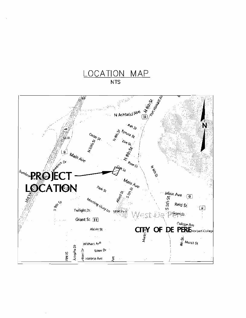
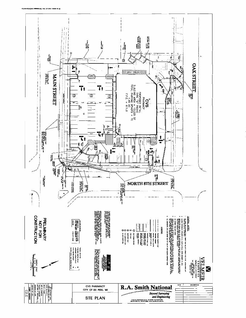
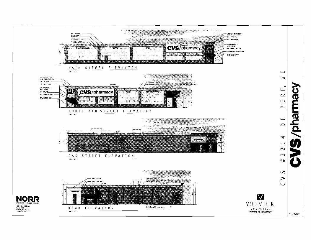
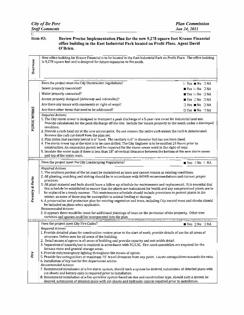
City ofDe Pere Plan Commission StaffComments Jan 24 2011
I 09 u CIl 0 5 be
sectI
oS Ql
oCl be I deg2 I ltII
E
Does the project meet the design regulations (exterior building elevationsmaterials) _ Yes D No DNA Does the project meet the City setback requirements _ Yes D No DNA Does the project meet the City parking requirements _ Yes D No DNA Does the project meet the City lighting requirements _ Yes D No DNA Is the refuse properly sited and screened _ Yes D No DNA Does the signage meet the Citycode _ Yes D No DNA Are there other items that need to be addressed DYes _ No DNA RequiredActions 1 Color for the building shall be earth tone in color 2 For parking traditional standards would require 38 stalls Under the 1-1zoning the Plan Commission can reduce
this requirement based on need We were told by the owner that 30 stalls would meet their needs The Plan Commission may want to request a letter from the owner to place on file to ensure there is no parking on the street in the future
3 The south gable end finish material should be modified to bring the design back into scale 4 Refuse enclosure shall be a matching split face concrete block with non-metal gates 5 As a note the two parcels will need to be combined before permits can be issued
Recommendation Staff would recommend approval with all required actions being implemented and the Precise Implementation Plan be forwarded to City Council for approval
CITY OF DE PERE Fee $ 24500
Receipt _-=6--I--=tu---O _
APPLICATION FOR SITE PLAN REVIEW Date
Please print or type using black ink for duplicating purposes
A Property Owner Name 1) C-e 6 y togtgt-t
V 1
- ffi
----)--2~L=--poundL-2lt3-k-_P~v)S~-4Jy
I hereby appoint the following as my agent for purposes of this application
Agent Name uCLvd e8r~~ ------- shyMailing Address -p 130 l ( ~S- Phone t9amp~930D
Signature DatelO I tJ6 1M It
B Property Information
AddressLocation of Property ~~ ~T-N f ~o-h t- Parcel pound D ~ pound0081-Z ~ CJ etmiddot- FbcR -Z-- t
Parcel Dimension t7f)( gttl3 Parcel Area -l7~~r-JcentLJ2--------shyLegal Description _
A Site Plan Review is requested as authorized by the De Pere Zoning Code Section(s) Article XIII
SectiOn146~middot0
Signed ApplicantAgentJLLOh-= Dated 111 II(
A plan consisting of all applicable information listed on the attached shall be submitted with this application
SITE PLAN REVIEW REQUIREMENTS
KRAUSE FINANCIAL SERVICES INC FOR BAYLAND BUILDINGS INC
CITY OF DE PERE BROWN COUNTY WISCONSIN AnENTIONI OOWNLOAOED PLANSARENOTSCALEASLE NEITHER THE OWNERORTHE ENGINEER SHALLSE HELDRESPONSIBLE FORTHESCALEOF DOWNLOADED PLANSONLYPRINTED PLANSFROMBLUEPRINTSERViCECO INCSHALLBE CONSIDERED TO BESCALEABLE PLANS
VICINITYMAP
fl(CAAl1ll~
II 1
1 l
Non ElClSnNlJ UTlUlIESSItC)MIONPLAH9AREAPPRO)jlW1Enil CON11IACTOR SliAlJBE RESPONSIBlE FOROIl1AININCI EXACTLOCATlDHS ANDELEVATIONS OFALLvnmas MIETlIERllHOWNDRNOTFROMTHECJVrNEP6 OFTHEREampPECTlYE umnlEs ALLUntTY OWNEASSHALt BENl1TJFIEO FORLOCATES avmE OOtmUlcrOR n HOlIll5PRIORTO
ouEA03ION CONTROL loIEAIilUREIilSWltLL 8E ~ PLACE PAIORTOCONSTFlUCTlDN AHOSfULlCOlolFOlllol TOlHEW1ampcOf1lWl OEPAPl1olENTOF IoUruIW RUOLIRCn CONSllIOCTlOfj mE EROSIONCOI4mOl AHOlECHtlICAL 5fANDAAOS
INDEXTO DRAWINGS SHTNO DESCRIPTION
1 LOCATiON MAPSANDINDEXTODRAWINGS 2 EXISTING SiTE CONDmONS 3 SITEPLAN UTILITYPLAN 5 GRADING ANDEROSiONCONTROL PLAN 6 DETAILS 7 DETAILS a EROSiON CONTROL DETAILS -INLET PROTECTION L----shyANDMISCELLANEOUS DETAILS Q EROSiON CONTROL DETAILSmiddot DITCHCHECKDETAILS 10 EROSiON CONTROL DETAILS- DITCHCHECKDETAILS
JoSPRfN DATE I APPROV REVlSIOJf KRAUSEFINANCiALSERVICES INCD
4 Robert E Lee amp Associates Inc
~~ECKEO FORBAYLAND BUILDINGS INC ENGJNEEftJNG 5~G ENVlRONltEmAL SERVtCESLOCATION MAPSANDINDEXTO DRAWINGSCiTYOF DE PERE eeeeeec --lBROWNCOUNTYWISCONSiN
LOCATION MAP
------ --- shyUTILITY INfORMATION I~~~rl
DESTINY DRIVE UTILITIES PRESENT crrvOF DEPEREWISCONSINPUBUCSERVICES6C TIMEWARNERCABLEl usSiGNAL I ~ 0 ___ bullbull
UTIUTlESSHOWNON THis MAP AREBASEDON lOCATES FAD I ~~ ~~~~100k=I
~--L (~ I 4 11 OIGGERS HDTUNETICKETNUlolaEA201~02Isa DATED 1223J2010 VISlBLEOB6EAVATIDN oN 12l2~01D AND i [ ~--- -__ ~~BR~EU~~~~~~~~NJiU~~~~O~~DEE~F~~g~ ~~U~~p~E VEFlIFleDPRIORTO 1Hf DIGGING I
1
11 ~ r u nn n~-=--=-~----- ~ ~ _ ~~_=~_--_DIGGERSliaTUIIlE HOo-242middota511
n -- 0_i 1j t ~ r -- L ~~Ju o~ gt 11 WATBIISAtHTAAYJtm]AU SCWlR~ GAS ELEGTJUO TelEPHONE C~BLE TV DEPARTNENTOf PUBUCWOIII(S WISCONSIN PUBLic SpoundRVIOE COItJgt no TIME WAflNER CABLE CNOFDEPEAE 6OONORTliMJMUgt6T lIaiampSFEJlSON6T 1OQ1KENNEOt AVE e25SXTHST Po BO)(180Dll GRiIENBAY W154~ KIUBliRlY WIUI)l i 11 fl~ ----~~----7~----- ~tmiddot r~1 DEPpoundREW1541gtS OrtEENBAYW16Q07
tQ~Q~-lIl47 820)11111207 (lI1l0jU9-5G7amp (InI4JJ~3 Ii ~n I I I lt0 I II
iJ - ---- -- I 1-I r1
tlll bullbullbullbullbull 111 i I lt1 ~ -11 I I IOWNER INfORMATION coNTRACTOR INfORMATION
ICFlAUSE FINANCIAL SERVICES INc BAYlANDBUILDINGS INC 1234ENrERPRI5E DRIVE POBOX13571 II-- i DEPEREW1 54115 GREEN6AYWI amp43D7middot3571 1
t 1_~I dl~i~ I I
I
II
~I~I I)0
j I ) I ~I i iI 5 III
(B6ampaS5-7437 (B20)3711i20D ) k I 1 IIL iIol 1 i ICONTACT DALE KRAUSE CONTACT DAVIDOBRIEN ~ ~I i 1 ) II) II Iti II
LEGEND -6 FIREHYDRANT I I i
tal ~ DECIDUOUS TREE I~I bull I
WATERVALVECURB STOP I gt I 1 I ~ i [ I I LOll I I tiWATERMANHOLE ~ bull _ bull o CONIFEROUS TREE j e I o SANITAAV tlANHOLE ~ 11 11 ~ r ese sr I I I Io BUSH o STORMMANHOlE II i r l ~ 1 ~ I I ~ ~ t~3B21 OP~ STORMIlANHOLE
RIPRAPbull J l ~ i i raquo I I 1151 lINIlIIll STORMINLET j shy glOOMINLETMANHOLE ~ZJf)IofI SPOTELEVATION III POWERPOLE r- ) i ~)i J I II ~
W~h FIRSTFLOCIRotlASEIrlENT ELEVATiON bull ~bullbull_ iEJ-oPOWERPOlE WGIN WIRE i4iL-i-l 0 ~ i al ~IUGHTPOLE N -rorAPPROXIMATE ROCKElEVATIONo ELECTRICMANIiOLE
III ELECTRICtlElER r III ll i I __ __ ) - I If__ 12 EXISTINGCULVERT
laquoI GASVALVE tii i I -- n iii ~ 1 I - -- - - - - - +-1- - i I I ti i ~ GASUETER o CONCRETE 81 MAIlBOX
CZJ WET1ANDS ~ - I I I I Iof SIGN
POST I f i
~ HANDICAP PARKING IRONPIPEJROD 11 ~ I I if I
4 PKNAlL ji rill I i i I 1 II I EXISTINGSANITARY SEWER (SIZENOTED) i 11 I 1 bull
EDGEOF PAVEMENT EXISlINGFORCEJJAlN (SIZENOTED)II ill- h i~ 1 ml i II ImiddotI ii -10C- ~ISlING STORMSEWER(SIZENOTED)
EDGEOF MAVEL k --N-- EXISlINGWATERMAIN (SIZENOTED) 1 I I 1i1 --0-- GASUNE C Ii
EXISTINGCURBamp GUTTEA I I ill 1 II i LOI I [I II --oc-- oVERHEADTELEPHONE UNE ---- UNDERGROUND TELEPHONE LINE 1
- TREEiBRUSH UNE --oc-- OVERHEAD ELECTRICUNE ) i ]1 n _ 1 I~ I
---- UNDERGROUNOELfCTRICUNE bullbull vse-bullbullbullbullbull EXISlINGCONTOURUNE i 11 -- t I
- OTV- OVERHEAD CABLE1VUNE --N-- CAaLElVLlHE I
RETAINING WAll 1 lilgtlll II ilmiddotMVUNE PROPERlYUNE H j i I I I
GUARDRAIL - EASEMENT UNE
~ FENCE BUILDING SETBACK UNE i I I ~ - i I II I ISEcnONUNE NOHIGHWAYACCESS
I I I II i ) I Ii i I I I i I l I I I I shy bull I1 1I~ I ~ ii k i I I J _ -J- _J ---- _ _ _ _ _ _ _ _ _ - - - - - - - - - - - - ~-- - LilI
gll~~ ~ NOTE D-t1 bullj I ELEVATIONs SHOWNAREBASEOON APREVIOUSCITY OF DEPEREEASTalOEDATUM SUSTRACT 091 TO ~mtII 8U) 0 CONVERTTO NAVOsl l
-0ampOATE IIoPPRrN OMWN KRAUSEFINANCiAL SERVICES INC-- shy FORBAYLAND BUILDINGS INC CITYOFDEPERE
~CJltQ) EXISTING SITECONDITIONS
~~SlCNEO BROWNCOUNTY WISCOSNIN
~r---L-j m1--Igill~~ ~~i~~~ 1131 bullI 1 -bull I 1 middot bullbullbull ]~) (SI1
~ e sr ------ shy
(I [a
[
I ar
I 1 I
r I
[ I [
I 1 f I r Ii
r
I I I I I I I I I I I I I
I I I I I I I I I I I I I I I I
I
I I 1 f-I ~I i~
I I
I
~ ~ ~I E~SnNG SURFACE TO AEMAIN I
~ 1 I ITJ I
I shyI II I
I I
I I 1 f~
I I I I
[1] I ~ ~ I I
I I ~ I I I I I I I ~ I I I I II
II l I I I _L II I8 I ----- ~ I I I I _------- ~ I
I f- I I - - -- - i7Jr I II I L_-J---- ~
I I amp-0~~ RlVlSlON KRAUSE FINANCiALSERVICES INC
I ri
-------------------------- ---------p----shyLOCAlED UMENT ON DESTINYDRIVE FROMEXl971NO OFFICE WITHNEW MASONRV BASE ANDELECTRICAL EX IHIEAGIUL CIJRlI ltlGUnER
shyNOCCESS _ 100 29917
~ ltgt3 J SLAND6CAPEAREAWlTH bull bullbullbullbull I io middott 5PRINKLEASYGTEM f
~ PROfr2~~ ~~DING
~~ FF ELEV63900
~ k 11I i I I I I I
I iii I f- I ~I J
f- I sect I
-- shyI I I I I I I I I I I I I I
w I I~
c I I I I I I I I I I
PROVlDE~1R6OPENING I ~~~g~ ~D~~~~~~~~SfARY VERIFYW H CITYBEFOREREMO~ING
DRIVEWA OPENINGCONCl1iTE I
I - shy
rIJ
SCIII2INFEET
NOTE ELEVATIONS SHOWNAREBASEDON APREVIOUS CITY OF DEFEREEASTSIDEDATUMSUBTRACT cer TO CONVERTTONAVDse
I~ l I
I II
NOTE ALLAREAS DESIGNATED ASGREENSPACE OR LAWN SHAll BE TOPSOILED TO A DEPTH OF e INCHES SEEOED ANDMUUHED AREA TO BE RAKEDFAEEOFSTONESAtJO CLUMPS
PARKINGVATA TOTALPARKINGSPACESPROVIDED 30
HANDICAP ACCESSIBlfPARKING SPACES 2
TOTALPARKING SPACESAEQUIRED24
SITEVATA TOTALAREA 223ACRES97212 SF
BUILDING AREA 021ACRES921aSF(amp5710)
SIOEWAlKIPARKING LOTAREA 032ACRES13B37SF(14jl3j
GREENSPACE090 ACRES39202BF(4033)
UNDISTURBED AREA 080ACRES348995F (35874)
ZONING
CONSTRUCnON CLASSIFICA nON vbull
PAllCEL NO EDF0081-2
EDmiddotFOOB1-2middot
LEGfNV
o CONCRETE PAVE~ENT
IRJ ASPHALT PAVEMENT
~ GREENSPACE
LANDSCAPED AREA
__ PROPOSEDie-CURBamp GoUTIER -- (UNLESS OThERWISENOTED)
~ PROPOSED SHEDDINCl CURBamp ClUTIER
PAINlED FIRElANE wlt
TRAFFICFLOWARROW ltgt HANDICAPPED PARKING~
NOTEALLCURBRADIIARETO THEFACEOF CURB
I I
I I I I
I I I
I I I
I I I I I
I I I
I I I
I
III
II I
I
I I I
II
I I I
I III
I10 I
I
I
t II I
I
I I If-shy
U) I I I
I I I
I I I
I III
I I I
I I
II I
I
I I I I
II I
I
I I
~ CHrtKlD FORBAYlAND BUILDINGS INC SITEPLAN --l ~ NeesaR UIl ENVIllONgtltBNTAI
CiTYOF DEPERE ~SICHEO BROWNCOUNTY WISCONSiN
3
-------------- shy WATERANOSMIITAAfLATERALS I AREESTl~ATED TO BE6 LINED DESTINYDRIVE
CONTACToRTO VERIFYEXACT [xlHlE~CIRfIampCln1m LOCATION ANDELEVAll0ItJI
I
I
I I
LE~IIIV --------PROPOSED SANlTARYSEWER I----~-- EXlSTlNG SANITARY SElJJER (SIZENOTED)
I bull - bullbullbull EX(STINGSTORMSEWER(SIZENOTED) =bull - bull - bull - bull - bull -PROPOSED WATERIolAlN
= == == PADPDSEOSTORM SEWER
---~-6w-6- EXISTlNGWATERIAIN (SI2ENOIED) I
I
~ ~ ~ ~ ~ I-6 -6 FIREHYDRANT I II $ WATERVALVEICURBSTOP l reg WATER MANHOLE V l REOUCER1NCREASER a 0 ISANITAAYMAIIHOlE C 0 STORMMANHOLE I I OPENSTOIUlMANHOLE UU lI STeAL( INLET C () STORMINLETMANHOLE I
I C
PLUM13ING VA TA CI
DRAINAGE FIXTURE UNITS 24 I I WATER FIXTURE UNITS 28 I m
NOTE I II MINIMUMOF S5FEETOF COVERSHALLSE MAINTAINEo I OVER ALL WATERMAIN
SANITARYSEWER WATERMA1N AND STORMSEWER5HALL BE CONSTRUCTEDIN ACCORDANCEWllrl TIIESTAIIOARD I6P~IFICAnONS FORSEWERANDWATERCONSTRUCTION IN WISCONSINAND ADMINISTRATIVE CODE CIAPTEASCOMM81middot87 I
rI
f~jil 3 FIELDVERIFYLOCATION OF EXISTINGUTILITIES IF EXISTING
LOCATIONSDIFFERFROMWHAT IS INDICATEDON 11-tEPLANS CONTACT ENGINEERPRIOR TOCONTlNUEOWORK I STORMLATERALSSHALL BE EQUIPPEDWITHTRACERMRE
i11 I
I
Ibull All DOWNSPOUTSSHALLBECLEANOUTDOWNSPOUTS
I I
I I
I I
I
IPROV 001[ I)fgtPROV ORoWH KRAUSEFINANCIALSERVICESINC ~E~00 FORBAVLAND BUILDINGS INC
CITYOF DEPERE UTIUlYPLAN ~SIGNEO BROWN COUNTY WISCONSIN
r-- shyI I I I I I I
I I I I I I I I I
I -shy
lOCAlEIHFUT
NOTE ELEVATIoNS sHoWN AREBASEDONAPREVlouaCllY OF DEPEREEASTSIOlDATUM sUBTRACTDe1TO
~-o CONVERTTONAVDB6
n srta r rl6367T1------shyOl~
~~~ g~~~ 10j ~L--ri-~ ---_~----r--___-~~7_
EXST utl l
LEIiRVV TOPOFCURBELEVATION~lcStltlil
FLOWUNE ELEVATION~F- TOPOFSIDEWALKELEVATION~SNJ66666
EDGEOF PAVEMeNTELEVATION~55
TOPOF RETAINING WALLELEVATION~RN444
~3J333 ORQIIIOELEVATION
DR-JNAGE SWAlE
DRAINAGE DIVIDE
---x- SlLTFENCe
~ BALE DITCH CHECK
FLOWAAAOW
TRACKlNCiPAOmmli INLETPROTECTION
NOTE ALLSANITARYSEWERSTORMSEWER ANDWATER SERVIcESIMAINSSHALLBE PROVIDED WITHTRACER WIREOA OTHER METHODTO BE lOCATED
STOlL IIIAITR MANAGEMRVT THISsrrsISTREATEQBY REGIONAL STORMWATER PONDTHAT IS LOCATEDSOUTHNeWEST OF THE END OFTHE CUL DEBAC OF PROFIT P~CE
ELOSWN cONT1WL NOTE All EROSrON CONTROLPRACTICE61NDICATEDON THIS PlAN ME APPROXIMATE LOCATIONSONLY THEACTUALSITEMAY REClUIREMOREOR LESSEROSiONCONTROLDEPENDINGON THE CURRENTCONDITIONOF THE SITE ~ SILT FENCEIS REQUIREDDOWNSLOPEOF ANY DISTURSED
LANDTHAT MAYCARRYSEDIMEtiTS OFF SITEl ltl
A TRACKINGPADIS REQUIREDAT ANYINGRESSIEGRESS LOCATIONWHERESEDII1ENT MAY BETRACKEDOFF-5ITE
II
PROPERIfLET PROTECTION6HAll BE U6ED OEPENDING ONTHE INLETTYPE
-4 SEDIMENTBASKET GH-ll BE USEDFOR ANY 6ITE DEWATERING
I I
I
I
I
in [)j j Ul
R1I4l7l1i1 0_S75I -- shy1 I~~~ m ~ 2lt 1 1 IIMampJl24(Wst)
Ii 1 I I r I i I
II i I I I j I I
STIHL4 r~ ~ I
t III
~ NLET(TYP) ~T~~ I
I j lJ I
OSTllILll Ii rL63s92
1I D_4045 It lW6l247 (W IN) llN6l U 71(15middotSO i I G ~ I
I
STING w o i a
I shy u ~921 I a i -(~ I i i 1160 II a
I L I - -1--+ ~ I f l I i I I ~ I II f j I I II J
I
J i I I I I 12 - shyI 1 ( I i I ~I ~ I 1 A I - I ~
f ~ I
i Iil71
_ - V~ - - - -- -- - ~-- - L Y Dwnall 111163U)
0-1117 NOTE ELEVATIONS sHoWN AREBASEDON A PREVIOOS CITY~~~ ~8 amp-0 g~~~~~RioE~~Jo~E DATUM SUBTRACTO91 TO001pound I APPRO KRAUSEFINANCIAL SERVICES INC IrQb~ Lee ampAsSOc]iite IncON ~~
CHECKED FORBAYLAND BUILDINGS NC EIGltiEERlNG SIJRVElING ENVIROHlWnALSUVlCpoundSGRADING ANDERosiON CONmOL PLAN 4664 COLOEN PONOPARltCOURTCITYOF DEPERE
~CNED ~oWl~~~lnltltom ~~~j~~2~)6~jN41BROWNCOUNTY WSCONSIN
NOTENEENAH R-3275OREQUALWITH TYPEA GRATEORRmiddot3246AOR Rmiddot3Dfl7WITHTYPEL GRATE
LESSTHAN4SHAlL BE RUBBER)
CLARlTY1
I 10$1 ~
~
il4R TO BEADOF ADJUSTlfIG RING CLEANOUT LINETOBElHE SAIlE ANDCASTlNGSEALANT OREQUAL SIZE5 MATERIAL ASSEWERIlAIN BElWEEN ADJUSTlNG RINGSAND NOTE CLEAWOUlLINETO BETHE
CONCRETE ADJUSTlNG RINGS SAME SIZEaIlATERIALASSEWER MIIN
ADAJSTlNG RINBSONLYWITH CASTING COATOUTSIDE OF
ASREOUIRED (4MINAND12 MAX UNLESSOTHERWISESEWERJOltlT COl4iOUNDND NOTEDALlADJUSTING RINGSWRAPWITHMIN8 MIL
~ GRADEPOLYETHI1ENE
ECCENTRIC REDUCING CONE (VERTICALWALL OF
PVCCOATEDCASTIRON 24 SQUARE LlHSTEPSmiddotOC CONePAD CLEANOUT PWB
ECCENTRiC CONESHALLBE ONDOINSTREAM SIDEOF MANHOLE THISDETAIL 4 (MIN)GRAVEL NOTESHOWNROTATED W FOR ADJUSTTOGRADEBY
CLEANoUTPLUG
II SUDINGVERTICALLY UPORDOWNOVER
PVQPIPESEWER 21 r~~~~~~~~~~~~4 SERVICE EACHJOINT
PROVIDE FROSTSLfEVE SERVICEPEAoCOM1l8236 (5)A)2
PROVIDEFROSTSLEEVE PEROCOMM8235 (6) fAJ2~~ TONGUE ampGROOVE PVCPIPE
n 45 BEND JOINTREQUIRED
PVCPIPE
FLEXIBLE PIPE To MANHOlE 45- BEND CONNECTOR REaUIRED
6PECUBEDDING
8 PRECAST S-8IlIN CONCRETE SASE SPECD SEODINGI I
SANITARYAND STORM CLEAN-OUT DETAIL CLEAN-OUT DETAIL STANDARD MANHOLE (TRAVELED AREAS) (NON-TRAVELED AREAS)
8-24(INCLUSIVE)
314-ro r
eunPOLYETHYLENE
I
~rd 81 ~I
~I
~
HDPEtPVC SEWERamp WATERMAIN amp FORCEMAINSTORM MANHOLE INLET PAVEMENT RESTORATION BEDDING ampTRENCHSECTIONTYPE A
MgtPFt(N ~T[ I WPROV REVISlCIH ~ampWN KRAUSEFINANCiAL SERVICES INC FORBAVLAND BUILDINGS INC~CKED DETAILS ~uCITYOFDEPERE
~IONEO BROWN COUNTY WISCONSIN
o
~ Io
I
W(IlAXJ12+00J2 W(MIN)-6oi-00J2
COMPACTEO BEDDING ANDCQVER SOILCLASSA-7
INITAL3 OFSOILCLASS ASIN WETORUNSTASLE TRENCH AS DIRECTED SYTHEENGINEER
WITHOUT EXTRACOST TOQWNER
I
ampolLCtASSG-l OR C-31FREQUIRED PER SPECIFlCAllONS
NOTE SUFlFACE RESTORATION REQUIREMENTS PERTHE SPECIFICATIONS
UNDER BARREL (8 FORBEDROCK EXCAVATiON
UTILITYTRENCH
t ENRENGTH ORENcH I bull -j _middot~middoti middotbullIc-~~~
PIPEUNE
SAWCUT CONStSTENTWlDTH
Imiddot I II I I 11--- -THiCKMANHOLE TOP
PVCCOAlEDCAST IRONIlHSTEPSmiddot 10C
BEADOF ADJUSTING NEENAH R-3215OREOUALWITH RINGANDCASTING SEALANT OR TYPEA GRATEORRmiddot1246AOR EQUALBETWEEN ADJSllNG Rmiddot3067WITHTYPEL BAATE RINGSANDCASTING COAT CONCRETE ADJUSTING RINGS OUT6IDEOF ADJUSTING RINGS 4SREQUiRED 14MINAND 12 ONLYWITHSEWER JOINT MAX UNLESS OTHERIIJISE
COMPOUND ANDWRAPWITH1l~N~~-~~~~L NOTEDALLADJUSTlNG RINGSLESSTHAN4SHALLBE RUBBER)
WAlllt CONTRACTION JOINTSPACING EXPANSION WIDTH TRANSVERSE LONGITUDINAL JOINTSPACING
NOTREQD 100lJAX
s NOTREQD 100lJAX 0 S NOTRECD 100lJAX 0 100lJAX e 100lJAX s 0 lOOlJAX
~
oj ~
~y
PROVIDE CONTRAClloH JOINlS 6CONCRETE ASDIRECTED BY ATUAXItlUlJ 20SPACING BY GENERALCONTRACTOR SAWCUTTINGOFtINSERTIONOF
DIVIDER PLATES
12 OFNO3 ORNO4 GRADATION R E6AR S LE EVES ~MINllJUMVOID rrEXPANSION MATERIAL WILLBEPLACEO ONEACHSlOEOFTHEORNEASUITINGTHE THERIlALEXPANSION SPliCEATENDOFSLEEVE FOR
SIDEWAUlt SIDEWALK ANDDRIVEWAY APRON SHAll BECONSTRUCTED SEPARATELY UNLESSOlHEfWJSE APPROVED BY THEDIRECTOROF PUBLICWORXS BACXOf CUAB COMPACTEDSUBGRADE
CONCRETE PAVEMENTDETAIL ~I 3~l rI~1 1 ABPHALTSATURATED fELT EXPANSION JOINTFILLERPLACED ~ ~rQ ATlJAXllgttUM 300middot SPACING AND
middotB1TUMINOUSSlJRFACE ATAll ENDSOf RADII 1 34 BITUMINOUS BINDER
18 LONG12 DIAlJmRIt REINfORCINGRODS 12 OF NO3 ORNO4 GRADATION ~
DRILL518HOLEMIN9 INTOEXISTINGCURB
CURBTIE-IN DETAIL lPAOPOSEDTO EXISTING)
COMPACTED SUBGRADE
ASPHALT PAVEMENT DETAIL SAWCUlCURBTRANSVERSELY PRIORTO RElJOVAl
~
12middotR60
COItRETE 4 APRONbull
DIMENSION VARIES SEEPlAN
I NOTE REFERTO SPECIFICATIONS FORREINFORCElJENlS
IiI CURBREMOVAL FORDRIVEWAY OPENINGWITH ~ CONCRETE APRON ONCONCRETE SURFAcESTREETS l
bull
EXPANSION JOINT TOOLED
CONTRACTION JOINT
PAVEMENT ANDBASECOURBE
SIDEWALKWITH INTEGRAL CURBCURBREMOVAL FORDRIVEWAYOPENING WITHCONCRETE APRON ON ASPHALT OVERCONCRETE
SURFACE STREETS
CURB REMOVAL DETAIL SIDEWALKDETAIL
bull VERIFYDETAILMATCHES crrv Of OEPERESTANOMDS
4 EXliTlNc CONCRjre
BREAK
VARIES
S SIDEWALK t ~ ~~~ ~~- z --~~~~N~N-~--~ ---~~
ALLARCUND(TYP) iii 11) gt
All RESIDENTIAL DRiVewAY APRONSSHALL BE FLAREDIF FIELDCONDITIONS PERMI1
THEflAAE BHALl NOTE)(CEED3-0
8middot ORJVEWAYAPRONrshy
~I ~t
bullbull _
1--( middotHmiddot bull middot ~ y ~h~raquo~gtY)1-S
~~ ~
L I bull bullbull bull bull ~ bull _ bullbullbull
CUflBA GUTIER 12 EXPANSION JOINT
DRIVEWAY APRON DETAIL
6lc6WmiddotIN211 W2WWf CENTERIN SLAB
-
CONCAETESlAB
4CONTINUOUS
12 EXPANSIONJOINTWITHSELF LEVEUNGSEALANTWHENCAST AGAINSTSTRUCTUIIE
MINIICOlJPACTED SOILCLASS C-3 MOISTENIMlJEOIATELY BEFOREPlACING CONCRElE
TYPICALSIDEWALK ADJACENT TO STRUCTURE
2RAD
SPECIFIED BITUlJlNOUS
4 CONTINUOUS TOP6 BOTTOM
DATE I APPROY AUSEFINANCiAL SERVICES INCm- TE At Robert E Lee amp Associates Inc SIl[D NO FORBAYLAND BUILDINGS INC~lEC1ltEO a ENGtNBeJUNO SURVEYINO BNVlRONWENTu SEJMCES
CrN OF DEPERE DETAILS fluU BROWNCOUNTY WISCONSIN
7
OR WASHEDSTONE
INLETPROTECTION NOTES
INIHAlUT10NtJDTESR W I4ANUFACTUAEO ilLTERN1TlVES 6PPROVED AND1t(if if f TYPE-e-a-c-USTEDONTIiEWOOTPRODUCTACCEPTABIUTV LJSr AAV BESUBSTITUTED
R TRJM EXCESS FABRIC INTHEFLOWUNETOWITHIN3J fq ~ if OF-THE GRATE
I WHEN ReMOVING ORMAINTAtlllNClINlET PROl1CTION CARESHAll Be TAKEN so THATTHE
50 MIN SEDIMENT TRAPPED ONTHEGEoTEXTllEFABRIC THECONTRaCTOR SHALLOEUClIISTRATE A METHOD OOESNOTFALLINTOTHE INLET NolVMATERIAL Of MAI~ENANCE USINGII SEWNFLAPHANDHOLDS
OROTHER ME11-tOQ TOPREVENT ACCUI4utATEO IMMED1AmV FlLUNGI~O THE INLETSHMl BE RELioVED PLANVIEW SED114ENT FROMe~EAING THEINleT
TYPE0 (j) FINIBHEDSIZEINCLUDINGFLAP POCKETS
WHEREREOUIREDBHALLEXTENDA MINIMUM ~ 2299 00 NOTINSTAllINLET PROTECTION TYPE0 ININLETS
SHALLOWERTHAN3DMEASUREDFROMTHEBOlTQlI PROFILE VIEW MAINl1NANCEOR REMOVAL Of THEINLETTQTHE TOPOFlHE GRATE
Of 10AROUNDTHEPfAIMEllR TO FACIUlATE
reg FDA INLETPROTECTIONNPE C (WITHCURB TRIMEXCESS FABRIC INTHEFLOWUNETOWITHIN 3 middot4 MIN OR FULLWIDTHOF THE EGRESSPOINT BOX)AN ADDITIONAL1SOF fABRIC IS Of THEGRATE REFERENCEWDNRTECHNICALSTANDARD1~1 WRAPPEDAROUNDTHEWOODAND SECURE1l
WITH STAPLESTHE WOCOSHALLNOT SlOCK THEINsTAuEOBAGSHALLHAVEII MINIMUMSiDE THE ENTIREHEIGHTOFTHECUR8 BOX CLENIANCE BElWEEN THE INlET WALLSANDTHE TRACKING PADDETAIL BAGMEASUREDATTIiE eorrouOF THE OVERFLOW OPENING
I
(IF APPUCABlEj HOLESOF 3 WHERENECESSARYTHE
reg FLAPPOCKETSSHALLBE URGE ENOUQHTO CONTRACTOR SHALLCINCHTHE BAG USINGPlASTIC ACCEPTWOOD2X4 ZIPTIESTOACHIEVETHE3ClEARANCETHE TIES
SliALL BE PuCED ATTHE MAXIMUMOF4 FROMTHE BonOM OF THEBAG
1 II
I 4XS OVALHOLESHAlL BE HEAT CUTI~D ALL fOUR SIDEPANELS 3
~ -USEREBAROR SllEL ROD
FORREMOVAL
] Of
FORINLETSWITHCASTCURB 80X USEWOOD2)(4 EXTEND10BEVOtlO GRATE WIDTHONBOTHSIDES LEMCJTH VARIES SECURETO GRATEWITHWIREOR PLASTICTIES
II
WOCO2 X 4 EXTENDS8 MINII4UI4 DOUBLESTITCHED BEYONDaRATe WIDTHON SEAMSALL AROUNOSIDE sorx SIDES LENGTHVARIES PIECESANDON FLAP SECURETo GRAll WITH POCKETS WIREOR PLASTiCTIES
INLET PROTECTION TYPE C INLETPROTECTiON TYPE 0 (WITHCURB BOX) (CAN BEINSTA1lEDIN mf INLETTYPEWITH ORWITHOUTCUM BOX AS PERNoTE Z)
INLETPROTECTION TYPE A
INLETPROTECTION TYPE B (WITHOUTCURB BOX)
(CAN BE INSTALLED IN ANV INLET WITHOUT A CURB BOXI
~~ KRAUSEFINANCiAL SERVICES INC ~ICEI) FORBAYLAND BUILDINGS INC Robert E Lee amp Associates IncEROSION CONTll0L
ENCINEERING SURVETING ENVliOtOlENTAL SERYXCESINLETPROTECTION ANDCiTY OFDE PERE OESlGNEO MiSCELLANEOUS DETAILS ---1 4 8
SUBGRAOE
WOODSTAKES(z PERBoLE) NOMINAL2 X T X 30 MIN LENGTHOR eQUIVALENT
CROSSSECTIONAL VIEW HOPEHIGH DENSITY POlVETHVLENE FABRIC SILTfENCE
FILTERBAG DETAIL
8HEETFLOW lt COURSE AGGREaATEINFORMATION
NOTE 1-shySIZENO ALlOlIJENS1ONS siEVESIZE AASHTO No87 (l)
AREAPPROXltrlAre SHEETFLOW 2 INCH(SO mm) 11fiINCH(375mm)
EMBEO BALES 1INet (250mm) 100 ~NEUZED FLOW314INCt1(111Olnm lMl-IOO 318INCIt(ll5mm) 20-55
PLANVIEW Wo-I175mm 0-10
i Wo8(200mrnl IJ-5
SECTION A-A ~ (1 SiZENoACCORDtNpound To AASHTO1l-l3
L THEDiSTANCE SUCH THAT POINTSIANDB AREOF EQUAL ELEvATIONNOTES
l 18X30middot ROCKFILLED FILTER al3 SHAll BEcOMPRISED OFTHEFOllOWllllB ~ HOPE HIGH DENSlNfOIETHYLENEFORSCOURPROTECTION USE HOPE HIGH DENSITY POLYETHVLENE DRAW sTRINGKt-ITTED DlREOllYlHToBAGOPENINGEROSIONMATFORCHANNELUNING 60 FABRIC CLOSURE WIlli APPARENT OPENINllSIZENOLARGER THAN 118middot X 18middot LAPMATUNDERUPSlREAM BALEB ROLleD BEAMUSINGA IlINttuuOF-180DENIERPOLYESTER SEWINGYARNFOR STRENC1T1-t ANDDURABILITYI ANDSECUREFABRiCWITHWOOD SIDEVIEW
STAKESATmiddotFOOTINTERVALSI USEWELLGRADEDCOURSEAGGREGATE CQNFORIolING TOTHE FOUOWINGGRAOATlON REQUIREMENTS
DITCHCHECKDETAIL
ROCK FILLED EROSiON CONTROL BAGS TYPEB
bull WELLGAADEDANGULARsTONE
OF 3 INCHOR GREATER
Ii~
STAGGERJOINTSBETWEEN ADJACENTROWSoF BALESa PLANVIEW
il STAKESDRIVENflUSH WHEN SOILCONDITIONS PERMITd
n
-------------~~~~~~~~~~~ WELLGRADEDANGULARSTONE OF3 INCHORQREATER
~~~
t-~~ ~1~80nOM ELEvATIONOF ENDSALE SHALLBE EOUALTOOR GREATER THANTOPOF LOWESTMIDDLEBALE IDROP
STAGGERJOINTSWITHDOUBLEROW SIDEVIEW FRONTELEVATION
TEMPORARY DITCH CHECK USING STONE TEMPORARY DITCH CHECK USING EROSiON BALES TYPECTYPE A
RrvISION OATpound I JJgtPRCN ~WH KRAUSE FINANCIAL SERVICES INC CHECKED FORBAYLAND BUILDINGS INC EROSION CONTROL
CllY OFDEPERE DITCH CHECK DETAILS OESICNED BROWN CQUNlYWISCONSIN
L OTENTlAlSCOlJAAREA USEERDSION )MAT OROTHERDEVICE WHEN DIRECTED BYTHEENGINEER
DIRECTIoN
~ ~FlOW
I II Id n
II I
I II
ENDTREATMENT ONSlOPES BACKFILL ampcOMP-cT TOBESIMII1IR TOCHANNEL TREHCHWITH flOW DETAIL
PLAN VIEW (WHEN LTERING THEDIRECTlON Of flOW)
I I I l--- TOEOFSLOPE I I I I I I
[ deg6~E~~~ I I I
PLANVIEW
rSTAKES DRIVENFLUSHWHEN SOILCONDITIClN$ PERMIT
8middot0plusmn
FILLSLOPE
DIRECTION OFFLOW
I II I 1111 ~ - EXISTING GROUND1111 II II BAneR STAXESIN OPPOSITE DIRECTION (TYPICAL)nuVV
FRONT ELEVATION WHENEXISTING GROUNDSLOPESAW~Y fROM FILLSLOPE
EROSION BALESFOR SHEETFLOW
MTE IpPRCN ~1RfWN KRAUSE FiNANCIAL SERVICES INC Leeamp AssDemes IncFORBAYLAND BUILDINGS INC EROSION CONTROl ---iENGUfEERlNG SURYrlTNG ENVlROlnlpoundNTAL SBRvtCllS
CIT OF DEPEAE SHEETFLOWDETAILs BROWNCOUNTWiSCONSIN
~CXEO
EXCAVATED SOIL GEOTEXTlLf FABRIC
WITH ALTERNTlVE SUPPORT COMPONENTS
~ (D
_~uJOiE~
NOTE DEPTH ORTIE ADDITiONAL~~OUIRED IN
SILTFENCENOTES
EROSIONCONTROL SHll BE PROVIDED IN AcCORONCEWITHWDNR SILTFENCEDETAIL ~~~~YSOIl6 TECHNICAL sTANDARD
reg CROSS8AACEWITH2X4~wC()QEN FRAMEOR EQUIVALENT ATTOP ~~
ANCHOR STAKEUIN18lONGWHEN REaD BYENG
SILT FENCETIE BACK
z
~
OFPOSTSASDIRECTED BYmE ENIlINEEAsl reg ~INIMUM 14GAUGE WIREREQUIRED FOLDFABRIC3OYEA THEWIRE~D STAPlE OR PLACEWIRERINGSON 12middot cc
cEOTEILEF )
CD EXCAVATE A TREWCH AMINIMUM of 4W1DE amp6 DEEPrOBURY ANDANCHORTHEGEOTEXTILE FABRIC fOLD MATERIALroFIT TRENCH ANDBACKFILL ampCOflPACTTRENCH WITHEXCAVATED SOIL
d
L WOODPOST reg WIRESUPPORT FENCESHALLBE14GAUGEMINIMUM WOVENWIJlE WITH AMAXlMUMMESH SPACING Of 6 SECURE TOPOFGEOlEXTAE FABRIC
GEOTE)ffi~EFABRlc TOTOPOF FENcEWITHSTAPLES ORWIRERINGSAT 12 cc (TYPE8)
reg ~~=~R~~~~~~~~~~~~~ ~~~~~~~T~t~40Ro 0 EOUAL A HEAW DUlY NYLONTOPSUPPORT CORDOREQUIVALENT IS
WOODPOST REQUIRED (TYPEA)
o STEELPOSTSSHALLBE STUDDED TEEORl lYPE WITHA MINIMUM
GEOTEXTILEFABRIc) WEIGHTOF 128LBSAJNrr (INITHOUT ANCHOR) FlN ANCI~ORS SUFFICiENT TORESISTPOSTMOVEMENT AREREQUIRED WOODPOSfS SHAlL8E A t4INIt4UU SIZEOF 1118X1 lIBmiddot OFOAKORHICKORY
reg CONSTAUCT SILTFENCEFROMA CONTINUOUs ROLLIF POSSIBLE BYd 18lL-__-w-__1Y curnsnLENGTHS TOAYCiDJOINTSIF A JOINTIS NECESSARY USE ONEOFWE FOLLOWINO TWOMETHODS AI1WSTMETHODshyOYERLAP THEENDPOSTSANDTWISTORROTATEATLEAST180 OEGREES B)HOOKMETHOD - HOOKTHEENDOF EACHSILTFENCE LENGTH
reg THEMAXIMUM SPfoClNG OFPOSTSFORWOVENFA8RICBILT FENCE
TWIST METHODreg SHALLBE8 FEETANOFORNoNmiddotWOVENFA8RICJ FEET
EROSiONCONTROL SHEETFLOW NOTES GEOTEXTIlEFABRIC
1 A~ SOILSTOCKPILEDlJiATREMAINS FORMORETHAN7 DAYSSHALLBEcovERED ORTREATED WITHST~BIUZAOON PRACTICES SUCl-lAS TEMPORARY ORPERt4ANEtfT WooDPOST ~ SEEDINGANDMULCHING
2 A MINIMUMOF4 INCHESOFTOPSOIL MUSTBEAPPUEDTOAlLAREASTOBESEEDED ORSODDED
L J All WASTEANDUNUSEDBUILDING MATERIALS (INCLUDING GARBAGE DEBRISCLEANING WASTES WASTEWATER TOXICMATERI4JS ORHAZARDOUS t4ATER1ALS)TE1ltTILEFA8RIC SHALLBEPROPERLY DISPOSED of ~ND NOTALlOWEDTOBECARRIED OFF-8ITEBYRUNOFF ORWIND
4 All OFF-SITE SEDIMENT DEPOSITS OCCURRING ASA RESULTOFCONSmUCTlONWORKORASTORMEVENTSH4JLBE CLEINEO UPBY THEENDOf EACHDAY FWSHINGsH~U NOTBE ALLOWED 5 NVYSOiLEROSiON lJiAT OCCURSAFTERfINAL GRADINGANDOR lliE APPLICATION OF STABILIZATION MlASUREsMUSTBEREPNREDANDTHESTABILIZATION WORK REDONE
WOQDPOST B FORANYDiSTURBED AREATHATREMAINS INACTIVE FORGREATER THAN 7WORKINGDAYSORlNHEREGRADING WORKEXTENDS BEYONDTHEPERMANENT SEEDING
middot C[-r 2middotOMIN DEAOUNES THEsrreeuetBETREATED WITHTEMPORARY sTAB1LI2ATlClN MEASURES SUCHASSOILTREATMENT TEMPORARY SEEDINGANlWfI MULCHING
7bullAU TEMPORARY EROSION CONTROL PRACTICES SHALL8EMlI1NTAINEDUNTllTHESITEIS STABluzEDWITH70 VEGETATION ANDA NOTiCEOFTERt4INATIDN HASBEEN MPROVEDBVTHE DNR 8 WINDEROSION SHALLBEKEPTTO~ MINMUM IXJRJNG cONSTRUCTlON WATEAJNG MULCHORA TACKING AGENTMAYNEEDTO BEUTILIZEDTOPROTECT NEARBY
HOOK METHOD reg AES10ENCESMlATER RESOURCES 9 THECONTRACTOR SHALLBERESPONSIBLE FORMALNTA1NNG AlL THEEROSION CONTFlOlMEAsURES IN CONFORMANCE WITHTHEINDNRCONSERVATlON PRACTlCE STANDARDS LATESTEDITION bull
JOININGTWO LENGTHS OF SiLT FENCE 10 UPONCQIvlPLETIDN OFSTORMJNLETCONSTAVcmON THECONTFIACTOR SHAll INSTAlLSTQRMDRAININLETPROTECTION FORCONSTRUCTiON SiTEASSPECifiED 11 FINESEOIMENT ACCUMULATIONS SHALLBECLEANED FROMSTREETS PRIYATEDRIYES ORPARKING AREASf1( MANUALORMECHANICAL SWEEPING A MINIt4UM OF ONCEPERWEEKANDBEFORE~LL IMMINENT RAINS 12 EFOBION ANDSEDIMENT COtlTROLSTRUCTURES SHALLaEINSPECTED WEEklYANDWITrIJNoj HOURSOFRAINFALL OF05INCHORMORE
MIt RODell E 10
I ~
BAYlAND BUILDINGS INC PGIClCL1IIn 1IIDIIIQWlNII7(IZD) _~
llESDI~au-CIJlIlWCJDlIt
eAYLAND
ppHr~ 1 ~ Ii rv ~ ~ J s ~Hmf I ~ bullH I ~ IH~O fFr Imiddot~IIsectsect ~ - 0
lUll 1l10~jl
I ~I l ~
HrLl~ ~
0 1 sect secti i 0
II t I S - s -j II
I~ I
I IrIII i I I
z I~~I0 0 II] ~ rn
~ ~
I~~I
Qli ~ ~ ~
~d I~~I
lUi I i i
I ] t s t r i 1
t ~ ij H~
~ 3 0 ~
i ~ ~ ~ bull
PROPOSED NEW BUILDING FOR 110-6065 DEPERE WISCONSIN BROWN COUNtY ~ REPJIM THYES (920) 371-2011 JOB NOshy AltCH) FU - orre 122110
8AY1AND 8UIlDINGSINC
Iigt
2W copyJ
11 ~ ~ ~
HT~llHgt065I(1wseF~5elIIaI(c-I2-lJ~c-liQ6SoltU~1I11lCfll1742AH
)
cJcJ 0 cJ cJ 0
cJ cJ 0 cJ cJ 0
Eil~ 1~ E~ ~I~ ~Isect sect sect sectsectEi sect 11111i 11111 ~ ~ I~ ~~
~lll~ ~ ~ II + - iii- Yamp ClCIltgtltgtltgtltgtltgtOoooltgt ltgt ~
I I 111 ~sect ~
~ I ~ I ~ 11Hmlqwl~11
1-1++middotmiddotmiddotmiddotmiddot1++middotmiddot +1- Ejmiddot1 1 ~
~ ilfl~l~ i ~ i ~ i i j ~i~li i -tmiddot i 1 t ~ ~lii~i~~iff~i~ltgt
111 1~ ~ ~ 1 I I IE ~I ~ ~ E I -1-1-1-1- +1-1+ + 1 ~ iii Ii i ilili ilili i iii i )i iii i i
tmiddot middotIt tmiddotmiddotttlmiddotmiddot cbullbullbullbull t~Imiddotmiddotmiddotmiddotmiddot Q~ ~i
I I III I Iii i ~ ~
1 I III I r1111
~ ~
~ii Iio
~~U d~i QIII ~
l r ---------shyi I
------_~===
BIYLANDBUILDINGSINC c aITl 1IlDIbull llIUn(aD)-D _-0 -alMJl ~
L~~=-l imiddot
11 i i
___dI~
eAYLAND
----1 o r Jle
I~
~i
~~ o
ki a
PROPOSED NEW BUILDING FOR fl0-60115 OEPERE WISCONSIN BROWN COUNTY SNES REP JIM TIffES (920) 371-2011 JOB NO I~ JCBNO--NtttO tnE=_ DlQEI22110 DAAJI)IEllDUD
BAYlANll BUIlDINGSINC
~ WJ WJ dm copyl
rr~
[]
NlimWrelIIl-6065~fillltlcizlStrnolIo-12middot23~~ll1I1111JJ117gt48lONol
H _
II II II II
I11
n---shy
II
Ii
Il PROPOSED NEW BUILDING FOR 10-6065 DE PERE WISCONSIN COUNlY OF BROWN ~ REP JIJI 1HYES (920) 371-201 1 lOR NO 1~
IlElrlaquol-(ARCH) fUshy DlaE122110 DRAW1IBlSWJ
BAYlAND BUILDINGSllltC
eAYLANo BAYLANDBUILDINGSINC 1QIDloDn GlIDIMrIfIKlllT (JlIl) 1M (Ira)
telQM bull -n clWIIIIIIClD
1fFalTlPnfirntlHlli5lCnnac~ ScniaIto-12middotUllerltldlll-6lJ6SAllHUlwg 111J2011741125AM
H II
1
ii
II
~i- il 1------ I
11 Ii 1j Ii ~ II
1 i u---shy1 g 11 ~ II
~ II ~ 11 3 II
jQ
Ii Ii Ii II II II
I ~ II II
~ ~ II It II I II II 11 11 II II II II II II II
[ il J 11 11 II
u------1 i
_
rlshy
_
1
PROPOSED NEW BUILDING FOR 10-6065 BAYLANDBUILDINGSINC DE PERE WISCONSIN COUNTY OF BROWN a_wn ~-DQJ7eAYLAND
(DIXt taOSALES REPJllil nNES (920) 371-2011 JOElNO te-eces raDI l1liMIl - ClIIIIIlifICftI108 NO- CAAai) fIL - CiTE 122710 OAAWX Err SWJ
BAYlANO BUILIllNQSINC
11~l2allJa2S]~1OXgtcPOf
r Ggt
1 ltI
~ Q ~ ~sect ij q Q (j)
oz
T z -u
~ ~ ~9 0 lt
~~ ~6 z i ~5i ~~ ~
~ ~ ~~ sect
~ lt
8~
I
PROPOSED NEW BUILDING FOR
~WISCONSIN BROWN COUNIY SALES REPJIW THYES (920) 371-2011 oIl8l1D 1o-eoel
oIl8 NO - CNOf) flLpound - bQf 122110 I- 8l till)
1lAINI) BUILlIHlSINC
SQ1Ilpound--O---- - amp--shyf------
sAYLANo BAYLAND BUILDINGS INCPamp_ _ ------_ __shy
0
lii2~JI~r~liI
1~~mUlnsectmiddotUmiddotjmiddotmiddotmiddotmiddot~~~)iinl~ ssses ~
~O~~~~_
m~u~imI~~ ~OI z z
~~ Ii~~~~sect~~ i ~ ~
~~~~~~~~~~~ rlt ~ l
I lt
lt I lt
lt middot~dOa lt lt lt
1 lt lt I II
i1 bullbull ~ e~~~
~ iP o~ pound
~ ~~ ~ ~ ~I ~
~B ~
~ ~ c~
Rsect
~i s ~~
- i
lt
~ ~ (J) (J
~ tl ~ ~
lt lt
lt
lt Igt ~oo
-c
I I
i I
I
~~ ~ bull -0
g ~~
~
8~
1 I
1 I
1 I
1 l I I
f) ~Q ~ B
01 If
1 I
I1 l I I
1 I l I
l1 I I I I
I I I
1 ~ I
1 I
i shy
SCALE 1IDlIF1CA11ONPROPOSED NEW BUIlJ)ING FOR 10-6065 DEPERE WISCONSIN BROWN COUNTY SALES REP 1M lHYES (920) 371-2011 JOe NO -~ ru - MTE 112110
BAYLA O BUILDINGS INC
eAYLANo BAYLAND BUILDINGS INC PO BOX 1l511 GilEEN 801 ~~7 (920) ge-93OQ FAX(920) ge-3OU
DESeN a BUILD CENERAL IOIlROCTOIi
City ofDe Pere Plan Commission StaffComments Jan 24 2011
Item 4 Land Subdivision review
A Review the Final Plat application for Garritys Glen First Addition Surveyor Mach IV
The final plat has been submitted for Garritys Glen First Addition The plat has 17 news lots which are located on Galway Lane and Tullig Place The design of the subdivision and lot layout was approved under the preliminary plat review This subdivision is zoned PDD-R-l which is Single Family Residential with a Planned Development District overlay The size and area of the lots conform with the original General Development Plan
The plat has three outlots shown on Galway Lane Outlots 1 and 2 are provided to meet the long-term plan which is to vacate the right-of-way and create a new lot with 80 offrontage Outlot 3 will be dedicated to the City of De Pere This lot will be attached to our City stormwater pond to the east
Recommendation Staff would recommend the following
1 Approval of the final plat 2 The final plat be forwarded to the City Council for approval
CITY OF DE PERE
APPLICATION FOR PLAT REVIEW
Fee Receipt
Date
A Review Type o Preliminary Plat ~ Final Plat
Preliminary Plat Fee $250 + ~ of lots $35) =
Final Plat Fee $150
_
Please print or type using black ink for duplicating purposes
B Property Owner Name Garri ty r s Glen LLC (Patricia Kaster)
Mailing Address 1317 Lombardi Access Rd Ste 101 Green Bay WI 54304
Phone 9~7-5090 ~
Signature jtib~~ Date _1_-_1_3_-_1_1 _
I hereby appoint the following as my agent for purposes of this application
Agent Name --=B=enja=m=inL=aCount=----- ~ ~ _
Mailing Address 211 N Broadway Suite 114 Green Bay WI 54303
Phone 920 - 569-5765
Signature $ ~~ Date _1_-_1_3_-_1_1 _
B Property Information WD-1754 WD-1755
Galway Lane amp Tullig Place 1 WD-1756 amp WD-1757AddressILocation of Property Parce _
A Plat Review is requested as authorized by the De Pere Municipal Code Chapter 46
ApplicanUAgent
v I
~~I I
I
~~~
I
Garritys Glen First Addition All of Outlets 2 and 3 and part of Outlets and 5 of Carritys Glen recorded in
Volume 22 Plats Page 241 Document Number 2193288 Brown County Records located in part of Lots 102 and 103 of the Williams Crant Subdivision being in the
City of DePere Brown County Wisconsin [(1 1[
GrlllhicScale
~s
~
~ ~~
~~~ copy
SITE MAP WILLIAMS GRANT SUBDIVISION
CITYOF OEPERE BROWN COUNTY
WISCONSIN
~~J8W
169011 O04c
Legend o 236middot(nd)~1811lll
oIggtg 36~ tl - foaIl
bull middotkonplpeloa bull Tlronplpero_ lf9r_eoyM_nl
bull lp qj
+COPoJ1qjpglnl(llOIJrlglltll)
middotoIcIlCM -aOlln a 1J10lt1) 1 Iralp1p1
M~~~~~~ bNn 10Vl tunormnaf ~
bull lInc __fM O QJI1 rclogtl1l
WBlaquoIdnv IOampIu nollXll --r shy~2Ullmllll(Io odJ
IWa~ SOnllWalCO~gpound1
mtplusmnplusmnI R lrtClud-u(bullbullbull nalolhihlI2J
[
Surveyors Certificate I Andrew 5 C18v8l0ndRegillered Land SurejOCf tlGloll1lt60111
Thai In rullcompDIIIlCll Ilh lhll prom Ion or Chapter 236 WICOnlnSlatula and uie u~lblon regulaUOon or ae Cy01OePera end BrownCounly III1dunder lhedi1lUon 01 jne ClWnented rllOnlTue lulVeyeddlvlded and mapped Gamly Glen 1$1 AddIUonendthDtubpl8tconacllyroproontsdelllorloibounda~eandtho
ubdlllonorlhalandulV81ampdlllldliaJloIOuUole2end3I111dpertoIOuUo1l48nd501 Garrllye GI~n reCOrdedlrlVolume 22 Plets Page 241 oeecmem Number 2lgnBB Brown Coonly Recorolocalampd Inpatl ollota102 and 103 of the Vll1IL1m Granl 5u~Mllon belng In the Cily of OePere Brown Counly W1SCOl19lr1 mora fulyducrlbed a51010$
Beginning al the 50ulheal comer or Lg 41 of Gam I) Glen f8lCnledIn Volume 22 Plall Page 241 OOCJmantNumber 219J2U Brown Counly Rerord thence NJ12358E 13500 feel lc tha NClt1heAlI Il)meror Mid Lo141 Ihenea S52J602E 29461eel tc lhe Well f1ghl-orw01Yne01 TuUlgPloea lbenea S3O0259 E6971aello lheEnlrlilI-orwaylineofaJdTuIU9Ptllc8lharneS~23602middotE13993feetloanEat
line or Oullo 5 of Mid middotG8r~ly Glen lllanceS41583lW 443 leet alon9 581dE0111lne lhllnca 51B~748W 23389 leel lton9 IW EUlline end the ulenslon thereof acron tha 119hlImiddotwoy of Galway Lane end llkonglin Ell IIn8of Ollllal 2 of aid Gar~ly Glan thonce S393953117891 reel8long lld Eal Unlto a South linear 5ald Outlot2 thonceN523602W149718l1Ialon9ealdSoutUn81oanEaI11n1lol8IdOuOo12 thonn 53723581119055 leolalon9 Uld E08lllrle to a South nne of 581dOutlot 2 thiincil 576215711721 lelllio llle NoMent comer of LOlJO of Illd Glrrlly Glen thenci N88419W 15742 f08110the NoMwul comer 01 Lol31 of Gemly Gwn lhence N3S36rE 13068 leel tc llle NoMu1 corner of LOlJ4 of Gem I) Glen and thl $ouIlIrl1 rIsIt-olweyline of County Clere Road thanea N031109EllJ90luet to llli North rlghl-crmiddot1 Une01Mid Counly Clarg Road end the Southanlll)rner of lol 35 or Garrllya Glan thenca N37235SE 13000 108110lhe NoMnat comer of 581dLo135 lllonco N523i02w 3~OOO reel 10 lhe SouU1eul ecmercr LOl40 oIGOlrll1l Gion uienee N372358E 13500 leollc the Northoul comor 01 nldlol40 IIIldIhe South 19h1-ofwlYline of Galway Line thenco N32273SE 6023 reelLo th poln of beginning Lesland~lCBpUngthalpllrtpleenUybeln9ulampdrorfldpurpoau
5aldparc81conlaln 223930 IlqnI514 AltJe50l1andmoro orlass 5ubacl 10 ell aaMments Ind rnlr1C11al 01rllCOld
AndrowSC1eeland DaIBJanuary72011
i ThcrcM bjluJ) lrrIhipl1 wilhrcpeltllu Sm 23~I~ 23616 2Jb2IJanu1)fl2Irl)31K1(2j Wi~ i1Igt J pu~~~ bygt 2)(12 W SUtgt
____~20_
shy a u fa I
l ii b~ st-
~ ~ lid ~( J~
ltIJ5 ~
~ ~~ S~~
~ i~ ~~
lt~6( ~~ ~
g DATE 1-7middot11
DRAFTED BY BJL
JI~middot~~~middot~~ ~~~~ PROJEcTIl 0336-0111
SCALE 150
SHEET NUMBER
10F2 DRAWING NUMBER
Department(IfAdmlnlsteatlon 409
Garritys Glen First Addition All of Outlot ~ and 3 and part of Outlot 4 and 5 of Garritys Glen recorded in
Volume 22 Plats Page 241 Document Number 2193288 Brown County Records located in part of Lots 102 and 103 ofthe Williams Grant Subdivision being in the
City of DePere Brown County Wisconsin
Certificate for the City of De lere ApprowodJorlhoCllyolDoPao thlli_dayal 20_
KonPbldl OlraClorolPlannlnog
Certificate Or the City of Del-ere Common Council RUolvedthaIthe ptal knownaemiddotGarrUy1Glen First AddlUonmiddot whlcl11Ia bolendUI~ lIledlor allptClvA oIlhe CommOl1 CounclloIlhe City or O~Pere blenells heretl~ apprOooed It QIlIrampltl b~ thapler 236 MsCOOtln SlamplutEl5
I do haratl1 cenlly the aboe Is I lfUeand oarrecl alpy 01a letalullon adopllltlb1lhe CommonCouncllollhe Cityof DePere on 1111 _dayor__~20_
ChartenaMPelerson Dale DePerlCllyCler)
Treasurers Certificate ~ dulyeleded CityorOePera Trdnurar Ind BrownCountyTreaSUlerWe herab~ car1lfy thellha records Inouromee show flO
unredeemed tax sales and no IInpaldtaxes or speclamplaneuments allectlngany 01lhe lendl IncludedInlhls Plalaeof lh dalasll9ted bolo
ChaneneMPeleDon Oale KerryMBtaney Dale Citycrceeere Treesurer BrownCounlyTraasurer
Consent of Corporate Mortgagee TIloBuslnon Bonke corporationdulyO19anlzod and atlstlngundor and by vrlue01he aWl ofYl9conlJnmongegoo of lho eeeee dosa1bedlanddoolhoroby~nsontlolhosulldylngdllldlngmepplngend dedketlonor the land dosc1bodon IhIIpial end doon hereby consent 10the allove eenlfteetal of Ganllyl Glen LlC awners INWITNESSWHEREOFThe Business Bankhel COUladthese prasentllo bo 81gnedby Devldlorltl ItaPlesldent and eounlel1llgned
Limited Liability Company Owners Certificate GARRITYSOLEN LLC 8 UmlledIIl1cUlly ltQmpany duly orgiU1Llvd andexlsUngunderandby vll1u8altha laws of theSIBIsof W1sconaTn dooshoreby rlJr1IIy tha W8CBuud Ihaland dBSQlbodon GARRITYSGLEN FIRSTADDITION10bu urvoyoo dlvldod mappedand daclhated as lepf8luntad herlion GARRITYSOLENLLC also earllRu lhallhls PJalLsraqulrEld by 523610or 523612 lOooliubmlltodtolhafoIlOYolngforapprovlllorob]acllon
CITYOF OEPERE BROWNCOUNTYPLANNINGCOMMISSION DEPTOF ADMINISTRATION
In Wltnen WherQOf Ihe 3ald GARRlTIS GLENLLCh81 CIIund lhGSe pruenli 10be 31j1ned by PalrtclaA Katler end DaMls P LaYdanllsmanagarsonthls_dayof__~20~
PalrtclaA Kailar DennisP Layden ManejlIll_Garrltys Olen LLC MenajlerOanltysGlenLLC
Persotlal1Cama bero ma thls_da1 or 20-- tha above named managars orsaId LlmlledLlablilly Company and acknowladgedlhat he uacvled lhe loregolngInstrUmant asSlIehmandgers althe dead or slllltlUmlladUabllltyCompany by 11amp aulhorlly
NotaryPubllQ M~CommllalonExplraa _ BrownCount~ WIsconsin
STATEOF WISCONSIN 1 ISS
COUNTY OF BROWN1
Grant (If Easement TIlere11hereby granled Joln~y to I1eCityof OePele Wliconslne munlclpaloarporsUOI1 WlswnlJn PublicSaMcaCorporaUon Ind lha WlscooslnTelapoone Compen~ bolhpubllculDl1ltInd lhelrsuccessors and aulgns a perpatualrlghlof wayover end eaou an nsementln elllands designated haln 8S middotUtllJUI1 EasemantamiddotIOItha purpose of conltrUcUnglnstallallon and malnlanancaoftha watar dlllrtbudonIyltem aanllaryend storm sewers draJnogaawales gn and alactrk dllllrllludon aylltamstalephona Iylleml lind eablatalevlslonsyslems NOhebltallleatruelureloraCCllsorybulldlngashailbacooslnJetedwllhlnoruponaaklIBaemanli All gradl1althertOnstructedoreslabDshadwlthlnsaldaasemenlihaUnolbedlslurbadorallarad TIlIIenemenlls perpetual
~ ~ s ~ i~
e ~ ~ ~~ ~~ ltl ~~ b(J S-~ J~ ~~~ ~~~~ ~~
~Imiddotmiddotmiddotmiddotmiddotmiddotmiddot
gt1 c u 0 ~ bull c I()LJ)
0 U 0 ~6d --lt ~ ~ ~ ~ ~~
i - p t() OllSo~ gt1 S gt_-O~~So~ ~ Co) I~H () ltJ bull -
-0 ~ by LaurlOOlsonltaVlClJProsldenLet creen BayYl9conslnIhls- dey of 20_
OaldLOfIll
PersonaUYCBmeberoremethLs_d8yor__~20-----lheabovenamedomearsolaaldcorpolBtlofItomeMOWI1 to eeu-e pel$Onlwho a~~liIltllhe foregolngInstrumenland 10me knOWl110 oe such omears or laid cotpOl1lllon and ecknOMedged lhet theyulletlledtheforegalnglnslrumenlal8ucholfteereesl1adeedolsaldoarporallonbylLseulhorlly
NotaryPublic MyCommlslllonExpll1Il _ BrownCounlyWlswnsln
STATEOF WISCONSIN I JSS
COUNTOF BROWN1
Restrictive Covenanls 1jTIle 11Ind 011all slde andreerlolUJlS crall Iotashell bolgraded by the propeny ownerandmalntalnldbytheebulUngproparly Olaquoners lo provloeloradequale drelnageolsurfa~ewaler
2) Eaclliol owner Shallgrade the properly10confOlm10the edopted sidewalkgrade elevaUonand malntalnaalde1eallonlor future Id_alks
J)NO poles pedeslal orbwled eeble are 10be pieced so 85 10dlslurbany sUlleyllake OfobSlruetvisionllIongey lollines orSllH or 5lteelllne e dlsurbancaof a IUlleyswka b1 anyone lIi a YiolaUOn ofleCUon23632oftheWlswnsinStalules
Notes 1)AllroadswllhlnlhepialboundaryeflldadlcaledlOlhapuoDc
2JOuUol3 1110boldedleeledlO the CllyofOePere
3) Lot6 and Lol7 are reslrtcledIromu9lngGalwayLiI1e fordrlvewa1purposes and must use Tullg PIa fordrlawe1enltan
4) PurSllent10 SQetIoltl456 DoPeroMunldpalCodQPublicSilol and Opon Spas tho CI11orOaPore requltel lhe paymonlofa lao InIlOu or Part OedleeUOI1 prior 10lhe luuenee of e BullolngPorrnlllor oilIolsInhIelubdlvlelon
5) Sidewalksare raqu1flld on aDSltaela SidewalkInltallaUonshall be cornplled prlor10IUllanee ofany occupancy parmltby thl City of DePere
6) The plOpln1 ownar althe lime 01wnstrudlon shllilImplamantthe epPOPriale sol eroaloncoolrolmethodl ouUlnedI the Yl9conlnOeparlmenl01NeluralResources OWlICORsln Conslrudlon Sila BlIslManegementPraCUeaHendboohmiddotlo preventBOIl erollon HoweverIftha Cily01DaPare alhe Umeof construellonhas edopted a aollerollon tOnLrol Ofdlnarne IllhaDgovem over lhlsrequltamenL ThlsprOoolsloneppll8810anycooSltueUOnorlnslallatlonreletedeetMUeS09soolaledwllhilraataendutlllUel
Curve Data
i07o71
~
furv M Ra~~ o~onl H1710 n~
~
lJ~
~ ~ ~
iirIi W iiUi5 uco
~17g
Sellgtack FIOntil~es ~
iiOO 1iW i iiiiiO iiOi illi iW uomn iii5
11 I ----0
(1-- Wraquo
ilgt1lT
MMiT ~
~ I~ ~ I ~1mI ~
I g
DATE 1-7-11
DRAFTED BY BJL
IImiddot~~~middot~middot~~middot~middotmiddot~~middotmiddot~middot~~ PROJECT OJJ~1-11There are no abjectiunlUIhipl~1 ~ilh rc~P~IIl
gteC513~I~23~162J6lOalldD62Irllendl2l SCAlE 150
WI~l141 bull 11prviddbyDfIllWIS18tl SHEET NUMBER
Cecd 20_ 2 OF 2
8ltmiddotmiddotDRAWING NUMBERilll II
Dcpanmcmuf Alimini~trJli(ln bull 409
City ofDe Pere Plan Commission StaffComments Jan 24 2011
Item 4 Land Subdivision review
B Review the affidavit of Correction for Certified Survey Map 6764 C Review the affidavit of Correction for Certified Survey Map 6765
Certified survey map 6764 and 6765 cover the Planned Development District by the former Sportsman Warehouse and Wal-Mart Based on some initial activity for potential development on these lots we have found an error on the CSMs which severely limits the development of the two frontage lots The CSMs have setbacks where both building and improvements are not permitted
To correct the CSMs we need to obtain approval from WI DOT DOT staff actually drafted the affidavits of correction
Recommendation Staff would recommend the following
1 Approval of filing the affidavits
Document Number AFFIDAVIT OF CORRECTION
Pursuant to s236295(l)(a) Wis Stats I William J Dorsey authorized Wisconsin Department ofTransportation representative hereby certify that Certified Survey Map Number 6764 recorded on March 5 2003 in Volume 45 Pages 193-197 as document number 1987796 and was recorded in Brown County State of Wisconsin contained the following language
Sheet 1 - 5000 Highway Setback Une Caution - Highway Setback Restrictions Prohibit Improvements SeeSheet 2 Sheet 2 - No improvements or structures are allowed between the right-ofshyway line and the highway setback line Improvements and structures include but are not limited to signs parking areas driveways wells septic systems drainage facilities buildings and retaining walls It is expressly intended that this restriction is for the benefit of the public as provided in section 236293 Wisconsin Statutes and shall be enforceable by the Wisconsin Department of Transportation or its assigns
AFFIANT makes this Affidavit for the purpose ofmodifying the above document by removing these restrictions in their entirety
Signed
I (Date)
This space is reserved for recording data
Return to Wisconsin Department of Transportation 944 Vanderperren Way Green Bay WI 54304 Attention JackieEisch
Parcel Identification lIumber(Tax Key N~mber
Wl)OOO2o-S WOmiddotDOOllmiddot4 Wo-OOOl1-1 WD-00020 WOshy
00011-2 WO-DOOl1-3 and W[-OOOl1
(Print Name)
This Instrument was drafted by the Wisconsin Department of Transportation Page 1 of2
Approval Certification
(Date)
(Name of local Government)
Approved far recording by the government identified above
(Clerk signature)
(Print or Type Name of Clerk)
This Instrument was drafted by the Wisconsin Department of Transportation Page 2 of2
1987796 NO _CERTIFIED SURVEY MAP
Part of Porcels C and D Volume 2 Cerlified Survey Maps page 67 Brown County Records all of Parcel G Volume 2 Certified Survey Maps poge 305 Brown County Records Lots 1 and 2 Volume 11 Certified Survey Mops poge 133 Brown County Records ond ports of the Northwest 14 Southwest 14 Northeost 14 ond the Southeost 14 of the Southwest 14 of Section 29 Town 23 North Range 20 Eost City of Depere Brown County Wisconsin
DOT FILE NUMBER 05-041-0883-02
S UNE sw - SEC 29 CUT CROSS IN CONCRETE SE COR OF SW 14 OF
A GRAPHIC SCALE
SEC 29-23-20
N 150 0 75 150 300
5CoolXI 1middot bull agocr J --shy ( IN FEET)
Inch = 300 ft
45 ~~GE193~
SHEET 1 OF 5
-r
CERTIFIED SURVEY MAP NO
Part of Parcels C and D Volume 2 Certified Survey Maps page 67 Brown County Records all of Parcel G Volume 2 Certified Survey Maps page 305 Brown County Records Lots 1 and 2 Volume 11 Certified Survey Maps page 133 Bmwn County Records and parts of the Northwest 14 Southwest 14 Northeast 14 and the Southeast 14 of the Southwest 14 of Section 29 Town 23 North Range 20 East City of DePere Brown County Wisconsin
SURfEXORS CERnFICATI
STATE OF WISCONSIN SS
WAUKESHA COUNTY
I JOHN P CASUCCI Registered Land Surveyor do hereby certify
THAT J have surveyed divided and mapped a Part of Parcels C and D Volume 2 Certified Survey Maps page 67 Brown County Records all of Parcel G Volume 2 Certified Survey Maps page 305 Brown County Records Lots 1 and 2 Volume 11 Certified Survey Maps page 133 Brown County Records and parts of the Northwest 14 Southwest 14 Northeast 14 and the Southeast 14 of the Southwest 14 of Section 29 Town 23 North Range 20 East City of DePere Brown County Wisconsin bounded and described as follOWs
COMMENCING at the Southeast comer of said 14 Section 29 Town 23 North Range 20 East thence North 00deg2013 East 23275 feet along the East line of said 14 section to the point of beginning of lands to be described thence North 88deg4858 West 18499 feet to a point thence South 00deg2013 West 7600 feet to a point thence North 88deg4858 West 14500 feet to a point thence South 00deg2013 West 7587 feet to a point in the Northerly right of way line of CTH P also known as SCheuring Road thence North 88deg3948 West along said North line 149115 feet to a point thence North 45deg5622W West along said line 10999 feet to a point in the East right otway line of Lawrence Drive thence North 06deg1609 West along said line 17223 feet to a point thence North 01deg1623 West along said line 24588 feet to a point thence Northeasterly 66297 feet along said line and the arc of a curve whose center lies to the Southeast whose radius is 76851 feet and whose chord bealS North 23deg2114 East 64260 feet to a point thence North 48deg0852 East along said line 69192 feet to a point thence North 64deg3024 East along said line 20485 feet to a point thence North 49deg0002 East along said line 10000 feet to a point thence North 49deg1122 East along said line 10000 feet to a point thence North 33deg4852 East along said line 20742 feet to a point thence North 49deg1122 East along said line 14170 feet to a poirrt thence South 40deg4838 East 53922 feet to a point thence South 89deg3138 East 25246 feet to a point in the East line of said 14 Section thence South 00deg2013 West along said East line 150875 feet to the point of beginning
THAT I have made such survey land division and map by the direction of BOULDER VENTURE 14 LLC WAL-MART REAL ESTATE BUSINESS TRUST AND MENARD INC owners
THAT such map is a correct representation of all the exterior boundaries of the land surveyed and the land division thereof made COIIl~
C Veo e-_~ bullbullbullbullbullbullbull ~M~~THAT I have fUlly complied with the provisions of Chapter 23634 of the Wisconsin ~~indttiemiddotmiddot bullbull y ~
City of DePere Land Ordinance in surveying diViding mapping dedicating said lands 2 JOHN P ~
AI 71 = CASUCCI bull shyWrIW~laquo- 3 ZodZ- (tptt-e-- _ sectoEOOyen DATE HN P CASUCCI _ IDItGWocmiddot ~
EGISTERED LAND SURVEYO~_~-ft-~ Wi bullbullbullmiddot0middot shy se- -7vD bullbullbull middotc -c-
ACCESS RESTRICTION SUR l All lots and blocks are hereby restrletecl so that no owner possessor user licensee or other person may have any right oIlIU l vehicular Ingres from Dr egtess to any highway lying within the rlght~1-way01 USH 41 It Is expressly Intended that this restriction constitute a restriction for the benefit of the public as prOVided In s 236293 Stats and shall b8 enforceable by the departmenl Dr Its assigns Any access allowad by speelal excaption shall be contlrmed and granlad only through the drivewy permitting process nd all permits are revocable (access to Lawrence Orie and ScheUring Rod permitted)
NOISE ABATEMENT The lots of this land divisIon may experience nolsa atlevels exceeding tha revels In s Trans 40504 Table 1 These levels ate based on federal standards The department of transportallon Is not responsible for ablITlg netse from existing state tlJnk highways or connecting highways In the absence of any Increase by the department to the highways ttlrough-Iane capaclty
HIGHWAY SETBACK RESTRICTION No improvements or strudUres are allowed between the r1gtlt-of-way line and ttle highwaY setback line Improvements and structures include but are not Ihnltad to sIgns par1lting areas driveways wells septic syslems drainage 13olllle5 buildings and retelnlng walls It is expressly Intended that this reslrlcllon Is for the benellt of the public as provided In section 236293 Wisco nsin Statutes and shall be enforceable by the WIsconsin Department of Transportallon Dr ils assigns
Sheet 2 of 5 Sheets
CERTIFIED SURVEY MAP NO
Part of Parcels C and D Volume 2 Certified Survey Maps page 67 Brown County Records all of Parcel G Volume 2 Certified ~urvey Maps page 305 Brown County Records Lots 1 and 2 Volume 11 Certified Survey Maps page 133 Brown County Records and parts of the Northwest 14 Southwest 14 Northeast 14 and the Southeast 14 of the Southwest 14 of Section 29 Town 23 North Range 20 East City of DePere Brown County Wisconsin
CORPORATE OWNERS CERTIFICATE (Lot 1 2 Outlot 1 amp partial Lot 3)
BOULDER VENTURE 14 LLC a limited liability company duly organized and existing under and by virtue of the laws of the Slate of Wisconsin as owner certify that aid company caused the land described On this map to the surveyed dlvldad mapped and dedicated as represented on this map
BOULDER VENTURE 14 LLC does fUrther certify that this map is requited by S23610 or 23612 to be sUbmitted to the following for epproval or objedion City OfDePere and Wisconin Department ofTransportation
WITNESS the hend and seal of BOULDER VENTIJR~~_LLC has caued these preiifjnts to ba signed by ROBERT E SCHMIDT III it Member this r 2~ day of ~t9PA 200b
STATE OF WISCONSiN
CONSENT OF CORPORATE MoRTGAGEE
MARINE BANK a corporation duly orgenized and existing under and by virtue of the laws of the Slate of Wisconsin mortgagee of the ebove-described land does hereby consent to the surveying dividing mapping and dedication ofltle land described on this plat and does hereby consent to the above certificate of BOULDER VENTURe 14 LLC owner
IN WITNESS WHEREOF the said MARINE BANK has caused these presents t be signed by bull its President and countersigned by Its Secretary at
--------------- bull and Its ccrporata seal to be hereunto affixed thl __day of ________~ 200_shy
PRESIDENT SECRETARY
STATE OFWJSCONSIN SS
_____COUNTY
PERSONALLY came before me this day of 200 the above named ---_-------__---------__~ President and Secretary of the above-named corporation to me known to be the persons who executed the foregoing In trument and to me known to e such President and Secretary of said corporation acknOWledged that they executed the foregoing instrument as such officers by its authority
Notary public State ofWisconsin My comrmsston expires _---- _ My commission is permanent
Sheet 3 of 5 Sheets
----------_~----------~-~------__--------------------------
CERTIFIED SURVEY MAP NO
Part of Parcels C and D Volume 2 certified Survey Maps page 67 Brown County Records aU of Parcel G Volume 2 Certified Survey Maps page 305 Brown County Records Lots 1 and 2 Volume 11 Certified Survey Maps page 133 Brown County Records and parts of the Northwest 14 Southwest 14 Northeast 14 and the Southeast 14 of the Southwest 14 of Section 29 Town 23 North Range 20 East City of DePere Brown County Wisconsin
CORPQRATE OWNERS CERTIFICATE (oartia Lot 3)
WAL-MART REAL ESTATE BUSINESS TRUST a Delaware~~dulY organized and existing under and by virtue of the laws of the State of Delaware as owner certifies that said trust caused the land described on this map to the surveyed dMded mapped and dedicated as represented on this map
WAL-MART REAL ESTATE BUSINESS TRUST does further certify that this map is required by S23610 or 23612 to be submitted to the following for approval or objection Clly of DePere and WiampCOnsin Department of Transportation
WITNESS the hand and seal of WAL-MART REAL ESTATE BUSINESS TRUST has caused thase presents to be signed by M4-ad e ampAlUNampfi its MMMbnt-Iiuc~ = this 1 ~~ay of )a N 80j 200
W~~S~UST Assistant Vice PresidentIt rt1-PN~tS
STATE OF HI ~ SS
eCOUNTY
PERSONALLY came before me this t day of J2Pluar(sect 2003 the above named vh IE G-APntPpound to me known to be the person who exeCuted thlt foregoing inslnJment and to me known to be such -4llu~t of said trust and acknowled at he cuted the foregoing Instrument as such officer by ~ ~uthorttymiddot ~
MENARD INC a corporetion duly organized and exis1jng under and by virtue of the laws of the State of Wisconsin as owner certify that said corporation caused the land described on this map to the surveyed divided mapped and dedicated as represented on this map
MENARD INCbullbull does further certify that this map is required by S23610 or 23612 to be submitted to the following for approval or objection City of DePere and WIsconsin Department ofTrensportetion
~A f WITNESS the hand and seal of MENARD INC nas caused these presents to be signed by Rv rROlHAS KA its V ICE PRe I D l-NT this 2L(-4~ day of bIlIIA f2t 2003
MENARO INC
STATE OF WISCONSIN EAV cLAI~ SS
S COUNTY _
ER~Olle-LLYcame before me this ltf+r day of JANVA(l1 200~~1he~ ~)feraquo_ named V t~Ov SIL to me known to be the parson who executed the foregoing iDStrbme~ndor me known to be such PEN of said corporation and acknowledged thattlN ~xeamptedtIi bull -~ _ - foregoing Instrument as such officer by its authority -r-~L A bull ~~fIi l i -l 1~ ~
~~LlIlllll I nvvV1NV~ IIV_ ~ ~SGlfJ~ I= ~ COtv II J EA_ i ~S S NotaryPubliOStateofWisconsirr-- middotmiddotmiddot-middot 1 ~o
~~middotmiddotmiddotmiddotmiddotmiddot~middotr~~ bull i ~ ~ -_ ~ ) ~olgt --f to- ampr~1fc -~ My commission is permanent bullbull ~
S 5 2055 ClCOlrotoIOW _ Sheet 4 of 5 Sheets -~bullbull WI ~ 140 rJ-O~
~ SUR II T5 100It VOl bull f PASE
1987796 CERTIFIED SURVEY MAP NO _
Part of Parcels C and D Volume 2 Certified Survey Maps page 67 Brown County Records all of Parcel G Volume 2 Certified Survey Maps page 305 Brown County Records Lots 1 and 2 Volume 11 Certified Survey Maps page 133 Brown County Records and parts of the Northwest 14 Southwest 114 Northeast 14 and the Southeast 14 of the Southwest 14 of Section 29 Town 23 North Range 20 ~ast City of DePere Brown County Wisconsin
PLANNING COMMISSION APPROVAL
SV A ~ lt bull 2003 APPROVED by the Plan Commission of the City of DePere on this _----L--=__ day of
REGIsnRS OFFIce
8mwnCOWIs ~ Received fw IOCOfIIIfle dayof ]2r-ceb AD at i ocloCk M and recooIed in Vol of Certified SurveyMaps on PCIlIlI
~41~-lt (9Ruglsklf 0Daeds
THIS INSTRUMENT WAS DRAFTED BY JOHN P CASUCCI 1604B6CSM REGISTERED LAN D SURVEYOR 8-2055 Sheet 5 of 5 Sheets
VOL 45 lAcpound197
Document Number AFFfDAVIT OF CORRECTION
Pursuant to s236295(l)(a) Wis Stats I William J Dorsey authorized Wisconsin Department of Transportation representative hereby certify that Certified Survey Map Number 6765 recorded on March 5 2003 in Volume 45 Pages 198-203 as docwnent number] 987797 and was recorded in Brown County State of Wisconsin contained the following language
Sheet 1 - 5000 Highway Setback Line Caution - Highway Setback Restrictions Prohibit Improvements SeeSheet 2 Sheet 2 - No improvements or structures are allowed between the right-ofshyway line and the highway setback line Improvements and structures include but are not limited to signs parking areasdriveways wells septic systems drainage facilities buildings and retaining walls It is expressly intended that this restriction is for the benefit ofthe public as provided in section 236293 Wisconsin Statutes and shall be enforceable by the Wisconsin Department of Transportation or its assigns
AFFIANT makes this Affidavit for the purpose of modifying the above document by removing these restrictions in their entirety
Signed
State of Wisconsin )o ) ss O(6tJQ County )
On the above date this instrument was acknowledged before me
by the nam~ officers J r l4 P V(h1 ~
(Signature Notary Public State of Wisconsin)
Curtis D Van Erem (Print or Type N~e Notary Public State of Wisconsin)
II ~~201J
This space is reserved for recording data
Return to Wisconsin Department of Transportation 944 Vanderperren Way Green Bay WI 54304 Attention Jackie Eisch
ParcelIdentification Numberfax Key Number
WD-DOO2(S WD-DOOl1-4 WD-DOOll-1 WO-DOO20 WDshy
100011-2 WOmiddotOOOl1-3 and WD-DOO11
William J Dorsey (Print Name)
(~ate ommission Expires)
This Instrument was drafted by the Wisconsin Department of Transportation Page 1 of2
Approva I Certification
(Date)
(Name of Local Government)
Approved for recording by the government identified above
(Clerk signature)
(Print or Type Name of Clerk)
This Instrument was drafted by the WIsconsin Department of Transportation Page 2 of2
67651987797 CERTIFIED SURVEY MAP NO
A Division Lot 3 Volume of5 Certified Survey Mops page Lj~ Brown County Records 011 being port of the Northwest 14 Southwest 14 Southeast 14 and the Northeast 14 of the Southwest 14 of Section 29 Town 23 North Ronge 20 East City of DePere Brown County Wisconsin
I ~I litj ~ 5
z
ili 5 w lliIlz
W
CUT CROSS IN CONCRETE SE COR OF SW 14 OF SEC 29-23-20
SHEET 1 OF 6
UNPlATTEO -LJNDs-
LOT CSM NO
ill ~ EXISTING euLDIHGS TO BE RAZED
-------~----
GRAPHIC SCALE 150 0 75 150 300
~--- I ( IN FEET )
1 inch = 300 ft
SCFffiURING RDshy S UNE SW 1 SEC iii 120 PUBUC ROAD
VOL SIA1I bullbull zooo
VICINITY MAP SCIUTHWEP 1
OFaanONZbullbull T2SNIIlZCC
I-~-I
I NwbullbullIN E
~ J
I sw I SE
L_~e--Re~
INDICATES 2 IRON PIPE (FOUND) tgt INDICATES 34 IRON PIPE (FOUND)
bull INDICATES I IRON PIPE (FOUND)
o INDICATES SET 35 00 IRON PIPE 24 IN LENGTH 168 LBS PER UNEAL FOOT
All DIIoAENSIONS SKOWN ARE MEASURED TO THE NEAREST HUNDREDTl-l OF A FOOT AlL BEARINGS ARE REFERENCED TO THE EAST UNE OF THE SW 4 OF SECTION 29 T 23 N R 20 E WHICH BEARS N 00203 E
DOT FILE NUMBER 05-041-0882-02
CERTIFIED SURVEY MAP NO __ A Division Lot 3 Volume 15 Certified Survey Mops page Ji3 Brown County Records all being port of the Northwest 14 Southwest 4 Southeast 14 ond the Northeost 14 of the Southwest 14 of Section 29 Town 23 North Ronge 20 East CIty of DePere Brown County Wisconsin
ACCESS RESTRICTION An lots and blocks ere hereby reslrlcted so that no owner possessor user licensee or other person may have any right of direct vehIcular Ingress from or egress to any highway lying within the right-of-way of USH -41lt Is expressly Intended that this restriction constitute a restrlcaon for the benefit of the public as provided In s 236293 Stats and shall be enforoaable by the department or Its assigns My access allowed by special exception shell be oonfinned and granted only through the driveway pennllting process and all permits are revocable (access to Lewrence Drive and SchelJring Road pennltted)
NOISE ABATEMENT The lots 01 this land division may experience noise at lavels exceeding the levels In s Trans 40504 Table 1 Thssa levels are based on federal standards The department of transportaUon Is not responsible for abating noise from exlsUng state trunk highways or connecting highways in Ihe absence of any Inaeasa by the department to Iha highways through-Ia capaclty
HIGHWAY SETBACK RESTRICTION No Improvemenl$ or structuras are allowed between the right-of-way line and Ihe highway setback line Improvemenl$ and structures Include but are not limited to signs parking arsas driveways wells septic systems drainage faelllUas buildings and retaining walla It la expre$$ly Intended Ihat Ihls restr1ctlon Is for the benafit 01 the public as provided In section 236293 Wisconsin Statutes and shall be enforceable by the WlSCOflsin Dapartment of TransportaUon or Its assigns
SCALEGRAPHIC 134502 sf ft 30877 acres g
OUTLOT 1 36772 sq ft 08901 acres
21875 S42OOSSE 21875
S41OZ1E 23776
t----- 12 UllUTY ES middotT
I
I
I I I 11I I 350
~
~
rJ ~ t5
rI x
I I I
1 ~
- I
~ a Cl
I shyl -c I
ampl lt
OUTLOT 2
11 50 0 25 50 100 200
Iw-~ I1 ( IN FEET ) Inch 100 ftA1
NtItIonaI ~ amp EI_-N 104aIIft=m~ L ~+
SHEET 2 OF G ~ -~
VOL 45 PACE199Cl
CERTIFIED SURVEY MAP NO __
A Division Lot 3 VolumeiJi Certified Survey Maps page 13 Brown County Records all being part of the Northwest 14 Southwest 14 Southeast 14 and the Northeast 14 of the Southwest 14 of Section 29 Town 23 North Range 20 East City of DePere Brown County Wisconsin
SUIDEYORS CERTIFICATE
STATE OF WISCONSIN SS
WAUKESHA COUNTY
I JOHN P CASUCCI Registered Land Surveyor do hereby certify
THAT I have surveyed divided and mapped a division of Lot 3 of Certified Survey Map No __ Brown County Records all being part of the Northwest 14 Southwest 14 Southeast 14 and the Northeast 14 of the Southwest 14 of Section 29 Town 23 North Range 20 East City of DePere Brown County Wisconsin
COMMENCING at the Southeast comer of said 14 Section thence North 00deg2013 East along the East line of said 14 section 116230 feet to the point of beginning of lands to be described thence South 48deg3934 West 56015 feet to a point thence South 61~156 West 18684 feet to a point thence southwesterly 3889 feet along an arc of a curve whose center lies to the southeast whose radius Is 9500 feet whose chord bears South 49deg3812 East 3862 feet to a point thence South 37deg5428 West 21211 feet to a point thence South 48deg3814 West 36839 feet to a point thence Northwesterly 5970 feet along an arc of a curve whose center lies to the Southwest whose radius is 12400 feet and whose chord bears North 27deg3412 West 5913 feet to a point thence North 41deg2146 West 107024 feet to a point in the Southeasterly right of way of Lawrence Drive thence Northeasterly 11550 feet along said right of way and an arc of a curve whose center lies to the Southeast whose radius is 76851 feet and whose chord bears North 43deg4543 East 11539 teet thence North 48deg0852 East along said line 69192 feet to a point thence North 64deg3024 East along said line 20485 feet to a point thence North 49deg0002 East along said line 10000 feet to a point thence North 49deg1122 East along said line 10000 feet to a point thence North 33deg4852 East along said line 20742 feet to a point thence North 49deg1122 East along said line 14170 feet to a point thence South 40deg4838 East 53922 feet to a point thence South 89deg3138 East 25246 feet to a point in tlie East line of said 14 sec thence South 00deg2013 West along said East line 57920 feet to the point of beginning
THAT I have made such survey land division and map by the direction of BOULDER VENTURE 14 LLC WAL-MART REAL ESTATE BUSINESS TRUST AND MENARD INC owners
THAT such map is a correct representation of all the exterior boundaries of the land surveyed and the land division thereof made
THAT I have fully complied with the provisions of Chapter 23634 of the Wisconsin Statutes and the City of DePere Land Ordinance In surveying dividing and mapping said lands 001111111
c No -~ ~~ ~ -11 ~
E JOHN P bullbull ~ bull - CASUCCI bull shy
~ ~ ~lh j shyts ZoOz N P CASUCCI OCONOMGWOC bullbull
GISTERED LAND SURV~~~55wr bullbull middotmiddot0middotR-~ ~Y rrD ~ 1 SURll -
rlU1
Sheet 3 of 6 Sheets
VOL 45 PASE200
CERTIFIED SURVEY MAP NO __
A Division Lot 3 Volume ~ Certified Survey Maps page r-3 Brown County Records all being part of the Northwest 14 Southwest 14 Southeast 14 and the Northeast 14 of the Southwest 14 of Section 29 Town 23 North Range 20 East City of DePere Brown County Wisconsin
CORPORATE OWNERS CERTIFICATE (Outlot 1 and 2)
BOULDER VENTURE 14 LLC a limited liability company dUly organized and existing under and by virtue of the laws of the State of Wisconsin as owner certify that said company caused the land described on this map to the surveyed divided and mapped as represented on this map
BOULDER VENTURE 14 LLC does further certify that this map is required by S2361 0 or 23612 to be submitted to the following for approval or objection City of DePere and Wisconsin Department of Transportation
WITNESS the hand and seal of BOULDER VENTURE 14 LLC has caused these presents to ~ signed by ROBERT E SCHMIDT III Its Member this 13fk day of ~bCC 200laquo=
B~LC
ROBERT E SCHMIDT III MEMBER
STATE OF WiSCONSIN ss
MILWAUKEE COUNTY
PERSONALLY came before me this ~ gK day of ~ 204 the above named ROBERT E SCHMIDT Ill to me known to be the person who executed the foregoing instrument and to me known to be such Member of said company and acknowledged that he executed the foregoing instrument as such officer by its authority
11 cCONn ~ bullbullbull oz$ ~--bullbullbull -middotv ~
JOHN P - - ~ I bull -CASUCCJ bull 5-2055 S ~ OOONOMOWOC - ~
~~~d~~~~~~ ~ 7~~-Y-degl-Sheet 4 of 6 Sheets
VOl 45 PAC201
CERTIFIED SURVEY MAP NO
A Division Lot 3 Volumel Certified Survey Maps page I B Brown County Records all being part of the Northwest 14 Southwest 14 Southeast 14 and the Northeast 14 of the Southwest 14 of Section 29 Town 23 North Range 20 East City of DePere Brown County Wisconsin
CORPORATE OWNERS CERTIFCATEt~tt2)
WA~-MARTREAL ESTATE BUSINESS TRUST a DelawarefiBs~ulyorganioed and eXisting under and by virtue of the laws of the State of Delaware as owner certifies that said trust caused the land described on his map to the surveyed divided and mapped as represented on this map
WAL-MART REAL ESTATE BUSINESS TRUST does further certify that this map is required by S23610 or 23612 to be submitted to the followtng for approval or ObJection City of DePere and Wisconsin Department of Transportation
WITNESS the hand and seal ofWAL-MARTREAL ESTATE BUSINESS TRUST has C8tyened these presents ~beSjgnedbY MdtaelE lia~ itsJtJS$bnt-Vvlt-fht~T this r~ day of
-~ zoo W~T
11tel-M1 e Ato me known to be the person who executed the foregoing instrument and to me
55tS an STATE OFWA-N5~~ ~ SS ~ECOUNTY
PERSONALLY came before me this r~ day of Jnu0rt4 2003 the above named tJAp~
known to be such _ v amp_Id of said trust and acknowl e th oragolng Inslnlment as such officer by Its authority
OFFICIAL6EAL ROBiN M leMEUR
NOTARY PUBUC-A1UCANSA8 bull BaiTOH COUNtY
M-CQmmIAlan Exwea MAY
MENARD INC a corporation duly organized and existing under and by virtue of the laws of the Stata of Wisconsin as owner certify that said corporauon caused the land described on this map to the surveyed divided and mapped as represented on this map
MENARD INC does further certify that this map is required by S23610 or 23612 to be submitted to the following for approval Of objection City of DePere and Wisconsin Department of Transportation
SS the hand and seal ofMENARQ INC llas caused tnese presents to be s9id by ()C ASKA its LIe- PIlE()(N-r this 2~ day
of-lo-uuLlltJO=7- ~ 2003
STATE OF WISCONSIN
MILWAUKEE COUNTY
JOHN P CASUCCI
S-2055 _ bull OGO(lOMOWO
~ lt -laquo - ~ 9JID aide- - SU
IllS
VOL 45 Aamppound202
1987797 CERTIFIED SURVEY MAP NO _
A DIvIsion Lot 3 Volume Certified Survey Maps page I q3 Brown County Records all being part of the Northwest 14 Southwest 14 Southeast 14 and the Northeast 14 of the Southwest 14 of Section 29 Town 23 North Range 20 East City of DePere Brown ~ounty Wisconsin
PLANNING COMMISSiON APPROVAL
APPROV1=D by the Plan Commission of the City of DePere on this 2gt camp day of ttocr~ 2005
-
lilli cCONc-~ bullbullbullbullbull umiddotyen
~~ bullbull r bull r~$ Ia- ~
JOHN P bullbull -= CASUCCI 8-2055 = ~ oca~NOMO~lF1 oIA~ ~ Wl E~ - shy
-e- --1110 bullbullbullbullbull ~ SU I I-I) -oz
lUI
THIS INSTRUMENT WAS DRAFTED BY JOHN P CASUCCI 160486CSM2 REGISTERED LAND SURVEYOR S-2055 Sheet 6 of 6 Sheets
VOL 45 PAGE203
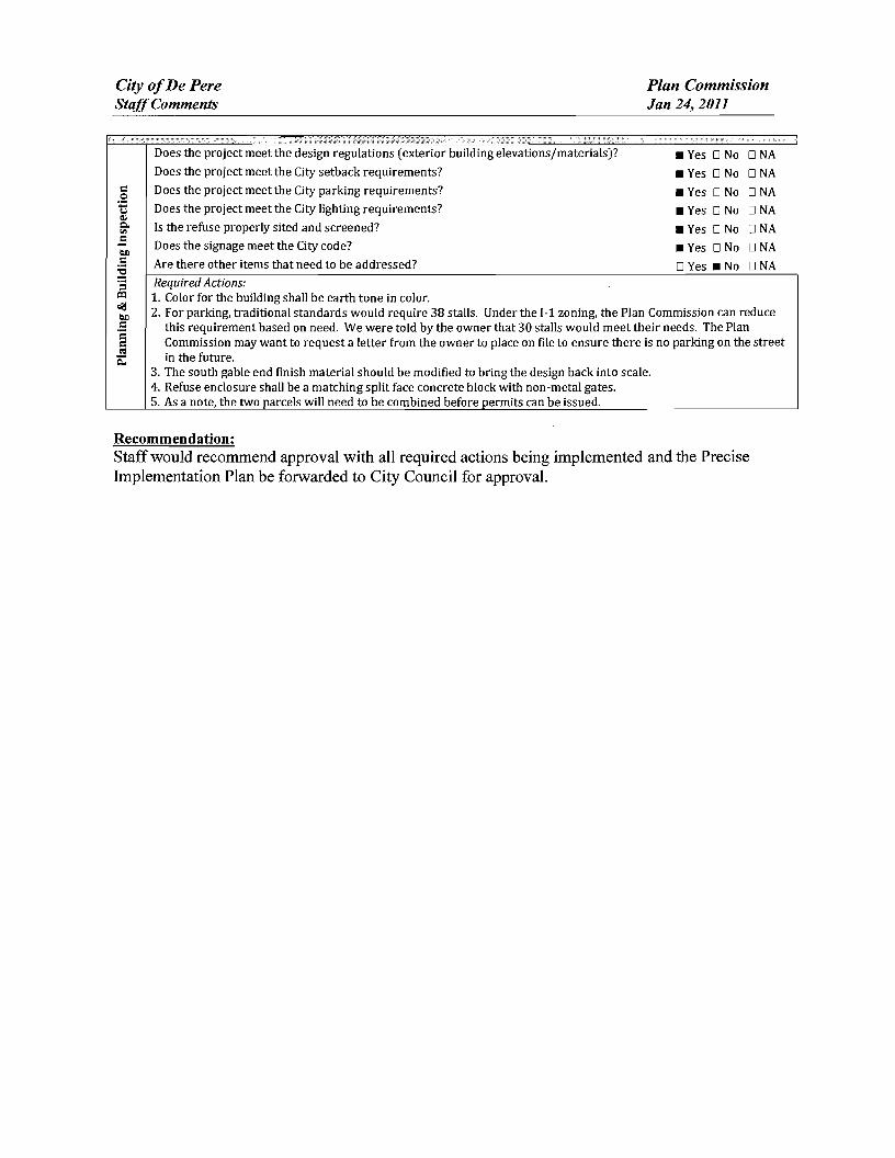
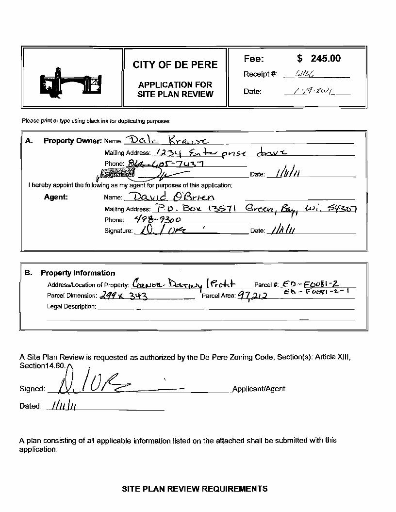
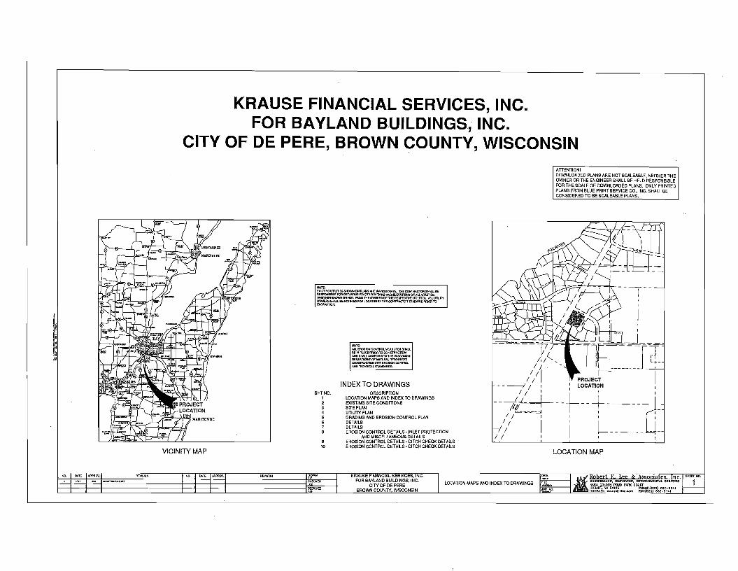
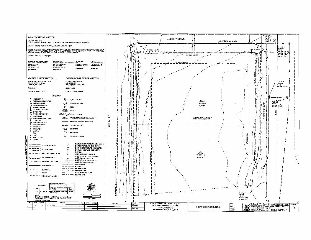
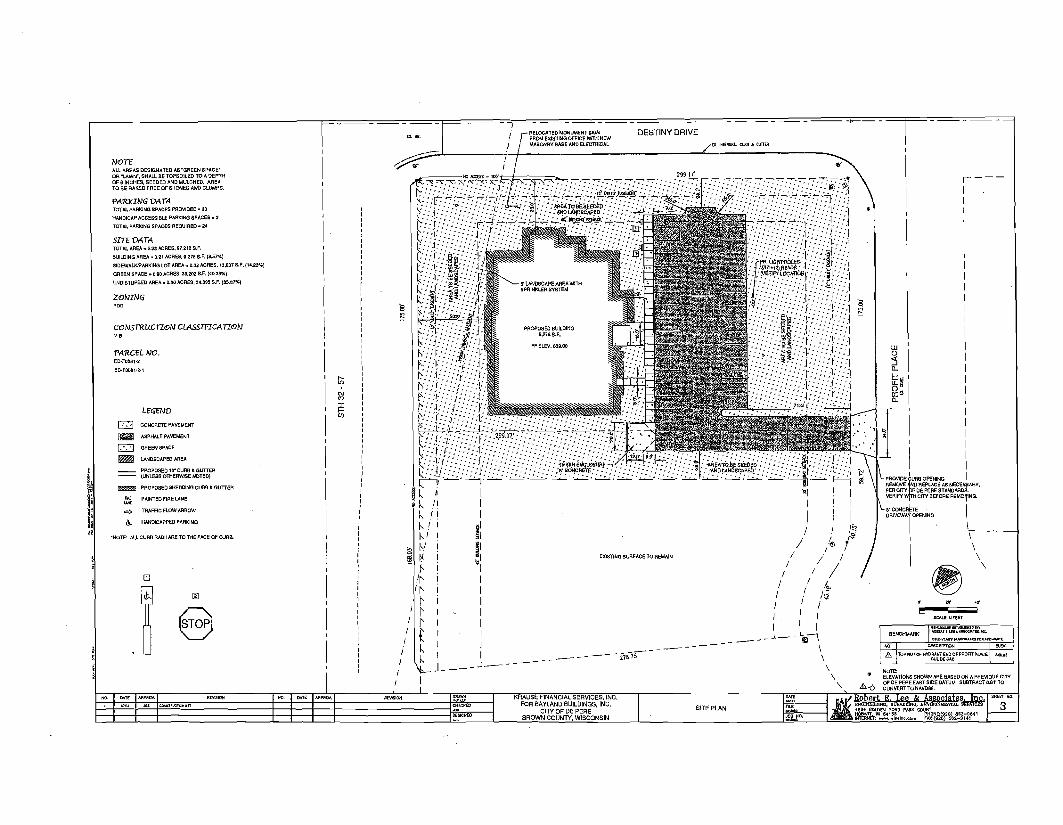
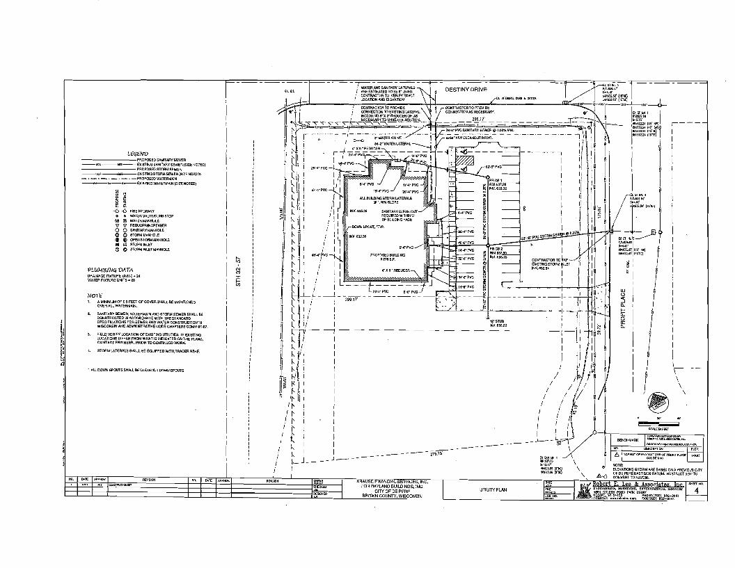
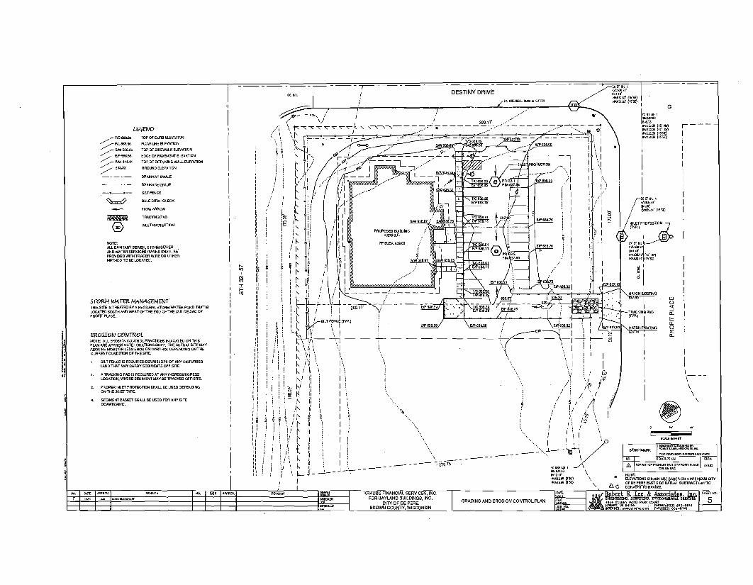
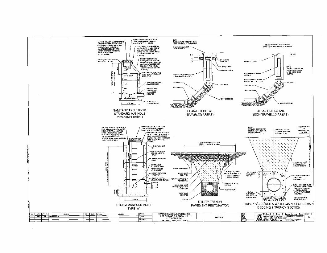
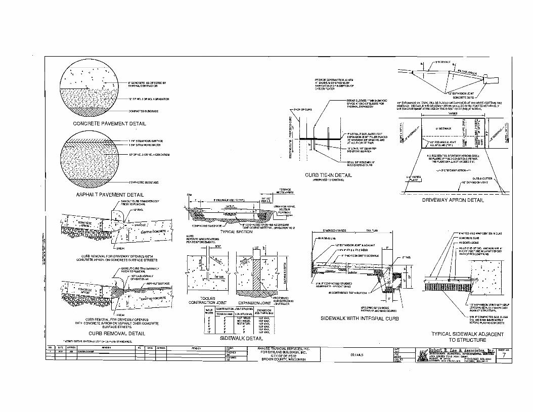
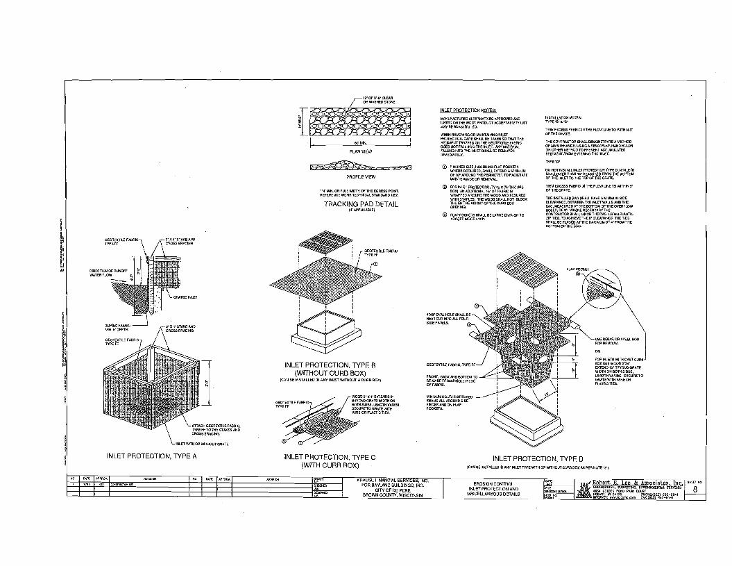
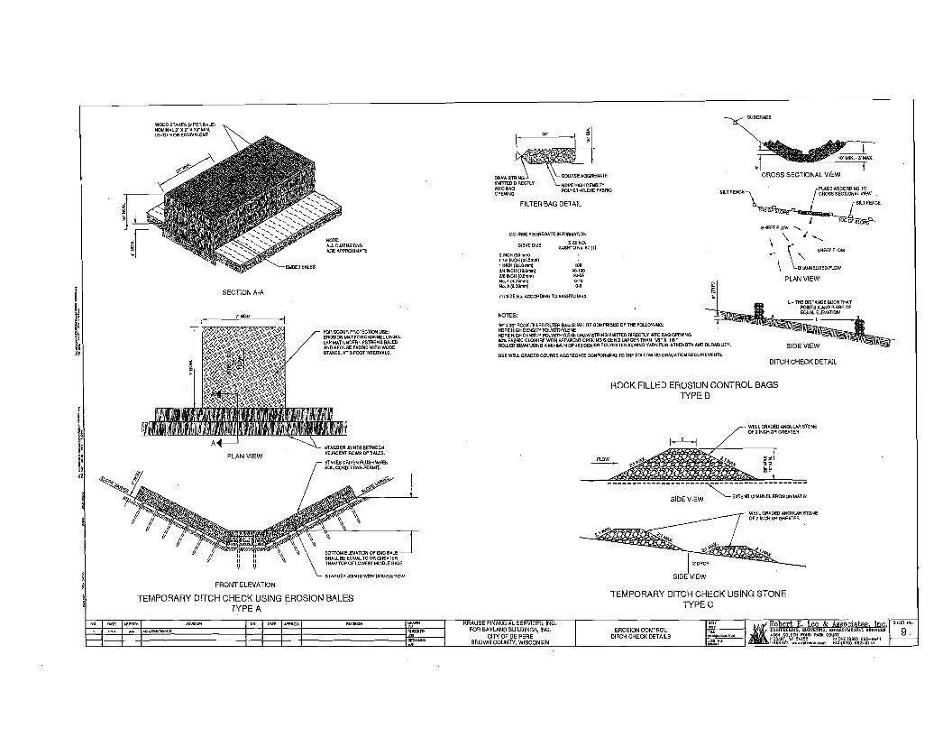
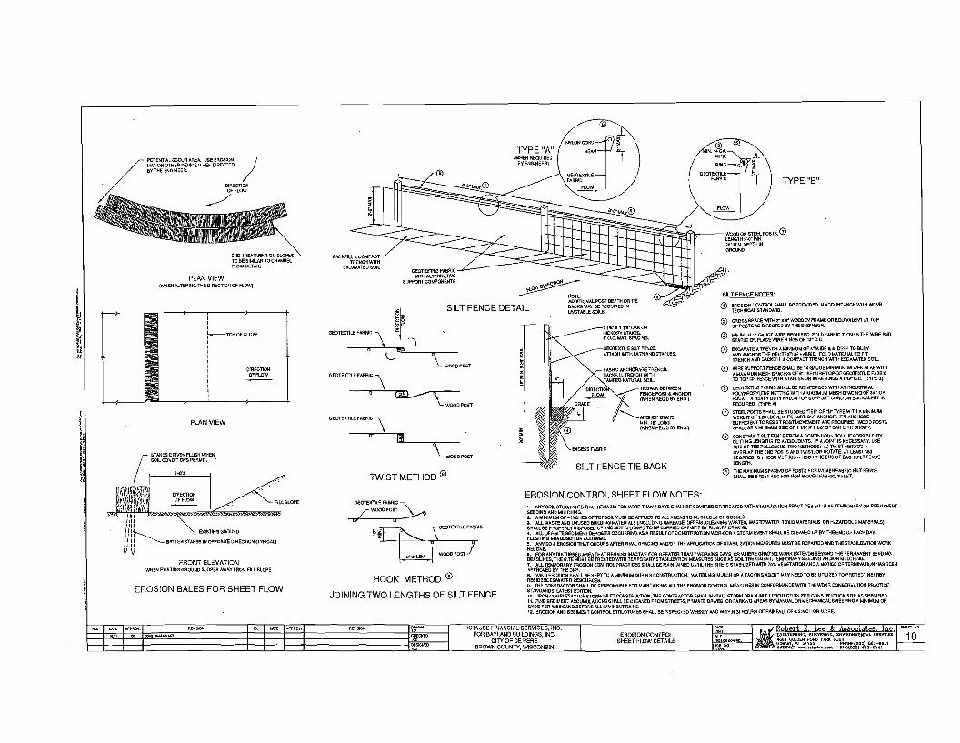
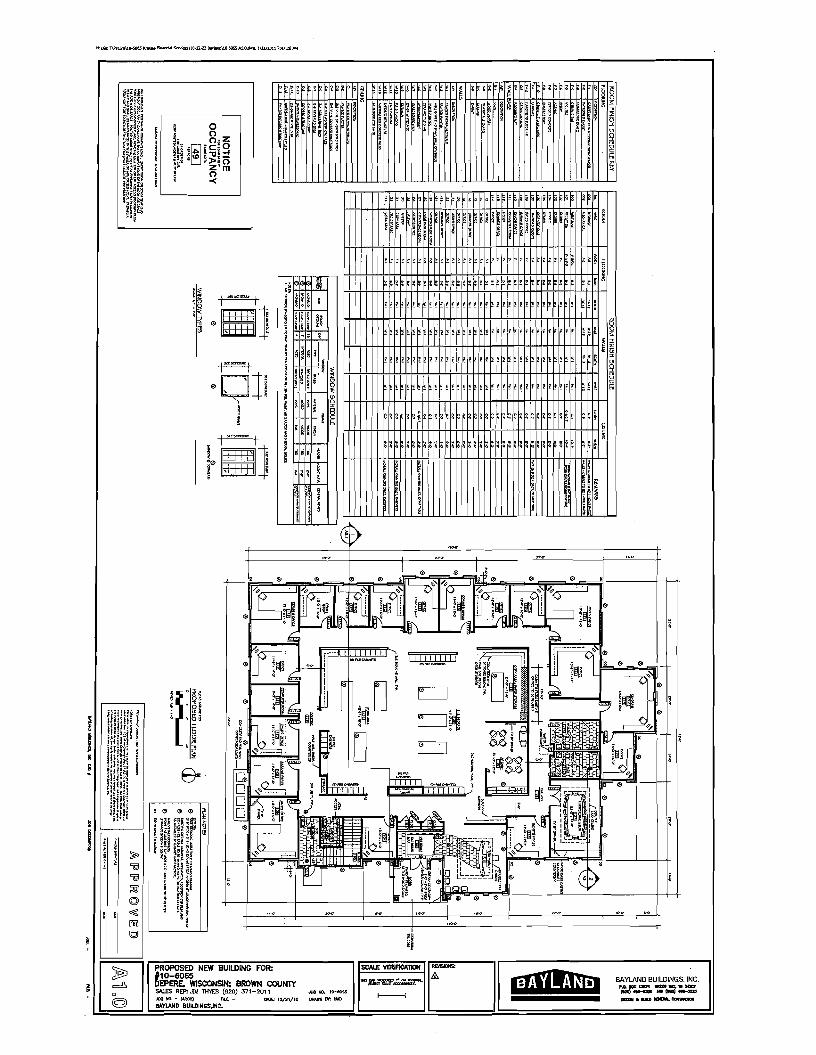
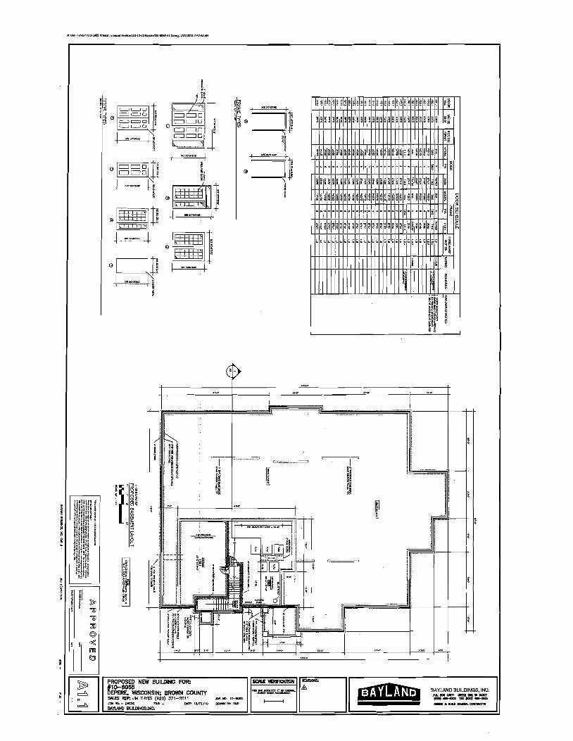
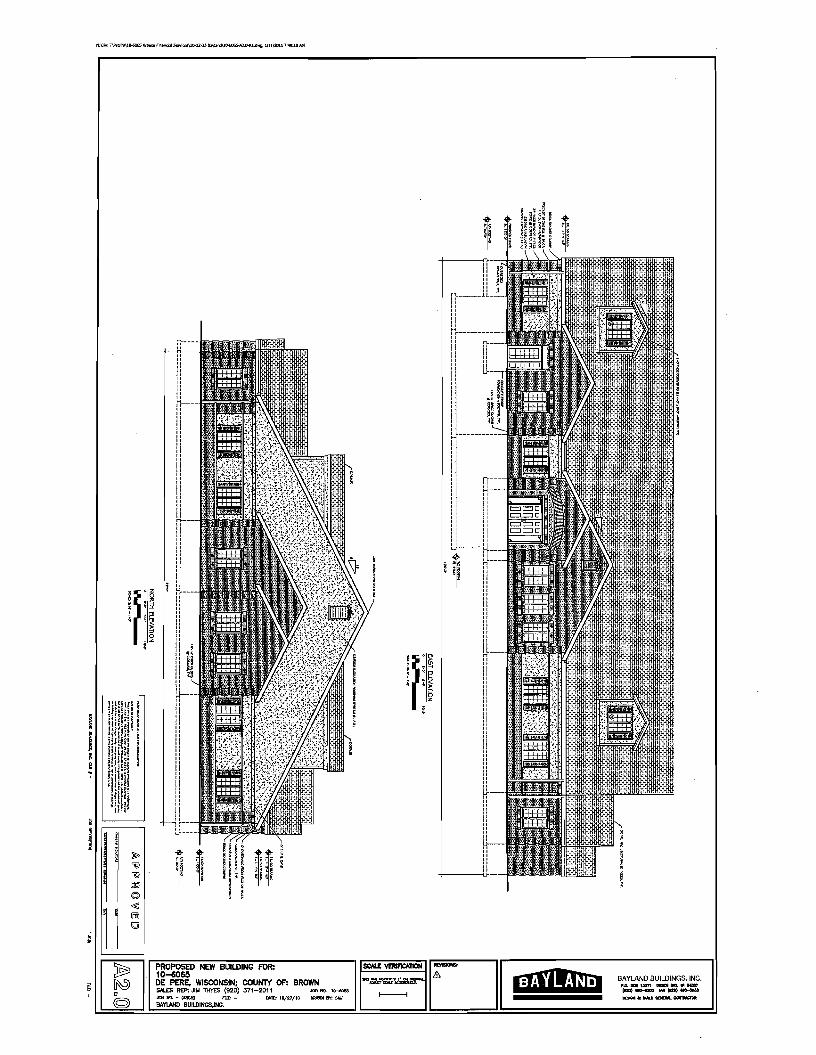
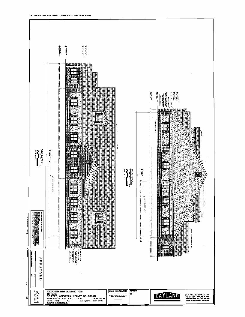
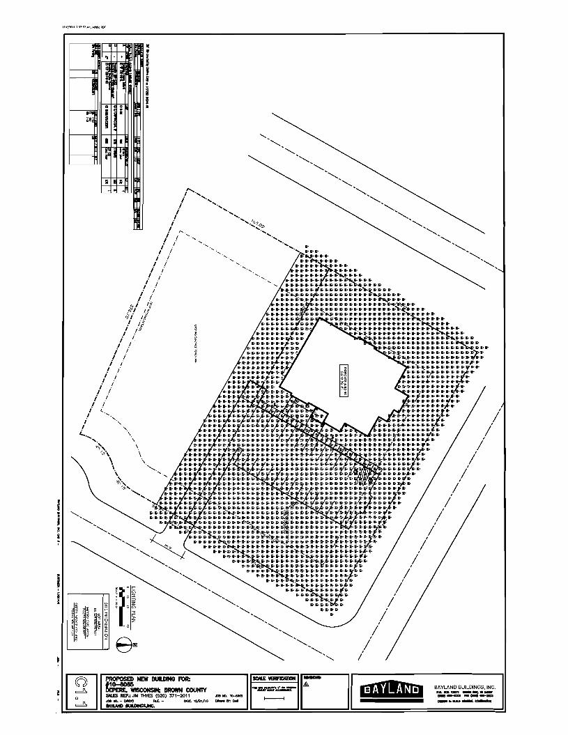
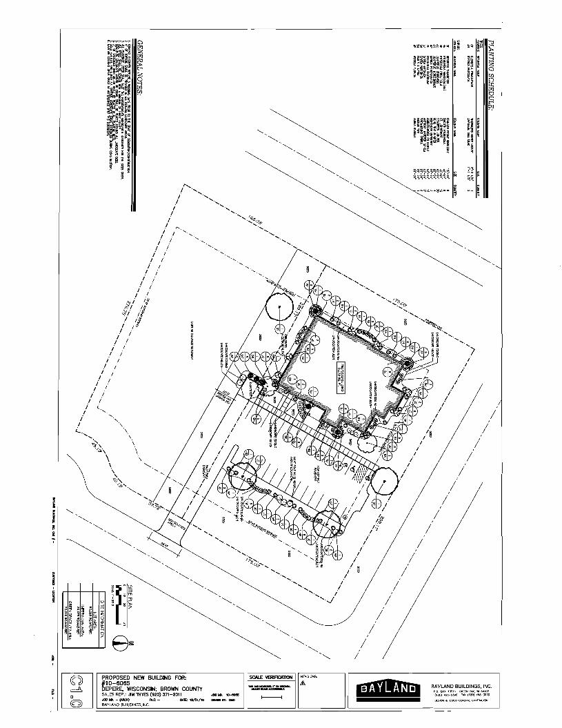
City ofDe Pere Plan Commission StaffComments Jan 24 2011
Item 4 Land Subdivision review
A Review the Final Plat application for Garritys Glen First Addition Surveyor Mach IV
The final plat has been submitted for Garritys Glen First Addition The plat has 17 news lots which are located on Galway Lane and Tullig Place The design of the subdivision and lot layout was approved under the preliminary plat review This subdivision is zoned PDD-R-l which is Single Family Residential with a Planned Development District overlay The size and area of the lots conform with the original General Development Plan
The plat has three outlots shown on Galway Lane Outlots 1 and 2 are provided to meet the long-term plan which is to vacate the right-of-way and create a new lot with 80 offrontage Outlot 3 will be dedicated to the City of De Pere This lot will be attached to our City stormwater pond to the east
Recommendation Staff would recommend the following
1 Approval of the final plat 2 The final plat be forwarded to the City Council for approval
CITY OF DE PERE
APPLICATION FOR PLAT REVIEW
Fee Receipt
Date
A Review Type o Preliminary Plat ~ Final Plat
Preliminary Plat Fee $250 + ~ of lots $35) =
Final Plat Fee $150
_
Please print or type using black ink for duplicating purposes
B Property Owner Name Garri ty r s Glen LLC (Patricia Kaster)
Mailing Address 1317 Lombardi Access Rd Ste 101 Green Bay WI 54304
Phone 9~7-5090 ~
Signature jtib~~ Date _1_-_1_3_-_1_1 _
I hereby appoint the following as my agent for purposes of this application
Agent Name --=B=enja=m=inL=aCount=----- ~ ~ _
Mailing Address 211 N Broadway Suite 114 Green Bay WI 54303
Phone 920 - 569-5765
Signature $ ~~ Date _1_-_1_3_-_1_1 _
B Property Information WD-1754 WD-1755
Galway Lane amp Tullig Place 1 WD-1756 amp WD-1757AddressILocation of Property Parce _
A Plat Review is requested as authorized by the De Pere Municipal Code Chapter 46
ApplicanUAgent
v I
~~I I
I
~~~
I
Garritys Glen First Addition All of Outlets 2 and 3 and part of Outlets and 5 of Carritys Glen recorded in
Volume 22 Plats Page 241 Document Number 2193288 Brown County Records located in part of Lots 102 and 103 of the Williams Crant Subdivision being in the
City of DePere Brown County Wisconsin [(1 1[
GrlllhicScale
~s
~
~ ~~
~~~ copy
SITE MAP WILLIAMS GRANT SUBDIVISION
CITYOF OEPERE BROWN COUNTY
WISCONSIN
~~J8W
169011 O04c
Legend o 236middot(nd)~1811lll
oIggtg 36~ tl - foaIl
bull middotkonplpeloa bull Tlronplpero_ lf9r_eoyM_nl
bull lp qj
+COPoJ1qjpglnl(llOIJrlglltll)
middotoIcIlCM -aOlln a 1J10lt1) 1 Iralp1p1
M~~~~~~ bNn 10Vl tunormnaf ~
bull lInc __fM O QJI1 rclogtl1l
WBlaquoIdnv IOampIu nollXll --r shy~2Ullmllll(Io odJ
IWa~ SOnllWalCO~gpound1
mtplusmnplusmnI R lrtClud-u(bullbullbull nalolhihlI2J
[
Surveyors Certificate I Andrew 5 C18v8l0ndRegillered Land SurejOCf tlGloll1lt60111
Thai In rullcompDIIIlCll Ilh lhll prom Ion or Chapter 236 WICOnlnSlatula and uie u~lblon regulaUOon or ae Cy01OePera end BrownCounly III1dunder lhedi1lUon 01 jne ClWnented rllOnlTue lulVeyeddlvlded and mapped Gamly Glen 1$1 AddIUonendthDtubpl8tconacllyroproontsdelllorloibounda~eandtho
ubdlllonorlhalandulV81ampdlllldliaJloIOuUole2end3I111dpertoIOuUo1l48nd501 Garrllye GI~n reCOrdedlrlVolume 22 Plets Page 241 oeecmem Number 2lgnBB Brown Coonly Recorolocalampd Inpatl ollota102 and 103 of the Vll1IL1m Granl 5u~Mllon belng In the Cily of OePere Brown Counly W1SCOl19lr1 mora fulyducrlbed a51010$
Beginning al the 50ulheal comer or Lg 41 of Gam I) Glen f8lCnledIn Volume 22 Plall Page 241 OOCJmantNumber 219J2U Brown Counly Rerord thence NJ12358E 13500 feel lc tha NClt1heAlI Il)meror Mid Lo141 Ihenea S52J602E 29461eel tc lhe Well f1ghl-orw01Yne01 TuUlgPloea lbenea S3O0259 E6971aello lheEnlrlilI-orwaylineofaJdTuIU9Ptllc8lharneS~23602middotE13993feetloanEat
line or Oullo 5 of Mid middotG8r~ly Glen lllanceS41583lW 443 leet alon9 581dE0111lne lhllnca 51B~748W 23389 leel lton9 IW EUlline end the ulenslon thereof acron tha 119hlImiddotwoy of Galway Lane end llkonglin Ell IIn8of Ollllal 2 of aid Gar~ly Glan thonce S393953117891 reel8long lld Eal Unlto a South linear 5ald Outlot2 thonceN523602W149718l1Ialon9ealdSoutUn81oanEaI11n1lol8IdOuOo12 thonn 53723581119055 leolalon9 Uld E08lllrle to a South nne of 581dOutlot 2 thiincil 576215711721 lelllio llle NoMent comer of LOlJO of Illd Glrrlly Glen thenci N88419W 15742 f08110the NoMwul comer 01 Lol31 of Gemly Gwn lhence N3S36rE 13068 leel tc llle NoMu1 corner of LOlJ4 of Gem I) Glen and thl $ouIlIrl1 rIsIt-olweyline of County Clere Road thanea N031109EllJ90luet to llli North rlghl-crmiddot1 Une01Mid Counly Clarg Road end the Southanlll)rner of lol 35 or Garrllya Glan thenca N37235SE 13000 108110lhe NoMnat comer of 581dLo135 lllonco N523i02w 3~OOO reel 10 lhe SouU1eul ecmercr LOl40 oIGOlrll1l Gion uienee N372358E 13500 leollc the Northoul comor 01 nldlol40 IIIldIhe South 19h1-ofwlYline of Galway Line thenco N32273SE 6023 reelLo th poln of beginning Lesland~lCBpUngthalpllrtpleenUybeln9ulampdrorfldpurpoau
5aldparc81conlaln 223930 IlqnI514 AltJe50l1andmoro orlass 5ubacl 10 ell aaMments Ind rnlr1C11al 01rllCOld
AndrowSC1eeland DaIBJanuary72011
i ThcrcM bjluJ) lrrIhipl1 wilhrcpeltllu Sm 23~I~ 23616 2Jb2IJanu1)fl2Irl)31K1(2j Wi~ i1Igt J pu~~~ bygt 2)(12 W SUtgt
____~20_
shy a u fa I
l ii b~ st-
~ ~ lid ~( J~
ltIJ5 ~
~ ~~ S~~
~ i~ ~~
lt~6( ~~ ~
g DATE 1-7middot11
DRAFTED BY BJL
JI~middot~~~middot~~ ~~~~ PROJEcTIl 0336-0111
SCALE 150
SHEET NUMBER
10F2 DRAWING NUMBER
Department(IfAdmlnlsteatlon 409
Garritys Glen First Addition All of Outlot ~ and 3 and part of Outlot 4 and 5 of Garritys Glen recorded in
Volume 22 Plats Page 241 Document Number 2193288 Brown County Records located in part of Lots 102 and 103 ofthe Williams Grant Subdivision being in the
City of DePere Brown County Wisconsin
Certificate for the City of De lere ApprowodJorlhoCllyolDoPao thlli_dayal 20_
KonPbldl OlraClorolPlannlnog
Certificate Or the City of Del-ere Common Council RUolvedthaIthe ptal knownaemiddotGarrUy1Glen First AddlUonmiddot whlcl11Ia bolendUI~ lIledlor allptClvA oIlhe CommOl1 CounclloIlhe City or O~Pere blenells heretl~ apprOooed It QIlIrampltl b~ thapler 236 MsCOOtln SlamplutEl5
I do haratl1 cenlly the aboe Is I lfUeand oarrecl alpy 01a letalullon adopllltlb1lhe CommonCouncllollhe Cityof DePere on 1111 _dayor__~20_
ChartenaMPelerson Dale DePerlCllyCler)
Treasurers Certificate ~ dulyeleded CityorOePera Trdnurar Ind BrownCountyTreaSUlerWe herab~ car1lfy thellha records Inouromee show flO
unredeemed tax sales and no IInpaldtaxes or speclamplaneuments allectlngany 01lhe lendl IncludedInlhls Plalaeof lh dalasll9ted bolo
ChaneneMPeleDon Oale KerryMBtaney Dale Citycrceeere Treesurer BrownCounlyTraasurer
Consent of Corporate Mortgagee TIloBuslnon Bonke corporationdulyO19anlzod and atlstlngundor and by vrlue01he aWl ofYl9conlJnmongegoo of lho eeeee dosa1bedlanddoolhoroby~nsontlolhosulldylngdllldlngmepplngend dedketlonor the land dosc1bodon IhIIpial end doon hereby consent 10the allove eenlfteetal of Ganllyl Glen LlC awners INWITNESSWHEREOFThe Business Bankhel COUladthese prasentllo bo 81gnedby Devldlorltl ItaPlesldent and eounlel1llgned
Limited Liability Company Owners Certificate GARRITYSOLEN LLC 8 UmlledIIl1cUlly ltQmpany duly orgiU1Llvd andexlsUngunderandby vll1u8altha laws of theSIBIsof W1sconaTn dooshoreby rlJr1IIy tha W8CBuud Ihaland dBSQlbodon GARRITYSGLEN FIRSTADDITION10bu urvoyoo dlvldod mappedand daclhated as lepf8luntad herlion GARRITYSOLENLLC also earllRu lhallhls PJalLsraqulrEld by 523610or 523612 lOooliubmlltodtolhafoIlOYolngforapprovlllorob]acllon
CITYOF OEPERE BROWNCOUNTYPLANNINGCOMMISSION DEPTOF ADMINISTRATION
In Wltnen WherQOf Ihe 3ald GARRlTIS GLENLLCh81 CIIund lhGSe pruenli 10be 31j1ned by PalrtclaA Katler end DaMls P LaYdanllsmanagarsonthls_dayof__~20~
PalrtclaA Kailar DennisP Layden ManejlIll_Garrltys Olen LLC MenajlerOanltysGlenLLC
Persotlal1Cama bero ma thls_da1 or 20-- tha above named managars orsaId LlmlledLlablilly Company and acknowladgedlhat he uacvled lhe loregolngInstrUmant asSlIehmandgers althe dead or slllltlUmlladUabllltyCompany by 11amp aulhorlly
NotaryPubllQ M~CommllalonExplraa _ BrownCount~ WIsconsin
STATEOF WISCONSIN 1 ISS
COUNTY OF BROWN1
Grant (If Easement TIlere11hereby granled Joln~y to I1eCityof OePele Wliconslne munlclpaloarporsUOI1 WlswnlJn PublicSaMcaCorporaUon Ind lha WlscooslnTelapoone Compen~ bolhpubllculDl1ltInd lhelrsuccessors and aulgns a perpatualrlghlof wayover end eaou an nsementln elllands designated haln 8S middotUtllJUI1 EasemantamiddotIOItha purpose of conltrUcUnglnstallallon and malnlanancaoftha watar dlllrtbudonIyltem aanllaryend storm sewers draJnogaawales gn and alactrk dllllrllludon aylltamstalephona Iylleml lind eablatalevlslonsyslems NOhebltallleatruelureloraCCllsorybulldlngashailbacooslnJetedwllhlnoruponaaklIBaemanli All gradl1althertOnstructedoreslabDshadwlthlnsaldaasemenlihaUnolbedlslurbadorallarad TIlIIenemenlls perpetual
~ ~ s ~ i~
e ~ ~ ~~ ~~ ltl ~~ b(J S-~ J~ ~~~ ~~~~ ~~
~Imiddotmiddotmiddotmiddotmiddotmiddotmiddot
gt1 c u 0 ~ bull c I()LJ)
0 U 0 ~6d --lt ~ ~ ~ ~ ~~
i - p t() OllSo~ gt1 S gt_-O~~So~ ~ Co) I~H () ltJ bull -
-0 ~ by LaurlOOlsonltaVlClJProsldenLet creen BayYl9conslnIhls- dey of 20_
OaldLOfIll
PersonaUYCBmeberoremethLs_d8yor__~20-----lheabovenamedomearsolaaldcorpolBtlofItomeMOWI1 to eeu-e pel$Onlwho a~~liIltllhe foregolngInstrumenland 10me knOWl110 oe such omears or laid cotpOl1lllon and ecknOMedged lhet theyulletlledtheforegalnglnslrumenlal8ucholfteereesl1adeedolsaldoarporallonbylLseulhorlly
NotaryPublic MyCommlslllonExpll1Il _ BrownCounlyWlswnsln
STATEOF WISCONSIN I JSS
COUNTOF BROWN1
Restrictive Covenanls 1jTIle 11Ind 011all slde andreerlolUJlS crall Iotashell bolgraded by the propeny ownerandmalntalnldbytheebulUngproparly Olaquoners lo provloeloradequale drelnageolsurfa~ewaler
2) Eaclliol owner Shallgrade the properly10confOlm10the edopted sidewalkgrade elevaUonand malntalnaalde1eallonlor future Id_alks
J)NO poles pedeslal orbwled eeble are 10be pieced so 85 10dlslurbany sUlleyllake OfobSlruetvisionllIongey lollines orSllH or 5lteelllne e dlsurbancaof a IUlleyswka b1 anyone lIi a YiolaUOn ofleCUon23632oftheWlswnsinStalules
Notes 1)AllroadswllhlnlhepialboundaryeflldadlcaledlOlhapuoDc
2JOuUol3 1110boldedleeledlO the CllyofOePere
3) Lot6 and Lol7 are reslrtcledIromu9lngGalwayLiI1e fordrlvewa1purposes and must use Tullg PIa fordrlawe1enltan
4) PurSllent10 SQetIoltl456 DoPeroMunldpalCodQPublicSilol and Opon Spas tho CI11orOaPore requltel lhe paymonlofa lao InIlOu or Part OedleeUOI1 prior 10lhe luuenee of e BullolngPorrnlllor oilIolsInhIelubdlvlelon
5) Sidewalksare raqu1flld on aDSltaela SidewalkInltallaUonshall be cornplled prlor10IUllanee ofany occupancy parmltby thl City of DePere
6) The plOpln1 ownar althe lime 01wnstrudlon shllilImplamantthe epPOPriale sol eroaloncoolrolmethodl ouUlnedI the Yl9conlnOeparlmenl01NeluralResources OWlICORsln Conslrudlon Sila BlIslManegementPraCUeaHendboohmiddotlo preventBOIl erollon HoweverIftha Cily01DaPare alhe Umeof construellonhas edopted a aollerollon tOnLrol Ofdlnarne IllhaDgovem over lhlsrequltamenL ThlsprOoolsloneppll8810anycooSltueUOnorlnslallatlonreletedeetMUeS09soolaledwllhilraataendutlllUel
Curve Data
i07o71
~
furv M Ra~~ o~onl H1710 n~
~
lJ~
~ ~ ~
iirIi W iiUi5 uco
~17g
Sellgtack FIOntil~es ~
iiOO 1iW i iiiiiO iiOi illi iW uomn iii5
11 I ----0
(1-- Wraquo
ilgt1lT
MMiT ~
~ I~ ~ I ~1mI ~
I g
DATE 1-7-11
DRAFTED BY BJL
IImiddot~~~middot~middot~~middot~middotmiddot~~middotmiddot~middot~~ PROJECT OJJ~1-11There are no abjectiunlUIhipl~1 ~ilh rc~P~IIl
gteC513~I~23~162J6lOalldD62Irllendl2l SCAlE 150
WI~l141 bull 11prviddbyDfIllWIS18tl SHEET NUMBER
Cecd 20_ 2 OF 2
8ltmiddotmiddotDRAWING NUMBERilll II
Dcpanmcmuf Alimini~trJli(ln bull 409
City ofDe Pere Plan Commission StaffComments Jan 24 2011
Item 4 Land Subdivision review
B Review the affidavit of Correction for Certified Survey Map 6764 C Review the affidavit of Correction for Certified Survey Map 6765
Certified survey map 6764 and 6765 cover the Planned Development District by the former Sportsman Warehouse and Wal-Mart Based on some initial activity for potential development on these lots we have found an error on the CSMs which severely limits the development of the two frontage lots The CSMs have setbacks where both building and improvements are not permitted
To correct the CSMs we need to obtain approval from WI DOT DOT staff actually drafted the affidavits of correction
Recommendation Staff would recommend the following
1 Approval of filing the affidavits
Document Number AFFIDAVIT OF CORRECTION
Pursuant to s236295(l)(a) Wis Stats I William J Dorsey authorized Wisconsin Department ofTransportation representative hereby certify that Certified Survey Map Number 6764 recorded on March 5 2003 in Volume 45 Pages 193-197 as document number 1987796 and was recorded in Brown County State of Wisconsin contained the following language
Sheet 1 - 5000 Highway Setback Une Caution - Highway Setback Restrictions Prohibit Improvements SeeSheet 2 Sheet 2 - No improvements or structures are allowed between the right-ofshyway line and the highway setback line Improvements and structures include but are not limited to signs parking areas driveways wells septic systems drainage facilities buildings and retaining walls It is expressly intended that this restriction is for the benefit of the public as provided in section 236293 Wisconsin Statutes and shall be enforceable by the Wisconsin Department of Transportation or its assigns
AFFIANT makes this Affidavit for the purpose ofmodifying the above document by removing these restrictions in their entirety
Signed
I (Date)
This space is reserved for recording data
Return to Wisconsin Department of Transportation 944 Vanderperren Way Green Bay WI 54304 Attention JackieEisch
Parcel Identification lIumber(Tax Key N~mber
Wl)OOO2o-S WOmiddotDOOllmiddot4 Wo-OOOl1-1 WD-00020 WOshy
00011-2 WO-DOOl1-3 and W[-OOOl1
(Print Name)
This Instrument was drafted by the Wisconsin Department of Transportation Page 1 of2
Approval Certification
(Date)
(Name of local Government)
Approved far recording by the government identified above
(Clerk signature)
(Print or Type Name of Clerk)
This Instrument was drafted by the Wisconsin Department of Transportation Page 2 of2
1987796 NO _CERTIFIED SURVEY MAP
Part of Porcels C and D Volume 2 Cerlified Survey Maps page 67 Brown County Records all of Parcel G Volume 2 Certified Survey Maps poge 305 Brown County Records Lots 1 and 2 Volume 11 Certified Survey Mops poge 133 Brown County Records ond ports of the Northwest 14 Southwest 14 Northeost 14 ond the Southeost 14 of the Southwest 14 of Section 29 Town 23 North Range 20 Eost City of Depere Brown County Wisconsin
DOT FILE NUMBER 05-041-0883-02
S UNE sw - SEC 29 CUT CROSS IN CONCRETE SE COR OF SW 14 OF
A GRAPHIC SCALE
SEC 29-23-20
N 150 0 75 150 300
5CoolXI 1middot bull agocr J --shy ( IN FEET)
Inch = 300 ft
45 ~~GE193~
SHEET 1 OF 5
-r
CERTIFIED SURVEY MAP NO
Part of Parcels C and D Volume 2 Certified Survey Maps page 67 Brown County Records all of Parcel G Volume 2 Certified Survey Maps page 305 Brown County Records Lots 1 and 2 Volume 11 Certified Survey Maps page 133 Bmwn County Records and parts of the Northwest 14 Southwest 14 Northeast 14 and the Southeast 14 of the Southwest 14 of Section 29 Town 23 North Range 20 East City of DePere Brown County Wisconsin
SURfEXORS CERnFICATI
STATE OF WISCONSIN SS
WAUKESHA COUNTY
I JOHN P CASUCCI Registered Land Surveyor do hereby certify
THAT J have surveyed divided and mapped a Part of Parcels C and D Volume 2 Certified Survey Maps page 67 Brown County Records all of Parcel G Volume 2 Certified Survey Maps page 305 Brown County Records Lots 1 and 2 Volume 11 Certified Survey Maps page 133 Brown County Records and parts of the Northwest 14 Southwest 14 Northeast 14 and the Southeast 14 of the Southwest 14 of Section 29 Town 23 North Range 20 East City of DePere Brown County Wisconsin bounded and described as follOWs
COMMENCING at the Southeast comer of said 14 Section 29 Town 23 North Range 20 East thence North 00deg2013 East 23275 feet along the East line of said 14 section to the point of beginning of lands to be described thence North 88deg4858 West 18499 feet to a point thence South 00deg2013 West 7600 feet to a point thence North 88deg4858 West 14500 feet to a point thence South 00deg2013 West 7587 feet to a point in the Northerly right of way line of CTH P also known as SCheuring Road thence North 88deg3948 West along said North line 149115 feet to a point thence North 45deg5622W West along said line 10999 feet to a point in the East right otway line of Lawrence Drive thence North 06deg1609 West along said line 17223 feet to a point thence North 01deg1623 West along said line 24588 feet to a point thence Northeasterly 66297 feet along said line and the arc of a curve whose center lies to the Southeast whose radius is 76851 feet and whose chord bealS North 23deg2114 East 64260 feet to a point thence North 48deg0852 East along said line 69192 feet to a point thence North 64deg3024 East along said line 20485 feet to a point thence North 49deg0002 East along said line 10000 feet to a point thence North 49deg1122 East along said line 10000 feet to a point thence North 33deg4852 East along said line 20742 feet to a point thence North 49deg1122 East along said line 14170 feet to a poirrt thence South 40deg4838 East 53922 feet to a point thence South 89deg3138 East 25246 feet to a point in the East line of said 14 Section thence South 00deg2013 West along said East line 150875 feet to the point of beginning
THAT I have made such survey land division and map by the direction of BOULDER VENTURE 14 LLC WAL-MART REAL ESTATE BUSINESS TRUST AND MENARD INC owners
THAT such map is a correct representation of all the exterior boundaries of the land surveyed and the land division thereof made COIIl~
C Veo e-_~ bullbullbullbullbullbullbull ~M~~THAT I have fUlly complied with the provisions of Chapter 23634 of the Wisconsin ~~indttiemiddotmiddot bullbull y ~
City of DePere Land Ordinance in surveying diViding mapping dedicating said lands 2 JOHN P ~
AI 71 = CASUCCI bull shyWrIW~laquo- 3 ZodZ- (tptt-e-- _ sectoEOOyen DATE HN P CASUCCI _ IDItGWocmiddot ~
EGISTERED LAND SURVEYO~_~-ft-~ Wi bullbullbullmiddot0middot shy se- -7vD bullbullbull middotc -c-
ACCESS RESTRICTION SUR l All lots and blocks are hereby restrletecl so that no owner possessor user licensee or other person may have any right oIlIU l vehicular Ingres from Dr egtess to any highway lying within the rlght~1-way01 USH 41 It Is expressly Intended that this restriction constitute a restriction for the benefit of the public as prOVided In s 236293 Stats and shall b8 enforceable by the departmenl Dr Its assigns Any access allowad by speelal excaption shall be contlrmed and granlad only through the drivewy permitting process nd all permits are revocable (access to Lawrence Orie and ScheUring Rod permitted)
NOISE ABATEMENT The lots of this land divisIon may experience nolsa atlevels exceeding tha revels In s Trans 40504 Table 1 These levels ate based on federal standards The department of transportallon Is not responsible for ablITlg netse from existing state tlJnk highways or connecting highways In the absence of any Increase by the department to the highways ttlrough-Iane capaclty
HIGHWAY SETBACK RESTRICTION No improvements or strudUres are allowed between the r1gtlt-of-way line and ttle highwaY setback line Improvements and structures include but are not Ihnltad to sIgns par1lting areas driveways wells septic syslems drainage 13olllle5 buildings and retelnlng walls It is expressly Intended that this reslrlcllon Is for the benellt of the public as provided In section 236293 Wisco nsin Statutes and shall be enforceable by the WIsconsin Department of Transportallon Dr ils assigns
Sheet 2 of 5 Sheets
CERTIFIED SURVEY MAP NO
Part of Parcels C and D Volume 2 Certified Survey Maps page 67 Brown County Records all of Parcel G Volume 2 Certified ~urvey Maps page 305 Brown County Records Lots 1 and 2 Volume 11 Certified Survey Maps page 133 Brown County Records and parts of the Northwest 14 Southwest 14 Northeast 14 and the Southeast 14 of the Southwest 14 of Section 29 Town 23 North Range 20 East City of DePere Brown County Wisconsin
CORPORATE OWNERS CERTIFICATE (Lot 1 2 Outlot 1 amp partial Lot 3)
BOULDER VENTURE 14 LLC a limited liability company duly organized and existing under and by virtue of the laws of the Slate of Wisconsin as owner certify that aid company caused the land described On this map to the surveyed dlvldad mapped and dedicated as represented on this map
BOULDER VENTURE 14 LLC does fUrther certify that this map is requited by S23610 or 23612 to be sUbmitted to the following for epproval or objedion City OfDePere and Wisconin Department ofTransportation
WITNESS the hend and seal of BOULDER VENTIJR~~_LLC has caued these preiifjnts to ba signed by ROBERT E SCHMIDT III it Member this r 2~ day of ~t9PA 200b
STATE OF WISCONSiN
CONSENT OF CORPORATE MoRTGAGEE
MARINE BANK a corporation duly orgenized and existing under and by virtue of the laws of the Slate of Wisconsin mortgagee of the ebove-described land does hereby consent to the surveying dividing mapping and dedication ofltle land described on this plat and does hereby consent to the above certificate of BOULDER VENTURe 14 LLC owner
IN WITNESS WHEREOF the said MARINE BANK has caused these presents t be signed by bull its President and countersigned by Its Secretary at
--------------- bull and Its ccrporata seal to be hereunto affixed thl __day of ________~ 200_shy
PRESIDENT SECRETARY
STATE OFWJSCONSIN SS
_____COUNTY
PERSONALLY came before me this day of 200 the above named ---_-------__---------__~ President and Secretary of the above-named corporation to me known to be the persons who executed the foregoing In trument and to me known to e such President and Secretary of said corporation acknOWledged that they executed the foregoing instrument as such officers by its authority
Notary public State ofWisconsin My comrmsston expires _---- _ My commission is permanent
Sheet 3 of 5 Sheets
----------_~----------~-~------__--------------------------
CERTIFIED SURVEY MAP NO
Part of Parcels C and D Volume 2 certified Survey Maps page 67 Brown County Records aU of Parcel G Volume 2 Certified Survey Maps page 305 Brown County Records Lots 1 and 2 Volume 11 Certified Survey Maps page 133 Brown County Records and parts of the Northwest 14 Southwest 14 Northeast 14 and the Southeast 14 of the Southwest 14 of Section 29 Town 23 North Range 20 East City of DePere Brown County Wisconsin
CORPQRATE OWNERS CERTIFICATE (oartia Lot 3)
WAL-MART REAL ESTATE BUSINESS TRUST a Delaware~~dulY organized and existing under and by virtue of the laws of the State of Delaware as owner certifies that said trust caused the land described on this map to the surveyed dMded mapped and dedicated as represented on this map
WAL-MART REAL ESTATE BUSINESS TRUST does further certify that this map is required by S23610 or 23612 to be submitted to the following for approval or objection Clly of DePere and WiampCOnsin Department of Transportation
WITNESS the hand and seal of WAL-MART REAL ESTATE BUSINESS TRUST has caused thase presents to be signed by M4-ad e ampAlUNampfi its MMMbnt-Iiuc~ = this 1 ~~ay of )a N 80j 200
W~~S~UST Assistant Vice PresidentIt rt1-PN~tS
STATE OF HI ~ SS
eCOUNTY
PERSONALLY came before me this t day of J2Pluar(sect 2003 the above named vh IE G-APntPpound to me known to be the person who exeCuted thlt foregoing inslnJment and to me known to be such -4llu~t of said trust and acknowled at he cuted the foregoing Instrument as such officer by ~ ~uthorttymiddot ~
MENARD INC a corporetion duly organized and exis1jng under and by virtue of the laws of the State of Wisconsin as owner certify that said corporation caused the land described on this map to the surveyed divided mapped and dedicated as represented on this map
MENARD INCbullbull does further certify that this map is required by S23610 or 23612 to be submitted to the following for approval or objection City of DePere and WIsconsin Department ofTrensportetion
~A f WITNESS the hand and seal of MENARD INC nas caused these presents to be signed by Rv rROlHAS KA its V ICE PRe I D l-NT this 2L(-4~ day of bIlIIA f2t 2003
MENARO INC
STATE OF WISCONSIN EAV cLAI~ SS
S COUNTY _
ER~Olle-LLYcame before me this ltf+r day of JANVA(l1 200~~1he~ ~)feraquo_ named V t~Ov SIL to me known to be the parson who executed the foregoing iDStrbme~ndor me known to be such PEN of said corporation and acknowledged thattlN ~xeamptedtIi bull -~ _ - foregoing Instrument as such officer by its authority -r-~L A bull ~~fIi l i -l 1~ ~
~~LlIlllll I nvvV1NV~ IIV_ ~ ~SGlfJ~ I= ~ COtv II J EA_ i ~S S NotaryPubliOStateofWisconsirr-- middotmiddotmiddot-middot 1 ~o
~~middotmiddotmiddotmiddotmiddotmiddot~middotr~~ bull i ~ ~ -_ ~ ) ~olgt --f to- ampr~1fc -~ My commission is permanent bullbull ~
S 5 2055 ClCOlrotoIOW _ Sheet 4 of 5 Sheets -~bullbull WI ~ 140 rJ-O~
~ SUR II T5 100It VOl bull f PASE
1987796 CERTIFIED SURVEY MAP NO _
Part of Parcels C and D Volume 2 Certified Survey Maps page 67 Brown County Records all of Parcel G Volume 2 Certified Survey Maps page 305 Brown County Records Lots 1 and 2 Volume 11 Certified Survey Maps page 133 Brown County Records and parts of the Northwest 14 Southwest 114 Northeast 14 and the Southeast 14 of the Southwest 14 of Section 29 Town 23 North Range 20 ~ast City of DePere Brown County Wisconsin
PLANNING COMMISSION APPROVAL
SV A ~ lt bull 2003 APPROVED by the Plan Commission of the City of DePere on this _----L--=__ day of
REGIsnRS OFFIce
8mwnCOWIs ~ Received fw IOCOfIIIfle dayof ]2r-ceb AD at i ocloCk M and recooIed in Vol of Certified SurveyMaps on PCIlIlI
~41~-lt (9Ruglsklf 0Daeds
THIS INSTRUMENT WAS DRAFTED BY JOHN P CASUCCI 1604B6CSM REGISTERED LAN D SURVEYOR 8-2055 Sheet 5 of 5 Sheets
VOL 45 lAcpound197
Document Number AFFfDAVIT OF CORRECTION
Pursuant to s236295(l)(a) Wis Stats I William J Dorsey authorized Wisconsin Department of Transportation representative hereby certify that Certified Survey Map Number 6765 recorded on March 5 2003 in Volume 45 Pages 198-203 as docwnent number] 987797 and was recorded in Brown County State of Wisconsin contained the following language
Sheet 1 - 5000 Highway Setback Line Caution - Highway Setback Restrictions Prohibit Improvements SeeSheet 2 Sheet 2 - No improvements or structures are allowed between the right-ofshyway line and the highway setback line Improvements and structures include but are not limited to signs parking areasdriveways wells septic systems drainage facilities buildings and retaining walls It is expressly intended that this restriction is for the benefit ofthe public as provided in section 236293 Wisconsin Statutes and shall be enforceable by the Wisconsin Department of Transportation or its assigns
AFFIANT makes this Affidavit for the purpose of modifying the above document by removing these restrictions in their entirety
Signed
State of Wisconsin )o ) ss O(6tJQ County )
On the above date this instrument was acknowledged before me
by the nam~ officers J r l4 P V(h1 ~
(Signature Notary Public State of Wisconsin)
Curtis D Van Erem (Print or Type N~e Notary Public State of Wisconsin)
II ~~201J
This space is reserved for recording data
Return to Wisconsin Department of Transportation 944 Vanderperren Way Green Bay WI 54304 Attention Jackie Eisch
ParcelIdentification Numberfax Key Number
WD-DOO2(S WD-DOOl1-4 WD-DOOll-1 WO-DOO20 WDshy
100011-2 WOmiddotOOOl1-3 and WD-DOO11
William J Dorsey (Print Name)
(~ate ommission Expires)
This Instrument was drafted by the Wisconsin Department of Transportation Page 1 of2
Approva I Certification
(Date)
(Name of Local Government)
Approved for recording by the government identified above
(Clerk signature)
(Print or Type Name of Clerk)
This Instrument was drafted by the WIsconsin Department of Transportation Page 2 of2
67651987797 CERTIFIED SURVEY MAP NO
A Division Lot 3 Volume of5 Certified Survey Mops page Lj~ Brown County Records 011 being port of the Northwest 14 Southwest 14 Southeast 14 and the Northeast 14 of the Southwest 14 of Section 29 Town 23 North Ronge 20 East City of DePere Brown County Wisconsin
I ~I litj ~ 5
z
ili 5 w lliIlz
W
CUT CROSS IN CONCRETE SE COR OF SW 14 OF SEC 29-23-20
SHEET 1 OF 6
UNPlATTEO -LJNDs-
LOT CSM NO
ill ~ EXISTING euLDIHGS TO BE RAZED
-------~----
GRAPHIC SCALE 150 0 75 150 300
~--- I ( IN FEET )
1 inch = 300 ft
SCFffiURING RDshy S UNE SW 1 SEC iii 120 PUBUC ROAD
VOL SIA1I bullbull zooo
VICINITY MAP SCIUTHWEP 1
OFaanONZbullbull T2SNIIlZCC
I-~-I
I NwbullbullIN E
~ J
I sw I SE
L_~e--Re~
INDICATES 2 IRON PIPE (FOUND) tgt INDICATES 34 IRON PIPE (FOUND)
bull INDICATES I IRON PIPE (FOUND)
o INDICATES SET 35 00 IRON PIPE 24 IN LENGTH 168 LBS PER UNEAL FOOT
All DIIoAENSIONS SKOWN ARE MEASURED TO THE NEAREST HUNDREDTl-l OF A FOOT AlL BEARINGS ARE REFERENCED TO THE EAST UNE OF THE SW 4 OF SECTION 29 T 23 N R 20 E WHICH BEARS N 00203 E
DOT FILE NUMBER 05-041-0882-02
CERTIFIED SURVEY MAP NO __ A Division Lot 3 Volume 15 Certified Survey Mops page Ji3 Brown County Records all being port of the Northwest 14 Southwest 4 Southeast 14 ond the Northeost 14 of the Southwest 14 of Section 29 Town 23 North Ronge 20 East CIty of DePere Brown County Wisconsin
ACCESS RESTRICTION An lots and blocks ere hereby reslrlcted so that no owner possessor user licensee or other person may have any right of direct vehIcular Ingress from or egress to any highway lying within the right-of-way of USH -41lt Is expressly Intended that this restriction constitute a restrlcaon for the benefit of the public as provided In s 236293 Stats and shall be enforoaable by the department or Its assigns My access allowed by special exception shell be oonfinned and granted only through the driveway pennllting process and all permits are revocable (access to Lewrence Drive and SchelJring Road pennltted)
NOISE ABATEMENT The lots 01 this land division may experience noise at lavels exceeding the levels In s Trans 40504 Table 1 Thssa levels are based on federal standards The department of transportaUon Is not responsible for abating noise from exlsUng state trunk highways or connecting highways in Ihe absence of any Inaeasa by the department to Iha highways through-Ia capaclty
HIGHWAY SETBACK RESTRICTION No Improvemenl$ or structuras are allowed between the right-of-way line and Ihe highway setback line Improvemenl$ and structures Include but are not limited to signs parking arsas driveways wells septic systems drainage faelllUas buildings and retaining walla It la expre$$ly Intended Ihat Ihls restr1ctlon Is for the benafit 01 the public as provided In section 236293 Wisconsin Statutes and shall be enforceable by the WlSCOflsin Dapartment of TransportaUon or Its assigns
SCALEGRAPHIC 134502 sf ft 30877 acres g
OUTLOT 1 36772 sq ft 08901 acres
21875 S42OOSSE 21875
S41OZ1E 23776
t----- 12 UllUTY ES middotT
I
I
I I I 11I I 350
~
~
rJ ~ t5
rI x
I I I
1 ~
- I
~ a Cl
I shyl -c I
ampl lt
OUTLOT 2
11 50 0 25 50 100 200
Iw-~ I1 ( IN FEET ) Inch 100 ftA1
NtItIonaI ~ amp EI_-N 104aIIft=m~ L ~+
SHEET 2 OF G ~ -~
VOL 45 PACE199Cl
CERTIFIED SURVEY MAP NO __
A Division Lot 3 VolumeiJi Certified Survey Maps page 13 Brown County Records all being part of the Northwest 14 Southwest 14 Southeast 14 and the Northeast 14 of the Southwest 14 of Section 29 Town 23 North Range 20 East City of DePere Brown County Wisconsin
SUIDEYORS CERTIFICATE
STATE OF WISCONSIN SS
WAUKESHA COUNTY
I JOHN P CASUCCI Registered Land Surveyor do hereby certify
THAT I have surveyed divided and mapped a division of Lot 3 of Certified Survey Map No __ Brown County Records all being part of the Northwest 14 Southwest 14 Southeast 14 and the Northeast 14 of the Southwest 14 of Section 29 Town 23 North Range 20 East City of DePere Brown County Wisconsin
COMMENCING at the Southeast comer of said 14 Section thence North 00deg2013 East along the East line of said 14 section 116230 feet to the point of beginning of lands to be described thence South 48deg3934 West 56015 feet to a point thence South 61~156 West 18684 feet to a point thence southwesterly 3889 feet along an arc of a curve whose center lies to the southeast whose radius Is 9500 feet whose chord bears South 49deg3812 East 3862 feet to a point thence South 37deg5428 West 21211 feet to a point thence South 48deg3814 West 36839 feet to a point thence Northwesterly 5970 feet along an arc of a curve whose center lies to the Southwest whose radius is 12400 feet and whose chord bears North 27deg3412 West 5913 feet to a point thence North 41deg2146 West 107024 feet to a point in the Southeasterly right of way of Lawrence Drive thence Northeasterly 11550 feet along said right of way and an arc of a curve whose center lies to the Southeast whose radius is 76851 feet and whose chord bears North 43deg4543 East 11539 teet thence North 48deg0852 East along said line 69192 feet to a point thence North 64deg3024 East along said line 20485 feet to a point thence North 49deg0002 East along said line 10000 feet to a point thence North 49deg1122 East along said line 10000 feet to a point thence North 33deg4852 East along said line 20742 feet to a point thence North 49deg1122 East along said line 14170 feet to a point thence South 40deg4838 East 53922 feet to a point thence South 89deg3138 East 25246 feet to a point in tlie East line of said 14 sec thence South 00deg2013 West along said East line 57920 feet to the point of beginning
THAT I have made such survey land division and map by the direction of BOULDER VENTURE 14 LLC WAL-MART REAL ESTATE BUSINESS TRUST AND MENARD INC owners
THAT such map is a correct representation of all the exterior boundaries of the land surveyed and the land division thereof made
THAT I have fully complied with the provisions of Chapter 23634 of the Wisconsin Statutes and the City of DePere Land Ordinance In surveying dividing and mapping said lands 001111111
c No -~ ~~ ~ -11 ~
E JOHN P bullbull ~ bull - CASUCCI bull shy
~ ~ ~lh j shyts ZoOz N P CASUCCI OCONOMGWOC bullbull
GISTERED LAND SURV~~~55wr bullbull middotmiddot0middotR-~ ~Y rrD ~ 1 SURll -
rlU1
Sheet 3 of 6 Sheets
VOL 45 PASE200
CERTIFIED SURVEY MAP NO __
A Division Lot 3 Volume ~ Certified Survey Maps page r-3 Brown County Records all being part of the Northwest 14 Southwest 14 Southeast 14 and the Northeast 14 of the Southwest 14 of Section 29 Town 23 North Range 20 East City of DePere Brown County Wisconsin
CORPORATE OWNERS CERTIFICATE (Outlot 1 and 2)
BOULDER VENTURE 14 LLC a limited liability company dUly organized and existing under and by virtue of the laws of the State of Wisconsin as owner certify that said company caused the land described on this map to the surveyed divided and mapped as represented on this map
BOULDER VENTURE 14 LLC does further certify that this map is required by S2361 0 or 23612 to be submitted to the following for approval or objection City of DePere and Wisconsin Department of Transportation
WITNESS the hand and seal of BOULDER VENTURE 14 LLC has caused these presents to ~ signed by ROBERT E SCHMIDT III Its Member this 13fk day of ~bCC 200laquo=
B~LC
ROBERT E SCHMIDT III MEMBER
STATE OF WiSCONSIN ss
MILWAUKEE COUNTY
PERSONALLY came before me this ~ gK day of ~ 204 the above named ROBERT E SCHMIDT Ill to me known to be the person who executed the foregoing instrument and to me known to be such Member of said company and acknowledged that he executed the foregoing instrument as such officer by its authority
11 cCONn ~ bullbullbull oz$ ~--bullbullbull -middotv ~
JOHN P - - ~ I bull -CASUCCJ bull 5-2055 S ~ OOONOMOWOC - ~
~~~d~~~~~~ ~ 7~~-Y-degl-Sheet 4 of 6 Sheets
VOl 45 PAC201
CERTIFIED SURVEY MAP NO
A Division Lot 3 Volumel Certified Survey Maps page I B Brown County Records all being part of the Northwest 14 Southwest 14 Southeast 14 and the Northeast 14 of the Southwest 14 of Section 29 Town 23 North Range 20 East City of DePere Brown County Wisconsin
CORPORATE OWNERS CERTIFCATEt~tt2)
WA~-MARTREAL ESTATE BUSINESS TRUST a DelawarefiBs~ulyorganioed and eXisting under and by virtue of the laws of the State of Delaware as owner certifies that said trust caused the land described on his map to the surveyed divided and mapped as represented on this map
WAL-MART REAL ESTATE BUSINESS TRUST does further certify that this map is required by S23610 or 23612 to be submitted to the followtng for approval or ObJection City of DePere and Wisconsin Department of Transportation
WITNESS the hand and seal ofWAL-MARTREAL ESTATE BUSINESS TRUST has C8tyened these presents ~beSjgnedbY MdtaelE lia~ itsJtJS$bnt-Vvlt-fht~T this r~ day of
-~ zoo W~T
11tel-M1 e Ato me known to be the person who executed the foregoing instrument and to me
55tS an STATE OFWA-N5~~ ~ SS ~ECOUNTY
PERSONALLY came before me this r~ day of Jnu0rt4 2003 the above named tJAp~
known to be such _ v amp_Id of said trust and acknowl e th oragolng Inslnlment as such officer by Its authority
OFFICIAL6EAL ROBiN M leMEUR
NOTARY PUBUC-A1UCANSA8 bull BaiTOH COUNtY
M-CQmmIAlan Exwea MAY
MENARD INC a corporation duly organized and existing under and by virtue of the laws of the Stata of Wisconsin as owner certify that said corporauon caused the land described on this map to the surveyed divided and mapped as represented on this map
MENARD INC does further certify that this map is required by S23610 or 23612 to be submitted to the following for approval Of objection City of DePere and Wisconsin Department of Transportation
SS the hand and seal ofMENARQ INC llas caused tnese presents to be s9id by ()C ASKA its LIe- PIlE()(N-r this 2~ day
of-lo-uuLlltJO=7- ~ 2003
STATE OF WISCONSIN
MILWAUKEE COUNTY
JOHN P CASUCCI
S-2055 _ bull OGO(lOMOWO
~ lt -laquo - ~ 9JID aide- - SU
IllS
VOL 45 Aamppound202
1987797 CERTIFIED SURVEY MAP NO _
A DIvIsion Lot 3 Volume Certified Survey Maps page I q3 Brown County Records all being part of the Northwest 14 Southwest 14 Southeast 14 and the Northeast 14 of the Southwest 14 of Section 29 Town 23 North Range 20 East City of DePere Brown ~ounty Wisconsin
PLANNING COMMISSiON APPROVAL
APPROV1=D by the Plan Commission of the City of DePere on this 2gt camp day of ttocr~ 2005
-
lilli cCONc-~ bullbullbullbullbull umiddotyen
~~ bullbull r bull r~$ Ia- ~
JOHN P bullbull -= CASUCCI 8-2055 = ~ oca~NOMO~lF1 oIA~ ~ Wl E~ - shy
-e- --1110 bullbullbullbullbull ~ SU I I-I) -oz
lUI
THIS INSTRUMENT WAS DRAFTED BY JOHN P CASUCCI 160486CSM2 REGISTERED LAND SURVEYOR S-2055 Sheet 6 of 6 Sheets
VOL 45 PAGE203
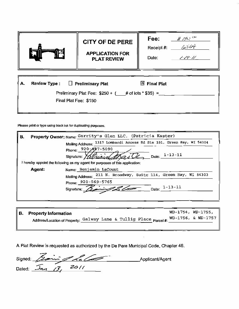
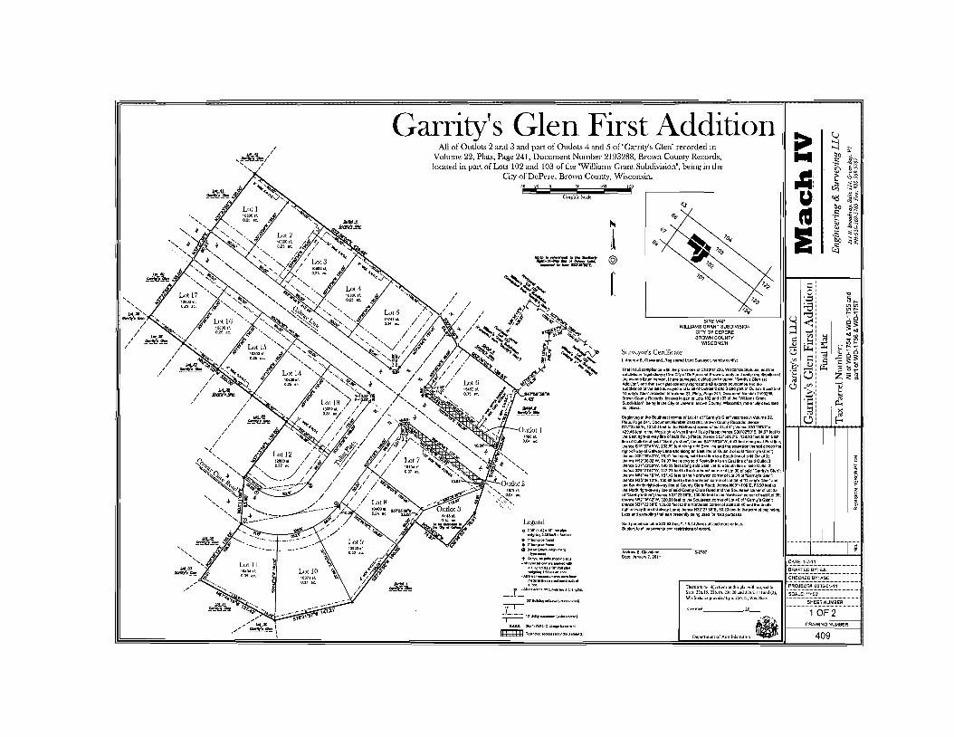
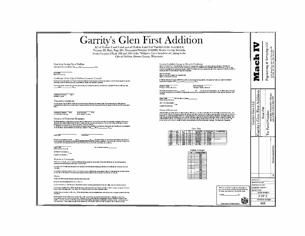
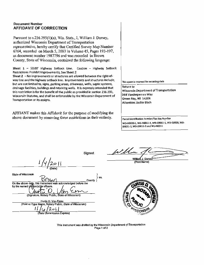
CERTIFIED SURVEY MAP NO
Part of Parcels C and D Volume 2 Certified Survey Maps page 67 Brown County Records all of Parcel G Volume 2 Certified Survey Maps page 305 Brown County Records Lots 1 and 2 Volume 11 Certified Survey Maps page 133 Bmwn County Records and parts of the Northwest 14 Southwest 14 Northeast 14 and the Southeast 14 of the Southwest 14 of Section 29 Town 23 North Range 20 East City of DePere Brown County Wisconsin
SURfEXORS CERnFICATI
STATE OF WISCONSIN SS
WAUKESHA COUNTY
I JOHN P CASUCCI Registered Land Surveyor do hereby certify
THAT J have surveyed divided and mapped a Part of Parcels C and D Volume 2 Certified Survey Maps page 67 Brown County Records all of Parcel G Volume 2 Certified Survey Maps page 305 Brown County Records Lots 1 and 2 Volume 11 Certified Survey Maps page 133 Brown County Records and parts of the Northwest 14 Southwest 14 Northeast 14 and the Southeast 14 of the Southwest 14 of Section 29 Town 23 North Range 20 East City of DePere Brown County Wisconsin bounded and described as follOWs
COMMENCING at the Southeast comer of said 14 Section 29 Town 23 North Range 20 East thence North 00deg2013 East 23275 feet along the East line of said 14 section to the point of beginning of lands to be described thence North 88deg4858 West 18499 feet to a point thence South 00deg2013 West 7600 feet to a point thence North 88deg4858 West 14500 feet to a point thence South 00deg2013 West 7587 feet to a point in the Northerly right of way line of CTH P also known as SCheuring Road thence North 88deg3948 West along said North line 149115 feet to a point thence North 45deg5622W West along said line 10999 feet to a point in the East right otway line of Lawrence Drive thence North 06deg1609 West along said line 17223 feet to a point thence North 01deg1623 West along said line 24588 feet to a point thence Northeasterly 66297 feet along said line and the arc of a curve whose center lies to the Southeast whose radius is 76851 feet and whose chord bealS North 23deg2114 East 64260 feet to a point thence North 48deg0852 East along said line 69192 feet to a point thence North 64deg3024 East along said line 20485 feet to a point thence North 49deg0002 East along said line 10000 feet to a point thence North 49deg1122 East along said line 10000 feet to a point thence North 33deg4852 East along said line 20742 feet to a point thence North 49deg1122 East along said line 14170 feet to a poirrt thence South 40deg4838 East 53922 feet to a point thence South 89deg3138 East 25246 feet to a point in the East line of said 14 Section thence South 00deg2013 West along said East line 150875 feet to the point of beginning
THAT I have made such survey land division and map by the direction of BOULDER VENTURE 14 LLC WAL-MART REAL ESTATE BUSINESS TRUST AND MENARD INC owners
THAT such map is a correct representation of all the exterior boundaries of the land surveyed and the land division thereof made COIIl~
C Veo e-_~ bullbullbullbullbullbullbull ~M~~THAT I have fUlly complied with the provisions of Chapter 23634 of the Wisconsin ~~indttiemiddotmiddot bullbull y ~
City of DePere Land Ordinance in surveying diViding mapping dedicating said lands 2 JOHN P ~
AI 71 = CASUCCI bull shyWrIW~laquo- 3 ZodZ- (tptt-e-- _ sectoEOOyen DATE HN P CASUCCI _ IDItGWocmiddot ~
EGISTERED LAND SURVEYO~_~-ft-~ Wi bullbullbullmiddot0middot shy se- -7vD bullbullbull middotc -c-
ACCESS RESTRICTION SUR l All lots and blocks are hereby restrletecl so that no owner possessor user licensee or other person may have any right oIlIU l vehicular Ingres from Dr egtess to any highway lying within the rlght~1-way01 USH 41 It Is expressly Intended that this restriction constitute a restriction for the benefit of the public as prOVided In s 236293 Stats and shall b8 enforceable by the departmenl Dr Its assigns Any access allowad by speelal excaption shall be contlrmed and granlad only through the drivewy permitting process nd all permits are revocable (access to Lawrence Orie and ScheUring Rod permitted)
NOISE ABATEMENT The lots of this land divisIon may experience nolsa atlevels exceeding tha revels In s Trans 40504 Table 1 These levels ate based on federal standards The department of transportallon Is not responsible for ablITlg netse from existing state tlJnk highways or connecting highways In the absence of any Increase by the department to the highways ttlrough-Iane capaclty
HIGHWAY SETBACK RESTRICTION No improvements or strudUres are allowed between the r1gtlt-of-way line and ttle highwaY setback line Improvements and structures include but are not Ihnltad to sIgns par1lting areas driveways wells septic syslems drainage 13olllle5 buildings and retelnlng walls It is expressly Intended that this reslrlcllon Is for the benellt of the public as provided In section 236293 Wisco nsin Statutes and shall be enforceable by the WIsconsin Department of Transportallon Dr ils assigns
Sheet 2 of 5 Sheets
CERTIFIED SURVEY MAP NO
Part of Parcels C and D Volume 2 Certified Survey Maps page 67 Brown County Records all of Parcel G Volume 2 Certified ~urvey Maps page 305 Brown County Records Lots 1 and 2 Volume 11 Certified Survey Maps page 133 Brown County Records and parts of the Northwest 14 Southwest 14 Northeast 14 and the Southeast 14 of the Southwest 14 of Section 29 Town 23 North Range 20 East City of DePere Brown County Wisconsin
CORPORATE OWNERS CERTIFICATE (Lot 1 2 Outlot 1 amp partial Lot 3)
BOULDER VENTURE 14 LLC a limited liability company duly organized and existing under and by virtue of the laws of the Slate of Wisconsin as owner certify that aid company caused the land described On this map to the surveyed dlvldad mapped and dedicated as represented on this map
BOULDER VENTURE 14 LLC does fUrther certify that this map is requited by S23610 or 23612 to be sUbmitted to the following for epproval or objedion City OfDePere and Wisconin Department ofTransportation
WITNESS the hend and seal of BOULDER VENTIJR~~_LLC has caued these preiifjnts to ba signed by ROBERT E SCHMIDT III it Member this r 2~ day of ~t9PA 200b
STATE OF WISCONSiN
CONSENT OF CORPORATE MoRTGAGEE
MARINE BANK a corporation duly orgenized and existing under and by virtue of the laws of the Slate of Wisconsin mortgagee of the ebove-described land does hereby consent to the surveying dividing mapping and dedication ofltle land described on this plat and does hereby consent to the above certificate of BOULDER VENTURe 14 LLC owner
IN WITNESS WHEREOF the said MARINE BANK has caused these presents t be signed by bull its President and countersigned by Its Secretary at
--------------- bull and Its ccrporata seal to be hereunto affixed thl __day of ________~ 200_shy
PRESIDENT SECRETARY
STATE OFWJSCONSIN SS
_____COUNTY
PERSONALLY came before me this day of 200 the above named ---_-------__---------__~ President and Secretary of the above-named corporation to me known to be the persons who executed the foregoing In trument and to me known to e such President and Secretary of said corporation acknOWledged that they executed the foregoing instrument as such officers by its authority
Notary public State ofWisconsin My comrmsston expires _---- _ My commission is permanent
Sheet 3 of 5 Sheets
----------_~----------~-~------__--------------------------
CERTIFIED SURVEY MAP NO
Part of Parcels C and D Volume 2 certified Survey Maps page 67 Brown County Records aU of Parcel G Volume 2 Certified Survey Maps page 305 Brown County Records Lots 1 and 2 Volume 11 Certified Survey Maps page 133 Brown County Records and parts of the Northwest 14 Southwest 14 Northeast 14 and the Southeast 14 of the Southwest 14 of Section 29 Town 23 North Range 20 East City of DePere Brown County Wisconsin
CORPQRATE OWNERS CERTIFICATE (oartia Lot 3)
WAL-MART REAL ESTATE BUSINESS TRUST a Delaware~~dulY organized and existing under and by virtue of the laws of the State of Delaware as owner certifies that said trust caused the land described on this map to the surveyed dMded mapped and dedicated as represented on this map
WAL-MART REAL ESTATE BUSINESS TRUST does further certify that this map is required by S23610 or 23612 to be submitted to the following for approval or objection Clly of DePere and WiampCOnsin Department of Transportation
WITNESS the hand and seal of WAL-MART REAL ESTATE BUSINESS TRUST has caused thase presents to be signed by M4-ad e ampAlUNampfi its MMMbnt-Iiuc~ = this 1 ~~ay of )a N 80j 200
W~~S~UST Assistant Vice PresidentIt rt1-PN~tS
STATE OF HI ~ SS
eCOUNTY
PERSONALLY came before me this t day of J2Pluar(sect 2003 the above named vh IE G-APntPpound to me known to be the person who exeCuted thlt foregoing inslnJment and to me known to be such -4llu~t of said trust and acknowled at he cuted the foregoing Instrument as such officer by ~ ~uthorttymiddot ~
MENARD INC a corporetion duly organized and exis1jng under and by virtue of the laws of the State of Wisconsin as owner certify that said corporation caused the land described on this map to the surveyed divided mapped and dedicated as represented on this map
MENARD INCbullbull does further certify that this map is required by S23610 or 23612 to be submitted to the following for approval or objection City of DePere and WIsconsin Department ofTrensportetion
~A f WITNESS the hand and seal of MENARD INC nas caused these presents to be signed by Rv rROlHAS KA its V ICE PRe I D l-NT this 2L(-4~ day of bIlIIA f2t 2003
MENARO INC
STATE OF WISCONSIN EAV cLAI~ SS
S COUNTY _
ER~Olle-LLYcame before me this ltf+r day of JANVA(l1 200~~1he~ ~)feraquo_ named V t~Ov SIL to me known to be the parson who executed the foregoing iDStrbme~ndor me known to be such PEN of said corporation and acknowledged thattlN ~xeamptedtIi bull -~ _ - foregoing Instrument as such officer by its authority -r-~L A bull ~~fIi l i -l 1~ ~
~~LlIlllll I nvvV1NV~ IIV_ ~ ~SGlfJ~ I= ~ COtv II J EA_ i ~S S NotaryPubliOStateofWisconsirr-- middotmiddotmiddot-middot 1 ~o
~~middotmiddotmiddotmiddotmiddotmiddot~middotr~~ bull i ~ ~ -_ ~ ) ~olgt --f to- ampr~1fc -~ My commission is permanent bullbull ~
S 5 2055 ClCOlrotoIOW _ Sheet 4 of 5 Sheets -~bullbull WI ~ 140 rJ-O~
~ SUR II T5 100It VOl bull f PASE
1987796 CERTIFIED SURVEY MAP NO _
Part of Parcels C and D Volume 2 Certified Survey Maps page 67 Brown County Records all of Parcel G Volume 2 Certified Survey Maps page 305 Brown County Records Lots 1 and 2 Volume 11 Certified Survey Maps page 133 Brown County Records and parts of the Northwest 14 Southwest 114 Northeast 14 and the Southeast 14 of the Southwest 14 of Section 29 Town 23 North Range 20 ~ast City of DePere Brown County Wisconsin
PLANNING COMMISSION APPROVAL
SV A ~ lt bull 2003 APPROVED by the Plan Commission of the City of DePere on this _----L--=__ day of
REGIsnRS OFFIce
8mwnCOWIs ~ Received fw IOCOfIIIfle dayof ]2r-ceb AD at i ocloCk M and recooIed in Vol of Certified SurveyMaps on PCIlIlI
~41~-lt (9Ruglsklf 0Daeds
THIS INSTRUMENT WAS DRAFTED BY JOHN P CASUCCI 1604B6CSM REGISTERED LAN D SURVEYOR 8-2055 Sheet 5 of 5 Sheets
VOL 45 lAcpound197
Document Number AFFfDAVIT OF CORRECTION
Pursuant to s236295(l)(a) Wis Stats I William J Dorsey authorized Wisconsin Department of Transportation representative hereby certify that Certified Survey Map Number 6765 recorded on March 5 2003 in Volume 45 Pages 198-203 as docwnent number] 987797 and was recorded in Brown County State of Wisconsin contained the following language
Sheet 1 - 5000 Highway Setback Line Caution - Highway Setback Restrictions Prohibit Improvements SeeSheet 2 Sheet 2 - No improvements or structures are allowed between the right-ofshyway line and the highway setback line Improvements and structures include but are not limited to signs parking areasdriveways wells septic systems drainage facilities buildings and retaining walls It is expressly intended that this restriction is for the benefit ofthe public as provided in section 236293 Wisconsin Statutes and shall be enforceable by the Wisconsin Department of Transportation or its assigns
AFFIANT makes this Affidavit for the purpose of modifying the above document by removing these restrictions in their entirety
Signed
State of Wisconsin )o ) ss O(6tJQ County )
On the above date this instrument was acknowledged before me
by the nam~ officers J r l4 P V(h1 ~
(Signature Notary Public State of Wisconsin)
Curtis D Van Erem (Print or Type N~e Notary Public State of Wisconsin)
II ~~201J
This space is reserved for recording data
Return to Wisconsin Department of Transportation 944 Vanderperren Way Green Bay WI 54304 Attention Jackie Eisch
ParcelIdentification Numberfax Key Number
WD-DOO2(S WD-DOOl1-4 WD-DOOll-1 WO-DOO20 WDshy
100011-2 WOmiddotOOOl1-3 and WD-DOO11
William J Dorsey (Print Name)
(~ate ommission Expires)
This Instrument was drafted by the Wisconsin Department of Transportation Page 1 of2
Approva I Certification
(Date)
(Name of Local Government)
Approved for recording by the government identified above
(Clerk signature)
(Print or Type Name of Clerk)
This Instrument was drafted by the WIsconsin Department of Transportation Page 2 of2
67651987797 CERTIFIED SURVEY MAP NO
A Division Lot 3 Volume of5 Certified Survey Mops page Lj~ Brown County Records 011 being port of the Northwest 14 Southwest 14 Southeast 14 and the Northeast 14 of the Southwest 14 of Section 29 Town 23 North Ronge 20 East City of DePere Brown County Wisconsin
I ~I litj ~ 5
z
ili 5 w lliIlz
W
CUT CROSS IN CONCRETE SE COR OF SW 14 OF SEC 29-23-20
SHEET 1 OF 6
UNPlATTEO -LJNDs-
LOT CSM NO
ill ~ EXISTING euLDIHGS TO BE RAZED
-------~----
GRAPHIC SCALE 150 0 75 150 300
~--- I ( IN FEET )
1 inch = 300 ft
SCFffiURING RDshy S UNE SW 1 SEC iii 120 PUBUC ROAD
VOL SIA1I bullbull zooo
VICINITY MAP SCIUTHWEP 1
OFaanONZbullbull T2SNIIlZCC
I-~-I
I NwbullbullIN E
~ J
I sw I SE
L_~e--Re~
INDICATES 2 IRON PIPE (FOUND) tgt INDICATES 34 IRON PIPE (FOUND)
bull INDICATES I IRON PIPE (FOUND)
o INDICATES SET 35 00 IRON PIPE 24 IN LENGTH 168 LBS PER UNEAL FOOT
All DIIoAENSIONS SKOWN ARE MEASURED TO THE NEAREST HUNDREDTl-l OF A FOOT AlL BEARINGS ARE REFERENCED TO THE EAST UNE OF THE SW 4 OF SECTION 29 T 23 N R 20 E WHICH BEARS N 00203 E
DOT FILE NUMBER 05-041-0882-02
CERTIFIED SURVEY MAP NO __ A Division Lot 3 Volume 15 Certified Survey Mops page Ji3 Brown County Records all being port of the Northwest 14 Southwest 4 Southeast 14 ond the Northeost 14 of the Southwest 14 of Section 29 Town 23 North Ronge 20 East CIty of DePere Brown County Wisconsin
ACCESS RESTRICTION An lots and blocks ere hereby reslrlcted so that no owner possessor user licensee or other person may have any right of direct vehIcular Ingress from or egress to any highway lying within the right-of-way of USH -41lt Is expressly Intended that this restriction constitute a restrlcaon for the benefit of the public as provided In s 236293 Stats and shall be enforoaable by the department or Its assigns My access allowed by special exception shell be oonfinned and granted only through the driveway pennllting process and all permits are revocable (access to Lewrence Drive and SchelJring Road pennltted)
NOISE ABATEMENT The lots 01 this land division may experience noise at lavels exceeding the levels In s Trans 40504 Table 1 Thssa levels are based on federal standards The department of transportaUon Is not responsible for abating noise from exlsUng state trunk highways or connecting highways in Ihe absence of any Inaeasa by the department to Iha highways through-Ia capaclty
HIGHWAY SETBACK RESTRICTION No Improvemenl$ or structuras are allowed between the right-of-way line and Ihe highway setback line Improvemenl$ and structures Include but are not limited to signs parking arsas driveways wells septic systems drainage faelllUas buildings and retaining walla It la expre$$ly Intended Ihat Ihls restr1ctlon Is for the benafit 01 the public as provided In section 236293 Wisconsin Statutes and shall be enforceable by the WlSCOflsin Dapartment of TransportaUon or Its assigns
SCALEGRAPHIC 134502 sf ft 30877 acres g
OUTLOT 1 36772 sq ft 08901 acres
21875 S42OOSSE 21875
S41OZ1E 23776
t----- 12 UllUTY ES middotT
I
I
I I I 11I I 350
~
~
rJ ~ t5
rI x
I I I
1 ~
- I
~ a Cl
I shyl -c I
ampl lt
OUTLOT 2
11 50 0 25 50 100 200
Iw-~ I1 ( IN FEET ) Inch 100 ftA1
NtItIonaI ~ amp EI_-N 104aIIft=m~ L ~+
SHEET 2 OF G ~ -~
VOL 45 PACE199Cl
CERTIFIED SURVEY MAP NO __
A Division Lot 3 VolumeiJi Certified Survey Maps page 13 Brown County Records all being part of the Northwest 14 Southwest 14 Southeast 14 and the Northeast 14 of the Southwest 14 of Section 29 Town 23 North Range 20 East City of DePere Brown County Wisconsin
SUIDEYORS CERTIFICATE
STATE OF WISCONSIN SS
WAUKESHA COUNTY
I JOHN P CASUCCI Registered Land Surveyor do hereby certify
THAT I have surveyed divided and mapped a division of Lot 3 of Certified Survey Map No __ Brown County Records all being part of the Northwest 14 Southwest 14 Southeast 14 and the Northeast 14 of the Southwest 14 of Section 29 Town 23 North Range 20 East City of DePere Brown County Wisconsin
COMMENCING at the Southeast comer of said 14 Section thence North 00deg2013 East along the East line of said 14 section 116230 feet to the point of beginning of lands to be described thence South 48deg3934 West 56015 feet to a point thence South 61~156 West 18684 feet to a point thence southwesterly 3889 feet along an arc of a curve whose center lies to the southeast whose radius Is 9500 feet whose chord bears South 49deg3812 East 3862 feet to a point thence South 37deg5428 West 21211 feet to a point thence South 48deg3814 West 36839 feet to a point thence Northwesterly 5970 feet along an arc of a curve whose center lies to the Southwest whose radius is 12400 feet and whose chord bears North 27deg3412 West 5913 feet to a point thence North 41deg2146 West 107024 feet to a point in the Southeasterly right of way of Lawrence Drive thence Northeasterly 11550 feet along said right of way and an arc of a curve whose center lies to the Southeast whose radius is 76851 feet and whose chord bears North 43deg4543 East 11539 teet thence North 48deg0852 East along said line 69192 feet to a point thence North 64deg3024 East along said line 20485 feet to a point thence North 49deg0002 East along said line 10000 feet to a point thence North 49deg1122 East along said line 10000 feet to a point thence North 33deg4852 East along said line 20742 feet to a point thence North 49deg1122 East along said line 14170 feet to a point thence South 40deg4838 East 53922 feet to a point thence South 89deg3138 East 25246 feet to a point in tlie East line of said 14 sec thence South 00deg2013 West along said East line 57920 feet to the point of beginning
THAT I have made such survey land division and map by the direction of BOULDER VENTURE 14 LLC WAL-MART REAL ESTATE BUSINESS TRUST AND MENARD INC owners
THAT such map is a correct representation of all the exterior boundaries of the land surveyed and the land division thereof made
THAT I have fully complied with the provisions of Chapter 23634 of the Wisconsin Statutes and the City of DePere Land Ordinance In surveying dividing and mapping said lands 001111111
c No -~ ~~ ~ -11 ~
E JOHN P bullbull ~ bull - CASUCCI bull shy
~ ~ ~lh j shyts ZoOz N P CASUCCI OCONOMGWOC bullbull
GISTERED LAND SURV~~~55wr bullbull middotmiddot0middotR-~ ~Y rrD ~ 1 SURll -
rlU1
Sheet 3 of 6 Sheets
VOL 45 PASE200
CERTIFIED SURVEY MAP NO __
A Division Lot 3 Volume ~ Certified Survey Maps page r-3 Brown County Records all being part of the Northwest 14 Southwest 14 Southeast 14 and the Northeast 14 of the Southwest 14 of Section 29 Town 23 North Range 20 East City of DePere Brown County Wisconsin
CORPORATE OWNERS CERTIFICATE (Outlot 1 and 2)
BOULDER VENTURE 14 LLC a limited liability company dUly organized and existing under and by virtue of the laws of the State of Wisconsin as owner certify that said company caused the land described on this map to the surveyed divided and mapped as represented on this map
BOULDER VENTURE 14 LLC does further certify that this map is required by S2361 0 or 23612 to be submitted to the following for approval or objection City of DePere and Wisconsin Department of Transportation
WITNESS the hand and seal of BOULDER VENTURE 14 LLC has caused these presents to ~ signed by ROBERT E SCHMIDT III Its Member this 13fk day of ~bCC 200laquo=
B~LC
ROBERT E SCHMIDT III MEMBER
STATE OF WiSCONSIN ss
MILWAUKEE COUNTY
PERSONALLY came before me this ~ gK day of ~ 204 the above named ROBERT E SCHMIDT Ill to me known to be the person who executed the foregoing instrument and to me known to be such Member of said company and acknowledged that he executed the foregoing instrument as such officer by its authority
11 cCONn ~ bullbullbull oz$ ~--bullbullbull -middotv ~
JOHN P - - ~ I bull -CASUCCJ bull 5-2055 S ~ OOONOMOWOC - ~
~~~d~~~~~~ ~ 7~~-Y-degl-Sheet 4 of 6 Sheets
VOl 45 PAC201
CERTIFIED SURVEY MAP NO
A Division Lot 3 Volumel Certified Survey Maps page I B Brown County Records all being part of the Northwest 14 Southwest 14 Southeast 14 and the Northeast 14 of the Southwest 14 of Section 29 Town 23 North Range 20 East City of DePere Brown County Wisconsin
CORPORATE OWNERS CERTIFCATEt~tt2)
WA~-MARTREAL ESTATE BUSINESS TRUST a DelawarefiBs~ulyorganioed and eXisting under and by virtue of the laws of the State of Delaware as owner certifies that said trust caused the land described on his map to the surveyed divided and mapped as represented on this map
WAL-MART REAL ESTATE BUSINESS TRUST does further certify that this map is required by S23610 or 23612 to be submitted to the followtng for approval or ObJection City of DePere and Wisconsin Department of Transportation
WITNESS the hand and seal ofWAL-MARTREAL ESTATE BUSINESS TRUST has C8tyened these presents ~beSjgnedbY MdtaelE lia~ itsJtJS$bnt-Vvlt-fht~T this r~ day of
-~ zoo W~T
11tel-M1 e Ato me known to be the person who executed the foregoing instrument and to me
55tS an STATE OFWA-N5~~ ~ SS ~ECOUNTY
PERSONALLY came before me this r~ day of Jnu0rt4 2003 the above named tJAp~
known to be such _ v amp_Id of said trust and acknowl e th oragolng Inslnlment as such officer by Its authority
OFFICIAL6EAL ROBiN M leMEUR
NOTARY PUBUC-A1UCANSA8 bull BaiTOH COUNtY
M-CQmmIAlan Exwea MAY
MENARD INC a corporation duly organized and existing under and by virtue of the laws of the Stata of Wisconsin as owner certify that said corporauon caused the land described on this map to the surveyed divided and mapped as represented on this map
MENARD INC does further certify that this map is required by S23610 or 23612 to be submitted to the following for approval Of objection City of DePere and Wisconsin Department of Transportation
SS the hand and seal ofMENARQ INC llas caused tnese presents to be s9id by ()C ASKA its LIe- PIlE()(N-r this 2~ day
of-lo-uuLlltJO=7- ~ 2003
STATE OF WISCONSIN
MILWAUKEE COUNTY
JOHN P CASUCCI
S-2055 _ bull OGO(lOMOWO
~ lt -laquo - ~ 9JID aide- - SU
IllS
VOL 45 Aamppound202
1987797 CERTIFIED SURVEY MAP NO _
A DIvIsion Lot 3 Volume Certified Survey Maps page I q3 Brown County Records all being part of the Northwest 14 Southwest 14 Southeast 14 and the Northeast 14 of the Southwest 14 of Section 29 Town 23 North Range 20 East City of DePere Brown ~ounty Wisconsin
PLANNING COMMISSiON APPROVAL
APPROV1=D by the Plan Commission of the City of DePere on this 2gt camp day of ttocr~ 2005
-
lilli cCONc-~ bullbullbullbullbull umiddotyen
~~ bullbull r bull r~$ Ia- ~
JOHN P bullbull -= CASUCCI 8-2055 = ~ oca~NOMO~lF1 oIA~ ~ Wl E~ - shy
-e- --1110 bullbullbullbullbull ~ SU I I-I) -oz
lUI
THIS INSTRUMENT WAS DRAFTED BY JOHN P CASUCCI 160486CSM2 REGISTERED LAND SURVEYOR S-2055 Sheet 6 of 6 Sheets
VOL 45 PAGE203
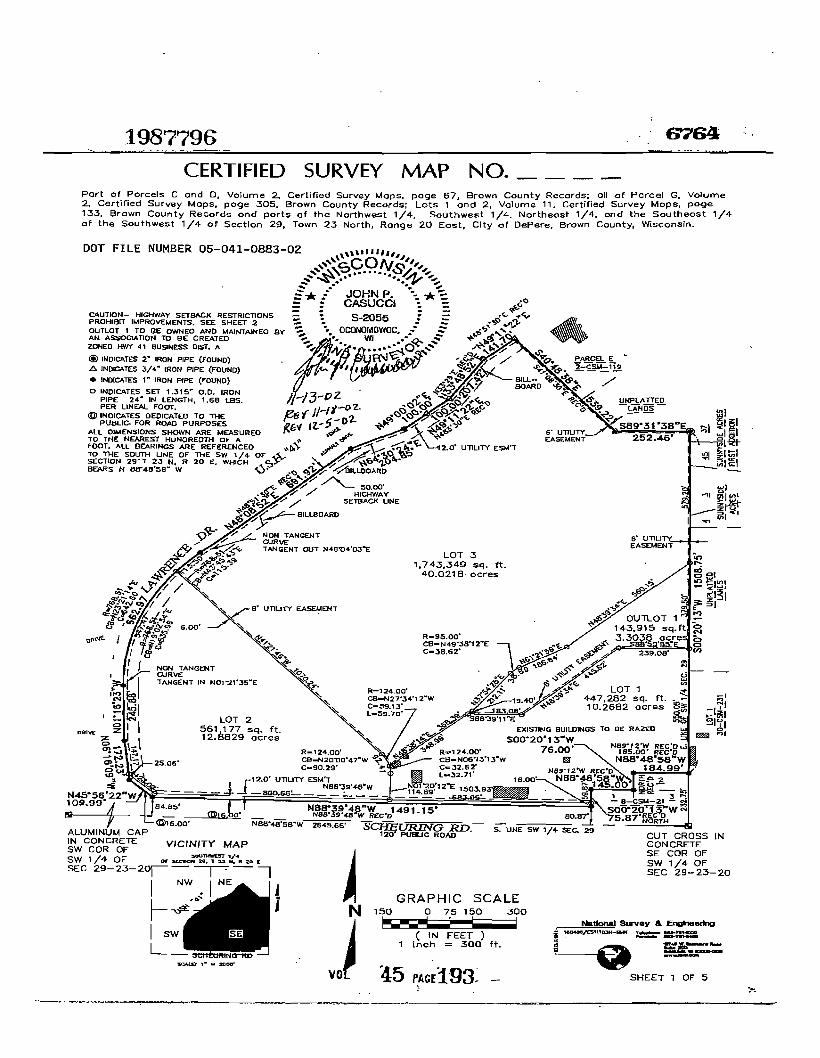
CERTIFIED SURVEY MAP NO
Part of Parcels C and D Volume 2 Certified Survey Maps page 67 Brown County Records all of Parcel G Volume 2 Certified ~urvey Maps page 305 Brown County Records Lots 1 and 2 Volume 11 Certified Survey Maps page 133 Brown County Records and parts of the Northwest 14 Southwest 14 Northeast 14 and the Southeast 14 of the Southwest 14 of Section 29 Town 23 North Range 20 East City of DePere Brown County Wisconsin
CORPORATE OWNERS CERTIFICATE (Lot 1 2 Outlot 1 amp partial Lot 3)
BOULDER VENTURE 14 LLC a limited liability company duly organized and existing under and by virtue of the laws of the Slate of Wisconsin as owner certify that aid company caused the land described On this map to the surveyed dlvldad mapped and dedicated as represented on this map
BOULDER VENTURE 14 LLC does fUrther certify that this map is requited by S23610 or 23612 to be sUbmitted to the following for epproval or objedion City OfDePere and Wisconin Department ofTransportation
WITNESS the hend and seal of BOULDER VENTIJR~~_LLC has caued these preiifjnts to ba signed by ROBERT E SCHMIDT III it Member this r 2~ day of ~t9PA 200b
STATE OF WISCONSiN
CONSENT OF CORPORATE MoRTGAGEE
MARINE BANK a corporation duly orgenized and existing under and by virtue of the laws of the Slate of Wisconsin mortgagee of the ebove-described land does hereby consent to the surveying dividing mapping and dedication ofltle land described on this plat and does hereby consent to the above certificate of BOULDER VENTURe 14 LLC owner
IN WITNESS WHEREOF the said MARINE BANK has caused these presents t be signed by bull its President and countersigned by Its Secretary at
--------------- bull and Its ccrporata seal to be hereunto affixed thl __day of ________~ 200_shy
PRESIDENT SECRETARY
STATE OFWJSCONSIN SS
_____COUNTY
PERSONALLY came before me this day of 200 the above named ---_-------__---------__~ President and Secretary of the above-named corporation to me known to be the persons who executed the foregoing In trument and to me known to e such President and Secretary of said corporation acknOWledged that they executed the foregoing instrument as such officers by its authority
Notary public State ofWisconsin My comrmsston expires _---- _ My commission is permanent
Sheet 3 of 5 Sheets
----------_~----------~-~------__--------------------------
CERTIFIED SURVEY MAP NO
Part of Parcels C and D Volume 2 certified Survey Maps page 67 Brown County Records aU of Parcel G Volume 2 Certified Survey Maps page 305 Brown County Records Lots 1 and 2 Volume 11 Certified Survey Maps page 133 Brown County Records and parts of the Northwest 14 Southwest 14 Northeast 14 and the Southeast 14 of the Southwest 14 of Section 29 Town 23 North Range 20 East City of DePere Brown County Wisconsin
CORPQRATE OWNERS CERTIFICATE (oartia Lot 3)
WAL-MART REAL ESTATE BUSINESS TRUST a Delaware~~dulY organized and existing under and by virtue of the laws of the State of Delaware as owner certifies that said trust caused the land described on this map to the surveyed dMded mapped and dedicated as represented on this map
WAL-MART REAL ESTATE BUSINESS TRUST does further certify that this map is required by S23610 or 23612 to be submitted to the following for approval or objection Clly of DePere and WiampCOnsin Department of Transportation
WITNESS the hand and seal of WAL-MART REAL ESTATE BUSINESS TRUST has caused thase presents to be signed by M4-ad e ampAlUNampfi its MMMbnt-Iiuc~ = this 1 ~~ay of )a N 80j 200
W~~S~UST Assistant Vice PresidentIt rt1-PN~tS
STATE OF HI ~ SS
eCOUNTY
PERSONALLY came before me this t day of J2Pluar(sect 2003 the above named vh IE G-APntPpound to me known to be the person who exeCuted thlt foregoing inslnJment and to me known to be such -4llu~t of said trust and acknowled at he cuted the foregoing Instrument as such officer by ~ ~uthorttymiddot ~
MENARD INC a corporetion duly organized and exis1jng under and by virtue of the laws of the State of Wisconsin as owner certify that said corporation caused the land described on this map to the surveyed divided mapped and dedicated as represented on this map
MENARD INCbullbull does further certify that this map is required by S23610 or 23612 to be submitted to the following for approval or objection City of DePere and WIsconsin Department ofTrensportetion
~A f WITNESS the hand and seal of MENARD INC nas caused these presents to be signed by Rv rROlHAS KA its V ICE PRe I D l-NT this 2L(-4~ day of bIlIIA f2t 2003
MENARO INC
STATE OF WISCONSIN EAV cLAI~ SS
S COUNTY _
ER~Olle-LLYcame before me this ltf+r day of JANVA(l1 200~~1he~ ~)feraquo_ named V t~Ov SIL to me known to be the parson who executed the foregoing iDStrbme~ndor me known to be such PEN of said corporation and acknowledged thattlN ~xeamptedtIi bull -~ _ - foregoing Instrument as such officer by its authority -r-~L A bull ~~fIi l i -l 1~ ~
~~LlIlllll I nvvV1NV~ IIV_ ~ ~SGlfJ~ I= ~ COtv II J EA_ i ~S S NotaryPubliOStateofWisconsirr-- middotmiddotmiddot-middot 1 ~o
~~middotmiddotmiddotmiddotmiddotmiddot~middotr~~ bull i ~ ~ -_ ~ ) ~olgt --f to- ampr~1fc -~ My commission is permanent bullbull ~
S 5 2055 ClCOlrotoIOW _ Sheet 4 of 5 Sheets -~bullbull WI ~ 140 rJ-O~
~ SUR II T5 100It VOl bull f PASE
1987796 CERTIFIED SURVEY MAP NO _
Part of Parcels C and D Volume 2 Certified Survey Maps page 67 Brown County Records all of Parcel G Volume 2 Certified Survey Maps page 305 Brown County Records Lots 1 and 2 Volume 11 Certified Survey Maps page 133 Brown County Records and parts of the Northwest 14 Southwest 114 Northeast 14 and the Southeast 14 of the Southwest 14 of Section 29 Town 23 North Range 20 ~ast City of DePere Brown County Wisconsin
PLANNING COMMISSION APPROVAL
SV A ~ lt bull 2003 APPROVED by the Plan Commission of the City of DePere on this _----L--=__ day of
REGIsnRS OFFIce
8mwnCOWIs ~ Received fw IOCOfIIIfle dayof ]2r-ceb AD at i ocloCk M and recooIed in Vol of Certified SurveyMaps on PCIlIlI
~41~-lt (9Ruglsklf 0Daeds
THIS INSTRUMENT WAS DRAFTED BY JOHN P CASUCCI 1604B6CSM REGISTERED LAN D SURVEYOR 8-2055 Sheet 5 of 5 Sheets
VOL 45 lAcpound197
Document Number AFFfDAVIT OF CORRECTION
Pursuant to s236295(l)(a) Wis Stats I William J Dorsey authorized Wisconsin Department of Transportation representative hereby certify that Certified Survey Map Number 6765 recorded on March 5 2003 in Volume 45 Pages 198-203 as docwnent number] 987797 and was recorded in Brown County State of Wisconsin contained the following language
Sheet 1 - 5000 Highway Setback Line Caution - Highway Setback Restrictions Prohibit Improvements SeeSheet 2 Sheet 2 - No improvements or structures are allowed between the right-ofshyway line and the highway setback line Improvements and structures include but are not limited to signs parking areasdriveways wells septic systems drainage facilities buildings and retaining walls It is expressly intended that this restriction is for the benefit ofthe public as provided in section 236293 Wisconsin Statutes and shall be enforceable by the Wisconsin Department of Transportation or its assigns
AFFIANT makes this Affidavit for the purpose of modifying the above document by removing these restrictions in their entirety
Signed
State of Wisconsin )o ) ss O(6tJQ County )
On the above date this instrument was acknowledged before me
by the nam~ officers J r l4 P V(h1 ~
(Signature Notary Public State of Wisconsin)
Curtis D Van Erem (Print or Type N~e Notary Public State of Wisconsin)
II ~~201J
This space is reserved for recording data
Return to Wisconsin Department of Transportation 944 Vanderperren Way Green Bay WI 54304 Attention Jackie Eisch
ParcelIdentification Numberfax Key Number
WD-DOO2(S WD-DOOl1-4 WD-DOOll-1 WO-DOO20 WDshy
100011-2 WOmiddotOOOl1-3 and WD-DOO11
William J Dorsey (Print Name)
(~ate ommission Expires)
This Instrument was drafted by the Wisconsin Department of Transportation Page 1 of2
Approva I Certification
(Date)
(Name of Local Government)
Approved for recording by the government identified above
(Clerk signature)
(Print or Type Name of Clerk)
This Instrument was drafted by the WIsconsin Department of Transportation Page 2 of2
67651987797 CERTIFIED SURVEY MAP NO
A Division Lot 3 Volume of5 Certified Survey Mops page Lj~ Brown County Records 011 being port of the Northwest 14 Southwest 14 Southeast 14 and the Northeast 14 of the Southwest 14 of Section 29 Town 23 North Ronge 20 East City of DePere Brown County Wisconsin
I ~I litj ~ 5
z
ili 5 w lliIlz
W
CUT CROSS IN CONCRETE SE COR OF SW 14 OF SEC 29-23-20
SHEET 1 OF 6
UNPlATTEO -LJNDs-
LOT CSM NO
ill ~ EXISTING euLDIHGS TO BE RAZED
-------~----
GRAPHIC SCALE 150 0 75 150 300
~--- I ( IN FEET )
1 inch = 300 ft
SCFffiURING RDshy S UNE SW 1 SEC iii 120 PUBUC ROAD
VOL SIA1I bullbull zooo
VICINITY MAP SCIUTHWEP 1
OFaanONZbullbull T2SNIIlZCC
I-~-I
I NwbullbullIN E
~ J
I sw I SE
L_~e--Re~
INDICATES 2 IRON PIPE (FOUND) tgt INDICATES 34 IRON PIPE (FOUND)
bull INDICATES I IRON PIPE (FOUND)
o INDICATES SET 35 00 IRON PIPE 24 IN LENGTH 168 LBS PER UNEAL FOOT
All DIIoAENSIONS SKOWN ARE MEASURED TO THE NEAREST HUNDREDTl-l OF A FOOT AlL BEARINGS ARE REFERENCED TO THE EAST UNE OF THE SW 4 OF SECTION 29 T 23 N R 20 E WHICH BEARS N 00203 E
DOT FILE NUMBER 05-041-0882-02
CERTIFIED SURVEY MAP NO __ A Division Lot 3 Volume 15 Certified Survey Mops page Ji3 Brown County Records all being port of the Northwest 14 Southwest 4 Southeast 14 ond the Northeost 14 of the Southwest 14 of Section 29 Town 23 North Ronge 20 East CIty of DePere Brown County Wisconsin
ACCESS RESTRICTION An lots and blocks ere hereby reslrlcted so that no owner possessor user licensee or other person may have any right of direct vehIcular Ingress from or egress to any highway lying within the right-of-way of USH -41lt Is expressly Intended that this restriction constitute a restrlcaon for the benefit of the public as provided In s 236293 Stats and shall be enforoaable by the department or Its assigns My access allowed by special exception shell be oonfinned and granted only through the driveway pennllting process and all permits are revocable (access to Lewrence Drive and SchelJring Road pennltted)
NOISE ABATEMENT The lots 01 this land division may experience noise at lavels exceeding the levels In s Trans 40504 Table 1 Thssa levels are based on federal standards The department of transportaUon Is not responsible for abating noise from exlsUng state trunk highways or connecting highways in Ihe absence of any Inaeasa by the department to Iha highways through-Ia capaclty
HIGHWAY SETBACK RESTRICTION No Improvemenl$ or structuras are allowed between the right-of-way line and Ihe highway setback line Improvemenl$ and structures Include but are not limited to signs parking arsas driveways wells septic systems drainage faelllUas buildings and retaining walla It la expre$$ly Intended Ihat Ihls restr1ctlon Is for the benafit 01 the public as provided In section 236293 Wisconsin Statutes and shall be enforceable by the WlSCOflsin Dapartment of TransportaUon or Its assigns
SCALEGRAPHIC 134502 sf ft 30877 acres g
OUTLOT 1 36772 sq ft 08901 acres
21875 S42OOSSE 21875
S41OZ1E 23776
t----- 12 UllUTY ES middotT
I
I
I I I 11I I 350
~
~
rJ ~ t5
rI x
I I I
1 ~
- I
~ a Cl
I shyl -c I
ampl lt
OUTLOT 2
11 50 0 25 50 100 200
Iw-~ I1 ( IN FEET ) Inch 100 ftA1
NtItIonaI ~ amp EI_-N 104aIIft=m~ L ~+
SHEET 2 OF G ~ -~
VOL 45 PACE199Cl
CERTIFIED SURVEY MAP NO __
A Division Lot 3 VolumeiJi Certified Survey Maps page 13 Brown County Records all being part of the Northwest 14 Southwest 14 Southeast 14 and the Northeast 14 of the Southwest 14 of Section 29 Town 23 North Range 20 East City of DePere Brown County Wisconsin
SUIDEYORS CERTIFICATE
STATE OF WISCONSIN SS
WAUKESHA COUNTY
I JOHN P CASUCCI Registered Land Surveyor do hereby certify
THAT I have surveyed divided and mapped a division of Lot 3 of Certified Survey Map No __ Brown County Records all being part of the Northwest 14 Southwest 14 Southeast 14 and the Northeast 14 of the Southwest 14 of Section 29 Town 23 North Range 20 East City of DePere Brown County Wisconsin
COMMENCING at the Southeast comer of said 14 Section thence North 00deg2013 East along the East line of said 14 section 116230 feet to the point of beginning of lands to be described thence South 48deg3934 West 56015 feet to a point thence South 61~156 West 18684 feet to a point thence southwesterly 3889 feet along an arc of a curve whose center lies to the southeast whose radius Is 9500 feet whose chord bears South 49deg3812 East 3862 feet to a point thence South 37deg5428 West 21211 feet to a point thence South 48deg3814 West 36839 feet to a point thence Northwesterly 5970 feet along an arc of a curve whose center lies to the Southwest whose radius is 12400 feet and whose chord bears North 27deg3412 West 5913 feet to a point thence North 41deg2146 West 107024 feet to a point in the Southeasterly right of way of Lawrence Drive thence Northeasterly 11550 feet along said right of way and an arc of a curve whose center lies to the Southeast whose radius is 76851 feet and whose chord bears North 43deg4543 East 11539 teet thence North 48deg0852 East along said line 69192 feet to a point thence North 64deg3024 East along said line 20485 feet to a point thence North 49deg0002 East along said line 10000 feet to a point thence North 49deg1122 East along said line 10000 feet to a point thence North 33deg4852 East along said line 20742 feet to a point thence North 49deg1122 East along said line 14170 feet to a point thence South 40deg4838 East 53922 feet to a point thence South 89deg3138 East 25246 feet to a point in tlie East line of said 14 sec thence South 00deg2013 West along said East line 57920 feet to the point of beginning
THAT I have made such survey land division and map by the direction of BOULDER VENTURE 14 LLC WAL-MART REAL ESTATE BUSINESS TRUST AND MENARD INC owners
THAT such map is a correct representation of all the exterior boundaries of the land surveyed and the land division thereof made
THAT I have fully complied with the provisions of Chapter 23634 of the Wisconsin Statutes and the City of DePere Land Ordinance In surveying dividing and mapping said lands 001111111
c No -~ ~~ ~ -11 ~
E JOHN P bullbull ~ bull - CASUCCI bull shy
~ ~ ~lh j shyts ZoOz N P CASUCCI OCONOMGWOC bullbull
GISTERED LAND SURV~~~55wr bullbull middotmiddot0middotR-~ ~Y rrD ~ 1 SURll -
rlU1
Sheet 3 of 6 Sheets
VOL 45 PASE200
CERTIFIED SURVEY MAP NO __
A Division Lot 3 Volume ~ Certified Survey Maps page r-3 Brown County Records all being part of the Northwest 14 Southwest 14 Southeast 14 and the Northeast 14 of the Southwest 14 of Section 29 Town 23 North Range 20 East City of DePere Brown County Wisconsin
CORPORATE OWNERS CERTIFICATE (Outlot 1 and 2)
BOULDER VENTURE 14 LLC a limited liability company dUly organized and existing under and by virtue of the laws of the State of Wisconsin as owner certify that said company caused the land described on this map to the surveyed divided and mapped as represented on this map
BOULDER VENTURE 14 LLC does further certify that this map is required by S2361 0 or 23612 to be submitted to the following for approval or objection City of DePere and Wisconsin Department of Transportation
WITNESS the hand and seal of BOULDER VENTURE 14 LLC has caused these presents to ~ signed by ROBERT E SCHMIDT III Its Member this 13fk day of ~bCC 200laquo=
B~LC
ROBERT E SCHMIDT III MEMBER
STATE OF WiSCONSIN ss
MILWAUKEE COUNTY
PERSONALLY came before me this ~ gK day of ~ 204 the above named ROBERT E SCHMIDT Ill to me known to be the person who executed the foregoing instrument and to me known to be such Member of said company and acknowledged that he executed the foregoing instrument as such officer by its authority
11 cCONn ~ bullbullbull oz$ ~--bullbullbull -middotv ~
JOHN P - - ~ I bull -CASUCCJ bull 5-2055 S ~ OOONOMOWOC - ~
~~~d~~~~~~ ~ 7~~-Y-degl-Sheet 4 of 6 Sheets
VOl 45 PAC201
CERTIFIED SURVEY MAP NO
A Division Lot 3 Volumel Certified Survey Maps page I B Brown County Records all being part of the Northwest 14 Southwest 14 Southeast 14 and the Northeast 14 of the Southwest 14 of Section 29 Town 23 North Range 20 East City of DePere Brown County Wisconsin
CORPORATE OWNERS CERTIFCATEt~tt2)
WA~-MARTREAL ESTATE BUSINESS TRUST a DelawarefiBs~ulyorganioed and eXisting under and by virtue of the laws of the State of Delaware as owner certifies that said trust caused the land described on his map to the surveyed divided and mapped as represented on this map
WAL-MART REAL ESTATE BUSINESS TRUST does further certify that this map is required by S23610 or 23612 to be submitted to the followtng for approval or ObJection City of DePere and Wisconsin Department of Transportation
WITNESS the hand and seal ofWAL-MARTREAL ESTATE BUSINESS TRUST has C8tyened these presents ~beSjgnedbY MdtaelE lia~ itsJtJS$bnt-Vvlt-fht~T this r~ day of
-~ zoo W~T
11tel-M1 e Ato me known to be the person who executed the foregoing instrument and to me
55tS an STATE OFWA-N5~~ ~ SS ~ECOUNTY
PERSONALLY came before me this r~ day of Jnu0rt4 2003 the above named tJAp~
known to be such _ v amp_Id of said trust and acknowl e th oragolng Inslnlment as such officer by Its authority
OFFICIAL6EAL ROBiN M leMEUR
NOTARY PUBUC-A1UCANSA8 bull BaiTOH COUNtY
M-CQmmIAlan Exwea MAY
MENARD INC a corporation duly organized and existing under and by virtue of the laws of the Stata of Wisconsin as owner certify that said corporauon caused the land described on this map to the surveyed divided and mapped as represented on this map
MENARD INC does further certify that this map is required by S23610 or 23612 to be submitted to the following for approval Of objection City of DePere and Wisconsin Department of Transportation
SS the hand and seal ofMENARQ INC llas caused tnese presents to be s9id by ()C ASKA its LIe- PIlE()(N-r this 2~ day
of-lo-uuLlltJO=7- ~ 2003
STATE OF WISCONSIN
MILWAUKEE COUNTY
JOHN P CASUCCI
S-2055 _ bull OGO(lOMOWO
~ lt -laquo - ~ 9JID aide- - SU
IllS
VOL 45 Aamppound202
1987797 CERTIFIED SURVEY MAP NO _
A DIvIsion Lot 3 Volume Certified Survey Maps page I q3 Brown County Records all being part of the Northwest 14 Southwest 14 Southeast 14 and the Northeast 14 of the Southwest 14 of Section 29 Town 23 North Range 20 East City of DePere Brown ~ounty Wisconsin
PLANNING COMMISSiON APPROVAL
APPROV1=D by the Plan Commission of the City of DePere on this 2gt camp day of ttocr~ 2005
-
lilli cCONc-~ bullbullbullbullbull umiddotyen
~~ bullbull r bull r~$ Ia- ~
JOHN P bullbull -= CASUCCI 8-2055 = ~ oca~NOMO~lF1 oIA~ ~ Wl E~ - shy
-e- --1110 bullbullbullbullbull ~ SU I I-I) -oz
lUI
THIS INSTRUMENT WAS DRAFTED BY JOHN P CASUCCI 160486CSM2 REGISTERED LAND SURVEYOR S-2055 Sheet 6 of 6 Sheets
VOL 45 PAGE203
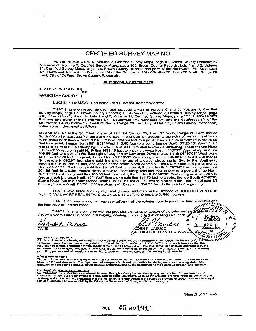
CERTIFIED SURVEY MAP NO
Part of Parcels C and D Volume 2 certified Survey Maps page 67 Brown County Records aU of Parcel G Volume 2 Certified Survey Maps page 305 Brown County Records Lots 1 and 2 Volume 11 Certified Survey Maps page 133 Brown County Records and parts of the Northwest 14 Southwest 14 Northeast 14 and the Southeast 14 of the Southwest 14 of Section 29 Town 23 North Range 20 East City of DePere Brown County Wisconsin
CORPQRATE OWNERS CERTIFICATE (oartia Lot 3)
WAL-MART REAL ESTATE BUSINESS TRUST a Delaware~~dulY organized and existing under and by virtue of the laws of the State of Delaware as owner certifies that said trust caused the land described on this map to the surveyed dMded mapped and dedicated as represented on this map
WAL-MART REAL ESTATE BUSINESS TRUST does further certify that this map is required by S23610 or 23612 to be submitted to the following for approval or objection Clly of DePere and WiampCOnsin Department of Transportation
WITNESS the hand and seal of WAL-MART REAL ESTATE BUSINESS TRUST has caused thase presents to be signed by M4-ad e ampAlUNampfi its MMMbnt-Iiuc~ = this 1 ~~ay of )a N 80j 200
W~~S~UST Assistant Vice PresidentIt rt1-PN~tS
STATE OF HI ~ SS
eCOUNTY
PERSONALLY came before me this t day of J2Pluar(sect 2003 the above named vh IE G-APntPpound to me known to be the person who exeCuted thlt foregoing inslnJment and to me known to be such -4llu~t of said trust and acknowled at he cuted the foregoing Instrument as such officer by ~ ~uthorttymiddot ~
MENARD INC a corporetion duly organized and exis1jng under and by virtue of the laws of the State of Wisconsin as owner certify that said corporation caused the land described on this map to the surveyed divided mapped and dedicated as represented on this map
MENARD INCbullbull does further certify that this map is required by S23610 or 23612 to be submitted to the following for approval or objection City of DePere and WIsconsin Department ofTrensportetion
~A f WITNESS the hand and seal of MENARD INC nas caused these presents to be signed by Rv rROlHAS KA its V ICE PRe I D l-NT this 2L(-4~ day of bIlIIA f2t 2003
MENARO INC
STATE OF WISCONSIN EAV cLAI~ SS
S COUNTY _
ER~Olle-LLYcame before me this ltf+r day of JANVA(l1 200~~1he~ ~)feraquo_ named V t~Ov SIL to me known to be the parson who executed the foregoing iDStrbme~ndor me known to be such PEN of said corporation and acknowledged thattlN ~xeamptedtIi bull -~ _ - foregoing Instrument as such officer by its authority -r-~L A bull ~~fIi l i -l 1~ ~
~~LlIlllll I nvvV1NV~ IIV_ ~ ~SGlfJ~ I= ~ COtv II J EA_ i ~S S NotaryPubliOStateofWisconsirr-- middotmiddotmiddot-middot 1 ~o
~~middotmiddotmiddotmiddotmiddotmiddot~middotr~~ bull i ~ ~ -_ ~ ) ~olgt --f to- ampr~1fc -~ My commission is permanent bullbull ~
S 5 2055 ClCOlrotoIOW _ Sheet 4 of 5 Sheets -~bullbull WI ~ 140 rJ-O~
~ SUR II T5 100It VOl bull f PASE
1987796 CERTIFIED SURVEY MAP NO _
Part of Parcels C and D Volume 2 Certified Survey Maps page 67 Brown County Records all of Parcel G Volume 2 Certified Survey Maps page 305 Brown County Records Lots 1 and 2 Volume 11 Certified Survey Maps page 133 Brown County Records and parts of the Northwest 14 Southwest 114 Northeast 14 and the Southeast 14 of the Southwest 14 of Section 29 Town 23 North Range 20 ~ast City of DePere Brown County Wisconsin
PLANNING COMMISSION APPROVAL
SV A ~ lt bull 2003 APPROVED by the Plan Commission of the City of DePere on this _----L--=__ day of
REGIsnRS OFFIce
8mwnCOWIs ~ Received fw IOCOfIIIfle dayof ]2r-ceb AD at i ocloCk M and recooIed in Vol of Certified SurveyMaps on PCIlIlI
~41~-lt (9Ruglsklf 0Daeds
THIS INSTRUMENT WAS DRAFTED BY JOHN P CASUCCI 1604B6CSM REGISTERED LAN D SURVEYOR 8-2055 Sheet 5 of 5 Sheets
VOL 45 lAcpound197
Document Number AFFfDAVIT OF CORRECTION
Pursuant to s236295(l)(a) Wis Stats I William J Dorsey authorized Wisconsin Department of Transportation representative hereby certify that Certified Survey Map Number 6765 recorded on March 5 2003 in Volume 45 Pages 198-203 as docwnent number] 987797 and was recorded in Brown County State of Wisconsin contained the following language
Sheet 1 - 5000 Highway Setback Line Caution - Highway Setback Restrictions Prohibit Improvements SeeSheet 2 Sheet 2 - No improvements or structures are allowed between the right-ofshyway line and the highway setback line Improvements and structures include but are not limited to signs parking areasdriveways wells septic systems drainage facilities buildings and retaining walls It is expressly intended that this restriction is for the benefit ofthe public as provided in section 236293 Wisconsin Statutes and shall be enforceable by the Wisconsin Department of Transportation or its assigns
AFFIANT makes this Affidavit for the purpose of modifying the above document by removing these restrictions in their entirety
Signed
State of Wisconsin )o ) ss O(6tJQ County )
On the above date this instrument was acknowledged before me
by the nam~ officers J r l4 P V(h1 ~
(Signature Notary Public State of Wisconsin)
Curtis D Van Erem (Print or Type N~e Notary Public State of Wisconsin)
II ~~201J
This space is reserved for recording data
Return to Wisconsin Department of Transportation 944 Vanderperren Way Green Bay WI 54304 Attention Jackie Eisch
ParcelIdentification Numberfax Key Number
WD-DOO2(S WD-DOOl1-4 WD-DOOll-1 WO-DOO20 WDshy
100011-2 WOmiddotOOOl1-3 and WD-DOO11
William J Dorsey (Print Name)
(~ate ommission Expires)
This Instrument was drafted by the Wisconsin Department of Transportation Page 1 of2
Approva I Certification
(Date)
(Name of Local Government)
Approved for recording by the government identified above
(Clerk signature)
(Print or Type Name of Clerk)
This Instrument was drafted by the WIsconsin Department of Transportation Page 2 of2
67651987797 CERTIFIED SURVEY MAP NO
A Division Lot 3 Volume of5 Certified Survey Mops page Lj~ Brown County Records 011 being port of the Northwest 14 Southwest 14 Southeast 14 and the Northeast 14 of the Southwest 14 of Section 29 Town 23 North Ronge 20 East City of DePere Brown County Wisconsin
I ~I litj ~ 5
z
ili 5 w lliIlz
W
CUT CROSS IN CONCRETE SE COR OF SW 14 OF SEC 29-23-20
SHEET 1 OF 6
UNPlATTEO -LJNDs-
LOT CSM NO
ill ~ EXISTING euLDIHGS TO BE RAZED
-------~----
GRAPHIC SCALE 150 0 75 150 300
~--- I ( IN FEET )
1 inch = 300 ft
SCFffiURING RDshy S UNE SW 1 SEC iii 120 PUBUC ROAD
VOL SIA1I bullbull zooo
VICINITY MAP SCIUTHWEP 1
OFaanONZbullbull T2SNIIlZCC
I-~-I
I NwbullbullIN E
~ J
I sw I SE
L_~e--Re~
INDICATES 2 IRON PIPE (FOUND) tgt INDICATES 34 IRON PIPE (FOUND)
bull INDICATES I IRON PIPE (FOUND)
o INDICATES SET 35 00 IRON PIPE 24 IN LENGTH 168 LBS PER UNEAL FOOT
All DIIoAENSIONS SKOWN ARE MEASURED TO THE NEAREST HUNDREDTl-l OF A FOOT AlL BEARINGS ARE REFERENCED TO THE EAST UNE OF THE SW 4 OF SECTION 29 T 23 N R 20 E WHICH BEARS N 00203 E
DOT FILE NUMBER 05-041-0882-02
CERTIFIED SURVEY MAP NO __ A Division Lot 3 Volume 15 Certified Survey Mops page Ji3 Brown County Records all being port of the Northwest 14 Southwest 4 Southeast 14 ond the Northeost 14 of the Southwest 14 of Section 29 Town 23 North Ronge 20 East CIty of DePere Brown County Wisconsin
ACCESS RESTRICTION An lots and blocks ere hereby reslrlcted so that no owner possessor user licensee or other person may have any right of direct vehIcular Ingress from or egress to any highway lying within the right-of-way of USH -41lt Is expressly Intended that this restriction constitute a restrlcaon for the benefit of the public as provided In s 236293 Stats and shall be enforoaable by the department or Its assigns My access allowed by special exception shell be oonfinned and granted only through the driveway pennllting process and all permits are revocable (access to Lewrence Drive and SchelJring Road pennltted)
NOISE ABATEMENT The lots 01 this land division may experience noise at lavels exceeding the levels In s Trans 40504 Table 1 Thssa levels are based on federal standards The department of transportaUon Is not responsible for abating noise from exlsUng state trunk highways or connecting highways in Ihe absence of any Inaeasa by the department to Iha highways through-Ia capaclty
HIGHWAY SETBACK RESTRICTION No Improvemenl$ or structuras are allowed between the right-of-way line and Ihe highway setback line Improvemenl$ and structures Include but are not limited to signs parking arsas driveways wells septic systems drainage faelllUas buildings and retaining walla It la expre$$ly Intended Ihat Ihls restr1ctlon Is for the benafit 01 the public as provided In section 236293 Wisconsin Statutes and shall be enforceable by the WlSCOflsin Dapartment of TransportaUon or Its assigns
SCALEGRAPHIC 134502 sf ft 30877 acres g
OUTLOT 1 36772 sq ft 08901 acres
21875 S42OOSSE 21875
S41OZ1E 23776
t----- 12 UllUTY ES middotT
I
I
I I I 11I I 350
~
~
rJ ~ t5
rI x
I I I
1 ~
- I
~ a Cl
I shyl -c I
ampl lt
OUTLOT 2
11 50 0 25 50 100 200
Iw-~ I1 ( IN FEET ) Inch 100 ftA1
NtItIonaI ~ amp EI_-N 104aIIft=m~ L ~+
SHEET 2 OF G ~ -~
VOL 45 PACE199Cl
CERTIFIED SURVEY MAP NO __
A Division Lot 3 VolumeiJi Certified Survey Maps page 13 Brown County Records all being part of the Northwest 14 Southwest 14 Southeast 14 and the Northeast 14 of the Southwest 14 of Section 29 Town 23 North Range 20 East City of DePere Brown County Wisconsin
SUIDEYORS CERTIFICATE
STATE OF WISCONSIN SS
WAUKESHA COUNTY
I JOHN P CASUCCI Registered Land Surveyor do hereby certify
THAT I have surveyed divided and mapped a division of Lot 3 of Certified Survey Map No __ Brown County Records all being part of the Northwest 14 Southwest 14 Southeast 14 and the Northeast 14 of the Southwest 14 of Section 29 Town 23 North Range 20 East City of DePere Brown County Wisconsin
COMMENCING at the Southeast comer of said 14 Section thence North 00deg2013 East along the East line of said 14 section 116230 feet to the point of beginning of lands to be described thence South 48deg3934 West 56015 feet to a point thence South 61~156 West 18684 feet to a point thence southwesterly 3889 feet along an arc of a curve whose center lies to the southeast whose radius Is 9500 feet whose chord bears South 49deg3812 East 3862 feet to a point thence South 37deg5428 West 21211 feet to a point thence South 48deg3814 West 36839 feet to a point thence Northwesterly 5970 feet along an arc of a curve whose center lies to the Southwest whose radius is 12400 feet and whose chord bears North 27deg3412 West 5913 feet to a point thence North 41deg2146 West 107024 feet to a point in the Southeasterly right of way of Lawrence Drive thence Northeasterly 11550 feet along said right of way and an arc of a curve whose center lies to the Southeast whose radius is 76851 feet and whose chord bears North 43deg4543 East 11539 teet thence North 48deg0852 East along said line 69192 feet to a point thence North 64deg3024 East along said line 20485 feet to a point thence North 49deg0002 East along said line 10000 feet to a point thence North 49deg1122 East along said line 10000 feet to a point thence North 33deg4852 East along said line 20742 feet to a point thence North 49deg1122 East along said line 14170 feet to a point thence South 40deg4838 East 53922 feet to a point thence South 89deg3138 East 25246 feet to a point in tlie East line of said 14 sec thence South 00deg2013 West along said East line 57920 feet to the point of beginning
THAT I have made such survey land division and map by the direction of BOULDER VENTURE 14 LLC WAL-MART REAL ESTATE BUSINESS TRUST AND MENARD INC owners
THAT such map is a correct representation of all the exterior boundaries of the land surveyed and the land division thereof made
THAT I have fully complied with the provisions of Chapter 23634 of the Wisconsin Statutes and the City of DePere Land Ordinance In surveying dividing and mapping said lands 001111111
c No -~ ~~ ~ -11 ~
E JOHN P bullbull ~ bull - CASUCCI bull shy
~ ~ ~lh j shyts ZoOz N P CASUCCI OCONOMGWOC bullbull
GISTERED LAND SURV~~~55wr bullbull middotmiddot0middotR-~ ~Y rrD ~ 1 SURll -
rlU1
Sheet 3 of 6 Sheets
VOL 45 PASE200
CERTIFIED SURVEY MAP NO __
A Division Lot 3 Volume ~ Certified Survey Maps page r-3 Brown County Records all being part of the Northwest 14 Southwest 14 Southeast 14 and the Northeast 14 of the Southwest 14 of Section 29 Town 23 North Range 20 East City of DePere Brown County Wisconsin
CORPORATE OWNERS CERTIFICATE (Outlot 1 and 2)
BOULDER VENTURE 14 LLC a limited liability company dUly organized and existing under and by virtue of the laws of the State of Wisconsin as owner certify that said company caused the land described on this map to the surveyed divided and mapped as represented on this map
BOULDER VENTURE 14 LLC does further certify that this map is required by S2361 0 or 23612 to be submitted to the following for approval or objection City of DePere and Wisconsin Department of Transportation
WITNESS the hand and seal of BOULDER VENTURE 14 LLC has caused these presents to ~ signed by ROBERT E SCHMIDT III Its Member this 13fk day of ~bCC 200laquo=
B~LC
ROBERT E SCHMIDT III MEMBER
STATE OF WiSCONSIN ss
MILWAUKEE COUNTY
PERSONALLY came before me this ~ gK day of ~ 204 the above named ROBERT E SCHMIDT Ill to me known to be the person who executed the foregoing instrument and to me known to be such Member of said company and acknowledged that he executed the foregoing instrument as such officer by its authority
11 cCONn ~ bullbullbull oz$ ~--bullbullbull -middotv ~
JOHN P - - ~ I bull -CASUCCJ bull 5-2055 S ~ OOONOMOWOC - ~
~~~d~~~~~~ ~ 7~~-Y-degl-Sheet 4 of 6 Sheets
VOl 45 PAC201
CERTIFIED SURVEY MAP NO
A Division Lot 3 Volumel Certified Survey Maps page I B Brown County Records all being part of the Northwest 14 Southwest 14 Southeast 14 and the Northeast 14 of the Southwest 14 of Section 29 Town 23 North Range 20 East City of DePere Brown County Wisconsin
CORPORATE OWNERS CERTIFCATEt~tt2)
WA~-MARTREAL ESTATE BUSINESS TRUST a DelawarefiBs~ulyorganioed and eXisting under and by virtue of the laws of the State of Delaware as owner certifies that said trust caused the land described on his map to the surveyed divided and mapped as represented on this map
WAL-MART REAL ESTATE BUSINESS TRUST does further certify that this map is required by S23610 or 23612 to be submitted to the followtng for approval or ObJection City of DePere and Wisconsin Department of Transportation
WITNESS the hand and seal ofWAL-MARTREAL ESTATE BUSINESS TRUST has C8tyened these presents ~beSjgnedbY MdtaelE lia~ itsJtJS$bnt-Vvlt-fht~T this r~ day of
-~ zoo W~T
11tel-M1 e Ato me known to be the person who executed the foregoing instrument and to me
55tS an STATE OFWA-N5~~ ~ SS ~ECOUNTY
PERSONALLY came before me this r~ day of Jnu0rt4 2003 the above named tJAp~
known to be such _ v amp_Id of said trust and acknowl e th oragolng Inslnlment as such officer by Its authority
OFFICIAL6EAL ROBiN M leMEUR
NOTARY PUBUC-A1UCANSA8 bull BaiTOH COUNtY
M-CQmmIAlan Exwea MAY
MENARD INC a corporation duly organized and existing under and by virtue of the laws of the Stata of Wisconsin as owner certify that said corporauon caused the land described on this map to the surveyed divided and mapped as represented on this map
MENARD INC does further certify that this map is required by S23610 or 23612 to be submitted to the following for approval Of objection City of DePere and Wisconsin Department of Transportation
SS the hand and seal ofMENARQ INC llas caused tnese presents to be s9id by ()C ASKA its LIe- PIlE()(N-r this 2~ day
of-lo-uuLlltJO=7- ~ 2003
STATE OF WISCONSIN
MILWAUKEE COUNTY
JOHN P CASUCCI
S-2055 _ bull OGO(lOMOWO
~ lt -laquo - ~ 9JID aide- - SU
IllS
VOL 45 Aamppound202
1987797 CERTIFIED SURVEY MAP NO _
A DIvIsion Lot 3 Volume Certified Survey Maps page I q3 Brown County Records all being part of the Northwest 14 Southwest 14 Southeast 14 and the Northeast 14 of the Southwest 14 of Section 29 Town 23 North Range 20 East City of DePere Brown ~ounty Wisconsin
PLANNING COMMISSiON APPROVAL
APPROV1=D by the Plan Commission of the City of DePere on this 2gt camp day of ttocr~ 2005
-
lilli cCONc-~ bullbullbullbullbull umiddotyen
~~ bullbull r bull r~$ Ia- ~
JOHN P bullbull -= CASUCCI 8-2055 = ~ oca~NOMO~lF1 oIA~ ~ Wl E~ - shy
-e- --1110 bullbullbullbullbull ~ SU I I-I) -oz
lUI
THIS INSTRUMENT WAS DRAFTED BY JOHN P CASUCCI 160486CSM2 REGISTERED LAND SURVEYOR S-2055 Sheet 6 of 6 Sheets
VOL 45 PAGE203
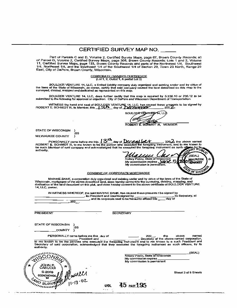
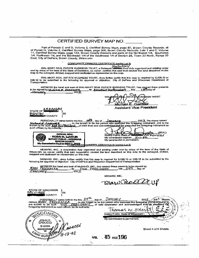
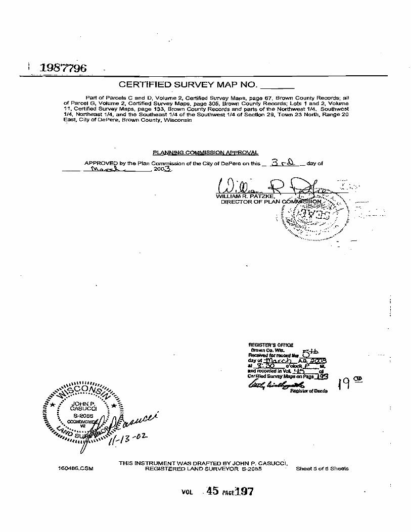
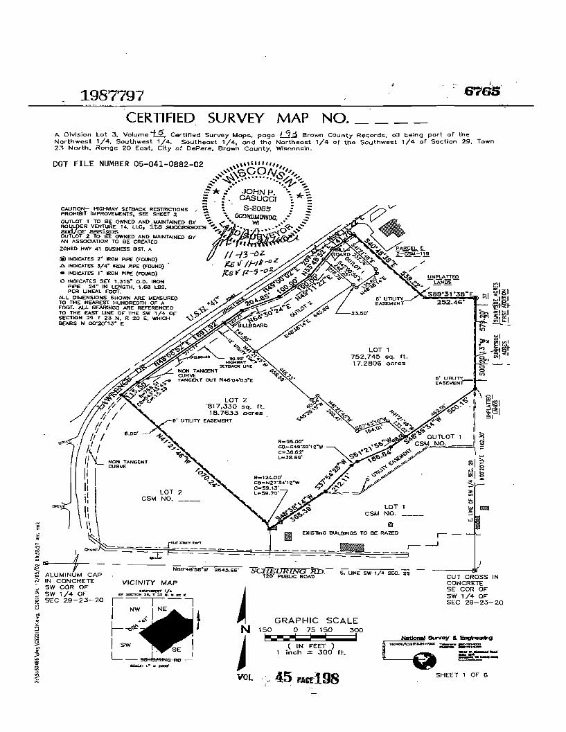
CERTIFIED SURVEY MAP NO __
A Division Lot 3 VolumeiJi Certified Survey Maps page 13 Brown County Records all being part of the Northwest 14 Southwest 14 Southeast 14 and the Northeast 14 of the Southwest 14 of Section 29 Town 23 North Range 20 East City of DePere Brown County Wisconsin
SUIDEYORS CERTIFICATE
STATE OF WISCONSIN SS
WAUKESHA COUNTY
I JOHN P CASUCCI Registered Land Surveyor do hereby certify
THAT I have surveyed divided and mapped a division of Lot 3 of Certified Survey Map No __ Brown County Records all being part of the Northwest 14 Southwest 14 Southeast 14 and the Northeast 14 of the Southwest 14 of Section 29 Town 23 North Range 20 East City of DePere Brown County Wisconsin
COMMENCING at the Southeast comer of said 14 Section thence North 00deg2013 East along the East line of said 14 section 116230 feet to the point of beginning of lands to be described thence South 48deg3934 West 56015 feet to a point thence South 61~156 West 18684 feet to a point thence southwesterly 3889 feet along an arc of a curve whose center lies to the southeast whose radius Is 9500 feet whose chord bears South 49deg3812 East 3862 feet to a point thence South 37deg5428 West 21211 feet to a point thence South 48deg3814 West 36839 feet to a point thence Northwesterly 5970 feet along an arc of a curve whose center lies to the Southwest whose radius is 12400 feet and whose chord bears North 27deg3412 West 5913 feet to a point thence North 41deg2146 West 107024 feet to a point in the Southeasterly right of way of Lawrence Drive thence Northeasterly 11550 feet along said right of way and an arc of a curve whose center lies to the Southeast whose radius is 76851 feet and whose chord bears North 43deg4543 East 11539 teet thence North 48deg0852 East along said line 69192 feet to a point thence North 64deg3024 East along said line 20485 feet to a point thence North 49deg0002 East along said line 10000 feet to a point thence North 49deg1122 East along said line 10000 feet to a point thence North 33deg4852 East along said line 20742 feet to a point thence North 49deg1122 East along said line 14170 feet to a point thence South 40deg4838 East 53922 feet to a point thence South 89deg3138 East 25246 feet to a point in tlie East line of said 14 sec thence South 00deg2013 West along said East line 57920 feet to the point of beginning
THAT I have made such survey land division and map by the direction of BOULDER VENTURE 14 LLC WAL-MART REAL ESTATE BUSINESS TRUST AND MENARD INC owners
THAT such map is a correct representation of all the exterior boundaries of the land surveyed and the land division thereof made
THAT I have fully complied with the provisions of Chapter 23634 of the Wisconsin Statutes and the City of DePere Land Ordinance In surveying dividing and mapping said lands 001111111
c No -~ ~~ ~ -11 ~
E JOHN P bullbull ~ bull - CASUCCI bull shy
~ ~ ~lh j shyts ZoOz N P CASUCCI OCONOMGWOC bullbull
GISTERED LAND SURV~~~55wr bullbull middotmiddot0middotR-~ ~Y rrD ~ 1 SURll -
rlU1
Sheet 3 of 6 Sheets
VOL 45 PASE200
CERTIFIED SURVEY MAP NO __
A Division Lot 3 Volume ~ Certified Survey Maps page r-3 Brown County Records all being part of the Northwest 14 Southwest 14 Southeast 14 and the Northeast 14 of the Southwest 14 of Section 29 Town 23 North Range 20 East City of DePere Brown County Wisconsin
CORPORATE OWNERS CERTIFICATE (Outlot 1 and 2)
BOULDER VENTURE 14 LLC a limited liability company dUly organized and existing under and by virtue of the laws of the State of Wisconsin as owner certify that said company caused the land described on this map to the surveyed divided and mapped as represented on this map
BOULDER VENTURE 14 LLC does further certify that this map is required by S2361 0 or 23612 to be submitted to the following for approval or objection City of DePere and Wisconsin Department of Transportation
WITNESS the hand and seal of BOULDER VENTURE 14 LLC has caused these presents to ~ signed by ROBERT E SCHMIDT III Its Member this 13fk day of ~bCC 200laquo=
B~LC
ROBERT E SCHMIDT III MEMBER
STATE OF WiSCONSIN ss
MILWAUKEE COUNTY
PERSONALLY came before me this ~ gK day of ~ 204 the above named ROBERT E SCHMIDT Ill to me known to be the person who executed the foregoing instrument and to me known to be such Member of said company and acknowledged that he executed the foregoing instrument as such officer by its authority
11 cCONn ~ bullbullbull oz$ ~--bullbullbull -middotv ~
JOHN P - - ~ I bull -CASUCCJ bull 5-2055 S ~ OOONOMOWOC - ~
~~~d~~~~~~ ~ 7~~-Y-degl-Sheet 4 of 6 Sheets
VOl 45 PAC201
CERTIFIED SURVEY MAP NO
A Division Lot 3 Volumel Certified Survey Maps page I B Brown County Records all being part of the Northwest 14 Southwest 14 Southeast 14 and the Northeast 14 of the Southwest 14 of Section 29 Town 23 North Range 20 East City of DePere Brown County Wisconsin
CORPORATE OWNERS CERTIFCATEt~tt2)
WA~-MARTREAL ESTATE BUSINESS TRUST a DelawarefiBs~ulyorganioed and eXisting under and by virtue of the laws of the State of Delaware as owner certifies that said trust caused the land described on his map to the surveyed divided and mapped as represented on this map
WAL-MART REAL ESTATE BUSINESS TRUST does further certify that this map is required by S23610 or 23612 to be submitted to the followtng for approval or ObJection City of DePere and Wisconsin Department of Transportation
WITNESS the hand and seal ofWAL-MARTREAL ESTATE BUSINESS TRUST has C8tyened these presents ~beSjgnedbY MdtaelE lia~ itsJtJS$bnt-Vvlt-fht~T this r~ day of
-~ zoo W~T
11tel-M1 e Ato me known to be the person who executed the foregoing instrument and to me
55tS an STATE OFWA-N5~~ ~ SS ~ECOUNTY
PERSONALLY came before me this r~ day of Jnu0rt4 2003 the above named tJAp~
known to be such _ v amp_Id of said trust and acknowl e th oragolng Inslnlment as such officer by Its authority
OFFICIAL6EAL ROBiN M leMEUR
NOTARY PUBUC-A1UCANSA8 bull BaiTOH COUNtY
M-CQmmIAlan Exwea MAY
MENARD INC a corporation duly organized and existing under and by virtue of the laws of the Stata of Wisconsin as owner certify that said corporauon caused the land described on this map to the surveyed divided and mapped as represented on this map
MENARD INC does further certify that this map is required by S23610 or 23612 to be submitted to the following for approval Of objection City of DePere and Wisconsin Department of Transportation
SS the hand and seal ofMENARQ INC llas caused tnese presents to be s9id by ()C ASKA its LIe- PIlE()(N-r this 2~ day
of-lo-uuLlltJO=7- ~ 2003
STATE OF WISCONSIN
MILWAUKEE COUNTY
JOHN P CASUCCI
S-2055 _ bull OGO(lOMOWO
~ lt -laquo - ~ 9JID aide- - SU
IllS
VOL 45 Aamppound202
1987797 CERTIFIED SURVEY MAP NO _
A DIvIsion Lot 3 Volume Certified Survey Maps page I q3 Brown County Records all being part of the Northwest 14 Southwest 14 Southeast 14 and the Northeast 14 of the Southwest 14 of Section 29 Town 23 North Range 20 East City of DePere Brown ~ounty Wisconsin
PLANNING COMMISSiON APPROVAL
APPROV1=D by the Plan Commission of the City of DePere on this 2gt camp day of ttocr~ 2005
-
lilli cCONc-~ bullbullbullbullbull umiddotyen
~~ bullbull r bull r~$ Ia- ~
JOHN P bullbull -= CASUCCI 8-2055 = ~ oca~NOMO~lF1 oIA~ ~ Wl E~ - shy
-e- --1110 bullbullbullbullbull ~ SU I I-I) -oz
lUI
THIS INSTRUMENT WAS DRAFTED BY JOHN P CASUCCI 160486CSM2 REGISTERED LAND SURVEYOR S-2055 Sheet 6 of 6 Sheets
VOL 45 PAGE203
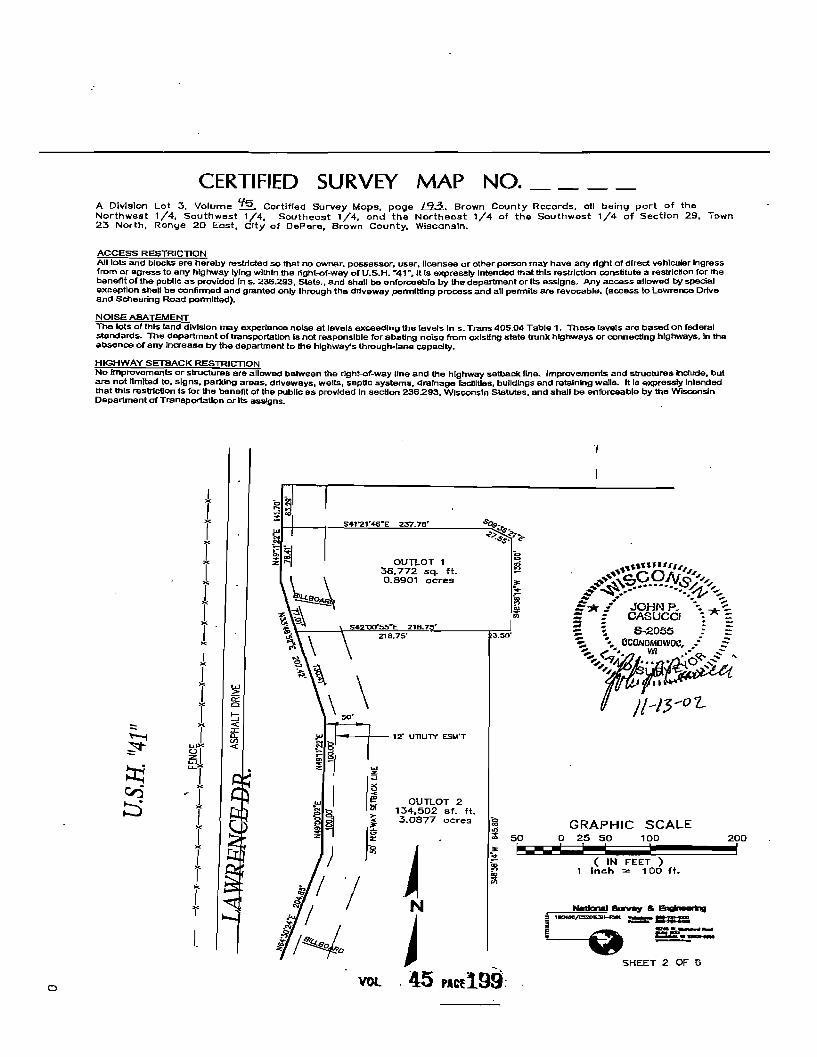
CERTIFIED SURVEY MAP NO __
A Division Lot 3 Volume ~ Certified Survey Maps page r-3 Brown County Records all being part of the Northwest 14 Southwest 14 Southeast 14 and the Northeast 14 of the Southwest 14 of Section 29 Town 23 North Range 20 East City of DePere Brown County Wisconsin
CORPORATE OWNERS CERTIFICATE (Outlot 1 and 2)
BOULDER VENTURE 14 LLC a limited liability company dUly organized and existing under and by virtue of the laws of the State of Wisconsin as owner certify that said company caused the land described on this map to the surveyed divided and mapped as represented on this map
BOULDER VENTURE 14 LLC does further certify that this map is required by S2361 0 or 23612 to be submitted to the following for approval or objection City of DePere and Wisconsin Department of Transportation
WITNESS the hand and seal of BOULDER VENTURE 14 LLC has caused these presents to ~ signed by ROBERT E SCHMIDT III Its Member this 13fk day of ~bCC 200laquo=
B~LC
ROBERT E SCHMIDT III MEMBER
STATE OF WiSCONSIN ss
MILWAUKEE COUNTY
PERSONALLY came before me this ~ gK day of ~ 204 the above named ROBERT E SCHMIDT Ill to me known to be the person who executed the foregoing instrument and to me known to be such Member of said company and acknowledged that he executed the foregoing instrument as such officer by its authority
11 cCONn ~ bullbullbull oz$ ~--bullbullbull -middotv ~
JOHN P - - ~ I bull -CASUCCJ bull 5-2055 S ~ OOONOMOWOC - ~
~~~d~~~~~~ ~ 7~~-Y-degl-Sheet 4 of 6 Sheets
VOl 45 PAC201
CERTIFIED SURVEY MAP NO
A Division Lot 3 Volumel Certified Survey Maps page I B Brown County Records all being part of the Northwest 14 Southwest 14 Southeast 14 and the Northeast 14 of the Southwest 14 of Section 29 Town 23 North Range 20 East City of DePere Brown County Wisconsin
CORPORATE OWNERS CERTIFCATEt~tt2)
WA~-MARTREAL ESTATE BUSINESS TRUST a DelawarefiBs~ulyorganioed and eXisting under and by virtue of the laws of the State of Delaware as owner certifies that said trust caused the land described on his map to the surveyed divided and mapped as represented on this map
WAL-MART REAL ESTATE BUSINESS TRUST does further certify that this map is required by S23610 or 23612 to be submitted to the followtng for approval or ObJection City of DePere and Wisconsin Department of Transportation
WITNESS the hand and seal ofWAL-MARTREAL ESTATE BUSINESS TRUST has C8tyened these presents ~beSjgnedbY MdtaelE lia~ itsJtJS$bnt-Vvlt-fht~T this r~ day of
-~ zoo W~T
11tel-M1 e Ato me known to be the person who executed the foregoing instrument and to me
55tS an STATE OFWA-N5~~ ~ SS ~ECOUNTY
PERSONALLY came before me this r~ day of Jnu0rt4 2003 the above named tJAp~
known to be such _ v amp_Id of said trust and acknowl e th oragolng Inslnlment as such officer by Its authority
OFFICIAL6EAL ROBiN M leMEUR
NOTARY PUBUC-A1UCANSA8 bull BaiTOH COUNtY
M-CQmmIAlan Exwea MAY
MENARD INC a corporation duly organized and existing under and by virtue of the laws of the Stata of Wisconsin as owner certify that said corporauon caused the land described on this map to the surveyed divided and mapped as represented on this map
MENARD INC does further certify that this map is required by S23610 or 23612 to be submitted to the following for approval Of objection City of DePere and Wisconsin Department of Transportation
SS the hand and seal ofMENARQ INC llas caused tnese presents to be s9id by ()C ASKA its LIe- PIlE()(N-r this 2~ day
of-lo-uuLlltJO=7- ~ 2003
STATE OF WISCONSIN
MILWAUKEE COUNTY
JOHN P CASUCCI
S-2055 _ bull OGO(lOMOWO
~ lt -laquo - ~ 9JID aide- - SU
IllS
VOL 45 Aamppound202
1987797 CERTIFIED SURVEY MAP NO _
A DIvIsion Lot 3 Volume Certified Survey Maps page I q3 Brown County Records all being part of the Northwest 14 Southwest 14 Southeast 14 and the Northeast 14 of the Southwest 14 of Section 29 Town 23 North Range 20 East City of DePere Brown ~ounty Wisconsin
PLANNING COMMISSiON APPROVAL
APPROV1=D by the Plan Commission of the City of DePere on this 2gt camp day of ttocr~ 2005
-
lilli cCONc-~ bullbullbullbullbull umiddotyen
~~ bullbull r bull r~$ Ia- ~
JOHN P bullbull -= CASUCCI 8-2055 = ~ oca~NOMO~lF1 oIA~ ~ Wl E~ - shy
-e- --1110 bullbullbullbullbull ~ SU I I-I) -oz
lUI
THIS INSTRUMENT WAS DRAFTED BY JOHN P CASUCCI 160486CSM2 REGISTERED LAND SURVEYOR S-2055 Sheet 6 of 6 Sheets
VOL 45 PAGE203
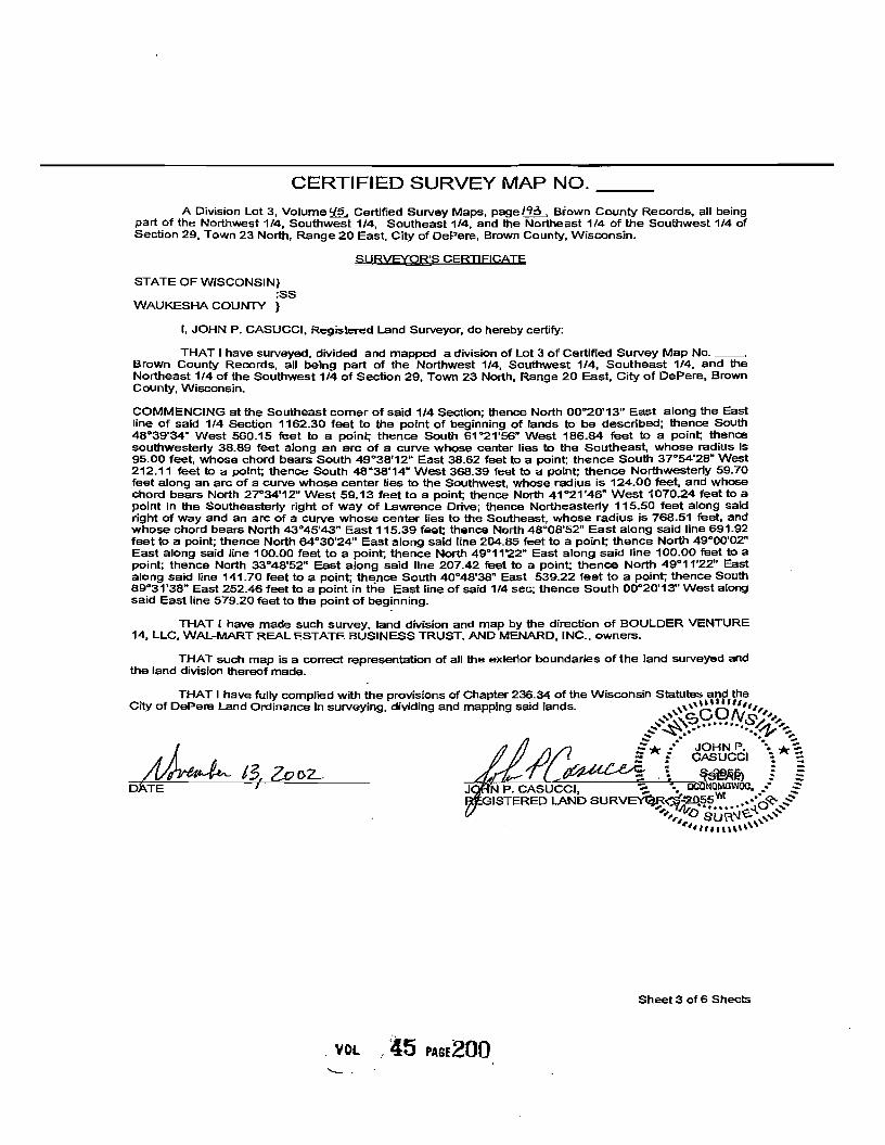
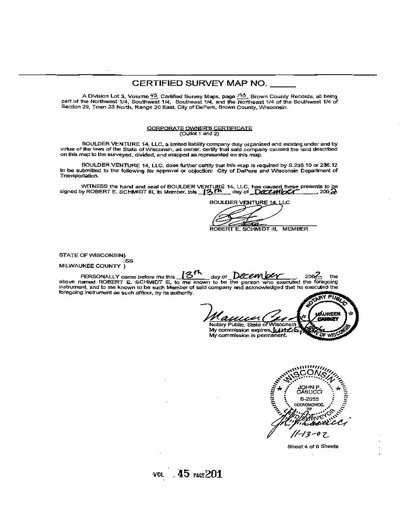