Embed Size (px)
Citation preview
Department of Parks and Wildlife2013–14 Annual Report Department of Parks and Wildlife2013–14 Yearbook
AcknowlegementsThis yearbook was prepared by the Public Information and Corporate Affairs Branch of the Department of Parks and Wildlife.
For more information contact:Department of Parks and Wildlife17 Dick Perry Avenue Technology Park, Western PrecinctKensington Western Australia 6151 Locked Bag 104, Bentley Delivery CentreWestern Australia 6983Telephone (08) 9219 9000
The recommended reference for this publication is: Department of Parks and Wildlife 2013–14 Yearbook, Department of Parks and Wildlife, 2014
ISSN 2203-921X (Print)ISSN 2203-9228 (Online)December 2014
Copies of this document are available in alternative formats on request.
About the logo The design is a stylised representation of a bottlebrush, or Callistemon, a group of native plants including some found only in Western Australia. The orange colour also references the Western Australian Christmas tree, or Nuytsia.
WA’s native flora supports our diverse fauna, is central to Aboriginal people’s idea of country, and attracts visitors from around the world. The leaves have been exaggerated slightly to suggest a boomerang and ocean waves. The blue background also refers to our marine parks and wildlife. The design therefore symbolises key activities of the new Department of Parks and Wildlife.
The logo was designed by the department’s senior graphic designer and production coordinator, Natalie Curtis
Front cover: Nearer to Nature education officer Zac Walker with Mundaring Primary School student Caitlin Zlatnik learning about bush tucker at the Perth Hills Discovery Centre, Beelu National Park. Photo – Jennifer Eliot
Back cover: Greens Pool at night, William Bay National Park. Photo – Peter Nicholas/Parks and Wildlife
Department of Parks and Wildlife Yearbook 2013–14 1
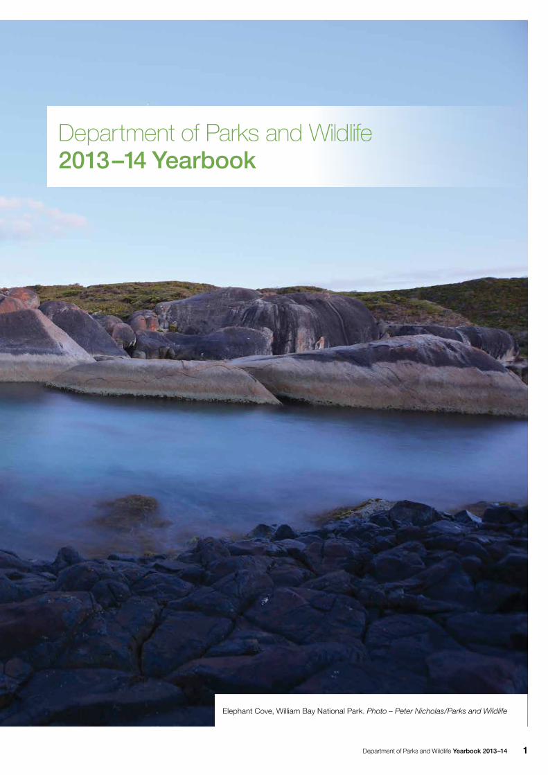
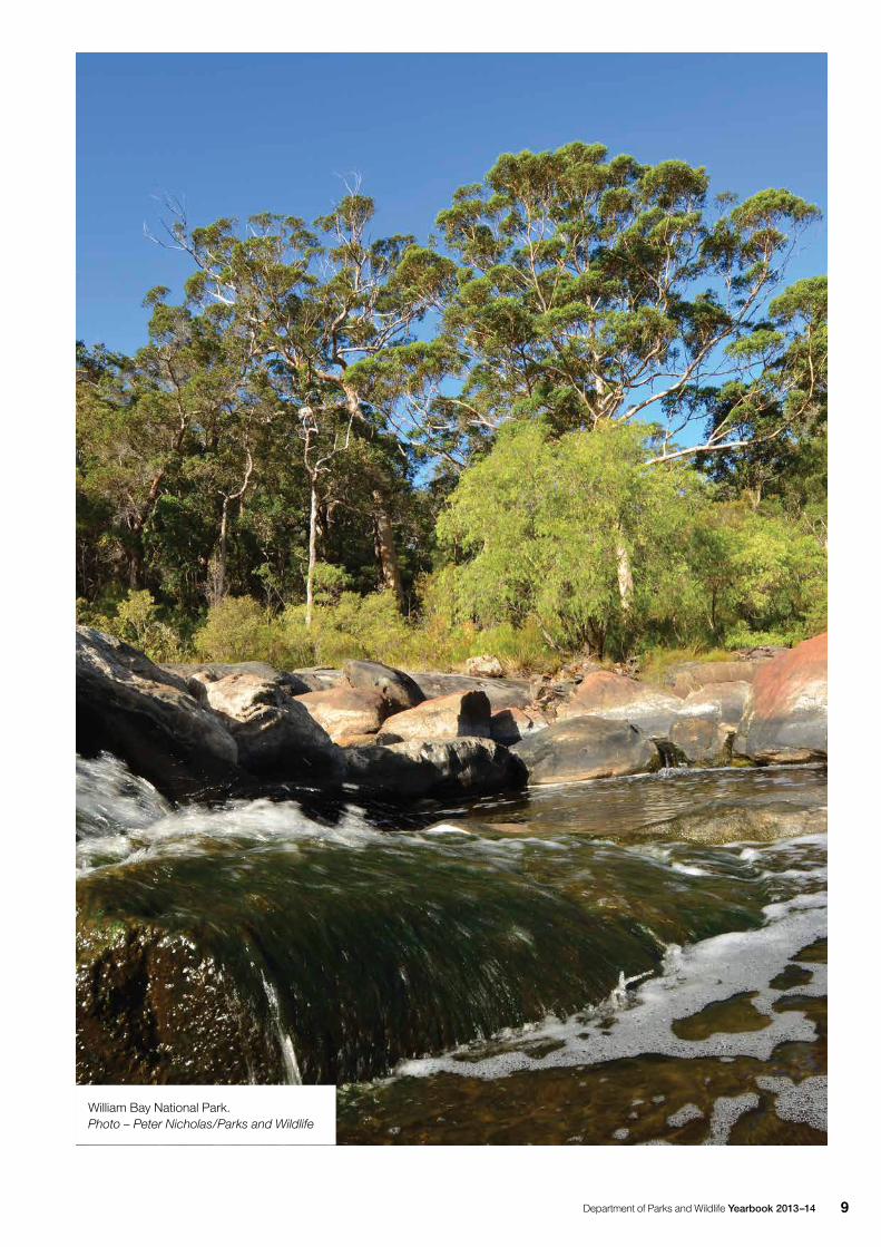
Elephant Cove, William Bay National Park. Photo – Peter Nicholas/Parks and Wildlife
Department of Parks and Wildlife2013–14 Yearbook
Department of Parks and Wildlife Yearbook 2013–142
Contents
Acknowledgements Inside cover
List of tables 4
Inaugural Director General appointed
for Parks and Wildlife 5
Director General’s year in review 6
Parks management 12
Planning for management 12
Acquisition and administration of protected areas 13
Reserve acquisition 13
Leasing activities 13
Apiary site management 14
Park presentation and resource protection 14
Capital park improvements 14
Royalties for Regions park improvements 14
Roads 15
Recreation planning and design 16
Enriching the visitor experience 16
Interpretive planning and design 16
Community liaison, consultation and advisory services 17
Guided interpretive programs 18
Aboriginal liaison, consultation and heritage 18
Planning and relationship building 18
Education and training 18
Business management 20
Park passes and fees 20
Commercial operations and events 20
Legislation and policy for Parks and Visitor Services 22
Legislation 22
Policy 22
Recreation activities and trails 23
Trails WA 23
Bibbulmun Track 23
Cape to Cape Track 23
Mountain biking 23
Munda Biddi Trail 24
Motorised recreation 24
Community involvement 26
Volunteer awards and activities 27
Tourism and marketing 28
Parks for People 28
Campground booking and information system 29
Social and visitor research 29
Visitor-use monitoring 30
Visitor survey program 30
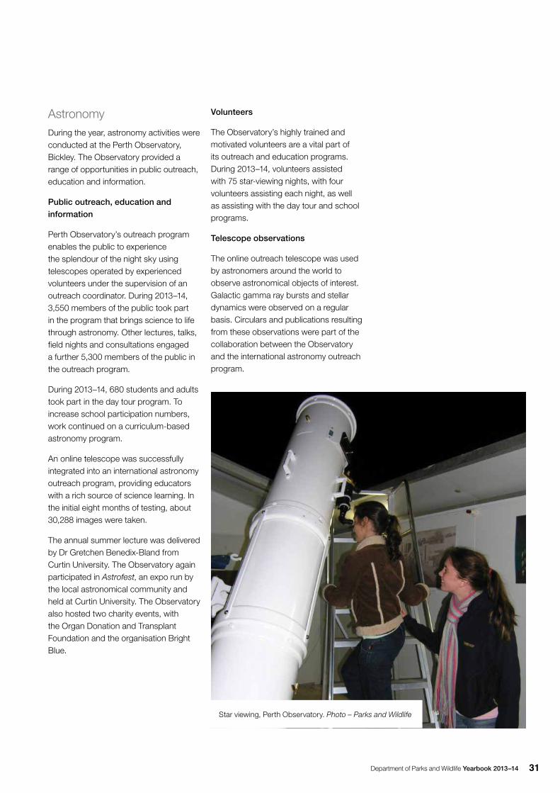
Astronomy 31
Public outreach, education and information 31
Volunteers 31
Telescope observations 31
Support to the Conservation Commission and Marine Parks and Reserves Authority 32
Other initiatives 33
Memoranda of understanding 33
World and national heritage 33
Formal management arrangements with Aboriginal people 34
Regional activities 36
Goldfields Region 36
Kimberley Region 36
Midwest Region 37
Pilbara Region 40
South Coast Region 42
South West Region 43
Swan Region 45
Warren Region 47
Wheatbelt Region 49
Wildlife management 50
Legislation, policy and plans 50
Biodiversity conservation legislation 50
Regional nature conservation plans 50
Kimberley Science and Conservation Strategy 51
Establishment of the terrestrial and marine conservation reserve system 51
Effective management of the conservation reserve system 52
Management planning 52
Management action 52
Good Neighbour policy 52
Recovery and management of threatened species and ecological communities, significant species and ecosystems 54
Recovery of threatened species and ecological communities 54
Flora 54
Threatened flora seed centre 55
Native animals 56
Threatened ecological communities 62
Department of Parks and Wildlife Yearbook 2013–14 3
Restoration 66
Recovery planning 66
Wetland conservation 66
Management of marine wildlife 70
Management of commercial activities involving flora
and fauna 70
Regulation 70
Managing system-wide threats 83
Invasive species control 83
Plant disease management 88
Altered hydrology and salinity 89
Assessment of land and resource use impacts
on biodiversity conservation 91
Building biodiversity knowledge 92
Biological inventory 92
Taxonomy and biotic collection management 95
Fire and biodiversity research projects 96
Information and data management 96
Encouraging public understanding and support for biodiversity conservation. 97
Provision of private land for biodiversity conservation support and advice 98
Animal ethics 100
Forest management 102
Implementation of approved forest management plans and government policies and programs 102
Forest Management Plan 2004–2013 102
Forest Management Plan 2014–2023 102
Community forest inspection program 103
Inventory, assessment and modelling of natural resources 103
Maintenance and enhancement of biodiversity and other values 104 Health and vitality in natural landscapes 104
Integrated planning support 104
Management of soil disturbance in timber harvesting 105
Implementation of fauna habitat zones 105
Management system for approvals, monitoring and compliance 105
Forest monitoring and research 105
Forest auditing 106
Adaptive management 110
Provision for harvesting, regeneration and growth of forestproducts 110
Silvicultural guidance 110
Monitoring of areas subject to timber harvesting and associated treatments 110
Fire management 114
Bushfire season 2013–14 114
Prescribed burning 119
Operations, planning and interagency cooperation 124
Aerial bushfire suppression operations 124
Bushfire detection 124
Bushfire training and development 124
Prescribed fire planning and risk management 124
Bushfire preparedness on unallocated Crown land 124
Interagency bushfire management 125
Key efficiency indicators 125
Marine operations 126
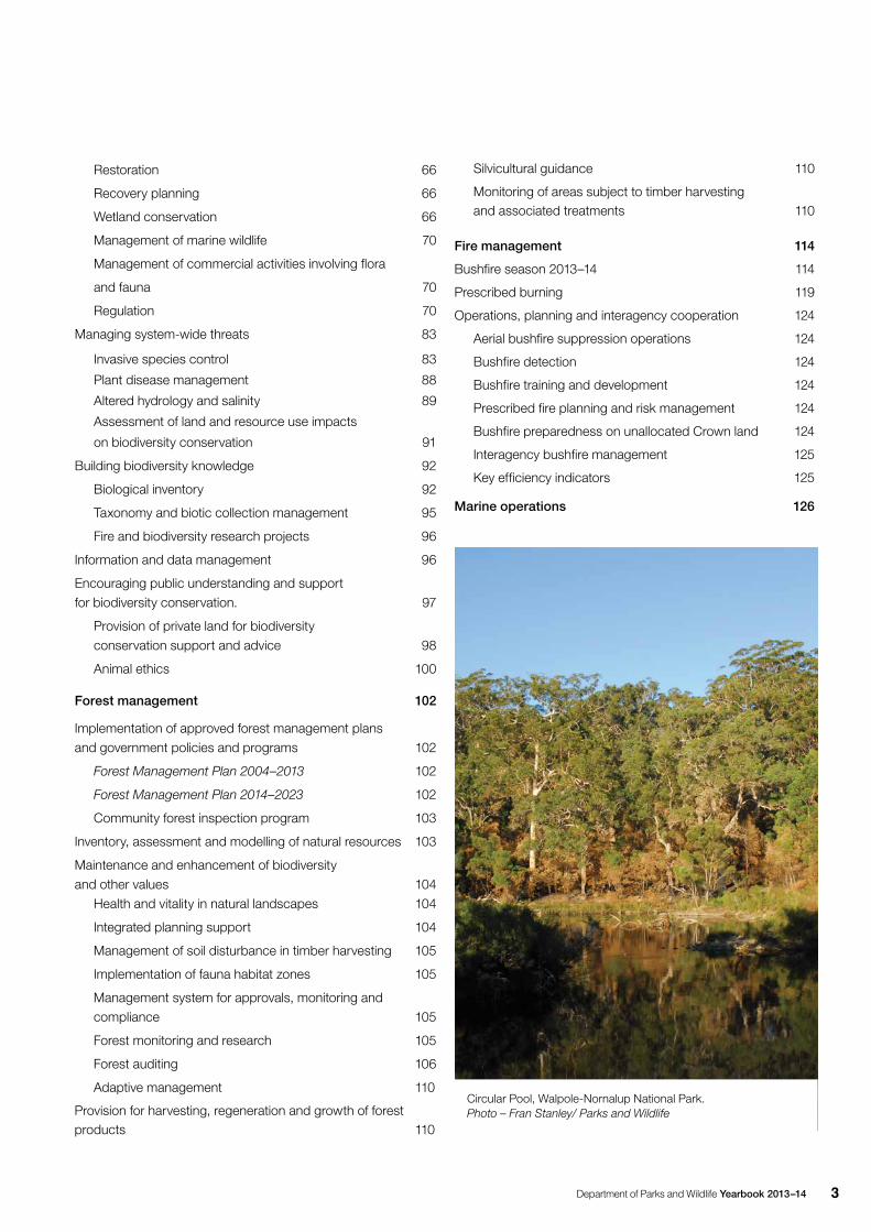
Circular Pool, Walpole-Nornalup National Park. Photo – Fran Stanley/ Parks and Wildlife
4 Department of Parks and Wildlife Yearbook 2013–14
List of tables
Table Page Operational area Description
1 20 Parks Management Breakdown of park pass distribution
2 20 Parks Management Fees waived-visits by Region
3 27 Parks Management Community involvement volunteers
4 55 Wildlife Management Flora translocations
5 61 Wildlife Management Native animal translocations
6 67 Wildlife Management Management plans for Ramsar wetlands in WA
7 73 Wildlife Management Fauna and flora licences
8 80 Wildlife Management Reported offences
9 81 Wildlife Management Offences under WC Act and Regulations
10 82 Wildlife Management Offences under the CALM Act and Regulations
and the Sandalwood Act
11 95 Wildlife Management Specimens held at the WA Herbarium
12 106 Forest Management List of coupes sampled
13 107 Forest Management Summary of coupe demarcation
14 107 Forest Management Summary of incidents
15 108 Forest Management Habitat retention
16 109 Forest Management Crop trees assessment
17 109 Forest Management Crop tree tops disposed and not disposed
18 109 Forest Management Erosion control
19 111 Forest Management Silvicultural objectives
20 113 Forest Management Trends in the area of native forest harvested
21 115 Fire Management Bushfires in 2011–12 to 2013–14
22 116 Fire Management Bushfire causes
23 117 Fire Management Area and number of bushfires
24 121 Fire Management Prescribed burns conducted by Parks and Wildlife in local government areas
25 122 Fire Management Area of prescribed burns by regions
26 123 Fire Management Area of prescribed burns by tenure
27 125 Fire Management Prescribed burning in south-west forest regions
28 125 Fire Management Fire suppression efficiency
Department of Parks and Wildlife Yearbook 2013–14 5
In March 2014 Jim Sharp was appointed as the first Director General of the Department of Parks and Wildlife.
Mr Sharp was a deputy Director General in the former Department of Environment and Conservation and was acting Director General of the Department of Parks and Wildlife since it was established in July 2013.
He has more than 40 years’ experience in the government sector and has worked extensively in the key areas of conservation and land management.
With a broad knowledge and experience of parks policy and management at a State, national and international level, Mr Sharp has successfully led the formation of the new Department from its inception.
He holds a Master’s Degree in Education and brings with him skills in contemporary management and engaging in partnerships with parks and conservation stakeholders and community interests.
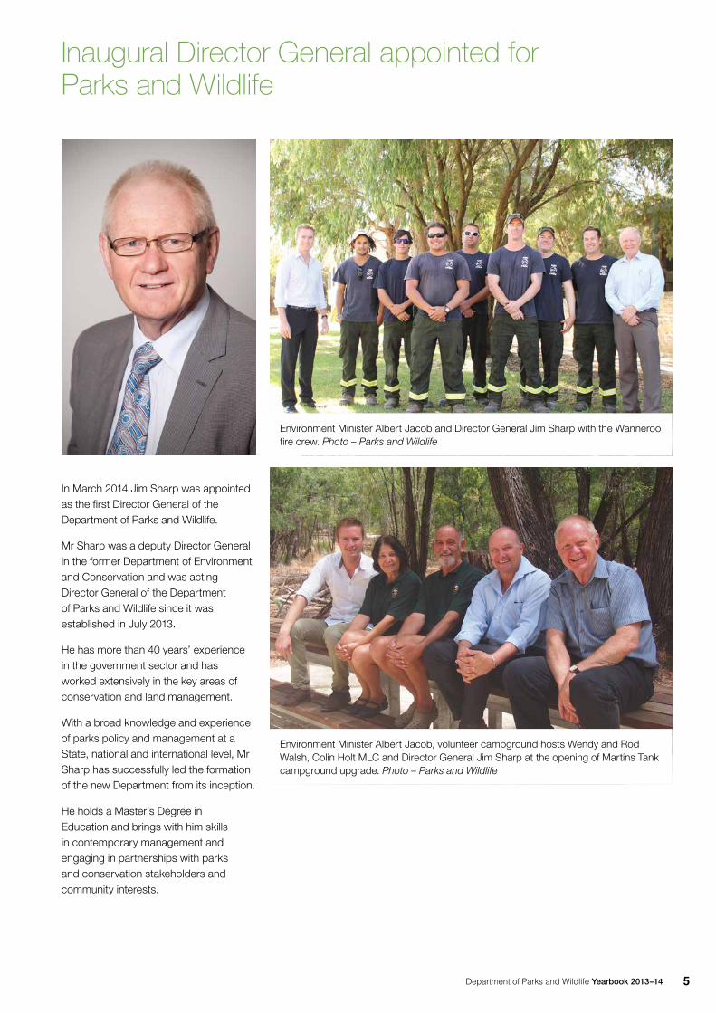
Inaugural Director General appointed for Parks and Wildlife
Environment Minister Albert Jacob and Director General Jim Sharp with the Wanneroo fire crew. Photo – Parks and Wildlife
Environment Minister Albert Jacob, volunteer campground hosts Wendy and Rod Walsh, Colin Holt MLC and Director General Jim Sharp at the opening of Martins Tank campground upgrade. Photo – Parks and Wildlife
Department of Parks and Wildlife Yearbook 2013–146
On 1 July 2013, the Department of Parks and Wildlife was created when the Department of Environment and Conservation was separated into two agencies. This yearbook serves to highlight the broad range of work done across the Department, and is a companion volume to the Annual Report. It also provides an account of the Department’s achievements for the public record.
The role of conserving the State’s natural environment on behalf of the people of Western Australia is a challenging but rewarding one. During the year, Parks and Wildlife staff demonstrated an extraordinary level of commitment to the environment and the community. Staff engaged in a wide variety of work across the State, such as disentangling whales, fighting fires and carrying out prescribed burns, researching and translocating threatened species, removing weeds and pest animals, and managing visitors to national parks, among many other activities.
Notably, the Strategic Directions document was revised, guiding the way the Department works with the community to conserve the State’s plants, animals, ecosystems and world-class network of terrestrial and marine parks and reserves. Under the Strategic
Directions, there was a strong focus on investing resources on programs
that result in tangible improvements to conservation, improve recreation and tourism facilities, and enhance local and landscape-scale management outcomes.
The first year of the Department was a busy and productive one, marked by significant achievements in the key areas of parks, wildlife, forest and fire management.
In 2013–14, the Department managed 100 national parks, 13 marine parks and numerous other conservation reserves, receiving more than 16 million visits. Visitor satisfaction was at a high level of 89 per cent. A priority was to create more community enjoyment of the facilities, wildlife and natural environment in national parks.
The Department made good progress under the Parks for People initiative, progressing the upgrade of nine campgrounds across WA. Under the initiative, Parks and Wildlife aims to establish 450 new camp and caravan sites across WA and upgrade many existing camp sites and visitor facilities. This is an immense task that will cement this State’s national parks and reserves as world-class destinations to camp in and explore.
A world-class improvement initiative in Fitzgerald River National Park was completed. The five-year project saw major access roads upgraded and
Director General’s year in review
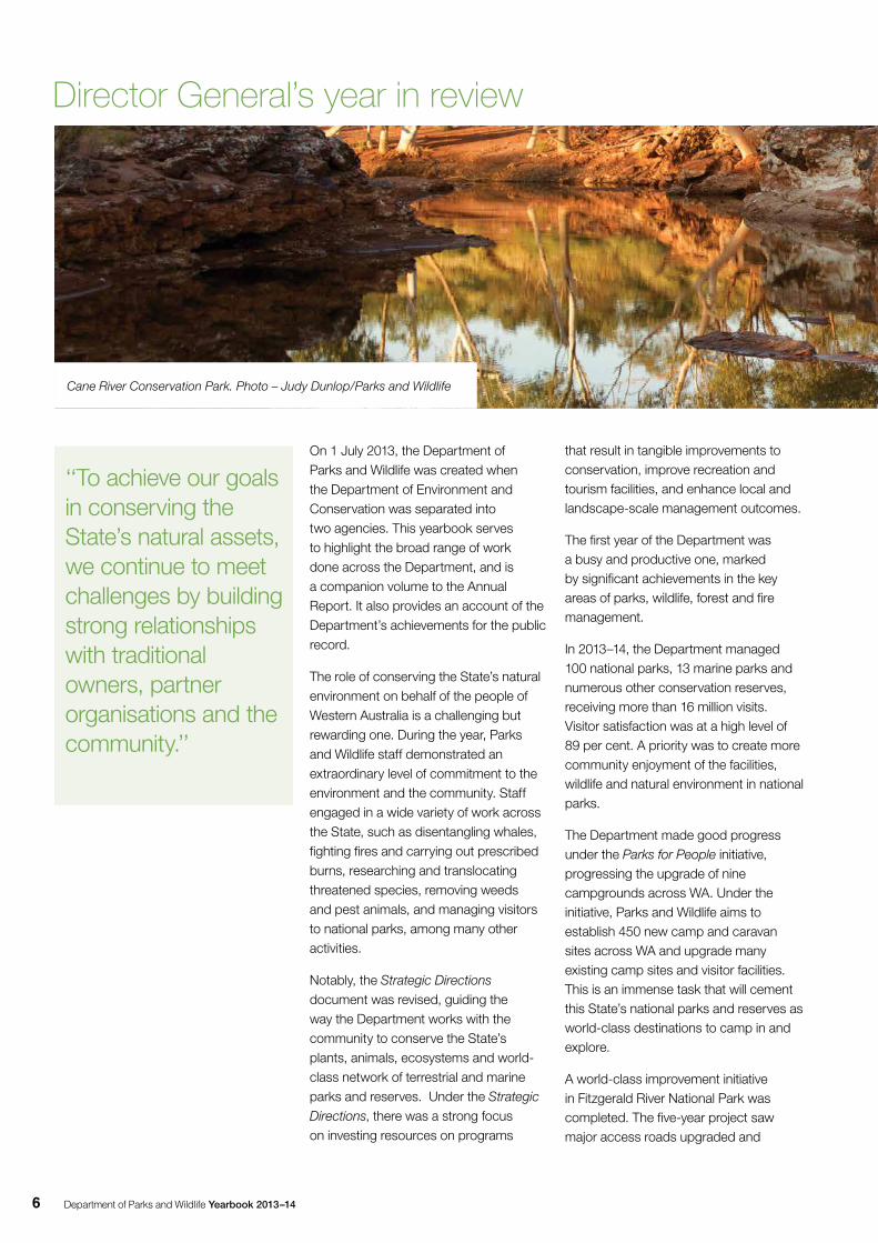
Cane River Conservation Park. Photo – Judy Dunlop/Parks and Wildlife
‘‘To achieve our goals in conserving the State’s natural assets, we continue to meet challenges by building strong relationships with traditional owners, partner organisations and the community.’’
Department of Parks and Wildlife Yearbook 2013–14 7
recreational sites redeveloped, in what was the biggest infrastructure project in the agency and its predecessors’ history.
Work continued on the Department’s flagship five-year Kimberley Science and Conservation Strategy, one of the largest and most significant conservation initiatives in Western Australia’s history. Building on the objective to retain and enhance the high biodiversity and landscape values in the north Kimberley, progress was made on the proposed North Kimberley Marine Park, creation of a national and marine park at Horizontal Falls and establishment of the proposed Kimberley National Park. During the year, work focussed on the improved management of fire regimes, pest animals, weeds and threatened animals, as well as new opportunities for Aboriginal employment and nature-based tourism.
History was created when the Department signed the first joint management agreement for a marine park in Western Australia. The agreement with the Dambimangari Aboriginal Corporation covers management of the Lalang-garram / Camden Sound Marine Park.
The Department also undertook a wide range of wildlife management projects and activities.
Working in partnership with the community, other organisations and traditional owners, the Department continued to carry out major landscape-scale ecological restoration and native animal reintroduction programs, including at Dirk Hartog Island National Park off the Midwest coast, and Lorna Glen (Matuwa) in the northern Goldfields. These groundbreaking programs were underpinned by Western Shield, the Department’s flagship wildlife recovery program, and one of the biggest wildlife conservation programs ever undertaken in Australia.
Importantly, in January 2014 the Department implemented the Forest Management Plan 2014–2023, paving the way for the protection and management of forests in the State’s south-west for the next decade.
As well as working with other agencies to respond to bushfires, the Department continued to conduct strategic prescribed burns to mitigate the severity of bushfires, for nature conservation and for forest management. Parks and Wildlife also rolled out a mandatory bushfire preseason training program that included burn-over drills and the use of two-way radios and fire blankets.
To achieve our goals in conserving the State’s natural assets, we continue to meet challenges by building strong relationships with traditional owners,
partner organisations and the community. Maintaining a healthy natural environment that is enjoyed by the public cannot be done by the Department alone. My sincere thanks go to the almost 11,000 registered volunteers who work with Parks and Wildlife, from manning the 24-hour Wildcare Helpline to assisting with weed control, fencing, planting, animal surveys, scientific research, community education and much more. Thank you also to the many community groups, agencies and organisations that continue to work closely with the Department and make a valuable contribution towards protecting Western Australia’s environment.
I am pleased to present the 2013–14 Department of Parks and Wildlife Yearbook.
Jim Sharp Director General December 2014
Department of Parks and Wildlife Yearbook 2013–148
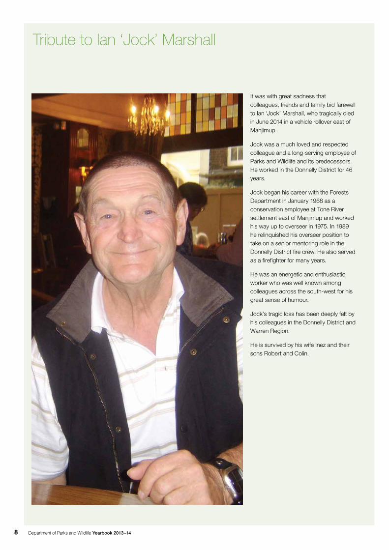
It was with great sadness that colleagues, friends and family bid farewell to Ian ‘Jock’ Marshall, who tragically died in June 2014 in a vehicle rollover east of Manjimup.
Jock was a much loved and respected colleague and a long-serving employee of Parks and Wildlife and its predecessors. He worked in the Donnelly District for 46 years.
Jock began his career with the Forests Department in January 1968 as a conservation employee at Tone River settlement east of Manjimup and worked his way up to overseer in 1975. In 1989 he relinquished his overseer position to take on a senior mentoring role in the Donnelly District fire crew. He also served as a firefighter for many years.
He was an energetic and enthusiastic worker who was well known among colleagues across the south-west for his great sense of humour.
Jock’s tragic loss has been deeply felt by his colleagues in the Donnelly District and Warren Region.
He is survived by his wife Inez and their sons Robert and Colin.
Tribute to Ian ‘Jock’ Marshall
Department of Parks and Wildlife Yearbook 2013–14 9
William Bay National Park. Photo – Peter Nicholas/Parks and Wildlife
Department of Parks and Wildlife Yearbook 2013–1410
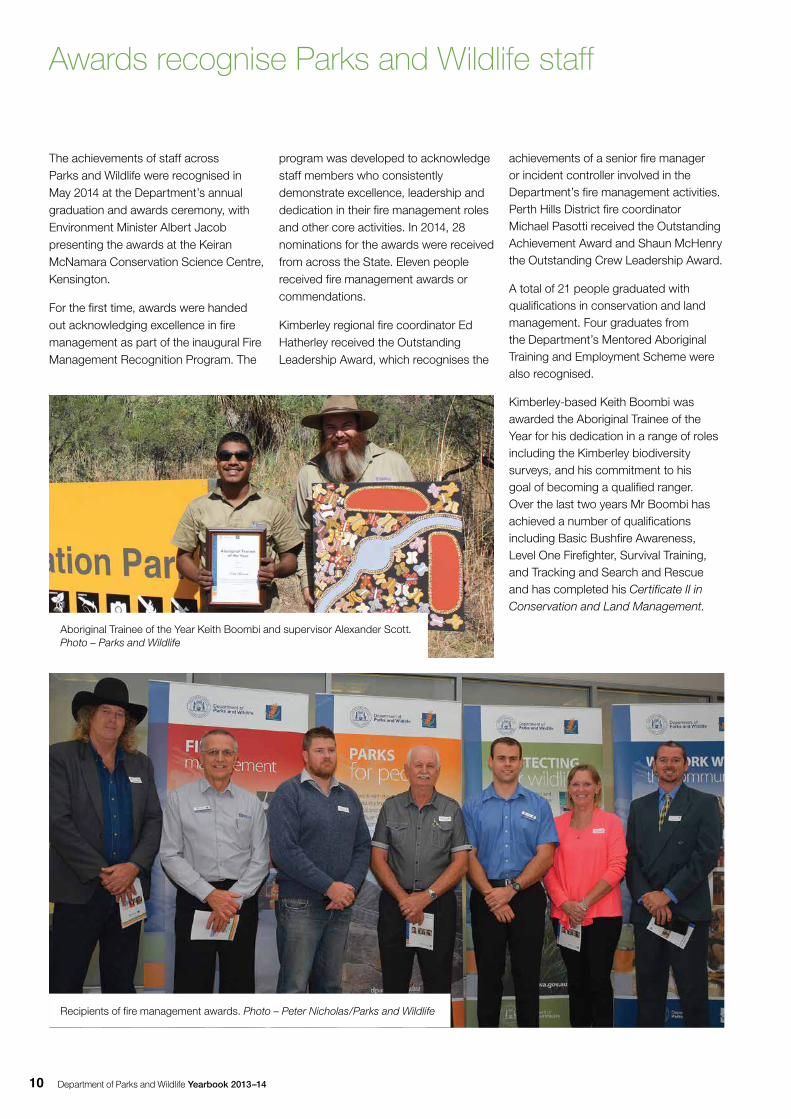
The achievements of staff across Parks and Wildlife were recognised in May 2014 at the Department’s annual graduation and awards ceremony, with Environment Minister Albert Jacob presenting the awards at the Keiran McNamara Conservation Science Centre, Kensington.
For the first time, awards were handed out acknowledging excellence in fire management as part of the inaugural Fire Management Recognition Program. The
Awards recognise Parks and Wildlife staff
program was developed to acknowledge staff members who consistently demonstrate excellence, leadership and dedication in their fire management roles and other core activities. In 2014, 28 nominations for the awards were received from across the State. Eleven people received fire management awards or commendations.
Kimberley regional fire coordinator Ed Hatherley received the Outstanding Leadership Award, which recognises the
achievements of a senior fire manager or incident controller involved in the Department’s fire management activities. Perth Hills District fire coordinator Michael Pasotti received the Outstanding Achievement Award and Shaun McHenry the Outstanding Crew Leadership Award.
A total of 21 people graduated with qualifications in conservation and land management. Four graduates from the Department’s Mentored Aboriginal Training and Employment Scheme were also recognised.
Kimberley-based Keith Boombi was awarded the Aboriginal Trainee of the Year for his dedication in a range of roles including the Kimberley biodiversity surveys, and his commitment to his goal of becoming a qualified ranger. Over the last two years Mr Boombi has achieved a number of qualifications including Basic Bushfire Awareness, Level One Firefighter, Survival Training, and Tracking and Search and Rescue and has completed his Certificate II in Conservation and Land Management.
Recipients of fire management awards. Photo – Peter Nicholas/Parks and Wildlife
Aboriginal Trainee of the Year Keith Boombi and supervisor Alexander Scott. Photo – Parks and Wildlife
Department of Parks and Wildlife Yearbook 2013–14 11
Awards recognise Parks and Wildlife staff
Jason Richardson, a Yawuru ranger in Broome, received the MATES program’s Kwabalitch Award for demonstrating tenacity, perseverance and dedication to his studies throughout his traineeship. The Pathways Program Award went to conservation employee Allan Clarke from Dwellingup who completed Certificate IV in Conservation and Land Management.
Graduates and awardsFire Management Recognition Program
Outstanding Leadership Award– Ed Hatherley (Broome)
Outstanding Achievement Award–Michael Pasotti (Mundaring)
Outstanding Crew Leadership Award–Shaun McHenry (Walpole)
Commendation awards–Keith Low (Kensington), Alfred Lorkiewicz (Bunbury), Clayton Sanders (Wanneroo), Alex Bickley (Busselton), Tim Gregson (Wanneroo)
Outstanding Contribution awards–Anna MacDonald (Kensington), Michael Wright (Forest Products Commission), Paul Cassidy (Main Roads WA)
Parks and Wildlife Mentored Aboriginal Training and Employment Scheme (MATES)
Certificate II in Conservation and Land Management–Keith Boombi (Kununurra), Eugene Park (Kununurra)
Certificate III in Conservation and Land Management–Jason Fong (Broome), Benjamin Taylor (Exmouth)
MATES program awards
Aboriginal Trainee of the Year– Keith Boombi (Kununurra)
Kwabalitch Award–Jason Richardson (Kununurra)
Pathways Program
Certificate III in Conservation and Land Management–Matthew Anning (Walpole), James Boothey (Kirup), Glenn Hancock (Mundaring), Jasper Kruse (Kununurra), Luke Millar (Pemberton), Simon Prins (Wanneroo), Marko Serra (Wanneroo)
Certificate IV in Conservation and Land Management–Phillip Arthur (Exmouth), Phillipa Carboon (Yanchep), Allan Clarke (Dwellingup), Huw Dilley (Exmouth), Tim Gregson (Wanneroo), Greg Hamlyn (Pemberton), Tony Howard (Exmouth), Timothy Hutton (Busselton), Philip Maher (Kirup), Grantly Morton (Jerramungup), John Prins (Margaret River), Alison Raper (Collie), Tracey Robins (Pemberton), Shannon Wilson (Pemberton)
Pathways Program Award
Allan Clarke (Dwellingup)
The Women’s Scholarship in Honour of June Craig
Frances Hoskins (Master of Environmental Law)
Jelena May, (Master of Science–Natural Resource Management)
The Science Scholarship in Memory of Dr George Malajczuk
Stuart Barter (Graduate Certificate of Environmental Compliance)
Wendy Chow (Graduate Diploma of Hydrogeology)
Saorla Finucane (Master of Science–Environmental Management)
Rebecca Ong (Master of Science–Natural Resources)
Chris Nutt (Master of Science-Environmental Science)
Chris Philips (Master of Science–Environmental Science)
The Leadership Scholarship in Memory of Seamus Mulholland
Stephen Bradfield (Master of Business Administration–Leadership)
Director General’s Scholarships for Career Development and Study Assistance
Paula Casserly (Double Diploma in Business and Human Resource Management)
Thomas Holmes (Australian Diver Accreditation Scheme Occupational Diver Part 1)
Nicola Mincham (Certificate IV in Government)
Michael Rule (Australian Diver Accreditation Scheme Occupational Diver Part 1)
George Shedrawi (Australian Diver Accreditation)
Department of Parks and Wildlife Yearbook 2013–1412
Parks ManagementPublic involvement, visitation and appreciation of the natural environment on Parks and Wildlife-managed lands and waters is coordinated through the Department’s Parks Management Service. The provision of parks and visitor services includes:
• preparing and implementing management plans in accordance with the Conservation and Land Management Act 1984 (CALM Act)
• preparing and implementing recreation site development plans
• providing, managing and maintaining appropriate access, recreation opportunities and visitor facilities
• protecting natural areas, visitors and facilities from bushfire
• training Departmental staff and volunteers
• working with local visitor centres and commercial tour operators
• involving Aboriginal people in park management in order to protect the value of the land to the culture and heritage of Aboriginal people
• involving Aboriginal people in the provision of visitor facilities and services
• providing visitor information, and designing and initiating educational and interpretive activity programs that enrich visitor experience and help develop greater community awareness and support for parks, natural areas, astronomy, nature-based tourism, and recreation services and policies
• undertaking scientific, visitor and social research in cooperation with other research institutions
• providing services to the Conservation Commission and the Marine Parks and Reserves Authority.
This work is carried out by staff around the State, with the support of thousands of volunteers as well as local visitor centres, tourism operators and local community organisations.
Planning for managementDuring 2013–14, the Minister for Environment released the final management plan for Lalang-garram / Camden Sound Marine Park, and draft management plans for Kalbarri National Park and Swan Coastal Plain South were released for public comment.A further nine terrestrial management plans and four marine park management plans were in preparation. These were for Albany coastal reserves, Barrow group nature reserves, Esperance and Recherche parks and reserves, Leeuwin-Naturaliste Capes area, Northern Yilgarn conservation reserves, Yawuru out-of-town conservation area, Yoorrooyang Dawang proposed conservation parks, Tuart Forest National Park, the proposed Horizontal Falls national and marine parks, the proposed Roebuck Bay Marine Park, the proposed North Kimberley Marine Park and Eighty Mile Beach Marine Park.
The public contributed to the content of management plans through public and stakeholder workshops and meetings, newsletters and invitations to comment
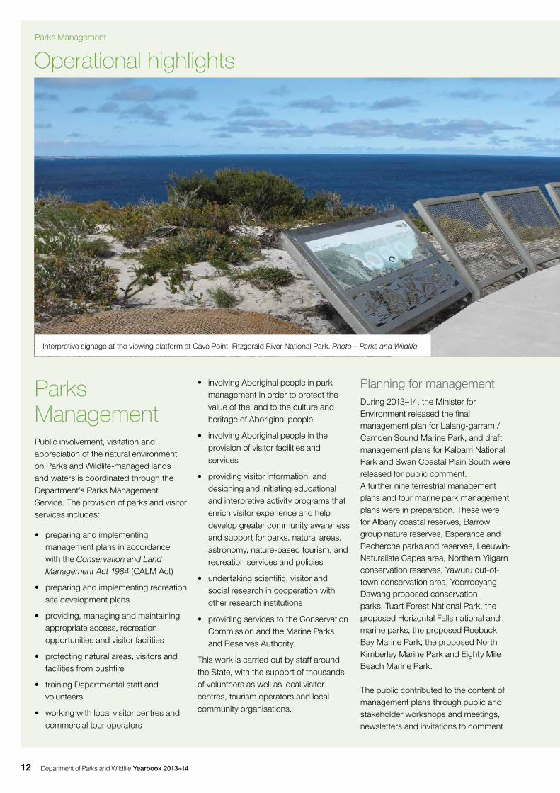
Operational highlights
Interpretive signage at the viewing platform at Cave Point, Fitzgerald River National Park. Photo – Parks and Wildlife
Parks Management
Department of Parks and Wildlife Yearbook 2013–14 13
on draft plans. Aboriginal people were also engaged through the involvement of Aboriginal native title representative bodies and Aboriginal park councils.
Acquisition and administration of protected areas
Reserve acquisition
The formal process of adding land to the State’s system of protected areas continued throughout the year. The Department purchased nine parcels of freehold land of high conservation value covering 3,783ha for future addition to the conservation reserve system. Details of these acquisitions and how they were funded are recorded in the Department’s 2013–14 Annual Report, which is available on the website: www.dpaw.wa.gov.au/about-us/annual-report-and-yearbook.
The Department’s priorities for purchases were areas containing ecosystems not adequately represented in existing conservation reserves, areas containing
threatened species and ecological communities, or additions to existing reserves that would greatly improve their diversity or facilitate their management.Other programs and processes led to the acquisition of lands suitable for inclusion in the conservation reserve system, including land ceded to the State as a condition of subdivision, land acquired from negotiated exchanges, and reserves no longer required by other agencies and organisations. Work continued on the implementation of tenure changes proposed in the Department’s management plans.
The Department also continued to provide advice on land proposals referred from other organisations, such as the Department of Lands, and advised on issues including the use or disposal of unallocated Crown land and surplus Crown reserves.
Leasing activities
Lease arrangements are maintained for a wide range of purposes. At 30 June 2014 there were 271 formal arrangements for various uses on Parks and Wildlife-managed lands including recreation, tourism accommodation, utilities and sawmills. The formal arrangements comprised 149 leases, 43 written agreements, 59 licences, 16 memoranda of understanding and three sawmill site permits.
The Department entered into 24 formal agreements in 2013–14. Major achievements were:
• a new lease for Hotham Valley Tourist Railway’s local headquarters in Dwellingup
• an agreement with the Leschenault Hand Gun Club for a shooting range at Kemerton Park
• the negotiation and formalising of six new licences for recreational huts at various locations in D’Entrecasteaux National Park
• a new licence to Hamersley Iron Pty Ltd for the installation of a pipeline
• a new licence to the City of Rockingham for the creation of a navigation channel at Bent Street within the Shoalwater Islands Marine Park
• a new lease to Western Australia Biomass Pty Limited for the construction of a biomass plant in State forest near Manjimup.
During the year, a number of other formal arrangements expired and, at 30 June, were at various stages of renewal.
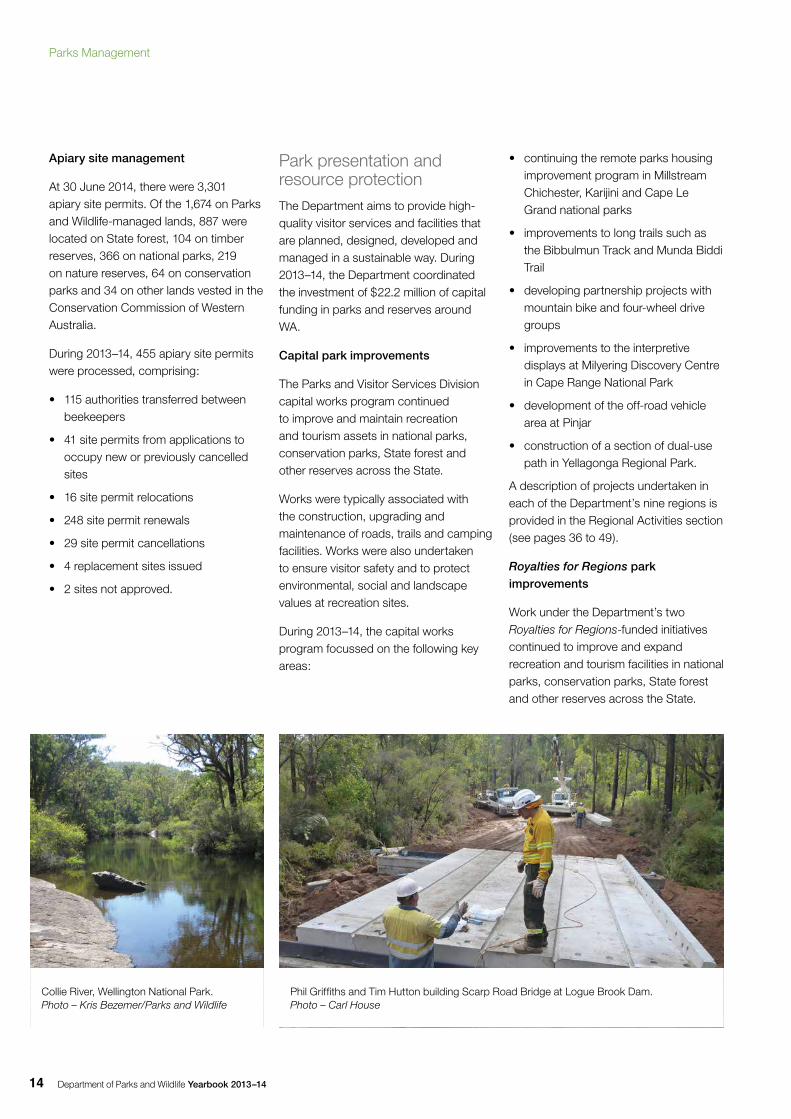
Camping in the Pilbara. Photo – Judy Dunlop/Parks and Wildlife
Department of Parks and Wildlife Yearbook 2013–1414
Apiary site management
At 30 June 2014, there were 3,301 apiary site permits. Of the 1,674 on Parks and Wildlife-managed lands, 887 were located on State forest, 104 on timber reserves, 366 on national parks, 219 on nature reserves, 64 on conservation parks and 34 on other lands vested in the Conservation Commission of Western Australia.
During 2013–14, 455 apiary site permits were processed, comprising:
• 115 authorities transferred between beekeepers
• 41 site permits from applications to occupy new or previously cancelled sites
• 16 site permit relocations
• 248 site permit renewals
• 29 site permit cancellations
• 4 replacement sites issued
• 2 sites not approved.
Park presentation and resource protectionThe Department aims to provide high-quality visitor services and facilities that are planned, designed, developed and managed in a sustainable way. During 2013–14, the Department coordinated the investment of $22.2 million of capital funding in parks and reserves around WA.
Capital park improvements
The Parks and Visitor Services Division capital works program continued to improve and maintain recreation and tourism assets in national parks, conservation parks, State forest and other reserves across the State.
Works were typically associated with the construction, upgrading and maintenance of roads, trails and camping facilities. Works were also undertaken to ensure visitor safety and to protect environmental, social and landscape values at recreation sites.
During 2013–14, the capital works program focussed on the following key areas:
• continuing the remote parks housing improvement program in Millstream Chichester, Karijini and Cape Le Grand national parks
• improvements to long trails such as the Bibbulmun Track and Munda Biddi Trail
• developing partnership projects with mountain bike and four-wheel drive groups
• improvements to the interpretive displays at Milyering Discovery Centre in Cape Range National Park
• development of the off-road vehicle area at Pinjar
• construction of a section of dual-use path in Yellagonga Regional Park.
A description of projects undertaken in each of the Department’s nine regions is provided in the Regional Activities section (see pages 36 to 49).
Royalties for Regions park improvements
Work under the Department’s two Royalties for Regions-funded initiatives continued to improve and expand recreation and tourism facilities in national parks, conservation parks, State forest and other reserves across the State.
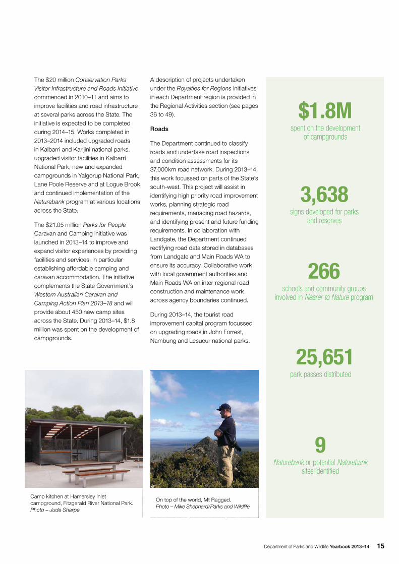
Collie River, Wellington National Park. Photo – Kris Bezemer/Parks and Wildlife
Phil Griffiths and Tim Hutton building Scarp Road Bridge at Logue Brook Dam. Photo – Carl House
Parks Management
Department of Parks and Wildlife Yearbook 2013–14 15
9 Naturebank or potential Naturebank
sites identified
3,638 signs developed for parks
and reserves
266 schools and community groups
involved in Nearer to Nature program
25,651park passes distributed
$1.8Mspent on the development
of campgrounds
The $20 million Conservation Parks Visitor Infrastructure and Roads Initiative commenced in 2010–11 and aims to improve facilities and road infrastructure at several parks across the State. The initiative is expected to be completed during 2014–15. Works completed in 2013–2014 included upgraded roads in Kalbarri and Karijini national parks, upgraded visitor facilities in Kalbarri National Park, new and expanded campgrounds in Yalgorup National Park, Lane Poole Reserve and at Logue Brook, and continued implementation of the Naturebank program at various locations across the State.
The $21.05 million Parks for People Caravan and Camping initiative was launched in 2013–14 to improve and expand visitor experiences by providing facilities and services, in particular establishing affordable camping and caravan accommodation. The initiative complements the State Government’s Western Australian Caravan and Camping Action Plan 2013–18 and will provide about 450 new camp sites across the State. During 2013–14, $1.8 million was spent on the development of campgrounds.
A description of projects undertaken under the Royalties for Regions initiatives in each Department region is provided in the Regional Activities section (see pages 36 to 49).
Roads
The Department continued to classify roads and undertake road inspections and condition assessments for its 37,000km road network. During 2013–14, this work focussed on parts of the State’s south-west. This project will assist in identifying high priority road improvement works, planning strategic road requirements, managing road hazards, and identifying present and future funding requirements. In collaboration with Landgate, the Department continued rectifying road data stored in databases from Landgate and Main Roads WA to ensure its accuracy. Collaborative work with local government authorities and Main Roads WA on inter-regional road construction and maintenance work across agency boundaries continued.
During 2013–14, the tourist road improvement capital program focussed on upgrading roads in John Forrest, Nambung and Lesueur national parks.
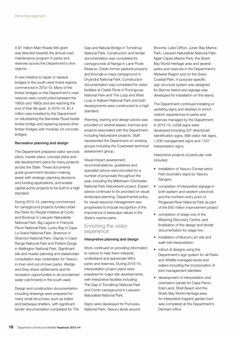
Camp kitchen at Hamersley Inlet campground, Fitzgerald River National Park. Photo – Jude Sharpe
On top of the world, Mt Ragged. Photo – Mike Shephard/Parks and Wildlife
Department of Parks and Wildlife Yearbook 2013–1416
A $1 million Main Roads WA grant was directed towards the annual road maintenance program in parks and reserves across the Department’s nine regions.
A new initiative to repair or replace bridges in the south-west forest regions commenced in 2012–13. Many of the timber bridges on the Department’s road network were constructed between the 1960s and 1980s and are reaching the end of their life span. In 2013–14, $1.4 million was invested by the Department on refurbishing the Bannister Road trestle timber bridge and replacing several other timber bridges with modular, kit concrete bridges.
Recreation planning and design
The Department prepared visitor services plans, master plans, concept plans and site development plans for many projects across the State. These documents guide government decision-making, assist with strategic planning decisions and funding applications, and enable capital works projects to be built to a high standard.
During 2013–14, planning commenced for campground projects funded under the Parks for People initiative at Conto and Boranup in Leeuwin-Naturaliste National Park, Big Lagoon in François Péron National Park, Lucky Bay in Cape Le Grand National Park, Shannon in Shannon National Park, Osprey in Cape Range National Park and Potters Gorge in Wellington National Park. Significant site and master planning and stakeholder consultation was undertaken for Yawuru in-town and out-of-town parks, Wedge and Grey shack settlements and for recreation opportunities in de-proclaimed water catchments in the south-west.
Design and construction documentation including drawings were prepared for many small structures, such as toilets and barbeque shelters, with significant tender documentation completed for The
Gap and Natural Bridge in Torndirrup National Park. Construction and tender documentation was completed for campgrounds at Nanga in Lane Poole Reserve, Credo former pastoral property and Koongk-a-maya campground in Dryandra National Park. Construction documentation was completed for visitor facilities at Castle Rock in Porongurup National Park and The Loop and West Loop in Kalbarri National Park and both developments were constructed to a high standard.
Planning, training and design advice was provided on several leases, licences and projects associated with the Department, including Naturebank projects. Staff represented the Department on working groups including the Coastwest technical assessment group.
Visual impact assessment, recommendations, guidelines and specialist advice were provided for a number of proposals throughout the year, including the Millstream Chichester National Park Naturebank project. Expert advice continued to be provided on visual landscape planning. Departmental policy for visual resource management was progressed to include recognition of the importance of seascape values in the State’s marine parks.
Enriching the visitor experienceInterpretive planning and design
Work continued on providing information to visitors to help them interpret, understand and appreciate WA’s parks and reserves. During 2013–14, interpretation project plans were prepared for major site developments, with interpretive facilities including The Gap in Torndirrup National Park and Conto campground in Leeuwin-Naturaliste National Park.
Signs were developed for Purnululu National Park, Yawuru lands around
Broome, Lake Clifton, Jurien Bay Marine Park, Leeuwin-Naturaliste National Park, Ngari Capes Marine Park, the Shark Bay World Heritage area and several parks and reserves in the Department’s Midwest Region and on the Swan Coastal Plain. A purpose-specific sign structure system was designed for Barrow Island and signage was developed for installation on the island.
The Department continued installing or updating signs and displays to enrich visitors’ experiences to parks and reserves managed by the Department. In 2013–14, 3,638 signs were developed including 307 directional/identification signs, 568 visitor risk signs, 1,206 management signs and 1,557 interpretation signs.
Interpretive projects of particular note included:
• installation of Yawuru Conservation Park boundary signs by Yawuru Rangers
• completion of interpretive signage in both eastern and western precincts and the northern entry point of Fitzgerald River National Park as part of the $40 million improvement project
• completion of stage one of the Milyering Discovery Centre, and finalisation of the design and tender documentation for stage two
• installation of Munurru art site and walk trail interpretation
• rollout of designs using the Department’s sign system for all Parks and Wildlife-managed lands and waters including the incorporation of joint management identities
• development of interpretation and orientation panels for Cape Peron, Edel Land, Shell Beach and the Shark Bay World Heritage area. An interpretive fragrant garden bed was completed at the Department’s Denham office
Parks Management
Department of Parks and Wildlife Yearbook 2013–14 17
• updating of all entry fee signage at parks and reserves across the State.
Community liaison, consultation and advisory services
Consultation with special interest groups, agencies, individuals and Aboriginal communities is a key aspect of site developments and their interpretation on and off Parks and Wildlife-managed areas.
Staff worked with the Miriuwung-Gajerrong Park Council and the Mirima Language Centre in Kununurra on signs in Mirima National Park, and on Yawuru lands and waters around Broome. Nyangumarta and Ngarla traditional owners for the Eighty Mile Beach Marine Park continued working with the Department to develop recreational opportunities near Broome.
Liaison, consultation and support continued with the National Trust of Australia (WA), WA Museum, Interpretation Australia and the Forum Advocating Cultural and Eco-tourism.
Advice was provided to local authorities and various ‘friends’ groups on the planning, design and production of signs and displays.
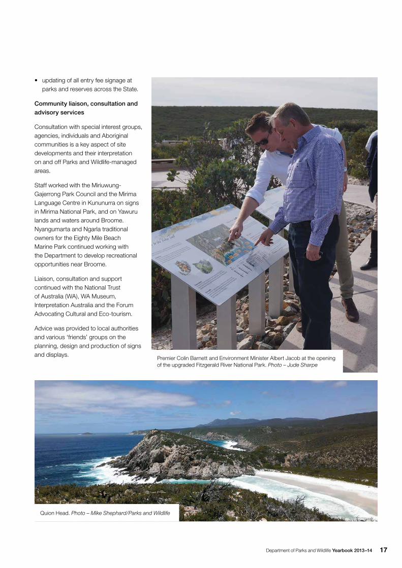
Premier Colin Barnett and Environment Minister Albert Jacob at the opening of the upgraded Fitzgerald River National Park. Photo – Jude Sharpe
Quion Head. Photo – Mike Shephard/Parks and Wildlife
Department of Parks and Wildlife Yearbook 2013–1418
Guided interpretive programs
Guided interpretive programs continued to be provided regularly in major areas throughout the State. These included the Nearer to Nature program provided in Perth’s regional parks, and at the Perth Hills Discovery Centre, Yanchep National Park, Penguin Island and the Perth Observatory.
In the regions, guided tours and/or interactions were provided at Geikie Gorge National Park in the Kimberley, Monkey Mia Reserve in the Shark Bay World Heritage area, Cape Range National Park in the Ningaloo Coast World Heritage area, marine parks around Broome, Valley of the Giants and Coalmine Beach near Walpole, Barna Mia in Dryandra Woodland, and Perup‑Nature’s Guesthouse near Manjimup. Regional staff also continued to respond, where appropriate and available, to requests for specific presentations and guided experiences in local areas.
Aboriginal liaison, consultation and heritageA high priority is placed on liaising, consulting and working with Aboriginal elders, traditional owners and other stakeholders to enhance management of Parks and Wildlife lands and waters. During the year the Department, with the help of its Aboriginal Heritage Unit, undertook a wide range of work including:
• working with elders in local Aboriginal communities regarding traditional land use and protocols
• liaising with elders conducting Welcome to Country for Department events
• advice on traditional owners for Parks and Wildlife-managed lands and waters
• assisting inter-agency engagement in the regions to support heritage protection
• organising and participating in NAIDOC community activities
• contributing to an Aboriginal employment expo
• advising on the use of Aboriginal images in Department marketing
• ensuring Aboriginal news, events and achievements were promoted in the Department and at external forums.
Planning and relationship building
Building relationships with Aboriginal and non-Aboriginal individuals and organisations both within and outside the Department remained a priority. In 2013–14, this included:
• providing ongoing cultural advice and assistance to Department staff regarding Aboriginal consultation and involvement on Parks and Wildlife-managed lands and waters
• providing links between regional and district staff and Aboriginal communities
• maintaining ongoing relationships with a range of agencies and organisations such as natural resource management groups
• participating and providing executive support to the Department’s Aboriginal Employee Reference Group, Access and Diversity Committee and Reconciliation Action Plan Committee
• implementing Reconciliation Action Plan strategies by providing opportunities for Department staff to participate in key Aboriginal and Torres Strait Islander events and dates of significance including NAIDOC Week and National Reconciliation Week
• developing guidelines for the recruitment of Aboriginal staff to the Department
• participating in public sector forums focusing on Aboriginal employment.
Education and training
During the year the Department continued efforts to increase awareness in WA of the culture, history and diversity of Aboriginal and Torres Strait Islander people. In 2013–14 this was done through:
• the Nearer to Nature program, which provided cross-cultural education programs to 266 schools and community groups totalling more than 10,000 people
• training and assistance for Department staff, organising Welcome to Country ceremonies for events, and providing advice on protocols for acknowledgment of traditional owners at Department meetings and events
• developing a new cultural awareness training program available to all Department staff
• exploring further learning and training opportunities for Department staff in the areas of heritage site training and native title
• providing training for Aboriginal staff in facilitation and presentation skills
• supporting workplace opportunities for Aboriginal cadet and school-based trainees
• contributing to the Department’s community education strategy for customary activities regulations and developing and delivering training for regional staff on the customary activities regulations
• presenting on the customary activities regulations to Aboriginal reference groups, Aboriginal Legal Services and the Western Australian Aboriginal Advisory Council
• providing training to enhance community development skills
• coordination of the Parks and Wildlife Aboriginal staff conference.
Parks Management
Department of Parks and Wildlife Yearbook 2013–14 19
The Parks for People Caravan and Camping initiative is a $21.05 million investment over four years, part-funded through Royalties for Regions, to improve and expand camping and visitor experiences in national parks and conservation reserves throughout WA.
It was developed as part of the Government’s Western Australian Caravan and Camping Action Plan 2013–18 and aims to establish affordable, high quality camping and caravan accommodation; walk, bike and drive trails; and interpretive information.
The initiative will deliver:
• eight new campgrounds in eight parks, State forest recreation areas or former pastoral lease areas
• the expansion/upgrade of at least nine campgrounds in eight parks, State forest recreation areas or former pastoral lease areas
• at least 450 new camp sites and caravan sites
• co-investment in at least three commercial tourism accommodation lease areas
• new and improved visitor facilities in at least nine parks, State forest recreation areas or former pastoral lease areas
• investigation and establishment of mobile and web-based applications, including the provision of wi-fi at selected parks, for use by visitors
• promotion of the new and expanded/upgraded parks, State forest recreation areas or former pastoral lease areas.
New and improved campgrounds
During 2013–14, $1.8 million was spent on the development of campgrounds at several sites across the State under the Parks for People initiative. Nine campgrounds were in the process of being upgraded in national parks and reserves. These included Leeuwin-Naturaliste, D’Entrecasteaux, Millstream Chichester, François Péron, Cape Range, Cape Le Grand and Shannon national parks and Lane Poole Reserve, among others.
Other key park infrastructure projects completed included upgrades at Kalbarri National Park and Fitzgerald River National Park.
Fitzgerald River National Park
A major $40 million upgrade to enhance visitors’ experiences at Fitzgerald River National Park on the south coast was completed in June 2014. Work included reconstructing and sealing 40km of roads and upgrading a further 40km of gravel roads.
New visitor facilities including picnic areas, viewing platforms and walk trails were created at Barrens Beach, Barrens Lookout, Four Mile Beach, East Mount Barren, Point Ann, Hamersley Inlet, Cave Point, West Beach and Mylies Beach.
The five-year upgrade, funded jointly by the State and Federal governments, with road works done in partnership with Main Roads WA, was the biggest infrastructure project in the history of the Department of Parks and Wildlife and its predecessors.
Kalbarri National Park
A $7.7 million upgrade of Kalbarri National Park was completed in April 2014. The major investment by the Royalties for Regions program included a $5.8 million upgrade of a section of the Loop-Z Bend access road.
The sealing of 12km of the old road, which was in poor condition, has vastly improved access and safety for tourists visiting the area. Shade shelters, lookouts, walking trails, visitor information areas, sealed car parks and toilets have been provided at the Loop and Inyaka Wookai Watju (West Loop lookout).
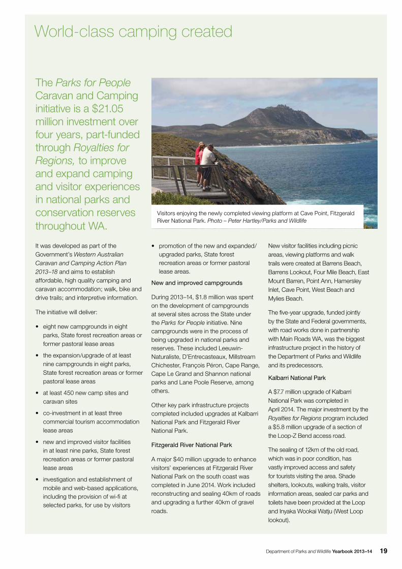
Visitors enjoying the newly completed viewing platform at Cave Point, Fitzgerald River National Park. Photo – Peter Hartley/Parks and Wildlife
World-class camping created
Department of Parks and Wildlife Yearbook 2013–1420
Business managementProviding accurate park information, promoting responsible behaviour by visitors and providing services to the tourism industry are important functions of the Department.
The Commercial Business Unit provided guidance and assistance in identifying new opportunities on Parks and Wildlife-managed lands. In 2013–14, advice was provided for alternative management options at several campgrounds. This included the completion of management option papers for Conto and Shannon campgrounds and draft options for Lucky Bay and the Perup Ecological Centre. A pre-feasibility study and draft business plan were also completed for the Tree Top Walk rejuvenation project.
To assist regional and district offices in identifying commercial opportunities, a template plan was developed to assist in commercial operations planning. The plan has a marketing section that can be used to identify promotional activities to raise awareness about what people can do in parks.
During the year, a restricted ‘E’ class licence was allocated via a publicly advertised call for expressions of interest for a safari tour operation incorporating a Yardie Creek boat tour option in Cape Range National Park.
Park passes and fees
National park passes are distributed at 83 locations around the State including 36 departmental offices and selected national parks, and 47 independent retail outlets.
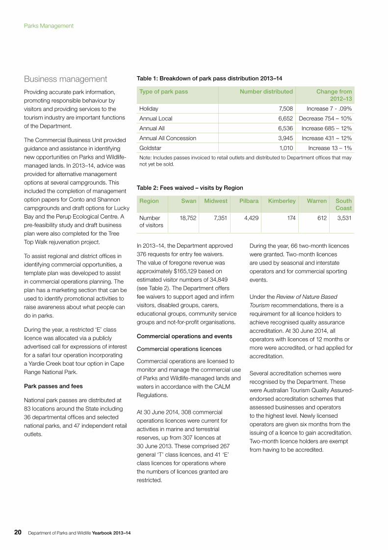
Table 1: Breakdown of park pass distribution 2013–14
Type of park pass Number distributed Change from 2012–13
Holiday 7,508 Increase 7 - .09%
Annual Local 6,652 Decrease 754 – 10%
Annual All 6,536 Increase 685 – 12%
Annual All Concession 3,945 Increase 431 – 12%
Goldstar 1,010 Increase 13 – 1%
Note: Includes passes invoiced to retail outlets and distributed to Department offices that may not yet be sold.
Table 2: Fees waived – visits by Region
Region Swan Midwest Pilbara Kimberley Warren South Coast
Number of visitors
18,752 7,351 4,429 174 612 3,531
In 2013–14, the Department approved 376 requests for entry fee waivers. The value of foregone revenue was approximately $165,129 based on estimated visitor numbers of 34,849 (see Table 2). The Department offers fee waivers to support aged and infirm visitors, disabled groups, carers, educational groups, community service groups and not-for-profit organisations.
Commercial operations and events
Commercial operations licences
Commercial operations are licensed to monitor and manage the commercial use of Parks and Wildlife-managed lands and waters in accordance with the CALM Regulations.
At 30 June 2014, 308 commercial operations licences were current for activities in marine and terrestrial reserves, up from 307 licences at 30 June 2013. These comprised 267 general ‘T’ class licences, and 41 ‘E’ class licences for operations where the numbers of licences granted are restricted.
During the year, 66 two-month licences were granted. Two-month licences are used by seasonal and interstate operators and for commercial sporting events.
Under the Review of Nature Based Tourism recommendations, there is a requirement for all licence holders to achieve recognised quality assurance accreditation. At 30 June 2014, all operators with licences of 12 months or more were accredited, or had applied for accreditation.
Several accreditation schemes were recognised by the Department. These were Australian Tourism Quality Assured-endorsed accreditation schemes that assessed businesses and operators to the highest level. Newly licensed operators are given six months from the issuing of a licence to gain accreditation. Two-month licence holders are exempt from having to be accredited.
Parks Management
Department of Parks and Wildlife Yearbook 2013–14 21
More information about commercial operations on Parks and Wildlife-managed lands and waters is available on the website: www.parks.dpaw.wa.gov.au/for-business/commercial-operations-licensing
Filming permits/licences
Commercial filming and photography on lands and waters managed by the Department can make a significant contribution towards raising awareness of conservation issues, and promoting the appreciation and use of parks and reserves.
The Department does not charge for commercial filming or photography applications considered to have a major tourism or other benefit to the State, or likely to increase appreciation, awareness and understanding of parks and reserves. In these cases, applicants are granted permits by the appropriate regional staff. Where it is deemed that a commercial filming or photography application has no such benefits, charges are applied on a set scale and a commercial filming licence is issued.In 2013–14, 93 commercial filming or photography applications were assessed and approved.
Naturebank
The Naturebank program involves the identification and preparation of suitable sites on Parks and Wildlife-managed lands for sustainable ecotourism initiatives. This program is a partnership between Tourism WA and Parks and Wildlife.
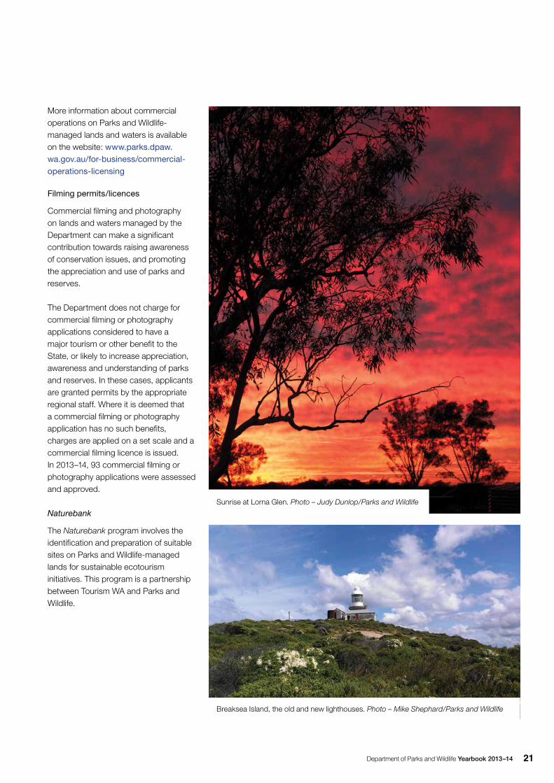
Sunrise at Lorna Glen. Photo – Judy Dunlop/Parks and Wildlife
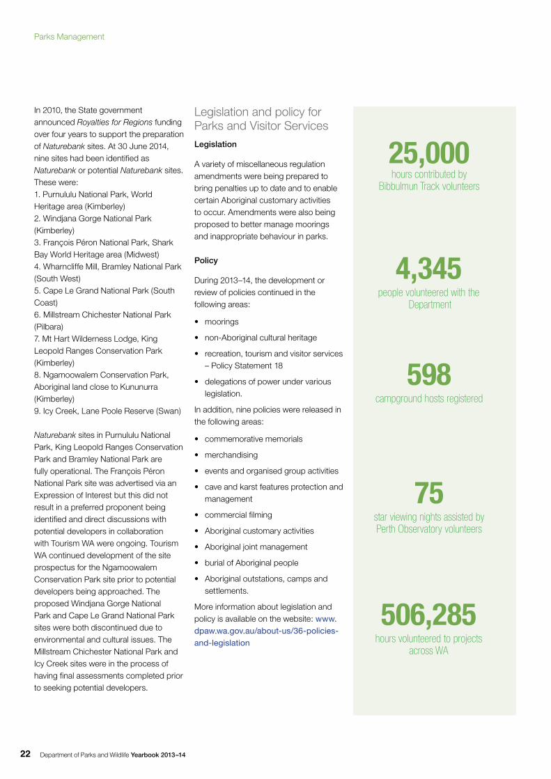
Breaksea Island, the old and new lighthouses. Photo – Mike Shephard/Parks and Wildlife
Department of Parks and Wildlife Yearbook 2013–1422
In 2010, the State government announced Royalties for Regions funding over four years to support the preparation of Naturebank sites. At 30 June 2014, nine sites had been identified as Naturebank or potential Naturebank sites. These were:1. Purnululu National Park, World Heritage area (Kimberley) 2. Windjana Gorge National Park (Kimberley) 3. François Péron National Park, Shark Bay World Heritage area (Midwest) 4. Wharncliffe Mill, Bramley National Park (South West) 5. Cape Le Grand National Park (South Coast) 6. Millstream Chichester National Park (Pilbara) 7. Mt Hart Wilderness Lodge, King Leopold Ranges Conservation Park (Kimberley) 8. Ngamoowalem Conservation Park, Aboriginal land close to Kununurra (Kimberley) 9. Icy Creek, Lane Poole Reserve (Swan)
Naturebank sites in Purnululu National Park, King Leopold Ranges Conservation Park and Bramley National Park are fully operational. The François Péron National Park site was advertised via an Expression of Interest but this did not result in a preferred proponent being identified and direct discussions with potential developers in collaboration with Tourism WA were ongoing. Tourism WA continued development of the site prospectus for the Ngamoowalem Conservation Park site prior to potential developers being approached. The proposed Windjana Gorge National Park and Cape Le Grand National Park sites were both discontinued due to environmental and cultural issues. The Millstream Chichester National Park and Icy Creek sites were in the process of having final assessments completed prior to seeking potential developers.
Legislation and policy for Parks and Visitor ServicesLegislation
A variety of miscellaneous regulation amendments were being prepared to bring penalties up to date and to enable certain Aboriginal customary activities to occur. Amendments were also being proposed to better manage moorings and inappropriate behaviour in parks.
Policy
During 2013–14, the development or review of policies continued in the following areas:
• moorings
• non-Aboriginal cultural heritage
• recreation, tourism and visitor services – Policy Statement 18
• delegations of power under various legislation.
In addition, nine policies were released in the following areas:
• commemorative memorials
• merchandising
• events and organised group activities
• cave and karst features protection and management
• commercial filming
• Aboriginal customary activities
• Aboriginal joint management
• burial of Aboriginal people
• Aboriginal outstations, camps and settlements.
More information about legislation and policy is available on the website: www.dpaw.wa.gov.au/about-us/36-policies-and-legislation
506,285 hours volunteered to projects
across WA
4,345people volunteered with the
Department
598campground hosts registered
75 star viewing nights assisted by Perth Observatory volunteers
25,000hours contributed by
Bibbulmun Track volunteers
Parks Management
Department of Parks and Wildlife Yearbook 2013–14 23
Recreation activities and trailsDuring 2013–14, the Department continued to coordinate the management of outdoor recreation activities consistent with the protection of natural and cultural values on the lands and waters it manages.
Work continued with the Department of Sport and Recreation, Outdoors WA, Trails WA, Westcycle, the Australian Trail Horse Riders Association and other key stakeholders on important recreation initiatives, including the development of an outdoor strategy for WA, the Trails WA website, the WA State Mountain Bike Strategy and commencing work on the State Horse Trail Strategy.
Trails WA
The Department continued to support Trails WA, the not-for-profit peak trails body for the State. During the year, the Department assisted in the development of the Trails WA website, which was launched in October 2013. The website is a central, searchable portal for public trails information across the State. Of the 93 trails listed on the website, 26 are on Parks and Wildlife-managed land, with an additional 19 in the process of being listed.
Bibbulmun Track
The Department continued its strong partnership with the Bibbulmun Track Foundation during the year. Foundation volunteers continued their much-valued support of the Bibbulmun Track, contributing in excess of 25,000 hours to assist in the maintenance of the 1,000km walk trail.
Staff completed the installation of pedestrian trail counters along the length of the track, and trained a selection of dedicated foundation volunteers to undertake the data collection. In addition,
the online user survey was updated. Both the trail counter and survey data will allow both the Department and the Foundation to gain a better understanding of usage, to improve and better manage the track.More information on the Bibbulmun Track is available on the website: www.parks.dpaw.wa.gov.au/know/bibbulmun-track
Cape to Cape Track
The Department continued its long partnership with the Friends of the Cape to Cape Track, with the Friends volunteers contributing more than 1,000 hours of trail maintenance during 2013–14.
Department staff delivered a strategic planning session with the Friends of the Cape to Cape Track and key local stakeholders, to provide future direction on the management of the track.In preparation for the strategic planning process, staff completed an audit of the current condition of the track and facilities. The data collected will be used to develop an ongoing maintenance and works program that will be completed by both staff and volunteers.
Mountain biking
During 2013–14, Parks and Wildlife worked closely with the Department of Sport and Recreation, Westcycle and the WA Mountain Bike Association in the management of mountain biking across the State. The development of the WA State Mountain Bike Strategy was completed and released for public comment.
Aligned with the State strategy, staff worked closely with stakeholders in the development of the South West Mountain Bike Master Plan, which has identified and prioritised areas for future development of mountain bike opportunities, and will guide their development. Specific trail development plans have commenced for the highest priority areas.
Building on the South West Mountain Bike Master Plan, a similar master planning process started in the Perth and Peel regions to identify and prioritise the future development of mountain bike trails in these regions.
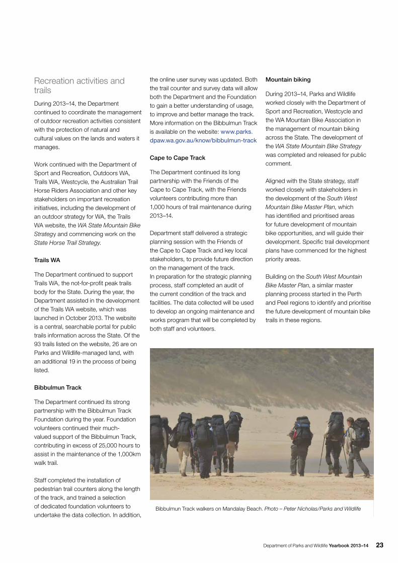
Bibbulmun Track walkers on Mandalay Beach. Photo – Peter Nicholas/Parks and Wildlife
Department of Parks and Wildlife Yearbook 2013–1424
To ensure consistent standards in the provision of mountain bike trails across the State, the Department is facilitating a working group for the development of mountain bike management guidelines. These will provide standards for the planning, development and management of mountain bike trails and facilities, both for the Department and external stakeholders.
Staff continued to work with the mountain bike community and facilitated the ongoing maintenance and construction of trails in the Perth Hills, Wellington and Blackwood districts.
In partnership with the WA Mountain Bike Association and the Kalamunda Collective, guidelines were developed for external sponsorship of the trails within the Kalamunda Circuit. Under the guidelines, the Kalamunda Collective successfully signed up 22 sponsors, which have contributed $23,500 towards the ongoing maintenance of the trails. The sponsorship program is now being rolled out across other mountain bike trail networks.The Department continued to formalise the existing partnership with the Kalamunda Collective for the maintenance and management of the
trail through the development of a formal adoption that sets out the roles and responsibilities of each organisation. Further adoptions will be developed for other major mountain bike trails and networks.More information on mountain biking in parks is available on the Department’s Explore Parks WA website: www.parks.dpaw.wa.gov.au/activity/mountain-biking
Munda Biddi Trail
The Department continued its strong partnership with the Munda Biddi Trail Foundation, with new maintenance volunteers being trained by staff. Since the opening of the completed 1,000km off-road cycle trail in April 2013, volunteer hours have doubled, with more than 85 per cent of the 108 maintenance sections allocated and volunteers undertaking regular inspections and maintenance.
Staff also worked closely with the Foundation to improve the existing volunteer maintenance program. The 108 maintenance sections along the trail were split into five sectors and volunteer sector leaders appointed to coordinate the volunteers in their sector. The volunteer sector leaders received
additional training and support from departmental and Foundation staff. Staff assisted the Foundation in the transition from an advocacy and trail development focus, to a new role of assisting with the ongoing management, maintenance and community support for the trail.
During 2013–14, final reports and acquittals were completed for the $2.5 million contributed to the trail’s development under the Royalties for Regions program, following the successful opening of the entire trail.The construction of a significant new suspension bridge over the Kent River near Denmark to replace the road crossing was completed, thus ensuring the trail remains open year-round. More information on the Munda Biddi Trail is available on the website:www.parks.dpaw.wa.gov.au/know/munda-biddi-trail
Motorised recreation
During the year, the Department continued working closely with the WA 4WD Association, Track Care WA, the Recreational Trailbike Riders’ Association of WA and Motorcycling Western Australia in promoting responsible use of public lands by four-wheel drivers and trail bike riders.
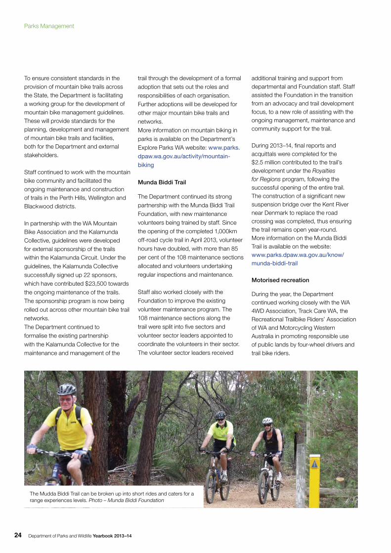
The Mudda Biddi Trail can be broken up into short rides and caters for a range experiences levels. Photo – Munda Biddi Foundation
Parks Management
Department of Parks and Wildlife Yearbook 2013–14 25
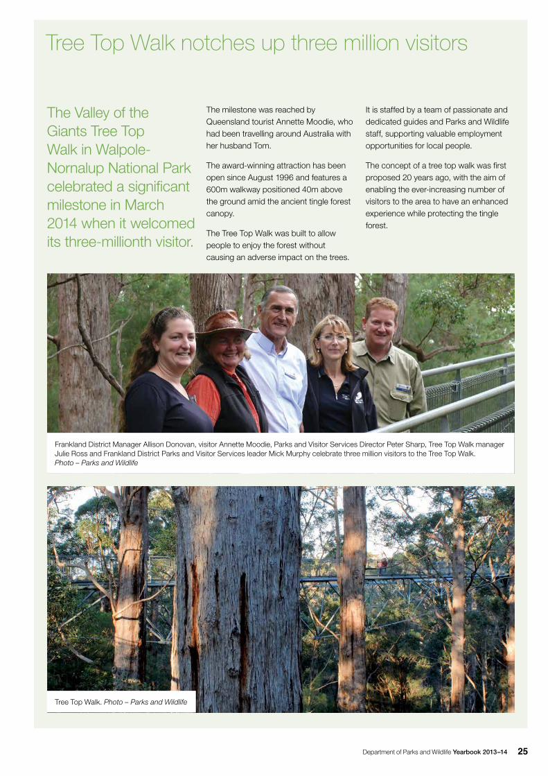
The Valley of the Giants Tree Top Walk in Walpole-Nornalup National Park celebrated a significant milestone in March 2014 when it welcomed its three-millionth visitor.
The milestone was reached by Queensland tourist Annette Moodie, who had been travelling around Australia with her husband Tom.
The award-winning attraction has been open since August 1996 and features a 600m walkway positioned 40m above the ground amid the ancient tingle forest canopy.
The Tree Top Walk was built to allow people to enjoy the forest without causing an adverse impact on the trees.
Tree Top Walk notches up three million visitors
It is staffed by a team of passionate and dedicated guides and Parks and Wildlife staff, supporting valuable employment opportunities for local people.
The concept of a tree top walk was first proposed 20 years ago, with the aim of enabling the ever-increasing number of visitors to the area to have an enhanced experience while protecting the tingle forest.
Frankland District Manager Allison Donovan, visitor Annette Moodie, Parks and Visitor Services Director Peter Sharp, Tree Top Walk manager Julie Ross and Frankland District Parks and Visitor Services leader Mick Murphy celebrate three million visitors to the Tree Top Walk. Photo – Parks and Wildlife
Tree Top Walk. Photo – Parks and Wildlife
Department of Parks and Wildlife Yearbook 2013–1426
The adoption program developed with Track Care WA and the WA 4WD Association continued to grow in popularity. During the year new adoptions and project opportunities were developed by staff. Some of the new formal adoptions signed included:
• the Toyota Landcruiser Club and the Great Southern District assisting with the management of Dryandra Woodland and the Holland Track within Emu Rock Nature Reserve
• the South West 4WD Club assisting the Department with the management of Lennard Track in Wellington National Park.
Some of the projects undertaken included:
• a clean-up on Dirk Hartog Island National Park undertaken by Track Care WA, the WA 4WD Association
and the Department’s Shark Bay District
• dune restoration and maintenance of Yeagarup Beach Track undertaken by the Land Rover Owners Club and the Department’s Donnelly District
• assessment and classification of Fawcett Track in Lane Poole Reserve undertaken by the Armadale 4WD Club and the Department’s Perth Hills District.
The Department continued to collaborate with the Recreational Trailbike Riders’ Association, to further improve trails for trail bikes in the gazetted off-road vehicle areas at Pinjar and Gnangara.More information on four-wheel driving in parks is available on the website: www.parks.dpaw.wa.gov.au/activity/4wd-adventure-motorcycling
Community involvementVolunteers are highly valued by the Department because they build communication links and understanding between the Department and the community. Volunteers also make a significant contribution to the management of parks and reserves and to a range of conservation programs throughout the State. During 2013–14, the Department continued to enlist community support and provide meaningful and interesting opportunities for volunteers to take part in conservation activities and a total of 4,345 volunteers contributed 506,285 hours to projects across WA.
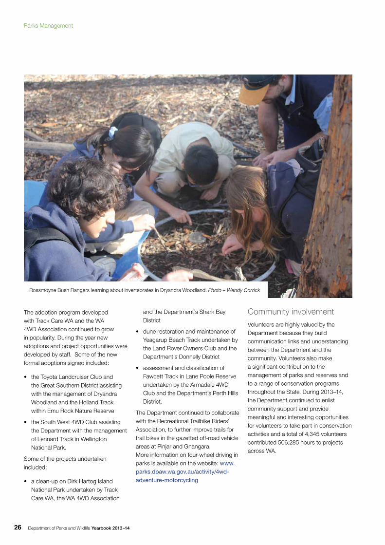
Rossmoyne Bush Rangers learning about invertebrates in Dryandra Woodland. Photo – Wendy Corrick
Parks Management
Department of Parks and Wildlife Yearbook 2013–14 27
Table 3: Community involvement volunteers
Year Total number of volunteers registered since 1999
New volunteers
Volunteers active in previous
three years
New projects
Number of volunteers
contributing
Total number of hours worked
Average hours per volunteer
2004–05 7,600 1,500 28 4,000 422,000 106
2005–06 8,230 630 6 3,882 470,600 121
2006–07 9,726 1,496 8 3,250 406,000 125
2007–08 7,784 -1,942 9 3,439 424,500 123
2008–09 9,558 1,774 7 4,004 426,200 106
2009–10 11,082 1,524 23 3,038 451,040 148
2010–11 12,759 1,677 27 3,602 436,216 121
2011–12 14,604 1,845 51 3,838 457,557 119
2012–13 16,446 1,842 7,585 28 4,717 564,350 120
2013–14 18,327 1,881 8,989 25 4,345 506,285 117
Volunteer awards and activities
An annual Volunteer of the Year and Outstanding Service awards function is held to acknowledge the important support provided by volunteers. Two volunteers were awarded Volunteer of the Year in 2013, with a further 15 individuals and one volunteer group receiving Outstanding Service awards.
Ongoing volunteer programs and projects such as the Campground Host program, Bibbulmun Track Foundation, Reptile
Removalists, Wildlife Rehabilitators, Wildcare Helpline, Honorary CALM officers and projects at the WA Herbarium continued to contribute to the protection and care of the environment. At 30 June 2014, the Department had more than 300 volunteer projects across the State.
The Department’s new volunteer vest was introduced at the campground host annual workshop in November 2013, to help campground hosts identify themselves to other visitors.
The Campground Host program continued to attract volunteers in 2013–14, with 80 new hosts joining, making a total of 598 registered with the Department. During the year, 208 campground hosts contributed 150,569
volunteer hours, welcoming visitors and helping to manage campgrounds around the State.
The quarterly newsletter distributed to all the Department’s registered volunteers continued to be well received and assisted in recruiting volunteers by offering cross promotion of volunteering opportunities, advertising new projects and highlighting volunteer achievements.
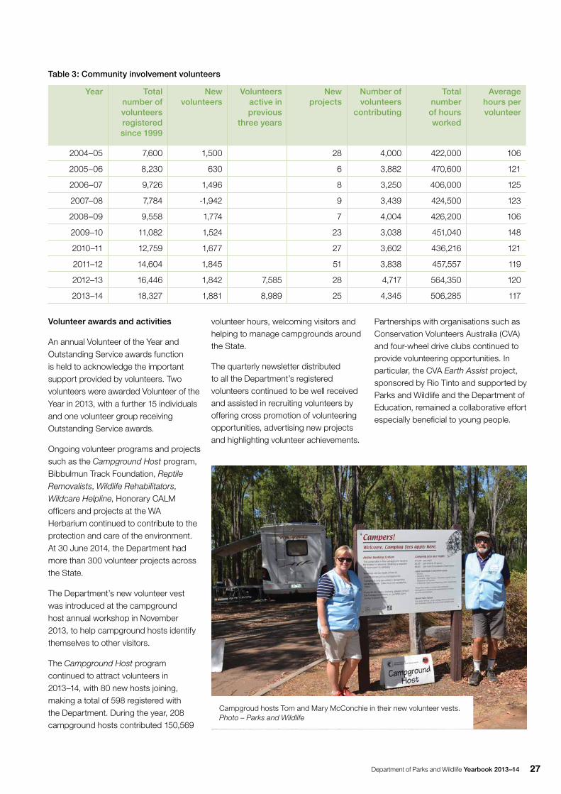
Campgroud hosts Tom and Mary McConchie in their new volunteer vests. Photo – Parks and Wildlife
Partnerships with organisations such as Conservation Volunteers Australia (CVA)and four-wheel drive clubs continued to provide volunteering opportunities. In particular, the CVA Earth Assist project, sponsored by Rio Tinto and supported by Parks and Wildlife and the Department of Education, remained a collaborative effort especially beneficial to young people.
Department of Parks and Wildlife Yearbook 2013–1428
Across the State, 25 new projects were registered with the Community Involvement Unit during 2013–14. New projects included:
• Cable Beach turtle monitoring
• central Wheatlbelt priority and threatened flora survey
• monitoring program for translocated golden bandicoots – Doole Island
• pest plant management – Exmouth.
During 2013–14, the Department provided training programs to more than 700 volunteers with support from specialist services within the Department and external agencies. Training included the Campground Host Forum; safe work practices as part of the Department’s corporate induction; risk management; basic fire awareness; first aid; cross cultural awareness; the basic course in wildlife rehabilitation; advanced and special topics for wildlife rehabilitation; and Wildcare Helpline evaluation and training.
Tourism and marketingParks for People
A new visual identity was created to reflect the Parks for People brand. This was supported by a number of promotional activities including a photographic competition conducted in partnership with the Sunday Times newspaper and free entry to all national parks during the WA Day long weekend.
The Department distributed about 20,000 copies of the free booklet National, marine and regional parks in Western Australia—a visitor’s guide to the State during the year. In March 2014, the Department’s Parks for People display at the Perth Caravan and Camping Show showcased the Department’s online and on-ground services. The Department continued to support and engage the recreation and tourism industries through
a variety of activities, including:
• regular meetings with the Tourism Industry Reference Group to assist with communication between the Department and the nature-based tourism industry
• participation in the Kimberley, Ningaloo and Great South West Edge National Landscapes programs
• development of smartphone applications providing visitor safety and park information
• publication of Touring WA, an electronic magazine featuring articles, information and opportunities for visitors to enjoy parks
• working with Tourism WA and the Caravan Industry Association of WA on the Caravan and Camping Action Plan marketing program to encourage more Western Australians to consider camping as a holiday option.
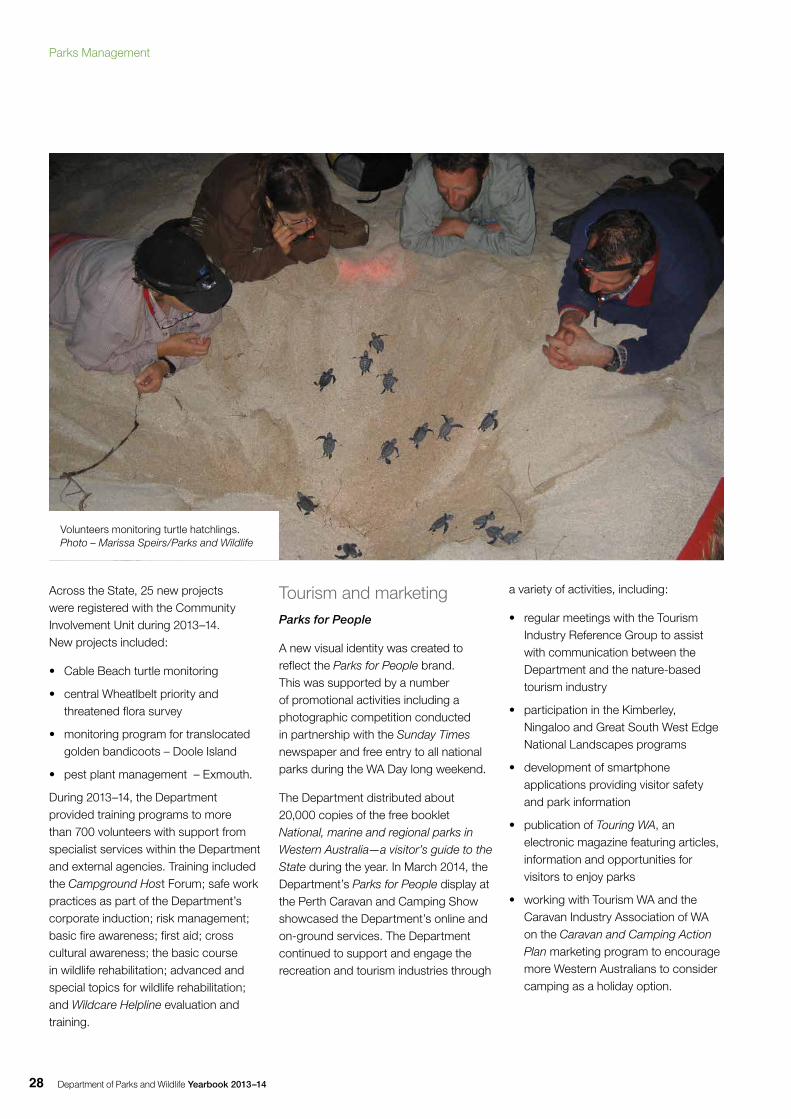
Volunteers monitoring turtle hatchlings. Photo – Marissa Speirs/Parks and Wildlife
Parks Management
Department of Parks and Wildlife Yearbook 2013–14 29
Campground booking and information system
The campground booking and information system was upgraded and relaunched as Park Stay WA, offering an improved search function and compatibility with tablets and mobile phones. During 2013–14, bookings through the system increased by 13 per cent, with 11,592 bookings made online.
Social and visitor researchDuring 2013–14, several social and visitor research projects were undertaken in collaboration with tertiary institutions and other agencies. Projects included:
• the completion of a study and preparation of a report about the desired nature-based camping experience sought by visitors to Parks and Wildlife-managed lands and a profile of camping market segments
• the development of baseline data and methodology for ongoing monitoring of visitor camping usage
• the completion of a Statewide campground audit to determine the number of campgrounds and camp sites on Parks and Wildlife-managed land
• the completion of an online survey to determine the effectiveness of the Department’s volunteer program and the expectations, motivations and satisfaction of volunteers, the results of which will assist in the future development of volunteer programs
• the completion of involvement in an Australian Research Council linkage project, Promoting and managing national parks into the 21st century, that will improve understanding of the place that parks occupy in Australian society
• the completion of a study, preparation of a report and journal article on the Department’s parks visitor market segments
• the completion of a study to determine platform occupancy, using camera monitoring equipment at the The Gap lookout in Torndirrup National Park
• ongoing involvement and support of the Kimberley Marine Research program in investigating human use, values and aspirations for Kimberley coastal waters
• the completion of a study at Penguin Island to determine visit and visitor characteristics, activities and satisfaction
• ongoing involvement in long trail use monitoring, with data being collected for the Bibbulmun Track
• the development of a user survey for the Bibbulmun Track to provide information about patterns of use, satisfaction levels, user expenditure, societal and personal benefits and visitor profile of track users
• review of the visitor survey and visitor use program
• ongoing involvement in a survey to determine visit and visitor characteristics, activities, knowledge of marine parks, and satisfaction with services and facilities at Shoalwater Islands and Marmion marine parks.
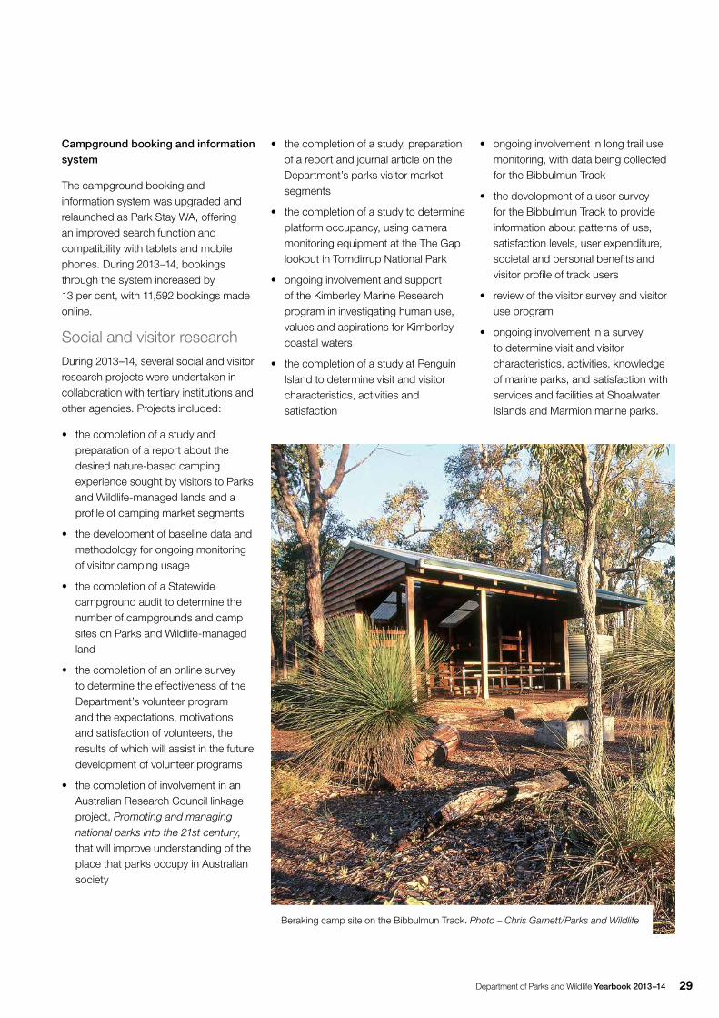
Beraking camp site on the Bibbulmun Track. Photo – Chris Garnett/Parks and Wildlife
Department of Parks and Wildlife Yearbook 2013–1430
Visitor-use monitoring
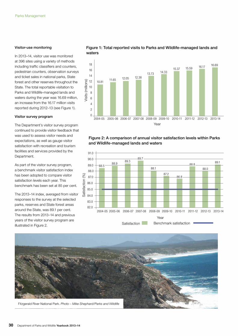
In 2013–14, visitor use was monitored at 396 sites using a variety of methods including traffic classifiers and counters, pedestrian counters, observation surveys and ticket sales in national parks, State forest and other reserves throughout the State. The total reportable visitation to Parks and Wildlife-managed lands and waters during the year was 16.69 million, an increase from the 16.17 million visits reported during 2012–13 (see Figure 1).
Visitor survey program
The Department’s visitor survey program continued to provide visitor feedback that was used to assess visitor needs and expectations, as well as gauge visitor satisfaction with recreation and tourism facilities and services provided by the Department.
As part of the visitor survey program, a benchmark visitor satisfaction index has been adopted to compare visitor satisfaction levels each year. This benchmark has been set at 85 per cent.
The 2013–14 index, averaged from visitor responses to the survey at the selected parks, reserves and State forest areas around the State, was 89.1 per cent. The results from 2013–14 and previous years of the visitor survey program are illustrated in Figure 2.
18
16
14
12
10
8
6
4
2
0
Vis
its (m
illion
s)S
atis
fact
ion
(%)
82.0
83.0
84.0
85.0
86.0
87.0
88.0
89.0
90.0
91.0
2004-05 2005-06 2006-07 2007-08 2008-09 2009-10 2010-11 2011-12 2012-13 2013-14
Figure 1: Total reported visits to Parks and Wildlife-managed lands and waters
10.8112.05 12.38
13.73 14.3315.37 15.59 16.17 16.69
11.65
Year
Satisfaction
Figure 2: A comparison of annual visitor satisfaction levels within Parks and Wildlife-managed lands and waters
89.1
2004-05 2005-06 2006-07 2007-08 2008-09 2009-10 2010-11 2011-12 2012-13 2013-14
Year
88.088.8
86.887.2
88.1
89.789.3
88.988.5
Benchmark satisfaction
Fitzgerald River National Park. Photo – Mike Shephard/Parks and Wildlife
Parks Management
Department of Parks and Wildlife Yearbook 2013–14 31
AstronomyDuring the year, astronomy activities were conducted at the Perth Observatory, Bickley. The Observatory provided a range of opportunities in public outreach, education and information.
Public outreach, education and information
Perth Observatory’s outreach program enables the public to experience the splendour of the night sky using telescopes operated by experienced volunteers under the supervision of an outreach coordinator. During 2013–14, 3,550 members of the public took part in the program that brings science to life through astronomy. Other lectures, talks, field nights and consultations engaged a further 5,300 members of the public in the outreach program.
During 2013–14, 680 students and adults took part in the day tour program. To increase school participation numbers, work continued on a curriculum-based astronomy program.
An online telescope was successfully integrated into an international astronomy outreach program, providing educators with a rich source of science learning. In the initial eight months of testing, about 30,288 images were taken.
The annual summer lecture was delivered by Dr Gretchen Benedix-Bland from Curtin University. The Observatory again participated in Astrofest, an expo run by the local astronomical community and held at Curtin University. The Observatory also hosted two charity events, with the Organ Donation and Transplant Foundation and the organisation Bright Blue.
Volunteers
The Observatory’s highly trained and motivated volunteers are a vital part of its outreach and education programs. During 2013–14, volunteers assisted with 75 star-viewing nights, with four volunteers assisting each night, as well as assisting with the day tour and school programs.
Telescope observations
The online outreach telescope was used by astronomers around the world to observe astronomical objects of interest. Galactic gamma ray bursts and stellar dynamics were observed on a regular basis. Circulars and publications resulting from these observations were part of the collaboration between the Observatory and the international astronomy outreach program.
2004-05 2005-06 2006-07 2007-08 2008-09 2009-10 2010-11 2011-12 2012-13 2013-14
Star viewing, Perth Observatory. Photo – Parks and Wildlife
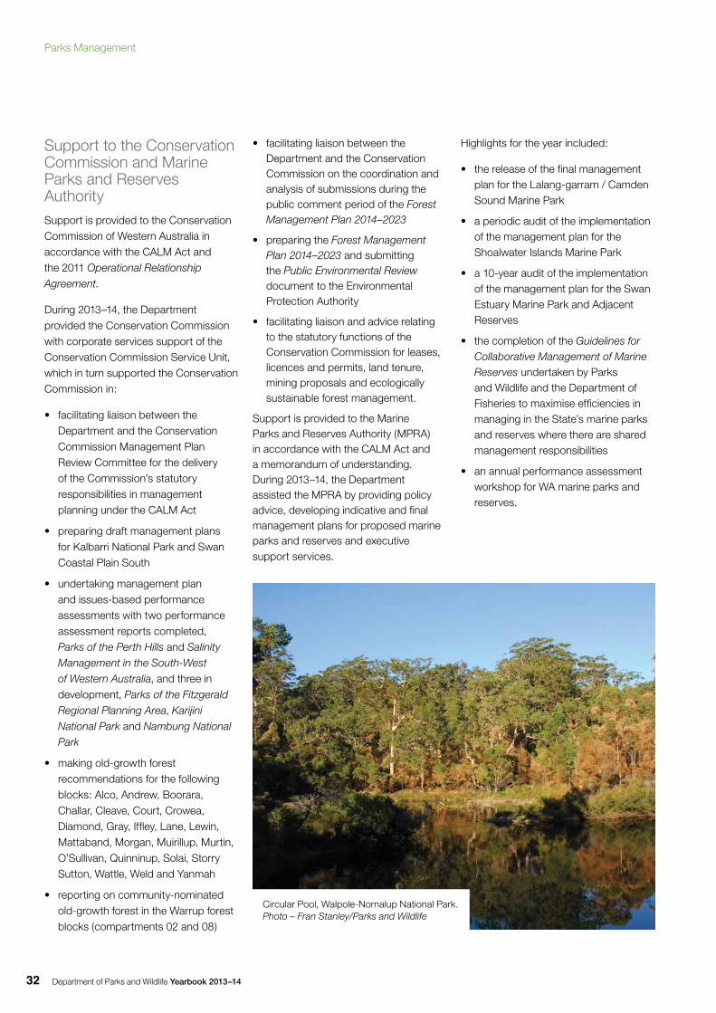
Department of Parks and Wildlife Yearbook 2013–1432
Support to the Conservation Commission and Marine Parks and Reserves AuthoritySupport is provided to the Conservation Commission of Western Australia in accordance with the CALM Act and the 2011 Operational Relationship
Agreement.
During 2013–14, the Department provided the Conservation Commission with corporate services support of the Conservation Commission Service Unit, which in turn supported the Conservation Commission in:
• facilitating liaison between the Department and the Conservation Commission Management Plan Review Committee for the delivery of the Commission’s statutory responsibilities in management planning under the CALM Act
• preparing draft management plans for Kalbarri National Park and Swan Coastal Plain South
• undertaking management plan and issues-based performance assessments with two performance assessment reports completed, Parks of the Perth Hills and Salinity
Management in the South-West
of Western Australia, and three in development, Parks of the Fitzgerald
Regional Planning Area, Karijini
National Park and Nambung National
Park
• making old-growth forest recommendations for the following blocks: Alco, Andrew, Boorara, Challar, Cleave, Court, Crowea, Diamond, Gray, Iffley, Lane, Lewin, Mattaband, Morgan, Muirillup, Murtin, O’Sullivan, Quinninup, Solai, Storry Sutton, Wattle, Weld and Yanmah
• reporting on community-nominated old-growth forest in the Warrup forest blocks (compartments 02 and 08)
• facilitating liaison between the Department and the Conservation Commission on the coordination and analysis of submissions during the public comment period of the Forest Management Plan 2014–2023
• preparing the Forest Management Plan 2014–2023 and submitting the Public Environmental Review document to the Environmental Protection Authority
• facilitating liaison and advice relating to the statutory functions of the Conservation Commission for leases, licences and permits, land tenure, mining proposals and ecologically sustainable forest management.
Support is provided to the Marine Parks and Reserves Authority (MPRA) in accordance with the CALM Act and a memorandum of understanding. During 2013–14, the Department assisted the MPRA by providing policy advice, developing indicative and final management plans for proposed marine parks and reserves and executive support services.
Highlights for the year included:
• the release of the final management plan for the Lalang-garram / Camden Sound Marine Park
• a periodic audit of the implementation of the management plan for the Shoalwater Islands Marine Park
• a 10-year audit of the implementation of the management plan for the Swan Estuary Marine Park and Adjacent Reserves
• the completion of the Guidelines for Collaborative Management of Marine Reserves undertaken by Parks and Wildlife and the Department of Fisheries to maximise efficiencies in managing in the State’s marine parks and reserves where there are shared management responsibilities
• an annual performance assessment workshop for WA marine parks and reserves.
Circular Pool, Walpole-Nornalup National Park.Photo – Fran Stanley/Parks and Wildlife
Parks Management
Department of Parks and Wildlife Yearbook 2013–14 33
Other initiativesMemoranda of understanding
A number of significant partnerships that are formalised through a memorandum of understanding (MOU) continued to be maintained.
A long-standing MOU continued with the Department of Corrective Services, allowing prisoners to make a valuable contribution to departmental projects and the community through maintenance and construction of walk trails and other facilities including the Bibbulmun Track, the Munda Biddi Trail and the Cape to Cape Track. Prisoners assisted with signage work, construction of picnic tables and benches, weed control, maintenance of firebreaks, and cleaning and repair of campground facilities in many parks and reserves around the State including Mirima, Millstream Chichester, Porongurup and Leeuwin-Naturaliste national parks and Coalseam Conservation Park.
The MOU between the Department and Leave No Trace Australia continued, with further projects to promote visitor behaviour that has minimal environmental impact.
During 2013–14, the successful partnership between the Department, Conservation Volunteers Australia, the Department of Education and Rio Tinto continued with Rio Tinto’s Earth Assist program. The MOU was renewed and extended for a further five years, enabling the continued involvement of students in Perth and regional WA to take part in the program, which offers environment-based volunteer opportunities to high school students.
The MOU between Parks and Wildlife, the Department of Health and the Department of Housing in support of the Fiona Stanley Hospital and Health Precinct project continued to contribute significantly to the rehabilitation of land at Beeliar Regional Park, research into Carnaby’s cockatoo and the Wildcare Helpline.
The partnership between the Department and Fairbridge Western Australia Inc. continued to provide opportunities for cooperation between the two organisations on employment and training outcomes for young Aboriginal people. Projects involving Fairbridge Aboriginal trainees were undertaken at Wellington National Park, Dryandra Woodland and other areas.
World and national heritage
Day-to-day management of three World Heritage areas, Shark Bay, the Ningaloo Coast and Purnululu National Park, continued.
The Ningaloo Coast World Heritage Advisory Committee was established and held its inaugural meeting in February 2014.
Implementation of the Shark Bay World Heritage Property Strategic Plan 2008–2020 continued.
Bald Head from Breaksea Island. Photo – Mike Shephard/Parks and Wildlife
Department of Parks and Wildlife Yearbook 2013–1434
More information on the achievements in the Ningaloo and Shark Bay World Heritage areas can be found in the Wildlife Management section of the Yearbook.
In Purnululu National Park, two Caring for our Country-funded projects were undertaken to protect the park’s World Heritage values by reducing the impact of hot late-season fires and upgrading a walk trail to protect fragile soils, vegetation and places of cultural importance in the park. Progress was made on the establishment of a new advisory committee.
Formal management arrangements with Aboriginal people
The Department made significant progress negotiating and creating new joint management arrangements under the provisions of the CALM Act, as well as implementing existing agreements.
Nyangumarta
In May 2014, the State government signed an Indigenous Land Use Agreement (ILUA) with the Nyangumarta people to enable the creation and joint management of Eighty Mile Beach Marine Park and Walyarta and Kujungurru Warrarn conservation reserves within Nyangumarta country. This is the first ILUA for a marine park in WA and includes the important intertidal area at Eighty Mile Beach.
The Department had already established good working relationships with Nyangumarta people through the marine planning process and ongoing on-ground works such as turtle monitoring, fencing, conservation and cultural interpretive signage works. The agreement formalises this partnership and provides for the employment of Nyangumarta rangers.
Dambimangari
In November 2013, the Department signed a joint management agreement for the Lalang-garram / Camden Sound
Marine Park with the Dambimangari Aboriginal Corporation, at a signing ceremony in Derby coinciding with the release of the Lalang-garram / Camden Sound Marine Park management plan. This is the first joint management agreement for a marine park in WA. The park will ultimately cover more than 7,000 square kilometres and protect the southern hemisphere’s largest humpback whale calving ground, and conserve habitats for flatback and green turtles, snubfin and Indo-Pacific humpback dolphins, dugongs, saltwater crocodiles and several species of sawfish. The State government is also negotiating an ILUA with the Dambimangari Aboriginal Corporation in relation to the joint management of the proposed Horizontal Falls national and marine parks and proposed Great Kimberley National Park.
Miriuwung-Gajerrong
The Department has a central role in implementing the Ord Final Agreement ILUA, in partnership with the Yawoorroong Miriuwung Gajerrong Yirrgeb Noong Dawang Aboriginal Corporation (Miriuwung Gajerrong Corporation) and other partners. Both the Department and the Miriuwung Gajerrong Corporation have joint responsibility for developing management arrangements for six new conservation reserves (totalling 150,000ha) in the east Kimberley.
Yawuru
An ILUA was signed on 25 February 2010 with Yawuru native title holders over 5,297 square kilometres of land in and around Broome. The agreement enabled the creation of terrestrial and marine conservation reserves, to be jointly managed by Yawuru people, Parks and Wildlife and, within the Broome town site, the Shire of Broome. These areas included a coastal park covering the intertidal area, terrestrial reserves around Broome and its north, and a marine park from Gantheaume Point to Cape Villaret.
13%increase in online campground
bookings
89.1% visitor satisfaction
3World Heritage areas managed
by the Department
11,592online campground
bookings made
16.69Mvisits to Parks and Wildlife- managed land and waters
Parks Management
Department of Parks and Wildlife Yearbook 2013–14 35
Burrup (Murujuga)
In January 2013, Murujuga National Park was created, covering 4,913ha, which comprises about 86 per cent of the Dampier Archipelago National Heritage place that has been gazetted on the Burrup Peninsula. The Murujuga National Park is held freehold by the Murujuga Aboriginal Corporation (MAC), leased to the State and jointly managed with Parks and Wildlife as a national park. The Murujuga Park Council, the joint management body, comprises representatives from MAC, Parks and Wildlife, and the Minister for Aboriginal Affairs.
Work continued with MAC and the Murujuga ranger team, which undertakes on-ground land management activities. During the year, the Department worked with MAC to support training, capacity building and authorisation of Murujuga rangers to strengthen their operational management function in the park. In October 2013, the Department participated in strategic planning for the park and the broader national heritage-listed place with MAC, the Federal Government, Woodside, Rio Tinto, The University of Western Australia, Murdoch University and other stakeholders.
Other joint management arrangements currently in negotiation
The Department continued to engage with traditional owner groups across the State to implement formal joint management agreements. These included negotiations as part of the South West Native Title settlement process, negotiations with the Ngarla and Karajarri native title holders over the Eighty Mile Beach Marine Park, and negotiations with the Gooniyandi and the Uunguu native title holders to achieve joint management outcomes under the Kimberley Science and Conservation Strategy.
Cullham Inlet from East Mount Barren, Fitzgerald River National Park. Photo – Mike Shephard/Parks and Wildlife
Department of Parks and Wildlife Yearbook 2013–1436
Regional activitiesGoldfields Region
The joint management project with the Wiluna Aboriginal community continued at Lorna Glen (Matuwa) and Earaheedy (Kurrara Kurrara) and included fence maintenance, erosion control, road maintenance and fire management contract work. Additional work was undertaken in the adjacent Birriliburu native title-determined area and Indigenous Protected Area.
• Joint management activities with the Tjuntjuntjara community in the Great Victoria Desert and the Spinifex native title-determined area included the repair and maintenance of two existing shed tanks, weed control and reserve management.
• Consultation, monitoring and clearance work relating to fire management was undertaken with various Aboriginal groups in the Goldfields under the Great Western Woodlands Strategy.
• Joint management for conservation and multiple-use was progressed with the Menzies Aboriginal Corporation for the Adelong pastoral lease adjacent to Goongarrie.
• A four-day joint management training course was run in April 2014 for Martu rangers, Goldfields Land and Sea Council (GLSC) rangers, Spinifex rangers and staff. Thirty-five rangers attended and were trained in first aid and AusChem weed spraying.
• The Credo working group was set up with assistance from GLSC to progress Aboriginal involvement and joint management of Credo and several meetings were held.
• Under the Parks for People initiative, development of a new campground at Credo started and involved consultation with local Aboriginal groups. This project has created local Aboriginal employment opportunities.
• Campground hosts and volunteer caretakers contributed more than 5,000 volunteer hours at Lorna Glen, about 5,000 hours at Credo, more than 2,000 hours at Lake Mason and about 2,000 hours at Goongarrie former pastoral stations.
• The multi-use field study centre at Credo was used by CSIRO for conducting research and by other organisations for training purposes.
• Ongoing maintenance work and improvements to the Credo homestead recreation site and an upgrade of the shearers’ quarters were undertaken. This included painting and repairs, installation of air-conditioning systems, and improvements to the electrical system and water supply.
• Other work undertaken at Credo included erosion mitigation works and the removal of more than 2,000 tyres from water courses at Credo. Two nature conservation projects were undertaken at Credo and Lorna Glen.
• The caretaker’s house at Lorna Glen was renovated and a new deck area added to the office. The bunkhouse was painted and upgraded, with partitioning for additional accommodation. Other work included flood mitigation around the homestead and on the predator-proof enclosure.
• The access roads to Goongarrie and Cave Hill recreation sites were upgraded after a severe rain event.
Kimberley Region
• Engagement and negotiations continued with native title and other Aboriginal groups to facilitate the implementation of the Kimberley Science and Conservation Strategy.
• Negotiations continued with the Bunuba Dawangarri Aboriginal Corporation in relation to an ILUA and joint management agreement for Bunuba native title-determined lands.
• Under the Kimberley Science and Conservation Strategy, the Bunuba ranger program continued to grow. Rangers started their training for Certificate II and III in Conservation and Land Management and continued to undertake weed and feral animal control in west Kimberley parks. An operations officer was employed to assist in the supervision and delivery of the Bunuba ranger program.
• Negotiations continued with Ngarla people in relation to an ILUA and joint management agreement over Ngarla native title-determined lands which form the southern part of Eighty Mile Beach Marine Park.
• The Karajarri people agreed to progress an ILUA and joint management agreement for the northern part of Eighty Mile Beach Marine Park.
• A fit-for-purpose 20m vessel for the northern Kimberley marine parks was commissioned, allowing regional staff to undertake joint management operations with traditional owners on sea country.
• Ranger accommodation for Eighty Mile Beach Marine Park was secured.
• Several projects were undertaken collaboratively with Nyangumarta people at Eighty Mile Beach, including the construction of a fence at a Ramsar site, cultural and conservation interpretation activities, cultural awareness activities for school holiday programs, and other science and conservation research programs.
• Work continued on developing four management plans for the Yawuru conservation estate.
• Four trainee Yawuru rangers employed within the Yawuru joint management team continued their training for Certificate II and III in Conservation and Land Management, and one trainee completed Certificate III. The studies included cultural components
Parks Management
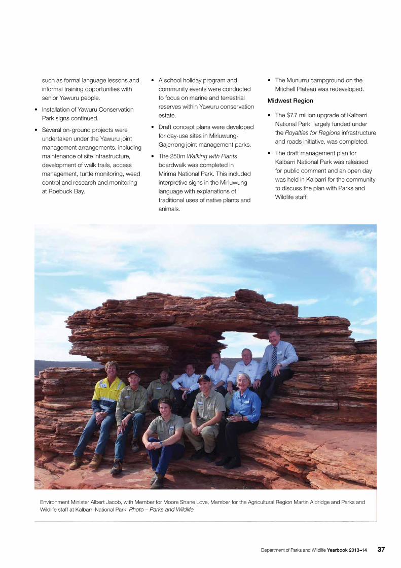
Department of Parks and Wildlife Yearbook 2013–14 37
such as formal language lessons and informal training opportunities with senior Yawuru people.
• Installation of Yawuru Conservation Park signs continued.
• Several on-ground projects were undertaken under the Yawuru joint management arrangements, including maintenance of site infrastructure, development of walk trails, access management, turtle monitoring, weed control and research and monitoring at Roebuck Bay.
• A school holiday program and community events were conducted to focus on marine and terrestrial reserves within Yawuru conservation estate.
• Draft concept plans were developed for day-use sites in Miriuwung-Gajerrong joint management parks.
• The 250m Walking with Plants boardwalk was completed in Mirima National Park. This included interpretive signs in the Miriuwung language with explanations of traditional uses of native plants and animals.
• The Munurru campground on the Mitchell Plateau was redeveloped.
Midwest Region
• The $7.7 million upgrade of Kalbarri National Park, largely funded under the Royalties for Regions infrastructure and roads initiative, was completed.
• The draft management plan for Kalbarri National Park was released for public comment and an open day was held in Kalbarri for the community to discuss the plan with Parks and Wildlife staff.
Environment Minister Albert Jacob, with Member for Moore Shane Love, Member for the Agricultural Region Martin Aldridge and Parks and Wildlife staff at Kalbarri National Park. Photo – Parks and Wildlife
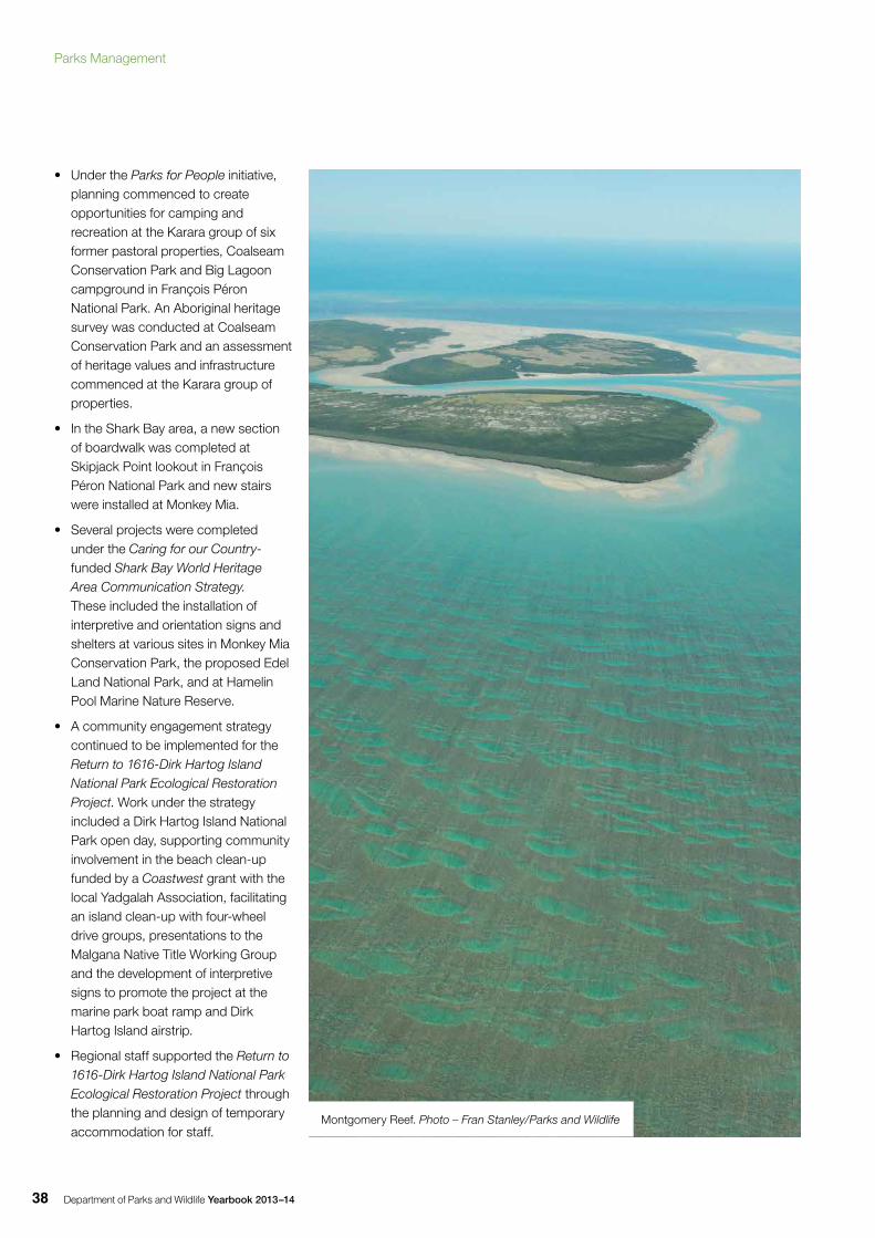
Department of Parks and Wildlife Yearbook 2013–1438
• Under the Parks for People initiative, planning commenced to create opportunities for camping and recreation at the Karara group of six former pastoral properties, Coalseam Conservation Park and Big Lagoon campground in François Péron National Park. An Aboriginal heritage survey was conducted at Coalseam Conservation Park and an assessment of heritage values and infrastructure commenced at the Karara group of properties.
• In the Shark Bay area, a new section of boardwalk was completed at Skipjack Point lookout in François Péron National Park and new stairs were installed at Monkey Mia.
• Several projects were completed under the Caring for our Country-funded Shark Bay World Heritage Area Communication Strategy. These included the installation of interpretive and orientation signs and shelters at various sites in Monkey Mia Conservation Park, the proposed Edel Land National Park, and at Hamelin Pool Marine Nature Reserve.
• A community engagement strategy continued to be implemented for the Return to 1616-Dirk Hartog Island National Park Ecological Restoration Project. Work under the strategy included a Dirk Hartog Island National Park open day, supporting community involvement in the beach clean-up funded by a Coastwest grant with the local Yadgalah Association, facilitating an island clean-up with four-wheel drive groups, presentations to the Malgana Native Title Working Group and the development of interpretive signs to promote the project at the marine park boat ramp and Dirk Hartog Island airstrip.
• Regional staff supported the Return to 1616-Dirk Hartog Island National Park Ecological Restoration Project through the planning and design of temporary accommodation for staff.
Montgomery Reef. Photo – Fran Stanley/Parks and Wildlife
Parks Management
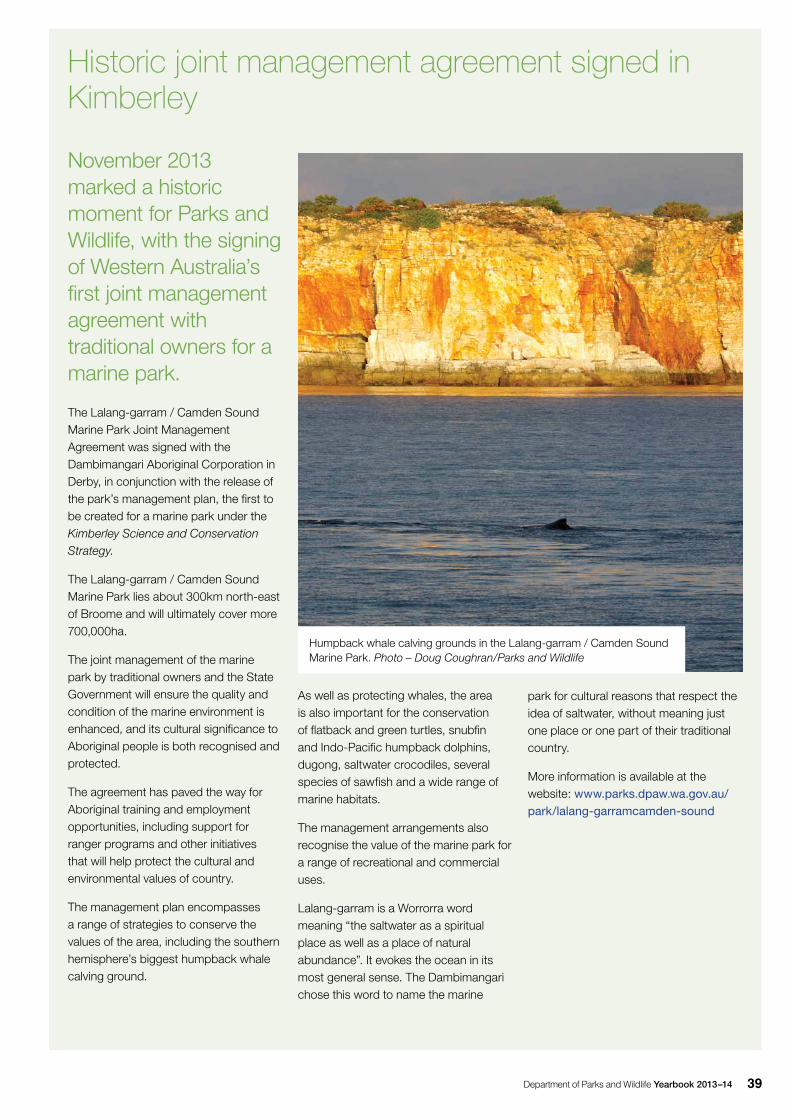
Department of Parks and Wildlife Yearbook 2013–14 39
November 2013 marked a historic moment for Parks and Wildlife, with the signing of Western Australia’s first joint management agreement with traditional owners for a marine park.
The Lalang-garram / Camden Sound Marine Park Joint Management Agreement was signed with the Dambimangari Aboriginal Corporation in Derby, in conjunction with the release of the park’s management plan, the first to be created for a marine park under the Kimberley Science and Conservation Strategy.
The Lalang-garram / Camden Sound Marine Park lies about 300km north-east of Broome and will ultimately cover more 700,000ha.
The joint management of the marine park by traditional owners and the State Government will ensure the quality and condition of the marine environment is enhanced, and its cultural significance to Aboriginal people is both recognised and protected.
The agreement has paved the way for Aboriginal training and employment opportunities, including support for ranger programs and other initiatives that will help protect the cultural and environmental values of country.
The management plan encompasses a range of strategies to conserve the values of the area, including the southern hemisphere’s biggest humpback whale calving ground.
As well as protecting whales, the area is also important for the conservation of flatback and green turtles, snubfin and Indo-Pacific humpback dolphins, dugong, saltwater crocodiles, several species of sawfish and a wide range of marine habitats.
The management arrangements also recognise the value of the marine park for a range of recreational and commercial uses.
Lalang-garram is a Worrorra word meaning “the saltwater as a spiritual place as well as a place of natural abundance”. It evokes the ocean in its most general sense. The Dambimangari chose this word to name the marine
Humpback whale calving grounds in the Lalang-garram / Camden Sound Marine Park. Photo – Doug Coughran/Parks and Wildlife
Historic joint management agreement signed in Kimberley
park for cultural reasons that respect the idea of saltwater, without meaning just one place or one part of their traditional country.
More information is available at the website: www.parks.dpaw.wa.gov.au/park/lalang-garramcamden-sound
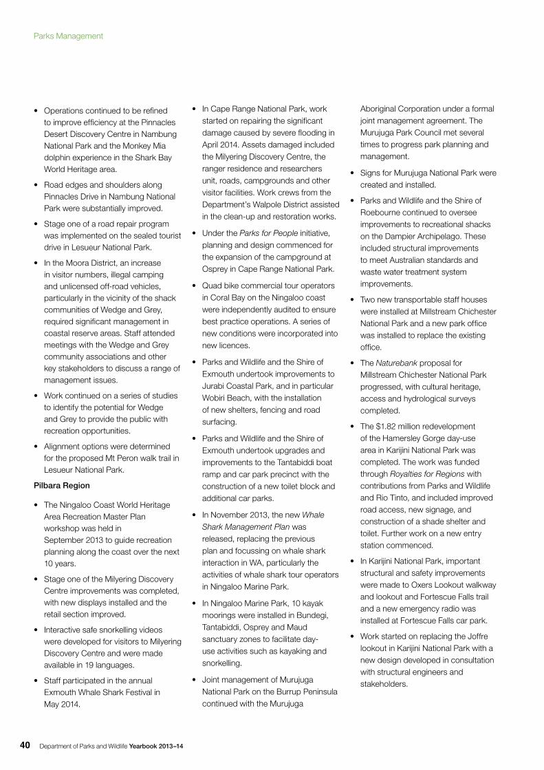
Department of Parks and Wildlife Yearbook 2013–1440
• Operations continued to be refined to improve efficiency at the Pinnacles Desert Discovery Centre in Nambung National Park and the Monkey Mia dolphin experience in the Shark Bay World Heritage area.
• Road edges and shoulders along Pinnacles Drive in Nambung National Park were substantially improved.
• Stage one of a road repair program was implemented on the sealed tourist drive in Lesueur National Park.
• In the Moora District, an increase in visitor numbers, illegal camping and unlicensed off-road vehicles, particularly in the vicinity of the shack communities of Wedge and Grey, required significant management in coastal reserve areas. Staff attended meetings with the Wedge and Grey community associations and other key stakeholders to discuss a range of management issues.
• Work continued on a series of studies to identify the potential for Wedge and Grey to provide the public with recreation opportunities.
• Alignment options were determined for the proposed Mt Peron walk trail in Lesueur National Park.
Pilbara Region
• The Ningaloo Coast World Heritage Area Recreation Master Plan workshop was held in September 2013 to guide recreation planning along the coast over the next 10 years.
• Stage one of the Milyering Discovery Centre improvements was completed, with new displays installed and the retail section improved.
• Interactive safe snorkelling videos were developed for visitors to Milyering Discovery Centre and were made available in 19 languages.
• Staff participated in the annual Exmouth Whale Shark Festival in May 2014.
• In Cape Range National Park, work started on repairing the significant damage caused by severe flooding in April 2014. Assets damaged included the Milyering Discovery Centre, the ranger residence and researchers unit, roads, campgrounds and other visitor facilities. Work crews from the Department’s Walpole District assisted in the clean-up and restoration works.
• Under the Parks for People initiative, planning and design commenced for the expansion of the campground at Osprey in Cape Range National Park.
• Quad bike commercial tour operators in Coral Bay on the Ningaloo coast were independently audited to ensure best practice operations. A series of new conditions were incorporated into new licences.
• Parks and Wildlife and the Shire of Exmouth undertook improvements to Jurabi Coastal Park, and in particular Wobiri Beach, with the installation of new shelters, fencing and road surfacing.
• Parks and Wildlife and the Shire of Exmouth undertook upgrades and improvements to the Tantabiddi boat ramp and car park precinct with the construction of a new toilet block and additional car parks.
• In November 2013, the new Whale Shark Management Plan was released, replacing the previous plan and focussing on whale shark interaction in WA, particularly the activities of whale shark tour operators in Ningaloo Marine Park.
• In Ningaloo Marine Park, 10 kayak moorings were installed in Bundegi, Tantabiddi, Osprey and Maud sanctuary zones to facilitate day-use activities such as kayaking and snorkelling.
• Joint management of Murujuga National Park on the Burrup Peninsula continued with the Murujuga
Aboriginal Corporation under a formal joint management agreement. The Murujuga Park Council met several times to progress park planning and management.
• Signs for Murujuga National Park were created and installed.
• Parks and Wildlife and the Shire of Roebourne continued to oversee improvements to recreational shacks on the Dampier Archipelago. These included structural improvements to meet Australian standards and waste water treatment system improvements.
• Two new transportable staff houses were installed at Millstream Chichester National Park and a new park office was installed to replace the existing office.
• The Naturebank proposal for Millstream Chichester National Park progressed, with cultural heritage, access and hydrological surveys completed.
• The $1.82 million redevelopment of the Hamersley Gorge day-use area in Karijini National Park was completed. The work was funded through Royalties for Regions with contributions from Parks and Wildlife and Rio Tinto, and included improved road access, new signage, and construction of a shade shelter and toilet. Further work on a new entry station commenced.
• In Karijini National Park, important structural and safety improvements were made to Oxers Lookout walkway and lookout and Fortescue Falls trail and a new emergency radio was installed at Fortescue Falls car park.
• Work started on replacing the Joffre lookout in Karijini National Park with a new design developed in consultation with structural engineers and stakeholders.
Parks Management
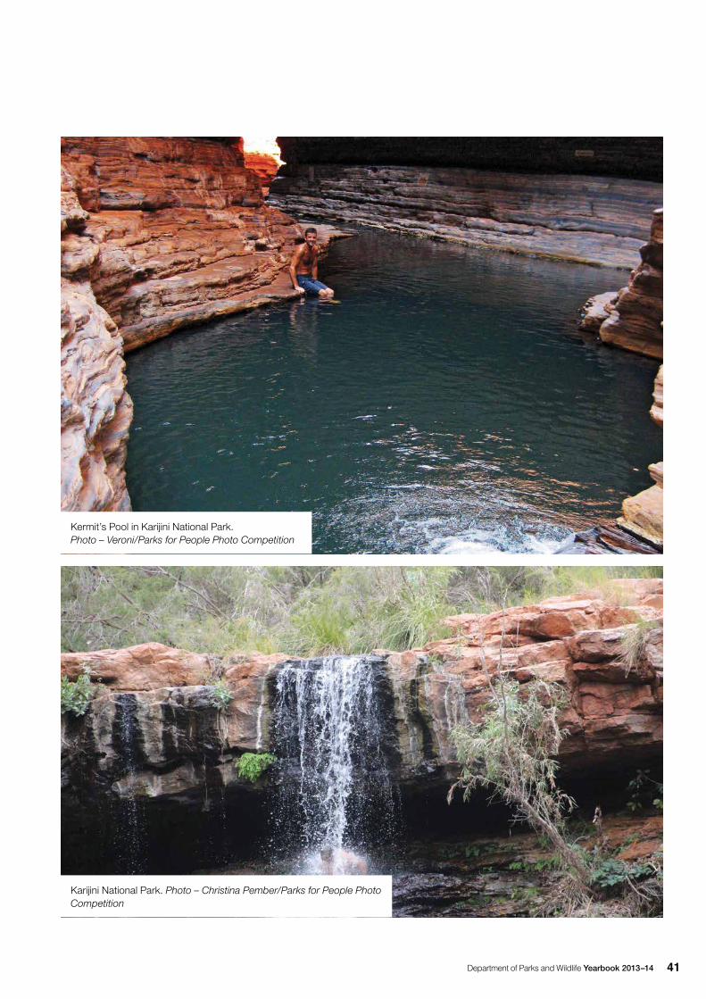
Department of Parks and Wildlife Yearbook 2013–14 41
Kermit’s Pool in Karijini National Park. Photo – Veroni/Parks for People Photo Competition
Karijini National Park. Photo – Christina Pember/Parks for People Photo Competition
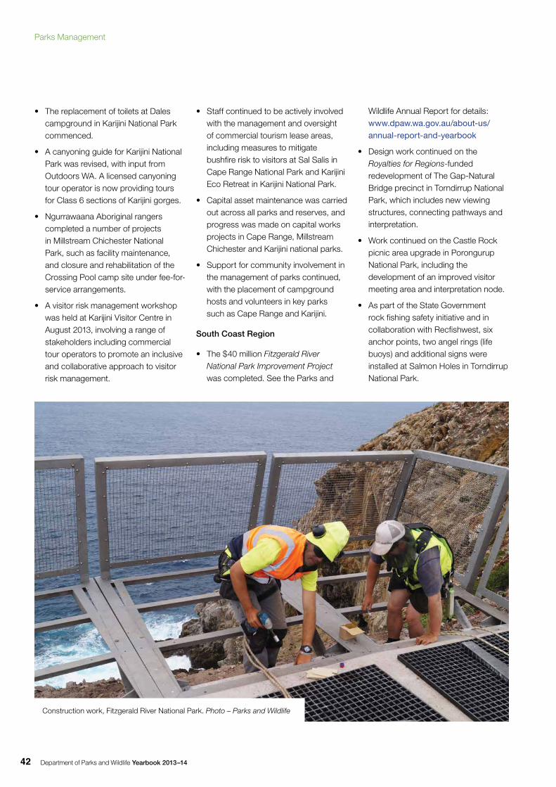
Department of Parks and Wildlife Yearbook 2013–1442
• The replacement of toilets at Dales campground in Karijini National Park commenced.
• A canyoning guide for Karijini National Park was revised, with input from Outdoors WA. A licensed canyoning tour operator is now providing tours for Class 6 sections of Karijini gorges.
• Ngurrawaana Aboriginal rangers completed a number of projects in Millstream Chichester National Park, such as facility maintenance, and closure and rehabilitation of the Crossing Pool camp site under fee-for-service arrangements.
• A visitor risk management workshop was held at Karijini Visitor Centre in August 2013, involving a range of stakeholders including commercial tour operators to promote an inclusive and collaborative approach to visitor risk management.
• Staff continued to be actively involved with the management and oversight of commercial tourism lease areas, including measures to mitigate bushfire risk to visitors at Sal Salis in Cape Range National Park and Karijini Eco Retreat in Karijini National Park.
• Capital asset maintenance was carried out across all parks and reserves, and progress was made on capital works projects in Cape Range, Millstream Chichester and Karijini national parks.
• Support for community involvement in the management of parks continued, with the placement of campground hosts and volunteers in key parks such as Cape Range and Karijini.
South Coast Region
• The $40 million Fitzgerald River National Park Improvement Project was completed. See the Parks and
Wildlife Annual Report for details: www.dpaw.wa.gov.au/about-us/annual-report-and-yearbook
• Design work continued on the Royalties for Regions-funded redevelopment of The Gap-Natural Bridge precinct in Torndirrup National Park, which includes new viewing structures, connecting pathways and interpretation.
• Work continued on the Castle Rock picnic area upgrade in Porongurup National Park, including the development of an improved visitor meeting area and interpretation node.
• As part of the State Government rock fishing safety initiative and in collaboration with Recfishwest, six anchor points, two angel rings (life buoys) and additional signs were installed at Salmon Holes in Torndirrup National Park.
Construction work, Fitzgerald River National Park. Photo – Parks and Wildlife
Parks Management

Department of Parks and Wildlife Yearbook 2013–14 43
• The annual Art in the Park event run by the Friends of the Porongurup Range was held in April 2014 at the Castle Rock picnic area.
• Engagement with traditional owners continued on a range of matters. In Esperance, an Aboriginal work crew was contracted to assist with a seven-week works maintenance program at Cape Le Grand and Stokes national parks and Esperance Lakes. In Albany, local area arrangements were made to facilitate customary activities in local parks and reserves.
• Campground hosts continued to assist staff at key parks in the region with positive results including improved visitor satisfaction.
• Visitor numbers continued to increase in all major national parks during peak and off-peak periods.
• The staff housing refurbishment project at Cape Le Grand National Park was completed with the upgrade of the assistant ranger’s house.
• A hydrology and water supply study and a feature survey were undertaken for the proposed Naturebank site in Cape Le Grand National Park. Following a re-examination of the flora survey, consideration of the site was discontinued due to environmental constraints.
• Under the Parks for People initiative, planning started for the Lucky Bay picnic area and campground redevelopment. This project will provide additional camp sites and new facilities including an ablution block and barbeque shelters.
South West Region
• The upgrade of Falcon Road in Wellington National Park continued, with the widening and sealing of 1.3km and the widening of a further 1.2km for sealing in 2014–15.
• Through the Naturebank program, Wharncliffe Mill Bush Retreat in Bramley National Park near Margaret River was opened by the Minister for Environment on 16 January 2014.
• Under the Parks for People initiative, planning for the development of a new campground at Potters Gorge in Wellington National Park commenced, with animal surveys and conceptual planning undertaken. This project will provide about 50 camp sites, six toilet blocks and four barbeque shelters.
Fitzgerald River National Park upgrade opening. Photo – Kerry Johnson/Parks and Wildlife
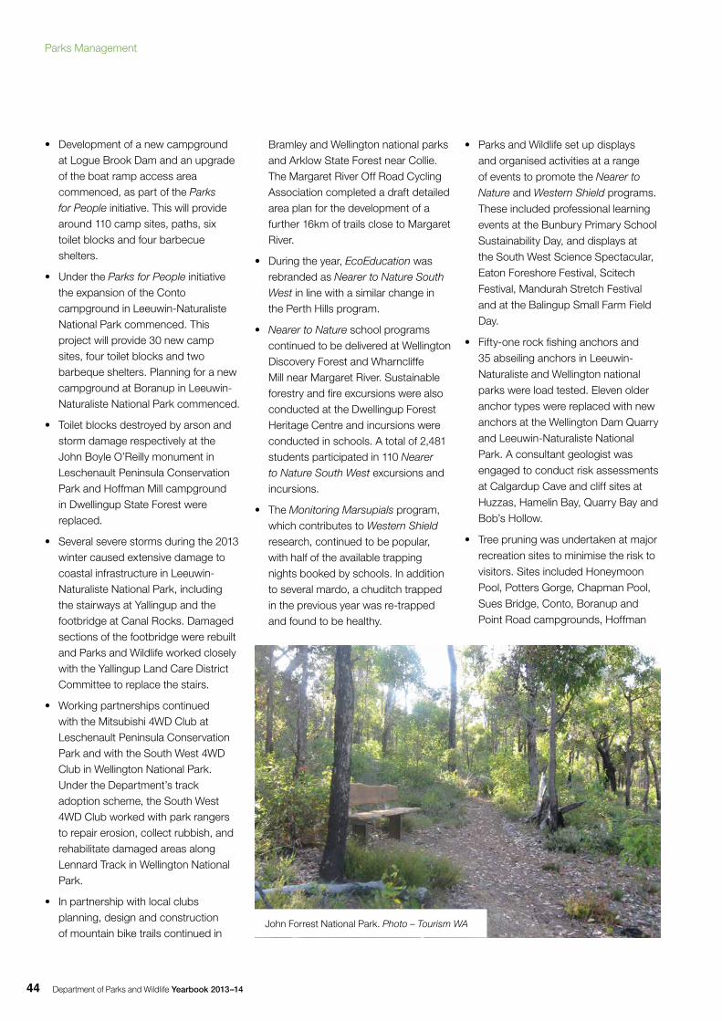
Department of Parks and Wildlife Yearbook 2013–1444
• Development of a new campground at Logue Brook Dam and an upgrade of the boat ramp access area commenced, as part of the Parks for People initiative. This will provide around 110 camp sites, paths, six toilet blocks and four barbecue shelters.
• Under the Parks for People initiative the expansion of the Conto campground in Leeuwin-Naturaliste National Park commenced. This project will provide 30 new camp sites, four toilet blocks and two barbeque shelters. Planning for a new campground at Boranup in Leeuwin-Naturaliste National Park commenced.
• Toilet blocks destroyed by arson and storm damage respectively at the John Boyle O’Reilly monument in Leschenault Peninsula Conservation Park and Hoffman Mill campground in Dwellingup State Forest were replaced.
• Several severe storms during the 2013 winter caused extensive damage to coastal infrastructure in Leeuwin-Naturaliste National Park, including the stairways at Yallingup and the footbridge at Canal Rocks. Damaged sections of the footbridge were rebuilt and Parks and Wildlife worked closely with the Yallingup Land Care District Committee to replace the stairs.
• Working partnerships continued with the Mitsubishi 4WD Club at Leschenault Peninsula Conservation Park and with the South West 4WD Club in Wellington National Park. Under the Department’s track adoption scheme, the South West 4WD Club worked with park rangers to repair erosion, collect rubbish, and rehabilitate damaged areas along Lennard Track in Wellington National Park.
• In partnership with local clubs planning, design and construction of mountain bike trails continued in
Bramley and Wellington national parks and Arklow State Forest near Collie. The Margaret River Off Road Cycling Association completed a draft detailed area plan for the development of a further 16km of trails close to Margaret River.
• During the year, EcoEducation was rebranded as Nearer to Nature South West in line with a similar change in the Perth Hills program.
• Nearer to Nature school programs continued to be delivered at Wellington Discovery Forest and Wharncliffe Mill near Margaret River. Sustainable forestry and fire excursions were also conducted at the Dwellingup Forest Heritage Centre and incursions were conducted in schools. A total of 2,481 students participated in 110 Nearer to Nature South West excursions and incursions.
• The Monitoring Marsupials program, which contributes to Western Shield research, continued to be popular, with half of the available trapping nights booked by schools. In addition to several mardo, a chuditch trapped in the previous year was re-trapped and found to be healthy.
• Parks and Wildlife set up displays and organised activities at a range of events to promote the Nearer to
Nature and Western Shield programs. These included professional learning events at the Bunbury Primary School Sustainability Day, and displays at the South West Science Spectacular, Eaton Foreshore Festival, Scitech Festival, Mandurah Stretch Festival and at the Balingup Small Farm Field Day.
• Fifty-one rock fishing anchors and 35 abseiling anchors in Leeuwin-Naturaliste and Wellington national parks were load tested. Eleven older anchor types were replaced with new anchors at the Wellington Dam Quarry and Leeuwin-Naturaliste National Park. A consultant geologist was engaged to conduct risk assessments at Calgardup Cave and cliff sites at Huzzas, Hamelin Bay, Quarry Bay and Bob’s Hollow.
• Tree pruning was undertaken at major recreation sites to minimise the risk to visitors. Sites included Honeymoon Pool, Potters Gorge, Chapman Pool, Sues Bridge, Conto, Boranup and Point Road campgrounds, Hoffman
John Forrest National Park. Photo – Tourism WA
Parks Management
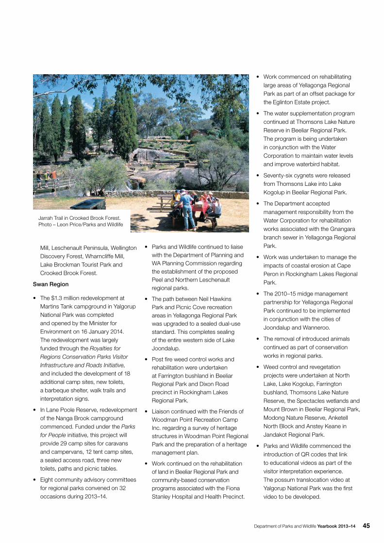
Department of Parks and Wildlife Yearbook 2013–14 45
Mill, Leschenault Peninsula, Wellington Discovery Forest, Wharncliffe Mill, Lake Brockman Tourist Park and Crooked Brook Forest.
Swan Region
• The $1.3 million redevelopment at Martins Tank campground in Yalgorup National Park was completed and opened by the Minister for Environment on 16 January 2014. The redevelopment was largely funded through the Royalties for Regions Conservation Parks Visitor Infrastructure and Roads Initiative, and included the development of 18 additional camp sites, new toilets, a barbeque shelter, walk trails and interpretation signs.
• In Lane Poole Reserve, redevelopment of the Nanga Brook campground commenced. Funded under the Parks for People initiative, this project will provide 29 camp sites for caravans and campervans, 12 tent camp sites, a sealed access road, three new toilets, paths and picnic tables.
• Eight community advisory committees for regional parks convened on 32 occasions during 2013–14.
• Parks and Wildlife continued to liaise with the Department of Planning and WA Planning Commission regarding the establishment of the proposed Peel and Northern Leschenault regional parks.
• The path between Neil Hawkins Park and Picnic Cove recreation areas in Yellagonga Regional Park was upgraded to a sealed dual-use standard. This completes sealing of the entire western side of Lake Joondalup.
• Post fire weed control works and rehabilitation were undertaken at Farrington bushland in Beeliar Regional Park and Dixon Road precinct in Rockingham Lakes Regional Park.
• Liaison continued with the Friends of Woodman Point Recreation Camp Inc. regarding a survey of heritage structures in Woodman Point Regional Park and the preparation of a heritage management plan.
• Work continued on the rehabilitation of land in Beeliar Regional Park and community-based conservation programs associated with the Fiona Stanley Hospital and Health Precinct.
• Work commenced on rehabilitating large areas of Yellagonga Regional Park as part of an offset package for the Eglinton Estate project.
• The water supplementation program continued at Thomsons Lake Nature Reserve in Beeliar Regional Park. The program is being undertaken in conjunction with the Water Corporation to maintain water levels and improve waterbird habitat.
• Seventy-six cygnets were released from Thomsons Lake into Lake Kogolup in Beeliar Regional Park.
• The Department accepted management responsibility from the Water Corporation for rehabilitation works associated with the Gnangara branch sewer in Yellagonga Regional Park.
• Work was undertaken to manage the impacts of coastal erosion at Cape Peron in Rockingham Lakes Regional Park.
• The 2010–15 midge management partnership for Yellagonga Regional Park continued to be implemented in conjunction with the cities of Joondalup and Wanneroo.
• The removal of introduced animals continued as part of conservation works in regional parks.
• Weed control and revegetation projects were undertaken at North Lake, Lake Kogolup, Farrington bushland, Thomsons Lake Nature Reserve, the Spectacles wetlands and Mount Brown in Beeliar Regional Park, Modong Nature Reserve, Anketell North Block and Anstey Keane in Jandakot Regional Park.
• Parks and Wildlife commenced the introduction of QR codes that link to educational videos as part of the visitor interpretation experience. The possum translocation video at Yalgorup National Park was the first video to be developed.
Jarrah Trail in Crooked Brook Forest. Photo – Leon Price/Parks and Wildlife
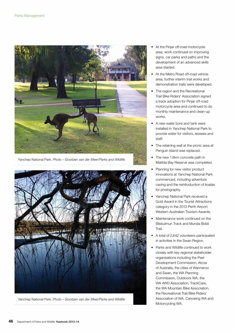
Department of Parks and Wildlife Yearbook 2013–1446
• At the Pinjar off-road motorcycle area, work continued on improving signs, car parks and paths and the development of an advanced skills area started.
• At the Metro Road off-road vehicle area, further interim trail works and demonstration trails were developed.
• The region and the Recreational Trail Bike Riders’ Association signed a track adoption for Pinjar off-road motorcycle area and continued to do monthly maintenance and clean-up works.
• A new water bore and tank were installed in Yanchep National Park to provide water for visitors, lessees and staff.
• The retaining wall at the picnic area at Penguin Island was replaced.
• The new 1.6km concrete path in Matilda Bay Reserve was completed.
• Planning for new visitor product innovations at Yanchep National Park commenced, including adventure caving and the reintroduction of koalas for photography.
• Yanchep National Park received a Gold Award in the Tourist Attractions category in the 2013 Perth Airport Western Australian Tourism Awards.
• Maintenance work continued on the Bibbulmun Track and Munda Biddi Trail.
• A total of 2,642 volunteers participated in activities in the Swan Region.
• Parks and Wildlife continued to work closely with key regional stakeholder organisations including the Peel Development Commission, Alcoa of Australia, the cities of Wanneroo and Swan, the WA Planning Commission, Outdoors WA, the WA 4WD Association, TrackCare, the WA Mountain Bike Association, the Recreational Trail Bike Riders’ Association of WA, Canoeing WA and Motorcycling WA.
Yanchep National Park. Photo – Gooitzen van der Meer/Parks and Wildlife
Yanchep National Park. Photo – Gooitzen van der Meer/Parks and Wildlife
Parks Management
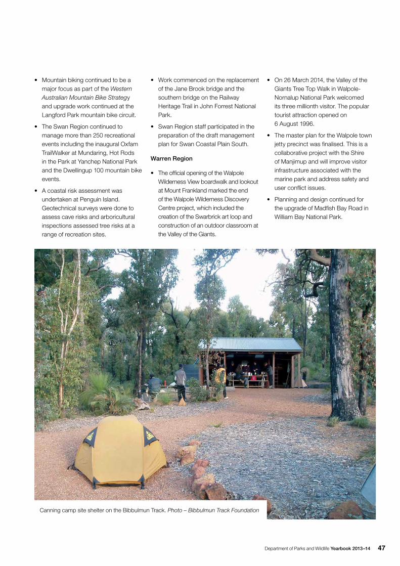
Department of Parks and Wildlife Yearbook 2013–14 47
• Mountain biking continued to be a major focus as part of the Western Australian Mountain Bike Strategy and upgrade work continued at the Langford Park mountain bike circuit.
• The Swan Region continued to manage more than 250 recreational events including the inaugural Oxfam TrailWalker at Mundaring, Hot Rods in the Park at Yanchep National Park and the Dwellingup 100 mountain bike events.
• A coastal risk assessment was undertaken at Penguin Island. Geotechnical surveys were done to assess cave risks and arboricultural inspections assessed tree risks at a range of recreation sites.
• Work commenced on the replacement of the Jane Brook bridge and the southern bridge on the Railway Heritage Trail in John Forrest National Park.
• Swan Region staff participated in the preparation of the draft management plan for Swan Coastal Plain South.
Warren Region
• The official opening of the Walpole Wilderness View boardwalk and lookout at Mount Frankland marked the end of the Walpole Wilderness Discovery Centre project, which included the creation of the Swarbrick art loop and construction of an outdoor classroom at the Valley of the Giants.
Canning camp site shelter on the Bibbulmun Track. Photo – Bibbulmun Track Foundation
• On 26 March 2014, the Valley of the Giants Tree Top Walk in Walpole-Nornalup National Park welcomed its three millionth visitor. The popular tourist attraction opened on 6 August 1996.
• The master plan for the Walpole town jetty precinct was finalised. This is a collaborative project with the Shire of Manjimup and will improve visitor infrastructure associated with the marine park and address safety and user conflict issues.
• Planning and design continued for the upgrade of Madfish Bay Road in William Bay National Park.
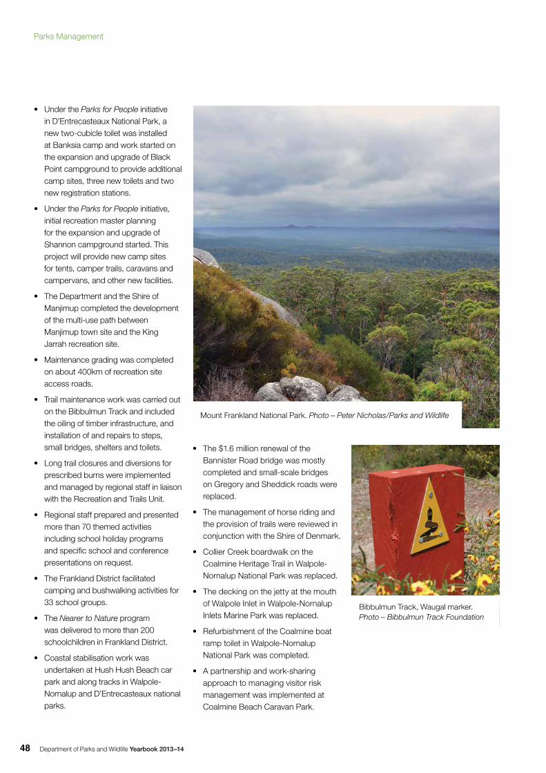
Department of Parks and Wildlife Yearbook 2013–1448
• Under the Parks for People initiative in D’Entrecasteaux National Park, a new two-cubicle toilet was installed at Banksia camp and work started on the expansion and upgrade of Black Point campground to provide additional camp sites, three new toilets and two new registration stations.
• Under the Parks for People initiative, initial recreation master planning for the expansion and upgrade of Shannon campground started. This project will provide new camp sites for tents, camper trails, caravans and campervans, and other new facilities.
• The Department and the Shire of Manjimup completed the development of the multi-use path between Manjimup town site and the King Jarrah recreation site.
• Maintenance grading was completed on about 400km of recreation site access roads.
• Trail maintenance work was carried out on the Bibbulmun Track and included the oiling of timber infrastructure, and installation of and repairs to steps, small bridges, shelters and toilets.
• Long trail closures and diversions for prescribed burns were implemented and managed by regional staff in liaison with the Recreation and Trails Unit.
• Regional staff prepared and presented more than 70 themed activities including school holiday programs and specific school and conference presentations on request.
• The Frankland District facilitated camping and bushwalking activities for 33 school groups.
• The Nearer to Nature program was delivered to more than 200 schoolchildren in Frankland District.
• Coastal stabilisation work was undertaken at Hush Hush Beach car park and along tracks in Walpole-Nornalup and D’Entrecasteaux national parks.
• The $1.6 million renewal of the Bannister Road bridge was mostly completed and small-scale bridges on Gregory and Sheddick roads were replaced.
• The management of horse riding and the provision of trails were reviewed in conjunction with the Shire of Denmark.
• Collier Creek boardwalk on the Coalmine Heritage Trail in Walpole-Nornalup National Park was replaced.
• The decking on the jetty at the mouth of Walpole Inlet in Walpole-Nornalup Inlets Marine Park was replaced.
• Refurbishment of the Coalmine boat ramp toilet in Walpole-Nornalup National Park was completed.
• A partnership and work-sharing approach to managing visitor risk management was implemented at Coalmine Beach Caravan Park.
Mount Frankland National Park. Photo – Peter Nicholas/Parks and Wildlife
Bibbulmun Track, Waugal marker. Photo – Bibbulmun Track Foundation
Parks Management
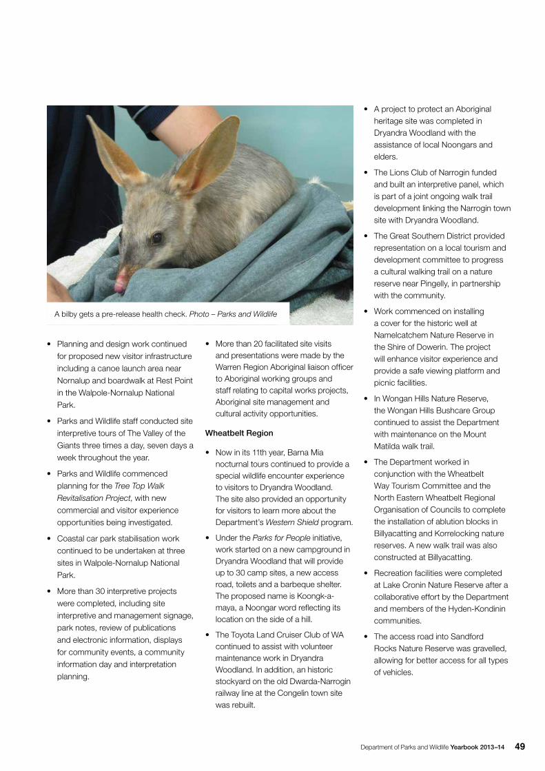
Department of Parks and Wildlife Yearbook 2013–14 49
• Planning and design work continued
for proposed new visitor infrastructure
including a canoe launch area near
Nornalup and boardwalk at Rest Point
in the Walpole-Nornalup National
Park.
• Parks and Wildlife staff conducted site
interpretive tours of The Valley of the
Giants three times a day, seven days a
week throughout the year.
• Parks and Wildlife commenced
planning for the Tree Top Walk
Revitalisation Project, with new
commercial and visitor experience
opportunities being investigated.
• Coastal car park stabilisation work
continued to be undertaken at three
sites in Walpole-Nornalup National
Park.
• More than 30 interpretive projects
were completed, including site
interpretive and management signage,
park notes, review of publications
and electronic information, displays
for community events, a community
information day and interpretation
planning.
• More than 20 facilitated site visits and presentations were made by the Warren Region Aboriginal liaison officer to Aboriginal working groups and staff relating to capital works projects, Aboriginal site management and cultural activity opportunities.
Wheatbelt Region
• Now in its 11th year, Barna Mia nocturnal tours continued to provide a special wildlife encounter experience to visitors to Dryandra Woodland. The site also provided an opportunity for visitors to learn more about the Department’s Western Shield program.
• Under the Parks for People initiative, work started on a new campground in Dryandra Woodland that will provide up to 30 camp sites, a new access road, toilets and a barbeque shelter. The proposed name is Koongk-a-maya, a Noongar word reflecting its location on the side of a hill.
• The Toyota Land Cruiser Club of WA continued to assist with volunteer maintenance work in Dryandra Woodland. In addition, an historic stockyard on the old Dwarda-Narrogin railway line at the Congelin town site was rebuilt.
• A project to protect an Aboriginal heritage site was completed in Dryandra Woodland with the assistance of local Noongars and elders.
• The Lions Club of Narrogin funded and built an interpretive panel, which is part of a joint ongoing walk trail development linking the Narrogin town site with Dryandra Woodland.
• The Great Southern District provided representation on a local tourism and development committee to progress a cultural walking trail on a nature reserve near Pingelly, in partnership with the community.
• Work commenced on installing a cover for the historic well at Namelcatchem Nature Reserve in the Shire of Dowerin. The project will enhance visitor experience and provide a safe viewing platform and picnic facilities.
• In Wongan Hills Nature Reserve, the Wongan Hills Bushcare Group continued to assist the Department with maintenance on the Mount Matilda walk trail.
• The Department worked in conjunction with the Wheatbelt Way Tourism Committee and the North Eastern Wheatbelt Regional Organisation of Councils to complete the installation of ablution blocks in Billyacatting and Korrelocking nature reserves. A new walk trail was also constructed at Billyacatting.
• Recreation facilities were completed at Lake Cronin Nature Reserve after a collaborative effort by the Department and members of the Hyden-Kondinin communities.
• The access road into Sandford Rocks Nature Reserve was gravelled, allowing for better access for all types of vehicles.
A bilby gets a pre-release health check. Photo – Parks and Wildlife
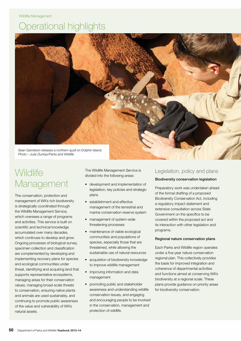
Department of Parks and Wildlife Yearbook 2013–1450
Operational highlights
Wildlife ManagementThe conservation, protection and management of WA’s rich biodiversity is strategically coordinated through the Wildlife Management Service, which oversees a range of programs and activities. This service is built on scientific and technical knowledge accumulated over many decades, which continues to develop and grow. Ongoing processes of biological survey, specimen collection and classification are complemented by developing and implementing recovery plans for species and ecological communities under threat, identifying and acquiring land that supports representative ecosystems, managing areas for their conservation values, managing broad-scale threats to conservation, ensuring native plants and animals are used sustainably, and continuing to promote public awareness of the value and vulnerability of WA’s natural assets.
The Wildlife Management Service is divided into the following areas:
• development and implementation of legislation, key policies and strategic plans
• establishment and effective management of the terrestrial and marine conservation reserve system
• management of system-wide threatening processes
• maintenance of viable ecological communities and populations of species, especially those that are threatened, while allowing the sustainable use of natural resources
• acquisition of biodiversity knowledge to improve wildlife management
• improving information and data management
• promoting public and stakeholder awareness and understanding wildlife conservation issues, and engaging and encouraging people to be involved in the conservation, management and protection of wildlife.
Legislation, policy and plansBiodiversity conservation legislation
Preparatory work was undertaken ahead of the formal drafting of a proposed Biodiversity Conservation Act, including a regulatory impact statement and extensive consultation across State Government on the specifics to be covered within the proposed act and its interaction with other legislation and programs.
Regional nature conservation plans
Each Parks and Wildlife region operates under a five-year nature conservation regional plan. This collectively provides the basis for improved integration and coherence of departmental activities and functions aimed at conserving WA’s biodiversity at a regional scale. These plans provide guidance on priority areas for biodiversity conservation.
Sean Garretson releases a northern quoll on Dolphin Island. Photo – Judy Dunlop/Parks and Wildlife
Wildlife Management
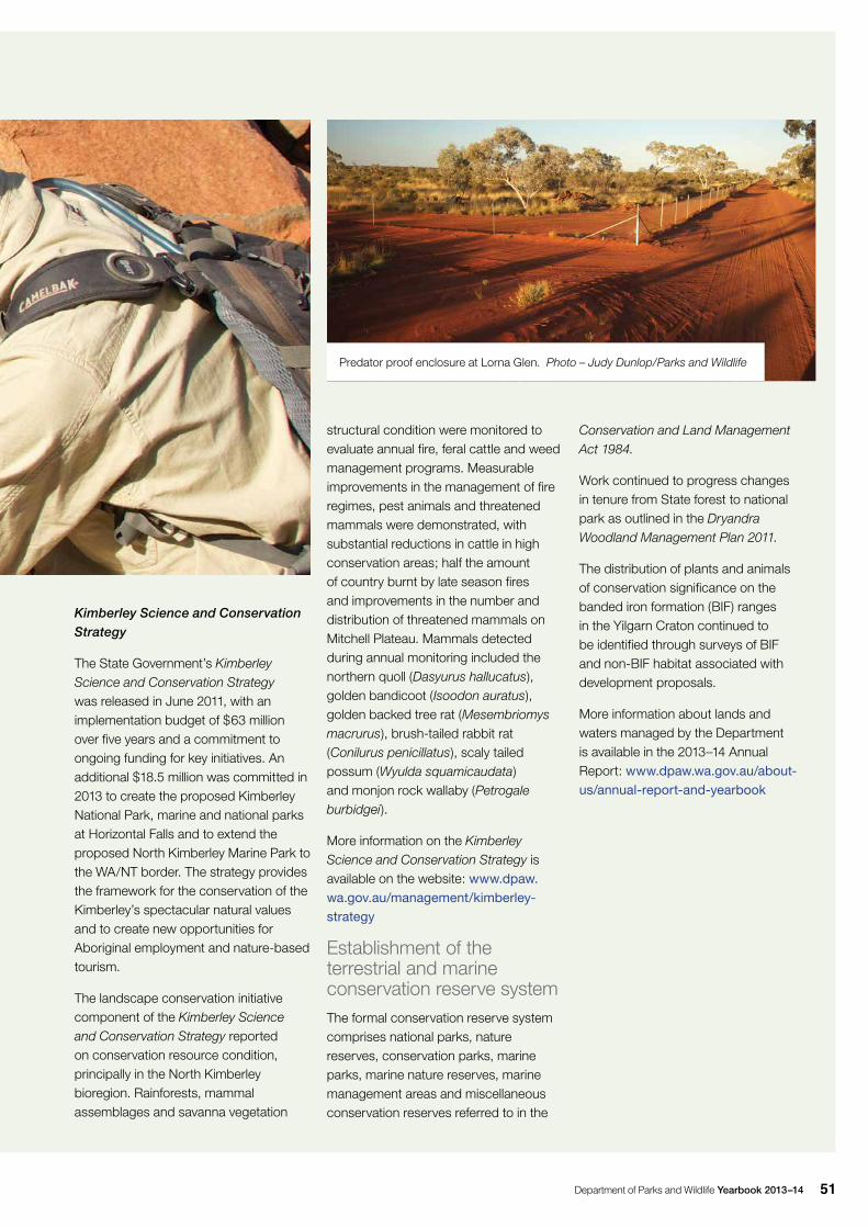
Department of Parks and Wildlife Yearbook 2013–14 51
Kimberley Science and Conservation Strategy
The State Government’s Kimberley Science and Conservation Strategy was released in June 2011, with an implementation budget of $63 million over five years and a commitment to ongoing funding for key initiatives. An additional $18.5 million was committed in 2013 to create the proposed Kimberley National Park, marine and national parks at Horizontal Falls and to extend the proposed North Kimberley Marine Park to the WA/NT border. The strategy provides the framework for the conservation of the Kimberley’s spectacular natural values and to create new opportunities for Aboriginal employment and nature-based tourism.
The landscape conservation initiative component of the Kimberley Science and Conservation Strategy reported on conservation resource condition, principally in the North Kimberley bioregion. Rainforests, mammal assemblages and savanna vegetation
structural condition were monitored to evaluate annual fire, feral cattle and weed management programs. Measurable improvements in the management of fire regimes, pest animals and threatened mammals were demonstrated, with substantial reductions in cattle in high conservation areas; half the amount of country burnt by late season fires and improvements in the number and distribution of threatened mammals on Mitchell Plateau. Mammals detected during annual monitoring included the northern quoll (Dasyurus hallucatus), golden bandicoot (Isoodon auratus), golden backed tree rat (Mesembriomys macrurus), brush-tailed rabbit rat (Conilurus penicillatus), scaly tailed possum (Wyulda squamicaudata) and monjon rock wallaby (Petrogale burbidgei).
More information on the Kimberley Science and Conservation Strategy is available on the website: www.dpaw.wa.gov.au/management/kimberley-strategy
Establishment of the terrestrial and marine conservation reserve systemThe formal conservation reserve system comprises national parks, nature reserves, conservation parks, marine parks, marine nature reserves, marine management areas and miscellaneous conservation reserves referred to in the
Predator proof enclosure at Lorna Glen. Photo – Judy Dunlop/Parks and Wildlife
Conservation and Land Management Act 1984.
Work continued to progress changes in tenure from State forest to national park as outlined in the Dryandra Woodland Management Plan 2011.
The distribution of plants and animals of conservation significance on the banded iron formation (BIF) ranges in the Yilgarn Craton continued to be identified through surveys of BIF and non-BIF habitat associated with development proposals.
More information about lands and waters managed by the Department is available in the 2013–14 Annual Report: www.dpaw.wa.gov.au/about-us/annual-report-and-yearbook
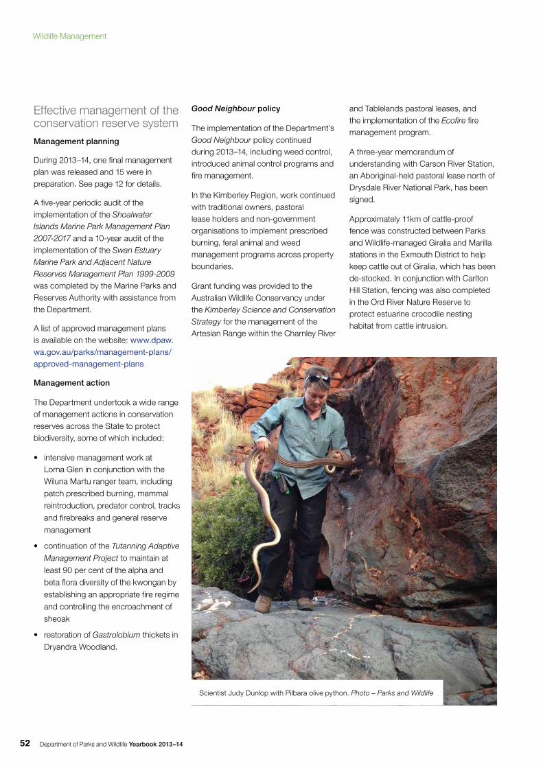
Department of Parks and Wildlife Yearbook 2013–1452
Effective management of the conservation reserve systemManagement planning
During 2013–14, one final management plan was released and 15 were in preparation. See page 12 for details.
A five-year periodic audit of the implementation of the Shoalwater Islands Marine Park Management Plan 2007-2017 and a 10-year audit of the implementation of the Swan Estuary Marine Park and Adjacent Nature Reserves Management Plan 1999-2009 was completed by the Marine Parks and Reserves Authority with assistance from the Department.
A list of approved management plans is available on the website: www.dpaw.wa.gov.au/parks/management-plans/approved-management-plans
Management action
The Department undertook a wide range of management actions in conservation reserves across the State to protect biodiversity, some of which included:
• intensive management work at Lorna Glen in conjunction with the Wiluna Martu ranger team, including
patch prescribed burning, mammal
reintroduction, predator control, tracks
and firebreaks and general reserve
management
• continuation of the Tutanning Adaptive
Management Project to maintain at
least 90 per cent of the alpha and
beta flora diversity of the kwongan by
establishing an appropriate fire regime
and controlling the encroachment of
sheoak
• restoration of Gastrolobium thickets in
Dryandra Woodland.
Good Neighbour policy
The implementation of the Department’s Good Neighbour policy continued during 2013–14, including weed control, introduced animal control programs and fire management.
In the Kimberley Region, work continued with traditional owners, pastoral lease holders and non-government organisations to implement prescribed burning, feral animal and weed management programs across property boundaries.
Grant funding was provided to the Australian Wildlife Conservancy under the Kimberley Science and Conservation Strategy for the management of the Artesian Range within the Charnley River
and Tablelands pastoral leases, and the implementation of the Ecofire fire management program.
A three-year memorandum of understanding with Carson River Station, an Aboriginal-held pastoral lease north of Drysdale River National Park, has been signed.
Approximately 11km of cattle-proof fence was constructed between Parks and Wildlife-managed Giralia and Marilla stations in the Exmouth District to help keep cattle out of Giralia, which has been de-stocked. In conjunction with Carlton Hill Station, fencing was also completed in the Ord River Nature Reserve to protect estuarine crocodile nesting habitat from cattle intrusion.
Scientist Judy Dunlop with Pilbara olive python. Photo – Parks and Wildlife
Wildlife Management
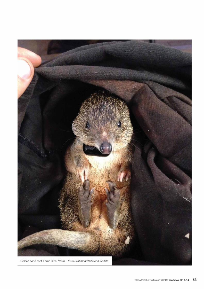
Department of Parks and Wildlife Yearbook 2013–14 53
Golden bandicoot, Lorna Glen. Photo – Mark Blythman/Parks and Wildlife
Department of Parks and Wildlife Yearbook 2013–1454
Recovery and management of threatened species and ecological communities, significant species and ecosystemsRecovery of threatened species and ecological communities
The Threatened Species Scientific Committee’s recommendations from 2013 for changes to the State lists of threatened native plants and animals under the WC Act were gazetted on 17 September 2013.
The Department continued to implement the Memorandum of Understanding (MOU) with the Federal Department of the Environment to better align the threatened species lists under the Federal Environment Protection and Biodiversity Conservation Act 1999 (EPBC Act) with the State lists under the WC Act. This MOU, and the prior joint project to prepare information sheets as the first stage in nominating changes to the list of threatened species under the EPBC Act, has so far resulted in 128 changes to the list of nationally threatened species under the EPBC Act.
Flora
Four species were added to the State list of extant threatened flora: Caladenia sp. Collie (E. Bennett s.n.), Commersonia apella, Synaphea sp. Pinjarra Plain (A.S. George 17182) and Synaphea sp. Serpentine (G.R. Brand 103). Acacia splendens was upgraded from endangered to critically endangered and Myriophyllum lapidicola was upgraded from vulnerable to endangered. Three nomenclature changes were also endorsed.
A further 88 taxa were added to the Department’s priority flora list, and 36 taxa were deleted from the list after more survey and taxonomic review demonstrated their adequate conservation status.
At 30 June 2014, there were 415 extant threatened flora species listed, with 14 listed as presumed to be extinct, and 2,999 taxa listed on the Department’s priority flora list.
Recovery actions were implemented for a suite of threatened flora. Highlights included:
• A total of 265 species of threatened and priority flora comprising 402 populations were surveyed or monitored and 21 new populations of threatened flora and 114 new populations of priority flora were located. Of note was the discovery of new populations of the critically endangered blue tinsel lily (Calectasia cyanea), Eremophila glabra subsp. chlorella, milky emu bush (Eremophila lactea), Guichenotia seorsiflora and salt myoporum (Myoporum turbinatum). In addition, new populations of the column hakea (Hakea aculeata) were located. Ten priority flora were recommended for downgrading in status following the discovery of further populations.
• Volunteers from the Department and the WA Native Orchid Study and Conservation Group collaborated on the Adopt an Orchid project to survey and monitor 24 threatened and priority orchid species, with 107 populations monitored and 11 new populations discovered.
• Phosphite applications were carried out to control Phytophthora dieback, targeting 19 threatened flora species including 11 critically endangered taxa in Stirling Range National Park and in the Albany coastal area.
• Aerial canker monitoring continued for Albany banksia (Banksia verticillata) and Lambertia orbifolia populations, as part of a larger south coast aerial canker research project.
• Fencing to protect plants from grazing was constructed for several threatened flora species, including the critically endangered western cyphanthera
(Cyphanthera odgersii subsp. occidentalis), yellow mountain bell (Darwinia collina), Stirling Range beard heath (Leucopogon gnaphalioides), Latrobea colophona and giant andersonia (Andersonia axilliflora).
• Rabbit control was undertaken to protect many threatened flora species including tangled wattle (Acacia volubilis), sprawling spiky adenanthos (Adenanthos pungens subsp. effusus), matchstick banksia (Banksia cuneata), Wagin banksia (Banksia oligantha), stilted tinsel lily (Calectasia pignattiana), Boscabel conostylis (Conostylis setigera subsp. dasys), Cunderdin daviesia (Daviesia cunderdin) and Lake King eremophila (Eremophila subteretifolia). Rabbit control included the fumigation of rabbit warrens and the baiting of threatened flora habitat.
• Weed control was undertaken for many threatened flora species including the Wagin banksia (Banksia oligantha), elegant spider orchid (Caladenia elegans), Fitzgerald eremophila (Eremophila denticulata subsp. denticulata), Northampton midget greenhood (Pterostylis sinuata) and Schoenia filifolia subsp. subulifolia.
• Recruitment burns were carried out on populations of Wongan cactus (Daviesia euphorbioides) and Dasymalla axillaris. Post fire monitoring was carried out for five threatened flora species: Wundowlin wattle (Acacia sciophanes), Tutanning boronia (Boronia capitata subsp. capitata), stilted tinsel lily, Drummond’s conostylis (Conostylis drummondii) and Norseman pea (Daviesia microcarpa).
• New translocation sites were established for the critically endangered Grevillea maxwellii and Daviesia ovata in 2013–14 (Table 4). Infill planting at 14 translocation sites previously established for nine critically endangered taxa was also undertaken. Additionally, 49 established plant translocation sites containing 32 taxa were monitored.
Wildlife Management
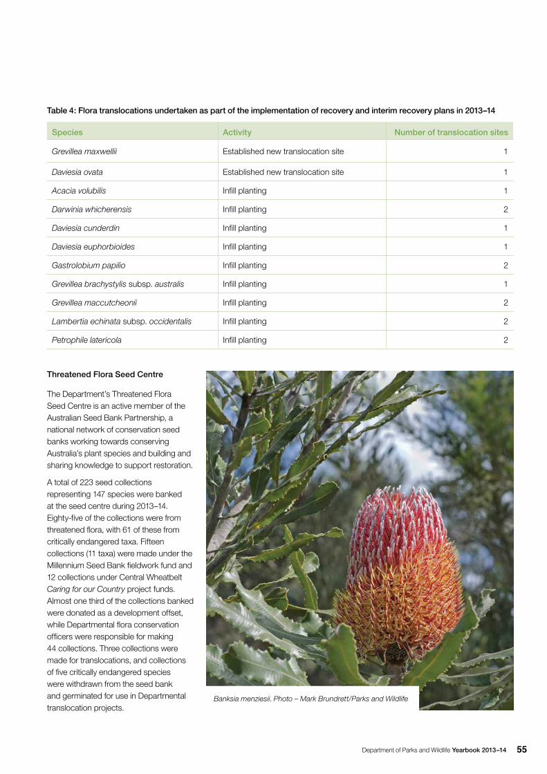
Department of Parks and Wildlife Yearbook 2013–14 55
Table 4: Flora translocations undertaken as part of the implementation of recovery and interim recovery plans in 2013–14
Species Activity Number of translocation sites
Grevillea maxwellii Established new translocation site 1
Daviesia ovata Established new translocation site 1
Acacia volubilis Infill planting 1
Darwinia whicherensis Infill planting 2
Daviesia cunderdin Infill planting 1
Daviesia euphorbioides Infill planting 1
Gastrolobium papilio Infill planting 2
Grevillea brachystylis subsp. australis Infill planting 1
Grevillea maccutcheonii Infill planting 2
Lambertia echinata subsp. occidentalis Infill planting 2
Petrophile latericola Infill planting 2
Threatened Flora Seed Centre
The Department’s Threatened Flora Seed Centre is an active member of the Australian Seed Bank Partnership, a national network of conservation seed banks working towards conserving Australia’s plant species and building and sharing knowledge to support restoration.
A total of 223 seed collections representing 147 species were banked at the seed centre during 2013–14. Eighty-five of the collections were from threatened flora, with 61 of these from critically endangered taxa. Fifteen collections (11 taxa) were made under the Millennium Seed Bank fieldwork fund and 12 collections under Central Wheatbelt Caring for our Country project funds. Almost one third of the collections banked were donated as a development offset, while Departmental flora conservation officers were responsible for making 44 collections. Three collections were made for translocations, and collections of five critically endangered species were withdrawn from the seed bank and germinated for use in Departmental translocation projects.
Banksia menziesii. Photo – Mark Brundrett/Parks and Wildlife
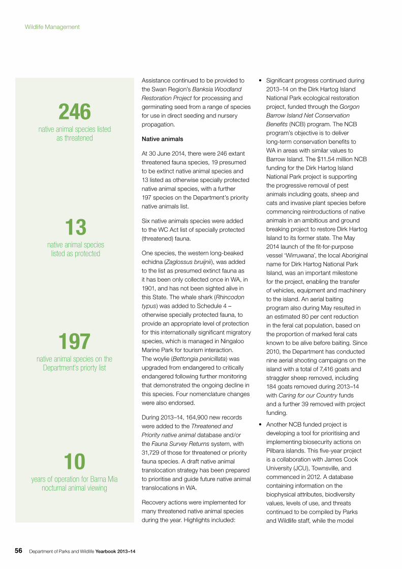
Department of Parks and Wildlife Yearbook 2013–1456
Assistance continued to be provided to the Swan Region’s Banksia Woodland Restoration Project for processing and germinating seed from a range of species for use in direct seeding and nursery propagation.
Native animals
At 30 June 2014, there were 246 extant threatened fauna species, 19 presumed to be extinct native animal species and 13 listed as otherwise specially protected native animal species, with a further 197 species on the Department’s priority native animals list.
Six native animals species were added to the WC Act list of specially protected (threatened) fauna.
One species, the western long-beaked echidna (Zaglossus bruijnii), was added to the list as presumed extinct fauna as it has been only collected once in WA, in 1901, and has not been sighted alive in this State. The whale shark (Rhincodon typus) was added to Schedule 4 – otherwise specially protected fauna, to provide an appropriate level of protection for this internationally significant migratory species, which is managed in Ningaloo Marine Park for tourism interaction. The woylie (Bettongia penicillata) was upgraded from endangered to critically endangered following further monitoring that demonstrated the ongoing decline in this species. Four nomenclature changes were also endorsed.
During 2013–14, 164,900 new records were added to the Threatened and Priority native animal database and/or the Fauna Survey Returns system, with 31,729 of those for threatened or priority fauna species. A draft native animal translocation strategy has been prepared to prioritise and guide future native animal translocations in WA.
Recovery actions were implemented for many threatened native animal species during the year. Highlights included:
13 native animal species
listed as protected
197native animal species on the
Department’s priorty list
10years of operation for Barna Mia
nocturnal animal viewing
246native animal species listed
as threatened
• Significant progress continued during 2013–14 on the Dirk Hartog Island National Park ecological restoration project, funded through the Gorgon Barrow Island Net Conservation Benefits (NCB) program. The NCB program’s objective is to deliver long-term conservation benefits to WA in areas with similar values to Barrow Island. The $11.54 million NCB funding for the Dirk Hartog Island National Park project is supporting the progressive removal of pest animals including goats, sheep and cats and invasive plant species before commencing reintroductions of native animals in an ambitious and ground breaking project to restore Dirk Hartog Island to its former state. The May 2014 launch of the fit-for-purpose vessel ‘Wirruwana’, the local Aboriginal name for Dirk Hartog National Park Island, was an important milestone for the project, enabling the transfer of vehicles, equipment and machinery to the island. An aerial baiting program also during May resulted in an estimated 80 per cent reduction in the feral cat population, based on the proportion of marked feral cats known to be alive before baiting. Since 2010, the Department has conducted nine aerial shooting campaigns on the island with a total of 7,416 goats and straggler sheep removed, including 184 goats removed during 2013–14 with Caring for our Country funds and a further 39 removed with project funding.
• Another NCB funded project is developing a tool for prioritising and implementing biosecurity actions on Pilbara islands. This five-year project is a collaboration with James Cook University (JCU), Townsville, and commenced in 2012. A database containing information on the biophysical attributes, biodiversity values, levels of use, and threats continued to be compiled by Parks and Wildlife staff, while the model
Wildlife Management
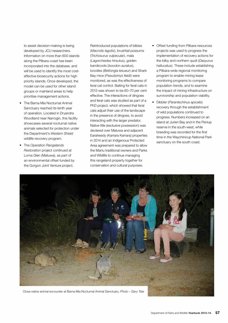
Department of Parks and Wildlife Yearbook 2013–14 57
to assist decision-making is being developed by JCU researchers. Information on more than 600 islands along the Pilbara coast has been incorporated into the database, and will be used to identify the most cost-effective biosecurity actions for high priority islands. Once developed, the model can be used for other island groups or mainland areas to help prioritise management actions.
• The Barna Mia Nocturnal Animal Sanctuary reached its tenth year of operation. Located in Dryandra Woodland near Narrogin, this facility showcases several nocturnal native animals selected for protection under the Department’s Western Shield wildlife recovery program.
• The Operation Rangelands
Restoration project continued at Lorna Glen (Matuwa), as part of an environmental offset funded by the Gorgon Joint Venture project.
Reintroduced populations of bilbies (Macrotis lagotis), brushtail possums (Trichosurus vulpecular), mala (Lagorchestes hirsutus), golden bandicoots (Isoodon auratus), boodies (Bettongia lesueur) and Shark Bay mice (Pseudomys fieldi) were monitored, as was the effectiveness of feral cat control. Baiting for feral cats in 2013 was shown to be 60–70 per cent effective. The interactions of dingoes and feral cats was studied as part of a PhD project, which showed that feral cats adjust their use of the landscape in the presence of dingoes, to avoid interacting with the larger predator. Native title (exclusive possession) was declared over Matuwa and adjacent Earaheedy (Karrara Karrara) properties in 2014 and an Indigenous Protected Area agreement was prepared to allow the Martu traditional owners and Parks and Wildlife to continue managing this rangeland property together for conservation and cultural purposes.
• Offset funding from Pilbara resources projects was used to progress the implementation of recovery actions for the bilby and northern quoll (Dasyurus hallucatus). These include establishing a Pilbara-wide regional monitoring program to enable mining lease monitoring programs to compare population trends, and to examine the impact of mining infrastructure on survivorship and population viability.
• Dibbler (Parantechinus apicalis) recovery through the establishment of wild populations continued to progress. Numbers increased on an island at Jurien Bay and in the Peniup reserve in the south-west, while breeding was recorded for the first time in the Waychinicup National Park sanctuary on the south coast.
Close native animal encounter at Barna Mia Nocturnal Animal Sanctuary. Photo – Gary Tate
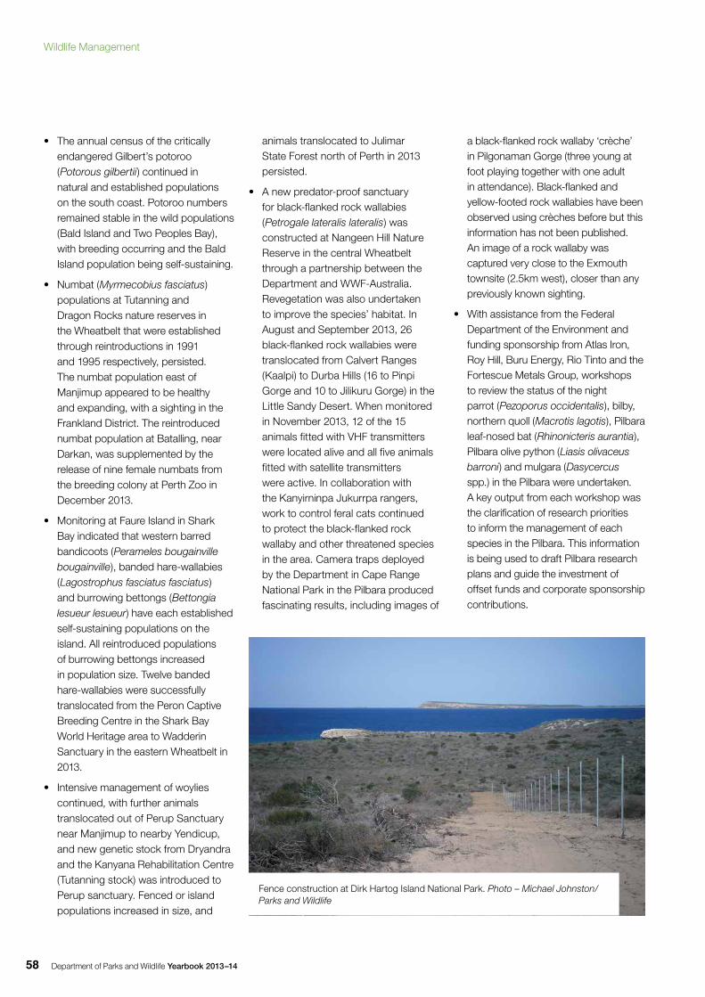
Department of Parks and Wildlife Yearbook 2013–1458
• The annual census of the critically endangered Gilbert’s potoroo (Potorous gilbertii) continued in natural and established populations on the south coast. Potoroo numbers remained stable in the wild populations (Bald Island and Two Peoples Bay), with breeding occurring and the Bald Island population being self-sustaining.
• Numbat (Myrmecobius fasciatus) populations at Tutanning and Dragon Rocks nature reserves in the Wheatbelt that were established through reintroductions in 1991 and 1995 respectively, persisted. The numbat population east of Manjimup appeared to be healthy and expanding, with a sighting in the Frankland District. The reintroduced numbat population at Batalling, near Darkan, was supplemented by the release of nine female numbats from the breeding colony at Perth Zoo in December 2013.
• Monitoring at Faure Island in Shark Bay indicated that western barred bandicoots (Perameles bougainville bougainville), banded hare-wallabies (Lagostrophus fasciatus fasciatus) and burrowing bettongs (Bettongia lesueur lesueur) have each established self-sustaining populations on the island. All reintroduced populations of burrowing bettongs increased in population size. Twelve banded hare-wallabies were successfully translocated from the Peron Captive Breeding Centre in the Shark Bay World Heritage area to Wadderin Sanctuary in the eastern Wheatbelt in 2013.
• Intensive management of woylies continued, with further animals translocated out of Perup Sanctuary near Manjimup to nearby Yendicup, and new genetic stock from Dryandra and the Kanyana Rehabilitation Centre (Tutanning stock) was introduced to Perup sanctuary. Fenced or island populations increased in size, and
animals translocated to Julimar State Forest north of Perth in 2013 persisted.
• A new predator-proof sanctuary for black-flanked rock wallabies (Petrogale lateralis lateralis) was constructed at Nangeen Hill Nature Reserve in the central Wheatbelt through a partnership between the Department and WWF-Australia. Revegetation was also undertaken to improve the species’ habitat. In August and September 2013, 26 black-flanked rock wallabies were translocated from Calvert Ranges (Kaalpi) to Durba Hills (16 to Pinpi Gorge and 10 to Jilikuru Gorge) in the Little Sandy Desert. When monitored in November 2013, 12 of the 15 animals fitted with VHF transmitters were located alive and all five animals fitted with satellite transmitters were active. In collaboration with the Kanyirninpa Jukurrpa rangers, work to control feral cats continued to protect the black-flanked rock wallaby and other threatened species in the area. Camera traps deployed by the Department in Cape Range National Park in the Pilbara produced fascinating results, including images of
a black-flanked rock wallaby ‘crèche’ in Pilgonaman Gorge (three young at foot playing together with one adult in attendance). Black-flanked and yellow-footed rock wallabies have been observed using crèches before but this information has not been published. An image of a rock wallaby was captured very close to the Exmouth townsite (2.5km west), closer than any previously known sighting.
• With assistance from the Federal Department of the Environment and funding sponsorship from Atlas Iron, Roy Hill, Buru Energy, Rio Tinto and the Fortescue Metals Group, workshops to review the status of the night parrot (Pezoporus occidentalis), bilby, northern quoll (Macrotis lagotis), Pilbara leaf-nosed bat (Rhinonicteris aurantia), Pilbara olive python (Liasis olivaceus barroni) and mulgara (Dasycercus spp.) in the Pilbara were undertaken. A key output from each workshop was the clarification of research priorities to inform the management of each species in the Pilbara. This information is being used to draft Pilbara research plans and guide the investment of offset funds and corporate sponsorship contributions.
Fence construction at Dirk Hartog Island National Park. Photo – Michael Johnston/Parks and Wildlife
Wildlife Management
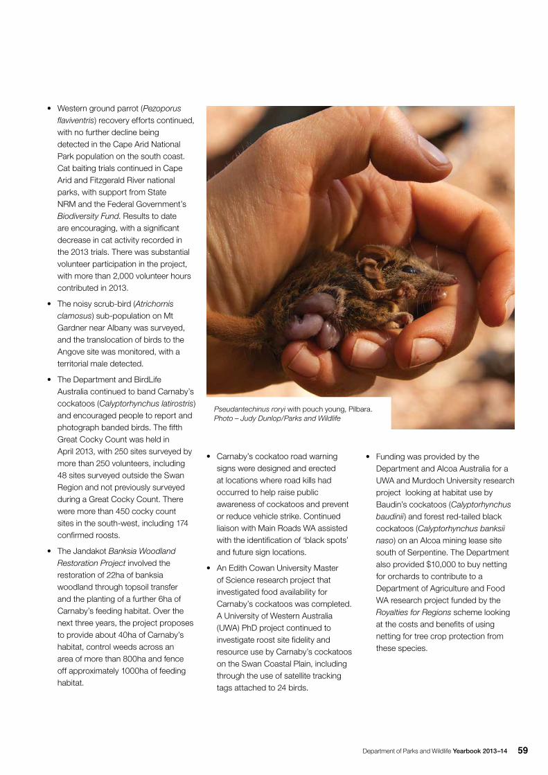
Department of Parks and Wildlife Yearbook 2013–14 59
• Western ground parrot (Pezoporus flaviventris) recovery efforts continued, with no further decline being detected in the Cape Arid National Park population on the south coast. Cat baiting trials continued in Cape Arid and Fitzgerald River national parks, with support from State NRM and the Federal Government’s Biodiversity Fund. Results to date are encouraging, with a significant decrease in cat activity recorded in the 2013 trials. There was substantial volunteer participation in the project, with more than 2,000 volunteer hours contributed in 2013.
• The noisy scrub-bird (Atrichornis clamosus) sub-population on Mt Gardner near Albany was surveyed, and the translocation of birds to the Angove site was monitored, with a territorial male detected.
• The Department and BirdLife Australia continued to band Carnaby’s cockatoos (Calyptorhynchus latirostris) and encouraged people to report and photograph banded birds. The fifth Great Cocky Count was held in April 2013, with 250 sites surveyed by more than 250 volunteers, including 48 sites surveyed outside the Swan Region and not previously surveyed during a Great Cocky Count. There were more than 450 cocky count sites in the south-west, including 174 confirmed roosts.
• The Jandakot Banksia Woodland Restoration Project involved the restoration of 22ha of banksia woodland through topsoil transfer and the planting of a further 6ha of Carnaby’s feeding habitat. Over the next three years, the project proposes to provide about 40ha of Carnaby’s habitat, control weeds across an area of more than 800ha and fence off approximately 1000ha of feeding habitat.
• Carnaby’s cockatoo road warning signs were designed and erected at locations where road kills had occurred to help raise public awareness of cockatoos and prevent or reduce vehicle strike. Continued liaison with Main Roads WA assisted with the identification of ‘black spots’ and future sign locations.
• An Edith Cowan University Master of Science research project that investigated food availability for Carnaby’s cockatoos was completed. A University of Western Australia (UWA) PhD project continued to investigate roost site fidelity and resource use by Carnaby’s cockatoos on the Swan Coastal Plain, including through the use of satellite tracking tags attached to 24 birds.
• Funding was provided by the Department and Alcoa Australia for a UWA and Murdoch University research project looking at habitat use by Baudin’s cockatoos (Calyptorhynchus baudinii) and forest red-tailed black cockatoos (Calyptorhynchus banksii naso) on an Alcoa mining lease site south of Serpentine. The Department also provided $10,000 to buy netting for orchards to contribute to a Department of Agriculture and Food WA research project funded by the Royalties for Regions scheme looking at the costs and benefits of using netting for tree crop protection from these species.
Pseudantechinus roryi with pouch young, Pilbara. Photo – Judy Dunlop/Parks and Wildlife
Department of Parks and Wildlife Yearbook 2013–1460
• Western swamp tortoise (Pseudemydura umbrina) populations at Ellen Brook Nature Reserve, Twin Swamps Nature Reserve, Sheep Swamp adjacent to Mogumber Nature Reserve and North-West Swamp in Moore River Nature Reserve all showed signs of recruitment, following annual monitoring and management of the reserves. Fifty years of monitoring and recovery efforts were celebrated in 2013 at an event attended by the Environment Minister.
• A Statewide strategic plan for the conservation of marine turtles was developed. A number of projects on marine turtles were undertaken, including:
-A project focussing on the composition, distribution and seasonality of marine turtle nesting in the Kimberley began in 2013 as part of the Kimberley Node of the Western Australia Marine Science Institution (WAMSI). This project is led by Parks and Wildlife and is being undertaken by a consortium of researchers and Aboriginal groups.
-In the Kimberley, flatback turtle (Natator depressus) nest monitoring continued on Eighty Mile Beach in partnership with traditional owners, pastoralists and volunteers. Flatback turtle populations were also monitored at Cape Domett to determine population viability in conjunction with Miriuwung-Gajerrong and Balanggarra traditional owners.
-At Dirk Hartog Island National Park, ongoing monitoring of nesting loggerhead turtles (Caretta caretta) continued, assisted by a remote camera system. The extended monitoring period showed that Dirk Hartog Island supports one of the world’s biggest nesting loggerhead turtle populations.
- The Ningaloo turtle program funded by Parks and Wildlife and Woodside continued, with 44 volunteers contributing 3,186 hours in identifying nests by the track count method along key Ningaloo coast beaches. An average nesting season was recorded during 2013–14, with 2,779 nests. Of these nests, 82 per cent were from green turtles (Chelonia mydas), 15 per cent from loggerheads and three per cent from hawksbill turtles (Eretmochelys imbricata). Hawksbill turtles have shown a significant increase in nesting abundance at Ningaloo since 2004.
-The Dampier Archipelago supports the largest hawksbill turtle rookery in the Indo-Pacific and one of the biggest in the world. Turtle monitoring on Rosemary Island, which lies within the archipelago, primarily focused on hawksbill turtles and continued to add to knowledge of spatial trends, turtle mortality and growth rates. Rosemary Island has been a focus for hawksbill turtle tagging and monitoring research since the mid-1980s. The project is undertaken by Parks and Wildlife staff and volunteers.
-The West Pilbara Turtle Program, funded by Rio Tinto, is a cooperatively managed, community-based program that monitors flatback turtles at Wickham beaches. Volunteers from Karratha and Wickham monitored nesting, false crawl events, hatchling events and nest interference by predators and humans. Volunteer numbers continued to increase, reflecting the value of this program to the local community.
-A pilot study was undertaken on Munda Station in the Pilbara, which aimed to determine the impact of cats and foxes on flatback turtle nests. Munda station supports one of the largest flatback turtle rookeries in WA. The pilot study was successful in capturing evidence of predation.
• Forty-eight sites were monitored in 2013 across the distribution of the threatened white-bellied and orange-bellied frogs (Geocrinia alba and Geocrinia vitellina) in the south-west, with linear monitoring of population densities indicating that larger populations at three sites were relatively stable. Monitoring showed successful establishment of white-bellied frogs at the Witchcliffe Forest site and all previous establishment sites of the orange-bellied frog. Froglet breeding by Perth Zoo continued, with 70 white-bellied frogs translocated to Forest Grove and 65 orange-bellied frogs translocated to three Adelaide Creek sites.
• A new wildlife management program for the management of the whale shark (Rhincodon typus) in Ningaloo Marine Park was prepared to guide the management of wildlife interactions with this species and ensure its ongoing conservation in State waters.
• A morphometric key for the hairy marron (Cherax tenuimanus) was developed, and the Cape to Cape catchment groups and volunteers were trained to use it. Captive breeding of this species was successfully undertaken in 2013.
Wildlife Management
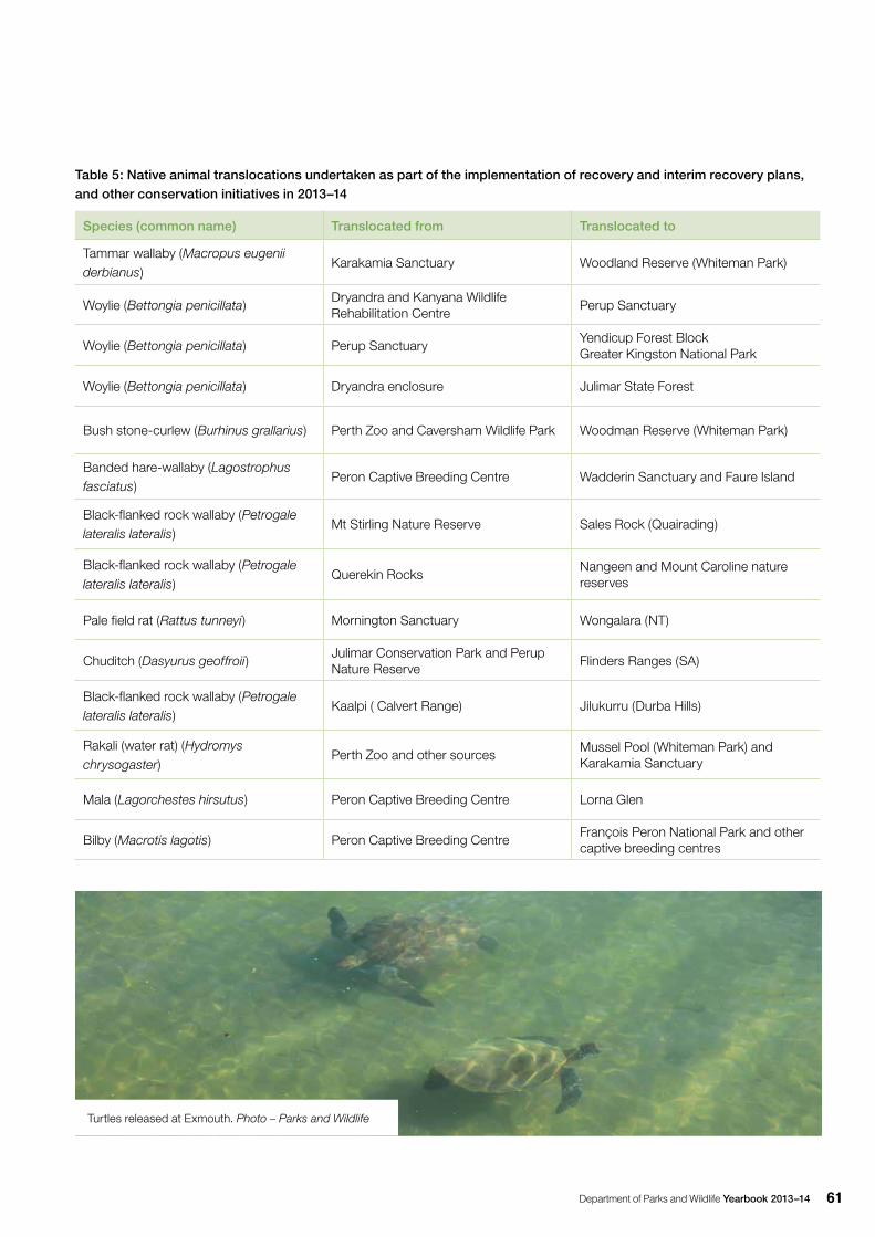
Department of Parks and Wildlife Yearbook 2013–14 61
Table 5: Native animal translocations undertaken as part of the implementation of recovery and interim recovery plans, and other conservation initiatives in 2013–14
Species (common name) Translocated from Translocated to
Tammar wallaby (Macropus eugenii derbianus)
Karakamia Sanctuary Woodland Reserve (Whiteman Park)
Woylie (Bettongia penicillata) Dryandra and Kanyana Wildlife Rehabilitation Centre
Perup Sanctuary
Woylie (Bettongia penicillata) Perup SanctuaryYendicup Forest BlockGreater Kingston National Park
Woylie (Bettongia penicillata) Dryandra enclosure Julimar State Forest
Bush stone-curlew (Burhinus grallarius) Perth Zoo and Caversham Wildlife Park Woodman Reserve (Whiteman Park)
Banded hare-wallaby (Lagostrophus fasciatus)
Peron Captive Breeding Centre Wadderin Sanctuary and Faure Island
Black-flanked rock wallaby (Petrogale lateralis lateralis)
Mt Stirling Nature Reserve Sales Rock (Quairading)
Black-flanked rock wallaby (Petrogale lateralis lateralis)
Querekin RocksNangeen and Mount Caroline nature reserves
Pale field rat (Rattus tunneyi) Mornington Sanctuary Wongalara (NT)
Chuditch (Dasyurus geoffroii) Julimar Conservation Park and Perup Nature Reserve
Flinders Ranges (SA)
Black-flanked rock wallaby (Petrogale lateralis lateralis)
Kaalpi ( Calvert Range) Jilukurru (Durba Hills)
Rakali (water rat) (Hydromys chrysogaster)
Perth Zoo and other sourcesMussel Pool (Whiteman Park) and Karakamia Sanctuary
Mala (Lagorchestes hirsutus) Peron Captive Breeding Centre Lorna Glen
Bilby (Macrotis lagotis) Peron Captive Breeding CentreFrançois Peron National Park and other captive breeding centres
Turtles released at Exmouth. Photo – Parks and Wildlife
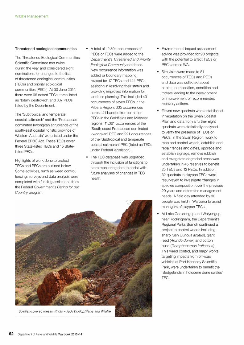
Department of Parks and Wildlife Yearbook 2013–1462
Threatened ecological communities
The Threatened Ecological Communities Scientific Committee met twice during the year and considered eight nominations for changes to the lists of threatened ecological communities (TECs) and priority ecological communities (PECs). At 30 June 2014, there were 66 extant TECs, three listed as ‘totally destroyed’, and 307 PECs listed by the Department.
The ‘Subtropical and temperate coastal saltmarsh’ and the ‘Proteaceae dominated kwongkan shrublands of the south-east coastal floristic province of Western Australia’ were listed under the Federal EPBC Act. These TECs cover three State-listed TECs and 15 State-listed PECs.
Highlights of work done to protect TECs and PECs are outlined below. Some activities, such as weed control, fencing, surveys and data analysis were completed with funding assistance from the Federal Government’s Caring for our Country program.
• A total of 12,394 occurrences of PECs or TECs were added to the Department’s Threatened and Priority Ecological Community database. New occurrence information was added or boundary mapping revised for 17 TECs and 144 PECs, assisting in resolving their status and providing improved information for land use planning. This included 43 occurrences of seven PECs in the Pilbara Region, 335 occurrences across 41 banded iron formation PECs in the Goldfields and Midwest regions, 11,361 occurrences of the ‘South coast Proteaceae dominated kwongkan’ PEC and 221 occurrences of the ‘Subtropical and temperate coastal saltmarsh’ PEC (listed as TECs under Federal legislation).
• The TEC database was upgraded through the inclusion of functions to store monitoring data to assist with future analyses of changes in TEC health.
• Environmental impact assessment advice was provided for 90 projects, with the potential to affect TECs or PECs across WA.
• Site visits were made to 81 occurrences of TECs and PECs and data was collected about habitat, composition, condition and threats leading to the development or improvement of recommended recovery actions.
• Eleven new quadrats were established in vegetation on the Swan Coastal Plain and data from a further eight quadrats were statistically analysed to verify the presence of TECs or PECs. In the Swan Region, work to map and control weeds, establish and repair fences and gates, upgrade and establish signage, remove rubbish and revegetate degraded areas was undertaken in 45 reserves to benefit 25 TECs and 12 PECs. In addition, 32 quadrats in claypan TECs were resurveyed to investigate changes in species composition over the previous 20 years and determine management needs. A field day attended by 30 people was held in Waroona to assist managers of claypan TECs.
• At Lake Cooloongup and Walyungup near Rockingham, the Department’s Regional Parks Branch continued a project to control weeds including sharp rush (Juncus acutus), giant reed (Arundo donax) and cotton bush (Gomphocarpus fruticosus). This weed control, and major works targeting impacts from off-road vehicles at Port Kennedy Scientific Park, were undertaken to benefit the ‘Sedgelands in holocene dune swales’ TEC.
Spinifex-covered mesas. Photo – Judy Dunlop/Parks and Wildlife
Wildlife Management
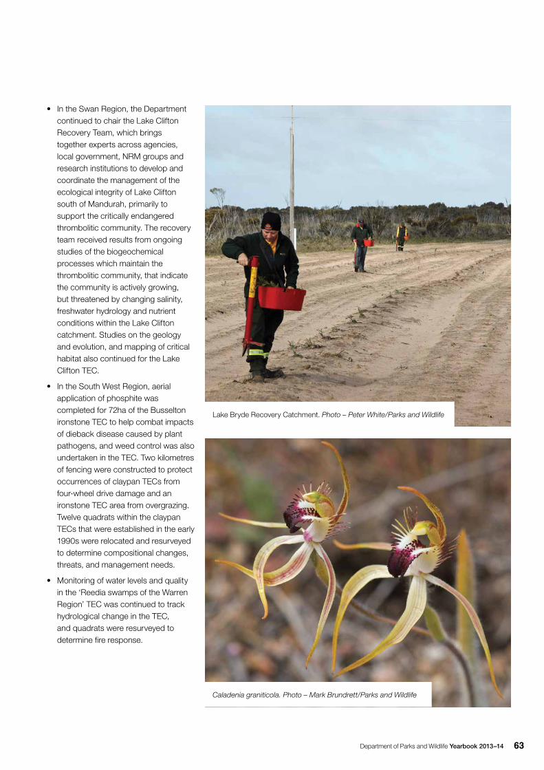
Department of Parks and Wildlife Yearbook 2013–14 63
• In the Swan Region, the Department continued to chair the Lake Clifton Recovery Team, which brings together experts across agencies, local government, NRM groups and research institutions to develop and coordinate the management of the ecological integrity of Lake Clifton south of Mandurah, primarily to support the critically endangered thrombolitic community. The recovery team received results from ongoing studies of the biogeochemical processes which maintain the thrombolitic community, that indicate the community is actively growing, but threatened by changing salinity, freshwater hydrology and nutrient conditions within the Lake Clifton catchment. Studies on the geology and evolution, and mapping of critical habitat also continued for the Lake Clifton TEC.
• In the South West Region, aerial application of phosphite was completed for 72ha of the Busselton ironstone TEC to help combat impacts of dieback disease caused by plant pathogens, and weed control was also undertaken in the TEC. Two kilometres of fencing were constructed to protect occurrences of claypan TECs from four-wheel drive damage and an ironstone TEC area from overgrazing. Twelve quadrats within the claypan TECs that were established in the early 1990s were relocated and resurveyed to determine compositional changes, threats, and management needs.
• Monitoring of water levels and quality in the ‘Reedia swamps of the Warren Region’ TEC was continued to track hydrological change in the TEC, and quadrats were resurveyed to determine fire response.
Lake Bryde Recovery Catchment. Photo – Peter White/Parks and Wildlife
Caladenia graniticola. Photo – Mark Brundrett/Parks and Wildlife
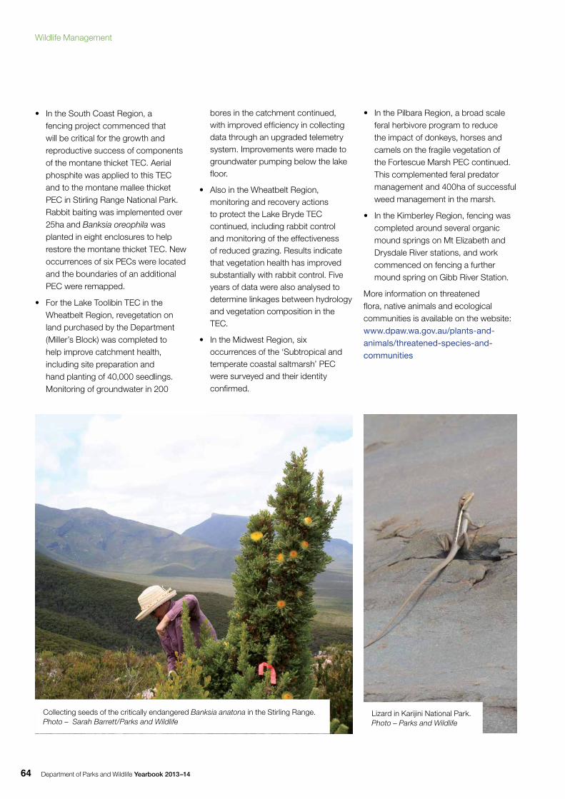
Department of Parks and Wildlife Yearbook 2013–1464
• In the South Coast Region, a fencing project commenced that will be critical for the growth and reproductive success of components of the montane thicket TEC. Aerial phosphite was applied to this TEC and to the montane mallee thicket PEC in Stirling Range National Park. Rabbit baiting was implemented over 25ha and Banksia oreophila was planted in eight enclosures to help restore the montane thicket TEC. New occurrences of six PECs were located and the boundaries of an additional PEC were remapped.
• For the Lake Toolibin TEC in the Wheatbelt Region, revegetation on land purchased by the Department (Miller’s Block) was completed to help improve catchment health, including site preparation and hand planting of 40,000 seedlings. Monitoring of groundwater in 200
bores in the catchment continued, with improved efficiency in collecting data through an upgraded telemetry system. Improvements were made to groundwater pumping below the lake floor.
• Also in the Wheatbelt Region, monitoring and recovery actions to protect the Lake Bryde TEC continued, including rabbit control and monitoring of the effectiveness of reduced grazing. Results indicate that vegetation health has improved substantially with rabbit control. Five years of data were also analysed to determine linkages between hydrology and vegetation composition in the TEC.
• In the Midwest Region, six occurrences of the ‘Subtropical and temperate coastal saltmarsh’ PEC were surveyed and their identity confirmed.
• In the Pilbara Region, a broad scale feral herbivore program to reduce the impact of donkeys, horses and camels on the fragile vegetation of the Fortescue Marsh PEC continued. This complemented feral predator management and 400ha of successful weed management in the marsh.
• In the Kimberley Region, fencing was completed around several organic mound springs on Mt Elizabeth and Drysdale River stations, and work commenced on fencing a further mound spring on Gibb River Station.
More information on threatened flora, native animals and ecological communities is available on the website: www.dpaw.wa.gov.au/plants-and-animals/threatened-species-and-communities
Collecting seeds of the critically endangered Banksia anatona in the Stirling Range. Photo – Sarah Barrett/Parks and Wildlife
Lizard in Karijini National Park. Photo – Parks and Wildlife
Wildlife Management
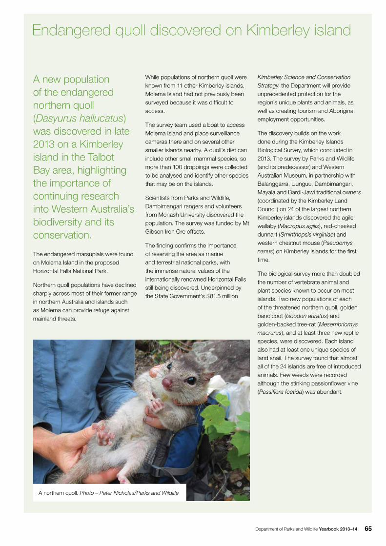
Department of Parks and Wildlife Yearbook 2013–14 65
A new population of the endangered northern quoll (Dasyurus hallucatus) was discovered in late 2013 on a Kimberley island in the Talbot Bay area, highlighting the importance of continuing research into Western Australia’s biodiversity and its conservation.
The endangered marsupials were found on Molema Island in the proposed Horizontal Falls National Park.
Northern quoll populations have declined sharply across most of their former range in northern Australia and islands such as Molema can provide refuge against mainland threats.
Endangered quoll discovered on Kimberley island
While populations of northern quoll were known from 11 other Kimberley islands, Molema Island had not previously been surveyed because it was difficult to access.
The survey team used a boat to access Molema Island and place surveillance cameras there and on several other smaller islands nearby. A quoll’s diet can include other small mammal species, so more than 100 droppings were collected to be analysed and identify other species that may be on the islands.
Scientists from Parks and Wildlife, Dambimangari rangers and volunteers from Monash University discovered the population. The survey was funded by Mt Gibson Iron Ore offsets.
The finding confirms the importance of reserving the area as marine and terrestrial national parks, with the immense natural values of the internationally renowned Horizontal Falls still being discovered. Underpinned by the State Government’s $81.5 million
Kimberley Science and Conservation Strategy, the Department will provide unprecedented protection for the region’s unique plants and animals, as well as creating tourism and Aboriginal employment opportunities.
The discovery builds on the work done during the Kimberley Islands Biological Survey, which concluded in 2013. The survey by Parks and Wildlife (and its predecessor) and Western Australian Museum, in partnership with Balanggarra, Uunguu, Dambimangari, Mayala and Bardi-Jawi traditional owners (coordinated by the Kimberley Land Council) on 24 of the largest northern Kimberley islands discovered the agile wallaby (Macropus agilis), red-cheeked dunnart (Sminthopsis virginiae) and western chestnut mouse (Pseudomys nanus) on Kimberley islands for the first time.
The biological survey more than doubled the number of vertebrate animal and plant species known to occur on most islands. Two new populations of each of the threatened northern quoll, golden bandicoot (Isoodon auratus) and golden-backed tree-rat (Mesembriomys macrurus), and at least three new reptile species, were discovered. Each island also had at least one unique species of land snail. The survey found that almost all of the 24 islands are free of introduced animals. Few weeds were recorded although the stinking passionflower vine (Passiflora foetida) was abundant.
A northern quoll. Photo – Peter Nicholas/Parks and Wildlife
Department of Parks and Wildlife Yearbook 2013–1466
Restoration
The Banksia Woodland Restoration Project was initiated to restore natural habitats in the Perth metropolitan region as an offset for vegetation clearing at Jandakot Airport. This project aims to re-establish native vegetation to provide habitat for the Carnaby’s cockatoo and grand spider orchid (Caladenia huegelii). Topsoil was transferred to 5ha at Forrestdale Lake and 11ha along Anketell Road in Jandakot Regional Park. In winter 2013, BirdLife Australia volunteers assisted in planting banksia seedlings and other native plants at the Anketell Road site where an additional 10ha was direct seeded in collaboration with Greening Australia WA. So far, more than 110 species of native plants have become established in these areas.
Recovery planning
Five new threatened flora interim recovery plans (Androclava perlaria, Caladenia lodgeana, Daviesia dielsii, Grevillea murex and Kunzea acicularis), and six updated plans (Banksia anatona, Drakaea confluens, Gastrolobium papilio, Grevillea calliantha, Isopogon uncinatus and Lambertia echinata subsp. echinata), were approved.
Recovery plans were approved for two TECs: ‘Heath dominated by one or more of Regelia megacephala, Kunzea praestans and Allocasuarina campestris on ridges and slopes of the chert hills of the Coomberdale Floristic Region’ and ‘Callitris preissii (or Melaleuca lanceolata) forests and woodlands of the Swan Coastal Plain’.
New recovery plans were approved for the western ringtail possum (Pseudocheirus occidentalis) and the white-bellied and orange-bellied frogs (Geocrinia alba and Geocrinia vitellina). Recovery plans for the quokka (Setonix brachyurus), western swamp tortoise (Pseudemydura umbrina), white shark (Carcharodon carcharias), Carnaby’s cockatoo (Calyptorhynchus latirostris) and five species of the black-flanked rock wallaby (Petrogale spp.) were adopted by the Federal Government under the EPBC Act. The recovery plans for south coast birds and the western ringtail possum were submitted to the Federal Government for adoption under the EPBC Act.
More information on recovery planning is available on the website: www.dpaw.wa.gov.au/plants-and-animals/threatened-species-and-communities
Wetland conservation
Ramsar wetlands
Twelve WA wetlands are listed under the International Convention on Wetlands (Ramsar Convention). The work of completing State and Federal government approvals for ecological character descriptions (ECD) for all 12 Ramsar sites continued (Table 6). During the 2013–14 period, the ECDs for Toolibin Lake and the Vasse-Wonnerup Ramsar sites were endorsed by the State and Federal governments and provided to the Ramsar Convention Secretariat for uploading onto the convention’s website. Eleven of WA’s 12 Ramsar sites now have endorsed ECDs. A draft of the final ECD, Becher Point Wetlands, was completed.
Ramsar information sheets are regularly revised. The Toolibin Lake sheet was endorsed during 2013–14.
Carnaby’s cockatoo. Photo – Rick Dawson/Parks and Wildlife
Wildlife Management
Department of Parks and Wildlife Yearbook 2013–14 67
Table 6: Management plans for Ramsar wetlands in WA
Ramsar siteRamsar
information sheet
Ecological character
descriptionManagement plan
Ord River Floodplain2014 (in
progress)2008 Ord River and Parry Lagoons Management Plan 2012
Roebuck Bay 2009 2009
Draft for Yawuru Park Council Review: Roebuck Bay Intertidal Reserve-Joint Draft Management Plan 2013; Roebuck Bay Ramsar Site Management Plan (Roebuck Bay Working Group 2009)
Eighty Mile Beach 2009 2009Indicative Eighty Mile Beach Marine Park Management Plan 2011
Eighty Mile Beach Ramsar Site Management Plan (in preparation)
Forrestdale and Thomsons lakes
2009 2009Thomsons Lake Nature Reserve Management Plan 2005 Forrestdale Lake Nature Reserve Management Plan 2005
Peel–Yalgorup System 2007 2007
Peel–Yalgorup System Ramsar Site Management Plan, Peel–Harvey Catchment Council 2009
Yalgorup National Park Management Plan 1995-2005
Lake McLarty Nature Reserve Management Plan 2008
Toolibin Lake 2014 2006
Recovery Plan for Toolibin Lake, Toolibin Lake Recovery Team and Technical Advisory Group 1994
Final Draft: Review 2013 Toolibin Lake Recovery Plan, Toolibin Lake Recovery Team and Technical Advisory Group 2013
Vasse–Wonnerup System2014 (in
progress)2007
Busselton Wetlands Conservation Strategy, WAPC 2005
Final in preparation, Swan Coastal Plain South Draft Management Plan 2013
Lake Warden System 2009 2009Final in preparation, Esperance and Recherche Parks and Reserves Draft Management Plan 2012
Becher Point Wetlands2014 (in
progress)Draft 2014 Rockingham Lakes Regional Park Management Plan 2010
Lake Gore 2009 2009Final in preparation, Esperance and Recherche Parks and Reserves Draft Management Plan 2012
Muir–Byenup System 2009 2009 Perup Management Plan 2012
Department of Parks and Wildlife Yearbook 2013–1468
Parks and Wildlife in collaboration with the Department of Water in Kununurra developed a report, A
Biophysical Foreshore Assessment
and Delineation of Wetland Boundaries
and their Buffers for Key Areas of Lake
Kununurra, Ord River, which identified key wetlands within and adjacent to the Lake Kununurra portion of the Lakes Argyle and Kununurra Ramsar site. Appropriate buffers to the wetlands were delineated as a guide to town planning for Kununurra.
The Vasse-Wonnerup Ramsar wetland system at Busselton supports about 35,000 waterbirds each year. There is a long history of mass fish deaths during summer in the lowest reaches of the system. The frequency and severity of these incidents can be reduced by timely openings of the Wonnerup Inlet sandbar and Water Corporation floodgates on the Vasse estuary’s exit channels. Careful management of seawater inflows and estuary water levels is needed to prevent adverse impacts on adjoining low-lying properties, waterbirds and fringing vegetation. The Vasse Estuary Technical Working Group coordinates summer openings of the sandbar at the wetland system mouth, water level and water quality monitoring, and floodgate openings to release fish and manage water levels. This ongoing work began in 1997. Long-term mitigation of poor water quality in the estuary will be assisted by the implementation of the Water Quality Improvement Plan for the Vasse and Wonnerup River systems. Parks and Wildlife collaborated with the Department of Water and NRM bodies on implementing the plan.
The Department provided logistic and technical support for research by Murdoch University’s Marine and Freshwater Research Laboratory into the submerged aquatic plant communities, nutrient status and ecological health of the Vasse and Wonnerup estuaries.
The Department continued biannual monitoring of waterbirds across the Lake Warden and Lake Gore Ramsar sites at Esperance and confirmed the success of managing water levels to maintain shorebird habitat.
The Department continued to be the lead agency in coordinating proposals for the possible nomination of nine wetlands for Ramsar listing. Candidate areas are Lake MacLeod, Lake Gregory, the Cape Range subterranean waterways, Lake Ballard, the Millstream pools, east Hamelin Pool in the Shark Bay World Heritage area, the Ellen Brook swamps system, tributaries of the Lower Blackwood River (formerly Spearwood Creek) and Fortescue Marshes.
More information on internationally significant wetlands is available on the website: www.dpaw.wa.gov.au/management/wetlands
The Department continued to work with other States and the Federal Government in developing a national wetlands policy regarding the implementation of international agreements. Toolkits for identifying, classifying and managing high ecological value aquatic ecosystems were finalised and made publicly available.
Following the inaugural Wetlands Climate Change Symposium in July 2010 and the 2011 climate change report card for aquatic ecosystems, the Department continued to participate in projects assessing the resilience of aquatic ecosystems across the south-west.
Wetlands Coordinating Committee
The Department continued to chair and provide executive support to the State’s Wetlands Coordinating Committee, which is involved in implementing the Wetlands Conservation Policy for Western Australia. The committee continued to establish, undertake and endorse a range of activities and projects relating to the strategic coordination and implementation of State Government management actions for wetlands in WA.
Wetlands mapping and evaluation projects
During the year, the Department maintained and added data to the corporate and publically available wetlands mapping layer, the Geomorphic Wetlands Swan Coastal Plain dataset that covers an area of 364,960ha from Moore River in the north to Dunsborough in the south and the base of the Darling escarpment in the east. Statistics have been updated for wetland extent and values including management categories and wetland type. The mapping of wetlands on the Swan Coastal Plain is one of the layers endorsed by the Wetlands Coordinating Committee that includes mapping for Cervantes to Coolimba Coast, Cervantes to Eneabba, Cervantes South, Wheatbelt, Darkan to Duranillin and Augusta to Walpole, while
New Holland honey eater. Photo – Matt Swan/Parks and Wildlife
Wildlife Management
Department of Parks and Wildlife Yearbook 2013–14 69
136illegally kept WA reptiles siezed
35,000 waterbirds supported by Vasse-
Wonnerup Ramsar wetland system
38 whale and dolphin incident responses
10humpback whales reported entangled
12WA wetlands listed as Ramsar sites
other wetland mapping layers where endorsement of methodology is yet to occur include the Leeuwin-Naturaliste Ridge, Donnybrook to Nannup, Manjimup to Northcliffe, Cottesloe Coastal Plain and Margaret River East.
The Department maintained mapping of the boundaries, classifications and evaluations of wetlands in its Geomorphic Wetlands Swan Coastal Plain dataset. The Department received requests from stakeholders, including environmental consultants, landholders and State and local government agencies, to modify wetland mapping in the dataset (management category, classification, or boundary reviews). The Department refined the process to modify this dataset, releasing a draft document, A methodology for the evaluation of specific wetland types on the Swan Coastal Plain, Western Australia, for a trial 12-month period.
Parks and Wildlife published a guide to managing and restoring wetlands in WA to provide practical, WA-specific information on wetland management and rehabilitation. The guide relates to planning, understanding, managing, monitoring and protecting wetlands and
Pacific heron or white-necked heron. Photo – Babs and Bert Wells/Parks and Wildlife
A pelican. Photo – Parks and Wildlife
is intended to assist people looking to manage or restore a wetland in WA. This includes landowners, land managers, natural resource managers, community members and employees of the public and private sectors.
More information on wetland management and mapping is available on the website: www.dpaw.wa.gov.au/management/wetlands
Department of Parks and Wildlife Yearbook 2013–1470
Parks and Wildlife continued to monitor the biological responses of a selection of Wheatbelt wetlands to threats such as salinisation and climate change for the State Salinity Strategy, with the focus on higher conservation value wetlands, including those in recovery catchments. The 1977–2012 report on depth, salinity and pH trends of 103 wetlands included in the South West Wetlands Monitoring Program, also conducted by the Department under the State Salinity Strategy, was completed. This report highlighted wetlands where changes were of particular interest or concern. Water level and rainfall were continuously monitored at nine high value wetlands, including key sites for the threatened Australasian bittern, to assist in developing an improved understanding of likely consequences of predicted climate change, particularly rainfall decline, on wetlands of south-western Australia. Reports on some of these wetlands have been published, some of which are available on the website: www.dpaw.wa.gov.au/management/wetlands/127-mapping-and-monitoring/223-surveying-monitoring-wetlands
Management of marine wildlife
During 2013–14, the Department responded to 38 whale and dolphin incidents. These involved 39 individual animals from seven species: humpback whale (Megaptera novaeangliae), Gray’s beaked whale (Mesoplodon grayi), false killer whale (Pseudorca crassidens), sperm whale (Physeter macrocephalus), long-finned pilot whale (Globicephala melas), pantropical spotted dolphin (Stenella attenuata), and bottlenose dolphin (Tursiops spp.). There were no mass strandings.
Ten humpback whales were reported entangled in fishing gear and marine debris during 2013–14. One whale was successfully disentangled, while the fate of the others is unknown as distance from shore or unfavourable conditions prevented intervention.
There were 13 reported seal incidents involving five species: Australian sea lion (Neophoca cinerea), New Zealand fur seal (Arctocephalus forsteri), sub-Antarctic fur seal (A. tropicalis), leopard seal (Hydrurga leptonyx) and southern elephant seal (Mirounga leonine).
In September 2013, a senior wildlife officer represented the Department at an International Whaling Commission Workshop in London on euthanasia protocols for stranded cetaceans.
Management of commercial activities involving native animals and flora
The Department ensured that wildlife-based activities occurring during the year were licensed and managed in accordance with the WC Act and associated regulations, and were investigated to ensure compliance with legislation and the licences issued.
As part of a nationally approved kangaroo management plan, aerial population surveys of kangaroos were undertaken in the Northern Zone between July and August 2013 and the South West Zone in October 2013. The aerial surveys provided the basis for setting commercial harvest quotas for 2014.
Quotas and commercial harvests for 2013 were:
• western grey kangaroo (Macropus fuliginosus)—quota, maximum of 106,000; harvest, 81,087
• red kangaroo (M. rufus)—quota, maximum of 77,200; harvest, 36,862
• euro (M. robustus)—no commercial harvest during 2013.
The management plan for the commercial harvest and farming of crocodiles in Western Australia expired on 31 December 2013 and was not renewed due to declining levels of interest from industry in harvesting wild crocodile eggs and hatchlings. Of two
licensed crocodile farms operating in WA, one ceased farming operations in 2014, selling its entire farm stock to a Darwin-based crocodile farm, and the other has significantly scaled back commercial farming operations.
The new management plan for the commercial harvesting of protected flora was approved by the Federal Government under the EPBC Act in July 2013 and is being implemented.
Regulation
Flora and fauna licensing
In 2013–14, there were 8,536 fauna licences (other than damage, but including non-commercial) issued during the year (Table 7), a decrease of 2.4 per cent from the previous year. The interest in pet herpetofauna (reptiles and frogs) declined during the previous 12 months, with 2,487 people licensed for up to three years to keep reptiles as pets, a decrease of almost 45 per cent on the previous year. The number of avian fauna licences issued continued to decline with 2,836 licences issued, a four per cent decrease on the previous year. The total number of flora licences and permits issued was 1,877, a decrease of 5.5 per cent from the previous year. The Department issued 278 commercial purposes licences, 173 commercial producer licences and nurseryman licences, 1,219 scientific or other prescribed purposes licences and 180 permits to take Declared Rare Flora in 2013–14.
Incidents of prohibited reptiles being brought into or kept illegally in WA continued to increase. During 2013–14, the majority of illegally kept reptiles were seized in the metropolitan area but increasing numbers were seized from around the State including the south-west, Midwest and Pilbara.
A total of 136 Western Australian reptiles were seized, including death adders (Acanthopis pyrrhus), black-headed pythons (Aspidites melanocephalus),
Wildlife Management
Department of Parks and Wildlife Yearbook 2013–14 71
Stimsons pythons (Antaresia stimsoni), pygmy pythons (Antaresia perthensis), childrens pythons (Antaresia childreni), oblong turtles (Chelodina oblonga), ornate rock dragons (Ctenophorus ornatus), south-west carpet pythons (Morelia spilota imbricata), western blue tongues (Tiliqua occipitalis), shingleback skinks (Tiliqua rugosa) and Pilbara rock monitors (Varanus pilbarensis scincoides). Prohibited species seized included Murray River turtles (Emydura macquarii), northern carpet pythons (M. s. spilota) from Darwin, central bearded dragons (Pogona vitticeps), eastern blue tongue skinks (Tiliqua scincoides), and an exotic red-eared slider turtle (Trechemys scripta elegans).
Damage and dangerous fauna licences
The Department received reports of problem crocodiles in several parts of
the Kimberley and the Pilbara. Nine licences were issued to remove saltwater crocodiles from the wild because they posed a threat to the public and one licence was issued to remove and relocate a freshwater crocodile. Twenty-four dangerous fauna licences were issued for aggressive magpies (Cracticus
tibicen), 10 for kangaroos, three for Australian ravens (Corvus coronoides) and three for kookaburras (Dacelo
novaeguineae). A number of dangerous fauna licences were issued to mitigate the risk of aircraft strike at Perth, Jandakot and regional airports. These licences applied to a range of mostly bird species but also included red kangaroos and western grey kangaroos.
A total of 461 licences were issued for the control of animals causing damage, including 11 licences for emus (Dromaius
novaehollandiae), 357 licences for western grey kangaroos (an increase of eight per cent in licence numbers and a 13 per cent increase in the number taken), 10 licences for red kangaroos, one licence for euros, one licence for agile wallabies, 15 licences for little corellas (Cacatua sanguinea), 24 licences for western long-billed corellas (Cacatua
tenuirostris), five licences for ringneck parrots (Barnardius zonarius), five licences for galahs (Eolophus roseicapilla) and three licences for Australian ravens. Twenty licences were also issued to scare, trap and relocate or destroy waterfowl causing damage. In total, 92 damage licences were issued for birds, an increase of 18 per cent from 2012–13.
More information is available on the website: www.dpaw.wa.gov.au/plants-and-animals/licences-and-permits
An elephant seal hauled up on Sorrento beach. Photo – Matt Swan/ Parks and Wildlife
Department of Parks and Wildlife Yearbook 2013–1472
From seizing lizards destined for the international black market to relocating ospreys and kangaroos, to disentangling whales and protecting an elephant seal hauled up on a Perth beach, wildlife officers had a busy year in 2013–14.
Wildlife officers from the Department’s Nature Protection Branch based in Kensington, as well as regionally located officers, responded to hundreds of incidents involving sick, injured, and orphaned wildlife and investigated
Wildlife officers and regional staff to the rescue
dozens of incidents including activities such as smuggling and illegal taking of wildlife.
The team was also responsible for providing advice to the public about living with wildlife, such as snakes; swooping magpies; ducks, ducklings and cygnets on roads; seals on beaches; and migratory whales off the WA coast.
In addition, wildlife officers released animals into the wild, including rehabilitated black cockatoos into Perth bushland and storm-swept shearwaters at the Abrolhos Islands.
They asked for public assistance in investigating incidents where ducks and kangaroos were shot with arrows, and long-necked turtles trapped and drowned in illegal nets set and left in Perth lakes and rivers.
During February 2014, a sub-adult male elephant seal weighing about two tonnes hauled up on Sorrento Beach in the Perth
metropolitan area, drawing large crowds for several days before leaving the area. Senior operations officers, Swan Coastal District staff and Nature Protection Branch wildlife officers maintained around-the-clock on-site management for three days and nights. The seal departed the beach on the fourth day and moved south.
In October 2013, two Japanese men were intercepted at Perth International Airport attempting to smuggle 28 shingleback lizards, one dragon and one skink to Japan. The reptiles were worth more than $130,000 on the black market. Australian Customs and Border Protection Service officers worked with Parks and Wildlife officers to investigate and charge the men involved, demonstrating the two agencies’ commitment to preventing the illegal import and export of Australia’s wildlife.
During 2013–14, 38 whale and dolphin incidents required a response by wildlife
Wildlife officers disentangle a whale off the Geraldton coast. Photo – Garth Grimsley/Parks and Wildlife
Department of Parks and Wildlife Yearbook 2013–14 73
Table 7: Fauna licences issued in 2013–14
Fauna licences No. issued
Collection (Reg 17) 598
Bird/bat banding (Reg 23) 143
Education and public
To take marine interaction (Reg 15) 217
To take other (Reg 15) 203
To hold (Reg 16) 127
Avian fauna
Trap (Reg 11) 2
Species trapped commercially: Twenty-eight parrot (Barnardius zonarius) Red-capped parrot (Purpurceicephalus spurious) Western rosella (Platycercus icterotis) Galah (Eolophus roseicapilla) Little corella (Cacatua sanguinea)
Number 82 18
18
512
Keep and breed in captivity (Reg 12) 2,836
Keep in captivity (Reg 12A) 84
Deal (Reg 13) 28
Breed for commercial purposes (Reg 14) 0
Herpetofauna (reptiles and amphibians)
Keeping 2,487
Dealing 27
Farming 1
Taking 8
Removing 519
Emus
Processing (emu eggshells) (Reg 7)
Dealing (Reg 8)
Dealing (emu eggshells) (Reg 13)
Farming (Reg 14)
3
0
3
8
Crocodiles
Processing (Reg 7)
Skin dealing (Reg 10)
Farming (Reg 14)
0
0
1
Kangaroos
Take for sale (Reg 6) 440
Processing (Reg 7) 16
Deal in carcasses (Reg 8) 17
Skin dealing (Reg 10) 6
Export interstate
Skins of fauna (or other dead fauna) 52
Fauna (live) 204
Herpetofauna (reptiles and amphibians) 47
officers. One whale that was entangled in marine debris was successfully disentangled.
Vital to the work of the Department’s wildlife officers was the support provided by senior regional staff and volunteers on the Wildcare Helpline, a 24 hour-a-day, seven day-a-week Departmental service. The helpline provides a service for the public who find sick, injured or orphaned native wildlife and are seeking advice on where to find care for the animal.
In 2013–14, the Wildcare Helpline received more than 9,000 calls, referring almost 7,000 of these calls to rehabilitators, licensed carers, reptile removers, wildlife officers and vets. Almost half the calls related to birds, a quarter to mammals and the remainder related to snakes and other reptiles, amphibians, and general enquiries.
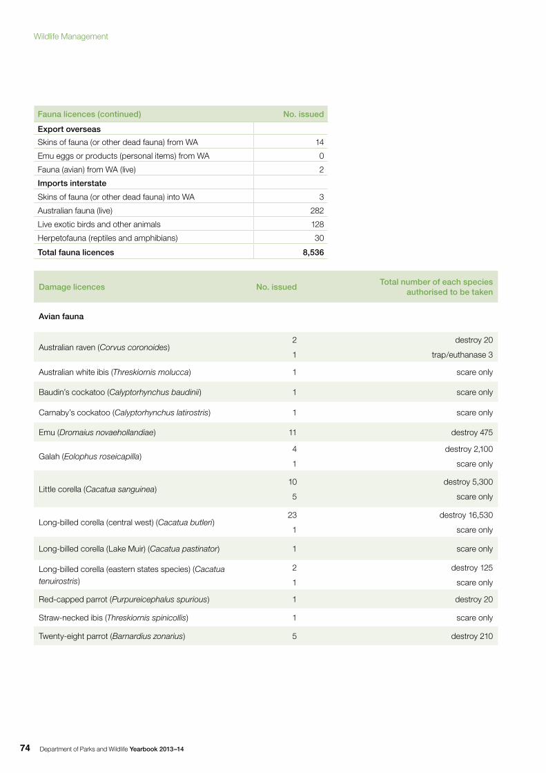
Department of Parks and Wildlife Yearbook 2013–1474
Fauna licences (continued) No. issued
Export overseas
Skins of fauna (or other dead fauna) from WA 14
Emu eggs or products (personal items) from WA 0
Fauna (avian) from WA (live) 2
Imports interstate
Skins of fauna (or other dead fauna) into WA 3
Australian fauna (live) 282
Live exotic birds and other animals 128
Herpetofauna (reptiles and amphibians) 30
Total fauna licences 8,536
Damage licences No. issued Total number of each species
authorised to be taken
Avian fauna
Australian raven (Corvus coronoides) 2
1
destroy 20
trap/euthanase 3
Australian white ibis (Threskiornis molucca) 1 scare only
Baudin’s cockatoo (Calyptorhynchus baudinii) 1 scare only
Carnaby’s cockatoo (Calyptorhynchus latirostris) 1 scare only
Emu (Dromaius novaehollandiae) 11 destroy 475
Galah (Eolophus roseicapilla)4
1
destroy 2,100
scare only
Little corella (Cacatua sanguinea)10
5
destroy 5,300
scare only
Long-billed corella (central west) (Cacatua butleri) 23
1
destroy 16,530
scare only
Long-billed corella (Lake Muir) (Cacatua pastinator) 1 scare only
Long-billed corella (eastern states species) (Cacatua tenuirostris)
2
1
destroy 125
scare only
Red-capped parrot (Purpureicephalus spurious) 1 destroy 20
Straw-necked ibis (Threskiornis spinicollis) 1 scare only
Twenty-eight parrot (Barnardius zonarius) 5 destroy 210
Wildlife Management
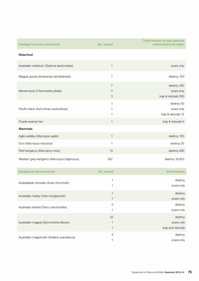
Department of Parks and Wildlife Yearbook 2013–14 75
Damage licences (continued) No. issued Total number of each species
authorised to be taken
Waterfowl
Australian shelduck (Tadorna tadornoides) 1 scare only
Magpie goose (Anseranas semipalmata) 1 destroy 100
Maned duck (Chenonetta jubata)
7
4
3
destroy 350
scare only
trap & relocate 260
Pacific black duck (Anas superciliosa)
1
1
1
destroy 50
scare only
trap & relocate 12
Purple swamp hen 1 trap & relocate 4
Mammals
Agile wallaby (Macropus agilis) 1 destroy 100
Euro (Macropus robustus) 1 destroy 25
Red kangaroo (Macropus rufus) 10 destroy 490
Western grey kangaroo (Macropus fuliginosus) 357 destroy 16,923
Dangerous fauna licences No. issued Authorisation
Australasian shoveler (Anas rhynchotis)1
1
destroy
scare only
Australian hobby (Falco longipennis)1
1
destroy
scare only
Australian kestrel (Falco cenchroides)2
1
destroy
scare only
Australian magpie (Gymnorhina tibicen)
22
1
1
destroy
scare only
trap and relocate
Australian magpie lark (Grallina cyanoleuca)3
1
destroy
scare only
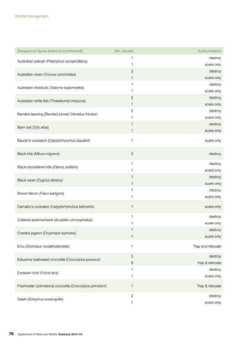
Department of Parks and Wildlife Yearbook 2013–1476
Dangerous fauna licences (continued) No. issued Authorisation
Australian pelican (Pelecanus conspicillatus)1
1
destroy
scare only
Australian raven (Corvus coronoides)2
1
destroy
scare only
Australian shelduck (Tadorna tadornoides)1
1
destroy
scare only
Australian white ibis (Threskiornis molucca)2
1
destroy
scare only
Banded lapwing (Banded plover) (Vanellus tricolor)2
1
destroy
scare only
Barn owl (Tyto alba)1
1
destroy
scare only
Baudin’s cockatoo (Calyptorhynchus baudinii) 1 scare only
Black kite (Milvus migrans) 2 destroy
Black-shouldered kite (Elanus axillaris)1
1
destroy
scare only
Black swan (Cygnus atratus)1
1
destroy
scare only
Brown falcon (Falco berigora)1
1
destroy
scare only
Carnaby’s cockatoo (Calyptorhynchus latirostris) 1 scare only
Collared sparrowhawk (Accipiter cirrocephalus)1
1
destroy
scare only
Crested pigeon (Ocyphaps lophotes)1
1
destroy
scare only
Emu (Dromaius novaehollandiae) 1 Trap and relocate
Estuarine (saltwater) crocodile (Crocodylus porosus)3
6
destroy
trap & relocate
Eurasian coot (Fulica atra)1
1
destroy
scare only
Freshwater (Johnstons) crocodile (Crocodylus johnstoni) 1 Trap & relocate
Galah (Eolophus roseicapilla)2
1
destroy
scare only
Wildlife Management
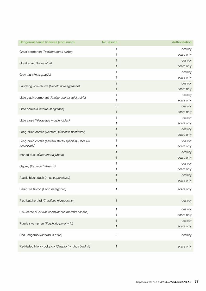
Department of Parks and Wildlife Yearbook 2013–14 77
Dangerous fauna licences (continued) No. issued Authorisation
Great cormorant (Phalacrocorax carbo)1
1
destroy
scare only
Great egret (Ardea alba)1
1
destroy
scare only
Grey teal (Anas gracilis)1
1
destroy
scare only
Laughing kookaburra (Dacelo novaeguineae)2
1
destroy
scare only
Little black cormorant (Phalacrocorax sulcirostris)1
1
destroy
scare only
Little corella (Cacatua sanguinea)3
1
destroy
scare only
Little eagle (Hieraaetus morphnoides)1
1
destroy
scare only
Long-billed corella (western) (Cacatua pastinator)1
1
destroy
scare only
Long-billed corella (eastern states species) (Cacatua tenuirostris)
1
1
destroy
scare only
Maned duck (Chenonetta jubata)1
1
destroy
scare only
Osprey (Pandion haliaetus)1
1
destroy
scare only
Pacific black duck (Anas superciliosa)1
1
destroy
scare only
Peregrine falcon (Falco peregrinus) 1 scare only
Pied butcherbird (Cracticus nigrogularis) 1 destroy
Pink-eared duck (Malacorhynchus membranaceus)1
1
destroy
scare only
Purple swamphen (Porphyrio porphyrio)1
1
destroy
scare only
Red kangaroo (Macropus rufus) 2 destroy
Red-tailed black cockatoo (Calyptorhynchus banksii) 1 scare only

Department of Parks and Wildlife Yearbook 2013–1478
Dangerous fauna licences (continued) No. issued Authorisation
Richard’s pipit (Anthus novaeseelandiae) 1 scare only
Square-tailed kite (Lophoictinia isura)1
1
destroy
scare only
Straw-necked ibis (Threskiornis spinicollis)2
1
destroy
scare only
Swamp harrier (Circus approximans)1
1
destroy
scare only
Tree martin (Petrochelidon nigricans) 1 scare only
Twenty-eight parrot (Barnardius zonarius)1
1
destroy
scare only
Wedge-tailed eagle (Aquila audax)1
1
destroy
scare only
Welcome swallow (Hirundo neoxena) 1 scare only
Western brush wallaby (Macropus irma) 1 destroy
Western grey kangaroo (Macropus fuliginosus) 10 destroy
Whistling kite (Haliastur sphenurus)3
1
destroy
scare only
White-faced heron (Egretta novaehollandiae)1
1
destroy
scare only
Willie wagtail (Rhipidura leucophrys) 1 scare only
Yellow-billed spoonbill (Platalea flavipes)1
1
destroy
scare only
Wildlife Management
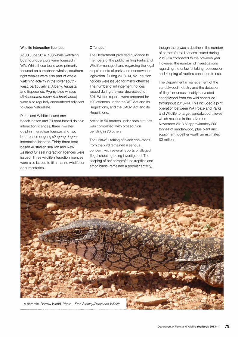
Department of Parks and Wildlife Yearbook 2013–14 79
Wildlife interaction licences
At 30 June 2014, 100 whale watching boat tour operators were licensed in WA. While these tours were primarily focused on humpback whales, southern right whales were also part of whale watching activity in the lower south-west, particularly at Albany, Augusta and Esperance. Pygmy blue whales (Balaenoptera musculus brevicauda) were also regularly encountered adjacent to Cape Naturaliste.
Parks and Wildlife issued one beach-based and 79 boat-based dolphin interaction licences, three in-water dolphin interaction licences and two boat-based dugong (Dugong dugon) interaction licences. Thirty-three boat-based Australian sea lion and New Zealand fur seal interaction licences were issued. Three wildlife interaction licences were also issued to film marine wildlife for documentaries.
Offences
The Department provided guidance to members of the public visiting Parks and Wildlife-managed land regarding the legal requirements of parks and conservation legislation. During 2013–14, 521 caution notices were issued for minor offences. The number of infringement notices issued during the year decreased to 591. Written reports were prepared for 120 offences under the WC Act and its Regulations, and the CALM Act and its Regulations.
Action in 50 matters under both statutes was completed, with prosecution pending in 70 others.
The unlawful taking of black cockatoos from the wild remained a serious concern, with several reports of alleged illegal shooting being investigated. The keeping of pet herpetofauna (reptiles and amphibians) remained a popular activity,
A perentie, Barrow Island. Photo – Fran Stanley/Parks and Wildlife
though there was a decline in the number of herpetofauna licences issued during 2013–14 compared to the previous year. However, the number of investigations regarding the unlawful taking, possession and keeping of reptiles continued to rise.
The Department’s management of the sandalwood industry and the detection of illegal or unsustainably harvested sandalwood from the wild continued throughout 2013–14. This included a joint operation between WA Police and Parks and Wildlife to target sandalwood thieves, which resulted in the seizure in November 2013 of approximately 200 tonnes of sandalwood, plus plant and equipment together worth an estimated $2 million.
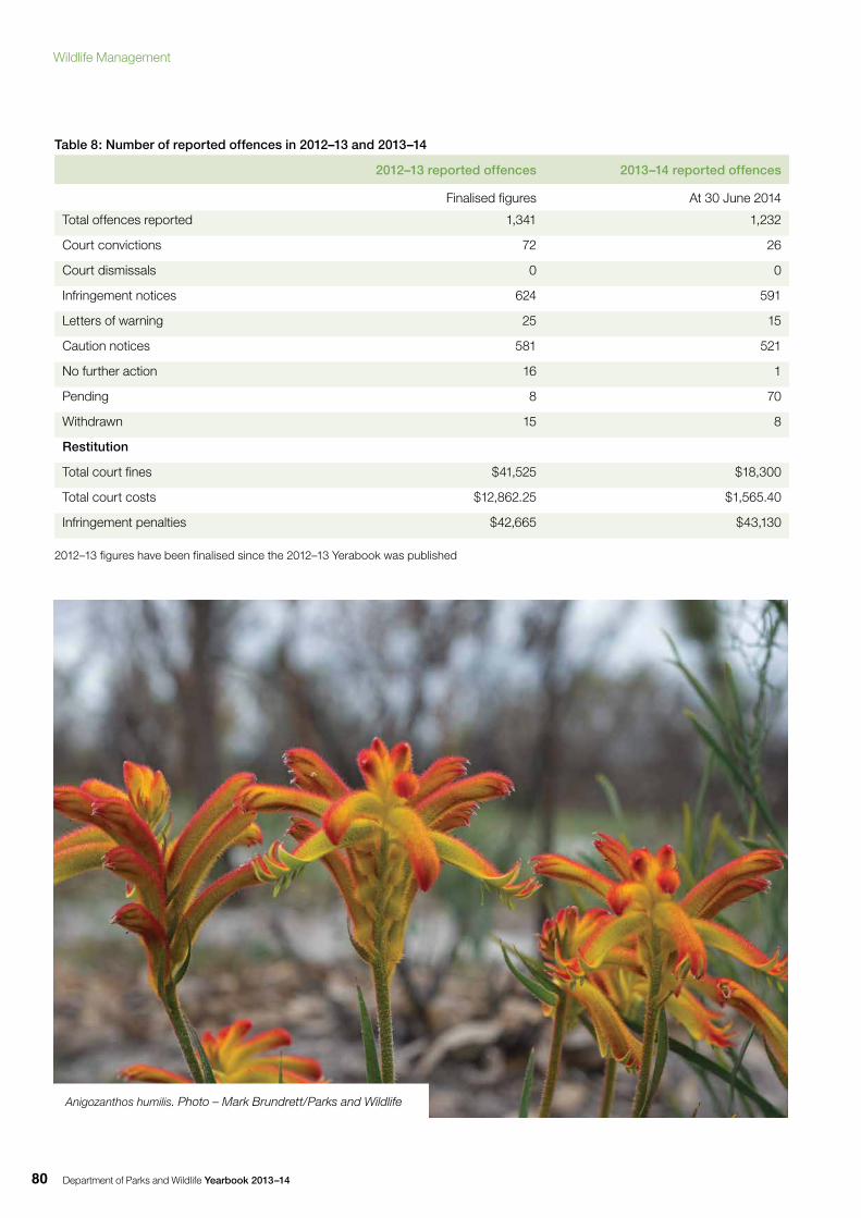
Department of Parks and Wildlife Yearbook 2013–1480
Table 8: Number of reported offences in 2012–13 and 2013–14
2012–13 reported offences 2013–14 reported offences
Finalised figures At 30 June 2014
Total offences reported 1,341 1,232
Court convictions 72 26
Court dismissals 0 0
Infringement notices 624 591
Letters of warning 25 15
Caution notices 581 521
No further action 16 1
Pending 8 70
Withdrawn 15 8
Restitution
Total court fines $41,525 $18,300
Total court costs $12,862.25 $1,565.40
Infringement penalties $42,665 $43,130
2012–13 figures have been finalised since the 2012–13 Yerabook was published
Anigozanthos humilis. Photo – Mark Brundrett/Parks and Wildlife
Wildlife Management
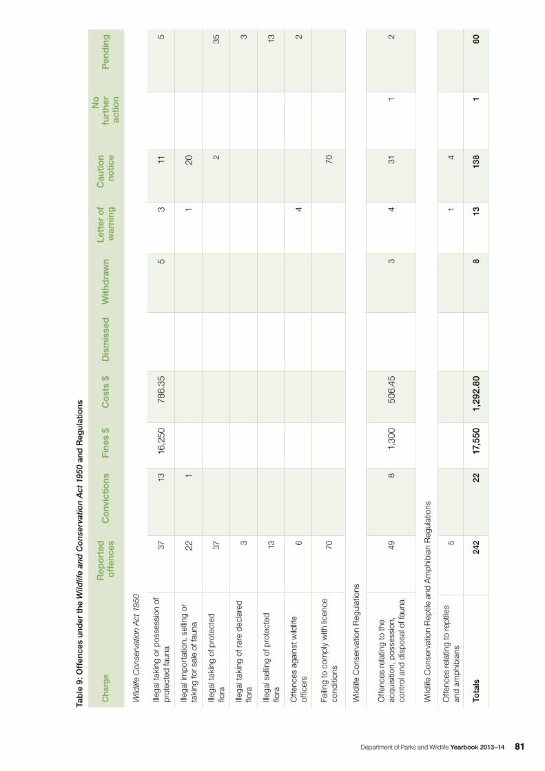
Department of Parks and Wildlife Yearbook 2013–14 81
Tab
le 9
: Off
ence
s un
der
the
Wild
life
and
Co
nse
rvat
ion
Act
195
0 an
d R
egul
atio
ns
Cha
rge
Rep
ort
ed
off
ence
sC
onv
ictio
nsF
ines
$C
ost
s $
Dis
mis
sed
With
dra
wn
Lett
er o
f w
arni
ngC
autio
n no
tice
No
fu
rthe
r ac
tion
Pen
din
g
Wild
life
Con
serv
atio
n A
ct 1
950
Illeg
al ta
king
or p
osse
ssio
n of
pr
otec
ted
faun
a37
1316
,250
786.
355
311
5
Illeg
al im
port
atio
n, s
ellin
g or
ta
king
for s
ale
of fa
una
221
120
Illeg
al ta
king
of p
rote
cted
flo
ra37
235
Illeg
al ta
king
of r
are
decl
ared
flo
ra3
3
Illeg
al s
ellin
g of
pro
tect
ed
flora
1313
Offe
nces
aga
inst
wild
life
offic
ers
64
2
Failin
g to
com
ply
with
lice
nce
cond
ition
s70
70
Wild
life
Con
serv
atio
n R
egul
atio
ns
Offe
nces
rela
ting
to th
e ac
quis
ition
, pos
sess
ion,
co
ntro
l and
dis
posa
l of f
auna
498
1,30
050
6.45
34
311
2
Wild
life
Con
serv
atio
n R
eptil
e an
d A
mph
ibia
n R
egul
atio
ns
Offe
nces
rela
ting
to re
ptile
s an
d am
phib
ians
51
4
Tota
ls24
222
17,5
501,
292.
808
1313
81
60
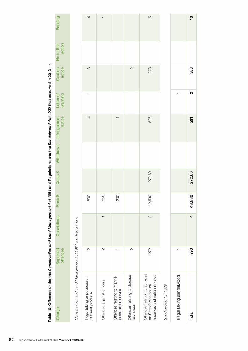
Department of Parks and Wildlife Yearbook 2013–1482
Tab
le 1
0: O
ffen
ces
und
er t
he C
on
serv
atio
n an
d L
and
Man
agem
ent
Act
198
4 an
d R
egul
atio
ns a
nd t
he S
and
alw
oo
d A
ct 1
929
that
occ
urre
d in
201
3–1
4
Cha
rge
Rep
ort
ed
off
ence
sC
onv
ictio
nsF
ines
$C
ost
s $
With
dra
wn
Infr
ing
emen
t no
tice
Lett
er o
f w
arni
ngC
autio
n no
tice
No
fur
ther
ac
tion
Pen
din
g
Con
serv
atio
n an
d La
nd M
anag
emen
t Act
198
4 an
d R
egul
atio
ns
Illeg
al ta
king
or p
osse
ssio
n of
fore
st p
rodu
ce12
800
41
34
Offe
nces
aga
inst
offi
cers
21
350
1
Offe
nces
rela
ting
to m
arin
e pa
rks
and
rese
rves
120
01
Offe
nces
rela
ting
to d
isea
se
risk
area
s2
2
Offe
nces
rela
ting
to a
ctiv
ities
on
Sta
te fo
rest
, nat
ure
rese
rves
and
nat
iona
l par
ks97
23
42,5
3027
2.60
586
378
5
San
dalw
ood
Act
192
9
Illega
l tak
ing
sand
alw
ood
11
Tota
l99
04
43,8
8027
2.60
591
238
310
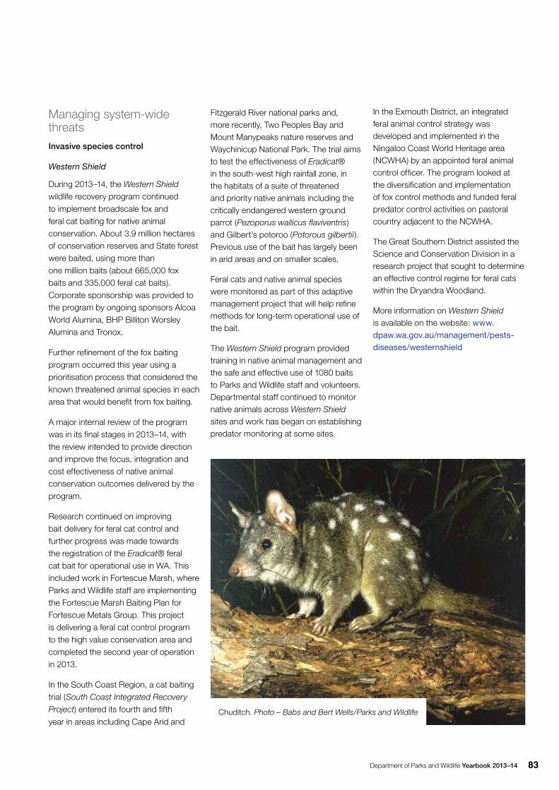
Department of Parks and Wildlife Yearbook 2013–14 83
Managing system-wide threatsInvasive species control
Western Shield
During 2013–14, the Western Shield wildlife recovery program continued to implement broadscale fox and feral cat baiting for native animal conservation. About 3.9 million hectares of conservation reserves and State forest were baited, using more than one million baits (about 665,000 fox baits and 335,000 feral cat baits). Corporate sponsorship was provided to the program by ongoing sponsors Alcoa World Alumina, BHP Billiton Worsley Alumina and Tronox.
Further refinement of the fox baiting program occurred this year using a prioritisation process that considered the known threatened animal species in each area that would benefit from fox baiting.
A major internal review of the program was in its final stages in 2013 –14, with the review intended to provide direction and improve the focus, integration and cost effectiveness of native animal conservation outcomes delivered by the program.
Research continued on improving bait delivery for feral cat control and further progress was made towards the registration of the Eradicat® feral cat bait for operational use in WA. This included work in Fortescue Marsh, where Parks and Wildlife staff are implementing the Fortescue Marsh Baiting Plan for Fortescue Metals Group. This project is delivering a feral cat control program to the high value conservation area and completed the second year of operation in 2013.
In the South Coast Region, a cat baiting trial (South Coast Integrated Recovery
Project) entered its fourth and fifth
year in areas including Cape Arid and
Fitzgerald River national parks and, more recently, Two Peoples Bay and Mount Manypeaks nature reserves and Waychinicup National Park. The trial aims to test the effectiveness of Eradicat® in the south-west high rainfall zone, in the habitats of a suite of threatened and priority native animals including the critically endangered western ground parrot (Pezoporus wallicus flaviventris) and Gilbert’s potoroo (Potorous gilbertii). Previous use of the bait has largely been in arid areas and on smaller scales.
Feral cats and native animal species were monitored as part of this adaptive management project that will help refine methods for long-term operational use of the bait.
The Western Shield program provided training in native animal management and the safe and effective use of 1080 baits to Parks and Wildlife staff and volunteers. Departmental staff continued to monitor native animals across Western Shield sites and work has began on establishing predator monitoring at some sites.
In the Exmouth District, an integrated feral animal control strategy was developed and implemented in the Ningaloo Coast World Heritage area (NCWHA) by an appointed feral animal control officer. The program looked at the diversification and implementation of fox control methods and funded feral predator control activities on pastoral country adjacent to the NCWHA.
The Great Southern District assisted the Science and Conservation Division in a research project that sought to determine an effective control regime for feral cats within the Dryandra Woodland.
More information on Western Shield is available on the website: www.dpaw.wa.gov.au/management/pests-diseases/westernshield
Chuditch. Photo – Babs and Bert Wells/Parks and Wildlife
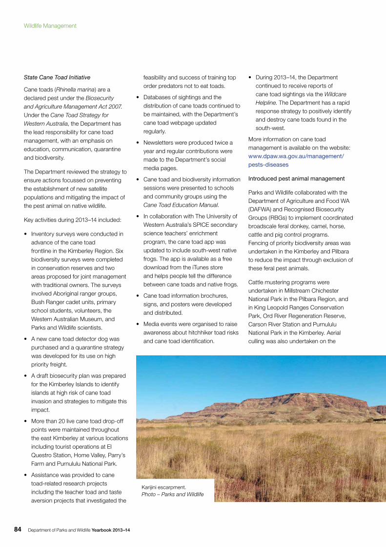
Department of Parks and Wildlife Yearbook 2013–1484
State Cane Toad Initiative
Cane toads (Rhinella marina) are a declared pest under the Biosecurity and Agriculture Management Act 2007.Under the Cane Toad Strategy for Western Australia, the Department has the lead responsibility for cane toad management, with an emphasis on education, communication, quarantine and biodiversity.
The Department reviewed the strategy to ensure actions focussed on preventing the establishment of new satellite populations and mitigating the impact of the pest animal on native wildlife.
Key activities during 2013–14 included:
• Inventory surveys were conducted in advance of the cane toad frontline in the Kimberley Region. Six biodiversity surveys were completed in conservation reserves and two areas proposed for joint management with traditional owners. The surveys involved Aboriginal ranger groups, Bush Ranger cadet units, primary school students, volunteers, the Western Australian Museum, and Parks and Wildlife scientists.
• A new cane toad detector dog was purchased and a quarantine strategy was developed for its use on high priority freight.
• A draft biosecurity plan was prepared for the Kimberley Islands to identify islands at high risk of cane toad invasion and strategies to mitigate this impact.
• More than 20 live cane toad drop-off points were maintained throughout the east Kimberley at various locations including tourist operations at El Questro Station, Home Valley, Parry’s Farm and Purnululu National Park.
• Assistance was provided to cane toad-related research projects including the teacher toad and taste aversion projects that investigated the
feasibility and success of training top order predators not to eat toads.
• Databases of sightings and the distribution of cane toads continued to be maintained, with the Department’s cane toad webpage updated regularly.
• Newsletters were produced twice a year and regular contributions were made to the Department’s social media pages.
• Cane toad and biodiversity information sessions were presented to schools and community groups using the Cane Toad Education Manual.
• In collaboration with The University of Western Australia’s SPICE secondary science teachers’ enrichment program, the cane toad app was updated to include south-west native frogs. The app is available as a free download from the iTunes store and helps people tell the difference between cane toads and native frogs.
• Cane toad information brochures, signs, and posters were developed and distributed.
• Media events were organised to raise awareness about hitchhiker toad risks and cane toad identification.
• During 2013–14, the Department continued to receive reports of cane toad sightings via the Wildcare Helpline. The Department has a rapid response strategy to positively identify and destroy cane toads found in the south-west.
More information on cane toad management is available on the website: www.dpaw.wa.gov.au/management/pests-diseases
Introduced pest animal management
Parks and Wildlife collaborated with the Department of Agriculture and Food WA (DAFWA) and Recognised Biosecurity Groups (RBGs) to implement coordinated broadscale feral donkey, camel, horse, cattle and pig control programs. Fencing of priority biodiversity areas was undertaken in the Kimberley and Pilbara to reduce the impact through exclusion of these feral pest animals.
Cattle mustering programs were undertaken in Millstream Chichester National Park in the Pilbara Region, and in King Leopold Ranges Conservation Park, Ord River Regeneration Reserve, Carson River Station and Purnululu National Park in the Kimberley. Aerial culling was also undertaken on the
Karijini escarpment. Photo – Parks and Wildlife
Wildlife Management
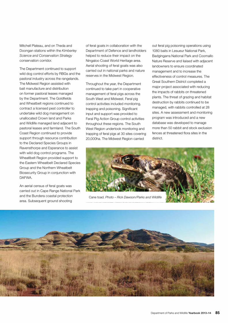
Department of Parks and Wildlife Yearbook 2013–14 85
Mitchell Plateau, and on Theda and Doongan stations within the Kimberley Science and Conservation Strategy conservation corridor.
The Department continued to support wild dog control efforts by RBGs and the pastoral industry across the rangelands. The Midwest Region assisted with bait manufacture and distribution on former pastoral leases managed by the Department. The Goldfields and Wheatbelt regions continued to contract a licensed pest controller to undertake wild dog management on unallocated Crown land and Parks and Wildlife managed land adjacent to pastoral leases and farmland. The South Coast Region continued to provide support through resource contribution to the Declared Species Groups in Ravensthorpe and Esperance to assist with wild dog control programs. The Wheatlbelt Region provided support to the Eastern Wheatbelt Declared Species Group and the Northern Wheatbelt Biosecurity Group in conjunction with DAFWA.
An aerial census of feral goats was carried out in Cape Range National Park and the Bundera coastal protection area. Subsequent ground shooting
of feral goats in collaboration with the Department of Defence and landholders helped to reduce their impact on the Ningaloo Coast World Heritage area. Aerial shooting of feral goats was also carried out in national parks and nature reserves in the Midwest Region.
Throughout the year, the Department continued to take part in cooperative management of feral pigs across the South West and Midwest. Feral pig control activities included monitoring, trapping and poisoning. Significant input and support was provided to Feral Pig Action Group control activities throughout these regions. The South West Region undertook monitoring and trapping of feral pigs at 30 sites covering 20,000ha. The Midwest Region carried
out feral pig poisoning operations using
1080 baits in Lesueur National Park,
Badgingarra National Park and Coomallo
Nature Reserve and liaised with adjacent
landowners to ensure coordinated
management and to increase the
effectiveness of control measures. The
Great Southern District completed a
major project associated with reducing
the impacts of rabbits on threatened
plants. The threat of grazing and habitat
destruction by rabbits continued to be
managed, with rabbits controlled at 28
sites. A new assessment and monitoring
program was introduced and a new
database was developed to manage
more than 50 rabbit and stock exclusion
fences at threatened flora sites in the
district.
Cane toad. Photo – Rick Dawson/Parks and Wildlife
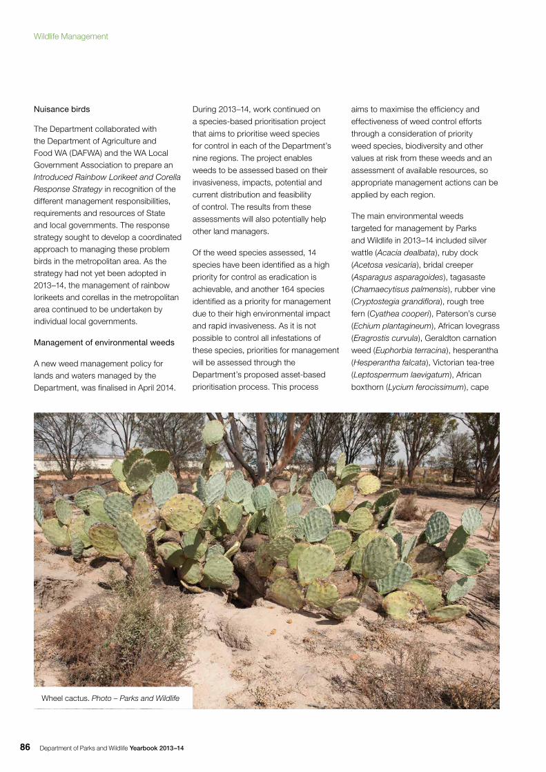
Department of Parks and Wildlife Yearbook 2013–1486
Nuisance birds
The Department collaborated with the Department of Agriculture and Food WA (DAFWA) and the WA Local Government Association to prepare an Introduced Rainbow Lorikeet and Corella Response Strategy in recognition of the different management responsibilities, requirements and resources of State and local governments. The response strategy sought to develop a coordinated approach to managing these problem birds in the metropolitan area. As the strategy had not yet been adopted in 2013–14, the management of rainbow lorikeets and corellas in the metropolitan area continued to be undertaken by individual local governments.
Management of environmental weeds
A new weed management policy for lands and waters managed by the Department, was finalised in April 2014.
During 2013–14, work continued on
a species-based prioritisation project
that aims to prioritise weed species
for control in each of the Department’s
nine regions. The project enables
weeds to be assessed based on their
invasiveness, impacts, potential and
current distribution and feasibility
of control. The results from these
assessments will also potentially help
other land managers.
Of the weed species assessed, 14
species have been identified as a high
priority for control as eradication is
achievable, and another 164 species
identified as a priority for management
due to their high environmental impact
and rapid invasiveness. As it is not
possible to control all infestations of
these species, priorities for management
will be assessed through the
Department’s proposed asset-based
prioritisation process. This process
aims to maximise the efficiency and
effectiveness of weed control efforts
through a consideration of priority
weed species, biodiversity and other
values at risk from these weeds and an
assessment of available resources, so
appropriate management actions can be
applied by each region.
The main environmental weeds
targeted for management by Parks
and Wildlife in 2013–14 included silver
wattle (Acacia dealbata), ruby dock
(Acetosa vesicaria), bridal creeper
(Asparagus asparagoides), tagasaste
(Chamaecytisus palmensis), rubber vine
(Cryptostegia grandiflora), rough tree
fern (Cyathea cooperi), Paterson’s curse
(Echium plantagineum), African lovegrass
(Eragrostis curvula), Geraldton carnation
weed (Euphorbia terracina), hesperantha
(Hesperantha falcata), Victorian tea-tree
(Leptospermum laevigatum), African
boxthorn (Lycium ferocissimum), cape
Wheel cactus. Photo – Parks and Wildlife
Wildlife Management
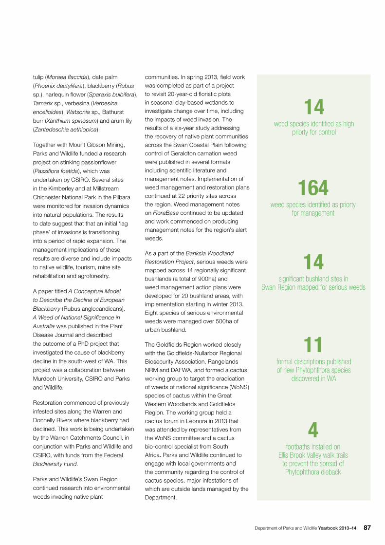
Department of Parks and Wildlife Yearbook 2013–14 87
tulip (Moraea flaccida), date palm
(Phoenix dactylifera), blackberry (Rubus
sp.), harlequin flower (Sparaxis bulbifera),
Tamarix sp., verbesina (Verbesina
encelioides), Watsonia sp., Bathurst
burr (Xanthium spinosum) and arum lily
(Zantedeschia aethiopica).
Together with Mount Gibson Mining,
Parks and Wildlife funded a research
project on stinking passionflower
(Passiflora foetida), which was
undertaken by CSIRO. Several sites
in the Kimberley and at Millstream
Chichester National Park in the Pilbara
were monitored for invasion dynamics
into natural populations. The results
to date suggest that that an initial ‘lag
phase’ of invasions is transitioning
into a period of rapid expansion. The
management implications of these
results are diverse and include impacts
to native wildlife, tourism, mine site
rehabilitation and agroforestry.
A paper titled A Conceptual Model
to Describe the Decline of European
Blackberry (Rubus anglocandicans),
A Weed of National Significance in
Australia was published in the Plant
Disease Journal and described
the outcome of a PhD project that
investigated the cause of blackberry
decline in the south-west of WA. This
project was a collaboration between
Murdoch University, CSIRO and Parks
and Wildlife.
Restoration commenced of previously
infested sites along the Warren and
Donnelly Rivers where blackberry had
declined. This work is being undertaken
by the Warren Catchments Council, in
conjunction with Parks and Wildlife and
CSIRO, with funds from the Federal
Biodiversity Fund.
Parks and Wildlife’s Swan Region
continued research into environmental
weeds invading native plant
communities. In spring 2013, field work was completed as part of a project to revisit 20-year-old floristic plots in seasonal clay-based wetlands to investigate change over time, including the impacts of weed invasion. The results of a six-year study addressing the recovery of native plant communities across the Swan Coastal Plain following control of Geraldton carnation weed were published in several formats including scientific literature and management notes. Implementation of weed management and restoration plans continued at 22 priority sites across the region. Weed management notes on FloraBase continued to be updated and work commenced on producing management notes for the region’s alert weeds.
As a part of the Banksia Woodland Restoration Project, serious weeds were mapped across 14 regionally significant bushlands (a total of 900ha) and weed management action plans were developed for 20 bushland areas, with implementation starting in winter 2013. Eight species of serious environmental weeds were managed over 500ha of urban bushland.
The Goldfields Region worked closely with the Goldfields-Nullarbor Regional Biosecurity Association, Rangelands NRM and DAFWA, and formed a cactus working group to target the eradication of weeds of national significance (WoNS) species of cactus within the Great Western Woodlands and Goldfields Region. The working group held a cactus forum in Leonora in 2013 that was attended by representatives from the WoNS committee and a cactus bio-control specialist from South Africa. Parks and Wildlife continued to engage with local governments and the community regarding the control of cactus species, major infestations of which are outside lands managed by the Department.
4 footbaths installed on
Ellis Brook Valley walk trails to prevent the spread of Phytophthora dieback
164 weed species identified as priorty
for management
14 significant bushland sites in
Swan Region mapped for serious weeds
11formal descriptions published of new Phytophthora species
discovered in WA
14weed species identified as high
priorty for control
Department of Parks and Wildlife Yearbook 2013–1488
Across the Kimberley, Parks and Wildlife
nature conservation officers and the
Miriuwung-Gajerrong, Yawuru, Bunuba,
Wunggur, Balanggarra and Uunguu
Aboriginal land management groups
implemented weed control programs
for a range of species including mission
grass (Pennisetum polystachion), hyptis
(Hyptis suaveolens), prickly acacia
(Acacia nilotica), passion vine (Passiflora
foetida), bellyache bush (Jatropha
gossypifolia), grader grass (Themeda
quadrivalvis), parkinsonia (Parkinsonia
aculeata), taro (Colocasia esculenta),
calotrope (Calotropis procera), Gamba
grass (Andropogon gayanus) and gallons
curse (Cenchrus biflorus). Parks and
Wildlife continued to use CyberTracker
software on hand-held devices for
mapping and recording weed data with
great success.
During 2013–14, the Department’s
South Coast Region continued work
in partnership with the Friends of
the Porongurup Range to control
environmental weeds in and around
Porongurup National Park. The long-
running project targeted species such
as blackberry, red valerian (Centranthus
ruber), dolichus pea (Dipogon lignosus)
and introduced acacias.
More information on control of invasive
plant species is available on the website:
www.dpaw.wa.gov.au/management/pests-diseases
Plant disease management
The Department renewed its focus on
plant disease management through
2013–14.
The Vegetation Health Service (VHS)
processed more than 1,609 diagnostic
samples collected by the Department’s
disease interpreters, private contractors
and land managers from across the
State’s south-west. In addition to
Phytophthora dieback, isolates of 11
species (including several undescribed species) were identified in association with dying native flora. The VHS continued to work in partnership with the Centre for Phytophthora Science and Management at Murdoch University to DNA-sequence recent and historical WA isolates from the VHS culture collection. At 30 June 2014, the total tested was 900. This ongoing program has identified 13 Phytophthora taxa that are also known from overseas, and at least 18 previously undescribed Phytophthora species, as well as several unique WA isolates that are Phytophthora hybrids. The formal descriptions of 11 of the new Phytophthora species discovered in WA natural ecosystems have been published.
The Department continued to work in partnership with key stakeholders on Project Dieback: Action and Opportunities for Protecting Biodiversity Assets, funded by State NRM and administered by South Coast Natural Resource Management Inc (SCNRM). In conjunction with Project Dieback, the Department carried out the following activities:
• Four footbaths were installed around Ellis Brook Valley walk trails in Banyowla Regional Park through a partnership between the Department, SCNRM, the City of Gosnells, Holcim (Australia), the Dieback Working Group and the Friends of Ellis Brook Valley. The footbaths, along with other infrastructure, represent a best practice approach to managing the risks posed by recreational users of the bushland.
• Aerial application of phosphite continued in vegetation in communities highly susceptible to Phytophthora dieback disease to protect threatened flora and ecological communities, including treating a total of 203ha across the Stirling Ranges, Gull Rock and Millbrook. Science-based monitoring was carried out
before and after application, including floristic quadrats, plant tissue and soil phosphorous analysis, phytotoxicity measurements, native animal surveys and fungal community assessments.
• Seed was collected from 39 populations of 17 threatened plant species at risk from Phytophthora dieback.
• Monitoring continued in Cape Arid National Park at a site where Parks and Wildlife successfully eradicated an infestation of Phytophthora dieback, with assistance from the State NRM program.
• Monitoring continued in Fitzgerald River National Park where Phytophthora dieback infestations had previously been contained.
• Significant planning for other on-ground works occurred at a number of sites, including Fitzgerald River National Park.
Myrtle rust
Myrtle rust (also known as eucalyptus and guava rust) is a fungus of South American origin that arrived in New South Wales in 2010 and has since rapidly spread along the eastern seaboard. It affects plants species from the Myrtaceae family. WA continues to be free of myrtle rust.
The Department continued to work with other key agencies including the Forest Products Commission, WA Local Government Association and DAFWA to develop a State preparedness plan. The Department carried out awareness-raising initiatives for staff, including what to do if they suspect an incursion of the disease. Some activities included:
• presenting at meetings of district staff
• developing a short self-drive Powerpoint presentation
• providing emergency myrtle rust hygiene kits to the Kimberley, Midwest, Swan, South Coast and Warren regions.
Wildlife Management
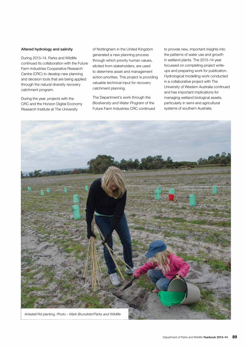
Department of Parks and Wildlife Yearbook 2013–14 89
Altered hydrology and salinity
During 2013–14, Parks and Wildlife continued its collaboration with the Future Farm Industries Cooperative Research Centre (CRC) to develop new planning and decision tools that are being applied through the natural diversity recovery catchment program.
During the year, projects with the CRC and the Horizon Digital Economy Research Institute at The University
Anketell Rd planting. Photo – Mark Brundrett/Parks and Wildlife
of Nottingham in the United Kingdom
generated a new planning process
through which priority human values,
elicited from stakeholders, are used
to determine asset and management
action priorities. This project is providing
valuable technical input for recovery
catchment planning.
The Department’s work through the
Biodiversity and Water Program of the
Future Farm Industries CRC continued
to provide new, important insights into the patterns of water use and growth in wetland plants. The 2013–14 year focussed on completing project write-ups and preparing work for publication. Hydrological modelling work conducted in a collaborative project with The University of Western Australia continued and has important implications for managing wetland biological assets, particularly in semi-arid agricultural systems of southern Australia.
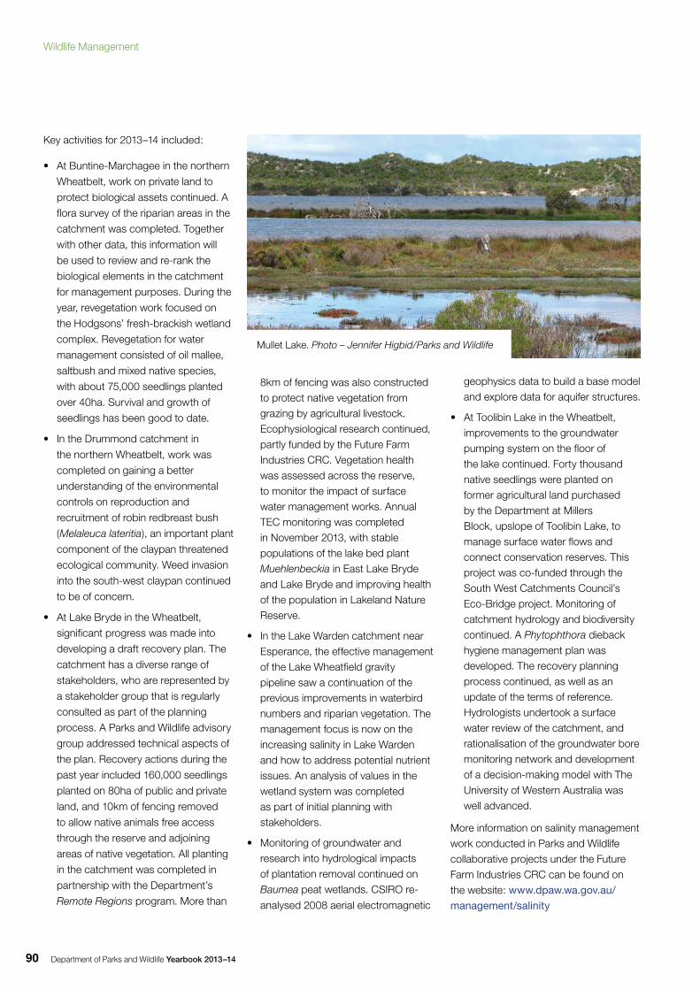
Department of Parks and Wildlife Yearbook 2013–1490
Key activities for 2013–14 included:
• At Buntine-Marchagee in the northern
Wheatbelt, work on private land to
protect biological assets continued. A
flora survey of the riparian areas in the
catchment was completed. Together
with other data, this information will
be used to review and re-rank the
biological elements in the catchment
for management purposes. During the
year, revegetation work focused on
the Hodgsons’ fresh-brackish wetland
complex. Revegetation for water
management consisted of oil mallee,
saltbush and mixed native species,
with about 75,000 seedlings planted
over 40ha. Survival and growth of
seedlings has been good to date.
• In the Drummond catchment in
the northern Wheatbelt, work was
completed on gaining a better
understanding of the environmental
controls on reproduction and
recruitment of robin redbreast bush
(Melaleuca lateritia), an important plant
component of the claypan threatened
ecological community. Weed invasion
into the south-west claypan continued
to be of concern.
• At Lake Bryde in the Wheatbelt,
significant progress was made into
developing a draft recovery plan. The
catchment has a diverse range of
stakeholders, who are represented by
a stakeholder group that is regularly
consulted as part of the planning
process. A Parks and Wildlife advisory
group addressed technical aspects of
the plan. Recovery actions during the
past year included 160,000 seedlings
planted on 80ha of public and private
land, and 10km of fencing removed
to allow native animals free access
through the reserve and adjoining
areas of native vegetation. All planting
in the catchment was completed in
partnership with the Department’s
Remote Regions program. More than
8km of fencing was also constructed to protect native vegetation from grazing by agricultural livestock. Ecophysiological research continued, partly funded by the Future Farm Industries CRC. Vegetation health was assessed across the reserve, to monitor the impact of surface water management works. Annual TEC monitoring was completed in November 2013, with stable populations of the lake bed plant Muehlenbeckia in East Lake Bryde and Lake Bryde and improving health of the population in Lakeland Nature Reserve.
• In the Lake Warden catchment near Esperance, the effective management of the Lake Wheatfield gravity pipeline saw a continuation of the previous improvements in waterbird numbers and riparian vegetation. The management focus is now on the increasing salinity in Lake Warden and how to address potential nutrient issues. An analysis of values in the wetland system was completed as part of initial planning with stakeholders.
• Monitoring of groundwater and research into hydrological impacts of plantation removal continued on Baumea peat wetlands. CSIRO re-
analysed 2008 aerial electromagnetic
geophysics data to build a base model and explore data for aquifer structures.
• At Toolibin Lake in the Wheatbelt, improvements to the groundwater pumping system on the floor of the lake continued. Forty thousand native seedlings were planted on former agricultural land purchased by the Department at Millers Block, upslope of Toolibin Lake, to manage surface water flows and connect conservation reserves. This project was co-funded through the South West Catchments Council’s Eco-Bridge project. Monitoring of catchment hydrology and biodiversity continued. A Phytophthora dieback hygiene management plan was developed. The recovery planning process continued, as well as an update of the terms of reference. Hydrologists undertook a surface water review of the catchment, and rationalisation of the groundwater bore monitoring network and development of a decision-making model with The University of Western Australia was well advanced.
More information on salinity management work conducted in Parks and Wildlife collaborative projects under the Future Farm Industries CRC can be found on the website: www.dpaw.wa.gov.au/management/salinity
Mullet Lake. Photo – Jennifer Higbid/Parks and Wildlife
Wildlife Management
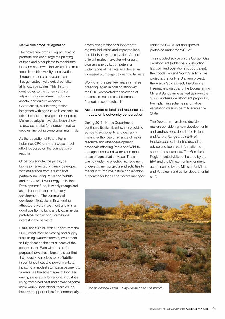
Department of Parks and Wildlife Yearbook 2013–14 91
Native tree crops/revegetation
The native tree crops program aims to promote and encourage the planting of trees and other plants to rehabilitate land and conserve biodiversity. The main focus is on biodiversity conservation through broadscale revegetation that generates hydrological benefits at landscape scales. This, in turn, contributes to the conservation of adjoining or downstream biological assets, particularly wetlands. Commercially viable revegetation integrated with agriculture is essential to drive the scale of revegetation required. Mallee eucalypts have also been shown to provide habitat for a range of native species, including some small mammals.
As the operation of Future Farm Industries CRC drew to a close, much effort focussed on the completion of reports.
Of particular note, the prototype biomass harvester, originally developed with assistance from a number of partners including Parks and Wildlife and the State’s Low Energy Emissions Development fund, is widely recognised as an important step in industry development. The commercial developer, Biosystems Engineering, attracted private investment and is in a good position to build a fully commercial prototype, with strong international interest in the harvester.
Parks and Wildlife, with support from the CRC, conducted harvesting and supply trials using available forestry equipment to fully describe the actual costs of the supply chain. Even without a fit-for-purpose harvester, it became clear that the industry was close to profitability in combined heat and power markets, including a modest stumpage payment to farmers. As the advantages of biomass energy generation for regional industries using combined heat and power become more widely understood, there will be important opportunities for commercially-
driven revegetation to support both regional industries and improved land and biodiversity conservation. A more efficient mallee harvester will enable biomass energy to compete in a wider range of markets and deliver an increased stumpage payment to farmers.
Work over the past few years in mallee breeding, again in collaboration with the CRC, completed the selection of a biomass line and establishment of foundation seed orchards.
Assessment of land and resource use impacts on biodiversity conservation
During 2013–14, the Department continued its significant role in providing advice to proponents and decision-making authorities on a range of major resource and other development proposals affecting Parks and Wildlife-managed lands and waters and other areas of conservation value. The aim was to guide the effective management of development projects and activities to maintain or improve nature conservation outcomes for lands and waters managed
under the CALM Act and species protected under the WC Act.
This included advice on the Gorgon Gas development (additional construction laydown and operations support area), the Koodaideri and North Star Iron Ore projects, the Kintyre Uranium project, the Marda Gold project, the Ularring Haematite project, and the Boonanarring Mineral Sands mine as well as more than 2,000 land-use development proposals, town planning schemes and native vegetation clearing permits across the State.
The Department assisted decision-makers considering new developments and land-use decisions in the Helena and Aurora Range area north of Koolyanobbing, including providing advice and technical information to support assessments. The Goldfields Region hosted visits to the area by the EPA and the Minister for Environment, accompanied by the Minister for Mines and Petroleum and senior departmental staff.
Boodie warrens. Photo – Judy Dunlop/Parks and Wildlife
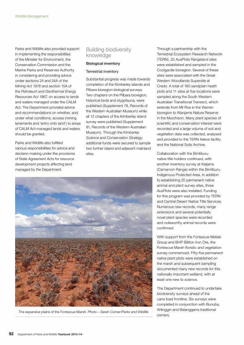
Department of Parks and Wildlife Yearbook 2013–1492
Parks and Wildlife also provided support in implementing the responsibilities of the Minister for Environment, the Conservation Commission and the Marine Parks and Reserves Authority in considering and providing advice under sections 24 and 24A of the Mining Act 1978 and section 15A of the Petroleum and Geothermal Energy Resources Act 1967, on access to lands and waters managed under the CALM Act. The Department provided advice and recommendations on whether, and under what conditions, access (mining tenements and ‘entry onto land’) to areas of CALM Act-managed lands and waters should be granted.
Parks and Wildlife also fulfilled various responsibilities for advice and decision-making under the provisions of State Agreement Acts for resource development projects affecting land managed by the Department.
Building biodiversity knowledgeBiological inventory
Terrestrial inventory
Substantial progress was made towards completion of the Kimberley islands and Pilbara bioregion biological surveys. Two chapters on the Pilbara bioregion, historical birds and stygofauna, were published (Supplement 78, Records of the Western Australian Museum) while all 12 chapters of the Kimberley island survey were published (Supplement 81, Records of the Western Australian Museum). Through the Kimberley Science and Conservation Strategy, additional funds were secured to sample two further island and adjacent mainland sites.
Through a partnership with the Terrestrial Ecosystem Research Network (TERN), 25 AusPlots Rangeland sites were established and sampled in the Coolgardie bioregion. Several of these sites were associated with the Great Western Woodlands Supersite at Credo. A total of 160 sandplain heath plots and 11 sites at five locations were sampled along the South Western Australian Transitional Transect, which extends from Mt Roe in the Warren bioregion to Wanjarrie Nature Reserve in the Murchison. Many plant species of scientific and conservation interest were recorded and a large volume of soil and vegetation data was collected, analysed and provided to the TERN Aekos facility and the National Soils Archive.
Collaboration with the Birriliburu native title holders continued, with another inventory survey at Katjarra (Carnarvon Range) within the Birriliburu Indigenous Protected Area. In addition to establishing 20 permanent native animal and plant survey sites, three AusPlots were also installed. Funding for this program was provided by TERN and Central Desert Native Title Services. Numerous new records, many range extensions and several potentially novel plant species were recorded and noteworthy animal records were confirmed.
With support from the Fortescue Metals Group and BHP Billiton Iron Ore, the Fortescue Marsh floristic and vegetation survey commenced. Fifty-five permanent native plant plots were established on the marsh and subsequent sampling documented many new records for this nationally important wetland, with at least one new to science.
The Department continued to undertake biodiversity surveys ahead of the cane toad frontline. Six surveys were completed in conjunction with Bunuba, Wilinggin and Balanggarra traditional owners.
The expansive plains of the Fortescue Marsh. Photo – Sarah Comer/Parks and Wildlife
Wildlife Management
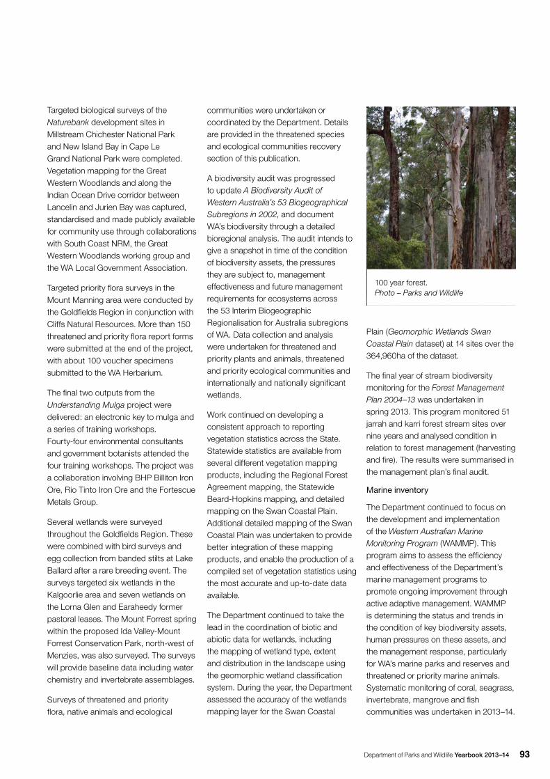
Department of Parks and Wildlife Yearbook 2013–14 93
Targeted biological surveys of the Naturebank development sites in Millstream Chichester National Park and New Island Bay in Cape Le Grand National Park were completed. Vegetation mapping for the Great Western Woodlands and along the Indian Ocean Drive corridor between Lancelin and Jurien Bay was captured, standardised and made publicly available for community use through collaborations with South Coast NRM, the Great Western Woodlands working group and the WA Local Government Association.
Targeted priority flora surveys in the Mount Manning area were conducted by the Goldfields Region in conjunction with Cliffs Natural Resources. More than 150 threatened and priority flora report forms were submitted at the end of the project, with about 100 voucher specimens submitted to the WA Herbarium.
The final two outputs from the Understanding Mulga project were delivered: an electronic key to mulga and a series of training workshops. Fourty-four environmental consultants and government botanists attended the four training workshops. The project was a collaboration involving BHP Billiton Iron Ore, Rio Tinto Iron Ore and the Fortescue Metals Group.
Several wetlands were surveyed throughout the Goldfields Region. These were combined with bird surveys and egg collection from banded stilts at Lake Ballard after a rare breeding event. The surveys targeted six wetlands in the Kalgoorlie area and seven wetlands on the Lorna Glen and Earaheedy former pastoral leases. The Mount Forrest spring within the proposed Ida Valley-Mount Forrest Conservation Park, north-west of Menzies, was also surveyed. The surveys will provide baseline data including water chemistry and invertebrate assemblages.
Surveys of threatened and priority flora, native animals and ecological
communities were undertaken or coordinated by the Department. Details are provided in the threatened species and ecological communities recovery section of this publication.
A biodiversity audit was progressed to update A Biodiversity Audit of Western Australia’s 53 Biogeographical Subregions in 2002, and document WA’s biodiversity through a detailed bioregional analysis. The audit intends to give a snapshot in time of the condition of biodiversity assets, the pressures they are subject to, management effectiveness and future management requirements for ecosystems across the 53 Interim Biogeographic Regionalisation for Australia subregions of WA. Data collection and analysis were undertaken for threatened and priority plants and animals, threatened and priority ecological communities and internationally and nationally significant wetlands.
Work continued on developing a consistent approach to reporting vegetation statistics across the State. Statewide statistics are available from several different vegetation mapping products, including the Regional Forest Agreement mapping, the Statewide Beard-Hopkins mapping, and detailed mapping on the Swan Coastal Plain. Additional detailed mapping of the Swan Coastal Plain was undertaken to provide better integration of these mapping products, and enable the production of a compiled set of vegetation statistics using the most accurate and up-to-date data available.
The Department continued to take the lead in the coordination of biotic and abiotic data for wetlands, including the mapping of wetland type, extent and distribution in the landscape using the geomorphic wetland classification system. During the year, the Department assessed the accuracy of the wetlands mapping layer for the Swan Coastal
Plain (Geomorphic Wetlands Swan Coastal Plain dataset) at 14 sites over the 364,960ha of the dataset.
The final year of stream biodiversity monitoring for the Forest Management Plan 2004–13 was undertaken in spring 2013. This program monitored 51 jarrah and karri forest stream sites over nine years and analysed condition in relation to forest management (harvesting and fire). The results were summarised in the management plan’s final audit.
Marine inventory
The Department continued to focus on the development and implementation of the Western Australian Marine Monitoring Program (WAMMP). This program aims to assess the efficiency and effectiveness of the Department’s marine management programs to promote ongoing improvement through active adaptive management. WAMMP is determining the status and trends in the condition of key biodiversity assets, human pressures on these assets, and the management response, particularly for WA’s marine parks and reserves and threatened or priority marine animals. Systematic monitoring of coral, seagrass, invertebrate, mangrove and fish communities was undertaken in 2013–14.
100 year forest. Photo – Parks and Wildlife
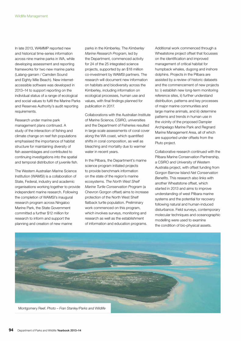
Department of Parks and Wildlife Yearbook 2013–1494
In late 2013, WAMMP reported new and historical time-series information across nine marine parks in WA, while developing assessment and reporting frameworks for two new marine parks (Lalang-garram / Camden Sound and Eighty Mile Beach). New internet-accessible software was developed in 2013–14 to support reporting on the individual status of a range of ecological and social values to fulfil the Marine Parks and Reserves Authority’s audit reporting requirements.
Research under marine park management plans continued. A study of the interaction of fishing and climate change on reef fish populations emphasised the importance of habitat structure for maintaining diversity of fish assemblages and contributed to continuing investigations into the spatial and temporal distribution of juvenile fish.
The Western Australian Marine Science Institution (WAMSI) is a collaboration of State, Federal, industry and academic organisations working together to provide independent marine research. Following the completion of WAMSI’s inaugural research program across Ningaloo Marine Park, the State Government committed a further $12 million for research to inform and support the planning and creation of new marine
parks in the Kimberley. The Kimberley Marine Research Program, led by the Department, commenced activity for 24 of the 25 integrated science projects, supported by an $18 million co-investment by WAMSI partners. The research will document new information on habitats and biodiversity across the Kimberley, including information on ecological processes, human use and values, with final findings planned for publication in 2017.
Collaborations with the Australian Institute of Marine Science, CSIRO, universities and the Department of Fisheries resulted in large scale assessments of coral cover along the WA coast, which quantified shifts in coral composition, as well as bleaching and mortality due to warmer water in recent years.
In the Pilbara, the Department’s marine science program initiated projects to provide benchmark information on the state of the region’s marine ecosystems. The North West Shelf Marine Turtle Conservation Program (a Chevron Gorgon offset) aims to increase protection of the North West Shelf flatback turtle population. Preliminary work commenced on this program, which involves surveys, monitoring and research as well as the establishment of information and education programs.
Additional work commenced through a Wheatstone project offset that focusses on the identification and improved management of critical habitat for humpback whales, dugong and inshore dolphins. Projects in the Pilbara are assisted by a review of historic datasets and the commencement of new projects to: i) establish new long-term monitoring reference sites, ii) further understand distribution, patterns and key processes of major marine communities and large marine animals, and iii) determine patterns and trends in human use in the vicinity of the proposed Dampier Archipelago Marine Park and Regnard Marine Management Area, all of which are supported under offsets from the Pluto project.
Collaborative research continued with the Pilbara Marine Conservation Partnership, a CSIRO and University of Western Australia project, with offset funding from Gorgon Barrow Island Net Conservation Benefits. This research also links with another Wheatstone offset, which started in 2013 and aims to improve understanding of west Pilbara marine systems and the potential for recovery following natural and human-induced disturbance. Field surveys, contemporary molecular techniques and oceanographic modelling were used to examine the condition of bio-physical assets.
Montgomery Reef. Photo – Fran Stanley/Parks and Wildlife
Wildlife Management
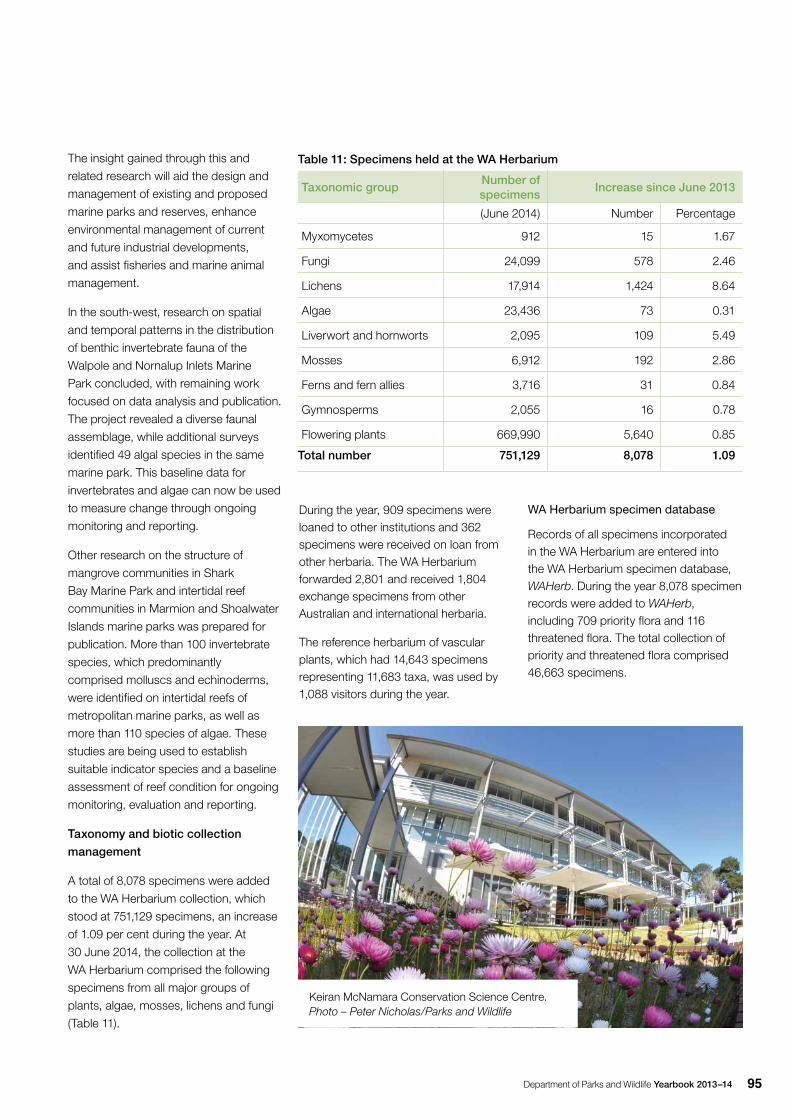
Department of Parks and Wildlife Yearbook 2013–14 95
The insight gained through this and
related research will aid the design and
management of existing and proposed
marine parks and reserves, enhance
environmental management of current
and future industrial developments,
and assist fisheries and marine animal
management.
In the south-west, research on spatial
and temporal patterns in the distribution
of benthic invertebrate fauna of the
Walpole and Nornalup Inlets Marine
Park concluded, with remaining work
focused on data analysis and publication.
The project revealed a diverse faunal
assemblage, while additional surveys
identified 49 algal species in the same
marine park. This baseline data for
invertebrates and algae can now be used
to measure change through ongoing
monitoring and reporting.
Other research on the structure of
mangrove communities in Shark
Bay Marine Park and intertidal reef
communities in Marmion and Shoalwater
Islands marine parks was prepared for
publication. More than 100 invertebrate
species, which predominantly
comprised molluscs and echinoderms,
were identified on intertidal reefs of
metropolitan marine parks, as well as
more than 110 species of algae. These
studies are being used to establish
suitable indicator species and a baseline
assessment of reef condition for ongoing
monitoring, evaluation and reporting.
Taxonomy and biotic collection
management
A total of 8,078 specimens were added
to the WA Herbarium collection, which
stood at 751,129 specimens, an increase
of 1.09 per cent during the year. At
30 June 2014, the collection at the
WA Herbarium comprised the following
specimens from all major groups of
plants, algae, mosses, lichens and fungi
(Table 11).
Table 11: Specimens held at the WA Herbarium
Taxonomic groupNumber of specimens
Increase since June 2013
(June 2014) Number Percentage
Myxomycetes 912 15 1.67
Fungi 24,099 578 2.46
Lichens 17,914 1,424 8.64
Algae 23,436 73 0.31
Liverwort and hornworts 2,095 109 5.49
Mosses 6,912 192 2.86
Ferns and fern allies 3,716 31 0.84
Gymnosperms 2,055 16 0.78
Flowering plants 669,990 5,640 0.85
Total number 751,129 8,078 1.09
During the year, 909 specimens were loaned to other institutions and 362 specimens were received on loan from other herbaria. The WA Herbarium forwarded 2,801 and received 1,804 exchange specimens from other Australian and international herbaria.
The reference herbarium of vascular plants, which had 14,643 specimens representing 11,683 taxa, was used by 1,088 visitors during the year.
Keiran McNamara Conservation Science Centre. Photo – Peter Nicholas/Parks and Wildlife
WA Herbarium specimen database
Records of all specimens incorporated in the WA Herbarium are entered into the WA Herbarium specimen database, WAHerb. During the year 8,078 specimen records were added to WAHerb, including 709 priority flora and 116 threatened flora. The total collection of priority and threatened flora comprised 46,663 specimens.
Department of Parks and Wildlife Yearbook 2013–1496
Flora data for WA
At 30 June 2014, WA’s vascular plants (flowering plants, ferns, cycads and conifers) comprised 13,632 recognised species, subspecies and varieties (12,392 native and 1,240 introduced to the State). This was a net increase of 93 taxa recognised as occurring in the State. During 2013–14, 106 new names were formally published.
The census of WA plants maintained by the WA Herbarium as the authoritative reference for all plants of the State contained 23,389 names, representing 15,878 currently recognised species, subspecies and varieties of vascular and non-vascular plants (algae, mosses, liverworts, lichens and fungi). Of these, 14,604 were native and 1,247 alien.
Herbarium volunteers
An extensive volunteer program at the WA Herbarium sees volunteers provide important skills and help in many curation activities. During the year, volunteers contributed 7,441 hours to the Herbarium, equivalent to almost four full-time staff. This contribution is gratefully acknowledged.
Fire and biodiversity research projects
Parks and Wildlife partnered with the Australian Wildlife Conservancy (AWC) and The University of Tasmania to research the impact of cats on mammals in savanna habitats. Recent work within cat-proof exclosures at AWC’s Wongalara Station in Arnhem Land, Northern Territory, experimentally confirmed that cats can cause local extinctions of small mammals, in this case the savanna rodent Rattus villiosissimus. This research highlighted for the first time the role of feral cats in mammal declines and/or extinctions in the tropics.
The Department was also a partner in research in the Kimberley with the Biodiversity Fund, Charles Darwin University and The Australian National University investigating the impacts of fire regimes on breeding success of the Gouldian finch (Erythrura gouldiae). Gouldian finches have been observed to abandon breeding sites which are burnt too often, or burnt hot, in the year following a fire. This joint project looked at whether declines were related to reduced availability of sorghum seed or a reduction in seed quality due to impacts of fires on soil nutrient status. A burning experiment was established in Gouldian finch breeding habitat near Wyndham to test some of these hypotheses.
Research conducted as part of the Biodiversity and Cultural Conservation Strategy for the Great Western Woodlands improved understanding of how gimlet (Eucalyptus salubris) woodlands respond to fire over long periods of time. Floristic diversity is high in recently burnt and in long-unburnt woodlands, but lower in intermediate-aged woodlands due to high levels of competition from trees and shrubs. Woodlands of intermediate age tend to be the most flammable because of the quantity and arrangement of fuel. Visual fuel assessment methods provide an effective and rapid way of quantifying changes in fuel condition over time.
In 2013, the Department’s Central Wheatbelt District received State NRM funds for the development of ecological fire management guidelines to protect and recover critically endangered flora and their associated habitat of the Wongan Hills. Together with a broader project, Fast track critically endangered flora recovery by implementing key recovery actions and establishing new wild populations, suitable fire regimes will be defined across the Wongan Hills area to maintain diversity of species and vegetation communities, with a focus on protecting both populations and
critical habitat for critically endangered flora. An adaptive management project in Quarram Nature Reserve in the Warren Region aims to protect and promote the structure and ecological integrity of a native grassland priority ecological community (PEC) through the introduction of experimental fire. It is believed the existing infrequent fire regime has promoted the encroachment of shrubs into the PEC by allowing them additional time to mature and store large amounts of seed in the soil, and then rapidly out compete grasses. The joint project by Frankland District, Warren Region and Science and Conservation Division staff established two monitoring plots in the PEC; the first area to be exposed to fire on a two to three-year rotation, and the second to be exposed to a ‘normal’ six to eight-year rotation. Fences were erected around half of the plots, to exclude native herbivore grazing and determine the impact of post fire grazing by herbivores in grasslands. Since commencement of the project, two prescribed burns were undertaken, the most recent in June 2014. The plots are monitored annually during the flowering period, recording flora species and an estimate of abundance.
More information on fire and the environment is available on website: www.dpaw.wa.gov.au/management/fire/fire-and-the-environment
Information and data managementNatureMap access to high-quality biodiversity data, including the reconciled publically available vegetation map. In 2013–14 there was a renewed focus on historical regional surveys, starting with the Carnarvon Basin. Occurrence records now total 3.2 million, an increase of 38,702. User registrations for access to NatureMap increased by 13 per cent to 1,725, with industry accounting for the biggest number.
Wildlife Management
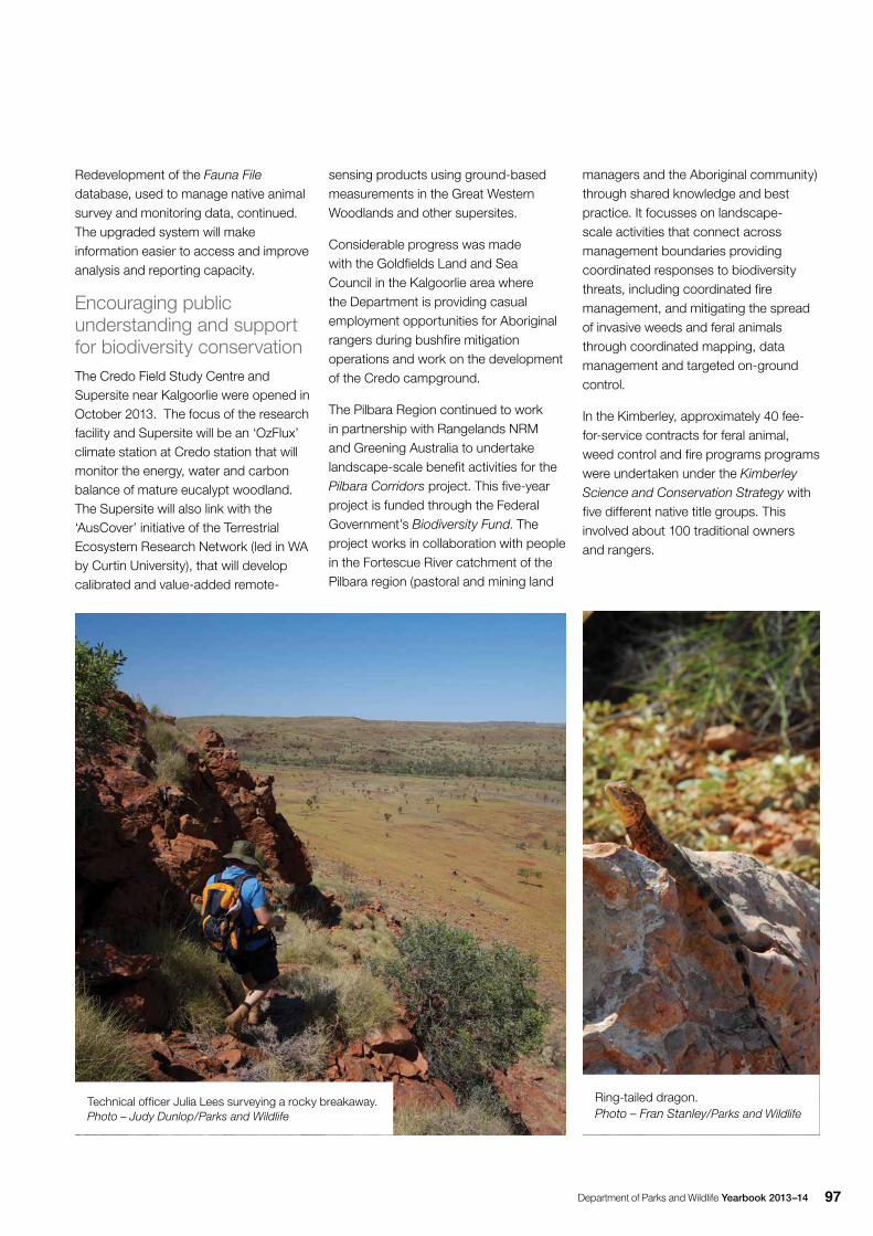
Department of Parks and Wildlife Yearbook 2013–14 97
Redevelopment of the Fauna File database, used to manage native animal survey and monitoring data, continued. The upgraded system will make information easier to access and improve analysis and reporting capacity.
Encouraging public understanding and support for biodiversity conservationThe Credo Field Study Centre and Supersite near Kalgoorlie were opened in October 2013. The focus of the research facility and Supersite will be an ‘OzFlux’ climate station at Credo station that will monitor the energy, water and carbon balance of mature eucalypt woodland. The Supersite will also link with the ‘AusCover’ initiative of the Terrestrial Ecosystem Research Network (led in WA by Curtin University), that will develop calibrated and value-added remote-
sensing products using ground-based measurements in the Great Western Woodlands and other supersites.
Considerable progress was made with the Goldfields Land and Sea Council in the Kalgoorlie area where the Department is providing casual employment opportunities for Aboriginal rangers during bushfire mitigation operations and work on the development of the Credo campground.
The Pilbara Region continued to work in partnership with Rangelands NRM and Greening Australia to undertake landscape-scale benefit activities for the Pilbara Corridors project. This five-year project is funded through the Federal Government’s Biodiversity Fund. The project works in collaboration with people in the Fortescue River catchment of the Pilbara region (pastoral and mining land
managers and the Aboriginal community) through shared knowledge and best practice. It focusses on landscape- scale activities that connect across management boundaries providing coordinated responses to biodiversity threats, including coordinated fire management, and mitigating the spread of invasive weeds and feral animals through coordinated mapping, data management and targeted on-ground control.
In the Kimberley, approximately 40 fee-for-service contracts for feral animal, weed control and fire programs programs were undertaken under the Kimberley Science and Conservation Strategy with five different native title groups. This involved about 100 traditional owners and rangers.
Technical officer Julia Lees surveying a rocky breakaway. Photo – Judy Dunlop/Parks and Wildlife
Ring-tailed dragon. Photo – Fran Stanley/Parks and Wildlife
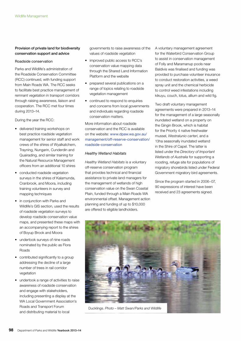
Department of Parks and Wildlife Yearbook 2013–1498
Provision of private land for biodiversity conservation support and advice
Roadside conservation
Parks and Wildlife’s administration of the Roadside Conservation Committee (RCC) continued, with funding support from Main Roads WA. The RCC seeks to facilitate best practice management of remnant vegetation in transport corridors through raising awareness, liaison and cooperation. The RCC met four times during 2013–14.
During the year the RCC:
• delivered training workshops on best practice roadside vegetation management for senior staff and work crews of the shires of Wyalkatchem, Trayning, Nungarin, Cunderdin and Quairading, and similar training for the Natural Resource Management officers from an additional 10 shires
• conducted roadside vegetation surveys in the shires of Kalamunda, Cranbrook, and Moora, including training volunteers in survey and mapping techniques
• in conjunction with Parks and Wildlife’s GIS section, used the results of roadside vegetation surveys to develop roadside conservation value maps, and presented these maps with an accompanying report to the shires of Boyup Brook and Moora
• undertook surveys of nine roads nominated by the public as Flora Roads
• contributed significantly to a group addressing the decline of a large number of trees in rail corridor vegetation
• undertook a range of activities to raise awareness of roadside conservation and engage with stakeholders, including presenting a display at the WA Local Government Association’s Roads and Transport Forum and distributing material to local
governments to raise awareness of the values of roadside vegetation
• improved public access to RCC’s conservation value mapping data through the Shared Land Information Platform and the website
• prepared several publications on a range of topics relating to roadside vegetation management
• continued to respond to enquiries and concerns from local governments and individuals regarding roadside conservation matters.
More information about roadside conservation and the RCC is available on the website: www.dpaw.wa.gov.au/management/off-reserve-conservation/roadside-conservation
Healthy Wetland Habitats
Healthy Wetland Habitats is a voluntary off-reserve conservation program that provides technical and financial assistance to private land managers for the management of wetlands of high conservation value on the Swan Coastal Plain, funded through a Main Roads WA environmental offset. Management action planning and funding of up to $10,000 are offered to eligible landholders.
A voluntary management agreement for the Waterbird Conservation Group to assist in conservation management of Folly and Maramanup pools near Baldivis was finalised and funding was provided to purchase volunteer insurance to conduct restoration activities, a weed spray unit and the chemical herbicide to control weed infestations including kikuyu, couch, lotus, allium and wild fig.
Two draft voluntary management agreements were prepared in 2013–14 for the management of a large seasonally inundated wetland on a property on the Gingin Brook, which is habitat for the Priority 4 native freshwater mussel, Westralunio carteri, and a 13ha seasonally inundated wetland in the Shire of Capel. The latter is listed under the Directory of Important Wetlands of Australia for supporting a roosting, refuge site for populations of migratory shorebirds listed under Federal Government migratory bird agreements.
Since the program started in 2006–07, 90 expressions of interest have been received and 23 agreements signed.
Ducklings. Photo – Matt Swan/Parks and Wildlife
Wildlife Management
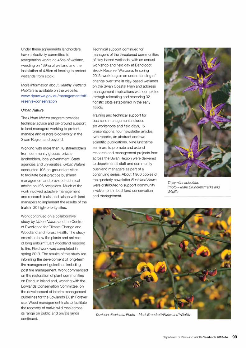
Department of Parks and Wildlife Yearbook 2013–14 99
Under these agreements landholders have collectively committed to revegetation works on 45ha of wetland, weeding on 139ha of wetland and the installation of 4.8km of fencing to protect wetlands from stock.
More information about Healthy Wetland Habitats is available on the website: www.dpaw.wa.gov.au/management/off-reserve-conservation
Urban Nature
The Urban Nature program provides technical advice and on-ground support to land managers working to protect, manage and restore biodiversity in the Swan Region and beyond.
Working with more than 76 stakeholders from community groups, private landholders, local government, State agencies and universities, Urban Nature conducted 105 on-ground activities to facilitate best-practice bushland management and provided technical advice on 196 occasions. Much of the work involved adaptive management and research trials, and liaison with land managers to implement the results of the trials in 20 high-priority sites.
Work continued on a collaborative study by Urban Nature and the Centre of Excellence for Climate Change and Woodland and Forest Health. The study examines how the plants and animals of long unburnt tuart woodland respond to fire. Field work was completed in spring 2013. The results of this study are informing the development of long-term fire management guidelines including post fire management. Work commenced on the restoration of plant communities on Penguin Island and, working with the Lowlands Conservation Committee, on the development of interim management guidelines for the Lowlands Bush Forever site. Weed management trials to facilitate the recovery of native wild rose across its range on public and private lands continued.
Technical support continued for managers of the threatened communities of clay-based wetlands, with an annual workshop and field day at Bandicoot Brook Reserve, Waroona. In spring 2013, work to gain an understanding of change over time in clay-based wetlands on the Swan Coastal Plain and address management implications was completed through relocating and rescoring 32 floristic plots established in the early 1990s.
Training and technical support for bushland management included six workshops and field days, 15 presentations, four newsletter articles, two reports, an abstract and two scientific publications. Nine lunchtime seminars to promote and extend research and management projects from across the Swan Region were delivered to departmental staff and community bushland managers as part of a continuing series. About 1,900 copies of the quarterly newsletter Bushland News were distributed to support community involvement in bushland conservation and management.
Daviesia divaricata. Photo – Mark Brundrett/Parks and Wildlife
Thelymitra apiculata. Photo – Mark Brundrett/Parks and Wildlife
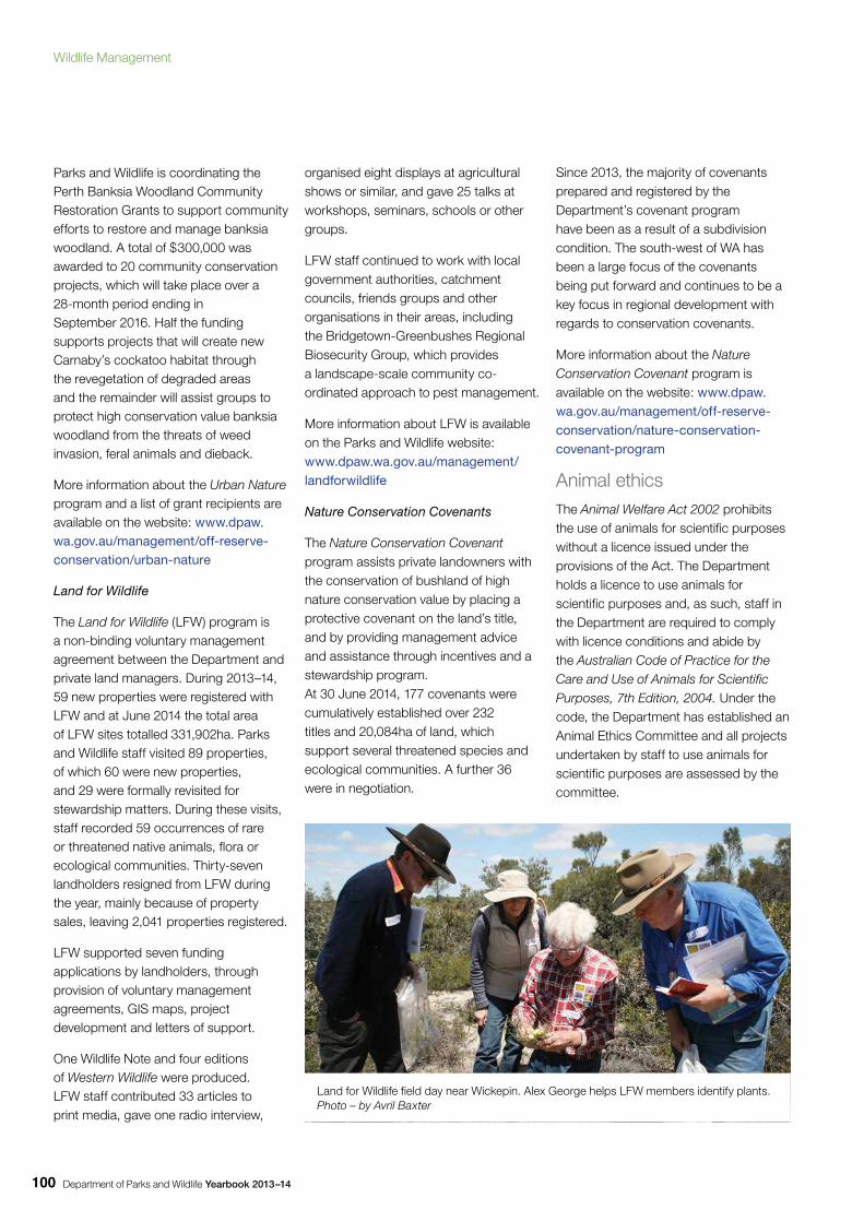
Department of Parks and Wildlife Yearbook 2013–14100
Parks and Wildlife is coordinating the Perth Banksia Woodland Community Restoration Grants to support community efforts to restore and manage banksia woodland. A total of $300,000 was awarded to 20 community conservation projects, which will take place over a 28-month period ending in September 2016. Half the funding supports projects that will create new Carnaby’s cockatoo habitat through the revegetation of degraded areas and the remainder will assist groups to protect high conservation value banksia woodland from the threats of weed invasion, feral animals and dieback.
More information about the Urban Nature program and a list of grant recipients are available on the website: www.dpaw.wa.gov.au/management/off-reserve-conservation/urban-nature
Land for Wildlife
The Land for Wildlife (LFW) program is a non-binding voluntary management agreement between the Department and private land managers. During 2013–14, 59 new properties were registered with LFW and at June 2014 the total area of LFW sites totalled 331,902ha. Parks and Wildlife staff visited 89 properties, of which 60 were new properties, and 29 were formally revisited for stewardship matters. During these visits, staff recorded 59 occurrences of rare or threatened native animals, flora or ecological communities. Thirty-seven landholders resigned from LFW during the year, mainly because of property sales, leaving 2,041 properties registered.
LFW supported seven funding applications by landholders, through provision of voluntary management agreements, GIS maps, project development and letters of support.
One Wildlife Note and four editions of Western Wildlife were produced. LFW staff contributed 33 articles to print media, gave one radio interview,
organised eight displays at agricultural shows or similar, and gave 25 talks at workshops, seminars, schools or other groups.
LFW staff continued to work with local government authorities, catchment councils, friends groups and other organisations in their areas, including the Bridgetown-Greenbushes Regional Biosecurity Group, which provides a landscape-scale community co-ordinated approach to pest management.
More information about LFW is available on the Parks and Wildlife website: www.dpaw.wa.gov.au/management/landforwildlife
Nature Conservation Covenants
The Nature Conservation Covenant program assists private landowners with the conservation of bushland of high nature conservation value by placing a protective covenant on the land’s title, and by providing management advice and assistance through incentives and a stewardship program. At 30 June 2014, 177 covenants were cumulatively established over 232 titles and 20,084ha of land, which support several threatened species and ecological communities. A further 36 were in negotiation.
Since 2013, the majority of covenants prepared and registered by the Department’s covenant program have been as a result of a subdivision condition. The south-west of WA has been a large focus of the covenants being put forward and continues to be a key focus in regional development with regards to conservation covenants.
More information about the Nature Conservation Covenant program is available on the website: www.dpaw.wa.gov.au/management/off-reserve-conservation/nature-conservation-covenant-program
Animal ethicsThe Animal Welfare Act 2002 prohibits the use of animals for scientific purposes without a licence issued under the provisions of the Act. The Department holds a licence to use animals for scientific purposes and, as such, staff in the Department are required to comply with licence conditions and abide by the Australian Code of Practice for the Care and Use of Animals for Scientific Purposes, 7th Edition, 2004. Under the code, the Department has established an Animal Ethics Committee and all projects undertaken by staff to use animals for scientific purposes are assessed by the committee.
Land for Wildlife field day near Wickepin. Alex George helps LFW members identify plants. Photo – by Avril Baxter
Wildlife Management
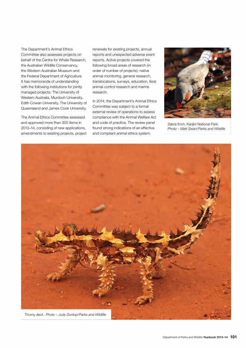
Department of Parks and Wildlife Yearbook 2013–14 101
The Department’s Animal Ethics Committee also assesses projects on behalf of the Centre for Whale Research, the Australian Wildlife Conservancy, the Western Australian Museum and the Federal Department of Agriculture. It has memoranda of understanding with the following institutions for jointly managed projects: The University of Western Australia, Murdoch University, Edith Cowan University, The University of Queensland and James Cook University.
The Animal Ethics Committee assessed and approved more than 300 items in 2013–14, consisting of new applications, amendments to existing projects, project
renewals for existing projects, annual reports and unexpected adverse event reports. Active projects covered the following broad areas of research (in order of number of projects): native animal monitoring, general research, translocations, surveys, education, feral animal control research and marine research.
In 2014, the Department’s Animal Ethics Committee was subject to a formal external review of operations to assess compliance with the Animal Welfare Act and code of practice. The review panel found strong indications of an effective and compliant animal ethics system.
Thorny devil. Photo – Judy Dunlop/Parks and Wildlife
Zebra finch, Karijini National Park. Photo – Matt Swan/Parks and Wildlife
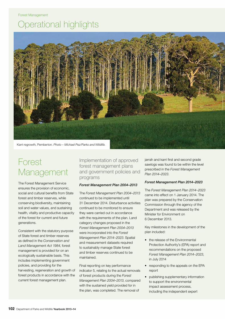
Department of Parks and Wildlife Yearbook 2013–14102
Forest ManagementThe Forest Management Service ensures the provision of economic, social and cultural benefits from State forest and timber reserves, while conserving biodiversity, maintaining soil and water values, and sustaining health, vitality and productive capacity of the forest for current and future generations.
Consistent with the statutory purpose of State forest and timber reserves as defined in the Conservation and Land Management Act 1984, forest management is provided for on an ecologically sustainable basis. This includes implementing government policies, and providing for the harvesting, regeneration and growth of forest products in accordance with the current forest management plan.
Implementation of approved forest management plans and government policies and programsForest Management Plan 2004–2013
The Forest Management Plan 2004–2013 continued to be implemented until 31 December 2014. Disturbance activities continued to be monitored to ensure they were carried out in accordance with the requirements of the plan. Land category changes proposed in the Forest Management Plan 2004–2013 were incorporated into the Forest Management Plan 2014–2023. Spatial and measurement datasets required to sustainably manage State forest and timber reserves continued to be maintained.
Final reporting on key performance indicator 5, relating to the actual removals of forest products during the Forest Management Plan 2004–2013, compared with the sustained yield provided for in the plan, was completed. The removal of
jarrah and karri first and second grade sawlogs was found to be within the level prescribed in the Forest Management Plan 2014–2023.
Forest Management Plan 2014–2023
The Forest Management Plan 2014–2023 came into effect on 1 January 2014. The plan was prepared by the Conservation Commission through the agency of the Department and was released by the Minister for Environment on 6 December 2013.
Key milestones in the development of the plan included:
• the release of the Environmental Protection Authority’s (EPA) report and recommendations on the proposed Forest Management Plan 2014–2023, in July 2014
• responding to the appeals on the EPA report
• publishing supplementary information to support the environmental impact assessment process, including the independent expert
Operational highlights
Karri regrowth, Pemberton. Photo – Michael Pez/Parks and Wildlife.
Forest Management
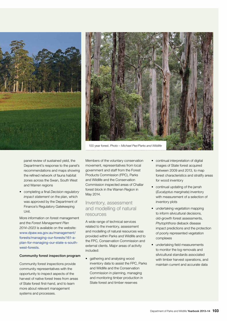
Department of Parks and Wildlife Yearbook 2013–14 103
panel review of sustained yield, the Department’s response to the panel’s recommendations and maps showing the refined network of fauna habitat zones across the Swan, South West and Warren regions
• completing a final Decision regulatory impact statement on the plan, which was approved by the Department of Finance’s Regulatory Gatekeeping Unit.
More information on forest management and the Forest Management Plan 2014–2023 is available on the website: www.dpaw.wa.gov.au/management/forests/managing-our-forests/161-a-plan-for-managing-our-state-s-south-west-forests.
Community forest inspection program
Community forest inspections provide community representatives with the opportunity to inspect aspects of the harvest of native forest trees from areas of State forest first-hand, and to learn more about relevant management systems and processes.
Members of the voluntary conservation movement, representatives from local government and staff from the Forest Products Commission (FPC), Parks and Wildlife and the Conservation Commission inspected areas of Challar forest block in the Warren Region in May 2014.
Inventory, assessment and modelling of natural resourcesA wide range of technical services related to the inventory, assessment and modelling of natural resources was provided within Parks and Wildlife and to the FPC, Conservation Commission and external clients. Major areas of activity included:
• gathering and analysing wood inventory data to assist the FPC, Parks and Wildlife and the Conservation Commission in planning, managing and monitoring timber production in State forest and timber reserves
100 year forest. Photo – Michael Pez/Parks and Wildlife
• continual interpretation of digital images of State forest acquired between 2009 and 2013, to map forest characteristics and stratify areas for wood inventory
• continual updating of the jarrah (Eucalyptus marginata) inventory with measurement of a selection of inventory plots
• undertaking vegetation mapping to inform silvicultural decisions, old-growth forest assessments, Phytophthora dieback disease impact predictions and the protection of poorly represented vegetation complexes
• undertaking field measurements to monitor the log removals and silvicultural standards associated with timber harvest operations, and maintain current and accurate data
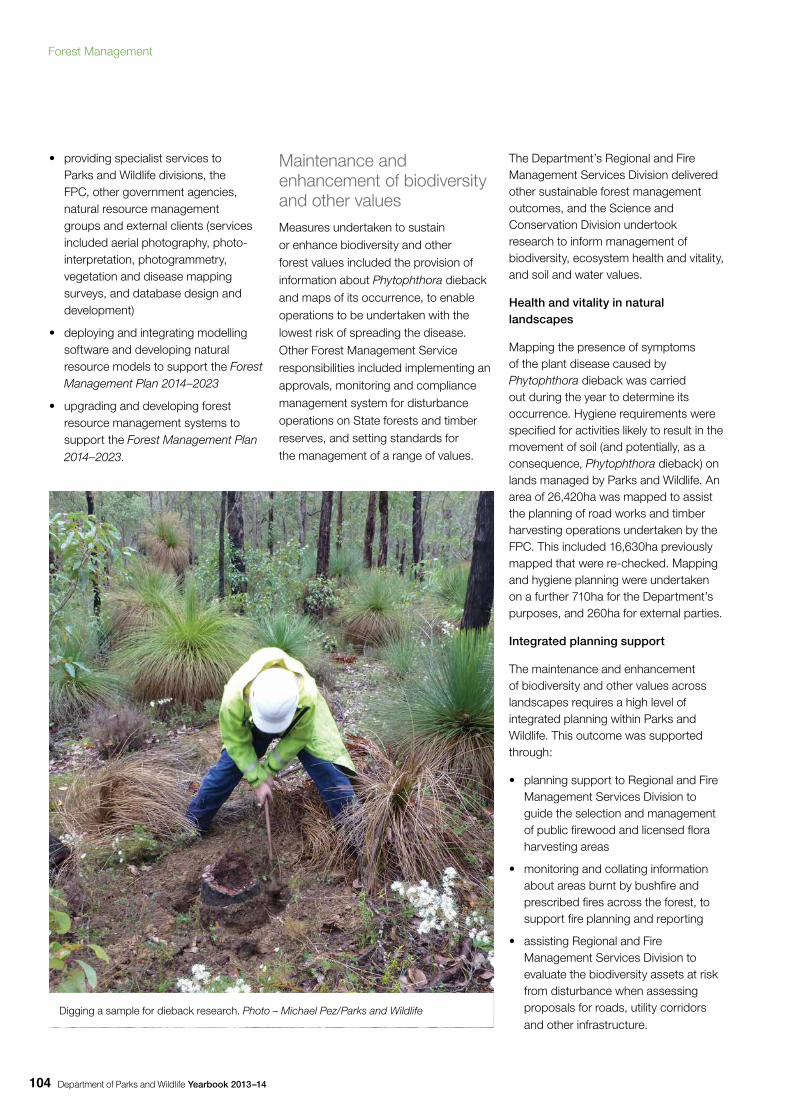
Department of Parks and Wildlife Yearbook 2013–14104
• providing specialist services to Parks and Wildlife divisions, the FPC, other government agencies, natural resource management groups and external clients (services included aerial photography, photo-interpretation, photogrammetry, vegetation and disease mapping surveys, and database design and development)
• deploying and integrating modelling software and developing natural resource models to support the Forest Management Plan 2014–2023
• upgrading and developing forest resource management systems to support the Forest Management Plan 2014–2023.
Maintenance and enhancement of biodiversity and other valuesMeasures undertaken to sustain or enhance biodiversity and other forest values included the provision of information about Phytophthora dieback and maps of its occurrence, to enable operations to be undertaken with the lowest risk of spreading the disease. Other Forest Management Service responsibilities included implementing an approvals, monitoring and compliance management system for disturbance operations on State forests and timber reserves, and setting standards for the management of a range of values.
The Department’s Regional and Fire Management Services Division delivered other sustainable forest management outcomes, and the Science and Conservation Division undertook research to inform management of biodiversity, ecosystem health and vitality, and soil and water values.
Health and vitality in natural landscapes
Mapping the presence of symptoms of the plant disease caused by Phytophthora dieback was carried out during the year to determine its occurrence. Hygiene requirements were specified for activities likely to result in the movement of soil (and potentially, as a consequence, Phytophthora dieback) on lands managed by Parks and Wildlife. An area of 26,420ha was mapped to assist the planning of road works and timber harvesting operations undertaken by the FPC. This included 16,630ha previously mapped that were re-checked. Mapping and hygiene planning were undertaken on a further 710ha for the Department’s purposes, and 260ha for external parties.
Integrated planning support
The maintenance and enhancement of biodiversity and other values across landscapes requires a high level of integrated planning within Parks and Wildlife. This outcome was supported through:
• planning support to Regional and Fire Management Services Division to guide the selection and management of public firewood and licensed flora harvesting areas
• monitoring and collating information about areas burnt by bushfire and prescribed fires across the forest, to support fire planning and reporting
• assisting Regional and Fire Management Services Division to evaluate the biodiversity assets at risk from disturbance when assessing proposals for roads, utility corridors and other infrastructure.
Digging a sample for dieback research. Photo – Michael Pez/Parks and Wildlife
Forest Management
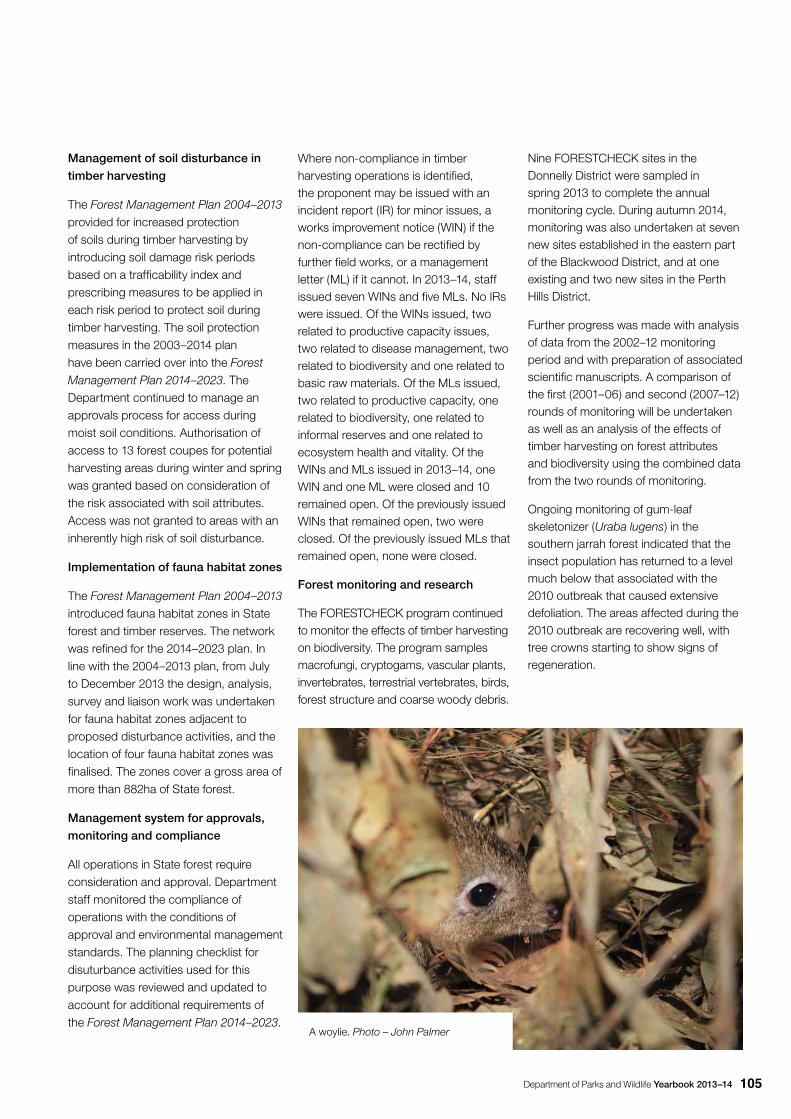
Department of Parks and Wildlife Yearbook 2013–14 105
Management of soil disturbance in
timber harvesting
The Forest Management Plan 2004–2013 provided for increased protection of soils during timber harvesting by introducing soil damage risk periods based on a trafficability index and prescribing measures to be applied in each risk period to protect soil during timber harvesting. The soil protection measures in the 2003–2014 plan have been carried over into the Forest
Management Plan 2014–2023. The Department continued to manage an approvals process for access during moist soil conditions. Authorisation of access to 13 forest coupes for potential harvesting areas during winter and spring was granted based on consideration of the risk associated with soil attributes. Access was not granted to areas with an inherently high risk of soil disturbance.
Implementation of fauna habitat zones
The Forest Management Plan 2004–2013 introduced fauna habitat zones in State forest and timber reserves. The network was refined for the 2014–2023 plan. In line with the 2004–2013 plan, from July to December 2013 the design, analysis, survey and liaison work was undertaken for fauna habitat zones adjacent to proposed disturbance activities, and the location of four fauna habitat zones was finalised. The zones cover a gross area of more than 882ha of State forest.
Management system for approvals,
monitoring and compliance
All operations in State forest require consideration and approval. Department staff monitored the compliance of operations with the conditions of approval and environmental management standards. The planning checklist for disuturbance activities used for this purpose was reviewed and updated to account for additional requirements of the Forest Management Plan 2014–2023.
Where non-compliance in timber harvesting operations is identified, the proponent may be issued with an incident report (IR) for minor issues, a works improvement notice (WIN) if the non-compliance can be rectified by further field works, or a management letter (ML) if it cannot. In 2013–14, staff issued seven WINs and five MLs. No IRs were issued. Of the WINs issued, two related to productive capacity issues, two related to disease management, two related to biodiversity and one related to basic raw materials. Of the MLs issued, two related to productive capacity, one related to biodiversity, one related to informal reserves and one related to ecosystem health and vitality. Of the WINs and MLs issued in 2013–14, one WIN and one ML were closed and 10 remained open. Of the previously issued WINs that remained open, two were closed. Of the previously issued MLs that remained open, none were closed.
Forest monitoring and research
The FORESTCHECK program continued to monitor the effects of timber harvesting on biodiversity. The program samples macrofungi, cryptogams, vascular plants, invertebrates, terrestrial vertebrates, birds, forest structure and coarse woody debris.
Nine FORESTCHECK sites in the Donnelly District were sampled in spring 2013 to complete the annual monitoring cycle. During autumn 2014, monitoring was also undertaken at seven new sites established in the eastern part of the Blackwood District, and at one existing and two new sites in the Perth Hills District.
Further progress was made with analysis of data from the 2002–12 monitoring period and with preparation of associated scientific manuscripts. A comparison of the first (2001–06) and second (2007–12) rounds of monitoring will be undertaken as well as an analysis of the effects of timber harvesting on forest attributes and biodiversity using the combined data from the two rounds of monitoring.
Ongoing monitoring of gum-leaf skeletonizer (Uraba lugens) in the southern jarrah forest indicated that the insect population has returned to a level much below that associated with the 2010 outbreak that caused extensive defoliation. The areas affected during the 2010 outbreak are recovering well, with tree crowns starting to show signs of regeneration.
A woylie. Photo – John Palmer
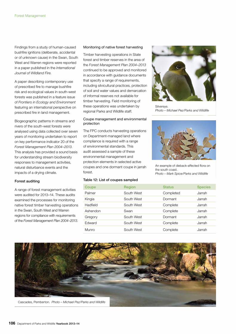
Department of Parks and Wildlife Yearbook 2013–14106
Findings from a study of human-caused bushfire ignitions (deliberate, accidental or of unknown cause) in the Swan, South West and Warren regions were reported in a paper published in the International Journal of Wildland Fire.
A paper describing contemporary use of prescribed fire to manage bushfire risk and ecological values in south-west forests was published in a feature issue of Frontiers in Ecology and Environment featuring an international perspective on prescribed fire in land management.
Biogeographic patterns in streams and rivers of the south-west forests were analysed using data collected over seven years of monitoring undertaken to report on key performance indicator 20 of the Forest Management Plan 2004–2013. This analysis has provided a sound basis for understanding stream biodiversity responses to management activities, natural disturbance events and the impacts of a drying climate.
Forest auditing
A range of forest management activities were audited for 2013–14. These audits examined the processes for monitoring native forest timber harvesting operations in the Swan, South West and Warren regions for compliance with requirements of the Forest Management Plan 2004–2013.
Monitoring of native forest harvesting
Timber harvesting operations in State forest and timber reserves in the area of the Forest Management Plan 2004–2013 continued to be approved and monitored in accordance with guidance documents that specify a range of requirements, including silvicultural practices, protection of soil and water values and demarcation of informal reserves not available for timber harvesting. Field monitoring of these operations was undertaken by regional Parks and Wildlife staff.
Coupe management and environmental protection
The FPC conducts harvesting operations on Department-managed land where compliance is required with a range of environmental standards. This audit assessed a sample of these environmental management and protection elements in selected active coupes and one dormant coupe in jarrah forest.
Table 12: List of coupes sampled
Coupe Region Status Species
Palmer South West Completed Jarrah
Kingia South West Dormant Jarrah
Hadfield South West Complete Jarrah
Ashendon Swan Complete Jarrah
Gregory South West Dormant Jarrah
Edward South West Complete Jarrah
Munro South West Complete Jarrah
Silvereye. Photo – Michael Pez/Parks and Wildlife
An example of dieback-affected flora on the south coast. Photo – Mark Spice/Parks and Wildlife
Cascades, Pemberton. Photo – Michael Pez/Parks and Wildlife
Forest Management
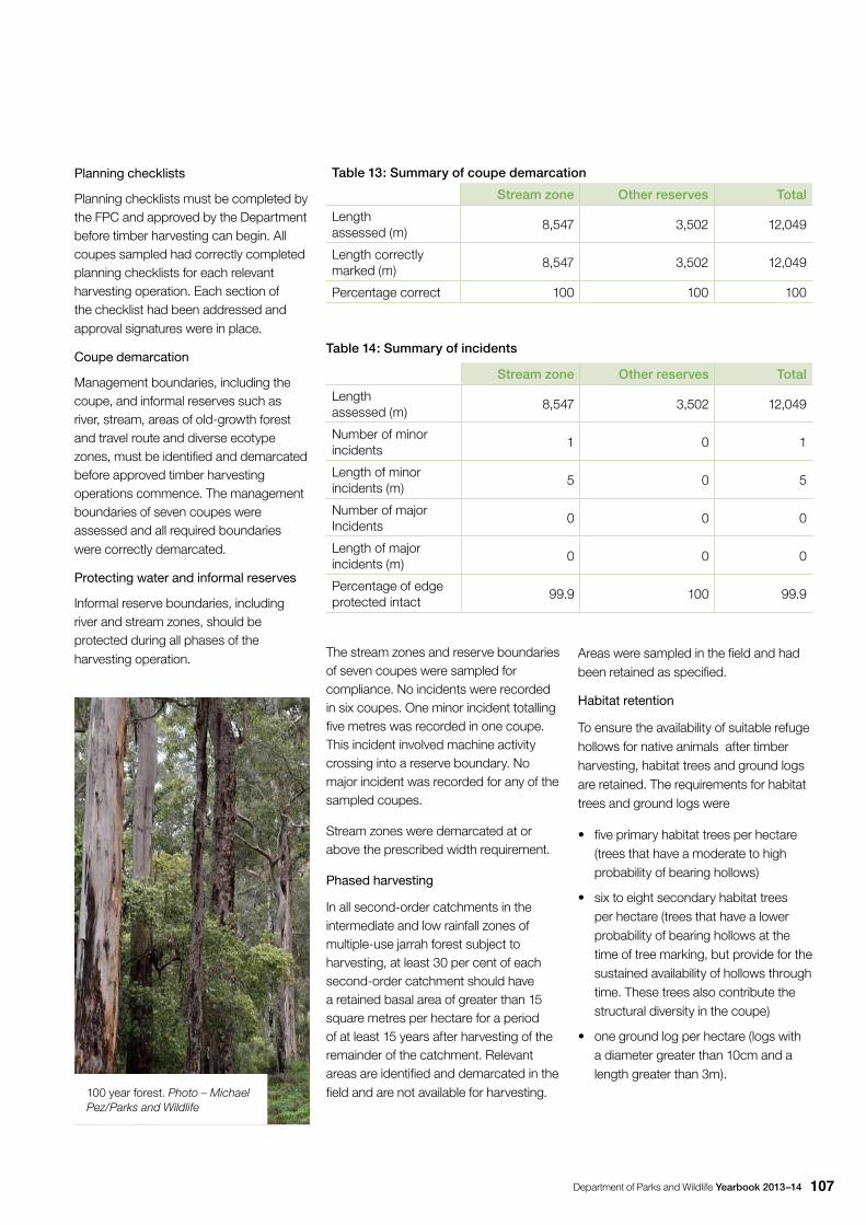
Department of Parks and Wildlife Yearbook 2013–14 107
Planning checklists
Planning checklists must be completed by the FPC and approved by the Department before timber harvesting can begin. All coupes sampled had correctly completed planning checklists for each relevant harvesting operation. Each section of the checklist had been addressed and approval signatures were in place.
Coupe demarcation
Management boundaries, including the coupe, and informal reserves such as river, stream, areas of old-growth forest and travel route and diverse ecotype zones, must be identified and demarcated before approved timber harvesting operations commence. The management boundaries of seven coupes were assessed and all required boundaries were correctly demarcated.
Protecting water and informal reserves
Informal reserve boundaries, including river and stream zones, should be protected during all phases of the harvesting operation.
Table 13: Summary of coupe demarcation
Stream zone Other reserves Total
Length assessed (m)
8,547 3,502 12,049
Length correctly marked (m)
8,547 3,502 12,049
Percentage correct 100 100 100
Table 14: Summary of incidents
Stream zone Other reserves Total
Length assessed (m)
8,547 3,502 12,049
Number of minor incidents
1 0 1
Length of minor incidents (m)
5 0 5
Number of major Incidents
0 0 0
Length of major incidents (m)
0 0 0
Percentage of edge protected intact
99.9 100 99.9
The stream zones and reserve boundaries of seven coupes were sampled for compliance. No incidents were recorded in six coupes. One minor incident totalling five metres was recorded in one coupe. This incident involved machine activity crossing into a reserve boundary. No major incident was recorded for any of the sampled coupes.
Stream zones were demarcated at or above the prescribed width requirement.
Phased harvesting
In all second-order catchments in the intermediate and low rainfall zones of multiple-use jarrah forest subject to harvesting, at least 30 per cent of each second-order catchment should have a retained basal area of greater than 15 square metres per hectare for a period of at least 15 years after harvesting of the remainder of the catchment. Relevant areas are identified and demarcated in the field and are not available for harvesting.
Areas were sampled in the field and had been retained as specified.
Habitat retention
To ensure the availability of suitable refuge hollows for native animals after timber harvesting, habitat trees and ground logs are retained. The requirements for habitat trees and ground logs were
• five primary habitat trees per hectare (trees that have a moderate to high probability of bearing hollows)
• six to eight secondary habitat trees per hectare (trees that have a lower probability of bearing hollows at the time of tree marking, but provide for the sustained availability of hollows through time. These trees also contribute the structural diversity in the coupe)
• one ground log per hectare (logs with a diameter greater than 10cm and a length greater than 3m).
100 year forest. Photo – Michael Pez/Parks and Wildlife
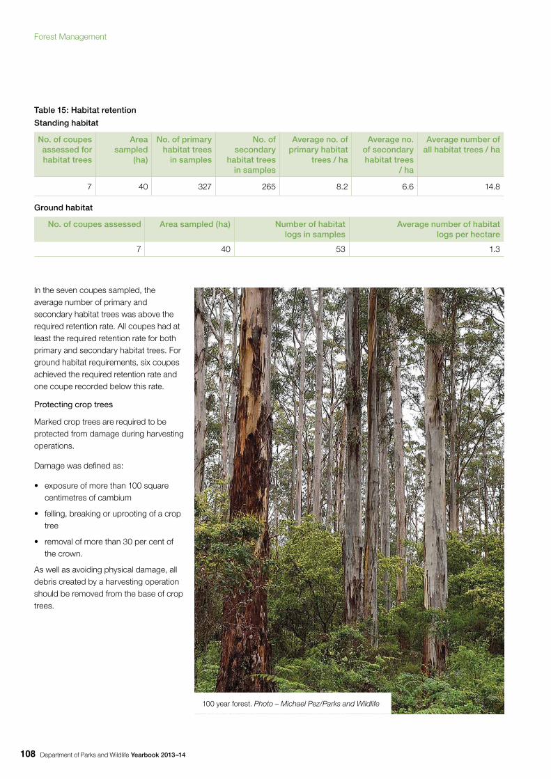
Department of Parks and Wildlife Yearbook 2013–14108
Table 15: Habitat retention
Standing habitat
No. of coupes assessed for habitat trees
Area sampled
(ha)
No. of primary habitat trees
in samples
No. of secondary
habitat trees in samples
Average no. of primary habitat
trees / ha
Average no. of secondary habitat trees
/ ha
Average number of all habitat trees / ha
7 40 327 265 8.2 6.6 14.8
Ground habitat
No. of coupes assessed Area sampled (ha) Number of habitat logs in samples
Average number of habitat logs per hectare
7 40 53 1.3
In the seven coupes sampled, the average number of primary and secondary habitat trees was above the required retention rate. All coupes had at least the required retention rate for both primary and secondary habitat trees. For ground habitat requirements, six coupes achieved the required retention rate and one coupe recorded below this rate.
Protecting crop trees
Marked crop trees are required to be protected from damage during harvesting operations.
Damage was defined as:
• exposure of more than 100 square centimetres of cambium
• felling, breaking or uprooting of a crop tree
• removal of more than 30 per cent of the crown.
As well as avoiding physical damage, all debris created by a harvesting operation should be removed from the base of crop trees.
100 year forest. Photo – Michael Pez/Parks and Wildlife
Forest Management
Department of Parks and Wildlife Yearbook 2013–14 109
Table 16: Crop tree assessment
No. of coupes assessed
No. of crop trees assessed
No. of crop trees undamaged
No. of crop trees damaged
Compliance
7 719 700 19 96%
Table 17: Crop tree tops disposed and not disposed
No. of crop trees assessed
No. of crop tree tops disposed
No. of crop tree tops disposed
Compliance
719 674 45 94%
All of the seven coupes assessed were below the allowable five per cent limit for crop tree damage. The highest level of damage recorded was four per cent and the lowest two per cent.
As well as avoiding physical damage, all debris created by a harvesting operation should be removed from the base of crop trees. This task is commonly known as ‘tops disposal’ and is designed to protect crop trees from fire damage. All woody material greater than 75mm in diameter must be removed at least 1m from the bole of the crop tree.
Of the seven coupes assessed, four achieved the compliance level of 95 per cent. The highest level of completed tops disposal was 98 per cent and the lowest level 89 per cent.
Protecting soil
When log extraction is completed in any feller’s block, and prior to machinery leaving, spreader banks must be constructed across all extraction tracks and disturbed firebreaks with exposed soil to minimise the risk of soil erosion. The minimum size and angle of banks is set and the prescribed spacing is dependent on the slope and soil type.
Table 18: Erosion control
No. of coupes assessed
Length of snig track assessed
(m)
Length of track meeting specification
(m)
Length of track not meeting
specification (m)
Compliance
7 7,482 7,482 0 100%
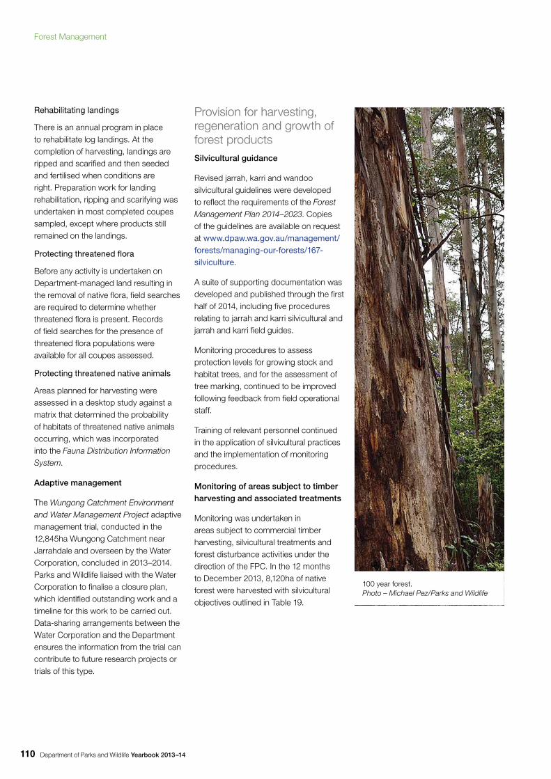
Department of Parks and Wildlife Yearbook 2013–14110
Rehabilitating landings
There is an annual program in place to rehabilitate log landings. At the completion of harvesting, landings are ripped and scarified and then seeded and fertilised when conditions are right. Preparation work for landing rehabilitation, ripping and scarifying was undertaken in most completed coupes sampled, except where products still remained on the landings.
Protecting threatened flora
Before any activity is undertaken on Department-managed land resulting in the removal of native flora, field searches are required to determine whether threatened flora is present. Records of field searches for the presence of threatened flora populations were available for all coupes assessed.
Protecting threatened native animals
Areas planned for harvesting were assessed in a desktop study against a matrix that determined the probability of habitats of threatened native animals occurring, which was incorporated into the Fauna Distribution Information System.
Adaptive management
The Wungong Catchment Environment and Water Management Project adaptive management trial, conducted in the 12,845ha Wungong Catchment near Jarrahdale and overseen by the Water Corporation, concluded in 2013–2014. Parks and Wildlife liaised with the Water Corporation to finalise a closure plan, which identified outstanding work and a timeline for this work to be carried out. Data-sharing arrangements between the Water Corporation and the Department ensures the information from the trial can contribute to future research projects or trials of this type.
Provision for harvesting, regeneration and growth of forest productsSilvicultural guidance
Revised jarrah, karri and wandoo silvicultural guidelines were developed to reflect the requirements of the Forest Management Plan 2014–2023. Copies of the guidelines are available on request at www.dpaw.wa.gov.au/management/forests/managing-our-forests/167-silviculture.
A suite of supporting documentation was developed and published through the first half of 2014, including five procedures relating to jarrah and karri silvicultural and jarrah and karri field guides.
Monitoring procedures to assess protection levels for growing stock and habitat trees, and for the assessment of tree marking, continued to be improved following feedback from field operational staff.
Training of relevant personnel continued in the application of silvicultural practices and the implementation of monitoring procedures.
Monitoring of areas subject to timber harvesting and associated treatments
Monitoring was undertaken in areas subject to commercial timber harvesting, silvicultural treatments and forest disturbance activities under the direction of the FPC. In the 12 months to December 2013, 8,120ha of native forest were harvested with silvicultural objectives outlined in Table 19.
100 year forest. Photo – Michael Pez/Parks and Wildlife
Forest Management
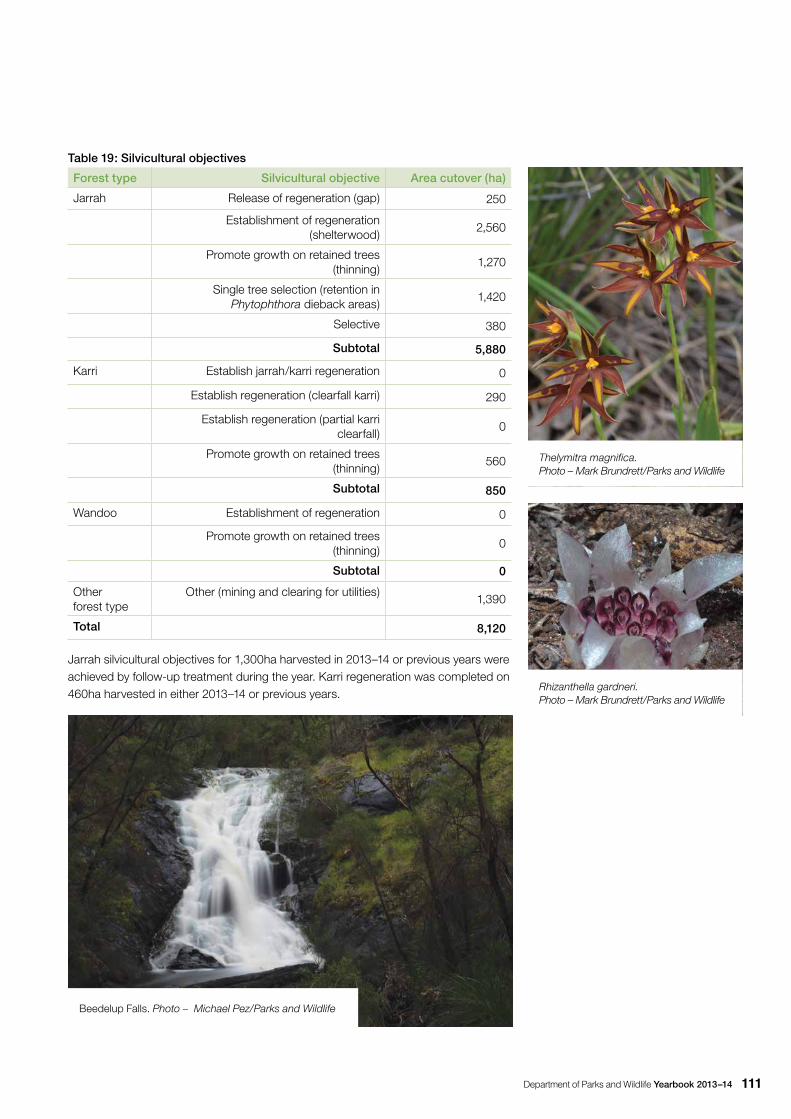
Department of Parks and Wildlife Yearbook 2013–14 111
Table 19: Silvicultural objectives
Forest type Silvicultural objective Area cutover (ha)
Jarrah Release of regeneration (gap) 250
Establishment of regeneration (shelterwood)
2,560
Promote growth on retained trees (thinning)
1,270
Single tree selection (retention in Phytophthora dieback areas)
1,420
Selective 380
Subtotal 5,880
Karri Establish jarrah/karri regeneration 0
Establish regeneration (clearfall karri) 290
Establish regeneration (partial karri clearfall)
0
Promote growth on retained trees (thinning)
560
Subtotal 850
Wandoo Establishment of regeneration 0
Promote growth on retained trees (thinning)
0
Subtotal 0
Other forest type
Other (mining and clearing for utilities)1,390
Total 8,120
Jarrah silvicultural objectives for 1,300ha harvested in 2013–14 or previous years were achieved by follow-up treatment during the year. Karri regeneration was completed on 460ha harvested in either 2013–14 or previous years.
Beedelup Falls. Photo – Michael Pez/Parks and Wildlife
Thelymitra magnifica. Photo – Mark Brundrett/Parks and Wildlife
Rhizanthella gardneri. Photo – Mark Brundrett/Parks and Wildlife
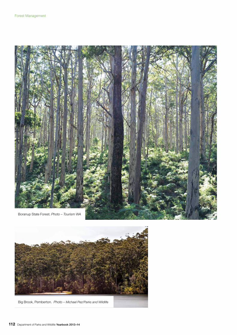
Department of Parks and Wildlife Yearbook 2013–14112
Boranup State Forest. Photo – Tourism WA
Big Brook, Pemberton. Photo – Michael Pez/Parks and Wildlife
Forest Management
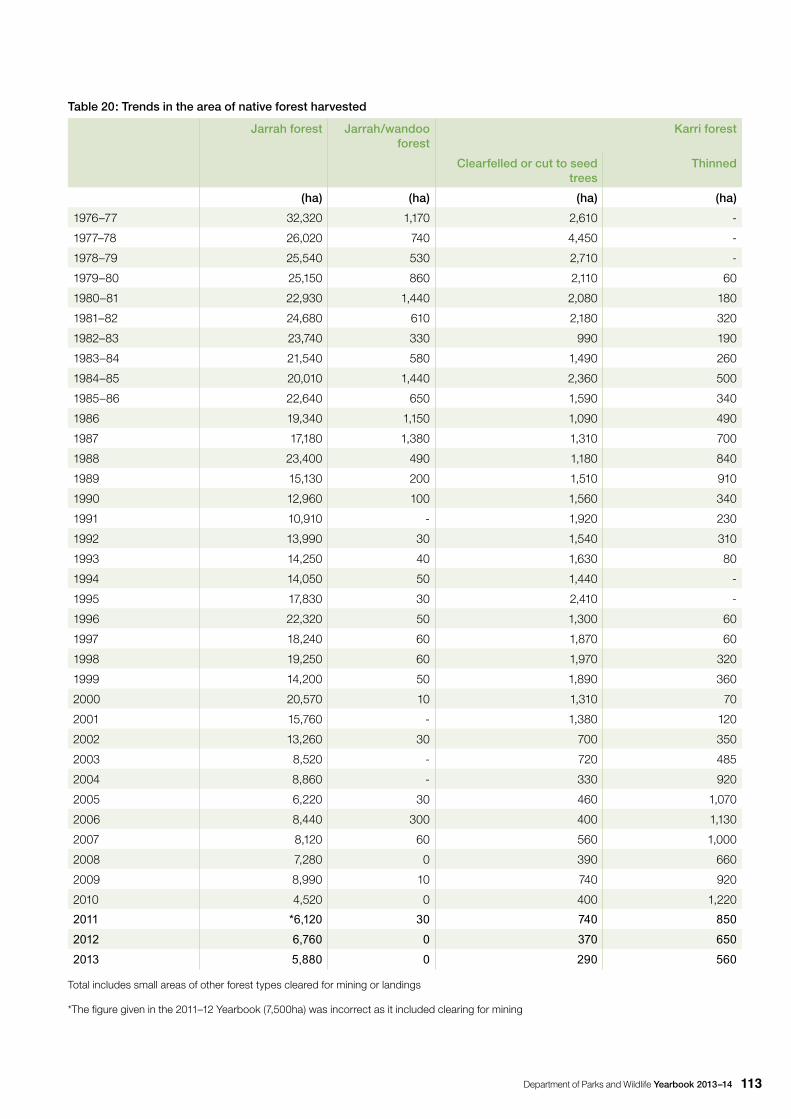
Department of Parks and Wildlife Yearbook 2013–14 113
Table 20: Trends in the area of native forest harvested
Jarrah forest Jarrah/wandoo forest
Karri forest
Clearfelled or cut to seed trees
Thinned
(ha) (ha) (ha) (ha)
1976–77 32,320 1,170 2,610 -
1977–78 26,020 740 4,450 -
1978–79 25,540 530 2,710 -
1979–80 25,150 860 2,110 60
1980–81 22,930 1,440 2,080 180
1981–82 24,680 610 2,180 320
1982–83 23,740 330 990 190
1983–84 21,540 580 1,490 260
1984–85 20,010 1,440 2,360 500
1985–86 22,640 650 1,590 340
1986 19,340 1,150 1,090 490
1987 17,180 1,380 1,310 700
1988 23,400 490 1,180 840
1989 15,130 200 1,510 910
1990 12,960 100 1,560 340
1991 10,910 - 1,920 230
1992 13,990 30 1,540 310
1993 14,250 40 1,630 80
1994 14,050 50 1,440 -
1995 17,830 30 2,410 -
1996 22,320 50 1,300 60
1997 18,240 60 1,870 60
1998 19,250 60 1,970 320
1999 14,200 50 1,890 360
2000 20,570 10 1,310 70
2001 15,760 - 1,380 120
2002 13,260 30 700 350
2003 8,520 - 720 485
2004 8,860 - 330 920
2005 6,220 30 460 1,070
2006 8,440 300 400 1,130
2007 8,120 60 560 1,000
2008 7,280 0 390 660
2009 8,990 10 740 920
2010 4,520 0 400 1,220
2011 *6,120 30 740 850
2012 6,760 0 370 650
2013 5,880 0 290 560
Total includes small areas of other forest types cleared for mining or landings
*The figure given in the 2011–12 Yearbook (7,500ha) was incorrect as it included clearing for mining
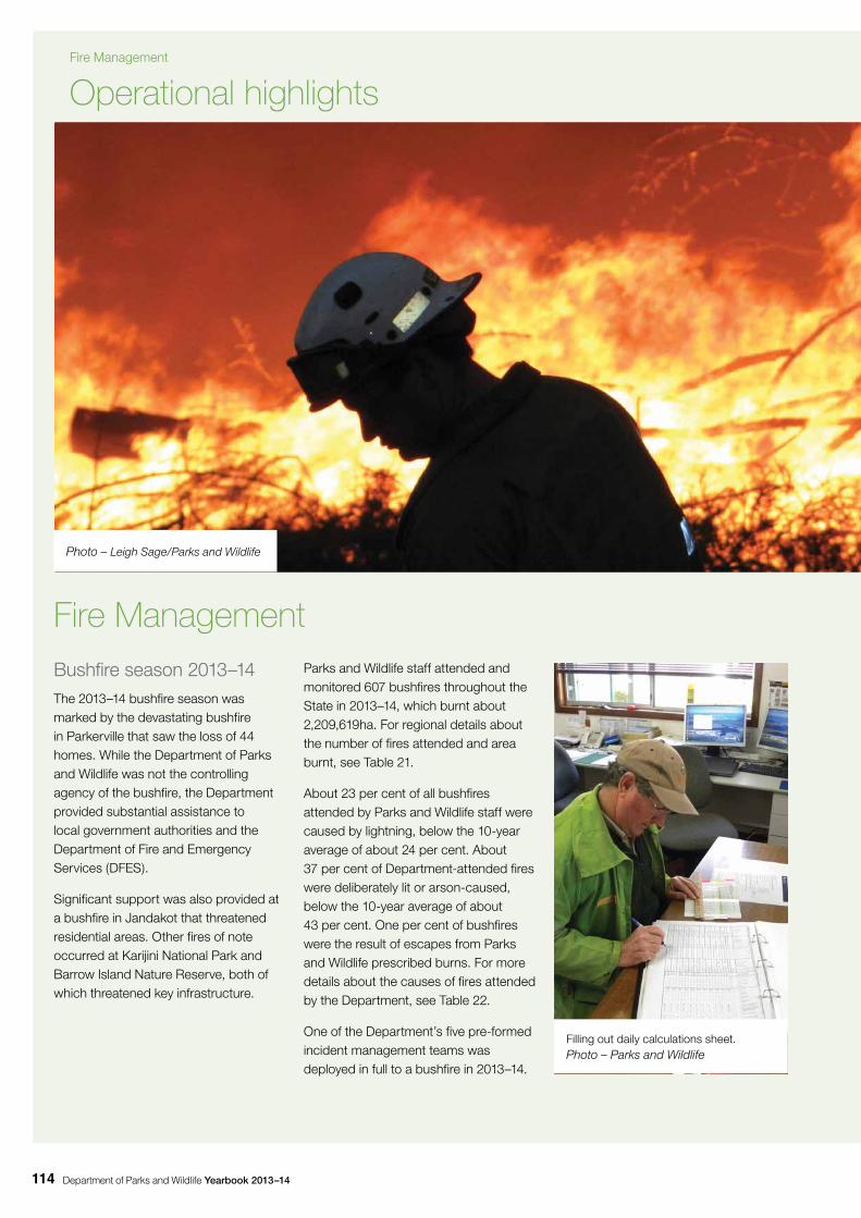
Department of Parks and Wildlife Yearbook 2013–14114
Bushfire season 2013–14 The 2013–14 bushfire season was marked by the devastating bushfire in Parkerville that saw the loss of 44 homes. While the Department of Parks and Wildlife was not the controlling agency of the bushfire, the Department provided substantial assistance to local government authorities and the Department of Fire and Emergency Services (DFES).
Significant support was also provided at a bushfire in Jandakot that threatened residential areas. Other fires of note occurred at Karijini National Park and Barrow Island Nature Reserve, both of which threatened key infrastructure.
Fire Management Parks and Wildlife staff attended and monitored 607 bushfires throughout the State in 2013–14, which burnt about 2,209,619ha. For regional details about the number of fires attended and area burnt, see Table 21.
About 23 per cent of all bushfires attended by Parks and Wildlife staff were caused by lightning, below the 10-year average of about 24 per cent. About 37 per cent of Department-attended fires were deliberately lit or arson-caused, below the 10-year average of about 43 per cent. One per cent of bushfires were the result of escapes from Parks and Wildlife prescribed burns. For more details about the causes of fires attended by the Department, see Table 22.
One of the Department’s five pre-formed incident management teams was deployed in full to a bushfire in 2013–14.
Operational highlights
Photo – Leigh Sage/Parks and Wildlife
Filling out daily calculations sheet. Photo – Parks and Wildlife
Fire Management
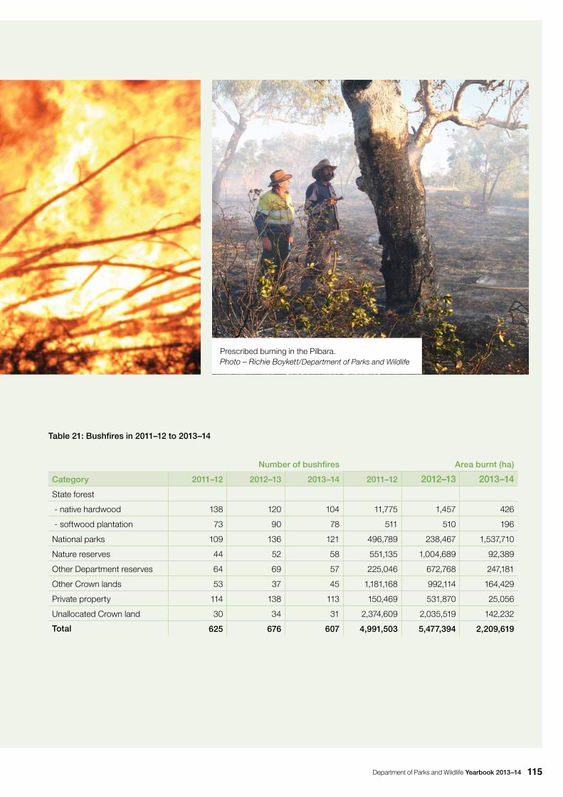
Department of Parks and Wildlife Yearbook 2013–14 115
Table 21: Bushfires in 2011–12 to 2013–14
Number of bushfires Area burnt (ha)
Category 2011–12 2012–13 2013–14 2011–12 2012–13 2013–14
State forest
- native hardwood 138 120 104 11,775 1,457 426
- softwood plantation 73 90 78 511 510 196
National parks 109 136 121 496,789 238,467 1,537,710
Nature reserves 44 52 58 551,135 1,004,689 92,389
Other Department reserves 64 69 57 225,046 672,768 247,181
Other Crown lands 53 37 45 1,181,168 992,114 164,429
Private property 114 138 113 150,469 531,870 25,056
Unallocated Crown land 30 34 31 2,374,609 2,035,519 142,232
Total 625 676 607 4,991,503 5,477,394 2,209,619
Prescribed burning in the Pilbara. Photo – Richie Boykett/Department of Parks and Wildlife
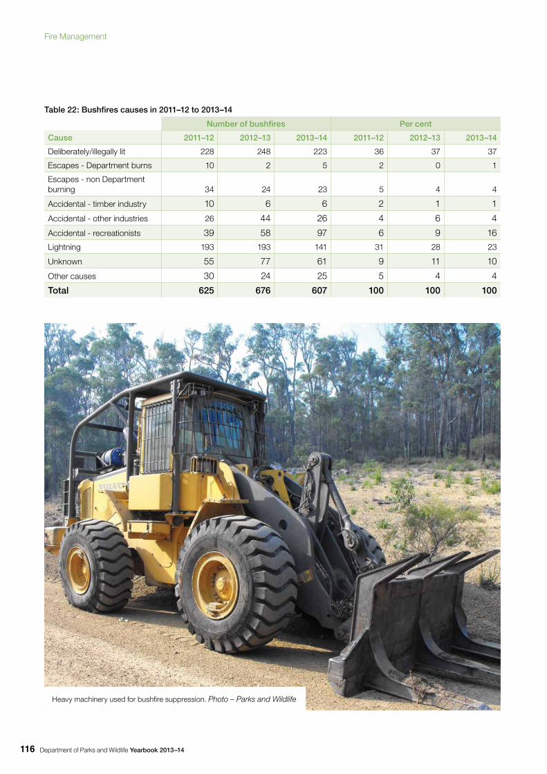
Department of Parks and Wildlife Yearbook 2013–14116
Table 22: Bushfires causes in 2011–12 to 2013–14
Number of bushfires Per cent
Cause 2011–12 2012–13 2013–14 2011–12 2012–13 2013–14
Deliberately/illegally lit 228 248 223 36 37 37
Escapes - Department burns 10 2 5 2 0 1
Escapes - non Department burning 34 24 23 5 4 4
Accidental - timber industry 10 6 6 2 1 1
Accidental - other industries 26 44 26 4 6 4
Accidental - recreationists 39 58 97 6 9 16
Lightning 193 193 141 31 28 23
Unknown 55 77 61 9 11 10
Other causes 30 24 25 5 4 4
Total 625 676 607 100 100 100
Heavy machinery used for bushfire suppression. Photo – Parks and Wildlife
Fire Management
Department of Parks and Wildlife Yearbook 2013–14 117
Tab
le 2
3: A
rea
and
num
ber
of b
ushf
ires
att
end
ed a
nd m
oni
tore
d b
y P
arks
and
Wild
life
for
all r
egio
ns 2
013
–14
Reg
ion
Sta
te
fore
st
nativ
e ha
rdw
oo
d
Sta
te f
ore
st
soft
wo
od
p
lant
atio
n
Nat
iona
l p
arks
Nat
ure
rese
rves
Oth
er
Dep
artm
ent
rese
rves
Oth
er
Cro
wn
land
s
Pri
vate
p
rop
erty
Una
lloca
ted
C
row
n la
ndTo
tal
So
uth-
wes
t fo
rest
reg
ions
Sw
anA
rea
(ha)
*32
019
552
713
836
552
386
142,
168
Num
ber *
*46
7224
1721
1841
324
2
Sou
th W
est
Are
a (h
a) *
442
517
194
216
230
7
Num
ber *
*43
521
19
438
212
3
War
ren
Are
a (h
a) *
620
14,3
0313
237
010
63
14,6
43
Num
ber *
*14
15
51
24
234
Sub
tota
lA
rea
(ha
) *42
619
614
,835
287
9255
670
718
17,1
18
Num
ber
**
103
7850
2331
2483
739
9
Oth
er r
egio
ns
Kim
berle
yA
rea
(ha)
*1,
198,
697
63,1
9119
9,05
446
,641
12,7
1567
,192
1,58
7,49
0
Num
ber *
*13
85
32
435
Pilb
ara
Are
a (h
a) *
307,
608
15,0
8842
,025
95,8
1247
,299
507,
831
Num
ber *
*48
912
99
87
Mid
wes
tA
rea
(ha)
*13
,015
2,86
945
720
,329
9,94
71,
157
47,7
74
Num
ber *
*3
12
611
326
Gol
dfie
lds
Are
a (h
a) *
020
7,64
35,
518
1,08
321
,165
35,4
30
Num
ber *
*1
13
21
412
Whe
atbe
ltA
rea
(ha)
*3,
283
2219
4,82
98,
153
Num
ber *
*7
11
9
Sou
th C
oast
Are
a (h
a) *
3,53
528
138
1,66
857
25,
823
Num
ber *
*6
74
217
339
Sub
tota
lA
rea
(ha
) *0
01,
522,
875
92,1
0224
7,08
916
3,87
324
,348
142,
214
2,1
92,5
01
Num
ber
**
10
7135
2621
3024
208
Gra
nd
to
tal (
all
reg
ion
s)A
rea
(ha)
*42
619
61,
537
,710
92,3
89
247
,181
164
,42
925
,05
614
2,2
322
,20
9,61
9
Nu
mb
er *
*10
478
121
58
574
511
331
607
* A
rea
(ha)
bur
nt b
y bu
shfir
es in
the
tenu
re t
ype
(slig
ht d
escr
epen
cies
in to
tals
may
app
ear d
ue to
roun
ding
)
** N
umbe
r of b
ushf
ires
orig
inat
ing
in th
e te
nure
typ
e
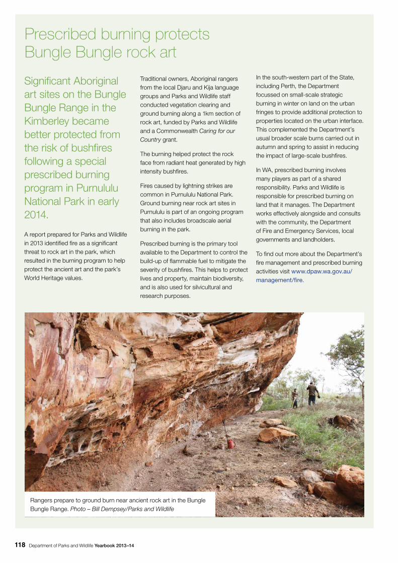
Department of Parks and Wildlife Yearbook 2013–14118
Significant Aboriginal art sites on the Bungle Bungle Range in the Kimberley became better protected from the risk of bushfires following a special prescribed burning program in Purnululu National Park in early 2014.
A report prepared for Parks and Wildlife in 2013 identified fire as a significant threat to rock art in the park, which resulted in the burning program to help protect the ancient art and the park’s World Heritage values.
Traditional owners, Aboriginal rangers from the local Djaru and Kija language groups and Parks and Wildlife staff conducted vegetation clearing and ground burning along a 1km section of rock art, funded by Parks and Wildlife and a Commonwealth Caring for our Country grant.
The burning helped protect the rock face from radiant heat generated by high intensity bushfires.
Fires caused by lightning strikes are common in Purnululu National Park. Ground burning near rock art sites in Purnululu is part of an ongoing program that also includes broadscale aerial burning in the park.
Prescribed burning is the primary tool available to the Department to control the build-up of flammable fuel to mitigate the severity of bushfires. This helps to protect lives and property, maintain biodiversity, and is also used for silvicultural and research purposes.
Prescribed burning protects Bungle Bungle rock art
Rangers prepare to ground burn near ancient rock art in the Bungle Bungle Range. Photo – Bill Dempsey/Parks and Wildlife
In the south-western part of the State, including Perth, the Department focussed on small-scale strategic burning in winter on land on the urban fringes to provide additional protection to properties located on the urban interface. This complemented the Department’s usual broader scale burns carried out in autumn and spring to assist in reducing the impact of large-scale bushfires.
In WA, prescribed burning involves many players as part of a shared responsibility. Parks and Wildlife is responsible for prescribed burning on land that it manages. The Department works effectively alongside and consults with the community, the Department of Fire and Emergency Services, local governments and landholders.
To find out more about the Department’s fire management and prescribed burning activities visit www.dpaw.wa.gov.au/management/fire.
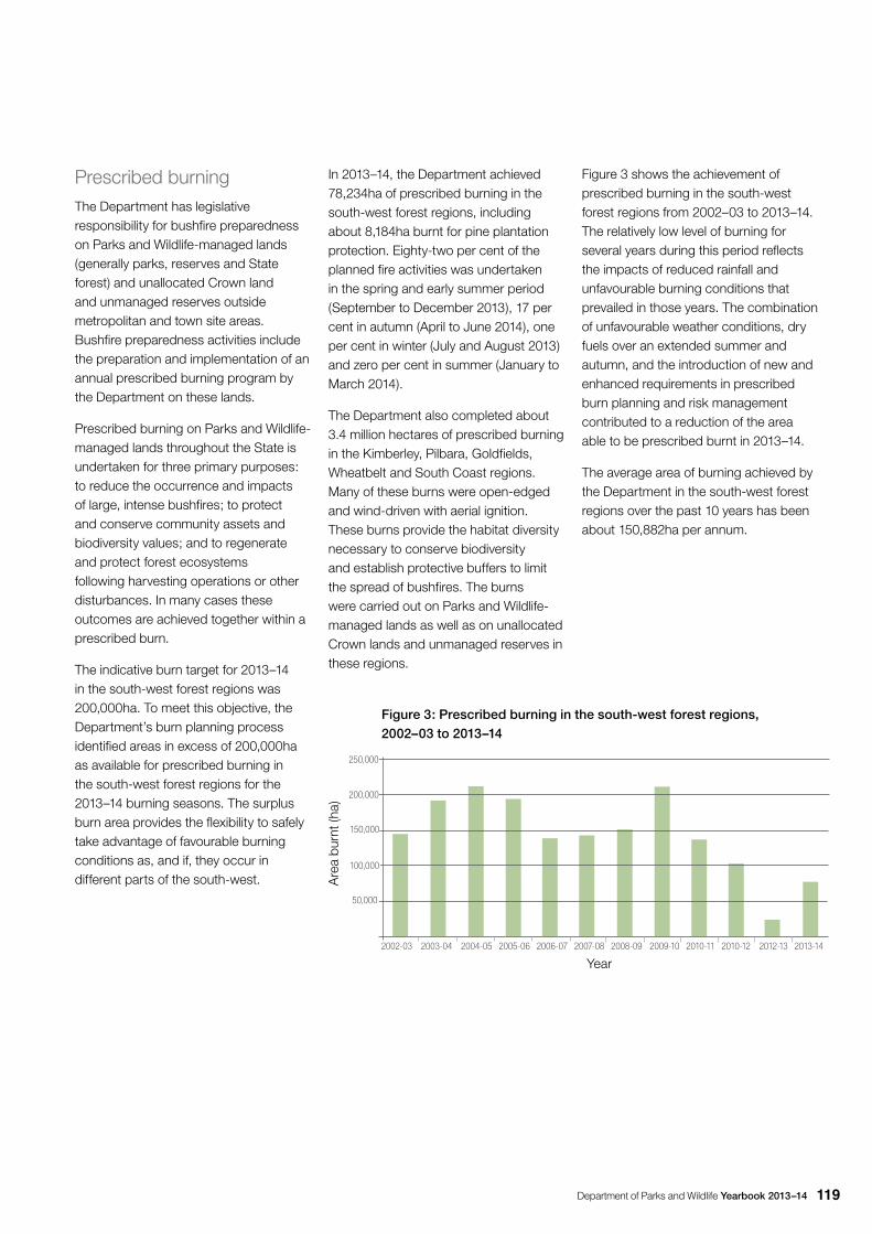
Department of Parks and Wildlife Yearbook 2013–14 119
Prescribed burning The Department has legislative responsibility for bushfire preparedness on Parks and Wildlife-managed lands (generally parks, reserves and State forest) and unallocated Crown land and unmanaged reserves outside metropolitan and town site areas. Bushfire preparedness activities include the preparation and implementation of an annual prescribed burning program by the Department on these lands.
Prescribed burning on Parks and Wildlife-managed lands throughout the State is undertaken for three primary purposes: to reduce the occurrence and impacts of large, intense bushfires; to protect and conserve community assets and biodiversity values; and to regenerate and protect forest ecosystems following harvesting operations or other disturbances. In many cases these outcomes are achieved together within a prescribed burn.
The indicative burn target for 2013–14 in the south-west forest regions was 200,000ha. To meet this objective, the Department’s burn planning process identified areas in excess of 200,000ha as available for prescribed burning in the south-west forest regions for the 2013–14 burning seasons. The surplus burn area provides the flexibility to safely take advantage of favourable burning conditions as, and if, they occur in different parts of the south-west.
In 2013–14, the Department achieved 78,234ha of prescribed burning in the south-west forest regions, including about 8,184ha burnt for pine plantation protection. Eighty-two per cent of the planned fire activities was undertaken in the spring and early summer period (September to December 2013), 17 per cent in autumn (April to June 2014), one per cent in winter (July and August 2013) and zero per cent in summer (January to March 2014).
The Department also completed about 3.4 million hectares of prescribed burning in the Kimberley, Pilbara, Goldfields, Wheatbelt and South Coast regions. Many of these burns were open-edged and wind-driven with aerial ignition. These burns provide the habitat diversity necessary to conserve biodiversity and establish protective buffers to limit the spread of bushfires. The burns were carried out on Parks and Wildlife-managed lands as well as on unallocated Crown lands and unmanaged reserves in these regions.
Figure 3 shows the achievement of prescribed burning in the south-west forest regions from 2002–03 to 2013–14. The relatively low level of burning for several years during this period reflects the impacts of reduced rainfall and unfavourable burning conditions that prevailed in those years. The combination of unfavourable weather conditions, dry fuels over an extended summer and autumn, and the introduction of new and enhanced requirements in prescribed burn planning and risk management contributed to a reduction of the area able to be prescribed burnt in 2013–14.
The average area of burning achieved by the Department in the south-west forest regions over the past 10 years has been about 150,882ha per annum.
Are
a bu
rnt (
ha)
Year
Figure 3: Prescribed burning in the south-west forest regions, 2002–03 to 2013–14
2002-03 2003-04 2004-05 2005-06 2006-07 2007-08 2008-09 2009-10 2010-11 2010-12 2012-13 2013-14
50,000
100,000
150,000
200,000
250,000
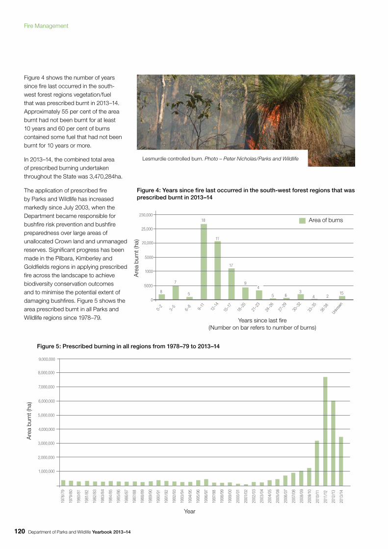
Department of Parks and Wildlife Yearbook 2013–14120
Figure 4 shows the number of years since fire last occurred in the south-west forest regions vegetation/fuel that was prescribed burnt in 2013–14. Approximately 55 per cent of the area burnt had not been burnt for at least 10 years and 60 per cent of burns contained some fuel that had not been burnt for 10 years or more.
In 2013–14, the combined total area of prescribed burning undertaken throughout the State was 3,470,284ha.
The application of prescribed fire by Parks and Wildlife has increased markedly since July 2003, when the Department became responsible for bushfire risk prevention and bushfire preparedness over large areas of unallocated Crown land and unmanaged reserves. Significant progress has been made in the Pilbara, Kimberley and Goldfields regions in applying prescribed fire across the landscape to achieve biodiversity conservation outcomes and to minimise the potential extent of damaging bushfires. Figure 5 shows the area prescribed burnt in all Parks and Wildlife regions since 1978–79.
Are
a bu
rnt (
ha)
5000
0
1000
5000
20,000
25,000
230,000
8
0–2
Years since last fire(Number on bar refers to number of burns)
Figure 4: Years since fire last occurred in the south-west forest regions that was prescribed burnt in 2013–14
7
5
18
11
17
94
5 63
4 215
3–5
6–8
9–11
12–1
4
15–1
7
18–2
0
21–2
3
24–2
6
27–2
9
30–3
2
33–3
5
36-3
8
Unkn
own
Area of burns
Lesmurdie controlled burn. Photo – Peter Nicholas/Parks and Wildlife
Figure 5: Prescribed burning in all regions from 1978–79 to 2013–14
1,000,000
2,000,000
3,000,000
7,000,000
4,000,000
5,000,000
6,000,000
8,000,000
9,000,000
1978
/79
1979
/80
1980
/81
1981
/82
1982
/83
1983
/84
1984
/85
1985
/86
1986
/87
1987
/88
1988
/89
1989
/90
1990
/91
1991
/92
1992
/93
1993
/94
1994
/95
1995
/96
1996
/97
1997
/98
1998
/99
1999
/00
2000
/01
2001
/02
2002
/03
2003
/04
2004
/05
2005
/06
2006
/07
2007
/08
2008
/09
2009
/10
2010
/11
2011
/12
2012
/13
2013
/14
Are
a bu
rnt (
ha)
Year
Fire Management
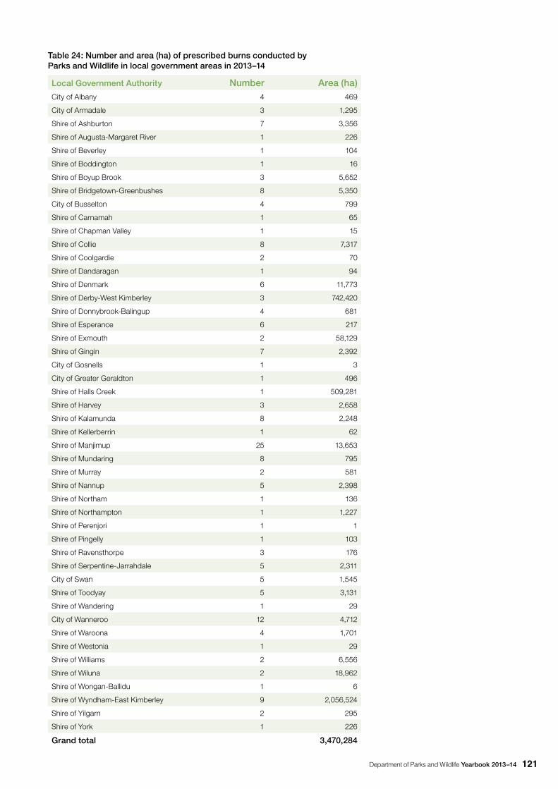
Department of Parks and Wildlife Yearbook 2013–14 121
Table 24: Number and area (ha) of prescribed burns conducted by Parks and Wildlife in local government areas in 2013–14
Local Government Authority Number Area (ha)City of Albany 4 469
City of Armadale 3 1,295
Shire of Ashburton 7 3,356
Shire of Augusta-Margaret River 1 226
Shire of Beverley 1 104
Shire of Boddington 1 16
Shire of Boyup Brook 3 5,652
Shire of Bridgetown-Greenbushes 8 5,350
City of Busselton 4 799
Shire of Carnamah 1 65
Shire of Chapman Valley 1 15
Shire of Collie 8 7,317
Shire of Coolgardie 2 70
Shire of Dandaragan 1 94
Shire of Denmark 6 11,773
Shire of Derby-West Kimberley 3 742,420
Shire of Donnybrook-Balingup 4 681
Shire of Esperance 6 217
Shire of Exmouth 2 58,129
Shire of Gingin 7 2,392
City of Gosnells 1 3
City of Greater Geraldton 1 496
Shire of Halls Creek 1 509,281
Shire of Harvey 3 2,658
Shire of Kalamunda 8 2,248
Shire of Kellerberrin 1 62
Shire of Manjimup 25 13,653
Shire of Mundaring 8 795
Shire of Murray 2 581
Shire of Nannup 5 2,398
Shire of Northam 1 136
Shire of Northampton 1 1,227
Shire of Perenjori 1 1
Shire of Pingelly 1 103
Shire of Ravensthorpe 3 176
Shire of Serpentine-Jarrahdale 5 2,311
City of Swan 5 1,545
Shire of Toodyay 5 3,131
Shire of Wandering 1 29
City of Wanneroo 12 4,712
Shire of Waroona 4 1,701
Shire of Westonia 1 29
Shire of Williams 2 6,556
Shire of Wiluna 2 18,962
Shire of Wongan-Ballidu 1 6
Shire of Wyndham-East Kimberley 9 2,056,524
Shire of Yilgarn 2 295
Shire of York 1 226
Grand total 3,470,284
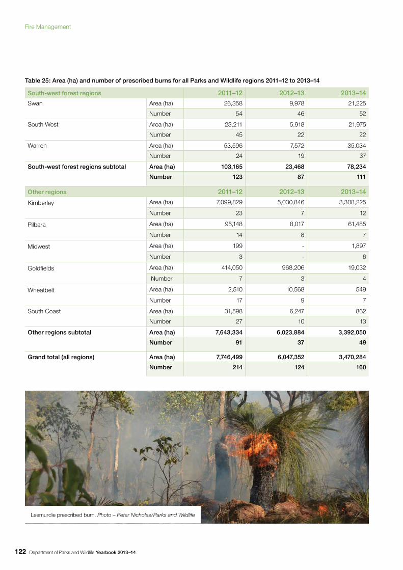
Department of Parks and Wildlife Yearbook 2013–14122
Table 25: Area (ha) and number of prescribed burns for all Parks and Wildlife regions 2011–12 to 2013–14
South-west forest regions 2011–12 2012–13 2013–14
Swan
Area (ha) 26,358 9,978 21,225
Number 54 46 52
South West
Area (ha) 23,211 5,918 21,975
Number 45 22 22
Warren
Area (ha) 53,596 7,572 35,034
Number 24 19 37
South-west forest regions subtotal
Area (ha) 103,165 23,468 78,234
Number 123 87 111
Other regions 2011–12 2012–13 2013–14
Kimberley
Area (ha) 7,099,829 5,030,846 3,308,225
Number 23 7 12
Pilbara
Area (ha) 95,148 8,017 61,485
Number 14 8 7
Midwest
Area (ha) 199 - 1,897
Number 3 - 6
Goldfields
Area (ha) 414,050 968,206 19,032
Number 7 3 4
Wheatbelt
Area (ha) 2,510 10,568 549
Number 17 9 7
South Coast
Area (ha) 31,598 6,247 862
Number 27 10 13
Other regions subtotal
Area (ha) 7,643,334 6,023,884 3,392,050
Number 91 37 49
Grand total (all regions)
Area (ha) 7,746,499 6,047,352 3,470,284
Number 214 124 160
Lesmurdie prescribed burn. Photo – Peter Nicholas/Parks and Wildlife
Fire Management
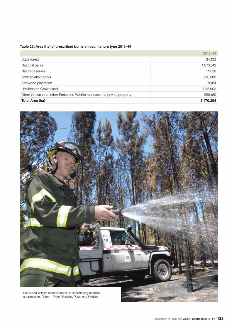
Department of Parks and Wildlife Yearbook 2013–14 123
Table 26: Area (ha) of prescribed burns on each tenure type 2013–14
2013–14
State forest 34,133
National parks 1,073,512
Nature reserves 11,028
Conservation parks 270,366
Softwood plantation 8,184
Unallocated Crown land 1,083,902
Other Crown land, other Parks and Wildlife reserves and private property 989,159
Total Area (ha) 3,470,284
Parks and Wildlife officer Sam Hurd undertaking bushfire suppression. Photo – Peter Nicholas/Parks and Wildlife
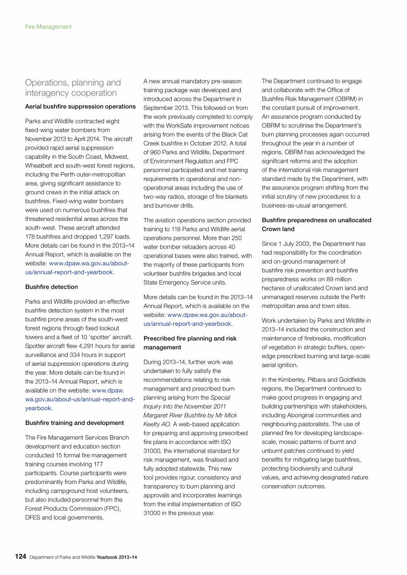
Department of Parks and Wildlife Yearbook 2013–14124
Operations, planning and interagency cooperationAerial bushfire suppression operations
Parks and Wildlife contracted eight fixed-wing water bombers from November 2013 to April 2014. The aircraft provided rapid aerial suppression capability in the South Coast, Midwest, Wheatbelt and south-west forest regions, including the Perth outer-metropolitan area, giving significant assistance to ground crews in the initial attack on bushfires. Fixed-wing water bombers were used on numerous bushfires that threatened residential areas across the south-west. These aircraft attended 178 bushfires and dropped 1,297 loads. More details can be found in the 2013–14 Annual Report, which is available on the website: www.dpaw.wa.gov.au/about-us/annual-report-and-yearbook.
Bushfire detection
Parks and Wildlife provided an effective bushfire detection system in the most bushfire prone areas of the south-west forest regions through fixed lookout towers and a fleet of 10 ‘spotter’ aircraft. Spotter aircraft flew 4,291 hours for aerial surveillance and 334 hours in support of aerial suppression operations during the year. More details can be found in the 2013–14 Annual Report, which is available on the website: www.dpaw.wa.gov.au/about-us/annual-report-and-yearbook.
Bushfire training and development
The Fire Management Services Branch development and education section conducted 15 formal fire management training courses involving 177 participants. Course participants were predominantly from Parks and Wildlife, including campground host volunteers, but also included personnel from the Forest Products Commission (FPC), DFES and local governments.
A new annual mandatory pre-season training package was developed and introduced across the Department in September 2013. This followed on from the work previously completed to comply with the WorkSafe improvement notices arising from the events of the Black Cat Creek bushfire in October 2012. A total of 960 Parks and Wildlife, Department of Environment Regulation and FPC personnel participated and met training requirements in operational and non-operational areas including the use of two-way radios, storage of fire blankets and burnover drills.
The aviation operations section provided training to 118 Parks and Wildlife aerial operations personnel. More than 250 water bomber reloaders across 40 operational bases were also trained, with the majority of these participants from volunteer bushfire brigades and local State Emergency Service units.
More details can be found in the 2013–14 Annual Report, which is available on the website: www.dpaw.wa.gov.au/about-us/annual-report-and-yearbook.
Prescribed fire planning and risk management
During 2013–14, further work was undertaken to fully satisfy the recommendations relating to risk management and prescribed burn planning arising from the Special Inquiry into the November 2011 Margaret River Bushfire by Mr Mick Keelty AO. A web-based application for preparing and approving prescribed fire plans in accordance with ISO 31000, the international standard for risk management, was finalised and fully adopted statewide. This new tool provides rigour, consistency and transparency to burn planning and approvals and incorporates learnings from the initial implementation of ISO 31000 in the previous year.
The Department continued to engage and collaborate with the Office of Bushfire Risk Management (OBRM) in the constant pursuit of improvement. An assurance program conducted by OBRM to scrutinise the Department’s burn planning processes again occurred throughout the year in a number of regions. OBRM has acknowledged the significant reforms and the adoption of the international risk management standard made by the Department, with the assurance program shifting from the initial scrutiny of new procedures to a business-as-usual arrangement.
Bushfire preparedness on unallocated Crown land
Since 1 July 2003, the Department has had responsibility for the coordination and on-ground management of bushfire risk prevention and bushfire preparedness works on 89 million hectares of unallocated Crown land and unmanaged reserves outside the Perth metropolitan area and town sites.
Work undertaken by Parks and Wildlife in 2013–14 included the construction and maintenance of firebreaks, modification of vegetation in strategic buffers, open-edge prescribed burning and large-scale aerial ignition.
In the Kimberley, Pilbara and Goldfields regions, the Department continued to make good progress in engaging and building partnerships with stakeholders, including Aboriginal communities and neighbouring pastoralists. The use of planned fire for developing landscape-scale, mosaic patterns of burnt and unburnt patches continued to yield benefits for mitigating large bushfires, protecting biodiversity and cultural values, and achieving designated nature conservation outcomes.
Fire Management
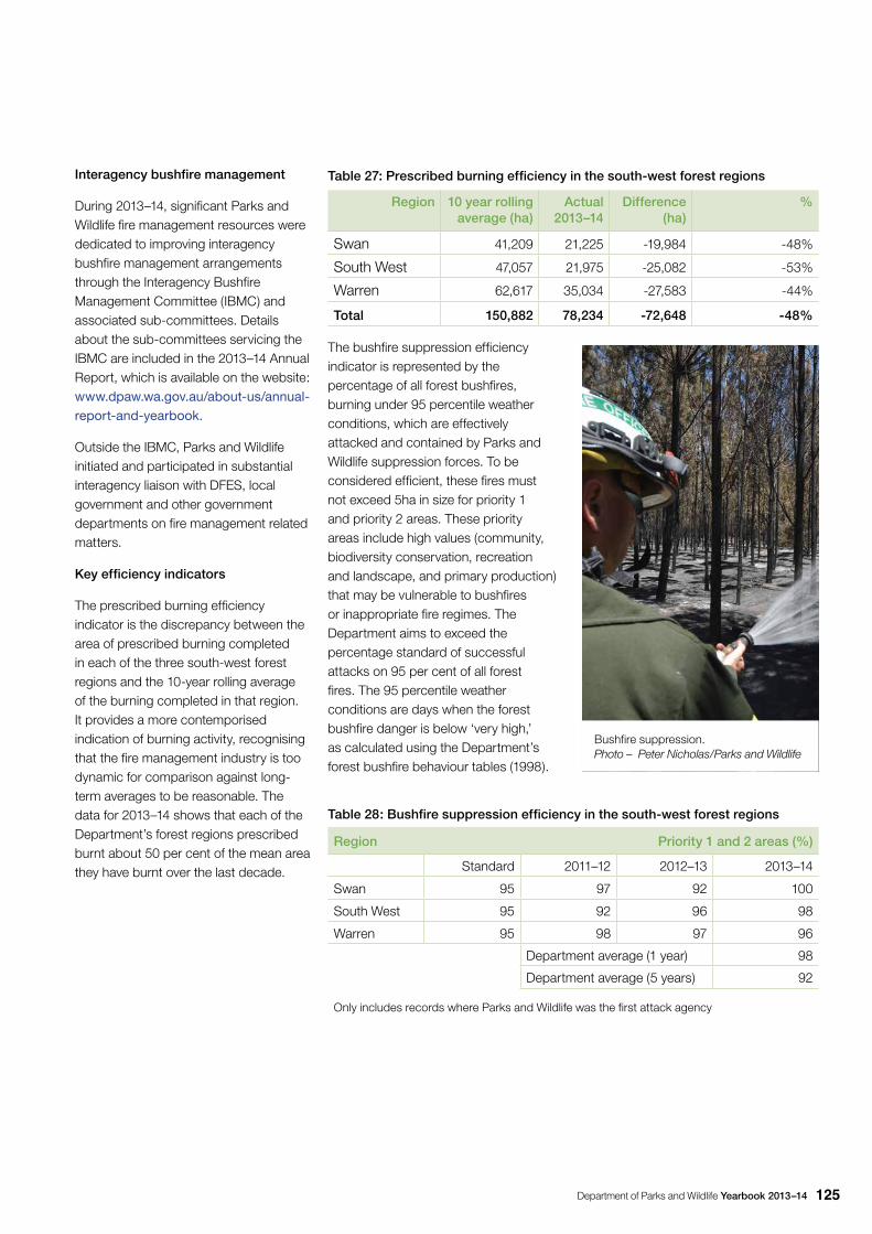
Department of Parks and Wildlife Yearbook 2013–14 125
Interagency bushfire management
During 2013–14, significant Parks and Wildlife fire management resources were dedicated to improving interagency bushfire management arrangements through the Interagency Bushfire Management Committee (IBMC) and associated sub-committees. Details about the sub-committees servicing the IBMC are included in the 2013–14 Annual Report, which is available on the website: www.dpaw.wa.gov.au/about-us/annual-report-and-yearbook.
Outside the IBMC, Parks and Wildlife initiated and participated in substantial interagency liaison with DFES, local government and other government departments on fire management related matters.
Key efficiency indicators
The prescribed burning efficiency indicator is the discrepancy between the area of prescribed burning completed in each of the three south-west forest regions and the 10-year rolling average of the burning completed in that region. It provides a more contemporised indication of burning activity, recognising that the fire management industry is too dynamic for comparison against long-term averages to be reasonable. The data for 2013–14 shows that each of the Department’s forest regions prescribed burnt about 50 per cent of the mean area they have burnt over the last decade.
Table 27: Prescribed burning efficiency in the south-west forest regions
Region 10 year rolling average (ha)
Actual 2013–14
Difference (ha)
%
Swan 41,209 21,225 -19,984 -48%
South West 47,057 21,975 -25,082 -53%
Warren 62,617 35,034 -27,583 -44%
Total 150,882 78,234 -72,648 -48%
The bushfire suppression efficiency indicator is represented by the percentage of all forest bushfires, burning under 95 percentile weather conditions, which are effectively attacked and contained by Parks and Wildlife suppression forces. To be considered efficient, these fires must not exceed 5ha in size for priority 1 and priority 2 areas. These priority areas include high values (community, biodiversity conservation, recreation and landscape, and primary production) that may be vulnerable to bushfires or inappropriate fire regimes. The Department aims to exceed the percentage standard of successful attacks on 95 per cent of all forest fires. The 95 percentile weather conditions are days when the forest bushfire danger is below ‘very high,’ as calculated using the Department’s forest bushfire behaviour tables (1998).
Table 28: Bushfire suppression efficiency in the south-west forest regions
Region Priority 1 and 2 areas (%)
Standard 2011–12 2012–13 2013–14
Swan 95 97 92 100
South West 95 92 96 98
Warren 95 98 97 96
Department average (1 year) 98
Department average (5 years) 92
Only includes records where Parks and Wildlife was the first attack agency
Bushfire suppression. Photo – Peter Nicholas/Parks and Wildlife
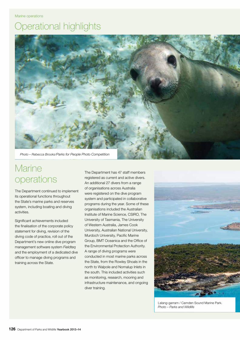
Department of Parks and Wildlife Yearbook 2013–14126
Marine operationsThe Department continued to implement its operational functions throughout the State’s marine parks and reserves system, including boating and diving activities.
Significant achievements included the finalisation of the corporate policy statement for diving, revision of the diving code of practice, roll out of the Department’s new online dive program management software system Fieldteq and the employment of a dedicated dive officer to manage diving programs and training across the State.
The Department has 47 staff members registered as current and active divers. An additional 27 divers from a range of organisations across Australia were registered on the dive program system and participated in collaborative programs during the year. Some of these organisations included the Australian Institute of Marine Science, CSIRO, The University of Tasmania, The University of Western Australia, James Cook University, Australian National University, Murdoch University, Pacific Marine Group, BMT Oceanica and the Office of the Environmental Protection Authority. A range of diving programs were conducted in most marine parks across the State, from the Rowley Shoals in the north to Walpole and Nornalup Inlets in the south. This included activities such as monitoring, research, mooring and infrastructure maintenance, and ongoing diver training.
Operational highlights
Photo – Rebecca Brooks/Parks for People Photo Competition
Lalang-garram / Camden Sound Marine Park. Photo – Parks and Wildlife
Marine operations
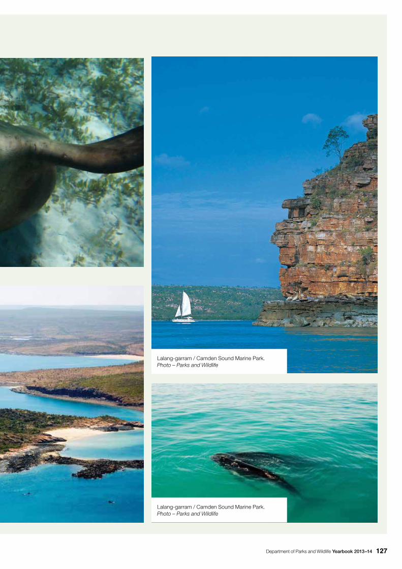
Department of Parks and Wildlife Yearbook 2013–14 127
Lalang-garram / Camden Sound Marine Park. Photo – Parks and Wildlife
Lalang-garram / Camden Sound Marine Park. Photo – Parks and Wildlife

Department of Parks and Wildlife Yearbook 2013–14128
Waychinicup stream. Photo – Peter Nicholas/Parks and Wildlife

This page left blank intentionally
2014
0586
12-
14-8
0