Embed Size (px)
Citation preview

Department of Water Resources (DWR)
Emergency Response/Services (ER/ES)
GIS Unit
Melody BaldwinFlood Operations Center
Outline
• DWR priorities
• Standardized Emergency Management System
• Flood Operations responsibilities
• GIS Data Management & Tools
DWR Emergency Response Priorities
• Protect life, property, and infrastructure
• Protect water quality and water supply
• Protect the environment
Statewide Response
• Responsible for entire state
• Majority of responses within Central Valley
• Respond to any event that impacts our watersheds

Cooperating and Co-located Agencies
DW RFlood Operations
Hydrology / Forecasting
National W eather ServiceW eather Forecast Office
CN River Forecast Center
Bureau of Reclam ation
Corps of Engineers
Geologic Survey
FederalCooperating
Agencies
Cal EMA
Forestry & Fire Protection
Conservation Corps
National G uard
State W ater Project
StateCooperating
Agencies
Levee M aintaining Agencies
Operational Areas
Other Agencies
LocalCooperating
Agencies

DWR’s Role: Emergencies
• Emergencies are declared by local, county (OA) or the State (Governor), not DWR or NWS
• DWR and NWS do not order evacuations• The FOC provides public warnings & technical
assessments for emergency managers, law enforcement and government agencies
• The FOC provides public information to the media and citizens
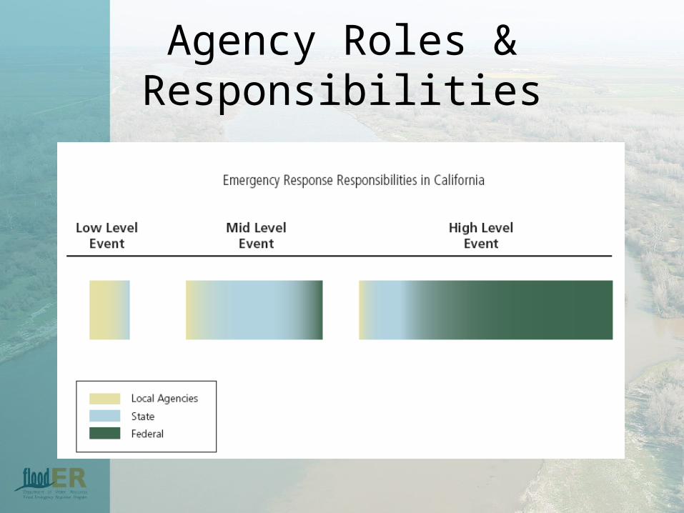
Agency Roles & Responsibilities
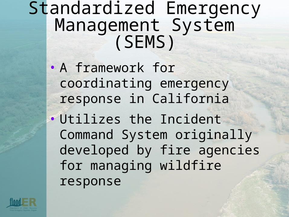
Standardized EmergencyManagement System (SEMS)
• A framework for coordinating emergency response in California
• Utilizes the Incident Command System originally developed by fire agencies for managing wildfire response
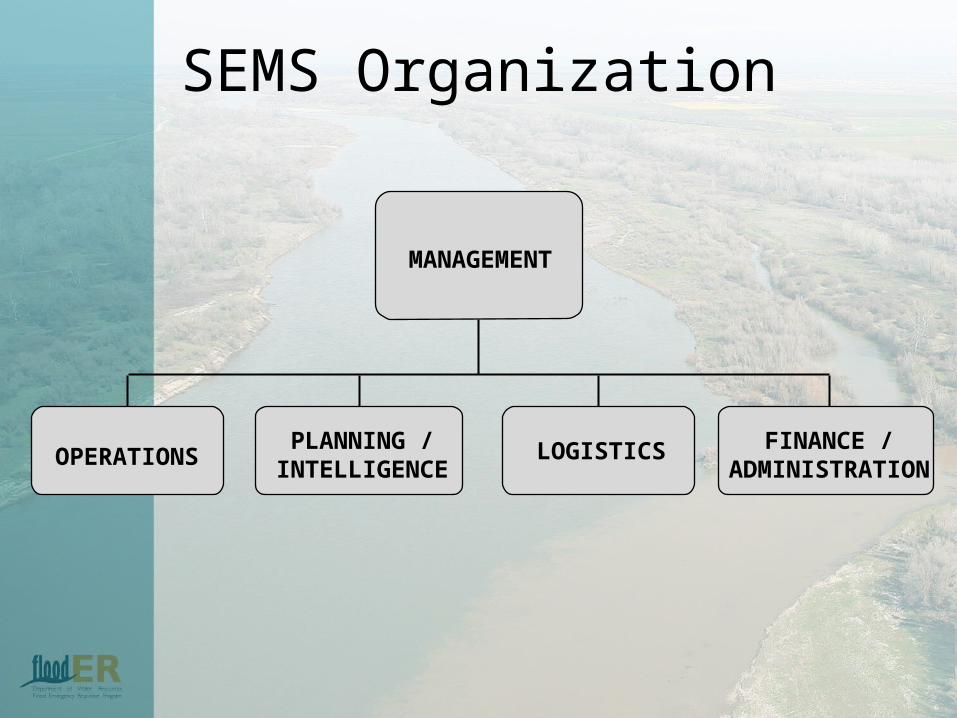
SEMS Organization
MANAGEMENT
OPERATIONSPLANNING /
INTELLIGENCELOGISTICS FINANCE /
ADMINISTRATION

Management Functions
• Sets policy for the jurisdiction• Provides for continuity• Directs overall emergency response• Ultimate accountability

Operations Functions
• Coordinates inter-agency response• Receive/evaluate/respond to requests
for assistance• Set jurisdiction priorities• Provide field status reports to
Management and Plans/Intel
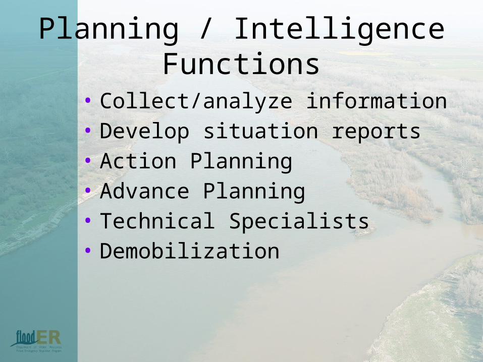
Planning / Intelligence Functions
• Collect/analyze information• Develop situation reports• Action Planning• Advance Planning• Technical Specialists• Demobilization

Logistics Functions
• Personnel• Transportation and Facilities• Equipment• Supply/Procurement of goods• Communications

Flood Operations Organizational Concept

FOC Program Background
DWR’s state-wide flood emergency responsibilities include:
• Coordinating with local, State, and federal agencies
• Providing technical assistance during a flood emergency
• Requesting technical and/or flood fight assistance from USACE on behalf of local agencies using PL 84-99
• Joint production and dissemination of flood forecasts and warnings in cooperation with the National Weather Service and the California-Nevada River Forecast Center
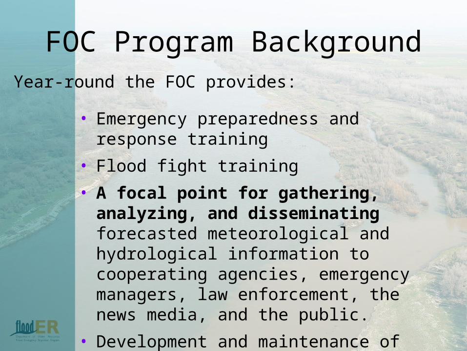
FOC Program Background
• Emergency preparedness and response training
• Flood fight training
• A focal point for gathering, analyzing, and disseminating forecasted meteorological and hydrological information to cooperating agencies, emergency managers, law enforcement, the news media, and the public.
• Development and maintenance of emergency response and business recovery plans, procedures, manuals, etc.
Year-round the FOC provides:
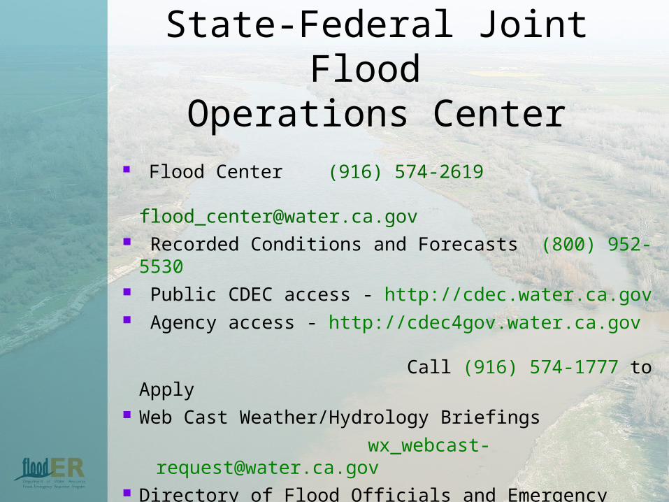
Flood Center (916) 574-2619 [email protected]
Recorded Conditions and Forecasts (800) 952-5530 Public CDEC access - http://cdec.water.ca.gov Agency access - http://cdec4gov.water.ca.gov
Call (916) 574-1777 to Apply Web Cast Weather/Hydrology Briefings
[email protected] Directory of Flood Officials and Emergency Phone
Cards:
Wendy Stewart (916) 574-2619 or [email protected]
State-Federal Joint Flood
Operations Center
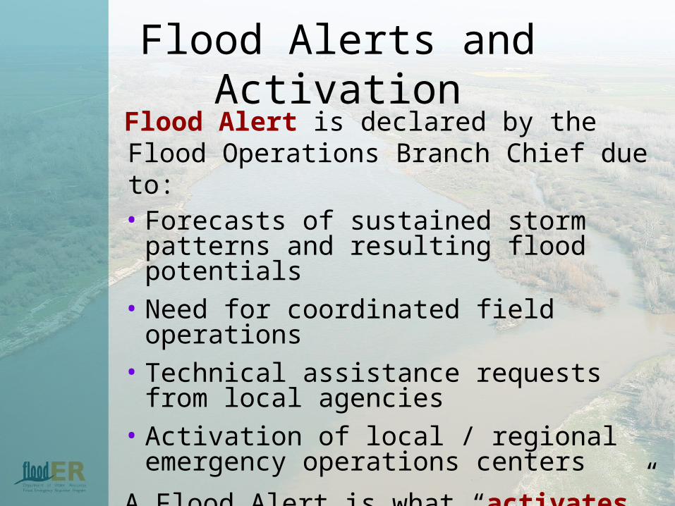
Flood Alerts and ActivationFlood Alert is declared by the Flood Operations Branch Chief due to:• Forecasts of sustained storm patterns and
resulting flood potentials• Need for coordinated field operations• Technical assistance requests from local
agencies• Activation of local / regional emergency
operations centers
A Flood Alert is what “activates” the FOC under SEMS up to 24 hour operation

Flood Alerts and Activation
Flood Mobilization is declared by the Flood Operations Branch Chief when the FOC needs additional:
•Personnel
•Equipment
•Material
•Financial resources

Events
• Fall 2007 – Southern California wildfires• July 2008 – Mud/debris flows – Inyo
County Mud Flow• January 2009 – Medford Island Levee
repair• August 2009 – Ship soft grounding –
Bradford Island • October 12-13, 2009 – Columbus Day
Storms

Tools
• Confronting Catastrophe: A GIS Handbook, Esri Press
• FloodSafe GIS Standards (Nov 2009)• Flood Emergency Operations Manual
State-Federal Operations Manual February 2002
• Common Operating Picture (Public and Intranet) http://cop.resources.ca.gov/cop_public/Default.aspx
• CDEC

Tools
• California Levee And Stream Information System (CLASIS) viewer FloodERhttp://cdecgis.water.ca.gov/clasis
• Floodplain Managements viewer:http://cdecgis.water.ca.gov/flooder
• Cal Atlas, DWR Image Server, Jane, Joel, Harry• Northern Region, GIS Portal• GIS Standard Operating Procedures on Incidents
(PMS 936- NFES 2809)• Directory of Flood Officials DWR Oct 2010
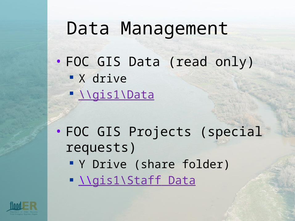
Data Management
• FOC GIS Data (read only) X drive \\gis1\Data
• FOC GIS Projects (special requests) Y Drive (share folder) \\gis1\Staff Data

ER GIS Data Storage
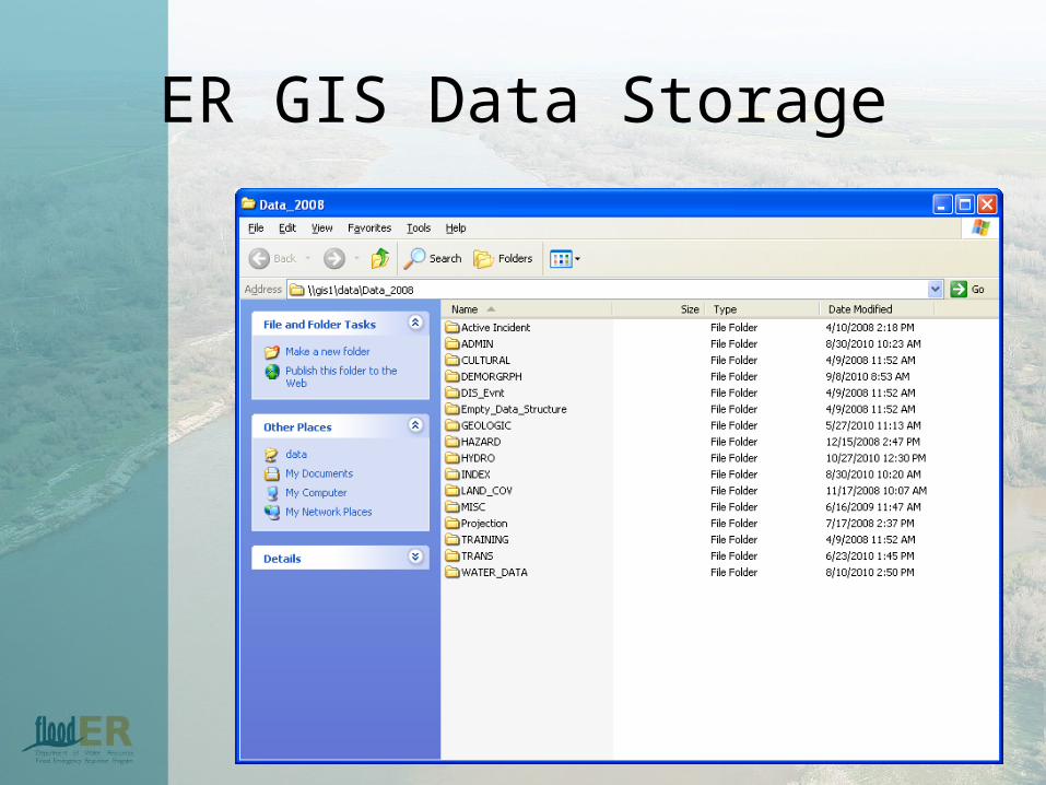
ER GIS Data Storage
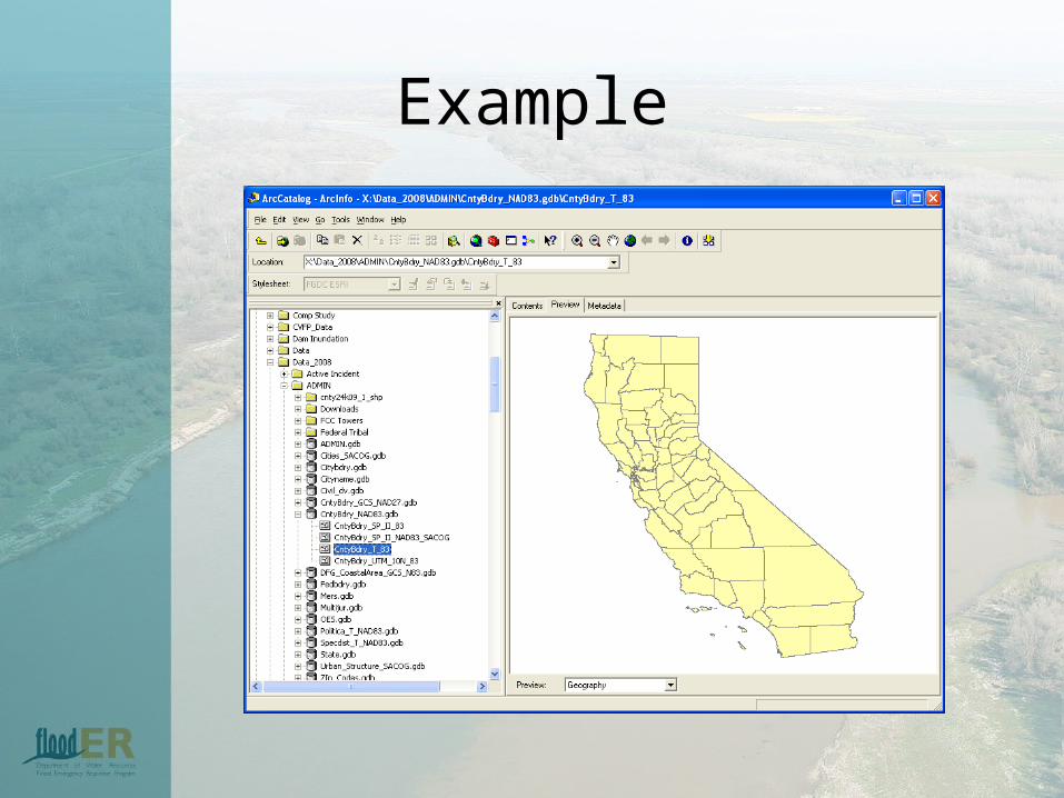
Example

Naming
• Relative Path• Admin• County Boundaries > CntyBdry• CntyBdry_NAD83.gdb
T = Teale Albers SP = State Plane II = Zone 83 or 27

Future?
• GIS Desk Reference• Build library – Templates in 10• GIS Training• Adopt standards for Flood Emergencies• Questions to answer
Do a survey to find out who has GIS skills and what level?

Questions and Answers
• Open to all

Weather and Operations Briefings
• Seasonal weather briefings during stormy weather
• Operational briefings added during FOC activation
• Reservoir operations conference calls• Joint media conferences and briefings• FOC facilitates coordinated operations

River Stages DefinedTypical Non-Leveed Stream
Typical Leveed Stream