Embed Size (px)
Citation preview
DESCRIPTION OF THE ENGINEER MOUNTAINQUADRANGLE.
By Whitman Cross.
INTRODUCTION.
POSITION AJXD EXTENT OF THE QUADRANGLE.
The Engineer Mountain quadrangle is in southwestern Colorado, about 60 miles east of the Utah boundary and 34 miles north of New Mexico. It lies between the Needle Mountains on the east and the Rico Mountains on the west and includes some of the outer summits of each group. Immediately adjacent on the north is the very rugged western arm of the San Juan Mountains. The quadrangle is included between meridians 107° 45' and 108° and parallels 37° 30' and 37° 45', embracing about 236 square miles.
39
IO9
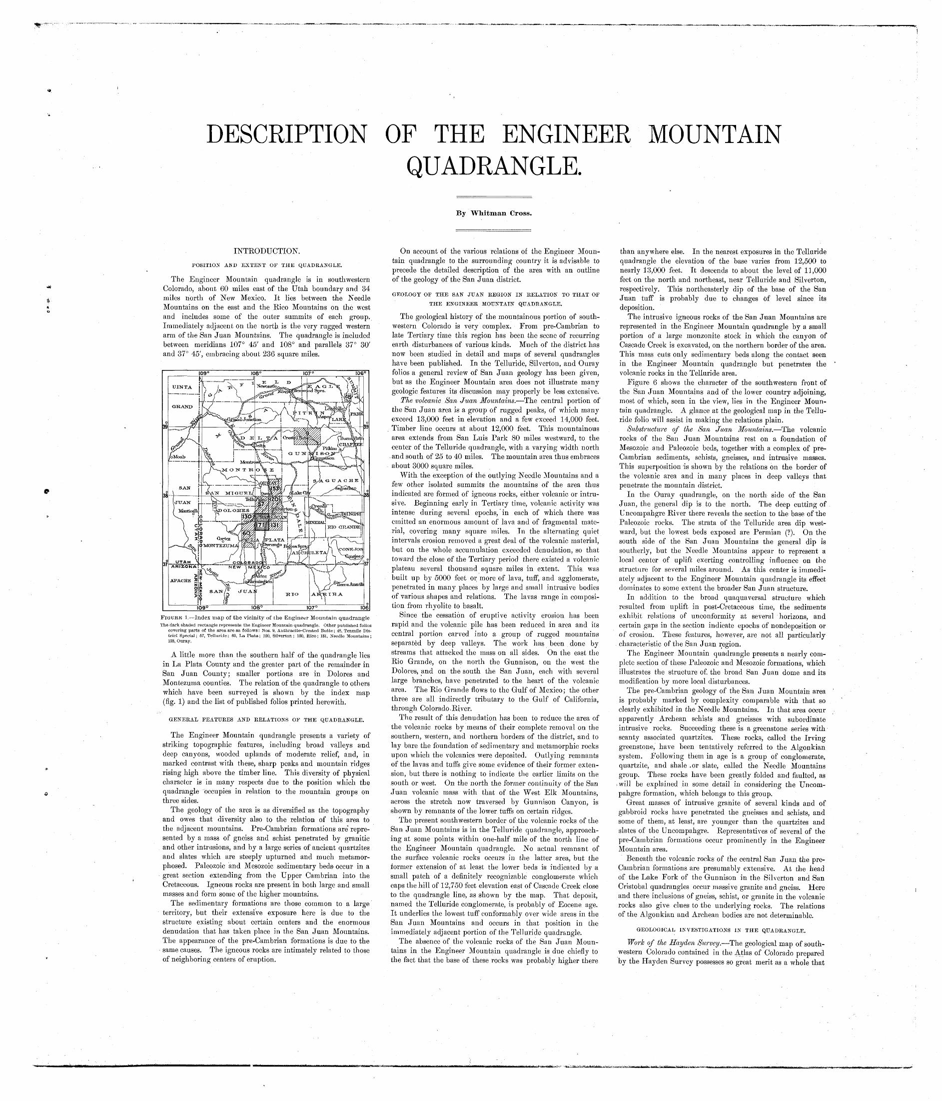
FIGURE 1. Index map of the vicinity of the Engineer Mountain quadrangleThe dark shaded rectangle represents the Engineer Mountain quadrangle. Other published folios
covering parts of the area are as follows: Nos. 9, Anthracite-Crested Butte; 48, Tenmile Dis trict Special; 57, Telluride; 60, La Plata; 120, Silverton; 130, Rico; 131, Needle Mountains; 153, Ouray.
A little more than the southern half of the quadrangle lies in La Plata County and the greater part of the remainder in San Juan County; smaller portions are in Dolores and Montezuma counties. The relation of the quadrangle to others which have been surveyed is shown by the index map (fig. 1) and the list of published folios printed herewith.
GENERAL FEATURES AND RELATIONS OF THE QUADRANGLE.
The Engineer Mountain quadrangle presents a variety of striking topographic features, including broad valleys and deep canyons, wooded uplands of moderate relief, and, in marked contrast with these, sharp peaks and mountain ridges rising high above the timber line. This diversity of physical character is in many respects due to the position which the quadrangle "occupies in relation to the mountain groups on three sides.
The geology of the area is as diversified as the topography and owes that diversity also to the relation of this area to the adjacent mountains. Pre-Cambrian formations are' repre sented by a mass of gneiss and schist penetrated by granitic and other intrusions, and by a large series of ancient quartzites and slates which are steeply upturned and much metamor phosed. Paleozoic and Mesozoic sedimentary beds- occur in a great section extending from the Upper Cambrian into the Cretaceous. Igneous rocks are present in both large and small masses and form some of the higher mountains.
The sedimentary formations are those common to a large territory, but their extensive exposure here is due to the structure existing about certain centers and the enormous denudation that has taken place in the San Juan Mountains. The appearance of the pre-Cambrian formations is due to the same causes. The igneous rocks are intimately related to those of neighboring centers of eruption.
On account of the various relations of the Engineer Moun tain quadrangle to the surrounding country it is advisable to precede the detailed description of the area with an outline of the geology of the San Juan district.o o*/
GEOLOGY OF THE SAN JUAN REGION IN RELATION TO THAT OF
THE ENGINEER MOUNTAIN QUADRANGLE,
The geological history of the mountainous portion of south western Colorado is very complex. From pre-Cambrian to late Tertiary time this region has been the scene of recurring earth disturbances of various kinds. Much of the district has now been studied in detail and maps of several quadrangles have been published. In the Telluride, Silverton, and Ouray folios a general review of San Juan geology has been given, but as the Engineer Mountain area does not illustrate many geologic features its discussion may properly be less extensive.
The volcanic San Juan Mountains. The central portion of the San Juan area is a group of rugged peaks, of which many exceed 13,000 feet in elevation and a few exceed 14,000 feet. Timber line occurs at about 12,000 feet. This mountainous area extends from San Luis Park 80 miles westward, to the center of the Telluride quadrangle, with a varying width north and south of 25 to 40 miles. The mountain area thus embraces about 3000 square miles.
With the exception of the outlying Needle Mountains and a few other isolated summits the mountains of the area thus indicated are formed of igneous rocks, either volcanic or intru sive. Beginning early in Tertiary time, volcanic activity was intense during several epochs, in each of which there was emitted an enormous amount of lava and of fragmental mate rial, covering many square miles. In the alternating quiet intervals erosion removed a great deal of the volcanic material, but on the whole accumulation exceeded denudation, so that toward the close of the Tertiary period there existed a volcanic plateau several thousand square miles in extent. This was built up by 5000 feet or more of lava, tuff, and agglomerate, penetrated in many places by large and small intrusive bodies of various shapes and relations. The lavas range in composi tion from rhyolite to basalt.
Since the cessation of eruptive activity erosion has been rapid and the volcanic pile has been reduced in area and its central portion carved into a group of rugged mountains separated by deep valleys. The work has been done by streams that attacked the mass on all sides. On the east the Rio Grande, on the north the Gunnison, on the west the Dolores^ and on the south the San Juan, each with several large branches, have penetrated to the heart of the volcanic area. The Rio Grande flows to the Gulf of Mexico; the other three are all indirectly tributary to the Gulf of California, through Colorado.River.
The result of this denudation has been to reduce the area of the volcanic rocks by means of their complete removal on the southern, western, and northern borders of the district, and to lay bare the foundation of sedimentary and metamorphic rocks upon which the volcanics were deposited. Outlying remnants of the lavas and tuffs give some evidence of their former exten sion, but there is nothing to indicate the earlier limits on the south or west. On the north the former continuity of the San Juan volcanic mass with that of the West Elk Mountains, across the stretch now traversed by Gunnison Canyon, is shown by remnants of the lower tuffs on. certain ridges.
The present southwestern border of the volcanic rocks of the San Juan Mountains is in the Telluride quadrangle, approach ing at some points within one-half mile of the north line of the Engineer Mountain quadrangle. No actual remnant of the surface volcanic rocks occurs in the latter area, but the former extension of at least the lower beds is indicated by a small patch of a definitely recognizable conglomerate which caps the hill of 12,750 feet elevation east of Cascade Creek close to the quadrangle line, as shown by the map. That deposit, named the Telluride conglomerate, is probably of Eocene age. It underlies the lowest tuff conformably over wide areas in the San Juan Mountains and occurs in that position in the immediately adjacent portion of the Telluride quadrangle.
The absence of the volcanic rocks of the San Juan Moun tains in the Engineer Mountain quadrangle is due chiefly to the fact that the base of these rocks was probably higher there
than anywhere else. In the nearest exposures in the Telluride quadrangle the elevation of the base varies from 12,500 to nearly 13,000 feet. It descends to about the level of 11,000 feet on the north and northeast, near Telluride and Silverton, respectively. This northeasterly dip of the base of the San Juan tuff is probably due to changes of level since its deposition.
The intrusive igneous rocks of the San Juan Mountains are represented in the Engineer Mountain quadrangle by a small portion of a large monzonite stock in which the canyon of Cascade Creek is excavated, on the northern border of the area. This mass cuts only sedimentary beds along the contact seen in the Engineer Mountain quadrangle but penetrates the volcanic rocks in the Telluride area.
Figure 6 shows the character of the southwestern front of the San Juan Mountains and of the lower country adjoining, most of which, seen in the view, lies in the Engineer Moun tain quadrangle. A glance at the geological map in the Tellu ride folio will assist in making the relations plain.
Substructure of the San Juan Mountains. The volcanic rocks of the San Juan Mountains rest on a foundation of Mesozoic and Paleozoic beds, together with a complex of pre- Cambrian sediments, schists, gneisses, and intrusive masses. This superposition is shown by the relations on the border of the volcanic area and in many places in deep valleys that penetrate the mountain district.
In the Ouray quadrangle, on the north side of the San Juan, the general dip is to the north. The deep cutting of Uncompahgre River there reveals the section to the base of the Paleozoic rocks. The strata of the Telluride area dip west ward, but the lowest beds exposed are Permian (?). On the south side of the San Juan Mountains the general dip is southerly, but the Needle Mountains appear to represent a local center of uplift exerting controlling influence on the structure for several miles around. As this center is immedi ately adjacent to the Engineer Mountain quadrangle its effect dominates to some extent the broader San Juan structure.
In addition to the broad quaquaversal structure which resulted from uplift in post-Cretaceous time, the sediments exhibit relations of unconformity at several horizons, and certain gaps in the section indicate epochs of nondeposition or of erosion. These features, however, are not all particularly characteristic of the San Juan region.
The Engineer Mountain quadrangle presents a nearly com plete section of these Paleozoic and Mesozoic formations, which illustrates the structure of. the broad San Juan dome and its modification by more local disturbances.
The pre-Cambrian geology of the San Juan Mountain area is probably marked by complexity comparable with that so clearly exhibited in the Needle Mountains. In that area occur apparently Archean schists and gneisses with subordinate intrusive rocks. Succeeding these is a greenstone series with scanty associated quartzites. These rocks, called the Irving greenstone, have been tentatively referred to the Algonkian system. Following them in age is a group of conglomerate, quartzite, and shale .or slate, called the Needle Mountains group. These rocks have been greatly folded and faulted, as
>will be explained in some detail in considering the Uncom pahgre formation, which belongs to this group.
Great masses of intrusive granite of several kinds and of gabbroid rocks have penetrated the gneisses and schists, and some of them, at least, are younger than the quartzites and slates of the Uncompahgre. Representatives of several of the pre-Cambrian formations occur prominently in the Engineer Mountain area.
Beneath the volcanic rocks of the central San Juan the pre- Cambrian formations are presumably extensive. At the head of the Lake Fork of the Gunnison in the Silverton and San Cristobal quadrangles occur massive granite and gneiss. Here and there inclusions of gneiss, schist, or granite in the volcanic rocks also give clues to the underlying rocks. The relations of the Algonkian and Archean bodies are not determinable.
GEOLOGICAL INVESTIGATIONS IN THE QUADRANGLE.
Work of the Hayden Survey. The geological map of south western Colorado contained in the Atlas of Colorado prepared by the Hayden Survey possesses so great merit as a whole that
it seems all the more necessary to refer to certain serious errors it contains respecting the Engineer Mountain quadrangle.
Potato Hill and a small area south of it are referred to the "metamorphic Paleozoic," as distinguished from the "meta- morphic granite" of the Animas Valley to the south. No ground for this distinction exists.
An isolated area of "Silurian," unique in the San Juan, is shown by the Hayden map east of Potato Hill. A careful examination has revealed only granite gneiss and schist in this area. The "Devonian" of the map also covers ground chiefly occupied by granite and gneiss, and the representation of an ending to the Devonian at the mouth of Lime Creek is inexplicable, for the Ouray limestone is particularly well exposed to the south from that point, along the west side of the Animas Valley, and connects in normal manner with the exposures on the south slope of the Needle Mountains observed by Endlich.
The representation of an isolated patch of Triassic beds at the head of Lime Creek and the expression of a hiatus by showing Cretaceous shale resting on "Upper Carboniferous" at the head of Dolores River and the Dakota resting on the same strata north of Silver Creek are errors which it is difficult to explain.
The igneous masses of Graysill and Engineer mountains are represented as belonging to the main volcanic formation of the San Juan " trachoreite " the plain evidence of intrusive origin having escaped notice. The intrusive bodies of Flattop and Hermosa Peak are, however, correctly grouped with the porphyries of the La Plata and Rico mountains.
Work of the United States Geological Survey. The Engineer Mountain quadrangle is surrounded by districts of economic importance, concerning which folios have already been pub lished, namely, Telluride, Rico, La Plata, Needle Mountains, and Silverton. In connection with the study of each of these areas more or less work was done in the Engineer Mountain quadrangle, but the map was not completed until 1908. Special assistance in the field work has been rendered by A. C. Spencer, Ernest Howe, W. H. Emmons, A. Johannsen, and Howland Bancroft, all of whom have been regular assist ants at various times. George W. Stose, George H. Girty, M. K. Shaler, and George I. Finlay have, in different seasons, rendered aid in particular directions. The glacial geology of the quadrangle was investigated by Alien D. Hole in 1908, and a special section of this folio, dealing with that subject, was prepared by him.
TOPOGRAPHY.
RELIEF.
General character. The Engineer Mountain quadrangle is characterized by a great variety of topographic forms. These may be readily recognized by a practiced eye through the study of the contour map. Most of the features are clearly illustrated by the views reproduced in this folio, which should be studied in connection with the accompanying descriptions. As the illustrations show, the quadrangle has physical features of great beauty as well as bare and rugged summits and unscalable cliffs. The mountains are in fact easily ascended. In variety of picturesque and attractive scenery the Engineer Mountain quadrangle compares favorably with most others of the beautiful San Juan region. The topographic features of the area will be described under appropriate headings.
Northern portion of the quadrangle. The general character of the northern and most diversified portion of the area is illustrated by figures 5 and 6. The first of these, taken near the summit of Blackhawk Peak (12,687 feet), the culminating point of the Rico Mountains, gives some idea of the relative elevation of that group and shows clearly the relation of these mountains to the high and extremely rugged San Juan Mountain front. The dominant and particularly characteristic summits of the area are the broad Graysill Mountain together with Hermosa Peak (12,574 feet) and Engineer Mountain (12,972 feet), which flank it on either side. All these owe their existence and special features to the great intrusive' masses of quartz trachyte, occurring in soft sedimentary beds. The features of the interesting summit from which the quadrangle derives its name are shown in detail in figures 7, 8, and 9. The mountain appears in the distance in figure 6. The mass of Engineer Mountain must have been vastly bolder and more impressive before the central peak was so greatly reduced in volume by the landslides whose debris is seen in the views.
At the southeastern extremity of Graysill Mountain is a sharp point called Grayrock Peak, which, when seen from the south, in the valley, seems almost comparable to Engineer Mountain. It is in fact but a projection from the main moun tain which has more the character of a broad ridge bounded by quartz trachyte cliffs. It illustrates, as does Flattop, a stage in the erosion of a laccolithic mass when the cover has not been wholly removed, exposing the massive rock to such sculpturing as Engineer Mountain has undergone.
The northern portion of the area contains, in Cascade Creek valley, a type of the canyons that are present on all sides of
the San Juan. The extreme head of this canyon is within the monzonite stock, only 1 mile north of the quadrangle line. Between Engineer and Graysill mountains, 6 miles from its head, this valley is 3600 feet deep and its slopes are very steep, yet generally forested. Less striking, but by no means insignificant mountain valleys, are those of Dolores River, Barlow and Silver creeks, and a north fork of the Hermosa. Figure 6 shows the valley of Barlow Creek.
The details of mountain and valley sculpture in the northern part of the quadrangle are such as are common in regions of intrusive rocks where massive sandstone ledges alternate with softer strata. About the Rico Mountains there are several sharp little summits, due to remnants of gray porphyry, with strongly contrasting red slopes below. Whitecap Mountain is a type of these porphyry-capped peaks. On the valley sides and moun tain slopes there are many ledges, cliffs, benches, and sharp pro jecting shoulders, due either to massive porphyry or to sand stone. Such formations are illustrated in several of the views.
The mountain to which the trifling name Potato Hill (11,876 feet) was given by some irreverent early settler, whose occupa tion can be easily inferred, is the most prominent outlier of the West Needle Mountains. It has been cut off from that group by Lime Creek, the canyon of which, east of the mountain, is nearly 3000 feet in depth. In figure 13 the relations of this summit to Engineer Mountain and to the West Needles are shown, as well as the character of the glaciated ridges on either side of Lime Creek, which belong geographically and geologi cally with the pre-Cambrian area.
Animas Valley. The southeastern section of the quadrangle belongs chiefly to Animas Valley, and its prominent topo graphic forms, though very different from those of the northern part of the area, are very striking. The valley has three particularly prominent features the canyon, an old upper val ley of gentle relief, and an imposing scarp (Hermosa. Cliffs) that bounds it on the west.
Animas Canyon is a gorge whose steep, rough, and in places forbidding sides are carved in the dark pre-Cambrian schists. The canyon is not so imposing here, where the river is but 2500 feet below the highest adjacent summit, as it is in the Needle Mountains, only a few miles to the northeast, where the depth of the canyon is over 6000 feet. There are several deep side gorges, the most notable being those of Cascade and Can yon creeks. Although the walls come close together in some places there are several gravel-covered expanses, shown on the geological map.
The bench, 2 or 3 miles in width, between Animas Canyon and Hermosa Cliffs, now traversed by Elbert Creek, is one of the most interesting topographic features in the quadrangle. On it were formerly several beautiful lakes, most of which are now replaced by the Ignacio reservoir of the Animas Power and Water Company. Figure 4 represents one of the smallest of this group of lakes as it formerly appeared. On this old upper valley bottom are several alluvial flats, now occupied chiefly by hay ranches. There are also low hills and an irregular ledge of Devonian limestone, above which is a minor bench that slopes with the dip of the underlying strata toward the great bounding scarp.
Hermosa Cliffs, which rise 1500 feet or more above the bench just described, extend with but one break for 10 miles northward from the quadrangle boundary. They continue practically up the valley of Cascade Creek and to the south in the Durango quadrangle for 2 miles or more. In figure 14 the line of gray cliffs is very prominent and their relation to the lower bench is seen. Figure 4 gives a glimpse of the cliffs west of the reserv.oir and figure 2 shows the details of the upper part of the scarp, characteristic of the whole line of cliffs.
On the opposite side of the Animas Valley there appear the western extremities of sloping mesas of lower Paleozoic beds, which form a prominent feature of the southern slopes of the Needle Mountains.
Hermosa Basin. The central and southwestern parts of the quadrangle belong to the basin of Hermosa Creek. It is an area of wooded uplands and ridges, chiefly in the territory of the red beds which constitute the Cutler formation. The ruddy tones of the sandstones may be seen in many exposures, sur rounded by forests of spruce or aspen. At the junction of North and East forks of Hermosa Creek is Hermosa Park, a grassy opening of which the valley of the East Fork is practi cally an extension. Below the park the Hermosa cuts deeper and deeper into the Carboniferous formations and the stream flows in a rugged canyon in some places. There are no moun tains of igneous rock in this portion of the quadrangle, which in this respect presents a marked contrast to the other districts described.
DKAINAGE.
Nearly all the drainage of the Engineer Mountain quadran gle is into Animas River, which is one of the principal tribu taries of the San Juan. Through this stream the waters reach the Colorado and ultimately the Gulf of California. The remaining drainage is by way of Dolores River to Grand River and thus to the Colorado.
Animas River is a swift mountain stream having a never- failing source in the high mountains of the Silverton quad rangle. The descent of the river within the quadrangle is about 650 feet in a little more than 8 miles, its lowest point on the southern boundary having an elevation of about 7100 feet.
The chief tributary of the Animas in the Engineer Moun tain quadrangle is Cascade Creek, which receives the waters of Lime Creek a short distance above its mouth. Cascade Creek has a fall of about 3250 feet from the northern boundary of the quadrangle to its mouth, a distance of about 13 miles. A large part of Cascade Creek is now diverted to unite with Elbert Creek in the Ignacio reservoir.
Tank and Canyon creeks are small eastern tributaries of the Animas, Canyon Creek being the more important. Hermosa Creek is also a tributary of the Animas, which it enters in the Durango quadrangle 6 miles south of the Engineer Mountain quadrangle line. The South Fork of Hermosa Creek derives its waters from the northeast slope of the La Plata Mountains.
DESCRIPTIVE GEOLOGY.
PRE-CAMBRIAN METAMORPHIC AND IGNEOUS ROCKS.
A great complex of sedimentary, igneous, and metamorphic rocks older than the Cambrian Ignacio quartzite is exhibited in the Needle Mountains and surrounding country. This com plex is represented by several distinct elements in the eastern zone of the Engineer Mountain quadrangle traversed by Animas River and Lime Creek. The sedimentary portion of this complex is well defined and is treated as the basal unit of the stratigraphic column, but the gneisses, schists, and ancient intrusives are so intimately related in occurrence that they will be considered together, although some of the intru sives are younger than the sediments referred to the Algonkian system. The gneisses and schists are believed to be of Archean age.
METAMOKPHIC EOCKS.
ARCHEAN GNEISS AND SCHIST.
General character. The rocks referred to the Archean con stitute a series of gneisses and schists of marked foliated texture, which are cut by the Twilight and Eolus granite masses and by a gabbro body, all of which are distinguished on the map, and by numerous lesser dikes and irregular masses of granite, aplite, pegmatite, diabase, and other rocks. These intrusives do not as a rule possess foliated texture and where such texture is present it is plainly to be differentiated from the schistosity of the Archean rocks.
The gneisses and schists appear to have been derived from igneous rocks of granitic, dioritic, or diabasic general character. The detailed original relations of these materials can not be determined, but clearly a complex of large bodies, penetrated by dikes of granite and diabase, was subjected to mashing or shearing with recrystallization and the resultant development of gneissic or schistose foliation.
The diverse characters of the original rocks are shown by their range from feldspathic quartzose gneisses to amphibolites and hornblende schists. In texture these rocks vary widely, ranging from rather coarse grained gneiss with distinct traces of the original rock to finely foliate mica or hornblende schist. Although the crushing to which the rocks have been subjected has greatly obscured the primary relations of various types, the hornblende schists in many places clearly represent dikes.
Distribution and structure. The Animas Canyon section of gneiss and schist ends abruptly about 1-J- miles south of the Engineer Mountain quadrangle, being covered by sediments or cut off by granite. The arm of schists shown on the map between the Twilight and Eolus granite masses extends several miles up the Animas Canyon into the heart of the Needle Mountains. Its relation to other pre-Cambrian formations is shown in the Needle Mountains folio.
The structure of the Archean gneisses and schists is well exhibited in the walls of Animas Canyon, which crosses obliquely the lines of schistosity. Near the southern line of the quadrangle the strike is nearly east-west. From this course it swings to northeast-southwest and then, on the north side of the gabbro intrusion, to north-south. The dips of the schistosity are variably steep to the south, southeast, or east, being in few localities less than 45° and at certain places reach ing the vertical. Strike and dip symbols on the map show the structure at certain localities. There is some local crumpling of schists, but apparently there is no complex structure involv ing a duplication of parts of the section.
Derivation from igneous rocks. A large part of the horn- blendic gneisses and schists were derived from quartz diorite, which may have originally contained augite and hornblende or the former alone. The least-altered rocks of this series occur in the Durango quadrangle. In that area may be seen nearly massive rocks consisting of common hornblende, lime-soda feldspar (oligoclase or andesine), and quartz. In some places a paramorphic change of augite into hornblende has occurred. Where the mashing is least pronounced the feldspar and quartz plainly make up about half of the rock. In the more
schistose forms secondary hornblende needles and biotite flakes obscure the white minerals, and hornblende seems to pre dominate more strongly than is actually the case.
Another considerable part of the schists is derived from ophitic diabase and in some of this a part of the primary augite remains, but usually uralitic or massive hornblende and newly formed needles of the same mineral, together with the crushed condition of the feldspar, render the determination of the original rock difficult except by means of the evidence of various stages represented in different places. Some but not all of the diabase rocks producing these schists were in the form of dikes.
A third and subordinate part of the schist and gneiss series was plainly derived from granite. Such rocks consist of quartz, orthoclase, microcline, plagioclase, hornblende, and biotite, the dark silicates being subordinate in amount.
In many places the alternation of hornblendic and felds- pathic or quartzose material indicates impregnation of the schist series in connection with ancient intrusions of granite.
Relations to the Twilight granite. The map represents Twilight granite as occupying the entire pre-Cambrian area lying north of the gabbro stock and east of the Ignacio quartz- ite line to the fault north of Potato Hill. The boundary between schists and granite is not sharply defined; the line on the map represents a zone within which the two rocks are most intimately mingled, as is stated under the heading "Twilight granite."
Not only along the boundary, in the zone mentioned, but also throughout the area mapped as Twilight granite, dark schists occur in minor bands or irregular bodies of different sizes, the mapping of which is practically impossible. No con siderable area of the intrusive granite is entirely free from dark schist fragments.
Age. The reference of the ancient gneisses and schists of the Animas Valley to the Archean is based principally on their general resemblance to rocks assigned to that system in other districts and on the fact that they are older than the Needle Mountains group of sediments, referred to the Algon- kian, and also older than a series of intrusive granites and other rocks which are older than the Ignacio quartzite. These intrusives have suffered relatively little metamorphism, but the gneisses and schists have undergone extreme alteration of the kinds common to the rocks of the Archean crystalline complex.
PEE-CAMBEIAN IGNEOUS ROCKS.
The Archean gneisses and schists of the Needle Mountains and vicinity are penetrated by several large and many small masses of granite and other coarsely crystalline igneous rocks. The principal intrusive bodies occur in the Needle Mountains quadrangle and have been described in considerable detail in the folio (No. 131) covering that area. The two largest intru sive masses are the Eolus and Twilight granites, parts of which appear in the Engineer Mountain quadrangle. A third important mass, of gabbroic character, is apparently confined to the Engineer Mountain area.
TWILIGHT GRANITE.
Occurrence. The Twilight granite, of more or less distinct gneissose texture, forms a large batholith whose complex rela tions to the Archean schists and gneisses have already been mentioned. This mass is the main element in the constitution of the West Needle Mountains, including their highest summit, Twilight Peak, which is about 2 miles due east of Potato Hill. The exposed portion of the batholith is irregularly oval in shape; its major axis is about 10 miles in length in a north- northeast to south-southwest direction, and its average width is about 4 miles.
From the crest of the West Needle Mountains the rock extends down their western slope, across Lime Creek into the Engineer Mountain quadrangle, and disappears beneath the Paleozoic sediments, as shown on the geological map. The northern limit of the exposed mass is a fault plane and the southwestern border is a line of contact with the later gabbro mass. The eastern boundary is therefore the only primary one now exposed and no reliable estimate of the former size and shape of the mass can be made.
The intrusion of this granite mass into the Archean schists was preceded or attended by tremendous shattering of the schists. The granite contains an enormous number of inclu sions of the schists, and certain portions of the broad zone of contact exhibit what is practically a breccia of schist cemented by granite. In some places the shattering of the schist pro duced very irregular fragments; in others the schist was split into thin slabs parallel to its foliation and the granite injected between them, here in thin dikes and there in wide or variable arms.
The relations of the two rocks just described are graphically illustrated by figures 10, 11, and 12 of this folio and by figures 10 and 11 of the Needle Mountains folio. The complex mingling of the two rocks, such as is illustrated in the figures, characterizes the entire eastern contact zone of the mass.
Engineer Mountain.
In the central part of the body of the Twilight granite inclusions of dark schist and gneiss are much less abundant than in the contact zone, yet no very considerable area of the granite is wholly free from schist fragments. These inclusions are not uncommonly long, narrow strips, visible from a distance and resembling the diabasic dikes, which also occur in the granite.
At several places near the line of overlying quartzite on the west dark schists appear in greater abundance than in the central portion of the granite, suggesting proximity to the main contact of the granite on that side. One locality rich in schists lies between Columbine Lake and Purgatory and another at the western base of Potato Hill. Slightly gneissoid granite, almost free from inclusions, is, however, also present at many places near the quartzites, so that the extent of the granite can not safely be conjectured.
Almost the entire area of the Twilight granite in the Engineer Mountain quadrangle has been glaciated. In figure 13 is shown the gentle character of the granite slopes, with their typical roches moutonnees. Above the ice-sculptured surface rises only the nunatak summit known as Potato Hill, seen in the figure. Excellent exposures of the granite are numerous and the complex contact zone is particularly well shown in the walls of Animas Canyon and in the lesser gorges of Cascade and Little Cascade creeks.
Character. The Twilight granite is as a rule gray in color, of medium grain, and of more or less clearly foliate or gneissose texture. Quartz and feldspar strongly predominate over biotite, the most common of the dark silicates, with which hornblende is frequently associated. In some places near the center of the mass the rock is pink or nearly white in color and of somewhat coarser grain than usual.
The prevalent foliation of the mass is of primary origin and is due to movement of the rock before its final solidification. Much of the mass, however, shows a later schistosity of dyna- mometamorphic origin, which in certain zones is pronounced. The primary texture is shown to be such by the curving and twisting of the foliation about sharp-angled inclusions of schist and by its parallelism with contact planes of various positions. Some of the quartz and feldspar grains are elongated parallel to the foliation shown by the mica and hornblende, but much of the rock is practically granular so far as the quartz and feld spar are concerned.
The secondary schistosity is readily distinguishable from the fluidal texture in many places because it involves both granite and amphibole schist fragments, and through the crushing and shearing the original contact relations become much obscured. In certain zones on the slope of the West Needle Mountains the two rocks are very well developed fissile schists. The relations are there so intricate as to illustrate finely one way in which Archean rocks of different origin may have become so confusedly mingled as to defy absolute determination of their primary character and relations, in the absence of transitions to less altered rocks, such as are found in this region.
The secondary schistosity just referred to is commonly developed parallel or nearly parallel to the earlier structure of the schists, and much of the fluidal gneissic foliation has the same direction, as the granite was injected parallel to great sheets of ^the invaded schists. It thus becomes difficult or impossible 'to determine exactly the amount of primary folia tion in the main mass of the rock.
The textural facies sometimes called "pencil gneiss" is not uncommon in the Twilight granite mass. In this the micas in particular and other constituents to some extent are drawn out in one direction rather than in certain planes. This may be seen in localities where the foliate texture is apparently primary, but as it also occurs in places where the amphibole schists exhibit the same texture in parallel position the secondary origin of the pencil texture must be granted.
The mineral composition of the Twilight granite batholith varies principally in the character of the feldspars. In the central part of the mass the rock is richer in orthoclase and microcline than in the contact zone. In that zone lime-soda feldspars greatly predominate. These are variably rich in the soda feldspar molecule, approaching albite in many places but ranging to andesine in others. A specimen from Little Cascade Creek contains 4.83 per cent soda and 0.22 per cent potash, and a coarser-grained phase, rich in orthoclase and microcline, occurring near Purgatory Park in Cascade Creek valley, contains 3.62 per cent soda and 2.52 percent potash. These extremes are connected by transition rocks. The term granite is thus applied to this mass in a general sense and much of the rock might with propriety be called quartz monzonite or quartz diorite. Quartz is very abundant throughout and in some places seems to exceed the feldspars in amount, but it varies greatly from place to place.
Variations also occur in the proportions of biotite and horn blende and to some extent in the total amount of these minerals as compared with quartz and feldspar. Muscovite is present in the greater part of the rock, being locally as abun dant as biotite, but it is rarely visible to the naked eye. The minerals apatite, zircon, titanite, garnet, and magnetite are
microscopic accessories of very subordinate importance and of common characteristics.
Associated pegmatite. As has been stated, the gneissic texture of the contact zone rarely extends into the apophyses of the granite which penetrate the schist or into the narrower cross dikes or arms which connect the larger masses. In most of these places the granite is granular and does not vary markedly in grain from the adjacent gneissose rock. In numerous arms, however, the grain is coarser. Although the constituents are in some places as regularly distributed as in the main body of the rock, a tendency to segregation is com mon and many drusy miarolitic cavities occur. In some arms the entire mass is distinctly pegmatitic; in others it is partly so and the texture of some cross dikelets varies from place to place.
Bodies of typical pegmatitic character exhibiting irregular distribution of constituents, coarse grain, and miarolitic cav ities are rarely more than a few inches wide and this phase of the granite does not as a rule project from the apophysis or arm into the larger mass. The transition from the common texture to the pegmatitic is abrupt in some places and gradual in others. Pegmatite of the type here referred to nowhere cuts the gneissose rock as if filling a fissure in it, although pegmatite of a different character traverses the schists and the Twilight granite in all its phases. This later pegmatite is rich in orthoclase and microcline and is usually pinkish in color.
The pegmatitic phase of the Twilight granite consists of the minerals of that rock, and the greater part of the feldspar is a white plagioclase, as a rule albite or oligoclase. No minerals foreign to the granite have been observed, such as those which are often found in independent dikes of pegmatite.
From the facts presented it appears that the magma of the Twilight granite occupying small apophyses and cross fissures of the contact zone has in many places consolidated into a pronounced pegmatitic phase. Apparently because of these conditions of occurrence the pegmatitic portions of the mass crystallized before the consolidation of the larger masses. There is no evidence that special factors, such as the so-called mineralizing agents, were more active in the formation of this pegmatite than in that of the granite itself. This pegmatite is regarded simply as a facies of the Twilight granite an igneous rock.
EOLUS GRANITE.
Occurrence. The Eolus granite occurs high on the east side of Animas Canyon beneath the Paleozoic beds. This body belongs to a mass that occupies about one-third of the area of the Needle Mountains quadrangle and extends an unknown distance to the south under the sedimentary rocks. Many of the highest summits of the Needle Mountains are within this granite mass, including Eolus Peak, from which the rock receives its local designation, a term useful in distinguishing it from other granite masses.
The Eolus granite cuts the Archean gneisses and schists and the quartzite of the Algonkian Uncompahgre formation. It is overlain by Upper Cambrian sediments, so that the time of intrusion is established as late Algonkian or early Cambrian.
In striking contrast to the Twilight granite and to other granites of the Needle Mountains the Eolus mass is character ized by sharply defined contacts and comparative freedom from inclusions of foreign rocks.
Character. The main part of the Eolus mass is a very coarse grained biotite granite with a variable amount of horn blende. The feldspar is usually pink and tends to develop in large irregular crystals producing a rude porphyritic texture. As a rule potash feldspar (orthoclase) predominates over lime- soda feldspars (plagioclase); locally, however, the relations are reversed, as is the case near the western border of this mass, in the Engineer Mountain ^quadrangle, and the rock is then tech nically rather a quartz monzonite or quartz diorite than a granite. The quartz of this granite is usually of a distinct bluish color.
Hornblende and biotite are much more abundant in the rock of the Eolus type than in any other granitic variety of the Needle Mountains and make the rock appear dark in places where the texture is fine grained. The gradations in mineral composition and texture just referred to take place gradually.
GABBRO,
Occurrence. The gabbro mass represented on the map as cutting Archean schists and Twilight granite in the zone of their contact is unique in petrographic character among the pre-Cambrian intrusive rocks of the Needle Mountains region. The part of the body now exposed is about 3 miles long from southeast to northwest, and as it is 2^ miles wide on the line of overlying sediments it presumably extends westward beneath them for a considerable distance.
Though of unusual composition, this rnaes represents a great intrusion resembling in physical features the granitic batho- liths or stocks of the region. The contact with the Twilight granite and associated schists is irregular in detail, numerous
small arms and tongues of the gabbro projecting for 20 feet or more. The southern contact is obscured in many places by glacial and other debris.
The gabbro is cut by many small dikes of reddish aplite, some of which extend into the surrounding granite or schist. These dikes are no doubt genetically connected with the gabbro.
Character. The gabbro mass varies a great deal in compo sition and texture, but shows no sharp changes indicating intrusive relations of any of the varieties. Texturally the rock is granular, ranging from medium to very coarse grain. In some places the crystals of feldspar or diallage are from 1 to 2.inches in diameter. Such large individuals generally inclose many small grains of other minerals and the resulting poikilitic fabric is pronounced.
A primary banded or gneissic texture is present in certain parts of the contact zone and also in portions of the interior of the mass. A dark dense phase of the rock was observed near the contact in a few places but is by no means a characteristic of the border zone.
The portion of the mass east of the Ignacio reservoir is chiefly made up of lime-soda feldspar (labradorite), diallage, and hypersthene, with subordinate amounts of biotite, horn blende, quartz, and orthoclase, variably developed. In some places, especially where a banded texture appears, hypersthene replaces diallage almost entirely and the rock becomes a norite.
On the west side of the reservoir the mass is richest in quartz, hornblende, and biotite, and some specimens from this portion of the mass are nearly free from diallage and hypersthene.
Pegmatite and aplite associated with gabbro. In intimate association with the gabbro occur many dikes or veins consist ing mainly of microcline, orthoclase, and quartz. These are commonly only a few inches wide and a few yards long. They cut both gabbro and schist, with sharp contacts. Some dikes have the fine, even grain of typical aplite; others are peg- matitic; and some are partly of one and partly of the other character. Biotite is the only dark silicate observed. In many places quartz and feldspar occur in intricate micro- graphic intergrowth. The essential minerals of the gabbro are entirely absent from these associated aplite and pegmatite dikes, so far as they have been examined.
MINOR INTRUSIVE ROCKS.
The gneisses, schists, and larger intrusive masses described are cut by small dikes and irregular bodies of granite, granite porphyry, syenite, aplite, pegmatite, diabase, and several other rocks, which are not represented on the map. For the most part these rocks are like the minor intrusive bodies generally found in considerable number in a pre-Cambriau crystalline complex. Some of the granite, pegmatite, and aplite dikes are more recent than the large granite masses but are undoubtedly connected genetically with them. -A few granite porphyry dikes occurring near the southern border of the quadrangle belong to a group of such dikes associated with the coarse granite cutting the schists about the town of Rockwood. A mica syenite dike outcropping only for a few yards on Little Cascade Creek cuts both gabbro and schist and is probably related to the gabbro in origin.
One of the most important of these lesser masses occurs in the cliffs north of Tank Creek at an elevation of about 8500 feet. It has extremely irregular form and is of very variable composition. It consists of hornblende-rich granite, with local phases characterized by abundant biotite, augite, and plagio- clase. It seems probable that this body is related to the Eolus granite, which in its adjacent contact phase is abnormally rich in plagioclase and hornblende.
Another small and irregular intrusive occurs on the north side of Little Cascade Creek on the old wagon road leading down to the river. It is a dark gabbro porphyry but is not directly cotmected with the gabbro body near by.
SEDIMENTAEY FORMATIONS.
The columnar section sheet of this folio gives a concise, comprehensive statement of the sedimentary section in the Engineer Mountain quadrangle. It embraces all the pre- Tertiary formations known in southwestern Colorado except the upper members of the Cretaceous system and the lower portion of the Algonkian Needle Mountains group. Nearly all of the formations have received names derived from local ities adjacent to the San Juan Mountains and all have been fully described in other folios.
ALGONKIAN SYSTEM.
NEEDLE MOUNTAINS GROUP.
greenstone, and quartzite, but include minor amounts of vein quartz, jasper, and iron ore. The known thickness of the conglomerate is 1000 feet.
Above the Vallecito conglomerate there is a great series of quartzites and slates, unfossiliferous as far as known, which exhibits faulting and folding so complex that the thickness of the series can not be determined, although it certainly amounts to several thousand feet. These beds have been named the Uncompahgre formation, after Uncompahgre Canyon, on the north side of the San Juan, where they are exposed in an extensive section which has been described in the Silverton and Ouray folios.
The quartzites and slates of the Uncompahgre formation cross the northern part of the Needle Mountains in a broad belt within which stand some of the highest and most rugged peaks of the group. Owing to faulting and to the intrusion of 'the Eolus granite the Vallecito conglomerate is missing in this zone. The quartzites and slates extend westward into the Engineer Mountain quadrangle, where they appear in a much contracted band of nearly vertical strata bounded on the north and south by faults. They disappear on the west beneath the Paleozoic formations, as represented on the map.
UNCOMPAHGRE FORMATION.
SUBDIVISIONS.-
The term Needle Mountains group was proposed in the Needle Mountains folio for two apparently Algonkian forma tions. The lower of these is a conglomerate that occurs in the eastern part of the Needle Mountains and that was named the Vallecito conglomerate, after one of the main valleys of the quadrangle. The pebbles of this formation are chiefly schist,
Character. The Uncompahgre formation consists of alter nating quartzites and shales or slates in approximately equal development. For the most part, the two rocks occur in prominent members several hundred feet thick. One quartz ite member is more than 1000 feet thick and includes very little or no shale. In some parts of the section the two rocks alternate in beds only a few feet in thickness. The map shows an alternation of quartzite and slate, which is well exhibited in the canyon of Lime Creek, just east of the quadrangle line, but, as is explained below, this section is not a normal one.
Quartzite is the predominant element in the Uncompahgre formation. It occurs in very hard, dense, massive strata, of varying grain, carrying small quartzite pebbles in many layers. The formation, however, includes no important actual conglom erate. White and gray are the common colors of the quartz ites; pink, red, or purple are less frequently seen. The shale or slate strata of the formation were originally somewhat arenaceous clays. By metamorphism, connected either with intense folding or with the great granitic intrusion in the region, secondary minerals, such as muscovite (sericite), chlorite, garnet, chiastolite, etc., have been variably developed in these clay beds. The presence of secondary mica, combined with foliation due to folding and shearing, has changed much of the clay or shale into imperfectly schistose or slaty rocks. The degree of metamorphism varies so much from place to place that neither "shale" nor "slate" is everywhere applicable to these rocks. "Slate" is used as a general term correspond ing best to "quartzite," which is applied to the arenaceous strata.
Occurrence and structure. The quartzites and slates of the Uncompahgre formation in the Engineer Mountain quad rangle are limited to one small area in its northeastern part. They occur on end or dip very steeply, the quartzites tending to form projecting ribs, in the depressions between which lie the softer shales. The relief has been much modified by glacial scouring.
The apparently simple section is in fact complex in that it represents closely compressed folds with diagonal shear fault ing, by which certain beds have been greatly decreased in thickness or cut out entirely. This structure is represented on the map by fault contacts that lie parallel or nearly parallel to the lines of stratification. As this zone of Uncompahgre beds' widens eastward in the Needle Mountains quadrangle anticlines and synclines appear in the midst of the section. The south ern boundary becomes an overthrust fault in the West Needle Mountains.
The northern limit of the Uncompahgre area in the Engineer Mountain quadrangle is a fault of post-Carboniferous or perhaps of Tertiary age and is presumably coincident in depth with one of the strike or shear faults of pre-Cambrian age. (See "Structure," p. 11.)
CAMBKIAN SYSTEM.
IGNACIO QUARTZITE.
Name and definition. In the Silverton folio (No. 120) the basal formation of the Paleozoic section in the San Juan region was first described as the Ignacio quartzite, the name being that of the lakes that formerly occupied the site of the present Ignacio reservoir, in the Engineer Mountain quad rangle. The formation rests unconformably on various pre- Cainbrian rocks, including granite, gabbro, gneiss, and the sediments of the Needle Mountains group. Its upper plane is one of erosion, the next succeeding deposits being of Devonian age. The name Ignacio is thus applied to a thin remnant of what may have been a much thicker deposit, which, from evidence to be stated, is believed to be of Upper Cambrian (Saratogan) age. The character and relations of the formation are well exhibited on and near the western border of the Ignacio reservoir.
Distribution and mode of occurrence. On the west side of the Animas Valley a narrow zone of Ignacio quartzite bor ders the pre-Cambrian formations from the Durango quad rangle line northward for 14 miles, to the east-west fault at the summit of Coalbank Hill. A few isolated exposures lie north of that fault. On the east side of Animas Canyon the quartzite appears as the basal member of the Paleozoic section, capping granite and schist on both sides of Canyon Creek. Owing to its southwestern dip the formation crosses the river about 3 miles south of the quadrangle, connecting the exposures of different elevation in the Engineer Mountain quadrangle.
The Ignacio is very well exposed on the south slopes of the Needle Mountains, east of the Animas Valley. It occurs in much smaller areas in the Silverton and Ouray quadrangles, as shown in the folios concerning those areas.
The Ignacio quartzite outcrops in a characteristic and distinct ledge in a zone on the west side of the Animas Valley. Below the ledge is a glaciated surface of older rocks and above it in many places the softer Elbert formation has been scoured off by ice, so that the top of the ledge of white or gray quartzite forms a bench surface. Glacial markings on the quartzite are common. The formation is so thin that gravel, soil, and talus obscure it in places. The general position of the Ignacio ledge is shown in figure 14, for it lies near the base of the Ouray limestone, which is prominent in theview.
Character. The Ignacio formation of the Engineer Moun tain quadrangle consists of quartzite and of subordinate and variable amounts of sandy shale and conglomerate. Its varia tion in thickness is due chiefly to erosion. The maximum thickness of the section measured in the quadrangle is about 80 feet, but in certain localities the entire formation has been eroded away. There is much lateral variation in development of even the most persistent strata and therefore no section is typical of the formation as a whole.
The floor on which the deposits were laid down was some what undulating and in many places where hollows existed a basal conglomerate was first formed. In the Animas Valley this conglomerate consists mainly of well-rounded pebbles of the extremely hard bluish-gray quartzites of the Uncompahgre formation. These pebbles in most places have a maximum diameter of a few inches, but in the patch of coarse conglomerate 2^ miles north of Potato Hill they reach a diameter of 2 or 3 feet. This isolated exposure of very coarse, hard, glaciated conglomerate rests directly on upturned quartzites of the Uncompahgre formation from which the rocks of the bowlders were evidently derived. Similar conglomerate occurs at the base of the Ignacio on Coalbank Hill, decreasing in coarse ness southward, though not regularly.
Lying above the conglomerate or resting directly on older rocks is a quartzite of rather coarse grain, commonly contain ing a few pebbles of white, gray, or pink quartzite. This has thin shaly partings, which separate it into beds 1 to 5 feet thick. Above this quartzite comes, generally, a zone in which sandy shale beds are more prominent. Some of these finer- grained shales exhibit trail or burrow markings, mud cracks, or ripple marks and commonly contain the problematic forms called Cruziana, which are believed to be of vegetable origin.
Above this shaly zone is a fine or medium grained quartzite in well-defined beds, with marked cross-bedding. This is the uppermost member of the formation in the Engineer Mountain quadrangle.
Where the formation is from 50 to 80 feet thick the two quartzites and an intermediate more shaly member are com monly recognizable, as in the zone south of Little Cascade Creek, but in the canyon of Cascade Creek the Ignacio is represented by 44 feet of alternating quartzite and sandy shale, the lower member here being indistinguishable from the central one, while the, upper one is missing through erosion. Between Cascade Creek and Coalbank Hill there is great variation in the relative amounts of conglomerate, quartzite, and shale in different sections.
The variations in the color of the Ignacio beds at different localities are also very striking. The lower quartzite is red in some places and white in others, and the upper member is almost equally variable in the same way.
Age. The reference of the Ignacio quartzite to the Saratogan series of the Cambrian rests mainly on a small fossil shell found originally in the Needle Mountains quadrangle in a very well exposed section of the formation and obtained later in the Ouray quadrangle. This has been identified by C. D. Walcott as Obolus sp. ?, related to forms occurring in the Middle or Upper Cambrian at various localities in ,the western United States. Minute fragments of other undetermi nable shells were associated with this fossil. Careful search of many exposures since the first discovery of this important fossil has failed to reveal further specimens of it on the south ern slopes of the San Juan.
The reference of the Ignacio quartzite^to the Cambrian is in accord with the evidence that that system is represented in central Colorado by a thin quartzite.
DEVONIAN SYSTEM.
The Devonian sediments of southwestern Colorado are embraced within two formations, the Elbert and the Ouray. The former includes the lower beds, of variable lithologic character, which were deposited after a period represented by the great stratigraphic break separating them from the Ignacio quartzite. The Ouray limestone is a lithologic unit which transgresses the line between the Devonian and the Carbon iferous systems.
Section of filbert format-ion in ravine west of Potato Hill.
Top.1.2.3.
Feet.
ELBERT FORMATION.
Definition. The Elbert formation was first described in 1904,a the name being derived from Elbert Creek, in the Engineer Mountain quadrangle, on and near which the beds are exposed in many places. The formation includes the Devonian section from the base to the Ouray limestone and consists as a rule of less than 100 feet of calcareous shales and earthy or sandy limestones, with subordinate quartzites in some places. These beds are further distinguished from the overlying Ouray by a faunal difference which seems to be per sistent. Ganoid fish remains have been found in the Elbert beds at several localities, but they have not yet been detected in the Ouray. On the other hand, the invertebrate fauna of the Ouray formation has not been found in the Elbert.
At the base of the Elbert formation is an unconformity that marks a great hiatus. Although in most places the formation rests with singular uniformity on the Ignacio quartzite, without notable discordance, in some places it transgresses this thin Cambrian formation and rests on pre-Carnbrian rocks of various characters.
Distribution and features of occurrence. The position of the Elbert formation at or very near the base of the Paleozoic section determines its general distribution. Its outcrop is con fined naturally to the narrow belt of four thin formations bordering the pre-Cambrian rocks. The main exposures in the Engineer Mountain quadrangle are on the west side of the Animas Valley, extending from the faulted area north of Potato Hill southward to the quadrangle line. About 3 miles below this, owing to their southwestern dip, the lower Paleozoic formations cross the valley of Animas River, and on the eastern side they rise to connect with the border expo sures on the southern slopes of the Needle Mountains. The beds appear within the quadrangle to the east of Animas Canyon on both sides of Canyon Creek, these exposures being continuous with those shown on the map in the Needle Moun tains folio.
The Elbert beds have but small exposures in the Silverton, Rico, and Ouray quadrangles. The only unsurveyed portion of the San Juan region in which they may occur at the surface lies east of Animas River, in the Ignacio and San Cristobal quadrangles.
The Elbert formation, being comparatively soft and lying between the massive Ouray limestone and the hard Ignacio quartzite, is commonly not well exposed. As the Animas Glacier moved parallel to the principal zone of its outcrop it scoured the soft Elbert strata away, leaving a bench of the underlying quartzite and a lateral cliff of the overlying lime stone at the base of which the Elbert occurs. The Elbert beds are in many localities greatly obscured by the talus from this Ouray limestone cliff. The best exposures are where Elbert Creek and other streams cross the zone of the lower Paleozoic rocks. v
Lithologic character. The Elbert formation varies in thick ness and in lithologic character from place to place. This variation may be best shown by describing the progressive changes exhibited between the northern and southern expo sures within the quadrangle.
In the fault zone north of Potato Hill, where the Paleozoic beds rest on steeply upturned Algonkian quartzites and shales, the Elbert is believed to be represented by 15 feet or less of calcareous sandy strata. Where they rest on shale, flakes of this material are common in the lowest layers. The Ignacio is not present in this zone except near the bordering faults. The limestone above the sandy beds referred to contains crinoid stems and corresponds in other respects to the Ouray, though very thin in this vicinity.
At the crest of Coalbank Hill the conglomerate phase of the Ignacio formation and the Ouray limestone are typically devel oped. Between them there can be but about 10 feet of Elbert strata, and these are not exposed. Farther south, along the zone where the Elbert should be, small outcrops of sandy lime stone of rusty brown color appear, within 200 yards of the top of the hill, in the middle of the Elbert zone. A little farther south evidences of shaly beds may be found above and below this limestone, which gradually becomes a rather persistent minor ledge between the Ouray and Ignacio. Here and there exposures show thin limestones and calcareous shales near the base of the Ouray.
The Elbert is well exposed in a ravine due west of .Potato Hill, where G. W. Stose measured the following section:
"Cross, "Whitman, A new Devonian formation in Colorado: Am. Jour. Sci., 4th ser., vol. IS, 1904, p. 245.
Engineer Mountain.
Limestone, thin bedded_________________________________ 3Shale, calcareous__________________________________ ______ 4Limestone in thin distinct beds_-_______________________ 5
4. Shale, calcareous, pink to gray, with a few thin limestone bandsi. ________________________________________ 15
5 Limestone, very thin bedded, wavy_____________________ 4£6. Limestone, sandy, with irregular wavy bedding, and
some intercalated sandstone layers ___ _ _ __ __ ___ 11 _
43
Massive Ouray limestone lies above this section, and 39 feet of normal Ignacio quartzite separates it from the pre-Cambrian rocks below. All the limestones are very fine grained, are gray in color, and have thus far yielded no fossils or salt casts.
The Elbert formation increases in thickness between the above section and the canyon of Cascade Creek, where it includes nearly 100 feet of strata which have the general character of the following section:
Section of Elbert formation in Cascade, Creek canyon.
Top. Feet.1. Limestone and shale, alternating in beds not more than
5 feet thick, in part very finely laminated; massive, dense in texture, buff or gray in color. The basal limestone (3 feet) contains chert________________________ 42
2. Quartzite, limestone, and shale in alternating beds, quartzite predominating (23 feet); variegated in color red, pink, gray, or white. Some limestone layers, cherty ________________________________________________ 31
3. Limestone, very dense, hard, sandy in part, in severaldistinct beds; buffer gray in color____________________ 25
About one-half mile south of Columbine Lake and 3 miles south of the section just given there is a somewhat different development of the formation.
Top.1.
2.
3.
4.
Section of Elbert formation south of Columbine Lake.
Feet.Shale, reddish or gray, not well exposed .._____________ 10Shale and limestone, alternating, limestone predominant,
salt casts observed_________________.___________________ 20Limestone, in several beds separated by thin shale layers.
Limestone dense, gray, hard, forming distinct ledge. Fish scales found in basal part of lowest stratum____^_ 30
Quartzite and sandy shale in wavy layers, calcareous in part, gray or red in color. Trail marks and mud cracks in shales. Particles of fish bones and scales scattered all through this inember__________________.____________ 25
85
From Columbine Lake southward the formation retains the general character shown in the last section. Salt casts become more and more prominent in the upper shales and the arena ceous character of the lower member is persistent, though most beds are notably calcareous.
About 1 mile south of the quadrangle line the Elbert and Ignacio formations are well but not continuously exposed.
In spite of the great variability of the Elbert formation, illustrated by the sections, it possesses characters making its identification easy in most localities. The lowest member is distinctly calcareous even where it is dominantly arenaceous; the middle portion is characterized by dense unfossiliferous limestones; the upper zone is largely calcareous shale and as a rule exhibits salt casts which are of diagnostic value.
These salt pseudomorphs were observed by Endlich on the south slopes of the Needle Mountains, where they are more common and more perfectly developed than elsewhere, and his explanation of their origin appears to be correct. He postulated that in some way shallow bodies of salt water became isolated and in time evaporated until the concen tration permitted crystallization of salt cubes. "Subsequent inundations of the places that had scarcely been laid dry brought with them sand and silt, covering the newly formed crystals. By the gradual percolation of water through the cover the salt was dissolved, and a quantity of the material composing the cover found its way into the cavities thus pro duced." a
Age and correlation.- The Upper Devonian age of the Elbert formation appears to be beyond question. Its strati- graphic relations show that it embraces the earlier variable deposits that were laid down after a long period seemingly of nondeposition in this region. The succeeding deposits of more massive limestone contain an Upper Devonian invertebrate fauna and the upper part of that lithologic unit is of Missis- sippian age.
The fish remains of the Elbert formation, though scanty, are regarded as Upper Devonian by C. R. Eastman, who discussed them in connection with the original description of the for mation.6 He identified Bathriolepis coloradensis sp. nov. in remains from near Rockwood in the Durango quadrangle and specifically undeterminable fragments of the same genus and of Holoptychius from the Needle Mountains quadrangle. A plate from the section near Columbine Lake is regarded by Eastman as belonging to an Anthrodice.
Beds like those of the Elbert formation in lithologic charac ter have not been noted in other districts, but Eastman regards the so-called "Parting" quartzite of central Colorado as of the same age, the correlation being suggested by fish remains
"Ann. Kept. U. S. Geol. and Geog. Survey Terr., 1874, p. 212. b Am. Jour. Sci., 4th ser., vol. 18, 1904, p. 253.
obtained from that formation near Aspen by J. E. Spurr.a The variable character of the Elbert sediments, which locally contain much quartzite, tends to confirm this correlation. It is possible that an equivalent of the Elbert is present in the Kanab Valley of southern Utah, where " placoganoid fishes of a Devonian type" were noted by Walcott in 1880.
OURAY LIMESTONE.
Definition. The Ouray limestone was named by Spencer in 1900 after the town of Ouray, where it is typically exposed. It has been described in detail in several folios on the San Juan region. The formation, which includes 100 to 300 feet of limestone and forms a striking lithologic unit, is underlain conformably by the Elbert formation and bounded above by an erosion plane separating it, in the San Juan region, from the peculiar Molas formation of the Pennsylvanian series. Its observed variation in thickness is due principally to this ero sion. The lower part of the formation is Devonian and the upper part Mississippian, except where erosion was sufficient to remove the latter before the deposition of the Molas formation.
Character. The lowest stratum referred to the Ouray is a distinctly crystalline limestone carrying crinoid stems and, in some places, a cup coral. This bed is easily distinguished from the denser, earthy,, unfossiliferous limestones that occur at the top of the Elbert in some localities. The lower third of the Ouray in most places consists of limestone layers a few inches thick with shaly layers or,'rarely, quartzite, between them. A wavy bedding is found in places and large unfossiliferous chert concretions are common at a horizon near the base.
The greater part of the formation is dense, massive limestone, some beds being saccharoidal. Toward the top the strata are commonly more and more coarsely crystalline, are sparingly fossiliferous, and contain fossil-bearing chert. The colors are white, straw-yellow, buff, or light pinkish. Owing to the mas sive character of the limestone and the conditions of its occurrence the characteristic topographic forms presented by the formation are low mesas, benches, and prominent cliffs.
Age. Invertebrate fossils are common at numerous horizons in the Ouray, but they are inconspicuous in the saccharoidal layers. From the base to a horizon somewhat above the mid dle the fauna is clearly Upper Devonian, according to G. H. Girty, who has fully described 28 species or varieties of fossils. Among the more important species are
Schizophoria striatula. Productella semiglobosa. Athyris coloradoensis. Spirifer coniculus. Camarotoochia endliehi. Paracyclas sp.Naticopsis? (Isomena) humilis. Orthoeeras (several species).
Schuchertella chemungensis. Productella subalata? Athyris vittata var. Spirifer disjunctus var. aniinas-
eiisis.Naticopsis gigantea. Straparollus clymenioides.
This fauna is considered by Girty as more closely related to the faunas of the Devonian in Athabasca and Russia than to those of other districts in the United States.
The fossils of the Carboniferous portion of the Ouray will be referred to in a later section.
Occurrence and distribution. In the Engineer Mountain quadrangle the Ouray limestone, like the Elbert and Ignacio formations, is limited in its occurrence to the zone bordering the pre-Cambrian rocks on the west and to small areas on the east side of the Animas Valley. The latter exposures continue into the Needle Mountains quadrangle, where the massive limestone beds form the surface of several broad sloping mesas. The Devonian fauna of the formation was first found by F. M. Endlich, of the Hay den Survey, on one of these mesas, now called in his honor Endlich Mesa.
Figure 14 shows the relations of the Ouray exposures to the schist surface and to Hermosa Cliffs. From the structural and topographic conditions illustrated in this view it will be readily understood that the Ouray limestone tends to form benches that slope gently toward the base of the cliffs and present ledge exposures on the east or main valley side. The Hayden map incorrectly represents Devonian beds as lacking south of Cascade Creek.
Correlation. The Ouray limestone corresponds in some respects with the Leadville limestone of central Colorado, which was originally described as Carboniferous, its age having been determined from fossils in its upper part. Some of the Devonian forms of the Ouray have been reported from lower parts, of the Leadville limestone, but studies warranting exact correlation have not yet been made.
CARBONIFEROUS SYSTEM.
MISSISSIPPIAJST SERIES.
UPPER PART OP THE OURAY LIMESTONE.
As was stated in describing the Ouray limestone, it is known that a Mississippian fauna occurs in certain localities in the upper part of that formation, which is separated from the uppermost Devonian fossiliferous beds by about 50 or 75 feet of massive limestone in which no fossils have thus far been discovered. Post-Ouray erosion removed those upper fossil- bearing strata completely over large areas, and as neither the
"Moii. U. S. Gfeol. Survey, vol. 12, 1886, p. 61.
6
Upper Devonian nor the basal Carboniferous strata are every where fossiliferous, it is impossible to decide in many places whether the upper portion of the Ouray limestone ledge is Carboniferous or not.
From the great quantity of Carboniferous chert pebbles in the succeeding Molas formation it must be assumed that above the known horizons of the Ouray there once existed in this region a considerable thickness of chert-bearing limestone of Mississippian age. The invertebrate fossils obtained from the upper part of the Ouray limestone and from the pebbles of the Molas formation have been identified by G. H. Girty, who furnishes the following list of the more important and char acteristic Mississippian forms:
Rhodocrinus sp. Platycrinus sp. Rhipidomella pulchra. Schuchertella insequalis. Productus semireticulatus var. Spirifer centronatus.
Spirifer peculiaris? Eumetria marcyi? Camarotoechia inetallica. Myalina keokuk. Phillipsia peroccidens.
One of the principal localities which has furnished Carbon iferous fossils in the Ouray limestone is in the Engineer Moun tain quadrangle on the southwest side of Cascade Creek, within half a mile of the stream.
PENNSYLVANIA!* SERIES.
MOLAS FORMATION.
Definition. The Molas formation was named in the Silver- ton folio from its good exposures about Molas Lake, which lies 4 miles east of the northeast corner of the Engineer Mountain quadrangle. The name applies to a thin formation of peculiar lithologic character, the first deposit after the interval of non- deposition and erosion which left its traces on the surface of the Ouray limestone. Where the Molas formation has been recognized in the region adjacent to the San Juan Mountains it rests almost universally on the Ouray limestone.
The surface of Ouray limestone on which the Molas was deposited was marked by deep solution crevices, some of which penetrated to depths of several feet. These were filled by the red mud of the Molas, whose coloring matter, ferric hydroxide, has spread into the massive limestone by numerous cracks. In some localities the zone between the Ouray and the Molas is practically a breccia of Ouray limestone blocks in a matrix of red shale or sand of the Molas formation.
Character. The Molas may be generally described as a thin series of reddish calcareous shales and sandstones, variable beds or lenses of chert conglomerate, and, rarely, thin layers of fos siliferous limestone. Not more than 75 feet of strata have been referred to the Molas in any section, but its beds are so soft and friable that good exposures are rare. Its strong red color is very characteristic and its line of junction with the overlying Hermosa formation is in general sharply determinable by a change of color as well as by the more massive texture of the limestone or sandstone in the Hermosa.
Age. The only fossils thus far found in the limestones of the Molas were obtained on Stag Mesa, in the Needle Moun tains quadrangle. These were determined by G. H. Girty as Echinocrinus triplex?, RJiombopora lepidodendroides, Rhipi domella pecosi, /Spirifer boonensisf, Composita subtilita, and Myalina perniformisf. These show close relationship with the fauna of the Hermosa formation and warrant the assump tion that the Molas represents the early sedimentation of the Pennsylvanian epoch, distinguished by certain lithologic features.
Distribution. The Molas formation accompanies the Ouray limestone but is as a rule not well exposed in this quadrangle. It occurs principally either at the base of Hermosa Cliffs, where it is commonly concealed by detritus or valley alluvium, or as a thin coating to benches of the Ouray limestone. On many slopes underlain by the Ouray, scattered chert pebbles or reddish sandy soil show the presence of the Molas in a thin remnant, at least. Where the Molas beds have been wholly removed the limestone may often be recognized as belonging to the uppermost zone of the Ouray through the reddish color penetrating it in the manner already described.
Characteristic exposures of the zone of transition between the Ouray and Molas occur at the point where the road crosses Cascade Creek.
HERMOSA FORMATION.
Definition. The Hermosa formation was named in 1900 by Spencer, from Hermosa Creek, along which, in the Engineer Mountain and JDurango quadrangles, it is well exposed. The term is applied to about 2000 feet of sandstones, shales, and limestones which occur conformably between the Molas and Rico formations. The basal stratum of the Hermosa is a notably persistent massive limestone, somewhat less than 15 feet in thickness as a rule, containing abundant fossil shells. It is normally dark in color but has been impregnated in some places by iron hydroxide derived from the underlying Molas beds. The upper limit of the Hermosa is determined by the appearance of the Rico fauna in a limestone of distinc tive lithologic features
Character. The Hermosa is a succession of alternating limestones, shales, sandstones, and grits, with conglomerates in some places. Each of these rocks occurs locally in massive and fairly homogeneous beds, which may exceed 50 feet in thickness. Each may also occur in very thin beds in rapid and irregular alternation with the others. The shaly members are usually not homogeneous. Some are dark calcareous shales; others are sandy.
Sections of the Hermosa formation a few miles apart can not be correlated as to individual beds owing to the great lateral variation of many or all' of its strata. This variation extends not only to the thickness of particular beds, but also to the general quantitative distribution of different kinds of sediments in different parts of the formation. Thus the pro portion of limestone to other sediments in the formation increases very materially between the southern portion of Hermosa Cliffs and the slopes northeast of Engineer Mountain. In the former locality limestone appears in but few ledge- making beds; in the latter it is almost as prominent as massive sandstone. The middle third of the formation is richest in limestone. As a rule the limestone beds are bluish gray, dense, and in many places bituminous, and nearly all carry fossils, at least sparingly. The sandstones are gray, pink, or green in color. Most of the more massive beds are feldspathic and pink. Green is the predominant color in the lower third and pink in the upper third. The shales are green, reddish, or dark gray.
Fossils and correlation. Invertebrate fossils are numerous and well preserved in many limestones and calcareous shales of the Hermosa formation. By far the larger number are brachi- opods, though gasteropods occur and also the characteristic foraminifer Triticites secalicus. Most of the species are identical with forms occurring in the Missouri group of the Carboniferous of the Mississippi Valley, which corresponds in point of age with what is commonly known as the "Upper Coal Measures." The same fauna is also found at various places in Colorado. In the Elk Mountains similar fossils are found in the Weber and Maroon formations, as described in the Anthracite-Crested Butte folio (No. 9), showing that the Hermosa may comprise the Weber and part of the Maroon formation. The following is a. partial list, supplied by G. H. Girty, of the most characteris tic Hermosa fossils:
Triticites secalicus. Chgetetes milleporaceus. Rhombopora lepidodendroides. Derbya crassa. Chonetes mesolobus. Productus semireticulatus var.
hermosanus. Productus gallatinensis. Productus cora. Productus punctatus.
Productus nebraskensis. Marginifera muricata. Marginifera wabashensis. Spirifer boonensis ? Spirifer cameratus. Squamularia perplexa. Composita subtilita. Deltopecten occidentalis. Acanthopecten carboniferus. Myalina subquadrata.
Reference to the Hayden map of southwestern Colorado will show that the strata between the Devonian and the Jurassic sandstone (corresponding to the La Plata sandstone) were mapped as " Middle and Upper Carboniferous." The mapping of the former division corresponds in general with the occur rence of the Hermosa formation.
Occurrence and distribution. The Hermosa formation is one of the most prominent in the quadrangle, as a glance at the map will show. Its most notable exposures face the Animas Valley in a great scarp that rises abruptly from the bench of the Ouray and Molas formations. To this scarp has been given the name of the formation so well exhibited in it. The general features of the cliff exposures are shown in figure 14; the details in the upper part in figure 2. The scarp between Engineer Mountain and Potato Hill, seen in figure 13, is also due to the Hermosa. Everywhere the massive limestones and sandstones tend to cause benches or ledges, which form <a striking feature of the dip slope represented in figure 15.
Only the upper part of the formation appears in the Hermosa Valley in this quadrangle. The heavy grit beds of the upper 300 feet cause prominent terraces or benches about Hermosa Park and on both sides of the stream below it.
In the Needle Mountains, Durango, and Rico quadrangles the Hermosa formation is also very prominent. On the north side of the San Juan it is well shown in cliffs facing the town of Ouray.
RICO FORMATION.
Definition. The Rico formation was first discriminated as such during the survey of the mountains from which it derives its name and was originally described in a report on the geology of the Rico Mountains by Cross and Spencer.a The name is applied to the lower portion, 250 to 325 feet thick, of the "Red Beds" section of the southwest side of the San Juan Mountains. The beds contain a marine fauna and are thus notably distinguished from the overlying unfossiliferous red strata, to which they bear a striking resemblance in lithologic character. The Rico strata are considered as transitional between marine and fresh-water deposits.
"Twenty-first Ann. Kept. U. S. Greol. Survey, pt. 2, 1900, p. 59.
The stratum at the upper limit of the Rico formation as it has been mapped is, except at one locality, mentioned below, the uppermost fossiliferous limestone, or its equivalent where that can be recognized. Discontinuity of exposures and lateral variation in the character of the formation prevent the identifi cation of the equivalent of the highest known fossil-bearing stratum in widely separated sections where fossils can not be found at that apparent level. The discovery of a fossil-bearing limestone of Rico character in the midst of a section of typical red beds of the Cutler formation on the south face of Engineer Mountain makes it seem probable that the Rico fauna may locally appear considerably above the horizon hitherto supposed to be the top of the formation at its maximum thickness. Although the Rico is thus not a consistently founded forma tion as to its upper limit, it seems highly desirable to distin guish it as closely as possible from the overlying red beds of the Cutler.
Character. The formation consists of sandstones and con glomerates with intercalated shales and usually sandy fossilifer ous limestones. Lithologically the formation resembles the overlying red beds of the Cutler more than the grayish Hermosa strata below. The basal stratum in and near the Rico Moun tains is commonly a sandy limestone or calcareous sandstone of pink color, strongly marked by the abundant shells it contains. These fossils are preserved in white calcite, which contrasts strongly with the pinkish matrix. The manner of occurrence of the Rico fossils is almost diagnostic of the formation near the Rico Mountains, for similar beds do not there appear in the Hermosa. It is much less characteristic in the Animas Valley. Although fossils also occur in thin dark-gray lime stones, like those of the Hermosa, at several horizons within the Rico, the features of the lowest stratum are repeated at higher levels in many sections.
The greater part of the formation is made up of sandstones and sandy shales, most of which are highly feldspathic Many of the massive sandstone or grit beds are conglomeratic, containing pebbles of schist and quartzite. Cross-bedding is common. Some of the shaly beds are chocolate or purplish in color; the grits and sandstones are of lighter shades. The color of the formation as a whole is a much darker red than that of the overlying Cutler formation and where the exposures are good the Rico can be distinguished in a general way by this difference in color at a distance of several miles. The color line is not a sharp one, however, nor does it terminate persistently at a definite horizon.
Fossils and correlation. The fossils of the Rico formation are almost all marine invertebrates. The known fauna embraces approximately 25 genera and 40 species. This material has been studied by G. H. Girty, whose judgments concerning the age and correlation of the formation are given in the succeed ing paragraph.
The fauna was originally thought to suggest both Permian and Pennsylvanian affinities. It was therefore called Permo- Carboniferous and was correlated with the Neosho and Chase of the Kansas section. After more detailed and extended com parisons had been made it was referred to the Pennsylvanian without qualification and correlated with distinctly older for mations in Kansas the Deer Creek, Hartford, and Howard limestones.* One of the species which was regarded as espe cially important in the correlation of the Rico is Chonetes mesolobus. In Kansas C. mesolobus is confined to the lower formations of the Pennsylvanian. In the Rico quadrangle its known occurrence is restricted to a single locality on Dolores River, which has been referred somewhat questionably to the Rico formation. Three other species were found associated with it there, not one of the four being known elsewhere in the Rico. On the other hand, only one of them has been found in the Hermosa formation. The lithologic and stratigraphic evidence is therefore not conclusive in determining the horizon of these fossils as Rico and it is possible that this significant species may have to be left out of the evidence used in correlating the Rico fauna.
A nearly full list of fossils from the Rico formation may be found in the cited report by Cross and Spencer, and in Professional Paper 16 of the Geological Survey. Girty sup plies the following partial list of characteristic forms:
Productus cora. Composita subtilita. Deltopecten occidentalis. Myalina wyomingensis. Myalina subquadrata? Myalina perattenuata? Pseudoinonotis hawni. Pseudomonotis equistriata. Pseudoinonotis kansasensis. Ayiculipinna nebraskensis.
Allerisma terminale. Schizodus pandatus? Pleurophorus subcostatus. Bdmondia gibbosa. Zygopleura plicata. Naticopsis monilifera. Strophostylus remex. Bulimorpha chrysalis. Eupheinus nodicarinatus.
Distribution. The Rico beds appear in a narrow band between the Hermosa and Cutler formations. Their most prominent exposures are on the sides of Hermosa Creek. The faulted area north of Hermosa Park exhibits several fossilifer ous beds which are very useful in working out the structure.
"Girty, Gr. H., The Carboniferous formations and faunas of Colorado: Prof. Paper U. S. Geol. Survey No. 16, 1903, p. 267.
A well-exposed section of the formation occurs in a ravine on the south slope of Engineer Mountain, where the uppermost fossil-bearing stratum appears at a higher horizon than usual. The Rico beds occupy a large surface in the upland country between Hermosa Creek and Hermosa Cliffs, but in spite of the favorable topography good sections of the formation there are very rare, on account of the prevalence of a dense growth of aspen.
PERMIAN (?) SERIES.
CUTLER FORMATION.
Limits and character. The Cutler formation was first dis tinguished as such in the Silverton folio (1905), the name being derived, however, from Cutler Creek, in the Ouray quadrangle, where a characteristic section is exposed. The formation includes a succession of red shales, sandstones, grits, and conglomerates, aggregating 2000 feet as a maximum observed thickness. These strata constitute the greater part of the "Red Beds" of southwestern Colorado. The formation normally overlies the Rico conformably, as may be seen on the south side of the San Juan Mountains, but in the Ouray quad rangle no beds containing the Rico fauna were detected and the Cutler was therefore mapped and described as resting with out any visible break on the Hermosa. The base of the Cutler formation is in practice determined by the uppermost fossilifer- ous stratum assigned to the Rico, or its equivalent, but, as has been already noted, this results in much uncertainty as to the line between the formations in many localities.
The upper limit of the Cutler formation is a stratigraphic break which was first observed in the Ouray quadrangle and which, it seems reasonable to assume, is present in all known sections, since above this break comes the clearly recognizable Dolores formation, of Upper Triassic age.
The Cutler formation is composed principally of shallow- water or fluviatile deposits. They are mainly arenaceous but as a rule include a calcareous cement, and thin earthy or sandy limestones are distributed at intervals throughout. Many of these limestones are nodular and some of them form conglom erates of apparently intraformational character.
The fluviatile or continental character of the Cutler forma tion is suggested by its very abrupt and irregular changes in thickness and by the constitution of its sandstones, c^nglom- erates, and shales. Ripple-marked surfaces and rain-drop impressions are seen on many of its shale layers, cross-bedding is a feature of its sandstones and grits, many of the grits are highly feldspathic, and its conglomerates contain chiefly peb bles of pre-Cambrian rocks.
The strong and bright-red color of the Cutler formation as a whole is very pronounced. The finer-grained beds have the strongest color; the grit and conglomerate strata are gener ally pinkish but include portions that are gray, white, or dark red.
Age and relations. The Cutler formation was assumed to be Triassic until the discovery of a pronounced break, with local angular unconformity, by which it is now known to be separated from the Triassic beds above.
The absence of recognizable Rico strata below the Cutler on the northern side of the San Juan, already referred to, may be interpreted as indicating either a break or that beds which are fossiliferous in one district are barren in another. The latter explanation is thought to be correct because the Rico fauna occurs in red beds of lithologically pronounced Cutler facies on the south face of Engineer Mountain about 225 feet above the horizon which would otherwise be taken as the upper limit of the Rico. The intervening 225 feet of unfossiliferous beds are lithologically typical of the Cutler. This occurrence serves to confirm the view already expressed that the Rico and Cutler formations constitute a series of transitional beds which range from marine to apparently continental deposits. The Rico formation contains the uppermost marine sediments, but it would seem that the change to continental deposition did not take place at absolutely the same horizon in all parts of the San Juan region.
From its broader stratigraphic relations the Cutler formation is now believed to be equivalent to the beds from which a Permian fauna has been reported in the Grand Canyon district of Utah and Arizona and western New Mexico. It is therefore provisionally referred to the Permian period, but owing to its close relationship with the Rico it may prove to belong in the Pennsylvanian.
Distribution. The red beds of the Cutler occur in one continuous belt between the Rico and Dolores formations, occupying a larger area than any other formation of the quadrangle. Many partial sections, each comprising several hundred feet, have been found. The strong red color of its cliff exposures makes them recognizable for many miles. The for mation is more perfectly exhibited in the Dolores Valley below Rico, a few miles west of the Engineer Mountain quadrangle. On the western slope of the San Juan the Cutler is concealed by younger formations except in the San Miguel Valley. It is well exposed in the Uncompahgre Valley, on the northern side of the mountains.
Engineer Mountain.
TEIASSIC SYSTEM.
DOLORES FORMATION.
Definition. The Dolores formation, named from Dolores River, embraces all the Triassic beds of southwestern Colorado. It includes a few hundred feet, at most, of intensely red strata, the upper portion of the "Red Beds" of the region. The formation is sharply defined at its base by a peculiar fossiliferous conglomerate and at its summit by contact with the white sandstone of the Jurassic La Plata. Both the upper and the lower boundary of the Dolores are in fact planes of stratigraphic break, as shown by angular unconformity and overlap in certain districts, but on the southwest side of the San Juan evidence of the break is found at but few places.
Character. Where the Dolores formation is best developed it exhibits a bipartite character. Its lower portion consists of an alternation of rather thin bedded sandstones, sandy shales, and limestone conglomerates, in some places 250 feet thick. This series of beds is characterized by the limestone conglom erates and by the fact that the strata are more commonly greenish or gray than distinctly red in color. All the known fossils of the formation occur in these beds.
Most of the limestone pebbles of the conglomerate are gray in color, fine grained, and so minute and so uniform in size as to suggest a pisolitic character, an impression which is, how ever, not confirmed by microscopical examination. In some places the pebbles are several inches in diameter. No fossil- bearing pebbles have been observed. A few pebbles of quartz- ite, granite, and other rocks occur locally in the conglomerate, and the matrix is variably sandy, with a calcareous cement.
These conglomerates characterize several bands in the lower 200 feet or more of the formation, and apparently they may appear at any horizon within this part of the section. The lateral variation is so great that a ledge 20 feet thick, consisting chiefly of conglomerate, may be replaced in a few yards by sandstone with numerous thin layers of conglomerate. Cross- bedding is common in both sandstones and conglomerates.
These peculiar conglomerates-are as a rule interbedded with thin-bedded gray sandstone and greenish shale, the mass aggregating in thickness 50 to 75 feet. In many places these rocks exhibit ripple and trail markings and mud cracks. Carbonized plant stems occur in these beds, but no determin- able leaves nor fossil wood.
The upper part of the formation consists of fine and even grained quartzose sandstone and sandy shale, in many places presenting no distinct subdivisions. It may be massive and resistant to erosion or friable and crumbling. Its color as a rule is bright vermilion and it thus stands in marked contrast to the white La Plata sandstone above.
Thickness. The thickness of the Dolores formation varies greatly throughout the Engineer Mountain and adjacent quad rangles. This variation is due chiefly to pre-La Plata erosion. In the Durango and Rico quadrangles the formation reaches a thickness of nearly 800 feet. In the Engineer Mountain quadrangle it is in most places not more than 200 feet thick but in some localities exceeds 400 feet. The upper red sand stone is lacking in some sections.
Distribution. The Dolores crosses the northern part of the quadrangle in a narrow band and caps a spur of the divide between Hermosa Creek and Dolores River, on the western border of the area. The limestone conglomerates and associ ated sandsto'nes form prominent ledges in many places, as about Jura Knob, east of Cascade Creek, and at the head of North Fork of Hermosa Creek. A fine section of the forma tion is exposed in Section Point in the outcrops represented in figure 5. The formation is there 440 feet thick.
Age and correlation. The Dolores formation is of Upper Triassic age, as shown by the scanty yet widely distributed vertebrate, invertebrate, and plant remains obtained from it. The limestone conglomerates usually contain fragmentary bones or fairly well preserved teeth of belodont crocodiles and megalosauroid dinosaurs of Triassic types. The limestone con glomerates are so generally characterized by these remains that careful search of a good exposure seldom fails to reveal fragments of bones or teeth.
Several species of Unio and a gasteropod, probably Vivipa- rus, have been found in the limestone conglomerates at several localities. One Triassic plant, Pachyphyllum milnsteri, has been obtained.
The meager fauna of the Dolores beds appears to be part of one also known in New Mexico, Arizona, Utah, and Wyoming. The identification of the conglomerate of the Dolores formation on Grand River, Utah, and the wide distribution of the vertebrate fauna make it seem probable that Dolores strata once extended over a large part of the Rocky Mountain and adjacent provinces. The correlation and distribution of the formation have been discussed in several publications. 01
"Cross, Whitman, and Howe, Ernest, Red Beds of southwestern Colorado and their correlation: Bull. Greol. Soc. America, vol. 16, 1905, pp. 447-498 Cross, Whitman, Stratigraphic results of a reconnaissance in western Colo rado and eastern Utah: Jour. Geology, vol. 15, 1907, pp. 684-679. The Tri assic portion of the Shinarump group Powell: Jour. Geology, vol. 16, 1908, pp. 97-133.
JURASSIC SYSTEM.
LA PLATA SANDSTONE.
Limits and character. The La Plata sandstone was first so named in the Telluride folio, from its prominence in the La Plata Mountains. It is defined as including a marked lithologic unit consisting principally of two massive white sandstones with a variable thin-bedded and more or less calcareous mem ber between them. The formation lies at the base of the series of fresh-water strata commonly assigned to the Jurassic in western Colorado.
The base of the La Plata is a plane of unconformity at which the lower sandstone overlaps the Dolores and all older sedimentary beds to the Archean, as shown north of the San Juan Mountains and elsewhere. The variation in the thick ness of the Dolores formation in the Engineer Mountain quadrangle is due to this unconformity.
The upper limit of the La Plata is drawn at the base of a clay shale of greenish or reddish color, the first stratum of this character in a section of alternating shales and sandstones in the McElmo formation. The thickness of the La Plata ranges from 250 to 400 feet in the Engineer Mountain quadrangle.
Both sandstone members of the formation are very white, massive, and of fine and even grained texture and consist chiefly of quartz grains. These sandstone beds form many steep cliffs or smooth and rounded faces of bare rock. The sandstone is normally very friable and is characterized by marked cross- bedding. Intricate and delicate veining of secondary white quartz appears locally in the more massive layers.
The lower sandstone is generally white but in some places is brilliantly colored in varying shades of orange and yellow. The coloration ordinarily extends irregularly from the base of the formation upward and as a rule is very distinct from the vermilion of the underlying sandstone of the Dolores formation.
The intermediate calcareous member of the formation con sists of an alternation of thin-bedded sandstones, some red and some white, with sandy and calcareous shales which in many places grade into limestone. In Graysill Mountain, Jura Knob, and elsewhere the limestone is strongly developed. It is dark blue-gray and is very fine grained in texture. No fossils have been found in it in the San Juan region.
Distribution. The white sandstones of the La Plata form a conspicuous portion of the sedimentary section. They contrast markedly with the bright-red Dolores formation below and the duller-toned McElmo above. The formation occurs princi pally in a band of outcrops that crosses the northern part of the quadrangle. It also appears in the bed of Dolores River and in a few isolated exposures.
The massive beds naturally produce cliffs, and some prom inent ledge outcrops can be seen for long distances. The view given in figure 5 shows the white band of the La Plata sand stone in Section Point standing out sha.rply from the dark-red Dolores beds below.
Age and correlation. The age of the La Plata sandstone is indicated chiefly by its stratigraphic position. It succeeds unconformably the LTpper Triassic beds of the Dolores forma tion. A general correlation with the White Cliff sandstone of the plateau country has been established by continuity of exposures down the valleys of San Juan and Dolores rivers. Since the White Cliff sandstone lies below marine Jurassic beds described by Powell, the age of the La Plata seems determined as Lower Jurassic..
The La Plata is undoubtedly the equivalent of the lower sandstones of the Gunnison formation of the Elk Mountains, Colorado, described by Eldridge in the Anthracite-Crested Butte folio. A few minute fresh-water shells were found by Eldridge near the base of the Gunnison.
MCELMO FORMATION.
Limits and character. The name McElmo was proposed in the Telluride folio for the alternating shales and sandstones which lie between the La Plata and Dakota sandstones. This series is somewhat variable in thickness, ranging from 400 to 10QO feet in the part of southwestern Colorado that has been examined. The vertical limits of the McElmo formation are accurately determinable by means of the uniform character of the La Plata and Dakota sandstones, between which it lies.
In the Engineer Mountain quadrangle the McElmo has a thickness of 400 to 500 feet. It is here composed more largely of shale than in the Telluride quadrangle, where its thickness on San Miguel River is nearly 1000 feet and where sandstone forms its most important element. Shale and sandstone alter nate in the formation in variable proportions. The beds of shale as a rule are colored some shade of green, but are locally pink or deep Indian red, and they include some variegated red and green bands. The shales are fine grained and sandy and occur in homogeneous bands, in places several feet thick, with little or no distinct lamination. The sandstones are fine and even grained and friable in texture; those of the lower portion resemble the La Plata sandstone, and at least one of the upper ̂ beds is very similar to the Dakota sandstone. The arenaceous layers are white or yellowish ,and locally grade horizontally and vertically into sandy shale and thence into
8
clay shale. In the upper part of the section there is a fine grained conglomerate which is practically identical in character with the lowest conglomerate of the Dakota, The large num-
'ber of crumbling beds in the formation cause numerous gaps in all discovered exposures, and no detailed section can be given.
Distribution. The McElmo formation is limited to the northern part of the Engineer Mountain quadrangle. It occurs in narrow bands except in the valleys of Dolores River and Barlow Creek, where its beds occupy broad slopes. On account of the generally soft and friable nature of the beds outcrops of notable extent are much less common than those of the more uniform sandstone formations above and below.
Age and correlation. The age of the McElmo formation is assumed to be Jurassic from the opinion prevalent among paleontologists concerning the vertebrate fauna long known from the Morrison formation on the eastern flanks of the Front Range and in the equivalent "Como beds" of Wyoming. Representatives of this fauna have been found by E. 8. Riggs in McElmo beds in the Grand River valley at the north end of the Uncompahgre Plateau.
The McElmo represents the upper part of the Gunnison formation of Eldridge. That the McElmo and Morrison for mations embrace certain equivalent strata is scarcely open to question. That the formations are vertically coextensive and thus fully equivalent can not be considered as demonstrated by present knowledge.
CRETACEOUS SYSTEM.
DAKOTA SANDSTONE.
Character. The Dakota sandstone of the Engineer Moun tain quadrangle has the general character common to it in Colorado. It is composed of variable gray or brownish quartz- ose sandstones, much cross-bedded, with a peculiar conglom erate at or near the base and several shaly layers at different horizons. Its thickness in the Engineer Mountain quadrangle ranges from 100 to 150 feet. The basal conglomerate, carrying small chert pebbles of white, dark-gray, or reddish colors, which is so persistent over large areas adjacent to the Rocky Mountains, is here rather variable in development. Conglom erate of this character is not, moreover, strictly confined to the base of the section.
The thin-bedded sandstones occur in zones 30 to 40 feet thick. These zones are separated by variable sandy shales which as a rule are carbonaceous and carry thin seams of coal. The shale members are strongly developed near the middle and again near the top of the formation. They contain abun dant indistinct plant remains.
The coal from the shaly layers of the Dakota was formerly mined in the valley of Barlow Creek just north of the quad rangle. It is at present of no economic importance, for the railroad brings in better coal from other formations.
Distribution. The Dakota sandstone is restricted to the divides about the head of Dolores River and to the slopes adjacent to Cascade Creek. It occurs over a large area in Flattop through the erosion of the soft Mancos shale above it. In both Flattop and Sliderock ridges intrusions of monzonite porphyry or quartz trachyte are found at the horizon of the shale layers of the Dakota.
MANGOS SHALE.
Character. In the Telluride folio (No. 57) the body of shale that lies above the Dakota sandstone and beneath the Mesaverde formation was named the Mancos shale, on account of its characteristic development in Mancos Valley, especially about the town of Mancos. In its typical development the formation is a series of dark clay-shale beds nearly 2000 feet thick, presenting no persistent lithologic or paleontologic horizon which can be used as a guide to subdivision. The shales are characteristically of a dark-gray or lead color and are nearly everywhere somewhat sandy. Near the base two calcareous layers become limestones in places and are locally rich in fossils. Thin sandstones also appear here and there in the basal part of the formation, but neither the limestone nor the sandstone layer is developed with sufficient uniform ity to be traced for considerable distances. The invertebrate fossils occur chiefly at horizons about 125 and 225 feet above the Dakota sandstone.
Distribution. The Mancos is more slightly developed in the Engineer Mountain quadrangle than any other of the Mesozoic formations. It forms a cap to the Dakota of Flattop and thin remnants of it have been preserved from erosion by the intruded sheets of trachyte in Sliderock Ridge and in'the divide southwest of Hermosa Peak. Its maximum thickness is about 300 feet in Flattop.
TERTIARY SYSTEM.
EOCENE (?) SERIES.
' TELI/URIDE CONGLOMERATE.
Almost on the northern border of the quadrangle, on the hill east of Cascade Creek having an elevation of 12,750 feet, there is a small remnant of a coarse conglomerate which is very
widely distributed in the Telluride quadrangle, after which the formation is named. The conglomerate is a continental or fresh-water deposit, formed during the later part of the great erosion epoch that succeeded the post-"Laramie" uplift of the San Juan region. The surface on which it rests in the Telluride quadrangle and adjacent country is a peneplain crossing the outcrops of the whole sedimentary section from the Cretaceous to the pre-Cambrian. This peneplain probably surrounded the Needle Mountains and other high areas in the San Juan district, and the conglomerate is the product of the erosion of these high tracts in the period immediately preced ing the accumulation of the San Juan tuff, which rests with general conformity on the conglomerate.
The conglomerate of the hill east of Cascade Creek contains bowlders and pebbles of the ancient rocks of the Needle Mountains and of several Paleozoic beds.
Since the relations and character of the Telluride conglom erate are so inadequately exhibited in the Engineer Mountain quadrangle the reader is referred to the Silverton, Telluride, and Ouray folios for a fuller discussion and description of this interesting and significant deposit.
QUATERNARY SYSTEM.
GLACIAL GEOLOGY.**By ALLEN DAVID HOLE.
DISTRIBUTION OF DEPOSITS.
The glacial deposits of the Engineer Mountain quadrangle were formed at two distinct stages of glaciation. Those of the later stage are found chiefly in the valley of Animas River and its tributaries and in the upper part of valleys tributary to Dolores River, near Blackhawk Peak and Flattop. In addition, a tongue of ice from the Animas Glacier passed over into the valley of the East Fork of Hermosa Creek, extending at its maximum about half a mile below the point of junction of the East and North forks. Except this tongue, which passed down the valley of the East Fork, and the small glacier that occupied Straight Gulch, there is no glacial ter minus in this quadrangle. The terminus of the large Animas Glacier was near Durango, about 15 miles farther south, and much of the ice that passed down the valley of the Animas through the Engineer Mountain quadrangle was derived from the mountains to the north and east, so that the glaciated area of this quadrangle is in large part intermediate in position between gathering grounds and terminus.
Most of the deposits of the earlier glacial epoch lie south of Hermosa Mountain, in valleys tributary to Hermosa Creek. One area, however, is found 2 miles northeast of Hermosa Mountain, in the valley of a stream tributary to Dolores River.
EVIDENCES OF GLACIATION.
The evidences of glaciation in this quadrangle include striae on bed rock, roches moutonne'es, cirques, lakes in rock basins, hanging valleys, morainal drift, and erratic bowlders.
Strice and roches moutonnees. Roches moutonne'es and striae are most abundant in that part of the eastern third of the quadrangle that lies south of Engineer Mountain. The under lying rock in this area is gneiss, schist, or granite and much less soil has accumulated here than in the adjoining areas, where the underlying formation is either trachyte or some kind of sedimentary rock. The direction of the striae is, in general, approximately parallel to the course of the stream draining the valley in which they are found; for example, (1) on the eastward-facing slope of the valley of Lime Creek, east and northeast from Engineer Mountain, the direction ranges from S. 27° E. to S. 30° W., the average being nearly due south; (2) on the terrace between Hermosa Cliffs and the canyon of Animas River, and in the area west of the canyon of Cascade Creek north of Elbert Creek, the direction ranges from S. 27° E. to S. 27° W., but by far the greater number of the striaa trend between. S. 12° E. and S. 13° W.
Striae are found not only on the lower slopes of valleys but on ridges and divides, where they afford conclusive evidence of the movement of ice from one valley to another. (See fig. 13.) Illustrations are seen in the following places:
(1) On the ridge north of Potato Hill, 3 miles southeast of Engineer Mountain, where roches moutonne'es and stria3 are abundant for 1^ miles along the crest of the ridge and occur up to an elevation of 11,200 feet. The average direction of the strise is about S. 53° W.
(2) On the divide separating the valley of Cascade Creek from the upper part of the valley of the East Fork of Hermosa Creek, where the bed rock exposed is well smoothed off. No striae were found at the crest; but between 300 and 400 feet below it, on the eastward-facing side, occur striae bearing N. 87° W. The striae and moraines in the valley of the East Fork of Hermosa Creek indicate that glacial ice passed over the divide in considerable amount from the valley of Cascade Creek. These striae were probably produced by the westward movement of the ice.
"Study of the glacial geology has been facilitated by data and sug gestions given by Whitman Cross and by assistance rendered in the field by Wilmer W. Lindley and Willard S. Markle. A. D. H.
(3) On the ridge between Lime Creek and Animas River, where striae having an average direction nearly due south occur up to elevations of about 10,300 feet. Those above 9500 feet are evidently due to ice that came, for the most part, from the valley of Lime Creek and moved directly across the ridge to join the Animas Glacier.
Cirques. Cirques are not numerous in the Engineer Moun tain quadrangle. Two, however, deserve special mention the valley heading north of Grayrock Peak, tributary to Cascade Creek, and the head of Aspen Gulch, northeast of Whitecap Mountain. Both of these have the steep bounding walls, the widening valley, and the diminished gradient near the head that characterize glacial cirques. In the first cirque there is also a "rock stream" that extends across the floor in a north easterly direction from the base of the steep wall northwest of Grayrock Peak.
Some other valleys have rather cirquelike heads, especially those of the upper tributaries of Cascade Creek coming from the west and those heading near Blackhawk Peak and Dolores Mountain. Glacial action was less vigorous, however, in the mountains of this quadrangle than in those to the north, east, and northeast, so that the cirques here are not so well devel oped as in those regions.
Lakes. Lakes are found at many places within the glaciated area, but most of them are not in cirques near the heads of valleys, as are those in the higher mountains to the north and the east. Their position in the Engineer Mountain quad rangle is due chiefly to the fact that the upper parts of most valleys here lie in comparatively soft rocks. Where the underlying rock is granitic, as in the upper part of the valley of Cascade Creek near Grizzly Peak and on the more gentle slopes in the eastern third of the quadrangle, lakes are numer ous. Some of these lakes lie in basins in which bed rock out crops on all sides above the water level, but more commonly a part of the lake rim consists of soil and drift. In the basins of some of the larger lakes the water level has been consider ably raised and the water-covered area greatly increased by artificial dams. The most notable example is the Ignacio reservoir (fig. 4), which covers the site of several lakes on the rock-cut terrace between Animas River and Hermosa Cliffs.
Hanging valleys. Good examples of hanging valleys are found on both sides of the canyon of the Animas such as the valleys of Tank Creek and of the small stream flowing from the west half a mile above Canyon Creek and along Hermosa Cliffs such as the upper valley of Elbert Creek. The grade of each of these valleys is comparatively low in its upper part but becomes notably steeper within half a mile or more of the valley to which it is tributary.
Moraines and drift. Glacial drift is widely distributed over the area represented on the geological map as having been occu pied by ice of the later epoch. In many places it consists of isolated erratic bowlders, the largest observed being 20 feet in diameter; in other places it is composed of small, irregular patches of sand and gravel, including rounded and subangular bowlders, some of which have well-marked striations. In a few places the drift is thick enough to conceal the underlying rocks wholly or in part. Within these areas its composition is that of typical glacial deposits that is, it is made up of clay, sand, gravel, and bowlders, rarely showing stratification and includ ing some striated pebbles or bowlders. The material in such areas has been mapped as heavy drift (moraine).
In most places where moraines are found the general slope of the surface is too great to permit any marked irregularity in topography such as characterizes moraines on level or nearly level areas; in a few places, however, the irregular hummocky topography is somewhat clearly marked, as in the large area south of Engineer Mountain and in the lower part of Straight Gulch. Moraines in the form of ridges occur on both sides of Canyon Creek approximately parallel to the course of Animas River, at elevations ranging from 9100 to 9800 feet, and in the valley of the East Fork of Hermosa Creek, where they extend in a nearly east-west direction at elevations ranging from 9500 to 9800 feet. The other areas shown on the map consist either of a succession of hillocks and short ridges, such as the U-shaped moraine near the Old Tollgate in the valley of the East Fork of Hermosa Creek, or of an irregularly disposed layer of drift on a somewhat steep slope, such as is seen on the northward-facing slope of the same valley. The entire amount of drift remaining in the quadrangle is small; its maximum thickness is probably not more than 100 feet; its average thickness in the areas covered is probably not more than 50 feet.
EXTENT OF LATEST GKLACIATION.
The area covered by ice in the latest stage of glaciation was a little more than one-third of the area of the quadrangle, or about 86 square miles. The surface of the ice ranged in elevation from about 13,000 feet above sea level at the head of tributaries of Cascade Creek to 9200 feet along Hermosa Cliffs at the south boundary of the quadrangle, the average gradient being thus about 220 feet to the mile. The gradient for the greater part of the way, however, is much less than this,
averaging but little over 100 feet to the mile in the southern half of the glaciated tract. The elevation of the surface of the tongue of ice that passed down the valley of the East Fork of Hermosa Creek ranged from 10,200 feet where it left the valley of Cascade Creek to about 8725 feet below the junction of the North and East forks, an average gradient of about 230 feet to the mile.
The ice was thickest in the canyon of Animas Biver and in the lower part of the canyon of Cascade Creek, reaching a maximum of nearly 2500 feet. On the broad terrace between the canyon of the Animas and Hermosa Cliffs its maximum thickness was about 1500 feet; in the small valley heading near Blackhawk Peak, 500 feet; on the divide above Coal- bank Hill, 700 feet; and in the tongue extending down the East Fork of Hermosa Creek, 700 feet. The average thick ness for the entire glaciated area was probably from 1000 to 1200 feet.
DRIFT OF AN BABLIBR STAGE OP GLACIATION.
Patches of glacial drift and scattered erratic bowlders are found outside of what appear to be the limits of the latest glaciation. This drift, which is believed to have been deposited during an earlier stage of glaciation, occurs in largest amounts in the seven small areas shown on the geological map. At these points the deposit has the characteristic heterogeneous composition of glacial drift, including some striated bowlders. The proportion of striated bowlders, however, is smaller than that commonly seen in drift of the latest stage. Although these patches of drift have somewhat irregular surfaces, they are more even-topped than those of the later drift. Moreover, the features of the upper parts of the valleys in which they lie are less clearly characteristic of glaciation than those of valleys that were occupied by recent glaciers that is, the valley heads are either not at all or but slightly cirque- like, the products of weathering are more abundant, and the cross sections are in general more nearly V-shaped. Besides these patches that are regarded as earlier drift there are scattered erratic monzoiiite bowlders at other points, as, for example, on the northward-facing slope of East Fork of Hermosa Creek 200 to 500 feet above the limit of the moraine of the latest drift, and on the west side of the valley of Hermosa Creek a little more than half a mile below the junction of North and East forks, up to about 400 feet above the edge of the terminal area of the last glaciers. These erratics, which include monzonite derived from the head of Cascade Creek, although not affording the definite proof pre sented by striated bowlders, nevertheless, by their positions and their shapes (which are usually subangular instead of well rounded), indicate that at an earlier stage the tongue of ice from the valley of Cascade Creek reached a much higher eleva tion and covered an area much larger than it did at the later advance.
If reliance can be placed on these very meager data it may be inferred that in the earlier stage glaciers must have filled practically all the valleys in the neighborhood of Hermosa Mountain, in addition to the areas covered by the later ice sheets, and that the general level of the surface of the ice was then not less than 400 to 500 feet higher than in the later stage. If this inference is correct, the area of earlier glaciation in the Engineer Mountain quadrangle was probably 50 to 75 per cent greater than that covered by the later glaciers.
AMOUNT OF DRIFT AND RATE OF RKTREAT OF GLACIERS.
The m eagerness of the drift in the Engineer Mountain quadrangle is due in part to the fact that with the exception noted there is no terminus within the quadrangle and in part to the fact that the erosion by glaciers was small and yielded a comparatively small load of debris. It should be remem bered, however, that the amount of drift left in a given area depends in part on the rapidity with which the ice withdraws and the uniformity or lack of uniformity in the rate of its retreat. It is impossible to say whether the withdrawal from the Engineer Mountain quadrangle was rapid or not, but the absence of a well-marked series of recessional moraines seems to indicate that the rate of retreat was somewhat uniform. It is true that some irregularity of rate is indicated by small deposits which are of the nature of recessional moraines; as, for example, the low hills, U-shaped in general plan, near Old Tollgate, in the valley of East Fork of Hermosa Creek, The number of drift forms of this type is, comparatively small, however, and it seems probable that irregularities in the rate of retreat were not pronounced..
AGE OF THE GLACIAL DEPOSITS.
The deposits of the latest glaciers probably correspond in age with the Wisconsin stage of glaciation in the Mississippi Valley. This correlation is made because of the small amount of change that has taken place since the disappearance of the ice, as shown by the abundance of unweathered striated bowlders in the drift, the numerous exposures of polished and striated surfaces, and the small amount of postglacial erosion in stream channels.
Engineer Mountain.
The age of the earlier drift can not be fixed accurately from observations made in this quadrangle. From studies made in the Telluride quadrangle, to the north, it seems probable that the earliest glacial deposits there were made at a time suffi ciently remote to permit a subsequent reduction in the general level of the upper parts of the glaciated valleys amounting to perhaps 1000 feet. Other glacial deposits in that quadrangle clearly belong to a stage which is earlier than the most recent but which seems to be somewhat later than that of the earliest deposits. It is not possible with the data now at hand to differ entiate clearly two distinct earlier stages of glaciation, but it is nevertheless necessary to recognize the fact that the earlier drift does not all appear to be of the same age. The earlier drift in the Engineer Mountain quadrangle seems to belong to a stage of glaciation somewhere between the earliest and the latest that occurred in this general region. The chief reasons for this conclusion are the following:
(1) These deposits lie on slopes and extend in places down to the bottoms of the valleys, showing that the valleys have not been deepened at these points since this drift was deposited. In the quadrangle to the north, on the other hand, the oldest drift occurs only on the tops of hills, ridges, and mesas, indi cating that much erosion has occurred in the intervening- valleys since the deposits were laid down.
(2) That the older drift in the Engineer Mountain area was not deposited at the latest stage is shown, as indicated above, by the fact that the upper parts of the valleys on whose slopes it occurs have been so much weathered and eroded as to obliterate the features that'usually characterize the valleys that were occupied by the latest glaciers.
the dip slopes of the Hermosa formation. The principal areas of such debris are within the Needle Mountains quadrangle; only a part of one lies in the Engineer Mountain area.
ROCK STREAMS.
POSTGLACIAL, GEOLOGY.
By WHITMAN CROSS.
LANDSLIDES.
The landslide masses of the Engineer Mountain quadrangle are small in comparison with those of the Rico, Telluride, Silverton, Ouray, and Needle Mountains quadrangles, which have been described and illustrated in published folios. The local landslides are, however, of interest as representing various conditions and as affecting several different formations. In general, the masses that are mapped are covered by forest growth and are therefore not recent. They consist of sedi mentary rocks representing former projecting points that were made unstable by some cause not readily determinable. Although the initial rock falls took place at a remote time the shattered condition of the landslide blocks has rendered them permeable to water, and permeation has led to further minor movement of many masses. Fresh scars testify to recent slumps about many of these masses. The features of the older slides have been gradually obscured and obliterated. Before their topographic detail was completely effaced the masses resembled strikingly the forms common in accumulations of glacial debris.
In the east branch of Cascade Creek, traversed by the trail to Silverton, near the northern boundary of the quadrangle, there is a landslide mass of La Plata sandstone of somewhat unusual relations. It lies in the lower part of the valley and the slide took place down a dip slope of not more than 10°. Probably this slip was caused by the saturation of the shale layers on which the upper massive La Plata sandstone rests.
About 2 miles north of Engineer Mountain, between the forks of another eastern branch of Cascade Creek, a portion of a prominent point of the red Cutler beds has become detached and has slipped in large sections down the slope, the separate masses lying at different distances from the point of detach ment. The rear masses are separated at the surface from rock in place by crevice's, without great dislocation. The front part has been broken off. Further sliding is undoubtedly in progress at this locality.
On the eastern slopes of the Rico Mountains, at several points, there are small landslide masses, only a few of which are represented on the map. In most of these the material that has fallen represents a ledge of intrusive porphyry, the supporting soft sedimentary rock having been worn away.
A landslide of unusual character is represented on the west slope of Flattop, where a mass of soft Cretaceous shale with a small sill of intrusive porphyry has been dislocated and has slipped in an irregular, streamlike body into the valley of Barlow Creek. This debris effectively obscures the contact between the large quartz trachyte and monzonite porphyry masses of this mountain.
On the west slope of Graysill Mountain a great amount of landslide action has taken place. The detritus has been projected into and largely filled the basin of an eastern branch of Hermosa Creek, where it is mingled with glacial matter.
The great scarp of Hermosa Cliffs has furnished many small rock falls, most of which have so disintegrated that they are scarcely distinguishable from ordinary talus accumulations. Near Castle Rock Spring, however, one landslide mass is of more distinct outline and has been represented on the map.
On the sloping sedimentary plateau east of Animas River and north of Canyon Creek many landslides have occurred on
Nature of material. The form of landslide debris that is distinguished on the map as "rock streams" is very common in the San Juan Mountains. It has been described and illustrated in considerable detail in the Silverton folio and is treated at length in a paper on landslides by Ernest Howe.a The rock streams of the Engineer Mountain quadrangle are described fully in that paper.
A rock stream is regarded as a landslide of special character a rock mass which was completely broken up in falling and whose debris acquired a momentum so great that it became a rapidly flowing body and descended in streamlike form far beyond the normal limit of a landslide mass. Figures 3,8, and 9 illustrate the streamlike outline and certain details of surface configuration which suggest and are in fact due to the motion of the mass. Many rock streams show striking resemblance to glaciers.
Nearly all the rock streams of this quadrangle are composed of material derived from intrusive bodies of quartz trachyte. The sills or laccolithic masses of this rock are intercalated between relatively soft sedimentary rocks. Recent glaciation is believed to have produced a very rugged topography, especially at Engineer Mountain. At several places huge masses of quartz trachyte have fallen from cliffs or projecting spurs and broken at once into relatively small fragments, which formed a mass of debris that has moved as a stream far down the slope. The extensive jointing of the intrusive bodies is thought to have facilitated the thorough breaking up of the falling mass.
Engineer Mountain. Figures 7, 8, and 9 illustrate the con ditions at Engineer Mountain which have led to the notable rock streams outlined on the map. Figure 7 shows the eastern face of the mountain. Here the base of the quartz trachyte mass dips away from the point of view and this fact seems to give a stability to the cliffs of intrusive rock which is lacking on the other sides. On the north face of the mountain, seen in figure 8, there is a broad cirque, the floor of which is covered with rock-stream material of very strongly marked and characteristic features. The stream extends for some distance into the forest.
The western slope of Engineer Mountain, shown in figure 9, does not now present so rugged features as do the other sides, but if the debris seen in the figure could be restored to the mountain it is plain that the peak would be of very striking relief. When it is remembered that the quartz trachyte intru sion rests on a base that is inclined several degrees toward the point of view of figure 9, it can be easily comprehended how the columnar jointing at right angles to the base has assisted in producing a condition of unstable equilibrium for project ing masses.
Most of the rock streams of the mountain are at least 50 feet thick and some of them greatly exceed that thickness. It is estimated that the rock-stream debris about Engineer Moun tain equals one-fourth of the rock now in place.
/Sliderock Ridge. Conditions peculiarly favorable for rock streams existed on the faces of Sliderock Ridge after the disappearance of the recent glaciers. The various quartz trachyte intrusions here rest on soft shale and are now above timber line. The jointed condition of the quartz trachyte has led to softening of the shale by snow and rain water, and at many times and places great masses of the intrusive rock have slipped from their bases and plunged in streams down the slopes. Figure 3 represents two very striking streams on the east side of the ridge; figure 5 gives a distant view of the extensive stream on the western face. The form of this stream has been modified by a creeping of the debris down the shale slope, a movement still in progress at several points.
Graysill Mountain. The great quartz trachyte sill of Gray- sill Mountain rests upon the red beds of the Cutler formation, but conditions for rock streams have not been so favorable here as at the other localities discussed. One very sharply outlined stream occurs in the cirque on the north face of Grayrock Peak and smaller ones may be distinguished at places indicated on the map.
Other streams. A few small rock streams occur about Her mosa Peak and in the Rico Mountains, but these are compara tively insignificant and deserve no special notice.
ALLUVIUM.
The surficial deposits of gravel, soil, and swamp land repre sented under one color pattern on the map have accumulated under various conditions, most of which are clearly suggested by their place or manner of occurrence.
Among these deposits are the gravel and bowlder beds of Animas and other deep canyons. These consist largely of flood-plain deposits of the principal streams in the wider spaces of the canyon. Upon the gravel benches some of the
' "Prof. Paper U. S. G-eol. Survey No. 67, 1909.
10
side branches have laid down their flood burden in low torrential fans.
The parklike area called Purgatory, which looks like beauti fully smooth bottom land at a little distance, is in fact princi pally a very rough torrential fan of Lime Creek. A similar area lies in the bottom of Lime Creek canyon at the south east base of Potato Hill.
The broad upper valley now traversed by Elbert and Little Cascade creeks contains many patches of arable land which are cultivated. Some of the alluvial deposits of this valley about the former Ignacio Lakes are now drowned by the reservoir. Others are stream bottom lands and a considerable portion is wash from Hermosa Cliffs.
In Hermosa Park and along the East Fork there are gravel beds, partly soil covered, situated at too great an elevation for most crops. The highest alluvial deposits are in the swampy tract on the divide between Dolores River and Hermosa Creek.
TERTIARY IGNEOUS ROCKS.
The Mesozoic and upper Paleozoic formations of the northern part of the quadrangle have been intruded by many igneous masses, which are represented on the map. All of these are undoubtedly of Tertiary age, as has been shown in folios on the Telluride and other quadrangles where similar rocks occur. These rocks are so far removed from the pre-Cambrian intru- sives in age and in mode of occurrence that they will be treated independently. The rocks will be described under the head ings used on the map.
MONZONITE PORPHYRY.
Occurrence and distribution. The part of the Engineer Mountain quadrangle that belongs topographically to the Rico Mountains is characterized by numerous intrusive masses of monzonite porphyry of character identical with that of bodies which are equally abundant in other parts of that mountain group. The Rico Mountains are in fact due in large degree to the great aggregate mass of these intrusives. The rocks and their occurrence have been described in detail in the report on the geology of the Rico Mountains by Cross and Spencer.
The occurrence of these porphyries in sills, dikes, and cross- cutting or forking bodies is clearly illustrated by the map. It will be noted that the two largest masses, namely, those of Flat top and Hermosa Peak, occur farthest from the Rico center. It is probable though not demonstrable that these masses belong to the Rico center, but equally large laccoliths of the same rock occur in Grayheacl and Ruffner mountains, in the Telluride quadrangle, and in other localities far from any particular center of laccolithic intrusion.
The horizons of intrusion in the Rico Mountains range from the lower Paleozoic to the Cretaceous. Apparently the Dakota sandstone was the most favorable zone for intrusion, situated as it is beneath the great mass of Mancos shale and consisting itself of alternating sandstone and shale strata. Both monzo nite porphyry and quartz trachyte intrusions occur at this, horizon in Hermosa Peak and Flattop.
By reference to figures 4, 5, and 6 the reader may gain some idea of the massive character and the general appearance of these large outlying bodies. They are practically of laccolithic type. In figure 5 may be seen the top and the bottom of the Flattop laccolith.
The mass of Flattop is distinctly laccolithic in form, though not of typical symmetry. Beneath the summit it is 1200 feet in thickness. Its rapid thinning out to the southeast is shown on the map. It is also well exhibited in the Telluride quad- rangJe, on the north and east. The general horizon of intru sion of this porphyry is the arenaceous shale member of the Dakota, which separates two relatively massive sandstones. The Hermosa Peak mass was probably of laccolithic form and was intruded at the top of the Dakota sandstone.
There is but slight metamorphism to be observed in connec tion with any of the monzonite porphyry intrusions. Frag ments of foreign rock are also rare in most of them.
Character. The average rock of these intrusions is a very distinct porphyry of generally light-gray tone with nearly even balance between phenocrysts and groundmass. The most abundant mineral occurring as phenocrysts is lime-soda feld-
( spar, usually labradorite or andesine, in stout white crystals. Few of these are as much as 1 centimeter in diameter and most are much smaller. Accompanying these crystals are prisms of common hornblende and in some rocks hexagonal tablets of biotite. The gray, megascopically felsitic groundmass is a holo- crystalline, usually microgranular mixture of orthoclase and subordinate quartz, with but small amounts of the dark silicates. Plagioclase appears in the groundmass but rarely.
The amounts of plagioclase and orthoclase in these porphyries are on the whole so nearly equal that they must be referred to the monzonite group, intermediate between diorite and syenite. Their quartz content makes them strictly deserving of the qualifying term quartz bearing. The usual accessory minerals are present in very small amounts.
As a consequence of the occurrence of this porphyry in bodies of many different sizes and shapes it exhibits also great
variety in texture. In the larger masses the plagioclase and hornblende phenocrysts are distinct from the groundmass, and the porphyritic texture is therefore plain, but in many dikes and thin sills and in contact zones of the larger bodies in general the phenocrysts are much smaller. The rock is there fore less evidently porphyritic and is darker in color through the smaller size of the femic silicates.
MONZONITE.
Occurrence. On the northern border of the quadrangle, where it is crossed by Cascade Creek, there is a small part of a large stock of monzonite, the greater portion of which lies in the Telluride quadrangle. The mass is irregular in form and reaches a maximum diameter of about 4 miles. Grizzly and San Miguel peaks and Rolling Mountain are composed mainly of this rock, and the great cirque at the head of Cascade Creek is excavated in it. The contacts of this mass are in most places abruptly crosscutting, like the southern one represented on the Engineer Mountain map. This contact visibly cuts through the formations from the McElmo (Jurassic) into the Mancos (Cretaceous) shale, and in the Telluride quadrangle the mass penetrates the Telluride conglomerate and San Juan tuff, proving the Tertiary age of the intrusion.
In figure 6 is illustrated the rugged form of Grizzly Peak, standing in contrast with the smooth detritus-covered slopes of the adjacent Sliderock Ridge, which is made up of other rocks. On the north slope of Grizzly Peak a wedgelike a,rm of the monzonite steeply upturns a mass of Telluride conglomerate and San Juan tuff. This relation may be seen somewhat indistinctly in figure 6.
This monzonite stock corresponds in character and dimen sions with several other masses of monzonite, diorite, gabbro, or syenite in the Telluride quadrangle and in the central portions of the Rico and La Plata mountains. In all these masses the granular stock rock is found to be more recent than any intrusive porphyries with which it conies into contact.
Character. The rock of the stock here under consideration is a medium to coarse grained dark-gray granular mass con sisting of labradorite and orthoclase in nearly equal amounts, with a variable and subordinate content of quartz, these white or colorless constituents being approximately equal in amount to the dark silicates augite, hypersthene, and biotite. These three occur in variable proportions, the biotite being, however, in all places the least important element.
The mass is not uniform in constitution, the northern por tion being much richer in feldspar and in quartz. In the Telluride folio it was called quartz monzonite. The various facies of the mass grade into one another in most places with out abrupt transitions.
Metamorphism. In the vicinity of the monzonite stock near Cascade Creek the various sedimentary beds traversed are con siderably metamorphosed for a distance of several hundred yards from the intrusive mass. Shales of the Mancos and McElmo formations are altered into dense, hard greenish hornstone- like rocks. This, change is accompanied by the formation of epidote, augite, and other less abundant silicates and by a con siderable increase in the quartz content of the rocks.
QUARTZ TRACHYTE.
Occurrence and distribution. The rock called quartz trachyte on the map is an intrusive that is comparable with the monzonite porphyry in all features of its occurrence. The large masses of Engineer and Graysill mountains are thick sills or laccoliths intruded somewhat irregularly in the Cutler formation. Thin sills of the same rock penetrate the Rico formation and the upper part of the Hermosa formation in the valley of Cascade Creek. The uppermost intrusions are in the Cretaceous Mancos shale or in the Dakota sandstone of Slide- rock Ridge.
In figures 7 and 8 the lower contact of the quartz trachyte mass of Engineer Mountain is seen. Graysill Mountain exhibits a large mass of the same rock, and in the northern portion of the mountain a part of the sedimentary cover is still visible, the mass wedging out to the north, as represented on the map.
The thick sill of Hermosa Peak is intruded in the Dakota sandstone at the same general horizon that is occupied by the laccolith of monzonite porphyry forming the summit. It is believed that the mass at the summit has been tilted by the other intrusion, but proof of the relative age of the two was not obtained.
The tendency of the quartz trachyte to invade a sedimentary formation along some favorable plane of separation is strikingly illustrated by a thin sill in the La Plata sandstone, which is practically continuous from Section Point for several miles eastward, though not represented on the map for the whole distance owing to the exaggeration which would be required for its expression.
The quartz trachyte masses of the Engineer Mountain quad rangle were evidently intruded at about the same time as the monzonite porphyry bodies and under the same conditions. It is probable that the quartz trachyte is slightly younger than
the porphyry, but the place, inTFlattop, where the rocks prob ably occur in contact is obscured by landslide debris. The quartz trachyte is faulted in Graysill Mountain but appears to be later than a small fault on the west side of Dolores River, for a sill of the intrusive ends at this fault plane.
No exposure of a rock closely comparable with this quartz trachyte has been observed elsewhere in the San Juan region, its restriction to this area notably contrasting with the wide distribution of rocks of the monzonite porphyry type.
Character. The quartz trachyte is an ash-gray or light- pinkish rock exhibiting as a rule a few more or less tabular feldspar phenocrysts and minute black biotite flakes in a very strongly dominant groundmass. A trachytic habit is pro nounced in the larger bodies, due to a rude parallelism of the feldspar tablets, a texture which is barely discernible in the groundmass. In the contact zones and in some other places a fluidal texture is apparent. The rock of the smaller masses has generally the aspect of a felsite porphyry.
Microscopical examination shows the rock to consist mainly of alkali feldspars and a highly sodic plagioclase with an important but often exceedingly inconspicuous amount of quartz. These constituents make up more than 90. per cent of the mass of all the various bodies. The other minerals noted are biotite, hornblende, augite, magnetite, apatite, and titanite. Of these only the biotite is especially characteristic of the rock.
The feldspar phenocrysts are mainly oligoclase or albite- oligoclase, though orthoclase, anorthoclase, and perhaps andesine are believed to occur less commonly. The ground- mass feldspars are partly soda orthoclase and partly anortho clase, which occur in prismoids or overlapping scales whose exact character is difficult of determination. Quartz occurs between these feldspars in minute, irregular interstitial particles as a cement. In some places the quartz is developed in anhedral grains more like those of the monzonite porphyry. Rarely clusters of quartz grains make this mineral assume almost the role of a phenocryst, but such aggregates have not been anywhere recognized megascopically.
The term trachyte is applied to this rock because its mega scopic appearance and microscopic texture are as a rule typically trachytic that is, the groundmass has a marked fluidal fabric and in many places the more or less tabular feldspar microlites are nearly parallel in position, causing a satiny sheen and making the texture megascopically prominent. The rock thus stands in marked contrast with the monzonite porphyry, which has a notably granular groundmass.
Chemical composition. A specimen of fresh and typical quartz trachyte from the southeast slope of Grayrock Peak has the following chemical composition:
Analysis of quartz trachyte from G-rayrock Peak, Colorado.
[Analyst, George Steiger, U. S. Geological Survey ]
SiO s ____________________________________________ 70.73A1 2 O 3 __ ____________________ ______________J______________ 14.22Fe 2 O s ____________________________________________________ 1.59PeO _ _______________________________________________ .59MgO ____..________________________________ None.CaO ______Na2 O_-__ K3 0 ______H S O 110° H 8 O+110°
ZrO 3 P 2 0 5
BaO
.724.965.571.16.82.34.04.03.11.01
100. 39
This analysis confirms the statement, based on microscopical study, that the rock consists 'principally of potash and soda feldspar and quartz. The amount of quartz must be nearly 20 per cent. No magnesia was found by the analyst, but the rock must contain a small amount in the biotite, which does not exhibit the properties of the iron-rich variety. The sample taken for analysis probably contained less than the average amount of biotite.
The quantitative classification of this rock places it in the magmatic subrang liparose (1.4.1.3). Among rocks whose chemical composition is known this quartz trachyte is very closely related to quartz keratophyre (bostonite) of Marble- head Neck, Massachusetts (Washington and Sears), quartz syenite porphyry of the Little Rocky Mountains, Montana (Pirsson), and syenite porphyry of Clinton County, New York (Gushing).
LA.MPROPHYRIC DIKE ROCKS.
Distribution and character. The northwestern part of the Engineer Mountain quadrangle is characterized by many small dikes of d,ark and mainly aphanitic rocks, the nature of which can be determined only by microscopical examination. The more prominent of these are represented on the map. Most of these dikes are only a few feet wide and some measure less than a foot.
The lamprophyric rocks are of several kinds, but all exhibit much similarity in the character of some of their constituents. The most important and distinct varieties are monchiquite, augite camptonite, and kersantite.
11Monchiquite. The most distinct and also most abundant
group of lamprophyric dike rocks is characterized by a dense black groundmass which strongly preponderates over the dark phenocrysts of green augite. The groundmass is almost glassy in appearance in some specimens and has a smooth or con- choidal fracture.
Microscopical study shows that augite and olivine are abun dant in a groundmass of brown hornblende, augite, and occasional brown biotite, with magnetite and apatite, all of which are embedded in an isotropic base, brownish as a rule but in some slides colorless. Pirsson has shown that the corresponding base of similar rocks is the mineral analcite. The augite as seen in thin sections is pale green and in all these rocks it is more abundant than hornblende or biotite. Olivine occurs only in phenocrysts and is more extensively altered than the other minerals.
The monchiquite dikes are restricted to the vicinity of the masses of quartz trachyte, which are cut by some of them. It is believed that the two rocks represent complementary differ entiation products. The occurrences in the Engineer Moun tain quadrangle seem to prove that monchiquite and bostonite are not necessarily connected in origin with foyaitic or ther- alitic parent magmas, as some eminent petrographers have supposed.
Augite camptonite. Another group of dikes is composed of rock which is nearly related to the monchiquites as to the con stituents augite, hornblende, biotite, and olivine but which has a matrix of plagioclase feldspar that is generally more abundant than the base of the monchiquites. The augite camptonites are gray rather than black and their holocrystal- line texture is in most specimens evident on examination with a hand lens. The feldspathic base in some specimens is very subordinate in amount and the rock closely resembles monchiquite.
The rock in some dikes of this group contains a small amount of orthoclase and quartz and in certain rocks the orthoclase becomes sufficiently abundant to bring them almost into a monzonitic group of lamprophyres.
The augite camptonite dikes occur principally on the eastern slope of the Rico Mountains and in the valley of the North Fork of Hermosa Creek. The dikes crossing the broad ridge southeast of Grayrock Peak also belong to this group.
Kersantite. A single dike in a small western tributary of Cascade Creek entering that stream at an elevation of 9850 feet is so rich in brown biotite, with subordinate augite, that it seems to be properly referable to kersantite. The character of the cloudy and somewhat decomposed feldspathic base is not fully determinable and possibly the rock should be classed as minette.
Andesite. Two dikes near the northern quadrangle line north of Jura Knob, which are grouped with the lamprophyric dikes on the map, are really more closely allied to pyroxene andesite through the abundance of a microlitic plagioclase feld spar groundmass, but the dark-brown biotite of one of them has so strongly the habit of that mineral in the camptonites and monchiquites as to indicate a relationship to those rocks.
STRUCTURE.
Introduction. The geographic position of the Engineer Mountain quadrangle is such that its sedimentary formations naturally exhibit in their attitudes the broad San Juan struc ture modified by uplifts of more local extent about the Needle, Rico, and La Plata mountains. Some structural features such as those seen in the pre-Cambrian rocks and in the most recent faults are not distinctly related to any of these central movements. The structures belonging to different epochs or originating in distinct centers will be discussed separately.
Structure of the Archean schists. The Archean rocks belong to a large and complex system of which so small a part is exposed in the San Juan region that no comprehensive state ment can be made as to the relations of the local structure to that of the corresponding schists and gneisses elsewhere in Colorado. It is plain, however, that in degree of dynamic metamorphism and in complexity of structural relations the Archean schists of the Animas Valley are comparable with those of other portions of the Rocky Mountain province.
The schists traversed by the Animas Canyon in the Engineer Mountain quadrangle strike in general northeast-southwest and dip to the southeast with variable though great steepness, in many places approaching verticality and in others passing it so that they dip steeply to the northwest. The huge masses of granite and gabbro that have been intruded into the schists have disturbed their structure somewhat, but far less than might be reasonably expected in view of the fact that the visible granite greatly exceeds the schists in volume. Indeed, the Twilight granite mass itself possesses a gneissoid texture of fluidal origin, which harmonizes with the earlier structure of the intruded schists.
Near the southern line of the quadrangle the schists bend until the strike is east-west, but they exhibit many local irregu larities in structure as well as extensive brecciation, both features being presumably due to the granite mass, which
Engineer Mountain.
approaches within half a mile of the quadrangle border. Only a few square miles of this granite mass are exposed, as it is covered by Paleozoic beds on the west, south, and east, and it may be of great size.
The schists extend up the Animas Canyon through the heart of the Needle Mountains with a strike somewhat east of north, turning to nearly east-west in the southern zone of the Silverton quadrangle, beyond which they are covered by volcanic rocks.
/Structure of pre-Cambrian sediments. The quartzite and slate bands of the Uncompahgre formation north of Potato Hill represent, as has been said, closely compressed infolded and sheared beds of a synclinorium, bounded on each side by faults which separate them from schists. This structure can not be made out in the Engineer Mountain quadrangle but is shown 1 in the Needle Mountains quadrangle, where the syn clinorium widens and partly opens out, displaying some of the compressed folds of the complex. For details of this structure the reader is referred to the Needle Mountains folio.
From all available evidence it appears that the Uncompahgre beds seen in the Engineer Mountain quadrangle belong to an east-west zone of much crushed and sheared rock which extends eastward across the north part of the Needle Moun tains and westward an unknown distance beneath the Paleozoic formations. The relations are shown in structure section B-B. The westward extension is demonstrated by the exist ence in the heart of the Rico Mountains, in the valley of Silver Creek, about 2 miles northwest of Blackhawk Peak, of typical quartzites of the Uncompahgre formation in small blocks thrust up by faults near the center of the uplift, as described in the Rico folio.
From the exposures in the Needle Mountains quadrangle it is probable that the Uncompahgre strata are present beneath the Paleozoic formations to the north of the outcrops in the Engineer Mountain area as far as a profound fault which separates them from schists. This fault runs nearly east-west and is about 1 mile south of the Telluride quadrangle line.
A consideration of the degree of deformation to which the Uncompahgre strata were subjected makes the conclusion plau sible that these beds are of pre-Cambrian age.
Structure due to Paleozoic or Mesozoic movements. The various earth movements occurring between Cambrian and Tertiary time are not recorded in the structure of the Paleo zoic and Mesozoic formations except for relations of overlap and local unconformity which are almost insignificant. Two faults which record movement in the interval between Dolores (Triassic) and La Plata (Jurassic) time were found south west of Hermosa Peak. To the erosion following this displace ment is due the relative thinness of the Dolores between these faults, as represented on the geological map and on section A-A. The La Plata above is slightly disturbed by later movements on these fault planes.
San Juan dome. As has been noted, the sedimentary for mations dip broadly away from the San Juan mountain region on the north, west, and south. The structure here is therefore comparable to that of a huge dome, but the symmetry of the dome was probably broken by local uplift at certain centers within the broader area. Thus the Needle Mountains district appear^ to be a center of such local movement. In the Engineer Mountain quadrangle it is scarcely possible to recog nize the tilted position of any beds as due to the general San Juan elevation alone, although all the beds have undoubtedly undergone deforrnation from that movement. The more local uplifts obscure the effect of the broader one.
Needle Mountains dome. The dips of the Paleozoic forma tions in the eastern half of the Engineer Mountain quadrangle are due mainly to the Needle Mountains uplift. The thin formations that rest on granite or schist in the extreme south eastern portion of the quadrangle, on both sides of Canyon Creek, dip west of south at an angle that carries them down to Animas River a few miles south of the quadrangle line. These same formations extend eastward along the south slope of the Needle Mountains and rise to an elevation of 13,000 feet opposite the center of that group.
Northward along the west side of the Animas from the southern border of the quadrangle the strike of the Paleozoic beds gradually changes and the dip becomes first westerly and, farther north, near the center of the quadrangle, northwesterly. Opposite Potato Hill the beds are more steeply upturned and their general structure is modified by some local folds. Their structure is shown on the geological map by the dip and strike symbols and by the distribution of the formations.
The zone of folding and faulting above the belt of Uncom pahgre beds breaks up the simple domal structure, but this appears again in the valley of Cascade Creek and east of it, adjacent to the Telluride quadrangle, where the dips are very regular to the northwest.
The structure here described is illustrated in figures 2, 4, 7, 8, 14, and 15.
Rico Mountains dome. In the northwest quarter of the quadrangle the structure is plainly due to the uplift centering
in the Rico Mountains. This is shown on the geological map by the distribution of the formations and the strike and dip symbols, and also in figures 5 and 6 of the illustration sheet. From figure 5, especially, one can gain an idea of the amount of the uplift. The point of view for this figure, near the sum mit of Blackhawk Peak, is almost at the top of the Cutler for mation. In Section Point, 2 miles away and 700 feet lower, the Dolores and La Plata formations, next above the Cutler, are seen still dipping away under the influence of the domal uplift.
The Rico Mountains quaquaversal fold, which has been described in detail in the Rico folio, is believed to be primarily the result of a local uplift that was genetically related to the broader San Juan movement and augmented by displacement due to a large number of laccolithic intrusions. For the La Plata sandstone at the apex of the dome the structural deforma tion is estimated at nearly 4000 feet, and the aggregate addi-
«/ * OO O
tional elevation from the intrusions may be about 600 or 700 feet. The dome is 15 to 20 miles in diameter.
On the east the Rico structure dies out or is neutralized by the larger Needle Mountains structure, disappearing only 3 or 4 miles from Blackhawk Peak, west of the median line of the quadrangle. To the south the influence of the Rico uplift may be recognized for about 7 miles from Blackhawk Peak. From that point to the southwest corner of the quadrangle the strata have a slight westerly dip, which seems to belong to the structure of the Needle Mountains uplift.
La Plata Mountains dome. The La Plata Mountains, carved out of a domal uplift in which intrusive sills and laccoliths play the same part as in the Rico Mountains, are situated a few miles southwest of the Engineer Mountain quadrangle. The dome structure due to the La Plata uplift is not directly evident in the quadrangle, but its influence is seen in the fact that the strata on South Fork of Hermosa Creek do not dip strongly to the southwest. In fact, the beds begin to rise very gently near that stream, and at short distances south and west of the corner of the Engineer Mountain quad rangle northeast dips become pronounced.
Fault zones. Displacements of Paleozoic or Mesozoic strata on fault planes are not very extensive in the Engineer Moun tain quadrangle, and most of those observed fall within one of two fault zones. The first of these to be mentioned is an east- west zone that crosses the northern part of the quadrangle above the belt of buried Algonkian quartzites and slates. In fact, most of these displacements, if not all of them, appear to represent renewed movement on some of the pre-Cambrian faults, affecting the Uncompahgre strata as has been described.
The northern border of the exposed Algonkian beds is a fault that brings them into contact with the Carboniferous Hermosa. The Hermosa beds are upturned against this fault, which passes westward into the sedimentary area, where it appears as a fracture in the crest of an anticlinal fold. The fault was not traced continuously and it undoubtedly passes into a fold, which in turn dies out upward, so that the total disturbance is slight in the Cutler beds.
In like manner the fault north of Coalbank Hill, which dislocates the lower Paleozoic beds about 300 feet, seems to correspond to one of the older faults in the pre-Cambrian com plex. This also dies out rapidly toward the west by passing into an anticlinal fold, and it could not be distinguished on the slopes of Engineer Mountain.
A minor fault, shown on the map, between these two larger ones is so nearly in line with the strike of the vertical Uncom pahgre beds below that it is believed to have similar relations to an old plane of movement.
The second pronounced fault zone passes in a northwest- southeast direction through Hermosa Park and appears prom inently on the map through the repeated dislocation of the Rico formation on North Fork of Hermosa Creek. Here the Rico contacts are successively brought up by step faults from 50 to 150 feet on the northeast side except along one plane. The map represents most of these dislocations as local,
. but they may extend in both directions farther than they were observed, for their identification in the Cutler beds to the northwest is difficult, owing to the lack of good exposures of these crumbling strata, while to the southeast, in the area of the Hermosa formation, the rocks are hidden by a dense growth of aspen. This fracture zone strikes for the Rico Mountains but does not directly connect with any of the fault systems in that center of uplift. Farther southeast several small faults are displayed in Hermosa Cliffs, and two of these seem to correspond with the outer fractures of the zone cross ing Hermosa Park. Actual continuity can not be demon strated, however, for the faults can not be traced across the forested spaces. All these faults are approximately vertical and appear to represent stretching rather than compression of the strata, being in this respect unlike the dislocations of the first zone described.
Certain small faults affecting the lower Paleozoic beds belowHermosa Cliffs seem possibly connected in origin with the
1 faults of the above-described zone, but^a direct connection, ifsuch exists, can not be established on account of the mask ofalluvial deposits.
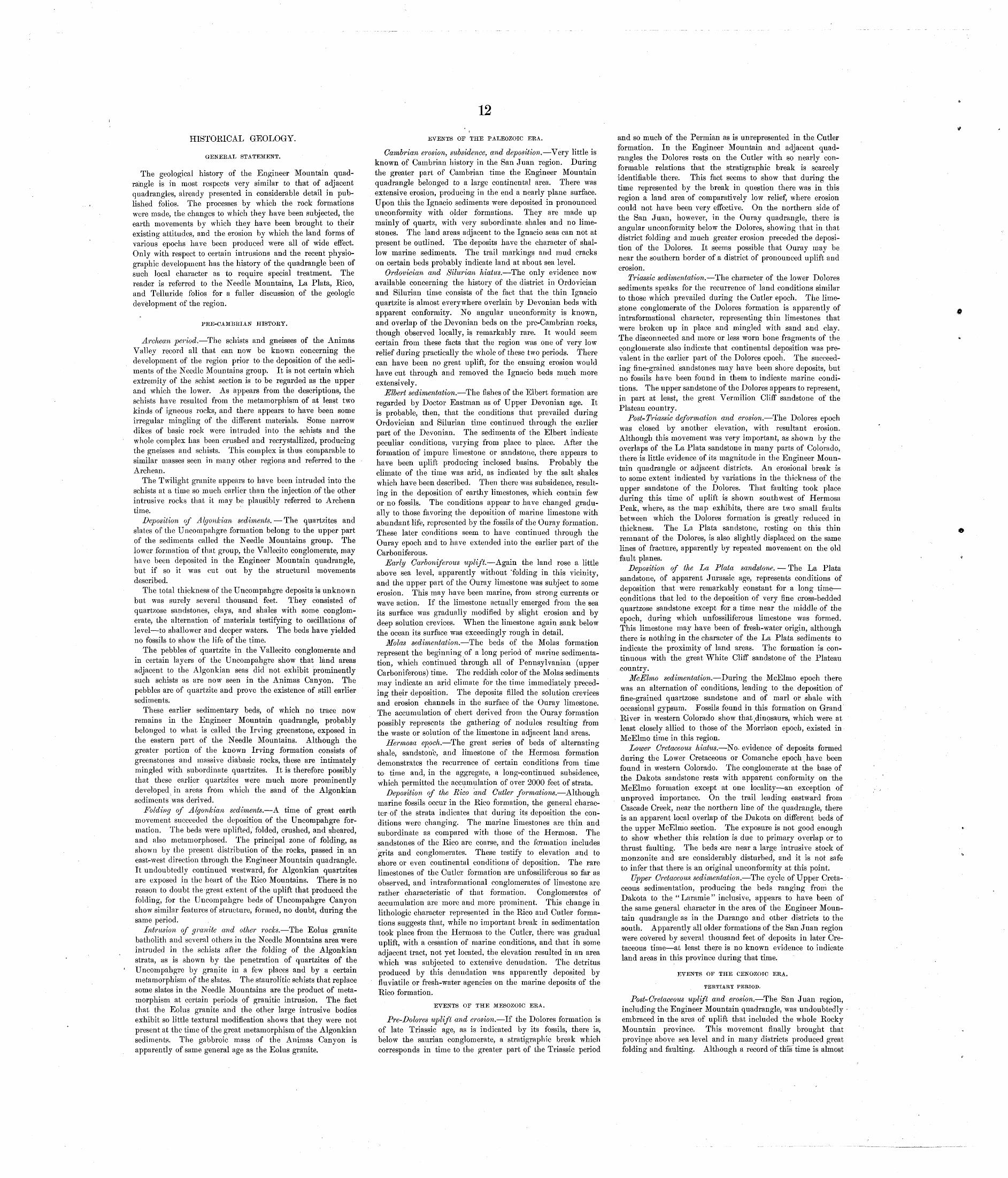
12
HISTORICAL GEOLOGY.
GENERAL STATEMENT.
The geological history of the Engineer Mountain quad rangle is in most respects very similar to that of adjacent quadrangles, already presented in considerable detail in pub lished folios. The processes by which the rock formations were made, the changes to which they have been subjected, the earth movements by which they have been brought to their existing attitudes, and the erosion by which the land forms of various epochs have been produced were all of wide effect. Only with respect to certain intrusions and the recent physio graphic development has the history of the quadrangle been of such local character as to require special treatment. The reader is referred to the Needle Mountains, La Plata, Rico, and Telluride folios for a fuller discussion of the geologic development of the region.
PRE-CAMBRIAN HISTORY.
Archean period. The schists and gneisses of the Animas Valley record all that can now be known concerning the development of the region prior to the deposition of the sedi ments of the Needle Mountains group. It is not certain which extremity of the schist section is to be regarded as the upper and which the lower. As appears from the descriptions, the schists have resulted from the metamorphism of at least two kinds of igneous rocks, and there appears to have been some irregular mingling of the different materials. Some narrow dikes of basic rock were intruded into the schists and the whole complex has been crushed and recrystallized, producing the gneisses and schists. This complex is thus comparable to similar masses seen in many other regions and referred to the Archean.
The Twilight granite appears to have been intruded into the schists at a time so much earlier than the injection ,of the other intrusive rocks that it may be plausibly referred to Archean time.
Deposition of Algonkian sediments. The quartzites and slates of the Uncornpahgre formation belong to the upper part of the sediments called the Needle Mountains group. The lower formation of that group, the Vallecito conglomerate, may have been deposited in the Engineer Mountain quadrangle, but if so it was cut out by the structural movements described.
The total thickness of the Uncompahgre deposits is unknown but was surely several thousand feet. They consisted of quartzose sandstones, clays, and shales with some conglom erate, the alternation of materials testifying to oscillations of level to shallower and deeper waters. The beds have yielded no fossils to show the life of the time.
The pebbles of quartzite in the Vallecito conglomerate and in certain layers of the Uncompahgre show that land areas adjacent to the Algonkian seas did not exhibit prominently such schists as are now seen in the Animas Canyon. The pebbles are of quartzite and prove the existence of still earlier sediments.
These earlier sedimentary beds, of which no trace now remains in the Engineer Mountain quadrangle, probably belonged to what is called the Irving greenstone, exposed in the eastern part of the Needle Mountains. Although the greater portion of the known Irving formation consists of greenstones and massive diabasic rocks, these are intimately mingled with subordinate quartzites. It is therefore possibly that these earlier quartzites were much more prominently developed in areas from which the sand of the Algonkian sediments was derived.
Folding of Algonkian sediments. A time of great earth movement succeeded the deposition of the Uncompahgre for mation. The beds were uplifted, folded, crushed, and sheared, and also metamorphosed. The principal zone of folding, as shown by the present distribution of the rocks, passed in an east-west direction through the Engineer Mountain quadrangle. It undoubtedly continued westward, for Algonkian quartzites are exposed in the heart of the Rico Mountains. There is no reason to doubt the great extent of the uplift that produced the folding, for the Uncompahgre beds of Uncompahgre Canyon show similar features of structure, formed, no doubt, during the same period.
Intrusion of granite and other rocks. The Eolus granite batholith and several others in the Needle Mountains area were intruded in the schists after the folding of the Algonkian strata, as is shown by the penetration of quartzites of the Uncompahgre by granite in a few places and by a certain metamorphism of the slates. The staurolitic schists that replace some slates in the Needle Mountains are the product of meta morphism at certain periods of granitic intrusion. The fact that the Eolus granite and the other large intrusive bodies exhibit so little textural modification shows that they were not present at the time of the great metamorphism of the Algonkian sediments. The gabbroic mass of the Animas Canyon is apparently of same general age as the Eolus granite.
EVENTS OF THE PALEOZOIC ERA.
Cambrian erosion, subsidence, and deposition. Very little is known of Cambrian history in the San Juan region. During the greater part of Cambrian time the Engineer Mountain quadrangle belonged to a large continental area. There was extensive erosion, producing in the end a nearly plane surface. Upon this the Ignacio sediments were deposited in pronounced unconformity with older formations. They are made up mainly of quartz, with very subordinate shales and no lime stones. The land areas adjacent to the Ignacio seas can not at present be outlined. The deposits have the character of shal low marine sediments. The trail markings and mud cracks on certain beds probably indicate land at about sea level.
Ordovician and Silurian hiatus. The only evidence now available concerning the history of the district in Ordovician and Silurian time consists of the fact that the thin Ignacio quartzite is almost everywhere overlain by Devonian beds with apparent conformity. No angular unconformity is known, and overlap of the Devonian beds on the pre-Cambrian rocks, though observed locally, is remarkably rare. It would seem certain from these facts that the region was one of very low relief during practically the whole of these two periods. There can have been no great uplift, for the ensuing erosion would have cut through and removed the Ignacio beds much more extensively.
Elbert sedimentation. The fishes of the Elbert formation are regarded by Doctor Eastman as of Upper Devonian age. It is probable, then, that the conditions that prevailed during Ordovician and Silurian time continued through the earlier part of the Devonian. The sediments of the Elbert indicate peculiar conditions, varying from place to place. After the formation of impure limestone or sandstone, there appears to have been uplift producing inclosed basins. Probably the climate of the time was arid, as indicated by the salt shales which have been described. Then there was subsidence, result ing in the deposition of earthy limestones, which contain few or no fossils. The conditions appear to have changed gradu ally to those favoring the deposition of marine limestone with abundant life, represented by the fossils of the Ouray formation. These later conditions seem to have continued through the Ouray epoch and to have extended into the earlier part of the Carboniferous.
Early Carboniferous uplift. Again the land rose a little above sea level, apparently without "folding in this vicinity, and the upper part of the Ouray limestone was subject to some erosion. This may have been marine, from strong currents or wave action. If the limestone actually emerged from the sea its surface was gradually modified by slight erosion and by deep solution crevices. When the limestone again sank below the ocean its surface was exceedingly rough in detail.
Molas sedimentation. The beds of the Molas formation represent the beginning of a long period of marine sedimenta tion, which continued through all of Pennsylvania!! (upper Carboniferous) time. The reddish color of the Molas sediments may indicate an arid climate for the time immediately preced ing their deposition. The deposits filled the solution crevices and erosion channels in the surface of the Ouray limestone. The accumulation of chert derived from the Ouray formation possibly represents the gathering of nodules resulting from the waste or solution of the limestone in adjacent land areas.
Hermosa epoch. The great series of beds of alternating shale, sandstone, and limestone of the Hermosa formation demonstrates the recurrence of certain conditions from time to time and, in the aggregate, a long-continued subsidence, which permitted the accumulation of over 2000 feet of strata.
Deposition of the Rico and Cutler formations. Although marine fossils occur in the Rico formation, the general charac ter of the strata indicates that during its deposition the con ditions were changing. The marine limestones are thin and subordinate as compared with those of the Hermosa. The sandstones of the Rico are coarse, and the formation includes grits and conglomerates. These testify to elevation and to shore or even continental conditions of deposition. The rare limestones of the Cutler formation are unfossiliferous so far as observed, and intraformational conglomerates of limestone are rather characteristic of that formation. Conglomerates of accumulation are more and more prominent. This change in lithologic character represented in the Rico and Cutler forma tions suggests that, while no important break in sedimentation took place from the Hermosa to the Cutler, there was gradual uplift, with a cessation of marine conditions, and that in some adjacent tract, not yet located, the elevation resulted in an area which was subjected to extensive denudation. The detritus produced by this denudation was apparently deposited by fluviatile or fresh-water agencies on the marine deposits of the Rico formation.
EVENTS OF THE MESOZOIC ERA.
Pre-Dolores uplift and erosion. If the Dolores formation is of late Triassic age, as is indicated by its fossils, there is, below the saurian conglomerate, a stratigraphic break which corresponds in time to the greater part of the Triassic period
and so much of the Permian as is unrepresented in the Cutler formation. In the Engineer Mountain and adjacent quad rangles the Dolores rests on the Cutler with so nearly con formable relations that the stratigraphic break is scarcely identifiable there. This fact seems to show that during the time represented by the break in question there was in this region a land area of comparatively low relief, where erosion could not have been very effective. On the northern side of the San Juan, however, in the Ouray quadrangle, there is angular unconformity below the Dolores, showing that in that district folding and much greater erosion preceded the deposi tion of the Dolores. It seems possible that Ouray may be near the southern border of a district of pronounced uplift and erosion.
Triassic sedimentation. The character of the lower Dolores sediments speaks for the recurrence of land conditions similar to those which prevailed during the Cutler epoch. The lime stone conglomerate of the Dolores formation is apparently of intraformational character, representing thin limestones that were broken up in place and mingled with sand and clay. The disconnected and more or less worn bone fragments of the conglomerate also indicate that continental deposition was pre valent in the earlier part of the Dolores epoch. The succeed ing fine-grained sandstones may have been shore deposits, but no fossils have been found in them to indicate marine condi tions. The upper sandstone of the Dolores appears to represent, in part at least, the great Vermilion Cliff sandstone of the Plateau country.
Post-Triassic deformation and erosion. The Dolores epoch was closed by another elevation, with resultant erosion. Although this movement was very important, as shown by the overlaps of the La Plata sandstone in many parts of Colorado, there is little evidence of its magnitude in the Engineer Moun tain quadrangle or adjacent districts. An erosional break is to some extent indicated by variations in the thickness of the upper sandstone of the Dolores. That faulting took place during this time of uplift is shown southwest of Hermosa Peak, where, as the map exhibits, there are two small faults between which the Dolores formation is greatly reduced in thickness. The La Plata sandstone, resting on this thin remnant of the Dolores, is also slightly displaced on the same lines of fracture, apparently by repeated movement on the old fault planes.
Deposition of the La Plata sandstone. The La Plata sandstone, of apparent Jurassic age, represents conditions of deposition that were remarkably constant for a long time conditions that led to the deposition of very fine cross-bedded quartzose sandstone except for a time near the middle of the epoch, during which unfossiliferous limestone was formed. This limestone may have been of fresh-water origin, although there is nothing in the character of the La Plata sediments to indicate the proximity of land areas. The formation is con tinuous with the great White Cliff sandstone of the Plateau country.
McElmo sedimentation. During the McElmo epoch there was an alternation of conditions, leading to the deposition of fine-grained quartzose sandstone and of marl or shale with occasional gypsum. Fossils found in this formation on Grand River in western Colorado show that (dinosaurs, which were at least closely allied to those of the Morrison epoch, existed in McElmo time in this region.
Lower Cretaceous hiatus. No- evidence of deposits formed daring the Lower Cretaceous or Comanche epoch have been found in western Colorado. The conglomerate at the base of the Dakota sandstone rests with apparent conformity on the McElmo formation except at one locality an exception of unproved importance. On the trail leading eastward from Cascade Creek, near the northern line of the quadrangle, there is an apparent local overlap of the Dakota on different beds of the upper McElmo section. The exposure is not good enough to show whether this relation is due to primary overlap or to thrust faulting. The beds -are near a large intrusive stock of monzonite and are considerably disturbed, and it is not safe to infer that there is an original unconformity at this point.
Upper Cretaceous sedimentation. The cycle of Upper Creta ceous sedimentation, producing the beds ranging from the Dakota to the "Laramie" inclusive, appears to have been of the same general character in the area of the Engineer Moun tain quadrangle as in the Durango and other districts to the south. Apparently all older formations of the San Juan region were covered by several thousand feet of deposits in later Cre taceous time at least there is no known evidence to indicate land areas in this province during that time.
EVENTS OF THE CENOZOIC ERA.
TERTIARY PERIOD.
Post-Cretaceous uplift and erosion. The San Juan region, including the Engineer Mountain quadrangle, was undoubtedly embraced in the area of uplift that included the whole Rocky Mountain province. This movement finally brought that province above sea level and in many districts produced great folding and faulting. Although a record of this time is almost
13
0
lacking in the Engineer Mountain quadrangle, a part of it is very clearly preserved in the adjacent Telluride and Silverton quadrangles. The Telluride conglomerate rests upon a pene plain that transgresses all formations from the Cretaceous Man cos to the pre-Cambrian. It thus records in its materials only the later part of a period of enormous erosion which had greatly denuded a large uplifted tract. The Needle Mountains and parts of the San Juan region north of them clearly repre sent the mountainous district from which the Telluride con glomerate was derived. The relations of the conglomerate to the high summits of the Needle Mountains show that it was probably deposited over the greater part of the Engineer Mountain quadrangle, decreasing in thickness to a minimum in a zone near the present slopes of the West Needle Mountains.
Volcanic eruptions. The principal events of San Juan development during Tertiary time consisted of great volcanic eruptions, between which there were intervals of quiet when widespread and deep erosion took place. Although volcanic rocks are not present in the Engineer Mountain quadrangle, it is certain that the San Juan tuff, exposed in the Telluride quadrangle, once covered a large part of the Engineer Moun tain area. The debris constituting the San Juan tuff was derived from a great volcanic mass of earlier formation, situ ated at some point in the eastern portion of the San Juan Mountains not yet definitely determined. If the Needle Mountains existed in nearly their present elevation during early Tertiary time, they may have served as a barrier to pro tect the southeastern portion of the Engineer Mountain quad rangle from burial by the San Juan tuff. The central part of the San Juan region contains a record of a series of eruptions, to which reference has been made, and it seems probable that the eruptions continued during nearly the whole of the Tertiary era.
Igneous intrusions. The Rico and La Plata mountains represent local centers of igneous intrusion of the laccolithic type. The mountains themselves are in part due to the uplift of sedimentary beds by intruding magmas, but it is clear that a general domal uplift, with upthrust faulting, played an important part in the formation of the Rico Mountains. The eastern summits of the Rico Mountains come within the Engineer Mountain quadrangle, and the domal structure, which has been described and illustrated in some detail, extends for some miles eastward from the base of the mountains.
The effect of the La Plata uplift is less evident in the Engineer Mountain area, but, as has been noted in discussing the structure, the normal southwesterly dip of the strata has been so changed by the La Plata movement that the strata lie in a nearly horizontal position. The intrusive sills and dikes of the Rico center are numerous in the Engineer Mountain area, as is shown by the geological map. The large laccolithic masses of monzonite porphyry seen in Hermosa Peak and Flat top were doubtless intruded in the same general period as the smaller masses directly connected with the Rico center. The large trachyte intrusions of Engineer Mountain, Graysill Moun tain, and Sliderock Ridge may be more recent than the monzo nite porphyries or may be of earlier age. No evidence has been found to determine the relative dates of their intrusion.
Earth movements. Aside from the local uplifts of the Rico and La Plata mountain centers a general uplift of the San Juan district took place in Tertiary time, very probably at intervals or in stages, during different epochs. The effect of such movements can not now be differentiated from that of the post-"Laramie" uplift. The faulting of the trachyte sheets of Graysill Mountain shows that movement of this kind took place after the intrusions occurred. These faults are not of great importance and it is not clear how many of the other dislocations represented on the map may be of contempora neous origin.
QUATERNARY PKRIOD.
Glaciation. The higher portions of the Rocky Mountain region were occupied by glaciers until very recently; indeed, remnants of these glaciers still exist at a few localities in Colorado. Within the last few years evidence has been found in the San Juan region that the recent glaciation was by no means so extensive as that of an earlier ice occupation. The later ice sheets and streams have within their limits obliterated the markings and cleared away the detritus of earlier glaciers, so that one must go above or beyond the boundaries of the
Engineer Mountain.
more recent ice to find traces of the ice of the older stage. In the course of studies on the lower slopes of the San Juan beyond the morainal limits of the recent glaciers many high gravel plains and terraces and some ancient morainal accumu lations have been found which testify to a long and probably complex early glaciation. a
Evidence of earlier glaciation in other parts of the Rocky Mountain region has been announced by R. D. Salisbury and associates as a result of a series of special investigations which have been carried on under the auspices of the United States Geological Survey. The extension of these researches into the San Juan district made cooperation desirable, and in 1908 Alien D. Hole was assigned to the special study of the Engineer Mountain quadrangle, under the supervision of Pro fessor Salisbury. Mr. Hole furnished the section on glacial geology given on pages 8 and 9.
Denudation and physiographic development. The Engineer Mountain quadrangle occupies such a position with relation to the San Juan area that it must have been at least partly covered by volcanic rocks at the close of Tertiary time. The removal of these materials and the deep carving of the sedi ments beneath them must have been accomplished by streams that have been at work on the volcanic plateau since the Ter tiary period. The rate and character of the erosion have been affected by regional earth movements and by the glacial occu pation at different times.
The physiographic history of the San Juan region during Quaternary time is extremely complex, deserving special study, and arrangements have been made to have this study begun under the immediate direction of W. W. Atwood in connection with a general geological survey of the region. It is therefore not desirable to attempt here a detailed discussion of the physiographic development of the Engineer Mountain quad rangle, for this will be undertaken by Mr. Atwood.
Landslide action. One of the processes that has been active in modifying the topography of the quadrangle during Quater nary time has produced several large detrital masses. Under the conditions that prevailed after the last glacial epoch, since the disappearance of the ice, great masses of rock have fallen from undercut cliffs or pinnacles, forming the rock streams or the less fully broken up and disintegrated landslide bodies shown on the geological map. These rock falls have occurred at many different times, and are still liable to happen. It may be said that landslides involving cliffs of the Cutler forma tion north of Engineer Mountain are still in progress, for many of the crevices separating blocks of the mass are clearly of very recent formation.
ECONOMIC GEOLOGY.
EXTENT OF MINERAL RESOURCES.
The natural resources of the Engineer Mountain quadrangle that may be appropriately considered in this place are not extensive compared with those of adjacent areas. Metalliferous deposits of value have not been found in the Engineer Moun tain quadrangle beyond the limits of the Rico Mountains. The valuable nonmetalliferous substances, such as limestone and building stone, are either better developed or may be more easily exploited in the adjacent quadrangles. It therefore seems probable that few of the mineral resources thus far discovered in this quadrangle will be utilized in the near future.
METALLIFEROUS DEPOSITS.
Rico Mountains. The central portion of the Rico Moun tains contains deposits of gold, silver, copper, lead, zinc, and iron ores of several 'types. The development of the district began about thirty years ago and has continued with varying production to the present time. A report on the ore deposits of the Rico Mountains by F. L. Ransome was published in the Twenty-second Annual Report of the United States Geological Survey, in 1902. The deposits in the. Engineer Mountain part of the Rico Mountains were described in Mr. Ransome's report, to which the reader is referred for details. A map accompanying that report embraced several summits situated in the Engineer Mountain quadrangle.
The important mines east of Dolores River in the Rico Mountains include those of Newman Hill, Nigger Baby Hill,
a Howe, Ernest, and Cross, Whitman. Glacial phenomena of the San Juan Mountains: Bull. Greol. Soc. America, vol. 17,1906, pp. 251-274.
and lower Silver Creek. All these are within 1^ miles of the western boundary of the Engineer Mountain quadrangle, but the important metallic deposits of the quadrangle occur only in the drainage basin of Silver Creek.
Near the head of Allyn Gulch, northwest of Blackhawk Peak, there are several prospects or mines on a system of fissure veins. The most prominent of these fissures is the Blackhawk fault, shown on the geological map. Several branch fissures, on which mineralization is more pronounced, occur northeast of the main fault. The Privateer and Leila Da vis mines, situated on two of these branch fissures, are indi cated on the map. The Little Maggie and Allegheny mines are just west of the boundary of the quadrangle, and the noted Blackhawk mine is near the mouth of Allyn Gulch.
Some prospecting has been done at the head of Deadwood Gulch south of Dolores Peak, but none of the prospects has proved to be important.
Cascade Creek basin. Adjacent to the monzonite stock, the southern portion of which lies in the Engineer Mountain quadrangle, there has been some mineralization which is prob ably connected in origin with the stock. Some prospecting has been done on veins that traverse the Dakota and McElmo formations, particularly east of Cascade Creek, but these pros pects were long .ago abandoned and no information has been obtained concerning the nature of the developments in them.
Pre-Cambrian area. The pre-Cambrian rocks of the Needle Mountains quadrangle contain a few veins of metalliferous deposits, which have been described in the Needle Moun tains folio. In many places in these old rocks in the Engineer Mountain quadrangle, as in pre-Cambrian rocks elsewhere, there is more or less indication of mineral deposition and some prospecting has been done in the schists and granites of the quadrangle, but in no place has any valuable deposit yet been found.
The fault vein between the Uncompahgre quartzite and the Ouray limestone, which passes just north of the summit of Coalbank Hill, has recently been prospected on the Delayed claim. The limonitic material found where the limestone is upturned against the fault is said to contain silver ore and a crosscut tunnel is now being driven to intersect the vein at a point several hundred feet lower. Present developments do not show the existence of valuable ore deposits in this vein.
FONMETALLIFEROUS DEPOSITS.
The abundant limestone in the quadrangle has not yet been put to any large or important practical use. The Ouray lime stone is suitable for use as a flux in smelting and a quarry has been opened in it a few miles south of the Engineer Mountain quadrangle, near the railroad. The material has been used at the Durango smelters.
Building stone of good quality could no doubt be obtained at many places in the Animas Canyon within the quadrangle, but no demand now exists that would justify the opening of quarries.
Subbituminous coal of inferior quality occurs in thin seams in the shaly parts of the Dakota sandstone. Unsuccessful attempts to utilize this coal have been made in the Rico and Telluride quadrangles, where it is better developed than in the Engineer Mountain area. There js no coal on the grade mis named Coalbank Hill, east of Engineer Mountain.
WATER RESOURCES.
The principal perennial streams of the Engineer Mountain quadrangle are Animas River and Lime, Cascade, and Hermosa creeks, all of which are tributary to the Animas. There is but little arable land in the quadrangle and owing to the high ele vation not many kinds of crops can be raised. The water of the Animas is ultimately utilized in irrigating fertile bottom or terrace lands in the Ignacio quadrangle or farther south in New Mexico. Storage of the waters of the Engineer Moun tain area for irrigation has not yet been attempted.
The only notable use made of the waters in the quadrangle is by the Animas Power and Water Company, which diverts Cascade Creek into the Ignacio reservoir, as shown by the topo graphic map. This reservoir serves as a source of supply for a power plant in the Animas Canyon at Tacoma, from which the power is transmitted to Silverton and other mining centers in the San Juan region.
May, 1909.