Embed Size (px)
Citation preview
DEVELOPING A SEMANTIC MODEL OF GLACIAL LANDFORMS FOR OBJECT-BASED TERRAIN CLASSIFICATION – THE EXAMPLE OF GLACIAL CIRQUES
C. Eisank a, *, L. Drăguţ a, b, J. Götz a, T. Blaschke a
a Dept. of Geography and Geology, University of Salzburg, Hellbrunnerstraße 34, 5020 Salzburg, Austria -
(clemens.eisank, lucian.dragut, joachim.goetz, thomas.blaschke)@sbg.ac.at b Dept. of Geography, West University of Timişoara, V. Pârvan Blv. 4, 300223 Timişoara, Romania
KEY WORDS: Glacial Cirques, DEM, Semantics, Landform Classification, Formalization, Knowledge, OBIA ABSTRACT: Earth surface processes operate on various spatio-temporal scales and produce landforms that are structured in a nested hierarchical manner. Semi-automated extraction of selected landform types from digital elevation models (DEMs) is of great importance in geomorphology. Object-based image analysis (OBIA) provides an attractive framework for multi-scale terrain segmentation and classification. However, classification in OBIA requires a priori knowledge and conceptualization approaches about candidate landforms as well as thorough modelling of their semantics. In our study we developed a semantic model for object-based classification of glacial cirques. The real-world feature ‘glacial cirque’ was conceptualized based on pre-existing knowledge about morphology, morphometry, and spatial context. From a 10 m DEM we derived curvatures. Filtered mean curvature served as input for the multi-resolution segmentation. Appropriate scale levels were identified by the method of local variance. In a first classification, ridges as features bordering cirques were extracted and masked out from mean curvature for a second segmentation process. Through semantic modelling we were able to link the concept of cirque and the image object domain to derive proper classification rules. The proposed model formalizes knowledge about glacial cirques and guides the user in the operational implementation of cirque classification in OBIA software. Since the classification process solely integrates shape and context information, the system becomes more objective and transferable. Extracted cirque objects contribute to a better understanding of cirque distribution and glacial processes. In future we will further improve our system to break new ground in automated mapping of glacial landforms. KURZFASSUNG: Erdoberflächenprozesse wirken auf unterschiedlichen raum-zeitlichen Skalen und schaffen Landformen, die sich durch eine ineinander verschachtelte, hierarchische Struktur kennzeichnen. Für geomorphologische Fragestellungen ist die semi-automatisierte Ableitung von Landformtypen auf Basis von digitalen Geländemodellen (DGM) von großer Bedeutung. Die objektbasierte Bildanalyse bietet diesbezüglich einige signifikante Vorteile gegenüber pixelbasierten Methoden. Allerdings erfordert die objektbasierte Klassifikation zunächst eine Formalisierung von vorhandenem Wissen über einzelne Landformtypen mittels semantischer Modellierung. In dieser Studie präsentieren wir ein semantisches Modell für die objektbasierte Klassifikation von glazialen Karen im Software-Produkt eCognition. Mit Hilfe von geomorphologischem Wissen bezüglich morphologischer, morphometrischer und topologischer Eigenschaften konnten wir die Form ‚glaziales Kar’ konzeptualisieren. Auf Basis eines 10 m DGMs berechneten wir Krümmungs-parameter. Die gefilterte mittlere Krümmung diente als Input für die hierarchische Segmentierung. Unter Anwendung der lokalen Varianz ermittelten wir geeignete Segmentierungsebenen. Im ersten Schritt klassifizierten wir Kammbereiche, um Nachbarschafts-beziehungen für die Extraktion von Kar-Objekten aufbauen zu können. Diese Kammbereiche wurden im zweiten Segmentierungs-prozess ausgeschlossen. Mit Hilfe der semantischen Modellierung wurden das Form-Konzept und die Objektebene in der Software miteinander in Beziehung gesetzt. Dies erleichterte die Auswahl von passenden Klassifikationsregeln. Das entworfene Modell eignet sich sehr gut für die operationale Umsetzung von Kar-Klassifikationen in objektbasierten Umgebungen. Da für die Klassifikation nur Form- und Kontexteigenschaften verwendet wurden, wird der Prozess vergleichsweise objektiv und übertragbar. Die abgeleiteten Kar-Objekte geben einen Einblick in die räumliche Verteilung von Karen und in abgelaufene glaziale Prozesse. Zukünftige Forschungsanstrengungen werden sich auf die Verbesserung des Regelsatzes beziehen, um neue Wege in Richtung automatisierter Klassifikation von glazialen Landschaftsformen zu beschreiten.
* Corresponding author.
1. INTRODUCTION
Earth surface processes operate on various spatio-temporal scales and resulting landforms are structured in a nested and hierarchical manner. Semi-automated extraction of selected landform types from land-surface models such as digital elevation models (DEMs), curvatures, and slope gradients is of particular interest in geomorphology, hydrology, and related
fields. Depending on the spatial scale different types of landforms can be distinguished. Classification/delineation of landform units relies on the principle of homogeneity of spatial entities: borders are expressions of maximizing internal homogeneity while maximizing external heterogeneity. Homogeneity is dependent upon the scale of analysis, but also on the knowledge-based rules of classification. Delineating landforms from land-surface models is particularly challenging
The International Archives of the Photogrammetry, Remote Sensing and Spatial Information Sciences, Vol. XXXVIII-4/C7
due to the transitional nature of landform boundaries (Fisher et al., 2004; Mark and Smith, 2004). Fuzzy logic has been proposed as a solution to address this challenge in landform classification (e.g. Burrough et al., 2000; Fisher et al., 2004; MacMillan et al., 2000). Still, the issue of fiat character of landform boundaries remains, which requires research into landform concepts and their formalization (Argialas, 1995; Brändli, 1996; Dehn et al., 2001). Additional problems arise from the quite heterogeneous views on landform. How landform, landform elements, and structures are defined and modelled strongly depends on the academic background of the user. Therefore, semantic modelling has been proposed as a solution to link landform concepts and computer-based applications of DEMs (Dehn et al., 2001). Object-based image analysis (OBIA) holds the potential of overcoming the above and other limitations of cell-based landform classification systems as acknowledged in recent papers on this topic (e.g. Anders et al., 2009; Drăguţ and Blaschke, 2006; Drăguţ et al., 2009; Ghosh et al., 2010). However, up to now, multi-level object-based classification has only been tangentially considered, since it requires a priori concepts of both candidate landforms and their interrelations within and across scales. There is still a gap between efforts in building semantic models of landform structures and object-based classification systems. In our research we are interested in developing a semantic model of glacial landforms for multi-scale classification in an OBIA environment. For this contribution we focused on glacial cirques and cirque components. Semi-automated cirque mapping from land-surface models is not a trivial task. At the moment, there is only one study that partly deals with the extraction of cirque elements such as headwalls using an object-based approach (Schneevoigt et al., 2008). In the past cirques were mainly manually delineated by geomorphological mapping projects in the field. Our approach combines a data-driven approach in segmentation with semantics-based classification in eCognition software.
2. STUDY AREA AND DATA
2.1 Study area
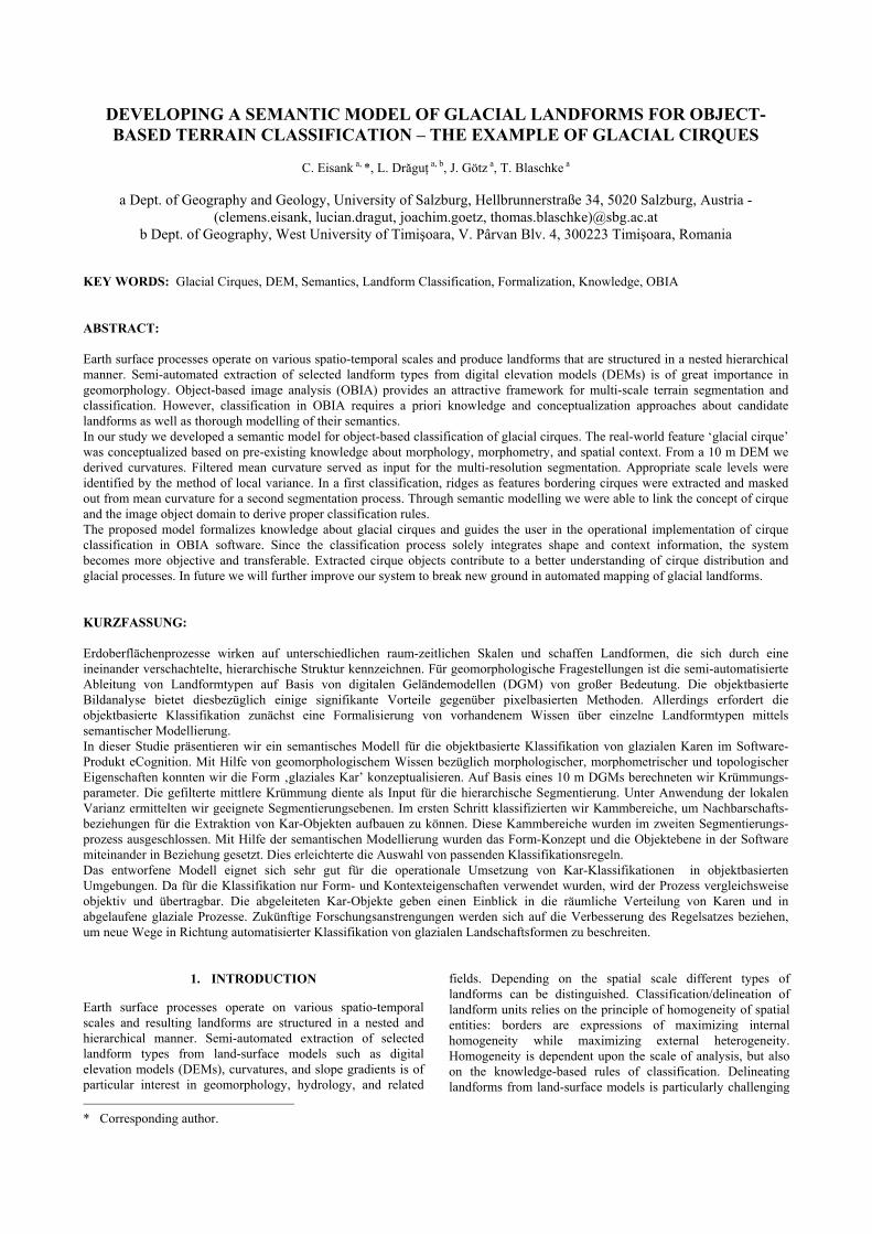
The area analyzed in this study is located in the northwest of Carinthia (southernmost province of Austria) and covers the eastern part of the high alpine Schobergroup (Figure 1). The test site covers an area of approximately 160 km². Elevation ranges from 860 m a.s.l. to 3283 m a.s.l. Despite of 36 peaks reaching above 3000 m a.s.l., recent glaciation of the Schobergroup is limited and restricted to some small (mostly debris covered) glaciers (e.g. Goessnitzkees, Gradenkees) due to a lack of larger accumulation areas above equilibrium line altitude. The intensely dissected Schobergroup is characterized by a variety of glacial landforms on different scales. On a broader scale, a high density of hanging valleys and various overdeepened glacial cirques often filled by cirque lakes can be observed. Typical fine-scale glacial landforms are for example widespread roches moutonnées and various types of moraines. This topography strongly influences local climate conditions especially of variable solar radiation that feed back on glacier and cirque development. 2.2 Digital elevation model
In this study we used a subset of the official Austrian-wide available DEM at 10 m horizontal resolution. During the
production process an initial grid size of 50 m was successively densified using multi-level interpolation algorithms. Accuracy of elevation data is not uniform, but dependent on land surface coverage and topography. The data was kindly provided by the “Amt der Kärntner Landesregierung, Abteilung 20/Landes-planung – KAGIS”. 2.3 Pre-processing
From the initial DEM we derived several land-surface models such as curvatures (mean, plan and profile) and slope gradient using the standard 3x3 moving window algorithm as implemented in ArcGIS 9.3. We further applied mean filtering of curvatures using a 10x10 cell neighbourhood to smooth out short-wave variations (i.e. noise). As recommended by Zevenbergen and Thorne (1987), we multiplied filtered curvature values by 100. Thus, we increased the range of values for the subsequent segmentation process. Pre-processing steps were carried out on a larger area to avoid edge effects. Finally, we clipped results to the extent of the study area.
Figure 1. Location and topographic characteristics of the
eastern Schobergroup
The International Archives of the Photogrammetry, Remote Sensing and Spatial Information Sciences, Vol. XXXVIII-4/C7
3. METHODOLOGY
The proposed methodology for semantics-based landform classification comprises the following five steps (modified, after Argialas, 1995): Identification of landforms, conceptualization of landforms, scale detection, semantic modelling of landforms (formalization), and software implementation. 3.1 Identification
Landforms of interest observable in the available land-surface models are identified in the first step. 3.2 Conceptualization
Landforms are thoroughly described based on pre-existing geomorphological knowledge about their morphometric and morphologic properties, their topological and hierarchical relations to each other, and their operating spatial scale(s). Thus, each landform of interest is conceptualized in the context of a mental model that simplifies the real-world situation with regard to a specific research field. Since definitions and semantics strongly depend on the discipline perception world (Bishr, 1998), conceptualizations of landforms are only valid for the targeted discipline. Imagine a hydrologist and a geomorphologist viewing the same landscape. Beyond doubt, they will perceive different landform objects and describe the same objects differently. Due to the problem of indeterminate boundaries of landforms, borders of the same form will differ. This is what Bishr (1998) called the cognitive heterogeneity of semantics. Moreover, scientists of various fields might use different names for the same object or identical terms for different objects resulting in naming heterogeneity (Dehn, 2001). 3.3 Scale detection
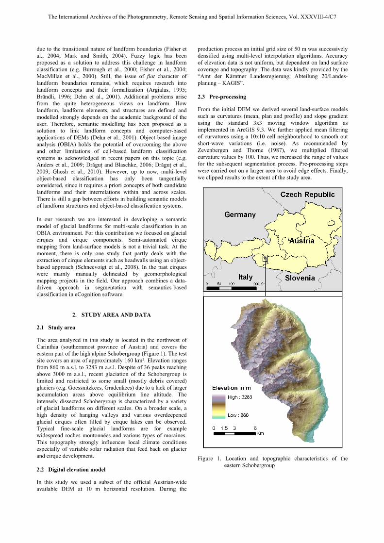
Multi-resolution segmentation in eCognition relies on several user-set parameters. The most crucial one is the scale parameter. Its value defines the threshold of the maximum increase in heterogeneity, when two objects are merged, and hence, directly influences the size of image objects (Benz et al., 2004). Until recently, the decision upon scale parameters was done in a time-consuming trial and error manner. Now, the freely available ESP tool (Estimation of Scale Parameters, Drăguţ et al., 2010) successfully guides the user in the selection of appropriate segmentation scales. The tool can easily be added to the process tree in eCognition. It uses a multi-scale data-driven approach based on local variance to identify those scale levels, where the spatial organization of image objects in a scene best characterizes a group of similar-sized real-world entities. More details on the method can be found in the original publication (Drăguţ et al., 2010). We applied the ESP tool for selecting characteristic scales for the hierarchical landform classification. 3.4 Semantic modelling
Semantics is defined as “the relationship among computer representations and the corresponding real-world feature within a certain context” (Bishr 1998: 302). A semantic model visualizes links between conceptualized real-world facts and computer representations within a certain context. In the case of landform-related applications, a semantic model describes which and how landform attributes (i.e. information about
shape and topology as from the previously defined concepts) can actually be formalized and represented by means of land-surface models in the software domain. 3.5 Software implementation
OBIA software has several advantages compared to cell-based systems. Firstly, the creation of objects through image segmentation mimics the way how humans perceive their environment (Fabrikant et al., 2010), and, moreover, objects better fit the shape of real-world entities. Secondly, OBIA is well suited for the integration of expert knowledge that has been formalized through semantic modelling (Burnett and Blaschke, 2003). The eCognition product offers a wide range of predefined features to account for spectral, shape, and context information in landform classification. One major challenge is to increase transferability of the developed classification rule set. This can be achieved by integrating object-intrinsic properties such as size and shape as well as topological expressions (e.g. part of, adjacent to), and, whenever possible, to leave apart spectral information (Möller et al., 2008).
4. FROM CIRQUE KNOWLEDGE TO CIRQUE CLASSIFICATION
4.1 The term ‘glacial cirque’ and its conceptualization
In our research geomorphological knowledge about glacial cirques is incorporated. A cirque is one of the most prominent forms of glacial erosion (Embleton and Hamann, 1988). According to Evans (2004: 154) cirques are “hollows formed at glacial sources in mountains and partly enclosed by steep, arcuate slopes (headwalls)”. In high-alpine regions cirques show a more shallow character with steep, straight, abraded floors. In general cirques exhibit concave shape in both plan and profile direction, with a size ranging from hundreds of metres to a few kilometres (Glasser and Bennett, 2004). They are typically composed of a cirque crest, a steep headwall, and a more gentler cirque floor often filled by a cirque lake. Evans (2004) suggested thresholds in slope gradient to subdivide cirques into its single components.
Figure 2. Parameterization of the ESP-tool 4.2 Detection of characteristic scale parameters for multi-resolution segmentation
Based on the acquired knowledge about cirque morphology we decided to ground the multi-resolution segmentation solely on the mean curvature layer. For detecting characteristic segmentation levels we applied the ESP-tool on the pre-processed mean curvature. According to the parameterization (Figure 2) the tool calculated local variance for scale levels with a step size of 1 starting at scale parameter 1 and stopping at
The International Archives of the Photogrammetry, Remote Sensing and Spatial Information Sciences, Vol. XXXVIII-4/C7
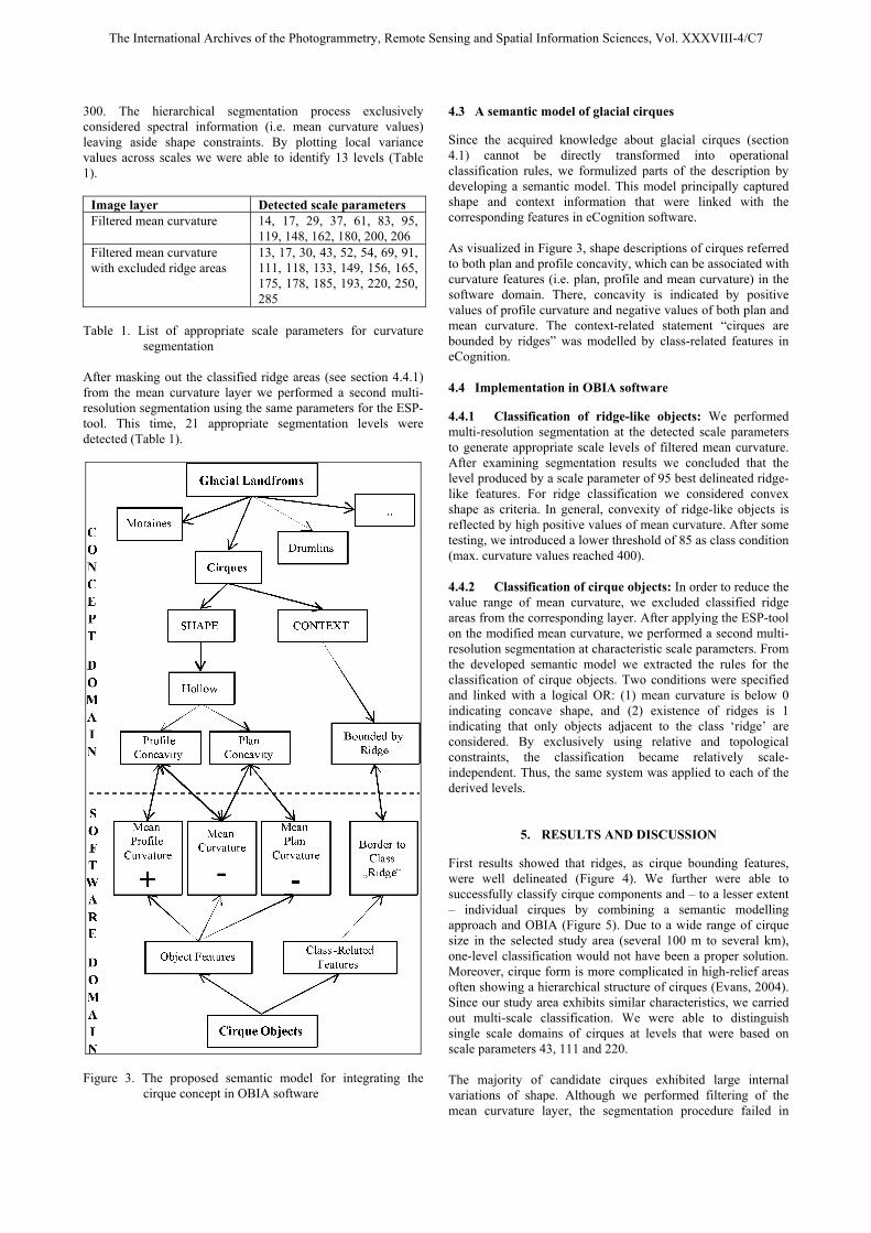
300. The hierarchical segmentation process exclusively considered spectral information (i.e. mean curvature values) leaving aside shape constraints. By plotting local variance values across scales we were able to identify 13 levels (Table 1).
Image layer Detected scale parameters Filtered mean curvature 14, 17, 29, 37, 61, 83, 95,
119, 148, 162, 180, 200, 206 Filtered mean curvature with excluded ridge areas
13, 17, 30, 43, 52, 54, 69, 91, 111, 118, 133, 149, 156, 165, 175, 178, 185, 193, 220, 250, 285
Table 1. List of appropriate scale parameters for curvature
segmentation After masking out the classified ridge areas (see section 4.4.1) from the mean curvature layer we performed a second multi-resolution segmentation using the same parameters for the ESP-tool. This time, 21 appropriate segmentation levels were detected (Table 1).
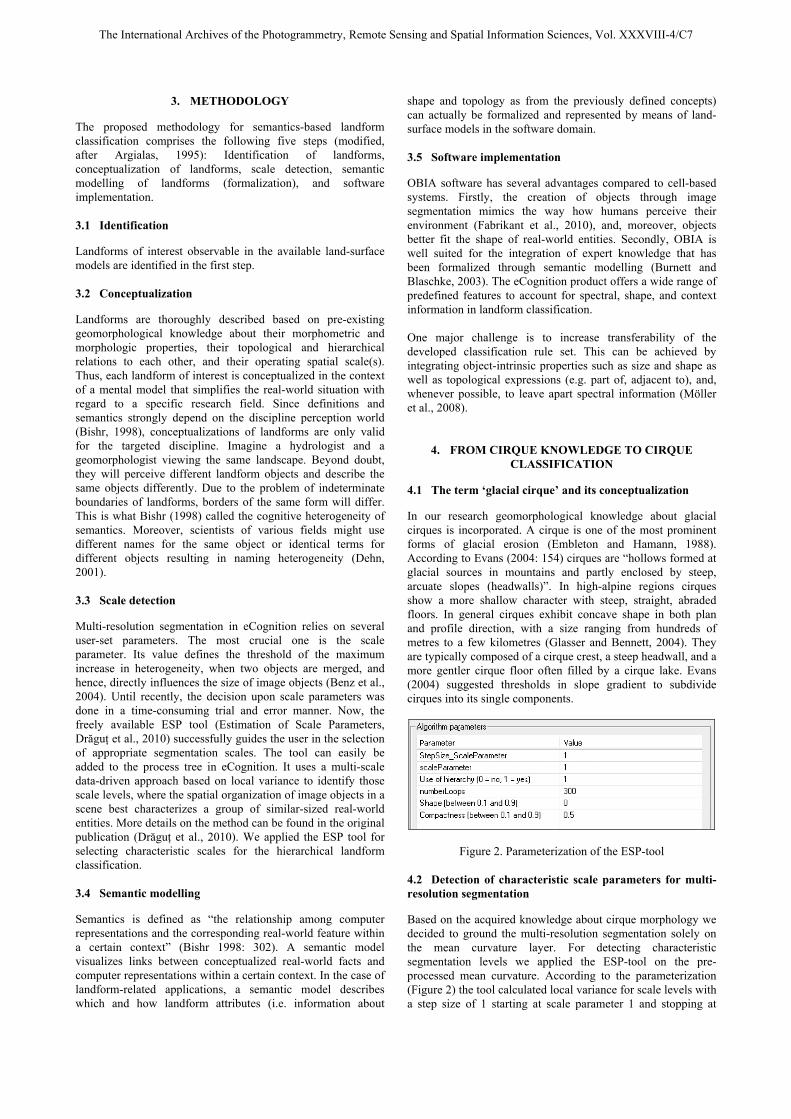
Figure 3. The proposed semantic model for integrating the
cirque concept in OBIA software
4.3 A semantic model of glacial cirques
Since the acquired knowledge about glacial cirques (section 4.1) cannot be directly transformed into operational classification rules, we formulized parts of the description by developing a semantic model. This model principally captured shape and context information that were linked with the corresponding features in eCognition software. As visualized in Figure 3, shape descriptions of cirques referred to both plan and profile concavity, which can be associated with curvature features (i.e. plan, profile and mean curvature) in the software domain. There, concavity is indicated by positive values of profile curvature and negative values of both plan and mean curvature. The context-related statement “cirques are bounded by ridges” was modelled by class-related features in eCognition. 4.4 Implementation in OBIA software
4.4.1 Classification of ridge-like objects: We performed multi-resolution segmentation at the detected scale parameters to generate appropriate scale levels of filtered mean curvature. After examining segmentation results we concluded that the level produced by a scale parameter of 95 best delineated ridge-like features. For ridge classification we considered convex shape as criteria. In general, convexity of ridge-like objects is reflected by high positive values of mean curvature. After some testing, we introduced a lower threshold of 85 as class condition (max. curvature values reached 400). 4.4.2 Classification of cirque objects: In order to reduce the value range of mean curvature, we excluded classified ridge areas from the corresponding layer. After applying the ESP-tool on the modified mean curvature, we performed a second multi-resolution segmentation at characteristic scale parameters. From the developed semantic model we extracted the rules for the classification of cirque objects. Two conditions were specified and linked with a logical OR: (1) mean curvature is below 0 indicating concave shape, and (2) existence of ridges is 1 indicating that only objects adjacent to the class ‘ridge’ are considered. By exclusively using relative and topological constraints, the classification became relatively scale-independent. Thus, the same system was applied to each of the derived levels.
5. RESULTS AND DISCUSSION
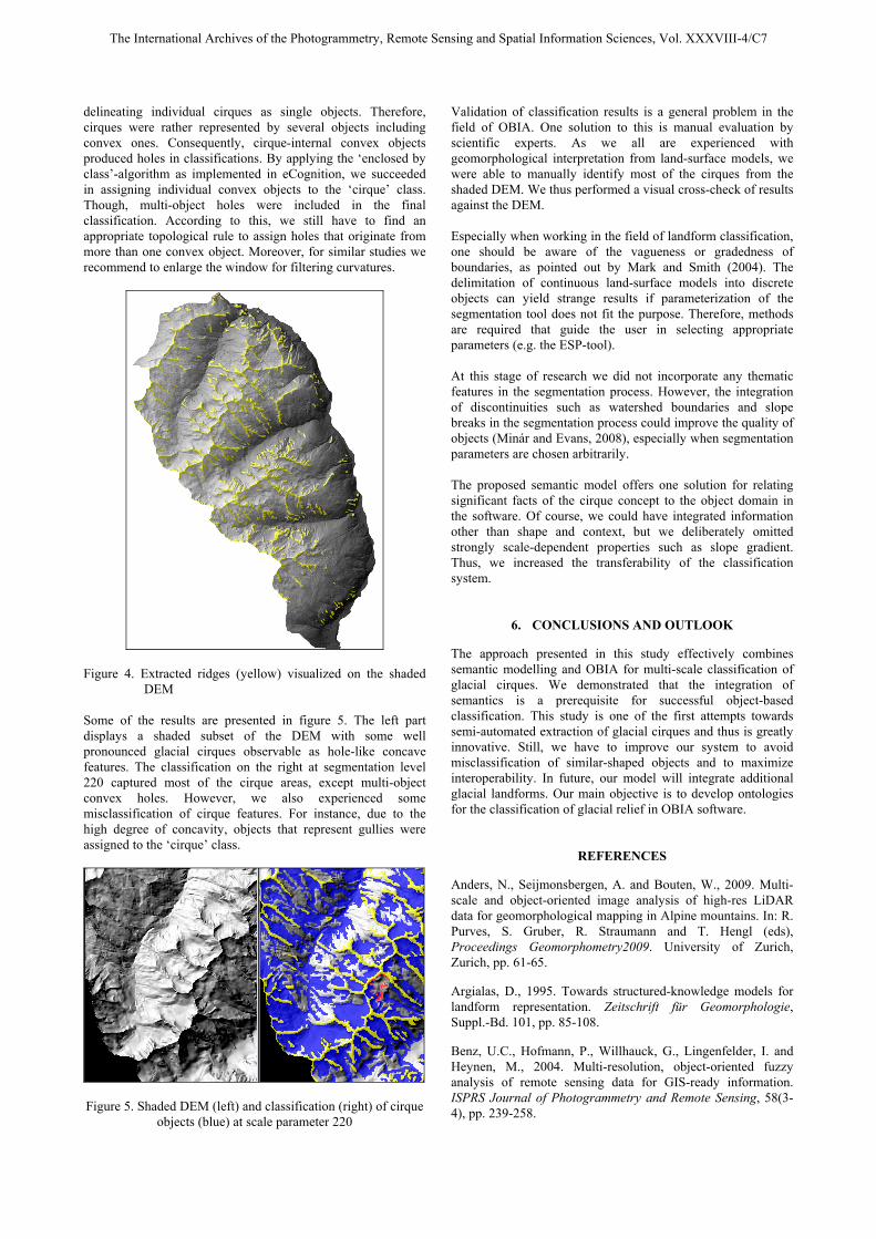
First results showed that ridges, as cirque bounding features, were well delineated (Figure 4). We further were able to successfully classify cirque components and – to a lesser extent – individual cirques by combining a semantic modelling approach and OBIA (Figure 5). Due to a wide range of cirque size in the selected study area (several 100 m to several km), one-level classification would not have been a proper solution. Moreover, cirque form is more complicated in high-relief areas often showing a hierarchical structure of cirques (Evans, 2004). Since our study area exhibits similar characteristics, we carried out multi-scale classification. We were able to distinguish single scale domains of cirques at levels that were based on scale parameters 43, 111 and 220. The majority of candidate cirques exhibited large internal variations of shape. Although we performed filtering of the mean curvature layer, the segmentation procedure failed in
The International Archives of the Photogrammetry, Remote Sensing and Spatial Information Sciences, Vol. XXXVIII-4/C7
delineating individual cirques as single objects. Therefore, cirques were rather represented by several objects including convex ones. Consequently, cirque-internal convex objects produced holes in classifications. By applying the ‘enclosed by class’-algorithm as implemented in eCognition, we succeeded in assigning individual convex objects to the ‘cirque’ class. Though, multi-object holes were included in the final classification. According to this, we still have to find an appropriate topological rule to assign holes that originate from more than one convex object. Moreover, for similar studies we recommend to enlarge the window for filtering curvatures.
Figure 4. Extracted ridges (yellow) visualized on the shaded
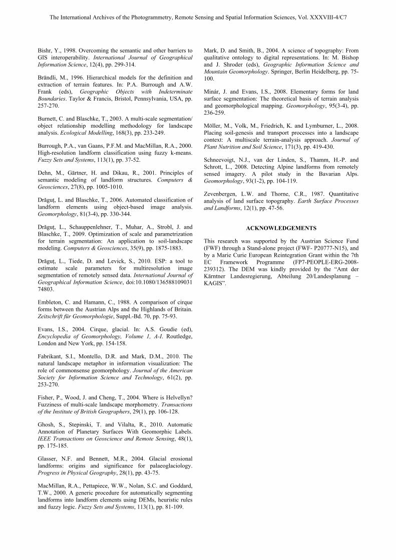
DEM Some of the results are presented in figure 5. The left part displays a shaded subset of the DEM with some well pronounced glacial cirques observable as hole-like concave features. The classification on the right at segmentation level 220 captured most of the cirque areas, except multi-object convex holes. However, we also experienced some misclassification of cirque features. For instance, due to the high degree of concavity, objects that represent gullies were assigned to the ‘cirque’ class.
Figure 5. Shaded DEM (left) and classification (right) of cirque
objects (blue) at scale parameter 220
Validation of classification results is a general problem in the field of OBIA. One solution to this is manual evaluation by scientific experts. As we all are experienced with geomorphological interpretation from land-surface models, we were able to manually identify most of the cirques from the shaded DEM. We thus performed a visual cross-check of results against the DEM. Especially when working in the field of landform classification, one should be aware of the vagueness or gradedness of boundaries, as pointed out by Mark and Smith (2004). The delimitation of continuous land-surface models into discrete objects can yield strange results if parameterization of the segmentation tool does not fit the purpose. Therefore, methods are required that guide the user in selecting appropriate parameters (e.g. the ESP-tool). At this stage of research we did not incorporate any thematic features in the segmentation process. However, the integration of discontinuities such as watershed boundaries and slope breaks in the segmentation process could improve the quality of objects (Minár and Evans, 2008), especially when segmentation parameters are chosen arbitrarily. The proposed semantic model offers one solution for relating significant facts of the cirque concept to the object domain in the software. Of course, we could have integrated information other than shape and context, but we deliberately omitted strongly scale-dependent properties such as slope gradient. Thus, we increased the transferability of the classification system.
6. CONCLUSIONS AND OUTLOOK
The approach presented in this study effectively combines semantic modelling and OBIA for multi-scale classification of glacial cirques. We demonstrated that the integration of semantics is a prerequisite for successful object-based classification. This study is one of the first attempts towards semi-automated extraction of glacial cirques and thus is greatly innovative. Still, we have to improve our system to avoid misclassification of similar-shaped objects and to maximize interoperability. In future, our model will integrate additional glacial landforms. Our main objective is to develop ontologies for the classification of glacial relief in OBIA software.
REFERENCES
Anders, N., Seijmonsbergen, A. and Bouten, W., 2009. Multi-scale and object-oriented image analysis of high-res LiDAR data for geomorphological mapping in Alpine mountains. In: R. Purves, S. Gruber, R. Straumann and T. Hengl (eds), Proceedings Geomorphometry2009. University of Zurich, Zurich, pp. 61-65.
Argialas, D., 1995. Towards structured-knowledge models for landform representation. Zeitschrift für Geomorphologie, Suppl.-Bd. 101, pp. 85-108.
Benz, U.C., Hofmann, P., Willhauck, G., Lingenfelder, I. and Heynen, M., 2004. Multi-resolution, object-oriented fuzzy analysis of remote sensing data for GIS-ready information. ISPRS Journal of Photogrammetry and Remote Sensing, 58(3-4), pp. 239-258.
The International Archives of the Photogrammetry, Remote Sensing and Spatial Information Sciences, Vol. XXXVIII-4/C7
Bishr, Y., 1998. Overcoming the semantic and other barriers to GIS interoperability. International Journal of Geographical Information Science, 12(4), pp. 299-314.
Brändli, M., 1996. Hierarchical models for the definition and extraction of terrain features. In: P.A. Burrough and A.W. Frank (eds), Geographic Objects with Indeterminate Boundaries. Taylor & Francis, Bristol, Pennsylvania, USA, pp. 257-270.
Burnett, C. and Blaschke, T., 2003. A multi-scale segmentation/ object relationship modelling methodology for landscape analysis. Ecological Modelling, 168(3), pp. 233-249.
Burrough, P.A., van Gaans, P.F.M. and MacMillan, R.A., 2000. High-resolution landform classification using fuzzy k-means. Fuzzy Sets and Systems, 113(1), pp. 37-52.
Dehn, M., Gärtner, H. and Dikau, R., 2001. Principles of semantic modeling of landform structures. Computers & Geosciences, 27(8), pp. 1005-1010.
Drăguţ, L. and Blaschke, T., 2006. Automated classification of landform elements using object-based image analysis. Geomorphology, 81(3-4), pp. 330-344.
Drăguţ, L., Schauppenlehner, T., Muhar, A., Strobl, J. and Blaschke, T., 2009. Optimization of scale and parametrization for terrain segmentation: An application to soil-landscape modeling. Computers & Geosciences, 35(9), pp. 1875-1883.
Drăguţ, L., Tiede, D. and Levick, S., 2010. ESP: a tool to estimate scale parameters for multiresolution image segmentation of remotely sensed data. International Journal of Geographical Information Science, doi:10.1080/136588109031 74803.
Embleton, C. and Hamann, C., 1988. A comparison of cirque forms between the Austrian Alps and the Highlands of Britain. Zeitschrift für Geomorphologie, Suppl.-Bd. 70, pp. 75-93.
Evans, I.S., 2004. Cirque, glacial. In: A.S. Goudie (ed), Encyclopedia of Geomorphology, Volume 1, A-I. Routledge, London and New York, pp. 154-158.
Fabrikant, S.I., Montello, D.R. and Mark, D.M., 2010. The natural landscape metaphor in information visualization: The role of commonsense geomorphology. Journal of the American Society for Information Science and Technology, 61(2), pp. 253-270.
Fisher, P., Wood, J. and Cheng, T., 2004. Where is Helvellyn? Fuzziness of multi-scale landscape morphometry. Transactions of the Institute of British Geographers, 29(1), pp. 106-128.
Ghosh, S., Stepinski, T. and Vilalta, R., 2010. Automatic Annotation of Planetary Surfaces With Geomorphic Labels. IEEE Transactions on Geoscience and Remote Sensing, 48(1), pp. 175-185.
Glasser, N.F. and Bennett, M.R., 2004. Glacial erosional landforms: origins and significance for palaeoglaciology. Progress in Physical Geography, 28(1), pp. 43-75.
MacMillan, R.A., Pettapiece, W.W., Nolan, S.C. and Goddard, T.W., 2000. A generic procedure for automatically segmenting landforms into landform elements using DEMs, heuristic rules and fuzzy logic. Fuzzy Sets and Systems, 113(1), pp. 81-109.
Mark, D. and Smith, B., 2004. A science of topography: From qualitative ontology to digital representations. In: M. Bishop and J. Shroder (eds), Geographic Information Science and Mountain Geomorphology. Springer, Berlin Heidelberg, pp. 75-100.
Minár, J. and Evans, I.S., 2008. Elementary forms for land surface segmentation: The theoretical basis of terrain analysis and geomorphological mapping. Geomorphology, 95(3-4), pp. 236-259.
Möller, M., Volk, M., Friedrich, K. and Lymburner, L., 2008. Placing soil-genesis and transport processes into a landscape context: A multiscale terrain-analysis approach. Journal of Plant Nutrition and Soil Science, 171(3), pp. 419-430.
Schneevoigt, N.J., van der Linden, S., Thamm, H.-P. and Schrott, L., 2008. Detecting Alpine landforms from remotely sensed imagery. A pilot study in the Bavarian Alps. Geomorphology, 93(1-2), pp. 104-119.
Zevenbergen, L.W. and Thorne, C.R., 1987. Quantitative analysis of land surface topography. Earth Surface Processes and Landforms, 12(1), pp. 47-56.
ACKNOWLEDGEMENTS
This research was supported by the Austrian Science Fund (FWF) through a Stand-alone project (FWF- P20777-N15), and by a Marie Curie European Reintegration Grant within the 7th EC Framework Programme (FP7-PEOPLE-ERG-2008-239312). The DEM was kindly provided by the “Amt der Kärntner Landesregierung, Abteilung 20/Landesplanung – KAGIS”.