Embed Size (px)
Citation preview

Draft for Consultation: Green Wedge Management PlanJune 2019
DRAFT FOR CONSULTATION

Acknowledgement of traditional owners Nillumbik Shire Council acknowledges the Wurundjeri people who are the Traditional Custodians of Land known today as Nillumbik. We pay respect to the Elders both past and present and extend that respect to other Indigenous Australians.

Contents
A vision for Nillumbik’s green wedge 5
Introduction 6
The Victorian Government’s planning framework for green wedges 9
Managing what is valuable to us 10
Five key moves for the Shire 13
Funding and resourcing of green wedge management 13
Principles 18
Goals, objectives and key actions 20
Goal 1: Engaged connected communities 21
Goal 2: Active and creative people 26
Goal 3: Safe and healthy environments 29
Goal 4: A prosperous economy 36
Goal 5: Responsible leadership 40
Monitoring and evaluation 42
Appendix 1 Plan Melbourne 2017-2050: Desired planning outcomes for green wedges and peri-urban areas 44
Maps and infographics
Nillumbik’s green wedge 4
Melbourne’s twelve green wedges 10
Ownership of the green wedge 12
Managing our green wedge – Plan on a page 14
The green wedge key data 15
How this plan was created 16
How the GWMP relates to Council policy and strategy 17
Rural land uses 25
Nillumbik’s trails network 28
Modelled ecological vegetation classes (2005) 34
Bushfire Occurrence 35
Contents | 1
DRAFT FOR CONSULTATION

Nillumbik’s Green Wedge
Source: Nillumbik Shire Council
Yarrambat
Plenty
Greensborough
Diamond Creek
Eltham
Research
Kangaroo Ground
Bend ofIslands
N
Panton Hill
Smiths Gully
Cottles BridgeDoreenNutfield
SugarloafReservoir
KinglakeNational
Park
Hurstbridge
Wattle Glen
ElthamNorth
North Warrandyte
WatsonsCreek
Christmas Hills
YanYean
Strathewen
Arthurs Creek
KinglakeWest
St Andrews
Kinglake
Watsons C
ree
k
Yarra R
iver
Non-Green Wedge Land
Green Wedge Area
National Park
Reservoir
Suburb Boundaries
Waterway
Arthurs
Creek
Diam
on
d Cre
ek
Ple
nty
Riv
er
0
kilometres
2 4
4 | Green Wedge Management Plan
DRAFT FOR CONSULTATION
A vision for Nillumbik’s green wedge
‘Management of the Nillumbik green wedge will lead the way in supporting a vibrant, resilient, connected and diverse community; living in the landscape to enhance the environmental, social and economic sustainability of the Shire.’Harnessing the shared values of our community and supporting their commitment to managing the green wedge will be the key objective over the 10 year lifetime of this plan.
Nillumbik’s green wedge and rural character contribute to the shire being one of Australia’s most attractive and liveable places. Human activity has shaped our landscapes and the green wedge will continue to support a range of existing and future uses. It will continue to thrive and evolve as a place to live, work and play.
Nillumbik’s green wedge will be maintained and enhanced through continued application of the urban growth boundary and decision making that reflects its roles as a place for agriculture, recreation, nature conservation, tourism and rural living. This will ensure the rural character, values, landscapes, townships, natural environments and lifestyles that are so cherished, are identified, preserved and enhanced. The management of risk from bushfire and adapting to climate change are also priorities.
Opportunities to grow agriculture, tourism, recreation and local jobs and services will be actively sought in a sensitive manner to create greater economic vitality and jobs for our community, foster new skills and build local capability. Our rural townships of Hurstbridge, St Andrews and Panton Hill will be the primary focus for local economic activity in the green wedge. Environment or nature based opportunities will also be encouraged where they demonstrate environmental, social and economic benefits.
Social and community challenges will be addressed through meaningful collaboration and engagement. Building community resilience, sharing knowledge and resources, planning for emergency management, supporting ageing in place, and increasing rural transport and accessibility will be achieved through positive relationships. We will embrace relevant new technologies to improve people’s lives and achieve enhanced social equity by promoting greater connectivity, learning, sharing of ideas and helping people to come together. Our reputation in arts and culture will continue to grow by supporting our passionate community who draw inspiration from our rural landscapes. Supporting healthy and active lifestyles through increased opportunities for recreation and enjoyment of the outdoors will continue to be a key focus for enhancing our wellbeing.
All of this will be achieved in a responsible, collaborative and balanced way. This will ensure that the environmental, social and economic sustainability of the Shire achieves balanced outcomes and a positive future for our people, place and community.
A Vision for Nillumbik’s green wedge | 5
DRAFT FOR CONSULTATION

Introduction
6 | Green Wedge Management Plan
DRAFT FOR CONSULTATION

Since its formulation as the Shire of Nillumbik in 1994, the values of the rural landscape - our green wedge - as a place to live, work or visit have grown in importance for the identity of the shire and its diverse communities. The inherent values and management of the landscape however date back thousands of years, under the stewardship of the Wurundjeri-willam clan of the Woi wurrung speaking people and territory. The Wurundjeri people lived in the landscape, managing and cultivating grazing land for food, and harvesting materials.
Today, Nillumbik is one of 12 green wedges around metropolitan Melbourne. Green wedges are established and protected under the Victorian Government’s legislative and policy framework. The government asks all green wedge councils to prepare and regularly review a green wedge management plan to identify a vision, objectives and actions for the sustainable use and development of each green wedge.
This draft is intended to be Nillumbik’s second Green Wedge Management Plan. It builds on and replaces the first plan adopted by Council in 2010. It forms part of Council’s suite of strategic policies and will act as a coordinating plan to align future green wedge strategy and policy and to guide funding, resourcing and service delivery. Once approved, it will be supported by an annual action plan, including regular monitoring and evaluation.
This plan has been produced as a result of a major public review conducted by Council in 2018, involving engagement with over 1000 people. This included the deliberations and advice of a community panel formed from 40 citizens of the shire who volunteered their time to consider the engagement feedback, understand the current metropolitan and local planning context and the progress of the earlier plan, hear from experts and provide recommendations to Council on the best way to manage the Nillumbik green wedge now and into the future. The panel provided recommendations to which Council provided formal responses, mostly either in support or support-in-principle. In addition, Council received a separate minority report from five panel members which has also been considered in the preparation of this plan.
This draft plan is consistent with the Victorian Government’s metropolitan plan, Plan Melbourne 2017-2050 and adopts the goals of the Shire’s Council Plan 2017-2021 – Living in the Landscape vision for Nillumbik to become Australia’s most liveable shire with:
• engaged, connected communities
• active and creative people
• safe and healthy environments
• a prosperous economy and
• responsible leadership.
All of this information has formed the basis for drafting this new plan for public consultation.
As much as possible, this plan has been designed to be aligned with Council’s shire-wide policies and its Council Plan so that investment attraction, resource allocation, advocacy, implementation and reporting against it are part of core business for Council.
It is intended that this plan provide direction over the next decade, with priorities determined every four years through the preparation of the Council Plan and prior to the four-yearly review of the Nillumbik Planning Scheme. It includes:
• principles that informed the creation of this plan and will guide how it is to be implemented
• goals that describe desired overall outcomes for the community
• objectives that describe what is to be achieved in support of the goals and
• key actions to effect change in the direction of the objectives.
This plan will inform future versions of the Council Plan, Municipal Health and Wellbeing Plan and Municipal Strategic Statement. Its objectives will also inform key shire-wide strategies such those relating to economic development, housing, agriculture, positive ageing, bushfire mitigation, arts and culture, biodiversity, climate change adaptation and recreation.
Introduction | 7
DRAFT FOR CONSULTATION

April 2017 to April 2018
Preliminary engagement with key community members identified some of the key issues, and secured community support for a participatory democracy process to review the GWMP.
April to May 2018
Design workshops involving community leaders helped create the wider community engagement program.
July 2018
The Community Panel recruitment process commenced with 10,000 invitations sent to Nillumbik businesses and households seeking expressions of interest.
August to November 2018
The Community Panel sat for six days. The Panel presented their recommendations to the Mayor and Councillors at the final Panel session.
December 2018
Council formally responded to the Panel recommendations. Council’s response to each recommendation was support, support-in-principle or not support, and reasons were provided.
June 2019
Council considered the draft GWMP for release for community consultation.
Late 2019
Council will consider feedback in preparing the final GWMP. The final Plan will be presented to Council for adoption.
March 2018
Council endorsed the scope of the GWMP review.
May to July 2018
Over 1,000 people participated in the wider engagement through workshops, surveys, sharing stories and photos, coffee and chat drop in sessions, market stall conversations, drawings from school children and an artwork created by Nillumbik Youth Theatre.
August 2018
40 people were appointed to the Community Panel by a third party independent of Council. The Panel were recruited based on where they reside and how they matched the demographic profile of Nillumbik.
The community engagement and detailed background reports were also prepared.
November 2018
Council formally received the Panel report at the Council Meeting.
December 2018 to June 2019
The draft GWMP was prepared considering feedback from wider community engagement, Council’s response to the community panel’s recommendations, a minority panel report and Council’s draft Bushfire Mitigation Strategy.
July to August 2019
Council will seek community feedback on the draft GWMP between 1 July and 11 August.
How this plan was created
8 | Green Wedge Management Plan
DRAFT FOR CONSULTATION

The Victorian Government’s planning framework for green wedges Since 1971, green wedges have become a key state government tool for managing metropolitan Melbourne’s growth. Unlike other rural municipalities across Victoria, green wedges directly interface with Melbourne’s urban areas. Typically they faced the greatest pressure for change and growth as a consequence of this immediate proximity.
The establishment of the urban growth boundary responded to these pressures by setting a limit to the metropolitan urban area. In turn, this defined the green wedges. Supporting legislation has also removed the potential for incremental change to occur to the boundary, which has had the effect of providing stronger delineation between urban and rural areas.
Since 2002, the following steps have been put in place by state governments to provide more protection and planning for Melbourne’s green wedges and to create more consistent outcomes around Melbourne’s edges:
• Legislation: regulations requiring ratification by both Houses of the Victorian Parliament for planning scheme amendments that alter the urban growth boundary or green wedge subdivision controls.
• Strategy: Plan Melbourne 2017-2050 is the Victorian Government’s strategy for the development of metropolitan Melbourne and specifies desired planning outcomes for green wedges.
• Core planning provisions for metropolitan green wedge land in every planning scheme. These set out prohibited land uses and subdivision provisions.
• Green wedge zones, which primarily include the Green Wedge Zone, the Green Wedge A Zone and the Rural Conservation Zone.
• Green wedge management plans – requested of Councils by the Victorian Government. They are council-adopted strategies that identify a vision, objectives and actions for the sustainable use and development of each green wedge.
The role of this plan is to direct local management and policy development. It is not a statutory document and does not override the legislative and statutory controls administered under various Acts of Parliament. Key state government policies referenced in this plan include:
• The Victorian Planning Provisions and the State’s Planning Policy Framework.
• Building Code of Australia
• Plan Melbourne 2017-2050 (see Appendix 1).
• Protecting Victoria’s Environment – Biodiversity 2037.
• Victoria’s Climate Change Framework and Climate Change Adaptation Plan 2017-2020.
• Water for Victoria, 2016 and Integrated Water Management Framework, 2017.
• Victorian Government Priority industries and sectors, Dept. of Jobs, Precincts and Regions, 2019
• Supporting Victoria’s Agriculture, Agriculture Victoria.
• Victorian Visitor Economy Strategy, 2016.
• Community Resilience Framework for Emergency Management, Emergency Management Victoria.
Many of these have funding, education and capacity building streams that will require Council to be organised and engaged in strategic partnerships at regional or sectoral level to realise outcomes that benefit our shire and our community.
Introduction | 9
DRAFT FOR CONSULTATION

Managing what is valuable to usThe Nillumbik green wedge is highly valued locally and regionally because of its natural beauty, rolling hills, varied landscapes, steep escarpments, water courses, agriculture, rural living, biodiversity and open space. Our people value the rural lifestyle that the landscape offers them as a tranquil place to live, the productive ability of the green wedge and its overall contribution to health and well-being.
The green wedge covers approximately 40,000 hectares and is home to 13,000 rural residents in a range of diverse communities. Rural landowners work to manage their properties, visitors enjoy what the area has to offer and volunteers contribute to its on-going sustainability. Its communities are supported by urban
areas including Diamond Creek and Eltham, the three main rural townships of Hurstbridge, St. Andrews and Panton Hill and a number of other small rural settlements that provide local facilities and act as focal points for community activities. The green wedge contains a number of uses, including agriculture, conservation, tourism and rural living.
Climate change will challenge the Nillumbik community with more frequent and more intense weather events. This will result in drought, heatwaves, bushfires and other events impacting on human and animal health and wellbeing and challenge our communities and the services that support sustainability. To start to address these new and changing risks, community programs that focus on community resilience and local solutions will be required.
Melbourne
Geelong
Ballarat
100km
Gisborne
Kilmore
BroadfordAlexandra
Torquay
Ballan
Seymour
Yea
Leongatha
Warragul/Drouin
Kyneton
CastlemaineMaryborough
Bacchus Marsh
Bannockburn
Wonthaggi
Korumburra
Yarra Valley andDandenong Ranges
SouthEast
SouthernRanges
Manningham
Nillumbik
WhittleseaSunbury
WesternPlainsNorth
WesternPlainsSouth
WerribeeSouth
Westernport
MorningtonPeninsula
Port Phillip Bay
Western Port
Bass Strait N 0
kilometres
20
GreaterGeelongGolden Plains
Surf Coast
Moorabool
Hepburn
Mitchel
Murrindindi
Baw Baw
Bass Coast
Macedon Ranges
Mount Alexander
Peri-urban area
Green Wedge Area
Urban area
City/Town Airport
SeaportRoad
Rail
Melbourne’s 12 Green Wedges – Plan Melbourne 2017-2050. As replicated from Plan Melbourne.
10 | Green Wedge Management Plan
DRAFT FOR CONSULTATION

Managing the landscape to mitigate bushfire risk, promote agriculture and tourism and retain biodiversity values and rural living is challenging and requires balancing what can be competing objectives. Our communities also point to and recognise the continued influences on our rural areas such as proximity to urban Melbourne, population growth and an ageing population, land pricing, the ability to provide services and infrastructure, rural land management, the difficulty of managing land in close proximity to the urban growth boundary, transport and the regulatory framework.
The extensive community engagement conducted in 2018 revealed, in summary:
What people like about the green wedge:• Space, peace, wellbeing –particularly how the green
wedge made people feel, with appreciation of views and fresh air and the less stressful environment.
• Environment, biodiversity, plants and animals – the importance of the natural environment for plants and animals as well as humans.
• Community.
• Recreation and leisure activities.
• Lifestyle.
• Rural living.
What the opportunities are: • Utilising the green wedge for health and wellbeing
services and industries and the opportunities provided by the environment to improve human health and wellbeing.
• Improving infrastructure to encourage people to visit the green wedge and to assist the local community in day to day activities.
• Community building to leverage the community strengths and work with existing groups to develop a shared understanding of living in the green wedge.
• Sustainable tourism opportunities to encourage people to visit or enjoy the green wedge and local towns.
• Environmental protection to protect the green wedge for future generations.
And the challenges: • Concerns that the population will be increased
and the area over developed.
• Transport issues, particularly poor quality and congested roads and lack of good public transport, safe cycling and horse-riding options.
• �The�risk�of�bushfires�and�the�need�to�manage�land� to reduce its impacts.
• Avoiding a reduction in the quality of the land through poor management, development or neglect.
• Costs for individuals living in the green wedge and�the�importance�of�finding�funding�options�from� other�levels�of�governments,�to�reduce�the�financial�pressure on local residents of maintaining the green wedge.
• Finding the balance between people and the environment and between different groups, such as farmers, conservationists and recreational users.
• �Difficult,�costly�and�time�intensive�and�unfair� planning processes were considered a challenge by some respondents.
Community engagement set out to try and find consensus on the best way to manage the green wedge, recognising that most of it is in private ownership. What has been revealed is reasonable consensus on what needs to be managed, the capability of the community and a desire for more inclusive approaches to bring people together around action.
The new plan proposes to move the balance of local management approaches more towards leadership and empowerment to achieve its objectives. Essential characteristics of leadership include sharing of a vision, motivating and serving people, empathy, creativity, team building and continuous improvement. Key to implementing this plan will be Council supporting the ability of people to cooperate and share knowledge.
Council will take the lead in this new approach and invest in new ways of working as well as adapt its existing businesses to be more customer-responsive. The key moves on page thirteen are intended to achieve the community panel’s recommendations on multiple fronts and present an opportunity for the state government to contribute to green wedge management. They are organisational changes for the long-term to build and share knowledge and to be present and useful within the community.
Introduction | 11
DRAFT FOR CONSULTATION

Ownership of the Green Wedge
VicRoads responsible for maintaining entire road VicRoads maintains pavement, Nillumbik Shire
Council maintains roadside Nillumbik Shire Council maintains entire road High voltage overhead powerlines Gas pipeline
Crown Land AusNet Land VicTrack Land VicRoads Land Nillumbik Shire Council Land Melbourne Water Land Yarra Valley Water Land Private Land
12 | Green Wedge Management Plan
DRAFT FOR CONSULTATION

Five key moves for the shire 1. Create a comprehensive landowners’ information
and support service for land use and management, including annual reporting on trends and outcomes. Seek on-going government funding to support the service.
2. Implement a whole of organisation approach to community resilience addressing climate change, emergency management and a range of matters in an integrated manner. This will include robust conversations on the natural environment and biodiversity values, bushfire risk reduction, economic development, agriculture, economic and community rebuilding post events, human health, well-being and safety and water catchment planning.
3. Create a Green Wedge Conversations program to provide local communities with a forum to discuss resilience, leadership, knowledge-transfer and cooperation between people involved with land management, agriculture, nature conservation, public land management and bushfire mitigation and management. Seek on-going government funding assistance to support the program.
4. Create a comprehensive planning and place management service for the townships to strengthen their identities and attractiveness as service, population, tourism, community and cultural centres.
5. Undertake stocktakes of environmental assets and agricultural activity and practices, including hobby farming, that need to be protected for the future and the pests that need to be managed by sourcing information from formal research bodies and landowners. Seek government funding assistance to establish and maintain this data base into the future for landowner information, program prioritisation and policy development.
Funding and resourcing of green wedge managementResourcing at both state and local level for green wedge management remains a challenge. Much is implied in many of the key state frameworks and strategies in terms of resourcing, education and partnerships with local councils and communities. Nillumbik, as a relatively small population in a metropolitan context and with limited resources, welcomes state funding support and wants to take greater advantage of government funding programs. Council also recognises that it needs to work smarter with existing resources. It can do this by ensuring key priorities are identified in areas where there is the greatest consensus to support outcomes or change. Resources can then be matched accordingly.
As Nillumbik Shire Council is considered an interface local government area, it is eligible for Growing Suburbs funding but is not eligible for many funding opportunities realised by other areas of the state that are classified as rural.
On the other hand, whilst the state government recognises the value that the green wedge brings to the metropolitan area, the community of Nillumbik has to manage the external demands of a rapidly growing population in the adjacent northern growth area and its role as one of Melbourne’s rural recreational and leisure areas.
It is therefore essential that funding options be sourced from other levels of government, to support the efforts of local ratepayers to maintain the green wedge.
Implementation plans will be considered as part of Council’s annual budget. They will need to be pragmatic and acknowledge the range of financial constraints that apply to Council across its entire servicing and operational budgets.
Introduction | 13
DRAFT FOR CONSULTATION

Plenty
Panton Hill
Yarrambat
Diamond Creek
Christmas Hills
Cottles Bridge
Eltham
Hurstbridge
Wattle Glen
Nutfield
Yan Yean
Doreen
Strathewen
Sugarloaf Reservoir
KangarooGround
Tower
Rob RoyHill Climb
St AndrewsMarket
KinglakeNational Park
St Andrews
Non GreenWedge area
Kangaroo Ground
North Warrandyte
Research
Bend of Islands
Arthurs Creek
Smiths Gully
Greensborough
Engaged, connected communities
The five goals for managing our green wedge are
Principles: What drives management of the Green Wedge• Leadership
• Aboriginal Voice
• A whole of Shire approach and recognition of Nillumbik’s relationship to Metropolitan Melbourne
• Manage change for future benefit
• Collaboration and connectedness
• Celebrate, appreciate and enjoy local identity and the landscape
• Social equity
• Safety, wellbeing and resilience
• Conserve and enhance our heritage
• Sustainability and the precautionary principle
How we will support delivery of the Plan: Five key moves1. A comprehensive landowners’
information and support service.
2. A whole of organisation approach to community resilience.
3. A Green Wedge Conversations program.
4. A comprehensive planning and place management service for the townships.
5. Stocktakes of environmental assets and agricultural practices.
Managing our green wedge – Plan on a pageVision – ‘Management of the Nillumbik Green Wedge will lead the way in supporting a vibrant, resilient, connected and diverse community, living in the landscape to enhance the environmental, social and economic sustainability of the Shire.’
Active and creative people
Safe and healthy environments
A prosperous economy
Responsible leadership
$
14 | Green Wedge Management Plan
DRAFT FOR CONSULTATION

The Green Wedge Management Plan (GWMP) will inform future versions of the Council Plan, Municipal Health and Wellbeing Plan and Municipal Strategic Statement.
It will also inform key shire-wide strategies such as economic development, housing, positive ageing, bushfire mitigation, arts and culture, biodiversity, climate change adaptation and recreation.
*Under development or review
Shire Plan*
Green Wedge Management Plan*
Stat
e P
olic
y, P
lann
ing
and
Legi
slat
ive
Fram
ewor
k
Annual Action Plans
Annual Budget
Department Plans
Annual Reporting and Review
Implementation
Council PlanHealth and Wellbeing PlanMunicipal Strategic
Statement
Economic Development*
Housing* Bushfire Mitigation*
Arts and Culture
Population* Recreation* Biodiversity Climate Change Adaptation
$
How the GWMP relates to council policy and strategy
Introduction | 15
DRAFT FOR CONSULTATION

15%
10%
21%
10%
22%
12%
15%
10%
21%
10%
22%
12%
of total shire (39,600 hectares)
Home to 1/4
of the shire’s population(15,665 people)
private ownership
Diverse mix of recreation including golf, sailing, archery, bushwalking, football, cricket, soccer, mountain bike riding,
equestrian & motor sports
Urban Nillumbik
0
%
YEARS
510152025303540455055
Green Wedge RuralGreen Wedge Township
10-19
16
14
15
20-29
10
11
11
30-39
8
12
11
40-49
15
16
16
50-59
17
15
16
60-69
13
11
11
70-79
55
7
80+0-9
10
13
14
2 12
How old are we?
How many provide unpaid assistance
Urban Nillumbik Urban Green Wedge Rural Green Wedge
15%
30% 30%
How many residents travel more than 30km to work
0
10
20
30
40
50
60
Couple familywith no children
Couple familywith children
One parentfamily
One person
%
Household composition
Urban Nillumbik
0
%
YEARS
510152025303540455055
Green Wedge RuralGreen Wedge Township
10-19
16
14
15
20-29
10
11
11
30-39
8
12
11
40-49
15
16
16
50-59
17
15
16
60-69
13
11
11
70-79
55
7
80+0-9
10
13
14
2 1 2
Volunteering
The green wedge key data
LEGEND
of the green wedge is covered by an environmental
significance overlay
Over 60% 79% 91%
16 | Green Wedge Management Plan
DRAFT FOR CONSULTATION

0
2
4
6
8
10
Construction Health Care and Social Assistance
Education and Training
RetailTrade
Professional, Scienti�c and
Technical Services
%
9%
6%4%
5%4%
How big our homes are
Top industries of employment of green wedge and rural town residents
How many people our businesses employ
57%
40%
3%
64%
34%
1%
47%
46%
7%
0%
100%
Nil employees 1-19 employees 20 or more employees
Urban Nillumbik Green Wedge Townships Green Wedge Rural
How we travel to work
11%
80%
6%
12%
80%
6%
79%
10%
0%
100%
Train Car Worked at home Other
Urban Nillumbik Green Wedge Townships Green Wedge Rural
7%
8%
43%
39%
9%
14%
54%
27%
6%
32%
11%
41%
16%
0%
100%
<3 bed 3 bed 4 bed >4 bed
Urban Nillumbik Green Wedge Townships Green Wedge Rural
Living in the green wedge
Sources: ABS 3101.0 and ABS 3218.0 Regional Population Growth, Australia, 2016-17 (SA1)
Green Wedge Rural
12,639
Green Wedge Townships
3,026
Urban Nillumbik
49,056
Estimated Residential Population of Nillumbik, by area of residence, 2017
Introduction | 17
DRAFT FOR CONSULTATION

Principles
Daviesia Leptophylla18 | Green Wedge Management Plan
DRAFT FOR CONSULTATION

The following principles informed the creation of this plan. They update the guiding principles of the first Green Wedge Management Plan to include the recommendations of the community panel and Council’s values. They will inform how the goals, objectives and key actions are to be implemented and to inform any new actions that are contemplated subsequent to the finalisation of this plan.
LeadershipCouncil’s leadership will demonstrate its values of:
• respect: we actively listen and encourage all views, respecting our peers, our community and the environment
• collaboration: we are one team working effectively, we willingly share our knowledge and time to achieve successful outcomes
• integrity: we are accountable, genuine and transparent in our actions and decisions
• adaptability: we are responsive, agile and creative
• community: we build strong relationships that benefit our community and customers.
Aboriginal voiceWe have much to learn from our first peoples, particularly about caring for country.
A whole of shire approach and recognition of Nillumbik’s relationship to Metropolitan MelbourneUrban and green wedge areas within the Shire are co-dependent, the green wedge’s overall planning is controlled by the state government and its residents are valued for their management of rural land that benefits metropolitan Melbourne.
Manage change for future benefit The green wedge is a changing environment and home to many people. Change will be managed to conserve its values and with a focus on long-term stewardship.
Collaboration and connectednessPartnership between Council, community, landowners and stakeholders is critical to the management of the green wedge recognising the dependencies between Nillumbik’s communities, communities in metropolitan Melbourne and other levels of government.
Celebrate, appreciate and enjoy local identity and the landscapeThe special nature of the green wedge and the diverse identities of its communities are to be embraced.
Social equityBalance diverse social needs, differing personal needs and variable access to services.
Safety, wellbeing and resilienceA commitment to build collective capability to plan for, respond to and better manage and adapt to shocks and stresses such as climate change, bushfire, an ageing population and transport restrictions.
Conserve and enhance our heritageThe green wedge environment and cultural heritage are irreplaceable resources for the local and metropolitan community that need to be conserved and enhanced.
Sustainability and the precautionary principleSolutions to problems need to be tailored to meet Nillumbik’s unique social, economic and environmental needs now and into the future. We need to anticipate and avoid any actions that may cause serious or irreversible harm to the environment and the people who live within it.
Principles | 19
DRAFT FOR CONSULTATION

Goals, objectives and key actions
20 | Green Wedge Management Plan
DRAFT FOR CONSULTATION

Goal 1: Engaged connected communities
A place where communities and ideas thrive, underpinned by trust, confidence and continuous learning.People are the lifeblood of any community and play the most important role of all in caring and looking after our green wedge. It is the people that own the majority of the land. It is the people who manage our beautiful landscapes and risk their lives to protect us. It is the people who volunteer, participate and engage in public life. It is the children that will contribute to our future and the elderly who pass on their wisdom and our history. It is the people who stand up and respond in adversity and it is the vulnerable people we look out for together. It is the people that invest their money in their homes and businesses, that connect socially and drive our togetherness, that farm the land, that visit our businesses, that run our clubs, that sometimes just seek a simple life or who just want to enjoy their home with their families.
Emergency Management Victoria’s Community Resilience Framework captures the importance of people in community life:
Council’s Council Plan 2017-2021 emphasises:
• improved engagement and communications
• building community resilience
• lifelong learning
• ensuring community infrastructure responds to community needs
• strengthen social inclusion; build social capital and connection within our communities and
• ensure that community services and programs respond to current and emerging needs.
The community engagement process that has supported the preparation of this plan has revealed a range of common values among our people. At the highest level, all value the sense of community, the landscapes, open space, nature and rural character that defines much of Nillumbik’s green wedge. The same process also revealed our people have a healthy range of divergent views in certain areas. To make progress and come together, we can focus on shared priorities. Where we share differing views but common objectives is an opportunity for progress. Where very different views remain, it is important that we continue to respect and understand these differences, listen to everyone and facilitate conversations in an attempt to resolve them or, at the very least, have a shared understanding.
Critical to the success of this plan will be enabling our people to take greater shared responsibility for the future of our green wedge. We can build greater capacity and capability in our people across the shire through:
• better education and awareness programs
• facilitation through regulatory processes
• information gathering and sharing
• continuing and improving volunteer support programs
• more conversations
• celebrating and promoting our achievements
• brokering opportunities with state government and its agencies to leverage change, be it finance, resourcing or strategy.
Population, settlements and local servicesHow and where Nillumbik might manage change and land uses, including housing or economic development, is an important issue for green wedge management and how people continue to live in it, experience it and thrive.
Nillumbik is undergoing limited population growth; growing annually by only 0.4 per cent compared to an average 2.4 per cent growth rate across metropolitan Melbourne. It is however, experiencing the impacts of proximity to population growth in the adjacent northern growth corridor, particularly in relation to demands on community infrastructure and the transport network.
It is also an ageing population with a median age of 44 years for people in the rural areas compared to 40 years in the urban areas of Nillumbik and 36 years across metropolitan Melbourne. Across the shire, the numbers of people aged over 50 years are expected to increase from one-in-five in 2016 to one-in-three by 2036.
Volunteers and volunteering are integral to Victorian community life. This is especially evident in emergency management, where trained and committed volunteers deliver services across the State on a daily basis. “Ordinary” people have long been willing to come together during tough times to pitch in and help affected communities.
Goals, objectives and key actions | 21
DRAFT FOR CONSULTATION

The engagement revealed a growing need to find ways to support ageing people to continue to live on and manage their land. Locating aged care services within the townships, helping people to access online government services and supporting community transport are all practical supports. Help with the manual effort of maintaining land could be coordinated by Council through volunteer and community groups.
The state government has set clear boundaries between urban Melbourne and the green wedges. Unlike all other planning controls in Victoria, the urban growth boundary and minimum subdivision sizes in the green wedge cannot change without the approval of the Victorian Parliament so any change will not occur without the strong direction of the government of the day. Outside of the major townships, housing is limited to one dwelling per allotment (plus a dependant person’s unit) but is not always possible because the size and location of many smaller allotments will not allow compliance with state planning requirements to manage bushfire risk, retain vegetation, manage effluent or protect agricultural uses. Consolidation of lots is likely to become increasingly necessary to assemble sufficient land to manage all of the requirements for a new dwelling.
It is likely that much of shire’s population growth needs to be concentrated in and around Eltham and Diamond Creek. Within the green wedge, only small incremental changes in population are anticipated.
A hierarchy of gathering places act as focal points for our rural communities and provide different levels of local service provision. Diamond Creek and Eltham, the townships of Hurstbridge, St. Andrews and Panton Hill, the smaller centres at Yarrambat and Kangaroo Ground and district based public facilities such as schools, halls and stores all support the rural communities.
Previous plans have sought to concentrate any new housing within the townships to avoid rural conflicts but the formal township boundaries are also constrained and development within them has been limited until sewerage services become available. These constraints may have to be re-examined, subject to state government support, to enable their roles as social, economic and service centres for the green wedge to accommodate incremental growth and support housing diversity for young and elderly people. Each township would benefit from place-based community engagement and an up-to-date vision and action plan.
State government planning policy expects each municipality to prepare well considered strategies to implement government growth policy. Council has identified that a new housing strategy is required for the whole of the shire. The development of a small number of related key Council strategies, including economic development and community infrastructure, will combine to inform an integrated approach toward settlement planning.
Rural living Rural living in Nillumbik means 13,000 people living in the green wedge and its townships. Opportunities also exist to run local home-based businesses, enjoy hobby farming and be part of local community life.
There are responsibilities and costs that come with rural life; including property and land management, often doing without the utility services enjoyed by urban residents and bushfire mitigation and preparedness. Our residents have high regard for the natural environment and the rural lifestyle that the landscape provides and invest in its management.
22 | Green Wedge Management Plan
DRAFT FOR CONSULTATION

There is a strong state planning policy framework that applies to rural living, including:
• protection of human life from bushfire being the top priority
• protection of agriculture and prevention of the loss of agricultural land to other land uses
• preference for residential development to be in existing urban settlements which can better service people’s needs
• ensuring no ‘net loss’ to biodiversity as a result of the removal, destruction or lopping of native vegetation – meaning land can’t be readily cleared (without off-setting) and
• prioritisation of conserving and enhancing the landscape ahead of residential development in the Rural Conservation Zone that applies to much of the shire.
The complexity of this regulatory and planning approval system brings challenges that Council needs to help the community to navigate through the provision of information.
The engagement revealed general concerns with aspects of the state government’s planning framework relating to the uncertain use of small rural lots, the balancing of bushfire safety requirements and native vegetation objectives and restrictions on the ability to accommodate different family generations on rural allotments. Localised concerns were also raised expressing frustrations with living and managing rural lands on the border of the urban growth boundary, particularly around Diamond Creek. Difficulties with trespass, rubbish dumping and dust from heavily used unsealed roads were all raised as symptoms of being abruptly adjacent to fully urbanised land. These conditions are, by contrast, improved on the edge of Eltham where a buffer zone is built into the urban area itself.
A particular issue of concern for rural residents is having the ability to rebuild their home if it has been lost to fire or other disasters. Under the planning scheme, this will require a planning permit for development. Council supports the premise that people should be able to rebuild, but the planning and building controls are in place so that the design and siting of replacement buildings reduce future risks to the occupants, not repeat them. This may mean that another location on the property is a better option to address fire risk.
The broader social considerations relevant to rural living also need to be better addressed. This includes how we house our ageing population and better enable people to age in the community where they have lived for many years – the ability to move into appropriate accommodation within the local area to remain close to family, friends and established community networks. Rural living also provides challenges about how we continue to service and support rural communities, including transport and accessibility and the provision of community facilities.
Transport and accessibilityThe rural community experiences challenges of access and mobility, particularly for isolated children, young and elderly people. Accessibility can have a range of health and wellbeing impacts, including access to employment or how socially connected people are. Surveys that supported the development of Council’s Health and Wellbeing Plan 2017-2021 and the community engagement that informed this plan both revealed relatively low resident satisfaction with public transport in the green wedge.
Council will continue to advocate strongly for improved public transport, including growing the range of community bus services. Opportunities may emerge through technology platforms to provide more choice and accessibility to transport solutions. The sharing economy continues to grow and the ability to reach more people with innovative solutions might enable transport to be delivered more efficiently by on-demand booking systems integrated into the broader transport network.
The bicycle and shared trail networks, footpaths and bus stops, are also important for mobility and accessibility within the green wedge.
Council implements a municipal road management plan. Higher use and higher maintenance roads are prioritised for sealing, which is considered to be of environmental benefit to reduce dust, silt and debris run-off into waterways. This can be a significant problem in the peri-urban area where rural unsealed roads are heavily used as if they are suburban roads. Council will look at ways to extend engagement with user communities about its road program, noting that not all roads should or will be sealed. Sometimes it may be beneficial for a road to be unsealed to prevent additional but non-essential vehicle movements, keep speeds low or provide for horse riding. Routine management of roadsides must continuously strike a balance between safety and environmental considerations.
Goals, objectives and key actions | 23
DRAFT FOR CONSULTATION

ObjectivesO1.1 Enable our people to take greater shared
responsibility for the future of our green wedge.
O1.2 Encourage, support, promote and celebrate the roles that landowners and volunteers play in the management of the green wedge.
O1.3 Support community facilities in the green wedge.
O1.4 Work with local communities to articulate a vision and develop plans appropriate to their scale and capacity for Hurstbridge, St Andrews and Panton Hill as green wedge service centres and visitor gateways. Where possible, encourage housing diversity to enable ageing in place. Align future development with environmentally sensitive design principles and ensure that future development emphasises each town’s unique characteristics.
O1.5 Recognise the limits on housing development in the rural areas.
O1.6 Better support the ageing population of the green wedge to age in place with its benefits to retaining local knowledge, community cohesiveness, engagement and involvement in local groups.
O1.7 Facilitate linked public, community and shared transport options connected to the existing railway network and destinations within the green wedge.
Key actionsA1.1 Create a Green Wedge Conversations program to
provide local communities with a forum to discuss resilience, leadership, knowledge-transfer and cooperation between people involved with land management, agriculture, nature conservation, public land management and bushfire mitigation and management. Seek on-going government funding assistance to support the program.
A1.2 Implement Council’s Nillumbik Volunteer Development Strategy 2015-2020.
A1.3 Develop and manage community infrastructure for the green wedge as part of the Shire’s overall approach to service and asset management planning.
A1.4 Better utilise multi-use community spaces to create community hubs in the townships.
A1.5 Create a comprehensive planning and place management service for the townships to strengthen their identities and attractiveness as service, population, tourism, community and cultural centres.
A1.6 Investigate options for consolidation and amalgamation of small rural lots that are not capable of supporting a dwelling in their current configuration. Where appropriate and with owner consent, consider government purchase of such lots where they are adjacent to public land.
A1.7 Review the impacts of proximity to urban communities on rural land adjoining the urban area and investigate options to maintain the amenity and productivity of those areas.
A1.8 Encourage the location of aged care services within the townships and programs to facilitate people ageing in the community where they have lived for many years. Encourage volunteer and community groups to support ageing landowners with land management, where needed. Implement Council’s Positive Ageing Strategy.
A1.9 Advocate for improved public transport, traffic management and reduced road congestion.
A1.10 Advocate for improved internet access and mobile phone coverage to support the ability to create application based services such as ride sharing and on-call transport.
A1.11 Undertake seasonal review of road conditions to improve management and review the road sealing program to ensure high use roads are prioritised.
24 | Green Wedge Management Plan
DRAFT FOR CONSULTATION

Rural Land Uses
Rural Land Use Category Rural Resident Vacant Resident Agricultural Conservation and Recreation Other Land Uses
Administrative boundaries Nillumbik Shire Boundary
Green Wedge Status Outside Green Wedge Area
Watercourse Hierarchy: High Hierarchy: Medium
Major water bodies Reservoirs
Roadways Freeway Highway Arterial Sub Arterial Collector
Goals, objectives and key actions | 25
DRAFT FOR CONSULTATION

Goal 2: Active and creative people
Active lifestyles and artistic expression are fostered through participation and innovation.Health and wellbeing is linked strongly to the natural attributes of our environment. Green space is an important determinant of health, not just because it enables physical activity but also because it has been shown to promote higher levels of mental wellbeing and social connectedness. Our community places significant value on open space and recreation.
Council’s Municipal Health and Wellbeing Plan 2017-2021 emphasises the importance of encouraging active living and enhancing mental wellbeing as two of its seven priorities and specifies strategies to advance these priorities, particularly in relation to participation, physical exercise and accessibility.
RecreationBushwalking, horse riding, cycling, land care as well as visitation of public reserves and national parks are key activities. The primary use of public land in the green wedge is for community recreation, public infrastructure (e.g. Sugarloaf Reservoir) and nature conservation.
Recreation opportunities within green space are an important factor in strengthening and maintaining healthy communities. Sport and active recreation brings people together and builds community cohesion. The green wedge is home to certain recreation facilities that are not found elsewhere in Nillumbik or the northern region of Melbourne. These contribute to tourism and include the Rob Roy Hill Climb, sailing at Sugarloaf Reservoir, the Yarrambat Park Golf Course, Ponyland and mountain biking. People in the green wedge also benefit from the major sports and recreation facilities in Diamond Creek, Eltham and Greensborough.
The rural trails in Nillumbik enable people to be physically active and enjoy a variety of recreation opportunities in natural and cultural landscapes. Implementing Council’s Nillumbik Trails Strategy 2011 has and will continue to be important for delivering many of the social, health, environmental and economic objectives of this plan.
Nillumbik’s trails are also part of an integrated Regional Trail Network across Melbourne’s northern suburbs that showcases the region’s diverse natural and cultural heritage, provide for a range of recreation interests, connect people to places and contribute to community wellbeing.
There are, however, broken links in the network. There is significant potential to further improve the connectivity, attractiveness and local, regional and national visitor numbers to the area by extending the network across the Shire, with improved connections to neighbouring municipalities and beyond to the Melbourne CBD.
A current signature project is the long-standing extension to the Diamond Creek Trail from Diamond Creek to Hurstbridge. The extension will be through scenic green wedge land and will make Wattle Glen and Hurstbridge destinations reachable by Melbourne’s metropolitan bicycle network. Planning is also underway for an extension of the Aqueduct Trail into the Yarra Ranges Shire Council, which will then connect the northern and eastern metropolitan Melbourne regions and, potentially, into the national trail northward.
Council’s Open Space Strategy 2005 guides the provision of open space, particularly active recreation reserves for local communities. It provides an inventory of open space, an analysis of community open space requirements and recommendations for acquisition of land to provide open space, development of existing open space and the types of facilities required.
26 | Green Wedge Management Plan
DRAFT FOR CONSULTATION

Conserving and celebrating our cultural heritage The landscapes and townships in our green wedge contain a rich and diverse cultural heritage. This heritage helps us to understand the social, economic and environmental forces, people and events that have shaped our community, and contributed to a sense of identity. For the Aboriginal community especially, it is a living connection to culture and country.
In the past, cultural heritage places mostly referred to historic buildings or structures. Today, what we think of as heritage has expanded to include places with spiritual or social value, scientific, industrial, architectural or technological importance, public art, parks, gardens, trees and so forth. It also includes elements such as stories, traditions and memories that are associated with places, events or people.
There are various regulatory frameworks at local, state, national and international levels for both Aboriginal and non-Aboriginal cultural heritage protection. Heritage places receive statutory protection at the local level through the Planning and Environment Act 1987 or at the state level through the Heritage Act 2017 and the Aboriginal Heritage Act 2016. Council works closely with the traditional owners, the Wurundjeri, especially in relation to managing culturally sensitive landscapes.
Council has a heritage strategy and the ongoing support and involvement from within the community is vital. Nillumbik is fortunate to have a network of historical societies, friendship groups, and passionate individuals that help look after our heritage.
Places in Nillumbik that have been found to be of local heritage significance are covered by a heritage overlay in the planning scheme. This serves as a tool for guiding, rather than preventing, change and can provide access to practical support and recognition of their owners’ role in safeguarding heritage for future generations.
Special aspects of Nillumbik’s living heritage are its deep and long-standing connections to the arts and its tradition of mud brick and rammed earth buildings throughout the green wedge. Council’s Arts and Cultural Plan 2018-2022 prioritises public participation in the arts and the growth of cultural industries. Unfortunately the tradition of mud brick building has fallen away in recent years. Its value lies not only in its aesthetics, sustainability and connection to the land but it is also something that owner-builders can do. Revival and promotion of the techniques is one way to accentuate Nillumbik’s uniqueness.
ObjectivesO2.1 Encourage active living and enhanced
mental wellbeing.
O2.2 Provide a diversity of open spaces with a range of high quality regional, district and neighbourhood parks linked by a network of trails.
O2.3 Complete the trail network for walking, cycling and horse riding in Nillumbik, connecting to the regional trails network covering neighbouring municipalities.
O2.4 Support, celebrate and enable public access to Nillumbik’s rich tradition of local artists and makers.
O2.5 Work with Heritage Victoria, the Wurundjeri Land Council and other government agencies to support local heritage protection.
O2.6 Ensure that council owned heritage places are accessible and sustainable and make better use of our heritage assets to support cultural tourism initiatives and leverage further economic benefits for green wedge communities.
Key actionsA2.1 Implement the Municipal Health and Wellbeing
Plan 2017-2021
A2.2 Review and update the Nillumbik Open Space Strategy and Recreation Strategy.
A2.3 Implement the Nillumbik Trails Strategy 2011.
A2.4 Implement the Nillumbik Arts and Cultural Plan 2018-2022.
A2.5 Investigate the establishment of a regional art gallery.
A2.6 Develop and implement a heritage interpretation plan.
A2.7 Use the Nillumbik Planning Scheme as a positive means to encourage heritage conservation and management, including support of adaptive reuse of heritage places and allowing prohibited uses, if they help support the conservation of a heritage place and are in line with planning policy objectives.
Goals, objectives and key actions | 27
DRAFT FOR CONSULTATION

Nutfield
To Yarra Valley TrailYarra Glen
Established Trails
Proposed Trails
SugarloafReservoir
KinglakeNational Park
Non GreenWedge area
Plenty
Panton Hill
Yarrambat
Diamond Creek
Christmas Hills
Cottles Bridge
Eltham
Hurstbridge
Wattle Glen
Yan Yean
Doreen
Strathewen
St Andrews
Kangaroo Ground
North Warrandyte
Research
Bend of Islands
Arthurs Creek
Smiths Gully
Greensborough
Main Yarra Trail
To City
Proposed North East
Link TrailTo Eastern
Suburbs
M80 TrailTo Northern and Western
Suburbs
To WhittleseaRail Trail
Nillumbik’s trails network
28 | Green Wedge Management Plan
DRAFT FOR CONSULTATION
Goal 3: Safe and healthy environments
Healthy and safe communities enjoy living in our iconic green wedge environment.
Environmental conservationOur natural environment is vitally important to the identity of our shire and encompasses much of what we value and appreciate about it.
It includes indigenous vegetation and waterways which provide habitat for native wildlife and the treed landscape character that is synonymous with Nillumbik.
Our natural environment also provides significant health and wellbeing value to our residents and visitors through access to nature, recreation, open spaces, fresh clean air and water and it provides livelihoods. Our natural environment is productive and sustains many of our rural businesses including agriculture, agribusiness, viticulture and tourism ventures – which in turn rely on a healthy ecosystem to thrive.
Furthermore, as it is an environment that is bushfire prone, risks to human life and the environment constantly need to be actively considered and managed.
Fortunately, our people are some of Melbourne’s most passionate, informed and engaged about maintaining and enhancing our natural environment. Many are making daily choices to help create a sustainable world, emerging citizen science opportunities are harnessing community-driven action, and we have committed landowners, Friends groups and Landcare groups.
As a result, localised sustainable land management and biodiversity successes are occurring and should be celebrated and built upon, notwithstanding the broader processes that contribute to an incremental decline in biodiversity across Victoria. These include clearing, climate change, pest plants and animals, erosion, altered water quality and flows and bushfire.
Since 2012 Council has implemented $1.2 million worth of grant-funded investment into biodiversity conservation projects in partnership with Landcare Victoria, Parks Victoria, Melbourne Water, state government departments, the Royal Botanic Gardens and neighbouring councils.
At both state and federal government levels, recognition of the importance of protecting, conserving and enhancing biodiversity and natural values is captured by a strong integrated framework of legislation and strategy.
For example, the State’s Planning Policy Framework requires that there is no net loss to biodiversity as a result of the removal, destruction or lopping of native vegetation and the Victorian Government’s draft Deer Management Strategy is providing a new way of thinking to guide how this pest species can be managed.
Highly relevant is the Victorian Government’s Biodiversity Strategy 2037 which sets out the roadmap to stop the decline of our biodiversity and achieve overall biodiversity improvement over the next 20 years.
It acknowledges that native plants and animals have intrinsic value but that there is also a need for balanced outcomes. Maintaining a healthy natural environment is vital but creates a complex challenge to find the right balance between protection and how we use land.
The above speaks to the challenges that face Nillumbik’s natural environment. It is a cherished resource, one that must support a variety of outcomes that include the conservation of our native plants and animals and productivity, tourism, liveability and health and wellbeing.
Looking forward, effective management of our natural environment is needed to give us the best chance of having a healthy environment to benefit our generation and future generations. Central to this will be promoting and supporting environmental care and stewardship by:
• helping all residents of our Nillumbik community connect with nature – and helping them to act to understand how to conserve our natural environment
• assisting our private landowners in best-practice land management, acknowledging that they own the majority of land and vegetation in the green wedge and
• enhancing our decision support data, tools and advocacy to deliver strategically planned and cost-effective programs that help our ecosystems continue to function at a landscape scale, protect indigenous plants and animals, water flows and groundwater, mitigate and adapt to challenges such as bushfire, salinity, erosion, flooding and climate change, improve local land productivity and conserve cultural heritage values.
Goals, objectives and key actions | 29
DRAFT FOR CONSULTATION

Adapting to a changing climate and our bushfire prone environment Victoria is becoming hotter and drier, facing more periods of extreme heat and drought, reductions in annual rainfall and increases in intense rainfall events. Extreme weather events such as bushfire and flooding are becoming more frequent and severe. The impacts of climate change that run throughout our ecosystem are broad and include biodiversity, the water cycle, agricultural productivity and human health, safety and wellbeing. It also impacts upon economic performance, tourism and the need for more sophisticated emergency management strategies to prepare and respond to increased frequency of natural events. The Nillumbik community is acutely sensitive to the impacts of climate change and mindful of the need to work collaboratively both locally and broadly to harness best practice for change. Balancing environmental protection and preparedness for bushfire will continue to present a challenge within Nillumbik’s landscape.
The Victorian Government has put in place a new Climate Change Act 2017, established the Victorian Climate Change Framework and released Victoria’s Climate Change Adaptation Plan 2017-2020. It will lead and broker regional and local response to climate change, including research and new partnership agreements with local government. It will include help to build community capacity and encourage adaptation actions across all policy areas including health and human services, emergency management, the natural environment, water, the built environment and our economy. From 2020 the Victorian Government will produce adaptation actions plans for ‘core systems’, including the natural environment and water cycles.
A vital part of this strategic framework for Nillumbik relates to community resilience and our preparedness and response, on many fronts, to natural events. Our biggest natural threat within the green wedge is bushfire and it extends beyond our boundaries. Community engagement participants repeatedly expressed concern over the balancing of vegetation protection with the management of fuel loads. Many did not know what to do or were concerned that their neighbours were not doing what they were doing. This is a significant point of tension within the community.
The Community Resilience Framework for Emergency Management prepared by Emergency Management Victoria puts community at the centre of all emergency management and highlights the need and importance of planning for resilience, not just planning for disaster. It sets out seven resilience characteristics that emergency managers should aim to strengthen and encourage in communities:
• safe and well
• connected, inclusive and empowered
• dynamic and diverse local economy
• sustainable built and natural environment
• culturally rich and vibrant
• democratic and engaged
• reflective and aware.
30 | Green Wedge Management Plan
DRAFT FOR CONSULTATION

These are the same characteristics that this plan is striving for and present an opportunity for us to think differently about green wedge management. This will require an integrated approach to the major land use issues in the green wedge that reflects a need to be adaptive yet balanced in the outcomes we want to achieve.
Victoria’s climate change adaptation plan aligns closely with the community resilience framework in terms of community enablement. It recognises that climate change risks are most effectively addressed by those who are directly affected. In practice, this means that businesses and individuals are often best placed to manage risks to private assets and infrastructure.
Enabling our people and our communities to fully understand, engage with and take ownership of strategies that help to create resilient communities will be a key objective for much of Council’s future policy and implementation work in the green wedge. The St. Andrews Conversation pilot, focusing on community resilience, was a good example of the type of engagement, listening and learning that will help to broker positive change where it matters most.
The Victorian Government continues to reform its strategies to reduce the risk of bushfire under its Safer Together approach. This has focussed on risk reduction on public land and is intended to extend to fuel management on private land. This is likely to see the community presented with options for a private land vegetation management strategy for the metropolitan region. It is unclear what this might mean from a future implementation perspective, which illustrates the need for Council to maintain an agile strategy.
Council will need to ensure it takes advantage of the significant state-led emphasis in this policy and implementation area. It must collaborate with state government, its agencies and bring together key stakeholders to build community capacity and leverage opportunities to put in place a best practice approach to climate change and build an integrated community resilience strategy.
The Nillumbik�Bushfire�Mitigation�Strategy is in final development and will cover private and public land bushfire mitigation, building stronger and more resilient communities and working to strengthen the ability of agencies to deliver coordinated bushfire mitigation programs. The strategy will be underpinned by community-centric outcomes, including shared responsibility, shared obligation and building strong relationships with agencies.
Landscape and open spaceThe landscape and open space character of Nillumbik’s green wedge carry cultural and environmental values which are regarded as one of its most valuable features. Our community has told us that it values the sense of openness, fresh air and the health and wellbeing it creates. It has also said that it values the visibility of the night sky and that lighting needs to be controlled to minimise its spill into the night time amenity of the landscape.
Nillumbik is a landscape that has and continues to be influenced by human activity and elements that include those of traditional owners and their land management techniques and post-contact history including farming, viticulture and gold mining. The landscape also provides other benefits, such as opportunities for local businesses to promote themselves, create local jobs and to enhance our visitor economy. The Victorian Government’s Biodiversity Strategy states that
‘the natural environment is Victoria’s biggest tourist attraction, contributing billions of dollars to the economy each year.’ It also recognises the need to manage uses such as tourism ‘to ensure that sensitive areas do not receive too many visitors and that such areas are well managed and resilient’.
State green wedge policies contained in Plan Melbourne 2017-2050 and the Victorian Planning Provisions recognise the benefits of protecting areas of landscape value and that new uses and developments need to be sensitively managed to ensure that they are sympathetic in character and scale with their surroundings.
Water supply catchmentsWater for Victoria, the state government’s water plan provides a framework to strengthen water security for communities, protect jobs and agriculture, recognise Aboriginal water values and improve environmental health with a vision that water is fundamental to our communities. We will manage water to support a healthy environment, a prosperous economy and thriving communities, now and into the future.
It is supported by Victoria’s Integrated Water Management Framework which states that the best approach to integrated water cycle management is a collaborative approach to planning that brings together organisations that influence all elements of the water cycle, including waterways and bays, wastewater management, alternative and potable water supply, stormwater management and water treatment.
Goals, objectives and key actions | 31
DRAFT FOR CONSULTATION

The Yarra River, Plenty River, Diamond Creek, Arthurs Creek and Watsons Creek, along with their feeders and overland flow paths, form Nillumbik’s natural and complex water cycle system.
An important role of Nillumbik’s green wedge is to manage and protect these catchments for:
• local users of water for agriculture, environmental conservation, rural living and fire-fighting
• Sugarloaf Reservoir, a key state asset nestled in Christmas Hills that has been supplying water to metropolitan Melbourne since 1981 and the
• Yarra River and coastal ecosystems of Port Phillip.
Streamflow has reduced by approximately fifty per cent over the last two decades making critical the task of managing and protecting groundwater and surface waterways to sustain and protect water quality from the negative impacts of sedimentation, reduced flows, effluent and other water pollution. Alternatives such as well-located storage of water collected from mains supplies, roof tops or sources of recycled water to support agriculture, fire-fighting and rural living will become more important in the future.
A key issue to protect water quality is the management of domestic wastewater. With the exception of parts of Hurstbridge and Doreen, the green wedge does not have reticulated sewerage and relies upon onsite treatment of effluent. Council’s Domestic Wastewater Management Plan 2019 sets out how this situation will be managed and the prospects for extension of the sewerage system.
A collaborative approach is required across a number of key policy areas to ensure we remain liveable, safe, resilient, economically viable and capable of meeting the challenges of climate change. Our ecosystem and the liveability of the green wedge depends upon maintaining water supply to support every aspect of our natural environment.
ObjectivesO3.1 Identify, protect and enhance valuable
biodiversity and habitats.
O3.2 Enhance community understanding, resilience and adaptability for the impacts of climate change and a bushfire prone environment.
O3.3 Reduce the number and impact of bushfire incidents.
O3.4 Create a community focussed approach to bushfire, a coordinated approach between key agencies and the communities of Nillumbik and ensure strong advocacy in relation to bushfire and bushfire risk.
O3.5 Conserve the bush and rural landscapes to maintain the natural beauty of the green wedge.
O3.6 Support Melbourne Water and the Catchment Management Authority to improve stream condition, water flows, water quality and catchment quality.
Key actionsA3.1 Undertake stocktakes of environmental assets
and agricultural activity and practices, including hobby farming, that need to be protected for the future and the pests that need to be managed by sourcing information from formal research bodies and landowners. Seek government funding assistance to establish and maintain this data base into the future for landowner information, program prioritisation and policy development.
A3.2 Subject to the findings of the data base described by A3.1, review the Environmental Significance Overlay in the Nillumbik Planning Scheme.
A3.3 Implement a whole of organisation approach to community resilience addressing climate change, emergency management and a range of matters in an integrated manner. This will include robust conversations on the natural environment and biodiversity values, bushfire risk reduction, economic development, agriculture, economic and community rebuilding post events, human health, well-being and safety and water catchment planning.
A3.4 Increase and prioritise Council’s focus on feral animal and pest plant species reduction, education and programs on private and public land.
A3.5 In partnership with relevant government agencies, encourage biodiversity conservation and responsible land management on public and private land by:
• implementing Council’s Biodiversity Strategy 2012; Roadside Management Plan and Invasive Species Action Plan 2015
• supporting Landcare and Friends groups
• providing an advisory service for land management
• providing rebates for Trust for Nature covenanted land and agriculture with a land management plan
• delivering Council’s land management incentive program and other conservation protection projects
• administering state planning policies that apply to native vegetation and
• delivering targeted environment and sustainability education experiences.
32 | Green Wedge Management Plan
DRAFT FOR CONSULTATION

A3.6 In conjunction with key stakeholders, review Council’s approach to climate change to develop a best practice response. This will incorporate our statutory requirements and respond to all key state government frameworks but will need to remain agile and adaptive to changing policy settings. It will adopt an integrated approach that brings together the key local issues that have been identified in every goal in this plan. This will result in either:
• an updated climate change action plan and/or
• a new climate change and community resilience strategic framework built from a local context that recognises the unique features of our communities, its landscapes and natural environment. It will be informed by appropriate evidence, independent expertise and strong community participation.
A3.7 Finalise and implement Council’s draft Bushfire�Mitigation Strategy 2019-23.
A3.8 Advocate for improved mobile and broadband connectivity to help improve the ability to communicate information and improve community safety, particularly to those most vulnerable during extreme weather events.
A3.9 As part of a future review of the Nillumbik Planning Scheme consider identified landscape character and quality through the current policies and overlays that apply.
A3.10 Consider, through development approvals and management of Council property, the limitation of light spill not directly associated with safety or community activity to reduce impacts on nocturnal animals and the night time amenity of the landscape.
A3.11 Investigate opportunities to support community-based renewable energy solutions.
A3.12 Promote water sensitive design, balance amenity uses of our waterways with environmental considerations and balance demand for private use of water flows through extraction and diversion with broader community and environmental considerations.
A3.13 Finalise and implement Council’s Domestic Waste Water Management Plan 2019.
Goals, objectives and key actions | 33
DRAFT FOR CONSULTATION

Modelled ecological Vegetation Class (2005)
Green Wedge Status Urban or township areas
Modelled EVC (2005) 0017 – Riparian Scrub Swampy
Riparian Woodland Complex 0018 – Riparian Forest 0020 – Healthy Dry Forest 0022 – Grassy Dry Forest 0023 – Herb-rich Foothill Forest 0029 – Damp Forest
0030 – Wet Forest 0045 – Shrubby Foothill Forest 0047 – Valley Grassy Forest 0053 – Swamp Scrub 0055 – Plains Grassy Woodland 0056 – Floodplain Riparian Woodland 0061 – Box Ironbark Forest 0074 – Wetland Formation 0126 – Swampy Riparian Complex 0164 – Creekline Herb-rich Woodland
0175 – Grassy Woodland 0793 – Damp Healthy Woodland 0895 – Escarpment Shrubland 0902 – Gully Woodland 0993 – Bare Rock Ground 0998 – Water Body Man-made
Administrative Boundaries Nillumbik Shire Boundary
The EVC map has been produced by DELWP and is widely accepted across the industry for use covering all of Victoria. As it is modelled data, there are times when checking on the ground shows the Ecological Vegetation Class may be something different to what has been mapped. Given the scale of the mapping it is inevitable there will be inaccuracies from time to time.
34 | Green Wedge Management Plan
DRAFT FOR CONSULTATION

Bushfire Occurence
Bushfire Occurence Year 1927–1950
Year 1951–1960 Year 1961–1970 Year 1971–1980 Year 1981–1990 Year 1991–2000 Year 2001–2010 Year 2011–2016
Administrative boundaries Nillumbik Shire Boundary
Watercourse Hierarchy: High Hierarchy: Medium
Major water bodies Reservoirs
Roadways Freeway Highway Arterial Sub Arterial Collector
Source: DELWPGoals, objectives and key actions | 35
DRAFT FOR CONSULTATION

Goal 4: A prosperous economy
A strong local economy that supports business, growth, jobs and community wealth.Council, in partnership with the Victorian Government, plays an important role in facilitating economic growth within the municipality.
The purpose of economic development at a local government level is to build up the capacity of a local area to improve its economic future and the quality of life for all. It is a process by which public, business and non-government sector partners work collectively to create better conditions for economic growth and employment generation. Specifically:
• supporting and promoting growth within the existing business base
• promoting growth by attracting new investment and businesses and
• facilitating liveability and sustainable communities.
The extended period of sustained growth experienced in Victoria provides favourable economic conditions for Nillumbik. Given the current conditions, we are well placed to experience business, industry and employment growth in the short to medium term.
The vision for Victoria’s economy is a competitive, sustainable and productive economy that contributes to a prosperous and inclusive society, with a mission to get our economy and society working together for the benefit of all Victorians – by creating more jobs for more people, connecting people and businesses, and maintaining Victoria’s envied reputation for liveability now and for the future.
The Nillumbik economy continues to transition from a traditional rural and gold mining past into one that is heavily influenced by proximity to metropolitan Melbourne.
Three of the 11 priority sectors for the Victorian Government are relevant to Nillumbik and its broader region:
• food and fibre
• professional services and
• the visitor economy.
The Nillumbik economy is unique, given the limited supply of land zoned for employment, the absence of big business and large land areas of green wedge. The local economy is predominantly driven by public sector, professional service and population-led service industries.
Given the presence of agriculture and horticulture in the green wedge, there is an opportunity to contribute to the growing demand for food across domestic and international markets through improved economic productivity and supply chain efficiencies and to create job opportunities for residents.
In support of these opportunities Council and its partners will focus on providing businesses with access to the policy framework and required infrastructure and services to enable them to operate effectively and productively, as well as to capitalise on technological opportunities.
AgricultureApproximately one-fifth of the shire is used for agriculture. The principal products are beef cattle, orchard fruit, grapes, horses and hay, although there are also a wide range of other farm products including sheep, pigs, goats, alpacas, horses (primarily for recreation), egg production, flowers, honey, citrus and mushrooms. Supply to metropolitan markets is augmented by local farmers markets and trading in hay to support livestock.
There is an opportunity to more productively utilise land in Nillumbik’s green wedge to supply Melbourne’s growing demand for food and to provide residents with a variety of new employment opportunities. With the establishment of stronger local supply chains, use of technology and motivated landowners, growing produce for Melbourne will ensure farming in the green wedge is protected and enhanced.
One of the barriers to food production is being able to move product to market efficiently. The small scale production that can occur in Nillumbik is not of a scale that suits the large wholesale market or supermarkets. However strengthening the supply chain between Nillumbik food producers and food retailers could provide new opportunities for food production.
The close proximity of the Melbourne Market in Epping presents opportunities for our current and future producers, particularly given the growing importance placed on fresh and sustainable production.
The Victorian Government rates Victoria as well positioned for sustained growth over the medium-term because of its diverse strengths: world-class education institutions, a culturally diverse population, strong technological capability, a positive business environment, quality infrastructure, transport services, productive land, significant natural resources and environmental heritage, as well as its proximity to emerging markets.
36 | Green Wedge Management Plan
DRAFT FOR CONSULTATION

Hobby and small scale agricultural production is an important community activity in the green wedge. This is supported by local farmers markets and activities that encourage ‘food exchanges’.
These kinds of enterprises are an important part of the future for our green wedge for community connectedness, the well-being of residents and to ensure a method of sustainable living and low food miles, reducing the impact of transport and large scale growing on the environment.
Local agriculture is also of value to the functioning of the green wedge itself, which in the case of Nillumbik is a mosaic of farming, nature conservation, townships and rural living. This value should also be protected for its contribution not only to the overall agricultural objective for green wedges but also metropolitan objectives for tourism, landscape and cultural heritage. This means that agriculture needs to co-exist comfortably with nature conservation. For example, livestock should not be grazed where they might damage areas with high biodiversity values.
This also means that the land available for soil-based based agriculture needs to be protected for the future, that farming is able to take place without unnecessary interference, that the possibility of diversification into related activities, such as tourism is allowed and that the emergence of non-soil based agriculture can be made possible.
EquineBy definition, the keeping or breeding of horses is considered an agricultural use in the planning scheme. In the Nillumbik green wedge it is primarily for recreation that, in turn contributes to the local economy by supporting specialist local businesses and farms.
Equine-related employment and business activities currently in the green wedge include agistment, breeding, horse float repairs, riding schools, stock and feed sales, pasture management, and equine health services.
In terms of recreation, equestrian activities have long been part of the history and culture of the shire. Those activities include competition, events and trail riding, one of the top 10 most popular recreational activities in Nillumbik.
Council is developing a plan to recognise and support the sustainable management of the equine community in the green wedge.
The visitor economyThe Victorian Visitor Economy Strategy 2016 is the Victorian Government’s long term tourism plan. It provides an overarching framework that defines tourism’s importance to many parts of our local economies and is supported by a broad state policy framework, including green wedge policy.
The shire’s close proximity to Melbourne, its place within the Yarra Valley and Dandenong Ranges region and its tourism strengths in nature based assets, agriculture/horticulture and arts and culture provide opportunity to attract an increase in visitors.
Sustainable tourism is a significant opportunity and will be an ongoing objective for the green wedge.
To grow and maximise the benefits derived from the visitor economy, strategies will support the need for new and diversified accommodation investment and development of new visitor experiences that are able to be managed appropriately in the green wedge environment and the townships.
Goals, objectives and key actions | 37
DRAFT FOR CONSULTATION

Council’s Nillumbik Destination Management Plan 2015, identified opportunities to capitalise on these opportunities with many of the strategies remaining relevant, for example:
• nature based tourism
• arts, heritage and cultural tourism
• agribusiness and wineries
• outdoor recreation
• family product
• accommodation and
• events.
Council has aligned its tourism work with Yarra Ranges Tourism as a mechanism for cooperation, efficiency and recognition by state government.
Professional servicesThere is a shortfall in suitable local jobs for the highly skilled and qualified professional workforce that lives in Nillumbik. Encouraging growth in these sectors in the townships will provide much needed employment opportunities for residents wanting to work closer to home and ensure that the economic health of the community is on a positive trajectory.
Home-based businessThere are a notable number. Given the ability to work remotely, with the right level of support and infrastructure, the number of home-based businesses in the green wedge is expected to increase in the future.
Melbourne is known as the start-up capital of Australia as it is home to over 170 co-working spaces across the metropolitan area. Co-working spaces provide the critical support infrastructure and services often required for businesses in their infancy to grow and mature and to support collaboration, openness, knowledge sharing, innovation, and the user experience.
Internet and mobile accessLocal businesses have highlighted that existing internet speed and connections and mobile phone access are issues in the green wedge. For businesses to operate effectively, they must have reliable access to these enabling services and infrastructure. They are also necessary to ensure safety within a fire prone environment (see also goal three).
ObjectivesO4.1 Encourage investment to improve the economy
and create local employment while at the same time preserving the green wedge.
O4.2 Encourage sustainable, diversified and productive agriculture, access to markets and the right to farm.
O4.3 Recognise the contribution of hobby (or small-scale) farming in the green wedge with supportive policy put in place.
O4.4 Recognise and support the sustainable management of the equine community in the green wedge.
O4.5 Encourage growth in the visitor economy through regional promotion and facilitation of new visitor experiences consistent with Nillumbik’s economic, social and environmental characteristics.
O4.6 Encourage growth in professional services and home-based business.
O4.7 Encourage government to make reliable mobile phone and internet access available across the Shire.
38 | Green Wedge Management Plan
DRAFT FOR CONSULTATION

Key actionsA4.1 Finalise and implement a new Nillumbik
Economic Development Strategy.
A4.2 Engage with and support the existing business base across the shire to promote local economic growth.
A4.3 Undertake stocktakes of environmental assets and agricultural activity and practices, including hobby farming, that need to be protected for the future and the pests that need to be managed by sourcing information from formal research bodies and landowners. Seek government funding assistance to establish and maintain this data base into the future for landowner information, program prioritisation and policy development.
A4.4 To ensure that land remains available for agriculture, use the Nillumbik planning scheme to encourage consolidation of smaller agricultural lots in common ownership and discourage the further fragmentation of agricultural lands.
A4.5 Continue to apply the sustainable agricultural rate rebate and the primary producer rate rebate.
A4.6 Consider policy and land use options to allow agricultural enterprises to diversify income sources by supporting complementary activities such as farm gate sales, events, education and accommodation.
A4.7 Continue to support sustainable land and animal management and access to markets by providing education programs, promotion, events and innovative partnership solutions.
A4.8 Advocate to the Victorian Government that:
• planning and other controls be altered to allow landholders a right to farm on pre-existing cleared agricultural land and be able to adapt to changing agricultural practice
• the support and promotion of supplementary rural business activities such as farm gate sales, farm stays and other low environmental amenity impact enterprises which are consistent with green wedge values need to be prioritised and
• the role of hobby farms be defined, recognised and policy and program be developed to support sustainable land management and agriculture at their scale.
A4.9 Finalise and implement a new Nillumbik Equine Strategy.
A4.10 Review and update Council’s Destination Management Plan to:
• improve awareness of the benefits of cycle tourism and mapping information
• invest in digital interpretation of heritage, cultural and natural assets
• develop tourism through trail investment
• develop festivals and an events attractions plan
• build on the arts and cultural product through development of curated content and packaging
• add to the food and wine offerings by facilitating diversity of product and infrastructure
• manage and avoid detrimental impacts on sensitive environmental areas
• increase strategic marketing and promotion and
• improve and develop products suited to family experiences.
A4.11 Create an investment attraction plan and investigate innovative land use solutions to attract professional services to locate within the townships of the green wedge.
A4.12 Identify and document areas of low mobile and internet connectively and black spots. Identify opportunities to rectify areas affected.
A4.13 Analyse the needs of home based business and identify the barriers to growth.
A4.14 Understand the demand for co-working spaces in Nillumbik and facilitate the needs of home based business through township and activity centre plans and community hubs.
Goals, objectives and key actions | 39
DRAFT FOR CONSULTATION

Goal 5: Responsible leadership
Collaborative and consultative leadership that builds trust and makes the best use of available resources to the benefit of all in the pursuit of excellence.
Governance and engagementManagement of the green wedge is a shared responsibility. Much of what we do and how we do it sits within a state regulatory and planning framework. Council administers issues associated with the use of land and land management on a day-to-day basis. The Victorian Government coordinates broader policy reform across multiple departments and agencies. Landowners, including state agencies, live within this policy framework and business must engage with it.
The extensive community engagement conducted in 2018 to inform this plan revealed that in many cases, a major issue of concern to the community is whether this framework is being properly implemented and how.
The engagement revealed strongly held and polarised views about the value of regulation and enforcement as a way of achieving management objectives. Many who argued for more regulation and enforcement wanted to be reassured that the rural areas would not be urbanised or over-developed. Those who were concerned with over-regulation and enforcement were concerned with unreasonable intrusion into everyday life and disempowerment. Some want certainty about their future in a challenging natural environment. Many respondents also raised concerns about community disharmony and conflict, often over this issue of regulation.
The reality is that nearly the entire legislative and regulatory framework is established by the Victorian Government and is not likely to change significantly or quickly.
Nonetheless, regulation and enforcement is sometimes required and is one way of achieving objectives, but is not necessarily the most sustainable way. As techniques they lie at one end of a spectrum. At other end are education, awareness, facilitation and ultimately empowerment. All techniques have their place but this plan envisages putting more emphasis towards the empowering end of the spectrum.
The review set out to try and find consensus on the best way to manage the green wedge, recognising that most of it is in private ownership. What has been revealed is reasonable consensus on what needs to be managed, the capability of the community and a desire for more inclusive approaches to bring people together around action.
Our greatest opportunity for better management and governance of the green wedge appears to rest in better humanising our approach. Places are created by people and are strengthened when people regard themselves as belonging to their local neighbourhood and enjoying their environment and amenity. Providing people with knowledge, skills and an understanding of roles and responsibilities will require strong leadership from Council. We need to provide encouragement and motivation and facilitate a better shared understanding of the complex and often disputed issues.
Land use planning Zoning of land through the planning scheme is one way of implementing the goals and objectives of this plan.
The Victorian Government currently provides three zones for general use in green wedges, the Rural Conservation Zone (RCZ), the Green Wedge Zone (GWZ) and the Green Wedge A Zone (GWAZ). The great majority of the privately-owned land in the Nillumbik green wedge is zoned RCZ. A much smaller area in the north-west corner of the Shire is zoned GWZ and a Special Use Zone applies to the Bend of Isles. The GWAZ (which aims to protect existing residential amenity) is not used in Nillumbik.
Public use zones are currently and appropriately applied to public land in the green wedge.
Further examination is warranted to determine whether the current application of the zones to private land hinders any of the objectives of this plan, particularly in relation to the promotion of agriculture and tourism, the consolidation of population around townships and the management of the rural areas on the fringe of the Urban Growth Boundary.
The GWZ promotes agriculture and tourism and appears to work well in its current location. Similarly, the Special Use Zone that applies to the Bend of Isles is long-established and works well for its community.
The RCZ is intended to support conservation and should be applied to land for which that is the primary purpose. However its current application across large parts of the shire means that land already cleared for agriculture cannot be used for that purpose without a planning permit. This is an inhibitor to this plan’s objectives to promote the right to farm and the tourism allowed in conjunction with farming.
The Victorian Government is currently reviewing the impact of planning controls on strategic agriculture in Melbourne’s green wedges and peri-urban areas.
40 | Green Wedge Management Plan
DRAFT FOR CONSULTATION
The content of the RCZ can only be changed by the state government so the options available to Council to effect change are either advocacy for change to the zone or to consider publicly exhibiting a planning scheme amendment to re-zone those parts of the RCZ that are used for agriculture. Like any other planning scheme amendment, any proposal to re-zone would require extensive preparatory research and consultation, the approval of the Minister for Planning to exhibit it publicly, consideration of submissions by an independent planning panel and final adoption by the Council and approval by the Minister.
AdvocacyAs a small shire we need to be pragmatic and conscious of our own resources in how we prioritise and make best use of them in response to genuine needs. Increased Victorian Government activity and frameworks also provide opportunities we should pursue for increased education, support, funding and local capacity building.
Council and its administration have a vital role ahead of it in terms of working with the Victorian Government, its departments and agencies and other key stakeholders to deliver strong local leadership and outcomes for our green wedge and its people. Partnerships and an integrated approach to developing and delivering key Council strategies will be required to better enable our community to manage and enjoy the green wedge.
ObjectivesO5.1 Recognise and support landowners’
maintaining land in the green wedge with up-to-date information.
O5.2 Take a joined up approach to working with the community to help it balance and cope with the competing demands of living and working in our green wedge.
O5.3 Support community strengthening through sharing its knowledge and capabilities.
O5.4 Clearly articulate and support the future of our green wedge townships.
O5.5 Work with the Victorian Government to ensure that the Nillumbik planning scheme supports the principles, goals and objectives of this plan.
O5.6 Enhance and update Council’s knowledge base to support informed management of critical issues in our green wedge.
O5.7 Keep the community appraised of and represent its interests in government policy reforms affecting our green wedge.
O5.8 Attract external funding for green wedge management.
Key actionsA5.1 Create a comprehensive landowners
information and support service for land use and management, including annual reporting on trends and outcomes. Seek on-going government funding to support the service.
A5.2 Implement a whole of organisation approach to community resilience addressing climate change, emergency management and a range of matters in an integrated manner. This will include robust conversations on the natural environment and biodiversity values, bushfire risk reduction, economic development, agriculture, economic and community rebuilding post events, human health, well-being and safety and water catchment planning.
A5.3 Create a Green Wedge Conversations program to provide local communities with a forum to discuss resilience, leadership, knowledge-transfer and cooperation between people involved with land management, agriculture, nature conservation, public land management and bushfire mitigation and management. Seek on-going government funding assistance to support the program
A5.4 Create a comprehensive planning and place management service for the townships to strengthen their identities and attractiveness as service, population, tourism, community and cultural centres.
A5.5 Undertake stocktakes of environmental assets and agricultural activity and practices, including hobby farming, that need to be protected for the future and the pests that need to be managed by sourcing information from formal research bodies and landowners. Seek government funding assistance to establish and maintain this data base into the future for landowner information, program prioritisation and policy development.
A5.6 Consider reviewing the current application of zoning controls in the green wedge to better reflect the actual use of land.
A5.7 Consider reviewing the potential range of land uses that could assist owners to be better manage rural land that abuts the Urban Growth Boundary.
A5.8 Advocate Council’s position on all government policy reform affecting the Shire, including reform of green wedge policy and planning provisions.
A5.9 Identify and pursue all funding opportunities from government, philanthropy and corporations to support implementation of this plan.
Goals, objectives and key actions | 41
DRAFT FOR CONSULTATION
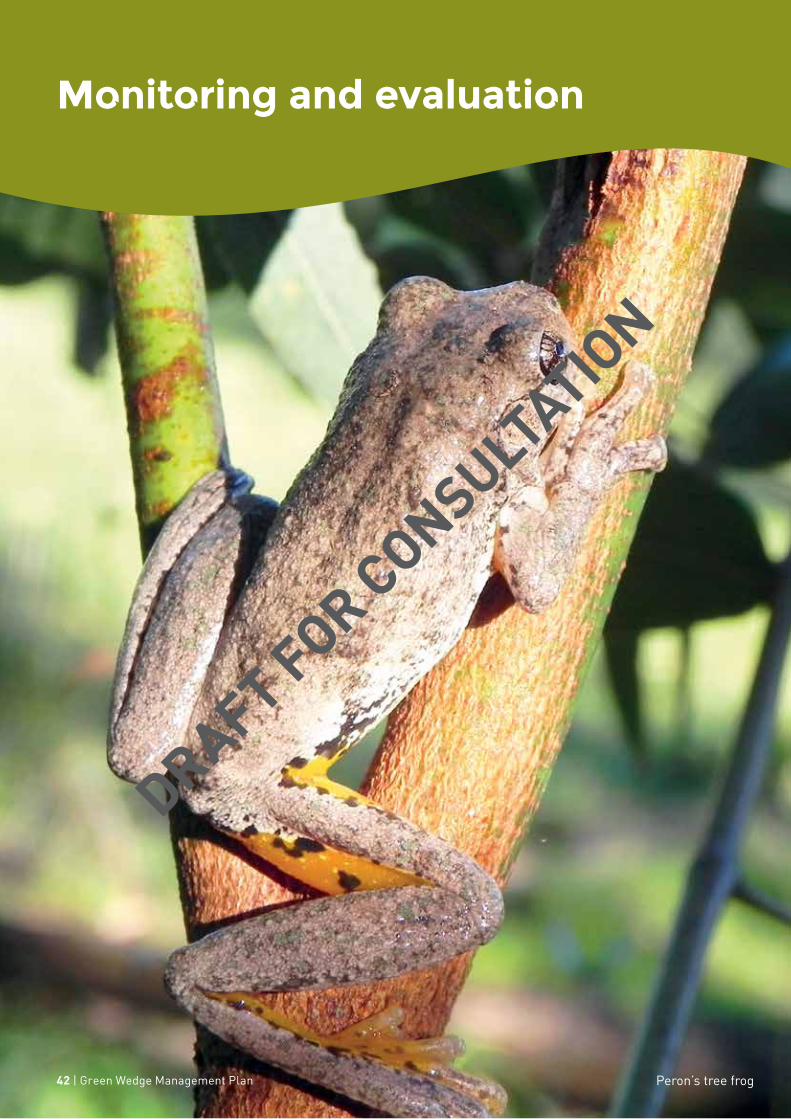
Monitoring and evaluation
Peron’s tree frog42 | Green Wedge Management Plan
DRAFT FOR CONSULTATION

This plan is intended to be one of the most important in Council’s strategic planning hierarchy and will be intrinsic to its way of doing business rather than standalone as yet another plan competing for resources.
It is intended that it provide direction over the next decade, with priorities determined every four years through the preparation of the Council Plan and prior to the four-yearly review of the Nillumbik Planning Scheme.
Council’s standing advisory committees are an important conduit of information between Council and the community. They will have the plan built into their charters for advice to Council and be asked contribute to the delivery of the five key moves.
Annual implementation plans will be prepared and reported on through Council’s annual planning, budgeting and reporting processes. Expenditure and activity associated with this plan will be tagged in Council’s public budget and performance statements against the plan’s objectives will inform the community on its progress.
The same objectives and performance measures will need to be incorporated into future versions of other key shire-wide strategies to ensure that that the plan remains central over the coming years to the overall work of the Shire.
For the Council administration, it will inform its service and business planning and become a strong influencer in the work it does and how it does it.
It will also inform key shire-wide strategies such as those relating to advocacy, economic development, housing, positive ageing, bushfire mitigation, arts and culture, biodiversity, climate change adaptation and recreation.
Peron’s tree frog Monitoring and evaluation | 43
DRAFT FOR CONSULTATION

Appendix 1: Plan Melbourne 2017-2050 Desired planning outcomes for green wedges and peri-urban areas
Environmental and biodiversity assetsProtect and enhance environmental and biodiversity assets, such as coastal areas, wetlands, rivers and creeks, forests and grasslands. Key features of international and national significance include Ramsar-listed wetlands (Westernport, Edithvale–Seaford wetlands, Port Phillip Bay [Western Shoreline] and Bellarine Peninsula), the Western Grassland Reserve, the UNESCO Mornington Peninsula and Westernport Biosphere Reserve, and a range of national and state parks.
Maintain and enhance the diversity of indigenous flora and fauna habitats and species and achieve a net gain in the quantity and quality of native vegetation.
Population, settlements and local infrastructurePlan and manage sustainable urban growth that is concentrated in and around major towns within Melbourne’s peri-urban area so as to provide employment, infrastructure, services and community facilities to new and established urban areas in an equitable manner. Manage the growth and sustainable development of green wedge townships and settlements, having regard for their distinct character and environmental and servicing constraints. Create socially sustainable communities and support an active community working towards reducing greenhouse gases and responding to climate change. Protect and enhance the existing character, presentation and form of towns, including their main road entrances.
Water supply catchmentsManage and protect catchments (including Special Water Supply Catchments), groundwater, water infrastructure and storages, and waterways to improve water quality, protect the environment and provide a reliable and secure water supply. Minimise any negative impacts from sedimentation or water pollution on the Port Phillip and Western Port coastal ecosystems.
Cultural heritage Provide for the protection and management of sites of Aboriginal and post–European settlement cultural heritage to ensure that links with the past are preserved for present and future generations to appreciate. A wide range of cultural-heritage assets are found in buildings, structures, scattered relics, trees and gardens, landscapes and geological formations, archaeological and fossil sites and areas associated with historical events.
Landscape and open spaceProtect significant views, maintain non-urban breaks between urban areas and conserve the cultural significance, tourism appeal and character of scenic rural landscapes.
Mineral, stone and sand resourcesProtect designated mineral resource areas such as the coal reserves in central and western Gippsland. Protect sand and stone resources for future extraction to ensure a continuous supply of construction material.
Natural hazardsAvoid development in areas that are subject to high risk from bushfire or flooding and inundation so as to minimise potential risk to life, property and the environment. Recognise, understand and prepare for the projected impacts of climate change and rising sea levels.
Avoid significant land disturbance, reduce the occurrence and impact of soil erosion and salinity and manage potentially contaminated land.
State-significant infrastructureProtect regionally significant assets such as metropolitan landfills (for example, Clayton South and Wollert), wastewater management facilities (for example, Eastern and Western Treatment Plants), industrial areas and related odour and safety buffers (for example, Dandenong South), airports and flightpaths (Melbourne, Avalon and Moorabbin), and ports (Port of Hastings). Provide opportunities for renewable energy generation.
44 | Green Wedge Management Plan
DRAFT FOR CONSULTATION
Agricultural landProtect agricultural land from incompatible uses, maintain farm size, promote the continuation of farming and provide a secure long term future for productive and sustainable agriculture.
EconomyMaintain a strong, dynamic economy and employment base by building on the comparative advantages in agriculture, timber, transport, tourism, education, manufacturing, the service industry and commerce
RecreationProvide land for a range of open space functions to meet community needs for active and passive recreation and for protection of the environment. State and metropolitan parks provide a focus for a range of recreation opportunities…
TourismFacilitate sustainable year round tourism, and new tourism development (including diverse attractions, accommodation and eating establishments) that maintains the integrity of the natural environment, provides social benefits for communities and visitors and contributes to local economies.
Rural livingManage rural living to prevent negative impacts on agriculture, biodiversity and landscape values.
Transport and AccessibilityProvide a high-quality road and rail transport network with a range of sustainable, efficient, accessible and affordable transport options that readily connect neighbourhoods, workplaces, community facilities, services and enable people to participate in community life. Facilitate improvements to transport networks and facilities that support tourism, such as airports.
Planning and governanceFacilitate integrated and balanced forward planning, involving all agencies, and having regard to the needs and aspirations of current and future generations.
DRAFT FOR CONSULTATION

nillumbik.vic.gov.au
Nillumbik Shire Council
Civic Drive (PO Box 476) Greensborough Victoria 3088
03 9433 3111 | [email protected]