Embed Size (px)
Citation preview
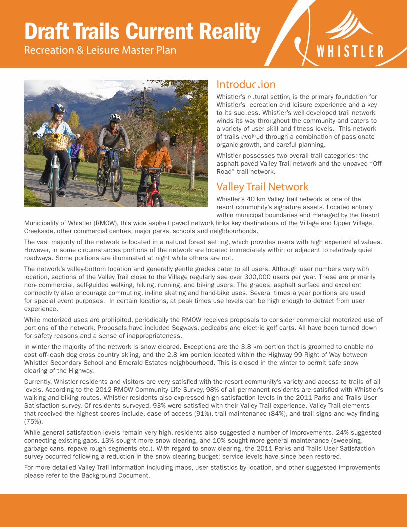
IntroductionWhistler’s natural setting is the primary foundation for Whistler’s recreation and leisure experience and a key to its success. Whistler’s well-developed trail network winds its way throughout the community and caters to a variety of user skill and fitness levels. This network of trails evolved through a combination of passionate organic growth, and careful planning.
Whistler possesses two overall trail categories: the asphalt paved Valley Trail network and the unpaved “Off Road” trail network.
Valley Trail NetworkWhistler’s 40 km Valley Trail network is one of the resort community’s signature assets. Located entirely within municipal boundaries and managed by the Resort
Municipality of Whistler (RMOW), this wide asphalt paved network links key destinations of the Village and Upper Village, Creekside, other commercial centres, major parks, schools and neighbourhoods.
The vast majority of the network is located in a natural forest setting, which provides users with high experiential values. However, in some circumstances portions of the network are located immediately within or adjacent to relatively quiet roadways. Some portions are illuminated at night while others are not.
The network’s valley-bottom location and generally gentle grades cater to all users. Although user numbers vary with location, sections of the Valley Trail close to the Village regularly see over 300,000 users per year. These are primarily non- commercial, self-guided walking, hiking, running, and biking users. The grades, asphalt surface and excellent connectivity also encourage commuting, in-line skating and hand-bike uses. Several times a year portions are used for special event purposes. In certain locations, at peak times use levels can be high enough to detract from user experience.
While motorized uses are prohibited, periodically the RMOW receives proposals to consider commercial motorized use of portions of the network. Proposals have included Segways, pedicabs and electric golf carts. All have been turned down for safety reasons and a sense of inappropriateness.
In winter the majority of the network is snow cleared. Exceptions are the 3.8 km portion that is groomed to enable no cost off-leash dog cross country skiing, and the 2.8 km portion located within the Highway 99 Right of Way between Whistler Secondary School and Emerald Estates neighbourhood. This is closed in the winter to permit safe snow clearing of the Highway.
Currently, Whistler residents and visitors are very satisfied with the resort community’s variety and access to trails of all levels. According to the 2012 RMOW Community Life Survey, 98% of all permanent residents are satisfied with Whistler’s walking and biking routes. Whistler residents also expressed high satisfaction levels in the 2011 Parks and Trails User Satisfaction survey. Of residents surveyed, 93% were satisfied with their Valley Trail experience. Valley Trail elements that received the highest scores include, ease of access (91%), trail maintenance (84%), and trail signs and way finding (75%).
While general satisfaction levels remain very high, residents also suggested a number of improvements. 24% suggested connecting existing gaps, 13% sought more snow clearing, and 10% sought more general maintenance (sweeping, garbage cans, repave rough segments etc.). With regard to snow clearing, the 2011 Parks and Trails User Satisfaction survey occurred following a reduction in the snow clearing budget; service levels have since been restored.
For more detailed Valley Trail information including maps, user statistics by location, and other suggested improvements please refer to the Background Document.
Draft Trails Current RealityRecreation & Leisure Master Plan
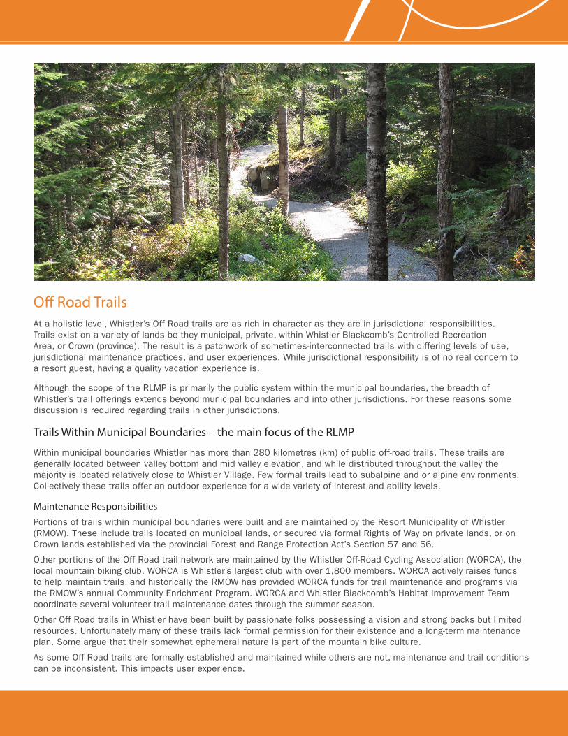
Off Road TrailsAt a holistic level, Whistler’s Off Road trails are as rich in character as they are in jurisdictional responsibilities. Trails exist on a variety of lands be they municipal, private, within Whistler Blackcomb’s Controlled Recreation Area, or Crown (province). The result is a patchwork of sometimes-interconnected trails with differing levels of use, jurisdictional maintenance practices, and user experiences. While jurisdictional responsibility is of no real concern to a resort guest, having a quality vacation experience is.
Although the scope of the RLMP is primarily the public system within the municipal boundaries, the breadth of Whistler’s trail offerings extends beyond municipal boundaries and into other jurisdictions. For these reasons some discussion is required regarding trails in other jurisdictions.
Trails Within Municipal Boundaries – the main focus of the RLMP
Within municipal boundaries Whistler has more than 280 kilometres (km) of public off-road trails. These trails are generally located between valley bottom and mid valley elevation, and while distributed throughout the valley the majority is located relatively close to Whistler Village. Few formal trails lead to subalpine and or alpine environments. Collectively these trails offer an outdoor experience for a wide variety of interest and ability levels.
Maintenance ResponsibilitiesPortions of trails within municipal boundaries were built and are maintained by the Resort Municipality of Whistler (RMOW). These include trails located on municipal lands, or secured via formal Rights of Way on private lands, or on Crown lands established via the provincial Forest and Range Protection Act’s Section 57 and 56.
Other portions of the Off Road trail network are maintained by the Whistler Off-Road Cycling Association (WORCA), the local mountain biking club. WORCA is Whistler’s largest club with over 1,800 members. WORCA actively raises funds to help maintain trails, and historically the RMOW has provided WORCA funds for trail maintenance and programs via the RMOW’s annual Community Enrichment Program. WORCA and Whistler Blackcomb’s Habitat Improvement Team coordinate several volunteer trail maintenance dates through the summer season.
Other Off Road trails in Whistler have been built by passionate folks possessing a vision and strong backs but limited resources. Unfortunately many of these trails lack formal permission for their existence and a long-term maintenance plan. Some argue that their somewhat ephemeral nature is part of the mountain bike culture.
As some Off Road trails are formally established and maintained while others are not, maintenance and trail conditions can be inconsistent. This impacts user experience.
Uses and UsersThe vast majority of off road trails within municipal boundaries are classified as non-motorized multi use trails. These are primarily used for non-commercial self-guided walking, hiking, running, and mountain biking purposes. The predominant use is mountain biking, which reflects this sport’s core recreational and economic role within the resort. Several hiking only trails do exist and their exclusive use is generally respected. Commercial operators also offer guided and self-guided tours. Special events on valley trails and off road trails collectively generate approximately $50,000 per year in revenue to the RMOW.
User numbers vary with trail type and proximity to Village and Valley bottom. Two of the most popular off road trail networks are within Lost Lake Park. The 1.0 metre wide gravel surfaced Lawrence Valleau network (i.e. Molly Hogan, Tin Pants) typically records over 30,000 users per June to September period. The narrower Zappa network typical sees 20,000 users over the same four-month period.
Respondents to the 2011 Park and Trail User Satisfaction survey identified the Lawrence Valleau network as the preferred type of off-road trail. The Valleau network was also identified as the type of trail used by the widest cross section of user groups (walking, running, and biking).
Trail Standards
The RMOW has developed a technical mountain bike focused “Whistler Trails Standards (2003)” (WTS) booklet that identifies a range of trail types and typical construction techniques for valley trails to advanced level off road single-track trails. The intent of this document is to help guide local trail development in building well-aligned and constructed trails.
All trails within WTS are classified as non-motorized multi use trails. Non-motorized multi use trails are the preferred trail type as they make best use of limited resources and are inclusive, catering to a broadest variety of user groups. Building exclusive use parallel trail systems is not cost effective and increases environmental impact. Upon non-motorized multi use trails, potential conflict between user groups is managed through education, upfront knowledge that different user groups may be using the trail, and through trail alignment design permitting clear sight lines and speed control techniques.
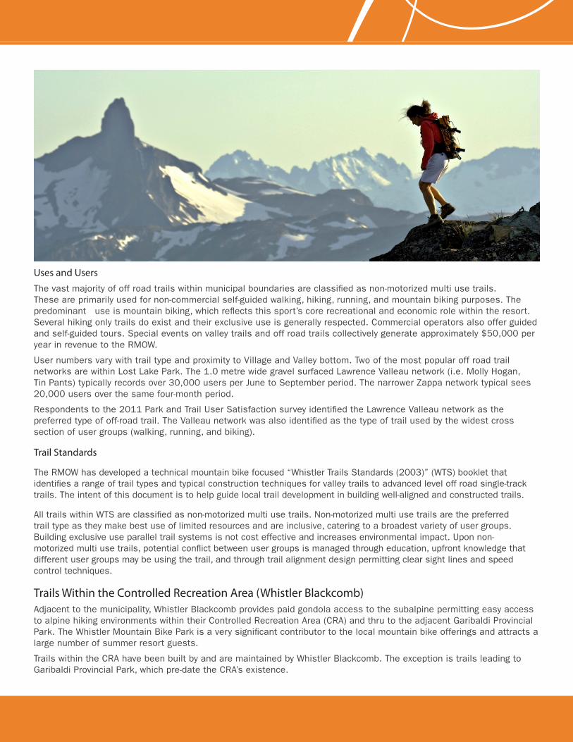
Trails Within the Controlled Recreation Area (Whistler Blackcomb)Adjacent to the municipality, Whistler Blackcomb provides paid gondola access to the subalpine permitting easy access to alpine hiking environments within their Controlled Recreation Area (CRA) and thru to the adjacent Garibaldi Provincial Park. The Whistler Mountain Bike Park is a very significant contributor to the local mountain bike offerings and attracts a large number of summer resort guests.
Trails within the CRA have been built by and are maintained by Whistler Blackcomb. The exception is trails leading to Garibaldi Provincial Park, which pre-date the CRA’s existence.
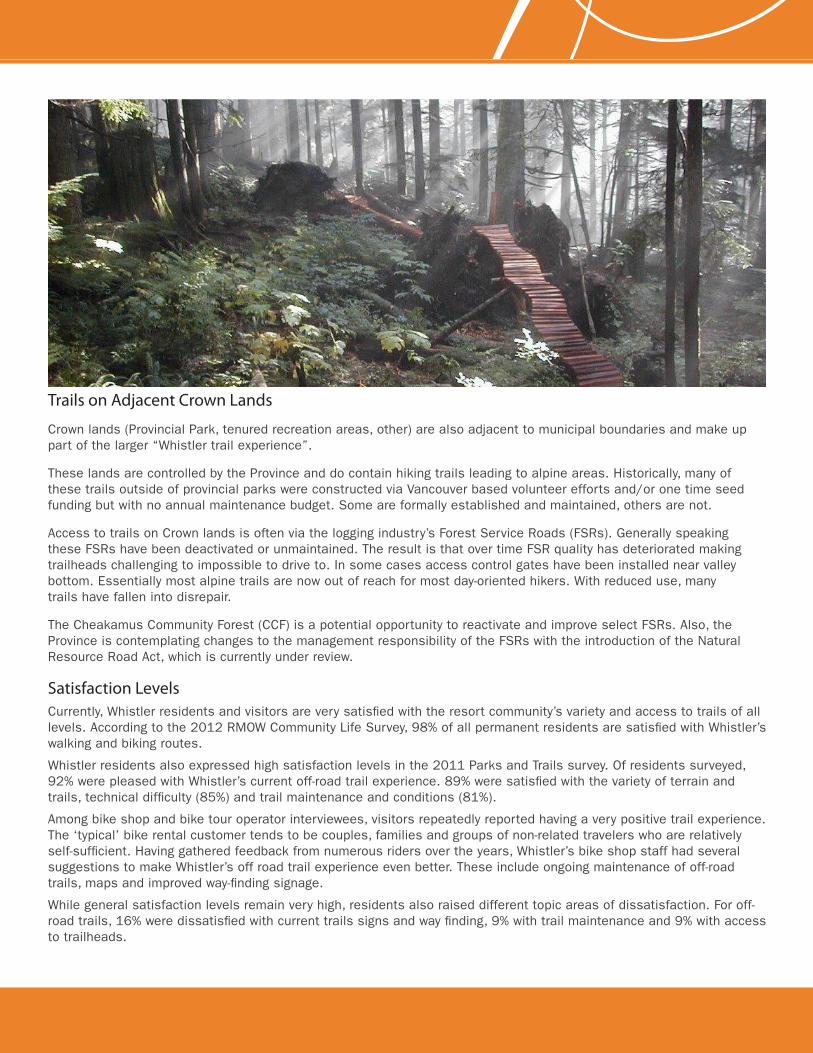
Trails on Adjacent Crown Lands
Crown lands (Provincial Park, tenured recreation areas, other) are also adjacent to municipal boundaries and make up part of the larger “Whistler trail experience”.
These lands are controlled by the Province and do contain hiking trails leading to alpine areas. Historically, many of these trails outside of provincial parks were constructed via Vancouver based volunteer efforts and/or one time seed funding but with no annual maintenance budget. Some are formally established and maintained, others are not.
Access to trails on Crown lands is often via the logging industry’s Forest Service Roads (FSRs). Generally speaking these FSRs have been deactivated or unmaintained. The result is that over time FSR quality has deteriorated making trailheads challenging to impossible to drive to. In some cases access control gates have been installed near valley bottom. Essentially most alpine trails are now out of reach for most day-oriented hikers. With reduced use, many trails have fallen into disrepair.
The Cheakamus Community Forest (CCF) is a potential opportunity to reactivate and improve select FSRs. Also, the Province is contemplating changes to the management responsibility of the FSRs with the introduction of the Natural Resource Road Act, which is currently under review.
Satisfaction LevelsCurrently, Whistler residents and visitors are very satisfied with the resort community’s variety and access to trails of all levels. According to the 2012 RMOW Community Life Survey, 98% of all permanent residents are satisfied with Whistler’s walking and biking routes.
Whistler residents also expressed high satisfaction levels in the 2011 Parks and Trails survey. Of residents surveyed, 92% were pleased with Whistler’s current off-road trail experience. 89% were satisfied with the variety of terrain and trails, technical difficulty (85%) and trail maintenance and conditions (81%).
Among bike shop and bike tour operator interviewees, visitors repeatedly reported having a very positive trail experience. The ‘typical’ bike rental customer tends to be couples, families and groups of non-related travelers who are relatively self-sufficient. Having gathered feedback from numerous riders over the years, Whistler’s bike shop staff had several suggestions to make Whistler’s off road trail experience even better. These include ongoing maintenance of off-road trails, maps and improved way-finding signage.
While general satisfaction levels remain very high, residents also raised different topic areas of dissatisfaction. For off- road trails, 16% were dissatisfied with current trails signs and way finding, 9% with trail maintenance and 9% with access to trailheads.
Hiking TrailsHistorically, hiking was the dominant summer trail activity in the Whistler area. Trails were constructed to alpine areas by the Squamish Forest District, BC Parks ad regional mountaineering clubs. The RMOW constructed trails in the Valley and mid-elevation, providing a variety of experiences for local and visiting hikers. Over time however, provincial ministries have reduced their maintenance efforts, resulting in the deterioration of existing trails. Further resource roads have not been maintained, so that vehicle access to higher elevation trailheads has been lost. With the emergence of mountain biking, multi-use low-elevation trails have been built and these trails are also enjoyed by casual hikers. Whistler Blackcomb has built a network of lift-accessed trails on the two mountains. However, outside of the WB CRA, the available experiences to and within the Whistler area alpine has diminished.
Recently there has been passionate interest in reestablishing a hiking presence in Whistler. A volunteer led Report on Whistler Area Hiking Trails (January 2012) was prepared by a dedicated group of Alpine Club of Canada Whistler Chapter volunteers. This comprehensive report identified challenges and gaps including limited resources for trail building or maintenance, the loss of convenient hiking access from Whistler Village to the Singing Pass alpine area due to the Fitzsimmons slump, general alpine trail deterioration, and reduced access to trailheads because of gate location and reduced maintenance of Forest Service Roads. There are also limited true alpine areas within RMOW boundaries. Most are in Garibaldi Park and the Whistler Blackcomb CRA, though there are alpine areas on Mt. Sproatt within the RMOW. A policy also needs to be established on the use of RMOW funds to build and maintain trail infrastructure outside of municipal boundaries (the jurisdiction of Squamish Lillooet Regional District).
Whistler’s trail network is enjoyed by residents and visitors alike and is a significant summer amenity for the resort. Recognizing that hiking could be a significant economic driver and that trails are located within and potentially cross several jurisdictions, the RMOW convened a Trails Planning Working Group (TPWG). The TPWG provides a forum to coordinate and prioritize trail maintenance and development issues among stakeholders and land managers. Stakeholders include the RMOW, Cheakamus Community Forest, ACC Whistler, WORCA, Recreation Sites and Trails BC, and recreation tenure holders where required. The TPWG will also be working with the Cheakamus Community Forest and the Province on proposed changes to Forest Service Roads in an effort to protect and improve trailhead access.
Tourism Whistler is conducting visitor studies to better understand the hiking demographic and market potential. The Alpine Club of Canada Whistler Chapter is also seeking to increase its profile and take on a more active role in the resort community.
Sea to Sky Initiatives
Sea to Sky TrailFurther development of regional trails such as the Sea to Sky Trail has increased opportunities for Whistler residents and visitors. The Sea to Sky Trail is a vision for a self-propelled multi-use trail to be completed from Squamish to D’Arcy. As the Sea-to-Sky Trail is extended north and south of Whistler there is potential for creating connections or loops with other trails, resulting in a variety of options. The Sea to Sky Trail is now complete between the northern and southern RMOW boundaries.
Garibaldi Park Master PlanBC Parks is also currently nearing completion of an update to the Garibaldi Park Master Plan. The purpose of this project is to update the 1990 Garibaldi Park Master Plan, confirm the existing plans’ direction and provide supplemental direction regarding public access in the Spearhead area of the Park. The update is anticipated to be finalized in 2013.
Recreation Sites and Trails BC
The Provincial Ministry of Forest, Lands and Natural Resource Operations is responsible for managing provincial recreation sites and trails upon Crown lands via their Recreation Sites and Trails BC program (RSTBC). This program is actively partnering with the RMOW and local trails groups to help physically improve existing trails and advise upon planning new trails within its jurisdiction. RSTBC is the formal referral agency and trail approving authority on Crown lands. RSTBC recently invested capital into upgrading Whistler trails and will continue to do so for the near term.
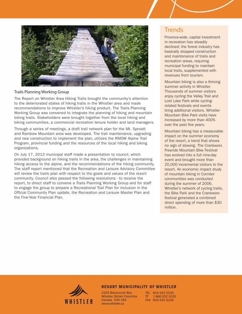
Trails Planning Working GroupThe Report on Whistler Area Hiking Trails brought the community’s attention to the deteriorated states of hiking trails in the Whistler area and made recommendations to improve Whistler’s hiking product. The Trails Planning Working Group was convened to integrate the planning of hiking and mountain biking trails. Stakeholders were brought together from the local hiking and biking communities, a commercial recreation tenure holder and land managers.
Through a series of meetings, a draft trail network plan for the Mt. Sproatt and Rainbow Mountain area was developed. The trail maintenance, upgrading and new construction to implement the plan, utilizes the RMOW Alpine Trail Program, provincial funding and the resources of the local hiking and biking organizations.
On July 17, 2012 municipal staff made a presentation to council, which provided background on hiking trails in the area, the challenges in maintaining hiking access to the alpine, and the recommendations of the hiking community. The staff report mentioned that the Recreation and Leisure Advisory Committee will review the trails plan with respect to the goals and values of the resort community. Council also passed the following resolutions - to receive the report, to direct staff to convene a Trails Planning Working Group and for staff to engage the group to prepare a Recreational Trail Plan for inclusion in the Official Community Plan update, the Recreation and Leisure Master Plan and the Five-Year Financial Plan.
4325 Blackcomb WayWhistler, British ColumbiaCanada V0N 1B4www.whistler.ca
TEL 604 932 5535TF 1 866 932 5535FAX 604 935 8109
RESORT MUNICIPALITY OF WHISTLER
TrendsProvince-wide, capital investment in recreation has steadily declined; the forest industry has basically stopped construction and maintenance of trails and recreation areas, requiring municipal funding to maintain local trails, supplemented with revenues from tourism.
Mountain biking is also a thriving summer activity in Whistler. Thousands of summer visitors enjoy cycling the Valley Trail and Lost Lake Park while cycling- related festivals and events bring additional visitors. Whistler Mountain Bike Park visits have increased by more than 400% over the past five years.
Mountain biking has a measurable impact on the summer economy of the resort, a trend that shows no sign of slowing. The Crankworx Freeride Mountain Bike Festival has evolved into a full nine-day event and brought more than 20,000 incremental visitors to the resort. An economic impact study of mountain biking in Corridor communities was conducted during the summer of 2006. Whistler’s network of cycling trails, the Bike Park and the Crankworx festival generated a combined direct spending of more than $30 million.