Embed Size (px)
Citation preview

Early Phytoplankton Blooms in the Beaufort Sea
Introduction• Phytoplankton blooms are influenced by
the retreat of the sea ice cover.• The Arctic Sea Ice cover in the summer
has been declining at a rapid rate.• Ice melt introduces a stable surface layer that is conducive to plankton growth• Corresponding changes in the productivity
of the Arctic region is expected.
Beaufort SeaBloom
Results:• An unusually early retreat of the sea ice cover occurred in the Beaufort Sea in 1998. The El Nino in 1998 caused the transport of warm water to the north and may be a factor.• The early retreat was followed by a massive phytoplankton bloom in the region.• Similar blooms did not occur in the region during other years (e.g., 2001) until mid-summer.• Early melt is favorable to extended bloom formation and higher productivity in the Arctic.
References:Wang, J. G.F. Cota, and J.C.Comiso, Phytoplanktonin the Beaufort and Chukchi Seas: Distribution, dynamicsand environmental forcing, Deep Sea Research (in review)Comiso, J.C., and G.F. Cota, Large scale variability ofPhytoplankton blooms in the Arctic and peripheral seas,J. Geophys. Res. (in review).Cota, G.F., J. Wang, and J.C. Comiso, Transformationof global satellite chlorophyll retrievals with a regionallytuned algorithm, Rem. Sensing of the Environment,90, 371-377, 2004.
Joey Comiso, Cryospheric Sciences Branch, Hydrospheric & Biospheric Sciences Laboratory, Earth-Sun Exploration Division, NASA GSFC
Chlorophyllconcentration

Charley, a strong Category-4 hurricane, came ashore over Captiva Island on the southwest coast of Florida on Friday, August 13, 2004. The USGS, NASA and US Army Corps of Engineers (USACE) are have teamed in a research project investigating coastal change that occurred during this powerful storm.
The research team has three airborne LiDAR surveys available of North Captiva Island, FL. Digital elevation models (DEMS) developed from the two earlier (pre-hurricane) surveys conducted in 1998 and spring, 2004 (left side of viewgraph) show elevations of the island and vegetation canopy, consisting of pine trees and mangroves, prior to the hurricane impact. A survey conducted just three days after Charley's landfall with the NASA GSFC Experimental Advanced Airborne Research LiDAR (EAARL) (shown below the photo of the island on next slide) provides subaerial and submerged topography of the section that breached during the hurricane.
The capability of acquiring topography above and below the water, and seamlessly across the shoreline, with no loss of submerged topography in very shallow water, is unique to the EAARL sensor. This type of data is critical for defining the quantity and distribution of eroded sand that was transported landward and seaward during the storm, as well as for defining the geometry of the breach so that it can be monitored as it naturally recovers.
The EAARL Sensor is unique in that it can:
Acquire topography above waterAcquire topography below waterAcquire topography seamlessly across the shorelineProvide no loss of submerged topography in very shallow water
This type of data is critical for defining the quantity and distribution of eroded sand that was transported landward and seaward during the storm, as well as for defining the geometry of the breach so that it can be monitored as it naturally recovers.
EAARL data acquired following all four land falling hurricanes will be compared to the earlier surveys conducted in spring, 2004 by the USACE using CHARTS (Compact Hydrographic Airborne Rapid Total Survey). The comparison will aid in determining the magnitude of coastal erosion/deposition and coastal damage along the Florida coastline. These data will be used to develop and test predictive models of coastal impacts from severe storms. The data will be made available to local, state and federal agencies for purposes of disaster recovery and erosion mitigation.
[email protected]://coastal.er.usgs.gov/hurricanes
Hurricane Charley Impact on North Captiva Island, Fla.Charles W. Wright, Instrumentation Sciences Branch Code 614.6,
Hydrospheric & Biospheric Sciences Laboratory, Earth-Sun Exploration Division, NASA GSFC

Hurricane Charley Impact on North Captiva Island, Fla.
Aerial photo taken August 15, 2004.
EAARL derived digital elevation model (DEM) showing simultaneously acquired bare Earth from beneath the shallow water (0-3m depths) in the breached and surrounding area, beneath the remaining vegetation on the island, and the exposed bare beach face.
NASA acquired LiDAR acquired in 1998.
Army Corps of Engineers CHARTS LiDAR DEM acquired less than 3 months before Hurricane Charley landfall. During 2001, Tropical Storm Gabrielle cut two small passes through the island. The passes are just visible near the center of the DEM.
Charles W. Wright, Instrumentation Sciences Branch Code 614.6, Hydrospheric & Biospheric Sciences Laboratory, Earth-Sun Exploration Division, NASA GSFC

The effect of changes in precipitation on sea ice volume in the Southern Ocean using data assimilation
Thorsten Markus, Instrumentation Sciences Branch, Hydrospheric & Biospheric Sciences Laboratory, Earth-Sun Exploration Division
This study investigated the competing effects of the snow layer’s insulation and snow-ice formation on thermodynamic sea ice thickness growth in response to changes in precipitation. Thicker snow increases the thermal insulation and thus reduces sea ice growth but, on the other hand, it also increases the snow load and therefore the submergence of sea ice below sea level, which subsequently enhances snow-ice formation. Figure 1 (next slide) shows unadjusted and adjusted precipitation rates as well as corresponding snow depths. One can clearly see a more reasonable snow depth distribution when snow depths are assimilated.
An assimilated precipitation data set was generated for the years 1992-2003. This data set was used to create a climatology and it was investigated how deviations in precipitation from the current state will affect the sea ice cover (Figure 2; a Precipitation Rate Multiplying Factor (PRMF) of 1 corresponds to the current state). The results show a minimum in sea ice volume when the precipitation is about 75% of its current state. An increase in precipitation will lead to an increase in sea ice volume which suggests that the present day climate around Antarctica is in a state where the impact of snow on sea ice is dominated by snow-ice formation rather than its insulation effect.
Reference: Powell, D.C., T. Markus, A. Stoessel, The effects of snow depth forcing on Southern Ocean sea ice simulations, J. Geophys. Res., 2005 (in press).

Figure 1: Unadjusted (UPR) and adjusted (APR) precipitation rates (top) and corresponding snow depth (bottom) form September 1994.
Figure 2: Changes in sea ice volume as a function of changes in precipitation rate. A Precipitation Rate Multiplying Factor (PRMF) of 1 corresponds to the current precipitation rates. Dashed and dotted lines show the results for different snow densities and heat conductivities.
The effect of changes in precipitation on sea ice volume in the Southern Ocean using data assimilation

Update on the MODIS Snow and Ice Product SuiteDorothy K. Hall/Cryospheric Sciences Branch, Vincent V. Salomonson/Earth-Sun Exploration Division
George A. Riggs, Kimberly A. Casey & Nicolo DiGirolamo/SSAI
Recent and planned enhancements in the MODIS snow and ice product suite are specifically targeted to provide products that are more useful to, and “friendly” for, modelers. Two new snow products are being developed: a climate-modeling grid (CMG) daily snow-map product as a flat-binary file at 0.25° resolution, and a monthly snow cover CMG product at 0.05°-resolution. Additionally, fractional-snow cover (FSC) for the 500-m resolution product has been developed; both the monthly snow map and the FSC snow map for the 500-m product will be available in Collection 5, while the new 0.25° CMG product will initially be available via ftp in the summer of 2005. An algorithm is under development to separate snow cover from bare glacier ice on Greenland and is planned as a Collection 6 enhancement to the snow-mapping product.
Many of the MODIS snow products are currently in use by outside investigators, and have been validated by the MODIS snow and ice group as well as by numerous outside investigators who have published results in the peer-reviewed literature (citations available on request).
The table below shows some of the MODIS snow and sea ice products that are currently available to order through the National Snow and Ice Data Center (NSIDC) DAAC, or will be available in Collection 5 (Collection 5 processing will begin in the summer of 2005). Data from the NSIDC DAAC show monthly ordering statistics for the MODIS snow and ice products. Need for the MODIS snow and ice products has been very strong, and has generally been increasing over time. In the beginning of March, 2005 (only a partial month), for example, 17, 526 granules of MODIS snow and ice granules were ordered by users (includes the MODIS Team).
Selected MODIS snow and sea ice products
Name & temporal resolution Resolution Grid
daily snow extent with FSC* 500m; 0.05, 0.25 sinusoidal or lat/long
8-day composite snow extent with FSC 500m; 0.05, 0.25 sinusoidal or lat/long
monthly snow extent with FSC 0.05 lat/long
daily sea ice extent 1 km; 0.05 EASE-Grid
daily sea ice surface temperature (IST) 1 km; 0.05 EASE-Grid
*FSC is fractional snow cover

Figure 1. The standard snow CMG product at 0.05°-resolution (top, image “A”) and the lower-resolution snow CMG product at 0.25°-resolution (bottom, image “B”) are shown above. Areas of nearly-100% snow cover (white) are consistent between the two maps. (The various colors represent fractions of snow cover.) Differences between the maps occur mainly at the edges of snow-covered regions. Snow-covered mountainous regions may exhibit significant differences between the two resolutions. On this day the Sierra Nevada Mountains were nearly completely snow covered as shown in the subimage (C) from the 0.05°-resolution CMG map. The 0.25°-resolution subimage (D) shows the Sierra Nevada Mountains with fewer snow-covered pixels, but each pixel is larger and thus the total amount of snow cover is greater than is shown in (C). Quantitative comparisons show that the new 0.25°-resolution product tends to overestimate snow cover, relative to the 0.05°-resolution map, because of the larger size of the grid cells.
3 May 2004
3 May 2004
A
C
D
B
FSC
Figure 2. A new product in Collection 5 will be MOD10CM which is the monthly snow map (including fractional snow cover) on the climate-modeling grid (CMG) at 0.05-degree resolution.
Figure 3 (right). MODIS bands 1, 4, 6 color-composite image (A), and snow map (B) created from two MODIS
swaths and displayed on an Albers Conical Equal Area projection. The snow map (B) is a (minimum distance)
supervised classification.
BA
February 24, 2004
BA
snow
bare ice
land
cloud
water
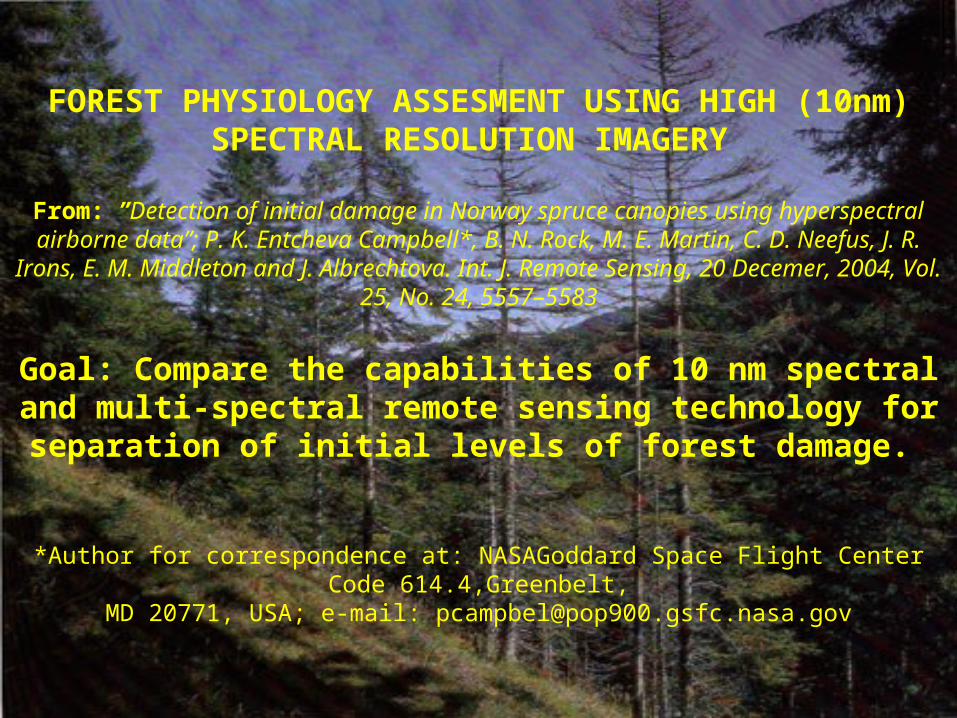
FOREST PHYSIOLOGY ASSESMENT USING HIGH (10nm) SPECTRAL RESOLUTION IMAGERY
From: ”Detection of initial damage in Norway spruce canopies using hyperspectral airborne data”; P. K. Entcheva Campbell*, B. N. Rock, M. E. Martin, C. D. Neefus, J. R. Irons, E. M. Middleton and J. Albrechtova. Int. J.
Remote Sensing, 20 Decemer, 2004, Vol. 25, No. 24, 5557–5583
Goal: Compare the capabilities of 10 nm spectral and multi-spectral remote sensing technology for separation of initial levels of forest
damage.
*Author for correspondence at: NASAGoddard Space Flight Center Code 614.4,Greenbelt,
MD 20771, USA; e-mail: [email protected]

1 Characteristic of more than 70% of the trees within the stand2 At this stage more than 50% of the trees within the stand are dead
Ecosystem vitality statusDamageLevel (DC)
Defoliation 1
(%) Chlorosis absent Chlorosis present0 0 – 10 Healthy Initial damage1 11 – 25 Initial damage
Medium damage2 26 – 60 Medium damageHeavy damage
3 61 – 80 Heavy damage Ecosystem collapse 2
81 – 100 Ecosystem collapse 2 Standing dead forest
Criteria used for field forest damage classification (after Hildebrandt and Gross, 1992)
In August 1998, in the Norway spruce stands under a full gradient of damage conditions in the Krusne hory , Czech Republic were acquired the following:
• High resolution nadir reflectance canopy spectra, using ASAS
• Ground truth data: forest damage survey, height, DBH and density measurements
• Foliar samples for determination of foliar pigments, N, C and structural compounds

0.5
0.6
0.7
0.8
0.9
Damage Level
0 1 2 3NDVI
• Using common broad band indices (example NDVI) was possible to separate only three forest damage classes: severely damaged (left) from healthy (right) and a major intermediate group.
•Broad band indices were found best related to foliar pigment levels.

ABSTRACT
Regionally calibrated gridded snow depth fields derived from the Scanning Multichannel Microwave Radiometer (SMMR) are developed for the Ob River Basin, Russia, for the period 1980-1990. The study is part of an ongoing effort to better understand and predict the relative contribution of snow precipitation and snowmelt runoff to total runoff of high latitude river systems using hydrologic models and satellite microwave imagery. The analysis addresses several issues including: i) the mismatch of spatial scales between the SMMR estimates (produced at 0.25-degree latitude-longitude grid) and surface observations (point measurements), ii) regional biases that may occur due to elevation, and iii) the sparse network of observing stations, especially in mountainous areas, that prevent accurate characterization of the spatial variability of snow depth. A statistical-geographic methodology was applied to interpolate and aggregate point observations to the resolution of satellite imagery. Field measurements, a digital elevation model, and local elevation-snow depth relationships were jointly applied to generate gridded maps of snow depth at the 0.25-degree resolution for 10-day periods. The comparison of observed and satellite-derived 10-day and monthly climatologies indicate significant spatial and temporal biases in the satellite estimates. To account for the biases, spatial maps of bias-correction coefficients for each 10-day period were derived and applied to the SMMR product. The new product, that could be used either to update a runoff simulation process or to calibrate a snow component of a hydrologic model, is expected to improve streamflow estimates for watersheds and seasons where snowmelt is the dominant streamflow component.
Regional Calibration of Satellite-Derived Snow Depth for Continental-Scale Hydrologic Modeling
Sanja Perica, University of UtahMichael Jasinski, NASA GSFC, Hydrological Sciences BranchJeremy Stoll, Science Systems and Analysis, Inc.Kaye Brubaker, University of Maryland
Fig. 1 Ob River Basin, Russia (2.98· 106 km2)

Discussion and ConclusionsFor the Ob River basin, SMMR estimates show significant regional biases in snow depth when compared to ground truth for the period 1980-1990. However, these biases can be easily corrected using a simple filtering technique and regionally available ground truth.
Satellite-derived climate-distributions generally do not agree well with observed climatology. Statistical-geographic methods, such as the one used in this study, provide good correction to the climate biases in the satellite data. Additional statistical post-processing will be needed to reconstruct a whole range of variability observed in the surface measurements.
Future snow depth - elevation relationships could probably be strengthened when additional physiographic factors, such as the terrain orientation and fractional tree coverage are considered.
Fig 3. SMMR snow depth image For March 1-10, 1984
after local adjustments added.
Fig 2. SMMR snow depth composite image forMarch 1 – 10, 1984
(cm)


![Classifying the Baltic Sea Shallow Water Habitats …...organic matter [9] and suspended particles [9,10], as well as frequent phytoplankton blooms [11]. High concentrations of optically](https://img.pdfslide.net/doc/110x75/5f806076914e67117e6e1831/classifying-the-baltic-sea-shallow-water-habitats-organic-matter-9-and-suspended.jpg)