Embed Size (px)
Citation preview
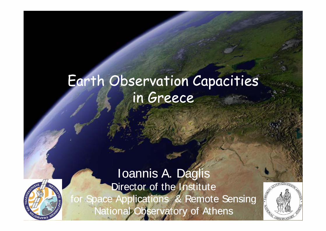
Earth Observation Capacities Earth Observation Capacities ppin Greecein Greece
Ioannis A. DaglisIoannis A. DaglisDirector of the Institute Director of the Institute
for Space Applications & Remote Sensingfor Space Applications & Remote SensingNational Observatory of AthensNational Observatory of Athens

Ioannis A. DaglisIoannis A. DaglisDirector of the Institute Director of the Institute
for Space Applications & Remote Sensingfor Space Applications & Remote SensingNational Observatory of AthensNational Observatory of Athens

A k l d tAcknowledgements
Contributions by Prof. K. Kourtidis (DUTH, National Delegate PB-EO and DOSTAG)National Delegate PB EO and DOSTAG) and Dr. V. Tsagaris (Irida Labs, ESA Study “Mapping of the Greek Requirements and“Mapping of the Greek Requirements and Capabilities in Earth Observation”) are gratefully acknowledged.

Earth Observation milestones in Greece 4
In the mid 1990’s the Hellenic National Space Committee with support from GSRT organized several working meetings on support from GSRT organized several working meetings on Earth Observation in Greece.
In 1998 Space Imaging Europe was established in Athens with the objective to provide IKONOS data to the Greek and European market; its operation terminated in 2001.
Since 2002: Greek organizations participate in EO programmes of ESA (through a Cooperation Agreement).

5
Earth Observation milestones in Greece
In 2005 Greece became the 16th member of ESA. First call for ideas by the ESA-Greece Task Force.
In 2005 Greece signed participation in HELIOS-2 (high resolution multispectral data) along with France, Belgium, Spain, Italy and Germany.
In February 2006, GSRT announced the participation in GEO and GEOSS initiatives. The Greek GEO office started its
ti i 2007operation in 2007.
Greek Organizations have participated in a large number of European R&D and preparatory projects paving the way forpreparatory projects paving the way for GMES, which is the European contribution to GEOSS the Global Earthcontribution to GEOSS - the Global Earth Observation System of Systems

Up to now, Greek participation has involved mostly public entities addressing R&D aspects. The participation of theR&D aspects. The participation of the private sector is still rather limited.

Examples of early Greek participation in GSE (GMES Services Element)
•• Forest Monitoring Forest Monitoring • Geoapikonisis, Qualisys• National Observatory of Athens (user)
•• MarcoastMarcoast (Oil(Oil--spill spill drift forecasting)drift forecasting)H ll i C t f M i R h• Hellenic Centre for Marine Research
• Ministry of Mercantile Marine (user)
•• PROMOTE (Air Quality)PROMOTE (Air Quality)•• PROMOTE (Air Quality)PROMOTE (Air Quality)• Aristotle U. Thessaloniki; National Univ. Athens• Region of Central Macedonia (user)
•• TerrafirmaTerrafirma (Land motion)(Land motion)• Earthquake Planning & Protection Office (user)• Institute of Geology & Mineral Exploitation (user)Institute of Geology & Mineral Exploitation (user)
•• MARISS (MARISS (MARItimeMARItime Security Service)Security Service)• Ministry of Mercantile Marine (user)Ministry of Mercantile Marine (user)

EC FP6 and FP7 Space Calls9
In FP7 we have an increasing participation of companies in
In FP6 most of the participants were research institutes and
proposals but not yet in successful projects.
Greece has participated in
universities.
Very limited participation of companies and p blic bodies Greece has participated in
GEOLAND2MyOcean
companies and public bodies as end-users.
SAFERMACCCOSMOSCOSMOS

ESA-Greece Task Force projects10
The ESA-Greece Task Force was set-up in September 2005 in order to implement transitional measures for the adaption of Greek industry to ESA requirements.
The Task Force has announced 2 Calls addressed exclusively to G k Greek entities.
In the 1st Call 330 proposals were submitted.
C i i i d i 37% f h lCompanies participated in 37% of the proposals.
The overall success rate was 10%.
Th f EO l d l 17%The success rate for EO-related proposals was 17%.

EO projects funded by the Task Force 1st Call
8 projects (6 relevant for GSE)ActivityActivity Greek PartnerGreek Partner ContractContractActivityActivity Greek PartnerGreek Partner ContractContract
Monitoring & Control of Greek Borders and Coastline
Space Hellas MARISS
Burnt Scar mapping in Greek territory NOA/ISARS Risk-EOS
EO and Coastal surveillance vehicles for tracing polluting ships
MARAC Electronics Marcoasttracing polluting shipsRisk assessment of structures & plants in areas susceptible to ground deformation
Harokopio University of Athens
Terrafirma
Comparison between NO Columnar National & PromoteComparison between NO2 Columnar measurements from ground and satellite
National & Kapodistrian University of Athens
Promote
EO for monitoring of water use in Greece Aristotle University of GSE-LandEO for monitoring of water use in Greece Aristotle University of Thessaloniki
GSE Land
High-res imagery for flood-plain mapping Technical University of Creteof Crete
Survey of Greek capabilities in EO IridaLabs

ESA-Greece Task Force projects cont.12
In the 2nd Call of the Task Force 4 EO-related proposals were 4 EO-related proposals were successful. The projects can be classified
Natural hazards29%Land
New methods7% Other
7%
The projects can be classified into 6 different categories: maritime, natural hazards, Maritime services
29%
Atmoshpere14%
14%
atmosphere, land, new methods and other.
29%
~50% of the projects are coordinated by public entities and ~50% by companies
Classification of EO projects in the framework of the ESA – Greece Task Forceand ~50% by companies.

Participation in optional ESA programmes13
Greece has also been participating in optional EO-related programmes of ESA, including the Earth Observation Envelope Programme (EOEP-3), the GMES S i El t (GSE) GMES S C t (GSC) d th GMES Service Element (GSE), GMES Space Component (GSC) and the EarthWatch Climate Change Initiative (CCI).
k bGreek subscription in ESA EO programmes
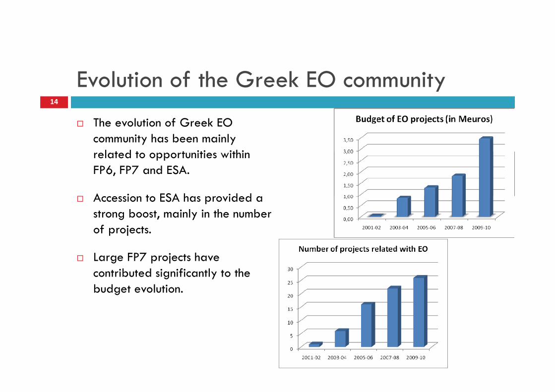
Evolution of the Greek EO community14
The evolution of Greek EO community has been mainly
l t d t t iti ithi related to opportunities within FP6, FP7 and ESA.
A i t ESA h id d Accession to ESA has provided a strong boost, mainly in the number of projects.
Large FP7 projects have contributed significantly to the b d l ibudget evolution.

EO landscape in Greece (1/2)15
Public authorities Public authorities High level High level

EO landscape in Greece (2/2)16
Public research Public research organizationsorganizations

Topical classification17
Top 5 applications
Greek EO topical classificationG ee O op ca c ass ca o
IRIDA Labs Study to map Greek EO

IRIDA L b t d fi diIRIDA L b t d fi diIRIDA Labs study findingsIRIDA Labs study findings
1818

IRIDA Labs study findingsIRIDA Labs study findings
The Greek EO industryThe Greek EO industry
The Greek EO service i d t h l dindustry has already shown a large portfolio of activities. It will probably Public bodies and
local authorities are
Market is not yet mature to support
The Greek EO industry seems to consist of mainly small fragmentedachieve a fair
georeturn in the context of ESA activities after the
local authorities are the main EO customers.
large companies with EO as their primary activity.
small, fragmented, expert consultancies offering niche services to public and local authoritiesspecial transition
period.
and local authorities.
1919

IRIDA L b t d fi diIRIDA L b t d fi diIRIDA Labs study findingsIRIDA Labs study findings
Public organizationsPublic organizations
Public authorities
Digital satellite data are available
face problems to share and exchange EO data. Most of the times, only metadata are
There is lack of telecommunication and related
There aren’t any standards for metadata and service
Most public organizations have data are available
in different public organizations.
only metadata are exchanged between different organizations. The new GMES data
infrastructure that slows down the operational use of EO services.
service development concerning Earth Observation of natural hazards.
reported problems with data share and exchange.
policy may provide a solution.
2020

GMES Service Element RISK-EOSGMES Service Element RISK EOSForest fires in 2007 and 2009 – ISARS/NOA
21
ISARS/NOA has participated in the GMES project RISK-EOS RISK-EOS maps the project RISK-EOS. RISK-EOS maps the consequences of forest fires in Greece in a systematic way, harnessing the full potential of satellite Earth Observation potential of satellite Earth Observation technology and data.
ISARS/NOA has developed the BSM_NOA service which was technically and service which was technically and qualitatively certified according to the specifications of the GMES SERVICE ELEMENT of ESA.
FormosatFormosat 2 coverage over Peloponnesus 2 coverage over Peloponnesus (fire season 2007)(fire season 2007)
ELEMENT of ESA.The results are provided to several national authorities and organizations, such as the Ministry of Rural Development and Food, the GSCP, the Greek Biotope / Wetland Center, the National Agricultural Research Foundation, etcthe National Agricultural Research Foundation, etc

EOEP-3 / Data User Element:Urban Heat Islands and Urban ThermographyUrban Heat Islands and Urban Thermography
10 European cities, 6 organizations from 5 countriesISARS/NOA

UHI j bj tiUHI j bj tiUHI major objectivesUHI major objectivesD i d b ild i f i bl• Design and build an information system able to integrate and assimilate EO data and ground data i t b t l i l d li t d li (into urban meteorological and climate modeling (tool for UHI monitoring and forecasting)
• Establish the mission requirements for a high-resolution TIR satellite sensor (re-orientate the FuegoSat Consolidation Element of the ESA Earth Watch Programme)
• Elaborate how TIR space observations can support the implementation of urban energy efficiency p gy ypolicies

STUDY TO MAP GREEK REQUIREMENTS AND CAPABILITIES IN EARTHAND CAPABILITIES IN EARTH OBSERVATION

Final Comments25
The Greek EO capacities have largely evolved during the last 10years. yA Key point for the future of EO in Greece is the inclusion of public end users and the successful transformation of research results or pre-operational services to fully operational and daily needed services. p y p yNot too different from the rest of Europe.Greece can produce valued added solutions for specific public sector needs through its participation in optional ESA programmes like EOEP needs through its participation in optional ESA programmes like EOEP or Climate Change Initiative. This is especially true for needs related to:
coastal monitoringcoastal monitoringnatural hazards forest mapping and monitoring.

h k f !Thank you for your attention!