Embed Size (px)
Citation preview
East Portland Historical Overview& Historic Preservation Study
RevisedMarch, 2009
City of Portland Bureau of Planning and Sustainability
Commissioner-In-Charge Mayor Sam Adams
Director
Susan Anderson
Historic Resources Program
Steve Dotterer, Principal Planner Liza Mickle, City Planner
Nicholas Starin, City Planner
Project Staff
Liza Mickle, City Planner Nicholas Starin, City Planner
With Assistance from
Carmen Piekarski, GIS Analyst
Kevin Martin, GIS Analyst Ralph Sanders, Graphic Designer
Dan Pauley, Community Service Aide Liza Mylott, Community Service Aide
For more information, contact:
City of Portland Bureau of Planning and Sustainability 1900 SW Fourth Ave, Ste. 7100 Portland, Oregon 97201-5380
Phone: (503) 823-7700 Fax: (503) 823-7800
www.portlandonline.com/bps/ The Bureau of Planning and Sustainability is committed to providing equal access to information and hearings. If you need special accommodation, call the Bureau of Planning and Sustainability at (503) 823-7700 (TTY 503-823-6868).
East Portland Historical Overview & Historic Preservation Study
Table of Contents I. Introduction................................................................................................................ 1 II. East Portland Historical Overview ........................................................................... 4
Chinook Illahee: The Land of the Chinook ..........................................................................4 Settlement to 1914 ..............................................................................................................8 The Motor Age and Interwar Era: 1914 to 1940................................................................25 The War Years: 1941 to 1945 ...........................................................................................34 The Post-War Era: 1946 to the Present ............................................................................37
III. Current Development and Preservation Issues ................................................... 53
Growth & Development .....................................................................................................53 Public Policies, Zoning and Infrastructure.........................................................................55 Historic Resources and Preservation ................................................................................56
IV. Preservation Options for East Portland ............................................................... 60
Historical Research ...........................................................................................................60 Survey and Inventory ........................................................................................................60 Potential Preservation Focus Areas ..................................................................................61 Preservation Planning and Policy Development ...............................................................64 Education, Outreach and Collaboration ............................................................................66 Conclusion.........................................................................................................................66
Bibliography................................................................................................................ 67 Appendices (under separate cover, available in PDF format)
Appendix A: Maps Appendix B: Aerial Photographs Appendix C: Historical Timeline Appendix D: East Portland Federal Land Patents Appendix E: East Portland Properties in the Historic Resource Inventory Appendix F: East Portland Annexations by Neighborhood & Period Appendix G: Miscellaneous Data Tables
Project funded in part through a Certified Local Government Grant from the Oregon State Historic Preservation Office
This report and its appendices are available from the Bureau of Planning and Sustainability web site: http://www.portlandonline.com/bps/
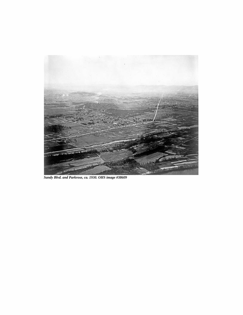
Sandy Blvd. and Parkrose, ca. 1930. OHS image #38609
East Portland Historical Overview & Historic Preservation Study
Portland Bureau of Planning and Sustainability Revised March, 2009 1
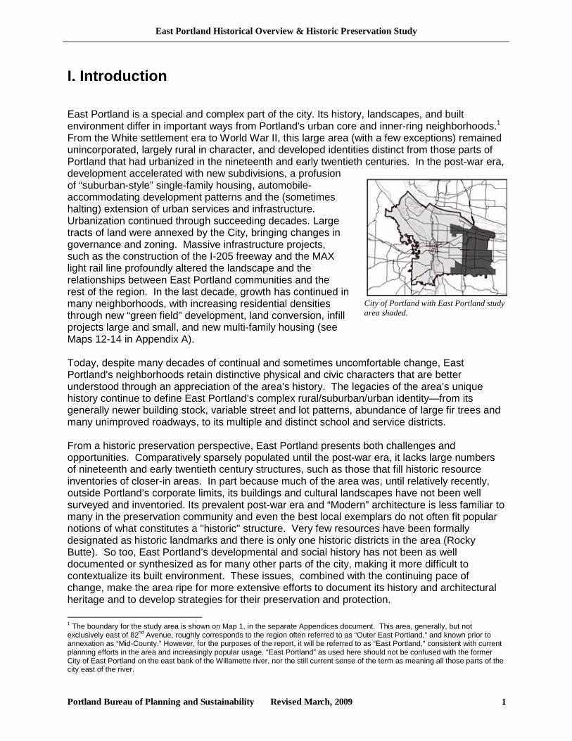
I. Introduction East Portland is a special and complex part of the city. Its history, landscapes, and built environment differ in important ways from Portland's urban core and inner-ring neighborhoods.1 From the White settlement era to World War II, this large area (with a few exceptions) remained unincorporated, largely rural in character, and developed identities distinct from those parts of Portland that had urbanized in the nineteenth and early twentieth centuries. In the post-war era, development accelerated with new subdivisions, a profusion of “suburban-style” single-family housing, automobile-accommodating development patterns and the (sometimes halting) extension of urban services and infrastructure. Urbanization continued through succeeding decades. Large tracts of land were annexed by the City, bringing changes in governance and zoning. Massive infrastructure projects, such as the construction of the I-205 freeway and the MAX light rail line profoundly altered the landscape and the relationships between East Portland communities and the rest of the region. In the last decade, growth has continued in many neighborhoods, with increasing residential densities through new “green field” development, land conversion, infill projects large and small, and new multi-family housing (see Maps 12-14 in Appendix A). Today, despite many decades of continual and sometimes uncomfortable change, East Portland's neighborhoods retain distinctive physical and civic characters that are better understood through an appreciation of the area’s history. The legacies of the area’s unique history continue to define East Portland’s complex rural/suburban/urban identity—from its generally newer building stock, variable street and lot patterns, abundance of large fir trees and many unimproved roadways, to its multiple and distinct school and service districts. From a historic preservation perspective, East Portland presents both challenges and opportunities. Comparatively sparsely populated until the post-war era, it lacks large numbers of nineteenth and early twentieth century structures, such as those that fill historic resource inventories of closer-in areas. In part because much of the area was, until relatively recently, outside Portland’s corporate limits, its buildings and cultural landscapes have not been well surveyed and inventoried. Its prevalent post-war era and “Modern” architecture is less familiar to many in the preservation community and even the best local exemplars do not often fit popular notions of what constitutes a "historic" structure. Very few resources have been formally designated as historic landmarks and there is only one historic districts in the area (Rocky Butte). So too, East Portland’s developmental and social history has not been as well documented or synthesized as for many other parts of the city, making it more difficult to contextualize its built environment. These issues, combined with the continuing pace of change, make the area ripe for more extensive efforts to document its history and architectural heritage and to develop strategies for their preservation and protection. 1 The boundary for the study area is shown on Map 1, in the separate Appendices document. This area, generally, but not exclusively east of 82nd Avenue, roughly corresponds to the region often referred to as “Outer East Portland,” and known prior to annexation as “Mid-County.” However, for the purposes of the report, it will be referred to as “East Portland,” consistent with current planning efforts in the area and increasingly popular usage. “East Portland” as used here should not be confused with the former City of East Portland on the east bank of the Willamette river, nor the still current sense of the term as meaning all those parts of the city east of the river.
City of Portland with East Portland study area shaded.
East Portland Historical Overview & Historic Preservation Study
Portland Bureau of Planning and Sustainability Revised March, 2009 2
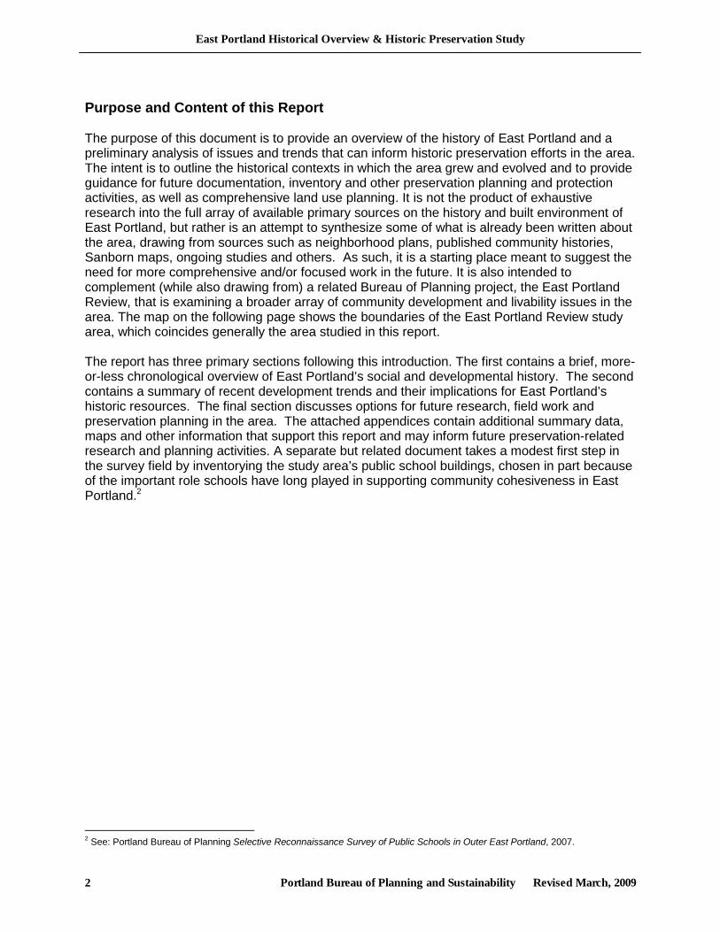
Purpose and Content of this Report The purpose of this document is to provide an overview of the history of East Portland and a preliminary analysis of issues and trends that can inform historic preservation efforts in the area. The intent is to outline the historical contexts in which the area grew and evolved and to provide guidance for future documentation, inventory and other preservation planning and protection activities, as well as comprehensive land use planning. It is not the product of exhaustive research into the full array of available primary sources on the history and built environment of East Portland, but rather is an attempt to synthesize some of what is already been written about the area, drawing from sources such as neighborhood plans, published community histories, Sanborn maps, ongoing studies and others. As such, it is a starting place meant to suggest the need for more comprehensive and/or focused work in the future. It is also intended to complement (while also drawing from) a related Bureau of Planning project, the East Portland Review, that is examining a broader array of community development and livability issues in the area. The map on the following page shows the boundaries of the East Portland Review study area, which coincides generally the area studied in this report. The report has three primary sections following this introduction. The first contains a brief, more-or-less chronological overview of East Portland’s social and developmental history. The second contains a summary of recent development trends and their implications for East Portland’s historic resources. The final section discusses options for future research, field work and preservation planning in the area. The attached appendices contain additional summary data, maps and other information that support this report and may inform future preservation-related research and planning activities. A separate but related document takes a modest first step in the survey field by inventorying the study area’s public school buildings, chosen in part because of the important role schools have long played in supporting community cohesiveness in East Portland.2
2 See: Portland Bureau of Planning Selective Reconnaissance Survey of Public Schools in Outer East Portland, 2007.
East Portland Historical Overview & Historic Preservation Study
Portland Bureau of Planning and Sustainability Revised March, 2009 3
East Portland Historical Overview & Historic Preservation Study
Portland Bureau of Planning and Sustainability Revised March, 2009 4
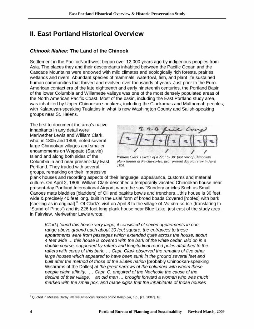
William Clark’s sketch of a 226’ by 30’ foot row of Chinookan plank houses at Ne-cha-co-lee, near present day Fairview in April 1806.
II. East Portland Historical Overview Chinook Illahee: The Land of the Chinook Settlement in the Pacific Northwest began over 12,000 years ago by indigenous peoples from Asia. The places they and their descendants inhabited between the Pacific Ocean and the Cascade Mountains were endowed with mild climates and ecologically rich forests, prairies, wetlands and rivers. Abundant species of mammals, waterfowl, fish, and plant life sustained human communities that thrived and evolved over thousands of years. Just prior to the Euro-American contact era of the late eighteenth and early nineteenth centuries, the Portland Basin of the lower Columbia and Willamette valleys was one of the most densely populated areas of the North American Pacific Coast. Most of the basin, including the East Portland study area, was inhabited by Upper Chinookan speakers, including the Clackamas and Multnomah peoples, with Kalapuyan-speaking Tualatins in what is now Washington County and Salish-speaking groups near St. Helens. The first to document the area's native inhabitants in any detail were Meriwether Lewis and William Clark, who, in 1805 and 1806, noted several large Chinookan villages and smaller encampments on Wappato (Sauvie) Island and along both sides of the Columbia in and near present-day East Portland. They traded with several groups, remarking on their impressive plank houses and recording aspects of their language, appearance, customs and material culture. On April 2, 1806, William Clark described a temporarily vacated Chinookan house near present-day Portland International Airport, where he saw “Sundery articles Such as Small Canoes mats bladdles [bladders] of Oil and baskits bowls and trenchers…this house is 30 feet wide & precisely 40 feet long. built in the usial form of broad boads Covered [roofed] with bark [spelling as in original].3 Of Clark’s visit on April 3 to the village of Ne-cha-co-lee (translating to “Stand-of-Pines”) and its 226-foot long plank house near Blue Lake, just east of the study area in Fairview, Meriwether Lewis wrote:
[Clark] found this house very large; it consisted of seven appartments in one range above ground each about 30 feet square. the entrances to these appartments were from passages which extended quite across the house, about 4 feet wide … this house is covered with the bark of the white cedar, laid on in a double course, supported by rafters and longitudinal round poles attatched to the rafters with cores of this bark. … Capt. Clark observed the remains of five other large houses which appeared to have been sunk in the ground several feet and built after the method of those of the Elutes nation [probably Chinookan-speaking Wishrams of the Dalles] at the great narrows of the columbia with whom these people claim affinity. … Capt. C. enquired of the Nechcole the cause of the decline of their village. an old man … brought forward a woman who was much marked with the small pox, and made signs that the inhabitants of those houses
3 Quoted in Melissa Darby, Native American Houses of the Kalapuya, n.p., [ca. 2007], 18.
East Portland Historical Overview & Historic Preservation Study
Portland Bureau of Planning and Sustainability Revised March, 2009 5
which he saw in ruins had all died with the disorder which marked the face of the woman …4
Chinookans, classified by anthropologists as “complex hunter-gatherers,” were one of several language groups in the greater Northwest Coast culture area stretching from Alaska to Northern California. Like other Northwest Coast peoples, Chinookans were remarkable for a set of social and cultural attributes very rarely associated with non-agricultural societies, including: sedentism; social stratification (including slavery); craft specialization; ownership of property; extensive trade networks; substantial architecture; and complex material cultures. Households were the fundamental units of their social and economic systems, in turn organized into semi-permanent villages characterized by large, multi-household plank houses and generally located adjacent to important bodies of water—in the Portland Basin especially ponds and wetlands bearing wapato, an edible tuber of primary significance as a subsistence and trade article. The main villages were complimented by seasonal camps located and occupied to take advantage of the life-cycles of salmon, game, plants and other resources. Through inter-marriage, Chinookan villages and bands of the Portland Basin were tied to each other and to more distant Chinookans, such as those at the mouth of the Columbia and up-river at The Dalles, as well as neighboring peoples such as the Kalapuyan-speaking Tualatins to the southwest and the more remote Tillamooks on the coast. Kinship and affinal (in-law) bonds, combined with the importation of slaves from coastal and inland areas, created multi-ethic populations and villages. In addition, by mutual agreement, bands and villages made regular forays to areas traditionally controlled by other groups, temporarily taking advantage of resources not otherwise easily available to them. All of this combines to complicate our understanding of aboriginal “tribal” boundaries and ethnic territoriality.5 Chinookans were skilled craftspeople, cultivating over millennia the distinctive forms, technologies and artistic styles reflected in the utilitarian and ceremonial items of their material culture. Their clothing, basketry, tools, architecture and various items of wood, stone, bone, shell and other materials were finely wrought and expressed their own aesthetic sensibilities and complex cosmologies. They were also proficient traders in an extended indigenous commercial economy that stretched along the coast as far as Southern California and Alaska and to the edges of the Great Plains. Just a few of the known items traded along the Columbia River highway include hardened elk hides (obtained and processed locally by Chinookans in the Portland Basin and traded to coastal peoples in British Columbia for use as body armor); dentalia (shells of a deep-water mollusk originating near Vancouver Island, British Columbia and used widely in the West as currency and ornamentation; obsidian (obtained from the Cascade Mountains and California and widely used in tool-making); and wapato (a nutritious tuber common in the riparian areas near Portland and sent towards the coast and east of the Cascade Mountains). They also played a key intermediary role in the English and American fur trade from the late eighteenth century through its decline by the mid-nineteenth century, evidenced by contemporary European and American accounts and the widespread adoption of Chinook Jargon, a pidgin developed from Chinookan languages that incorporated words from English, French, Nootkan and other tongues. Chinook Jargon became the lingua franca for trading activities throughout the Pacific Northwest. It came to be adopted by thousands of Whites, Asians, Hawaiians and Indians in many contexts, including trade and military forts, missions, reservations, mixed-blood households and multi-ethnic work places such as fishing boats, canneries, lumberyards, hop fields and mining camps.6 4 Entry for April 6, The Journals of the Lewis and Clark Expedition Online, http://lewisandclarkjournals.unl.edu/ 5 Ken Ames and Herbert Maschner, Peoples of the Northwest Coast: Their Archaeology and Prehistory, London: Thames and Hudson, 1999: passim; Melissa Darby, Native American Houses, passim. 6 Jim Holton, Chinook Jargon: The Hidden Language of the Pacific Northwest, San Leandro, CA: Wawa Press, 2004: 1-18.
East Portland Historical Overview & Historic Preservation Study
Portland Bureau of Planning and Sustainability Revised March, 2009 6
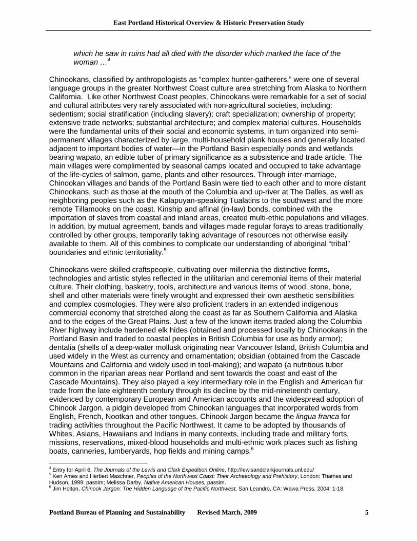
Old John and his small plank house, near the Columbia Slough, ca. 1880s. This is the only known photograph of a Chinookan plank house. Photo with permission of Fairview-Rockwood-Wilkes Historical Society.
Native societies in the Northwest were decimated by diseases introduced by Europeans and Americans between the late 1700s and the 1850s. With pre-contact populations reduced by an estimated 90 percent by the time settlement accelerated in the 1840s and 1850s, relatively few Native Americans remained in the lower Columbia and Willamette valleys. The peoples of the Portland area were particularly devastated, one observer noting that by 1834, the Multnomah Indians “who formerly occupied the Wapatoo Islands, and the country around the Wallamette and who numbered 3,000 souls are all dead, and their villages reduced to desolation.”7 Displaced survivors of the “Great Sick” (malaria) of the 1830s moved around frequently along the greater Columbia Valley, joining existing groups or forming new composite groups, making it difficult to understand pre-contact and early historical-era Indian cultural affiliations and settlement patterns. By the end of the 1850s, a great many of the remaining Portland-area Indians had been removed to reservations, primarily the Grande Ronde Reservation, established in 1857 about 60 miles to the southwest, including what may have been the last surviving 88 individuals of the Clackamas band. Among those who resisted relocation was Old John, who had resided in the pre-contact village Ne-cha-co-lee west of the mouth of the Sandy River near Blue Lake.8 Reportedly present in 1806 when Lewis and Clark visited Ne-cha-co-lee, in the last half of the century Old John fished, tanned hides and labored on the farms along the Columbia Slough from what is now Fairview to Parkrose. Living from about 1800 (possibly earlier) to 1893, Old John was respected and protected by his white neighbors to an unusual degree for the time. Parkrose resident Annie Wilkes Wright remembered:
There were Indians that came and camped along the slough … One old Indian lived on Dad’s farm at Parkrose … I remember he had a family. They all died young and were buried at White Salmon. Indian John used to visit their grave every fall and bring us huckleberries. ... He was a true friend to the white man, warned Dad and the other pioneers when the Indians went on the warpath at Yakima [late 1855 or early 1856]. He stayed in the woods and watched the home and cared for the cattle while the folks went to Portland. Yes, he was a good man. He worked for Dad as long as he was able.9
7 Quoted in Melissa Darby, “Intensification of Wapato (Sagittaria latifolia) by the Chinookan People of the Lower Columbia Valley,” in Douglas Deur and Nancy Turner, eds., Keeping it Living: Traditions of Plant Use and Cultivation on the Northwest Coast of North America, Seattle: University of Washington Press, 2005, 213. 8 Other Portland area Indians resisted transfer to reservations, including Old John’s sister who later lived in Vancouver, Washington. 9 “Reminiscences of Annie Wiles Wright,” in History of Wilkes School, compiled by Mrs. J.W. Edwards, quoted in: Melissa Darby, “Indian John – Information from Fairview-Rockwood-Wilkes Historical Society,” n.d., no pagination.
East Portland Historical Overview & Historic Preservation Study
Portland Bureau of Planning and Sustainability Revised March, 2009 7
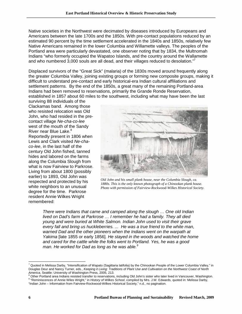
A great deal remains unknown about the pre-contact and contact-era native inhabitants of the Portland area. What we do know is based on native oral histories, sketchy explorer, trapper, missionary and pioneer accounts, limited ethnographic research, and spotty archaeological evidence. Many archaeological sites and artifacts have been disturbed or destroyed by natural processes (such as erosion) and agricultural and development activities, buried under urban structures and paving, or scavenged by relic hunters. However, some of the most important archaeological resources in the greater Portland Basin are located in and near the East Portland study area along the Columbia River and Columbia Slough, where early settlers remarked on the remains of villages and camp sites, and artifacts were exposed by farmers' plows beginning in the mid-nineteenth century. More recently, scientifically conducted archaeological surveys and excavations have uncovered numerous cultural resources and identified areas with high potential for future archaeological discoveries. In the Columbia South Shore district, in the northern part of the East Portland study area, the City of Portland has adopted a cultural resources protection plan and special regulations intended to identify and protect the area’s significant archaeological resources as new development occurs over time.10 Further to the south and away from the river, early settler accounts noted several other places associated with Indians in East Portland. "Indian Rock," a natural amphitheater near SE Foster Road and SE 100th Avenue in Lents, was apparently a long-established location for ceremonial activities until, according to one account, “some of the young men took potatoes and tomatoes
10 City of Portland Bureau of Planning, Cultural Resources Protection Plan for Columbia South Shore, 1996, 2 vols., as amended 2004.
Reconstruction of the pre-contact landscape of the Columbia South Shore area. Source: Rick Minor, Robert Musil and Kathryn Anne Toepel, An Inventory and Assessment of Archaeological Resources in the Columbia South Shore for the City of Portland, Oregon (Eugene: Heritage Research Associates, [ca. 1995]).
East Portland Historical Overview & Historic Preservation Study
Portland Bureau of Planning and Sustainability Revised March, 2009 8
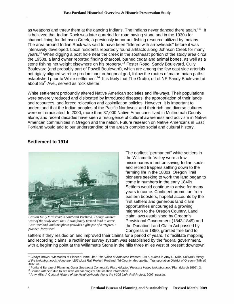
Clinton Kelly farmstead in southeast Portland. Though located west of the study area, the Clinton family farmed land in outer East Portland, and this photo provides a glimpse of a “typical” pioneer farmstead.
as weapons and threw them at the dancing Indians. The Indians never danced there again.”11 It is believed that Indian Rock was later quarried for road paving stone and in the 1930s for channel-lining for Johnson Creek, a previously important fishing resource utilized by Indians. The area around Indian Rock was said to have been “littered with arrowheads” before it was intensively developed. Local residents reportedly found artifacts along Johnson Creek for many years.12 When digging a post hole near the creek in the southeast portion of the study area circa the 1950s, a land owner reported finding charcoal, burned cedar and animal bones, as well as a stone fishing net weight elsewhere on his property.13 Foster Road, Sandy Boulevard, Cully Boulevard (and probably part of Powell Boulevard), which are among the few east side arterials not rigidly aligned with the predominant orthogonal grid, follow the routes of major Indian paths established prior to White settlement.14 It is likely that The Grotto, off of NE Sandy Boulevard at about 85th Ave., served as rock shelter. White settlement profoundly altered Native American societies and life-ways. Their populations were severely reduced and dislocated by introduced diseases, the appropriation of their lands and resources, and forced relocation and assimilation policies. However, it is important to understand that the Indian peoples of the Pacific Northwest and their rich and diverse cultures were not eradicated. In 2000, more than 37,000 Native Americans lived in Multnomah County alone, and recent decades have seen a resurgence of cultural awareness and activism in Native American communities in Oregon and the nation. Future research on Native Americans in East Portland would add to our understanding of the area’s complex social and cultural history.
Settlement to 1914
The earliest “permanent” white settlers in the Willamette Valley were a few missionaries intent on saving Indian souls and retired trappers settling down to the farming life in the 1830s. Oregon Trail pioneers seeking to work the land began to come in numbers in the early 1840s. Settlers would continue to arrive for many years to come. Confident promotion from eastern boosters, hopeful accounts by the first settlers and generous land claim opportunities encouraged a growing migration to the Oregon Country. Land claim laws established by Oregon’s Provisional Government (1843-1849) and the Donation Land Claim Act passed by Congress in 1850, granted free land to
settlers if they resided on and improved their claims for a period of years. To facilitate mapping and recording claims, a rectilinear survey system was established by the federal government, with a beginning point at the Willamette Stone in the hills three miles west of present downtown
11 Gladys Brown, “Memories of Pioneer Home Life,” The Voice of American Women, 1947, quoted in Amy C. Mills, Cultural History of the Neighborhoods Along the I-205 Light Rail Project, Portland: Tri-County Metropolitan Transportation District of Oregon (TriMet) 2007: 44. 12 Portland Bureau of Planning, Outer Southeast Community Plan, Adopted Pleasant Valley Neighborhood Plan (March 1996), 3. 13 Source withheld due to sensitive archaeological site location information. 14 Amy Mills, A Cultural History of the Neighborhoods Along the I-205 Light Rail Project, 2007, passim.
East Portland Historical Overview & Historic Preservation Study
Portland Bureau of Planning and Sustainability Revised March, 2009 9
Portland. A north and south line (Willamette Meridian) and east and west line (Base Line) provided the basis from which the township and range lines were determined. Many of these survey lines in the study area would later become the locations of major arterials.15 Under the Donation Land Claim Act, for a small filing fee, single white citizens who had arrived prior to December 1, 1850 were allowed to claim 320 acres, married couples 640 acres. This legitimated the earliest claims made prior to the creation of the Oregon Territory in 1848. Between that date and December 1, 1853, settlers received one half of a grant, i.e., 320 acres for a man and wife and 160 acres for a single man. After 1853, settlers could claim up to 320 acres of public land at a cost of $1.25 per acre. Early land claims in East Portland indicated on Oregon General Land Office (GLO) maps by 1860 -1862 are summarized in the table below. The maps and more extensive land patent information are included in the Appendices. An examination of the GLO maps indicate that early East Portland settlers appear to have settled first on lands that met one or more of the following locational criteria: 1) close proximity to waterways, especially the Columbia River and Johnson Creek; 2) close proximity to the earliest roads and trails, such as Sandy Road; 3) flat or rolling topography; and/or 4) land that had been partially cleared of timber by earlier fires (discussed below).
Early East Portland Land Claims (ca. 1862) North/Sandy Rd./Columbia River South/Buttes/Johnson Creek
Name Acres Township Name Acres Township Gideon Millard 637 1N2E Robert Wilmot 323 1N3E Anthony Whittaker 649 1N2E Levi Nelson 320 1S2E Thomas Cully 637 1N2E Ezra Johnson 318 1S2E George M. Long 319 1N2E Jacob Johnson 319 1S2E E. L. Quimby 639 1N2E Emanuel Himmon 160 1S2E David Powell 323 1N2E Francis N. Elliot 640 1S2E Gideon Millard 587 1N2E Plympton Kelley 322 1S2E Irvine Taylor (abandoned) 321 1N2E Ebenezer Creswell 643 1S2E Henry Holtgrieve 275 1N2E Benjamin F. Starrs 316 1S2E Charles Stevenson 264 1N2E Jacob Wills 642 1S1E/1S2E John Powell 320 1N2E George Wills 640 1S1E/1S2E David Powell 324 1N2E Alanzo Gates 640 1S2E/1S3E William Wilkes 640 1N2E Nathaniel Hamlin 643 1S3E George Hamilton 320 1N2E Lemuel Jenne 320 1S3E Jesse Flemming 315 1N2E/1N3E Source: Oregon General Land Office cadastral survey maps, 1860-1862, available: libweb.uoregon.edu/map/map_resources/about_glo.html. See Maps in Appendix A. Note: Many Donation Land Claims and claims under the 1862 Homestead Act were finalized later than the date of the source maps, and thus are not shown in this table. A fuller list of Federal land patents in East Portland is included in the appendices. Early East Portland settlers found a landscape with a diversity of features and ecosystems. Perhaps most prominent were the large stands of upland forest—dominated by Douglas Fir, but also including Western Hemlock, Red Cedar and Big Leaf Maple. Large portions of the area had been burned by fires that had swept through in the 1820s and were partially deforested,
15 Howard and Grace Horner, eds., History and Folklore of the David Douglas Community (Portland: David Douglas Historical Society 1989) 11
East Portland Historical Overview & Historic Preservation Study
Portland Bureau of Planning and Sustainability Revised March, 2009 10
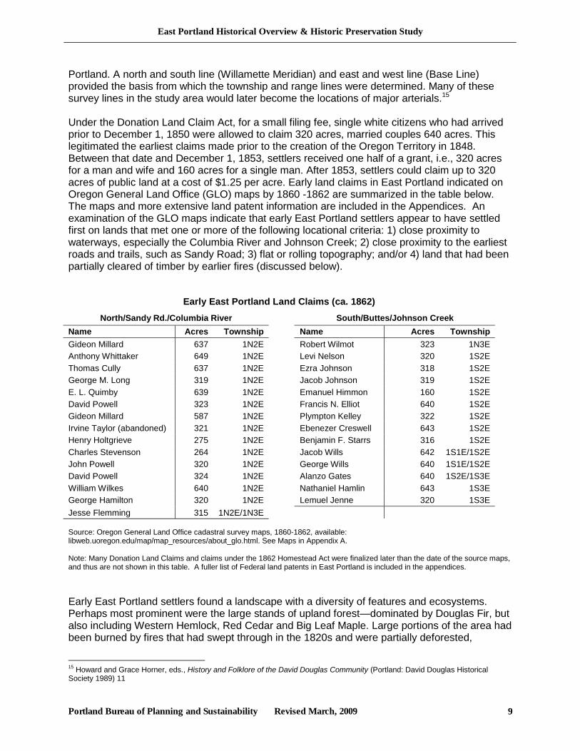
Berry farming near Johnson Creek
facilitating the preparation of land for agriculture.16 Expanses of flat and gently rolling forest and meadow land were punctuated by occasional hills and volcanic buttes, which often served as timber resources after the surrounding flats were converted to farming and stock-raising. Lowland areas along the Columbia Slough, Johnson Creek and other waterways contained cedar, willows, oaks and various grassland and wetland habitats. Along these waterways, a few settlers constructed mills, where the area’s timber was processed for use locally and in the region’s growing urban areas, including Portland and Milwaukie. Large stands of old-growth trees remained in some areas into the twentieth century. A “Mr. Parker” reported that in 1903 Pleasant Valley “was filled with the big red cedar trees which were being cut for shingles.”17
Constructing some form of shelter was an immediate priority for pioneers; often simple log cabins were the first to go up, followed within a few years by larger wood-frame dwellings, as the first crops came in and settlers had more time and resources to establish more comfortable and permanent abodes. Lemuel Jenne, who claimed 269 acres along Johnson Creek in the Pleasant Valley area, first built a “kind of leanto [sic]” for himself and his wife, upon arriving from West Virginia in the summer of 1853. Although the Jenne’s were nervous as Indians began arriving to the area in the fall
to catch their winter supply of Salmon in the creek, he told his grandson Bill that they turned out to be “peaceful and helpful.” Within a year or so, Jenne built a more sturdy log cabin to live in, and eventually “moved up the hill nearer to the road, now called Jenne Road, and built a clapboard house since lumber was now available from the small lumber mills that must have sprung up.” The house eventually burned down when Bill Jenne was a young man.18 Clearing and preparing the land to raise plants and animals for subsistence and trade was also clearly an urgent task. East Portland pioneers were soon raising a variety of crops, including grains, potatoes, vegetables, and livestock, for both their own use and sale to markets in Portland and Milwaukie. Over time, differences in soils and other factors tended to promote increasing agricultural specialization, depending on location. The generally rich and tillable soil near the Columbia encouraged vegetable and grain production. In the central and southern parts of East Portland, land owners reported generally poorer soils, and agriculture in much of this area eventually focused on orchardry, berry production, livestock raising, and dairy farming.19
In those days it was all dairy from 82nd all the way to Troutdale on that side [south of Sandy Boulevard]. The reason for the dairies is the ground is clay and hard. Above Sandy Boulevard that's why there's farms 'cause its sandy ground. Works real good.20
Remnants of early pastures and orchards can still be found in some places, including Powell Butte, where large meadows once grazed by cattle and a few rows of ancient and decaying apple, pear and walnut trees remain. An apple tree planted by Lemuel Jenne from seed he
16 Mills, Cultural History, 3; see also GLO maps from the 1850s noting large areas as “burnt and fallen timber.” 17 Ken and Poky Bayles, “Some History of the Log House on Circle Avenue,” letter dated June 3, 1980, on file at the Portland Bureau of Development Services 18 Bayles, “Some History of the Log House on Circle Avenue.” 19 Centennial Community Plan, 12. 20 Rachel Blumberg, ed. The Wheel Keeps Turning: An Oral History of Parkrose (Portland: FamilyWorks 2002), 16.
East Portland Historical Overview & Historic Preservation Study
Portland Bureau of Planning and Sustainability Revised March, 2009 11
brought from West Virginia in 1853 was still growing in 2001 on a portion of his land claim in Pleasant Valley.21
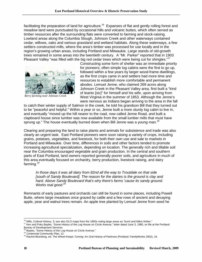
Establishing a transportation network was also important to early East Portland residents. In a 1915 unpublished history on the origin of Foster Road, W.S. Chapman tells about a meeting on May 28, 1853 at Johnson’s Mill (along Johnson Creek, then known as Milwaukie Creek, see Map 21) to consider opening a wagon road to Portland. According to Lents Branch librarian Gladys Brown, the route chosen for the road had long been traveled by Native Americans. It was named after pioneer Philip Foster, who had a farm near Eagle Creek. Foster Road became a well traveled farm-to-market route connecting to Powell Valley Road near the present-day 52nd Avenue and thence to the Willamette River and Portland.22 Today, a few farm houses from the late 19th and early twentieth century can still be seen along its route, including a Victorian farmhouse next to Johnson Creek located at 14707 SE Foster Road, and an 1887 home at 11823 SE Foster Road.23 In 1854, Clackamas County24 approved the construction of a
road along the Base Line, as established by the Federal survey process. Base Line Road, now SE Stark Street, ran from the Sandy River to the Willamette River. Today you can still see some of the original milepost markers installed along Base Line Road, such as the P5 marker (indicating five miles to Portland) in the Montavilla area and another near Ventura Park at Stark and 117th. Schools were important early public institutions in rural communities, established as families planted permanent roots in the area and settlements coalesced. One of the earliest in East Portland was the Whitaker School, in what is now the Cully Neighborhood, established in 1861, just five years after Thomas Cully made his Donation Land Claim along the Columbia Slough.25 The Parkrose School District traces its roots to 1885, when a schoolhouse on NE Sandy and 122nd was established. While the majority of settlement-era structures and cultural landscapes have been lost or profoundly altered, historic cemeteries are important cultural resources that are still found in the study area. Now managed by Metro, these “Pioneer Cemeteries” are still used for their original purposes and provide a tangible link to East Portland’s past. They help document early settlement, memorialize people and places and sometimes spark the memories of long-time residents and descendants of earlier generations of East Portlanders.26 The Powell Grove cemetery at NE Sandy Blvd. and NE 122nd in the Parkrose Neighborhood was founded in 1848 by David Powell, although the death dates on some of the stones date back as far as 1837. 21 Letter Report from Robert R. Musil to Holly Walla, re: Alsop-Brownwood Flood Mitigation and Restoration Project, Sept. 14, 2001, on file the Portland Bureau of Environmental Services. 22 Portland Bureau of Planning, Powellhurst-Gilbert Neighborhood Plan (1996), 5. 23 portlandmaps.com. 24 Multnomah County was created on December 22, 1854 from eastern portions of Washington County and northern portions of Clackamas County. 25 Portland Bureau of Planning, Cully Neighborhood Plan (1992), 8-9. 26 See Metro: http://www.metro-region.org/article.cfm?articleid=159.
Milepost marker P5 built approximately 1854 indicated a distance of five miles from the downtown courthouse.
East Portland Historical Overview & Historic Preservation Study
Portland Bureau of Planning and Sustainability Revised March, 2009 12
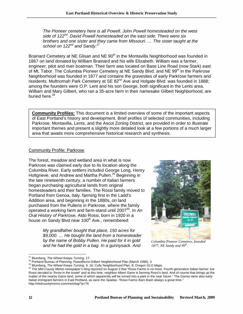
Columbia Pioneer Cemetery, founded 1877, NE Sandy and 99th.
The Pioneer cemetery here is all Powell. John Powell homesteaded on the west side of 122nd. David Powell homesteaded on the east side. There were six brothers and one sister and they came from Missouri. … The sister taught at the school on 122nd and Sandy.27
Brainard Cemetery at NE Glisan and NE 90th in the Montavilla Neighborhood was founded in 1867 on land donated by William Brainard and his wife Elizabeth. William was a farmer, engineer, pilot and river boatman. Their farm was located on Base Line Road (now Stark) east of Mt. Tabor. The Columbia Pioneer Cemetery at NE Sandy Blvd. and NE 99th in the Parkrose Neighborhood was founded in 1877 and contains the gravesites of early Parkrose farmers and residents. Multnomah Park Cemetery at SE 82nd Ave and Holgate Blvd. was founded in 1888; among the founders were O.P. Lent and his son George, both significant in the Lents area. William and Mary Gilbert, who ran a 35-acre farm in their namesake Gilbert Neighborhood, are buried here.28
Community Profile: Parkrose The forest, meadow and wetland area in what is now Parkrose was claimed early due to its location along the Columbia River. Early settlers included George Long, Henry Holtgrieve, and Andrew and Martha Pullen.29 Beginning in the late nineteenth century, a number of Italian farmers began purchasing agricultural lands from original homesteaders and their families. The Rossi family moved to Portland from Genoa, Italy, farming first in the Ladd’s Addition area, and beginning in the 1880s, on land purchased from the Pullens in Parkrose, where the family operated a working farm and farm-stand until 200730. In An Oral History of Parkrose, Aldo Rossi, born in 1920 in a house on Sandy Blvd near 100th Ave., remembered:
My grandfather bought that place, 150 acres for $9,000. … He bought the land from a homesteader by the name of Bobby Pullen. He paid for it in gold and he had the gold in a bag. In a gunnysack. And
27 Blumberg, The Wheel Keeps Turning, 17. 28 Portland Bureau of Planning, Powellhurst-Gilbert Neighborhood Plan (March 1996), 3 29 Blumberg, The Wheel Keeps Turning, 9, 16; Cully Neighborhood Plan, 8; Oregon GLO Maps. 30 The Mid-County Memo newspaper’s blog reported on August 3 that “Rossi Farms is no more. Fourth-generation Italian farmer Joe Rossi decided to ‘throw in the trowel’ and at this time, neighbor Albert Garre is farming Rossi’s land. And of course that brings up the matter of the nearby Garre land, some of which apparently will be turned into a park in the near future.” The Garres were also early Italian immigrant farmers in East Portland, as were the Spadas. “Rossi Farms Barn Bash always a great time,” http://midcountymemo.com/memlog/?p=76
Community Profiles: This document is a limited overview of some of the important aspects of East Portland’s history and development. Brief profiles of selected communities, including Parkrose, Montavilla, Lents, and the Ascot Zoning District, are provided in order to illustrate important themes and present a slightly more detailed look at a few portions of a much larger area that awaits more comprehensive historical research and synthesis.
East Portland Historical Overview & Historic Preservation Study
Portland Bureau of Planning and Sustainability Revised March, 2009 13
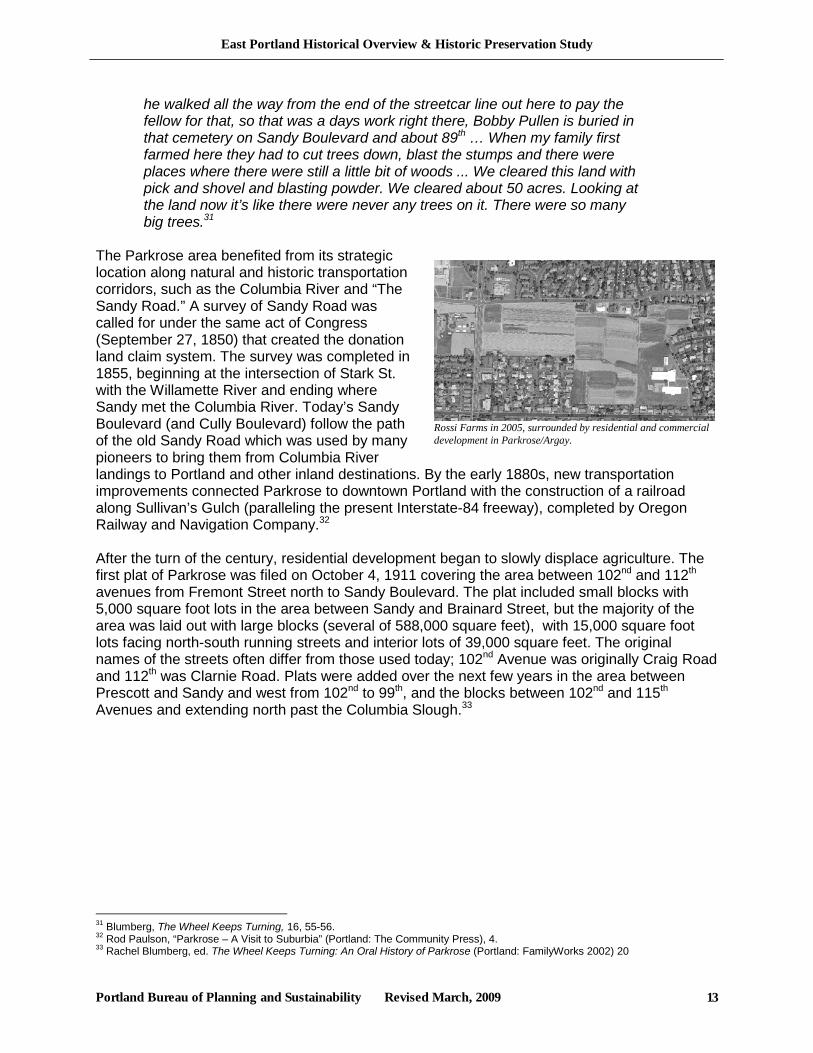
Rossi Farms in 2005, surrounded by residential and commercial development in Parkrose/Argay.
he walked all the way from the end of the streetcar line out here to pay the fellow for that, so that was a days work right there, Bobby Pullen is buried in that cemetery on Sandy Boulevard and about 89th … When my family first farmed here they had to cut trees down, blast the stumps and there were places where there were still a little bit of woods ... We cleared this land with pick and shovel and blasting powder. We cleared about 50 acres. Looking at the land now it’s like there were never any trees on it. There were so many big trees.31
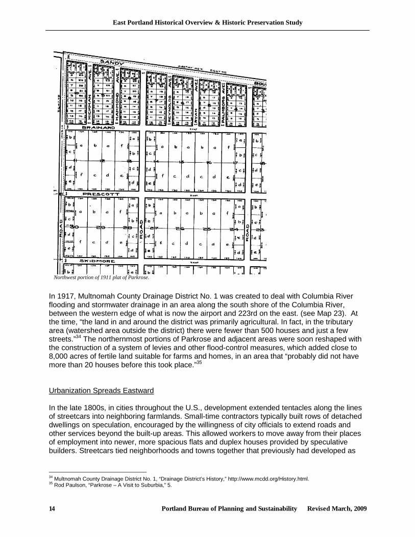
The Parkrose area benefited from its strategic location along natural and historic transportation corridors, such as the Columbia River and “The Sandy Road.” A survey of Sandy Road was called for under the same act of Congress (September 27, 1850) that created the donation land claim system. The survey was completed in 1855, beginning at the intersection of Stark St. with the Willamette River and ending where Sandy met the Columbia River. Today’s Sandy Boulevard (and Cully Boulevard) follow the path of the old Sandy Road which was used by many pioneers to bring them from Columbia River landings to Portland and other inland destinations. By the early 1880s, new transportation improvements connected Parkrose to downtown Portland with the construction of a railroad along Sullivan’s Gulch (paralleling the present Interstate-84 freeway), completed by Oregon Railway and Navigation Company.32 After the turn of the century, residential development began to slowly displace agriculture. The first plat of Parkrose was filed on October 4, 1911 covering the area between 102nd and 112th avenues from Fremont Street north to Sandy Boulevard. The plat included small blocks with 5,000 square foot lots in the area between Sandy and Brainard Street, but the majority of the area was laid out with large blocks (several of 588,000 square feet), with 15,000 square foot lots facing north-south running streets and interior lots of 39,000 square feet. The original names of the streets often differ from those used today; 102nd Avenue was originally Craig Road and 112th was Clarnie Road. Plats were added over the next few years in the area between Prescott and Sandy and west from 102nd to 99th, and the blocks between 102nd and 115th Avenues and extending north past the Columbia Slough.33
31 Blumberg, The Wheel Keeps Turning, 16, 55-56. 32 Rod Paulson, “Parkrose – A Visit to Suburbia” (Portland: The Community Press), 4. 33 Rachel Blumberg, ed. The Wheel Keeps Turning: An Oral History of Parkrose (Portland: FamilyWorks 2002) 20
East Portland Historical Overview & Historic Preservation Study
Portland Bureau of Planning and Sustainability Revised March, 2009 14
In 1917, Multnomah County Drainage District No. 1 was created to deal with Columbia River flooding and stormwater drainage in an area along the south shore of the Columbia River, between the western edge of what is now the airport and 223rd on the east. (see Map 23). At the time, “the land in and around the district was primarily agricultural. In fact, in the tributary area (watershed area outside the district) there were fewer than 500 houses and just a few streets.”34 The northernmost portions of Parkrose and adjacent areas were soon reshaped with the construction of a system of levies and other flood-control measures, which added close to 8,000 acres of fertile land suitable for farms and homes, in an area that “probably did not have more than 20 houses before this took place.”35 Urbanization Spreads Eastward In the late 1800s, in cities throughout the U.S., development extended tentacles along the lines of streetcars into neighboring farmlands. Small-time contractors typically built rows of detached dwellings on speculation, encouraged by the willingness of city officials to extend roads and other services beyond the built-up areas. This allowed workers to move away from their places of employment into newer, more spacious flats and duplex houses provided by speculative builders. Streetcars tied neighborhoods and towns together that previously had developed as
34 Multnomah County Drainage District No. 1, “Drainage District’s History,” http://www.mcdd.org/History.html. 35 Rod Paulson, “Parkrose – A Visit to Suburbia,” 5.
Northwest portion of 1911 plat of Parkrose.

East Portland Historical Overview & Historic Preservation Study
Portland Bureau of Planning and Sustainability Revised March, 2009 15
separate settlements. The basic pattern was one of nodes of residential-commercial development with relatively large spaces in between.36 From 1898 until 1914, there was a surge across the nation of migration into towns and cities from farms and small towns. Mechanization of agriculture pushed, and increased urban employment opportunities pulled, people to the expanding urban areas. This led to increasing demands for affordable housing, social services, transportation, power and utilities to new communities. Portland was no exception to this national trend. On the east side of the Willamette River, from approximately 1890 to 1920 land developers platted thousands of acres in an area extending between 1.5 and six miles from the central business district. Builders filled these neighborhoods with blocks of bungalows in two great building booms, 1905-1913 and 1922-28. At the height of the first boom in 1910, city building inspector, H.E. Plummer, reported 132 new houses on the west side, and 3,000 on the east.37 While inner East Portland experienced widespread urbanization much earlier, the transition from rural to suburban and urban patterns began to affect the study area in the early 1900s.”38 The extension of street railways, inter-urbans and other utilities encouraged development of relatively distant land. Settlements that were once separated from Portland and from each other by farm and forest were gradually absorbed into Portland or connected to Portland by transportation improvements. In the western portions of the study area, “towns” and subdivisions began to be platted in the late 19th century, although they were not always fully developed in short order. These early towns and subdivisions still serve as a foundation for many of today’s neighborhoods, and often provide their names. Some notable early plats in East Portland include: Little Homes Number 2 (1882), the first subdivision in the Brentwood-Darlington Neighborhood; Montavilla (1889); Town of Lent (1892); Arleta Park Subdivision (1903); Parkrose (1907); and Errol Heights (1910). Russellville was a farming community that produced berries, grain, nursery stock, and produce in the area of SE 102nd and Base Line Road (Stark). Some of these coalescing communities later voted for annexation to the City of Portland, to take advantage of services and other amenities. Early annexations in the area include parts of Montavilla in 1906, Mt. Scott-Arleta in 1908, and parts of Lents in 1912.
36 City of Portland, Portland Historical Context Statement, draft (Portland: Planning Bureau, 1983) 26. 37 Carl Abbott, Portland: Planning, Politics and Growth in a Twentieth-Century City. (Lincoln: University of Nebraska Press, 1983), 55, 57. 38 City of Portland, East Portland Review, draft (Portland: Planning Bureau, 2007) 8.
Public school at NE 122nd and Sandy, Parkrose, ca. 1890. OHS photograph.
East Portland Historical Overview & Historic Preservation Study
Portland Bureau of Planning and Sustainability Revised March, 2009 16
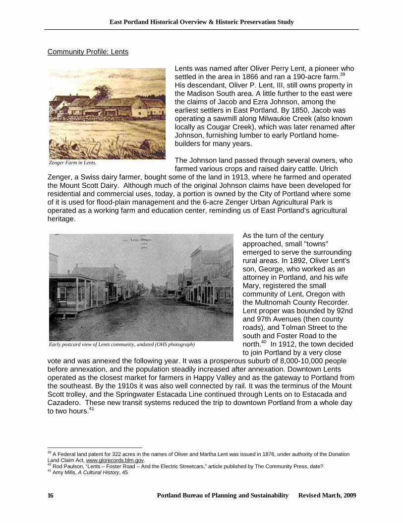
Zenger Farm in Lents.
Community Profile: Lents
Lents was named after Oliver Perry Lent, a pioneer who settled in the area in 1866 and ran a 190-acre farm.39 His descendant, Oliver P. Lent, III, still owns property in the Madison South area. A little further to the east were the claims of Jacob and Ezra Johnson, among the earliest settlers in East Portland. By 1850, Jacob was operating a sawmill along Milwaukie Creek (also known locally as Cougar Creek), which was later renamed after Johnson, furnishing lumber to early Portland home-builders for many years. The Johnson land passed through several owners, who farmed various crops and raised dairy cattle. Ulrich
Zenger, a Swiss dairy farmer, bought some of the land in 1913, where he farmed and operated the Mount Scott Dairy. Although much of the original Johnson claims have been developed for residential and commercial uses, today, a portion is owned by the City of Portland where some of it is used for flood-plain management and the 6-acre Zenger Urban Agricultural Park is operated as a working farm and education center, reminding us of East Portland’s agricultural heritage.
As the turn of the century approached, small "towns" emerged to serve the surrounding rural areas. In 1892, Oliver Lent's son, George, who worked as an attorney in Portland, and his wife Mary, registered the small community of Lent, Oregon with the Multnomah County Recorder. Lent proper was bounded by 92nd and 97th Avenues (then county roads), and Tolman Street to the south and Foster Road to the north.40 In 1912, the town decided to join Portland by a very close
vote and was annexed the following year. It was a prosperous suburb of 8,000-10,000 people before annexation, and the population steadily increased after annexation. Downtown Lents operated as the closest market for farmers in Happy Valley and as the gateway to Portland from the southeast. By the 1910s it was also well connected by rail. It was the terminus of the Mount Scott trolley, and the Springwater Estacada Line continued through Lents on to Estacada and Cazadero. These new transit systems reduced the trip to downtown Portland from a whole day to two hours.41
39 A Federal land patent for 322 acres in the names of Oliver and Martha Lent was issued in 1876, under authority of the Donation Land Claim Act, www.glorecords.blm.gov. 40 Rod Paulson, “Lents – Foster Road – And the Electric Streetcars,” article published by The Community Press, date? 41 Amy Mills, A Cultural History, 45
Early postcard view of Lents community, undated (OHS photograph)
East Portland Historical Overview & Historic Preservation Study
Portland Bureau of Planning and Sustainability Revised March, 2009 17
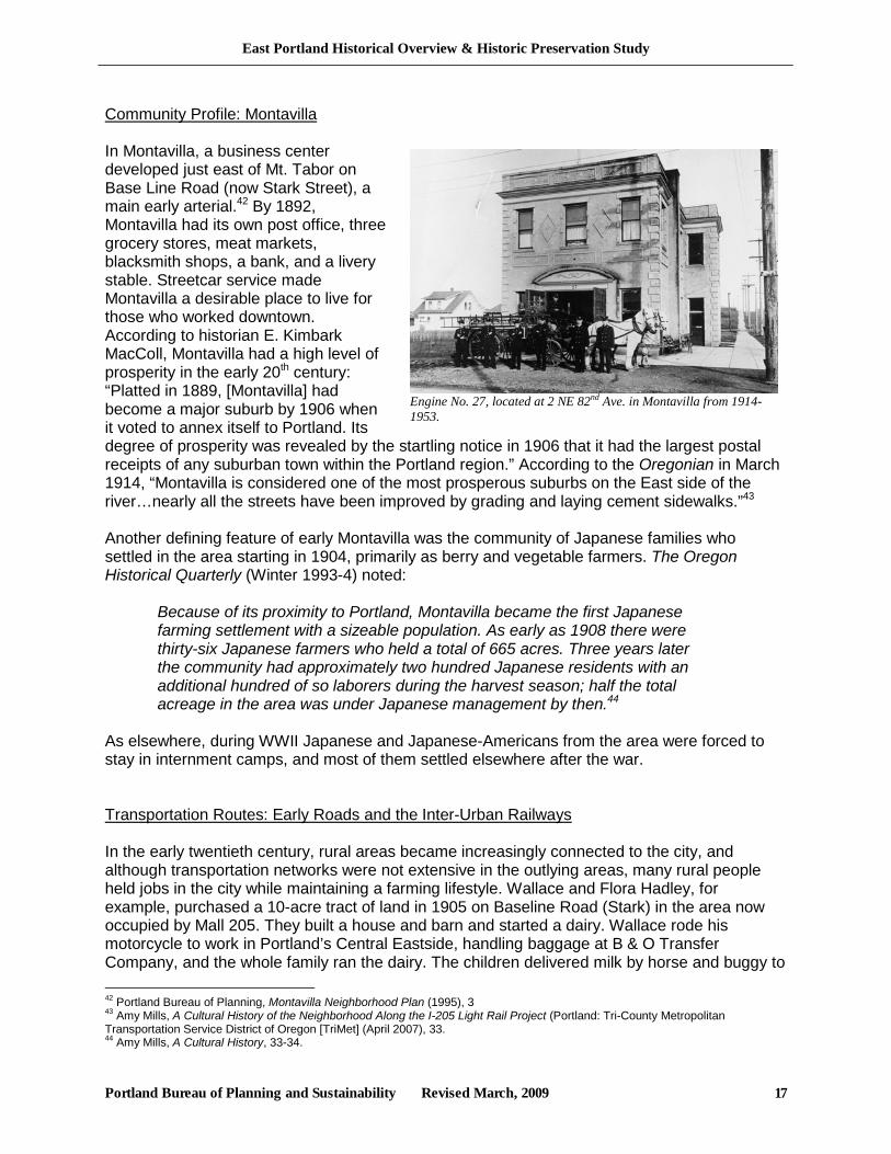
Engine No. 27, located at 2 NE 82nd Ave. in Montavilla from 1914-1953.
Community Profile: Montavilla In Montavilla, a business center developed just east of Mt. Tabor on Base Line Road (now Stark Street), a main early arterial.42 By 1892, Montavilla had its own post office, three grocery stores, meat markets, blacksmith shops, a bank, and a livery stable. Streetcar service made Montavilla a desirable place to live for those who worked downtown. According to historian E. Kimbark MacColl, Montavilla had a high level of prosperity in the early 20th century: “Platted in 1889, [Montavilla] had become a major suburb by 1906 when it voted to annex itself to Portland. Its degree of prosperity was revealed by the startling notice in 1906 that it had the largest postal receipts of any suburban town within the Portland region.” According to the Oregonian in March 1914, “Montavilla is considered one of the most prosperous suburbs on the East side of the river…nearly all the streets have been improved by grading and laying cement sidewalks.”43 Another defining feature of early Montavilla was the community of Japanese families who settled in the area starting in 1904, primarily as berry and vegetable farmers. The Oregon Historical Quarterly (Winter 1993-4) noted:
Because of its proximity to Portland, Montavilla became the first Japanese farming settlement with a sizeable population. As early as 1908 there were thirty-six Japanese farmers who held a total of 665 acres. Three years later the community had approximately two hundred Japanese residents with an additional hundred of so laborers during the harvest season; half the total acreage in the area was under Japanese management by then.44
As elsewhere, during WWII Japanese and Japanese-Americans from the area were forced to stay in internment camps, and most of them settled elsewhere after the war. Transportation Routes: Early Roads and the Inter-Urban Railways In the early twentieth century, rural areas became increasingly connected to the city, and although transportation networks were not extensive in the outlying areas, many rural people held jobs in the city while maintaining a farming lifestyle. Wallace and Flora Hadley, for example, purchased a 10-acre tract of land in 1905 on Baseline Road (Stark) in the area now occupied by Mall 205. They built a house and barn and started a dairy. Wallace rode his motorcycle to work in Portland’s Central Eastside, handling baggage at B & O Transfer Company, and the whole family ran the dairy. The children delivered milk by horse and buggy to 42 Portland Bureau of Planning, Montavilla Neighborhood Plan (1995), 3 43 Amy Mills, A Cultural History of the Neighborhood Along the I-205 Light Rail Project (Portland: Tri-County Metropolitan Transportation Service District of Oregon [TriMet] (April 2007), 33. 44 Amy Mills, A Cultural History, 33-34.
East Portland Historical Overview & Historic Preservation Study
Portland Bureau of Planning and Sustainability Revised March, 2009 18
homes in the area.45 This example also illustrates a trend that occurred in parts of outer East Portland where land was divided over time into increasingly smaller parcels, from large to smaller farms and finally to residential subdivisions. Some of the main East-West Streets were SE Stark (Base Line), SE Division (Section Line), SE Powell (Powell Valley), and SE Foster. Foster Road was one of the most important east-west streets, a strategic route that began as a Native American trail. It became an alternative route of the Barlow Trail during the pioneer era, bringing settlers directly into Portland rather than down to Oregon City. Settlers and farmers used it to travel to East Portland, Milwaukie and Portland to sell produce and purchase supplies. To this day, there are fruit stands and farmland along Foster Road east of Lents. Travelers disembarking from boats on the Columbia River used Sandy Blvd. and also SE 82nd Avenue, which served as a north-south route to Oregon City and other points south. Of the main north-south Streets, SE 82nd Ave was one of the most important routes in the area. This was the main highway between outer Southeast Portland and north Clackamas county. SE 92nd Ave, in contrast, was primarily a residential street. It was called Main Street in downtown Lents before street names were changed. SE 102nd Ave (Craig Road) and SE 122nd Ave were also major routes. The establishment of County Road 602, now 52nd Avenue, in 1894 proved influential in the growth in the area that is now Brentwood-Darlington.46 This includes the Errol Heights subdivision adjacent to 52nd Avenue. A 1913 Errol Heights homes still stands at 7445 SE 52nd Avenue.47
Electric streetcars were vital to growth and community vitality in the new towns and subdivisions. They were preceded by horse-drawn trolleys and some pulled by steam engines known as “dummies,” which were enclosed in a wooden box structure made to resemble a railroad passenger coach. Portland’s first electric streetcar carried passengers across the Steel Bridge to the town of Albina in 1889, and soon after streetcars extended to Montavilla and Lents neighborhoods along the Montavilla, Mount Tabor, and Mount Scott trolley lines. In 1892 a steam-powered streetcar railway began service from Portland to Lents along SE Hawthorne and Foster Road, and by 1901 the railway was electrified. These streetcars allowed people to commute into downtown Portland to work, sell produce or buy essential goods.48 Structures that were constructed next to streetcar lines still exist in some areas, especially in Lents, Brentwood-
45 Horner, History and Folklore, 146. 46 Portland Bureau of Planning, Brentwood-Darlington Community Plan (1992), 15. 47 portlandmaps.com 48 Amy Mills, A Cultural History, 15
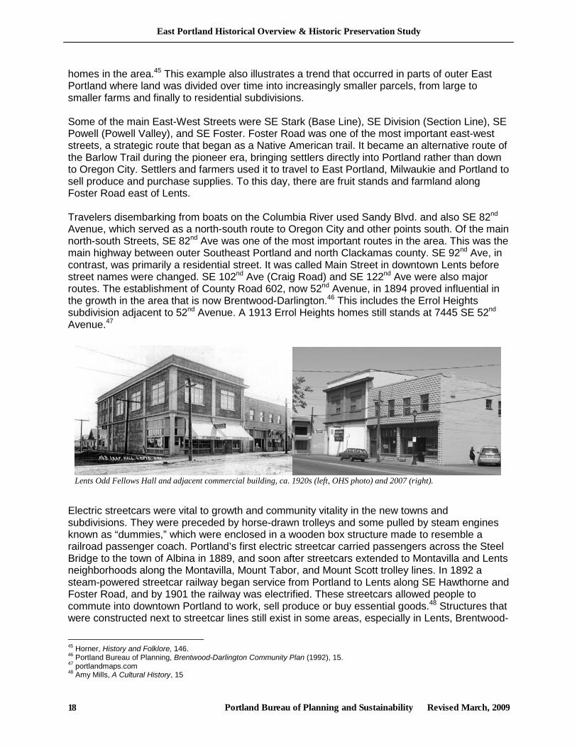
Lents Odd Fellows Hall and adjacent commercial building, ca. 1920s (left, OHS photo) and 2007 (right).
East Portland Historical Overview & Historic Preservation Study
Portland Bureau of Planning and Sustainability Revised March, 2009 19
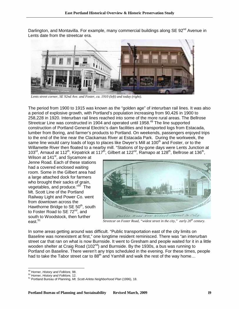
Darlington, and Montavilla. For example, many commercial buildings along SE 92nd Avenue in Lents date from the streetcar era.
The period from 1900 to 1915 was known as the “golden age” of interurban rail lines. It was also a period of explosive growth, with Portland’s population increasing from 90,426 in 1900 to 258,228 in 1920. Interurban rail lines reached into some of the more rural areas. The Bellrose Streetcar Line was constructed in 1904 and operated until 1958.49 The line supported construction of Portland General Electric’s dam facilities and transported logs from Estacada, lumber from Boring, and farmer’s products to Portland. On weekends, passengers enjoyed trips to the end of the line near the Clackamas River at Estacada Park. During the workweek, the same line would carry loads of logs to places like Dwyer’s Mill at 100th and Foster, or to the Willamette River then floated to a nearby mill. “Stations of by-gone days were Lents Junction at 103rd, Arnaud at 112th, Kirpatrick at 117th, Gilbert at 122nd, Ramapo at 128th, Bellrose at 136th, Wilson at 141st, and Sycamore at Jenne Road. Each of these stations had a covered enclosed waiting room. Some in the Gilbert area had a large attached dock for farmers who brought their sacks of grain, vegetables, and produce.”50 The Mt. Scott Line of the Portland Railway Light and Power Co. went from downtown across the Hawthorne Bridge to SE 50th, south to Foster Road to SE 72nd, and south to Woodstock, then further east.51 In some areas getting around was difficult. “Public transportation east of the city limits on Baseline was nonexistent at first,” one longtime resident reminisced. There was “an interurban street car that ran on what is now Burnside. It went to Gresham and people waited for it in a little wooden shelter at Craig Road (102nd) and Burnside. By the 1930s, a bus was running to Portland on Baseline. There weren’t any trips scheduled in the evening. For these times, people had to take the Tabor street car to 88th and Yamhill and walk the rest of the way home…
49 Horner, History and Folklore, 98. 50 Horner, History and Folklore, 12. 51 Portland Bureau of Planning, Mt. Scott-Arleta Neighborhood Plan (1996), 18.
Lents street corner, SE 92nd Ave. and Foster, ca. 1910 (left) and today (right).
Streetcar on Foster Road, “widest street in the city,” early 20th century.
East Portland Historical Overview & Historic Preservation Study
Portland Bureau of Planning and Sustainability Revised March, 2009 20
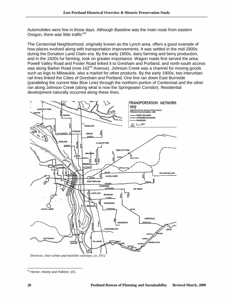
Automobiles were few in those days. Although Baseline was the main route from eastern Oregon, there was little traffic”52 The Centennial Neighborhood, originally known as the Lynch area, offers a good example of how places evolved along with transportation improvements. It was settled in the mid-1800s during the Donation Land Claim era. By the early 1900s, dairy farming and berry production, and in the 1920s fur farming, took on greater importance. Wagon roads first served the area; Powell Valley Road and Foster Road linked it to Gresham and Portland, and north-south access was along Barker Road (now 162nd Avenue). Johnson Creek was a channel for moving goods such as logs to Milwaukie, also a market for other products. By the early 1900s, two interurban rail lines linked the Cities of Gresham and Portland. One line ran down East Burnside (paralleling the current Max Blue Line) through the northern portion of Centennial and the other ran along Johnson Creek (along what is now the Springwater Corridor). Residential development naturally occurred along these lines.
52 Horner, History and Folklore, 101.
Streetcar, inter-urban and mainline railways, ca. 1912
East Portland Historical Overview & Historic Preservation Study
Portland Bureau of Planning and Sustainability Revised March, 2009 21
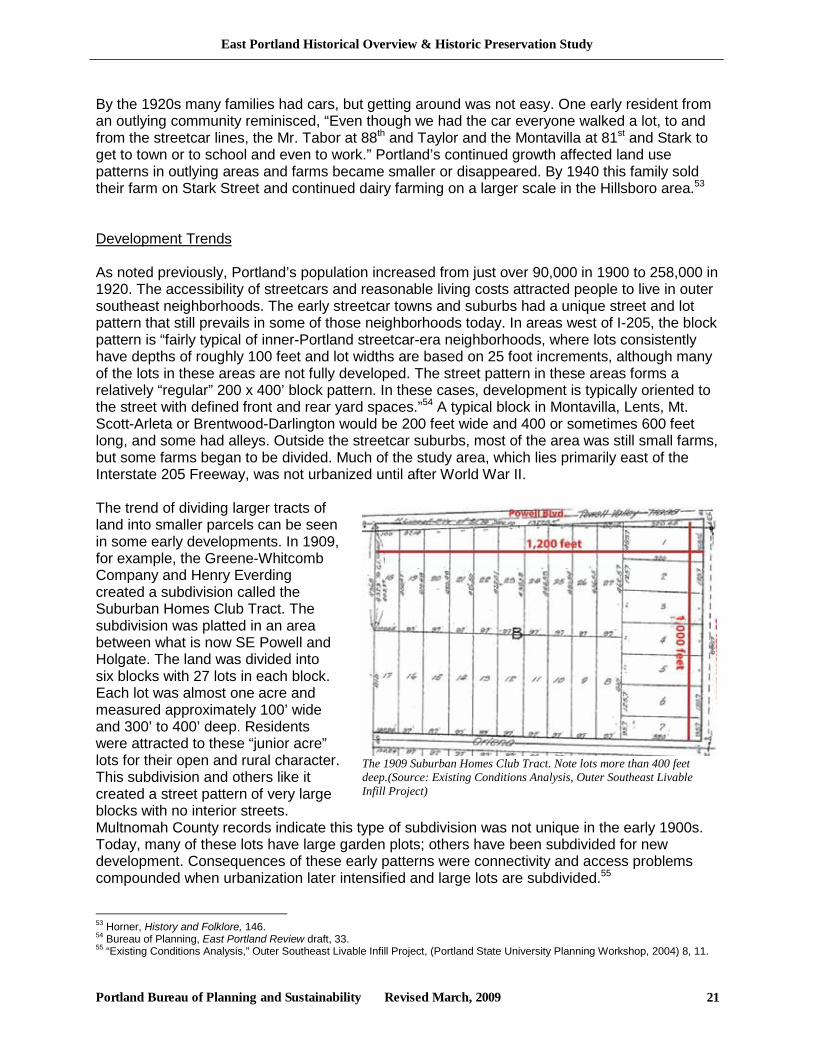
The 1909 Suburban Homes Club Tract. Note lots more than 400 feet deep.(Source: Existing Conditions Analysis, Outer Southeast Livable Infill Project)
By the 1920s many families had cars, but getting around was not easy. One early resident from an outlying community reminisced, “Even though we had the car everyone walked a lot, to and from the streetcar lines, the Mr. Tabor at 88th and Taylor and the Montavilla at 81st and Stark to get to town or to school and even to work.” Portland’s continued growth affected land use patterns in outlying areas and farms became smaller or disappeared. By 1940 this family sold their farm on Stark Street and continued dairy farming on a larger scale in the Hillsboro area.53 Development Trends As noted previously, Portland’s population increased from just over 90,000 in 1900 to 258,000 in 1920. The accessibility of streetcars and reasonable living costs attracted people to live in outer southeast neighborhoods. The early streetcar towns and suburbs had a unique street and lot pattern that still prevails in some of those neighborhoods today. In areas west of I-205, the block pattern is “fairly typical of inner-Portland streetcar-era neighborhoods, where lots consistently have depths of roughly 100 feet and lot widths are based on 25 foot increments, although many of the lots in these areas are not fully developed. The street pattern in these areas forms a relatively “regular” 200 x 400’ block pattern. In these cases, development is typically oriented to the street with defined front and rear yard spaces.”54 A typical block in Montavilla, Lents, Mt. Scott-Arleta or Brentwood-Darlington would be 200 feet wide and 400 or sometimes 600 feet long, and some had alleys. Outside the streetcar suburbs, most of the area was still small farms, but some farms began to be divided. Much of the study area, which lies primarily east of the Interstate 205 Freeway, was not urbanized until after World War II. The trend of dividing larger tracts of land into smaller parcels can be seen in some early developments. In 1909, for example, the Greene-Whitcomb Company and Henry Everding created a subdivision called the Suburban Homes Club Tract. The subdivision was platted in an area between what is now SE Powell and Holgate. The land was divided into six blocks with 27 lots in each block. Each lot was almost one acre and measured approximately 100’ wide and 300’ to 400’ deep. Residents were attracted to these “junior acre” lots for their open and rural character. This subdivision and others like it created a street pattern of very large blocks with no interior streets. Multnomah County records indicate this type of subdivision was not unique in the early 1900s. Today, many of these lots have large garden plots; others have been subdivided for new development. Consequences of these early patterns were connectivity and access problems compounded when urbanization later intensified and large lots are subdivided.55 53 Horner, History and Folklore, 146. 54 Bureau of Planning, East Portland Review draft, 33. 55 “Existing Conditions Analysis,” Outer Southeast Livable Infill Project, (Portland State University Planning Workshop, 2004) 8, 11.

East Portland Historical Overview & Historic Preservation Study
Portland Bureau of Planning and Sustainability Revised March, 2009 22
“…a very livable home, combining both Colonial and bungalow characteristics only covering a little over nine hundred square feet of space.” (Homecraft Handbook for Home Builders, 1923, p. 105)
Most of the neighborhood development in pre-WWII Portland was the work of many small developers, who operated with very limited capital and conformed to conventional tastes and patterns. In a sense there was a self-imposed set of “zoning rules” that kept neighborhoods relatively homogeneous. However, the stylistic features of typical houses constructed between 1890-1930 did not have as many shared characteristics as those constructed in the post-war era.56
The majority of residential structures from this era are single-family detached houses. This housing reflects a wide range of socio-economic ranges. Styles were somewhat fragmented. During the first part of the Progressive Era, the Queen Anne style was the most popular. In addition to the continued construction of Italianate houses, a wide range of other styles were introduced during the Progressive Era, including the Colonial Revival, Arts and Crafts, and Bungalow.57 A 1923 Portland-area home builders’ handbook included an article on “Local Tendencies in Architectural Style:”
It is doubtful as to whether Portland will tend to develop a single type for a number of good reasons, although it is reasonable to suppose that local conditions will restrict the development of certain styles and favor others. We are in the heart of one of the greatest lumber producing centers of the world…Retail lumber is relatively cheap. As long as this condition obtains, frame construction and the use of wood for exterior finish and wherever possible, will be justifiably popular, from the standpoint of economy. Thus it is not to be expected that there will be a marked tendency towards the employment of Italian, Spanish or Mission motives in the design of local residences or moderate cost, as these types do not permit of the greatest use of wood. Accordingly, it would seem as if the various Colonial types, as well as some of the English and Swiss, would become even more popular, and not without reason... Being for the most part regular and somewhat formal in plan and elevation, they are easy to frame and hence economical in labor and materials.58
The same handbook targeted prospective first-time owners with ads and advice. “Don’t wait until you have saved enough money to build your home. What you pay in rent will build it for you,” promoted the Union Savings and Loan Association.59 Savings and loan associations provided increasingly liberal financing, with loans as high as 50 percent of the value of the lot plus the value of the planned building(s) being quite generous, compared to those available in earlier eras. Marketing efforts were aggressive.
Corporations and individuals interested in the uplift of humanity and the development of our Pacific Northwest are ready and willing to help you in the financing of your home and
56 City of Portland, Portland Historical Context Statement, 36. 57 City of Portland, Portland Historical Context Statement, 6-7. 58The Homecraft Handbook for Home Builders (Portland, 1923), 27. 59 Homecraft Handbook, 20.
East Portland Historical Overview & Historic Preservation Study
Portland Bureau of Planning and Sustainability Revised March, 2009 23
start you on your way to success and happiness. With a very small amount you may now own your own home, or start to build it with their assistance…Let’s cooperate to encourage home ownership, which is the backbone of any nation, large or small, and help develop Oregon.60
In many neighborhoods, houses were built by their owners as time and money permitted, often using an informal barter system. In Brentwood-Darlington, for example, houses in the 1930s were generally small and built by the owner with little contractor help. Many were little more than shacks. In 1937, one family purchased two and one-half acres of an old cherry orchard between Crystal Springs and Harney near SE 79th Ave. for $850. There was a large garage on the property. Water had to be carried until the owner dug water lines that could be connected with the local water company. With additions and remodeling over the years, the garage became the family home.61 The Brentwood Darlington neighborhood was first established in 1882. Its location on a sloping plateau above the Johnson Creek Flood Plain helped to shape the character and type of development in the area, which includes large and irregular lots and open space along Johnson Creek. An important trend in the housing industry nationwide was mechanization, which created the possibility of partial to near-total prefabrication. This development allowed more houses to be erected between 1890 and 1930 than in the nation’s previous history.62 Pattern books and house plans were easily accessible with mass communication through the popular press. Companies offering house plans and related services, and even prefabricated buildings, started to become significant in the residential market in the late 19th and early 20th century. Aladdin Homes for example, established one of its four branch factories in NE Portland in approximately 1920.63 Houses built from off the shelf plans or as precut kits were popular for various reasons. House designs were attractive but not daring and there was enough variety to ensure that nearly all tastes could be satisfied. They were good value, and in the era before hand power tools were available, they made it possible for individuals to erect a house without the expense of hiring a professional builder. Some companies, such as Sears, also offered attractive financing packages. Schools and other institutions continued to be developed to serve growing populations in the area, including areas that were still fairly rural. One example is the Buckley School founded in 1908 at the corner of 124th Avenue and Division in what is now the Mill Park Neighborhood. Though the school only operated until 1924, histories of the area tell how it helped bring a sense of community identity to an early rural community.64
60 Homecraft Handbook, 23. 61 Portland Bureau of Planning, Brentwood-Darlington Community Plan, 1992, 14. 62 City of Portland, Portland Historical Context Statement, 35. 63 City of Portland, Portland Historical Context Statement, 35 64 Portland Bureau of Planning, Mill Park Neighborhood Plan, 1995, 3.
East Portland Historical Overview & Historic Preservation Study
Portland Bureau of Planning and Sustainability Revised March, 2009 24
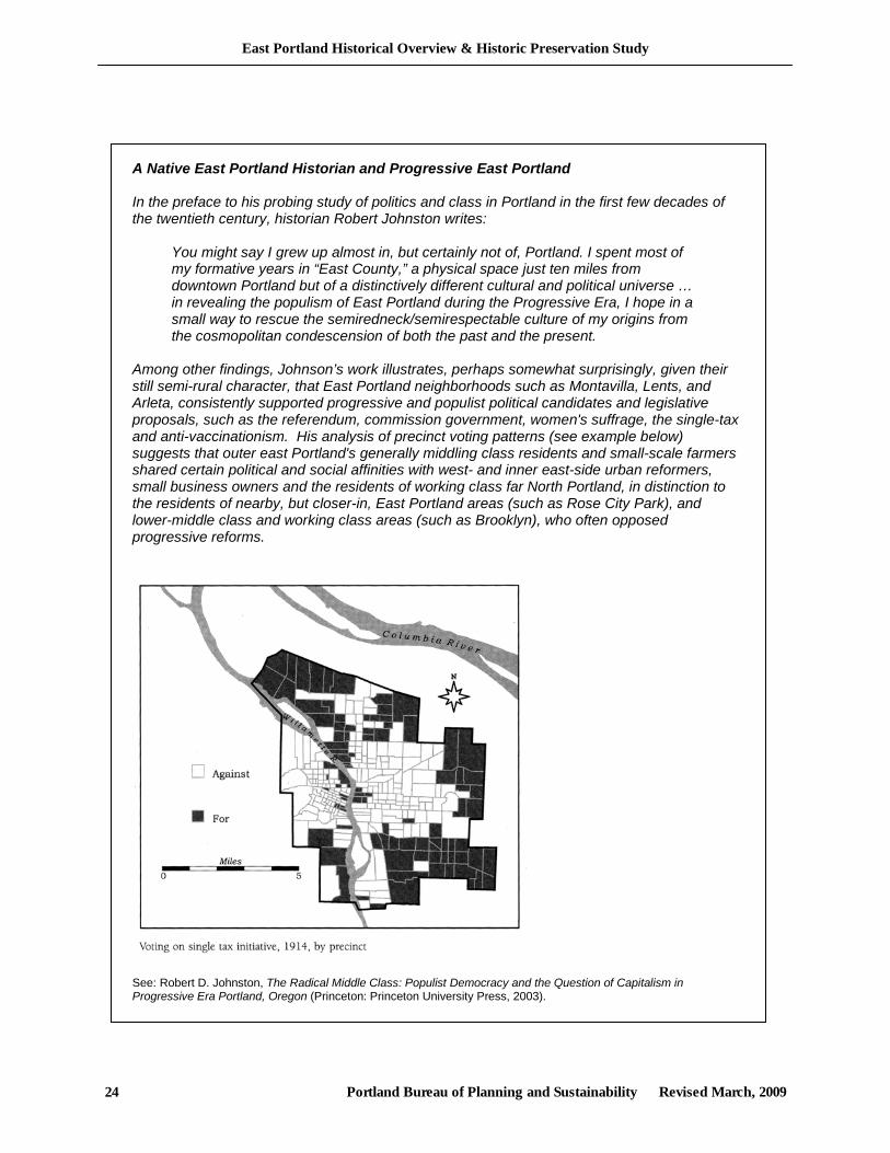
A Native East Portland Historian and Progressive East Portland In the preface to his probing study of politics and class in Portland in the first few decades of the twentieth century, historian Robert Johnston writes:
You might say I grew up almost in, but certainly not of, Portland. I spent most of my formative years in “East County,” a physical space just ten miles from downtown Portland but of a distinctively different cultural and political universe … in revealing the populism of East Portland during the Progressive Era, I hope in a small way to rescue the semiredneck/semirespectable culture of my origins from the cosmopolitan condescension of both the past and the present.
Among other findings, Johnson’s work illustrates, perhaps somewhat surprisingly, given their still semi-rural character, that East Portland neighborhoods such as Montavilla, Lents, and Arleta, consistently supported progressive and populist political candidates and legislative proposals, such as the referendum, commission government, women's suffrage, the single-tax and anti-vaccinationism. His analysis of precinct voting patterns (see example below) suggests that outer east Portland's generally middling class residents and small-scale farmers shared certain political and social affinities with west- and inner east-side urban reformers, small business owners and the residents of working class far North Portland, in distinction to the residents of nearby, but closer-in, East Portland areas (such as Rose City Park), and lower-middle class and working class areas (such as Brooklyn), who often opposed progressive reforms.
See: Robert D. Johnston, The Radical Middle Class: Populist Democracy and the Question of Capitalism in Progressive Era Portland, Oregon (Princeton: Princeton University Press, 2003).
East Portland Historical Overview & Historic Preservation Study
Portland Bureau of Planning and Sustainability Revised March, 2009 25
Parkrose school district records begin in the summer of 1913. Census records show 131 students were enrolled, ages four through 19, and that teachers were paid $80 per month. That same year, the district bonded for $10,000 to construct a four-room building, Parkrose Elementary, better known as the Wygant School when Brainard and Reynolds roads were renamed and the school’s address became 10634 NE Wygant. A high school program was launched two years later. By 1924, enrollment at the Wygant School had increased to 665 students, leading the school board to find overcrowded conditions. A bond measure was passed allocating $31,000 to construct a new high school at NE 106th and Prescott.65
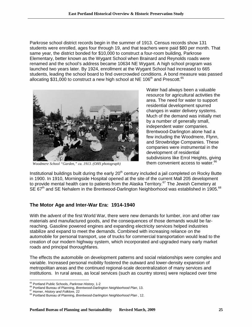
Water had always been a valuable resource for agricultural activities the area. The need for water to support residential development spurred changes in water delivery systems. Much of the demand was initially met by a number of generally small, independent water companies. Brentwood-Darlington alone had a few including the Woodmere, Flynn, and Strowbridge Companies. These companies were instrumental in the development of residential subdivisions like Errol Heights, giving them convenient access to water.66
Institutional buildings built during the early 20th century included a jail completed on Rocky Butte in 1900. In 1910, Morningside Hospital opened at the site of the current Mall 205 development to provide mental health care to patients from the Alaska Territory.67 The Jewish Cemetery at SE 67th and SE Nehalem in the Brentwood-Darlington Neighborhood was established in 1905.68 The Motor Age and Inter-War Era: 1914-1940 With the advent of the first World War, there were new demands for lumber, iron and other raw materials and manufactured goods, and the consequences of those demands would be far-reaching. Gasoline powered engines and expanding electricity services helped industries stabilize and expand to meet the demands. Combined with increasing reliance on the automobile for personal transport, use of trucks for commercial transportation would lead to the creation of our modern highway system, which incorporated and upgraded many early market roads and principal thoroughfares. The effects the automobile on development patterns and social relationships were complex and variable. Increased personal mobility fostered the outward and lower-density expansion of metropolitan areas and the continued regional-scale decentralization of many services and institutions. In rural areas, as local services (such as country stores) were replaced over time 65 Portland Public Schools, Parkrose History, 1-2 66 Portland Bureau of Planning, Brentwood-Darlington Neighborhood Plan, 13. 67 Horner, History and Folklore, 22 68 Portland Bureau of Planning, Brentwood-Darlington Neighborhood Plan , 12.
Woodmere School “Garden,” ca. 1913. (OHS photograph)
East Portland Historical Overview & Historic Preservation Study
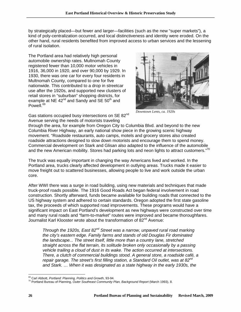
Portland Bureau of Planning and Sustainability Revised March, 2009 26
by strategically placed—but fewer and larger—facilities (such as the new “super markets”), a kind of poly-centralization occurred, and local distinctiveness and identity were eroded. On the other hand, rural residents benefited from improved access to urban services and the lessening of rural isolation. The Portland area had relatively high personal automobile ownership rates. Multnomah County registered fewer than 10,000 motor vehicles in 1916, 36,000 in 1920, and over 90,000 by 1929. In 1930, there was one car for every four residents in Multnomah County, compared to one for five nationwide. This contributed to a drop in streetcar use after the 1920s, and supported new clusters of retail stores in “suburban” shopping districts, for example at NE 42nd and Sandy and SE 50th and Powell.69 Gas stations occupied busy intersections on SE 82nd Avenue serving the needs of motorists traveling through the area, for example from Oregon City to Columbia Blvd. and beyond to the new Columbia River Highway, an early national show piece in the growing scenic highway movement. “Roadside restaurants, auto camps, motels and grocery stores also created roadside attractions designed to slow down motorists and encourage them to spend money. Commercial development on Stark and Glisan also adapted to the influence of the automobile and the new American mobility. Stores had parking lots and neon lights to attract customers.”70 The truck was equally important in changing the way Americans lived and worked. In the Portland area, trucks clearly affected development in outlying areas. Trucks made it easier to move freight out to scattered businesses, allowing people to live and work outside the urban core. After WWI there was a surge in road building, using new materials and techniques that made truck-proof roads possible. The 1916 Good Roads Act began federal involvement in road construction. Shortly afterward, funds became available for building roads that connected to the US highway system and adhered to certain standards. Oregon adopted the first state gasoline tax, the proceeds of which supported road improvements. These programs would have a significant impact on East Portland’s development as new highways were constructed over time and many rural roads and “farm-to-market” routes were improved and became thoroughfares. Journalist Karl Klooster wrote about the transformation of 82nd Avenue:
Through the 1920s, East 82nd Street was a narrow, unpaved rural road marking the city’s eastern edge. Family farms and stands of old Douglas Fir dominated the landscape... The street itself, little more than a country lane, stretched straight across the flat terrain, its solitude broken only occasionally by a passing vehicle trailing a cloud of dust in its wake. The action occurred at intersections. There, a clutch of commercial buildings stood. A general store, a roadside café, a repair garage. The street’s first filling station, a Standard Oil outlet, was at 82nd and Stark. … When it was designated as a state highway in the early 1930s, the
69 Carl Abbott, Portland: Planning, Politics and Growth, 93-94. 70 Portland Bureau of Planning, Outer Southeast Community Plan, Background Report (March 1993), 8.
Downtown Lents, ca. 1920s

East Portland Historical Overview & Historic Preservation Study
Portland Bureau of Planning and Sustainability Revised March, 2009 27
die was cast. The newly named 82nd Avenue (the present system went into effect in 1933) was widened, completely paved and cut through from Milwaukie to Columbia Boulevard. With dramatically increased traffic volume, commercial development quickly followed. In 1937, the last barrier to unbridled building activity was toppled. Upon the planning commission’s recommendation, the city council authorized a zoning change for all of 82nd from “multi-family” to “commercial-industrial.”71
General Trends During the 1920s and 1930s, in much of the Portland area, rapid spatial expansion filled-in areas between formerly separate small communities and towns, which then served as subcenters.72 As the city grew, low density uses such as market gardens, dairies, pastures, marshes and recreation places started to disappear. Under the earlier model of community development, street railways and trolleys allowed development of land miles from downtown areas, but development was limited to areas within a few blocks of the lines, and the residential pattern followed the lines as fingers spread out from the center. Cars changed this pattern by opening up more land than was possible with other forms of transportation, making it possible to develop the areas in between the fingers. By the 1920s, newly accessible fringe areas were growing faster than the central city. During the 1930s, the trend of living in one suburb and working in another rather than downtown continued to grow. The new automobile suburbs were spacious by comparison to the streetcar suburbs. They were laid out with lower densities and larger lots than any other previous housing pattern. Building lots were about 70 percent larger in automobile suburbs than in streetcar suburbs.73
71 Karl Klooster, “Then and now: 82nd Avenue,” This Week, 12/16/1987 72 City of Portland, Portland Historical Context Statement, 55. 73 City of Portland, Portland Historical Context Statement, 52.
Intersection of SE 82nd and Powell, looking north, 1937.
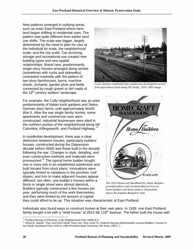
East Portland Historical Overview & Historic Preservation Study
Portland Bureau of Planning and Sustainability Revised March, 2009 28
The 1923 Homecraft Handbook for Home Builders provided advice and recommended services to home builders and home makers. Illustration shows the popular Bungalow style.
New patterns emerged in outlying areas, such as outer East Portland where farm land began shifting to residential uses. The pattern was quite different from earlier land use shifts. The scale was bigger, largely determined by the need to plan for cars at the individual lot scale, the neighborhood scale, and the city scale. Car servicing, storage and recreational use created new building types and new spatial relationships. Brand new, predominantly single-story houses arranged along streets (sometimes with curbs and sidewalks) contrasted markedly with the pattern of two-story farmhouses, barns, machine sheds, orchards, garden plots and fields connected by rough gravel or dirt roads of the 19th century settlers’ landscape. For example, the Cully neighborhood was an area predominantly of Italian truck gardens and Swiss-German dairy farms, until approximately World War II. After the war single family homes, some apartments and commercial uses were constructed. Industrial businesses were sited in the northern portion of the neighborhood along NE Columbia, Killingsworth, and Portland Highway.74 In residential development, there was a clear distinction between houses, particularly builders’ houses, constructed during the Depression decade before WWII and those built in the decade following the war. Changes in style, detailing, and even construction methods and materials were pronounced.75 The typical home builder bought one or more lots in an established subdivision and built houses from stock plans. Innovations were typically limited to variations in the porches, roof slopes, and trim to make adjacent houses appear different; but often, one builder’s houses within a block or single street were almost identical. Builders typically constructed a few houses per year, performing much of the work themselves, and they were limited by the amount of capital they could afford to tie up. This situation was characteristic of East Portland. Individuals also found ways to construct homes at their own pace. In 1939, one East Portland family bought a lot with a “shell house” at 2913 SE 118th Avenue. The father built the house with 74 Portland Bureau of Planning, Cully Neighborhood Plan (1992) 8-9. 75 Alfred M. Staehli, They Sure Don’t Build Them Like They Used To: Federal Housing Administration Insured Builders’ Houses in the Pacific Northwest From 1934 to 1954 (Portland State University: MA thesis 1987), 1.
Lower density residential and commercial development across from agricultural land along NE Sandy, 1924. OHS image.
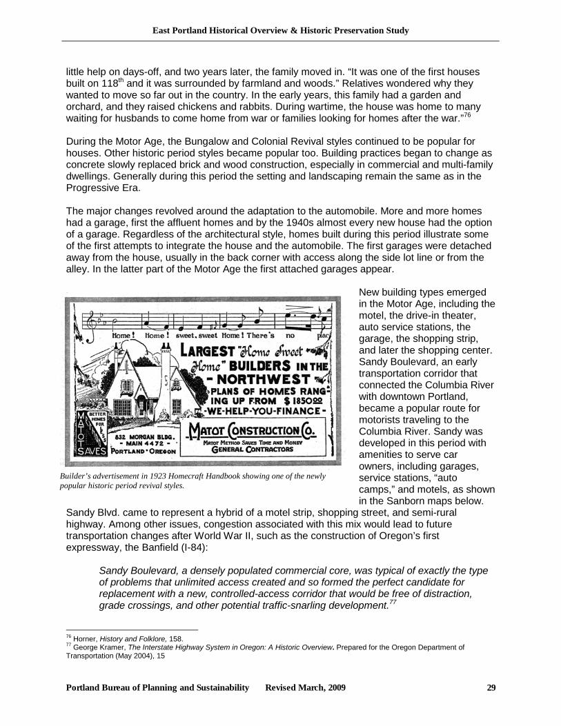
East Portland Historical Overview & Historic Preservation Study
Portland Bureau of Planning and Sustainability Revised March, 2009 29
little help on days-off, and two years later, the family moved in. “It was one of the first houses built on 118th and it was surrounded by farmland and woods.” Relatives wondered why they wanted to move so far out in the country. In the early years, this family had a garden and orchard, and they raised chickens and rabbits. During wartime, the house was home to many waiting for husbands to come home from war or families looking for homes after the war.”76 During the Motor Age, the Bungalow and Colonial Revival styles continued to be popular for houses. Other historic period styles became popular too. Building practices began to change as concrete slowly replaced brick and wood construction, especially in commercial and multi-family dwellings. Generally during this period the setting and landscaping remain the same as in the Progressive Era. The major changes revolved around the adaptation to the automobile. More and more homes had a garage, first the affluent homes and by the 1940s almost every new house had the option of a garage. Regardless of the architectural style, homes built during this period illustrate some of the first attempts to integrate the house and the automobile. The first garages were detached away from the house, usually in the back corner with access along the side lot line or from the alley. In the latter part of the Motor Age the first attached garages appear.
New building types emerged in the Motor Age, including the motel, the drive-in theater, auto service stations, the garage, the shopping strip, and later the shopping center. Sandy Boulevard, an early transportation corridor that connected the Columbia River with downtown Portland, became a popular route for motorists traveling to the Columbia River. Sandy was developed in this period with amenities to serve car owners, including garages, service stations, “auto camps,” and motels, as shown in the Sanborn maps below.
Sandy Blvd. came to represent a hybrid of a motel strip, shopping street, and semi-rural highway. Among other issues, congestion associated with this mix would lead to future transportation changes after World War II, such as the construction of Oregon’s first expressway, the Banfield (I-84):
Sandy Boulevard, a densely populated commercial core, was typical of exactly the type of problems that unlimited access created and so formed the perfect candidate for replacement with a new, controlled-access corridor that would be free of distraction, grade crossings, and other potential traffic-snarling development.77
76 Horner, History and Folklore, 158. 77 George Kramer, The Interstate Highway System in Oregon: A Historic Overview. Prepared for the Oregon Department of Transportation (May 2004), 15
Builder’s advertisement in 1923 Homecraft Handbook showing one of the newly popular historic period revival styles.
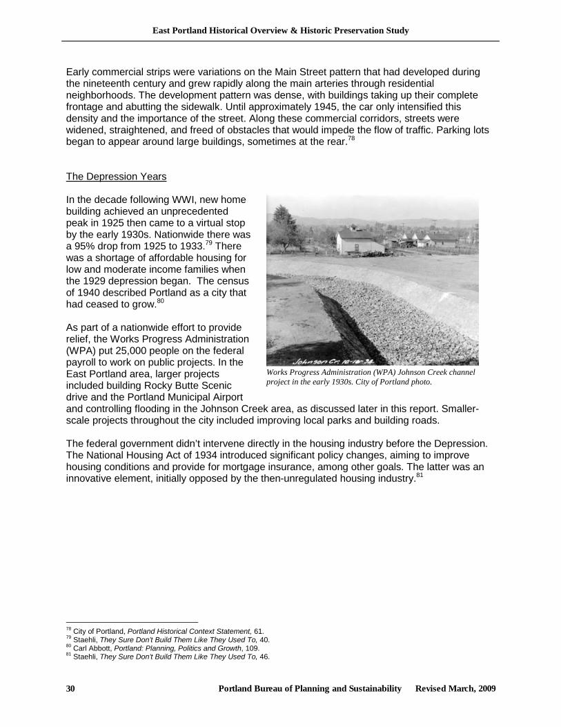
East Portland Historical Overview & Historic Preservation Study
Portland Bureau of Planning and Sustainability Revised March, 2009 30
Early commercial strips were variations on the Main Street pattern that had developed during the nineteenth century and grew rapidly along the main arteries through residential neighborhoods. The development pattern was dense, with buildings taking up their complete frontage and abutting the sidewalk. Until approximately 1945, the car only intensified this density and the importance of the street. Along these commercial corridors, streets were widened, straightened, and freed of obstacles that would impede the flow of traffic. Parking lots began to appear around large buildings, sometimes at the rear.78 The Depression Years In the decade following WWI, new home building achieved an unprecedented peak in 1925 then came to a virtual stop by the early 1930s. Nationwide there was a 95% drop from 1925 to 1933.79 There was a shortage of affordable housing for low and moderate income families when the 1929 depression began. The census of 1940 described Portland as a city that had ceased to grow.80 As part of a nationwide effort to provide relief, the Works Progress Administration (WPA) put 25,000 people on the federal payroll to work on public projects. In the East Portland area, larger projects included building Rocky Butte Scenic drive and the Portland Municipal Airport and controlling flooding in the Johnson Creek area, as discussed later in this report. Smaller-scale projects throughout the city included improving local parks and building roads. The federal government didn’t intervene directly in the housing industry before the Depression. The National Housing Act of 1934 introduced significant policy changes, aiming to improve housing conditions and provide for mortgage insurance, among other goals. The latter was an innovative element, initially opposed by the then-unregulated housing industry.81
78 City of Portland, Portland Historical Context Statement, 61. 79 Staehli, They Sure Don’t Build Them Like They Used To, 40. 80 Carl Abbott, Portland: Planning, Politics and Growth, 109. 81 Staehli, They Sure Don’t Build Them Like They Used To, 46.
Works Progress Administration (WPA) Johnson Creek channel project in the early 1930s. City of Portland photo.
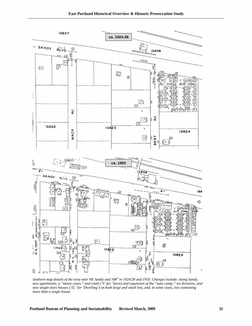
East Portland Historical Overview & Historic Preservation Study
Portland Bureau of Planning and Sustainability Revised March, 2009 31
Sanborn map details of the area near NE Sandy and 188th in 1924/28 and 1950. Changes include: along Sandy, new apartments, a “motor court,” and retail (‘S’ for ‘Store) and expansion of the “auto camp;” lot divisions; and new single-story houses (‘D,’ for ‘Dwelling’) on both large and small lots, and, in some cases, lots containing more than a single house.
ca. 1924-28
ca. 1950
East Portland Historical Overview & Historic Preservation Study
Portland Bureau of Planning and Sustainability Revised March, 2009 32
Under the National Housing Act, the Federal Housing Administration (FHA) put in place a new system of financing private home building that made the purchase of a home as affordable as paying rent and with substantial protections built in against foreclosure. The FHA’s partnership with the home building industry and with research institutions would revolutionize the home building industry in the 1940s and the following decades.82
Research in home planning, building technology and materials, and development of new building materials was stimulated. Architectural journals began to feature articles on housing and the home with an emphasis on the small two or three bedroom house. Research and development into industrialized products produced methods that were used to some extent before WWII, for example, glue laminated timbers, wall panel systems, and exterior use of plywood panels. However, these innovations were slow to take hold and most families who needed housing remained unable to purchase it. Three world fairs in the US during the Depression promoted hopes for the future and the ideal low-cost house that would be built. There were some who did not accept this vision and saw in the exhibits a future of urban sprawl and automobile congestion.83 “ Development Trends Between the World Wars much of the study area still remained rural, but development continued. The new developments weren’t streetcar suburban communities, but the first automobile suburbs. These automobile suburbs developed further out than, and filled-in between, earlier streetcar suburbs. Among the emerging neighborhoods with residential construction in this era were Cully, Sumner, Parkrose, and Brentwood-Darlington, with bungalows and other types from the mid 1920s. Plats of this era differed in a number of ways from the earlier Streetcar Era plats. Blocks remained mainly rectangles with streets continuing to (often imperfectly) interconnect. However, the block sizes varied more than the typical Streetcar era blocks, some measuring 200 by 400 feet, others 200 by 450 feet with deeper lots, and others as large as 450 by 500. Varied block sizes were accompanied by varied lot sizes. In many instances the lots were larger than earlier Streetcar era lots. While most blocks and lots were still platted as rectangles, some plats did take the shape of irregular polygons and triangles, including some in Roseway Plat 2.84 While a number of subdivisions were platted during this period, most of the land was still rural. In these rural areas residents did not necessarily rely on professional home builders to put a roof over their head. In the Brentwood-Darlington Neighborhood in the 1930s, homes were built with little outside help and were often very basic structures.85 Some properties were used as summer residences by urbanites. In the early 1930’s, a Captain Coulter of the Portland Police Bureau built a log cabin as a summer home for himself and his mother south of Powel Butte, near Johnson Creek. Coulter “had access to the jail inmates, so he used them to construct the log house,” using Tamarack logs brought in from Eastern Oregon. A later resident of the house “found a few notes stuck under the eaves, written by some of the men working on the house, complaining about the poor food that was furnished for them.” The cabin was demolished sometime after 2001.86
82 Staehli, They Sure Don’t Build Them Like They Used To, 54-55. 83 Staehli, They Sure Don’t Build Them Like They Used To, 78. 84 Brentwood-Darlington Neighborhood Plan (1992), 12 85 Brentwood-Darlington Neighborhood Plan (1992), 14. 86 Bayles, “Some History of the Log House on Circle Avenue.”
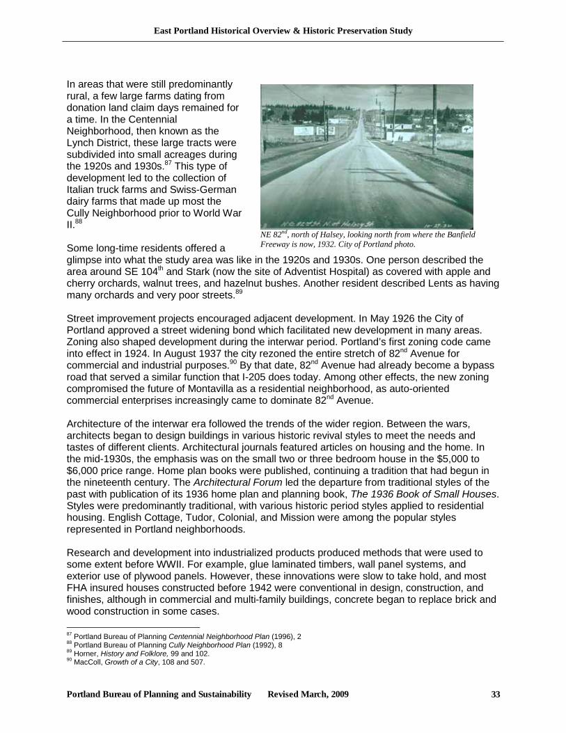
East Portland Historical Overview & Historic Preservation Study
Portland Bureau of Planning and Sustainability Revised March, 2009 33
In areas that were still predominantly rural, a few large farms dating from donation land claim days remained for a time. In the Centennial Neighborhood, then known as the Lynch District, these large tracts were subdivided into small acreages during the 1920s and 1930s.87 This type of development led to the collection of Italian truck farms and Swiss-German dairy farms that made up most the Cully Neighborhood prior to World War II.88 Some long-time residents offered a glimpse into what the study area was like in the 1920s and 1930s. One person described the area around SE 104th and Stark (now the site of Adventist Hospital) as covered with apple and cherry orchards, walnut trees, and hazelnut bushes. Another resident described Lents as having many orchards and very poor streets.89 Street improvement projects encouraged adjacent development. In May 1926 the City of Portland approved a street widening bond which facilitated new development in many areas. Zoning also shaped development during the interwar period. Portland’s first zoning code came into effect in 1924. In August 1937 the city rezoned the entire stretch of 82nd Avenue for commercial and industrial purposes.90 By that date, 82nd Avenue had already become a bypass road that served a similar function that I-205 does today. Among other effects, the new zoning compromised the future of Montavilla as a residential neighborhood, as auto-oriented commercial enterprises increasingly came to dominate 82nd Avenue. Architecture of the interwar era followed the trends of the wider region. Between the wars, architects began to design buildings in various historic revival styles to meet the needs and tastes of different clients. Architectural journals featured articles on housing and the home. In the mid-1930s, the emphasis was on the small two or three bedroom house in the $5,000 to $6,000 price range. Home plan books were published, continuing a tradition that had begun in the nineteenth century. The Architectural Forum led the departure from traditional styles of the past with publication of its 1936 home plan and planning book, The 1936 Book of Small Houses. Styles were predominantly traditional, with various historic period styles applied to residential housing. English Cottage, Tudor, Colonial, and Mission were among the popular styles represented in Portland neighborhoods. Research and development into industrialized products produced methods that were used to some extent before WWII. For example, glue laminated timbers, wall panel systems, and exterior use of plywood panels. However, these innovations were slow to take hold, and most FHA insured houses constructed before 1942 were conventional in design, construction, and finishes, although in commercial and multi-family buildings, concrete began to replace brick and wood construction in some cases. 87 Portland Bureau of Planning Centennial Neighborhood Plan (1996), 2 88 Portland Bureau of Planning Cully Neighborhood Plan (1992), 8 89 Horner, History and Folklore, 99 and 102. 90 MacColl, Growth of a City, 108 and 507.
NE 82nd, north of Halsey, looking north from where the Banfield Freeway is now, 1932. City of Portland photo.
East Portland Historical Overview & Historic Preservation Study
Portland Bureau of Planning and Sustainability Revised March, 2009 34
In semi-rural communities such as Brentwood-Darlington, grocery stores developed to serve surrounding areas and served as community focal points. For years an important community landmark was the 1916 Moll Store, at what is now Powell Boulevard and 122nd.91 Most of these communities also developed fire districts in the 1930’s and 1940’s. For years many parts of the area covered with hazel brush and other vegetation would burn in major brush fires. Parkrose Fire District #2 formed in 1935 followed by Faloma District #5 in 1941, Russelville District #6 and Kelley Butte District #7 in 1942, Twelve-mile Corner District #9 in 1946, and Erroll Heights District #12 in 1948.92 Many streets had different names than they do now, including: Division Street/Section Line Road, Halsey Street/Barr Road, Glisan Street/Villa Avenue, Market Street/Everglade Avenue, 102nd Avenue/Craig Road, 122nd Avenue/Buckley Road, 128th Avenue/Lennox Avenue, 130th Avenue/Prune Road, 135th Avenue/Taylor Avenue, 136th Avenue/Gates Road, to name a few.93
As the Depression entered the 1940s and the US mobilized for WWII, the home building industry began to organize a support structure to help home builders and developers compete successfully, build effectively, and coordinate marketing.
The War Years: 1941-1945 Portland changed dramatically during the war years, with a large number of new residents that came to work in shipbuilding close to the city center, and also further out in Troutdale and Vancouver, Washington where Alcoa located aluminum plants. West Coast merchant shipping grew, and along with it a workforce. There were severe housing shortages. Like all war boom cities, Portland made frantic efforts to provide sufficient housing, transportation, utilities and services, especially during 1942 and 1943. Some communities grew very rapidly. Many houses were hastily or inadequately constructed and subdivisions often lacked adequate street improvements as in the 1930s. For example, cheaply built barracks used as housing for workers at Bonneville Dam were purchased and moved to Errol Heights (now Brentwood-Darlington).94 During WWII, Portland-area firms won ship-building military contracts, and thousands of un- and underemployed people moved to the region. New workers arriving in 1941 promptly added 30,000 to the city population. This put a great strain on public facilities after a period of practically no change or growth. By May 1944, the population of Portland had grown by 54,000 from its 1940 figure. The sudden increase in jobs and the onset of gasoline rationing doubled the ridership on public transit. The system’s management added 200 new buses and 150 trucks in an effort to connect populations centers to war plants and recreation.95
91 Horner, History and Folklore, 21 92 Ibid, 20 and Brentwood-Darlington Plan (1992), 14 93 Portland Bureau of Planning, Hazelwood Neighborhood Plan (1996), 4. 94 Portland Bureau of Planning, Brentwood-Darlington Neighborhood Plan (1992), 15. 95 Carl Abbott, Portland: Planning, Politics and Growth, 126-7.
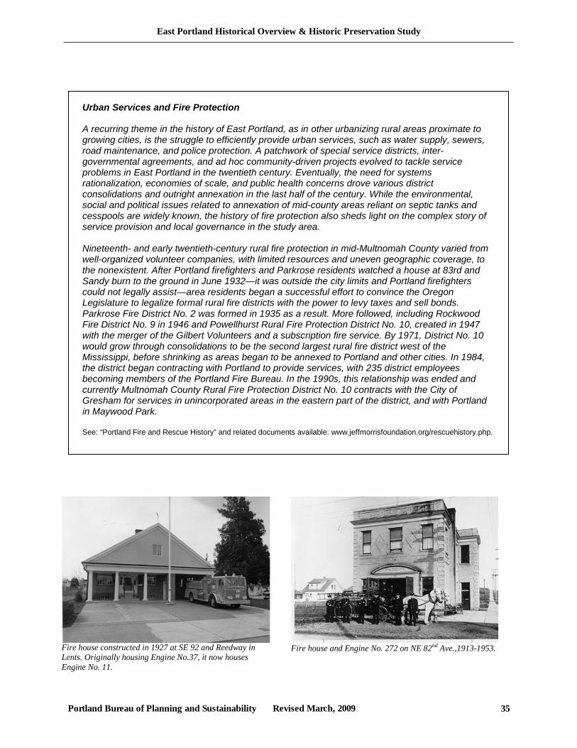
East Portland Historical Overview & Historic Preservation Study
Portland Bureau of Planning and Sustainability Revised March, 2009 35
Fire house constructed in 1927 at SE 92 and Reedway in Lents. Originally housing Engine No.37, it now houses Engine No. 11.
Urban Services and Fire Protection A recurring theme in the history of East Portland, as in other urbanizing rural areas proximate to growing cities, is the struggle to efficiently provide urban services, such as water supply, sewers, road maintenance, and police protection. A patchwork of special service districts, inter-governmental agreements, and ad hoc community-driven projects evolved to tackle service problems in East Portland in the twentieth century. Eventually, the need for systems rationalization, economies of scale, and public health concerns drove various district consolidations and outright annexation in the last half of the century. While the environmental, social and political issues related to annexation of mid-county areas reliant on septic tanks and cesspools are widely known, the history of fire protection also sheds light on the complex story of service provision and local governance in the study area. Nineteenth- and early twentieth-century rural fire protection in mid-Multnomah County varied from well-organized volunteer companies, with limited resources and uneven geographic coverage, to the nonexistent. After Portland firefighters and Parkrose residents watched a house at 83rd and Sandy burn to the ground in June 1932—it was outside the city limits and Portland firefighters could not legally assist—area residents began a successful effort to convince the Oregon Legislature to legalize formal rural fire districts with the power to levy taxes and sell bonds. Parkrose Fire District No. 2 was formed in 1935 as a result. More followed, including Rockwood Fire District No. 9 in 1946 and Powellhurst Rural Fire Protection District No. 10, created in 1947 with the merger of the Gilbert Volunteers and a subscription fire service. By 1971, District No. 10 would grow through consolidations to be the second largest rural fire district west of the Mississippi, before shrinking as areas began to be annexed to Portland and other cities. In 1984, the district began contracting with Portland to provide services, with 235 district employees becoming members of the Portland Fire Bureau. In the 1990s, this relationship was ended and currently Multnomah County Rural Fire Protection District No. 10 contracts with the City of Gresham for services in unincorporated areas in the eastern part of the district, and with Portland in Maywood Park. See: “Portland Fire and Rescue History” and related documents available: www.jeffmorrisfoundation.org/rescuehistory.php.
Fire house and Engine No. 272 on NE 82nd Ave.,1913-1953.
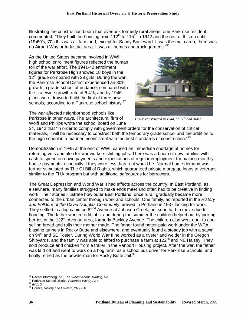
East Portland Historical Overview & Historic Preservation Study
Portland Bureau of Planning and Sustainability Revised March, 2009 36
Illustrating the construction boom that overtook formerly rural areas, one Parkrose resident commented, “They built the housing from 112th to 115th in 1942 and the rest of this up until (19)60’s, 70s this was all farmland, except for Sandy Boulevard. It was the main area, there was no Airport Way or Industrial area. It was all homes and truck gardens.”96 As the United States became involved in WWII, high school enrollment figures reflected the human toll of the war effort. The 1941-42 enrollment figures for Parkrose High showed 18 boys in the 12th grade compared with 38 girls. During the war, the Parkrose School District experienced an 80% growth in grade school attendance, compared with the statewide growth rate of 6.4%, and by 1946 plans were drawn to build the first of three new schools, according to a Parkrose school history.97 The war affected neighborhood schools like Parkrose in other ways. The architectural firm of Wolff and Phillips wrote the school board on June 24, 1942 that “in order to comply with government orders for the conservation of critical materials, it will be necessary to construct both the temporary grade school and the addition to the high school in a manner inconsistent with the best standards of construction.”98
Demobilization in 1945 at the end of WWII caused an immediate shortage of homes for returning vets and also for war workers shifting jobs. There was a boom of new families with cash to spend on down payments and expectations of regular employment for making monthly house payments, especially if they were less than rent would be. Normal home demand was further stimulated by The GI Bill of Rights, which guaranteed private mortgage loans to veterans similar to the FHA program but with additional safeguards for borrowers. The Great Depression and World War II had effects across the country. In East Portland, as elsewhere, many families struggled to make ends meet and often had to be creative in finding work. Their stories illustrate how outer East Portland, once rural, gradually became more connected to the urban center through work and schools. One family, as reported in the History and Folklore of the David Douglas Community, arrived in Portland in 1937 looking for work. They settled in a log cabin on 82nd Avenue at Johnson Creek, but soon had to move due to flooding. The father worked odd jobs, and during the summer the children helped out by picking berries in the 122nd Avenue area, formerly Buckley Avenue. The children also went door to door selling bread and rolls their mother made. The father found better-paid work under the WPA, blasting tunnels in Rocky Butte and elsewhere, and eventually found a steady job with a sawmill on 94th and SE Foster. During World War II he worked as a riveter and welder in the Oregon Shipyards, and the family was able to afford to purchase a farm at 122nd and NE Halsey. They sold produce and chicken from a trailer in the Vanport Housing project. After the war, the father was laid off and went to work on a hog farm, as a school bus driver for Parkrose Schools, and finally retired as the powderman for Rocky Butte Jail.99
96 Rachel Blumberg, ed., The Wheel Keeps Turning, 50. 97 Parkrose School District, Parkrose History, 3-4. 98 Ibid., 3. 99 Horner, History and Folklore, 265-266.
House constructed in 1944, SE 88th and Alder.
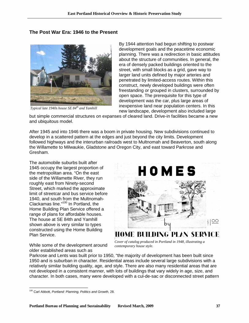
East Portland Historical Overview & Historic Preservation Study
Portland Bureau of Planning and Sustainability Revised March, 2009 37
The Post War Era: 1946 to the Present
By 1944 attention had begun shifting to postwar development goals and the peacetime economic planning. There was a redirection in basic attitudes about the structure of communities. In general, the era of densely packed buildings oriented to the street, with small blocks as a grid, gave way to larger land units defined by major arteries and penetrated by limited-access routes. Within this construct, newly developed buildings were often freestanding or grouped in clusters, surrounded by open space. The prerequisite for this type of development was the car, plus large areas of inexpensive land near population centers. In this new landscape, development also included large
but simple commercial structures on expanses of cleared land. Drive-in facilities became a new and ubiquitous model. After 1945 and into 1946 there was a boom in private housing. New subdivisions continued to develop in a scattered pattern at the edges and just beyond the city limits. Development followed highways and the interurban railroads west to Multnomah and Beaverton, south along the Willamette to Milwaukie, Gladstone and Oregon City, and east toward Parkrose and Gresham. The automobile suburbs built after 1945 occupy the largest proportion of the metropolitan area. “On the east side of the Willamette River, they run roughly east from Ninety-second Street, which marked the approximate limit of streetcar and bus service before 1940, and south from the Multnomah-Clackamas line.”100 In Portland, the Home Building Plan Service offered a range of plans for affordable houses. The house at SE 84th and Yamhill shown above is very similar to types constructed using the Home Building Plan Service. While some of the development around older established areas such as Parkrose and Lents was built prior to 1950, “the majority of development has been built since 1950 and is suburban in character. Residential areas include several large subdivisions with a relatively similar building quality, age, and style. There are also many residential areas that are not developed in a consistent manner, with lots of buildings that vary widely in age, size, and character. In both cases, many were developed with a cul-de-sac or disconnected street pattern
100 Carl Abbott, Portland: Planning, Politics and Growth, 28.
Typical late 1940s house SE 84th and Yamhill
Cover of catalog produced in Portland in 1948, illustrating a contemporary house style.
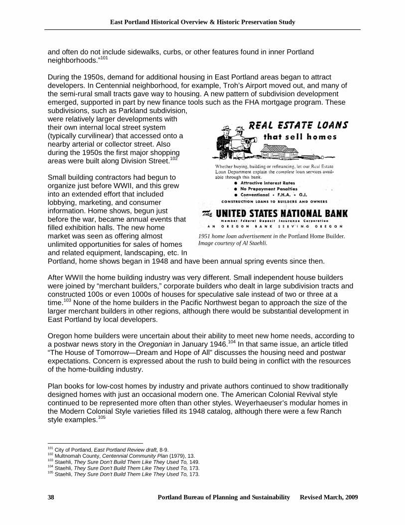
East Portland Historical Overview & Historic Preservation Study
Portland Bureau of Planning and Sustainability Revised March, 2009 38
1951 home loan advertisement in the Portland Home Builder. Image courtesy of Al Staehli.
and often do not include sidewalks, curbs, or other features found in inner Portland neighborhoods.”101 During the 1950s, demand for additional housing in East Portland areas began to attract developers. In Centennial neighborhood, for example, Troh’s Airport moved out, and many of the semi-rural small tracts gave way to housing. A new pattern of subdivision development emerged, supported in part by new finance tools such as the FHA mortgage program. These subdivisions, such as Parkland subdivision, were relatively larger developments with their own internal local street system (typically curvilinear) that accessed onto a nearby arterial or collector street. Also during the 1950s the first major shopping areas were built along Division Street.102
Small building contractors had begun to organize just before WWII, and this grew into an extended effort that included lobbying, marketing, and consumer information. Home shows, begun just before the war, became annual events that filled exhibition halls. The new home market was seen as offering almost unlimited opportunities for sales of homes and related equipment, landscaping, etc. In Portland, home shows began in 1948 and have been annual spring events since then.
After WWII the home building industry was very different. Small independent house builders were joined by “merchant builders,” corporate builders who dealt in large subdivision tracts and constructed 100s or even 1000s of houses for speculative sale instead of two or three at a time.103 None of the home builders in the Pacific Northwest began to approach the size of the larger merchant builders in other regions, although there would be substantial development in East Portland by local developers.
Oregon home builders were uncertain about their ability to meet new home needs, according to a postwar news story in the Oregonian in January 1946.104 In that same issue, an article titled “The House of Tomorrow—Dream and Hope of All” discusses the housing need and postwar expectations. Concern is expressed about the rush to build being in conflict with the resources of the home-building industry. Plan books for low-cost homes by industry and private authors continued to show traditionally designed homes with just an occasional modern one. The American Colonial Revival style continued to be represented more often than other styles. Weyerhaeuser’s modular homes in the Modern Colonial Style varieties filled its 1948 catalog, although there were a few Ranch style examples.105
101 City of Portland, East Portland Review draft, 8-9. 102 Multnomah County, Centennial Community Plan (1979), 13. 103 Staehli, They Sure Don’t Build Them Like They Used To, 149. 104 Staehli, They Sure Don’t Build Them Like They Used To, 173. 105 Staehli, They Sure Don’t Build Them Like They Used To, 173.
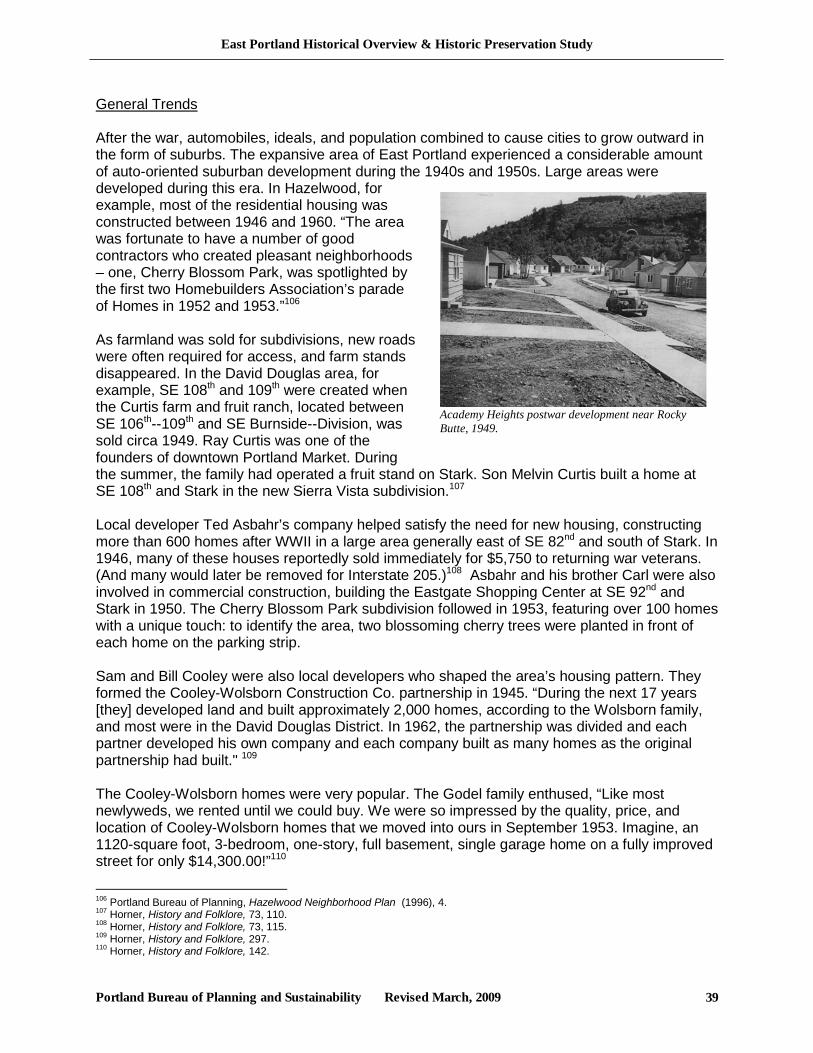
East Portland Historical Overview & Historic Preservation Study
Portland Bureau of Planning and Sustainability Revised March, 2009 39
General Trends After the war, automobiles, ideals, and population combined to cause cities to grow outward in the form of suburbs. The expansive area of East Portland experienced a considerable amount of auto-oriented suburban development during the 1940s and 1950s. Large areas were developed during this era. In Hazelwood, for example, most of the residential housing was constructed between 1946 and 1960. “The area was fortunate to have a number of good contractors who created pleasant neighborhoods – one, Cherry Blossom Park, was spotlighted by the first two Homebuilders Association’s parade of Homes in 1952 and 1953.”106 As farmland was sold for subdivisions, new roads were often required for access, and farm stands disappeared. In the David Douglas area, for example, SE 108th and 109th were created when the Curtis farm and fruit ranch, located between SE 106th--109th and SE Burnside--Division, was sold circa 1949. Ray Curtis was one of the founders of downtown Portland Market. During the summer, the family had operated a fruit stand on Stark. Son Melvin Curtis built a home at SE 108th and Stark in the new Sierra Vista subdivision.107 Local developer Ted Asbahr’s company helped satisfy the need for new housing, constructing more than 600 homes after WWII in a large area generally east of SE 82nd and south of Stark. In 1946, many of these houses reportedly sold immediately for $5,750 to returning war veterans. (And many would later be removed for Interstate 205.)108 Asbahr and his brother Carl were also involved in commercial construction, building the Eastgate Shopping Center at SE 92nd and Stark in 1950. The Cherry Blossom Park subdivision followed in 1953, featuring over 100 homes with a unique touch: to identify the area, two blossoming cherry trees were planted in front of each home on the parking strip. Sam and Bill Cooley were also local developers who shaped the area’s housing pattern. They formed the Cooley-Wolsborn Construction Co. partnership in 1945. “During the next 17 years [they] developed land and built approximately 2,000 homes, according to the Wolsborn family, and most were in the David Douglas District. In 1962, the partnership was divided and each partner developed his own company and each company built as many homes as the original partnership had built." 109 The Cooley-Wolsborn homes were very popular. The Godel family enthused, “Like most newlyweds, we rented until we could buy. We were so impressed by the quality, price, and location of Cooley-Wolsborn homes that we moved into ours in September 1953. Imagine, an 1120-square foot, 3-bedroom, one-story, full basement, single garage home on a fully improved street for only $14,300.00!”110
106 Portland Bureau of Planning, Hazelwood Neighborhood Plan (1996), 4. 107 Horner, History and Folklore, 73, 110. 108 Horner, History and Folklore, 73, 115. 109 Horner, History and Folklore, 297. 110 Horner, History and Folklore, 142.
Academy Heights postwar development near Rocky Butte, 1949.
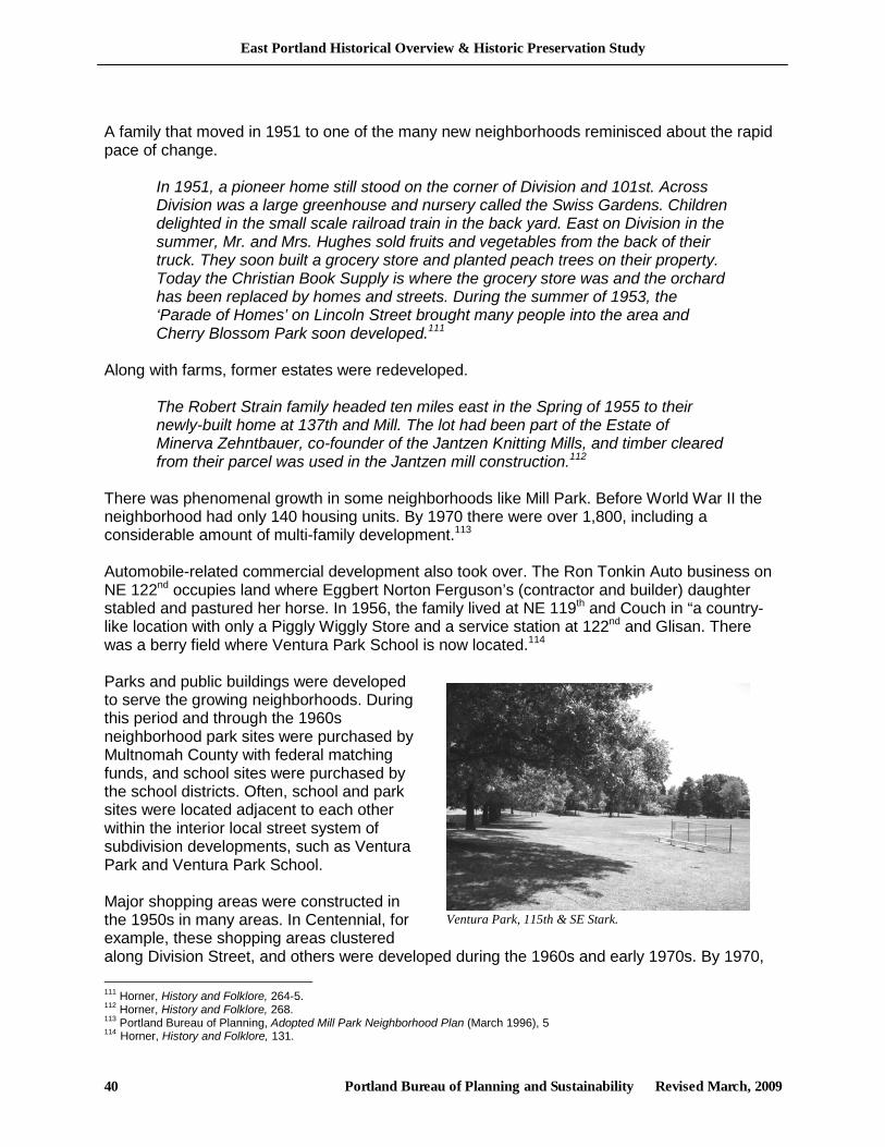
East Portland Historical Overview & Historic Preservation Study
Portland Bureau of Planning and Sustainability Revised March, 2009 40
A family that moved in 1951 to one of the many new neighborhoods reminisced about the rapid pace of change.
In 1951, a pioneer home still stood on the corner of Division and 101st. Across Division was a large greenhouse and nursery called the Swiss Gardens. Children delighted in the small scale railroad train in the back yard. East on Division in the summer, Mr. and Mrs. Hughes sold fruits and vegetables from the back of their truck. They soon built a grocery store and planted peach trees on their property. Today the Christian Book Supply is where the grocery store was and the orchard has been replaced by homes and streets. During the summer of 1953, the ‘Parade of Homes’ on Lincoln Street brought many people into the area and Cherry Blossom Park soon developed.111
Along with farms, former estates were redeveloped.
The Robert Strain family headed ten miles east in the Spring of 1955 to their newly-built home at 137th and Mill. The lot had been part of the Estate of Minerva Zehntbauer, co-founder of the Jantzen Knitting Mills, and timber cleared from their parcel was used in the Jantzen mill construction.112
There was phenomenal growth in some neighborhoods like Mill Park. Before World War II the neighborhood had only 140 housing units. By 1970 there were over 1,800, including a considerable amount of multi-family development.113 Automobile-related commercial development also took over. The Ron Tonkin Auto business on NE 122nd occupies land where Eggbert Norton Ferguson’s (contractor and builder) daughter stabled and pastured her horse. In 1956, the family lived at NE 119th and Couch in “a country-like location with only a Piggly Wiggly Store and a service station at 122nd and Glisan. There was a berry field where Ventura Park School is now located.114 Parks and public buildings were developed to serve the growing neighborhoods. During this period and through the 1960s neighborhood park sites were purchased by Multnomah County with federal matching funds, and school sites were purchased by the school districts. Often, school and park sites were located adjacent to each other within the interior local street system of subdivision developments, such as Ventura Park and Ventura Park School. Major shopping areas were constructed in the 1950s in many areas. In Centennial, for example, these shopping areas clustered along Division Street, and others were developed during the 1960s and early 1970s. By 1970, 111 Horner, History and Folklore, 264-5. 112 Horner, History and Folklore, 268. 113 Portland Bureau of Planning, Adopted Mill Park Neighborhood Plan (March 1996), 5 114 Horner, History and Folklore, 131.
Ventura Park, 115th & SE Stark.
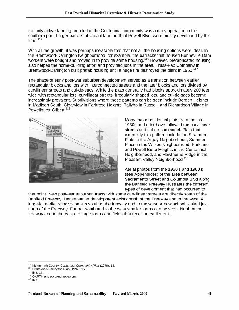
East Portland Historical Overview & Historic Preservation Study
Portland Bureau of Planning and Sustainability Revised March, 2009 41
the only active farming area left in the Centennial community was a dairy operation in the southern part. Larger parcels of vacant land north of Powell Blvd. were mostly developed by this time.115 With all the growth, it was perhaps inevitable that that not all the housing options were ideal. In the Brentwood-Darlington Neighborhood, for example, the barracks that housed Bonneville Dam workers were bought and moved in to provide some housing.116 However, prefabricated housing also helped the home-building effort and provided jobs in the area. Truss-Fab Company in Brentwood-Darlington built prefab housing until a huge fire destroyed the plant in 1950.117 The shape of early post-war suburban development served as a transition between earlier rectangular blocks and lots with interconnected streets and the later blocks and lots divided by curvilinear streets and cul-de-sacs. While the plats generally had blocks approximately 200 feet wide with rectangular lots, curvilinear streets, irregularly shaped lots, and cul-de-sacs became increasingly prevalent. Subdivisions where these patterns can be seen include Borden Heights in Madison South, Clearview in Parkrose Heights, Tallyho in Russell, and Richardson Village in Powellhurst-Gilbert.118
Many major residential plats from the late 1950s and after have followed the curvilinear streets and cul-de-sac model. Plats that exemplify this pattern include the Stratmore Plats in the Argay Neighborhood, Summer Place in the Wilkes Neighborhood, Parklane and Powell Butte Heights in the Centennial Neighborhood, and Hawthorne Ridge in the Pleasant Valley Neighborhood.119 Aerial photos from the 1950’s and 1960’s (see Appendices) of the area between Sacramento Street and Columbia Blvd along the Banfield Freeway illustrates the different types of development that had occurred to
that point. New post-war suburban tracts with some curvilinear streets are directly south of the Banfield Freeway. Dense earlier development exists north of the Freeway and to the west. A large-lot earlier subdivision sits south of the freeway and to the west. A new school is sited just north of the Freeway. Further south and to the west smaller farms can be seen. North of the freeway and to the east are large farms and fields that recall an earlier era.
115 Multnomah County, Centennial Community Plan (1979), 13. 116 Brentwood-Darlington Plan (1992), 15. 117 ibid. 15. 118 GARTH and portlandmaps.com. 119 ibid.
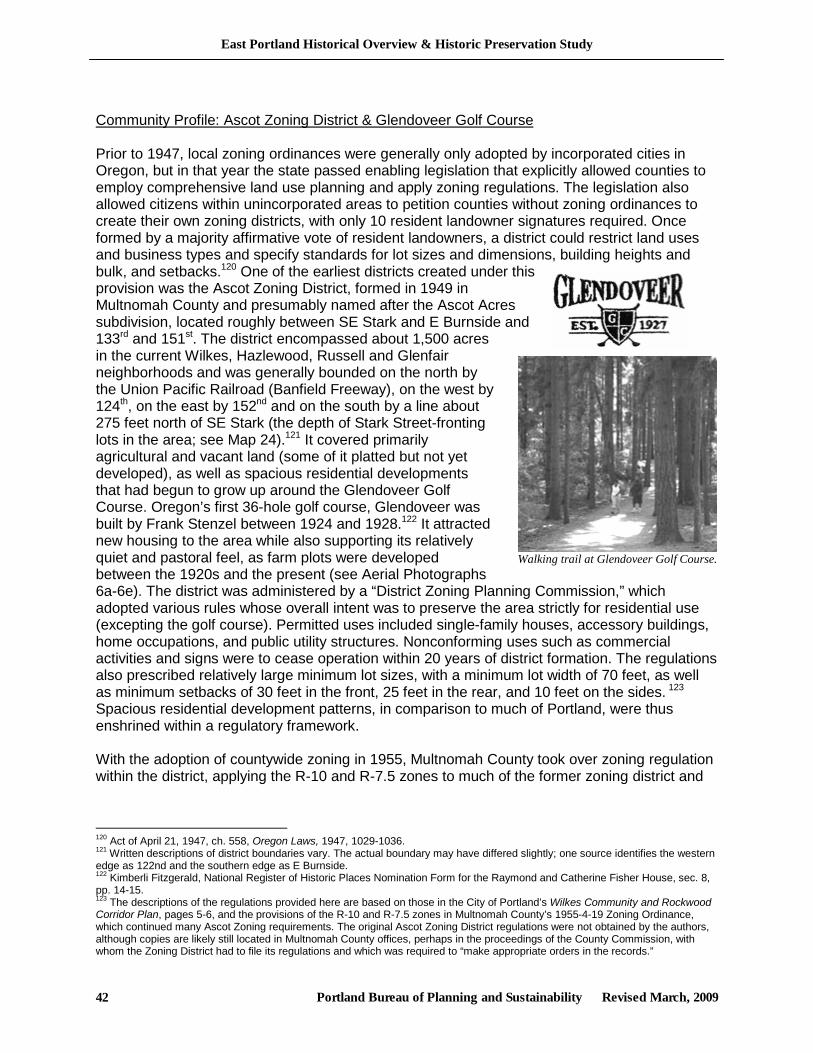
East Portland Historical Overview & Historic Preservation Study
Portland Bureau of Planning and Sustainability Revised March, 2009 42
Community Profile: Ascot Zoning District & Glendoveer Golf Course Prior to 1947, local zoning ordinances were generally only adopted by incorporated cities in Oregon, but in that year the state passed enabling legislation that explicitly allowed counties to employ comprehensive land use planning and apply zoning regulations. The legislation also allowed citizens within unincorporated areas to petition counties without zoning ordinances to create their own zoning districts, with only 10 resident landowner signatures required. Once formed by a majority affirmative vote of resident landowners, a district could restrict land uses and business types and specify standards for lot sizes and dimensions, building heights and bulk, and setbacks.120 One of the earliest districts created under this provision was the Ascot Zoning District, formed in 1949 in Multnomah County and presumably named after the Ascot Acres subdivision, located roughly between SE Stark and E Burnside and 133rd and 151st. The district encompassed about 1,500 acres in the current Wilkes, Hazlewood, Russell and Glenfair neighborhoods and was generally bounded on the north by the Union Pacific Railroad (Banfield Freeway), on the west by 124th, on the east by 152nd and on the south by a line about 275 feet north of SE Stark (the depth of Stark Street-fronting lots in the area; see Map 24).121 It covered primarily agricultural and vacant land (some of it platted but not yet developed), as well as spacious residential developments that had begun to grow up around the Glendoveer Golf Course. Oregon’s first 36-hole golf course, Glendoveer was built by Frank Stenzel between 1924 and 1928.122 It attracted new housing to the area while also supporting its relatively quiet and pastoral feel, as farm plots were developed between the 1920s and the present (see Aerial Photographs 6a-6e). The district was administered by a “District Zoning Planning Commission,” which adopted various rules whose overall intent was to preserve the area strictly for residential use (excepting the golf course). Permitted uses included single-family houses, accessory buildings, home occupations, and public utility structures. Nonconforming uses such as commercial activities and signs were to cease operation within 20 years of district formation. The regulations also prescribed relatively large minimum lot sizes, with a minimum lot width of 70 feet, as well as minimum setbacks of 30 feet in the front, 25 feet in the rear, and 10 feet on the sides. 123 Spacious residential development patterns, in comparison to much of Portland, were thus enshrined within a regulatory framework. With the adoption of countywide zoning in 1955, Multnomah County took over zoning regulation within the district, applying the R-10 and R-7.5 zones to much of the former zoning district and
120 Act of April 21, 1947, ch. 558, Oregon Laws, 1947, 1029-1036. 121 Written descriptions of district boundaries vary. The actual boundary may have differed slightly; one source identifies the western edge as 122nd and the southern edge as E Burnside. 122 Kimberli Fitzgerald, National Register of Historic Places Nomination Form for the Raymond and Catherine Fisher House, sec. 8, pp. 14-15. 123 The descriptions of the regulations provided here are based on those in the City of Portland’s Wilkes Community and Rockwood Corridor Plan, pages 5-6, and the provisions of the R-10 and R-7.5 zones in Multnomah County’s 1955-4-19 Zoning Ordinance, which continued many Ascot Zoning requirements. The original Ascot Zoning District regulations were not obtained by the authors, although copies are likely still located in Multnomah County offices, perhaps in the proceedings of the County Commission, with whom the Zoning District had to file its regulations and which was required to “make appropriate orders in the records.”
Walking trail at Glendoveer Golf Course.
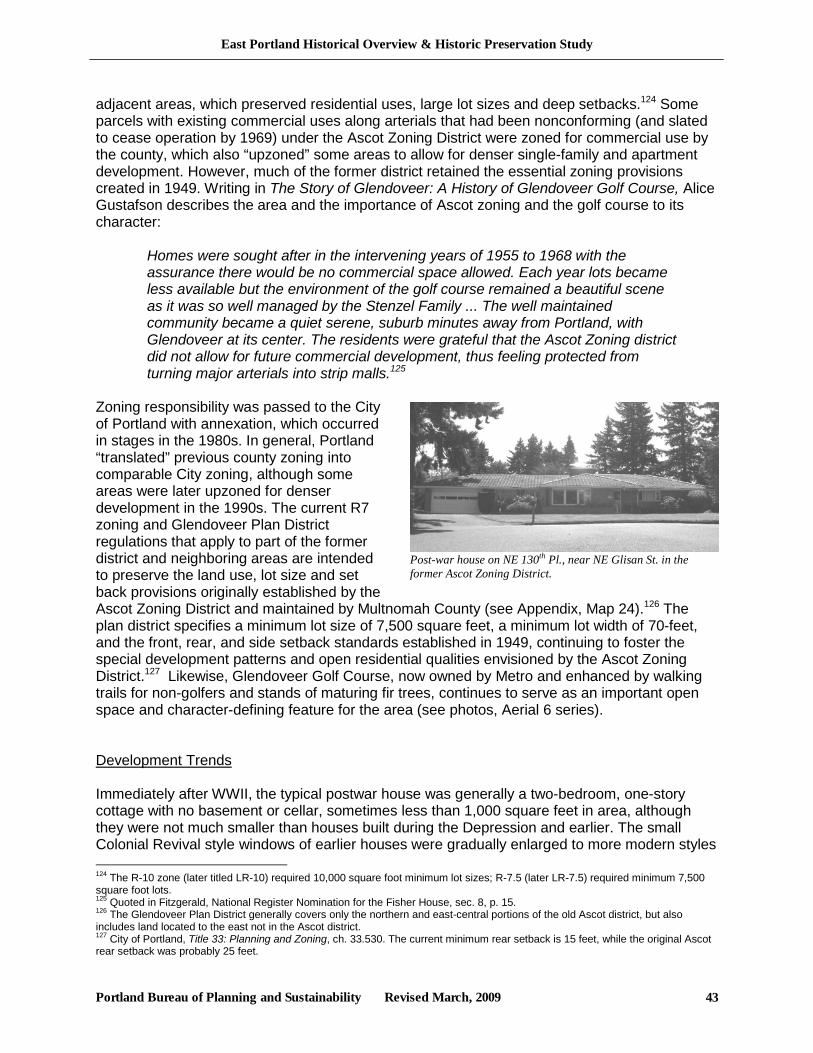
East Portland Historical Overview & Historic Preservation Study
Portland Bureau of Planning and Sustainability Revised March, 2009 43
Post-war house on NE 130th Pl., near NE Glisan St. in the former Ascot Zoning District.
adjacent areas, which preserved residential uses, large lot sizes and deep setbacks.124 Some parcels with existing commercial uses along arterials that had been nonconforming (and slated to cease operation by 1969) under the Ascot Zoning District were zoned for commercial use by the county, which also “upzoned” some areas to allow for denser single-family and apartment development. However, much of the former district retained the essential zoning provisions created in 1949. Writing in The Story of Glendoveer: A History of Glendoveer Golf Course, Alice Gustafson describes the area and the importance of Ascot zoning and the golf course to its character:
Homes were sought after in the intervening years of 1955 to 1968 with the assurance there would be no commercial space allowed. Each year lots became less available but the environment of the golf course remained a beautiful scene as it was so well managed by the Stenzel Family ... The well maintained community became a quiet serene, suburb minutes away from Portland, with Glendoveer at its center. The residents were grateful that the Ascot Zoning district did not allow for future commercial development, thus feeling protected from turning major arterials into strip malls.125
Zoning responsibility was passed to the City of Portland with annexation, which occurred in stages in the 1980s. In general, Portland “translated” previous county zoning into comparable City zoning, although some areas were later upzoned for denser development in the 1990s. The current R7 zoning and Glendoveer Plan District regulations that apply to part of the former district and neighboring areas are intended to preserve the land use, lot size and set back provisions originally established by the Ascot Zoning District and maintained by Multnomah County (see Appendix, Map 24).126 The plan district specifies a minimum lot size of 7,500 square feet, a minimum lot width of 70-feet, and the front, rear, and side setback standards established in 1949, continuing to foster the special development patterns and open residential qualities envisioned by the Ascot Zoning District.127 Likewise, Glendoveer Golf Course, now owned by Metro and enhanced by walking trails for non-golfers and stands of maturing fir trees, continues to serve as an important open space and character-defining feature for the area (see photos, Aerial 6 series). Development Trends Immediately after WWII, the typical postwar house was generally a two-bedroom, one-story cottage with no basement or cellar, sometimes less than 1,000 square feet in area, although they were not much smaller than houses built during the Depression and earlier. The small Colonial Revival style windows of earlier houses were gradually enlarged to more modern styles 124 The R-10 zone (later titled LR-10) required 10,000 square foot minimum lot sizes; R-7.5 (later LR-7.5) required minimum 7,500 square foot lots. 125 Quoted in Fitzgerald, National Register Nomination for the Fisher House, sec. 8, p. 15. 126 The Glendoveer Plan District generally covers only the northern and east-central portions of the old Ascot district, but also includes land located to the east not in the Ascot district. 127 City of Portland, Title 33: Planning and Zoning, ch. 33.530. The current minimum rear setback is 15 feet, while the original Ascot rear setback was probably 25 feet.
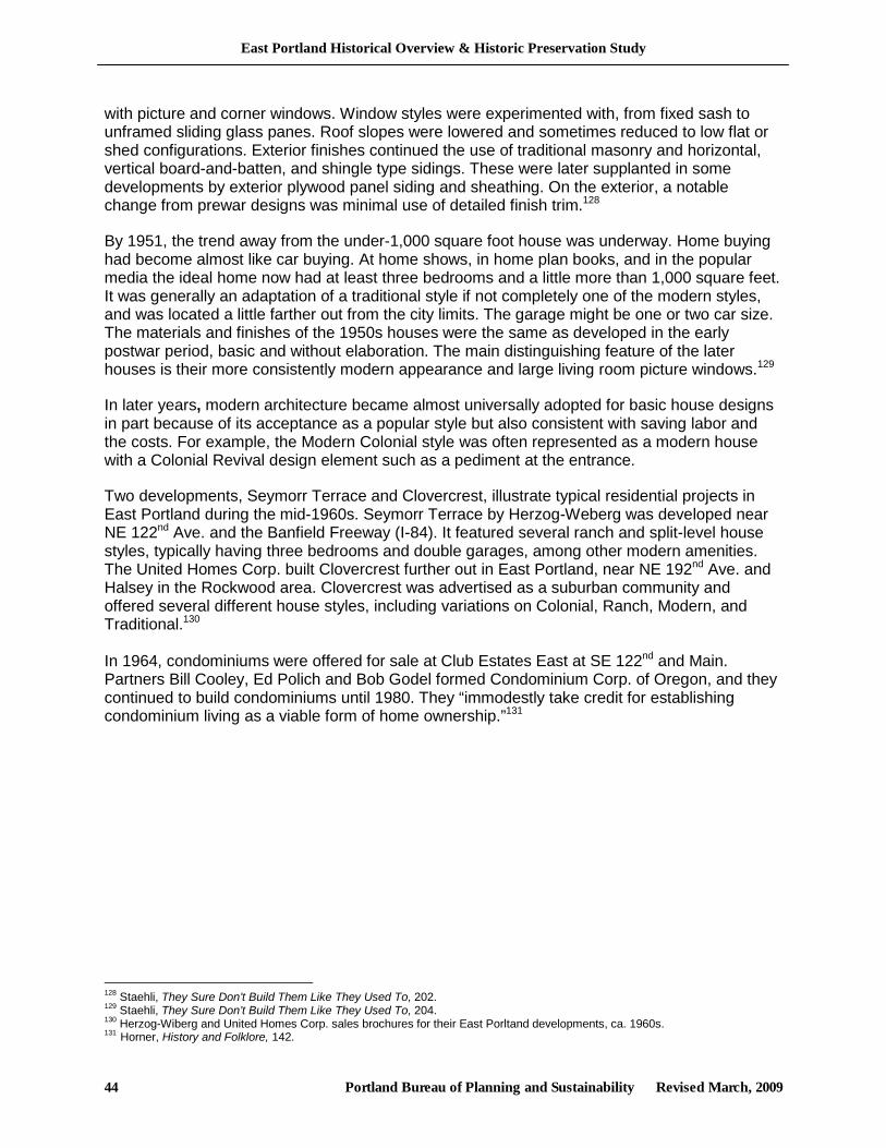
East Portland Historical Overview & Historic Preservation Study
Portland Bureau of Planning and Sustainability Revised March, 2009 44
with picture and corner windows. Window styles were experimented with, from fixed sash to unframed sliding glass panes. Roof slopes were lowered and sometimes reduced to low flat or shed configurations. Exterior finishes continued the use of traditional masonry and horizontal, vertical board-and-batten, and shingle type sidings. These were later supplanted in some developments by exterior plywood panel siding and sheathing. On the exterior, a notable change from prewar designs was minimal use of detailed finish trim.128
By 1951, the trend away from the under-1,000 square foot house was underway. Home buying had become almost like car buying. At home shows, in home plan books, and in the popular media the ideal home now had at least three bedrooms and a little more than 1,000 square feet. It was generally an adaptation of a traditional style if not completely one of the modern styles, and was located a little farther out from the city limits. The garage might be one or two car size. The materials and finishes of the 1950s houses were the same as developed in the early postwar period, basic and without elaboration. The main distinguishing feature of the later houses is their more consistently modern appearance and large living room picture windows.129
In later years, modern architecture became almost universally adopted for basic house designs in part because of its acceptance as a popular style but also consistent with saving labor and the costs. For example, the Modern Colonial style was often represented as a modern house with a Colonial Revival design element such as a pediment at the entrance.
Two developments, Seymorr Terrace and Clovercrest, illustrate typical residential projects in East Portland during the mid-1960s. Seymorr Terrace by Herzog-Weberg was developed near NE 122nd Ave. and the Banfield Freeway (I-84). It featured several ranch and split-level house styles, typically having three bedrooms and double garages, among other modern amenities. The United Homes Corp. built Clovercrest further out in East Portland, near NE 192nd Ave. and Halsey in the Rockwood area. Clovercrest was advertised as a suburban community and offered several different house styles, including variations on Colonial, Ranch, Modern, and Traditional.130 In 1964, condominiums were offered for sale at Club Estates East at SE 122nd and Main. Partners Bill Cooley, Ed Polich and Bob Godel formed Condominium Corp. of Oregon, and they continued to build condominiums until 1980. They “immodestly take credit for establishing condominium living as a viable form of home ownership.”131
128 Staehli, They Sure Don’t Build Them Like They Used To, 202. 129 Staehli, They Sure Don’t Build Them Like They Used To, 204. 130 Herzog-Wiberg and United Homes Corp. sales brochures for their East Porltand developments, ca. 1960s. 131 Horner, History and Folklore, 142.
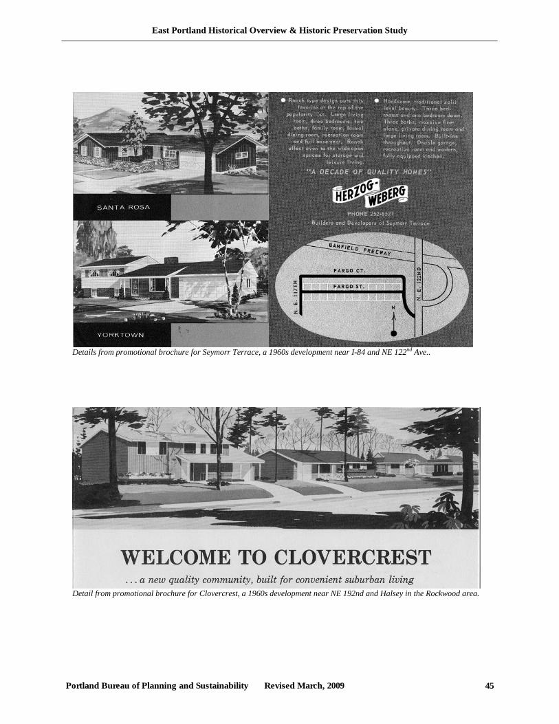
East Portland Historical Overview & Historic Preservation Study
Portland Bureau of Planning and Sustainability Revised March, 2009 45
Detail from promotional brochure for Clovercrest, a 1960s development near NE 192nd and Halsey in the Rockwood area.
Details from promotional brochure for Seymorr Terrace, a 1960s development near I-84 and NE 122nd Ave..
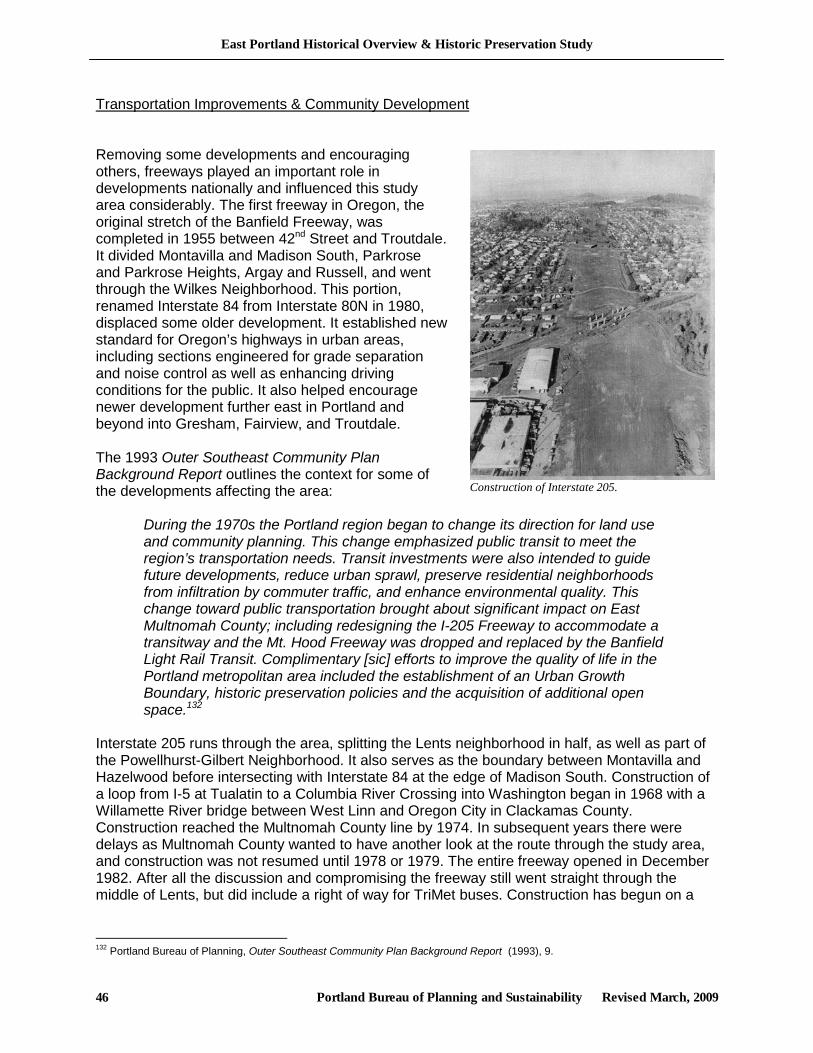
East Portland Historical Overview & Historic Preservation Study
Portland Bureau of Planning and Sustainability Revised March, 2009 46
Transportation Improvements & Community Development Removing some developments and encouraging others, freeways played an important role in developments nationally and influenced this study area considerably. The first freeway in Oregon, the original stretch of the Banfield Freeway, was completed in 1955 between 42nd Street and Troutdale. It divided Montavilla and Madison South, Parkrose and Parkrose Heights, Argay and Russell, and went through the Wilkes Neighborhood. This portion, renamed Interstate 84 from Interstate 80N in 1980, displaced some older development. It established new standard for Oregon’s highways in urban areas, including sections engineered for grade separation and noise control as well as enhancing driving conditions for the public. It also helped encourage newer development further east in Portland and beyond into Gresham, Fairview, and Troutdale. The 1993 Outer Southeast Community Plan Background Report outlines the context for some of the developments affecting the area:
During the 1970s the Portland region began to change its direction for land use and community planning. This change emphasized public transit to meet the region’s transportation needs. Transit investments were also intended to guide future developments, reduce urban sprawl, preserve residential neighborhoods from infiltration by commuter traffic, and enhance environmental quality. This change toward public transportation brought about significant impact on East Multnomah County; including redesigning the I-205 Freeway to accommodate a transitway and the Mt. Hood Freeway was dropped and replaced by the Banfield Light Rail Transit. Complimentary [sic] efforts to improve the quality of life in the Portland metropolitan area included the establishment of an Urban Growth Boundary, historic preservation policies and the acquisition of additional open space.132
Interstate 205 runs through the area, splitting the Lents neighborhood in half, as well as part of the Powellhurst-Gilbert Neighborhood. It also serves as the boundary between Montavilla and Hazelwood before intersecting with Interstate 84 at the edge of Madison South. Construction of a loop from I-5 at Tualatin to a Columbia River Crossing into Washington began in 1968 with a Willamette River bridge between West Linn and Oregon City in Clackamas County. Construction reached the Multnomah County line by 1974. In subsequent years there were delays as Multnomah County wanted to have another look at the route through the study area, and construction was not resumed until 1978 or 1979. The entire freeway opened in December 1982. After all the discussion and compromising the freeway still went straight through the middle of Lents, but did include a right of way for TriMet buses. Construction has begun on a
132 Portland Bureau of Planning, Outer Southeast Community Plan Background Report (1993), 9.
Construction of Interstate 205.
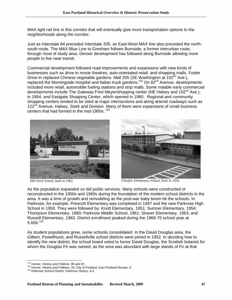
East Portland Historical Overview & Historic Preservation Study
Portland Bureau of Planning and Sustainability Revised March, 2009 47
MAX light rail line in this corridor that will eventually give more transportation options to the neighborhoods along the corridor. Just as Interstate 84 preceded Interstate 205, an East-West MAX line also preceded the north-south route. The MAX Blue Line to Gresham follows Burnside, a former interurban route, through most of study area. Denser development has followed along Burnside allowing more people to live near transit. Commercial development followed road improvements and expansions with new kinds of businesses such as drive-in movie theatres, auto-orientated retail, and shopping malls. Foster Drive-In replaced Chinese vegetable gardens. Mall 205 (SE Washington at 102nd Ave.), replaced the Morningside Hospital and Italian truck gardens.133 On 82nd Avenue, developments included more retail, automobile fueling stations and strip malls. Some notable early commercial developments include The Gateway Fred Meyer/shopping center (NE Halsey and 102nd Ave.), in 1954, and Eastgate Shopping Center, which opened in 1960. Regional and community shopping centers tended to be sited at major intersections and along arterial roadways such as 122nd Avenue, Halsey, Stark and Division. Many of them were expansions of small business centers that had formed in the mid-1900s. 134
As the population expanded so did public services. Many schools were constructed or reconstructed in the 1950s and 1960s during the foundation of the modern school districts in the area. It was a time of growth and remodeling as the post-war baby boom hit the schools. In Parkrose, for example, Prescott Elementary was completed in 1947 and the new Parkrose High School in 1950. They were followed by: Knott Elementary, 1951; Sumner Elementary, 1954; Thompson Elementary, 1960; Parkrose Middle School, 1961; Shaver Elementary, 1963; and Russell Elementary, 1963. District enrollment peaked during the 1969-70 school year at 5,656.135 As student populations grew, some schools consolidated. In the David Douglas area, the Gilbert, Powellhurst, and Russellville school districts were joined in 1952. In deciding how to identify the new district, the school board voted to honor David Douglas, the Scottish botanist for whom the Douglas Fir was named, as the area was abundant with large stands of Fir at that
133 Horner, History and Folklore, 95 and 97. 134 Horner, History and Folklore, 34; City of Portland, East Portland Review, 9. 135 Parkrose School District, Parkrose History, 4-5.
Mill Park School, built in 1962. Glenfair Elementary School, built in 1956.
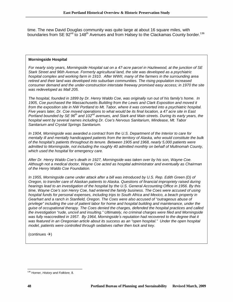
East Portland Historical Overview & Historic Preservation Study
Portland Bureau of Planning and Sustainability Revised March, 2009 48
time. The new David Douglas community was quite large at about 16 square miles, with boundaries from SE 92nd to 148th Avenues and from Halsey to the Clackamas County border.136
136 Horner, History and Folklore, 8.
Morningside Hospital For nearly sixty years, Morningside Hospital sat on a 47-acre parcel in Hazlewood, at the junction of SE Stark Street and 96th Avenue. Formerly agricultural land, the site was developed as a psychiatric hospital complex and working farm in 1910. After WWII, many of the farmers in the surrounding area retired and their land was developed into suburban communities. The rising population increased consumer demand and the under-construction interstate freeway promised easy access; in 1970 the site was redeveloped as Mall 205. The hospital, founded in 1899 by Dr. Henry Waldo Coe, was originally run out of his family’s home. In 1905, Coe purchased the Massachusetts Building from the Lewis and Clark Exposition and moved it from the exposition site in NW Portland to Mt. Tabor, where it was converted into a psychiatric hospital. Five years later, Dr. Coe moved operations to what would be its final location, a 47 acre site in East Portland bounded by SE 96th and 102nd avenues, and Stark and Main streets. During its early years, the hospital went by several names including Dr. Coe’s Nervous Sanitarium, Mindease, Mt. Tabor Sanitarium and Crystal Springs Sanitarium. In 1904, Morningside was awarded a contract from the U.S. Department of the Interior to care for mentally ill and mentally handicapped patients from the territory of Alaska, who would constitute the bulk of the hospital’s patients throughout its tenure. Between 1905 and 1968, nearly 5,000 patients were admitted to Morningside, not including the roughly 40 admitted monthly on behalf of Multnomah County, which used the hospital for emergency care. After Dr. Henry Waldo Coe’s death in 1927, Morningside was taken over by his son, Wayne Coe. Although not a medical doctor, Wayne Coe acted as hospital administrator and eventually as Chairman of the Henry Waldo Coe Foundation. In 1955, Morningside came under attack after a bill was introduced by U.S. Rep. Edith Green (D) of Oregon, to transfer care of Alaskan patients to Alaska. Questions of financial impropriety raised during hearings lead to an investigation of the hospital by the U.S. General Accounting Office in 1956. By this time, Wayne Coe’s son Henry Coe, had entered the family business. The Coes were accused of using hospital funds for personal expenses, including trips to South Africa and Mexico, a beach property in Gearhart and a ranch in Stanfield, Oregon. The Coes were also accused of “outrageous abuse of privilege” including the use of patient labor for home and hospital building and maintenance, under the guise of occupational therapy. The Coes denied the charges, defended the hospital practices and called the investigation “rude, uncivil and insulting.” Ultimately, no criminal charges were filed and Morningside was fully reaccredited in 1957. By 1964, Morningside’s reputation had recovered to the degree that it was featured in an Oregonian article about its success as an “open hospital.” Under the open hospital model, patients were controlled through sedatives rather then lock and key. (continues )
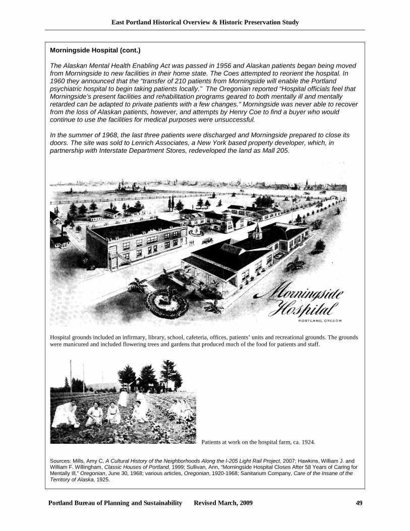
East Portland Historical Overview & Historic Preservation Study
Portland Bureau of Planning and Sustainability Revised March, 2009 49
Morningside Hospital (cont.) The Alaskan Mental Health Enabling Act was passed in 1956 and Alaskan patients began being moved from Morningside to new facilities in their home state. The Coes attempted to reorient the hospital. In 1960 they announced that the “transfer of 210 patients from Morningside will enable the Portland psychiatric hospital to begin taking patients locally.” The Oregonian reported “Hospital officials feel that Morningside’s present facilities and rehabilitation programs geared to both mentally ill and mentally retarded can be adapted to private patients with a few changes.” Morningside was never able to recover from the loss of Alaskan patients, however, and attempts by Henry Coe to find a buyer who would continue to use the facilities for medical purposes were unsuccessful. In the summer of 1968, the last three patients were discharged and Morningside prepared to close its doors. The site was sold to Lenrich Associates, a New York based property developer, which, in partnership with Interstate Department Stores, redeveloped the land as Mall 205.
Hospital grounds included an infirmary, library, school, cafeteria, offices, patients’ units and recreational grounds. The grounds were manicured and included flowering trees and gardens that produced much of the food for patients and staff.
Patients at work on the hospital farm, ca. 1924. Sources: Mills, Amy C, A Cultural History of the Neighborhoods Along the I-205 Light Rail Project, 2007; Hawkins, William J. and William F. Willingham, Classic Houses of Portland, 1999; Sullivan, Ann, “Morningside Hospital Closes After 58 Years of Caring for Mentally Ill,” Oregonian, June 30, 1968; various articles, Oregonian, 1920-1968; Sanitarium Company, Care of the Insane of the Territory of Alaska, 1925.
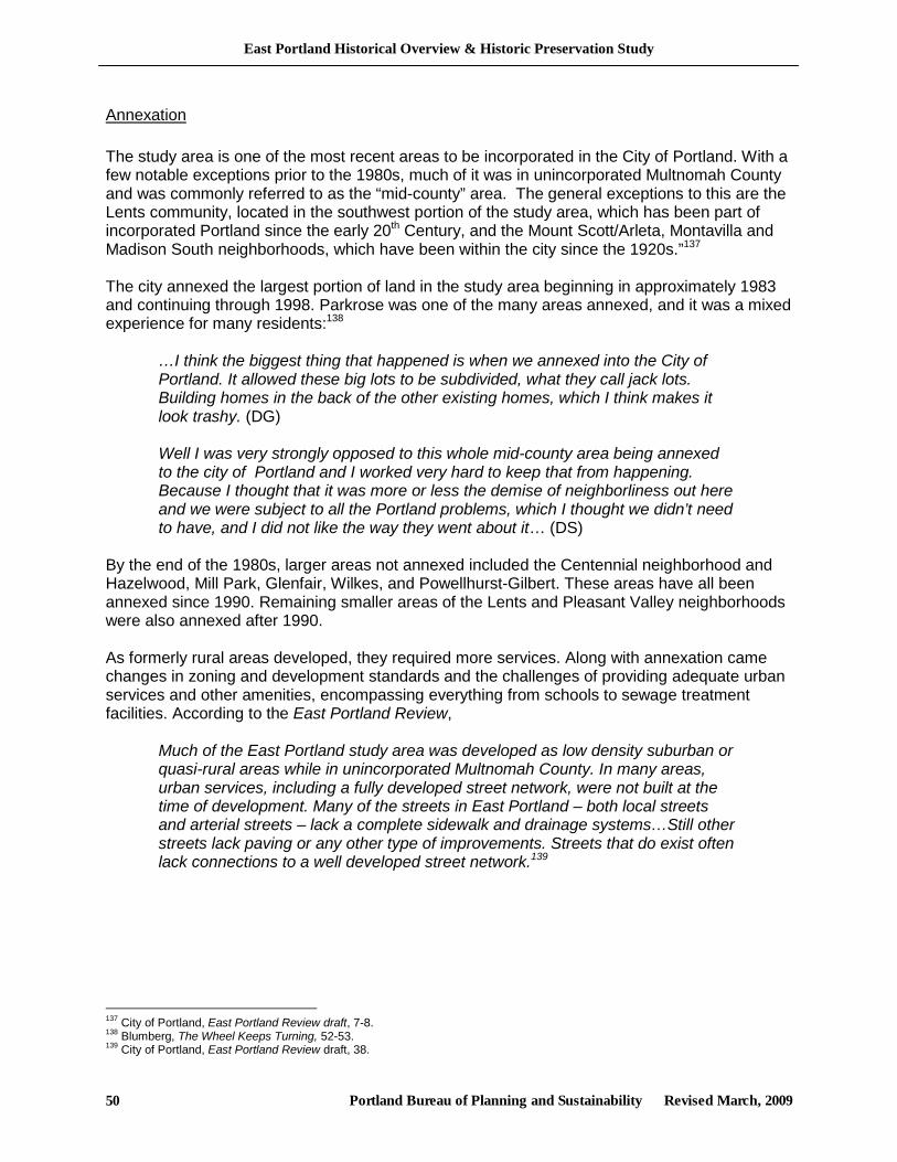
East Portland Historical Overview & Historic Preservation Study
Portland Bureau of Planning and Sustainability Revised March, 2009 50
Annexation The study area is one of the most recent areas to be incorporated in the City of Portland. With a few notable exceptions prior to the 1980s, much of it was in unincorporated Multnomah County and was commonly referred to as the “mid-county” area. The general exceptions to this are the Lents community, located in the southwest portion of the study area, which has been part of incorporated Portland since the early 20th Century, and the Mount Scott/Arleta, Montavilla and Madison South neighborhoods, which have been within the city since the 1920s.”137 The city annexed the largest portion of land in the study area beginning in approximately 1983 and continuing through 1998. Parkrose was one of the many areas annexed, and it was a mixed experience for many residents:138
…I think the biggest thing that happened is when we annexed into the City of Portland. It allowed these big lots to be subdivided, what they call jack lots. Building homes in the back of the other existing homes, which I think makes it look trashy. (DG) Well I was very strongly opposed to this whole mid-county area being annexed to the city of Portland and I worked very hard to keep that from happening. Because I thought that it was more or less the demise of neighborliness out here and we were subject to all the Portland problems, which I thought we didn’t need to have, and I did not like the way they went about it… (DS)
By the end of the 1980s, larger areas not annexed included the Centennial neighborhood and Hazelwood, Mill Park, Glenfair, Wilkes, and Powellhurst-Gilbert. These areas have all been annexed since 1990. Remaining smaller areas of the Lents and Pleasant Valley neighborhoods were also annexed after 1990. As formerly rural areas developed, they required more services. Along with annexation came changes in zoning and development standards and the challenges of providing adequate urban services and other amenities, encompassing everything from schools to sewage treatment facilities. According to the East Portland Review,
Much of the East Portland study area was developed as low density suburban or quasi-rural areas while in unincorporated Multnomah County. In many areas, urban services, including a fully developed street network, were not built at the time of development. Many of the streets in East Portland – both local streets and arterial streets – lack a complete sidewalk and drainage systems…Still other streets lack paving or any other type of improvements. Streets that do exist often lack connections to a well developed street network.139
137 City of Portland, East Portland Review draft, 7-8. 138 Blumberg, The Wheel Keeps Turning, 52-53. 139 City of Portland, East Portland Review draft, 38.
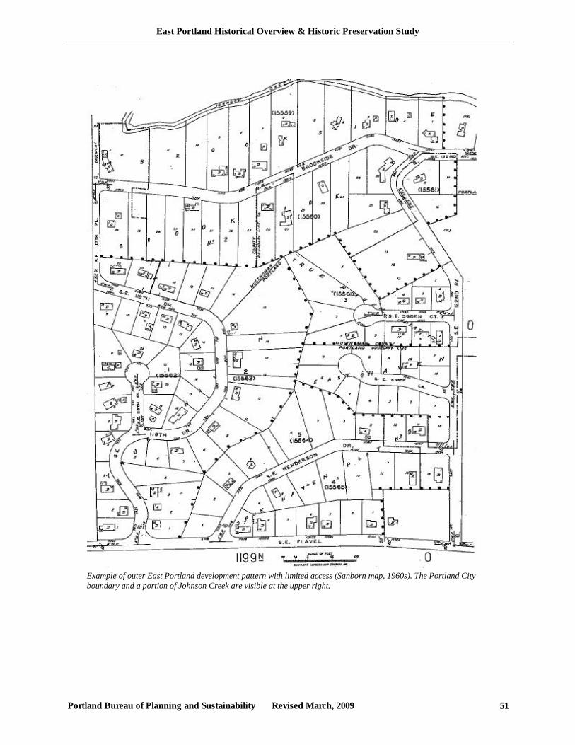
East Portland Historical Overview & Historic Preservation Study
Portland Bureau of Planning and Sustainability Revised March, 2009 51
Example of outer East Portland development pattern with limited access (Sanborn map, 1960s). The Portland City boundary and a portion of Johnson Creek are visible at the upper right.
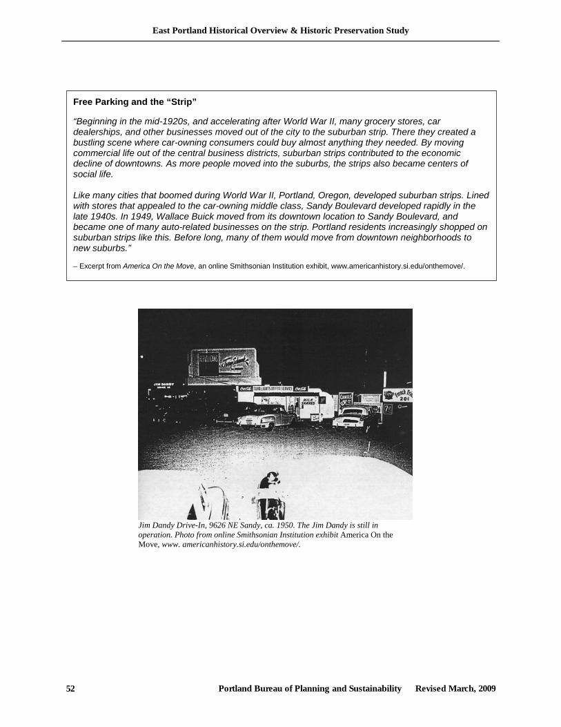
East Portland Historical Overview & Historic Preservation Study
Portland Bureau of Planning and Sustainability Revised March, 2009 52
Jim Dandy Drive-In, 9626 NE Sandy, ca. 1950. The Jim Dandy is still in operation. Photo from online Smithsonian Institution exhibit America On the Move, www. americanhistory.si.edu/onthemove/.
Free Parking and the “Strip” “Beginning in the mid-1920s, and accelerating after World War II, many grocery stores, car dealerships, and other businesses moved out of the city to the suburban strip. There they created a bustling scene where car-owning consumers could buy almost anything they needed. By moving commercial life out of the central business districts, suburban strips contributed to the economic decline of downtowns. As more people moved into the suburbs, the strips also became centers of social life. Like many cities that boomed during World War II, Portland, Oregon, developed suburban strips. Lined with stores that appealed to the car-owning middle class, Sandy Boulevard developed rapidly in the late 1940s. In 1949, Wallace Buick moved from its downtown location to Sandy Boulevard, and became one of many auto-related businesses on the strip. Portland residents increasingly shopped on suburban strips like this. Before long, many of them would move from downtown neighborhoods to new suburbs.” – Excerpt from America On the Move, an online Smithsonian Institution exhibit, www.americanhistory.si.edu/onthemove/.
East Portland Historical Overview & Historic Preservation Study
Portland Bureau of Planning and Sustainability Revised March, 2009 53
III. Current Development and Preservation Issues The Bureau of Planning’s ongoing East Portland Review project and other sources have identified a number of development trends, issues and challenges facing East Portland, many of which are related to its historical development patterns. This section reviews some of these issues and their potential implications for historic resources and summarizes some of the available data on potentially significant resources and related preservation matters. Much of this development-trend information below is drawn from East Portland Review project documents. Maps contained in a separate Appendices document illustrate this discussion. Growth and Development An array of issues are tied to broader regional growth trends. Increasing residential density (a long-running, if punctuated, pattern as seen from the previous sections on East Portland’s history) continues to bring changes to the physical and social attributes of East Portland’s commercial areas, main streets and neighborhoods. Especially evident is the way land is re-divided and redeveloped—transforming street, block and lot patterns and reshaping physical relationships and neighborhood character. East Portland’s often generous lot sizes—legacies of pre-war rural land uses and subsequent “suburban” development patterns under county administration—fostered more spacious residential landscapes, in contrast to most inner neighborhoods. Today, the average lot size in East Portland is 119 percent of the citywide average and the median is 135 percent of the citywide figure (excluding industrial and open space lands) However, parcel sizes continue to shrink in many places. With City annexation came more intense zoning in many areas, such that today a great many of the area’s lots are significantly larger than the allowable density (see map section in Appendices), suggesting this trend may continue. East Portland has experienced considerable development activity in the past decade, different in type, if not intensity from the development in the 1950s and 1960s. With sustained regional population growth and rising real estate prices, increasing numbers of property owners have sought to subdivide and use their land more intensely. While the study area accounts for 26 percent of Portland’s land area, records show that it accommodated about 50 percent of all single dwelling residential permits in the city and about 46% of the multi-dwelling residential permits between 1996 and 2006 (Maps 12 and 13). Much of the new residential development is focused in the southeast portion of the study area and is likely a result of the combination of existing large lot patterns, low-density existing development, increasing property values and the higher density single- and multi-dwelling zoning applied by the Outer Southeast Community Plan in the mid 1990’s. Rising housing demand has made former back- and side-yards more valuable and fostered infill development—sometimes through creation of “skinny” lots and flag lots, which many feel negatively impact community character (see Map 14). In many neighborhoods, multifamily zoning has been applied to areas that were historically predominantly single-family in nature. New row-houses, apartments, and condominiums—occasionally entailing demolition of existing homes—can seem out of character, raising concerns about transitions, design, construction quality, and lack of on-site open space and landscaping. In addition to overall and generalized impacts on the character and feel of individual neighborhoods and the area as a whole, new development also increases the potential for demolition of historic resources, as owners seek to completely redevelop their properties at higher than existing density.

East Portland Historical Overview & Historic Preservation Study
Portland Bureau of Planning and Sustainability Revised March, 2009 54
On the other hand, rising residential density has the potential to support more vital commercial main streets and nodes. This increases the chances, under favorable circumstances, that historic commercial buildings will be maintained, renovated or rehabilitated (although demolition and site redevelopment also becomes more likely). Growth also impacts natural areas, farm land, and landscape character. The area is home to much of the Johnson Creek watershed and other environmentally sensitive areas such as those on the volcanic buttes. These natural areas and agricultural lands are important reminders of East Portland’s rural past and contribute to its identity and livability. The preservation and health of these resources are potentially threatened as development continues. At a different scale, increased intensity of land use and new infill development entails the loss of the modest “open spaces” and landscaping that contribute to the area’s less urbanized feel. East Portland’s character-defining Fir trees, from significant stands on large, semi-natural undeveloped parcels, to individual trees on oversized side- and backyards are also at risk.
The nature of growth and associated demographic changes also have social implications. Studies such as the East Portland Review have found increasing ethnic and racial diversity in the study area. Beginning in the 1970s, many immigrants and refugees settled in the area, including: Vietnamese, Cambodians, Lao, Hmong, Russians, Ukrainians, Ethiopians, Burmese, Kurds, and Bosnians. According to Carl Abbott, about half of the metropolitan region’s foreign-born residents live in Outer East Portland. Attracted to lower housing costs and now established ethnic communities, the area’s diversity has become a major part of its identity. Data from public schools illustrate this trend: most area schools have at least 20 percent English language learners, with many having over 30 or 40 percent. Alder School in the Centennial Neighborhood has over 60 percent English language learners. Poverty also appears to be growing in East Portland, in part because of rising housing costs and the displacement of low-income households from “gentrifying” neighborhoods closer to the Central City. Median household income for residents of some East Portland neighborhoods exceeds the Portland average, while other’s have lower median incomes. However, the overall trend for shows a decline in the number of area neighborhoods meeting or exceeding the citywide median household income. Again, school data is illustrative, with the majority of East Portland schools having over 50 percent of their students qualify for free or reduced lunch. Several have over 80 percent.
Zenger Farm in Lents.
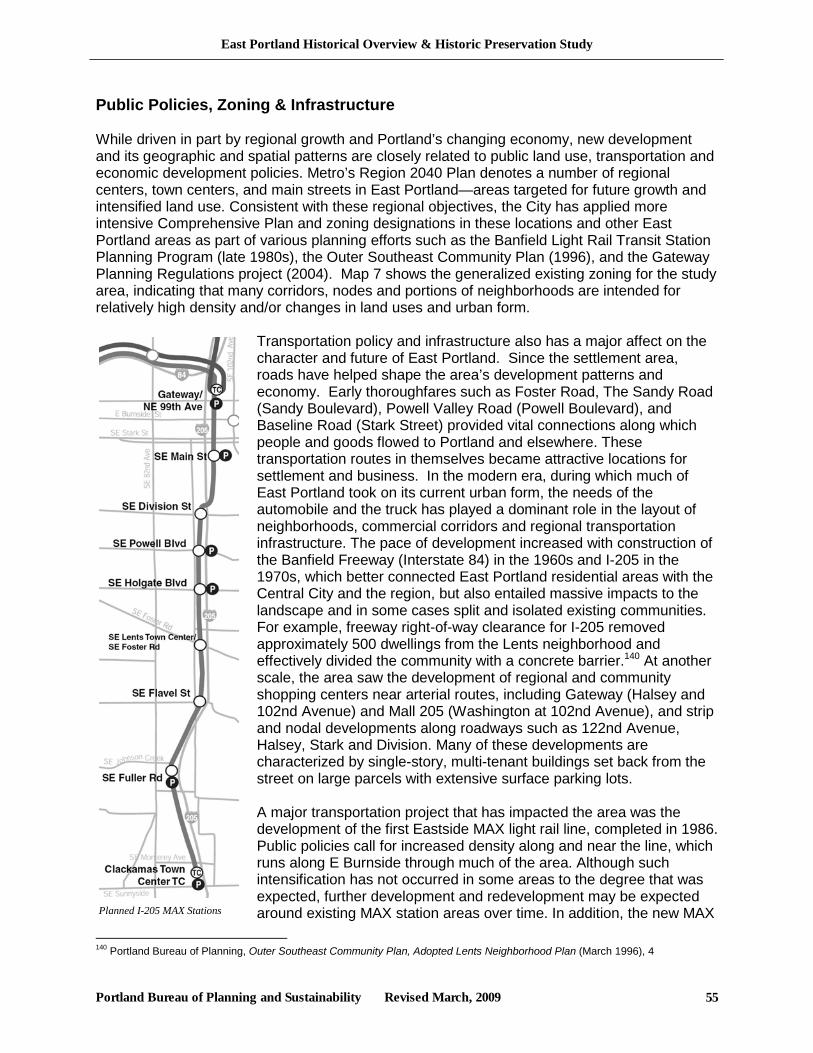
East Portland Historical Overview & Historic Preservation Study
Portland Bureau of Planning and Sustainability Revised March, 2009 55
Planned I-205 MAX Stations
Public Policies, Zoning & Infrastructure While driven in part by regional growth and Portland’s changing economy, new development and its geographic and spatial patterns are closely related to public land use, transportation and economic development policies. Metro’s Region 2040 Plan denotes a number of regional centers, town centers, and main streets in East Portland—areas targeted for future growth and intensified land use. Consistent with these regional objectives, the City has applied more intensive Comprehensive Plan and zoning designations in these locations and other East Portland areas as part of various planning efforts such as the Banfield Light Rail Transit Station Planning Program (late 1980s), the Outer Southeast Community Plan (1996), and the Gateway Planning Regulations project (2004). Map 7 shows the generalized existing zoning for the study area, indicating that many corridors, nodes and portions of neighborhoods are intended for relatively high density and/or changes in land uses and urban form.
Transportation policy and infrastructure also has a major affect on the character and future of East Portland. Since the settlement area, roads have helped shape the area’s development patterns and economy. Early thoroughfares such as Foster Road, The Sandy Road (Sandy Boulevard), Powell Valley Road (Powell Boulevard), and Baseline Road (Stark Street) provided vital connections along which people and goods flowed to Portland and elsewhere. These transportation routes in themselves became attractive locations for settlement and business. In the modern era, during which much of East Portland took on its current urban form, the needs of the automobile and the truck has played a dominant role in the layout of neighborhoods, commercial corridors and regional transportation infrastructure. The pace of development increased with construction of the Banfield Freeway (Interstate 84) in the 1960s and I-205 in the 1970s, which better connected East Portland residential areas with the Central City and the region, but also entailed massive impacts to the landscape and in some cases split and isolated existing communities. For example, freeway right-of-way clearance for I-205 removed approximately 500 dwellings from the Lents neighborhood and effectively divided the community with a concrete barrier.140 At another scale, the area saw the development of regional and community shopping centers near arterial routes, including Gateway (Halsey and 102nd Avenue) and Mall 205 (Washington at 102nd Avenue), and strip and nodal developments along roadways such as 122nd Avenue, Halsey, Stark and Division. Many of these developments are characterized by single-story, multi-tenant buildings set back from the street on large parcels with extensive surface parking lots. A major transportation project that has impacted the area was the development of the first Eastside MAX light rail line, completed in 1986. Public policies call for increased density along and near the line, which runs along E Burnside through much of the area. Although such intensification has not occurred in some areas to the degree that was expected, further development and redevelopment may be expected around existing MAX station areas over time. In addition, the new MAX
140 Portland Bureau of Planning, Outer Southeast Community Plan, Adopted Lents Neighborhood Plan (March 1996), 4
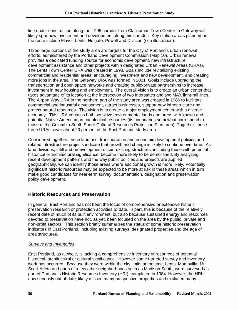
East Portland Historical Overview & Historic Preservation Study
Portland Bureau of Planning and Sustainability Revised March, 2009 56
line under construction along the I-205 corridor from Clackamas Town Center to Gateway will likely spur new investment and development along this corridor. Key station areas planned on the route include Flavel, Lents, Holgate, Powell and Division (see illustration). Three large portions of the study area are targets for the City of Portland’s urban renewal efforts, administered by the Portland Development Commission (Map 10). Urban renewal provides a dedicated funding source for economic development, new infrastructure, development assistance and other projects within designated Urban Renewal Areas (URAs). The Lents Town Center URA was created in 1998. Goals include revitalizing existing commercial and residential areas, encouraging investment and new development, and creating more jobs in the area. The Gateway URA was formed in 2001. Goals include upgrading the transportation and open space networks and creating public-private partnerships to increase investment in new housing and employment. The overall vision is to create an urban center that takes advantage of its location at the intersection of two Interstates and two MAX light-rail lines. The Airport Way URA in the northern part of the study area was created in 1986 to facilitate commercial and industrial development, attract businesses, support new infrastructure and protect natural resources. The vision is to create a major employment center with a diverse economy. This URA contains both sensitive environmental lands and areas with known and potential Native American archaeological resources (its boundaries somewhat correspond to those of the Columbia South Shore Cultural Resources Protection Plan area). Together, these three URAs cover about 20 percent of the East Portland study area. Considered together, these land use, transportation and economic development policies and related infrastructure projects indicate that growth and change is likely to continue over time. As land divisions, infill and redevelopment occur, existing structures, including those with potential historical or architectural significance, become more likely to be demolished. By analyzing recent development patterns and the way public policies and projects are applied geographically, we can identify those areas where additional growth is more likely. Potentially significant historic resources may be expected to be more at risk in these areas which in turn make good candidates for near-term survey, documentation, designation and preservation policy development. Historic Resources and Preservation In general, East Portland has not been the focus of comprehensive or extensive historic preservation research or protection activities to-date. In part, this is because of the relatively recent date of much of its built environment, but also because sustained energy and resources devoted to preservation have not, as yet, been focused on the area by the public, private and non-profit sectors. This section briefly summarizes the status of some historic preservation indicators in East Portland, including existing surveys, designated properties and the age of area structures. Surveys and Inventories East Portland, as a whole, is lacking a comprehensive inventory of resources of potential historical, architectural or cultural significance. However some targeted survey and inventory work has occurred. Because they were within the city limits at the time, Lents, Montavilla, Mt. Scott-Arleta and parts of a few other neighborhoods such as Madison South, were surveyed as part of Portland’s Historic Resources Inventory (HRI), completed in 1984. However, the HRI is now seriously out of date, likely missed many prospective properties and excluded many—
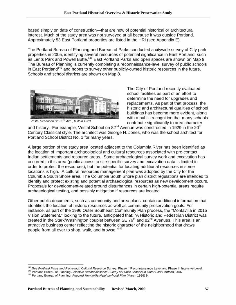
East Portland Historical Overview & Historic Preservation Study
Portland Bureau of Planning and Sustainability Revised March, 2009 57
Vestal School on SE 82nd Ave., built in 1929
based simply on date of construction—that are now of potential historical or architectural interest. Much of the study area was not surveyed at all because it was outside Portland. Approximately 53 East Portland properties are listed in the HRI (see Appendix E). The Portland Bureau of Planning and Bureau of Parks conducted a citywide survey of City park properties in 2005, identifying several resources of potential significance in East Portland, such as Lents Park and Powell Butte.141 East Portland Parks and open spaces are shown on Map 9. The Bureau of Planning is currently completing a reconnaissance-level survey of public schools in East Portland142 and hopes to survey other publicly-owned historic resources in the future. Schools and school districts are shown on Map 8.
The City of Portland recently evaluated school facilities as part of an effort to determine the need for upgrades and replacements. As part of that process, the historic and architectural qualities of school buildings has become more evident, along with a public recognition that many schools contribute significantly to area character
and history. For example, Vestal School on 82nd Avenue was constructed in 1929 in the 20th Century Classical style. The architect was George H. Jones, who was the school architect for Portland School District No. 1 for many years. A large portion of the study area located adjacent to the Columbia River has been identified as the location of important archaeological and cultural resources associated with pre-contact Indian settlements and resource areas. Some archaeological survey work and excavation has occurred in this area (public access to site-specific survey and excavation data is limited in order to protect the resources), but the potential for locating additional resources in some locations is high. A cultural resources management plan was adopted by the City for the Columbia South Shore area. The Columbia South Shore plan district regulations are intended to identify and protect existing and potential archaeological resources as new development occurs. Proposals for development-related ground disturbances in certain high-potential areas require archaeological testing, and possibly mitigation if resources are located. Other public documents, such as community and area plans, contain additional information that identifies the location of historic resources as well as community preservation goals. For instance, as part of the 1996 Outer Southeast Community Plan process, the ”Montavilla in 2015 Vision Statement,” looking to the future, anticipated that: “A Historic and Pedestrian District was created in the Stark/Washington couplet between SE 76th and 82nd Avenues. This area is an attractive business center reflecting the historic character of the neighborhood that draws people from all over to shop, walk, and browse.”143
141 See Portland Parks and Recreation Cultural Resource Survey, Phase I: Reconnaissance Level and Phase II: Intensive Level. 142 Portland Bureau of Planning Selective Reconnaissance Survey of Public Schools in Outer East Portland, 2007. 143 Portland Bureau of Planning, Adopted Montavilla Neighborhood Plan (March 1996) 9.
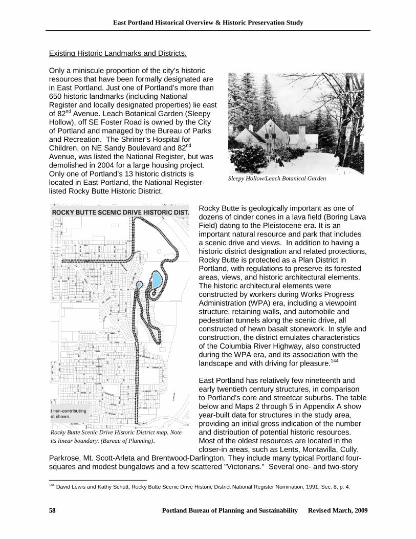
East Portland Historical Overview & Historic Preservation Study
Portland Bureau of Planning and Sustainability Revised March, 2009 58
Sleepy Hollow/Leach Botanical Garden
Rocky Butte Scenic Drive Historic District map. Note its linear boundary. (Bureau of Planning).
Existing Historic Landmarks and Districts. Only a miniscule proportion of the city’s historic resources that have been formally designated are in East Portland. Just one of Portland’s more than 650 historic landmarks (including National Register and locally designated properties) lie east of 82nd Avenue. Leach Botanical Garden (Sleepy Hollow), off SE Foster Road is owned by the City of Portland and managed by the Bureau of Parks and Recreation. The Shriner’s Hospital for Children, on NE Sandy Boulevard and 82nd Avenue, was listed the National Register, but was demolished in 2004 for a large housing project. Only one of Portland’s 13 historic districts is located in East Portland, the National Register-listed Rocky Butte Historic District.
Rocky Butte is geologically important as one of dozens of cinder cones in a lava field (Boring Lava Field) dating to the Pleistocene era. It is an important natural resource and park that includes a scenic drive and views. In addition to having a historic district designation and related protections, Rocky Butte is protected as a Plan District in Portland, with regulations to preserve its forested areas, views, and historic architectural elements. The historic architectural elements were constructed by workers during Works Progress Administration (WPA) era, including a viewpoint structure, retaining walls, and automobile and pedestrian tunnels along the scenic drive, all constructed of hewn basalt stonework. In style and construction, the district emulates characteristics of the Columbia River Highway, also constructed during the WPA era, and its association with the landscape and with driving for pleasure.144 East Portland has relatively few nineteenth and early twentieth century structures, in comparison to Portland's core and streetcar suburbs. The table below and Maps 2 through 5 in Appendix A show year-built data for structures in the study area, providing an initial gross indication of the number and distribution of potential historic resources. Most of the oldest resources are located in the closer-in areas, such as Lents, Montavilla, Cully,
Parkrose, Mt. Scott-Arleta and Brentwood-Darlington. They include many typical Portland four-squares and modest bungalows and a few scattered "Victorians." Several one- and two-story
144 David Lewis and Kathy Schutt, Rocky Butte Scenic Drive Historic District National Register Nomination, 1991, Sec. 8, p. 4.
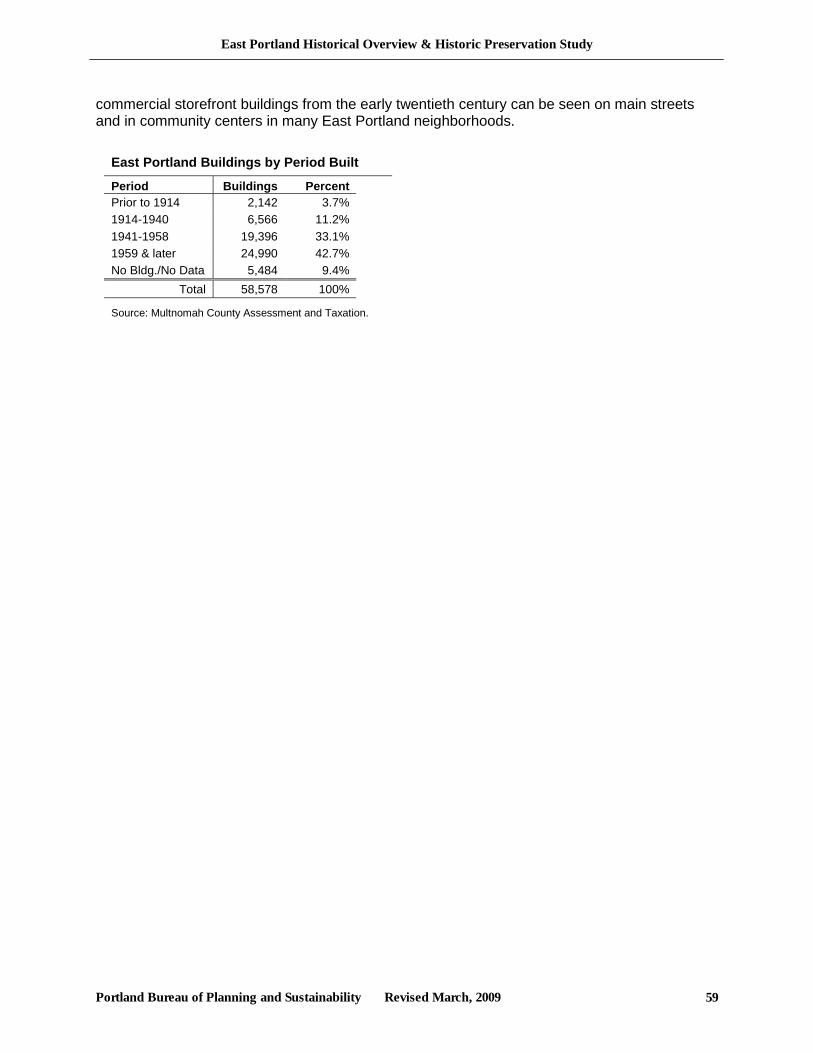
East Portland Historical Overview & Historic Preservation Study
Portland Bureau of Planning and Sustainability Revised March, 2009 59
commercial storefront buildings from the early twentieth century can be seen on main streets and in community centers in many East Portland neighborhoods.
East Portland Buildings by Period Built
Period Buildings Percent Prior to 1914 2,142 3.7% 1914-1940 6,566 11.2% 1941-1958 19,396 33.1% 1959 & later 24,990 42.7% No Bldg./No Data 5,484 9.4%
Total 58,578 100%
Source: Multnomah County Assessment and Taxation.
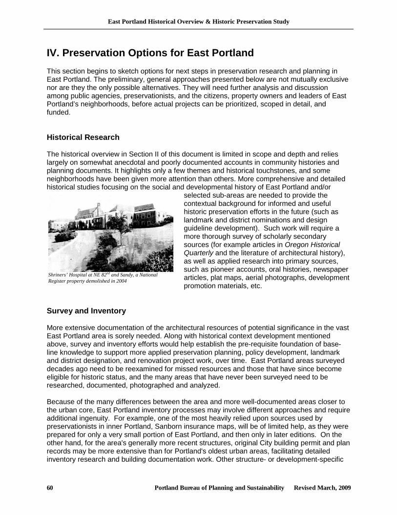
East Portland Historical Overview & Historic Preservation Study
Portland Bureau of Planning and Sustainability Revised March, 2009 60
Shriners’ Hospital at NE 82nd and Sandy, a National Register property demolished in 2004
IV. Preservation Options for East Portland This section begins to sketch options for next steps in preservation research and planning in East Portland. The preliminary, general approaches presented below are not mutually exclusive nor are they the only possible alternatives. They will need further analysis and discussion among public agencies, preservationists, and the citizens, property owners and leaders of East Portland’s neighborhoods, before actual projects can be prioritized, scoped in detail, and funded. Historical Research The historical overview in Section II of this document is limited in scope and depth and relies largely on somewhat anecdotal and poorly documented accounts in community histories and planning documents. It highlights only a few themes and historical touchstones, and some neighborhoods have been given more attention than others. More comprehensive and detailed historical studies focusing on the social and developmental history of East Portland and/or
selected sub-areas are needed to provide the contextual background for informed and useful historic preservation efforts in the future (such as landmark and district nominations and design guideline development). Such work will require a more thorough survey of scholarly secondary sources (for example articles in Oregon Historical Quarterly and the literature of architectural history), as well as applied research into primary sources, such as pioneer accounts, oral histories, newspaper articles, plat maps, aerial photographs, development promotion materials, etc.
Survey and Inventory More extensive documentation of the architectural resources of potential significance in the vast East Portland area is sorely needed. Along with historical context development mentioned above, survey and inventory efforts would help establish the pre-requisite foundation of base-line knowledge to support more applied preservation planning, policy development, landmark and district designation, and renovation project work, over time. East Portland areas surveyed decades ago need to be reexamined for missed resources and those that have since become eligible for historic status, and the many areas that have never been surveyed need to be researched, documented, photographed and analyzed. Because of the many differences between the area and more well-documented areas closer to the urban core, East Portland inventory processes may involve different approaches and require additional ingenuity. For example, one of the most heavily relied upon sources used by preservationists in inner Portland, Sanborn insurance maps, will be of limited help, as they were prepared for only a very small portion of East Portland, and then only in later editions. On the other hand, for the area's generally more recent structures, original City building permit and plan records may be more extensive than for Portland's oldest urban areas, facilitating detailed inventory research and building documentation work. Other structure- or development-specific
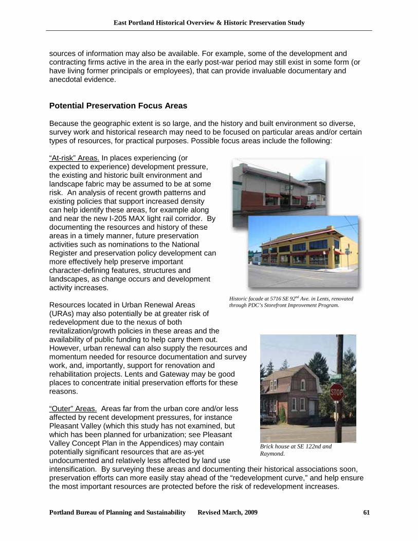
East Portland Historical Overview & Historic Preservation Study
Portland Bureau of Planning and Sustainability Revised March, 2009 61
Historic facade at 5716 SE 92nd Ave. in Lents, renovated through PDC’s Storefront Improvement Program.
Brick house at SE 122nd and Raymond.
sources of information may also be available. For example, some of the development and contracting firms active in the area in the early post-war period may still exist in some form (or have living former principals or employees), that can provide invaluable documentary and anecdotal evidence. Potential Preservation Focus Areas Because the geographic extent is so large, and the history and built environment so diverse, survey work and historical research may need to be focused on particular areas and/or certain types of resources, for practical purposes. Possible focus areas include the following: “At-risk” Areas. In places experiencing (or expected to experience) development pressure, the existing and historic built environment and landscape fabric may be assumed to be at some risk. An analysis of recent growth patterns and existing policies that support increased density can help identify these areas, for example along and near the new I-205 MAX light rail corridor. By documenting the resources and history of these areas in a timely manner, future preservation activities such as nominations to the National Register and preservation policy development can more effectively help preserve important character-defining features, structures and landscapes, as change occurs and development activity increases. Resources located in Urban Renewal Areas (URAs) may also potentially be at greater risk of redevelopment due to the nexus of both revitalization/growth policies in these areas and the availability of public funding to help carry them out. However, urban renewal can also supply the resources and momentum needed for resource documentation and survey work, and, importantly, support for renovation and rehabilitation projects. Lents and Gateway may be good places to concentrate initial preservation efforts for these reasons. “Outer” Areas. Areas far from the urban core and/or less affected by recent development pressures, for instance Pleasant Valley (which this study has not examined, but which has been planned for urbanization; see Pleasant Valley Concept Plan in the Appendices) may contain potentially significant resources that are as-yet undocumented and relatively less affected by land use intensification. By surveying these areas and documenting their historical associations soon, preservation efforts can more easily stay ahead of the “redevelopment curve,” and help ensure the most important resources are protected before the risk of redevelopment increases.
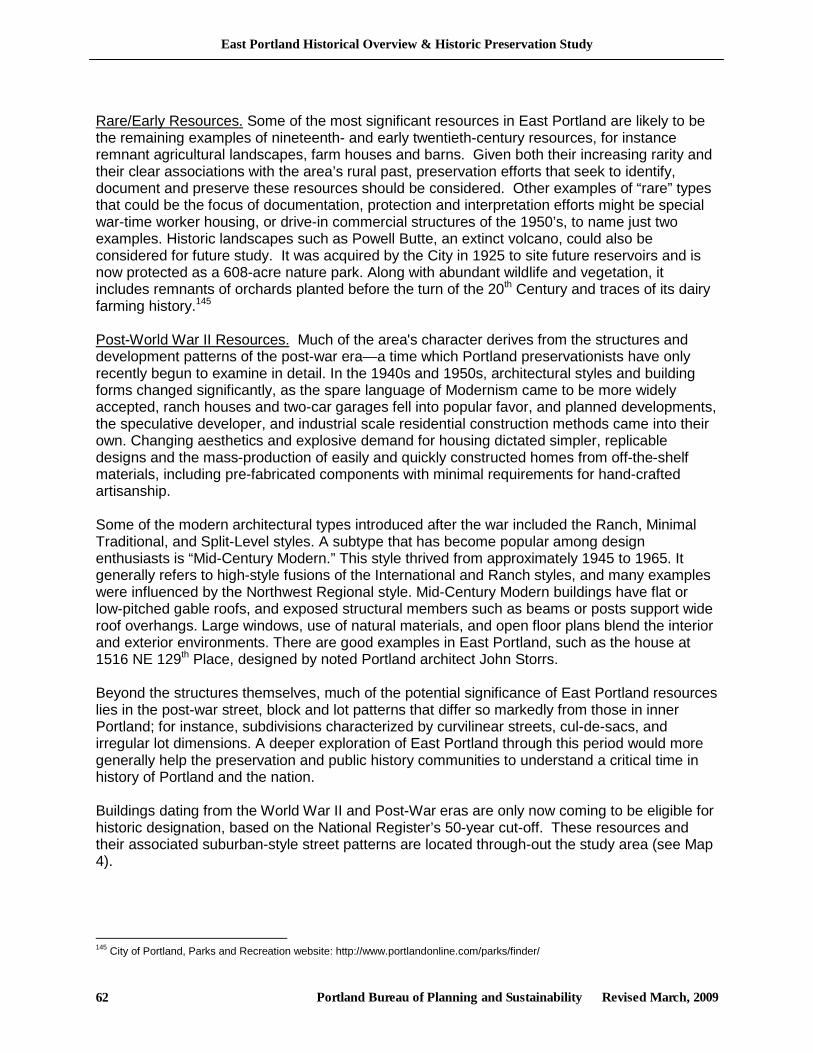
East Portland Historical Overview & Historic Preservation Study
Portland Bureau of Planning and Sustainability Revised March, 2009 62
Rare/Early Resources. Some of the most significant resources in East Portland are likely to be the remaining examples of nineteenth- and early twentieth-century resources, for instance remnant agricultural landscapes, farm houses and barns. Given both their increasing rarity and their clear associations with the area’s rural past, preservation efforts that seek to identify, document and preserve these resources should be considered. Other examples of “rare” types that could be the focus of documentation, protection and interpretation efforts might be special war-time worker housing, or drive-in commercial structures of the 1950’s, to name just two examples. Historic landscapes such as Powell Butte, an extinct volcano, could also be considered for future study. It was acquired by the City in 1925 to site future reservoirs and is now protected as a 608-acre nature park. Along with abundant wildlife and vegetation, it includes remnants of orchards planted before the turn of the 20th Century and traces of its dairy farming history.145 Post-World War II Resources. Much of the area's character derives from the structures and development patterns of the post-war era—a time which Portland preservationists have only recently begun to examine in detail. In the 1940s and 1950s, architectural styles and building forms changed significantly, as the spare language of Modernism came to be more widely accepted, ranch houses and two-car garages fell into popular favor, and planned developments, the speculative developer, and industrial scale residential construction methods came into their own. Changing aesthetics and explosive demand for housing dictated simpler, replicable designs and the mass-production of easily and quickly constructed homes from off-the-shelf materials, including pre-fabricated components with minimal requirements for hand-crafted artisanship. Some of the modern architectural types introduced after the war included the Ranch, Minimal Traditional, and Split-Level styles. A subtype that has become popular among design enthusiasts is “Mid-Century Modern.” This style thrived from approximately 1945 to 1965. It generally refers to high-style fusions of the International and Ranch styles, and many examples were influenced by the Northwest Regional style. Mid-Century Modern buildings have flat or low-pitched gable roofs, and exposed structural members such as beams or posts support wide roof overhangs. Large windows, use of natural materials, and open floor plans blend the interior and exterior environments. There are good examples in East Portland, such as the house at 1516 NE 129th Place, designed by noted Portland architect John Storrs. Beyond the structures themselves, much of the potential significance of East Portland resources lies in the post-war street, block and lot patterns that differ so markedly from those in inner Portland; for instance, subdivisions characterized by curvilinear streets, cul-de-sacs, and irregular lot dimensions. A deeper exploration of East Portland through this period would more generally help the preservation and public history communities to understand a critical time in history of Portland and the nation. Buildings dating from the World War II and Post-War eras are only now coming to be eligible for historic designation, based on the National Register’s 50-year cut-off. These resources and their associated suburban-style street patterns are located through-out the study area (see Map 4).
145 City of Portland, Parks and Recreation website: http://www.portlandonline.com/parks/finder/
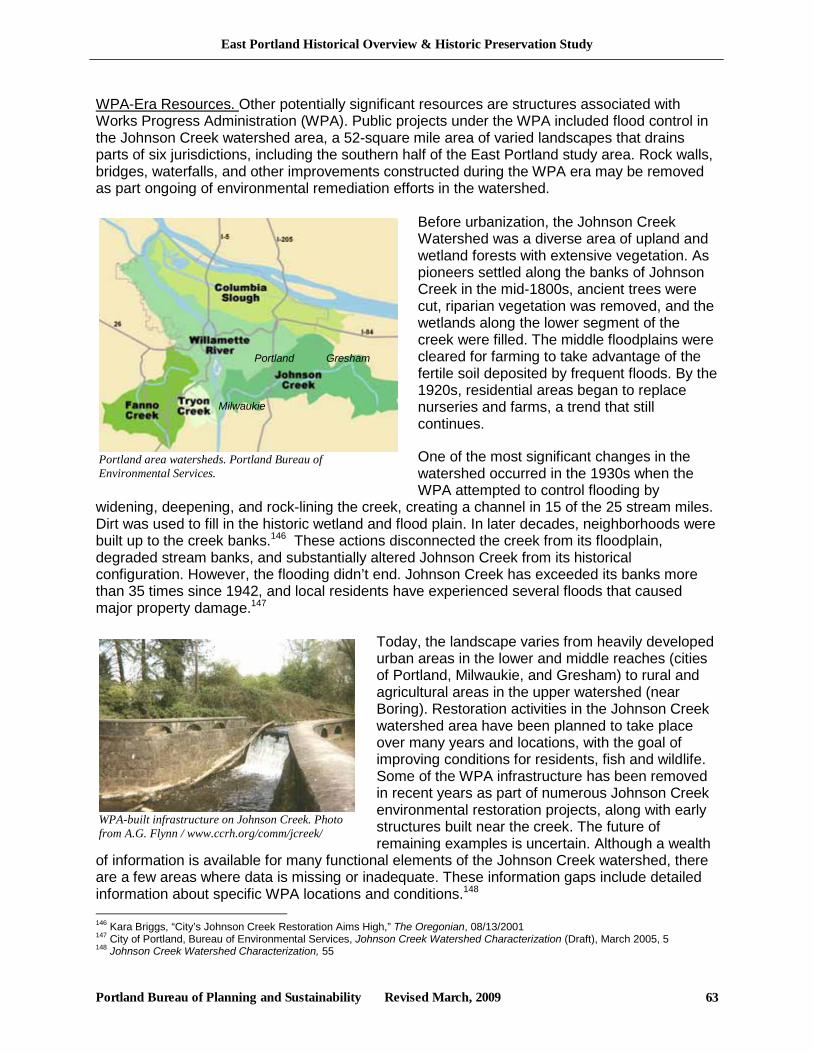
East Portland Historical Overview & Historic Preservation Study
Portland Bureau of Planning and Sustainability Revised March, 2009 63
WPA-built infrastructure on Johnson Creek. Photo from A.G. Flynn / www.ccrh.org/comm/jcreek/
Portland area watersheds. Portland Bureau of Environmental Services.
WPA-Era Resources. Other potentially significant resources are structures associated with Works Progress Administration (WPA). Public projects under the WPA included flood control in the Johnson Creek watershed area, a 52-square mile area of varied landscapes that drains parts of six jurisdictions, including the southern half of the East Portland study area. Rock walls, bridges, waterfalls, and other improvements constructed during the WPA era may be removed as part ongoing of environmental remediation efforts in the watershed.
Before urbanization, the Johnson Creek Watershed was a diverse area of upland and wetland forests with extensive vegetation. As pioneers settled along the banks of Johnson Creek in the mid-1800s, ancient trees were cut, riparian vegetation was removed, and the wetlands along the lower segment of the creek were filled. The middle floodplains were cleared for farming to take advantage of the fertile soil deposited by frequent floods. By the 1920s, residential areas began to replace nurseries and farms, a trend that still continues.
One of the most significant changes in the watershed occurred in the 1930s when the WPA attempted to control flooding by
widening, deepening, and rock-lining the creek, creating a channel in 15 of the 25 stream miles. Dirt was used to fill in the historic wetland and flood plain. In later decades, neighborhoods were built up to the creek banks.146 These actions disconnected the creek from its floodplain, degraded stream banks, and substantially altered Johnson Creek from its historical configuration. However, the flooding didn’t end. Johnson Creek has exceeded its banks more than 35 times since 1942, and local residents have experienced several floods that caused major property damage.147
Today, the landscape varies from heavily developed urban areas in the lower and middle reaches (cities of Portland, Milwaukie, and Gresham) to rural and agricultural areas in the upper watershed (near Boring). Restoration activities in the Johnson Creek watershed area have been planned to take place over many years and locations, with the goal of improving conditions for residents, fish and wildlife. Some of the WPA infrastructure has been removed in recent years as part of numerous Johnson Creek environmental restoration projects, along with early structures built near the creek. The future of remaining examples is uncertain. Although a wealth
of information is available for many functional elements of the Johnson Creek watershed, there are a few areas where data is missing or inadequate. These information gaps include detailed information about specific WPA locations and conditions.148 146 Kara Briggs, “City’s Johnson Creek Restoration Aims High,” The Oregonian, 08/13/2001 147 City of Portland, Bureau of Environmental Services, Johnson Creek Watershed Characterization (Draft), March 2005, 5 148 Johnson Creek Watershed Characterization, 55
Portland Gresham
Milwaukie
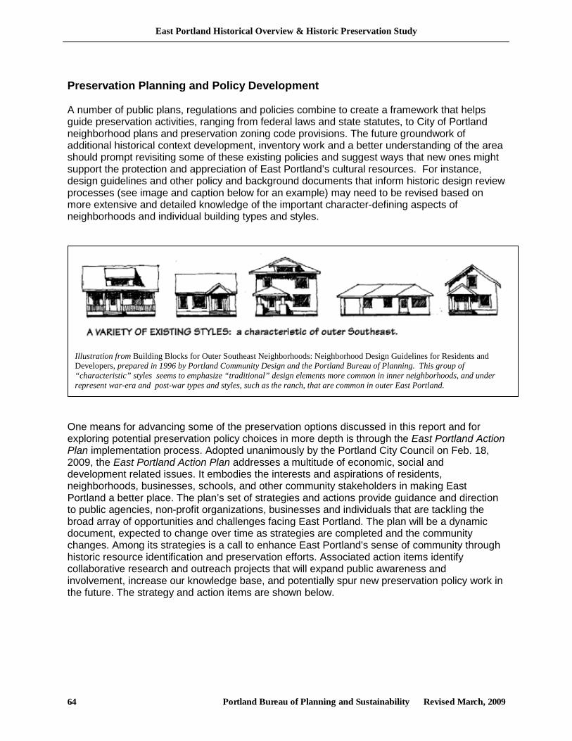
East Portland Historical Overview & Historic Preservation Study
Portland Bureau of Planning and Sustainability Revised March, 2009 64
Preservation Planning and Policy Development A number of public plans, regulations and policies combine to create a framework that helps guide preservation activities, ranging from federal laws and state statutes, to City of Portland neighborhood plans and preservation zoning code provisions. The future groundwork of additional historical context development, inventory work and a better understanding of the area should prompt revisiting some of these existing policies and suggest ways that new ones might support the protection and appreciation of East Portland’s cultural resources. For instance, design guidelines and other policy and background documents that inform historic design review processes (see image and caption below for an example) may need to be revised based on more extensive and detailed knowledge of the important character-defining aspects of neighborhoods and individual building types and styles.
One means for advancing some of the preservation options discussed in this report and for exploring potential preservation policy choices in more depth is through the East Portland Action Plan implementation process. Adopted unanimously by the Portland City Council on Feb. 18, 2009, the East Portland Action Plan addresses a multitude of economic, social and development related issues. It embodies the interests and aspirations of residents, neighborhoods, businesses, schools, and other community stakeholders in making East Portland a better place. The plan’s set of strategies and actions provide guidance and direction to public agencies, non-profit organizations, businesses and individuals that are tackling the broad array of opportunities and challenges facing East Portland. The plan will be a dynamic document, expected to change over time as strategies are completed and the community changes. Among its strategies is a call to enhance East Portland's sense of community through historic resource identification and preservation efforts. Associated action items identify collaborative research and outreach projects that will expand public awareness and involvement, increase our knowledge base, and potentially spur new preservation policy work in the future. The strategy and action items are shown below.
Illustration from Building Blocks for Outer Southeast Neighborhoods: Neighborhood Design Guidelines for Residents and Developers, prepared in 1996 by Portland Community Design and the Portland Bureau of Planning. This group of “characteristic” styles seems to emphasize “traditional” design elements more common in inner neighborhoods, and under represent war-era and post-war types and styles, such as the ranch, that are common in outer East Portland.
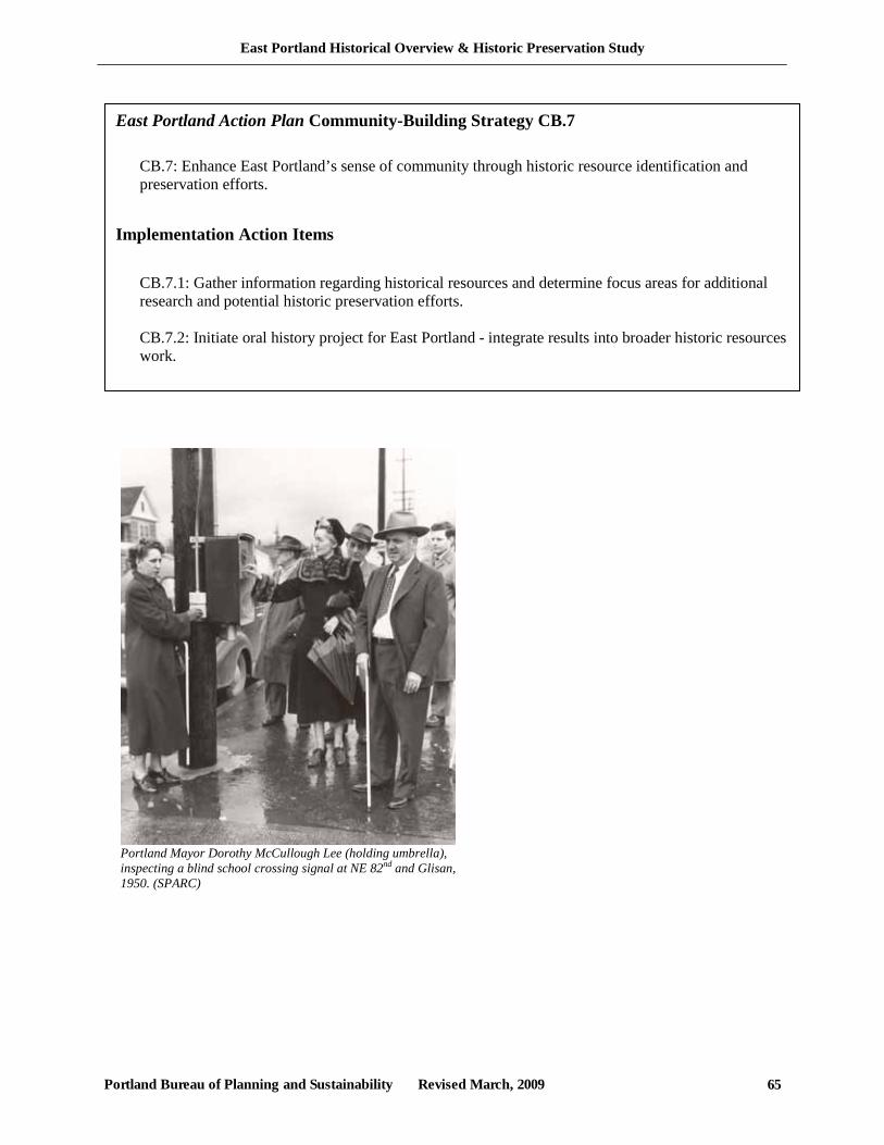
East Portland Historical Overview & Historic Preservation Study
Portland Bureau of Planning and Sustainability Revised March, 2009 65
East Portland Action Plan Community-Building Strategy CB.7 CB.7: Enhance East Portland’s sense of community through historic resource identification and preservation efforts.
Implementation Action Items CB.7.1: Gather information regarding historical resources and determine focus areas for additional research and potential historic preservation efforts. CB.7.2: Initiate oral history project for East Portland - integrate results into broader historic resources work.
Portland Mayor Dorothy McCullough Lee (holding umbrella), inspecting a blind school crossing signal at NE 82nd and Glisan, 1950. (SPARC)
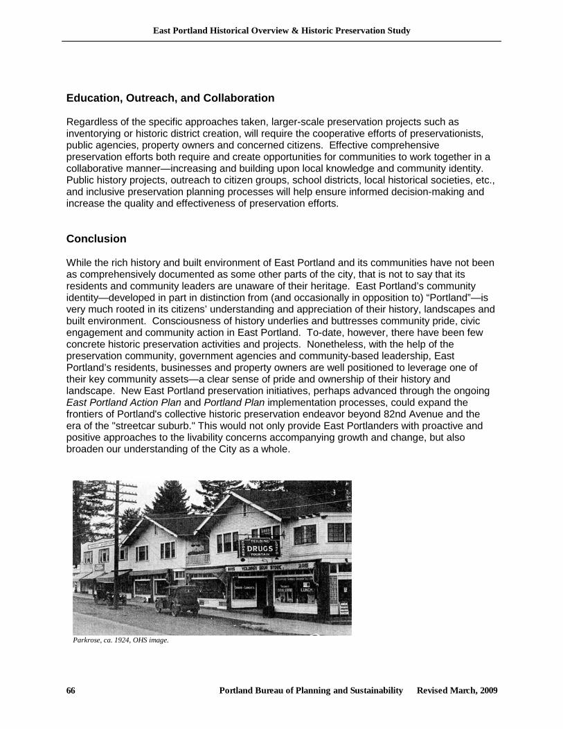
East Portland Historical Overview & Historic Preservation Study
Portland Bureau of Planning and Sustainability Revised March, 2009 66
Education, Outreach, and Collaboration Regardless of the specific approaches taken, larger-scale preservation projects such as inventorying or historic district creation, will require the cooperative efforts of preservationists, public agencies, property owners and concerned citizens. Effective comprehensive preservation efforts both require and create opportunities for communities to work together in a collaborative manner—increasing and building upon local knowledge and community identity. Public history projects, outreach to citizen groups, school districts, local historical societies, etc., and inclusive preservation planning processes will help ensure informed decision-making and increase the quality and effectiveness of preservation efforts. Conclusion While the rich history and built environment of East Portland and its communities have not been as comprehensively documented as some other parts of the city, that is not to say that its residents and community leaders are unaware of their heritage. East Portland’s community identity—developed in part in distinction from (and occasionally in opposition to) “Portland”—is very much rooted in its citizens’ understanding and appreciation of their history, landscapes and built environment. Consciousness of history underlies and buttresses community pride, civic engagement and community action in East Portland. To-date, however, there have been few concrete historic preservation activities and projects. Nonetheless, with the help of the preservation community, government agencies and community-based leadership, East Portland’s residents, businesses and property owners are well positioned to leverage one of their key community assets—a clear sense of pride and ownership of their history and landscape. New East Portland preservation initiatives, perhaps advanced through the ongoing East Portland Action Plan and Portland Plan implementation processes, could expand the frontiers of Portland's collective historic preservation endeavor beyond 82nd Avenue and the era of the "streetcar suburb." This would not only provide East Portlanders with proactive and positive approaches to the livability concerns accompanying growth and change, but also broaden our understanding of the City as a whole.
Parkrose, ca. 1924, OHS image.
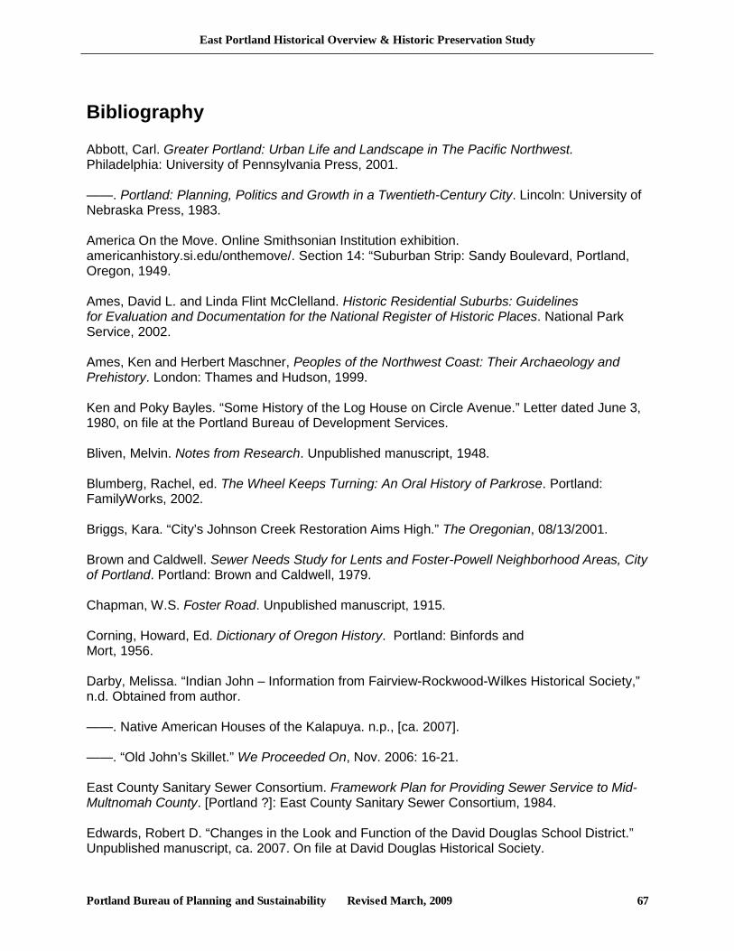
East Portland Historical Overview & Historic Preservation Study
Portland Bureau of Planning and Sustainability Revised March, 2009 67
Bibliography Abbott, Carl. Greater Portland: Urban Life and Landscape in The Pacific Northwest. Philadelphia: University of Pennsylvania Press, 2001. ——. Portland: Planning, Politics and Growth in a Twentieth-Century City. Lincoln: University of Nebraska Press, 1983. America On the Move. Online Smithsonian Institution exhibition. americanhistory.si.edu/onthemove/. Section 14: “Suburban Strip: Sandy Boulevard, Portland, Oregon, 1949. Ames, David L. and Linda Flint McClelland. Historic Residential Suburbs: Guidelines for Evaluation and Documentation for the National Register of Historic Places. National Park Service, 2002. Ames, Ken and Herbert Maschner, Peoples of the Northwest Coast: Their Archaeology and Prehistory. London: Thames and Hudson, 1999. Ken and Poky Bayles. “Some History of the Log House on Circle Avenue.” Letter dated June 3, 1980, on file at the Portland Bureau of Development Services. Bliven, Melvin. Notes from Research. Unpublished manuscript, 1948. Blumberg, Rachel, ed. The Wheel Keeps Turning: An Oral History of Parkrose. Portland: FamilyWorks, 2002. Briggs, Kara. “City’s Johnson Creek Restoration Aims High.” The Oregonian, 08/13/2001. Brown and Caldwell. Sewer Needs Study for Lents and Foster-Powell Neighborhood Areas, City of Portland. Portland: Brown and Caldwell, 1979. Chapman, W.S. Foster Road. Unpublished manuscript, 1915. Corning, Howard, Ed. Dictionary of Oregon History. Portland: Binfords and Mort, 1956. Darby, Melissa. “Indian John – Information from Fairview-Rockwood-Wilkes Historical Society,” n.d. Obtained from author. ——. Native American Houses of the Kalapuya. n.p., [ca. 2007]. ——. “Old John’s Skillet.” We Proceeded On, Nov. 2006: 16-21. East County Sanitary Sewer Consortium. Framework Plan for Providing Sewer Service to Mid-Multnomah County. [Portland ?]: East County Sanitary Sewer Consortium, 1984. Edwards, Robert D. “Changes in the Look and Function of the David Douglas School District.” Unpublished manuscript, ca. 2007. On file at David Douglas Historical Society.
East Portland Historical Overview & Historic Preservation Study
Portland Bureau of Planning and Sustainability Revised March, 2009 68
Genealogical Forum of Oregon and Friday Morning Research Group, comps. Cemeteries of East Multnomah County: Bridal Veil, Columbia Masonic, Mt. View-Stark, Mt. View-Corbett, Pleasant Home, Pounder, Powell. Portland: Genealogical Forum of Oregon, 2001. Horner, Howard and Grace, eds. History and Folklore of the David Douglas Community. Portland: David Douglas Historical Society, 1989. Johnston, Robert D. The Radical Middle Class: Populist Democracy and the Question of Capitalism in Progressive Era Portland, Oregon. Princeton: Princeton University Press, 2003. Kelly, Plympton. (Date unknown) Unnamed manuscript. Contained in collection of documents related to the Lents neighborhood in the Wilson Special Collection room, Multnomah County Central Library, Portland. Kramer, George. The Interstate Highway System in Oregon: A Historic Overview. Oregon Dept. of Transportation, Geo-Environmental Unit, May 2004. Lamb-Greene, Helen. From Circuit Riders to Speakeasies: A Family History of Growing Up in Early Rockwood, Oregon. [Portland: H. Lamb-Greene], 1992. Lewis, David and Kathy Schutt. Rocky Butte Scenic Drive Historic District National Register Nomination, 1991 MacColl, E. Kimbark. The Growth of a City. Power and Politics in Portland, Oregon 1915-1950. Portland: The Georgian Press Company, 1979. Metro. Pioneer Cemeteries. Parks, Trails and Greens. 2007. Retrieved online June 14, 2007: http://www.metro-region.org/article.cfm?articleid=159. Mills, Amy. A Cultural History of the Neighborhood Along the I-205 Light Rail Project. Tri- County Metropolitan Transportation Service District of Oregon (TriMet), April 2007. Multnomah, County of. Centennial Community Plan, 1979. ——. Errol Heights Community Plan, 1980. ——, Tax Assessor. Automated data files. Norman, C.R. Woodmere History. http://www.pps.k12.or.us/schools-c/pages/woodmere/history.html Parkrose School District. Parkrose History. www.parkrose.k12.or.us/community/local_links/parkrose_history.pdf Paulson, Rod. “Parkrose – A Visit to Suburbia.” The Community Press (more info needed) ——. “Lents – Foster Road – And the Electric Street Cars.” The Community Press.
East Portland Historical Overview & Historic Preservation Study
Portland Bureau of Planning and Sustainability Revised March, 2009 69
Pleasant Valley Project Partners. Pleasant Valley Concept Plan. 2002. Portland (City of). Digital files retrieved from www.portlandonline.com. Histories and timelines from Parks, Transportation, Environmental Services, Auditor’s Office and other bureaus. ——. Historic Resources Inventory, 1984. ____, Bureau of Environmental Services. Johnson Creek Watershed Characterization (Draft), March 2005. ——, Bureau of Parks and Recreation. Cultural Resource Survey. Phase I: Reconnaissance Level, 2005; Phase II: Intensive Level, 2006. ____, Bureau of Parks and Recreation. Website: http://www.portlandonline.com/parks/finder/ ——, Bureau of Planning. Background Report: Outer Southeast Community Plan, Planning Bureau, 1993. ——, ——. Brentwood-Darlington Neighborhood Plan, 1992. ——, ——. Centennial Community Plan, 1995. ——, ——. Cully-Parkrose Community Plan, 1986. ——, ——. Cully Neighborhood Plan, 1992. ——, ——. Cultural Resources Protection Plan for Columbia South Shore. 1996, 2 vols., as amended 2004. ——, ——. East Portland Review (Draft), August 2007 ____, ___. Foster-Powell Neighborhood Plan, 1996 ——, ——. Hazelwood Community Plan, 1996. ——, ——. Lents Neighborhood Plan, 1996. ——, ——. Mill Park Neighborhood Plan, 1996. ——, ——. Montavilla Neighborhood Plan, 1996. ——, ——. Mt. Scott-Arleta Neighborhood Plan, 1996. ____,____. Pleasant Valley Neighborhood Plan, 1996. ——, ——. Portland Historical Context Statement (Draft), October 1993. ——, ——. Powellhurst Community Plan, 1988. ——, ——. Powellhurst-Gilbert Neighborhood Plan, 1996. “Historical Overview” by Jack Vahey.
East Portland Historical Overview & Historic Preservation Study
Portland Bureau of Planning and Sustainability Revised March, 2009 70
____, ____ Wilkes Community and Rockwood Corridor Plan, 1987. Portland Community Design and Portland Bureau of Planning. Building Blocks for Outer Southeast Neighborhoods: Neighborhood Design Guidelines for Residents and Developers, 1996. Portland Development Commission. Gateway Regional Center. Retrieved online June 19, 2007. http://pdc.us/ura/gateway.asp. ——. Lents Town Center. Retrieved online June 19, 2007. http://pdc.us/ura/lents.asp. Portland State University. MURP Program Planning Workshop, Outer Southeast Livable Infill Project, April 2004. Price, Larry W., Ed. Portland’s Changing Landscape. Portland: Portland State University Foundation, 1987. Sanborn Map Company insurance maps: 1924-1928, 1950 and 1970. Sanitarium Company, The. The Care of the Insane of the Territory of Alaska, Administered by the Department of the Interior at Morningside Hospital, Portland, Oregon: Report Covering 21 Years of Such Service. [Portland: The Sanitarium Company,] Jan. 17, 1925. Staehli, Alfred M. They Sure Don’t Build Them Like They Used To: Federal Housing Administration Insured Builders’ Houses in the Pacific Northwest From 1934 to 1954. M.A. thesis. Portland State University, History, 1987. Vaughan, Thomas. Space, Style and Structure: Building in Northwest America. Portland: Oregon Historical Society, 1974.