Embed Size (px)
Citation preview
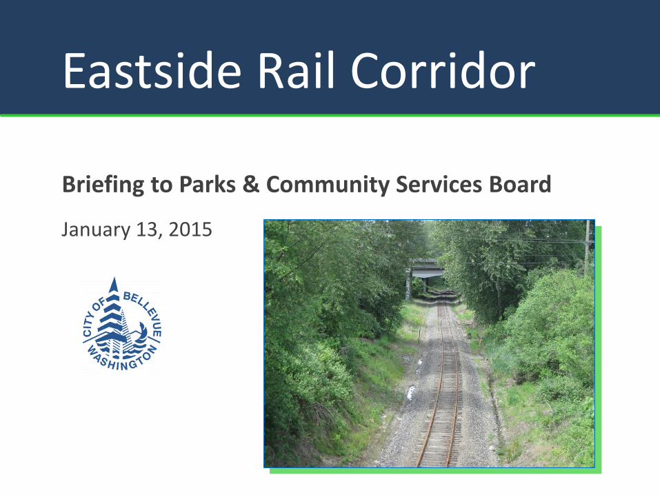
Eastside Rail Corridor
Briefing to Parks & Community Services Board
January 13, 2015
View from Eastside Rail Corridor looking west to Downtown Bellevue
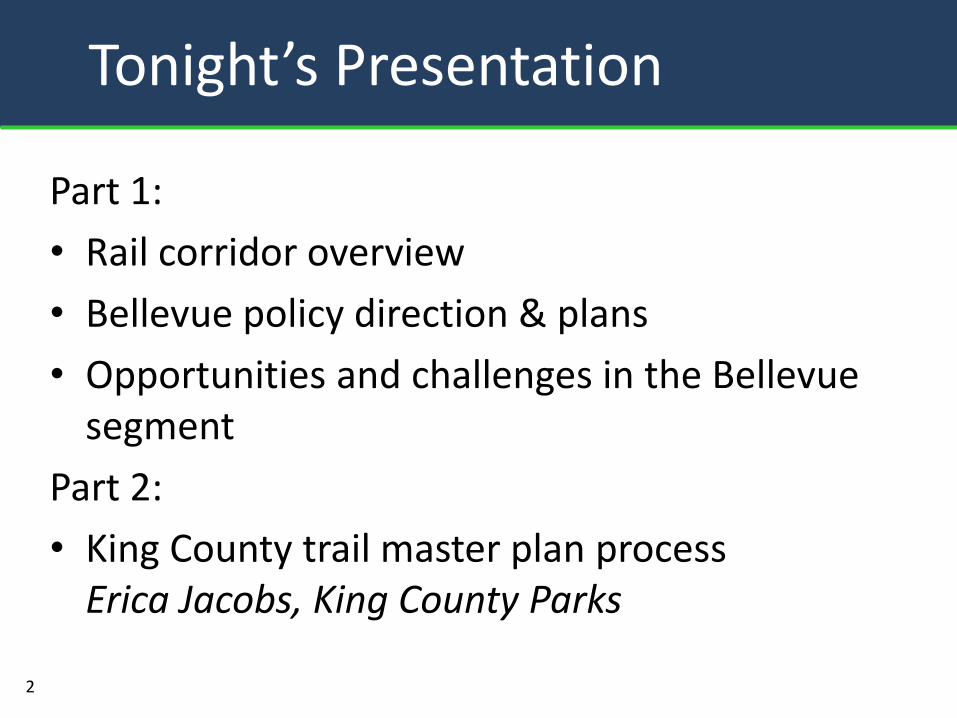
Part 1:
• Rail corridor overview
• Bellevue policy direction & plans
• Opportunities and challenges in the Bellevue segment
Part 2:
• King County trail master plan process Erica Jacobs, King County Parks
2
Tonight’s Presentation
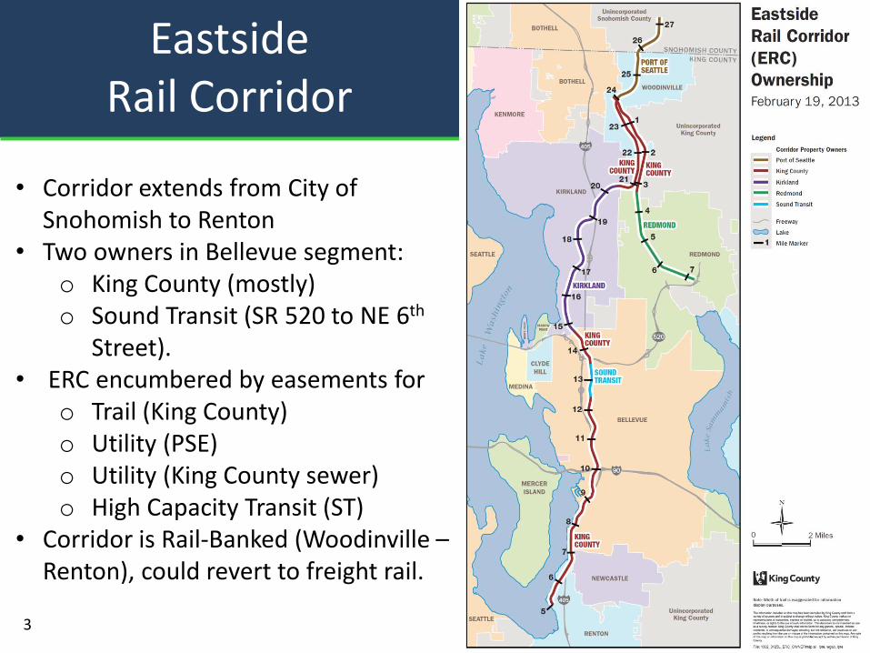
Eastside Rail Corridor
• Corridor extends from City of Snohomish to Renton
• Two owners in Bellevue segment: o King County (mostly) o Sound Transit (SR 520 to NE 6th
Street). • ERC encumbered by easements for
o Trail (King County) o Utility (PSE) o Utility (King County sewer) o High Capacity Transit (ST)
• Corridor is Rail-Banked (Woodinville – Renton), could revert to freight rail.
3
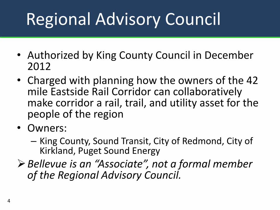
• Authorized by King County Council in December 2012
• Charged with planning how the owners of the 42 mile Eastside Rail Corridor can collaboratively make corridor a rail, trail, and utility asset for the people of the region
• Owners: – King County, Sound Transit, City of Redmond, City of
Kirkland, Puget Sound Energy
Bellevue is an “Associate”, not a formal member of the Regional Advisory Council.
Regional Advisory Council
4
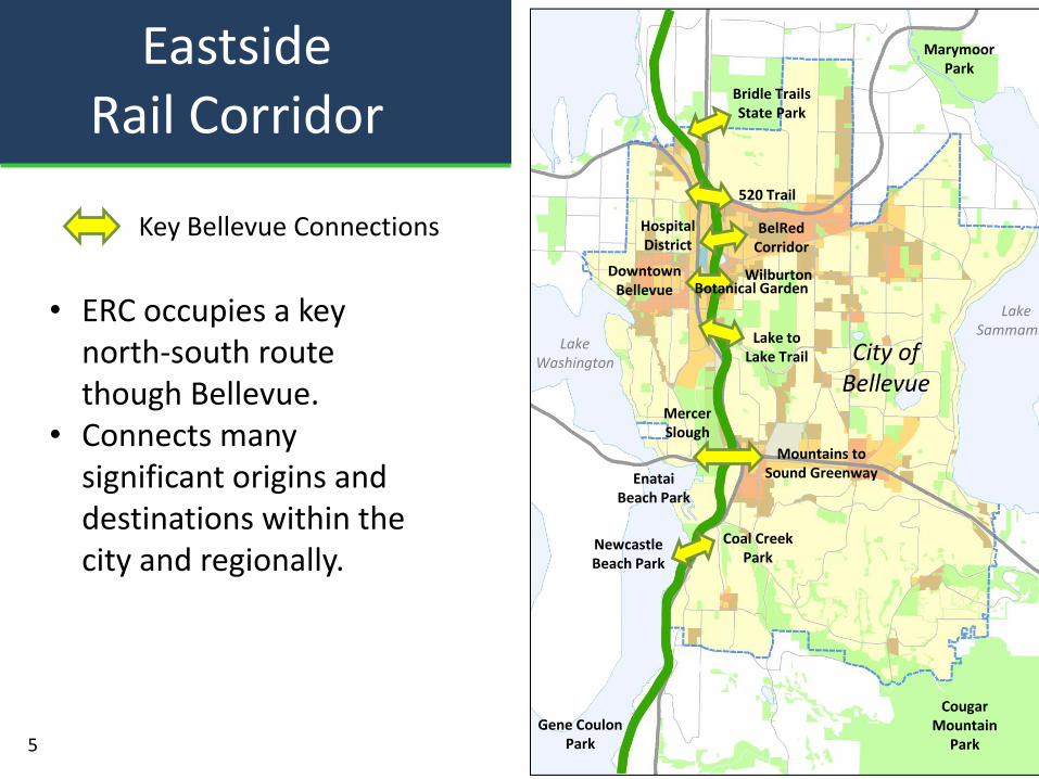
Eastside Rail Corridor
Key Bellevue Connections
City of Bellevue
Lake Washington
Lake Sammamish
Bridle Trails State Park
BelRed Corridor
Hospital District
Downtown Bellevue
Marymoor Park
520 Trail
Lake to Lake Trail
Mountains to Sound Greenway
Wilburton
Newcastle Beach Park
Coal Creek Park
Mercer Slough
Cougar Mountain
Park
Enatai Beach Park
Gene Coulon Park
Botanical Garden
5
• ERC occupies a key north-south route though Bellevue.
• Connects many significant origins and destinations within the city and regionally.
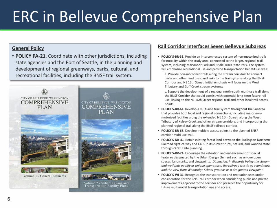
ERC in Bellevue Comprehensive Plan
Rail Corridor Interfaces Seven Bellevue Subareas
• POLICY S-BR-38. Provide an interconnected system of non-motorized trails for mobility within the study area, connected to the larger, regional trail system, including Marymoor Park and Bridle Trails State Park. The system will emphasize recreational use and provide transportation benefits as well:
a. Provide non-motorized trails along the stream corridors to connect parks and other land uses, and links to the trail systems along the BNSF Corridor and NE 16th Street. Initial emphasis will focus on the West Tributary and Goff Creek stream systems;
c. Support the development of a regional north-south multi-use trail along the BNSF Corridor that could coexist with potential long-term future rail use, linking to the NE 16th Street regional trail and other local trail access points.
• POLICY S-BR-64. Develop a multi-use trail system throughout the Subarea that provides both local and regional connections, including major non-motorized facilities along the extended NE 16th Street, along the West Tributary of Kelsey Creek and other stream corridors, and incorporating the planned regional trail along the BNSF railroad corridor.
• POLICY S-BR-65. Develop multiple access points to the planned BNSF corridor multi-use trail.
• POLICY S-NB-41. Retain existing forest land between the Burlington Northern Railroad right-of-way and I-405 in its current rural, natural, and wooded state through careful site planning.
• POLICY S-RV-24. Encourage the retention and enhancement of special features designated by the Urban Design Element such as unique open spaces, landmarks, and viewpoints. Discussion: In Richards Valley the stream and wetlands qualify as unique open space, the railroad trestle as a landmark and the view from Woodridge School grounds as a designated viewpoint.
• POLICY S-WI-31. Recognize the transportation and recreation uses under consideration for the BNSF rail corridor when considering public and private improvements adjacent to the corridor and preserve the opportunity for future multimodal transportation use and access.
General Policy
• POLICY PA-21. Coordinate with other jurisdictions, including state agencies and the Port of Seattle, in the planning and development of regional greenways, parks, cultural, and recreational facilities, including the BNSF trail system.
6
ERC in Plans, Reports, Studies
7
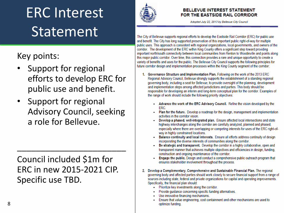
Key points:
• Support for regional efforts to develop ERC for public use and benefit.
• Support for regional Advisory Council, seeking a role for Bellevue.
_______________________
Council included $1m for ERC in new 2015-2021 CIP. Specific use TBD.
ERC Interest Statement
8
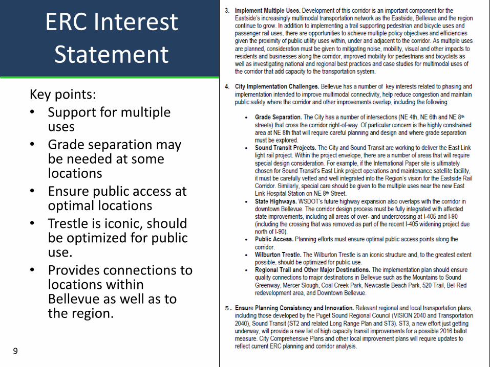
Key points: • Support for multiple
uses • Grade separation may
be needed at some locations
• Ensure public access at optimal locations
• Trestle is iconic, should be optimized for public use.
• Provides connections to locations within Bellevue as well as to the region.
ERC Interest Statement
9
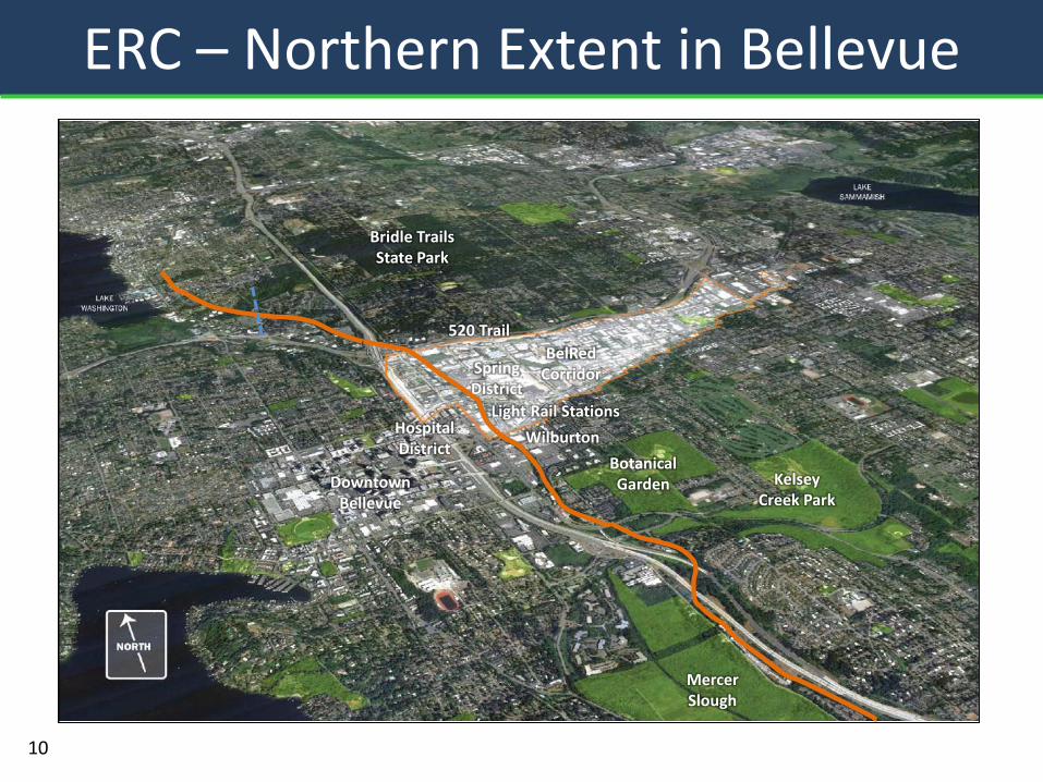
ERC – Northern Extent in Bellevue
Bridle Trails State Park
BelRed Corridor
Hospital District
520 Trail
Downtown Bellevue
Mercer Slough
Wilburton
Kelsey Creek Park
Light Rail Stations
Spring District
Botanical Garden
10
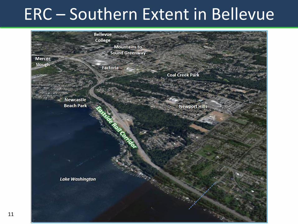
ERC – Southern Extent in Bellevue
520 Trail
Mercer Slough
11
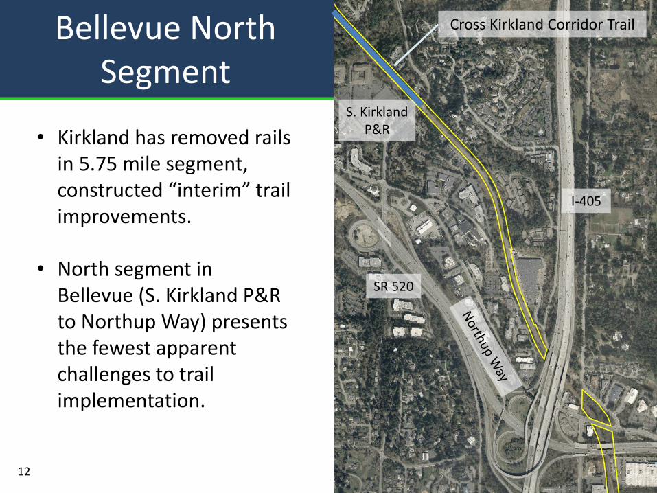
Bellevue North Segment
12
• Kirkland has removed rails in 5.75 mile segment, constructed “interim” trail improvements.
• North segment in Bellevue (S. Kirkland P&R to Northup Way) presents the fewest apparent challenges to trail implementation.
Cross Kirkland Corridor Trail
S. Kirkland P&R
I-405
SR 520
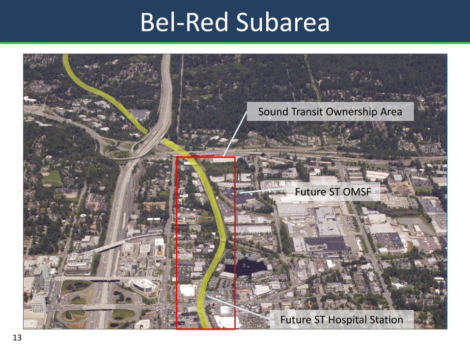
Bel-Red Subarea
13
Sound Transit Ownership Area
Future ST Hospital Station
Future ST OMSF
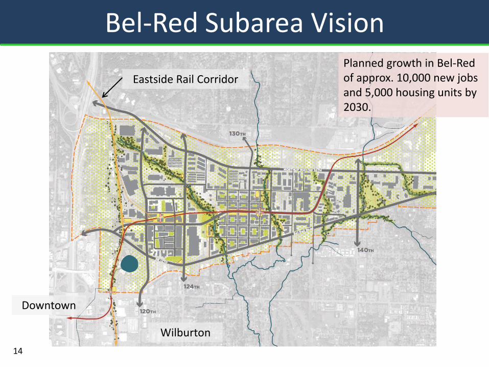
Bel-Red Subarea Vision Planned growth in Bel-Red of approx. 10,000 new jobs and 5,000 housing units by 2030.
14
Eastside Rail Corridor
Downtown
Wilburton
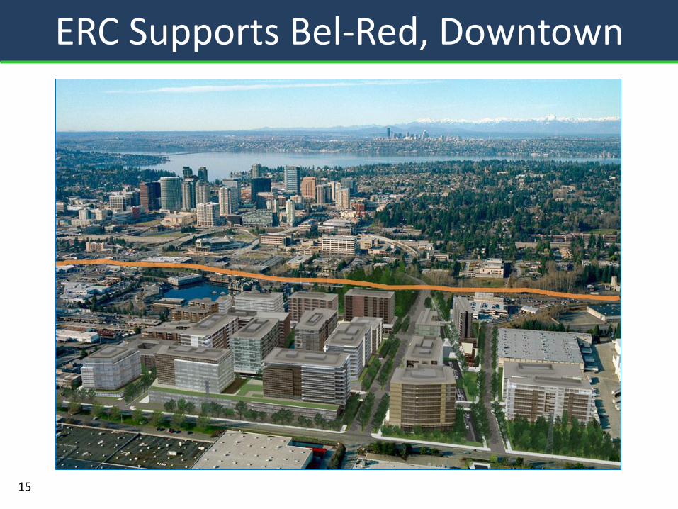
ERC Supports Bel-Red, Downtown
15
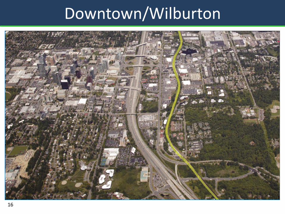
Downtown/Wilburton
16
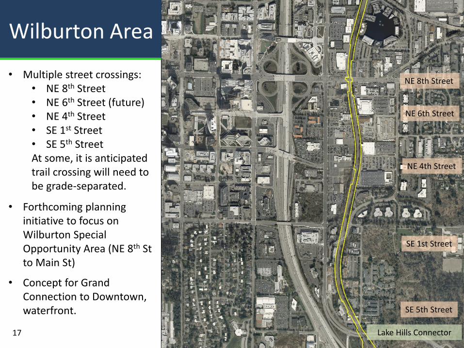
Wilburton Area
NE 8th Street
NE 4th Street
Lake Hills Connector
SE 1st Street
SE 5th Street
17
• Multiple street crossings: • NE 8th Street • NE 6th Street (future) • NE 4th Street • SE 1st Street • SE 5th Street At some, it is anticipated trail crossing will need to be grade-separated.
• Forthcoming planning initiative to focus on Wilburton Special Opportunity Area (NE 8th St to Main St)
• Concept for Grand Connection to Downtown, waterfront.
NE 6th Street
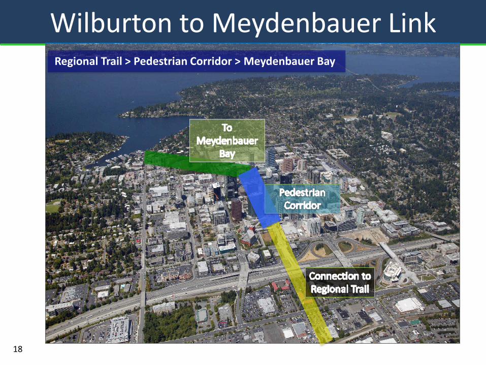
Wilburton to Meydenbauer Link
18
Regional Trail > Pedestrian Corridor > Meydenbauer Bay
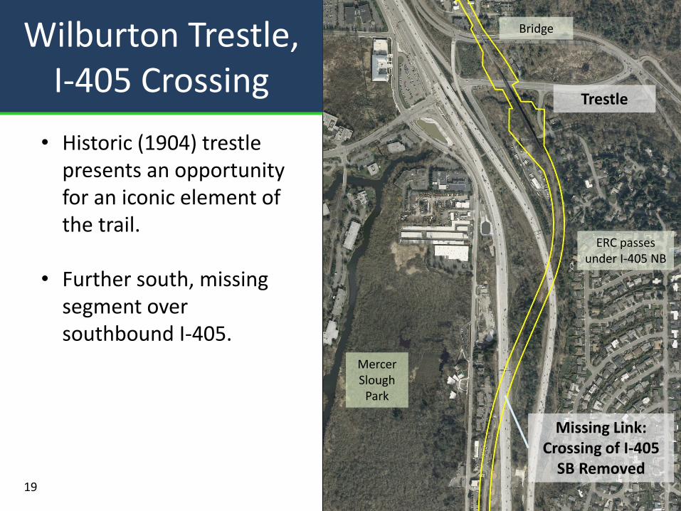
Wilburton Trestle, I-405 Crossing
Mercer Slough
Park
Trestle
Bridge
Missing Link: Crossing of I-405
SB Removed
ERC passes under I-405 NB
19
• Historic (1904) trestle presents an opportunity for an iconic element of the trail.
• Further south, missing segment over southbound I-405.
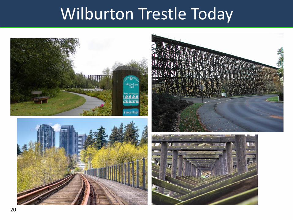
Wilburton Trestle Today
20
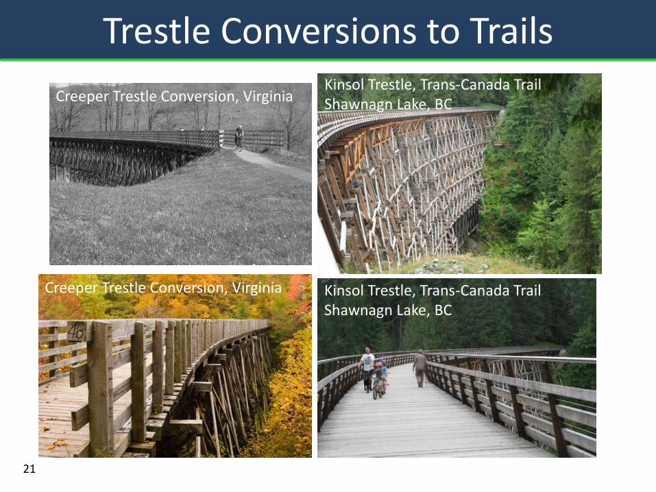
Trestle Conversions to Trails
Creeper Trestle Conversion, Virginia
Kinsol Trestle, Trans-Canada Trail Shawnagn Lake, BC
Creeper Trestle Conversion, Virginia
Kinsol Trestle, Trans-Canada Trail Shawnagn Lake, BC
21
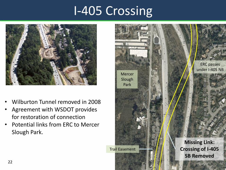
I-405 Crossing
• Wilburton Tunnel removed in 2008 • Agreement with WSDOT provides
for restoration of connection • Potential links from ERC to Mercer
Slough Park.
Mercer Slough
Park
Trail Easement
ERC passes under I-405 NB
Missing Link: Crossing of I-405
SB Removed 22
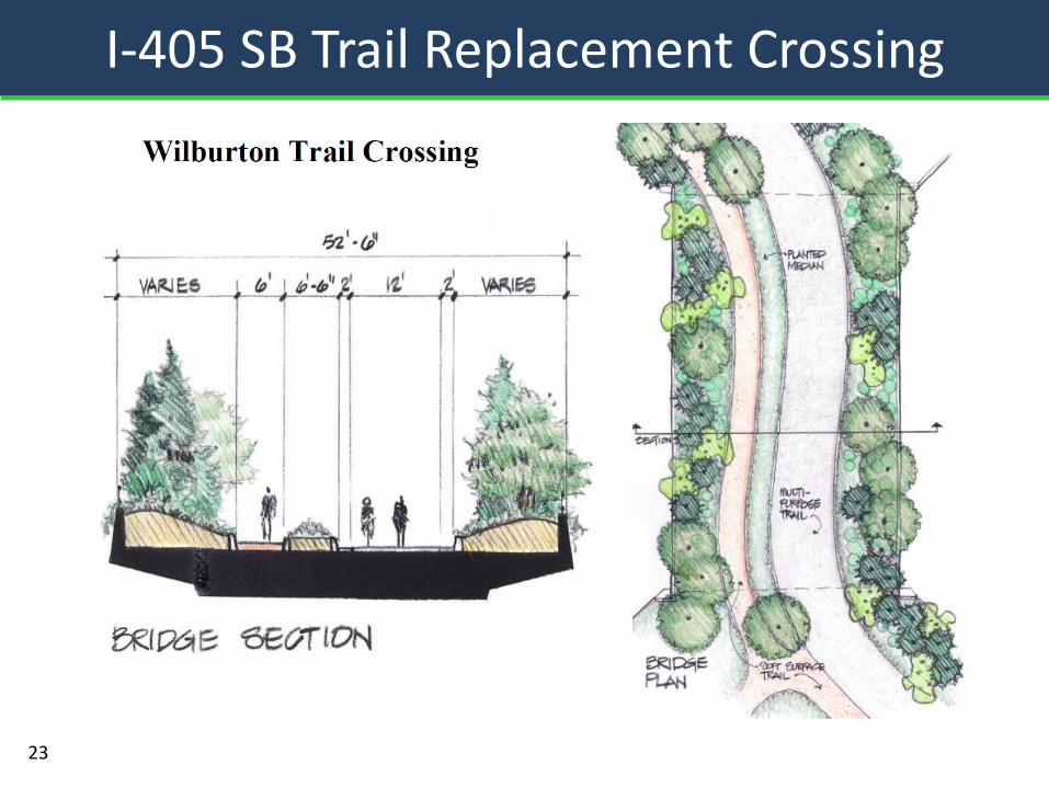
I-405 SB Trail Replacement Crossing
23
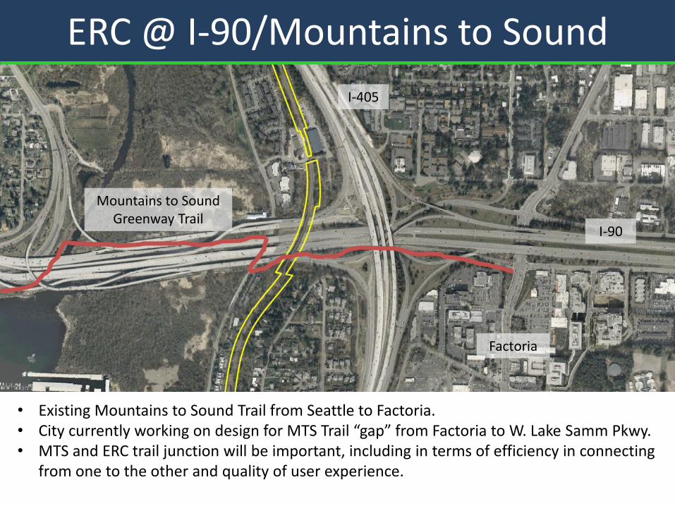
ERC @ I-90/Mountains to Sound
• Existing Mountains to Sound Trail from Seattle to Factoria. • City currently working on design for MTS Trail “gap” from Factoria to W. Lake Samm Pkwy. • MTS and ERC trail junction will be important, including in terms of efficiency in connecting
from one to the other and quality of user experience.
I-405
I-90
Mountains to Sound Greenway Trail
Factoria
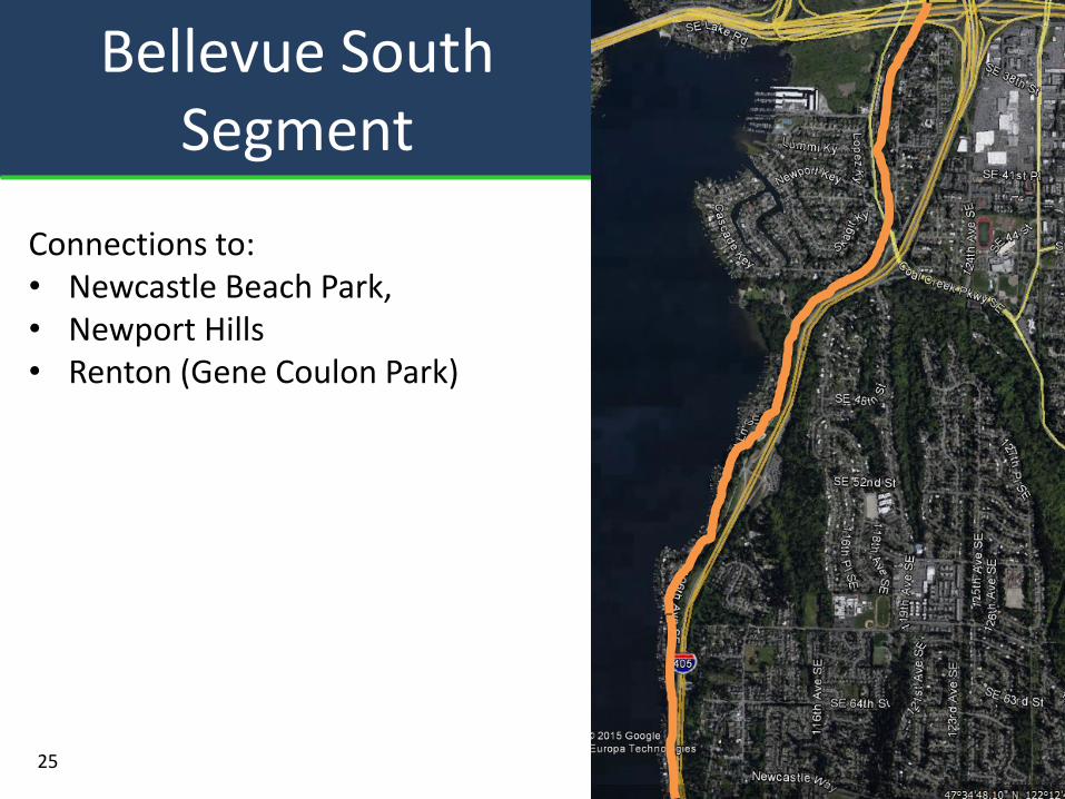
Bellevue South Segment
25
Connections to: • Newcastle Beach Park, • Newport Hills • Renton (Gene Coulon Park)
• Support King County Trail Master Plan process
• Additional direction anticipated from Council regarding CIP funding allocation.
26
Next Steps for Bellevue
Part 2:
• King County Trail Master Plan process
27
Eastside Rail Corridor