Embed Size (px)
Citation preview

Efficient Asset Management for Small Town Utilities
CUSTOMER EXPERIENCE | AUGUST 2019
TRANSFORMING THE WAY THE WORLD WORKS
Solution
Trimble® Geo 7X Handheld
Trimble TerraSync™ Software
Trimble Positions™ Desktop Software
A Minnesota town uses GNSS and GIS to manage public assets
Integrated GIS data management helps multiple utility networks share information and operate efficiently.
Accurate positioning of utilities enables technicians to quickly locate assets when repairs are needed.Accurate positioning of utilities enables technicians to quickly locate assets when repairs are needed.
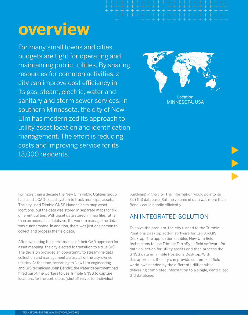
For many small towns and cities, budgets are tight for operating and maintaining public utilities. By sharing resources for common activities, a city can improve cost efficiency in its gas, steam, electric, water and sanitary and storm sewer services. In southern Minnesota, the city of New Ulm has modernized its approach to utility asset location and identification management. The effort is reducing costs and improving service for its 13,000 residents.
overview
LocationMINNESOTA, USA
TRANSFORMING THE WAY THE WORLD WORKSTRANSFORMING THE WAY THE WORLD WORKS
For more than a decade the New Ulm Public Utilities group had used a CAD-based system to track municipal assets. The city used Trimble GNSS Handhelds to map asset locations, but the data was stored in separate maps for six different utilities. With asset data stored in map files rather than an accessible database, the work to manage the data was cumbersome. In addition, there was just one person to collect and process the field data.
After evaluating the performance of their CAD approach for asset mapping, the city elected to transition to a true GIS. The decision provided an opportunity to streamline data collection and management across all of the city-owned utilities. At the time, according to New Ulm engineering and GIS technician John Bendix, the water department had hired part-time workers to use Trimble GNSS to capture locations for the curb stops (shutoff valves for individual
buildings) in the city. The information would go into its Esri GIS database. But the volume of data was more than Bendix could handle efficiently.
AN INTEGRATED SOLUTION
To solve the problem, the city turned to the Trimble Positions Desktop add-in software for Esri ArcGIS Desktop. The application enables New Ulm field technicians to use Trimble TerraSync field software for data collection for utility assets and then process the GNSS data in Trimble Positions Desktop. With this approach, the city can provide customized field workflows needed by the different utilities while delivering completed information to a single, centralized GIS database.
For example, New Ulm’s electric distribution network includes a wide variety of components for distribution, switching and metering. New Ulm has defined geodatabase schema in ArcMap to manage information related to the various structures and equipment. Using TerraSync, the schema can be taken out to the field for use in collecting new or updated information. In addition to capturing location data with GNSS, electric utility technicians use familiar terminology and work processes to gather attribute information defined in the schema. They can also edit existing features to reflect changes to the condition and location of the electric network assets.
Rather than juggling the different datasets and requirements of the six utilities, Bendix has defined a straightforward process to quickly bring the information
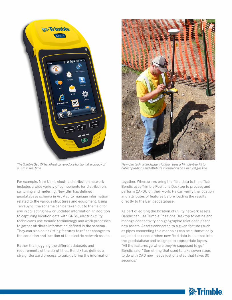
The Trimble Geo 7X handheld can produce horizontal accuracy of 10 cm in real time.
New Ulm technician Jagger Hoffman uses a Trimble Geo 7X to collect positions and attribute information on a natural gas line.
together. When crews bring the field data to the office, Bendix uses Trimble Positions Desktop to process and perform QA/QC on their work. He can verify the location and attributes of features before loading the results directly to the Esri geodatabase.
As part of editing the location of utility network assets, Bendix can use Trimble Positions Desktop to define and manage connectivity and geographic relationships for new assets. Assets connected to a given feature (such as pipes connecting to a manhole) can be automatically adjusted as needed when new field data is checked into the geodatabase and assigned to appropriate layers. “All the features go where they’re supposed to go,” Bendix said. “Something that used to take seven steps to do with CAD now needs just one step that takes 30 seconds.”
TRANSFORMING THE WAY THE WORLD WORKS
Contact your local Trimble Authorized Distribution Partner for more information
NORTH AMERICATrimble Inc.10368 Westmoor DriveWestminster CO 80021USA
EUROPETrimble Germany GmbHAm Prime Parc 1165479 RaunheimGERMANY+49-6142-2100-0 Phone+49-6142-2100-140 Fax
ASIA-PACIFICTrimble NavigationSingapore PTE Limited3 HarbourFront Place#13-02 HarbourFront Tower TwoSingapore 099254Singapore+65-6871-5878 Phone+65-6871-5879 Fax
“If you’re using your GIS for spatial accuracy, then GNSS is the best thing you can do. I’m probably 500 percent faster with my GNSS workflows with Trimble Positions.”
— John Bendix, Engineering/GIS Technician, City of New Ulm, MN
© 2019, Trimble Inc. All rights reserved. Trimble, the Globe & Triangle logo and Trimble TerraSync are trademarks of Trimble Inc., registered in the United States and in other countries. All other trademarks are the property of their respective owners. PN 022516-472 (08/19)
FLEXIBLE PRODUCTIVITY
In addition to recording the locations and attributes of utility assets, the Trimble solution helps New Ulm technicians return to specific assets when needed. By accessing the Minnesota Department of Transportation MnCORS GNSS network, which is built on Trimble VRS technology, field crews can navigate directly to specific assets. “Looking for a shutoff valve during a snowstorm isn’t easy,” Bendix said. “The Trimble handhelds and MnCORS help them find an asset quickly.” Because the GIS data is synced with the central geodatabase, field crews always have up-to-date information.
With data coming from five six different utilities, New Ulm benefits from the system’s ability to adjust to specific needs. The different utilities have different ways of collecting information.
Some departments collect only locations and add descriptive data in the office. Others are interested in getting all the information while in the field.
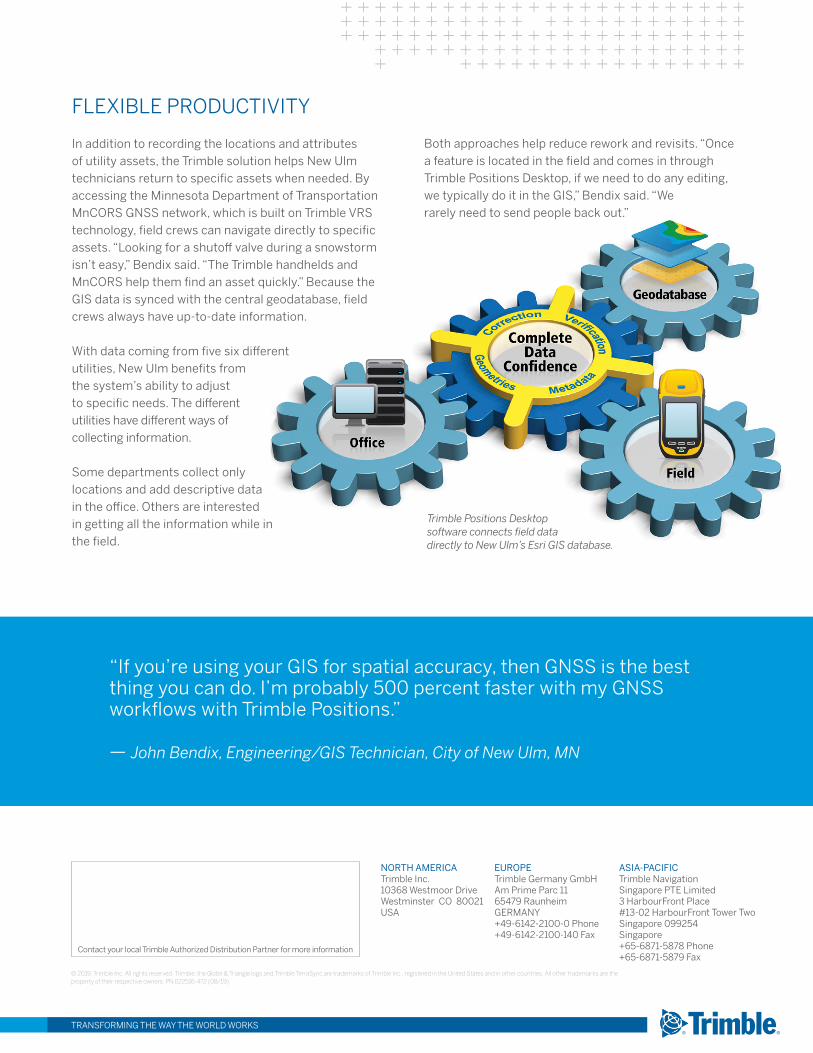
Trimble Positions Desktop software connects field data directly to New Ulm’s Esri GIS database.
Both approaches help reduce rework and revisits. “Once a feature is located in the field and comes in through Trimble Positions Desktop, if we need to do any editing, we typically do it in the GIS,” Bendix said. “We rarely need to send people back out.”