Embed Size (px)
Citation preview
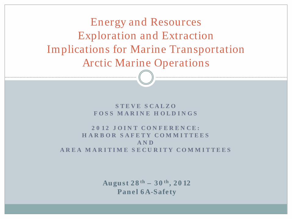
S T E V E S C A L Z O F O S S M A R I N E H O L D I N G S
2 0 1 2 J O I N T C O N F E R E N C E :
H A R B O R S A F E T Y C O M M I T T E E S A N D
A R E A M A R I T I M E S E C U R I T Y C O M M I T T E E S
Energy and Resources Exploration and Extraction
Implications for Marine Transportation Arctic Marine Operations
August 28th – 30th, 2012 Panel 6A-Safety
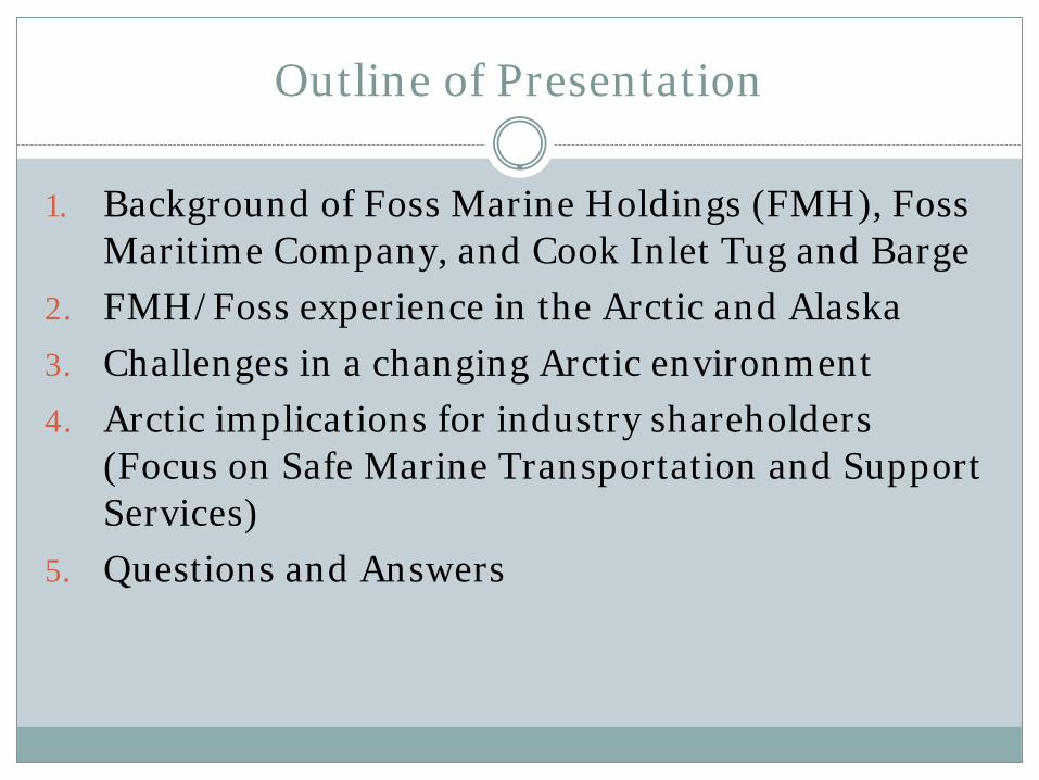
Outline of Presentation
1. Background of Foss Marine Holdings (FMH), Foss Maritime Company, and Cook Inlet Tug and Barge
2. FMH/Foss experience in the Arctic and Alaska
3. Challenges in a changing Arctic environment
4. Arctic implications for industry shareholders (Focus on Safe Marine Transportation and Support Services)
5. Questions and Answers

Foss Marine Holdings
Consolidation in 2004 to develop Saltchuk’s Green Water Assets
1650 Employees worldwide
90 Tugs
70 Barges
FMH Mission Safe/ Quality Operation
Brand Integrity
Profitability and Return on Investment
Growth Initiatives
ISM International Safety
Management
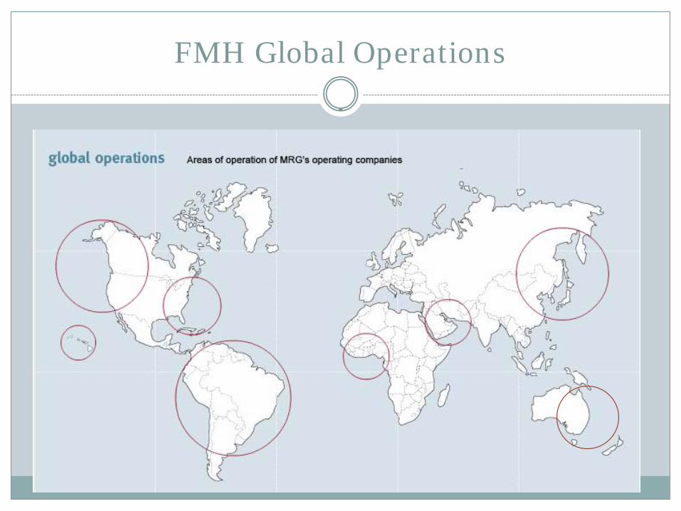
FMH Global Operations
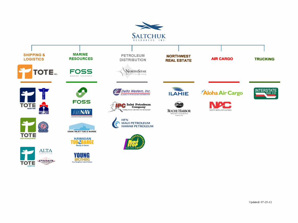
FMH Subsidiary Companies

Foss Maritime Company
Founded in 1889
Foss Maritime Company offers a complete range of maritime transportation and logistics services to customers on the U.S. West, Gulf and East coasts, Alaska, across the Pacific Rim,, South America and around the globe.

The first Foss office in the late 1890’s
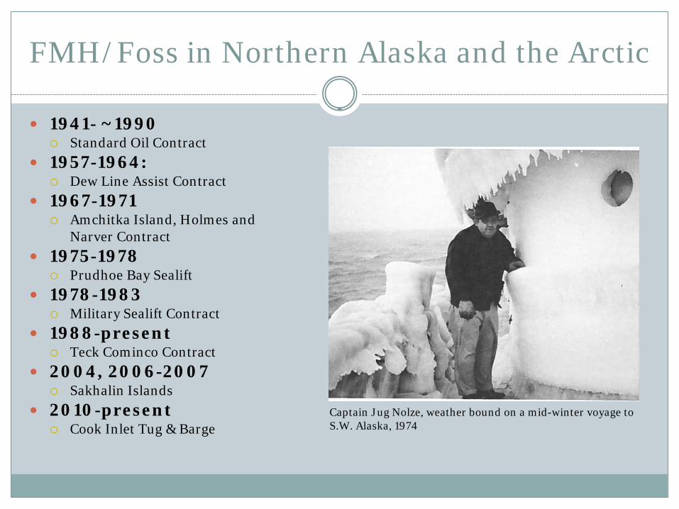
FMH/Foss in Northern Alaska and the Arctic
1941- ~1990 Standard Oil Contract
1957-1964: Dew Line Assist Contract
1967-1971 Amchitka Island, Holmes and Narver Contract
1975-1978 Prudhoe Bay Sealift
1978-1983 Military Sealift Contract
1988-present Teck Cominco Contract
2004, 2006-2007 Sakhalin Islands
2010-present Cook Inlet Tug & Barge
Captain Jug Nolze, weather bound on a mid-winter voyage to S.W. Alaska, 1974
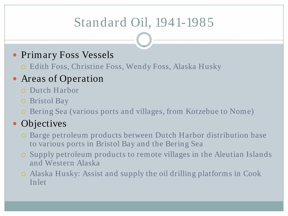
Standard Oil, 1941-1985
Primary Foss Vessels Edith Foss, Christine Foss, Wendy Foss, Alaska Husky
Areas of Operation Dutch Harbor Bristol Bay Bering Sea (various ports and villages, from Kotzebue to Nome)
Objectives Barge petroleum products between Dutch Harbor distribution base
to various ports in Bristol Bay and the Bering Sea Supply petroleum products to remote villages in the Aleutian Islands
and Western Alaska Alaska Husky: Assist and supply the oil drilling platforms in Cook
Inlet
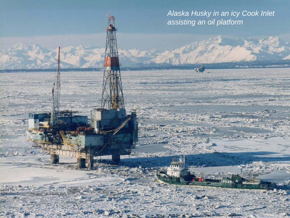
Alaska Husky in an icy Cook Inlet assisting an oil platform

DEW Line Support, 1957-1964
Primary Foss Vessel Agnes Foss, and other sister tugs
Areas of Operation Bering Sea
Arctic Ocean
Airforce Base at Shemya Island
Objectives: DEW Line construction support and yearly resupply
Complete job in stormy and unpredictable weather
Complete 5,800 mile round trip
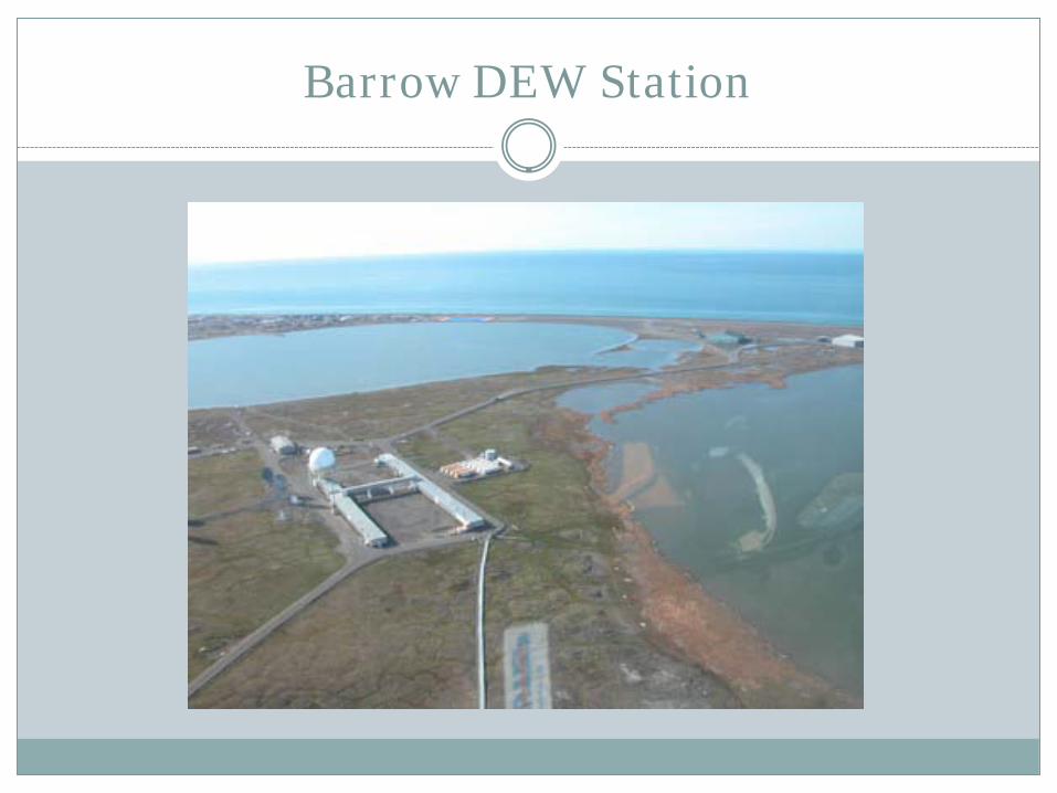
Barrow DEW Station

Amchitka Island, 1967-1971
Primary Foss Vessel Adeline Foss, and other sister tugs
Areas of Operation Amchitka Island, part of the Aleutian Chain
Objectives Sealift of supplies and equipment for Holmes & Narver, the
prime contractor for the Atomic Energy Commission’s underground explosion project
73 separate tows at an average of 40 days each
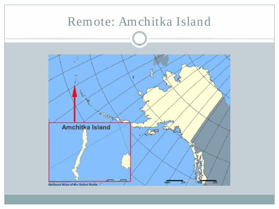
Remote: Amchitka Island
Prudhoe Bay Sealift, 1975-1978
Primary Foss Vessels Jeffrey Foss, Arthur Foss, Henry Foss & other sister tugs
Areas of Operation Prudhoe Bay, Alaska
Objectives , Challenges, & Results Deliver 47 barges to oil industry customer in Prudhoe Bay Record levels of polar ice led to extremely challenging
conditions All 47 barges were delivered safely to Prudhoe Bay The Foss tugs were able to make it out of Prudhoe before the
ice thickened 25 barges had to be left in the Bay until the ice thawed

Prudhoe Bay Sealift, 1975-1978
Icy waters made it challenging to tow 47 barges to Prudhoe Bay, but Foss tugs were able to complete the job. Right: The barges being towed to Prudhoe Bay
Military Sealift Command, 1978-1983
Primary Foss Vessel Justine Foss, and sister tugs
Areas of Operation Adak, Aleutian Islands
Objectives Deliver one barge-load to Adak once every 3 weeks
To maintain the schedule, the regular Foss Alaska Line tug transported the Military Sealift Command cargo on a barge and dropped it off at Sitka, where it would sit in a marshalling area to await the Justine.
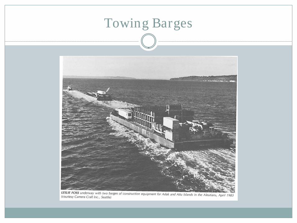
Towing Barges
Teck Cominco, 1988-present
Primary Foss Vessels Barbara Foss, Justine Foss, Drew Foss, Jeffrey Foss, Stacey
Foss
Areas of Operation Red Dog Mine, NW Alaska
Objectives Use Foss self-loading barges to pick up the ore and lighter it to
the ships anchored offshore
Complete objectives in a 90-100 day season due to weather and ice
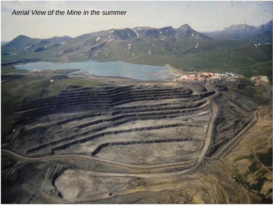
Aerial View of the Mine in the summer

The Stacey Foss towing the specially designed lighter barge

Teck Cominco says Red Dog Mine does everything it can to lessen its environmental footprint – following strict regulations and setting its own environmental and safety standards.

Sakhalin Islands, 2005-2006
Areas of Operation Sakhalin Islands, North East Russia
Objectives and Results Transport 36 prefabricated modules to support the
construction of an LNG production facility on the NE tip of Sakhalin Island
Each module was 280’ long x 45’ wide x 85’ tall and weight 1,800 tons
Manage challenging ice, typhoons and dangerous seas
Project completed ahead of schedule and safely
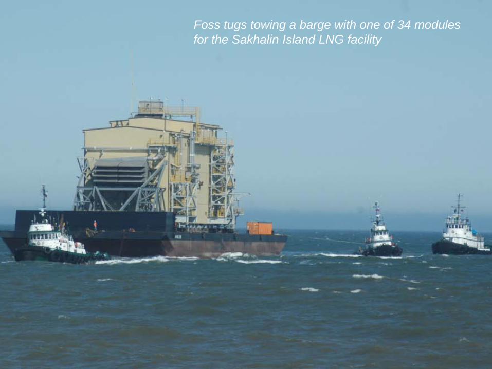
Foss tugs towing a barge with one of 34 modules for the Sakhalin Island LNG facility
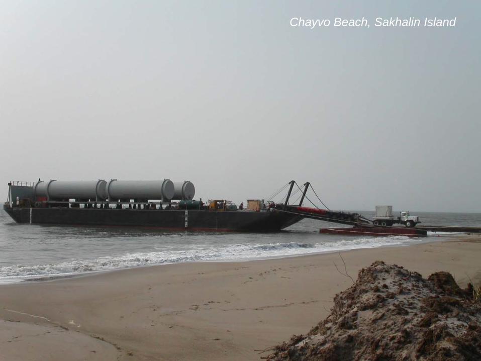
Chayvo Beach, Sakhalin Island
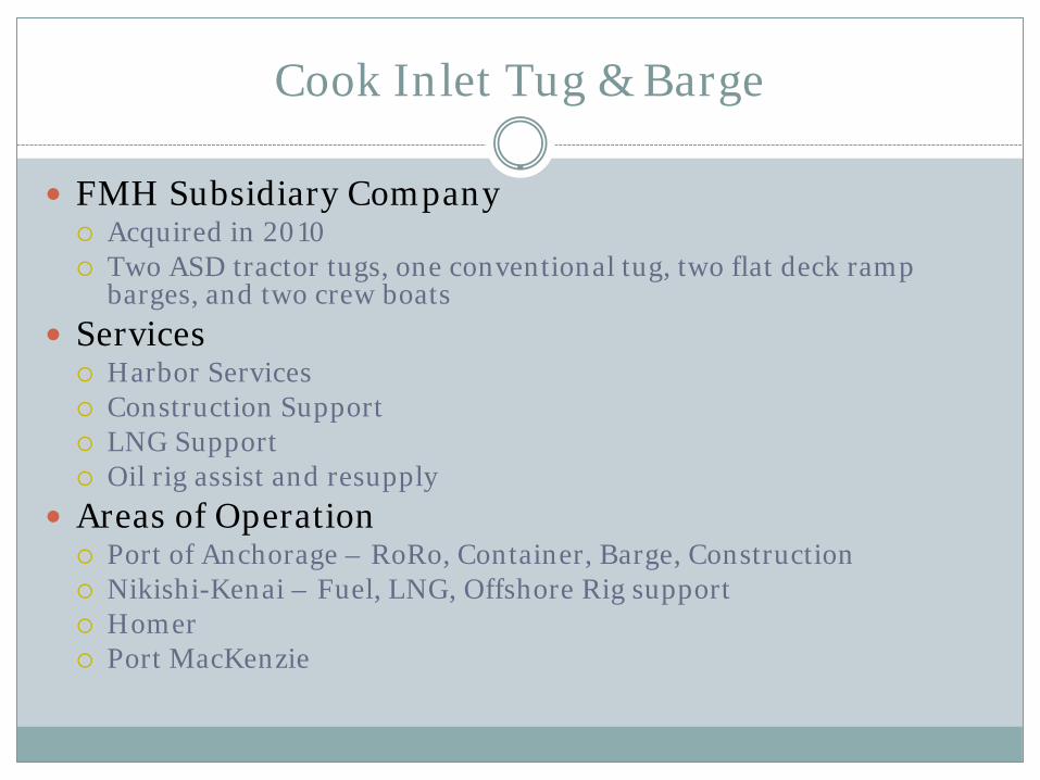
Cook Inlet Tug & Barge
FMH Subsidiary Company Acquired in 2010 Two ASD tractor tugs, one conventional tug, two flat deck ramp
barges, and two crew boats
Services Harbor Services Construction Support LNG Support Oil rig assist and resupply
Areas of Operation Port of Anchorage – RoRo, Container, Barge, Construction Nikishi-Kenai – Fuel, LNG, Offshore Rig support Homer Port MacKenzie
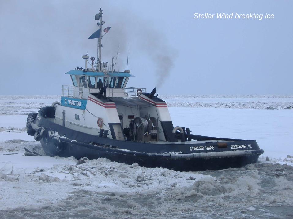
Stellar Wind breaking ice
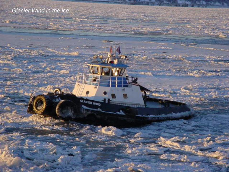
Glacier Wind in the ice
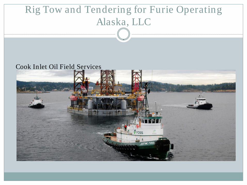
Rig Tow and Tendering for Furie Operating Alaska, LLC
Cook Inlet Oil Field Services
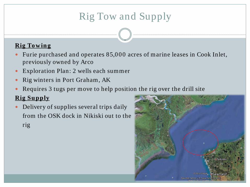
Rig Tow and Supply
Rig Towing
Furie purchased and operates 85,000 acres of marine leases in Cook Inlet, previously owned by Arco
Exploration Plan: 2 wells each summer
Rig winters in Port Graham, AK
Requires 3 tugs per move to help position the rig over the drill site
Rig Supply
Delivery of supplies several trips daily
from the OSK dock in Nikiski out to the
rig
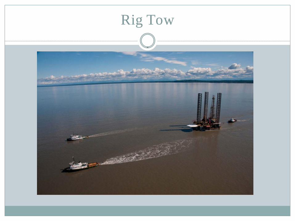
Rig Tow

Rig Supply Vessel
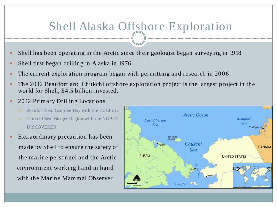
Shell Alaska Offshore Exploration
Shell has been operating in the Arctic since their geologist began surveying in 1918
Shell first began drilling in Alaska in 1976
The current exploration program began with permitting and research in 2006
The 2012 Beaufort and Chukchi offshore exploration project is the largest project in the world for Shell, $4.5 billion invested.
2012 Primary Drilling Locations
Beaufort Sea: Camden Bay with the KULLUK
Chukchi Sea: Burger Region with the NOBLE
DISCOVERER
Extraordinary precaution has been
made by Shell to ensure the safety of
the marine personnel and the Arctic
environment working hand in hand
with the Marine Mammal Observer
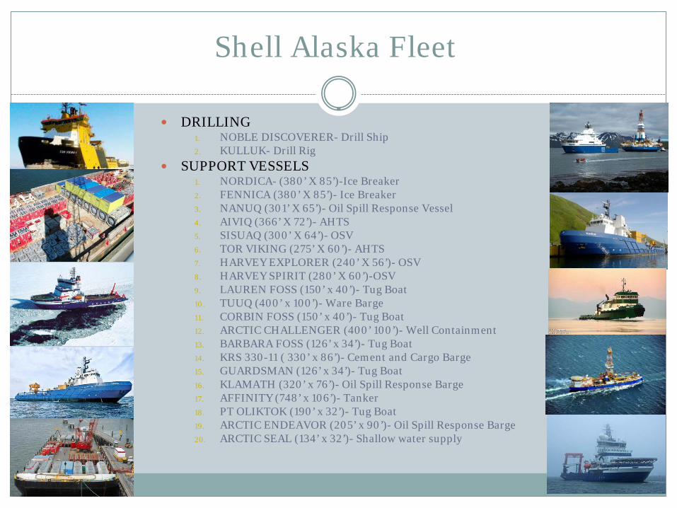
Shell Alaska Fleet
DRILLING 1. NOBLE DISCOVERER- Drill Ship 2. KULLUK- Drill Rig
SUPPORT VESSELS 1. NORDICA- (380’ X 85’)-Ice Breaker 2. FENNICA (380’ X 85’)- Ice Breaker 3. NANUQ (301’ X 65’)- Oil Spill Response Vessel 4. AIVIQ (366’ X 72’)- AHTS 5. SISUAQ (300’ X 64’)- OSV 6. TOR VIKING (275’ X 60’)- AHTS 7. HARVEY EXPLORER (240’ X 56’)- OSV 8. HARVEY SPIRIT (280’ X 60’)-OSV 9. LAUREN FOSS (150’ x 40’)- Tug Boat 10. TUUQ (400’ x 100’)- Ware Barge 11. CORBIN FOSS (150’ x 40’)- Tug Boat 12. ARCTIC CHALLENGER (400’ 100’)- Well Containment 13. BARBARA FOSS (126’ x 34’)- Tug Boat 14. KRS 330-11 ( 330’ x 86’)- Cement and Cargo Barge 15. GUARDSMAN (126’ x 34’)- Tug Boat 16. KLAMATH (320’ x 76’)- Oil Spill Response Barge 17. AFFINITY (748’ x 106’)- Tanker 18. PT OLIKTOK (190’ x 32’)- Tug Boat 19. ARCTIC ENDEAVOR (205’ x 90’)- Oil Spill Response Barge 20. ARCTIC SEAL (134’ x 32’)- Shallow water supply

Exploration Plan
Original Expectation for 2012 • Drilling Season: 1st July to 31st
October • Wells: 3 Chukchi & 2 Beaufort
Current Expectation for 2012
• Drill Season: ASAP to 31st October for the Beaufort • Wells: two (2) • Considerations • Abnormally cold temperatures delayed break up and kept the Arctic inaccessible • Well containment barge was not delivered as originally scheduled, delaying overall drilling
program. • It takes between 2 weeks and a month to drill one well • Inupiat tribe whale hunting season begins September 25th; exploration vessels will be
removed from the region and taken to ice until the hunt is complete (appx. 3-6 weeks)
Operation Logistics
Utilize two drill rigs: NOBLE DISCOVERER and KULLUK Supplies and equipment will be transported to the site during the
mobilization of the assets from Seattle, WA Resupply of rigs and equipment will be brought from Dutch Harbor, AK via
Offshore Supply Vessels and from Deadhorse, AK via shallow supply vessels Crews will be transported via helicopter to the rigs from Deadhorse, AK and
Barrow, AK 24 hours oil spill contingency vessels and well containment vessels will be on
site at drilling locations during all active drilling Shell is practicing zero discharge drilling in the Beaufort Sea. Mud and grey
water vessels will collect and store drill cuttings and grey water from drilling rig and take to a cleaning facility for decontamination at the end of the season
Marine Mammal Observers on board for research and observation

Risk Factors - Environmental
Ice covers much of the navigable waters of the Arctic except for brief periods in the summer, making the area inaccessible to marine traffic 6-9months per year. Much of the coastal and inland waters of Arctic Alaska are shallow with a shifting hydrography, restricting accessibility to deep draft vessels and in many cases requiring a maximum operating draft as little as 4’. Extreme cold, unpredictable weather and gale storm force wind and sea conditions are present in Arctic Alaska, even in the summer.
Challenges in the Arctic Operational Considerations
Environmental Conditions for Operation Poor Weather/difficult ice Reliable Charts/Navigational aid Underdeveloped communications Remote location logistics
Northern Bering and Chukchi Seas Earlier Spring and later Fall transitions (ice covered to ice free) Improving access to the Arctic
Increased Vessel traffic Ice capable vessel transits Northern sea route – Russia Northwest Passage – Canada

Operational Considerations
Potential conflicts among competing users Domestic and Foreign
Natural Resource exploration, development and production Fishing Commercial vessel transits Scientific polar research (national leadership role) Tourism Indigenous Peoples
• Sealing, Whale hunting, wildlife subsistence • Cultural implications
US Government 1. Protect territorial interests 2. Controlled access and oversight 3. Maritime safety and security law enforcement 4. Boundary protection 5. Natural Resources protection 6. Environmental response 7. U.N. Convention in the Law of the Seas (extensive mapping) 8. Assured access and sovereign presence
• U.S. national policy • Presidential decision directive
Arctic Implications Risk Management in Arctic Operations
Risk Factors Safely navigating Arctic waters has inherent risks that fall into three broad categories:
o Environmental
o Navigation Technology
o Support Resources and Infrastructure

Risk Factor - Environmental
Environmental
Ice
Shallow water
Extreme cold
Extreme wind and sea conditions
Atmospheric interference with electronic positioning and communication devices
High ecological impact of incident

Risk Factors – Navigation Technology
Navigation Technology
Navigation in Polar Regions has not yet evolved to the high performance levels commonly accepted for the more heavily n marine routes in the mid and lower latitudes. This has created technology gaps in the following areas:
Charting – inaccurate or dated charting
Depth surveys – lack of comprehensive depth surveys
Heading accuracy – poor performance of magnetic and inertial heading devices
Electronic position locating – gaps in satellite coverage and atmospheric interference effect the accuracy of electronic position technology
Aids to navigation – fixed aids to navigation are scarce and in many areas impractical
Risk Factors – Navigation Technology
Navigation Technology continued
Ice and weather data collection and forecasting – lack of data collection resources and inconsistent weather and ice forecast accuracy
Tidal predictions – wide areas of coastal and inland waters lack accurate localized tide and current prediction data
Communication – gaps in SAT and cell phone coverage
Risk Factors – Support Resources and Infrastructure
Support Resources and Infrastructure
Arctic marine traffic currently has limited support from shore-based resources and infrastructure in the event of a serious marine incident. Effective immediate incident response is dependent on utilization the resources aboard the affected vessel and other vessels in its vicinity.

Areas for Improvement
Define Arctic waters as area North and West of Unimak Pass
Provide additional charting with more comprehensive depth contours and appropriate scaling
Provide updated electronic charts with embedded aids to navigation
Increase AIS coverage in the Arctic navigation area
Develop more accurate tide and current data for the area
Enhance Ice assessment and forecasting capabilities
Provide more comprehensive weather data gathering tools and more accurate localized weather forecasting for the region
Areas for Improvement - continued
Implement a Traffic Management Scheme for Unimak Pass and the Bering Strait
Utilize the Cook Inlet Model of Phased Ice Operation Guidelines for establishing Guidelines in the Arctic
Improve communication capabilities – satellite and terrestrial
Create safe Harbor(s)/ Harbor of Refuge(s) with appropriate support infrastructure
Asses Port Clarence as a possible Safe Harbor

Areas for Improvement - continued
Increase emergency response, salvage and search and rescue capabilities in the region
Provide more comprehensive U.S.C.G. Search and Rescue resources in the region
Provide additional icebreaking resources and capability during the “shoulder” season to provide assured access to Arctic Communities during the critical summer transportation season

Questions and Answers