Embed Size (px)
Citation preview
Europe, Canada, Latin America, & Australia
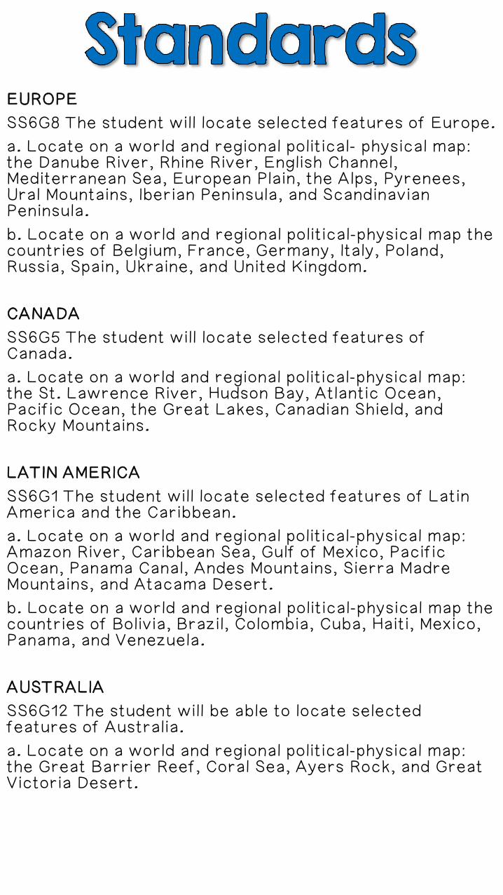
EUROPE
SS6G8 The student will locate selected features of Europe.
a. Locate on a world and regional political- physical map: the Danube River, Rhine River, English Channel, Mediterranean Sea, European Plain, the Alps, Pyrenees, Ural Mountains, Iberian Peninsula, and Scandinavian Peninsula.
b. Locate on a world and regional political-physical map the countries of Belgium, France, Germany, Italy, Poland, Russia, Spain, Ukraine, and United Kingdom.
CANADA
SS6G5 The student will locate selected features of Canada.
a. Locate on a world and regional political-physical map: the St. Lawrence River, Hudson Bay, Atlantic Ocean, Pacific Ocean, the Great Lakes, Canadian Shield, and Rocky Mountains.
LATIN AMERICA
SS6G1 The student will locate selected features of Latin America and the Caribbean.
a. Locate on a world and regional political-physical map: Amazon River, Caribbean Sea, Gulf of Mexico, Pacific Ocean, Panama Canal, Andes Mountains, Sierra Madre Mountains, and Atacama Desert.
b. Locate on a world and regional political-physical map the countries of Bolivia, Brazil, Colombia, Cuba, Haiti, Mexico, Panama, and Venezuela.
AUSTRALIA
SS6G12 The student will be able to locate selected features of Australia.
a. Locate on a world and regional political-physical map: the Great Barrier Reef, Coral Sea, Ayers Rock, and Great Victoria Desert.
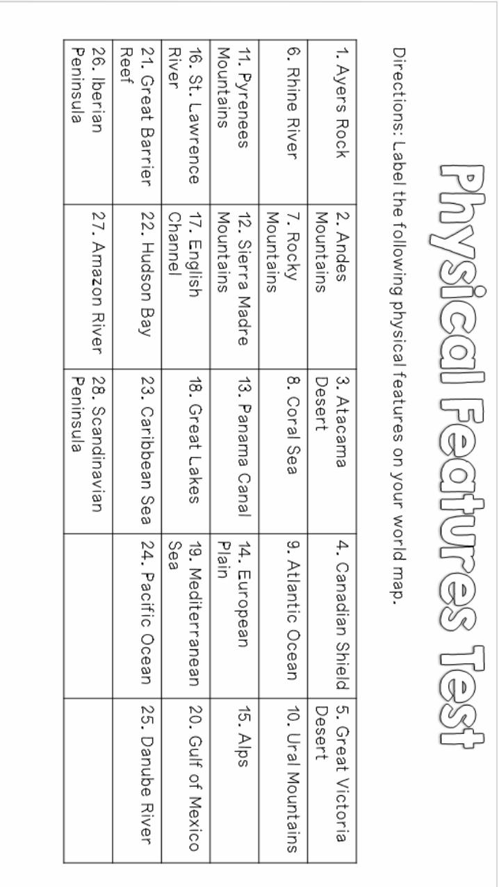
I use this file when preparing for the CRCT. I usually print off all of the pages and have the students make a packet. They have to label all of the features (without looking at notes, atlas, etc.) and then we check the answers in class by going over the following pages. After we finishing reviewing and the students have had plenty of time to study the features (2-3 days), I give the Physical Features Test. (I count this as a test grade.) By this point, the students are more than ready for the geography-location questions on the CRCT!
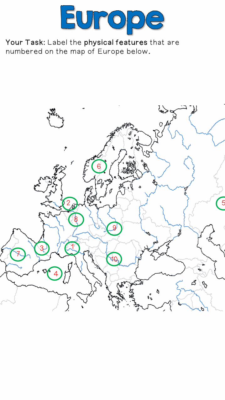
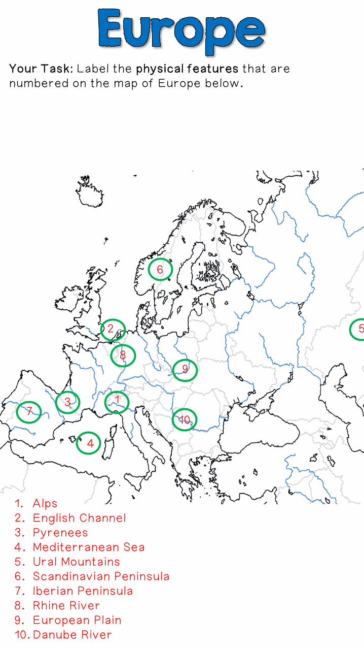
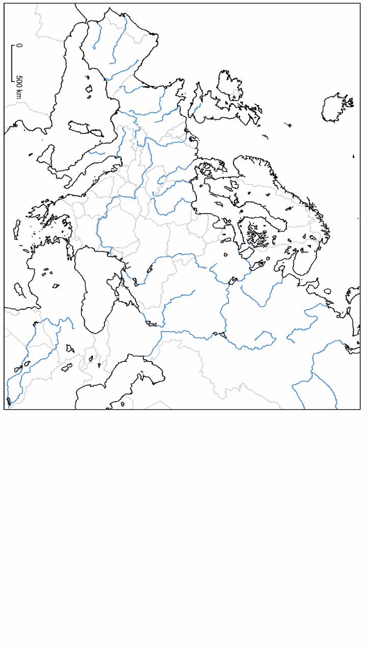
Your Task: Label the physical features that are numbered on the map of Europe below.
2
13
4
5
6
7
89
10
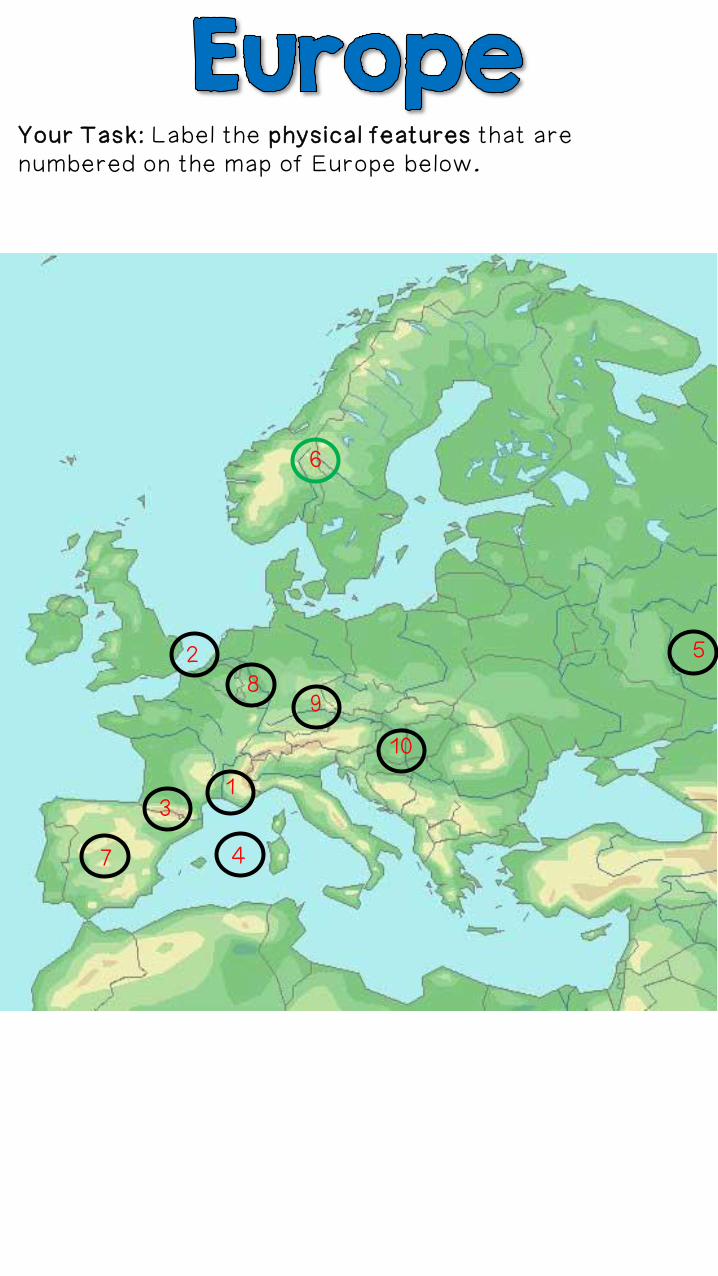
Your Task: Label the physical features that are numbered on the map of Europe below.
2
13
4
5
6
7
89
10
1. Alps2. English Channel3. Pyrenees4. Mediterranean Sea5. Ural Mountains6. Scandinavian Peninsula7. Iberian Peninsula8. Rhine River9. European Plain10.Danube River
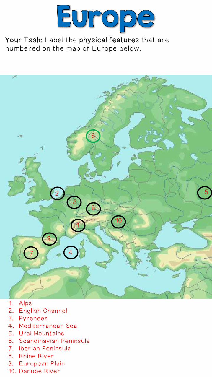
Your Task: Label the physical features that are numbered on the map of Europe below.
2
13
4
5
6
7
89
10
Your Task: Label the physical features that are numbered on the map of Europe below.
2
1
3
4
5
6
7
89
10
1. Alps2. English Channel3. Pyrenees4. Mediterranean Sea5. Ural Mountains6. Scandinavian Peninsula7. Iberian Peninsula8. Rhine River9. European Plain10. Danube River
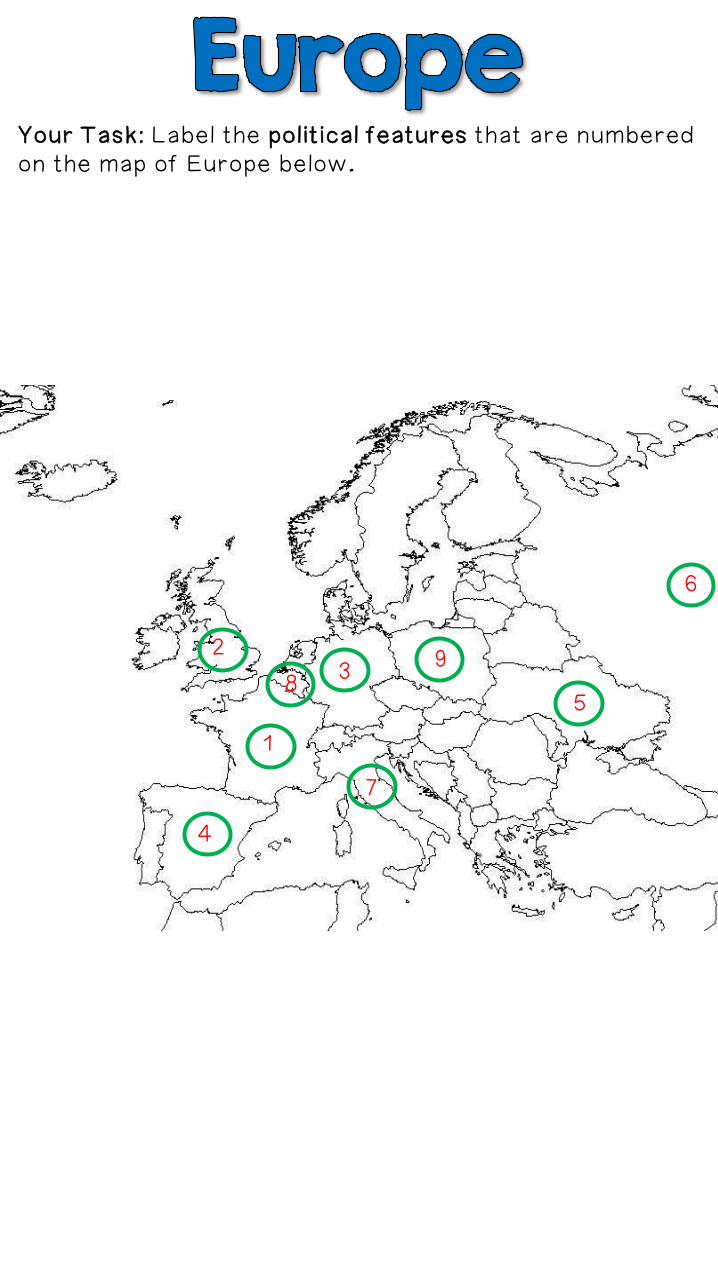
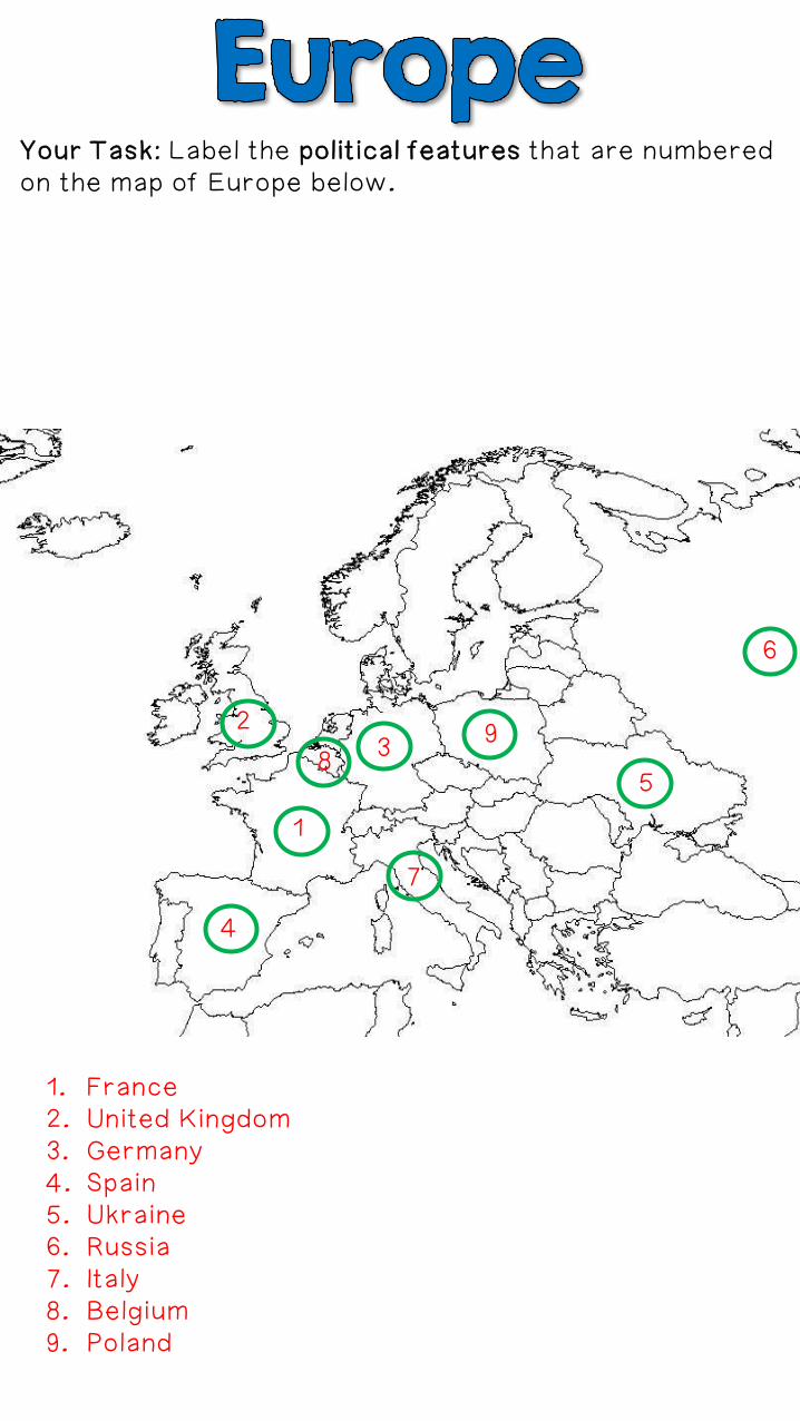
Your Task: Label the political features that are numbered on the map of Europe below.
2
1
3
4
5
6
7
89
Your Task: Label the political features that are numbered on the map of Europe below.
2
1
3
4
5
6
7
89
1. France2. United Kingdom3. Germany4. Spain5. Ukraine6. Russia7. Italy8. Belgium9. Poland

Your Task: Label the physical features that are numbered on the map of Canada below.
2
1
3
4
5
6 7

Your Task: Label the physical features that are numbered on the map of Canada below.
2
1
3
4
5
6 7
1. Rocky Mountains2. Great Lakes3. Hudson Bay4. St. Lawrence River5. Canadian Shield6. Pacific Ocean7. Atlantic Ocean
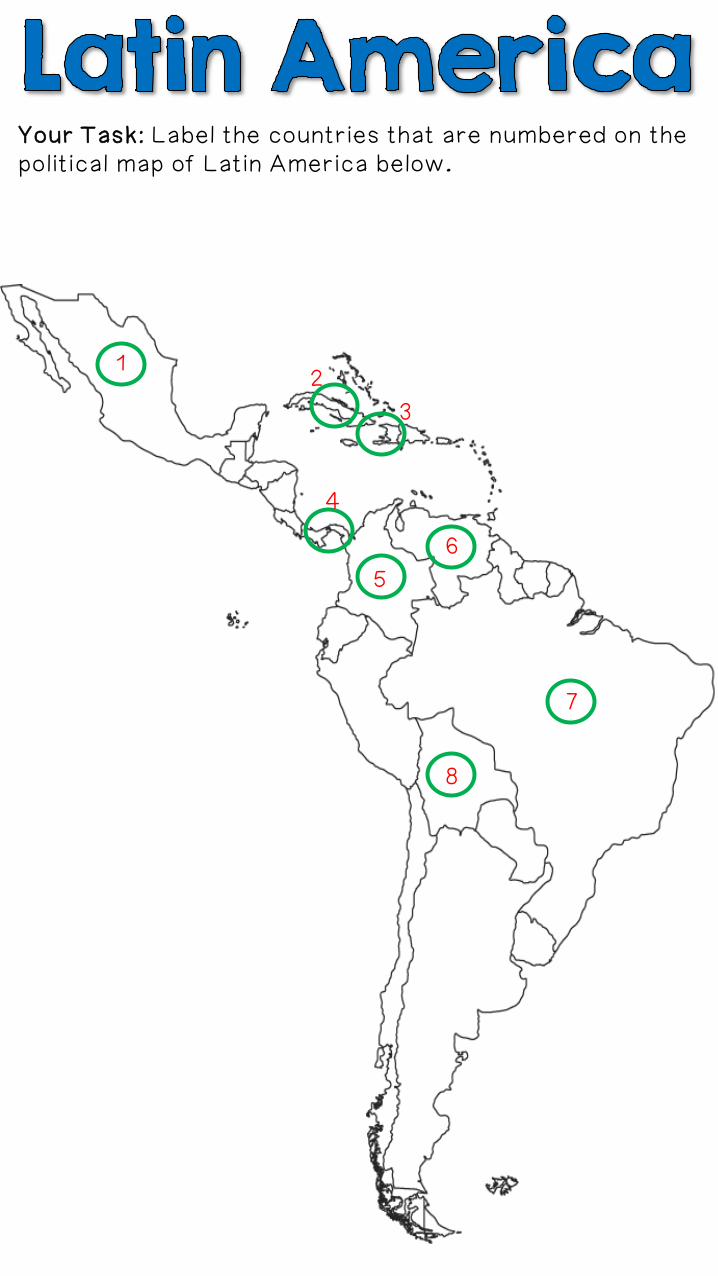
Your Task: Label the countries that are numbered on the political map of Latin America below.
12
3
4
5
6
7
8
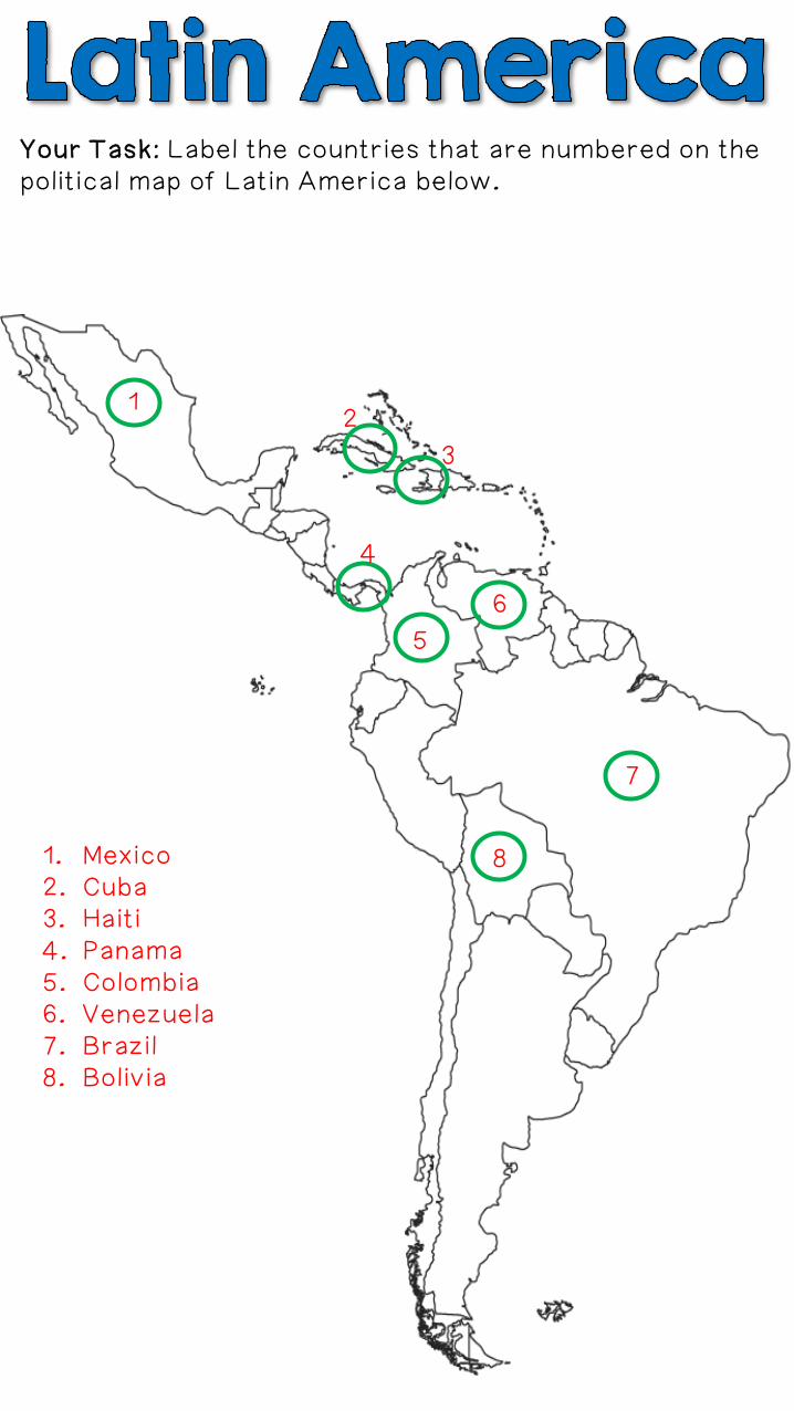
Your Task: Label the countries that are numbered on the political map of Latin America below.
12
3
4
5
6
7
81. Mexico2. Cuba3. Haiti4. Panama5. Colombia6. Venezuela7. Brazil8. Bolivia
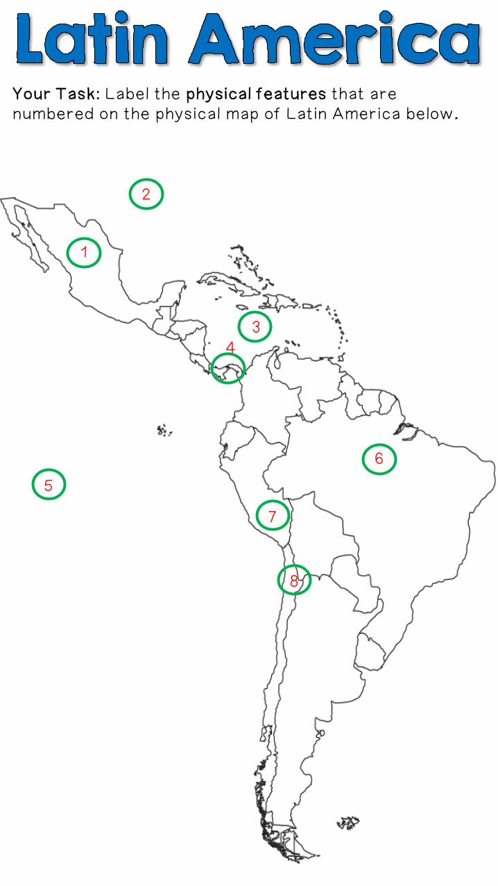
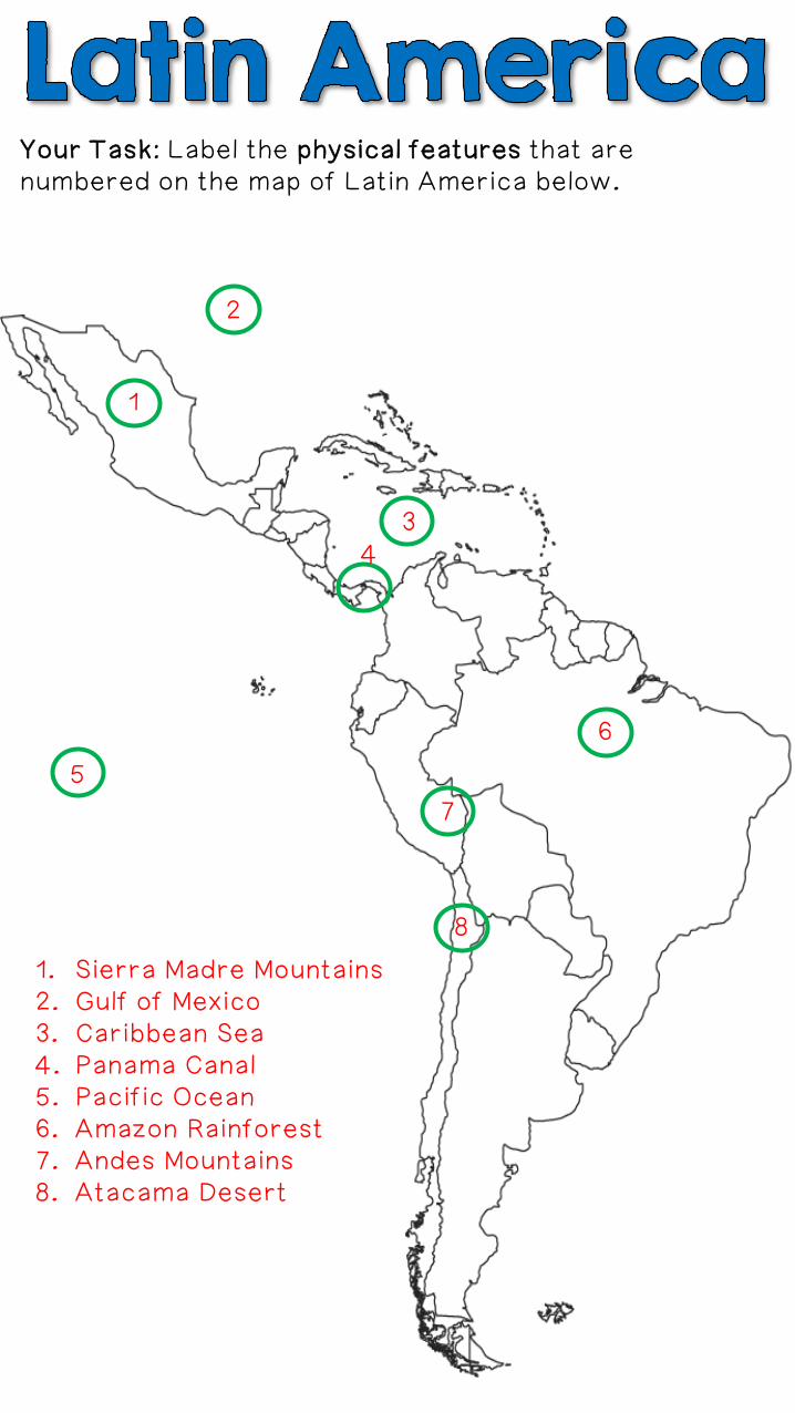
Your Task: Label the physical features that are numbered on the physical map of Latin America below.
1
2
34
5
6
7
8
Your Task: Label the physical features that are numbered on the map of Latin America below.
1
2
34
5
6
7
8
1. Sierra Madre Mountains2. Gulf of Mexico3. Caribbean Sea4. Panama Canal5. Pacific Ocean6. Amazon Rainforest7. Andes Mountains8. Atacama Desert
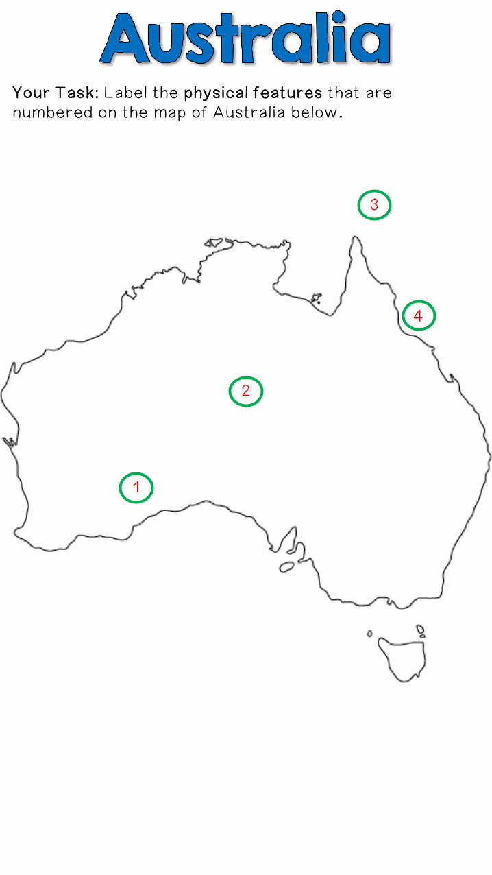
Your Task: Label the physical features that are numbered on the map of Australia below.
2
1
3
4
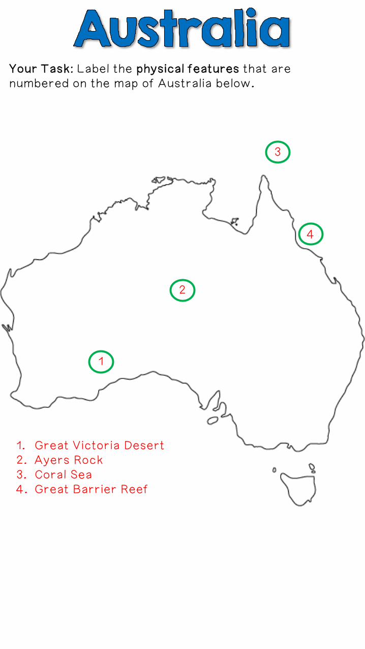
Your Task: Label the physical features that are numbered on the map of Australia below.
2
1
3
4
1. Great Victoria Desert2. Ayers Rock3. Coral Sea4. Great Barrier Reef
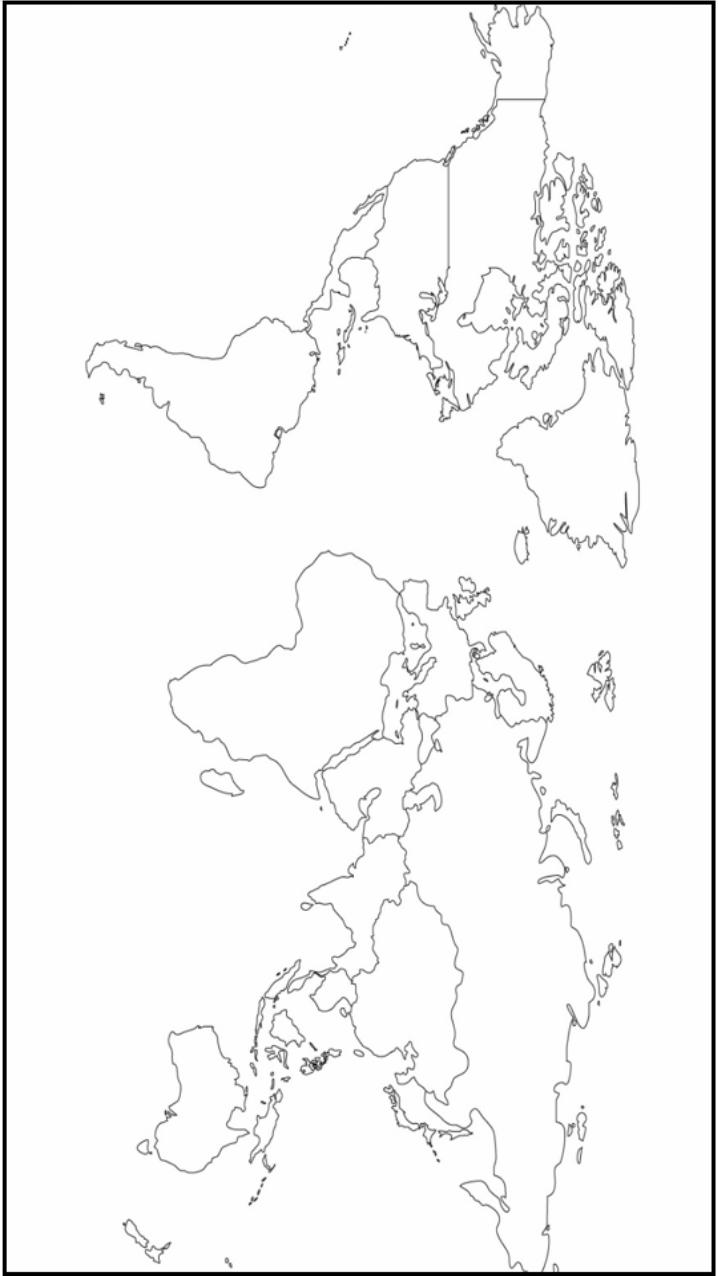
The following 3 slides are
part of the Physical
Geography Test. I project the
directions slide onto the
board. I print off the world
map and the Europe map for
the students to label. (The
reason that there are two
maps is because Europe is
pretty small on the world map
& it can get confusing when
the students are labeling all
10 of Europe’s features.)

Thank you for downloading this file. I hope you enjoy using it with your students, and I can’t wait to
read your feedback in my TPT store!
•For more social studies materials, please visit my store:
http://www.teacherspayteachers.com/Store/Brain-Wrinkles
• I teach 6th grade Language Arts and Social Studies in Georgia, so
my products are aligned with Common Core (LA) and Georgia Performance Standards (SS).
© Copyright 2013. Brain Wrinkles. All rights reserved. Permission is granted to copy pages specifically designed for student or teacher use
by the original purchaser or licensee. The reproduction of any other part of this product is strictly prohibited. Copying any part of this
product and placing it on the Internet in any form (even a personal/classroom website) is strictly forbidden. Doing so makes it
possible for an Internet search to make the document available on the Internet, free of charge, and is a violation of the Digital Millennium
Copyright Act (DMCA).

All images were found via Creative Commons and
labeled for reuse.
•Fonts:
•Backgrounds & Graphics: