Embed Size (px)
Citation preview

EVERYTHING HAPPENS
SOMEWHERE …
GEOSPATIAL BIG DATA
Emma Kemp
Business Development Manager
Ordnance Survey

Agenda
• Why are businesses using location data to make decisions?
• How can geospatial data help underpin a vast amount of
data?
• Examples of geospatial analytics
• Geovation Hub
• Questions and Answers
How can one of the oldest data
companies help organisations of today
get value from big data?


HELPING GOVERNMENT AND BUSINESS…
Save lives
Save time
Save money
Improve services
Discover new
markets
Make key business decisions

USER REQUIREMENTS EVOLVE WITH BEHAVIOUR
Detail “Where is the quickest
entrance to the hospital”
Immersive
Experiences “Wow, the ads on bus
stop are relevant to me”
Currency “Is the hailstorm impacting
traffic on my commute?”
Seamless
Connectivity “Route me from my house
to my meeting”

Currency
UNDERPINNING FRAMEWORKS
Official

‘WHERE’ PROVIDES THE UNIVERSAL CONNECTOR
X, Y coordinate
Address & Semantics
Polygons (admin areas)
Physical assets
UPRN Classifications
Nodes 1,2 or 3D Relative positions
Why is location data the golden thread
for Big Data?
• The volume of data is increasing each year
• Mobile devices help generate data around an individuals
location
• Every Residential and Commercial property has a
unique Property Reference Number (UPRN)
• Location data becomes an underpinning reference point
to a whole host of other data
• This enables geographic & historical patterns to be
idenfied which provide powerful insights

TURNING MAPS
INTO DATA
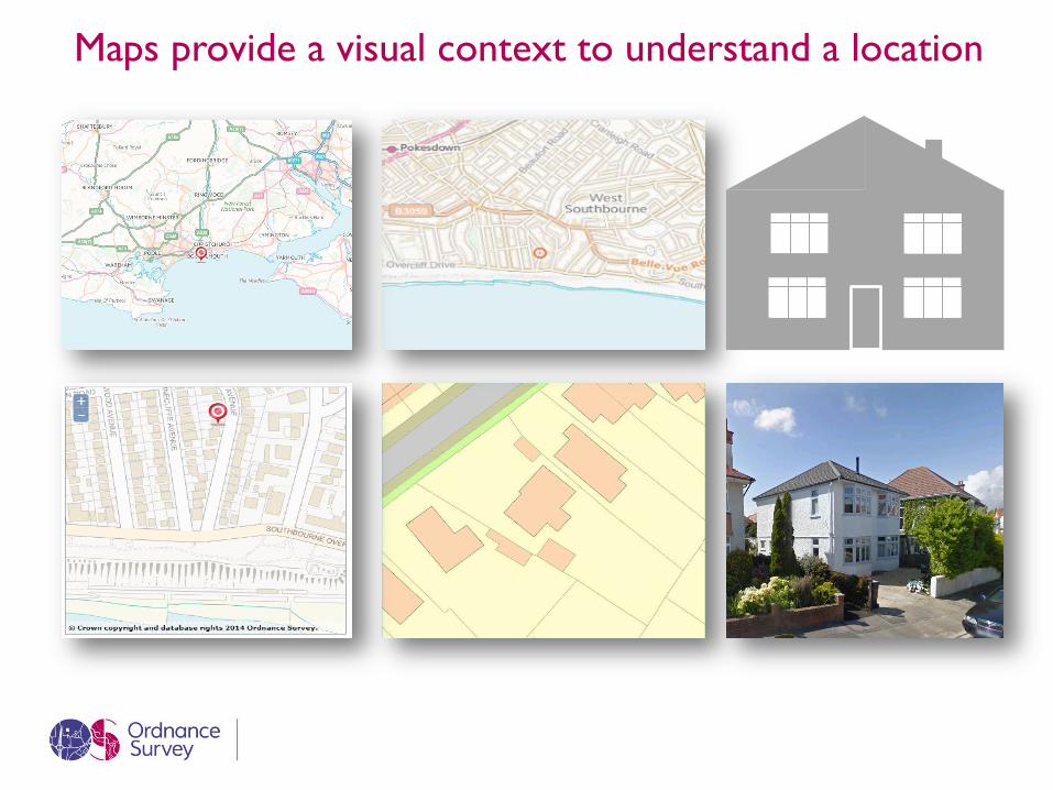
Maps provide a visual context to understand a location

HOW ARE ADDRESSBASE PRODUCTS MADE?
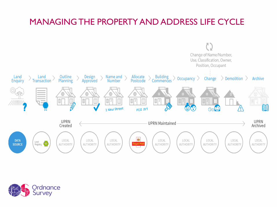
MANAGING THE PROPERTY AND ADDRESS LIFE CYCLE

There are more than 670,000 residential addresses in
Kent
[VALUE]
47,943
9,067
730,686 unique addresses in Kent
Residential Commercial Other
31.7%
30.1%
[VALUE]
11.9%
[VALUE]
Residential addresses (split by type)
Detached House Semi Detached House
Mid Terrace House End of Terrace House
Flat and Maisonette
92% of all addresses in Kent are residential
AB
P

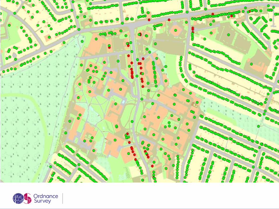
“Distance to nearest” measurements can be calculated
33,624 Residential premises are within
50m of a Pub, Bar or Inn
16,631 Residential premises are within
100m of tidal water
(coastline/estuary)
122,301 Residential premises are within
100m of inland water (rivers/lakes)
19,538 Residential premises are within 5m
of a Listed Building or feature
AB
P
POI
MM
Ope
n
data

Behind the maps is a digital content store containing data
describing more than 500m unique objects in GB
• Everything OS surveys is stored in the National Geospatial Database
• With over 10 000 changes a day
Detached
Footprint 42.3 sq m
1.2 m • It can be queried to retrieve attributes about a property
• Attributes include: • Nature of dwelling • Main building ground area • Distance from main building
to edge of property • Total plot size • Front garden area • Back garden area • Number of outbuildings • Building Height
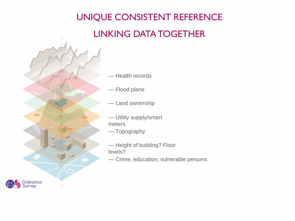
— Health records
— Flood plane
— Land ownership
— Utility supply/smart
meters
— Topography
— Height of building? Floor
levels?
— Crime, education, vulnerable persons
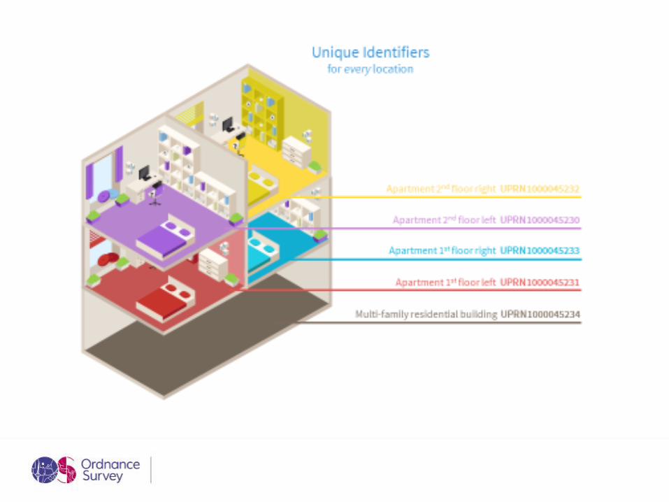
UNIQUE CONSISTENT REFERENCE
LINKING DATA TOGETHER
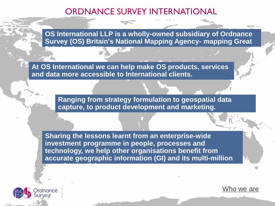
ORDNANCE SURVEY INTERNATIONAL
At OS International we can help make OS products, services and data more accessible to International clients.
Ranging from strategy formulation to geospatial data capture, to product development and marketing.
Sharing the lessons learnt from an enterprise-wide investment programme in people, processes and technology, we help other organisations benefit from accurate geographic information (GI) and its multi-million pound potential.
OS International LLP is a wholly-owned subsidiary of Ordnance Survey (OS) Britain's National Mapping Agency- mapping Great Britain since 1791.
Who we are
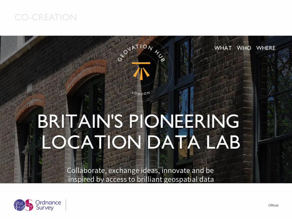
CO-CREATION
Official

GEOVATION HUB
the space
GEOVATION PROGRAMME
the accelerator
GEOVATION CHALLENGE
the opportunity

Collaborate, exchange ideas,
innovate and be inspired by
access to world-leading
geospatial data
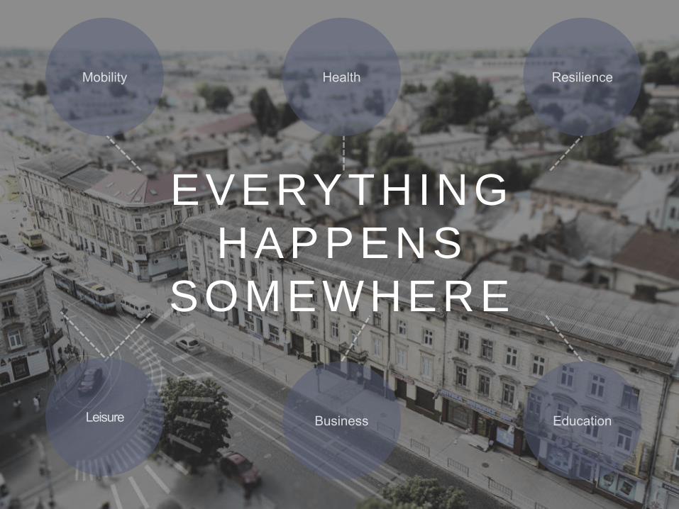
EVERYTHING
HAPPENS
SOMEWHERE


![Progression July 2014 - elam.org.uk[6] “Everything that happens once can never happen again. But everything that happens twice will surely happen a third time.” And so it was on](https://img.pdfslide.net/doc/110x75/6044fde163c2f534ee2f09c1/progression-july-2014-elamorguk-6-aoeeverything-that-happens-once-can-never.jpg)